This page summarizes the sites that feature Roman roads.
“All roads lead to Rome.”
Home > Info > Structures > Roman Roads
Contents:
Introduction
History
Peutinger Map
Roman roads
Historical Refs
Etymology
Links
Introduction:
- Roman roads
Roman roads were an important part of the infrastructure built during the Roman period in Israel, which lasted from 63 BC to 324 AD and continued to the Byzantine period 324 – 634 AD. These roads were built by the Roman Empire to facilitate trade, communication, and the movement of troops throughout the region. They set up roads that enabled an efficient route through the tough terrain. Josephus Flavius (Wars, III 6 2): “… to make the road even and straight…that the army might not be in distress, or tired with their march”.
A Figurative Roman road – AI generated by Stable Diffusion
Some sections of the Roman roads and their milestones are still visible today and can be explored by visitors to Israel. These sites are listed in this web page.
- The Via – Roman road
The Roman engineers perfected the art of road building, and enabled them to effectively manage the vast empire by improving the links between the cities. They were the greatest road builders of the ancient world, which may be one of the factors the Romans sustained their empire for hundreds of years. At the peak of the empire there were over 85,000 KM of roads which served military and commercial traffic, which was unprecedented in the ancient times.
The default width of the road was 8ft (2.4M). Milestones were placed every about 1.5KM, and were usually circular columns (50cm diameter), 1.5M high and standing over a rectangular base.
- Roman streets
The Romans also established well planned cities and based them on a matrix of high quality paved streets. Some of the streets were colonnaded with shops or houses on both sides. These are covered by a separate web page.
- “All Roads lead to Rome”
The phrase “All roads lead to Rome” is a proverb that dates back to ancient times, and its original author is unknown. However, it is believed to have originated during the Roman Empire, when Rome was the center of the world and a hub of trade, commerce, and culture. The phrase reflects the fact that Rome was the endpoint of many of the major roads in the empire, and that it was a destination that people from all over the world wanted to reach. Over time, the phrase has taken on a more metaphorical meaning, suggesting that there are many different paths to a common goal or destination.
History:
Great Revolt:
The Romans conquered the Holy Land in 63 BC and ruled for over 700 years. Among their major effect on the land and its history was the quality of the roads.
During the great revolt (66-74 AD) the Romans constructed new roads to make their long supply lines more efficient. Their mobilization of the army required better roads than were constructed previously. Josephus Flavius, the commander of the Galilee revolt which later wrote about these tragic events, describes one of such constructions (“Wars of the Jews”, book III chapter 7 par. 3):
“Accordingly, he sent both foot-men and horsemen to level the road, which was mountainous and rocky, not without difficulty to be traveled over by footmen, but absolutely impracticable for horsemen. Now these workmen accomplished what they were about in four days’ time, and opened a broad way for the army”.
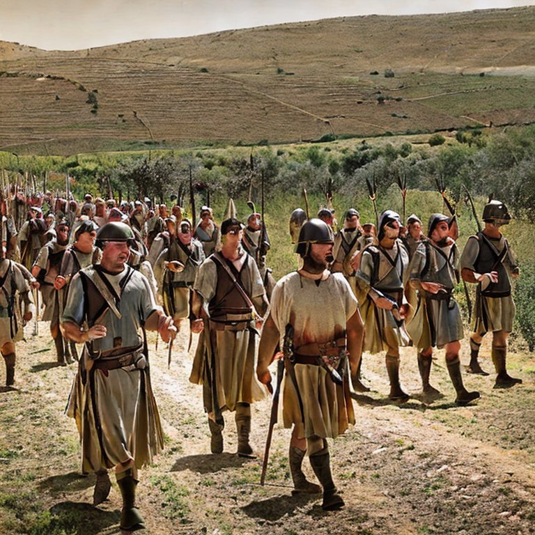
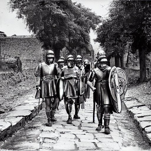
Roman soldiers march along a road – AI generated by Stable Diffusion
Josephus also describes the heavily armed Roman Army, justifying why they required such roads – see the reference below.
Bar Kokhba revolt:
Following the second revolt, during and after the reign of Hadrian, the Romans added new roads and established new military camps in order to enforce the might of the empire.
Peutinger Map:
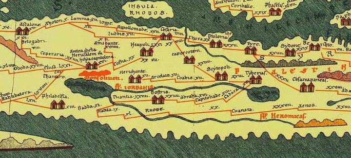
The Peutinger Map (Tabula Peutingeriana) is a medieval map which was based on a 4th century Roman military road map. It is named after Conrad Peutinger, who found it in a monastery and published it in 1507. The map was made in the 13th century, and copied from an older map. It is drawn as a long scroll (6.82M x 34 cm), arranged in the direction of England on the left side and India on the right side. The map shows the major roads, with indication of the cities, and geographic highlights (lakes, rivers, mountains, seas). Along the links are stations and distance in Roman miles (about 1.5KM per mile).
In the section shown below is the area of the Holy Land, drawn in a rotated direction (Egypt on the left, the Mediterranean sea on the top, and Syria on the right). The major cities are (from left to right): Jerusalem listed as “Helya Capitolina formely Herusalem” (drawn as a double house, with Mount of Olives as “Mons Oliveti”), Jaffa as Joppe, Caesarea Maritama as Cesaria, Dor as Thora, Beit Shean as Scytopoli, Acre as Ptolomaide, Tyre as Tyro, Sidon as Sydone, Tiberias as Tyberias (including the Sea of Galilee as La(cus) tyberias). The roads are shown as brown lines between the cities and stations.
Sites with Roman Roads (between cities):
Roman roads and streets are found in many of the Holy Land sites. The following section lists the sites of Roman roads that are featured in BibleWalks. Click on the site’s name to see more information on each site.
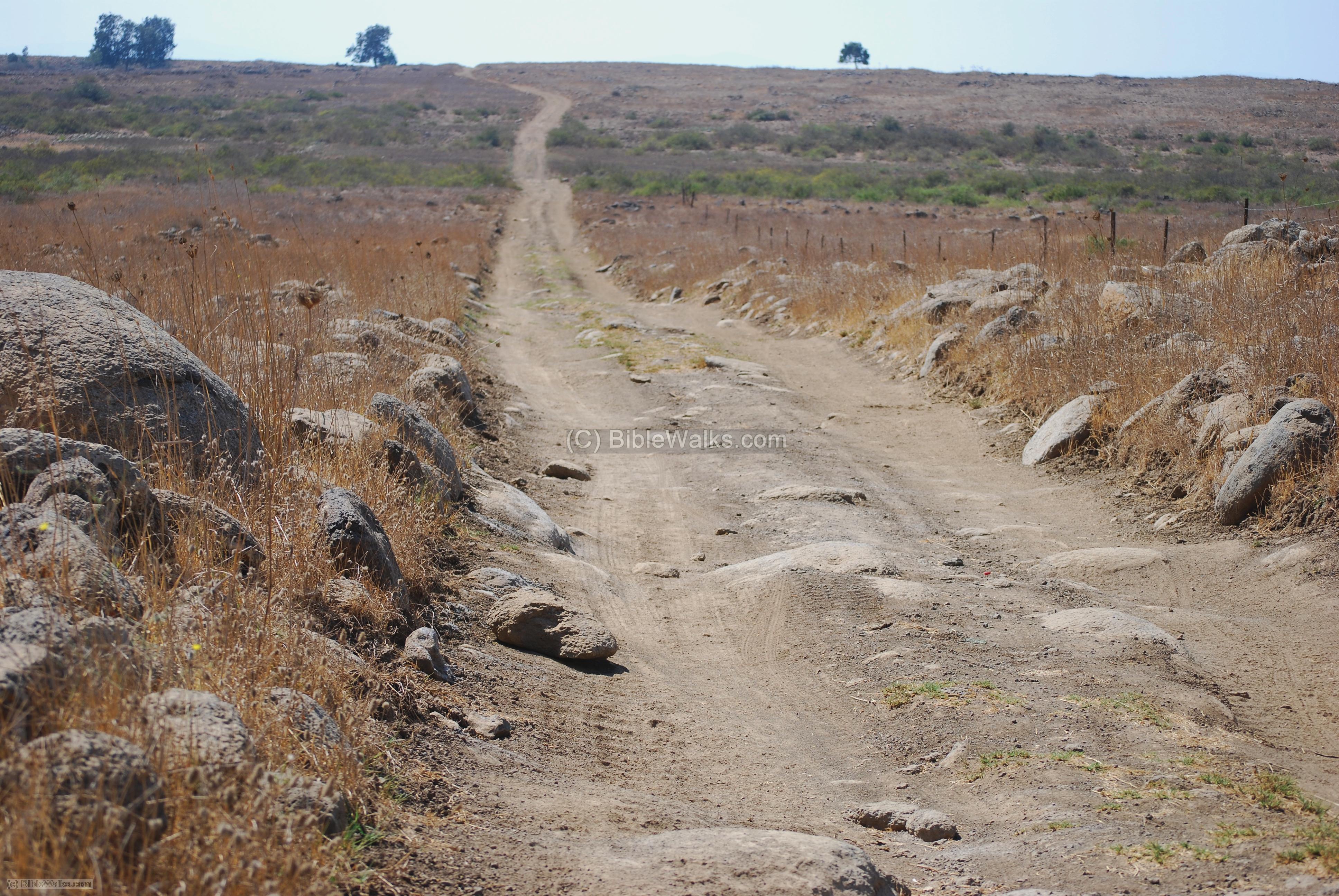
- The Romans linked their center of administration, located in Damascus, to the Galilee. They set up roads that enabled an efficient route through the tough terrain. Traces of such roads can be seen in several locations in the Golan heights.
- The photo shows the road through Kanaf valley on the south of the Golan heights.
Click on the photos to enlarge them.
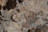
- A section of a Roman road is located north of the ancient town of Usha (which was, for some time, the place of the Sanhedrin during the Roman period). This section was constructed during the Great revolt (68-70AD) by Roman soldiers, and connected Acre to Sepphoris.
- A section of the road is located north of Usha, between Kiryat-Atta and Shefaram. An inscription on a rock (“CAB”, seen on the right) may have been an ancient Sabbath zone marker.
- The site is located on the coastal section of the ancient road of Via Maris (Derech Hayam), the major highway that connected for centuries the south and the north of Israel.
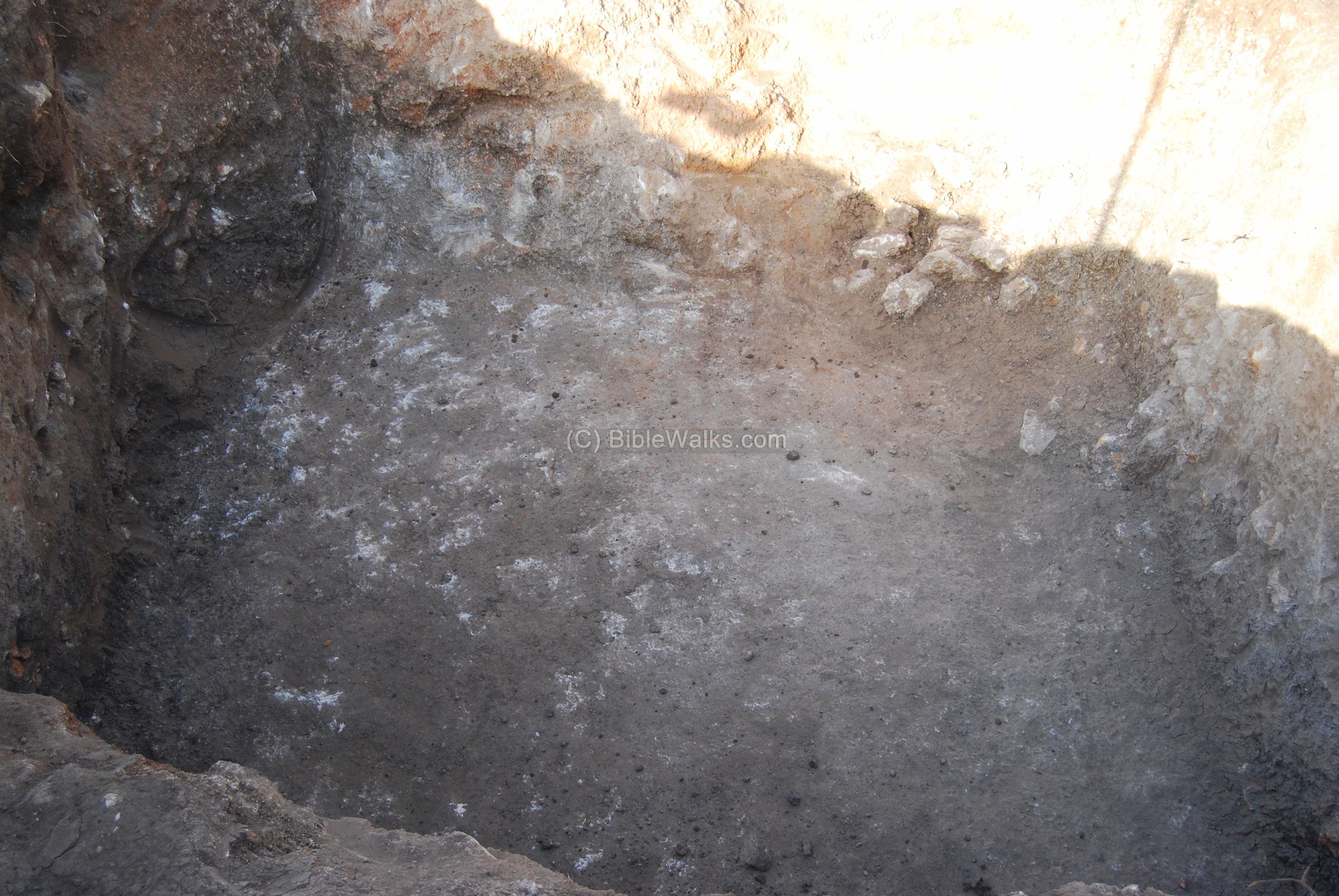
- Excavations were conducted in November 2007, and a deep cavity in the sandstone bedrock – at a width of about 3M and depth of 2M into the rock – was found in one of the pits. This may be, perhaps, a section of the ancient road that passed at this point and was cut into the rock.
Khirbet Shimshit
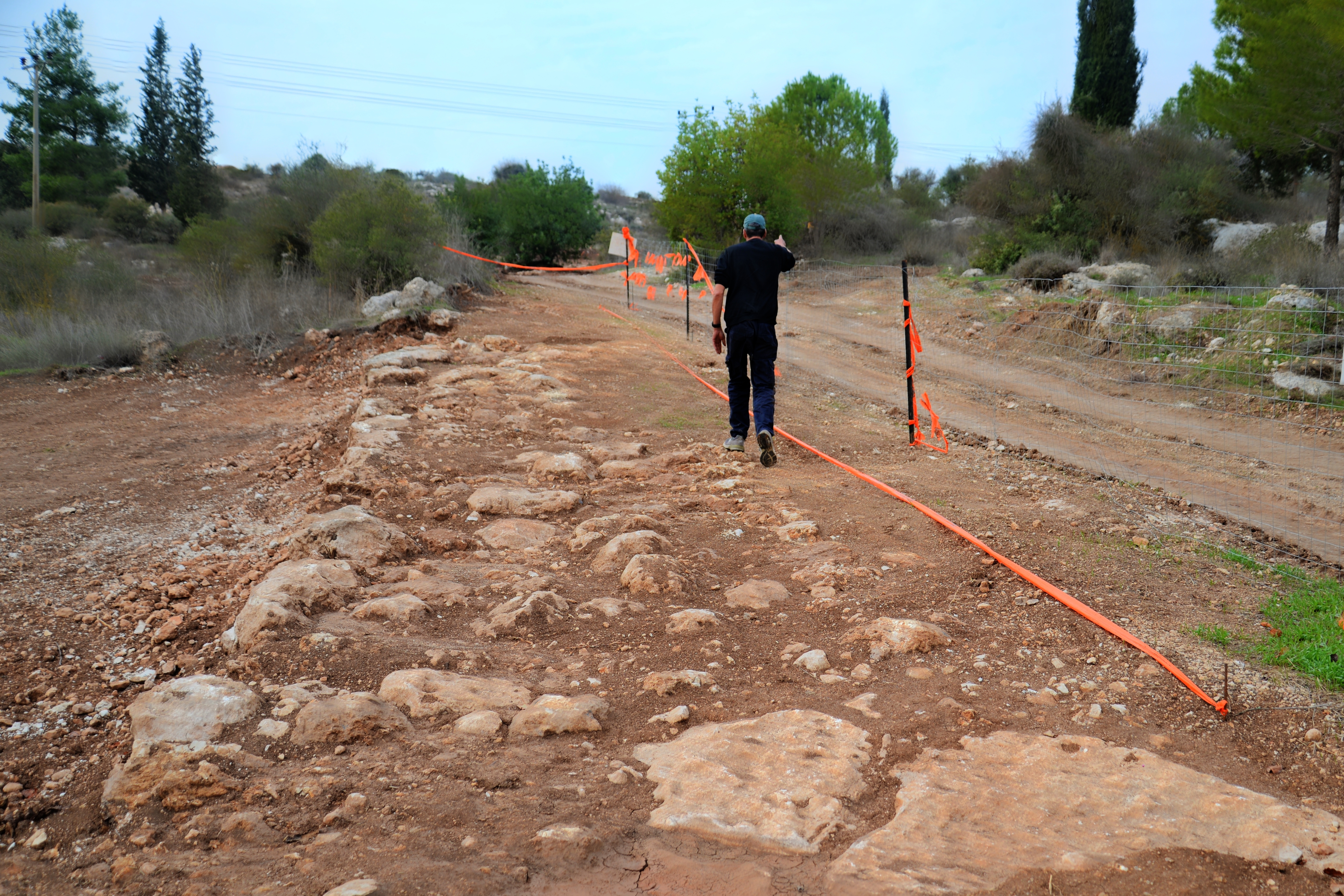
- Khirbet Shimshit is a Roman/Byzantine village 3KM south-west to Sepphoris, on a hill overlooking the Zippori creek. A Roman road passed at its western foothills, the main road from Sepphoris to the south (Legio/Megiddo).
- The Roman road traversed the foothills on the western side, and a section of that road is seen below, although it is partially covered by the leaves. A 12M section of the 6M wide road was excavated. The road was composed of a floor covered with small stones and pebbles. On its north (right) side there are two rows of stones, laid side by side: larger and medium stones (0.55-0.3M) on the exterior, and medium stones on the interior.
![]()
Har Hiya Ascent
A section of the road from Sepphoris to Legio is found in Mizpe Resh Lakish, south of Har Yiha, 2km north east of Shimshit. Steps are carved into the bedrock to ease the steep ascent.
Closer to Sepphoris is another section of this road.
- In the 2006 a section of the Roman road from Acre to Sepphoris was excavated north-west of the Tell.
Photo courtesy of the Israel Antiquities Authority.
- The following photo shows a biker riding on the ancient rock-cut Roman road Ma’ale Akrabbim, one of the spice route passes in the Negev desert.
Photo courtesy of Dr. Hezi Yizhaq and Ilan Shoham
Arab El Heib
- A small section of the road from Tiberias to Sepphoris and Ptolemais (Acre) can be seen in a field south-west of the Arab El Heib village. This route goes through the Yiftachel valley, and reaches the Netufa valley.
- The road was built during the time of Hadrian
- A group of milestones were also found at the site.
- New excavations were held in 2022.
Ibilin creek
- A Roman road led from Acre, through the valley of Evlayim (Ibilin), to Hannathon and Netufa valley.
A Roman road from Tyre, through Banias, up to the Golan heights. It passes on the northern foothills of Tell Dan. This east-west road was used by the French & British to mark the borders between Lebanon, Syria and Israel. A Roman bridge is located nearby.
Under the modern road connecting to the Golan, is the base of a Roman bridge. This was once a section of the ancient Roman road that led via Tell Dan to Damascus.
Two Roman milestones were found near Shavey Zion, and marked the 4th and 5th miles from Acre to Tyre (#309 and #310 of the Roman Acre-Syrian road that was built by Claudius in 56AD).

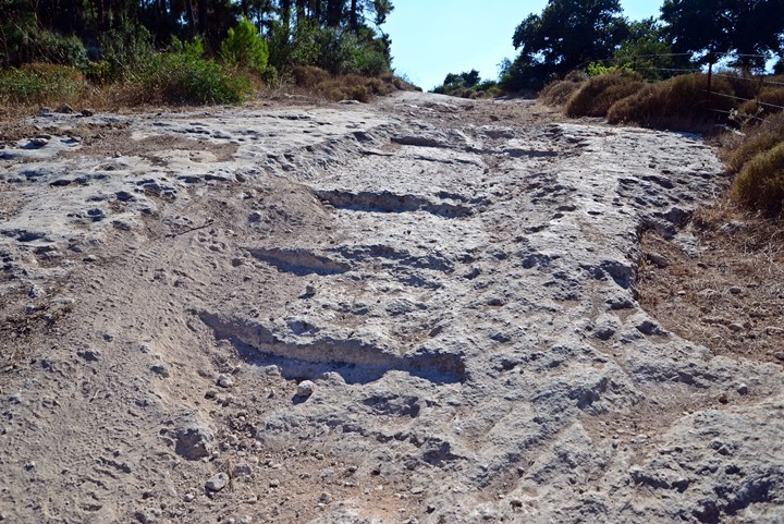
The Roman road from Emmaus passed through a narrow mountain passage named Nahal Ilan (Wadi A’lakah), and started here its ascent to to the Holy City of Jerusalem.
A collection of milestones is located on the side of the Roman road.
Another section of this road from Emmaus to Jerusalem is located 100m south of Neve-Ilan hotel, about 4km to the east of the previous section. Notice the steps that were carved on the surface of the rock.
- Horvat Hanut was a station along the ancient road ascending from the Elah valley. This road (aka. “Caesar’s Way”) was part of the Roman road from the coast city of Ashkelon, via Beit-Guvrin, to Bethlehem and Jerusalem.
- Sections of the Roman road can be seen along the modern road.
- Geres was a fortified village near the Roman road (aka. “Caesar’s Way”) from the coast city of Ashkelon, via Beit-Guvrin, to Bethlehem and Jerusalem.
- A section of a local road that connected the village to the main road is visible on the foothills of Mt. Kitron.
- A section of the main Roman road, with carved steps, can be seen on the side of the highway, north to Geres.
- A Roman milestone is located under one of the arches of the Caesarea aqueduct, dated to the 2nd or 3rd century AD . It indicated the distance of 4 Roman miles, probably the distance along the coastal road from Caesarea.
- A Roman road crosses Har Amasa mountain, passing east of the Kibbutz, 20km south of Hebron.
- This road connected the city of Hebron in the north and Malatha (where the regional Roman military cavalry headquarters – the Cohors I Flavia Equitata – were located during the Byzantine period). It continued south to the Negev and Aravah.
- Watch the Aerial View video – a drone flying over a stretch of the road.
- Watch a short video tour along a section of the road
- The road via the Valley of Elah was part of the Roman road from the coast city of Ashkelon, via Beit-Guvrin, to Bethlehem and Jerusalem.
- A group of 5 milestones are on display near the route of this road, just south of the Elah junction. They marked the 24th mile from Jerusalem.
- Two other locations – 26th and 29th mile stations – also have a group of milestones standing at the side of the modern road. A section of the Roman road is also visible.
- A major Roman road passed on the east side of the Tel, connecting Beit Shean (Skythopolis) to Tiberias.
- Many milestones of this imperial road were found around Beit Yosef, the nearby community. In front of one of the houses are two milestones, found by a local farmer in the 1980s.
- One of the milestones was erected during the time of emperor Commodus (2nd century AD). P. Thomsen (1917) described a milestone of the 3rd Roman mile from Scythopolis from the time of Constantine I (292-306 BC).
The imperial road, connecting Tiberias and Gadara to Scythopolis, passed on the east side of Horvat Baat, a Roman period village south of Tel Issachar. A long section of the road is visible on the east side of the ruined village.
Beit Shemesh, Kh. Beit Nettif
New excavations in 2016 unearthed a section of the Roman road leading to Beit Nettif, near Beit Shemesh. It may have been a section of the Caesar’s way from Ashkelon, via Beit-Guvrin, to Bethlehem and Jerusalem.
Amatzia
The Roman road from BeerSheba to Beit Juvrin (Eleutheropolis) passed near Moshav Amatzia, a community in south central Israel.
A milestone stands on the side of the road, about 1.5km north of Amatzia.
A Roman road passed on the north side of Tel Maresha, connecting Beit Guvrin (Eleutheropolis) to Hebron, Gaza and the south. It is a northern section of the same road near Amatzia. A Roman milestone remained from the road, and was placed on the side of the modern road.
A paved Roman road was recently unearthed in a forest east of Kafr Kanna. The excavated section extends to 200m, and is part of a road from Sepphoris to Tiberias. It has a unique plan of 2 lanes, each 2.4m wide, with a line of stones dividing the lanes.
Milestones, 6th and 7th Mile from Scythopolis
An important imperial Roman road passed west of Kibbutz Tirat Zvi, connecting Scythopolis to Jericho. Several of the milestones along the road are on display in front of the Kibbutz dining hall. All 5 milestones stood on the 6th Roman mile (8.87 km) from Scythopolis (Beit Shean). Another set of milestones of the 7th Roman mile were recently moved here as well.
Milestone, 5th Mile from Scythopolis
The imperial Roman road passed west of Kibbutz Sde Eliyahu, connecting Scythopolis to Jericho. A milestone along the road is on display in the Kibbutz. The milestone originally stood on the 5th Roman mile (7.4 km) from Scythopolis (Beit Shean).
Historical References:
Josephus Flavius (Wars of the Jews, book III chapter 6 par. 2):
Josephus, the Galilee commander who fought the Romans, then served them as a historian, provides a fascinating description of the heavily armed Roman army, which justified rebuilding the old dusty roads of the Holy land.
“But as Vespasian had a great mind to fall upon Galilee, he marched out of Ptolemais, having put his army into that order wherein the Romans used to march. He ordered those auxiliaries which were lightly armed, and the archers, to march first, that they might prevent any sudden insults from the enemy, and might search out the woods that looked suspiciously, and were capable of ambuscades. Next to these followed that part of the Romans which was completely armed, both footmen ,and horsemen. Next to these followed ten out of every hundred, carrying along with them their arms, and what was necessary to measure out a camp withal; and after them, such as were to make the road even and straight, and if it were any where rough and hard to be passed over, to plane it, and to cut down the woods that hindered their march, that the army might not be in distress, or tired with their march…”.
Roman soldiers along a road – AI generated by Stable Diffusion
“…Behind these he set such carriages of the army as belonged both to himself and to the other commanders, with a considerable number of their horsemen for their security. After these he marched himself, having with him a select body of footmen, and horsemen, and pikemen. After these came the peculiar cavalry of his own legion, for there were a hundred and twenty horsemen that peculiarly belonged to every legion. Next to these came the mules that carried the engines for sieges, and the other warlike machines of that nature. After these came the commanders of the cohorts and tribunes, having about them soldiers chosen out of the rest. Then came the ensigns encompassing the eagle, which is at the head of every Roman legion, the king, and the strongest of all birds, which seems to them a signal of dominion, and an omen that they shall conquer all against whom they march; these sacred ensigns are followed by the trumpeters. Then came the main army in their squadrons and battalions, with six men in depth, which were followed at last by a centurion, who, according to custom, observed the rest. As for the servants of every legion, they all followed the footmen, and led the baggage of the soldiers, which was borne by the mules and other beasts of burden. But behind all the legions carne the whole multitude of the mercenaries; and those that brought up the rear came last of all for the security of the whole army, being both footmen, and those in their armor also, with a great number of horsemen”.
Etymology:
- Via – Latin for “road”
- Strata (plural form of stratum) – Roman word for a “paved road”, normally for military purposes. It is the root of the English word “street” .It is also used as an archaeological term – a level of earth, one of several horizontal layers. This is based on the structure of the roman paved road – a number of layers that were laid out to build a lasting road.
- Derech – Hebrew: road, way.
Links:
* Roman Roads:
- VIAE – Roman road
- Peutinger Map (Tabula Peutingeriana) – medieval map based on 4th century Roman map
- Roman roads in Roman/Byzantine and Arabia
- 1st Century roads – map of Roman roads and caravan routes
- Ancient roads in the land of Israel great lecture by Rami Aharoni (ppt; Hebrew; 146 slides)
- Roman roads and Milestones in Judea/Palaestina interactive web page, Kinneret College on the Sea of Galilee
- Between Damascus and Megiddo – Israel Roll, 2009;
- Milestones Kinneret College on the Sea of Galilee (great articles)
- All The Milestones Lead to… Scythopolis – Ben David, C. and Stein, O. , Aram Periodical 34 (2022), pp. 1-27. Figure 2 map; pdf
- Milestones reference – north – Kinneret College on the Sea of Galilee
- Roman Road system in Judea – Israel Roll
- Development of the Roman Road system – Aharoni, 1950
- Roman roads in the Upper Galilee and Lower Golan regions – AL Whitten · 1997
- Hoshaya North – Roman road – Vol 132 year 2020
- Har Amasa (North East) – Davida Eisenberg-Degen [HAESI 136 2024]
* Milestones:
- The Near East under Roman Rule – Selected papers – Benjamin Isaac (pp48-74) – great review
- Horvat Mishkena – milestone and hiding complex
* Internal links:
- Roman streets
- Roads to Jerusalem
- Roman Roads of the Golan
- Elah Valley Roman Road
- Kafr Kanna Roman road – YouTube
- Har Amasa Roman road – YouTube (drone video, tour video)
BibleWalks.com – walk with us through the sites of the Holy Land
Oil presses <<<—Previous info—<<< All Info >>>—Next Info—>>> Roman Streets
This page was last updated on May 23, 2025 (add Har Amasa video tour)
Sponsored links: