Ruins of a large Biblical city, south-east to Acre.

Home > Sites > West Galilee >Tel Kisson (Kison, Kissan,Keisan, Achshaf)
Contents:
Background
Location
History
Photos
* Aerial views
* Overview
* Gate to city
* The slopes
* Top of Tel
* Ancient road
* The well
* Motor visitors
* Olive harvest
* Video
Etymology
Links
Background:
The site is located on a section of an ancient road. This Tel (also spelled: Tell), located 6km southeast of Tel Akko (Acre), is the largest ancient mound in the Akko plain. Its identification is not certain; some scholars identify it as Achshaf or Biblical Cabul.
Location and map:
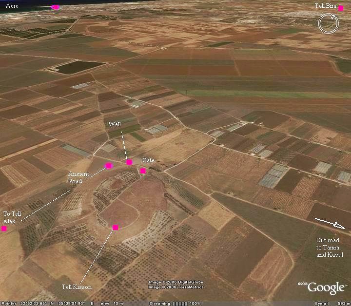
The site is located in the plains south-east to Acre, and is seen form all sides as a large hill. The site can be reached either from Kefar-Masarik on the west side, or closer – from the gas station in Tamra.
This aerial map of the area is from the south-east side.
History of the place:
A total of 16 archaeological layers were identified on the mound.
-
Middle Bronze period
The soil in the area was muddy, especially in the wet winters when the Na’aman river, west to Tel Kisson, overflowed. In the Biblical texts the area is called “land of Cabul”, implying a muddy soil which is found in swamps, and is a deposit of decaying plants in swamps. This made the city, and the paved road that passed on the west side of it, important in the ancient times, since the trade route had to pass via this road.
The Tel was inhabited starting from the Chalcolithic period (4,500 BC-3150BC), but the massive walls were built in the Middle Bronze period (2200-1550BC). The Middle Bronze period settlement occupied the mound (30 dunams) and the fields around it (a total area of 95 dunams).
During the Late Bronze period the settlement was considerably smaller, reducing its area to only the area of the summit.
The cities and roads during the Canaanite and Israelite periods are indicated on the Biblical Map below. Tell Kisson is identified here as Achshaph. It is located on the major route connecting Acco/Acre to Hannathon, Shimron and Megiddo via the Valley of Yiphtakh-el. Dorsey (“The roads and Highways of Ancient Israel”) marked this road as “I37” (see map 3, p. 79).
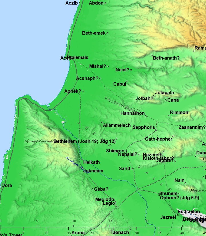
Map of the area of the land of Cabul – during the Canaanite and Israelite periods (based on Bible Mapper 3.0)
-
Israelite period
During the Biblical times this city was occupied by the Phoenicians, who had economical and cultural relations with the Israelites and the Northern Kingdom of Israel.
This was one of the largest cities in the area, and therefore should have been mentioned by the Bible. But which is it? The scholars debate on its identity, suggesting several names referred by the Bible:
(a) Achshaph? According to some scholars, the city at Tel Kisson may have been the Biblical city of Achsaph. They base their identification on several Egyptian texts, and also on the Biblical text describing the land of the tribe of Asher. ( Joshua 19:24-25):
“And the fifth lot came out for the tribe of the children of Asher according to their families. And their border was Helkath, and Khali, and Beten, and Achshaph And Alammelech, and Amad, and Misheal; and reacheth to Carmel westward, and to Shihorlibnath; And turneth toward the sunrising to Bethdagon, and reacheth to Zebulun, and to the valley of Jiphthahel toward the north side of Bethemek, and Neiel, and goeth out to Cabul on the left hand, And Hebron, and Rehob, and Hammon, and Kanah, even unto great Zidon; And then the coast turneth to Ramah, and to the strong city Tyre; and the coast turneth to Hosah; and the outgoings thereof are at the sea from the coast to Achzib: Ummah also, and Aphek, and Rehob: twenty and two cities with their villages”.
However, Achshaph may also be identified in Tel Regev, as per some scholars, since it is listed with sites on the south side of Asher.
The Bible also tells that Achshaph was a part of the Northern coalition of Kings who attempted to block the Israelites, headed by Joshua (Joshua 11: 1):
“And it came to pass, when Jabin king of Hazor heard thereof, that he sent to Jobab king of Madon, and to the king of Shimron, and to the king of Achshaph,… And all these kings met together, and they came and pitched together at the waters of Merom, to fight with Israel”.
However, the Canaanite coalition was defeated by the Israelite armies (Joshua 12: 1,20):
“Now these are the kings of the land, whom the children of Israel smote, and possessed their land…the king of Achshaph, one”.
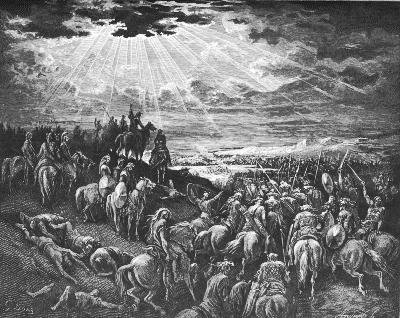
Joshua in another battle against the Canaanites
Drawing by Gustav Dore (French artist, 1832-1883)
(b) Cabul? Another possible identification could be ancient Cabul (Chabula, Kavul). This Biblical text tells about the Solomon-Hiram agreement, where the area of west Galilee (land of Kavul/Cabul) was traded with the Phoenicians. The implied reason was that King Solomon had to pay for his debts (to pay the cost of the timber, labor and other goods), and he paid with prime real estate (although Hiram was not pleased as per the Biblical text). (1 Kings 9: 11-13):
“now Hiram the king of Tyre had furnished Solomon with cedar-trees and cypress-trees, and with gold, according to all his desire–that then king Solomon gave Hiram twenty cities in the land of Galilee. And Hiram came out from Tyre to see the cities which Solomon had given him: and they pleased him not. And he said: ‘What cities are these which thou hast given me, my brother?’ And they were called the land of Cabul, unto this day”.
Actually, this old treaty lasted for 3000 years until Israel was founded, since the area of west Galilee always remained under the Phoenician control.
(c) Misheal? Another Biblical city was suggested by Dorsey (p. 80) as another candidate. Mishal is one of Asher’s cities (Joshua 19:24-26):
“And the fifth lot came out for the tribe of the children of Asher according to their families… And Alammelech, and Amad, and Misheal; and reacheth to Carmel westward, and to Shihorlibnath”
Mishal/Mishael was also listed as one of the 119 cities conquered by Thutmose III in the 15th century BC.
-
Persian, Hellenistic, Roman, Byzantine
The last large occupation periods were in the Persian and Hellenistic periods. The area of the settlement, on the mound and the fields around it, increased to 130 dunams.
During the Roman period a major paved road passed on the west side of the Tel. Findings of the Early and Late Roman period were found on and around the Tel.
In the Byzantine period a Church was built on the top of the Tel and lasted until the 7th century.
-
Crusaders (13th century)
After the first Crusader Kingdom fell to the Arab army of Saladin (1187), Acre was in the hands of the Arabs. The third crusade, headed by Richard Lionheart of England and Phillip II of France, set out to re-conquer the city of Acre. Saladin rushed to the help of the Arab defenders of Acre. The Arabs closed on the Crusaders who placed a siege on the city. Tel Kisson was used by Saladin as his 4th base during this campaign. However, after a 2 year long battle (1189-1191), the Arabs finally surrendered Acre (July 11, 1191). After this, the Crusaders continued to the south of the Land, winning a major battle against Saladin (in Arsuf). Acre continued to be the capital of the second Crusader Kingdom for 100 more years, when the Kingdom fell to the Mamluke forces (1291).
A ring belonging to the Ramban (Rabbi Moses Ben-Nahman, 1194-1270) was found on the slopes of hill, probably lost in 1267AD when the famous Rabbi was touring the Holy Land on his way to Jerusalem. The Rabbi, born in Girona (north east Spain), is famous for his role in the Disputation of Barcelona (1263). Although he was victorious in this faith disputation, he was forced to go to exile (1267) and settled in Acre, where he died after 3 years.
Ottoman period:
The area of was examined in the Palestine Exploration Foundation (PEF) survey (1866-1877) by Wilson, Conder and Kitchener.
The map is a section of their survey results. Notice the double-dashed line that passes on the west side of Tell Keisan (Tel Kisson), which was a Roman road connecting Acre to Tiberias via Tel Hannathon. The well on its north side is marked as “Bir Keisan”.
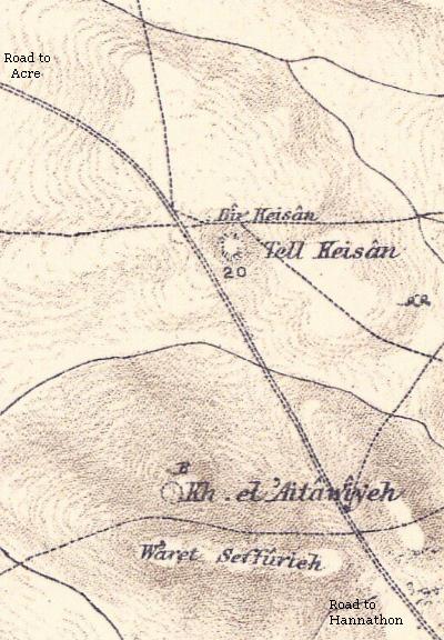
Part of map sheet 5 of Survey of Western Palestine, by Conder and Kitchener, 1872-1877.
(Published 1880, reprinted by LifeintheHolyLand.com)
The site is briefly described in their report (Vol 1, Sheet V, page 352):
“Tell Keisan – A large artificial mound in the plain.
Guerin gives the measurement of the mound at 350 paces in length from west to east, by 125 in its greatest breadth; it is about 130 feet high. It is ascended at the north and south by a kind of slope produced by artificial depression of the ground. The plateau on the top is covered with fragments of pottery, and among them cubes of mosaic; heaps of stones from buildings now destroyed are also scattered about. On this Tell Saladin had his head quarters during the siege of St. Jean d’Acre by Guy de Lusignan, Richard Coeur de Lion, and Philip Augustus”.
- Modern period: Archaeological excavations
Early surveys were conducted in 1922 (J. Garstand) and 1923 (W.J. Phythian-Adams). Excavations were conducted in 1935-1936 (British expedition on the south side, headed by J. Garstand and A. Rowe), and 1971-1980 (French expedition on the North and NE side of the summit, headed by R. de Vaux, J. Prignaud, J. Briend and J.B.Humbert). Salvage expeditions were conducted in 2002 and 2007 (Y. Tepper) and in 2005 (N. Feig).
Photos:
(a) Aerial views
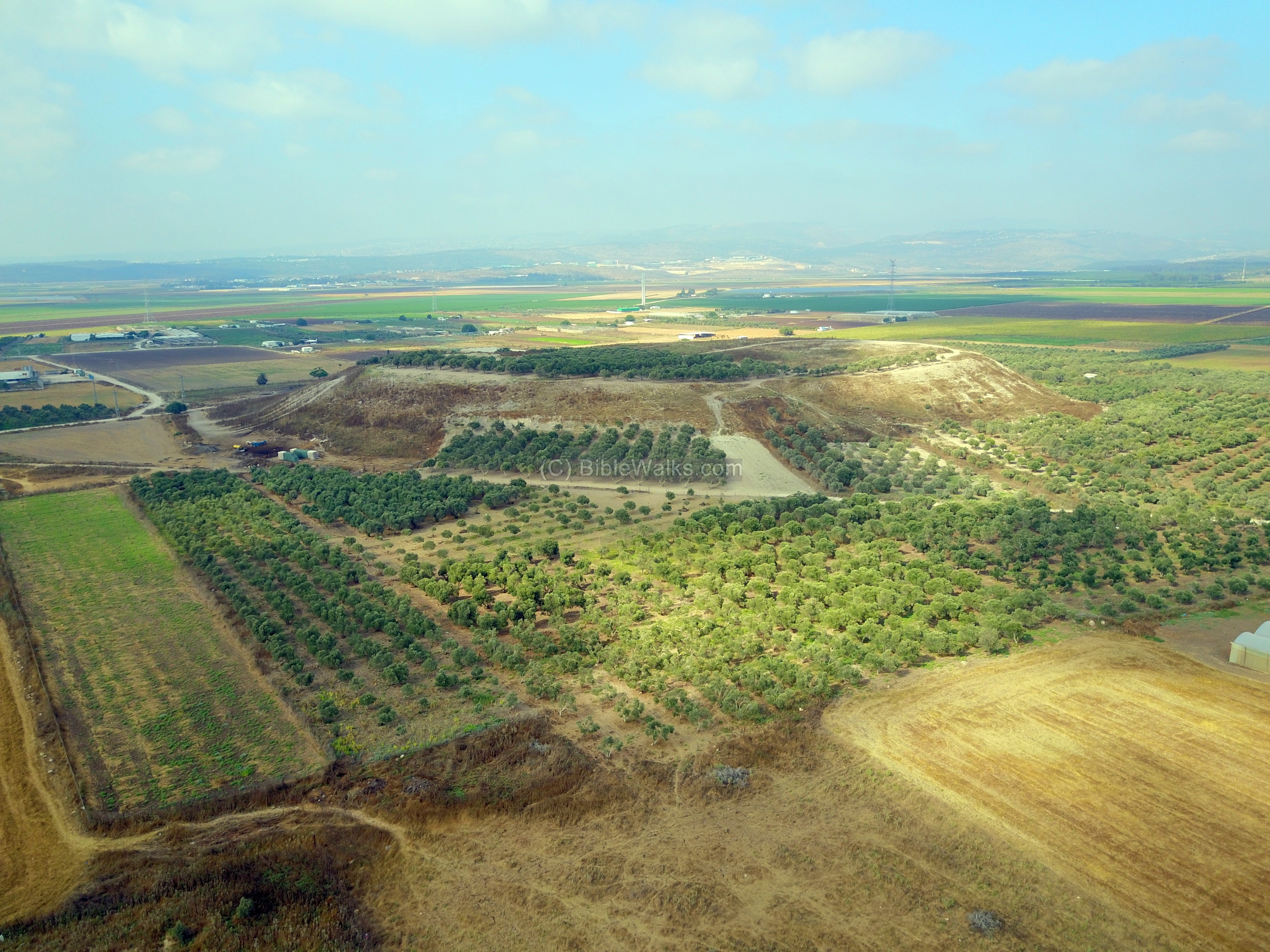
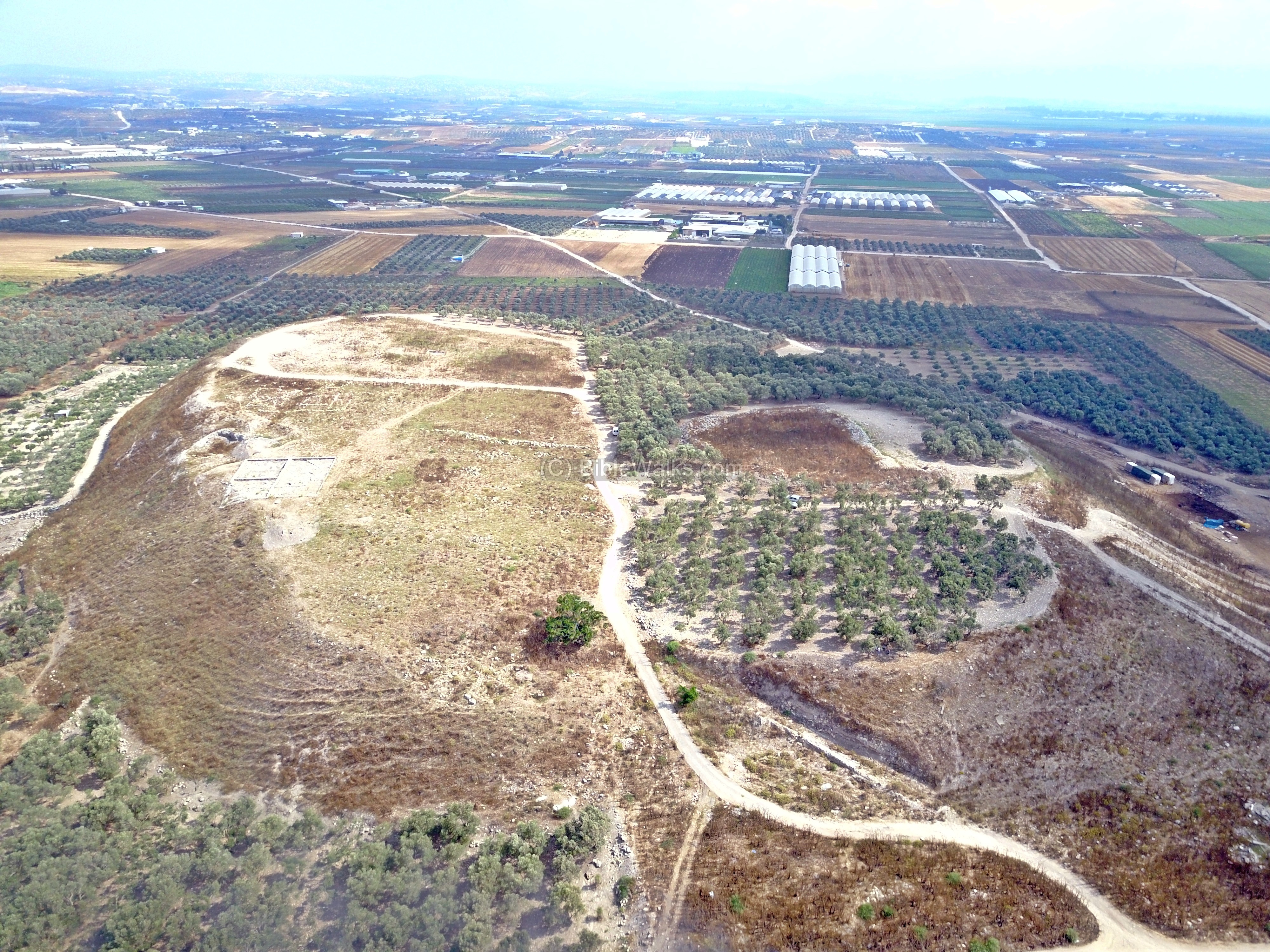
A drone captured this view from the south side (on July 2017). The mound rises 33m above the surface around it.
The area of this oval shaped mound is 370m by 250m, with the summit covering an area of 30 dunams (3 hectares). The archaeologists also found that during the Middle Bronze period the “lower city” around the mound extended its total area 95 dunams (10 hectares), while at the peak of the settlement in the Persian and Hellenistic periods the total area was 130 dunams (13 hectares).
Click on the photo to view it in higher resolution…
A view of the top of the mound is seen in the following drone view. This picture is from the south west side.
All around the mound the slope is very steep. The easiest access to the summit is from the north side, here on the top left side.
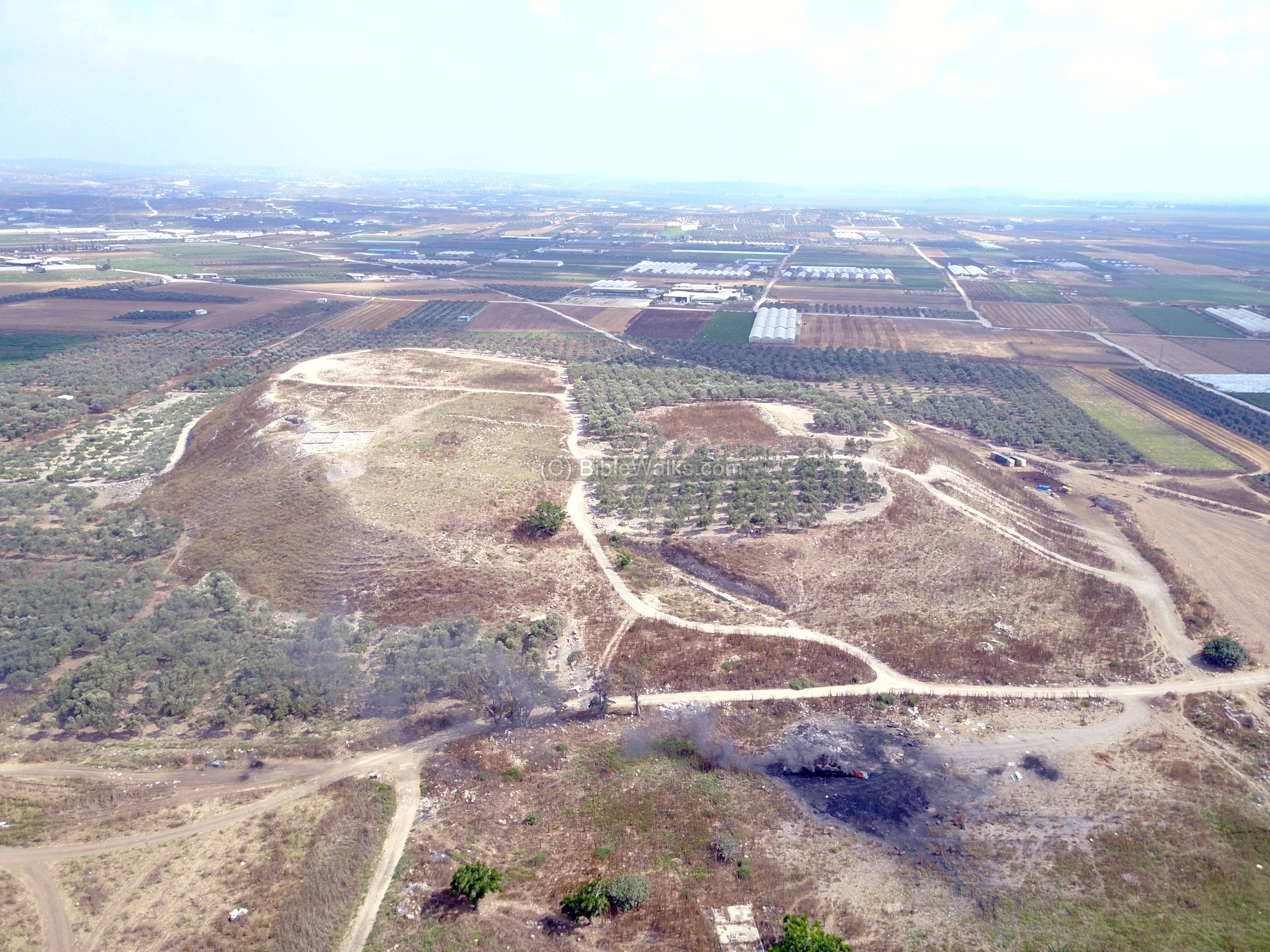
The next aerial view shows the north side of Tel Kisson. Notice the smoke on the bottom side, where garbage was set on fire.
(b) Ground views
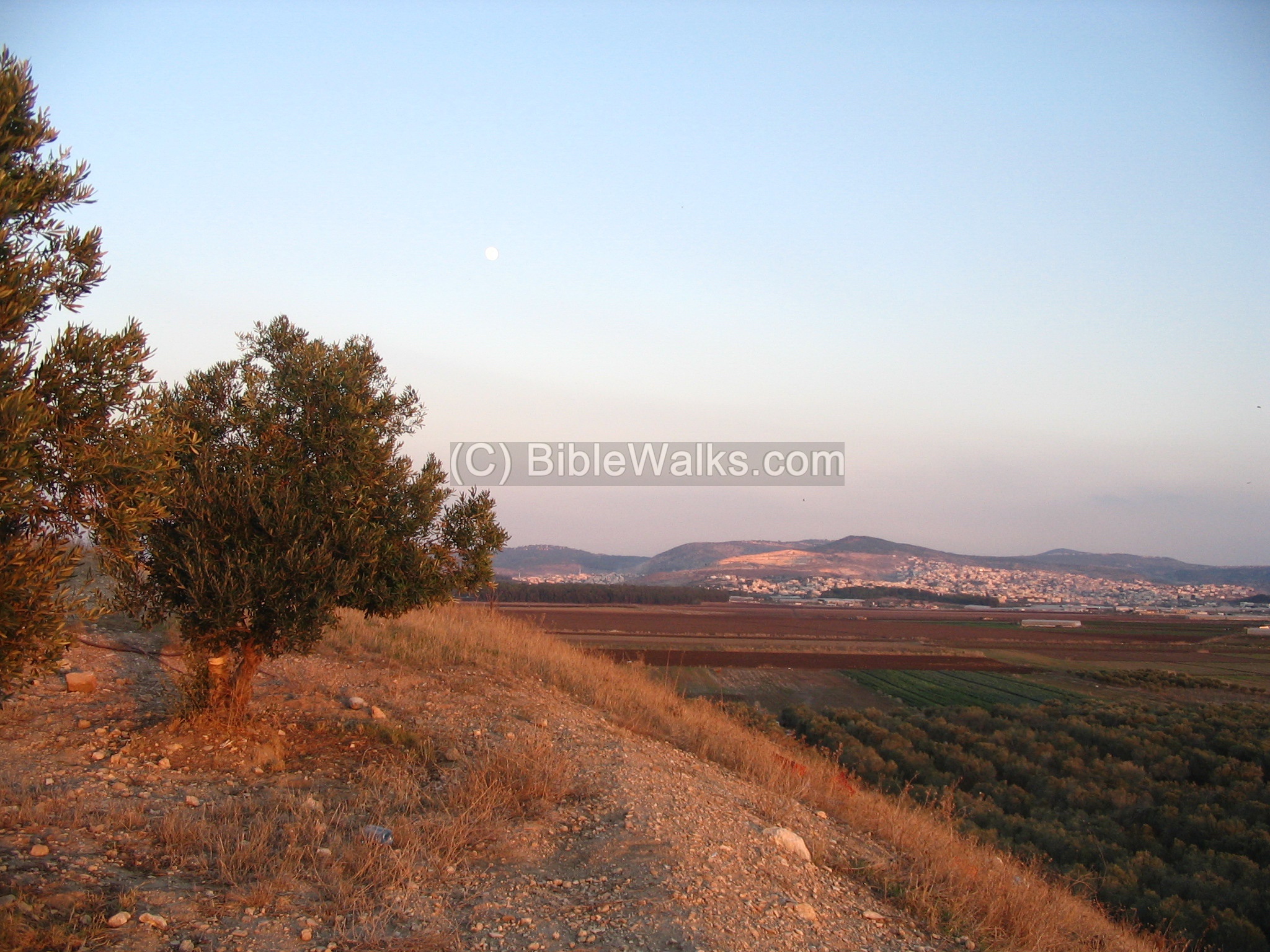
This is the view of the massive Tel from the south side. On top of the Tel is an olive grove, as well as around it.
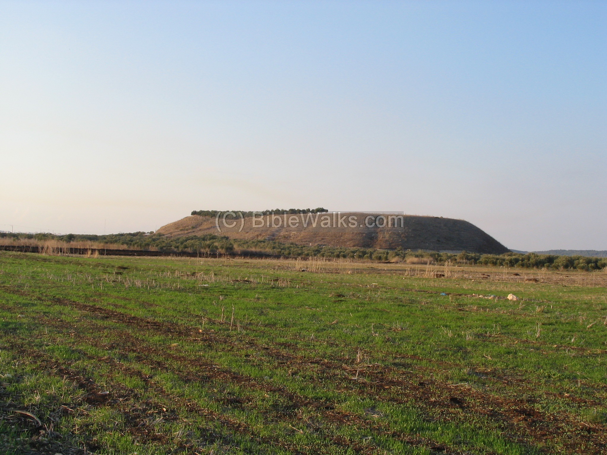
The next photo is a closer look from the south side. As can be seen, the hill is steep in order to defend it better. The builders of this biblical city built massive walls around it, and a steep glacis, as part of their defense lines. The Middle Bronze ramparts were coated with white plaster. These fortifications gave the mound its current shape.
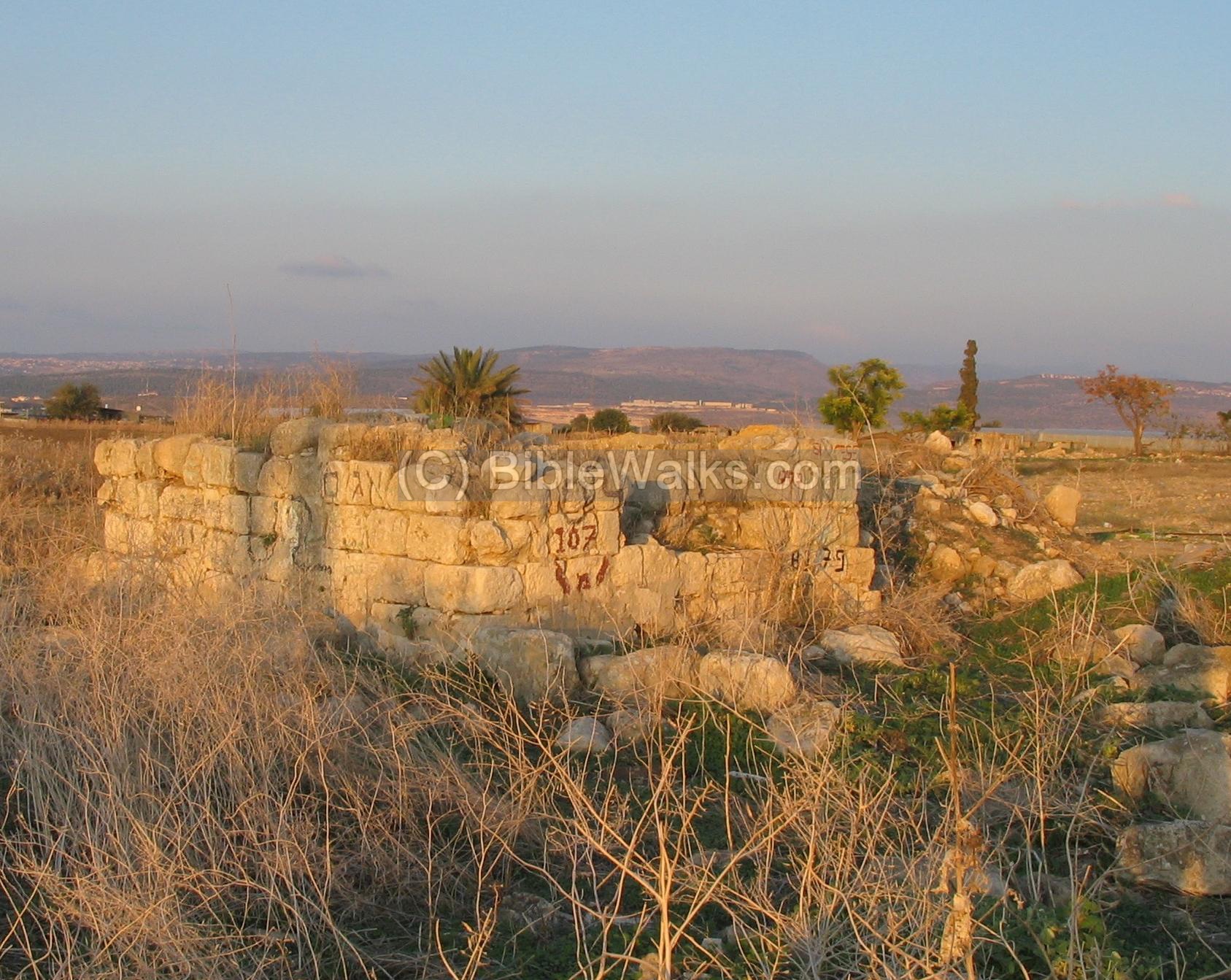
(c) Gate to the city
Excavations of Apr/May 2006 have revealed parts of the city gate, located on the north side. The aerial view (captured by a drone on July 2017) shows the northern side of the mound, with the dirt road rising up to the summit.
The dirt road climbs up from the valley to the top of the hill, passing through massive walls and a steep glacis.
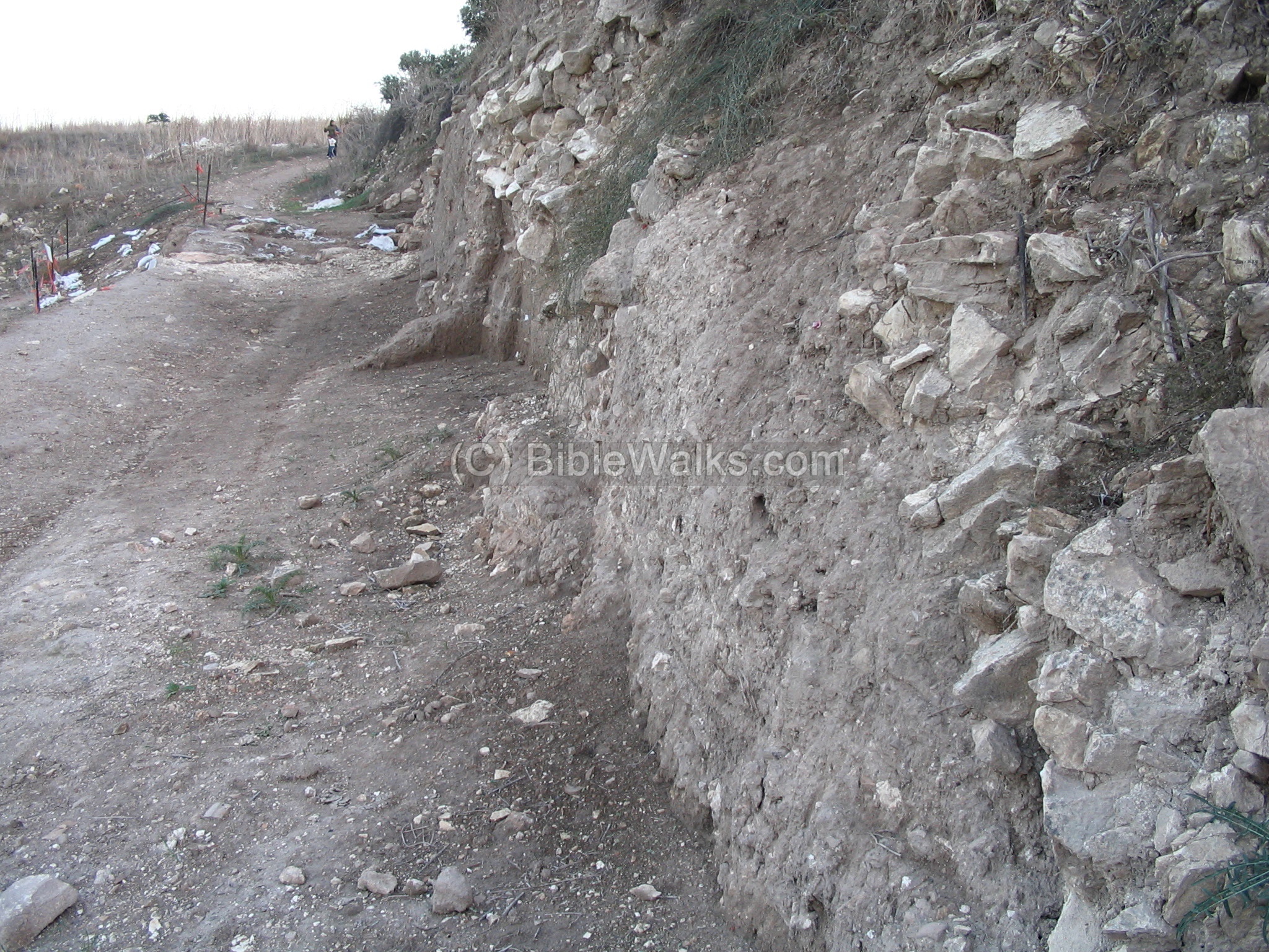
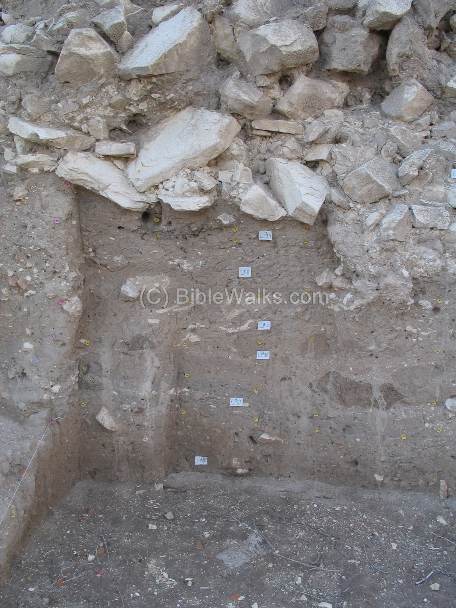
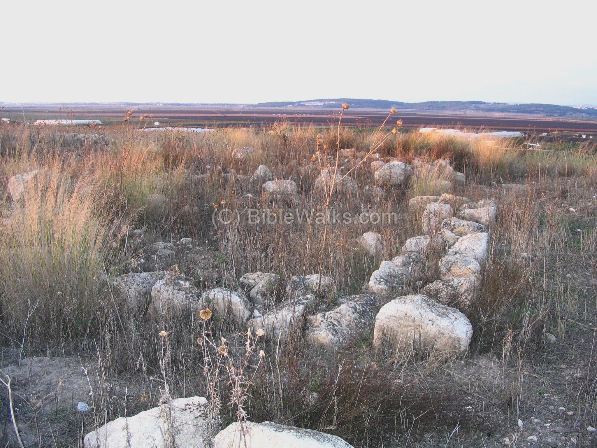
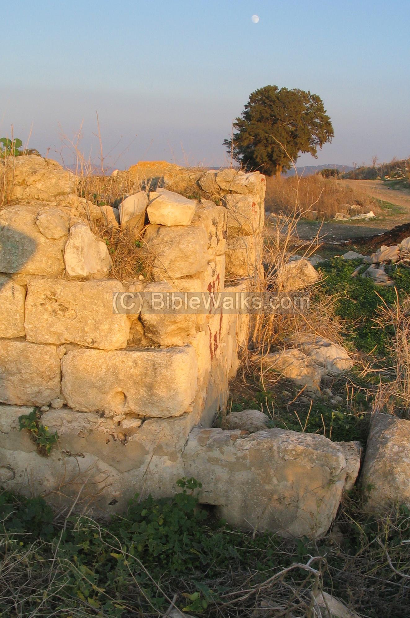
A closer look on the wall shows a cross section of the defense walls, which were built in the middle Bronze period, over 3500 years ago.
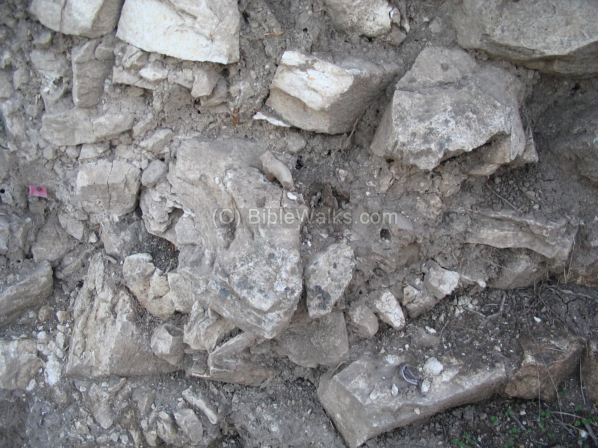
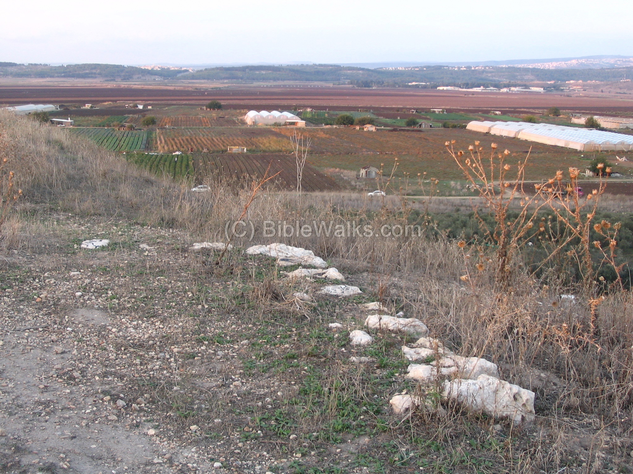
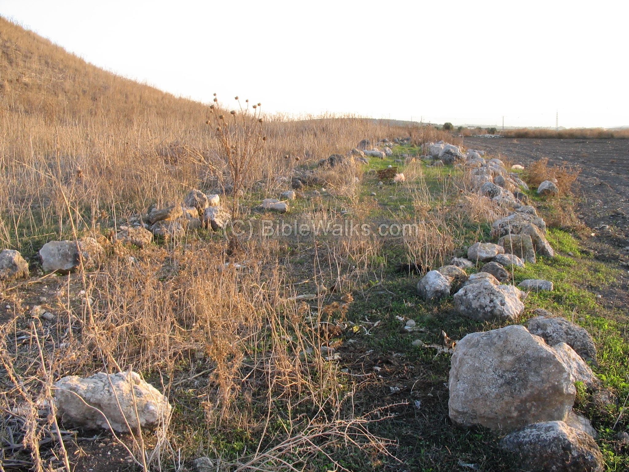
These stones are part of the stone paved road leading into the city.
Another cross section of the walls, with markers still stuck in the layers.
(d) The slopes
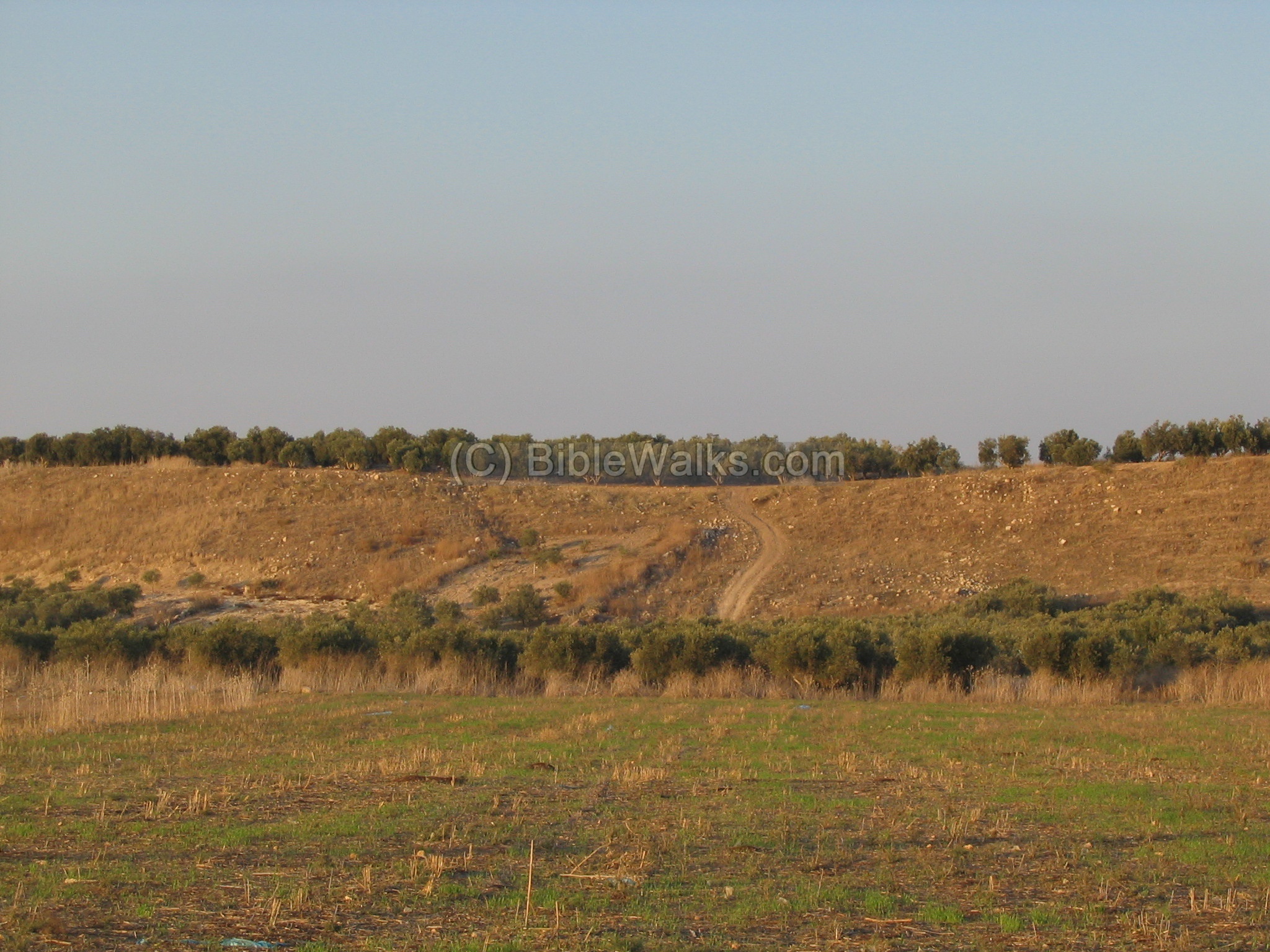
From the top of the hill you can get a better impression on the might of the city. The glacis and walls made it hard from the attackers to get into the city. This photo is taken towards the east.
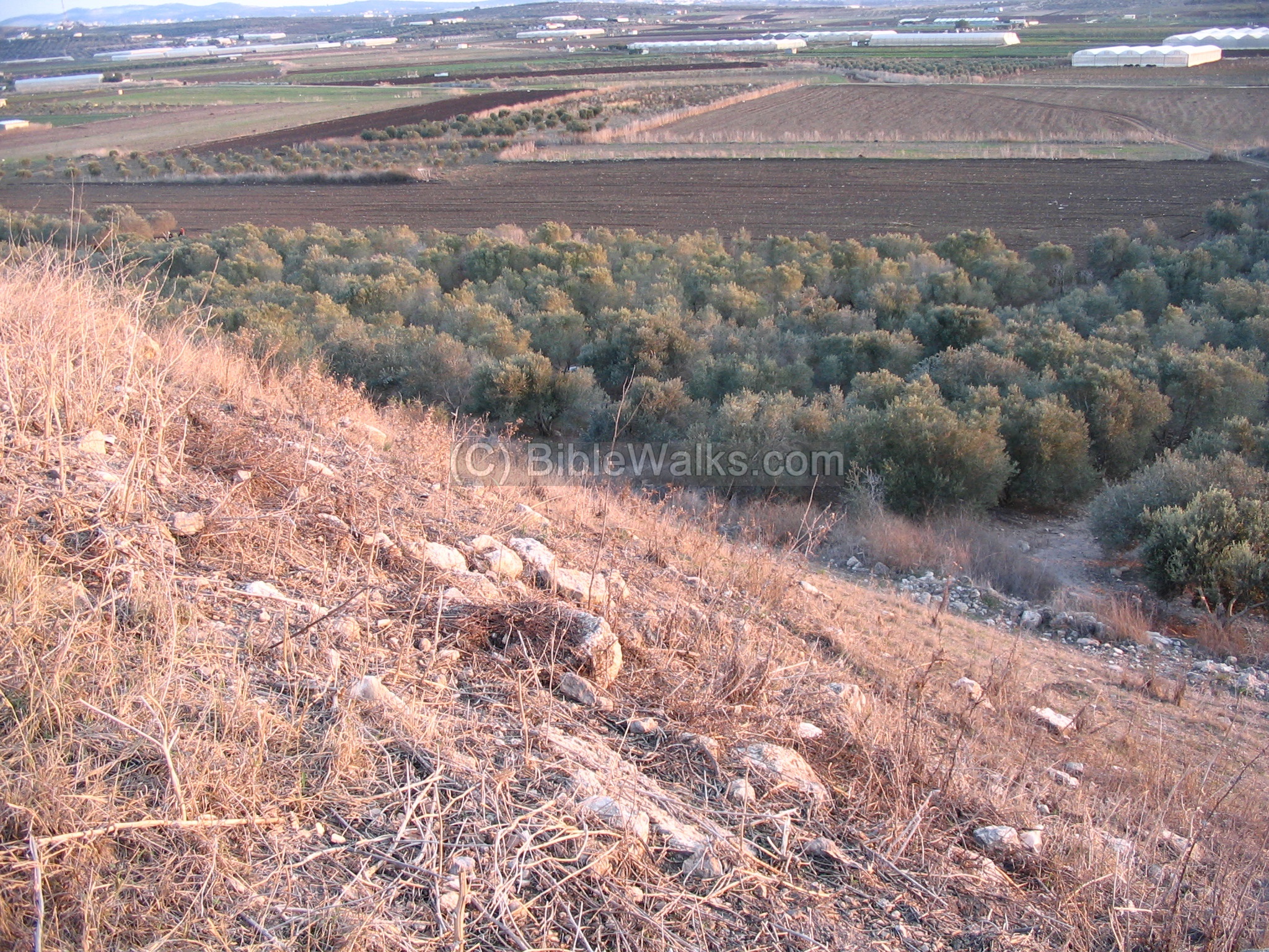
Another view of the east side:
(e) On top of the Tel
Excavations were conducted on the north east side of the summit.
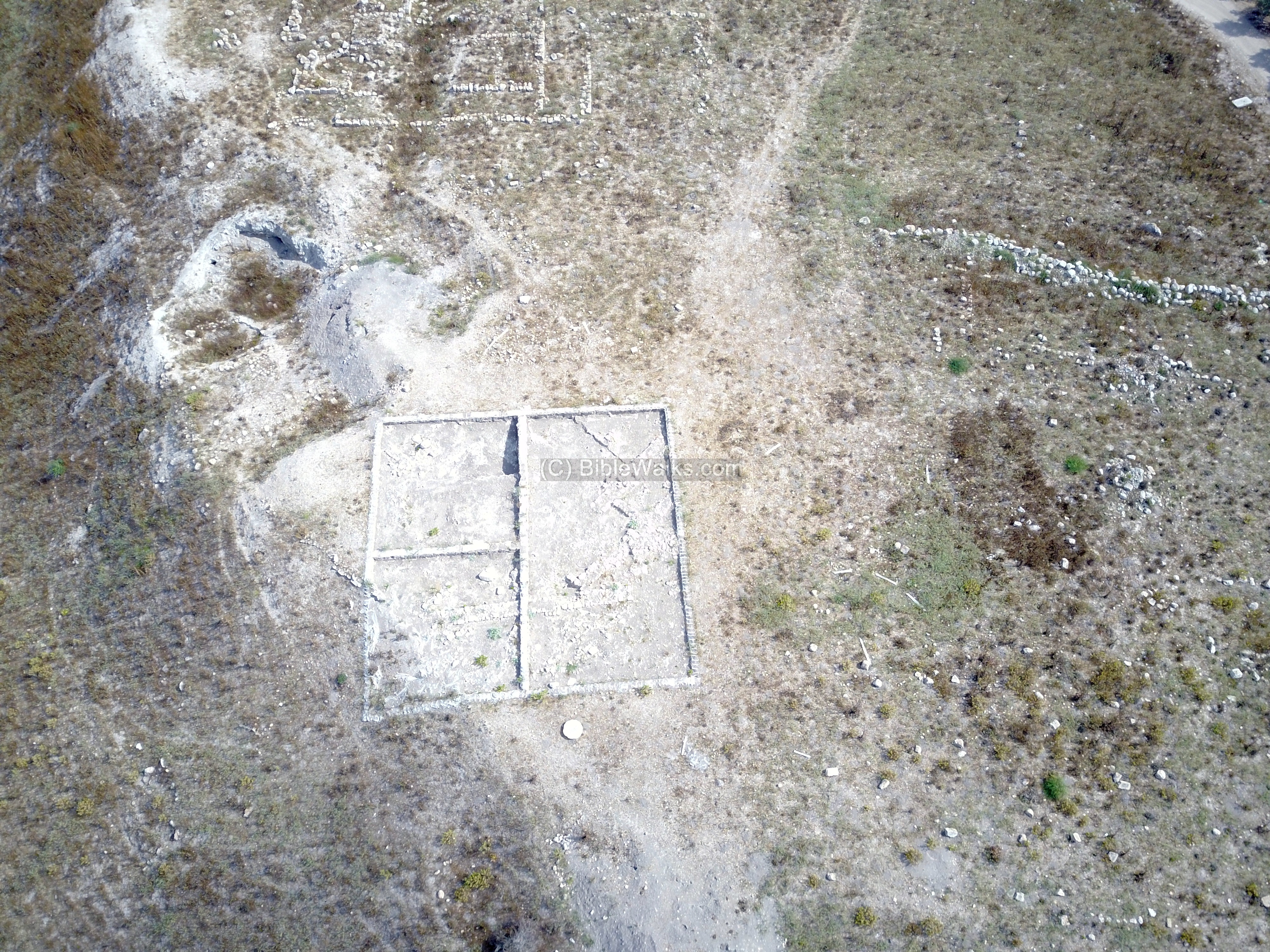
Earlier excavations revealed several Byzantine buildings, including this 6th century church.
A watch tower is located on the north-east side.
(e) Ancient road
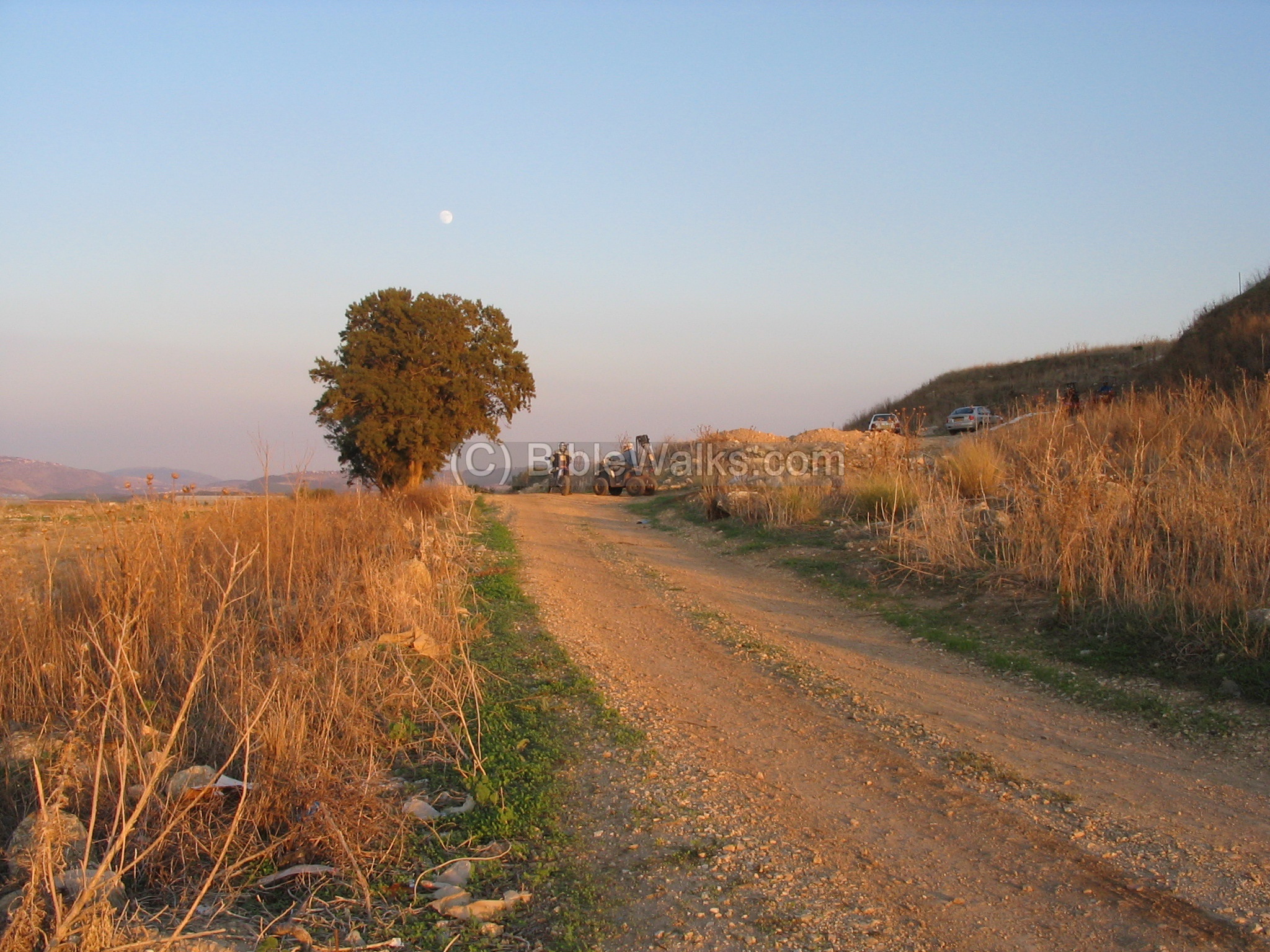
Below the Tel, on the west side, you can see the remains of the paved road (the western section of the Via Maris).
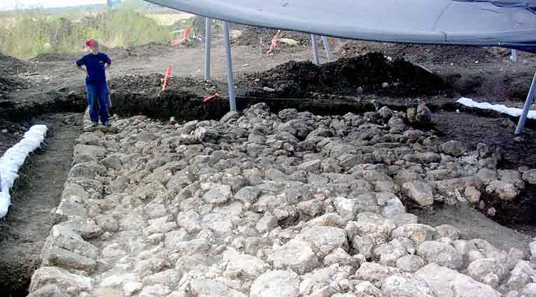
In the 2006 a section of the Roman road from Acre to Sepphoris was excavated north-west of the Tel. Photo courtesy of the Israel Antiquities Authority.
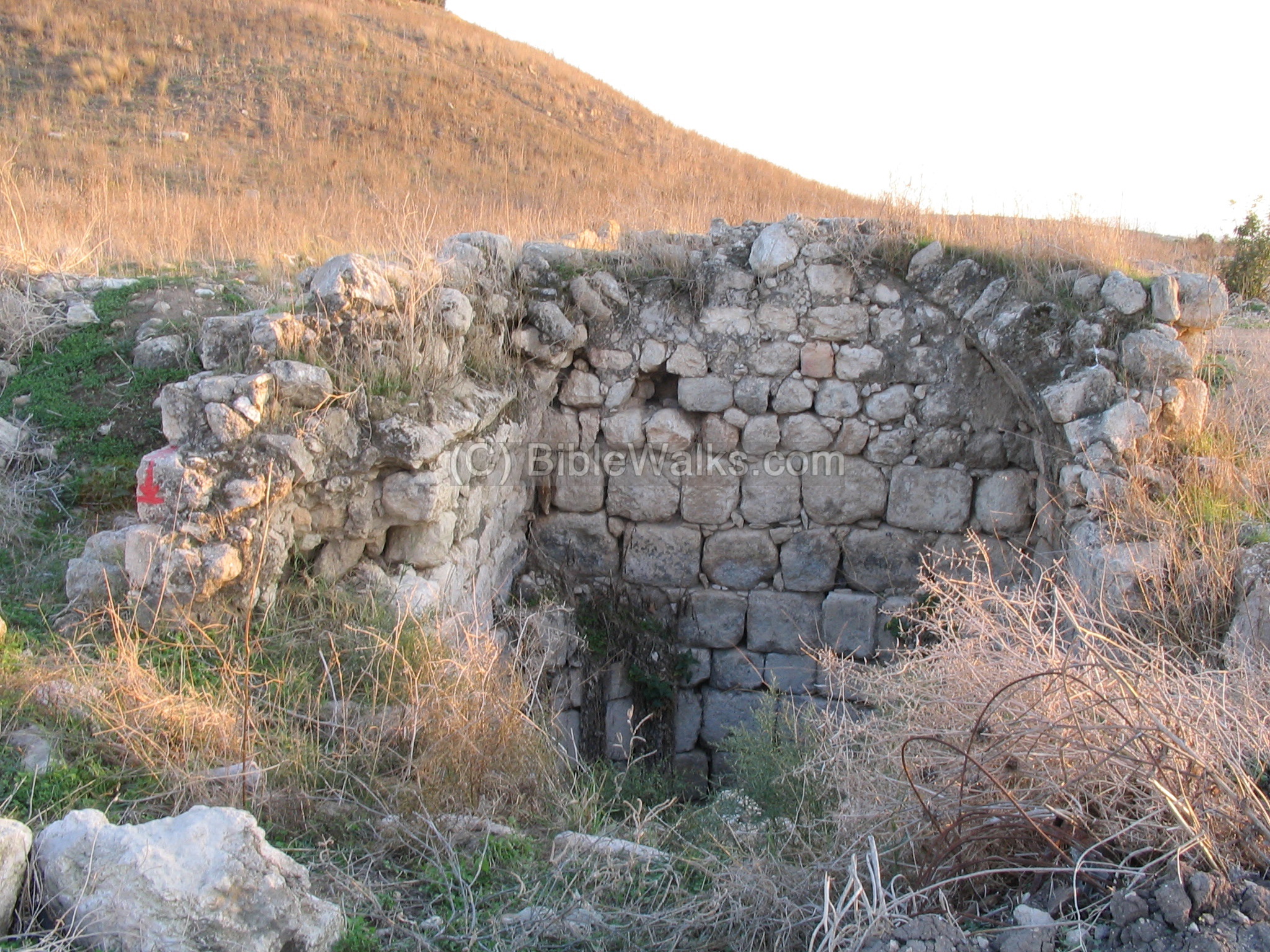
(f) Well
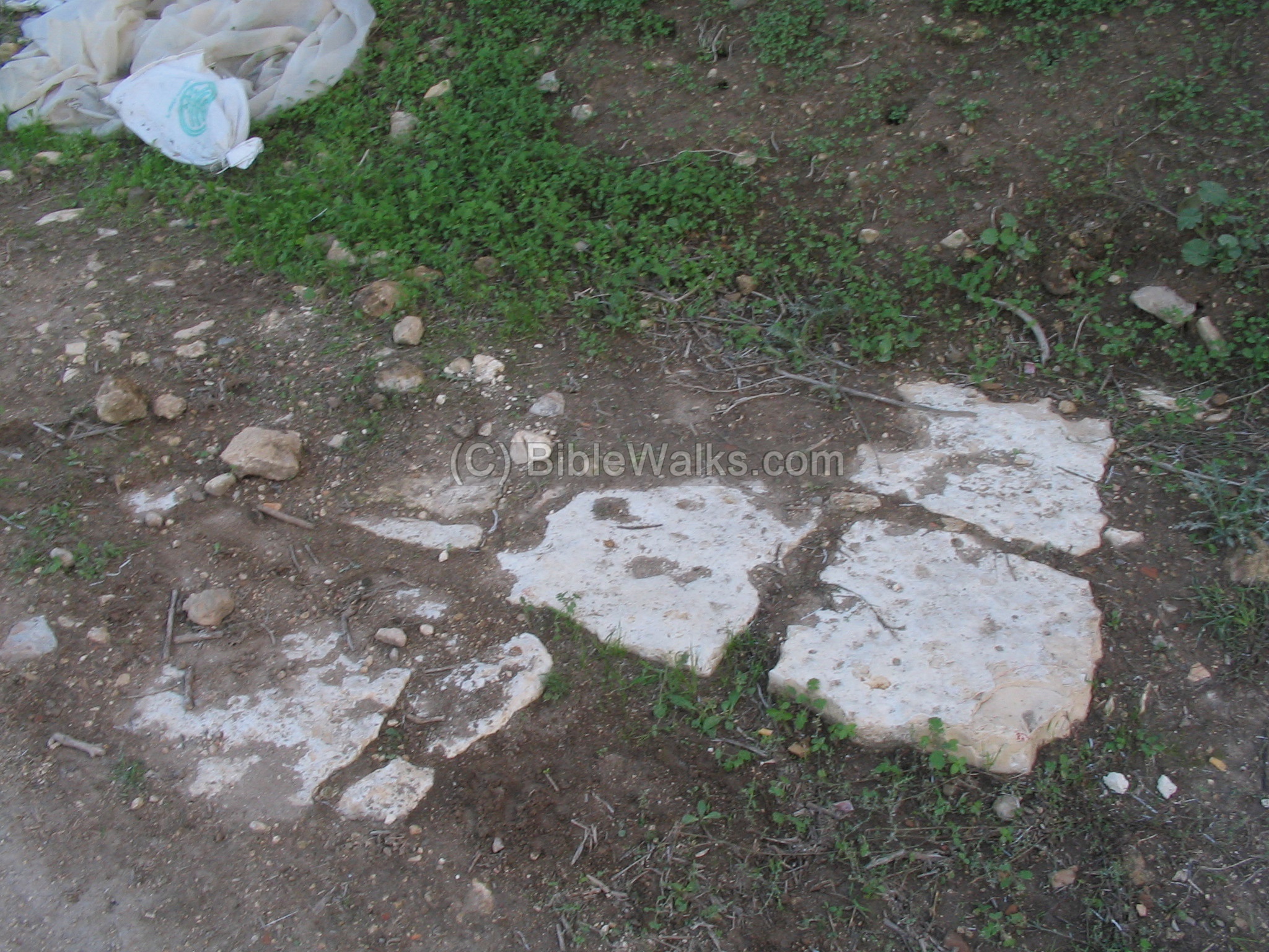
Close to the ancient road path, on the north-west side of the Tel, are the ruins of a covered well house.
Another detail of the well. The water would be drawn up from the well, and poured into a water trough, which some parts of it remain on the bottom of the building.
A view of the back of the house, with the deep well. The Tel is seen in the background.
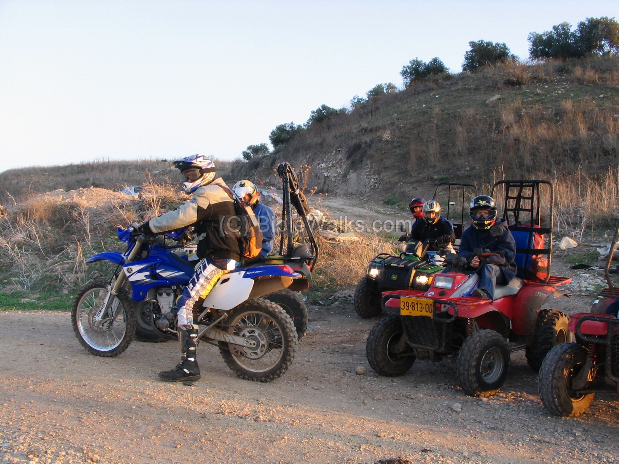
(g) Motor Visitors
There are frequent visitors to the Tel – dirt bikes and motorcycles – that shoot up the slopes.
A closer view of the group. In the background is the entrance to the Tel, where recent excavations were done.
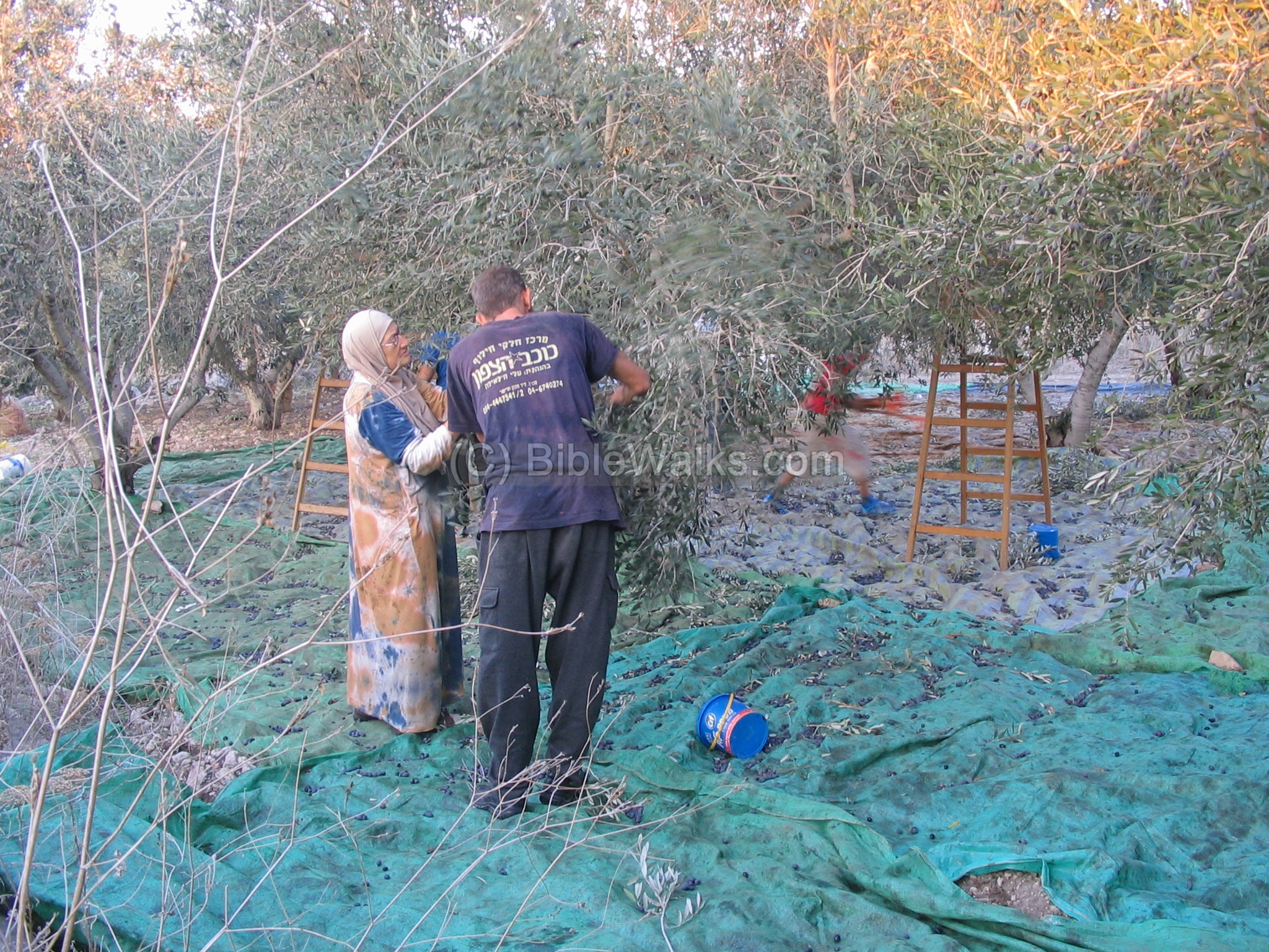
(h) Olive harvest
On the top of Tel Kisson, and around it, there are many olive trees.
In the month of November the Galilee is in the middle of the olive tree harvest. Families gather at their olive groves, shake the branches, and collect the olives on colorful blankets. Then the olives are brought to a central oil press, crushed into olive oil, and packaged, then sold. The yellowish liquid – olive oil- is almost like gold, both in color and in value.
This picture was taken on top of the Tel in November 2006. Note that the year 2006 was an excellent year for olive oil in Israel.
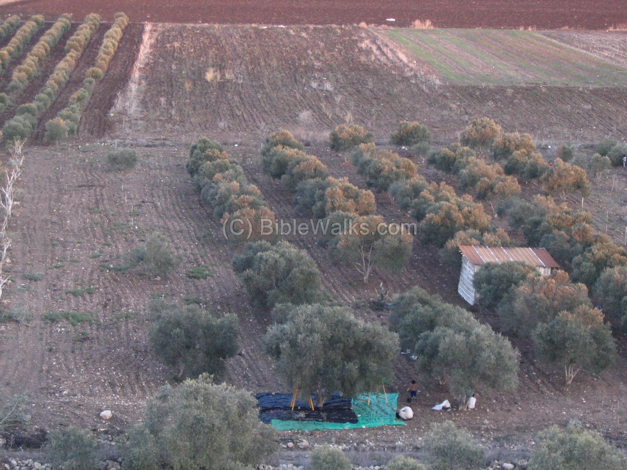
Another olive harvest activity is seen on the eastern slopes of the Tel. This practice did not change in the thousands of years since the olive oil became one of the important exports of the Galilee. Many ancient oil presses are found near the ancient sites, and were used for thousands of years to crush the olives.
(i) Video
![]() A flight over the site was captured by a drone on July 2017:
A flight over the site was captured by a drone on July 2017:
Etymology (behind the name):
-
Tell Keisan – the Arabic name of the site. The PEF dictionary (p. 117) translated it to: “The mound of treachery”.
-
Bir – Arabic – well.
-
Bir Keisan – Arabic: “well of treachery”.
-
Kisson – A Hebrew version -based on the Arabic name. No meaning.
-
Kavul – In Hebrew, a muddy soil which is found in swamps, and is a deposit of decaying plants in swamps.
-
Tel (also spelled Tell) – a layered mound (read about the story of the Tels)
Links and References:
* Archaeological:
(a) Tel Kisson recent digs (in Hebrew):
-
North West walls (2006) – cross section of the walls, dated to the middle Bronze period (first half of 2nd Millenium BC). The digs, seen in the photos above, revealed a steep glacis was built around the top of the hill to protect it, massive walls, and possibly sections of the gate.
-
North West to Tel (2006) – ruins from early Chalcolithic, early Bronze, Persian and Roman periods. Also, a section of the Roman road from Acre to Sepphoris.
-
Area north-west to Tel (2005) – limited excavations, revealed Persian period ruins and ceramics from Iron, Bronze, early Chalcolithic periods.
-
Area north to Tel (2005) Nurit Feig
(b) North-East to Tel (2002) – inspection excavations, with ruins from several periods. The important finding is that the city extended more than 170M north to the Tel, making it a larger city than the size of the hill.
(c) Arch. dig in 1971– Revealed ruins of a church and a cross engraved in the rock from the 6th century AD
- IAA archive – Tell Keisan British period accounts of the survey
- Archaeological survey of Israel – Map 20 site #24
(d) Future explorations – scheduled for 2018 by the University of Chicago. Headed by David Schloen (University of Chicago) and Gunnar Lehmann (Ben-Gurion University).
* Biblical References:
- Identification of Kisson as Achsaph (p 117-121)
* Internal links:
- Quadcopter Aerial views – collection of Biblical sites from the air
BibleWalks.com – visit the Land of Cabul
Ofrat <<<–previous site—<<<All Sites>>>—next West Galilee site–>>> Tel Bira
This page was last updated on Oct 1, 2022 (Add Mishal as another identification; add Biblical map)
Sponsored links: