Gaza (Azzah) is one of the World’s ancient cities, situated on the coastal road. Judges 16: 1-3: “Then went Samson to Gaza…”.
Home > Sites > Shefela> South > Gaza (Azzah)
Contents:
Background
Location
History
Photos
* Gaza main city
* Gaza port city
Etymology
Links
Overview:
Gaza (Azzah) is one of the World’s ancient cities, situated on the coastal road, which was the main throughway of the Fertile Crescent, the region which was the cradle of civilization. This road, known in the Bible as Derech Hayam (“Via Maris”) connected the Egyptian empire in the south to the civilizations of the Levant (Israel, Phoenicia, Syria), Mesopotamia (Babylon, Assyria, Persia) and Asia Minor in the north.
During the period of the Israelite Kingdom, it was one of the largest Philistine city. Gaza also served the trade of the Nabateans, who marketed their precious incense and spices through its port. During the Byzantine period, it was one of the major Christian religious centers, and had a great influence on Byzantine monasticism.
Location and Map:
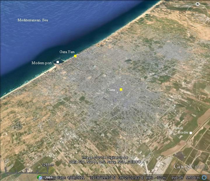
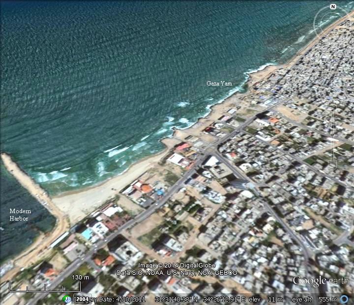
The aerial view shows the points of interest in the the vicinity of Gaza. The ruins of the ancient city is now surrounded by modern neighborhoods, and is at a highest altitude of 55m (180 ft). The main road, tracing the ancient trade route, is seen here crossing the center of Gaza from northeast to southwest.
In ancient times the main city of Gaza was located on a hill, 1.5km (1 mile) away from the shore, while its port city (Gaza Yam, also named in antiquity: Anthedon or Maiumas) was located near the modern port.
History:
-
Canaanite/Egyptian city
The Egyptians conquered Canaan following the battle of Megiddo of 1468 BC. Their control of Canaan lasted for 400 years, and Gaza was a major station along the only road connecting Egypt to Canaan. Gaza is mentioned in the Tell el-Amarna letters, a 14th century BC Egyptian archive of clay tablets.
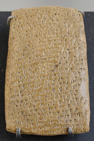
One of Tell Amarna letters (Louvre Museum, Public domain CC 2.5)
Cuneiform writing on a clay tablet.
-
Biblical Periods – Exodus
The city is first described by the the Israelites as a city of giants or Anakim (Joshua 11, 22):
“There was none of the Anakims left in the land of the children of Israel: only in Gaza, in Gath, and in Ashdod, there remained”.
It was one of the five major Philistine cities (Joshua 13: 2-3):
“This is the land that yet remaineth: all the borders of the Philistines, and all Geshuri, From Sihor, which is before Egypt, even unto the borders of Ekron northward, which is counted to the Canaanite: five lords of the Philistines; the Gazathites, and the Ashdothites, the Eshkalonites, the Gittites, and the Ekronites; also the Avites”.
Gaza and its towns and villages were allotted to the tribe of Judah (Joshua 15:20,47):
“This is the inheritance of the tribe of the children of Judah… Ashdod with her towns and her villages, Gaza with her towns and her villages, unto the river of Egypt, and the great sea, and the border thereof:”.
Gaza was conquered by the people of Judah (Judges 1:18):
“Also Judah took Gaza with the coast thereof, and Askelon with the coast thereof, and Ekron with the coast thereof”.
The Biblical map below shows the location of Gaza and the major cities during the ancient times. The city, marked with a red circle near the Mediterranean sea, is located to the north of the Besor brook (Wady Gaza). Its port city is located on the shore, while Gaza is situated inland on defendable hills.
Major ancient roads passed through the city: The coastal road (Via Maris, Way of the Sea), a major caravan route connecting the south to the north; the Nabatean “spice route”; and the road to Judea (Lachish, Hebron and Jerusalem).
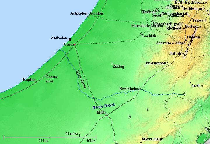
Gaza and the south west of Israel – during the Biblical periods (based on Bible Mapper 3.0)
-
Judges (12-10th century B.C.)
During the 12th century the Philistines arrived to the cities along the shore. The Israelite cities on the low hills along the coast were affected by the push of the Philistines eastwards into the land of Judah.
Their conflict with the Israelites started in the mid 11th century BC, and one of the stories associated with this conflict is the heroism of the mighty Samson of the tribe of Dan, who was born in the village of Zorah (3km north of Beit Shemesh).
Samson attacked Gaza and tears down the doors of the city gate, as illustrated below(Judges 16: 1-3):
“Then went Samson to Gaza, and saw there an harlot, and went in unto her. And it was told the Gazites, saying, Samson is come hither. And they compassed him in, and laid wait for him all night in the gate of the city, and were quiet all the night, saying, In the morning, when it is day, we shall kill him. And Samson lay till midnight, and arose at midnight, and took the doors of the gate of the city, and the two posts, and went away with them, bar and all, and put them upon his shoulders, and carried them up to the top of an hill that is before Hebron”.
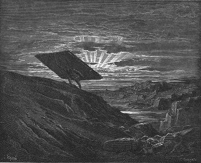
Samson carries the doors of the gate of Gaza – Drawing by Gustav Dore
As a revenge, the Philistines caught Samson, imprisoned and blinded him (Judges 16: 21-23):
“But the Philistines took him, and put out his eyes, and brought him down to Gaza, and bound him with fetters of brass; and he did grind in the prison house. Howbeit the hair of his head began to grow again after he was shaven. Then the lords of the Philistines gathered them together for to offer a great sacrifice unto Dagon their god, and to rejoice: for they said, Our god hath delivered Samson our enemy into our hand”.
Samson was then moved from the prison to the Philistine temple of Dagon, and Samson knocks the temple down, uttering his famous last words (Judges 16: 29-20):
“And Samson took hold of the two middle pillars upon which the house stood, and on which it was borne up, of the one with his right hand, and of the other with his left. And Samson said, Let me die with the Philistines. And he bowed himself with all his might; and the house fell upon the lords, and upon all the people that were therein. So the dead which he slew at his death were more than they which he slew in his life”.
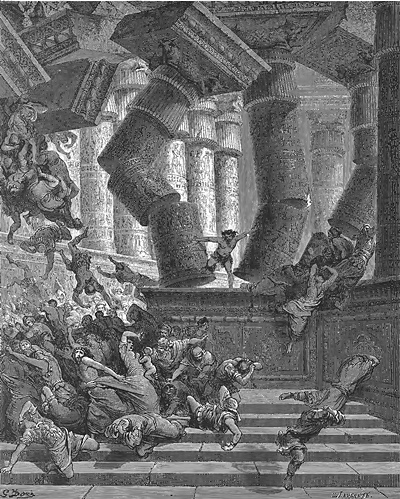
Death of Samson in Gaza – Drawing by Gustav Dore (French artist, 1832-1883)
-
Israelite Kingdom (10th century-6th century B.C.)
The Philistines became the arch enemies of the Israelites. Many battles were conducted between the armies of the Israelites and the Philistines who pushed north and east into the territories of Israel. King Saul, the first king of the united Kingdom, was killed in the battle of the Gilboa. Solomon’s kingdom extended until Gaza, but the cities of the Philistines were excluded from the area of the Judean Kingdom (1 Kings 4:24): “For he had dominion over all the region on this side the river, from Tiphsah even to Azzah, over all the kings on this side the river: and he had peace on all sides round about him”.
Gaza is referred by many prophets, forecasting the doom of the Philistines:
* Jeremiah (47:5): “Baldness is come upon Gaza; Ashkelon is cut off with the remnant of their valley: how long wilt thou cut thyself?”.
* Amos (1:6-7): “Thus saith the LORD; For three transgressions of Gaza, and for four, I will not turn away the punishment thereof; because they carried away captive the whole captivity, to deliver them up to Edom. But I will send a fire on the wall of Gaza, which shall devour the palaces thereof”.
* Zephaniah (2:4): “For Gaza shall be forsaken, and Ashkelon a desolation: they shall drive out Ashdod at the noon day, and Ekron shall be rooted up”.
* Zechariah (9:5): “Ashkelon shall see it, and fear; Gaza also shall see it, and be very sorrowful, and Ekron; for her expectation shall be ashamed; and the king shall perish from Gaza, and Ashkelon shall not be inhabited”.
-
Assyrians (732-630 BC)
The Assyrian empire, a rising force in the region, conquered the North Kingdom of Israel in 732 BC, destroying most of the cities and villages in the land. The Assyrian King Tiglath-Pileser III annexed the area (as per 2 Kings 15: 29):
“In the days of Pekah king of Israel came Tiglathpileser king of Assyria, and took … and carried them captive to Assyria”)”.
The Assyrians reached Gaza and made the Philistine cities – from Jaffa to Raphia – a kingdom subdued and raising taxes to the Assyrians. The main city of the Philistine-Assyrian kingdom was Ashdod.
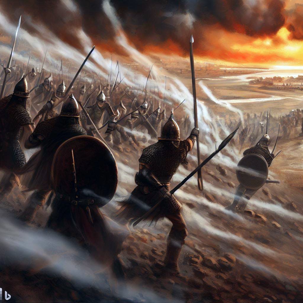
Assyrian forces attacking – AI generated by Bing
Sargon II:
In 712 the Assyrian King Sargon II came to fight the Egyptian army in Raphia, south of Gaza, and managed to repel them back to the south.
Sennacherib:
After the death of the Assyrian King Sargon II (705 BC), King Hezekiah mutinied against the Assyrians, joining other cities in the area, including Ashkelon and Ekron, who attempted to free themselves from the Assyrian conquest. Hezekiah crushed the Philistine cities who refused to join his mutiny (2 Kings 18:8):
“He smote the Philistines, even unto Gaza, and the borders thereof, from the tower of the watchmen to the fenced city”.
The Assyrian army came in 701, headed by Sennacherib, son of Sargon II (2 Chronicles 32 1):
“After these things, and the establishment thereof, Sennacherib king of Assyria came, and entered into Judah, and encamped against the fenced cities, and thought to win them for himself”.
This intrusion ended the mutiny. Sennacherib conquered 46 cities in Judea, but Jerusalem was spared from destruction.
In his stele, found in the royal palace Nineveh, Sennacherib writes that he rewarded the Philistine cities that were not involved in the mutiny:
“The cities, which I had captured, from his country I cut off and gave them to Mitinti, King of Ashdod, Padi, King of Ekron, and Sillibaal, King of Gaza, and diminished his land”.
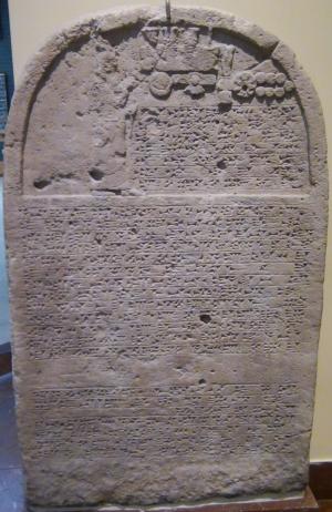
Sennacherib’s stele with relief and inscription; Nineveh;
limestone [Istanbul Archaeological Museum]
-
Babylonian (630-538 BC)
The Assyrians ruled Gaza for 100 years, and were followed by the Babylonian empire (630BC-538BC) and the Persians (538-332BC).
The Babylonian empire rose after the fall of the Assyrians (610BC), defeated the Egyptians (609BC) and conquered the land until the Nile (2 Kings 24 7):
“… for the king of Babylon had taken from the river of Egypt unto the river Euphrates all that pertained to the king of Egypt”.
Gaza was conquered in 604 BC. Its people, as well as the residents of the other Philistine cities, were relocated to Mesopotamia.
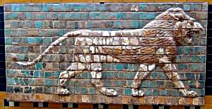
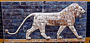
“Lions in Relief” – from the procession street in Babylon.
Nebuchadnezzar II period (604-562 BC); glazed brick
[Istanbul Archaeological Museum]
-
Persians (538-332 BC)
The Persian empire replaced the Babylonians in 538 BC. During the Persian period, the former cities of the Philistines were resettled by the Phoenicians. This ended the 600 years of the Philistine presence in Israel, opening a new chapter in the history of Gaza. Gaza became a fortified state city.
- Gaza – export city of the Nabateans
The Nabateans originated from Arabia, where they have been nomadic tent dwellers. They prospered from the operation of the Incense and Spice route, and established stations and cities along the route. This commercial enterprise started during the Persian period, around the 5th or 4th century BC, and made these merchants rich.
The Incense & Spice route connected the east (Yemen and Oman), through Arabia, via the Nabatean capital city Petra, to the port city of Gaza (Anthedon) on the shore of the Mediterranean Sea. This road, with a total length of 2,400 km, passed through harsh desert areas. It was used by the Nabateans to export the incense and spices from southern Arabia and the Far east to the Classic world of Greece and Rome.
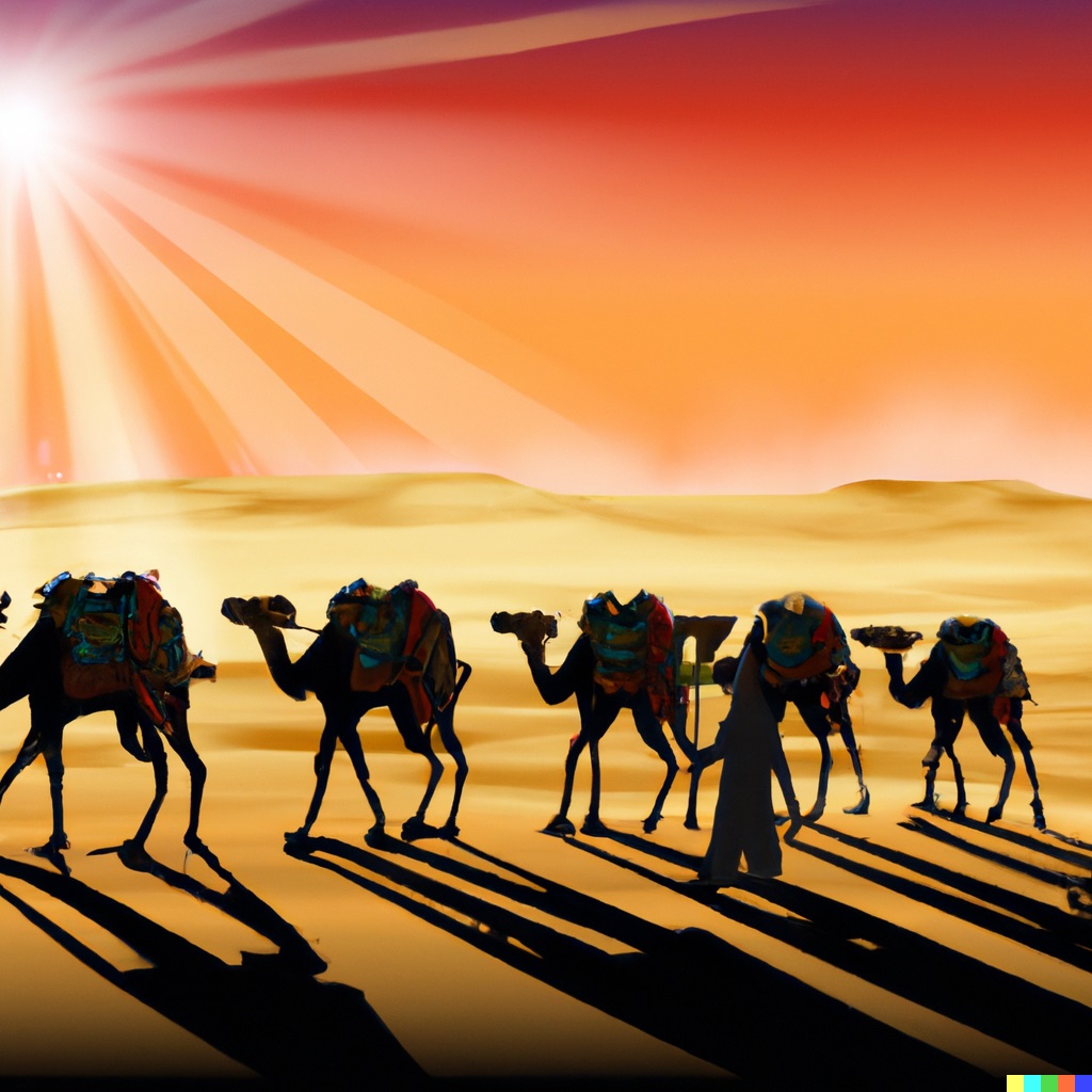
Caravans of camels carrying the merchandise along the Incense route
– AI Illustration by DALL-E 2
Gaza was under Nabatean control since the Persian period, and the city prospered thanks to the Nabatean export of the incenses and spices.
-
Alexander the Great (332 BC) and successors – Hellenistic period
When Alexander the Great arrived to the area (332 BC), the Greeks set siege on Gaza, and conquered it after 2 months. The entire population was killed or sold to slavery, and replaced by new Greek residents who made Gaza an important commercial and Maritime city.
It is believed by some scholars that the ruins of the city, destroyed by Alexander, are located on the mouth of the Besor stream (Wady Gaza) 7Km south of Gaza, in a place called Beit Aglaim (Tell el Ajjul).
In the following years after Alexander’s death (323), Gaza was torn and switched sides between the two Greek empires – the Ptolemy-Egyptian and the Seleucids-Antioch. Major battles occurred between the sides, starting from the battle near Gaza (312BC) with the victory of the Ptolemy kings, who ruled the Levant (Israel and Syria) for the following 114 years (312-198).
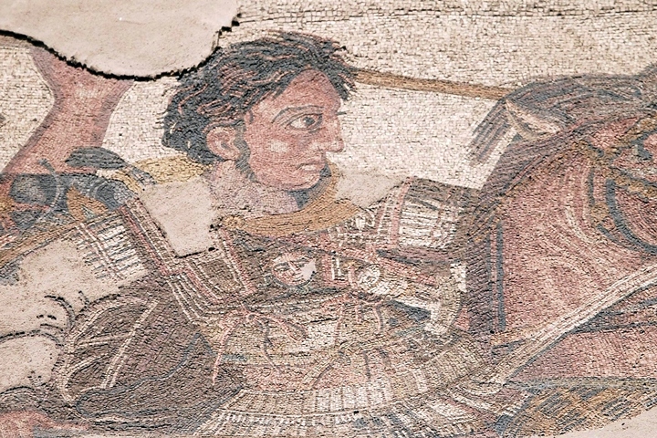
Illustration of Alexander
– On a mosaic floor in Pompeii
The Seleucids attempted to recapture the area during the First and Second Ptolemy-Seleucid wars (276-255), and failed again in the Third Syrian war (246-240). In their next attempt (219-217) the Seleucids managed to win several battles and even reach Gaza, but the Raphia battle south of Gaza (217) secured the Ptolemy control. Gaza was captured in 201 BC by the Seleucid king Antiochus III, but the Ptolemy army, headed by general Scopas, pushed them back to the north.
The Seleucids finally defeated the Ptolemy army in the battle of Banias (198 BC). This gave them a control of the Land of Israel. Josephus writes about this (Ant. 12 3 4): “Antiochus overcame Scopas, in a battle fought at the fountains of Jordan, and destroyed a great part of his army”.
-
Maccabee revolt and Hasmoneans (167-63 B.C.)
The Maccabees headed the anti-Hellenization rebellion against the Greek Seleucids who controlled the land of Israel since 198 BC. After a series of successful military campaigns they took control of Judea, liberated the land and created an independent Jewish country, known as the Hasmonean Kingdom (164-63 BC as independent state, and 63-37 BC as rulers under Rome).
Hasmoneans battle the Seleucid Greeks (Stable Diffusion T2I)
The cities in the southern coast area of Israel were important targets during the following years of the Hasmonean expansion. In 145 BC Jonathan Maccabee captured Gaza, burnt the villages around it, and forced a truce with the city. (Antiquities 13, Chapter 5:5):
“…he set a part of his army round about Gaza itself, so with the rest he overran their land, and spoiled it, and burnt what was in it. When the [people] of Gaza saw themselves in this state of affliction… so they sent to Jonathan, and professed they would be his friends, and afford him assistance… he made a league of friendship with them, and took from them hostages for their performance of it, and sent these hostages to Jerusalem, while he went himself over all the country, as far as Damascus”.
Years later, King Alexander Jannaeus captured the port city of Yavne-Yam (Jamnia) in 103 BC, followed by the capture of the port city of Gaza (Anthedon) in 100 BC, the inland city Gaza (100 BC) and the coastal city of Raphia (south of Gaza) in the same year. (Wars 1 4:2):
“However, Alexander recovered this blow, and turned his force towards the maritime parts, and took Raphia and Gaza, with Anthedon also, which was afterwards called Agrippias by king Herod”.
This campaign secured the southwest border of the Hasmonean Kingdom, with a border set at the brook of Egypt, 74 Km (46 miles) southwest of Gaza.
The loss of the port city was a major defeat for the Nabateans, causing their cities along the Incense route to decline. On the other hand, the possession of Gaza made the Hasmoneans richer and was one of the important sources of income for the Jewish Kingdom.
- Early Roman Period (63 BC – 67 AD )
Pompey captured the land in 63 BC, and rearranged the territories. Gaza, as other port and Hellenistic cities, were removed from the area of the Hasmonean kingdom, and became an autonomous city. After the murder of Julius Caesar (44), Augustus defeated his opponents and became the new emperor. Herod the Great (Hasmonean king 37-4 B.C.) managed to build good relations with Augustus, and received the coastal cities. In 30 BC Gaza was returned to the Hasmonean Kingdom, as a tribute by Augustus. (Wars 1 21 3):
“[Caesar] made an addition to his kingdom, by giving him not only the country which had been taken from him by Cleopatra, but besides that, Gadara, and Hippos, and Samaria; and moreover, of the maritime cities, Gaza and Anthedon, and Joppa, and Strato’s Tower.”
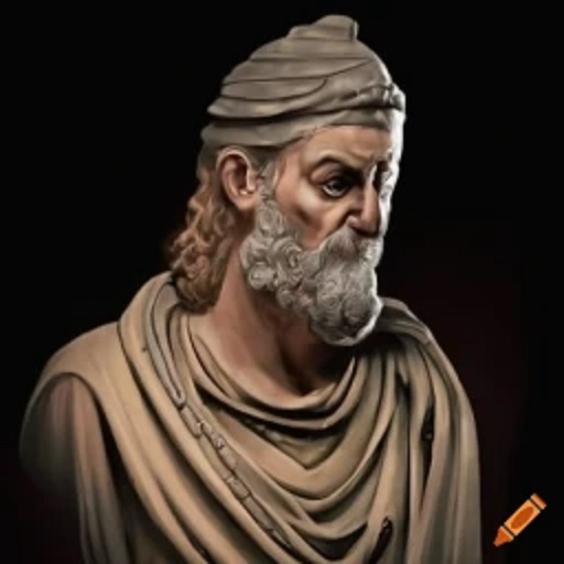 Herod the Great – AI illustration by Craiyon
Gaza received rights of a Polis city, and its port city was renamed from Anthedon to Agripias or Agrippeum (Wars 1 21 8):
“He also rebuilt Anthedon, a city that lay on the coast, and had been demolished in the wars, and named it Agrippeum. Moreover, he had so very great a kindness for his friend Agrippa, that he had his name engraved upon that gate which he had himself erected in the temple.”.
After the death of Herod (4 B.C.), Augustus gave Gaza to the Governor of Syria (Wars 2 6 3): “He also made subject to him the following cities, viz. Strato’s Tower, and Sebaste, and Joppa, and Jerusalem; but as to the Grecian cities, Gaza, and Gadara, and Hippos, he cut them off from the kingdom, and added them to Syria.”.
Gaza is referred in the New Testament in the journeys of Philip the Evangelist of Jerusalem (Acts 8:26): “And the angel of the Lord spake unto Philip, saying, Arise, and go toward the south unto the way that goeth down from Jerusalem unto Gaza, which is desert”. He baptized an Ethiopian man, an eunuch, which traditionally marks the start of the Ethiopian church.
- Great Revolt (67-70 AD), Roman period (1st -4th century AD)
On the eve of the Great revolt, Gaza and its port city, as well as other Hellenistic cities, were destroyed by the Jewish rebels, after learning of the massacre of 20,000 Jews in Caesarea (Wars 2 18 1): “…they entirely demolished Anthedon and Gaza; many also of the villages that were about every one of those cities were plundered, and an immense slaughter was made of the men who were caught in them”.
Vespasian, the Roman general who headed the Roman campaign to crush the rebellion, came from Egypt and camped in Gaza (Wars 4 11 5): “For his fifth station he pitched his camp at Gaza”. After the disastrous war, Gaza was rebuilt, with Samarian residents moving to the city.
The coastal road passing through Gaza, connecting the north to Egypt, appears on the Peutinger map. This map is based on a 4th century Roman military road map, with an orientation of north on the right side. Jerusalem is marked by a pair of icons of a house with “Herusalem” above it. Ashkelon is also marked with a pair of icons with “Ascalone” above it.
The location of Gaza is not marked as a station on this road, but its position is to the left of Ashkelon, and right of a station in the Sinai desert named “Rinocorora” (modern city of el Arish). A red square was added to show that location. As the map shows, the road passes between the sea and the mountains, and is the only way from the north to Egypt.
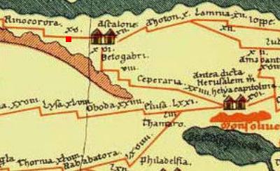
Peutinger Roman 4th C Military Map
– section near Gaza (marked by us as a red square).
The map is oriented with north on the right side.
-
Byzantine period (4th – 7th century A.D.)
Gaza, once a stronghold of paganism, underwent transition to Christianity during the Byzantine period. Pagan temples throughout the city were replaced with churches, in order to service the growing numbers of converted Christians.
Gaza appears in the Madaba map, an ancient map of the Holy Land from the 6th century AD was discovered in 1884 in a Byzantine church in Madaba, Jordan. The name of the city appears as [Ga]za, seen here on the upper part of the segment. The major streets, public and religious buildings of Gaza are illustrated on the mosaic. Its elaborate details and size (comparable to Jerusalem) imply the importance of the city.
|
The illustrations show: two colonnaded streets run across the city, north-south and east-west, intersecting a central square; a horseshoe shaped theater in the upper (eastern) side, aligned with the walls of the city, and connected to a main street; two grand churches; the city walls.
|
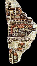
p/o Madaba map |
An icon of a church appears below (west) of the city, with the title “Saint Victor”. This shrine was dedicated to a Christian martyr who was killed by the Romans. Also illustrated is the shrine of Hilarion. On the bottom of the segment is the port city of Gaza, which appears as “[Maiumas] is Nea[po]lis” (meaning the new city, since Constantine the Great granted the port city the status of a separate city) .
Byzantine Monks:
During the Byzantine period, Gaza was an early center of Christian clergymen who spread the faith among the pagan population. It became an important center of monasticism ,and the first station for monks who came from Egypt and moved into the Judean desert.
Hilarion (291-371) was one of the important early monks in the Holy Land. He was born in Thabatha, a village 5 Miles south of Gaza, a son of a pagan family. At the age of 15 he became a Christian, and joined Antonius the Great in Egypt – where he stayed for 2 months (306). Anthony (“The Great” – Megas in Greek) operated in the desert of Egypt, and is regarded as the father of all desert dwellers, although he was not the first of the Christian hermits.
Hilarion then returned to Gaza, and established a Laura (328) in the desert between between Gaza and Maiumas. Hilarion operated in the whole region around Gaza, and his center evolved to become a large religious center in Gaza (4th to 7th century) with notable followers:
-
Zenon or Zeno, bishop of Maiuma (~400)
-
Abba Isaiah (Isaias the Egyptian) who settled in Gaza in the 430s.
-
Petrus or Peter the Iberian of Georgia (died 491), bishop of Maiouma port city, desciple of Abba Isaiah
-
Procopius (465-530), a theologian
-
Aeneas (d. 538), a philosopher
Hilarion influenced the early stages of Monasticism. His Laura became a sort of preliminary Coenobium, with characteristics of a commune life.
Other notable clergymen of Gaza include Porphirius (Porphyrius), the Bishop of Gaza (395-420), whose tomb is located in the Church of St. Porphyrius in Gaza.
Jews continued to live in Gaza city, as indicated by the column with a seven-branched candelabrum that is embedded in the grand mosque, with a Hebrew and Greek inscription (naming Hannaniah Ben Jacob). In the port city (Anthedon, a.k.a Maiumas) an early 6th Century synagogue was also unearthed.
- Arab period (7th-12th century AD)
In 637 AD Gaza was conquered by the Arabs, ending its Christian population and importance. During the next 500 years the city became an important wealthy Muslim city, thriving from the growing commerce between the south and the north.
- Crusaders (12th -13th century)
The Crusaders arrived from Europe to the Holy Land in order to liberate the Holy Land and free Jerusalem. They accomplished the mission in 1099, and established the Crusader Kingdom.
Gaza was on the border between the Arabs in Egypt and the Christian Crusaders in the Holy Land. Long battles were fought among the armies near the city, including the great battle of Ashkelon (1099) when the Crusaders first established the southern border of their Kingdom in the Holy Land. During the next 12 years (1101-1114) the Egyptians attempted to retake the Holy Land, attacking the Crusaders for 10 times.
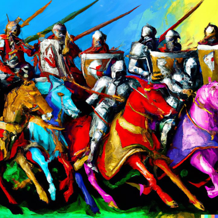
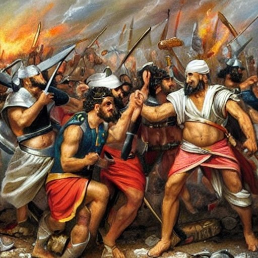
Crusaders battle – AI Illustration by DALL-E 2
The Crusaders were surrounded by the hostile Arab world, and therefore spent the first 50 years in fortifying the borders of their Kingdom. In 1149 Gaza was fortified by King Baldwin III, and was guarded by knights of the Templars order. The Templars were a military-religious organization, established in 1118, naming their organization after the temple: the guards of the temple. Their task, as defined by the pope, was to protect the pilgrims and patients that visited the Holy Land. The Crusaders named the city with an additional name – Gadres (source of this name is unknown).
The Egyptian army, headed by Saladin, attempted to capture Gaza/Gadres in 1170 and 1177, and finally crushed the Crusaders in 1187. Although Gaza returned for brief periods to the Crusaders control in some of the following years, at the end the Crusaders left the Land in 1291.
The Crusaders brought with them, back to their native countries in Europe, a number of new medical practices from the Holy Land. One of them is the Gauze, a thin fabric with a loose open weave. This cloth was woven here, named after Gaza, and was used for medical dressing of wounds.
- Mameluke (14th-16th century) and Ottoman period (16th – 20th century)
During the post-Crusader Arab period, and then under the rule of the Mamelukes (1250-1516), the city expanded, growing even larger than Jerusalem. Gaza was a regional capital (Sanjak – an administrative division of the Ottoman Empire).
In 1516 the Ottoman army, headed by Sinan Pacha, conquered Gaza and defeated the Mamelukes in the battle of Tell-el-Jamma south of the city. The Land passed to the Ottoman control for the next 400 years.
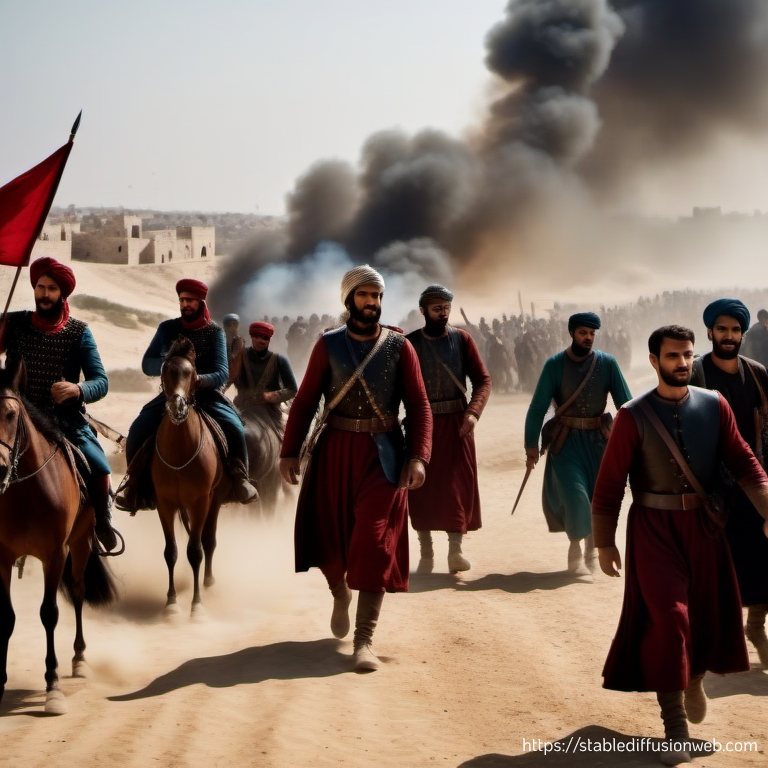
Ottomans win the battle at Tell el-Jamma (Stable Diffusion T2I)
-
Napoleon expedition (1798-1801)
In 1789 the French revolution replaced the Monarchy with a Republican system. Britain refused to recognize the new Republic, leading to a French attack against the British interests in Egypt, in order to cut off the Suez Canal.
The French Army, headed by Napoleon Bonaparte, lands in Egypt (May 1798) and within 3 months captures the entire country, and cut off the British access through the Suez Canal. However, the French navy loses the naval battle of Abukir (August 1798) resulting in the loss of their logistic supply from France.
The French then continued northwards in February 1799. They defeat the Ottoman army in the battle of El-Arish, and then attack and capture Gaza in February 1799. They continue up north, capture Jaffa (March 1799), and win the battles at Qaqun (March) and Tabor (April). They reach the port city of Acre, where they set siege (March-May 1799). After failing to capture the city due to the strong resistance of the Ottoman defenders, and attacks from the sea by British vessels, the French retreat.
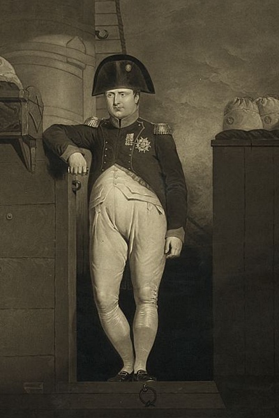
Napoleon Bonaparte, 1769-1821 [Photos of the LOC]
Napoleon returns to Egypt in May-June 1799, blowing up all the fortifications of the coastal cities, including Gaza City which is severely damaged. The French finally surrendered in 1801 and returned to Europe.
-
Survey of Western Palestine
Conder and Kitchener of the Palestine Exploration Fund (PEF) surveyed the area during the Survey of Western Palestine (SWP) in 1874-75. The report of modern Gaza and the ancient sites is found in sheet XIX.
The PEF report of 1875 describes their findings in the ancient sites of Gaza (Ghuzzeh) in the end of the 19th Century (Volume III pp 248 -251):
“The principal archaeological points of interest are the Jamia el Kebir, Bab ed Darun, and Meidan ez Zeid. Green mounds extend round the houses on the hill, and seem to indicate the ruins of former fortifications. These show probably the site of the walls of Crusading Gaza”.
A section of the PEF map is seen here. The center of Gaza is marked by red zones in the middle of the map, and is located on both sides of the ancient road, which is marked as a double dashed line.
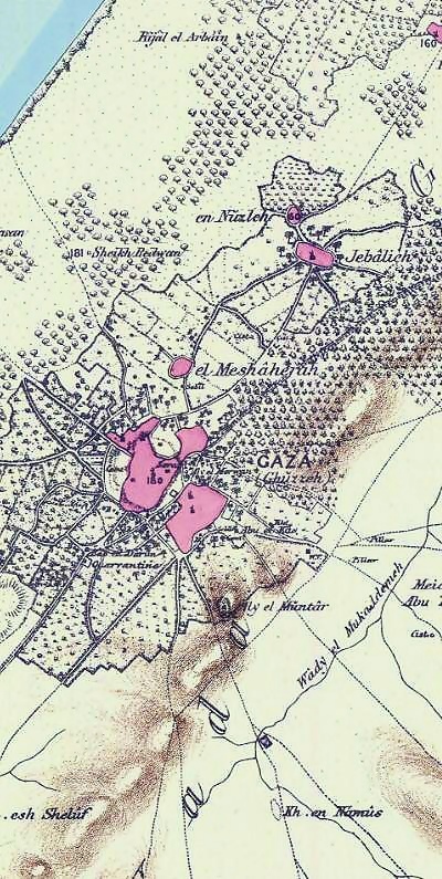
Part of map Sheet 19 of Survey of Western Palestine,
by Conder and Kitchener, 1872-1877.
(Published 1880, reprinted by LifeintheHolyLand.com)
-
World War I
During World War 1 the British Army fought together with the French against the Ottoman and German forces.
The first major battle was in the Suez canal (February 1915), where the British defeated the invading forces.
The British then pushed northwards to the Sinai desert, wining the Romani battle (August 1916) and the Raphia battle (January 1917). They attacked the Ottoman and German armies in Gaza in two failed attempts (March and April 1917). After General Allenby takes command of the British Army, they managed to capture Gaza and Beersheba (October 1917). The British managed to conquer the Land and reach Damascus within another year.
Gaza is ruined during this campaign, and thousands of British soldiers were buried in the cemeteries of Gaza, Dir el-Balah and Beersheba.
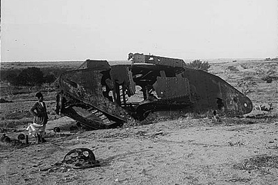
Disabled tank in Gaza, 1917
(American Colony photos, Library of Congress)
- Modern period
During the Israeli Independence war (1948), Gaza was captured by the Egyptian army, who held it until 1967. For a brief time the Israeli Defense Forces (IDF) captured the city in the Sinai war of 1956, and again following the six day war (1967). After the Israeli disengagement of 2005, the Israeli settlements in the Gaza strip were dismantled, and the IDF forces left the Gaza strip. Hamas, a Sunni Islamist political and military organization , seized control in 2007. Since then Gaza engaged in several wars with Israel (2008/2009, 2014), followed by a large scale war in 2023.
The Gaza strip is an autonomous Palestinian region which borders with Egypt and Israel. It is narrow (6-12 Km, 3.7-7.5 miles wide), and 41 Km (25 miles) long. With 1.7 million people and growing, the strip is one of the most crowded areas in the World. Gaza is the main city, located in the northern part of the Gaza strip. There are other large cities in the strip: Rafah (Raphia), Khan Yunis, Dayr al Balah. The area is not accessible for visitors from Israel, and the traffic from Egypt is also limited. The ancient wonders of Gaza, once one of the most important cities in the Levant, are mostly damaged and gone, affected by the modern construction, years of neglect, and military operations in this area.
Photos:
As we have no access to the ancient sites of Gaza, and most of these places are lost to modern construction, this section includes information of the PEF report, followed with old photos.
(a) Gaza – main city
The PEF report of 1875 describes the topography of Gaza in Volume III (pp 234-235):
“Ghuzzeh (GAZA) – The capital of the district ; is a town principally of mud houses, but with mosques and other buildings well built of stone. It stands on an isolated hill in the plain, rising 180 feet above the sea, and some 100 feet above the surrounding flat ground. The place is divided into four Haret, or quarters, occupying about 3/4 mile either way.
- Haret ed Deraj [=the quarter of the steps], on the west, occupies the west slope and the top of the hill;
- Haret et Tufenis [=the prison quarter] on the flat ground to the north;
- Haret es Sejjiyeh [=quarter of flat roofed clay-plastered houses], on the east, is also on the lower ground, and built of mud ;
- Haret ez Zeitun [=quarter of the olive trees],on the south, extends down the sides of the mound.
There are two principal mosques, besides others smaller. The one on the hill in the middle of the town (Jamid el Kebir) is an ancient church rebuilt as a mosque. The second, which is newer, is composed of much ancient material. Five minarets rise over the town, including that of ‘Aly el Merwan in the eastern quarter the traditional tomb of Samson, and that of Sidna Hashem (the father of the Prophet), who is buried on the north-west side of the town, near the brow of the hill. The Serai, or Court-house, is north-east of the great mosque. West of the town is the little sacred place of Sheikh Shaban, and on the north beyond the houses is Sheikh Nabak”.
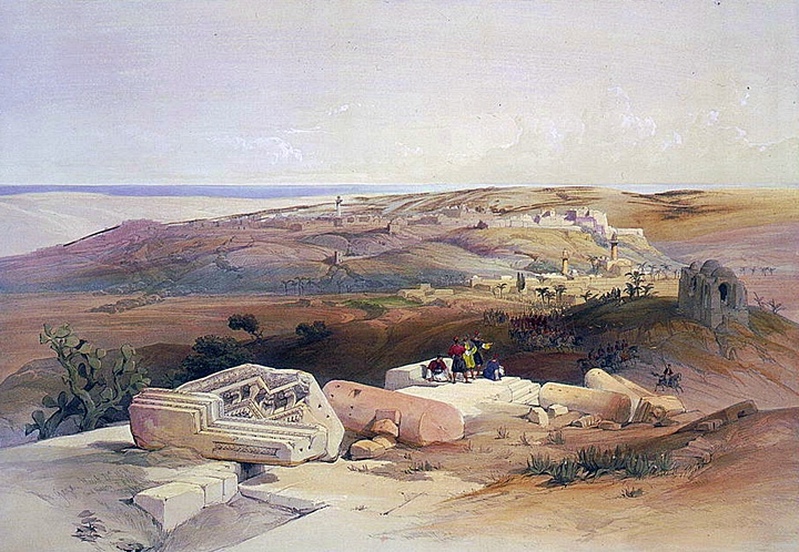
Painting by David Roberts, 1839
The PEF report continues:
“There is a Greek church in the town, west of the great mosque. The water supply is from good wells of sweet water in the town and in the surrounding gardens. The names of 15 of these wells (all marked on the Plan as B) were collected, but are unimportant.
Fine gardens surround Gaza, stretching 4 miles north and south, and east and west. There are many palms in these, and fine olive-groves exist beyond them on the west and north. The avenue of ancient trees along the north road, stretching for 4 miles, is the most remarkable characteristic of the town”.
“There is a cemetery east, and another west, of the hill. On the south is the quarantine building in the gardens. There is a bazaar in the town, and soap is manufactured, as well as a peculiar black pottery. The potteries are west of the town. Cotton is sometimes grown, and dates, figs, olives, lentils, apricots and mulberries, melons and cucumbers, are grown in the gardens.
The town has the reputation of being very healthy, probably from its dry and elevated position. The population is said to be at the present day 18,000 souls, of whom some 200 are Greek Orthodox Christians”.
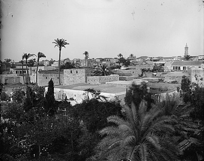
View of Gaza, 1898
(American Colony or Matson photo service, Library of Congress)
“The Samaritans had a synagogue in Gaza about a century ago. The remains of the ancient walls seem to be represented by the great mounds on the hill, visible on the east and south beyond the houses. The houses on the hill are the best built, being of stone, and many ancient fragments are here used up in the walls”.
-
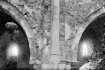
Great Mosque
The PEF report of 1875 description of the great mosque is as follows:
“The mosque is a church to which an extra aisle has been added by the Moslems on the south. The whole of the building in its original form seems attributable to the twelfth century. Only four bays are now to be seen, the apses having been destroyed or hidden behind a modern wall, on which stands the minaret”.
“The total length was 108 feet 6 inches to the modern east wall, internal measure. The nave is 21 feet 6 inches wide in the clear, the aisles 13 feet. The true bearing of the length is 109°. The south wall has been destroyed, and rude piers built instead ; while south of them is a modern wall, which is not parallel to the axis of the building. The style of architecture is severe, and the ornamentation very plain. The piers are 5 feet 6 inches by 6 feet 6 inches, with four attached semi-columns (1 foot 6 inches diameter) to each pier. The nave has a clerestory, and a second order of pillars stand on the cornice, which runs round the piers above the capitals of the lower order of pillars. The details of cornice and capitals are seen in the photograph. These upper pillars are almost of equal diameter with the lower, and have a heavy appearance. All the pillars and cornices are well cut in hard dark grey marble, and the diagonal dressing is marked on the base blocks. The spaces of the various bays are irregular, the span varying about a foot. The roof is entire with groined vaulting. The windows and arches have a point, but are broad in proportion to the rise of the arch”.
Great Mosque, 1917, Library of Congress – American Colony collection
They also described the Jewish stone in the mosque:
“On one of the upper order of pillars on the south side of the nave on the pier nearest the east end of the church is a curious design, representing the seven-branched candlestick inside a wreath, with a winged tablet beneath having on it a Greek inscription”.
Pillar in great mosque with seven-branched candlestick, 1898
“The west door of this church is a beautiful specimen of the Italian Gothic of the twelfth century churches in Palestine, with delicate-clustered shafts and pillars, with deeply undercut lily-leaves to the capital. The Mihrab is at the east end of the modern additional aisle, but so skewed as to point towards Mecca.
This church was dedicated to St. John the Baptist. Over the door of the court of the mosque is an inscription, including the name of Kalawun, and the date 707 A.H. Over the small Mihrab on the interior is a later inscription, with the name of Musa Pasha, and the date of the month Rejeb, with the year 1074 A.H.. The Greek Church in Gaza has in the interior two Byzantine columns, which appear to be old. The Khuri said it was fourteen centuries old, and built by a Byzantine emperor. Ancient registers belonging to this church are said to exist in Jerusalem, and one 1,000 years old in the church itself”.
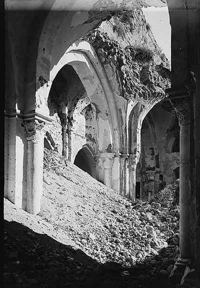
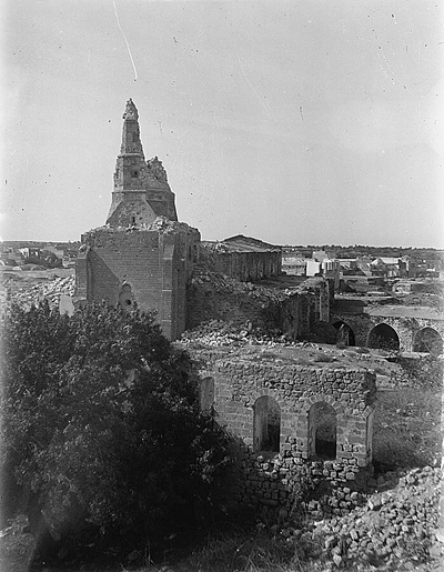
Ruined great mosque, 1900
“The tomb of Samson (‘Aly Merwan [=name of the 8th Omayyad Caliph] ) was visited, but the building and masonry cenotaph within appear to be modern.
At the Bab ed Darun [=the gate of the south] , near the quarantine, is a Moslem graveyard, with seven marble shafts of pillars. One of these has an Arabic inscription on it 700 years old. Others have been cut flat on one side, and inscriptions put on them. The ancient city is said by the natives to have extended even further, and to have included ‘Aly el Muntar.
The Meidan ez Zeid [= the open place of Abu Zeid] is a flat plot of ground, the angles of which are marked by four pillar-shafts. These marked out a race-course made by the Saracens some 700 years ago; two of the shafts are 2,000 yards, apart east and west. One of these pillars, that at the south-west corner, is inscribed. The pillar is of grey granite, 18 inches diameter. The height of the inscription is 20 inches, the breadth on the circumference of the pillar is 1 7 inches. This also appears to be a mortuary inscription. It is deeply but rudely cut, and evidently refers to a previous use of the pillar, probably as a grave headstone”.
Other photos of Gaza from the Library of Congress collection:
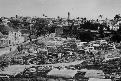
Gaza, 1950
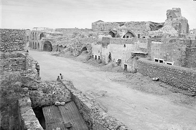
Gaza ruins 1898 (American Colony or Matson photo service, Library of Congress)
(b) Gaza Yam – port city
Gaza is built inland, on a hill far from the sea, situated along the Via Maris road. The ancient port city of Gaza is located on the shore, north of the modern harbor. This port city was called Maiumas, or Azza-Yam (Gaza Maritime in Hebrew).
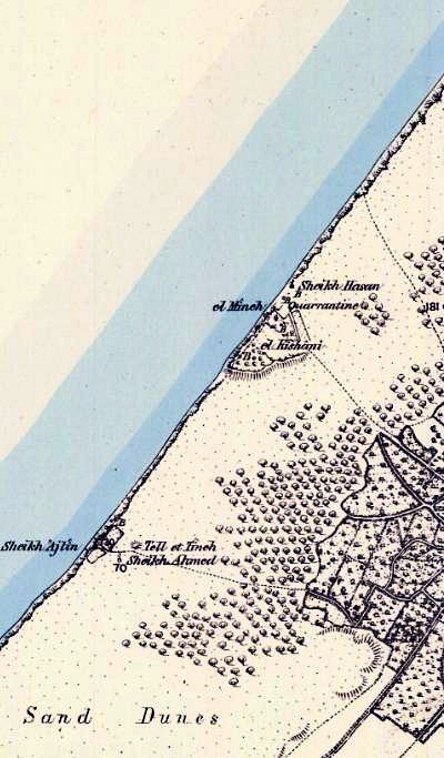
The 1875 PEF report identifies the port city (SWP Vol 3, Sheet XiX, p 236):
“Gaza had a port called Majuma, which Julian the Apostate named Limena of Gaza. This is probably the landing-place called el Mineh. There was here a separate town, which became a bishopric in the Byzantine period, and the ruins of el Kishani near the landing-place are no doubt those of Majuma Gazae”.
The port city is briefly described in the PEF report as follows as El Kishani, meaning in Arabic “the place of the Persian ceramics”. The shore front is named El Mineh – meaning in Arabic: “the Harbour” (see map) in Sheet XIX p 251:
“El Kishani.
The gardens are surrounded by a bank, and there are several wells. It seems probable that ruins of a walled town may here be covered by the sand. Marble slabs and other fragments are dug up here by the peasantry”.
Part of map Sheet 19 of Survey of Western Palestine,
by Conder and Kitchener, 1872-1877.
(Published 1880, reprinted by LifeintheHolyLand.com)
In 1965 the site was discovered by chance during ground work for a new Casino. The port city may have been walled, although its walls were not traced.
Remains of a synagogue were found during these excavations. This synagogue was built in 508 A.D.
-
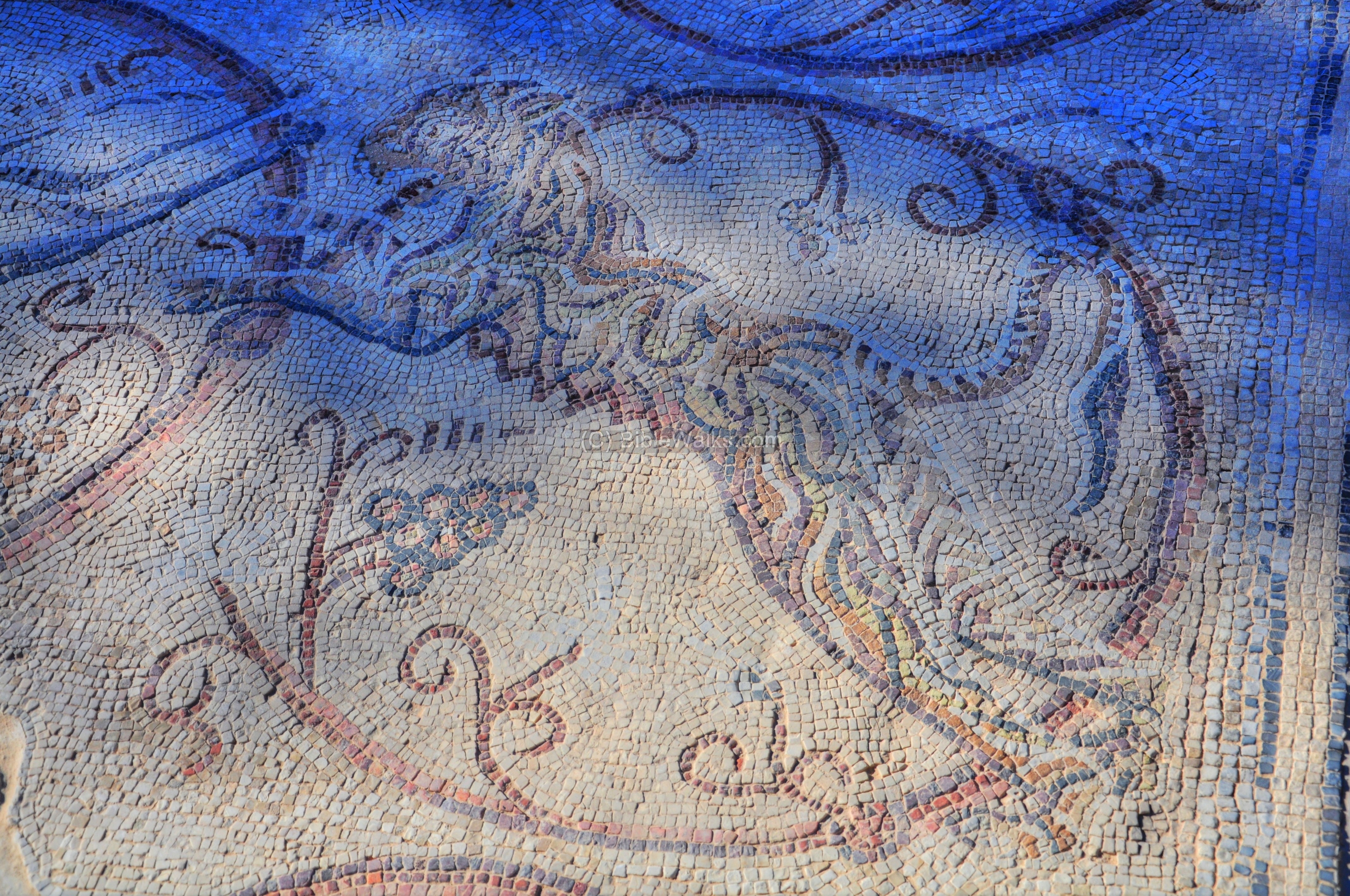
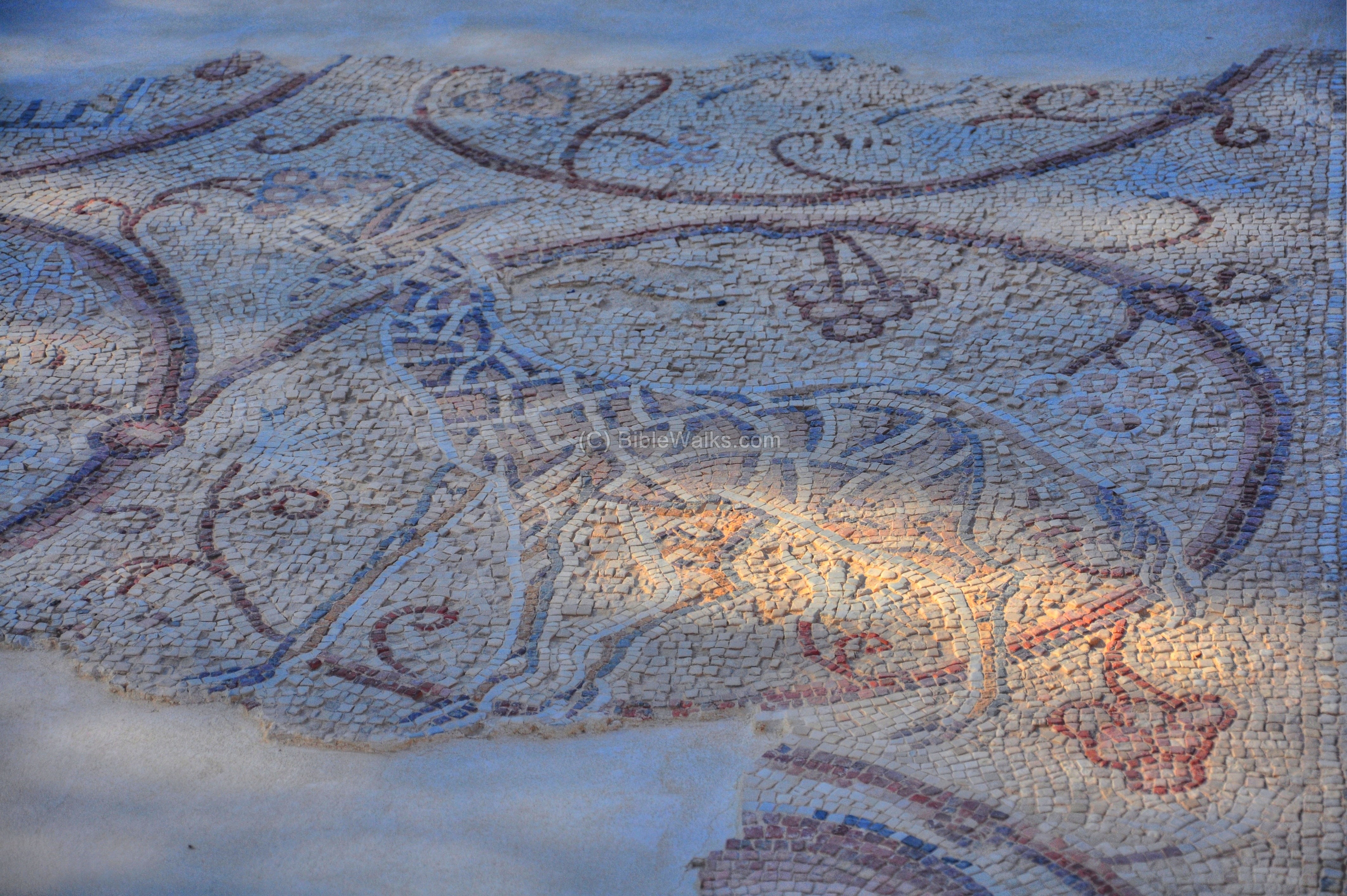
Mosaics:
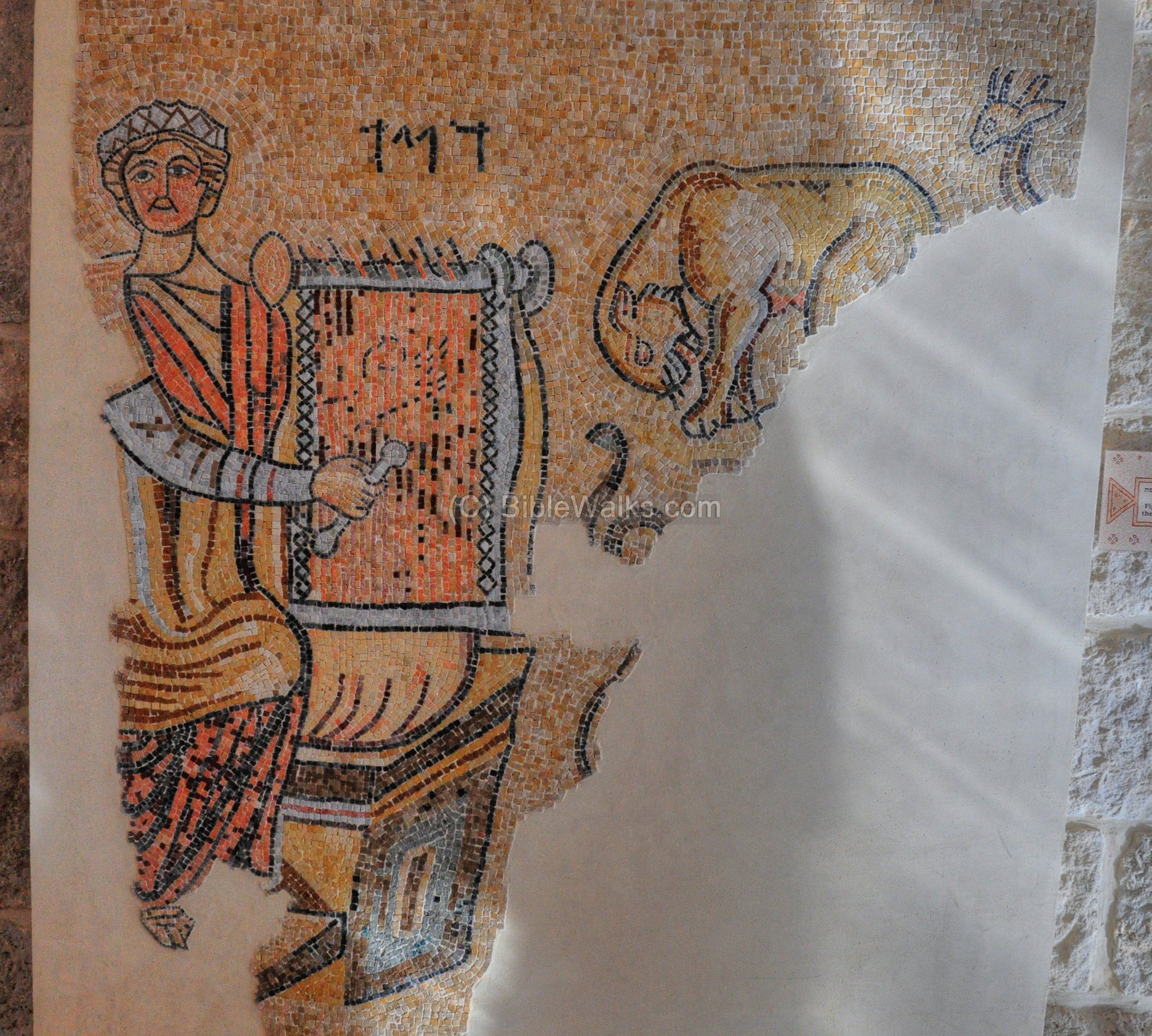
The excavations unearthed several sections of the mosaic floor of the synagogue. The most famous is a figure of David playing the harp, with the Hebrew words “David”:
Click on the photos to view in higher resolution…
These mosaic floors can be seen in the archaeological museum, which is located in the ancient Good Samaritan Inn. It focuses on Mosaic floors collected from ruins across the West Bank and Gaza. This unique collection allows the public to view the results of the archaeological excavations in areas where there are travel limitations due to security.
Another section of the floor from the Synagogue illustrates a tiger:
Another icon on the Gaza floor shows a Giraffe:
Etymology (behind the name):
* Names of Gaza:
- Azza – the Hebrew Biblical name, probably derived from the word Az – strong, based on its strong defense walls.
- Gaza – The Greek name of Azza. Based on the word “treasure”.
- A’zzah – Arabic name of the city
* Names of the port of Gaza –
- Anthedon – The ancient Persian name
- Maiumas – Greek name
- Azza Yam – Modern Hebrew: Azza Maritime.
Links and References:
* External links:
-
Old photos of Gaza – Library of Congress collection
- Christian Gaza In Late Antiquity
-
Abba Isaiah (pdf) – Abba Isaiah (Isaias the Egyptian), settled in Gaza in the 430s
-
The Jewish communities in Gaza throughout the years
* Nearby Sites:
- Tel Gamma – Canaanite and Philistine city (Yurza?), 10km south of Gaza, along the Besor river
- Tel Sharuhen – Canaanite city, 24km south of Gaza, along the Besor river
* Internal links:
BibleWalks.com – Search for the lost cities of the Bible
Yavne Yam <—previous Shefela site—<<<All Sites>>>— Next Shefela site —>>> Ashkelon
This page was last updated on Oct 17, 2023 (add links)
Sponsored links: