On Tel Issachar are ruins of an ancient Canaanite and Israelite city, located on a mound on the north bank of Issachar stream.
Home > Sites > Jordan Valley> North > Tel Issachar (Tell Esh-Sheh)
Contents:
Overview
Aerial Map
History
Photos
* Aerial views
* The mound
* Round pits
* Ceramics
* Issachar Brook
* Railway
* Roman Road
* Hiking trail
* Survey video
Biblical
Links
Etymology
Background:
On Tel Issachar are ruins of an ancient Canaanite and Israelite city, located on a mound on the north bank of the valley of Issachar stream (Wady Esh-Sheh), 6km north east of Beit Shean. It is also known as Tell Esh-Sheh (Arabic: “the mound of the nest”) and by the name Tell Zeba (Zeba is a girl name meaning in Arabic graceful).
The city was one of the Biblical places of the tribe of Issachar.
Location:
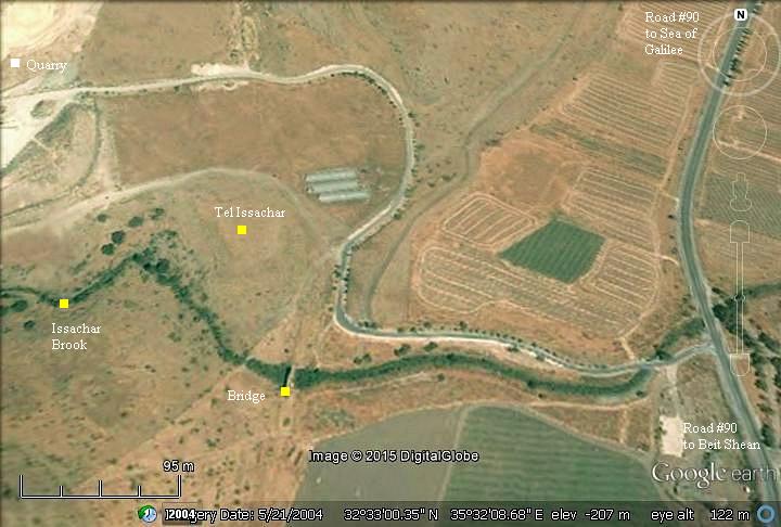
The site is located to the west of road #90, about 6km north of Beit Shean. Follow the sign of Doshen farm and drive along the road to the quarry.
The summit of Tel Issachar is located at the height of -196 under sea level, 5-7m above the north side and 10-12m above the Issachar brook on its south side.
History:
-
Biblical periods – Early Canaanite to Israelite periods (3150 BC- 586 BC)
On Tel Issachar was an ancient city, inhabited from the Early Bronze (Cannanite) to the Iron (Israelite) period.
The survey of the Beit Shean valley (by N. Zori) collected at the site and dated the following ceramic pieces: hole-mouth jars dated to Early Canaanite period, vessels dated to the Middle Canaanite period II, few ceramics decorated with red stripes of the Late Canaanite period (or Israelite I period), cooking pots dated to the Israelite I period and the Israelite period II. [Thanks to A. Levy and Y. Sygmand for their assistance]
This ancient city, marked by a red square in the map below, was located close to the major city of Beth Shean. It was probably one of the towns linked to Beit Shean, as described in the Bible (Judges 1:27): “….the inhabitants of Bethshean and her towns”.
The cities and roads during the ancient periods, up to the Roman period, are indicated on the Biblical Map below. The site is on the path of a major south/north ancient road along the Jordan valley, depicted here as a grey dashed line (Dorsey’s Bronze/Iron age route ‘A3’). It is not far from the Jordan river, illustrated as a blue line, where a river crossing (Mak.t Umm el Karanis) crossed the ford to the eastern side of the river. It is also on the bottom of a descent from a cross road from the west (Dorsey’s route ‘T6’) , connecting Na’ura thru the Bronze/Iron age settlements of Yubla and esh Sheikha.
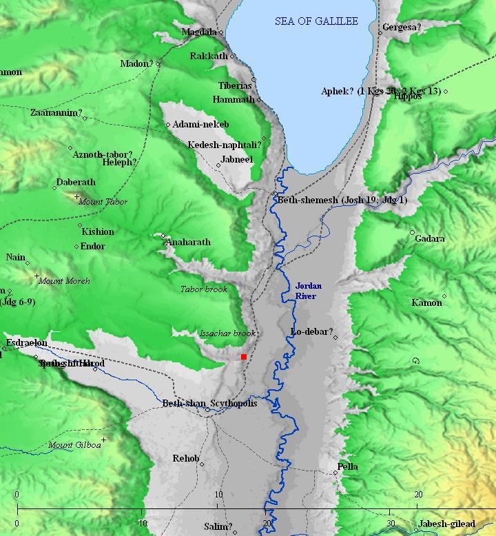
Map of the area around Tel Issachar -from the Canaanite/ Israelite periods to the Roman period (based on Bible Mapper 3.0)
The area of the Jordan valley was fertile and populated during the early periods. About 2.5km to the east of Tel Issachar is another ancient site named Tell Ishmael (Tell Isma’eil). It has twin mounds, one with remains dated to the Roman/Byzantine period, and the lower one has ceramic remains from the Chalcolithic, Early Bronze, Israelite, Byzantine and Early Arab periods.
-
Later periods (586 BC – 1099 AD)
The survey identified ceramics of later periods, including Persian-period bowls, some ceramics from the Byzantine period, and glazed ceramics from the Early Arab period.
A major Roman road passed on the east side. Many milestones of this imperial road were found around Beit Yosef, the nearby community.
A detail of the Peutinger map (Peutingeriana tabula), based on a 4th century map of Imperial Roman roads, is here on the right. It is oriented with the top side as the west. The map shows the major military roads between Jericho (on the middle left, named here by its Roman name – “Herichonte”), though Beit Shean (“Scytopoli”) to Tiberias ( “Tyberias”) above the icon of the Sea of Galilee. The distances are marked with Latin numbers, being XXIII (which means 23 Roman miles, or 35KM, between Beit Shean and Tiberias).
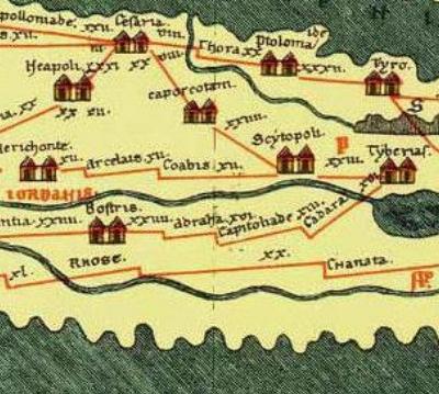
Section of the 4th Century Peutinger Map, focusing on the Jericho-Beit Shean-Tiberias road
-
Ottoman Period – (1516-1918 A.D.)
During the late Ottoman period a small village was located on the hill south of Tel Issachar.
The area was examined in the Palestine Exploration Foundation (PEF) survey (1866-1877) by Wilson, Conder and Kitchener. The map is a section of sheet 9 of their survey results. Wady el Esh-Sheh is the Arabic name of Issachar brook, but has other names in its upper section (Wady Yebla, Wady Dabu).
The map included an adjacent site south of the mound, just above the height “-675” (Volume 2, p. 121):
“Kh. el Esh-sheh – Foundations of buildings, apparently modern”.
The translation of the Arabic name of Wady el Esh-Sheh is: “The valley of the nest”.
Part of map sheet 9 of Survey of Western Palestine,
by Conder and Kitchener, 1872-1877.
(Published 1880, reprinted by LifeintheHolyLand.com)
The map also shows a double-dashed road that passed east of the mound, marked as a Roman road. Its route follows the same route as the modern road #90 (Israel’s main and longest North-South highway).
-
Ottoman Hejaz Railway
The Ottomans built a section of the Hejaz (Hijaz) railway from Haifa to Damascus, Syria, more than 100 years ago (in 1905). This railway linked the city and harbor of Haifa to Turkey and Medina (Arabia) until the Independence of Israel in 1948. Since then, it was dismantled and only few of the original rail sections could be seen.
The Ottoman railway, now dismantled, passed on its east side.
-
Modern period
The nearby Moshav Beit Yosef was established in 1937.
The area of Tel Issachar is open to the public and easily accessible.
In 2022 a new memorial hiking trail was laid between the site and late Meir Har-Zion’s estate.
Photos:
(a) Aerial views:
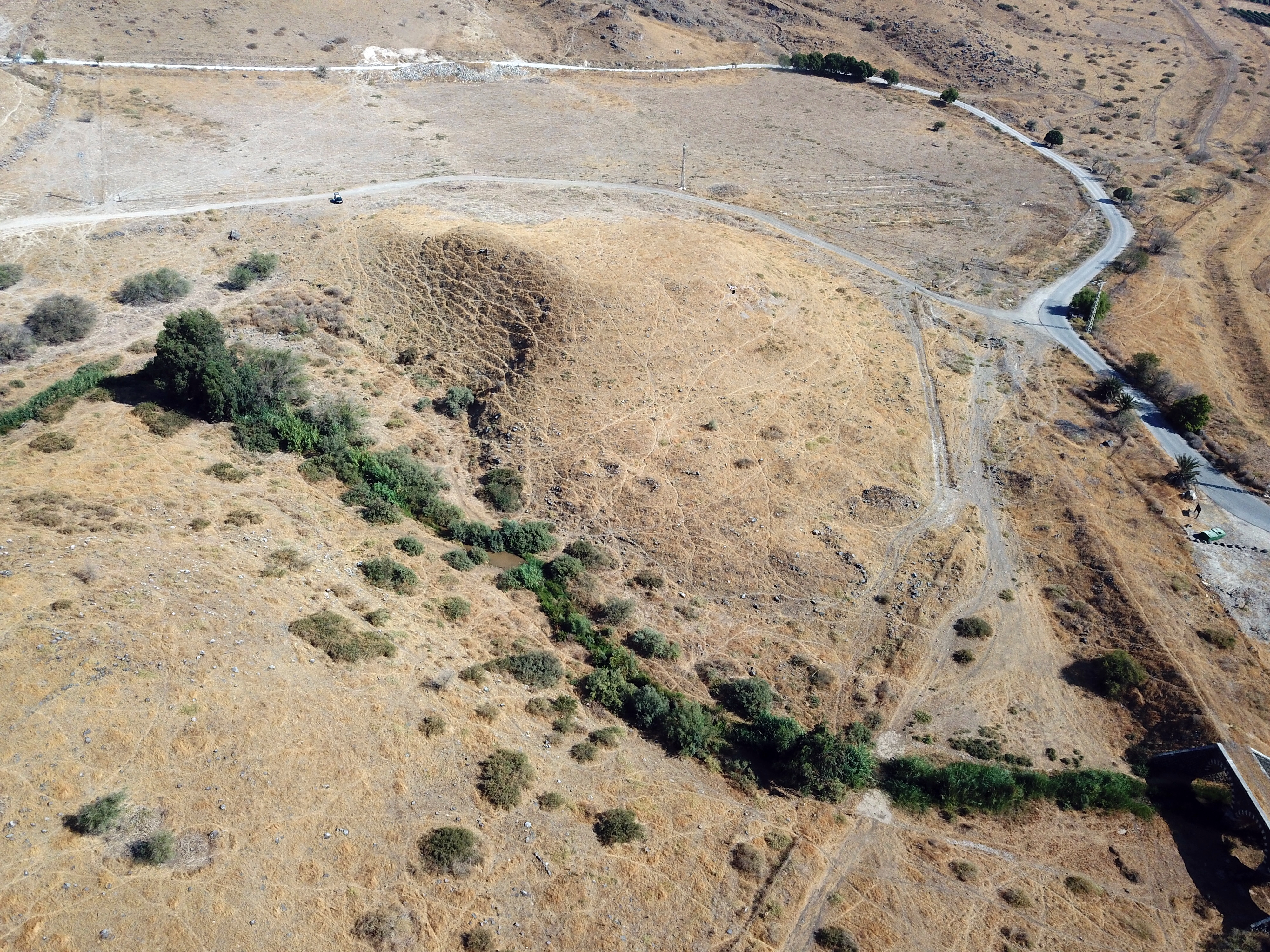
This aerial view above the site was captured by a quadcopter drone on Sep 2022, with a view towards the north. Issachar brook, with some water streaming on the south foothills of the Tel, is seen on the left bottom edge.
Click on the photos to view in higher resolution…
A closer view of the summit is on the next photo, also oriented to the north. The hill is relatively small (35 x 70m) and it is hard to regard it as a ‘city’, but in the ancient periods the Tel served as the “upper city”, where most of the residents lived in mud brick houses around the central area. After thousands of years, only the nucleus remained visible.
Another view from the north side is next.
On the left (east) side of the hill is a bridge of the old Ottoman period railway.
![]() A flight over the site can be seen in the following Youtube video.
A flight over the site can be seen in the following Youtube video.
(b) The site:
The round mound of Tel Issachar is located on the north bank of Issachar brook, which flows from the plains to the west (left) into the Jordan river on the east (right). This picture is a view to the north, taken from the opposite hill. On this side of the stream are remains of another ruin – Khirbet Qitta (Kitta).
A chalk quarry is located not far from the site, seen in the left background. It quarries chalk from a layer of marlstone dated to the Pliocene period (5.333 million to 2.58 million years before present).
The next photo shows a closer view of the foothill of Tel Issachar, as seen from the west side.
The slopes around the hill are steep, especially above the south side above the valley of the stream.
The summit is mostly flat without visible structures. There are a few make-shift tombs, probably Bedouins who bury there dead on high places.
The city was protected by mud bricks laid over a basalt stone foundation. Remains of some of the mud bricks is shown here. Most of the bricks have since crumbled into dust, but some parts are still found along the slopes. (See also a video of a sun dried mudbrick that was found on the site).
(c) Round pits
On our survey at the beginning of the year 2025 we noticed an important finding. On the south east side are a number of round pits that are built in the ground, with stones lined around the walls. The following aerial view focuses on the south east area above the stream.
The round pits are marked on the photo below in yellow. Some of them are hidden, covered by soil that fell off the hill, while others were probably damaged by a road and earthworks along the railway. so we can assume that there are a dozen or more of such underground chambers.
What was their purpose? Perhaps, used for storage of goods, grain silos, or water cisterns. Only a detailed archaeological dig could provide answers. Furthermore, these chambers are like the ones found on the summit of the Iron II period fortified site of Horvat Ziwan.
Here are some of these round pits:

Another one:
The round pits were built outside of the protected summit as in Horvat Ziwan. However, a wall was built on the lower side of the area and above the stream, as seen in the following photo.
(d) Ceramic survey
Ceramics collected on Tel Issachar on its foothills were dated by previous surveys to the Mid Bronze II, Late Bronze, Iron I, Iron II, Persian, Byzantine and Early Muslim.
The following are few samples of interesting findings found during our short survey across the site, which was lead by archaeologist Ayelet Goldberg-Keidar. The ceramics were collected at the side of animal digging. These were found in porcupine holes. The mammals dig into the ground, pulling out dirt and pottery fragments, making it easy to sift thru the soil and pick up the ceramics. All segments were left on the site.
First, a collection of items we saw:
Some of the findings are shown here from a closer view:
- Base of a vessel
2. Base of an Iron Age chalice (footed cup, goblet), painted with a geometric pattern.
This object (Hebrew: קובעת) was used in burial practices. It was found on the foothill, probably a place used for a burial.
A similar finding from Tel Sharuhen can be seen in the IAA archives.
(e) Issachar Brook:
The Issachar brook passes on the south side of the mound, flowing into the Jordan river. Its drainage basin is up on the plains of Issachar. Issachar is the modern Hebrew name. The brook is also known in Arabic as Wady el Esh-Sheh , and its upper sections have other names (Wady Yebla, Wady Dabu).
Hikers often walk through this valley up to the Crusader fortress of Kochav Hayarden (Kuwka Hawa).

Issachar brook has a steady flow throughout the year, although during the summer it almost dries out.
This photo was taken in the beginning of September 2022. We crossed here to explore the south side of the stream.
The next photo was taken at the last week of May 2015, when the temperatures reached 40 degrees Celsius. At this time the weed on the foothills already dried out in the past 2 months, although this winter’s rain was above average. The region of the Jordan valley, 200m under the sea level, is extremely hot and dry.
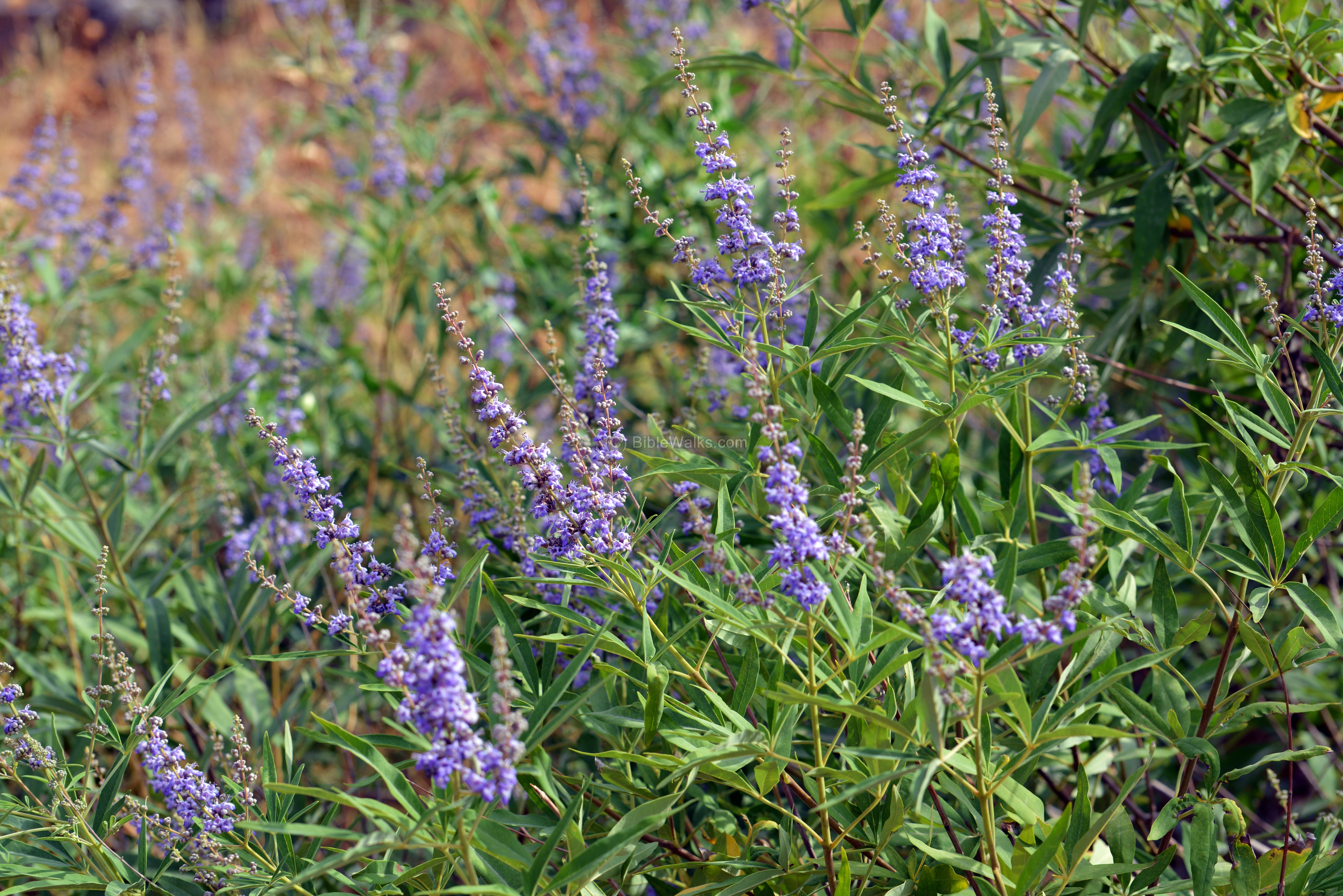
Along the brook are various types of wild plants. This bush, a native of the Mediterranean region, is called “Vitex Agnus-Castus”, commonly named Chastetree.
It is also named “Abraham’s bush”, as a tradition holds that this bush was the “thicket” that caught the ram that substituted the sacrifice of his son (Genesis 22 14): “And Abraham lifted up his eyes, and looked, and behold behind him a ram caught in a thicket by his horns: and Abraham went and took the ram, and offered him up for a burnt offering in the stead of his son”.
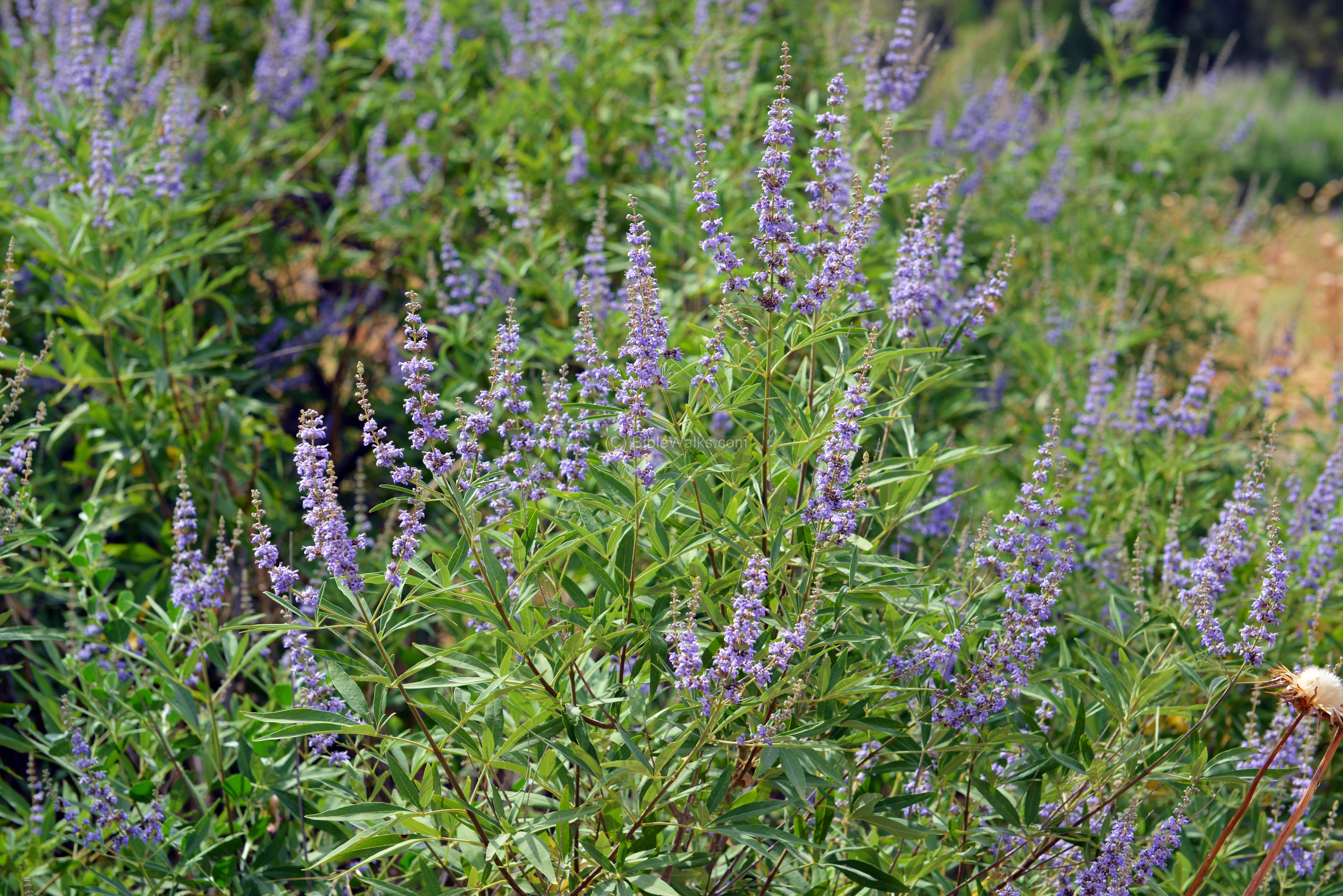
In alternative medicine, its berries and leaves are known as herbs for both male and female reproduction systems. It is also used as medication for certain diseases. This gave it an alternative name of “Abraham’s balm” (balm is a tree that yields a fragrant substance, which is also used as medicine).
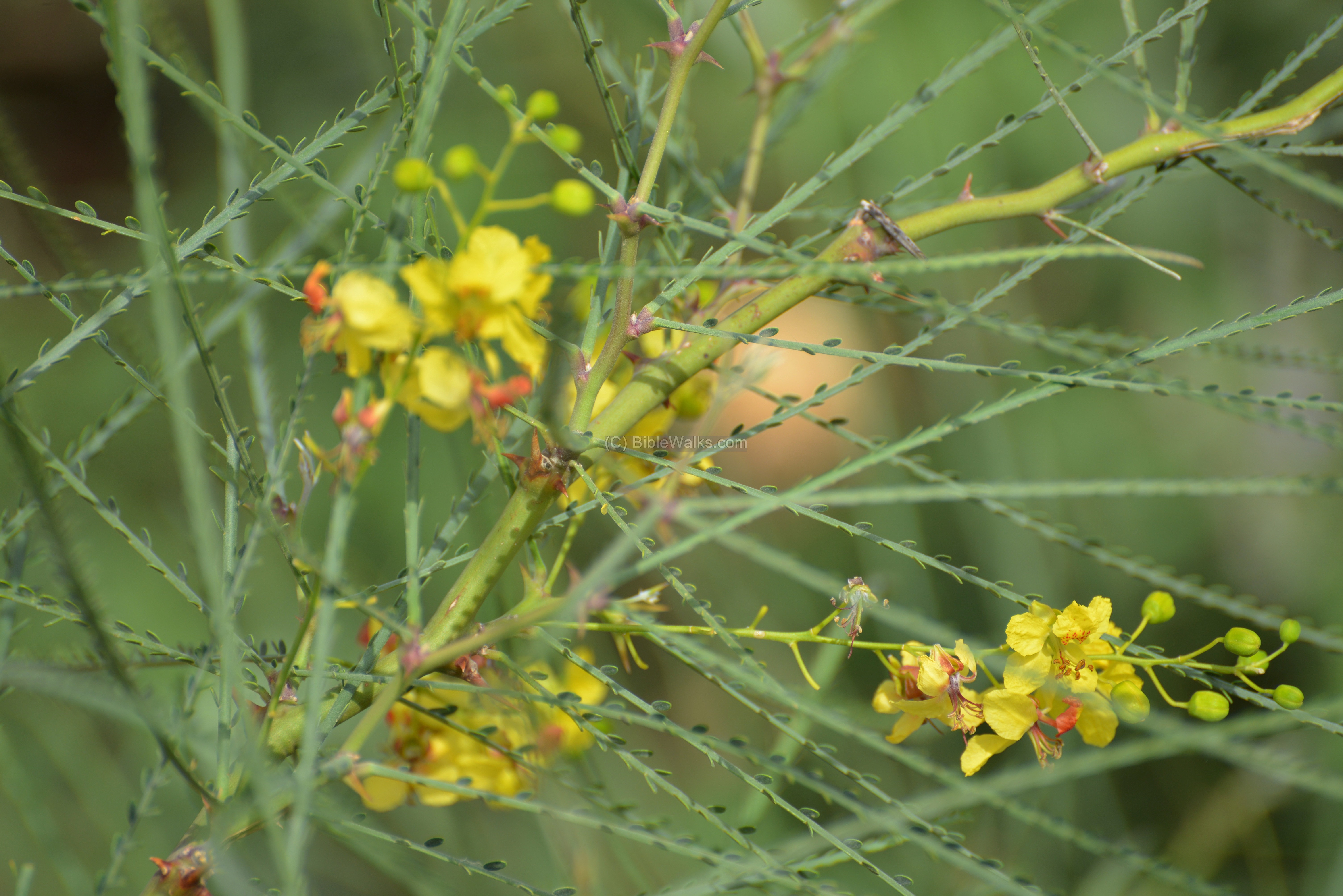
Other plants and flowers are seen here:
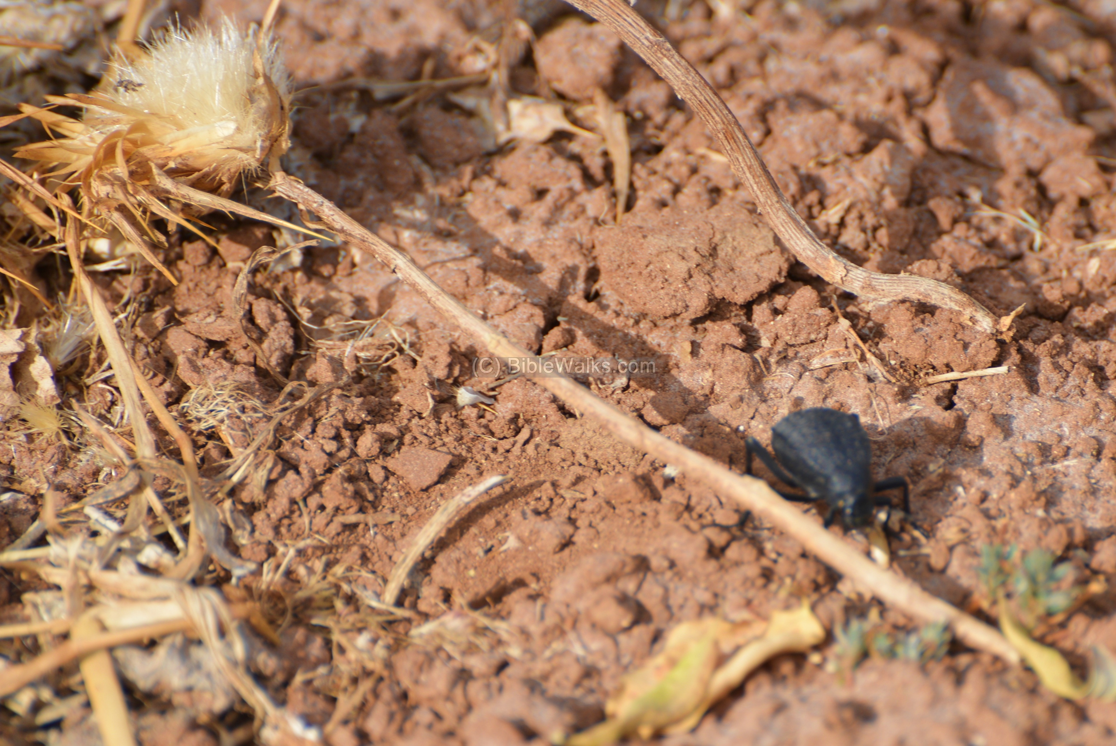
Turning to the insects world – a beetle walks along the dry soil.
In the air there are various types of birds, such as the buzzard bird of prey.
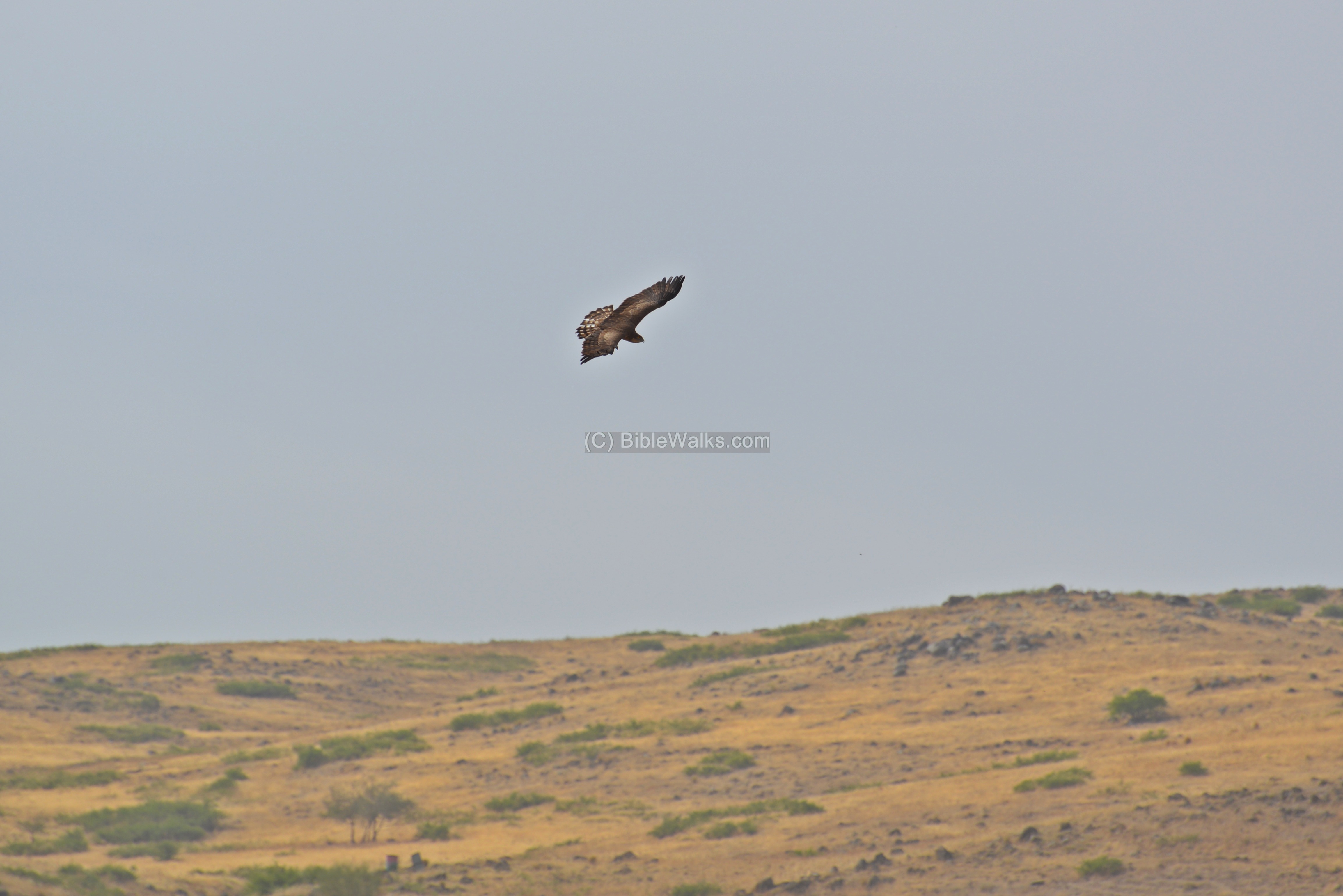
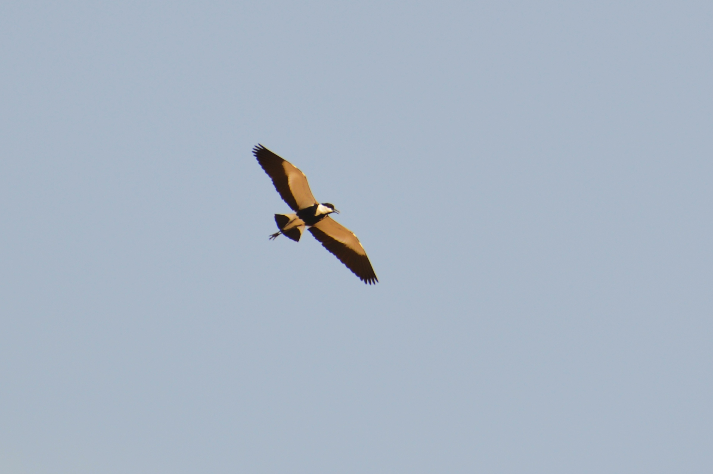
The following photo shows another bird circling the site. Please identify
In addition to these resident birds, the Jordan river witnesses a staggering number of 500 million birds who pass it twice a year, as Israel is a main migration corridor between Europe and Africa.
(f) Railway:
The old Ottoman railway passed on the east side of the site, connecting Damascus (north east) to Haifa (south west). On the north bound direction, it continued several kilometers to the north, where it crossed the Jordan river near Gesher.
This aerial view shows the Ottoman period bridge, crossing Issachar brook.
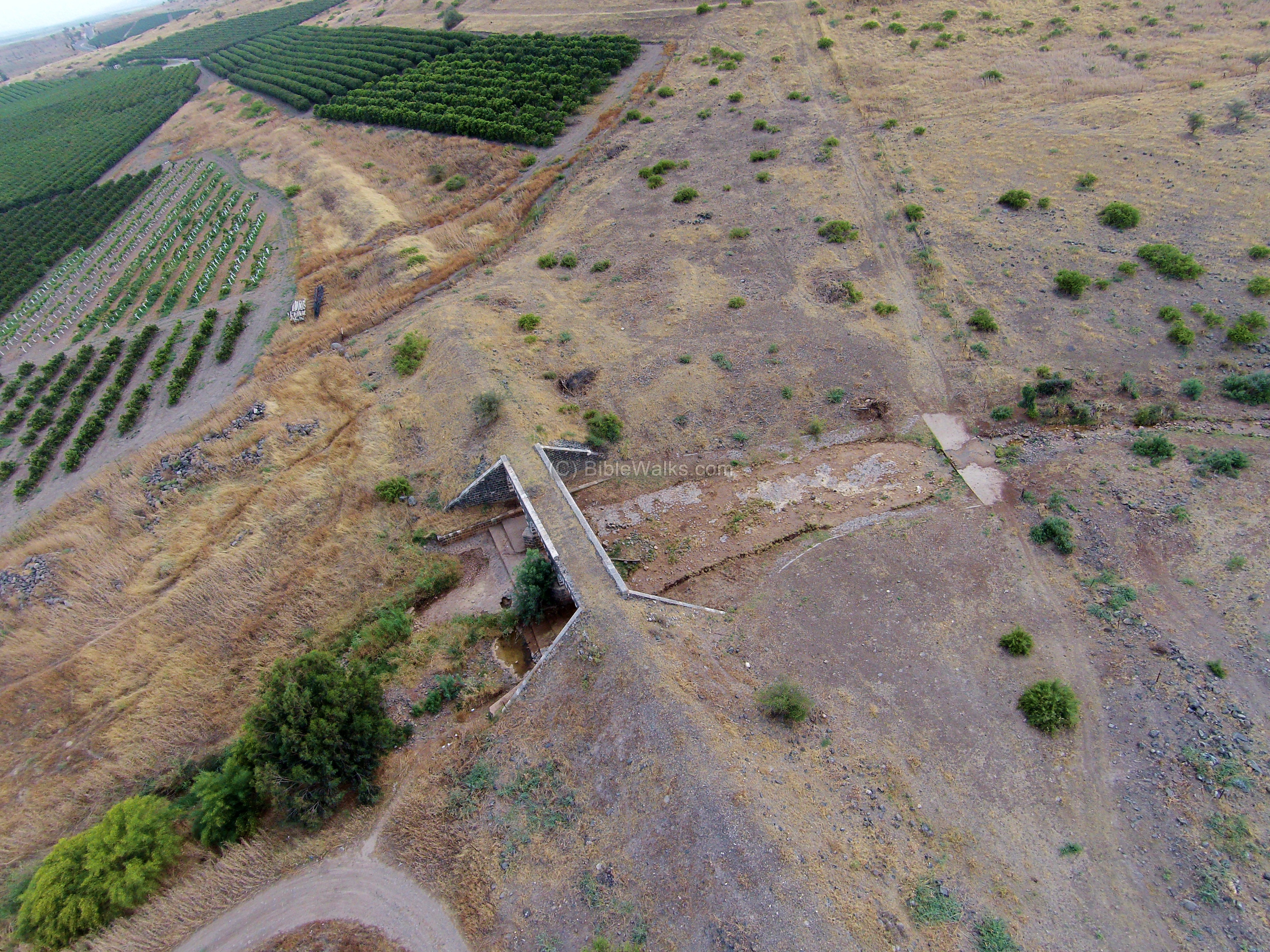
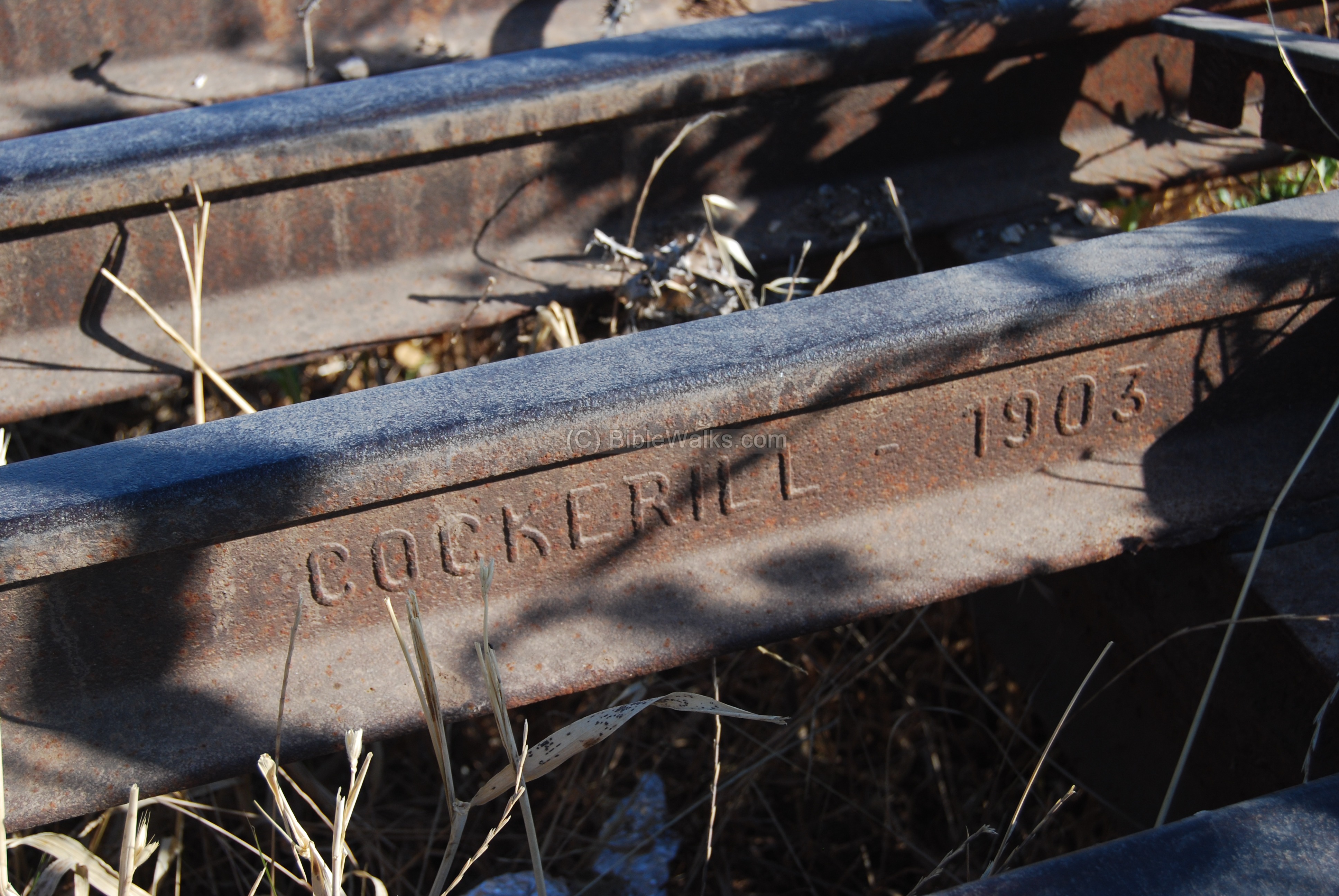
The bridge, based on these magnificent black basalt and white stone arches, was built in the years 1904-195.
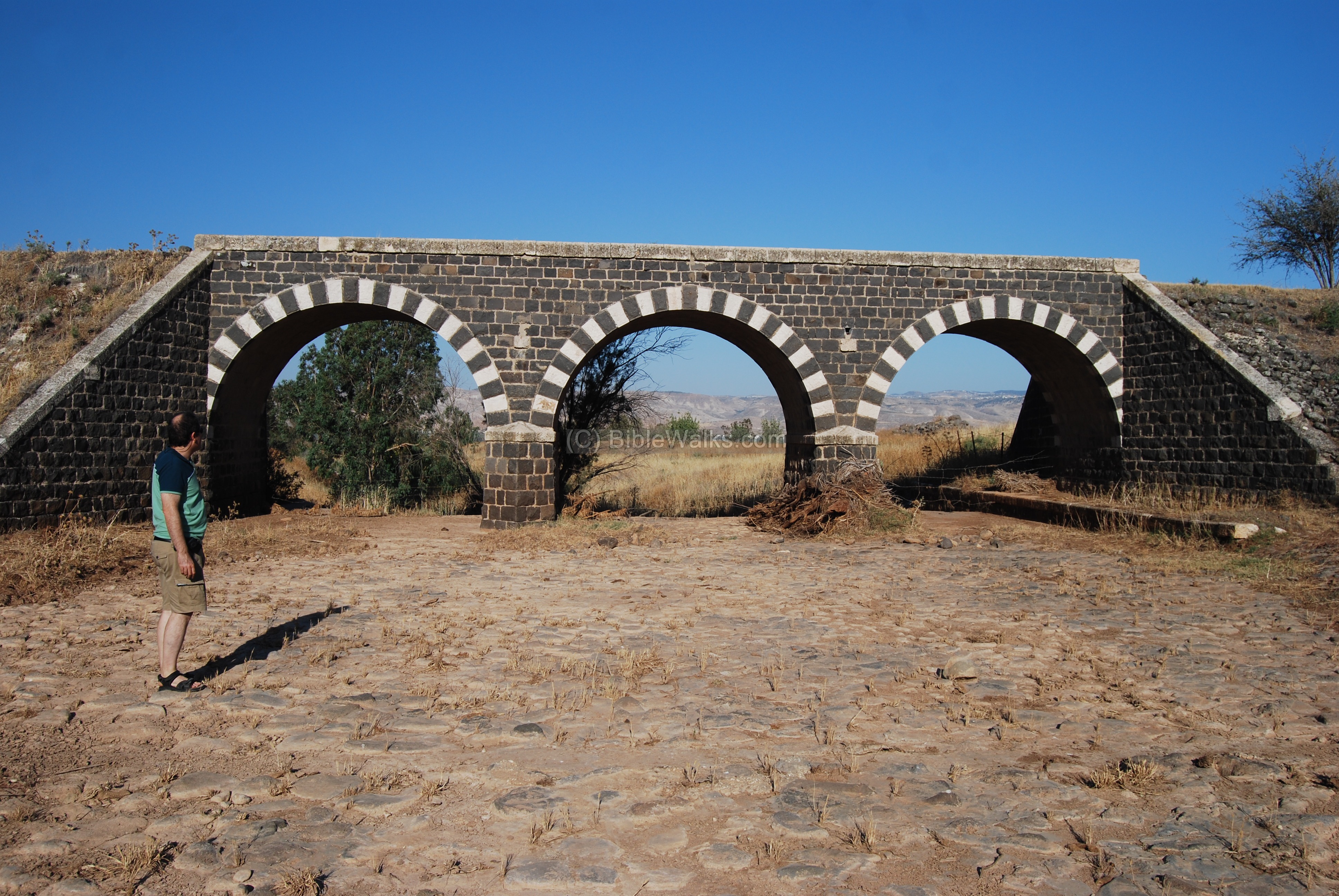
The rails are marked with the year “Cockerill 1903”, produced by the John Cockerill Company – a Belgian iron, steel and manufacturing company based in the area of Liege.
(g) Roman Road:
A major Roman road passed on the east side of the Tel. Many milestones of this imperial road were found around Beit Yosef, the nearby community. In front of one of the houses are two milestones, found by a local farmer in the 1980s.
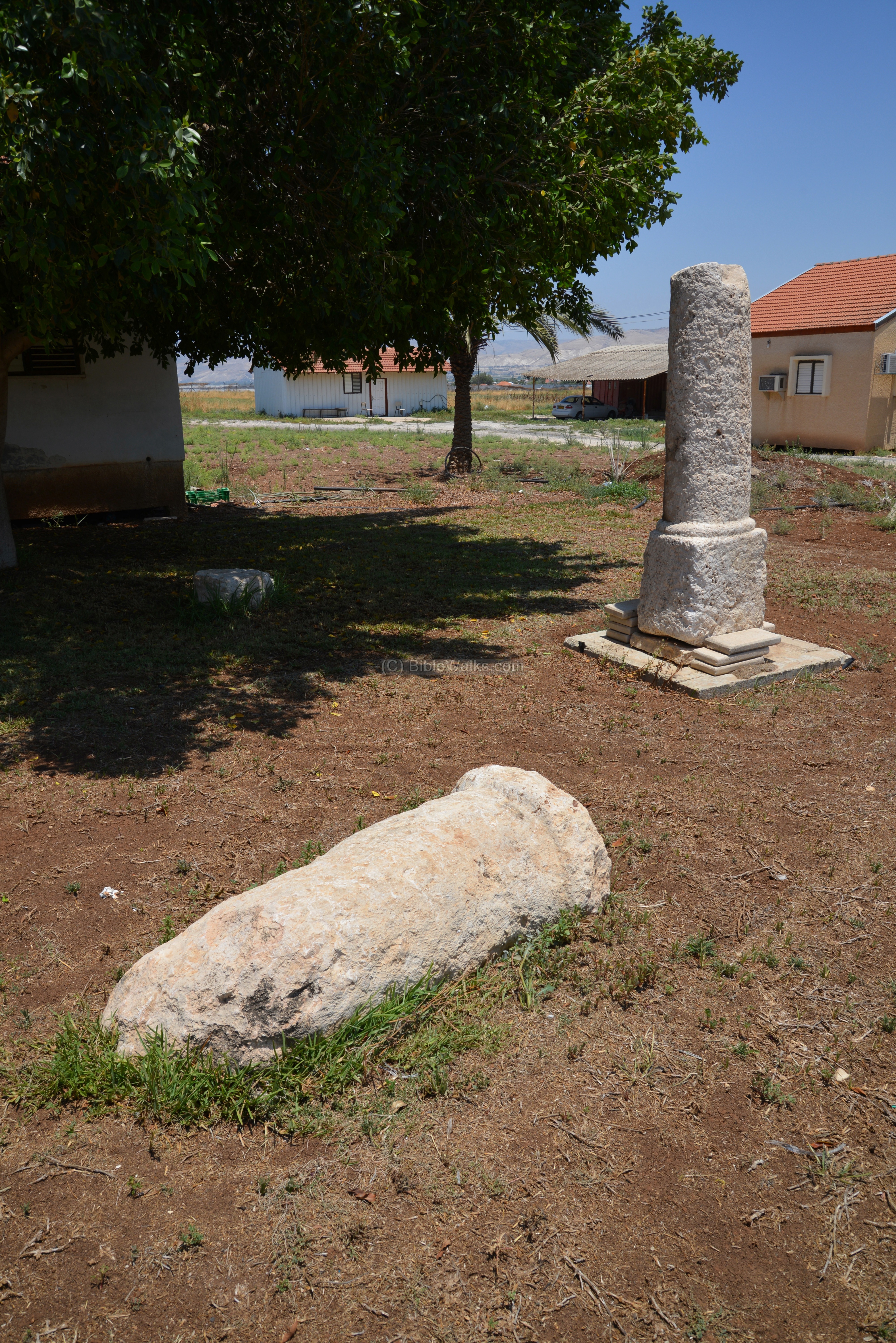
A closer detail of the beautiful standing milestone is in the following photo:
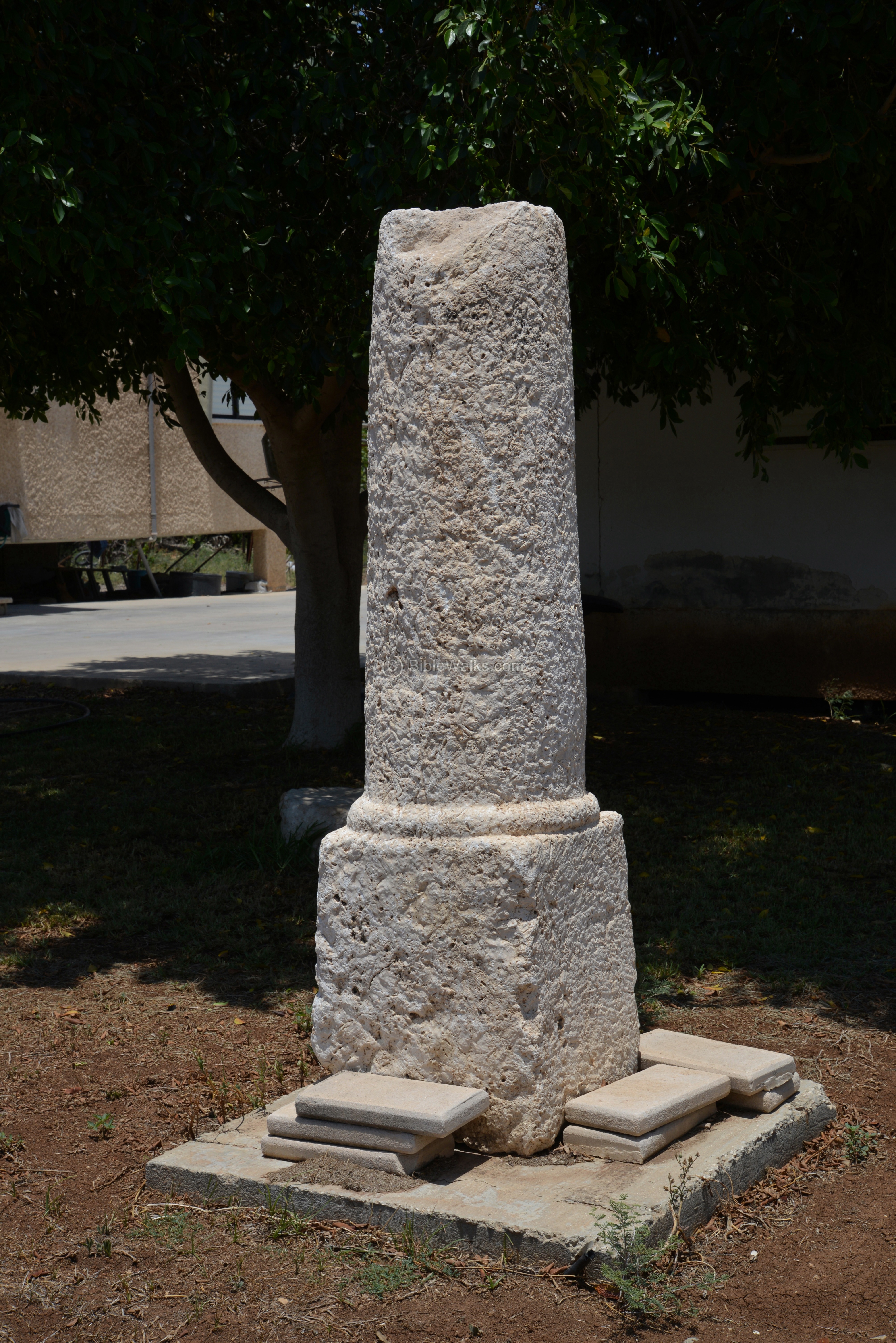
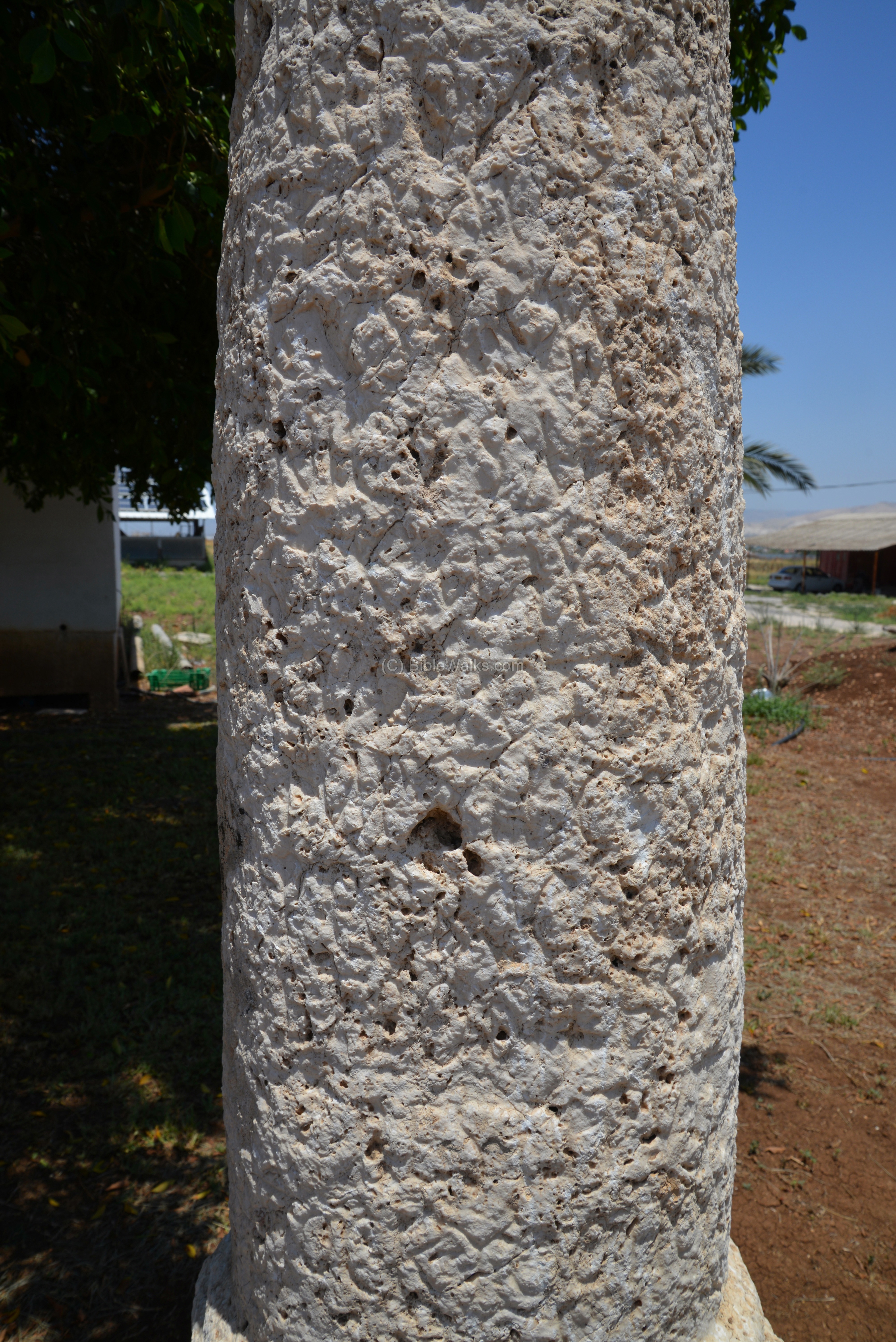
The inscription on the stone is hard to decipher, and only few letters are visible, as seen on the face of the stone below. In the archaeological survey of Israel, map 64 (“Bet Yosef”) site #2, the surveyors wrote:
“Five milestones were found c. 500 m southwest of Bet Yosef; however, inscriptions were preserved on only some of them. The following is one of the inscriptions:”
IMP
—CAESAR
—PARTH
—NERV
—ADRIA
MΛΙ
XIII
In another site (#11), they found more milestones:
“Six milestones were discovered 1 km south of Bet Yosef, but they are embedded in the ground, and therefore the dates of them cannot be determined”.
Yet in another nearby site (#10), more milestones were found. Their report:
“Five to six milestones, probably from the Roman road that led from Scythopolis to Gedara and Tiberias, were found 1 km southeast of Tel Yissakhar, east of the highway and next to a high tension wire. The following inscription is engraved on one of the stones:
IMP CAESAR AM
VRELIO COMMO
DO ANTONINO
– – – – SARMATI
AVG
GERMANICO
MTRBIP
The stone, which was erected during the reign of Commodus (2nd century CE), is now on display in the Bet Shean museum. The rest of the stones are now consolidated 200 meters north of the place where they were found. Thomsen (see Avi-Yonah 1949: 80) mentions that the third milestone from Bet Shean was in this spot, probably from the time of Constantinus II (292306 CE)”.
(h) HarZion walking path
A new memorial path (“Ma’ale Etgar Har-Zion”) was inaugurated in 2021, starting from Tel Issachar and ascending to Kokhav Hayarden (‘Star of Jordan’).
The path, one of Israel’s most challenging hiking trails, is 8.6km long and ascends 480m.
The trail commemorates the celebrated fighter of IDF’s 101 unit, Meir Har-Zion, who died in 2014 at the age of 80.
It starts here near the railway bridge.
(i) Survey
An archaeological survey conducted by BibleWalks team, in December 2024, has published this video.
Biblical References:
Joshua 19: 17-23
These verses describe the area of the tribe of Issachar.
“The fourth lot came out for Issachar, even for the children of Issachar according to their families. And their border was Jezreel, and Chesulloth, and Shunem; and Hapharaim, and Shion, and Anaharath; and Rabbith, and Kishion, and Ebez; and Remeth, and En-gannim, and En-haddah, and Beth-pazzez; and the border reached to Tabor, and Shahazim, and Beth-shemesh; and the goings out of their border were at the Jordan; sixteen cities with their villages. This is the inheritance of the tribe of the children of Issachar according to their families, the cities with their villages”.
Joshua 21: 28-29
The tribe of Levy settled among the other tribe regions and had religious and political duties. This text lists the cities and areas where the Tribe of Levy was located in Issachar:
“And out of the tribe of Issachar, Kishion with the open land about it, Dobrath with the open land about it; Jarmuth with the open land about it, En-gannim with the open land about it; four cities”.
Links:
* Internal links:
- The Tels – story of the life and death of the Tels
- Drone Aerial views – collection of Biblical sites from the air
- Roman Roads – about the Roman roads in Israel
- Short video of a sun dried mudbrick that was found on the site.
* External links:
- The Archaeological Survey of Israel” – Map 64, sites 1,2,11 (Milestones)
- “The Roads and highways of ancient Israel” (Dorsey, 1991) – (Map 5, p.104; p.112 )
- Meir Har-Zion trail (Hebrew)
Etymology – behind the name:
- Wadi, Vadi – Arabic: valley
- Tel Issachar – Issachar (Yissakhar, יששכר) was one of the 12 tribes
- Esh-Sheh – (Arabic: “the mound of the nest”)
- Tell Zeba – Zeba is a girl’s name, meaning in Arabic graceful, adorned.
BibleWalks.com – walks along the Jordan river
Tel Rechov<<<—previous site—<<<All Sites>>>—next Jordan Valley site—> >> Belvoir
This page was last updated on Jan 22, 2025 (add mudbrick video)
Sponsored Links: