This village is located south of Mount Tabor, and built on the ruins of a Roman village, where according to Luke Jesus performed a miracle, bringing the widow’s son back to life.
Home > Sites > Yizreel Valley > Naim (Nain, Nin)
Contents:
Background
Location
History
Photos
* The Village
* The Church
* Tell Agol
Biblical
References
Etymology
Background:
According to Luke, the village of Naim (Nain) was one of the cities in the Galilee where Jesus toured, accompanied with his 12 apostles and assistant women, at the summer of 29AD (approximate date). During this visit he performed a miracle, bringing back to life the only son of a widow.
Luke 7:14: “And he said, Young man, I say unto thee, Arise”
Location:
The village is located 7KM south-west of Mount Tabor, on the road to the city of Afula.
The site is most likely the village referred in the new testament, since it is located close to Mount Tabor and Nazareth, was inhabited in the times of Jesus, and preserved the name.
The cities and roads during the Israelite and Roman periods are indicated on the Biblical Map below.
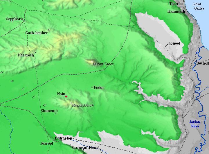
Map of the area around Naim/Nain – during the Israelite and Roman periods – 10C BC and 1st century AD (based on Bible Mapper 3.0)
History:
-
Early history – Tell Agol (Anaharath?)
Two KM to the east of the village is an earlier site, Tell Agol. According to the survey, it was inhabited from the Epi-Paleolithic period (16,000 to 8,300 BC), Middle Bronze age (2200 to 1550BC), Israelite/Iron age (1200 to 1000BC) and up to the Persian period (586 to 332BC).
This may have been the Biblical site of Anaharath (Joshua 19:19), part of the land that was given to the tribe of Issachar. It was also listed in the Egyptian Pharaoh Thutmose III conquests (1468BC), although the identification with the Tell at that period is not verified by the survey. It was also listed in the lists of Pharaoh Amenhotep (Amenophis) II conquests in Canaan (1440BC), where he counted the rich loot that his soldiers plundered in the city (443 oxens, 370 cows, 16 nobles,…).
-
The Roman Village of Naim
The area of the village was inhabited from the Middle Bronze period, according to survey of ceramics in the graves around the village. It was probably a continuation of the earlier site in Tell Agol during the Hellenistic period (332-37BC). The village reached its peak in the Roman and Byzantine periods (37BC-640AD). According to some ancient texts, the Roman village was surrounded by walls.
The ruins of the ancient village lay under the new village, in the area of the new Church (which was built in 1880).
Photos:
(a) The Village of Nin:
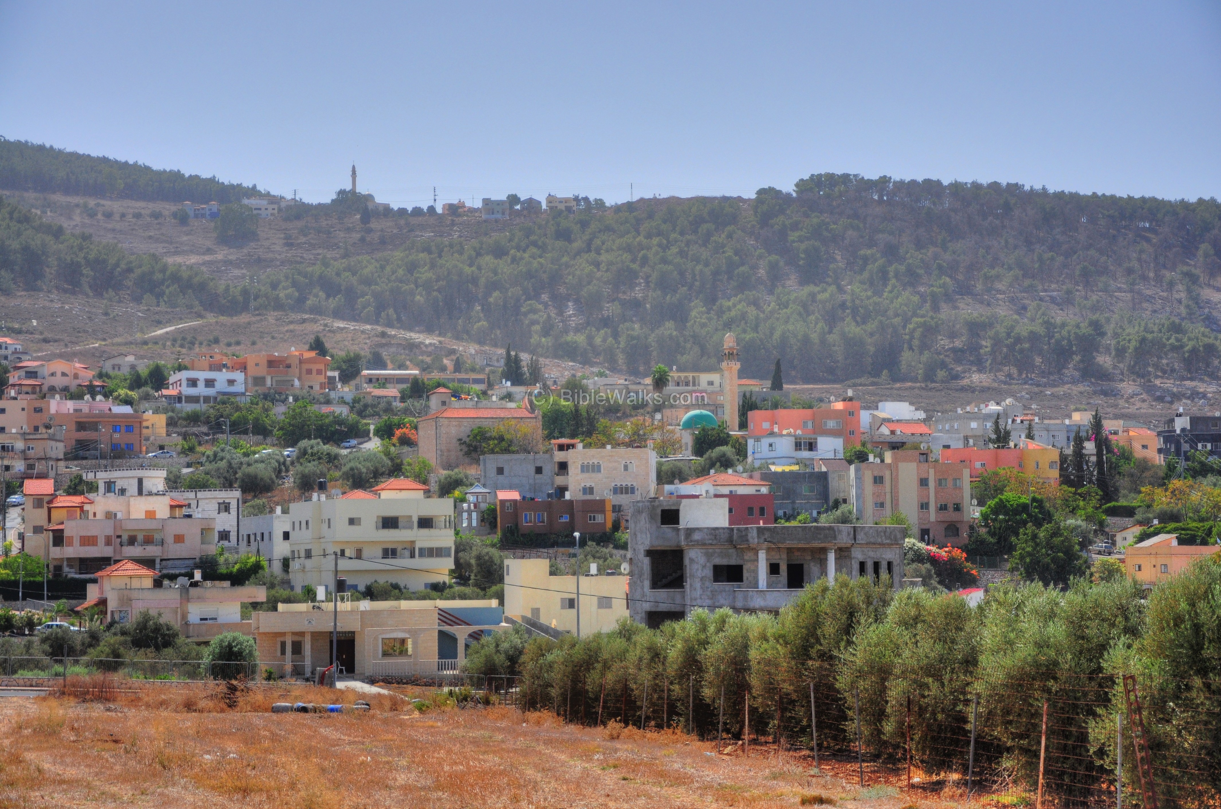
The following photo is taken from the north side of the village of Nin. The church (rectangular structure) and mosque (green dome & minaret) can be seen in the center. The cemetery is on the top left side.
In the background is the hill of Givat Hamoreh. On top of the hillside is the village of Eh Dachi, which is also built on the ruins of an ancient site.
Click on the photos to view in higher resolution…
Another view from the north, within the village. The church is seen on the left side. The ancient site is in the area of the Church, although they are buried under the modern village.
This is the south side of the village, on the hillside of Givat Hamoreh. On the left side is an Arab cemetery. Above and to the left of it is a series of rock-hewn cist graves and burial caves, where square shafts lead into the burial caves. The pottery in the graves, as per the survey (see references) is from the Middle Bronze, Roman and Byzantine, and Mameluke.

(b) The Church:
- Exterior:
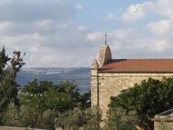
The church is in the middle of the village, on the hillside. In the photo below, taken from the east side, the city of Nazareth can be seen in the background, since it is only 8KM away.

Another view from the west side, where the entrance is located.
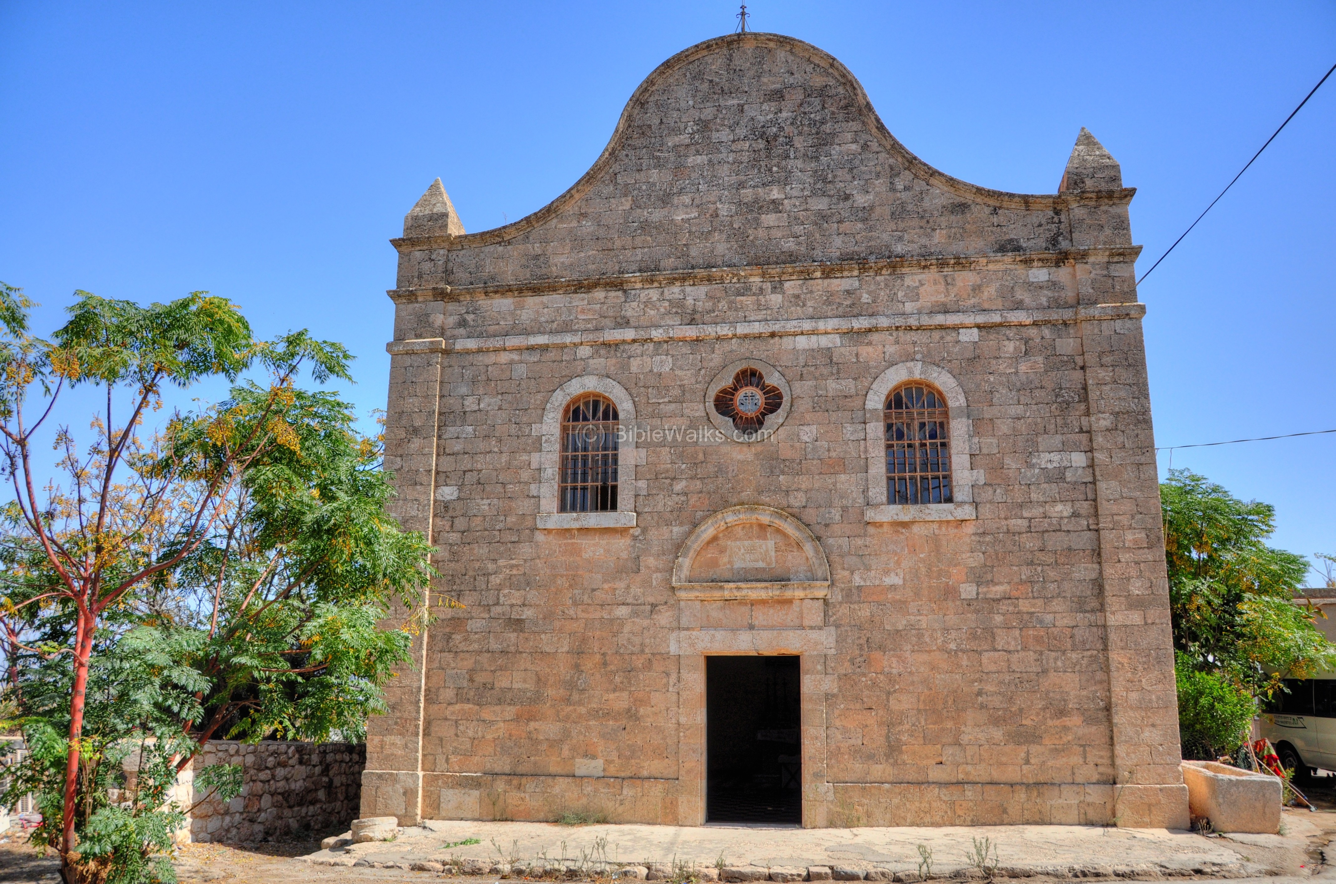
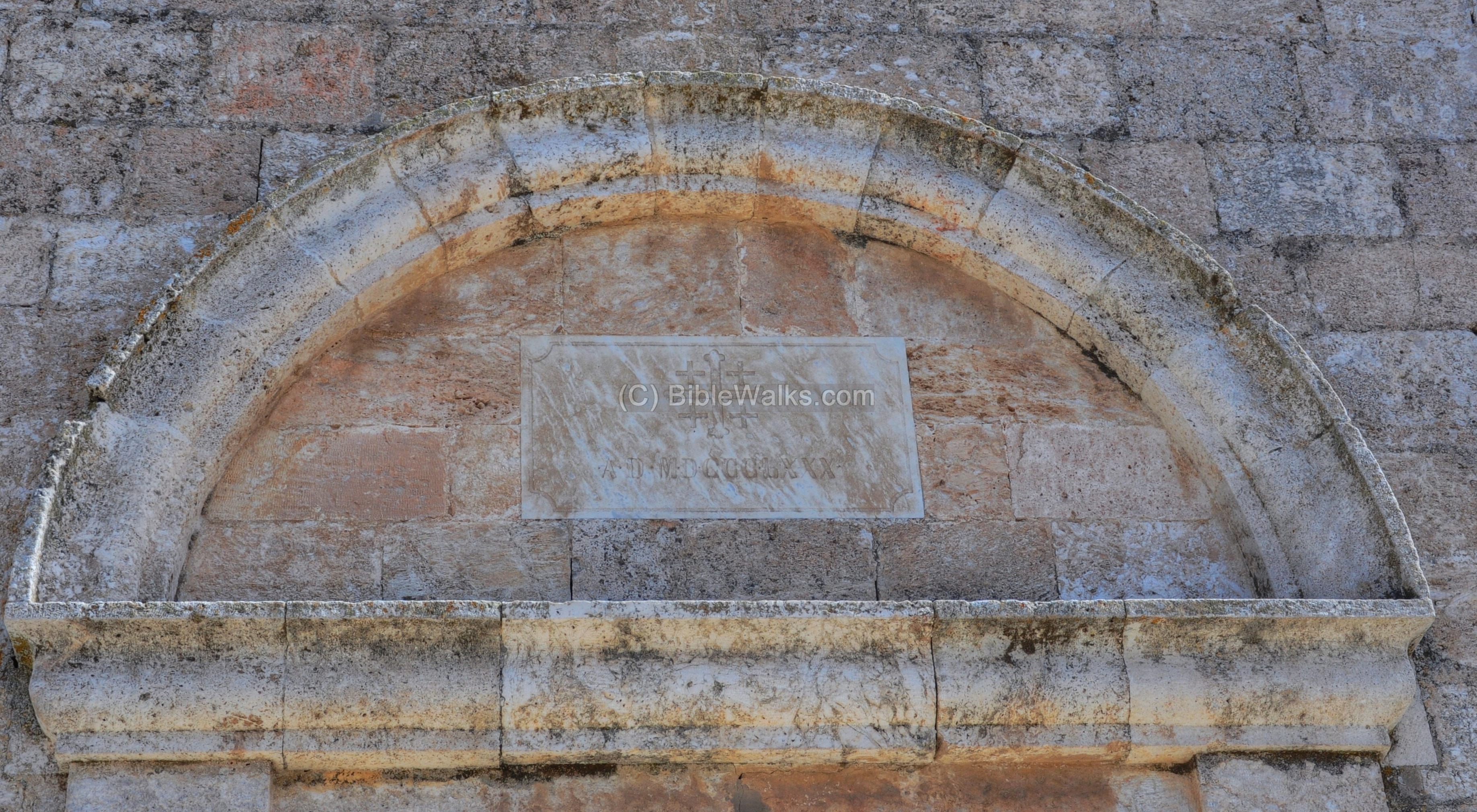
The church was built in 1880 by the Franciscans, as indicated on the tablet above the entrance (the year appears as “AD MD CCC LXXX).
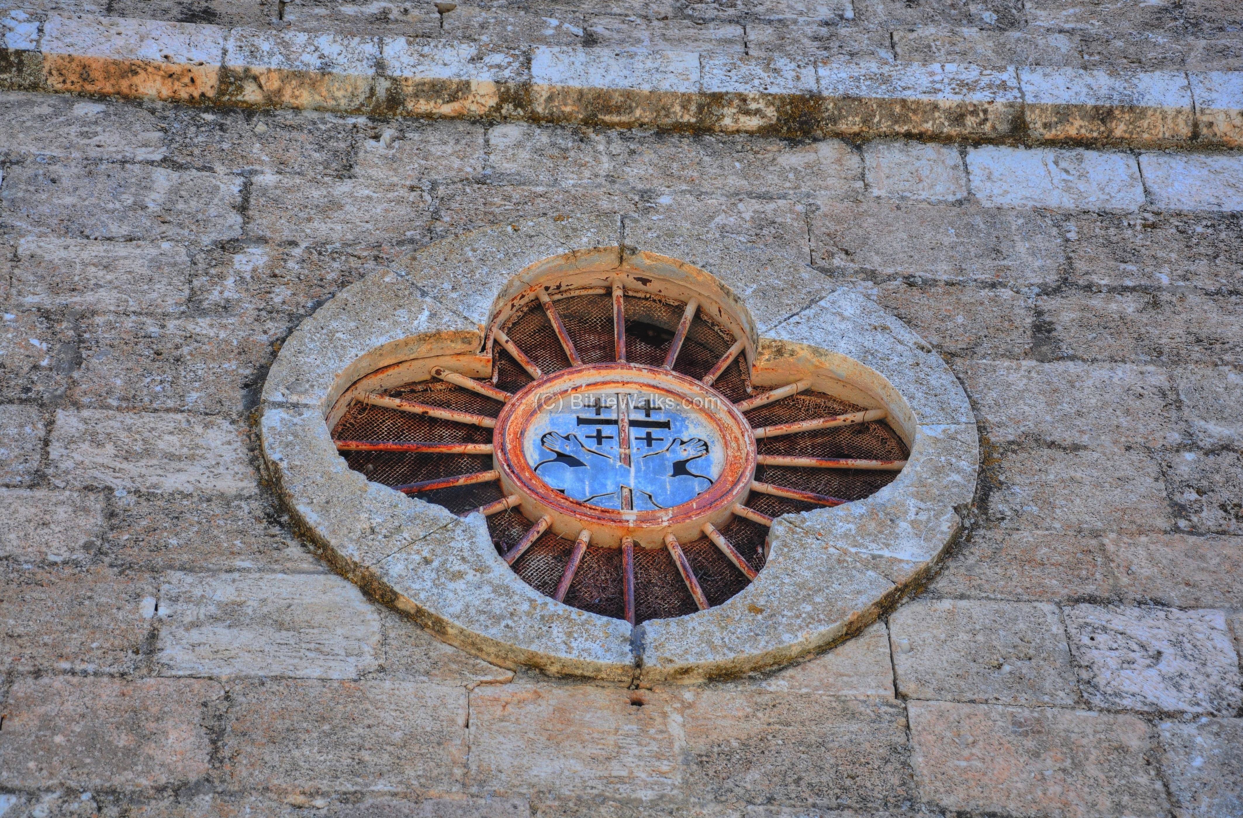
Above the tablet is the 5-cross symbol of the Franciscans: large cross with four crosses on each of its corners. This symbol was the Crusaders sign of Jerusalem, and was adapted by the Franciscans. The 5-cross symbol is based on the 5 Holy wounds of the crucifixion of Jesus (2 in the hands, 2 in the legs, and one in the chest).
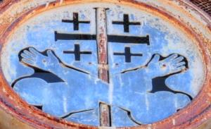
Below the five crosses are two hands on both sides of a cross – the symbol of the custody of the Holy places. The bare hand is the hand of Jesus, while the hand with a sleeve is St. Francis of Assisi, the founder. Both hands are perforated – the holes created by nails (Jesus on the cross, St. Francis of stigmata).
A family resides in the back yard, and keeps the church clean. Their ducks are seen walking in front of the church in the photograph below.
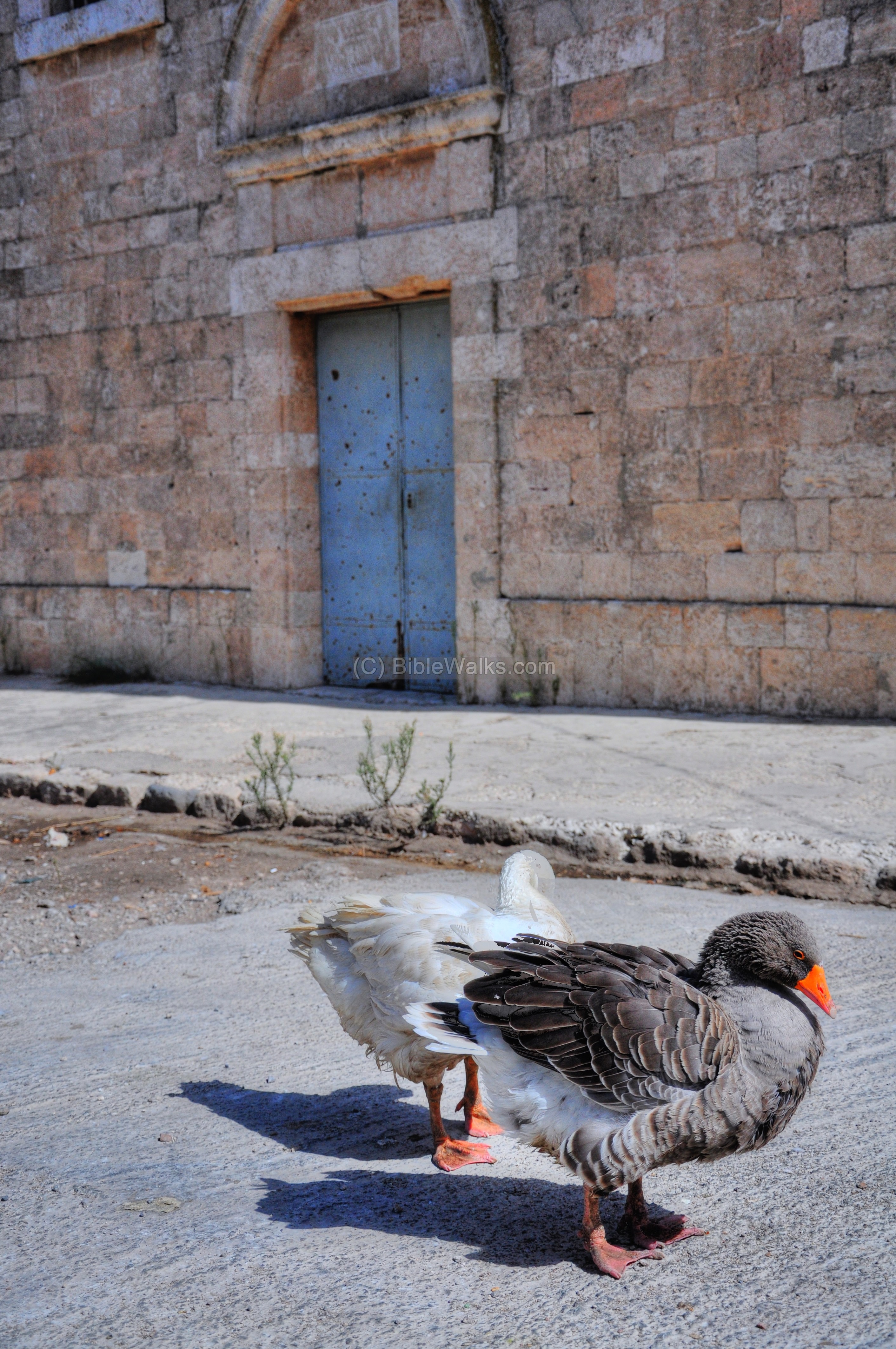
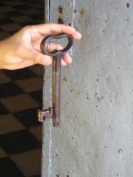
The family members have a key to the church, and normally on weekends they sit outside in the yard waiting for visitors. They will unlock the door and will let you in (for one Shekel or two).
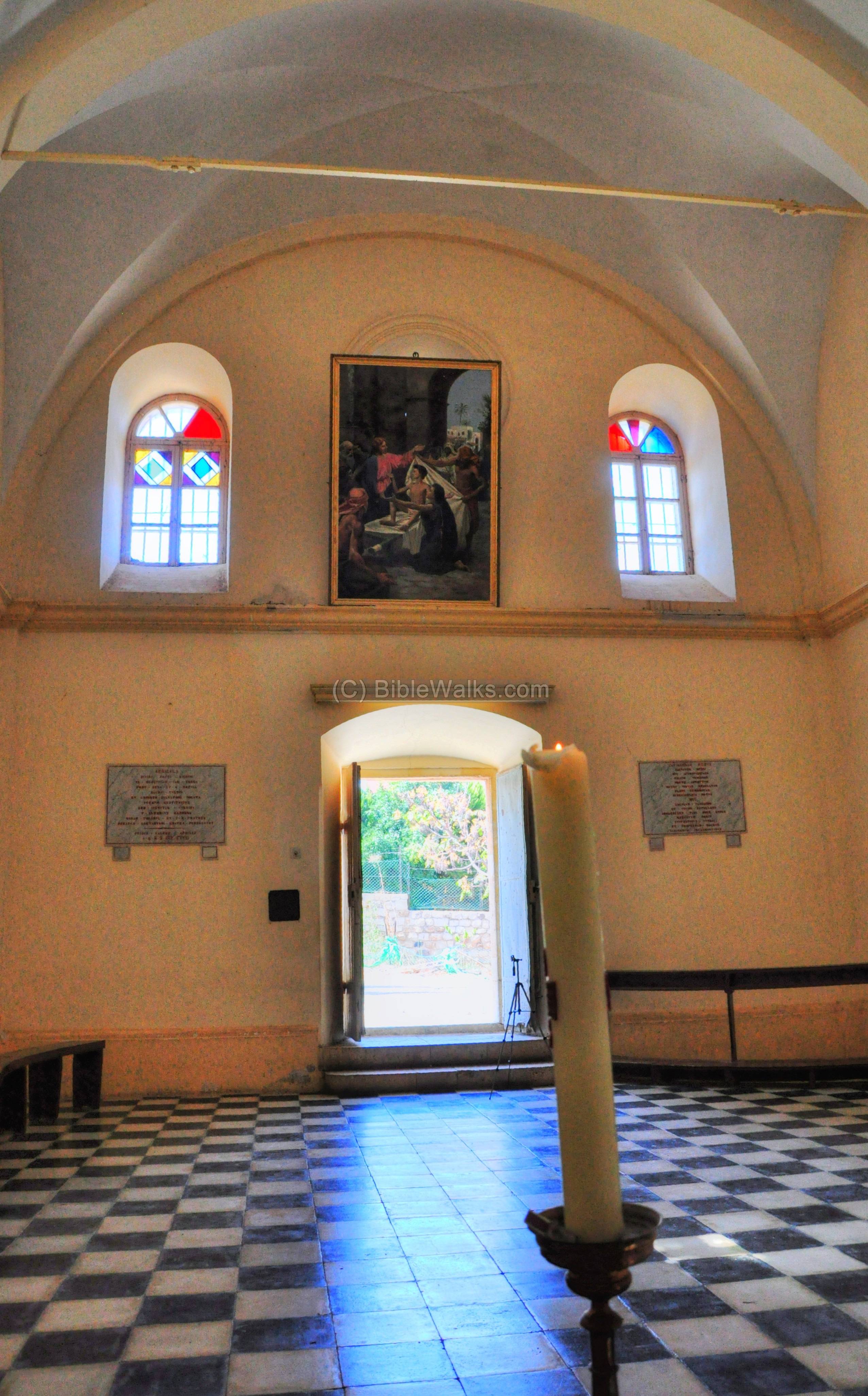
- Interior:
The interior of the church is simple, with a beautiful painting behind the altar on the east side:
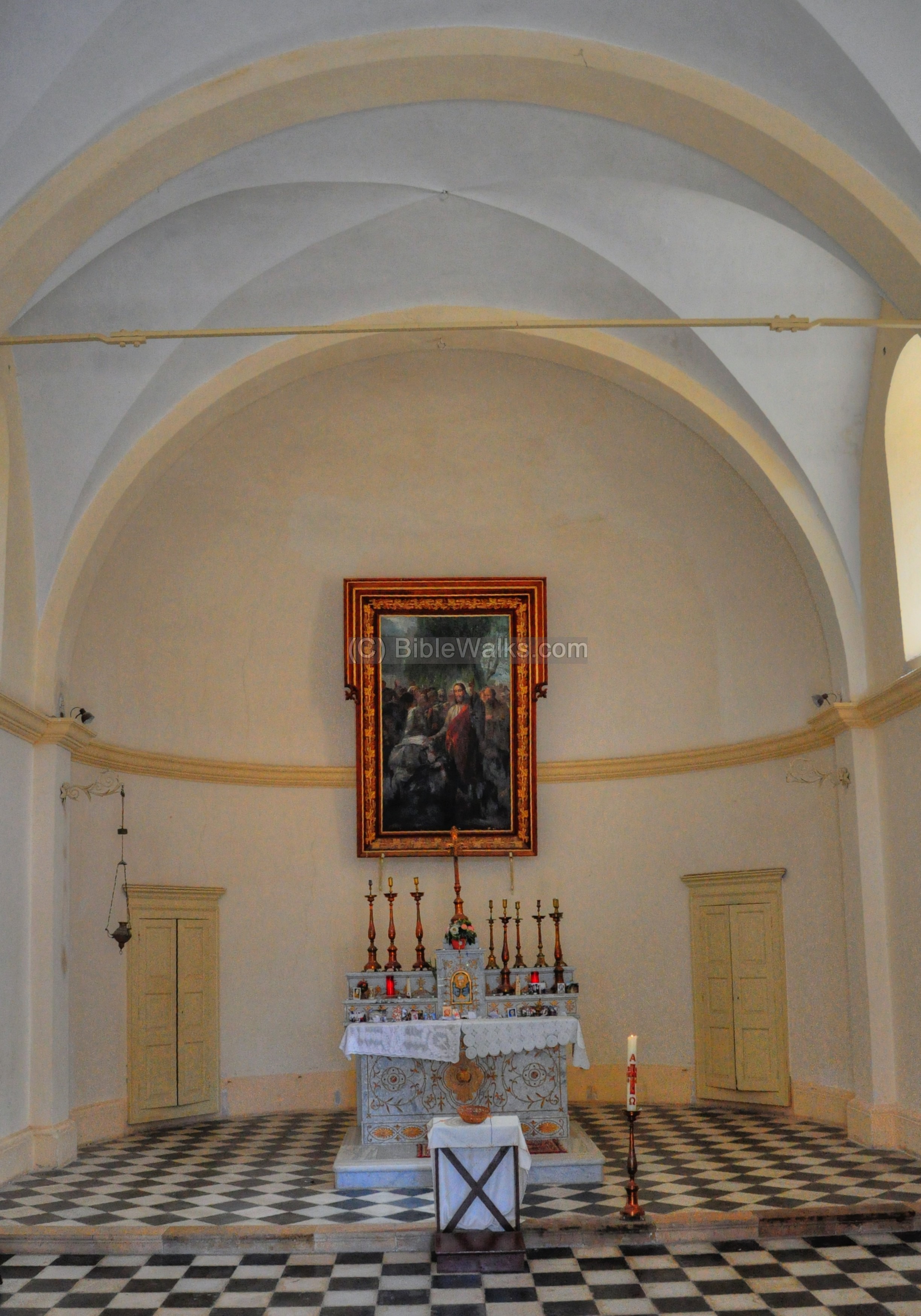
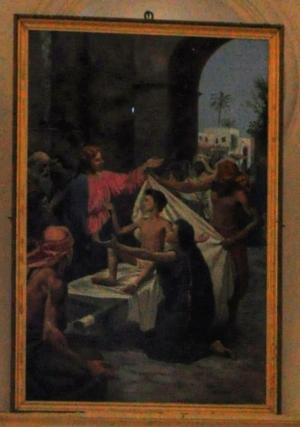
The painting is of the Miracle of Jesus bringing the widow’s son back to life.
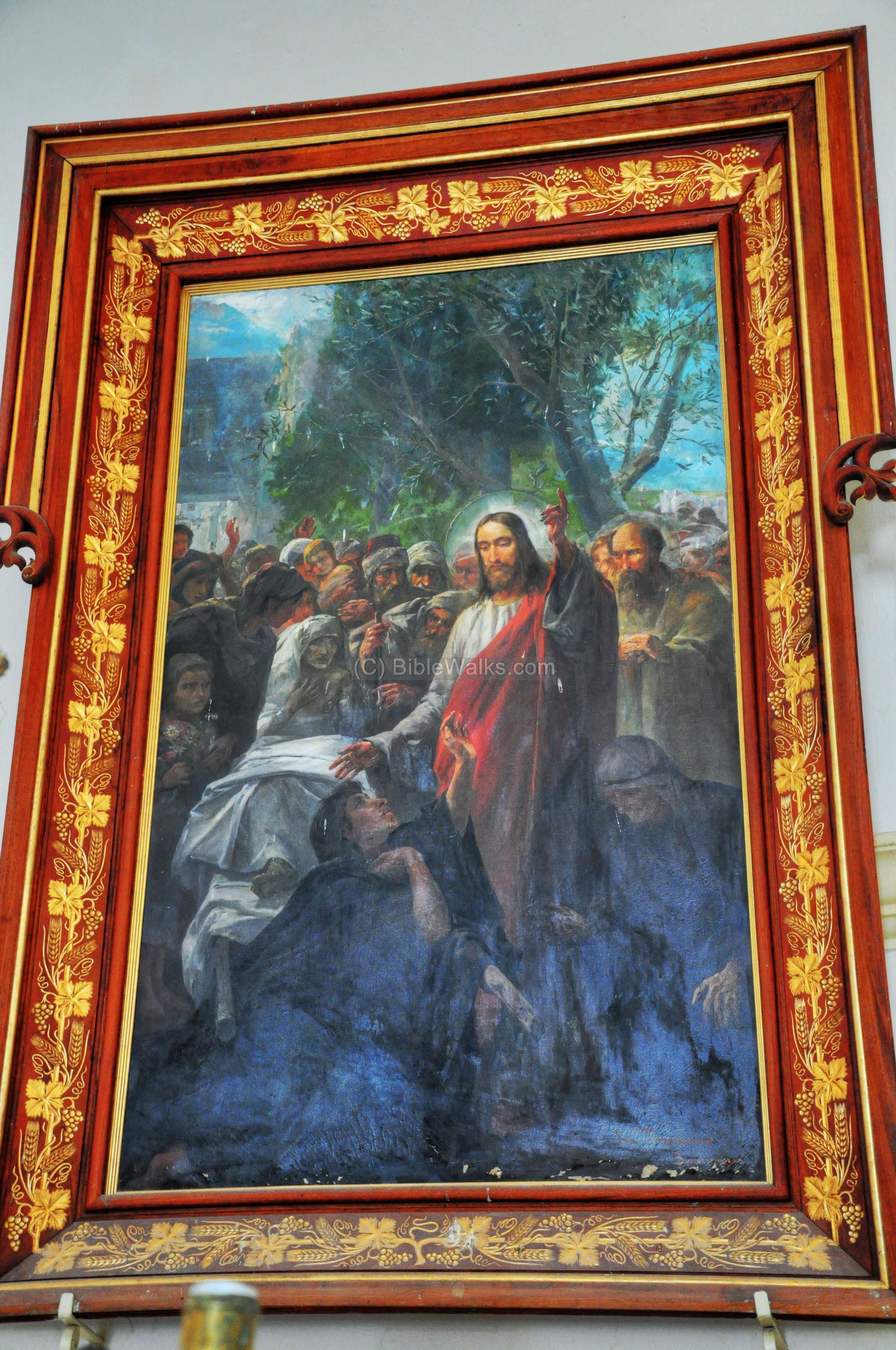
The western side of the church is seen in the following photograph, with another painting of the miracle above the entrance.
The miracle is shown in a larger size:
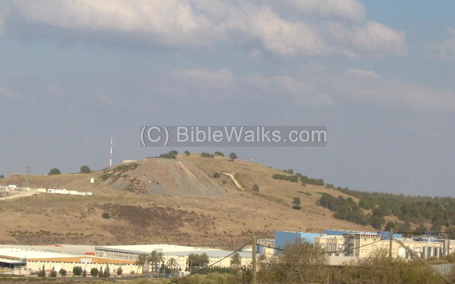
(c) Tell Agol
Around Naim there are several other ancient sites, such as Ein-Dor and Tell Agol.
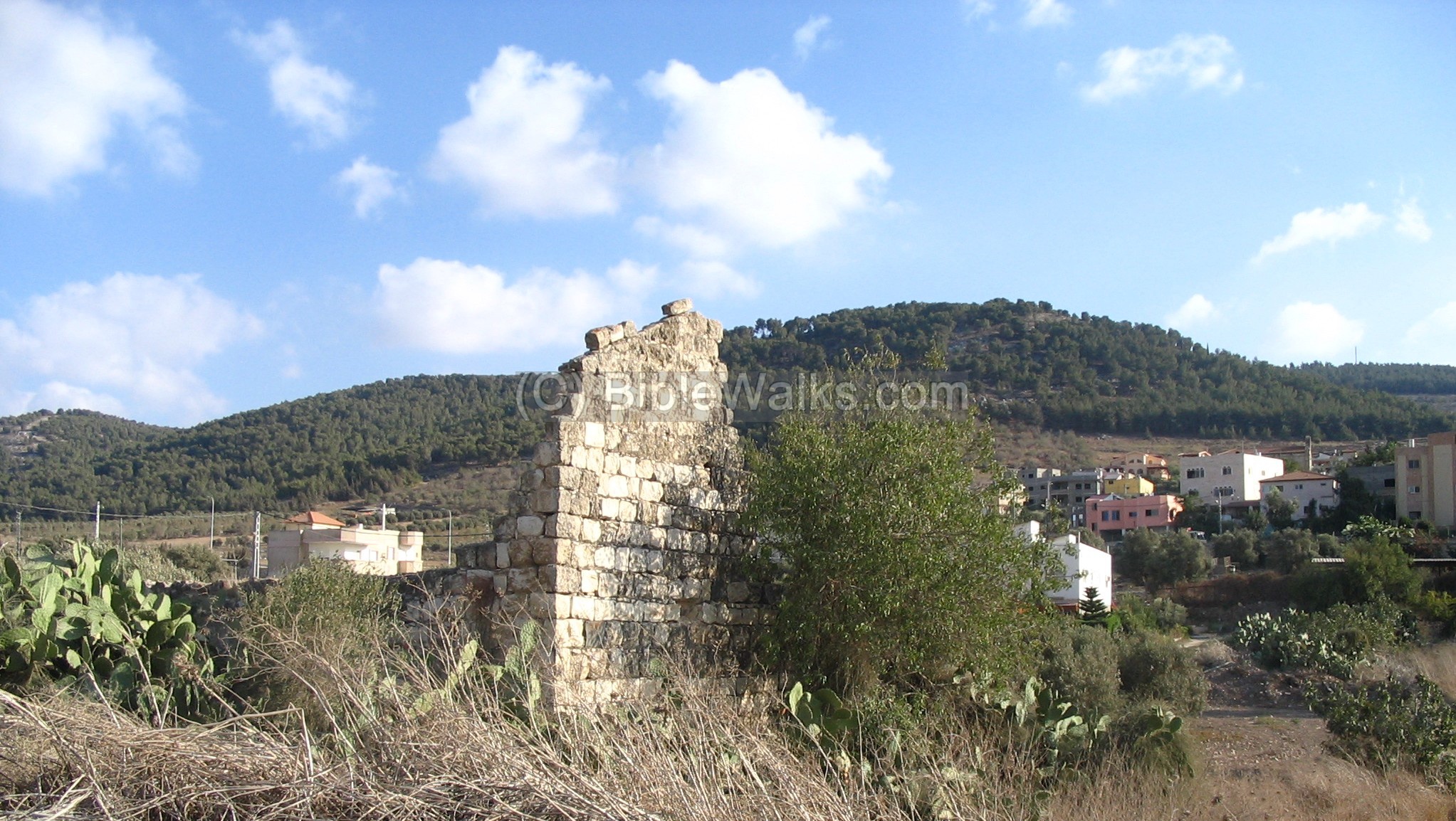
The following photograph is the view of the Biblical site of Tell Agol (Tell el Ajjul, Tell el Ujul), 2KM to the east, which may be identified with Biblical Anaharath (listed in Joshua as part of the region of the Tribe of Issachar).
A new industrial was constructed near the site, seen in the foreground.
Biblical References:
Luke 7:11-15
In these verses Jesus performs one of his healing miracles, and brings back the widow’s son back to life:
“And it came to pass the day after, that he went into a city called Nain; and many of his disciples went with him, and much people. Now when he came nigh to the gate of the city, behold, there was a dead man carried out, the only son of his mother, and she was a widow: and much people of the city was with her. And when the Lord saw her, he had compassion on her, and said unto her, Weep not. And he came and touched the bier: and they that bare him stood still. And he said, Young man, I say unto thee, Arise. And he that was dead sat up, and began to speak. And he delivered him to his mother”.
Joshua 19:19
This text lists the cities within the tribe of Issachar, and Anahareth may have been the place now called “Tell Agol”, east of Naim.
“And the fourth lot came out to Issachar, for the children of Issachar according to their families. And their border was toward Jezreel, and Chesulloth, and Shunem, And Haphraim, and Shihon, and Anaharath,”
Judges 7:1
This text describes the battle of the Midianites against the Israelites, headed by Gideon the judge (12th century BC). The Israelites camped in Harod spring, in the foothills of the Giboa, while the enemy camped “north of Givat Hamoreh”, at the vacinity of Naim where there was plenty of water (2 springs: Moreh spring and Naim spring). Yet another location of their camp can be Ein Dor, where according to Psalms this is where they were defeated (see below).
“Then Jerubbaal, who is Gideon, and all the people that were with him, rose up early, and pitched beside the well of” Harod: so that the host of the Midianites were on the north side of them, by the hill of Moreh, in the valley”.
Psalms 83: 9-10
According to the Biblical text, the Midianites were defeated by Gideon at Endor, which is nearby (north) of Naim.
“Do unto them as unto the Midianites; as to Sisera, as to Jabin, at the brook of Kison: Which perished at Endor: they became as dung for the earth.”
References and Links:
Archaeological:
-
Arch. Survey of Israel – Ein Dor Map (45) – Zvi Gal [1998] , site #11 (Nein) and #14 (Tell Agol)
-
A mystery in Kfar Nin – report of salvage excavations
-
Excavation (2007) of a burnt Roman house and earlier Hellenistic period
- Nein Emergency Excavation (2016) – HAESI Volume 128 Year 2016
BibleWalks:
- Footsteps of Jesus – This pictorial presentation is arranged by BibleWalks staff. The miracle is event #35.
Etymology (behind the name):
-
Nein: Name in the survey of Western Palestine (1881)
-
Nein: Name from the British Mandate map (1940)
-
Naim – in Hebrew is “pleasant”
-
Tell Agol – round Mound in Hebrew ( Tell = Mound, Agol=round).
-
Anaharath – unknown origin.
![]()
BibleWalks.com – walk with us through the sites of the Holy Land
Tell Kassis<<<—previous site—<<<All Sites>>>—next Yizreel Valley site—>>>Sahar
This page was last updated on Sep 13, 2024 (add link)
Sponsored links: