Sites along the Allon Road, that crosses the eastern side of Samaria from North to South.
* Site of the Month May 2017 *
Home > Sites > Samaria > Allon Road > Overview
Contents:
Background
Location
History
Sites
* Northern section
* Central section
* Southern section
Etymology
Links
Overview:
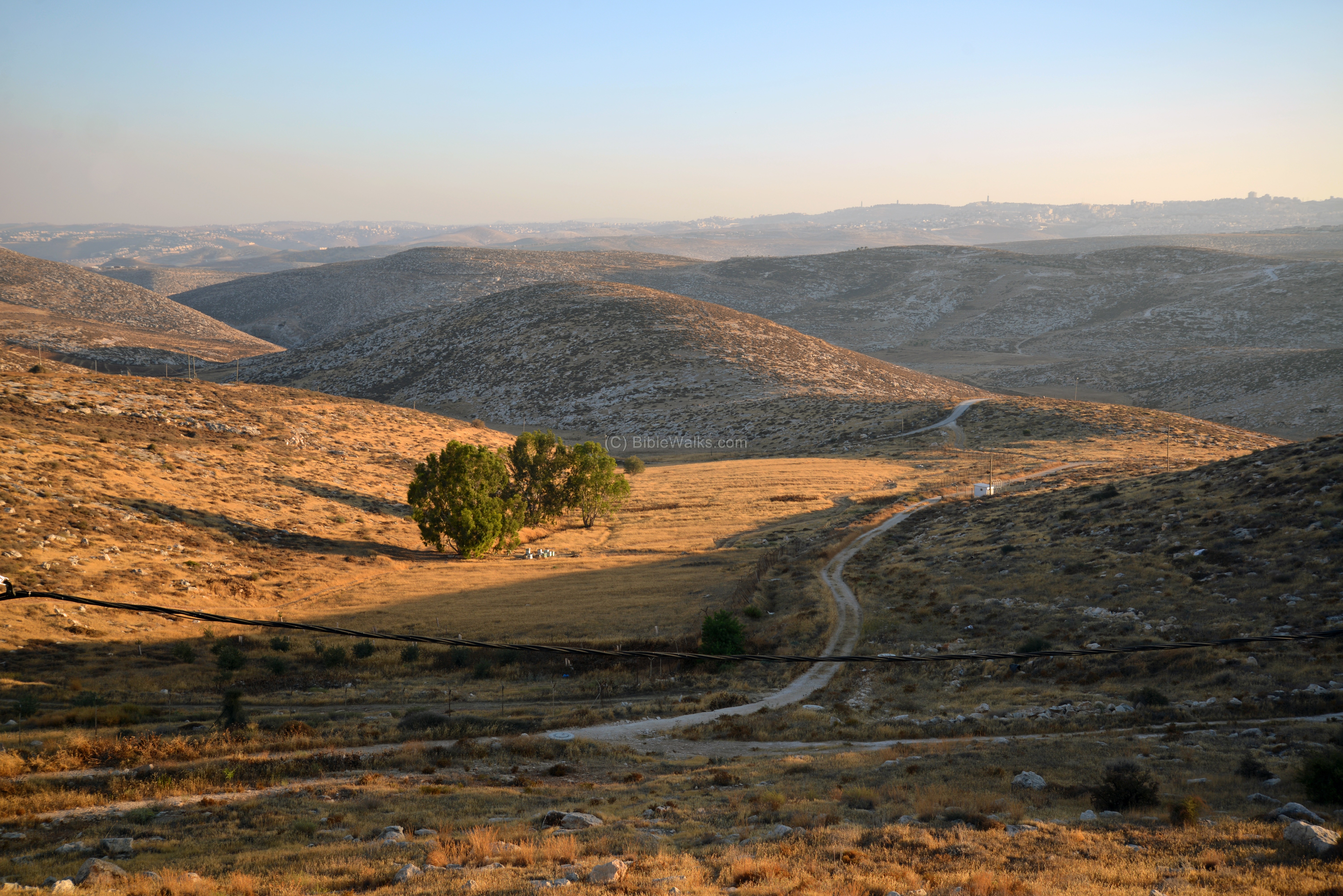
The Allon road, named after Igal Allon, stretches from north to south along the eastern watershed of the Samaria and Judean mountains. Along the 87km long and winding road are many ancient sites. This web page reviews some of these sites, and directs to other web pages that detail some of the important sites which relate to the Bible and the history of the area.
The road is in “Area C” – full Israeli civil and security control – which covers 60% of the West Bank. Mixed Israeli and Palestinian vehicles are sharing the Allon road, although the Allon road does not cross any of the Palestinian villages. It is recommended to observe touring restrictions as posted from time to time by the army.
This is one of the interesting roads in Israel, although few people travel through it. The beauty of the desert sights, combined with the Biblical and historical places along it, make the tour a must.
Location and map:
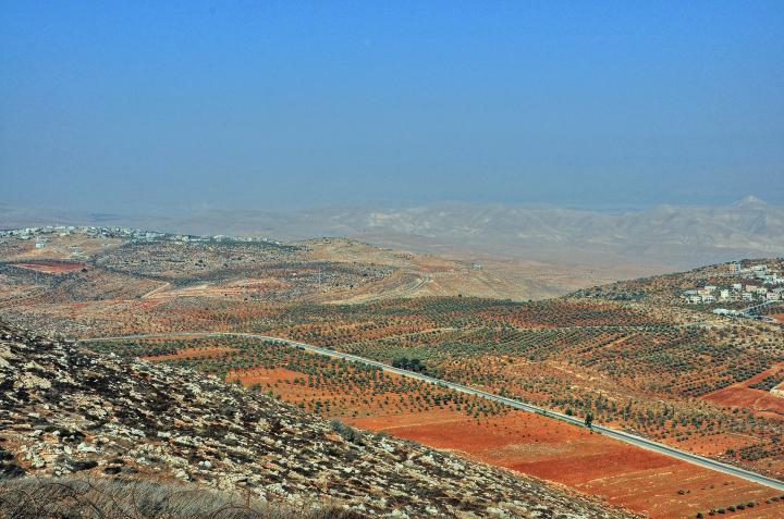
The Allon road stretches, north to south, from Mehola junction in the Beit-Shean valley to the Ma’ale Adummim junction. Its route is parallel to the road #90 Jordan valley highway, traversing the Samaria desert at a distance of 5-15km from the valley.
The 3 sections of Allon road are numbered by roads #578 (northern), #508 (central), and#458 (southern).
An illustration of the route is shown here. The Allon road is marked with a yellow striped line, crossing the foothills from north to south across the eastern side of Samaria.
The sites reviewed in this page are indicated with colored dots (Blue = Old Testament, Purple= other ancient periods, Green= prehistoric, nature sites).
These sites are also mapped on the Samaria sites and Judea sites map.
Map of Allon Road (yellow striped line).
History:
- Modern Period (20th century)
Igal Allon, a famed soldier (and Commander of the Palmach forces), was a minister of Labor in the Israeli Government (1961-1968) and other government posts. In 1967, following the stunning victory of the 6-day-war, he devised a plan to partition the area of the west bank of the Jordan which was conquered from Jordan. The plan was to create and annex an area east of the populated area of the west bank. This area included a number of connected areas: a narrow corridor along the Jordan river, an area east of Jerusalem, the area around Gush Etzion, and the Judean desert.
A border road was planned along the western side of the Jordan valley area, bypassing all (but one) of the Arab villages in Samaria and Judea. The construction started in 1972 and was completed in 1980 (the year when Allon died at the age of 81).
In addition to the road, 21 Israeli agriculture communities were established along the road. As part of the plan, all communities were built on the east side of the Allon road.
The sites:
The remainder of the web page reviews a sample of the sites along the Allon Road, starting from Beit Shean valley in the north, down south to Highway #1 (Jerusalem to the Dead Sea).
1. Northern section: Road #578
The northern section is from Beit Shean to Beka’ot junction. The area was part of the Biblical region of the Manasseh tribe.
(1a) Ein el-Helweh (el-Hilu), near Maskiot
Maskiot is an Israeli community, located above Milha stream (Wady Malha), on the northern edge of the Allon Road. Ancient roads passed through the valley on the west side of the community, connecting Beit Shean to Samaria. The modern road passes beneath the cliff.
A small fortress, 6m x 12m in area, is seen here on top of a cliff overlooking the pass. It was excavated in 1988, and surveyed by Zertal in 1996 (Ein el-Hilu A, site #229). The fortress was dated, according to the few ceramics found in the structure, to the Middle Bronze 2B age (1750-1650 BC).
An earlier settlement of the Chalcolithic period (4500-3150 BC) is located on the ridge south west of the fortress, covering an area of 12 dunams. The site was surveyed by Zertal (Ein el-Hilu B, site #230), who identified 15-20 structures. Four structures were later excavated by Zertal (1988).
The spring of Ein-Helweh (Arabic for “sweet”) is located at the bottom of the cliff.
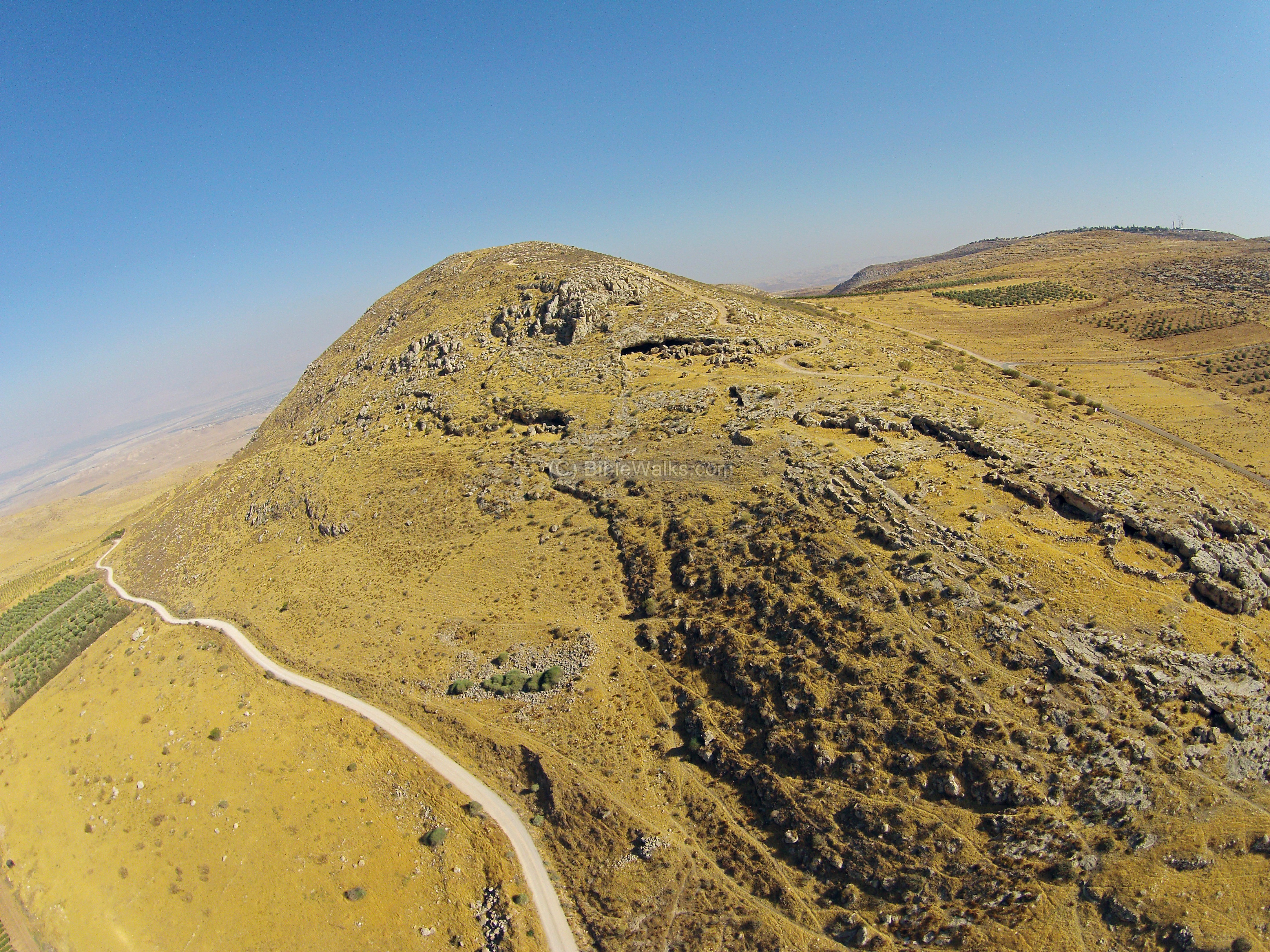
(1b) Tel el-Hilu, near Maskiot
Across the valley is the mound of Tel el Hilu, with ruins of an ancient city on a small mound (3.2 dunams). The Arabic name of the mound is Tell Abu Sifri, or Abu Sifry – “the mound with the round table”. The city was populated from the Late Bronze Age II (1300-1200 BC), peaked at the Late Bronze 3 period, and continued up to the Persian period. It was surveyed by Gophna and Porat (1972, site #86), Zertal (1996, site #96), Bar Yosef (2007), and excavated by Zertal (1988-1989). The Allon road cuts its eastern foothills, where remains of walls and structures are visible. On the summit are visible foundations of four structures.
The city is identified by some scholars as the Biblical Abel-Mehola (Judges 7:22, 1 Kings 4:12, 1 Kings 19:16, 1 Samuel 18:19, 2 Samuel 21:8). The identification also is based on the Onomasticon (book written by Eusebius of Caesarea in the 4th Century), placing Abel-Mehola at 10 miles south of Scythopolis (Beit Shean) where the site is located. Another suggestion by Nelson Glueck (in Basor 1943) was the city of Jokneam near Abel-Mehola, mentioned in the list of King Solomon’s officers (1 Kings 4:12): “…from Bethshean to Abelmeholah, even unto the place that is beyond Jokneam”. According to Zertal (Manasseh hill country survey, Eastern valleys, p. 106), both identifications are problematic due to the size of the mound and the farming area around it.
(1c) Kh. es Sumra
Remains of a large Roman/Byzantine town are located on the east side of Allon Road, near the Umm Zuka nature reservoir. An ancient road once passed through this town, crossing the mountain towards the east, reaching the Jordan valley near Tell el-Makabra (7km north east).
The aerial view shows the center of the ruin from the east side. In the background is an Army camp, one of several in this area.
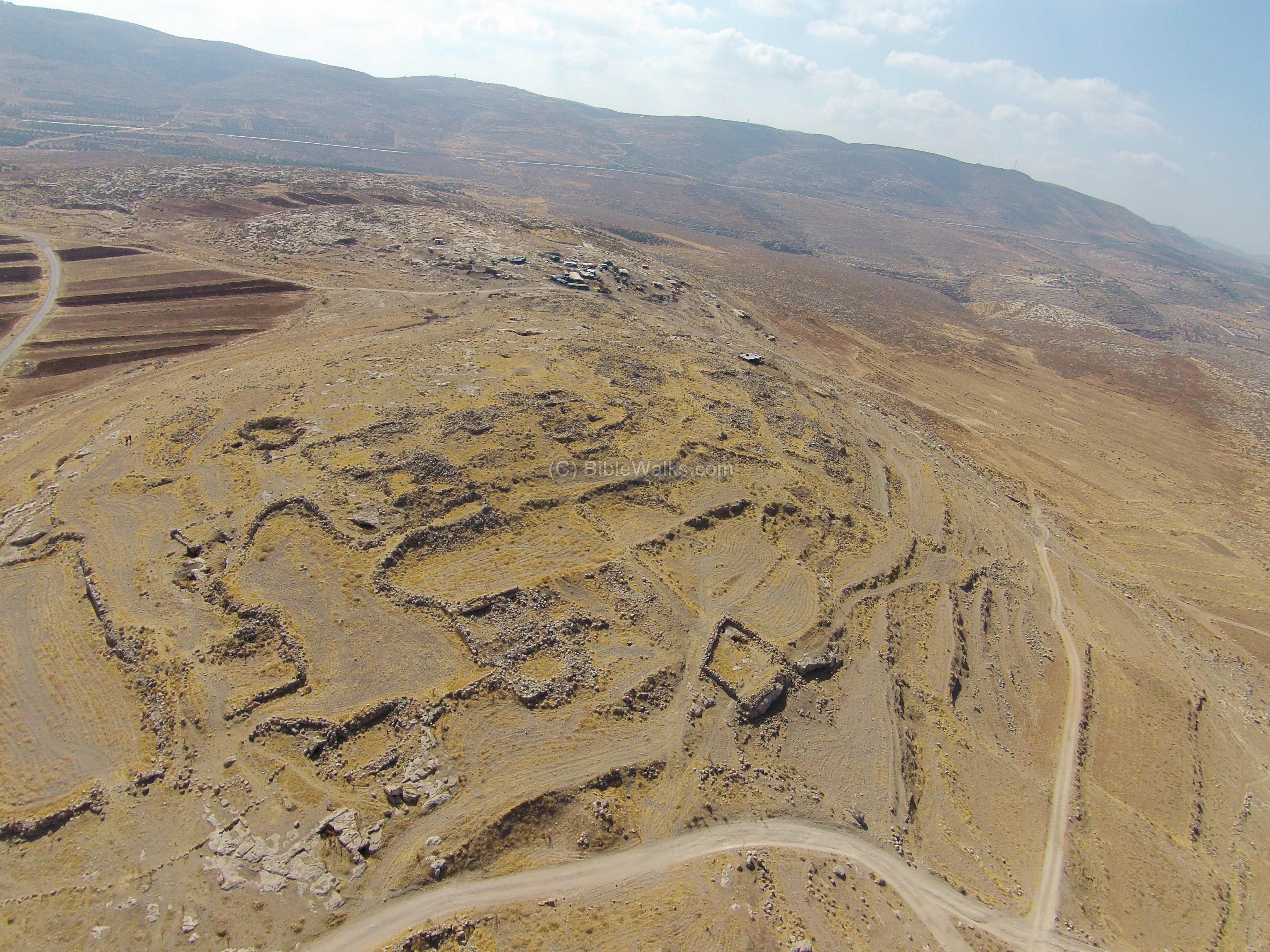
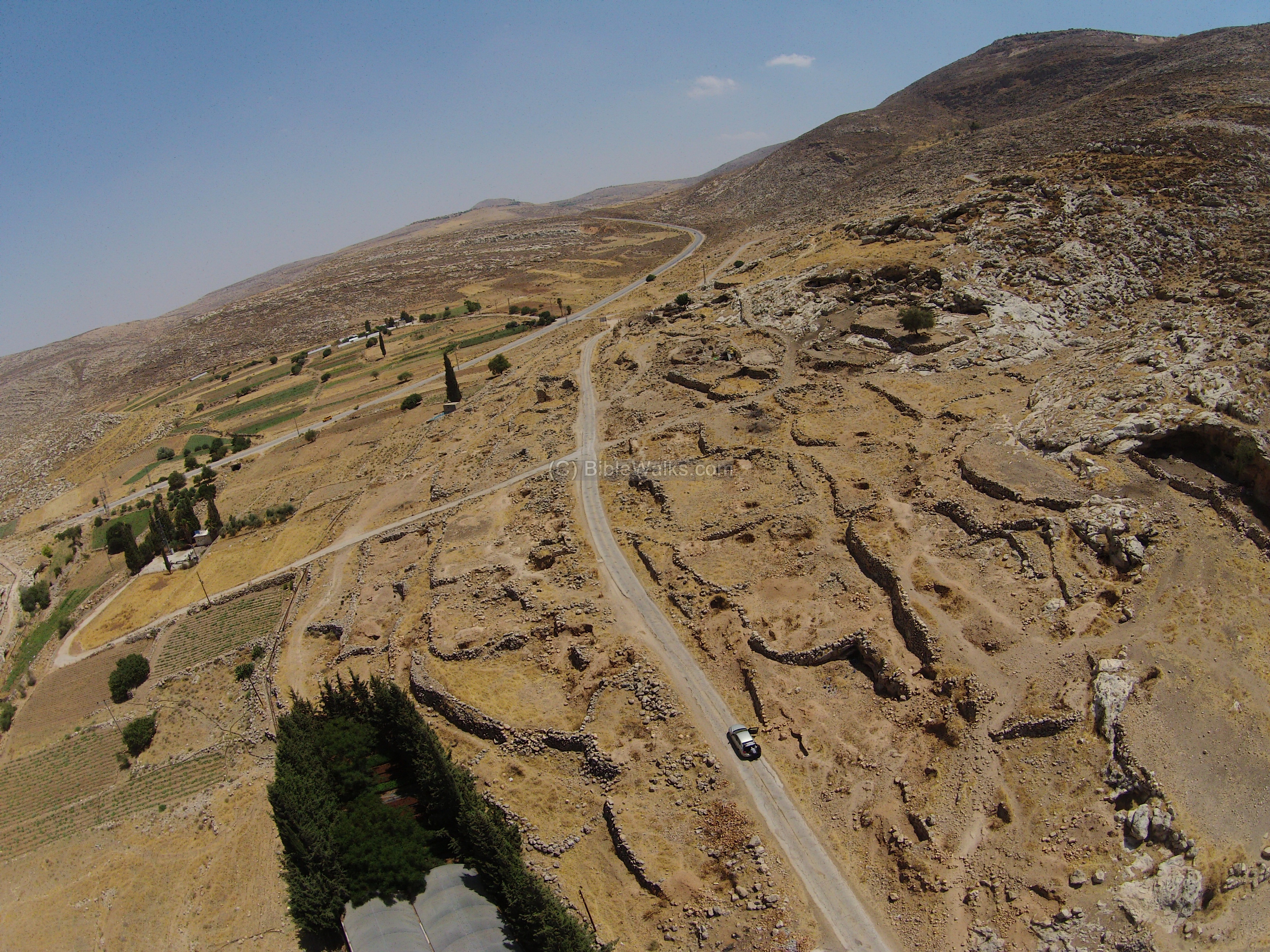
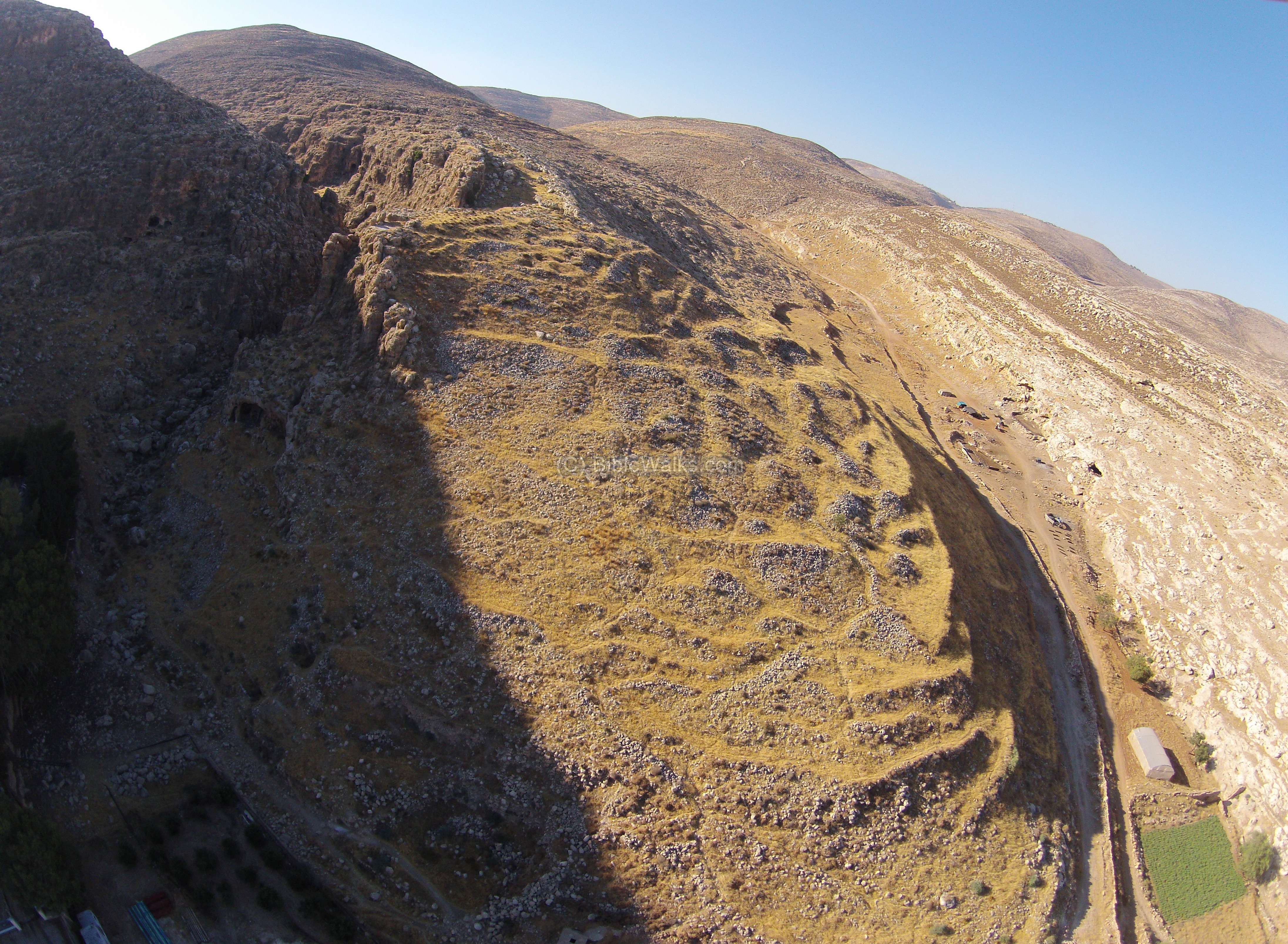
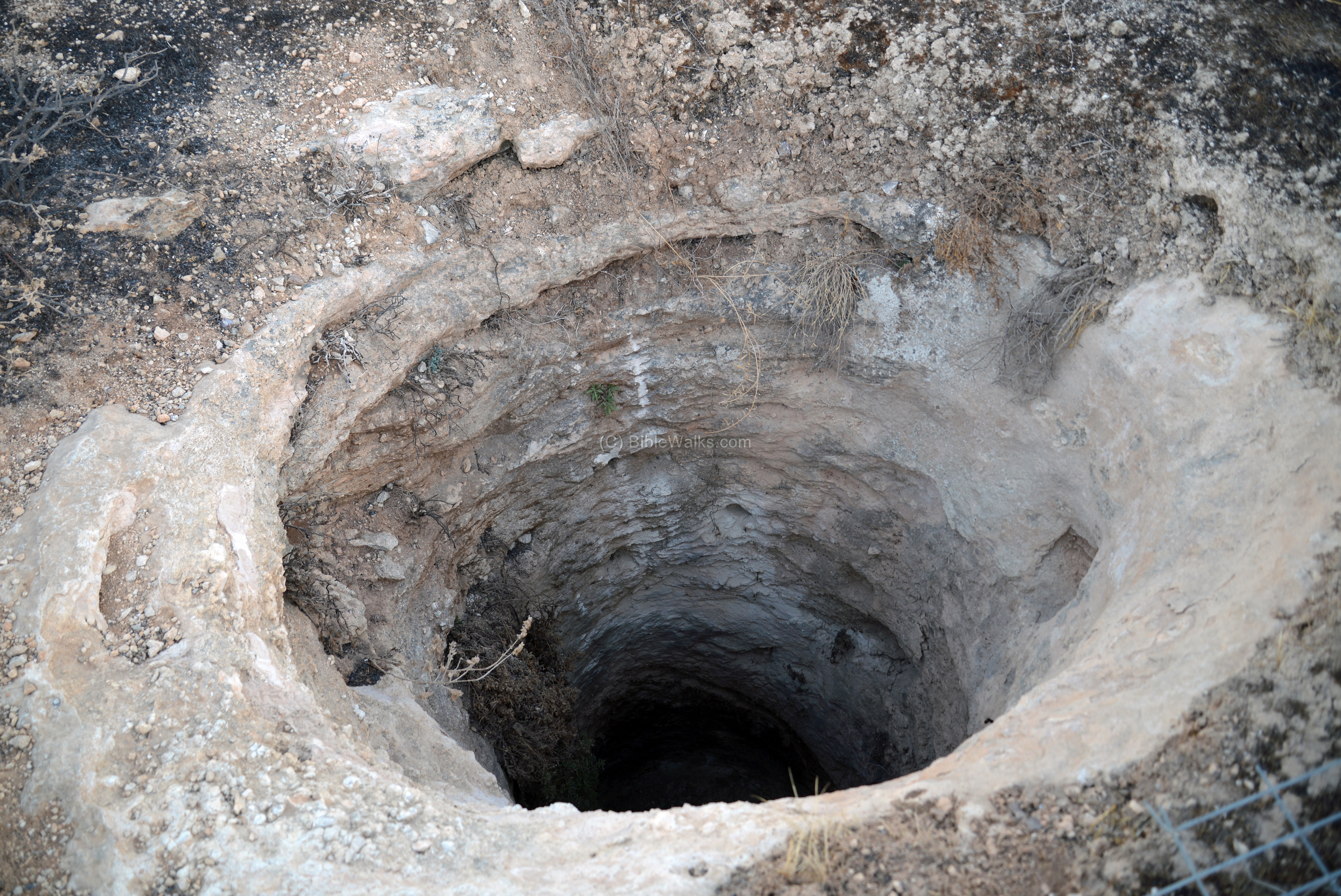
The site is spread over 30 dunams. In the ruins are bases of structures (70 units), courtyards, 28 water cisterns, dams and tombs. The site was surveyed by Zertal in 1996 (Manasseh hill country survey, Eastern valleys, site #129). The major periods were dated to the late Roman period, Byzantine and Medieval periods.
Most remarkable tomb is on the east side, cut into the northern bank of Sumra valley.
The Arabic name means the “brown ruin” or “dark ruin”. This is a common name, and there are several sites in the area with the same name.
(1d) Mrah el-‘Enab, Beka’ot/Hamra
The valley of Nahal Tirzah (Wadi Far’a in Arabic) is one of the largest streams that drain the eastern Samaria, starting from Shechem and ending near Adam bridge on the Jordan river. An ancient route passed along the valley to the heart of Samaria. Many ancient fortified cities and fortresses were built along this route to defend the eastern border of Israel.
The Allon road crosses the valley near Moshav Hamra, switching from road #578 to #508 via a short (1km) section of road #57. The two nearby junctions are called Beka’ot (Hebrew for valleys) and Hamra, named after the nearby communities.
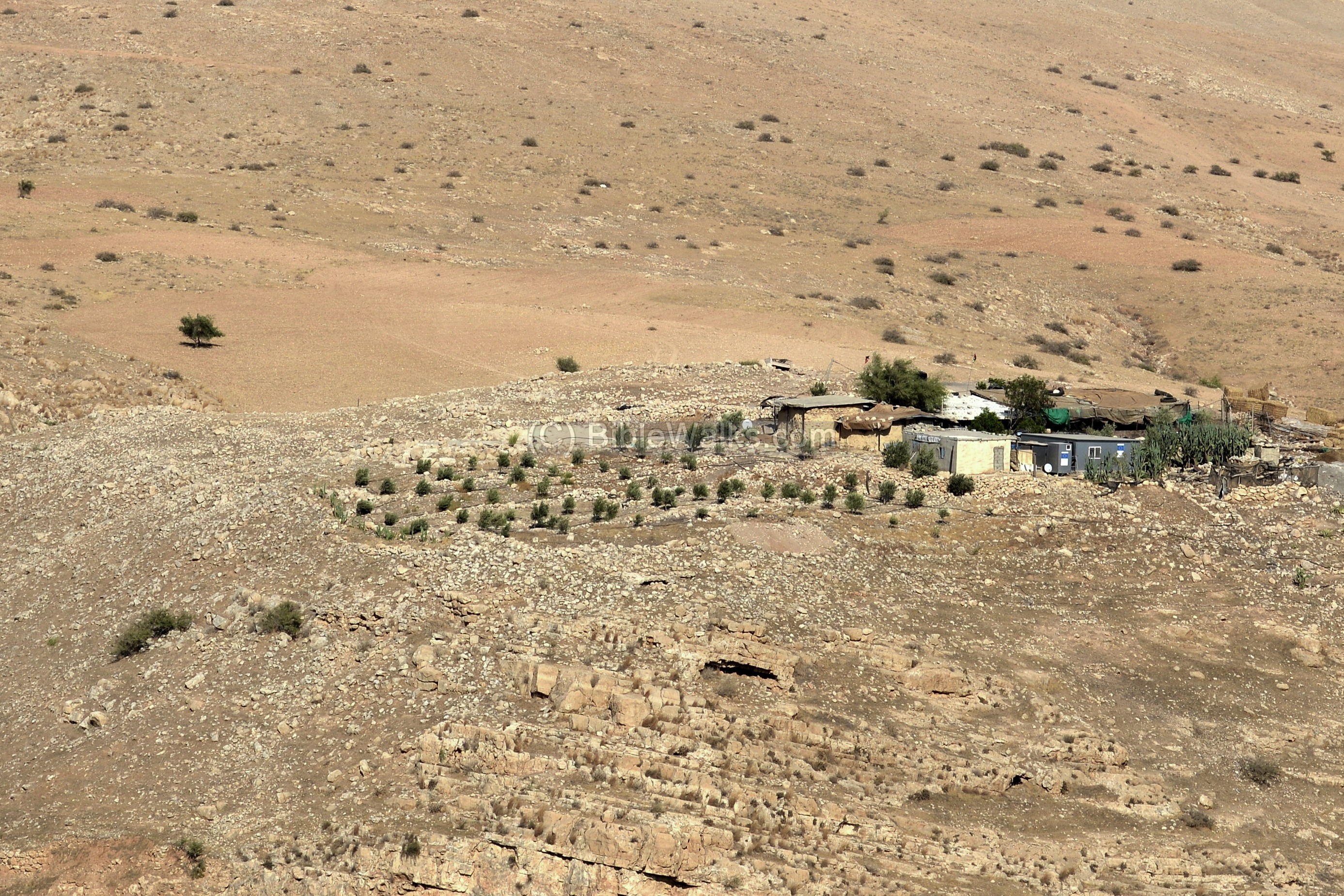
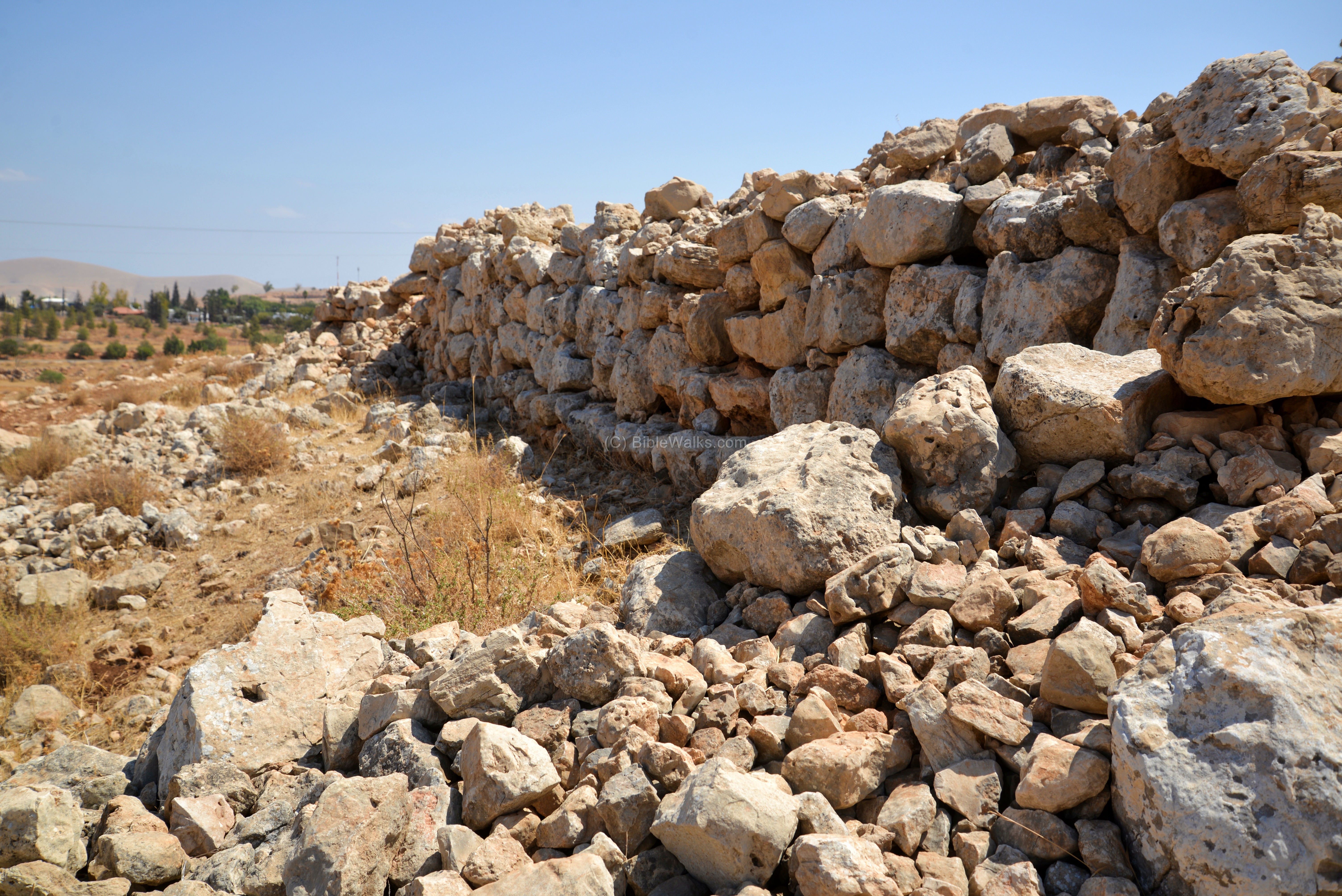
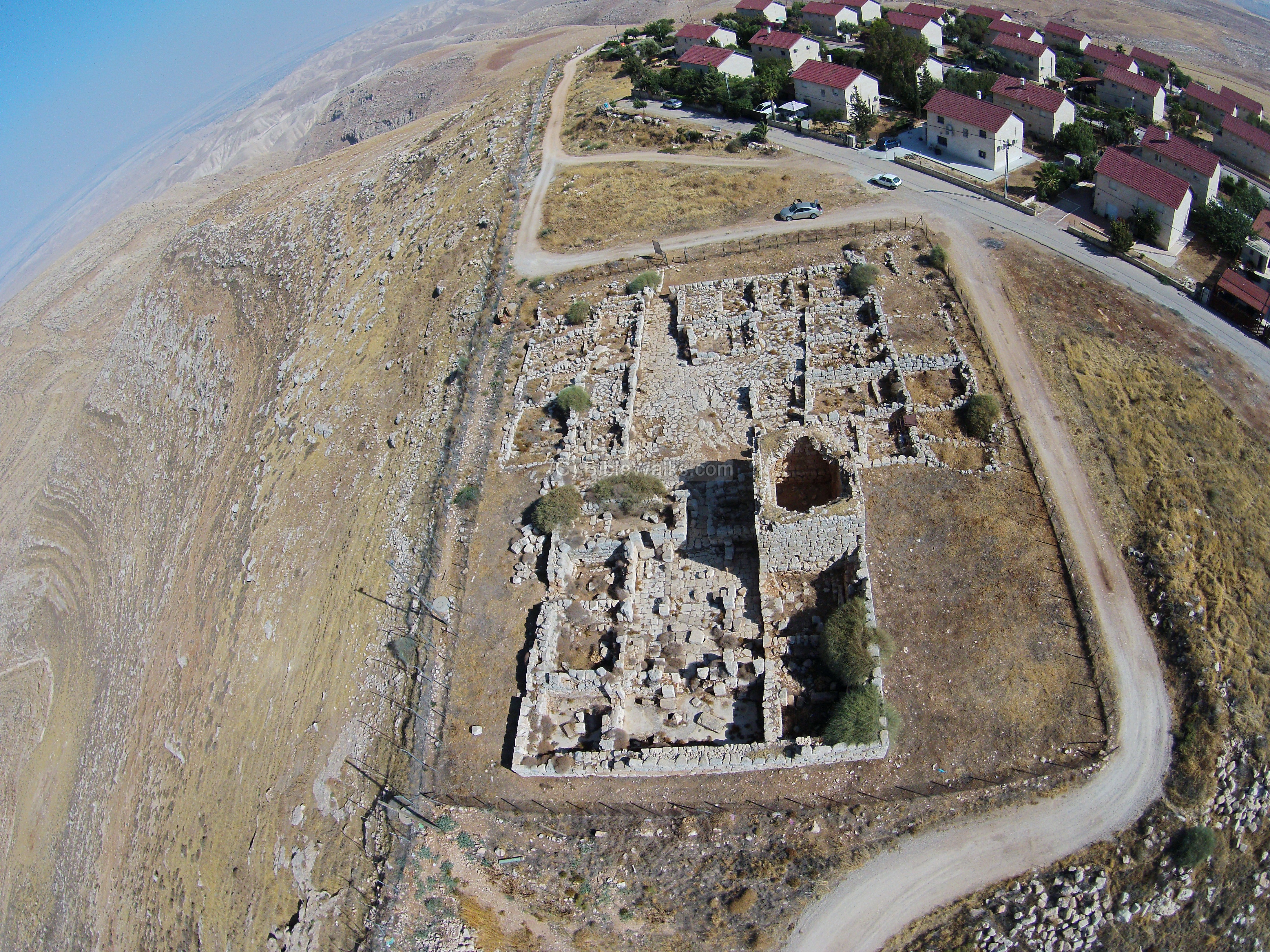
Overlooking this section of road #57 is a site named Mrah el-‘Enab (also: Marah el-‘Inab, el-Buseiliyeh). On top of a ridge on the east side of the curving section of the road is a large fortress. Remains of the fortress structure, walls and a plastered pool were dated to the Israelite Kingdom – Iron Age Ia and II. Additional periods include the Intermediate Bronze period, and early Roman period.
It is seen here from the south side, where the modern farm house is located. The site overlooks the road, 50m above the valley.
The ruins were surveyed by Guerin (19th century), Gophna and Porat (1972, site #174) and Zertal (1996, site #191). Zertal suggested that the last stage of the site was a Roman fortress that protected the strategic road.
A closer view is in the following photo. The plan of the fortress is rectangular, aligned from north to south. Remains of a 2m wide wall surrounds the complex.
Gurin wrote about this site (PEF, V2, p. 236): “The ruins of this name extend from the Wady over a plain, and upon the hills which rise gradually to the south-west and north-east. The little town whose ruins these are is now completely destroyed. Not a trace of the surrounding wall is visible ; not a building remains upright. The site, grown over with grass, flowers, and young seder, is scattered over with the remains of pottery and materials of all kinds, the ruins of houses completely destroyed. Some cisterns cut in the rock are alone remaining in preservation. I observed also the lower courses of a wall determining a rectangle 58 paces long and 33 broad. This wall, 3 feet thick, was constructed of pretty large well-squared blocks. Small stones, with earth in place of cement, are inserted between the larger ones. A narrow ditch ran outside the southern face of this little enclosure, which the Arabs still call the Serai (“The Palace”), and which, except on the north side, where it rises to the height of 3 feet g inches, is elsewhere either razed entirely or buried beneath earth. It was divided into two unequal compartments, one of which encloses a sort of subterranean magazine with semicircular vaulting. The other buildings which formerly stood within this wall are so entirely destroyed that not a trace remains visible”.
A view from the south side shows a section of the lower wall, built of large stones.
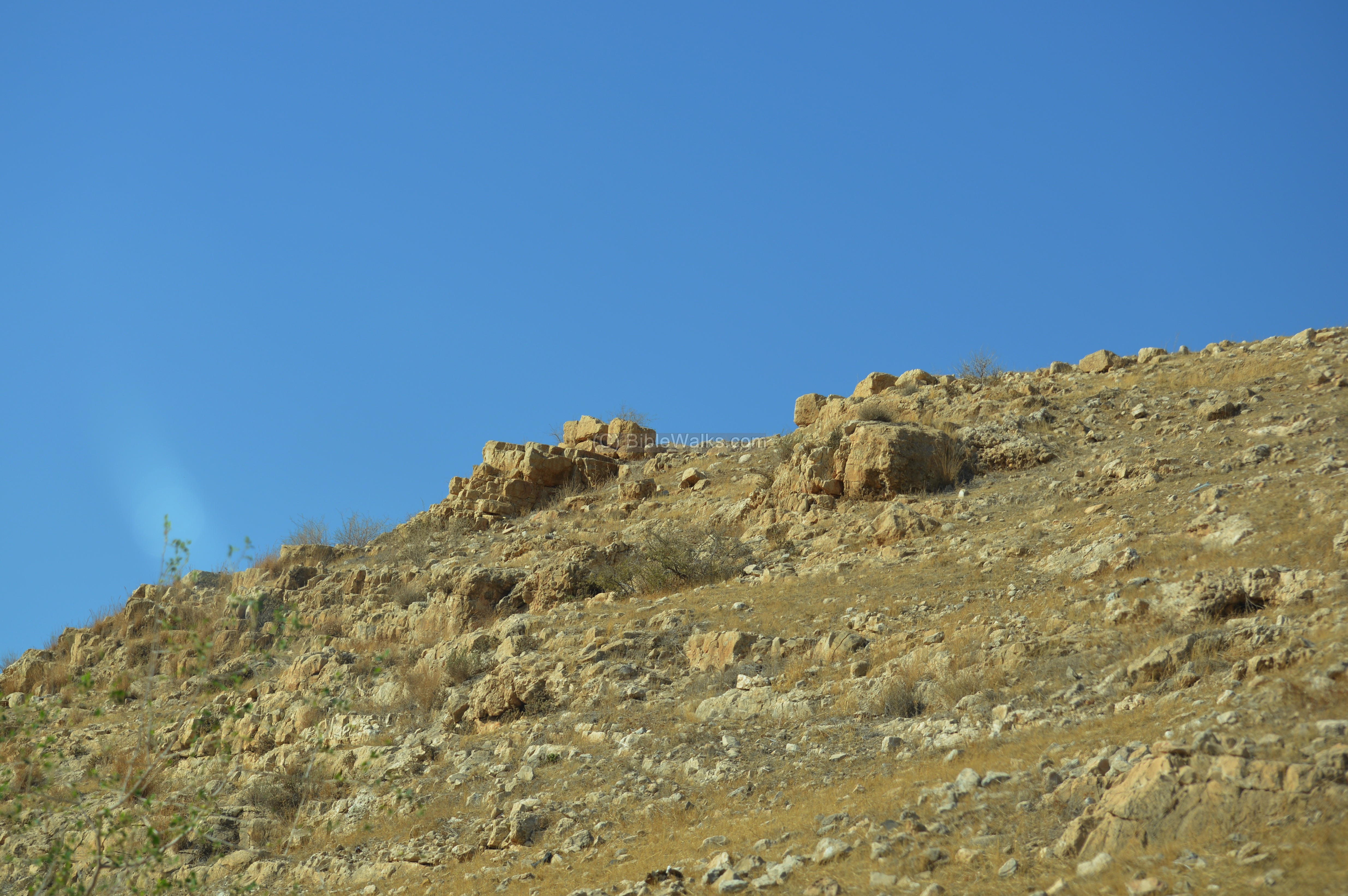
The next view, from the north side, shows the ridge where the ruins are located. Along the foothill are traces of another wall that surrounded the fortress.
Due to the importance of this ancient route, other fortresses are located along the valley. Another Israelite fortress, Kh. Makhruk, is located 11km downstream near the Jordan valley highway (road #90).
2. Central section: Road #508
This section is from Hamra junction to Ma’ale Efraim junction. The area was also part of the Biblical region of the Manasseh tribe.
(2a) Plain of Ifjim
The Allon road between Mechora and Gittit passes along a wide valley – Sahel Ifjim (Arabic: the plain of Ifjim, a private name). Through this valley once passed the Roman road from Kh. Fusail in the Jordan valley, through Beit Furik to Shechem.
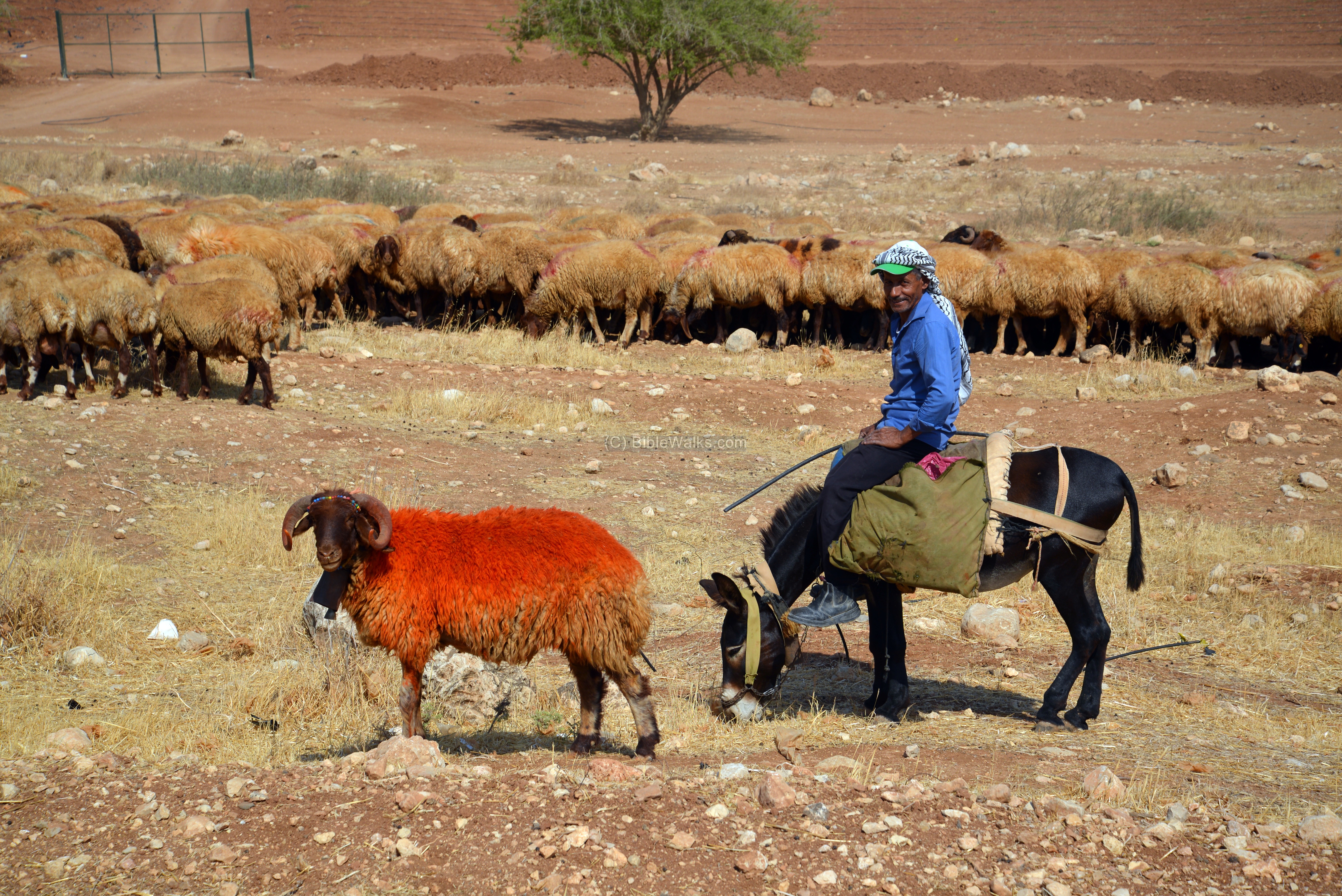
At the south part of Wadi Ifjim, where it meets the valley of Wadi Zamur, we noticed the flock of sheep grazing the dry weed.
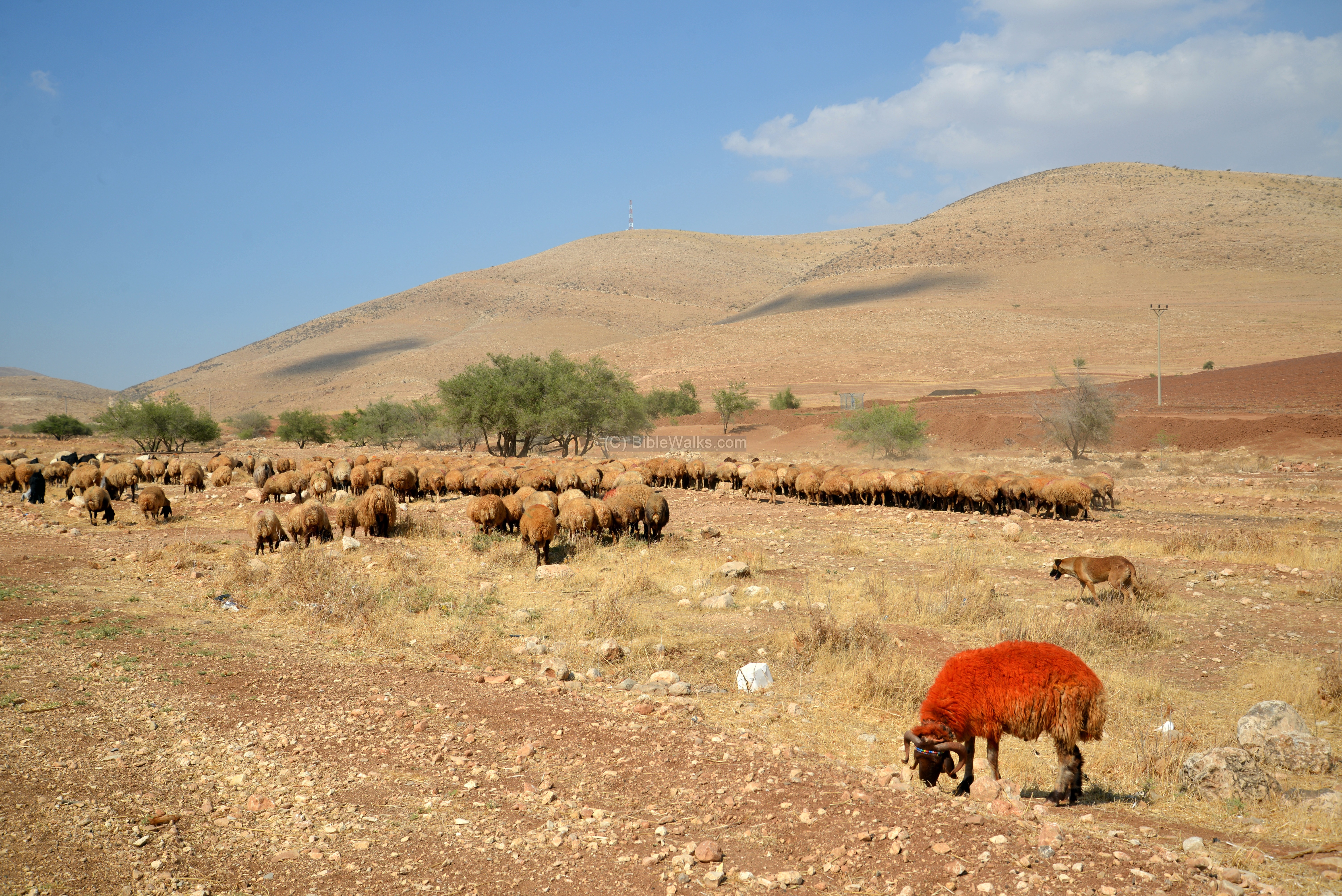
A single sheep was painted with a striking orange color. The shepherd explained to us why: the trick was that this prize sheep will stand out with its color, and the rest of the flock will follow.
(2b) Kh. Tuweiyil, Kh. Tawil; Tell es Suweid
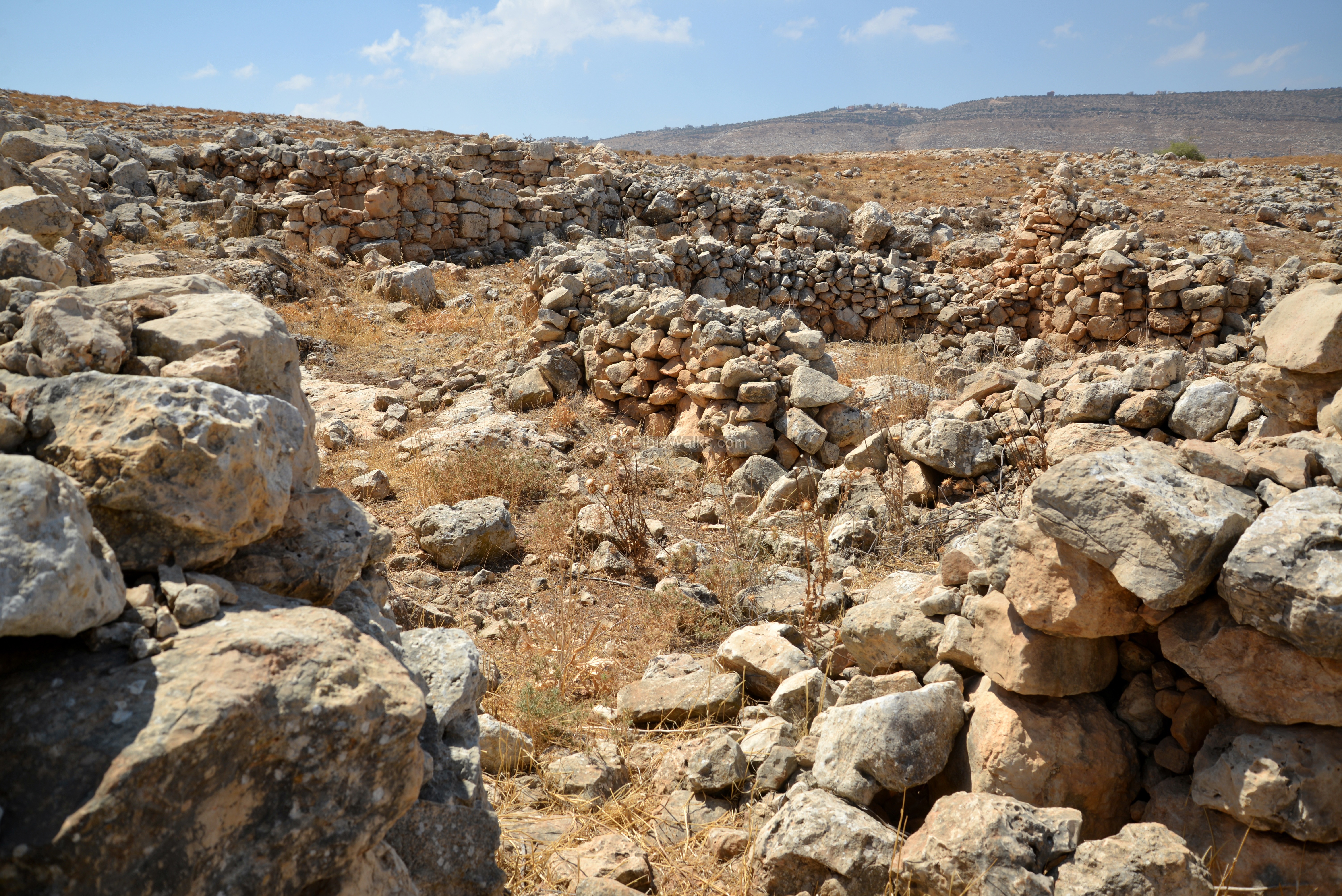
An ancient site is located south west of Moshav Gittit community, on the south side of the Allon road. It is detailed in the Manasseh Hill Country survey (Volume 4, site #159), and identified as a fortified farm.
In the center of the farm is a large (20m x 20m) structure with an irregular square plan, seen here from the south side. A valley (Wadi Manhur) crosses the north side (left) of the main structure. Across the valley is an enclosed area (upper left side).
The external walls of the structure are thick (2m wide), composed of large stones, without cement, aligned along straight lines.
Dating the site is based on ceramics collected by the survey team: its construction started in the Middle Bronze II and enlarged in the Iron Age II period. The site was also in use during the Roman and Medieval periods. This is one of the east most MBII sites in the area, as the dry desert could not sustain farming during those early times.
The entrance is from the east. Inside the structure, along the external walls, are at least 5 rooms built of smaller stones, as seen in the following photo. These were probably built as a later stage, and were used for residence.
South of the main structure are additional walled areas –
-
small rectangular (4 x 8m) structure 30m south of the main structure;
-
semi circular area (20m diameter), 15m south of the small structure (may have been used to support it);
-
a large (15m x 20m) paddock, 60m south of the main structure.
The farm depended on storing water during the few winter rains, then using it during the rest of the year. For this purpose, a set of cisterns and dams were built along the valley north of the main structure. Two water cisterns are located across the valley, 40m north west of the main structure. Four dams were built over the course of the valley, used for farming purposes and to channel the waters to the cisterns. The first two dams are built near the main structure, with both southern walls connected to the main structure. The other other dams are 30m and 45m west of the main structure.
On the north side of the road is a round hill (Tell es Suweid), where a modern water reservoir was built. It was surveyed by Porat in 1968 (p. 62) and Finkelstein et al. in 1997 (p. 799). The major period was dated to the Byzantine period, and also other periods were dated here (Hellenistic/Roman).
3. Southern section: Road #458
This section is from Ma’ale Efraim junction to Ma’ale Adummim. The area was part of the Biblical region of the Benjamin tribe.
(3a) Kida
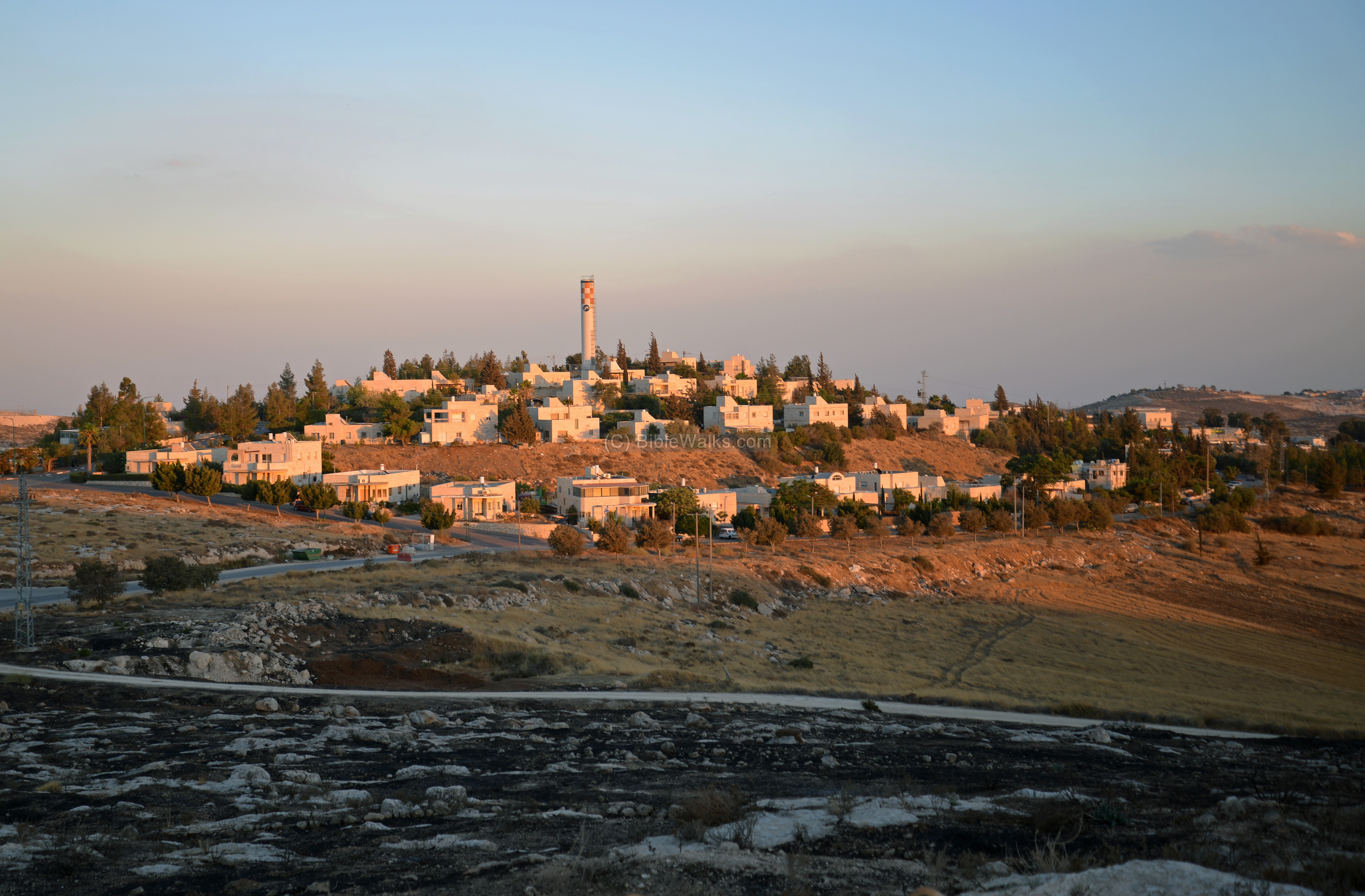
Kida is a new community (2003) established on the eastern side of Samaria, overlooking the Allon Road and the Judean desert.
In this view towards the north east, captured from the Kida tower, is a section of the Allon road. In the left background, 3km to the north, is the Arab village of Mejdel Beni Fadl. The Allon road bypasses this village around its south and eastern sides.
On the right side is the Arab village named Duma (Dömeh). It is the only Arab village east of Allon Road.
![]() Read more on Kida.
Read more on Kida.
(3b) Kh. Jibeit
Ruins of a multi-period village along the Allon road in the eastern Samaria area, adjacent to the cross roads of ancient roads. The 50 Dunam (5 hectares) site was settled almost continuously from the Early Bronze II period (30th century BC) until the Byzantine period (7th century AD). Biblical scholars suggest that it was a town in Ephraim named Giv’it or Giv’on.
![]() Read more on Kh. Jibeit
Read more on Kh. Jibeit
(3c, 3d) Kh. Samiya and Kh. Marjameh
Ruins of a Roman/Byzantine period village, located near the rich Samiya spring on the foothills of Mt. Baal-Hazor in the eastern Samaria desert region. A unique Middle Bronze cemetery is located on its south side.
![]() Read more on Kh. Samiya
Read more on Kh. Samiya
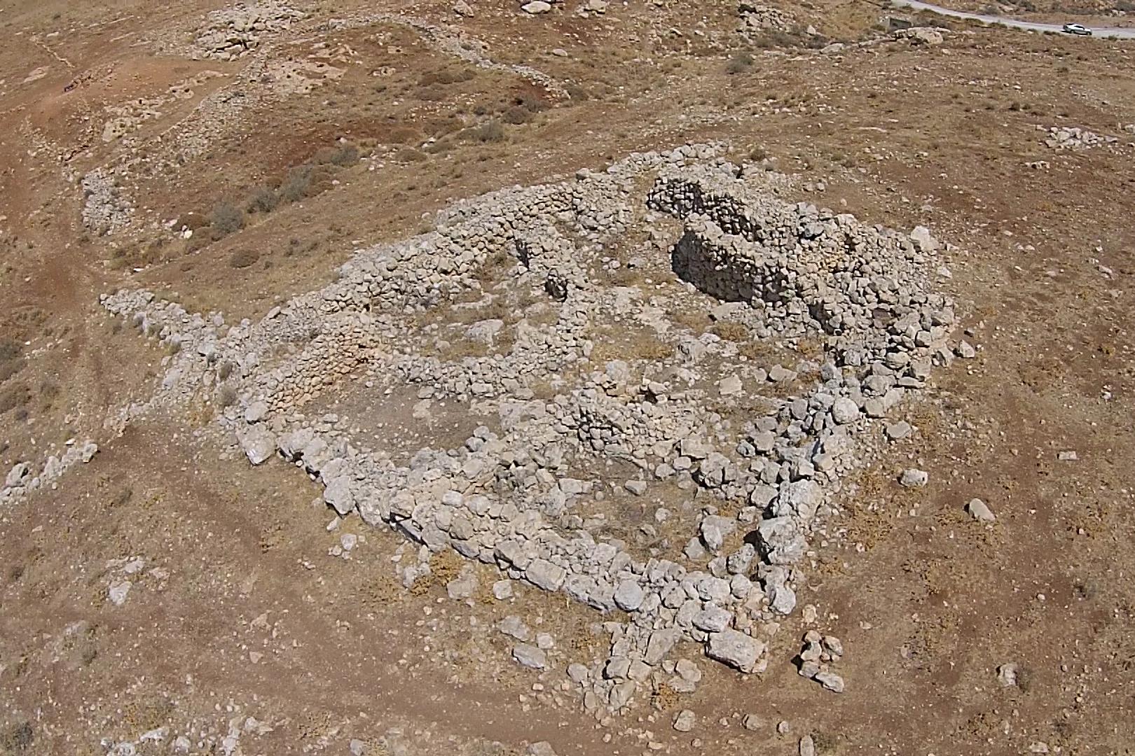
North of the Roman ruins, on the east side of the rich Samiya spring, are remains of an ancient city above a fortified hill. Its Arabic name – Marjameh – means “ruin of the heaps of stones”, which indeed describe the look of the remains.
According to the surveys and brief excavations, this was a major Israelite city, which was first a Canaanite city, then fortified at the end of the 10th century BC, lasting until the Assyrian conquest. Scholars suggest several identifications to this primary Biblical city.
![]() Read more on Kh. Marjameh
Read more on Kh. Marjameh
(3e) Kokhav Hashachar
Kokhav Hashahar was established in 1975, and today is a religious community with over 350 families. On its south side is the mountain of Kubbat an Nejmeh, rising 724m above sea level and 1,000m above the Jordan valley. Remains of a ruined village are located on its Northwest foothills, a sheikh’s tomb on its peak, and ruins of a Hasmonean fortress – turned to monastery – on its south side.
![]() Fly over the site with this YouTube video.
Fly over the site with this YouTube video.
(3f) Kh. Kilya, Rimonim
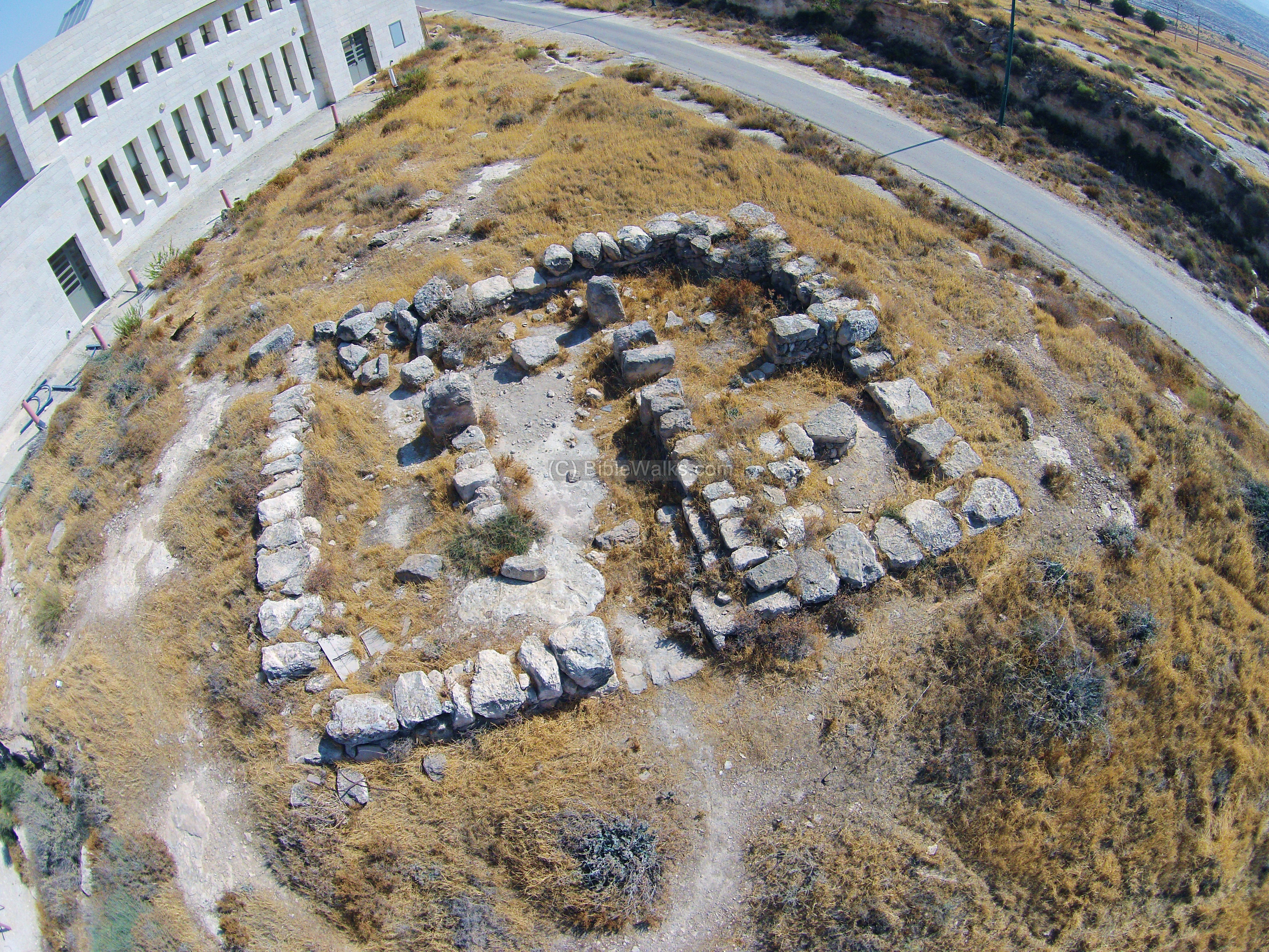
Ruins of a Roman fortress, converted to a Byzantine monastery, are located in the Rimonim community in Samaria.
The 20 Dunam complex of Kh. Kilya includes 2 interconnected square structures, dated to the 4-5th century AD (Late Roman on the north side) and 6th century AD (Byzantine monastery on the south side).
![]() Read more on Kh. Kilya.
Read more on Kh. Kilya.
(3f) Ma’ale Mikhmas
Ma’ale Mikhmas is a communal settlement (established 1981) in Benjamin region, north east of Jerusalem, situated along the Allon road near the Biblical city of Mikhmas (Michmas). Several Biblical texts refer to the place.
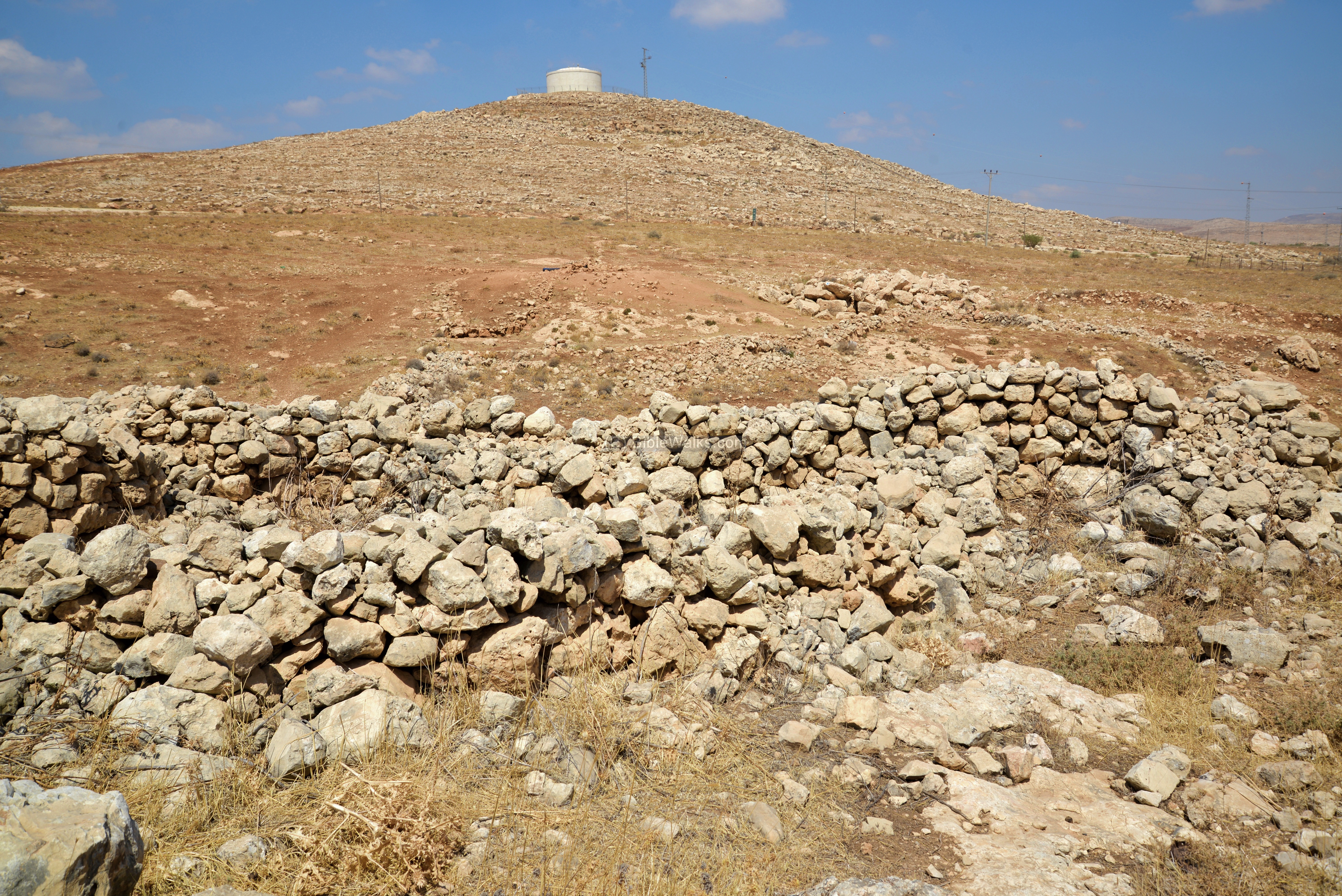
A late Iron Age fortress was excavated on the north side of Ma’ale Mikhmas. The square fortress (8.5m x 9.0m) was built at the end of the 7th century BC, and was destroyed during the Baylonian conquest. Its walls are made of 0.8m wide hewn stones, with a plan type of a three-room house.
According to the excavator S. Riklin, the fortress commanded 2 east-west roads, one of them (to Jericho) was described in 1 Samuel 13:18: “…the way of the border that looketh to the valley of Zeboim toward the wilderness”.
A large Necropolis, with dozens of shaft tombs, was discovered on two hills around the community (the water tower hill and the observation post hill). The tombs are dated to the Intermediate Bronze period (2200-2000 BC).
![]() Read more on Michmash.
Read more on Michmash.
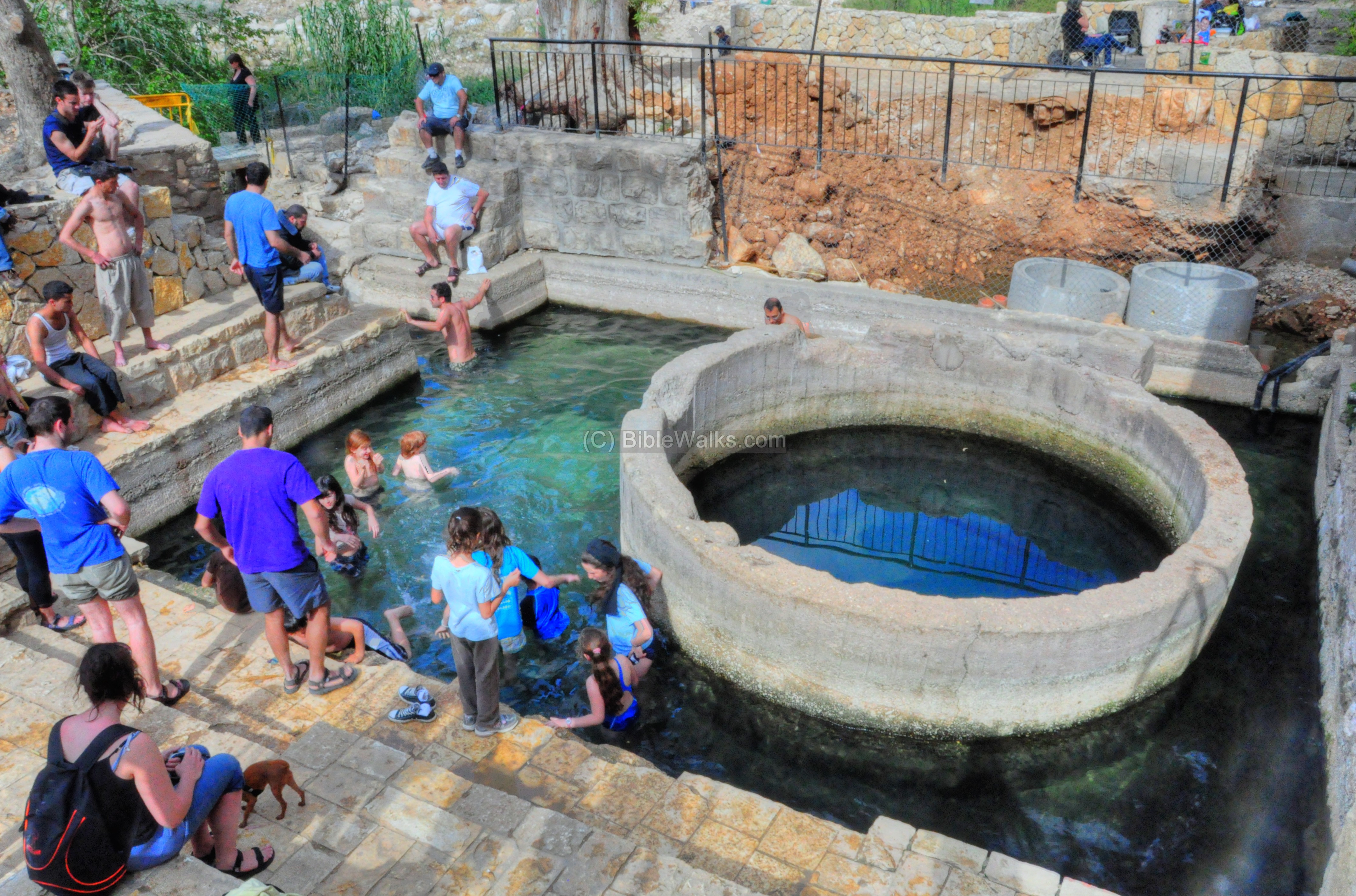
(3g) Ein Mabua spring
Allon road crosses dozens of dry valleys in its winding course along the Samaria desert. On its southern section, the road crosses Nahal Prat valley (Wadi Qelt). This valley runs down from Jerusalem eastwards to the Jordan valley, north of the Dead Sea.
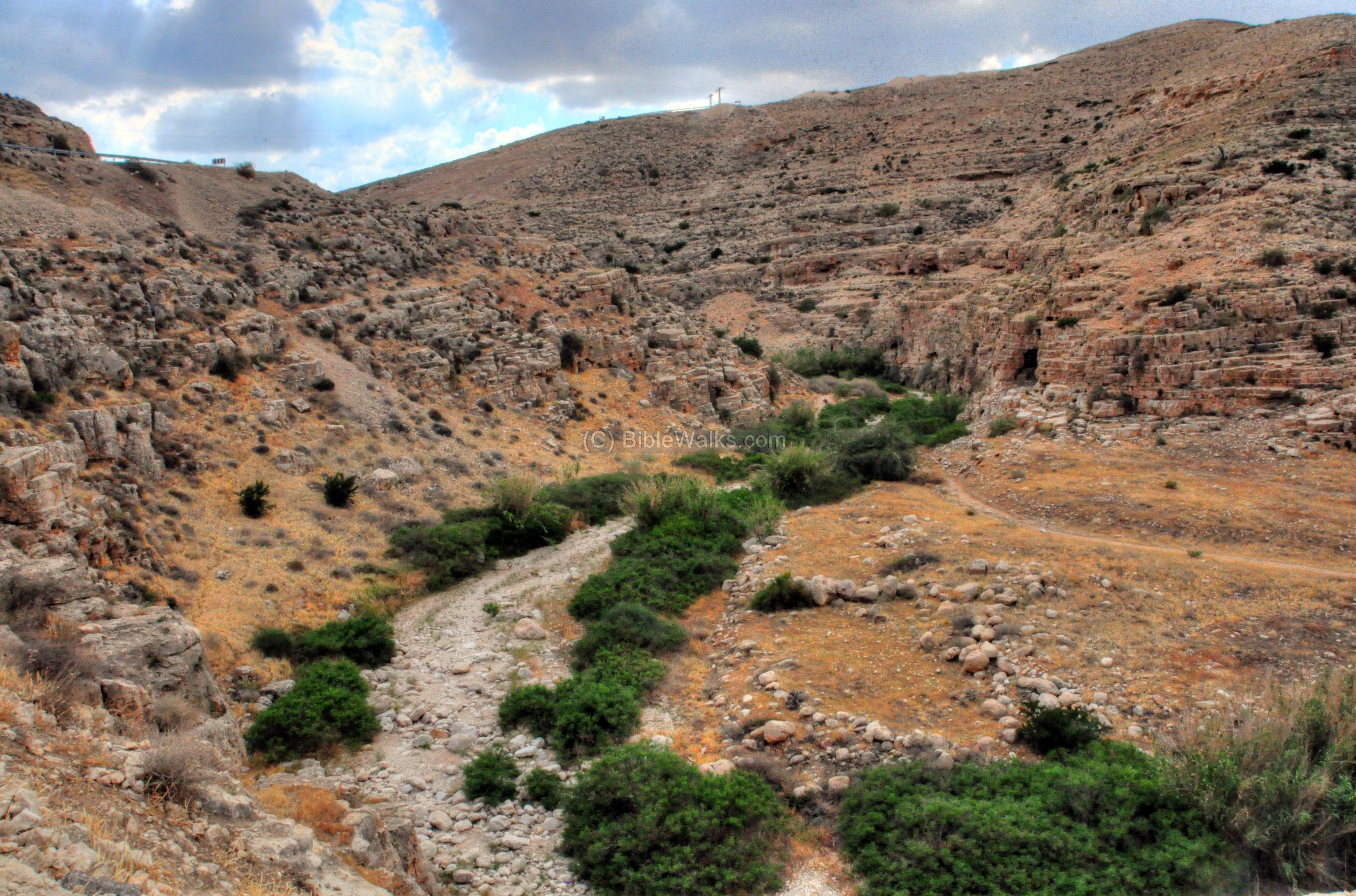
In this riverbed are three major springs. Remains of a Hasmonean aqueduct can be seen on the south (left) side of the valley, conveying the spring waters from the first spring down to the Hasmonean and Herodian Kypros fortress.
The middle of the three springs, which is close to the Allon road, is named Ein Mabua (Arabic: En Fawwar). Ein Mabua is a sort of geyser: it empties completely and refills every day.
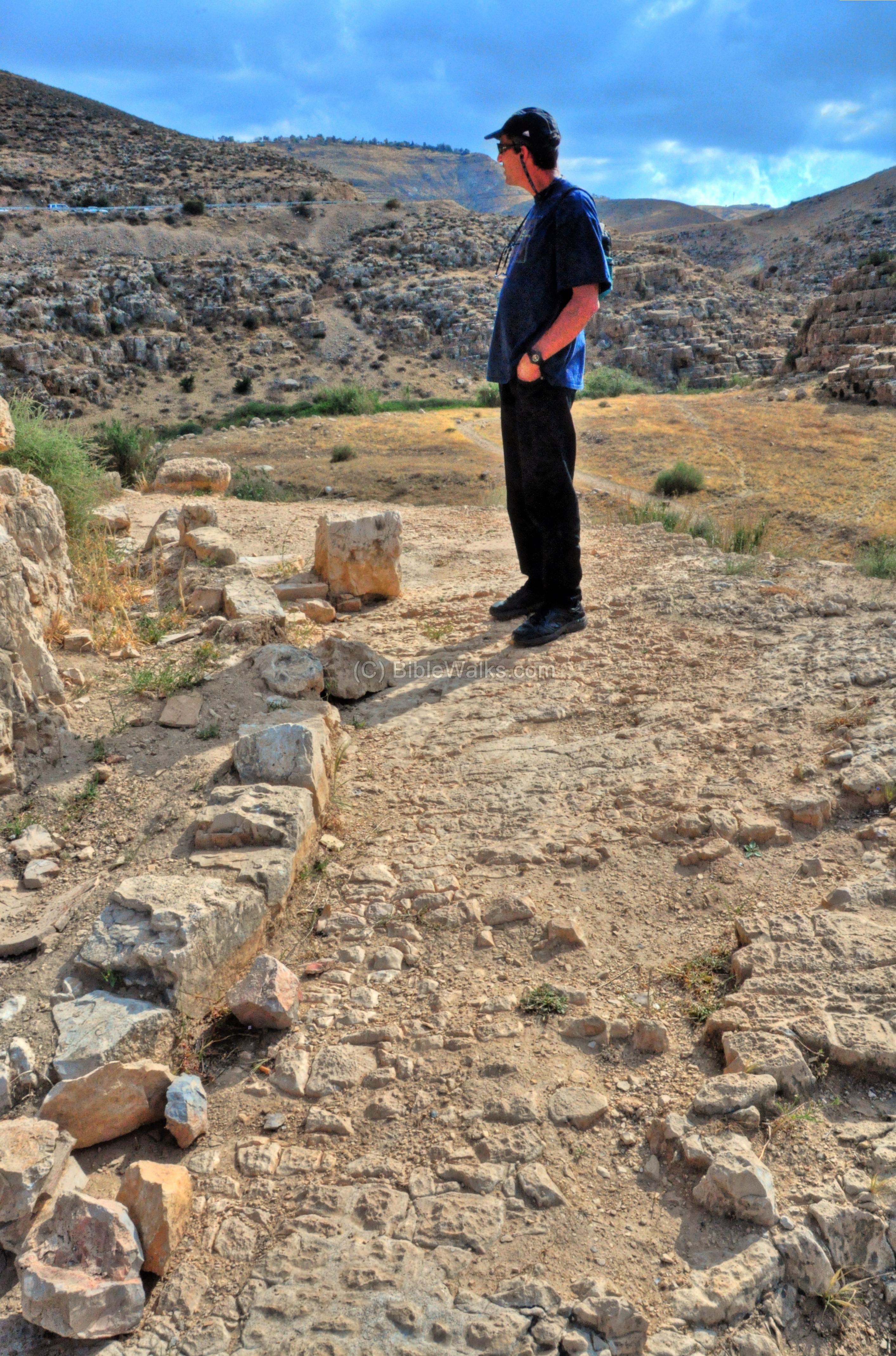
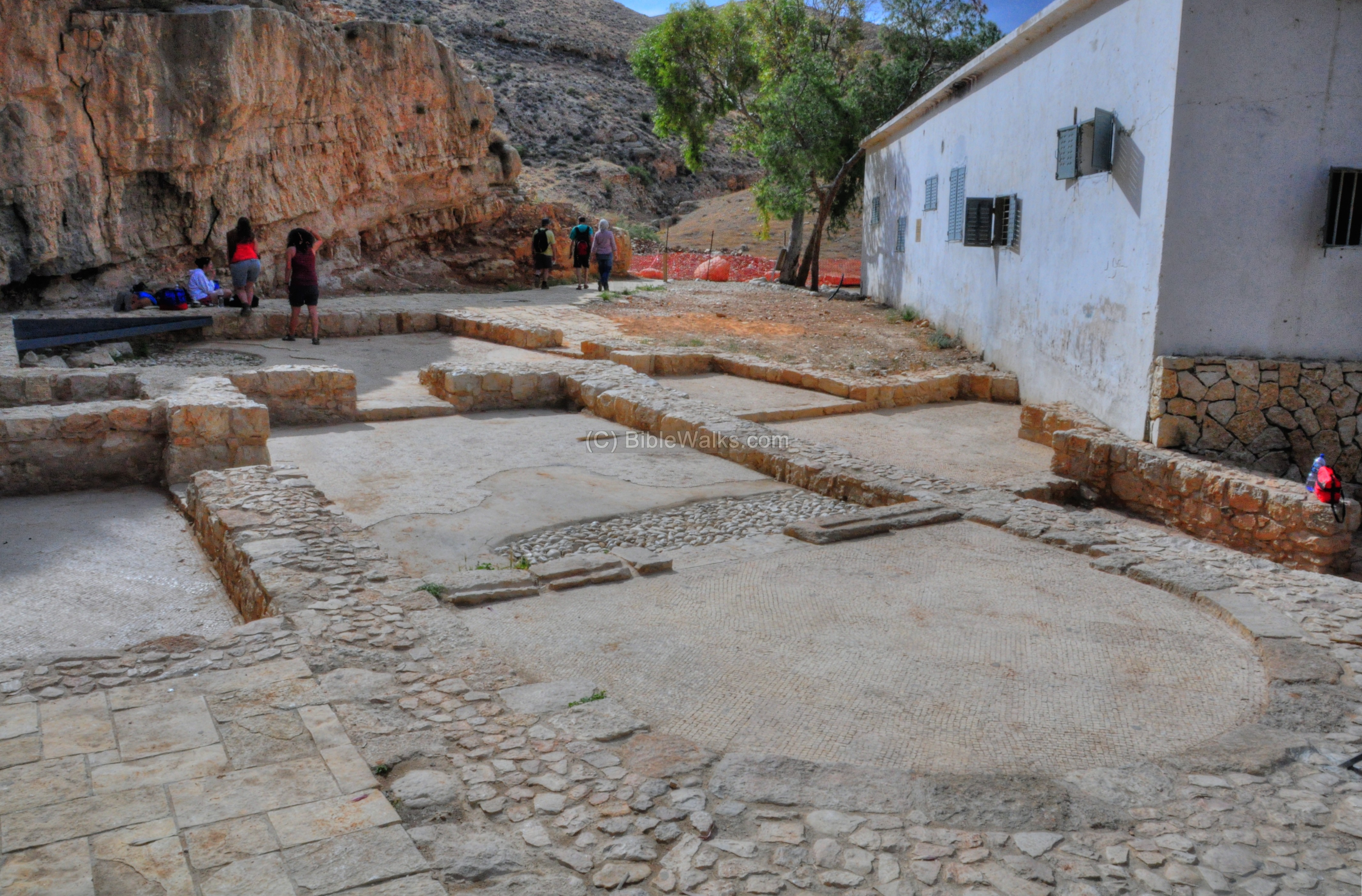
Remains of a Byzantine monastery are located at the side of the spring. The apse of the church is seen here on the right side, paved with a mosaic floor.
Etymology (behind the name):
* Names of the place:
- Allon – Hebrew: oak; named after Igal Allon.
Links and References:
* External:
- The Six-Lane desert Enigma – Eretz magazine Dec 15, 2014 pp 67-77
- West Bank Area “C” map – pdf
- IB cemetery near Geva Binyamin – Y. Aharonovich, Hebrew
- The Manasseh Hill Country survey – Volume II: The eastern Valleys and the Fringes of the desert – Adam Zertal
- The Manasseh Hill Country survey – Volume IV: From Nahal Bezeq to Sartaba – Adam Zertal
* Allon road sites reviewed in BibleWalks:
* Other Biblewalks sites:
- Drone Aerial views – collection of Biblical sites from the air
- Maps – Samaria sites and Judea sites
BibleWalks.com – exploring Ephraim
Marjameh <<<—previous site—<<<All Sites>>>—next Samaria site—>>> Arumah
This page was last updated on Apr 16, 2023 (add el-Hilu)
Sponsored links: