Kida is a new community (2003) established on the eastern side of Samaria, overlooking the Allon Road and the Judean desert.
Home > Sites > Samaria > Allon Road > Kida
Contents:
Background
Location
History
Photos
* Allon Road
* Duma
* Vineyards
* Cisterns
* Kida Valley
* Misc
Etymology
Links
Overview:
Kida is a new community (2003) established on the eastern side of Samaria, overlooking the Allon Road and the Judean desert.
Location and Map:
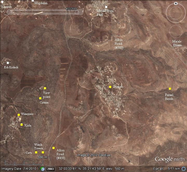
The location of Kida, and the places around it, are indicated on this aerial map.
History:
Conder and Kitchener surveyed this area during the Survey of Western Palestine in 1882. A section of their map is here:
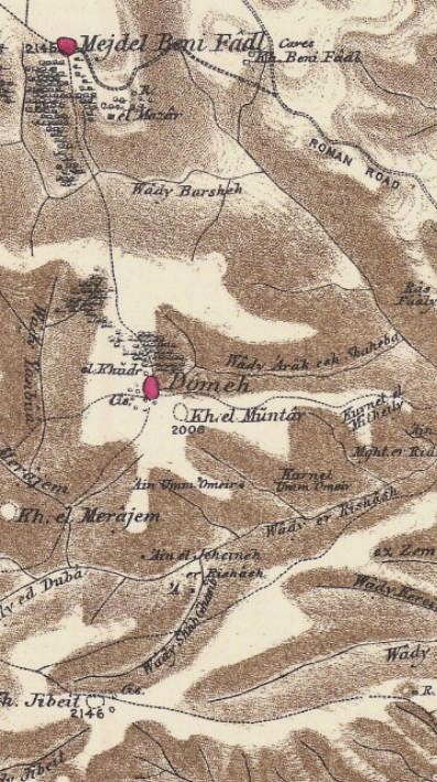
Part of map Sheet 15 of Survey of Western Palestine,
by Conder and Kitchener, 1872-1877.
(Published 1880, reprinted by LifeintheHolyLand.com)
They reported on their account of the villages and ruins around the site (SWP, Vol 2):
“Dömeh (Duma): A small village on the top of a ridge. It has cisterns and ancient rock- cut tombs. There is a spring, ‘Ain Umm ‘Omeir, 3/4 mile south-east of the houses. On the north is the ruin of a place sacred to el Khudr, St. George. There are olives to the north. Domeh is noticed in the ‘Onomasticon’ as Edumia, 12 Roman miles from Neapolis ; the true distance is about 13 English miles from Nablus”.
“Rock-cut tombs with loculi occur near the village, and numerous cisterns. The little mosque is an old Church of St. George, in the walls of which drafted stones are used.
‘The village was formerly defended by two towers, one on the east and the other on the west. One of them was 18 paces long by 13 broad, and the other was 17 paces long by 8 in breadth. Some of the lower courses are still in place, and show that the towers were built of stones of large dimensions, some cut smooth and others in boss. These remains, separated by a space of about 750 yards, prove ancient work. The antiquity of the site is also proved by the numerous excavations in the rock, such as cisterns and subterranean magazines, found everywhere. (Guerin, Samaria, ii. 15)”.
“Khurbet Jibeit: Foundations, cisterns, and rock-cut tombs, now blocked up ; drafted stones, with the rustic boss. The masonry is of moderate size.
Khurbet el Muntar: Foundations and heaps of stones near Duma, probably an old watch-tower.
Khurbet el Merajim Foundations and heaps of stones.
El Mugheir A small village of stone houses, on a ridge, with olives to the west, and beautiful corn-land.
Mejdel Beni Fadl: A small village on the top of a hill, with olives on the south and west, and a small sacred place on the south-east. On the east are caves, and there are tombs and rock-cut cisterns near the village. This place appears to be the Magdal Senna of the Onomasticon, though the distance to Jericho docs not agree, being 16 English miles from Jericho instead of 7 Roman. Probably the a may have dropped out in the Greek, and we should read 17 Roman miles.
Khurbet Beni Fadl: Foundations of buildings and caves”.
-
Modern times
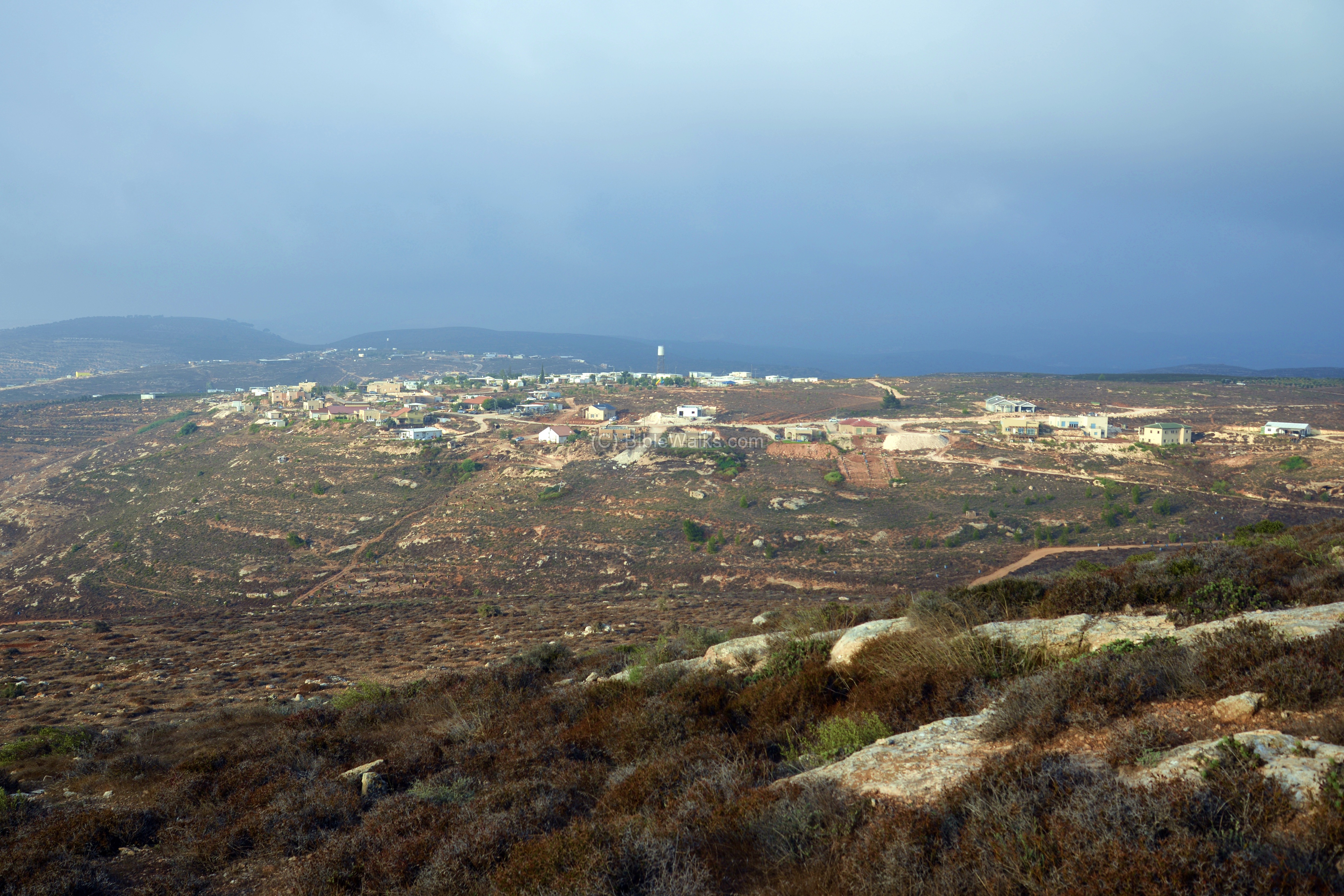
Kida is a new community (2003) established on the eastern side of Samaria, overlooking the Allon Road and the Judean desert. It started as a military post, then resettled with civilian Jewish settlers. More than 50 families live here, and the community is further expanding.
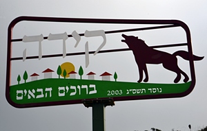
Welcome sign to Kida
Kida is one of the half dozen new Jewish communities in the Shiloh cluster, which includes Shiloh, Shvut Rachel, Adi- Ad, Esh Kodesh and Akhia. They are part of the Binyamin (Benjamin) Regional council.
Below, a view of the Kida community from the north.
Photos:
Allon Road:
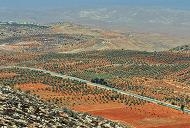
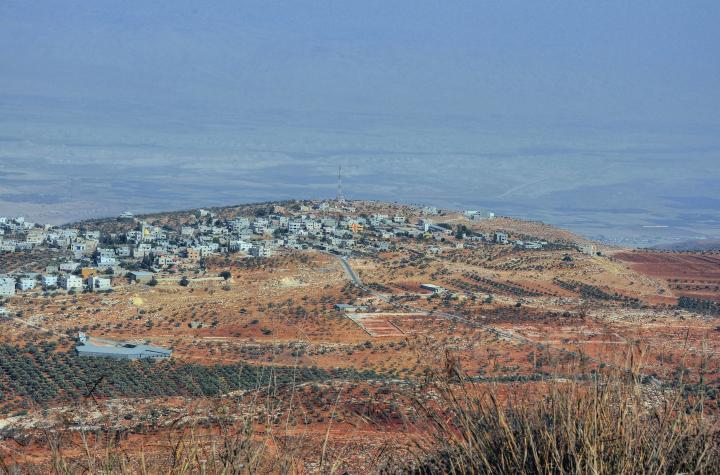
The old military post of Kida is a great place to view the eastern side of Samaria. It overlooks the Allon Road, which connects Ma’ale Adummim in the south (near the Good Samaritan Inn), to Mehola in the north.
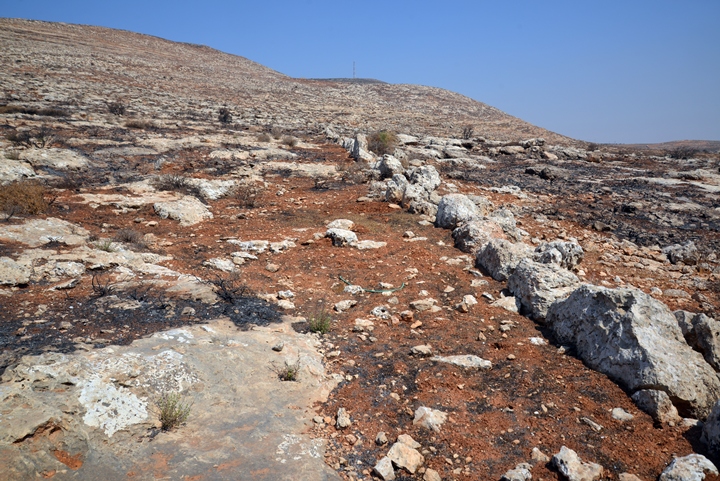
The following photo shows the place from the south side. The Kida view pointy is located near the antenna on the hill, overlooking the Samaria desert on the east. The hills are mostly barren, and a recent fire cleaned out all the small bushes that grew along the foothills.
A section of the Allon road is seen on the upper right side.
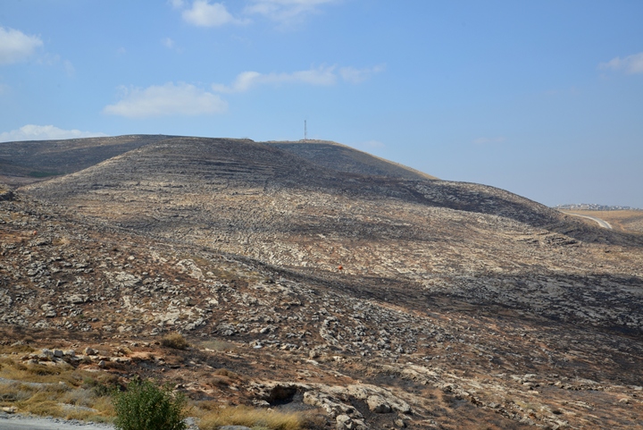
The Allon road is named after the plan conceived by the late Igal Allon, who drafted it in 1967 in order to plan the settlement and control of Samaria and Judea. This section is numbered road #458 – the southern section of Allon road.
In the left background, 3km to the north, is the Arab village of Mejdel Beni Fadl. The Allon road bypasses this village around its south and eastern sides: just before arriving to the village, the Allon road turns east (to the right), then north again along its central section (road #508).
Duma:
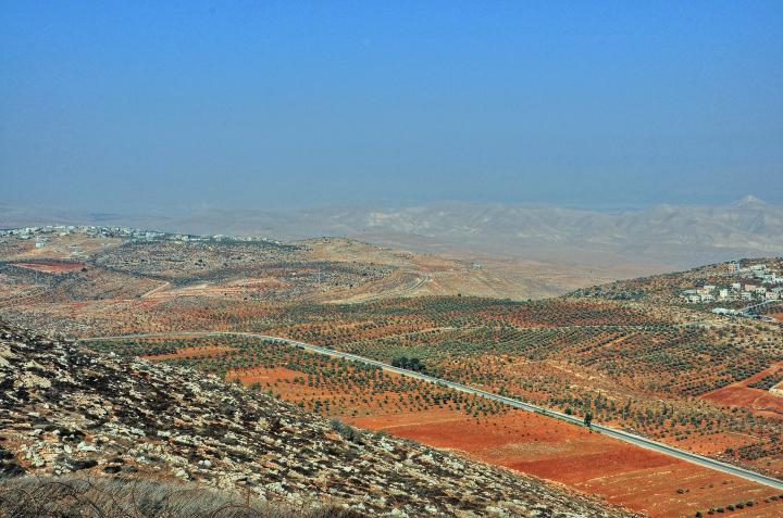
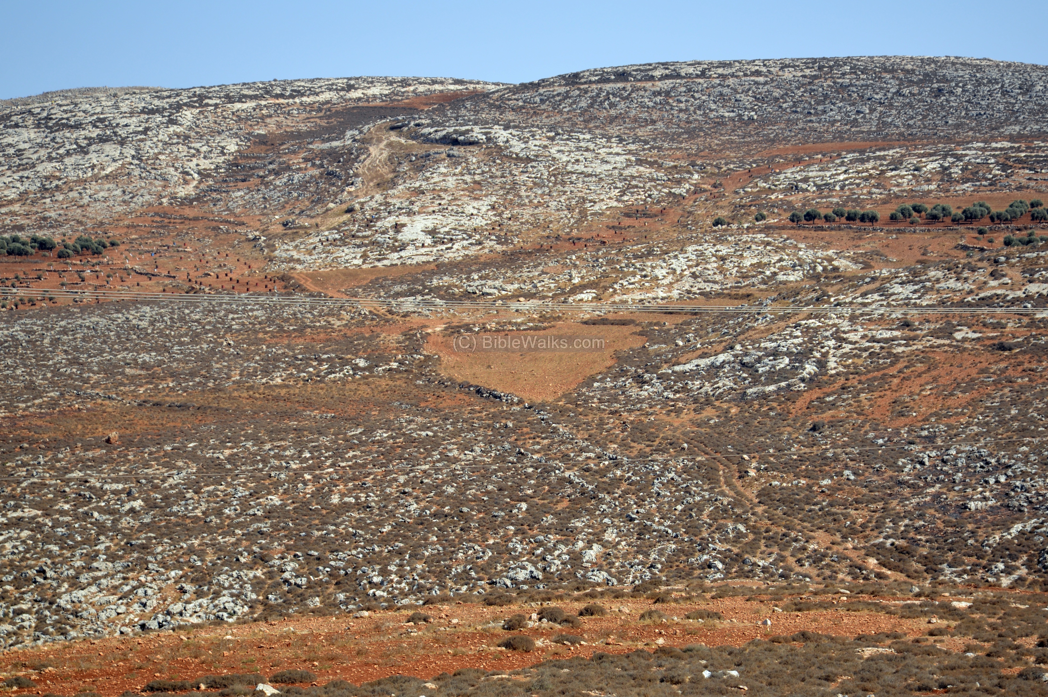
Looking towards the east – is the village named Duma (appears as Dömeh in the PEF map). It is the only Arab village east of Allon Road.
Behind the village of Duma, in the far background, are the barren hills of the northern Judean desert. Behind, in the very far background, is the section of the Jordan valley near Adam.
In the center of these hills is a pyramid-shaped hill towering over the mountain ridge. This hill is the location of the ruins of the Sartaba fortress – which was built by the Hasmoneans in the 1st C BC. It was also known as Alexandrion or Alexandrium, and in Biblical times this place was identified as Zaretan. Its location was a landmark referred by the Bible, described as a place “beside” Adam – the place of the crossing of the Israelites during the Exodus (Joshua 3 14, 16): “And it came to pass.. to pass over Jordan … very far from the city Adam, that is beside Zaretan”.
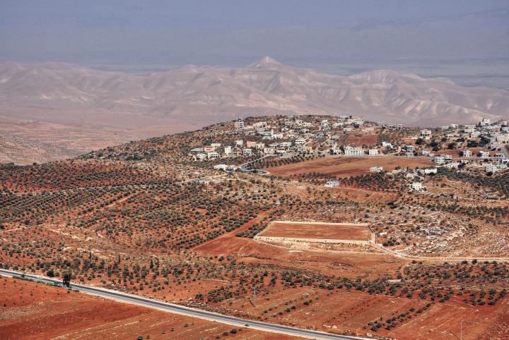
The southern side of Duma is seen here below. As reported in the 19th century SWP report, the village was protected by a wall and towers on both west and east sides.
- Munttar – scapegoat ceremony for Shiloah
Behind (east) of the village is Kh. el Munttar (the “Watchman”) – probably the ruins of one of the towers.
At Kh. Muntar are also traces of ruins dated to the Iron age (Biblical times). Therefore, it was suggested as the place of the scapegoat annual ceremony (‘Azazel in Hebrew), where a goat was carried out from the temple to the desert and thrown away to the abyss. This place, according to this suggestion, served the religious center of Shiloh during 1200-1050BC. After the destruction of Shiloh, the center of worship relocated to Jerusalem, and therefore the ceremony moved south to Jabal Munttar (bearing the same name).
From Duma is a trail that descends down to Fazael (Phasael, Phasaelus, Phasaelis), passing through a spring and brook that flows to the Jordan river. At the mouth of the valley is a Biblical site, which is identified as Ataroth.
Vineyards:
One of the sources of income – and pride – of the settlers in Samaria is the production of quality wine. The grapes that are grown in the hills of Samaria enjoy the warm days and cool nights, which make a good recipe for good wines.
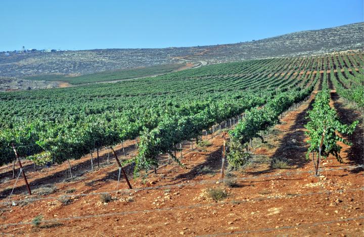
Wine and Olive oil was one of the main sources of income during the ancient times. Samaria, as well as all regions in the Holy Land, has hundreds of ancient winepresses and oil presses cut into the rocks. Now the settlers revive the wine industry, including two local wineries (Shiloh and Talia) located in nearby Shiloh.
In ancient times the press was built inside the grape vineyard, as the wine must be processed without delay from the time the grapes are picked. Inside the community is an old wine press, dated to the Roman period, seen in the following photo. Another one is located near the Kida old military camp.
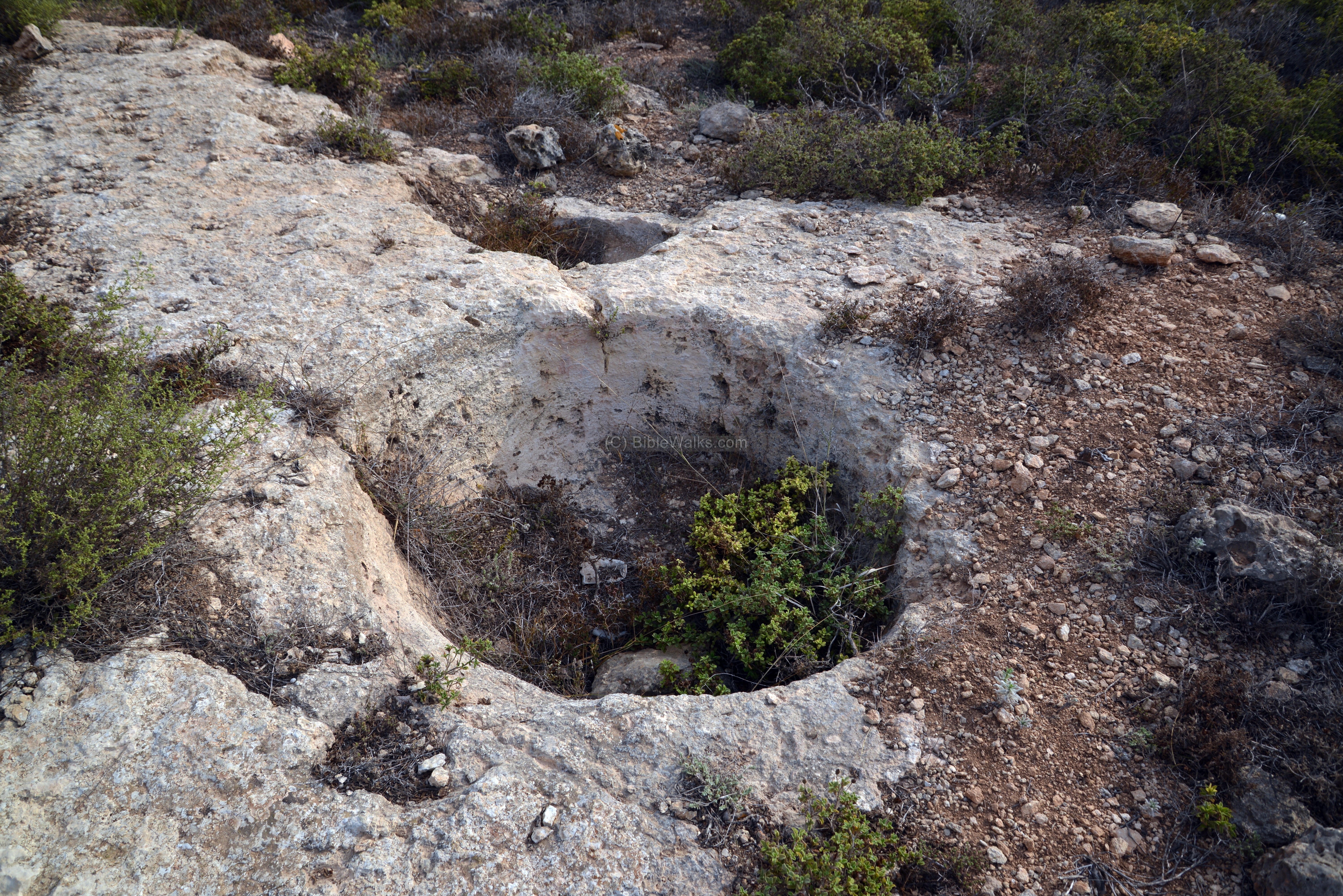
Cisterns:
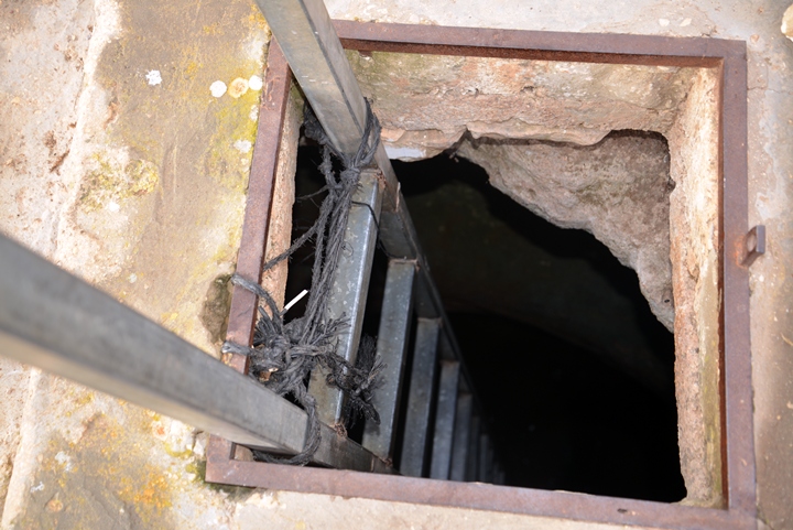
This mountain area is dry, as it is on the fringes of the Samaria desert. The ancient means of water supply was based on water cisterns, that collected the runoff rain water and stored them for use during the dry season. One of the cisterns is located on a hill south of the antenna. This ancient cistern was probably hewn more than 2,000 years ago, and was used by the shepherds to water their herd.
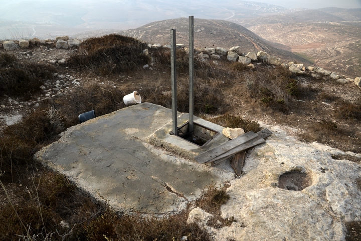
However, the cisterns are used today by the Jewish settlers as a Mikveh, for the purpose of ritual immersion. They added a ladder in order to step down into the waters.
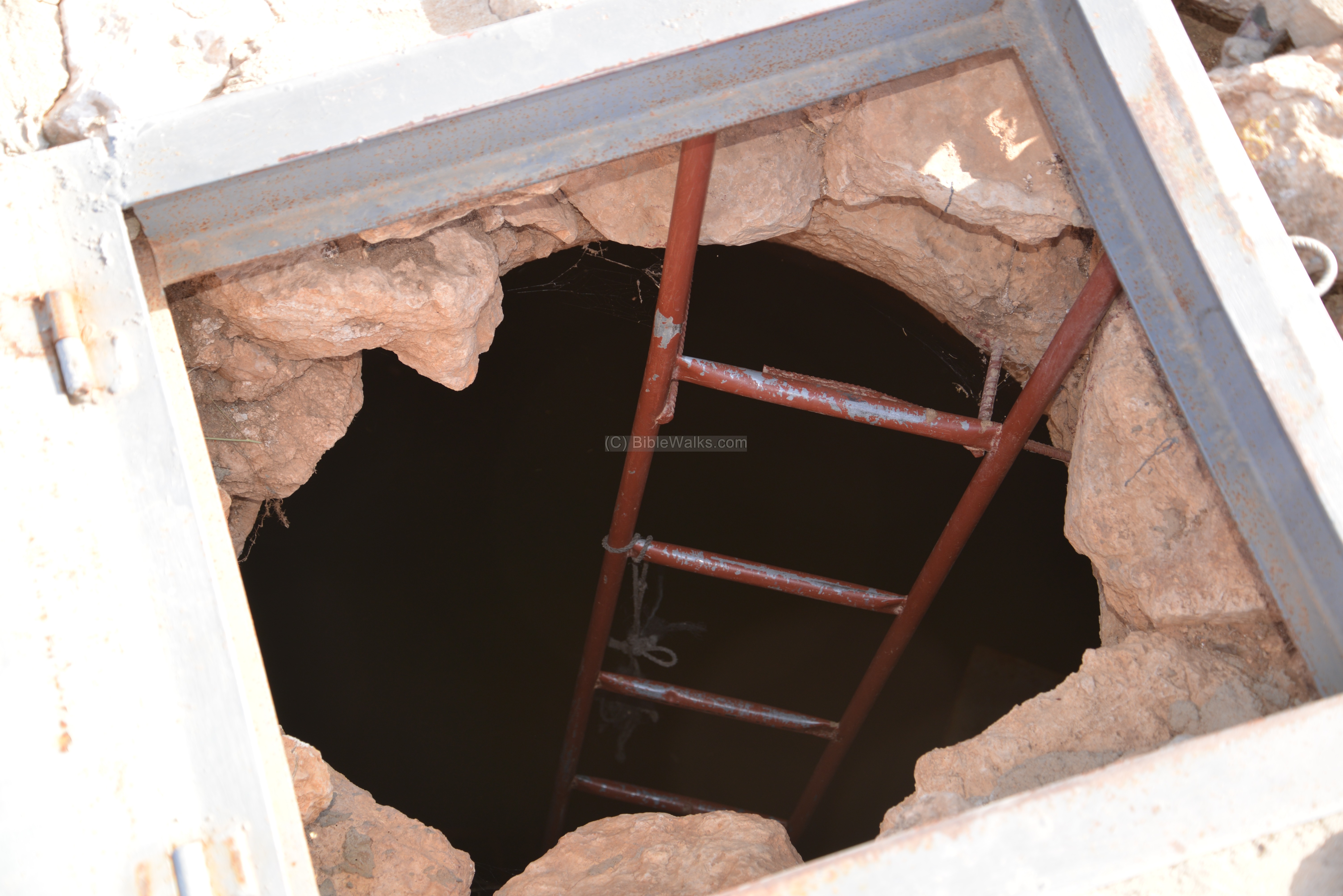
Another example is in the valley below, just above the junction below Kida.
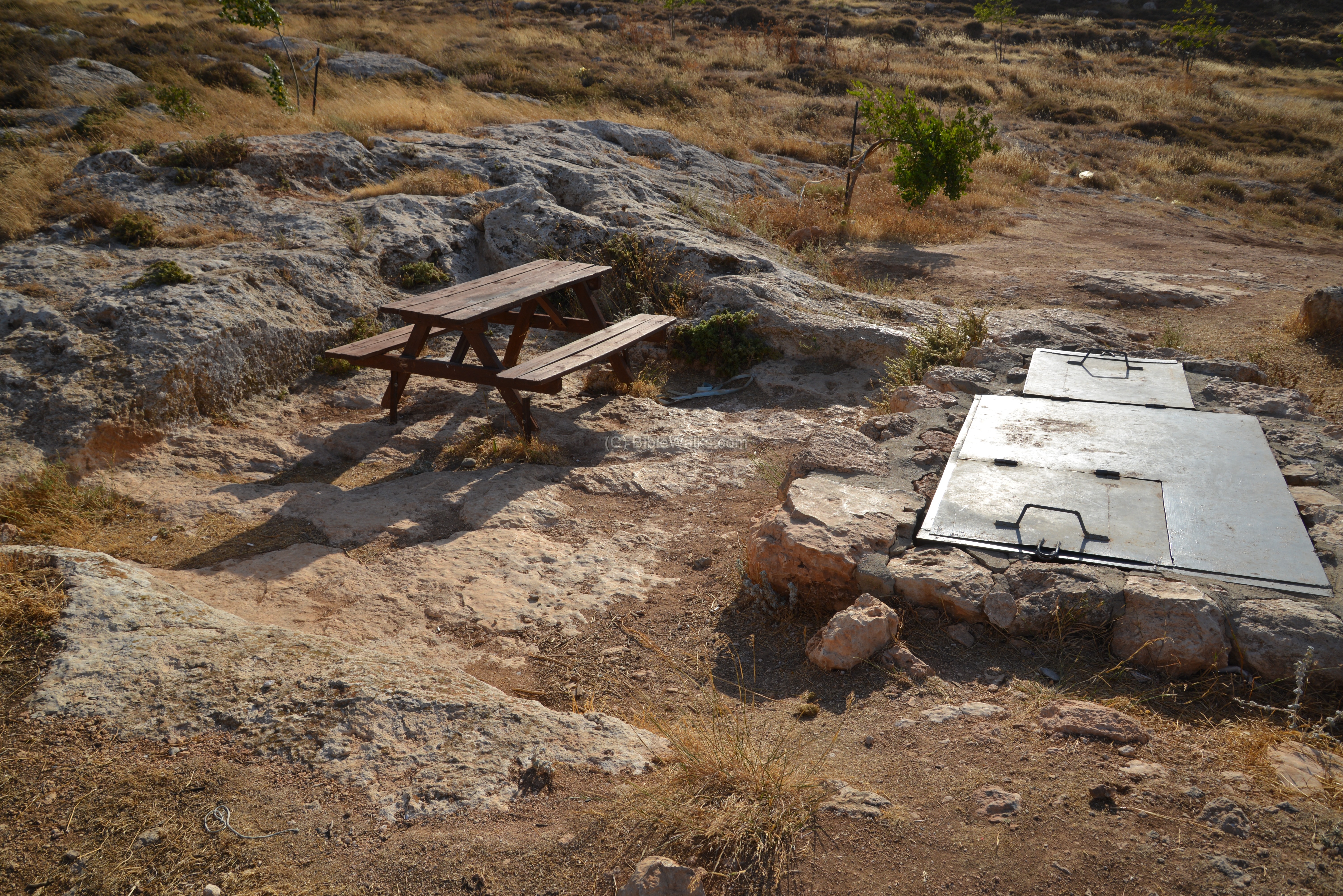
Here too the cistern was converted to a Mikveh by adding a ladder.
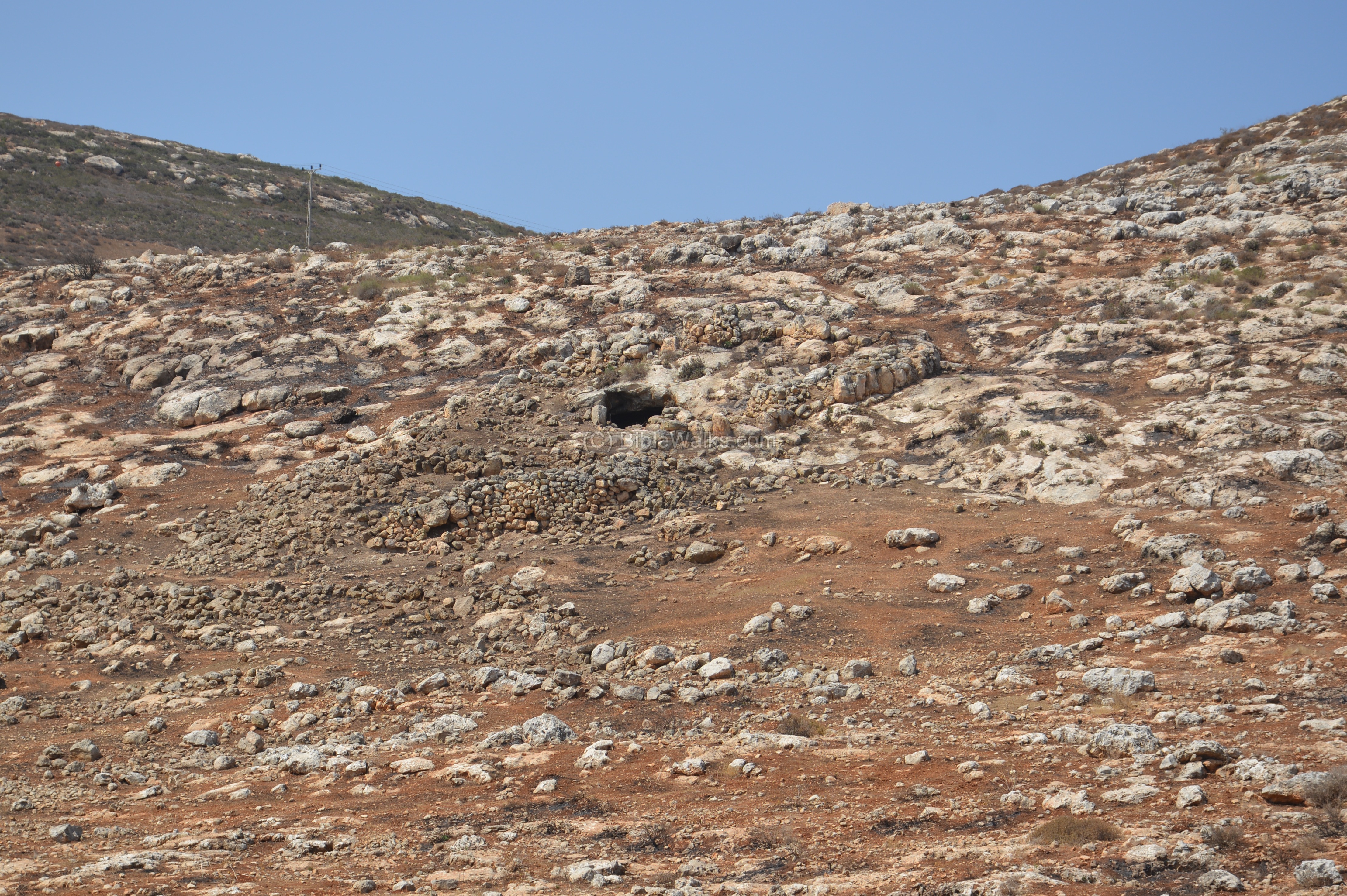
Kida valley:
In the valley east and below Kida, near the Alon junction with the road that ascend to Shiloh, is a cave which was converted to a dwelling place.
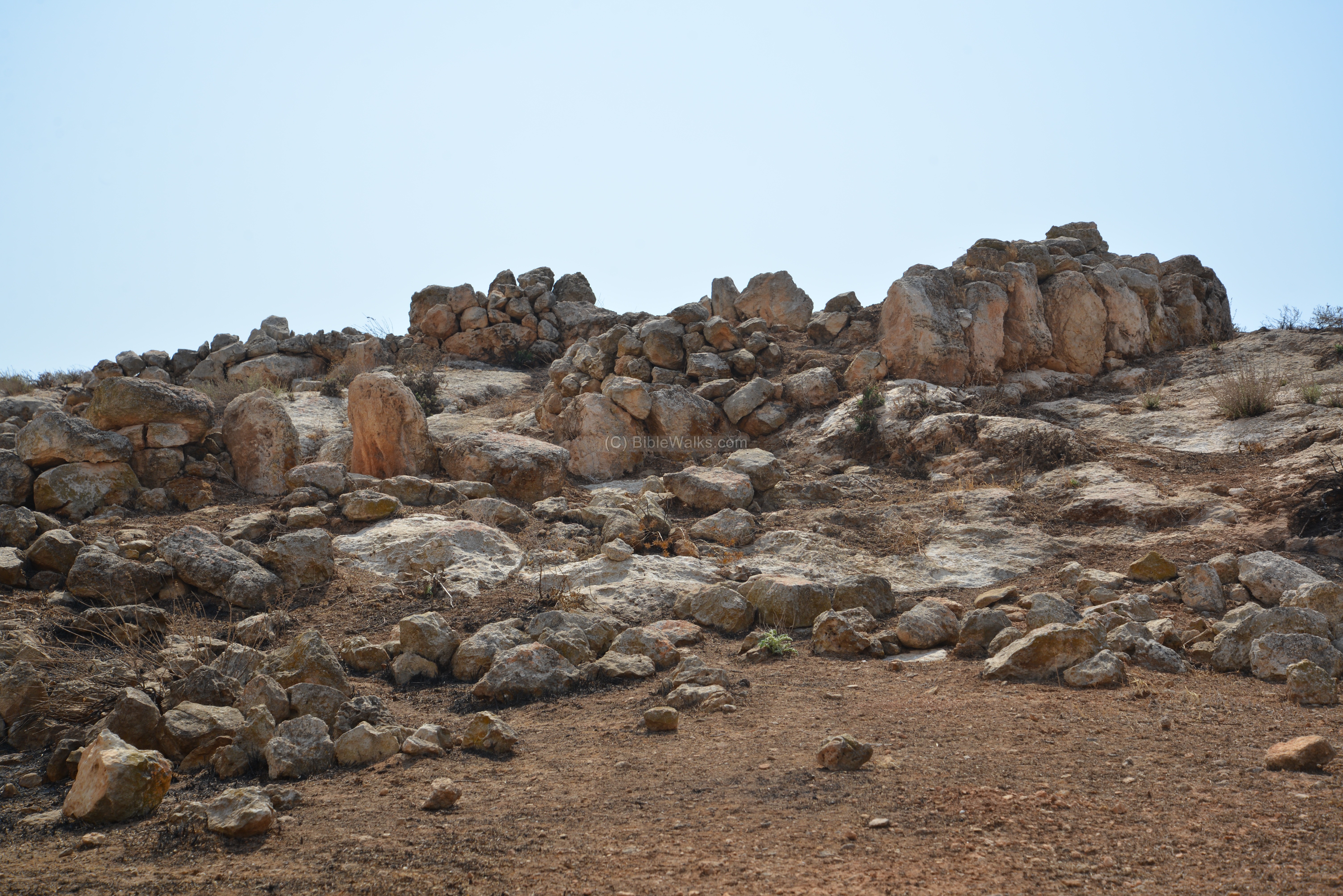
A closer view on the entrance to the cave is in the next photo. Notice the entrance to the complex, with two large upright stones on both sides, flanking a staircase:
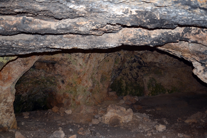
The interior of the cave:
Several rooms are built around the entrance to the cave:
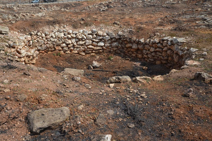
A large pit is located not far from the Allon road. This was a kiln, which used to burn limestone in order to produce Calcium oxide (aka, quicklime or burnt lime). The lime was then used as a sealant to cover the surfaces of the cisterns, thus preserving the water in the reservoirs. It was also used as a key ingredient for making cement.
An illustration of a lime kiln, dated 1882, is shown here. This is from a book by CH. W. Wilson , one of the PEF explorers. (The lime kiln was illustrated in the valley of Berachah, between Tekoa and the road from Hebron to Bethlehem).
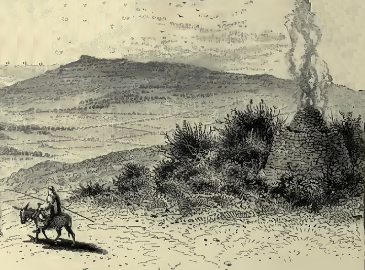
Ch. W. Wilson, Picturesque Palestine, 1882, Vol III P. 184
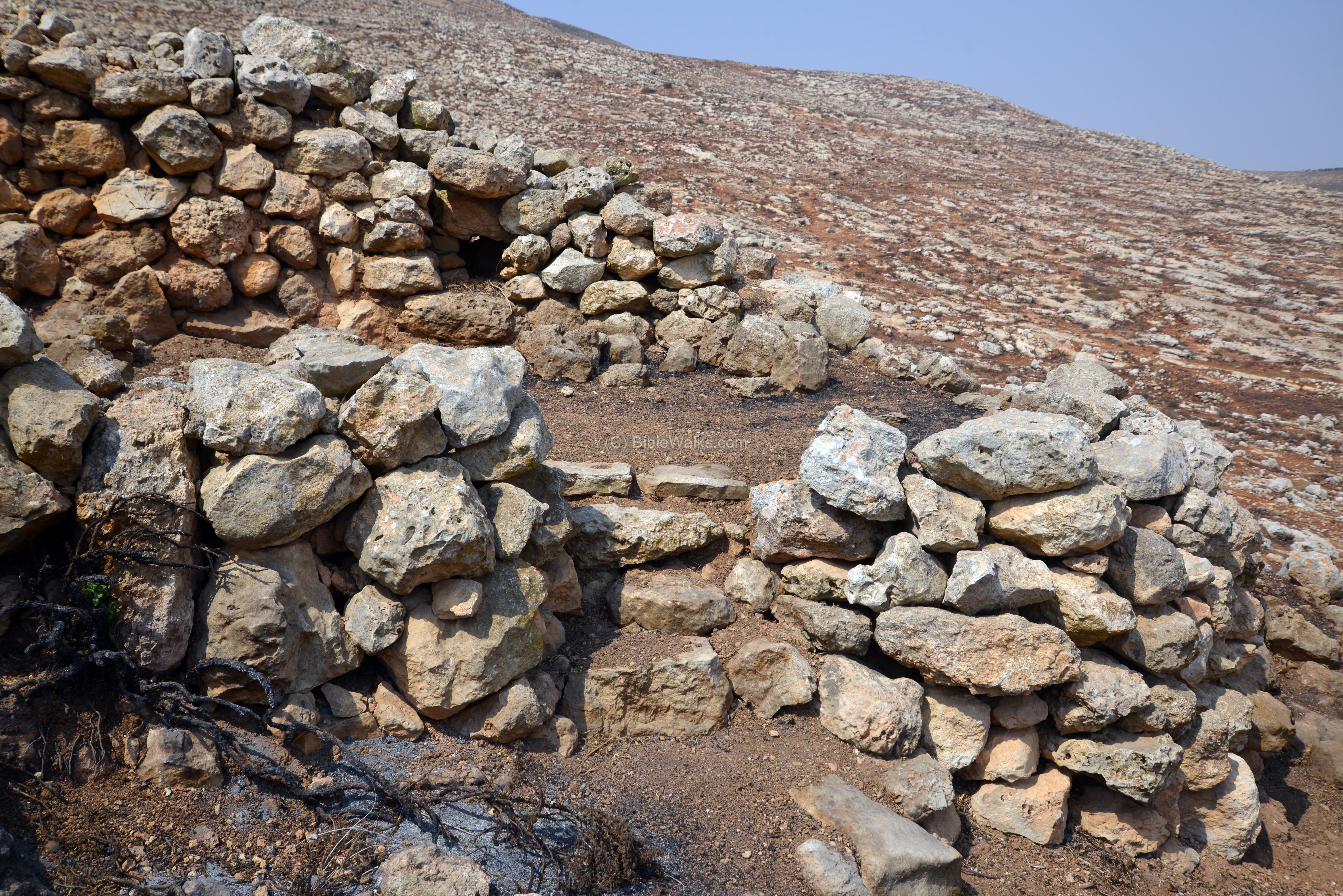
Near the kiln are ruins of two small watch towers, 3-4m in diameter and 1-2m high, built with large stones. Here is the first one:
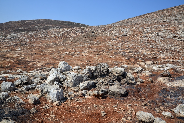
The second structure, which is smaller, is located nearby:
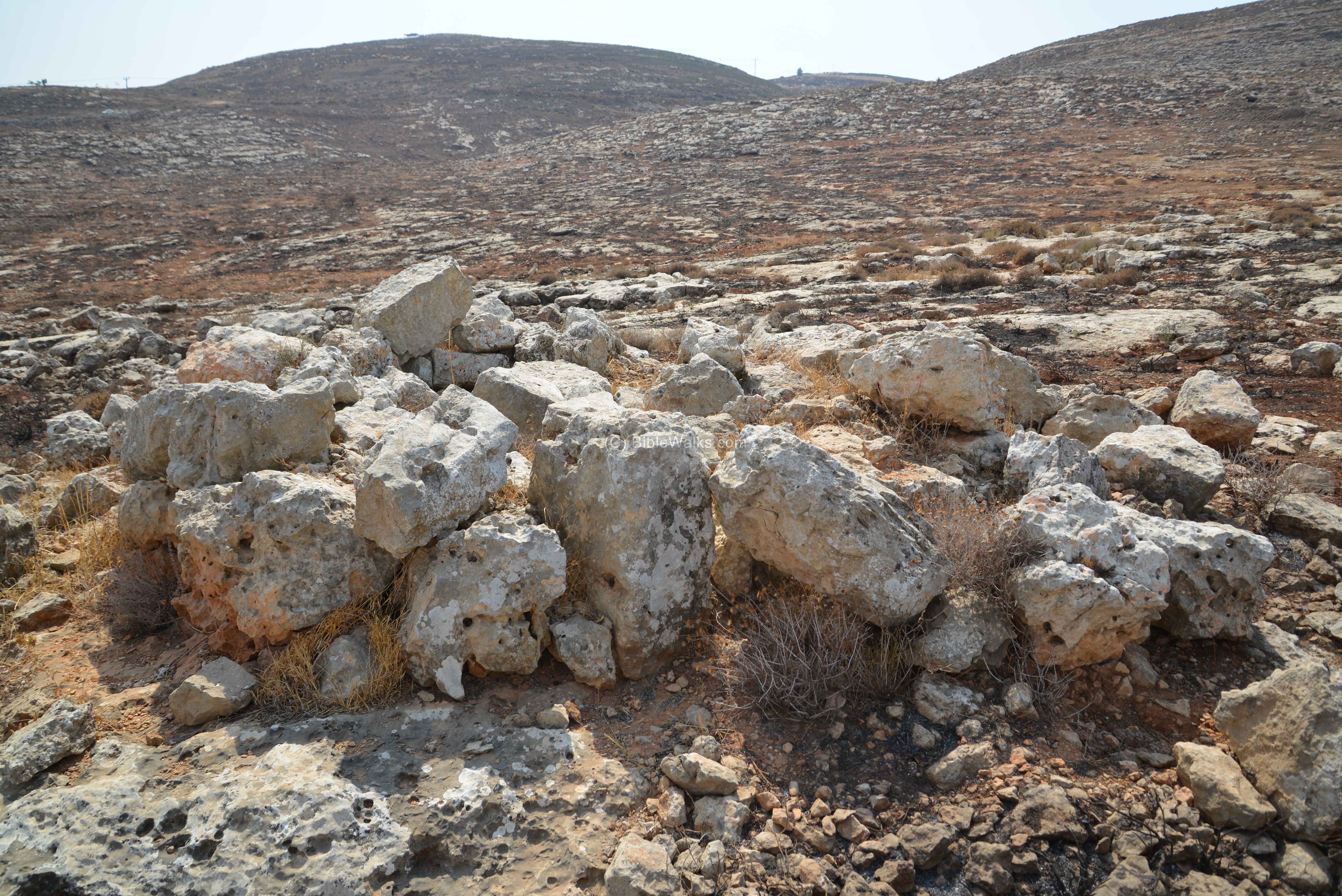
To the north of these round structures are remains of a long wall and wide path, perhaps an ancient road that lead up to the mountain.
Note that farther below are remains of an Israelite period road, with a line of stones on each of its sides. It led up from the Jordan valley, passed on the north side of kh. Jibeit, then climbed up the hill to the Shiloh valley. So this may have been an extension to that road.
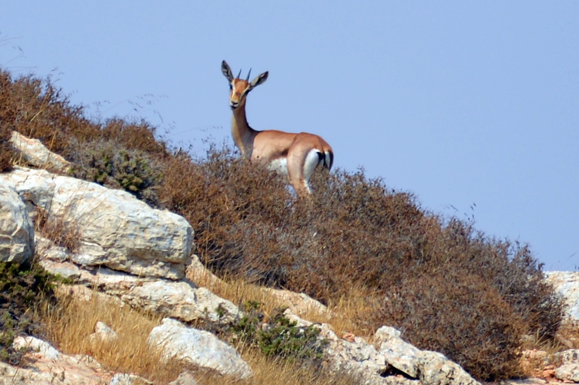
While we were searching for ancient structures, curious gazelles were checking what are we doing in their habitat…
Misc:
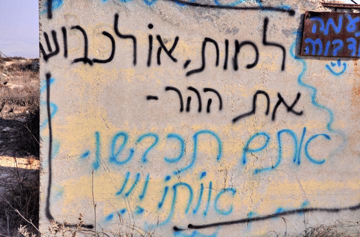
On the old military post wall is a sign in Hebrew, probably sprayed by one of the young settlers: “Die, or conquer the Mountain – you shall conquer it!!!”.
Etymology (behind the name):
* Several meanings of the site:
- Kida – Hebrew: bow.
- Kida – Hebrew: a type of thorn (Calicotome)
- Kida – Bible – Hebrew for cassia – one of the perfumes used in the temple (Exodus 30, 34; Ezekiel 27 19: “…bright iron, cassia, and calamus, were in thy market.”.
- Duma – Arab village, perhaps based on the name Idumia (the Hellenistic period region, where Edomites settled)
Links:
* External:
- Binyamin Regional council – Kida (English, Hebrew)
- Binyamin wineries
* Internal: sites nearby
BibleWalks.com – bringing the Bible Alive!
Eli <<<—previous site—<<<All Sites>>>—next Samaria site—>>> Samaria/Shomron
This page was last updated on Mar 22, 2024 (remove pano)
Sponsored links: