The site served as a hostel along the road from Jericho to Jerusalem, with remains from the Roman period to the Ottoman period. A new archaeological museum was opened here, focusing on ancient Mosaics collected from excavations across the West Bank and Gaza.
Luke 10 33-34: “But a certain Samaritan, …had compassion on him…brought him to an inn, and took care of him”.
Home > Sites > Judea > Inn of the Good Samaritan
Contents:
Background
Location
History
Photos
* Church
* Outdoor mosaics
*Indoor mosaics
*Outdoor Arch.
*Indoor Arch.
*Installations
*Red Fortress
Video
Biblical
Overview:
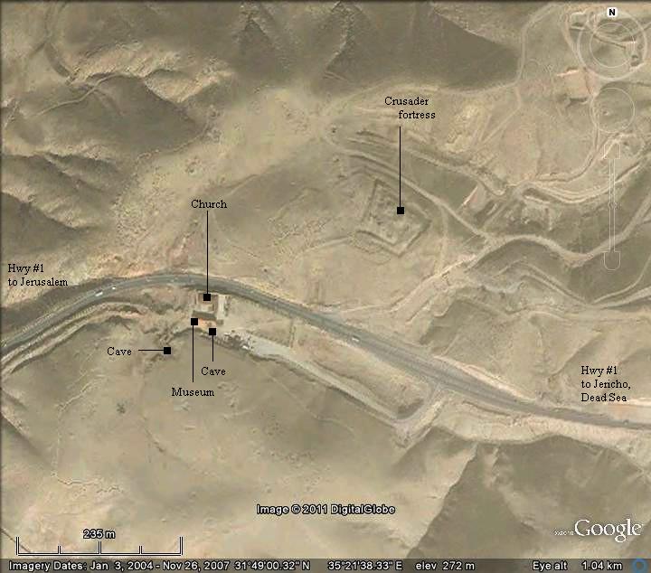
The site served as a hostel along the ancient road from Jericho to Jerusalem, with remains from the Roman period to the Ottoman period. A nearby Crusader fortress protected the road, and its ruins are seen above the site.
Joshua 15:7: “Adummim, which is on the south side of the river…”.
A new archaeological museum was opened on the location of the ancient site. It focuses on Mosaic floors collected from ruins across the West Bank and Gaza. This unique collection allows the public to view the results of the archaeological excavations in areas where there are travel limitations due to security.
Since its opening in 2009 the museum has been a huge success. This is a great place to stop on the way from Jerusalem to the Dead Sea and the Jordan Valley.
Location and Aerial map:
The inn is located on the south side of the modern highway from Jericho to Jerusalem, which follows the ancient route. High above the other side of the road are ruins of a Crusader fortress.
History of the place:
-
Biblical Period
The site is located along the ancient route ascending from the deep Syrian-African depression, where Jericho and the Jordan valley are located, ascending to Jerusalem and Judea. The Biblical name of the road, Ma’ale Adummim (“Reds Ascent”) , is named after the color of the rocks along the road. This important route was also the border between two tribes – Judah along the route and to the south of it, and Benjamin north of the route:
- The Biblical border of the tribe of Judah is described in the following verse, which indicates the ascent of Adummim as its north-east border (Joshua 15 1-7): “This then was the lot of the tribe of the children of Judah by their families… And the east border was the salt sea, even unto the end of Jordan. And their border in the north quarter was from the bay of the sea at the uttermost part of Jordan: And the border went up to … Adummim, which is on the south side of the river…”. The river referred here is the Prat (Qelt) river.
- The Biblical border of Benjamin is described in Joshua 18 17: “…and went forth toward Geliloth, which is over against the going up of Adummim”.
The cities and roads during the early Israelite periods (Patriarchal to Judges periods) are indicated on the Biblical Map below, with the position of the Good Samaritan Inn indicated as a red square on the side of the ancient route.
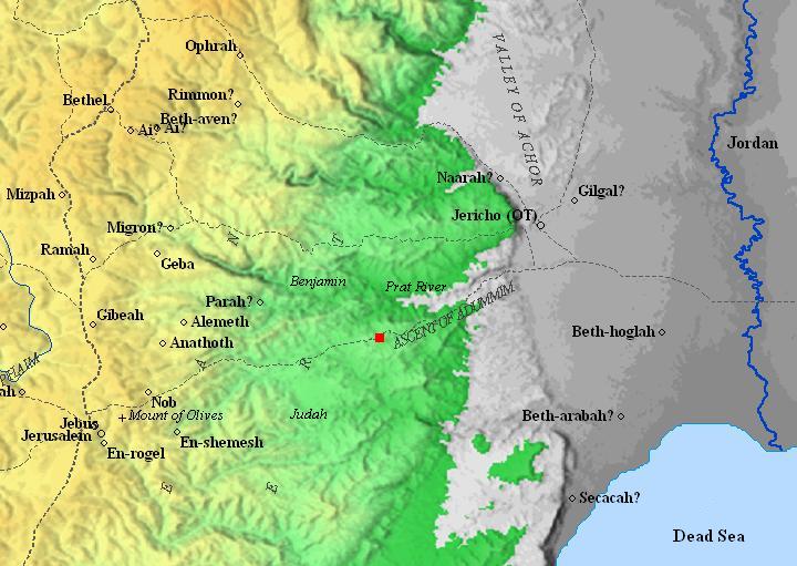
Map of the area around Ma’ale Adummim – during the Israelite periods , 2000BC thru 1000BC (map is based on Bible Mapper 3.0)
-
Hellenistic and Roman Period
The site was inhabited in the Hellenistic and Roman period. Remains from the 1st century BC to the 1st century AD were unearthed during the excavations of the inn. On the northwest hill were remains of Herod’s palace. On the south side is a large dwelling cave dated to this period of the second temple.
According to the tradition, the inn was the location of the event of the Good Samaritan (Luke 10 30-35). This story was told by Jesus to demonstrate the importance of compassion.
According to the Gospel, this happened when “A certain man went down from Jerusalem to Jericho”. After he was robbed and wounded, neither a priest or Levite helped him. Only a Samaritan helped him, and brought him into the inn. Since few inns were located along the road from Jerusalem to Jericho, the inn of Ma’ale Adummim indeed is a probable fit.
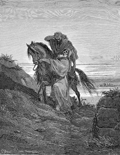
The Good Samaritan – drawing by Gustav Dore (French artist, 1832-1883)
During the Roman period a fortress was located on the north hill (where the Crusaders later built their fortress), and hosted a garrison. They protected the road against the desert robbers who frequently attacked the travelers, exactly as told in the story of the Good Samaritan.
-
Byzantine period
The pilgrim inn was erected in the 6th century, probably as part of a monastery. The plan of the inn was rectangular (24 x 26m), with residential rooms and a courtyard on the east, a basilica in the north-west side (11.6 x 21.3m), and a large cistern (10m x 10m) in the center. The main entrance to the inn was from the south, while the animals were entered to the courtyard from the east.
-
After the Byzantine period
The inn continued to be used after the Arab conquest.
-
Crusaders
The Crusaders made the site an important station along the road to the Jordan valley. During the Crusader period tens of thousands pilgrims used this route yearly to reach Jericho and the baptismal sites on the Jordan river. A fortress was erected on the north hill in order to protect the road and defend Jerusalem from the east.
The fortress was erected by the order of the Knights Templar in 1169-1172 and was in use until 1187, when the Crusaders retreated from the region. This rectangular structure (60 x 70m) was surrounded by walls, and its halls were supported on vaults. The water supply was based on a large plastered cistern. An extra protection was provided by a 6m wide dry moat, cut 4m into the bedrock. An access bridge was located above the southwestern corner of the moat. On the north side of the fortress was a 8.5 x 9.3m tower. The fortress was called “Castellum Rouge” (red castle) or “Tour Rouge” (red tower).
An inn (34 x 36m) was established above the remains of the Byzantine inn, which included rooms arranged around a central courtyard. In order to supply water to the pilgrims, they added on the western side a large rectangular cistern (7m x 16.6m x 7.5m deep) and continued to use the Byzantine cistern (10m x 10m).
-
Ayyubid Arab period (1171-1341) and Mamlukes (1341-1517)
After Saladin defeated the Crusaders, he converted the Crusaders fortress to an Ayyubid fort. The Crusader khan continued to function during the next 3 centuries, and was used as a station for the Muslim pilgrims to Nebi Musa.
-
Ottoman period
The Ottomans erected in the 1830s a rectangular structure over the ruins of the southern wall of the Crusader fortress. It is composed of 6 rooms, with an entrance on the south. The inn was damaged in WW1, then restored by the British and later by the Jordanians. The inn was recently fit for use as a museum.
In 1873, the surveyors of the PEF (Palestine Exploration Foundation) visited the ruined site and reported on the ruins of the hostel (SWP – Sheet XVIII, p207-208):
“Khan Hathrurah A Saracen hostel, standing on high ground, and just north of the present Jericho road. A few piers and some of the walls are still standing. On the opposite side of the road are two or three small caves, in one of which is a stone with an Arabic inscription. Cisterns, well-built and supported on arches, exist beneath the Khan, and contain water.
North-east of this, on the highest part of the hill, are the remains of a strong fortress, which commands the road here, ascending through a narrow pass between walls of rock on the east. On the west also there is a winding ascent to the neighborhood of the Khan. The rock, especially on the west, is of a ruddy color like burnt brick, whence the title, Tal’at ed Damm, ‘Ascent of Blood ‘, is applied to the whole hill, and sometimes to the castle on the summit”.
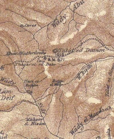
Part of Map Sheet 187 of Survey of Western Palestine, by Conder and Kitchener, 1872-1877. (Published 1880, reprinted by LifeintheHolyLand.com)
-
Modern period
A new archaeological museum was opened in 2009 on the location of the ancient site.
The museum focuses on Mosaic floors collected from ruins across the West Bank and Gaza. This unique collection allows the public to view the results of the archaeological excavations in areas where there are travel limitations due to security.
Photos:
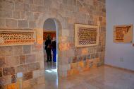
(a) The Byzantine Church
The Byzantine church, built on the traditional location of the Inn of the Good Samaritan, was constructed in the 6th century. It is 20m long by 11m wide and is oriented to the east. Sections of its original walls (seen in the foreground) and bases of its columns are seen below. The design of the Byzantine church was reconstructed by an additional wooden roof which follows the architecture of the old church.
Click on the photos to view in higher resolution…
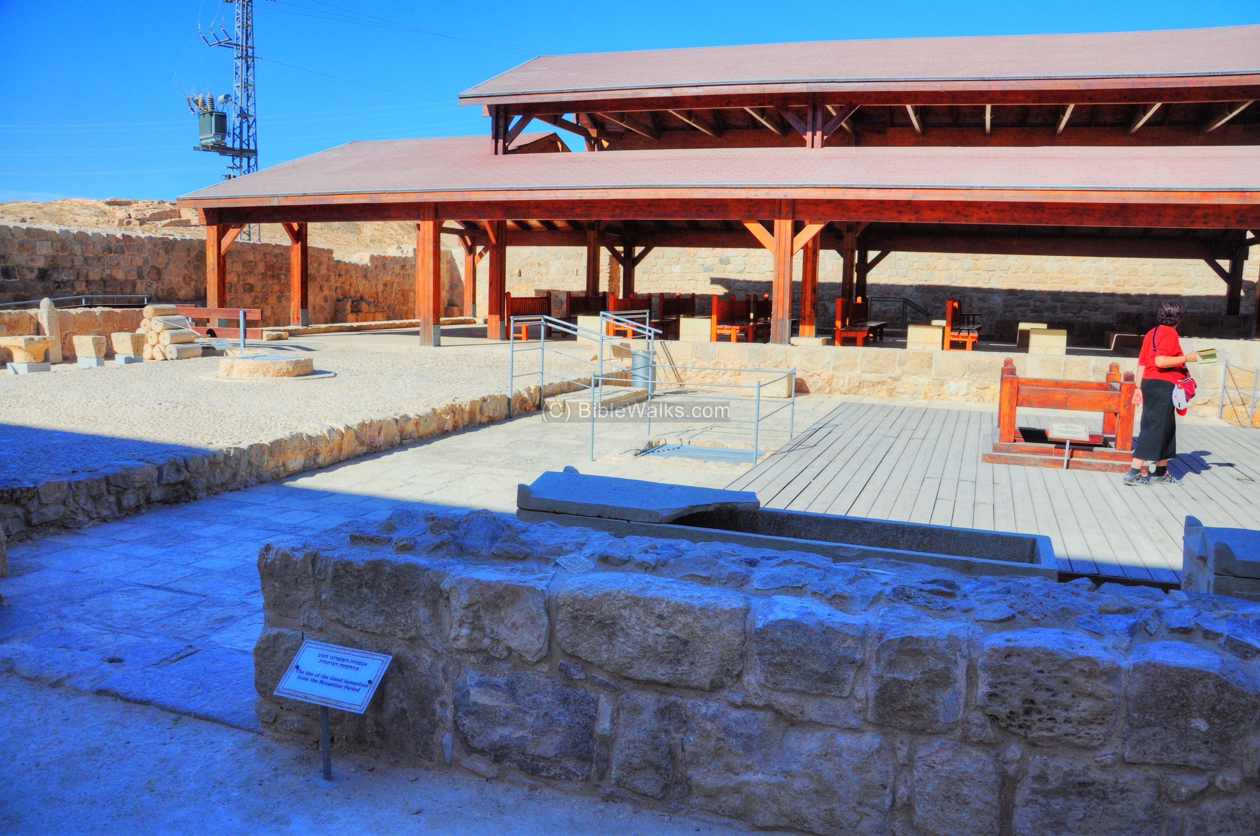
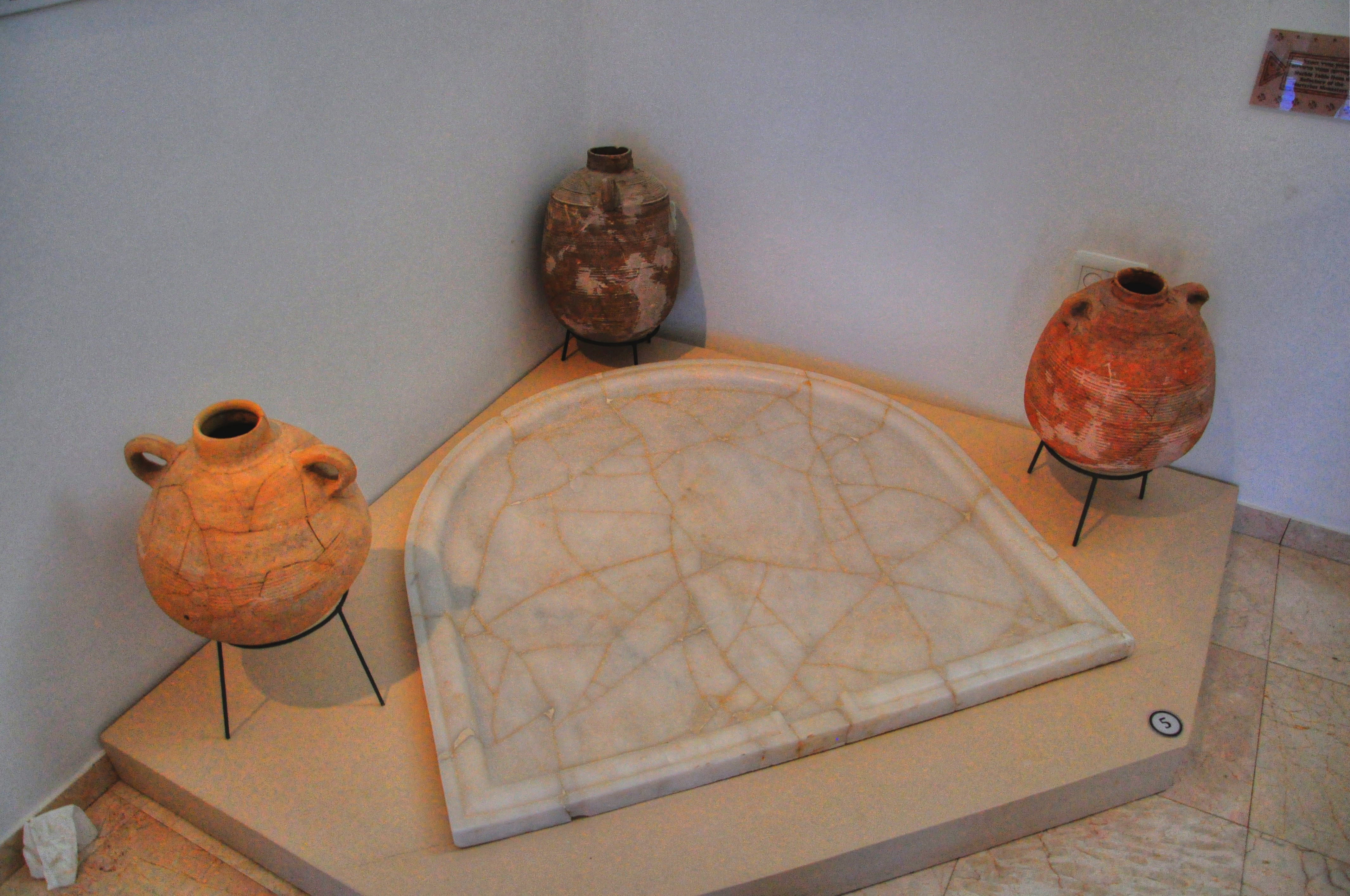
The eastern side of the Byzantine church is viewed below. This was the eastern courtyard of the original church, and is now used to display mosaic floors from other sites, as described in the following section.
The inner side of the southern entrance to the Byzantine structure is seen below. Behind the aisle is the wall of the Ottoman period inn, where the indoor museum is located:
The external wall on the right is composed of constructions from three periods – Byzantine period, Crusader period and the Ottoman period.
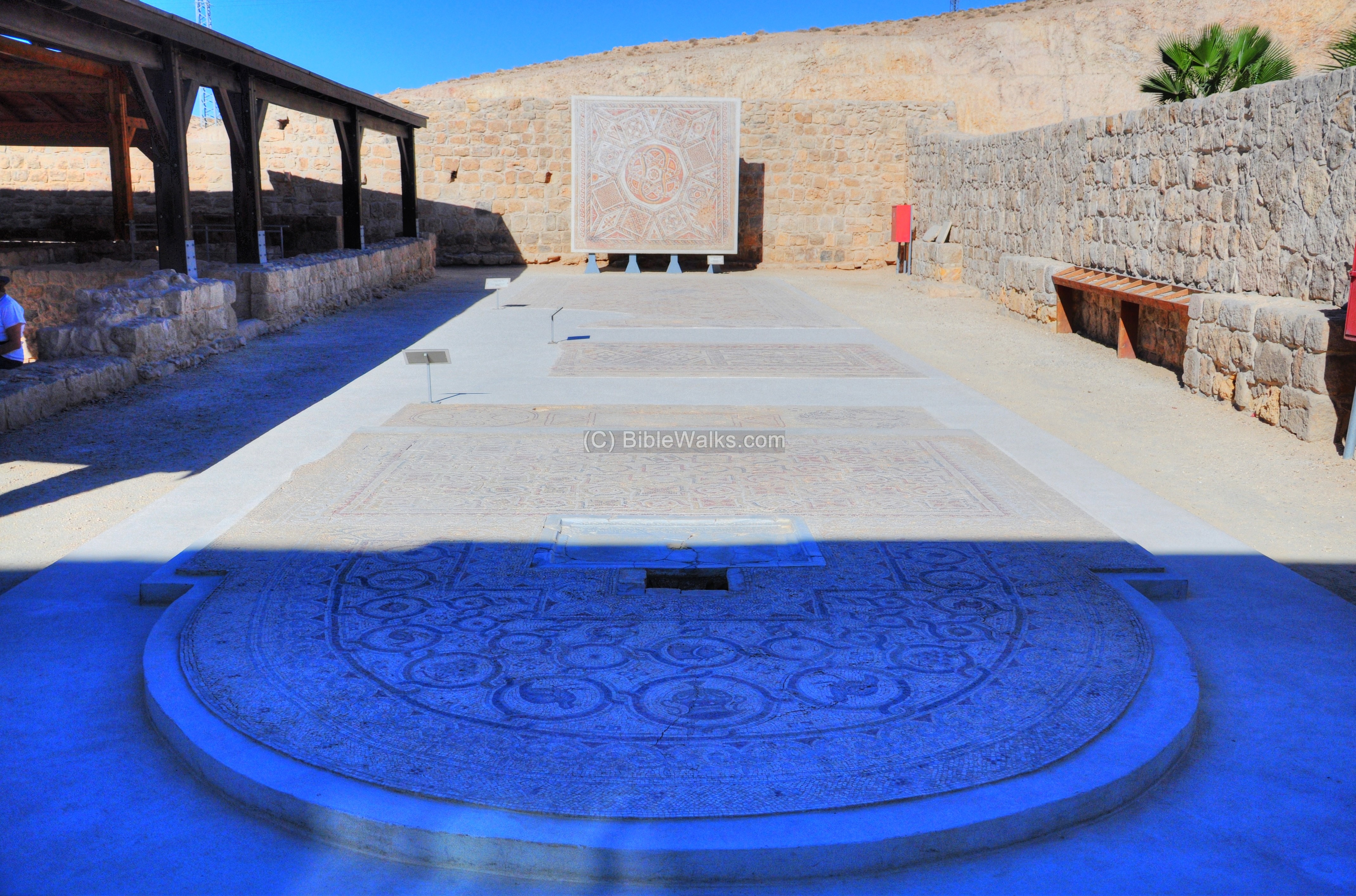
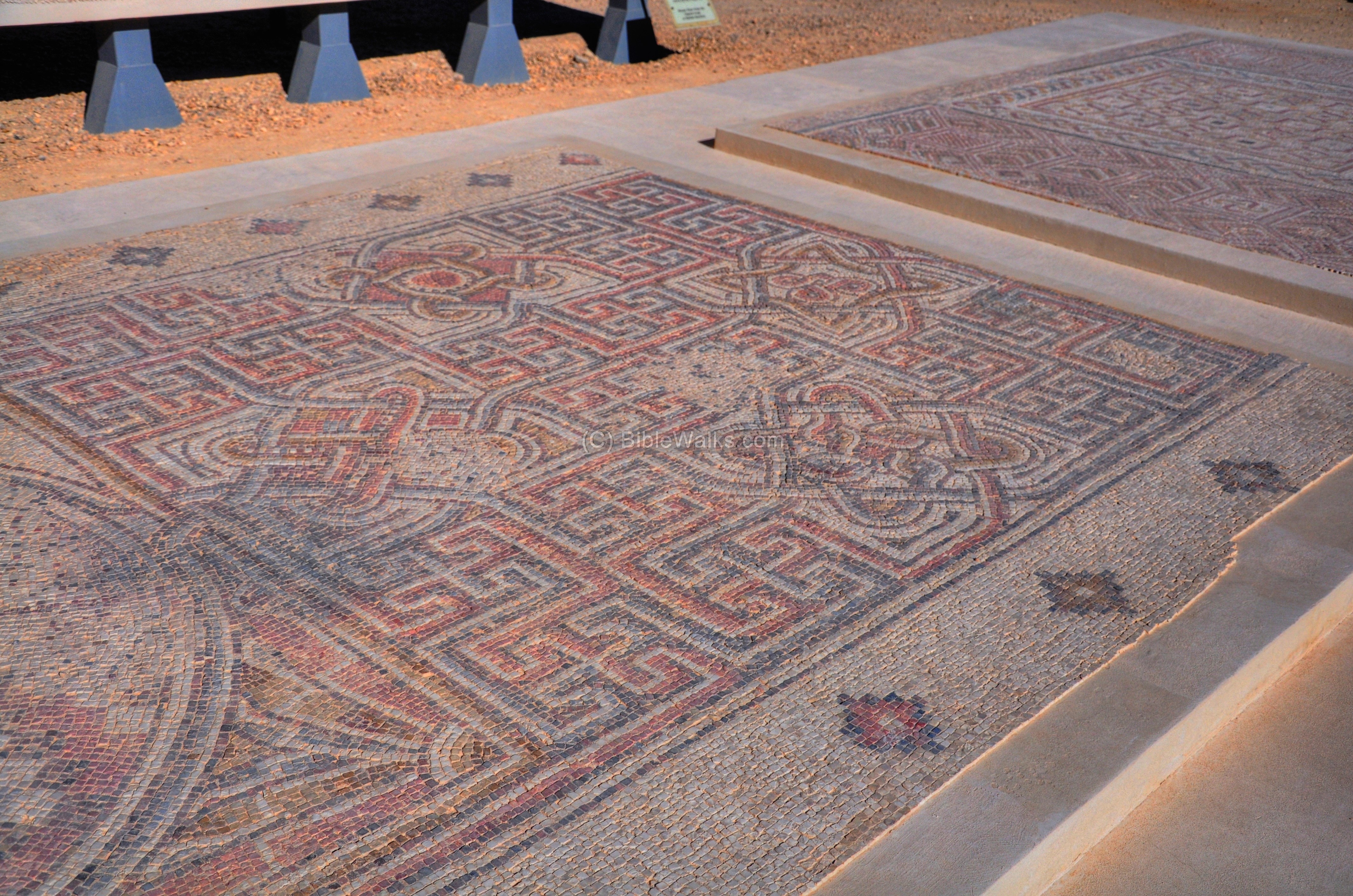
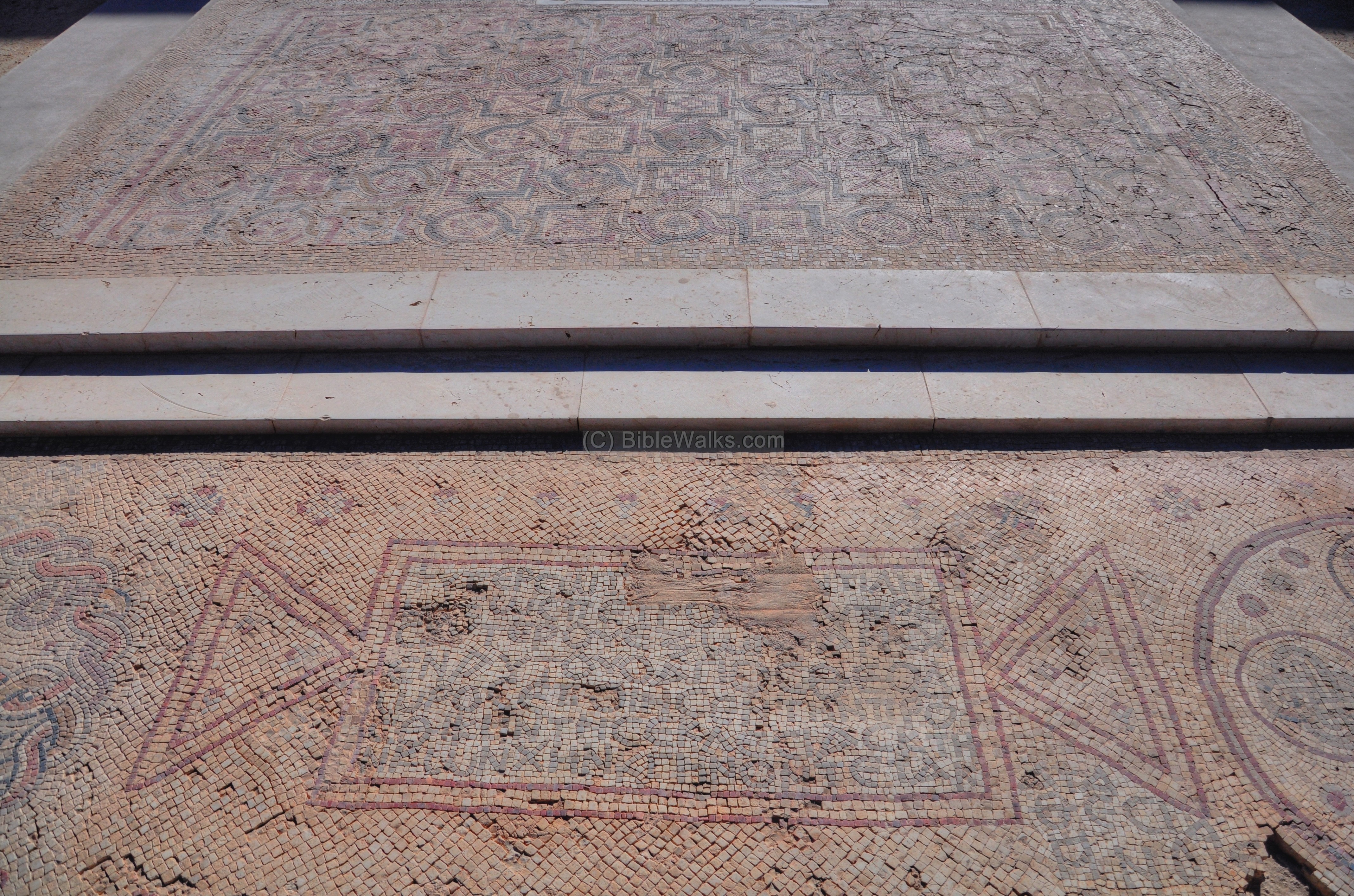
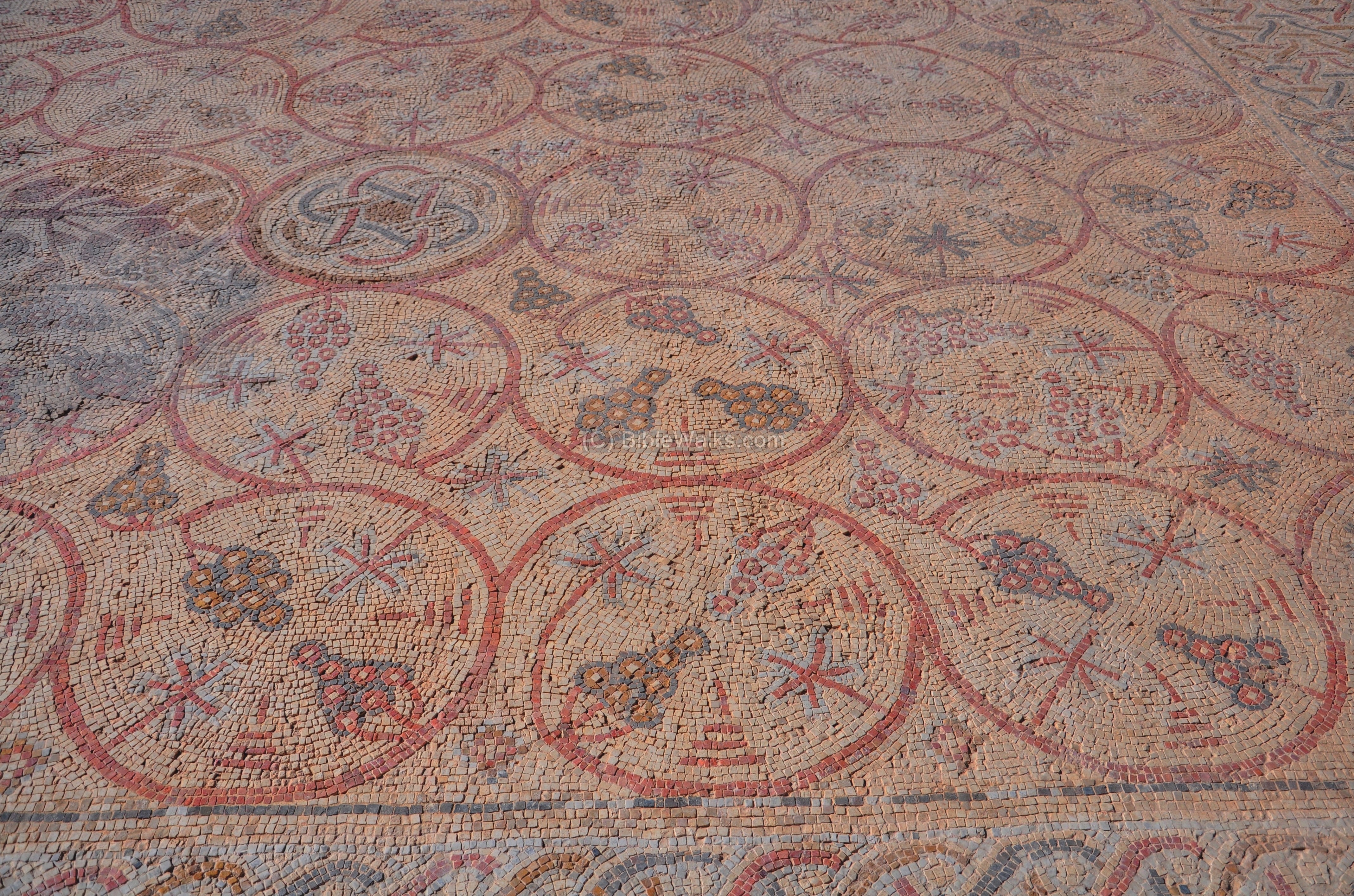
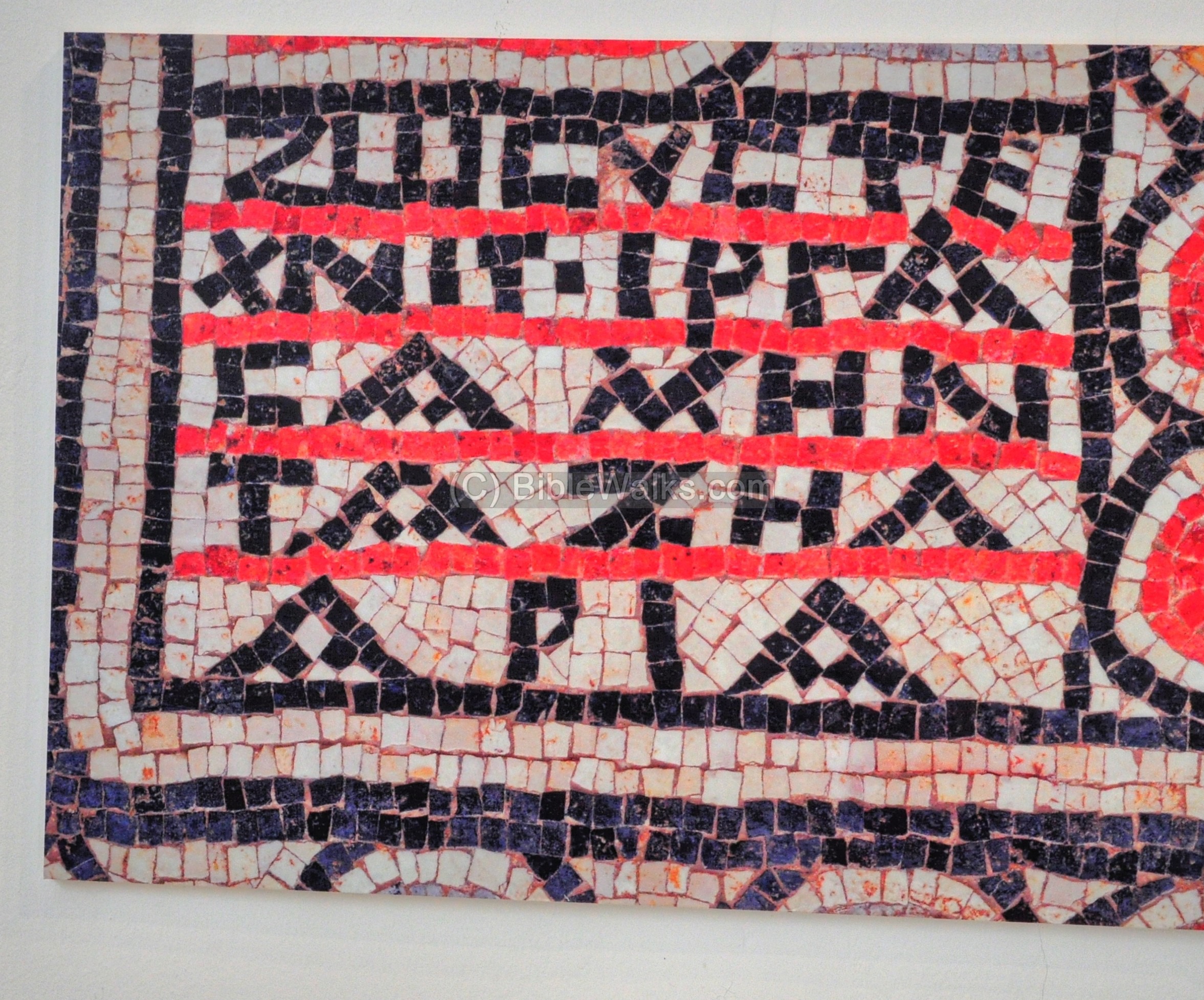
(b) Outdoor mosaics museum
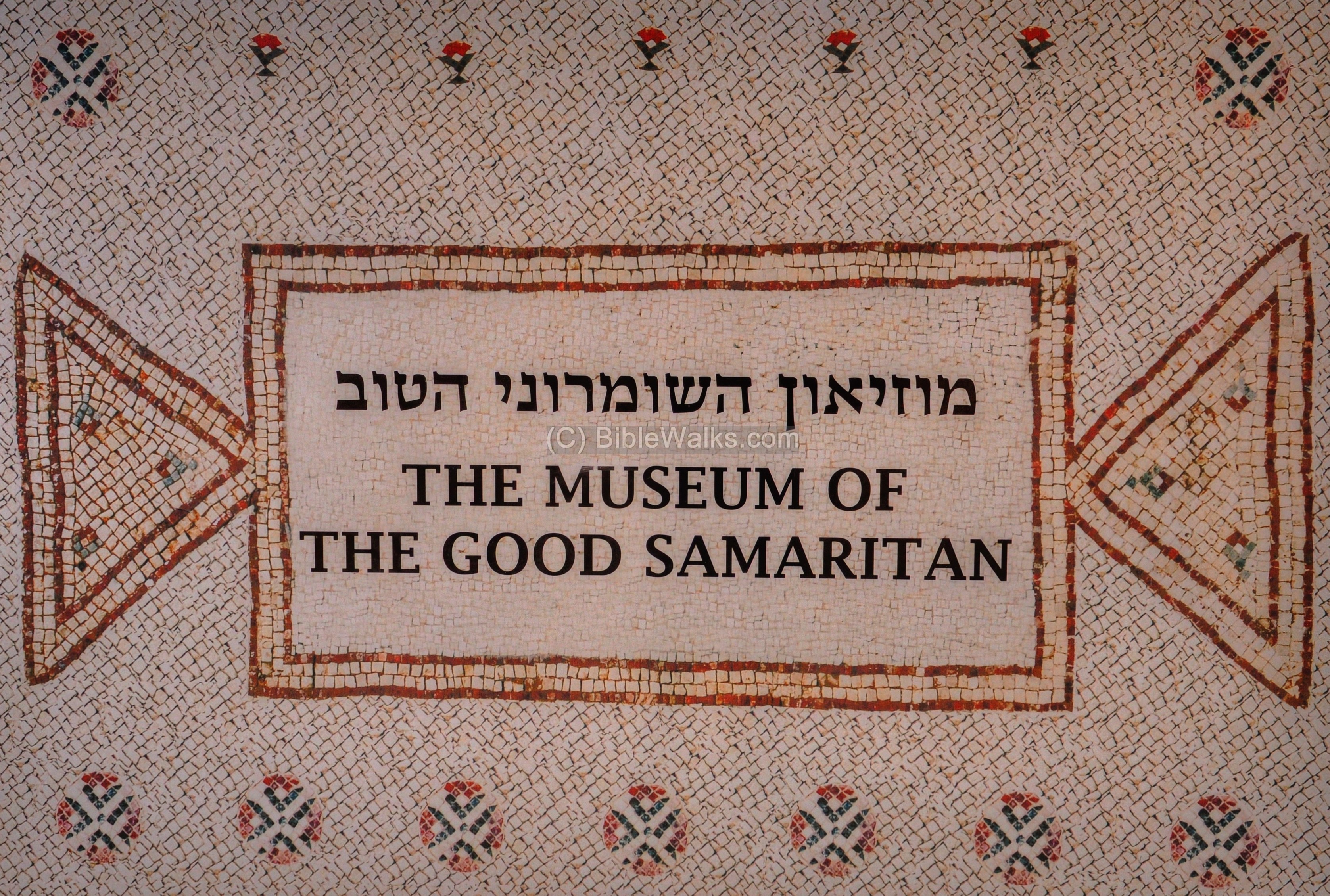
A sign greets the visitor to the museum of the Good Samaritan. This museum displays archaeological findings which were excavated in the West Bank and Gaza. The majority of the findings are sections of the mosaic floors collected from different sites.
The museum has both an outdoor and indoor sections:
-
The outdoor collection is arranged in the courtyard of the Byzantine church and the open area around it.
-
The indoor museum is located on the reconstructed inn on the south side of the complex, which is dated to the Ottoman period (called: Khan).
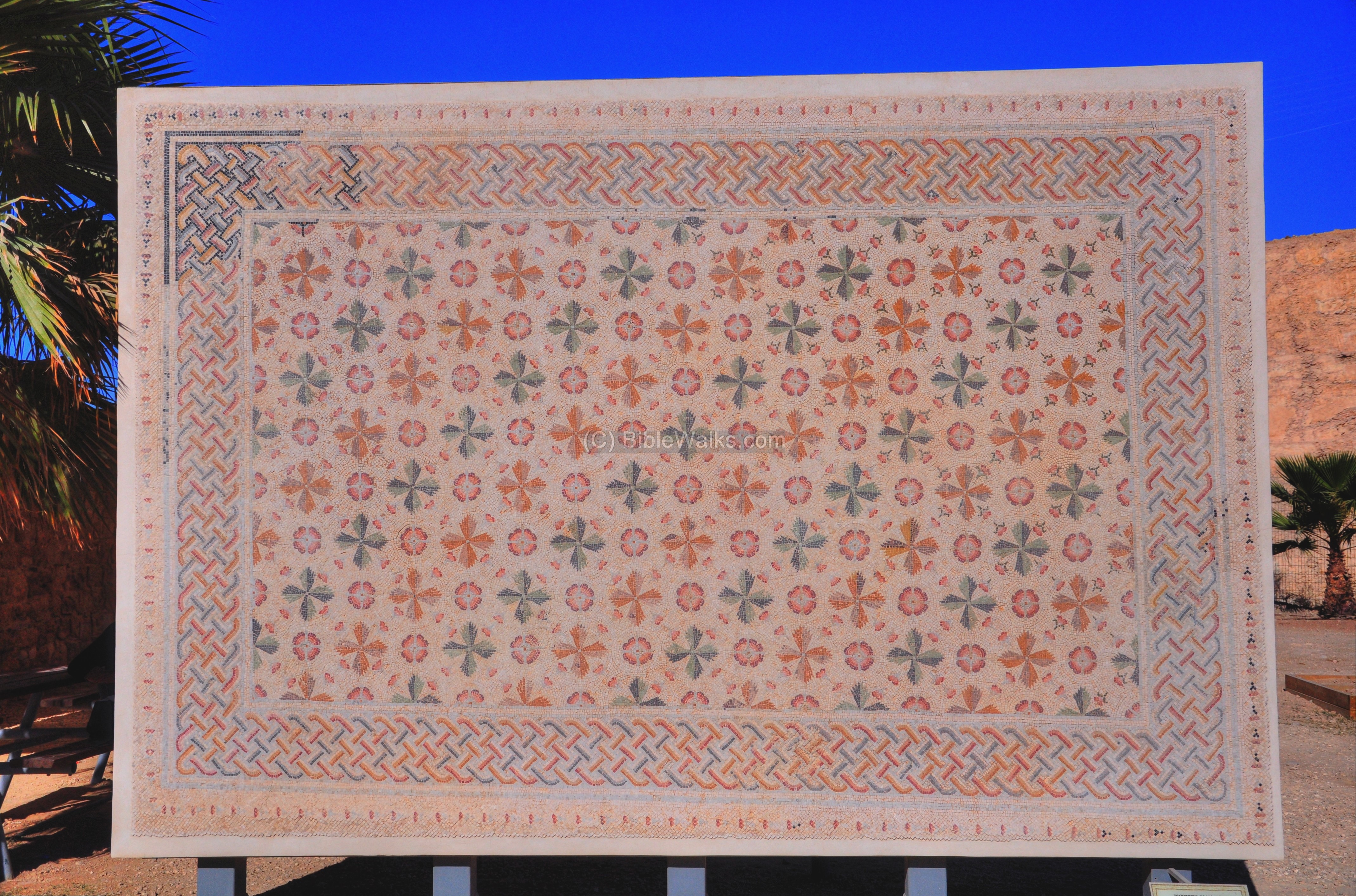
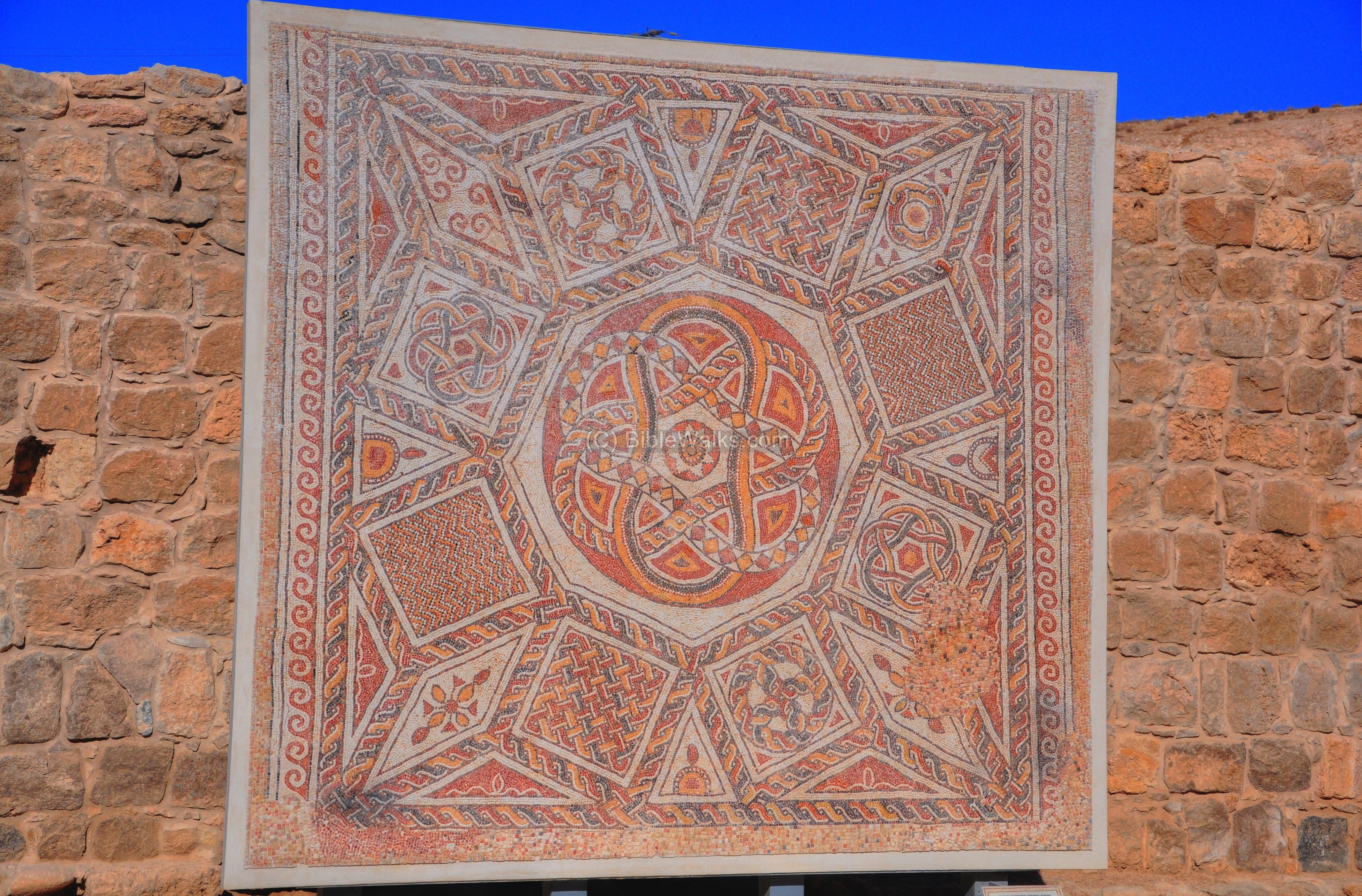
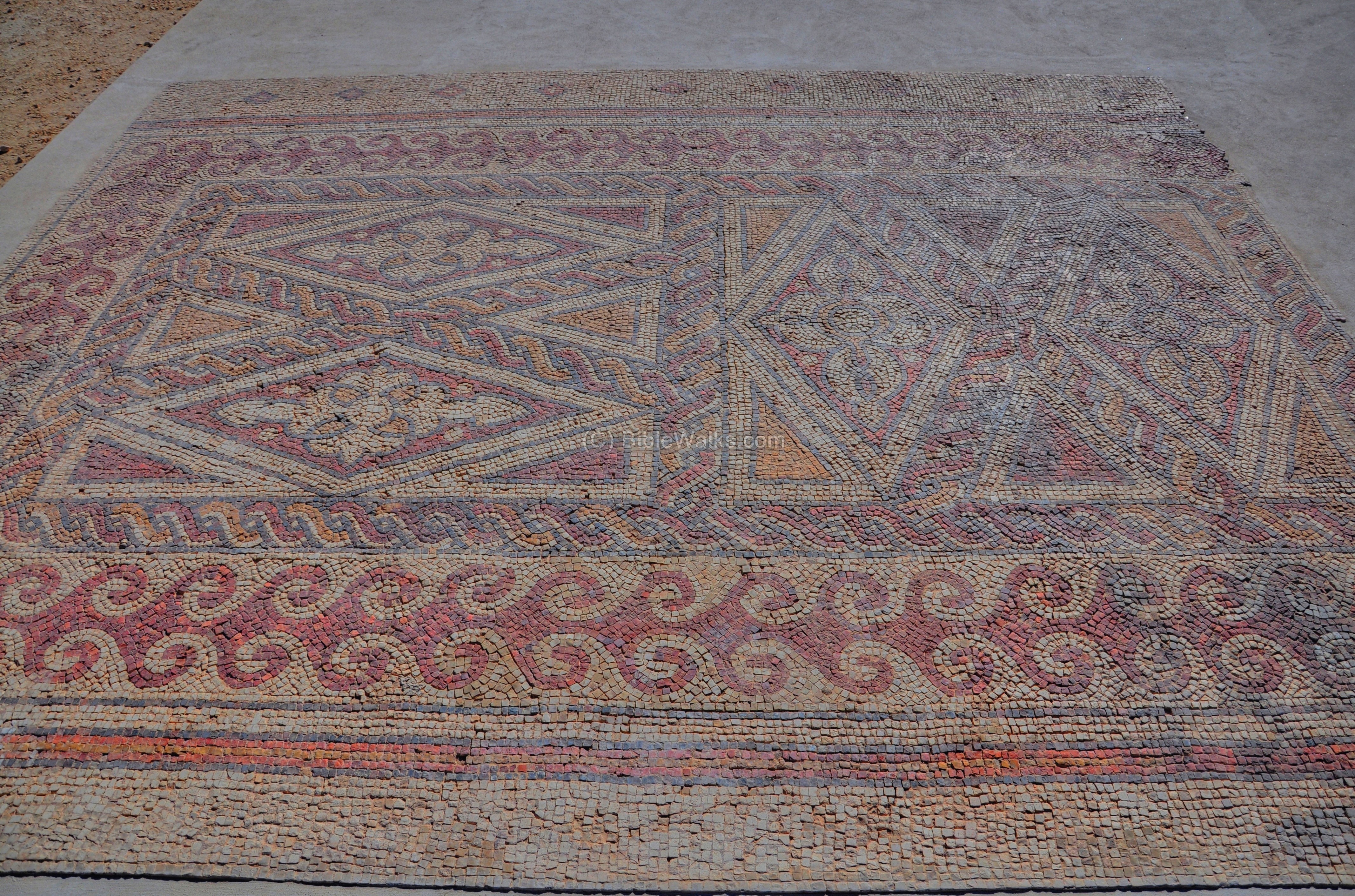
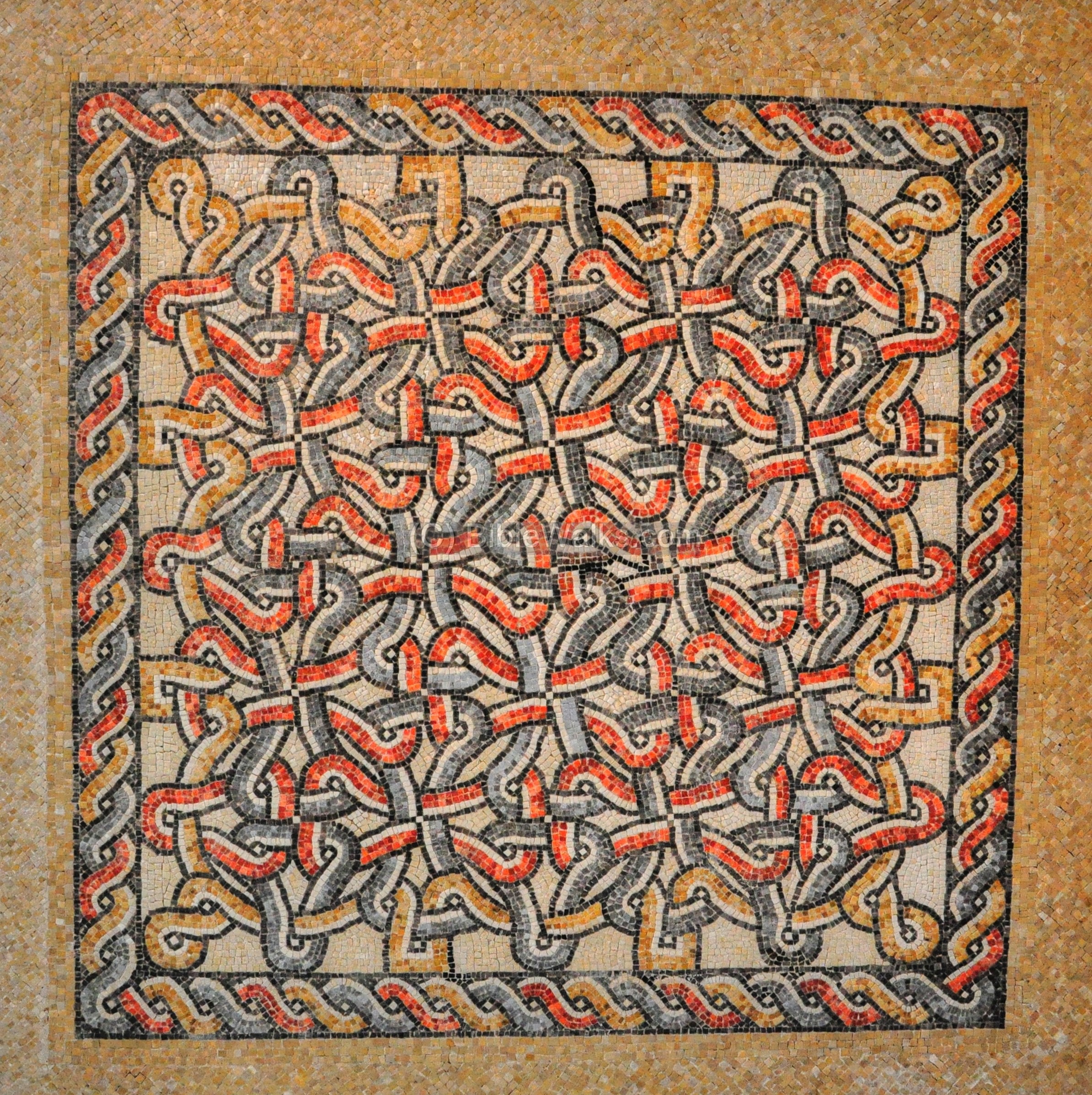
The next picture is displayed at the entrance to the outdoor museum. It shows the mosaic floor on the crypt of the Church at Horvat Berachot (Khirbet Bureikut). The ruins of this church are located to the south of Bethlehem and east of Kefar Etzion, on the Jerusalem-Hebron road. This Byzantine site was excavated in 1976 by Y. Tsafrir and Y. Hirschfeld. The church was built in the early 6th C, and its remarkable floor survived since it was covered by the debris of the 7th C destruction following the Arab conquest.
The next floor is from the Byzantine Church at Khirbet el-Letatin, which was excavated by A. Barhoum (1970), M. Itah (1993) and Y. Zelinger (1995). The site was located near the 9th mile of the Roman road of Beit Horon, from Jerusalem to Lod (Lydda). The 9th mile station also appears on the Madaba map, according to some scholars. The ruins of the church – a large building around a courtyard – and another building (its hostel), are located near the modern town of Givat Ze’ev. The mosaic floor was located on the main apse of this Byzantine church.
Mosaic floor from the Byzantine church at Khirbet Huriya (a.k.a Esh-Sheikh Huriya or Kafr Lut) is seen below. The ruins are located 1km east of Modi’yn.
Another section of the floor of Khirbet Huriya:
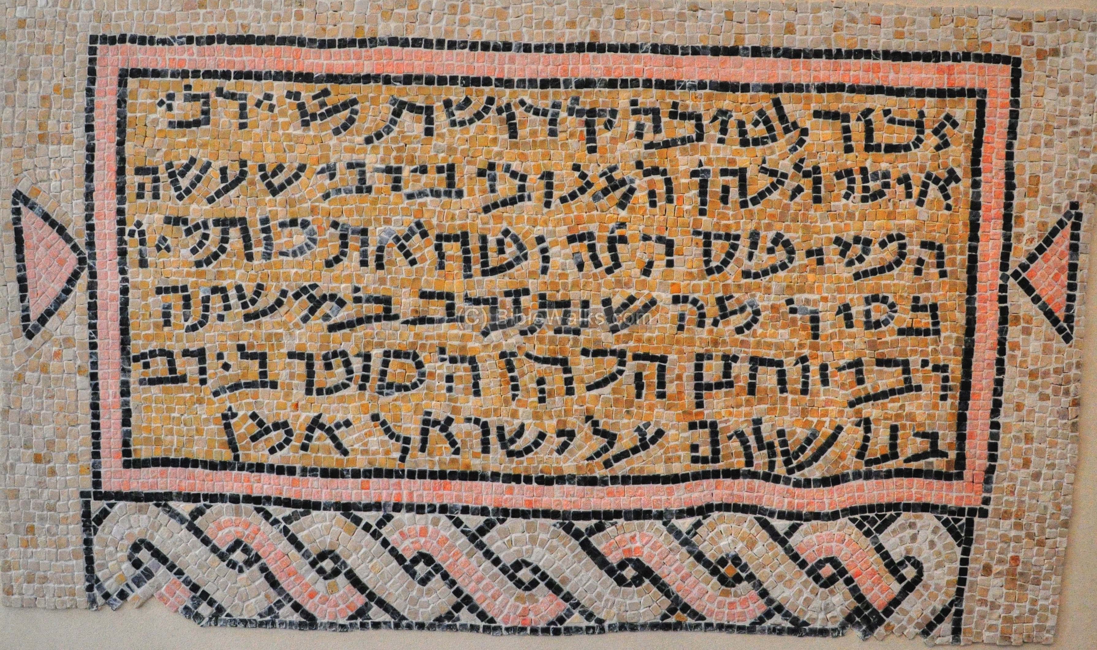
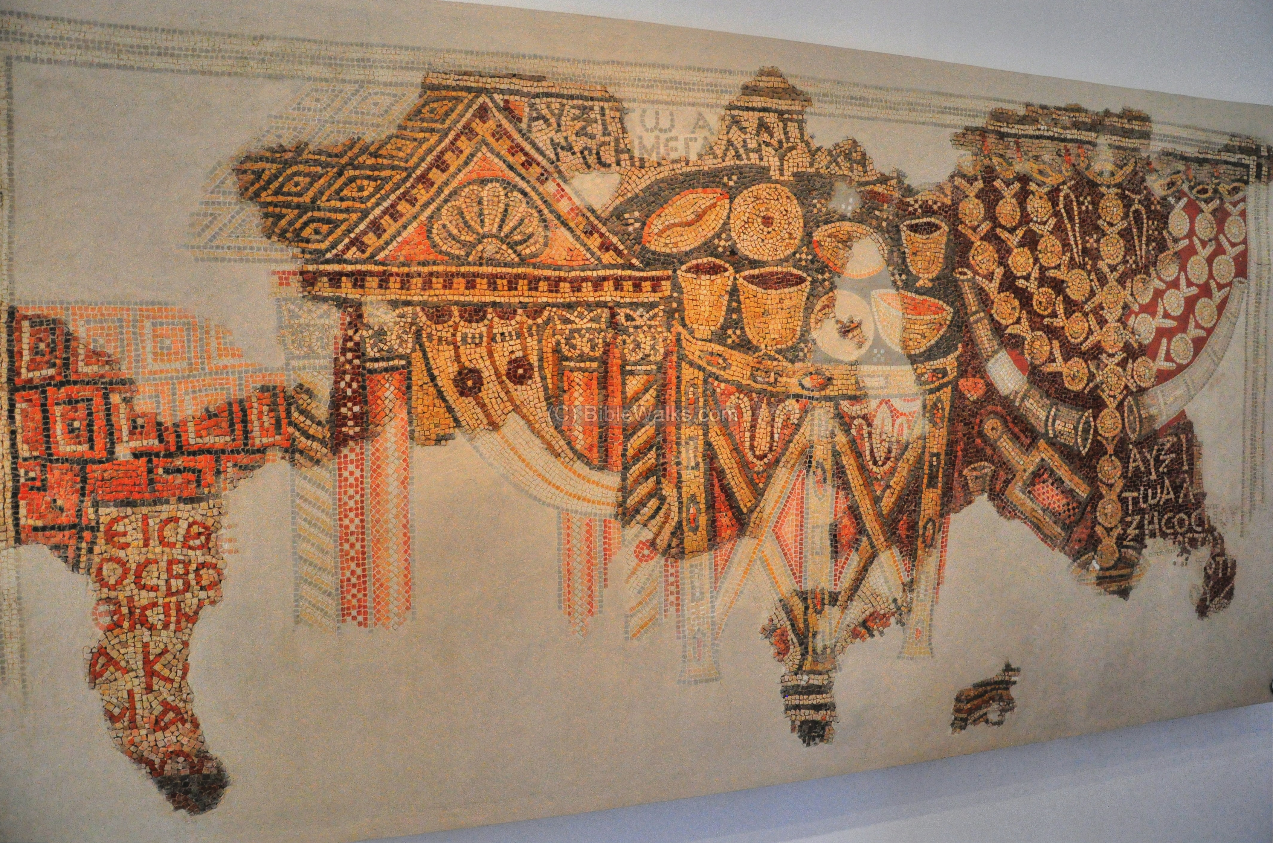
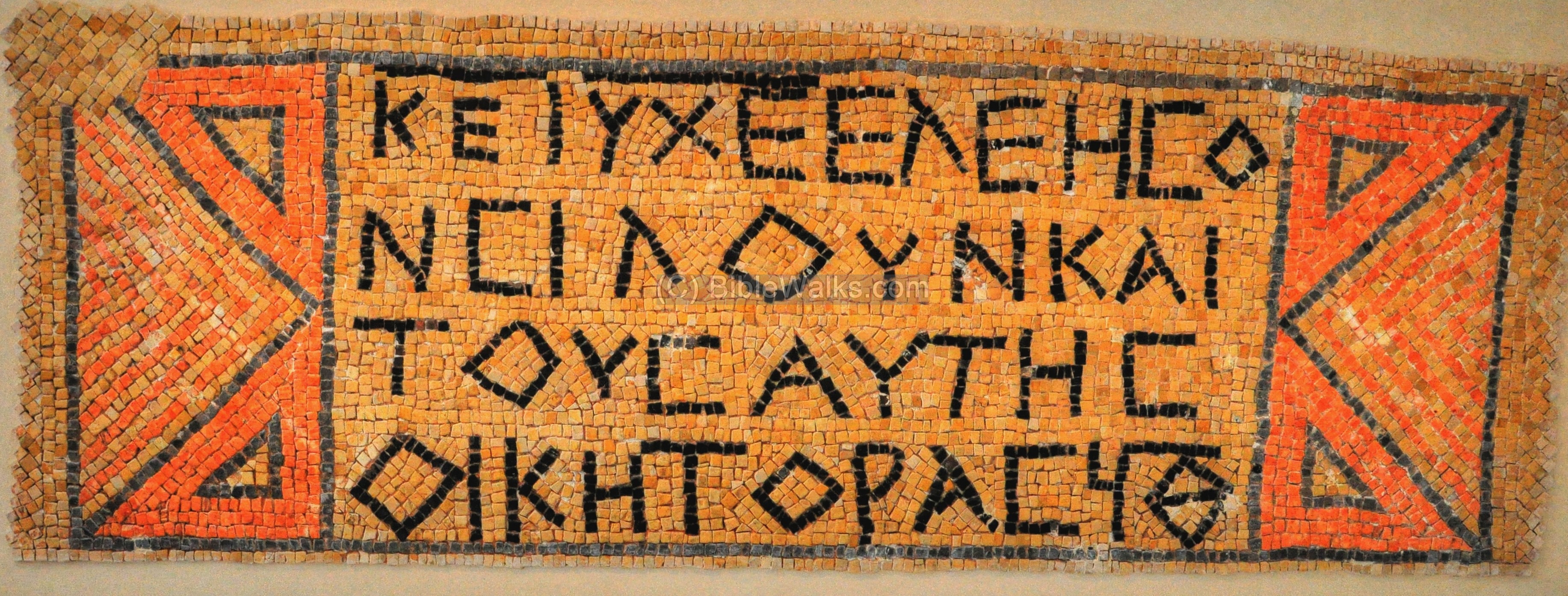
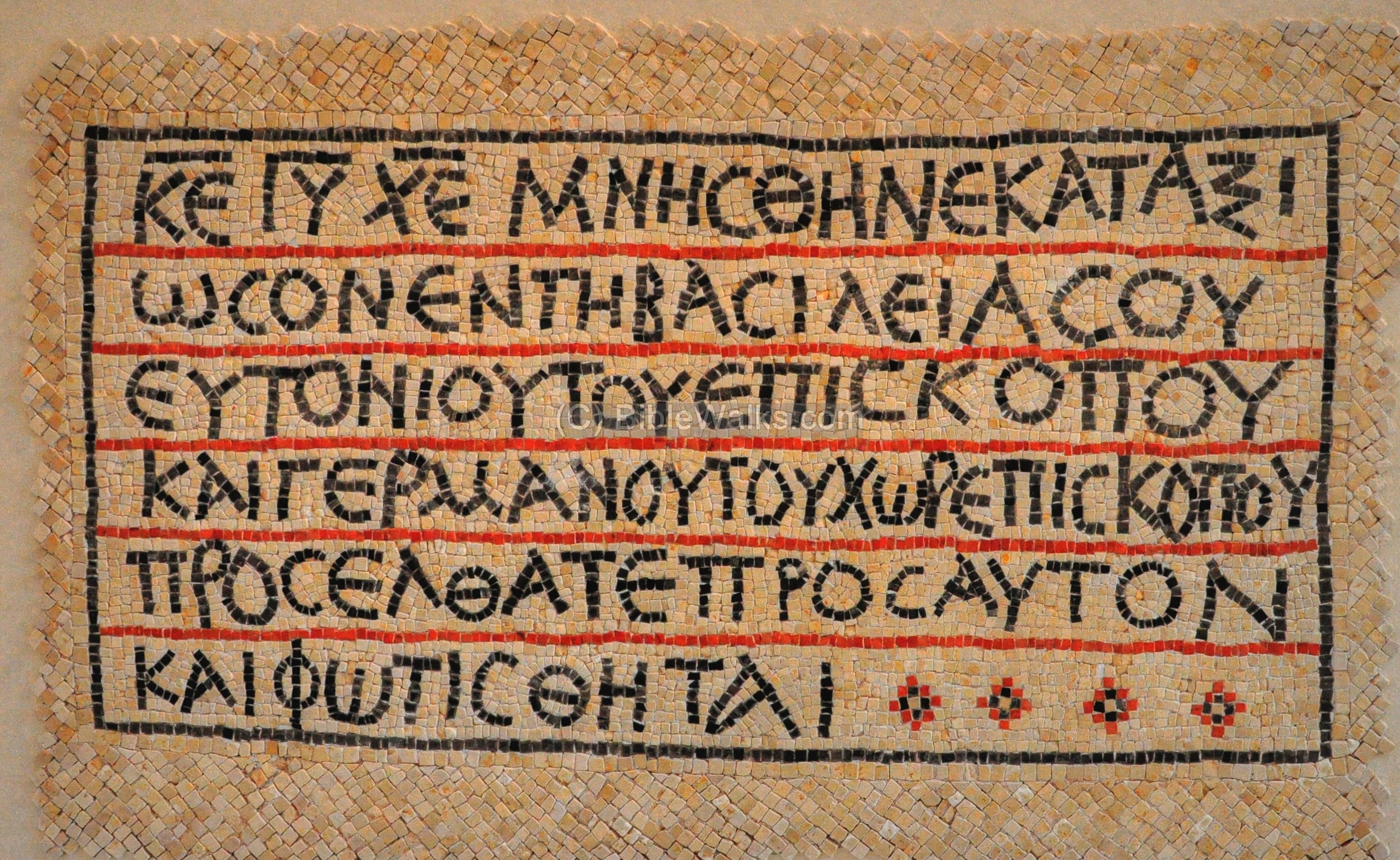
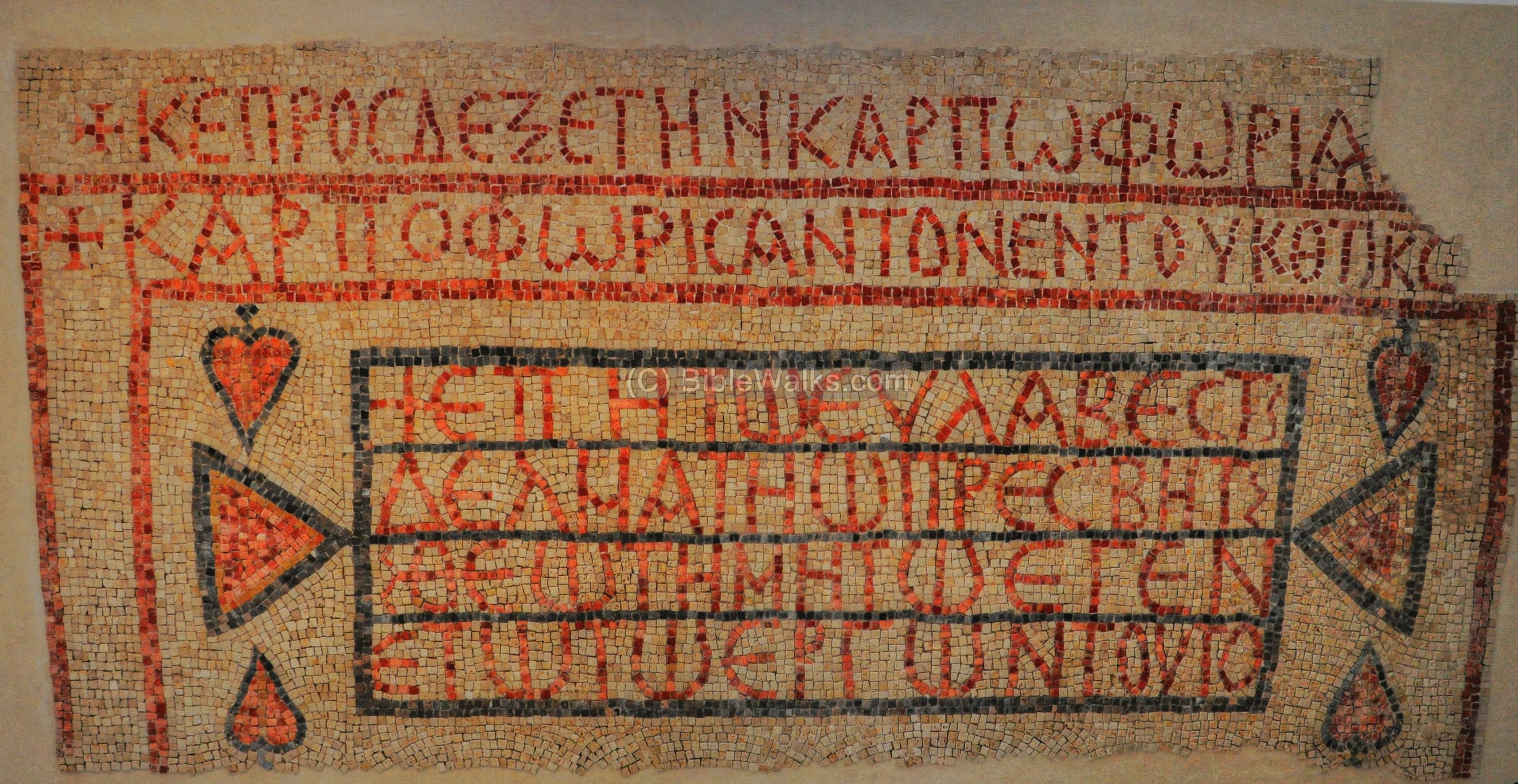
The mosaic floor of the altar and apse of the Church at Khirbet Beit Sila (displayed upside down) are in the next picture. This site was excavated by S. Batz (1998-2006) and I. Shrukh (1997), who identified a village dated from the Hellenistic period to the Byzantine period. This was the church of St. Theodore (Theodoros), which is located northwest of Jerusalem. The church, whose floor was laid at the end of the 5th C, serviced the pilgrims on the road from Lod (Lydda) to Jerusalem. It was designed as a basilica with two square rooms next to a single apse. The bema (raised platform), aisles and nave were paved with remarkable mosaics. An inscription on a stone slab on the floor, seen in the bottom of the picture, reads: “”Lord, please receive the offering of your servant, the priest Peter.”
Another section of the floor from Kh. Beit Sila, with a Greek inscription found on the nave, describes the construction of the church: “For the salvation and help of the Priest Peter/Petros, who with the joy granted him by St. Theodoros, made the nave of the church and the apse…”. The date on this inscription is 497AD. The church continued to be used until the 7th C, when it was ruined during the Arab conquest.
A pulpit from this church is also on display inside the museum.
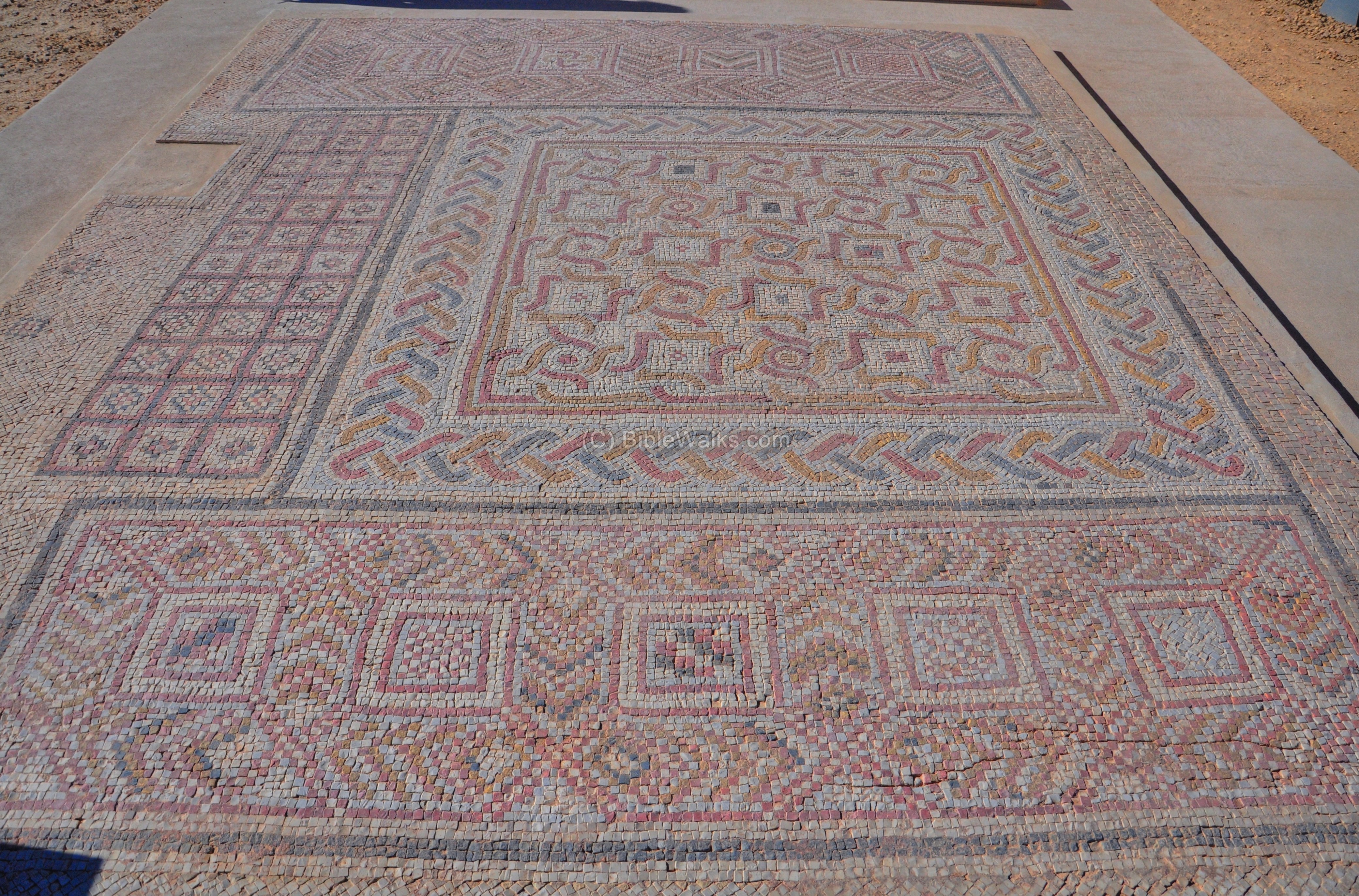
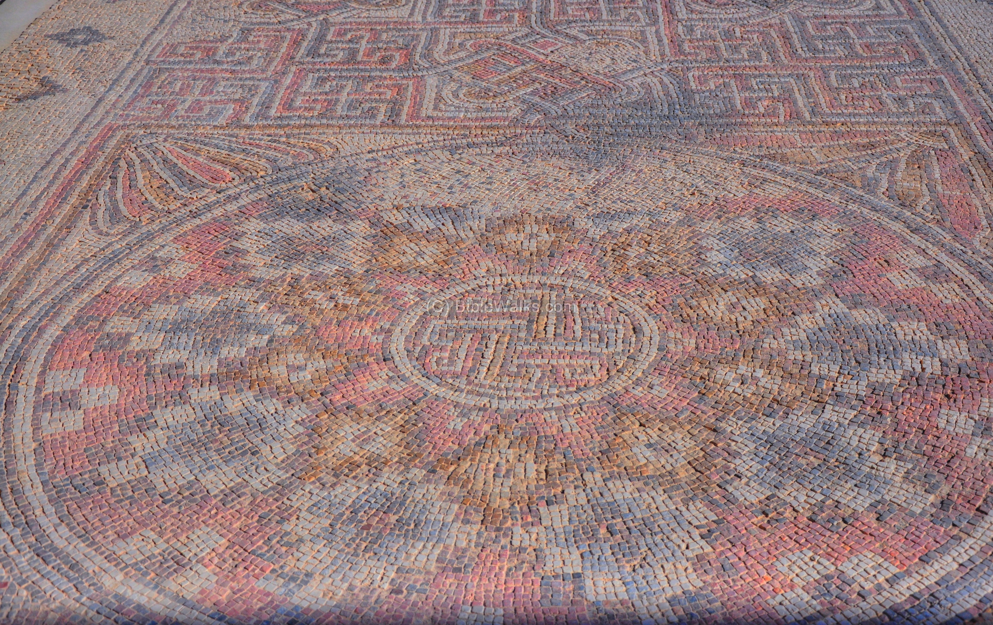
The mosaic floor below is from Deir Qal’a. This Byzantine monastery is located in Western Samaria, near the communal village of Peduel. The large church (47m x 45m) is dated to the 6th C, and is located on the side of the road from Samaria to Afek (Antipatris). Its Arabic name means “the monastery of the fortress”, probably due to its massive walls and a watchtower. It may have functioned as a fortified station along this road. The excavators suggested it was based on an earlier Roman fortress.
The floor from the Chapel at Deir Qal’a is shown in the next photo. The church, and an adjacent farmhouse, were excavated by Y. Magen and N. Aizik in 2004-2006.
Another section of the floor, from the Church’s narthex, is seen below:
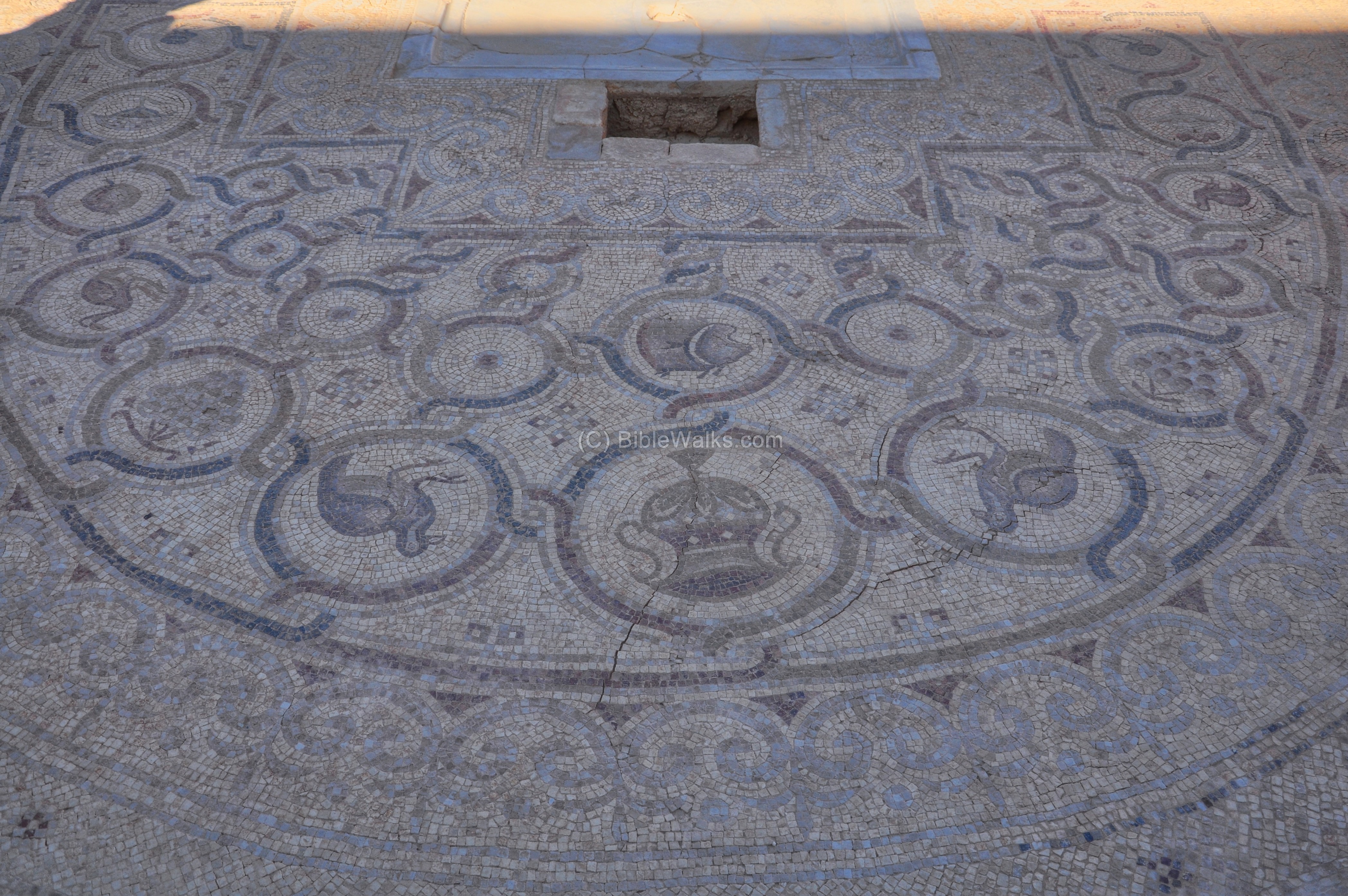
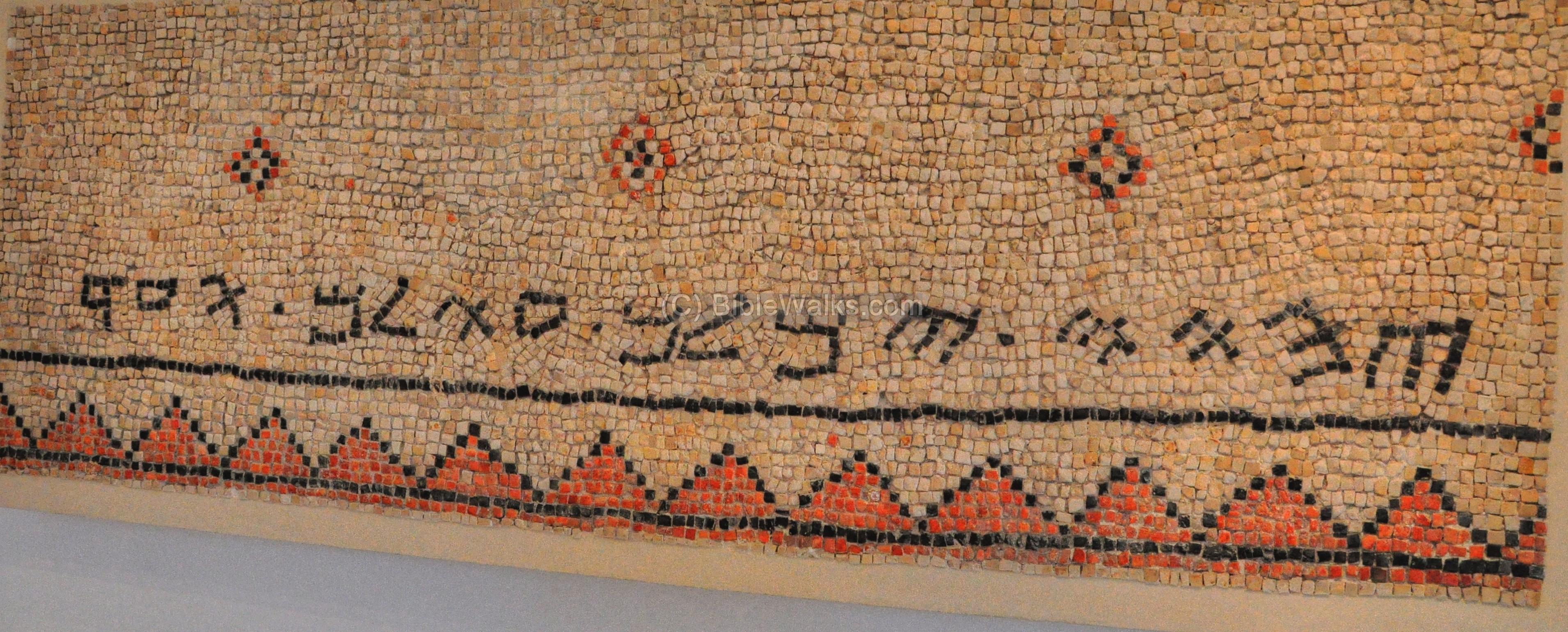
A section of the mosaic floor from the Synagogue at Na’aran (Naarath), is seen next. This 6th C synagogue is located 5KM north of Jericho, and its mosaic floor includes a Zodiac, and many inscriptions (one of them are display in the indoor museum). Na’aran is mentioned in the Bible in several verses (Joshua 16 7: “And it went down from Janohah to Ataroth, and to Naarath, and came to Jericho, and went out at Jordan”).
A section of the mosaic floor from the church at Shoham:
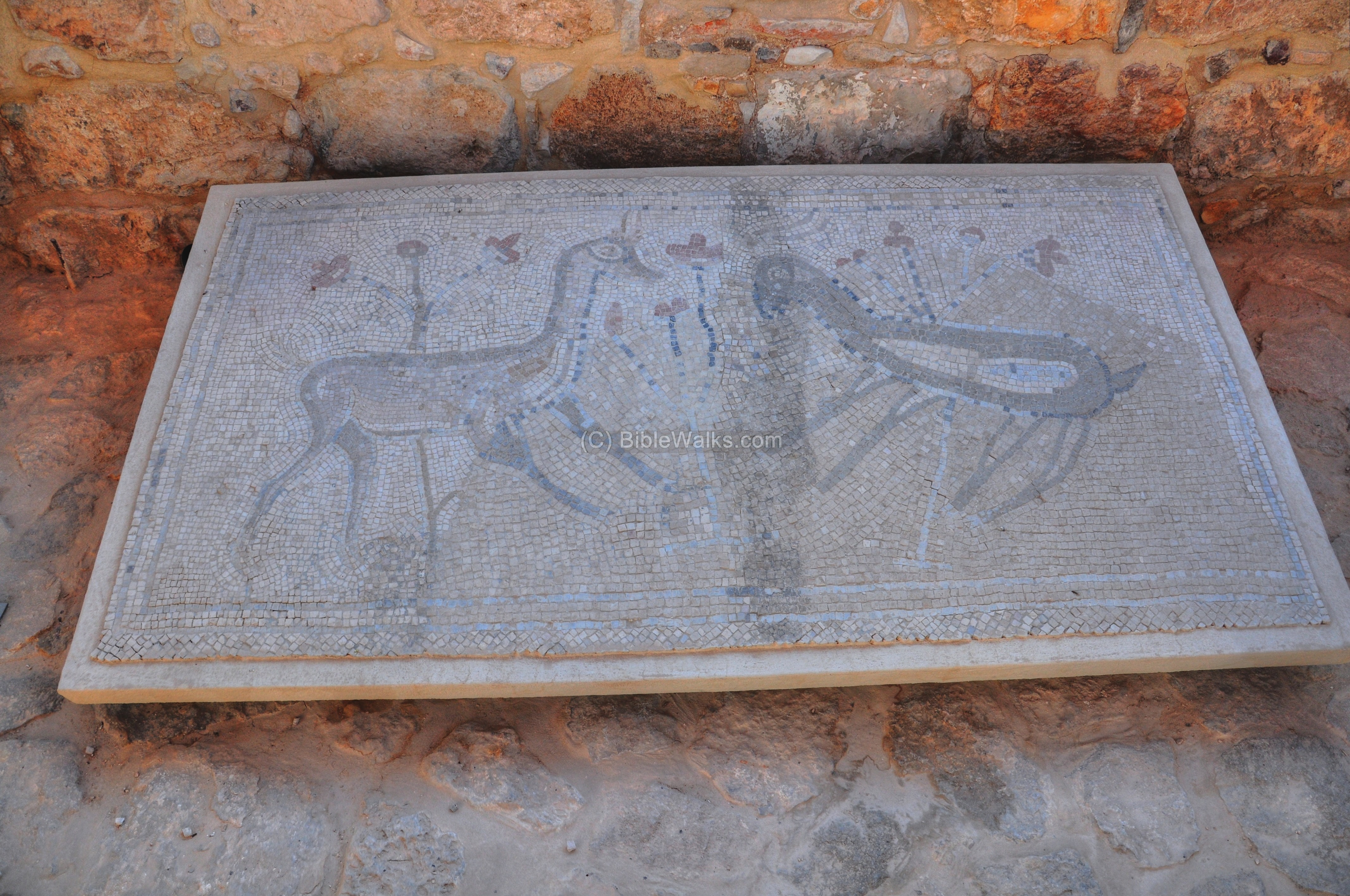
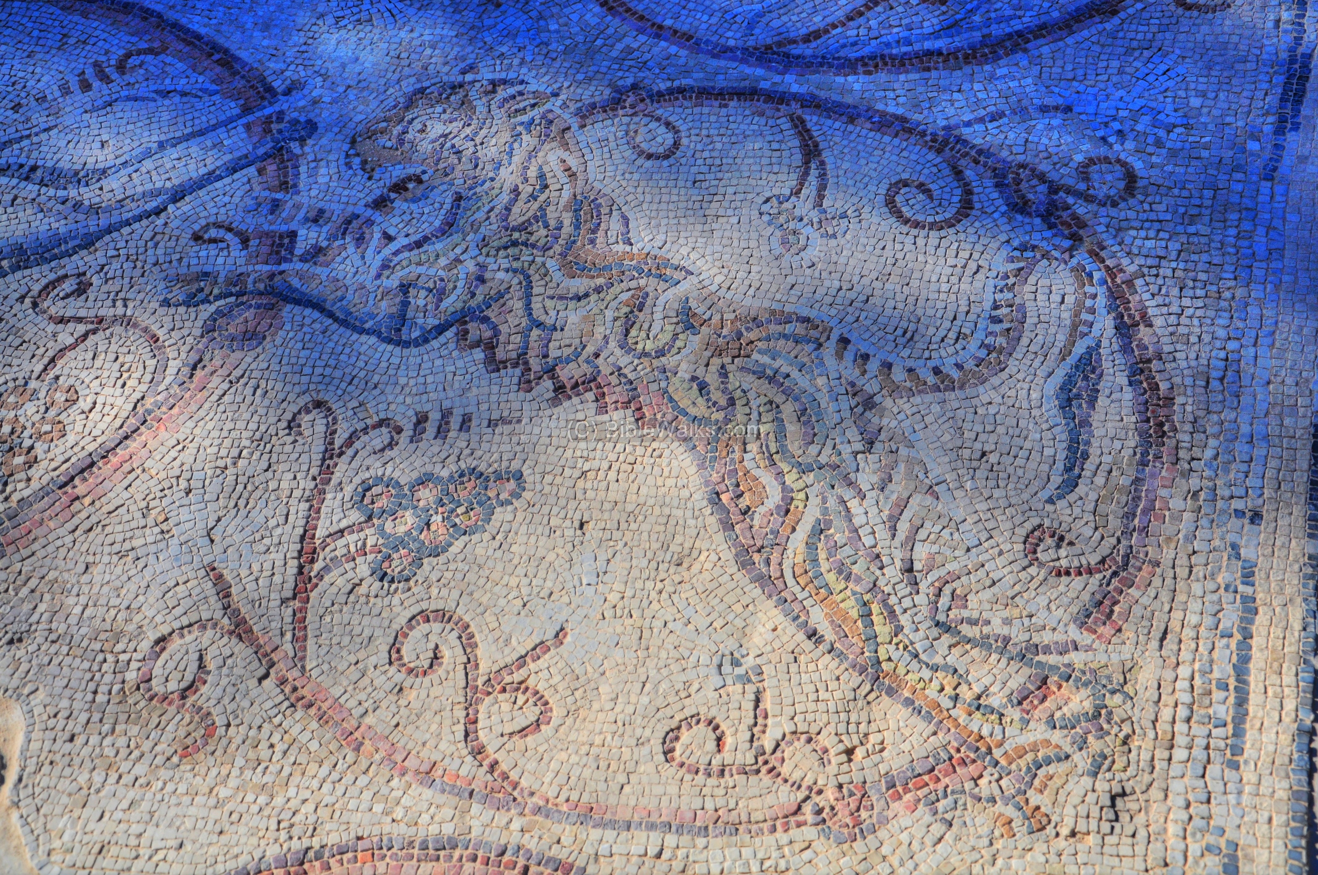
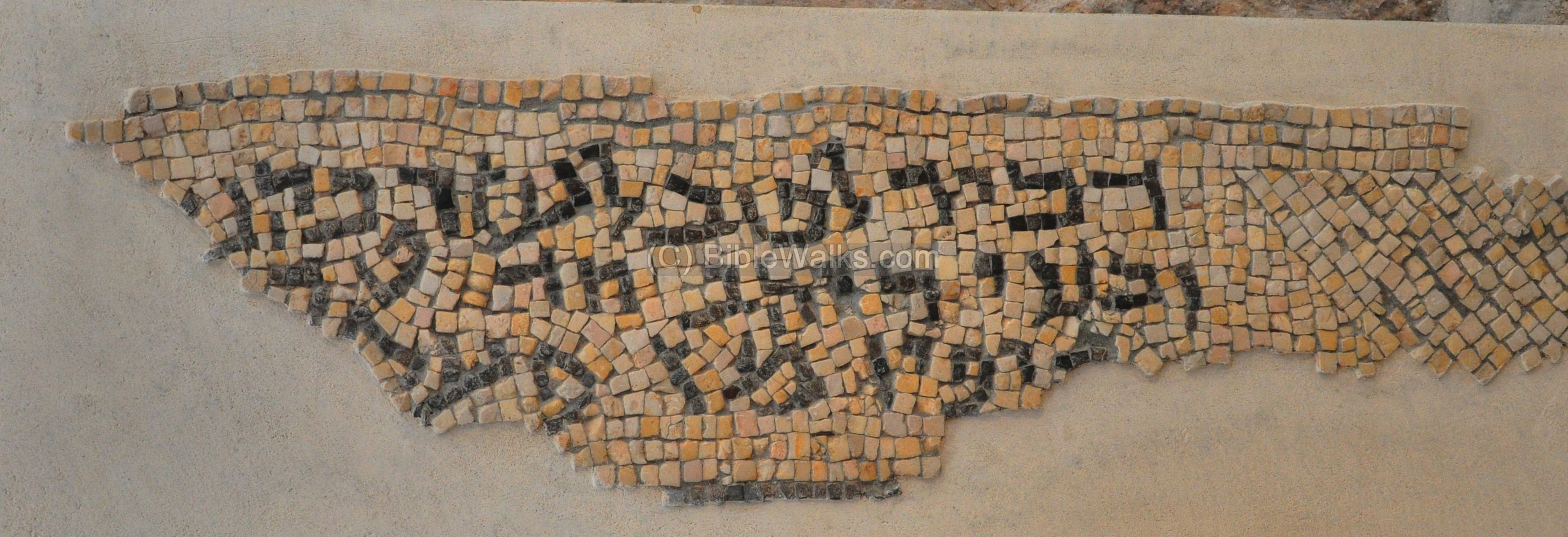
A section of the floor from the Synagogue at Gaza, with the icon of a tiger:
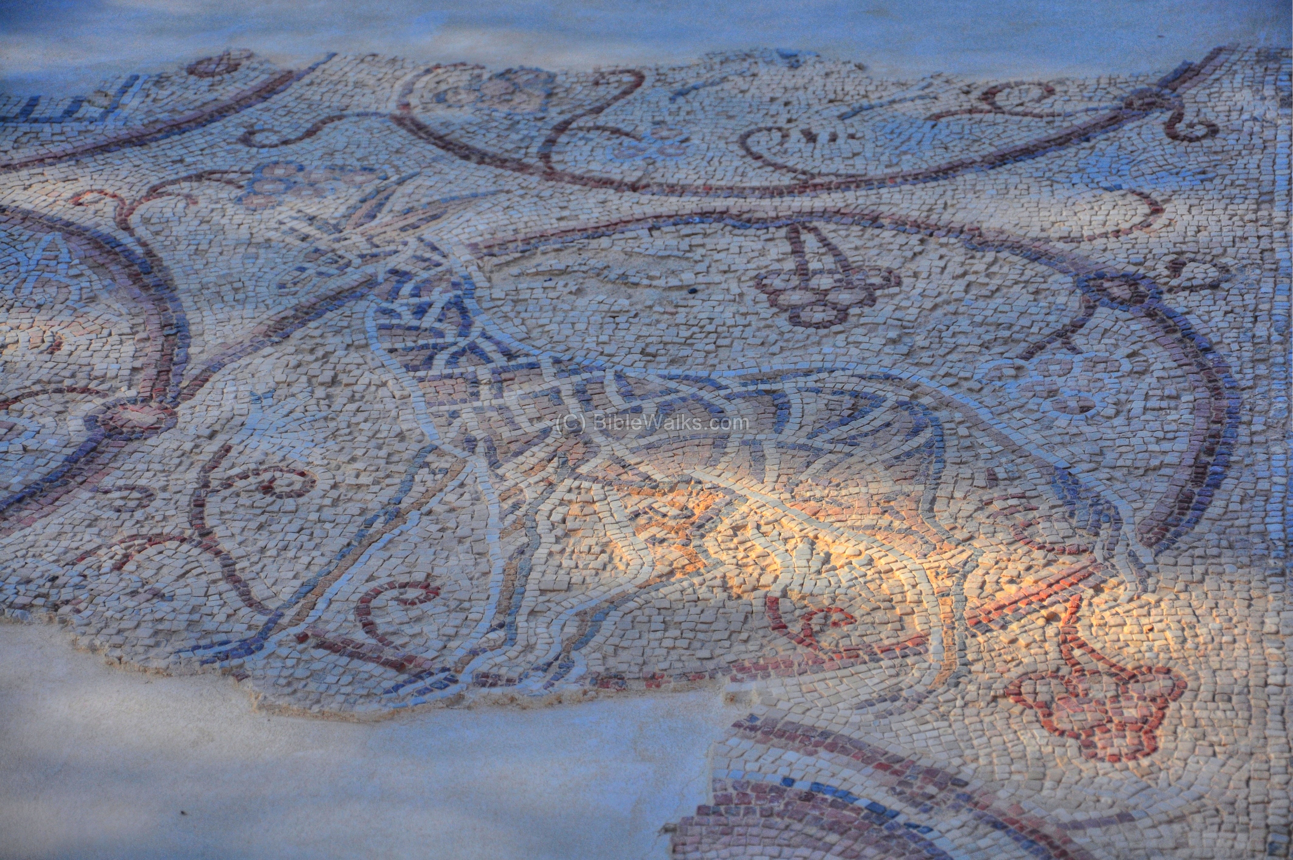
Another icon on the Gaza floor (Giraffe):
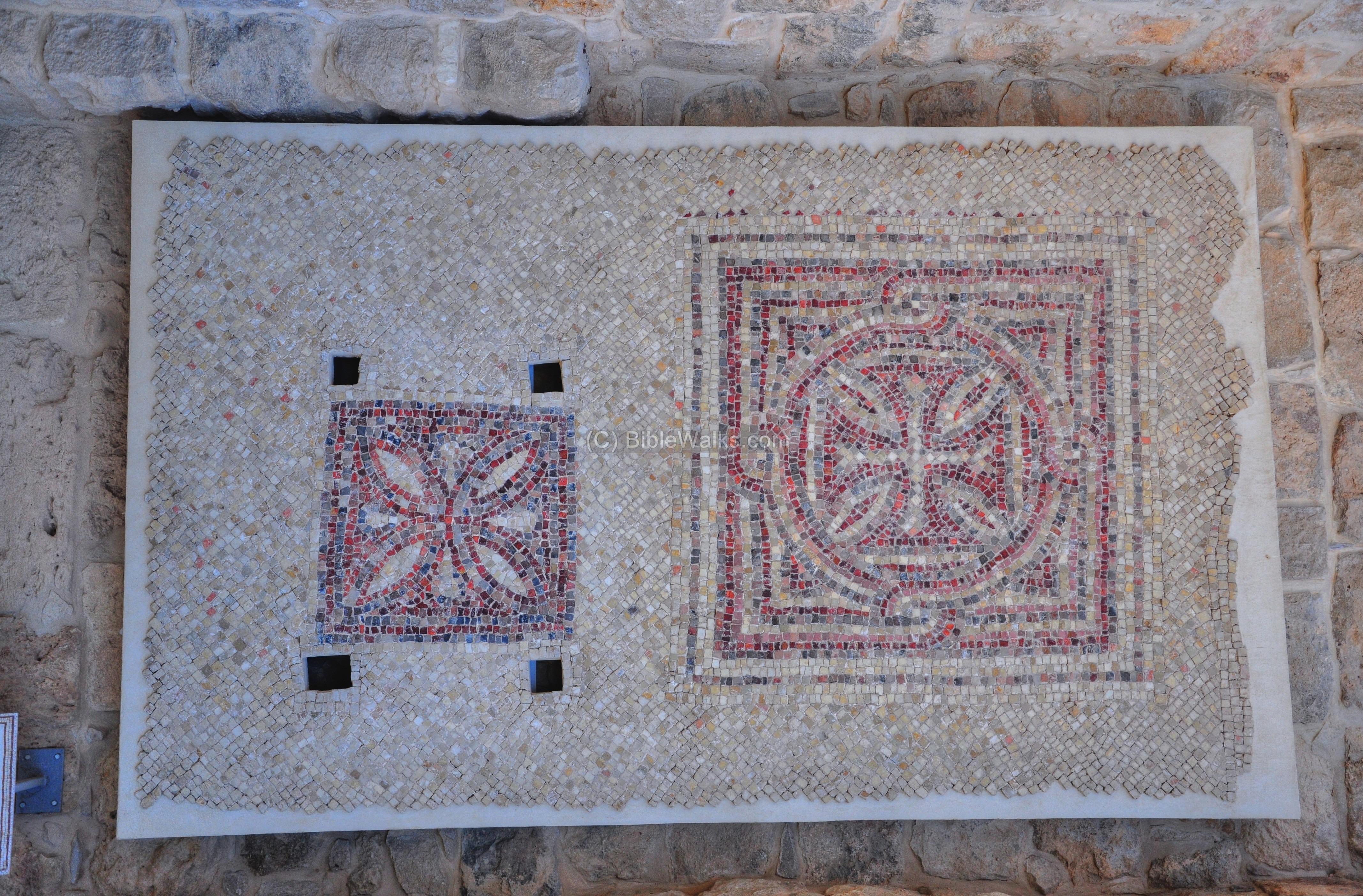
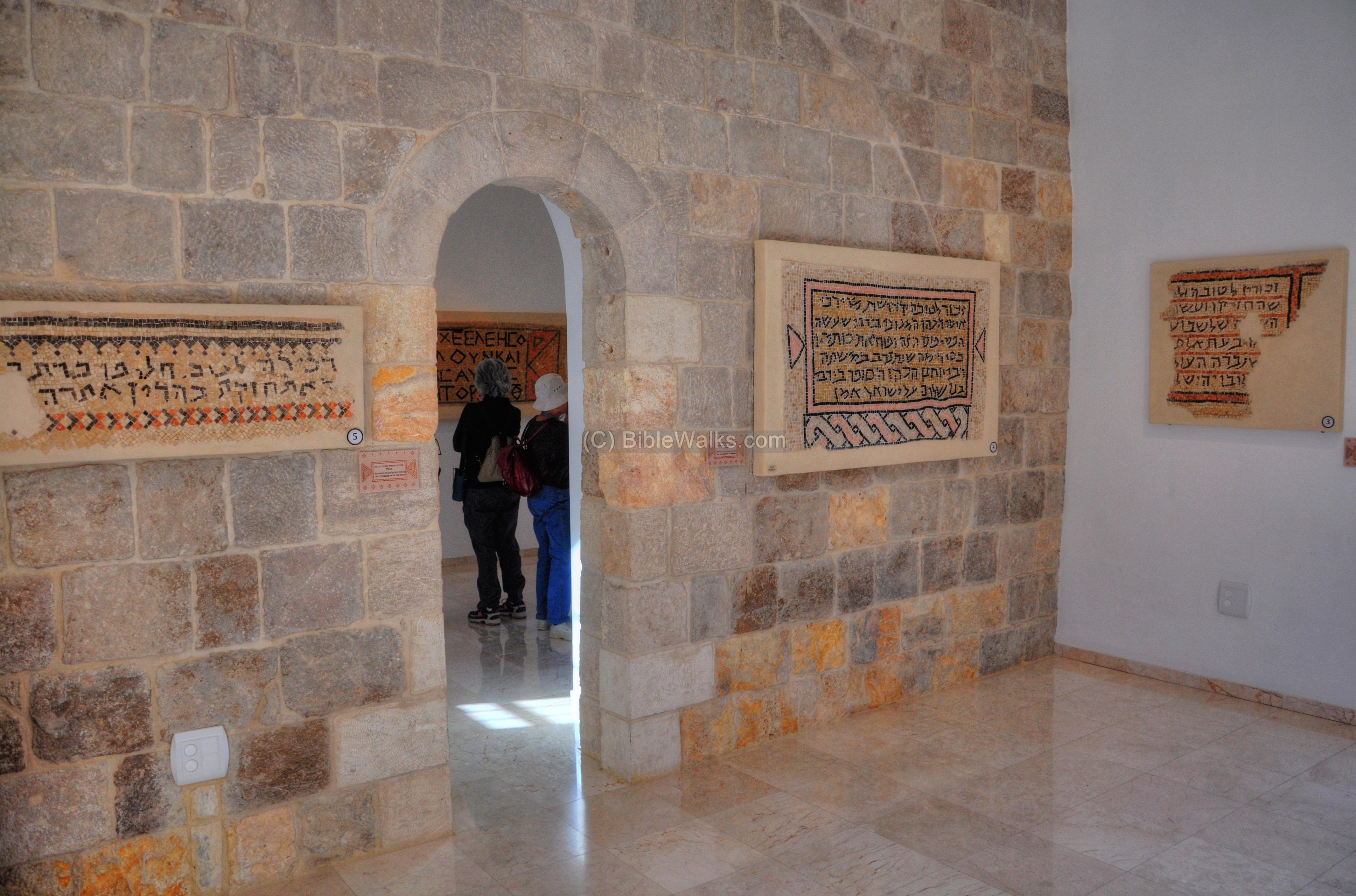
(c) Indoor Mosaics Museum
The indoor museum is located on the reconstructed inn on the south side of the complex. The following pictures show the mosaics in the indoor collection. Some of the mosaics are copies of the original floors.
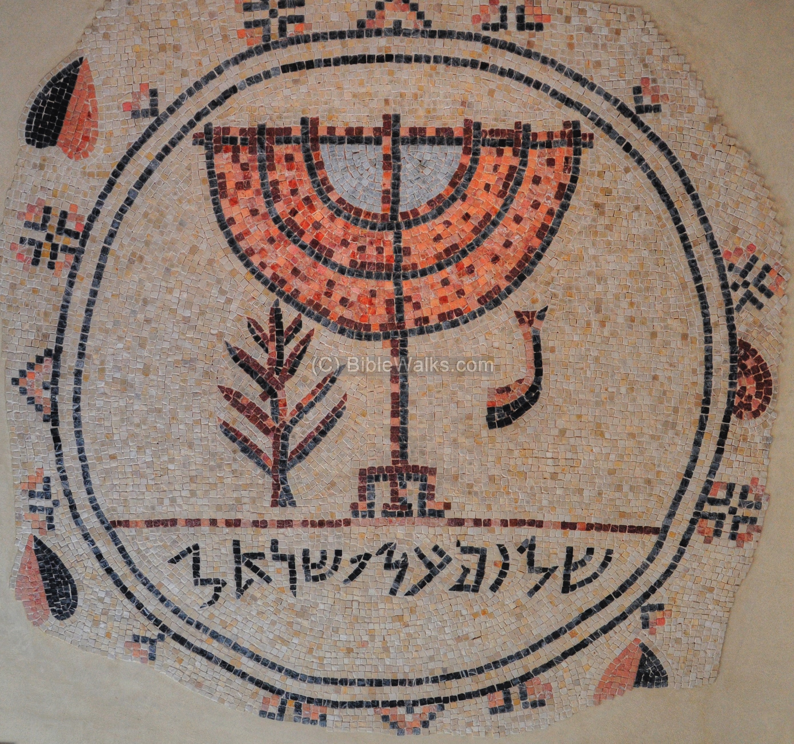
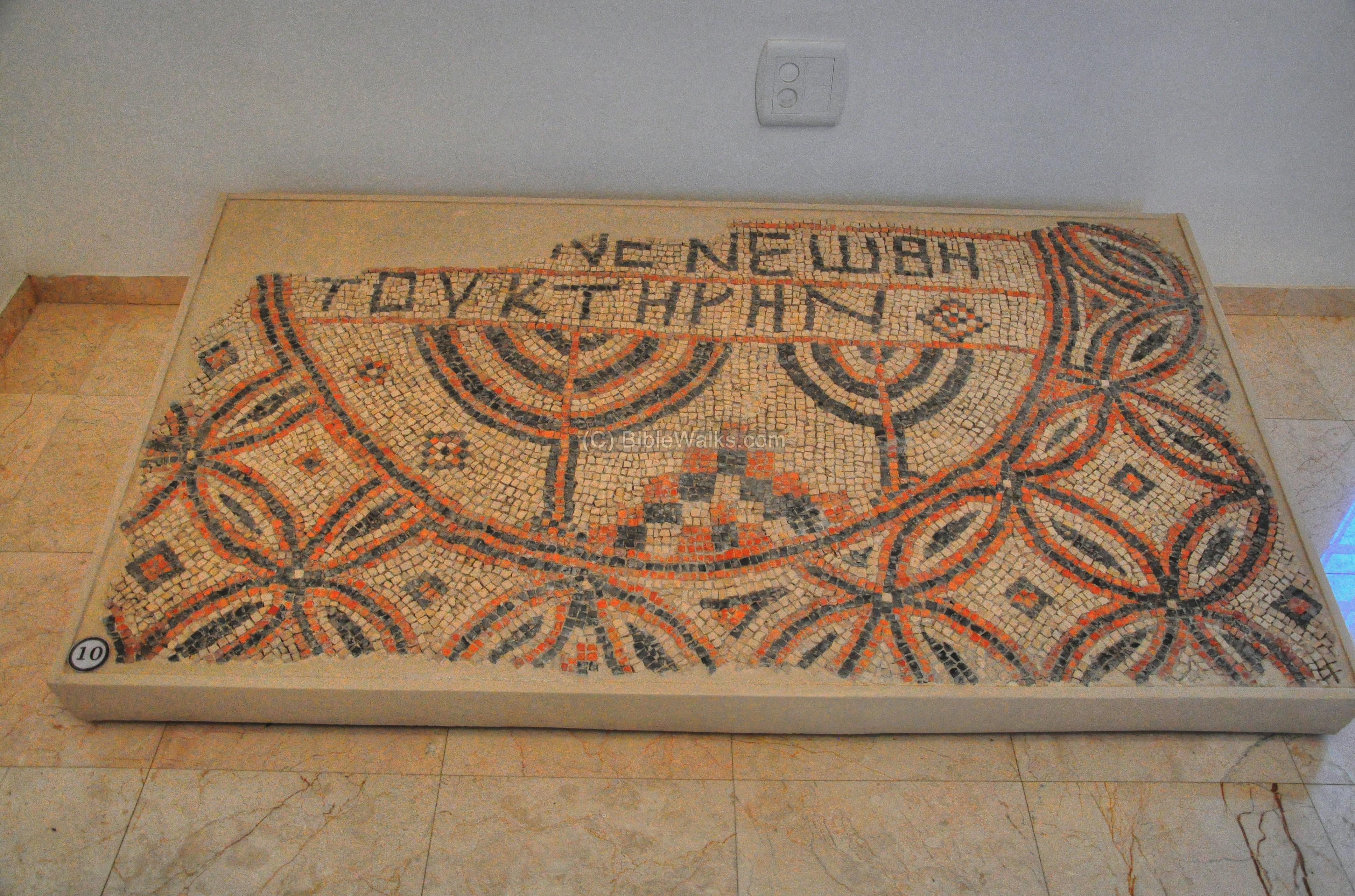
First, a Hebrew inscription from the synagogue at Jericho, with the title “Peace on Israel”:
An Aramaic inscription from the Synagogue at Na’aran. This 6th C synagogue is located 5KM north of Jericho.
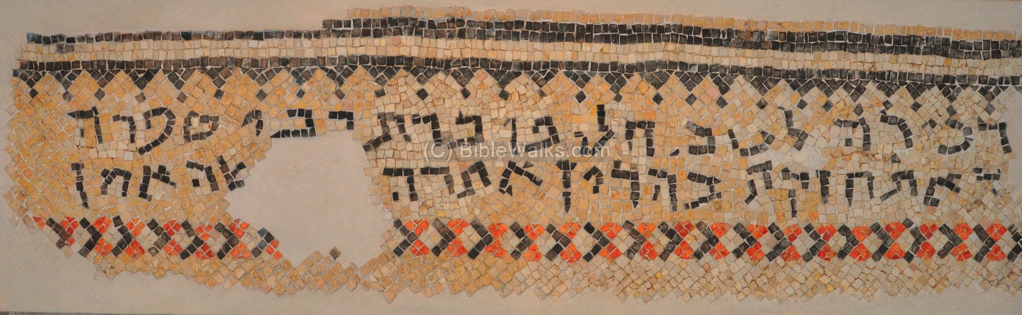
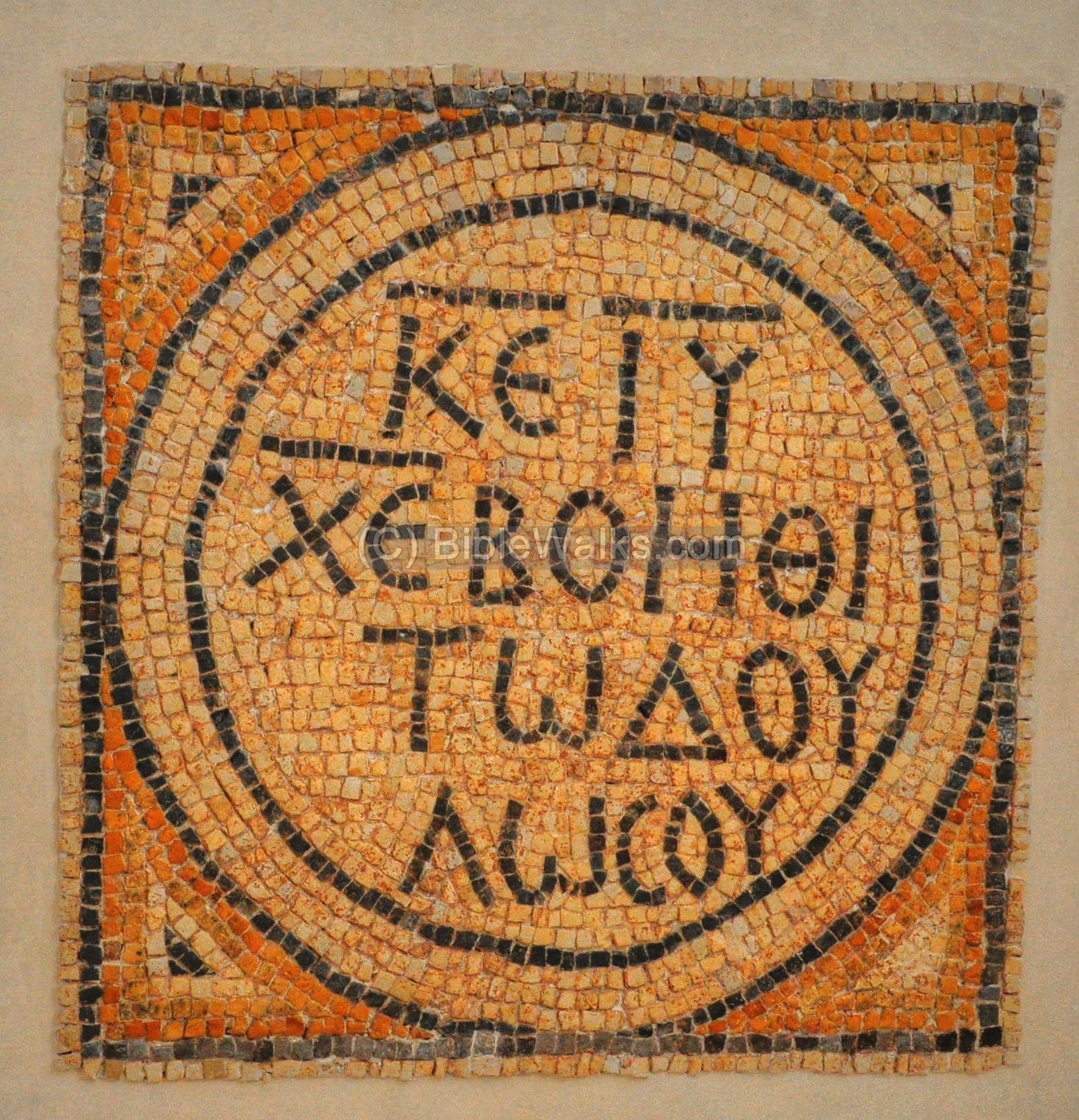
A Hebrew inscription from the synagogue at Susiya, in the southern Hebron hills. It is dated to the 6th/7th C:
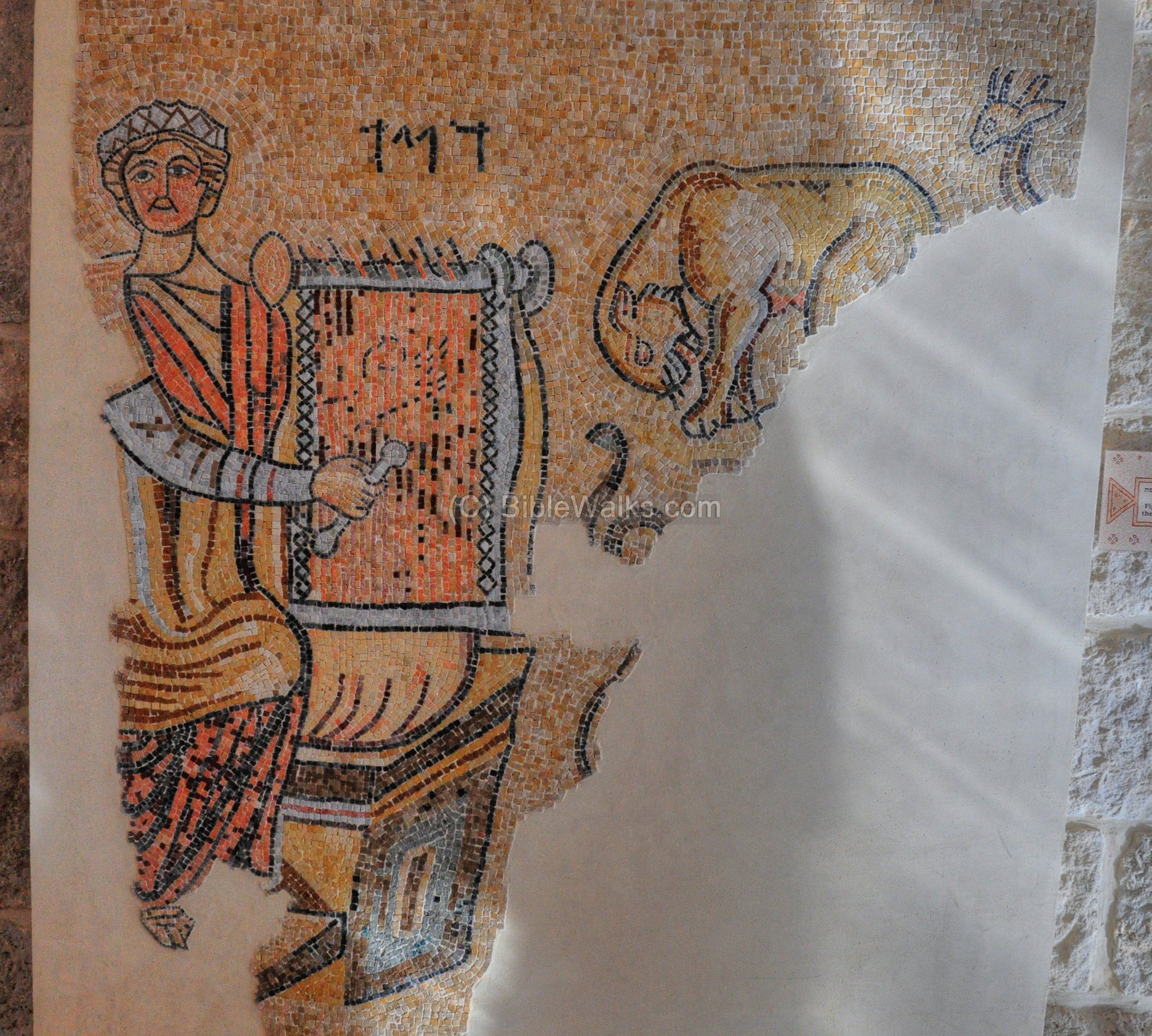
A figure of David playing the harp, with the Hebrew words “David”, is from the synagogue at Gaza:
An Aramaic inscription from the Synagogue at Eshtemoa. This 6th C synagogue is located 15KM south of Hebron.
An Aramaic inscription from the Samaritan synagogue at Sha’alavim. It is dated to the 4th C:
A mosaic floor from the Samaritan synagogue at el-Khirbe. It is dated to the 4th C:
A mosaic floor from the Samaritan synagogue at Sha’alavim:
A Greek inscription from the early church at Shiloh, is in the following picture. It is dated to 380-420 AD.
Shiloh is the Biblical site which was the religious capital during the period of the Judges. It is, located north of Beit-El in the center of Samaria.
Another Greek inscription from the early church at Shiloh:
Yet, another Greek inscription from the early church at Shiloh:
A Greek inscription from the early church at Shiloh:

A Greek inscription from the Baptistery at Shiloh:
A remarkable floor from bema of the early church at Shiloh:
A Greek inscription from the late Church at Shiloh:
(d) Outdoor Archaeological Museum
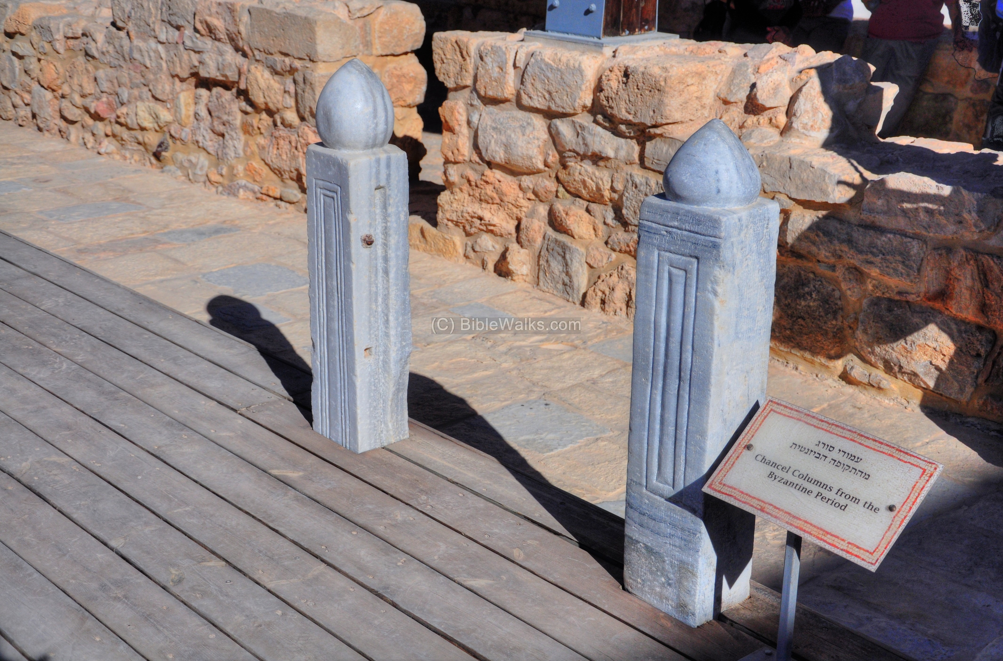
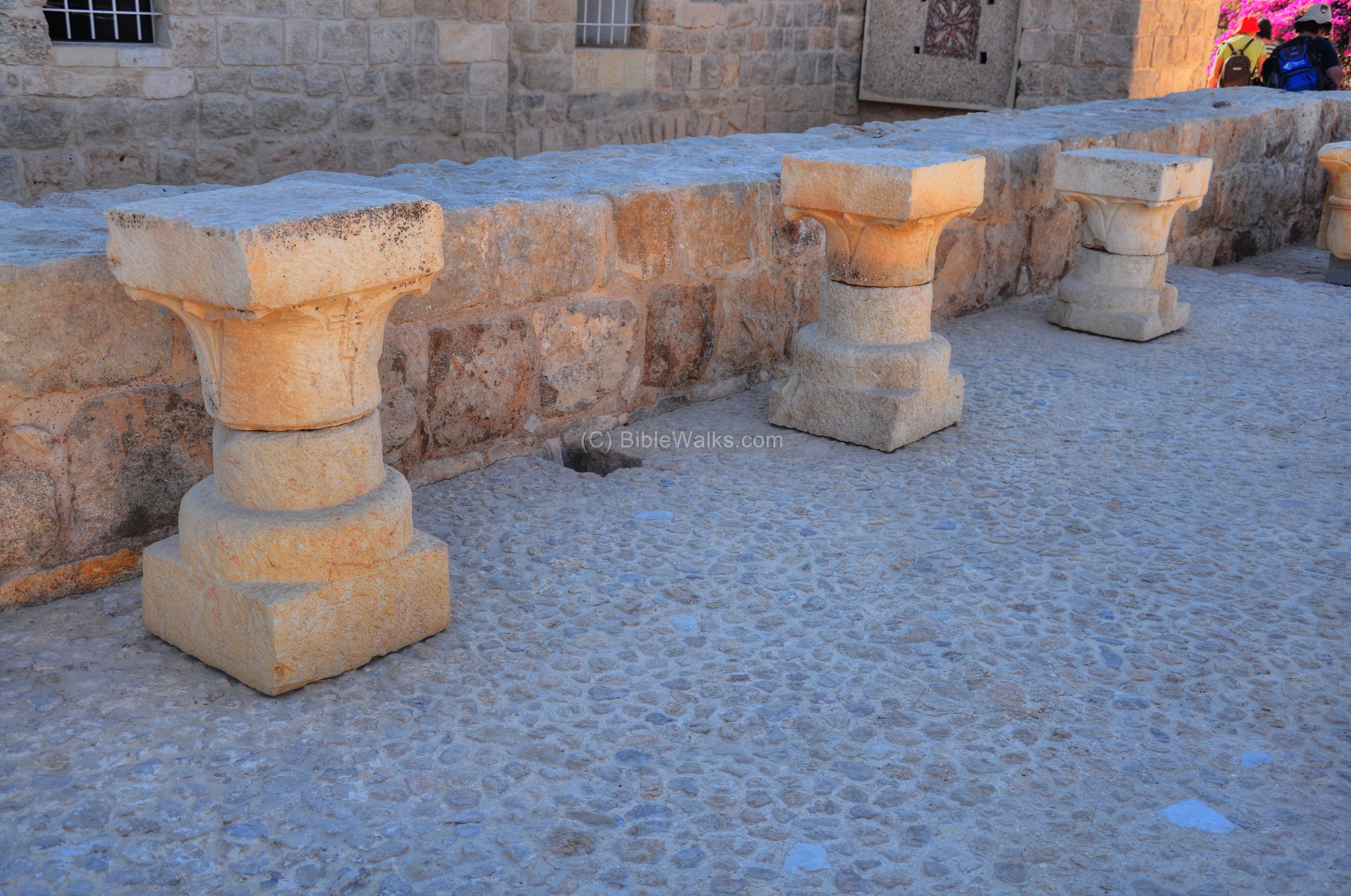
The outdoor collection is arranged in the courtyard of the Byzantine church and the open area around it. These chancel columns are typical of the Byzantine period. It held the screen in order to separate the area of the altar (also called chancel) from the nave.
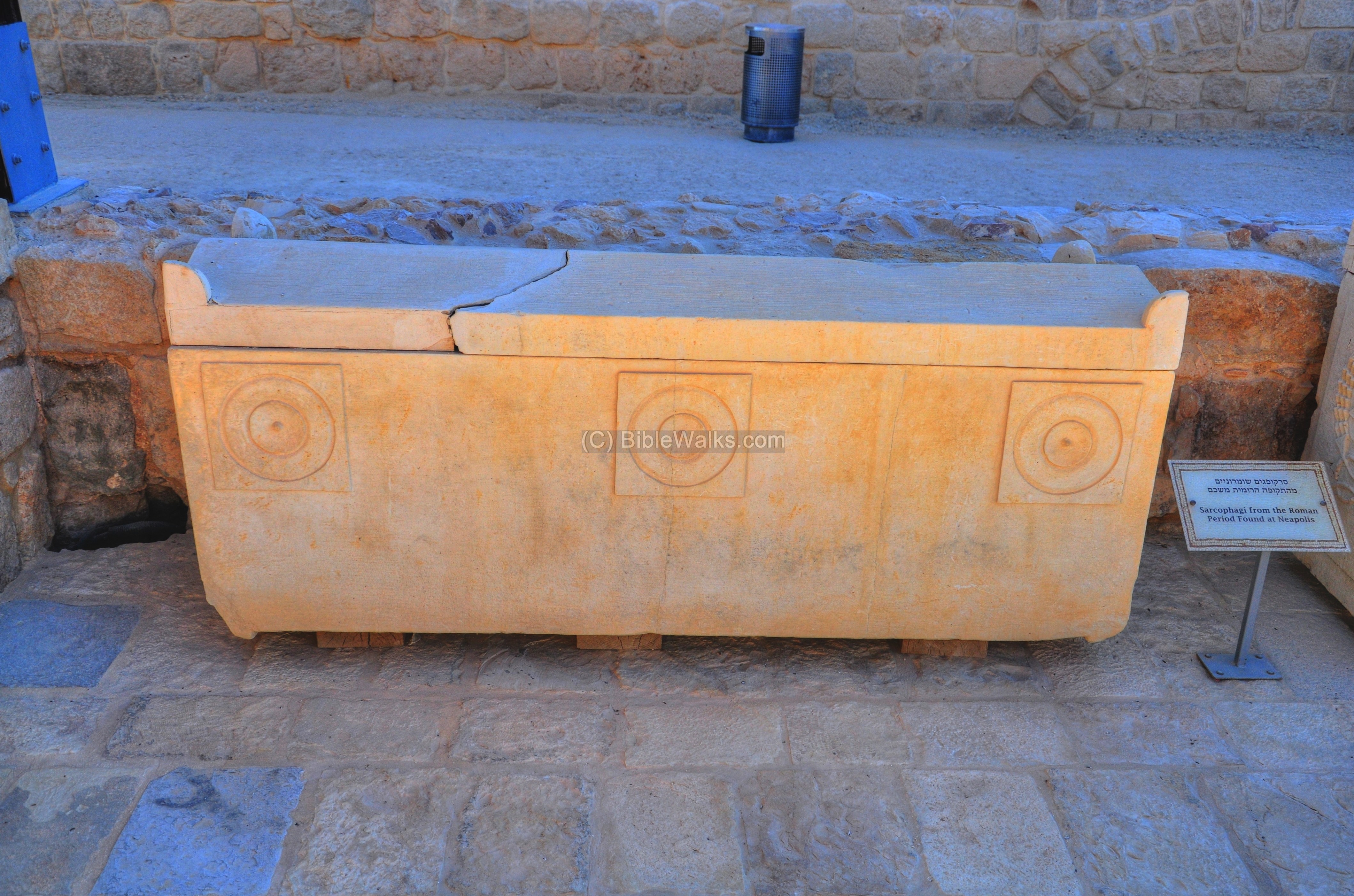
A number of sarcophagi (burial coffins) are also on display. The ones below are Roman stone coffins dated to the Roman period, and found in Neapolis (Shechem).
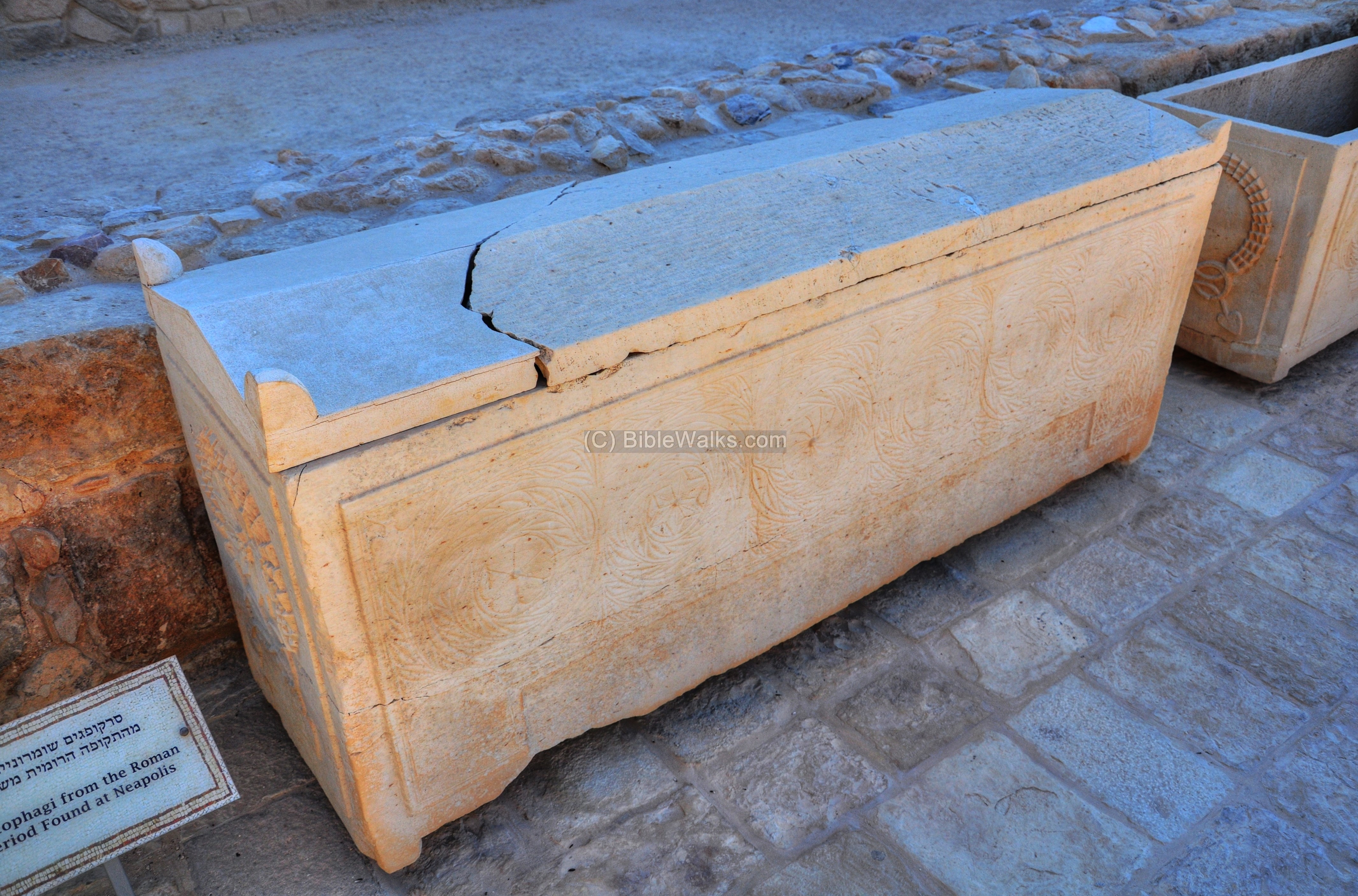
Another coffin from Shechem:
Capitals from the Crusader Period found in the excavations of Nebi Samuel are on display here:
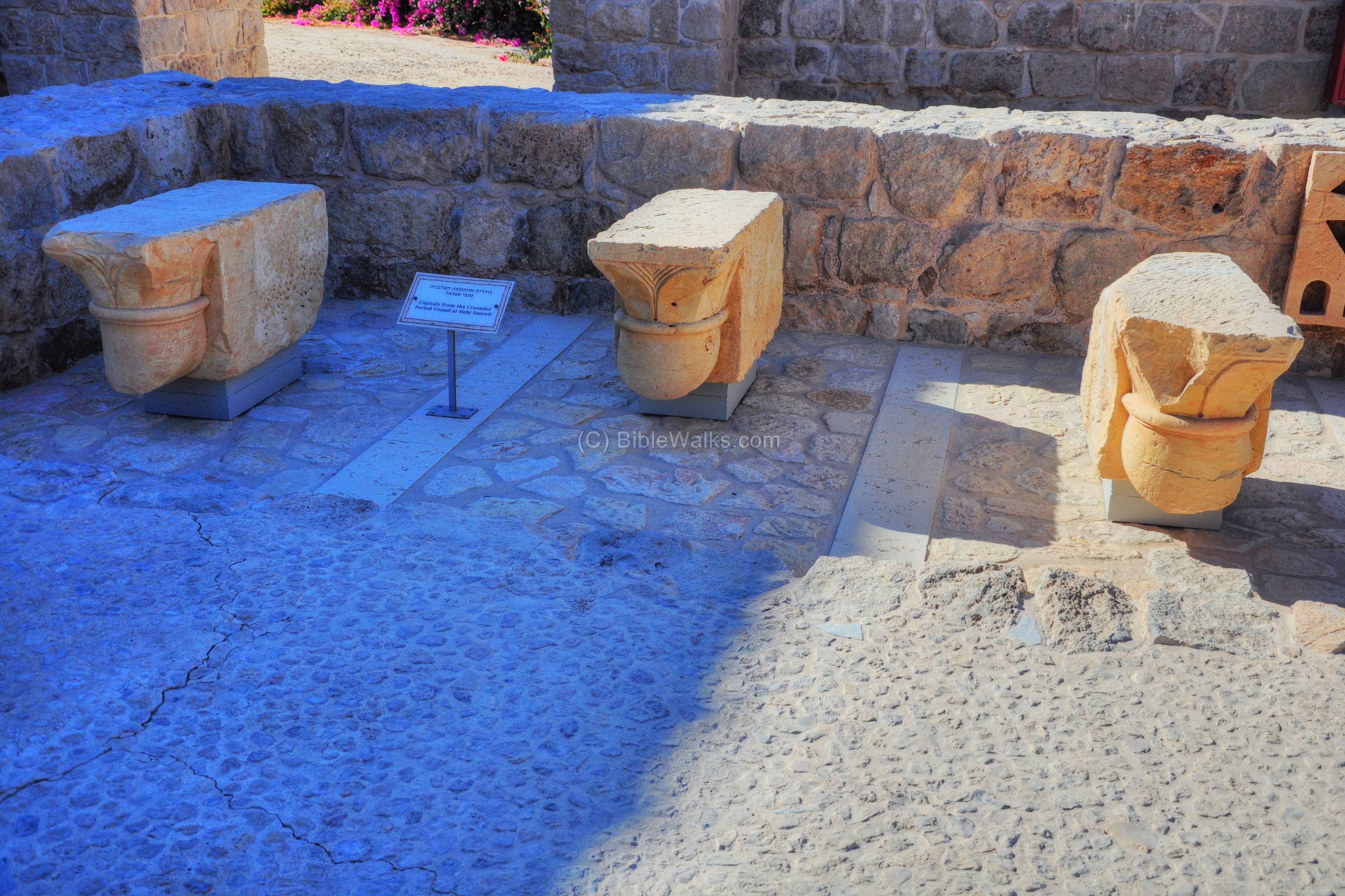
Other capitals from Nebi Samuel:
A collection of capitals (in front) and windows (in the back):
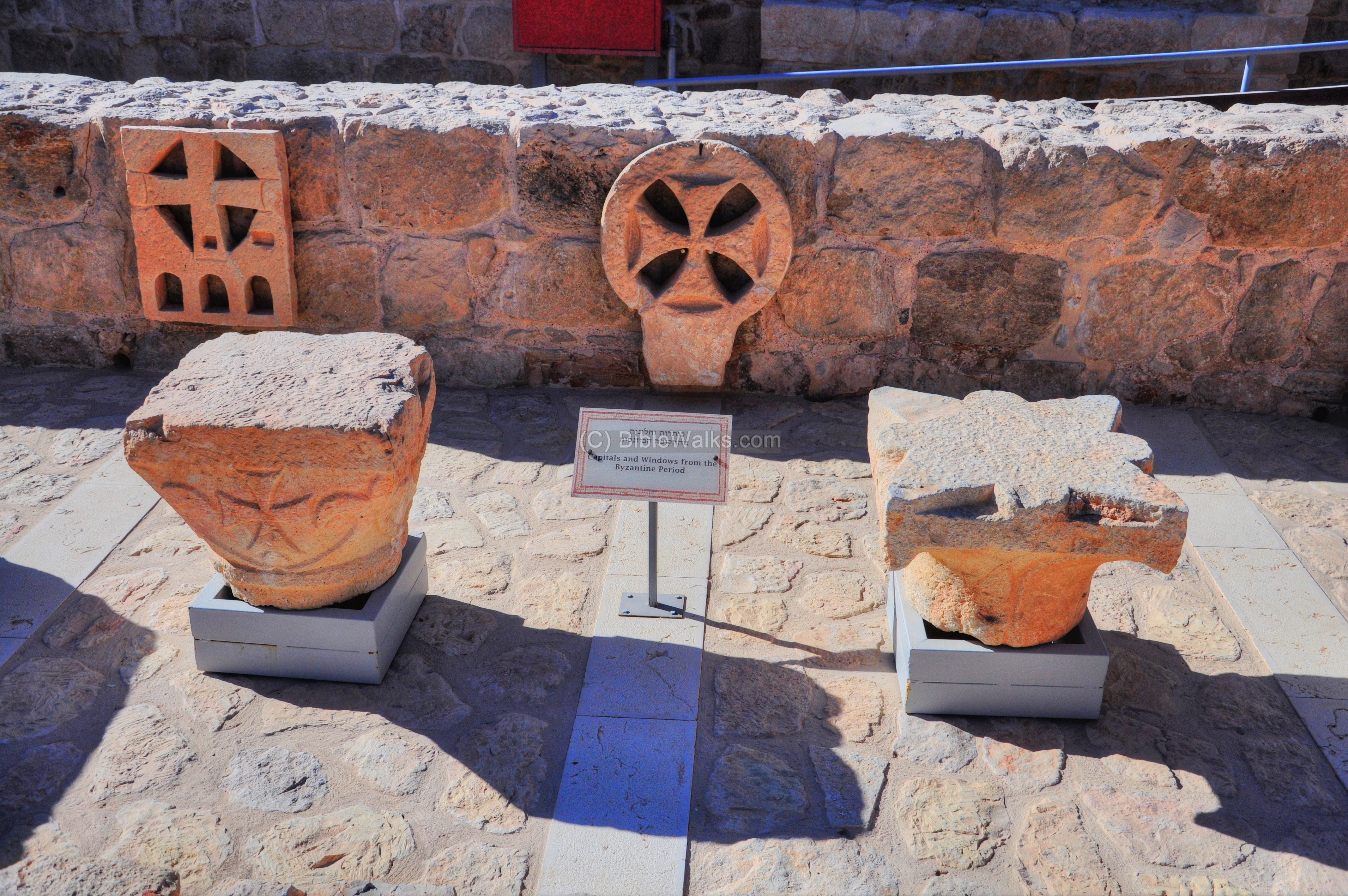
Capitals, windows and a chancel column dated to the Byzantine period are seen on the left of the next picture.
On the right is a set of roller stones for compressing plaster on roofs and floors, dated to the Hellenistic period, found at Mt Gerizim.
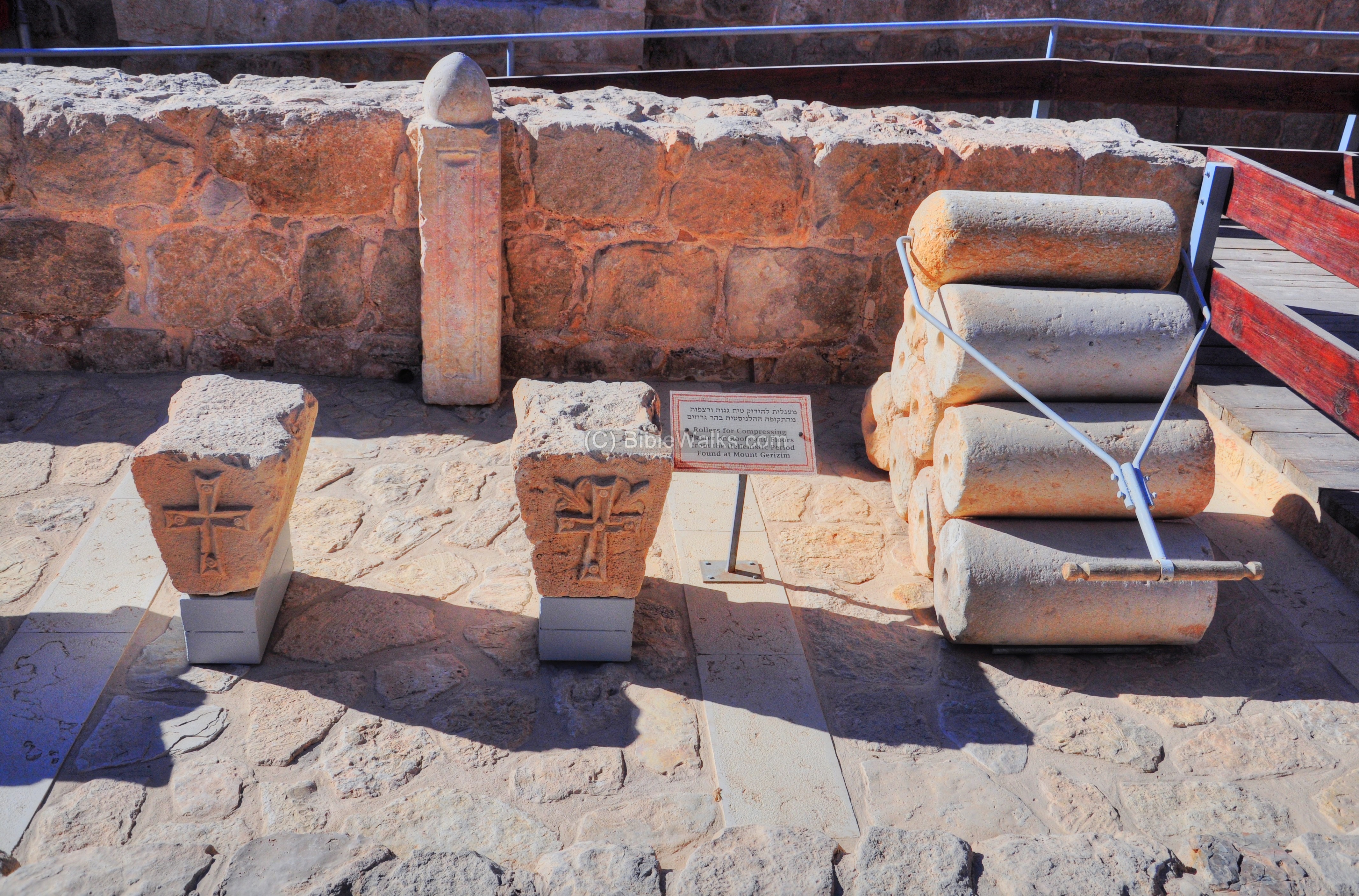
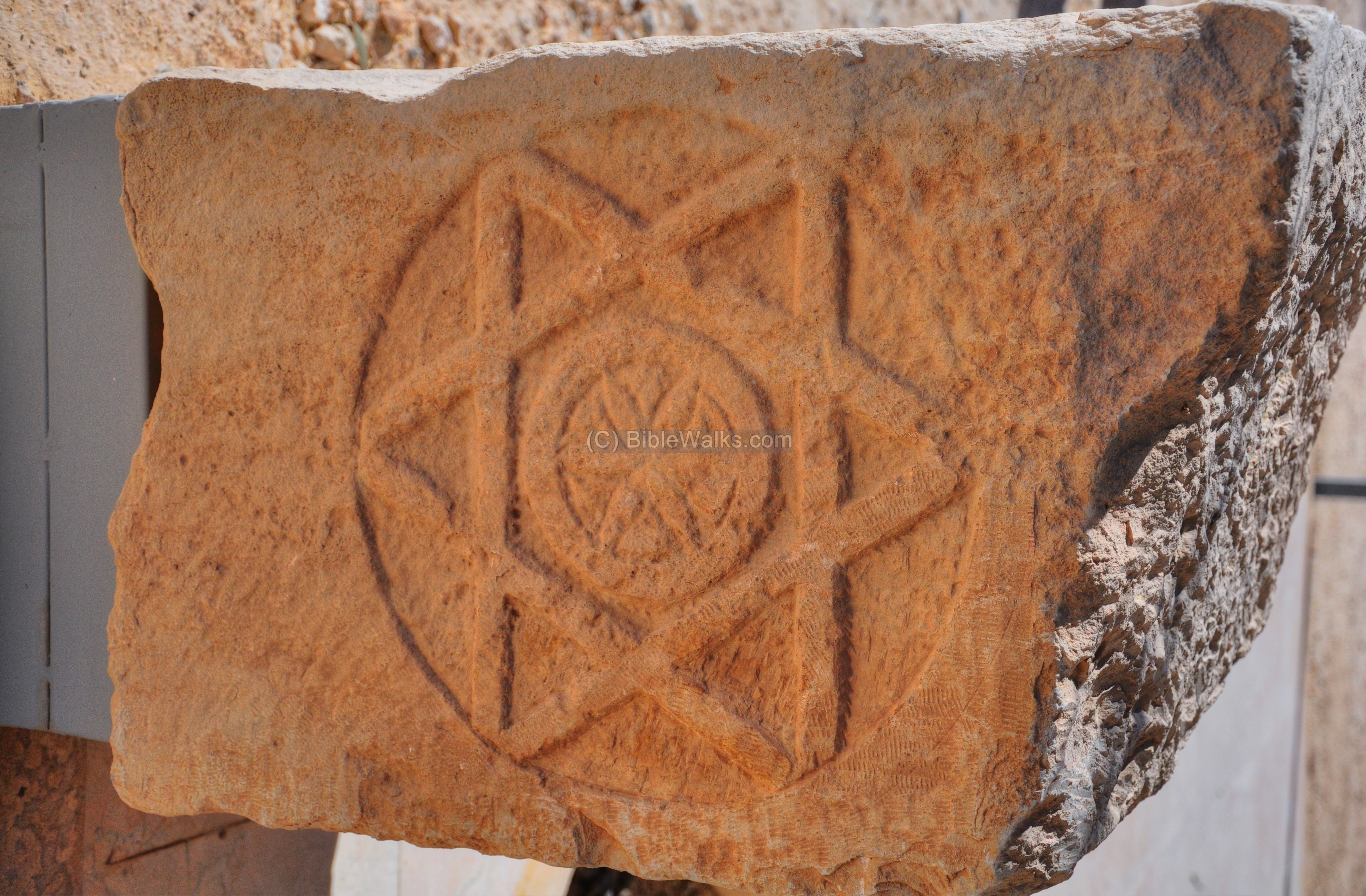
A star of David relief is found on a lintel, which was found at Tell es-Simadi, a site between Jericho and Adam (Damiyeh) bridge.
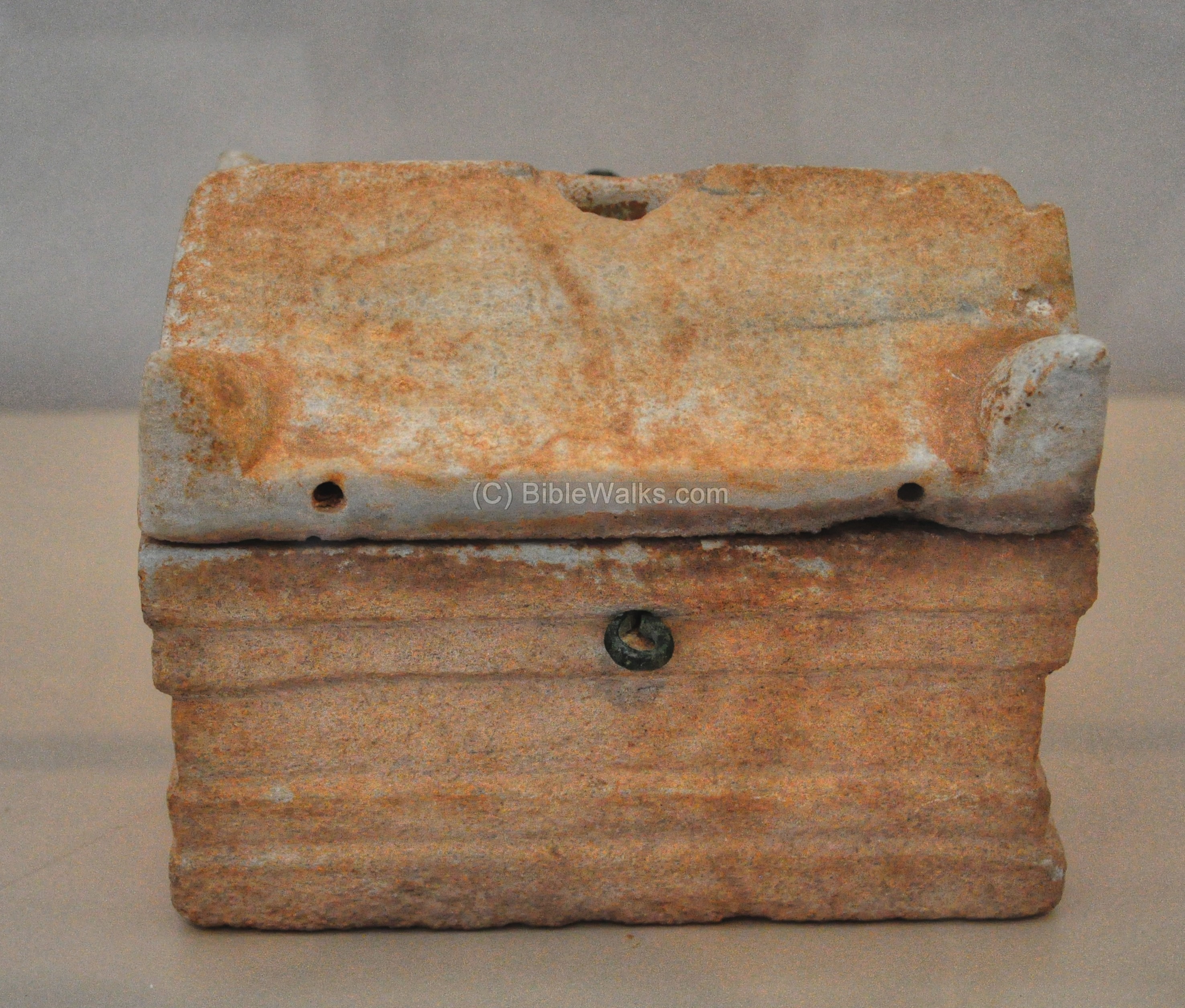
(e) Indoor Archaeological Display
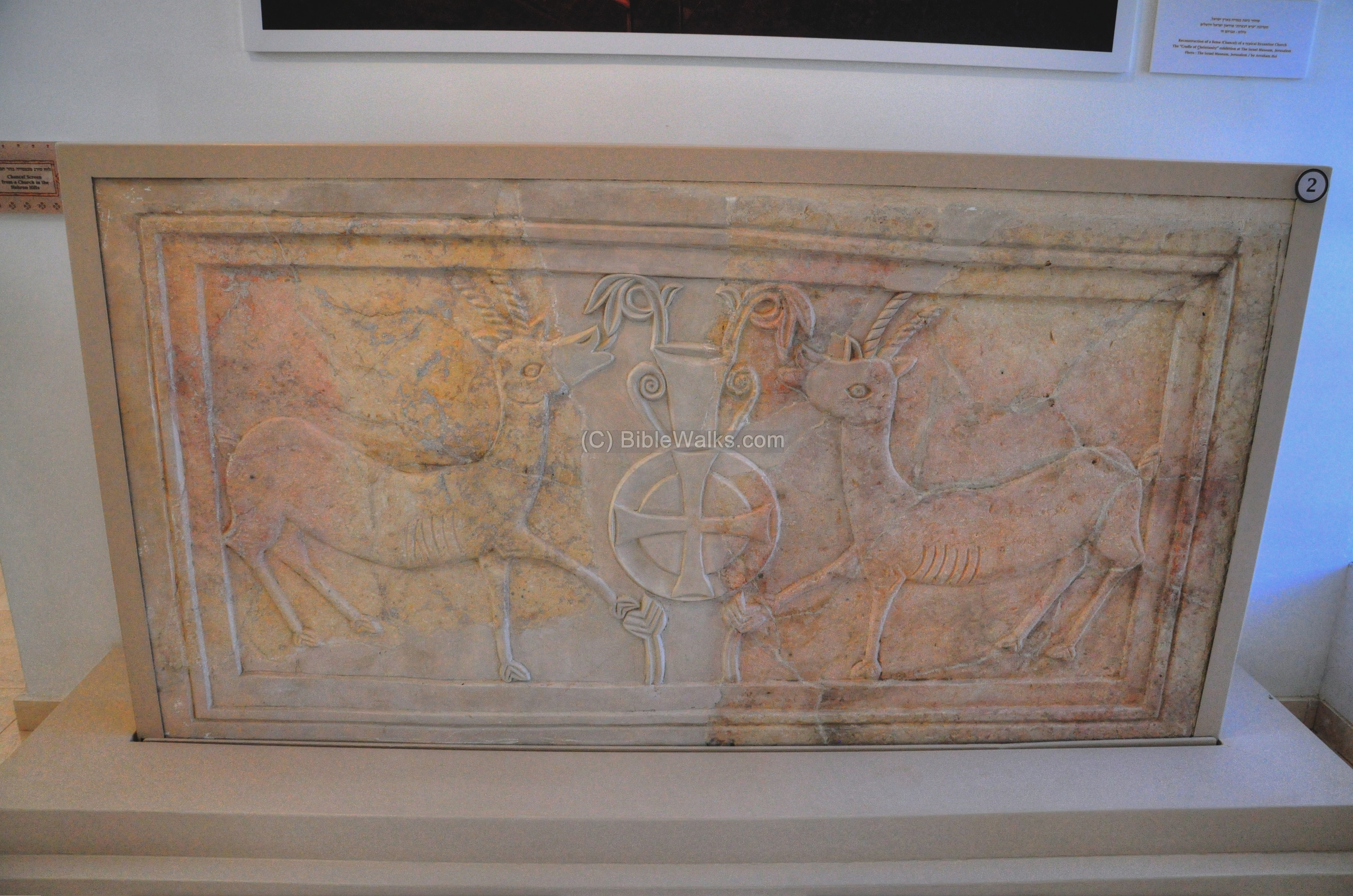
Inside the indoor museum are also a number of archaeological findings, including the chancel screen from a church in the Hebron hills:
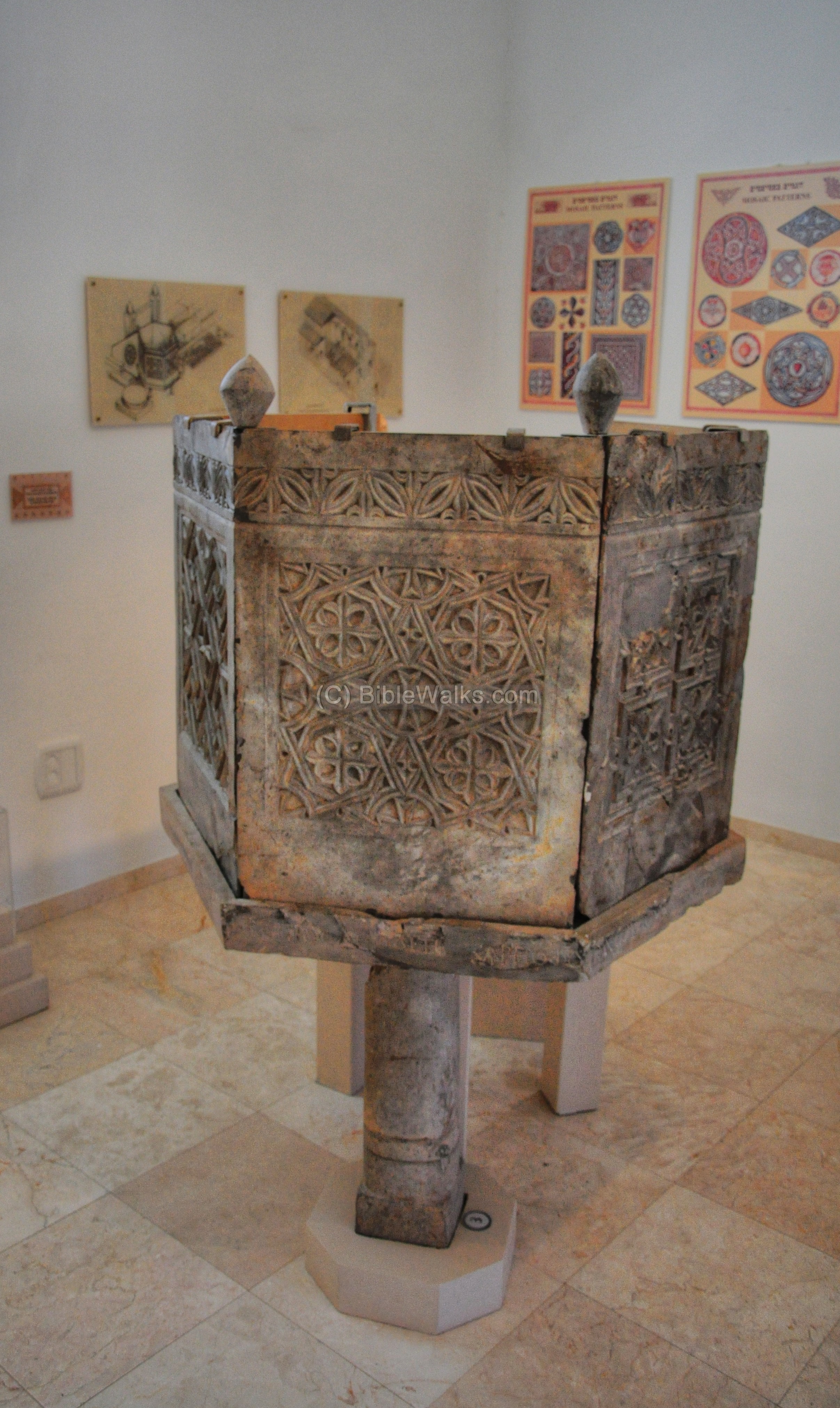
An ambo (or pulpit – speaker’s stand) from the Byzantine church of St. Theodoros at Beit Sila. The church, whose floor was laid at the end of the 5th C, serviced the pilgrims on the road from Lod (Lydda) to Jerusalem.
From this platform the scriptures are read. This is one of the most remarkable findings in early churches!
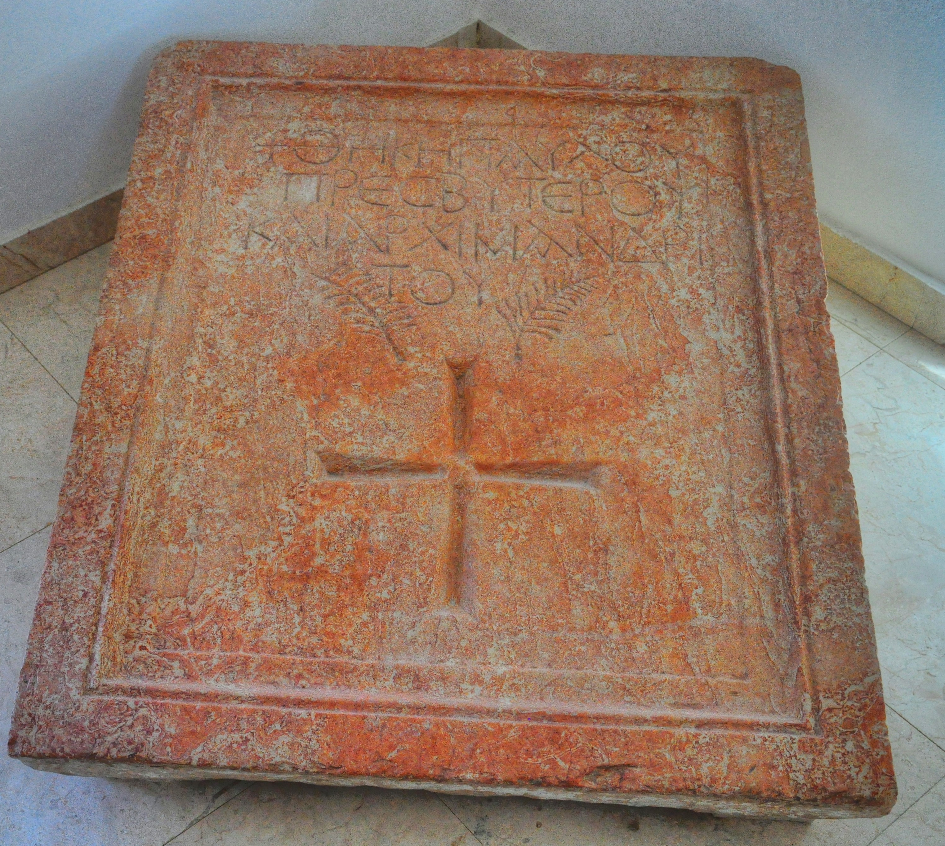
The tombstone of Paul, the Abbot of the Martyrius Monastery in the nearby city of Ma’ale Adummim, is on display here. Abbot Paul headed the construction of the monastery during the period Martyrius served as Patriarch of Jerusalem (478-486).
One of the marble tables from the kitchen of the Martyrius Monastery is also on display here, including ceramic vessels found during the excavation of the refectory.
A reliquiry (container for relics) from the church at Beit Sila:
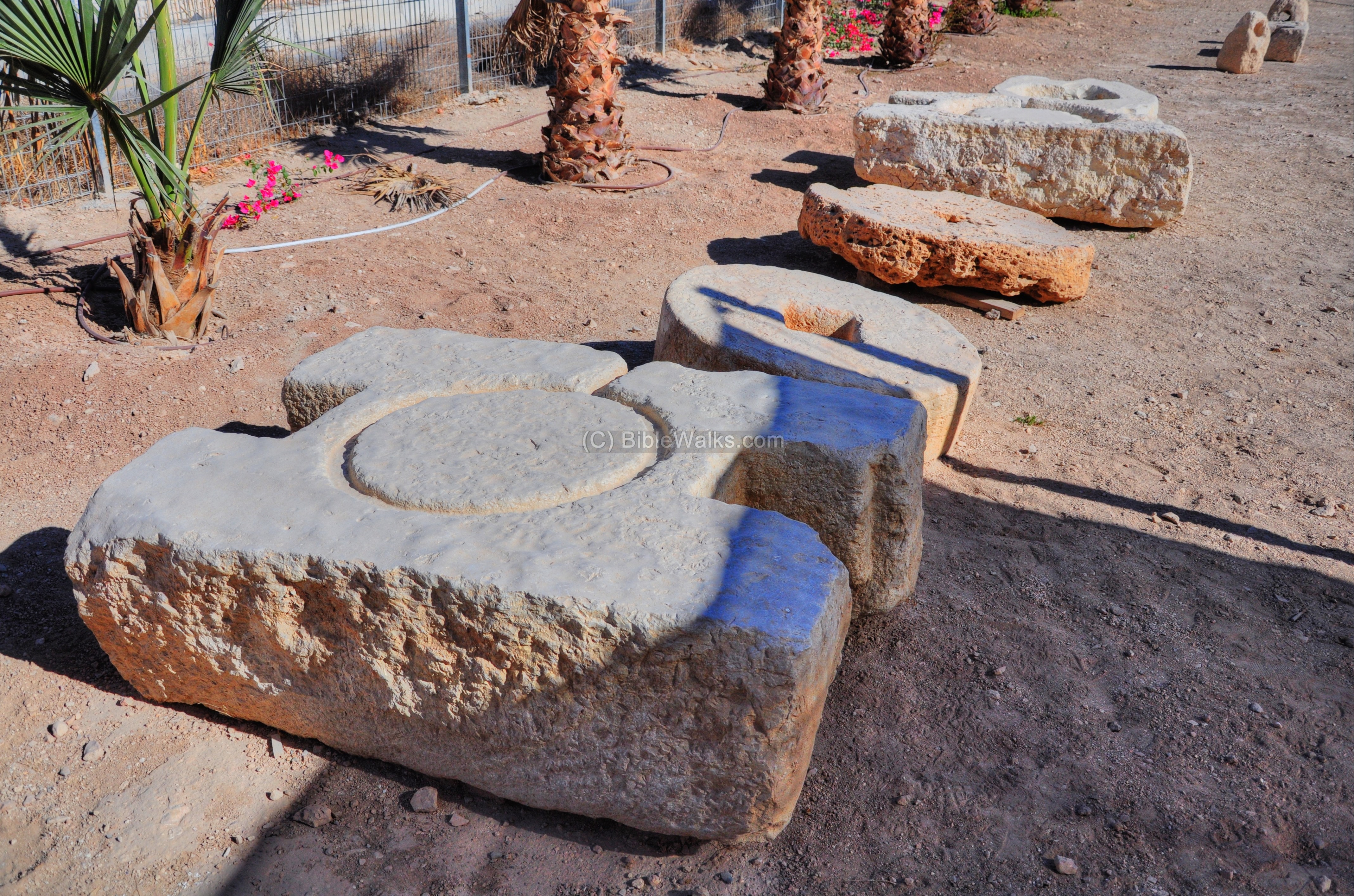
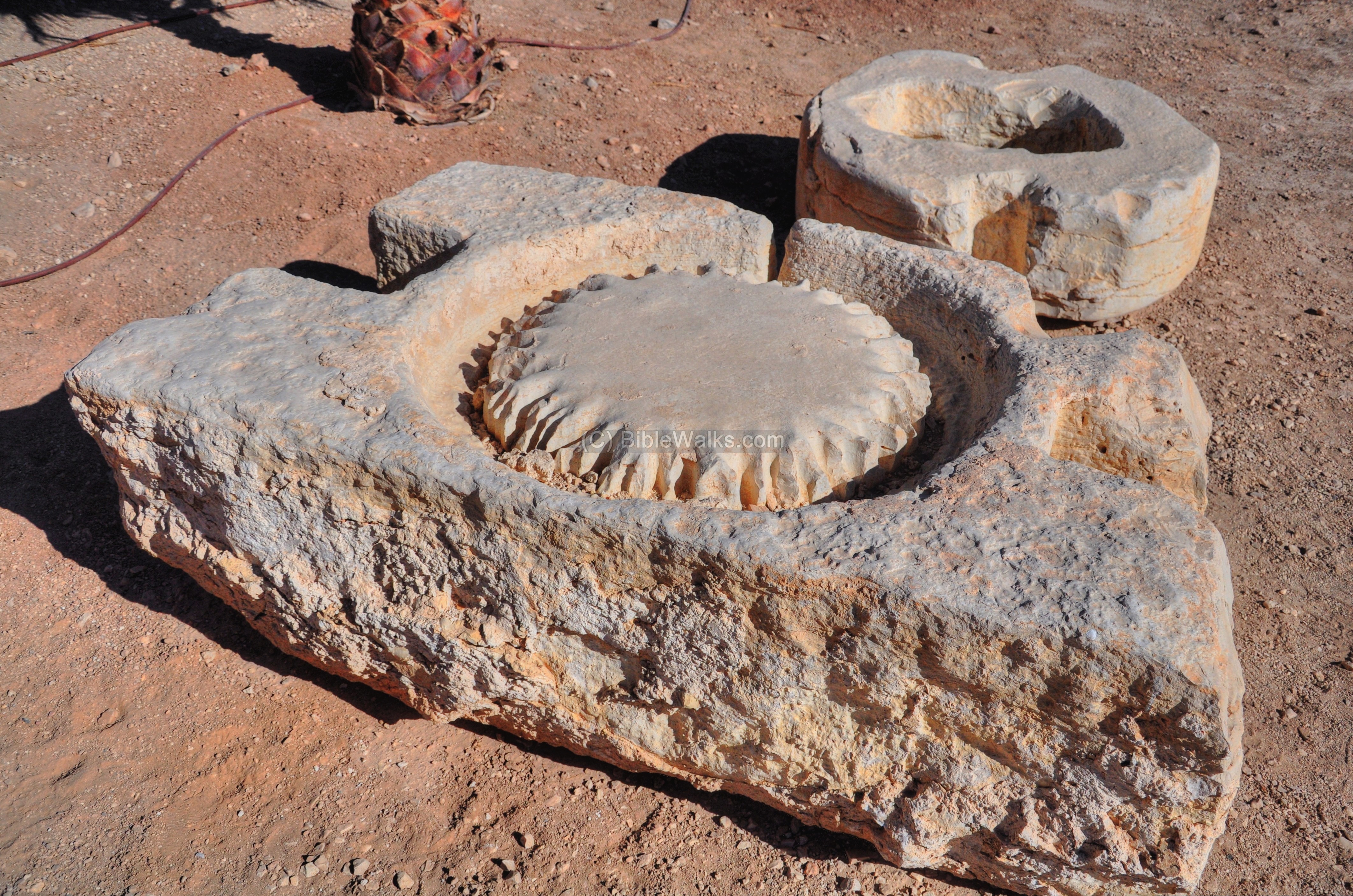
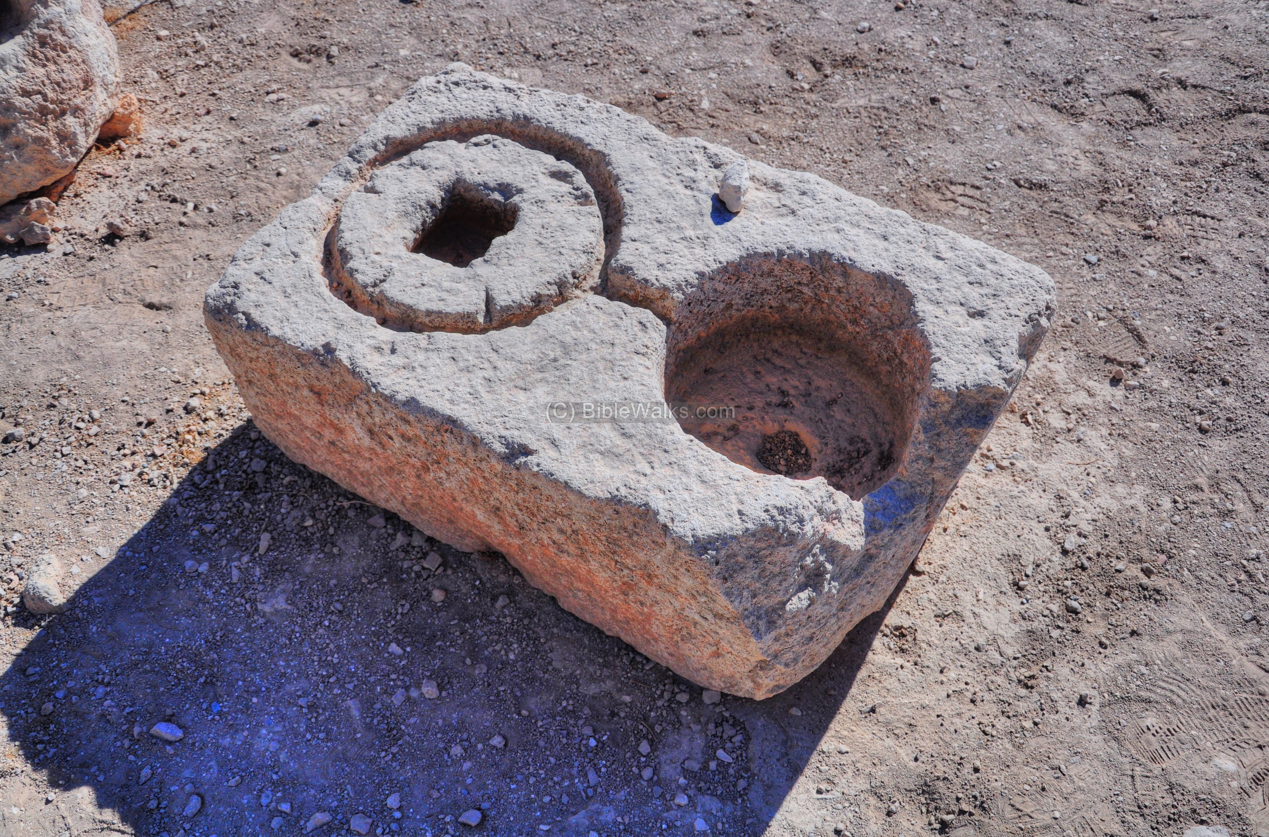
(f) Agriculture Installations
A collection of agriculture installations are also on display near the parking lot. These include parts of ancient oil presses.
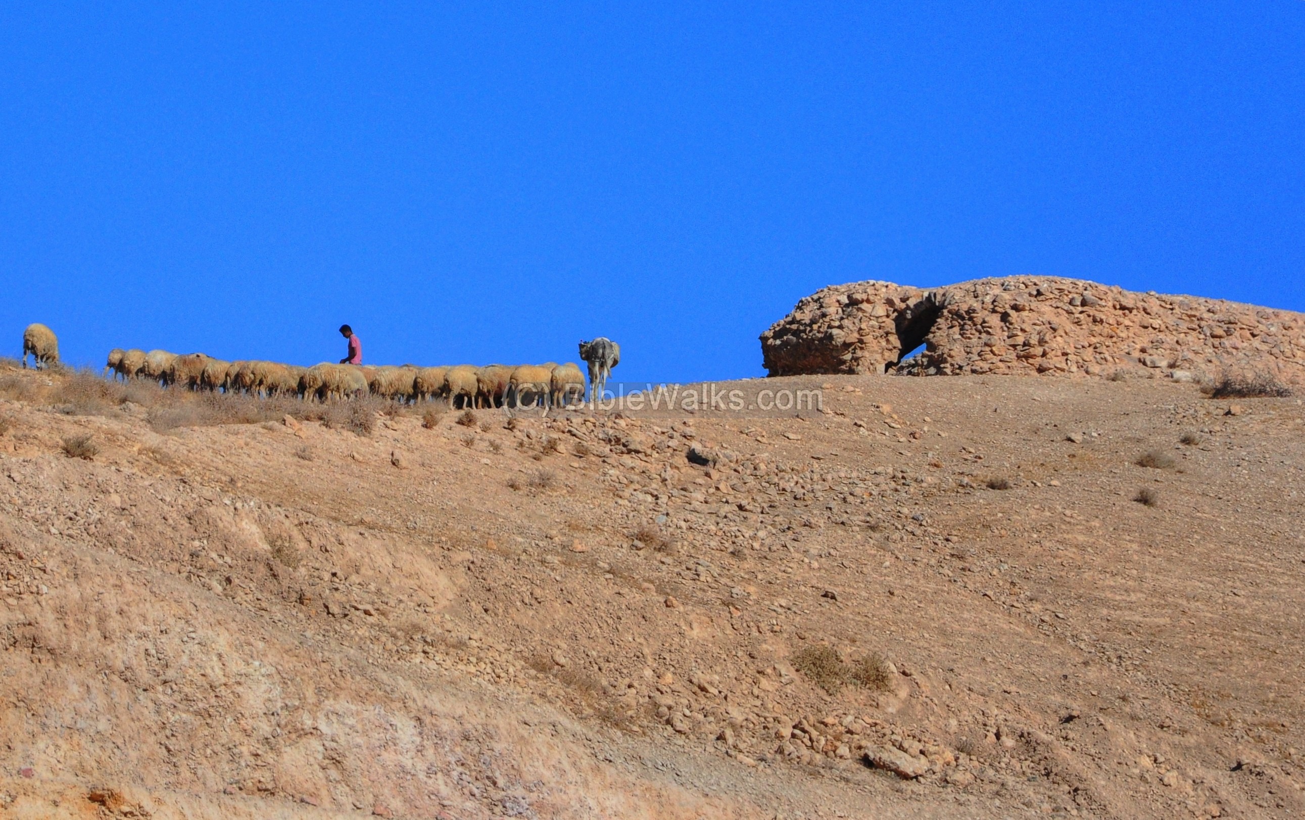
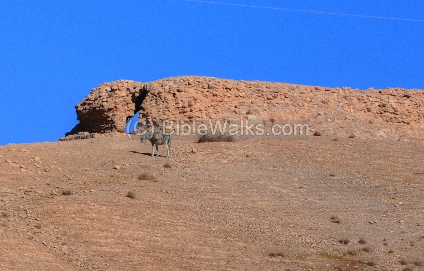
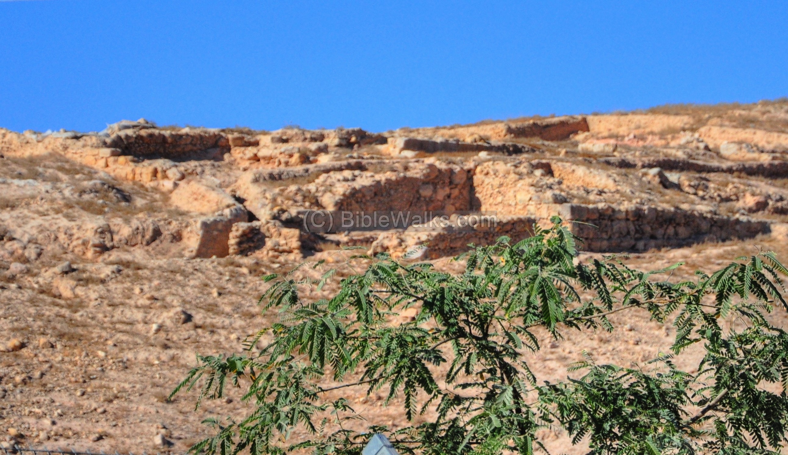
(g) Red Fortress
A nearby Crusader fortress protected the road, and its ruins are seen above the site. It was erected by the order of the Knights Templar in 1169-1172 and was in use until 1187, when the Crusaders retreated from the region.
The Crusader structure (60 x 70m) was surrounded by walls and halls supported on vaults. An extra protection was provided by a 6m wide dry moat, cut 4m into the bedrock. On the north side of the fortress was a 8.5 x 9.3m tower. A bridge over the moat was located on the southwest corner.
The SWP report (1873) describes it: “The fortress is surrounded by a rock-cut ditch, which is crossed at the southwest corner by a narrow ramp…. The site enclosed by the ditch is a trapezoid (see plan), measuring 205 feet on the north, 181 feet on the south, 217 feet on the east, 155 feet on the west. … There can be but little hesitation in supposing this to be the Tour Rouge, built by the Templars to protect pilgrims to Jericho”.
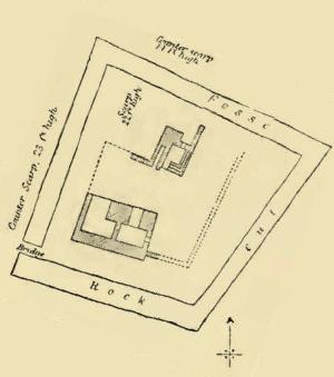
Plan from the SWP survey – Sheet XVIII p 208
Other ruins are located on the west side of the castle.
Video
![]() You can see a short video captured inside the museum, where a sample of ancient mosaics and other interesting findings from archaeological excavations in the west bank and gaza.
You can see a short video captured inside the museum, where a sample of ancient mosaics and other interesting findings from archaeological excavations in the west bank and gaza.
Biblical References:
(a) Luke 10 30-37
The event of the Good Samaritan:
“And Jesus answering said, A certain man went down from Jerusalem to Jericho, and fell among thieves, which stripped him of his raiment, and wounded him, and departed, leaving him half dead. And by chance there came down a certain priest that way: and when he saw him, he passed by on the other side. And likewise a Levite, when he was at the place, came and looked on him, and passed by on the other side. But a certain Samaritan, as he journeyed, came where he was: and when he saw him, he had compassion on him, And went to him, and bound up his wounds, pouring in oil and wine, and set him on his own beast, and brought him to an inn, and took care of him. And on the morrow when he departed, he took out two pence, and gave them to the host, and said unto him, Take care of him; and whatsoever thou spendest more, when I come again, I will repay thee. Which now of these three, thinkest thou, was neighbour unto him that fell among the thieves? And he said, He that shewed mercy on him. Then said Jesus unto him, Go, and do thou likewise”.
Links:
* Links on excavation sites in West Bank & Gaza:
- Israeli Archaeological activity in the west bank (1967-2007)
– a sourcebook of all digs (pdf, 184 pages, 2009)
– by Raphael Greenberg and Adi Keinan
- Horvat Latatin – IAA (Hebrew)
- Architecture of the church – the pulpit in Beit Sila
- Martyrius monastery – the nearby monastery in Ma’ale Adummim
- Preservation of the Good Samaritan (IAA)
- Biblical pictures by Gustave Doré (1832-1883)
* Internal links:
- Mosaics – overview on mosaic floors
- Deir Qal’a
- Gaza
References
- Survey of Western Palestine, Vol 3 – Sheet XVIII [1878]
Etymology – behind the name:
* Names of Site:
- Ma’ale Adummim – Hebrew: Red Ascent or Red Heights. This is the area above Nebi Musa, named after the red hills. In Biblical times it was a landmark the north-east border of Judah (Joshua 15 7): “before the going up to Adummim…”. Ma’ale Adummim is also the name of the city on the eastern suburbs of Jerusalem, which was established in 1991, and named after the Biblical place.
- Tal’at ed Damm – Arabic name of the site, meaning: “Ascent of Blood” which is based on the Biblical name.
- Inn of the Good Samaritan – named after the Gospel account of the Samaritan who helped the wounded man, while the priests and Levites cruelly passed him. The Samaritan carried him inside the inn, which is identified at this location.
BibleWalks.com – Let the Bible be your tour guide
Martyrius <—–previous Judean site——<<< All Sites >>> —next Judea site—> Munttar
This page was last updated on 15 Feb, 2015
Sponsored links: