In the dry Judean desert, water is life. Its few residents rely on wells and springs in order to survive.
Home > Sites > Judea > Water in the desert
Contents:
Background
Map
Photos
* Dry desert
* Well
* Reservoirs
* Aqueducts
* Streams
* Monasteries
Etymology
Links
Overview:
The Judean desert is very dry. The western winds, carrying the moisture from the Mediterranean Sea, are blocked by the Jerusalem and Hebron hills and so the land on the eastern side of the water divide receives few rain falls. The average rain fall in the north-eastern section is 100mm, and the average temperatures in the summer time are 40 degrees Celsius in the shade. Few springs are located inside the desert, and year-long streams are found only in several brooks close to the shores of the Dead Sea.
Hardly any trees can be seen in this barren landscape, and the weed dies out in mid spring. Its few residents – the Bedouins nomads – found ways to survive in this harsh land, by installing or reusing water cisterns that collect the rain from a few winter days, or bring the water from remote springs. This web page provides a sample of such installations. Many of these installations date back to the Biblical times.
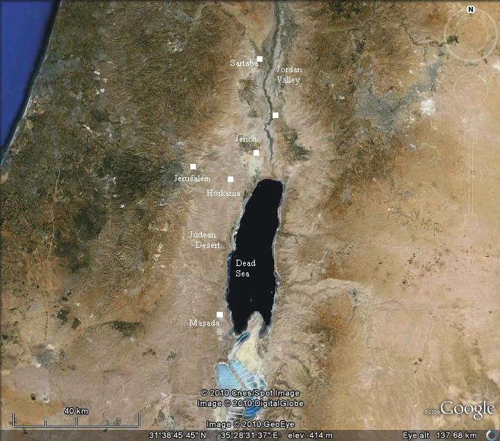
Map:
An aerial map is shown below, indicating the major sites. The Judean desert is located along the western side of the Jordan valley. Its eastern side is the eastern cliffs of the Syrian-African depression, above the Jordan valley. Its western side are the foothills of the ridge between Hebron and Ramallah, passing thru Jerusalem. The north-south border is less defined, covering the area between the ancient fortresses of Sartaba (north) and Masada (south). As seen from the satellite view, this whole area has no green colors.
The desert descends from the west (Jerusalem) to the east (Dead Sea); the drop in height is 1200m over a width of 20KM (about 6%).
Photos:
(a) The Dry desert
The Judean desert is very dry. Although in the winter time there are green patches of grass, the landscape is barren most of the year.
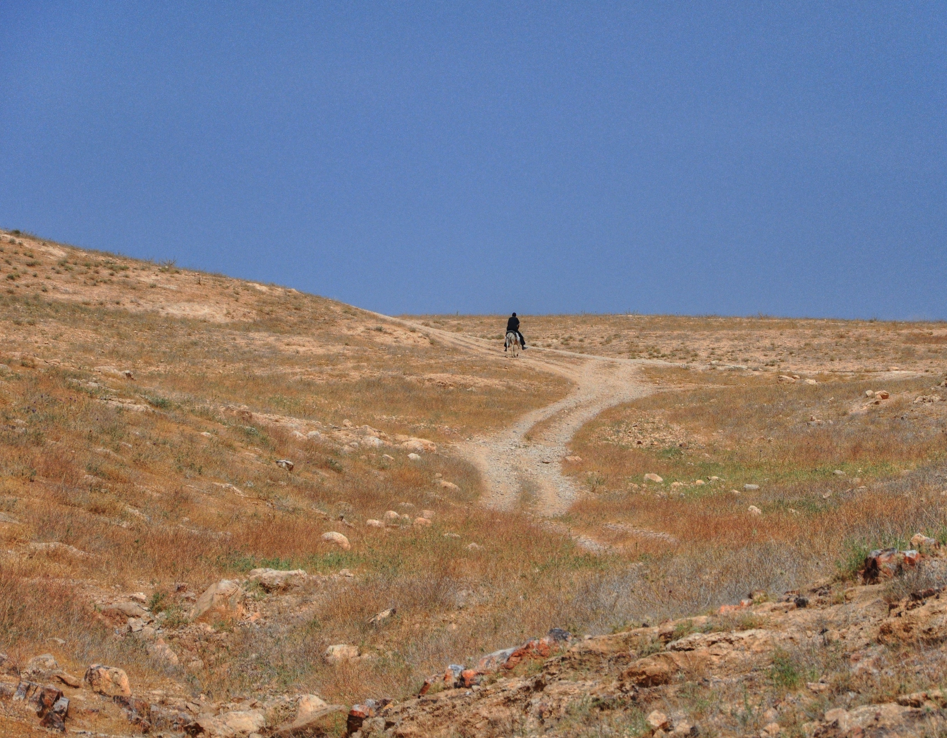
In areas closer to Jerusalem, where the water divide passes, there are more trees and plantations. But the more you go eastwards towards the Dead Sea, the landscape turns grey and yellow.
In lower areas closer to the Dead Sea, the land is virtually dead. This view is seen from Jabal Munttar, above the valley of Horkonia. Only rocks and fragments of rocks backed in the hot sun.
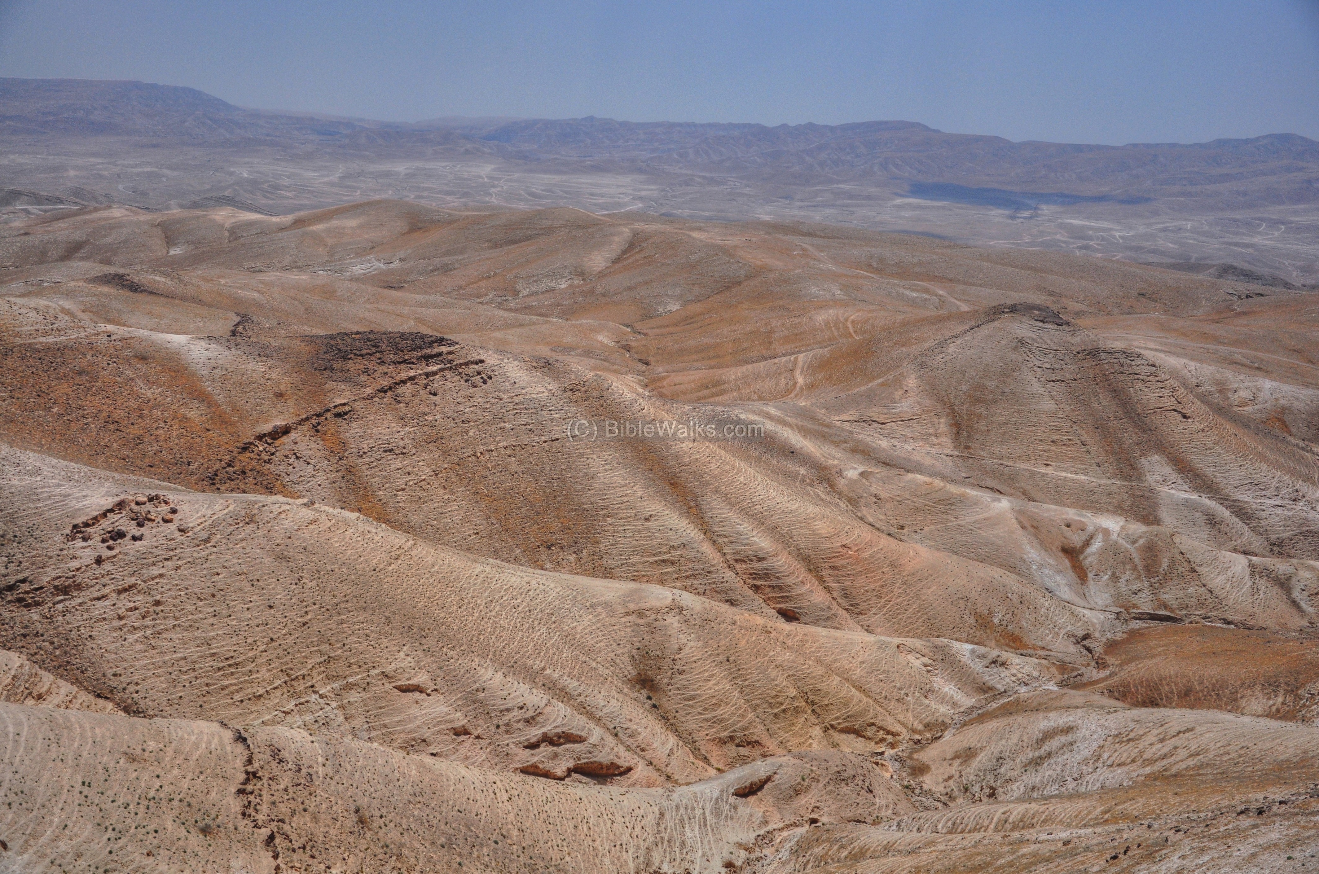
The Bedouins are the only residents in this desert, except for some small modern Jewish settlements that were constructed in the past years. They live in tents and makeshift compounds where they raise their camels, donkeys, goats and sheep.
How do they survive? This is the focus of this web page.
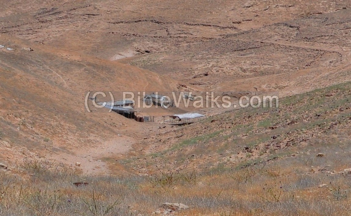
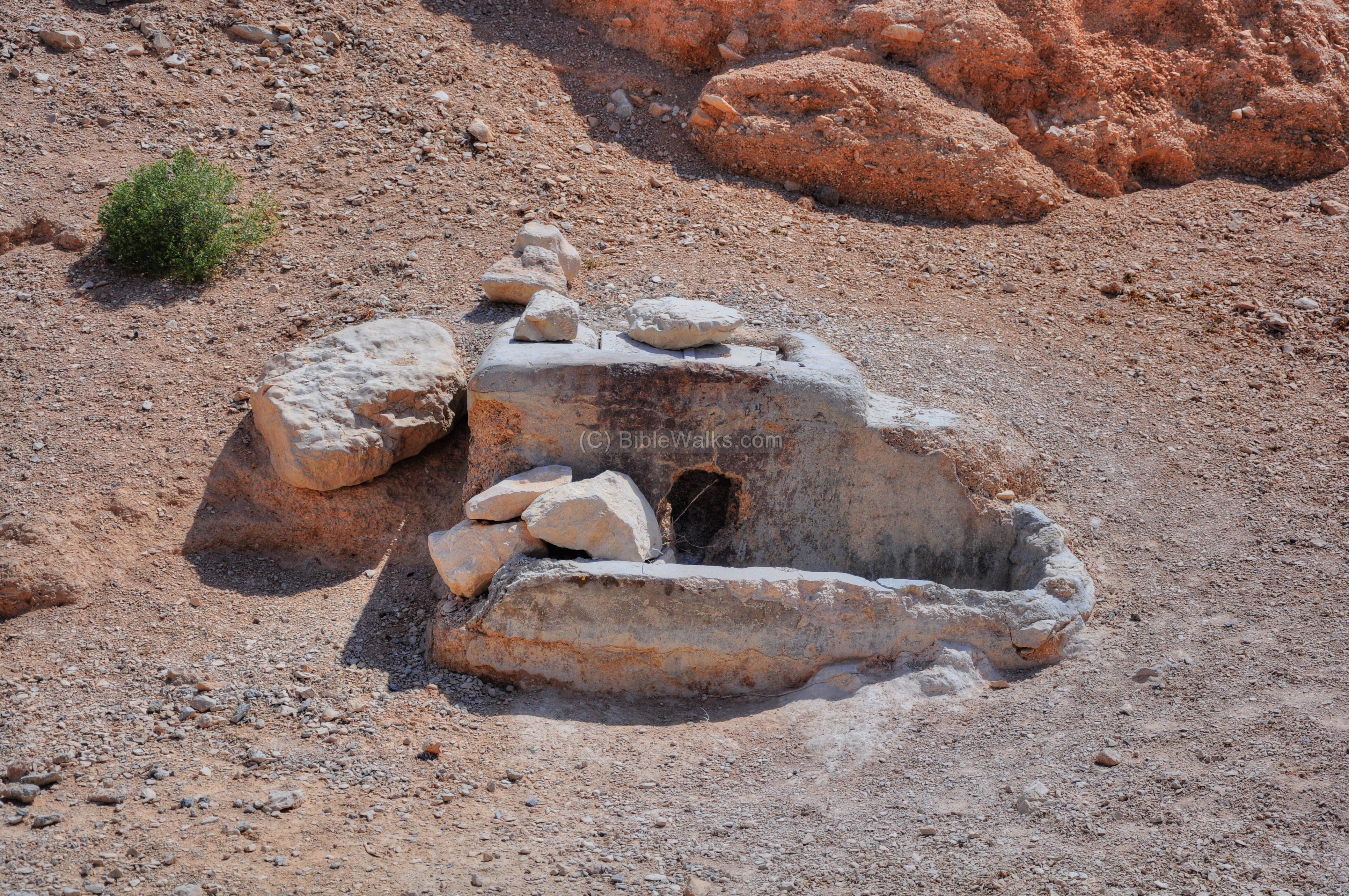
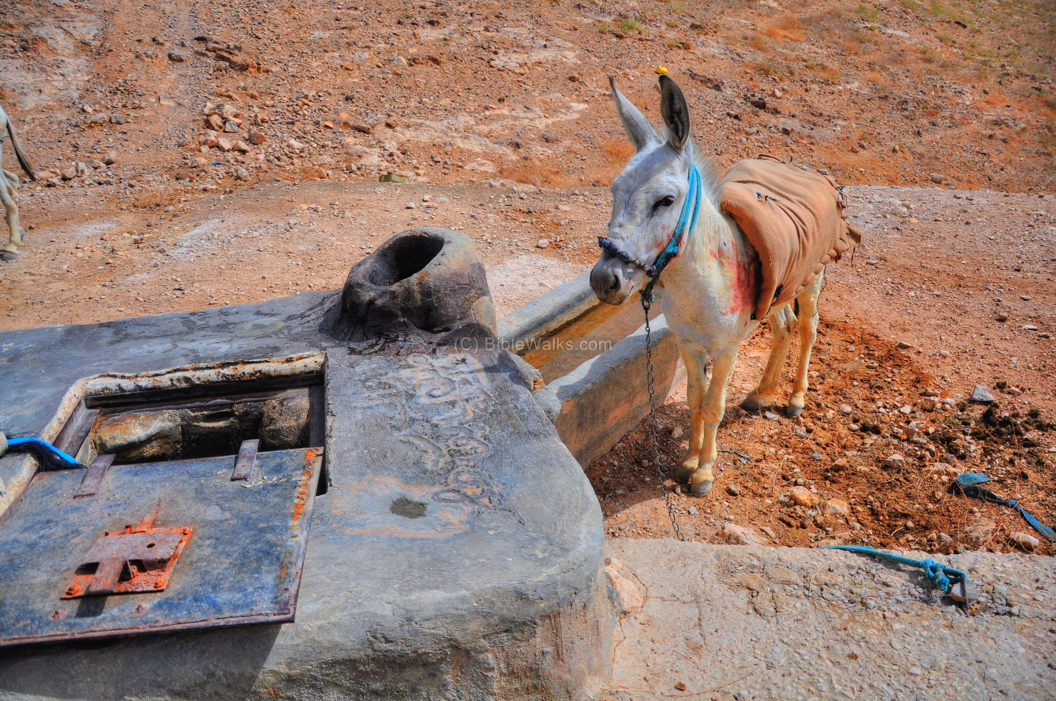
(b) Well near Kedar
One of the techniques of supplying water was to collect the rain water in the few days of winter, lead them to a reservoir, and use the water during the rest of the year. There are hundreds of such systems in the Judean desert, such as the one between Kedar and Munttar.
This system relies on collecting rain water and storing them for later use. In the following photo you can see that a channel was constructed along the hillside, collecting the rain drops into a collecting pool located in the bottom of the valley:
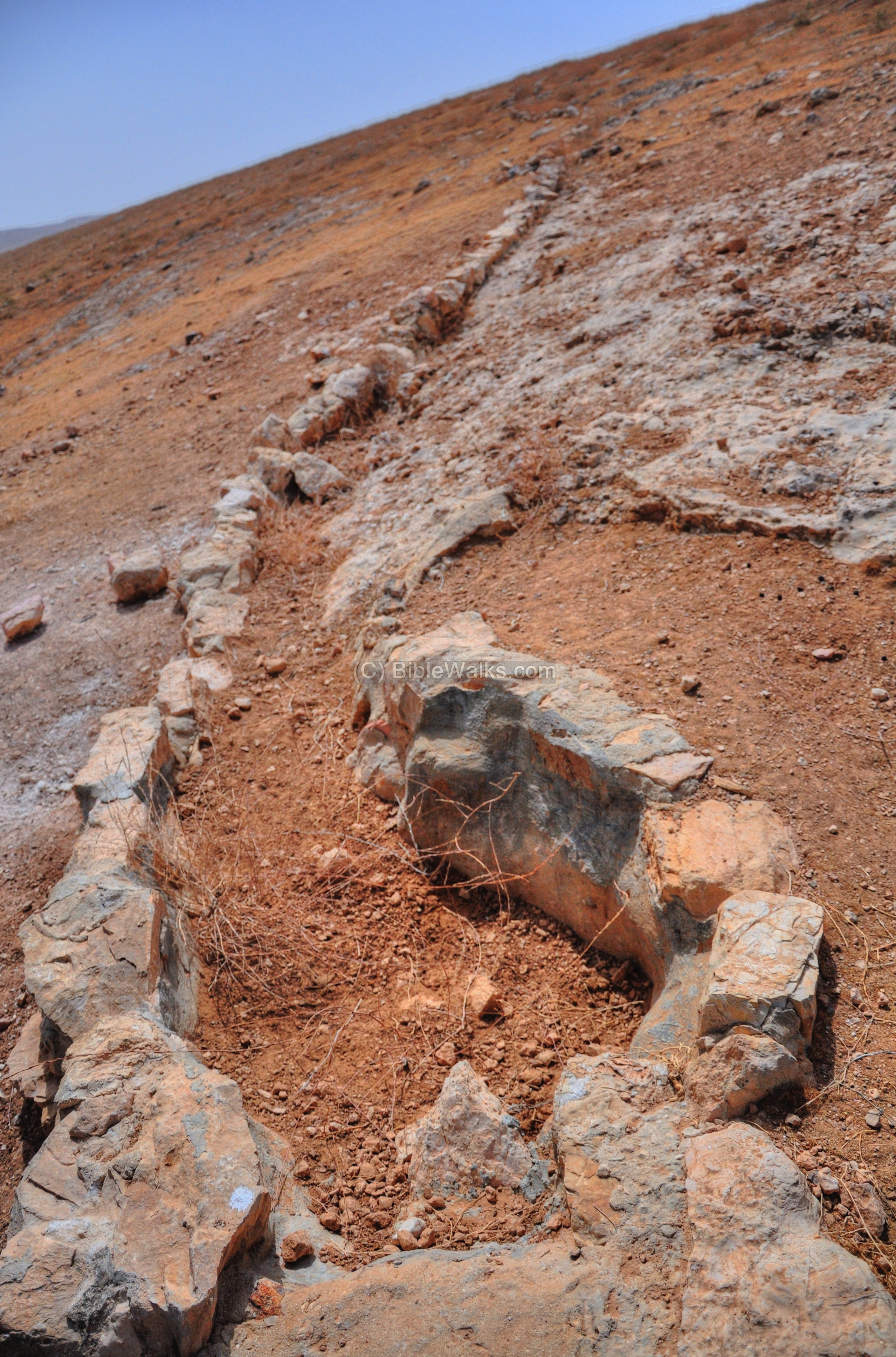
Several water channels are spread out over the hillside, meeting in the bottom of the valley, feeding into a collecting reservoir. In the photo below there are two channels from both sides of the reservoir.
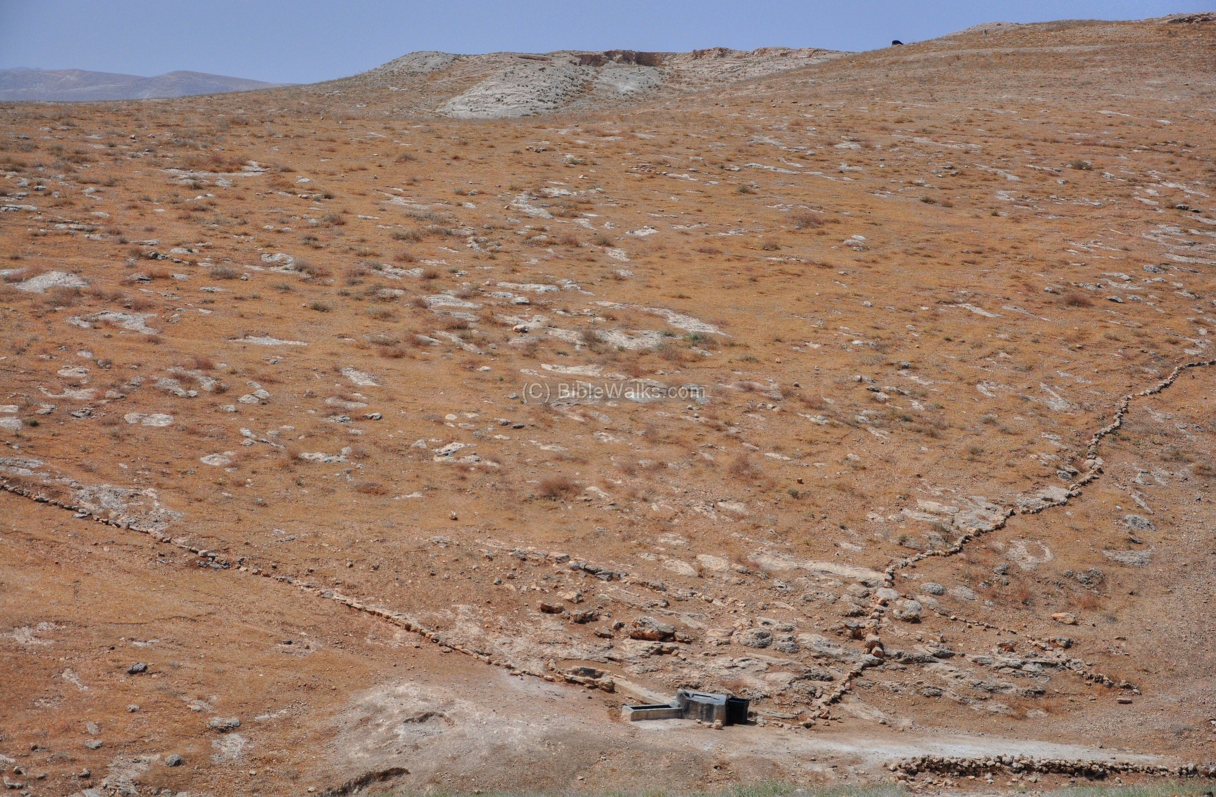
The rain waters are collected and stored in the reservoir. Then they are fetched by a bucket, and used to water the animals and people.
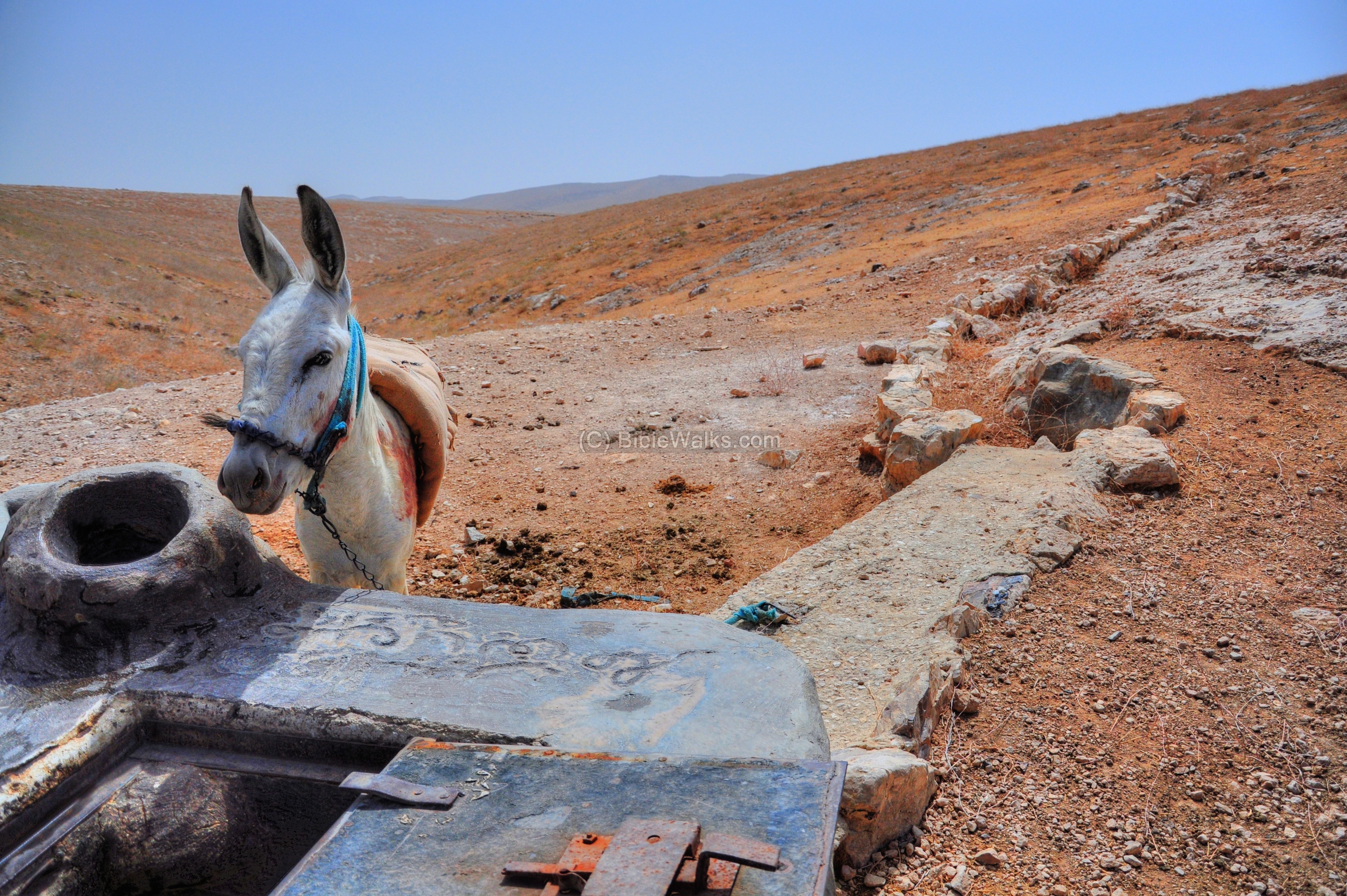
There are many similar systems installed all over the desert. Each well is owned by a Bedouin family, and are maintained by them. In a such large real-estate such as the desert, what really counts is the number of animals you have, and the number of wells to support them.
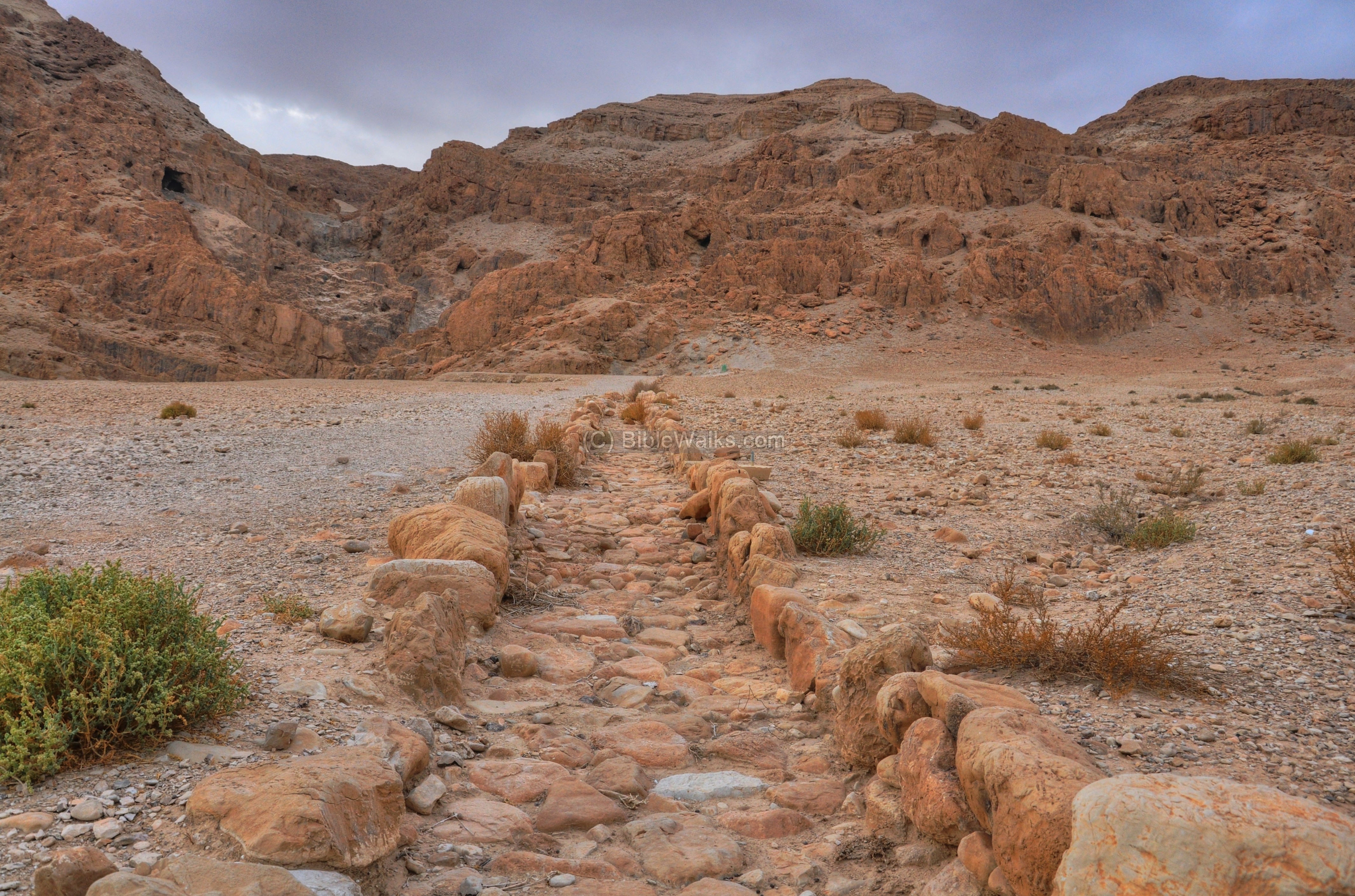
(c) Valley of Horkonia
In the valley of Horkania, another water reservoir is seen below. It is also fed from water channels that collect rain water from the hills around the valley. This photo was captured in May, and the pool looks quite dry.
(d) Aqueducts
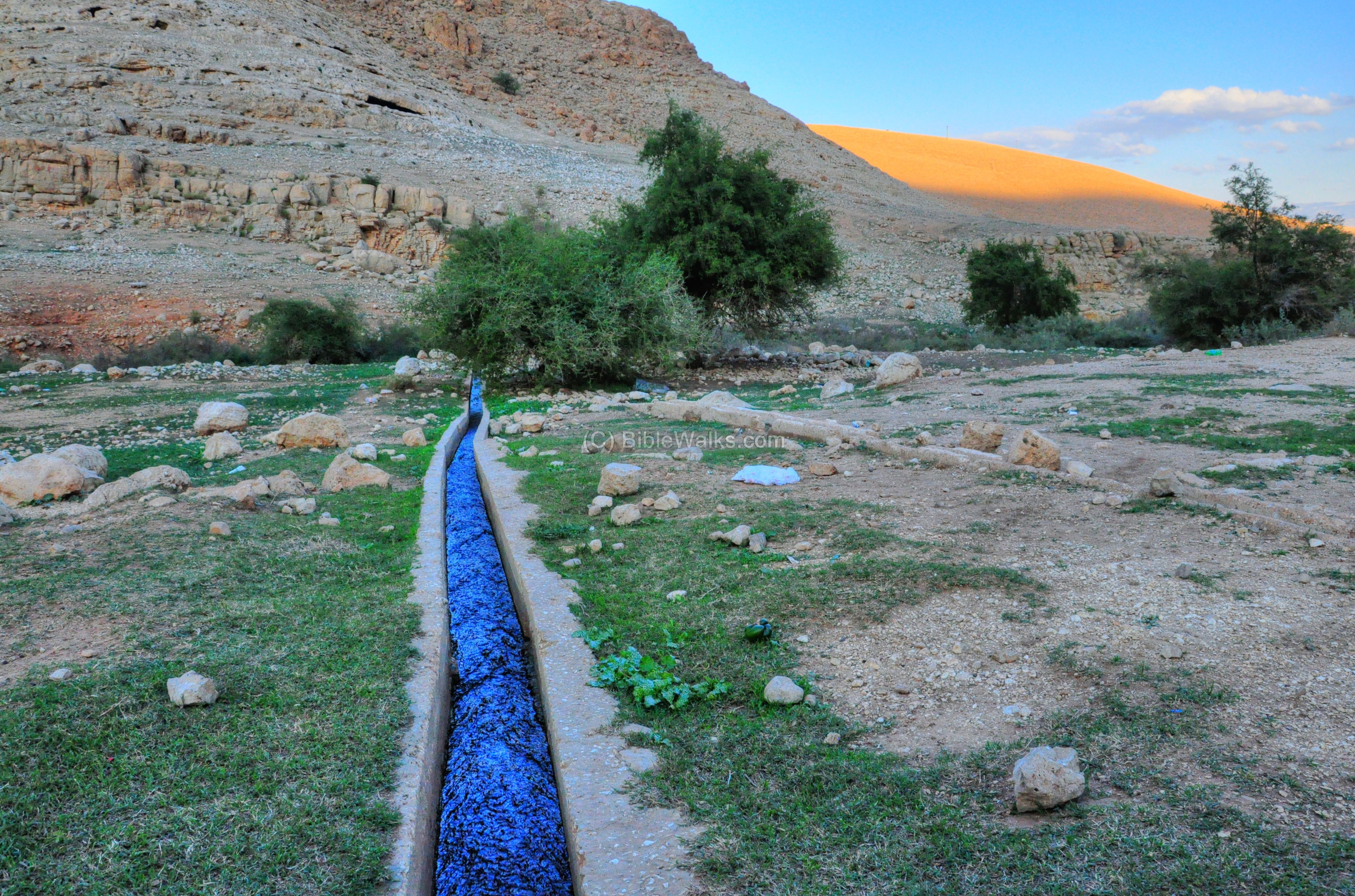
Large scale engineering projects were constructed during the Biblical, Hellenistic and Roman/Byzantine times. These projects supplied water to the desert fortresses and villages using aqueducts, using the gravitational force to move the water from the nearby source (springs or water reservoirs) to the fortress or village, over very long distances.
-
Fazael Brook
An example of such aqueduct is the Fazael brook. The waters from the springs were raised by the dam and channeled to an aqueduct. The aqueduct conveyed the waters to the Roman city of Fazael, about 6KM away, and was also used by the farmers for agriculture. This section, near the dam, is from a later period, but the original aqueduct was laid out by Herod.
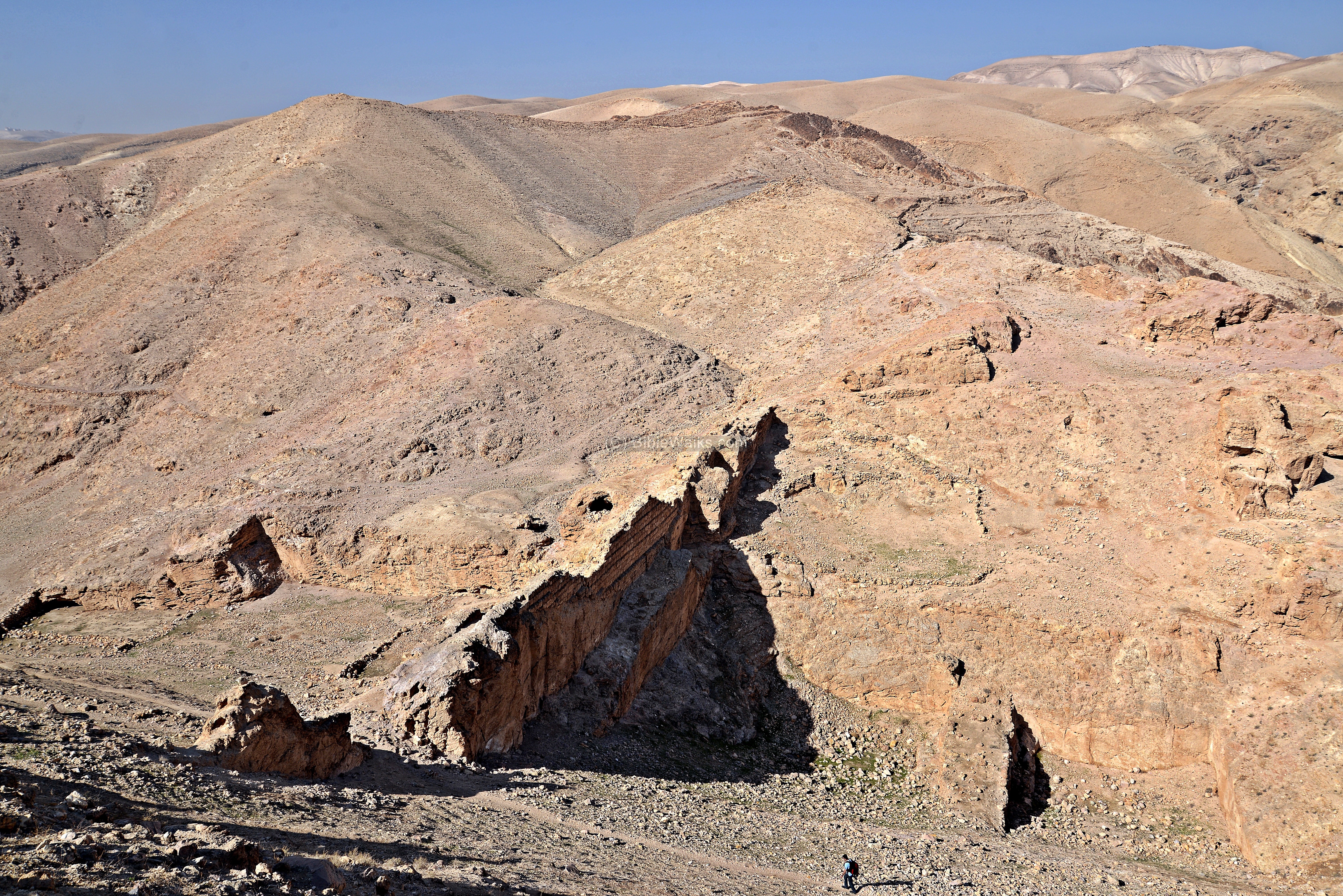
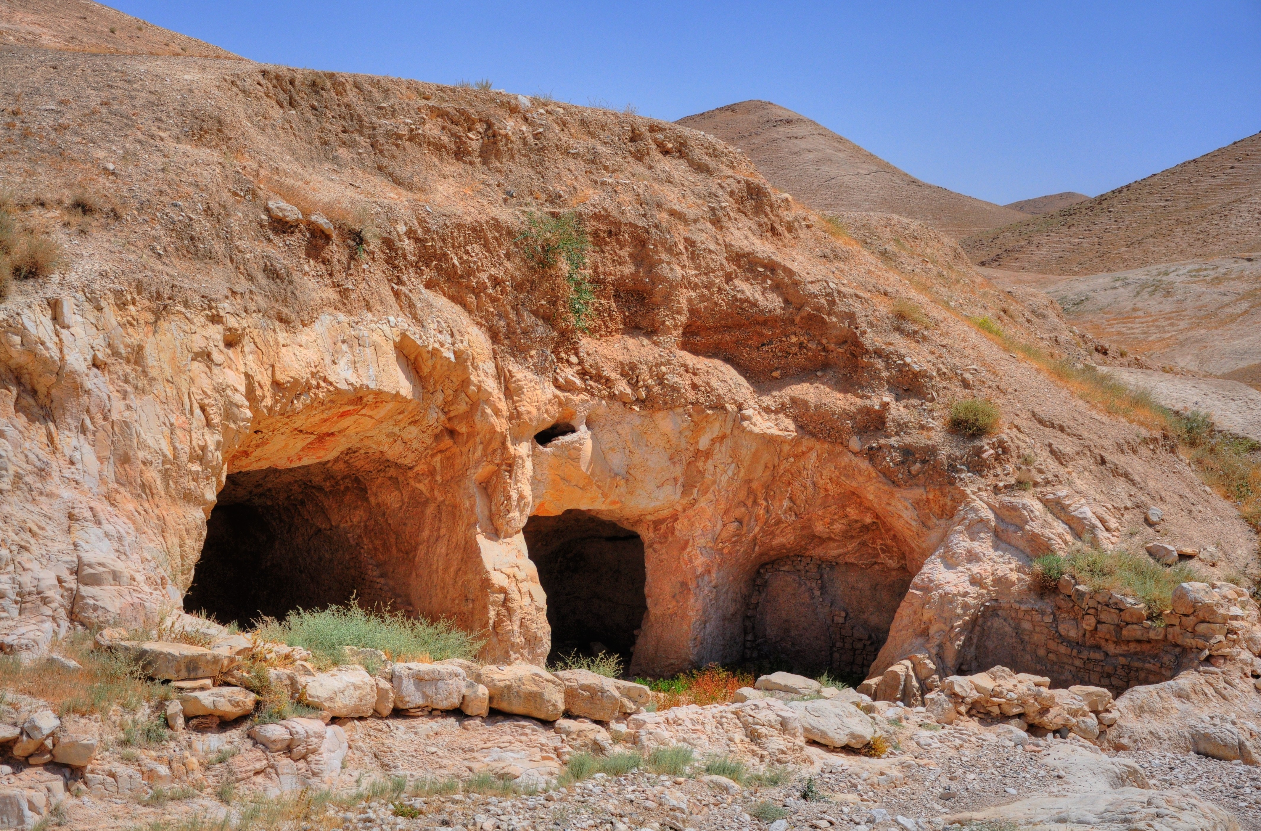
- Horkania fortress
There were two aqueducts that supplied water to the fortress. A shorter north-west aqueduct brought water from the springs on the eastern hillside of Jabal Munttar, seen here in the far background. A longer channel diverted water from the Kidron stream, south-west of Horkonia. The aqueduct reached the hillside of the fortress and filled its hillside cisterns and the three large pools on the bottom of the valley. The aqueducts were constructed by the Hasmoneans, repaired by Herod the Great, and was in use during the Byzantine period.
-
Qumran
Another example is the elaborate water system that kept the Essenes settlement alive in the dry climate of the Judean desert. An aqueduct, several hundred meters long, supplied the water from a dam in the course of the Qumran brook, and filled up its cisterns through an elaborate series of canals that ran between the structures.
![]() For more information on aqueducts – check our special info page.
For more information on aqueducts – check our special info page.
(e) Water reservoirs in the streams
The dry surface of the desert absorbs little of the rain fall. Most of the rain water rushes down the streams, occasionally causing dangerous flash floods. In order to utilize this vast amount of water, dams and reservoirs were constructed in the bottom of the streams.
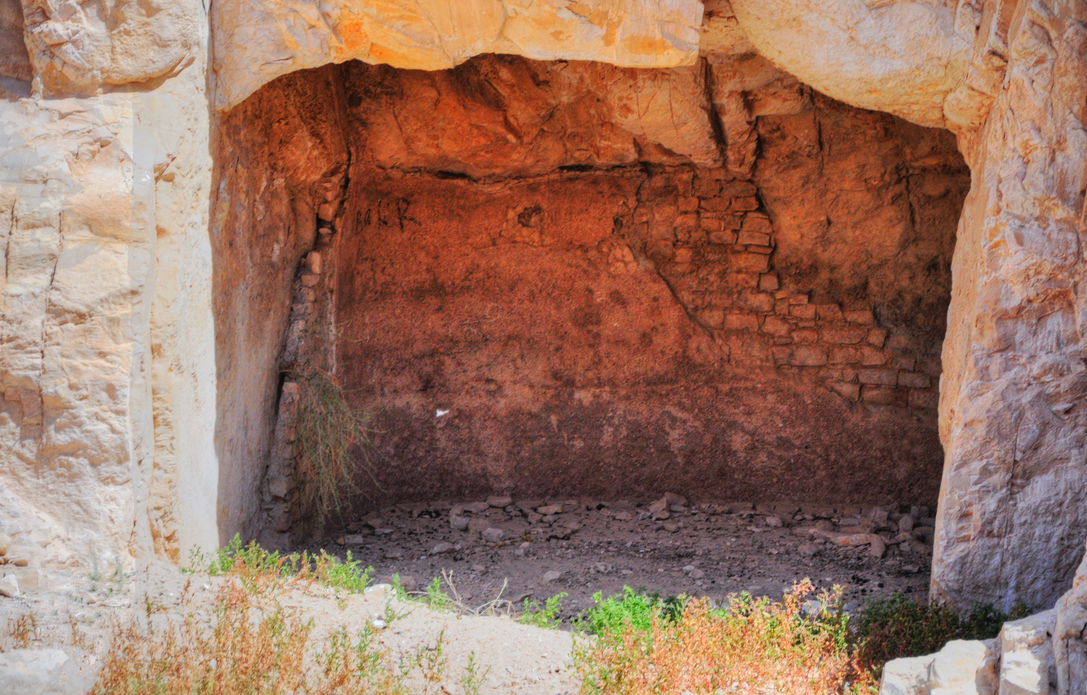
One such case is seen in the bottom of the valley on the west side of the fortress of Horkonia. The water reservoirs stored the water during the flash flooding, and in months after then the water was used for drinking and agriculture.
A closer view of one of the pools of the reservoir. This one was probably constructed in 2C BC, as part of the water systems around the fortress.
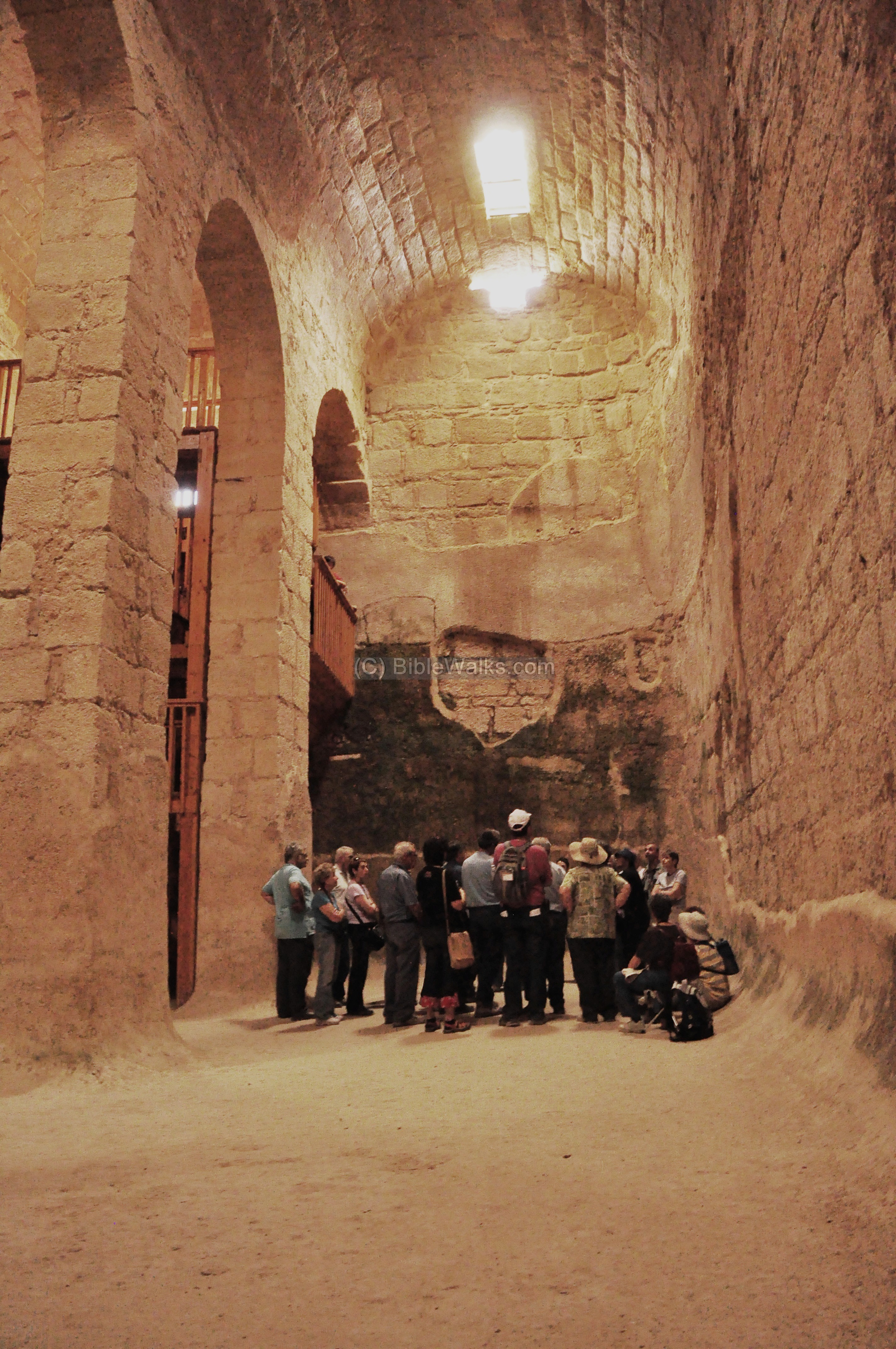
(f) Water Reservoirs in Monasteries
An impressive water reservoir can be seen in the Euthymius monastery. This gigantic cistern, one of four constructed near the monastery, contained over 3000 m3 , which collected rain water from the hills and rooftops of the monastery.
Links:
Internal:
- Mar Saba monastery in Kidron stream
- Munttar Azazel
- Nebi Musa tomb of Moses
- Horkonia desert fortress
- Euthymius monastery coenobium in Mishor Adummim
- Aqueducts info page
- Byzantine monks of the Judean desert
BibleWalks.com – Have Bible, will travel!
Nebi Musa<<<—previous site—<<< All Sites >>>—next Judea site—>>> Lachish
This page was last updated on Feb 15, 2013
Sponsored links: