Remains of a Biblical city, dated to the times of David and successor kings of Judah. It was an important fortified gateway city, protecting the western flank of the Kingdom. 2 Chronicles 11 5-12: “And Rehoboam … built cities for defense in Judah. He built … Shoco…”.
Home > Sites > Judea > Elah Valley > Sochoh
Contents:
Overview
Location
History
Structure
Photos
* Aerial views
* West of Western Hill
* Top of Western Hill
* East of Western Hill
* Eastern Hill
* Panoramas
* LMLK Seals
Etymology
Links
Overview:
There are several archaeological sites in Israel that are associated with the ancient city of Sochoh, which is mentioned in the Hebrew Bible. However, the specific location of the city remains a matter of scholarly debate, and its exact identification is uncertain. One possible site that has been identified as Sochoh is Tel Sochoh, which is located in the Elah Valley, about 30 kilometers southwest of Jerusalem. Excavations carried out at the site have revealed evidence of a fortified settlement dating back to the Iron Age (12th-7th centuries BC), including city walls, gates, public buildings, and private dwellings. Other artifacts found at the site suggest that it was inhabited during the Persian, Hellenistic, and Roman periods as well.
On Tel Sochoh are remains of a Biblical city, dated to the times of David and successor kings of Judah. It was an important fortified gateway city, protecting the western flank of the Kingdom, situated along the valley of Elah.
Location:
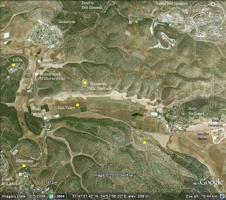
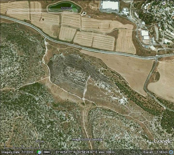
The following aerial view shows the points of interest, with the valley of Elah in the center. The site is located south of road #375.
History:
- Biblical
The city of Sochoh (also: Socoh, Sokho, Shochoh) was one of the cities of the tribe of Judah (Joshua 15: 20, 35-36):
“This is the inheritance of the tribe of the children of Judah according to their families…. and Adullam, Socoh, and Azekah, And Sharaim,…”.
Its location according to this verse is between Adullam and azekah, and indeed the ruins of Sochoh are located exactly in the middle between Kh. Adullam (4 KM to the south-east) and Tell Azekah (4KM north-west).
Sochoh was an important fortified city during the times of the Judea Kingdom (11thC through 6th century BC), defending the kingdom against attacks through the valley of Elah on its western frontier. There are several texts that emphasize its strategic importance to the Kings of Judah:
King Saul: The city appeared in the Biblical account of the battle between David and Goliath of Gath. This famous battle is detailed in the web page of the Valley of Elah. According to the Bible, it is located near the place of the battle in the valley of Elah (1 Samuel 17: 1):
“Now the Philistines gathered together their armies to battle, and were gathered together at Shochoh, which belongeth to Judah, and pitched between Shochoh and Azekah, in Ephesdammim. “.
King Rehobam, son of Solomon, fortified the city (2 Chronicles 11 5-12):
“And Rehoboam dwelt in Jerusalem, and built cities for defense in Judah. He built … Shoco, and Adullam, And Gath, and Mareshah, and Ziph, And Adoraim, and Lachish, and Azekah… And he fortified the strong holds, and put captains in them, and store of victual, and of oil and wine. And in every several city he put shields and spears, and made them exceeding strong…”.
King Ahaz: The Philistines continued their intrusions along the valley of Elah into Judea during the times of King Ahaz, son of Jotham, who reigned 20 years at ~735 715 BC (2 Chronicles 28 16, 18):
“At that time did king Ahaz… The Philistines also had invaded the cities of the low country, and of the south of Judah, and had taken Bethshemesh, and Ajalon, and Gederoth, and Shocho with the villages thereof, and Timnah with the villages thereof, Gimzo also and the villages thereof: and they dwelt there”.
-
Assyrians (8th – 7th century BC):
The Assyrian empire, a rising force in the region, conquered the North Kingdom of Israel in 732BC, destroying most of the cities and villages in the land. The South Kingdom of Judah managed to survive this onslaught by teaming up with the Assyrians, but not for long. After the death of the Assyrian King Sargon II (722 -705BC), King Hezekiah – son of Ahaz – mutinied against the Assyrians, joining other cities in the area who attempted to free themselves from the Assyrian conquest. Hezekiah recaptured Sochoh as well as other cities in the area (2 Kings 18 8):
“He smote the Philistines, even unto Gaza, and the borders thereof, from the tower of the watchmen to the fenced city”.
Anticipating the coming Assyrian intrusion, Hezekiah fortified Jerusalem and the major cities.
The Assyrian army came in 701, leaded by Sennacherib, son of Sargon II (2 Chronicles 32 1):
“After these things, and the establishment thereof, Sennacherib king of Assyria came, and entered into Judah, and encamped against the fenced cities, and thought to win them for himself”.
According to an Assyrian clay tablet, Sennacherib conquered 46 cities in Judea.
However, Jerusalem was spared from destruction and the Assyrians retreated (2 Chronicles 31 21-22):
“And the LORD sent an angel, which cut off all the mighty men of valor, and the leaders and captains in the camp of the king of Assyria. So he returned with shame of face to his own land. And when he was come into the house of his god, they that came forth of his own bowels slew him there with the sword. Thus the LORD saved Hezekiah and the inhabitants of Jerusalem from the hand of Sennacherib the king of Assyria, and from the hand of all other, and guided them on every side”.
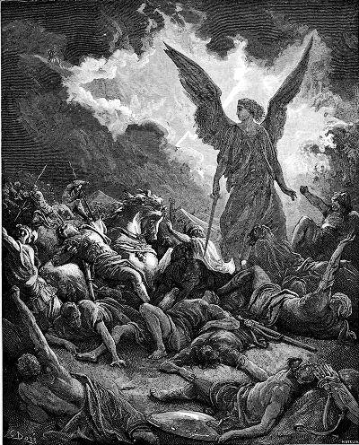
Sennacherib’s army destroyed – by Gustav Dore (French artist, 1832-1883)
After the Assyrian intrusion, the city of Sochoh was in ruins for a 1,000 years.
-
Roman/Byzantine
The ruins of the Biblical city are located on the western side of the hill, and were reused during the Roman/Byzantine period. The village extended to the east in this time. Eusebius Pamphili (better known as Eusebius of Caesarea), a 4th C Greek historian of the Church, wrote in his book “Onomasticon” that at his times there were “twin villages” on the hill – an upper and lower. He wrote:
“Sokcho – two villages nine miles from Eleutheropolis on the road to Jerusalem. The upper and the lower are named Sokchoth. tribe of Juda”.
-
Ottoman period – PEF survey
The area around the valley of Elah was examined in the Palestine Exploration Foundation (PEF) survey (1866-1877) by Wilson, Conder and Kitchener. The valley of Elah appears on this map of 1878 in its Arabic form – “Wadi es Sunt” (the valley of the Acacia). An ancient road traverses the valley – marked as a double dashed line crossing from left to right – and passing the site.
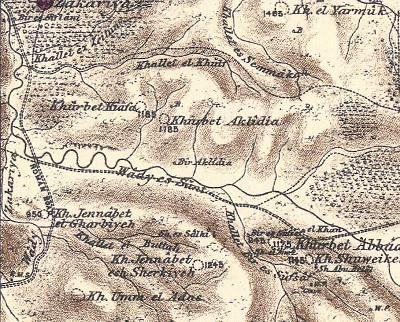 Part of Map Sheet 17 of Survey of Western Palestine,
by Conder and Kitchener, 1872-1877.
(Published 1880, reprinted by LifeintheHolyLand.com)
The ruins of Biblical Sochoh (Socoh) are marked at the ruins called Kh. Shuweike (the eastern side) and Khirbet ‘Abbad (the western side). They wrote about these two ruins, which are located on either sides of the hill:
“Socoh (Joshua XV. 35) was known in the fourth century as 8 or 9 Roman miles from Eleutheropolis (Beit Jibrin), on the road to Jerusalem. This agrees with the position of Khürbet Shuweikeh.” The name, Shuweikeh, preserves the Biblical name Sochoh.
“Khürbet ‘Abbad – Caves, cisterns, heaps of stones, ruined foundations, and pillar shafts and bases”.
Note that there are other sites in the area of Judea called “Khürbet Shuweikeh” (e.g, 12KM north of Jerusalem) and Biblical cities with the name “Sochoh” (e.g., in the land of Hefer – as per 1 Kings 4:10).
An illustration of the sites, dated 1882, was published in a book by CH. W. Wilson , one of the PEF explorers. The title: “Shochoh – the camp of the Philistines”. The subtitle: “This site, now called Shuweikeh, is marked by extensive ruins, large terebinth trees, and a Muhammedan shrine dedicated to Sheikh Aba Helal.”.
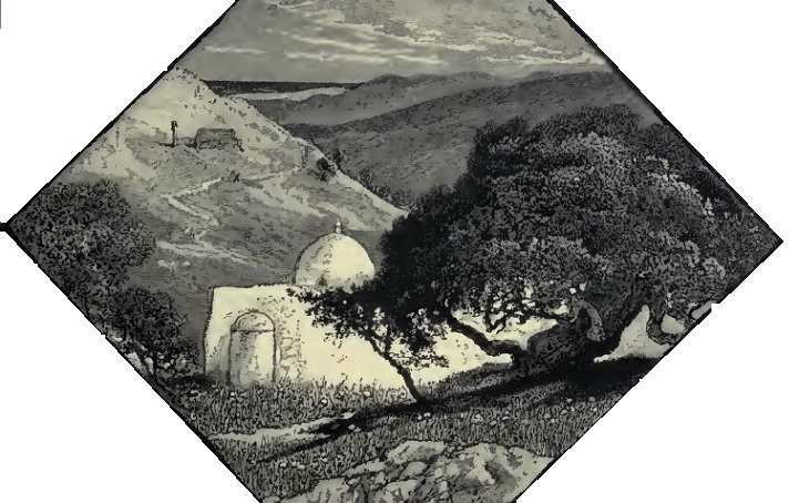
Ch. W. Wilson, Picturesque Palestine, 1882, Vol III P. 159
-
Modern Period
The site has not yet been thoroughly excavated, although there are plans to start digging there in a large scale. In limited excavations, the IAA reports (July 2011):
“An excavation was conducted at the foot of the northern slope where a Byzantine building from the fifthsixth centuries CE was exposed. Remains from Iron Age II were uncovered in another excavation at the foot of the northern slope, and walls dating to the Middle Bronze Age were discerned in probe trenches…”.
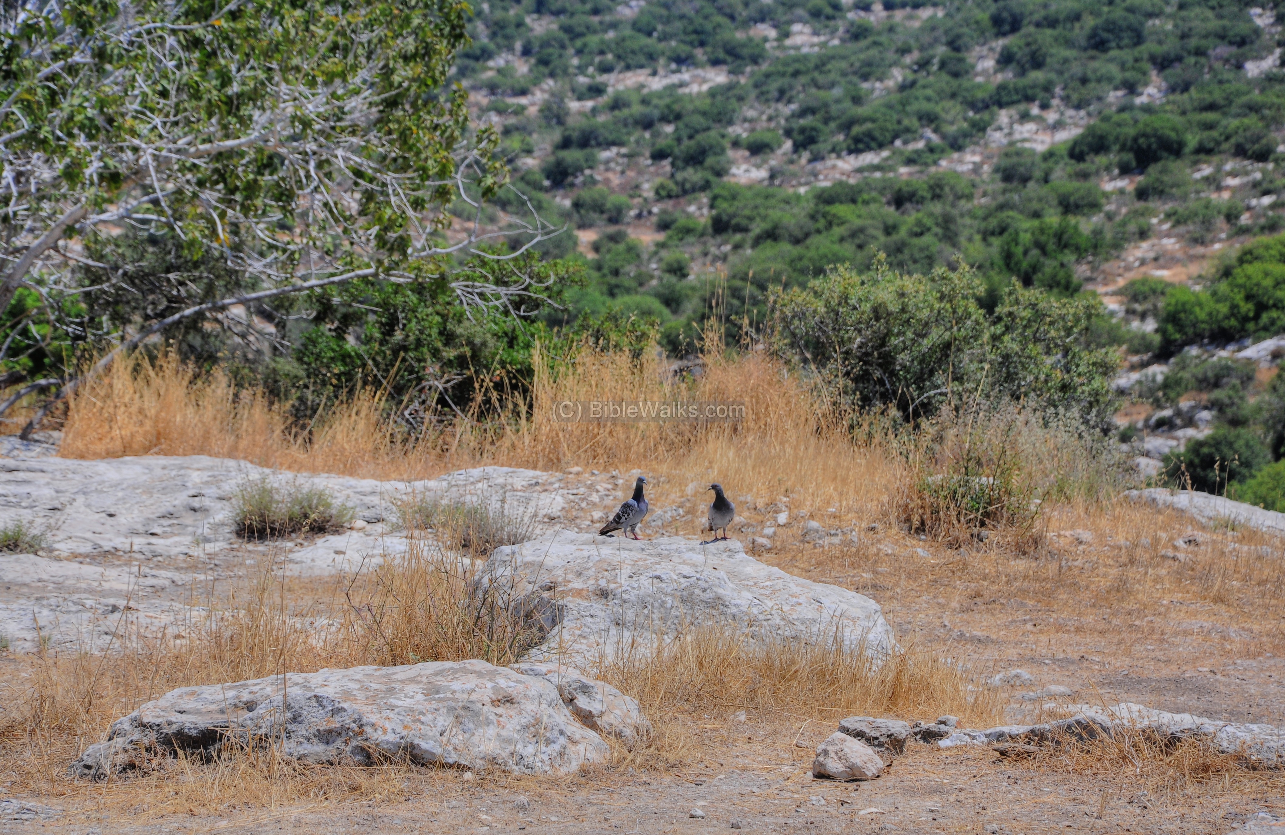
During late Winter and Spring the hill is covered with flowers and attracts visitors, so it is commonly known as the “hill of Turmus” (the blue/purple Lupinus flower).
Structure:
The site is located on two sides of a high hill (349m) above the valley of Elah. The western side (named Kh. ‘Abbad) is dated to the Iron age, with some later remains from the Byzantine period. The eastern side of the hill (named Kh. Shuweikeh) is dated to the Roman-Byzantine period.
Photos:
(a) Aerial views
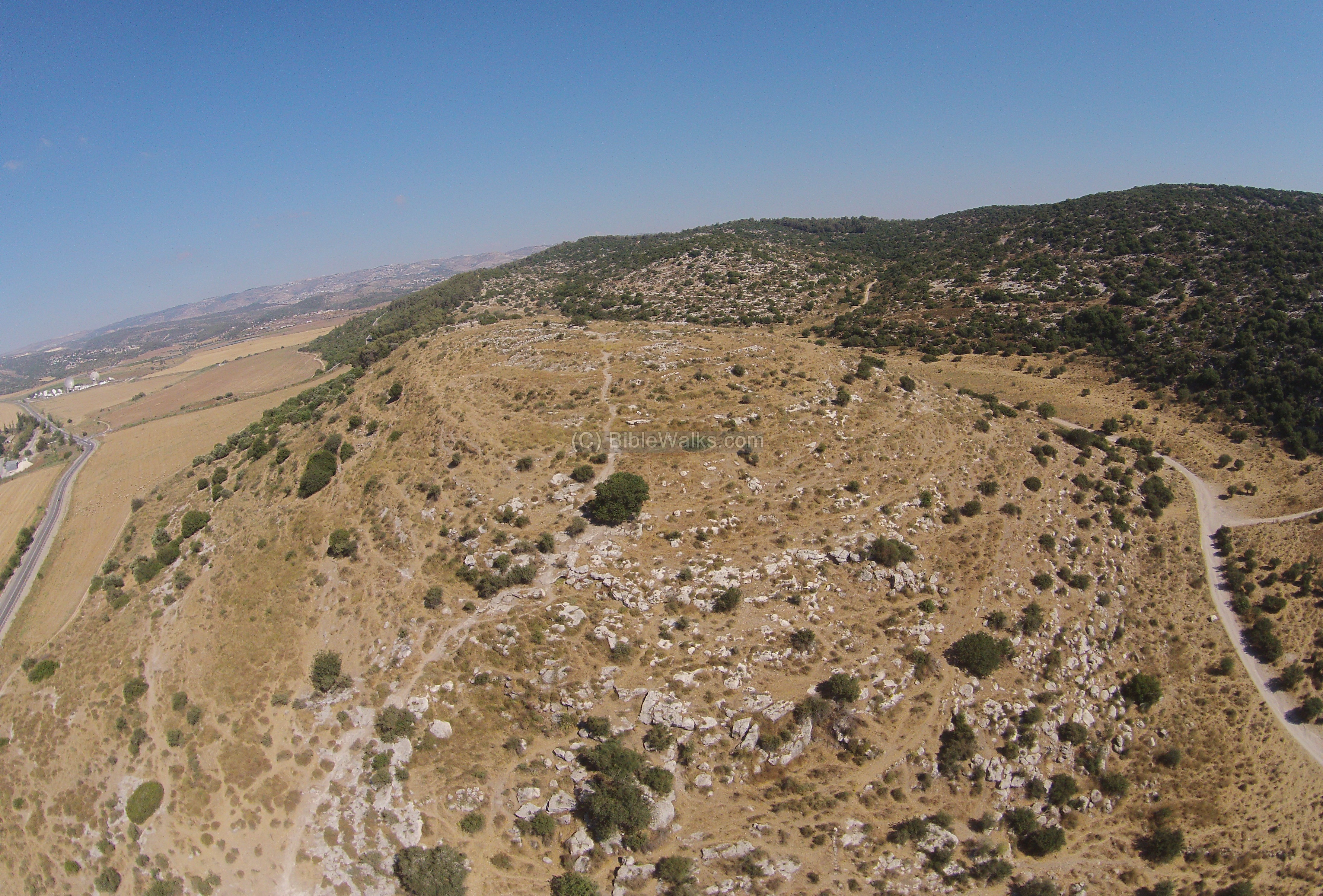
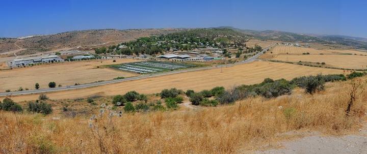
An aerial view of the site was captured in June 2015 over its western side. On top of the hill are traces of its ruins. The site extends towards the eastern side, which is not visible in this view.
In the left background is a eastern section of the valley of Elah. Behind are the mountains of Gush-Etzion and Hebron.
Click on the photos to view in higher resolution…
![]() “Fly” over the site with this drone video:
“Fly” over the site with this drone video:
(b) Foothills of the Western hill
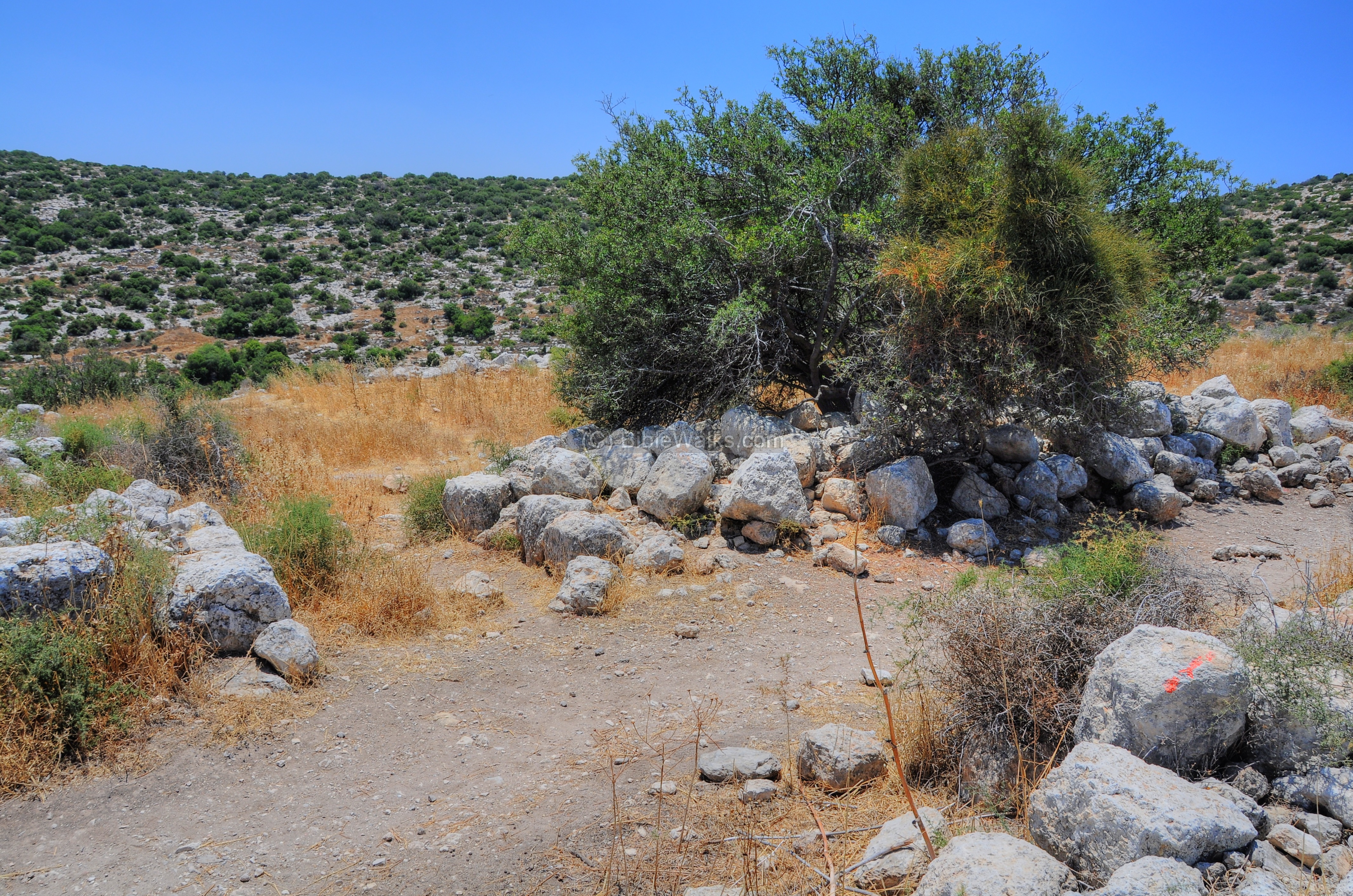
A convenient place to start your hike is on the western side of the hill, where you can turn off the main road and leave you car. On your way up you may notice a large tree that planted itself into one of the underground cisterns.
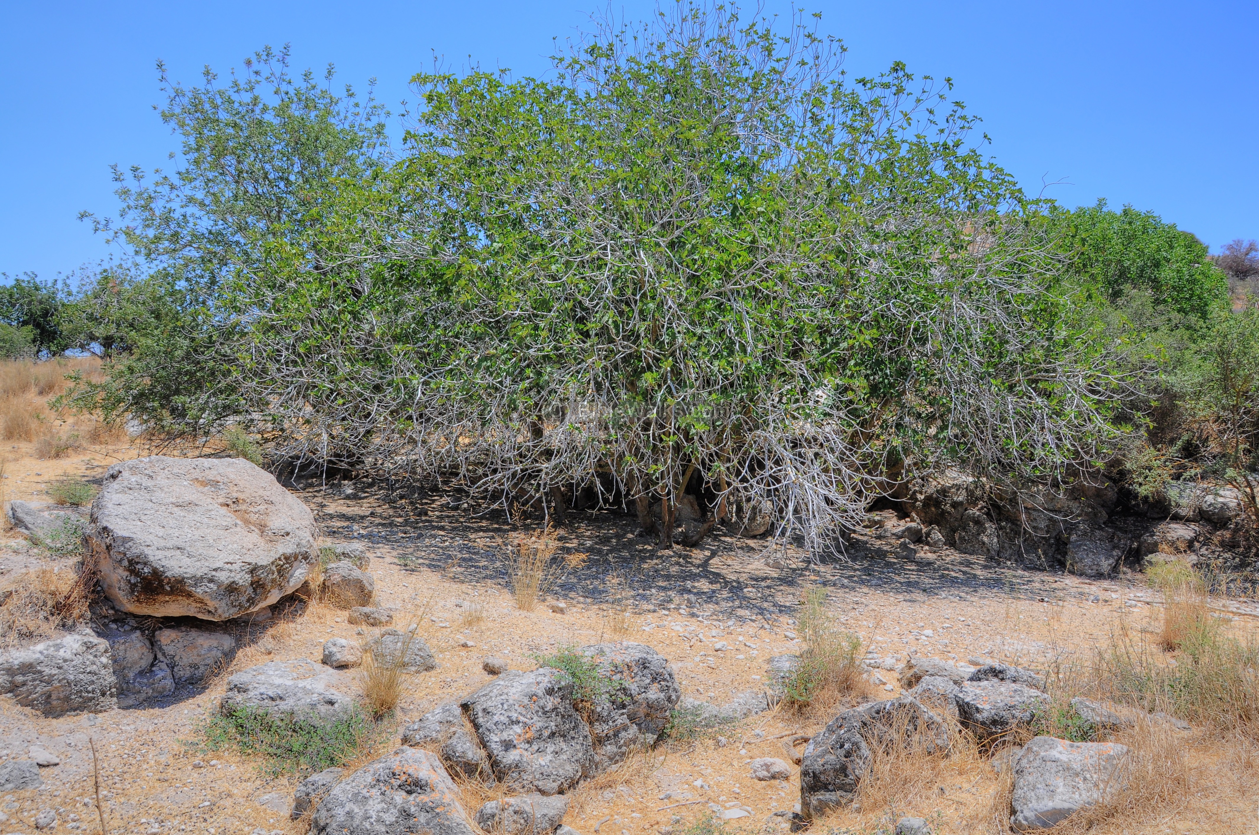
Around the hill are several Elah trees (Terebinth -Pistacia), which gave this valley its name.
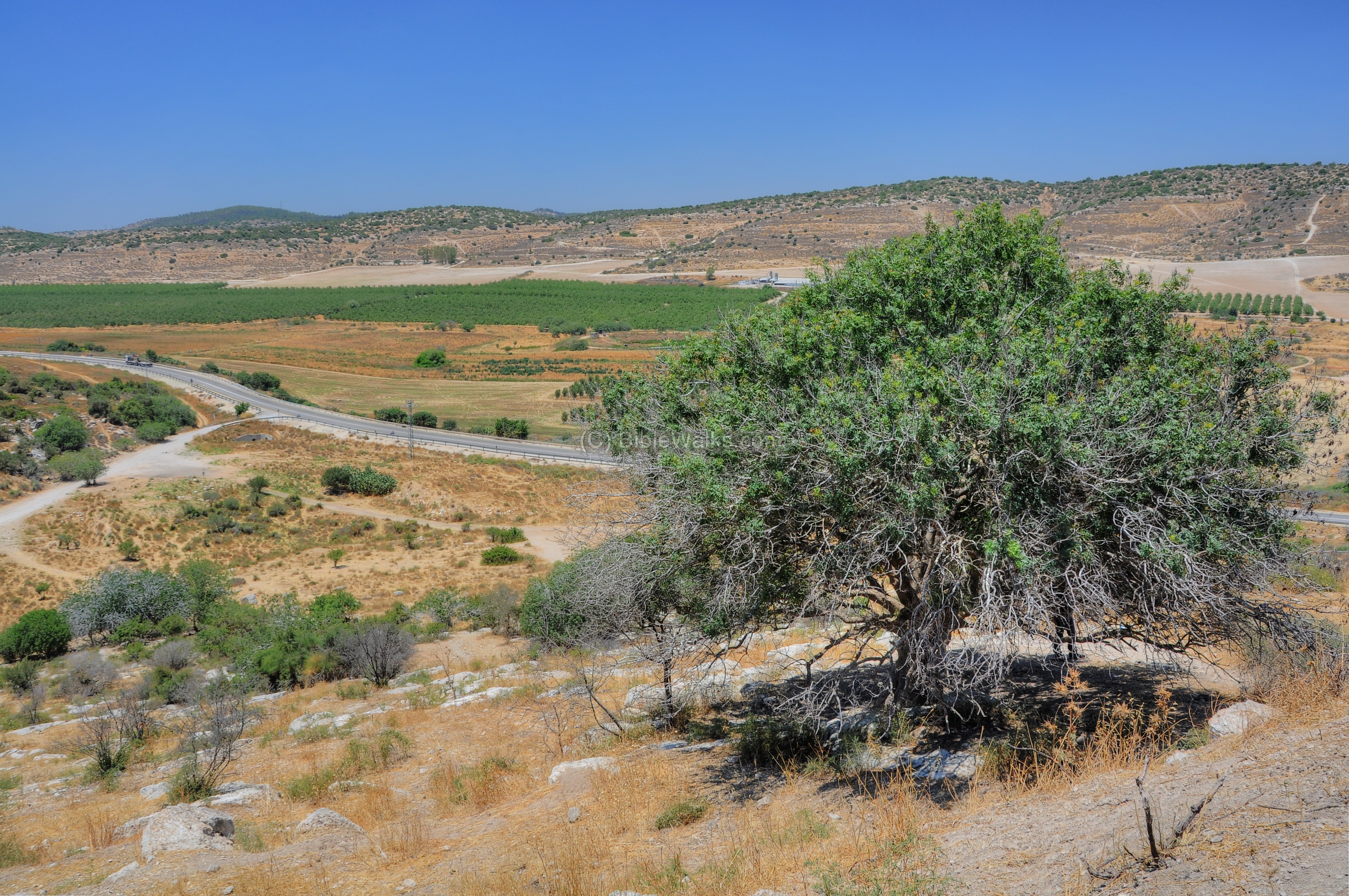
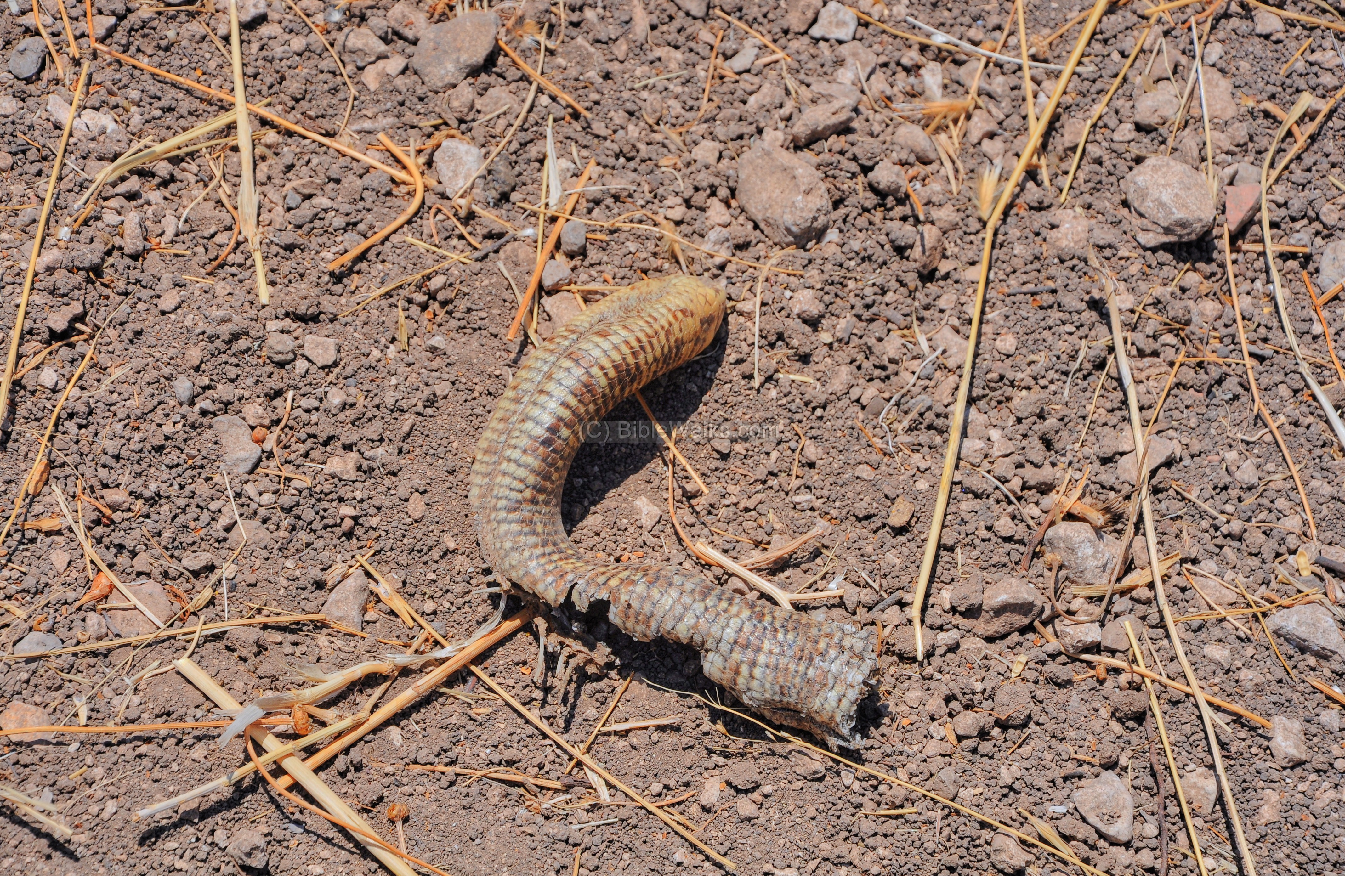
You need to be careful while climbing up the hillside – not only due to the height difference of 70m from the bottom of the valley to the top of the hill, but also due to snakes (such as this skin).
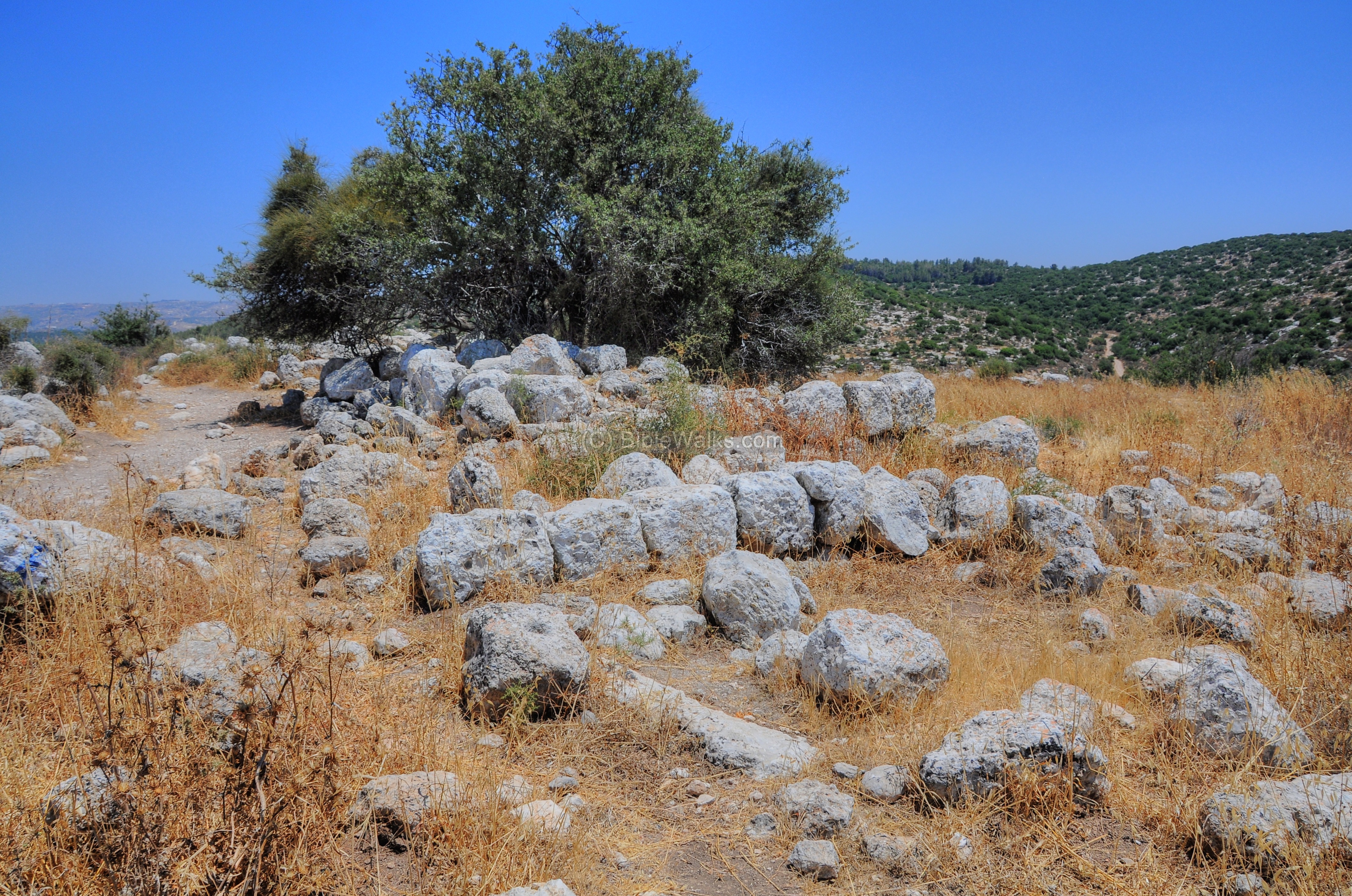
(c) Top of the Western hill
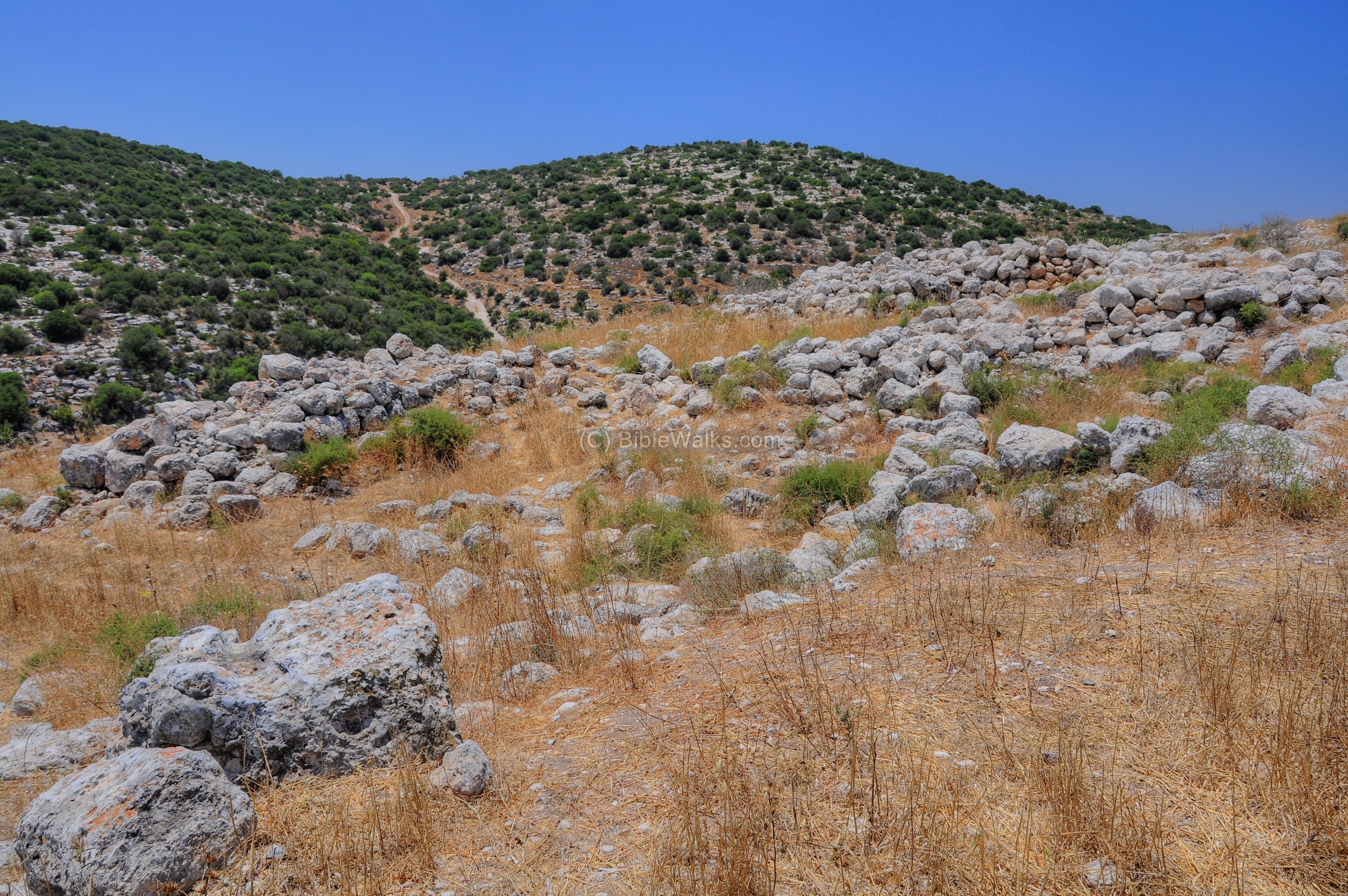
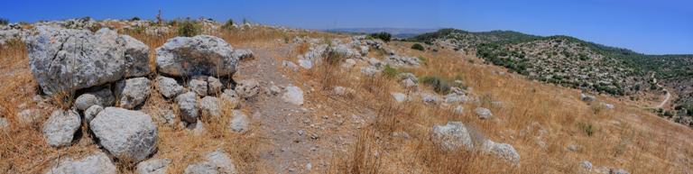
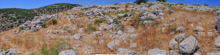
On top of the hill are traces of walls, roughly hewn stones, ruins of houses, and cisterns. This site was not yet excavated (2011), although excavation permits are in the pipeline. The antiquities get denser as you get closer to the top.
The western hill dates primarily to the Biblical Iron-Age period, with some remains from the later Roman/Byzantine period.
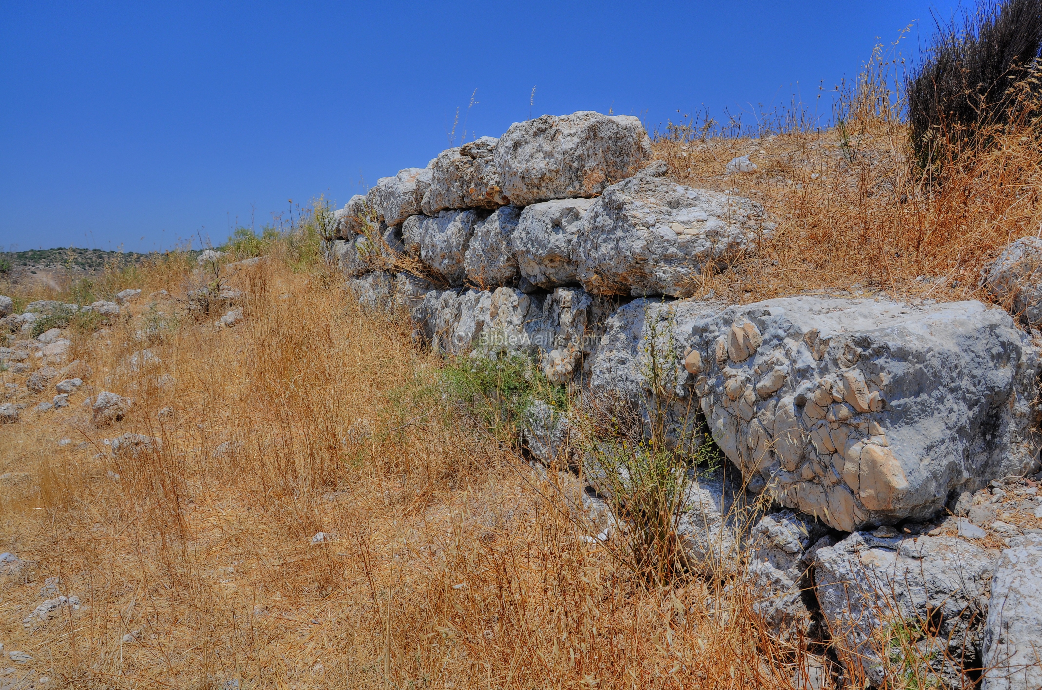
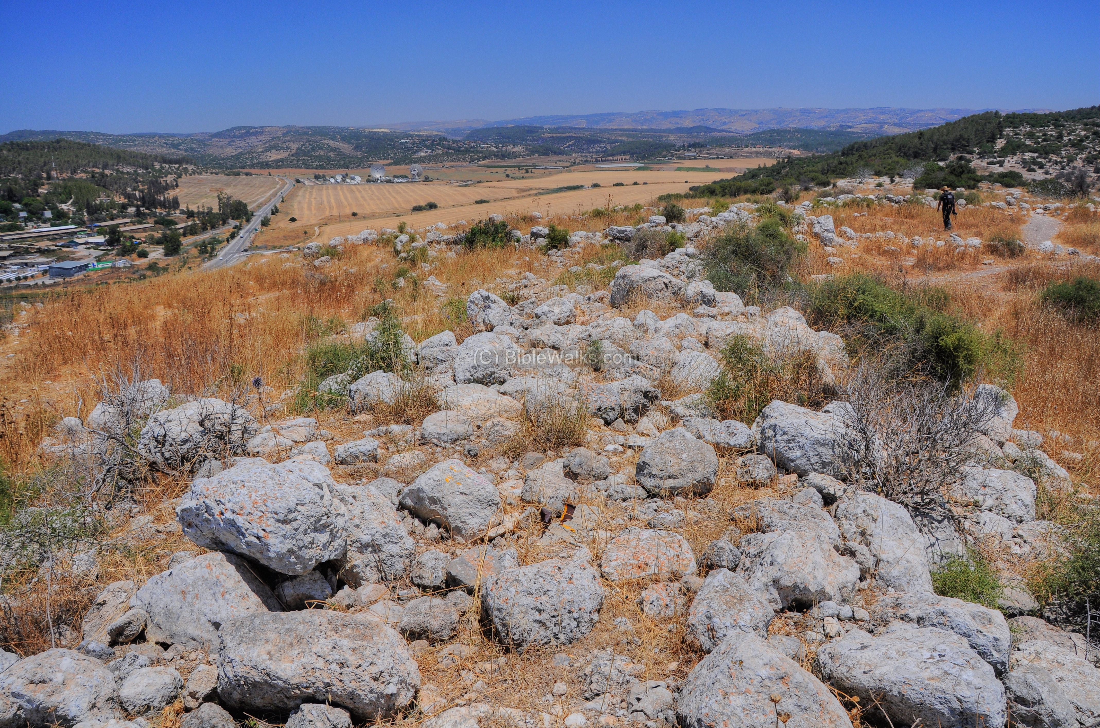
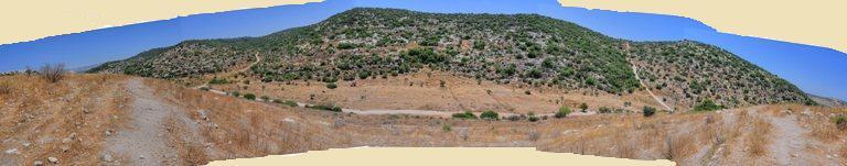
A view from the south side of the top of the hill, looking westwards. The major ruins cover the top of the western hill, with an area of about 100m wide (south-north) by 200m (west-east).
Some parts on the south side are clear of visible structures, since they are buried underground.
The top of the hill is at an altitude of 349m. An eastern view of the ruins in the center of the hill is shown in the following picture.
A southern view of this location:
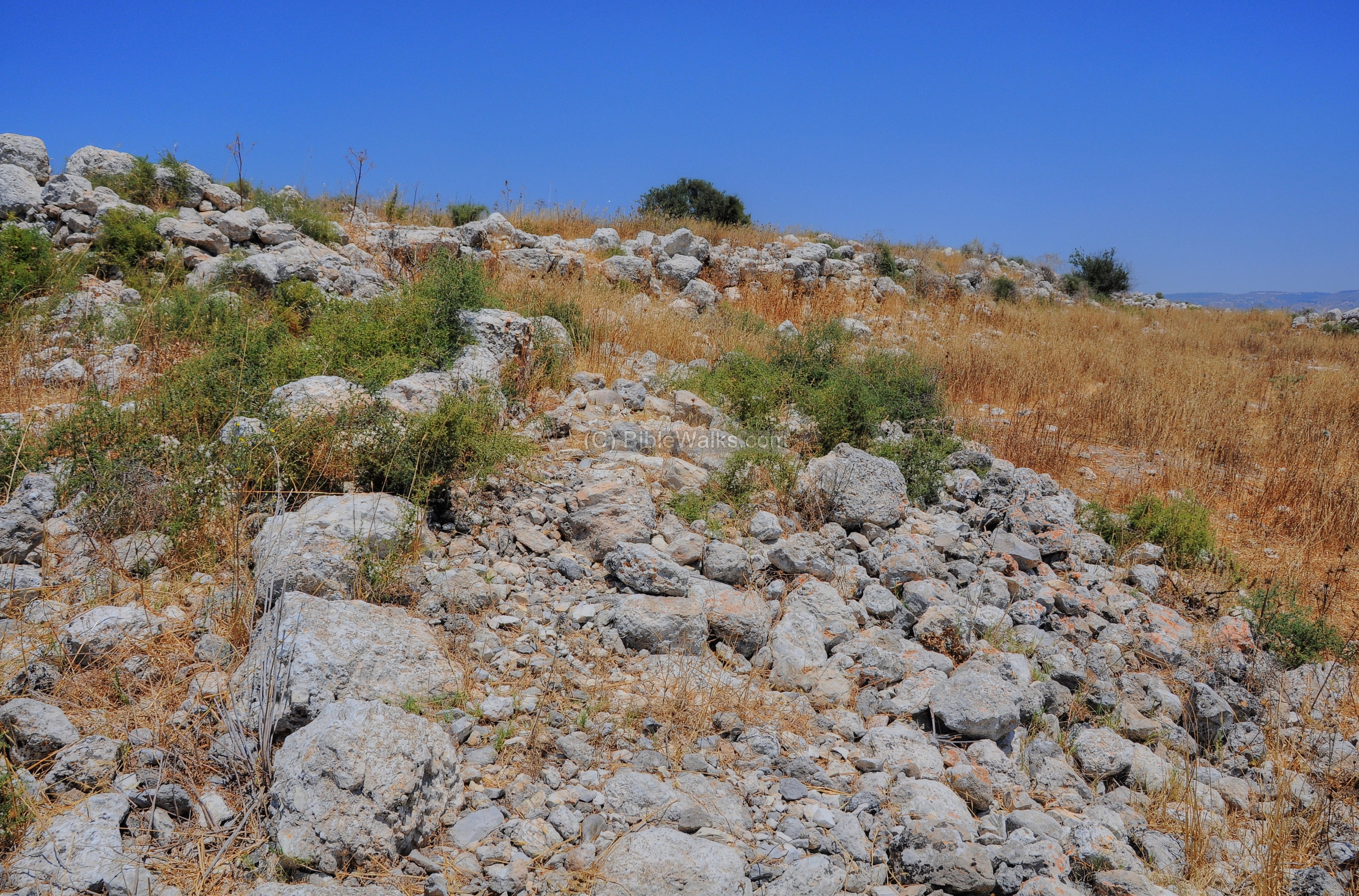
(d) East side of the Western hill
Tell Sochoh ruins continue to the east, where they end in the middle of the hill top.
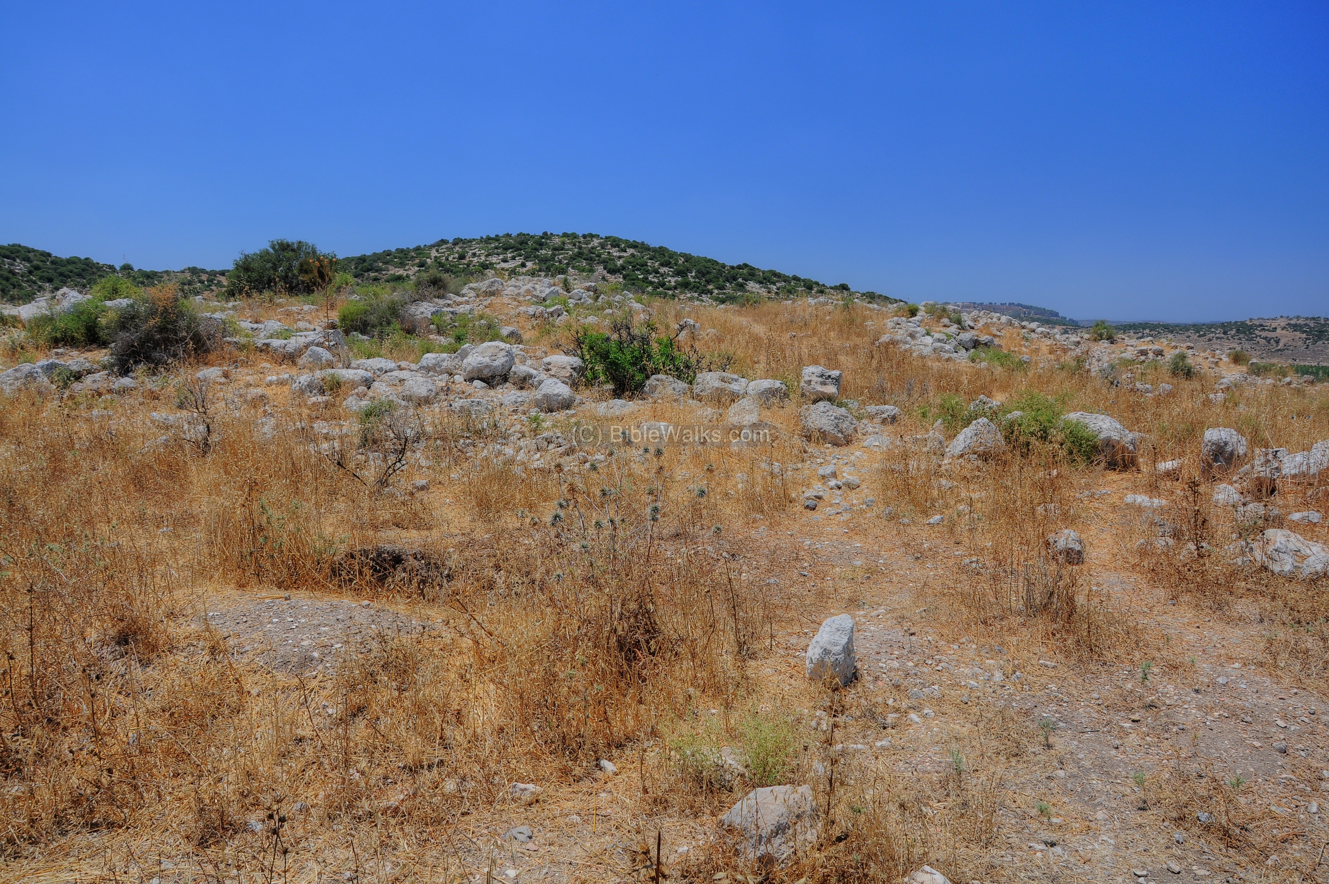
The north-east walls of Tell Sochoh are seen below.
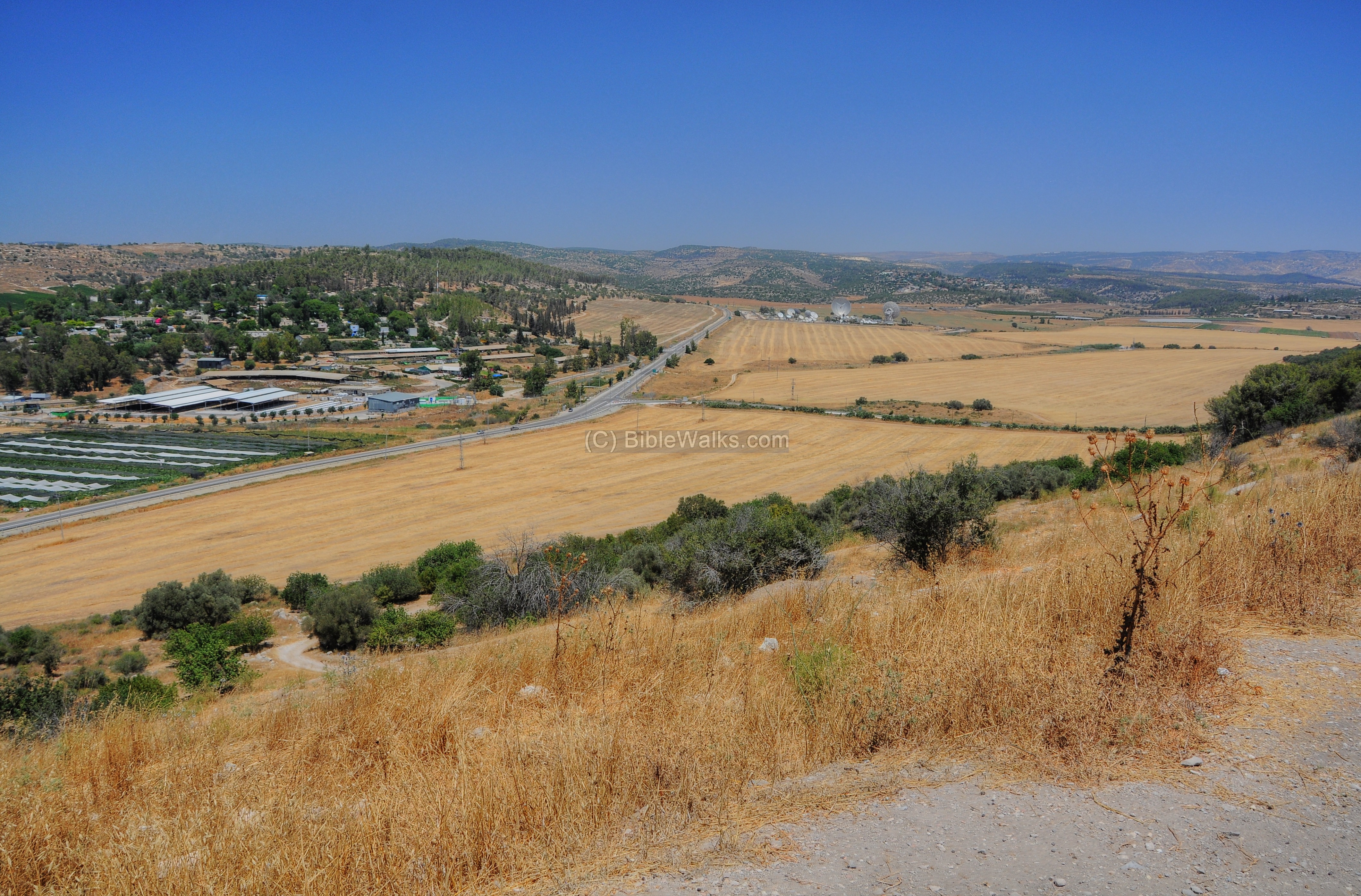
The next picture shows a view from the top of the ancient site, looking eastwards to the eastern edge of the valley of Elah. The Kibbutz Netiv Halamed-Hei is on the left side, while the satellite dishes are seen in the far center. On the far right side is where the valley of Elah turns to the south where the ancient site of Adullam is located (it was also mentioned in the list of fortified cities by Rehobam).
(e) Eastern hill – Khirbet Shuweikeh
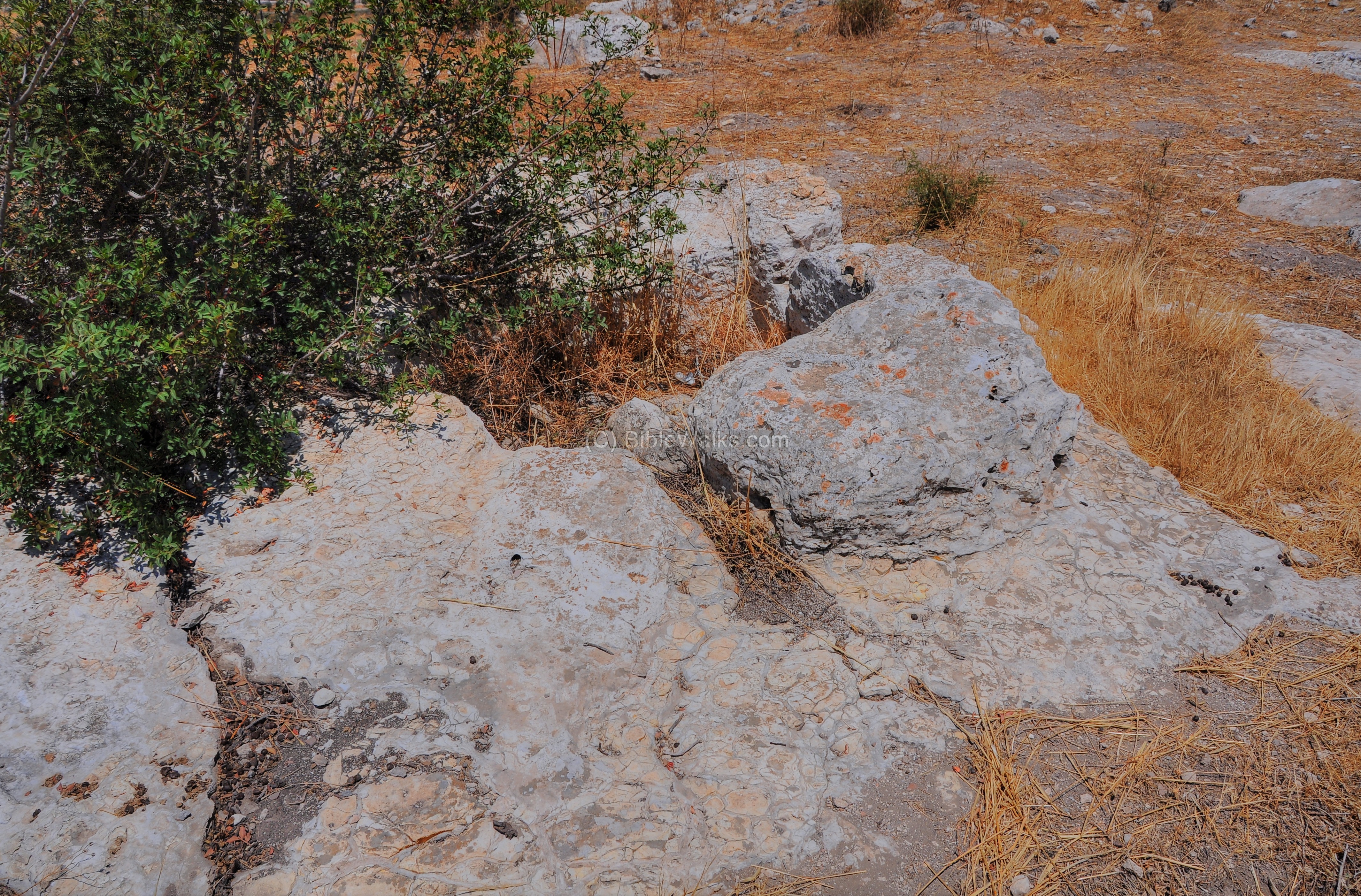
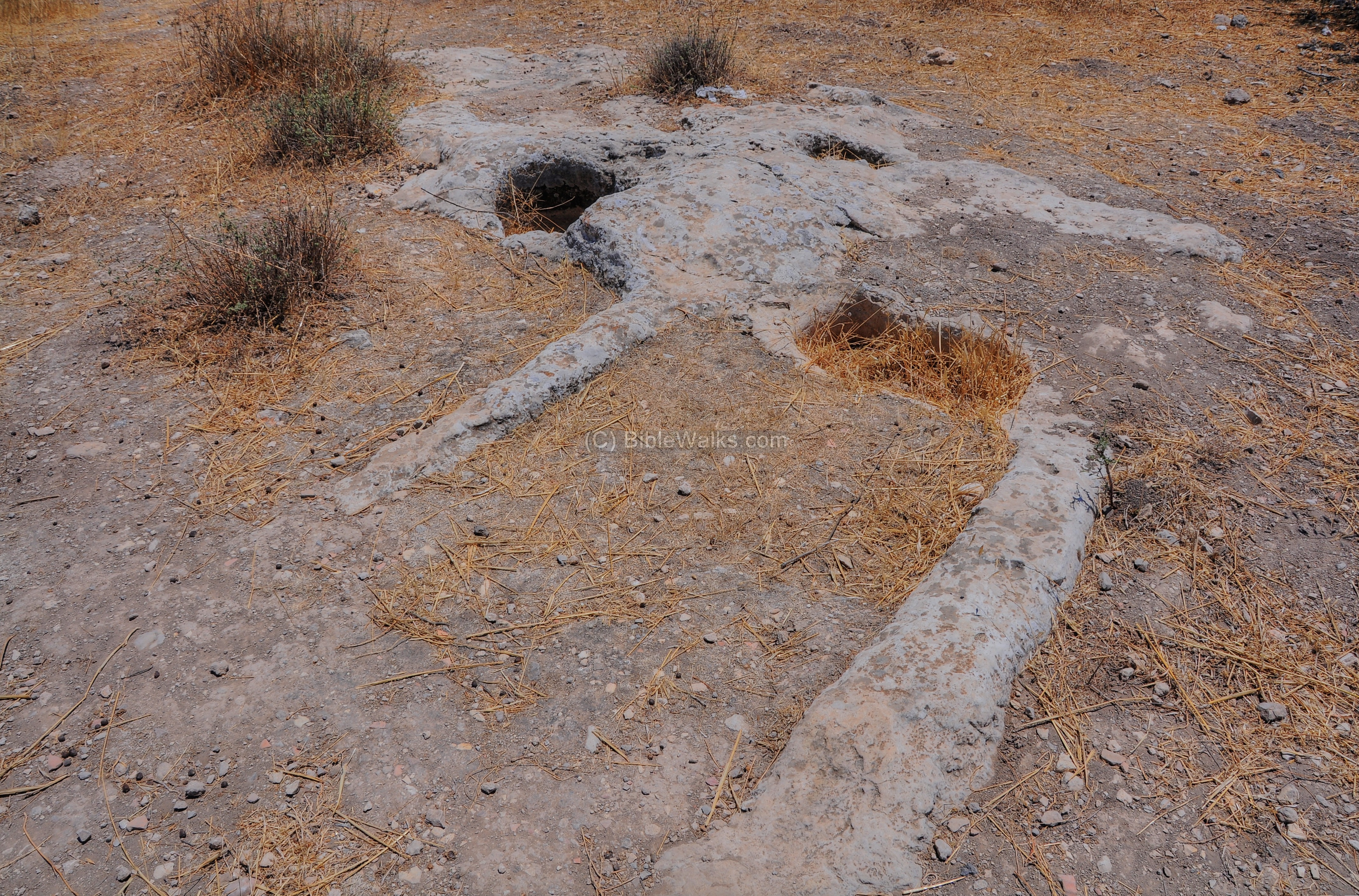
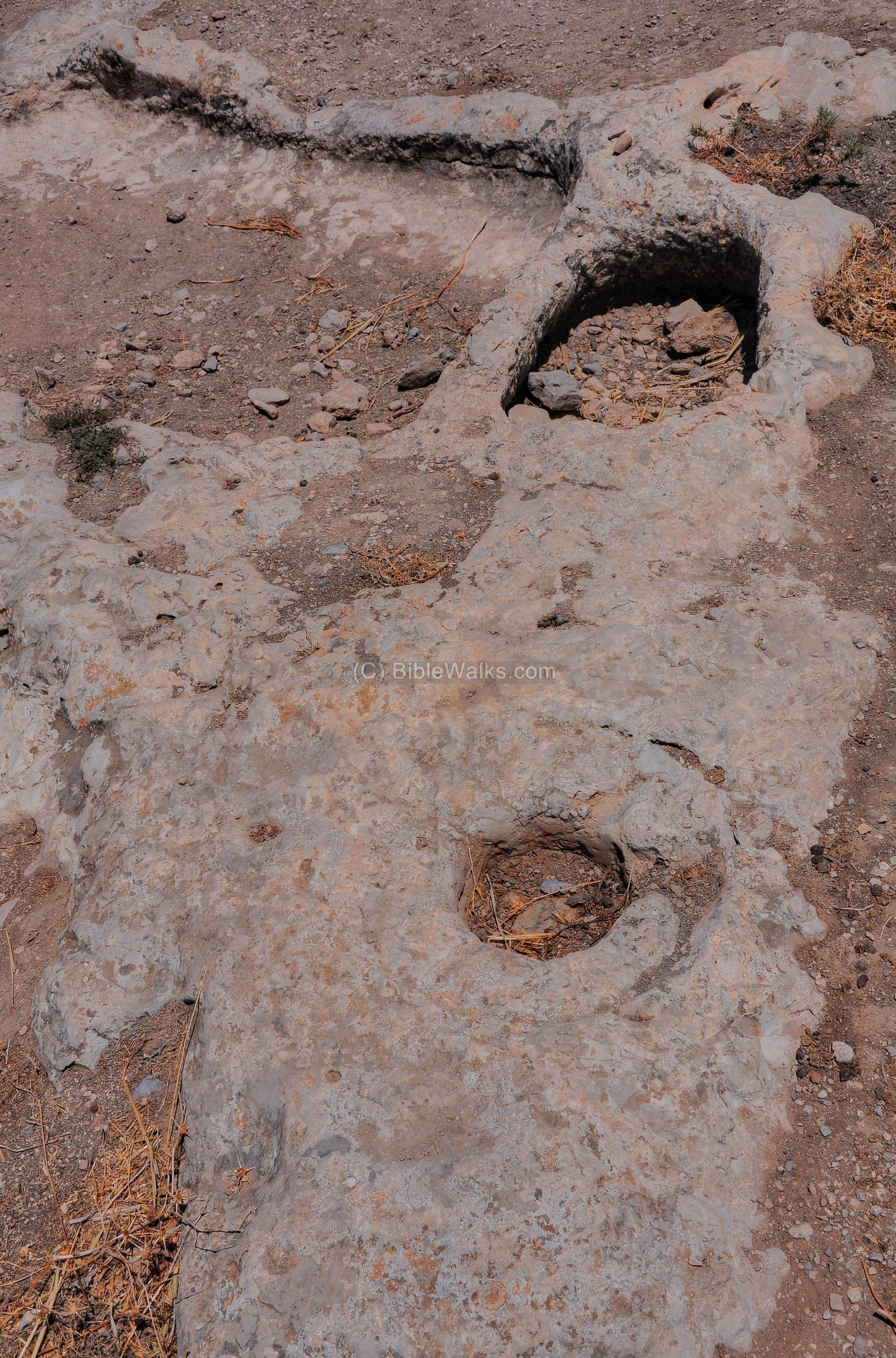
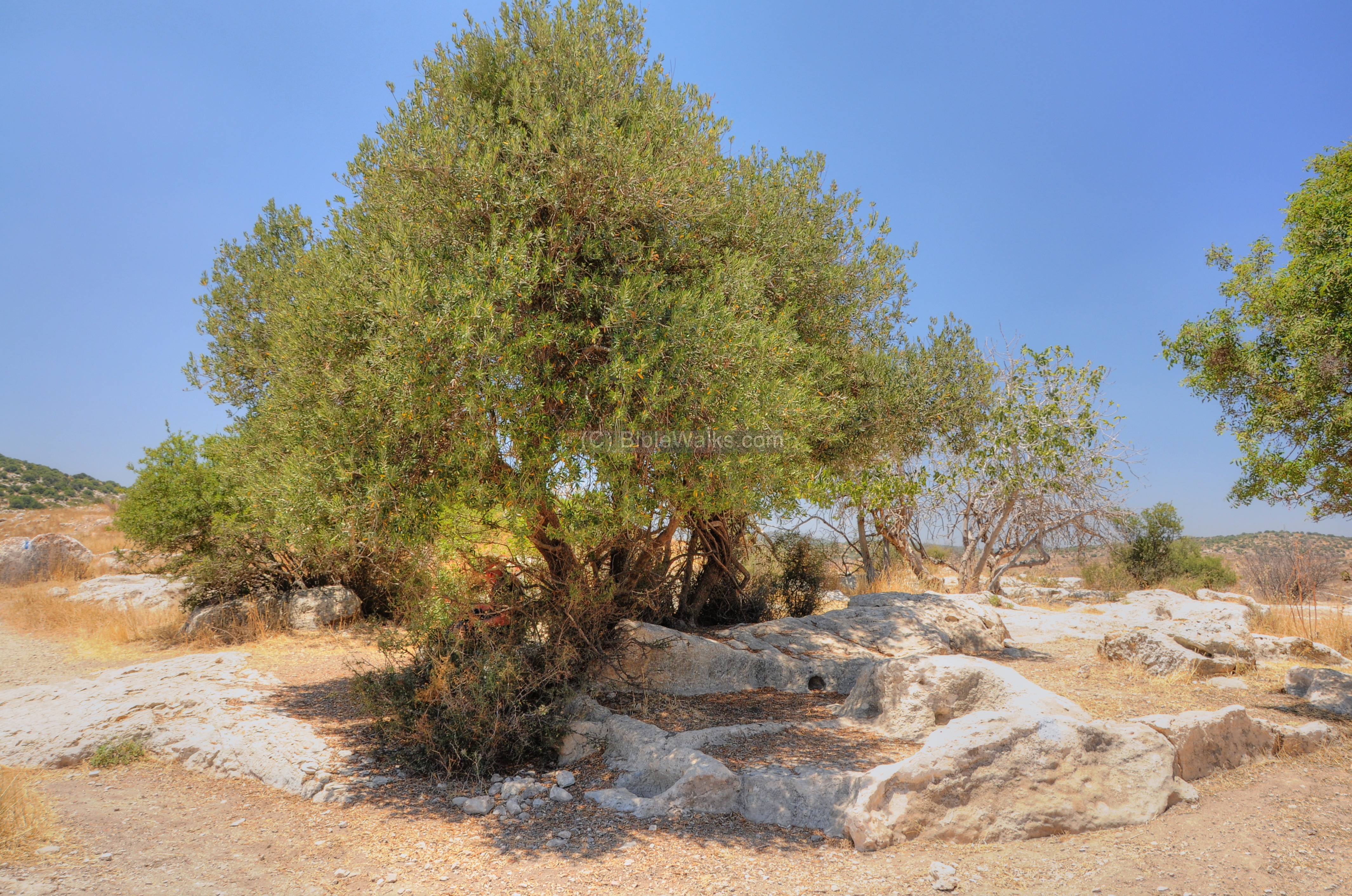
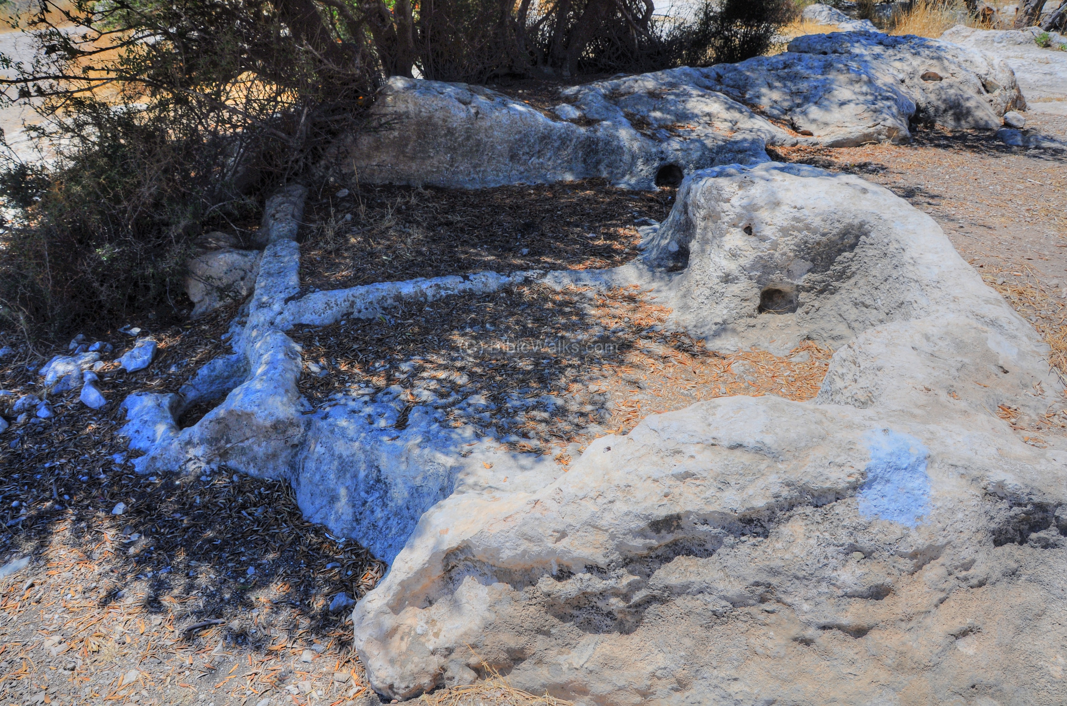
To the east of the ruins of Sochoh are the ruins of Khirbet Shuweikeh. Here are remains of a later dated village – from the Roman/Byzantine period. The Arabic name of the ruins – Shuweikeh – actually preserves the ancient Hebrew Biblical name, although Sochoh is located on the western hill.
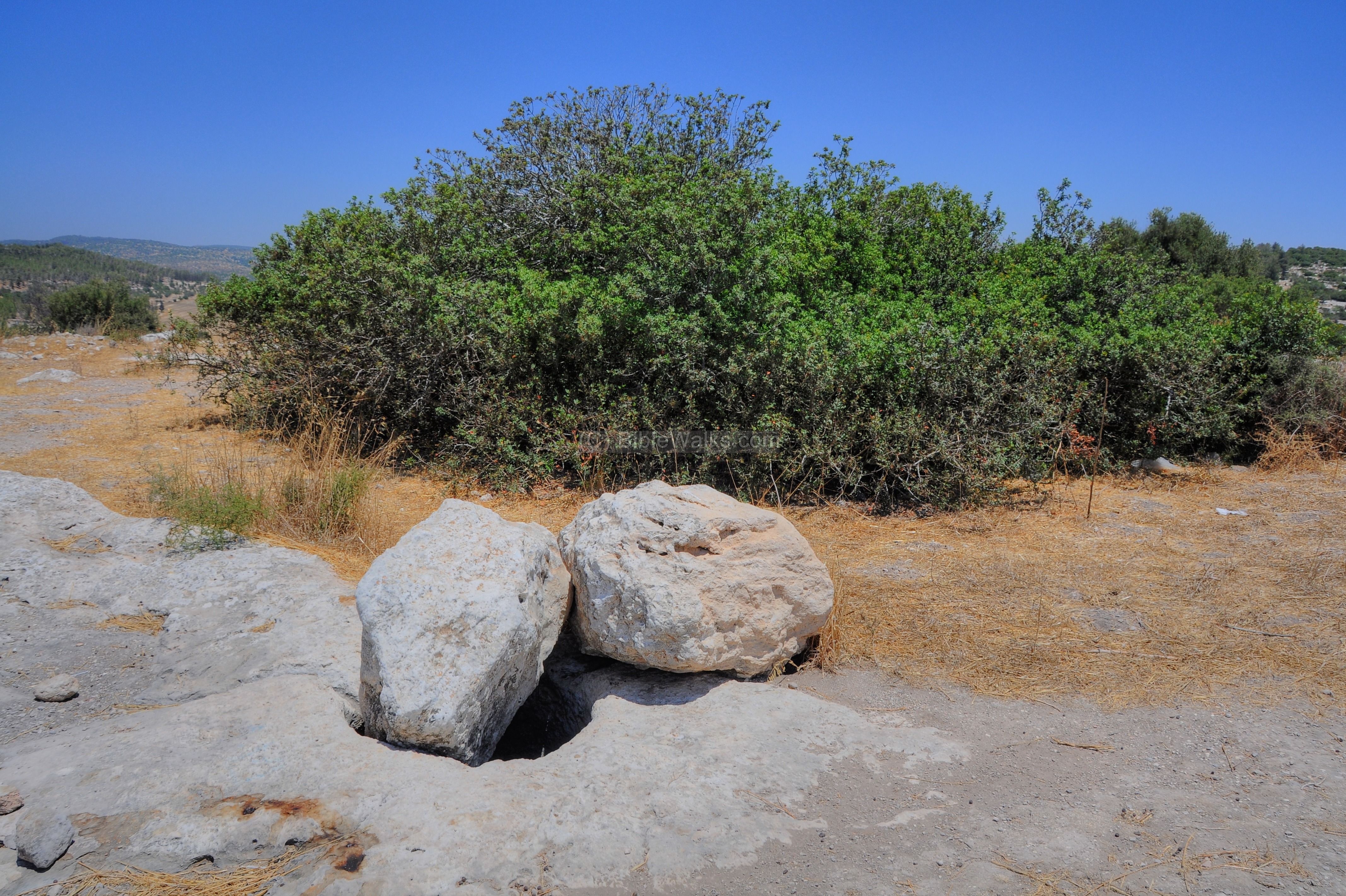
This side has less scattered rocks like on the western side. There are, however, many agriculture installations and cisterns hewn into the rock. The following pictures show a sample of these installations.
An ancient winepress under the shade of a tree:
A closer view of the winepress:
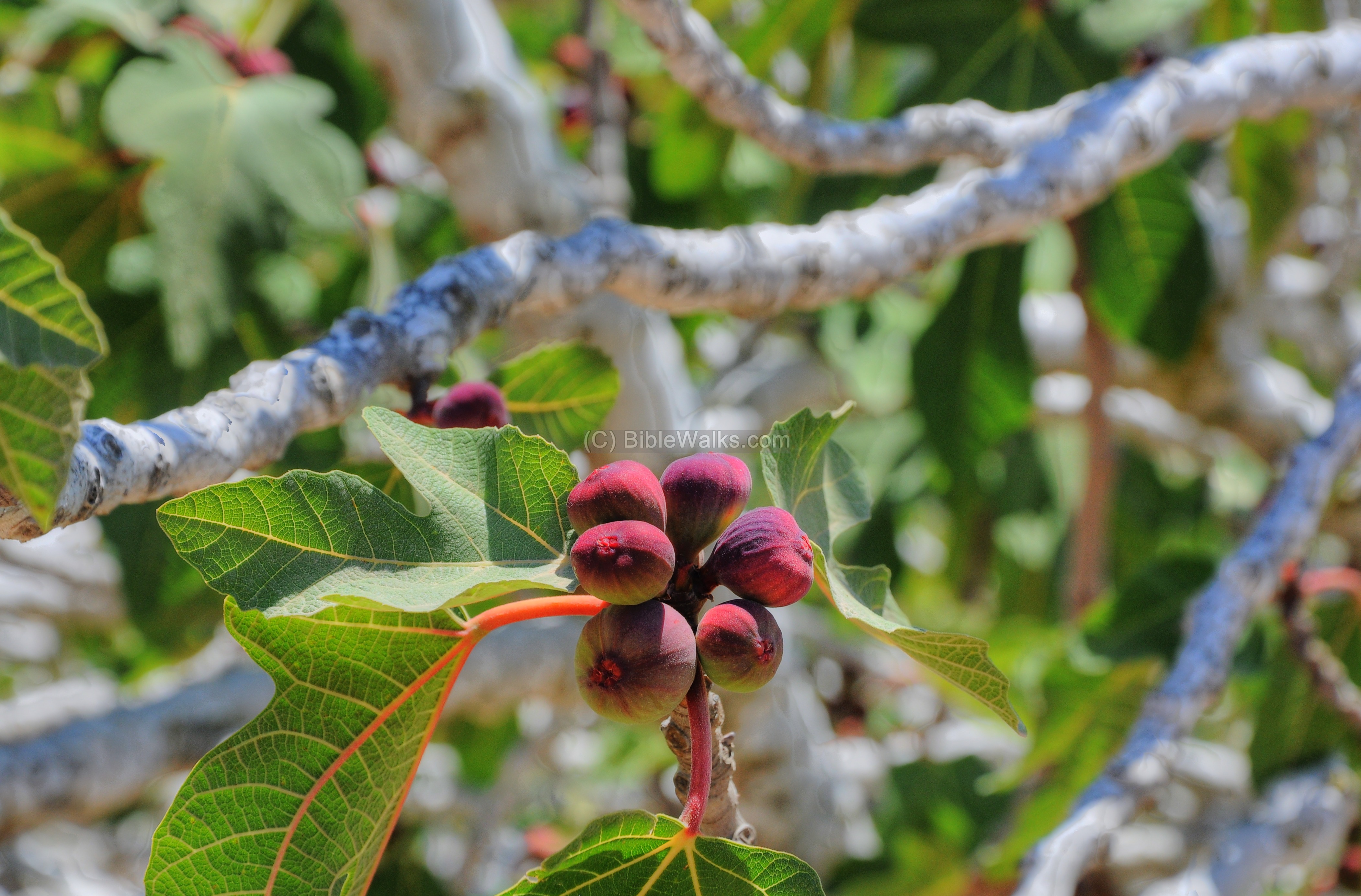
A fig tree grows in one of the cisterns:
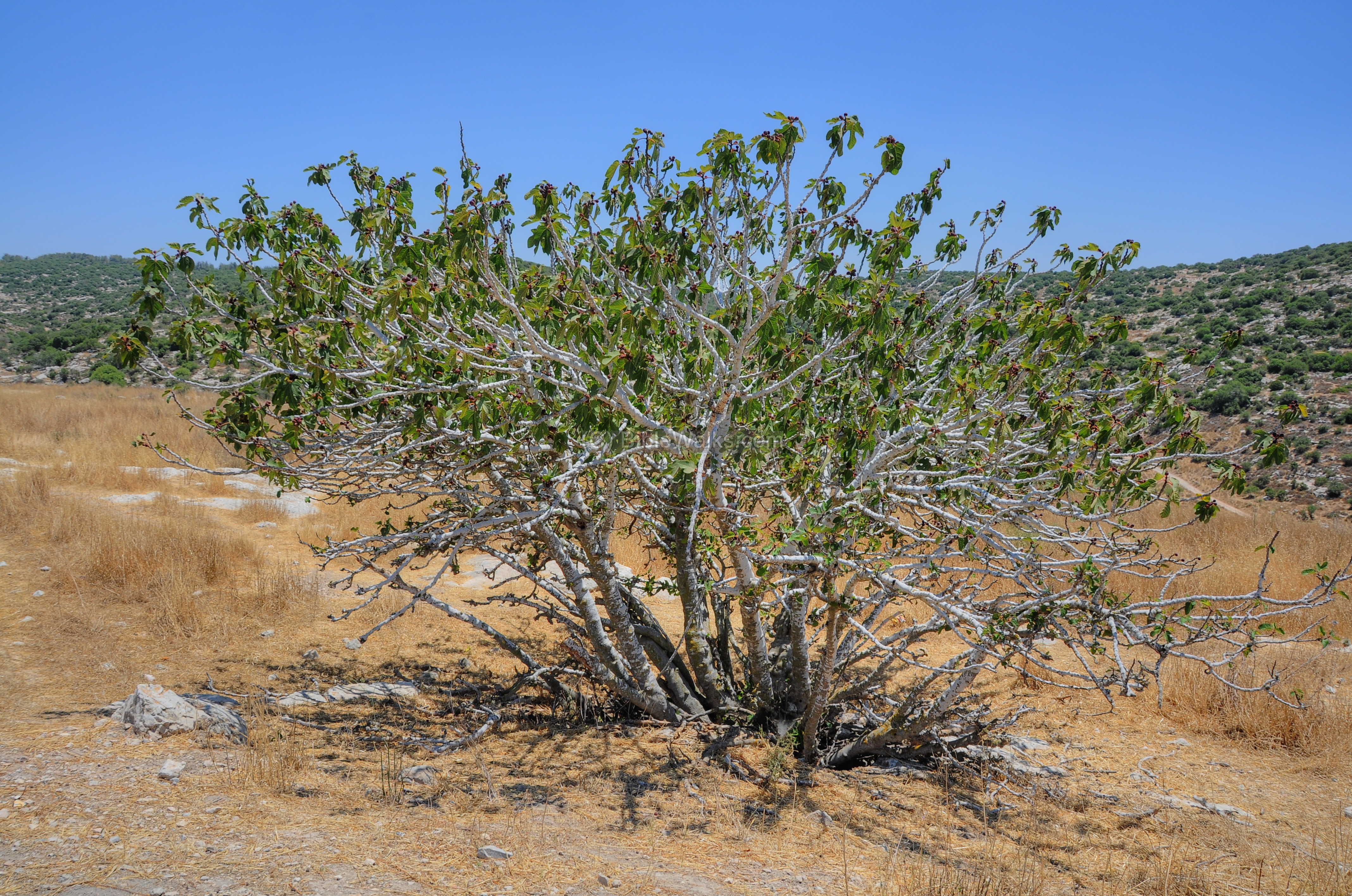
A closer view to the fig tree in the next picture. The fig tree is the first tree in the Bible (Genesis 3 7): “…and they sewed fig leaves together, and made themselves aprons”. It appears many times pairing with grape (Isaiah 34 4, NASB version): “As a leaf withers from the vine, or as one withers from the fig tree“.
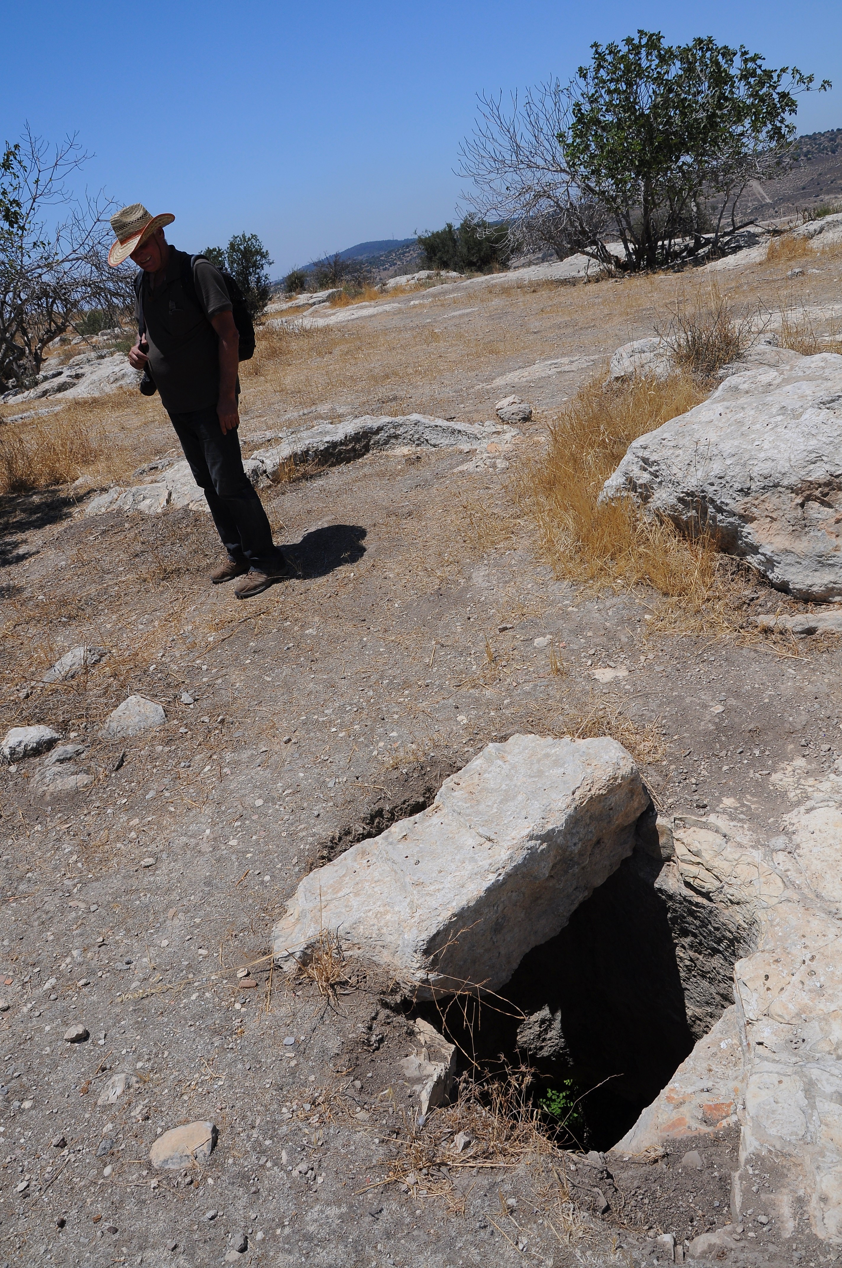
Yechiel is seen below near one of the water cisterns:
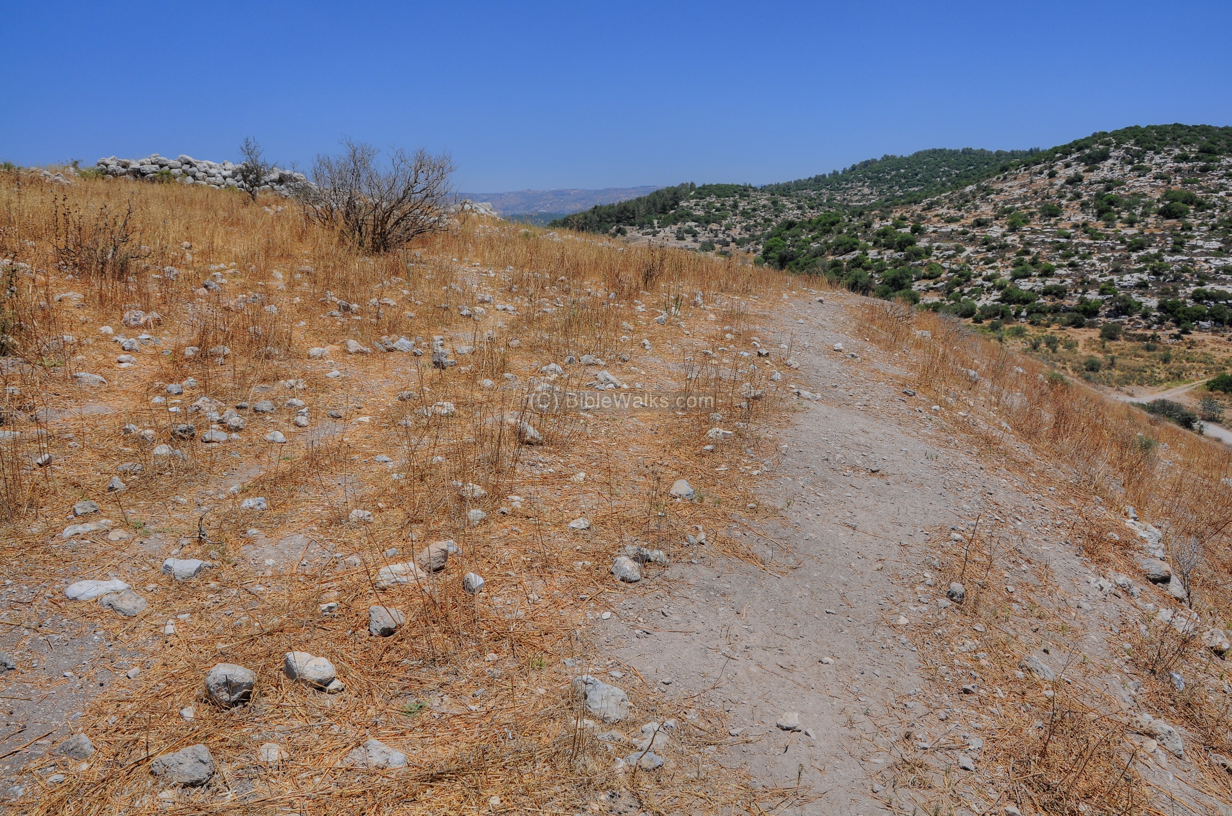
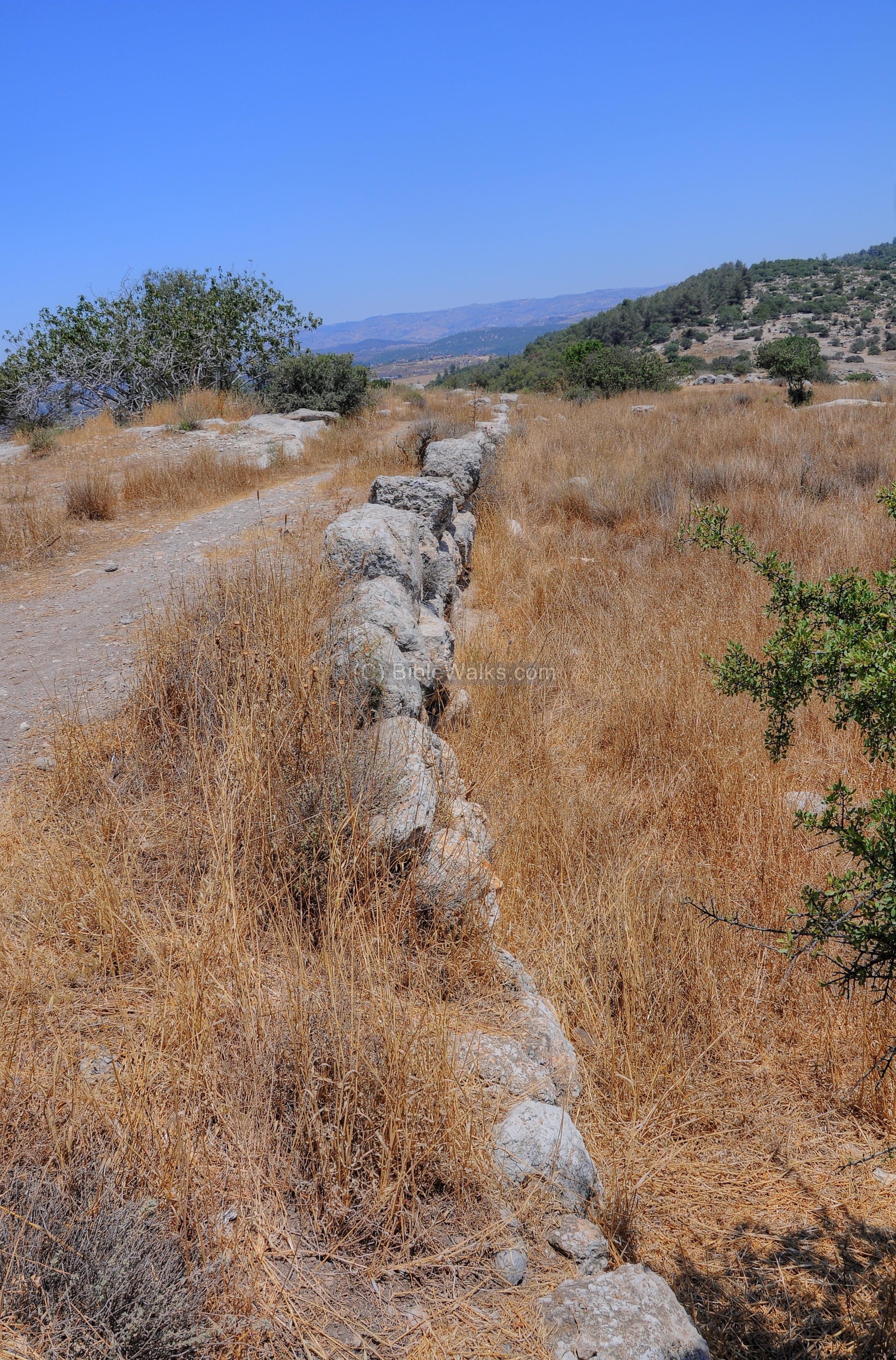
A long wall stretches along the southern side of the hill:
The next picture shows a view from the top of the eastern hill:
(f) Panoramas
Panoramic views, as seen from Tell Sochoh, are shown in the following pictures. If you press on any one picture, a panoramic viewer will pop up. Using this flash-based panoramic viewer, you can move around and zoom in and out, and view the site in the amazing full screen mode (like you are really there).
To open the viewer, simply click on one of the photos below. Note that it may take minutes to upload, but then its worth the waiting time.
South/ South-West:
Date of picture: July 2011
South-East:
Date of picture: July 2011
West:
Date of picture: July 2011
North:
Date of picture: July 2011
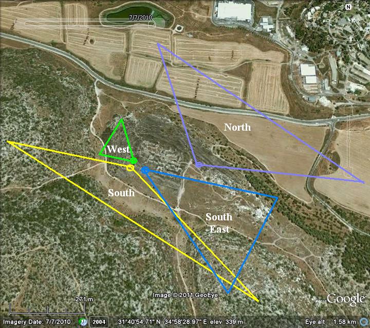
The location of these panoramic views, and their viewing zones, is shown in the following map as a reference:
(g) LMLK Seals
Many seals were found in Israel imprinted on jars with the Hebrew letters LMLK ( “L’melekh”), meaning “belonging to the king”. Some of these royal seals bear the name “Sochoh” on the bottom (4 Hebrew letters Shin-Vav-Kaf-Hey). This name may refer to the Sochoh in the valley of Elah, or to another one of the cities named Sochoh, or they “may have been used as literal words of devotion” (as per G.M. Grena of LMLK.com who helped us with this section, and provided the following stick figures and photos).
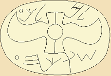
There are 4 types of Sochoh seals, 3 are shown below:
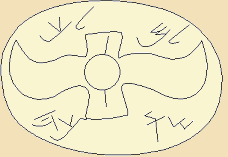
Type S2DW
Type S2U
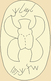
Type S4L
Figures courtesy of G.M. Grena of LMLK.com
Examples of Sochoh seals:
Type S2U:
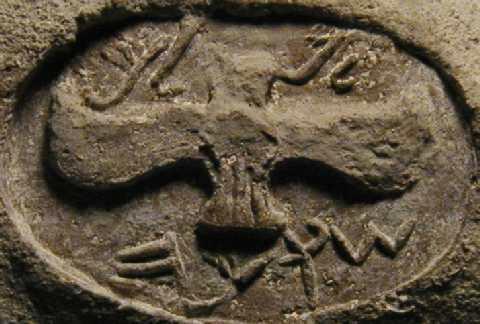
Type S4L:
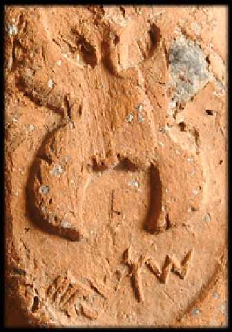
Photos courtesy of LMLK.com
G.M. Gerner wrote us: “Seals bearing “Sokoh” inscriptions have been found at these sites: Arad, Arnona, Azekah (Tell Zakariya), Beth-Shemesh, Gezer, Gibeon, Jericho, Jerusalem, Lachish, Masud (Khirbat el-Masud or el-Mas’ud), Moresheth-Gath (Tell ej-Judeideh or Tel Goded), Ramat Rachel, Tel ‘Erani (Tel Gat), Tell ash-Shuqf (‘En Shoqef), Tell en-Nasbeh and Timnah”.
“As for dates, the majority of scholars believe these seal impressions date to the 8th-7th centuries BC; however, this equates to about 7th-6th centuries BC on the Jewish calendar. These dates center around the reign of King Hezekiah because the handles appear in strata formed by a destruction layer caused by the Assyrian king, Sennacherib. Some scholars believe the handles were stamped as early as the reign of Uzziah, & as late as Manasseh (hence the 8th/7th or 7th/6th span of about a century), though some believe they were strictly limited to Hezekiah’s reign”.
Etymology:
* Elah – the Hebrew name of the Terebinth (Pistacia) tree.
* Sochoh – the Biblical name of the city. Perhaps is based on the root word of “Socha” – temporary hut or shelter (Hebrew: Sucah). Its Hebrew form Socha appears in Judges 9, 48/49 and was translated to ‘bough’ – a branch of a tree: “and Abimelech took an axe in his hand, and cut down a bough from the trees, and took it, and laid it on his shoulder”.
* Kh. Shuwike, Shuweikah, Shuweikeh – The Arabic name of the ruins. The word ‘Shuweikeh’ or ‘Shuweikah’ means “thorns” according to the PEF dictionary.
Links:
* Archaeology:
- LMLK seals – “L’melekh”, meaning “belonging to the king”; jars with royal seals bearing the name “Sochoh”
See also the introduction movie ( in flash)
- Onomasticon of Eusebius – 4th C Church history book, mapping the Bible to sites; with references to Sochoh
- Onomasticon of Eusebius – list of places
- Terra Cotta Figurine Astarte figurine found in Horevot Sokho (2010)
* Internal – sites nearby:
- Valley of Elah – overview
- Kh, Qeiyafa – Shaaraim
- Azekah
- Gath – Philistine city, home of Goliath
* Internal web pages – other subjects:
- Trees of the Bible – info page
BibleWalks.com – Touring the Bible Land
Shaaraim <<<—previous Judea site–<<< All Sites >>>—next Judea site—>>> Azekah
This page was last updated on Feb 21, 2023 (new overview)
Sponsored links: