Tel Zafit (Tell es-Safi) is one of the largest Biblical sites in Israel. Settlement started in the Early Bronze Age, and was occupied with some interruptions for 5,000 years until modern times. It is widely accepted by scholars as the Philistine city of Gath – the hometown of Goliath.
* Site of the Month Sep 2016 *
Home > Sites > Shephela > Gath (Tel Zafit, Tell es-Safi)
Contents:
Background
Location
History
Photos
* Aerial views
* Entrance
* White Cliffs
* South side
* Summit
* Area F
* Center
* Area P
* Area A
* Area E
* Foothills
* Area D
* Well
* Siege Moat
* Misc
Etymology
Links
Background:
Tel Zafit (Tell es-Safi) is one of the largest Biblical sites in Israel, located halfway between Ashkelon and Jerusalem.
The settlement on the tell started in the 5th millennium BC, reached its peak in the Late Bronze and Iron Age II periods, and was settled until modern times. It is widely accepted by scholars as the Philistine city of Gath – the hometown of Goliath.
1 Samuel 5:8: “Let the ark of the God of Israel be carried about unto Gath”.
Location:
The Tel is in the western edge of the Judean foothills (Shephelah) area, bordering the southern coast plains. It is located on the south banks of the Elah stream.
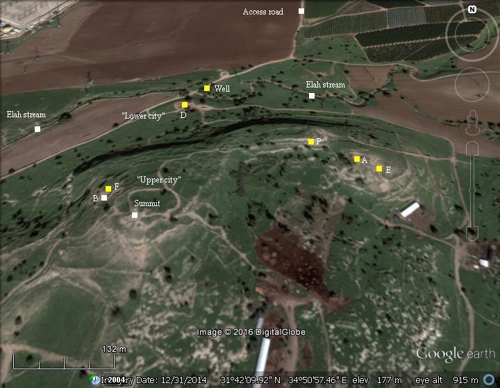
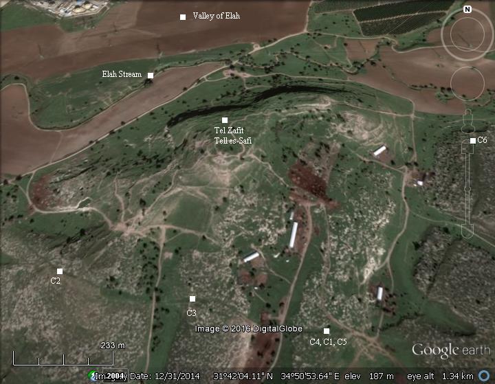
An aerial map of the site is shown here, with the major points of interest and the dig areas marked on it.
The first excavator of the site, F.J. Bliss, wrote in 1899 about the topography [1]: “The importance of the site of Tell-es-Safi has always been recognized by archaeologists. It is a striking point in the landscape from whatever direction it may be approached. The Valley of Elah, coming westwards through the low hills of the Shephelah, sweeps around its north side and at once enters the Philistine plain. Tell-es-Safi thus stands as a natural fortress between this plain and the rolling country. The view is magnificent. To the north appears the town of Ramleh, with its tower ; to the east is the olive-dotted Shephelah, bounded by the Judean Mountains, and crossed by the lower ridge running from Tell-el-Judeideh to Tell Zakariya; to the west lies the broad expanse of the maritime plain, with the sites of Ashdod and Ascalon quite distinct.”.
History:
-
Chalcolithic period (4,500-3,300 BC), Canaanite period – Early Bronze I (3,300-3050BC)
Settlement on the tell started in the 5th millennium BC. The city was first fortified during the Early Bronze I period.
-
Early Bronze II-III (3,050-2,400 B.C.)
Massive fortifications were constructed during several phases of the Early Bronze age III. The extent of the urbanization and fortifications suggest that Gath was one of the most important urban sites in southern Canaan. It covered an area of ~25 hectares (250 dunams), an impressive size at those times (comparable to Tel ‘Erani). The excavations unearthed fortifications and a large residential quarter. One of the unique findings was an ivory seal with an illustration of a standing lion.
-
Intermediate and Middle Bronze Age (2,400-2,000 BC, 2,200-1,550 BC)
There was almost no presence on the hill during this period, except for a small fortification near the summit. This follows a general pattern, as most of the EB III cities were depopulated in the Levant. It may have been a result of onset of drier climatic conditions, which resulted in insufficient resources to support the large cities. Most cities in the Levant disappeared and settlements were abandoned.
-
Late Bronze (1,550 – 1,200 BC)
The city once again became a large fortified city, spread over most of the upper (south) city area. The area of the city resumed its Early Bronze size of ~25 hectares (250 dunams). Massive fortifications, large houses, and evidence of trade with neighboring regions all attest to its importance and domination of the region.
Gath is known from the Tell-Amarna letters [7]. This 14th century BC Egyptian archive of clay tablets mentions Gath in some of the letters during the reign of Akhenaten (aka Amenhotep IV), during the years ~1352-1335 BC. The letters, written in Cuneiform on a clay tablet, name one or two kings of Gath – uwardata (Shuwardatta, author of 8 letters) and ‘Abdi-‘Ashtarti (3 letters). Both kings wrote to the Pharaoh as vassals of Egypt (letters EA 278284, 63, 65, 335, 366).
For example, letter EA 283 starts with: “To the king, my lord, my god, my Sun: Message of uwardatta, your servant. I fall at the feet of the king, my lord….”. In this letter the king invites the Egyptians to come and assist Gath in their fight against a coalition of 30 cities.
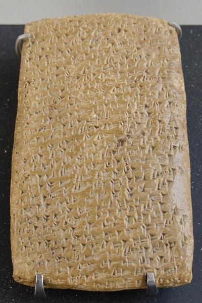
One of the Tell Amarna letters (Louvre Museum, Public domain CC 2.5)
Cuneiform writing on a clay tablet.
The city is first described by the the Israelites as a city of giants or Anakim, which the Israelites could not conquer (Joshua 11, 22): “There was none of the Anakims left in the land of the children of Israel: only in Gaza, in Gath, and in Ashdod, there remained”. Decades later after Joshua’s entry to Canaan, Gath was the home city of the giant Goliath.
-
Iron Age I (1,200 – 1,000 BC)
During the 12th century the Philistines arrived to the cities along the shore.
The Philistines – “Sea Peoples” from the Aegean sea – landed in Canaan and Egypt in the 12th century BC. The Egyptians fought the invaders (Ramses III battle of 1175 BC) and repulsed them into a small enclave in the southern coastal cities of Canaan (from Gaza to Ashkelon), as per (Joshua 13, 3): “…five lords of the Philistines; the Gazathites, and the Ashdothites, the Eshkalonites, the Gittites, and the Ekronites”. Gath was conquered by the Philistines, with minor damages to the city, and became their most important city.
The main cities of the Philistines were located in the south coast area named by the Bible as “Pleshet”. The area was initially between Gaza and Ashdod. It included Gath, Ashkelon, and Ekron (Tell Mikne). As described in the Bible (1 Samuel 6:17): “And these are the golden emerods which the Philistines returned for a trespass offering unto the LORD; for Ashdod one, for Gaza one, for Askelon one, for Gath one, for Ekron one”.
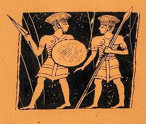
Philistine warriors – on sign of the Zafit national park
A map of the cities and roads of the Iron Age period is here, with Gath marked as a red point in the center. The city is strategically located on crossroads of the south/north Via Maris and a west/east route along the valley of Elah to Jerusalem.
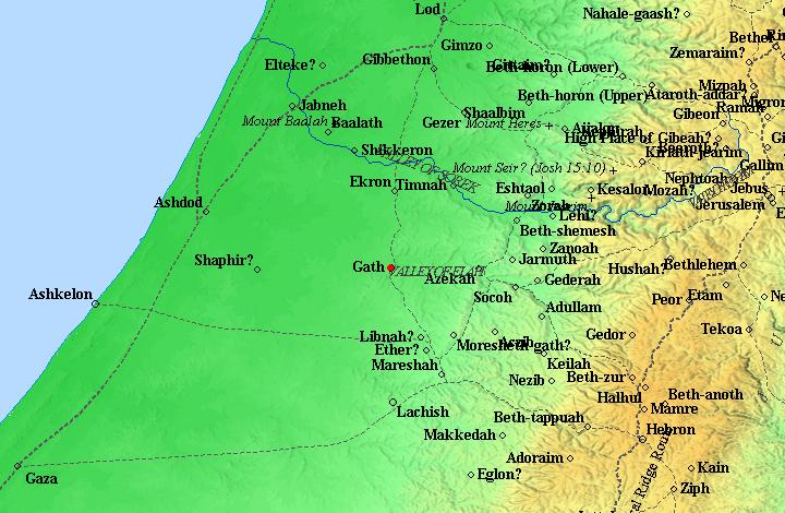
The cities and roads around Gath – during the Canaanite and Israelite periods – Bible Mapper 3.0
The excavations unearthed Philistine style ceramics, including decorated pottery, as well as other artifacts. This is evidence of the early settlement by the Philistines in Gath. The Iron Age Philistine remains were found on all sections of the city, thus strengthening the identification of the city with Gath.
-
Early Israelite Kingdom – Iron Age IIA (1000 – 925 BC)
At a later stage the Philistines moved northwards until the Yarkon river north of Jaffa. They replaced the Egyptians, ruling the southern coastal area of Israel.
The Philistines took over the city and mixed with the local Canaanites in Gath. The Philistine city reached its zenith during this time: the bulk of the ceramics found in the excavations belong to this period, and indicate on the prosperity of the city. The city covered both the upper and lower cities, and was probably the largest city in the land of Israel, covering an area of 450-500 dunams (45-50 hectares) .
The Philistine control of the plains was initially not a threat to the Israelites who dwelt in the hills of Samaria and Judea. However, towards the beginning of the 11th century BC the Israelites pushed westwards towards the plains, resulting with periodic clashes. This ongoing conflict ended only after 400 years, after the Babylonian conquests at the end of the 7th century (604 BC).
-
Gath and the Ark of Covenant:
The great battle of Eben-Ezer occurred in the middle of the 11th century between Ebenezer and Aphek, at about 1050 BC. This battle is fully detailed in the Bible (1 Samuel 4:1): “Now Israel went out against the Philistines to battle, and pitched beside Ebenezer: and the Philistines pitched in Aphek”.
The Bible describes the course of the battle, and its tragic results: 34,000 Israelite soldiers dead, the two spiritual leaders (sons of Eli) were killed, and worse: the Ark of Covenant, which was brought from Shiloh to encourage the army, was taken by the Philistines (1 Samuel 5 1): “And the Philistines took the ark of God, and brought it from Ebenezer unto Ashdod”.
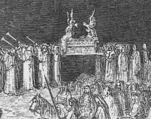
Ark of Covenant moved to the battlefield –
Part of a drawing by Gustav Dore (French artist, 1832-1883)
After the Ark of Covenant was in Ashdod and caused damages to their temple, the Philistines moved it to Gath (1 Samuel 5:8): “They sent therefore and gathered all the lords of the Philistines unto them, and said, What shall we do with the ark of the God of Israel? And they answered, Let the ark of the God of Israel be carried about unto Gath. And they carried the ark of the God of Israel about thither”.
While it was stationed in Gath, the Ark continued to bring destruction, so it was moved once again to Ekron (1 Samuel 5:9-10): “And it was so, that, after they had carried it about, the hand of the LORD was against the city with a very great destruction: and he smote the men of the city, both small and great, and they had emerods in their secret parts. Therefore they sent the ark of God to Ekron…”. Eventually the Philistines understood that the ark of the Covenant is dangerous to them, so they returned it back to the Israelites.
After the return of the ark, the Israelites prevailed (1 Samuel 7:13-14): “So the Philistines were subdued, and they came no more into the coast of Israel: and the hand of the LORD was against the Philistines all the days of Samuel. And the cities which the Philistines had taken from Israel were restored to Israel, from Ekron even unto Gath; and the coasts thereof did Israel deliver out of the hands of the Philistines”. Notice the Bible tells us that Gath was originally Israelite, and was taken by the Philistines.
-
Goliath
Gath was the hometown of Goliath – the fabled champion of the Philistines who fought David in the valley of Elah, as described in details in the Bible (1 Samuel 17).
The battle happened at about 1010 BC ,after the Philistines attempted to push along the valley of Elah towards the heart of the kingdom of Judah. King Saul and his Israelite army blocked them, facing the Philistines at Sochoh in the center of the valley.
The Philistine giant, Goliath of the city Gath, challenged the Israelites to fight him in order to determine the fate of the battle, but no Israelite soldier dared to take this challenge. Only the young David, an untrained shepherd who came to assist his elder brothers, bravely volunteered for this fight. To summarize the battle: David, with just 5 stones and a sling, faced the giant Goliath which was heavily armed. The young shepherd, drawing his strength from his faith in God, shot the rock into the center of the giant’s forehead, knocking him down, then took his sword and cut of his head. Israel wins, chasing the Philistines out of the valley of Elah.
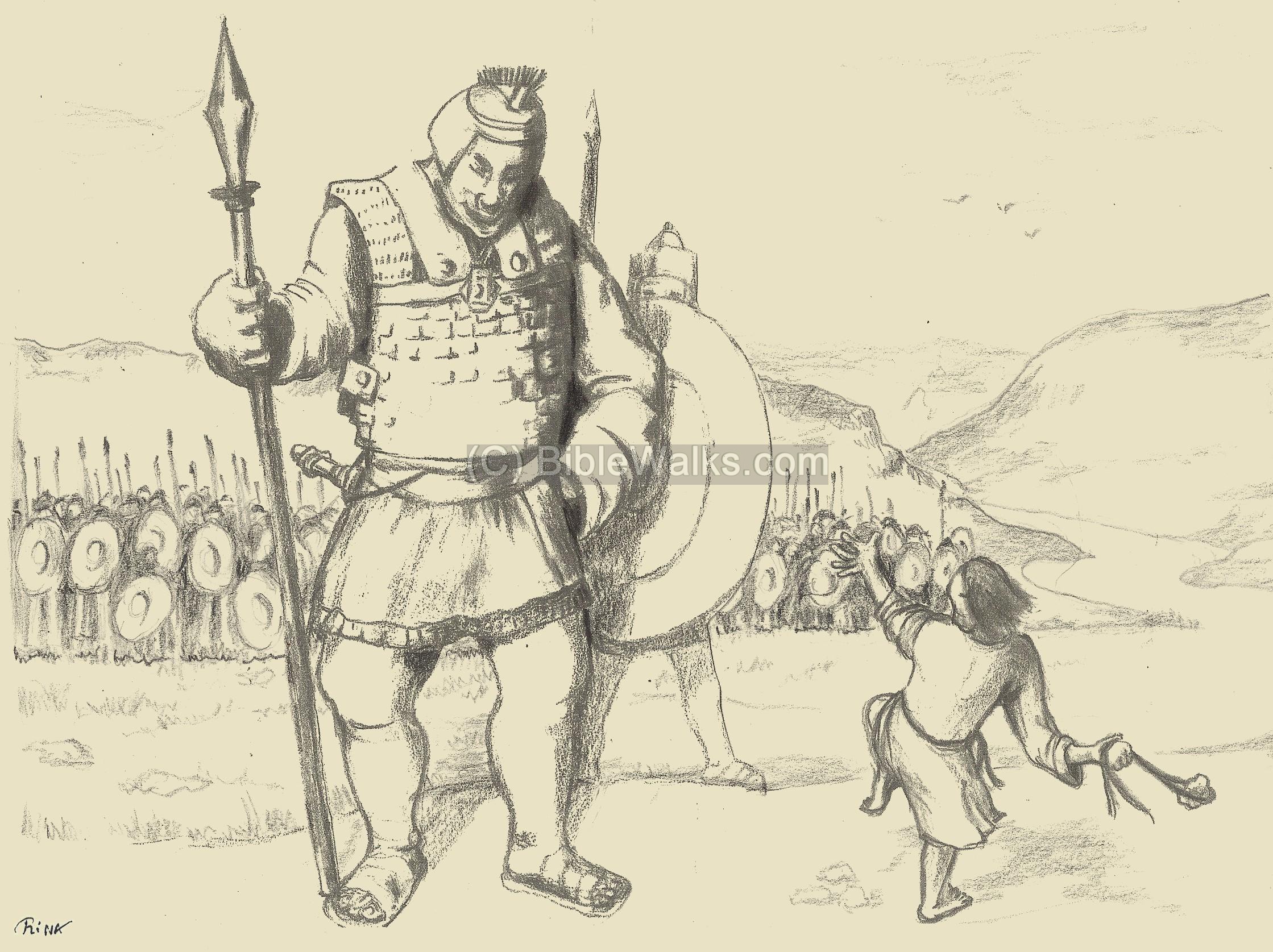
Young David – vs – the giant Goliath
A fragment of a clay bowl was found in the excavations. It was dated to 950 BC – about the time of David.
The sherd has a size of 10 x 5 cm , with ancient alphabetic letters incised on it. The words spell two non-Semitic names ‘lwt and wlt, which are etymologically close to the name Goliath, but not the actual name of the giant as was initially broadcasted in the media.
The excavations have not yet found evidence of a destruction during the times of David, although the Bible wrote twice about the defeat of the Philistines (2 Samuel 5:25): “And David did so, as the LORD had commanded him; and smote the Philistines from Geba until thou come to Gazer.” and (2 Samuel 8:1): “And after this it came to pass that David smote the Philistines, and subdued them: and David took Methegammah out of the hand of the Philistines.”.
-
Israelite Kingdom – Iron Age II B ( 925-700 BC)
The Philistines continued to be the arch enemies of the Israelites. Uzziah, King of Judah, was credited with the battles with the Philistines and the push towards the coastal cities (1 Chronicles 26:6): “And he went forth and warred against the Philistines, and brake down the wall of Gath, and the wall of Jabneh, and the wall of Ashdod, and built cities about Ashdod, and among the Philistines”.
The Iron Age IIa city continued to thrive as the leading city in the area until a massive destruction in the late 9th century, around 830 BC.
Aram-Damascus, headed by Hazael, invaded in that time and conquered Gath. This is told by the Biblical accounts (2 Kings 8:12, 12:18-19, 13:3+7; Amos 1:3) and (2 Kings 10: 32):
“In those days the LORD began to cut Israel short: and Hazael smote them in all the coasts of Israel;”.
In one of these intrusions the city of Gath was captured and destroyed (2 Kings 12:17):
“Then Hazael king of Syria went up, and fought against Gath, and took it: and Hazael set his face to go up to Jerusalem”. Jehoash king of Judea had to give Hazael a fortune in order to relieve the pressure off Jerusalem (2 King 12:18):
“And Jehoash king of Judah took all the hallowed things that Jehoshaphat, and Jehoram, and Ahaziah, his fathers, kings of Judah, had dedicated, and his own hallowed things, and all the gold that was found in the treasures of the house of the LORD, and in the king’s house, and sent it to Hazael king of Syria: and he went away from Jerusalem”.
A trench , 2km long, 3-5m deep and 8-10m wide, was found along 2km around the western, southern and eastern sides of the city. It was identified as a siege moat, which encircled the city in order to prevent the defenders to escape the city, similar to the walls around Masada. It is located at an average distance of ~600m from the center of the mound. The moat was cut during the Iron Age IIa period (1000-800 BC), and the soil was dumped on one side of the trench. It was later covered at about the same time. It was suggested that the siege moat was constructed by Hazael of Aram, who captured the city. The archaeologists identified this destruction in layer 6.
A powerful earthquake devastated the city, as witnessed in the excavations. This may have been the earthquake of ~759 BC, as testified by the prophets Amos, Zechariah, Micah and possibly Isaiah. (Amos 1:1): ” “The words of Amos, who was among the herdmen of Tekoa, which he saw concerning Israel in the days of Uzziah king of Judah, and in the days of Jeroboam the son of Joash king of Israel, two years before the earthquake”. The quake measuring 8.2 on the Richer scale, with an epicenter in Lebanon, was the most powerful in the Holy Land in the past 4,000 years [8].
-
Assyrians (732-632 BC) and Babylonians (632 -586 BC)
The Assyrian empire conquered the North Kingdom of Israel in 732 BC, destroying most of the cities and villages in the land. The Assyrian King Tiglath-Pileser III annexed the area (as per 2 Kings 15: 29):
“In the days of Pekah king of Israel came Tiglathpileser king of Assyria, and took … and carried them captive to Assyria”).
The Assyrians reached the south coast and made the Philistine cities – from Jaffa to Raphia – a kingdom subdued and raising taxes to the Assyrians.
Due to the heavy taxes, the cities of the Levant attempted to free themselves from the Assyrians. They were assisted by the Egyptians, the empire from the south. Ashdod’s king, Azuri, stopped to deliver tributes to Assyria. The Assyrians replaced him with his brother, but a commoner named Yamani took the power and refused to pay.
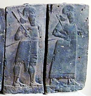
Orthostat relief – depicting soldiers from different orders of the Assyrian Army, in procession;
basalt; Hadatu Tiglath-Pileser III period (744-727BC)
[Istanbul Archaeological museum]
Sargon II ‘s intrusion: The Assyrian King Sargon II (722 – 705 BC) came to settle the Philistine mutiny. The first step was to handle the allies of the Philistines: in 720 BC Sargon fought the Egyptian army in Raphia, south of Gaza, and managed to repel them back to the south. The next step was to handle the rebel Philistines: in 712 Sargon’s army crushed their cities (Gibton, Ekron and Gath), then took Ashdod and its port city Ashdod-Yam (Ashdudimmu).
Prophet Isaiah writes about this campaign, when Tartan – chief officer of Sargon – conquered Ashdod and its seaport (Isaiah 20 1): “In the year that Tartan came unto Ashdod, (when Sargon the king of Assyria sent him,) and fought against Ashdod, and took it”. Isaiah’s prophecy was backed by Sargon’s own accounts of the events, as inscribed in his palace of Khorsabad (discovered by P. E. Botta in 1845). One fragment described the mutiny and specifically mentioned Ashdudimmu (Ashdod-Maritime): “Ashdod, Gath, Ashdudimmu, I besieged, I conquered”.
After the Sargon II destruction, the Assyrians deported some of the population, replacing them with newcomers. Probably at this time the Judeans replaced the Philistines in Gath. After Sargon’s destruction, Gath was not listed again among the Philistine cities.
Sennacherib’s intrusion (701 BC): Following the death of the Assyrian King Sargon II, the Judean King Hezekiah mutinied against the Assyrians, joining other cities in the area in another attempt to free themselves from the Assyrian conquest. Two Philistine cities joined Hezekiah’s mutiny: Ashkelon and Ekron. Hezekiah crushed the other Philistine cities that refused to join the mutiny (2 Kings 18:8): “He smote the Philistines, even unto Gaza, and the borders thereof, from the tower of the watchmen to the fenced city”.
During the late 8th century there is evidence of a Judahite presence in Gath. A number of LMLK seals (“L’melekh” – “belonging to the king”) were found in the excavations, which are dated to Hezekiah’s times. Therefore, it can be assumed that Hezekiah conquered Gath as preparations to the Assyrian intrusion.
The Assyrian army came in 701, led by Sennacherib, son of Sargon II (2 Chronicles 32 1): “After these things, and the establishment thereof, Sennacherib king of Assyria came, and entered into Judah, and encamped against the fenced cities, and thought to win them for himself”. The Assyrians first handled the rebelling Philistine cities and then confronted the Egyptian army that supported the mutiny.
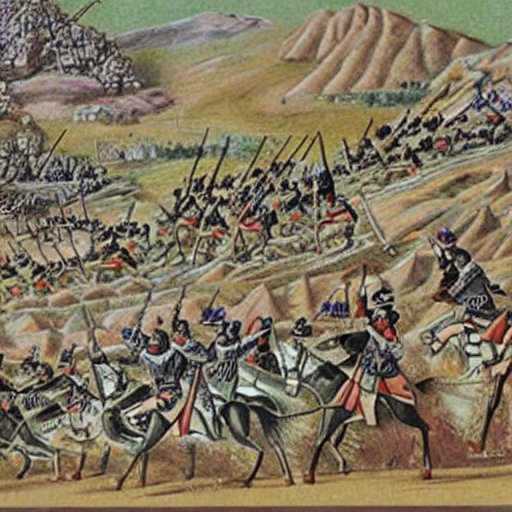
Assyrian forces attacking – AI generated by Stable Diffusion
According to an Assyrian stele found in the ruins of the royal palace of Nineveh, Sennacherib conquered 46 cities in Judea, probably including their newly fortified city in Gath:
“And as to Hezekiah, the Judaean, who had not submitted to my yoke, 46 of his strongholds, fortified cities, and smaller cities of their environs without number, with the onset of battering rams and the attack of engines, mines, breaches, and axes (?), I besieged, I captured. 200,150 people, small and great, male and female, horses, mules, asses, camels, oxen, and sheep without number I brought out of their midst and counted as booty. He himself I shut up like a caged bird in Jerusalem, his capital city; I erected beleaguering works against him, and turned back by command every one who came out of his city gate”.
Prophet Micah, who prophesied at that time, wrote that Gath was gone (Micah 1:10): “Declare ye it not at Gath, weep ye not at all”.
Jerusalem was spared from destruction and the Assyrians retreated (2 Chronicles 31 22): “Thus the LORD saved Hezekiah and the inhabitants of Jerusalem from the hand of Sennacherib the king of Assyria, and from the hand of all other, and guided them on every side”.
Jerusalem fell only 114 years later. Judea continued to pay heavy taxes to the Assyrian conquerors.
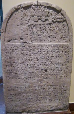
Sennacherib’s stele with relief and inscription; Nineveh;
limestone [Istanbul Archaeological Museum]
Following the Assyrian destruction, the city was left in ruins until the Persian period.
-
Persian, Hellenistic, Roman, Byzantine (6th century BC – 6th century AD)
During the Persian time there was some presence in the city, although limited in comparison to the Iron Age II. Remains of a temple was found by Bliss and Macalister.
Throughout the following Hellenistic, Roman/Byzantine periods there was limited activity on the site. The north-south Roman road passed on the east side of the city.
The city appears on the Madaba map as “Saphitha”. The map was discovered in 1884 in a Byzantine church in Madaba, Jordan. The ancient map, laid out in the 6th century AD on the floor of the church, shows the map of the Holy Land, with dozens of illustrated sites. The icon shows a door between two towers, with the Greek word above it: “СΑΦΙθΑ” (Saphitha).
A new Roman village was established in Kh. es Safi, 1km north east of the site, which reduced the settlement on the hill.
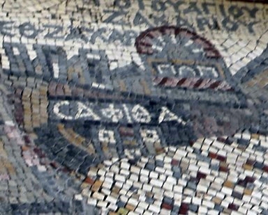
p/o Madaba map
-
Crusaders (1099-1260 AD)
The Crusaders arrived from Europe to the Holy Land in order to liberate the Holy Land and free Jerusalem. They accomplished the mission in 1099, and established the Crusader Kingdom.
A small castle and village were built in the 12th century (1142) on the mound. The builder of the castle was the King of Jerusalem Fulk V of Anjou (reigned 1131-1143), who built a number of fortresses in the area (such as Migdal Afek and Yavne). The castle was named the Blanche Garde (French: “white fortress”). It was constructed to protect the road from Ashkelon, and the coastal area, to Jerusalem. The French name Blanche Garde was based on the white cliffs that surround the site, which also was the base of the Arabic name (Safi= shining).
Blanche Garde was captured by the forces of Saladin in 1187 AD following the Crusaders defeat in the battle of the horns of Hittim. The castle was destroyed, but rebuilt by Richard of England in 1192, only to be destroyed again in the following year.
Few remains were found, since the stones of the castle were dismantled to be reused in the houses of the modern Arab village, and in the construction of the Wely. The base of a circular structure was found in area ‘F’ near the summit. The Crusaders quarried some of the stones to build the castle from the sides of the cliffs.
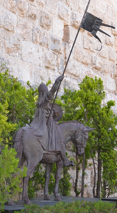
Statue of a Muslim warrior – near David Tower, Jerusalem
-
Ottoman period (1516-1918)
An Arab village was built on the ruins of the Crusaders village and fortress. The village was constructed on the northern side of the center of the site. The villagers reused the ancient stones and added sun-dried mud bricks to build their houses.
Conder and Kitchener surveyed this area during the Survey of Western Palestine (SWP) of the PEF in 1873. A section of the survey’s map, part of Sheet 16, is shown here, with Tell es Safi in the lower center.
Their report was (p. 415-416 on Volume 2, sheet XVI) is as follows:
“Tell es Safi -This important site is identified by Dr. Porter with the ancient Gath. Gath would seem to have been known to Eusebius and Jerome, ‘as in the 5th mile from Eleutheropolis (Beit Ji brin) to those going to Diospolis’ (‘Onomasticon’, s. V. Gath.) The vicinity to the Valley of Elah may also be urged in favour of the site, and the fact that Josephus gives Gath to the tribe of Dan (Ant. v. i, 22). The Gathrimmon of Dan (Joshua x.xi. 24) may perhaps be the same place, as the title may be rendered ‘High Gath.’ The modern hovels are of mud; the well in the valley to the north is the principal supply of water”.
Other excerpts of their evaluation of the identity of the site with Gath includes this description:
“The magnificent natural site of Tell el Safieh, standing above the broad valley, which seems undoubtedly the ^’alley of Elah, and presenting on the north and west a white precipice of many hundred feet, must have made this place one of importance in all ages. In its mounds, excavation might be productive of good results, but even of the fortress of Blanche Garde no trace seems to remain beyond the scarped side of the rock upon the east, evidently artificial. There are many large caves in the northern precipice, and excavations, where grain is now kept. The village at the top is a collection of miserable mud huts, inhabited by insolent peasantry, one of whom I had the satisfaction of sending bound to Hebron for threatening me with a stone”.
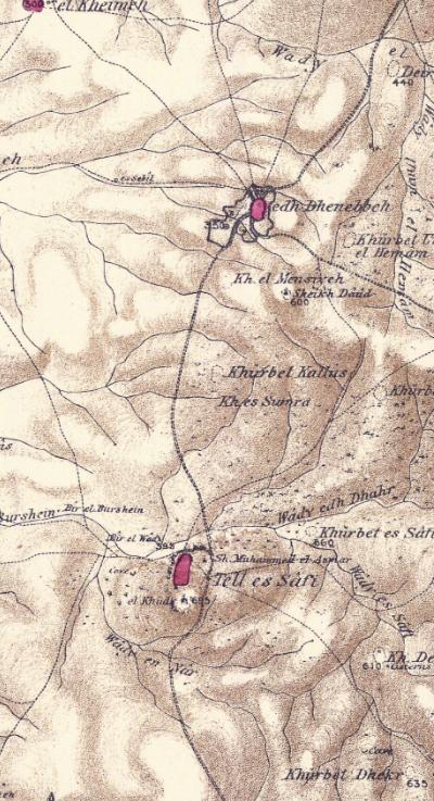
Part of map Sheet 16 of Survey of Western Palestine,
by Conder and Kitchener, 1872-1877.
(Published 1880, reprinted by LifeintheHolyLand.com)
The archaeological review in section B in their report appears on page 440:
“Tell es Safi This important site was known by its present name in the twelfth century. In 1144 AD the fortress of Blanche Garde (Alba Specula) was erected here by King Fulke. It was dismantled by Saladin in 1191. The fort had, according to this account, four towers of equal height. Of this fortress nothing now remains ; the stones appear to have been carried off, and only mounds of rubbish indicate the position of the castle. The modern village occupies the centre of the Tell. The site is naturally of great strength. Precipitous white cliffs, 100 feet high, exist on the north and west, and a low narrow neck of land on the south joins the Tell to the range of low hills of which it forms an advanced bastion. The south portion of the Tell is occupied by a sacred building called el Khudr, possibly on the site of a chapel of St. George. This is the trigonometrical station of the Survey.
The Tell is high and precipitous on the north-east, and the square terrace here indicates the foundations of a fort, but the ruined buildings appeared all to be modern, and no large masonry was observed either by the Survey party in three visits to the spot or by other later travelers. Numerous caves and hollow receptacles, in which grain is stored, exist in the cliff on the north and north-west. A very steep path here descends through the village to the well in the valley called Bir el Wad. This well has a cistern beside it, and a conduit on pointed arches, not apparently ancient. In the side of the trough which exists at the cistern, a pillar-shaft of white marble is built in, having a twisted fluting at the base and vertical flutings above. It is about 1 foot in diameter. The highest part of the Tell is that occupied by the Mukam. The village is lower than this, situate on the brink of the cliff at the north-west corner. It is built of mud, and is of moderate size. The castle on the north-east portion of the Tell would appear to have been about 50 yards square.
– Visited March, 1874; April, 1874; May, 1874″.
-
Israeli Independence war
The village of Tall as-Safi was conquered by the Givati brigade in 1948, and later leveled.
-
Excavations
The site was briefly excavated for a short time – three short seasons in the summer and fall of 1899 – by Bliss and Macalister of the PEF. Fortunately, they were limited in scope as the excavations during that time literally destroyed the archaeological sites and were poorly documented and researched.
Although the PEF team suggested that Gath was located in Tell es-Safi, other early scholars were not convinced. In 1921-2 the famous archaeologist Albright identified Gath in another location – Tel ‘Erani (12 KM south) – as he argued that Tell es-Safi is too close to Ekron. However, excavations there proved he was wrong. Today most scholars agree with the identification in Tell es-Safi.
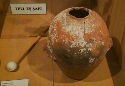
Finding from Bliss and Macalister’s expedition
Courtesy Istanbul Archaeological Museum
Long term excavations started in 1997 after a survey in 1996. The excavations, led by Prof. Aren Maeir of the Bar Ilan university, continue to date to explore the secrets of the city.
* Thanks to Prof. Maeir for is corrections (Mar 25, 2016)
-
Modern Times
The site is a public open area, declared as a national park. It is recommended to visit the site, walk along the prepared path, and enjoy the sights and the excavation areas.
Photos:
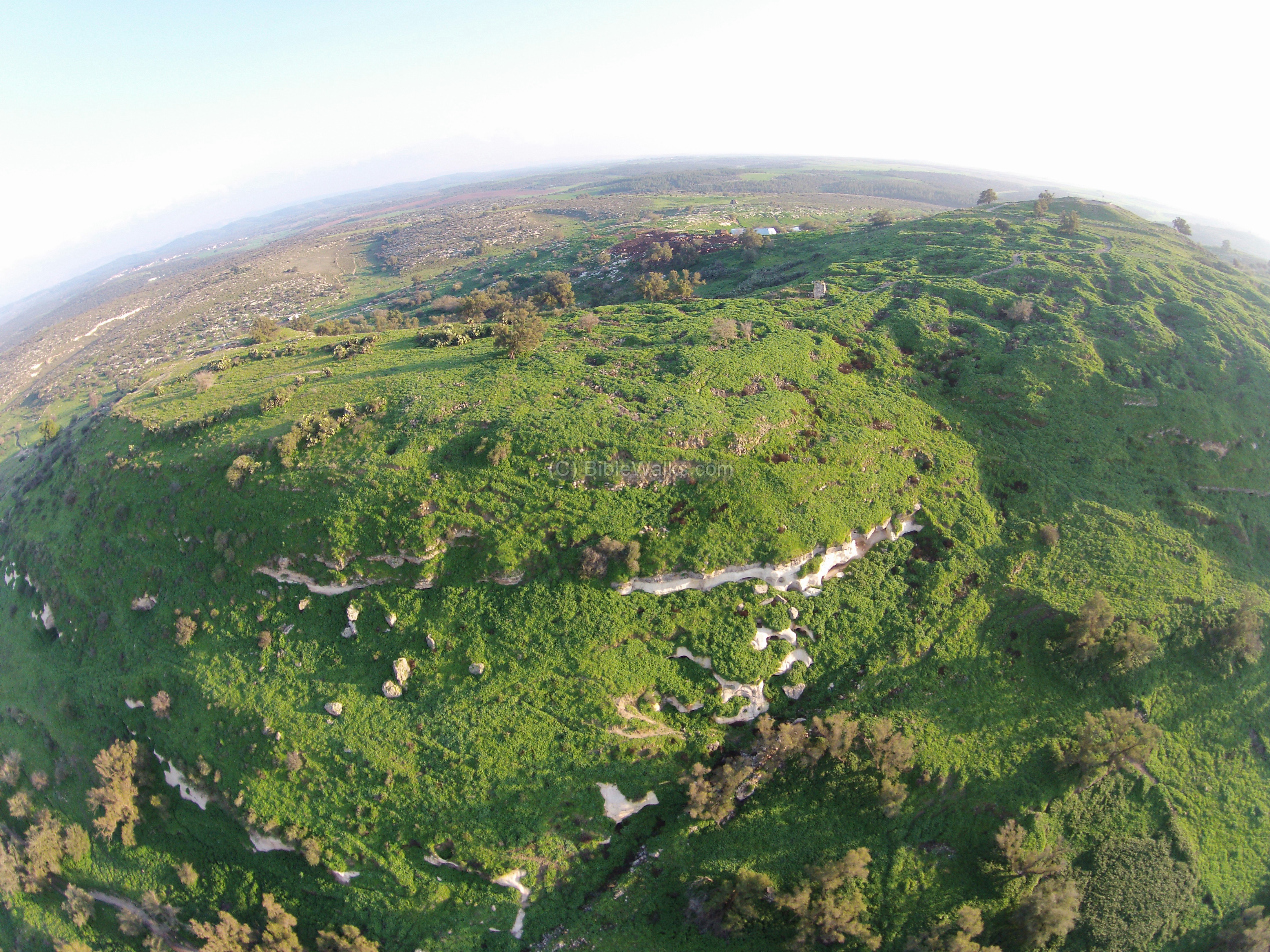
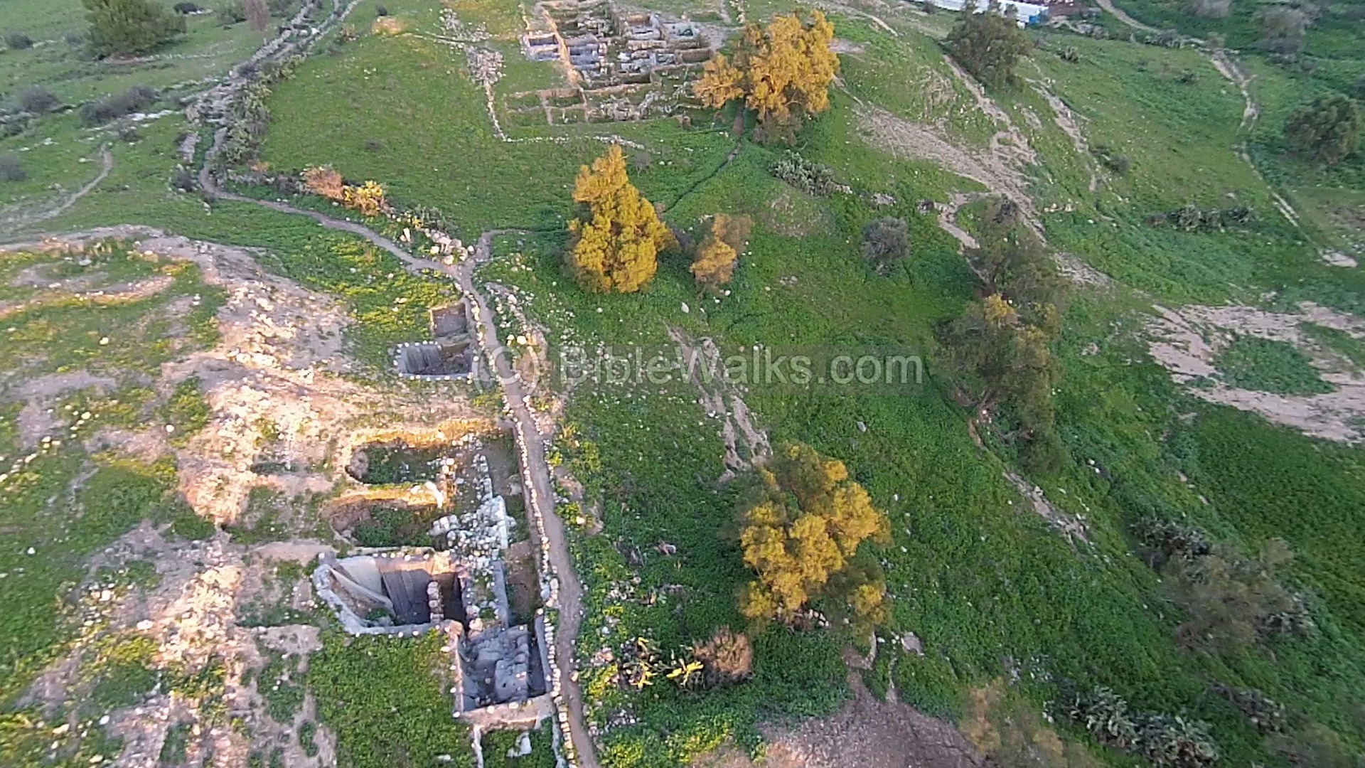
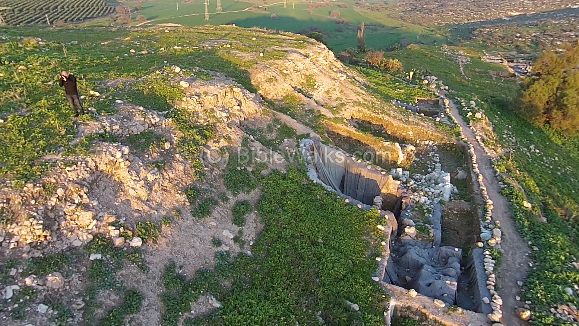
(a) Aerial views
The aerial photo, captured by a drone from the north west side of the mound, shows the major areas of the ruins. The top of the mound is a 500m long oval area, with two knolls on each side – eastern on the left side and a higher western on the right sides. The two knolls are separated by a saddle where the ruins of the Arab village are located.
Click on the photos to view in higher resolution…
The next photo shows the east side of the Tel, with a number of excavation areas – ‘P’, ‘A’, ‘E’. An Iron Age high place was found on the top of the mound, here on the left side of the picture.
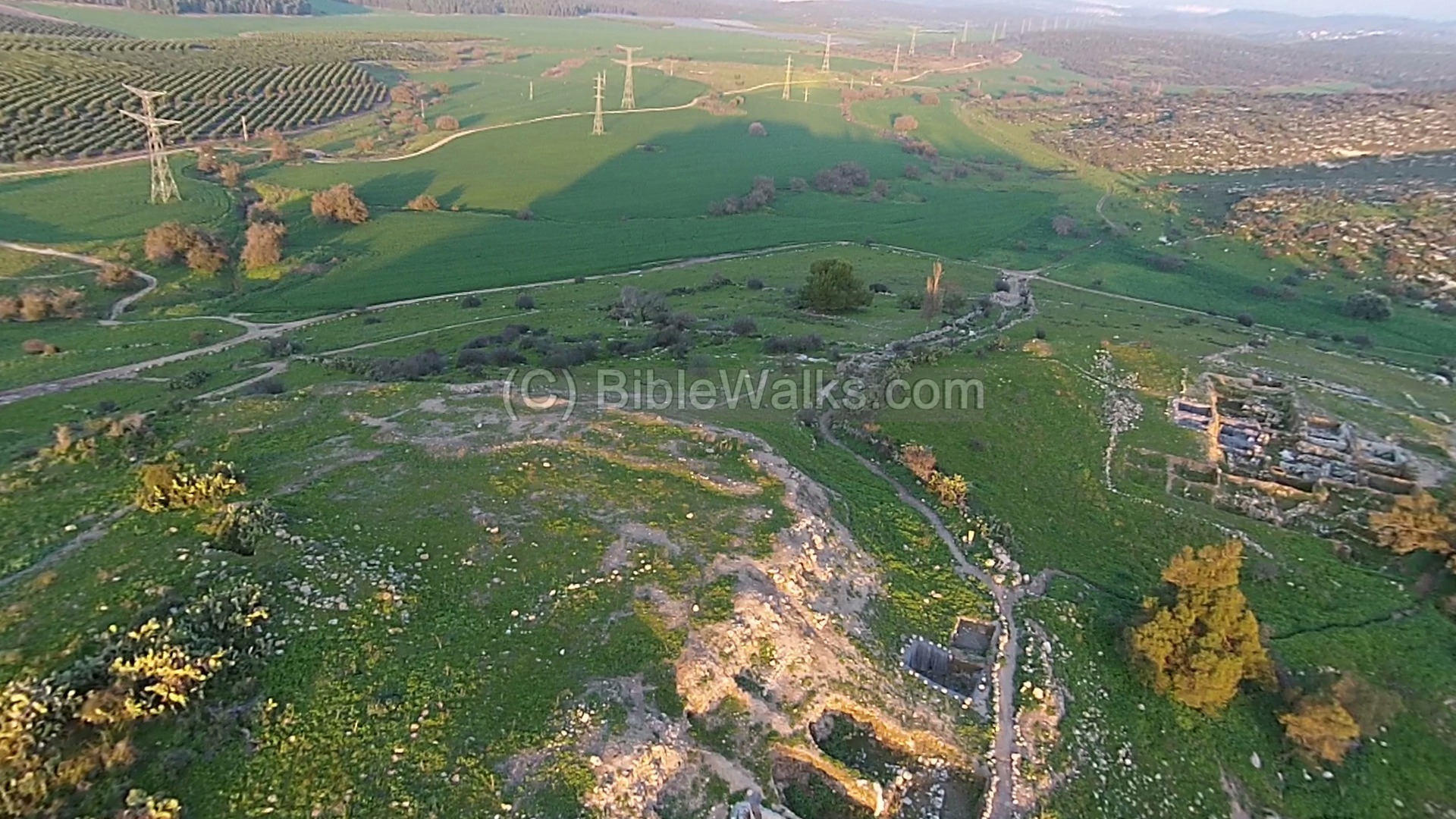
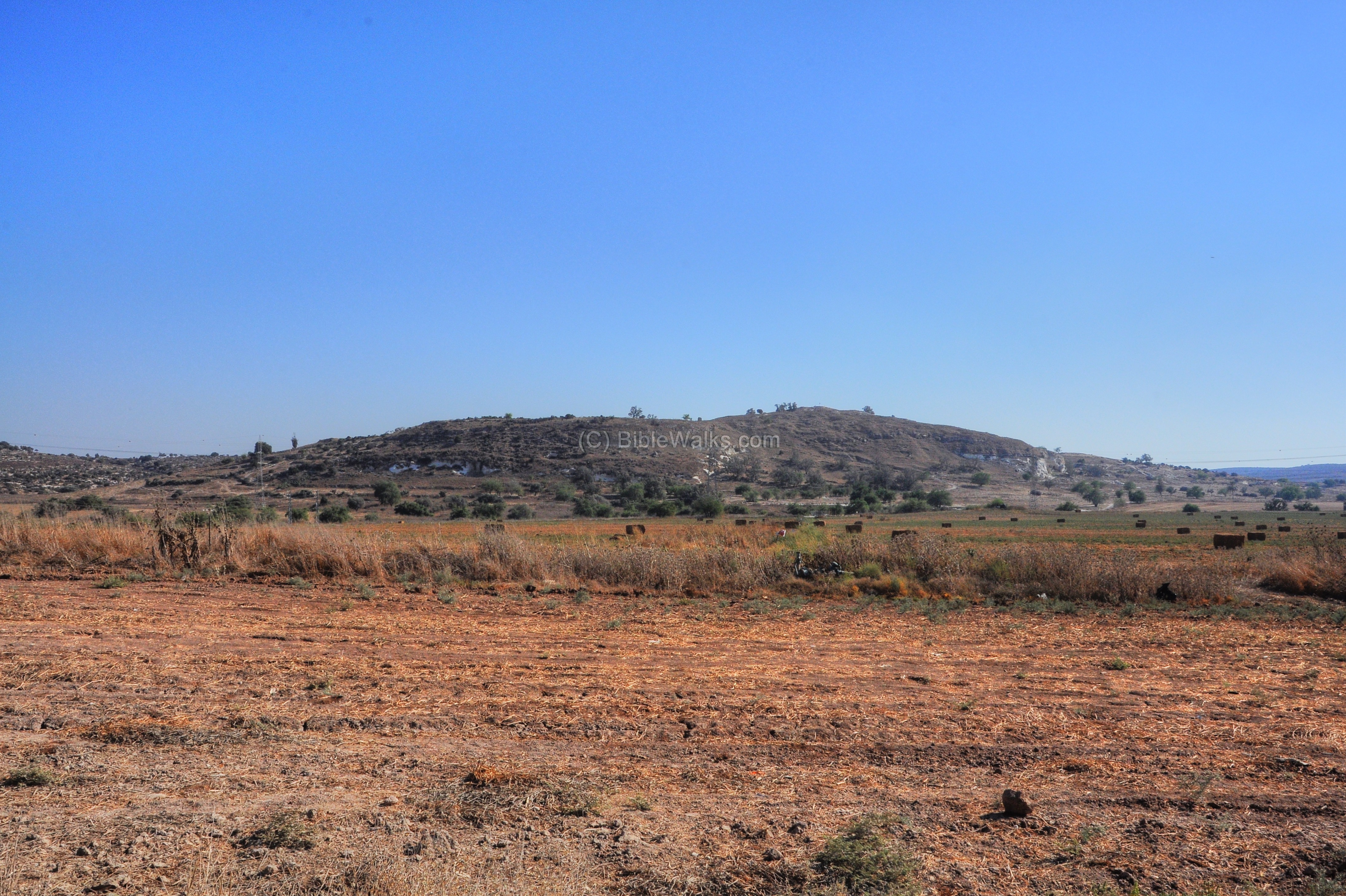
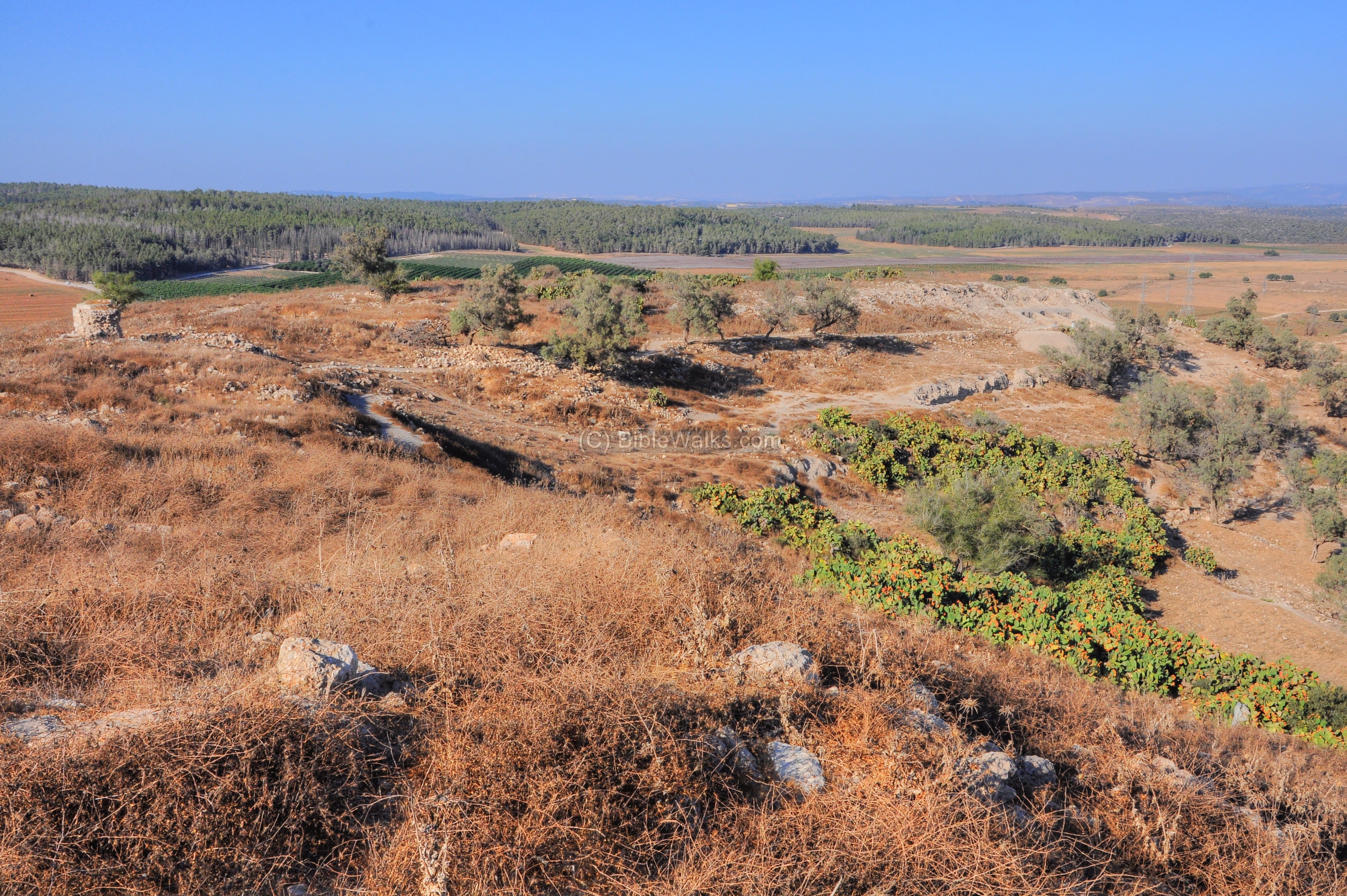
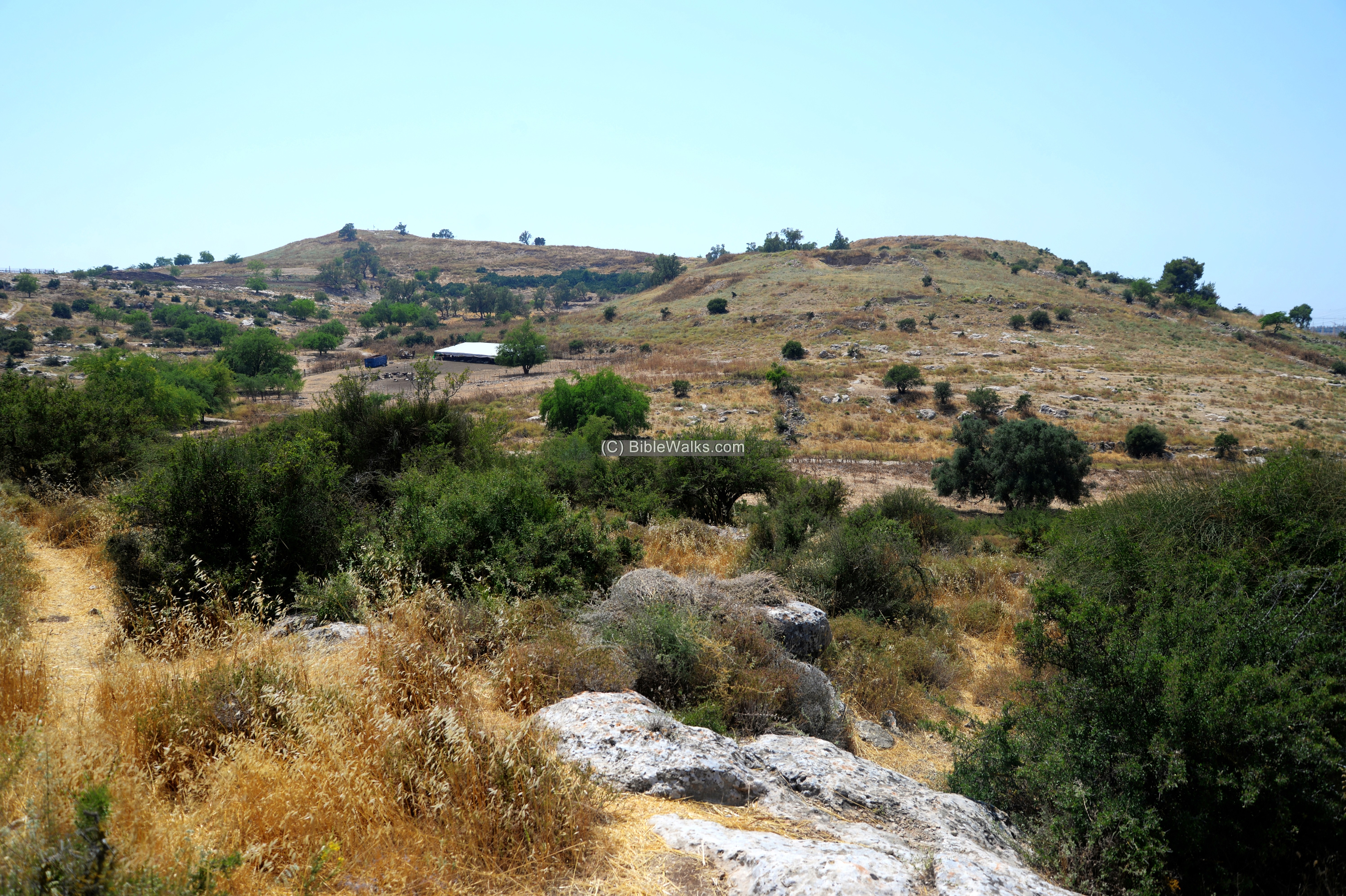
Below is a view of the southern side of Tel Zafit. On the western foothills summit of the “upper city”, seen in the far center area, are areas ‘B’ and ‘F’.
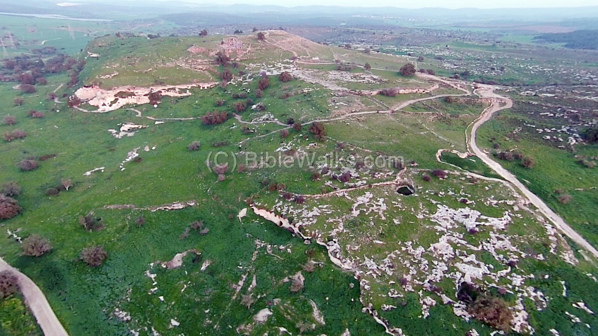
On the plains of the north side of Tel Zafit is area ‘D’. The area is near the stream bed of the Elah Valley, which is seen here behind the high voltage electricity pole.
![]() The following YouTube video shows a flight of a drone over various sites of the mound.
The following YouTube video shows a flight of a drone over various sites of the mound.
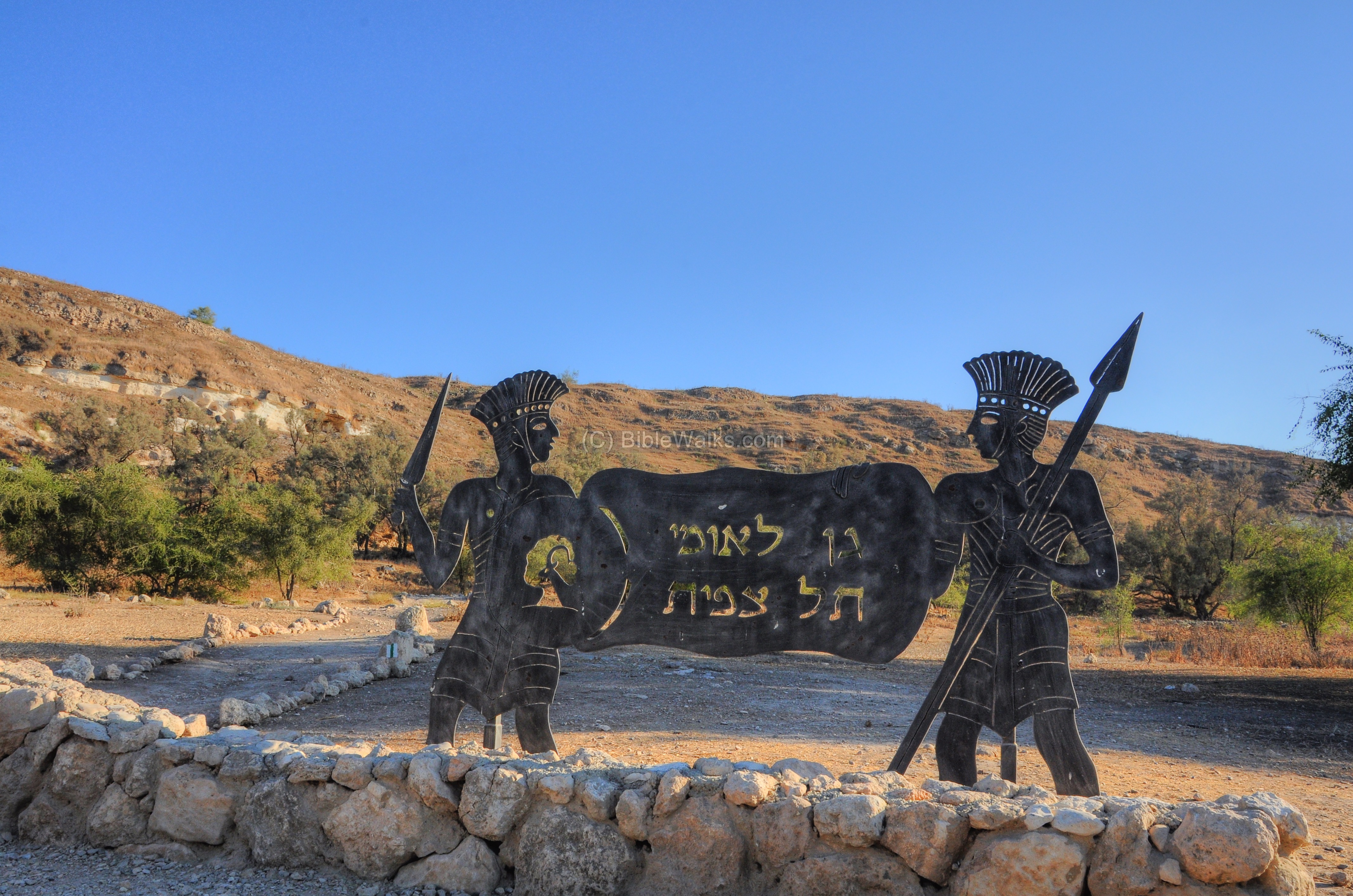
(b) Entrance
Ancient Gath, believed to be located on Tel Zafit (Tell es-Safi), is seen here from the north side. The hill overlooks the valley of the stream of Elah.
The site was declared a national park of Tel Zafit, as written on the sign in the parking area on the north side. A cool sculpture of Philistine warriors holding the sign on both sides stands on the entrance to the park.
To explore the site, take the counter-clockwise trail around the site. The trail leads up from the parking lot towards the white cliffs area (seen here on the right side), then up from the southern (right) side towards the summit of the west hill. From the summit it continues through the center, down towards the east hill, descending back to the northern foothills, and back again to the parking area.
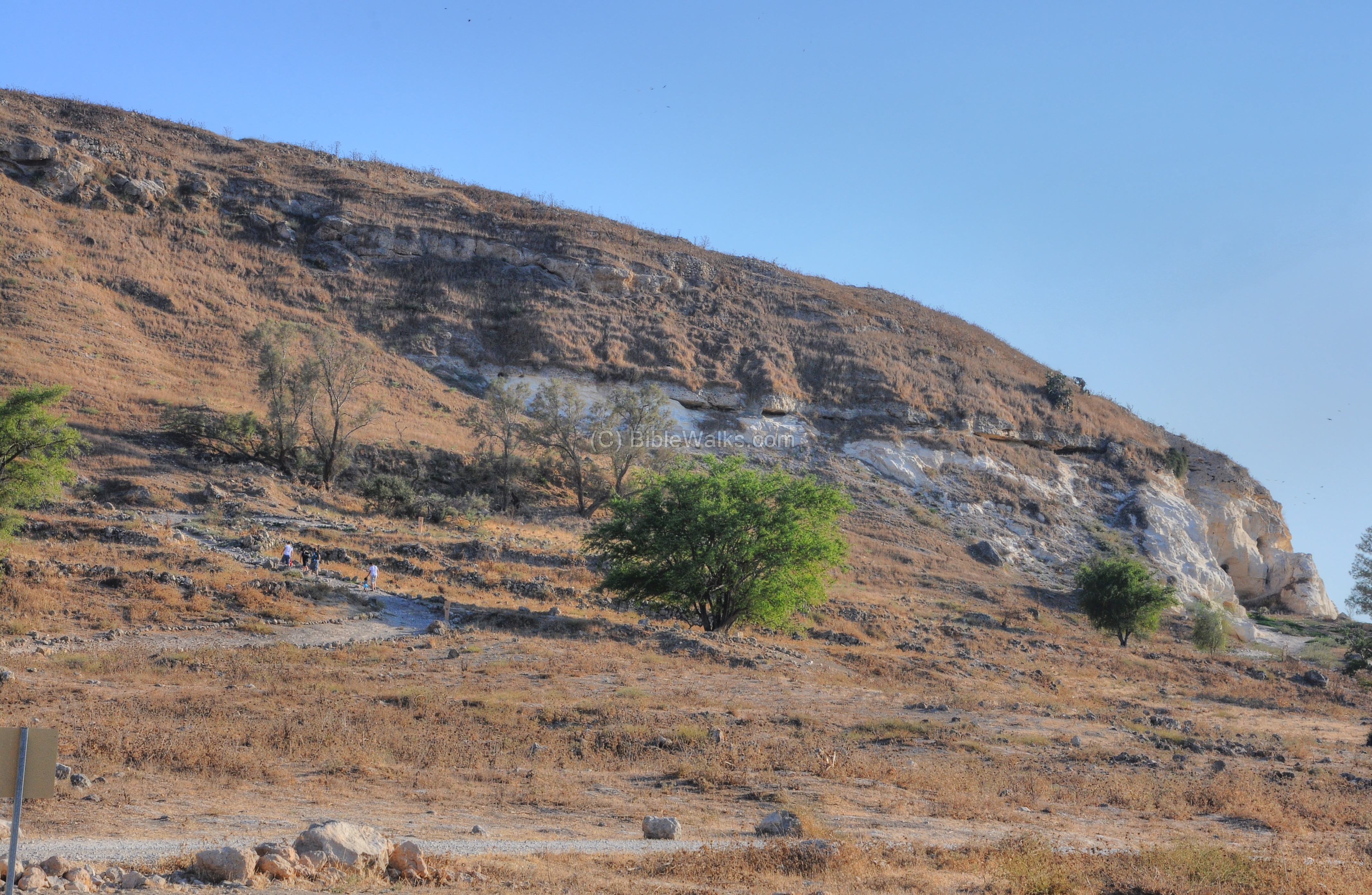
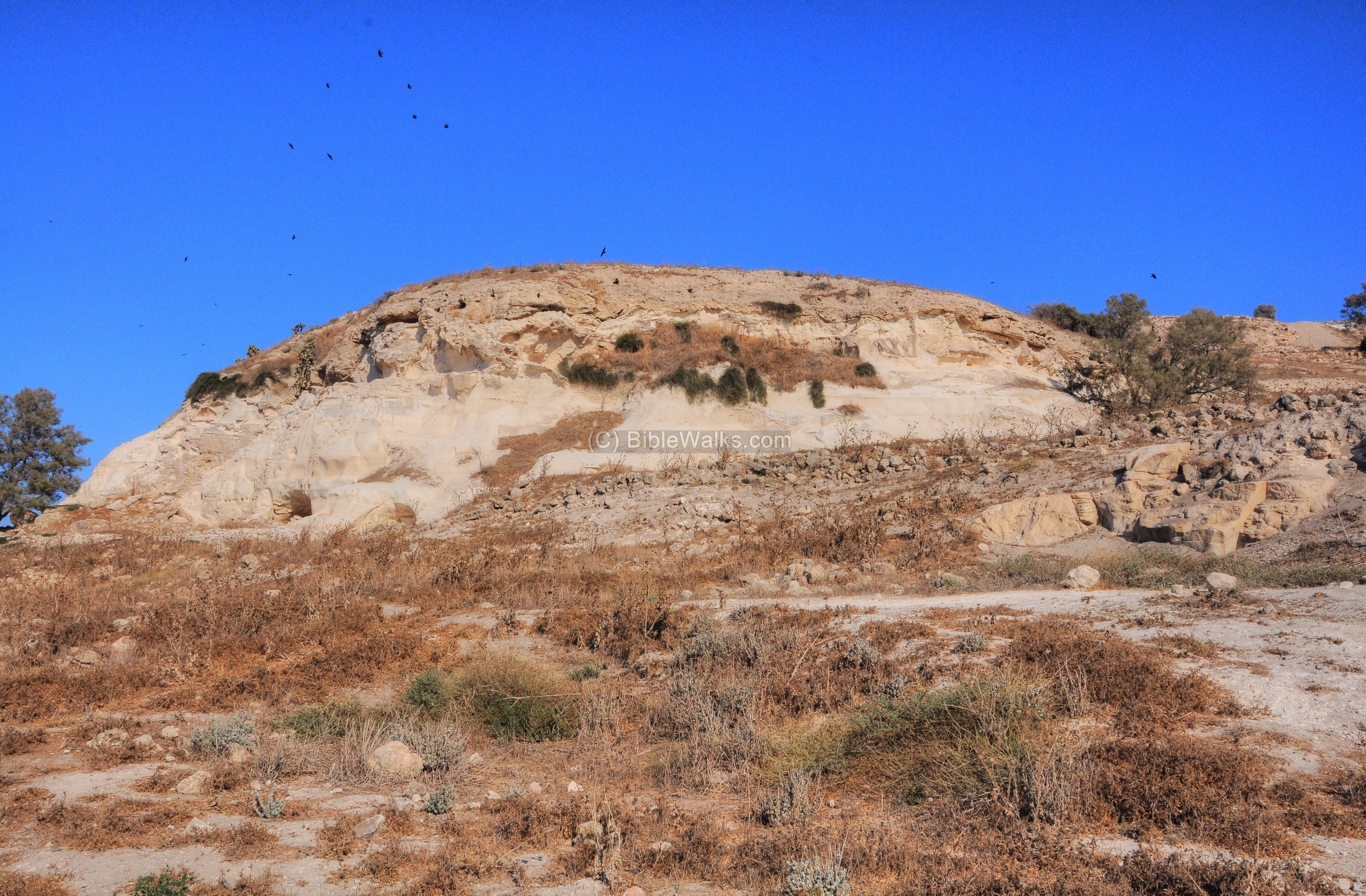
(c) White Cliffs
The hill is primarily composed of white chalk, covered by a thick crust (“Nari”). Caves dot the western and northern area of the hill.
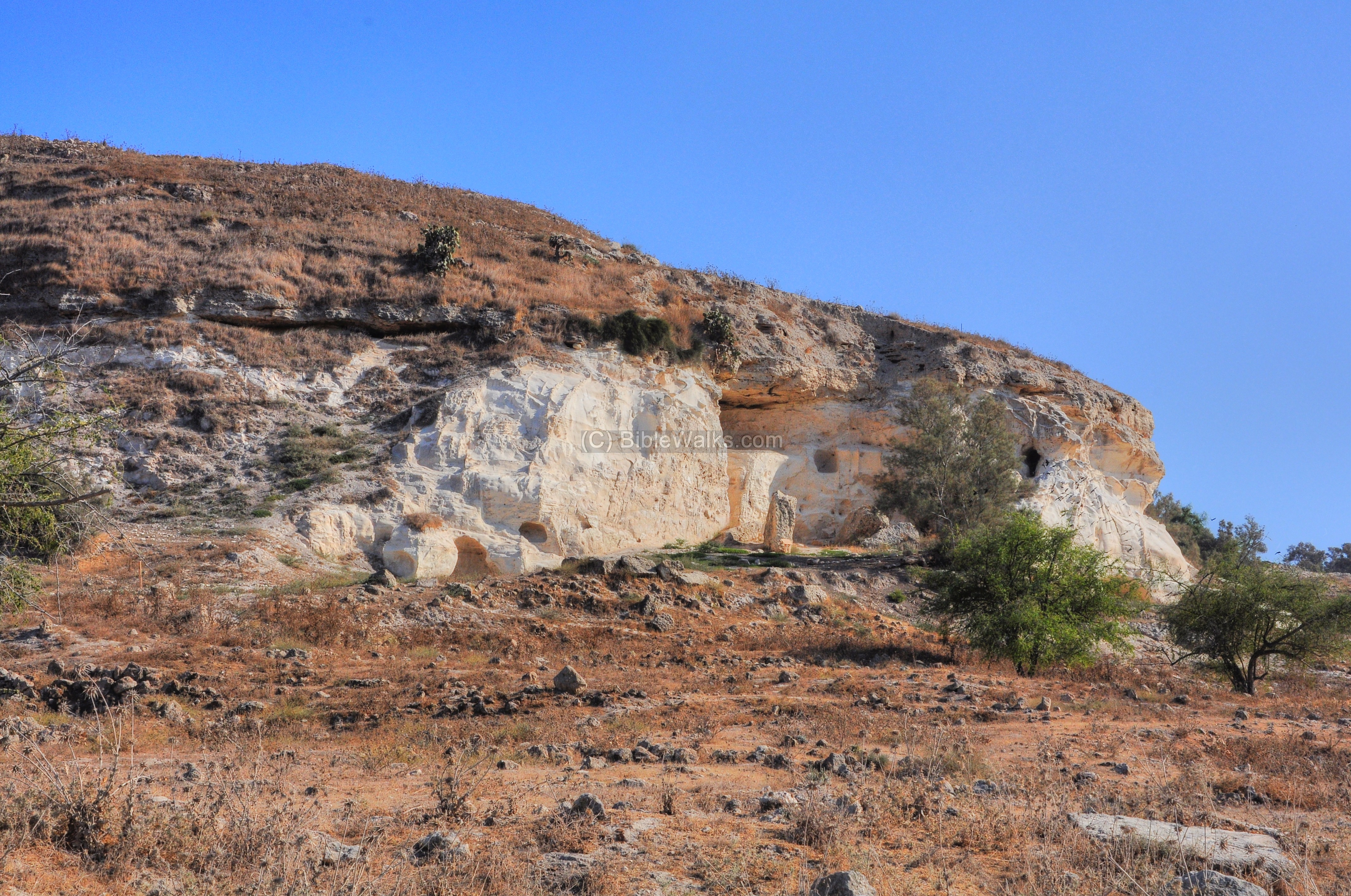
A closer view of the white cliffs is below.
Macalister wrote about the large chamber in 1900 (QA32, p. 30): “A damaged chamber, which serves as vestibule to an enormous room, 60 feet long by 20 feet across (measured by pacing). The height is about 20 feet. With the exception of a chamber at Atraba, which is 75 feet in diameter, this is the largest rock-cut chamber I have as yet found.”.
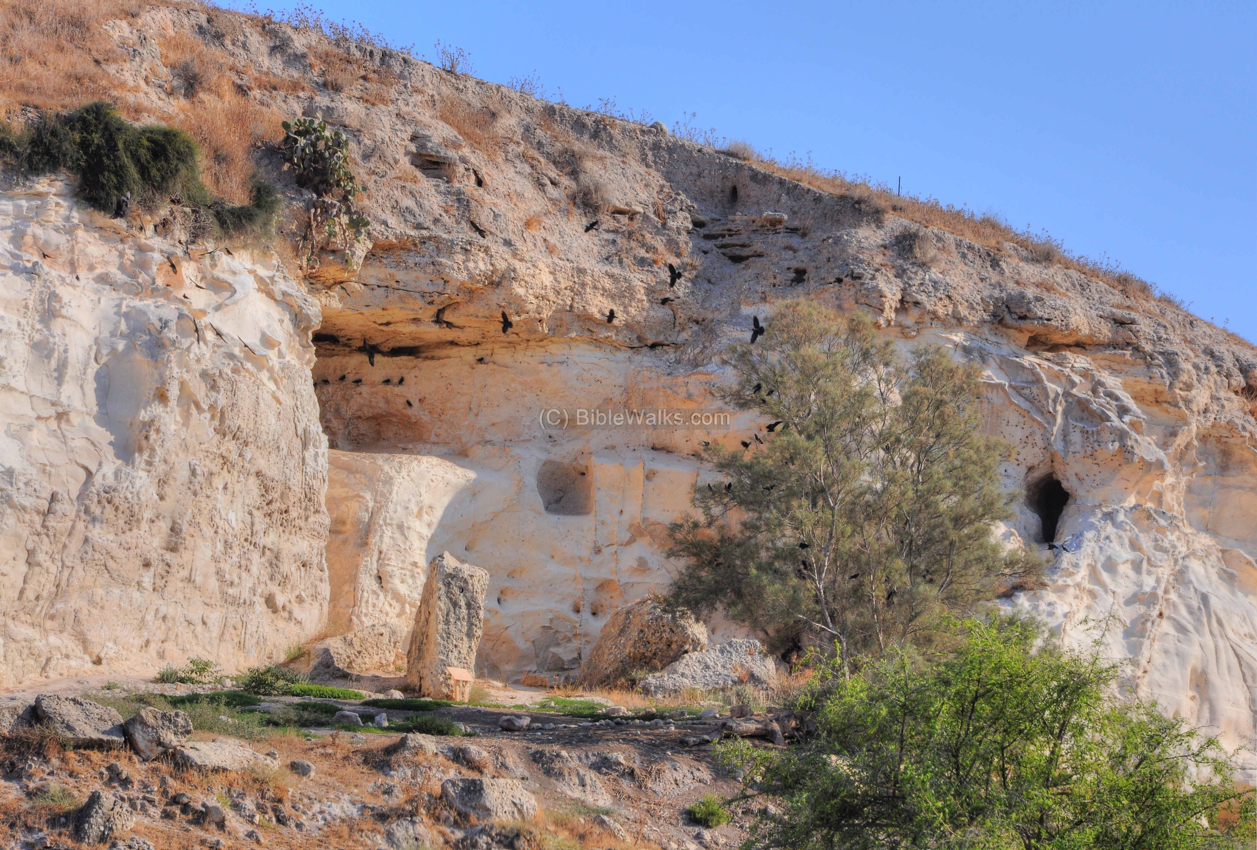
Black crows, of the specie western jackdaw (Corvus Monedula), nest and enjoy the safety of the caves.
The stone was used in ancient times to quarry building stones for the structures. The artificially carved caves were then used for storage of grain and as reservoirs for the water supply.
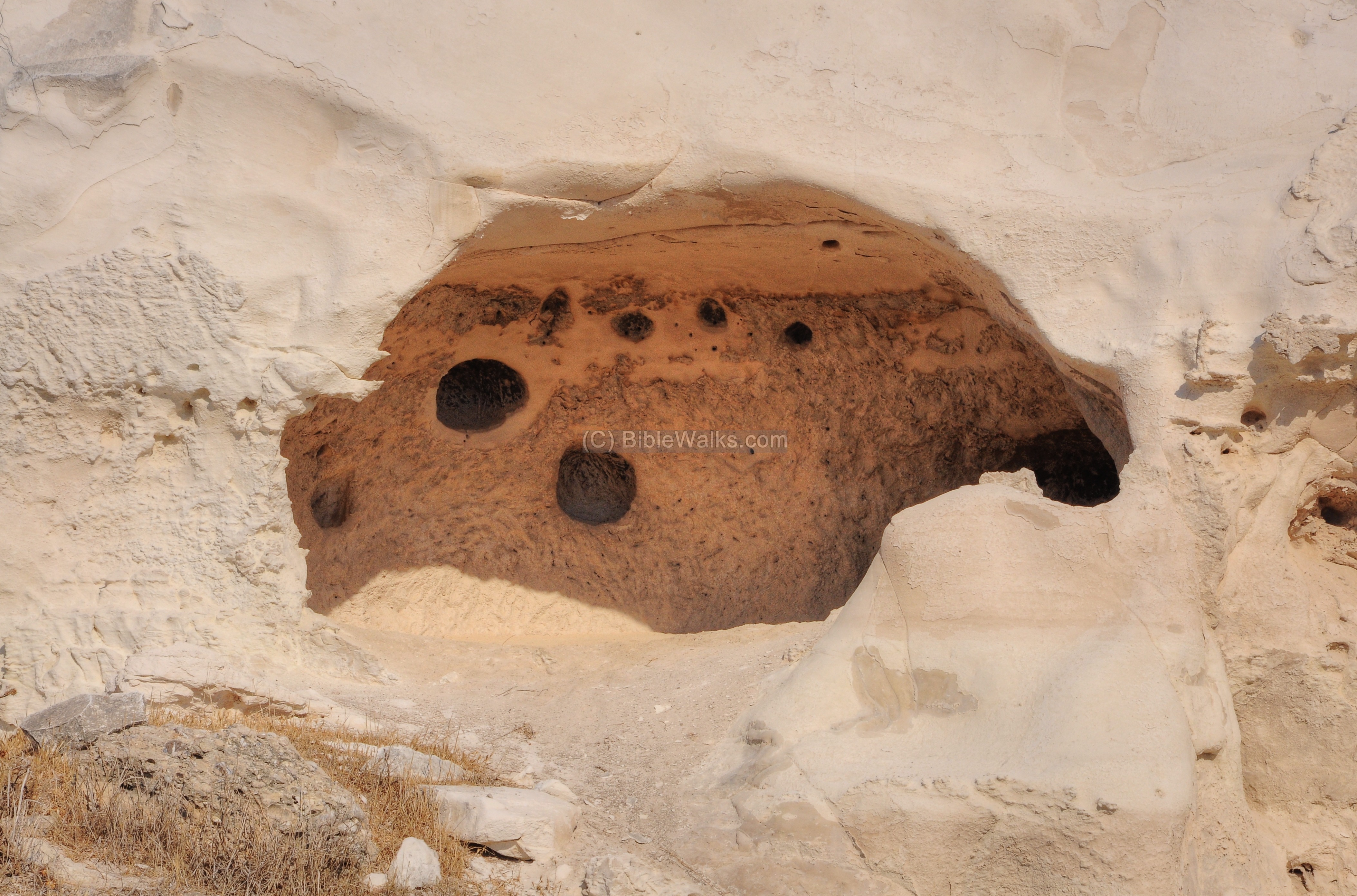
A small columbarium (housing structure for doves and pigeons) was also carved into one of the caves for fresh meat supply.
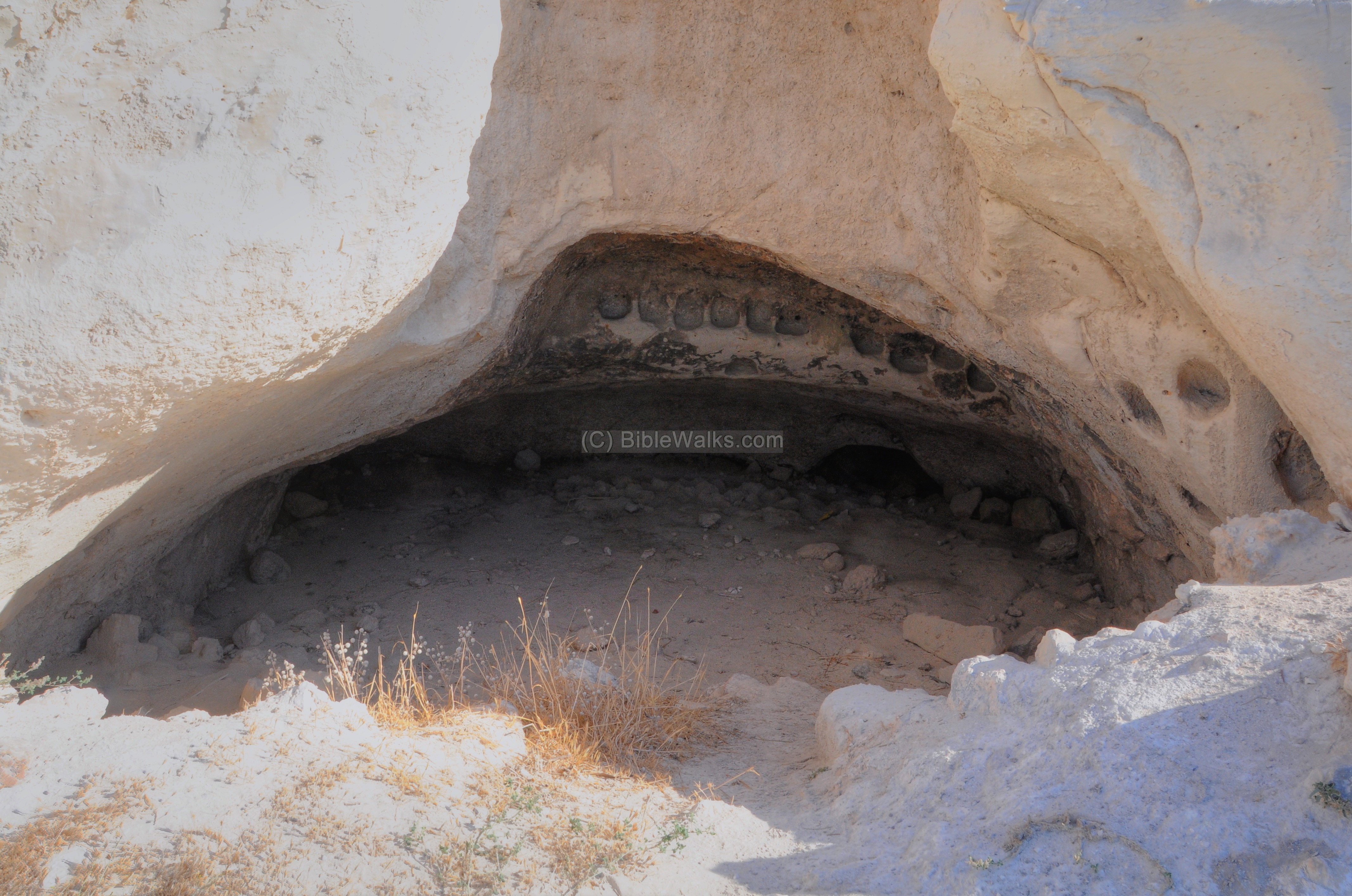
A closer view of the columbarium inside the cave is below. Macalister wrote about this chamber in 1900 (QA32, p. 30): “A dome-shaped columbarium, with three rows of triangular loculi in the walls.”. Apparently, the bottom two floors have collapsed during the years.
Along the path are some interesting elements, such as this dead tree limb.
(d) South
From the white cliffs the train ascends steeply towards the southern hill.
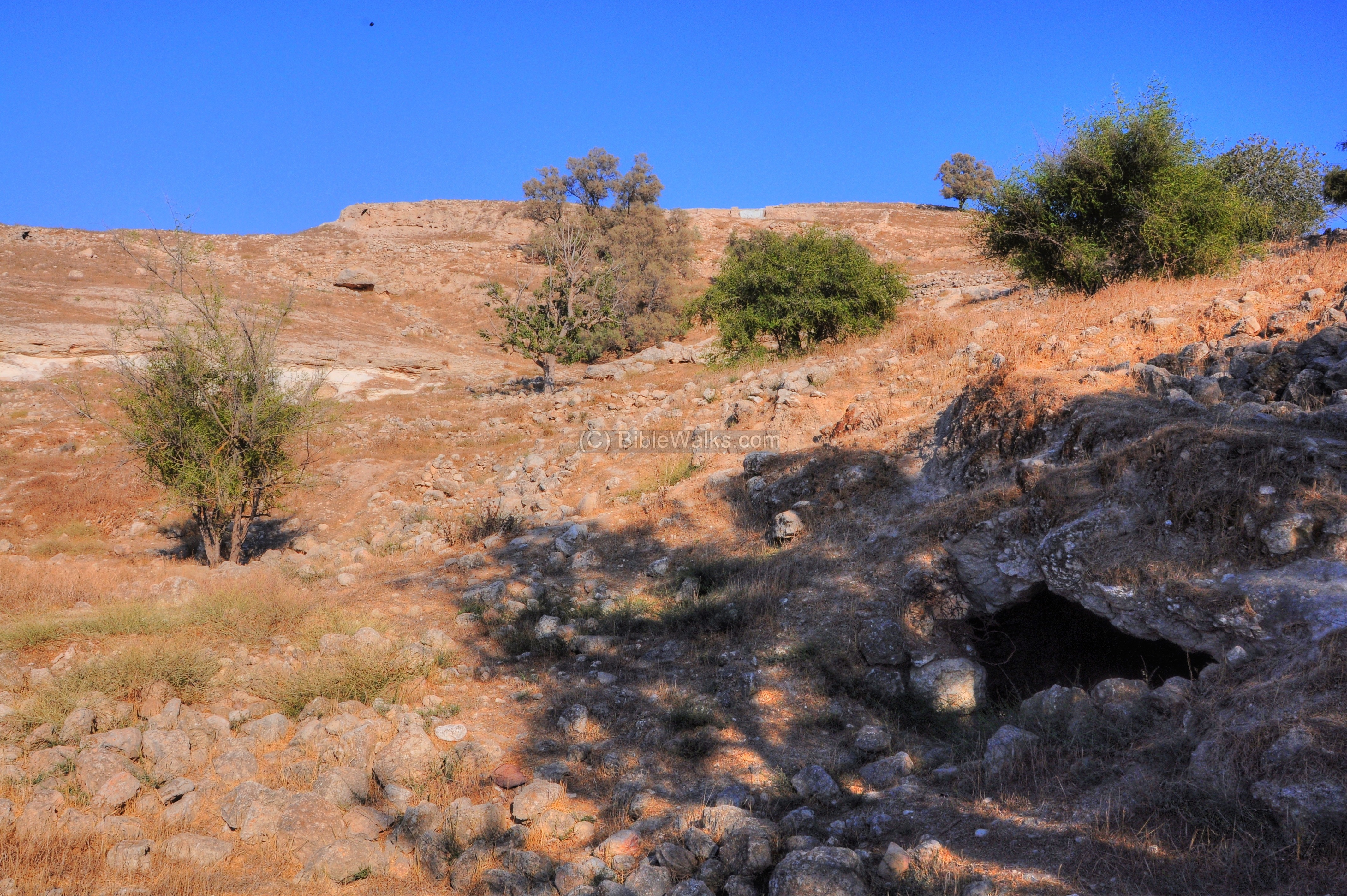
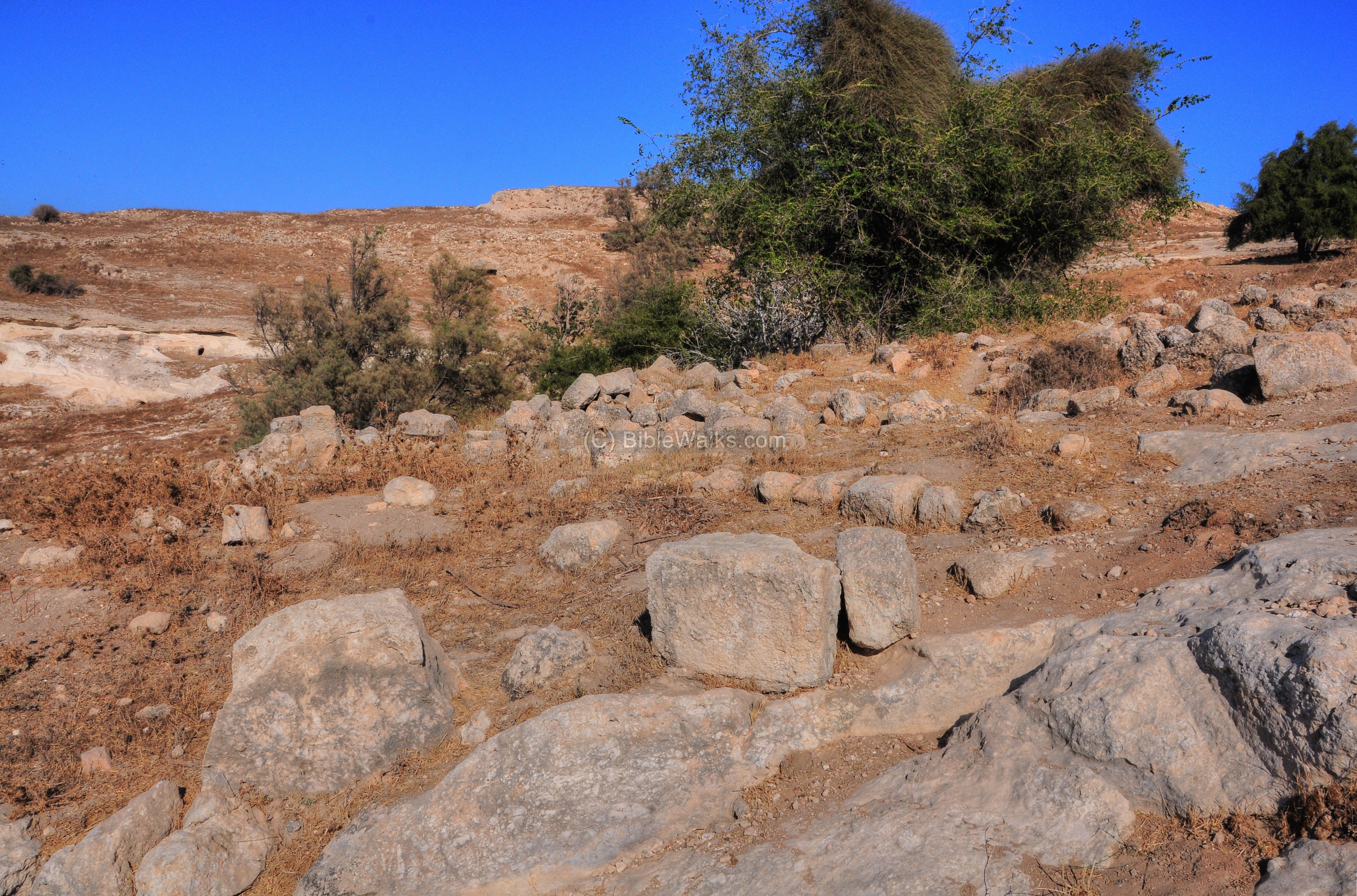
Along the descent are remains of the Arab village, as well as more ancient remains.
Signs along the trail relate the place to the Biblical texts, such as this sign with Ezekiel’s prophecy (25: 15-16) that Israel will prevail against the Philistines: “Thus saith the Lord GOD; Because the Philistines have dealt by revenge, and have taken vengeance with a despiteful heart, to destroy it for the old hatred; Therefore thus saith the Lord GOD; Behold, I will stretch out mine hand upon the Philistines, and I will cut off the Cherethims, and destroy the remnant of the sea coast”.
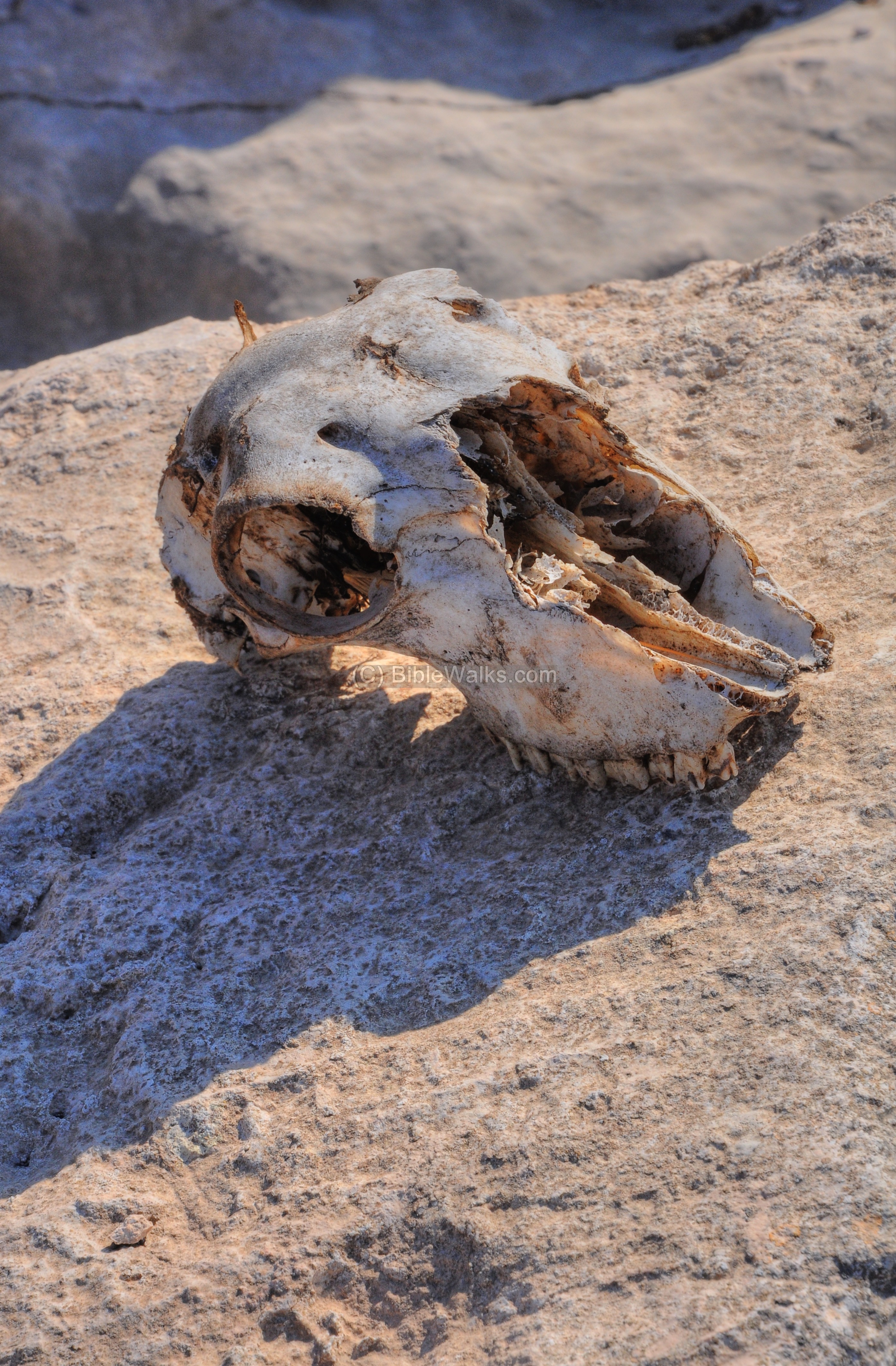
An ancient carved stone, perhaps belonging to the Crusaders castle, is seen along the ascending path:
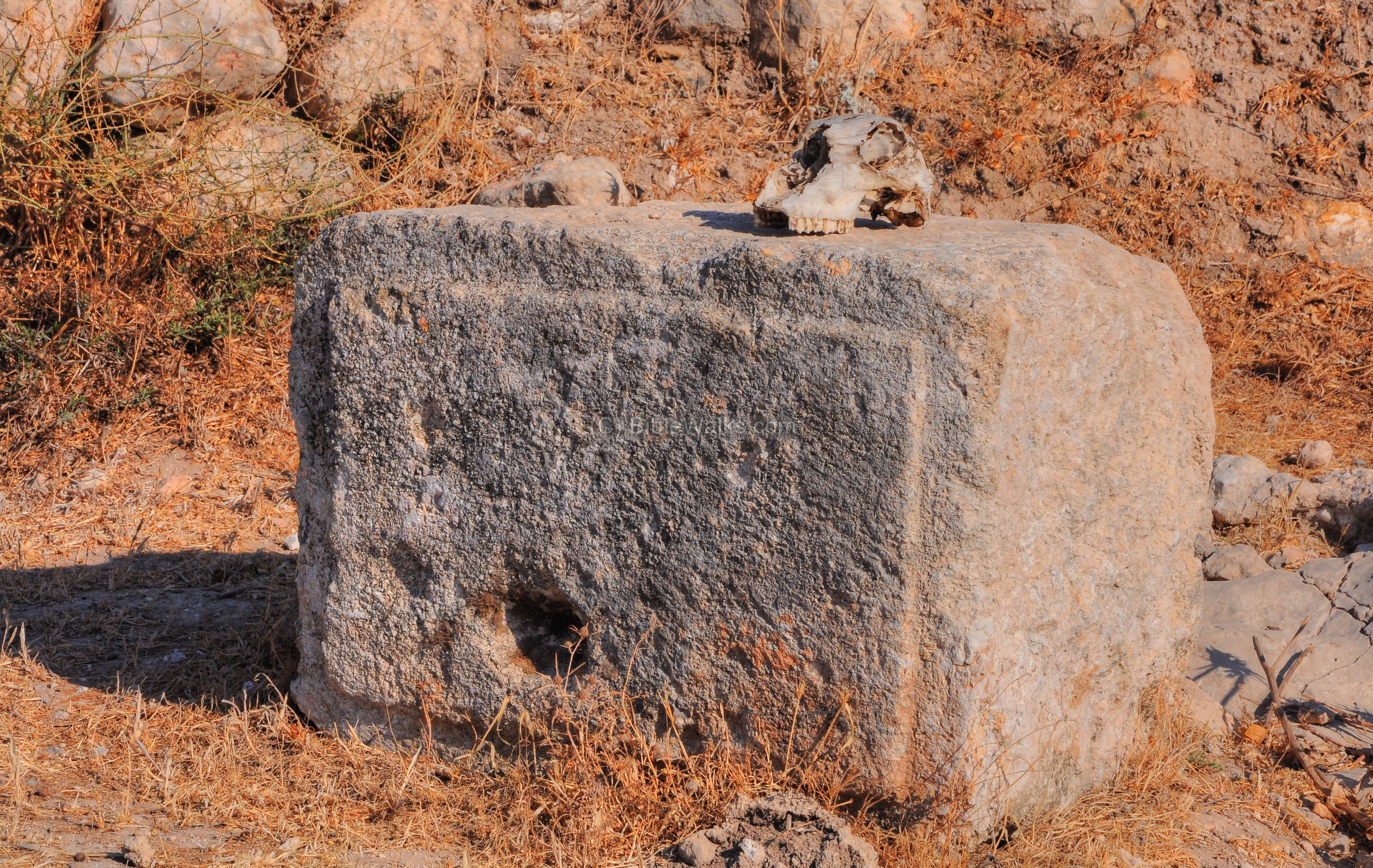
A head skull of a goat (?) lies on the stone…
An Arab graveyard was located on the fringes of the ruined Arab village. Some remains of the tombs are still standing on the hillside.
The next photo shows a view down towards the valley. The electricity production plant is located near the western side of the site.
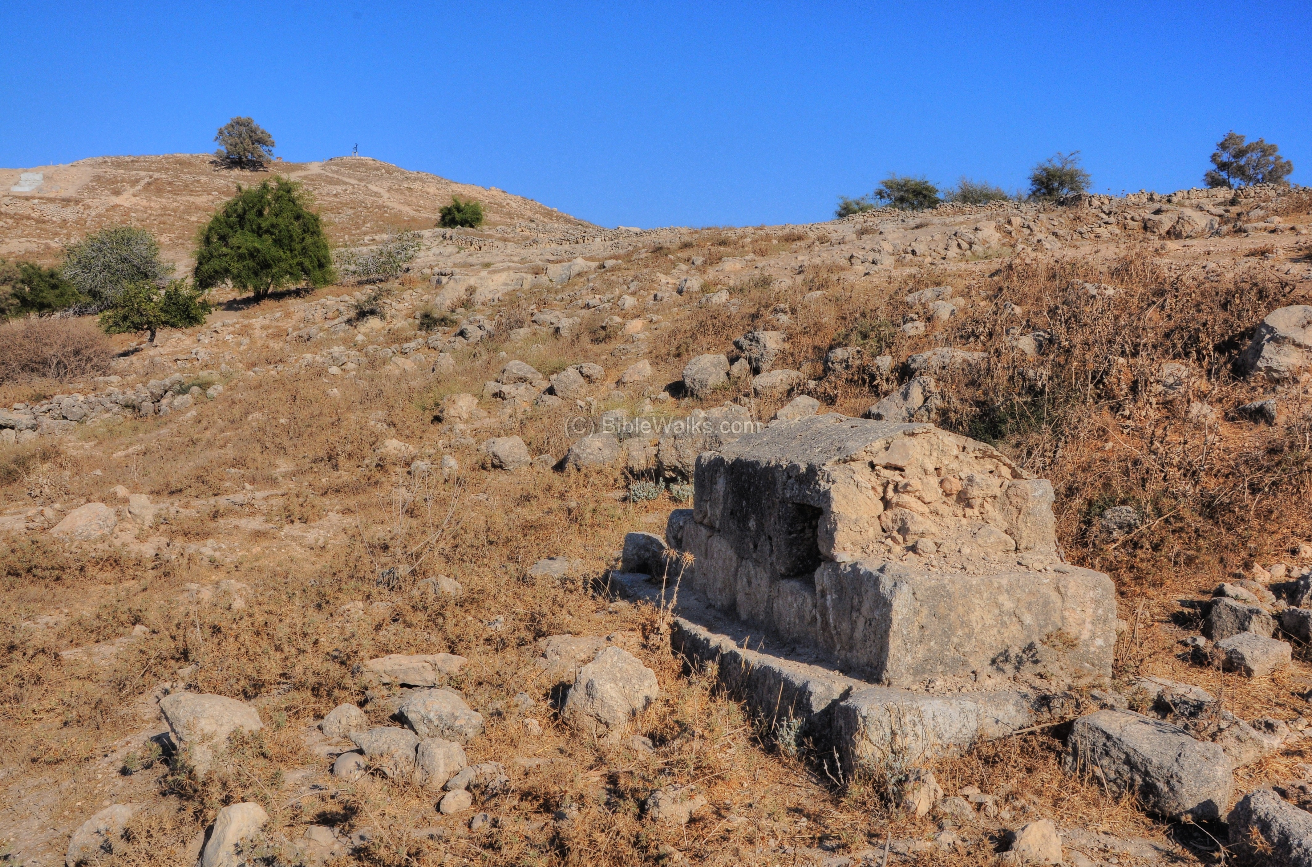
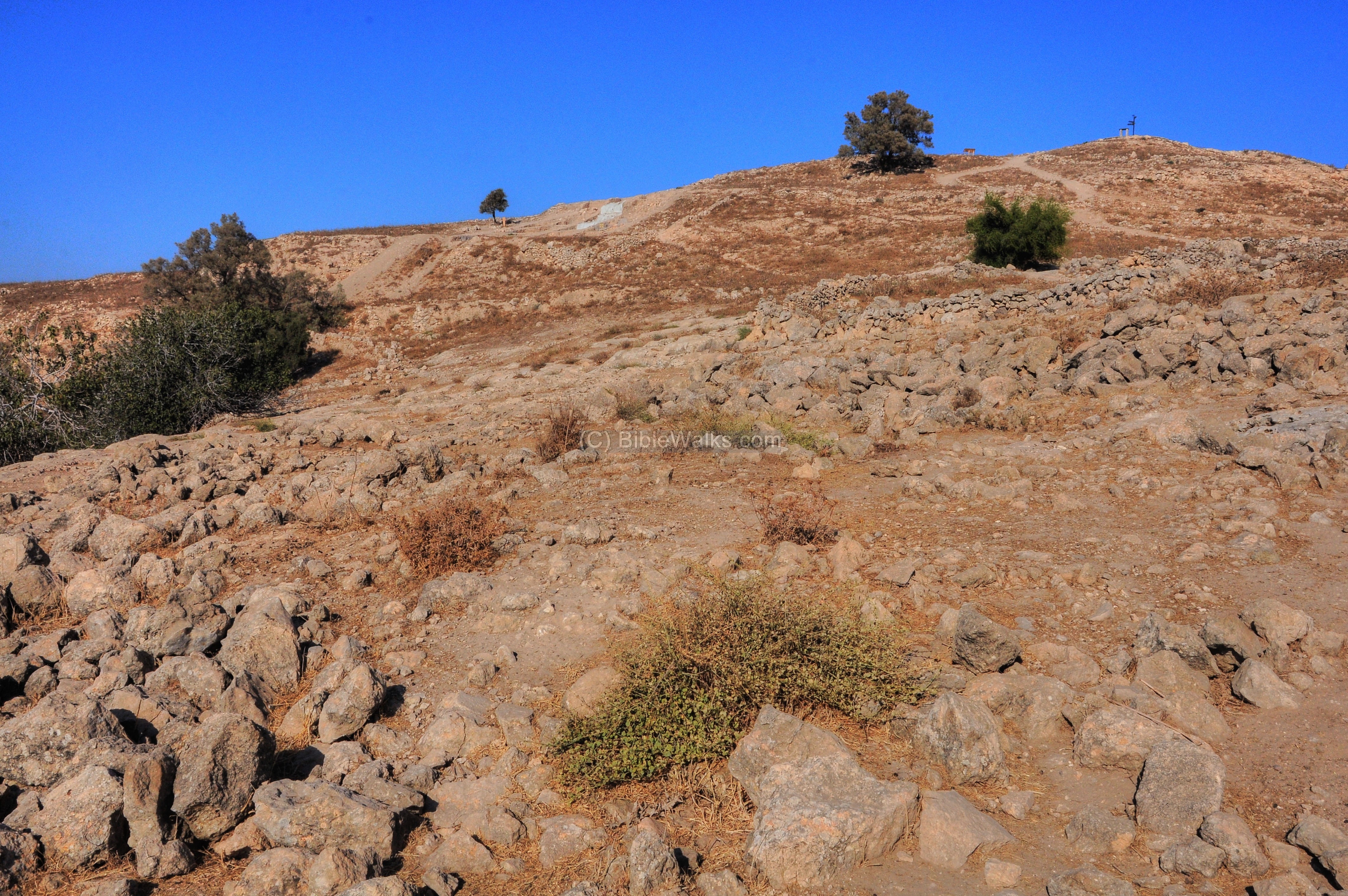
The summit is now seen on the right side of the photo. To the left of the tree, standing near the summit, are the excavation areas ‘F’ and ‘B’.
Some modern built walls cover the southern area, probably were used by the villagers to mark the edges of their areas along the roads.
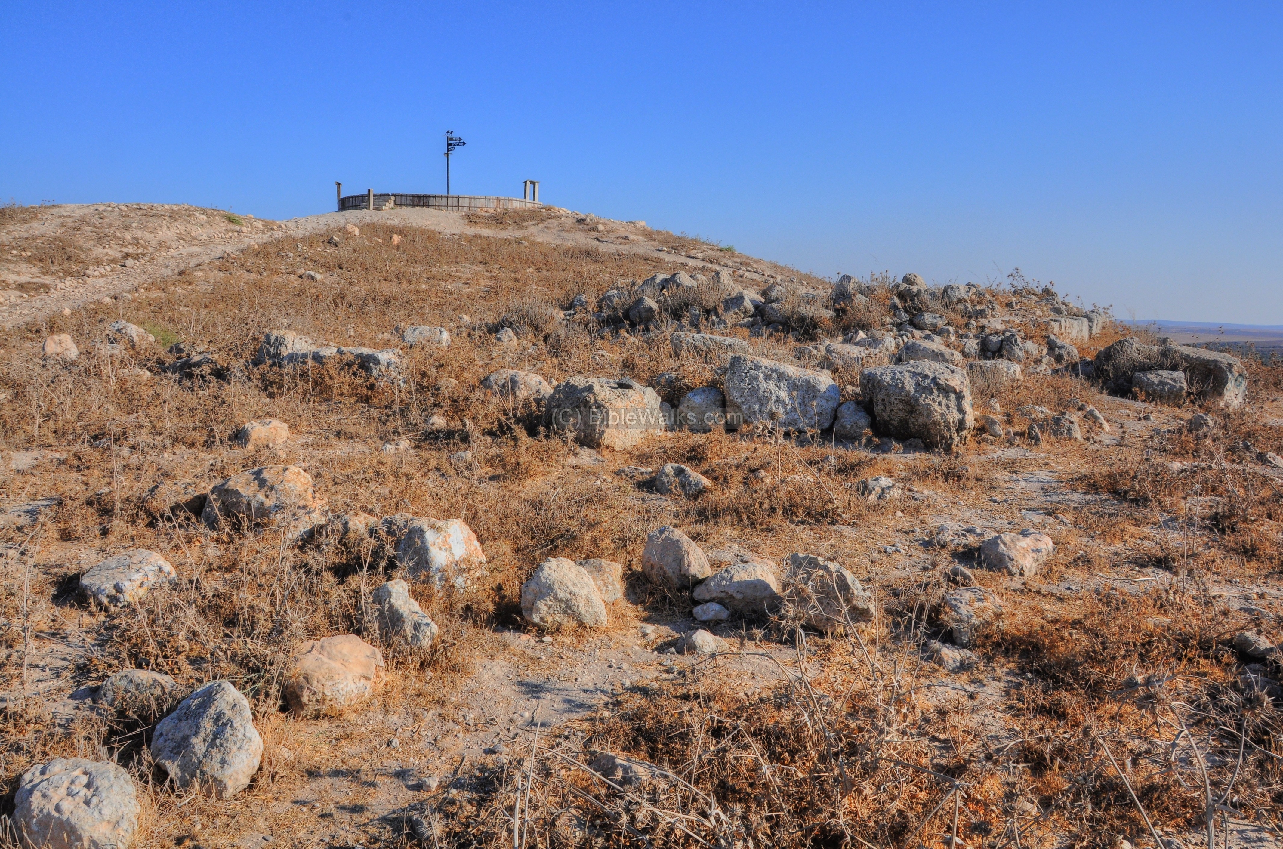
(e) Summit
The highest point is located on the south hill, where an observation platform is located. This was the ancient acropolis, and also the location of the Crusaders fortress.
A closer view of the observation platform:
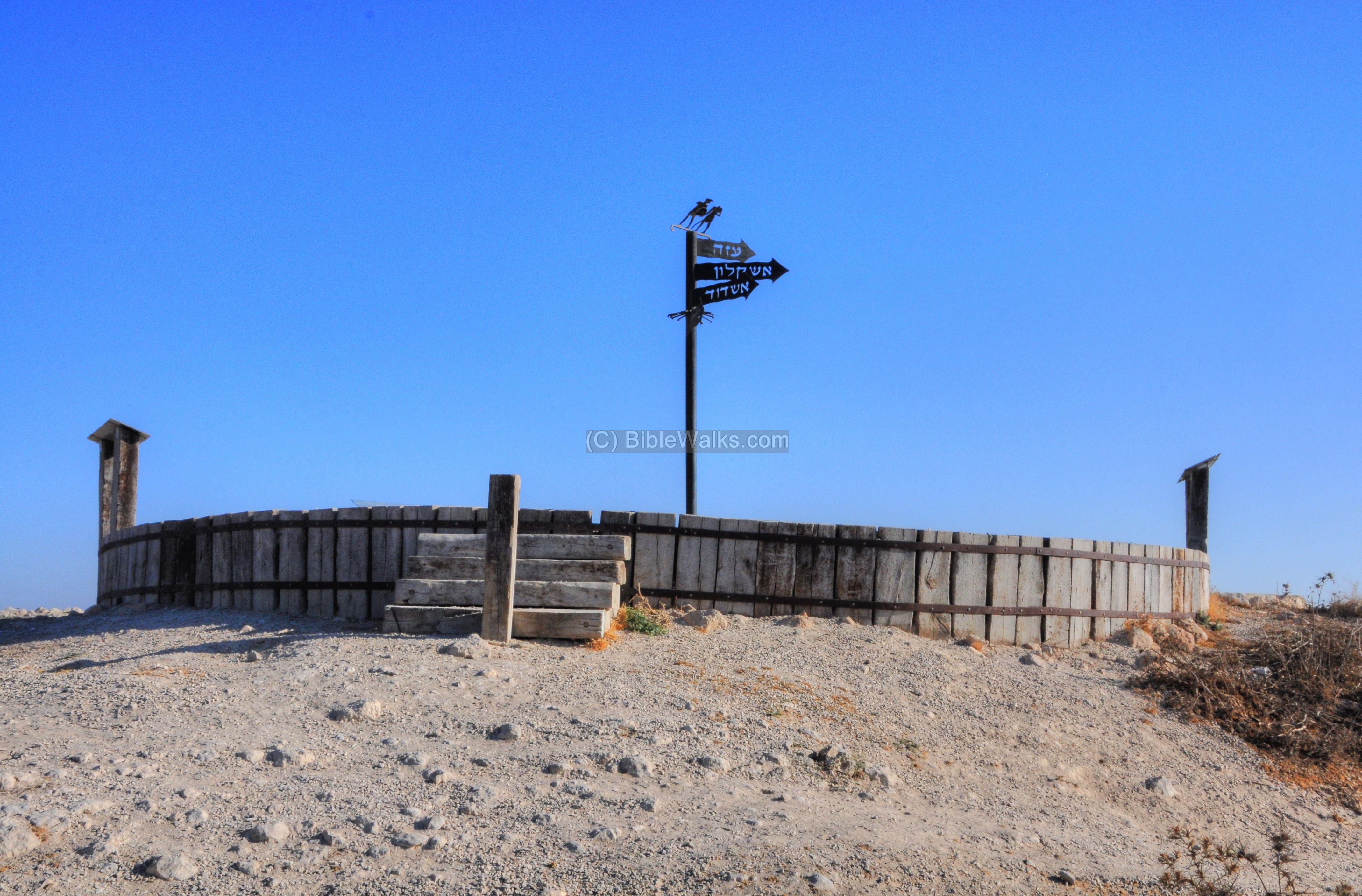
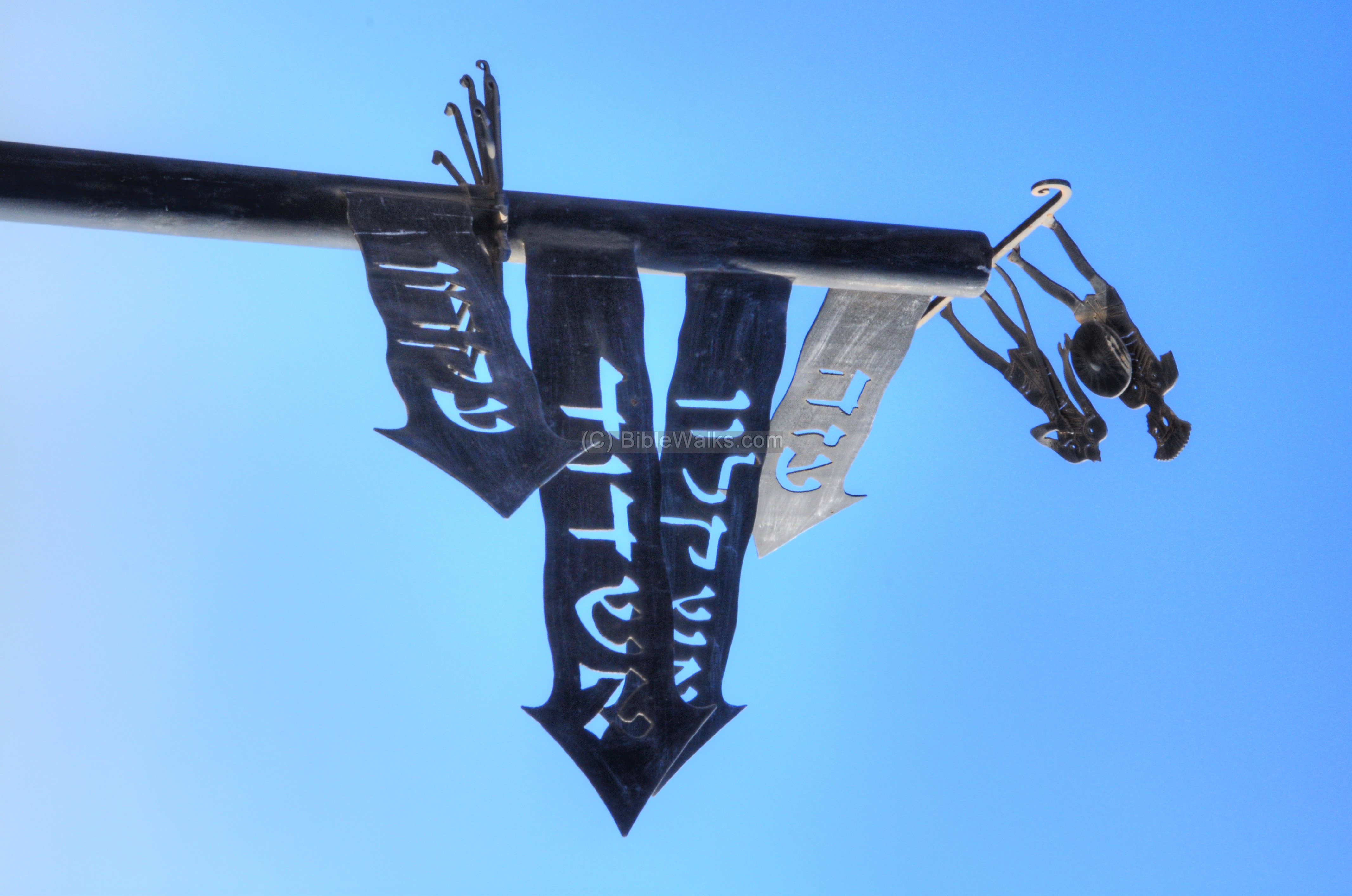
The sign on the observation platform shows directions, in Hebrew, to the major Philistine cities – Gaza, Ashkelon, Ashdod and Ekron. They are in order from top to bottom, also from south to north.
A Wely (Muslim shrine, aka maqam) was constructed on the high point, north west of the summit. It was named as the shrine of al-Shaykh Muhammad, a local Sheikh. According to Bliss, it was built around 1875. Bliss reckoned that the wely replaced a ruined Crusader fortress, 60m square with 8 feet thick walls and towers on its corners.
An Arab graveyard was located around the summit, with some of the tombs still there.
A panoramic view from the north west side of the summit is shown here. Pressing on this picture will pop up the panoramic viewer. Using this flash-based panoramic viewer, you can move around, zooming in and out – viewing the site in the amazing full screen mode (like you are really there). Major sites are marked on the views. It may take minutes to upload, but then its worth the waiting time.
To open the viewer, simply click on the photo, then tour the area around:

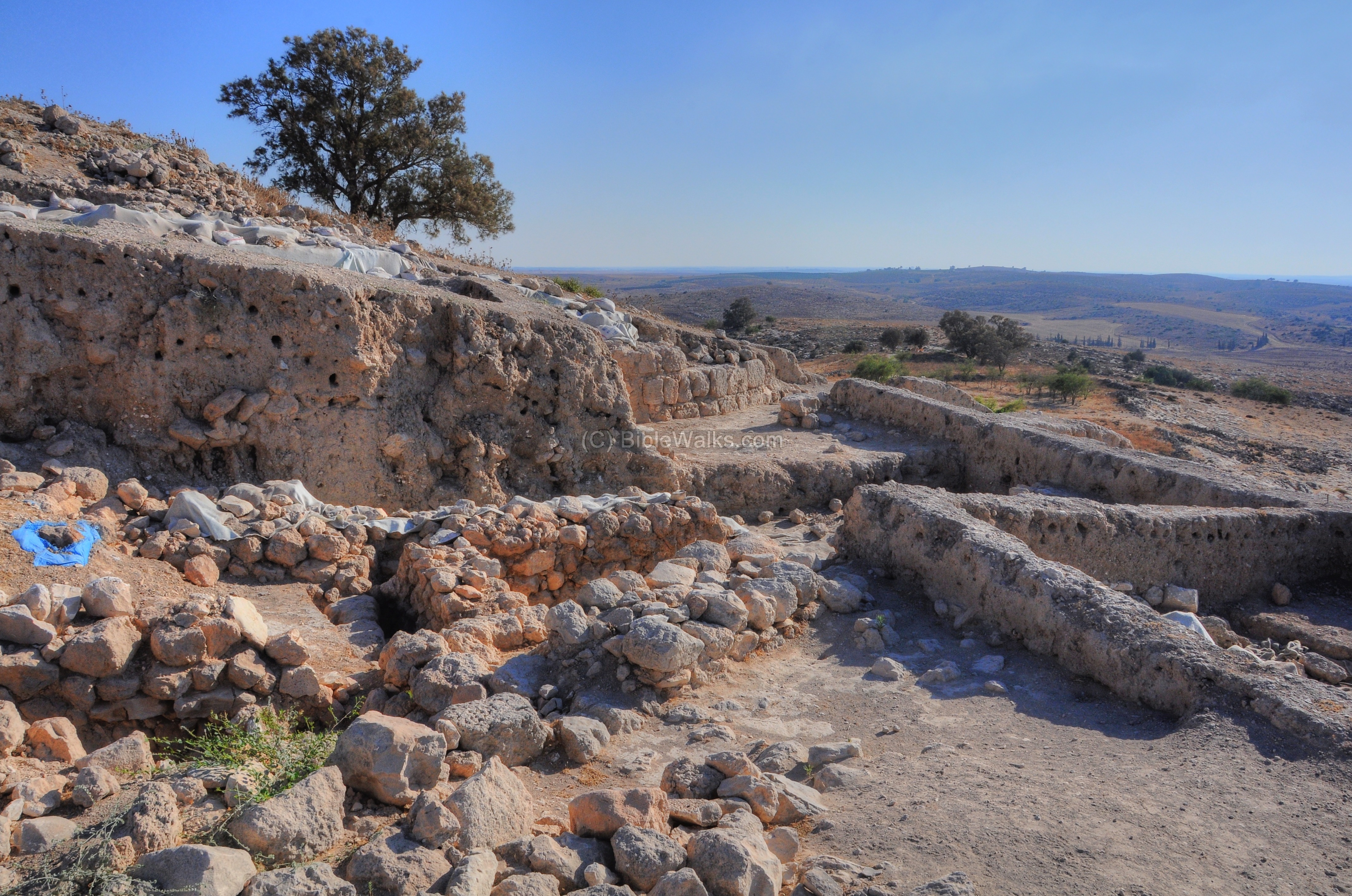
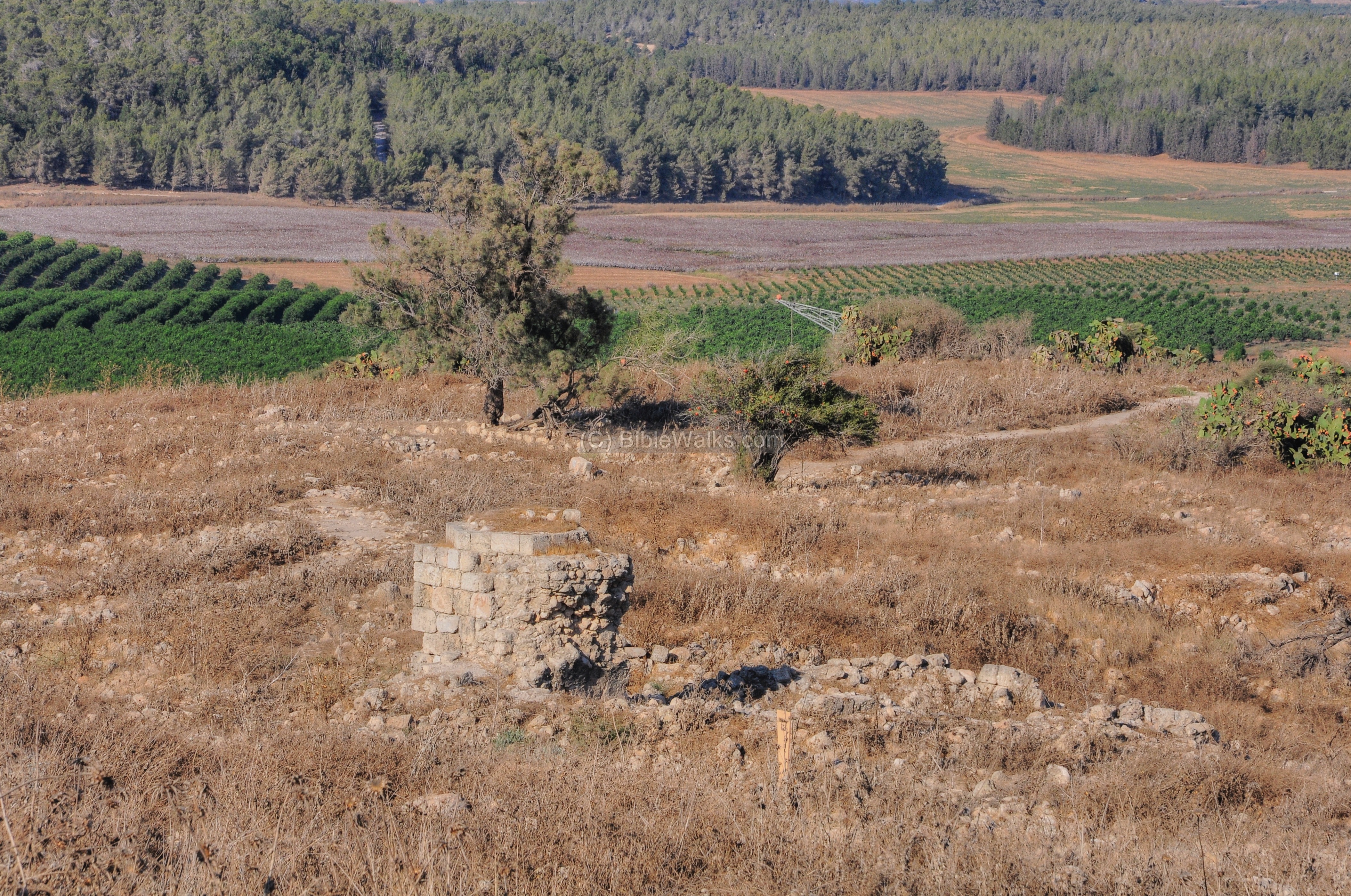
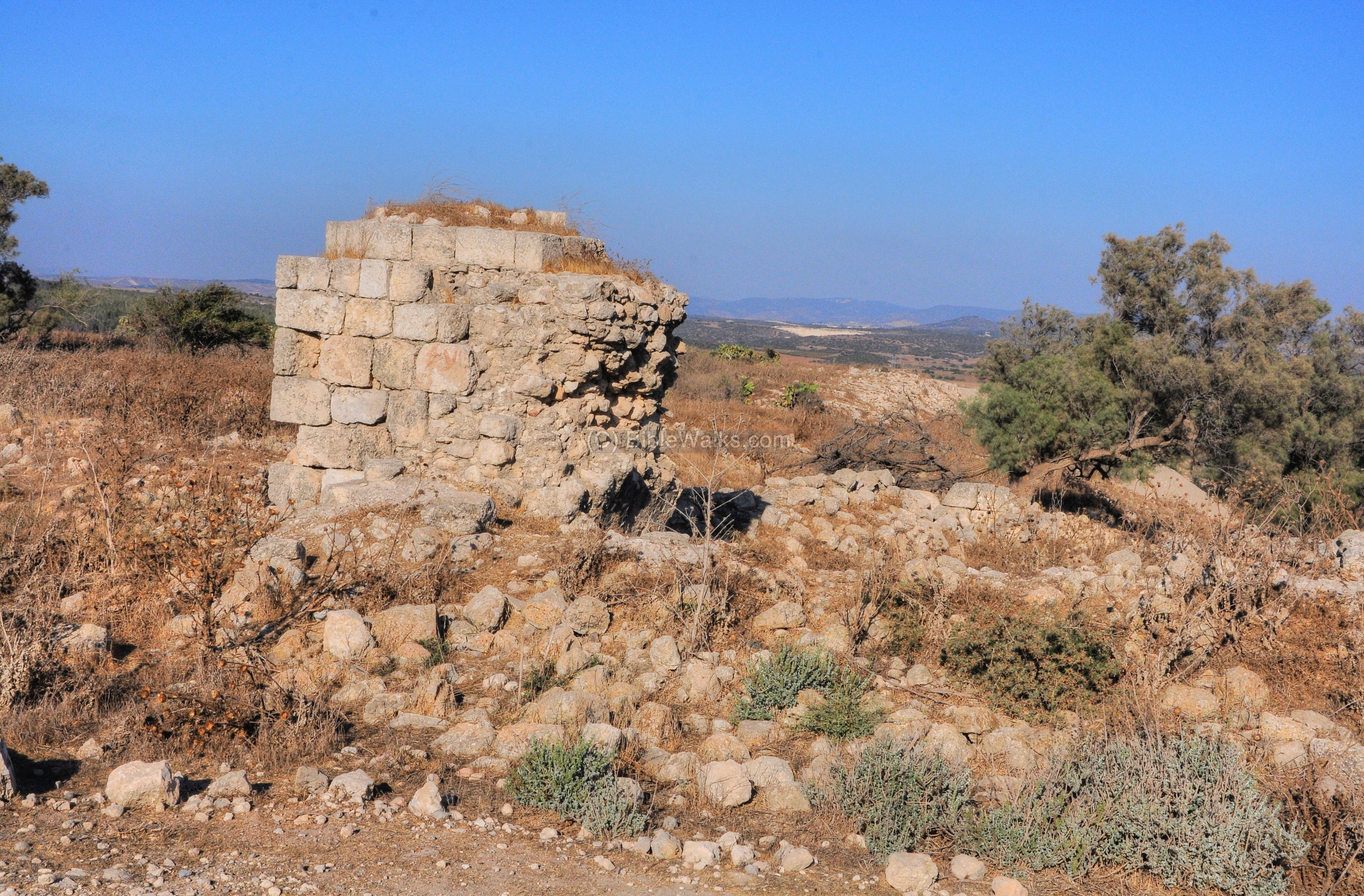
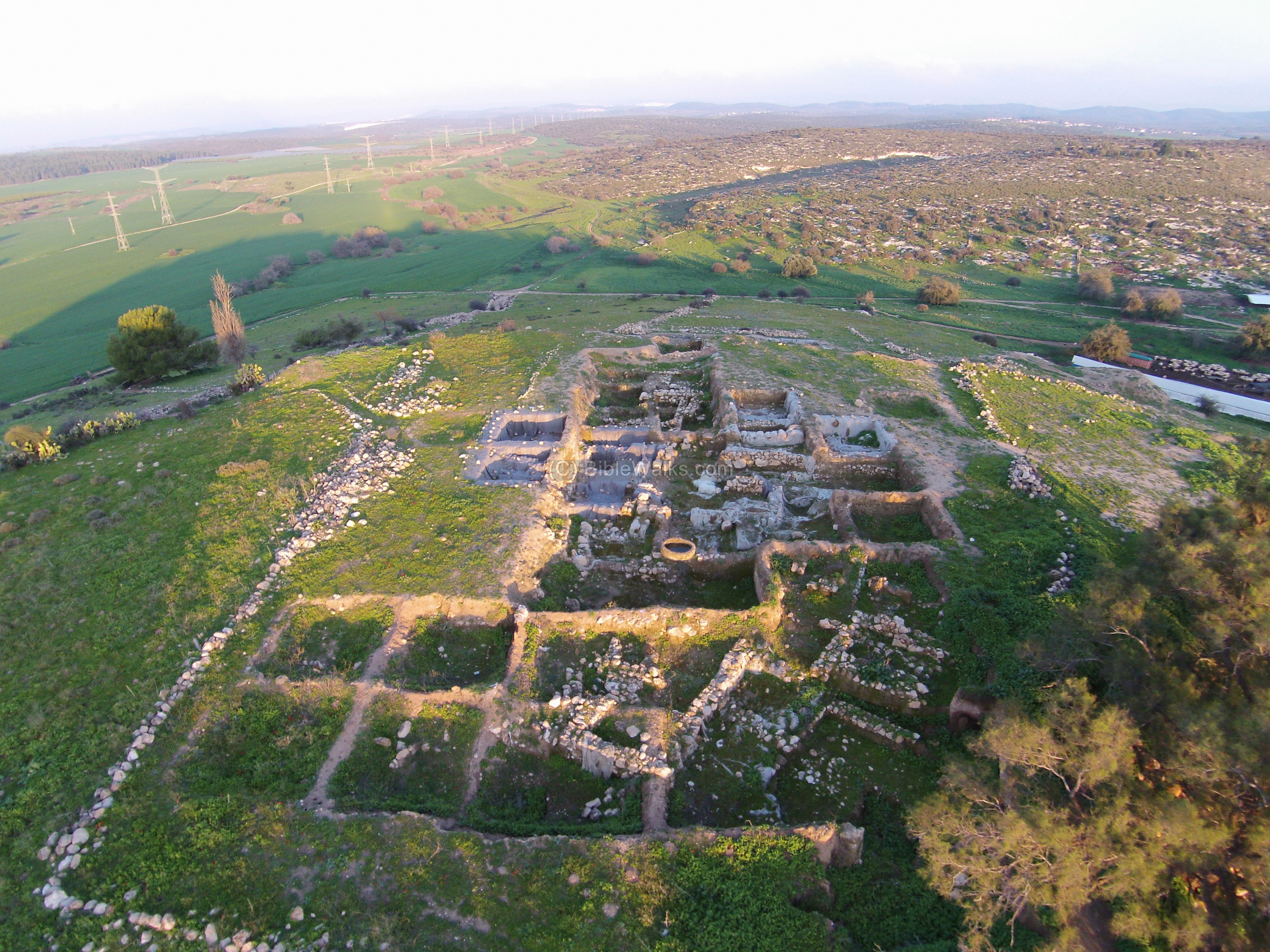
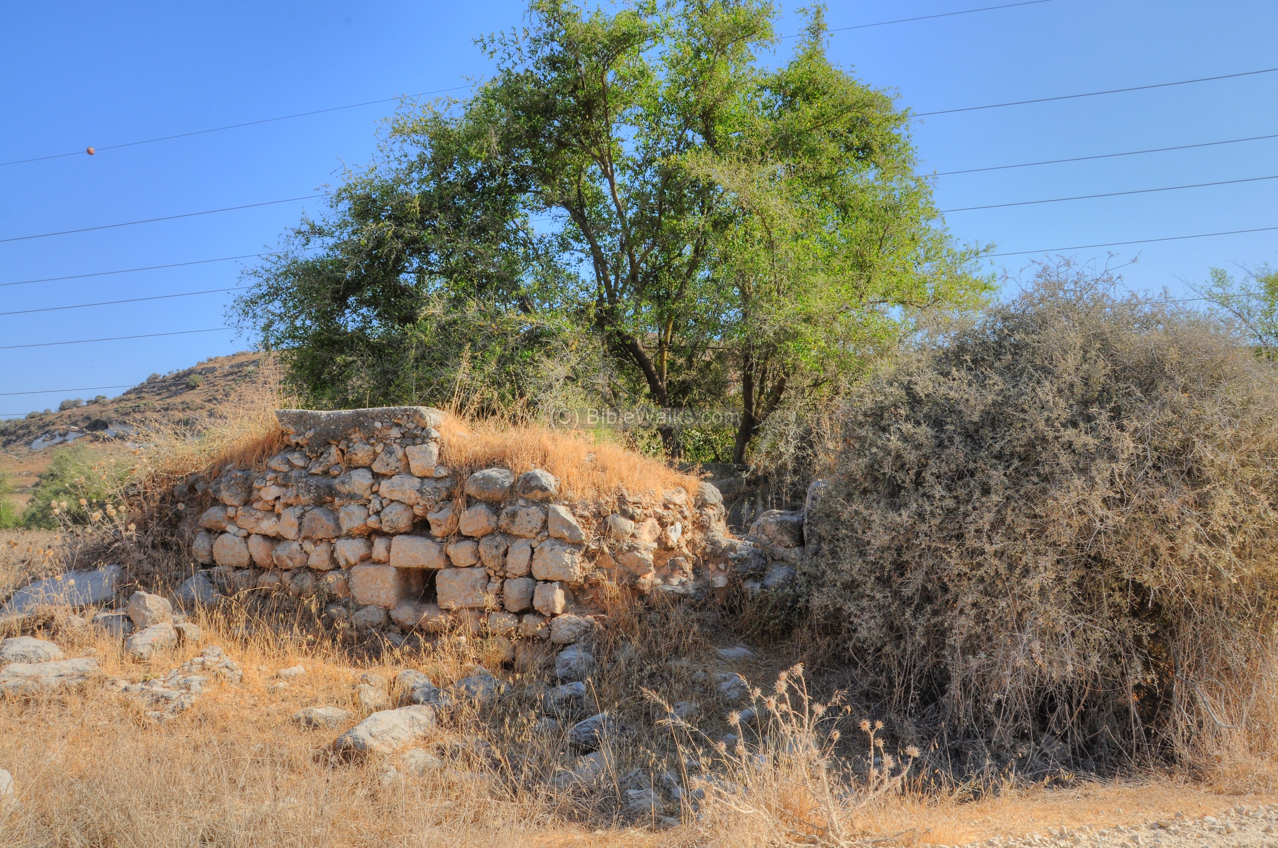
(f) Areas F near the summit
Area ‘F’ is located to the west of the summit of the “upper city”.
The main findings in the lower part of area F was a large fortification wall dated to the Early Bronze Age, used until the Iron Age II.
The Iron Age II brick wall, over 20m in length, was found to have shifted ~2m and toppled. This may have been the result of the powerful earthquake of 759 BC that shook the Levant and echoed in the words of the prophets Amos, Zechariah, Micah and possibly Isaiah.
In an Iron Age I layer, the excavations unearthed Philistine style ceramics, including decorated pottery. This supports evidence of the early settlement by the Philistines in Gath. The Iron Age Philistine remains were found on all sections of the “upper city”, thus strengthening the identification of the city with Gath.
Bliss wrote in his third report of 1900 [1]: “No gate has been found in the city wall. From the position of the city it appears likely that the main entrance was either from the south, leading directly into the Acropolis, or on the line of the modern approach to the village at the point where a bit of the old wall is exposed. Mr. Macalister observed a road 16 to 18 feet broad, cut in the rock ascending the hill from the west striking … at a point south of the “Wely”.”
New excavations unearthed a monumental city gate in area ‘D‘ during a later period when the city expanded to the “lower city”.
(g) Center
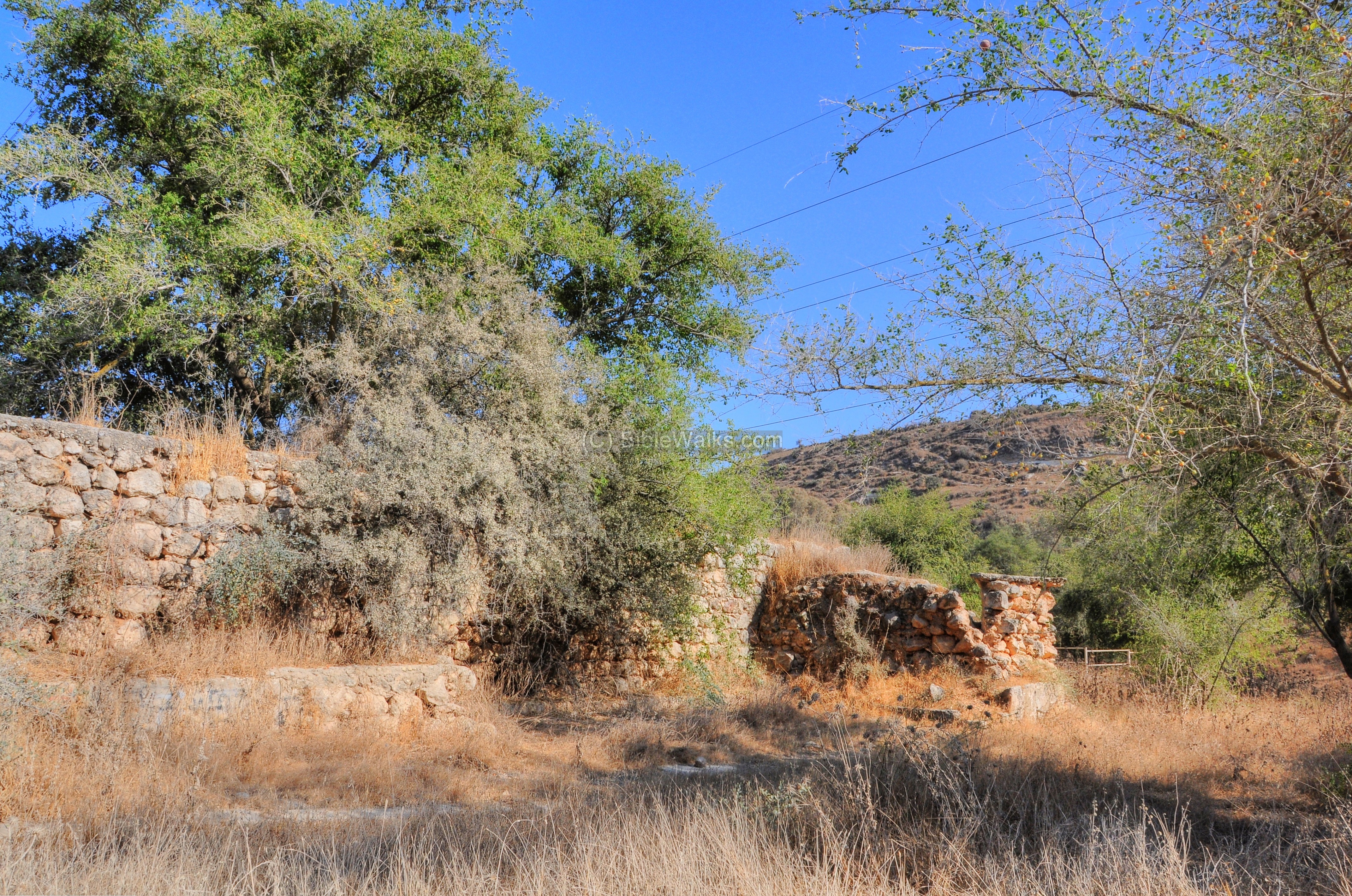
In the center of the site are remains of the Arab village.
Ruins of the Ottoman period village are located in the center of the mound, on its north side.
A standing wall is located on the south side of the ruined village, remains of the mosque.
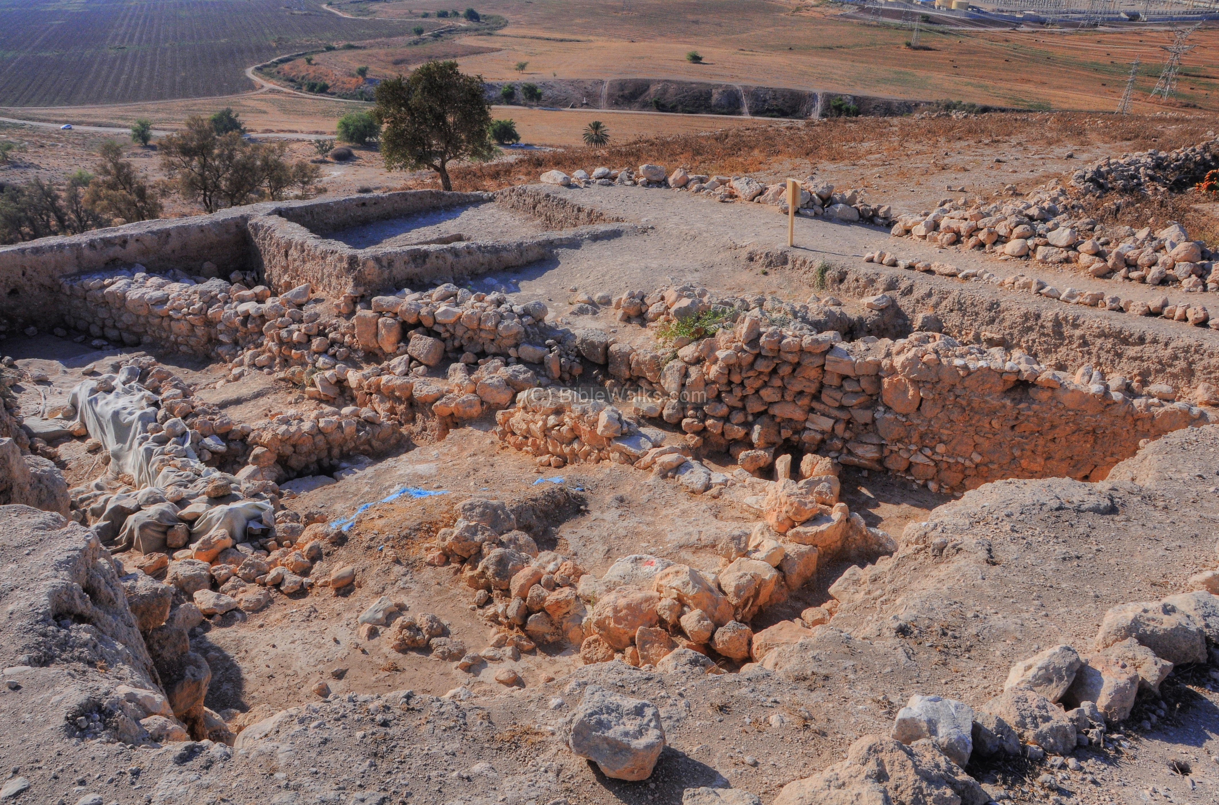
(h) East – Area ‘P’
Area ‘P’ is located on the eastern foothills of the northern “lower hill”.
This aerial view shows the excavation squares from the south side. Notice the large wide wall along the excavated area.
In this layer the archaeologists found Early Bronze fortifications which were later reused in the Late Bronze period. Additionally, they unearthed Late Bronze and Iron I houses which were built up against this wall.
The Late Bronze fortifications in Area ‘P’ are evidence of the expansion of the city during this time. Following this period, during the beginning of the Iron Age I (1200-1000 BC) , the city was conquered by the Philistines who dominated the region until the mid 9th century. Evidence of this shift in the population is seen in new types of pottery that appear, as well as the changes in food preparation techniques.
(i) East – Area ‘A’
Area ‘A’ is located on the eastern side of the mound. This aerial view shows the area from the south side.
In area ‘A’ a poorly preserved Philistine temple was discovered, dated to the Iron Age I (~1000 BC). In the temple the excavations unearthed two large pillars in the middle of the complex, implying a plan similar to the temple in Gaza that Samson knocked down.
Next to the temple, a small area was identified as an industrial installation of metal production.
One of the highlights of the findings was a fragment of a clay bowl, dated to 950 BC, with ancient alphabetic letters incised on it spelling two words which are etymologically close to the name Goliath – known from the Bible as the famous brave of the Philistines originating from Gath.
Another interesting finding in Area A was an ivory bowl cut from a section of a tusk of an Indian elephant. It is dated to 1100 BC, and was surprisingly similar to other bowls found in Megiddo. Scientific analysis proved these bowls were made by the same craftsman and cut from the same tusk [Video].
Evidence of the Philistine culture was found in area ‘A’ in the form of typical pottery and a cooking installation known as ‘pebbled hearth’ – a round pile of small stones on which they cooked their food.
The archeologists identified the Philistine culture from a number of elements found and analyzed during the excavations. This included the analysis of the bones of their food, which included dogs and pigs – forbidden in the Jewish allowed diet. The Philistines also used a special plaster which was typical of the islands of Greece.
A large stone vessel is seen in the center of the area:
(j) North East – Area ‘E’ and ‘C6’
Area ‘E’ is located to the east of area ‘A’, on the lower foothills. A large late Bronze patrician house was found here, above the Early Bronze layers.
Another view of the excavation area is in the next photo.
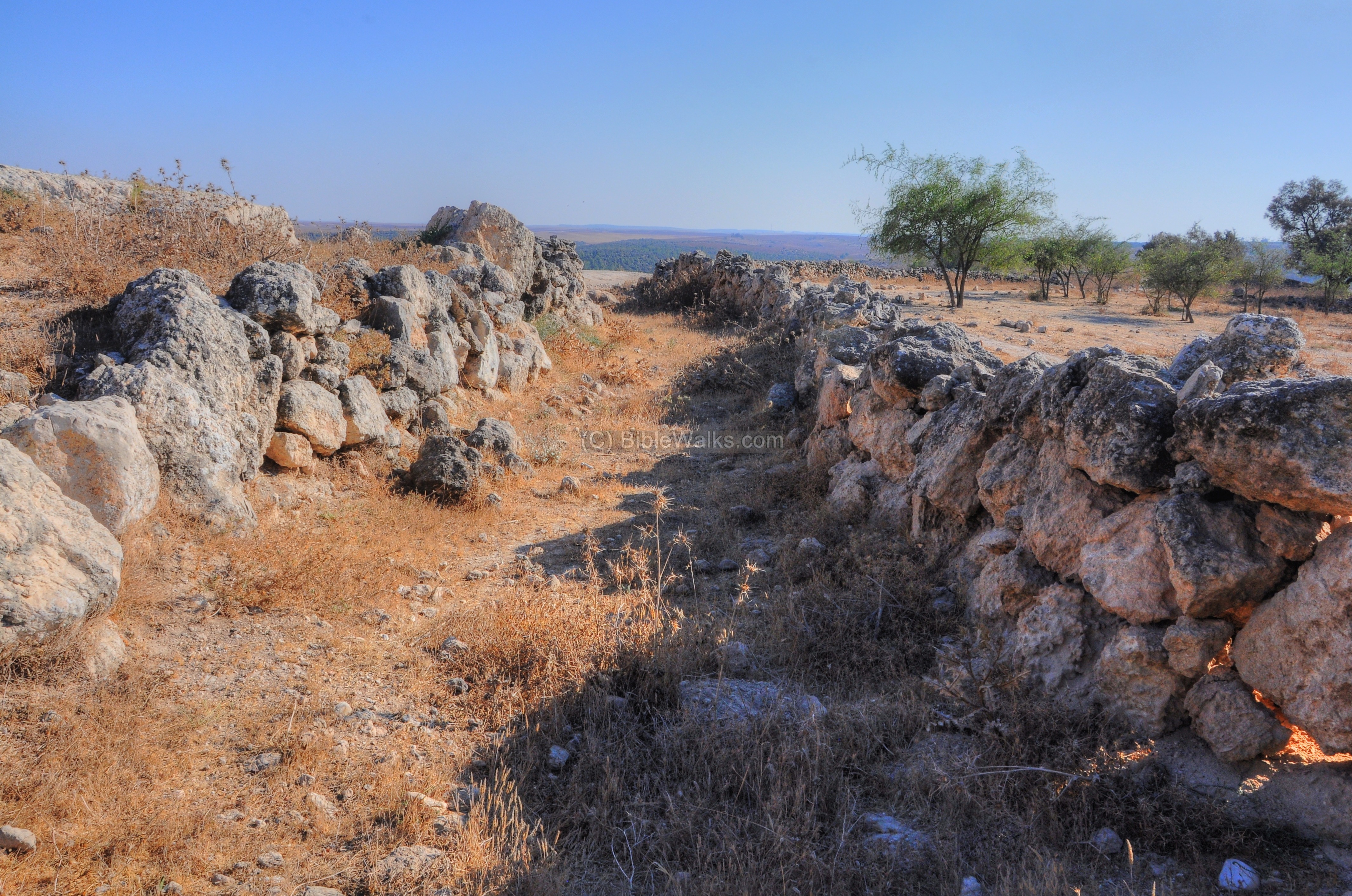
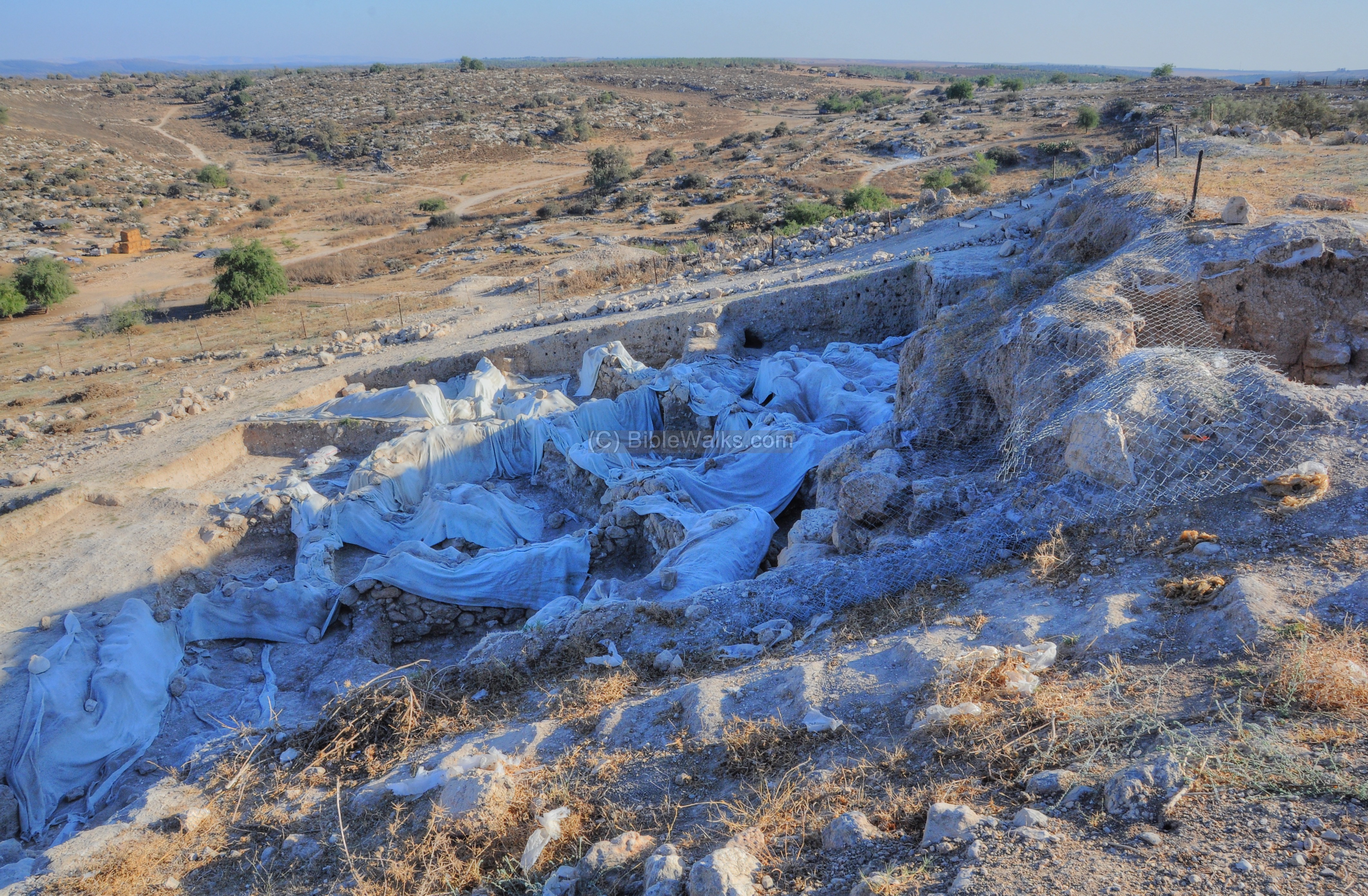
Notice a faint horizontal brown line that crosses left to right in the hill to the east of the valley. This is the remains of a siege moat that may have been cut during the intrusion of Hazael of Aram-Damascus during the 9th century BC. A number of areas were examined, and designated as ‘C1’ (on the west of the mound) thru ‘C6’ (the eastern area seen in this photo). The Aramean trench was cut into the bedrock along 2.5km, 3-5m deep and 8-10m wide.
The trench is easily seen in the aerial photo, where the cut line has a slightly different color in relation to its surroundings. The dig areas C1-C6 are marked along its route. Several stone towers, the berm (mound of earth) and other features were constructed along the line.
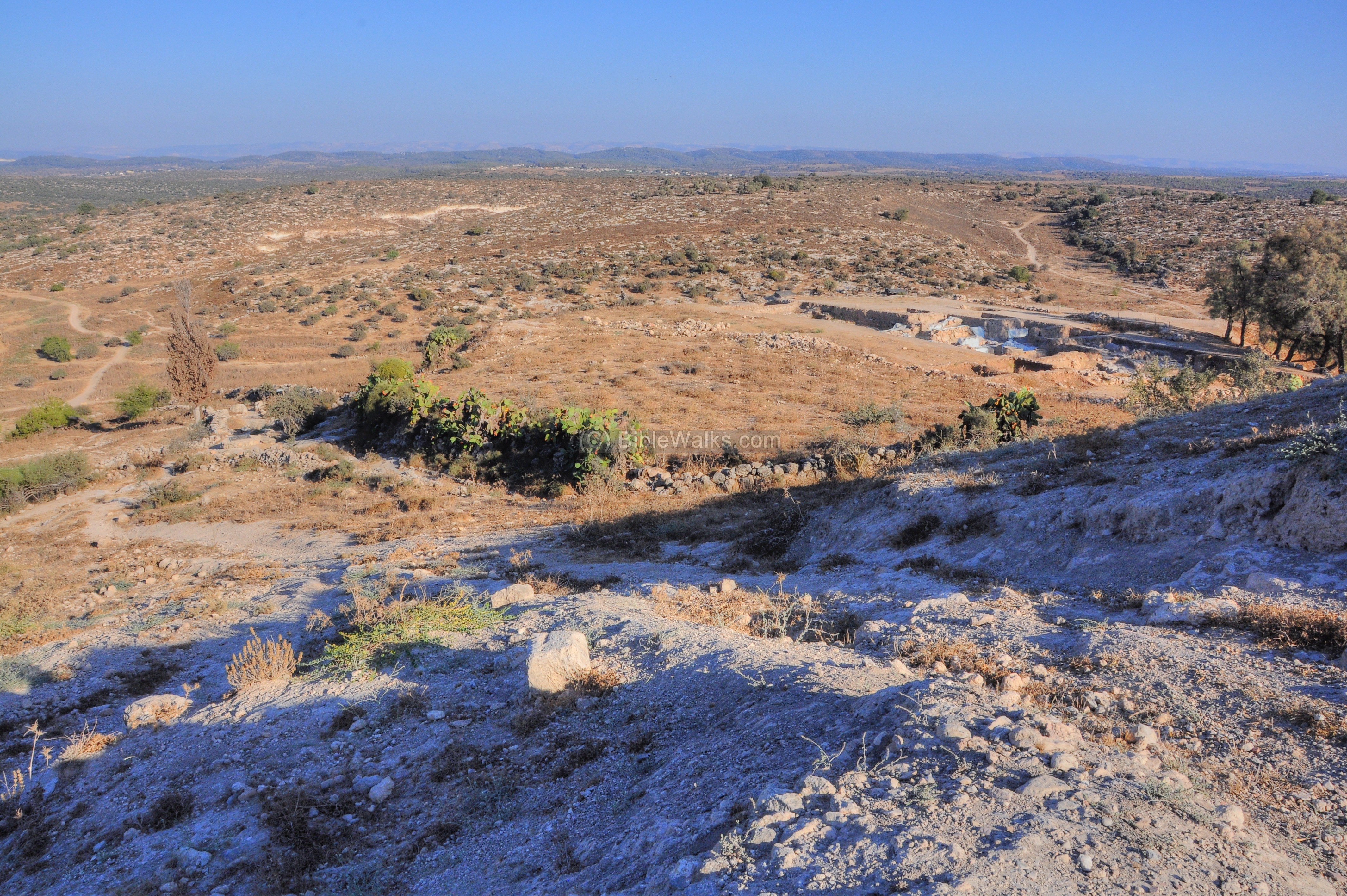
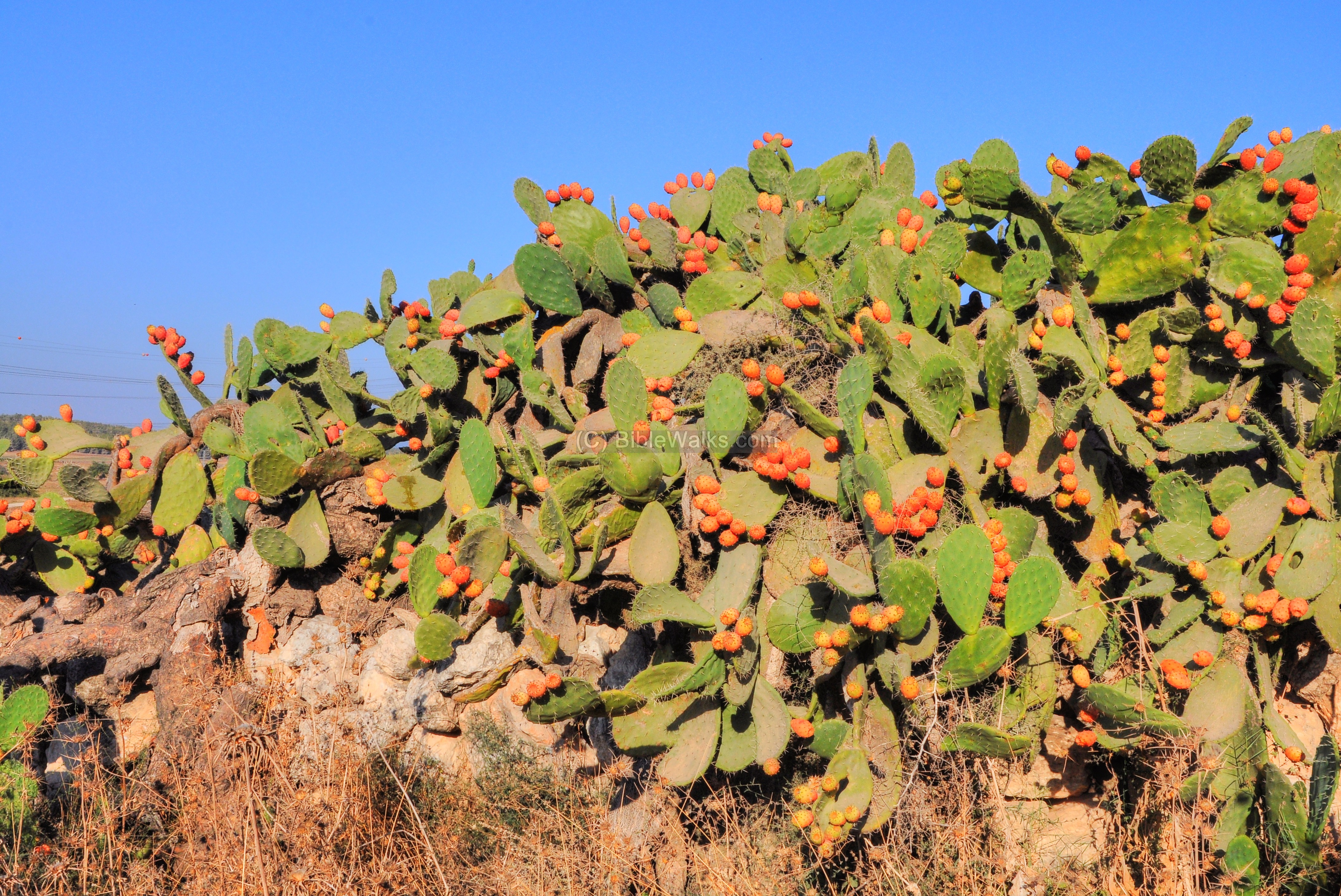
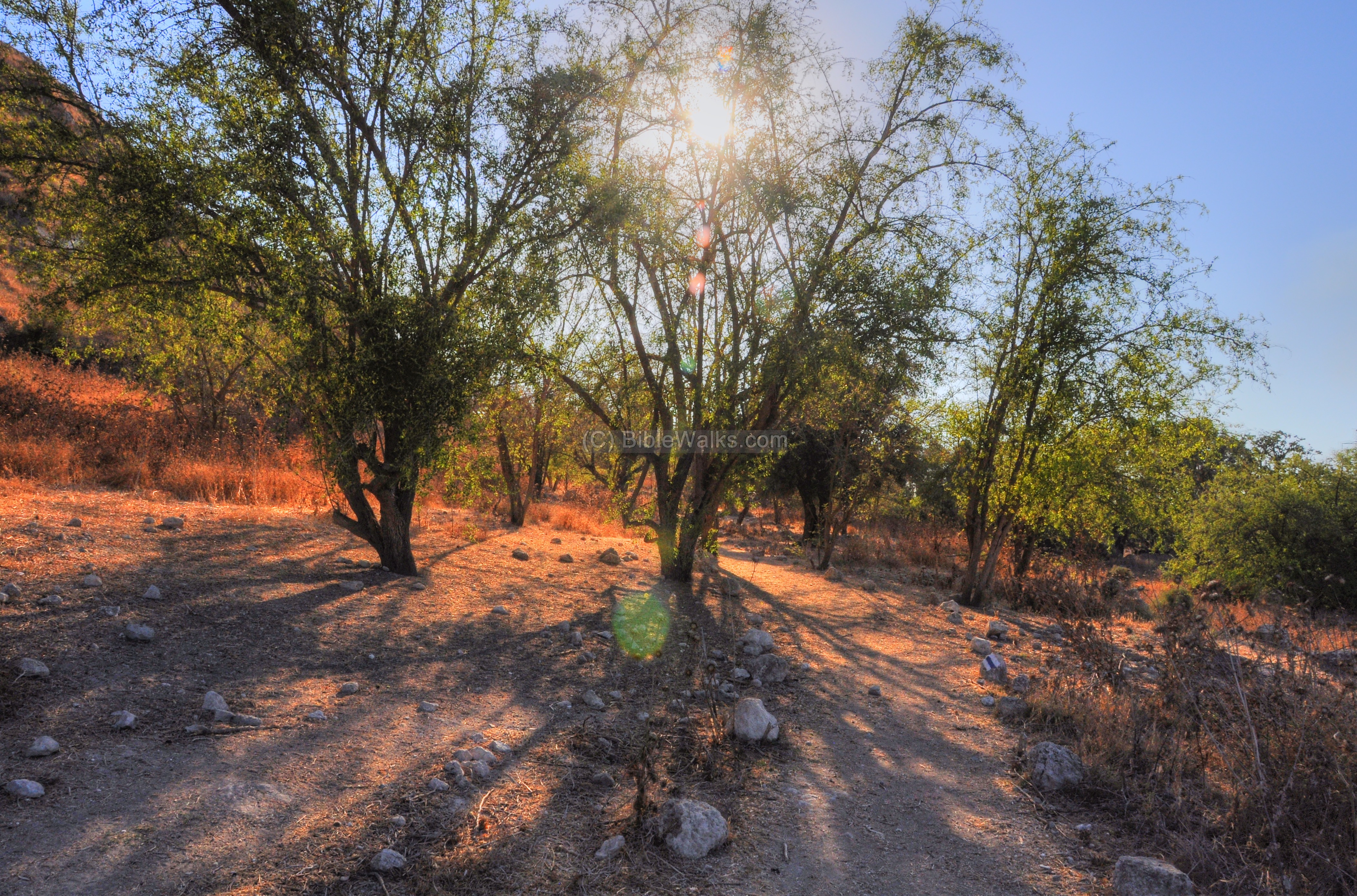
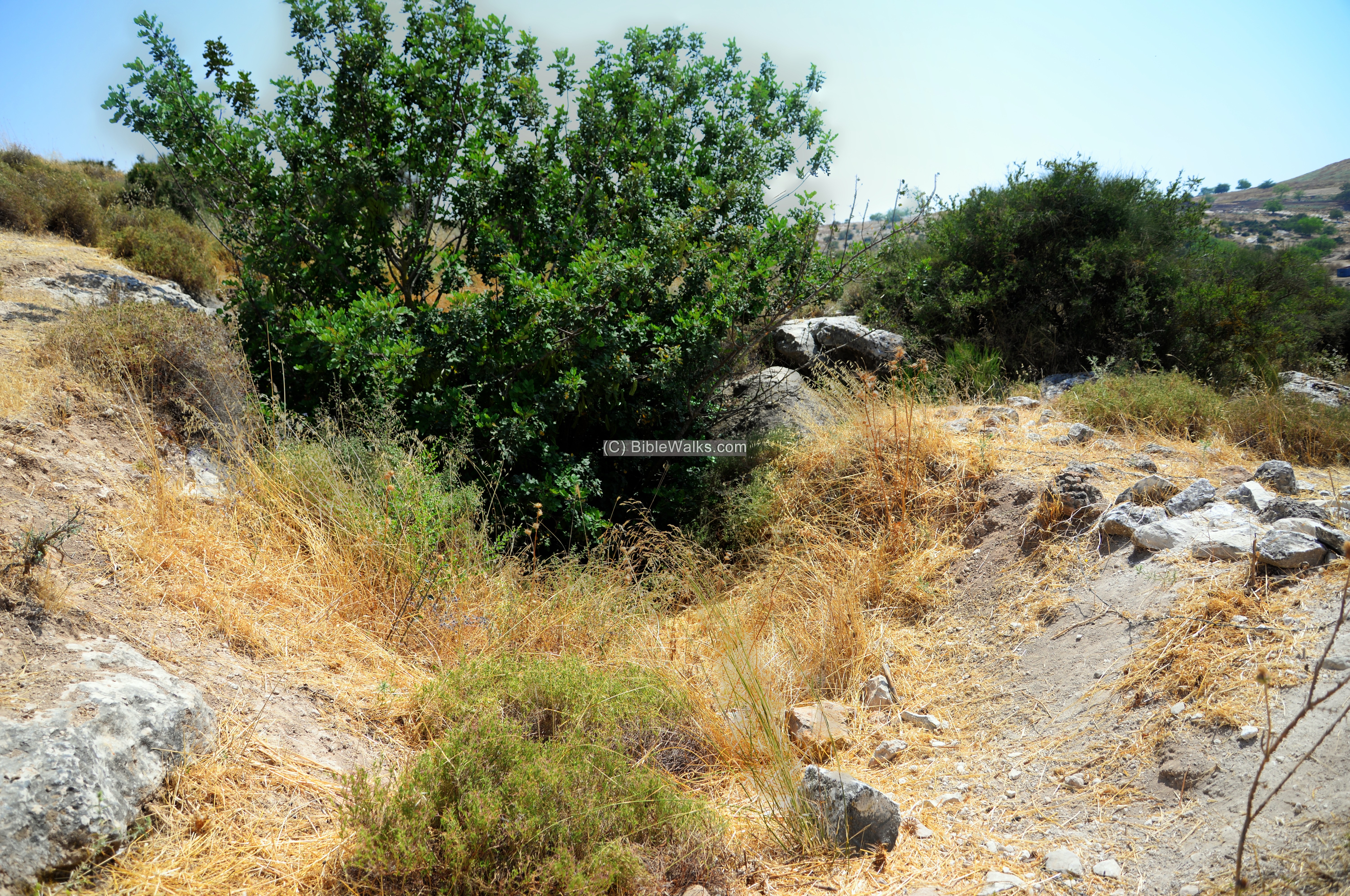
(k) Foothills
Along the foothills are groups of cactus bushes. The cactus bush was a typical fence used in Arab villages. The cacti and heap of stones is what remained from the Arab village of Tall al-Safi.
Other trees are located around the foothills, some of them belonging to the orchids of the ruined Arab village.
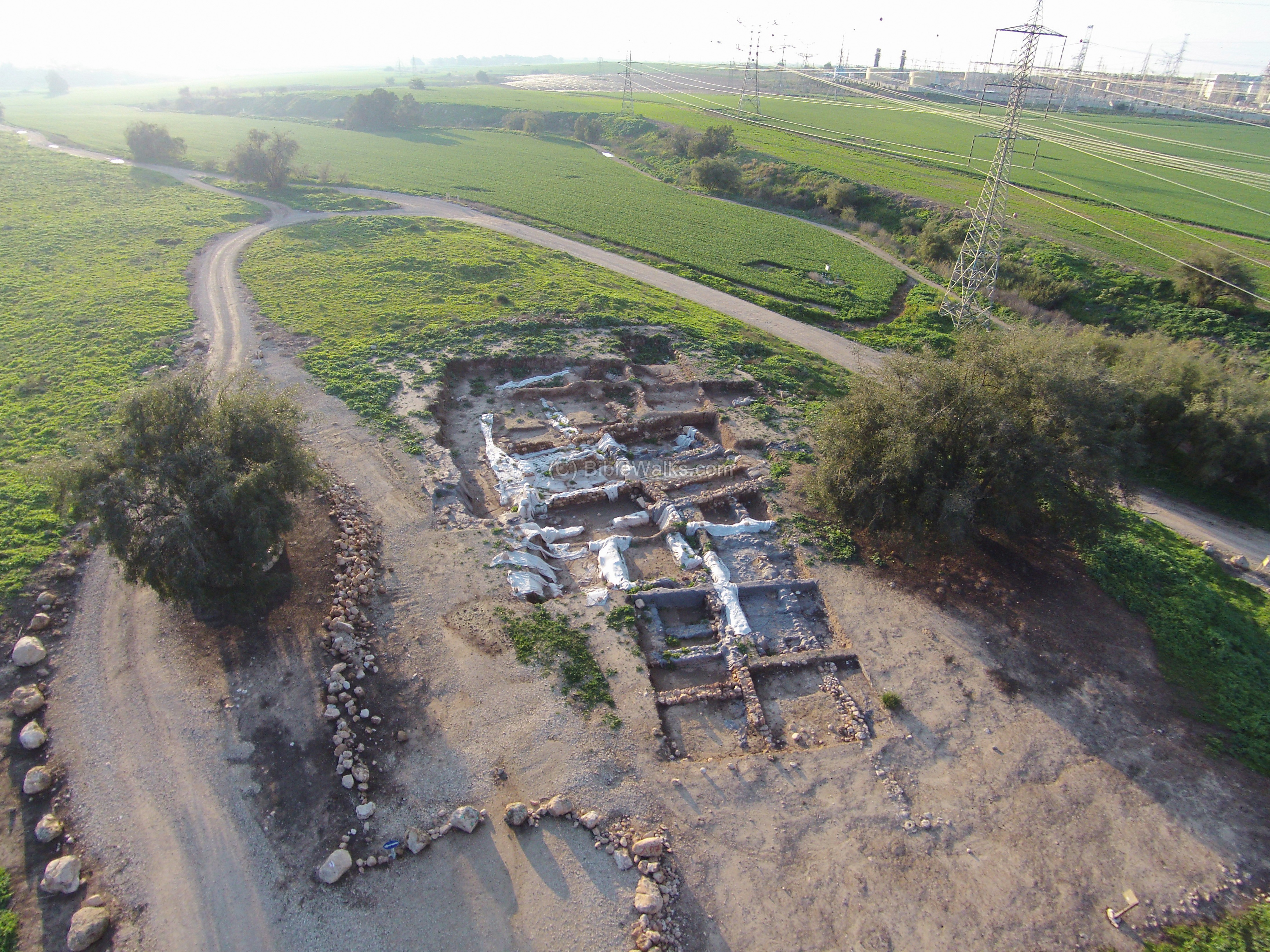
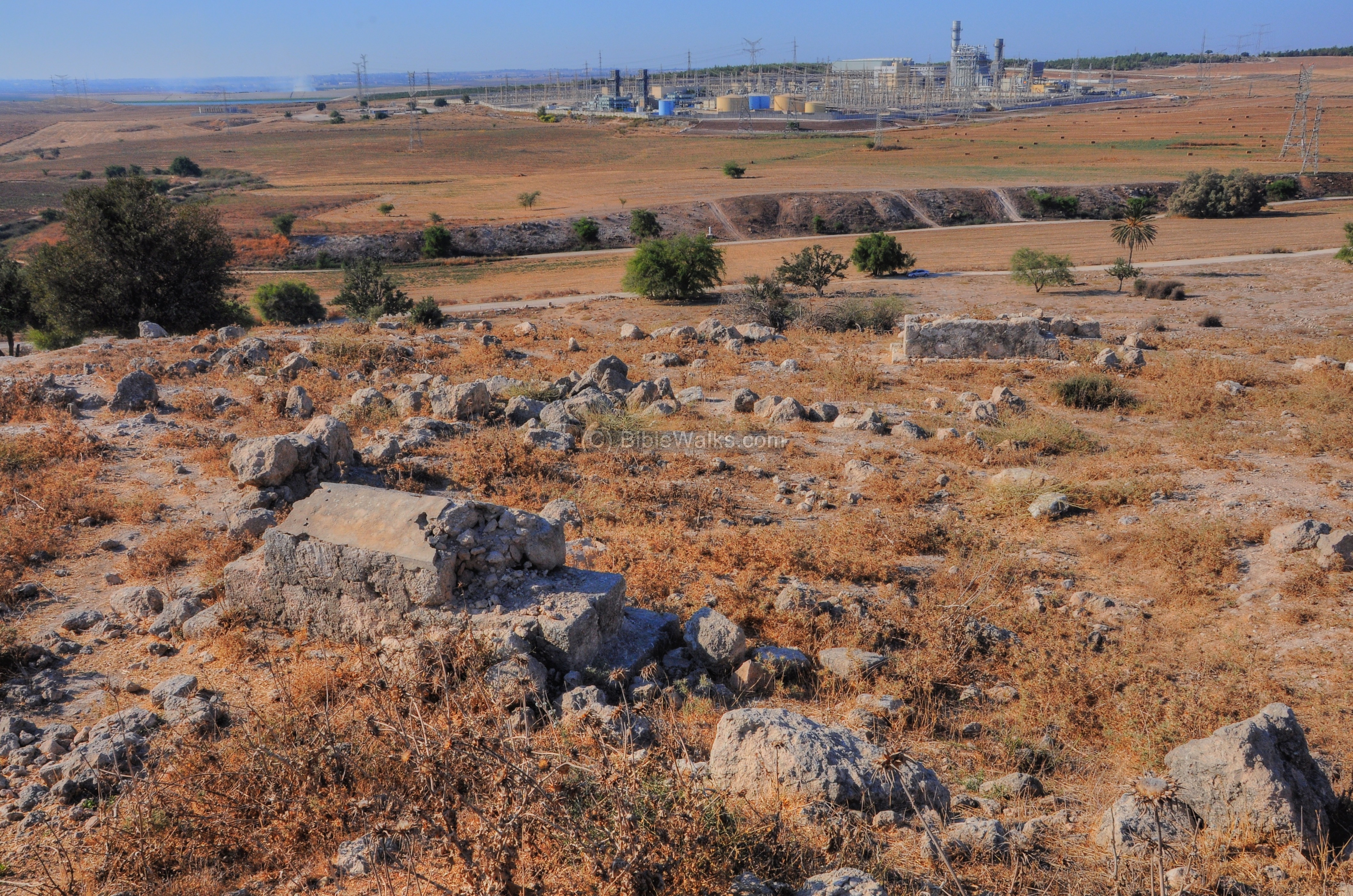
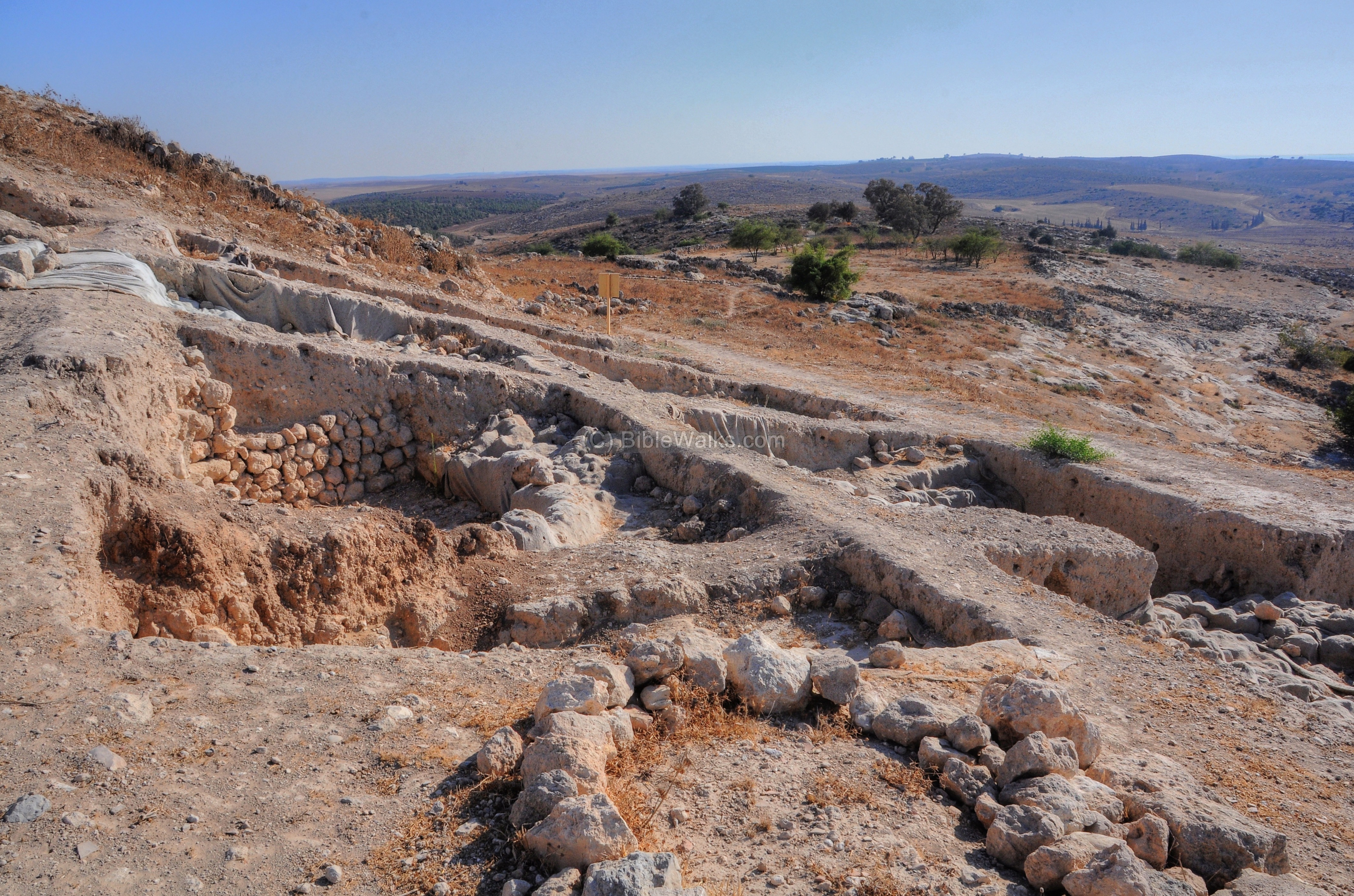
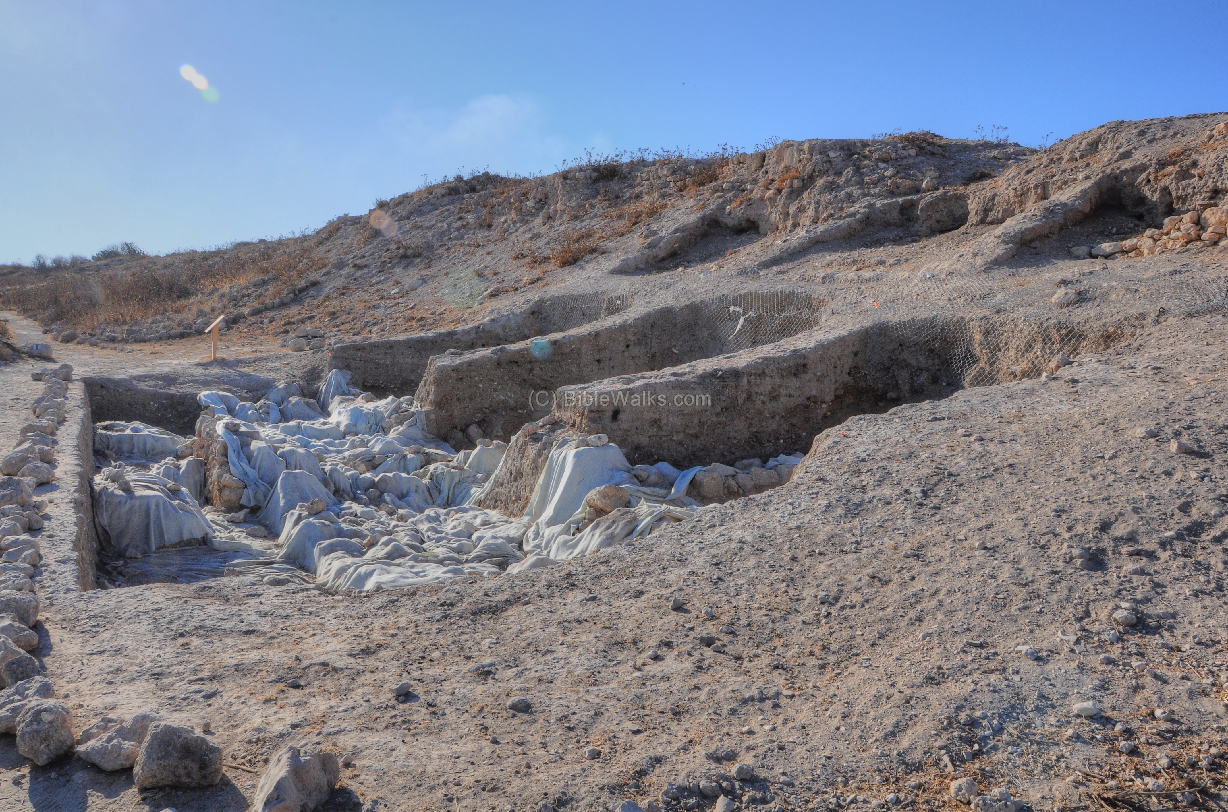
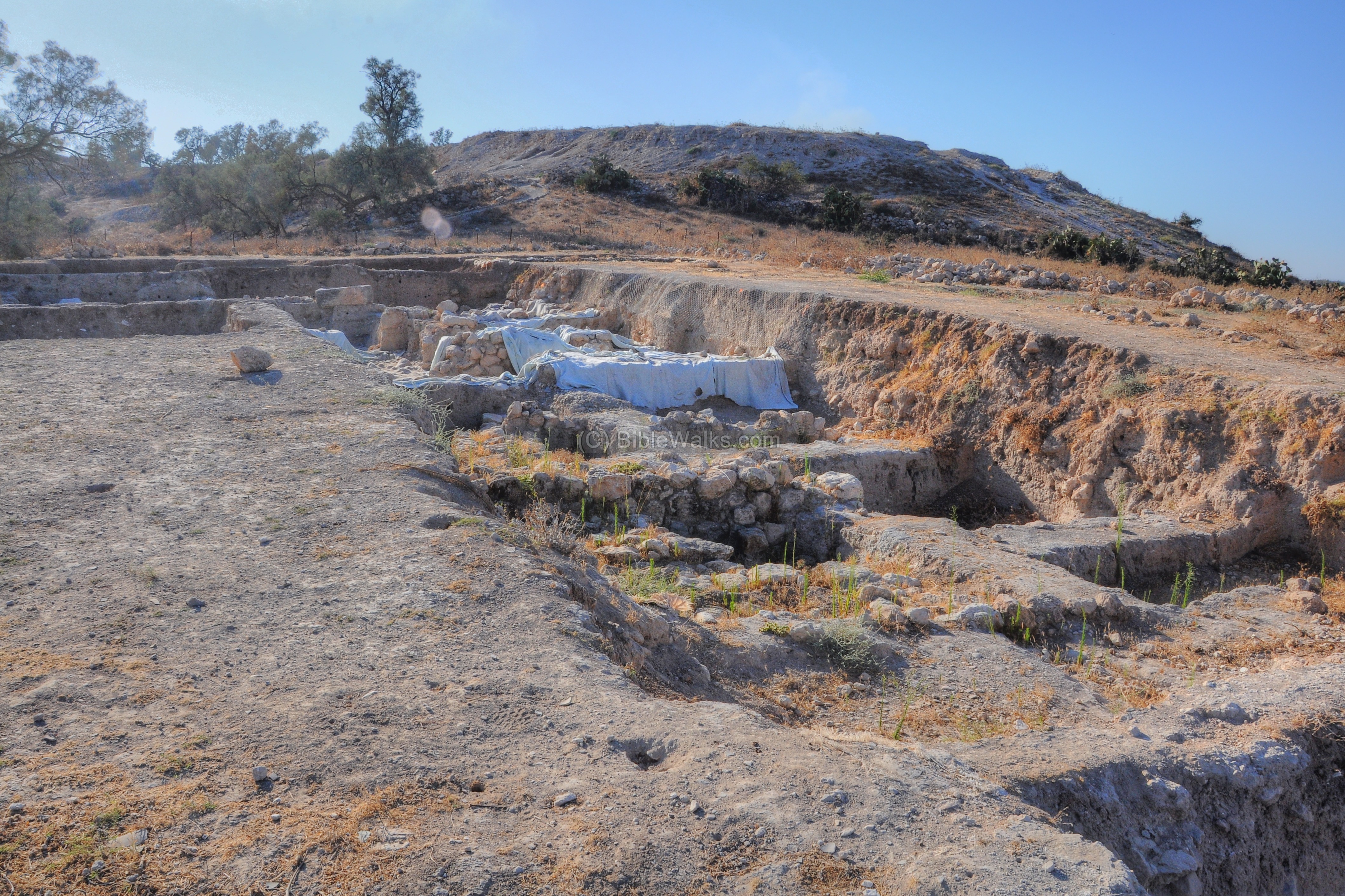
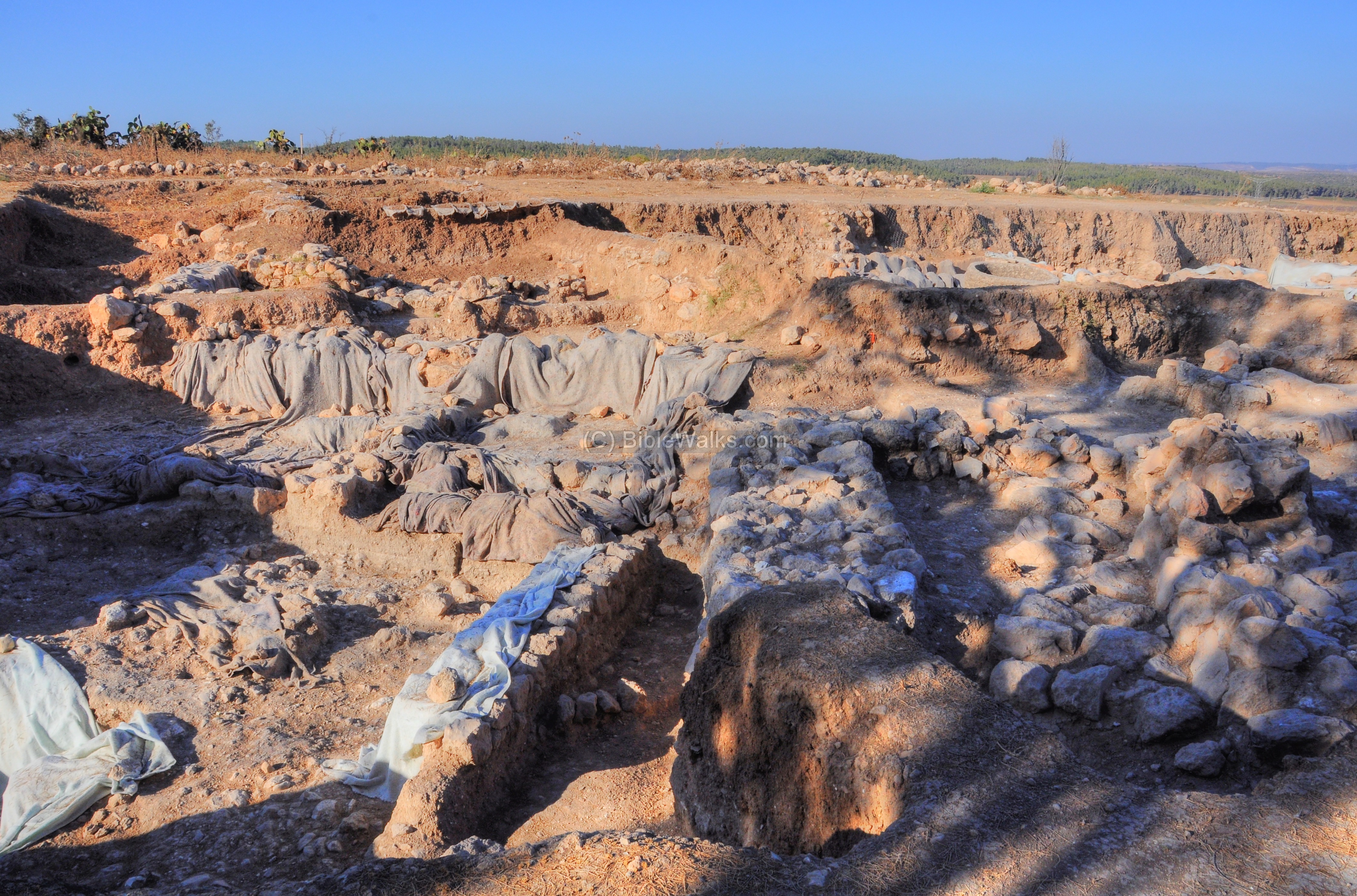
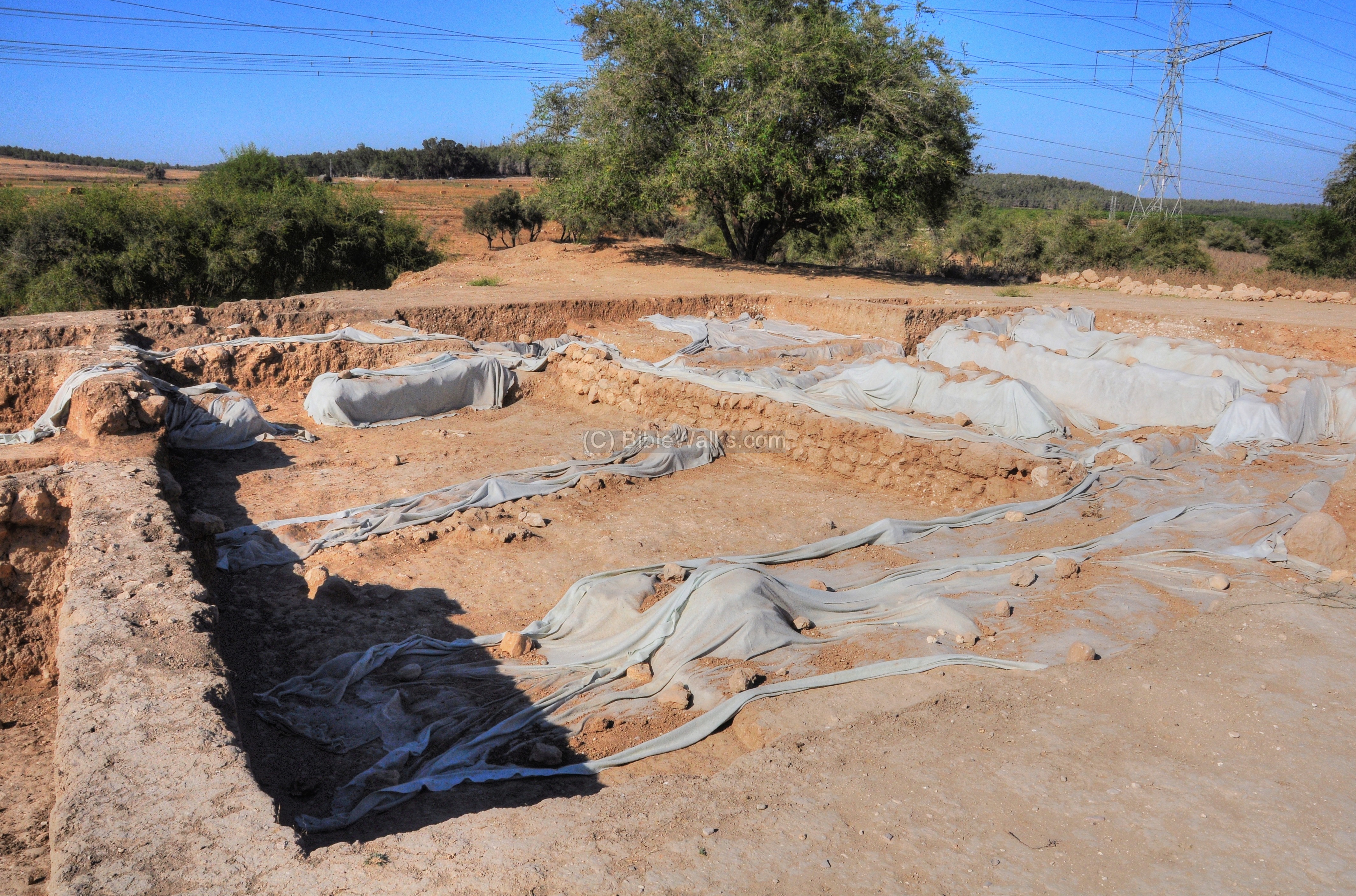
(l) North – Area D
Area ‘D’ is located on the lower city, on the north plain outside the tell. Here the excavations unearthed massive fortifications, Iron Age II structures, and the impressive city Gate. A section of the recent excavations in this area is seen in this photo.
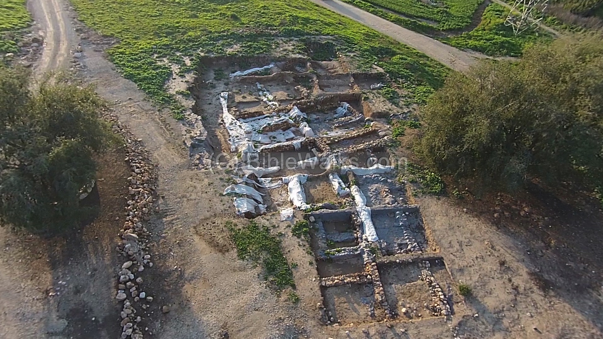
The Philistine city expanded to this area of the “lower city” during the Iron Age IIA. The Philistine city reached its zenith during this time: the bulk of the ceramics found in the excavations belong to this period. The findings indicate on the prosperity of the city, which was the largest city in Israel during this time, covering a large area of (45-50 hectares, or 450-500 dunams).
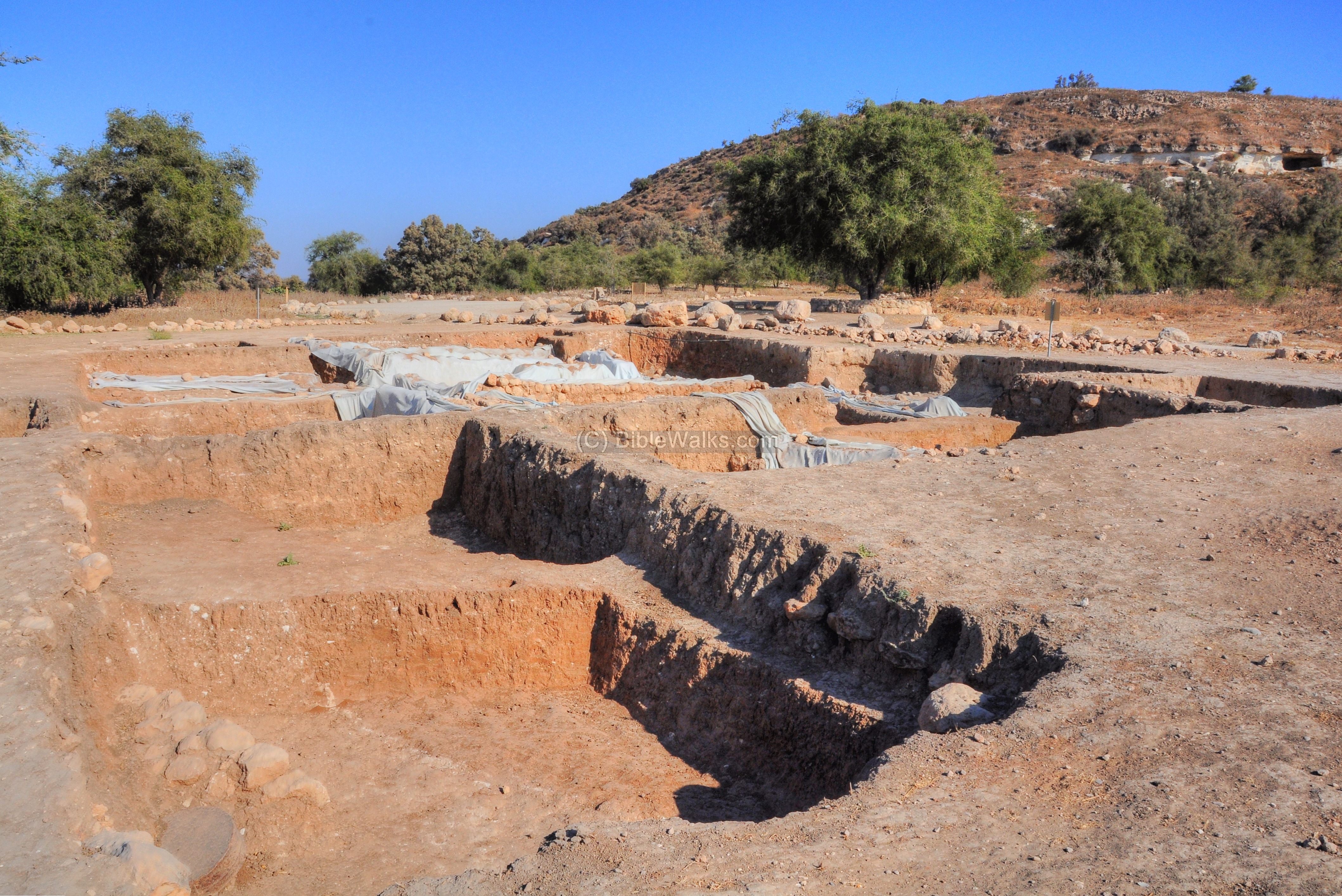
A monumental city gate was found in area ‘D’, attesting to the status of Gath as a huge fortified city. The size of the city and its might sheds a new light on the Philistine domination of the Judean plain, providing a clearer background to the struggle between Judea Kingdom and the Philistines.
The city gate appears in the story of David who fled King Saul and found refugee in Gath (1 Samuel 21 10-13): “And David arose and fled that day for fear of Saul, and went to Achish the king of Gath. And the servants of Achish said unto him, Is not this David the king of the land? did they not sing one to another of him in dances, saying, Saul hath slain his thousands, and David his ten thousands? And David laid up these words in his heart, and was sore afraid of Achish the king of Gath. And he changed his behavior before them, and feigned himself mad in their hands, and scrabbled on the doors of the gate, and let his spittle fall down upon his beard”.
The excavations also unearthed buildings close to the gate and the city wall, as well as a Iron working installation near the city gate.
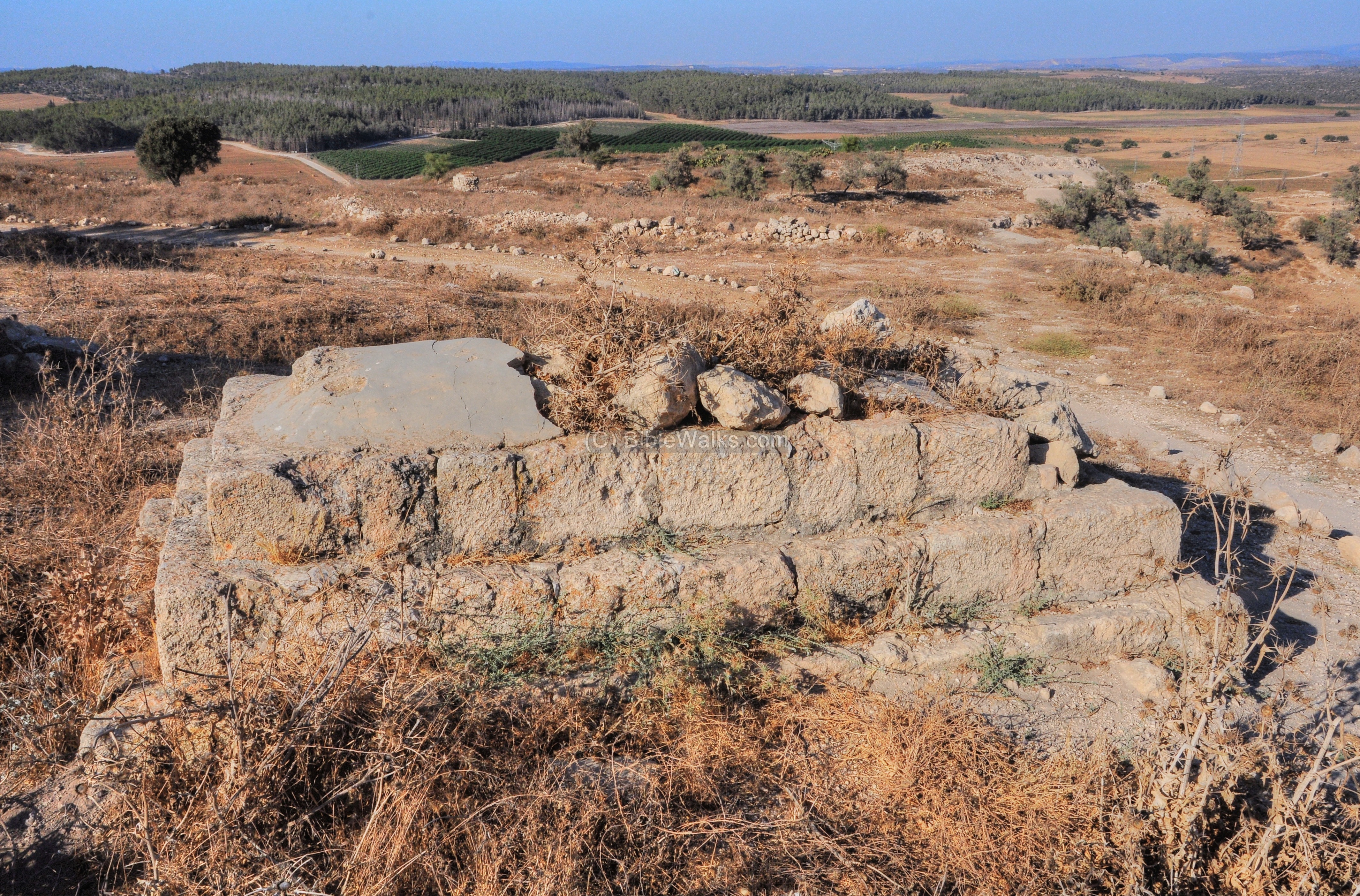
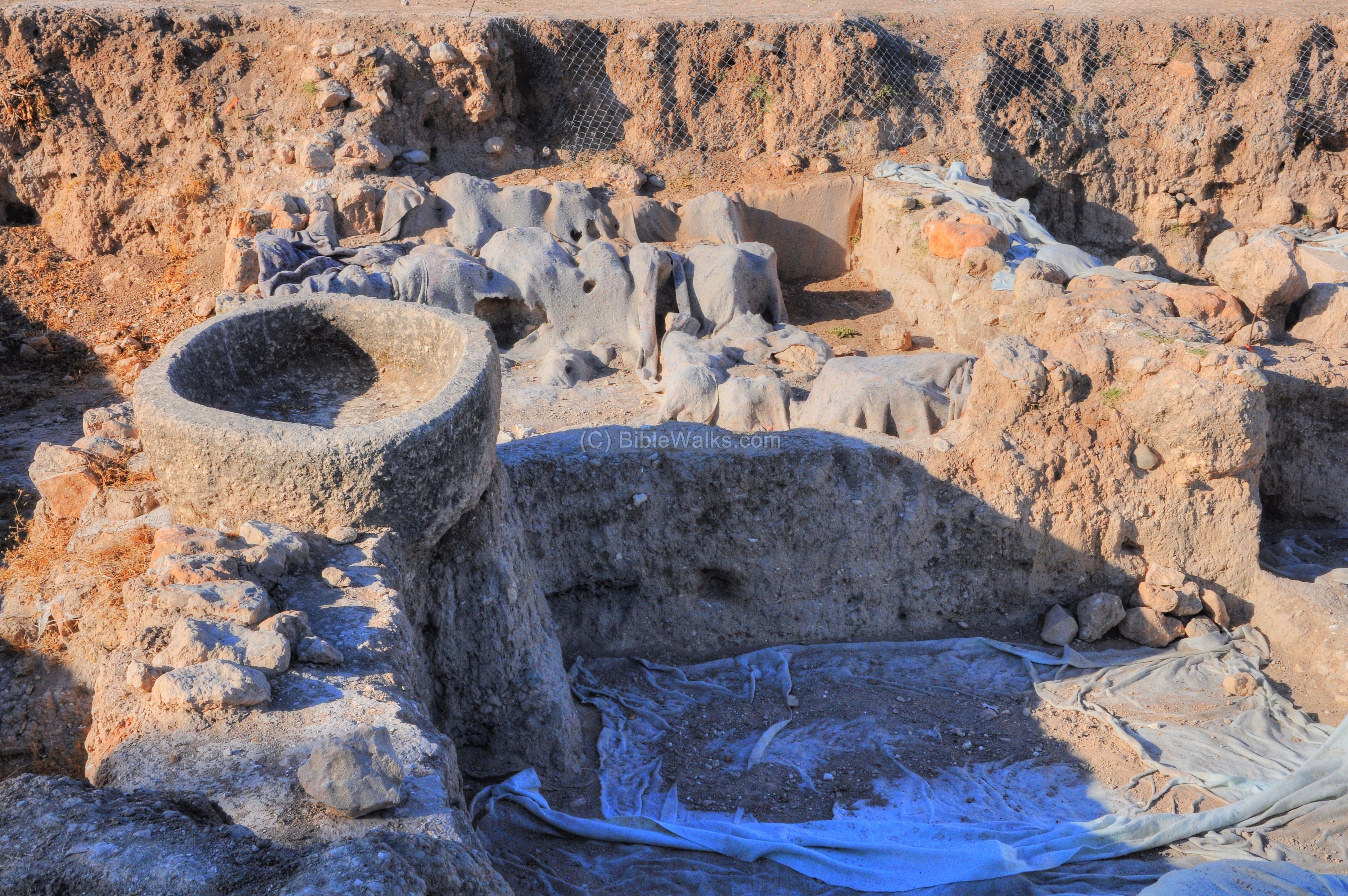
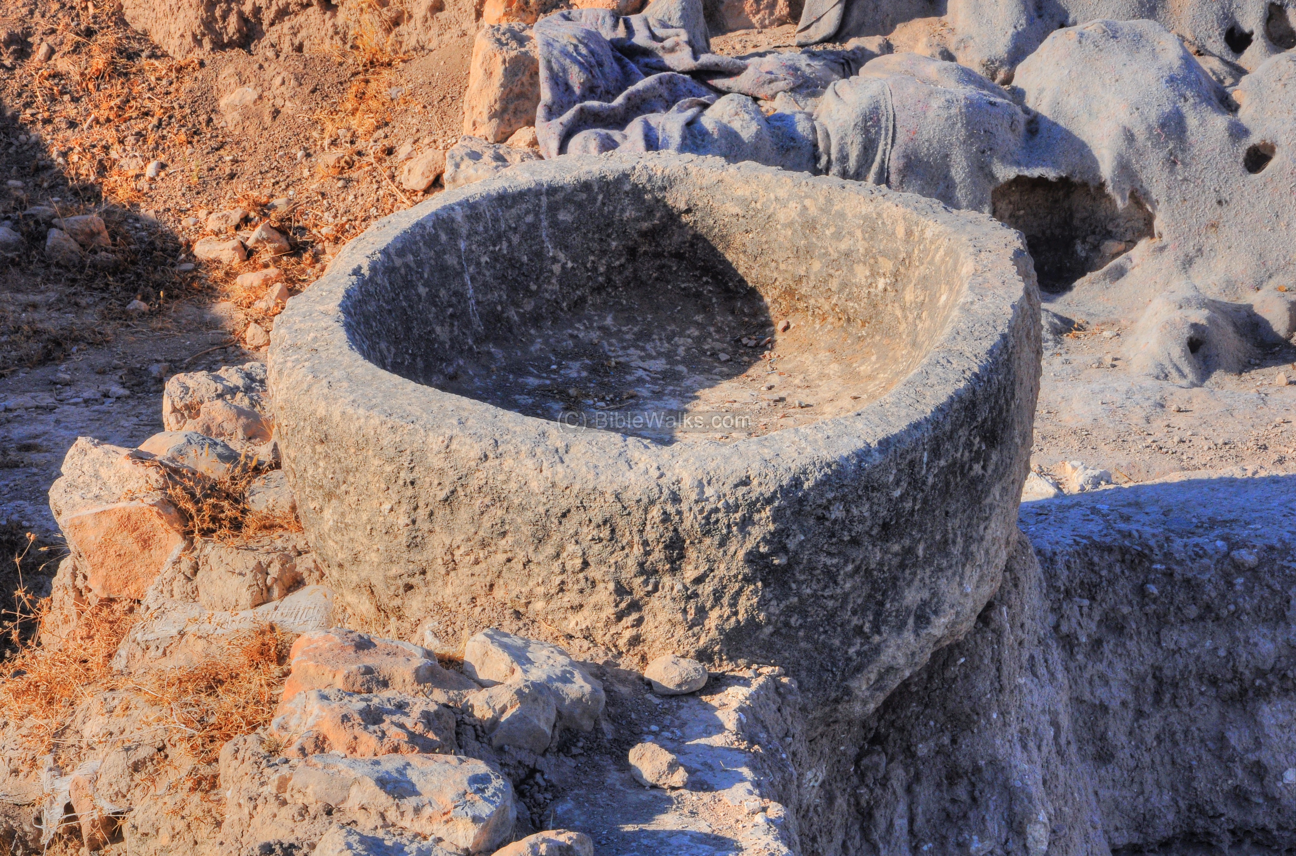
One of the important findings in area D was a two-horned Philistine altar stone. It is made of a single large stone, and is very similar to the depiction of the Israelite altar in the Bible, both in size and in the form of the horns. This implies a strong connection between the Philistines and the Israelites. This interaction, in contrary to their long conflict, is also found in the stories of Samson and David.
Evidence of a massive destruction was found in all excavations sites, perhaps the result of the conquest of 830 BC by Hazael of Aram Damascus. The destruction layer includes hundreds of ceramic vessels, burnt and collapsed buildings, and cultic objects.
(m) Well
An ancient well is located in the river bed of Nahal Elah. The well, which appears on the PEF map as “Bir el Wad” (well of the valley), was used by the villagers as their source of water.
This well may have been an Antilia (Greek for : bring water) type well. The water wheel, also known as “Antilia”, was one of the devices used to fetch the water from the bottom of the well. This type of installation used cogwheels and animal power – donkey or camel – to raise water from the well, and let it fill up to the nearby pool. From the pool the water was channeled to agriculture fields, or used for household or livestock.
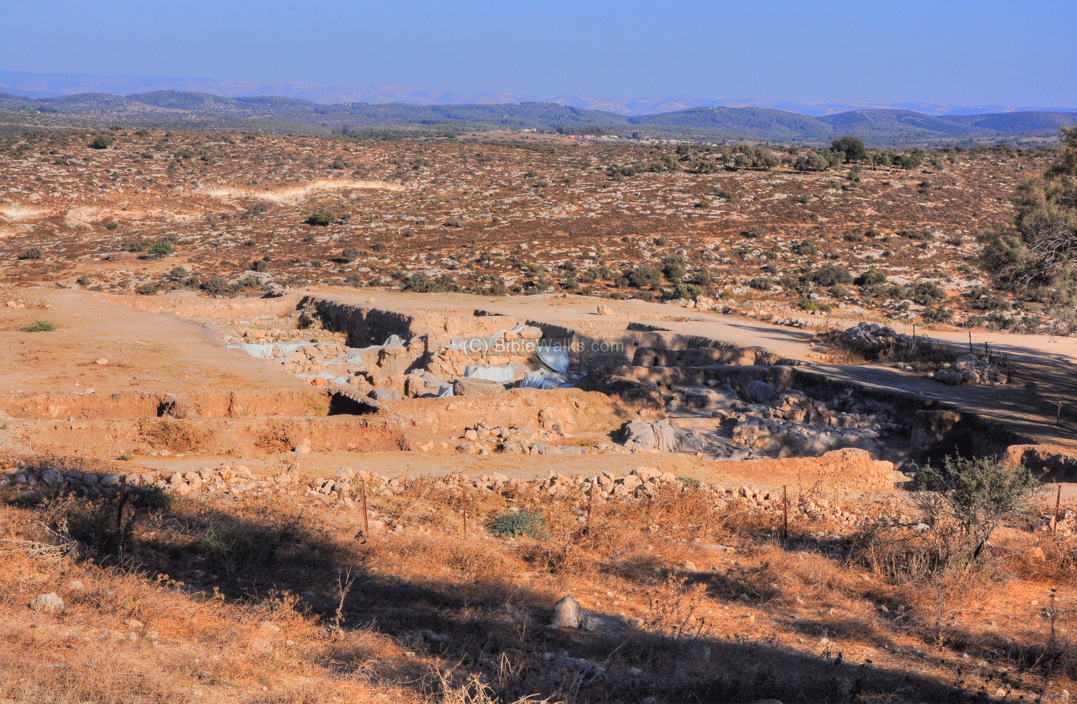
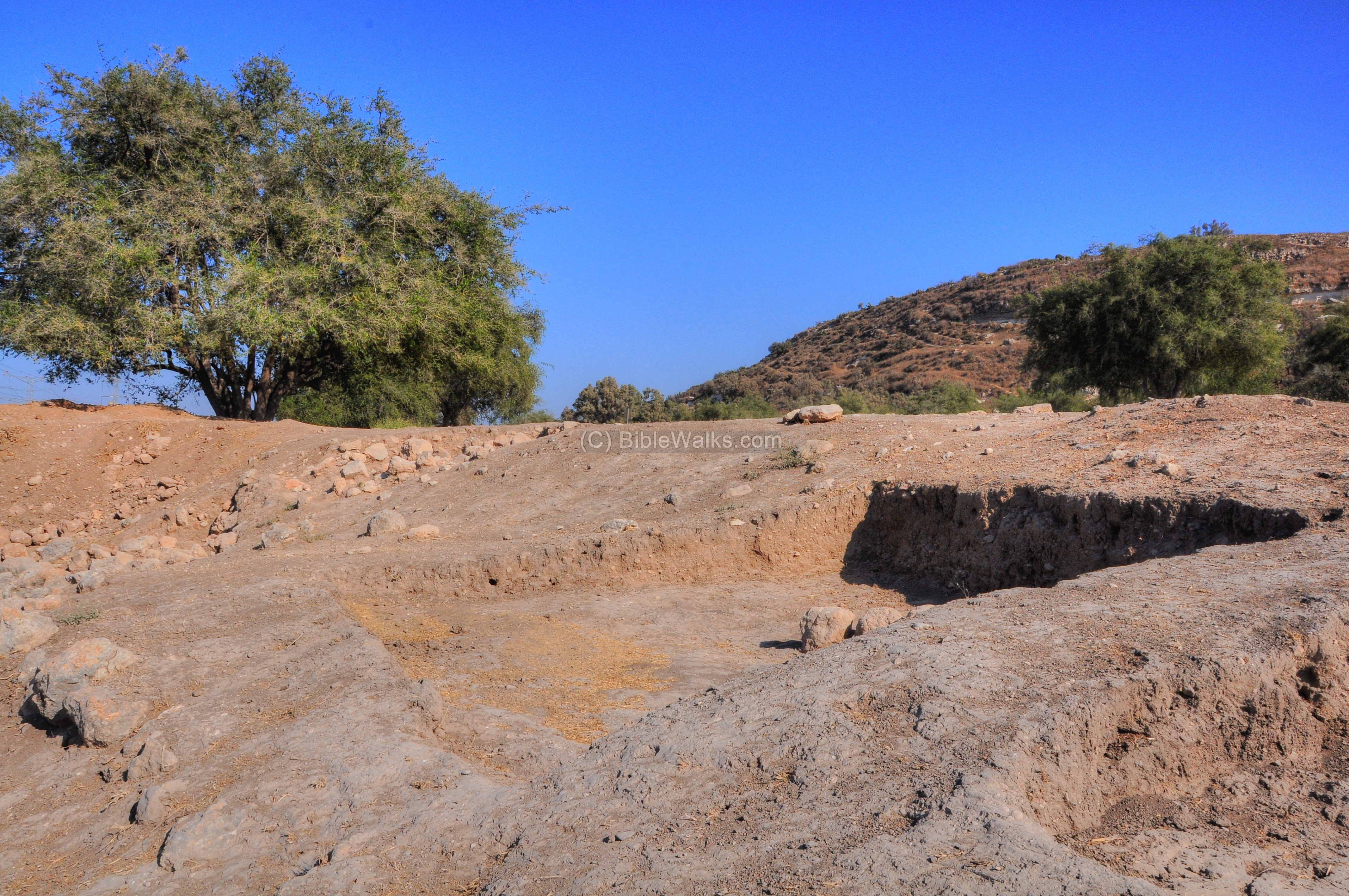
(n) Aramean moat
A trench , 2km long, 3-5m deep and 8-10m wide, was found along 2km around the western, southern and eastern sides of the city. It was identified as a siege moat, which encircled the city in order to prevent the defenders to escape the city, similar to the walls around Masada. The moat was cut during the Iron Age IIa period (1000-800 BC), and the soil was dumped on one side of the trench. It was suggested that the siege moat was constructed by Hazael of Aram, who captured the city.
A section of the ground works of this siege trench can be seen to the east of the mound. From the location of the siege ramp, ~600m from the center of the mound, is this Eastern view of the Tel.
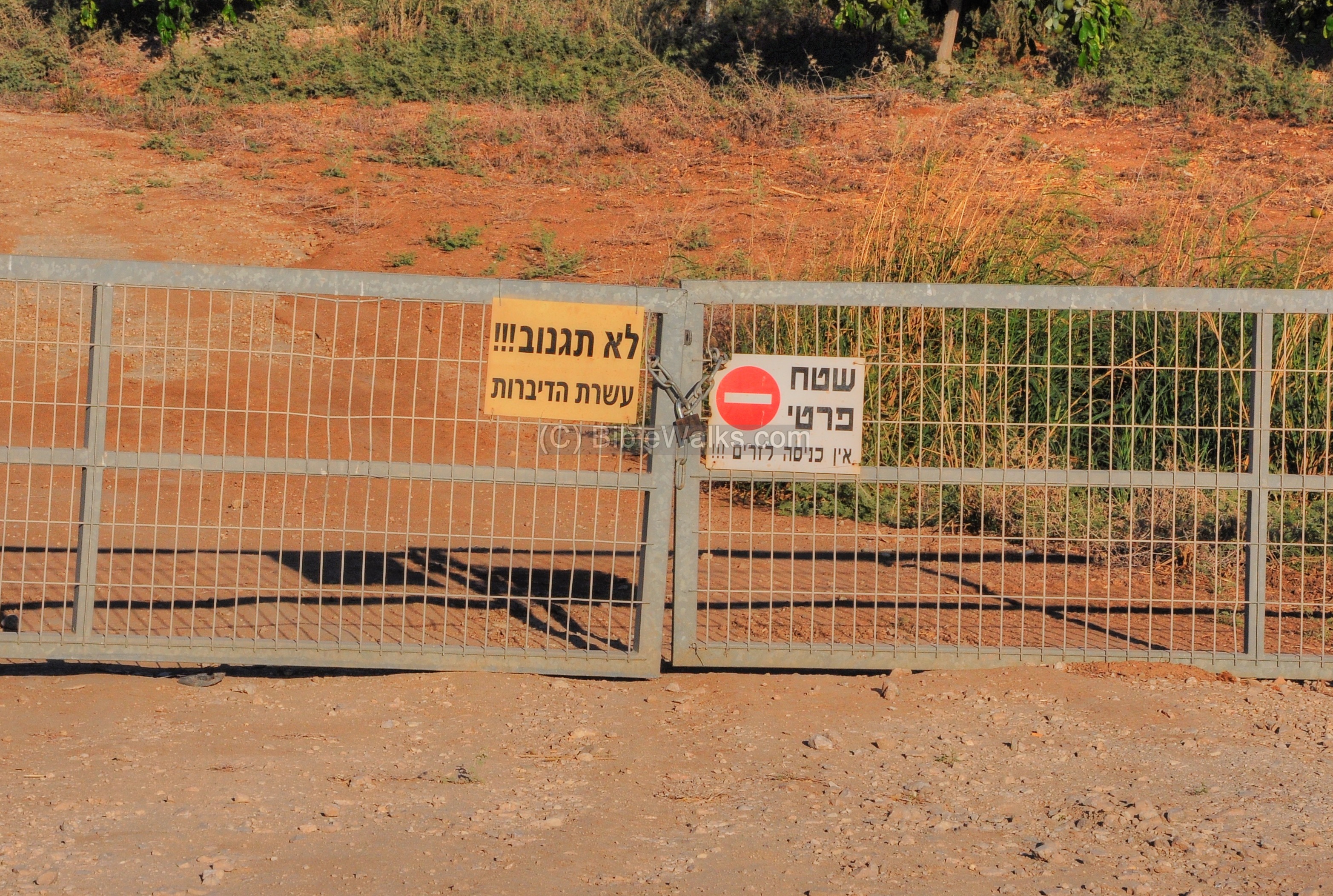
(o) On the light side…
Nearby is an interesting sign on a gate to a field. The left sign reads in Hebrew “Do not steal!!! 10 commandments”. One can find such signs only in the land of the Bible.
Etymology (behind the name):
* Names of the site:
- Tell es Safi – Arabic: the bright, or shining, mound (due to the chalk cliffs).
- Gath – Hebrew: Winepress.
- Alba Specula or Alba Custodia– the 12th Century Crusader name, meaning the bright cliffs.
- Blanche-Garde– French : white fortress, based on the white chalk cliff, used by the Franks during the Crusaders times.
Links and References:
* Archaeology and History:
- Quarterly statement, 31 1899 – F. J. Bliss First report pp. 188-199; Second report pp. 317-333
- Quarterly statement, 32 1900 – F. J. BlissThird report pp. 16-29Rock cuttings of Tel es-Safi – R.A. S. Macalister pp. 29-39
- Gath Archaeology – reports, maps, images of the Ground penetration radar (GPR) study of the siege moat
- The Geopolitical history of Philistine Gath – W. M. Schniedewind Basor #309 1998 pp. 69-77
- Gath expedition – web blog – lots of info
- Photo essay Aren Maeir, Bar Ilan Univ. – nice!
- The Shephelah according to the Amarna Letters – Nadav Na’aman
- Earthquakes in the Holy Land
* YouTube and Podcasts:
- Podcast on the Gath excavations (ABC Australia, 2009)
- Philistine Altar found in Gath (Hebrew)
- Excavating Biblical Philistine Gath – International project (BIU, 2012, YouTube, 5:50 minutes)
- Flight over Gath (Biblewalks, 2016, 4:33 minutes)
- A. Maeir explaining the Tell (2012, 15:57 minutes)
- Science and Archaeology at Tell es-Safi (Lecture,2014, 49:06 minutes)
- Archaeological dig at Tell es-Safi (Lecture,2014, Sagu, 47:36 minutes)
- Tell es-Safi – Biblical Gath (BibleWalks, 2016, 4:33 minutes)
- Aramean conquest and Bone arrows (Ancient insights; 8:47 minutes)
* Biblewalks sites:
Drone Aerial views – collection of Biblical sites from the air
The ark of Covenant – Its Journeys
BibleWalks.com – tour the Bible country
Tel ‘Erani<<–previous site—<<< All Sites>>>— next Shefela site–>> Tel Burna
This page was last updated on Mar 23, 2023 (add AI illustration)
Sponsored links: