This page is an overview of the ancient sites of Ashdod, with direction to its major ancient sites.
Home > Sites > Shefela > Ashdod (Overview)
Contents:
Background
Location
History
Photos
* Tel Ashdod
* Tel Mor
* Ashdod Yam
* Jonah Hill
Etymology
Links
Overview:
Ashdod is the fifth-largest city in Israel and is home to a bustling port, a number of beaches, and various cultural and historical sites.
This page is an overview of the ancient sites of Ashdod. It covers the long history of the city, from its foundation in the 17th century BC, through its 600 years as a Philistine city with many references in the Bible, until the modern times. This overview page refers to other web pages which detail the Biblical and Historical sites of Ashdod.
(1 Samuel 5:1): “the Philistines took the ark of God, and brought it from Ebenezer unto Ashdod“.
Location and Map:
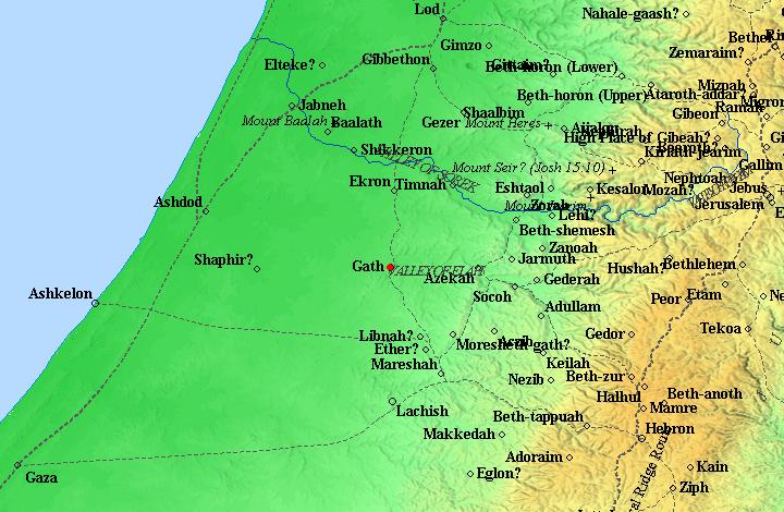
There are several areas of interest in the region of Ashdod. The following maps show three of these areas.
a. Tel Ashdod
Tel Ashdod is located south east of the modern city.
b. Ashdod Yam (Ashdod Maritime) is located on the western side of the modern city.
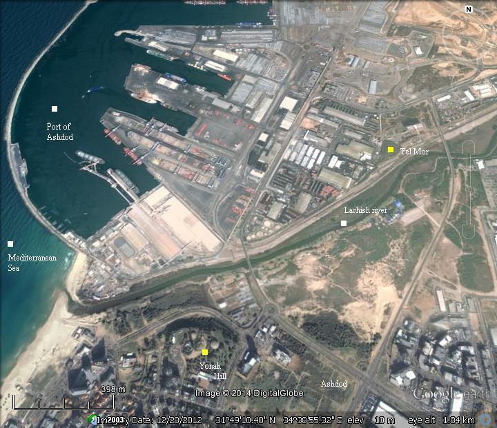
c. Tel Mor – the Canaanite period port – is located 7KM north west of the ancient inland city of Ashdod. It is near the modern port of Ashdod, seen here to the north of the ancient mound.
History:
-
Bronze period – a major Canaanite city
The Canaanite city was established in the 17th Century BC, along the ancient Via Maris road from Egypt to Syria and Mesopotamia. Its port city – Ashdod Maritime – was established a decade later on the banks of the Lachish river.
The Egyptians conquered Canaan following the battle of Megiddo (1468 BC). Their control of Canaan lasted for 350 years, and Ashdod was a station along the only road connecting Egypt to Canaan.
The city is first described by the the Israelites as a city of giants or Anakim, which the Israelites could not conquer (Joshua 11, 22): “There was none of the Anakims left in the land of the children of Israel: only in Gaza, in Gath, and in Ashdod, there remained”. Ashdod and its towns and villages were allotted to the tribe of Judah (Joshua 15:20,47): “This is the inheritance of the tribe of the children of Judah… Ashdod with her towns and her villages, Gaza with her towns and her villages, unto the river of Egypt, and the great sea, and the border thereof:”.
-
Iron (Biblical) age I – Invasion of “Sea people”
The Philistines: The “Sea Peoples” from the Aegean sea landed in Canaan and Egypt in waves of invasions during the 12th Century BC. They eventually settled along the eastern shores of the Levant, in a region called “Pleshet”, named after the Philistines (Hebrew: Plishtim). They eventually became the arch enemies during the period of the Judges (12th-10th C) and the Israelite Kingdom (10th Century – 6th Century).
The identity of the invaders is not certain, and several hypotheses attempt to resolve the origins of these people:
-
The Bible: wrote about the Philistine invasion (Amos 9 7): “Have not I brought up Israel out of the land of Egypt? and the Philistines from Caphtor…”. Caphtor is the island of Cypress. Another Biblical source points out to the source of the Philistines (Jeremiah 47 4): “Because of the day that cometh to spoil all the Philistines, and to cut off from Tyrus and Zidon every helper that remaineth: for the LORD will spoil the Philistines, the remnant of the country of Caphtor”.
-
Egyptian sources: Ramses III confronted the Sea People invaders in 1168BC, in the sea and on land. A relief describing the naval battle, located in Medinet Habu (Tebes, Upper Egypt), tells about the invasion: “The foreigners made a conspiracy in their island…their confederation ware Plst, Skl, … no land could stand before them…they were coming towards Egypt, and fire walked before them.” The “Skl” may have been, according to some scholars, Sikels from Sicily.
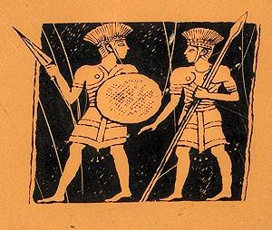
Philistine warriors – on sign of the Zafit national park
Following the battles against the invaders, the Egyptians managed to repulse the Philistines into a small enclave in the southern coastal cities of Canaan (from Gaza to Ashkelon), as per (Joshua 13, 3): “…five lords of the Philistines; the Gazathites, and the Ashdothites, the Eshkalonites, the Gittites, and the Ekronites”.
A map of the cities and roads of the Bronze and Iron Age periods is below. The ancient city of Ashdod was strategically located on the south/north Via Maris route.
The cities and roads around Ashdod – during the Canaanite and Israelite periods – Bible Mapper 3.0
The Israelite cities on the low hills along the coast were affected by the push of the Philistines eastwards into the land of Judah.
Their conflict with the Israelites started in the mid 11th century BC, and one of the stories associated with this conflict is the heroism of the mighty Samson of the tribe of Dan, who was born in the village of Zorah (3km north of Beit Shemesh) and was a Judge for 20 years.
Samson attacked a group of people in Ashkelon, after his first Philistine wife (of Timnath) betrayed him by disclosing his riddle to her relatives (Judges 14: 19): “And the Spirit of the LORD came upon him, and he went down to Ashkelon, and slew thirty men of them, and took their spoil, and gave change of garments unto them which expounded the riddle. And his anger was kindled, and he went up to his father’s house”.
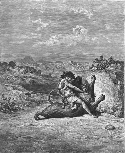
Samson slaying the Lion – – Drawing by Gustav Dore
As per Judges 14: 8-9
The Philistines continued to struggle with the Israelites, and managed to defeat Israel in the battle of Eben Ezer.
The great battle of Eben-Ezer occurred in the middle of the 11th century between Ebenezer and Aphek, at about 1050 BC. This battle is fully detailed in the Bible (1 Samuel 4 1): “Now Israel went out against the Philistines to battle, and pitched beside Ebenezer: and the Philistines pitched in Aphek”.
The Bible describes the course of the battle, and its tragic results: 34,000 Israelite soldiers dead, the two spiritual leaders (sons of Eli) were killed, and worse: the Ark of Covenant, which was brought from Shiloh to encourage the army, was taken by the Philistines (1 Samuel 5:1,2): “And the Philistines took the ark of God, and brought it from Ebenezer unto Ashdod. When the Philistines took the ark of God, they brought it into the house of Dagon, and set it by Dagon”. Dagon was one of the Philistine Gods, and worshiped in the city.
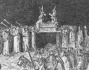
Ark of Covenant moved to the battlefield –
Part of a drawing by Gustav Dore (French artist, 1832-1883)
The stolen ark did not stay too long in Ashdod, and was moved to Gath (1 Samuel 5:2-8):
“And when they of Ashdod arose early on the morrow, behold, Dagon was fallen upon his face to the earth before the ark of the LORD. And they took Dagon, and set him in his place again. And when they arose early on the morrow morning, behold, Dagon was fallen upon his face to the ground before the ark of the LORD; and the head of Dagon and both the palms of his hands were cut off upon the threshold; only the stump of Dagon was left to him. Therefore neither the priests of Dagon, nor any that come into Dagon’s house, tread on the threshold of Dagon in Ashdod unto this day. But the hand of the LORD was heavy upon them of Ashdod, and he destroyed them, and smote them with emerods, even Ashdod and the coasts thereof. And when the men of Ashdod saw that it was so, they said, The ark of the God of Israel shall not abide with us: for his hand is sore upon us, and upon Dagon our god. They sent therefore and gathered all the lords of the Philistines unto them, and said, What shall we do with the ark of the God of Israel? And they answered, Let the ark of the God of Israel be carried about unto Gath”.
According to the excavations results [2], Ashdod of the 10th century covered an area of 100 Dunams (10 hectares) with a population of 2,000. It controlled a sparse rural settlement area of 4 villages.
-
Israelite Kingdom (10th -6th century B.C.)
The Eben-Ezer battle defeat caused a shock to Israel, and brought the people to demand a strong monarch leadership rather than the existing administration by judges.
King Saul, the first anointed King of Israel (~1025-1006 BC), managed to push the Philistines back to their cities after Saul’s victory over the Philistines. They retreated from the hills of Samaria and Judea (1 Samuel 14 31): “And they smote the Philistines that day from Michmash to Aijalon”. The constant friction with the Philistines is also underlined in the battle between David and Goliath in the Valley of Elah.
The area of Pleshet – the region of the Philistines in the Shefela lowland – was not conquered by the Israelite Kingdom, except for brief occasions. King Uziah managed to conquer parts of Pleshet in the middle of the 8th Century (2 Chronicles 26: 1, 7) “Then all the people of Judah took Uzziah… and he went forth and warred against the Philistines, and brake down the wall of Gath, and the wall of Jabneh, and the wall of Ashdod, and built cities about Ashdod, and among the Philistines. And God helped him against the Philistines…”.
The conflict with the Philistines is echoed in the words of the prophet regarding the fate of the cities of the Philistines:
-
Jeremiah (47:5-7): “Baldness is come upon Gaza; Ashkelon is cut off with the remnant of their valley: how long wilt thou cut thyself? O thou sword of the LORD, how long will it be ere thou be quiet? put up thyself into thy scabbard, rest, and be still. How can it be quiet, seeing the LORD hath given it a charge against Ashkelon, and against the sea shore? there hath he appointed it”.
-
Amos (1:8): “And I will cut off the inhabitant from Ashdod, and him that holdeth the sceptre from Ashkelon, and I will turn mine hand against Ekron: and the remnant of the Philistines shall perish, saith the Lord GOD”.
-
Zephaniah (2:4-7) :” For Gaza shall be forsaken, and Ashkelon a desolation: they shall drive out Ashdod at the noon day, and Ekron shall be rooted up. Woe unto the inhabitants of the sea coast, the nation of the Cherethites! the word of the LORD is against you; O Canaan, the land of the Philistines, I will even destroy thee, that there shall be no inhabitant. And the sea coast shall be dwellings and cottages for shepherds, and folds for flocks. And the coast shall be for the remnant of the house of Judah; they shall feed thereupon: in the houses of Ashkelon shall they lie down in the evening: for the LORD their God shall visit them, and turn away their captivity”.
-
Zecharia (9:5): “Ashkelon shall see it, and fear; Gaza also shall see it, and be very sorrowful, and Ekron; for her expectation shall be ashamed; and the king shall perish from Gaza, and Ashkelon shall not be inhabited”.
Ashdod reached a peak during the 8th century, growing almost 3 times larger in area (280 dunams) and population (5,600 inhabitants), and controlled 15 settlements.
-
Assyrians (8th – 7th Century BC)
The Assyrian empire, a rising force in the region, conquered the North Kingdom of Israel in 732 BC, destroying most of the cities and villages in the land. The Assyrian King Tiglath-Pileser III annexed the area (as per 2 Kings 15: 29):
“In the days of Pekah king of Israel came Tiglathpileser king of Assyria, and took … and carried them captive to Assyria”). The Assyrians made the Philistine cities – from Jaffa to Raphia – a kingdom subdued and raising taxes to the Assyrians. The main city of the Philistine-Assyrian kingdom was Ashdod.
-
First uprising
The cities of the Levant attempted to free themselves from the Assyrians, and were assisted by the Egyptians. In 712 the Assyrian King Sargon II came to fight the Egyptian army in Raphia, south of Gaza, and managed to repel them back to the south. Sargon also took Ashdod (Isaiah 20:1): “In the year that Tartan came unto Ashdod, (when Sargon the king of Assyria sent him,) and fought against Ashdod, and took it;”.
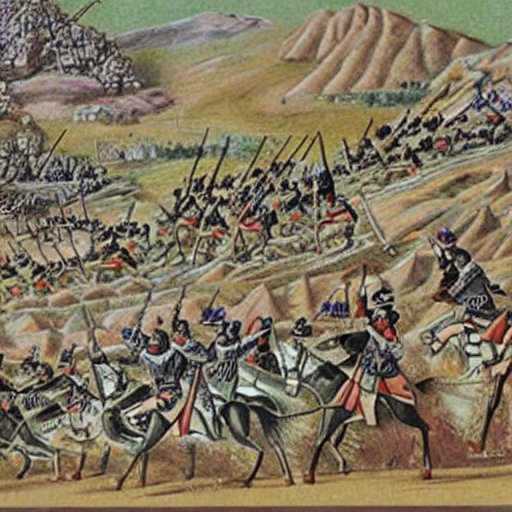
Assyrian forces attacking – AI generated by Stable Diffusion
-
Second uprising
After the death of the Assyrian King Sargon II (722-705 BC), the Judean King Hezekiah mutinied against the Assyrians, joining other cities in the area in another attempt to free themselves from the Assyrian conquest. Two Philistine cities joined Hezekiah’s mutiny: Ashkelon and Ekron. Hezekiah crushed the other Philistine cities that refused to join the mutiny (2 Kings 18:8): “He smote the Philistines, even unto Gaza, and the borders thereof, from the tower of the watchmen to the fenced city”.
The Assyrian army came in 701, led by Sennacherib, son of Sargon II (2 Chronicles 32 1): “After these things, and the establishment thereof, Sennacherib king of Assyria came, and entered into Judah, and encamped against the fenced cities, and thought to win them for himself”. The Assyrians first handled the Philistine cities and confronted the Egyptian army who supported the mutiny. Ashkelon, whose King Zedka led the Philistine revolt, was punished and its ruler was replaced. Sennacherib conquered 46 cities in Judea, but Jerusalem was spared from destruction.
Ashdod became a vassal city-state.
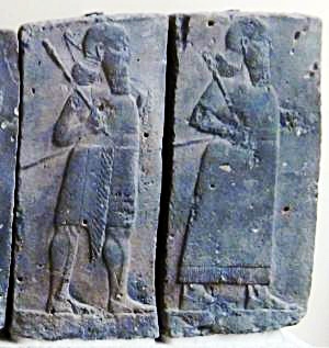
Orthostat relief – depicting soldiers from different orders of the Assyrian Army, in procession;
basalt; Hadatu Tiglath-Pileser III period (744-727BC)
[Istanbul Archaeological museum]
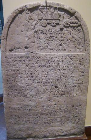
Sennacherib’s stele with relief and inscription; Ninveh;
limestone [Istanbul Archaeological Museum]
Recent excavations on the north of Tel Ashdod[1] unearthed an Assyrian palace which may have been the residence of the Assyrian governor.
The Assyrians rebuilt the port city of Ashdod Maritime and named it Asdudimmu, preserving the ancient name. They shifted the focus to the new city along the coast, thus degrading the economic and political importance of the inland Ashdod. According to the excavations, the inland city decreased in the 7th century to only 70 dunams and 1,500 inhabitants, due to the shift to the newly founded city of Ashdod-Maritime by the Assyrians.
-
Babylonian (630-538 BC)
The Assyrians ruled the area for 100 years, and were followed by the Babylonian empire (630BC-538BC) and the Persians (538-332BC).
The Babylonian empire rose after the fall of the Assyrians (610BC). They defeated the Egyptians (609BC) and conquered the land until the Nile (2 Kings 24 7):
“… for the king of Babylon had taken from the river of Egypt unto the river Euphrates all that pertained to the king of Egypt”.
Ashdod was conquered in 604 BC, and the city was destroyed. Its people, as well as the residents of the other Philistine cities, were relocated to Mesopotamia. This ended the 600 years of the Philistine presence in Israel.
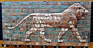
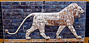
“Lions in Relief” – from the procession street in Babylon.
Nebuchadnezzar II period (604-562BC); glazed brick
[Istanbul Archaeological Museum]
-
Persians (538-332 BC)
The new power – the Persian empire – replaced the Babylonians in 538 BC. Their King Cyrus allowed the exiled Judea residents to return to Jerusalem and rebuilt the area around it.
During the Persian period, the former cities of the Philistines were resettled by the Phoenicians who excelled in Maritime commerce in the nearby port city of Ashdod-Maritime. The city was under the patronage of the Phoenician port city of the Tyre. The Phoenicians in return served the ruling Persian empire with Maritime services. Ashdod was the capital of the region named after the city.
Ashdod remained outside of the small Jewish region centered around Jerusalem, and was hostile to the newly established Jewish presence. (Nehemiah 4:7-8): “But it came to pass, that when Sanballat, and Tobiah, and the Arabians, and the Ammonites, and the Ashdodites, heard that the walls of Jerusalem were made up, and that the breaches began to be stopped, then they were very wroth, And conspired all of them together to come and to fight against Jerusalem, and to hinder it”. Later Nehemiah complains on the inter-marriage of Jews and women of Ashdod (Nehemiah 13: 23-24): “In those days also saw I Jews that had married wives of Ashdod, of Ammon, and of Moab: And their children spake half in the speech of Ashdod, and could not speak in the Jews’ language, but according to the language of each people…”.
-
Alexander the Great (332 BC) and successors – Hellenistic period
When Alexander the Great arrived to the area (332 BC), Ashdod and Ashkelon surrendered and were not harmed, unlike nearby Gaza which was totally destroyed after 2 months of siege. The city was named Azotus-Mesogaias (the inland city of Azotos), as opposed to “Azotos Paralios” which referred to the port city of Ashdod. Note that Azotos was a city in Macedonia, and so this name was an honor to the great city.
The former area of the Philistines – Pleshet – an area of the sea coast which included Ashdod, was now called by the Greeks “Paralia”.
After Alexander’s death (323), Ashdod was torn and switched sides between the two Greek empires – the Ptolemy-Egyptian and the Seleucids-Antioch. Major battles occurred between the sides, starting from the battle near Gaza (312 BC) with the victory of the Ptolemy kings, who ruled the Levant (Israel and Syria) for the following 114 years (312-198).
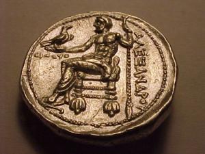
Greek coin – Alexander the Great – Bethsaida
The Seleucids attempted to recapture the area during the First and Second Ptolemy-Seleucid wars (276-255), and failed again in the Third Syrian war (246-240). In their next attempt (219-217) the Seleucids managed to win several battles, but the Raphia battle in the south (217) secured the Ptolemy control. Ashdod and the other Philistine cities were captured in 201 BC by the Seleucid king Antiochus III, but the Ptolemy army, headed by general Scopas, pushed them back to the north. The Seleucids finally defeated the Ptolemy army in the battle of Banias (198 BC). This gave them a control of the Land of Israel. Josephus writes about this (Ant. 12 3 4): “Antiochus overcame Scopas, in a battle fought at the fountains of Jordan, and destroyed a great part of his army”.
During the Hellenistic period, and even during the Hasmonean period, Ashdod remained an independent city. As such, it minted its own coins, starting in 111 BC. The city was also known for its beautiful Hellenistic temples.
-
Maccabee revolt and Hasmoneans (167-103 B.C.)
The Maccabees headed the anti-Hellenization rebellion against the Greek Seleucids who controlled the land of Israel since 198 BC. After a series of successful military campaigns they took control of Judea, liberated the land and created an independent Jewish country, known as the Hasmonean Kingdom (164-63 BC as independent state, and 63-37 BC as rulers under Rome).
The southern coast cities of Israel were important targets during the following years of the Hasmonean expansion. In 163 BC Judas Maccabeus captures Ashdod and returns with spoils of war which were important for financing their war machine (Josephus Ant. 12: 9: 6): “They came also to Ashdod, and took it, and laid it waste, and took away a great deal of the spoils and prey that were in it, and returned to Judea”. In 145 BC Jonathan Maccabee captured Ashdod and killed 8,000, and forced a truce with Ashkelon. He later captured the city and burned the temple (Ant 13 4: 4) : “Upon which Jonathan pursued them as far as Ashdod, and slew a great many of them, and compelled the rest, in despair of escaping, to fly to the temple of Dagon, which was at Ashdod; but Jonathan took the city on the first onset, and burnt it, and the villages about it; nor did he abstain from the temple of Dagon itself, but burnt it also, and destroyed those that had fled to it”.
His brother, Simon, fortified Ashdod (Antiquities 13 5:10): “About the same time it was that Simon his brother went over all Judea and Palestine, as far as Askelon, and fortified the strong holds; and when he had made them very strong, both in the edifices erected, and in the garrisons placed in them”. Ashdod was under Hasmonean rule until 137 BC, when it returned to the Seleucid control.
Years later, King Alexander Jannaeus recaptured the area around Ashdod in 103-102BC (Wars 1 4:2): “However, Alexander recovered this blow, and turned his force towards the maritime parts, and took Raphia and Gaza, with Anthedon also, which was afterwards called Agrippias by king Herod”. This campaign secured the southwest border of the Hasmonean Kingdom, with a border set at the brook of Egypt, 74 Km (46 miles) southwest of Gaza.
- Early Roman Period (63BC – 67 AD )
The Roman general Pompey captured the land in 63 BC, and rearranged the territories (Ant. 1 7:7). The coastal area was removed from the Hasmonean Kingdom’s territory. Ashdod retained its independent city status even during the Roman period. Thus, Ashdod as well as all coastal cities, became autonomous units. (Josephus Plavius, Antiquities, XIV 4 4): “took away those cities … he rebuilt … Ashdod, and Jamnia…. All these Pompey left in a state of freedom, and joined them to the province of Syria.”.
Herod the Great, King of Israel under the Romans (37 BC – 4 BC), received the south coast area, including Ashdod, in 30 BC as a gift from Augustus Caesar. After his death (4 BC) the area was inherited by his sister, Salome (Shelomit), and remained under Judea control (Wars 2 6): “Salome also, besides what the king had left her in his testaments, was now made mistress of Jamnia, and Ashdod, and Phasaelis”.
During the Great revolt (67-70 AD), the city was captured in the first year by Vespasian’s army (Wars 4 3:2): “…Vespasian from Caesarea to Jamnia and Azotus, and took them both”.
Shift to the harbor city:
During the Roman period, the inland Ashdod (“Azotos Mesogaias”) was gradually abandoned and the center moved to the shore side Ashdod-Yam (“Azotus Paralios”). The large Roman city covered a smaller section of the former Iron age city, mostly south of the Medieval fortress. It was about 150m long, fortified and protected by high towers.
Roman highways: The coastal road passing near Azotus, connecting the north to Egypt, appears on the Peutinger map. This map is based on a 4th Century Roman military road map, with an orientation of north on the right side. Jerusalem is marked by a pair of icons of a house with “Herusalem” above it. Ashkelon is also marked with a pair of icons with “Ascalone” above it.
The coastal road from Ashkelon, thru Jamnia (Yavne) to Joppe (Jaffa), passed through the city (marked here as “Azoton”) .
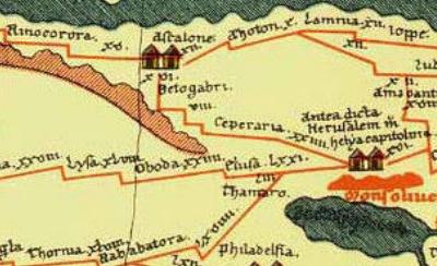
Peutinger Roman 4th Century Military Map – Azoton is seen to the roight of Ashkelon
Note that the map is oriented with north on the right side.
Throughout the Late Roman and Byzantine periods, many of its people converted to Christianity. In Azotus Parolios was a seat of a bishop (Episcopus), serving the Byzantine province called “Palaestina Prima” (established in 390 AD).
Ashdod Maritime (=Azotus Paralos) appears in the Madaba map, an ancient map of the Holy Land from the 6th Century AD was discovered in 1884 in a Byzantine church in Madaba, Jordan. The name of the city appears as Azotoc Paro[lios], seen here on the upper part of the segment.
The major streets, public and religious buildings of the city are illustrated on the mosaic. Its elaborate details and size imply the importance of the city. The illustrations show:
-
the sea and sand on the bottom side
-
a colonnaded street parallel to the sea
-
a church, with steps descending to the shore
-
a number of buildings
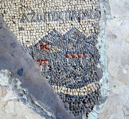
p/o Madaba map
- Early Islamic period (637-1099 AD)
In 637 AD Ashdod Maritime was conquered by the Arabs, completely destroyed, ending its Christian population and importance.
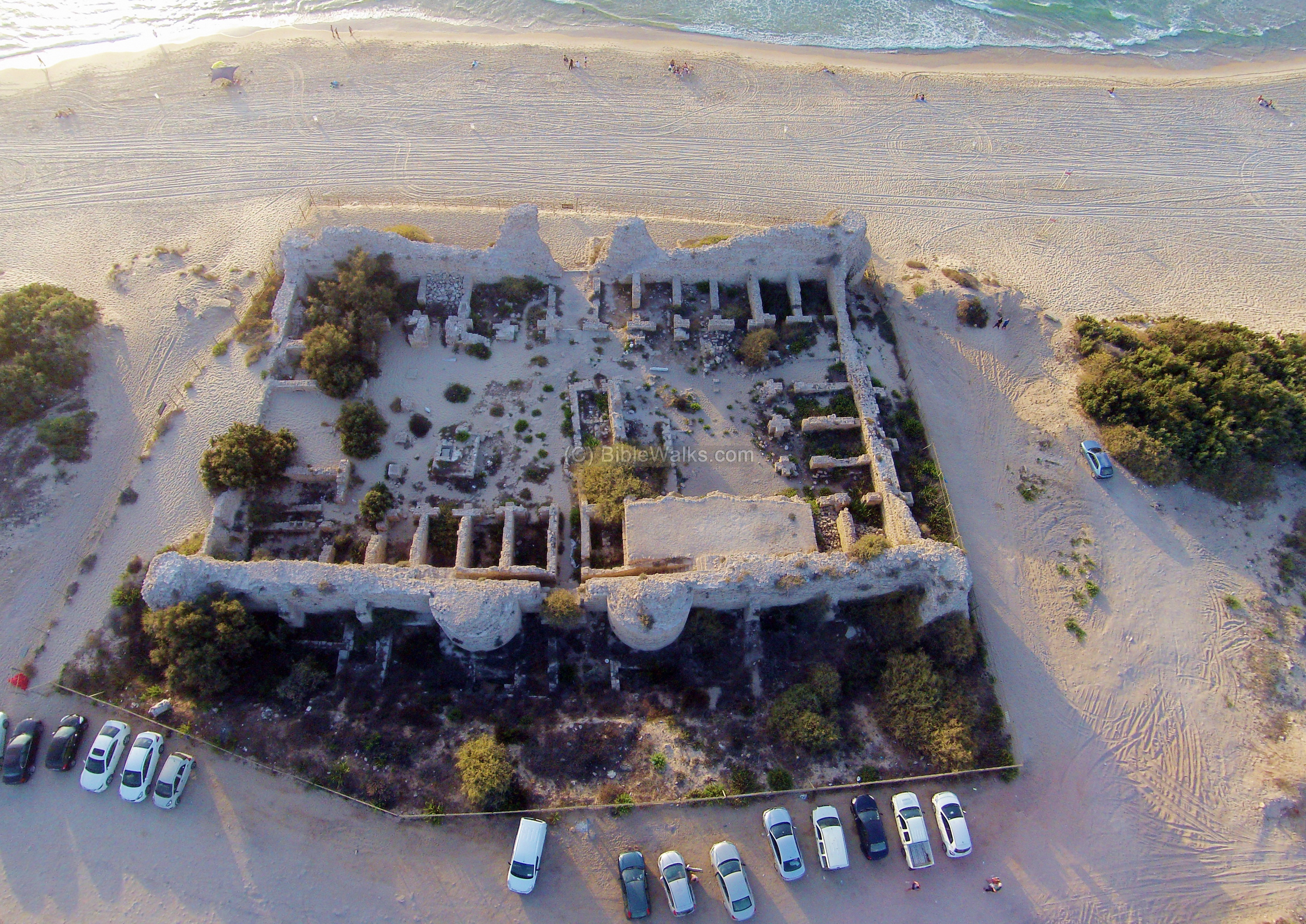
During the 9th Century, probably during the time of Umayyad Caliph ‘Abd al-Malak (685-705), a new fortress was built on top of the ruins of a Byzantine structure, and named “Minet el Qal’a” – the Citadel of the harbour. This was one of the fortresses and coastal towers (called ribats) that were built along the frontier, having a visual contact proximity for relaying alerts to the district capital (Ramla). This defense line was aimed at defending the region against Byzantine raids from the sea. The ribats also served as hostels (Caravanserai) for the voyagers along the coastal road.
The Citadel covered an area of 60m by 45m, protected by four corner towers with 6m (17ft) in diameter. There were two gates – one on the west and the other on the east, each gate protected by semicircular towers. The walls, built of the sandstone (kurkar) bricks, are 1.7m-2.1m wide.
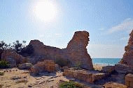
- Crusaders (12th -13th century)
The Crusaders arrived from Europe to the Holy Land in order to liberate the Holy Land and free Jerusalem. They accomplished the mission in 1099, and established the Crusader Kingdom.
The Crusaders renovated and reoccupied the Ashdod Maritime fortress (1131-1141). They named it: Castle Bernard (Castellum Beroart; Castellum Beroardi). The source of this name is not known. The fortress was ruined in 1290 by the Islamic forces that defeated the Crusaders.
-
Ottoman period (16th – 20th century)
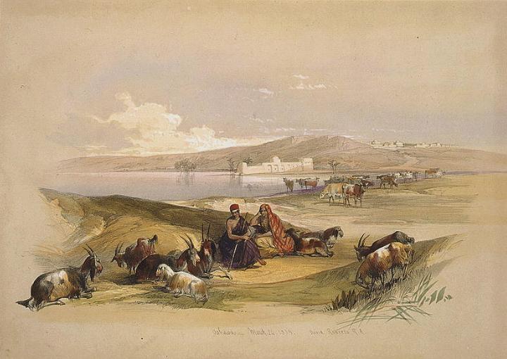
David Roberts visited Ashdod in 1839 and provided this great illustration of shepherds on the beaches of Ashdod.
Survey of Western Palestine:
Conder and Kitchener of the Palestine Exploration Fund (PEF) surveyed the area during the Survey of Western Palestine (SWP) in 1874-75. The report of the ancient sites of Ashkelon is found in sheet XVI (Volume 3, p.409). Sections of the report are brought here:
“Esdud – This village marks the site of the ancient Ashdod, but no ruins of any great antiquity were observed. It consists almost entirely of mud houses, one story high, with walls and enclosures also of mud. The houses occupy the eastern side of a low hill, which rises considerably above them, and is covered with gardens, walled in with cactus hedges ; the soil a semi-consolidated sand. Gardens also exist on the other sides of the village. The sand dunes extend almost to the village. On the south-west is the ruined Khan ,and south of this a large marsh, which was only partly dry in April, 1875. The water-supply of the village is from ponds with mud banks, and from a masonry well to the east ; and in this direction there are a few datepalms and some small fig-trees in gardens. It is probable that the ancient site was on the top of the hill, but no ruins were found. This site has never been lost, being known to Jerome and Eusebius, and also to the best informed of the Crusading Chroniclers”.
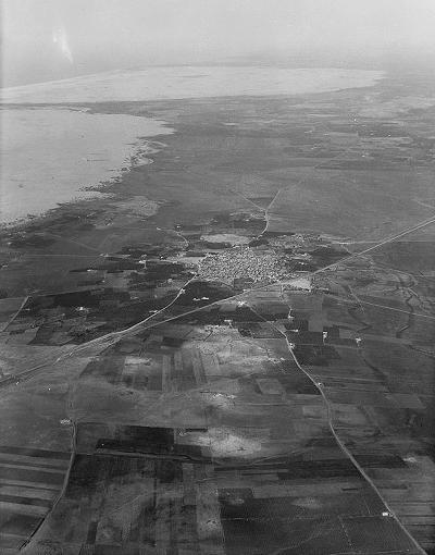
Aerial photo of Esdud (1939) – Photos of the LOC, Matson collection;
printed by American Colony, 1932
Their report continues (p421):
“Most of the houses are built of mud bricks ; some few are of stone. In a mosque called Jimi’a Sidi Amer, I found a great column in white marble supporting the vault. This place, which rises on the slopes of a low hill, is itself commanded on the north-west by a higher hill, which was formerly the citadel It is now cultivated and planted with fig and olive trees ; a wall of cactus surrounds it This natural hedge grows over a thick wall built of blocks regularly cut and well dressed. This is the tradition among the people, and one of them declared that quite recently while digging a hole in the ground he had brought to light several courses of a great wall in magnificently cut stones.
Below and round Esdud one observes a number of walls, some of them ancient Near one there is a mosque which contains the tombs of two Santons much revered in this neighborhood.
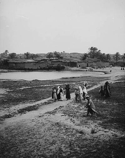
Mud brick village of Esdud, ~1900
American Colony, Matson collection, Photos of LOC
In the court before the mosque is an ancient sarcophagus, 7 feet long and broad in proportion. Its principal face is ornamented with sculptured garlands, to which are hanging, right and left, bunches of grapes, emblems of the Promised Land.
South of the same mosque extend the ruins of a vast abandoned Khan. Outside it forms a great rectangle, within long galleries, sustained by ogival arcades, chambers, and magazines run round a central court. The entrance faces the north. In the vestibule of the doorway, an ancient column of marble, lying on the ground, serves as threshold. The inhabitants of Esdud have been pulling this Khan down in order to sell the materials” Guerin.
An illustration of the Arab village, dated 1882, is shown here. This is from a book by CH. W. Wilson , one of the PEF explorers. The title reads: “Eshdud – the ancient Ashdod”.
Ch. W. Wilson, Picturesque Palestine, 1882, Vol III P. 165
Their report continues:
“The history of the city of Ashdod, or Azotus, the ‘Great City of Syria,’ as Herodotus called it, extends from the time of Joshua to the sixth century of the Christian era. Apart from its association with the Philistine wars, the place was besieged and taken by Tartan, general of Sargon in the year 716 B.C. ; by Psammedcus 636 B.C. ; by Judas Maccabaeus 163 B.C. ; and by Jonathan and Simon 148 B.C.. It was taken from the Jews by Pompey; rebuilt 55 B.C.. by Gabinius: bequeathed by Herod to Salome, and taken by Vespasian. It became the seat of a bishopric in the fourth century. Probably its decline followed the Moslem conquest. In the time of the Crusaders Ashdod was nothing but a small village”.
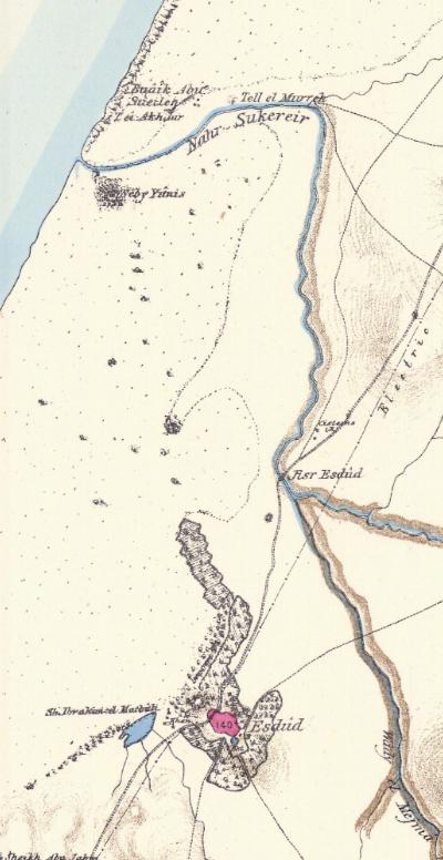
Part of map Sheet 16 of Survey of Western Palestine, by Conder and Kitchener, 1872-1877.
(Published 1880, reprinted by LifeintheHolyLand.com)
Another report describes the harbor of Ashdod, Minet el Kulah, west of Esdud (pp 426-427)
“Minet el Kulah – This ruin forms the port of Ashdod, and though nearly all the buildings are covered up with blown sand, it shows evidence of having been a place of importance. There is a small landing place between reefs of rock, the shore sloping more rapidly here than elsewhere. Ships still touch here occasionally.
The principal ruin is a square fort, which is, according to the natives, ancient, and the masonry and cement of which resemble those of the walls of Ascalon. It is certainly more ancient than the time of Ibrahim Pacha, who erected other buildings along the coast. The building measured 180 feet north and south, by 144 feet east and west, outside, and had a round tower at each corner, and on the east and west walls towers flanking a sea and land gate. Seven of these towers remain. The west wall is nearly perfect, but the southern is broken down, and the other breached. The towers are 17 feet diameter, the wall 5 feet 6 inches thick, and the gateways 12 feet wide.
The masonry used is small, and of a soft sandy limestone from the cliffs near. The joints are well made, and the cement the same found at Ascalon, very hard, white, and full of shells and ashes. This building stands on the shore, only a few feet above the water. In the outer wall near the north-west corner, near the base, is a stone on which are the letters EΔOM. Behind the castle, on the sand-hills, are traces of a considerable town. There are no cliffs near the spot, so that it affords a good site for a harbour town. South of the castle, also close to the shore, scattered stones and foundations exist, and the sand-hills are strewn for some distance with numerous fragments of broken pottery. Remains of a tessellated pavement were also found in the ruins. Near the town on the south-east there is a ruined rubble cistern, circular, and 10 feet diameter, having a domed roof of similar rubble work, in good cement full of shells. This consists, in fact, more of cement than of stone, the stones used being small and friable. There can be no doubt that this was an important place, apparently in the Middle Ages, judging by comparison with other ruins in the plains.
Visited April 12th, 1875″.
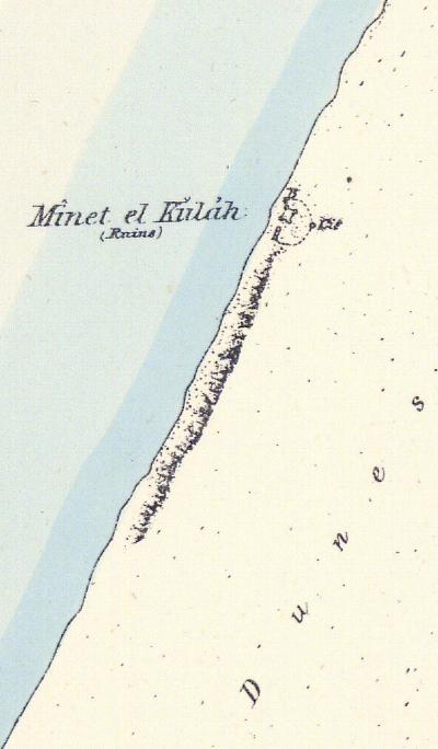
Part of map Sheet 16 of Survey of Western Palestine, by Conder and Kitchener, 1872-1877.
(Published 1880, reprinted by LifeintheHolyLand.com)
-
Excavations
The late Prof. Moshe Dothan (1919-1999) of the Department of Antiquities and University of Haifa, excavated Tel Ashdod in the years 1962-1972. Salvage excavations were held in 2003 (Daniel Verga, IAA) and 2003-2004 (Elena Kogan Zahavi, Perchia Nahshoni).
-
Modern Period
A modern city of Ashdod was founded in 1955 as an immigration settlement, but soon grown into a city (declared in 1968). Its prime industry is the port of Ashdod, Israel’s largest port. Ashdod has now (2016) a population of ~250,000, the 6th largest city in Israel, covering an area of 50 square KM (5,000 hectares).
Photos:
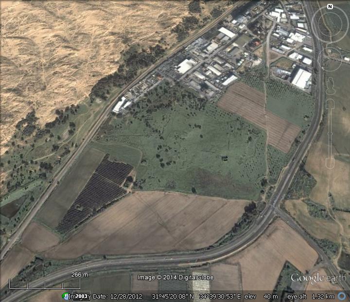
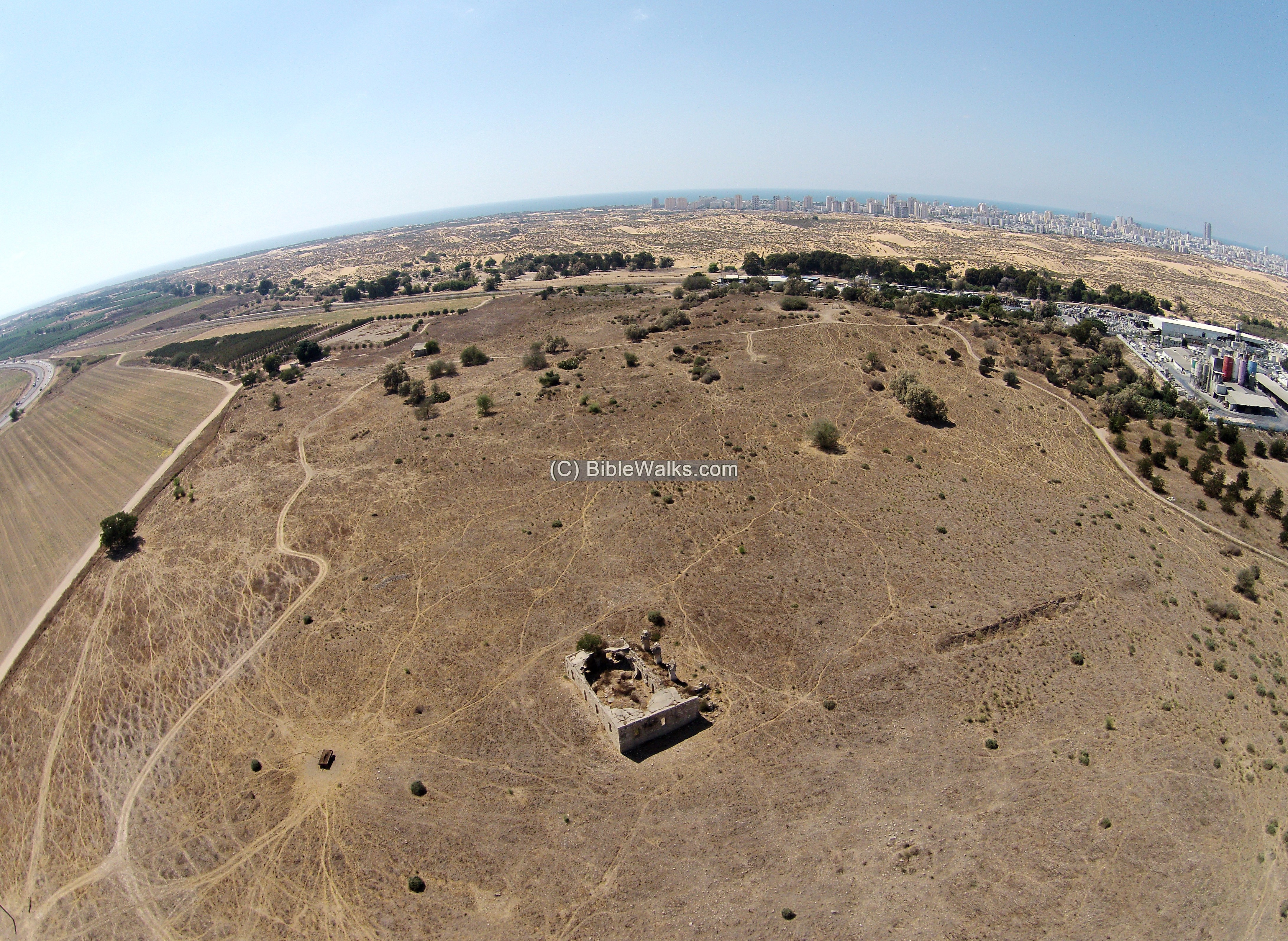
(a) Tel Ashdod:
The site of the Bronze and Iron Age periods is located on a the multi-period mound of Tel Ashdod , south and east of the modern city. It was first fortified in the 17th Century BC, and was one of the five large Philistine cities from the 12th Century to the 6th Century BC.
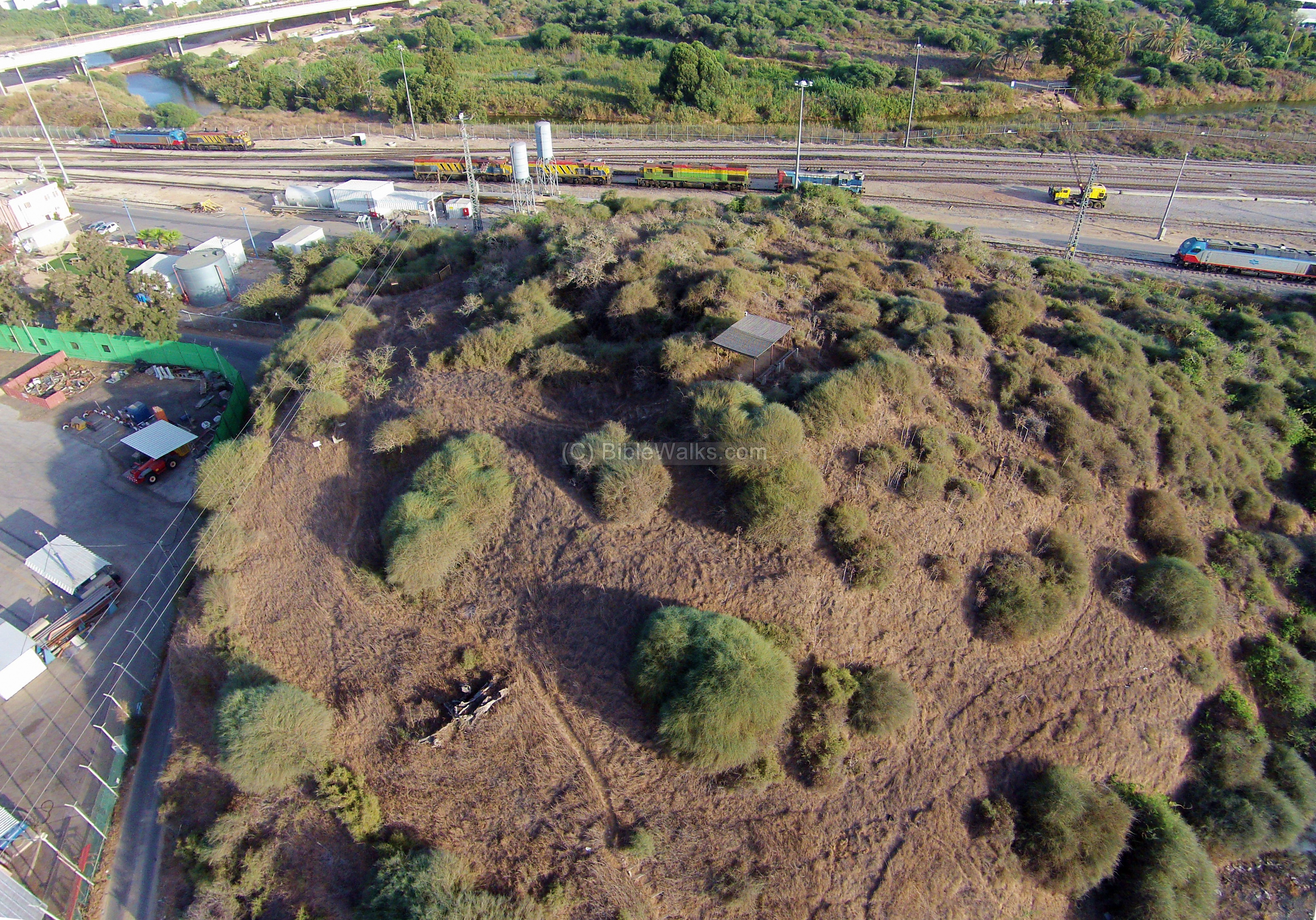
(b) Tel Mor:
Tel Mor is a small archaeological mound near the mouth of Nahal Lachish river, near Ashdod’s modern harbor. During the Canaanite and Philistine settlements of the Bronze and Iron Ages (16th-8th Century B.C.), this fortified city served as the harbor for the inland city of Ashdod.
![]() Read about Tel Mor in a separate page.
Read about Tel Mor in a separate page.
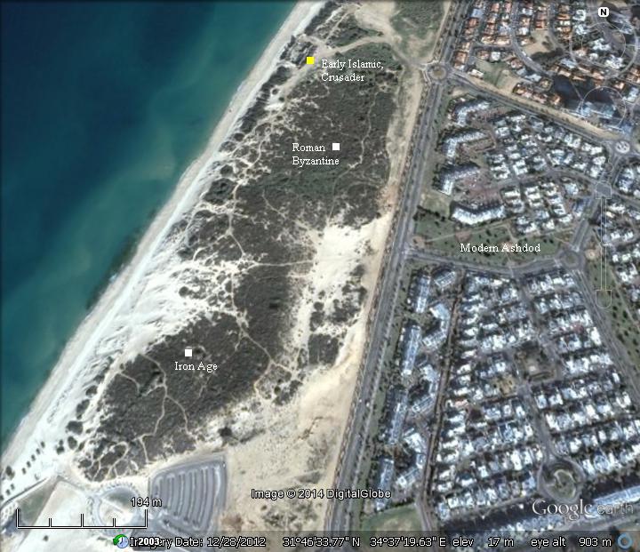
(c) Ashdod Yam:
The site of Ashdod Maritime (Hebrew: Ashdod Yam) is located on the coast, 4km west of the inland city of Tel Ashdod. It served as the city’s harbor since the Iron Age (8th Century BC), replacing the older Canaanite port located in the north of Ashdod (Tel Mor).
The Israelite period and Roman/Byzantine periods covered the area south of the medieval citadel. It is covered today by sand dunes, as seen here.
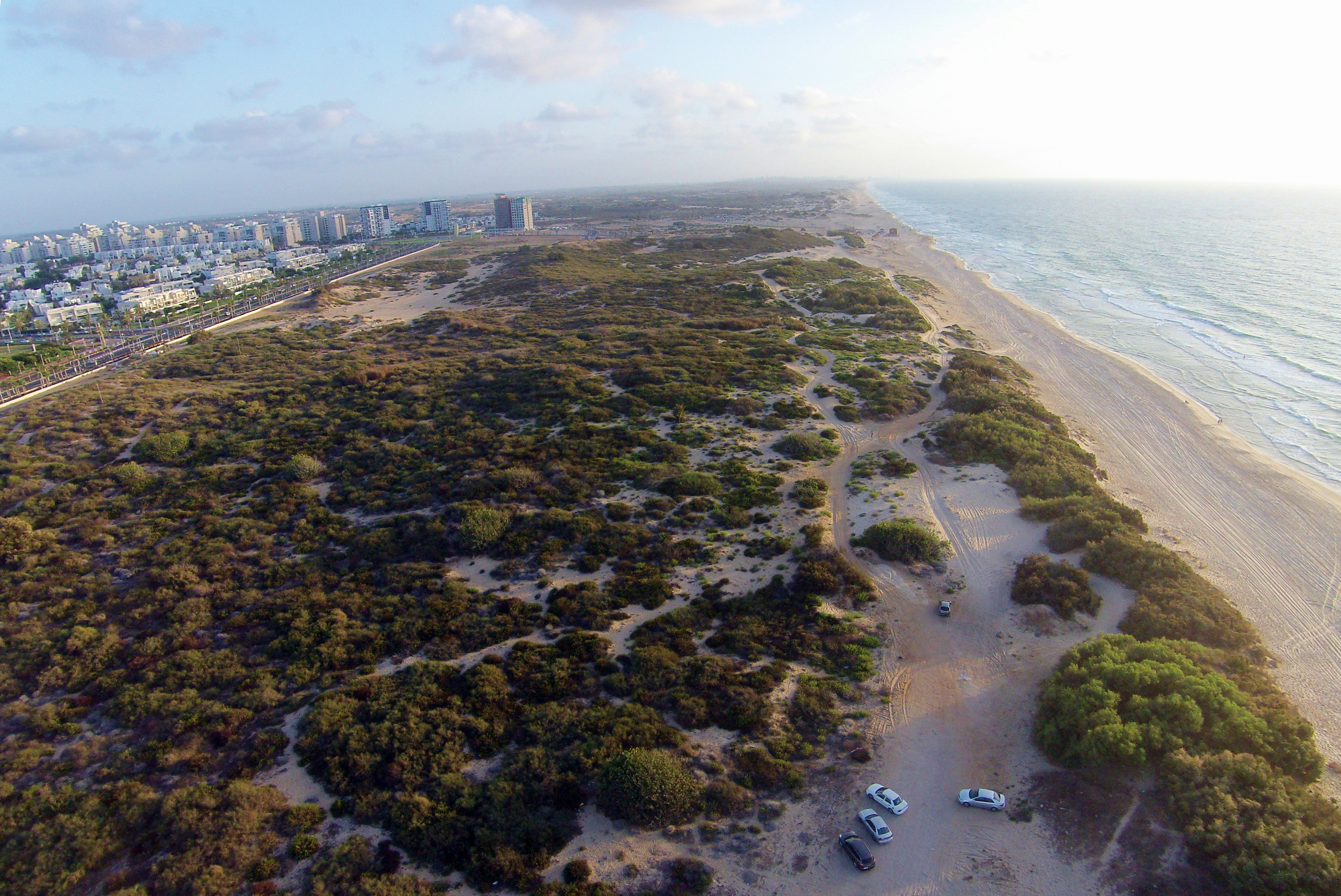
The harbor continued to function through the Hellenistic and Roman-Byzantine period (renamed Azotus), up to the Crusader period. The ruins of the Crusaders fortress are located on the north side of the area.
![]() Read about Ashdod Yam in a separate page.
Read about Ashdod Yam in a separate page.
(d) Jonah tomb:
Yonah (Jonah) hill is located on the north-west side of Ashdod, overlooking the mouth of the Lachish river and the port of Ashdod. On this hill, 53m above sea level, is the traditional tomb of Jonah, and excavations unearthed ruins of a First Temple period fortified observation post from the times of Jonah.
![]() Read about Yonah Hill in a separate page.
Read about Yonah Hill in a separate page.
Etymology (behind the name):
* Names of Ashdod and the area:
- Pleshet – Hebrew name of the Philistine region.
- Paralia – Greek name of the area of the former Philistine region.
- Inland Ashdod – Greek name: “Azotos Mesogaias”
- Maritime Ashdod – Greek name: “Azotos Paralios”
Links and References:
* Excavation references:
- North Tel Ashdod rescue excavation – summary of 2 seasons (IAA, Elena Kogan Zahavi, Perchia Nahshoni)
- Studies in Archaeology of Israel and Levant (edited by Fantalkin & Yasur-Landau) 2008
* External links:
- Old photos of Ashdod – Library of Congress collection
- Municipality of Ashdod English version (in Hebrew: detailed site)
- Port of Ashdod
* Ashdod sites:
- Ashdod Maritime – the Iron Age harbour city
- Tel Mor – The Canaanite period harbour city
- Yonah Hill – fortifications south of Lachish river
- The ark of Covenant – Its Journeys
BibleWalks.com – Search for the lost cities of the Bible
Ashkelon (City) <<<—previous —<<<All Sites>>>— next Shefela site—>>> Ashdod Yam
This page was last updated on Mar 23, 2023 (add AI illustration)
Sponsored links: