Ruins of an ancient fortified Canaanite and Philistine Harbor city.
Home > Sites > Shefela > Ashdod > Tel Mor
Contents:
Background
Location
History
Photos
* General
* Mound
* Purple dye
* Surroundings
Etymology
Links
Overview:
Tel Mor (Tell el Murreh) is a small archaeological mound near the mouth of Nahal Lachish river, near Ashdod’s modern harbor. During the Canaanite and Philistine settlements of the Bronze and Iron Ages (16th-8th Century BC), this fortified city served as the harbor for the inland city of Ashdod.
Excavations at Tel Mor have revealed evidence of human habitation dating back to the Middle Bronze Age (around 2000 BC), and the site was inhabited continuously through the Iron Age, the Persian period, and the Hellenistic period, before eventually being abandoned in the Roman period.
The most prominent remains at Tel Mor include a large, well-preserved fortress that dates to the Late Bronze Age (around 1400 BC), as well as a number of other structures, including houses, public buildings, and a large water system. Archaeological finds at Tel Mor include pottery, jewelry, weapons, and other artifacts that provide important insights into the material culture of the ancient city. In addition, the site has yielded important inscriptions in both Hebrew and Phoenician that shed light on the political and cultural history of the region during various periods of its occupation.
Overall, Tel Mor is an important archaeological site that provides important insights into the history and material culture of ancient Ashdod and the surrounding region. Its excavations and discoveries have contributed greatly to our understanding of the political and cultural landscape of the eastern Mediterranean during the Bronze and Iron Ages.
Location and Map:
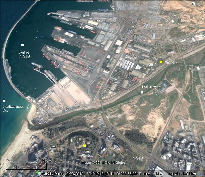
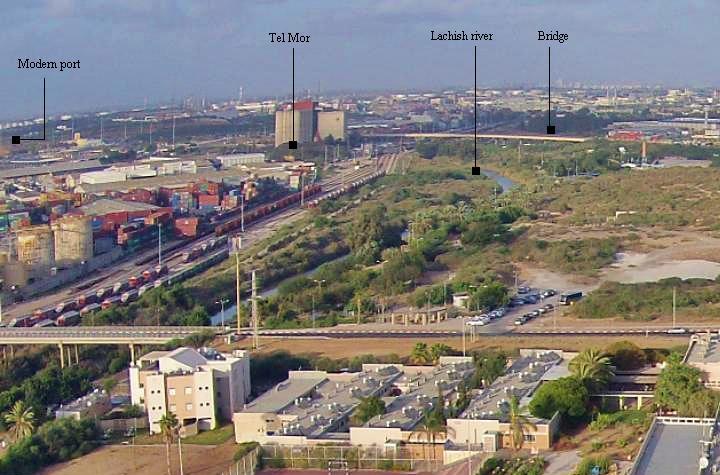
An aerial view of the area around Tel Mor is shown here, with indication of the major sites. Tel Mor is located on the north bank of Lachish river, close to its mouth, and adjacent to the modern port of Ashdod.
The Iron/Bronze period port city is 7KM north west of the ancient inland city of Ashdod.
History:
-
Canaanite Period (16th -12th Century BC)
Tel Mor was settled at the 16th Century BC (end of the Middle Bronze Age), as the harbor of the inland city of Ashdod. Its location at the mouth of Nahal Lachish river, with its natural anchorage, fulfilled the needs of the city for marine commerce. The excavations unearthed ceramics and artifacts dated to the 16th Century, originated from Cypress, Egypt and coastal cities of the Levant, indicating strong trade activities with the region.
According to excavator of the site, M. Dothan, this harbor city and its mother city (Ashdod) may have been constructed during the reign of the Egyptian Pharaoh Apophis I (Apepi), ruler of Lower (North) Egypt during the 15th dynasty (1650-1550). This construction may have associated with the struggle between the Egyptians and the Hyksos (Greek for: “ruler of foreign lands”), foreign invaders who conquered the area of the eastern Nile delta starting from the 18th Century. These invaders, Semitic Canaanites from the Levant, seized control of Northern Egypt, pushed the Egyptians to Thebes in the south, and forced the pharaohs to pay tribute. Only after a great war of 30 years, they were finally expelled several years after Apophis. The fortifications of Ashdod, Tel Mor, as well as other cities, may have played a role in this conflict.
The fortified city was destroyed at the end of the 14th Century, but soon was rebuilt. A square Egyptian-style fortress (23m x 23m; stratum VIII-VII) was its central structure, with thick walls.
This city was destroyed in the middle 13th Century, and a smaller fort (11m x 11m; building F in stratum VI) was built partially on top of it. This also ended in a destruction at the end of the 13th Century.
A smaller building (7m x 8m; building H in stratum V) was built on top of it. The ceramics indicated an Egyptian occupation. This construction was not destroyed, but rather fell out of use during the second half of the 12th Century.
Some scholars suggested, based on the analysis of ceramics of Tel Mor and Tel Ashdod (as per T.J. Barako, “Philistines and Egyptians in Southern Coastal Canaan during the early Iron Age”), that the Egyptians continued to hold the post of Tel Mor during the early Philistine period.
-
Iron Age (12th -6th century B.C.)
During the beginning of the period, a small agriculture town was located on the mound.
The Philistines: The “Sea Peoples” from the Aegean sea landed in Canaan and Egypt in waves of invasions during the 12th Century BC, and settled along the eastern shores of the Levant – a region called “Pleshet”, named after the Philistines (Hebrew: Plishtim). The Philistine Pentapolis (“5 cities”: Ashdod, Ashkelon, Ekron, Gath and Gaza) were probably established at about 1130 BC.
The Philistines became the arch enemies during the period of the Judges (12th-10th century) and the Israelite Kingdom (10th – 6th century).
Decline: Relocation of the harbor (8th Century):
Ashdod was one of the Philistine main cities, located inland along the Via Maris road. The port city of Ashdod was first located in Tel Mor. However, it small size did not fit the maritime activity of the Iron Age.
During the 8th Century the Philistines established a new large fortified port city – Ashdod Maritime – 7km south-west of Tel Mor, on top of a raised mound. It is not known when exactly the transition was made. According to some scholars this was before the Assyrian conquest, while others regard the new site as a new stronghold that was constructed in the eve of the conquest.
Assyrians (732-632 BC):
The Assyrian empire conquered the North Kingdom of Israel in 732BC, destroying most of the cities and villages in the land. The Assyrian King Tiglath-Pileser III annexed the area (as per 2 Kings 15: 29):
“In the days of Pekah king of Israel came Tiglathpileser king of Assyria, and took … and carried them captive to Assyria”).
The Assyrians reached Ashdod and made the Philistine cities – from Jaffa to Raphia – a kingdom subdued and raising taxes to the Assyrians. The main city of the Philistine-Assyrian kingdom was Ashdod (the inland city, south of Tel Mor).
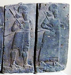
Orthostat relief – depicting soldiers from different orders of the Assyrian Army,
in procession; basalt; Hadatu Tiglath-Pileser III period (744-727BC)
[Istanbul Archaeological museum]
Sargon II ‘s intrusion (712 BC): Due to the heavy taxes, the cities of the Levant attempted to free themselves from the Assyrians. They were assisted by the Egyptians, the empire from the south. Ashdod’s king, Azuri, stopped to deliver tributes to Assyria. The Assyrians replaced him with his brother, but a commoner named Yamani took the power and refused to pay, and so in 712 the Assyrian King Sargon II (722 -705BC) came to settle the issue. He also fought the Egyptian army in Raphia, south of Gaza, where he managed to repel them back to the south.
During this conquest, both the old and new harbors were besieged and conquered. In the excavations of Tel Mor, the last Iron Age layer is dated to this destruction.
Prophet Isaiah writes about this campaign, when Tartan – chief officer of Sargon – conquered Ashdod and its seaport (Isaiah 20 1):
“In the year that Tartan came unto Ashdod, (when Sargon the king of Assyria sent him,) and fought against Ashdod, and took it”.
This prophecy was backed by Sargon’s own accounts of the events, as inscribed in his palace of Khorsabad (discovered by P. E. Botta in 1845). One fragment described the mutiny and specifically mentioned Ashdudimmu (Ashdod-Maritime):
“Azuri, King of Ashdod, planned in his heart not to pay tribute, and among the kings of his neighborhood disseminated hatred of Assyria. On account of the evil he had done I cut off his lordship over the people of his land. I appointed Ahimiti, his younger (?) brother to the kingship over them. But the Hittites, planning evil, hated him and exalted over them Yamani, who had no claim to the throne, and who, like them, knew no fear of authority. In the anger of my heart the mass of my army I did not muster, I did not assemble my camp. With my usual bodyguard I marched against Ashdod. Yamani heard of the progress of my expedition from afar and fled to the borders of Egypt, which lies by the side of Melucha, and was seen no more. Ashdod, Gath, Ashdudimmu, I besieged, I conquered”.
Another fragment adds more details on this campaign:
“In the 9th [error for 11th] year of my reign I marched to the coast of the great sea Azuri, King of Ashdod, Ahimiti his younger (?) brother I exalted over them tribute and taxes of my lordship like those of kings, I imposed upon them The evil in in order not to pay tribute their princes they drove him away Yamani, a soldier, they appointed to kingship over them. Their city in its environs a moat cubits in depth they dug, they reached the water-level To [punish] Philistia, Judah, Edom, Moab, who inhabit the sea-coast, payers of tribute, and taxes to Ashur, my lord. Planning rebellion and untold evil against me, they bore their pledges to Pharaoh, King of Egypt, a prince who could not help them, and sought his aid. I, Sargon, the faithful prince, who honors the oath of Nabu and Marduk, who guards the name of Ashur, caused my trusty troops to cross the Tigris and Euphrates at high water. As for him, Yamani, their king, who had trusted to his own power, and had not submitted to my lordship, he heard of the advance of my army. The fear of Ashur, my lord, cast him down, and to … which is on the bank of the river … waters his land … far away … he fled … Ashdod”.
After the Sargon II destruction, the Assyrians deported some of the population, replacing them with newcomers. They rebuilt the port city and named it Asdudimmu, preserving the ancient name. However, Tel Mor was not used again as a port.
-
Hellenistic period (4th-1st C BC)
The site was resettled during the Hellenistic period. A public structure was found on the eastern foothills, and an installation for the production of purple dye. The installation included a number of plastered pools and a well full of shells of snails which were used to produce the dye.
-
Roman/Byzantine period (1st century BC – 7th century AD)
A small agriculture village existed here during this period.
-
Ottoman period (16th – 20th century)
Survey of Western Palestine: Conder and Kitchener of the Palestine Exploration Fund (PEF) surveyed the area during the Survey of Western Palestine (SWP) in 1874-75. Their map shows the location of Tel Mor (here: “Tell el Murreh”), on the north bank of Lachish river (Nahr Sukereir). They wrote about the sites near the river:
-
- Tell el Murreh – Across the river is this mound, now named Tel Mor, where the Canaanite/Philistine port was once located. The Arabic translation (per PEF name lists, p. 275) is: “The mound of the brackish water, but perhaps named from the Beni Murreh Arabs”.
- Tell Akhdar – Arabic: the green mound. This is another name of Tel Mor, although it is marked apart of Tell Mureh.
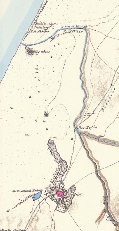
Part of map Sheet 16 of Survey of Western Palestine,
by Conder and Kitchener, 1872-1877.
(Published 1880, reprinted by LifeintheHolyLand.com)
Other sites are marked on the map:
-
- Neby Yunis (“Prophet Jonah”), on the south bank of Lachish river (Nahr Sukereir). See Yonah Hill.
- Esdud – To the south of the site were the ruins of Tel Ashdod.
- Via Maris – Sea way – this ancient highway is marked as a double line, connecting the empires on the North to Egypt on the South. It crossed the river at Jisr Esdud (bridge of Ashdod).
- Buaik Abu Sueileh – Means: the cattle sheds of Abu Sueileh
- Archaeological surveys and excavations
Excavations at Tel Mor were conducted in 1959 and 1960, directed by M. Dothan.
The survey of the Ashdod map (#84), conducted in the 1980s and published in the Archaeological survey of Israel (map #84, site 18), and dated the site.
-
Modern Period
The city of Ashdod was established in 1957, and has grown to have a population of a quarter million (2014). Its port, constructed in 1961 in an area north of the Lachish river, is one of the two main ports in Israel.
Photos:
(a) Overview:
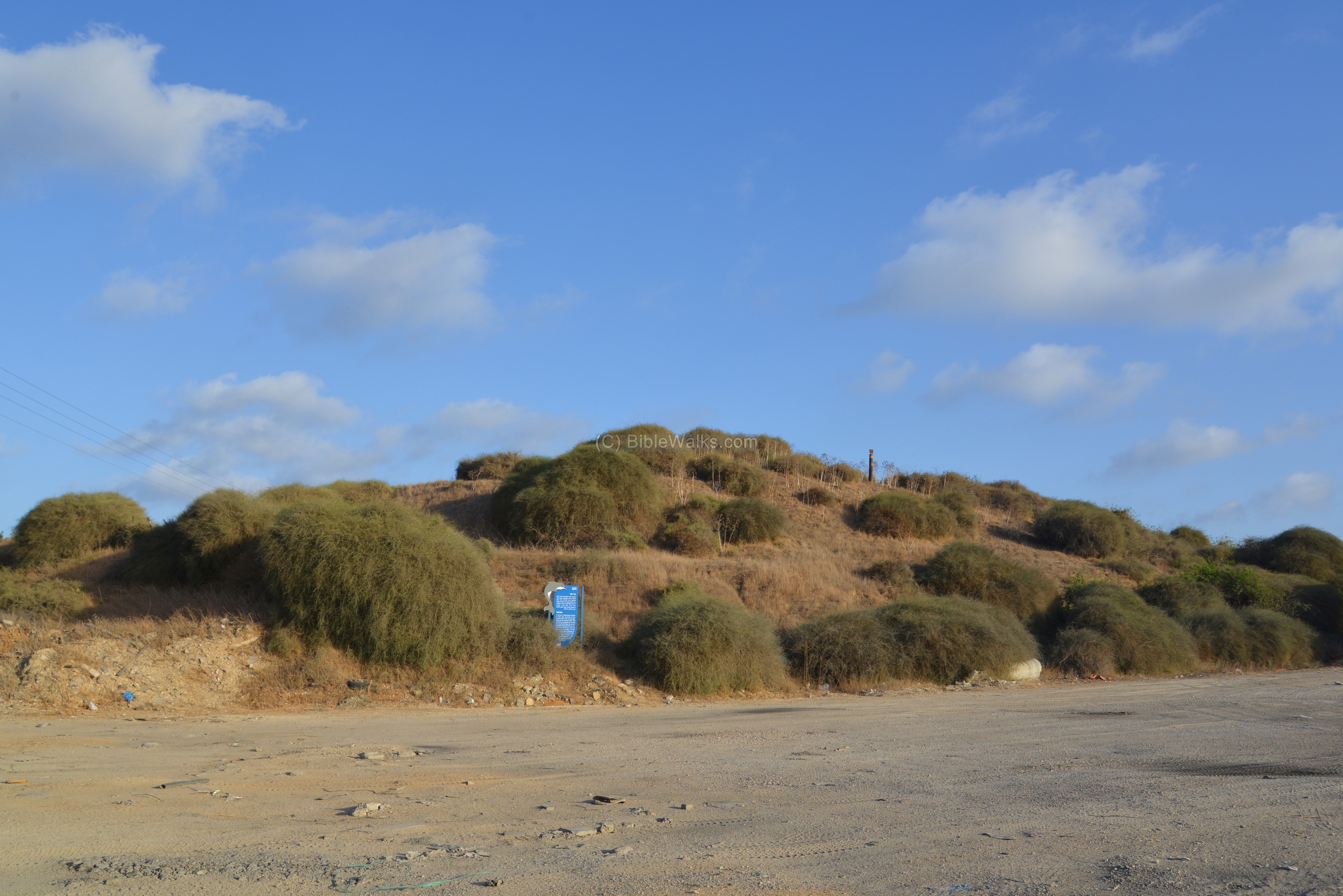
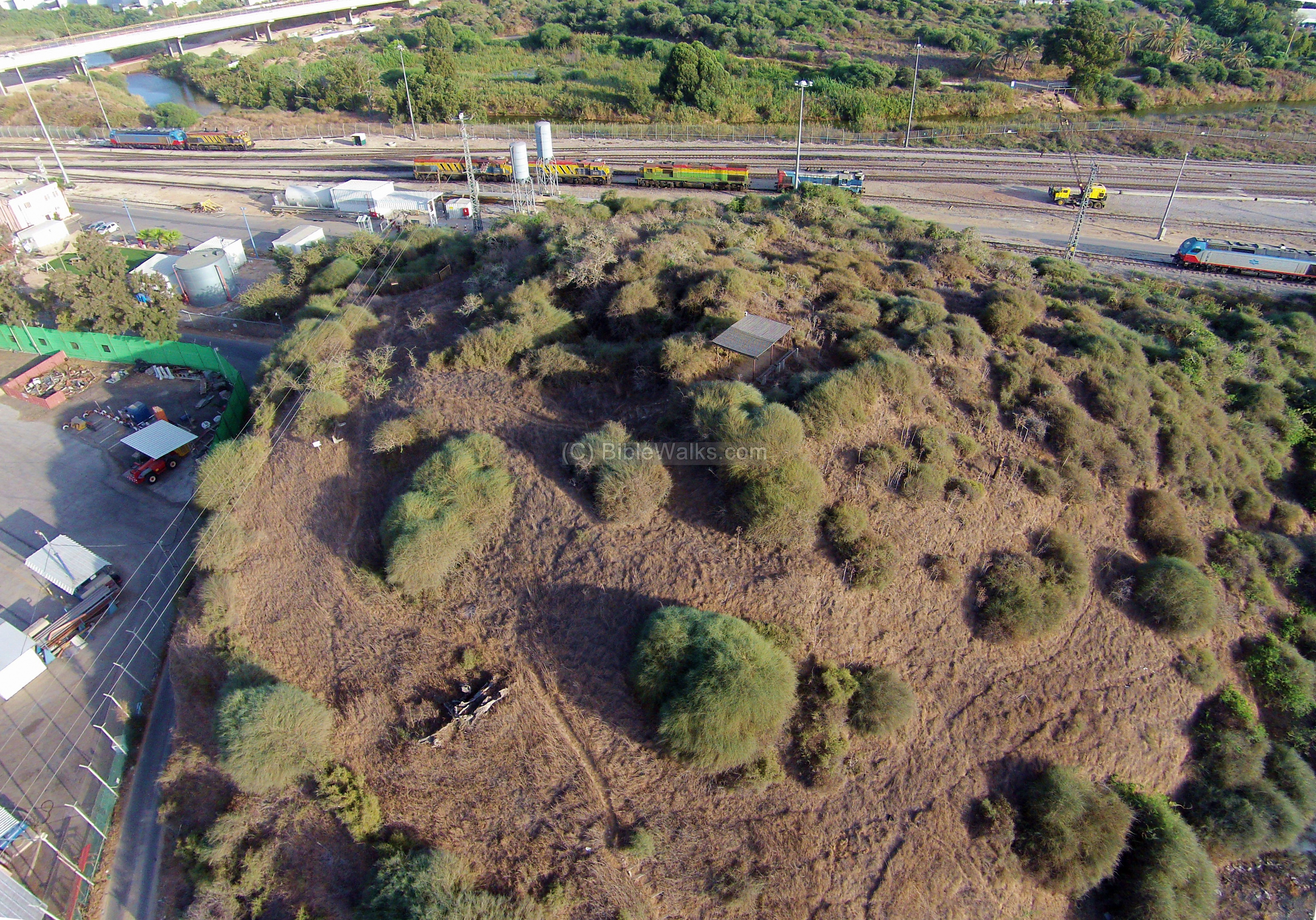
Tel Mor is located on the north bank of Lachish river, covering an area of 1 Dunam (1/4 acres) mound, rising 25m above sea level. In antiquity the area of the city was larger – 6 Dunam (1 1/2 acres), spreading around the hill, but these ruins were eroded or buried under the ground level.
An aerial view from the north west side of Tel Mor was captured by a quad copter. In the center of the mound is a covered observation point. In the left background is the Lachish river and bridge.
Click on the photos to view in higher resolution…
The mound is located inside the industrial zone near the port of Ashdod. This view, captured from the southwest (Yonah Hill), shows the location of the site and indicates other points of interest.
(b) The Mound:
The mound from ground level, with a view from the north, is seen here. Twelve occupation levels were identified, covering 7m thick layers.
The next view was captured during the winter:

(c) Purple Dye installation:
Remains of the Hellenistic-period installation for the production of purple dye is seen in the following photo.
This industrial process was based on the medium-sized marine snail (Hilazon in Hebrew, Murex trunculus as scientific name) which was one of the important sources of dye colors in antiquity. The Canaanites, Hebrews of the Zebulun tribe, and especially the Phoenicians produced the deep-purple indigo dye which was used for the textile industry and became a symbol of status, sovereignty and power. The first stage of the extraction of the dye used salt water, while the second phase required fresh water.
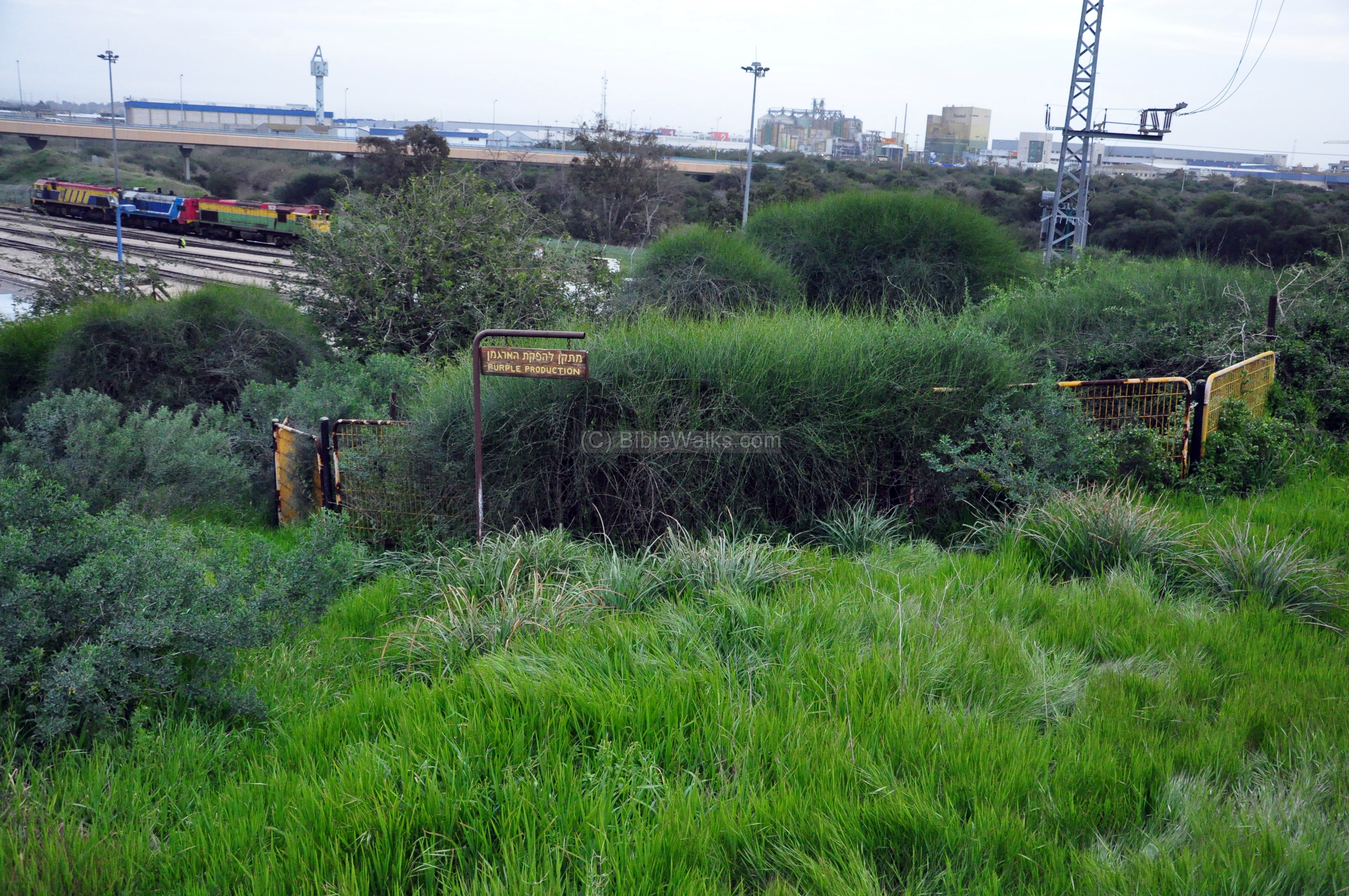
The installation included a number of plastered pools. Also found were remains of thousands of shells of snails which were used to produce the dye.
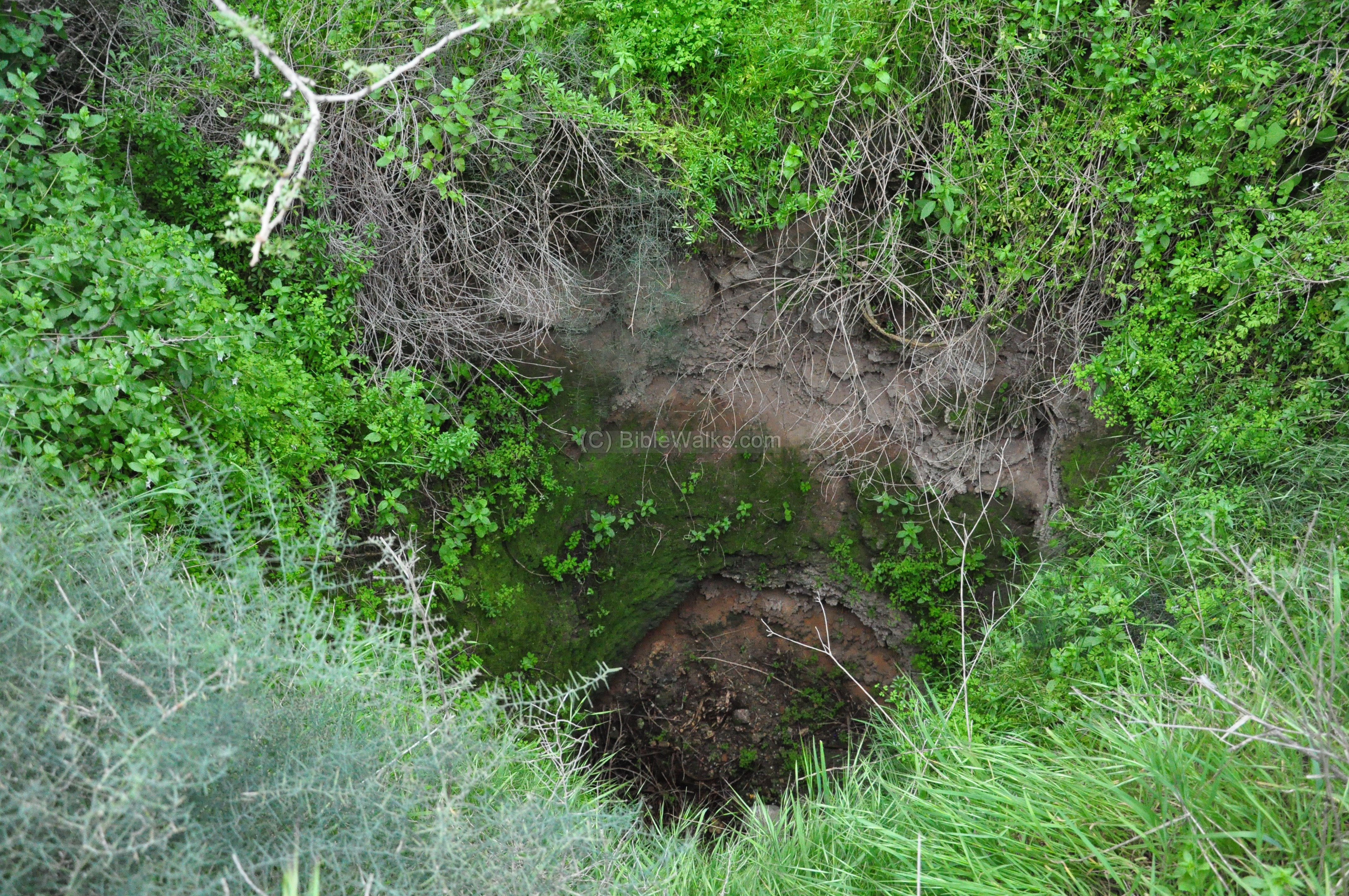
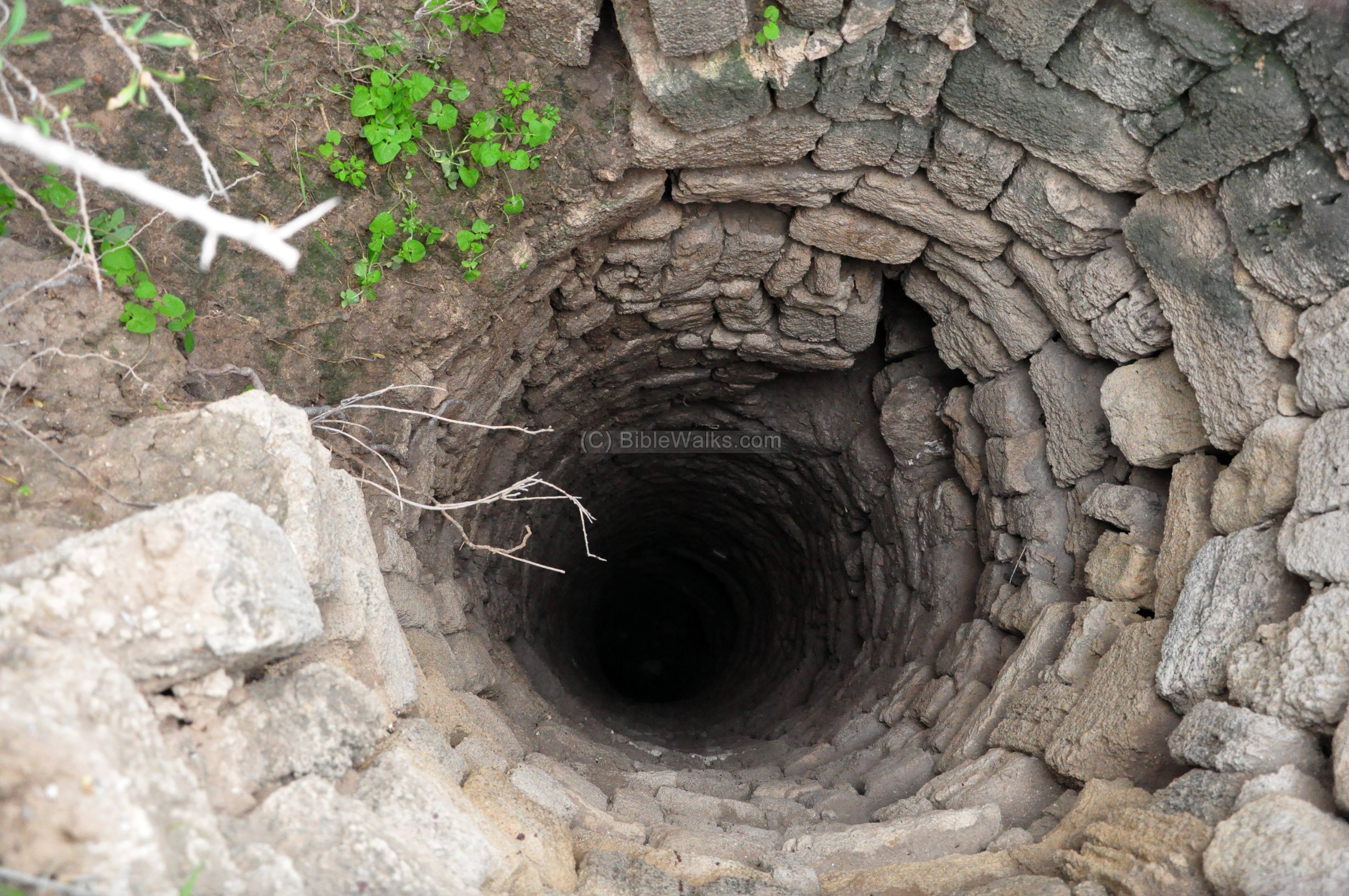
A deep well, 120 cm in diameter, is located on the top of the mound, which supplied the water to the installation.
(d) Around the site:
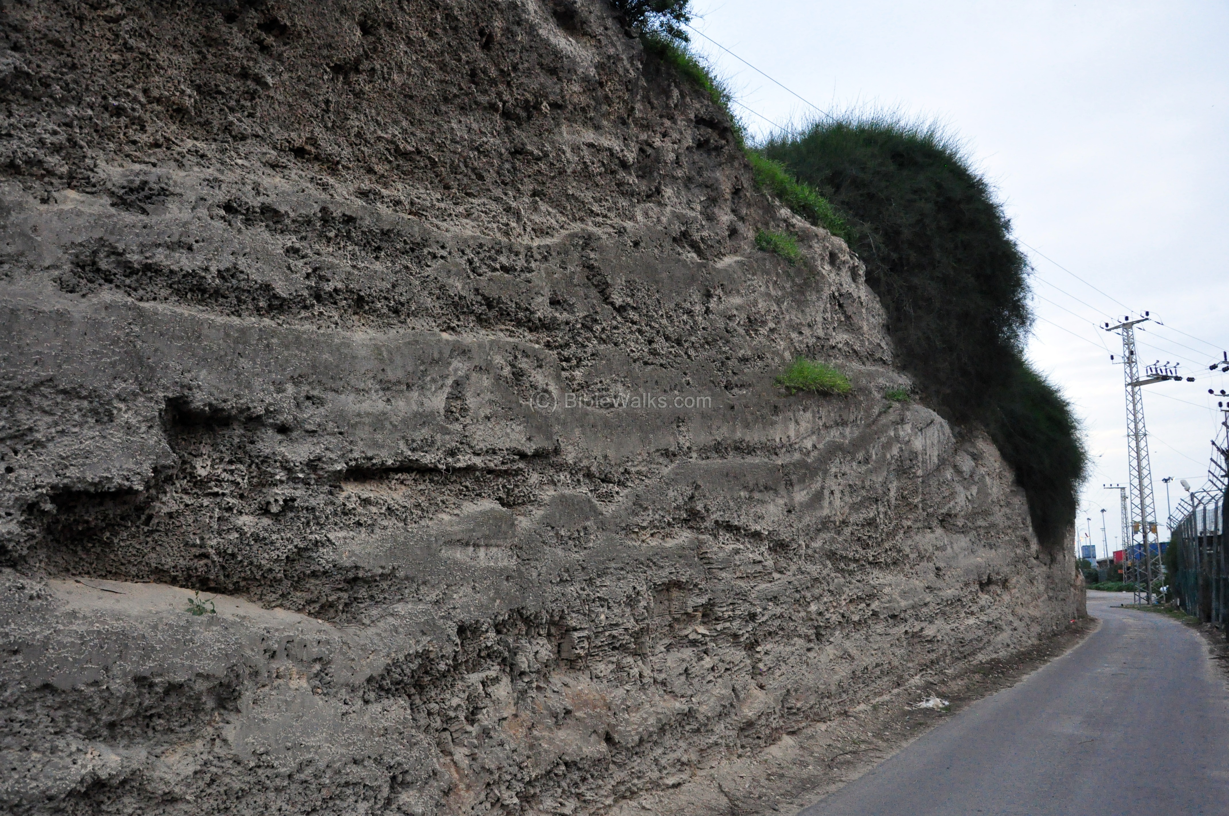
On the north side of the mound is a road that cut through the Kurkar sandstone ridge.
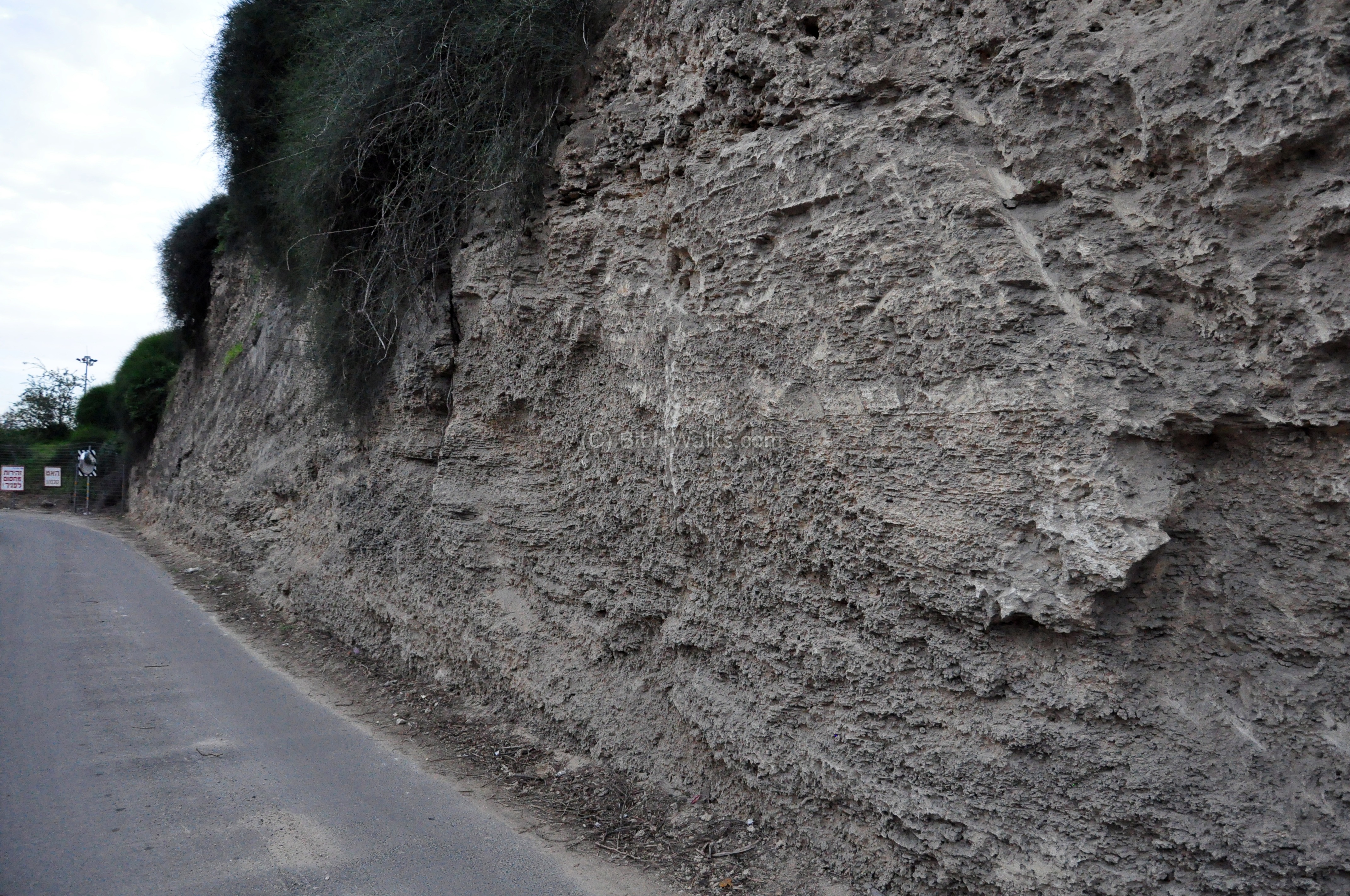
A view of the section towards the north.
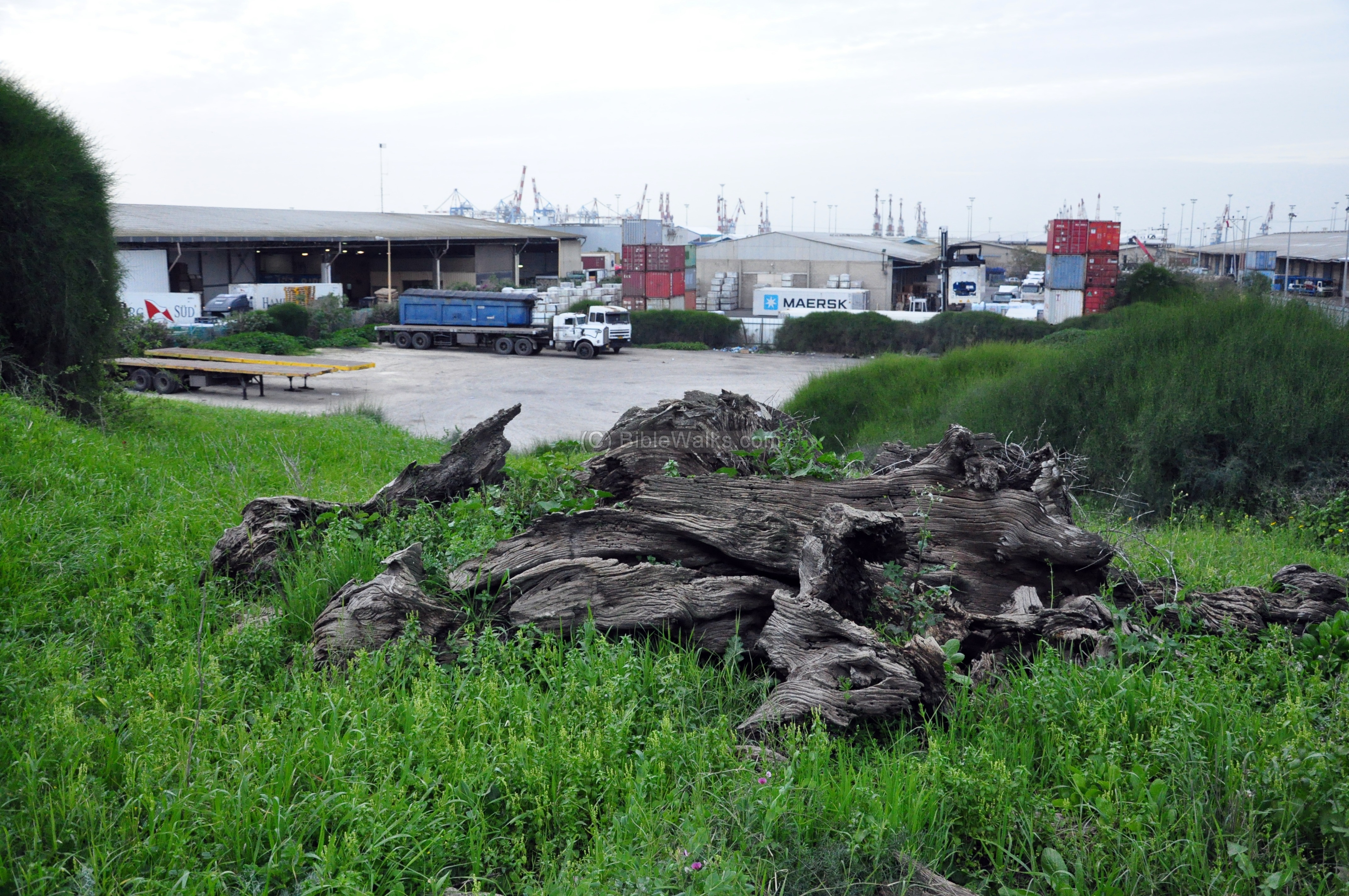
The edge of the Tel is located near storehouses of the modern port.
Etymology (behind the name):
- Tell el Murreh: The Arabic translation (per PEF name lists, p. 275) is: “The mound of the brackish water, but perhaps named from the Beni Murreh Arabs”.
- Tel Mor – Hebrew name, based on the Arabic name.
-
Yonah, Yona – Hebrew: Jonah (prophet)
-
Miztpeh – Hebrew: observation
-
Mitzpeh Yonah – observation point on Yonah hill
-
Giv’at Yonah – Giv’ah- Hebrew: hill
-
Neby – Arabic: Prophet (Hebrew: Navi)
-
Neby Younes, Nebbi Yunis – Arabic name of the tomb of Jonah
Links and References:
* External links:
- Archaeological survey of Israel – Map 84, site 18
- Ashdod Municipality
- Givat Yona (Hebrew)
- Tel Mor – Boaz Raanan’s presentation (Hebrew; pdf)
* References:
- M. Dothan – The foundation of Tel Mor and of Ashdod (IEJ, V23, 1973)
- M. Dothan – Tel Mor Excavations 1959-1960 (IAA reports)
- Archaeology and the Bible (George Barton; 1916) – source for the Assyrian inscriptions.
* Internal:
- Quadcopter Aerial views – collection of Biblical sites from the air
* Ashdod sites:
- Ashdod – overview of Ashdod’s ancient sites
- Ashdod Maritime – the Iron Age harbour city
- Tel Mor – The Canaanite period harbour city
- Yonah Hill – fortifications south of Lachish river
BibleWalks.com – Search for the lost cities of the Bible
Yonah Hill <—previous site—<<<All Sites>>>— next Shefela site—-> Migdal Afek
This page was last updated on Feb 16, 2023 (update overview)
Sponsored links: