An important Biblical city, located in the valley of Nahal Sorek. Beth Shemesh is mentioned in connection with the return of the Ark of the Covenant by the Philistines.
* Site of the Month Feb 2012 *
Home > Sites > Judea > Tel Beth Shemesh (Beit Shemesh)
Contents:
Overview
Location
History
Photos
* Aerial Views
* North East
* North
* North West
* Top
* South
* South East
* East
Biblical References
Etymology
Links
Overview:
Tel Beit Shemesh is an archaeological site located in central Israel, about 30 km west of Jerusalem. It is an ancient city that has been inhabited by various civilizations throughout its history, including the Canaanites, Israelites, Babylonians, Persians, Greeks, and Romans.
Beth Shemesh (“House of the Sun”) was an important Biblical city during the Canaanite and Israelite periods. It was a border city, located at the meeting point of three civilizations – Canaanites, Israelites and Philistines. Beth Shemesh is mentioned in connection with the return of the Ark of the Covenant by the Philistines, as well as other historical events.
The site of Tel Beit Shemesh is located on a hill overlooking the Sorek Valley, which was an important trade route connecting the coastal plain with the Judean hills. Excavations at the site have revealed important discoveries, including the remains of a Canaanite city with a massive stone wall and a gate, as well as a Jewish town from the time of the First Temple period.
Location:
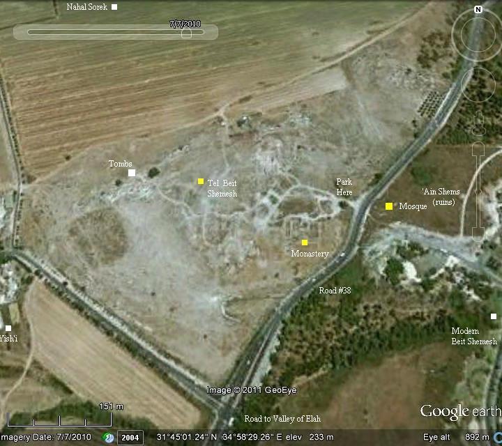
Tel Beth Shemesh is located on the side of road #38 between the north and south entrances to the modern city of Beth Shemesh.
The following aerial view shows the points of interest.
History:
- Canaanite – worship of the sun
Beth Shemesh was a large Canaanite city. It was built as an oval mound on the south bank of Nahal Sorek. The area of the city, within the walls, is 203 long by 157m wide – a total size of 32 dunam (8 acres) . The Canaanite city may have been named Ir-Shemesh (“Sun City”) since its people worshipped the sun, although no such temple was yet found.
The practice of sun worship was common in ancient times, and the Bible warns against it (Deuteronomy 4 19): “And lest thou lift up thine eyes unto heaven, and when thou seest the sun, and the moon, and the stars, even all the host of heaven, shouldest be driven to worship them, and serve them, which the LORD thy God hath divided unto all nations under the whole heaven”. There were several cities named after the sun or the moon, and the practice was common even later during the period of the Israelite Kingdom (2 Kings 23 5): “And he put down the idolatrous priests, whom the kings of Judah had ordained to burn incense in the high places in the cities of Judah, and in the places round about Jerusalem; them also that burned incense unto Baal, to the sun, and to the moon, and to the planets, and to all the host of heaven”.
The archaeological excavations identified in the 9th layer a massive destruction during the 14th century BC when the city was burnt down, and later rebuilt.
- Biblical
Tribes of Israel: Beth Shemesh was initially given to the tribe of Dan (Joshua 19 41): “And the coast of their inheritance was Zorah, and Eshtaol, and Irshemesh“. It was also one of the 48 Levitical cities, as commanded by Moses (Joshua 21:16): “And Ain with her suburbs, and Juttah with her suburbs, and Bethshemesh with her suburbs; nine cities out of those two tribes”. Scholars suggested that the Canaanite cult of sun-worship may have contributed to its selection as a Levitical city.
The archaeological evidence indicate that the city was destroyed at the end of the 12th century, and was shortly reoccupied. Perhaps, this resettlement was due to the change of the population from Canaanite to Israelite.
Judges period (12th-11th century BC): During that time, the city grew and spread over the whole mound. Recent excavations revealed Canaanite architecture and ceramics, but the study of the remains of animal bones indicated that the diet excluded pigs which imply an Israelite presence.
During the 12th century the Philistines arrived to the cities along the shore. Beth Shemesh and the cities in the Sorek valley are located on the border with the Philistines, and were affected by their push from the shore eastwards into the land of Judah.
Their conflict with the Israelites started in the mid 11th century BC, and one of the stories associated with this conflict is the heroism of Samson of the tribe of Dan, who was born in the nearby village of Zorah (3km north).
The mighty Samson was a judge for 20 years, battled with the Philistines and died in Gaza by pulling down the temple with his incredible strength (Judges 13-16). The name Samson means “man of the Sun”, so even his name is related to Beth Shemesh – the “house of the sun”.
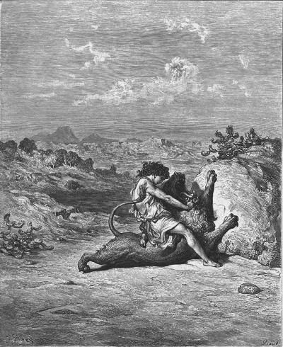
Samson slaying the Lion –
drawing by Gustav Dore (French artist, 1832-1883)
King Saul period (11th century BC): Beth Shemesh became a border city of the tribe of Judah, and renamed to Beth Shemesh – “the house of the sun”. (Joshua 15 10): “And the border compassed from Baalah westward unto mount Seir, and passed along unto the side of mount Jearim, which is Chesalon, on the north side, and went down to Bethshemesh, and passed on to Timnah”.
Return of the Ark: Beth Shemesh is mentioned in connection with the return of the Ark of the Covenant by the Philistines. The ark was captured seven months earlier, but the Philistines decided to return it to Israel after it caused them plagues.
Its first station was in Beth Shemesh (1 Samuel 6 10,12): “And see, if it goeth up by the way of his own coast to Bethshemesh”…”And the kine took the straight way to the way of Bethshemesh, and went along the highway…”.
Some of the people of Beth Shemesh peeked into the ark and God killed them.
You can read the whole story in the Biblical references section.
This story implies that Beth Shemesh was located on the border of the Land of the Philistines, and was located on a major highway.
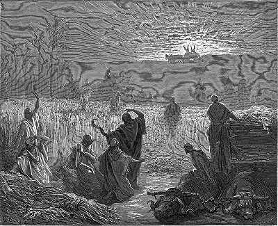
Return of the Ark- drawing by Gustav Dore (French artist, 1832-1883)
King Solomon (10th century BC): Beth Shemesh was one of the twelve precincts of the Kingdom of Solomon, and the son of Dekar was appointed its governor (1 Kings 4 1,2,9): So king Solomon was king over all Israel. And these were the princes which he had…The son of Dekar, in Makaz, and in Shaalbim, and Bethshemesh, and Elonbethhanan:”. In this period the city underwent considerable planning and reconstruction, transforming the city into a regional administrative center. The excavators unearthed the governor’s house and adjoining storerooms and barn, covering an area of 250m2. A massive city wall was constructed and supported by towers. A 10th-9th C ironsmith workhouse, one of the earliest ever found in this region, was found on the south side, with locally casted arrowheads and other military iron casts. These findings are proof of a strong centralized administration emerging in this period, as a result of the newly established kingdom of Israel.
Kings Amaziah and Jehoash (9th century BC): In the fields near Beth Shemesh the two Israelite kingdoms clashed at about 800BC. The Northern Kingdom (based in Samaria) defeated the Kingdom of Judah, and Jerusalem was sacked (2 Kings 14:11-14): “But Amaziah would not hear. Therefore Jehoash king of Israel went up; and he and Amaziah king of Judah looked one another in the face at Bethshemesh, which belongeth to Judah. And Judah was put to the worse before Israel; and they fled every man to their tents. And Jehoash king of Israel took Amaziah king of Judah, the son of Jehoash the son of Ahaziah, at Bethshemesh, and came to Jerusalem, and brake down the wall of Jerusalem from the gate of Ephraim unto the corner gate, four hundred cubits. And he took all the gold and silver, and all the vessels that were found in the house of the LORD, and in the treasures of the king’s house, and hostages, and returned to Samaria.”.
King Ahaz (8th century BC): The Philistines continued their intrusions along the valley of Elah into Judea during the times of King Ahaz, son of Jotham, who reigned 20 years at ~735 715 BC. They captured Beth Shemesh (2 Chronicles 28 16, 18): “At that time did king Ahaz… The Philistines also had invaded the cities of the low country, and of the south of Judah, and had taken Bethshemesh, and Ajalon, and Gederoth, and Shocho with the villages thereof, and Timnah with the villages thereof, Gimzo also and the villages thereof: and they dwelt there”.
King Uzziah: During his reign (783-742 BC) Uzziah expanded the Judean territories into the Philistine cities (2 Chronicles 26 6-7): “And he went forth and warred against the Philistines, and brake down the wall of Gath, and the wall of Jabneh, and the wall of Ashdod, and built cities about Ashdod, and among the Philistines. And God helped him against the Philistines…”. Some of the city’s fortifications may have been constructed by Uzziah.
King Hezekiah and the Assyrians (8th century BC): The Assyrian empire, a rising force in the region, conquered the North Kingdom of Israel in 732BC, destroying most of the cities and villages in the land. The South Kingdom of Judah managed to survive this onslaught by teaming up with the Assyrians, but not for long. After the death of the Assyrian King Sargon II (722 705BC), King Hezekiah son of Ahaz (reigned 715-686BC) – mutinied against the Assyrians. He joined other states in the area who attempted to free themselves from the Assyrian conquest. Hezekiah recaptured Beth-Shemesh as well as other cities in the area (2 Kings 18 8): “He smote the Philistines, even unto Gaza, and the borders thereof, from the tower of the watchmen to the fenced city”.
Anticipating the coming Assyrian intrusion, Hezekiah fortified Jerusalem and the major cities.
The Assyrian army came in 701, leaded by Sennacherib, son of Sargon II (2 Chronicles 32 1):
“After these things, and the establishment thereof, Sennacherib king of Assyria came, and entered into Judah, and encamped against the fenced cities, and thought to win them for himself”.
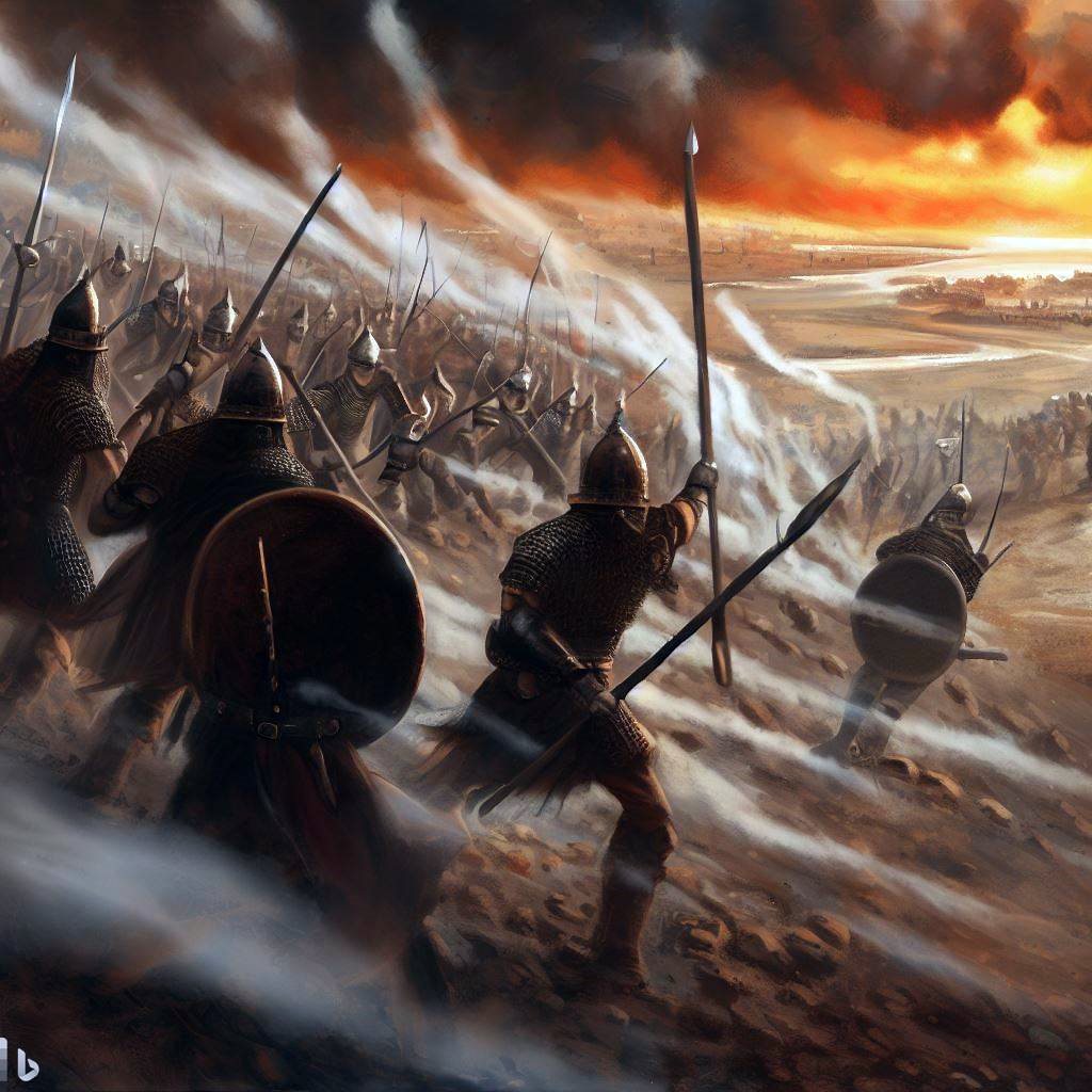
Assyrian forces attacking – AI generated by Bing
According to an Assyrian stele found in the ruins of the royal palace of Nineveh, Sennacherib conquered 46 cities in Judea:
“And as to Hezekiah, the Judaean, who had not submitted to my yoke, 46 of his strongholds, fortified cities, and smaller cities of their environs without number, with the onset of battering rams and the attack of engines, mines, breaches, and axes (?), I besieged, I captured. 200,150 people, small and great, male and female, horses, mules, asses, camels, oxen, and sheep without number I brought out of their midst and counted as booty. He himself I shut up like a caged bird in Jerusalem, his capital city; I erected beleaguering works against him, and turned back by command every one who came out of his city gate”.
However, Jerusalem was spared from destruction and the Assyrians retreated (2 Chronicles 31 21-22): “And the LORD sent an angel, which cut off all the mighty men of valor, and the leaders and captains in the camp of the king of Assyria. So he returned with shame of face to his own land. And when he was come into the house of his god, they that came forth of his own bowels slew him there with the sword. Thus the LORD saved Hezekiah and the inhabitants of Jerusalem from the hand of Sennacherib the king of Assyria, and from the hand of all other, and guided them on every side”.
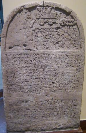
Sennacherib’s stele with relief and inscription; Nineveh;
limestone [Istanbul Archaeological Museum]
After the Assyrian intrusion, the city was in ruins. Only few Judean families returned to the site for a short time, but then the city was abandoned for good.
- Roman/Byzantine period:
A Roman road from Jerusalem/Bethlehem (on the east) passed at the site, connecting it to the west. The route of the ancient road passes on the east side of the mound. This ancient road is indicated by a double-dashed line in the map below. It joined the north-south road from Diospolis (Lod) to Eleutheropolis (Beth Jibrin – on the south), just north of Tel es-Safi (Gath).
In the 5th century a large monastery and inn was built on the south side of Tel Beth Shemesh. It serviced the pilgrims that travelled along the road to and from Jerusalem.
-
Ottoman period – PEF survey
The area was examined in the Palestine Exploration Foundation (PEF) survey (1866-1877) by Wilson, Conder and Kitchener.
They identified Beth Shemesh as the Arab village of ‘Ain Shems, which preserved the name of the ancient site (means: the “spring of the Sun”). This village is indicated on their map (at the location of a yellow square we have added). The Arab village was located on the east side of the mound, around the mosque of Abu Meizar (indicated on this map just above the number 917).
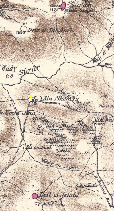
Part of Map Sheet 17 of Survey of Western Palestine, by Conder and Kitchener, 1872-1877. (Published 1880, reprinted by LifeintheHolyLand.com) The site is marked by a yellow square.
The surveyors concluded (1883) in Volume III of the Survey of Western Palestine (Sheet XVII p. 35): “Beth Shemesh (Joshua xv. 10) – In the lower hills is the present ruin of ‘A in S h e m s”.
Their report about the site was as follows (p.60):
” ‘Ain Shems – Heaps of stones and ruined walls of modern appearance, the remains of a former village on a low Tel. There is no spring at the place, but in the valleys to the south there are several; to the east are olives ; in the ruins is a Mukam of Neby Meizer. There is a low swell west of the village site, on which are ruins apparently more ancient foundations and walls of good masonry. On the north are rock-cut tombs, half buried. A large ‘Ozbeh, or summer settlement of drystone huts, with roofs of boughs, was found here in 1881, inhabited during harvest time”.
-
Modern Period -Excavations
Excavations were conducted at Tel Beth Shemesh by D. Mackenzie (1911- 1912; Palestine Exploration Foundation) and by E. Grant (1928-1933; Haverford College, Pennsylvania).
New recent excavations were conducted by S. Bunimovitz and Z. Lederman (1990-2000; Tel Aviv University).
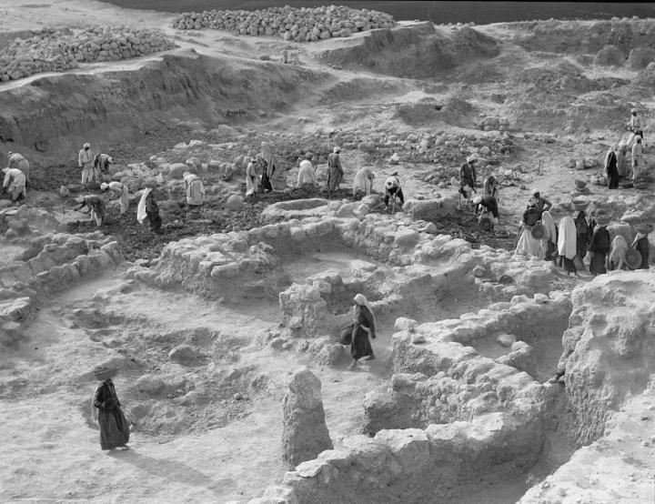
Excavations in 1928-1933 – walls of a store house and grain bin [American Colony photo, Matson Photograph collection; Library of Congress]
- Visit today
The ruins of the mosque, and the houses of the Arab village around it, can be seen on the east side of the modern road that crosses Tel Beth Shemesh. To the west side of the road is an open area of the mound, with sections of archaeological trenches. You can easily park on the side of the road, walk up to the ancient ruins and imagine your are back to the Biblical times.
Photos:
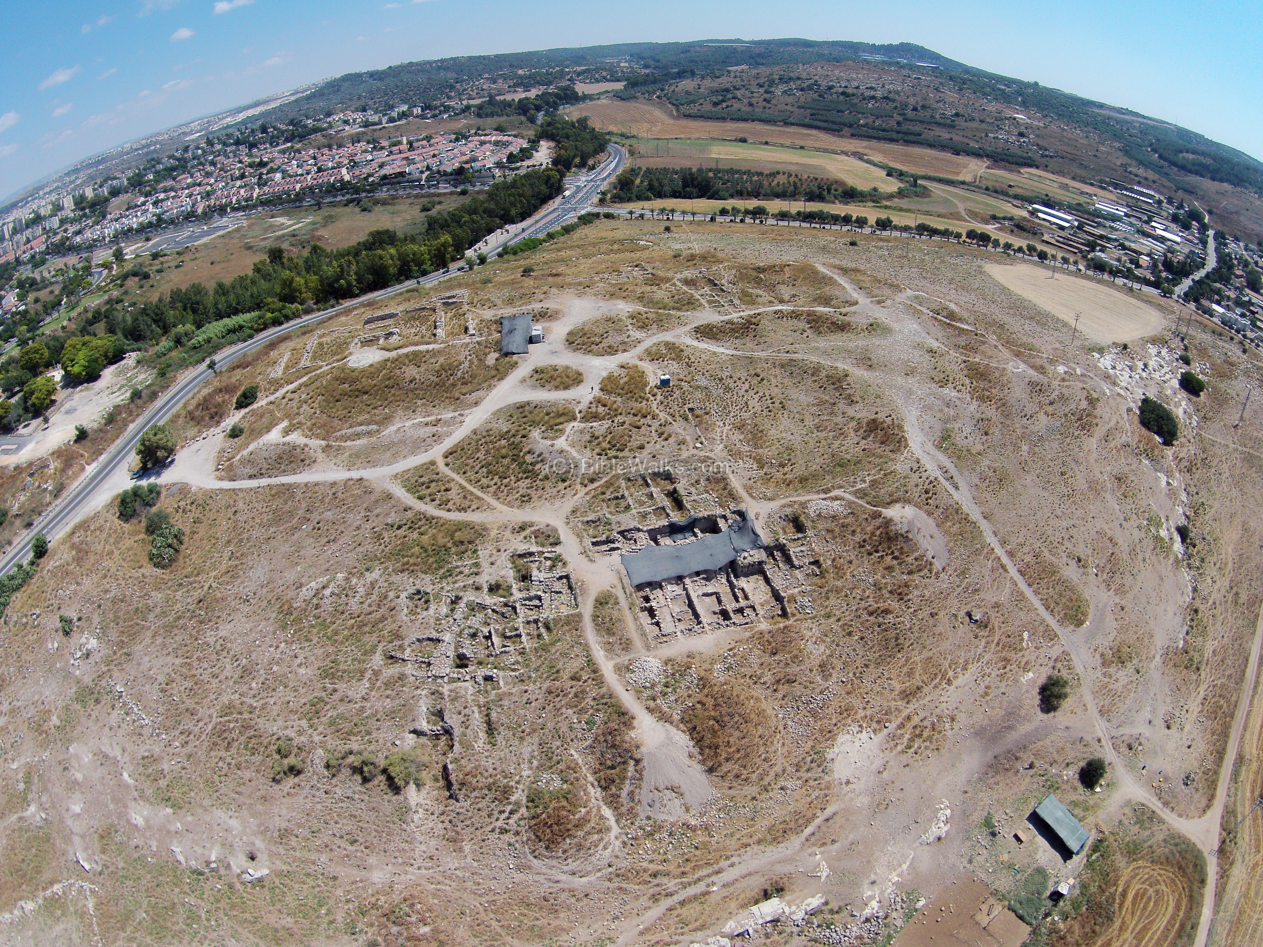
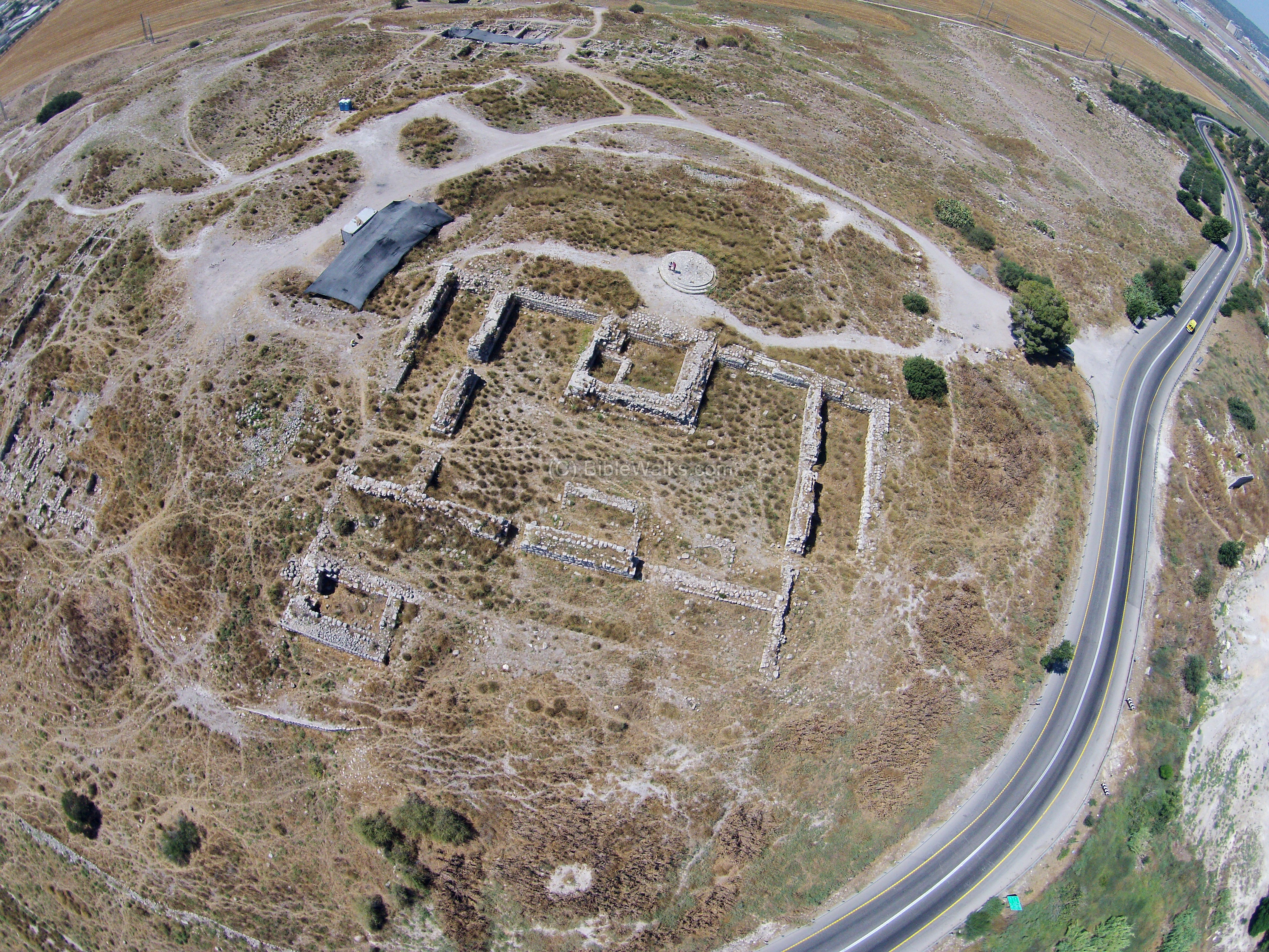
(a) Aerial Views
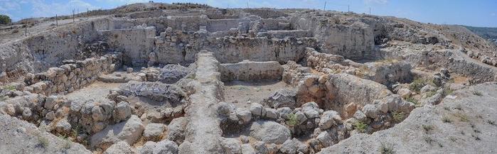
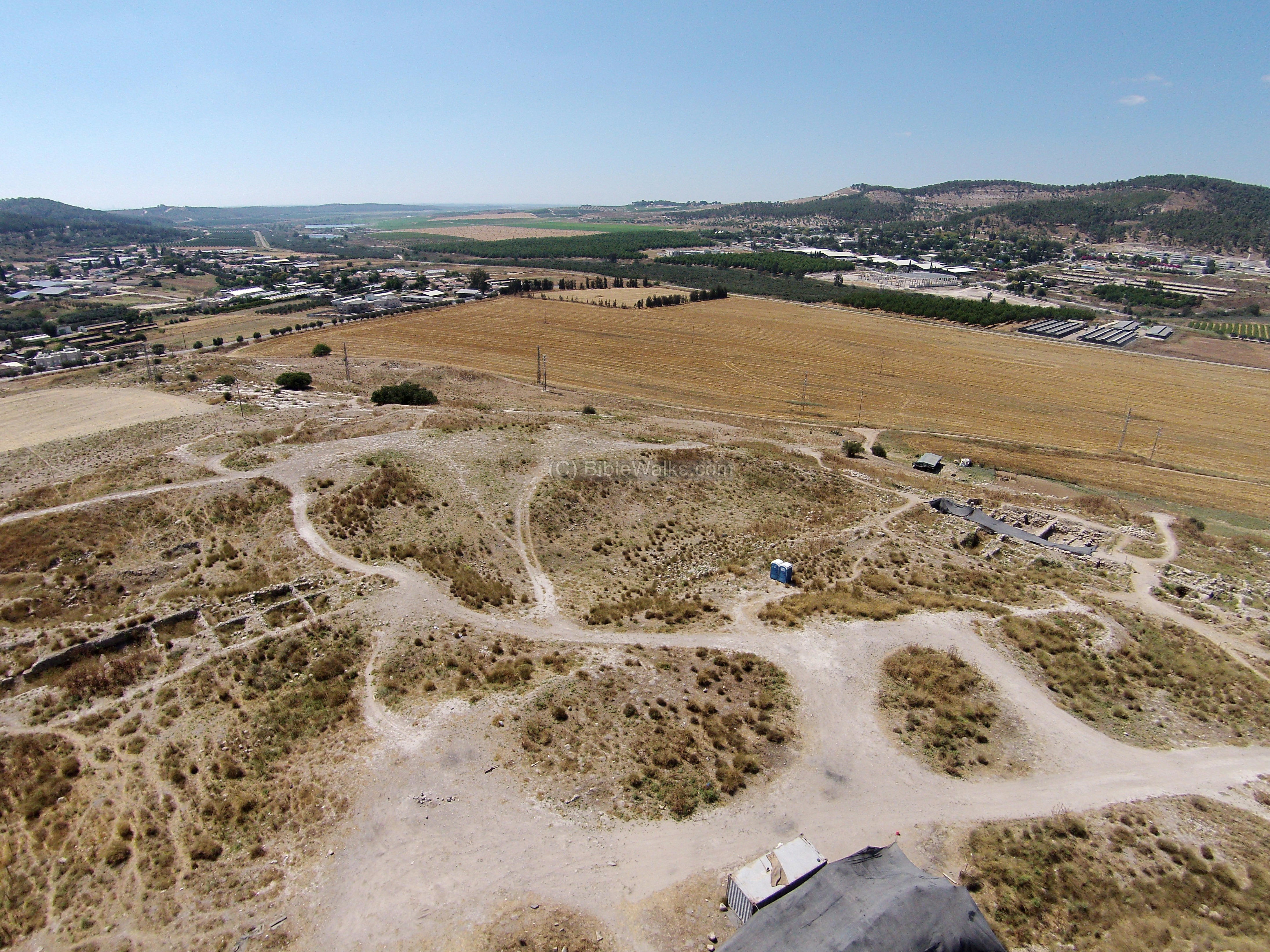
The following aerial views were captured by a quadcopter over the site in June 2015. This view, which covers most of the site, is from the north side. As seen, some of the areas on the mound were recently excavated, while other areas of the 100 year old excavations have been long covered or removed.
On the left background are the neighborhoods of modern Beth Shemesh, while on the right background are houses of Moshav Yish’i.
Click on the photos to view in higher resolution…
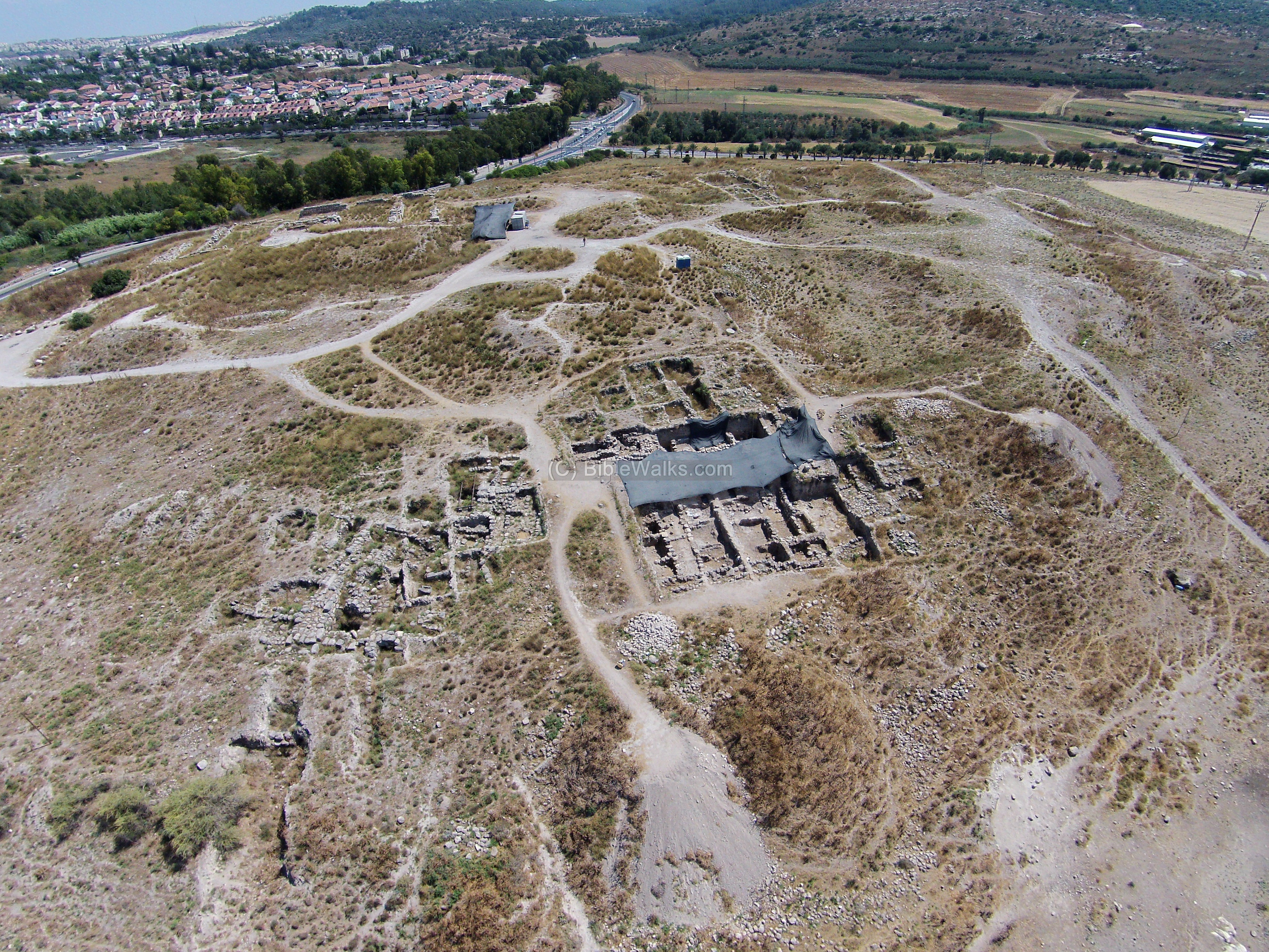
The next photo focuses on the renewed excavation area on the north side of Tel Beth Shemesh.
A flight over the site can be seen in this drone video:
The remainder of the photo section is ordered “counter clockwise”, starting from the northeast section.
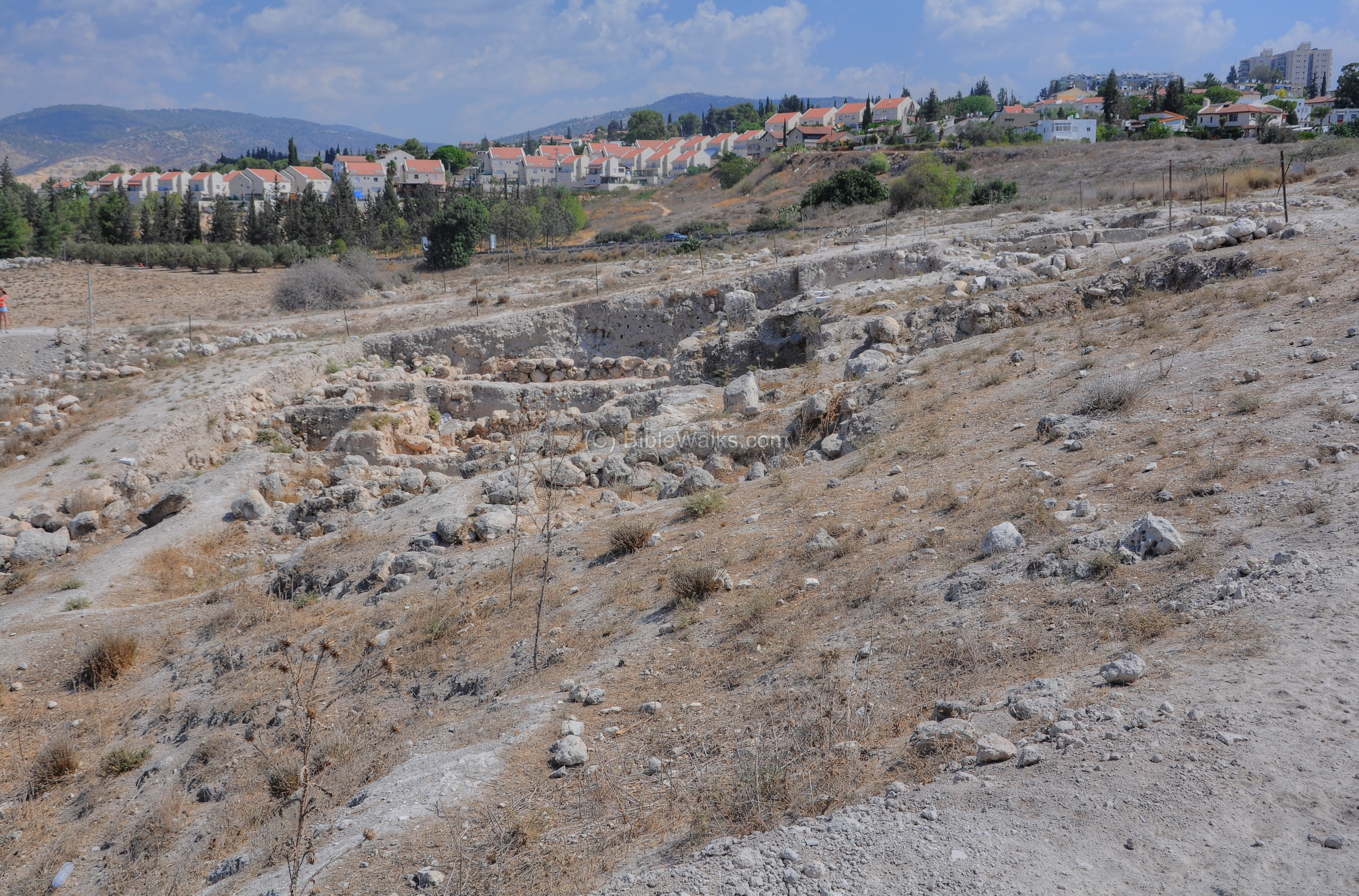
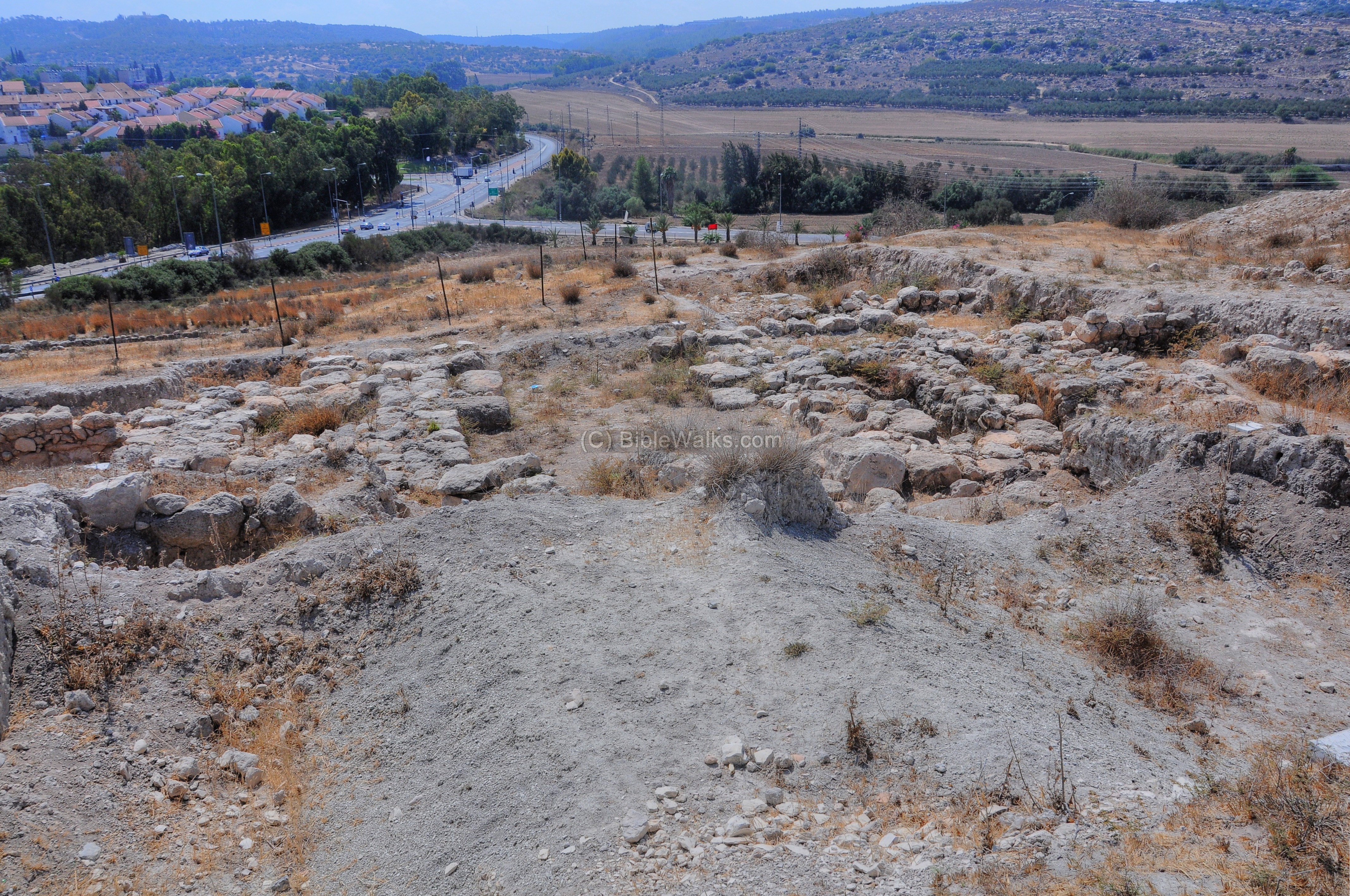
(b) North East
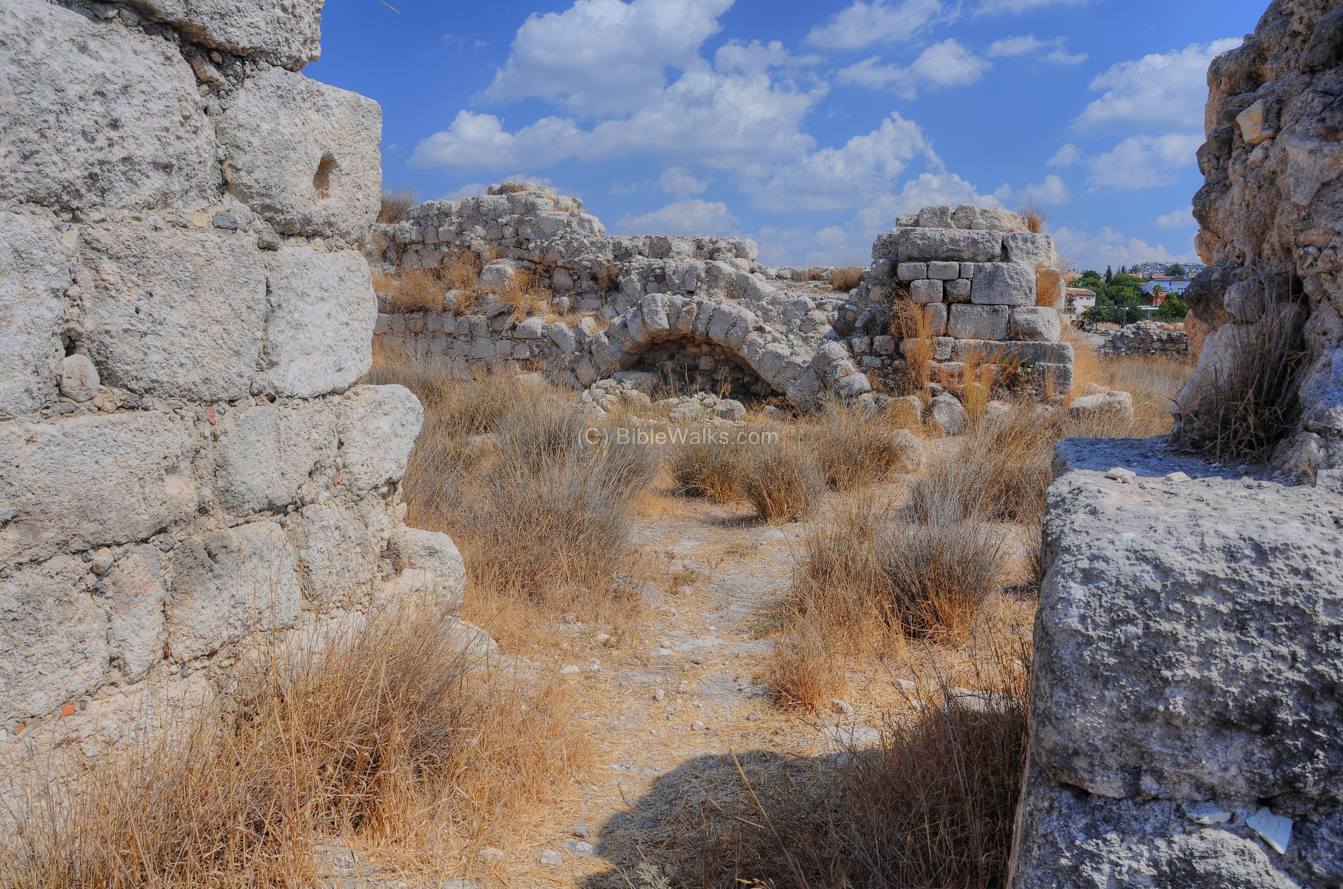
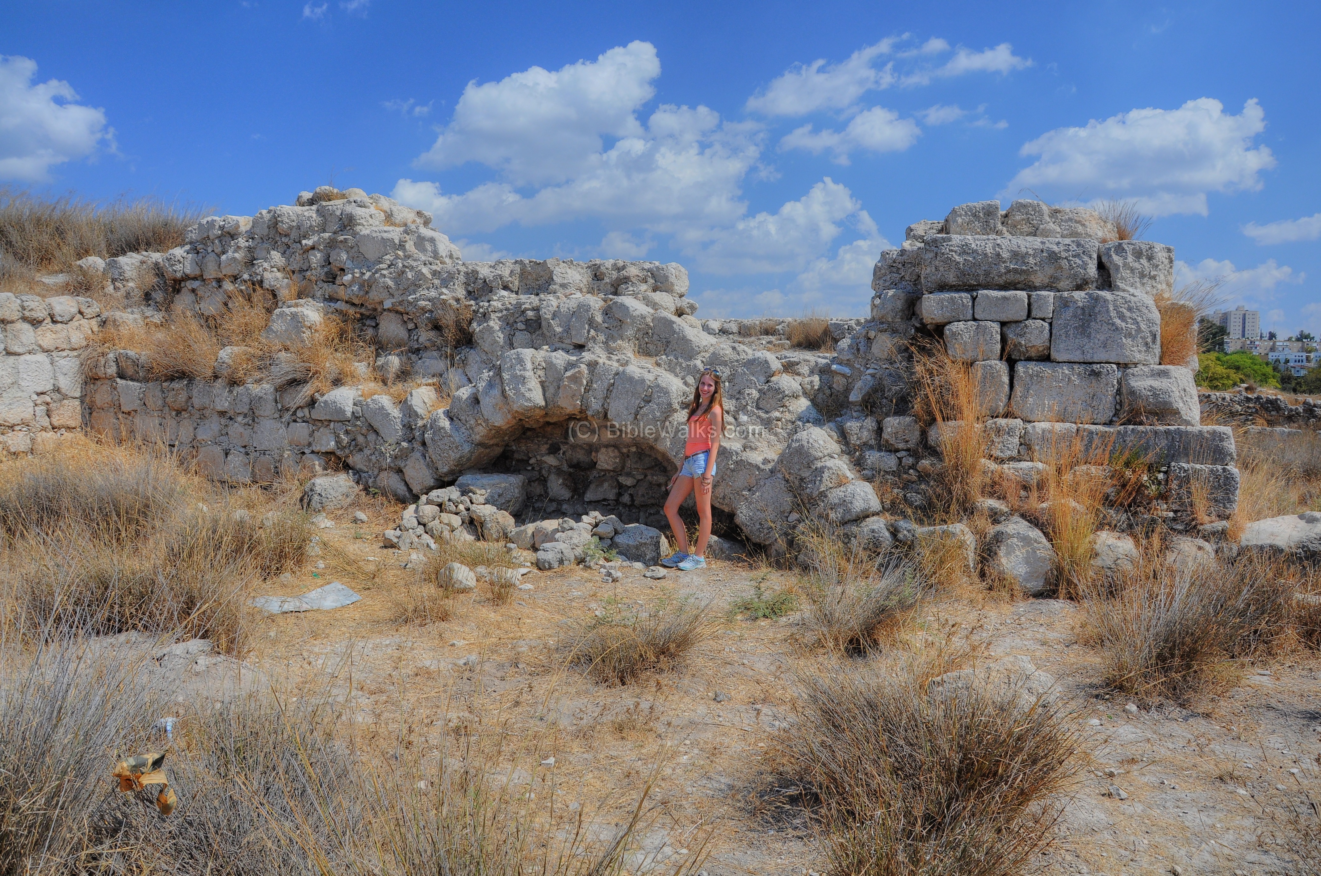
The north-east section of the city is seen in this picture. The traces of the buildings and walls are the result of three cycles of archaeological excavations. An elaborate system of fortifications was unearthed here, with a massive casemate wall and a large tower in front of the wall.
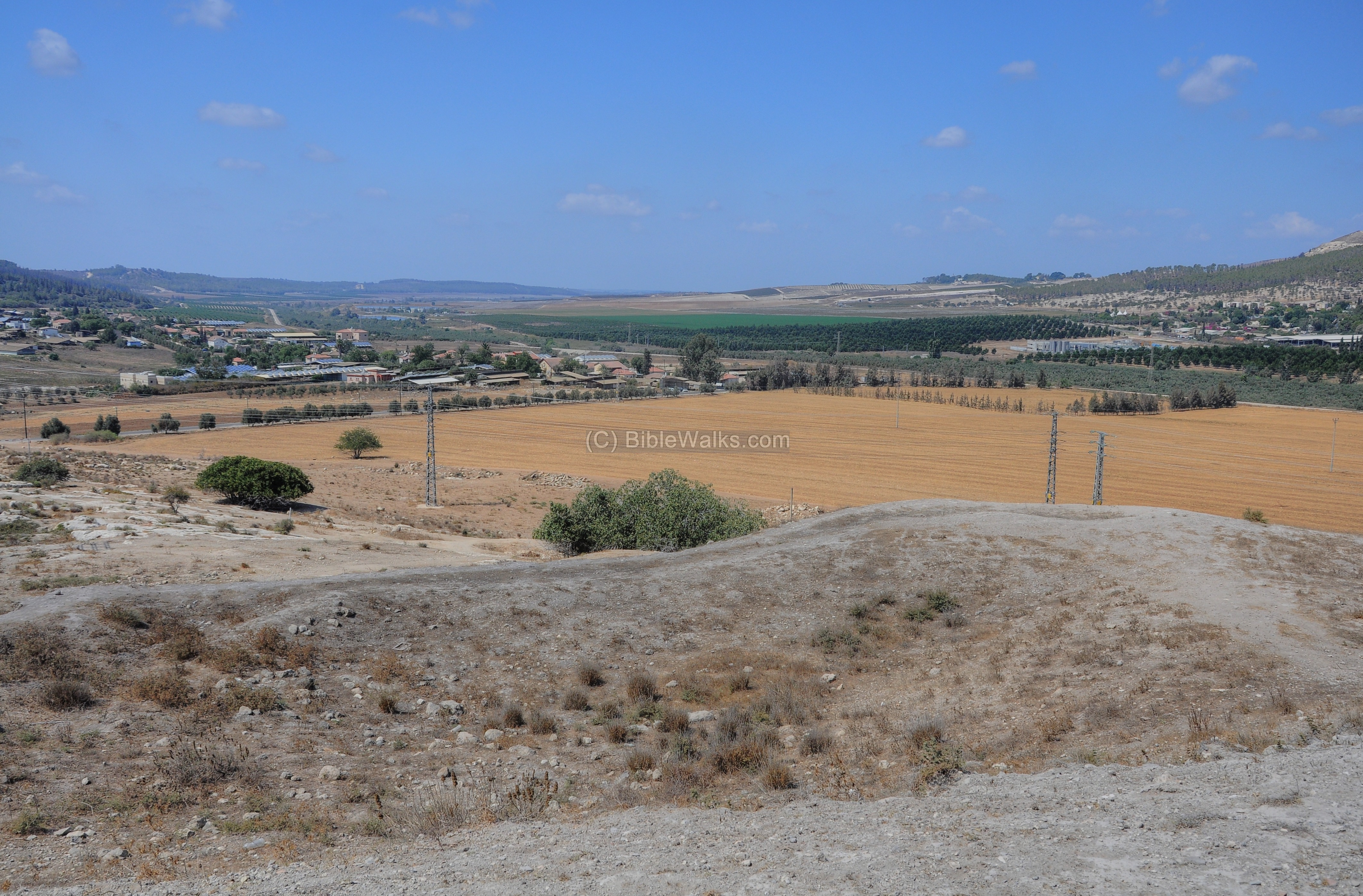
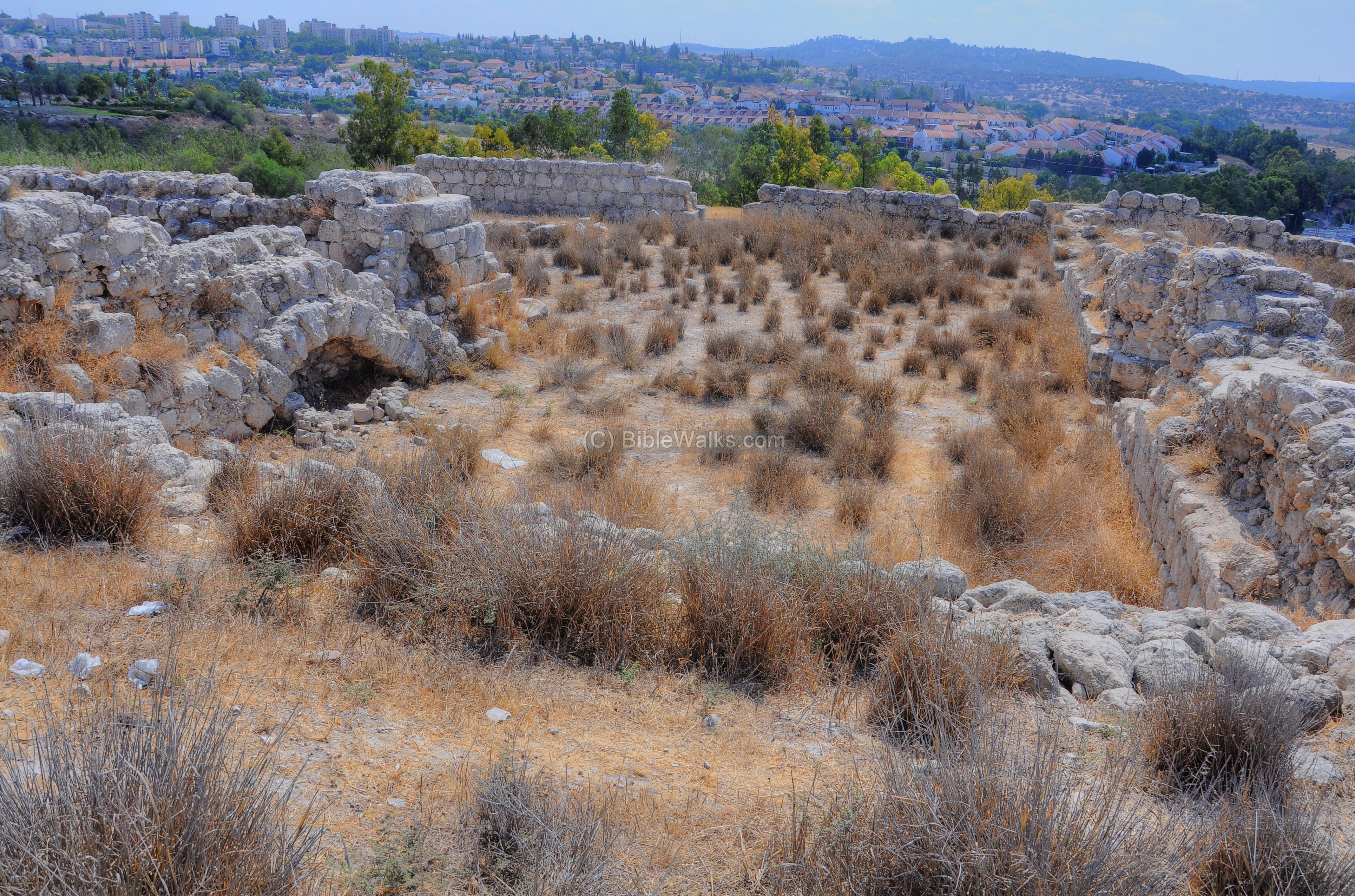
In the left background is the valley of Nahal Sorek, a stream that leads to the north suburbs of Jerusalem and was one of the ancient routes ascending to the city. In the right background are the houses of modern Beth Shemesh, which was established in 1951 and today a large city with over 80,000 residents.
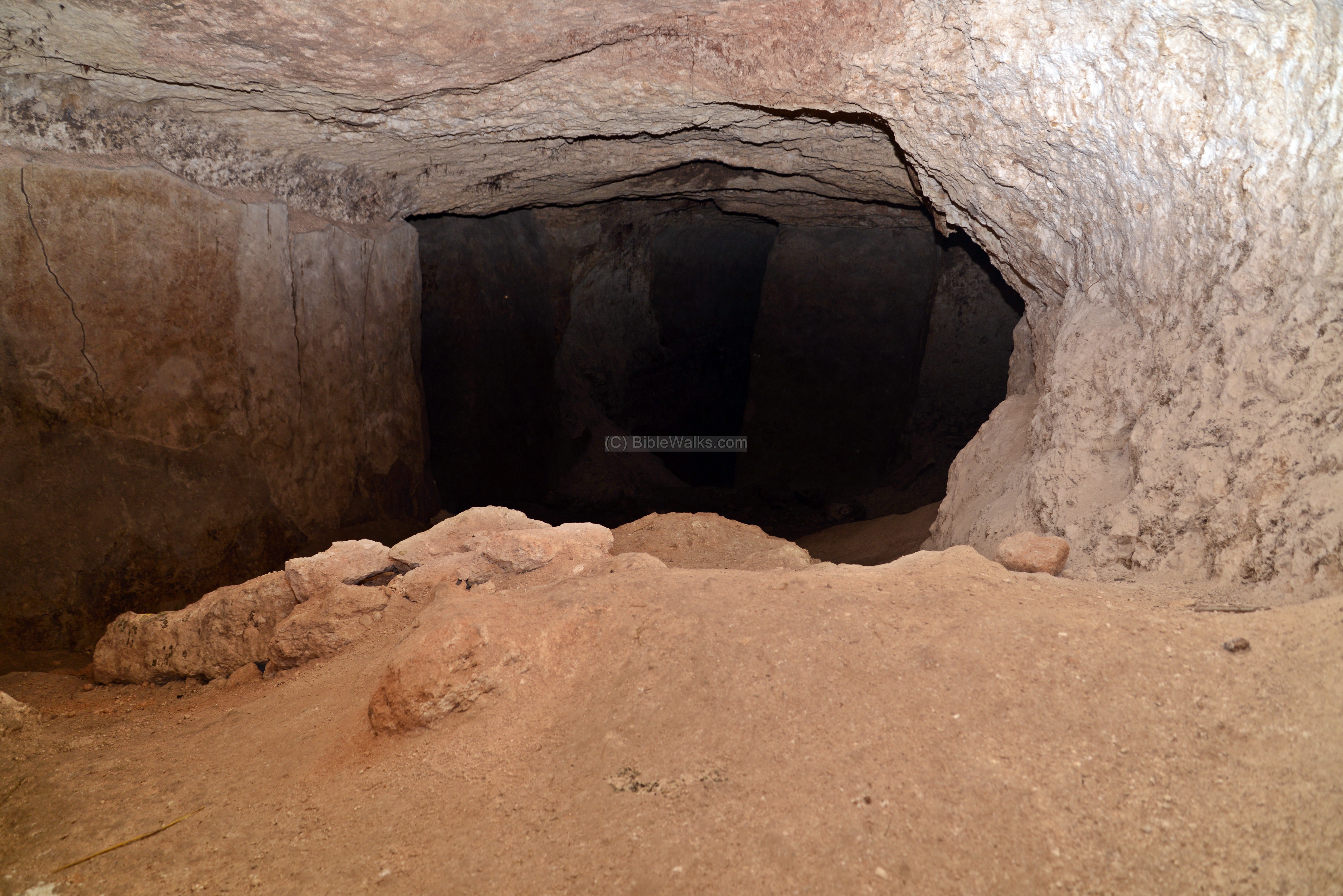
A large underground water reservoir is located here, with a total capacity of 800 m3. It collected rainfall from the buildings, and was the main public water supply for the city and for the stables.
The construction of the water system is dated to the 10th century BC, and was in use until some years after the final Assyrian destruction of 701BC.
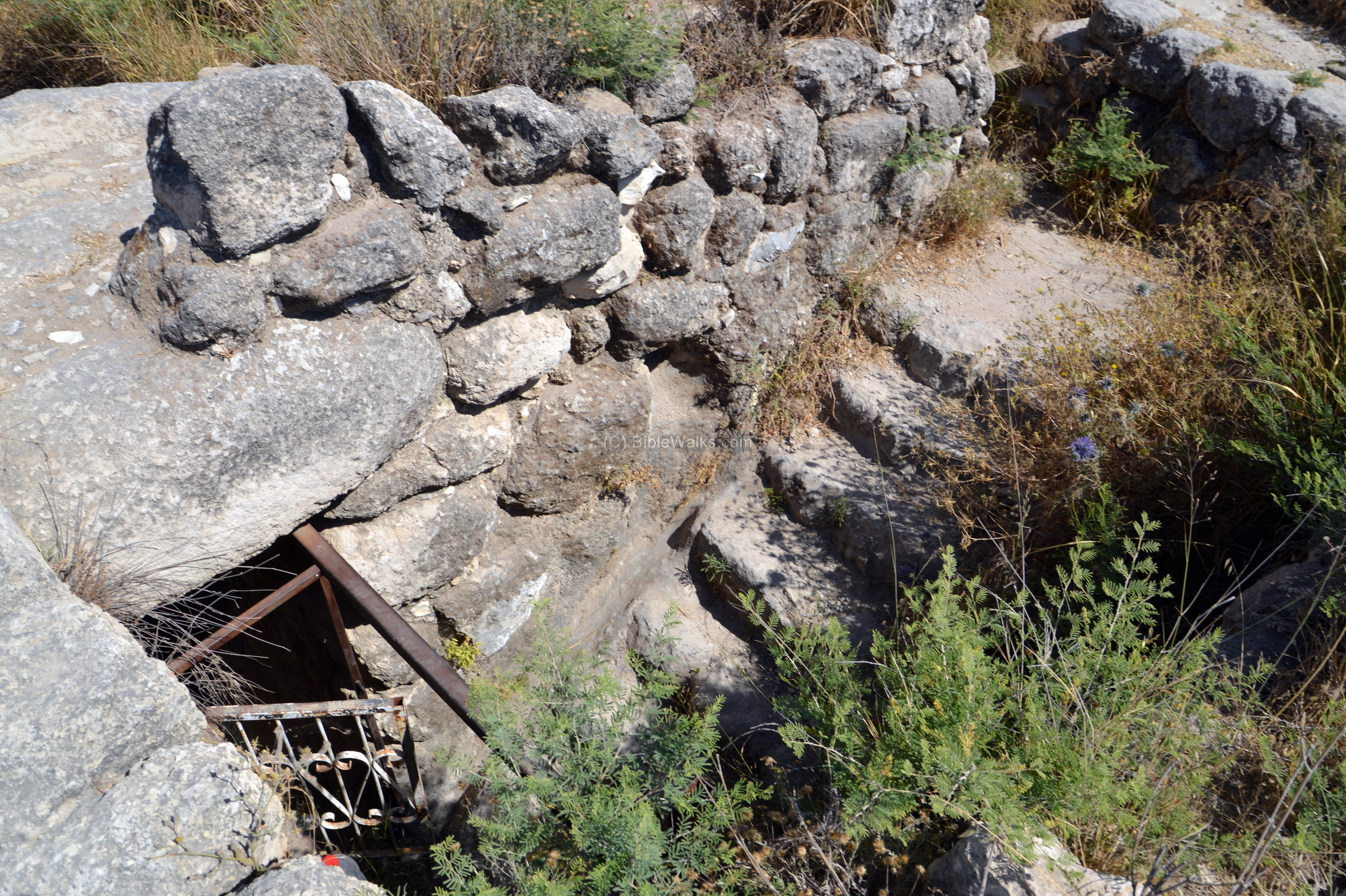
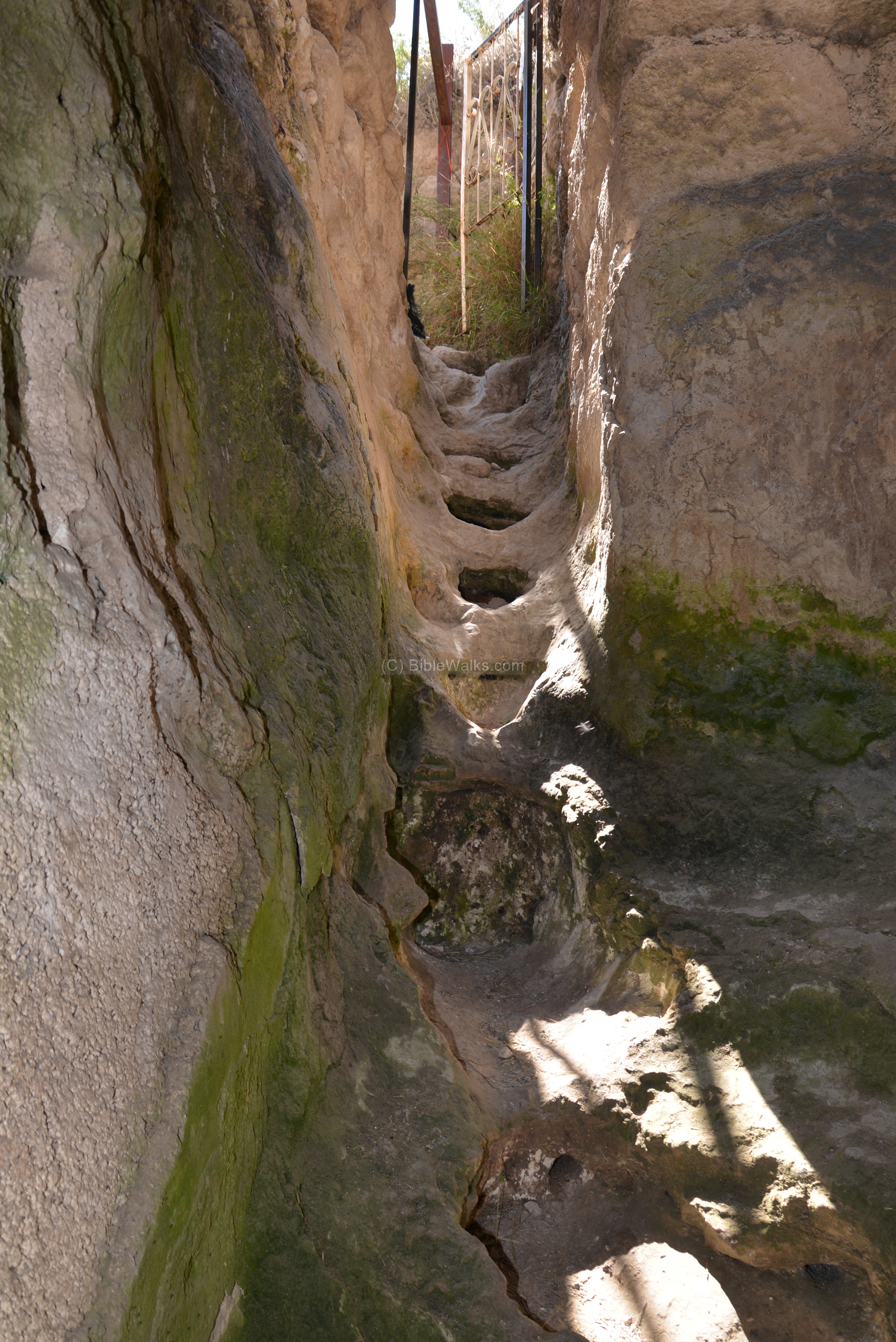
The entrance to the reservoir is through a rock hewn stairway.
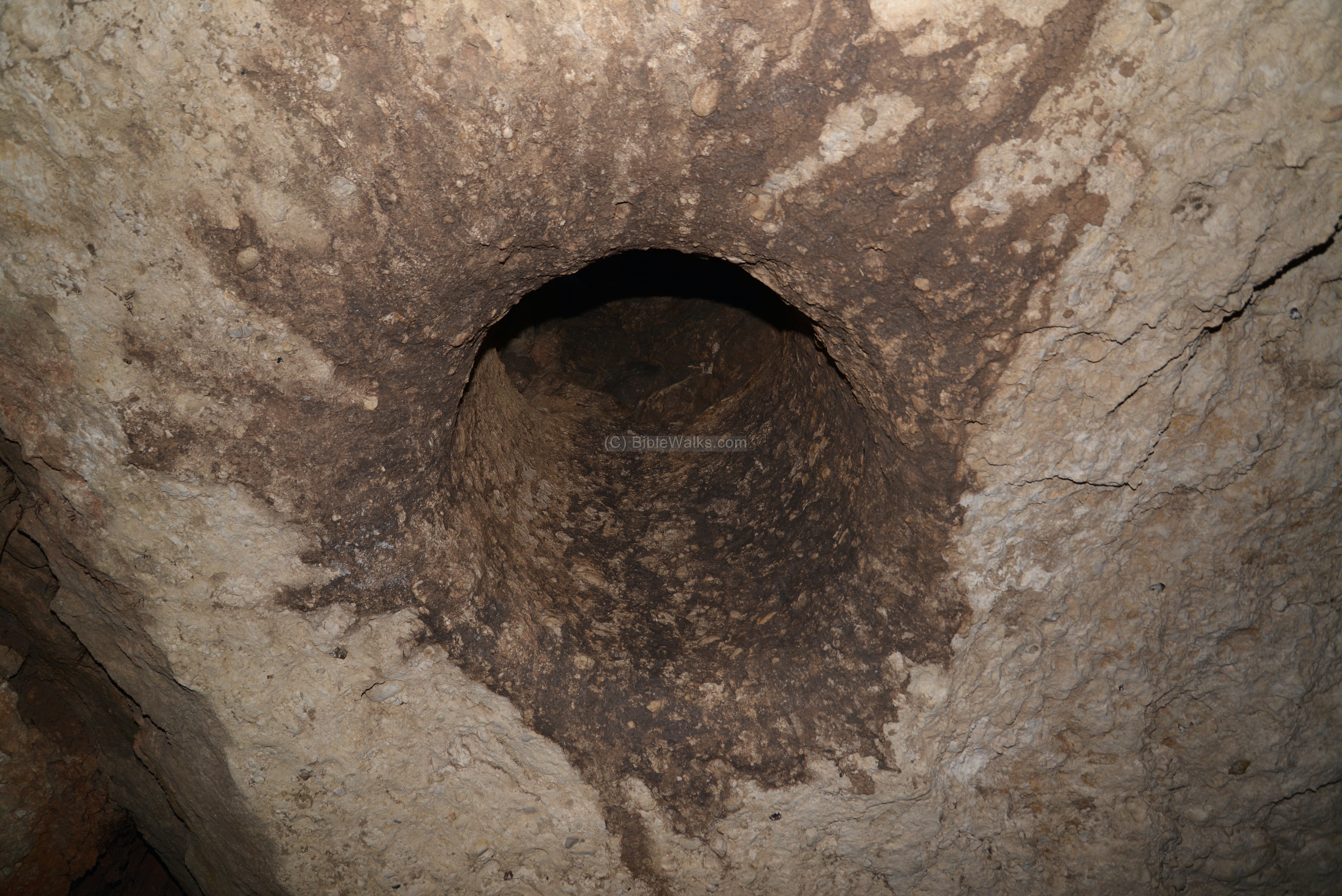
Water channels led the runoff water from the roofs of the surrounding houses, down into the reservoir through a hole on the top of the reservoir:
The water was stored in one of the four underground chambers, which are plastered up to the ceiling. The total capacity was 800 cubic meters – a large reservoir for that time.
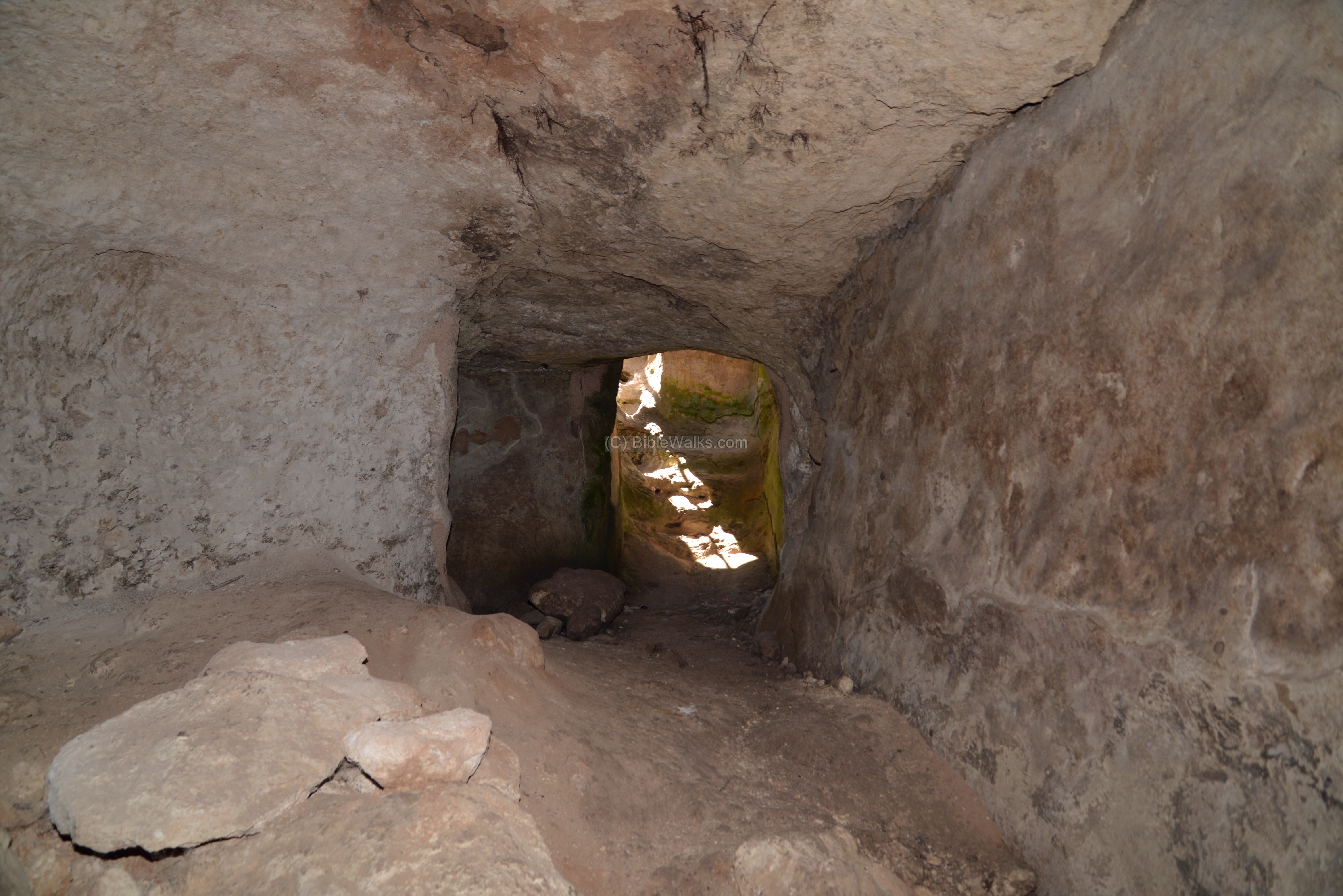
A view of one of the four chambers:
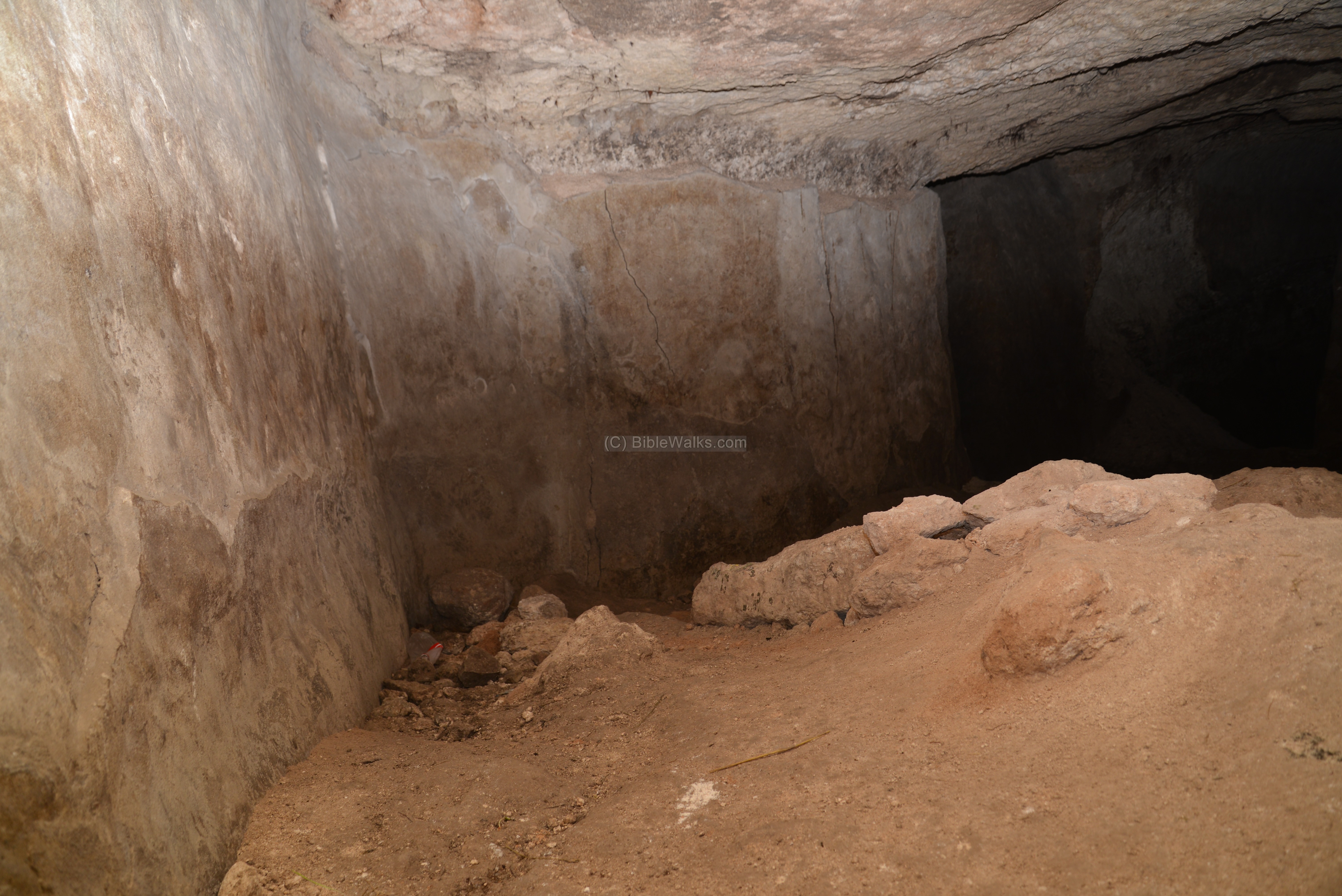
Another chamber below… it was pitch dark inside, but the cool temperature was refreshing compared to the heat outside.
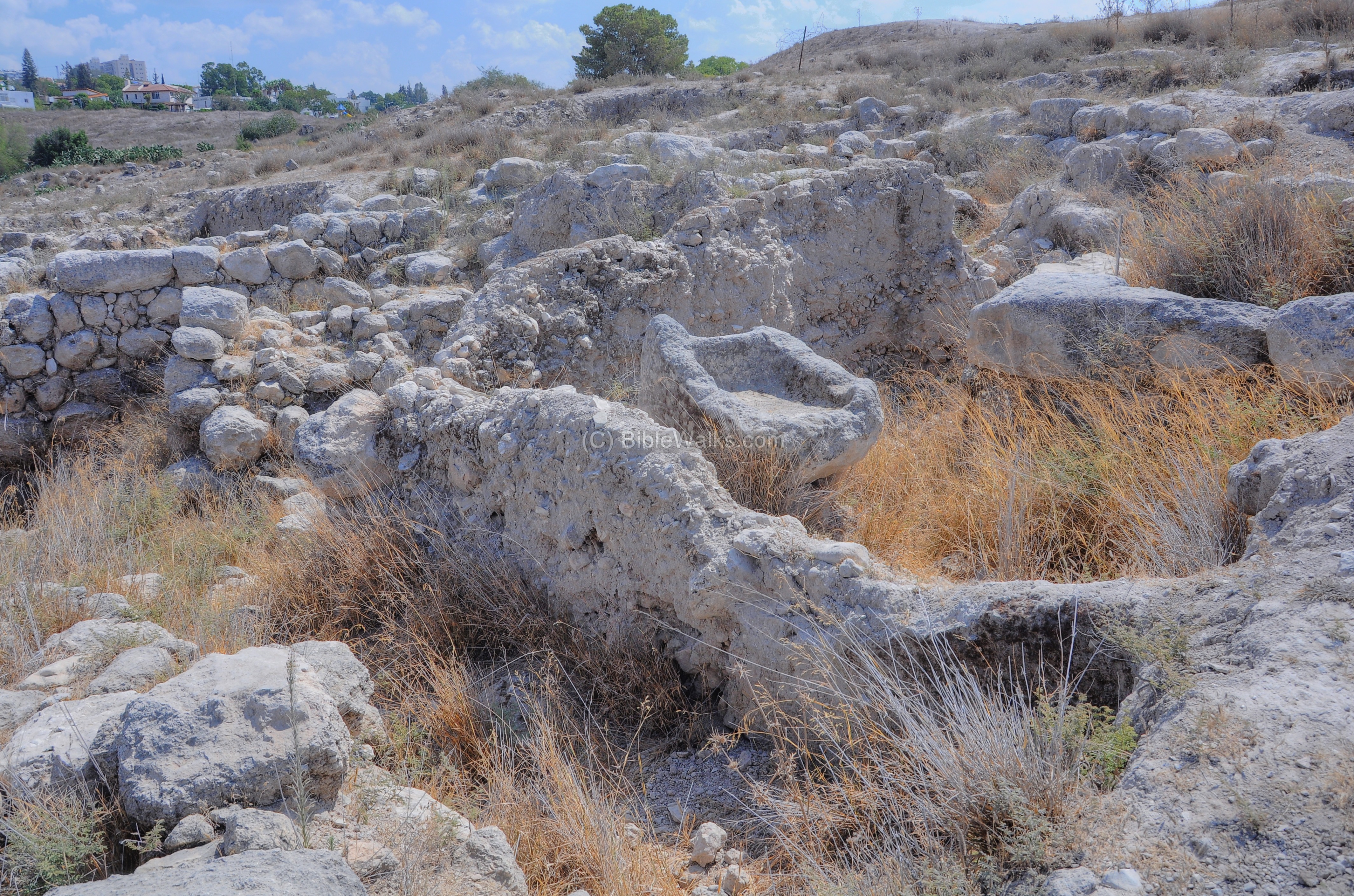
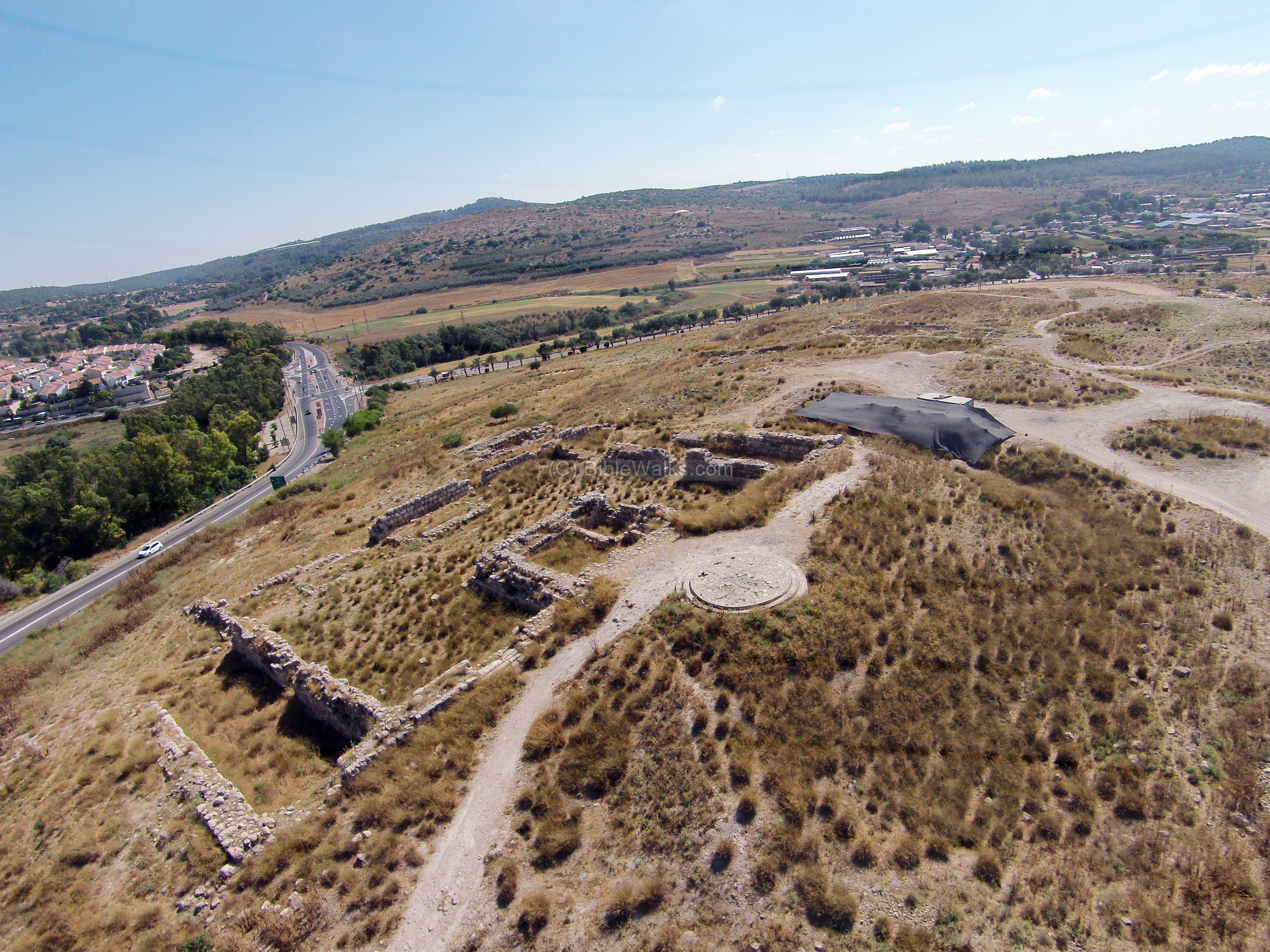
(c) North
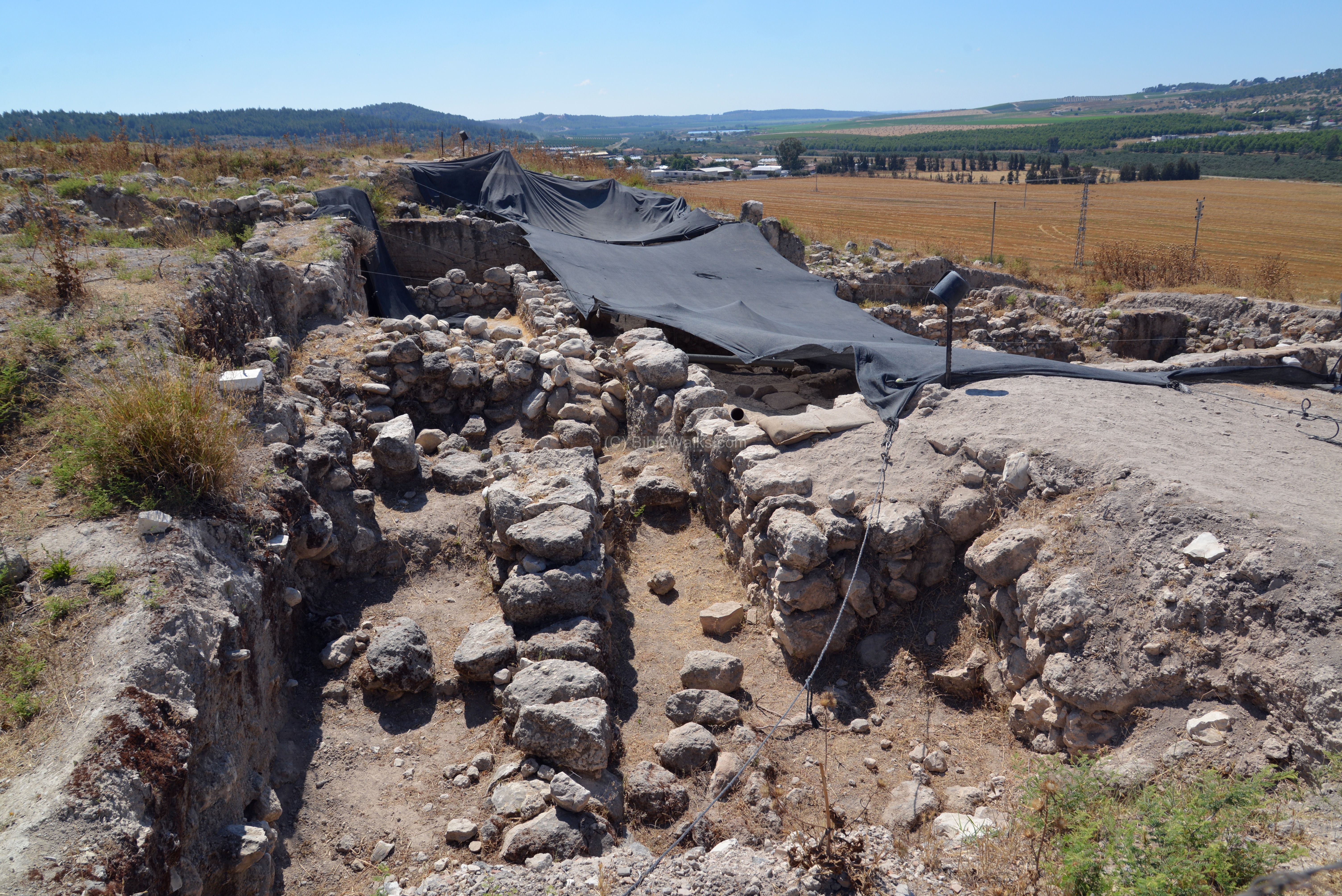
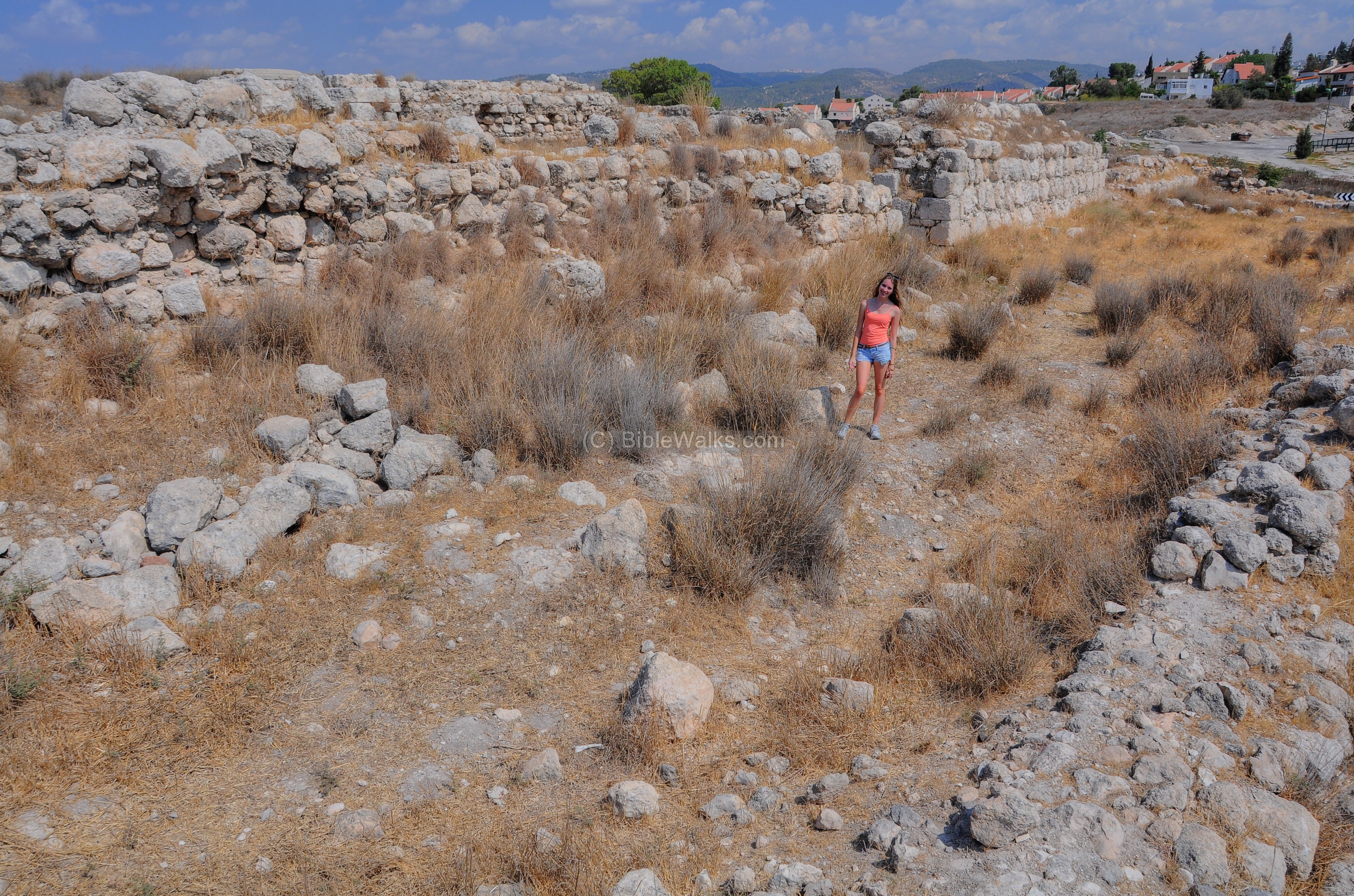
Another excavated section is on the adjacent north foothills. This west view shows the northern area of excavations, with modern Beth Shemesh in the background.
A view of the archaeological trenches is also seen below. Recent excavations found a double-chambered gate which opens into a plastered city plaza. This gate is dated to the end of the 9th century or the beginning of the 8th century. The design of a city plaza near the city gate is common in other Biblical cities, such as Bethsaida. This can also be found in the following text, which is related to King Hezekiah at the end of the 8th century (2 Chronicles 32 6): “And he set captains of war over the people, and gathered them together to him in the street of the gate of the city”.
The gate was built perhaps by King Amaziah during his clash with Jehoash (2 Kings 14:11-14): “Therefore Jehoash king of Israel went up; and he and Amaziah king of Judah looked one another in the face at Bethshemesh”. It could have also have been built by King Uzziah, following his expansion into the Philistine areas.
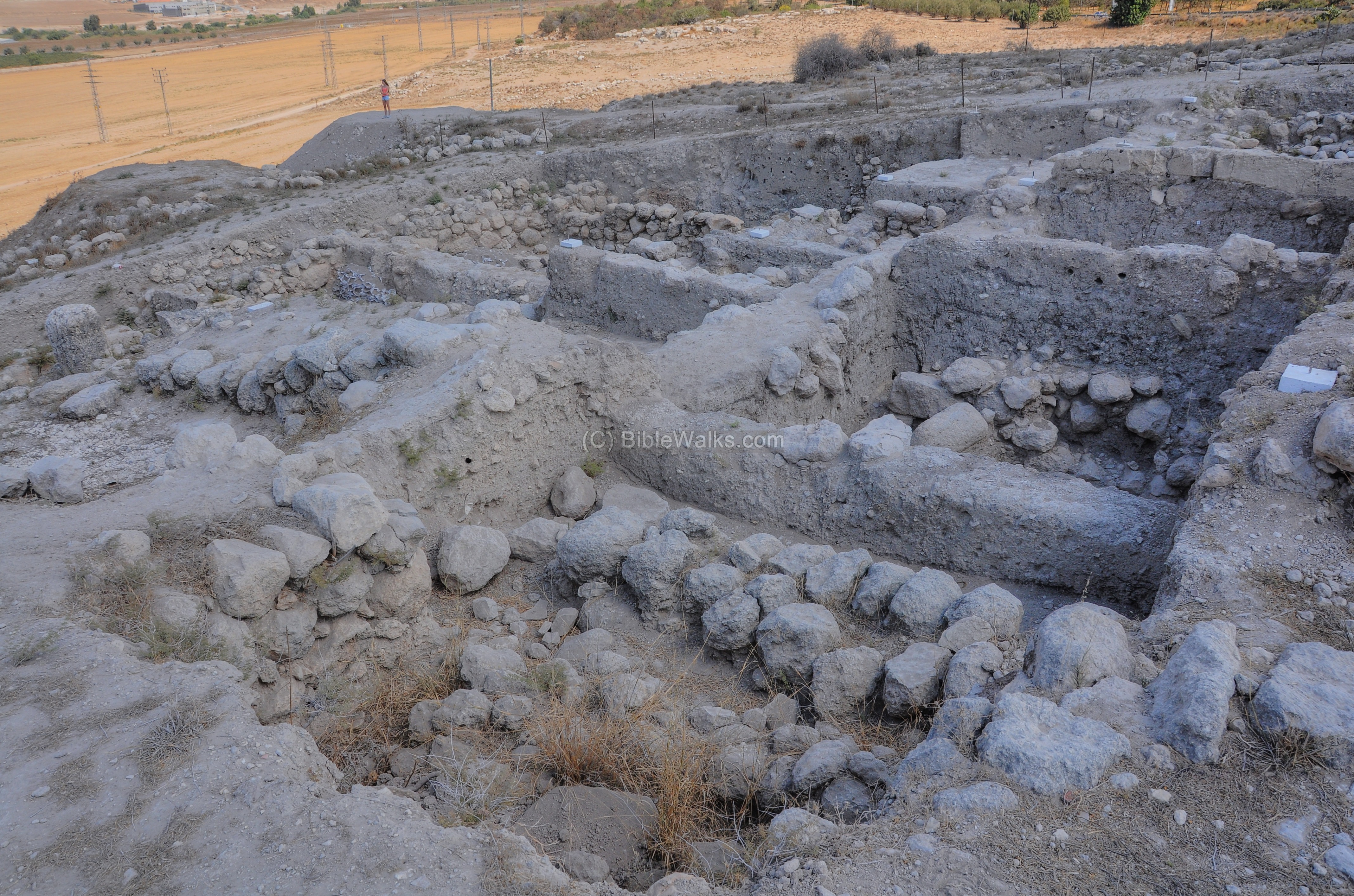
A closer view to some sections of the excavations is seen below. This picture was taken on June 2015, when renewed excavations are conducted:
A Panoramic view of the excavated north side of Tel Beth Shemesh is shown below. If you press on this picture, a panoramic viewer will pop up. Using this flash-based panoramic viewer, you can move around, zooming in and out – viewing the site in the amazing full screen mode (like you are really there). It may take minutes to upload.
An oil press, dated to the Israelite period, was found. In the installation were four large ceramic vessels and two stone vessels.
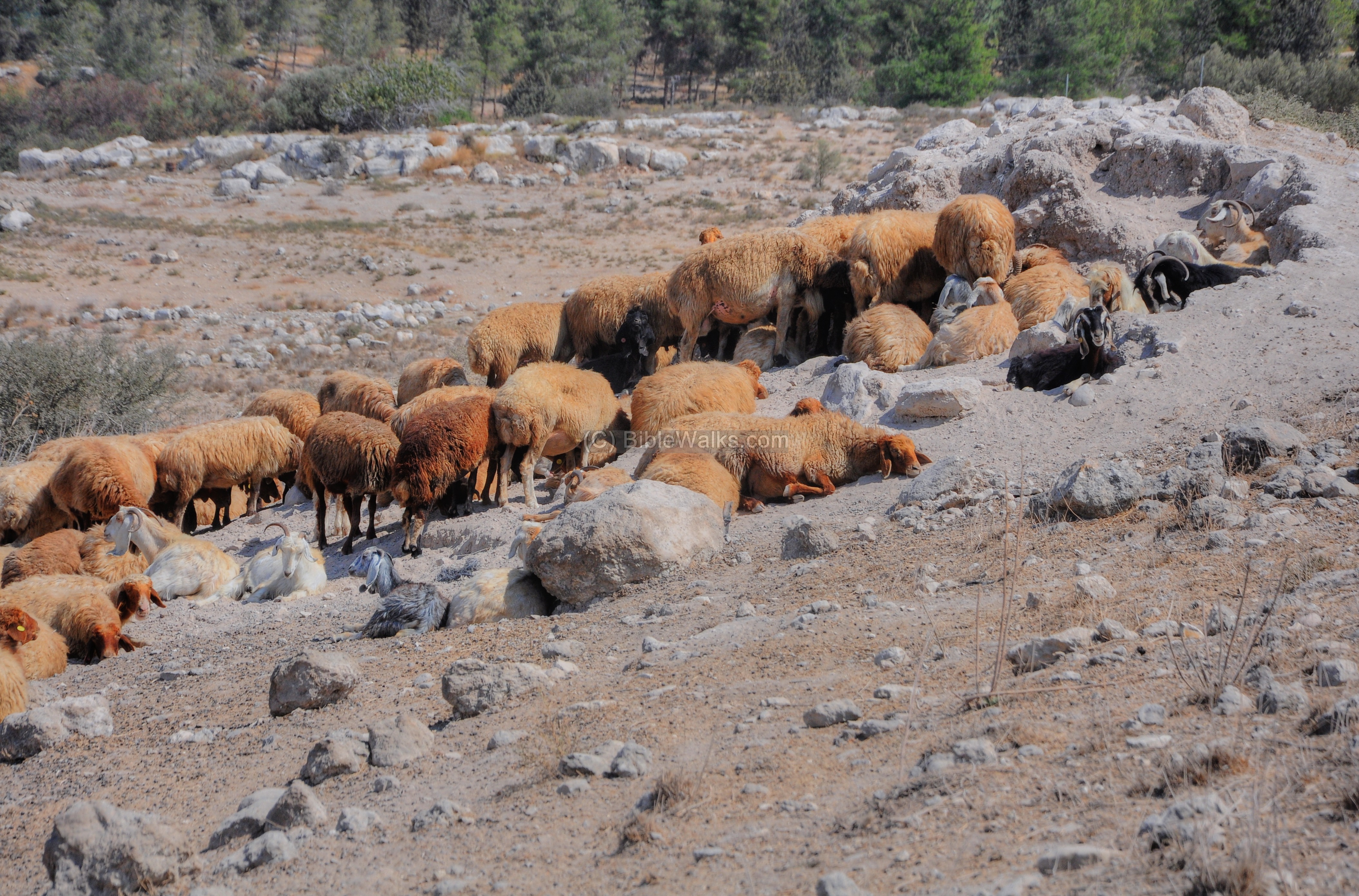
A Bedouin family lives in the valley near the site. This scene of the herd of sheep and goats is like nothing changed in the past thousands of years.
(d) North West
The houses of Moshav Yish’i are seen on the west (left) side. This agriculture settlement was founded in 1950 by immigrants from Yemen. On the far right are the houses of Kibbutz Tsor’a, founded in 1948.
On the north west foothills are numerous rock-cut tombs. Dr Masterman of the PEF wrote about this (1913): ”
“A great number of tombs have been opened which confirm the other evidences regarding the periods of occupation of the site; indeed all the best pottery-the entire pieces now running into many hundreds is from the tombs. One large cave-tomb at the northwest corner proved to be a perfect mine of treasures, even though it had been frequently ransacked previously by the agents of dealers. Much pottery from this tomb is now in museums in America. The earliest interments, and consequently the earliest pottery and scarabs, were here. The majority of the tombs be-longed to the later periods, either just pre-Hebrew or Hebrew”.
(e) Top
The following aerial view is over the top and the south west section of the Tel. The Mackenzie/Grant excavations removed most of the ground at this location.
On top of the site are a fragments of columns and other pieces of stone are scattered around. About three quarters of the 32 Dunam (8 acre) mound have already been excavated down to the bedrock.
A small whirlwind formed above the center of the Tel, shooting up the dust.
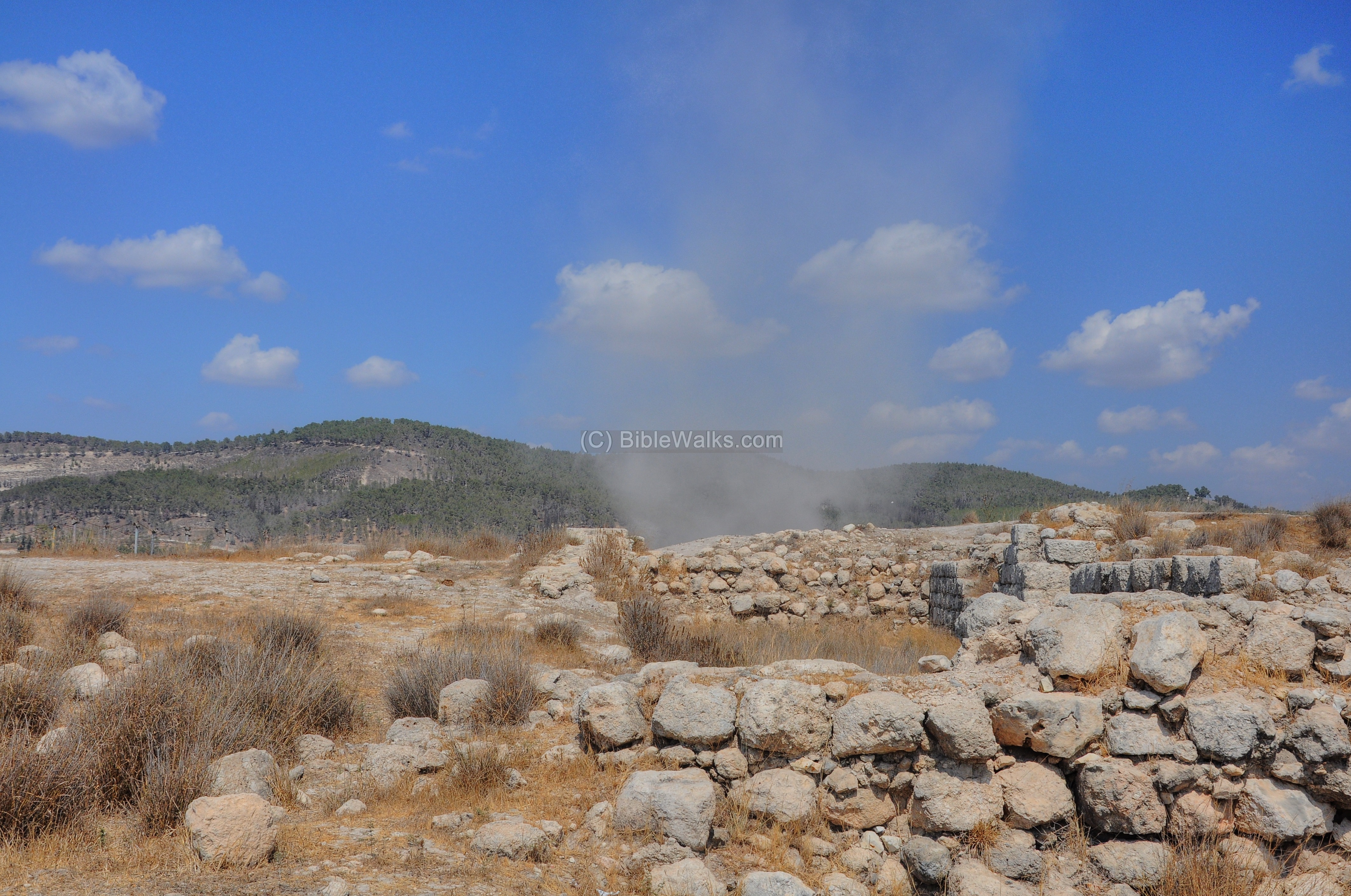
In the center of the hill is a modern concrete platform, which is used as a observation place. This is a perfect place to photograph panoramic views around the place.
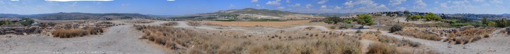
A Panoramic view, as seen from the top of the site, is shown below. If you press on this picture, a panoramic viewer will pop up. Using this flash-based panoramic viewer, you can move around 360 degrees, zooming in and out – viewing the site in the amazing full screen mode (like you are really there). Points of interest are indicated on the view. It may take minutes to upload, but then its worth the waiting time.
To open the viewer, simply click on the photo, then tour the area around:
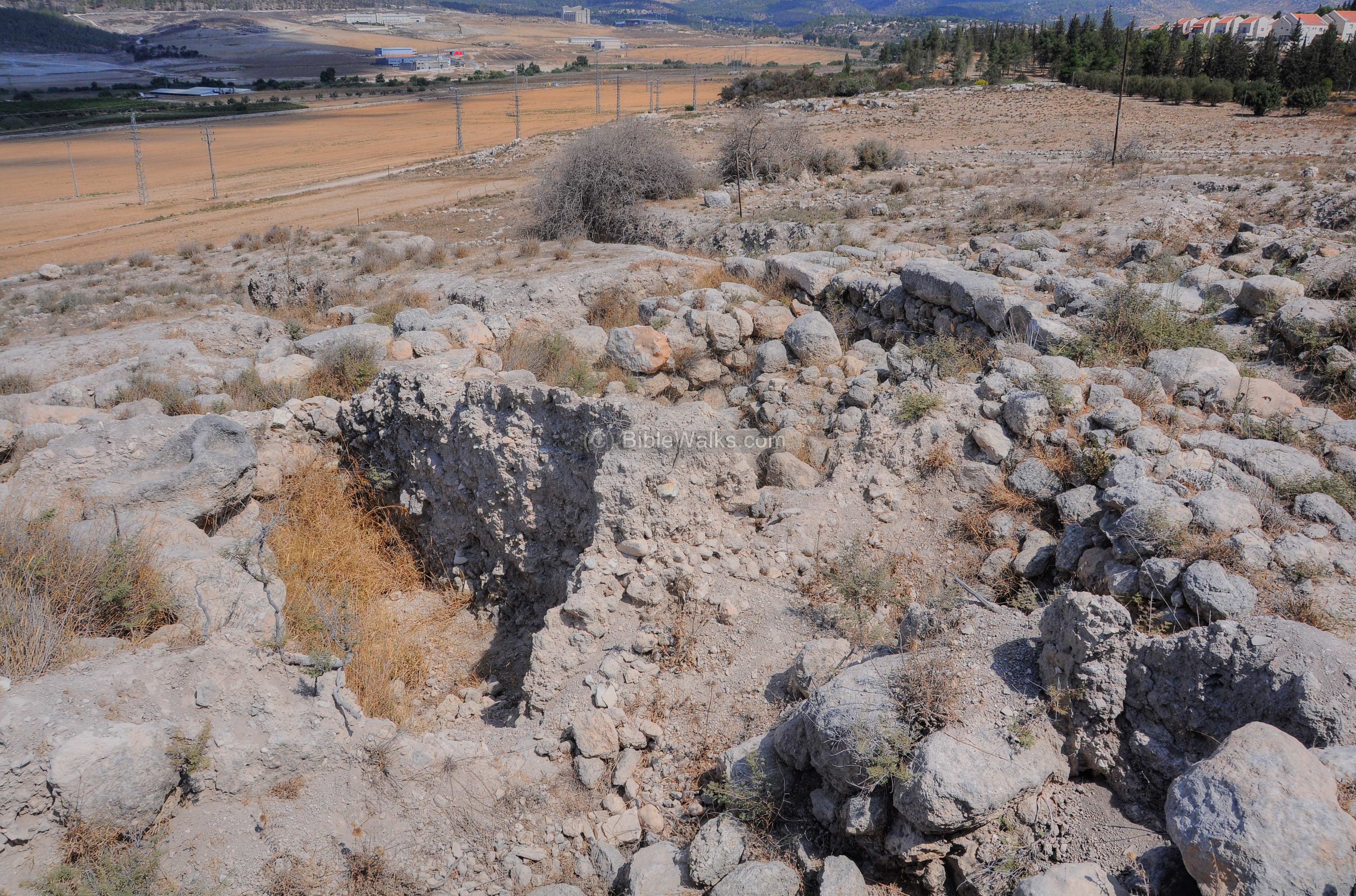
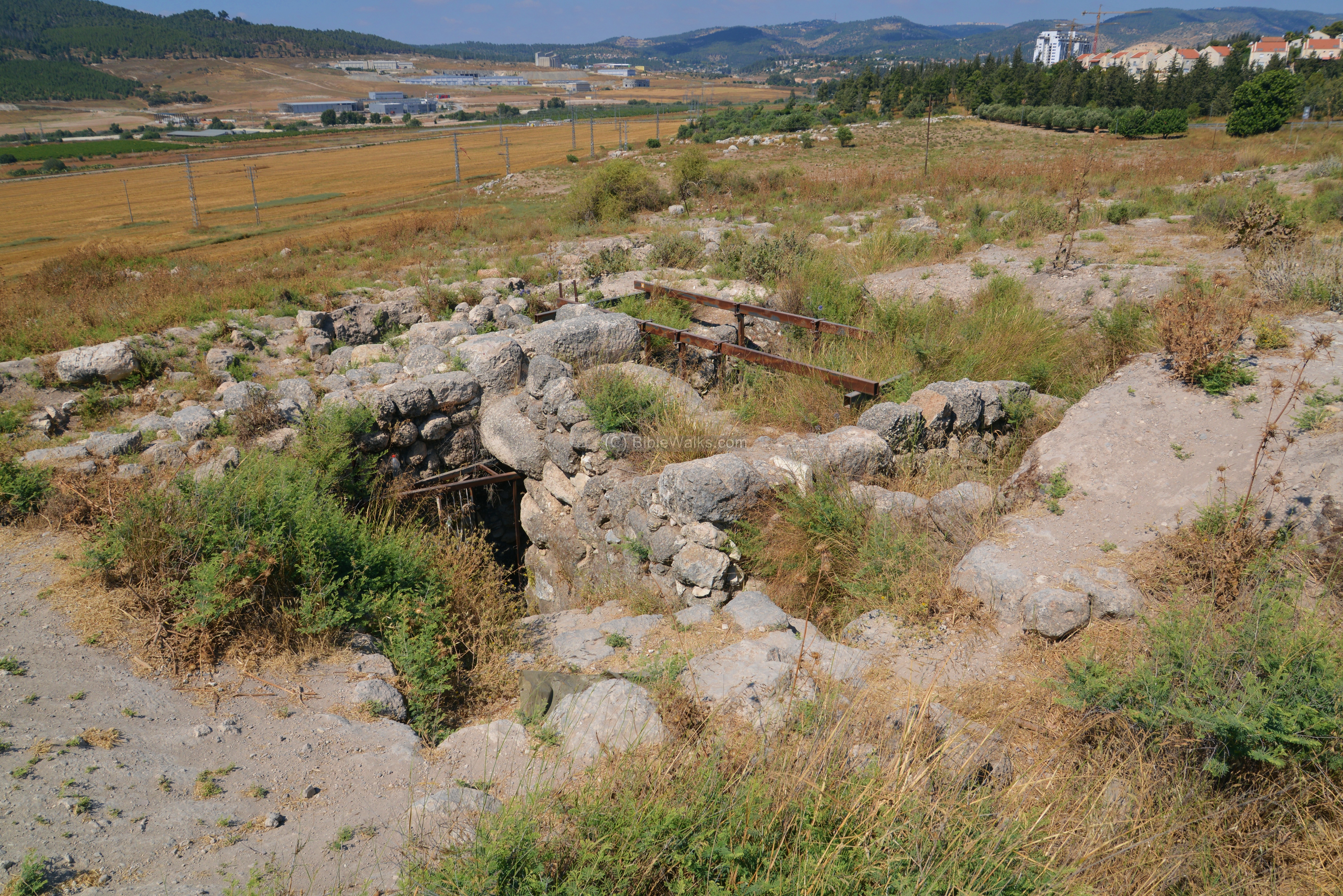
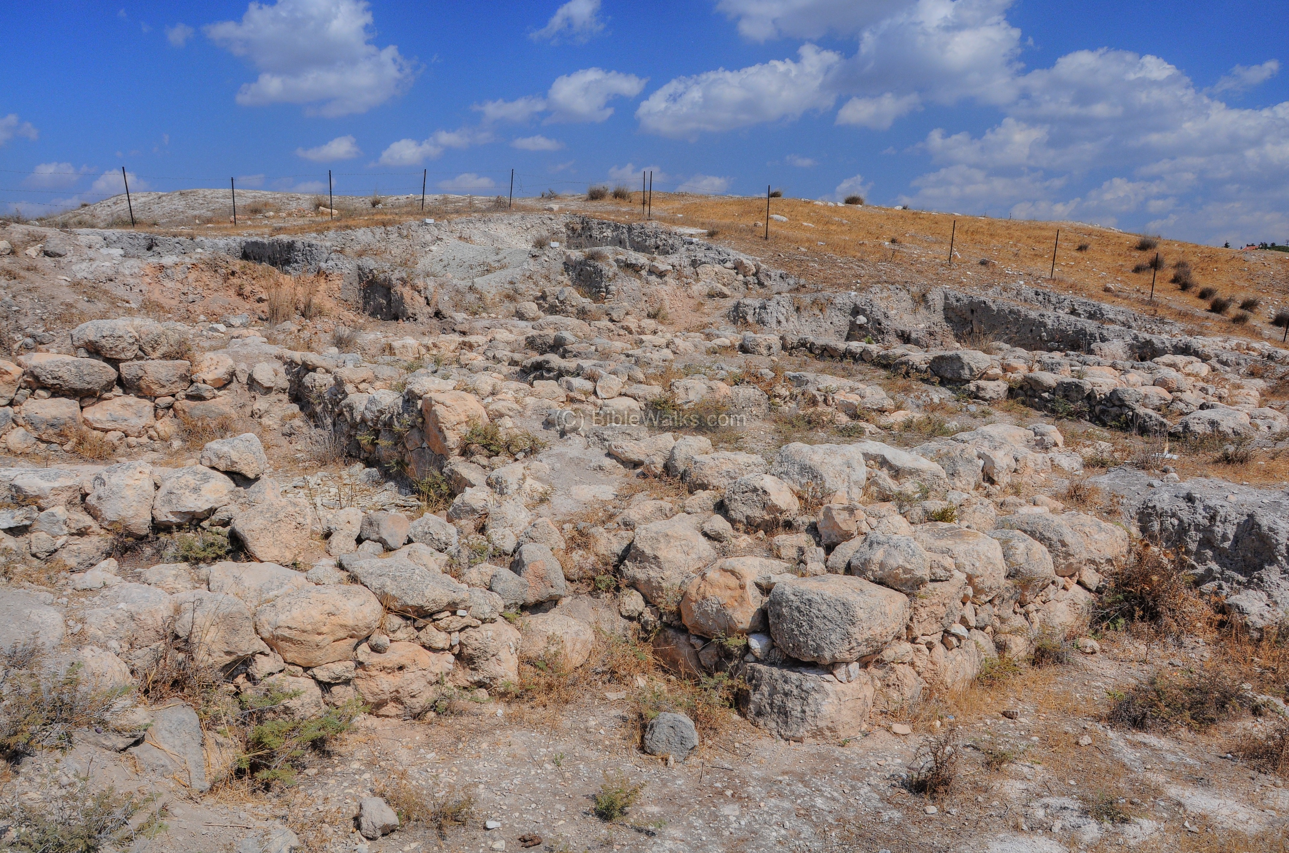
(f) South
On the south side of the mound was a another gate, which was unearthed in the early excavations.
Dr Masterman of the PEF wrote about the gate in 1913:
“Apparently there was only one gate on the south, but this was once flanked by powerful bastions. It is evident that Bethshemesh before the coming of Israel was almost as powerfully fortified as Gezer, though on a smaller scale. The destruction of the great gateway and probably of much of these walls appears to have been a result of the capture of the city and the great conflagration at the end of the middle period. Great quantities of burnt brick were found blocking up the entrances, and during the succeeding period buildings encroached upon the actual site, so that it is clear that the gate and much indeed of these walls were not rebuilt during the Hebrew period”.
He was wrong the assumption of a single gate, since a north gate was recently found.
Another view of the south side is seen below. The excavators found a 10th-9th C ironsmith workhouse, one of the earliest ever found in this region, with locally casted arrowheads and other military iron casts.
(g) Monastery – South East
On the southeast side of Tel Beth Shemesh are the ruins of a 5th century AD Byzantine monastery. This aerial view shows the traces of its ruins.
Another view of the ruins of the monastery is seen in the following photo.
A ground level view of a section of the monastery is in the photo below.
Dr. Masterman of the PEF wrote about the ruins of the monastery in 1913, following the first excavation of the site:
“There are capitals and drums of columns, a door lintel ornamented with a cross, and various beveled stones which certainly were not cut for their present situations. This earlier building may be the one which marked the site of the Bethsamis which Eusebius and Jerome state was visible from the highroad to Nicopolis”.
Dr. Masterman continued:
“After the Arabs captured and largely destroyed the convent, they squatted in it. One of the long halls was used for a stable, and the mangers, which the conquerors placed there, can be seen today. Later on stone houses were built among, and along side of, the massive convent walls until perhaps about 10oo AD, when the site was entirely and finally deserted. The whole building was about 210 feet by 140 feet, and it is a matter of historic interest to realize that this is one of many such institutions which flourished over the land in pre-Islamic days.”
Another view of these ruins:
A Panoramic view of the south side is shown below. If you press on this picture, a panoramic viewer will pop up. Using this flash-based panoramic viewer, you can move around left and right, zooming in and out, and view the site in full screen mode. Note that it may take minutes to upload…
To open the viewer, simply click on the photo:
(h) East side – Weli Abu Meizar
East of Tel Beth Shemesh was a small Arab village (‘Ain Shems), with houses around a mosque named Weli (chapel) of Abu Meizar. This sacred shrine, now almost totally ruined, was a long room with a prayer niche on its south side. The other structures of the village are also gone, as seen in the following picture.
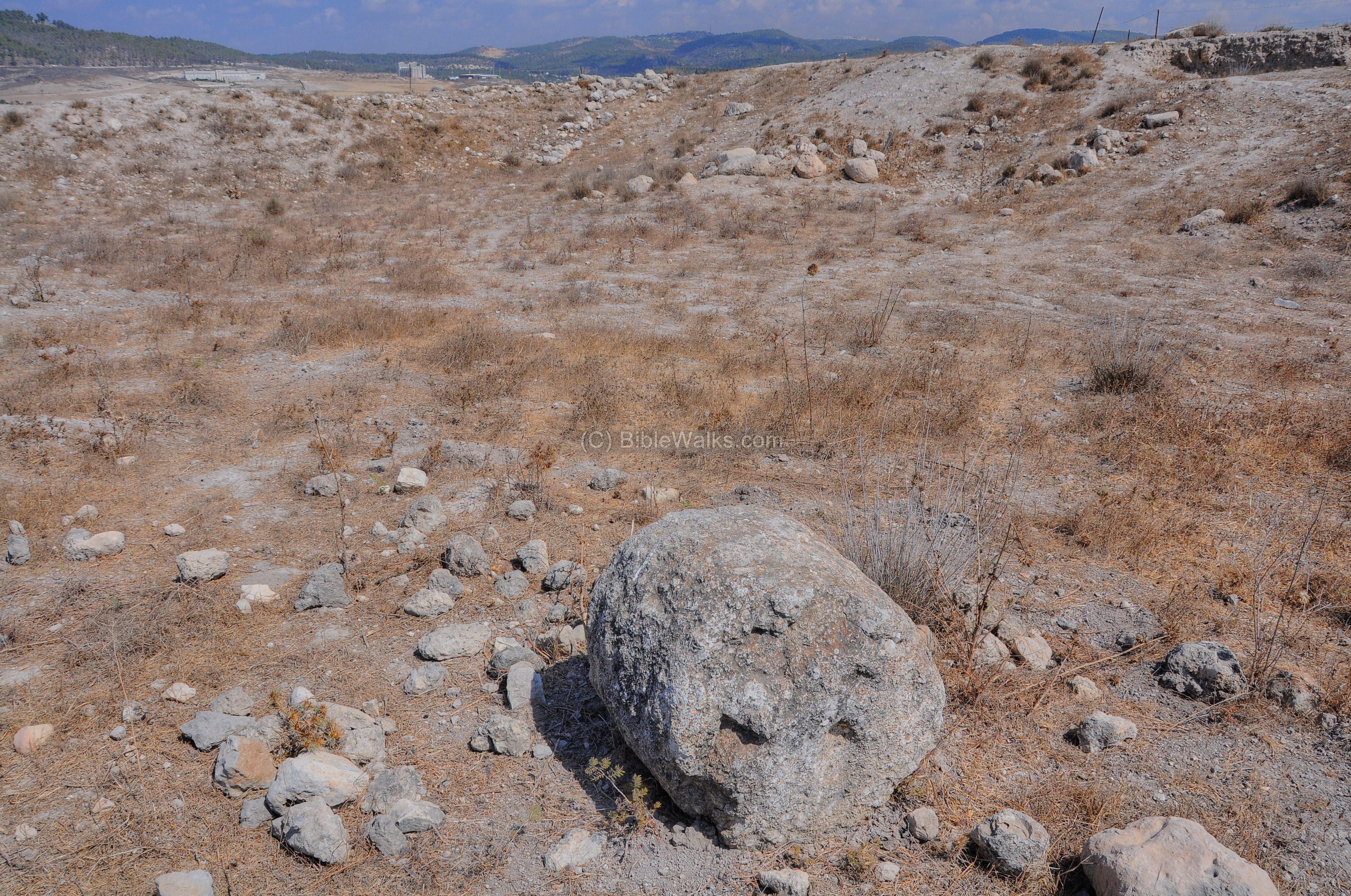
There are several traditions with this shrine. One of them relate to the return of the Ark, and suggest that the cart went up the eastern side of Tel Beth Shemesh and arrived into the field of Joshua, to a great stone which was located at the present location of the Weli. (1 Samuel 6 14):
“And the cart came into the field of Joshua, a Bethshemite, and stood there, where there was a great stone…And the Levites took down the ark of the LORD, and the coffer that was with it, wherein the jewels of gold were, and put them on the great stone”.
This sacred rock became a holy place, and it could have been the reason for the location of a Muslim shrine. The excavators in 1911-1912, who used it for a shelter, noted that the shrine was located on a rock platform, and concluded it was a likely place where the cart carrying the Holy Ark has stopped.
Another tradition gave the mosque the Arabic name of “Shemshum el Jebbar” ( ” Samson the Hero”) or Abu Al-Azam (“the father of the might”). According to this tradition, Abu Meizar is Samson, the great Biblical hero (1 Samuel 13-16). According to this tradition, Samson-Abu-Meizar toppled the temple at this location, similar to the Biblical story.
Highway #38 crosses the mound on its east side. It became too narrow for the traffic that built up after the population in the city extended within ~30 years from 30,000 to 250,000 residents. The authorities debated whether a tunnel is preferred than extending the highway in order to save the east side of the mound, but the expenses were too high for the project.
In preparation for enlarging the highway, new excavations cleared the area east of the highway and revealed a vast extension of the city. In 2023 the new extension of the highway covered these excavation areas, and soon (2024?) the highway will open with new lanes.
(i) LMLK Seals
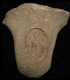
Many seals were found in Israel imprinted on jars with the Hebrew letters LMLK ( “L’melekh”), meaning “belonging to the king”. The royal seals bear the name of the city on the bottom, such as the nearby “Sochoh” (4 Hebrew letters Shin-Vav-Kaf-Hey), as seen in the example below and its corresponding stick figure. A number of seal types classifications were defined according to their structure and city name, such as “S4L”.
55 handles have been excavated from Beth Shemesh.
Type S4L (Sochoh)
Courtesy of LMLK.com
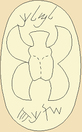
Type S4L (Sochoh)
According to G.M. Grena of LMLK.com (who helped us with this section, and provided the stick figure):
“As for dates, the majority of scholars believe these seal impressions date to the 8th-7th centuries BC; however, this equates to about 7th-6th centuries BC on the Jewish calendar. These dates center around the reign of King Hezekiah because the handles appear in strata formed by a destruction layer caused by the Assyrian king, Sennacherib. Some scholars believe the handles were stamped as early as the reign of Uzziah, & as late as Manasseh (hence the 8th/7th or 7th/6th span of about a century), though some believe they were strictly limited to Hezekiah’s reign”.
Biblical References:
1 Samuel 6:10-21
The Philistines decided to return the stolen Ark of covenant back to Israel, since it caused them plagues. They returned it to Beth Shemesh on a cart. The residents of Beth Shemesh peeked into the Ark, God killed them, and the Ark was sent to the nearby city of Kiryat Ye’arim.
“And see, if it goeth up by the way of his own coast to Bethshemesh, then he hath done us this great evil: but if not, then we shall know that it is not his hand that smote us: it was a chance that happened to us. And the men did so; and took two milch kine, and tied them to the cart, and shut up their calves at home: And they laid the ark of the LORD upon the cart, and the coffer with the mice of gold and the images of their emerods.
And the kine took the straight way to the way of Bethshemesh, and went along the highway, lowing as they went, and turned not aside to the right hand or to the left; and the lords of the Philistines went after them unto the border of Bethshemesh. And they of Bethshemesh were reaping their wheat harvest in the valley: and they lifted up their eyes, and saw the ark, and rejoiced to see it. And the cart came into the field of Joshua, a Bethshemite, and stood there, where there was a great stone: and they clave the wood of the cart, and offered the kine a burnt offering unto the LORD. And the Levites took down the ark of the LORD, and the coffer that was with it, wherein the jewels of gold were, and put them on the great stone: and the men of Bethshemesh offered burnt offerings and sacrificed sacrifices the same day unto the LORD. And when the five lords of the Philistines had seen it, they returned to Ekron the same day.
Return of the Ark- drawing by Gustav Dore (French artist, 1832-1883)
And these are the golden emerods which the Philistines returned for a trespass offering unto the LORD; for Ashdod one, for Gaza one, for Askelon one, for Gath one, for Ekron one; And the golden mice, according to the number of all the cities of the Philistines belonging to the five lords, both of fenced cities, and of country villages, even unto the great stone of Abel, whereon they set down the ark of the LORD: which stone remaineth unto this day in the field of Joshua, the Bethshemite.
And he smote the men of Bethshemesh, because they had looked into the ark of the LORD, even he smote of the people fifty thousand and threescore and ten men: and the people lamented, because the LORD had smitten many of the people with a great slaughter. And the men of Bethshemesh said, Who is able to stand before this holy LORD God? and to whom shall he go up from us? And they sent messengers to the inhabitants of Kirjathjearim, saying, The Philistines have brought again the ark of the LORD; come ye down, and fetch it up to you”.
Etymology:
Beth Shemesh, Beit Shemesh – (Hebrew) The house of the Sun. Named after the worship of the sun by the Canaanites.
‘Ain Shems – (Arabic) – the name of the Arab village on the east side of the site. It means : “Spring of the Sun”, although there is no spring at this site.
Abu Meizar – (Arabic) the father of Meizar – the name of the mosque of the Arab village.
Tel el Rumeilah – the Arabic name of Tel Beth Shemesh, meaning: “the little sandy knoll”.
Tel (Tel) – mound (See more on the story of a Tel).
* Yish’i – a Moshav west of the site. Founded in 1950. Based on the verse (Psalms 27:1): “The LORD is my light and my salvation; whom shall I fear?”.
* Tsor’a (Zorah) – Kibbutz north of the site. Founded in 1948. Based on the Biblical city of Zoreah which is located above the Kibbutz (Joshua 15:32): “And in the valley, Eshtaol, and Zoreah, and Ashnah”.
Nahal Sorek – The stream on the north side of Beth Shemesh, flowing from north Jerusalem westwards to the sea. (Hebrew) Nahal – stream, Sorek – a type of grapes used for red wine. The Arabic name of the valley is called Wady es Surar.
Biblical references: A single Biblical verse refers to Sorek, describing the area where Samson operated (Judges 16 4): “And it came to pass afterward, that he loved a woman in the valley of Sorek, whose name was Delilah”.
Sorek is a Biblical form of a reddish color and also a type of grape used to make red wine. In the following verse the Hebrew word for vine is Sorek (Isaiah 5 2): “And he fenced it, and gathered out the stones thereof, and planted it with the choicest vine, and built a tower in the midst of it, and also made a winepress therein: and he looked that it should bring forth grapes, and it brought forth wild grapes”. The word Sorek is used for the red color (Zechariah 1 8): “I saw by night, and behold a man riding upon a red horse, and he stood among the myrtle trees that were in the bottom; and behind him were there red horses, speckled, and white.
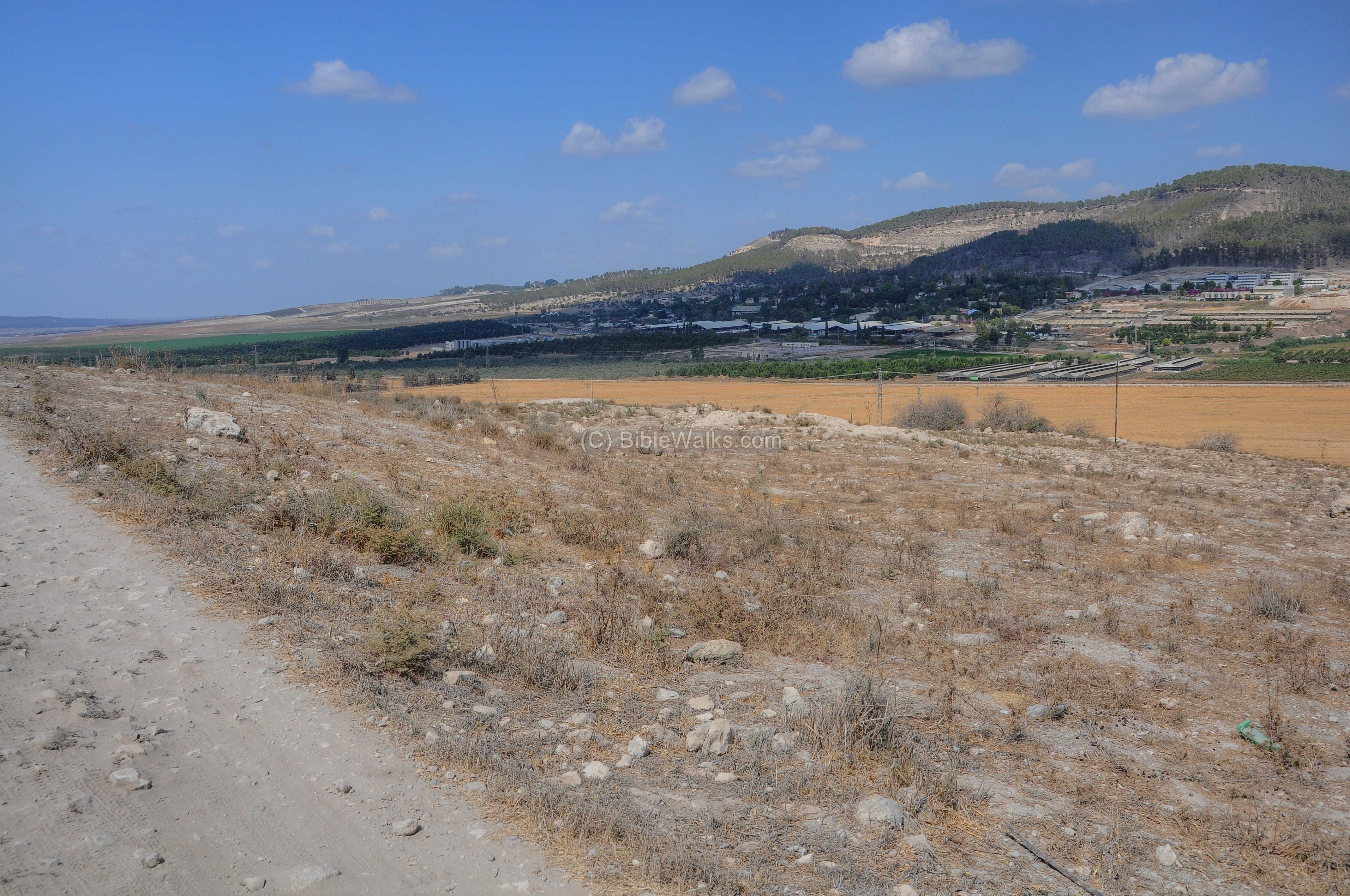
Nahal Sorek, as seen from Tel Beit Shemesh
Links and References:
* Archaeology:
- Beth-Shemesh site – Univ Tel-Aviv
- Bethshemesh excavations – Dr. Masterman of the PEF; Biblical World (1913) – pp101-109
- MacKenzie dig report – Excavations at Ain Shems – PEF, 1911 (pp42- )
- Library of Congress – historic pictures of the excavations
- The final destruction of Beth Shemesh – a different opinion by Alexander Fankaltin (2004)
- Conservation of the water reservoir (Hebrew, 2002)
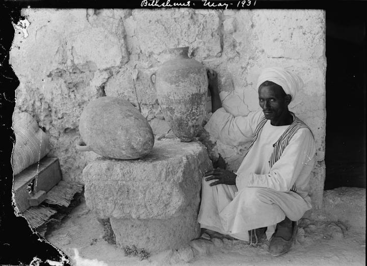
Findings of excavation of 1931, inside Weli Abu Meizar
[ Matson collection; Library of Congress]
* Internal – sites nearby:
- Valley of Elah
- Beit Jamal
- Kh. el ‘Alya
- Tel Yarmut
- Gath – Philistine city, home of Goliath
* Internal – general information:
- Tel – story of mounds
- The ark of Covenant – Its Journeys
- Drone Aerial views – collection of Biblical sites from the air
* Other:
- Biblical pictures by Gustave Doré (1832-1883)
- Kibbutz Tsor’a – 1.5km to the north
Elah Roman Road<<<—previous site–<<< All Sites >>>—next Judea site—>>> Beit Jamal
![]()
This page was last updated on Aug, 2023 (change AI illustration)
Sponsored links: