Remains of a mighty Biblical city, located above the valley of Elah. The city was one of the strongholds of the Kingdom of Judah, which protected its western border.
* Site of the Month Dec 2011 *
Home > Sites > Judea > Elah Valley > Azekah
Contents:
Overview
Location
History
Structure
Photos
* Aerial views
* Entrance
* Observation
* Panorama
* Fortress
* East
* West
* North
* Caves
* Nature trail
* Video
* LMLK seals
Etymology
Links
Overview:
Remains of an important Biblical city, located above the valley of Elah. The city was one of the strongholds of the Kingdom of Judah, which protected its western border.
Joshua 10 11: “…the LORD cast down great stones from heaven upon them unto Azekah”.
Location:
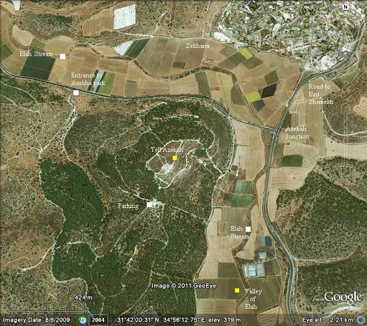
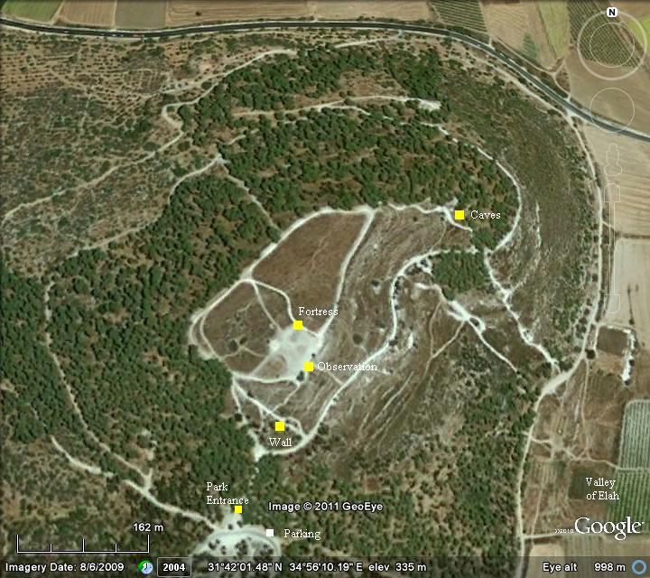
The following aerial view shows the points of interest, with Tell Azekah in the center. To visit the national park, enter the road on the north-west side, and follow the signs. The parking place is located on the south-west side of the hill.
History:
- Pre-Israelite period
Tell Azekah was first inhabited from the middle of the 2nd Millennium BC.
The lowest level of the city, excavated by the archaeologist Dr. F. J. Bliss in the years 1899-1900, is a layer predating the Israelite period. He estimated the date of this early layer as 1400BC.
Bliss found ceramics from this period, including Mycenaean vessels. This cultural period refers to a Greek civilization during the Bronze age (1900BC to 1100 BC). This shows that there was an active overseas trade with Greece, probably by Phoenician maritime merchants. These vessels may have been brought from Cypress or Crete, which were major centers of this civilization.
Two of the findings is seen here, and were classified as “Mycenaean type pyxides”. Pixides (plural for pyxis) are shapes of vessels, usually round with separate lids, where women held their cosmetics or jewelry. Bliss wrote: “These vessels have convex bases, wide mouths, and small ear handles. They all show painted ornament.”. (Reference: quarterly statement PEF 1900, pp 10-12).
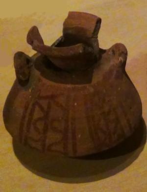
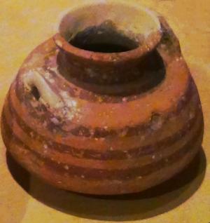
Vases found in Azekah excavations in 1899-1900
[Istanbul Archeological museum]
- Biblical (13th Century BC)
Azekah appears in the Bible in several locations. The first reference to Azekah appears in the conquest of the land of Israel by Joshua. In the campaign of the city of Gibeon, Joshua chased the 5 Amorite kings down to Azekah. The Israelites slew the Amorites, and God casted great hailstones which destroyed them.
Joshua 10 10-11: “And the LORD discomfited them before Israel, and slew them with a great slaughter at Gibeon, and chased them along the way that goeth up to Bethhoron, and smote them to Azekah, and unto Makkedah.
And it came to pass, as they fled from before Israel, and were in the going down to Bethhoron, that the LORD cast down great stones from heaven upon them unto Azekah, and they died: they were more which died with hailstones than they whom the children of Israel slew with the sword.”
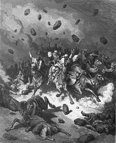
Hailstones on Amorites- Drawing by Gustav Dore (French artist, 1832-1883)
The city of Azekah (also: Azeka) was one of the cities of the tribe of Judah (Joshua 15: 20, 35-36): “This is the inheritance of the tribe of the children of Judah according to their families…. and Adullam, Socoh, and Azekah, And Sharaim,…”. Its location according to this verse is near Sochoh (4KM Northwest of Sochoh).
-
Philistines (11th Century – 8th Century BC):
Azekah was an important fortified city during the times of the Judea Kingdom (11thCentury through 6th Century BC), defending the kingdom against the Philistine attacks through the valley of Elah on its western frontier. There are several texts that emphasize its strategic importance to the Kings of Judah:
King Saul: The city appeared in the Biblical account of the battle between David and Goliath of Gath. This famous battle is detailed in the web page of the Valley of Elah. According to the Bible, it is located near the place of the battle in the valley of Elah (1 Samuel 17: 1): “Now the Philistines gathered together their armies to battle, and were gathered together at Shochoh, which belongeth to Judah, and pitched between Shochoh and Azekah, in Ephesdammim. “.
King Rehobam, son of Solomon, fortified the city (2 Chronicles 11 5-12): “And Rehoboam dwelt in Jerusalem, and built cities for defense in Judah. He built … Shoco, and Adullam, And Gath, and Mareshah, and Ziph, And Adoraim, and Lachish, and Azekah… And he fortified the strong holds, and put captains in them, and store of victual, and of oil and wine. And in every several city he put shields and spears, and made them exceeding strong…”.
The first excavators of the site indeed found a large fortress on the south-east side of the summit, and dated it to Rehobam (end of the 10th Century), basing their assessment on this Biblical description. However, later studies rose doubts on this dating, suggesting a later date of construction (9th or 8th BC).
-
Assyrians (8th – 7th Century BC):
The Assyrian empire, a rising force in the region, conquered the North Kingdom of Israel in 732BC, destroying most of the cities and villages in the land. The South Kingdom of Judah managed to survive this onslaught by teaming up with the Assyrians, but not for long. After the death of the Assyrian King Sargon II (722 705BC), King Hezekiah mutinied against the Assyrians, joining other cities in the area who attempted to free themselves from the Assyrian conquest.
Anticipating the coming Assyrian intrusion, he fortified Jerusalem and the major cities, including Azekah.
The Assyrian army came in 701, leaded by Sennacherib, son of Sargon II (2 Chronicles 32 1): “After these things, and the establishment thereof, Sennacherib king of Assyria came, and entered into Judah, and encamped against the fenced cities, and thought to win them for himself”. According to an Assyrian clay tablet, Sennacherib conquered 46 cities in Judea, including the mighty fortress of Azekah.
A tablet inscribed at that time, and found in the library of Ashurbanipal, reads “… the province of [Hezek]iah of Judah like the city of Azekah, his stronghold, which is between my [bo]rder and the land of Judah…”.
Jerusalem was spared from destruction and the Assyrians retreated (2 Chronicles 31 21-22): “And the LORD sent an angel, which cut off all the mighty men of valor, and the leaders and captains in the camp of the king of Assyria. So he returned with shame of face to his own land. And when he was come into the house of his god, they that came forth of his own bowels slew him there with the sword. Thus the LORD saved Hezekiah and the inhabitants of Jerusalem from the hand of Sennacherib the king of Assyria, and from the hand of all other, and guided them on every side”.
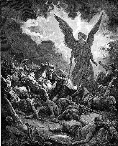
Sennacherib’s army destroyed – by Gustav Dore (French artist, 1832-1883)
-
Babylonians (610-538 BC):
The Babylonian empire rose after the fall of the Assyrians (610BC), defeated the Egyptians (609BC) and conquered the land until the Nile (2 Kings 24 7): “… for the king of Babylon had taken from the river of Egypt unto the river Euphrates all that pertained to the king of Egypt”.
After 10 years under Babylonian control, Jehoiakim King of Judah mutinied, and so the Babylonians reached the gates of Jerusalem (598) and placed it under siege (2 Kings 24 10): “At that time the servants of Nebuchadnezzar king of Babylon came up against Jerusalem, and the city was besieged”.
Jehoiakim was murdered (Jeremiah 22 18-19): “Therefore thus saith the LORD concerning Jehoiakim the son of Josiah king of Judah; They shall not lament for him, saying, Ah my brother! or, Ah sister! they shall not lament for him, saying, Ah lord! or, Ah his glory! He shall be buried with the burial of an ass, drawn and cast forth beyond the gates of Jerusalem”. Most of the nobles were exiled, including the son Jehoiachin (2 Kings 24 14-15): “And he carried away all Jerusalem, and all the princes, and all the mighty men of valor, even ten thousand captives, and all the craftsmen and smiths: none remained, save the poorest sort of the people of the land. And he carried away Jehoiachin to Babylon, and the king’s mother, and the king’s wives, and his officers, and the mighty of the land, those carried he into captivity from Jerusalem to Babylon”. Nebuchadnezzar appointed Zedekiah (2 Kings 24 17): “And the king of Babylon made Mattaniah his father’s brother king in his stead, and changed his name to Zedekiah”.
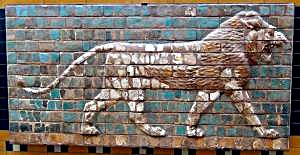
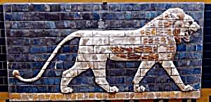
“Lions in Relief” – from the procession street in Babylon.
Nebuchadnezzar II period (604-562BC); glazed brick
[Istanbul Archaeological Museum]
However, after some time (589) Zedekiah mutinied, which brought Nebuchadnezzar to destroy the Judah kingdom completely. In this intrusion (587) most of the cities were leveled. Close to the end, only Jerusalem, Lachish and Azekah were left fighting (Jeremiah 34 7): “When the king of Babylon’s army fought against Jerusalem, and against all the cities of Judah that were left, against Lachish, and against Azekah: for these defenced cities remained of the cities of Judah”. Azekah fell after some time, as documented in the Lachish letter (Ostracon #4). The writer of that letter reports that the no longer sees the signal fires of Azekah. Jerusalem followed in the summer of 587, and many of the people in the land were exiled to Babylon – thus bringing an end to the Kingdom of Judah.
-
Persian period (538 – 332 BC):
In 539 the Persians defeated the Babylonians, and allowed the exiles to return to Zion (538 through 445 BC). The cities were reconstructed, including Jerusalem and Azekah (Nehemiah 11 1, 30): “And the rulers of the people dwelt at Jerusalem: the rest of the people also cast lots, to bring one of ten to dwell in Jerusalem the holy city, and nine parts to dwell in other cities…. Zanoah, Adullam, and in their villages, at Lachish, and the fields thereof, at Azekah, and in the villages thereof. “.
- Roman/Byzantine period:
Eusebius Pamphili (better known as Eusebius of Caesarea), a 4th Century Greek historian of the Church, wrote in his book “Onomasticon”: Azeka – City of the Chanaanites to which Josue pursued the five kings. It was given to the tribe of Juda. There is even now a village called Azeka between Eleutheropolis and Jerusalem”.
The name of Azekah changed during the Byzantine period to Kefar Zechariah, and it appears with this name in the Peutinger map as a station along the Jerusalem to Ashkeleon. The Peutinger Map (Tabula Peutingeriana) is a medieval map which was based on a 4th Century Roman military road map. The map shows the major roads, with indication of the cities, and geographic highlights (lakes, rivers, mountains, seas). Along the links are stations and distance in Roman miles (about 1.5KM per mile). The roads are shown as brown lines between the cities and stations. In the section shown below is the area of Jerusalem, drawn in a rotated direction (Egypt on the left, the Mediterranean sea on the top). Jerusalem is illustrated in the center as a double house icon, which represents a major city. It is listed as “formerly called Jerusalem, now called Aelia Capitolina” (antea dicta Hierusalem n(unc) Helya Capitolina).
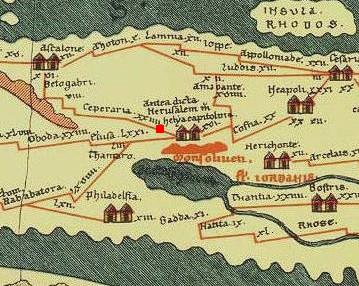
Part of Peutinger map, based on 4th Century Roman road map.
The section where the Roman road passes through the valley of Elah is indicated as a red square. Ashkelon is marked as “Ascalone”. Stations along the road are marked as:
-
“Caper (zac) aria” – Kefar Zacharia (XXIIII=24 miles from Jerusalem), located on Tell Zakariya, southwest of Beth Shemesh. This place is identified as Azekah.
-
“Beto gabri” – Beit Guvrin (additional VIII=8 miles, and XVI=16 miles from Ashkelon).
The total distance of this road is 48 Roman miles, or about 71km – the actual distance between the two cities.
The Jewish presence in Azekah was destroyed following the second Jewish revolt against the Romans – known as the Bar Kochba revolt (132-136 AD). On the north side of the hill are remains of a large underground complex – a hiding complex of the Bar-Kochba revolt.
The excavators determined that the site was inhabited until the Byzantine period, and remained in ruins since then.
-
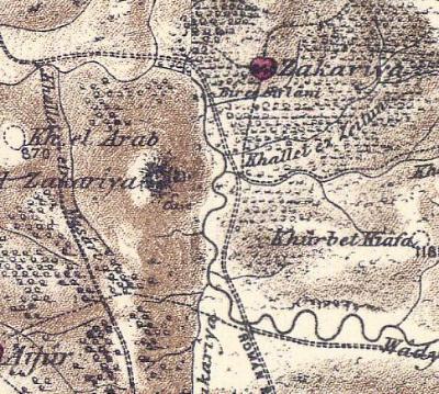
Ottoman period – PEF survey and excavations (19th Century AD)
The area around the valley of Elah was examined in the Palestine Exploration Foundation (PEF) survey (1866-1877) by Wilson, Conder and Kitchener. The valley of Elah appears on this map of 1878 in its Arabic form – “Wadi es Sunt” (the valley of the Acacia), although in the map below only the word “Wady” is seen on the right side. The ruins of Azekah are marked at the ruins called Tell Zakariya (the hill in the center of the map), preserving the name of Kefar Zacharia. An Arab village is located nearby, named Zakariya like the name of the ruins. A double-dashed line on the east and north sides are marked as “Roman Road”, while another ancient road passes on the west side.
The surveyors of the PEF did not identify Tell Zakariya as Azekah. Their report of 1875 (in Survey of Western Palestine, sheet XVI p. 441) on Tell Zakariya was:
“This seems also to have been a site of importance. The summit of the hill, which is a natural fortress, resembling the last, is 300 or 350 feet above the valley. In the sides, which are cut into terraces, there are several caves. In the valley on the north is an ancient well (Bir es Siflani), having stone water-troughs round it. On the south side of the hill is a raised area , on which apparently the citadel once stood. Rude foundations exist on the summit of the Tell; one of the caves has steps at its entrance. Two tombs were also found choked up, and an ancient olive-press. The place has every appearance of being an ancient and important site, though as yet unidentified. The present name is probably taken from the village near”.
 Part of Map Sheet 16&17 of Survey of Western Palestine,
by Conder and Kitchener, 1872-1877.
(Published 1880, reprinted by LifeintheHolyLand.com)
The PEF archaeologists, headed by Bliss and MacAllister, excavated Tell Zakariya during the years 1898-1899. They identified the site as Azekah.
-
Modern Period
Tell Azekah is today a national park and open to the public.
Modern excavations started in 2012, directed by Prof. Oded Lipschits and Dr. Yuval Gadot of Tel Aviv University, and Prof. Manfred Oeming of Heidelberg University. The expedition is part of the Valley of Elah project.
Structure:
Tell Azekah (Zakariya) is located on a high (347m) hill, which towers 100m above the valley of Elah. The stream of Elah surrounds it from three sides, thus providing an additional natural defensibility.
The summit is about 350 long by 150m wide, with few visible ruins on it. It was described by the British excavator, Dr. Bliss (PEF Quarterly report #32, January 1899, p 288 ): “The summit is fairly flat, and has a generally triangular shape, measuring from base to apex about 1,000 feet, with a maximum breadth of about 400 feet. At the south-east corner is a raised area on which apparently the citadel once stood”.
At the end of his statement, Dr. Bliss suggested that this site is Azekah.
Photos:
(a) General and Aerial Views
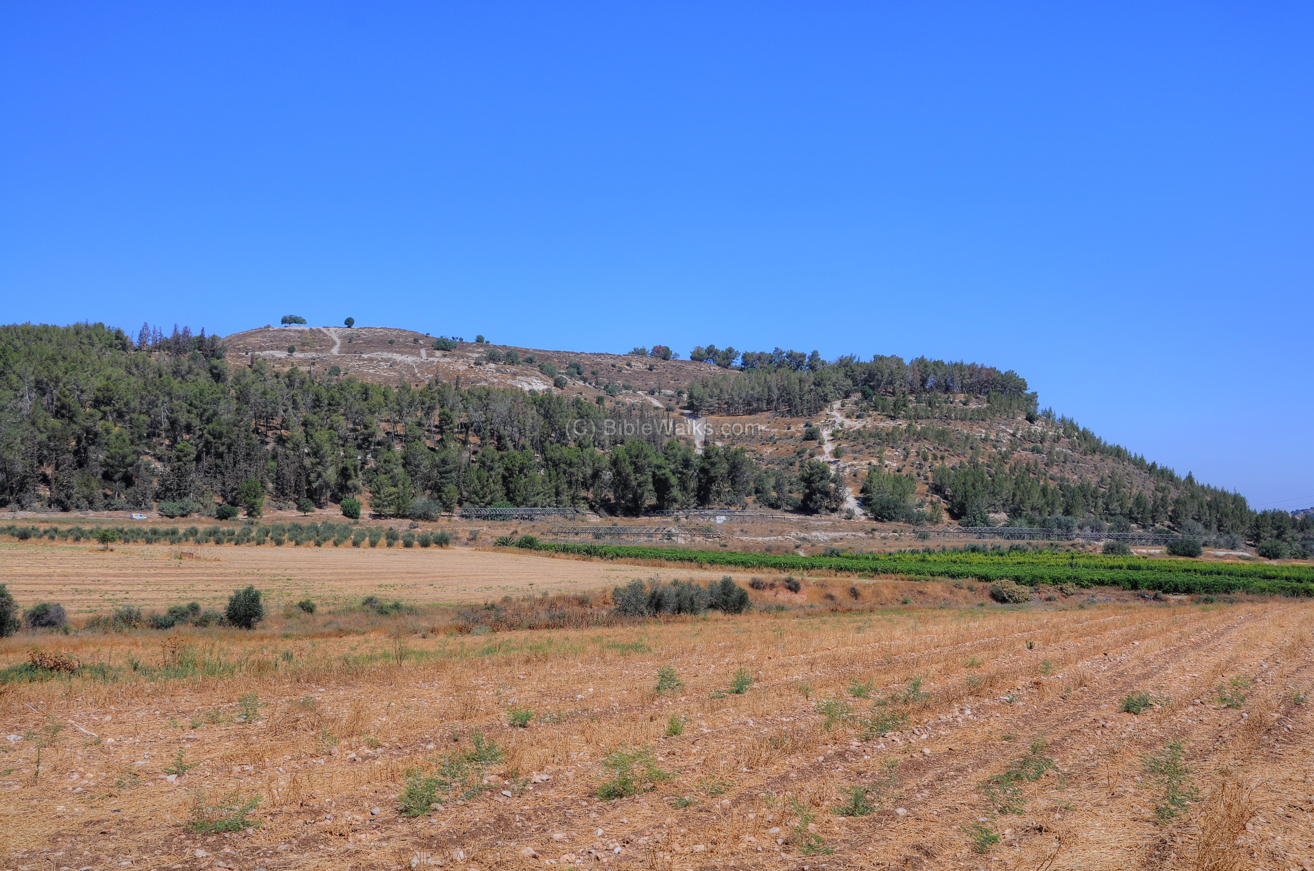
The impressive Tell Azekah towers over the valley of Elah. This view is from the east, looking up to the summit.
Click on the photos to view in higher resolution…
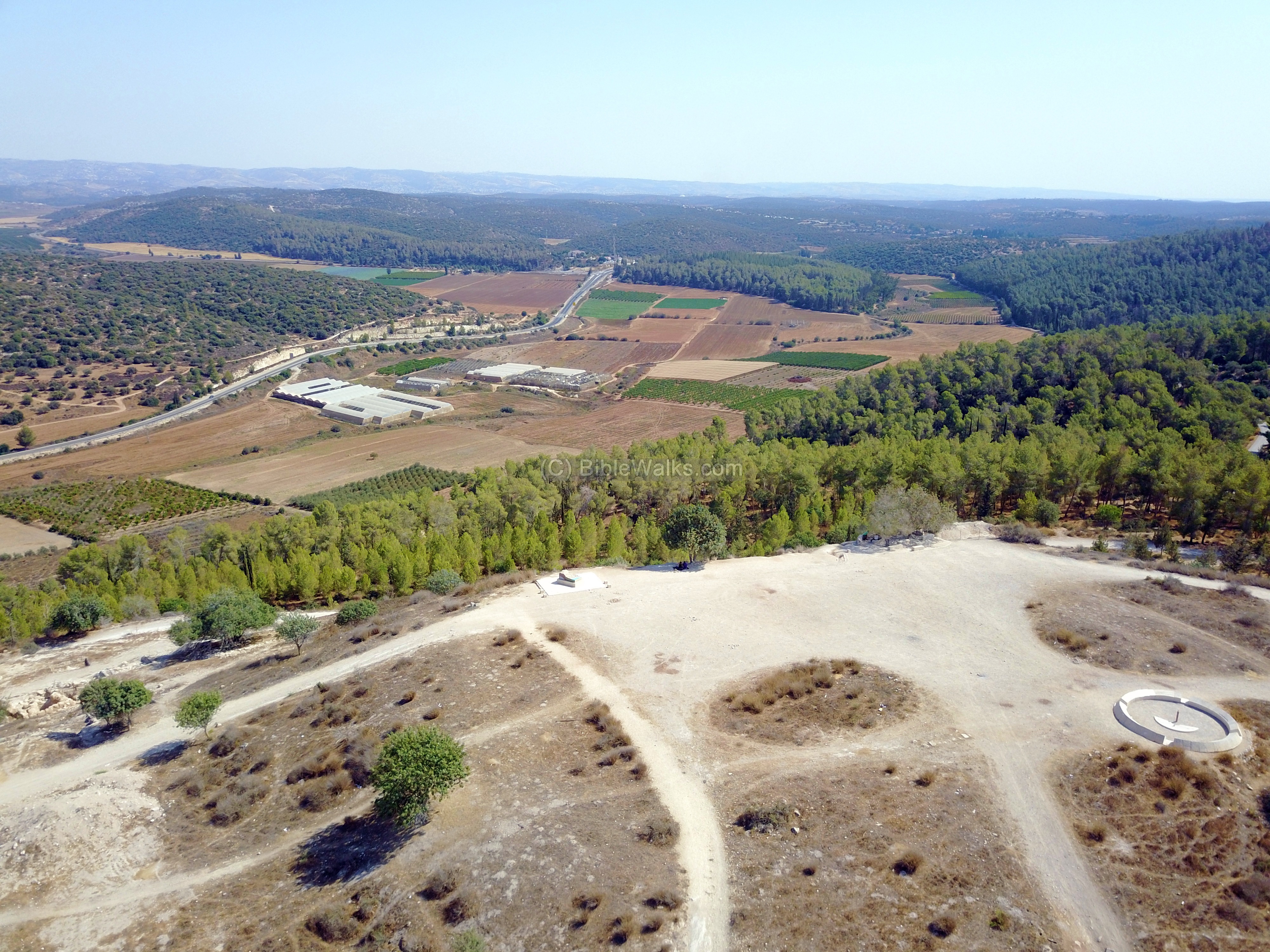
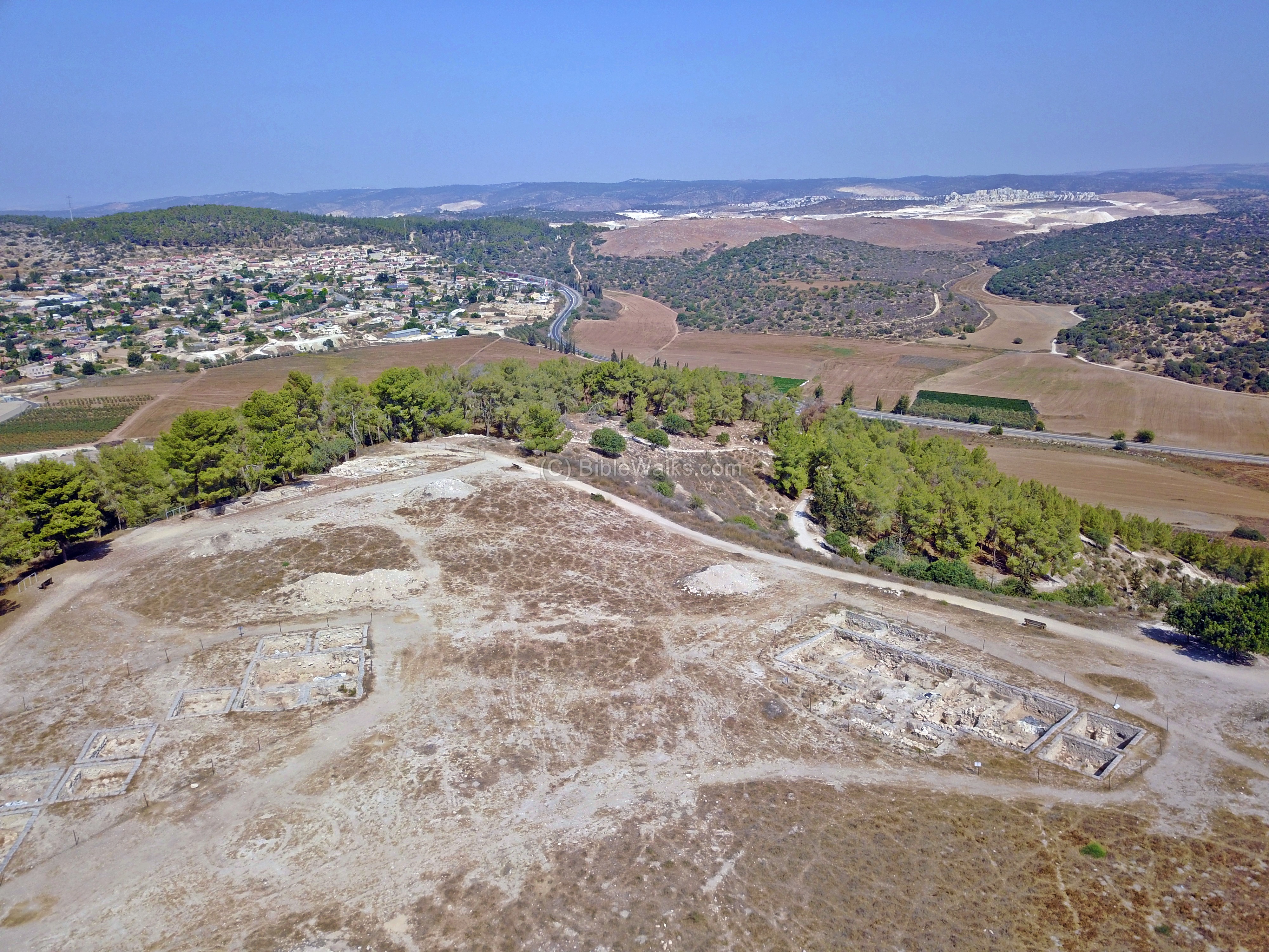
The next photo is a drone view above the south east side of the summit. The mound on this side is raised.
Below is the valley of Elah, and in the far background are the hills of Judea and the cities of Jerusalem, Bethlehem and Hebron.
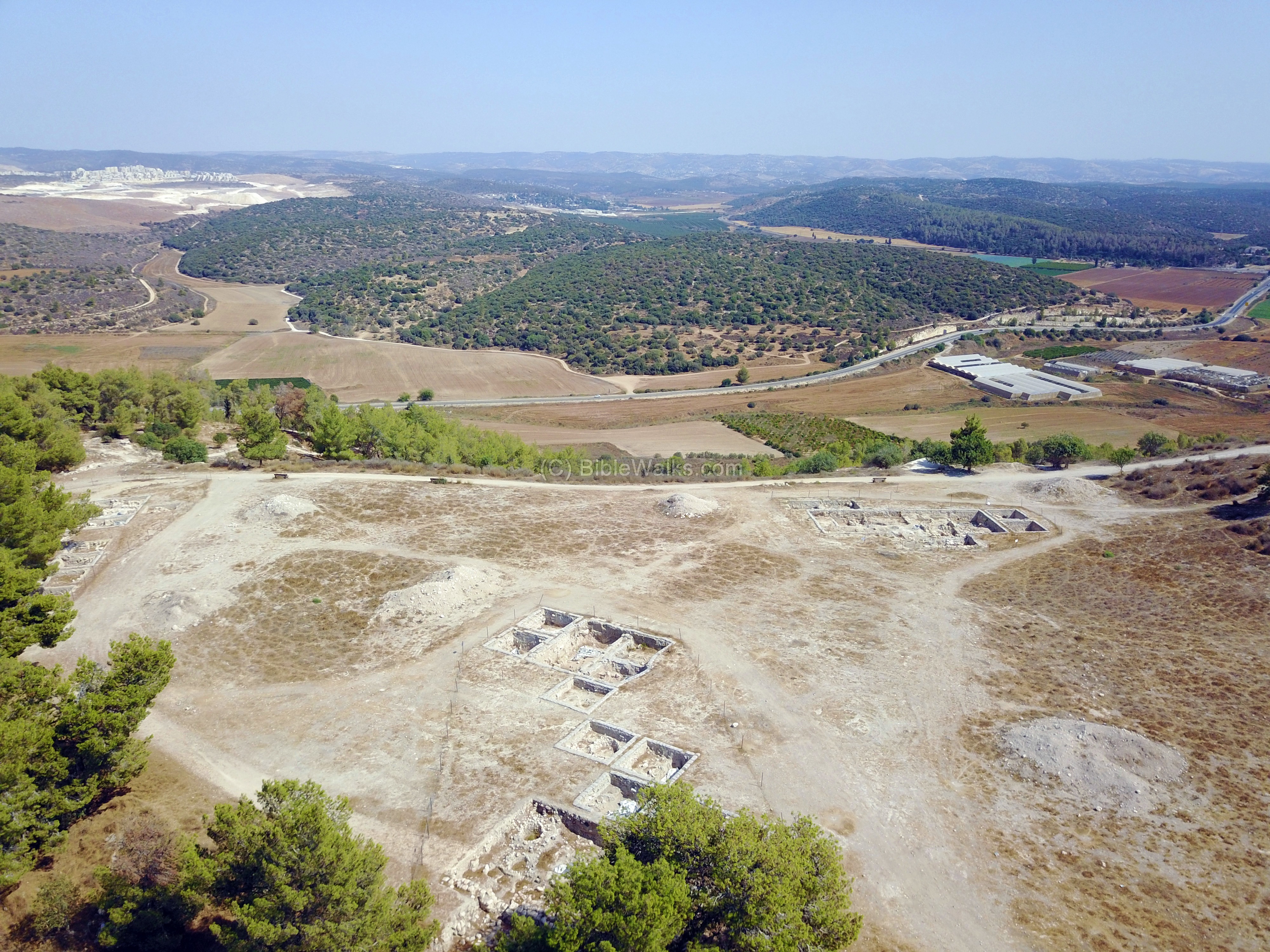
The next drone view is of the north east side of Azekah, where recent (2017) seasons of excavations opened up new areas.
On the left far background is the expansion of the city of Beit Shemesh (Ramat Beit Shemesh).
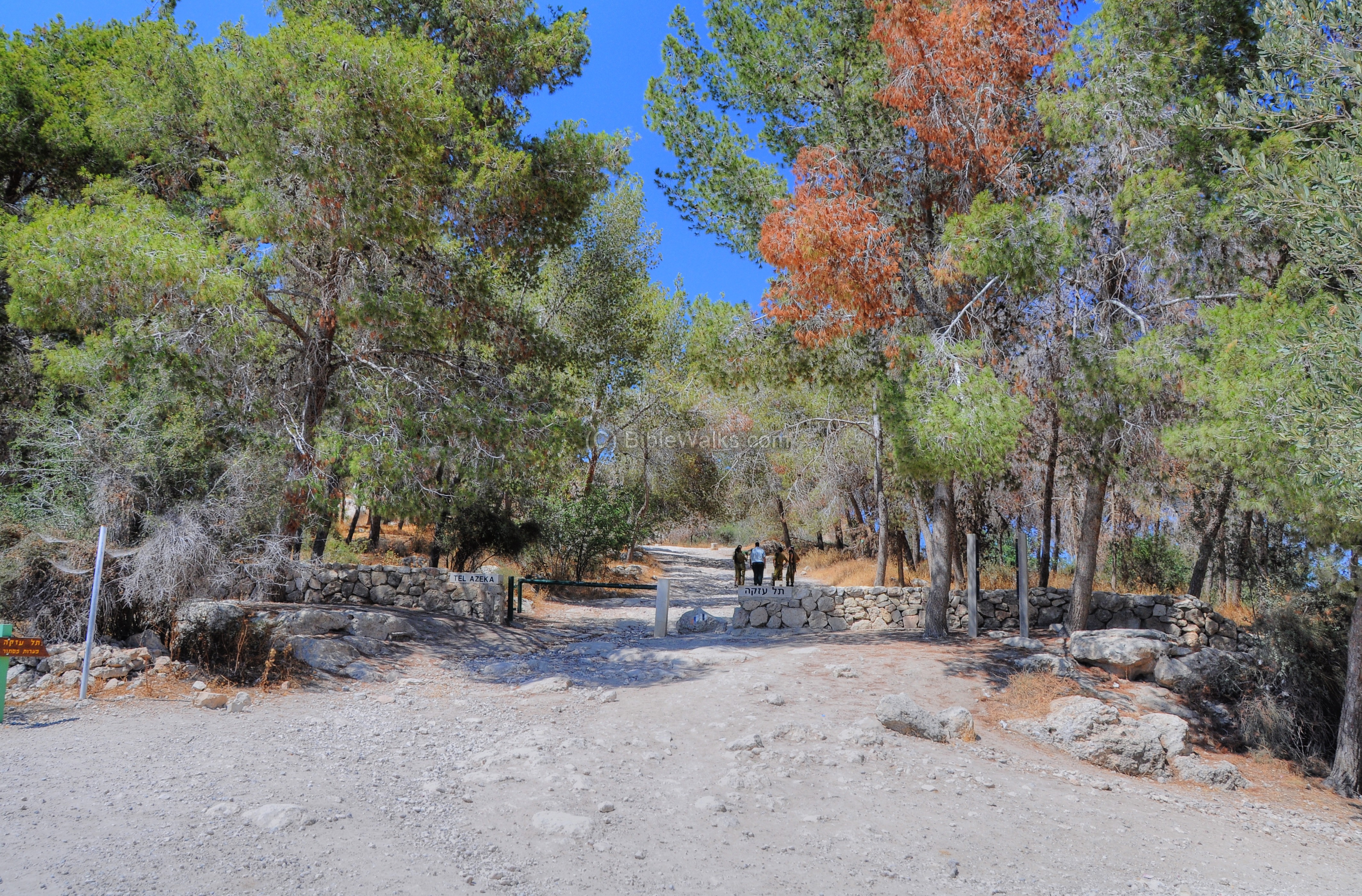
(b) Entrance
The gate to the national park is located on the south side of the summit, close to the parking lot.
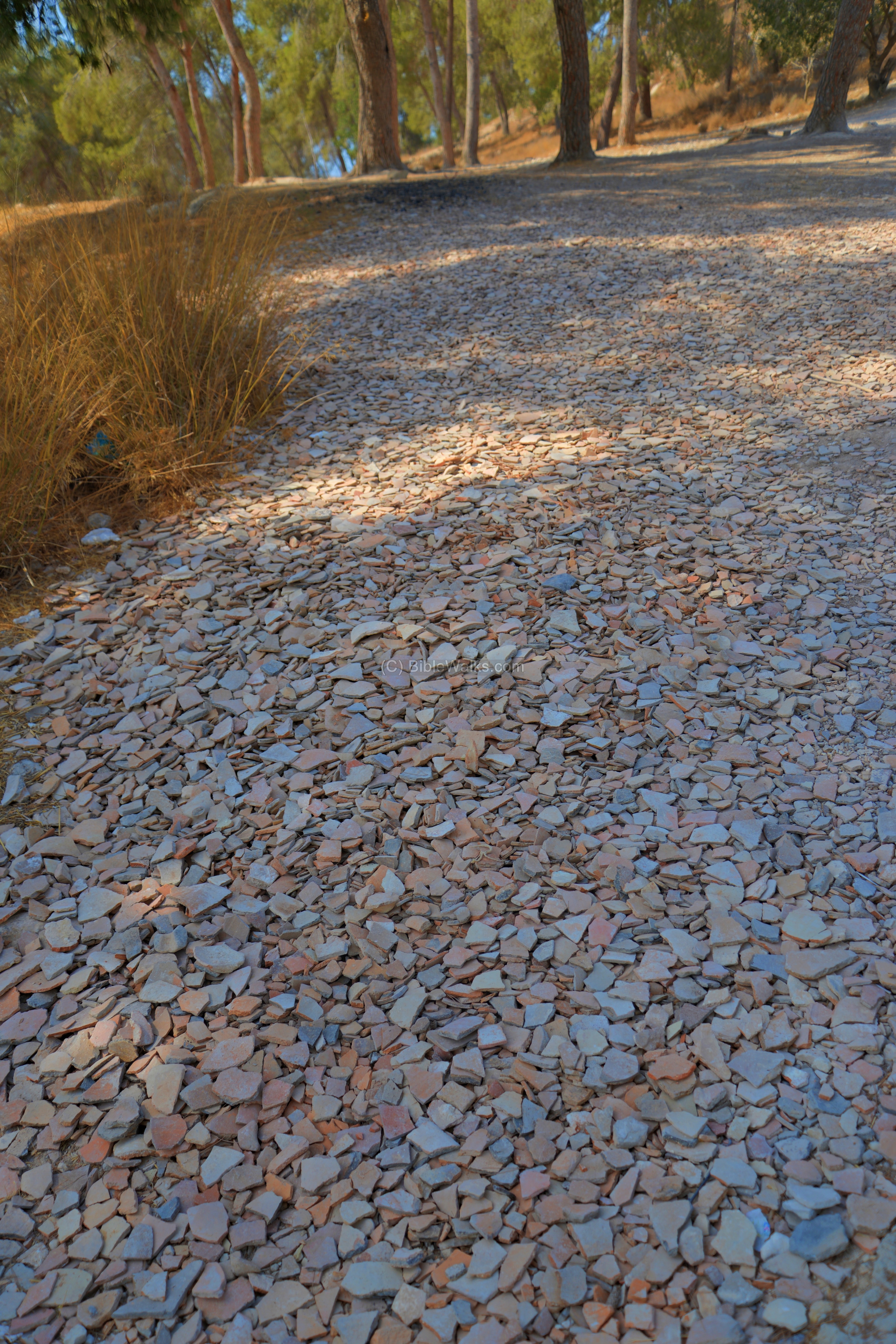
Near the entrance is a large pile of ceramics, probably left by the archaeologists for the public in order to take souvenirs:
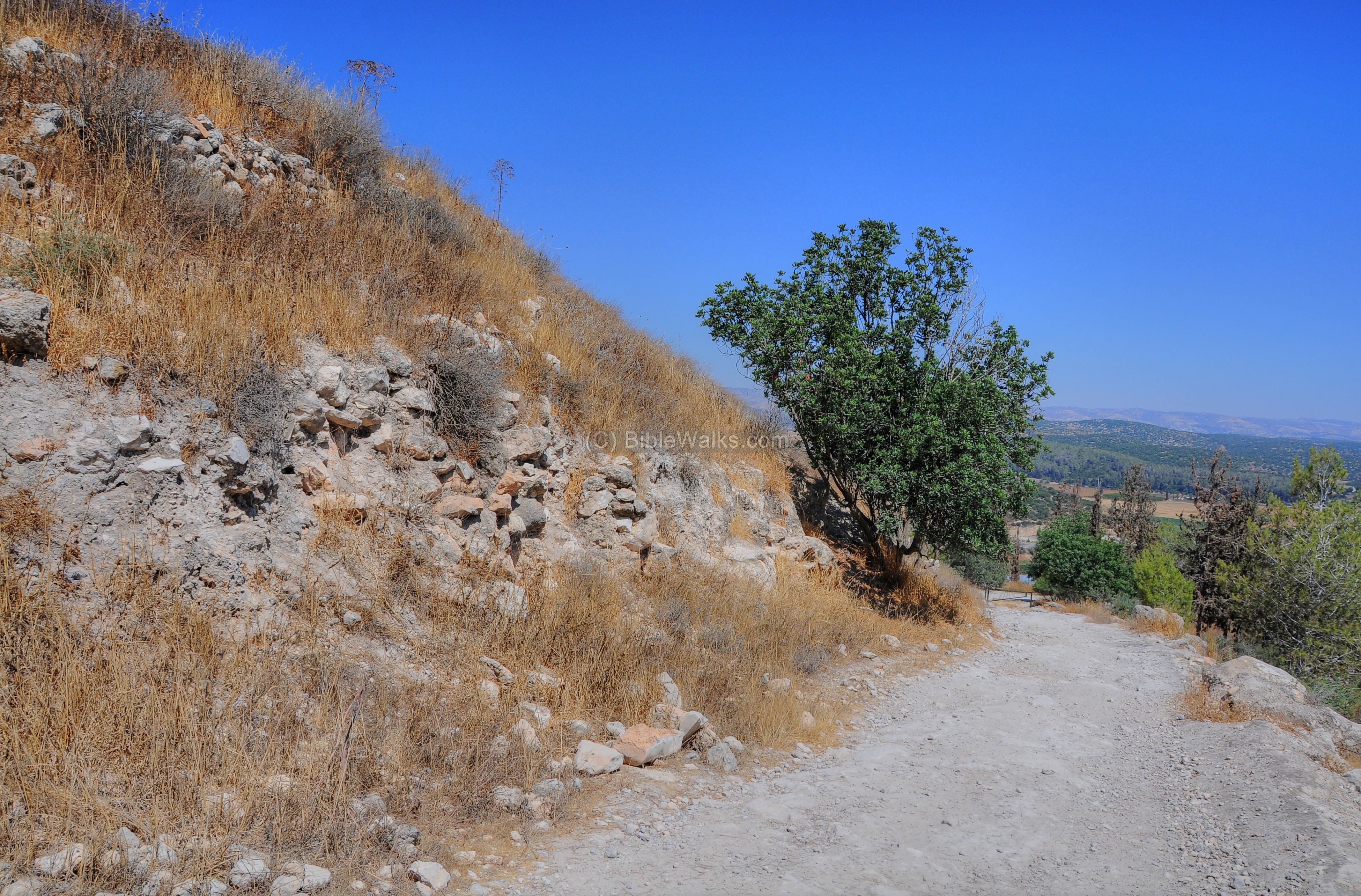
The summit is located high above the entrance, and a staircase helps you to walk it up. Along the path are dozens of stone markers with Biblical texts written on them (reading them during the ascent eases the effort of the ascent).
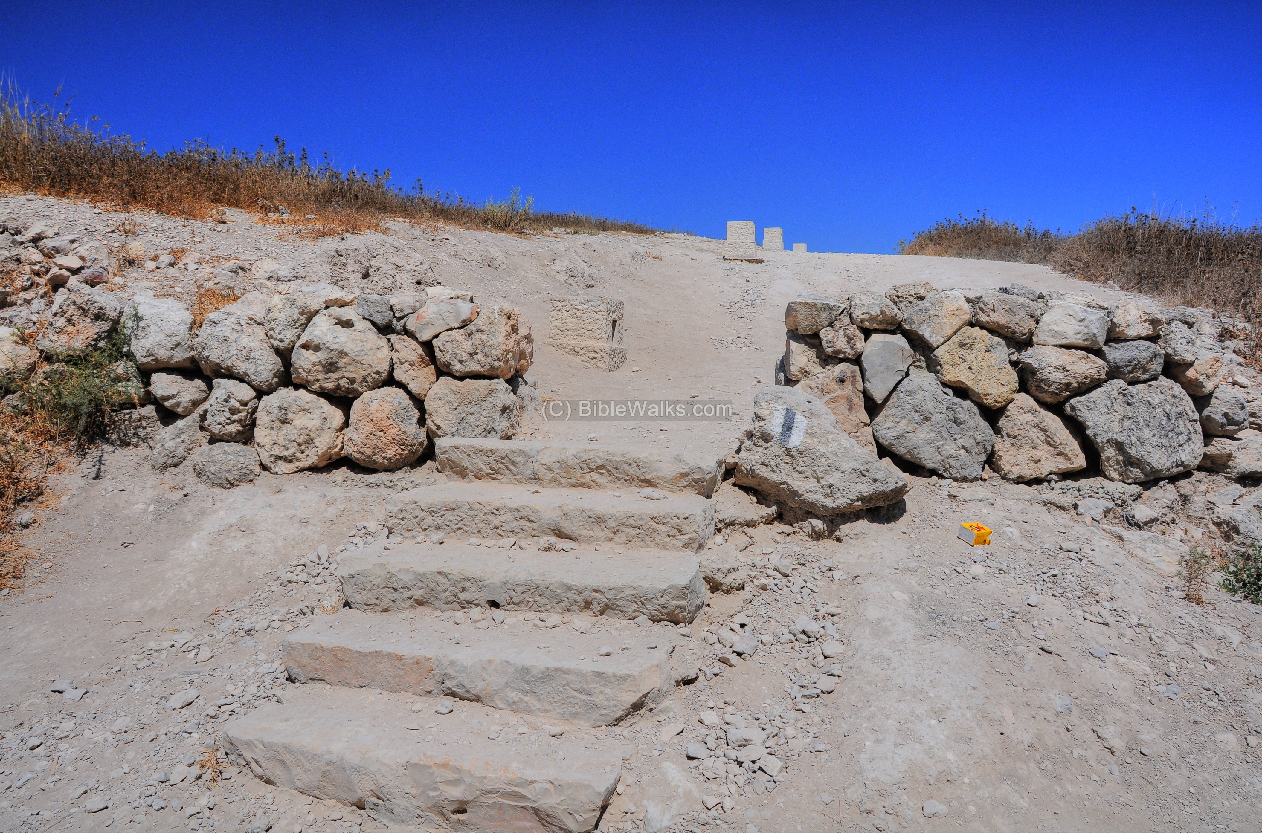
One of the markers along the path (1 Samuel 17 1): “”Now the Philistines gathered together their armies to battle, and were gathered together at Shochoh, which belongeth to Judah, and pitched between Shochoh and Azekah“.

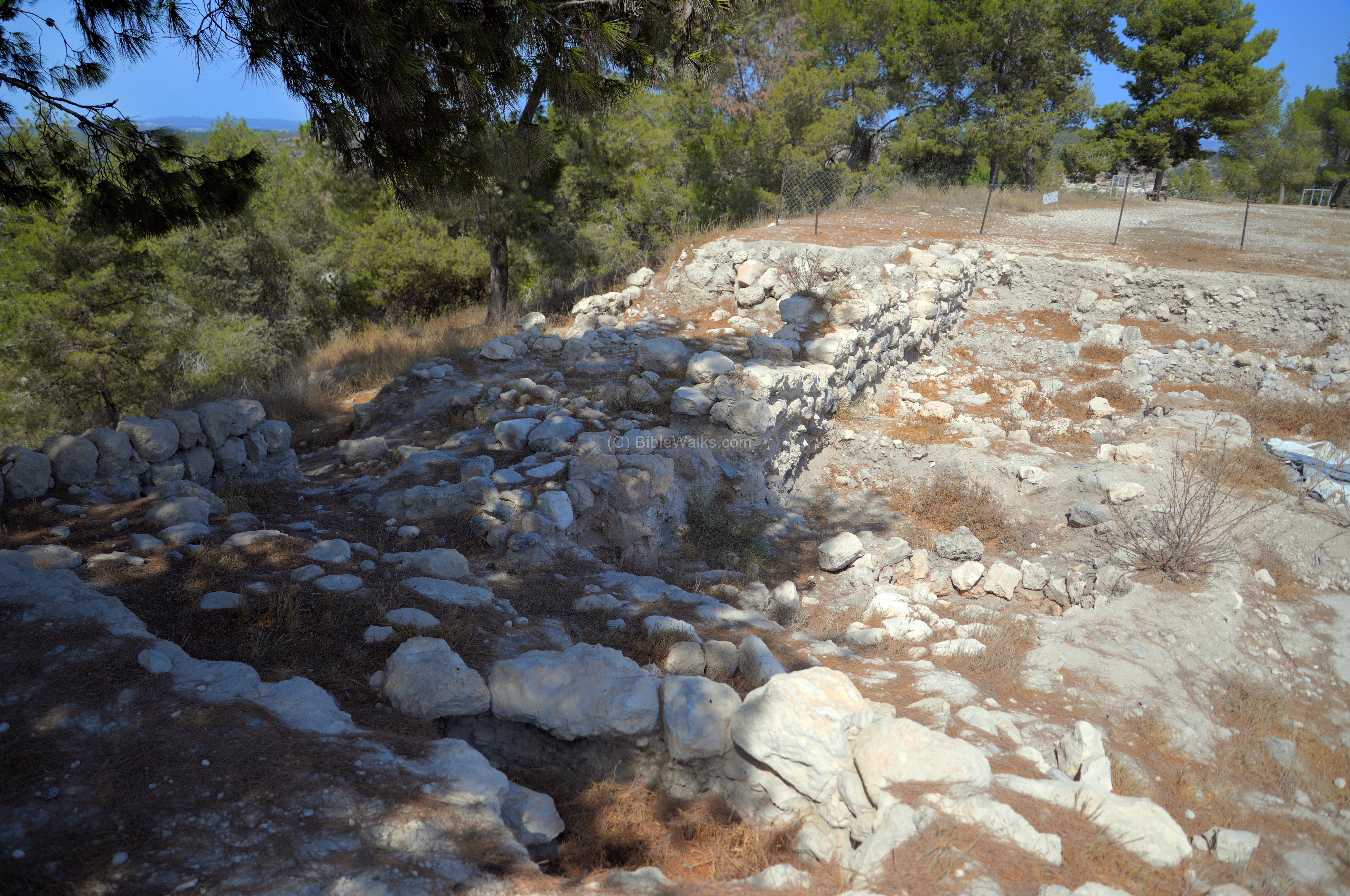
Close to the summit, above an access road, is a section of the wall. You can notice how steep this hill is.
-
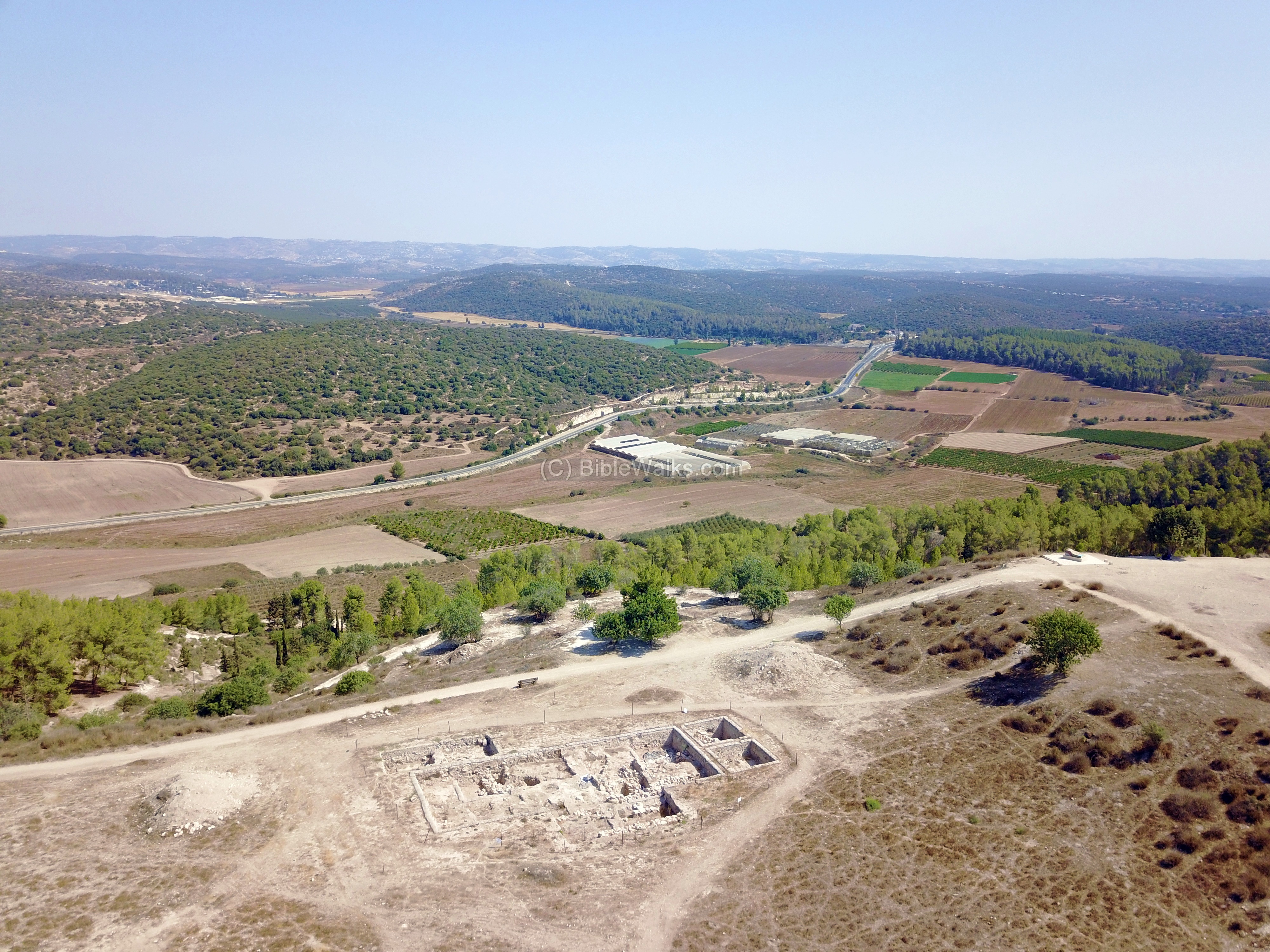
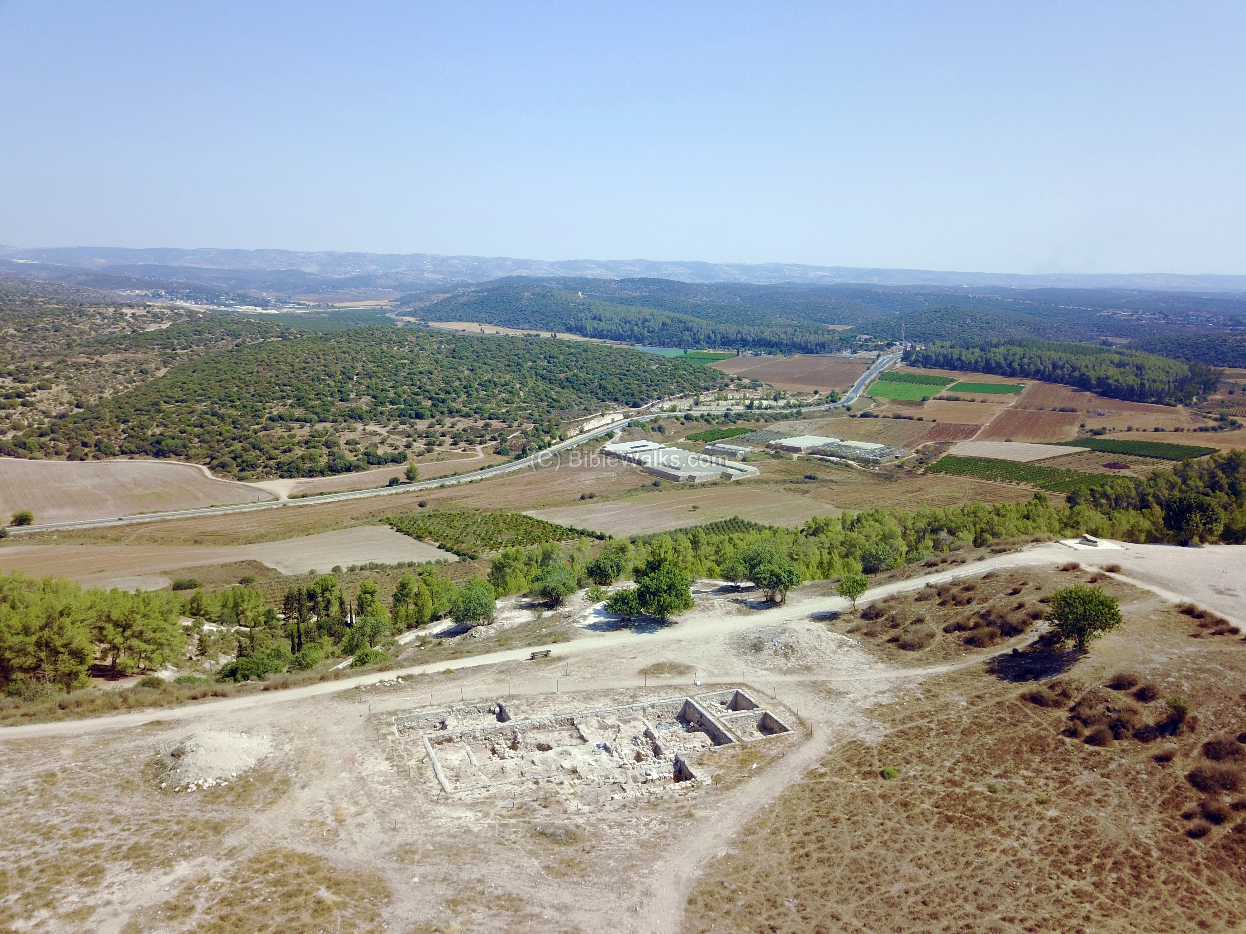
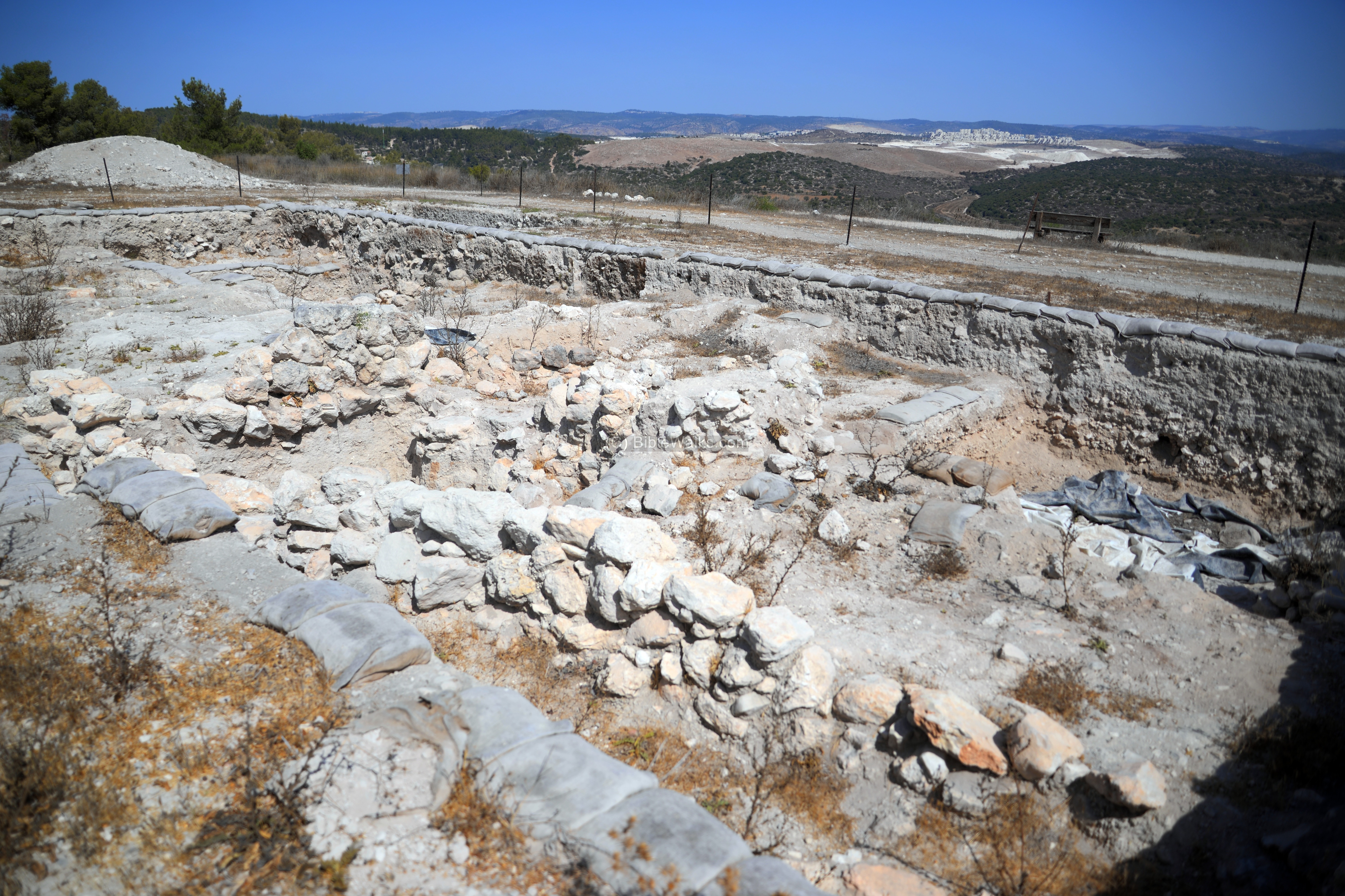
Area “E3”:
Recent (2017) excavations of the south east corner is seen in the next photo. In this area (marked as “E3”) the excavations revealed findings of the Middle and Late Bronze, Iron-Age/Persian, and Late Hellenistic periods.
(c) Observation point
On top of the summit, on the south-east side, is an observation point. A number of Elah trees and benches form a perfect place to rest from the climb.
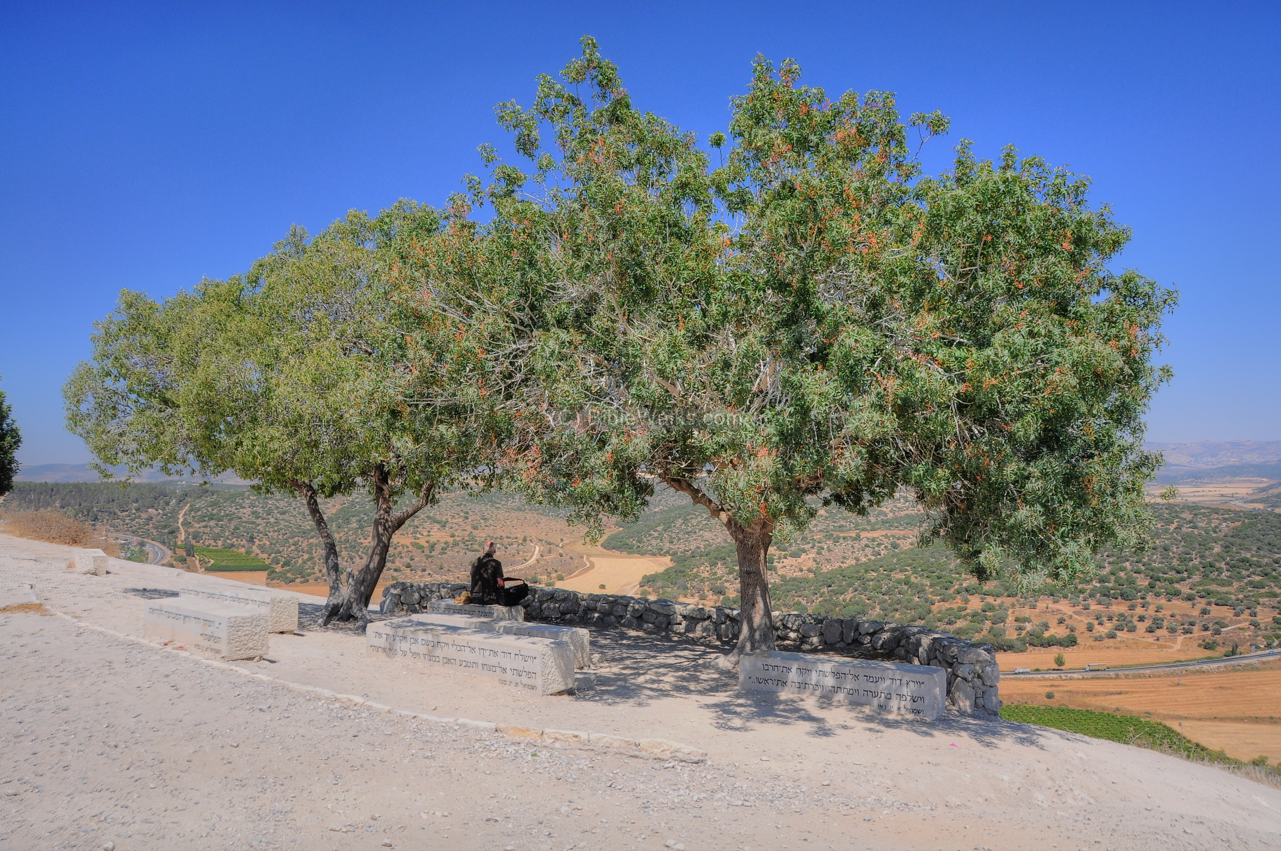
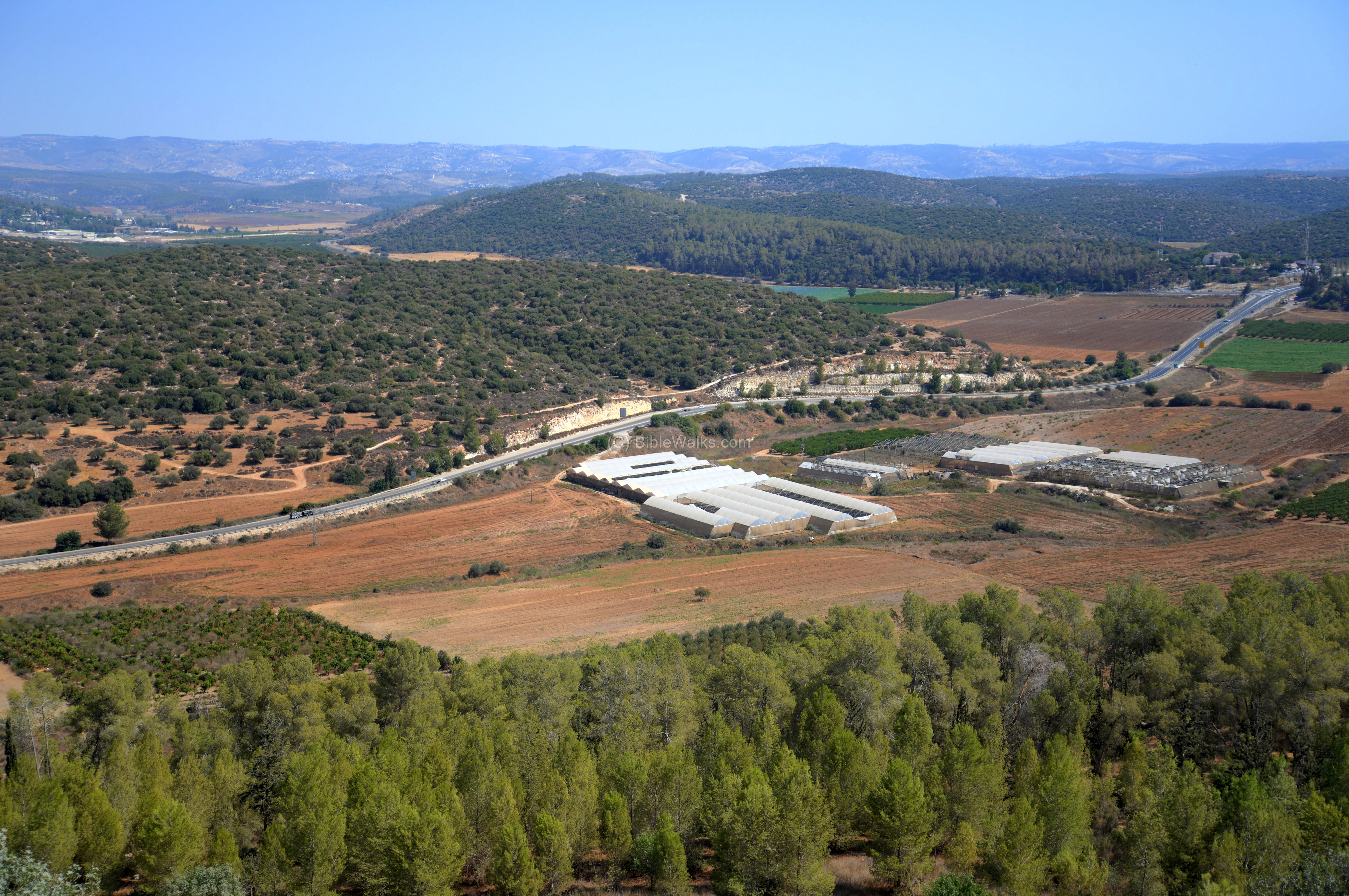
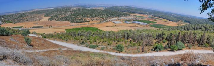
This is a great place to sit and admire the panorama of the valley of Elah and beyond. The following photo is a view towards the east. In the foreground is the Elah stream, flowing towards the left. In the far background are the hills of Judea, where Hebron and Jerusalem are located.

A view towards the south-east is seen below. The Biblical sites of Sha’araim and Sochoh are located in the far center around the valley of Elah.
A Panoramic view, as seen from the observation point on Tell Azekah, is shown in the following picture. Pressing on it will pop up a panoramic viewer. Using this flash-based panoramic viewer, move around and zoom in and out, and view the site in the amazing full screen mode (like you are really there). Hotspots are indicated on the view, indicating the major points of interest.
To open the viewer, simply click on the photo below. Note that it may take minutes to upload, but then its worth the waiting time.
Pictures taken on July 2011
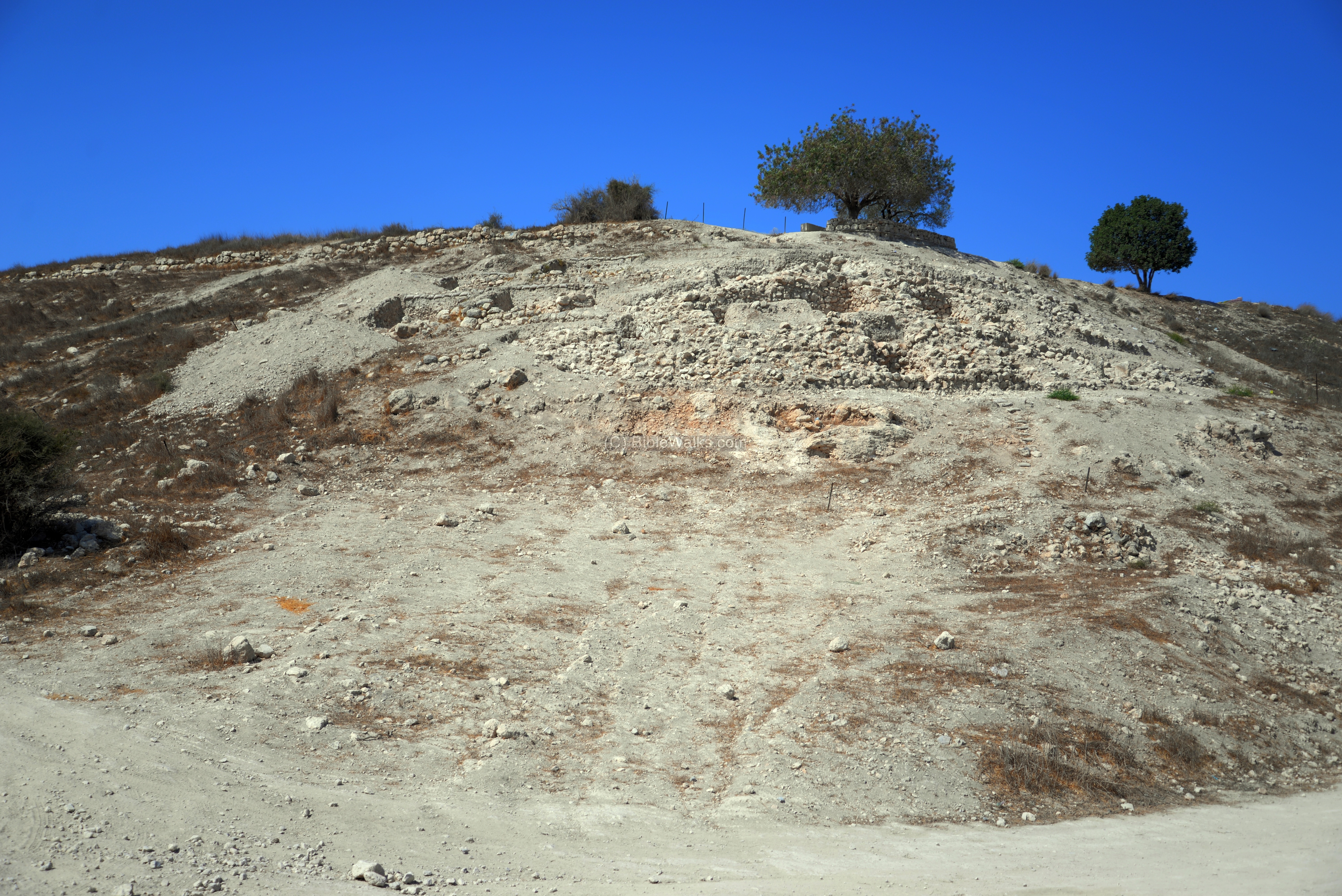
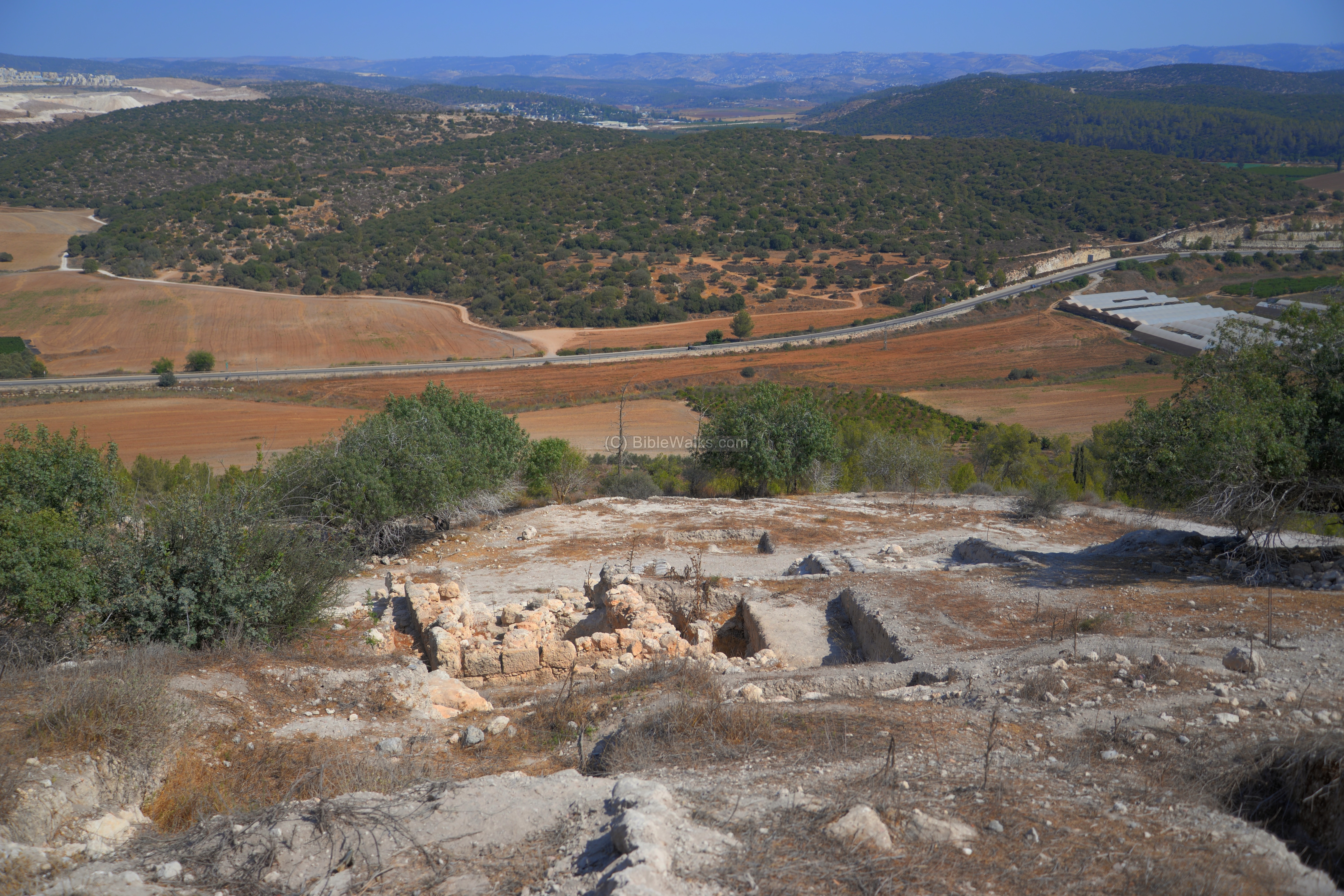
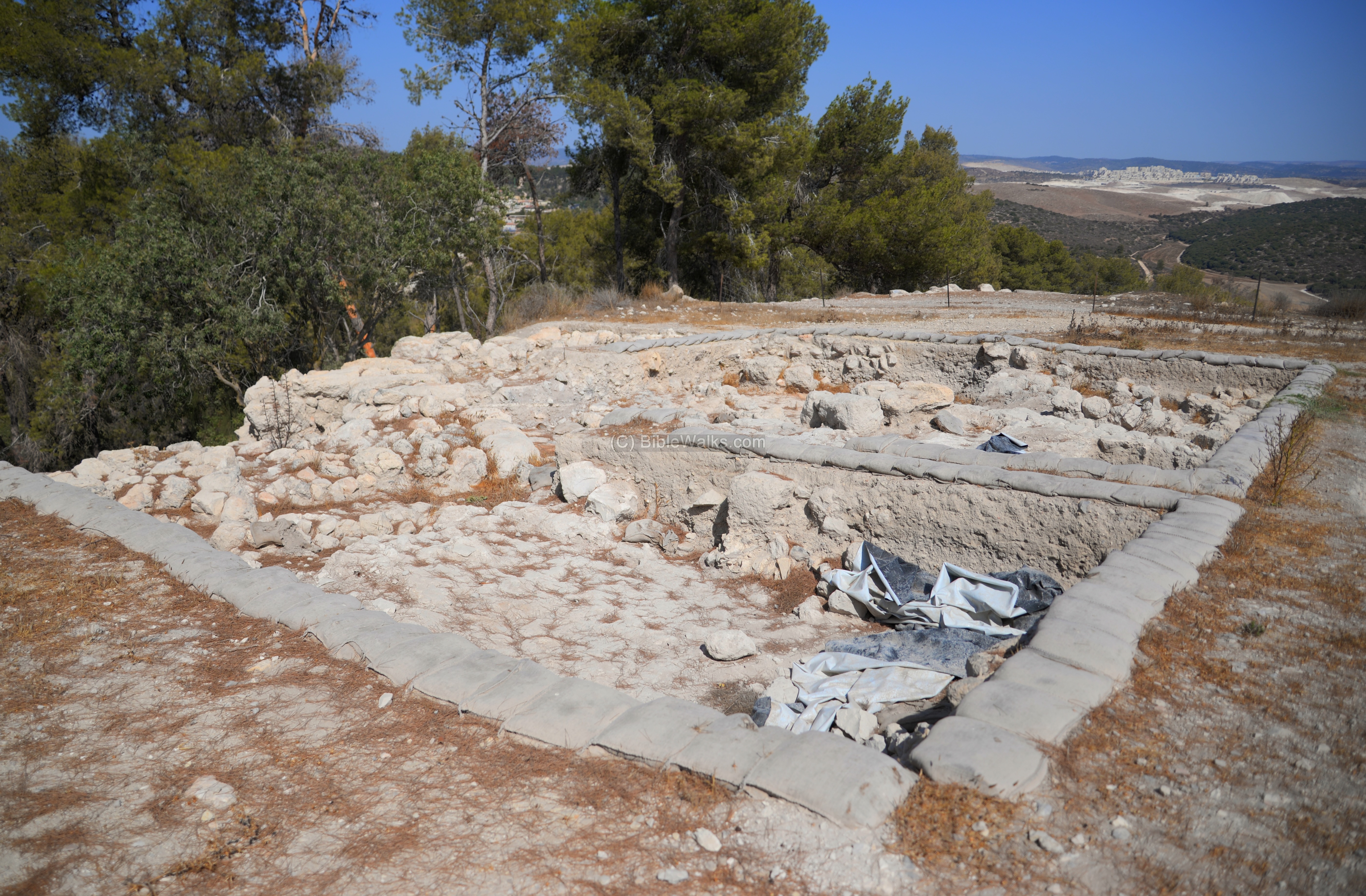
(d) Fortress on the summit
On the south-east side of the summit is a raised area, the remains of a ancient fortress. This drone view shows its area, as captured from the west side and looking towards the valley of Elah below Azekah.

Another drone view of the northern edge of the raised area shows the difference in height between the north and south side of the raised area:
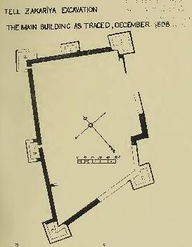
Dr. Bliss, the excavator of the site in 1898-1899, described the fortress in his quarterly statement to the PEF meeting (Quarterly report #32, January 1899, p 289 ) :
“On the raised portion we have found a large fortress, of irregular shape, measuring 220 feet on the west side, and about 120 feet on the north. The walls are about 6 feet thick, built without mortar. At the angles are four towers, with two extra towers on the northern and western sides, all proved to have been of later construction than the main walls. This building stands upon the rock to a height varying from 16 feet to about 20 feet; the top of its ruined walls crops out in places from the present surface of the soil. About half the area included has been examined down to the rock.
The debris thus exhumed has proved to consist of two strata : one a pre-Israelite stratum, in which the foundations of the fortress were sunk ; and the other a Jewish stratum, slightly disturbed in Roman times. The fortress thus may possibly be the work of King Rehoboam, who built so many cities for defence.”
(e) East side
This drone view shows the area north of the observation point and raised area.
-
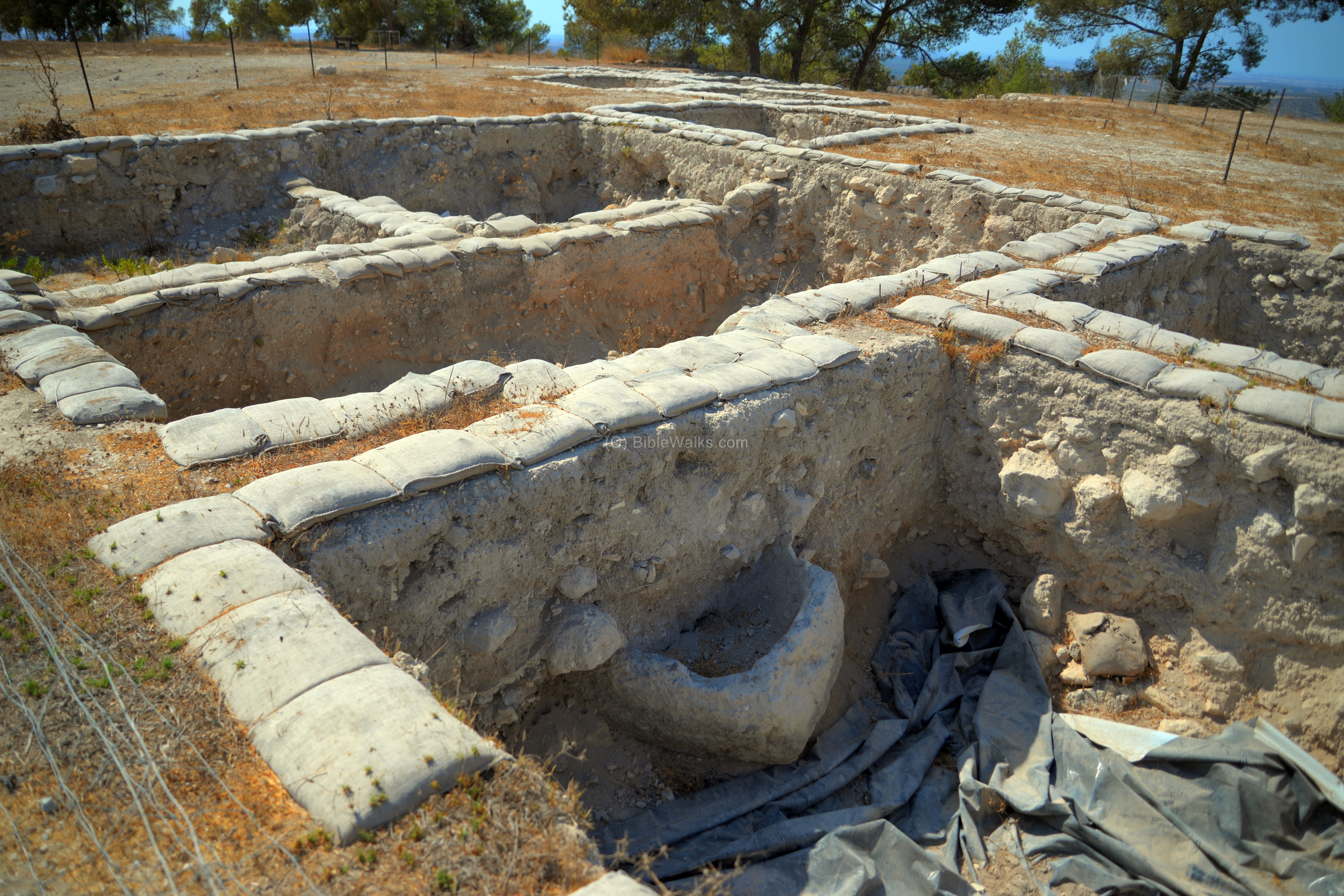
Area “T2”:
The excavation area “T2” is seen here close to the edge of the hill, located on a prime location on the summit.
In area “T2” the excavations dated the findings to the Late Bronze, Iron Age, and Persian/Hellenistic periods. The Late Bronze period structure, a building with courtyard and pillars, was destroyed in instant during the Late Bronze period.
-
Area “E1”:
Just below are “T1” and the fortress, on the slopes, is area “E1”. Here the excavations unearthed structures and findings of the Hasmonean period, and the Early and Late Roman periods.
(f) West side
-
Area “T1”
Area ‘T1″ is on the north west side.
-
Area “W1”
Nearby is area ‘W1″, on the edge of the summit and its slope. The findings are dated to the Middle and Late Bronze periods, Iron Age, and the Persian/Hellenistic periods.
On the top side of this area the archaeologists unearthed granaries of the 4th century BC.
(g) North side
This drone view is of the north side. The village of Moshav Zechariah is seen on the left background, on the north side of highway #383, which continues west along the valley of Elah.
-
Area “N1”
An excavation area “N1” was opened on the northern edge of Tel Azekah. Here the excavations identified findings of the Middle Bronze, Late Bronze, Iron Age, Persian/Hellenistic and Roman periods. On the slope below is a mud brick city wall of the Middle Bronze period.
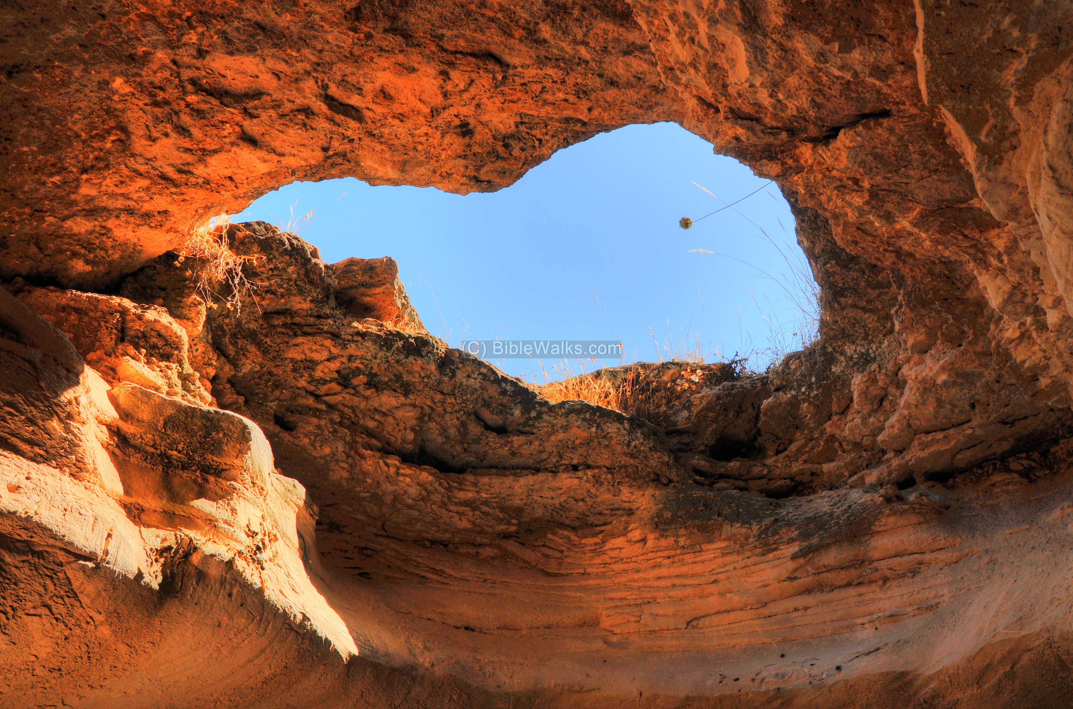
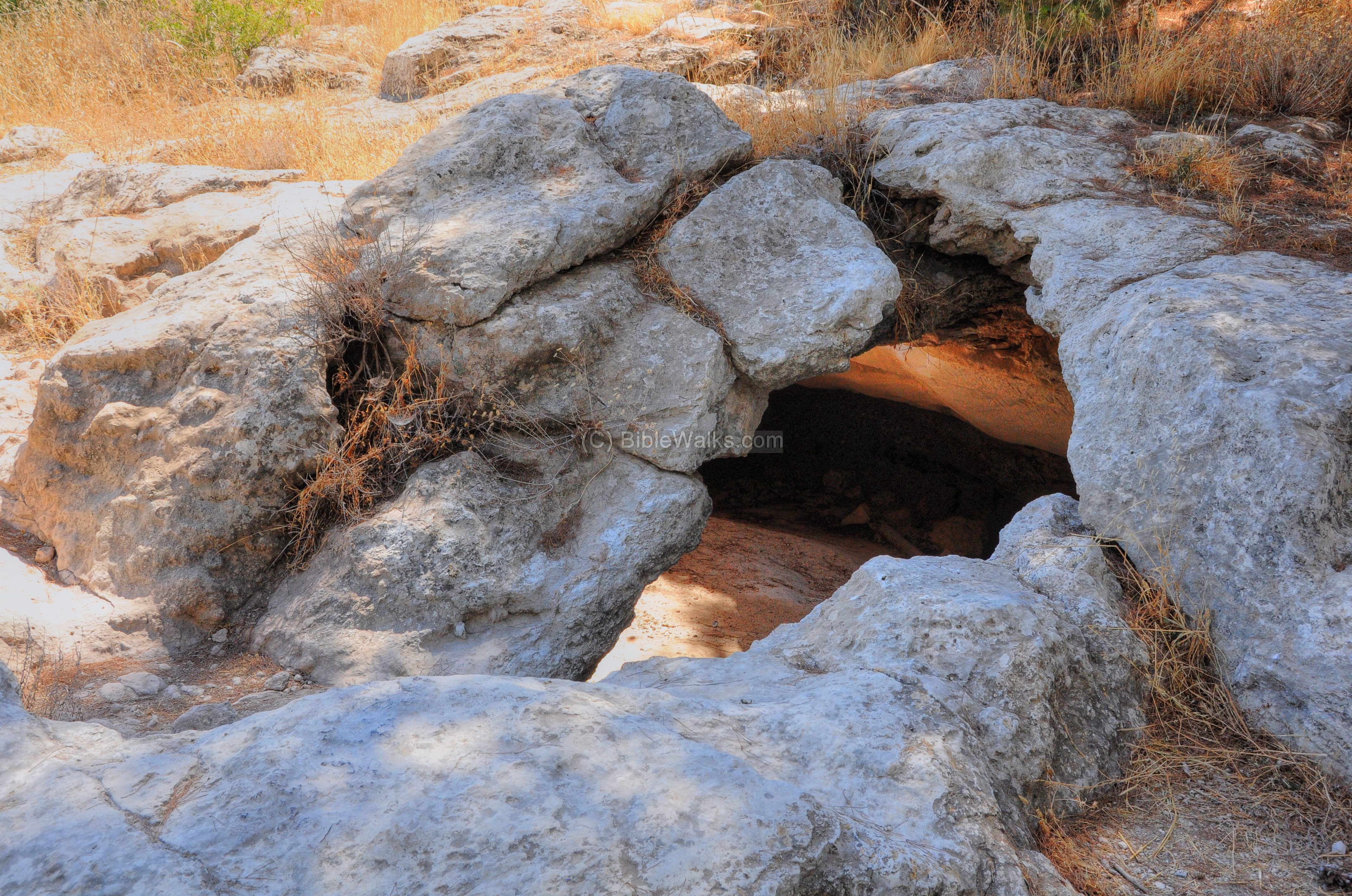
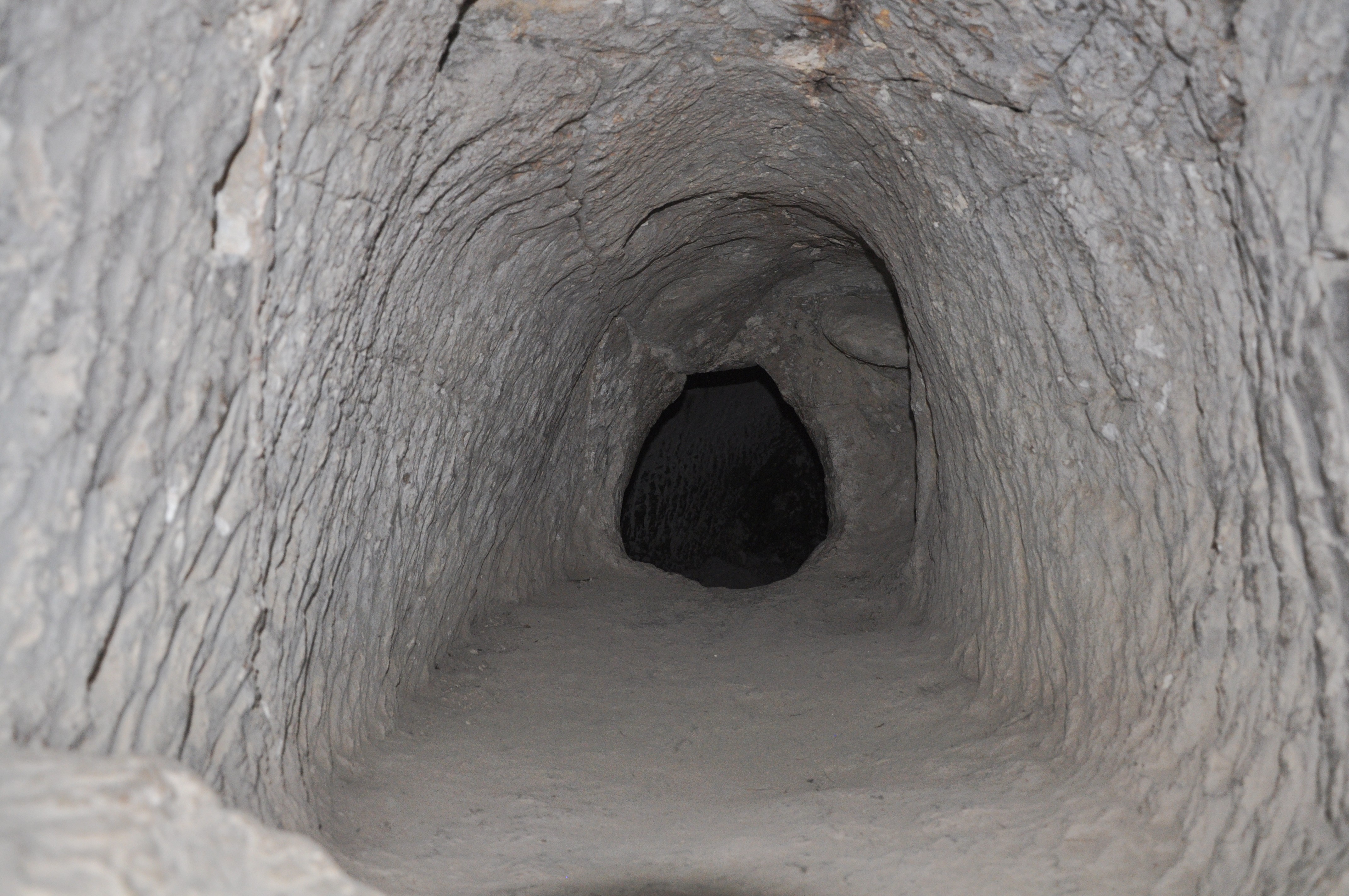
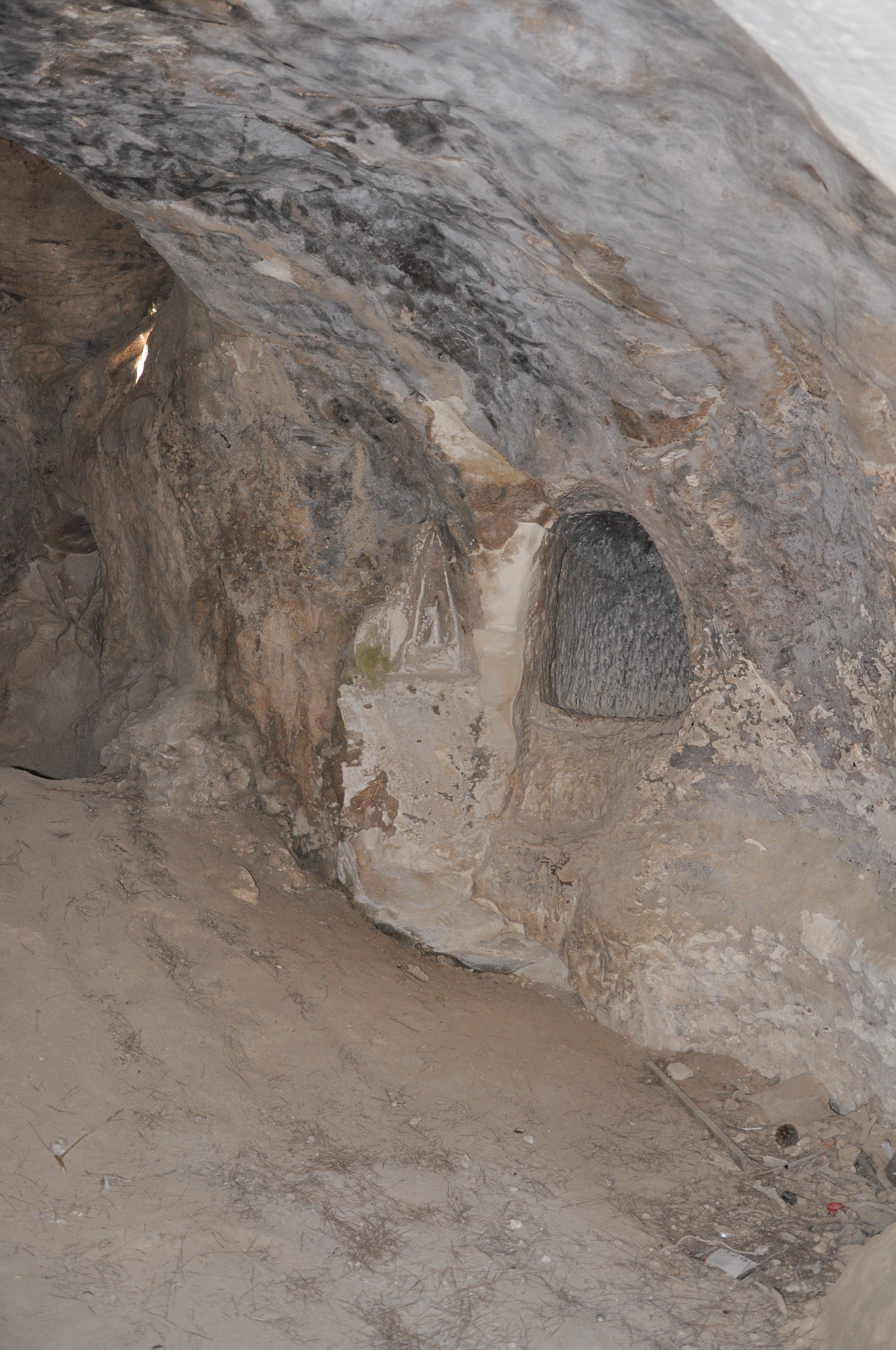
(h) Caves
On the north-east foothills is a cluster of underground caves cut into the rocks. The caves were initially part of the water supply system. During the Bar-Kochba revolt (132-136 AD) a maze of hideout caves were added.
The ground level above the caves is seen below. Around the openings of the caves are safety fences.

One of the openings is seen in the next picture.
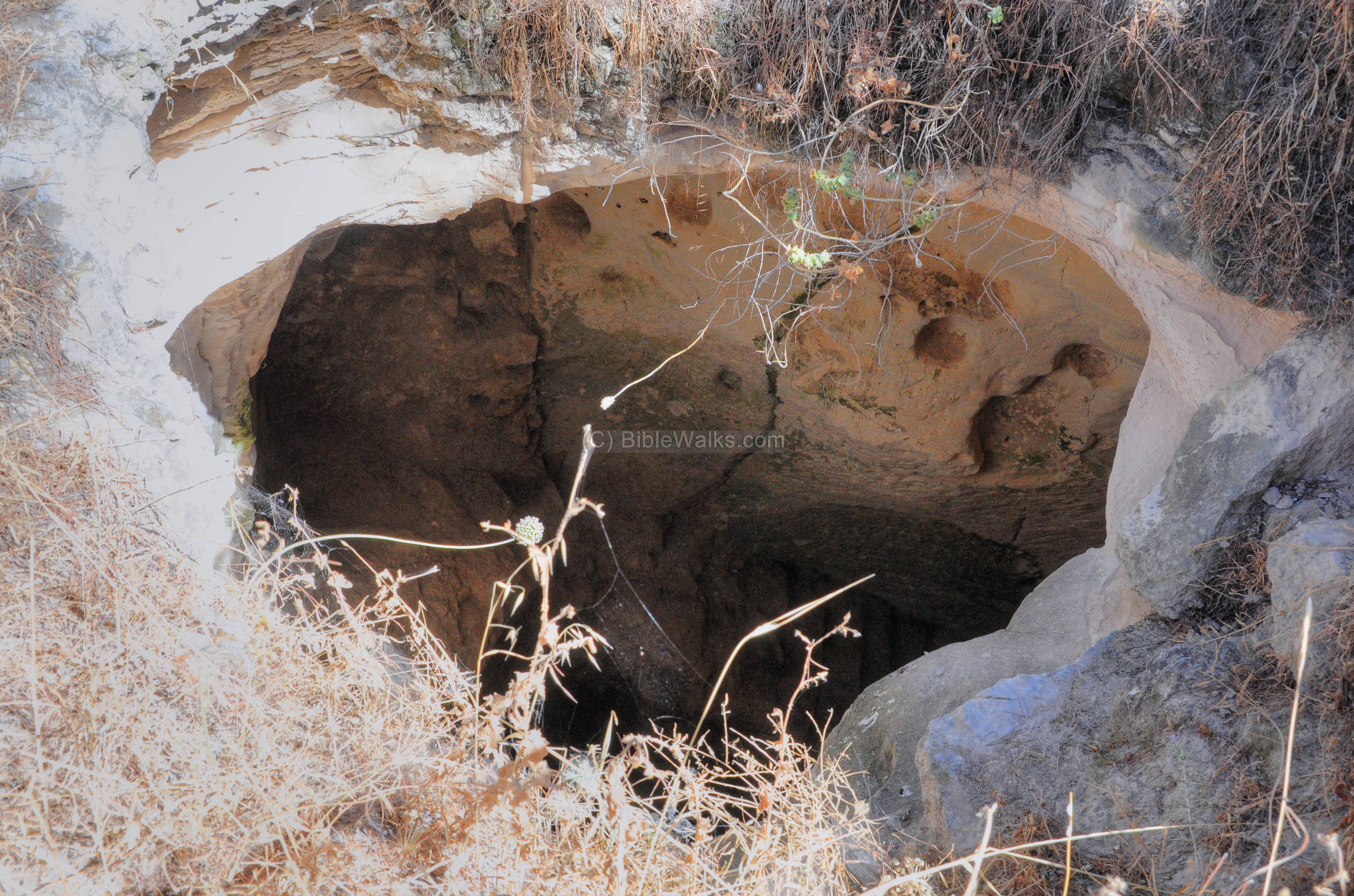
The view of the opening from the underground side:
The easiest access is through this opening on the east side.
Inside these caves are beautifully carved walls and tunnels. The tunnels lead to other chambers in this underground world.
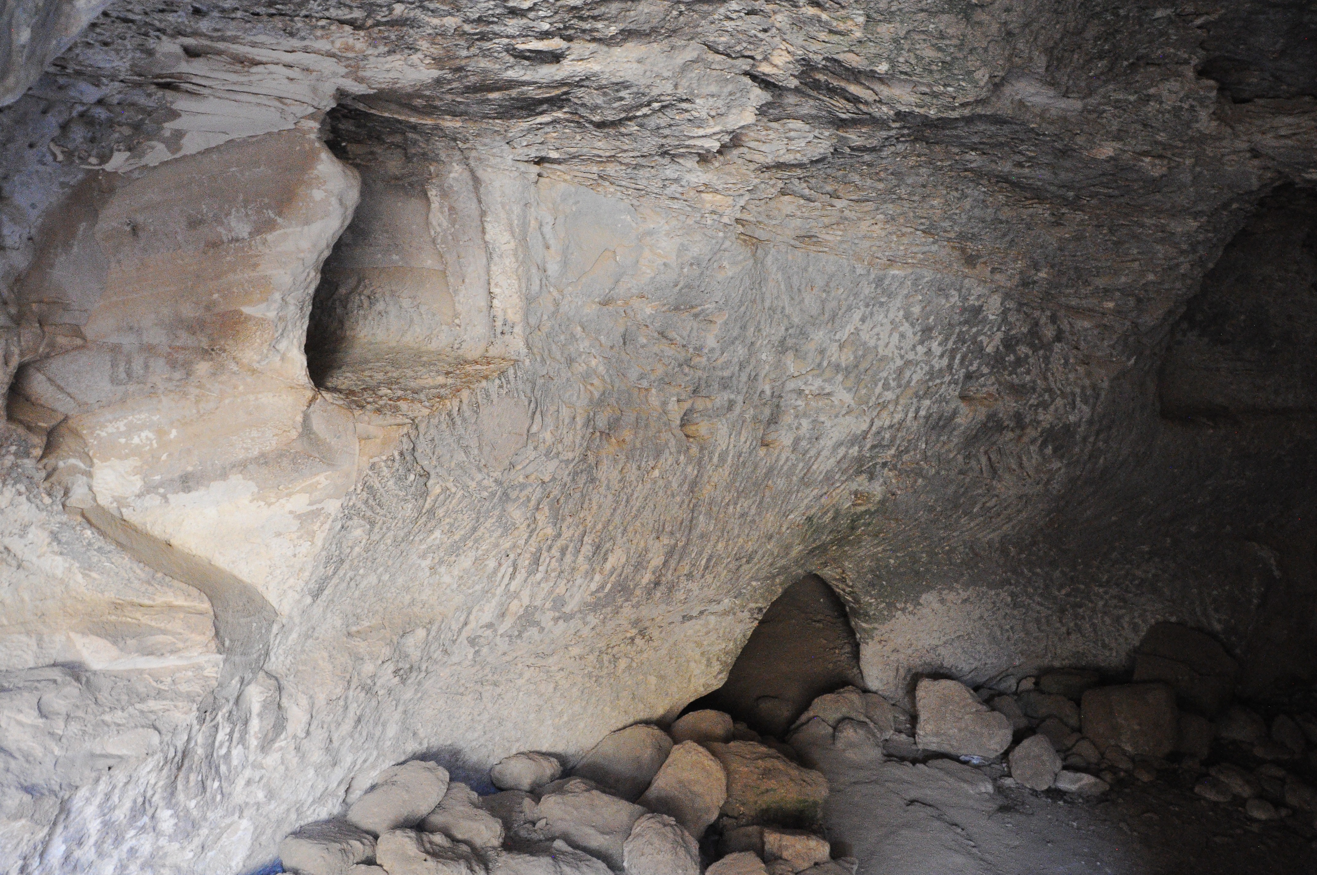
A closer view into one of the carved tunnels:
Another section of the carved hideout tunnels, with a location for the oil lamp.
(j) Israel National trail
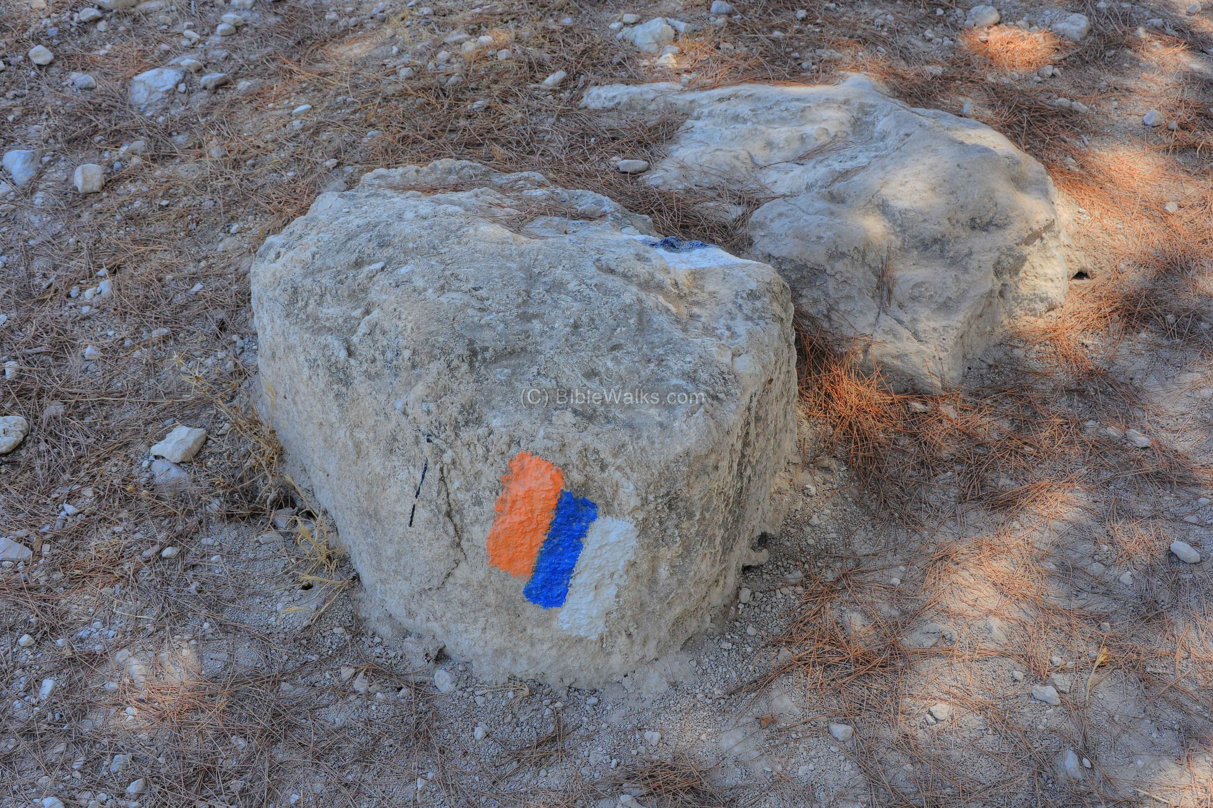
The 3-stripe color marking (orange, blue & white) indicates that this path is part of “Israel National Trail” (Shvil-Israel) that crosses the Country from Dan to Eilat. The path crosses the summit of Azekah, and the color marking can be seen in several places in the site. It takes an average walking time of 45 days from side to side, and there are hikers that take this challenge.
(k) Video
![]() Fly over the site with this YouTube video:
Fly over the site with this YouTube video:
(l) LMLK Seals
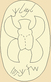
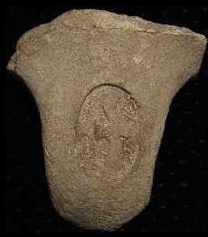
Many seals were found in Israel imprinted on jars with the Hebrew letters LMLK ( “L’melekh”), meaning “belonging to the king”. The royal seals bear the name of the city on the bottom, such as the nearby “Sochoh” (4 Hebrew letters Shin-Vav-Kaf-Hey), as seen in the example below and its corresponding stick figure. A number of seal types classifications were defined according to their structure and city name, such as “S4L”.
According to G.M. Grena of LMLK.com (who helped us with this section, and provided the following stick figure):
17 handles have been excavated from Azekah, but only 4 types have been positively identified by drawings published by Bliss & Macalister (1900):
- “Sochoh” seals: Type S4L (at least 4 seals),
- “Hebron” Seals: H4C (at least 1), H4L (at least 1)
- “Memshat” (?) Seals: M4L (at least 1).
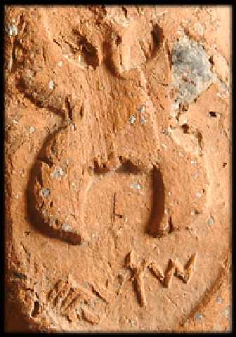
Type S4L (Sochoh)
Courtesy of LMLK.com
Type S4L (Sochoh)
“As for dates, the majority of scholars believe these seal impressions date to the 8th-7th centuries BC; however, this equates to about 7th-6th centuries BC on the Jewish calendar. These dates center around the reign of King Hezekiah because the handles appear in strata formed by a destruction layer caused by the Assyrian king, Sennacherib. Some scholars believe the handles were stamped as early as the reign of Uzziah, and as late as Manasseh (hence the 8th/7th or 7th/6th span of about a century), though some believe they were strictly limited to Hezekiah’s reign”.
Etymology:
* Elah – the Hebrew name of the Terebinth (Pistacia) tree.
* Azekah – the Biblical name of the city. This name may have been based on the word “Azek” in Hebrew, which means to dig into the soil in preparation of planting. This word appears in Isaiah, but was translated in KJV to “fenced it” (Isaiah 5 1-2): “My wellbeloved hath a vineyard in a very fruitful hill: And he fenced it, and gathered out the stones thereof, and planted it with the choicest vine, and built a tower in the midst of it, and also made a winepress therein: and he looked that it should bring forth grapes, and it brought forth wild grapes”.
* Caper Zacaria – The Roman name of the city (Kefar Zachariah), as appears on the Peutinger map.
* Tell Zakaria – the Arab name of the ruins, named after the nearby Arab village. Preserved the Roman name.
* Zekhariah – The Hebrew name of the nearby village.
Links:
* Archaeology:
- Azekah expedition home page since 2012, guide to the site (pdf), and Facebook group
- LMLK seals – “L’melekh”, meaning “belonging to the king”
- Onomasticon of Eusebius – 4th Century Church history book, mapping the Bible to sites; with references to Azekah
- Onomasticon of Eusebius – list of places
- 3rd quarterly report on excavations of Tell Zakariya – F.J. Bliss of PEF [PDF; 1899]
- 4th quarterly report on excavations of Tell Zakariya – F.J. Bliss of PEF [PDF; 1900, p7-16]
* Internal – sites nearby:
- Valley of Elah – overview
- Kh, Qeiyafa – Shaaraim
- Sochoh
- Adullam
- Gath – Philistine city, home of Goliath
* Other:
- Biblical pictures by Gustave Doré (1832-1883) – public domain
- Drone Aerial views – collection of Biblical sites from the air
- BibleWalks Youtube channel
BibleWalks.com – Have Bible – will travel
Sochoh<<<—previous site–<<< All Sites >>>—>>> —Next Judea site—>>> Adullam
This page was last updated on Oct 13, 2017 (Major update)