Tel Regev was a Biblical fortified city that was one of the passing points across the Kishon river. Its history spanned from the Early bronze age to the Byzantine period.

Home > Sites > West Galilee > Tel Regev (Tell Harbaj)
Contents:
Background
Location
History
Photos
* Aerial views
* South
* North
* Flowers
Biblical
Etymology
References
Sites nearby
Background:
Tel Regev (Tell Harbaj) was a biblical fortified city near one of the passing points across the Kishon river, that flows north of the Carmel. It is a Tel (mound), with many layers of history, spanning over 3,500 years from the Early bronze age to the Byzantine period. It belonged to the Asher tribe, but its identification is not certain, although scholars suggest it was the Biblical city Achshaph.
Location:
The Tel is located near Kefar Hassidim, on the east side of the modern road from Yagur junction towards north.
In the ancient times, the main highway (Via Maris) passed from North to South at this point, and had to cross the Kishon River, located 1.5km to the south. The crossing point was the existence of good ford located at that point – a shallow place with good footing where the river may be crossed. This made the site a prime location.
Furthermore, Tel Regev is located 100M south of the Nahal Zippori (Sepphoris) creek, which bends at this point towards the west and eventually flows into the river of Kishon. This gave the Tel its waters (an important factor at these times) and made the crossing of the creek yet another asset. Its waters may have also served as a barrier around the city walls.
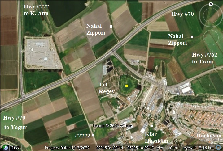
Note: 2Km to the north is a new regional cemetery that opened in 2005, and is also called “Tel Regev”. It is not associated with this site, but its name (Regev in Hebrew means: clod of earth) seemed worthy for a cemetery.
History of the place:
- Bronze (Canaanite) period
This city was established in the early Bronze (Canaanite) period (3150BC-2200BC). The city continued through the middle and late Bronze age (2200-1550BC, 1550BC-1550BC- 1200BC).
- Identification: Biblical Achshaph?
The Egyptians ruled the land of Israel all along the Late Bronze period (1,550 -1,200BC). The conquest was after the famous battle near Megiddo (1468 BC), which resulted in the Egyptian conquest of Canaan for 350 years. It continued up to the 3rd quarter of the 12th century.
Achshaph is listed in the conquests of the Egyptian Pharaoh Thutmose III of the 18th Dynasty. The city of ‘i-k-s-p’, probably referring to Achshaph, is listed in Karnak as one of the 119 cities that were conquered by this pharaoh. The conquest was after the famous battle near Megiddo (1468 BC), which resulted in the Egyptian conquest of Canaan for 350 years.
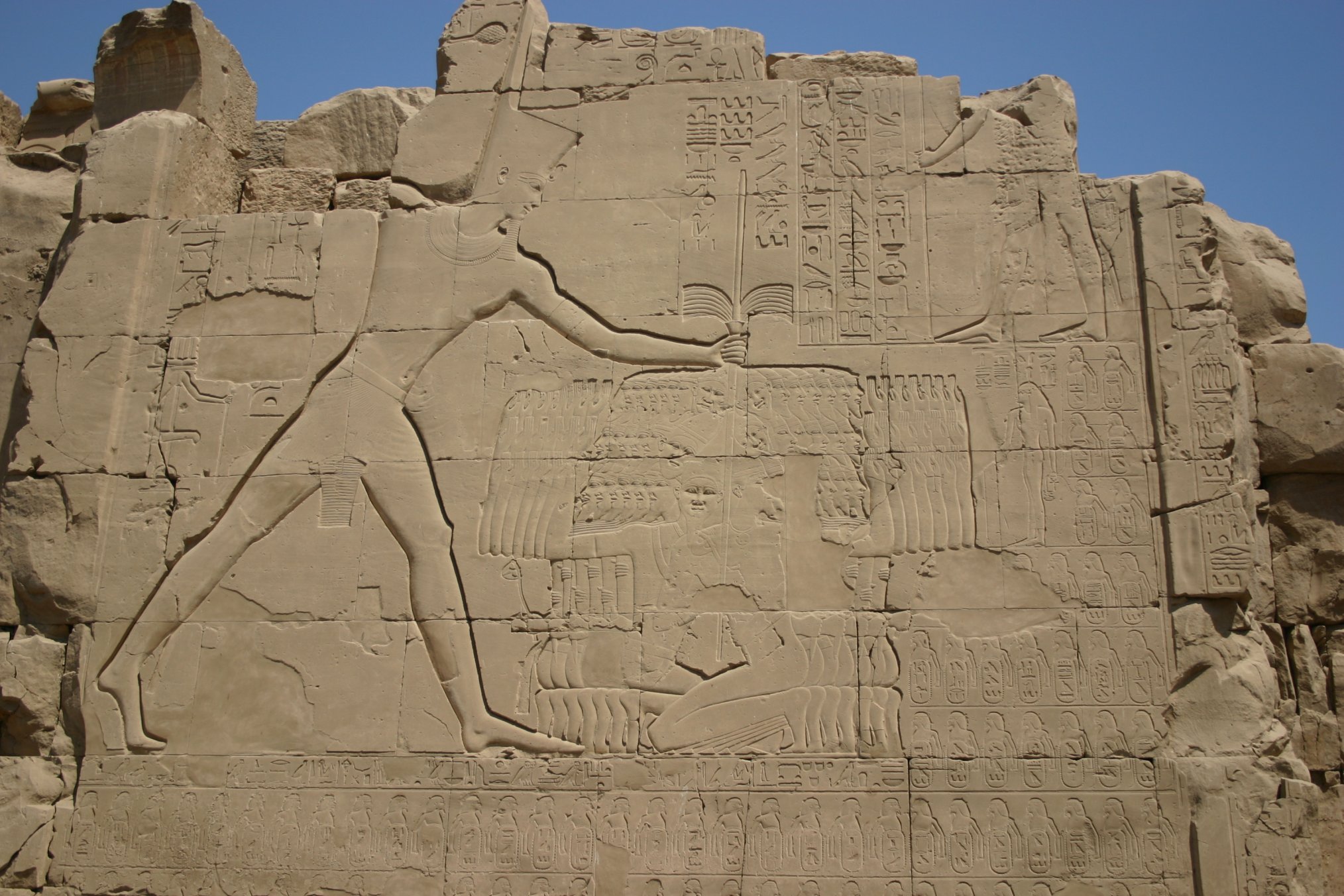
Thutmose III smiting his enemies (7th pylon in Karnak).
Achshaph is also referred in the 14th century Amarna letters as Akšapa. The letters were written from various Canaanite cities in Akkadian cuneiform to their Egyptian masters. The letters (EA 222a:1; 290a:23, out of 382 tablets) wrote about Achshaph.
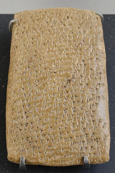
One of Tell Amarna letters (Louvre Museum, Public domain CC 2.5)
Cuneiform writing on a clay tablet.
Achsaph is also mentioned in Papyrus Anastasi 1 – a satirical text dated to 13th century.
- Late Bronze and Iron Age – Israelite period
The city continued in the Israelite period (1200BC-586BC). It might have been in one of the cities given to Hiram, King of Tyre, as part of the pact with King Solomon (Kings I).
Scholars identify the city as Biblical Achshaph (Joshua 19:24-25):
“And the fifth lot came out for the tribe of the children of Asher according to their families… And their border was Helkath, and Khali, and Beten, and Achshaph”.
A Biblical map of the area shows the position of the city (marked with a red square). It lies along the main coastal highway, north of the ford across the Kishon river, and near the Sepphoris river. The coastal highway came from Jokneam pass on the south, continued north thru Tel Zavat and Tel Gedra (Jidru) (south and north of modern Kefar Bialik) to Aphek. Another route (not marked) continued to the east along the valley of Zippori thru Khali.
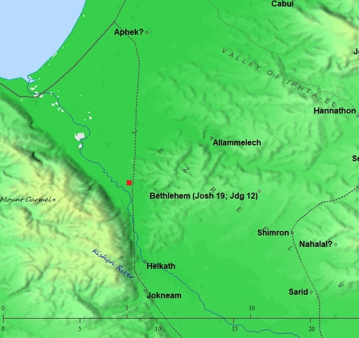
Map of area around the site (red square) – from the Canaanite thru the Roman periods (based on Bible Mapper 3.0)
- Later periods
The city continued during later periods: Babylonian/Persian (586BC-332BC) , Hellenistic (332BC-37BC), Roman and Byzantine (37BC-324AD, 324AD-640AD).
- Ottoman Period
During the Ottoman period, Daher el ‘Amr fortified the mound (1749 AD).
The area was examined in the Palestine Exploration Foundation (PEF) survey (1866-1877) by Wilson, Conder and Kitchener. A section of their map is here. Tel Regev appears as “el Harbaj”, located on the west side of the main road connecting the south, via Jidru (today, Kefar Bialik) to the coastal road on the north.
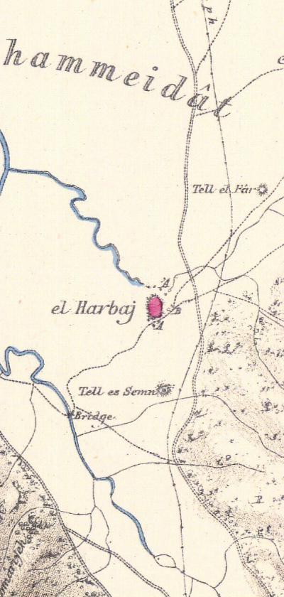
Part of Map Sheet 5 of Survey of Western Palestine,
by Conder and Kitchener, 1872-1877.
(Published 1880, reprinted by LifeintheHolyLand.com)
The surveyors wrote about the site (Volume 1, Sheet V, p. 285):
“El Harbaj (K h).- A small village, on a mound, surrounded by springs. It was fortified in 1162 hijri [1749 AD] by Dhaher el ‘Amr. Traces of the wall still remain”.
The survey also noted the springs of el Harbaj as one of the sources of the Kishon river: “Kishon receives … from the springs of el Harbaj”. The springs are marked on the map as ‘A on the north and south sides of the mound.
The survey dictionary explained the Arabic name “Harbaj” (name list, p. 109): “El Harbaj proper name; – it means work (such as masonry) that is badly done”.
- British Mandate Period
Professor John Garstang, who headed the department of archaeology between 1920-1926 during the British mandate and founded the School of Archaeology in Jerusalem (now the Kenyon institute), excavated the site in the 1930s.
A 1940s British map shows the area around the sites in detail. Tell Harbaj (Tel Regev) is south of Wadi el Malik (Zippori stream), and north of the Kishon river crossing.
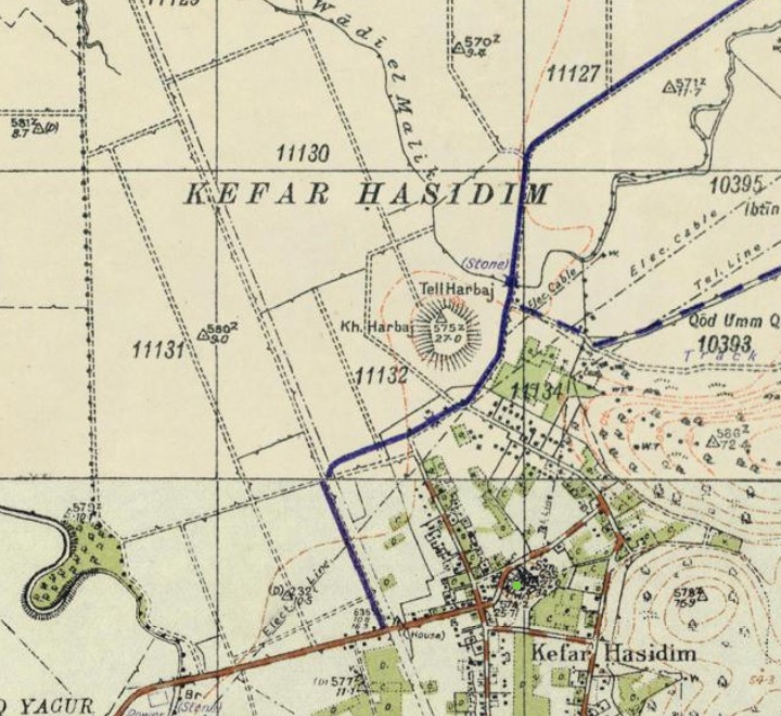
British survey map 1942-1948 – https://palopenmaps.org topo maps
License: public domain under the UK Copyright, Designs and Patent Act 1998
- Modern periods
A salvage excavation was conducted at the site in 1993. A large amount of the Early Bronze Age pottery was discovered, and on its surface several shreds from the Middle and Late Bronze Ages and some of the Iron Age.
The new agriculture village of Kefar Hassidim (Kfar Hasidim) is located near the site.
Photos:
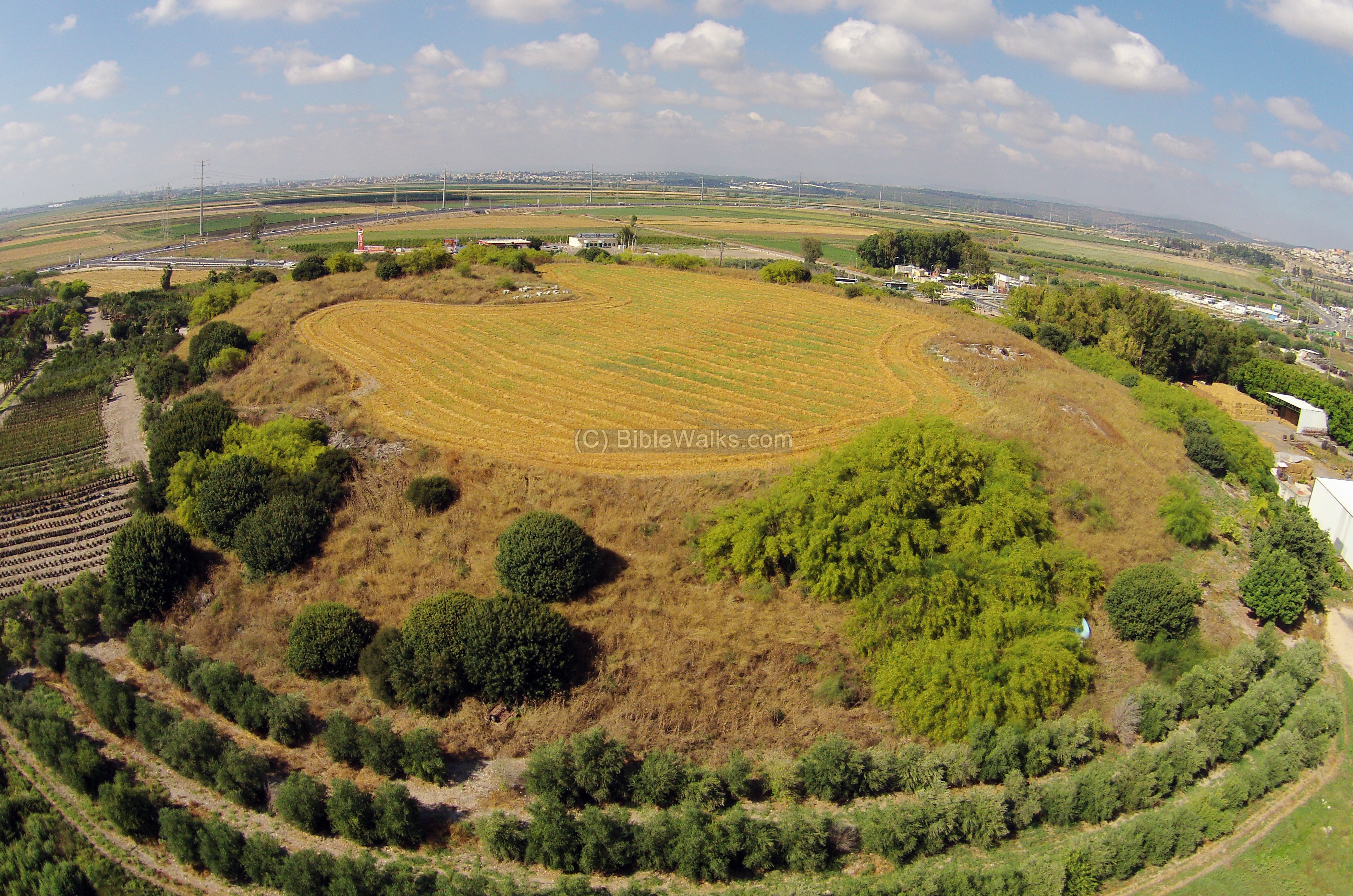
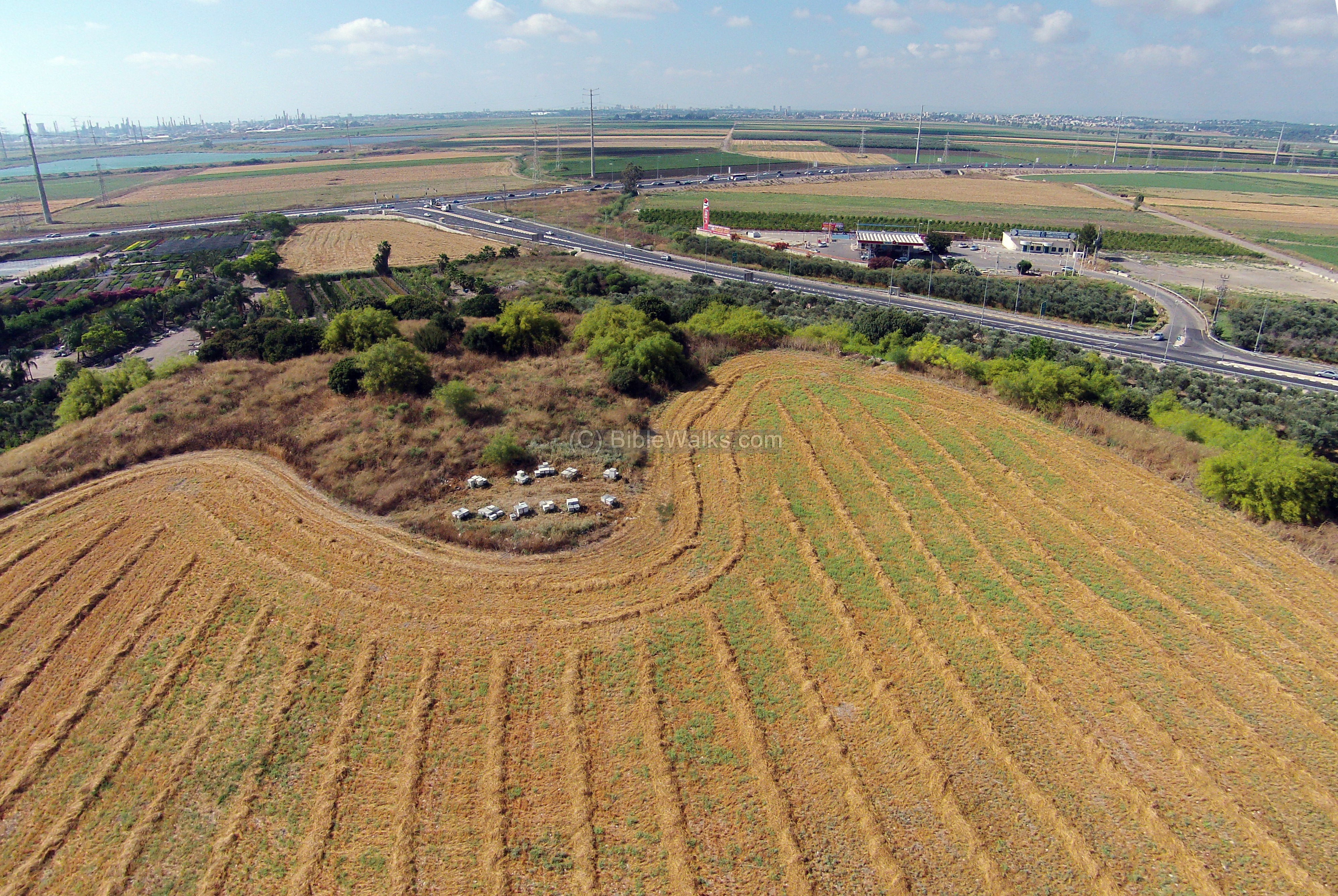
(a) Aerial view:
This aerial view was taken in June 2015, captured by a quadcopter from the south side. The Zippori stream flowed just behind the mound, where a modern road leads from the bay area to Kefar Hassidim and Tivon.
Click on the photo to view it in higher resolution…
The next photo is a closer view on an excavated section on the eastern side of the summit:
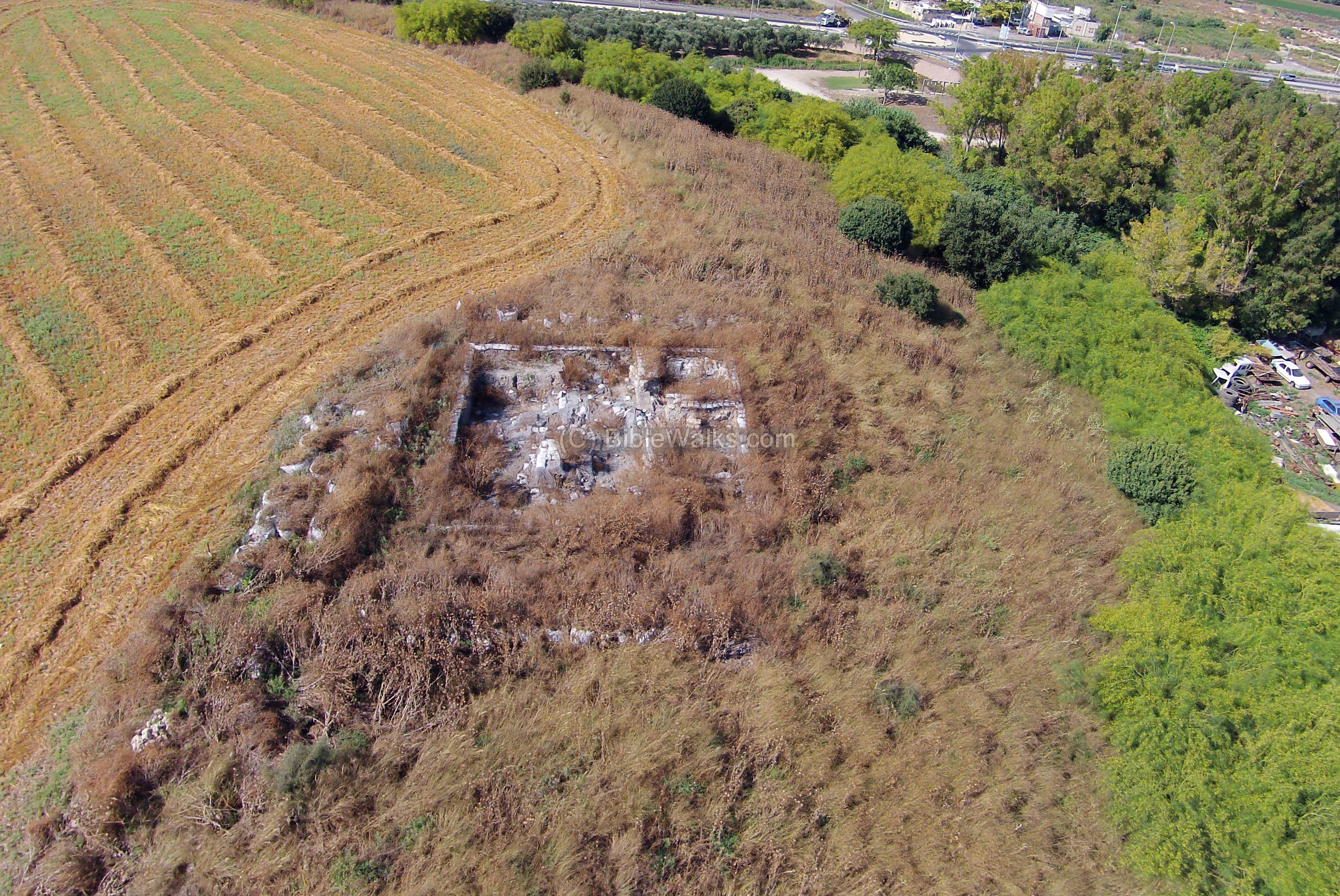
On the west side of the summit is a 30m x 30m cavity where John Garstang excavated in the 1930s.
![]() A flight over the site can be seen in this drone video.
A flight over the site can be seen in this drone video.
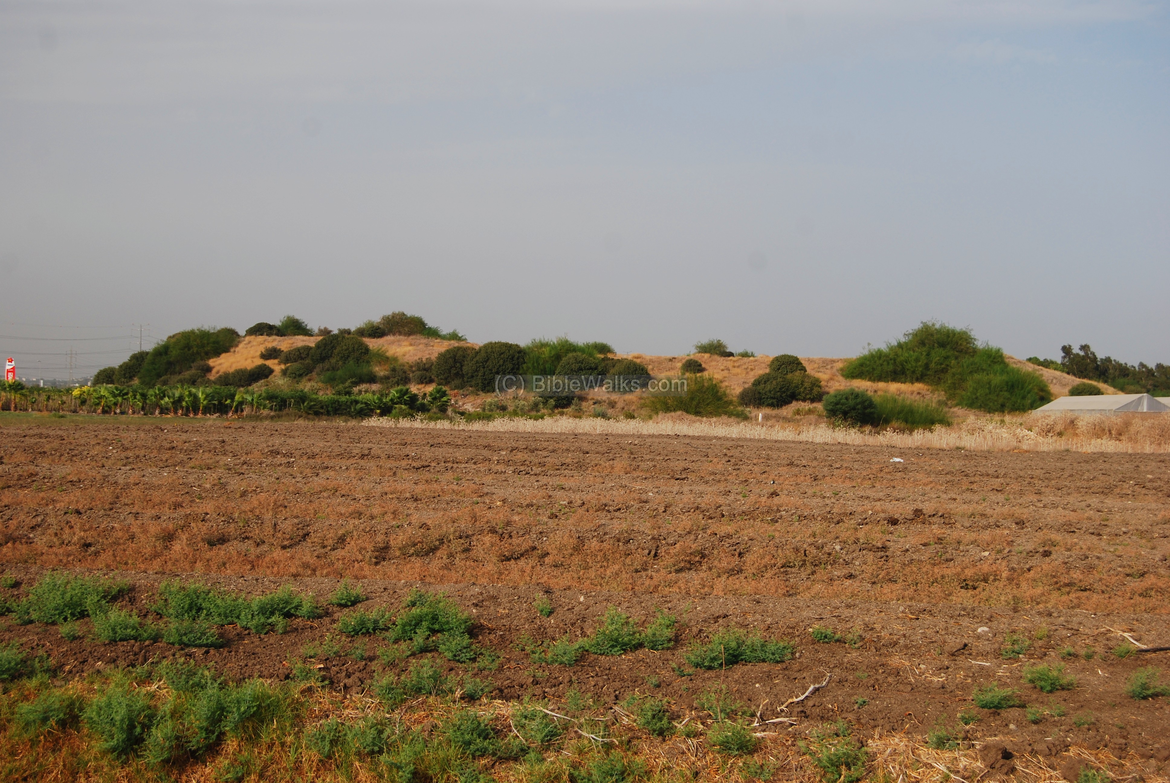
(b) South view:
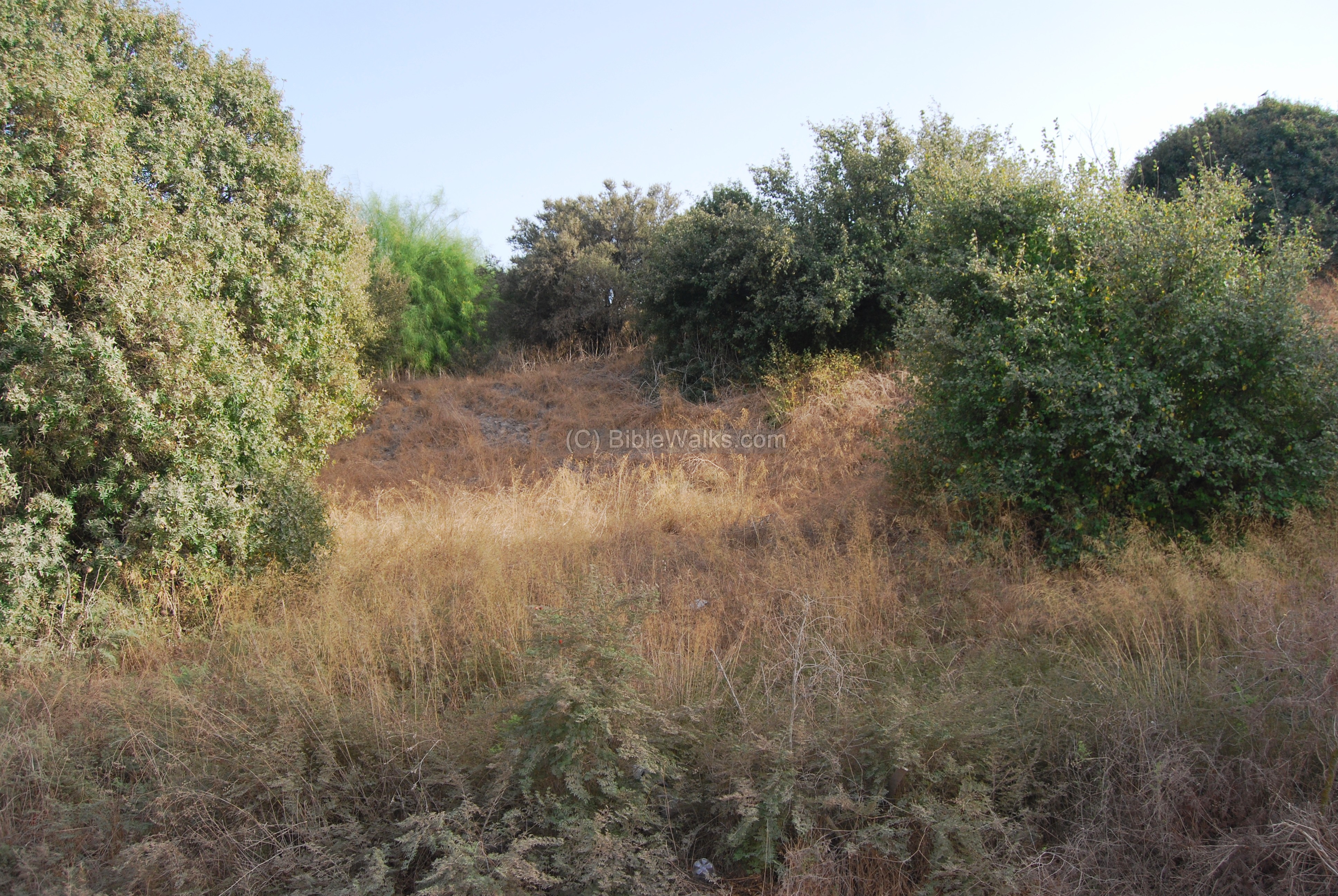
The Tel is a round hill that towers 18m above the surrounding grounds. The photo below is a view from the south-east, taken from the old road side.
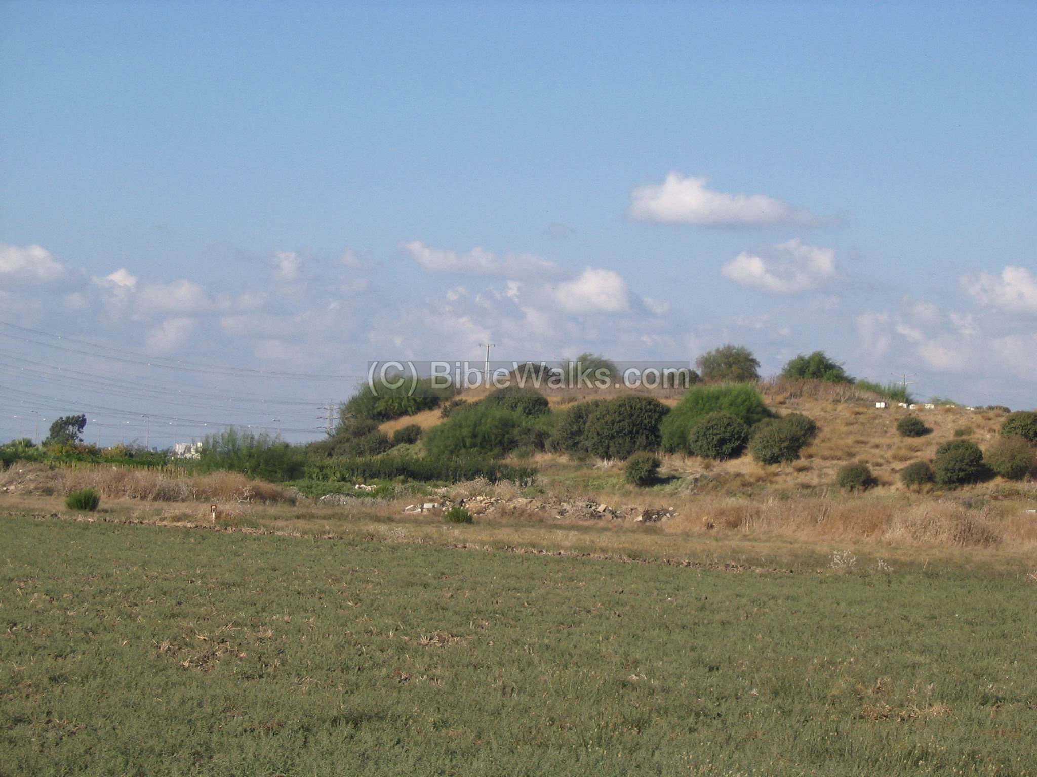
Another view from the south-west side is seen below.
(c) North side:
This is a view from the north-west, taken from the new highway junction of Kefar Hassidim. In the background you can see the edge of mount Carmel.
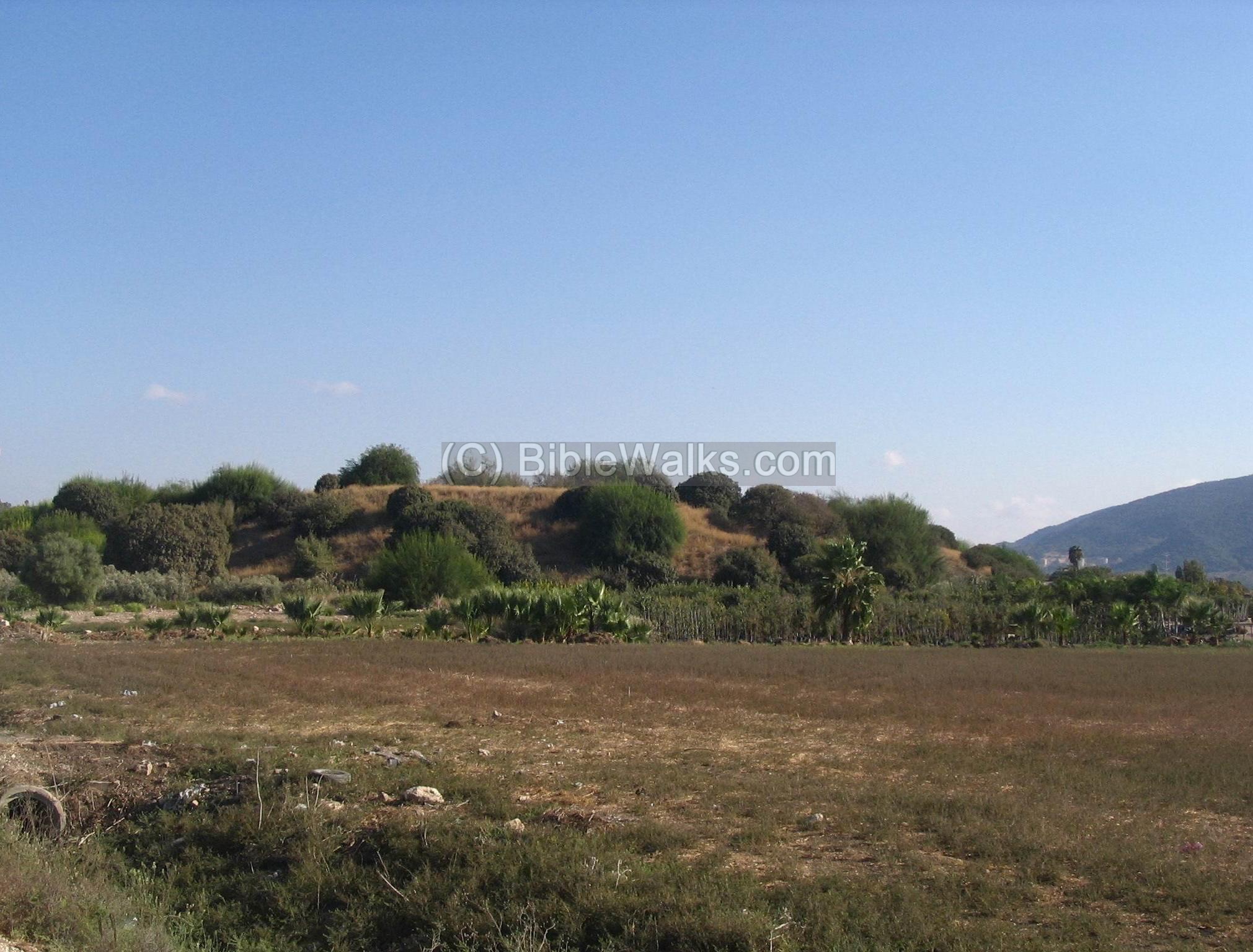
A closer view of the steep foothills on the north side is seen below. This was once a steep glacis and defense walls which was built around the city. The Zippori (Sepphoris) creek flowed along this side, adding another protection to the fortified city.
(d) Flowers:
A large number of Squirting Cucumbers (Ecballium elaterium) grow on the side of the hill. This annual, named in Hebrew: Yerikat Hachamor (“donkey’s spit”), is like a loaded grenade: Its ripe fruit “explode” violently and suddenly when touched, spitting seeds around for a range up to 4M. This unique mechanism helps to propagate the plant – either by spreading its seeds around, or by attaching to the person or animal that accidentally touched it. Its sap is bitter and poisonous, and may be harmful if it spits into your eyes.
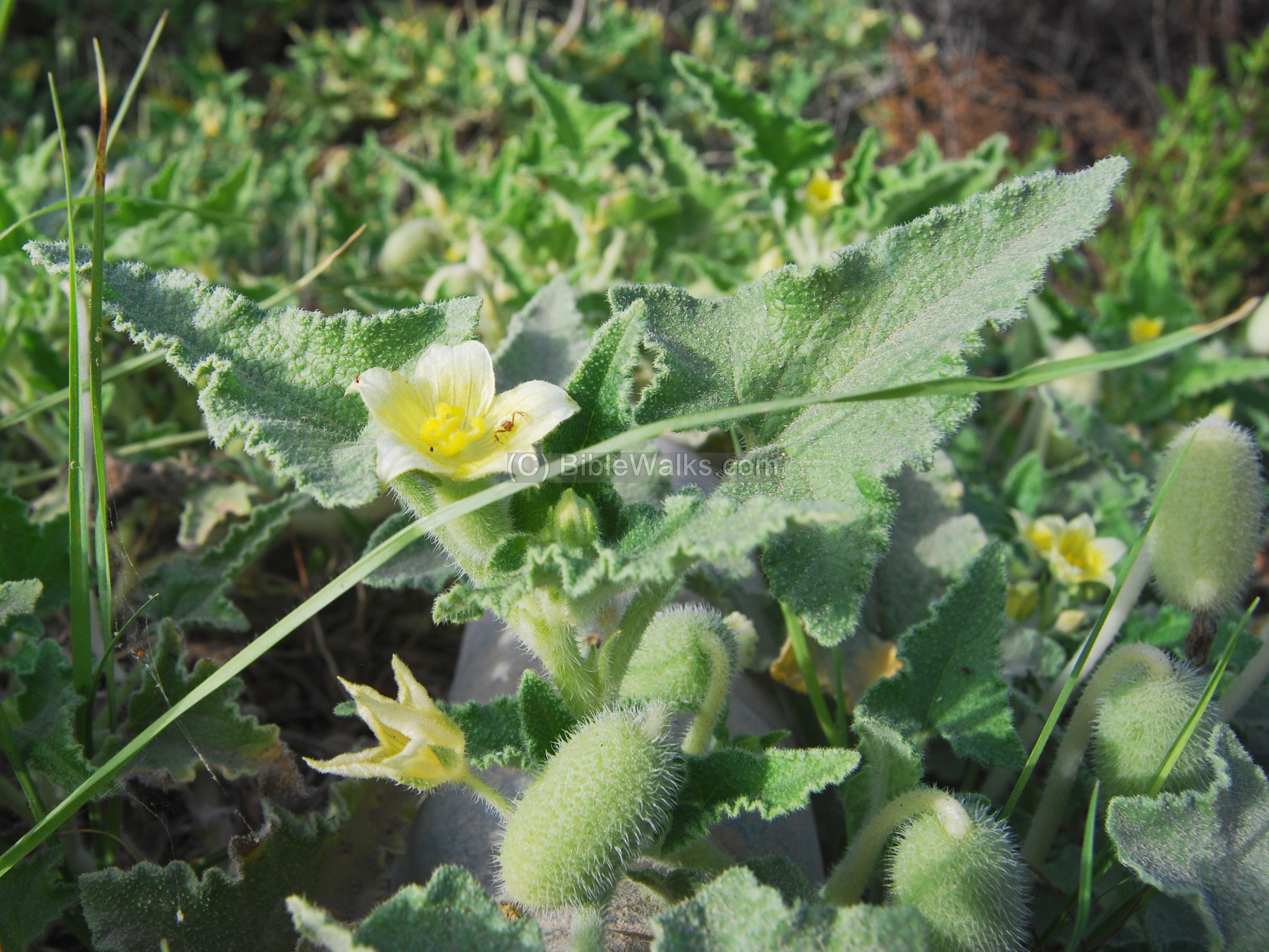
The Squirting Cucumbers plant may be identified as the “wild gourd” that was gathered by Elisha’s servant (2 Kings 4:38-39):
“And Elisha came again to Gilgal: and there was a dearth in the land; and the sons of the prophets were sitting before him: and he said unto his servant, Set on the great pot, and seethe pottage for the sons of the prophets. And one went out into the field to gather herbs, and found a wild vine, and gathered thereof wild gourds his lap full, and came and shred them into the pot of pottage: for they knew them not”.
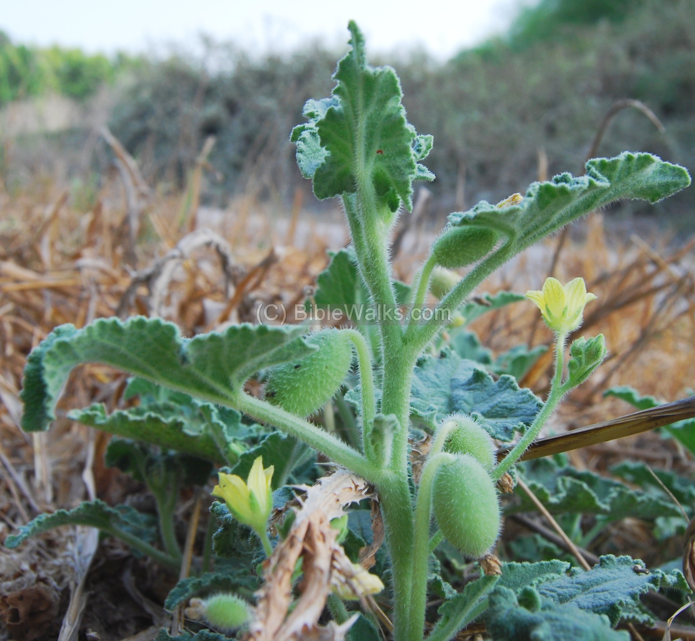
Wild gourds may have also been mentioned in the book of Jonah (Jonah, 4: 6-8). In the story, Jonah is angry with God for showing mercy to the people of Nineveh and wishes to die. God causes a plant (likely a castor oil plant or a gourd plant) to grow up overnight and provide shade for Jonah. But the next day, God causes a worm to attack the plant, causing it to wither. This serves as a lesson to Jonah about the fleeting nature of worldly comforts and the importance of humility and obedience to God.
Biblical References:
(a) Joshua 19:24,25
This text, describing the land of the tribe of Asher, lists the cities in their area. One of the sites may relate to Tel Regev – maybe it is Achshaph which is listed near Khali and Beten (maybe Tel Par near Ibtin). However, Achshaph may also be identified in Tel Kisson (Kissan), as per some scholars.
“And the fifth lot came out for the tribe of the children of Asher according to their families. And their border was Helkath, and Khali, and Beten, and Achshaph And Alammelech, and Amad, and Misheal; and reacheth to Carmel westward, and to Shihorlibnath; And turneth toward the sunrising to Bethdagon, and reacheth to Zebulun, and to the valley of Jiphthahel toward the north side of Bethemek, and Neiel, and goeth out to Cabul on the left hand, And Hebron, and Rehob, and Hammon, and Kanah, even unto great Zidon;
And then the coast turneth to Ramah, and to the strong city Tyre; and the coast turneth to Hosah; and the outgoings thereof are at the sea from the coast to Achzib: Ummah also, and Aphek, and Rehob: twenty and two cities with their villages”.
(b,c) Joshua 11:1-5 ; 12: 20
If Tel Regev is indeed Achshaph, then this city is also listed as the Canaanite cities that fought, and lost, against Joshua and the Israelites during the conquest of Israel:
“And it came to pass, when Jabin king of Hazor had heard those things, that he sent to Jobab king of Madon, and to the king of Shimron, and to the king of Achshaph, And to the kings that were on the north of the mountains, and of the plains south of Chinneroth, and in the valley, and in the borders of Dor on the west, And to the Canaanite on the east and on the west, and to the Amorite, and the Hittite, and the Perizzite, and the Jebusite in the mountains, and to the Hivite under Hermon in the land of Mizpeh. And they went out, they and all their hosts with them, much people, even as the sand that is upon the sea shore in multitude, with horses and chariots very many. And when all these kings were met together, they came and pitched together at the waters of Merom, to fight against Israel. “
And also listed in Joshua 12 20:
The king of Shimronmeron, one; the king of Achshaph, one;”
(d) Kings I (9: 11-13)
This text tells about the Solomon-Hiram agreement, where the area of west Galilee was traded with the Phoenicians. This area, called Cabul (or Kavul), might have included Tel Regev as well, since the number of cities (20) corresponds to the number of cities listed above (22).
“Now Hiram the king of Tyre had furnished Solomon with cedar-trees and cypress-trees, and with gold, according to all his desire–that then king Solomon gave Hiram twenty cities in the land of Galilee. And Hiram came out from Tyre to see the cities which Solomon had given him: and they pleased him not. And he said: ‘What cities are these which thou hast given me, my brother?’ And they were called the land of Cabul, unto this day”.
Etymology (behind the name):
-
Regev – in Hebrew: lump, clod (of earth)
-
Name of the site in Arabic: Tell El-Kharbaj or Khirbet el-Harbaj – named after Sheikh Kharbaj who was buried here according to Arabic tradition.
- Harbaj – a private name. The PEF translates el-Harbaj as: “…it means work (such as masonry) that is badly done”.
-
Tel – in Hebrew and Arabic: Tell, english: Mound. See more about Tells.
References:
* Biblical References:
- Identification of Achshaf (pdf; p 120)
- A salvage excavation near Tel Regev (Hebrew + English summary) – Atiqot 62
- David Dorsey (“The roads and Highways of Ancient Israel”, 2018) – pp. 78-81
- The Three conquests of Canaan – Eero Junkkaala
* Wild Flowers:
* Other sites:
- Drone Aerial views – collection of Biblical sites from the air
Other ancient sites close by:
Visit the following sites, which are north of Tel Regev:
To the south, in Lower Galilee:
- Tel Meamer (Biblical Geva-Shemen, Roman “Geva”) – located 3 KM to the south-east
- Tel Yokneam – located 10Km to the south.
- Tel Kassis – located 8KM to the south. Identified as Biblical Khelkat.
You can also learn about the story of a Tel in our info page.
BibleWalks.com – walk with us through the sites of the Holy Land
Khali<<<–previous site—<<<All Sites>>>—next West Galilee site —>>> Tel Par & Kh. Ibtin
This page was last updated on May 5, 2024 (add history Achshaph, Google map)
Sponsored links: