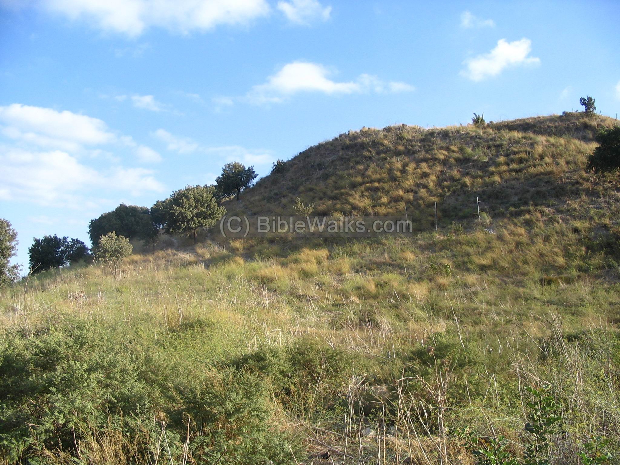
Tel Yokneam, an important city in Biblical times, stands in the entrance of a mountain pass through Mount Carmel.
* Site of the month Aug 2015 *
Home > Sites >Yizreel Valley > Tel Yokneam (Jokneam, Yoqne’am)
Contents:
Background
Location
History
Photos
* Aerial
* Ascent path
* Crusader Church
* Crusader house
* Crusader fortress
* Ottoman fortress
* Western side
* Iron age Walls
Etymology
Links
Background:
Tel Yokneam stands as a gate to the entrance of a pass through Mount Carmel towards the south. This steep hill was a mighty city in the Biblical times, and due to its strategic location played an important role in ancient history of the region. It was one of Manasseh tribe cities and a Levite city.
Joshua 12, 22: “the king of Jokneam in Carmel, one”.
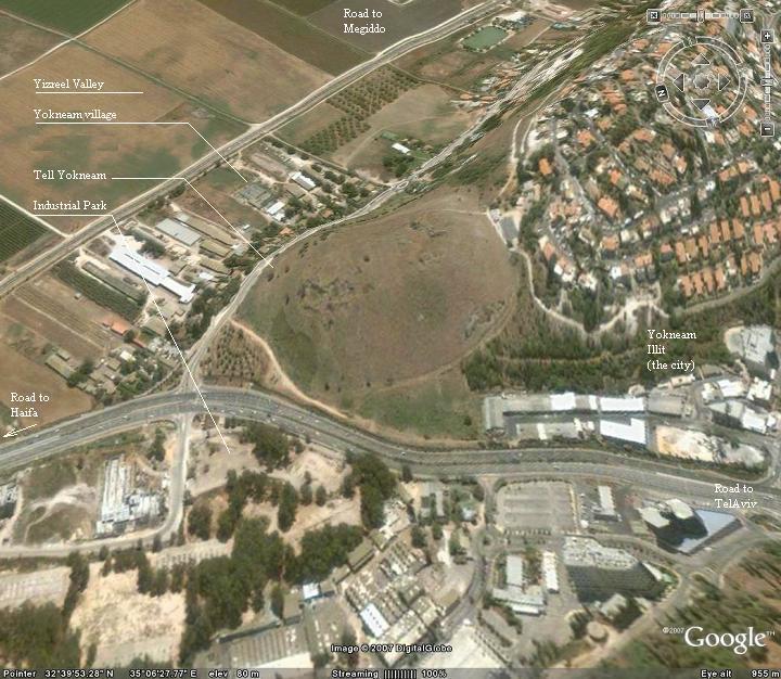
Today the Tel is in ruins, and the agriculture village of Yokneam (established 1935) is built east of the site. The modern city of Yokneam Illit (Upper), established in 1967, is built south of the site. An Advanced Technology park is located west of the site, across the highway.
Location:
While driving on the modern north-south highway through Mount Carmel you can easily notice this steep hill in the north side of Yokneam.
As in many ancient roads in Israel, modern highways follow the ancient routes due to their topographic advantages. Thus, traveling in Israel is usually travel by of the greater ancient cities, like Megiddo (which is the second pass through the Carmel/Menashe mountains).
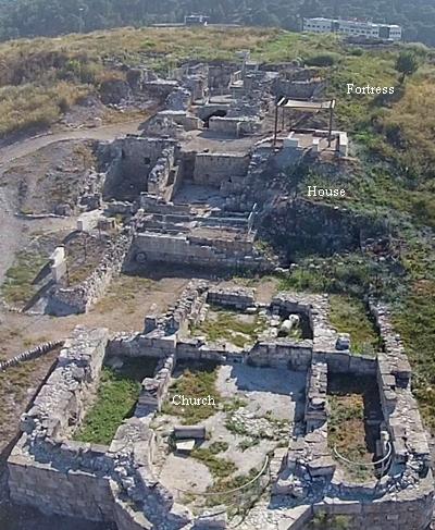
An aerial map of Yokneam is shown below, indicating the major points of interest. Access to the top of the mound is from Yokneam Illit.
History:
-
Pre-history
According to the Archaeological survey, there were few pottery findings from the Chalcolithic period (4,500-3150BC). The city continued to be populated in the Early Bronze (3150-2200 BC), and especially in the middle Bronze (Canaanite) period (2200-1550BC).
-
Late Bronze (Canaanite)
In the late Bronze period (1550BC- 1200BC) the city expanded. Yokneam was an important city in this period. It was mentioned in list of cities that were conquered in 1468BC by Egyptian Pharaoh Thutmose III.
A plan of the Canaanite and Israelite city is seen in this model. The main city gate is located on the east side, protected by towers. The entry road ascends to the gate along the eastern slope of the hill. The city was defended by high walls with towers, and a glacis (artificial slope) before the walls. Inside the city are structures of storerooms, houses, and palace. On the north west side of the city is a staircase that leads down to an underground water reservoir. The area around the hill was an additional residential area – the “lower” city.
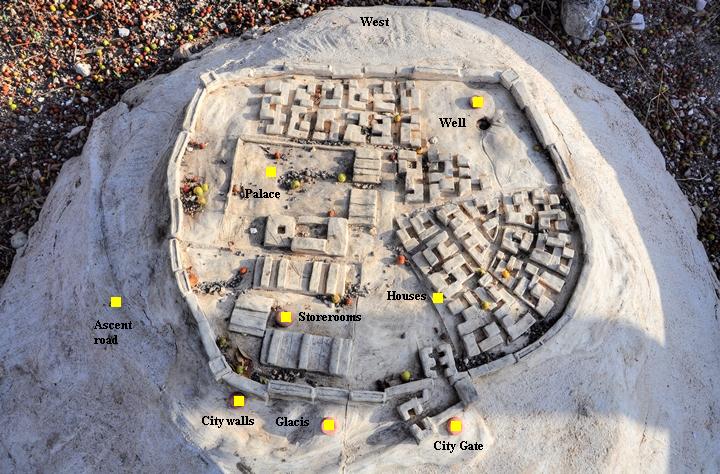
Biblical city model – courtesy of the archaeological park (located on the north west side)
-
Israelites
The city of Yokneam also was one of the 31 Canaanite cities that assembled their forces to fight against Joshua and the Israelites, but were defeated (Joshua 12:1,22):
“Now these are the kings of the land, whom the children of Israel smote, and possessed their land… …the king of Kedesh, one; the king of Jokneam in Carmel, one;”.
It is interesting that the suffix “Jokneam in Carmel” was added, since there was another Yokneam in another region.
The city was part of the inheritance of the tribe of Manasseh, and was located on the south side of the area allotted to the tribe of Zebulun (Joshua 19: 10-11):
“And the third lot came up for the children of Zebulun according to their families; and the border of their inheritance was unto Sarid. And their border went up westward, even to Maralah, and reached to Dabbesheth; and it reached to the brook that is before Jokneam”. The brook that the text refers to “before Jokneam” is probably the Kishon river, which is 0.5KM to the north.
Biblical map is shown in the map below, with the city Yokneam (Jokneam) in the center of the most important trade routes in the northern Israel (Via Maris to south, north, and east; southeast to Megiddo/BethShean) .
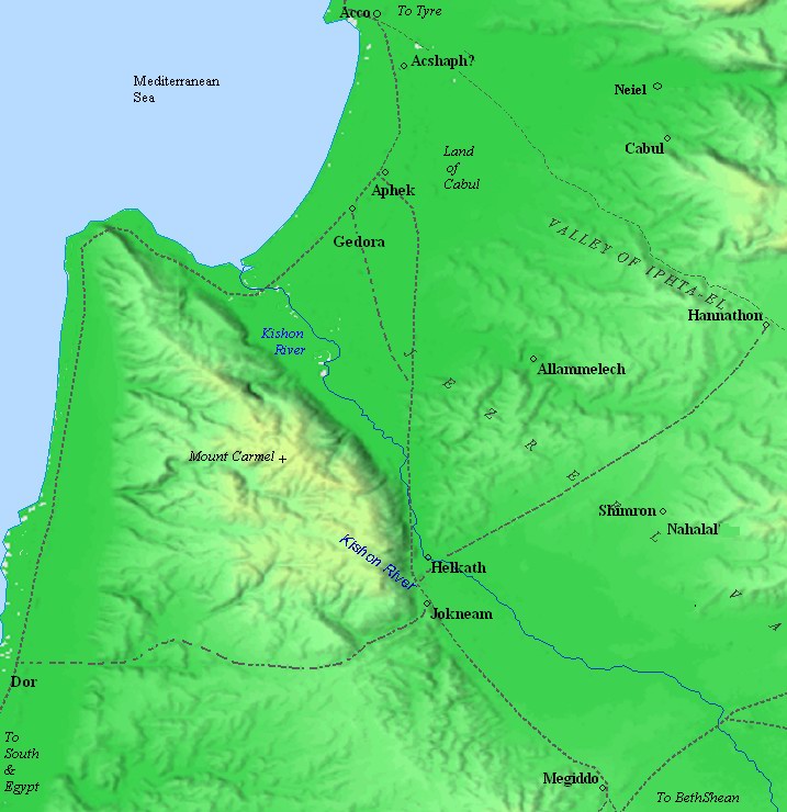
Biblical map – Canaanite and Israelite periods (based on Bible Mapper 3.0)
Yokneam was also a Levite city. This tribe settled among the other tribe regions and had religious and political duties. In this text Yokneam was listed as one of these cities, including the area around it (Joshua 21: 1-3,34):
“Then came near the heads of fathers’ houses of the Levites unto Eleazar the priest, and unto Joshua the son of Nun, and unto the heads of fathers’ houses of the tribes of the children of Israel; and they spoke unto them at Shiloh in the land of Canaan, saying: ‘The HaShem commanded by the hand of Moses to give us cities to dwell in, with the open land thereabout for our cattle.’ And the children of Israel gave unto the Levites out of their inheritance, according to the commandment of HaShem, these cities with the open land about them. … And unto the families of the children of Merari, the rest of the Levites, out of the tribe of Zebulun, Jokneam with the open land about it, and Kartah with the open land about it”.
-
Later periods
Later, the city flourished from the commercially strategic location. It was populated throughout the Persian and Hellenistic periods, Roman/Byzantine, Arab and Crusaders, Mamlukes and Ottomans.
The Crusaders built here a fortified farm house, which included residential houses, paved streets, a tower and a Parish Church. Sections of the fortress can be seen on the east and center side of the hill. The Crusader name was “Cain Mons”, which means “the mountain of Cain”, since the tradition was that the Cain, son of Adam (Genesis 4: 23-24), was killed in this site by his grand-grandson Lemech, father of Noah.
In the 18th century a fortress was built by Daher el Omar on the western side of the hill. Sections of the fortifications can be seen on the western side of the summit. The Arabic name of the fortress was Qamun, which preserved the Crusader name.
-
Modern times
There are two types of modern settlements in Yokneam, located around the site: an agriculture village (Moshav Yokneam, established in 1935), and the city of Yokneam Illit, established in 1967 as an immigration town (“Yokneam Illit”), expanded and was recognized as a city in 2006.
-
Excavations
Excavations on the site were conducted in 1977-1988 by the Hebrew University of Jerusalem, headed by non Ben Tor. These seasons focused on the northern slopes and the Crusaders Church. In 1993 the IAA team, headed by Miriam Avissar, focused on the summit area. A total of 25 levels were identified by the archaeologists, spanning from the Early Bronze period to the Ottoman period.
Photos:
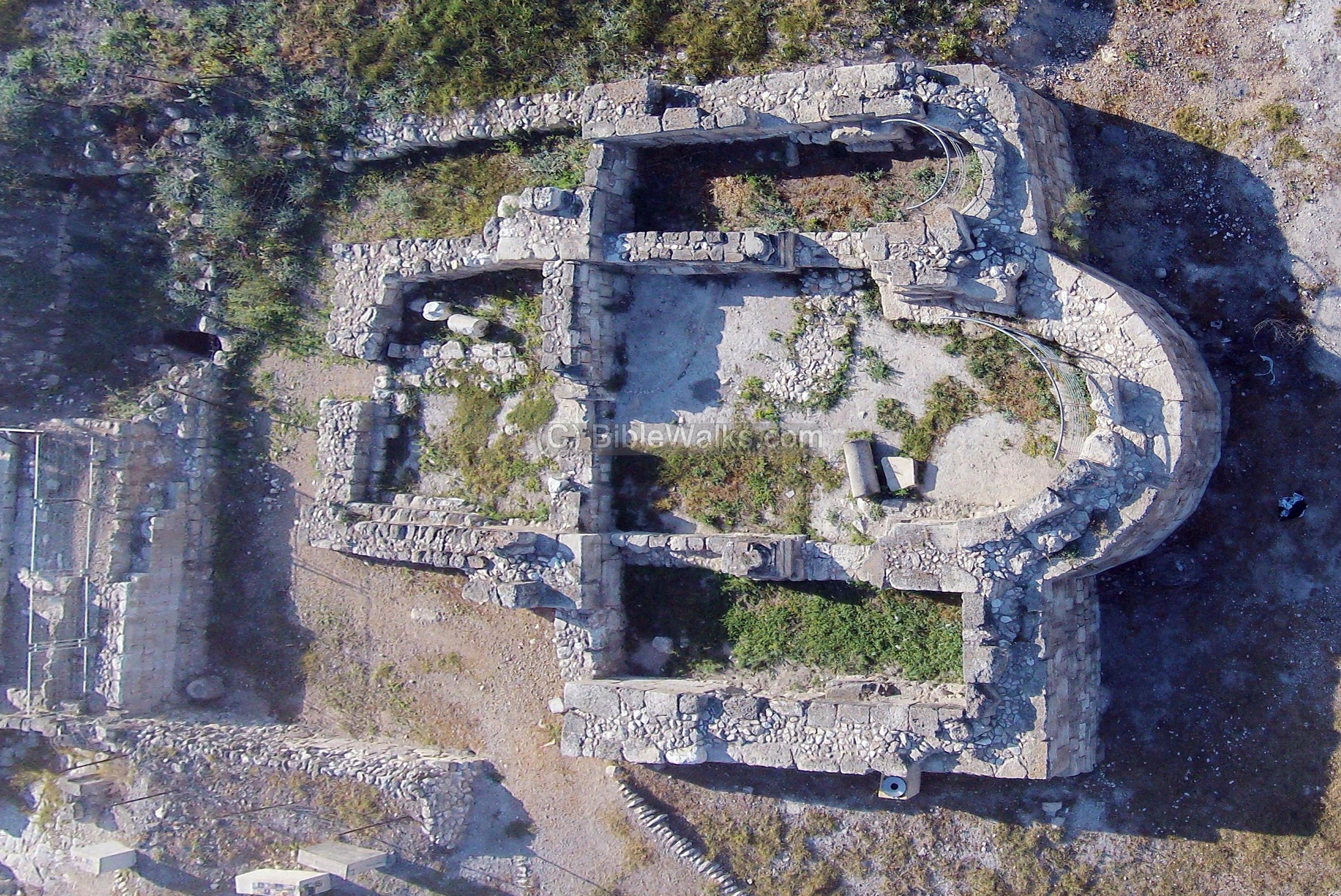
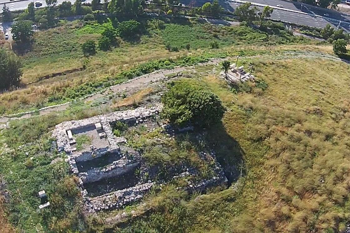
(a) Aerial Views
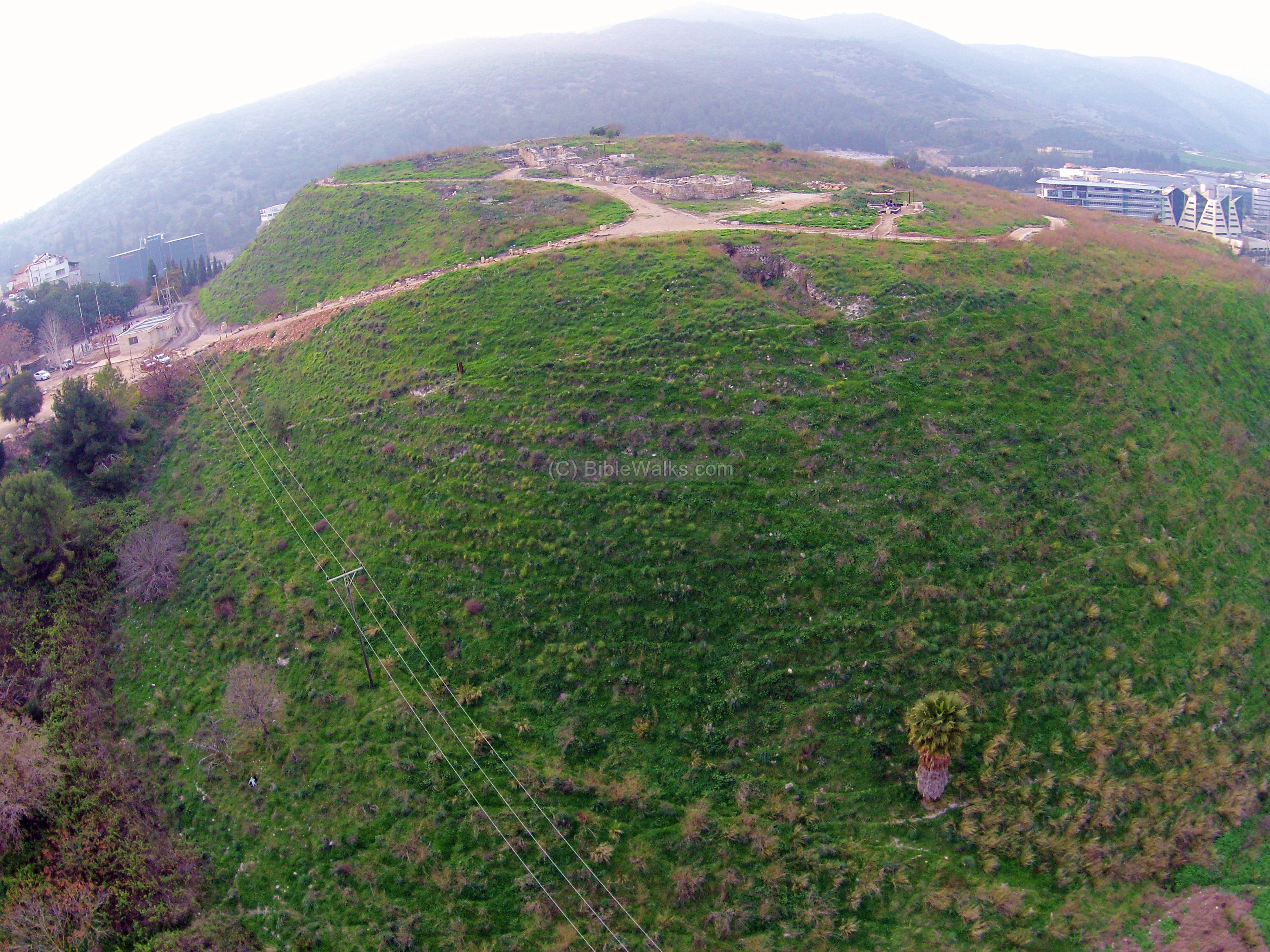
This aerial view was captured from the east, on the west side of the agriculture village (Moshav) of Yokneam. The ruins of the ancient city cover the entire hill and the area around it. On top of the hill are some of the structures exposed in recent excavations. A trail leads up from the parking lot, which is seen on the upper left side.
Click on the photos to view in higher resolution…
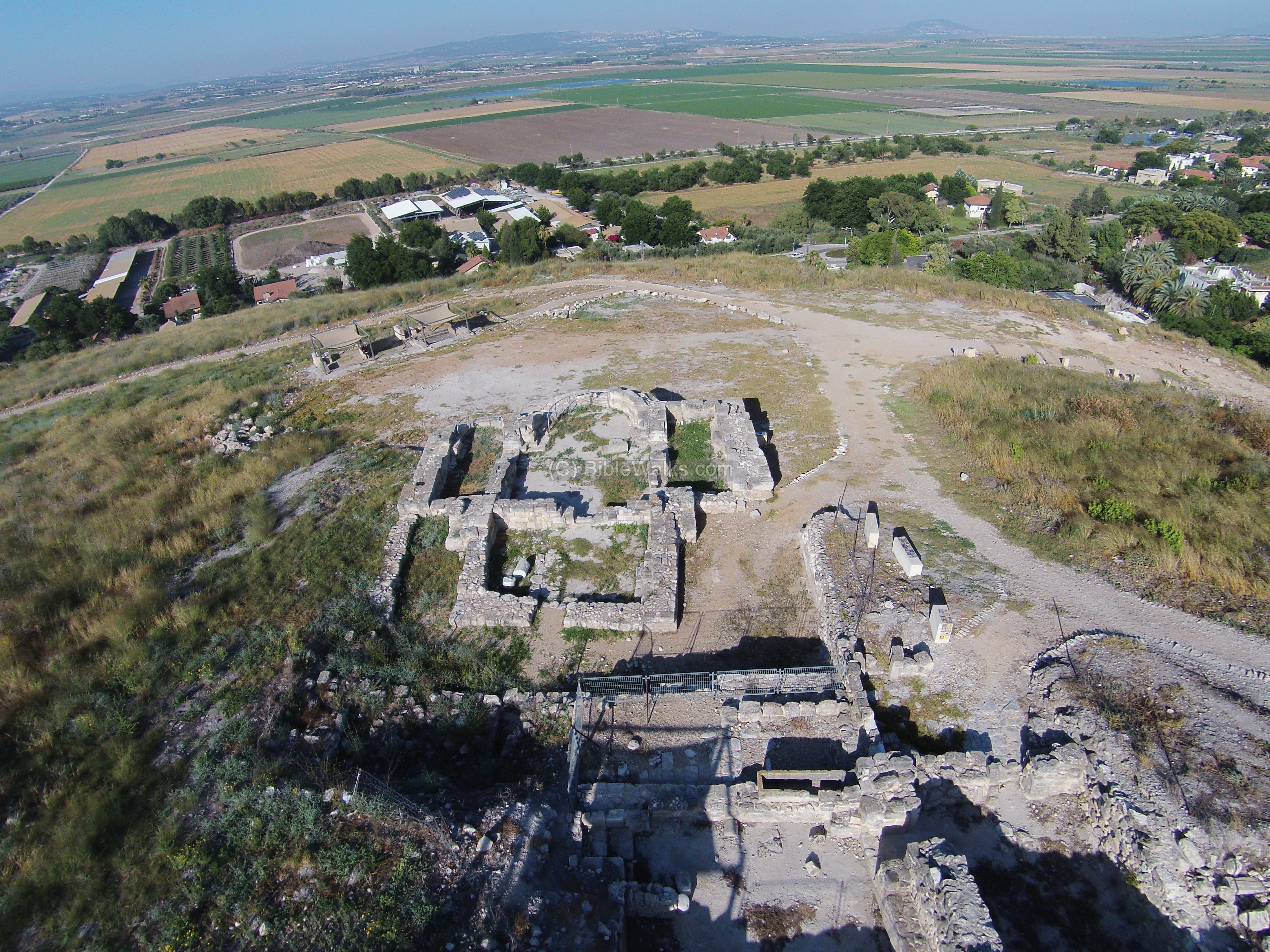
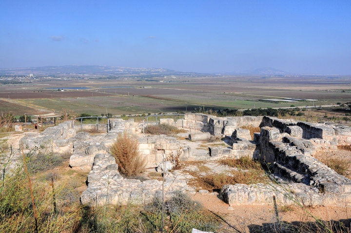
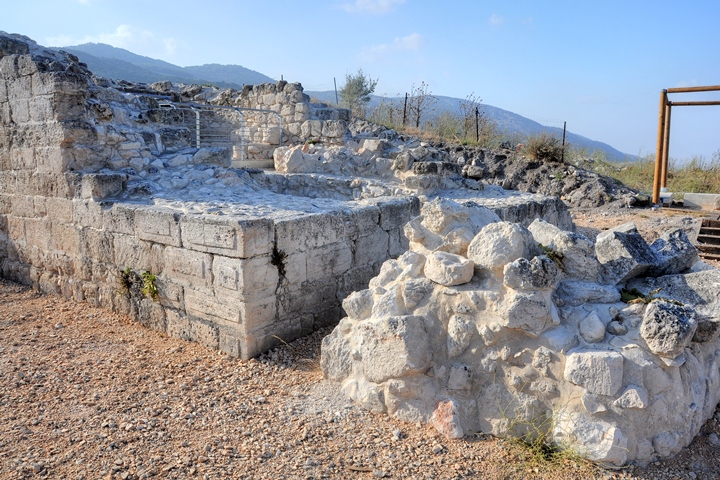
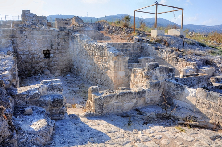
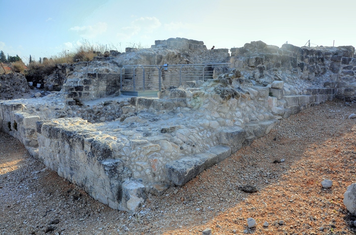
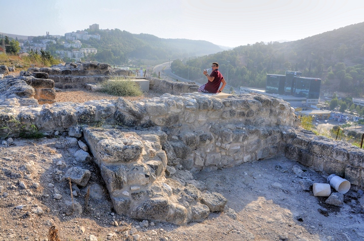
The next photo is a view from the summit, also captured from the same east side, shows the main structures on the hill. The currently visible reconstructed structures are of the Crusaders period, while all around the summit are ruins of the earlier Biblical cities.
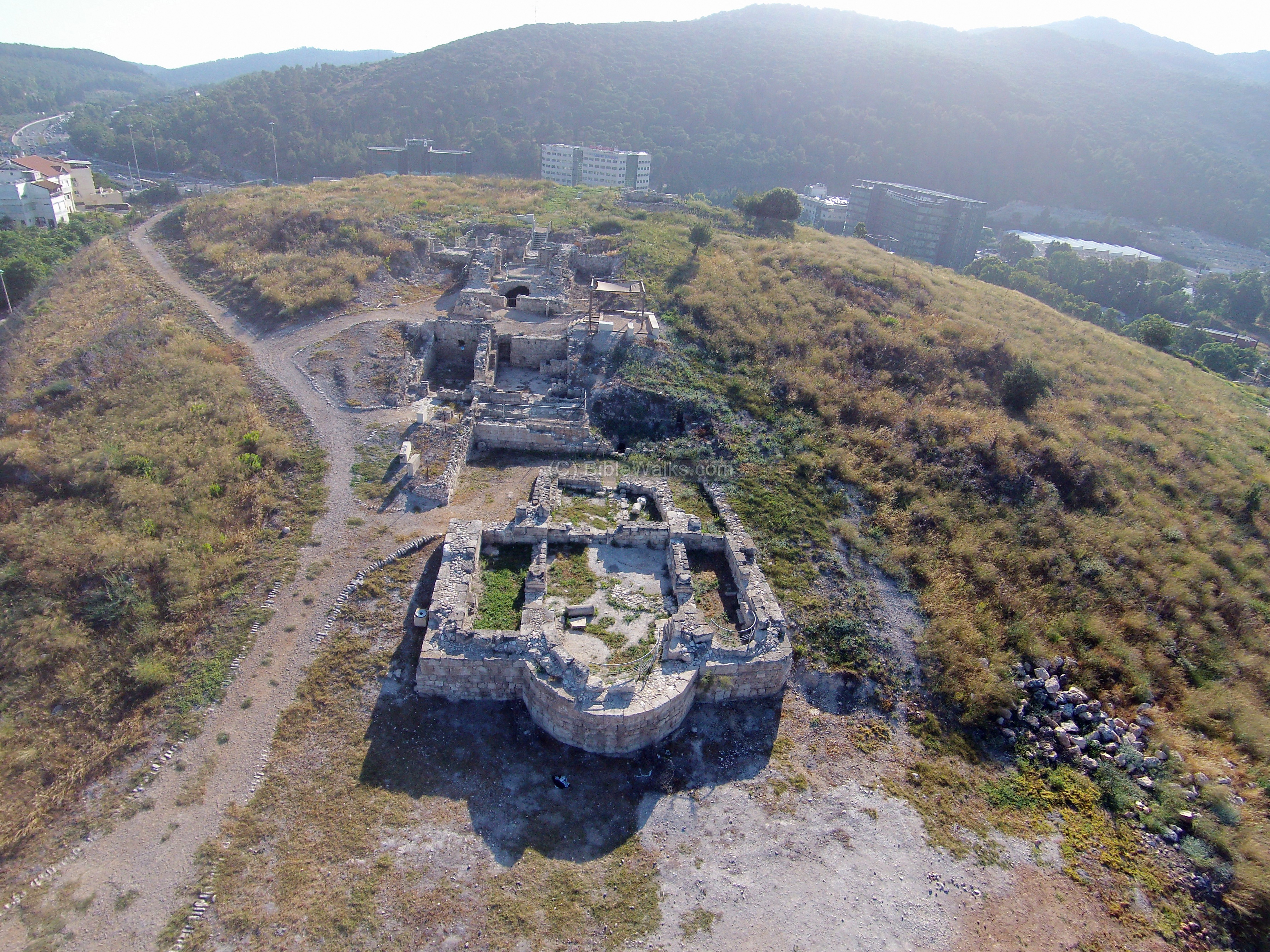
The points of interest on the hill are indicated on the photo. In the foreground are remains of the Crusaders period fortifications, with the Church in front. All around the Tel are remains of the Canaanite and Israelite ruins and the walls that protected the city. The well, also dated to the Biblical period, is located on the right (north west) side. In the far background is Mt Carmel (right) and Mt. Menasseh (left), with road #70 (Wadi Milek) between them, a road that connects the Jezreel valley to the coastal road.
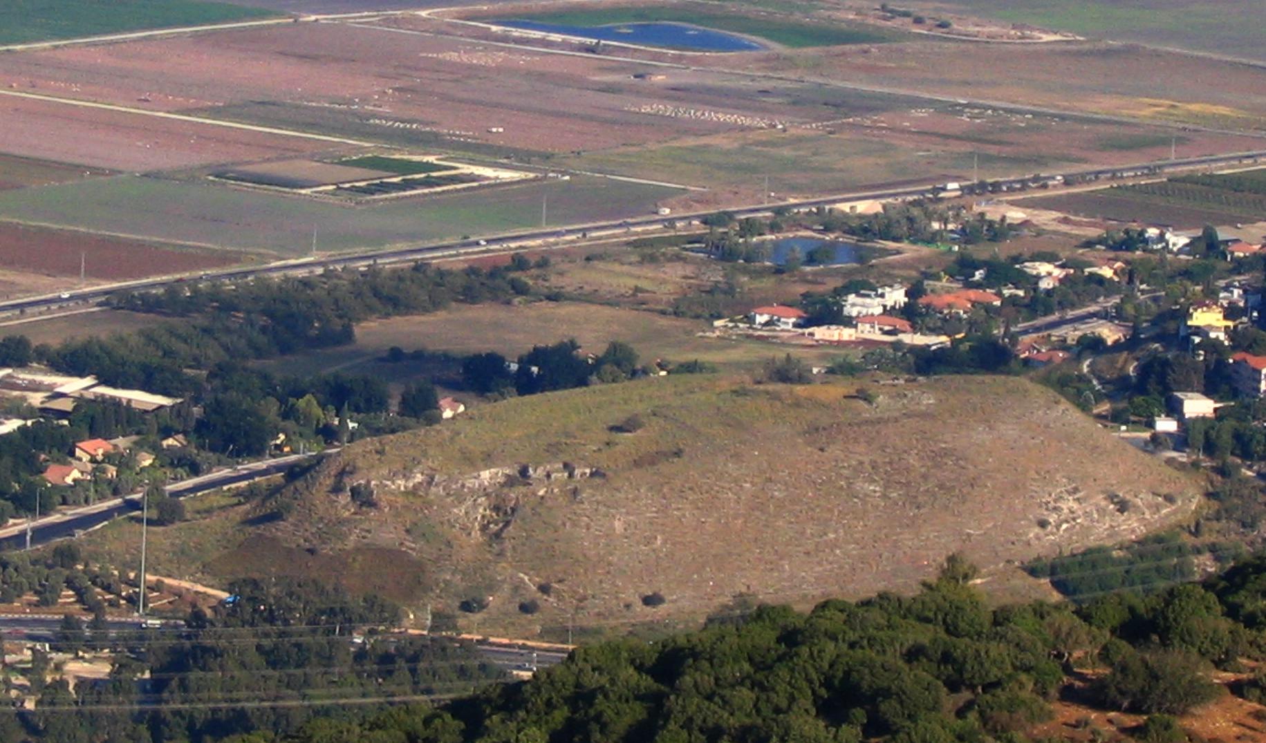
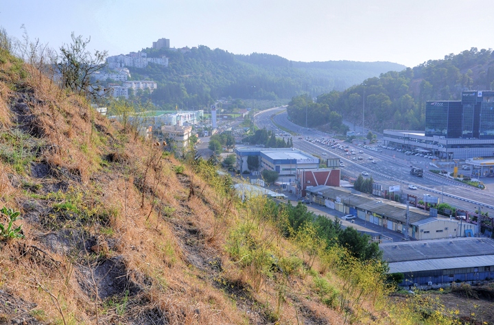
A view from the top of the Carmel shows the extent of the mound. The Tel of Yokneam is located to the east side of the main road (both modern and ancient roads passed at the same place). In the far background is Jezreel valley, and the road to Megiddo.
The Tel has two parts: the upper city on the summit, and the lower city on the area around the mound.
![]() Fly over the site with the following Youtube video:
Fly over the site with the following Youtube video:
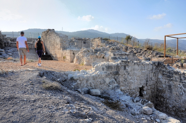
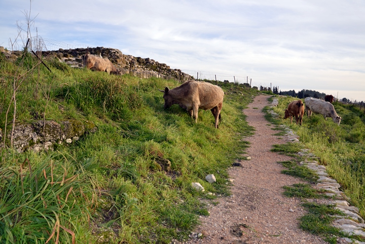
(b) Ascent path
After parking the car on the south east side of the site, an ascent path leads up to the summit. This path follows the route of the Canaanite and Israelite city, leading up to the city gate.
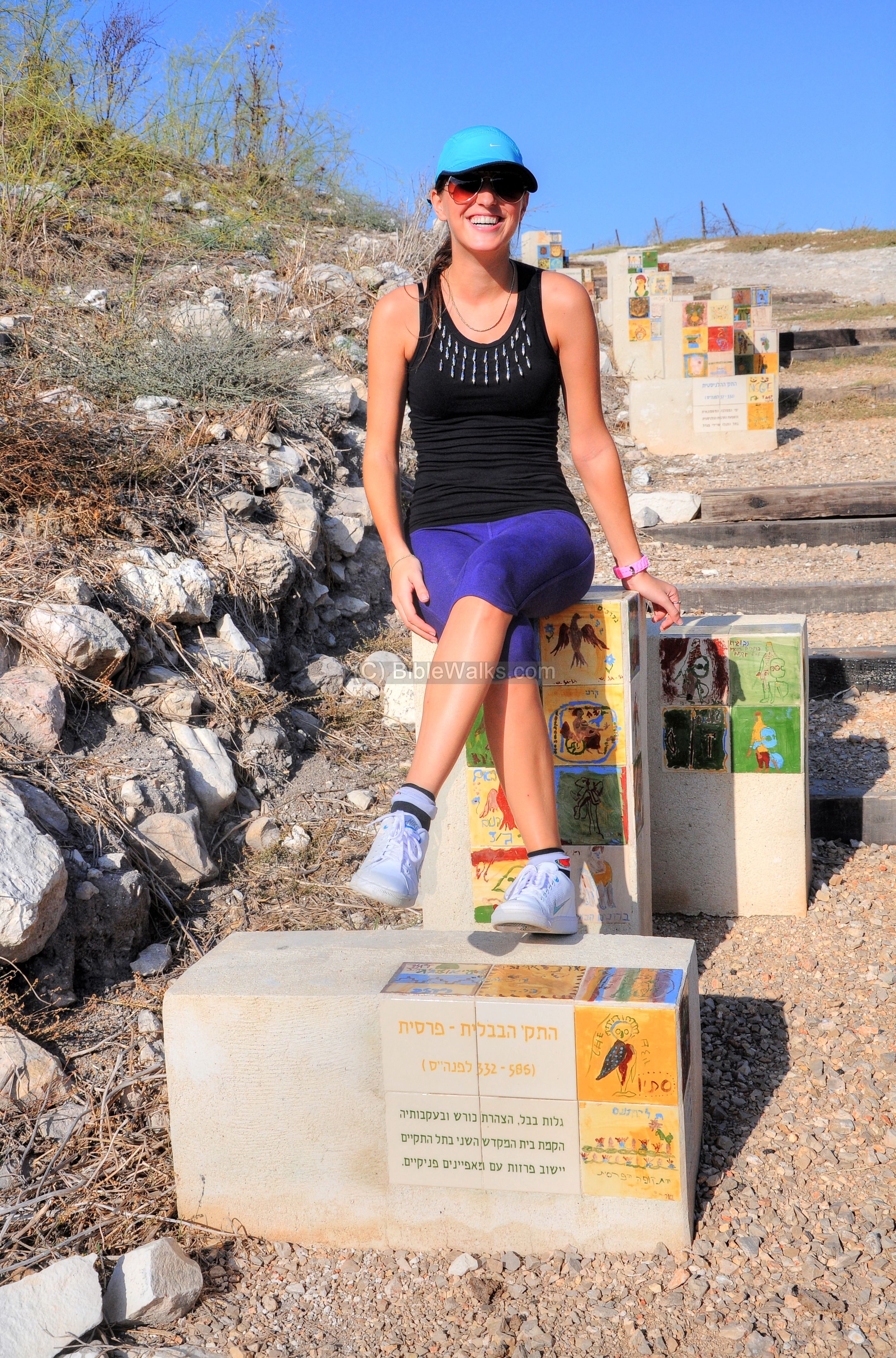
Along the path a number of stone pillars, with mosaic tiles describing the different levels found here. The Hebrew inscriptions on the lower stones describe each level, starting from the first chapter in the history of Tel Yokneam (Early Bronze period), through the Roman period (the inscription in front), up to the last chapter (Ottoman period).
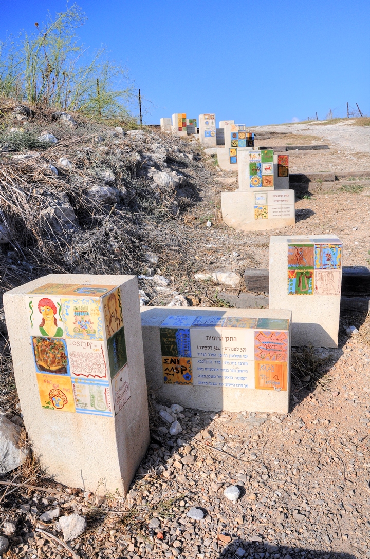
Each of the colorful mosaics was crafted by local school children, part of an educational project in Yokneam. The involvement with the creation of the archaeological park had an aim of creating interest of the young generation to the history of their place.
Webmaster Rotem poses here near the Babylonian-Persian level (586-332).
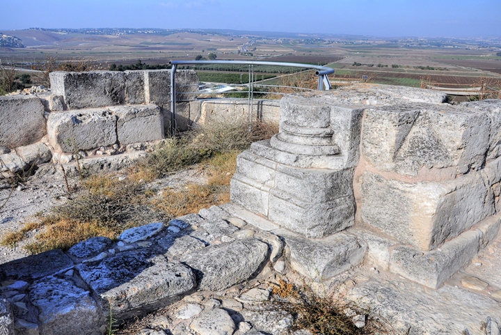
After reaching the summit, the first structure on the left is the reconstructed Crusader Church.
(c) Crusaders Church
A Church dated to the 12th century is located on the east side of the Crusader fortress of Qaimun, overlooking the Jezreel valley. This view shows the Church from the west side, with a great panorama of the valley of Jezreel in the background. The hills of Nazareth are in the center of the horizon, while Mt. Tabor is the round hill rising to the right.
This was a parish Church, which served the Frankish settlement in the Qaimun castle. The archaeologists reconstructed only the lower parts of the structure from the rubble found at the beginning of the excavations.
The Crusaders built their Church over the ruins of an earlier Byzantine period Church. Two phases of construction were identified in the Byzantine Church.
The Crusaders first built the semicircular apse on top of the ruins of the Byzantine apse, then continued the structure to the west. The external walls are 1.8m wide. The eastern section of the Church was covered by a dome roof.
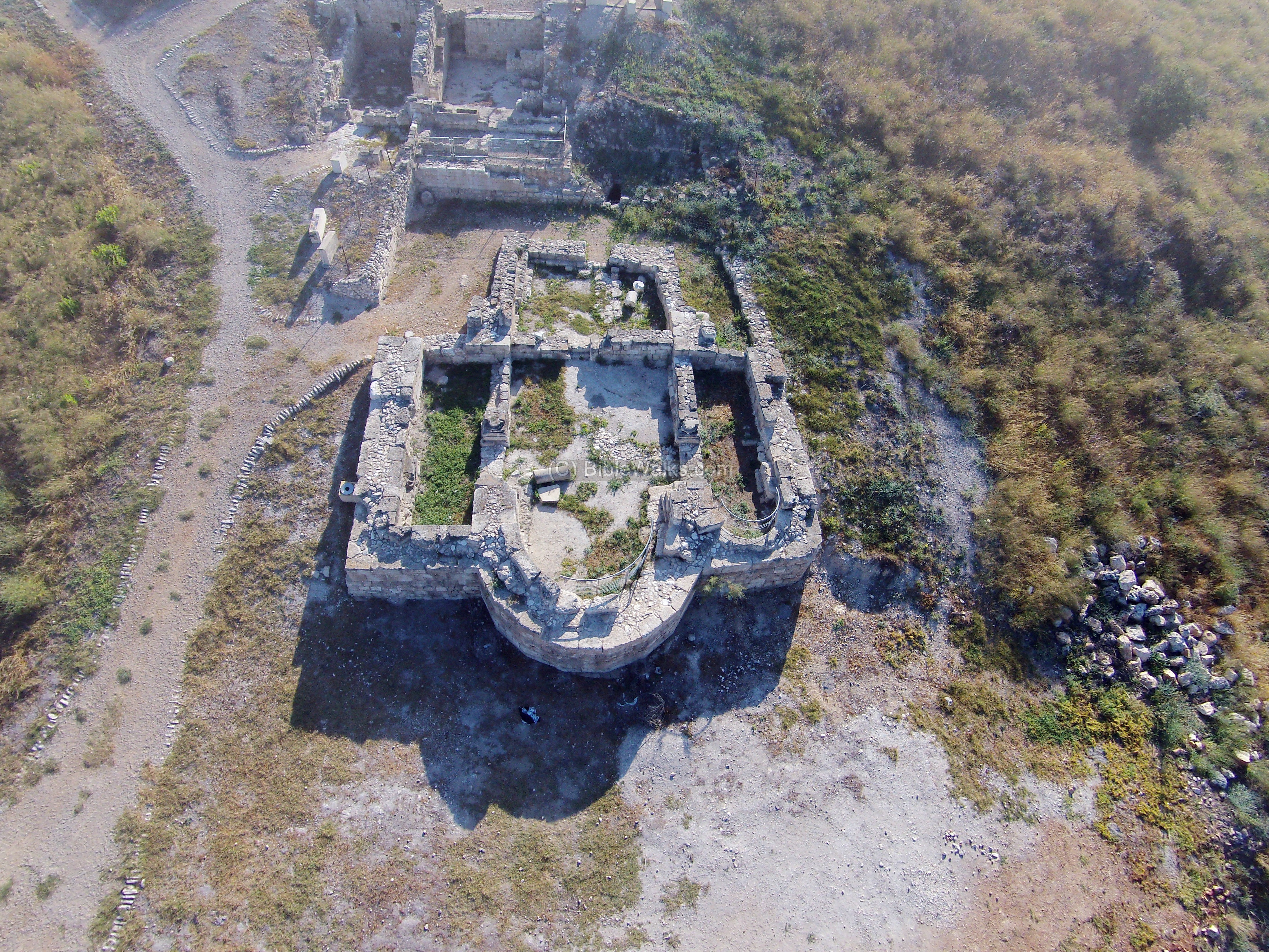
The apse, located on the east side, has an inner width of 5m. The central nave is 6.5m wide by 8m length. It is flanked by two aisles, 2.5m wide, which connected to the nave with a pair of arches. The north aisle ends with a semicircular apse on its eastern side, while the southern apse ends with a flat wall.
A paved street separates the Church from the house on its western side.
In a second phase of construction, the Crusaders added walls between the aisles and the nave, and between the front of the nave and the rear. These newer, internal walls can be seen in the picture surrounding the nave.
During the Ottoman period, the Church was converted to a residential house. Additional partition walls were added, a staircase connected to the upper floor, and an oven was constructed.
The following photos show the Church from the ground level. First, a view from the west side, with the valley of Jezreel in the background:
The entrance from the central nave to the main apse is in the next photo:
A closer view of the main apse at the end of the central apse:
The south aisle:
The north aisle is seen in the following photo. Notice the pilaster base on the left side of the main apse.
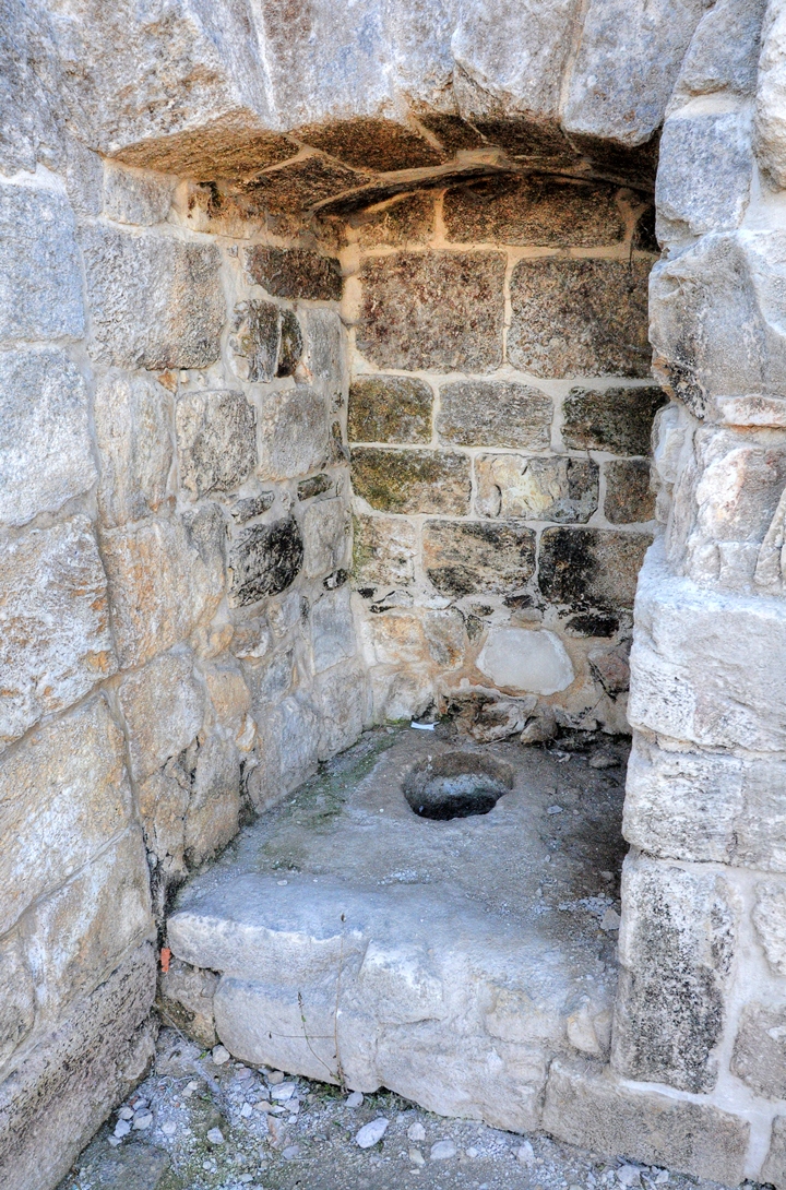
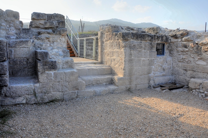
(d) Crusaders House
To the west of the Church a large residential house was excavated and reconstructed.
Notice the Crusaders style stones on the wall of the house.
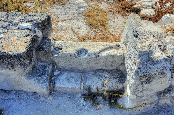
The house contains two rooms and a courtyard, and a bathroom with toilet.
The toilet:
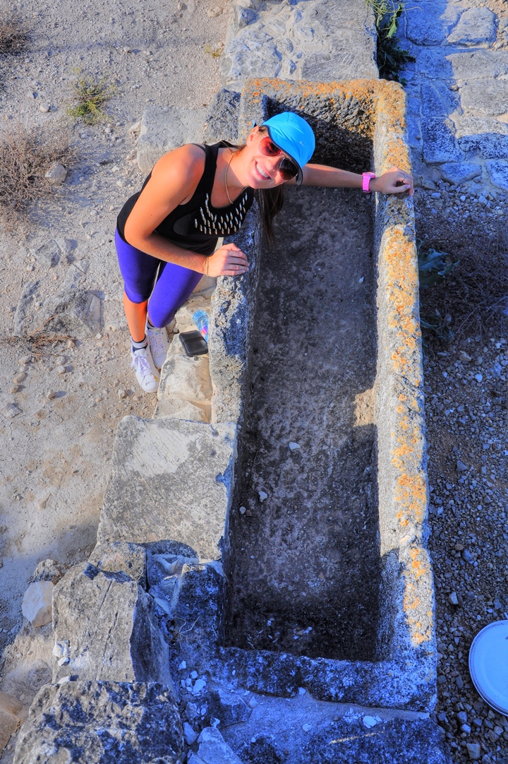
A Roman sarcophagus (burial coffin), on the northern room, was reused as a water reservoir.
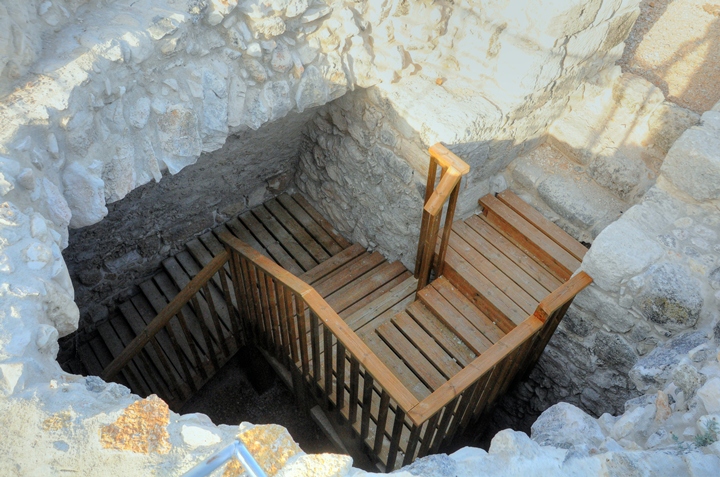
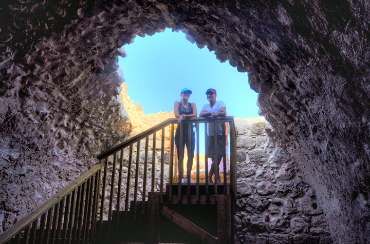
(e) Crusaders Fortress
A small Crusader fortress stood on a higher level, to the west of the Crusader house.
The illustration on the aerial view shows how the structures of the Crusaders are arranged along the foothill.
The photo below shows the lower level of the fortress.
The fortress includes two floors. Stairs lead up to the summit.
An underground water reservoir can be accessed by a modern staircase.
(f) Ottoman period castle
On the western side of the summit are remains of a fortress dated to the 18th century, seen here from a drone above the site.
The fortress was erected by Daher el-Omar (1690-1775), a Bedouin from the Galilean village of Arraba, who captured large parts of the Galilee from the Ottomans and created his own autonomous state.
Daher and his sons built many forts in his territories and established new commerce centers. In Yokneam Daher built a fortress in order to protect the road connecting his territories.
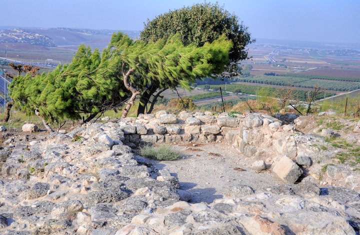
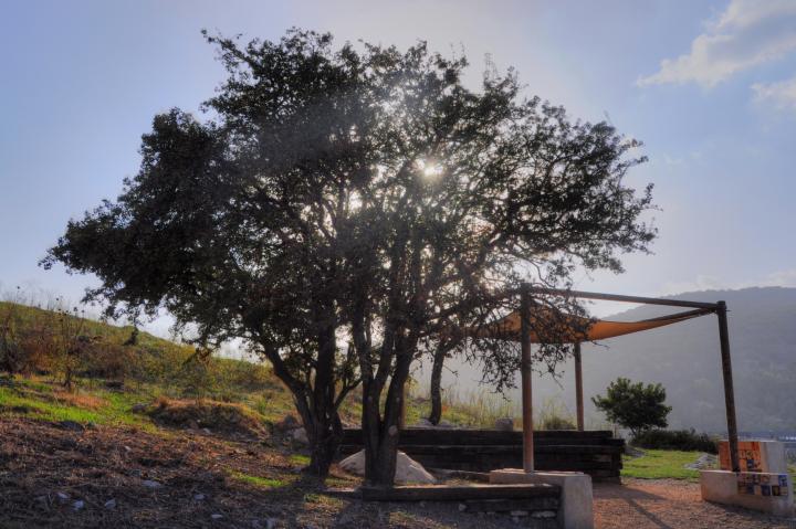
(g) Western side
The western side of Tel Yokneam is steep, overlooks the highway and the Industrial park.
A trail leads to the south and north along the edge of the summit. You can continue north on the trail as it loops around the mound and returns back to the access road.
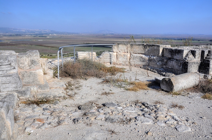
An observation point is located under the tree on the western side of the summit. Here are some educational instruments that tell the story of the Tel.
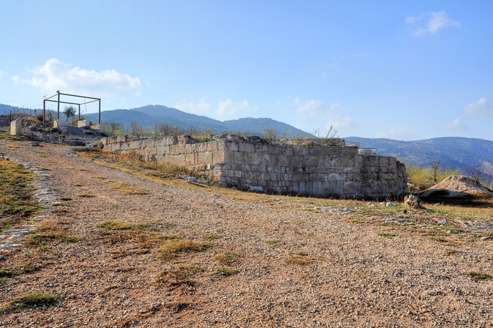
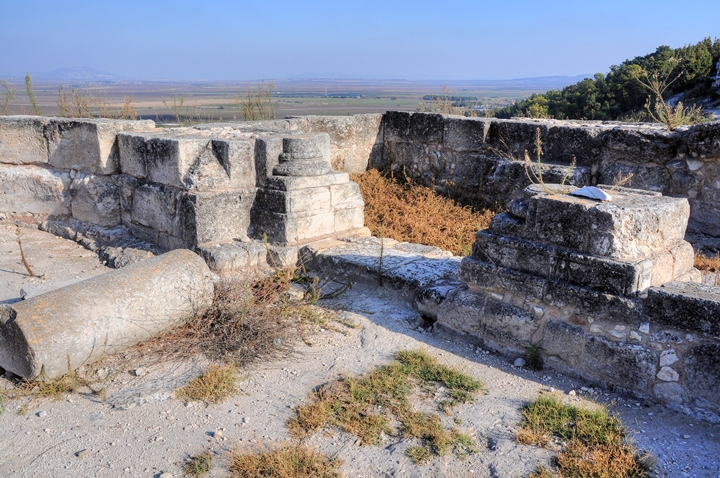
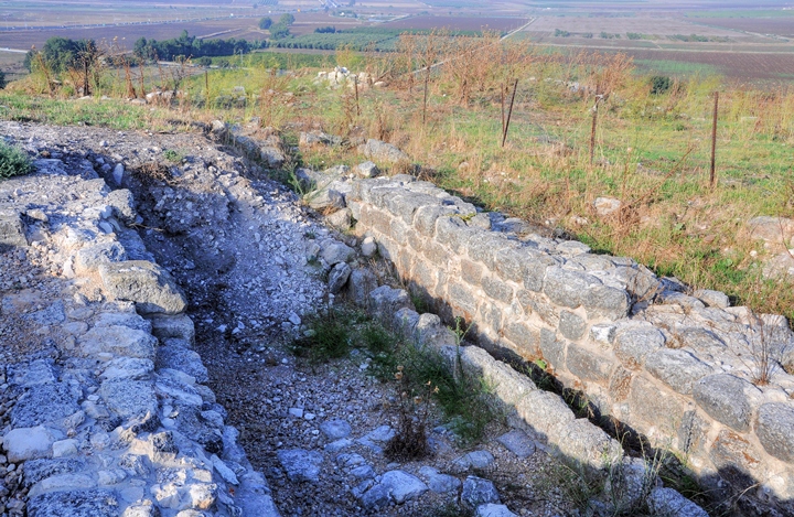
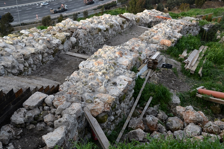
(h) Iron Age Walls
On the western side is a reconstructed section of the City wall, that once protected the city from all sides. The wall is dated to the Israelite period.
The archaeologists identified two phases of construction:
-
9th Century BC “Corridor” type: the section of the wall seen in this picture consists of two parallel walls with a corridor between the walls. This corridor-type design allowed the defenders to quickly move from one side to another side of the city during an enemy attack. The wall was constructed above the ruins of an earlier wall.
-
10th Century BC “Casemate type”: This earlier wall was was built in the casemate type (“Soragim”). In this design, which is common to most of the Biblical cities, the corridor between the walls was separated by walls, thus creating narrow chambers. The chambers served for storage, dwelling and working places.
An underground water supply complex is located on the north side. The complex was fortified, and allowing access to the ground water level from within the fortified city.
Etymology (behind the name):
- The Canaanite name was perhaps ” Anaknam”, as referred in the lists of 119 conquered cities by Egyptian Pharaoh Thutmose III after his victory in the great Megiddo battle (1468BC).
- The Crusader name was “Cain Mons”, which means “the mountain of Cain”, since the tradition was that the Cain, son of Adam (Genesis 4: 23-24), was killed in this site by his grand-grandson Lemech, father of Noah.
- The Arabic name is Tell Qamun (also appears on the 1940 British maps)
- Name in the survey of Western Palestine (1881): Kh. Kaimun
- Another name from Jacotin map (1826): Shatou D’el Kirah
Links and References:
* Archaeology:
-
Arch. Survey of Israel – Nahalal Map (28) – Avner Raban [1982] , sites #13, 15, 16
-
Carta’s Atlas of the Bible – Y. Aharoni [Carta Jerusalem 1974] – Shop for this must-have book.
Maps: 34, 59,63,71, 72, 108
-
IAA Conservation project 2007-2010 and Fortifications project 2013
-
Churches of the Crusaders Kingdom – (Qaimon, #179, pp 159-161)
-
Salvage excavation 2014 Nurit Feig, Hadashot Arkheologiyot 128 2016
* Useful links:
- Igal Morag’s presentation on Tel Yokneam and other sites (Hebrew; power point)
* Nearby sites:
- Tel Kassis (Qashis, Kashish) – maybe Biblical Helkat – a site from the Middle and Late bronze age. It is located 2KM to the North, on the Via Maris road towards north.
- Tel Meamer (Biblical Geva-Shemen, Roman “Geva”) – located 7 KM to the North.
* Info pages:
- Tel – story of mounds
- Drone Aerial views – collection of Biblical sites from the air
- BibleWalks Youtube aerial videos collections (including more Yokneam films)
BibleWalks.com – walk with us through the sites of the Holy Land
Tarbenet<<<—previous site—<<<All Sites>>> —next Yizreel Valley site—>>>Tel Kassis
This page was last updated on Mar 17, 2017 (Added excavation report)
Sponsored links: