
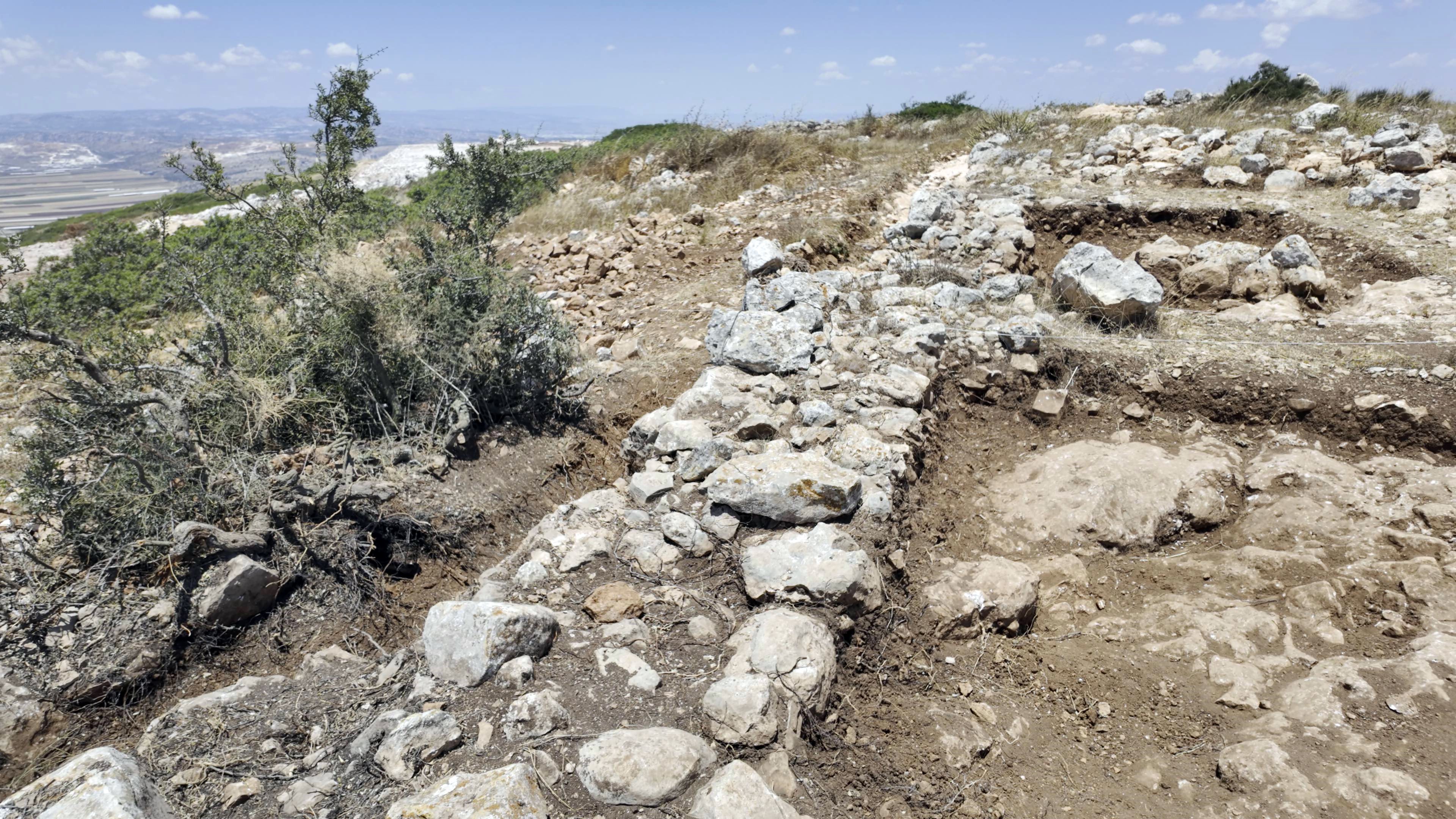
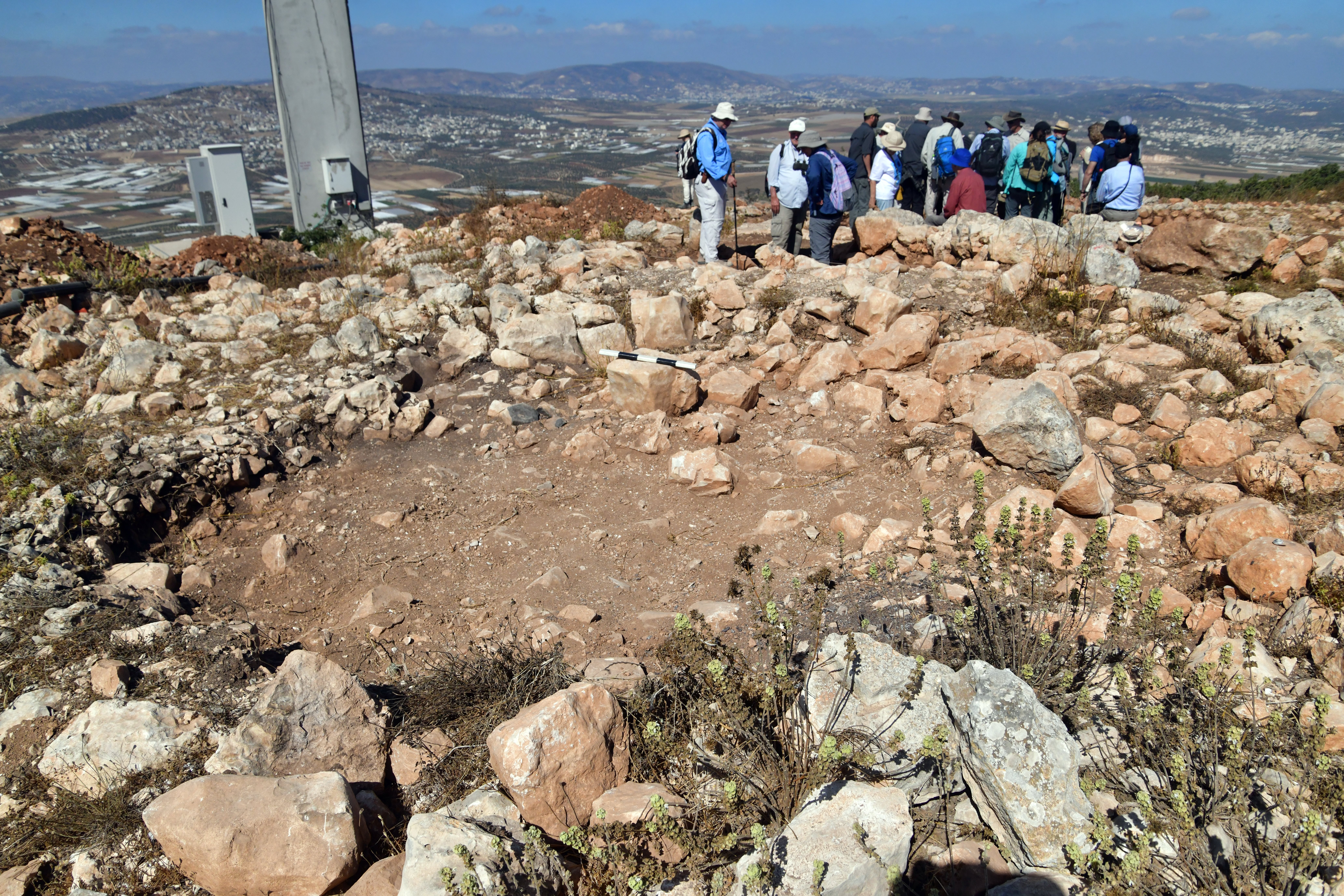
Ruins of an Iron Age settlement on the summit of Mount Bezeq.
Home > Sites > Samaria > Mount Bezeq (Ras Ibzik)
Contents:
Overview
Aerial Map
History
Photos
* Nahal Bezeq
* Views from Mt. Bezeq
* Iron age site
* Findings
* Visit
Video Tour
Etymology
Links
Overview:
On the highest peak of Mt. Bezeq (also: Bezek) are ruins of a medium sized Iron Age settlement. Recent excavations attempt to explore the site and perhaps tie it to the Biblical event of the assembly of King Saul’s army (1 Samuel 11:8): “And when he numbered them in Bezek”.
Map / Aerial View:
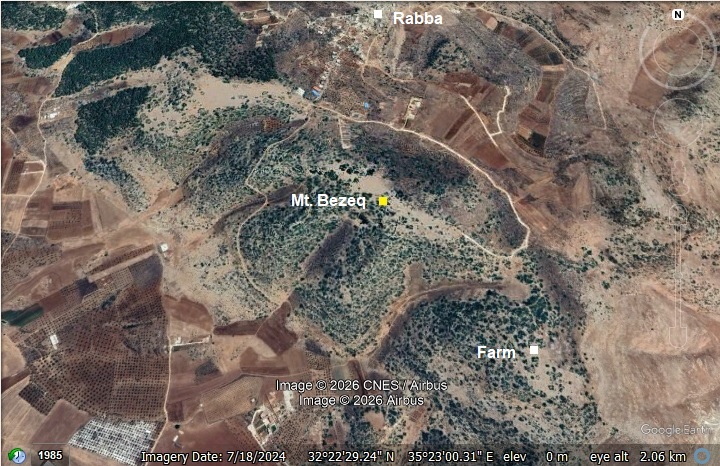
An aerial map is shown here, indicating the major points of interest around the site.
History:
- Biblical periods
Bezeq served as the critical staging area for Israel’s first unified military campaign under King Saul (1 Samuel 11). Here are the details:
- Saul Gathers his army in Bezeq:
The story of Saul rescuing the city of Jabesh-Gilead is a massive turning point in biblical history. It wasn’t just a random act of military defense; it was the exact event that solidified Saul’s position as the very first king of Israel. This was the story:
The Ammonites, led by a king named Nahash (“snake”), besieged Jabesh-Gilead. (1 Samuel, 11: 1):
“Then Nahash the Ammonite came up, and encamped against Jabeshgilead: and all the men of Jabesh said unto Nahash, Make a covenant with us, and we will serve thee”.
Desperate, the townspeople tried to negotiate a treaty. Nahash agreed, but on one horrific condition: he would gouge out the right eye of every man in the city to bring disgrace upon all of Israel. The elders of Jabesh asked for seven days to send messengers throughout Israel to see if anyone would save them. Confident that the fractured, leaderless Israelite tribes wouldn’t show up, Nahash granted them the week.
Now there was also a profound underlying blood dynamic between Saul’s tribe (Benjamin) and Jabesh-Gilead. Generations earlier, during the tragic civil war recorded at the end of the Book of Judges, the tribe of Benjamin was nearly wiped out. The only city that hadn’t participated in the war against Benjamin was Jabesh-Gilead. To keep Benjamin from going extinct, the surviving Benjaminites were given wives from Jabesh-Gilead. Saul was a Benjaminite. This means the people of Jabesh-Gilead weren’t just fellow Israelites — they were quite literally his maternal cousins and ancestors.
When the messengers arrived at Saul’s hometown of Gibeah, the people erupted into weeping. Saul was literally out plowing a field with his oxen when he walked into town and heard the news. The text states that the Spirit of God came powerfully upon Saul, and he burned with righteous anger. It wasn’t just sympathy; it was a divinely inspired surge of leadership. He took his two oxen, cut them into pieces, and sent them by messengers throughout Israel with a clear, terrifying ultimatum: “With whomever does not come out after Saul and after Samuel, so shall be done to his oxen!” (1 Samuel, 11:7):
“And he took a yoke of oxen, and hewed them in pieces, and sent them throughout all the coasts of Israel by the hands of messengers, saying, Whosoever cometh not forth after Saul and after Samuel, so shall it be done unto his oxen. And the fear of the LORD fell on the people, and they came out with one consent”.
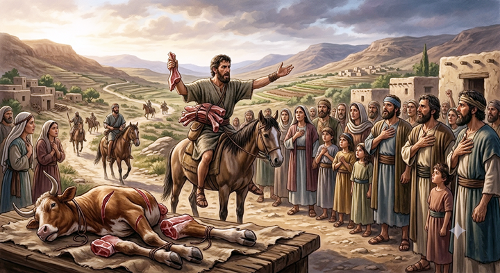
Saul send messages to 12 tribes – – AI generated Credit: Gemini AI / BibleWalks Collection
To rescue the besieged inhabitants of Jabesh-Gilead from the Ammonites, Saul gathered and counted a massive force of 300,000 men from Israel and 30,000 from Judah right at Bezeq (Bezek) before launching a successful surprise dawn attack across the Jordan River. Saul gathered the army in Bezek. The site’s geographical position—nestled between Samaria and the Jordan Valley—made it the perfect assembly point for launching campaigns into the east. (1 Samuel, 11:8):
“And when he numbered them in Bezek, the children of Israel were three hundred thousand, and the men of Judah thirty thousand”.
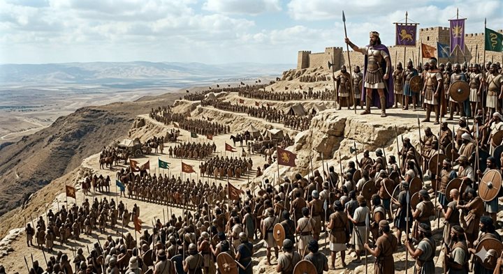
Saul gathers the army in Bezek – – AI generated Credit: Gemini AI / BibleWalks Collection
Saul’s strategy worked flawlessly. He mobilized a massive force at Bezek, crossed the Jordan River under the cover of darkness, and launched a surprise multi-pronged attack on the Ammonites during the morning watch. The Ammonites were completely scattered. (1 Samuel 11:11):
“And it was so on the morrow, that Saul put the people in three companies; and they came into the midst of the host in the morning watch, and slew the Ammonites until the heat of the day: and it came to pass, that they which remained were scattered, so that two of them were not left together”.
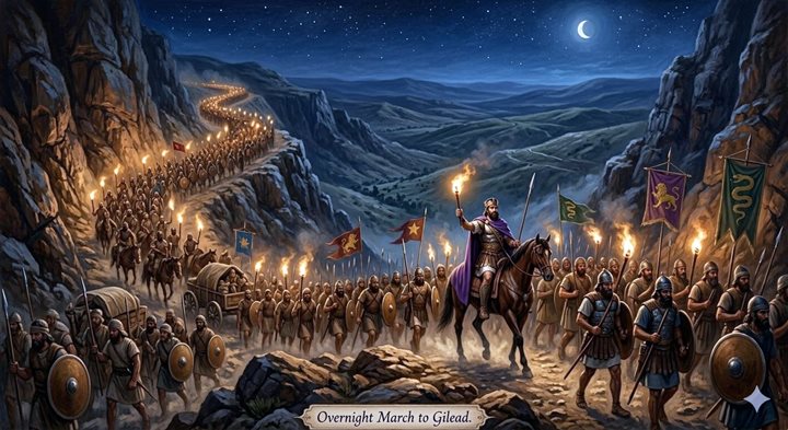
Illustration of King Saul gathering the forces – AI generated Credit: Gemini AI / BibleWalks Collection
Before this battle, many Israelites were deeply skeptical of Saul’s ability to lead, openly mocking him. After this brilliant victory, the people were so unified and ecstatic that they marched to Gilgal and officially confirmed Saul as their king with peace offerings and great celebration.
The archaeological profile fits the biblical narrative perfectly. Rather than a massive, heavily fortified permanent Iron Age city on the absolute peak, the summit shows evidence of a smaller, strategic stronghold and watchpoint. The massive open terraces and plateaus below the peak provided the exact type of expansive space needed for a massive military assembly—like King Saul’s emergency mobilization of troops before crossing the Jordan to save Jabesh-Gilead.
The presence of these early Iron Age remains on the strategic high ground confirms that during the exact era of Saul and the early Israelite monarchy, this ridge was actively occupied, monitored, and utilized to control the vital pass between the central highlands and the Jordan Rift Valley.
Yet another nearby location of this gathering may be in the wide valley below, where a major trade route passed nearby. There were twin villages (Kh. Ibziq) located near the ancient road, one of them was established during the Iron Age (“Upper Bezeq”) while the other village (“Lower Bezeq”) was settled during the Byzantine period.
- Other identifications?
- Bezeq as a site:
The location of Bezek (בֶּזֶק) has puzzled scholars for generations. This is because the text uses it in two very different geographical contexts—leading to alternative site identifications.
a) Southern location: On one hand, as per Judges 1:4-7, The tribes of Judah and Simeon fight the Canaanites and capture their ruler, Adoni-bezek (literally “Lord of Bezek”). Because this is tied to the conquest of the southern lot of Judah, scholars naturally looked for a southern location.
b) Northern location: As per 1 Samuel 11:8, King Saul musters the armies of Israel at Bezek before launching a rapid night march to rescue Jabesh-Gilead (east of the Jordan River). For a single night’s march to be possible, this Bezek must be in the northeast, near the Jordan Valley.
2. Bezek is descriptive noun or adjective
Others suggested a compelling theory that it might not be a place name at all, but a descriptive noun or adjective.
a) Bezeq means speed: Some linguistic alternative readings suggest Saul numbered the people “with lightning speed” or “in a flash” due to the urgent, overnight crisis facing Jabesh-Gilead.
b) Bezeq means scattering stones : Another less common root connection relates bezeq to scattering small stones or broken pieces. In this view, it could refer to a stony, gravelly terrain where troops were gathered, or the scattering/mustering technique used to count the massive army.
3. If not Bezek, what is this site?
According to Zertal, the site on the summit of Mount Bezek may have been Rabbith (as per Joshua 12:17,20): “And the fourth lot came out to Issachar… and Rabbith, and Kishion, and Abez”. He based this theory on the name of the nearby Arabic village Raba that preserved the ancient name, and a possible shared ownership with the tribe of Manasseh.
- Roads and Cities:
The cities and roads during the ancient periods up to the Roman period, are indicated on the Biblical Map below. The site is indicated as “Bezek” although it refers to the village at the foothills. The Iron age site is on the adjacent peak of the mountain to the north west (and marked with a red dot).
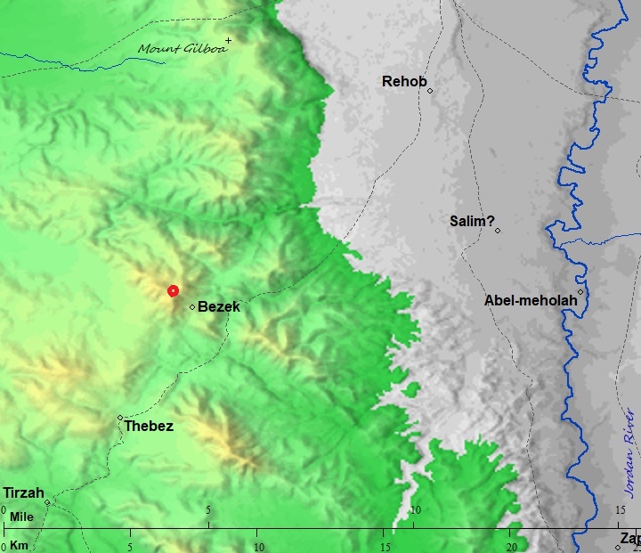
Map of the area – during the Israelite to Roman periods (based on Bible Mapper 3.0)
An ancient Roman road is indicated here as a dashed line, but is uses another parallel route via Wadi el Khashneh (or Khashnah) rather than Nahal Bezeq (that is too narrow). A section of this major road also passed near the twin villages (Upper and Lower Bezeq), but is not marked on this map. The Roman road starts from Beit-Shean Scythopolis, via Rehob, along Nahal Bezeq to Thebes (modern Tubas) down to Tirzah and to Shechem (modern Nablus). By bypassing the rugged belly of Nahal Bezeq (Wadi Shubash) in favor of Wadi el-Khashneh, Roman engineers chose the path of least resistance, highest safety, and best military control. Wadi Shubash (Bezeq) carves out a incredibly deep, steep, and jagged limestone canyon as it drops down toward the Jordan Rift Valley. For a Roman army, baggage train, or heavily laden merchant caravans, navigating the sheer cliffs and the boulder-strewn bed of the lower Shubash gorge was a logistical nightmare. Wadi el-Khashneh, by contrast, provides a much more accessible, moderate, and uniform gradient descending from the highlands. Roman road design heavily prioritized steady, reliable inclines where draft animals wouldn’t lose footing or collapse from exhaustion.
- Ottoman Period – (1516-1918 A.D.)
Conder and Kitchener of the Palestine Exploration Fund (PEF) surveyed the area during the Survey of Western Palestine (SWP) in 1874-75. This is a section of their map, focusing on the mountain that appears as “Ras Ibzik” with a height indication of 2404 ft (732m). “Ras Ibzik”, on the summit, is the site that is covered in this page.
On a lower level is Khirbet Ibzik el Fauqa (“Upper Bezeq”) – a multi period village established during the Iron Age and continued to the Middle Ages. Another village, Kirbet Ibzik el Tachta (“Lower Bezeq”), was settled during the Byzantine period near the first village. The Roman road from Jordan valley to Samaria passed along the east side of both villages, as marked by a double dashed line (the bypass route).
To the north is the village of Raba, built over a a multi-period site starting from the Persian period.
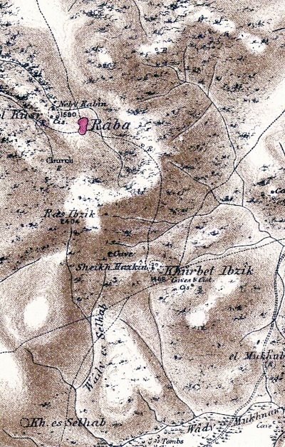
Part of map sheets 12 of Survey of Western Palestine,
by Conder and Kitchener, 1872-1877. (Published 1880, reprinted by LifeintheHolyLand.com)
- British Mandate
A 1940s British map shows the area around the site. The peak is marked 713m. To the south east is Kh. Ibziq (“Upper Bezeq”). Near the village is Nebi Hizqin – a holy site honoring prophet Ezekiel ( although the recognized mausoleum of the prophet Ezekiel is located in Iraq).
To the north is the village of Raba, on the slopes of Mount Bezeq. The stream of Nahal Bezeq (also known in Arabic as Wadi Shubash) originates near the village of Raba. It is marked as Wadi el Balad on a hidden section of this map. As it flows, it carves out a beautiful, steep canyon that serves as a dramatic geographic boundary, separating the eastern Samarian hills from the southern slopes of the Gilboa range. From its mountainous origin, it runs a 25-kilometer course eastward, eventually making its way down into the Jordan Rift Valley and emptying into the Jordan River just south of Kibbutz Tirat Zvi.
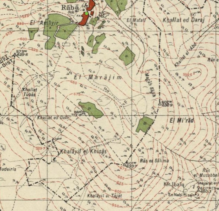
British survey map 1942-1948 – https://palopenmaps.org topo maps
License: public domain under the UK Copyright, Designs and Patent Act 1998
- Modern period survey
Adam Zertal thoroughly surveyed the site (in 2001), and added valuable information in the The Manasseh Hill Country Survey. This massive archaeological undertaking led by the late Adam Zertal (University of Haifa). Zertal’s work transformed our understanding of the eastern Samarian desert fringes, moving it from a perceived “wasteland” to a strategically managed imperial frontier. Zertal and his team (notably Shay Bar in later volumes) documented the site in Volume II (site 41, pp. 181-182) of the survey series.
New excavations were held here in years 2025-2026 and are still in process. The work, headed by Tal Orenstein of the Staff Officer of Archaeology, is still in progress. Ayelet Keidar is the academic researcher for the excavation.
Photos:
The photos and videos were captured on May-June 2026.
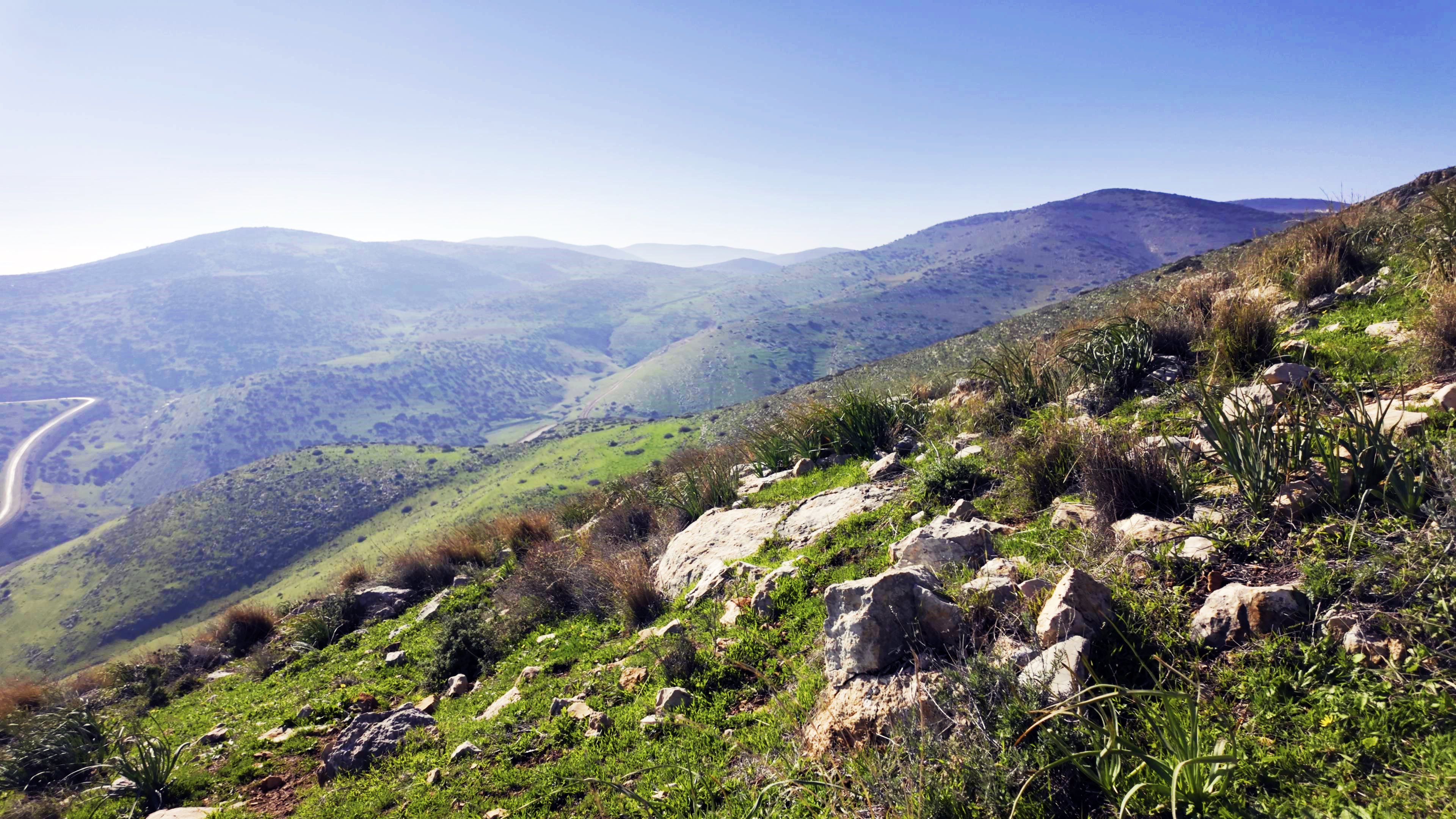
(a) Nahal Bezeq
Nahal Bezeq, Wadi Shubash in Arabic, is an intermittent stream that serves as the prominent geographical divider between the southern slopes of Mount Gilboa and the northeastern hills of Samaria. The stream originates near Mount Bezeq at an altitude of 713 meters.
(b) Views from Mt. Bezeq
In 2026 a new paved road from the Jordan valley simplified the access to this once remote site. From the peak are remarkable sights.
Standing at Mount Bezeq you are positioned on a highly strategic topographical high point. From this single summit, you can monitor major movement across both the central hill country and the entire northern Jordan Valley crossing points.
Directly below the southern slopes, you look down onto the ancient rolling agricultural lands, the deep-set wadi of Upper Nahal Bezeq, and the nearby Palestinian villages of Tayasir and Tubas.
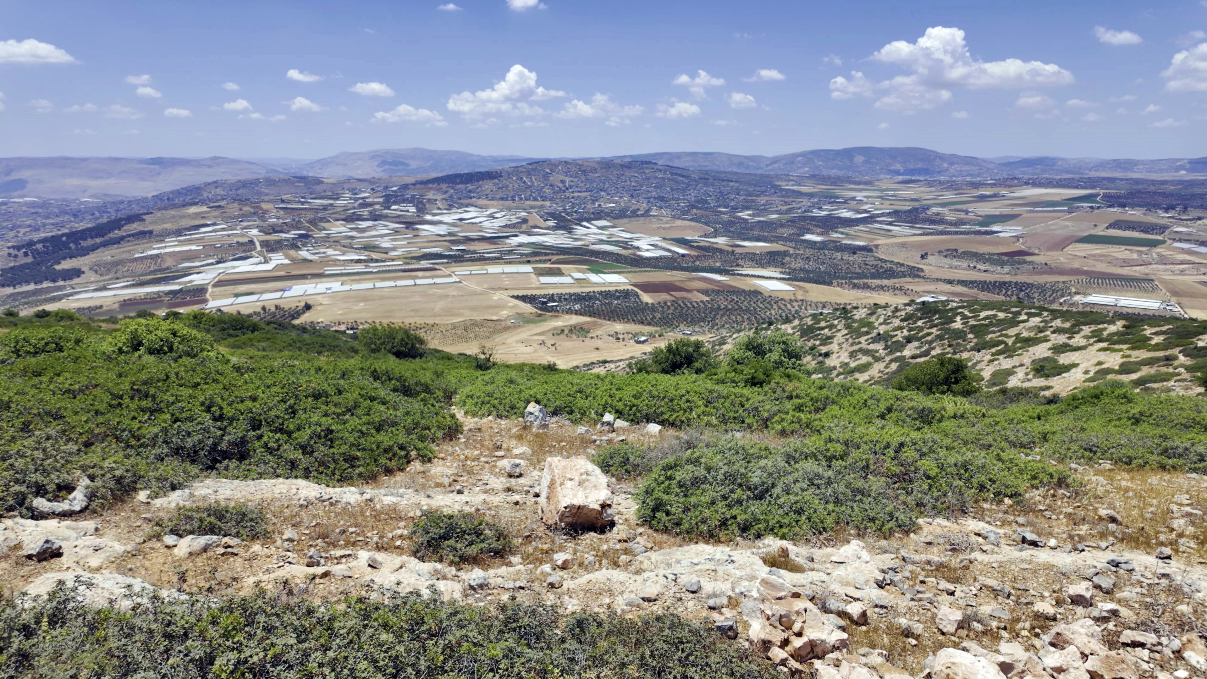
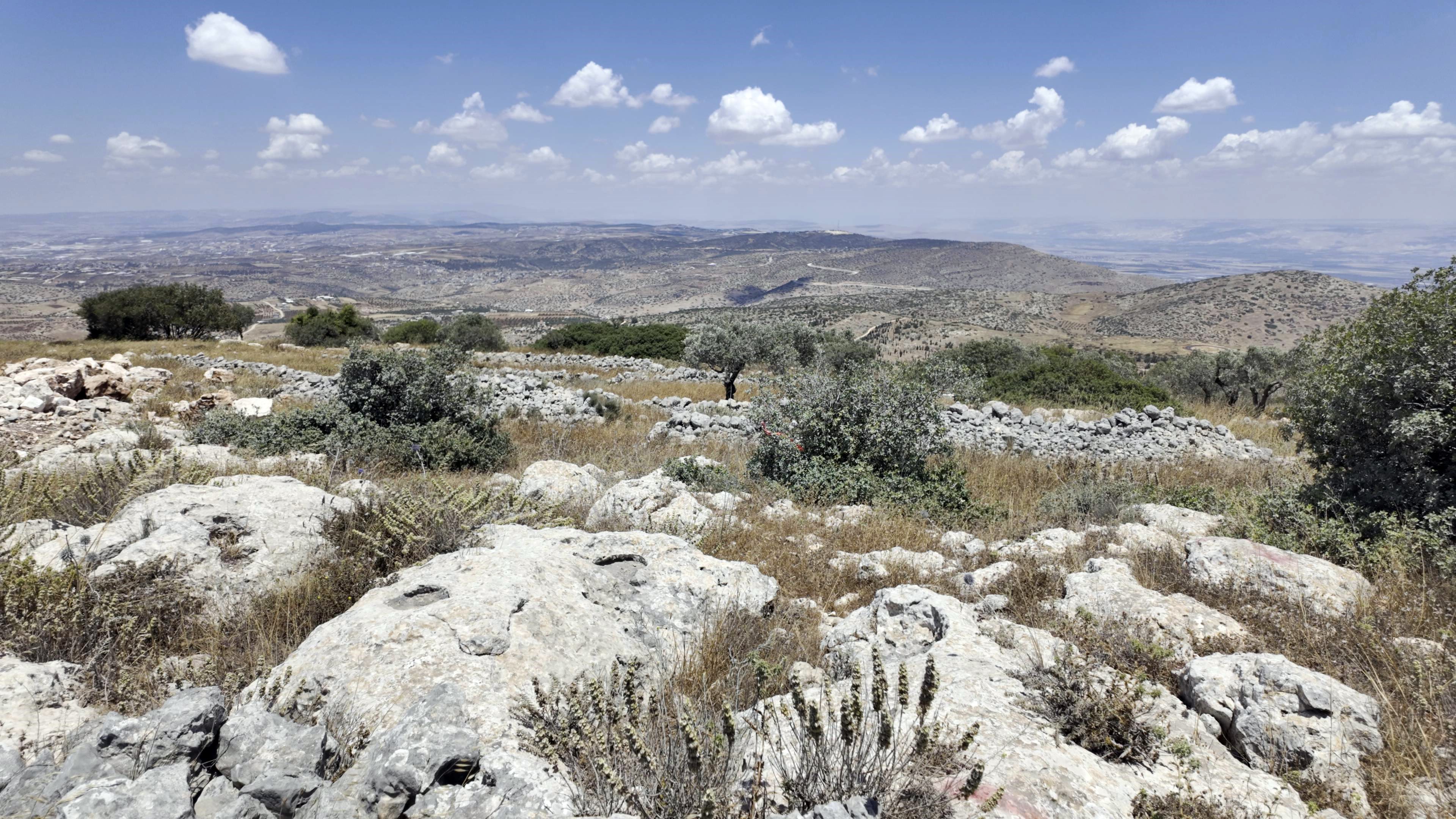
To the North you get a clear, sweeping look at the rugged southern slopes of Mount Gilboa (including the nearby peak of Mount Avner). On clear days, the vista stretches past the Gilboa to the hills of the Lower Galilee, Mount Tabor, the Carmel range, and the distant, snow-capped silhouette of Mount Hermon.
(c) Mt. Bezeq ruin
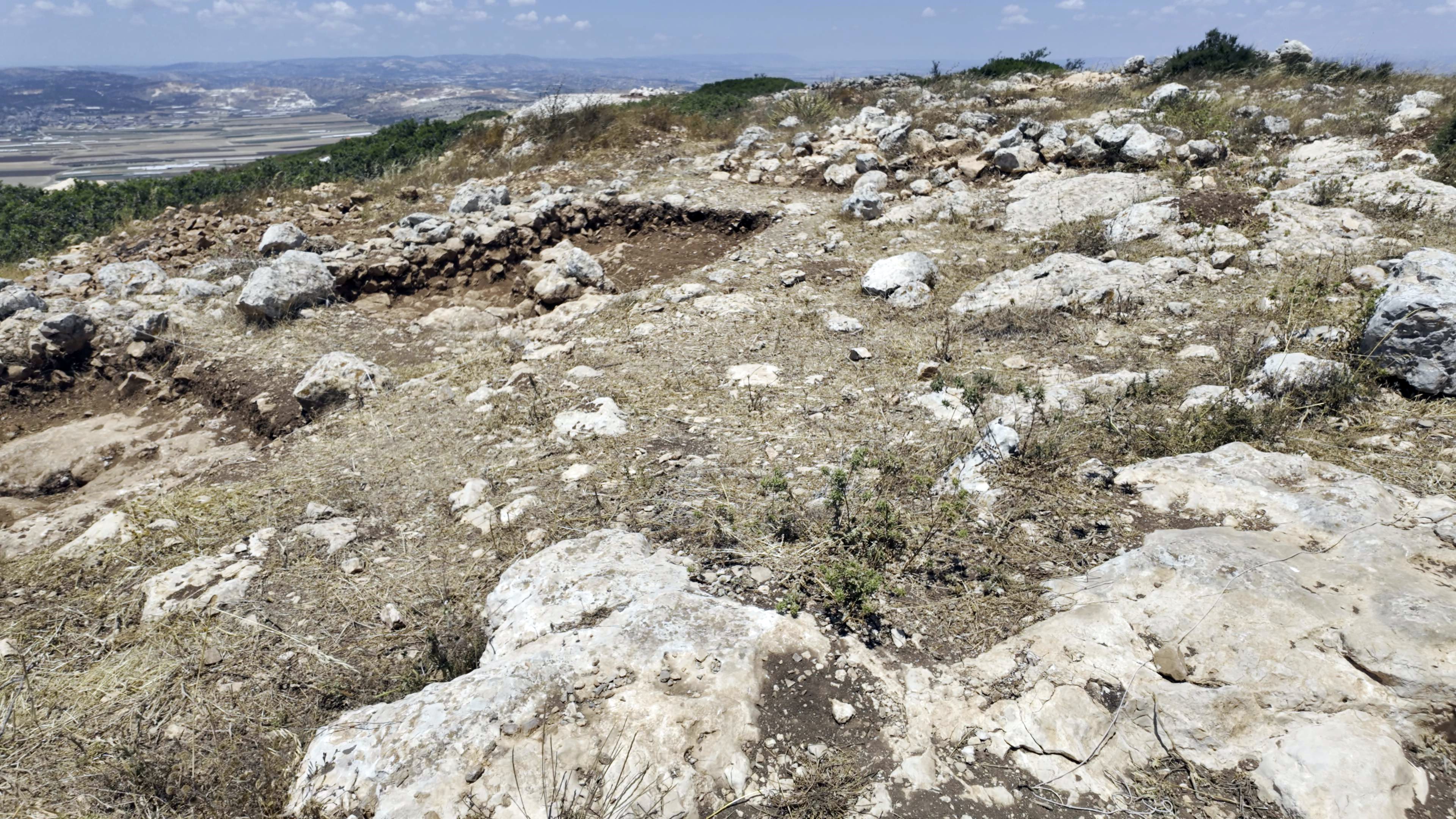
The upper peak site is where the earliest remains are concentrated. This view is from the south side.
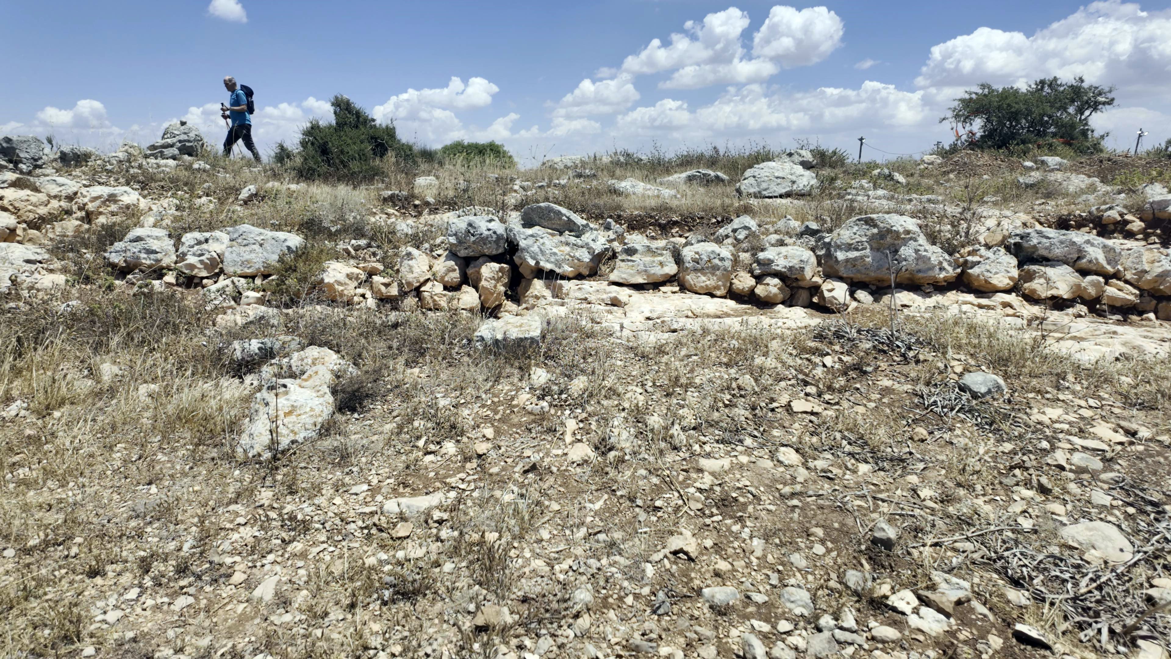
Its a medium sized Iron age site. According to Zertal’s survey, the site occupies an area of 6 dunams.
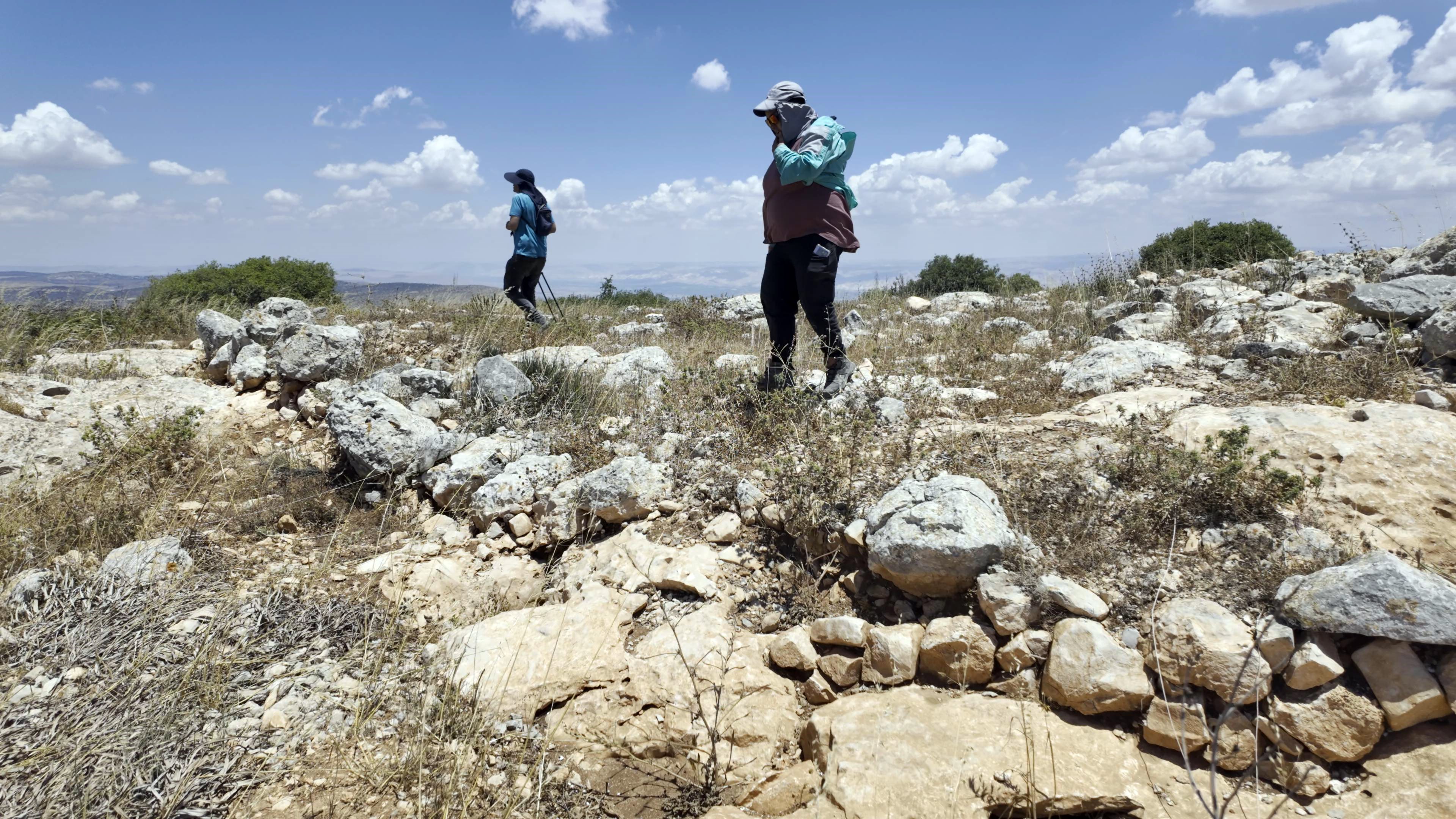
The physical Iron Age structures on the peak are difficult to piece together fully because later Byzantine and medieval builders extensively cleared, reused, and built over the foundations to construct their own mountain outposts, agricultural installations, and burial caves.
- Structures:
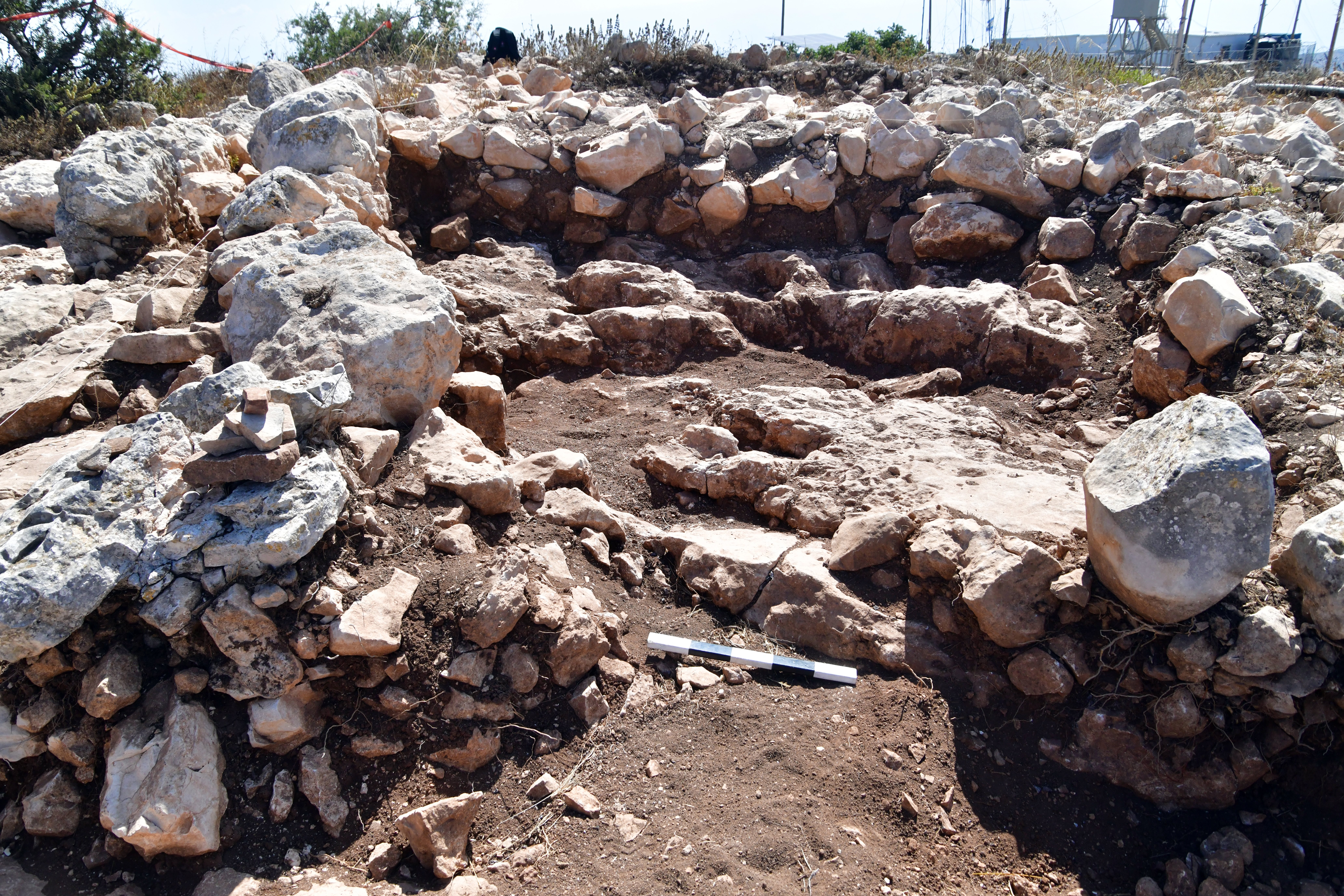
According to the survey, inside the site are about 10 structures. The largest structure is near the western wall, with a size of 6 x 8m, and an adjacent courtyard along the western wall.
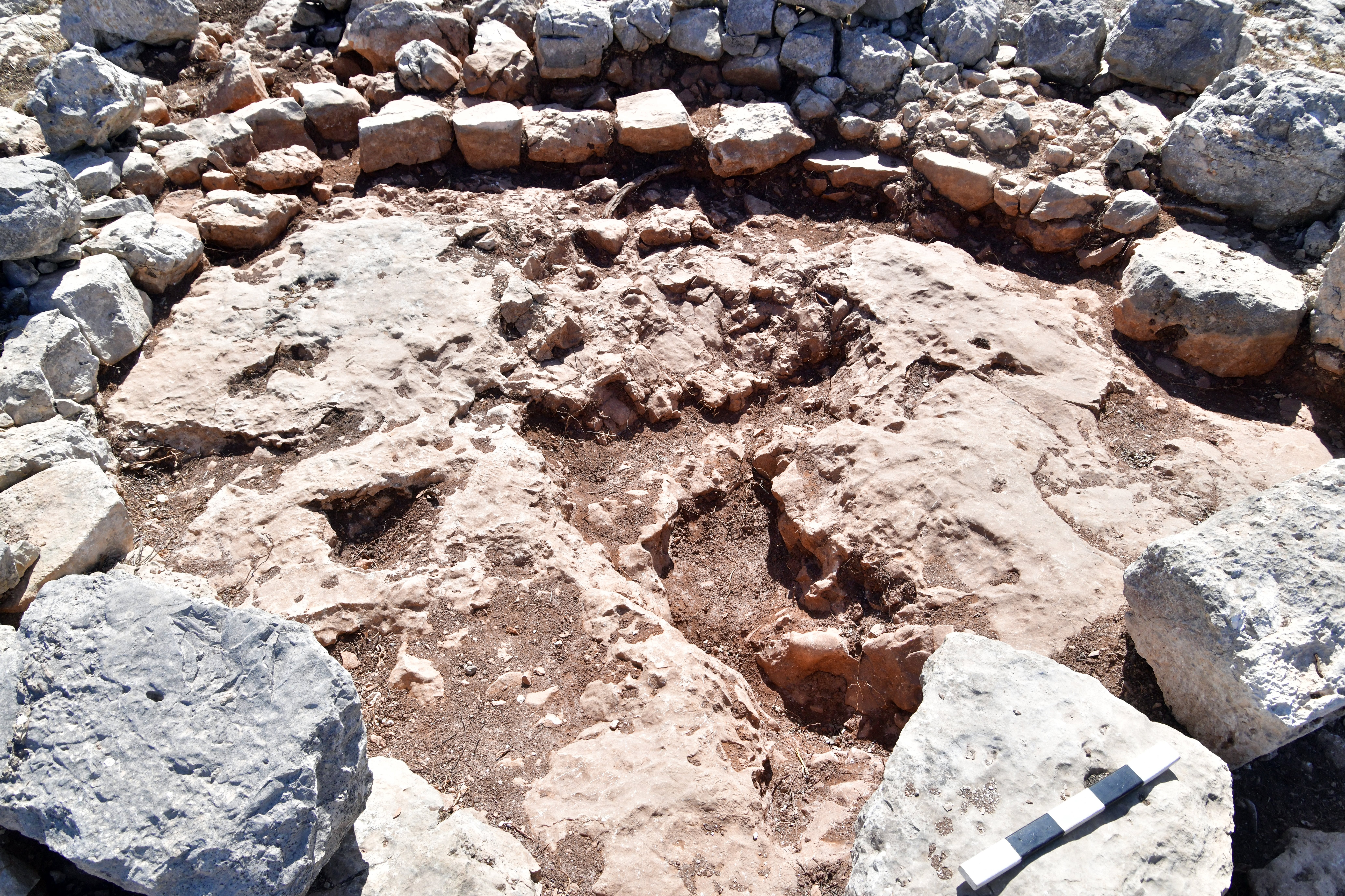
Another interesting structure has a circular shape, with a wall around the bedrock center. The purpose of this structure is not clear. There are 2 phases of construction of the wall: the bottom smaller stones are dated to the Iron Age, while the larger stones were probably from the Muslim period.
- Walls:
Along the south western side of the site is a long wall, 50m in length and 1m wide. It is built with large field stones.
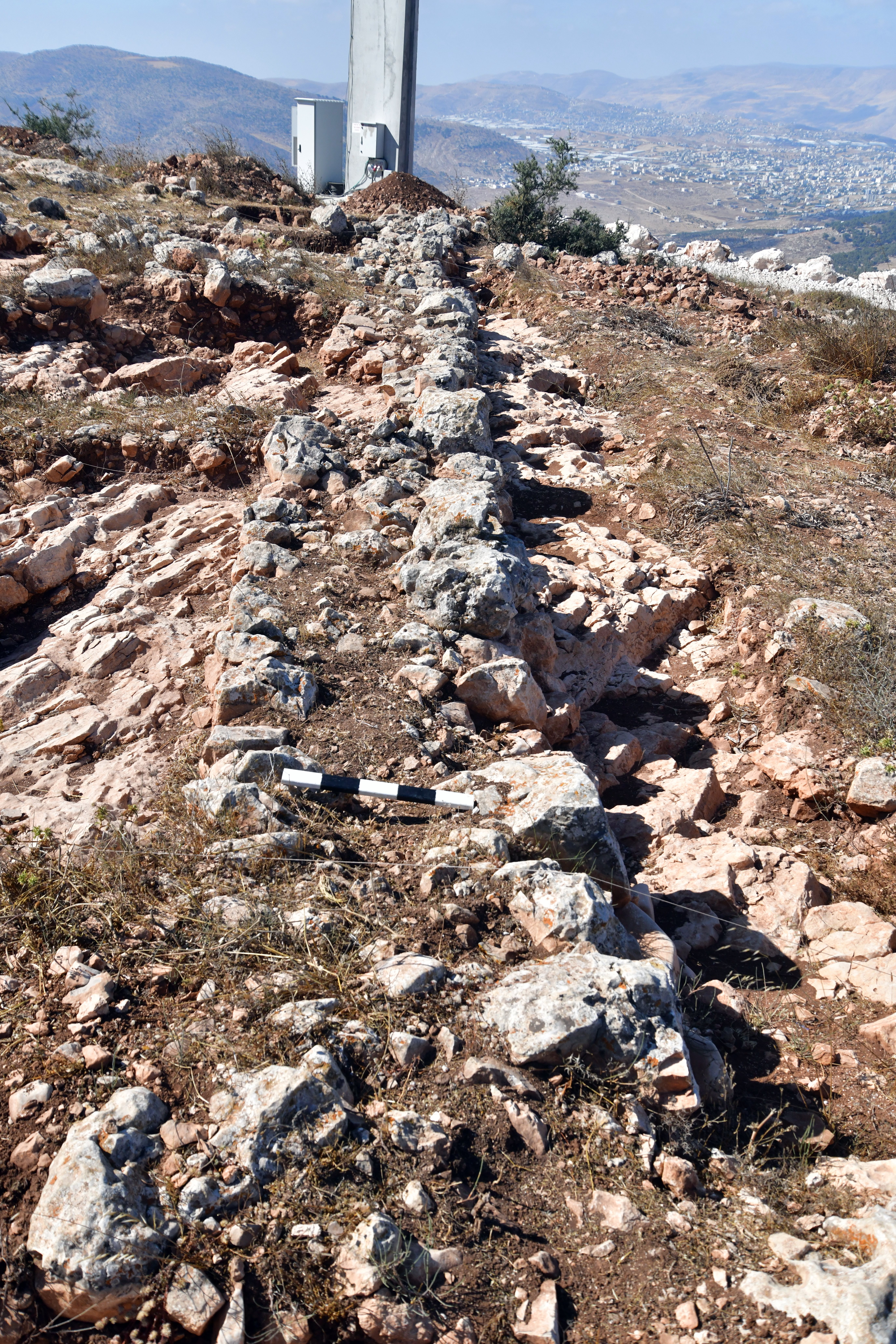
At its north end the wall curves around towards the east, then stops.
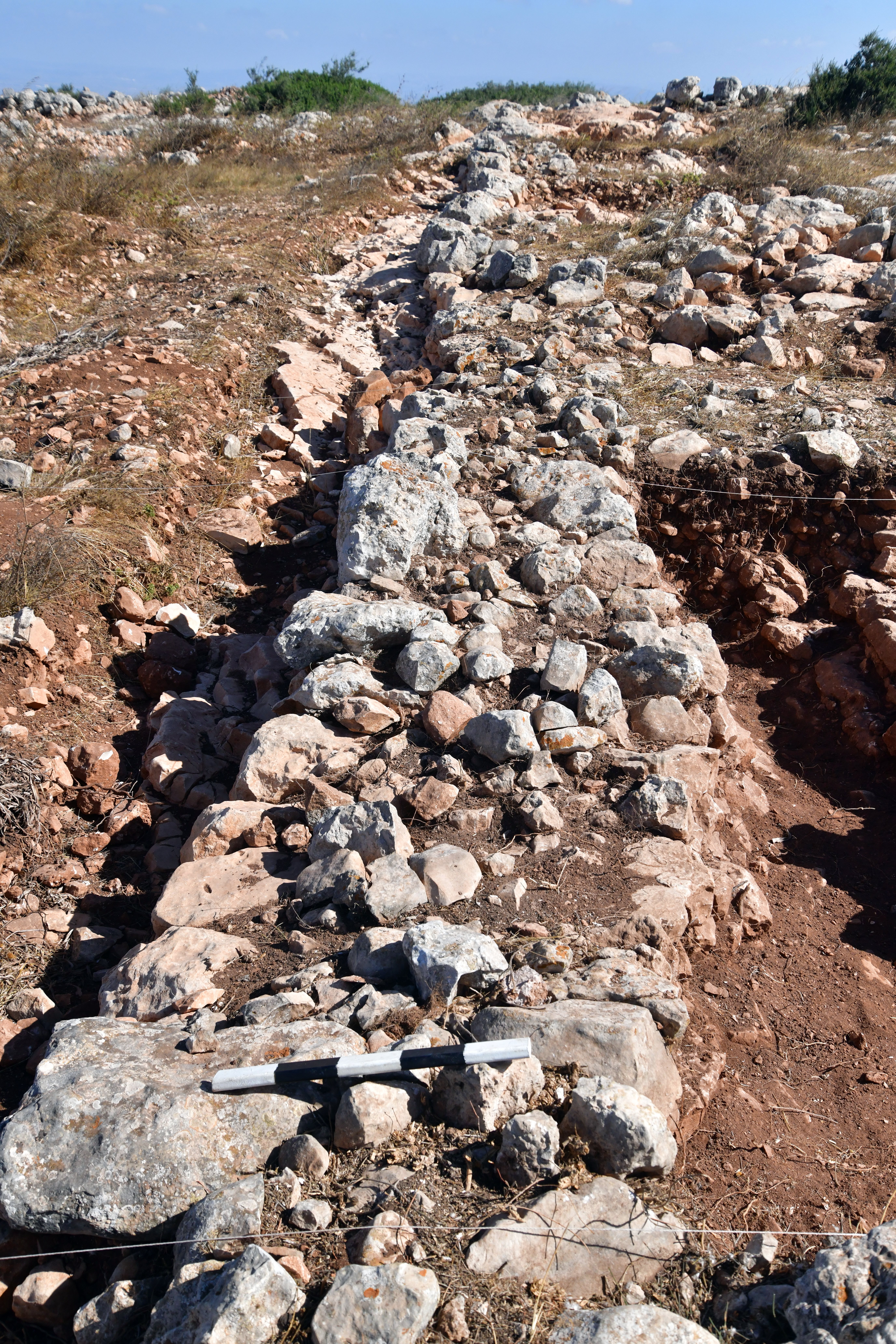
Another view of the western wall and 2 excavation squares along it. This was probably an open courtyard, adjacent to the rectangular building.
(d) Findings
Surface surveys and localized excavations on the high ridges have yielded significant pottery fragments dating precisely to Iron Age I (the period of the Judges and early settlement, roughly 1200–1000 BC) and Iron Age II (the Monarchic period). According to the survey by Zertal, the sherds are divided 50% to the Iron Age I c (1100-1000 BC) and 50% to the Iron Age 2 (1000-586 BC).
According to the 2026 excavation, the earliest sherds were dated to the Iron Age 2. However, continued excavations could reach the Iron Age 1 layer.
- Stone bowl
One of the excavation prized findings that was shown during our visit was a broken limestone hewn bowl, made of a local stone, and dated to the Iron Age. This is its upper side:
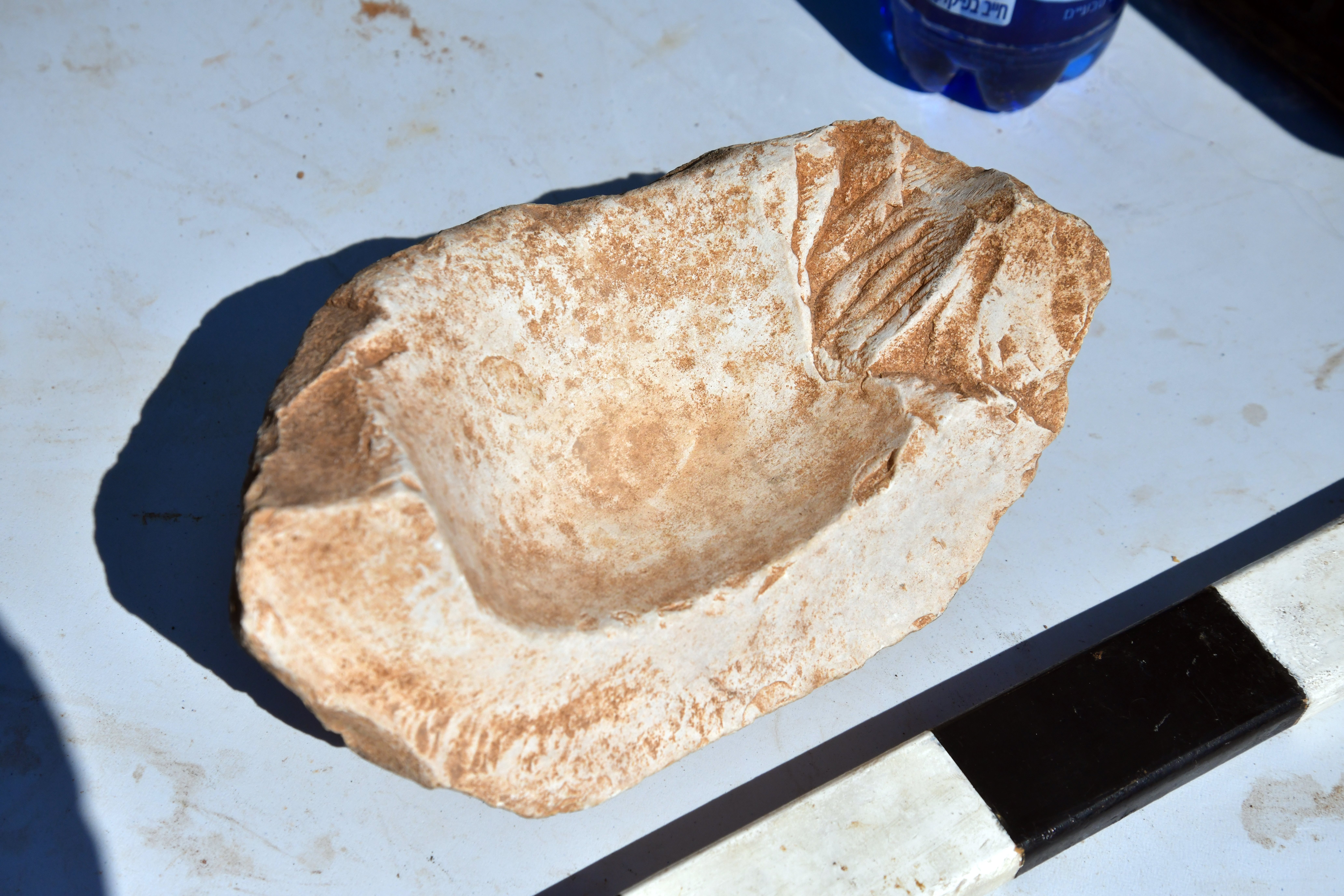
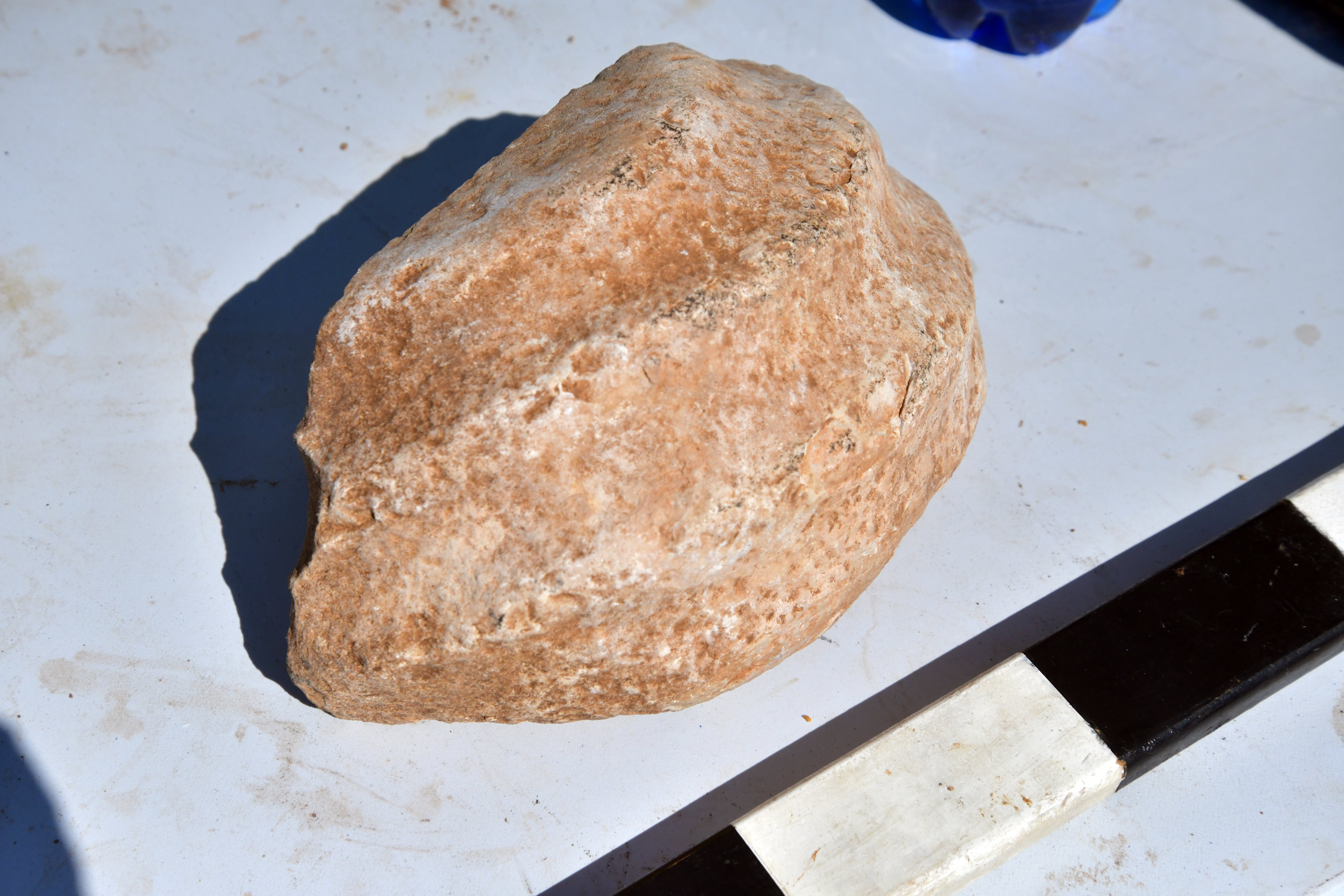
On the rear side of the bowl are decorated ribs. Why adding the ribs? Limestone gets incredibly slick when wet, oily, or covered in food residue. Because these bowls were heavily used for grinding, pounding, or mixing (acting as mortars for grains, herbs, or cosmetics), they required stability. The raised ribs or bar-handles gave the user’s fingers a solid, non-slip surface to grip onto while lifting the heavy stone, or to brace the vessel against a surface while grinding.
(e) Visit
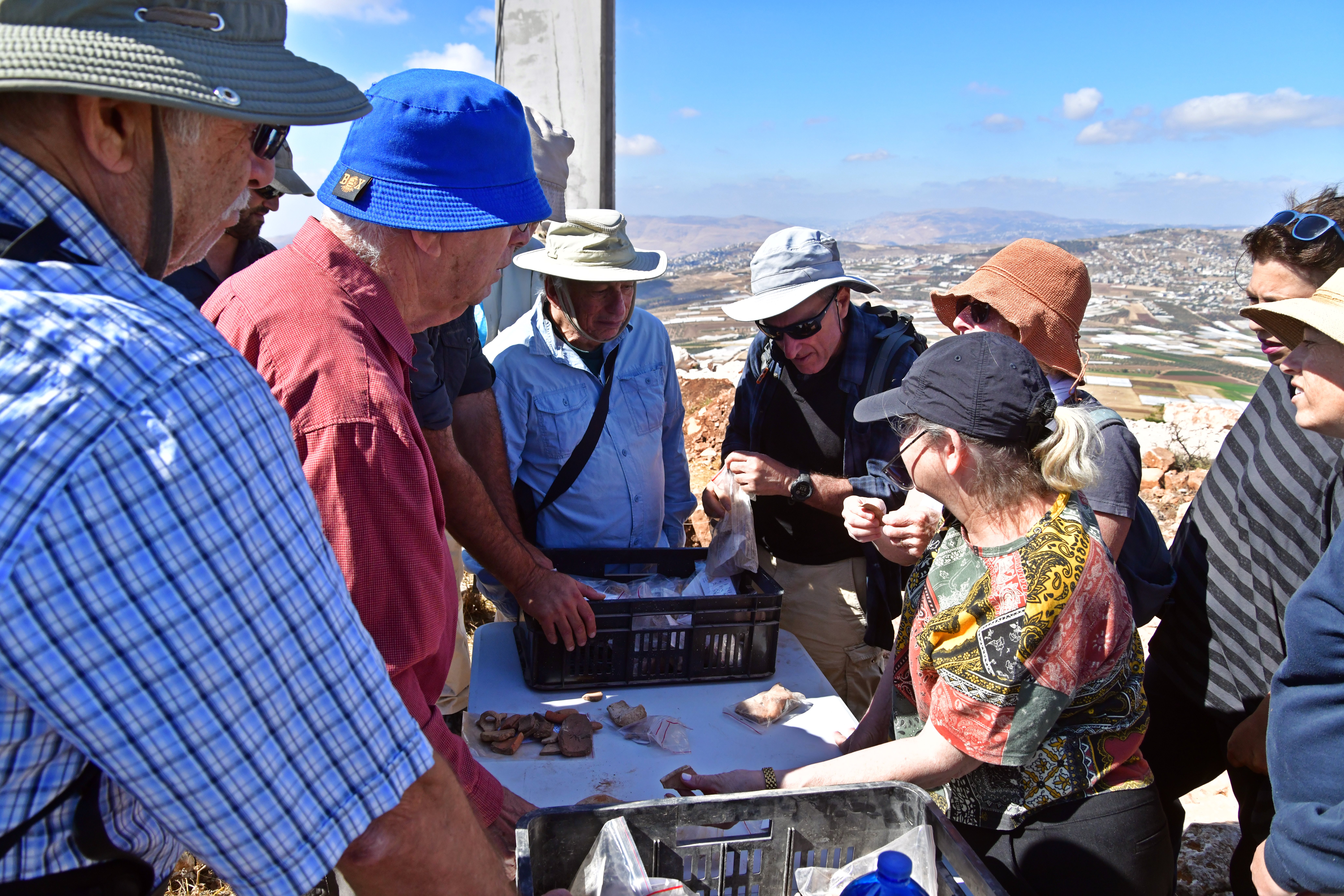
A team of leading Biblical archaeology scholars visited this newly accessible excavation site on Mount Bezeq on June 15, 2026. They were excited to get to this site that was so far out of reach for most civilians.
The team was headed by the distinguished Israeli archaeologist, Professor Emeritus Amichai Mazar (here in the red shirt). The archaeologists were briefed on the dig results so far, examined the site and the pottery sherds that were collected during the excavation.
Video Tour
 Tour the site with this video (captured May 2026):
See other video tours of the Bezeq area in the links section below.
Etymology – behind the name:
* Names of the site and valley:
- Bezeq – Biblical name of the site and the valley
- Ibziq – Arabic name of Bezeq (preserved the ancient name)
- Har Bezeq – Hebrew name of the mount (Har: Mountain)
- Ras Ibzik – Arabic name of the peak (Ras: head)
- Khirbet Ibziq al-Fauqa – means: Upper Bezeq ruin – the name of the settlement at the eastern foothills of Mt. Bezeq; al-Fauqa – Arabic for upper (to distinguish this site to the Roman period site located at a lower height)
- Khirbet Ibziq al-Tachta – means: Lower Bezeq ruin – a village north of Upper Bezeq village
- Nahal Bezeq – name of the valley along the south side of Mt. Gilboa
- Wadi Shubash – Arabic name of the valley south of Nahal Bezeq;
- Wadi Khashnah – Arabic name of the valley parallel to Nahal Bezeq; the route of ancient Roman road. Means the rough valley.
- Wadi Khashneh – the spelling on the PEF map
Links:
* External links and references:
- “The Manasseh Hill Country survey”, Adam Zertal, Volume 2 site 41, pp. 181-182
- N. Zori – The Land of Issachar Archaeological Survey (1977), p. 36-37 – Sites 50 (Upper Ibzik), 51 (Lower Ibzik)
* Video tours of Bezeq area:
- Horvat Mt. Bezeq – Iron age site on the peak
- Lower Bezeq village – video tour of Khirbet Ibziq al Tachta
- Mystery of el-Qule fortress – video tour of the ruin east of Mt. Bezeq
- Inscribed winepress– ancient carved inscription of Byzantine installation near lower Bezeq village
- Wady Khasneh – the ancient route along the valley
* BibleWalks sites:
- Sartaba – A Hasmonean and Herodian desert fortress on a high pointed mountain.
- Miqveh – ritual baths
BibleWalks.com – “Arise, walk through the land in the length of it and in the breadth of it…”
Rujm es Si’a <<<—previous site—<<<All Sites>>>— next site—>>> more will come soon
This page was last updated on Aug 15, 2026 (update Khashnah)
Sponsored Links: