A quadcopter drone is used for capturing photos from above. This page contains a sample of our aerial photos.
Home > Info > Photography >Aerial Views (Page 1)
Contents:
Overview
The quadcopter
Aerial photos
Biblical refs
Links
Overview:
This page provides information on our aerial photos using the quadcopter – a drone which is “the eye in the sky”. It shows a sample of our aerial photos of the Holy Land and links to the reviewed sites.
Quadcopter: Eye in the Sky
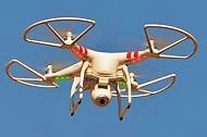
A quadcopter is an unmanned aerial vehicle, or drone, which is equipped with a camera. It is lifted and propelled by four rotors, controlled by manual commands from the ground.
Biblewalks is currently using the model “Phantom 2 Vision”, which is manufactured by DJI. This flying platform is equipped with an integrated camera of 14 Mega pixel resolution, and can capture both still images and 1080p Video. The quadcopter can be commanded to a maximum range of 300m. The flight control of the quadcopter is via a panel with two joysticks and switches. The imagery is viewed and stored in real time.
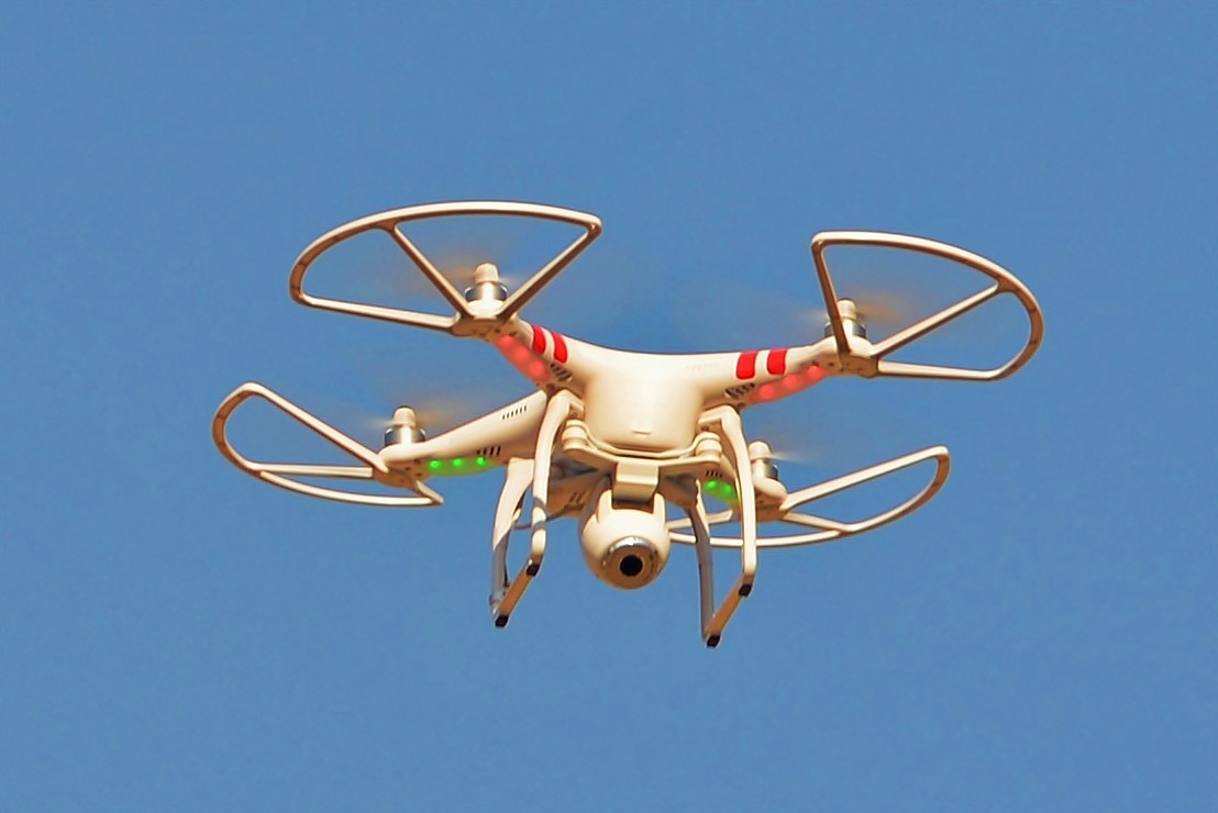
The flying camera is a great asset for photographing ancient sites and excavations. It provides another perspective on the topography of the place, with high resolution imagery. The device is launched and brought to a desired altitude in a few minutes, and can be easily maneuvered to the desired location for shooting the pictures.
* April 2017 update: New Mavic Pro quadcopter advances the quality of our aerial shots!
In the following section is a sample of the photos captured by our quadcopter.
Aerial Photos
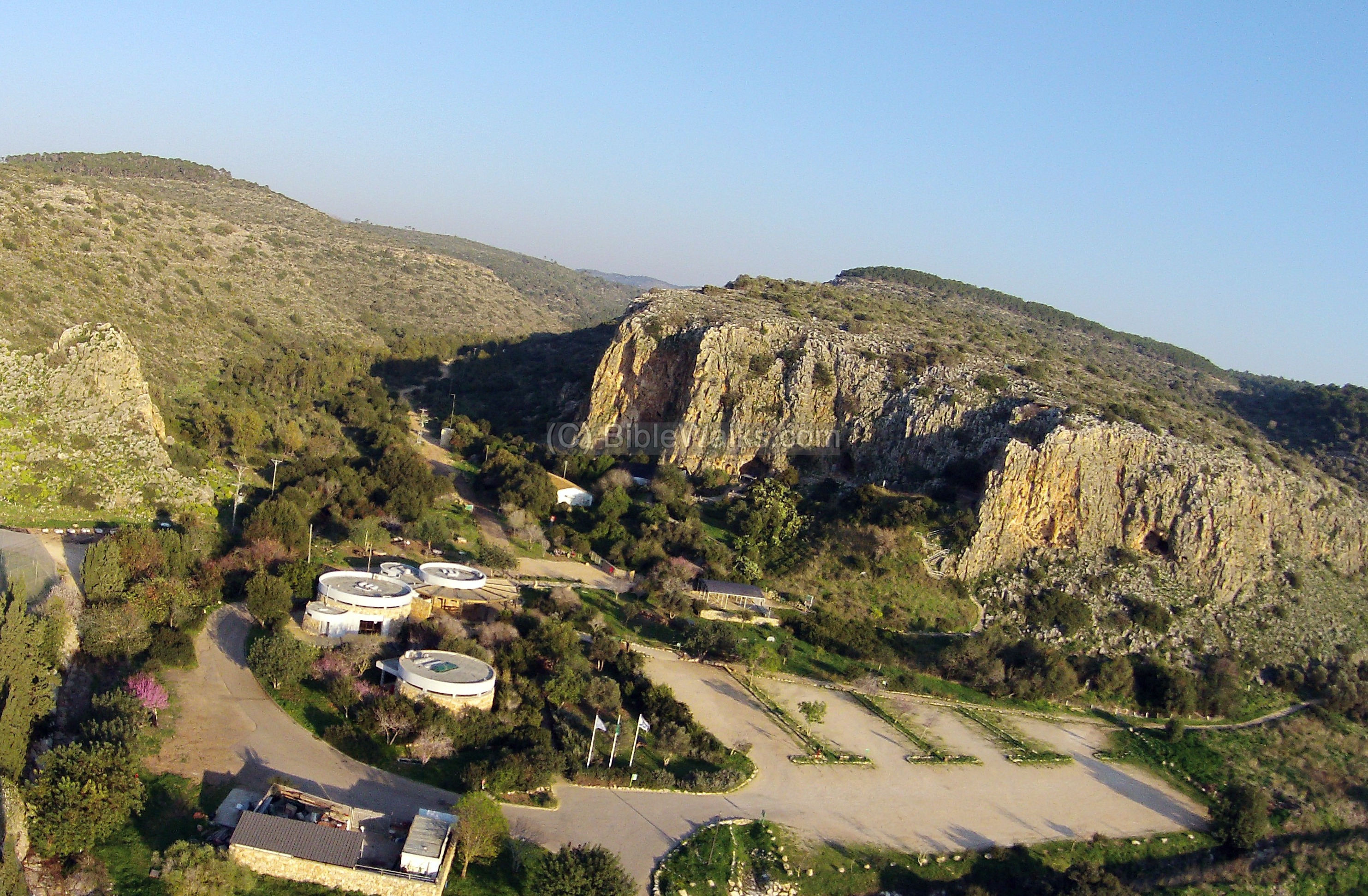
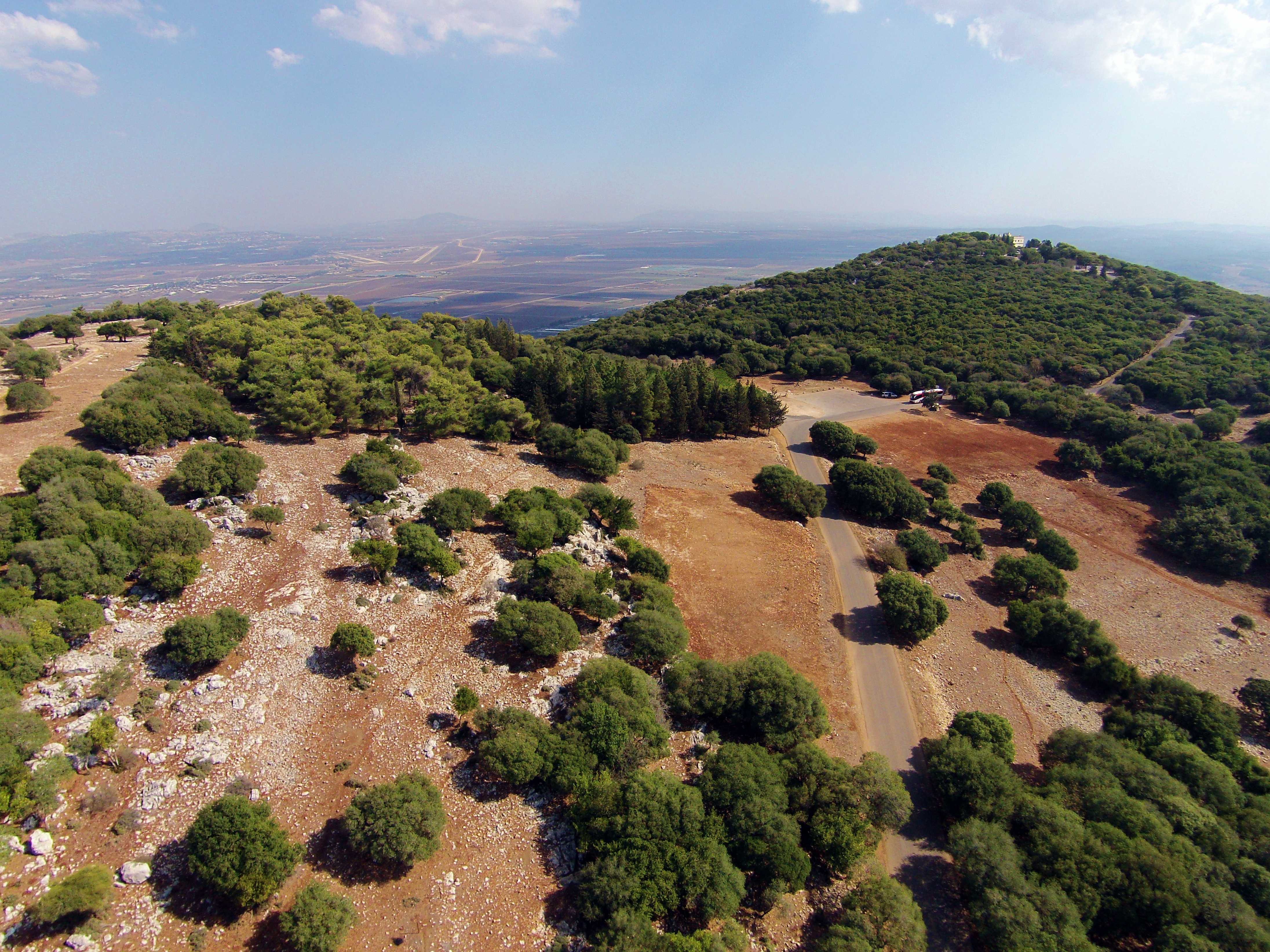
1. Carmel Caves:
These famous caves were were dwelling sites during prehistoric times, and are listed as UNESCO World heritage sites.
The aerial view shows the site from the west. The visitors center occupies the white round structures, with a parking lot on its south side. Behind it, in the center, is Nahal Ma’arot (the caves creek). On the right (south) side is the cliff where the four prehistoric caves are located.
Click on the photos to view in higher resolution…
![]() To read more about the site or other sites in this page, simply click on the header of the site.
To read more about the site or other sites in this page, simply click on the header of the site.
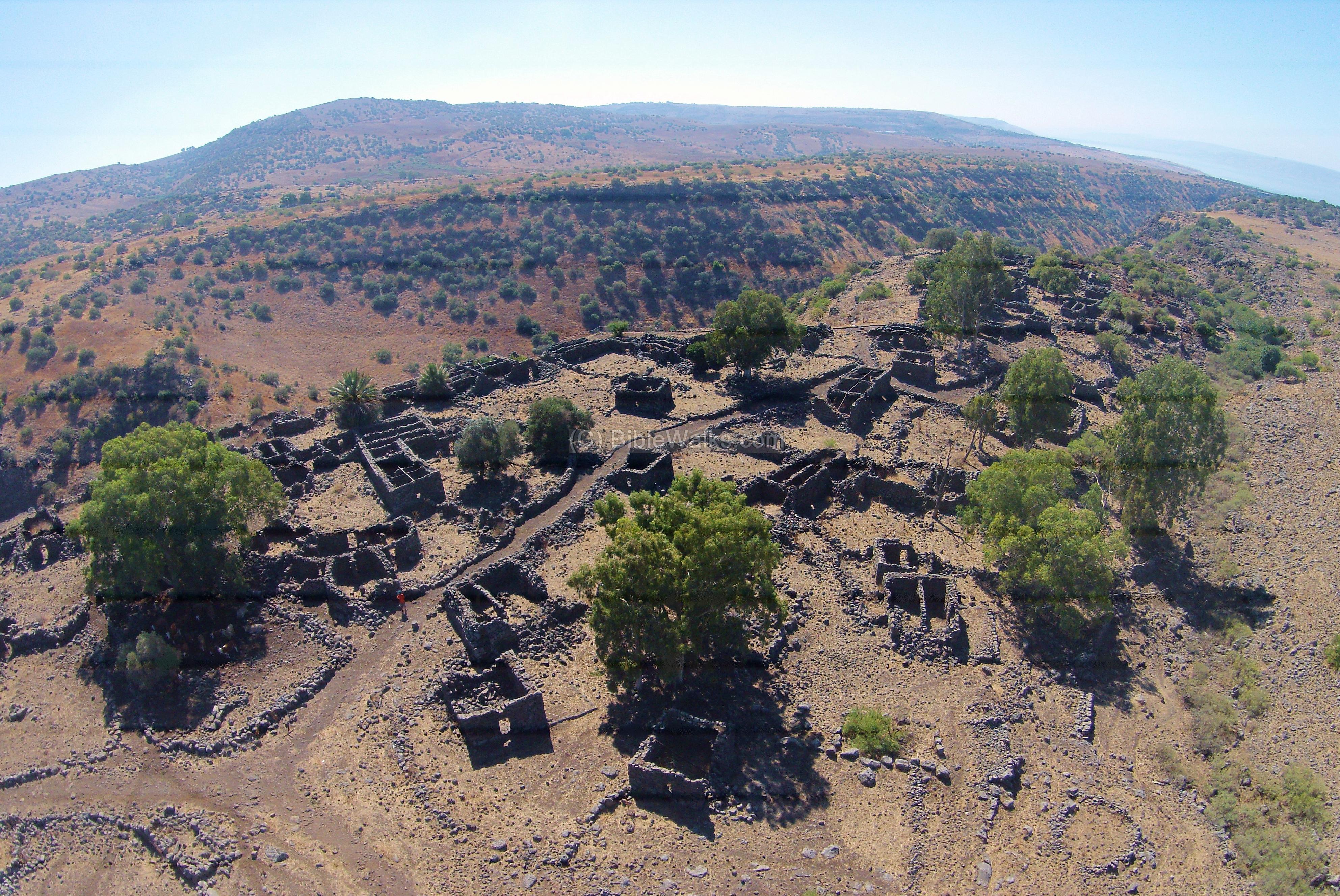
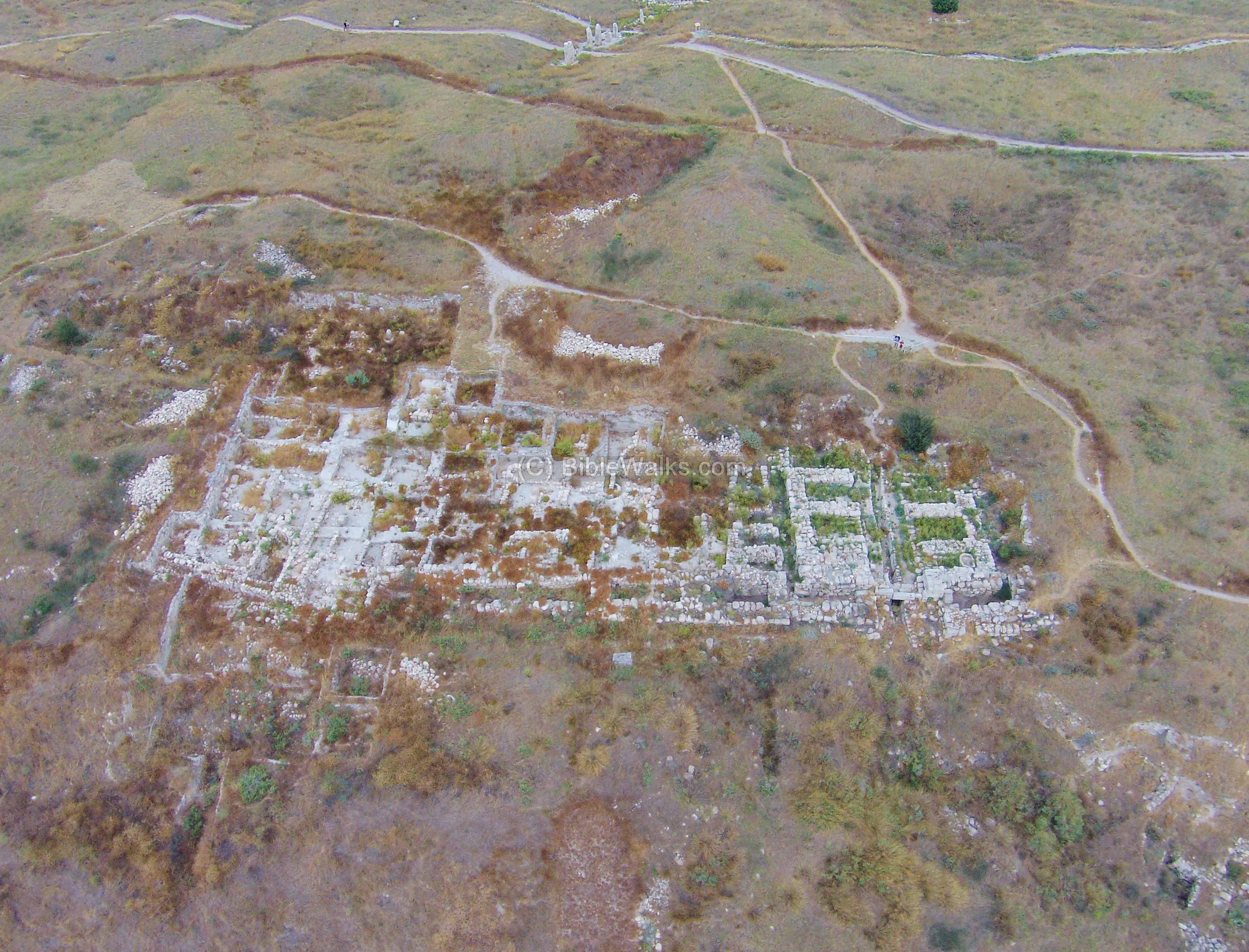
2. Yodfat:
The photo shows an aerial view of the site from the west, as captured by a quadcopter. On the top of the hill a set of caves can be seen, and just beneath it the walls of the fortress. In the center right the Romans built the ramp in order to crush the walls.

On the south-west side of the Arbel cliffs, inside the modern agriculture Moshav Arbel, are ruins of a Roman/Byzantine period village scattered along the hillside. A grand Byzantine period synagogue was excavated there in 1905 by the archaeologists H. Kohl and C. Watzinger. New excavations (2012) were conducted in the area of the synagogue.
This aerial view is of March 2014, with a scaffolding on the monumental door, and new trenches on the south side.
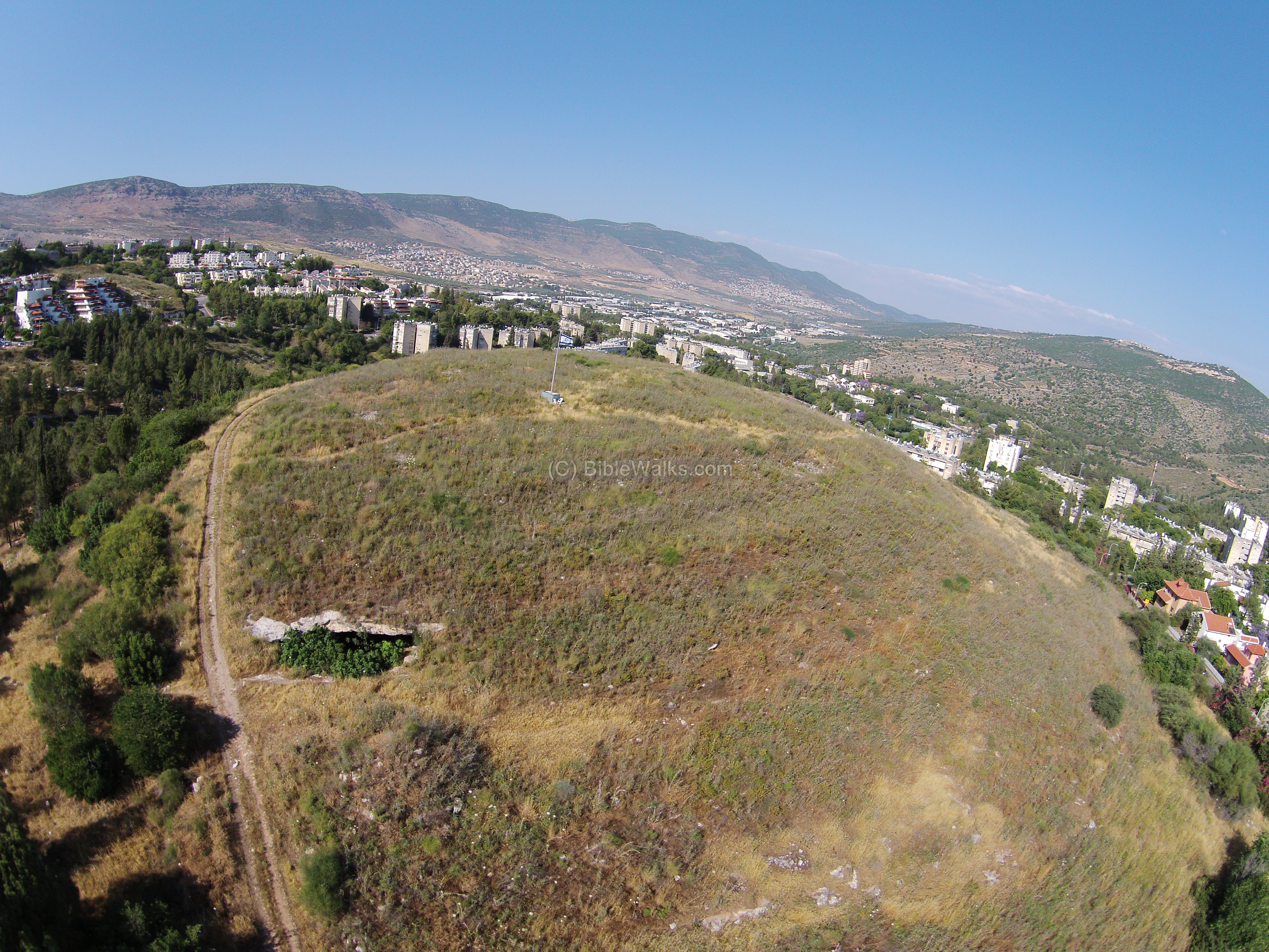
An aerial view, as captured by a quadcopter in May 2014 from the south side, is seen in the following photo. A road traverses the hill from its west side, passing near a large cave. An Israeli flag is located on the top, as in all ancient sites of Karmiel.
5. Wadi Hamam, Arbel
A Roman period synagogue was excavated recently in Khirbet Veradim, on the south side of the village of Wadi el-Hamam.
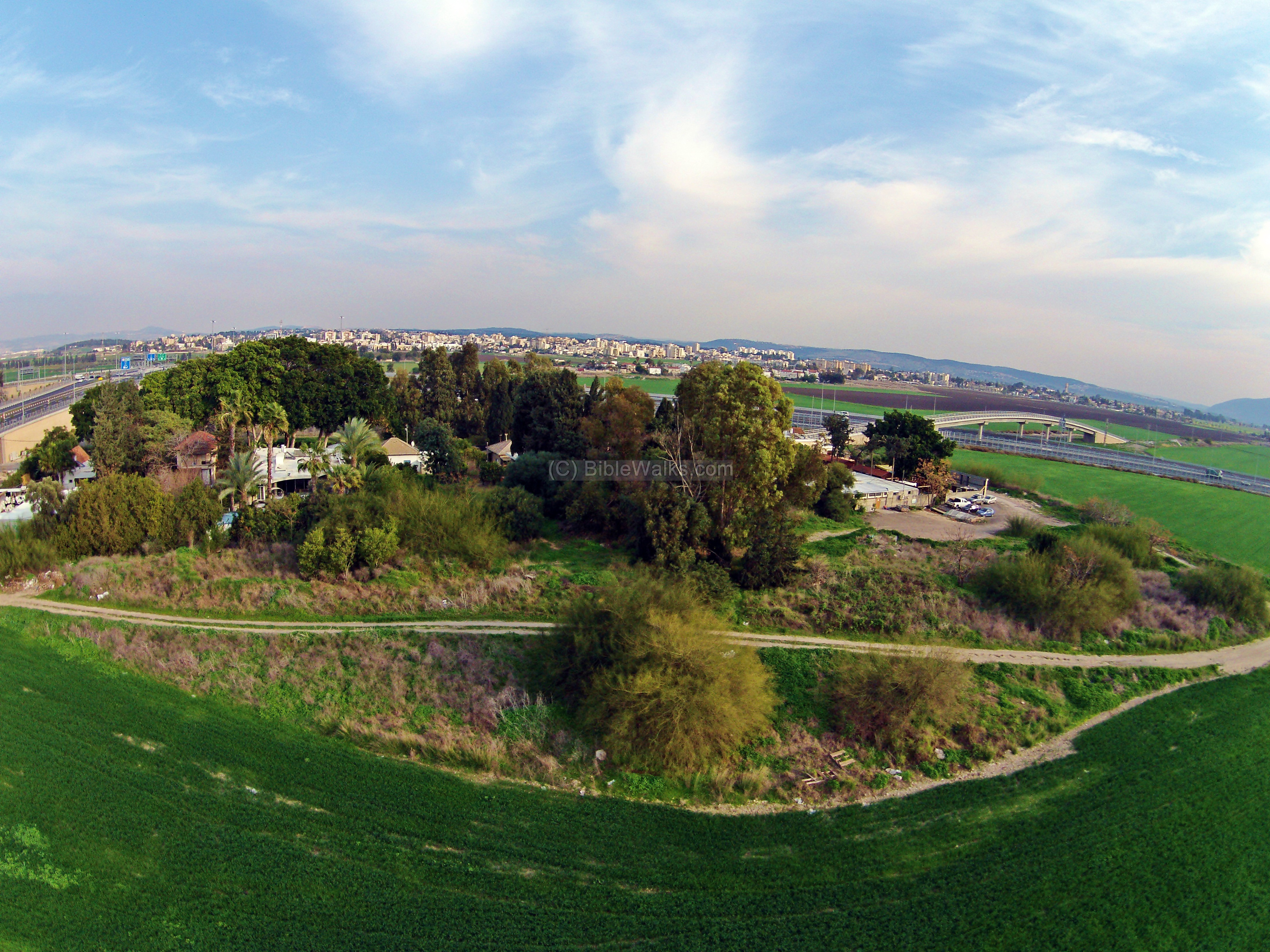
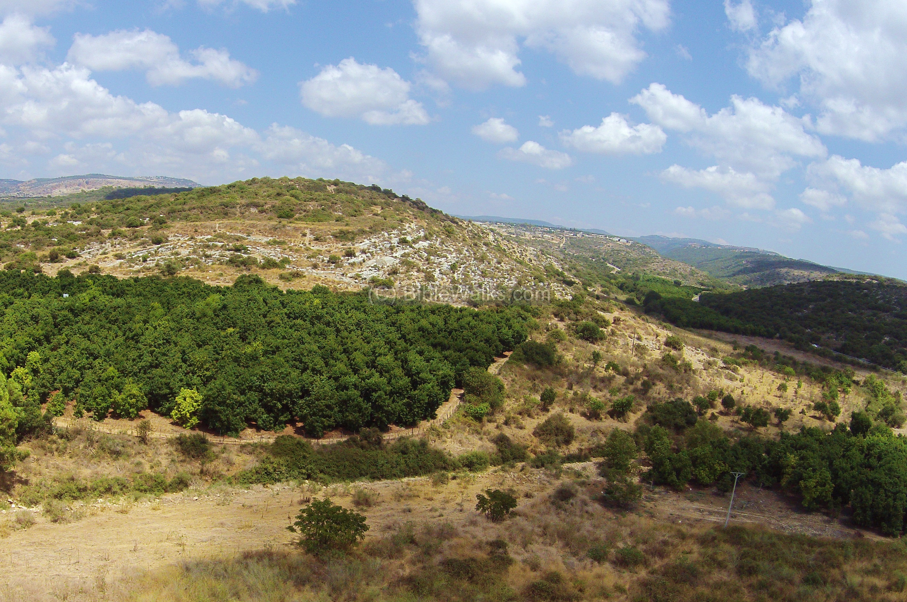
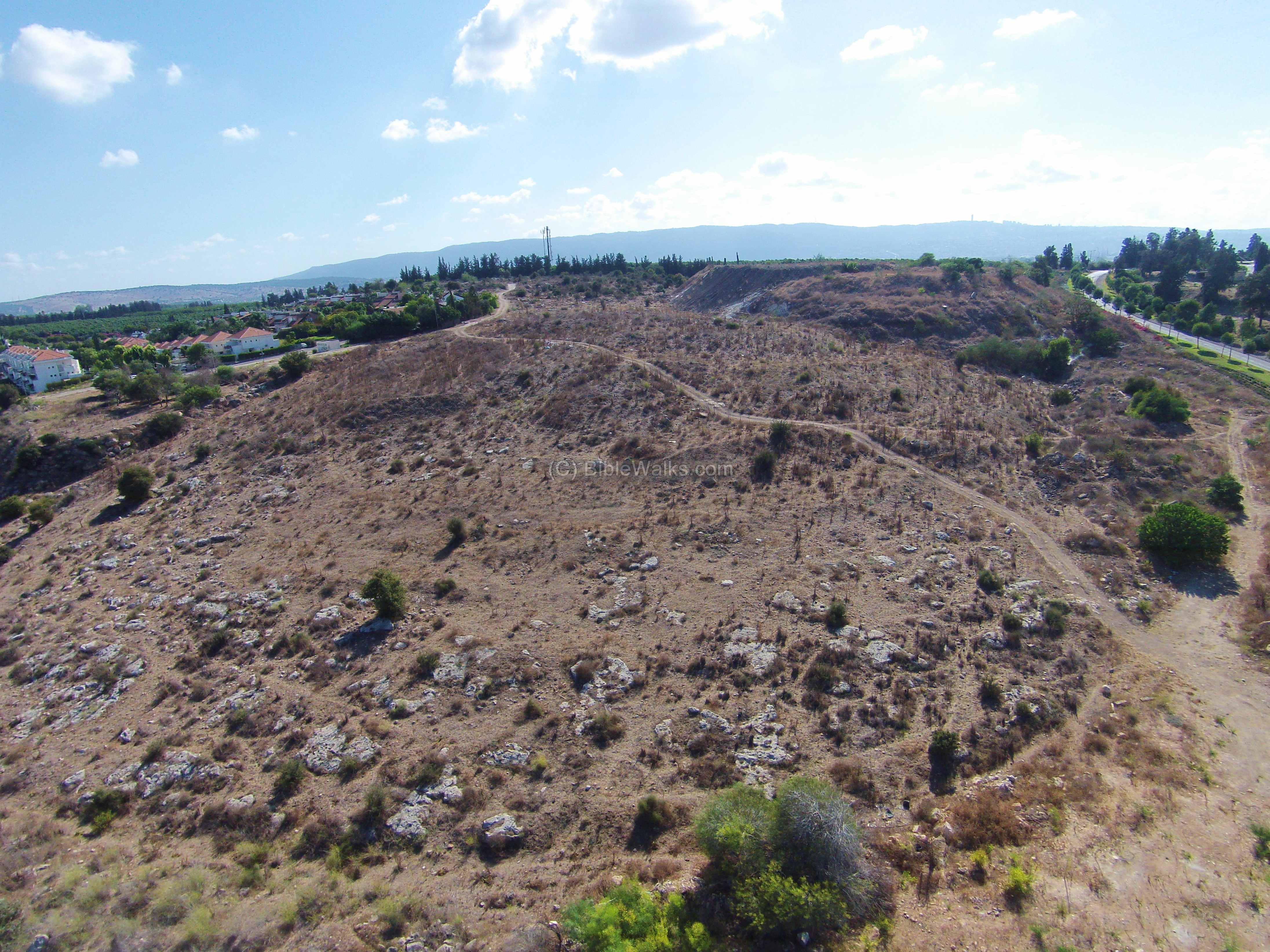
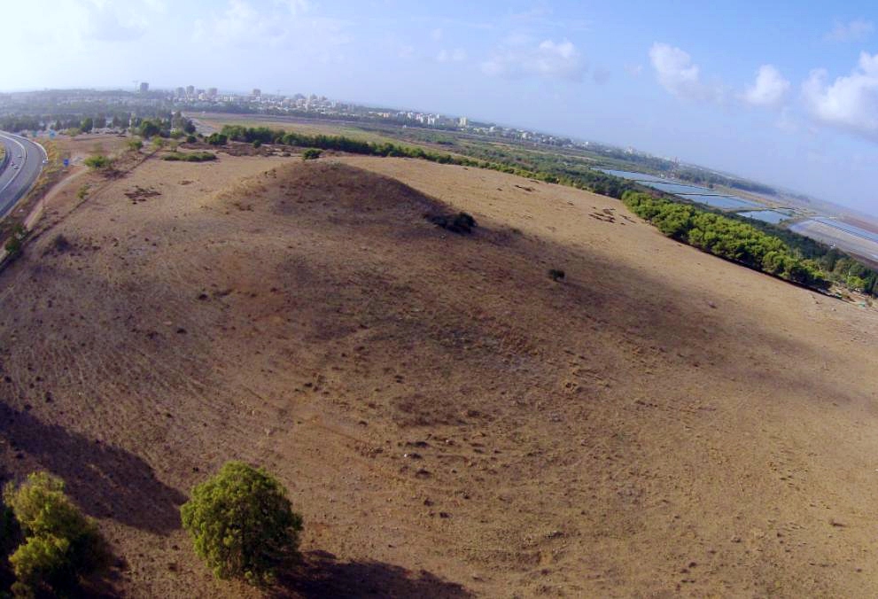
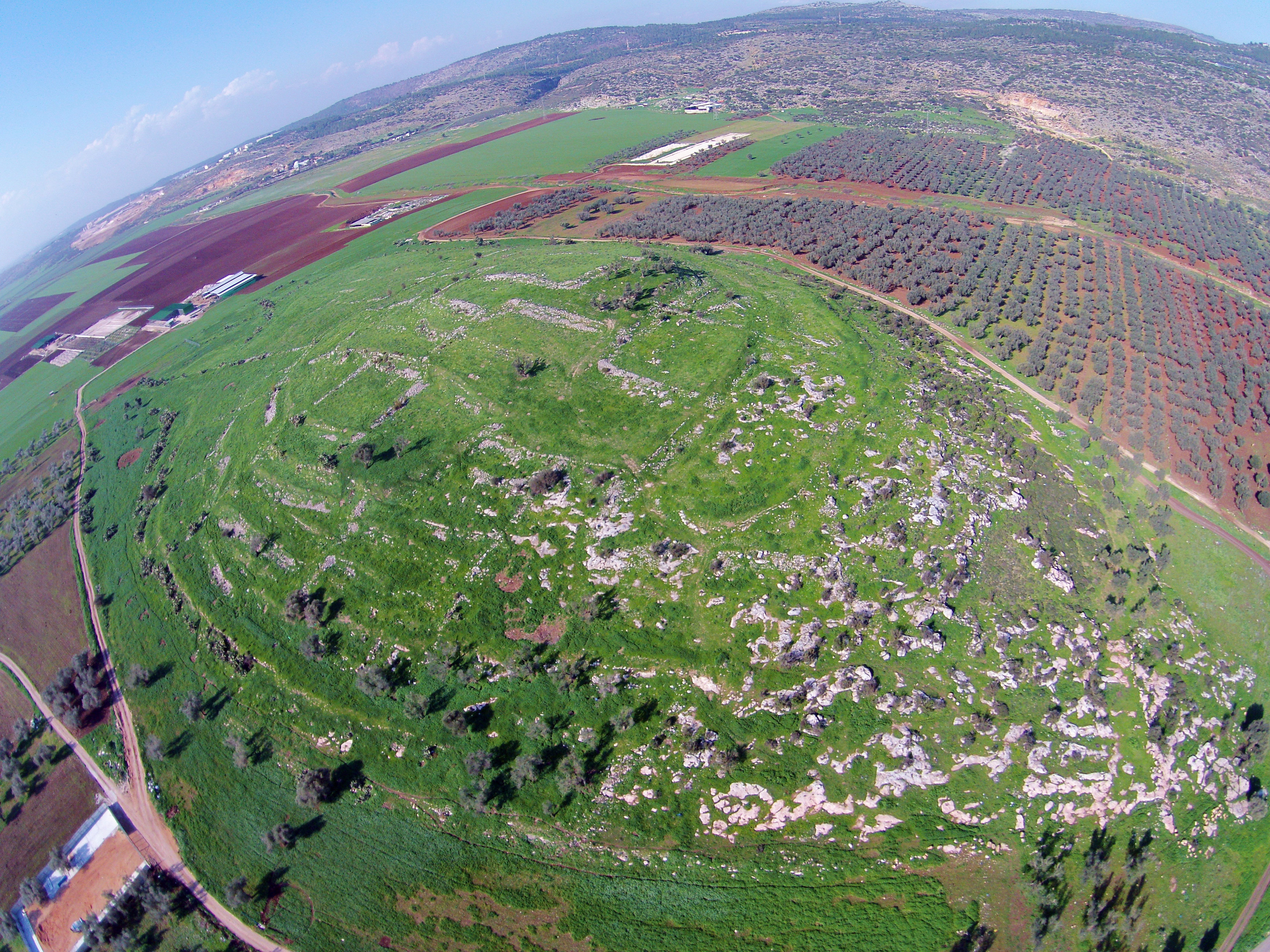
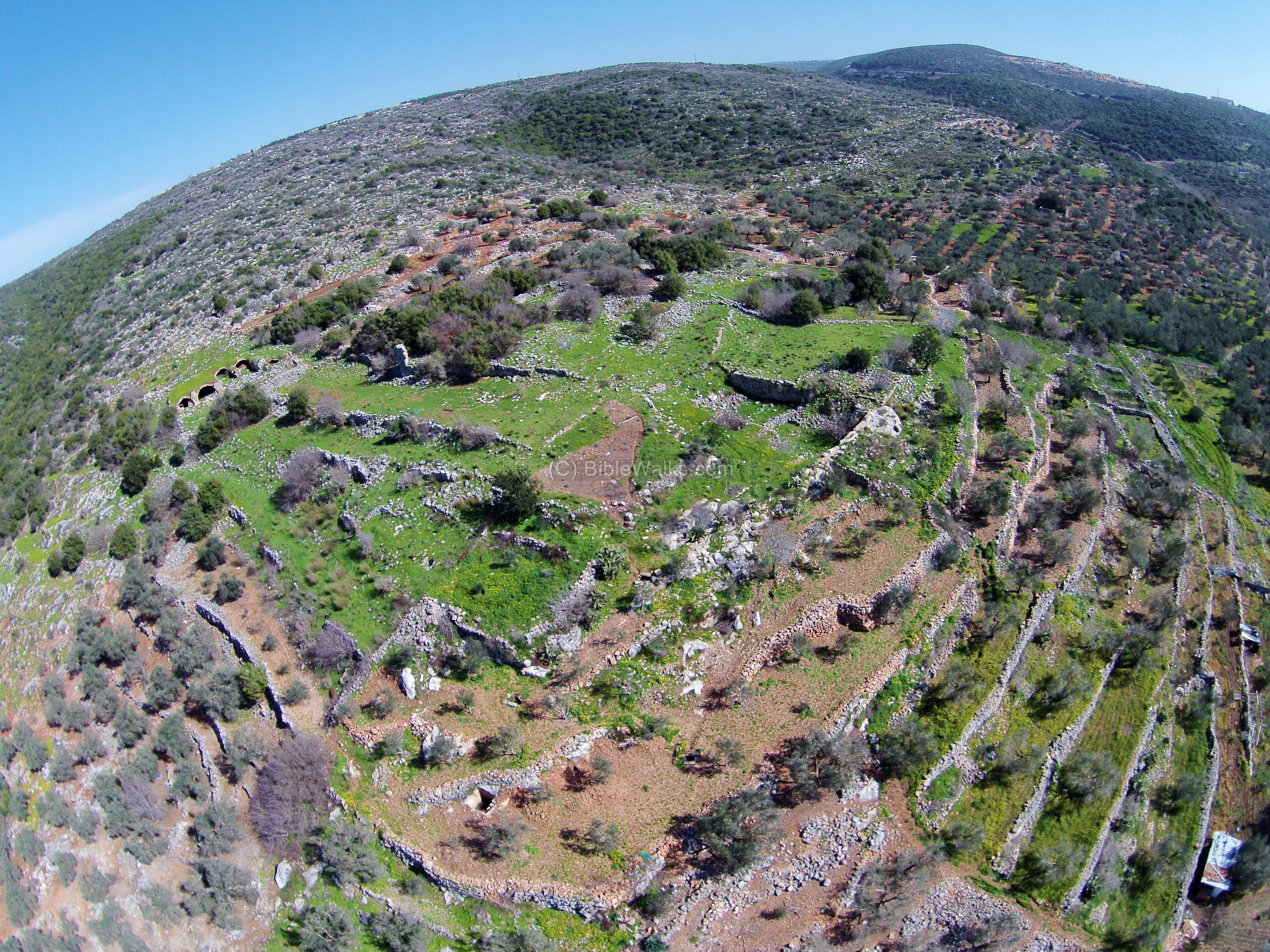
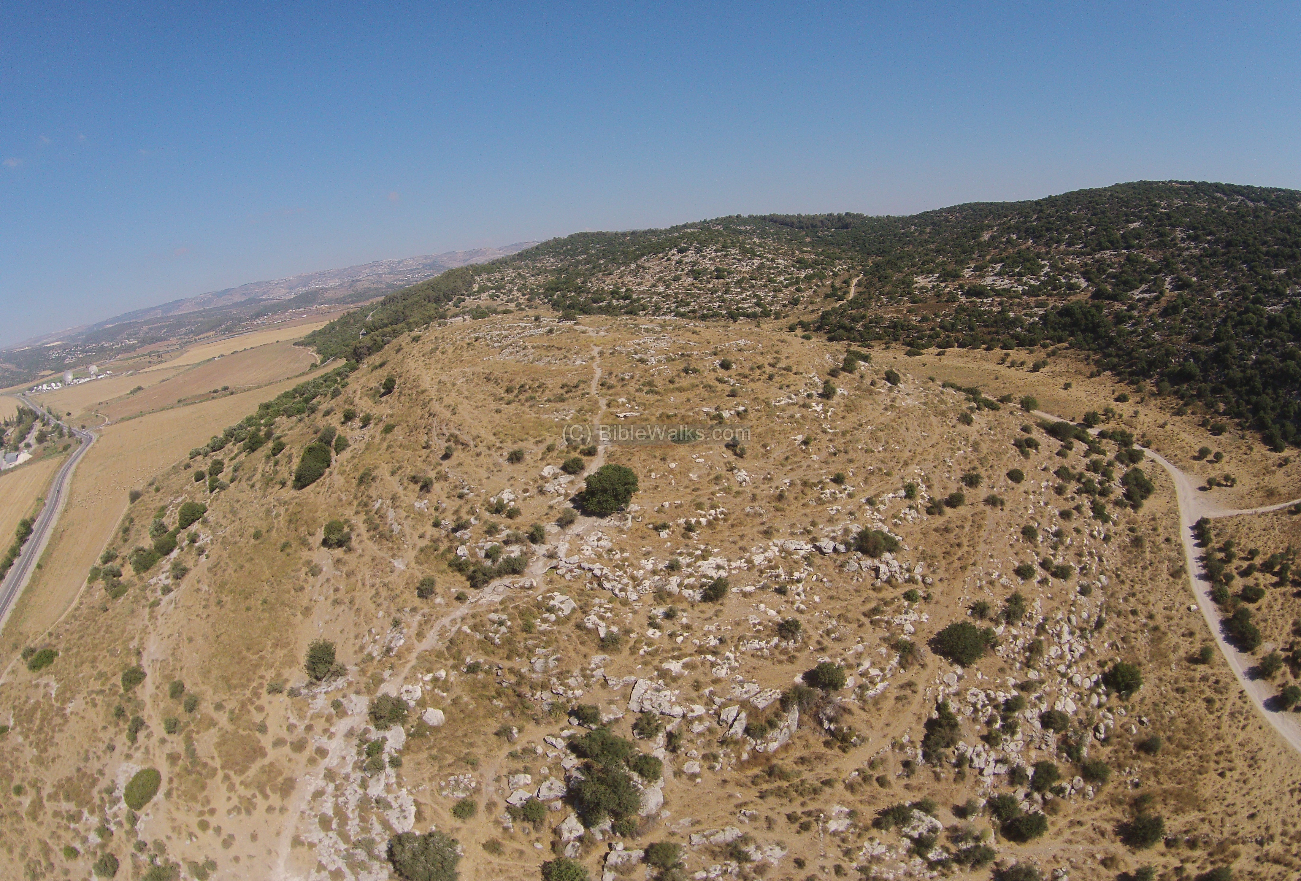
6. West Khali:
This mound, identified as the Biblical city of Khali (Joshua 19:25), is located in the entrance to the Zippori valley. It is a round hill (133M height, 700 sq M). On the top of the hill is a flat terrace (size), which was the center of the fortified small city.
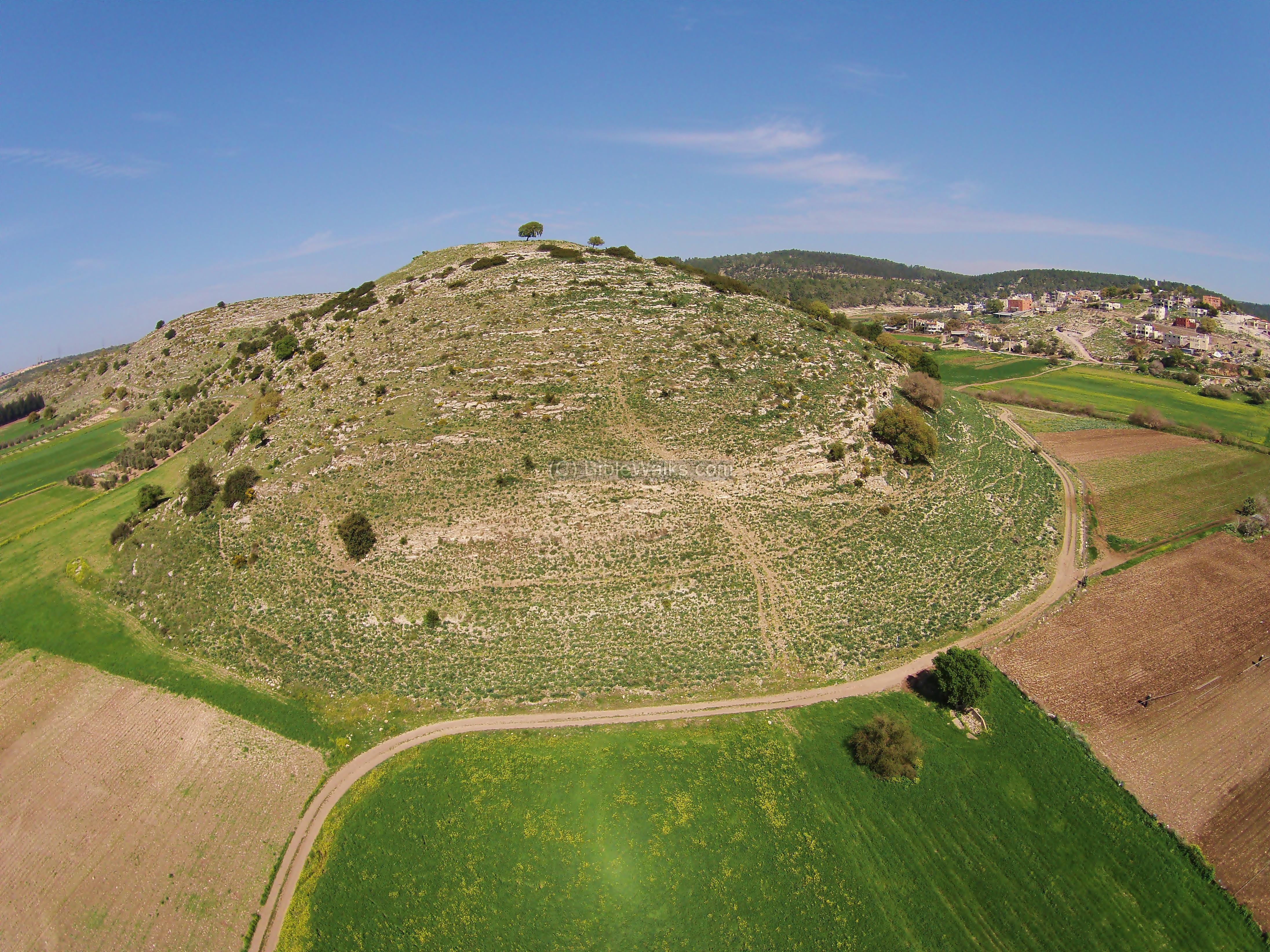
The site was one of the agriculture villages that were under the protection of the fortified city of Khali. It is located in the valley south west of Tel West Khali, and was a small farming village. The pottery in this site is from the late Israelite and Persian period.
![]() For a video clip, which was captured by the quad-copter above Kh. Govit, view it on Youtube.
For a video clip, which was captured by the quad-copter above Kh. Govit, view it on Youtube.
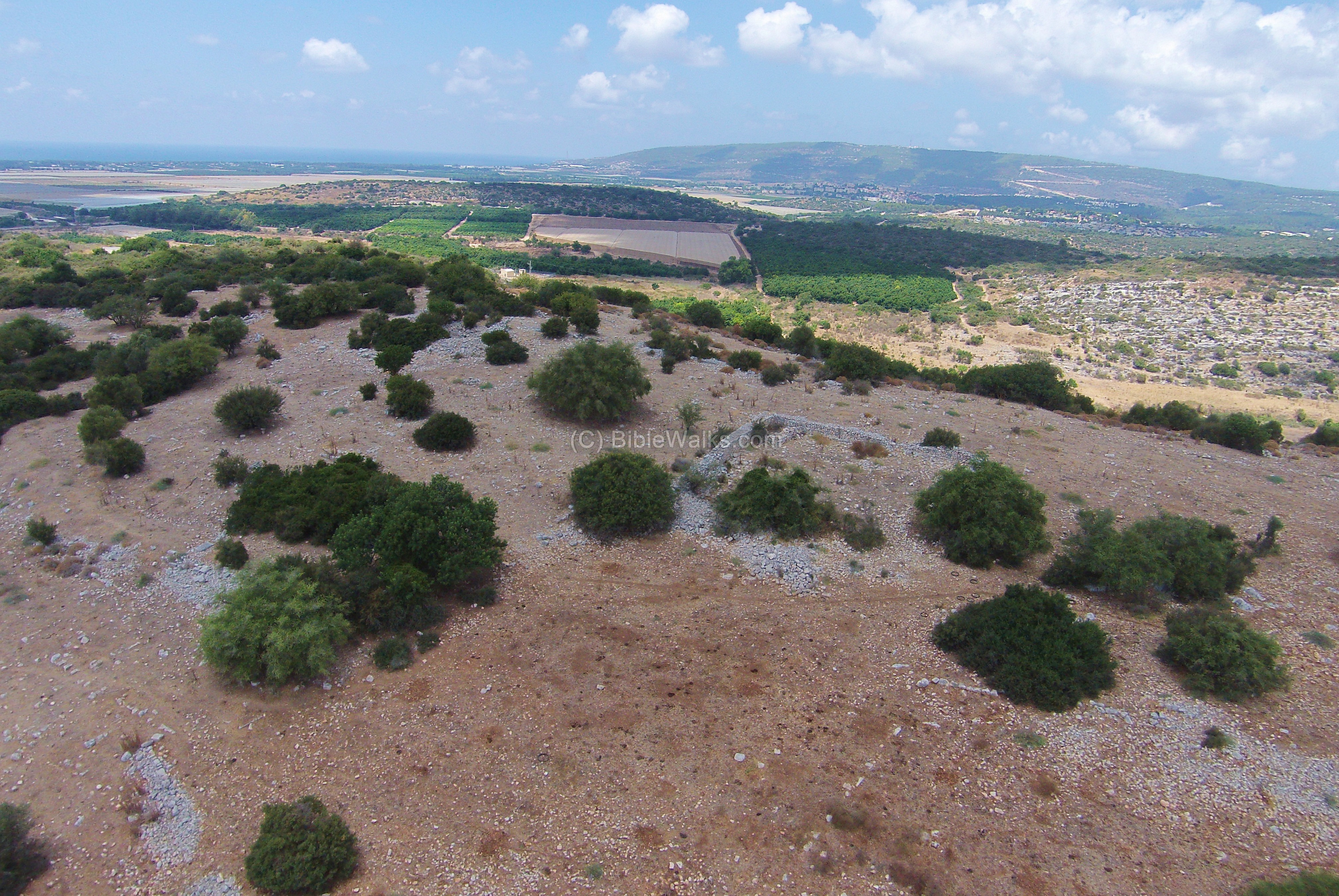
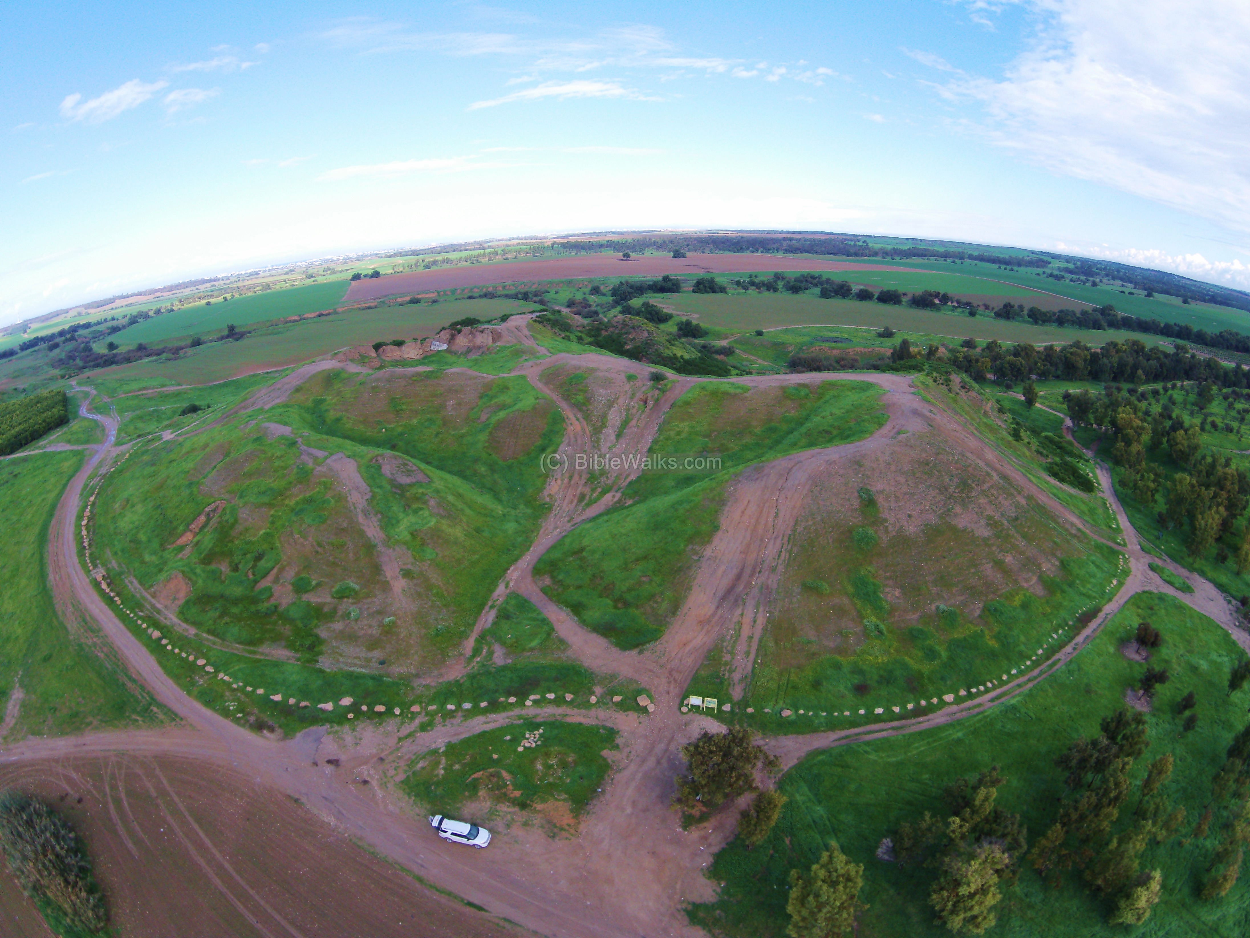
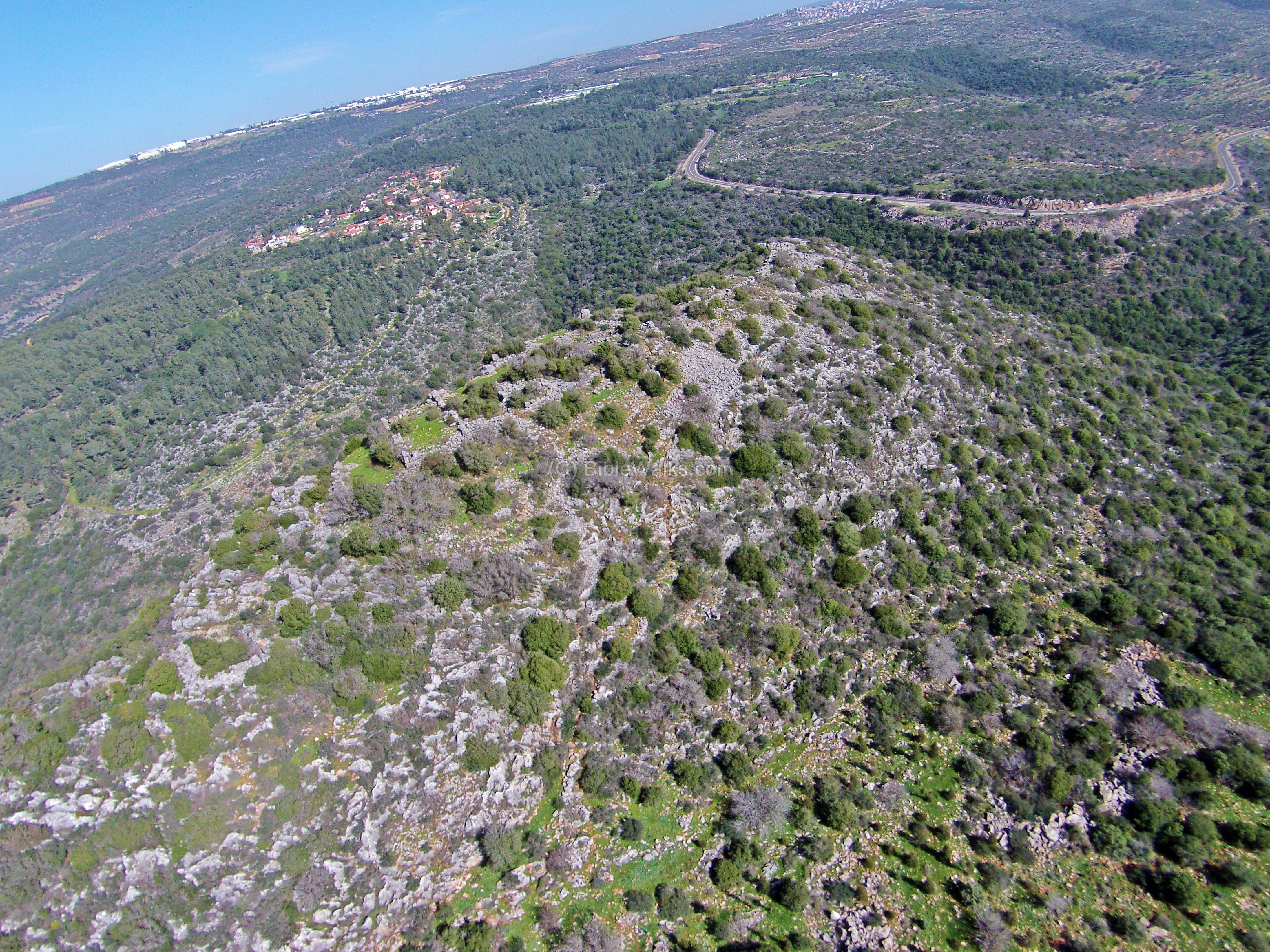
8. Tel Zavat:
The next picture is an aerial view of Tel Zavat, as seen from the west side (captured Feb 2014). On top of the ancient site are several modern residential houses. In the left and right backgrounds are sections of the new Kerioth-Bypass highway.
This was one of the many sites along the ancient coastal highway. According to archaeological survey, the majority of the findings are from the Israelite period through the Byzantine period.
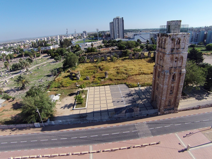
9. Afek in the Sharon (Antipatris)
The Ottomans built a large fortified Khan in the 16th C, which served as a hostel for the caravans that passed through the Holy Land. An aerial view, as captured from a quadcopter from the west side, is seen here.
Excavations in the Egyptian Governor’s residence, seen below in an aerial view from the north side, are from the Late Bronze Age (1,550-1,200 BC).
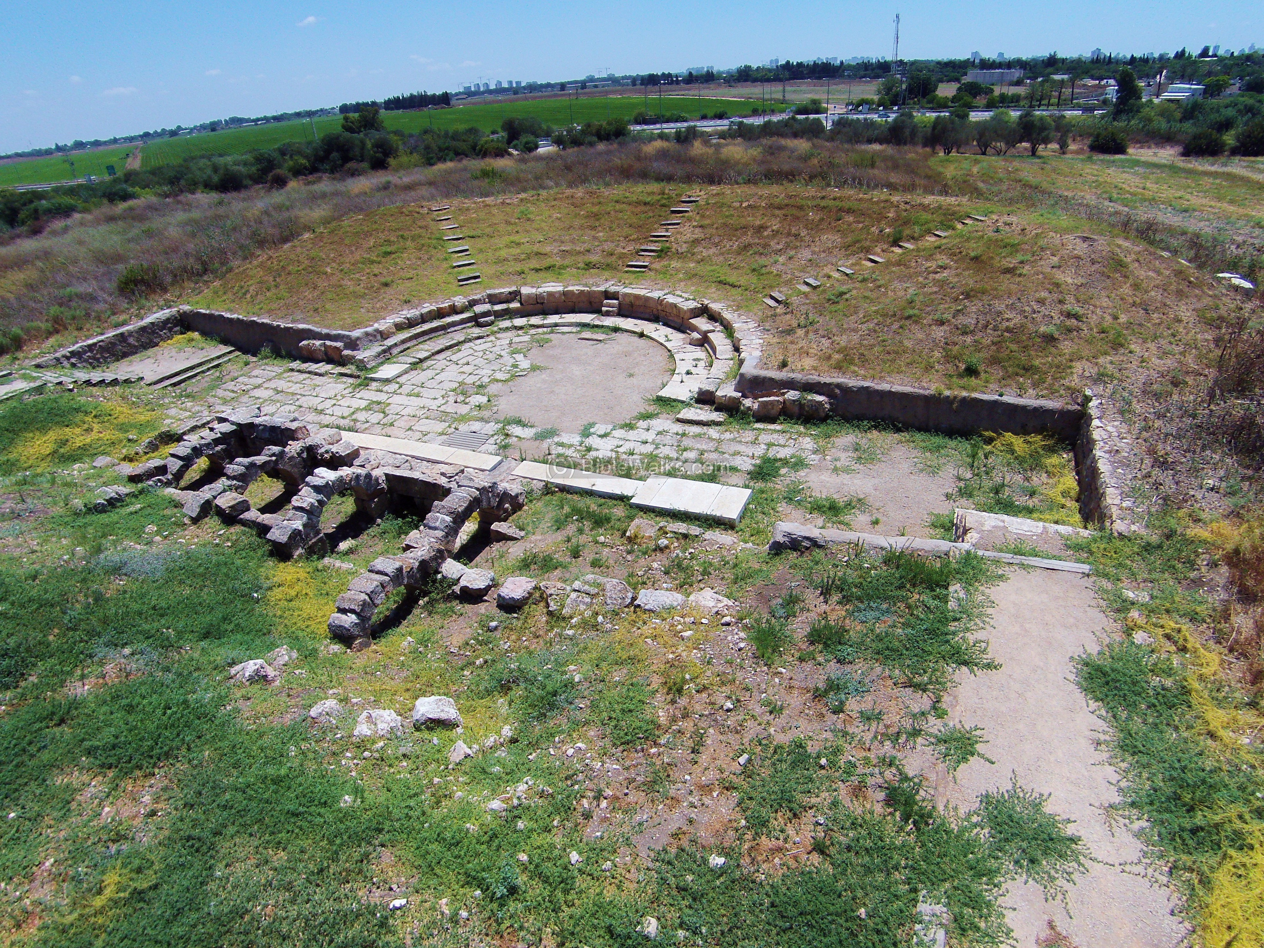
An Odeon mini-theater was excavated and reconstructed on the side of the Roman Cardo:
10. Tel Avdon
The photo below shows a southwest view of Tel Avdon. The hill rises 70M above the Kziv creek with a very steep slope. This was the location of Biblical Levite city of Avdon or Abdon (Joshua 21: 3, 30): “And the children of Israel gave unto the Levites out of their inheritance, at the commandment of the LORD, these cities and their suburbs…. And out of the tribe of Asher, Mishal with her suburbs, Abdon with her suburbs”.
11. Khirbet Suggar
A quadcopter view above the road on the south side of Khirbet Suggar, located south of Kziv stream. Traces of the ruins of the Roman/Byzantine village cover the hill. A rectangular walled area, which was an ancient sheepfold, is seen in the center. The Kziv stream flows just after the hill. Across it, on top of a steep hill, are the ruins of the Biblical city Avdon. In the far left background is the Mediterranean Sea, and the mountain of the “ladder of Tyre” (Sulam-Tzor) is seen in the far left background.
12. Tel Hannathon
Hannathon was an important Biblical city in the heart of the lower Galilee, on the junction of ancient crossroads.
An aerial view, as captured by a quad copter, was viewed from the west side. The top of the hill is at 196m above sea level, about 50m above the valley around it. To the east of the site is a reservoir lake of the national water channel. Behind it, in the far background, is Sepphoris. Further east is Nazareth.

13. Shimshit
Khirbet Shimshit is a Roman/Byzantine village 3KM south-west to Sepphoris, on a hill overlooking the Zippori creek. A Roman road passed at its western foothills, the main road from Sepphoris to the south.
![]()
14. Usha
The quad copter view shows the eastern side of Usha, looking towards the north-west. Scattered ruins are all what remained from the Arab village, which was built over the Roman-period site.
A group of 3 Roman-period winepresses are located on the located on the east side of the village.
15. Kh. Sharta
An aerial view of the eastern hill is shown from the north side. Only the north half of the mound remained intact, as modern construction cut away sections of the site.
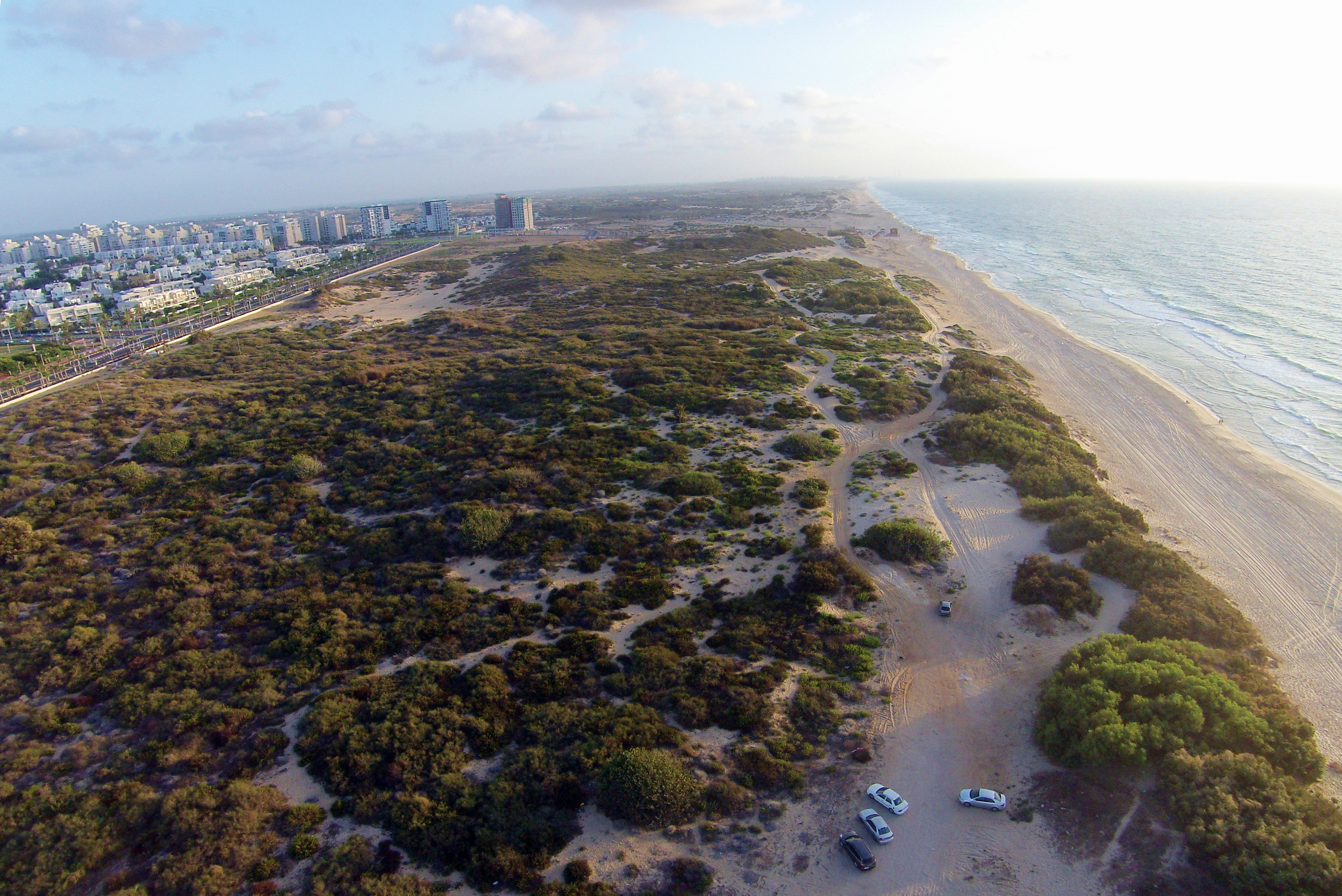
The site of Ashdod Maritime (Hebrew: Ashdod Yam) is located on the coast, and served as the city’s harbour since the Iron Age (8th Century BC). The harbour continued to function through the Hellenistic and Roman-Byzantine period (renamed Azotus), up to the Crusader period.
A 7th Century citadel was constructed on the north side, used by the Muslim rulers and the Crusaders to protect the harbour.
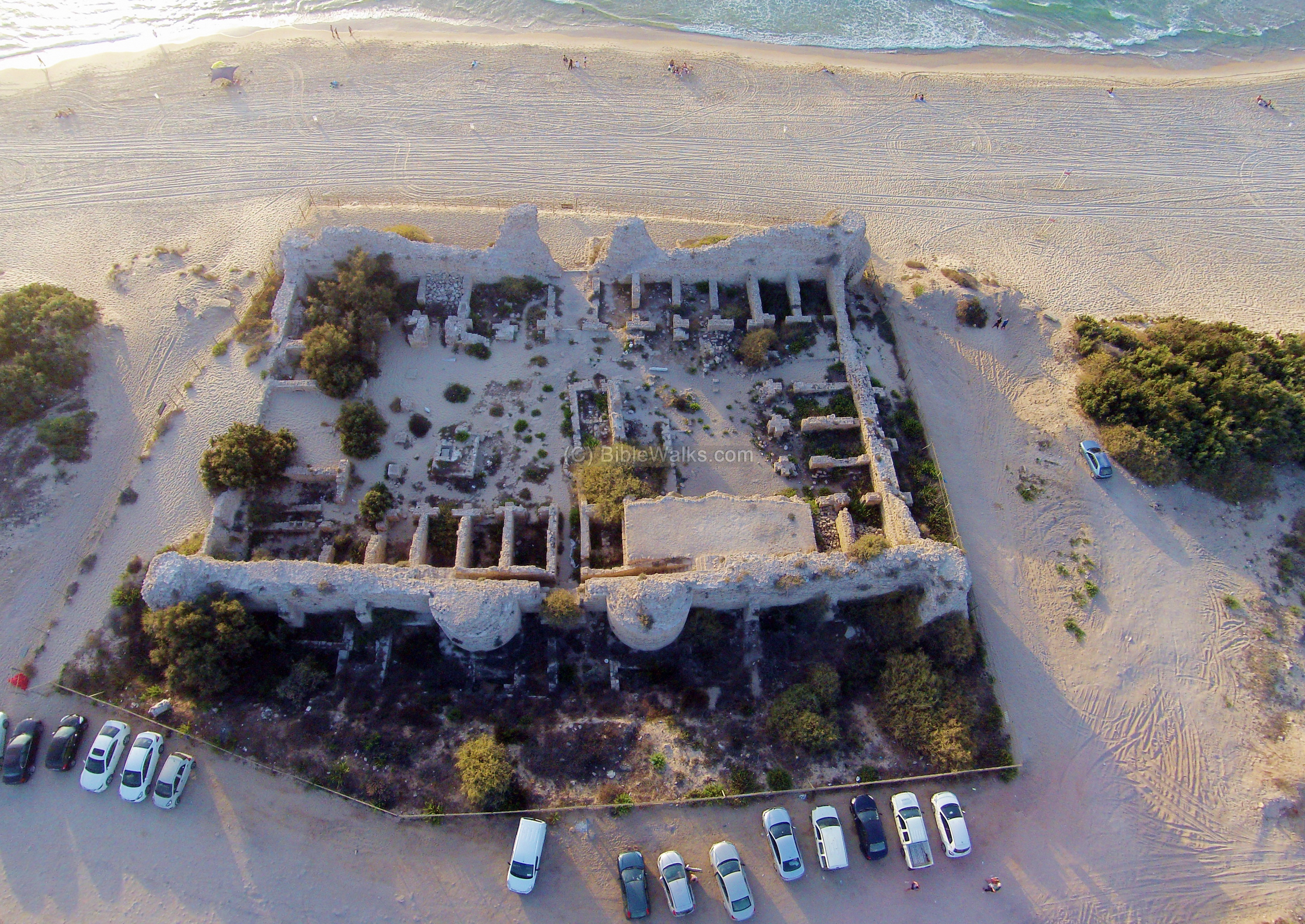
To the south of the Citadel is the Roman and Israelite mound, yet covered by the sand dunes.
17. Ebenezer
An Iron age agriculture settlement was excavated in Izbet Zartta, a small hill on the western hills of Samaria close to the ancient city of Aphek (Antipatris). It is identified as Ebenezer (“Stone of Help”), the place where the Israelites camped during their fatal battle with the Philistines (1 Samuel 4 1): “Now Israel went out against the Philistines to battle, and pitched beside Ebenezer: and the Philistines pitched in Aphek”.
18. Yehudiye
Ruins of a Roman village located in the central Golan heights. This site is identified as Sogana, one of the villages that were fortified during the great revolt against the Romans.
This village is on the northern side of Sea of Galilee, and was the center of the activities of Jesus and his town during that time. A grand 4th C Ad Synagogue was excavated, which stood over the Synagogue from the time of Jesus.
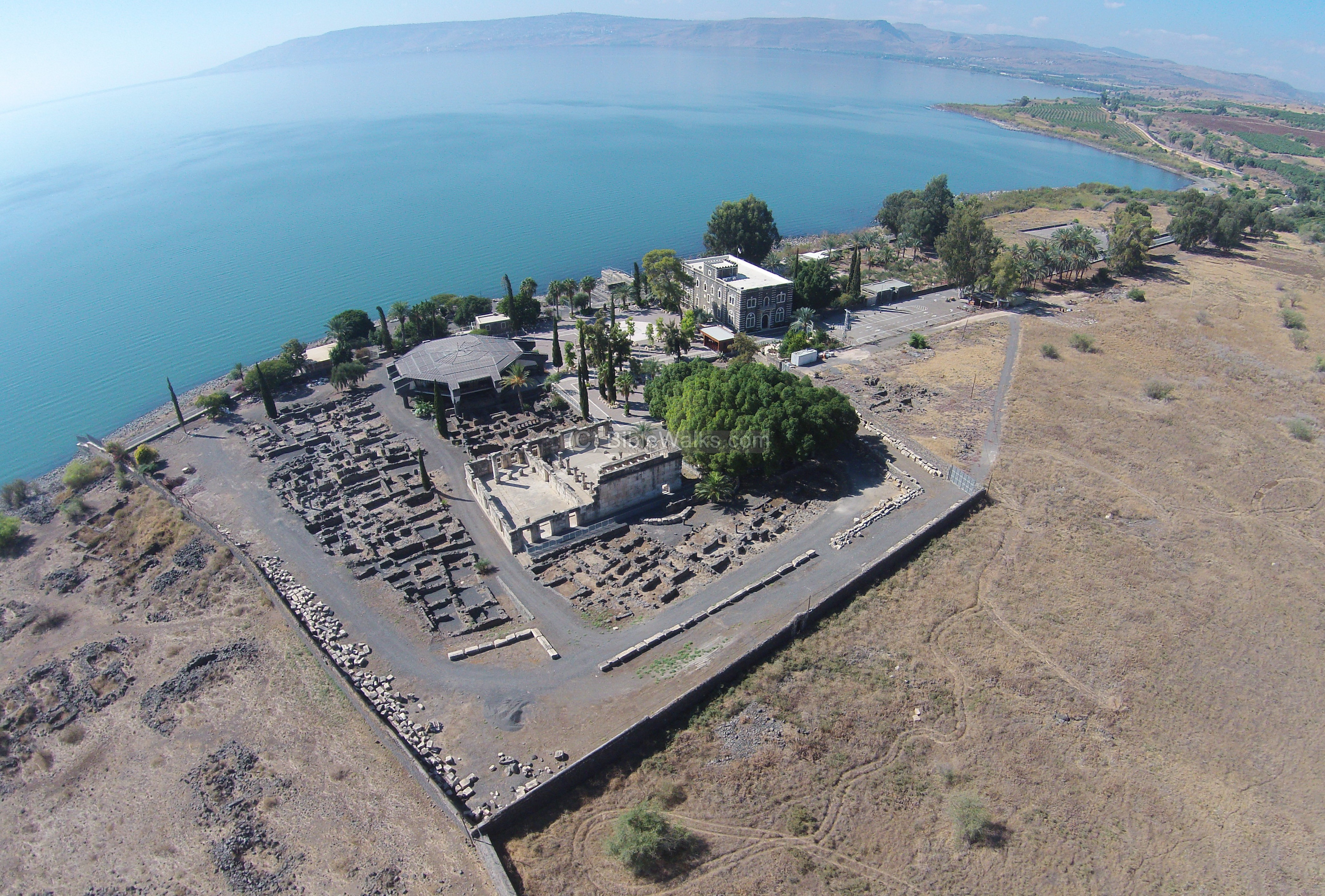
The nearby Greek Orthodox Church is a charming place in the site of the ancient village of Capernaum.
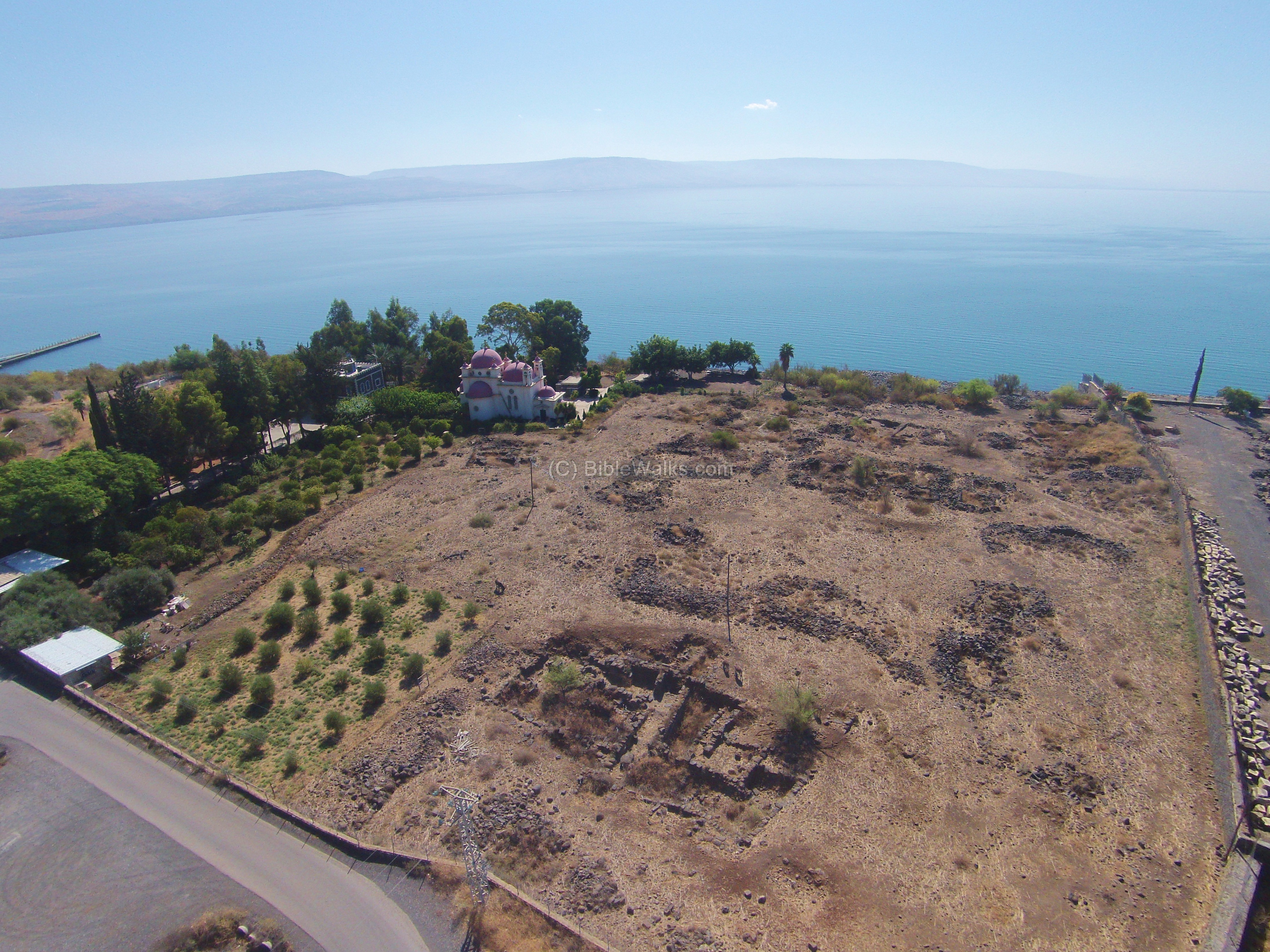
Ruins of a Roman/Byzantine town, located above the north side of sea of Galilee, and is referred in the new testament as one of the cities condemned by Jesus.

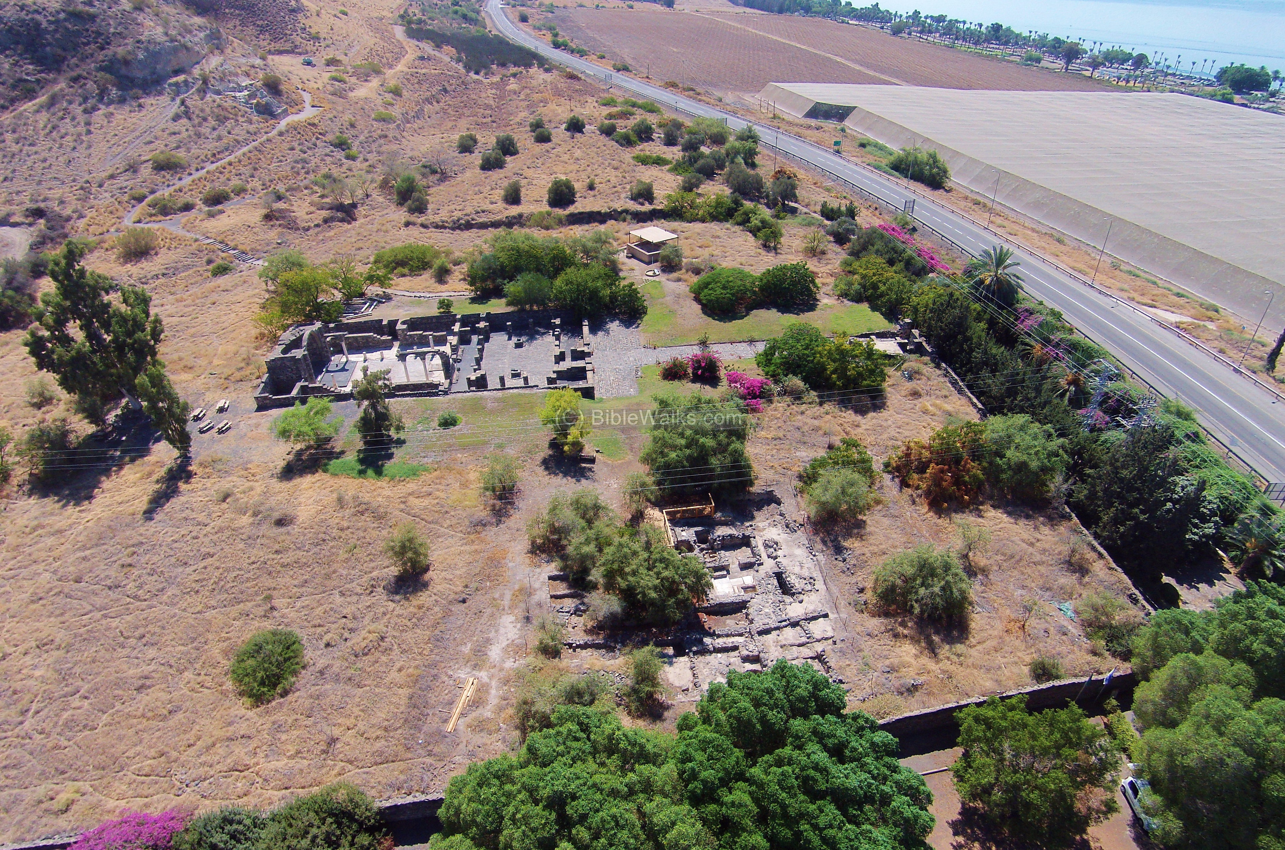
Ruins of a 5th C AD church and monastery at the traditional location of Jesus miracle at Gadarenes/Gergesa – healing the madman, driving out his devils into a herd of pigs who then drown in the lake.
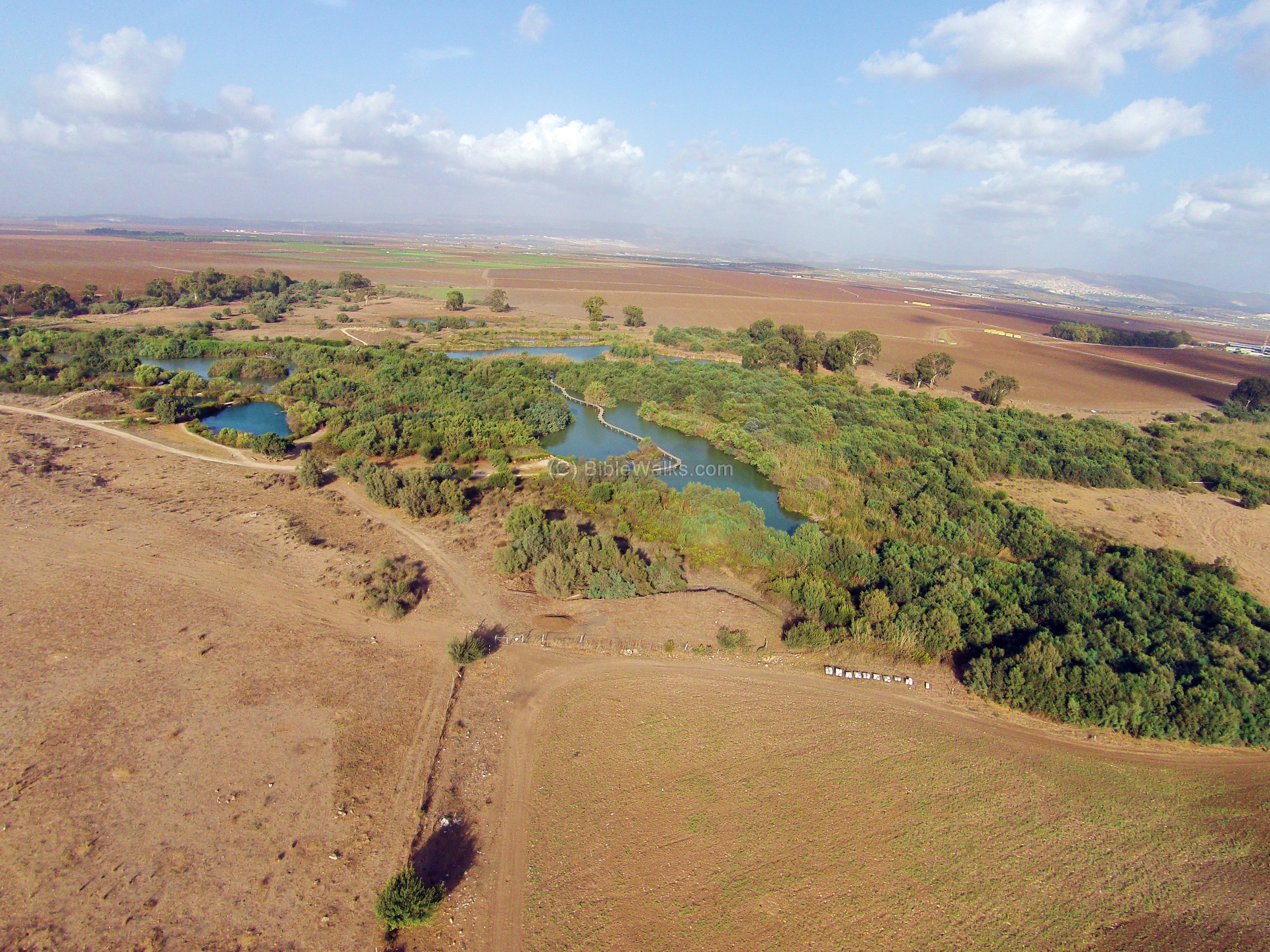
Tel Afek (in the Galilee) is a Biblical city on the ancient Via Maris road, south of Acre. On the north side are ruins from the Hellenistic/Roman periods, a two-story fortified building, and a flour mill dated to the Crusader and Ottoman periods.
In the north-east side of Tel Afek is the Ein Afek nature park. The 30 springs of Afek are the sources of the Na’aman river.
Ruins of the ancient port city of Haifa, located on the west shore side of Mount Carmel. This aerial view is above the south side of the mound.
On the south side of the mound is an excavated area with storehouses and installations. In the upper side of this view are the ruins of a Byzantine period monastery.
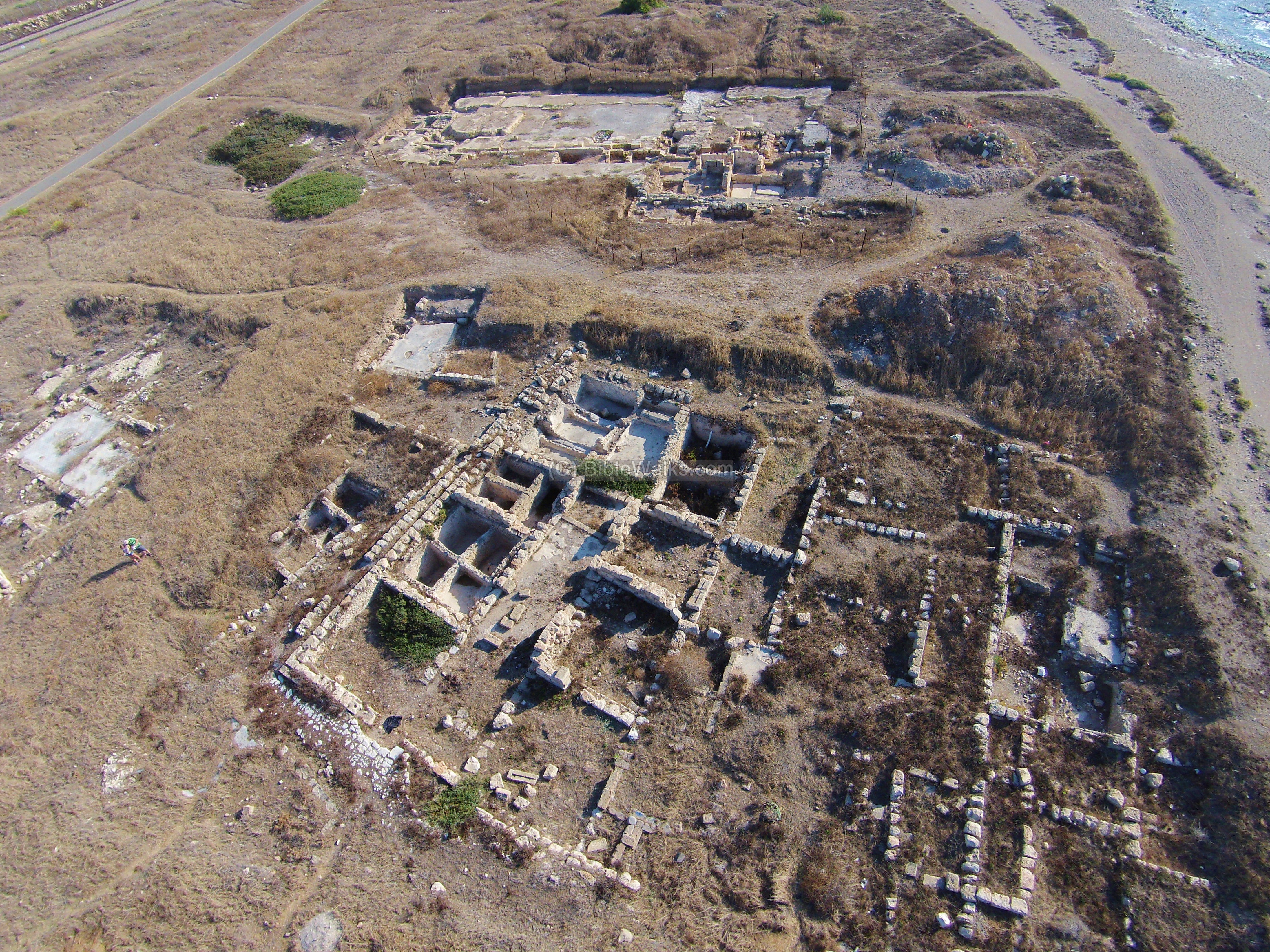
The ancient Phoenician port city is located on a mound on the Carmel coast, and was one of the greatest cities along the northern shore.
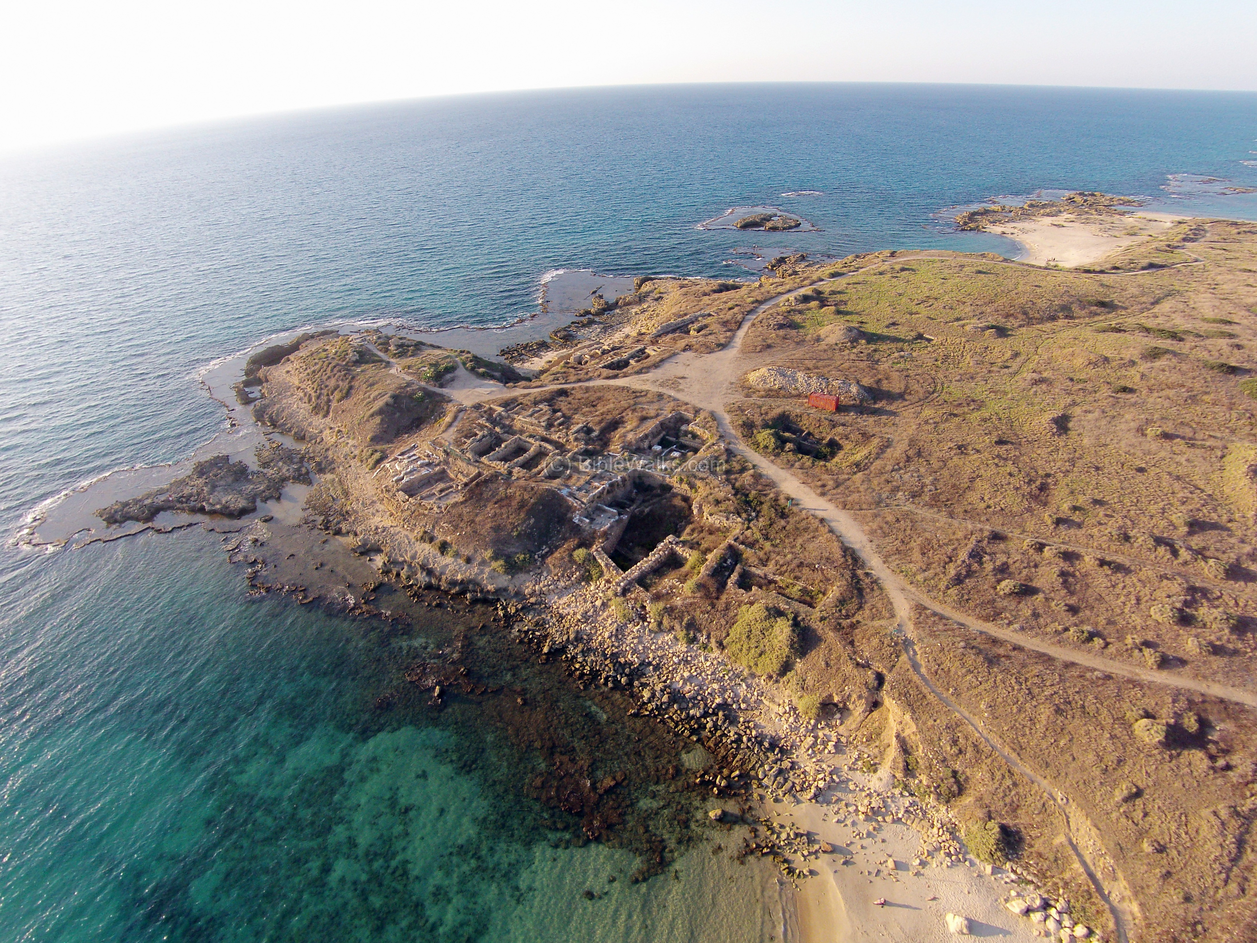
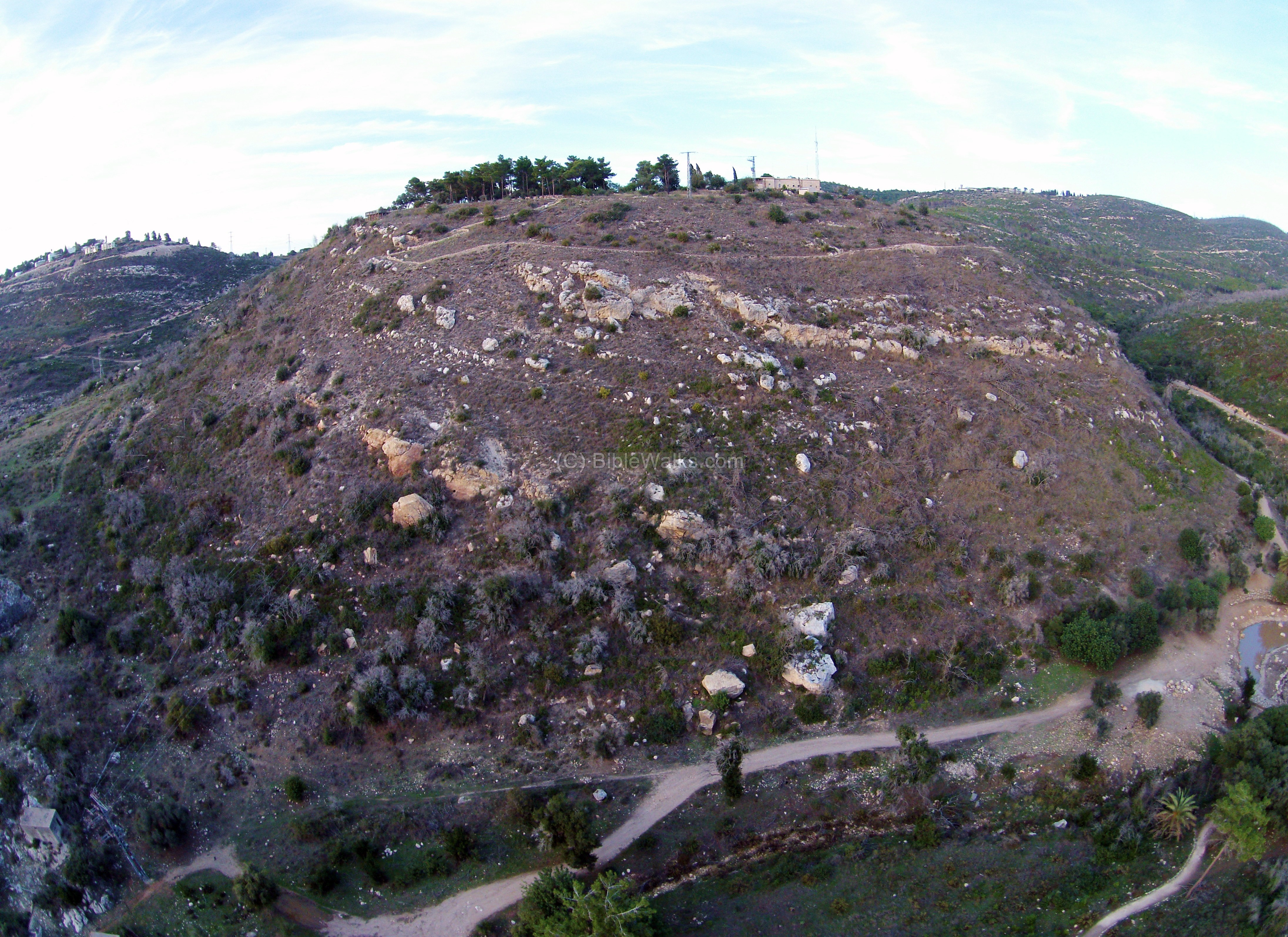
The site is in the center of mount Carmel, on top of a round hill, overlooking the Oren valley. It was the site of a city in the Hellenistic and Roman periods.
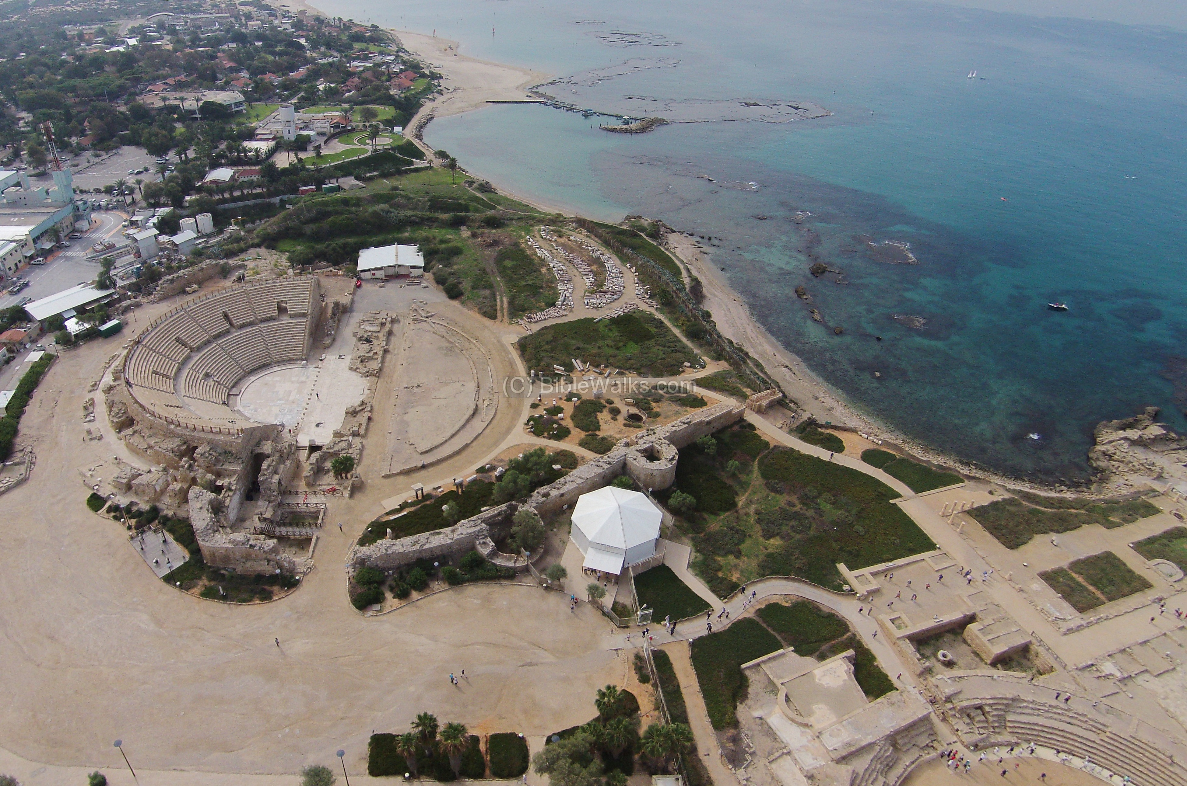
This view shows the ruined Crusaders fortress, north of the Roman city.
The next view shows the north side of the ruins of the Roman city, adjacent to the Crusaders fortress.
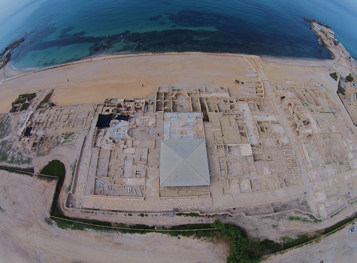
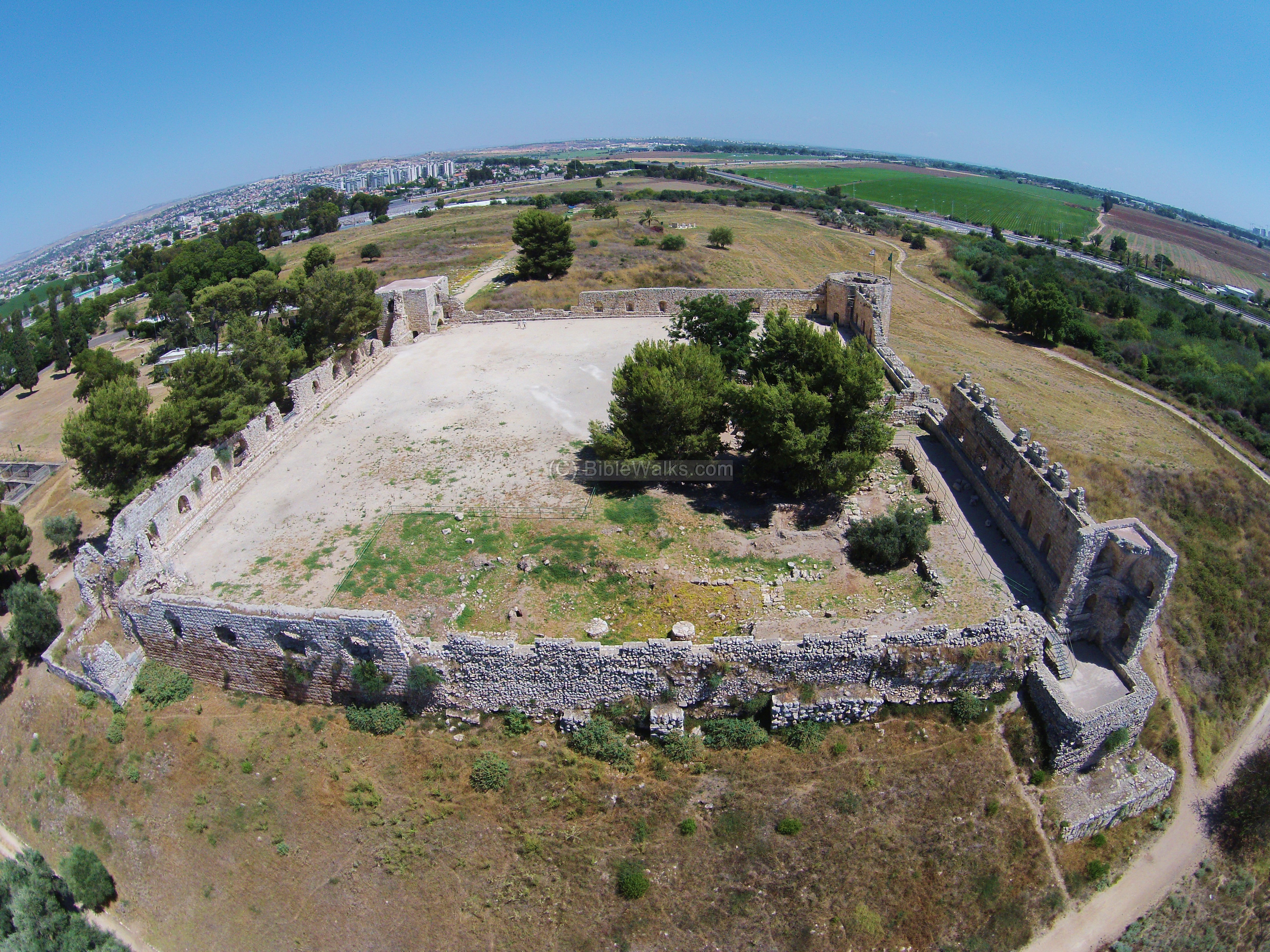
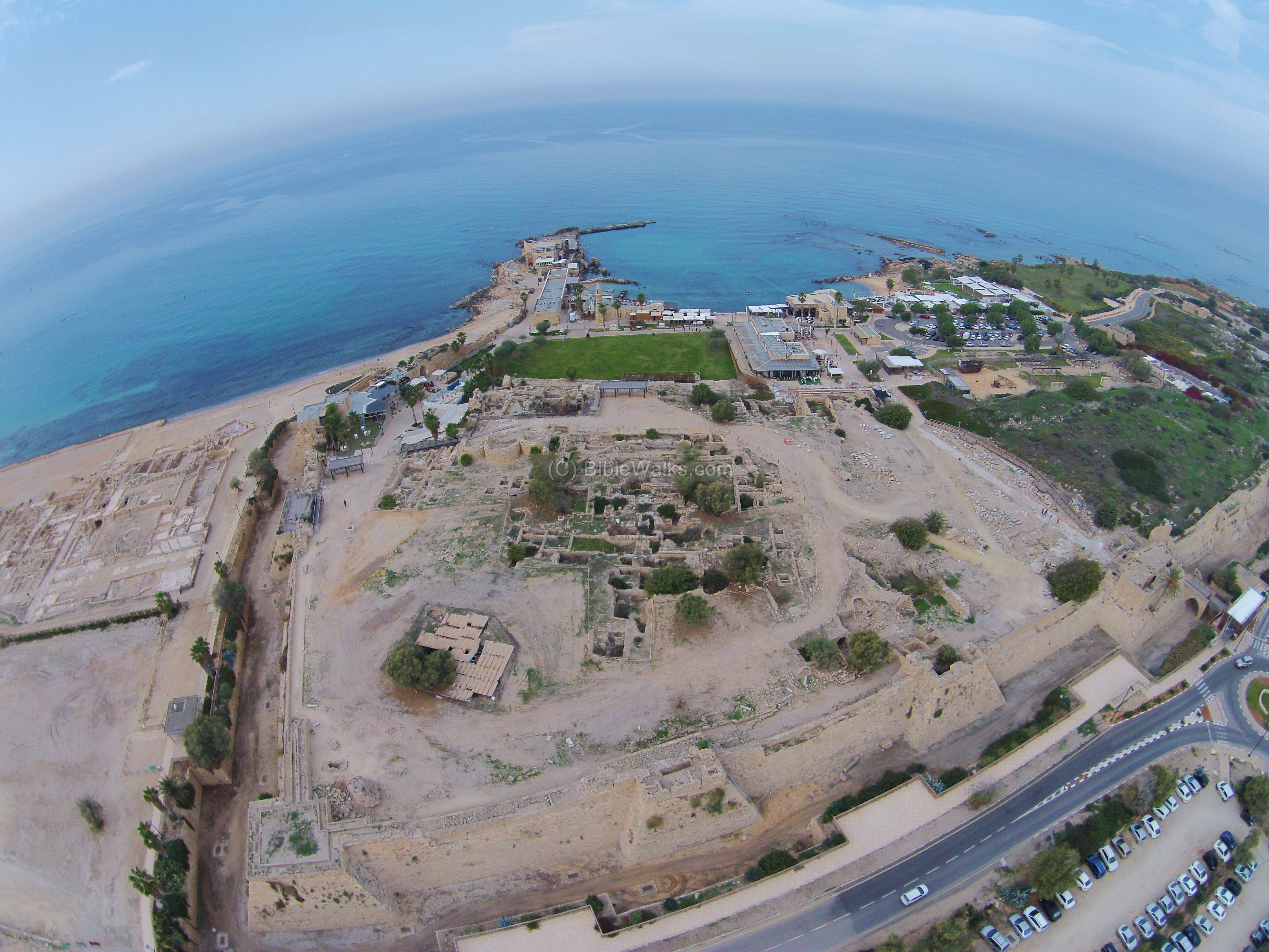
A grand entertainment place was built during the Roman period by Herod – a large Hippodrome in the shape of a long “U” (50 X 250M), with 10,000 seats in 12 rows. In this amphitheater the Romans conducted horse races (Hippo in Greek), special events, and games.
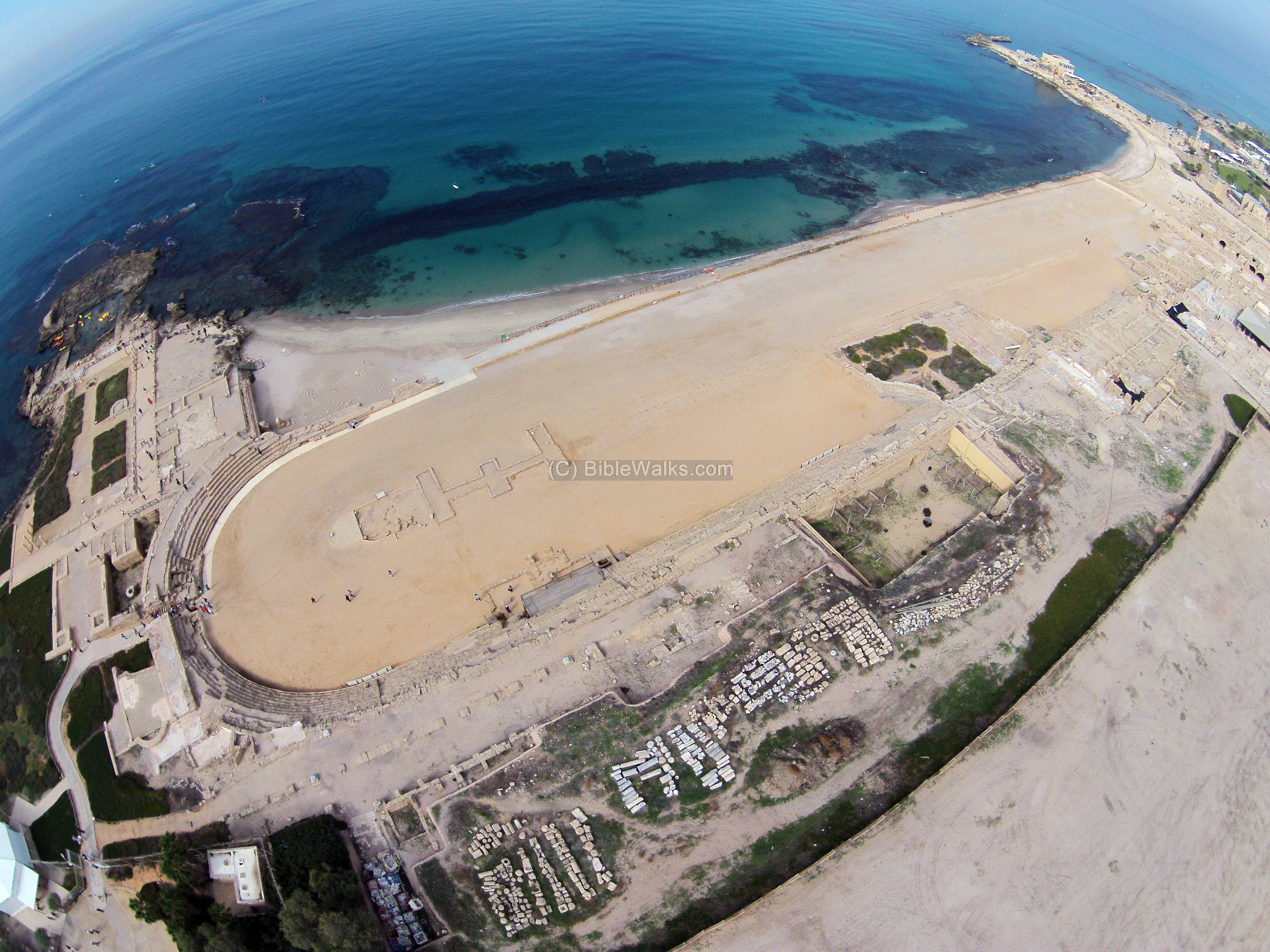
A large Roman theater, also built by Herod the Great, is located at the southern side of the city.
![]() A flight over the site can be seen in the following Youtube video.
A flight over the site can be seen in the following Youtube video.
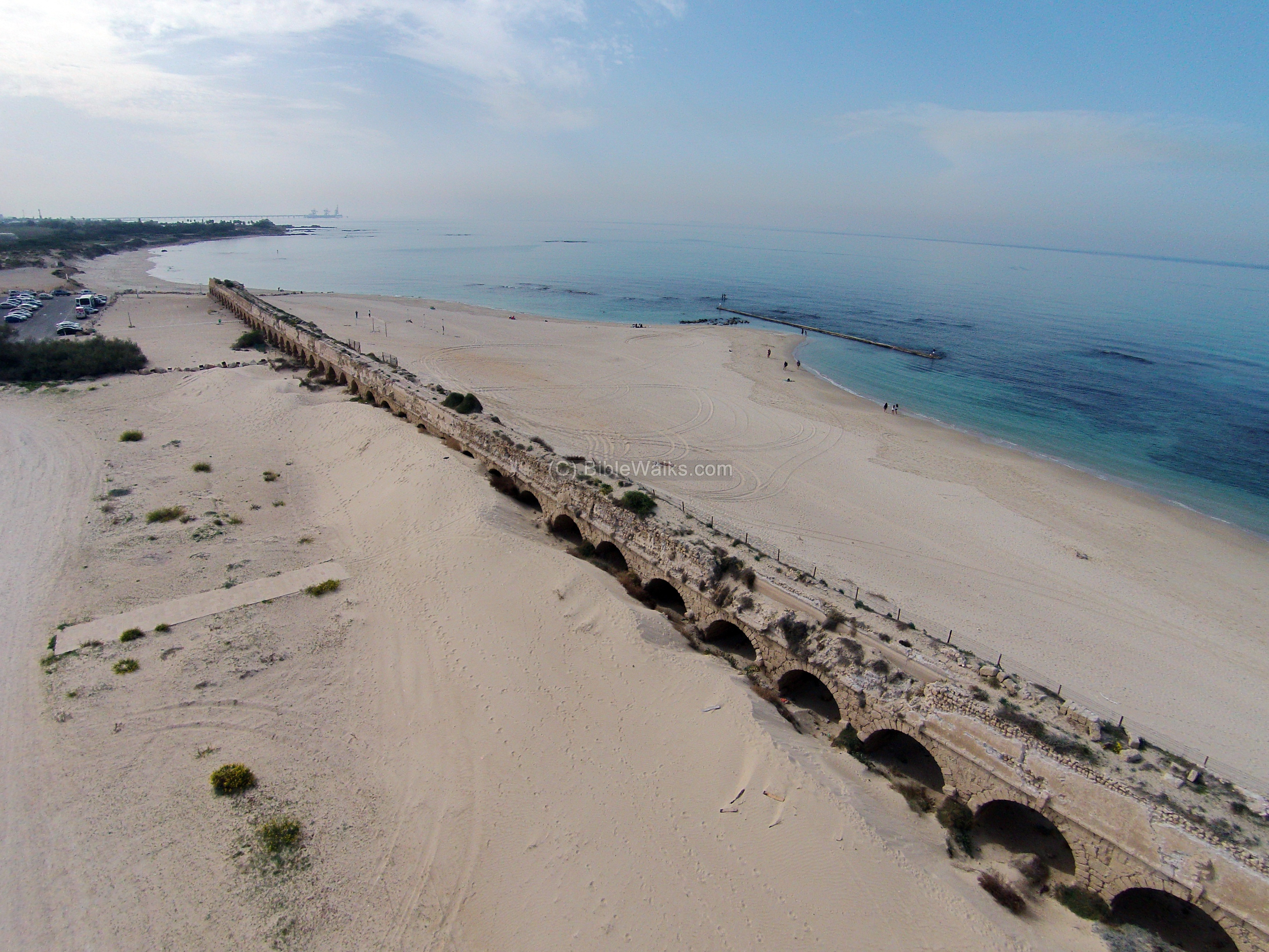
One of the famous sites in Caesarea is the aqueduct, which brought water to the city.
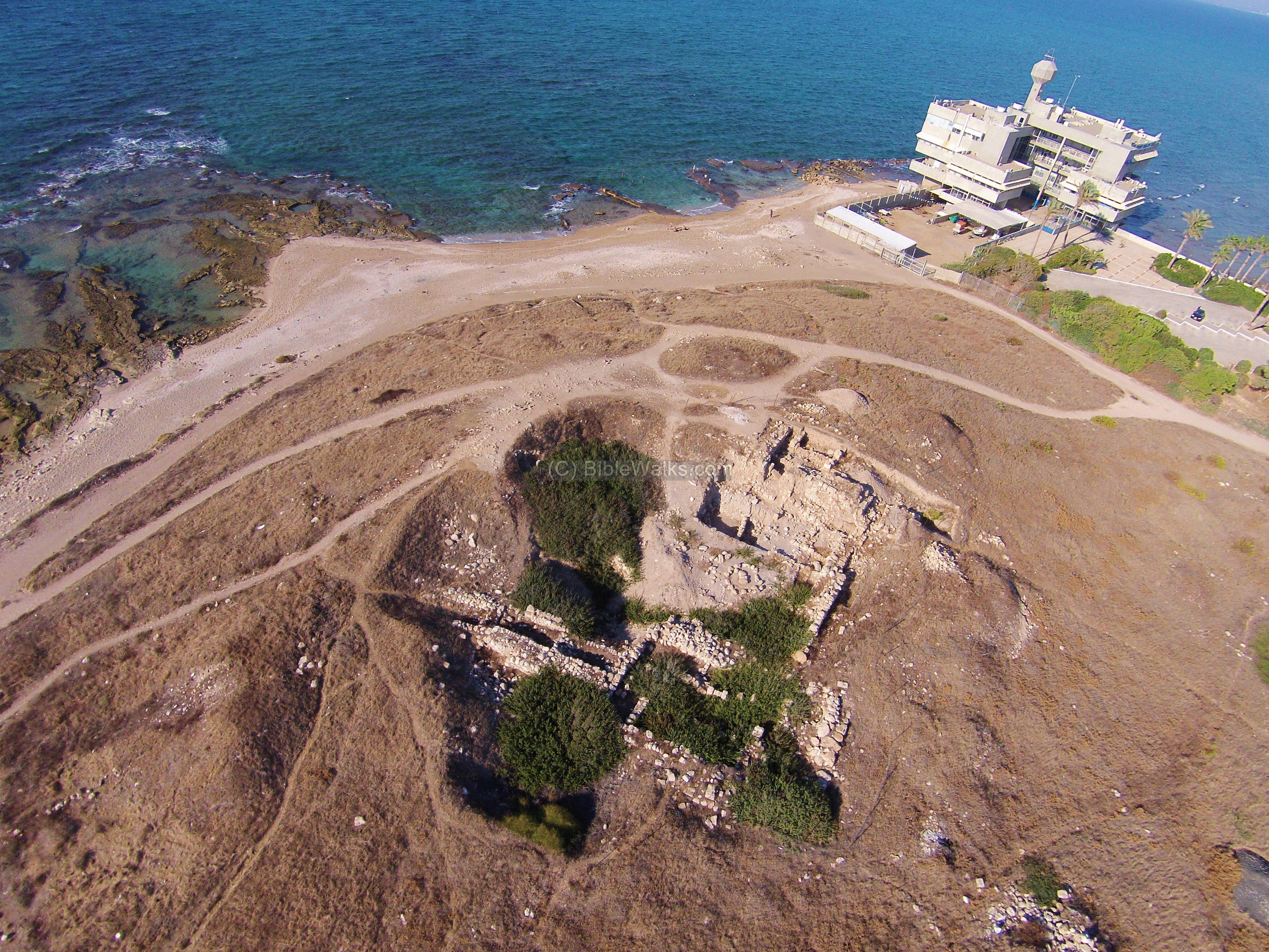
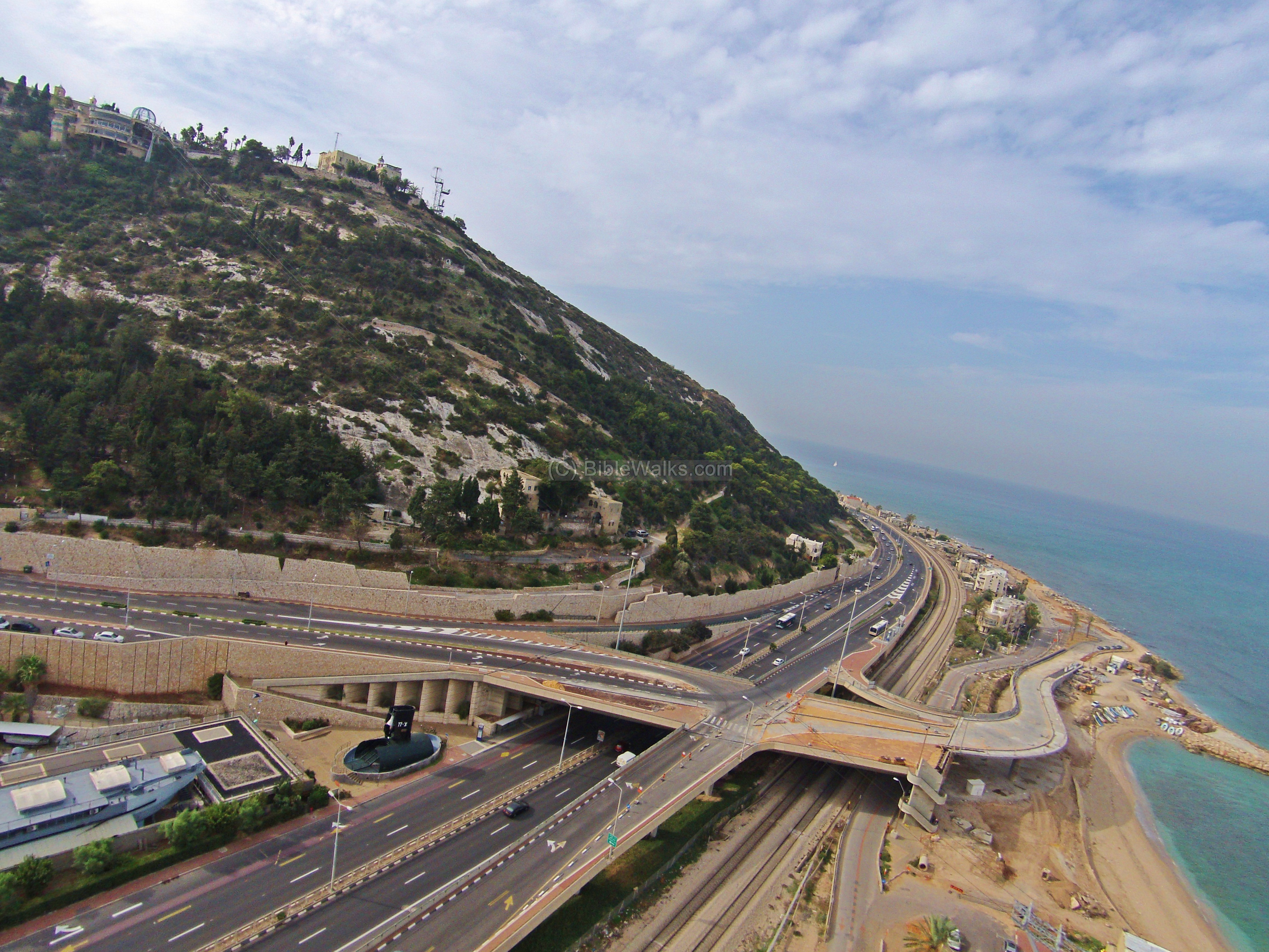
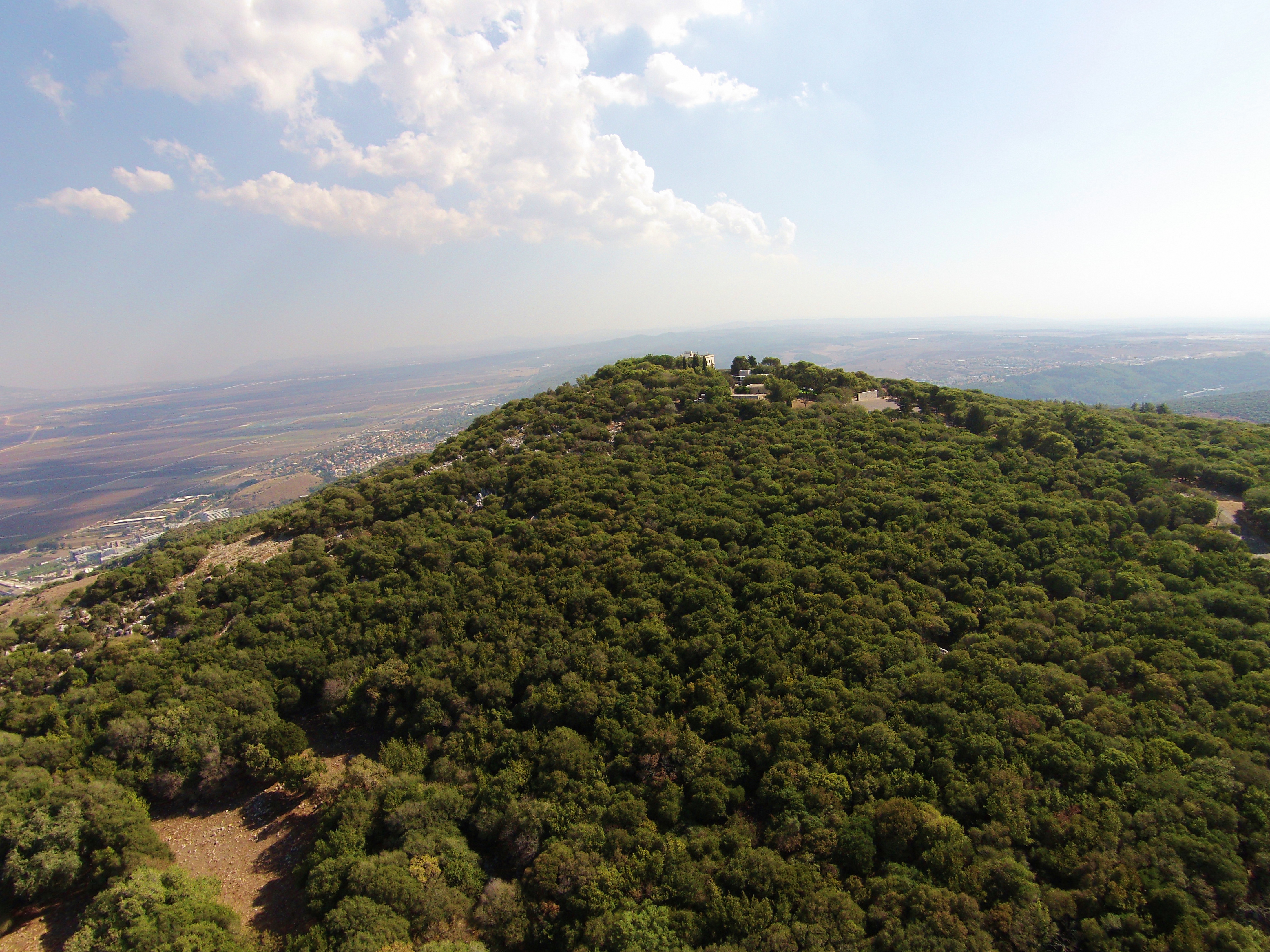
28. Stella Maris and Elijah’s cave
This photo shows the edge of Mt Carmel from the North West side.
29. Kh. Dubbah
Khirbet Dubbah is a ruined Roman village located on the eastern side of Mt Carmel. In this photo the center of the site is on the left side.
30. Mukhraka
On the adjacent hill is the Mukhraka, where a small Carmelite order church named after Elijah marks the traditional site of his victory over the Baal prophets.
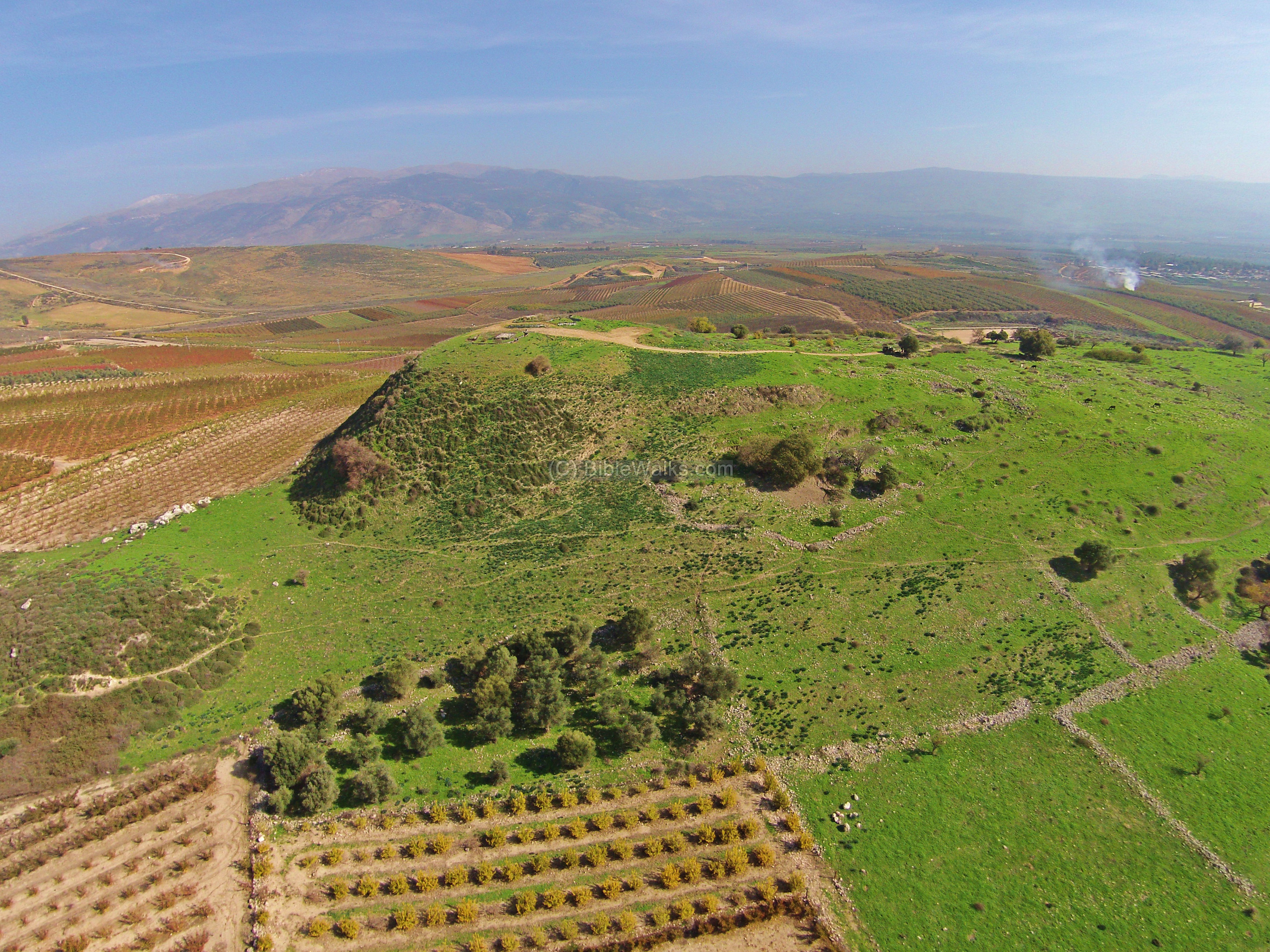
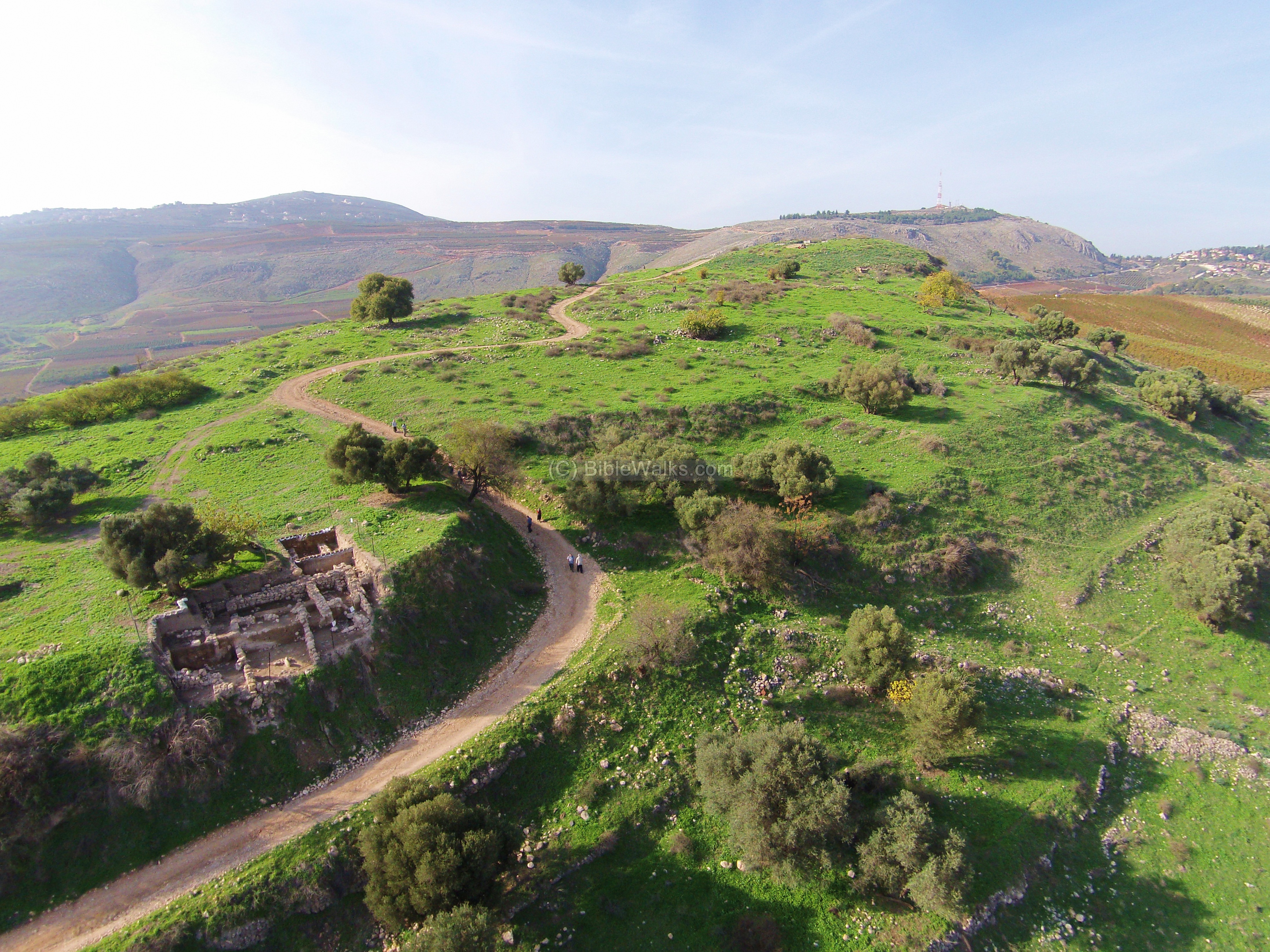
Abel Beth Maacah is an important Canaanite and Israelite city in the northern part of Israel, situated on a large mound. This was the city where Sheba son of Bichri has hidden during his mutiny against king David. Abel was destroyed twice – by the Syrians in the 9th Century and by the Assyrians in the 8th Century BC. New excavations started in 2013 have started to unravel its secrets. An aerial view from the northwest side of Tel Abel Beth Maacah:
Another view from the north east:
![]() You can also watch the above views as part of YouTube videos: West and East.
You can also watch the above views as part of YouTube videos: West and East.
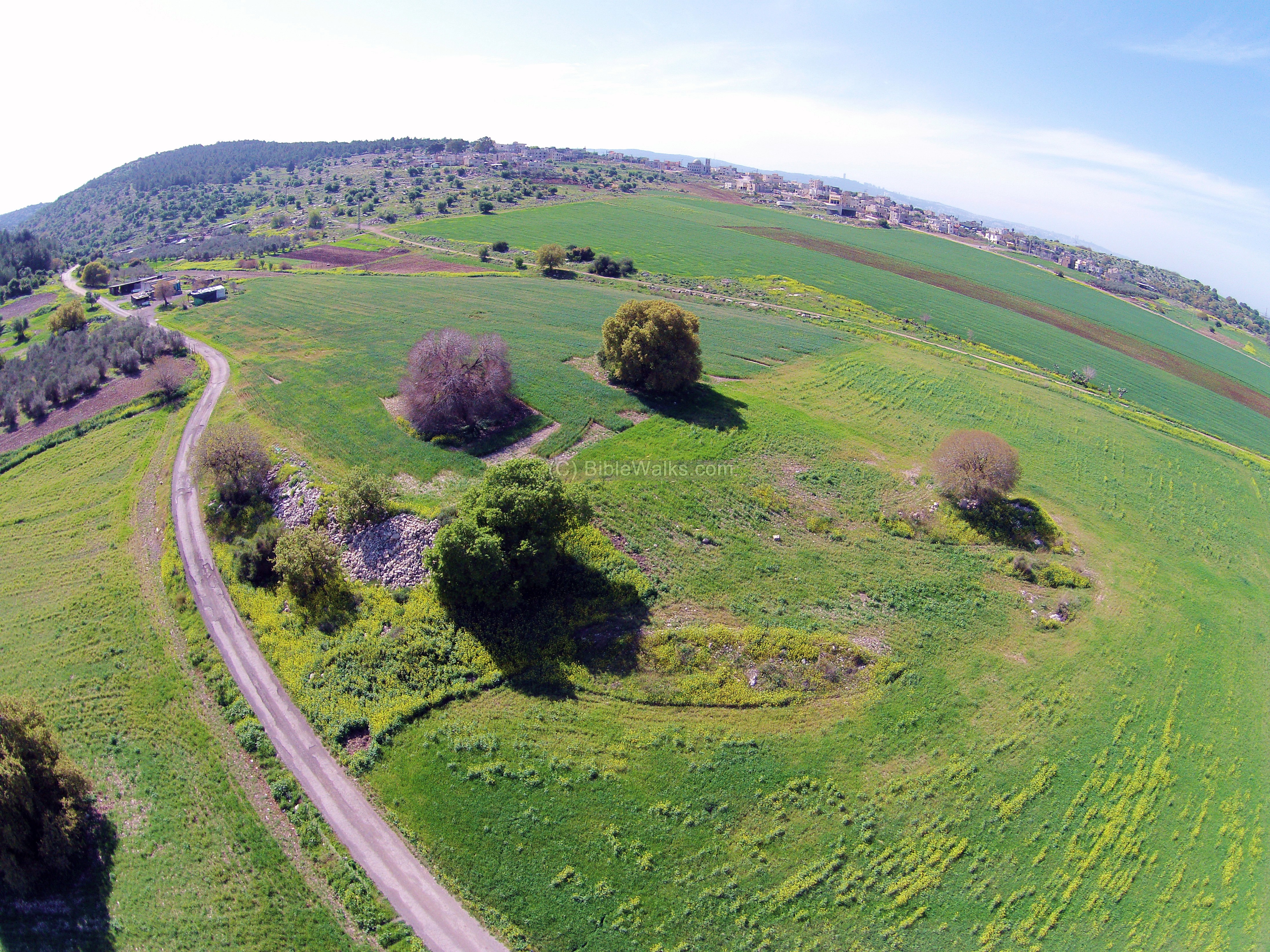
32. Tell Ya’anin (Biblical Neiel)
Tell Ya’anin is identified as Biblical Neiel (Joshua 19: 24-27): “And the fifth lot came out for the tribe of the children of Asher … And their border was … and Neiel, and goeth out to Cabul on the left hand”. This aerial view shows the ancient mound from its south side. Traces of the ancient structures are seen close on the summit and on the upper level of the foothills. Behind the hill is the valley of the Hilazon stream.
“Fly” over the mound with this Youtube video.
In Tel Gamma, located on the bend of the Besor brook, are ruins of an ancient Canaanite. This city is identified as Yurza, a city referred in the conquest of pharaoh Thutmose III (reigned 1479-1425 BC). The city was an important trading post on the caravan route from the Mediterranean to Arabia, and one of the Philistine cities during the Iron Age.
![]() A flight over the site can be seen in the following Youtube video.
A flight over the site can be seen in the following Youtube video.
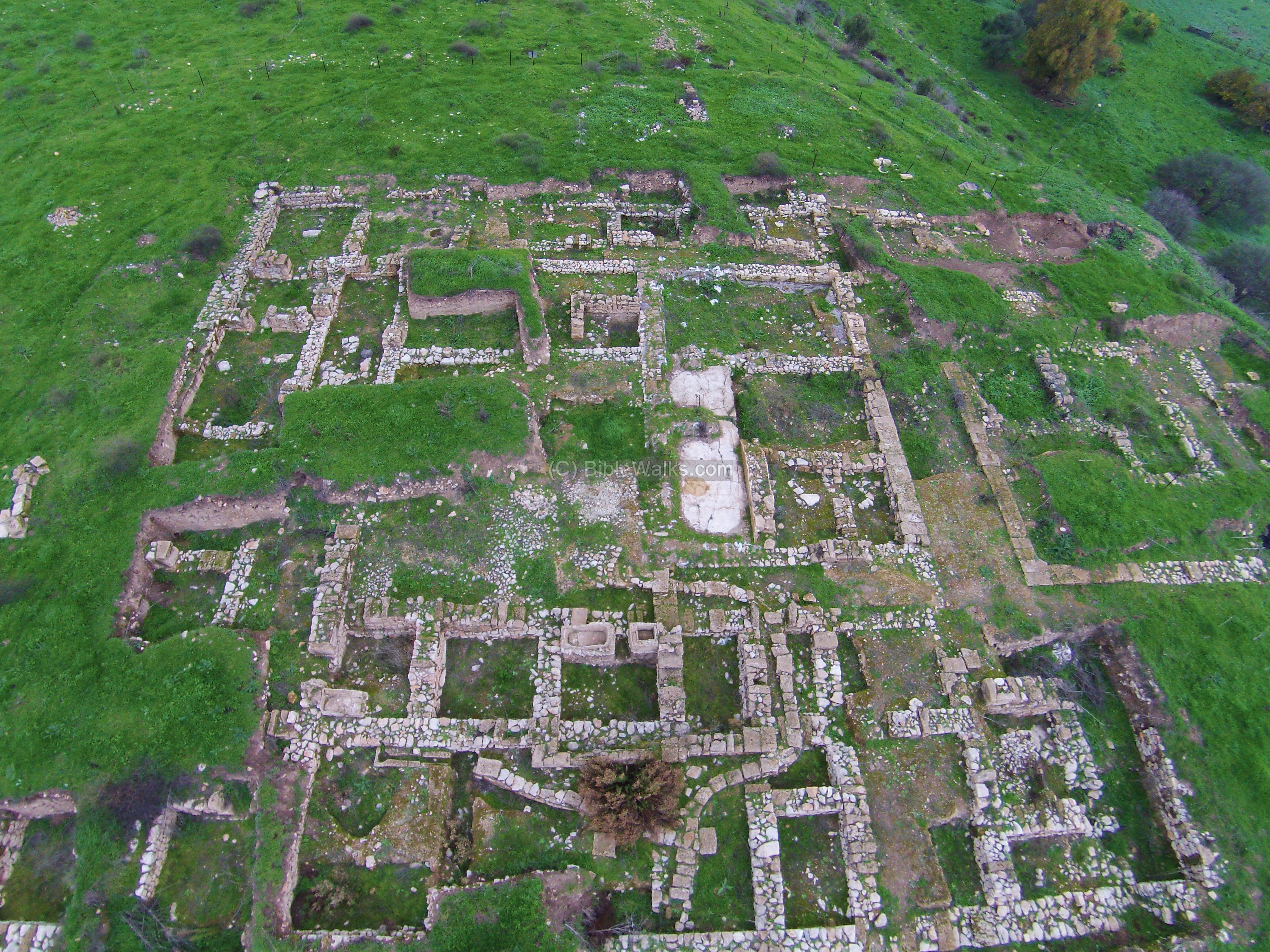
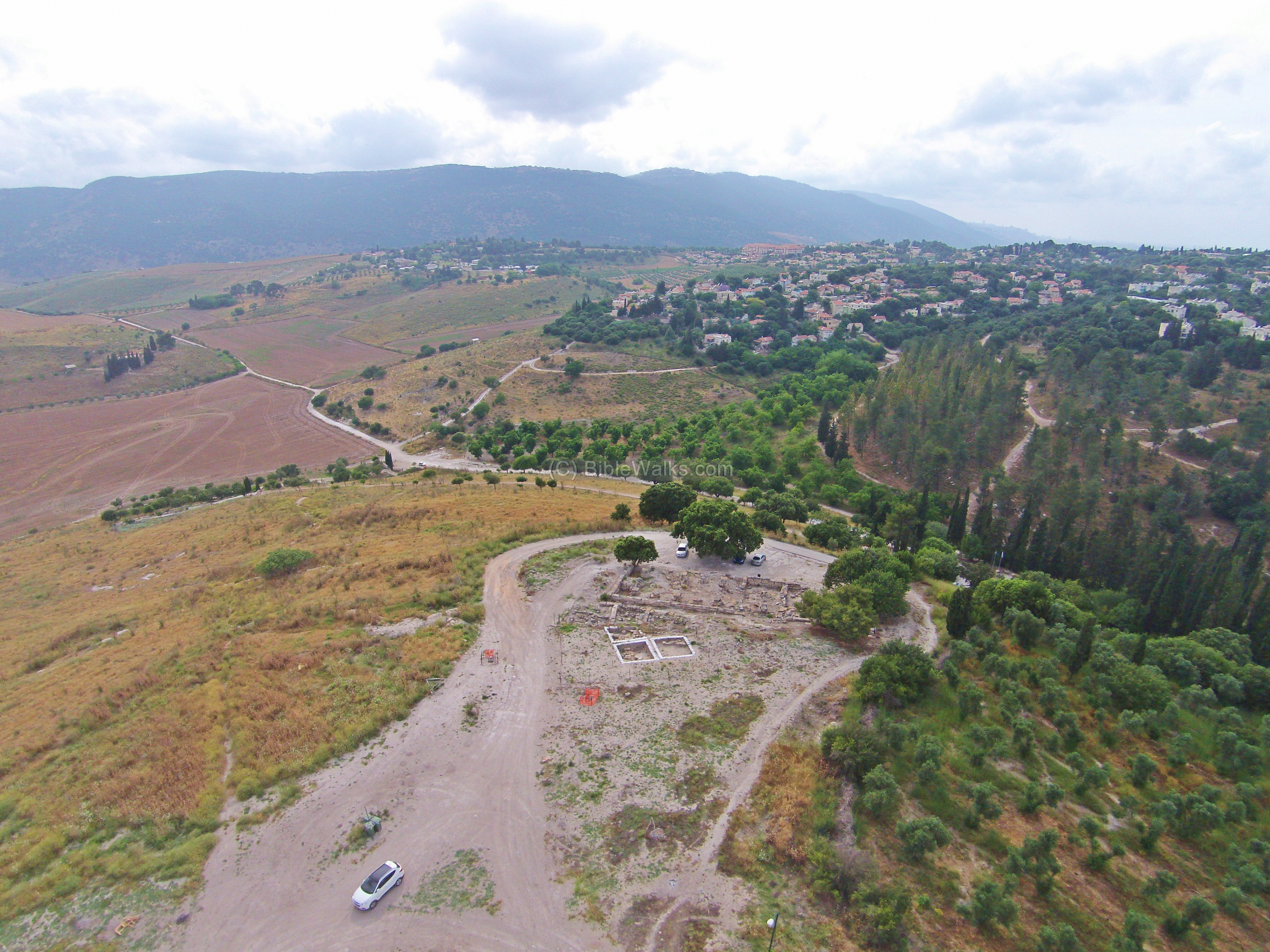
Tell Kedesh in the Upper Galilee is composed of an an ancient mound (with North and South hills) and a lower east hill, with a spring in the center. A large Persian/Hellenistic Administration Building (“PHAB”) was excavated on the south most side of the mound.
![]() A flight over the site can be seen in the following Youtube video.
A flight over the site can be seen in the following Youtube video.
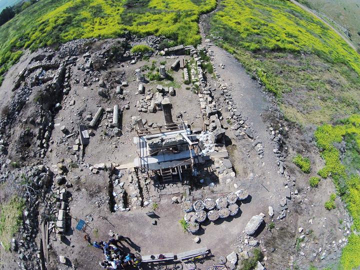
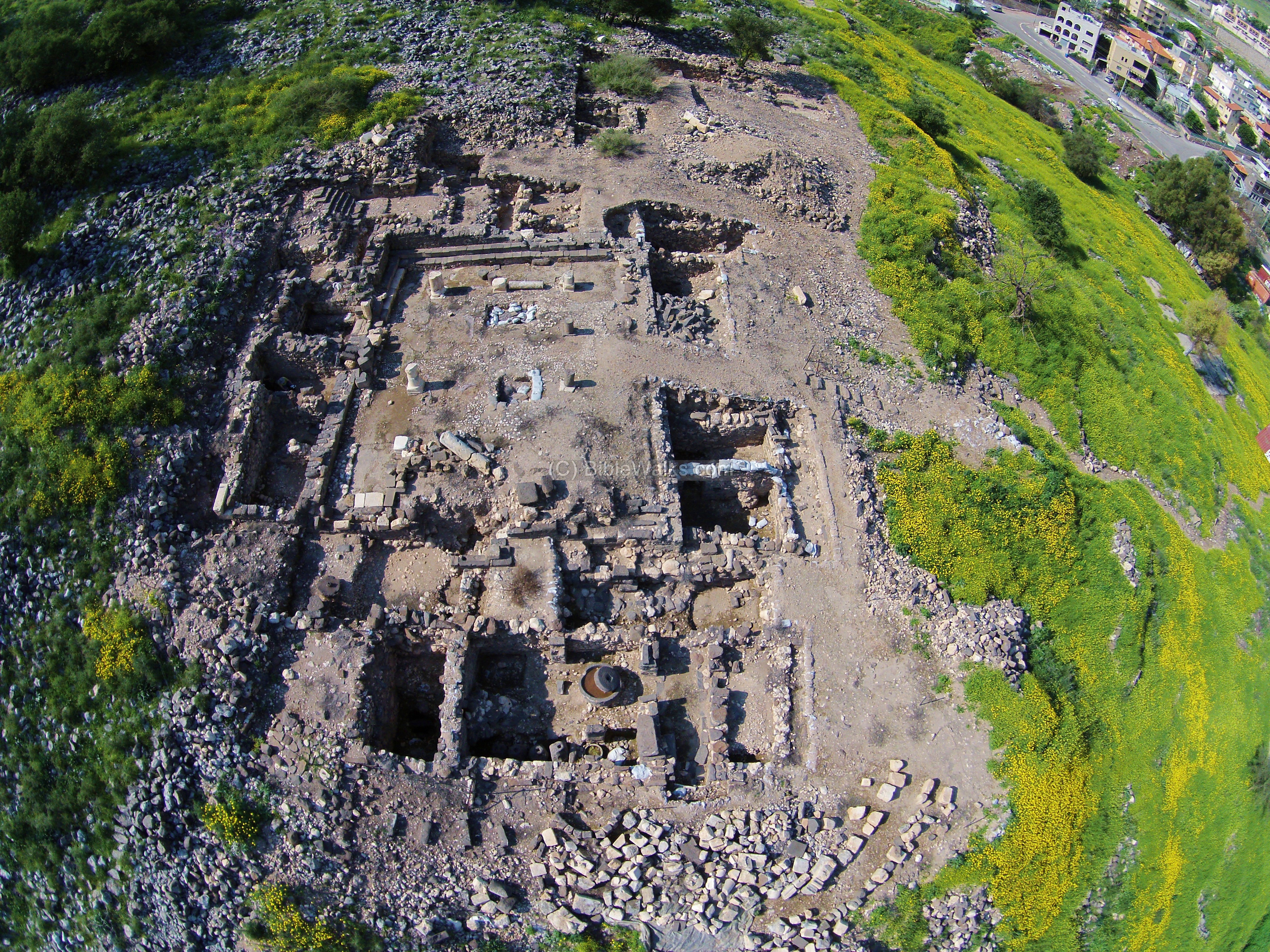
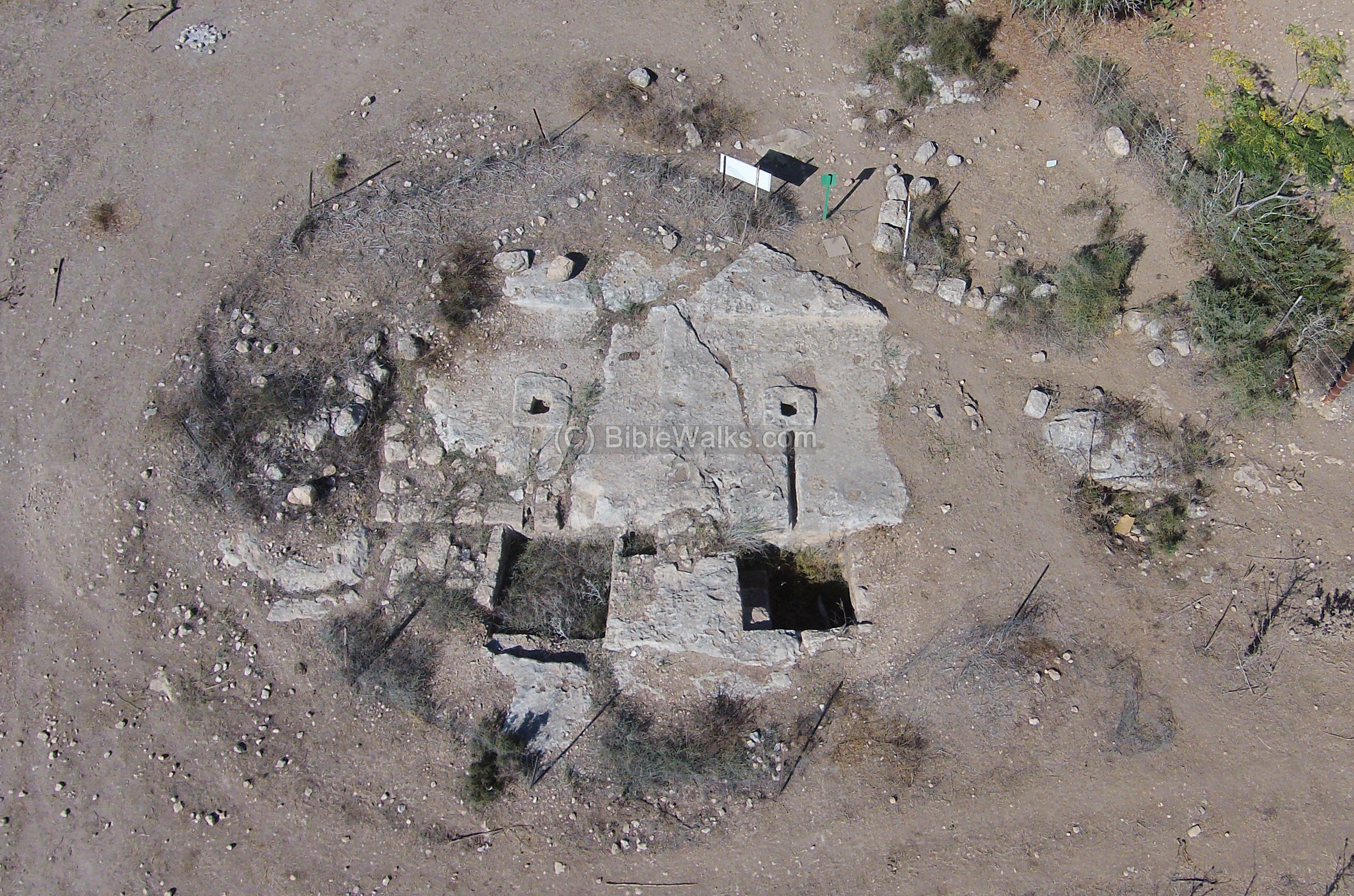
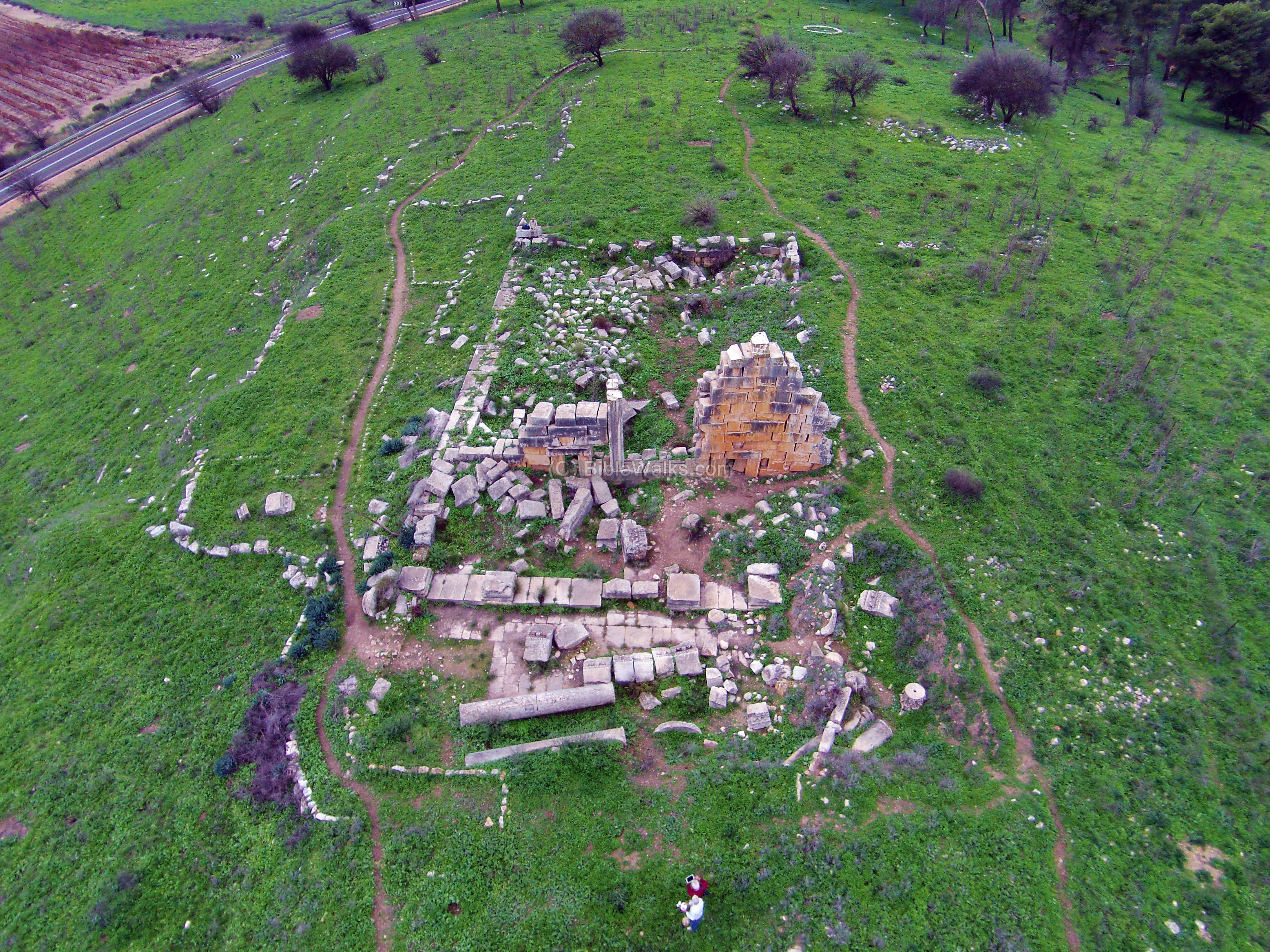
35. Kedesh – Roman city
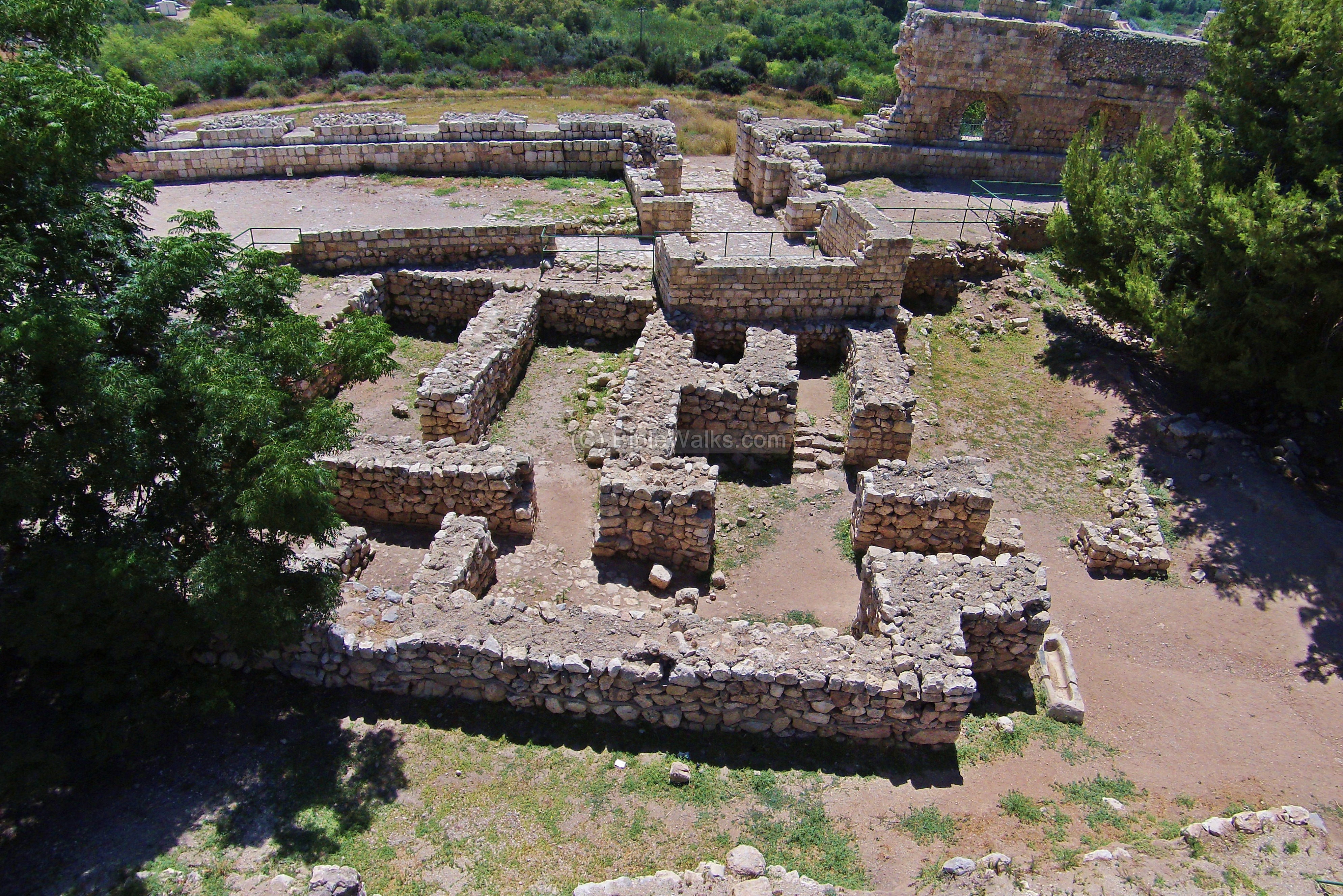
The ruins of this period are located on the eastern Tell Kedesh, a low hill on the north-east side of the ancient Biblical city. Ruins of a Roman temple, dated to the 2nd and 3rd C AD, are located on the southern side of the eastern mound. This aerial view shows the plan of the temple from the east side.
36. Khirbet Mehoz
Remains of a Byzantine village on the north side of the upper section of Beit Haemek brook. A recommended site for a short hike in the spring time.
![]() A flight over the site can be seen in the following Youtube video.
A flight over the site can be seen in the following Youtube video.
37. Khirbet Tefen
Ruins of a mountain fortress dated to the Hellenistic period, which was probably built to protect the border between the west (Acre/Ptolemais) and center of the Galilee (Sepphoris).
![]() A flight over the site can be seen in the following Youtube video.
A flight over the site can be seen in the following Youtube video.
38. Tel Tanninim
Tel Tanninim (“Crocodiles mound”) is the ruins of the city of Crocodilopolis, situated at the mouth of Tanninim stream. Nearby is a fishermen’s pier, village and beach.
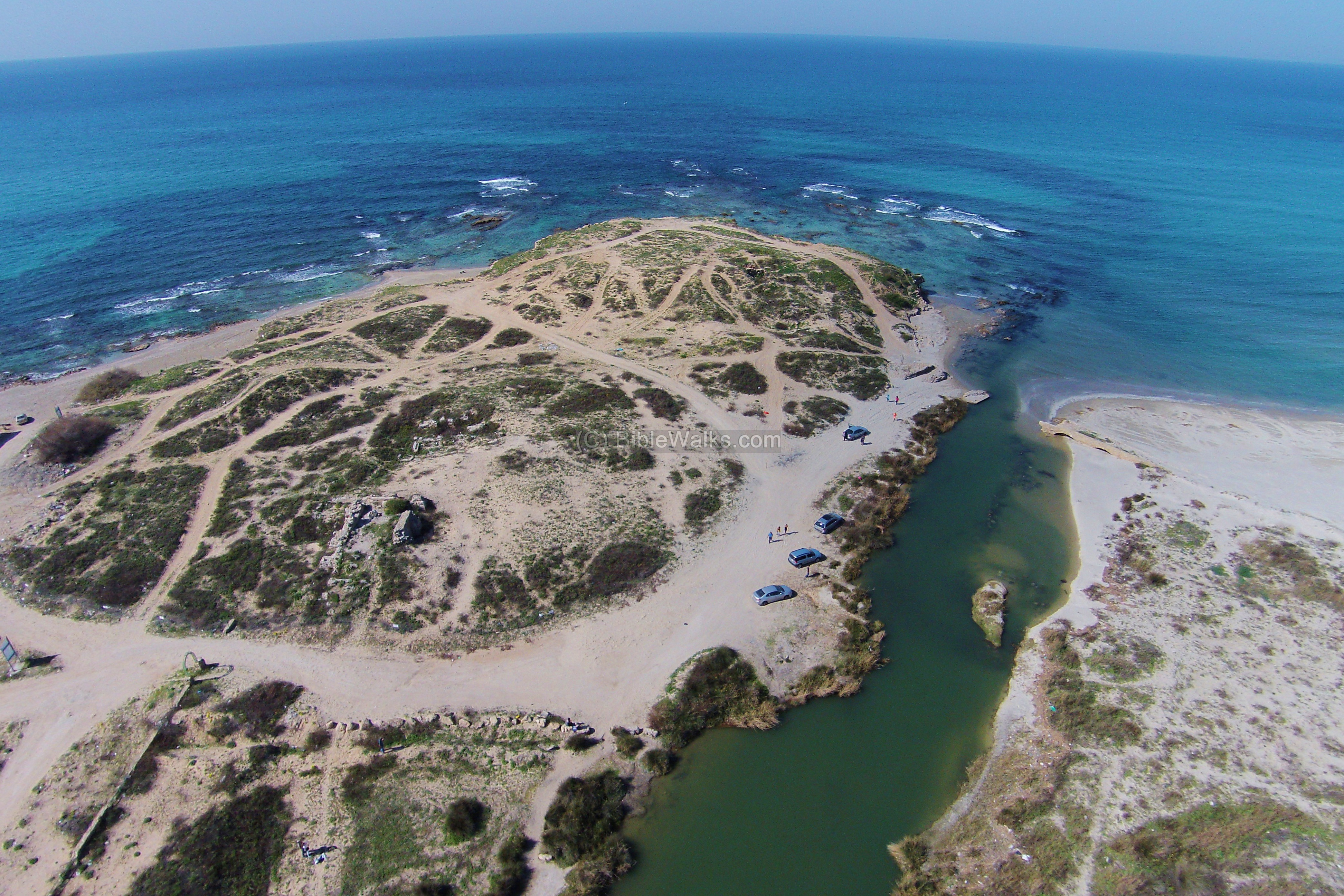
The next aerial view, with a view towards the east, shows the stream and Jiser e-Zarka in the background.
![]() You can “fly” over the site with the following Youtube videos of Tel Tanninim and the Tanninim stream.
You can “fly” over the site with the following Youtube videos of Tel Tanninim and the Tanninim stream.
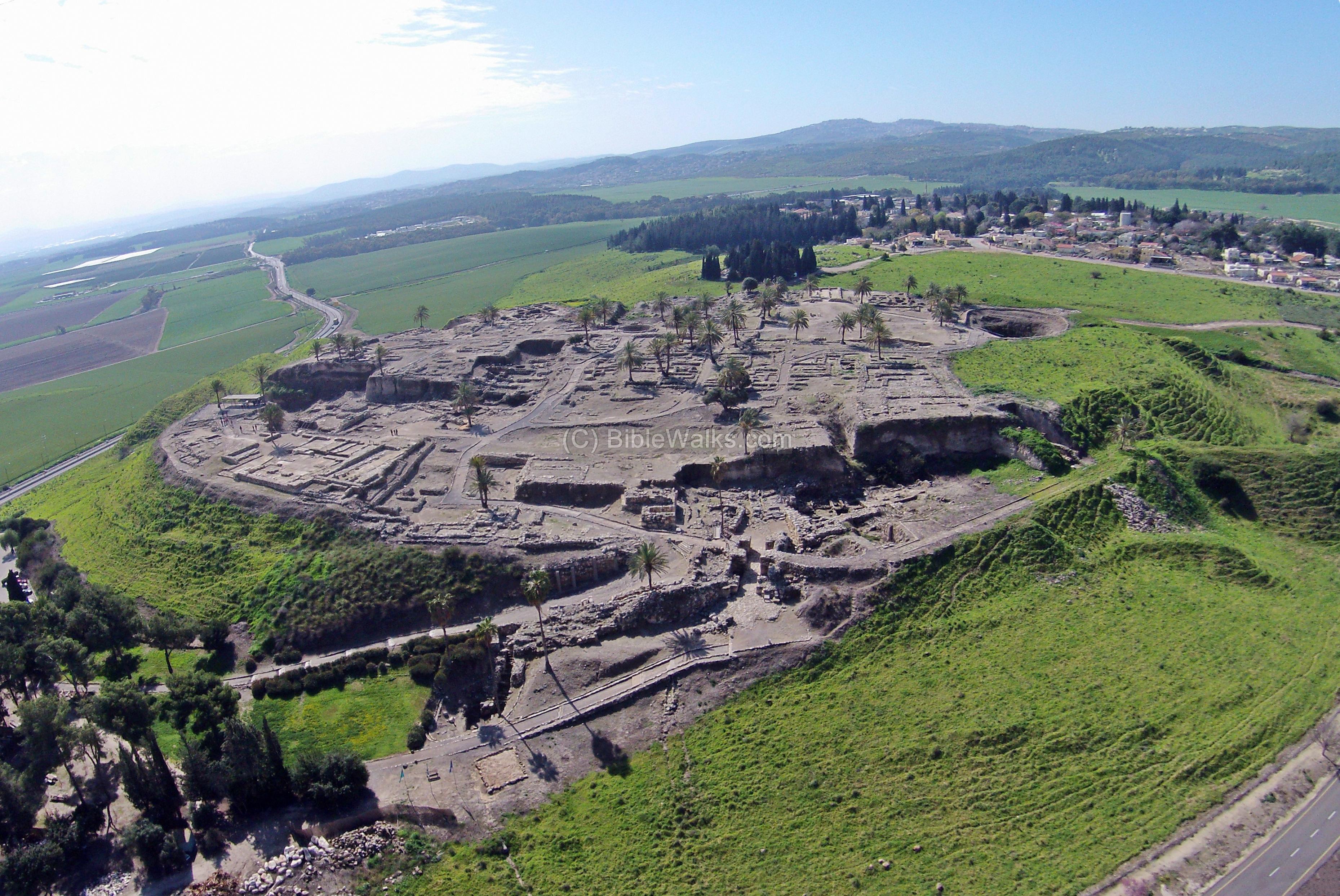
39. Tel Megiddo
This famous site is situated on the gateway on the road linking North and South of Israel, about 30 Km south-east of Haifa. The archeologists uncovered 26 layers of ancient cities, starting before the bronze age (4000 BC) until the Greeks (4th C BC).
1 Kings 9-15: “And this is the reason of the levy which king Solomon raised; for to build the house of the LORD, and his own house, and Millo, and the wall of Jerusalem, and Hazor, and Megiddo, and Gezer.”
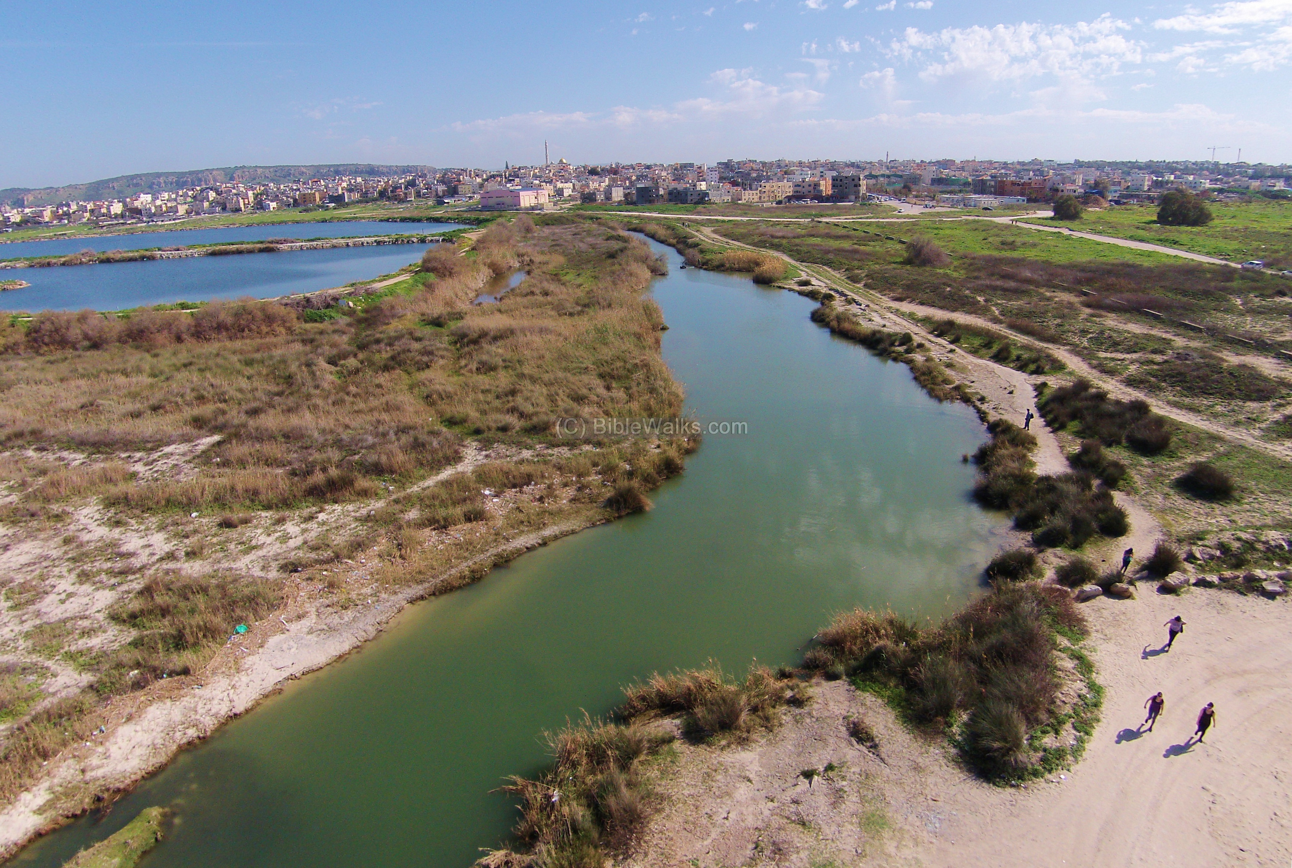
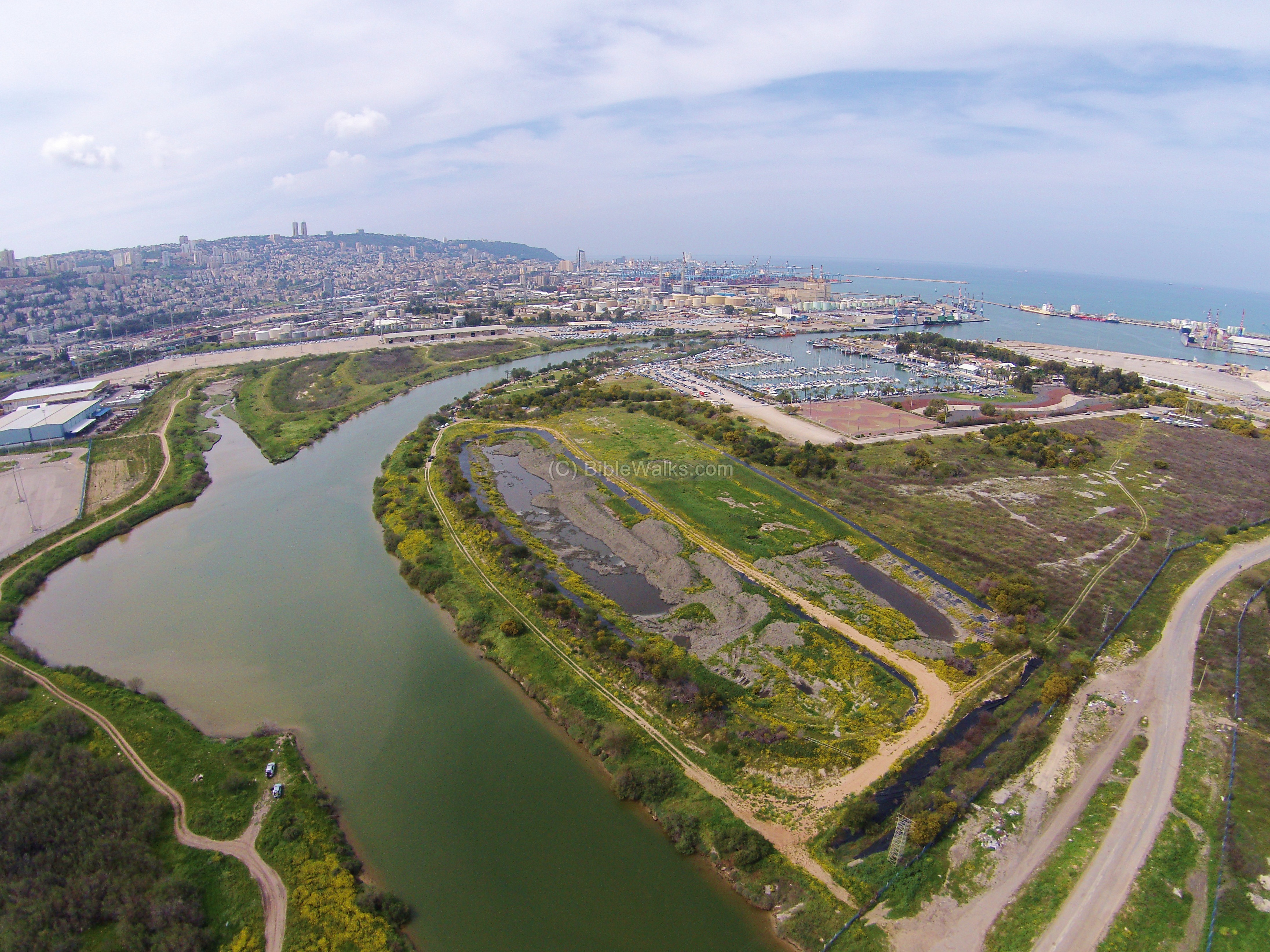
40. Kishon River
This photo is an eastern view of the city of Haifa, its port and the bay of Haifa. The Kishon river, which flows here into the bay of Haifa, is one of the largest in Israel. Its drainage basin includes an area over 1000 square KM, where one third of this area is in the Jezreel valley. Prophetess Deborah sang the famous song after the victory over Sisra: (Judges 5 21): “The river of Kishon swept them away, that ancient river, the river Kishon”.
41. Yiftach-El
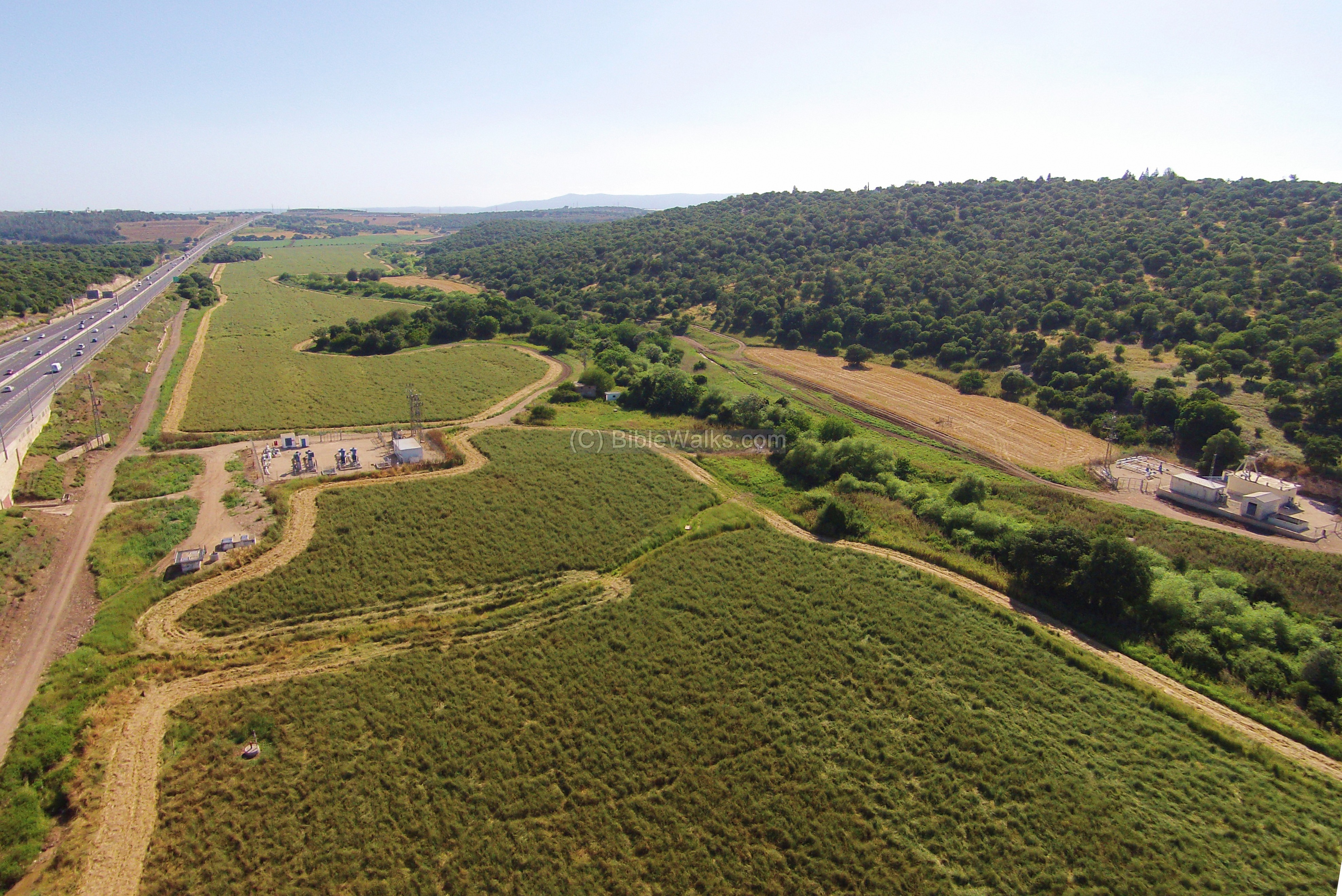
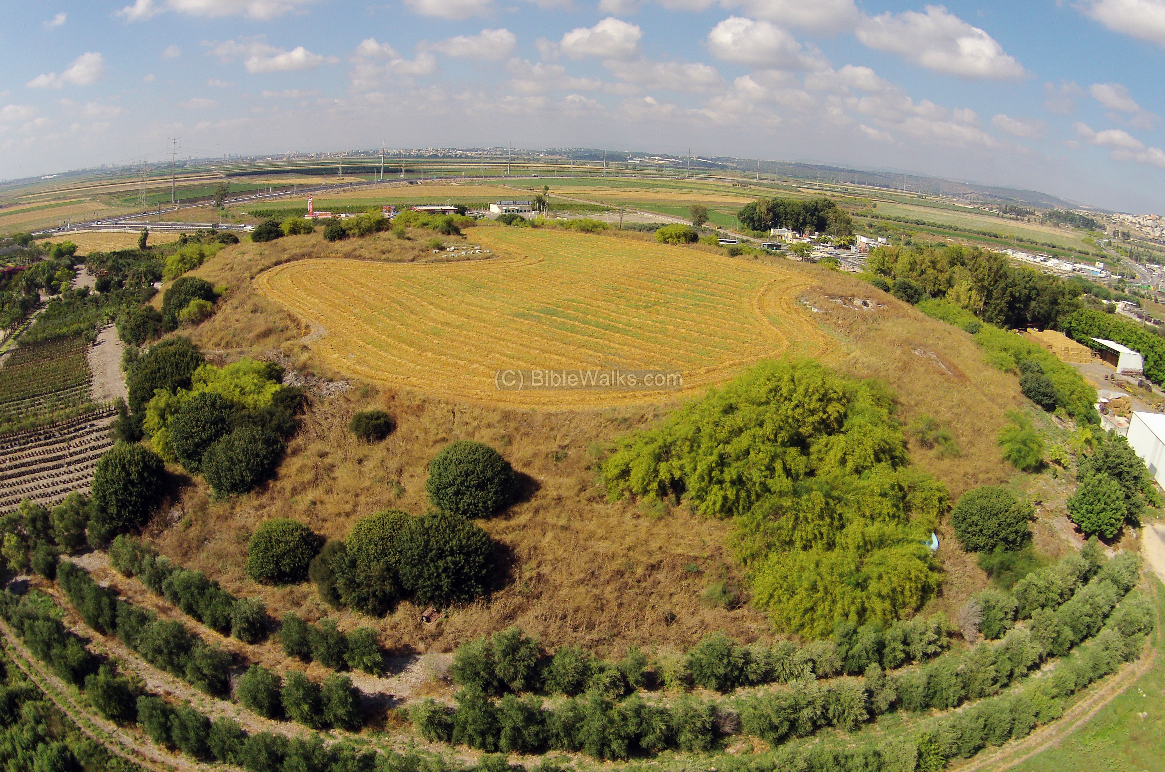
The site was one of Zebulun tribe cities. An aerial view of the site was captured from the north side by a quad copter drone. Yiftach-El brook is on the right side, flowing to the south into the Zippori brook towards the far background.
The ancient city is actually covered by this large green field. During the Bronze Age its structures were spread out to the east of the brook. A small section of its “upper city”, which is the only visible ruins today, is located in the group of trees behind the modern water pump.
![]() You can also watch a video of a flight above the area.
You can also watch a video of a flight above the area.
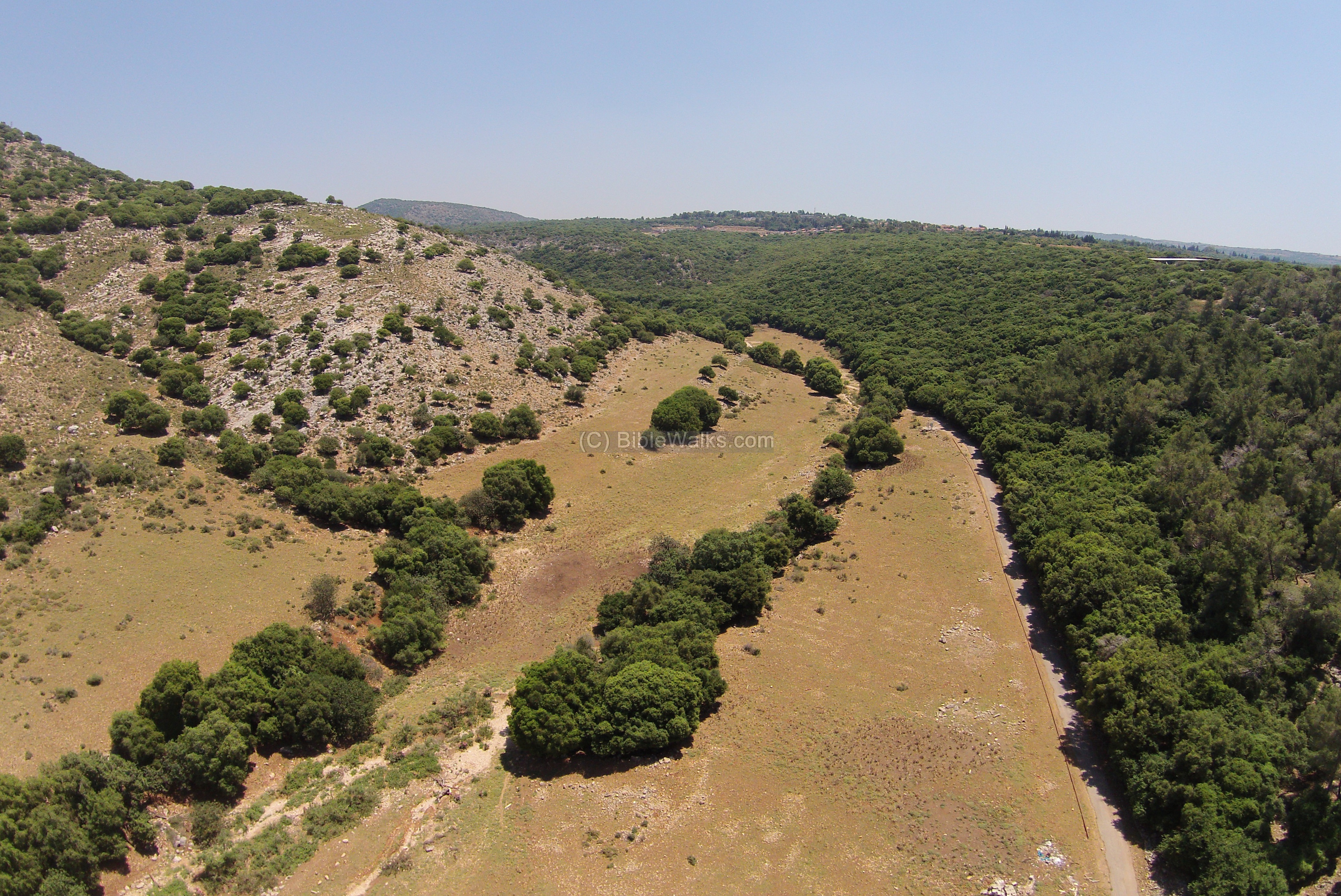
42. Kh. Seraf and Betzet Creek
In Kh. Seraf (Semah), located in the Western Upper Galilee, are remains of an ancient multi-level Tel. Another Roman/Byzantine village, Ramah, was established on its east side. This aerial view shows Betzet creek, while the ancient sites are on the hills above its south (right) bank.
![]() You can also watch a video of a flight above the area.
You can also watch a video of a flight above the area.
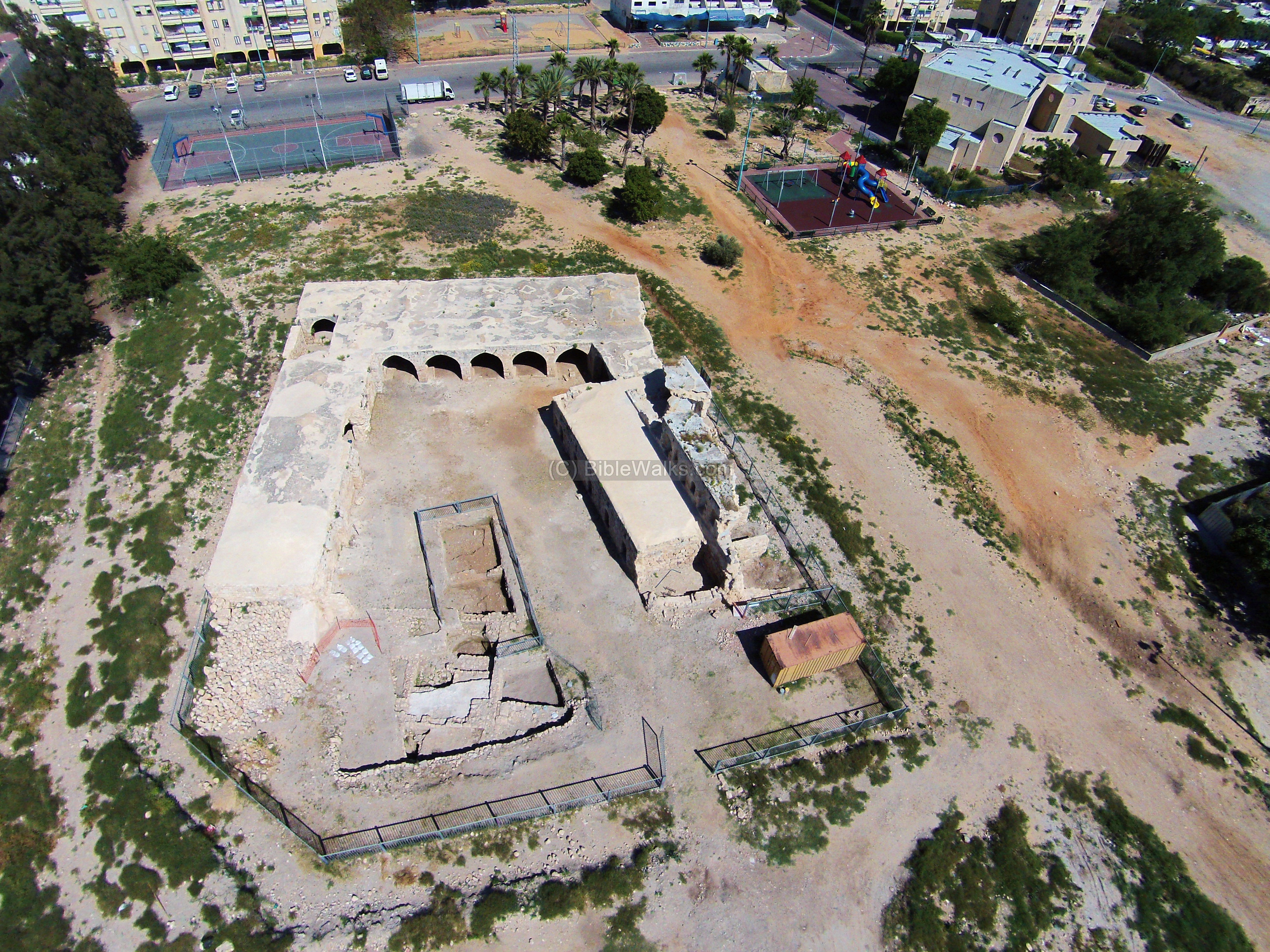
The ruins of the White Mosque (Arabic: Jamia el Arbain Meghazi), also known as the mosque of the 40 Champions, are located in Dani Maas street, Ramla. It was built in several phases, during the Umayyad, Ayyubid and Mameluke periods. The drone view shows the Minaret tower and ruins from the north side.
![]() You can also “fly” over the site with this drone video.
You can also “fly” over the site with this drone video.
44. Beit Shearim
This is a south-west view of the ancient city. Beit Shearim (Besara) is located on the summit. On the left (north) corner in the background is the location of the national park of Beit Shearim, with its famous catacombs. On the right is a new section of the catacombs.

![]() You can “fly” over the site with this drone video.
You can “fly” over the site with this drone video.
A west view from the summit shows the ruins of a large Basilica-type public house dated to the Roman period. Mt Carmel is seen in the background.
On the east side is the tomb of Sheikh Ibrik, overlooking the Jezreel valley.

45. Lod
Lod (Lydda) is a historic city, starting from a Canaanite city situated along two major roads in the heart of the Country. The birth and burial place of the famous St. George, an early Christian Martyr who inspired the Crusaders and Christian World.
This drone view shows the center of Lod from the north side. The Church of St. George is located to the left side of the minaret of its adjacent mosque.
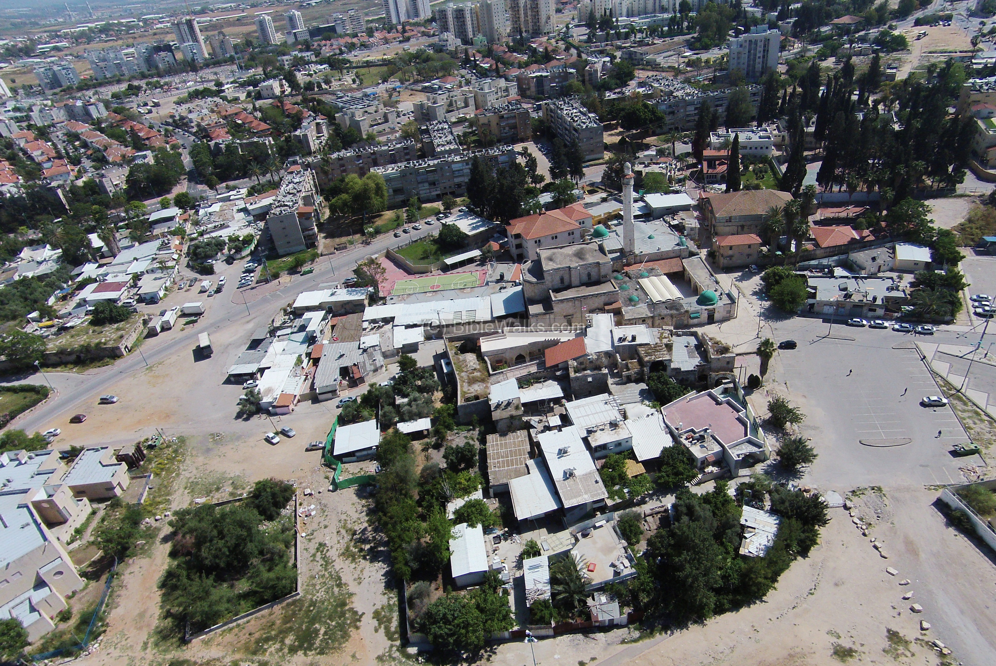
An impressive 19th Century Khan (inn, caravansary) located near St. George.
A major fortified Canaanite and Israelite fortified city, one of the famous Biblical cities. This view is over the ruins of the Israelite period city, with the city gate (“Solomon’s gate”) with its 6 chambers on the right side.
1 Kings 9-15: “King Solomon raised… the wall of Gezer.”
![]() A flight over the site can be seen in this drone video.
A flight over the site can be seen in this drone video.
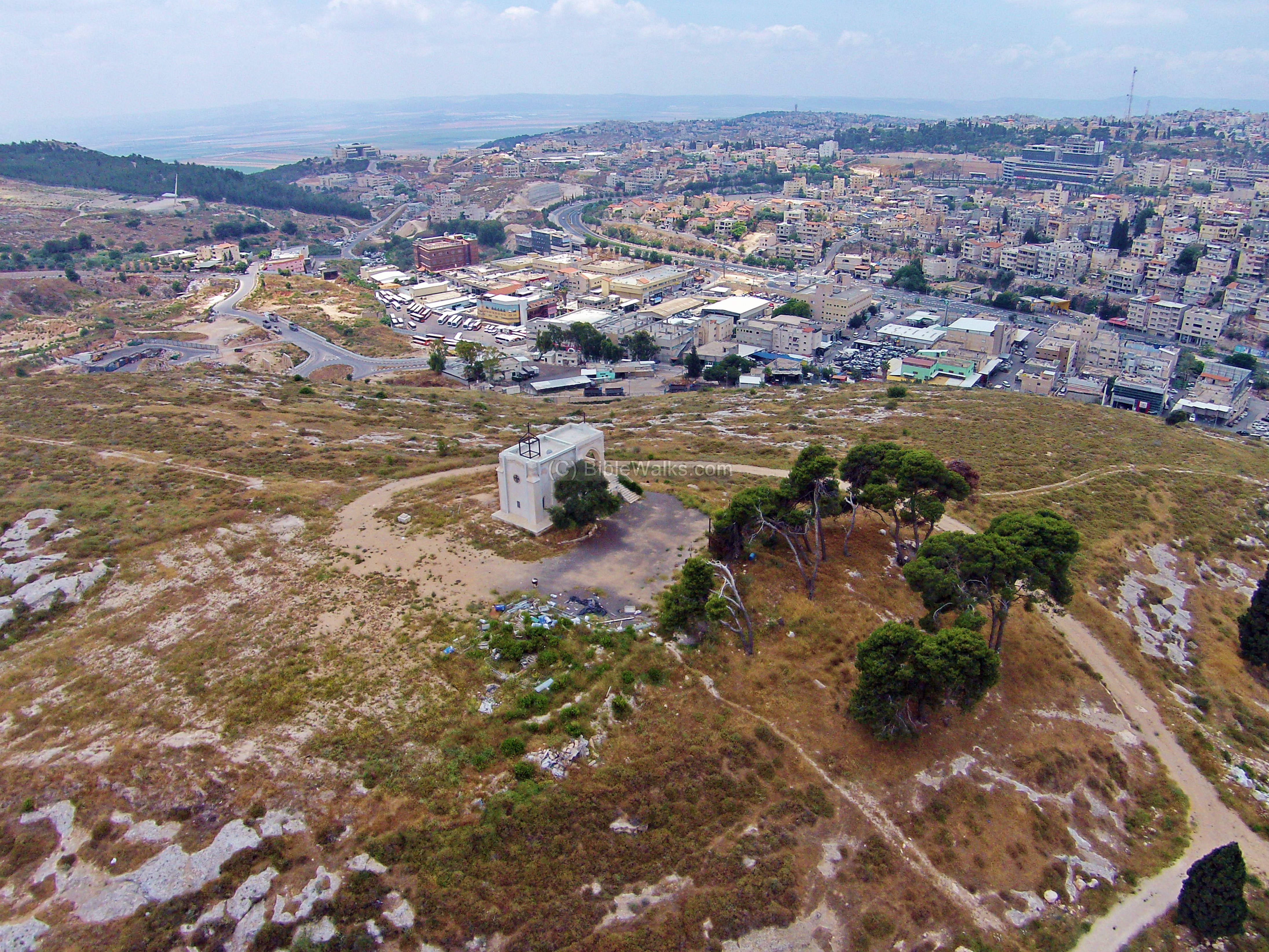
47. Our Lady of Fright, Nazareth
Ruins of a Franciscan chapel on a south hill near Mt Precipice. It was named after the traditional site where Mary, mother of Jesus, stood when her son was about to be thrown from the hill. The chapel overlooks Mt Precipice (left background) and the south side of Nazareth (right background).
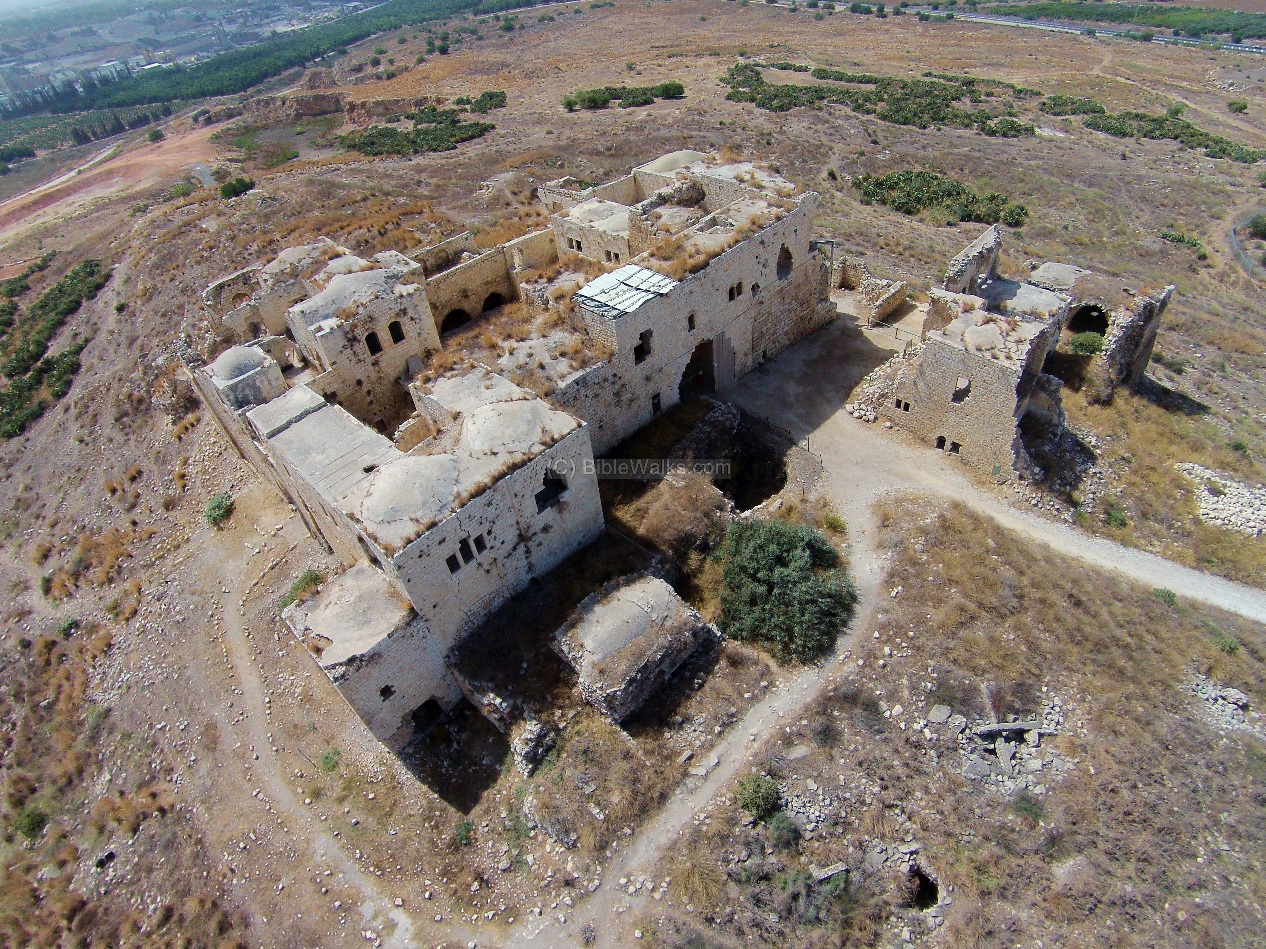
48. Migdal Afek (Tsedek)
The fortress of Migdal Afek controlled the narrow pass of Via Maris (“Way of the Sea”), located near its location. Remains of settlements spanning from the Roman to the Ottoman periods are located in the National Park.
![]() A flight over the castle can be seen with this Youtube video.
A flight over the castle can be seen with this Youtube video.
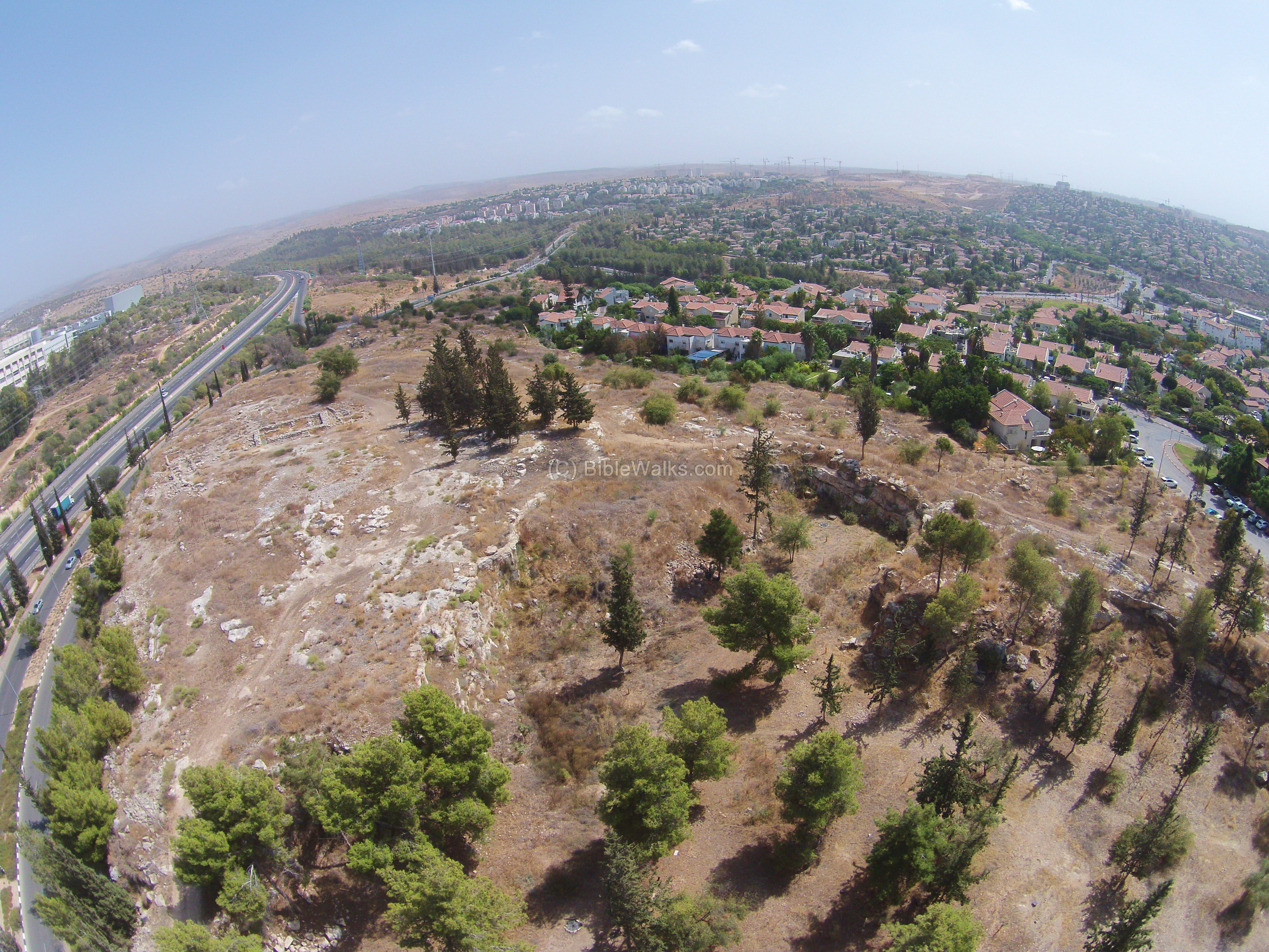
Tel Regev was a biblical fortified city that was one of the passing points across the Kishon river. Its history spanned from the Early bronze age to the Byzantine period. It belonged to the Asher tribe, but its identification is not certain.
![]() A flight over the site can be seen in this drone video.
A flight over the site can be seen in this drone video.
Remains of a Biblical city, dated to the times of David and successor kings of Judah. It was an important fortified gateway city, protecting the western flank of the Kingdom.
2 Chronicles 11 5-12: “And Rehoboam … built cities for defense in Judah. He built … Shoco…”.
![]() “Fly” over the site with this drone video.
“Fly” over the site with this drone video.
* Read more on each site by clicking on the title of each site
![]()
![]()
![]() See more sites on the next page
See more sites on the next page
Biblical references:
Kevin Woodruff wrote to us this Biblical reference which amazingly describes the quadcopter:
Ezekiel 1:16-18: “The appearance of the wheels and their work was like unto the colour of a beryl: and they four had one likeness: and their appearance and their work was as it were a wheel in the middle of a wheel. When they went, they went upon their four sides: and they turned not when they went. As for their rings, they were so high that they were dreadful; and their rings were full of eyes round about them four”.
Links:
Internal Links:
External links:
- DJI – Phantom Vision 2 – Our drone years 2014-2016
- DJI – Mavic pro – Our drone years 2017-2019
- DJI – Mavic platinum – Our drone years 2019+
Internal sites:
- Biblewalks Youtube channel – large selection of aerial videos of Israel
* BibleWalks.com – your eye in the sky
Rina <<<—Previous info—<<< All Info >>>–Next info ->>> Quadcopter 2
This page was last updated on Dec 23, 2023 (remove site, update links)
Sponsored links: