Multi-period site on the foothills of Poriya ridge, overlooking the Sea of Galilee. Hometown of Barak son of Abinoam?
Home > Sites > Sea of Galilee> Mt. Poriya > Tel Kedesh (kh. Qadish)
Contents:
Background
Location
History
Photos
* Aerial Views
* Ground Views
* Pottery dating
* Other findings
* Structures
* Poriya Spring
* Field Survey
Etymology
Links
Background:
Tel Kedesh (Khirbet Qadish) is an archaeological site located on the foothills of the Poriya ridge, 220m above the Sea of Galilee. On the site are traces of structures and walls built with basalt stones. Ceramics were dated to the Bronze and Iron ages as well as later periods. Ein Poriya, a perennial spring, is 600m south of the site.
Some Scholars, such as Y. Aharoni, suggested that this ruin was the Biblical Kedesh Naphtali (Joshua 20:7): “Kedesh in Galilee in mount Naphtali”. However, another identification of Kedesh Naphtali is in the Upper Galilee near the border of Lebanon (see: Kedesh Upper Galilee).
Biblical Kedesh Naphtali was the home town of Barak ben Abinoam, the military leader appointed by prophetess Deborah to fight against the Canaanites. (Judges 4:6): “And she sent and called Barak the son of Abinoam out of Kedesh Naphtali”. Barak assembled the troops (Judges 4:10): “And Barak called Zebulun and Naphtali to Kedesh; and he went up with ten thousand men at his feet: and Deborah went up with him”. The Israelites prevailed (Judges 4:24)”And the hand of the children of Israel prospered, and prevailed against Jabin the king of Canaan, until they had destroyed Jabin king of Canaan”.
Location:
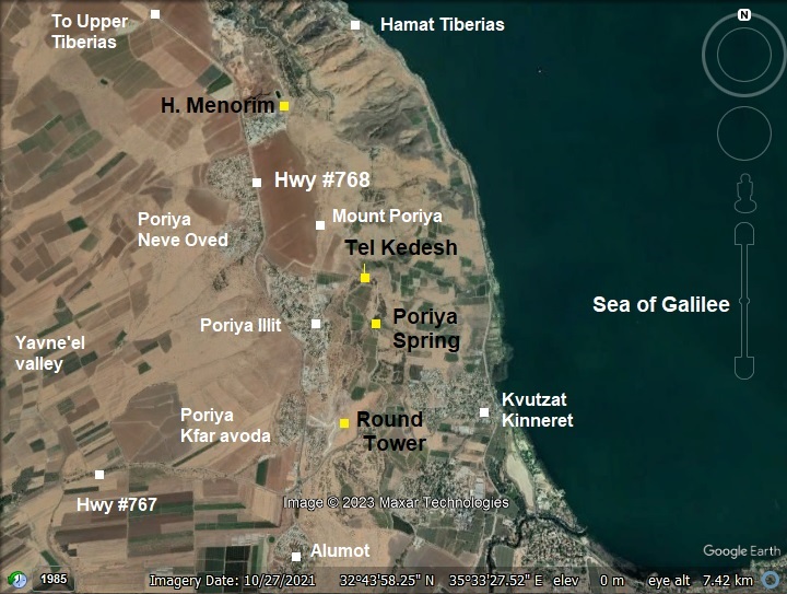
Tel Kedesh location is marked on this aerial map with a yellow square. Other sites of this period are also indicated, and are covered in the Mount Poriya overview page.
Mount Poriya, or Poriya heights, is an elongated ridge towering above the Sea of Galilee on its east side and the Yavne’el valley on its west side. Its highest point is on the north side, south of Tiberias, is ~240m above sea level, or about 460m above the lake. On the south side, at Alumot junction, its height drops to 20m. This lowest point is where highway #767 descends along a serpentine road down to Kvutzat (Kibbutz) Kinneret.
History:
- Biblical periods – Bronze/Iron Age
The site was settled during the Bronze and Iron Ages.
Kedesh was a Biblical fortified city in the region of the tribe of Naftali (Joshua 19: 32-39):
“The sixth lot came out for the children of Naphtali, even for the children of Naphtali according to their families…And the fortified cities were… and Kedesh, and Edrei, and En-hazor;”.
Kedesh was one of the six designated refugee cities named by the Bible (Joshua 20, 2,7):
“Speak to the children of Israel, saying, Appoint out for you cities of refuge… And they appointed Kedesh in Galilee in mount Naphtali”.
The Israelites arrived from Egypt in the 13th century BC, taking the land of Canaan by force. According to Joshua, they also captured Kedesh (Joshua 12:1, 22):
“Now these are the kings of the land, which the children of Israel smote, and possessed their land … The king of Kedesh, one; the king of Jokneam of Carmel, one;”.
Some Scholars, such as Y. Aharoni, suggested that this ruin was the Biblical Kedesh Naphtali. However, another identification of Kedesh Naphtali is in the Upper Galilee near the border of Lebanon. Kedesh was a common name of the city, and ruins of a third Kedesh is located near Megiddo in the area of the tribe of Manasseh.
A Biblical map is shown here, focusing on the area west and south of the Sea of Galilee. The site is marked as “Kedesh-naphtali?”.
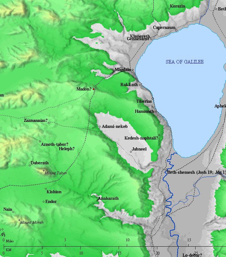
Roads and cities during the Canaanite/Israelite periods thru the Roman period, 20th BC- 1st century AD (based on Bible Mapper 3.0)
Battle of Barak and Deborah:
According to the Bible, this battle occurred during the Iron Age 1 (1200-1000 BC), at the times of the judges, prior to the Israel Kingdom period.
Biblical Kedesh Naphtali was the home town of Barak ben Abinoam (Judges 4:6): “…Barak the son of Abinoam out of Kedesh Naphtali”. He is a famous general that was summoned by Deborah to battle the Canaanites during the period of the Judges.
Deborah was a prophetess and judge in Israel during a period of turmoil and conflict. The narrative of Judges indicates that the Israelites were under the oppression of the Canaanites, particularly King Jabin of Hazor, and his commander, Sisera. Deborah, acting as a leader and judge, summoned Barak and informed him that it was time to rally the Israelite tribes and confront the Canaanite forces.

Illustration of Deborah and Barak (Image created by AI using OpenAI’s ChatGPT)
Barak hesitated to go into battle without Deborah’s presence, and she agreed to accompany him. They gathered an army, and with Deborah’s guidance, they faced the Canaanite forces led by Sisera. The battle took place in the vicinity of Mount Tabor, according to the biblical account.
As the story goes, with the help of divine intervention and tactical maneuvers, the Israelites achieved a decisive victory over the Canaanites. Sisera, the Canaanite commander, fled on foot and sought refuge in the tent of a woman named Jael. However, Jael killed Sisera by driving a tent peg through his temple while he was sleeping, fulfilling a prophecy Deborah had made about the Canaanite leader’s fate.
The victory of the Israelites in this battle had significant implications. It weakened the hold of the Canaanites in the region and contributed to the eventual conquest and settlement of the Promised Land by the Israelites. The “Song of Deborah” in Judges 5 is a poetic celebration of this victory, highlighting the role of Deborah, Barak, and other tribes in the battle.
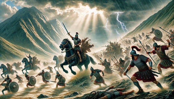
Illustration of the battle between Barak and Sisera (Image created by AI using DALL·E through OpenAI’s ChatGPT)
The events of the “battle of Deborah” are considered a pivotal moment in the biblical narrative of Israel’s early history, as they reflect themes of divine intervention, leadership, and the struggle for freedom against oppressive forces. The conquest of Hazor and the victory over Sisera marked a significant step toward the Israelites’ establishment in the land of Canaan.
Barak (“lightening”), son of Abinoam, was the great hero of the day. His tactical management of the battle turned a possible defeat into a glorious victory. He knew that the Israelites have no match against the 900 chariots of iron of the Canaanites. After all, they had none, and could not win face to face on even ground. So he cleverly selected a place where the chariots were ineffective – they could not climb up Mt Tabor, and they were useless in the swampy grounds of the Kishon brook and the muddy grounds of the Jezreel valley. Barak selected a rainy day for the battle ( “They fought from heaven… The river of Kishon swept them away…”). Barak and the 10,000 Israelites held the high ground, and descended upon the Canaanites. They dispersed in panic and were chased for 30 Km until completely wiped out.
Barak was a modest man, and he hesitated initially to take the leadership. He also shared the honors of victory with Deborah (How many generals would do so?). The honors for the hero still continues to date: his name is widely used, such as US President Barak Obama and Israel’s Ehud Barak.
See details on the battle and the sites associated with it.
Iron Age 2:
Assyrians (8th -7th century): The Assyrians captured the Galilee (732 BC), and destroyed Kedesh (2 Kings 15:39): ” In the days of Pekah king of Israel came Tiglathpileser king of Assyria, and took Ijon, and Abelbethmaachah, and Janoah, and Kedesh, and Hazor, and Gilead, and Galilee, all the land of Naphtali, and carried them captive to Assyria”. Kedesh came under the Assyrian control, with Megiddo the capital city of the Galilee province. The Assyrian empire lasted until the end of the 7th century, replaced by the Babylonians and later by the Persian empire.
During the empire switchover, the Judean King Josiah (628 to 609BC) seized the moment and expanded the Kingdom to the Upper Galilee (2 Chronicles 34 6): “And so did he in the cities of Manasseh, and Ephraim, and Simeon, even unto Naphtali,…”. This was the greatest times for the Judean Kingdom, which lasted for a short time, and Josiah was killed in a battle at Megiddo. The Babylonians destroyed Judea in 587.
Later periods:
During the Roman/Byzantine period it reached a peak, as seen by the concentration of pottery of that period on the summit of Tel Kedesh.
Crusaders:
According to “ancient Sites of the Galilee” by S Grootkerk, this village was known as “Hecdix” during the Crusaders period. The name appears on a map illustrating Crusader place names in Gustav Beyer’s 1945 Die Kreuzfahrergebiete Akko und Galilaea (p. 189). The author noted that Hecdix is Khirbat al-Kidīsh.
- Ottoman period
According to “ancient Sites of the Galilee” by S Grootkerk, the site appears as Kh. Kadish during the Ottoman 16th century period (as per Akadis 202/237).
It appears on Pierre Jacotin’s map as “Kadis”. (Map of Jacotin, 1817; “Acre, Nazareth, Le Jourdain”). Jacotin was a surveyor and geographer who accompanied Napoleon on his 1799 expedition to Palestine.
Conder and Kitchener surveyed this area during the Survey of Western Palestine in 1882. A section of their map is seen here, on the south west corner of the Sea Of Galilee. The site reviewed in this page is Kh. Kadish, located on Mt. Poriya overlooking the lake.
Part of map Sheet 6 of Survey of Western Palestine,
by Conder and Kitchener, 1872-1877.
(Published 1880, reprinted by LifeintheHolyLand.com)
The surveyors merely stated (SWP, Volume I, p. 400): “Heaps of basaltic stones, and ruined Arab houses”.
Notice that a dashed route ascended from the main road on the edge of the lake (the double dashed line) and passed through the site, then connected to el Manarah (Horvat Menorim, a large site on Mt. Poriya).
- British Mandate
The Finnish archaeologist Aapeli Saarisalo surveyed the site in 1927 and described it in his book (“The Boundary between Issachar and Naphtali”, pp. 82-84). Here is a summary:
Location & setting: Saarisalo places the ruin on a commanding ridge in the Yavneʾel / western Galilee district. The site occupies a natural high point with slopes that fall away on most sides, giving it a defensible, watch-post character.
Topography & approach: The mound sits above nearby valleys/wadis and overlooks routes and springs, so it controls local communication lines. Saarisalo emphasizes the steepness of some slopes and the accessibility on others, which explains its strategic choice. The site is 200m in length from south to north and maximum 50m in width.
Visible architectural remains: He records foundation walls and scattered built stones (unhewn basaltic blocks), indicating at least one substantial building or enclosure. Saarisalo measured and described a prominent foundation/ruin on the eastern side (dimensions reported in his notes). Much of the visible masonry is rough basalt — typical for local vernacular building. Some Arab graves are on the northern side.
Water reservoirs: Saarisalo discovered several rock-cut pools and cisterns hewn into the bedrock around the summit. Some were rectangular, others irregular, filled with rainwater and sediment. He identified them as ancient water-storage installations, clearly connected with the site’s occupation. Their position near the top suggested they were meant to collect runoff from the slopes, not natural springs—an important adaptation for a hilltop settlement.
Surface finds & pottery: The site is strewn with pottery sherds from multiple periods. Saarisalo noted Roman–Byzantine and later Arabic sherds on the summit/upper surfaces, and presence of earlier (Iron/Bronze) fragments on the slopes and debris. From the pottery distribution he inferred occupation or reuse in several phases.
Function & interpretation: Because of its elevation, control of nearby roads/springs, and the mixed-period finds, Saarisalo sees Hirbet Kdis principally as a watch-station / small fortified or lookout site used at different times rather than as a large sustained urban center. He treats it as one of the frontier/marking sites relevant to the tribe-boundary study of Issachar–Naphtali.
Condition (1927): The rain and wind carried down the steep eastern slopes, and sherds were found all the way down to the Berniki aqueduct (a 100m drop in height). He also reports heaps of ruinous basalt blocks and that local use/clearance of stones was occurring (re-use for enclosures / agricultural needs), leaving the ruin partly robbed and eroded.
In the last census of 1931, there were 16 houses and population of 80 in the Bedouin (nomad) town of ‘Arab el Kadish. It seems like the houses (or actually tents and mud houses) were rebuilt after the PEF survey that reported only ruined houses. The settlement was depopulated again in 1948, and the fields around it were used for farming.
A section of the 1940s British map shows the area around the site, which is marked as “Kh. el Qadish”. Poriya, situated on the heights above the site, was at that time in ruins.
British survey map 1942-1948 – https://palopenmaps.org topo maps
License: public domain under the UK Copyright, Designs and Patent Act 1998
-
Modern Age
The area of Mt. Poriya started to be populated after the establishment of the State of Israel. These are the communities on Mt Poriya:
- Poriya Illit is a village situated on the slopes of Mt. Poriya in the northern part of Israel. It is located just west of the city of Tiberias and overlooks the Sea of Galilee. The village is known for its tranquil atmosphere, picturesque views, and proximity to nature. Poriya Illit offers a peaceful and scenic environment, making it an attractive residential area for those seeking a quieter lifestyle away from larger urban centers. The village features a mix of residential housing, community facilities, and green spaces. Its elevated position on the slopes of Mt. Poriya provides residents with beautiful vistas of the Sea of Galilee and the surrounding landscapes.
- Poriya Neve Oved is another community, north west of Poriya Illit.
- Poriya-Padeh is a medical center and hospital south of Poriya Illit.
- Poriya Kfar Avoda are 4 small communities south of Poriya Illit.
Photos:
(a) Aerial views
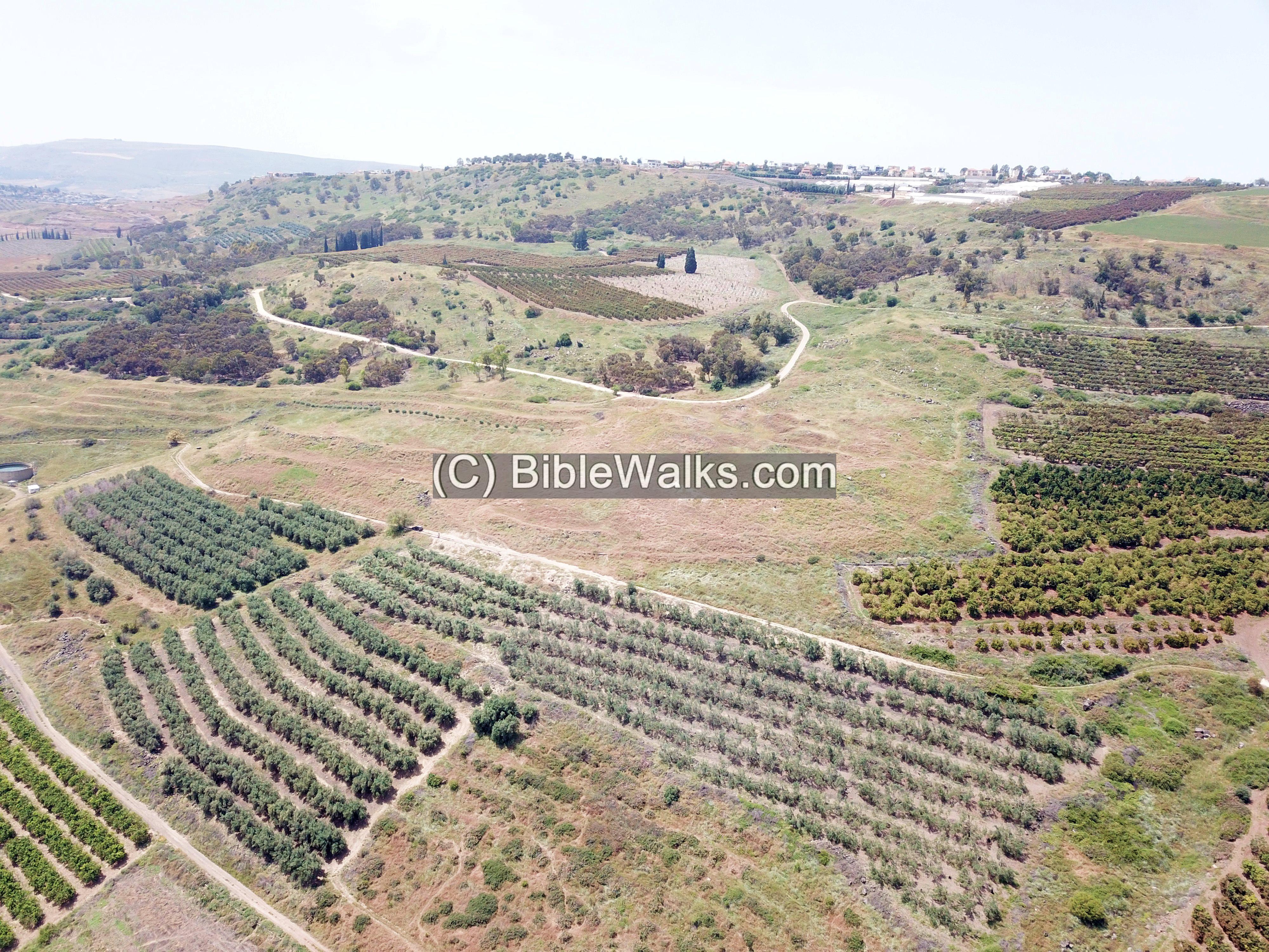
Ruins of Tel Kedesh are located on the foothills of the Poriya ridge, 220m above the Sea of Galilee. On the site are traces of structures and walls built with basalt stones. An aerial view of the site and its surroundings is seen below, as captured from the east side. The ruin covers a large area bounded by the orchards. On the hill on the far background are the residential houses of Poriya Illit.
Pressing on the photos will display a higher resolution version.
![]() Fly above and around the site with this YouTube video, captured on April 2023. The drone scans the site starting from the eastern foothills side towards Poriya, then turns around to view the Sea of Galilee.
Fly above and around the site with this YouTube video, captured on April 2023. The drone scans the site starting from the eastern foothills side towards Poriya, then turns around to view the Sea of Galilee.
(b) Ground views
During our first visit to the site, on April 2023, we could hardly see what is below the tall weeds.
This photo is an eastern view. The site towers high above the Sea of Galilee.
Luckily, during our second and third visits to the site in September and October 2025, we found that the eastern slope had been completely burnt, and the foothills were totally cleared of weeds. This allowed us to examine the plan of the ancient site and date the pottery fragments.
The following photo is viewed towards the west. This wall of rocks is seen on the south and east sides. The line of the rocks are seen here along the top of the ridge.
The site was heavily damaged in modern times by a bulldozer activity, and so the plan of the site has changed considerably. What can be currently seen is a wall made of large basalt rocks on the upper side of the foothill, although it could have been pushed to form a wall during the earthworks.
Another south west view of the foothill is next. The south west corner is where the electrical pole is standing.
Eastern views:
A view from the site looking southeast reveals the southern tip of the Sea of Galilee, with the southern Golan Heights visible in the background.
The site’s proximity to the lake’s southern edge helps explain the strategic placement of Tel Kedesh—it likely controlled the ascent from the Jordan River crossing at the lake’s southern end up to the highlands above.
Another view towards the north east:
(c) Pottery dating
The exposure of the eastern foothill revealed hundreds of pottery fragments on the surface, making it one of the richest sites in terms of visible ceramics.
Tel Kedesh is a multi-period city spanning thousands of years, starting from the Chalcolithic period and continuing until the Middle ages.
Ceramics on the eastern hillside were dated to the Bronze and Iron ages, while the majority of pottery on the summit was of the Roman/Byzantine and Mameluke/Ottoman periods.
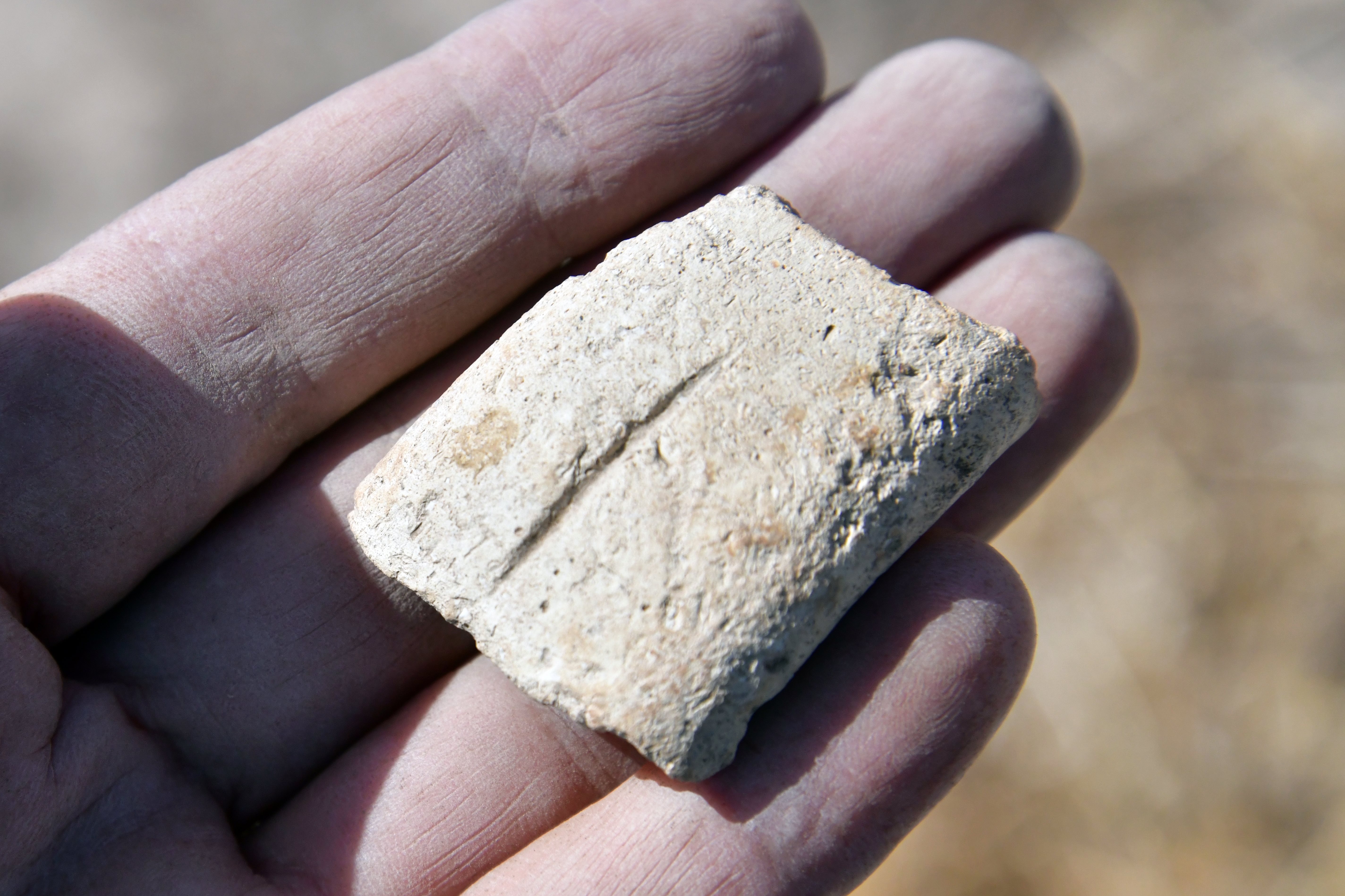
Here is a small sample of pottery fragments that we collected on the hillside (and left them on the site).
Dozens of holes had been dug by porcupines all across the foothills. These animals burrow into the ground, bringing up soil and pottery fragments, which makes it easier to sift through the soil and collect ceramics.
However, they also cause serious problems for local farmers by cutting irrigation pipes and damaging crops. Near one of the burrows, we found an empty metal trap cage placed to capture a porcupine, visible just behind the hole.
Here are some of the pottery fragments that were found along the barren foothill, around the porcupine holes, and along the dirt road below the site. They are ordered by their estimated date:
Chalcolithic period – made with a mattress mold.
Chalcolithic pottery was often made using a mattress mold, which created a characteristic pattern of mat impressions on the base of storage jars. The distinctive mat-impressed bases were formed by placing wet clay onto a matted surface or by impressing the mat into the wet clay of the finished base.
Decorated handle:
A reddish colored handle, with geometric crisscrossing lines. This rare specimen was initially dated to the Iron Age 2, but a second guess predates it to the Chalcolithic period.
Press on the photo to see a revolving 3D model. Model was generated with Scaniverse.
A ceramic cork.
A ceramic cork was needed for its ability to serve as a stopper for bottles, helping to preserve contents.
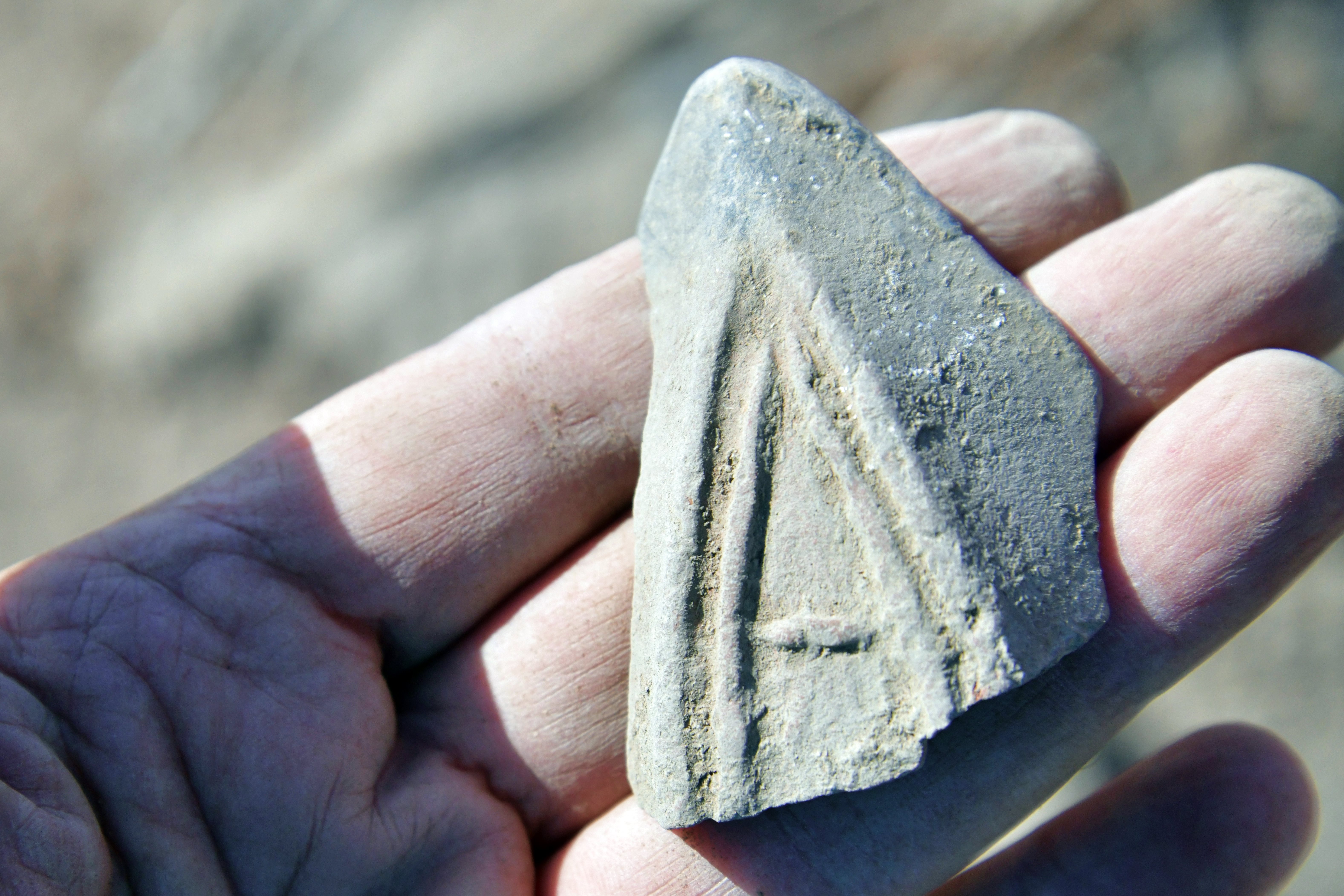
Iron Age handle:
The handle bears an incised potter’s mark.
In the Iron Age, it was quite common for jar handles to bear potter’s marks or stamp impressions, serving several possible purposes. These marks, which were incised, impressed, or stamped before firing, could indicate:
-
Workshop or potter identification – to signify the craftsman, production center, or workshop responsible for the vessel.
-
Administrative control – in some regions (notably in the Kingdoms of Judah and Israel), stamped handles were used for taxation, storage, or distribution purposes, marking vessels belonging to royal or temple administrations.
-
Quality or capacity marks – occasionally, they may have denoted a vessel’s size, contents, or quality.
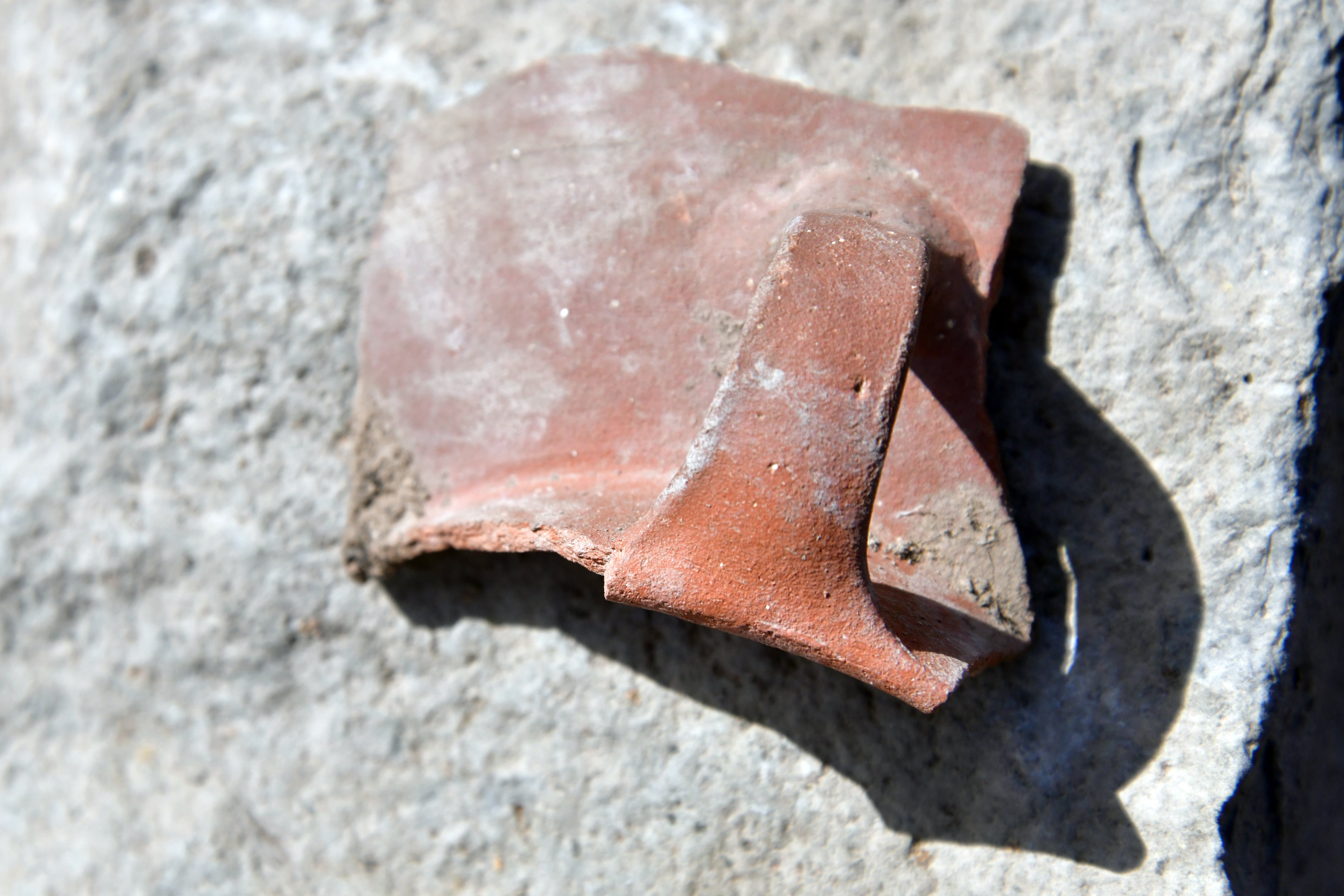
Iron Age: Serpent decorated rim
Iron Age ceramic vessel with applied serpent decoration along the upper body. The serpent was modeled separately and affixed to the vessel surface prior to firing. The execution suggests deliberate symbolic intent, possibly apotropaic (a type of magic intended to turn away harm or evil influences) or connected to fertility and renewal motifs common in Iron Age Levantine material culture.
A similar snake decoration on a vessel (title: “Ritual stand decorated with snakes and birds”) can be seen in the catalog of the Israel Museum, Jerusalem. That one was dated to the Iron 1 (12th-11th century BC) – the time period of Barak.
Press on the photo to see a revolving 3D model. Model was generated with Scaniverse.
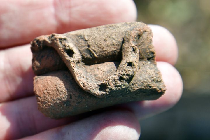
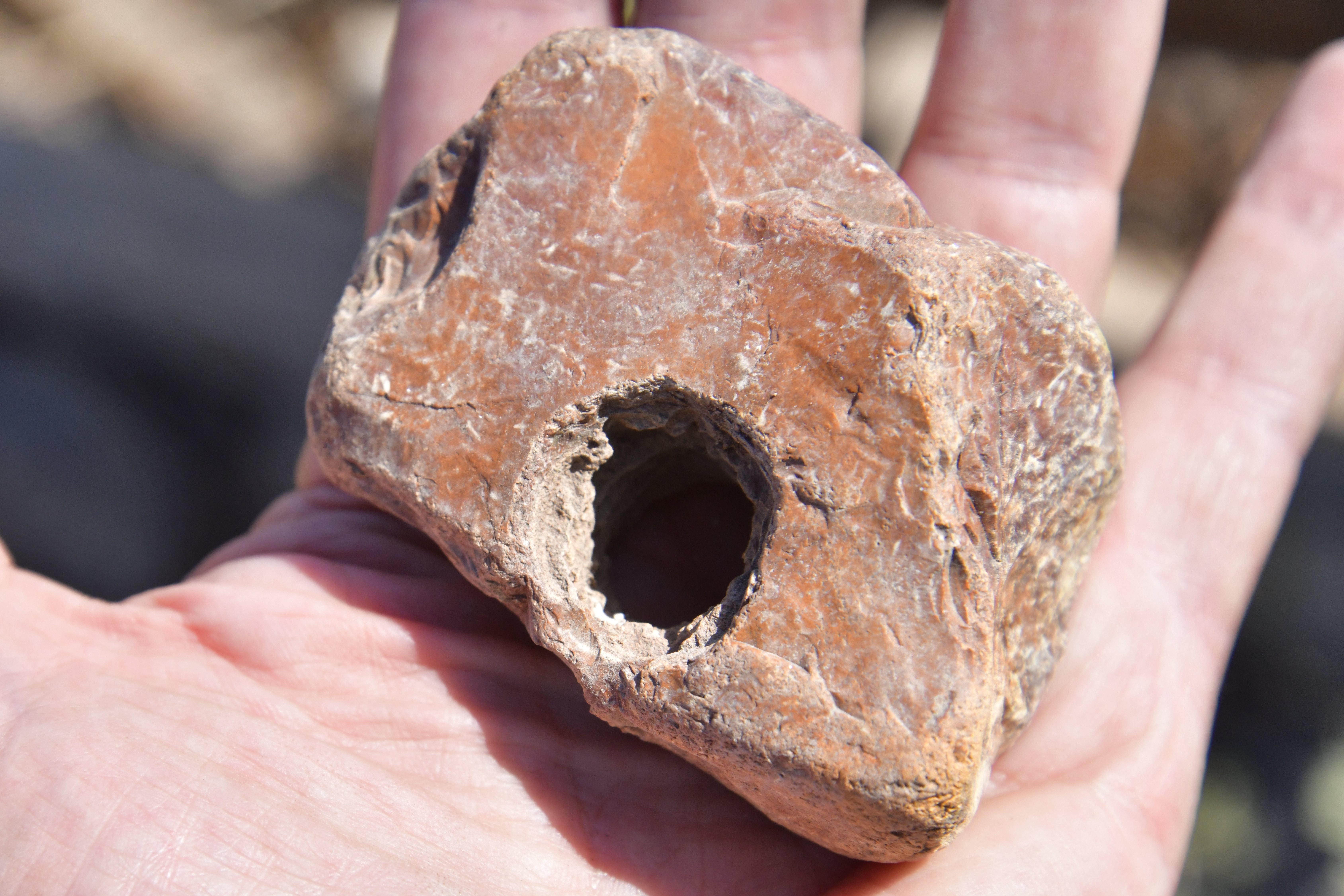
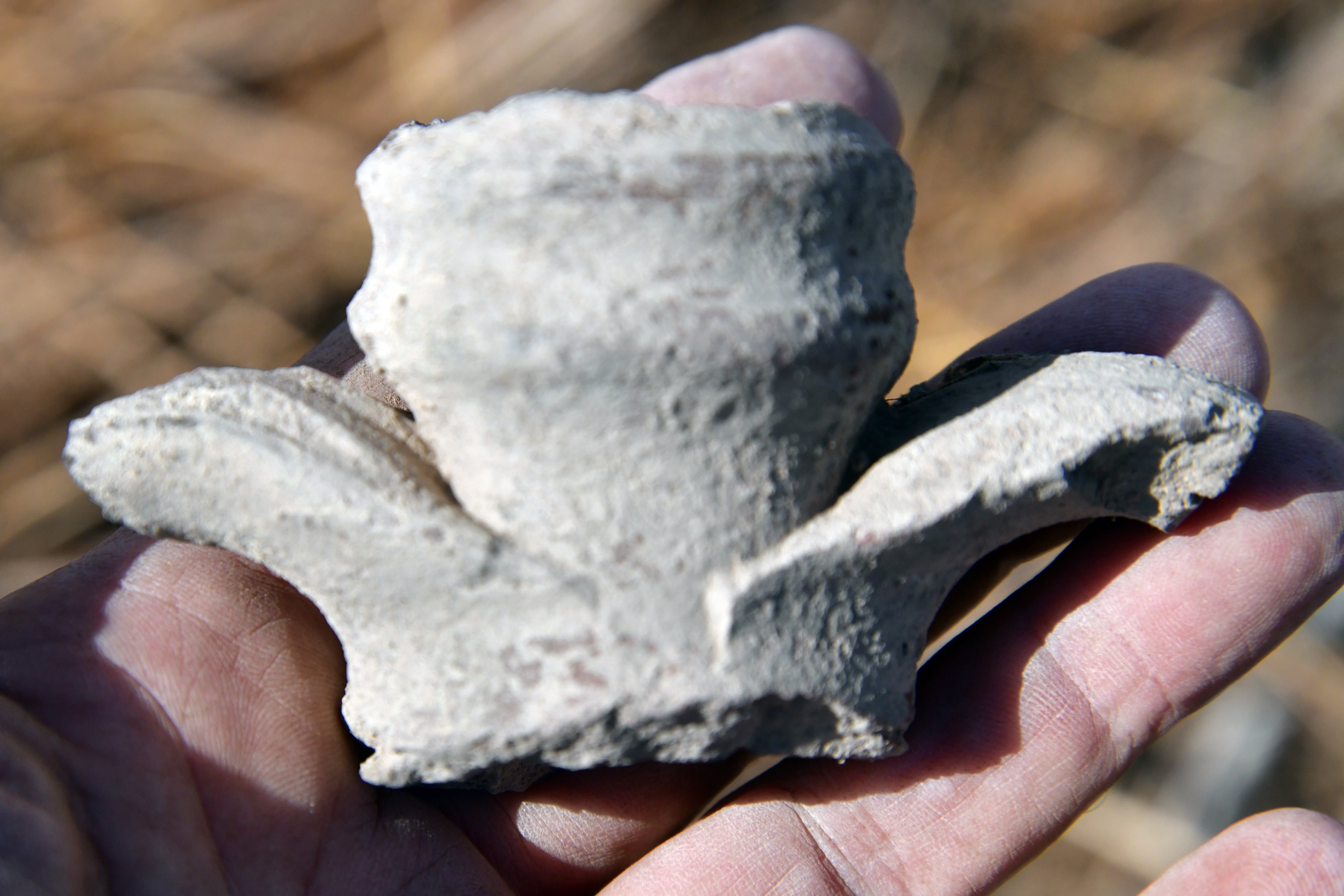
Iron Age 2: Loom weights
Several loom weights were found. Loom weights are used in the textile industry. Loom weights are typically found in areas where weaving took place. They were used to keep the warp threads taut in a vertical loom, a common type in the ancient world.
Flax (Hebrew: Pishtan, Pishtim) was a crucial plant in the ancient world, primarily for its use in producing linen, one of the oldest known textiles. Flax was a major winter crop in the Levant from the early Neolithic period through the Roman times. Flax is listed in the Gezer tablet (“One month, cutting flax”). It is mentioned in various Biblical verses (e.g. Isaiah 19:9: “Moreover they that work in fine flax, and they that weave networks, shall be confounded.” and Proverbs 31:13: “She seeketh wool, and flax, and worketh willingly with her hands.”);
The the loom weights discovered at the site, reinforce the idea that flax was cultivated and processed into linen. The fertile area would have provided suitable conditions for flax cultivation due to its access to water and fertile soil. Linen, made from flax fibers, was highly prized for its durability and comfort, and it was used for making clothing, ropes, and even burial shrouds.
Another weight with 3 holes was also found here.
Roman period handle:
Roman/Byzantine period oil lamp:
The bottom side of an edge of a decorated lamp.
Roman jar with mouth and double handles:
A Roman jar with a mouth and double handles is called an amphora, a type of vessel used for storing and transporting liquids like wine or oil, as well as grains. Amphorae have a distinctive shape with an oval body, a narrower neck, and two handles on the sides that typically extend from the neck to the shoulder. They were a principal form of pottery for ancient storage and transport, with many examples found in Roman and Greek cultures.
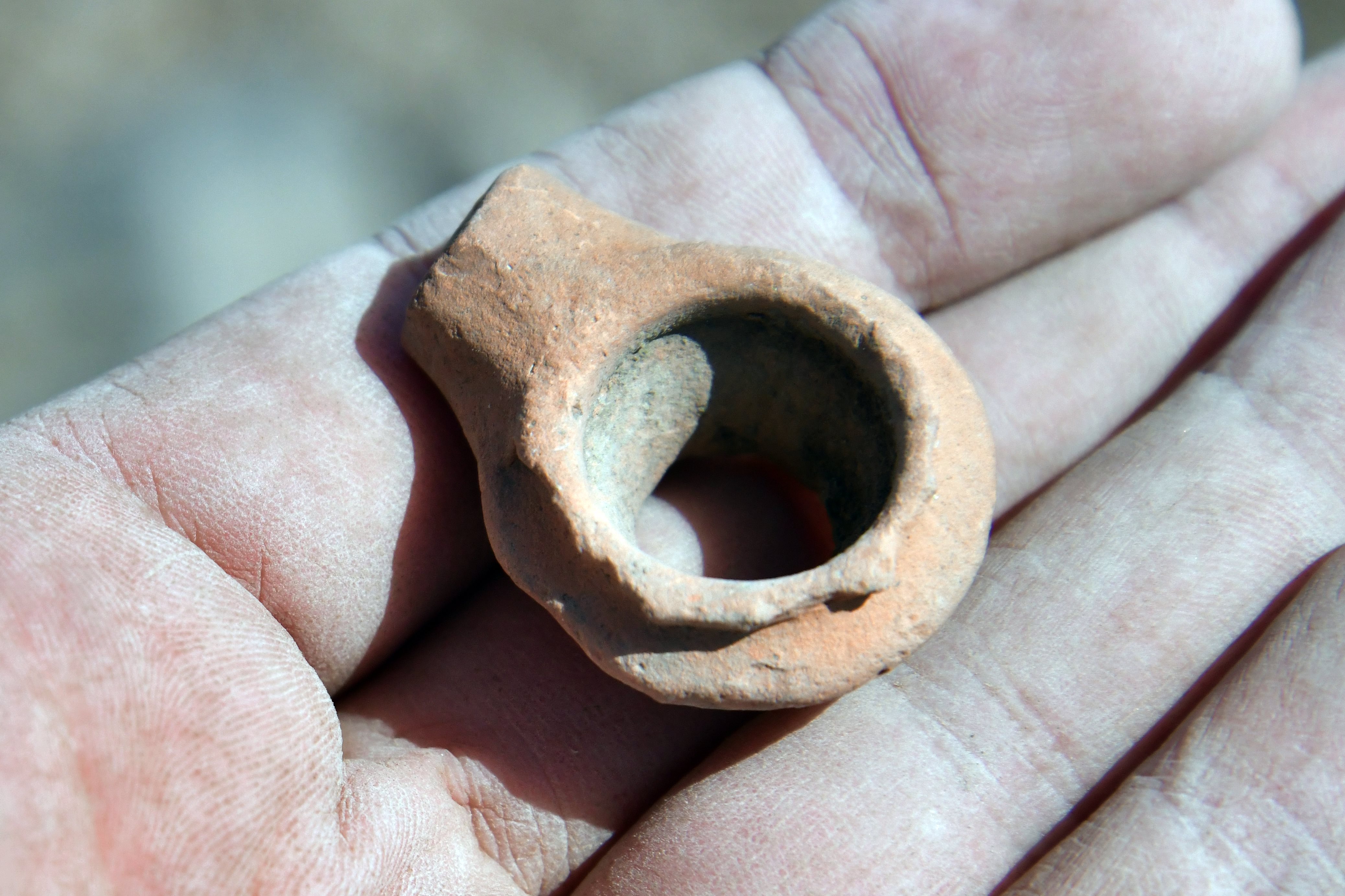
Roman period mouthpiece:
A Roman period ceramic mouth of a small vessel.
Middle ages colored sherd:
A colored sherd from the Muslim period is a ceramic fragment from the Islamic era, often displaying characteristic glazes like yellow, green, or purple, or a metallic, iridescent “lustre” effect achieved through special firing techniques. These sherds can be from various vessels like jars, bowls, or tiles and often have painted or glazed decorations.
Ottoman period ceramic pipe:
Ottoman period ceramic pipes, also known as chibouks, were common smoking implements made from various clays and materials, often featuring long stems and elaborate decorations. They were made in different styles and qualities, with some being simple and functional while others were made from fine clay and ornamented with precious stones or intricate patterns. Archaeological finds have been made at many Ottoman-period sites in the region, and local production centers existed, though some pipes were imported from other parts of the empire and beyond.
(d) Other findings
Glass item:
Dated to the Early Islamic period.
This twisted glass was often made using a technique where a glassmaker would heat and wind a molten glass trail around a metal rod. The twisted pattern is created by the winding process.
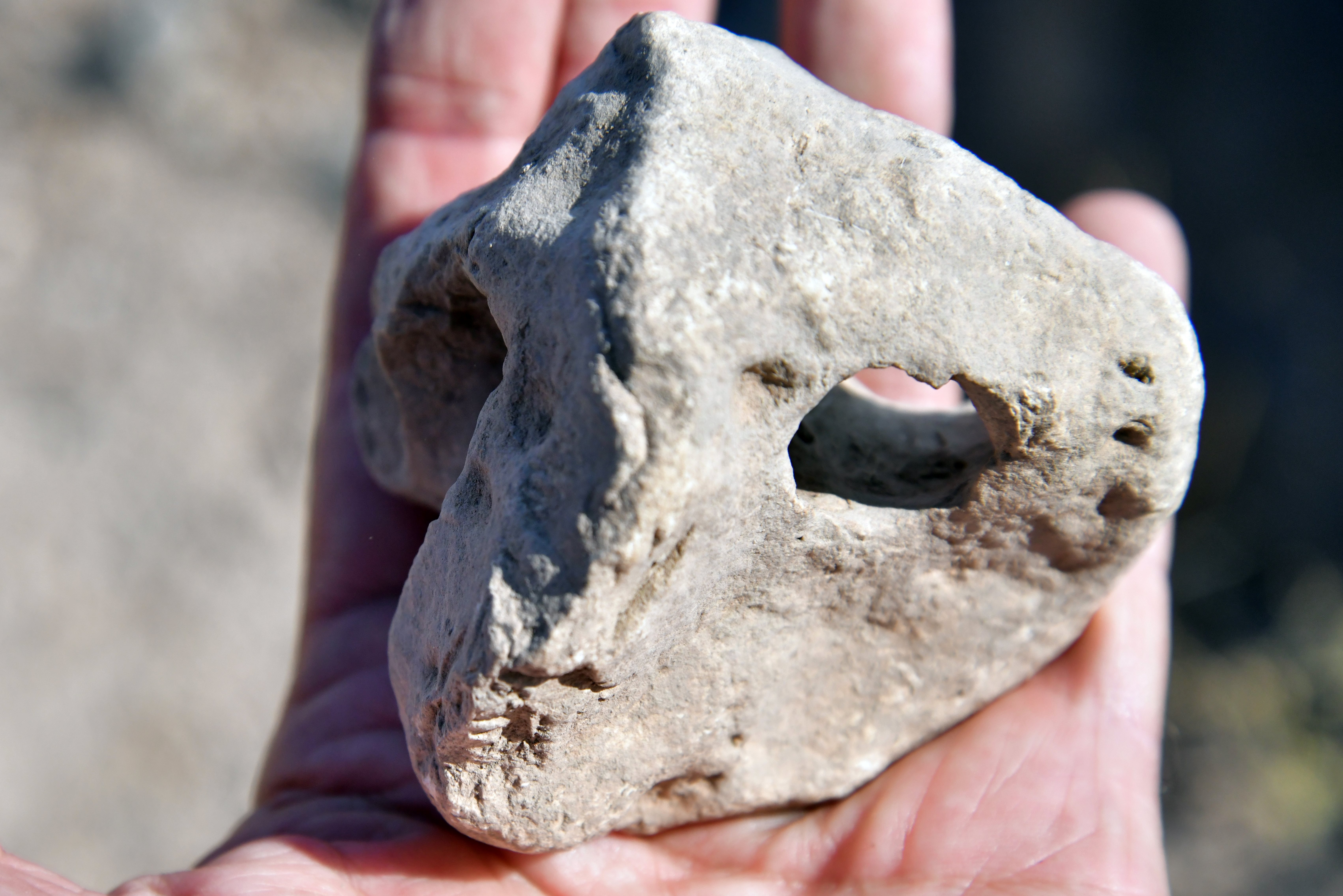
Lightweight basalt item:
A carved, lightweight volcanic stone, possibly used as a spindle whorl or loom weight in textile production. Unknown dating.
A lightweight basalt is a type of volcanic rock that is naturally lighter due to its porous structure. This is a naturally occurring form of basalt that is full of gas bubbles (vesicles) from its volcanic formation, making it porous and lightweight.
Flint:
A sharp, double-edged blade from the Bronze/Iron Age, showing signs of use on the edge, is likely a specialized tool for harvesting grain, such as a sickle. The wear on the cutting edge, sometimes called “use-wear,” indicates it was used for cutting stalks of ripe cereals, a crucial activity in a fully established farming system during that period.
Another Bronze/Iron age double edged flint blade:
(d) Structures
On the foothill we found some interesting carved basalt stones.
This one is a carved Byzantine period threshold stone. Note that the measuring stick bars are 10cm in length.

A decorated basalt stone:
And a smaller basalt stone:
Other carved stones we encountered during an earlier visit:
(e) Poriya Spring:
About 0.6km south of Tel Kedesh is a perirenal spring named Poria spring (Ein Poriya). It was one of the sources of water for Tel Kedesh, in addition to other springs around the settlement.
The KKL-JNF drained the water from the muddy slopes of the spring and created this pool.
An observation point is nearby, commemorating Naomi Shemer, a leading Israeli musician and songwriter who was born in the nearby Kvutzat (Kibbutz) Kinneret.
(f) Field Survey Video
![]() This 16 minutes video summarizes a field survey of the site by BibleWalks staff, conducted on September 2025:
This 16 minutes video summarizes a field survey of the site by BibleWalks staff, conducted on September 2025:
Etymology (behind the name):
- Poriya – Hebrew: fertile. Based on the Hebrew word Pri (fruit), meaning fruitful.
- Poriya – a number of communities above the south western side of the Sea of Galilee share this name:
- Poriya Illit – Hebrew for: upper Poriya. Established in 1955.
- Poriya-Padeh Medical center – founded 1955. Prof. B. Padeh headed the hospital for 2 years.
- Poriya Neve Oved – Hebrew for: Poriya worker oasis. Village was established in 1949.
- Poriya Kfar Avoda – founded in 1949, and is built in several sections along highway #768
Links:
* Archaeological:
- “Nomadic” and “Beduin” Population in the Census Returns of Mandatory Palestine – D. H. K. Amiran, Israel Exploration Journal, Vol. 13, No. 3 (1963), pp. 247-252 (6 pages)
* Other:
- Map of the sites
- Barak and Deborah – details on the battle and the sites associated with it.
* Nearby sites:
BibleWalks.com – walk with us through the sites of the Holy Land
Kankuza<<<–previous Sea of Galilee site—<<<All Sites>>> —-next Sea of Galilee site –>>>Tell Kinneret
This page was last updated on Nov 2, 2025 (add snake 3D)
Sponsored links: