This page summarizes the sites that feature Roman streets inside the cities of the Holy Land.
Home > Info > Structures > Roman Streets
Contents:
Introduction
Roman streets
Historical Refs
Etymology
Links
Roman streets:
The Romans established well planned cities and based them on a matrix of high quality paved streets. Some of the streets were colonnaded with shops or houses on both sides.
The quality of the streets in the Roman Empire varied depending on the location and time period. In major cities such as Rome, the streets were generally well-constructed and paved with large stones. Some of the streets were wide enough to accommodate the heavy traffic of chariots and carts. Outside of major cities, the quality of the streets could vary greatly.
Roman street – AI generated by Stable Diffusion
Roman Roads:
The Roman government invested heavily in the construction and maintenance of roads throughout the empire, particularly for military purposes. Overall, the Roman Empire was known for its impressive infrastructure, including its road network, which was one of the most extensive in the ancient world. The quality of the roads played an important role in facilitating trade and commerce, as well as the movement of military forces throughout the empire. The roads are covered in another web page – “The Roman Roads“.
Sites with Roman streets (inside the cities):
The Romans constructed high quality streets inside the cities. The following section shows the sites which feature some of these streets.
- Decumanus street, the principle gate street in Roman camps and cities, is an east to west Roman street dated to the early 2nd century AD and part of the network of streets. The stone paved streets were carefully designed and arranged in a grid, typical of the newly constructed major cities in the Roman world. They were colonnaded and led to entrances of the buildings on both sides of the streets.
Click on the photos to enlarge them.
Cardo Maximus, or simply the Cardo, was the main North-South “Boulevard” of Aelia Capetalina, the Roman and Byzantine city that was established in the 2nd century AD. It was a monumental royal road, which was typical of the grand Roman cities. It is emphasized in the Madaba map, showing that it played a central role in the urban design of the Byzantine city.
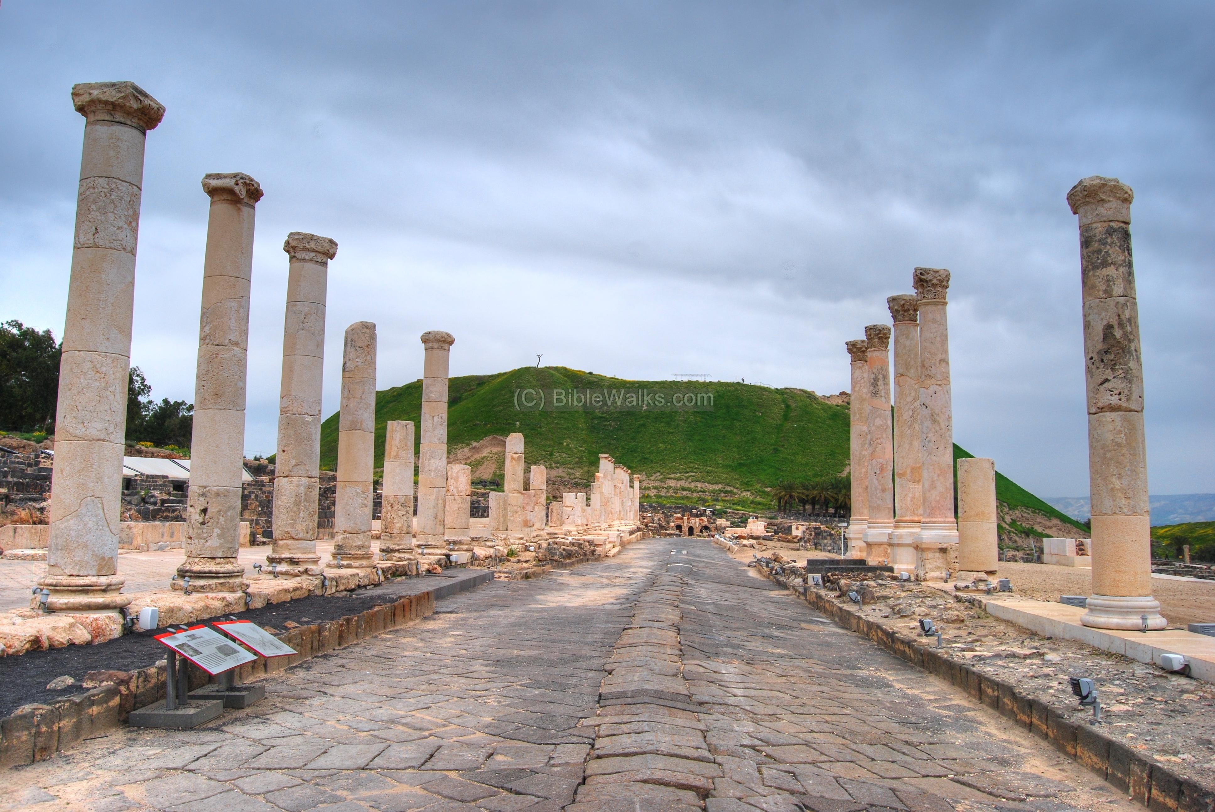
Tell Beit Shean (Beth Shean) was a major Biblical city, located in the center of crossroads between the Jordan valley and the Jezreel valley. It later was expanded into a large Hellenistic, Roman and Byzantine city of Scythopolis. The large city was leveled by a massive earthquake in the 8th century AD.
The colonnaded Palladius street extends from the theater to the foothills of the ancient Tell, 150M from south to north. The street was built in the Roman period, and restored during the Byzantine period. On both sides of the 24M paved street was a raised roofed sidewalk with shops and public houses.
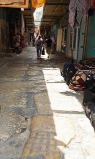
Jerusalem, near St. John the Baptist
A section of a paved Roman road is located on the Christian Quarter street not far from St. John. It was discovered during the restorations conducted at this area in 1977, under the modern level.
This paved section dates to the end of the Roman period – 3rd/4th century AD. In the photo below is a section of the paved Roman road, flanked by modern shops.
Secondary Cardo, Via Dolorosa
A short section of the Byzantine road at this section. This pavement is part of the “secondary” Cardo, which once connected the Damascus (Shkhem) gate to the Dung (Ha-Ashpot) gate in the south, as seen in the Madaba map. Although the stones were several hundred years later, they followed the same route of the Roman road that existed during the times of Jesus.
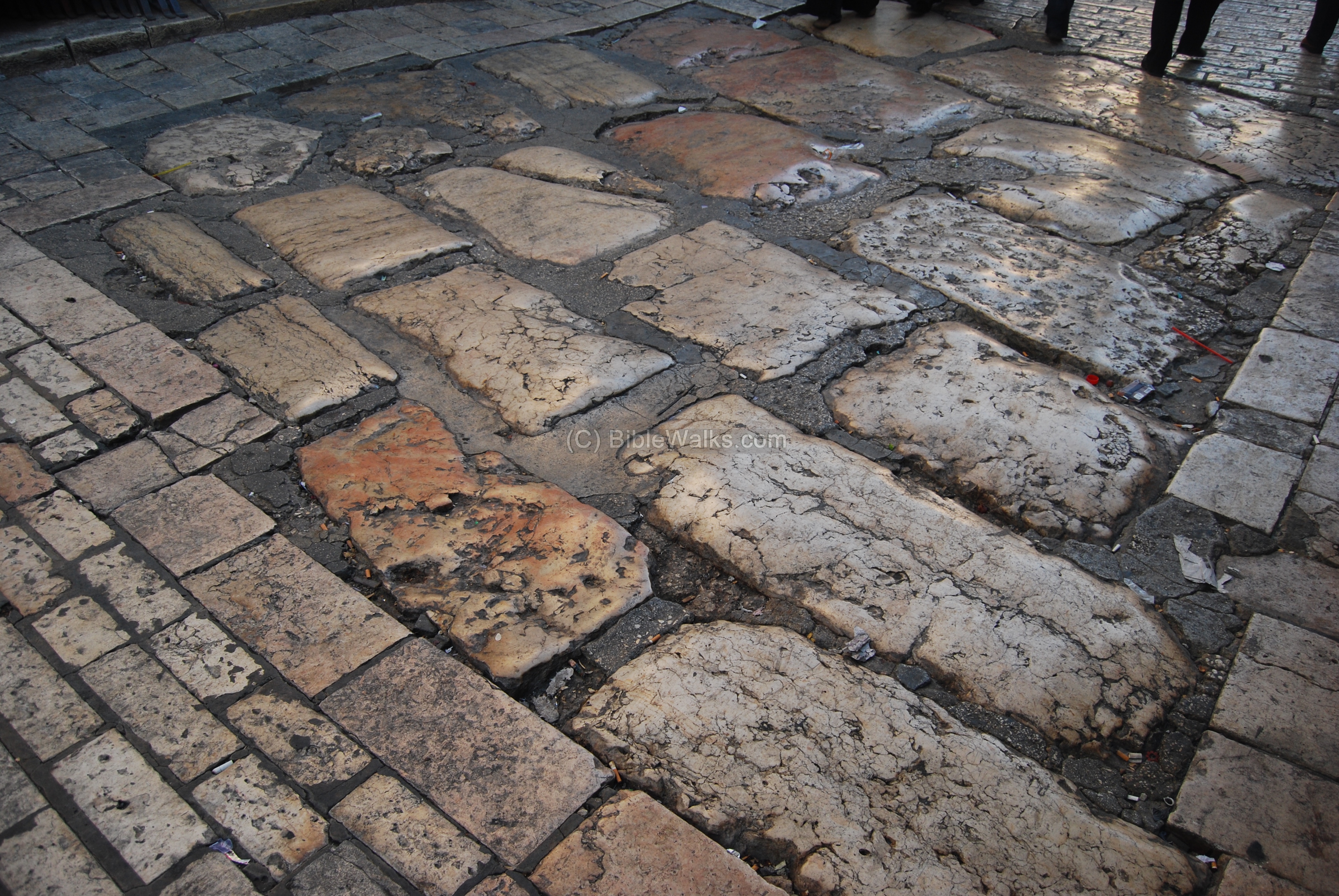
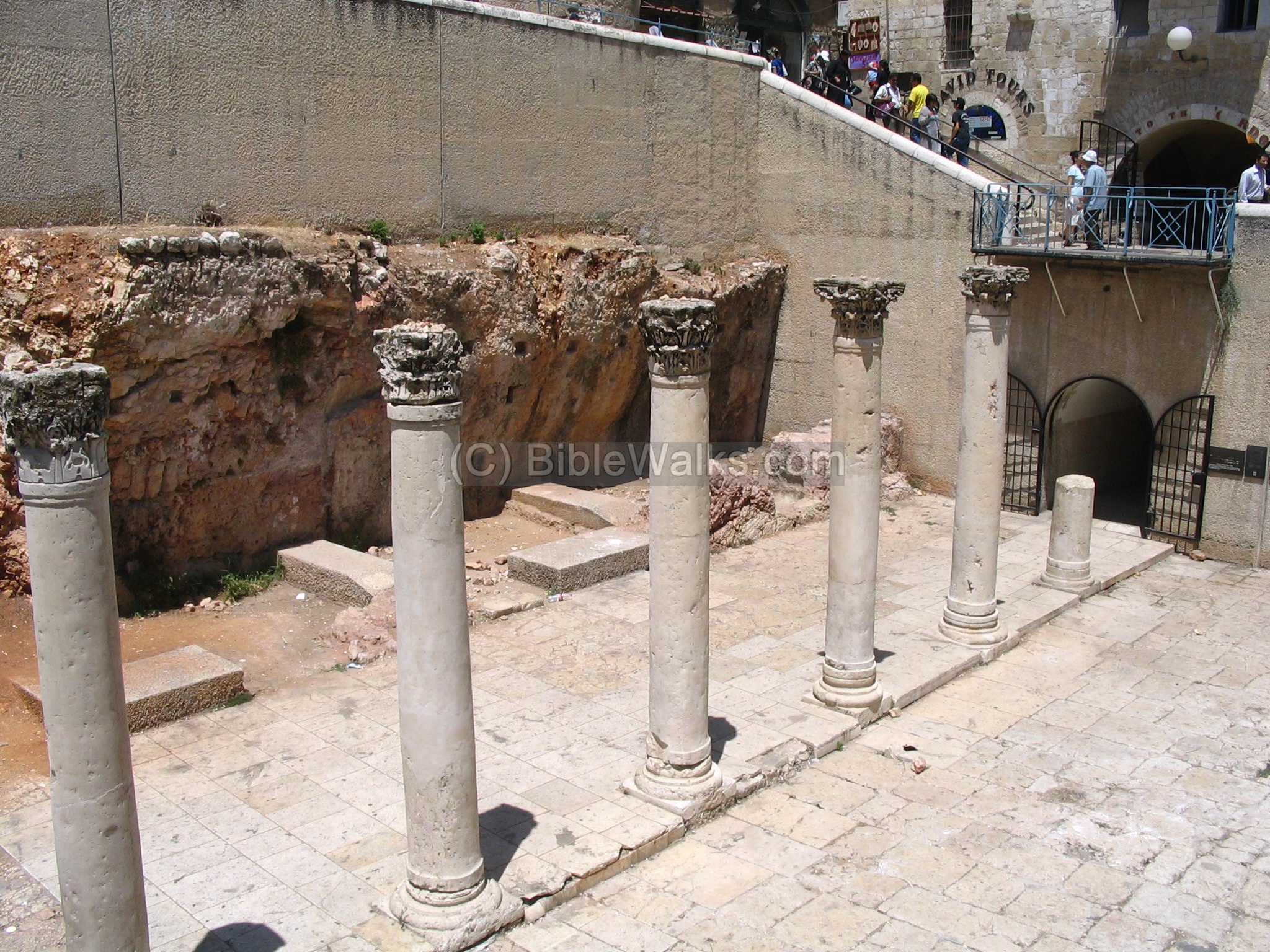
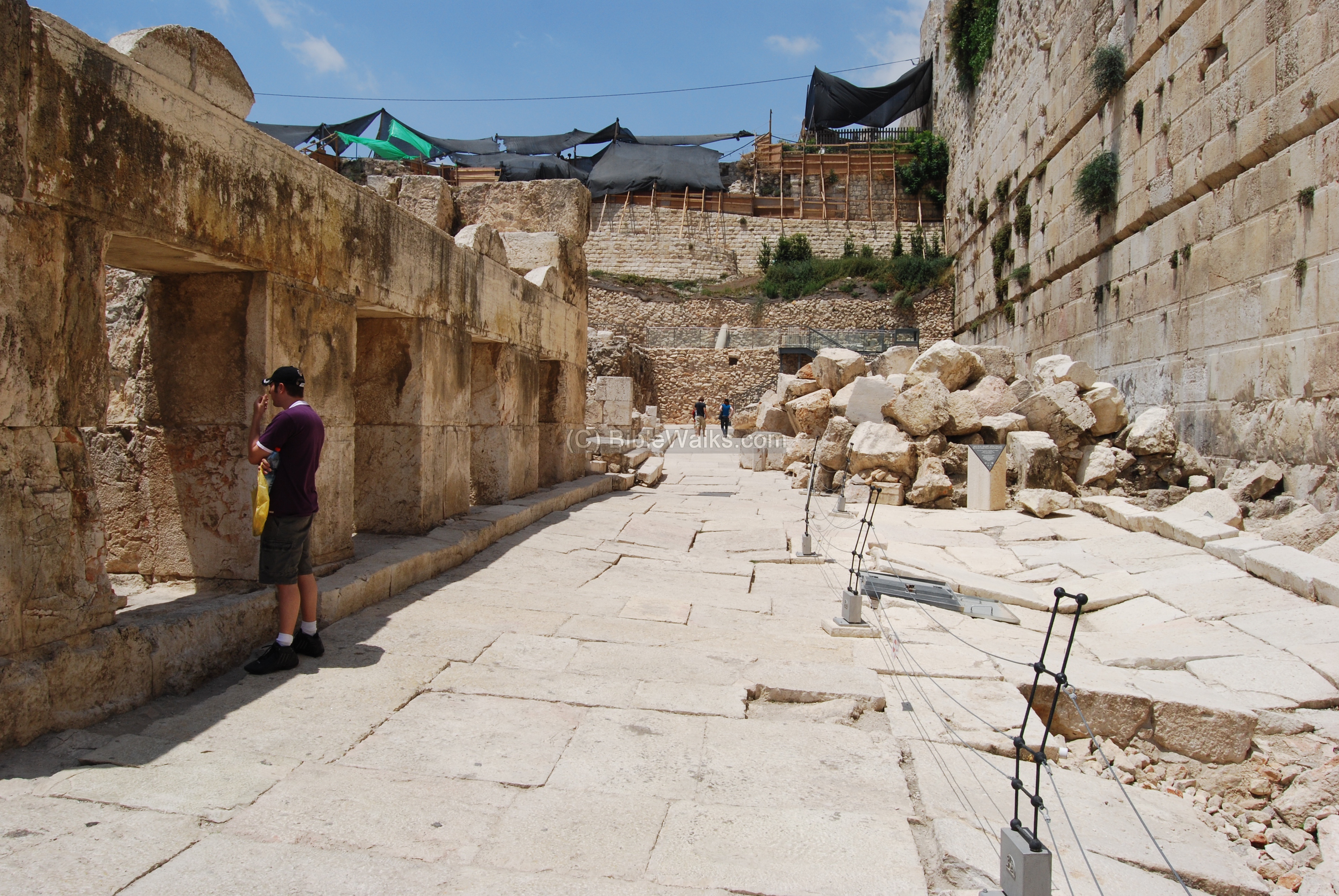
Herodion street, Southern Wall, Jerusalem
Along the southern wall of the temple, near the Robinson arch, the excavations discovered a paved Herodian street, one of the most important findings in the Jerusalem excavations, which serve as a time machine – bringing us back to the days of the second temple and the destruction of Jerusalem by the Romans (70AD). A magnificent paved road came back to life after almost 2,000 years.
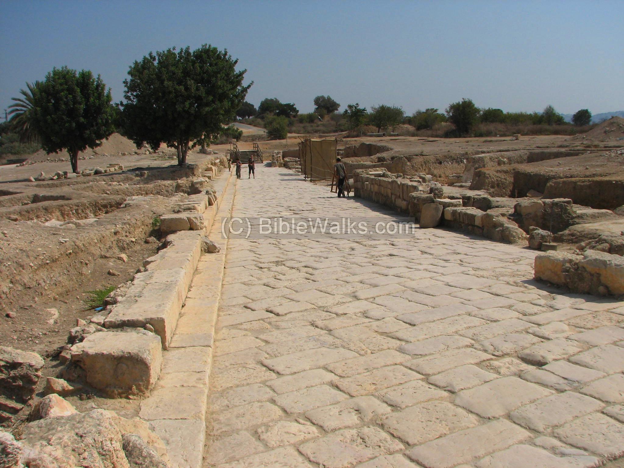
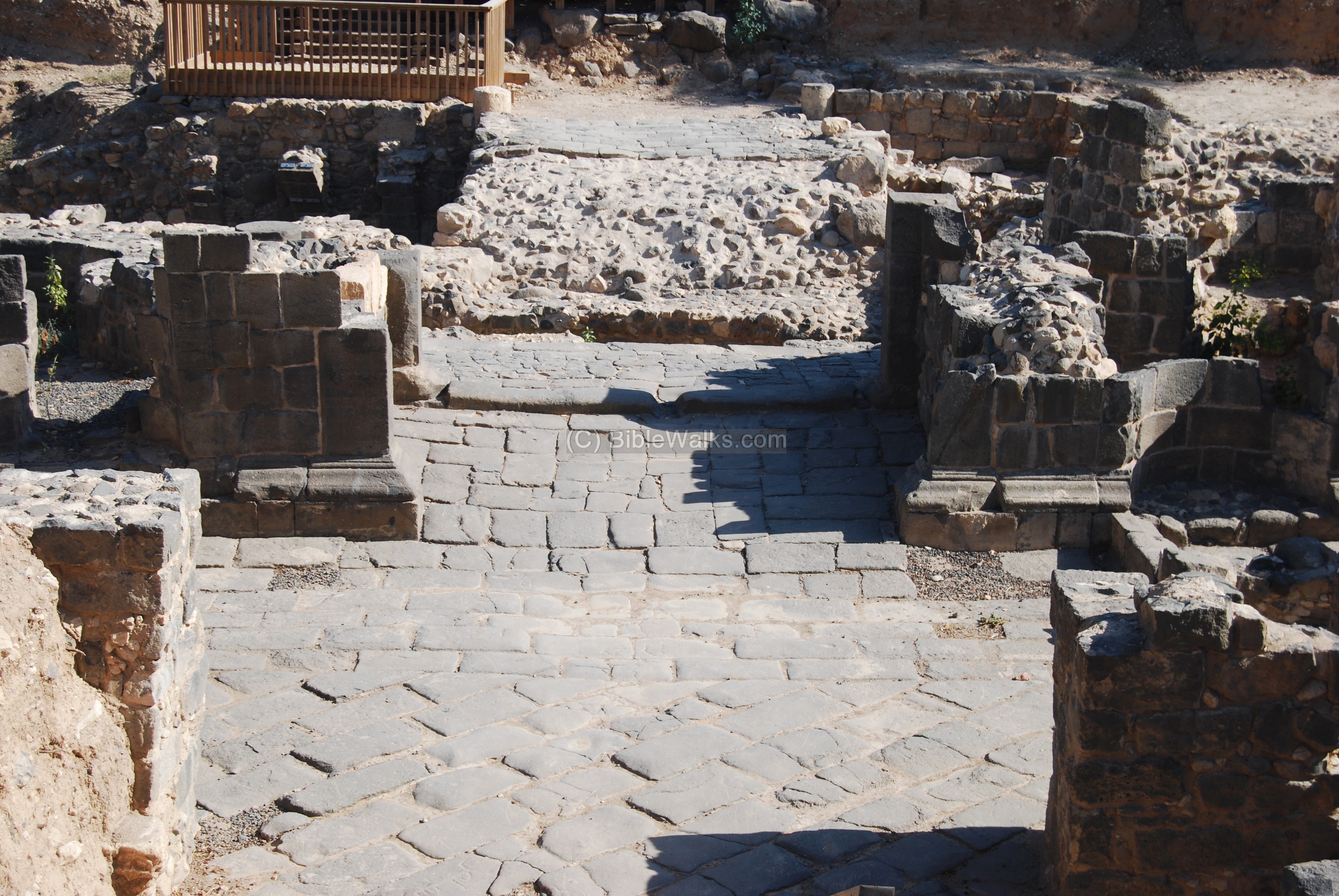
The main Road in the Roman city was the “Cardo”. Here in Antipatris, the Roman city established by Herod, the Cardo is oriented in a south-east to north-west orientation, on top of the Tell.
The excavated Cardo extends for 300 M from the fortress. On both sides are traces of the ruins of the Roman/Byzantine city. Shops and public houses were built along the road. On the left side are ruins of a Roman villa, and in the center is the Forum – the city center.
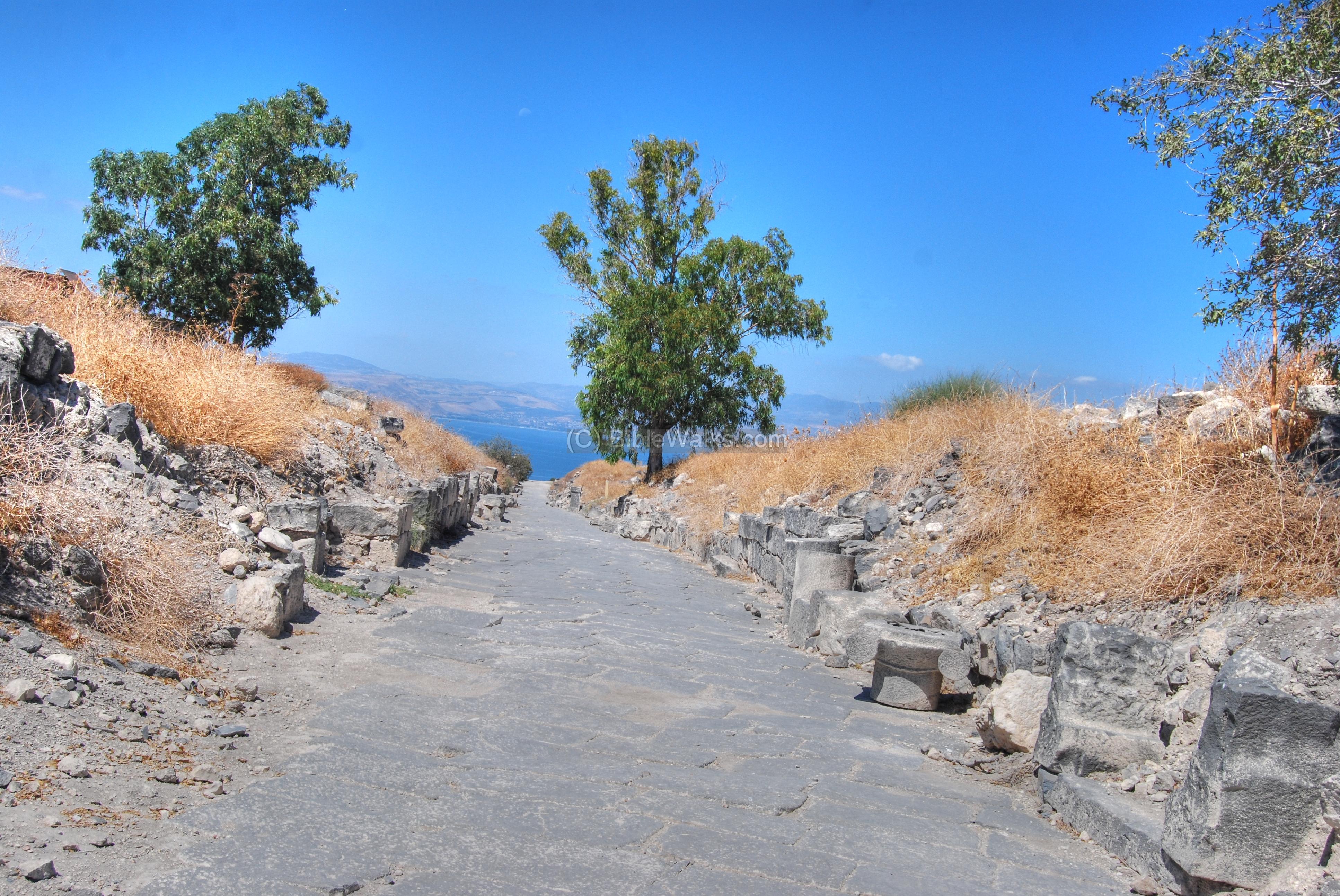
This is the main colonnaded street of Hippos. It runs a total length of about 500M , connecting the city’s two gates along its main axis. The street is named “Decumanus Maximus”, the Roman word for east-west main street.
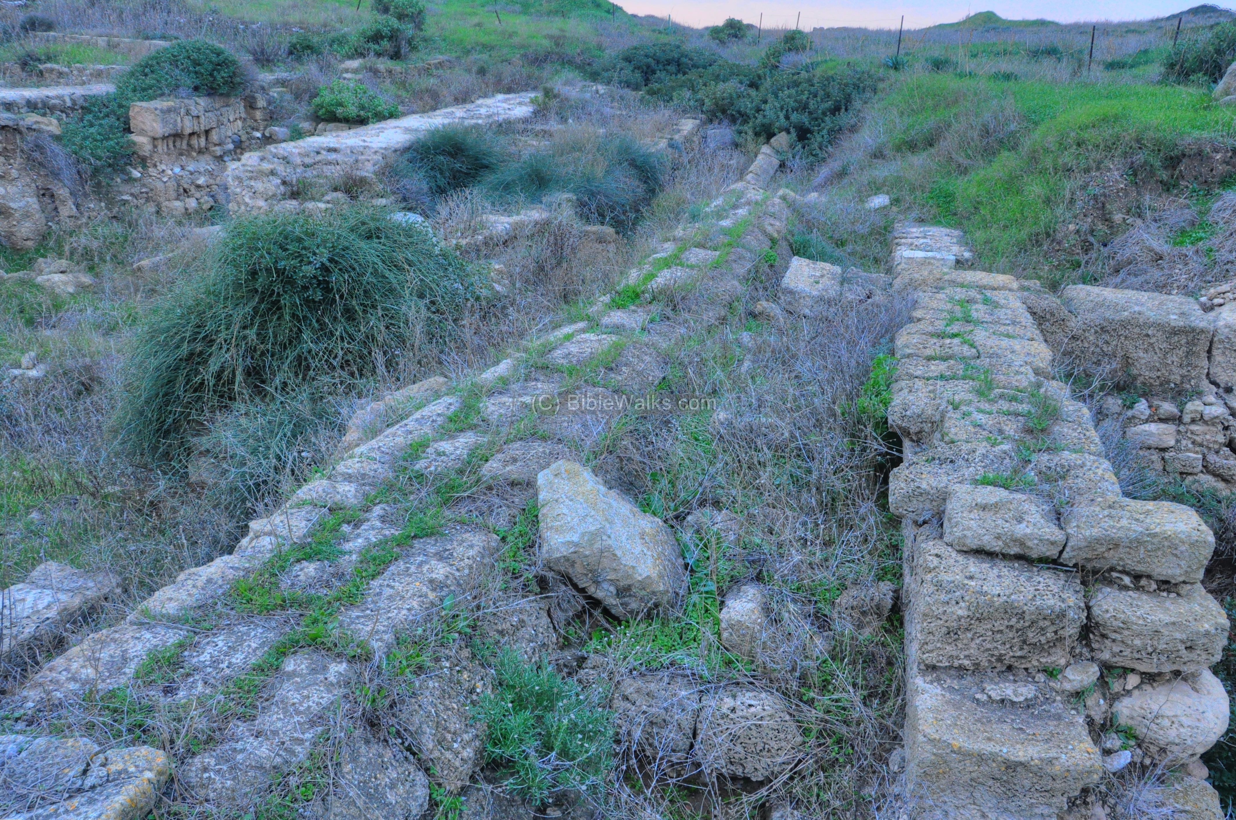
This colonnaded road, 6-7M wide, crossed Tel Dor all the way from the eastern gate to the west side, splitting the city into a north and south section. The photo below shows a view towards the western side. The road was paved between the two lines of stones (now gone), and the covered sewer tunnel ran in its center.
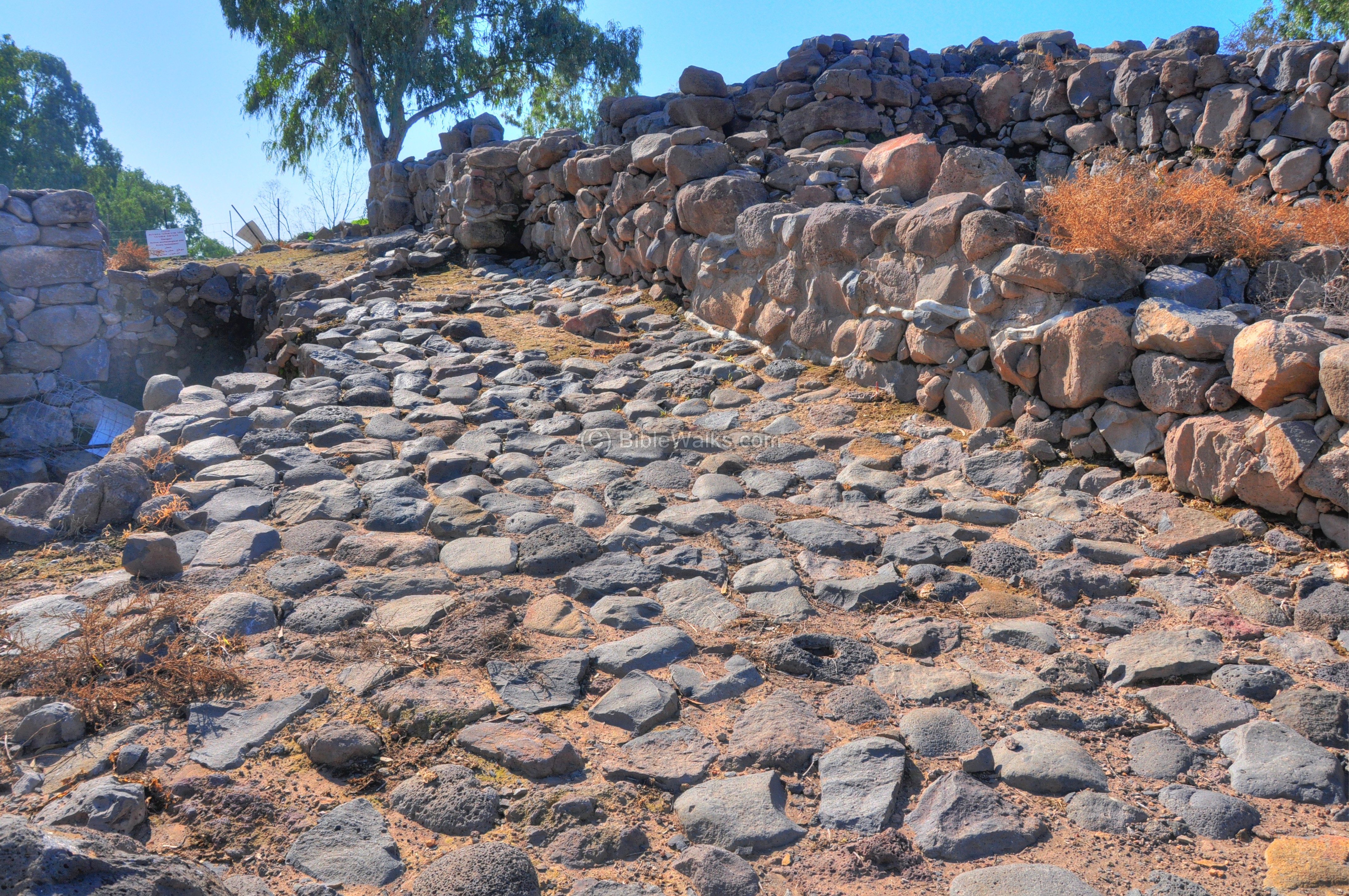
Tiberias – South Gate
The southern gate and walls of the Roman city include twin round towers, walls, bridge and the entrance street to the city. It was in use for 1,000 years since the city was established in 18AD.
The cobble stone road approached the city, following the eastern outer city wall. The road was paved in the 9th century BC, and had been in use until the 4th century AD. Pottery finds on the road include shards from all periods, from the Bronze period up to the Roman period.
Sections of the inner city streets were also excavated and reconstructed.
Shomron (Samaria) was the capital city of the Northern Kingdom, established by Omri and Ahab. An important Hellenistic and Roman cities in the Holy Land.
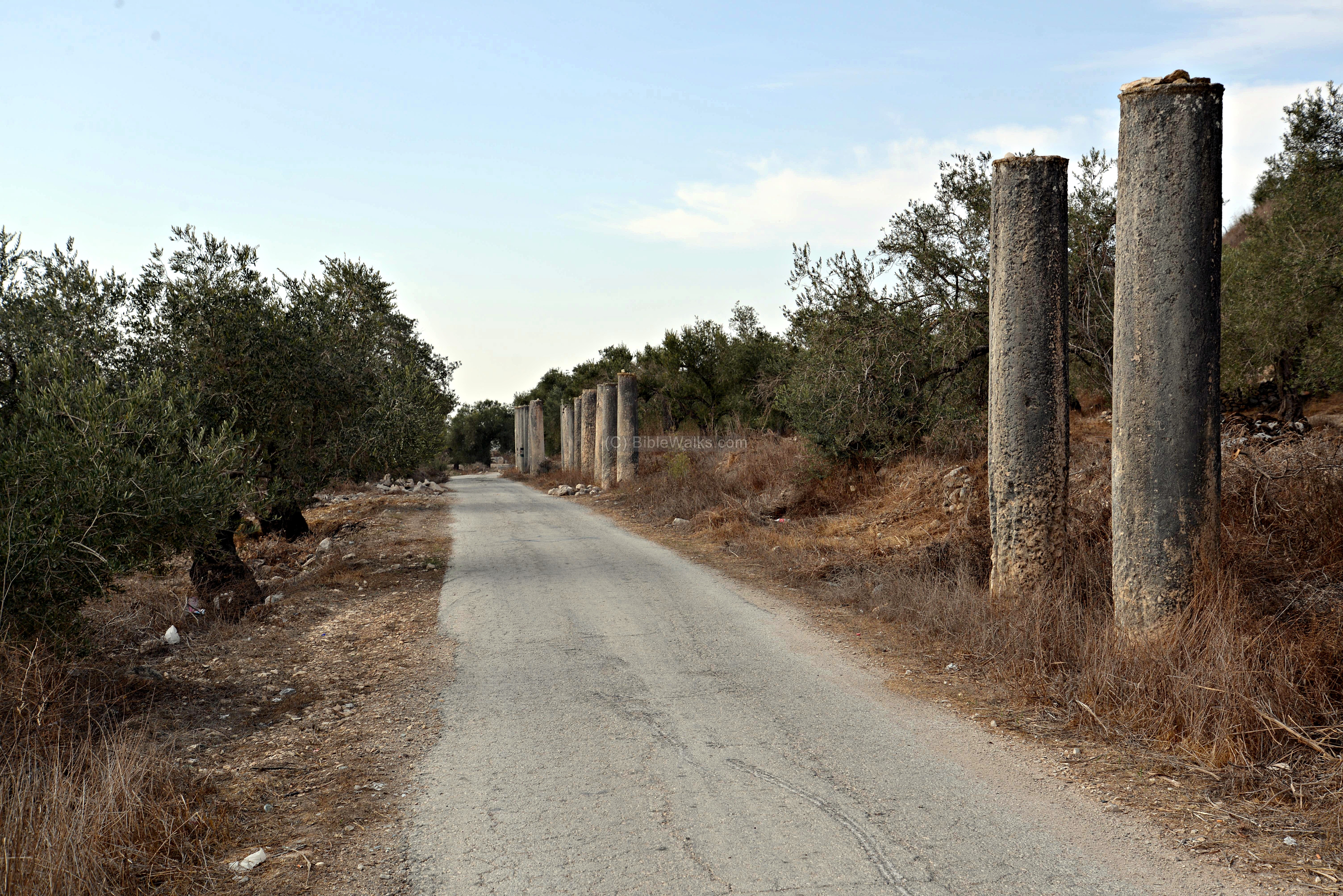
The Roman colonnaded street of Samaria is a famous landmark. The street connected the west gate (as above) to the east gate (now gone). This section is marked on the map as a red square. The street, 12.5m wide, is about 1Km long.
Etymology:
- Via – Latin for “road”
- Strata (plural form of stratum) – Roman word for a “paved road”, normally for military purposes. It is the root of the English word “street” .It is also used as an archaeological term – a level of earth, one of several horizontal layers. This is based on the structure of the roman paved road – a number of layers that were laid out to build a lasting road.
- Derech – Hebrew: road, way.
Links:
* Internal:
BibleWalks.com – walk with us through the sites of the Holy Land
Roman Roads <<<—Previous info—<<< All Info >>>—Next Info—>>> Earthquakes
This page was last updated on Mar 13, 2023 (add illustration, new overview)
Sponsored links: