Ruins of a large Early Bronze Canaanite fortified city and fortresses from the Israelite Kingdom period, located on a ridge overlooking the Jordan and Tirza (Farha) valleys.
Home > Sites > Jordan Valley> Khirbet Makhruk
Contents:
Overview
Aerial Map
History
Structure
Photos
* Aerial views
* Valley road
* Tirzah road
* Circular Tower
* NW Rectangular tower
* Findings
* Eastern fortress
* Fields
* Survey
Links
References
Etymology
Background:
Khirbet Makhruk (also spelled el-Makhruq or Mahruq) is a significant archaeological site, located on a broad ridge, at the entrance to the Tirzah Valley (Wadi Far’ah) in the Jordan Valley, near the Adam Junction. It serves as a prominent landmark that guarded a vital ancient crossroads and route connecting the Jordan River to the heart of the Samarian highlands. On the site are ruins of a large Early Bronze Canaanite fortified city and well preserved towers and fortress from the Israelite Kingdom period. The ruins date to the Early Bronze age and the Iron age II.
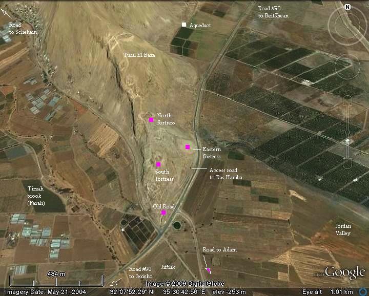
Map / Aerial View:
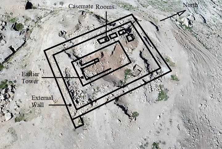
The site is located at a height of -247m, 30m above the valley surface, and covers 45 Dunams (11.25 acres). An aerial photo of the area around Khirbet Makhruk is shown below, indicating the major points of interest.
History:
-
Early Bronze age
During the Early Bronze age a fortified city covered most of the area of the ridge. The shape of the walled city was triangular, with the head of the triangle pointing north. A rectangular tower, dated to this period (Early Bronze II – 3100-2900 BC), was located on the highest edge of the fortified city (excavation area ‘A’). It was built with red bricks, and two phases of construction were observed. The tower was later built upon during the Iron Age.
Another mound was also inhabited during the Early Bronze II period, on the east side closer to the road below.
The archaeologists opened a section (area ‘C’, 15 x 10m) in the south of the Canaanite city, and revealed residential dwelling structures dated to the Early Bronze II-III (3100-2500 BC).
Biblical period – Iron Age II
During the Israelite Kingdom, a rectangular tower was rebuilt on the northern hill over the Early Bronze rectangular tower. Another circular tower was built over Early Bronze structures in the southern part of the ridge. Another fortress was built over the Early Bronze fortifications on top of the eastern mound. These fortifications served as a road fortress that protected the westward roads to the heart of the kingdom – Samaria.
The fortifications may have been conducted by Jeroboam, the first King of Northern Israelite Kingdom, in order to protect the route to the frontier city of Penuel, on the northern bank of Yabok (Zarka) brook, which passed at this place (1 Kings 12 25): “Then Jeroboam built Shechem in mount Ephraim, and dwelt therein; and went out from thence, and built Penuel”. Jeroboam reigned during the years ~930-910 BC, and Peneuel was his capital city. However, the excavators suggested that these fortresses were built at a later time, during the years of King Ahab and Jehoahaz (see below).
-
Roman Period
The site is located on a junction of two major roads. This was the case in ancient times as well as in the modern period. The Romans, masters of road construction, constructed a major “highway” that connected Jericho to Beit Shean (see below) and a road that connected this road and passed westward via Tirzah valley.
The Peutinger Map (Tabula Peutingeriana) is a medieval map which was based on a 4th C Roman military road map. The map shows the major roads (in brown lines), with indication of the cities, and geographic highlights (lakes, rivers, mountains, seas). Along the links are stations and distance in Roman miles (about 1.5KM per mile).
In this section of the map is the area of Jordan valley, drawn in a rotated direction (Dead sea is on the left; Sea of Galilee is the right).
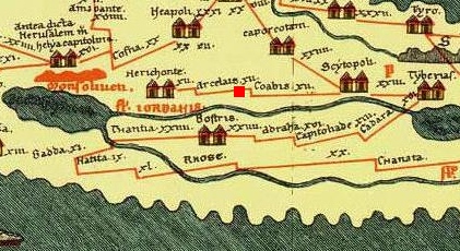
The major Roman road in the Jordan valley connected Beit Shean (“Scytopoli”) and Jericho (“Herichonte”). The red square marks the place of Khirbet Makhruk, in the middle between theses major cities.
- Ottoman period
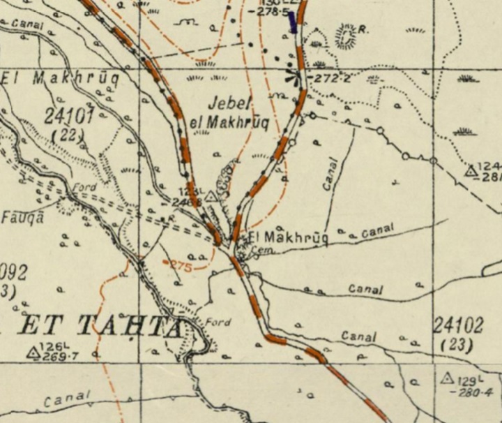
The area was examined in the PEF survey (1866-1877) by Wilson, Conder and Kitchener. A section of their map is seen here. The site is indicated on the map as Khirbet el Makhruk (“The split”).
Roman and Middle ages roads appear as double dashed lines and cross at the foot of the ridge. The north-south road connects Beit Shean and Jericho. The east to west road connects the Adam bridge and ford to Shechem and Samaria.
Their report of the site was (volume II, p. 385): “At el Makhruk the main road from east of Jordan crosses, running up the north side of the stream of Wadi Farah. At this place there are caves beside the road which appear to be remains of an ancient guard-house”.
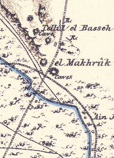
Part of Map sheet 15 of Survey of Western Palestine, by Conder and Kitchener, 1872-1877.
(Published 1880, reprinted by LifeintheHolyLand.com)
- Anza Conquest
In the context of modern history, Khirbet Makhruk (el-Makhruq) played a pivotal strategic role during the final stages of World War I. During WW1 the Turkish 53rd division held a headquarter on the ridge, protecting the road from Nablus/Shechem to the bridge at Damieh/Adam. New Zealand’s Wellington Mounted Rifle (WMR) Anzaq division were tasked to capture el Makhruq and to block the enemy from crossing into TransJordan. At 4:30 a.m. on September 22, 1918, the WMR successfully captured el-Makhruq. The take was significant: they captured approximately 400 Ottoman and German prisoners, along with a large amount of war materiel.
The military choice of Khirbet Makhruk in 1918 perfectly mirrors its ancient purpose. Just as the Canaanites and Israelites used the ridge to control the “gate” to the Samarian highlands, the British and Anzac commanders recognized that whoever held Makhruk held the “stopper” for the Tirzah Valley. By placing the Wellington Rifles there, the Allies effectively trapped thousands of Ottoman soldiers who were fleeing Nablus toward the safety of the eastern bank of the Jordan.
- British Mandate
A section of the 1940s British map shows the area around the site, located on a ridge that is marked above the junction. Two roads cross at the foothills: North-South (Beit Shean to Jericho) and the west bound road that ascends to Nablus/Shechem and the heart of Samaria.
British survey map 1942-1948 – https://palopenmaps.org topo maps
License: public domain under the UK Copyright, Designs and Patent Act 1998
-
Modern times
The site was damaged by modern armies; fortifications constructed by the Israeli Defense Forces (IDF). Communication lines and trenches were built into the circular and rectangular towers, and in other parts of the ridge.
The site is an open area today, and is easily accessed. It is recommended to make a stop here, visit the site, and enjoy the views of the Jordan and Tirzah / Far’ah valleys.
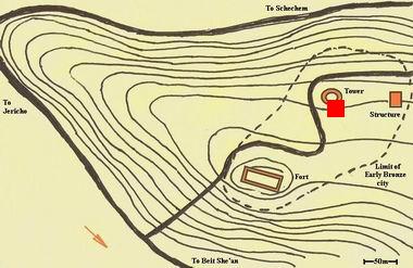
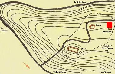
Site Plan:
A diagram of the site is shown below (based on Manasseh Hill country survey), with indication of the position of the towers and fortress. A paved road traverses the ridge, and continues on to the top of the ridge (Ras El Harubeh, a view point at a height of +211m, with great views of the Tirzah valley).
Early Bronze period:
The dashed line marks the walls of the Early Bronze period city, covering a total area of 45 dunams. The archaeologists identified 4 layers dated to the Early Bronze I and Early Bronze II-III. On the north side of this area, on the highest point in the city, was a large tower built of red sun-dried mud bricks (a square area marked as “Structure”). It was later rebuilt during the Iron age. Around it were residential houses. A fortress was also built on a mound on the east side (marked as a rectangular fort).
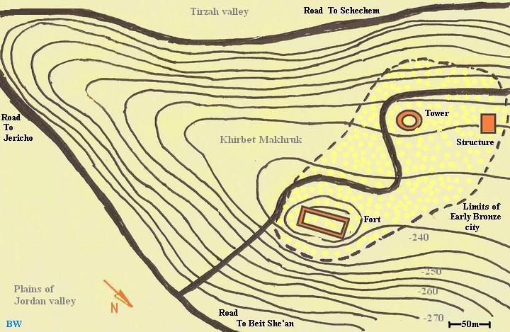
Iron Age II:
During the Iron Age II, two towers were built – a rectangular tower above the Early Bronze structure on the highest point (NW side) and a round tower on the south side. Around the towers there is no Iron Age settlement, so the purpose of these structures during this time was watch towers and a local police stronghold.
But why build 2 watch towers at the same time (Iron Age)? Since the construction of the round tower preceded the rectangular tower, the hypothesis the excavators made was that the circular tower was abandoned and went out of use and was replaced by the rectangular tower. They also suggested that the round tower was built by King Ahab (reigned ~870-850 BC), while the rectangular tower was built by King Jehoahaz (reigned ~815-800 BC), both of the Northern Kingdom, during their struggle with Aram Damascus.
Another Iron Age fortress was built over the Early Bronze fortress on the eastern mound (marked ‘Fort’ in the diagram). This location is lower than the circular and rectangular towers, but is closer to the road. It was built with a 4m wide wall. One of the suggested identifications of this fortress was Biblical Zarthan (1 Kings 7:47), although other scholars suggest it to be in Sartaba.
Photos:
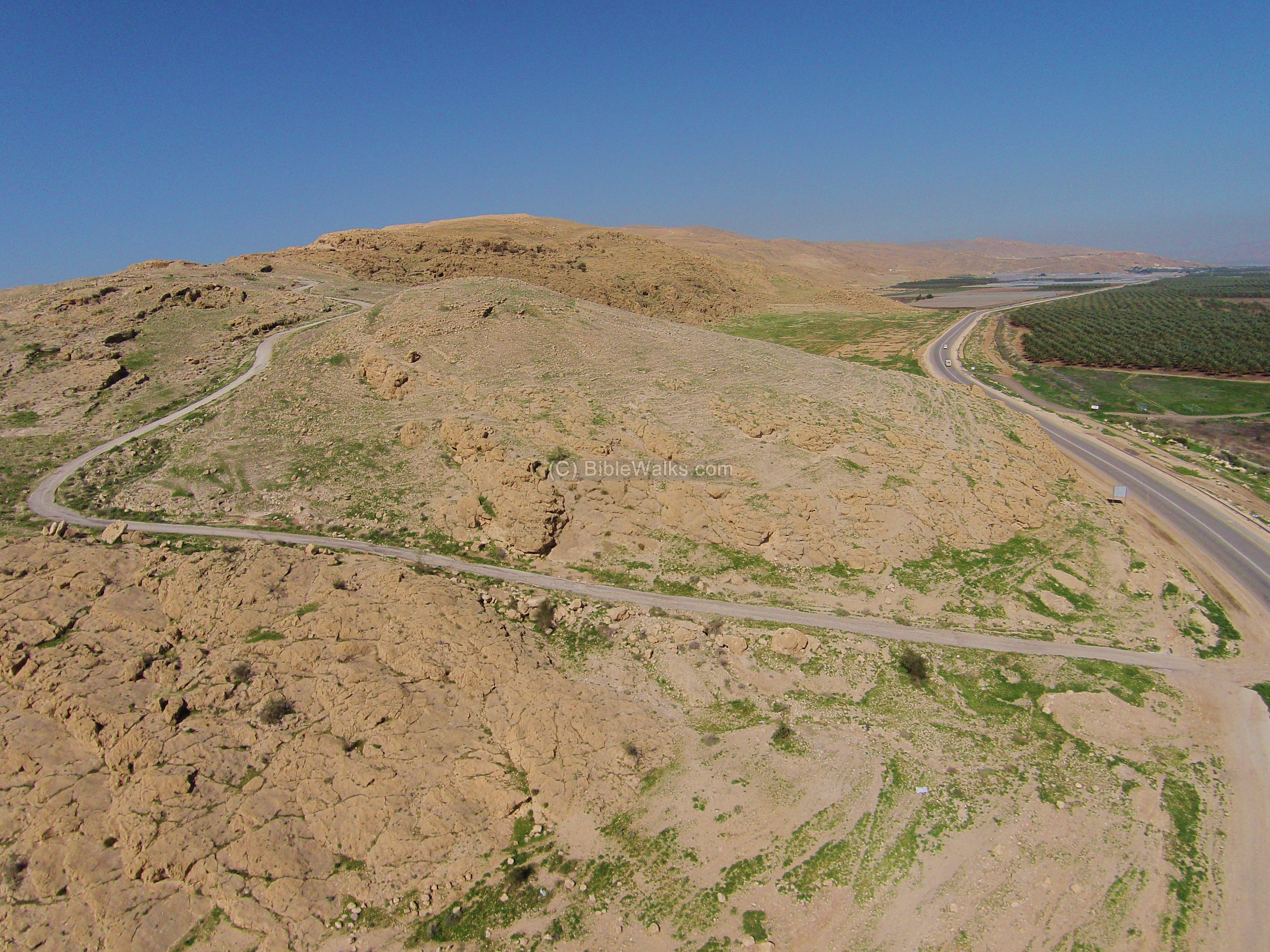
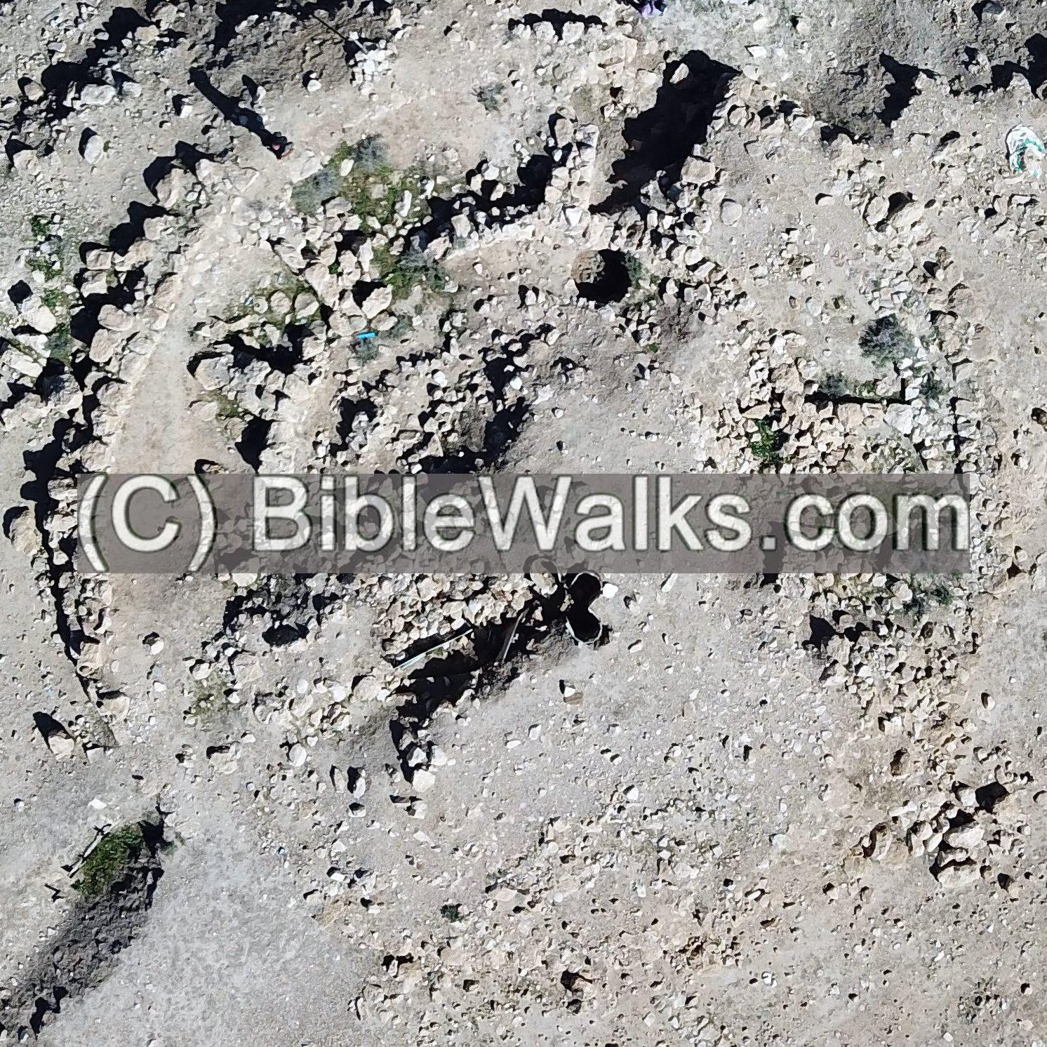
(a) Aerial Views:
A drone captured views above the site in Feb 2016. The eastern fortress is located on a hill, in the center of the view, just above road #90 (Beit Shean to Jericho). The green farming areas, in the plains of the Jordan valley, are on the right (east) side.
An access road climbs up to the top of the ridge, passing near the circular tower and the rectangular structure which are located up the road.
Click on the photos to view in higher resolution…
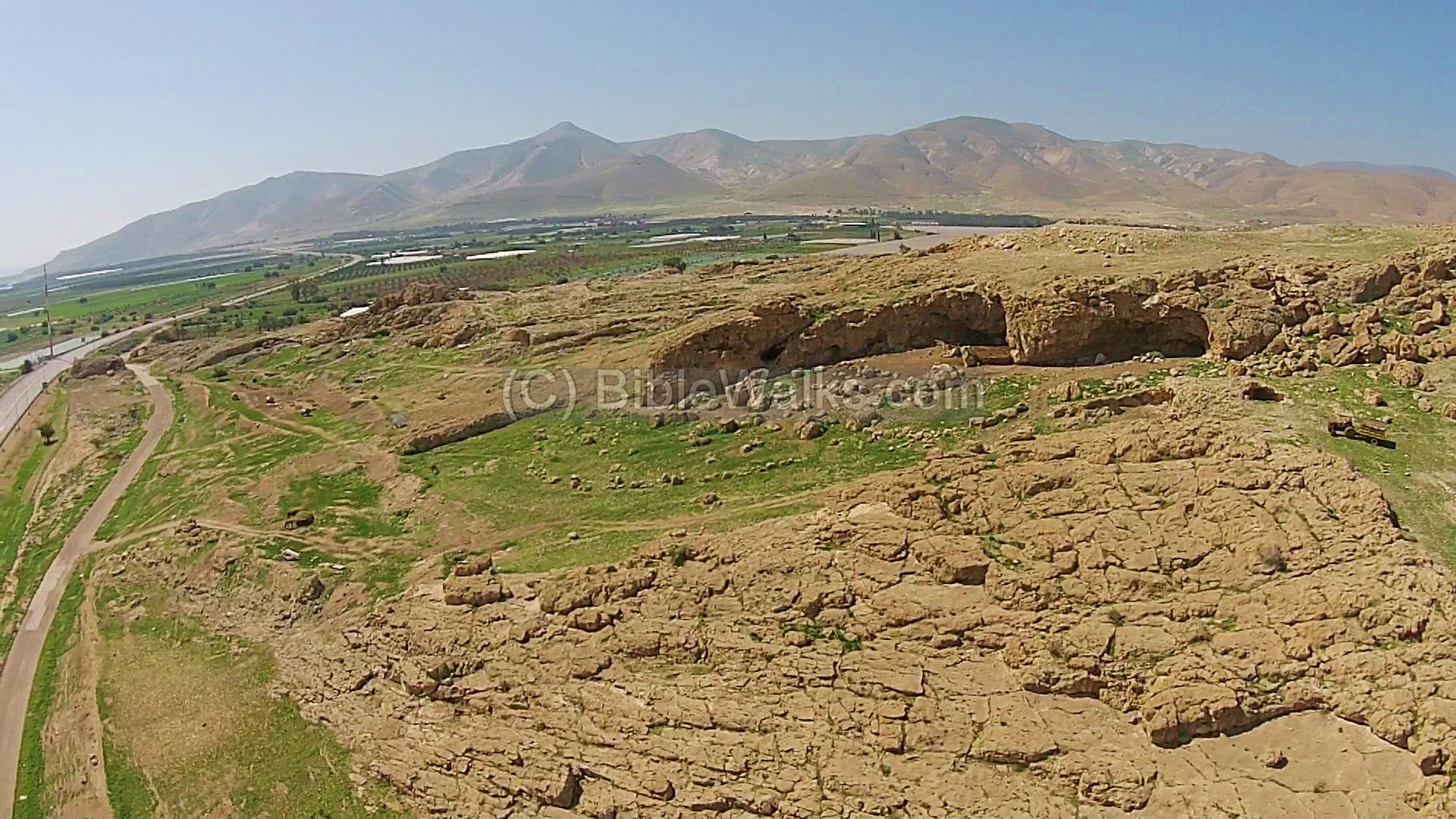
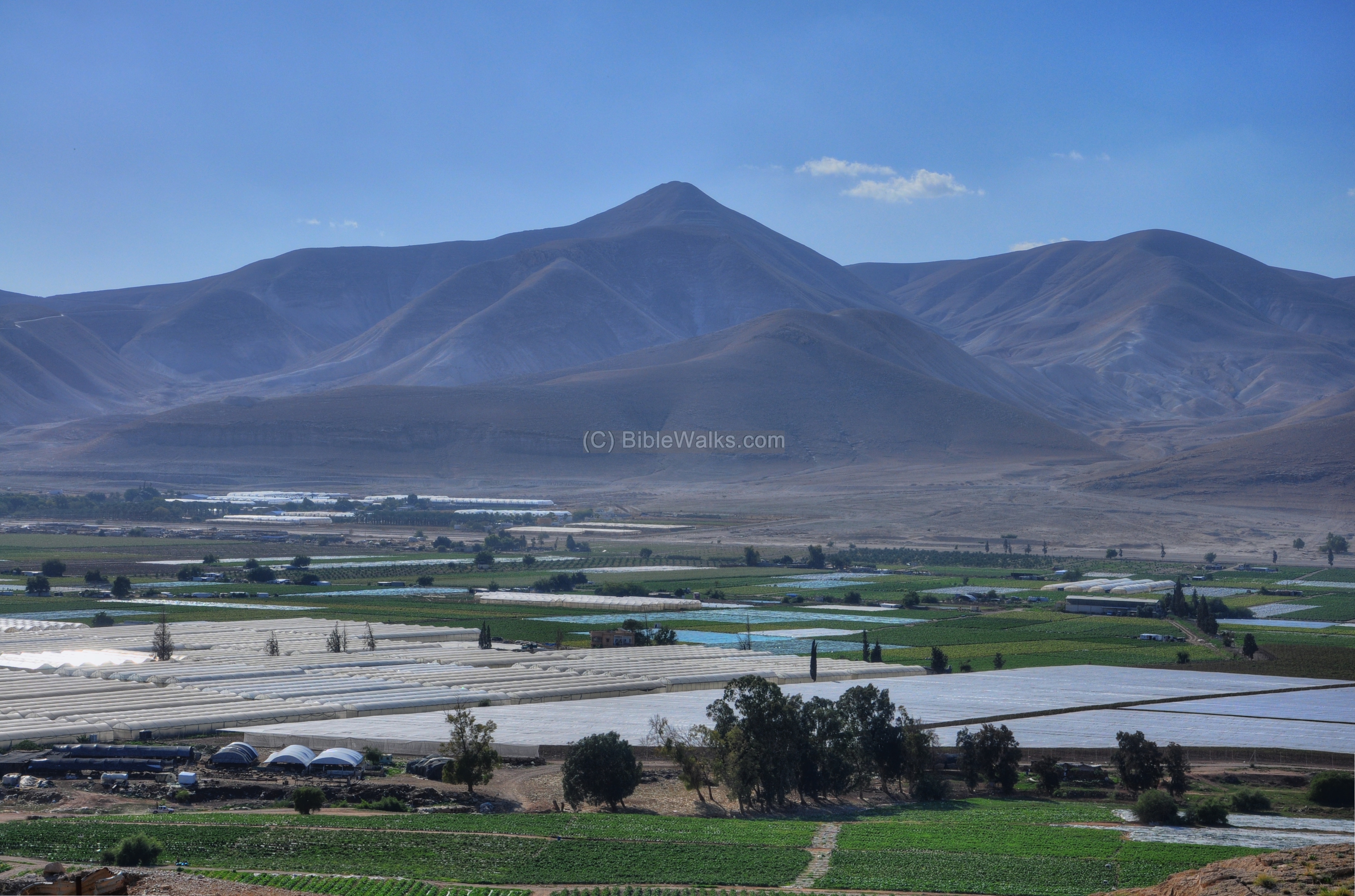
A drone from a photo above the eastern side of the site captured this photo, with a view towards the south. The green valley of Tirzah is seen behind the hill, and leads to the right towards Shechem. The fortified hill of Sartaba, a pointed hill that towers above the mountains on the south side of the entrance to the valley, is in the center background. A number of caves were inhabited on the eastern cliffs.
![]() The following YouTube video shows a flight Kh. Makhruk, then turning around to view the surrounding area:
The following YouTube video shows a flight Kh. Makhruk, then turning around to view the surrounding area:
This video was captured on March 2023
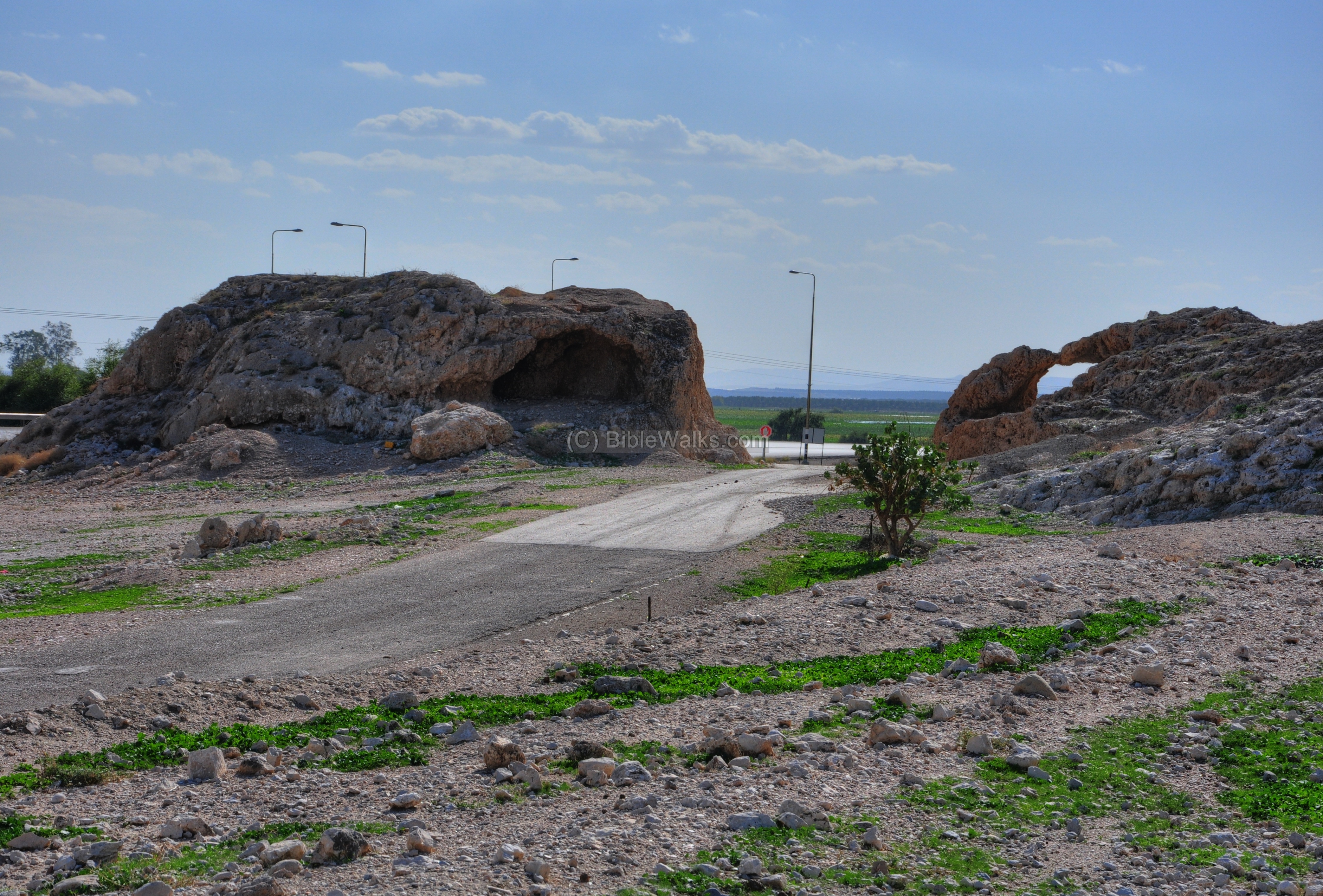
(b) Valley Road and caves:
The old north-south road passed at the southern edge of the ridge. The new #90 road was relocated slightly eastwards, as seen on the left side.
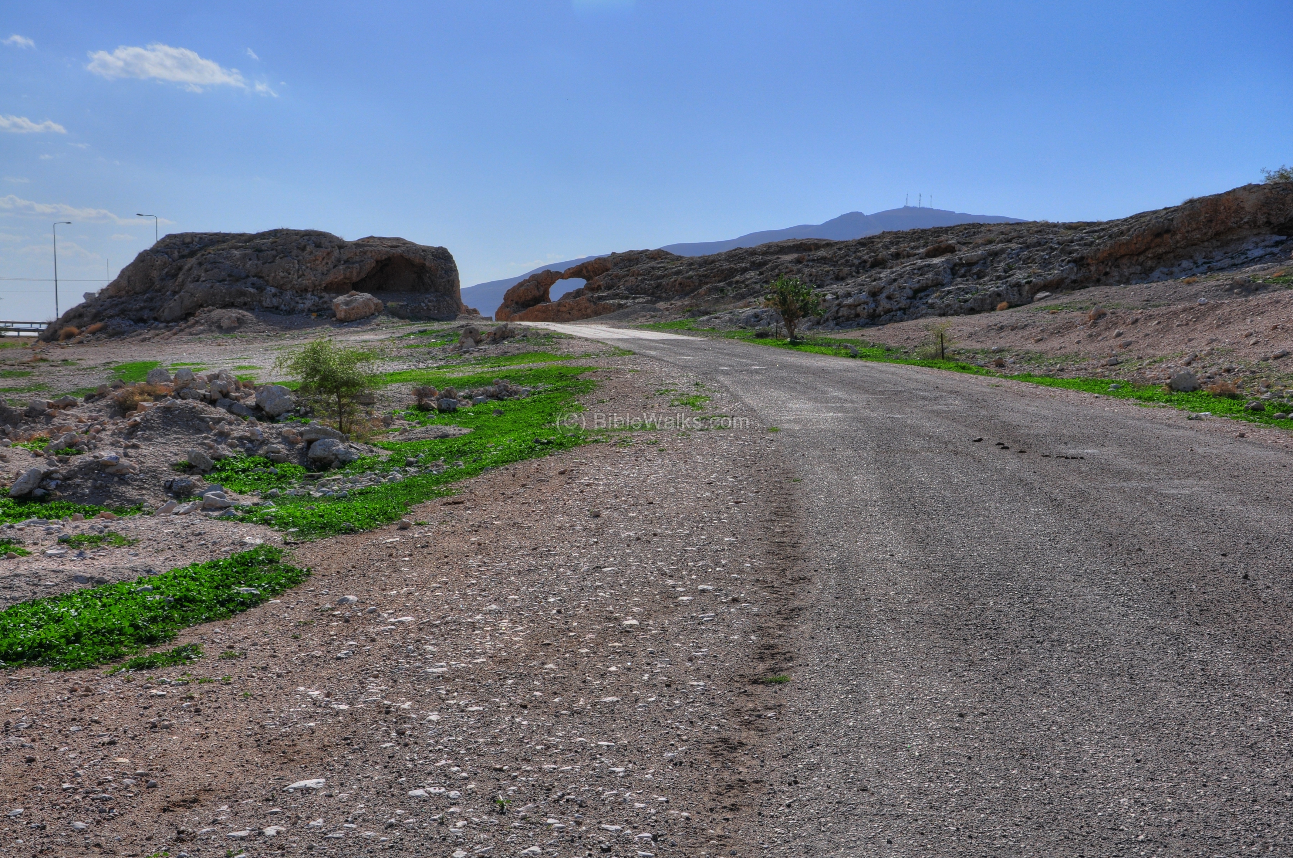
The photo below shows a closer view of the rock formations on both sides of the old road. This split rock formation may have given the name of the site – el-Makhruk means “perforated” in Arabic (according to Z. Vilnai).
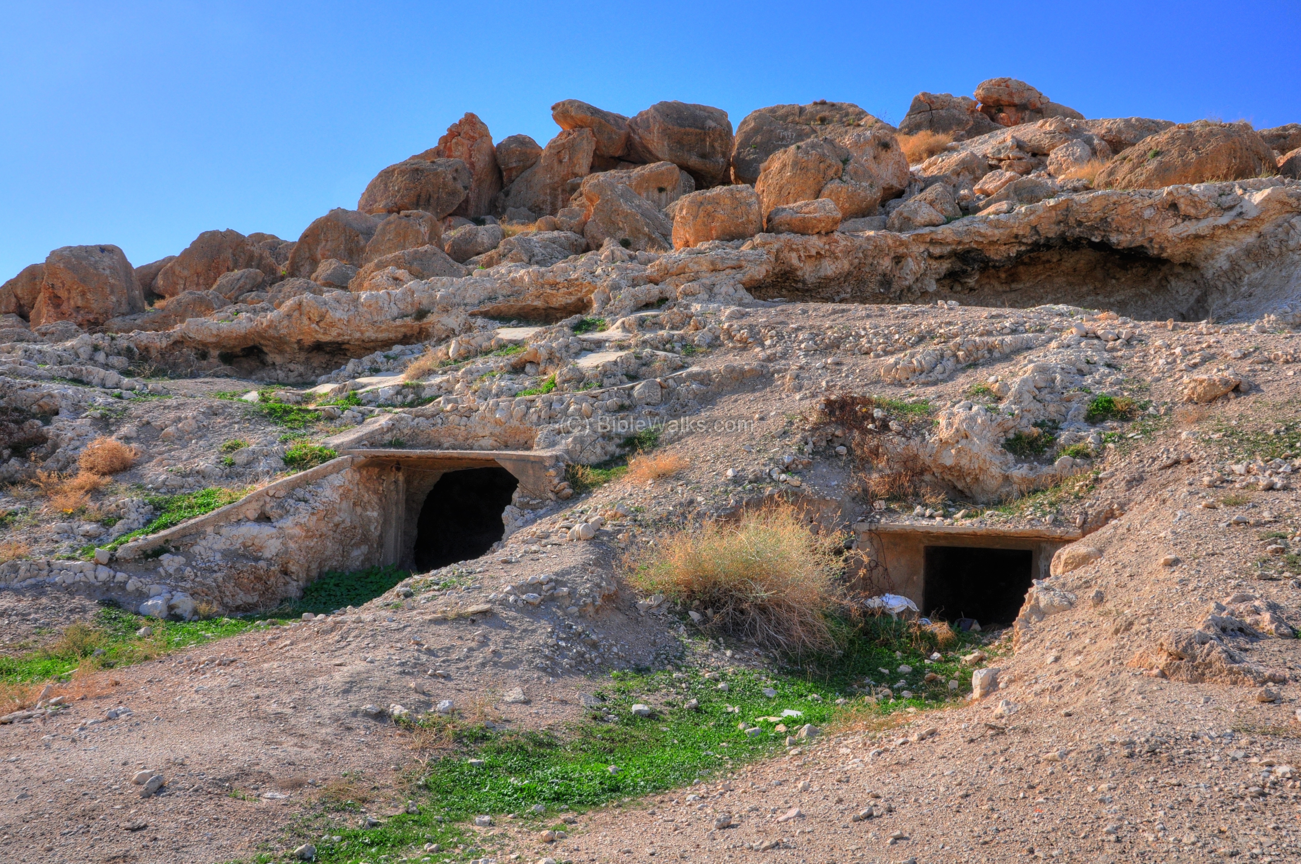
The eastern side of the ridge is pocketed with caves and traces of ruins. The caves were used for residential and farming purposes.
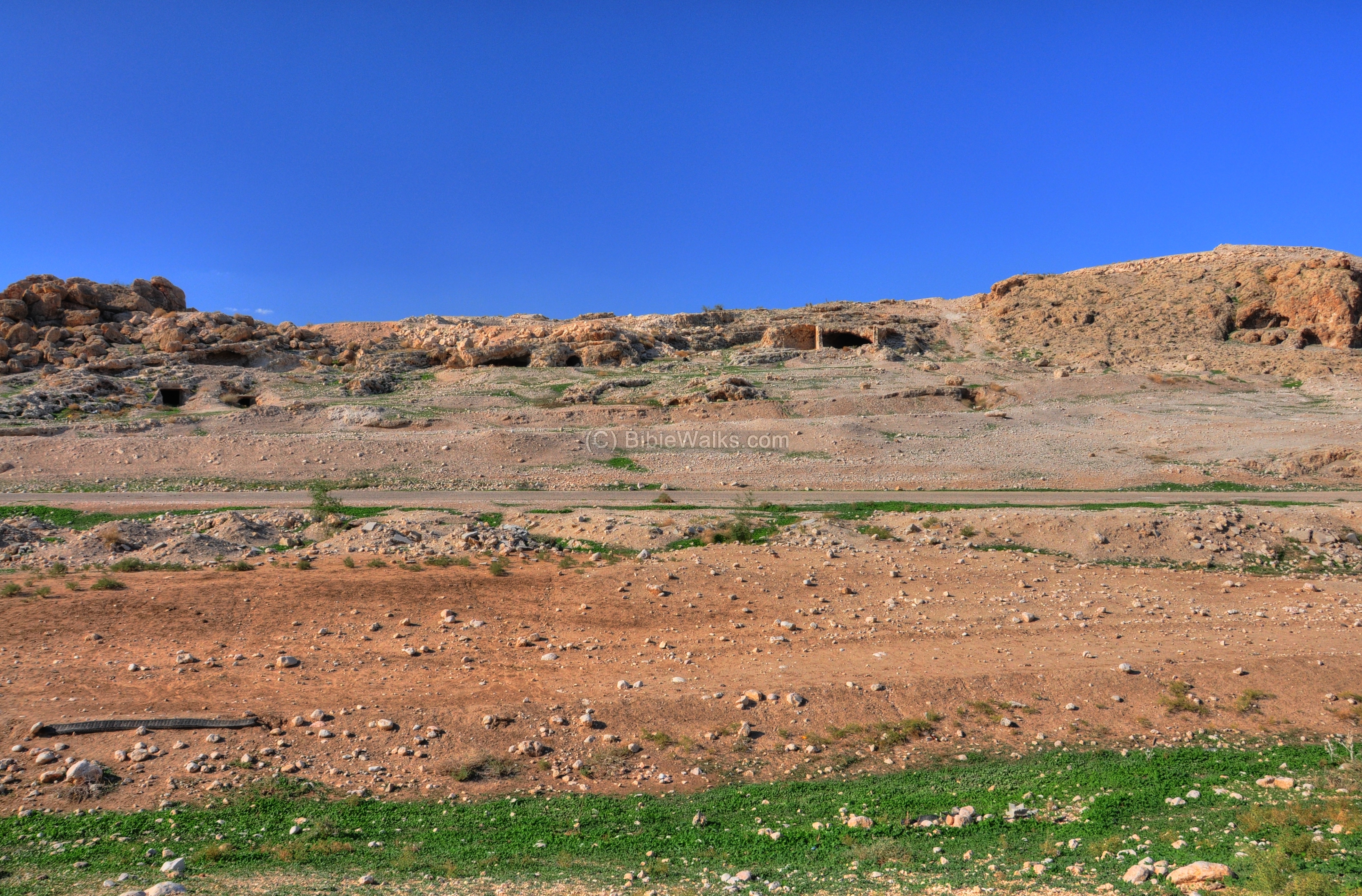
Below is a closer view of modern fortifications in the caves along the eastern side. This was the site of the Ottoman’s 53rd division headquarters in WW1 (1918), and the British managed to capture it during its offensive in Israel on their attack towards Jordan.
The photo below – another view of the eastern side.

(c) Tirzah Road:
The road on the south side of the ridge is an ancient route from the Jordan to the heart of Samaria. This is the valley of Tirzah (Far’ah).
Tirzah, the name of the valley, was Biblical city in Samaria. It was once a mighty Canaanite city (Joshua 12 24):
“And these are the kings of the country which Joshua and the children of Israel smote… the king of Tirzah”.
It then became Israel’s Kingdom first capital city (1 Kings 15 33):
“In the third year of Asa king of Judah began Baasha the son of Ahijah to reign over all Israel in Tirzah, twenty and four years”.
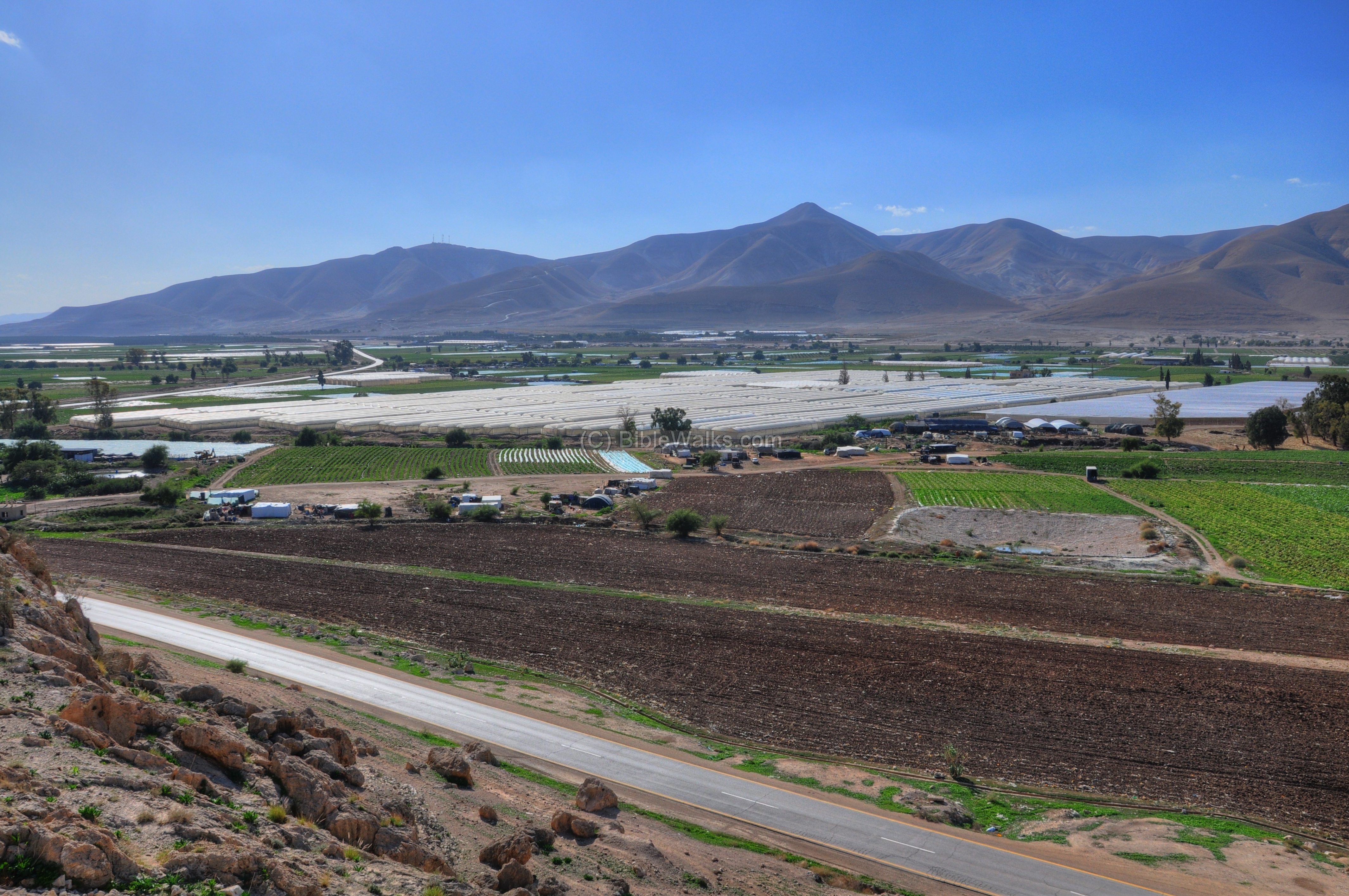
The pointed hill is the place of the fortress of Sartaba, identified as Biblical Zarthan. According to the Bible, King Solomon prepared Brass and Gold vessels for the temple, casting them in the clay that is located here between Succoth (plains of valley of Jordan) and Zarthan (1 Kings 7:47):
“In the plain of Jordan did the king cast them, in the clay ground between Succoth and Zarthan”.
So the casting of the temple tools was done at this area.
The ridge was heavily fortified in modern times, since even today it is strategically located on an important junction. The communication lines in the picture below cut through the ridge and damaged the site.

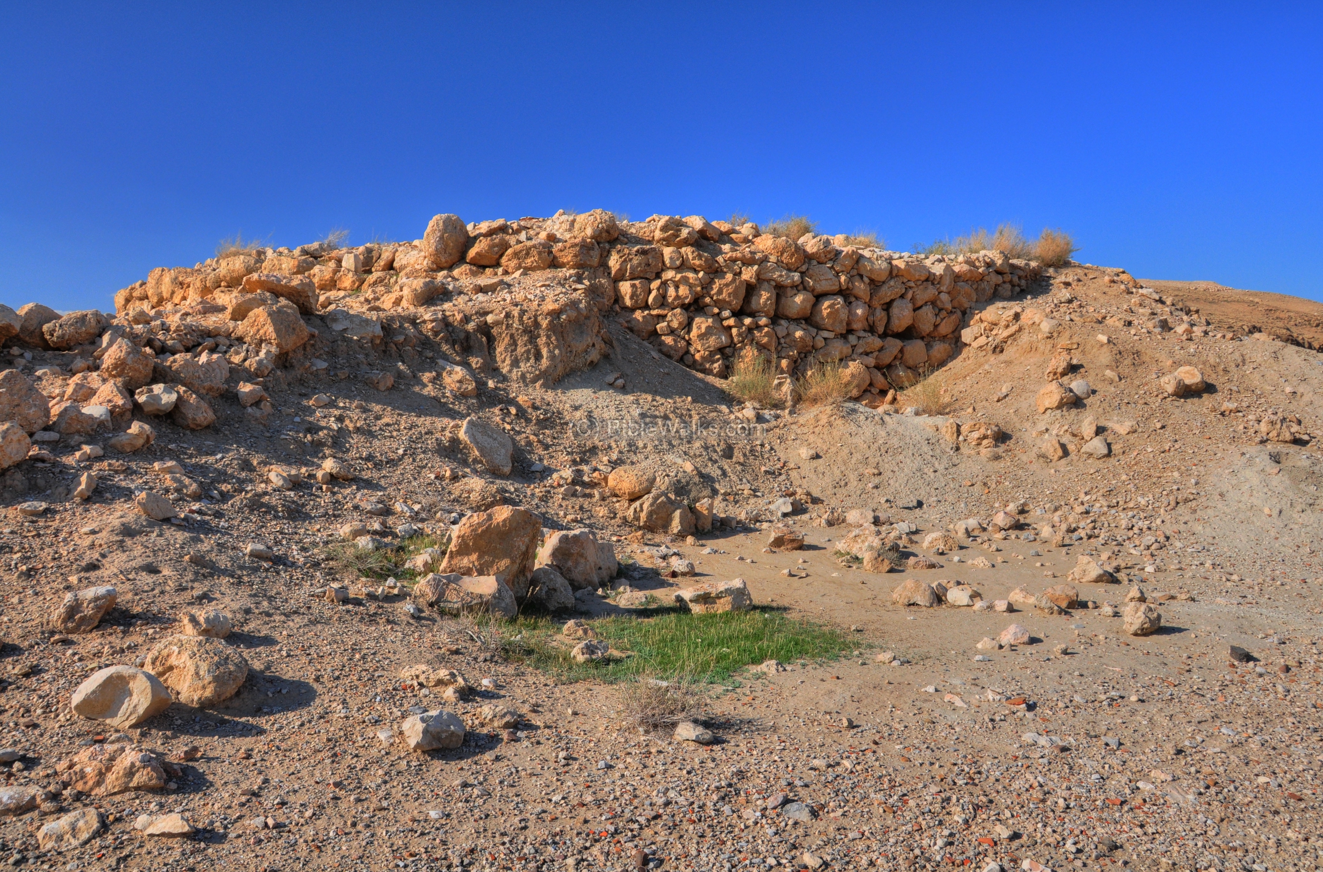
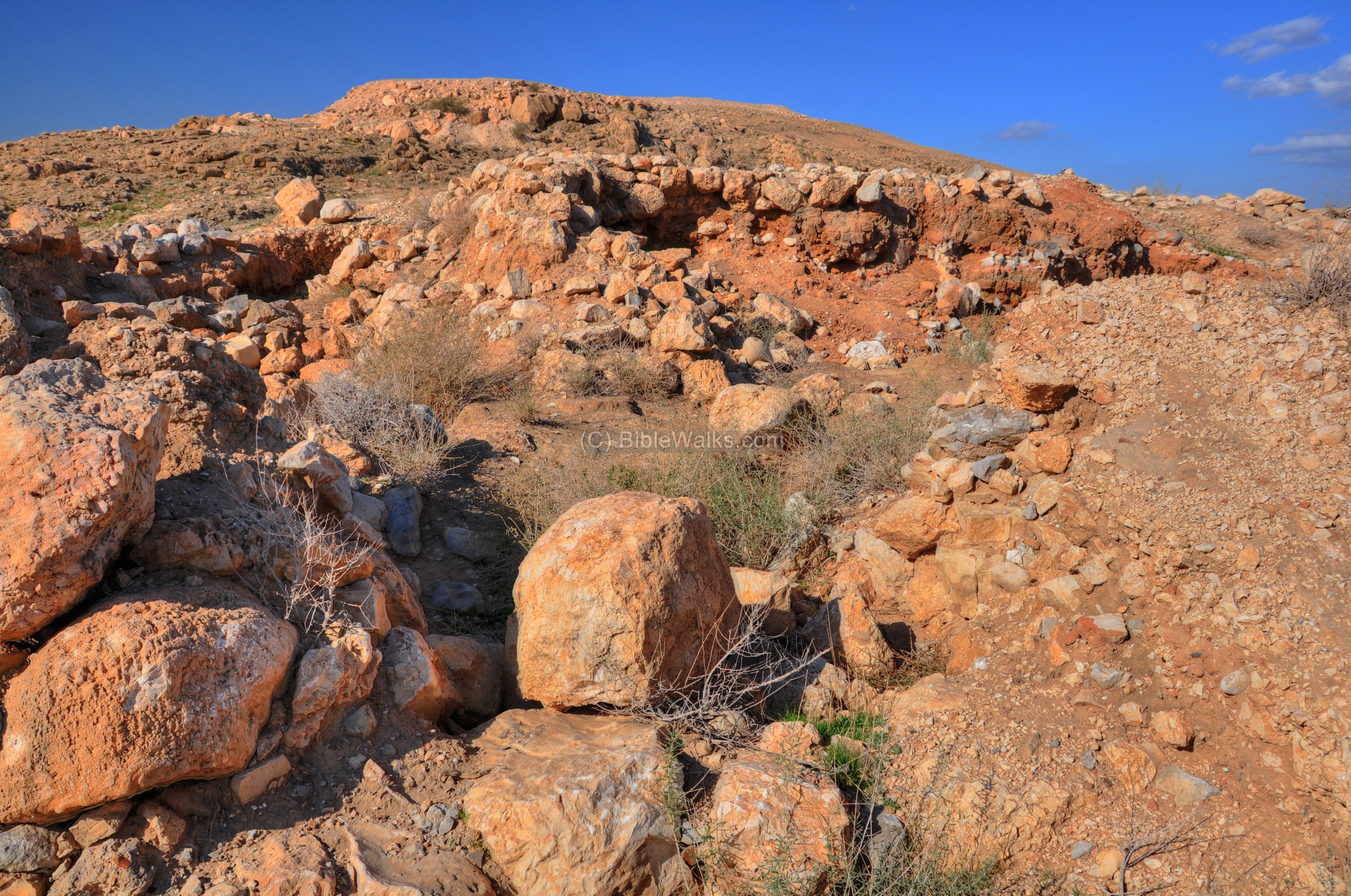
(d) Circular tower:
A small circular Iron Age tower is located in the south west side of the site (Area ‘B”), as marked in red on the diagram of the site. It was built over the remains of the residential houses of the Early Bronze city.
The tower has an external diameter of 19.5m, and consists of 3 concentric towers. According to the excavator (Yeivin 1993), it is dated to the 10th-9th century BC (Iron Age II), with some underlying Early Bronze remains. The tower was damaged by modern military construction, but the archaeologists managed to research the structure and restore some of its sections.
An aerial view of the circular tower is below, with a view towards the east:
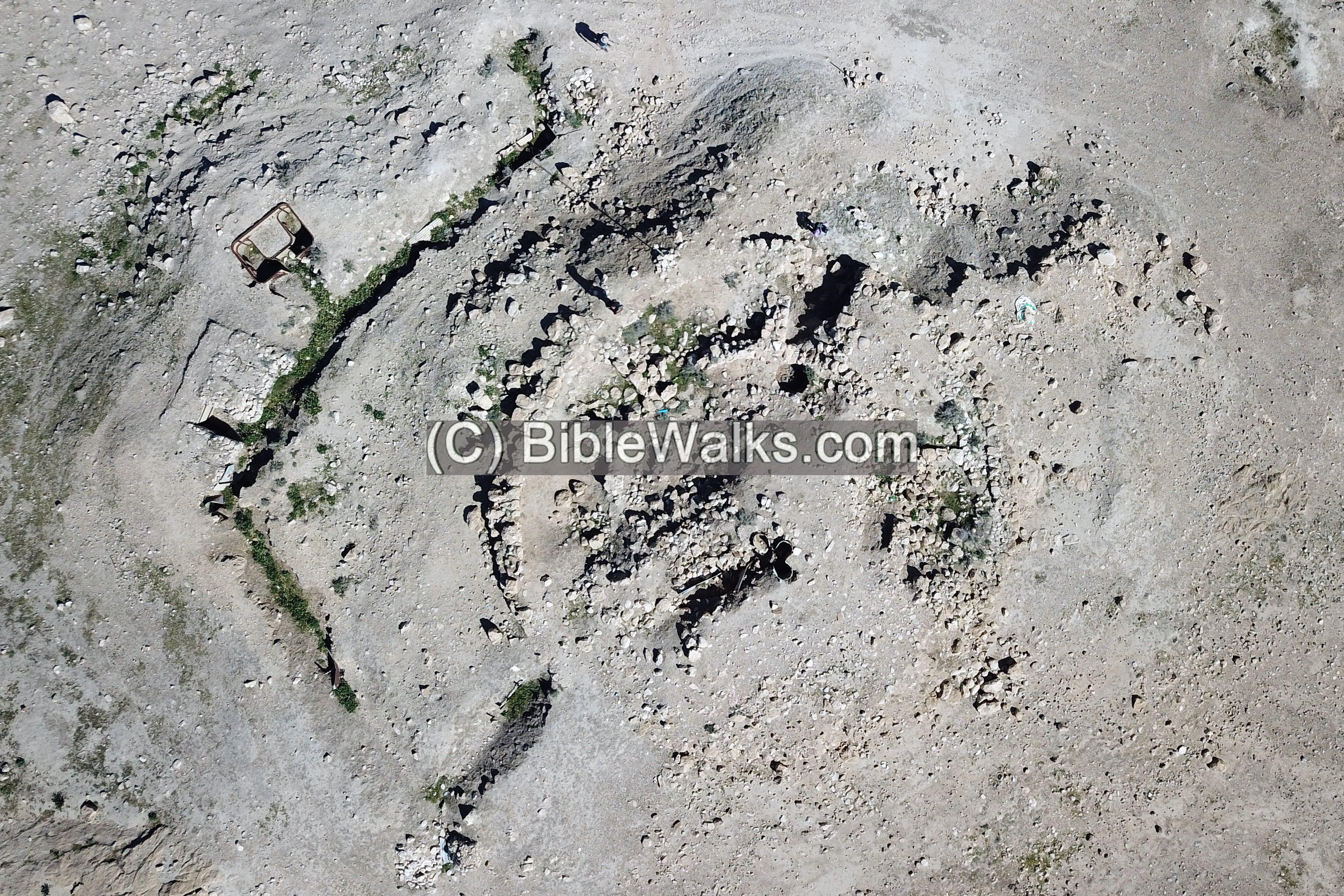
The circular tower has 3 concentric stone walls, as seen in the legend below. Here is the plan of the structure:
- An inner circular tower of 8m in diameter, built as a solid area full of stones and pottery fragments, within a supporting stone wall 70cm wide and at least 2m deep.
- A second stone wall, 10m in diameter, was built around the inner circular tower, with a space of 1m. The space to the inner wall was filled with sun-dried mud bricks.
- An outer stone wall, 19.5M in diameter, was built around the middle circular wall with a space of 2m. The wall is 1m wide.
- Casemate plan: The space between the two external stone walls had radial walls that created chambers. An opening of 60-70cm in the radial walls allowed moving between the chambers.
- Pottery of the 9th century BC were found on the floors of the radial chambers. One of these rooms had an oven.
Ground views:
The ruins of the tower is shown here, as captured from the south side.
A closer view of the eastern side of the tower is seen below, as seen from the north side. Notice the 3 walls of this concentric tower, and a section of a radial wall on the right side.
Standing on the tower, the Biblical time watchmen could see the eastern rectangular fortress below, and a great view of the plains of the Jordan valley. The watchmen would have spotted enemy troops approaching from the Jordan and alerted the army.
The tower also provides a great view of the road to the north and the plains of the Jordan valley. The Biblical name of this area was “Succoth”.
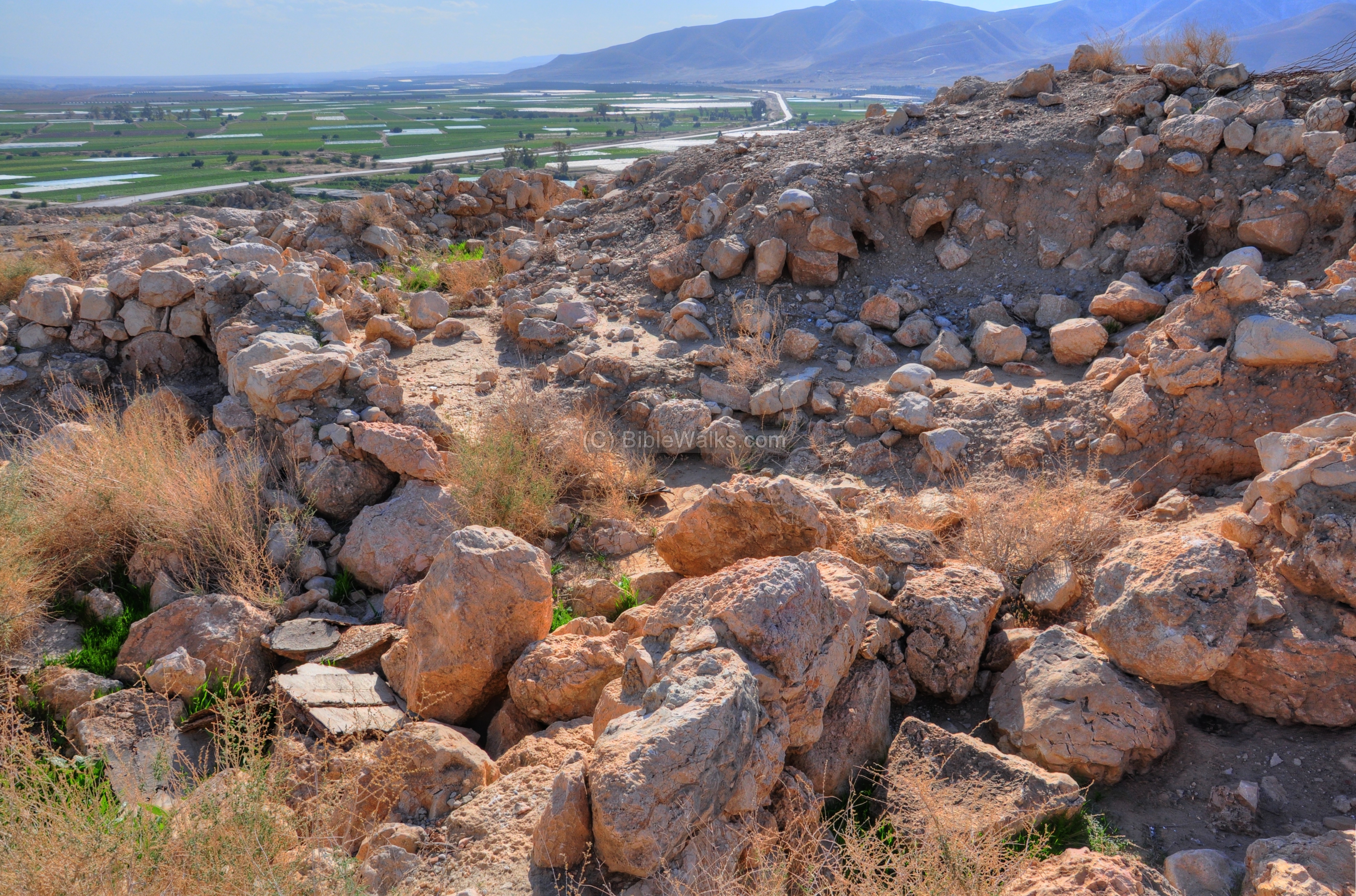
(e) North-West Tower:
A fortified structure was constructed on the highest edge of the fortified city- the north-west side. Its location inside the site appears on the diagram, marked in red. Several construction phases were observed during the Early Bronze II and the Iron Age II.
- Early Bronze period tower:
The tower was built in three phases: The first tower had a 10 x 17m shape that was built on top of the bedrock. It was later expanded on its western side to an area of 10.5 x 29m. In front of this tower was a 15m wide and 5-6m deep moat, and a glacis protected the base of the tower. The city wall protected the tower on its west and east sides. The tower was built with red bricks, and was destroyed by a fierce fire.
A third tower was then constructed on top of the destruction level, which accumulated to 1m or higher. The builders increased the height of the structure by building a large raised podium, and by adding retaining walls on the breached corners. The podium was paved with stone and laid two layers of bricks on top of it. This base was then used to raise a higher tower above it. The entrance was by wide steps on the western side, along the city wall that connected to the tower on its western side. This third tower was also destroyed by a fierce fire, burning the stone base into lime.
- Iron Age tower:
The Iron Age tower was built over the ruins of the Early Bronze period tower. According to the excavator (Yeivin 1993), its construction is dated to the 10th-9th century BC (Iron Age II), built slightly later than the circular tower.
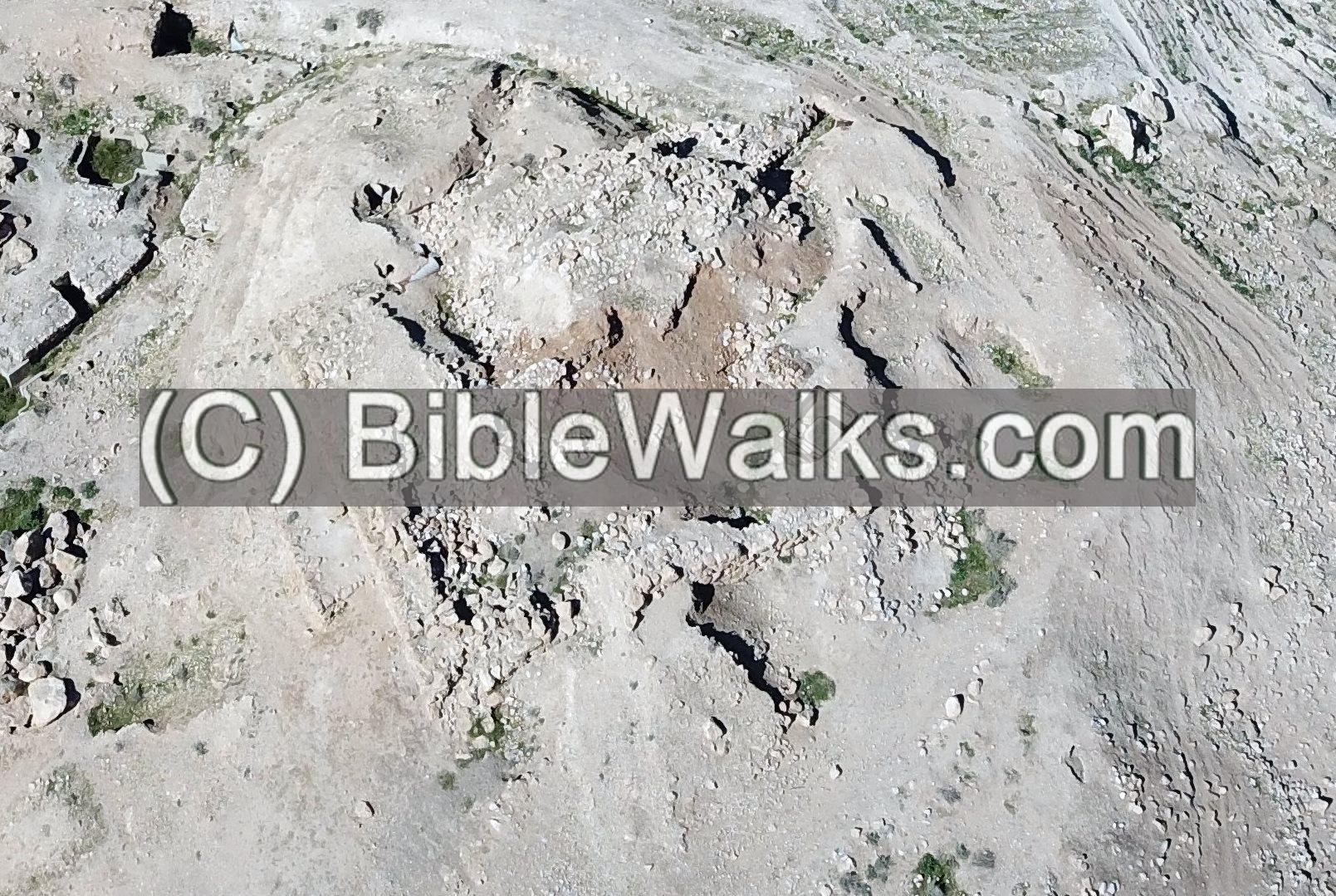
An aerial view of the structure is seen here, oriented towards the north. Around the tower are modern military trenches. Most of the structure was damaged by erosion and/or Military construction, so only the north-east side was partially intact when the structure was unearthed.
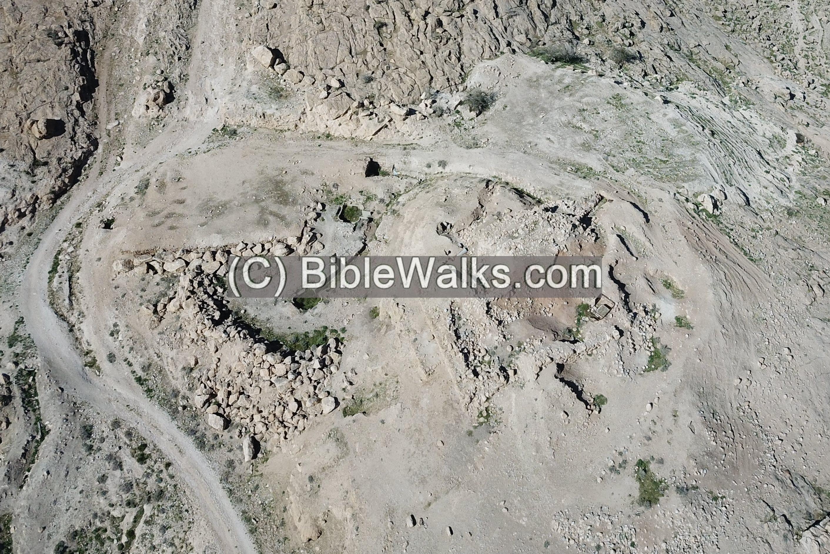
The following aerial view provides a closer look at the Iron Age tower, which measures 23m x 18m. This structure was built using massive external walls directly atop the Early Bronze Age ruins and was developed in two distinct phases.
The first phase consisted of a smaller tower (9.5m x 13m), built over the Early Bronze ruins. In the second phase, the site was significantly expanded: a new 1.5m-wide wall was sunk four meters deep into the Early Bronze destruction layer, encircling the original structure with a 3m gap between the two walls. The total size of the rectangular tower was 18 x 23m. Within the protective casing of the 2m and 3m-wide walls, a series of small chambers (each 2m x 1m) were integrated along the perimeter, and the original structure was used as an open center. This transformed the modified layout into a central courtyard, surrounded by peripheral rooms that occupied the space between the walls.
Ground views:
The photo below shows the rectangular structure, as seen from the circular tower.
Another view of the rectangular structure is in the picture below. A section of the Early Bronze period wall stretches in front – from left to right.
A closer view of the walls of this structure is in the picture below. The building was first constructed with an area of 15 x 10m, then enlarged to 24 x 20m.
The picture below shows the interior of the rectangular tower.
A north-east view of the plains of the Jordan valley is seen from the structure.
The view towards the south is remarkable. The green valley of Tirzah (Far’ah), and the high mountains of above the valley, with the pointed hill of Sartaba (identified as the Biblical Zarthan).
(f) Pottery and flint findings:
The site is covered by a blanket of red/orange ceramic fragments. The majority of these are dated to the Bronze and Iron ages with almost no later period ceramics.
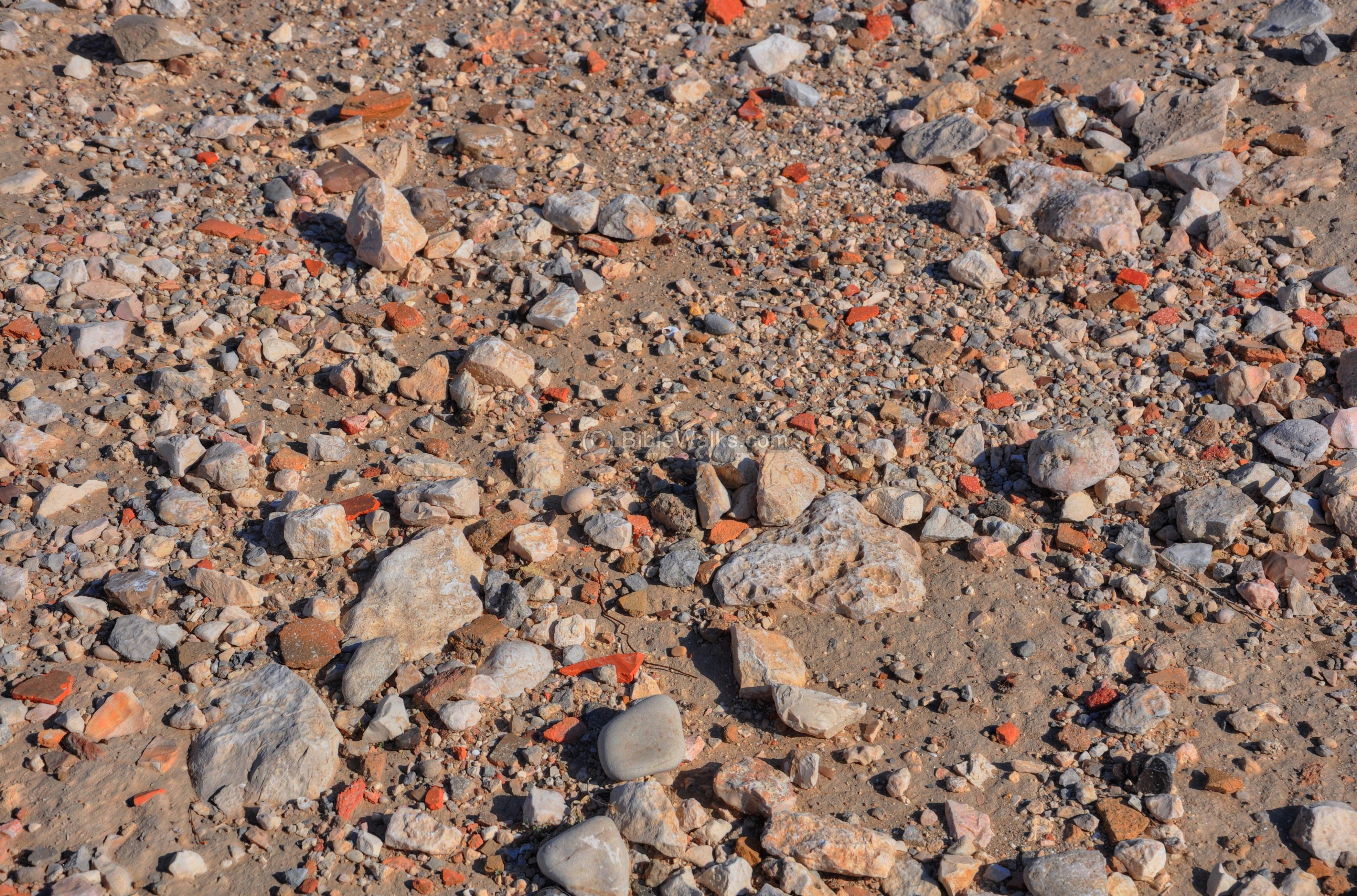
We collected some of the interesting pottery segments and flint tools. All items were left on the site.
According to Zartal’s site description, the ceramics in Kh. Makhruk towers were dated to the Chalcolithic period (4%), Early Bronze I (5%), Early Bronze 2-3 (65%), Middle Bronze 2B (2%), and Iron age (24%). The flint tools were dated to the Neolithic pottery period (Wadi Rabah culture), Chalcolithic, and Early Bronze period.
Sun dried mud bricks, dated to the Iron Age, are found in Khirbet Makhruk.
The red color of the mud bricks at Khirbet Makhruk is primarily a result of the local geology and the chemical composition of the raw materials used in their construction. There are two main reasons for this distinct coloration: 1. High Iron Oxide Content (Terra Rossa Soil) – The most common reason for red-colored mud bricks in the Levant is the use of Terra Rossa soil. The central mountain ridge and the valleys of Samaria (including the Tirzah Valley) are rich in Terra Rossa, a reddish, clay-like soil that forms from the weathering of limestone and dolomite. This soil contains high concentrations of iron oxides (specifically hematite). When the ancient builders mixed this local clay with water and binders like straw to form bricks, the iron minerals gave the finished product its deep red or orange-brown hue.
Example:
While most Early Bronze and Iron Age mud bricks were sun-dried, many of the bricks at Khirbet Makhruk exhibit a “fired” appearance due to the site’s history of destruction. During intense city-wide fires, the heat acts like a kiln, “firing” the sun-dried mud bricks. This process chemically alters the clay, permanently hardening it and often intensifying the red color.
Those burnt bricks that are in-situ could be dated by archaeomagnetic dating method.
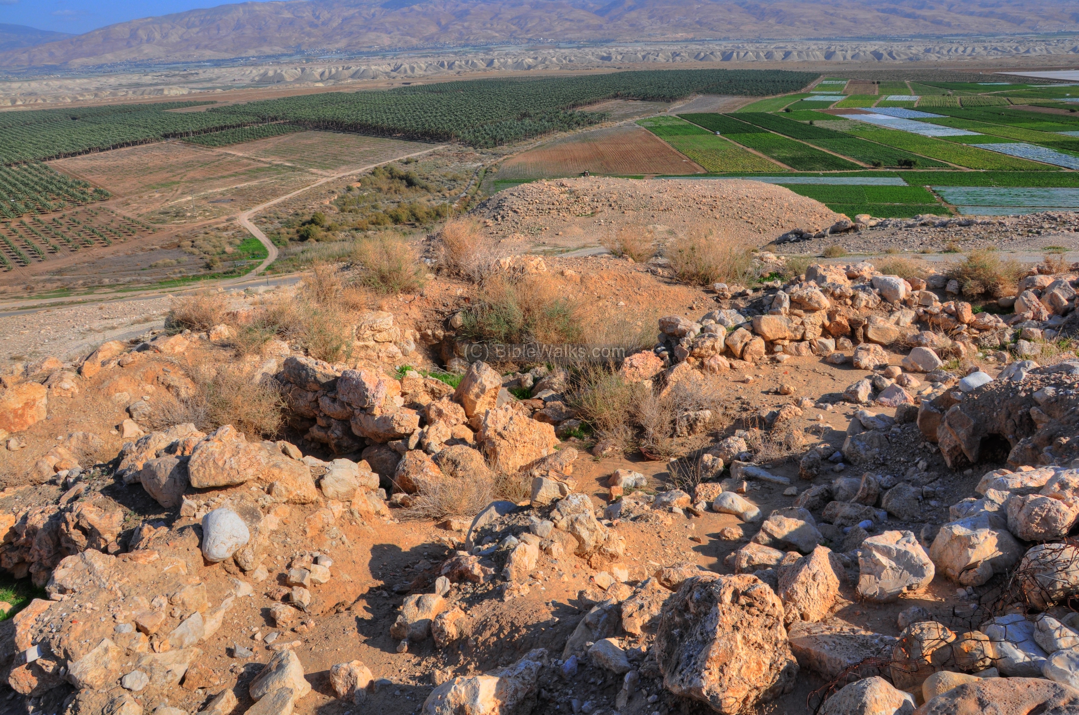
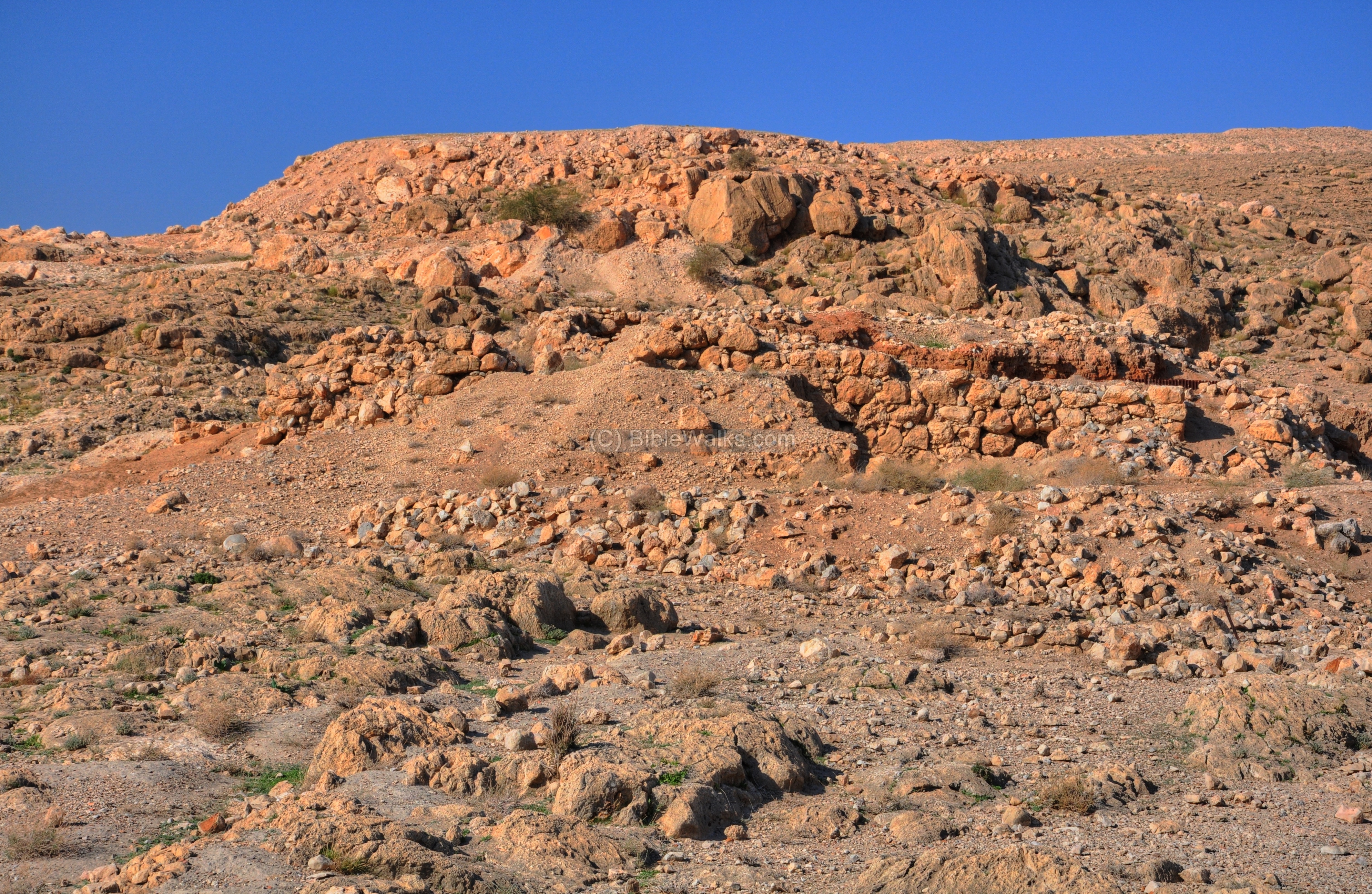
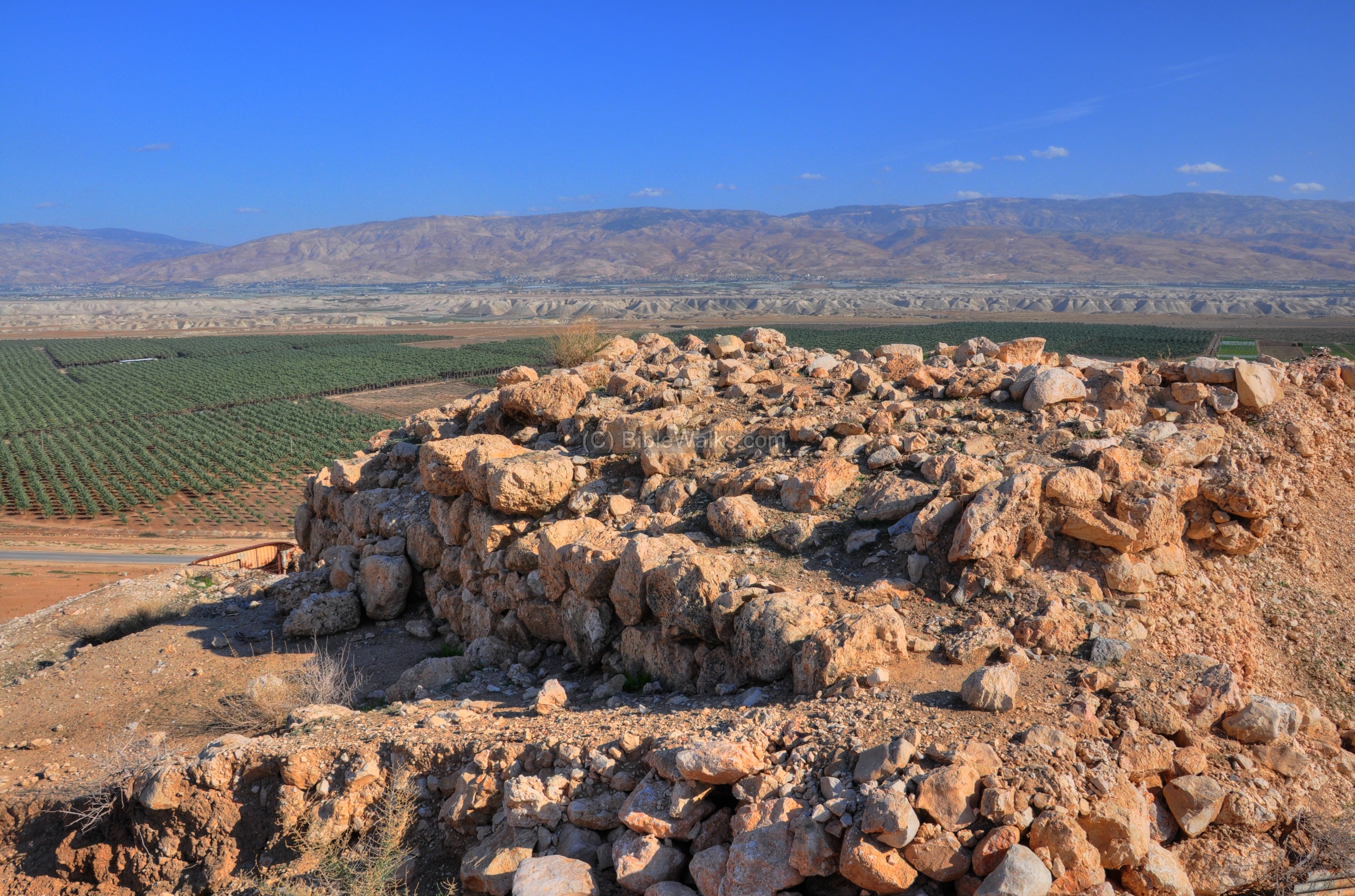
(g) Eastern Fortress:
The Eastern Fortress (also referred to as the “Rectangular Fortress” or “Fortified Mound”) is one of the key defensive structures at Khirbet Makhruk. Located on a distinct hill just above Route 90, it functioned as the primary watchtower for the Jordan Valley floor.
Its location is marked in red in the diagram.
The Eastern Fortress is situated on the easternmost edge of the ridge, providing an unobstructed line of sight to the Jordan River and the plains of Succoth. Its primary purpose was to monitor approaching enemy forces or trade caravans from the east (Transjordan) and alert the army stationed further up the Tirzah Valley. From its summit, watchmen could also communicate via signals with the circular Tower on the southern ridge and the rectangular tower on the northwest.
The photo below shows the fortress from the west side. In the background of the photo are the plains of the Jordan valley, in the direction of Adam bridge.
The fortress has a rectangular footprint, covering an area of 40m by 70m. Archaeologists found that it was constructed directly over a pre-existing Early Bronze Age mound, reusing the elevated position for better vantage. A drone captured the view from above:
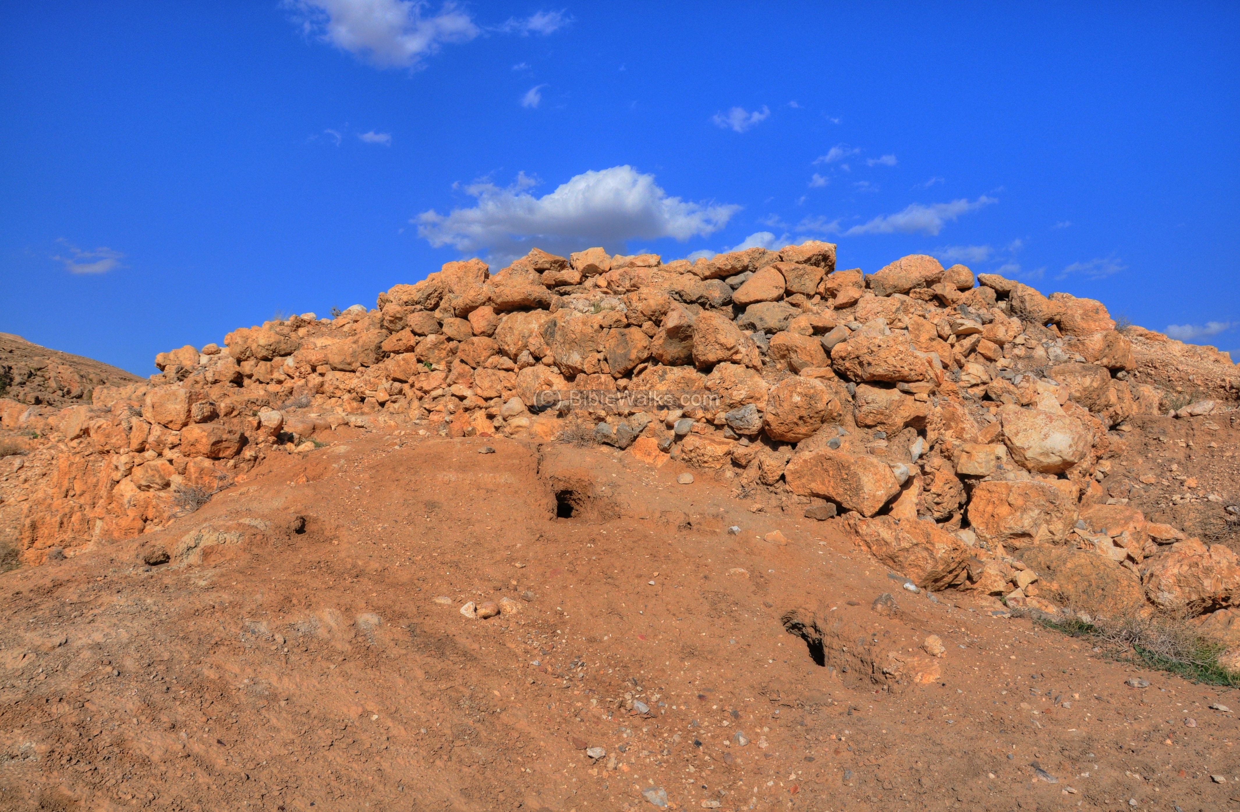
A ground view of the rectangular Iron Age II fortress is seen below. It was protected by a very wide (6-7m) wall.
Notice the 5 rows of large stones on the north side of the mound. This supporting wall was part of the podium that was built along the foothills. It is visible only on the north west side of the mound but during the Iron Age it surrounded the hill, creating a formidable fortification.
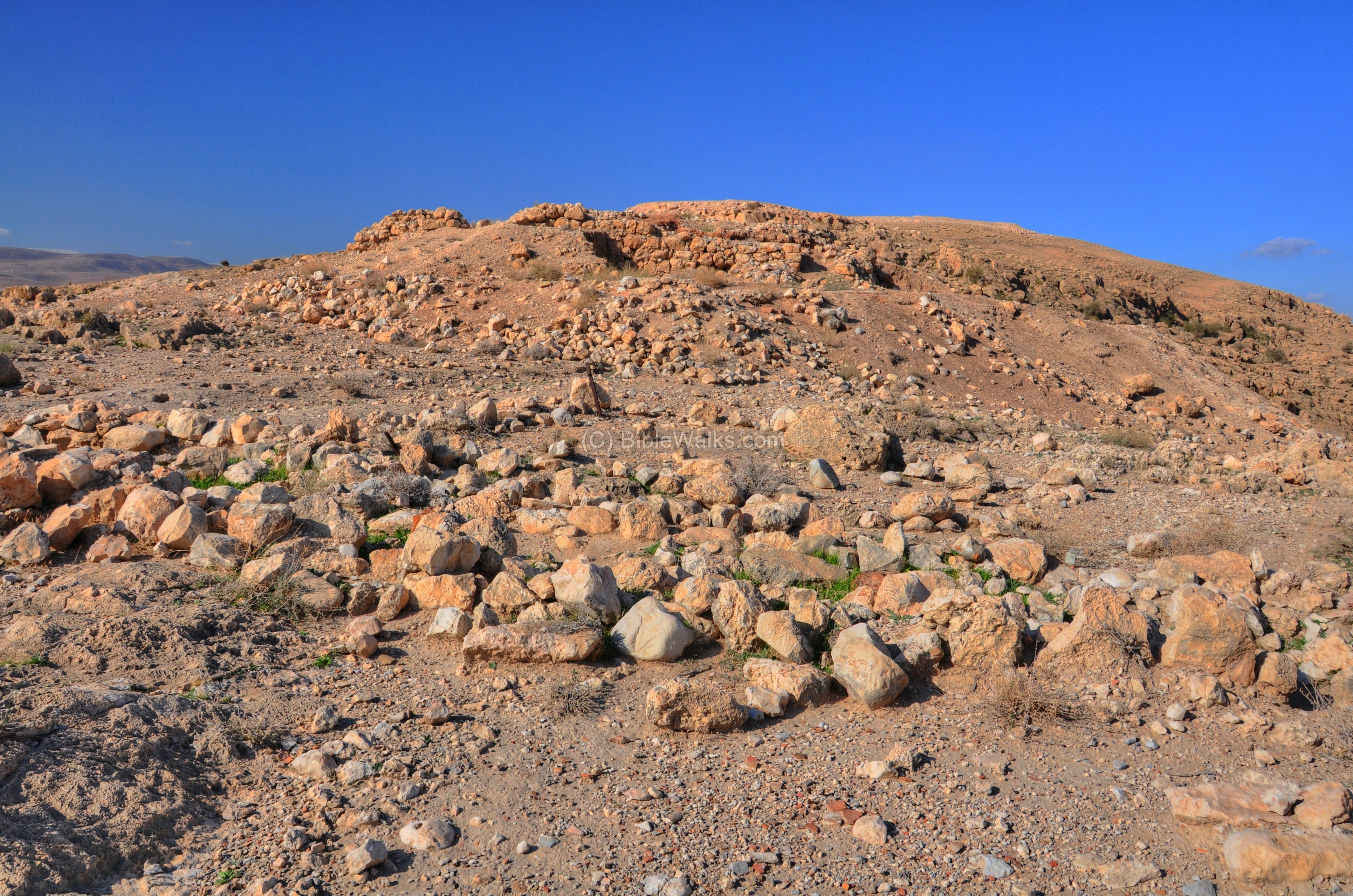
The mound is steep:
On the summit of the rectangular fortress are traces of wide walls. Similar to the other Iron Age structures at the site, it was built with massive unhewn stones.
This view is towards the west, where the round and rectangular towers are built on the hill above. Notice remains of a structure on the left side of Roni.
Below – Another view towards the north. Roni is walking along a section of the eastern wall that surrounded the summit.
The base of the hill contains layers from the Early Bronze I-II (roughly 3000–2700 BC), when it was part of a much larger fortified Canaanite city. The visible rectangular ruins date primarily to the Iron Age II (10th–9th centuries BC).
On the foothills, especially on the eastern side, are a large number of pottery sherds. According to Zartal’s site description (Volume 4, site 73), the ceramics on the eastern fortress were dated to the Early Bronze I-II (23%), Middle Bronze 2 (5%), Iron age II (71%), and others (1%). The flint tools were dated to the Early Bronze period and probably also to the Iron Age II.
A water cistern is located below the fortress along the ascending road, and was part of the water supply for the city and fortress.
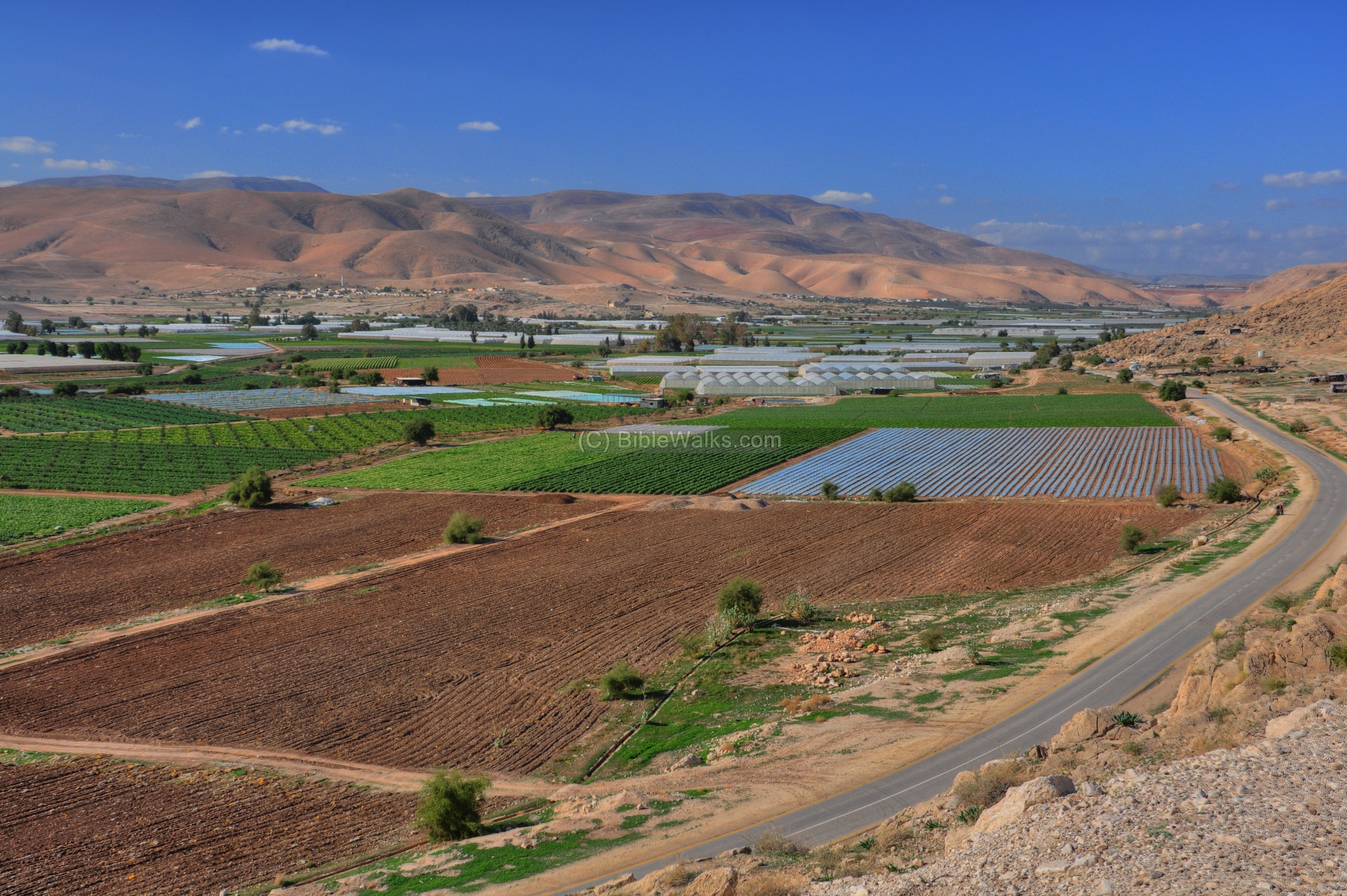
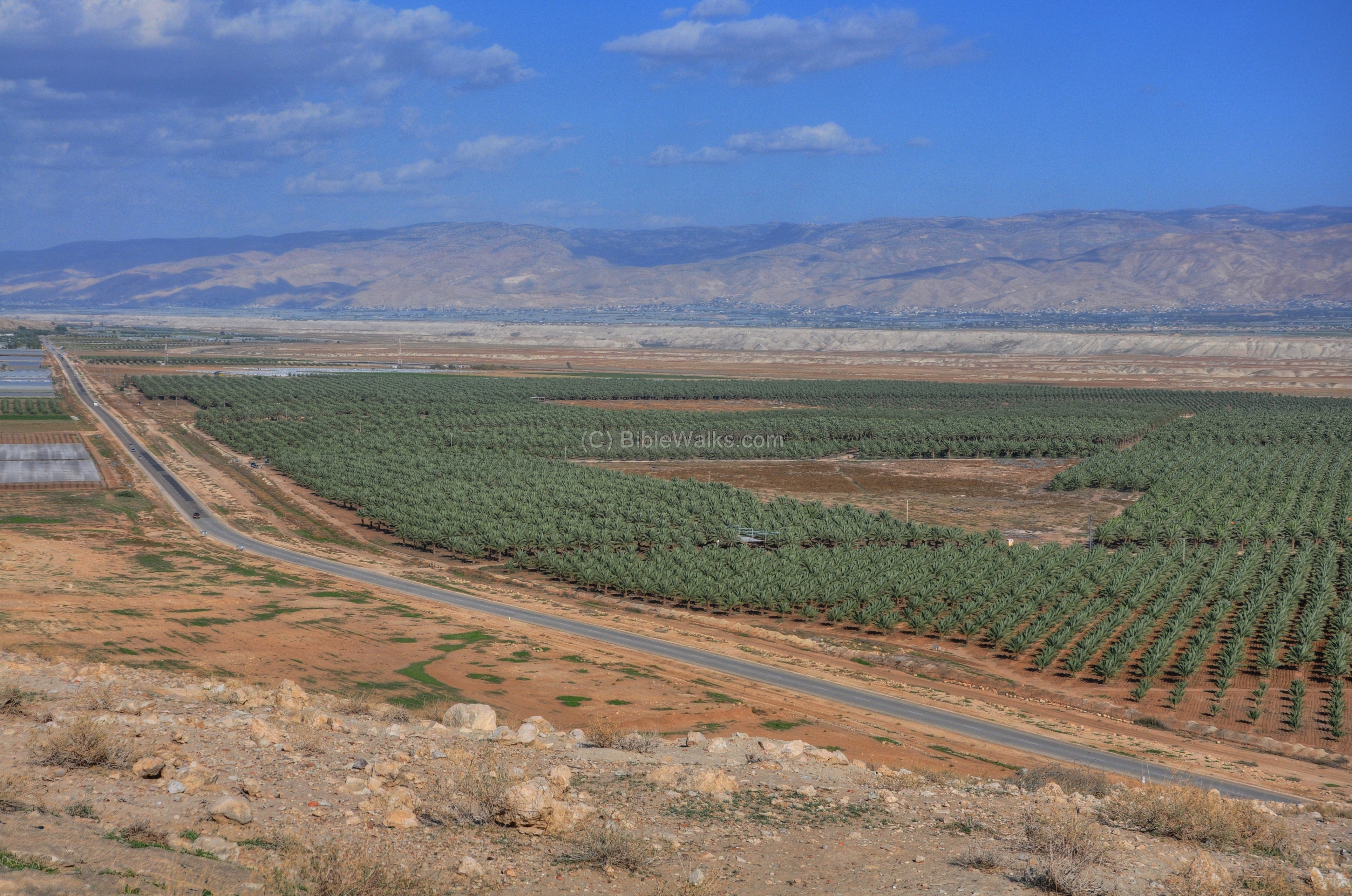
(h) The Fields:
The green fields near the road present a vivid contrast to the dry light-brown soil around it. Local Arab villagers work the fields in old fashion ways – by hand.
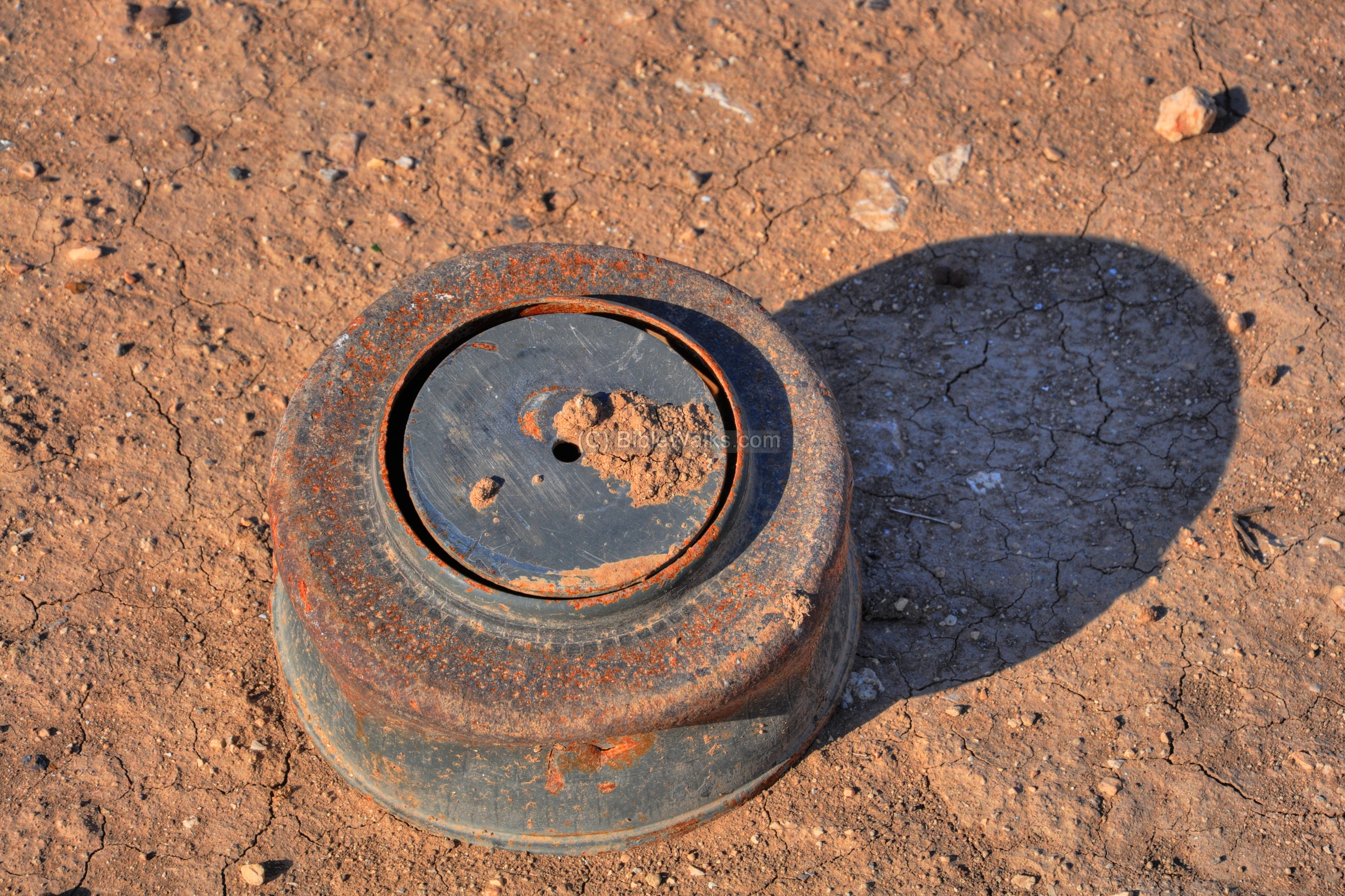
An old mine was seen near this field. After all, the area is close to the border and is a gateway for two major crossing roads. The mine was probably found during the farming of the field, and left out on the road. Since it is painted blue, this might be a dummy training mine, but we would not advise to touch it.
(i) Field Survey
A field survey of the site was conducted on Jan 2026. This 12 minute video summarizes the visit to the site.
Links:
- Where is Coabis? (Adam Zertal, 1991; Hebrew) – discussion on Roman roads in the Jordan valley
References:
- Studies in the Archaeology of the Iron Age in Israel and Jordan (edited A. Mazar, 2001, ISBN 1-84127-203-5)
Chapter 2: Adam Zertal (pp 38-64): The heart of the Monarchy: Pattern of settlement and Historical considerations of the Israelite Kingdom of Samaria Preview
- Manasseh Hill country survey Vol 2 Eastern Valleys
- Site 269 el-Makhruq , pp. 591-595 – covers the entire complex
- Manasseh Hill country survey Vol 4 Bezeq to Sartaba
- Site 73 el-Makhruq (2) , pp 257-259 – details the eastern fortress
- “From Watchtowers to Fortified Cities” — On the History of Highway Forts in the Israelite Kingdom” -A. Zartal, Qadmoniot 1988), pp. 82-86 (5 pages)
- Three Iron Age Fortresses in the Jordan Valley and the Origin of the Ammonite
Circular Towers – Israel Exploration Journal , 1995, Vol. 45, No. 4 (1995), pp. 253-273
- British attack El Makhruk (1918)
- “The new encyclopedia of archaeological excavations in the Holy Land” [1992 E. Stern editor, Volume 3 pp. 926-928]
* Biblewalks sites:
- Drone Aerial views – collection of Biblical sites from the air
- esh-Shukk valley – similar Iron Age circular tower
- Rujm Abu Mukheir – another Iron Age circular tower
- Sun dried mud bricks
Etymology – behind the name:
-
Makhruk (Mahruq, Makherouk)- Arabic for “split”. The name of the site, based on the split between the rocks where the road passed.
- Mukhrak (Muhraq) – Arabic for: “burnt” . Another common interpretation of the name of the site.
- Khirbet – Ruined site in Arabic;
-
Khurvah (Horvah, Horbah )- Ruined site in Hebrew; Khirbet in Arabic. Biblical references: Leviticus 26,31: “And I will make your cities waste,…”. Isaiah 44, 26: “…and I will raise up the decayed places thereof.
-
Tirzah – Biblical city in Samaria – Once a Canaanite city (Joshua 12 24: “And these are the kings of the country which Joshua and the children of Israel smote… the king of Tirzah”), and then Israel’s Kingdom first capital city (1 Kings 15 33: “In the third year of Asa king of Judah began Baasha the son of Ahijah to reign over all Israel in Tirzah, twenty and four years”).
- Tirzah brook – The brook from Shechem to Adam.
- Farah – The name in Arabic of Tirzah; unknown translation.
- Jiftlik, Jiftliq – Turkish: The Sultan’s estate. There were many such estates, one is located south-east of Makhruk.
BibleWalks.com – walks along the Jordan river
Adam<<<—previous site—<<<All Sites>>>—next Jordan Valley site—> >> Jordan-Jericho
This page was last updated on May 16, 2026 (updated the eastern fortress)
Sponsored Links: