Antiquities in the community of ‘Eli in central Samaria, north west of Shiloh.
Home > Sites > Samaria > Shiloh > ‘Eli
Contents:
Background
Location
History
Structure
Photos
* Farmstead
* Installations
* Pilgey Ma’im
* Nature
Biblical
Etymology
Links
Overview:
In ‘Eli, a community in central Samaria, a farmhouse dating to the late seventh–early sixth centuries BC was excavated. Several building phases were observed, and a few fragments of pottery vessels from the time of the Second Temple and the Byzantine and Mamluk periods were found, which the excavator attributed to a temporary settlement.
Other antiquities are reviewed in the area of ‘Eli.
Location and Map:
The aerial map shows the location of the community of ‘Eli, situated on a high ridge that towers above the Shiloh valley. The ancient north-south trade route (now highway #60) passed along the valley, continuing southwards via the Lebonah ascent, or eastwards towards Shiloh.
On the ridge are ruins of Horvat ‘Eli (altitude 720m, 200m above the valley).
Ancient installations were found in the hills nearby such as a wine press complex.
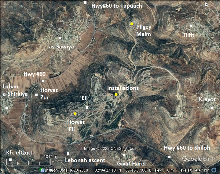
On its east side is the Arab village Krayot – one of the suggested identifications for the birth place of Judas Iscariot.
On its west side is the Arab village of Luban – named after the Biblical ascent of Lebonah.
History:
-
Middle Bronze II period – Foundation of Shiloh
During the Middle Bronze II period (2000-1600 BC) the region witnessed a large settlement wave, when new cities were founded in the high mountain area of Judea, Ephraim and Benjamin – such as Jerusalem, Shechem, Tirzah, Hebron and Bethel. One of these new cities was the nearby Shiloh, located in the fertile valley of the area of Ephraim between Shechem and Bethel.
A large city was founded in Tel Shiloh during the Middle Bronze II period (18th century BC).
-
Late Bronze period – Egyptian control
During the Late Bronze period (1550 BC-1200 BC) the settlements in the region of the high mountain deteriorated. Many of the small cities were deserted, and the region was under Egyptian control since the great battle in Megiddo (1468 BC). The strongest city in the area of Ephraim and Manasseh was Shechem, which expanded its control over the entire area between Jerusalem in the south and Megiddo in the north.
On the other hand, the Canaanite city in Shiloh has weakened. When the Israelites started to settle the area at the end of this period, the Canaanite presence around Shiloh was scarce.
-
Iron Age I – Israelite settlement
Throughout the Iron Age I (1200-1000 BC) the region of the high mountain area witnessed a new wave of settlement, following the conquest of the Land by the Israelites. Dozens of villages were established. According to many scholars, the core of the Israelites settled in the area of Manasseh and Ephraim, and only later expanded to the south (Benjamin and Judea). Therefore, the capital city was selected to be in Ephraim, and only at the end of this period it moved to Jerusalem.
Shiloh, located in the region of Ephraim, became the religious capital of Israel: it was the assembly place for the people of Israel, a center of worship, and housed the Ark of Covenant. The location of Shiloh is clearly identified in the Bible (Judges 21 19): “Then they said, Behold, there is a feast of the LORD in Shiloh yearly in a place which is on the north side of Bethel, on the east side of the highway that goeth up from Bethel to Shechem, and on the south of Lebonah”. Since the location of all three of these sites are known, hence Shiloh’s location is clear.
Its location is shown in the center of the Biblical map below.
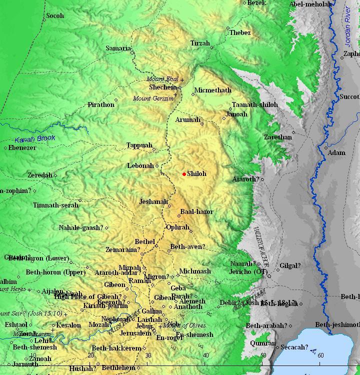
Map of the area around Shiloh (red dot) – during the Canaanite and Israelite periods (based on Bible Mapper 3.0)
Shiloh continued to serve as the religious capital for 369 years (according to traditions), or about 150 years (according to historians), from the conquest of Canaan until the end of the time of the Judges of Israel.
The battle of Ebenezer (~1050 BC) brought a great tragedy (1 Samuel 4: 10):
“And the Philistines fought, and Israel was smitten…”.
The Ark of Covenant was lost (1 Samuel 4:11):
“And the ark of God was taken…”.
‘Eli, a high priest of the Israelites in Shiloh, was the predecessor of Samuel – the last Israelite Judge.
The two sons of ‘Eli died in the battle (1 Samuel 4:11):
“… and the two sons of Eli, Hophni and Phinehas, were slain”.
‘Eli died after hearing of the loss (1 Samuel 4:17-18):
“And the messenger answered and said, Israel is fled before the Philistines, and there hath been also a great slaughter among the people, and thy two sons also, Hophni and Phinehas, are dead, and the ark of God is taken. And it came to pass, when he made mention of the ark of God, that he fell from off the seat backward by the side of the gate, and his neck brake, and he died: for he was an old man, and heavy. And he had judged Israel forty years”.
Age 98 at his death, ‘Eli was followed by Samuel, son of Elkanah and Hanna, who was a key figure in the transition from the period of the Judges to Kingdom.
- Iron Age II – Israelite settlement and Assyrian conquest
Shiloh was burnt by the Philistines, at ~1050 BC.
After hundreds of years of neglect, the city was resettled during the 8th century BC or earlier.
However, this period soon ended with the Assyrian conquest. The intrusions of Shalmaneser V and Sargon II in 724-712 ended the Northern Kingdom (2 Kings 17: 5-6). Shiloh, like other cities and villages in Samaria, was destroyed. Most of the population was lost, exiled or moved to Judea.
- End of the Iron Age
The Persian period brought great prosperity and resettlement, mainly in the Northern Samaria. Southern Samaria witnessed growth but in lower numbers.
The excavated farmhouse in ‘Eli is dated to the late seventh–early sixth centuries BC, at the end of the Assyrian period and beginning of the Persian period. It has two structures which are of a different building style: a four-room house, typical of the Iron Age but was not in use following the Assyrian period, and a open court style which was in use at the end of the Iron Age.
The excavators could not decide on the identification of the settlers in the farmhouse. They may have been descendants of the Israelites after the conquest, or new people that were settled by the Assyrians, or at a later stage people arriving from the Assyrian exile.
-
Ottoman period
Conder and Kitchener surveyed this area during the Survey of Western Palestine in 1882. A section of their map appears below, with a yellow marker indicating the location of Eli.
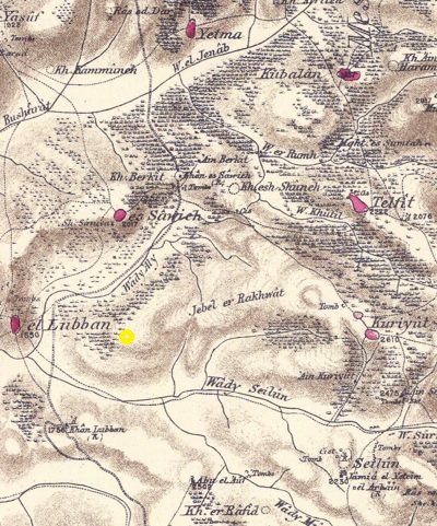
Part of map Sheet 14 of Survey of Western Palestine,
by Conder and Kitchener, 1872-1877.
(Published 1880, reprinted by LifeintheHolyLand.com)
-
Modern times
The community of Eli was established in 1984. It was first named “Givat Levonah”, after the ascent nearby. Later it was renamed after judge Eli – second to the last of the Israelite judges who governed Israel before the establishment of the United Kingdom. Since then it grew, covering 2,000 dunams within 6 neighborhoods, spreading over several hills. Today it is a large mixed community of ~5,000 residents, within the jurisdiction of Mateh Binyamin regional council based in Psgaot.
The ancient farmstead was surveyed in the 1980s. Emergency excavations were conducted in 1992 by a team of the archaeological office for Judea and Samaria.
Photos:
(a) Farmstead
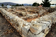
A second temple period farmstead was excavated on the western neighborhood (the closest to highway #60). The ruin is located in a small park between residential houses.
Click on the photos to view in higher resolution…
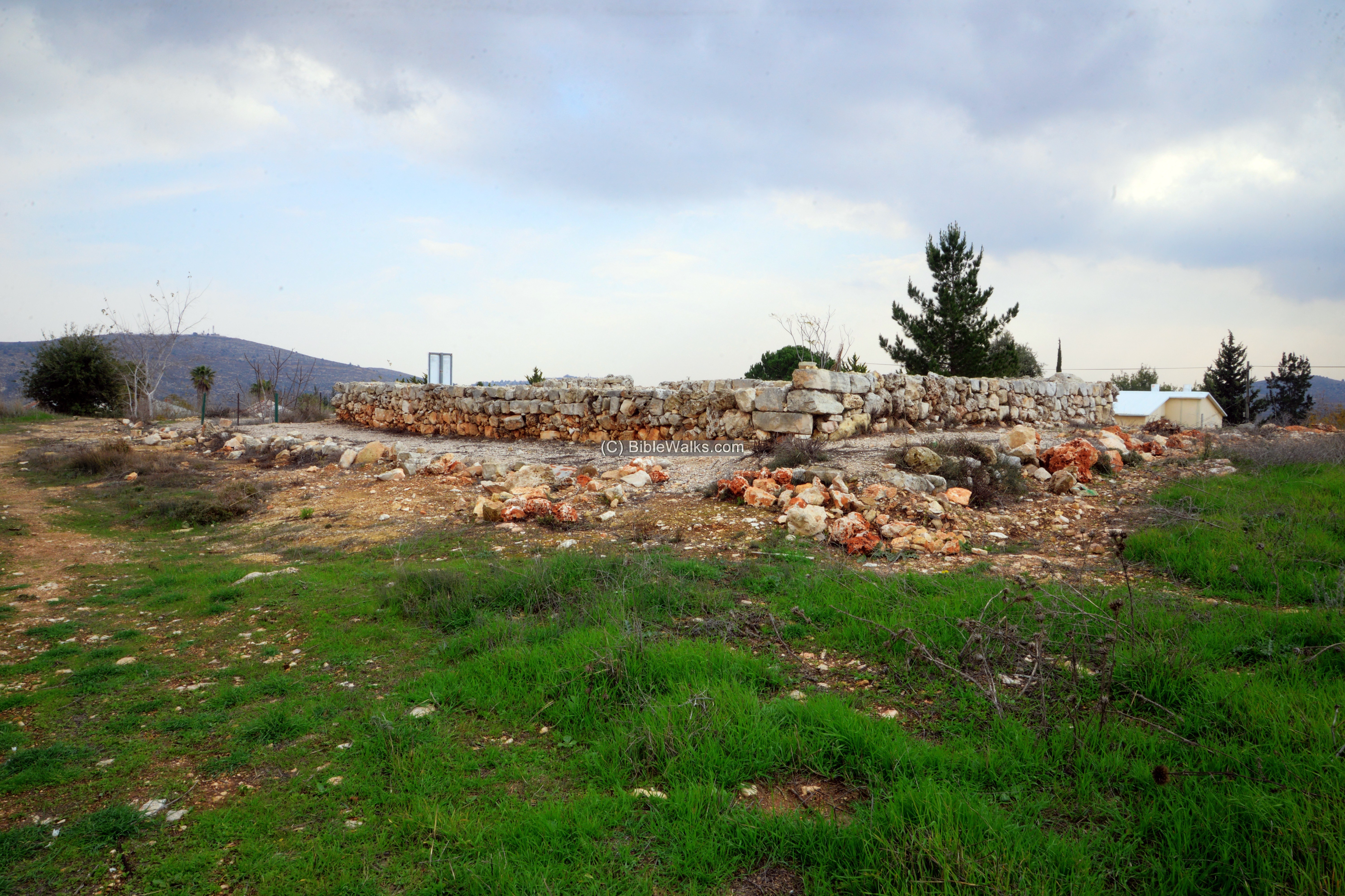
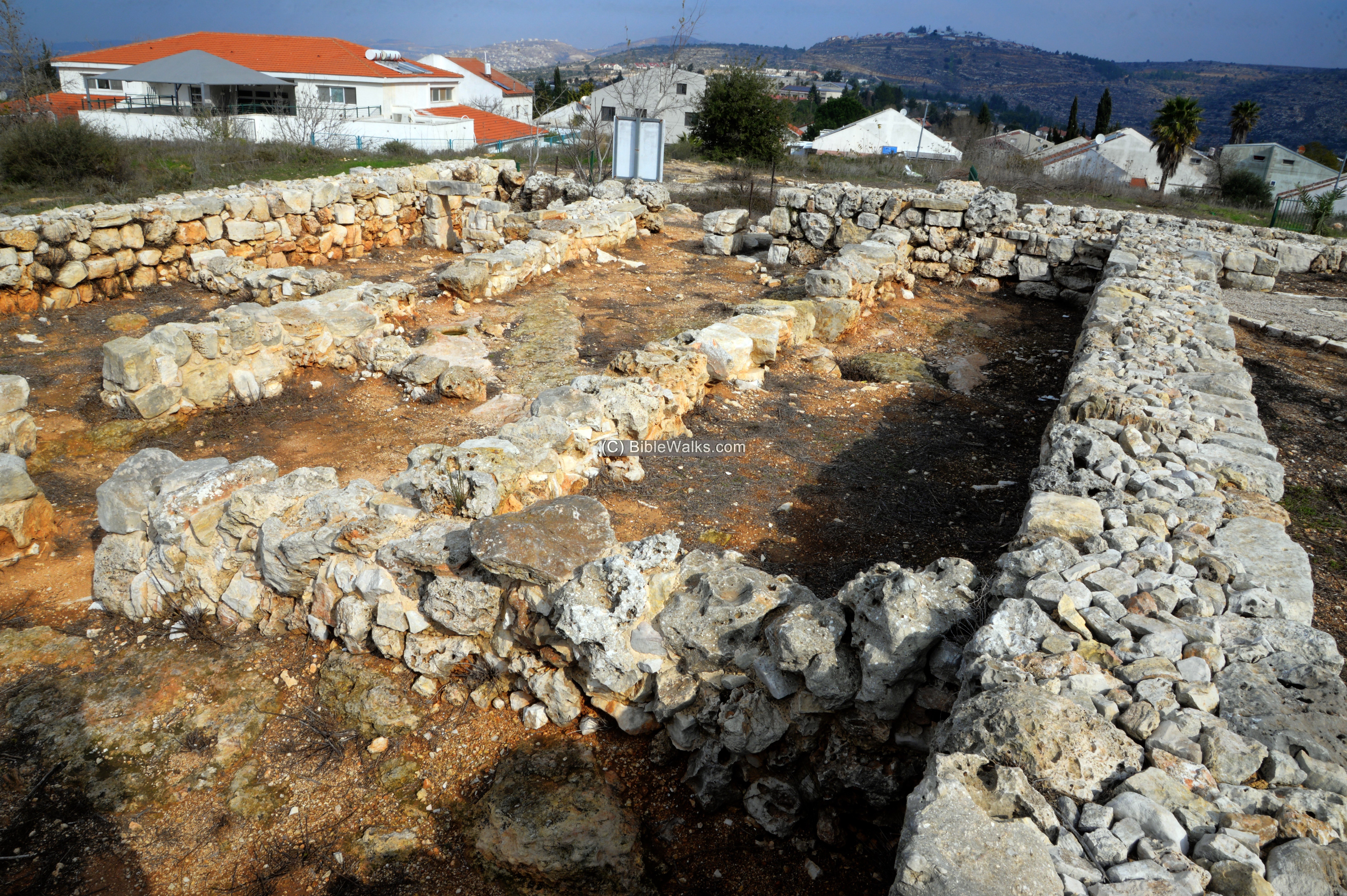
The farmstead consists of a four-room house, a cave, a water reservoir, a structure with a central courtyard flanked by rooms, and a sheepfold area.
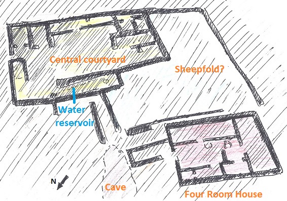
Its sections are detailed below.
- Four Room house
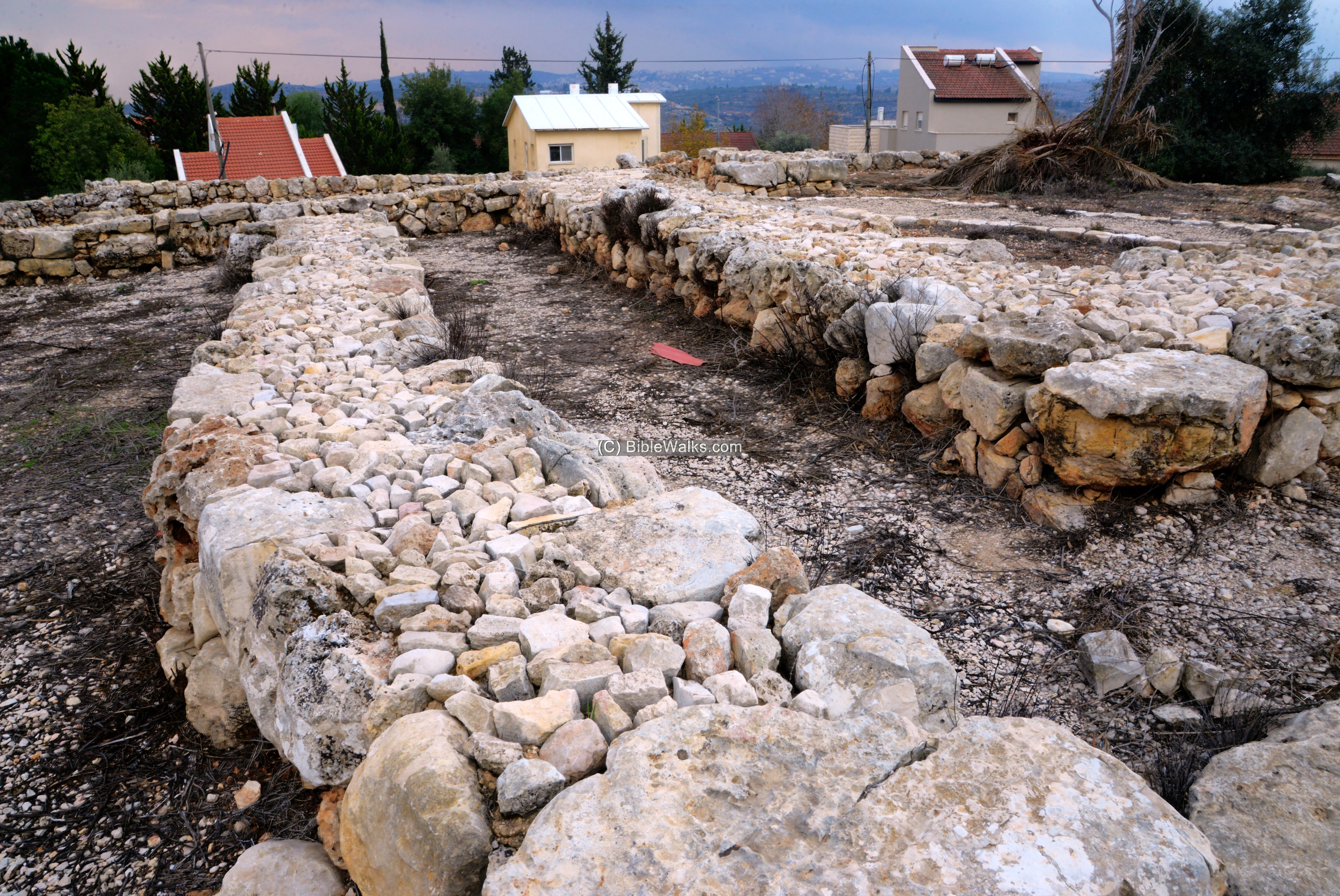
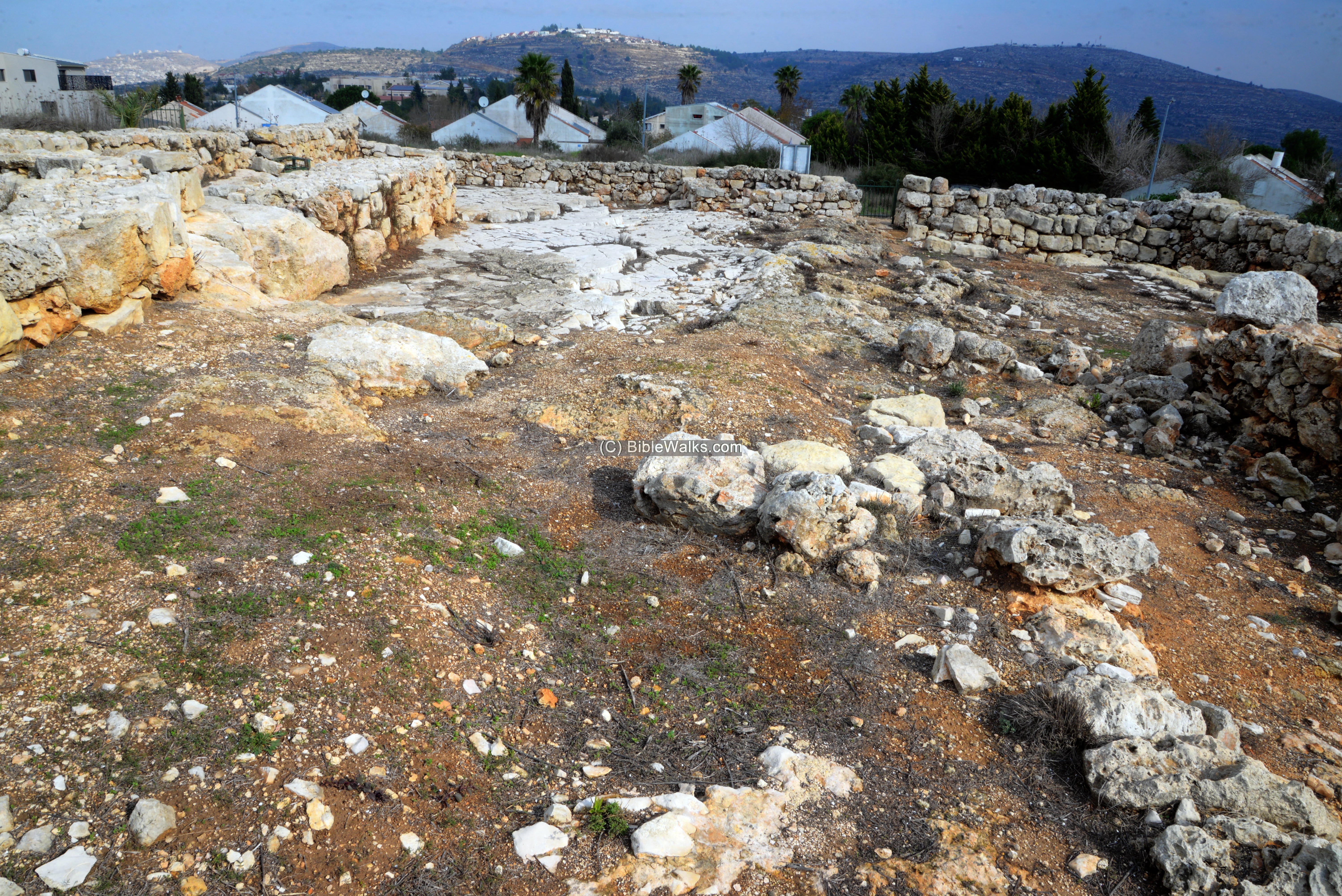
During the Iron age a typical structure style was a “four-room house”. Remains of such house is located on the west side of the ruin. It is 14.5m by 12m, built over the bedrock.
This is a view from the north west corner.

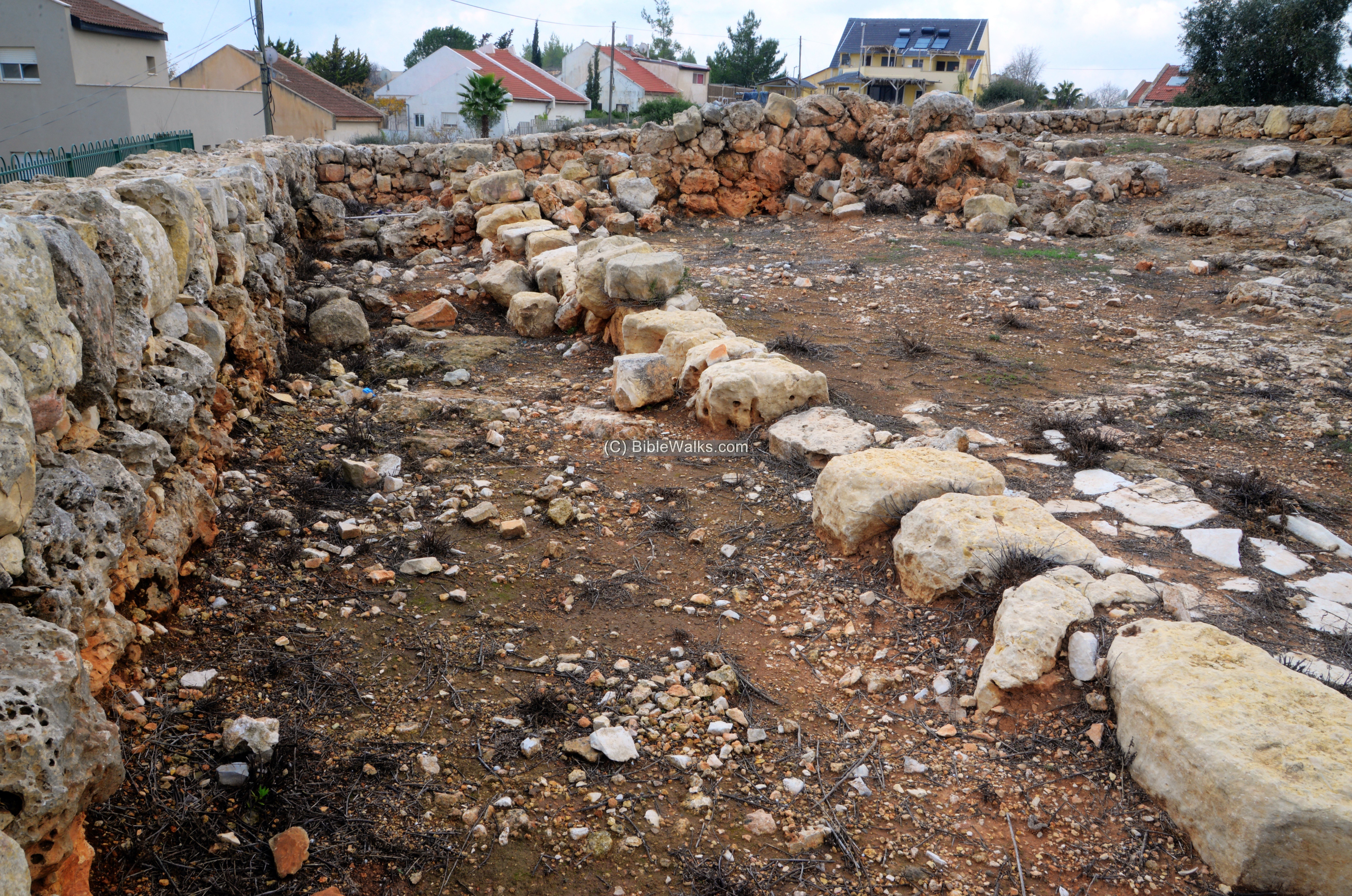
The external walls are 1m wide, and were preserved to a height of 1.2m.
The internal walls are thinner.
The floor was made by crushed red soil mixed with crushed limestone laid over the bedrock.
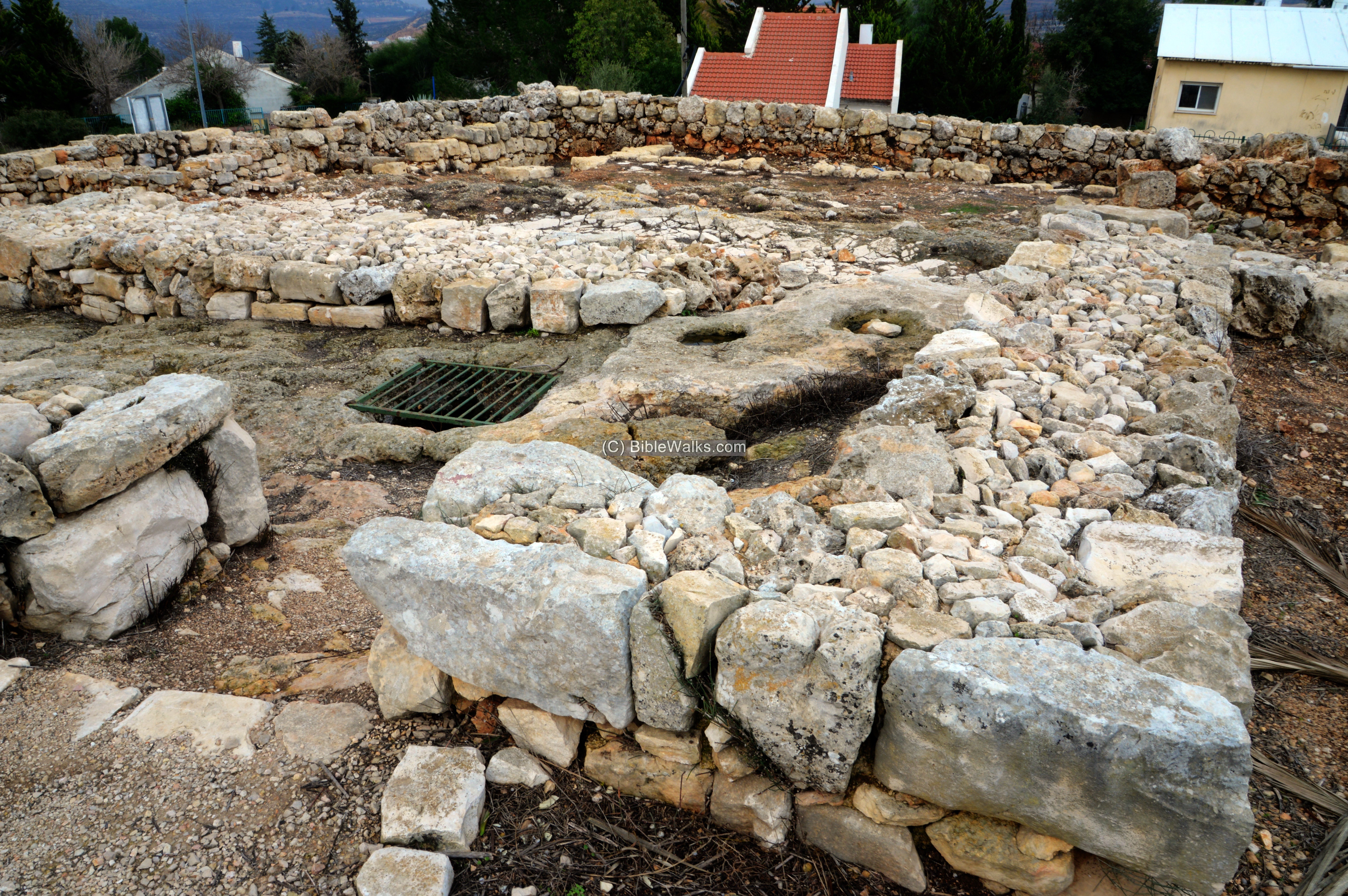
The entrance to the house is from the east side. It opens up to a long open space which was probably unroofed.
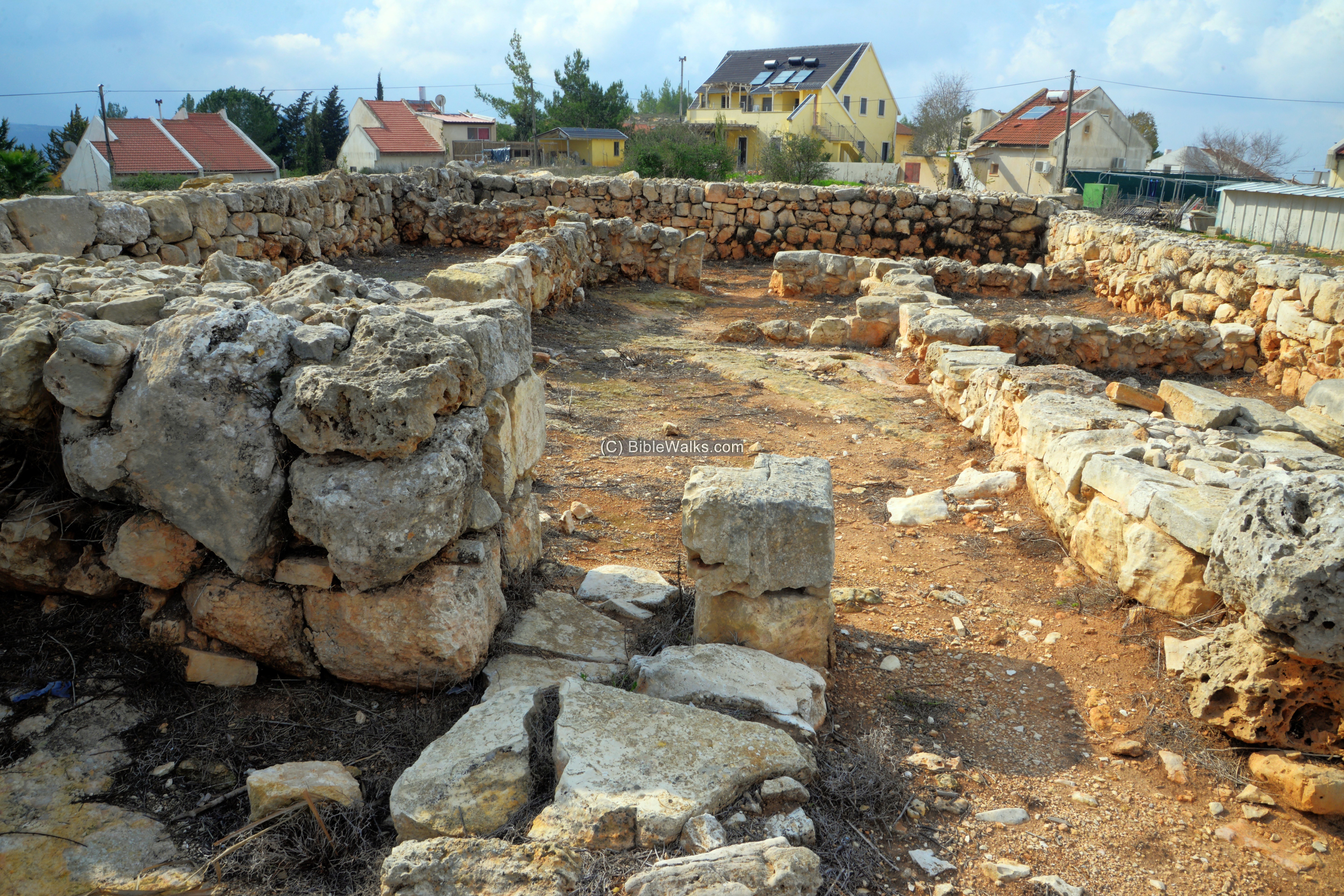
On three sides of the courtyard (north, west and south) were 3 roofed chambers. The northern chamber is sub-divided to 3 rooms, while the southern and western chambers are long rooms with an entrance in their center.
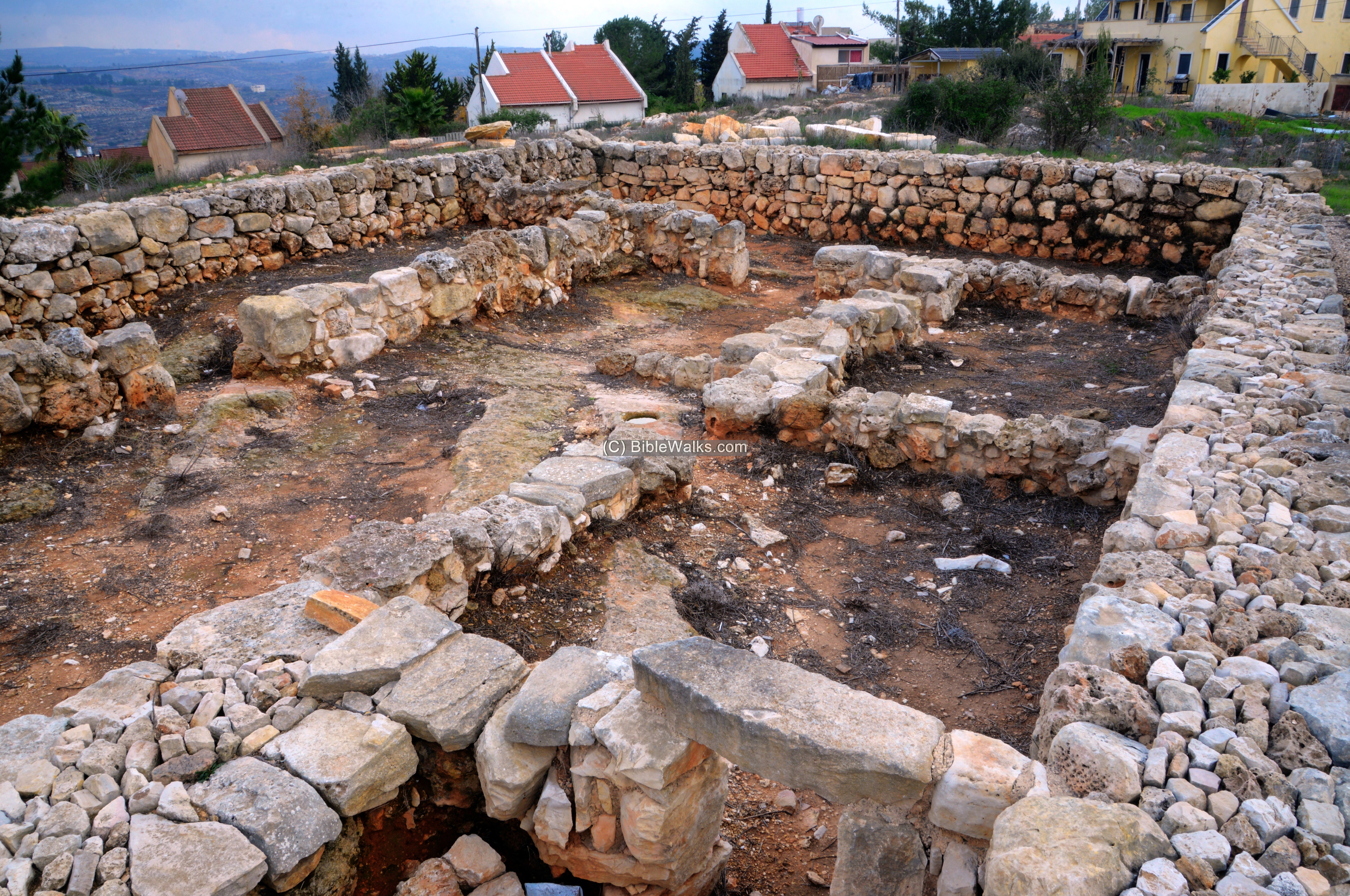
A detail of the central courtyard is next. Along the southern wall (left side) were two stone installations – one square and the other round (probably an oven).
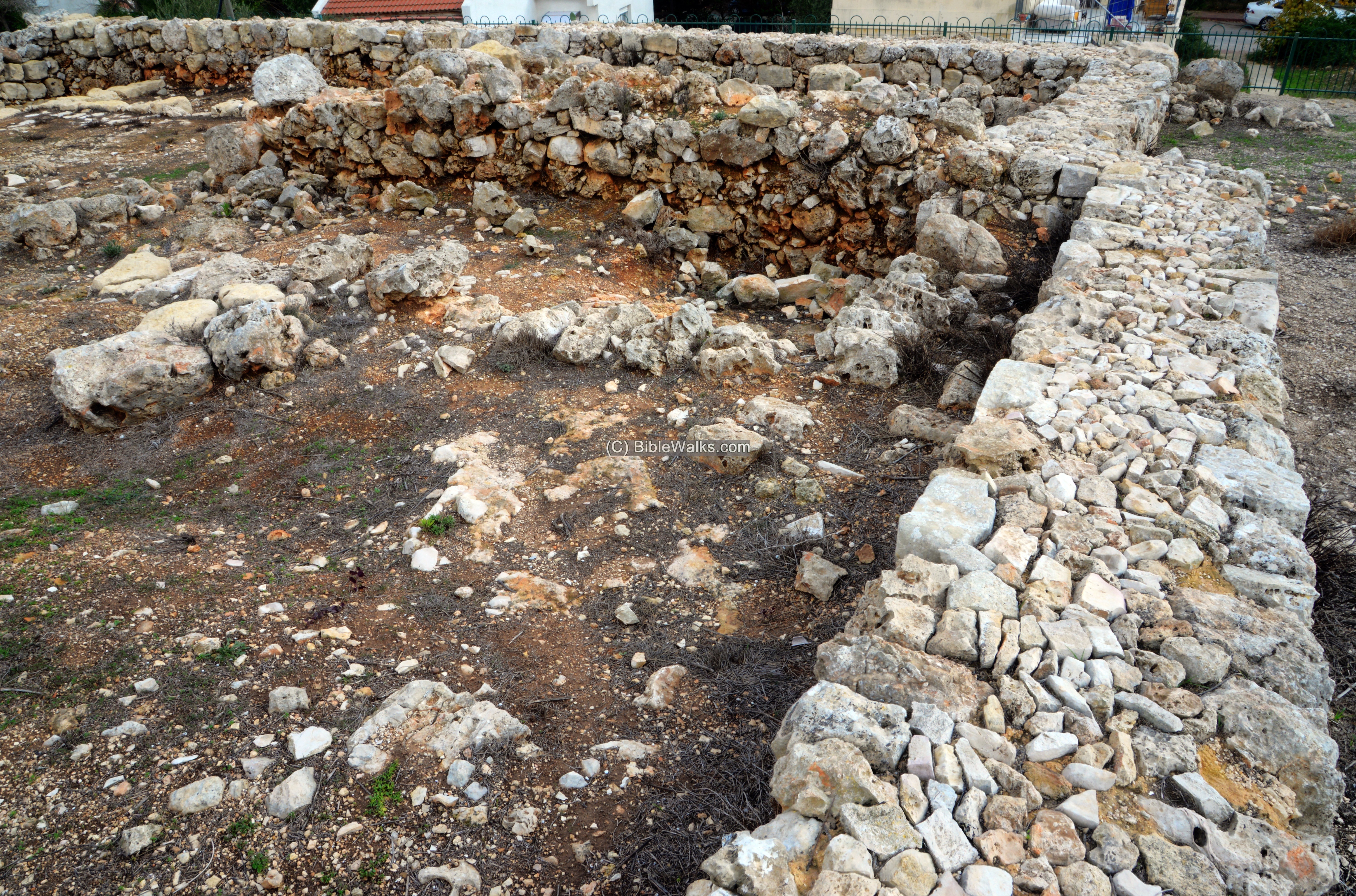
Another view below is from the west side.
In the long room on the south (right) side the team unearthed a decorated bronze spatula. On its end is an imprinted female figure holding three grains, probably representing Demeter (Deo) – the Greek goddess of harvest and agriculture. According to the scholar, the object was an imported artifact, dated to the beginning of the Persian period.
The chamber at the bottom of the photo was used as a storage space, as the excavators unearthed numerous pottery fragments inside it.
- Caves
On the east side of the four-room house are two caves. They may have been constructed at a later stage, perhaps for residence.
The entrance to the caves is from the south side.
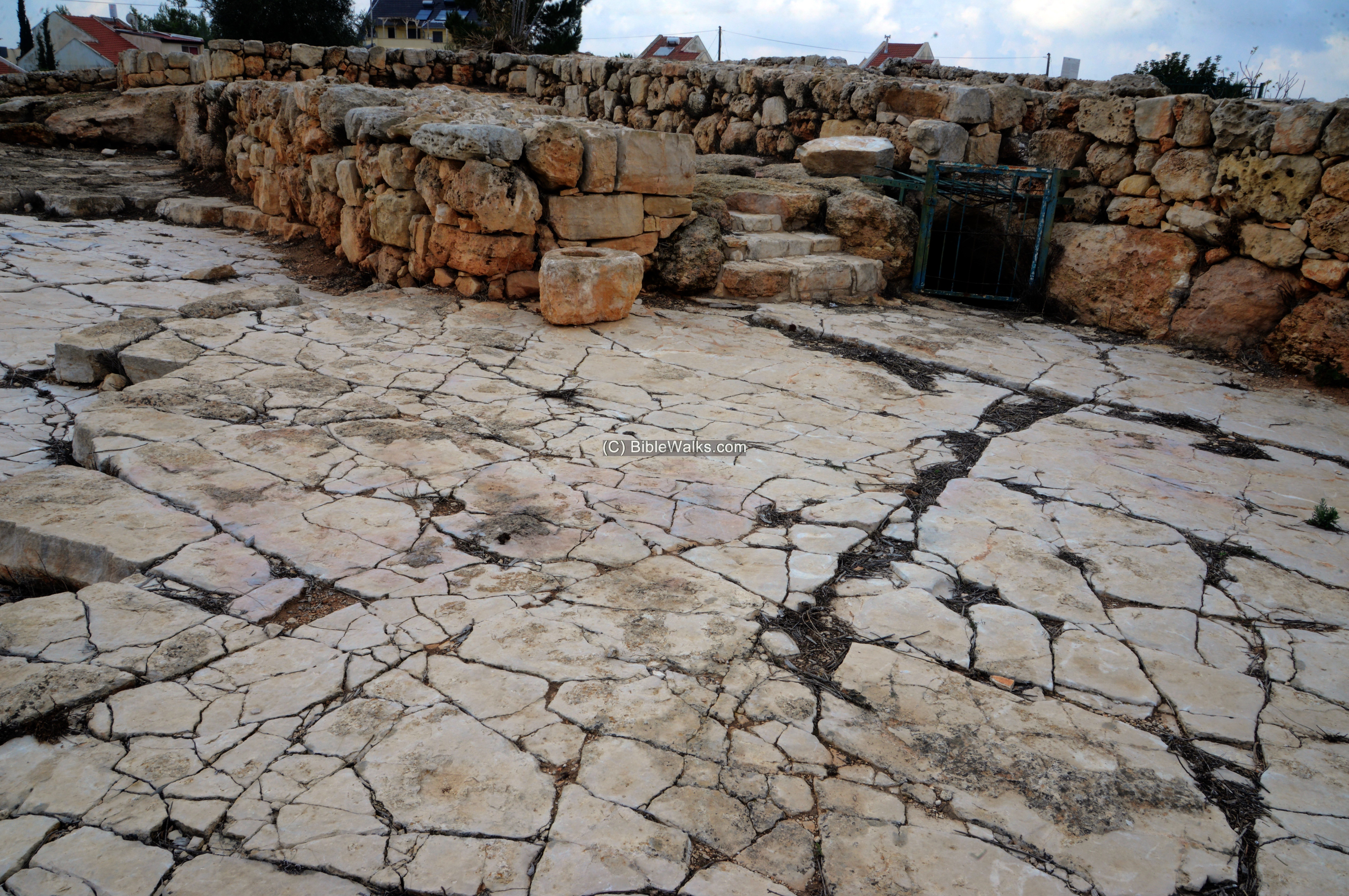
- Open Court structure
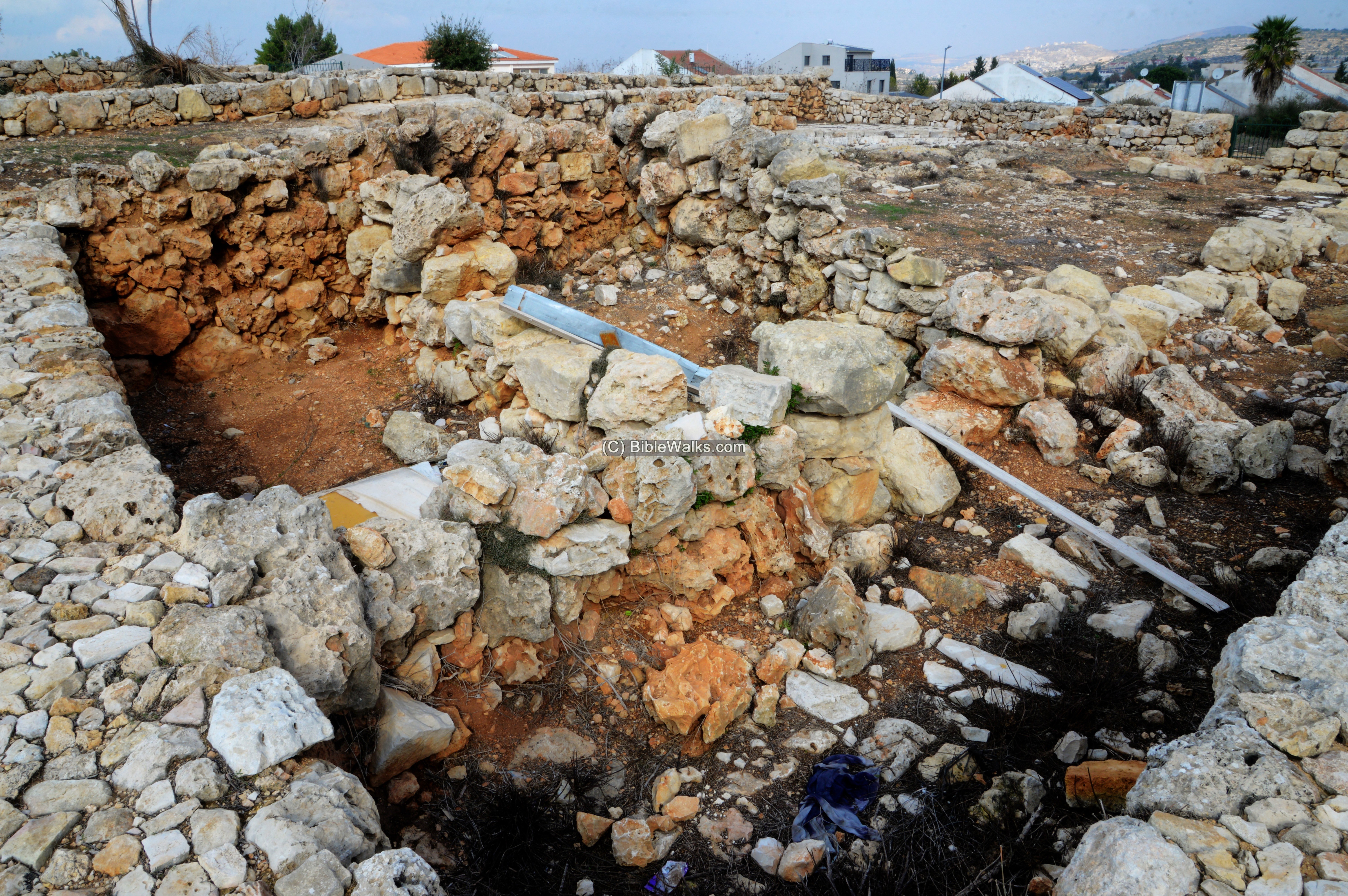
A large rectangular structure, 23m x 29m, is located on the hillside south of the four-room house. It was probably built in a later stage.
A long corridor connects the four-room house to the structure.
The plan of the structure is a central courtyard, surrounded by rooms.
The entrance to the open court structure was from the east side, seen here below.
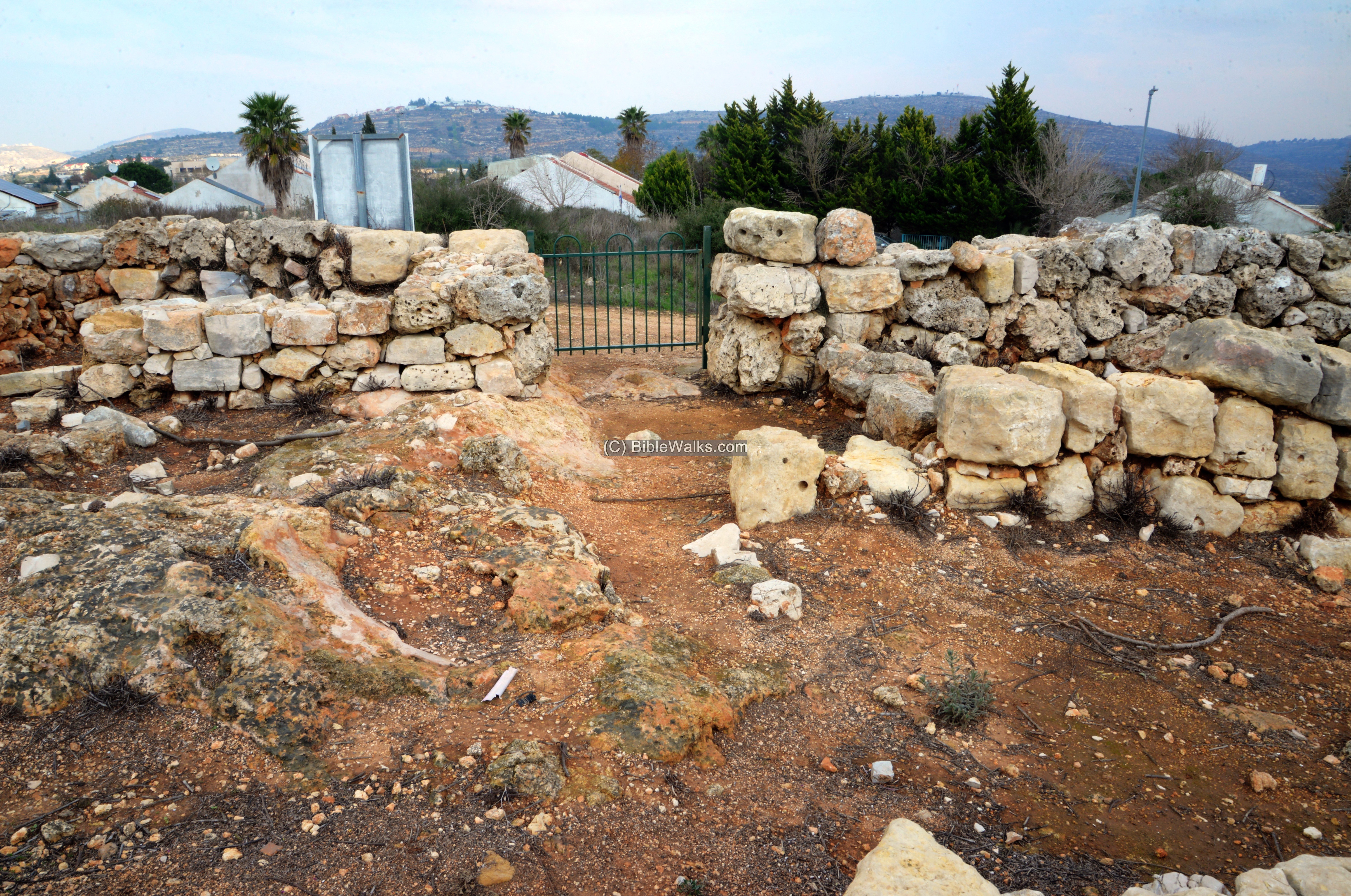
Rooms flank the entrance on both sides.
The entrance leads to a wide central courtyard.
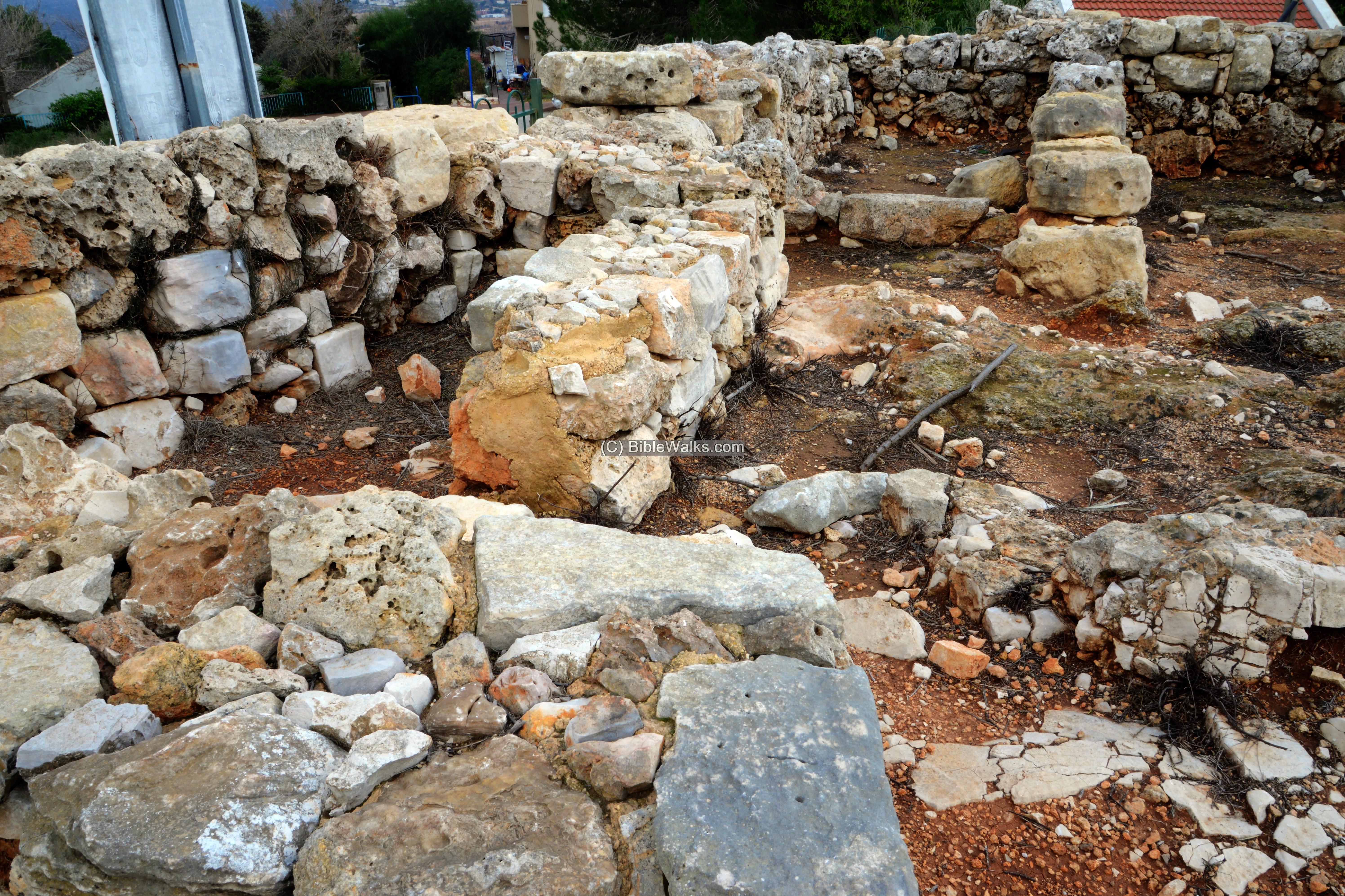
The following photo shows the rooms along the southern wall.
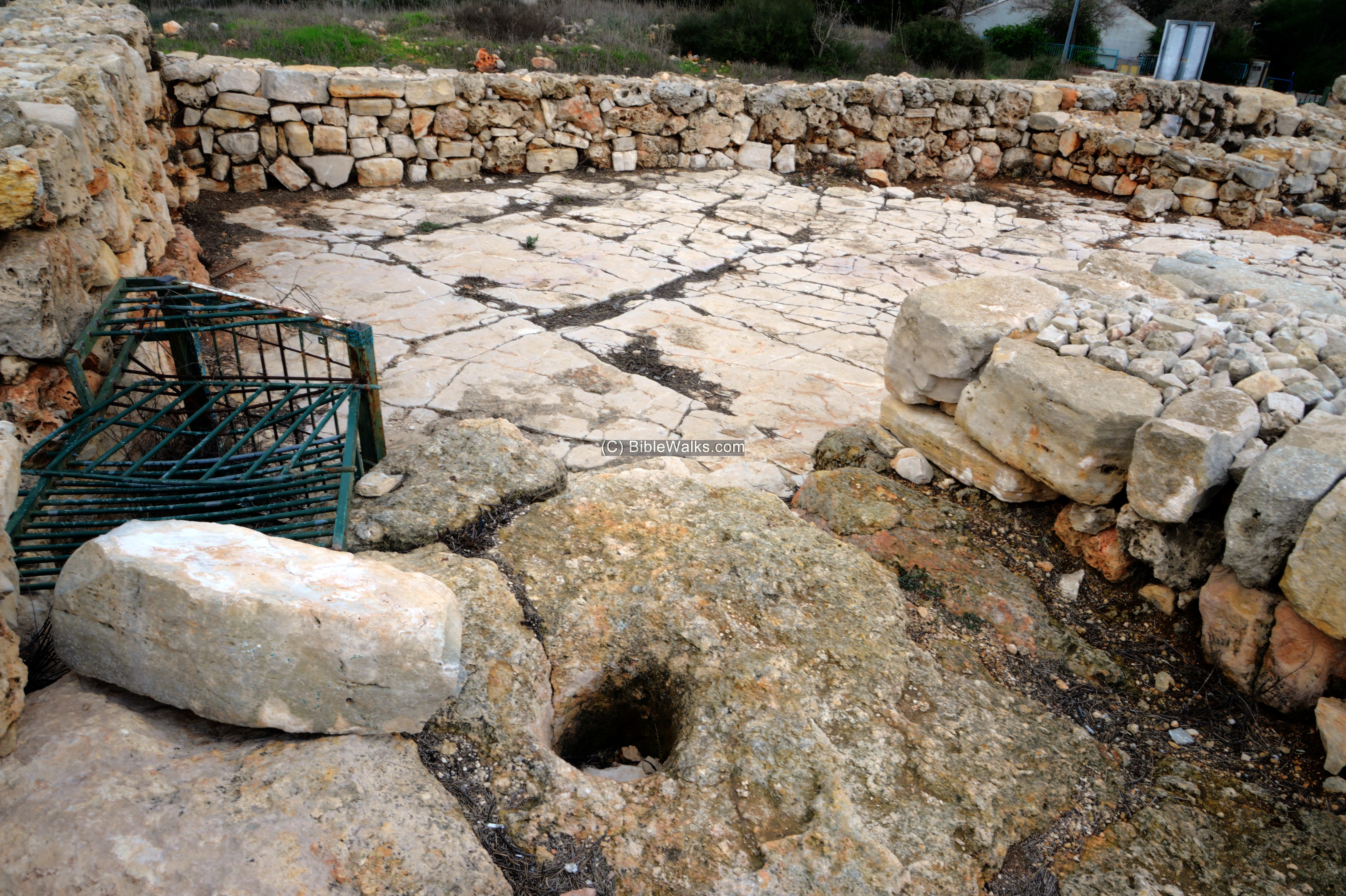
The south western corner of the structure is in the photo below, as viewed from the west side. In the room adjacent to the wall the team unearthed a small (2.4 cm high) glass pendant made of opaque and colored glass. It has a form of the face of an angry bearded face. It may have served as amulet against an evil eye, that is supposed to drive away evil demons.
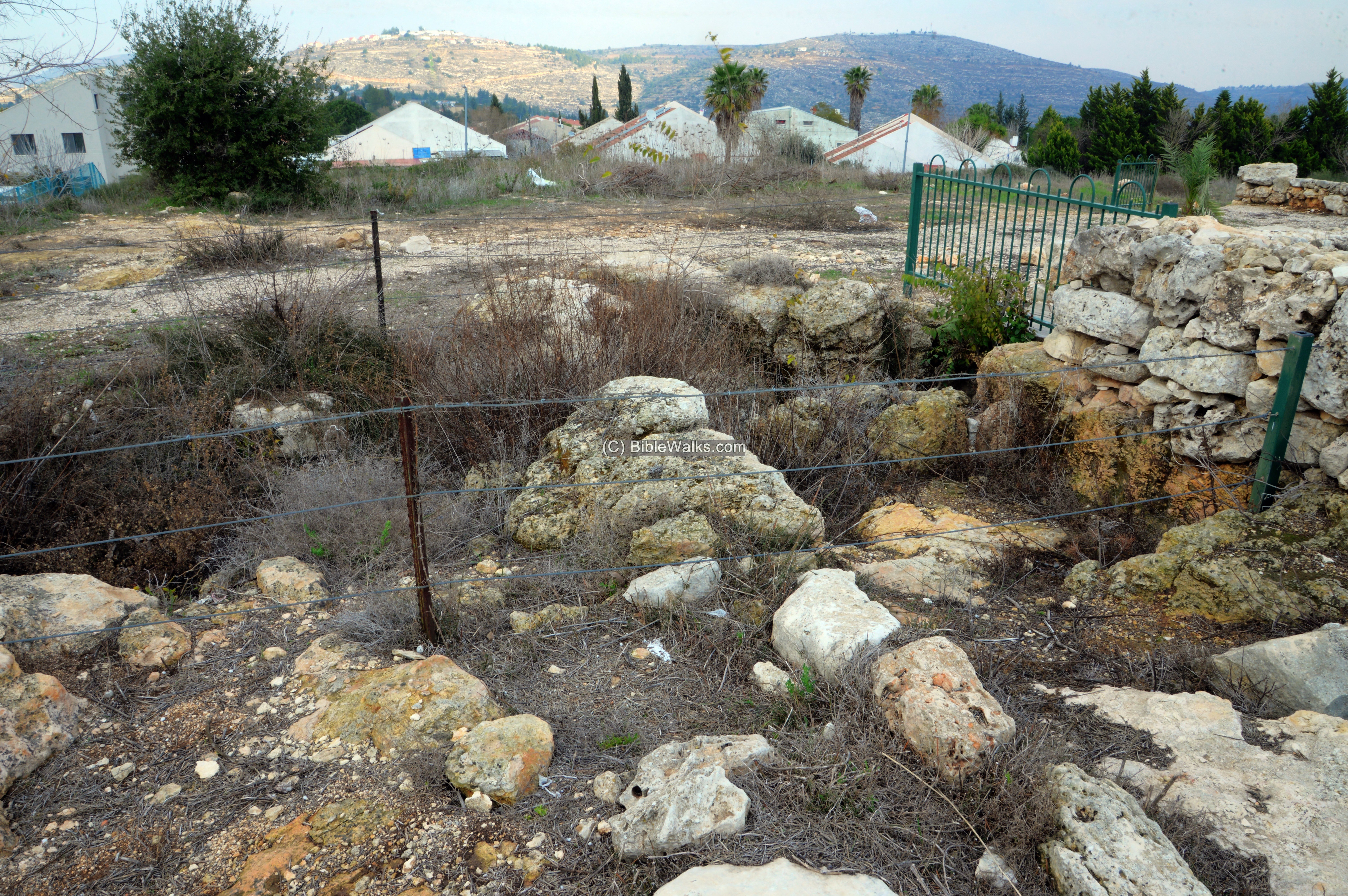
To the south of the structure (here on the right side), and covering an area up to the four room house, was a large open area bounded by walls. It may have been a sheepfold.
Another view from the southern corner is below.
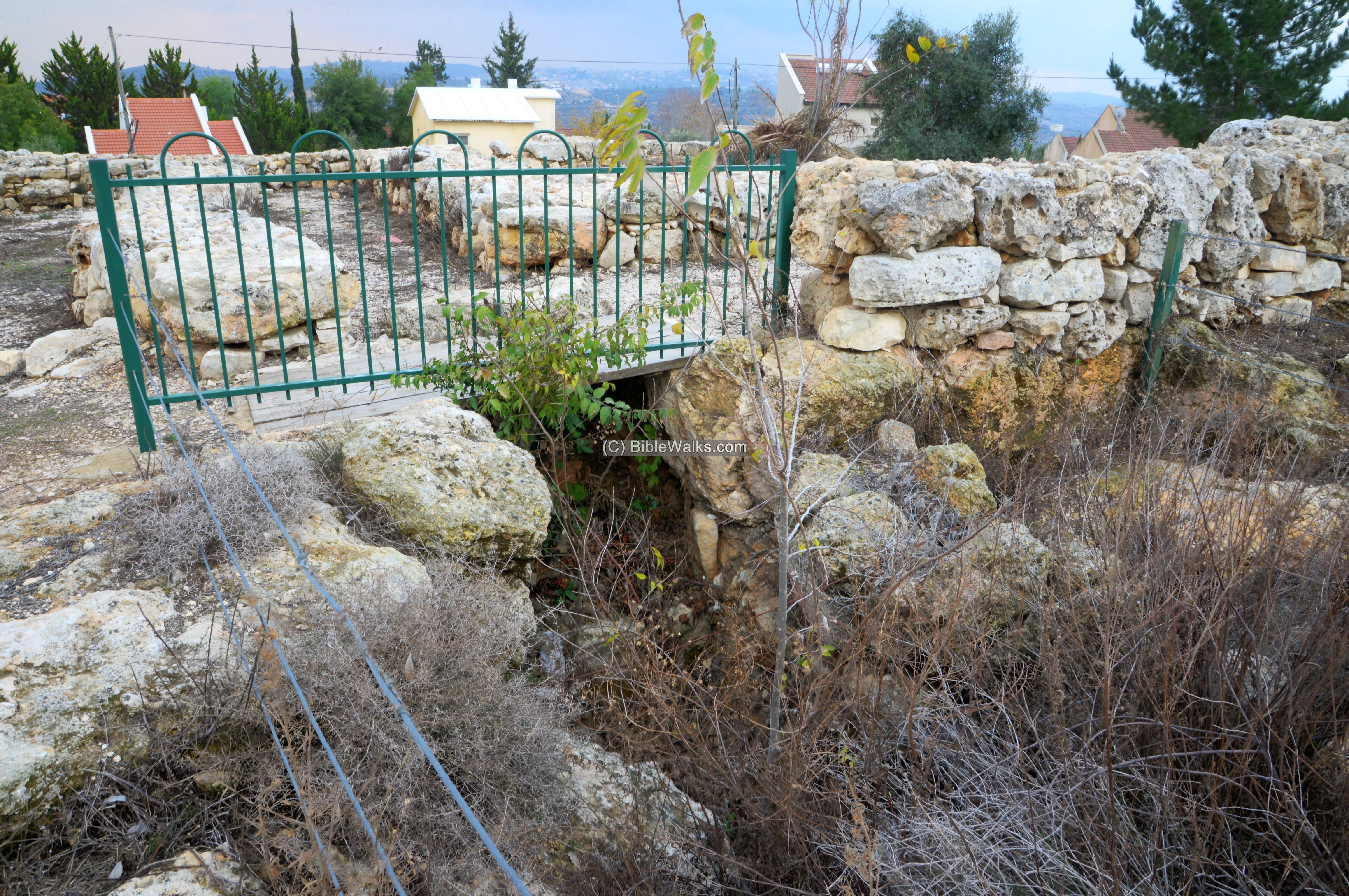
One of the rooms (the upper left one) served as a kitchen. The archaeologists unearthed an oven and found remains of a fire on its floor.
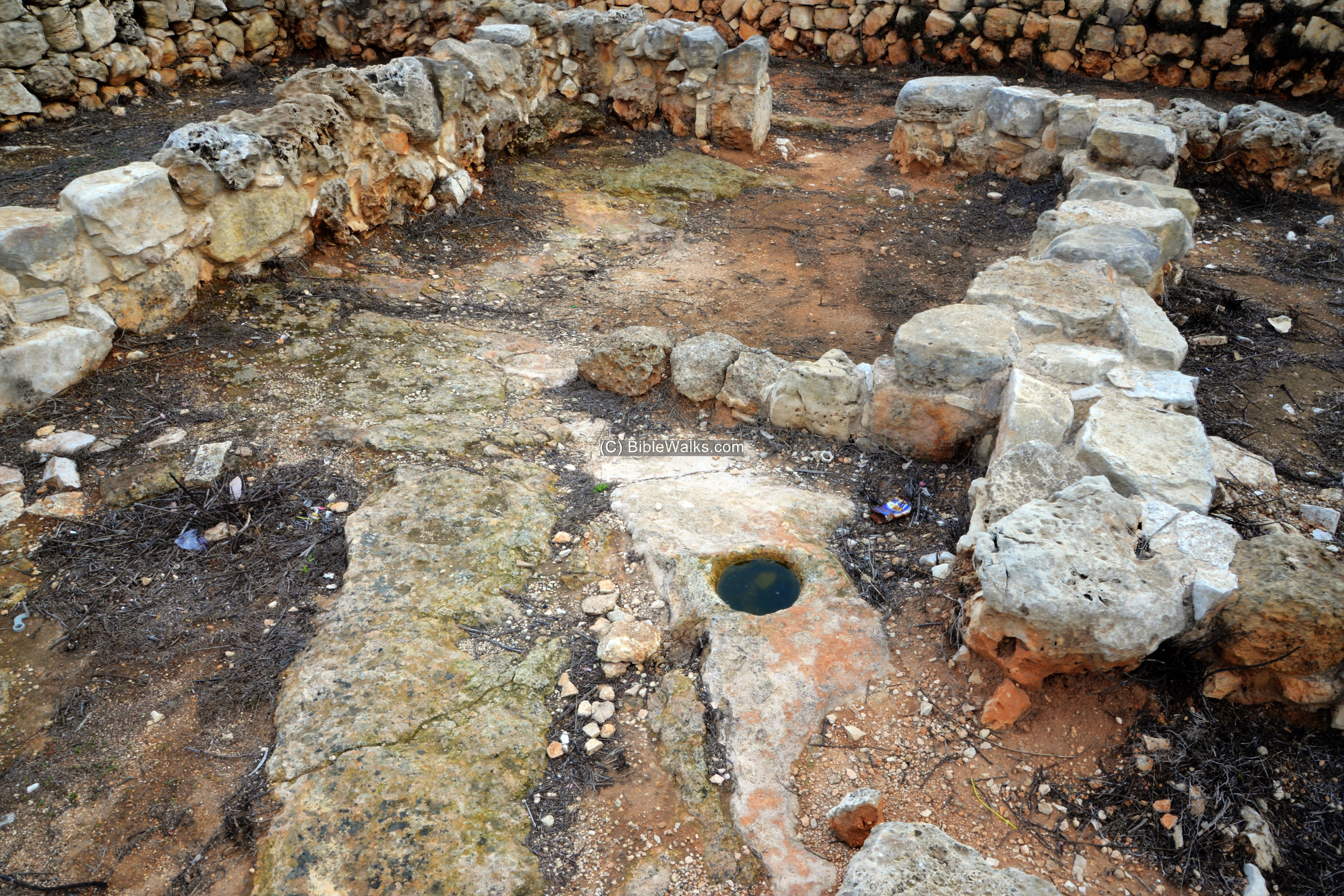
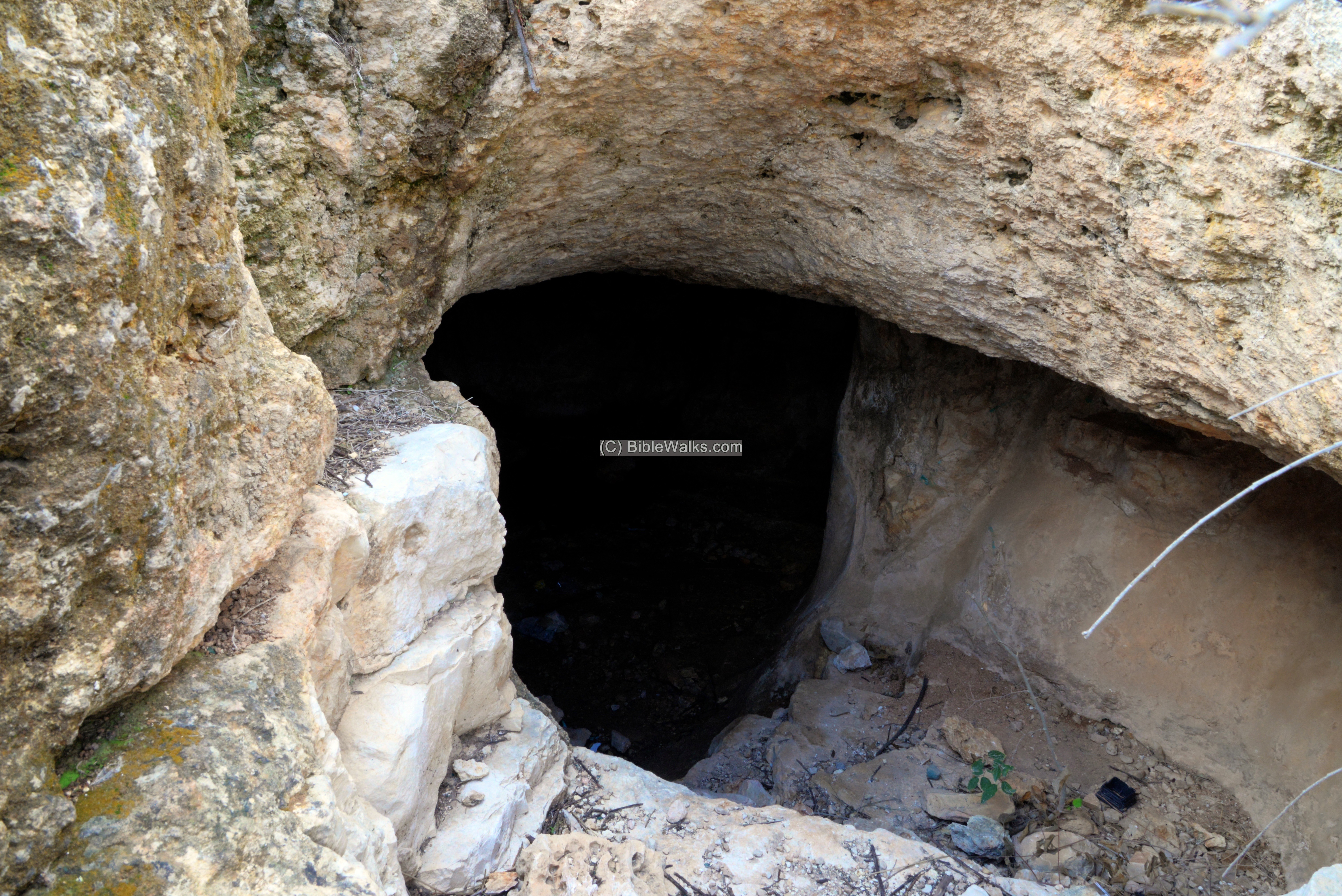
- Water reservoir
On the north side of the open court structure is an area where the bedrock is smooth and flat like a carpet.
At the edge of the flat area is a room, enclosed with walls on three sides. Under it is an underground cistern. The rain would have collected from the smooth floor and filled up the cistern.
A rectangular hole on top of the reservoir allowed fetching the water by buckets. The water was filled into jars which were held upright, supported by cup marks on the side of the hole.
An opening to the cistern is located on the east side of the room, with 4 steps leading down to the reservoir.
The size of the elongated reservoir is 13m long by 2×2.5m. Its walls were covered by plaster in order to prevent the stored water to seep into the earth.
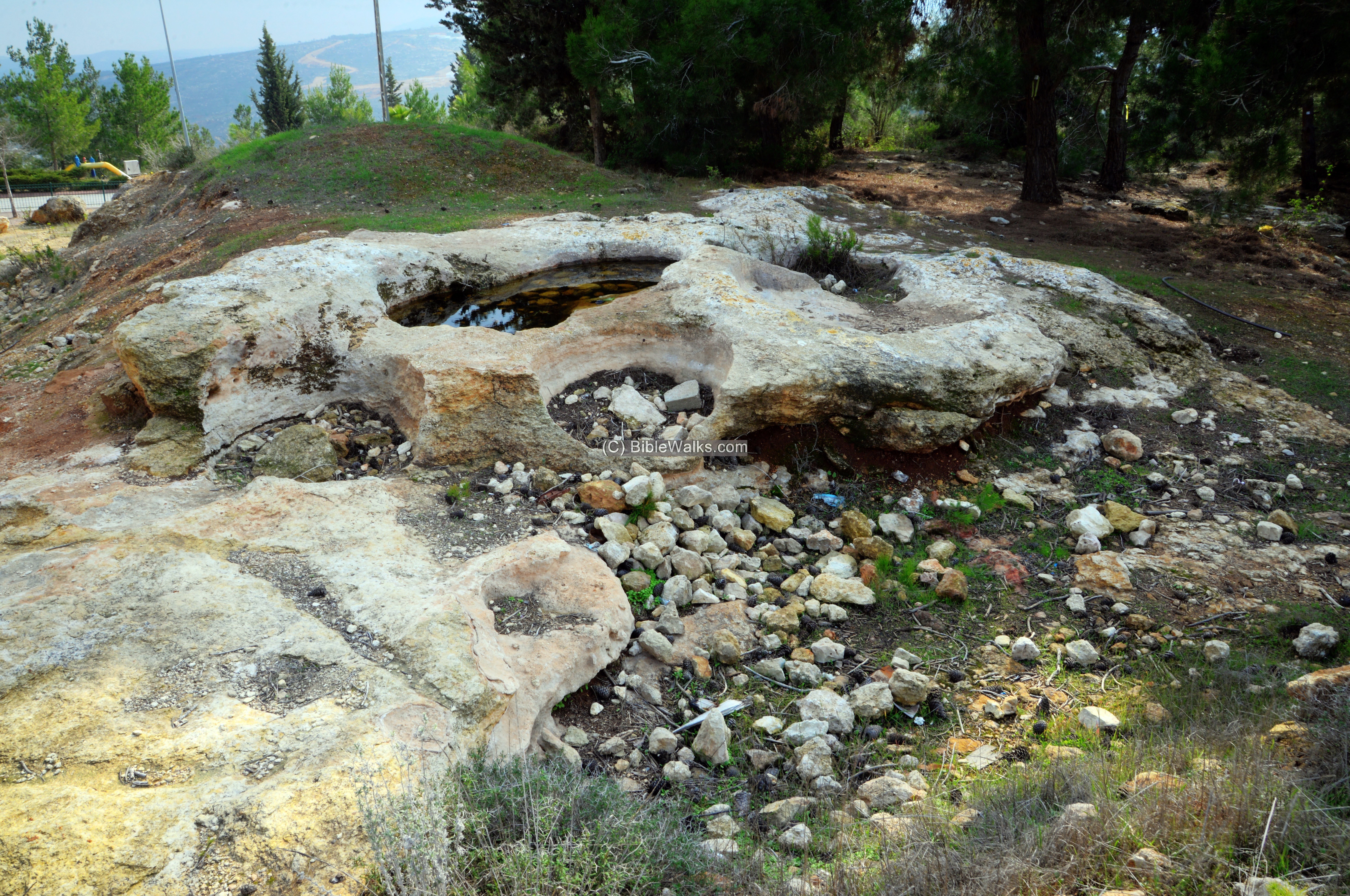
(b) Installations
To the north, in the center of the community, are several agriculture installations. This one is a wine press complex.
(c) Pilgey Ma’im
The community of ‘Eli is spread over several hills. The north-most neighborhood is Pilgey Ma’im.
In 1999 an outpost was constructed on Khirbet Shuna, and the Army removed it. Later it was repopulated and rebuilt in 2001. It was named Pilgey Maim (Psalms 1:3: “And he shall be like a tree planted by the rivers of water”).
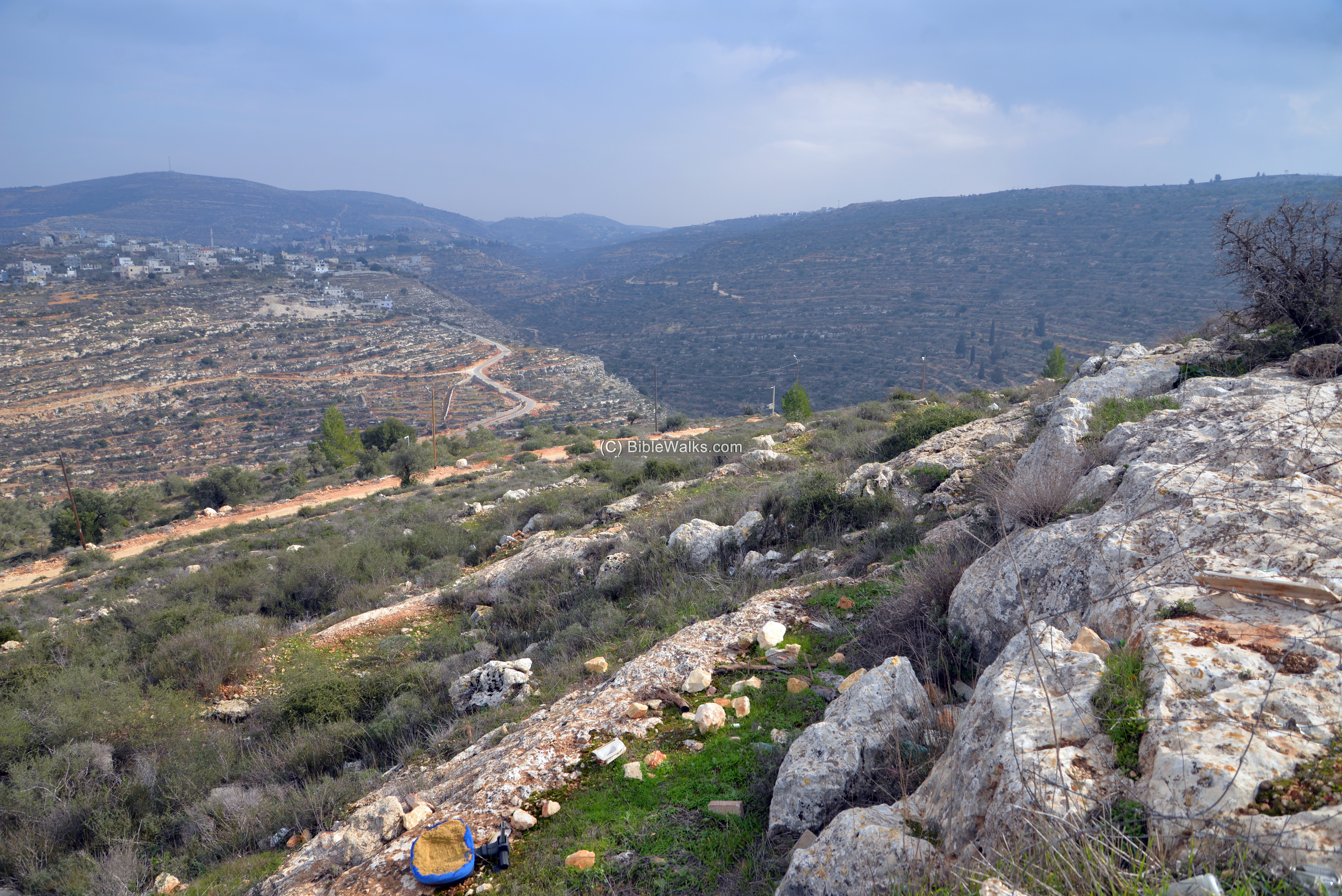
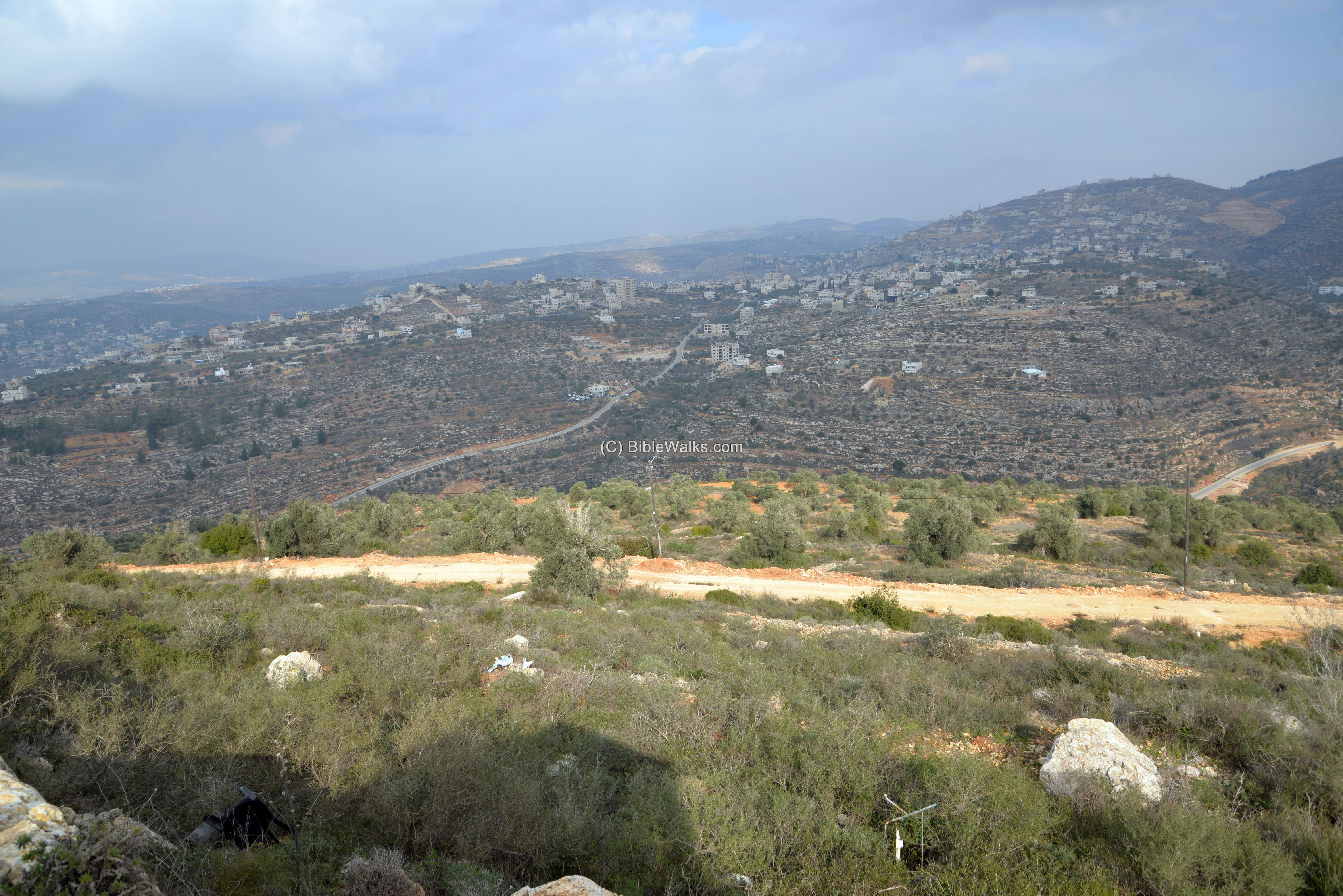
This small neighborhood is situated on a small hill (alt. 713), tucked between 3 Arab villages that are separated by deep valleys. Here are some views of the east and north sides.
South East: The village of Telfit is on the foreground, and Kuriyot is the far background.
Kuriyot (also: Qaryut, Qaryout) was described in the 1882 SWP survey report (SWP Vol 2, p. 288):
“A small village, on the top of a high chain, with a spring between it and the ruin of Seilun [Shiloh]. This place, being at the head of Wady Fusail, seems to have given rise to the medieval identification of that valley as the Brook Cherith (mentioned by Marino Sanuto in 1321). Kuriyut is supposed by Robinson to be the Corea of Josephus (Ant. xiv. 3, 4), on the boundary of Judea”.
Kuriyot may have been, according to a scholar, the Biblical Kerioth – birth place of Judas Iscariot, one of the twelve apostles of Jesus, who betrayed Jesus (Matthew 10:2-4).
East: Telfit is situated on a hill, 1km to the east, separated by a the deep gorge of Wady Khulil. The 1882 SWP survey (Vol. 2, p. 288) described it as a village of moderate size, on high ground,
with olives round it, and supplied by a well called ‘Ain Telfit.

North East: The village of Kubulan, 1.5km north-east.
The SWP survey wrote about the village (Vol 2, p. 358): “The ruin to the east consists of heaps of stones”.
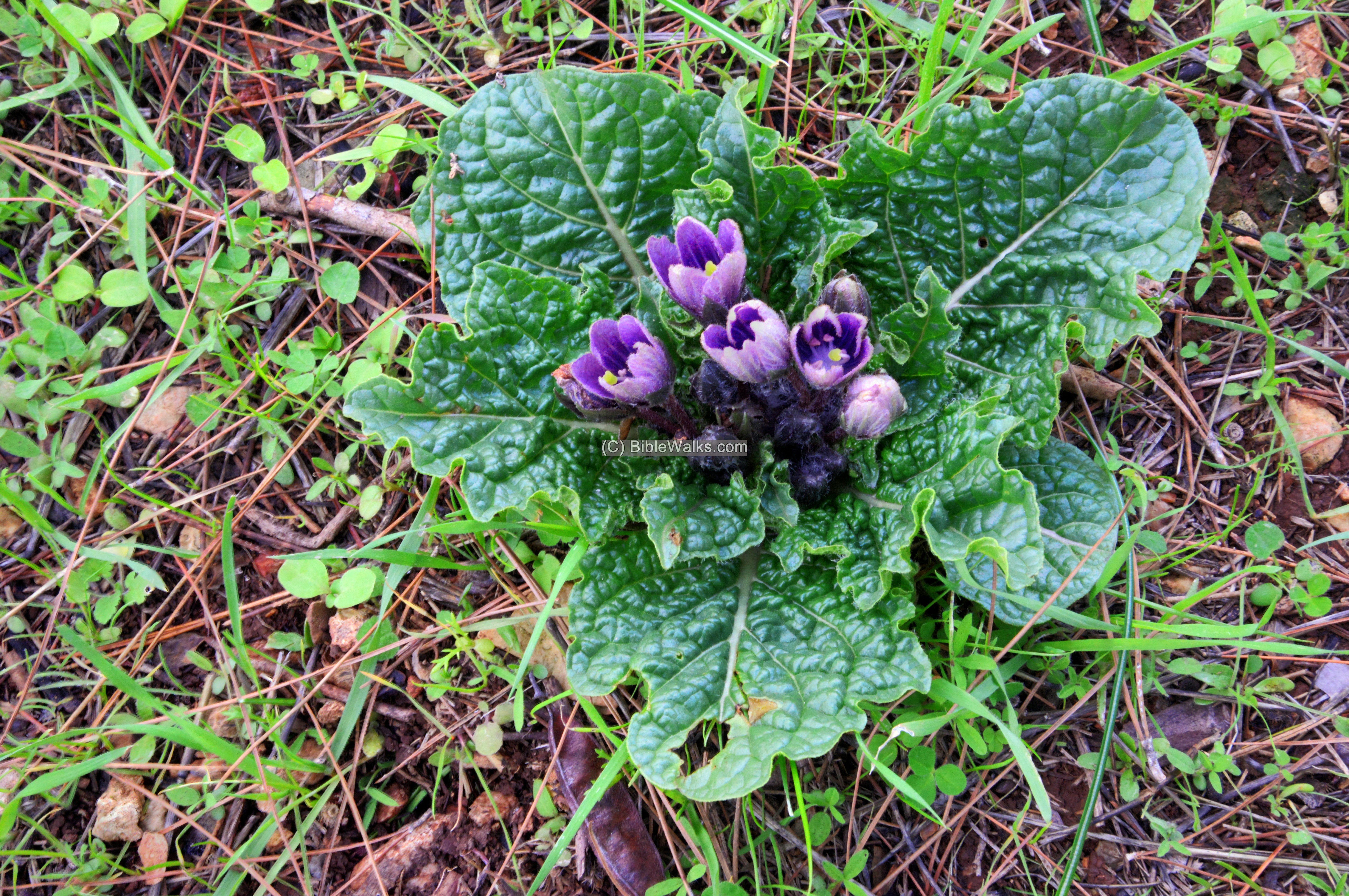
(d) Nature
During winter these big dark-green leaves appear, and a cluster of purple flowers emerge in its center. They are the Mandrake flowers (Hebrew: Duda’im). The fruits of this plant were used for treating fertility problems, as told in the Bible (Genesis 30:14):
“And Reuben went in the days of wheat harvest, and found mandrakes in the field, and brought them unto his mother Leah. Then Rachel said to Leah, Give me, I pray thee, of thy son’s mandrakes”.
Etymology (behind the name):
* Names of the site:
- Eli – named after Judge Eli; Hebrew (עלי) for “above”.
- Shiloh – Biblical name of the city, with unknown meaning. Z. Vilanai suggests it means serenity or rest (from Hebrew: Shalva) after the rough years of Exodus and Conquest. This is based on Deuteronomy 12 9: “For ye are not as yet come to the rest and to the inheritance, which the LORD your God giveth you”.
- Khirbet Shuna – Arabic name of the hill where modern Pilgey M’aim was constructed.
- Pilgey Ma’im – Hebrew: rivers of waters. Psalms 1:3: “And he shall be like a tree planted by the rivers of water”.
Links and References:
* External:
- HA 129 2017 ‘Eli – emergency excavation in the center of ‘Eli
-
Horvat ‘Eli, a Farmstead from the End of the Iron Age in Mount Ephraim.
– Itach G., Regev D. and Hizmi H. 2018. Qadmoniot 155: 32-36 (in Hebrew).
- Hadashot Arkheologiyot HA 1996 – Horvat ‘Eli – pp. 74-75
* Internal nearby sites:
- Shiloh – nearby religious capital
- Shiloh altars – Iron Age altars found on and around Tel Shiloh
- Horvat Kerioth – another suggested identification of birth place of Judas Iscariot
- Kh. el Qutt (1km SW) and the Lebonah ascent (1km south)
* Other internal sites:
- Wild flowers in the Holy Land
BibleWalks.com – bringing the Bible Alive!
Kh. Sarra <<<—previous site—<<<All Sites>>>—next Samaria site—>>>Kida
This page was last updated on Mar 25, 2022 (add plan)
Sponsored links: