
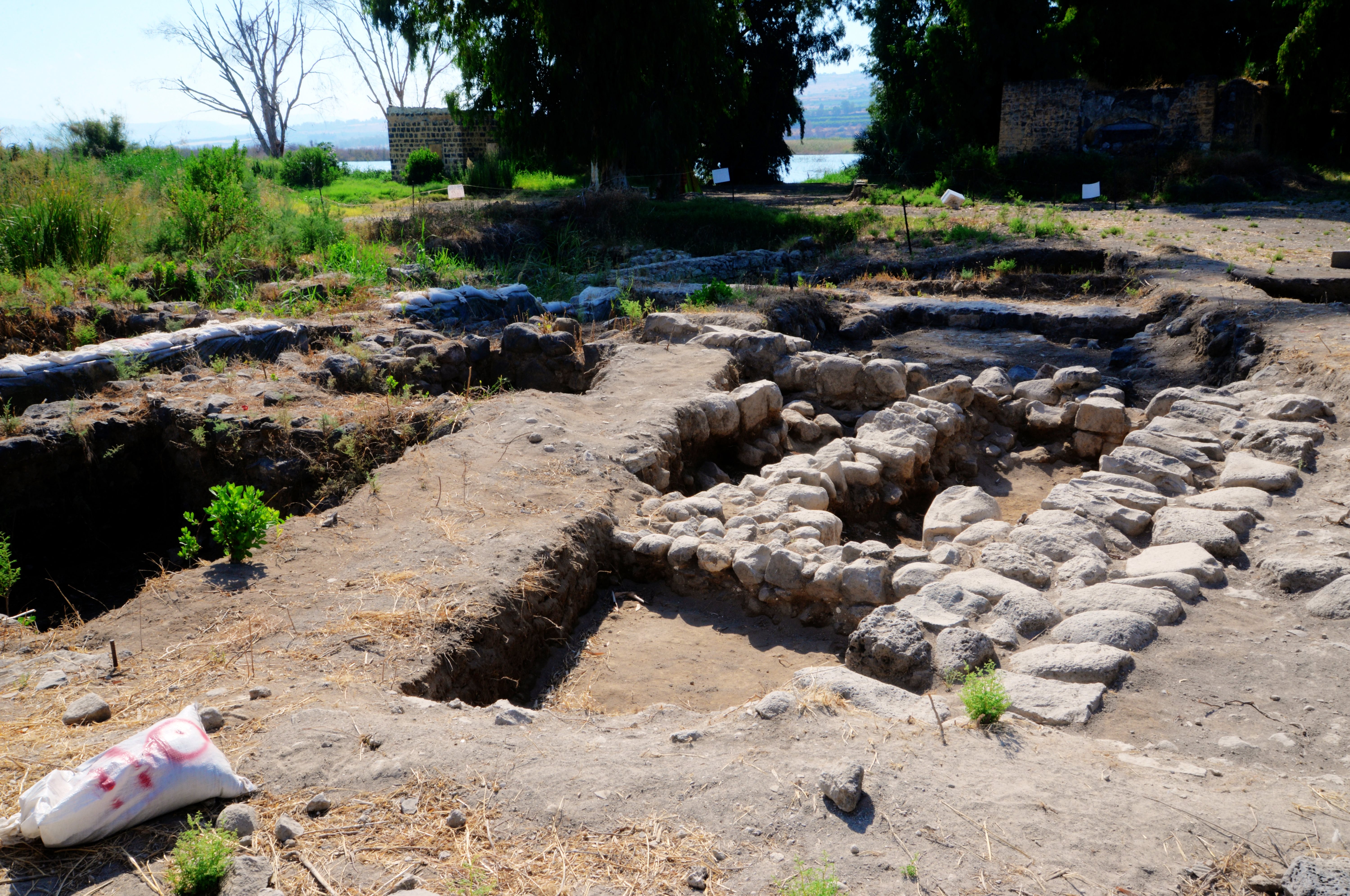
Ruins of the Roman/Byzantine period village, located on the shores of the Sea of Galilee. This could have been Bethsaida, the site of Jesus’ two miracles, and the Roman city of Julius.
Home > Sites > Sea of Galilee > El Araj (Beit Habek)
Contents:
Background
Location
Biblical Map
Where Is?
History
Photos
* Shore of the Lake
* Church of the Apostles
* City of Julius
* Beit HaBek
Videos
* Aerial View
* Excavations
Biblical
References
Etymology
Links
Background:
Recent excavations at the site (Kh. al-Araj), headed by Mordechai Aviam and Steven Notley, have unearthed remains from the Roman and Byzantine periods.
Bethsaida, an ancient city on the north side of the Sea of Galilee, is a “tale of two cities” – an Iron age city of the land of Geshur, and a Roman city known as Julias. The Iron age site and Roman period city was unearthed on a site situated on a hill known as e-Tel, while the Roman/Byzantine site was found on the shores of the lake.
The area of Bethsaida was referred in the New Testament in conjunction with two of Jesus miracles: healing the blind man and the first feeding of the Multitude. It is also known as the birthplace of some of the Apostles (Andrew, Peter, Philip). Mark 8:22: “And he cometh to Bethsaida; and they bring a blind man unto him…”
Location:
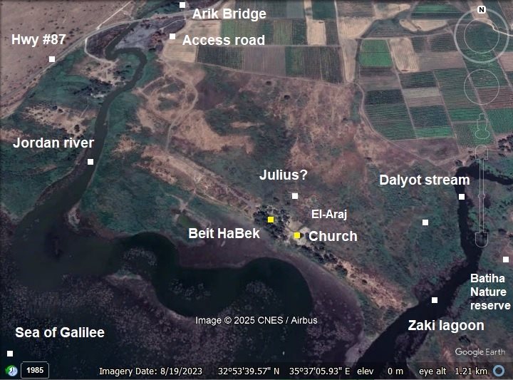
The area of Bethsaida is located at the fertile delta of the upper Jordan river, when it enters to the Sea of Galilee (aka the Betiha). In a site along the shore of the lake of Sea of Galilee is an Ottoman period house and grounds named Beit Habek. In the area around it, buried under the ground, are remains of the ancient Roman/Byzantine site.
Biblical map:
- Iron age
A Biblical map of Bethsaida and the area around it is illustrated below. During the Iron (Israelite) Age, it was a part of the land of Geshur, which bordered on the east side of the tribe of Asher. The Iron Age site was found on a hill 3 km to the north (marked here as Upper Bethsaida).
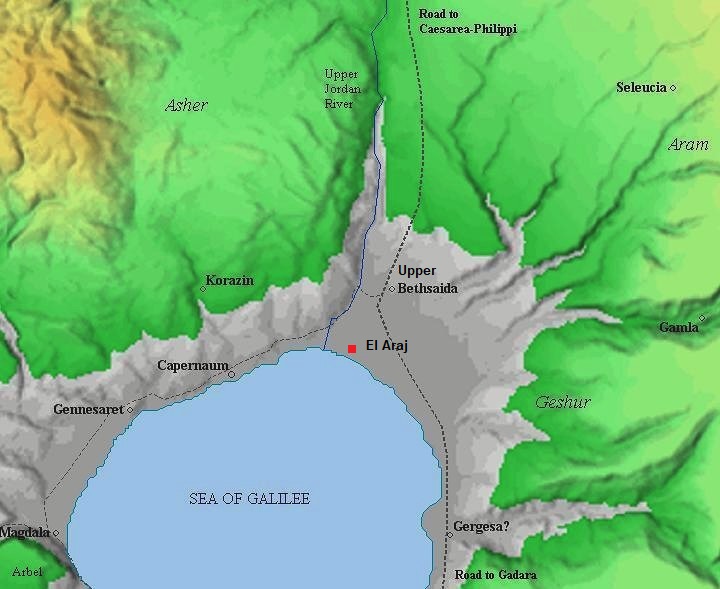
(based on Bible Mapper 3.0)
Later, during the Roman period, it became a fortified city. On the shore of the Sea of Galilee, a fishermen village of “Lower Bethsaida” (located at El-Araj) was established during the Hellenistic period, and was later renamed the city of Julias.
The site is located on the crossroads of major trade routes: north to Caesarea-Philippi (Panias/Banias); south to Gadara and the Gilad; east to Aram; west thru Capernaum, Genneserat (Kinnereth), Magdala (Migdal) to the Via Maris route which crossed the land to the south.
History:
- Hasmonean period
The village was established during the Hasmonean period, 2nd to 1st century BC, based on pottery of this period and a Hasmonean coin that was found in area D.
- Roman period
A Roman period layer was found in El Araj 1.0-1.5m below the surface. A Roman bathhouse was also unearthed. Recent excavations unearthed coins dated to the 1st century (including a silver denarius coin of Nero of 63 AD) to the 3rd century AD. Future excavations are planned to further explore this buried period.
- City of Julius?
According to recent excavations, El Araj site covers a total area of 41 dunams (10 acres), all of it was buried under meters of sediment from the Upper Jordan river and Golan streams. After removing the top soil, the bottom layer was dated to the Early Roman period – perhaps the city of Julius.
The ancient town of Bethsaida is believed to have been renamed “Julias” in the 1st century AD by Herod Philip (26 BC – 33 AD), son of Herod the Great and ruler of the north east region of the Kingdom. This renaming is mentioned by the historian Flavius Josephus in his writings. Josephus, a 1st-century Jewish historian, provides historical evidence that Bethsaida was upgraded into a city and renamed (Antiquities of the Jews 18.2.1):
“Philip also advanced the village Bethsaida, situated at the lake of Gennesareth, to the dignity of a city, and named it Julias, in honor of Julia, the daughter of the emperor.”
Yet another text repeats this upgrade of the village (War 2.9.1):
“Philip, Herod’s son, also built a city at Paneas at the fountains of the Jordan, which he named Caesarea. He also advanced the village of Bethsaida, which lay by the lake of Gennesareth, to the dignity of a city, and named it Julias.”
From these texts, we learn that: Bethsaida was originally a village (likely a fishing settlement); Philip upgraded it to a small polis (city), meaning it likely saw urban expansion; it was renamed “Julias” in honor of Julia (Livia Drusilla), the wife of Augustus Caesar and the Roman empress.
-
Jesus and Bethsaida
According to the New Testament, BethSaida was known as the birthplace of the Apostles Andrew, Peter, and Philip (John 1:44):
“Now Philip was of Bethsaida, the city of Andrew and Peter”.
The area of Bethsaida was referred in the new testament in conjunction with two of Jesus miracles:
Miracle 1: The healing the blind man (Mark 8:22):
People in Bethsaida brought a blind man to Jesus and begged him to touch and heal him. Jesus took the man by the hand and led him outside the village. He spat on the man’s eyes, put his hands on him, and asked, “Do you see anything?”. The man looked up and said, “I see people; they look like trees walking around.” His sight was partially restored, but blurry and distorted. Jesus placed his hands on the man’s eyes a second time. This time, the man’s eyes were opened wide, his sight was fully restored, and he saw everything clearly.
The site was BethSaida:
“And he cometh to Bethsaida; and they bring a blind man unto him…..”.
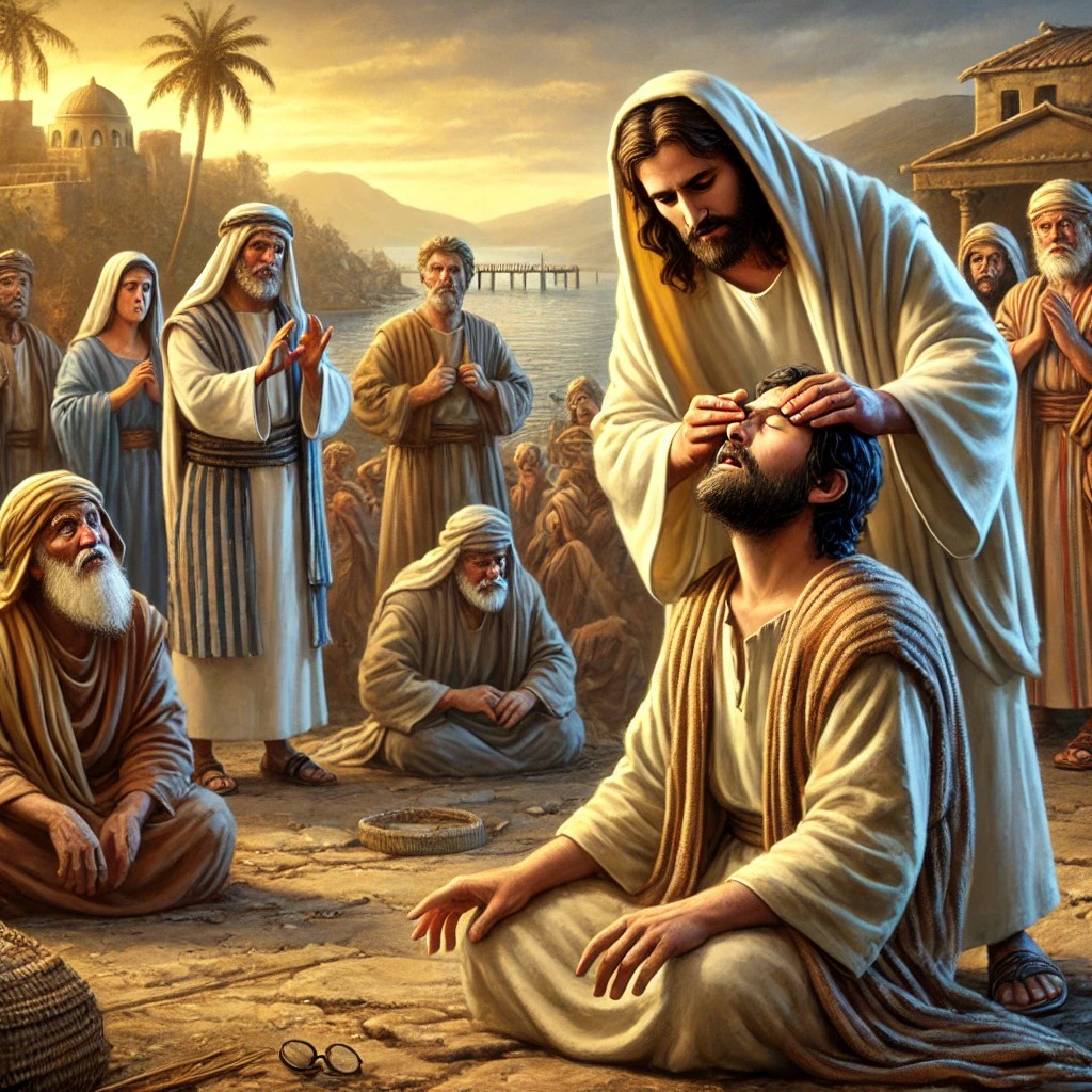
Illustration of the healing of the blind man in Bethsaida
(Image created by AI using DALL·E through OpenAI’s ChatGPT)
Miracle 2. The first feeding of the Multitude. (Luke 9:16):
A massive crowd of about 5,000 men (not including women and children) followed Jesus to a remote area to hear him teach. As evening approached, they grew hungry, but the disciples had no way to feed them in the wilderness. The disciples found a young boy who had just five small barley loaves and two small fish. Jesus had everyone sit down on the grass. He took the loaves and fish, gave thanks to God, and began breaking them. As the disciples distributed the food, it kept multiplying.
The site was Bethsaida:
“And the apostles, when they were returned, told him all that they had done. And he took them, and went aside privately into a desert place belonging to the city called Bethsaida…”.
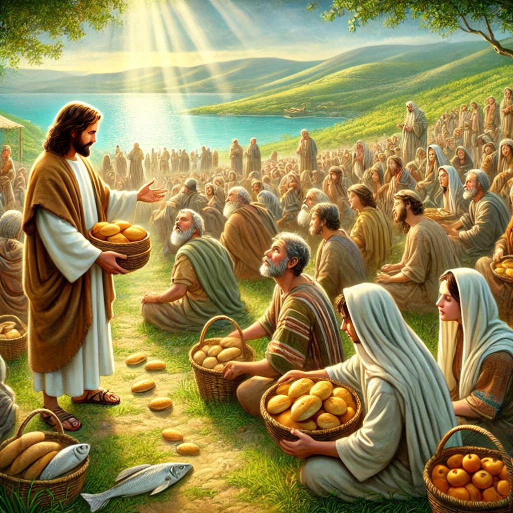
Illustration of the first feeding of the multitude in Bethsaida
(Image created by AI using DALL·E through OpenAI’s ChatGPT)
3. The curse of Bethsaida (Matthew 11:21)
Later, Jesus cursed Bethsaida since its Jewish residents did not follow his teachings, despite witnessing miracles:
“Woe unto thee, Chorazin! woe unto thee, Bethsaida! for if the mighty works, which were done in you, had been done in Tyre and Sidon, they would have repented long ago in sackcloth and ashes”.
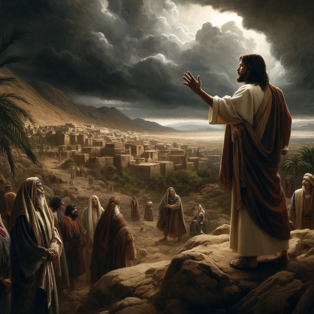
Illustration of Jesus condemning the towns
(Image created by AI using DALL·E through OpenAI’s ChatGPT)
The Roman city expanded to a large area. Future excavation seasons will research the city which is currently buried under the ground.
The archaeologists found a hoard of 70 coins (of Bronze, Silver and Gold) were also found dated to the 1st-3rd century AD.
Remains of a private house from the Roman period were excavated, with finds dated from the first to the third centuries AD that included pottery, coins, fishing net weights and a cooking oven.
The dwellings of the Roman period city were abandoned in the late 3rd century. After the abandonment of the settlement, the site was covered by floods from the Jordan River and water streams east of el-Araj.
- Byzantine period
Above the Roman period layer was a Byzantine period monastery, built in the 5th century. Its church design was a basilica, with its apse oriented to the east, and its floors covered by mosaic. The basilica measures 27 x 16m. The walls were standing to a height of one meter. No opening was found.
Key findings include mosaic floors (with geometric patterns and inscriptions), 5th century Byzantine period coins, fragments of chancellor screen, marble and glass tesserae,. These findings suggest a richly decorated church. A probable reliquary stone with 3 cells was found outside the church.
The important discovery was a Greek inscription referring to the apostles and Peter. Part of the larger, ornamentally patterned floor in the church’s sacristy, the inscription is framed inside a circular medallion made from two rows of black mosaic stones. The text identifies the donor as “Constantine, the servant of Christ,” and offers a prayer for intercession to St. Peter, describing him as the “chief and commander of the heavenly apostles.”
This was probably the lost Church of the Apostles, dedicated to Peter and Andrew. The Church of the Apostles is a Byzantine-era church (5th–7th century AD) that was discovered at El-Araj, a site believed to be Bethsaida, on the northern shore of the Sea of Galilee. Early Christian tradition states that this church was built over the house of the apostles Peter and Andrew, who were originally from Bethsaida (John 1:44).
Medieval Christian pilgrims recorded visiting a church at Bethsaida, which they believed marked the birthplace of Peter and Andrew. Bishop Willibald, a 8th Century AD Bavarian bishop, visited the Holy Land around 725 AD, and wrote that there was a church in Bethsaida built over the home of Peter and Andrew: “And from there they went to Bethsaida, the city of Peter and Andrew, where there is now a church on the site of their house.” This suggests that the Byzantine Christians venerated Bethsaida as the hometown of the apostles and built a church to commemorate them.
The Church was destroyed by the 749 great earthquake. After then it was abandoned.
- Crusader period
In the 12th century the Crusaders built a sugar factory on the site. The cultivation of sugarcane required abundant water and mills to crush the canes. This industry flourished along the Jordan valley area, as well as other locations in the Holy Land, and a dozen sites were found around the Sea of Galilee.
The area of the Byzantine Church was filled with dirt and used for the Crusader sugar factory. A number of Kilns were built along the Byzantine walls. Remains of clay vessels used in the sugar extraction process were found on the south side of the excavation area. The aqueduct that conveyed water to operate the sugar cane crushing process was not yet found, but may have been located along the entrance road on the north side of the farm house.
- Ottoman period
In the 19th century, a house and compound was built by Abdul Rahim Bek, a wealthy landlord who owned a vast area around the site entire valley. This 1940 map shows the location of the house, marked “House of ‘Abd er Rahman Pasha”. During the excavations, a hoard of 20 Ottoman silver coins and five French gold coins, were found under the concrete floor of the house, placed by the owner for good luck.
The residential building was later blown up and its ruins are located on the south east side of the remains of the church. Conversely, the farm’s storage area and horse stable are still standing today.
A section of the 1940s map is seen below. The house, Beit Ha-Bek, is in a place named El ‘Araj, situated along the coastal road from Jordan river south to Mas’udiaya and Kafr ‘Aqab. A mouth of a stream, Nahr ez Zaki (modern Nahal Yehudiya), is adjacent to El ‘Araj.
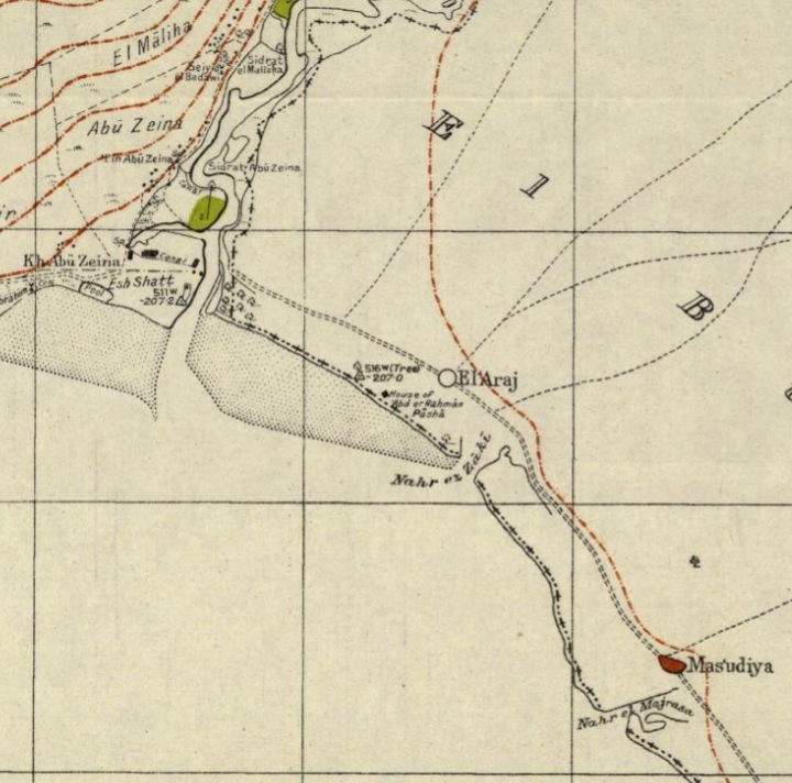
https://palopenmaps.org – Palestine 1940s 1:20,000 map
-
Modern period
The ancient site is in the area of the Ottoman house of Beit HaBek. This area is inside the nature reserve area of the Jordan river delta, on the north east side of the Sea of Galilee. An access dirt road to Beit Ha-Bek was recently closed, but you can walk to the site from a gate near Arik bridge.
A massive wildfire swept through the area on July 26, 2025. The fire raged for 17 hours, forcing beachgoers to flee and temporarily closing Highway 87. The exact cause of the fire was not officially released. However, the blaze started as a brush fire during a period of extreme summer heat in the dense lakeside vegetation of the Betiha Nature Reserve. While it destroyed equipment of the archaeological site, the fire accidentally helped researchers. By burning away thick underbrush, the flames exposed hidden ancient stone walls and artifacts believed to belong to the lost biblical village of Bethsaida.
Where exactly is BethSaida?:
The quest for the exact location of Bethsaida (“house of the Hunt”) has been one of the great mysteries of the past hundreds of years. This area of the northern part of the Sea of Galilee has many ancient sites due to its strategic place: a crossing of the ancient trade routes, a year round flow of water, the fish and game that can be found around the site, and the fertile soil in the area. There are many scattered ruined villages at the area, and for many years it was not clear which one of them is the village that Jesus has visited and performed miracles.
While Bethsaida is never explicitly called a “fishing village”, the fact that Peter and Andrew (who were fishermen) were from there, it was located near the water, fishing-related events occurred nearby and boats were used to travel to and from Bethsaida. Also, many lead weights for fishing nets were found in the excavated areas, serving as a key indicator of historical fishing activity. These are characteristic of the fishing communities surrounding the lake. These all strongly suggests that Bethsaida had a fishing-based economy, even if it was also an administrative town under Herod Philip.
The scholars debated for many years on the location of Bethsaida. The location at et-Tel was suggested in 1838 by Robinson. According to recent excavations, Khirbet et-Tel (“the Tell”) is a good candidate for Bethsaida (“the house of the hunt”). It is detailed in another web page. Excavations started here in 1987 after the Archaeologist Rami Arav recognized the significance of et-Tel while exploring the sites in the area. The excavations at Bethsaida were directed by Rami Arav on behalf of the Bethsaida Excavations Consortium which is headed by the University of Nebraska. The excavations at the site confirmed the identification of an Iron Age and Roman period village.
An alternative location was commenced in the area along the shore of the Sea of Galilee, as a fishermen village must be location along the waters. Khirbet el-Araj (also known as Beit Ha-Bek) is 2km to the south of et-Tel, on the shores of the Sea of Galilee. Remains of a large Roman fishing village and a Byzantine Church (the lost “Church of the Apostles”), were found in recent excavations that commenced in 2017. This discovery suggests an alternative location of Bethsaida, which was previously identified on the nearby hill 2KM to the north. It has a stronger claim to be the fishermen village, as it lies on the shores of the lake.
El-Araj vs. Et-Tell: The Bethsaida Debate
There is an ongoing debate over whether El-Araj or Et-Tell, another nearby site, is the true location of Bethsaida.
- El-Araj is closer to the lake, fitting the biblical description of a fishing village, and has clear 1st-century Early Roman remains.
- Et-Tell, further inland, has extensive Iron Age remains but is less convincing as a 1st-century fishing town, and saw a resurgence in the later Roman or Byzantine period. The majority of the coins were of the later Roman period.
- Some scholars believe Bethsaida moved over time due to damages created by high sea levels, or due to a need to increase the security, from the low area along the shore to the more secure hill top.
Photos :
(a) On the Shore
The ancient ruins of Khirbet el-Araj are located at the shores of the northern section of the Sea of Galilee lake. This view is from the excavated area towards the south east. The hills of the Golan heights are seen in the background.
The site is located inside the Betiha Nature Reserve (also widely known as the Majrase Nature Reserve), covering an area of 7,000 dunams (1,730 acres). This is a lush, watery wetland delta located on the northeastern shore of the Sea of Galilee. Managed by the Israel Nature and Parks Authority, it serves as the spectacular meeting point where several major Golan streams (Upper Jordan river, Daliot, Yehudiya, and Meshushim) merge before emptying into the lake.
Click on the photos to view in higher resolution…
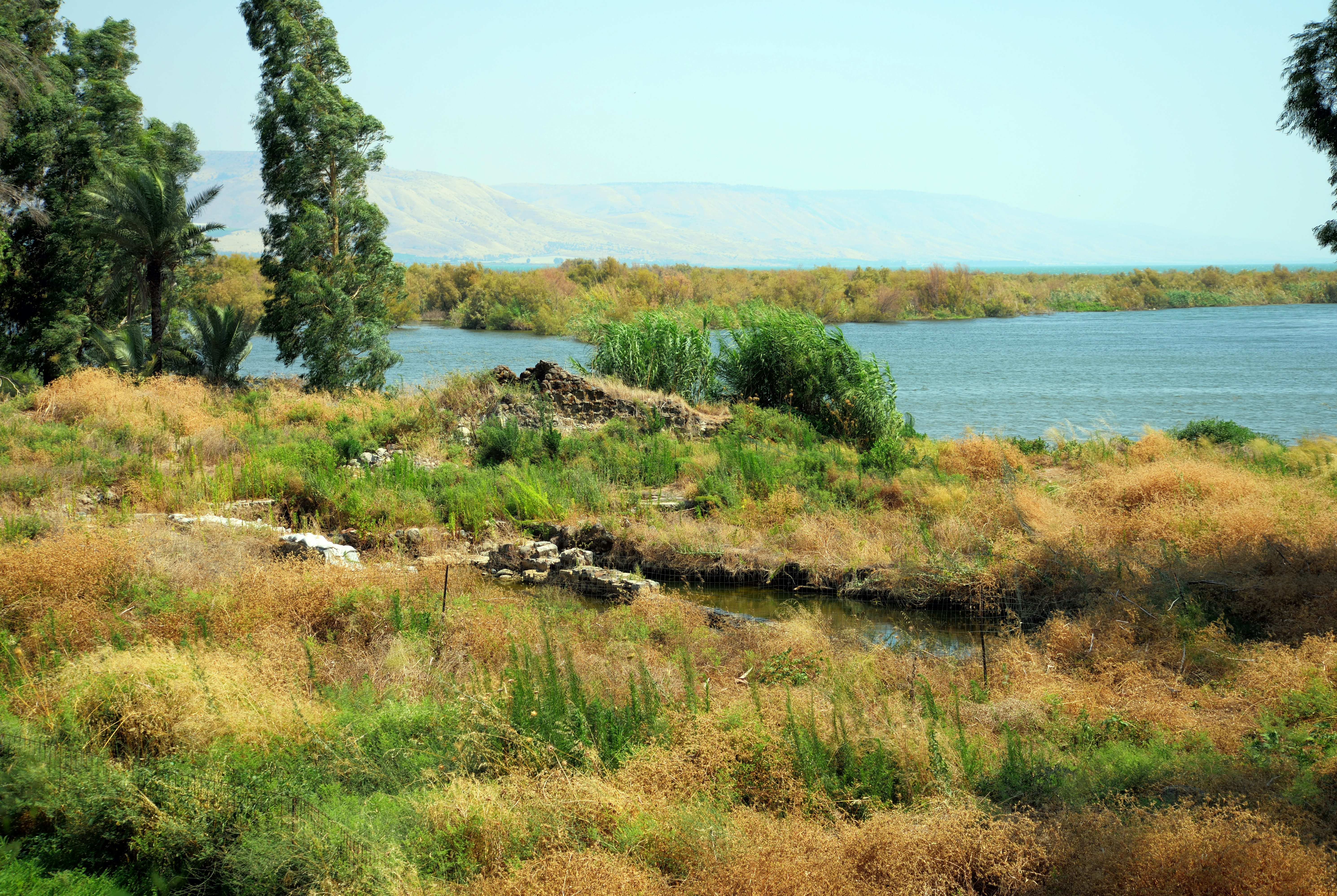
Today this coast area is a marsh land, with a low level of water. The levels of the water of the Sea of Galilee changes between the summer and winter periods, and at times the waters cover the ruins. Heavy winter rains (mostly from November to March) cause the lake to rise, and dry summers and drought years cause it to drop. Due to high temperatures in the region, the lake loses millions of cubic meters of water annually.
The average height (elevation) of the Sea of Galilee is approximately -209 to -210 meters (-686 to -689 feet) below sea level, making it the lowest freshwater lake in the world. The elevation fluctuates seasonally due to rainfall, river inflow (mainly from the Jordan River), and water usage. The highest recorded level in modern times is around -208 meters (-682 feet) and the lowest recorded level (during droughts) has dropped close to -214 meters (-702 feet).
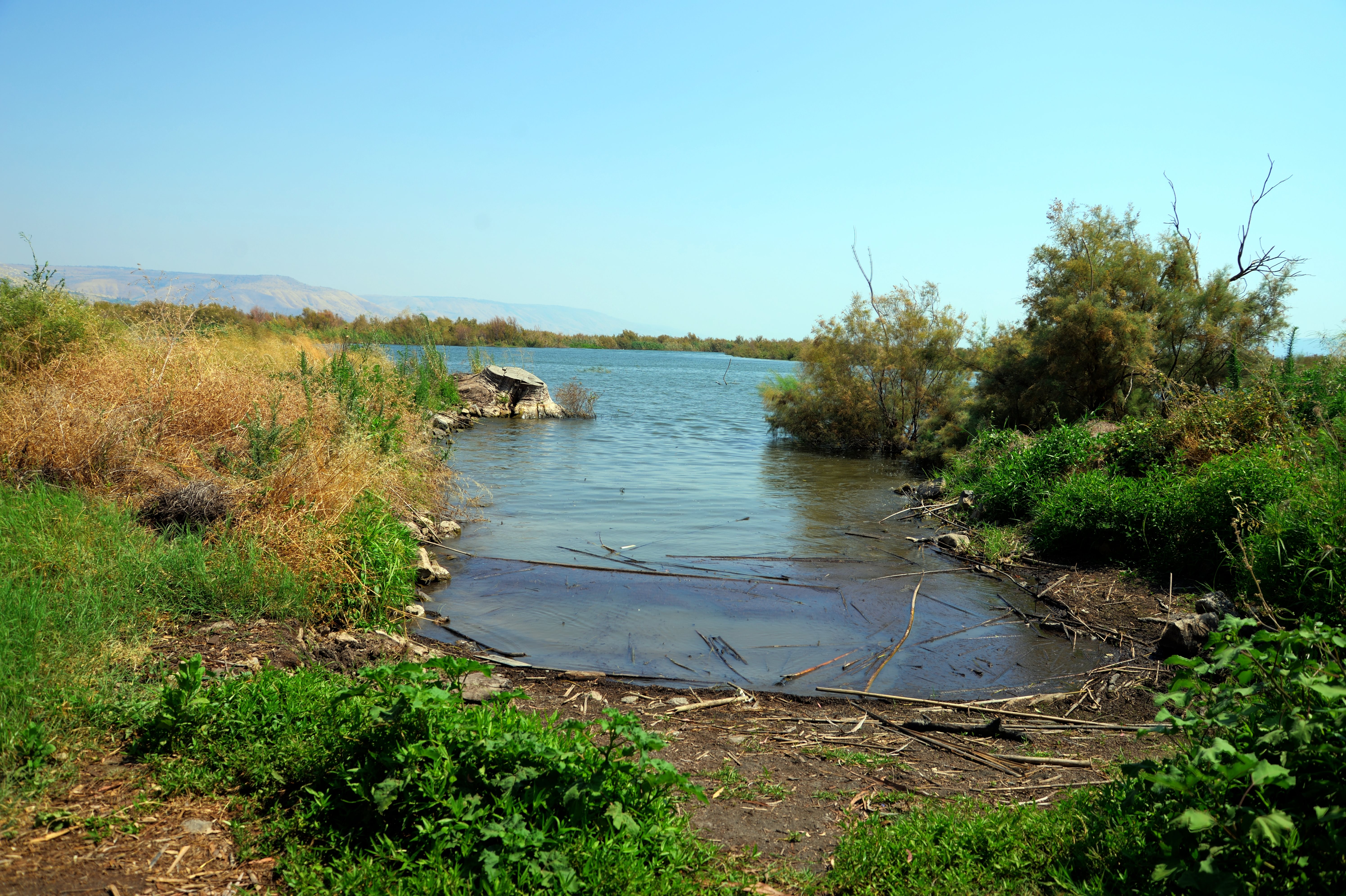
According to a research by Giaime & Artzy, the level of the lake fluctuates over the centuries. During the antiquities the level of the Sea of Galilee was low during the Iron Age II (averaged -211m), rose higher during the late Hellenistic/Early Roman period (averaged -209m), and then dropped again considerably during the Byzantine to the Crusader period (averaged -213-214). This is why the Roman site was buried below several meters of sediments in the delta of the Jordan river, and why the church was able to build in an area that is now partially flooded during the year.
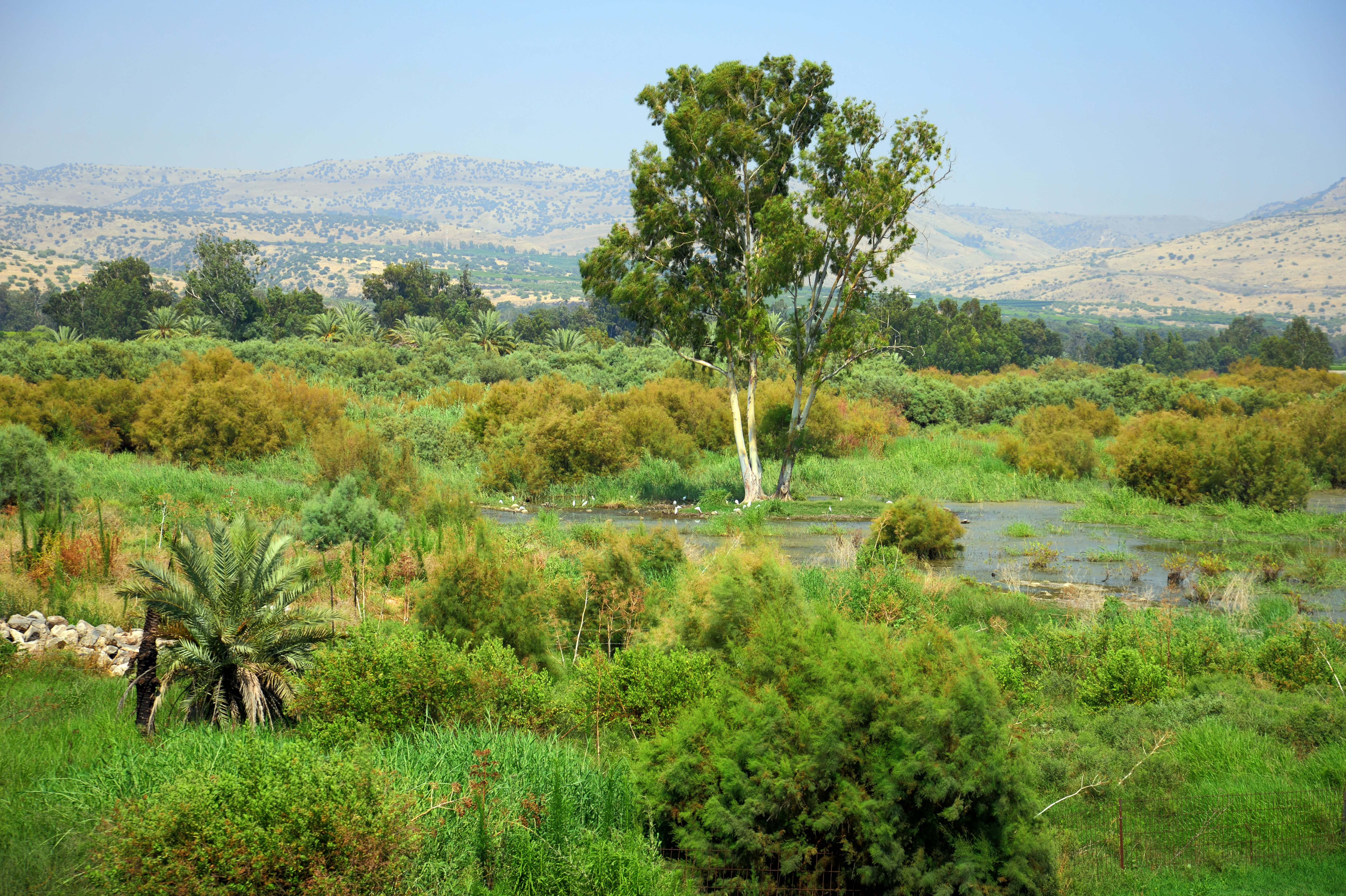
Below is a view to the north, prior to the excavations and the 2025 fire that consumed most of the trees and bushes.
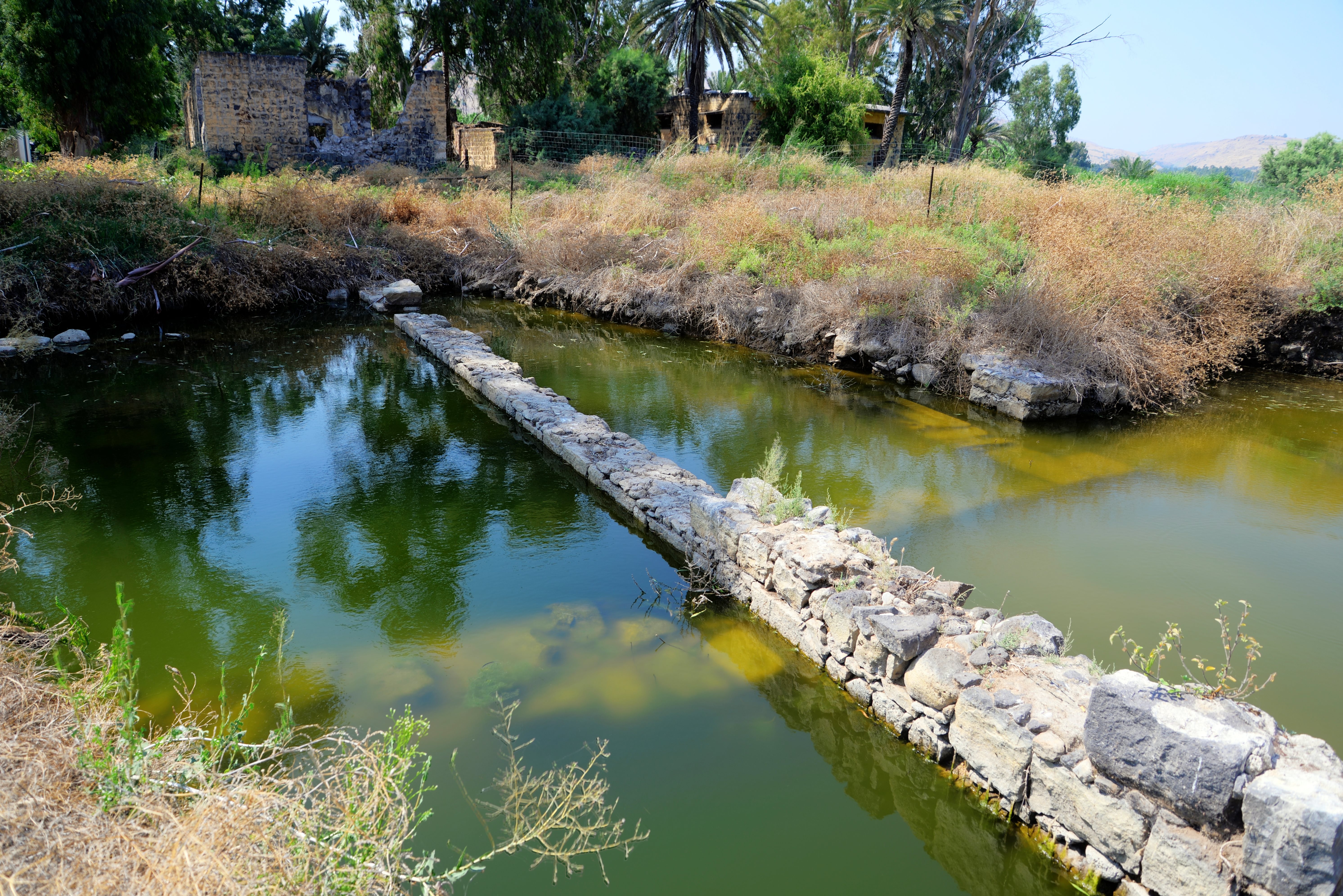
The flooding of the Jordan River over centuries buried much of the site under silt and sediment, hiding its ruins until modern archaeology uncovered them. The sea level of the Lake of the Sea of Galilee fluctuates during the year. This photo was captured on July 2020 when the sea level was high, following two years of wet winters. The water level covered the base of the church walls.
(b) Church of Apostles
Recent excavations, led by Dr. Mordechai Aviam and Dr. R. Steven Notley, have uncovered the following ruins in El Araj area:
- A Byzantine-era church (c. 5th–7th century AD), which may be the Church of the Apostles mentioned by medieval pilgrims. A recently found mosaic floor inscription with the praise to the apostles provides proof to this claim.
- Roman-period ruins (1st-3rd century AD), including pottery, coins, and structures, supporting the theory that this was a significant settlement during Jesus’ time.
- Evidence that the site was covered by sediment from flooding (possibly from the Jordan River), which may explain why it was abandoned and later forgotten.
The church design was a basilica, with its apse oriented to the east, and its atrium and narthex to the west. The church was first built in the 5th century, and a second phase of construction of the apse was built above the earlier apse during the 6th-7th century. The floor was paved with mosaic with geometric and floral designs, and two inscriptions. This was probably the lost Church of the Apostles, as attested by the mosaic floor inscription.
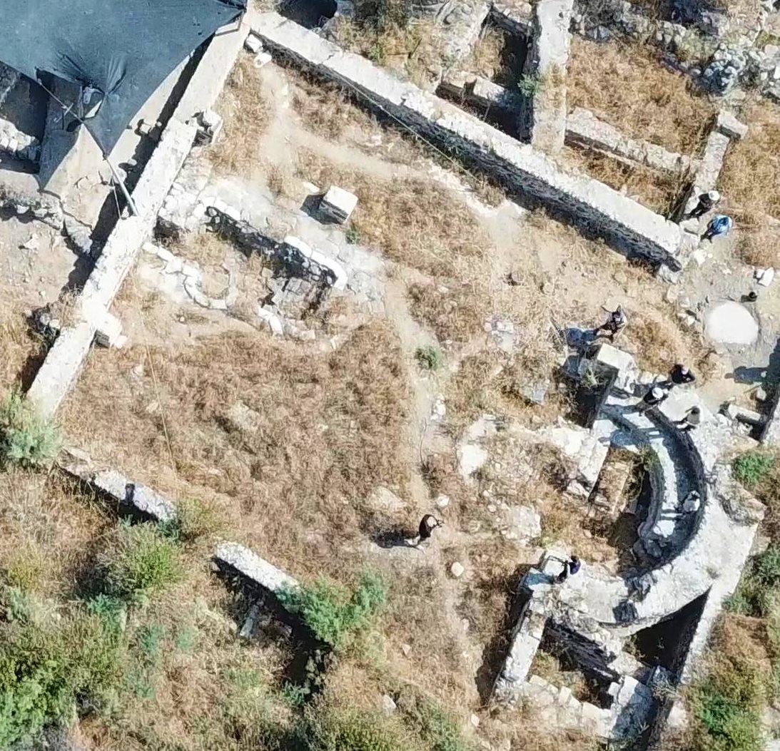
A recent aerial view (2026) of the church is seen below. The area of the basilica measures 27 x 16m, and is oriented south east. A small apse, seen outside the eastern wall, was a Byzantine period bathhouse, part of the monastery complex.
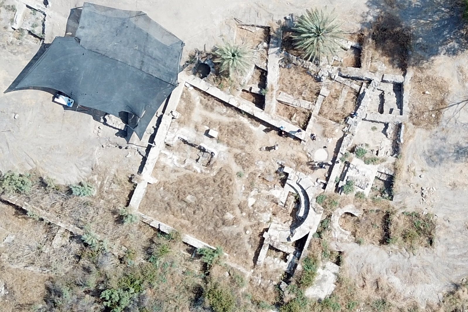
The excavation tent is built over the atrium on the west side, and the team was working in this area at the time we visited the site. The upper surface is Early Muslim and Crusader, then they will reach the Byzantine period to further study the western area of the church.
A closer view of the church is below. The outer wall of the church does not have an opening. It was sealed at some time after it was abandoned, perhaps following the devastating earthquake of 749 AD.
- House of Peter?
On a section of its mosaic floor was a well preserved inscription. It states that the donator of the mosaic floor on the Diaconicon (the chamber of the south side of the apse) was built by Constantine, in name of his children. The inscription also included the following statement of whom the work was dedicated to: “…Chief of the apostles and keeper of the keys of the heavenlies”.
The keeper of the keys refers to the Apostle Peter (aka Simon Bar-Yonah). The builders of the Church believed that it was built over the house of Peter. In Matthew 16:19, Jesus tells Peter, “I will give you the keys of the kingdom of heaven, and whatever you bind on Earth shall be bound in heaven, and whatever you loose on Earth shall be loosed in heaven.”
This was for sure one of the most important findings in the excavations so far, providing an identification of the Byzantine period Church. It was built by believers who assumed that the house of Peter was under this structure.
(c) Julius city?
The excavations continue on other areas around Beit Ha-Bek. They are marked on the aerial view below, with a view towards the north. The lake’s shore line is marked as a red line on the bottom side.
The excavation team opened several squares, starting from the area of the church (‘A’, ‘B’). Above the Byzantine layer was a Crusader sugar factory. Other excavation areas include:
- On area ‘C’, 100m to the north of the shore side area, are remains of two phases of the Roman village: 1st-2nd century AD and 2nd-3rd century AD.
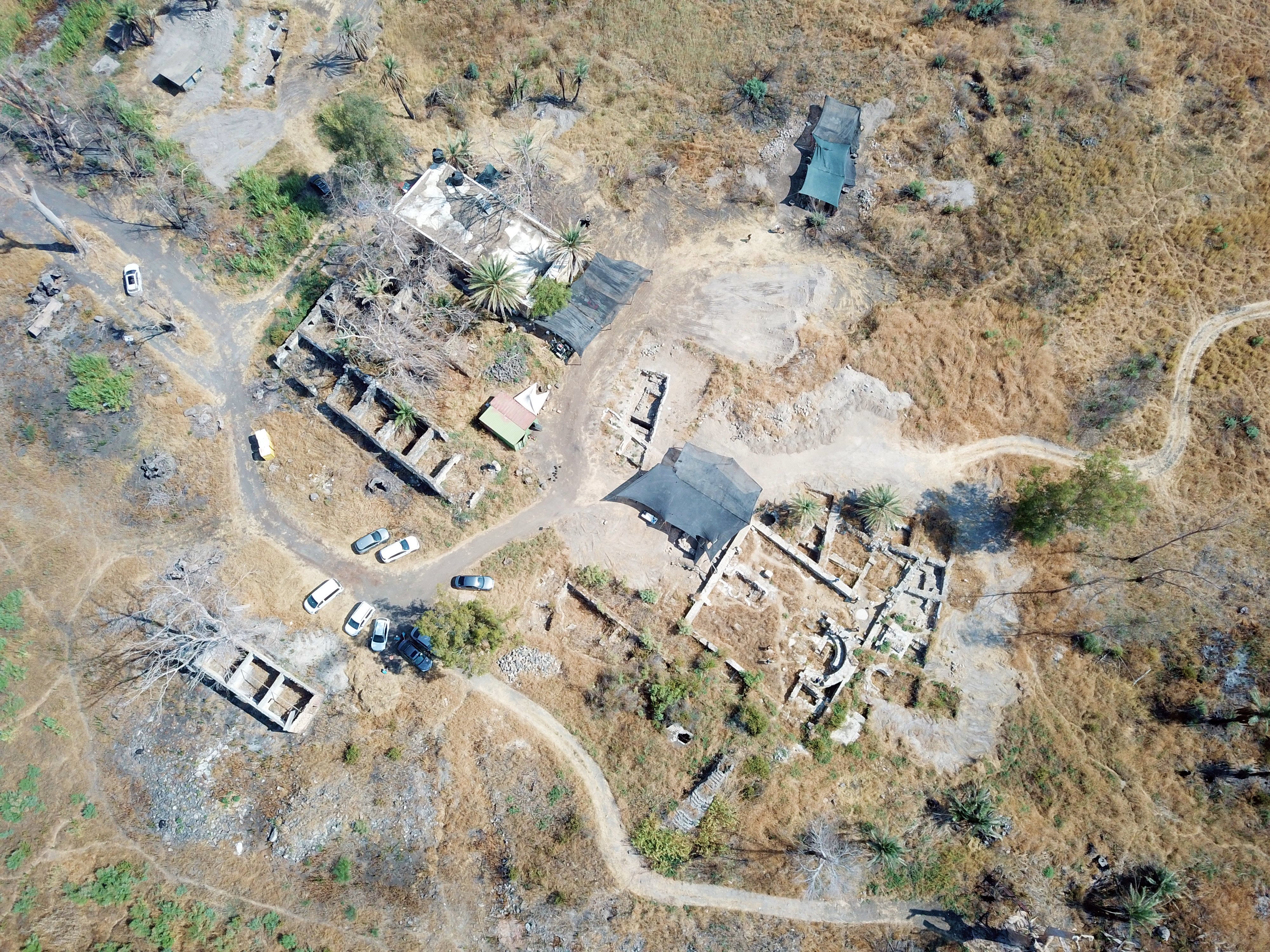
- Area ‘D’ is on the west side of the Roman city, past the farming houses. Here the archeologists also found two phases of the Roman village (1st to 3rd century). Also they determined that a ‘catastrophic’ ending of the city occurred during the 3rd century, around 250 AD, perhaps due to flooding from the Jordan river that drowned the houses. The destruction layer included glass vessels still standing on the site, and inkwells (like in Qumran). Hasmonean pottery sherds and coins were also found there on the bedrock, indicating the early establishment of the Jewish village to the 1st/2nd century BC.
- Area ‘E’ is east of the church, with structural remains of the Byzantine monastery, and a Roman layer below it.
- Area ‘F’ is on the west side of the church, with Byzantine walls and a large Roman period structure below it. The Roman destruction layer of the 3rd century includes 1.5-2m walls, an impressive preservation state for this period.
- Area ‘G’ on the north side has modern, Crusader, and Roman periods below.
- Area ‘H’ near Bek’s barn, with only modern remains.
(d) Beit HaBek
Beit HaBek is a 19th-century estate located in the Betiha Valley, on the northern shore of the Sea of Galilee, within the fertile delta of the Upper Jordan Valley. It was constructed over the ruins of El-Araj, which are now believed to be the ancient site of Bethsaida/Julias.
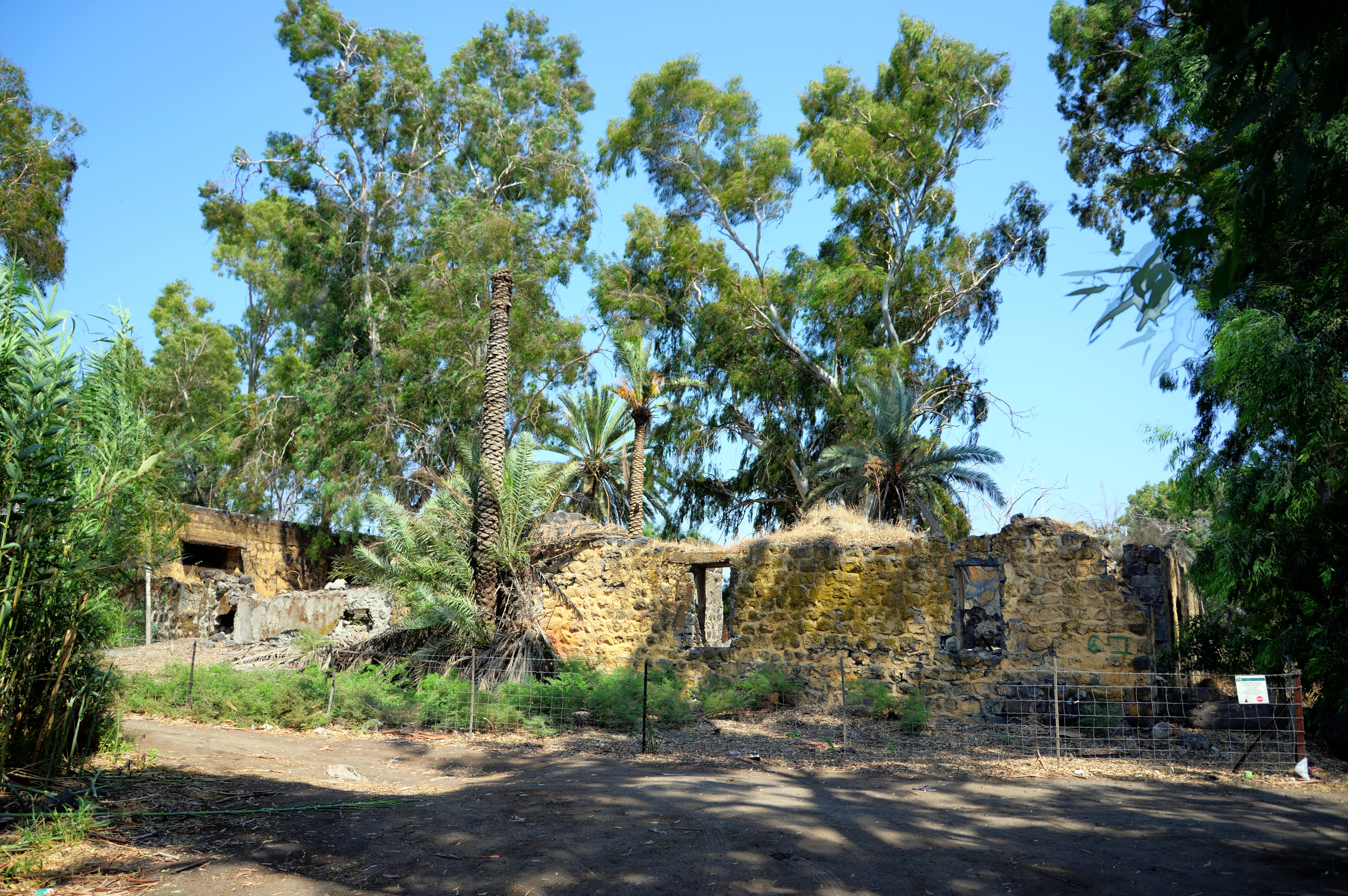
These farming structures were built by Abdul Rahim Bek, a wealthy landlord who owned a vast area around the site entire valley. He owned and cultivated land in the Betiha Valley, a region known for its fertile soil and agricultural significance. Beit HaBek was built as a residential or administrative structure, possibly serving as the center of his estate or farming operations.
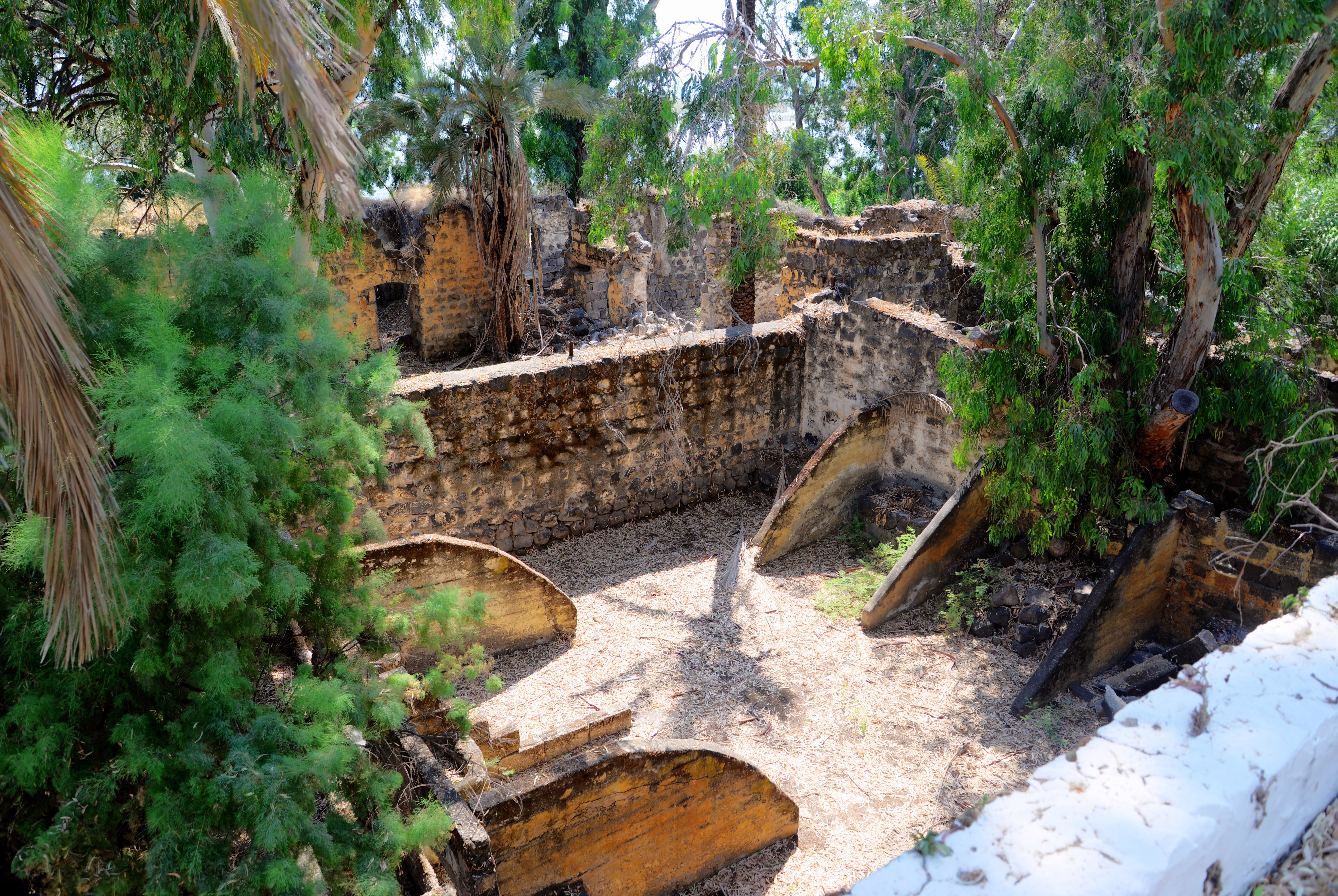
The main residence house was on the east side of the excavated church, but was blown up, and now are a pile of rubble. Only the farming structures were left on the western side.
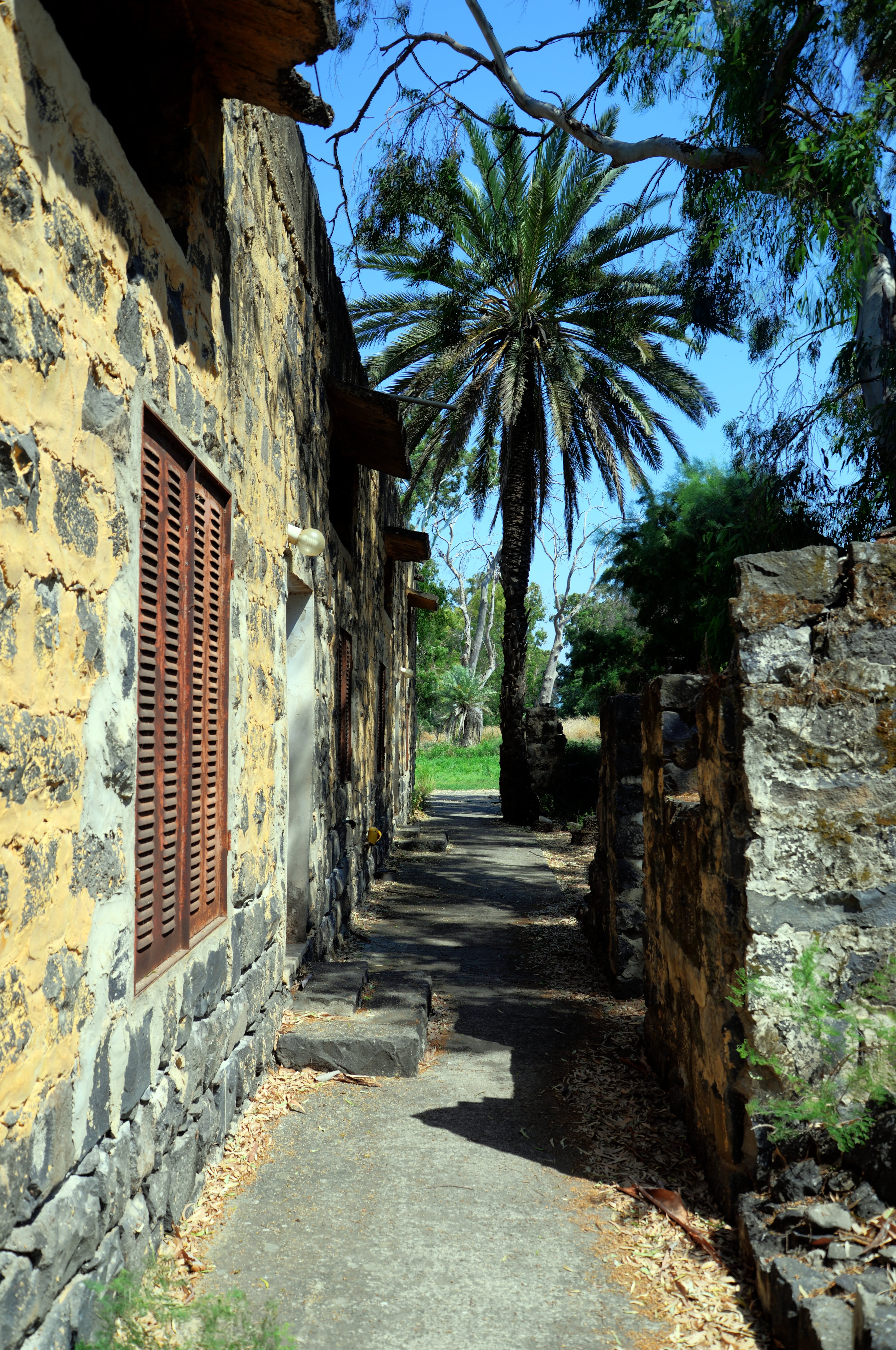
The title “Bek” (or Bey) was an honorific title used in the Ottoman Empire, often given to officials, noblemen, or influential landowners.
Below – a horse stable in Beit HaBek.
Videos:
(a) Aerial Views
 The drone captured aerial views of the excavation area on July 16, 2026.
(b) Excavation 2026 highlights:
Our team visited the site on July 19, 2026, and provided this review of the excavation site.
New Testament References:
(a) Mark 8:22-26
This text describes the miracle of the healing of the blind man in BethSaida:
“And he cometh to Bethsaida; and they bring a blind man unto him, and besought him to touch him. And he took the blind man by the hand, and led him out of the town; and when he had spit on his eyes, and put his hands upon him, he asked him if he saw ought. And he looked up, and said, I see men as trees, walking. After that he put his hands again upon his eyes, and made him look up: and he was restored, and saw every man clearly. And he sent him away to his house, saying, Neither go into the town, nor tell it to any in the town”.
(b) Mark 6:44-45
This text talks about the miracle of feeding the multitude, afterwards Jesus left for the area of BethSaida.
“…And they that did eat of the loaves were about five thousand men. And straightway he constrained his disciples to get into the ship, and to go to the other side before unto Bethsaida, while he sent away the people”.
(c) Luke 9:16
This text also relates to BethSaida and the miracle of feeding the multitude:
“And the apostles, when they were returned, told him all that they had done. And he took them, and went aside privately into a desert place belonging to the city called Bethsaida. And the people, when they knew it, followed him: and he received them, and spake unto them of the kingdom of God, and healed them that had need of healing. And when the day began to wear away, then came the twelve, and said unto him, Send the multitude away, that they may go into the towns and country round about, and lodge, and get victuals: for we are here in a desert place. But he said unto them, Give ye them to eat. And they said, We have no more but five loaves and two fishes; except we should go and buy meat for all this people. For they were about five thousand men. And he said to his disciples, Make them sit down by fifties in a company. And they did so, and made them all sit down. Then he took the five loaves and the two fishes, and looking up to heaven, he blessed them, and brake, and gave to the disciples to set before the multitude”.
Josephus Flavius:
Josephus Flavius, the Roman historian and ex-Jewish commander, writes about BethSaida. According to the following text, Bethsaida was given to Herod Phillip, one of the sons of Herod the great. He renamed the city to Julias, in honor of Caesar’s daughter, so that implies that the city was important. He was also buried there.
(a) Antiquities of the Jews, Book 18, 2: 1
“He also advanced the village Bethsaida, situate at the lake of Gennesareth, unto the dignity of a city, both by the number of inhabitants it contained, and its other grandeur, and called it by the name of Julias, the same name with Caesar’s daughter”.
(b) Antiquities of the Jews, Book 18, 4: 6
“He died at Julias; and when he was carried to that monument which he had already erected for himself beforehand, he was buried with great pomp”.
(c) Autobiography, 72
Josephus was wounded near Bethsaida (Julias) after falling from his horse:
“As soon as I had gotten intelligence of this, I sent two thousand armed men, and a captain over them, whose name was Jeremiah, who raised a bank a furlong off Julias, near to the river Jordan, and did no more than skirmish with the enemy; till I took three thousand soldiers myself, and came to them. But on the next day, when I had laid an ambush in a certain valley, not far from the banks, I provoked those that belonged to the king to come to a battle, and gave orders to my own soldiers to turn their backs upon them, until they should have drawn the enemy away from their camp, and brought them out into the field, which was done accordingly; for Sylla, supposing that our party did really run away, was ready to pursue them, when our soldiers that lay in ambush took them on their backs, and put them all into great disorder. I also immediately made a sudden turn with my own forces, and met those of the king’s party, and put them to flight. And I had performed great things that day, if a certain fate had not been my hinderance; for the horse on which I rode, and upon whose back I fought, fell into a quagmire, and threw me on the ground, and I was bruised on my wrist, and carried into a village named Cepharnome, or Capernaum. When my soldiers heard of this, they were afraid I had been worse hurt than I was; and so they did not go on with their pursuit any further, but returned in very great concern for me. I therefore sent for the physicians, and while I was under their hands, I continued feverish that day; and as the physicians directed, I was that night removed to Taricheee”.
Etymology (behind the name):
-
Beth, Beith – in Hebrew – House.
-
Tsaida – in Hebrew: Hunt.
-
BethSaida – the combined name means “House of the Hunt”.
-
Julias – the Roman name of the city, named after Caesar’s daughter and Augustus’s powerful third wife
- El Aeraj (Araj) – Arabic for “the lame” or “the limp”, perhaps due to the bad terrain where the coastal road is passing
- HaBek – title “Bek” (or Bey) was an honorific title used in the Ottoman Empire, often given to officials, noblemen, or influential landowners.
- Betiha – Arabic for ‘swampland’. A vast area the spans the fertile Bethsaida Plain, located at the northeast corner of the Sea of Galilee. It encompasses a massive delta where several prominent freshwater streams descending from the Upper Jordan river and from the Golan Heights merge and empty into the lake.
Links:
* External:
- El Araj excavations home page
- El Araj excavation update 2025 – Bible Museum, Washington, 2025
- Bethsaida – ancient fishing village
-
Using archaeological data for the understanding of Late-Holocene Sea of Galilee’s level fluctuations – article by Matthieu Giaime & Michal Artzy (2022)
- Is et-Tell Bethsaida? Biblearchaeologyreport.com great article (Bryan Windle, 2019)
- Sugar history
* Internal:
- Beit HaBek (el Araj) – drone view of el Araj during an earlier excavation phase
- E-Tell Bethsiada site
BibleWalks.com – witnessing the Biblical places
Golan Roman Roads <<<–previous site—<<<All Sites>>>—next Golan site—>>> Bethsaida coins
This page was last updated on July 21, 2026 (new video section)
Sponsored links: