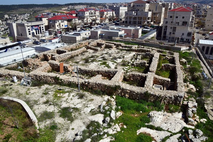
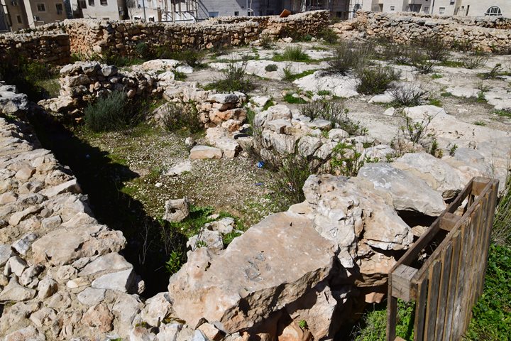
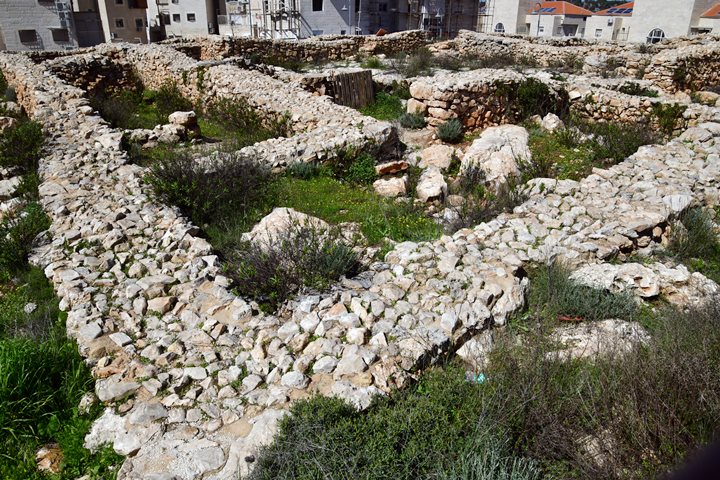
Ruins of a Persian period fortress in the city of Beitar Illit.
Home > Sites > Judea > Kh. Dir Baal
Contents:
Overview
Location
History
Photos
* Aerial views
* Entrance gate
* CourtYard
* South East
Etymology
Links
Overview:
Ruins of a fortress are located in the city of Beitar Illit. It guarded an ancient route from the plains to Jerusalem and Bethlehem. Archaeological excavations dated it to the Persian period.
Location:
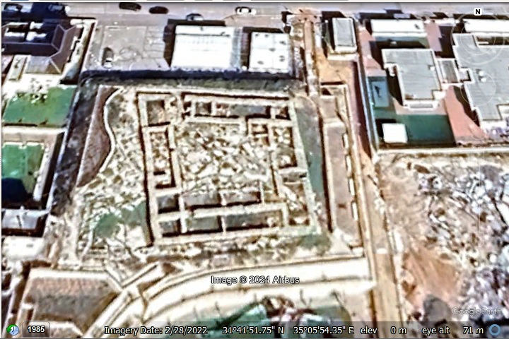
The fortress is located in the modern city of Beitar Illit, on a raised ground between Ohev Yisrael and Admori Vizonech streets. The fortress is built on an area of 1000 square meters.
The map shows the points of interest on and around the site.
History:
- Iron Age II (10th-6th century BC)
Surveyors initially suggested that this was an Iron Age II fortress, as the plan of a casemate wall around a courtyard, with two chambers on each side of the entrance, was typical of this period. However, the dating changed after the excavation to the Persian period.
A Biblical map of the area is illustrated here, with the site marked by a red square.
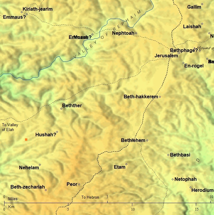
Map of the area – during the Biblical periods (based on Bible Mapper 3.0)
According to David Dorsey (“The roads and Highways of Ancient Israel”, pp. 182-191) two major roads passed nearby:
-
- J8 – Jaffa-Gezer-Bethlehem (NW to SE route) – shown here
- J9 – Ashkelon-Elah Valley-Jerusalem (SW to NE route)
- Persian period (6th-4th century BC)
After the Babylonian destruction of Jerusalem, and the fall of the Babylonian empire, the Persians replaced them and controlled Judea. Cyrus the Great, the founder of the Persian Empire, issued a decree allowing the Jews to return to Jerusalem and rebuild their temple. This led to the construction of the Second Temple, which became the center of Jewish worship and culture.
During the Persian rule Jerusalem experienced a period of revival and rebuilding. The Persians established an autonomous administrative division named Yehud Medinata, or simply Yehud. During the Persian period, Jerusalem and its surrounding region were fortified with several significant fortresses and defensive structures. These fortifications played crucial roles in securing the city and protecting it from external threats.
According to the excavation results, this fortress at Dir Baal was constructed during the Persian period. It was in use during the 5th century BC, and was abandoned at the end of the 4th century BC.
There are 5 other known Persian period fortresses around Jerusalem (as per article of Horvat Eres). These are:
- Horvat Eres (aka Wind Mountain) – North west of Kiryat Yearim
- Har Adar (Kh. Nijam) – 4 km east of Eres; 21.8 x 25.8m with central courtyard 10 x 11.9m
- Khirbet az- Zawiyye, in the Hebron Hills; 21.8×24.7m
- Khirbet Abu et-Twein, on the western slopes of the Hebron Hills; 30×30 m with a central courtyard surrounded by rooms on four sides
- Khirbet el-Qatt, near Karmei Zur; same as Abu et-Twein
- Early Roman Period
During the 1st century BC the structures were rebuilt and reused for residential purposes.
- Byzantine period
The place was in partial use during this period, and may have served as hermit cells. This probably was the source of the name (Dir is Arabic for monastery).
-
Ottoman period
Conder and Kitchener of the Palestine Exploration Fund (PEF) surveyed the area during the Survey of Western Palestine (SWP) in 1874-75. This is a section of their map, focusing on the area.
The site does not appear on the map. Only another adjacent Iron Age ruin, Kh. ed Deir, appears on the map. Several roads, marked by a dashed line, appear passing at this section along the valleys, from west to east.
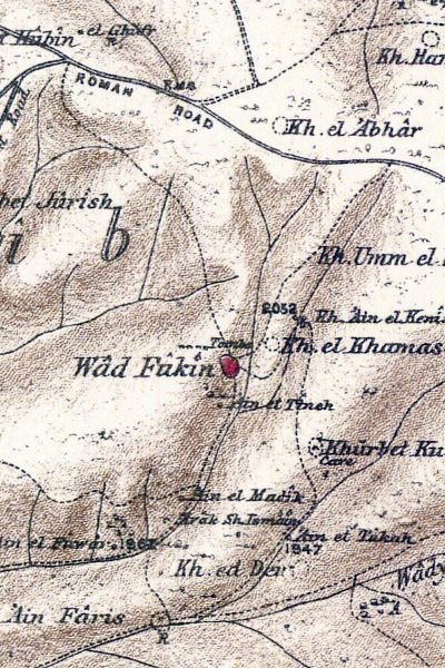
Part of map sheets 17/20 of Survey of Western Palestine,
by Conder and Kitchener, 1872-1877.
(Published 1880, reprinted by LifeintheHolyLand.com)
-
Modern period
Excavations were conducted by B. Har-Even and Haim Shkolnik of the Archaeological unit for Judea and Samaria. The site surrounding the fortress is fenced. There are gates on both sides, one of the gates may be open.
Photos:
(a) Aerial View
This is a view of the fortress from the west side. Its plan is almost square, roughly 30 x 30m long. A large courtyard is located at the center, and is surrounded by a casemate wall on all four sides.
The casemate wall, built of parallel external and internal walls, is 4m in width. Its external wall is 1.3-1.5m wide. It preserved to a height of 2m. The internal wall (facing the courtyard) is 1m wide. The walls were built of medium size field stones that were cut to fit at the site. The corners were built with very large field stones, laid using the “heads and stringers” method, a construction method typical of that period.
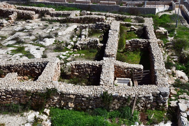
The following view shows the southern wall (31m long) on the right , and part of the western wall (35m long) on the bottom.
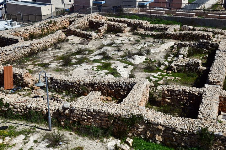
The following view shows part of the western wall (35m long) on the bottom , and part of the eastern wall (29m long) on the top.
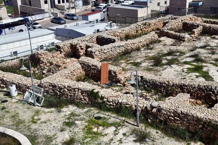
The next view shows the northern wall on the left side (31m long), and part of the western wall .
On the western side of the northern wall (on the bottom left corner) was the entrance to the fortress.
Along the northern wall is a long 18.5m casemate room, 4m in width.
(b) Entrance
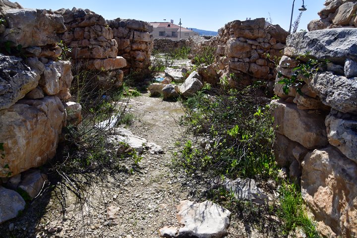
The entrance to the fortress is on the north western corner. It is 6.5m long and 2m wide.
On each side of the entrance corridor are two chambers. These chambers could serve various purposes such as guard rooms, storage areas, or defensive positions. Placing chambers alongside the entrance can provide additional protection and surveillance capabilities. The layout is typical of military structures aimed at enhancing defense capabilities. By positioning the entrance on the northwestern corner and flanking it with chambers, the fortress can better control access and provide defensive cover for those guarding the entrance.
There were 4 other gates along the external wall, but they were sealed during the Persian period.
(c) Courtyard
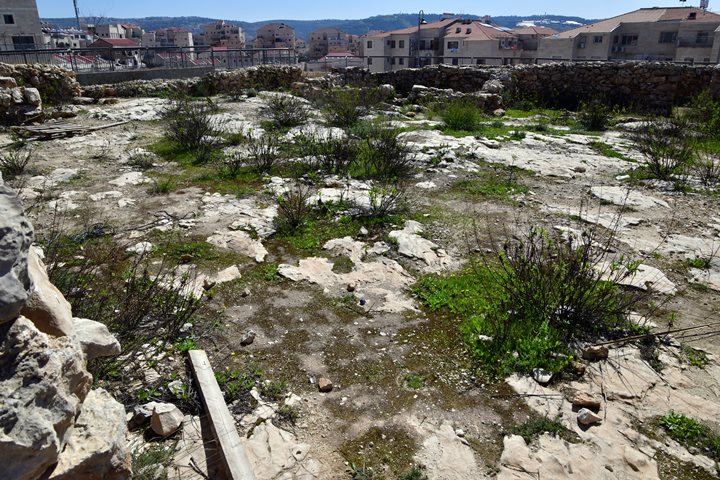
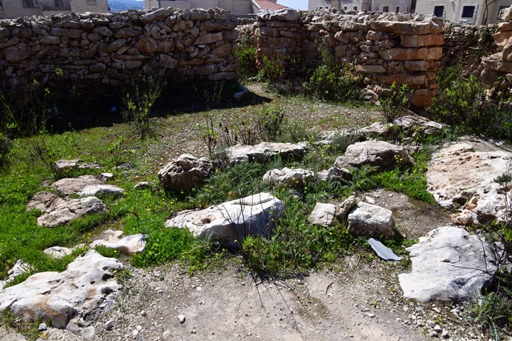
The vast courtyard measures 19m (north), 20.5m (west), 17m (south and east), the entrance to the courtyard is from the main entrance on the north west corner. It opens up to 8 casemate rooms that surround it.
There were no water cisterns found inside the compound.
There was no tower, as the site was built on an elevated platform with a great view of the surroundings and the road it protected. The archaeologists suggested that the fortress had a second floor.
In the courtyard are several installations: 3 ovens on the western side, and benches on their side. On the eastern side is an installation that was used for storing grain.
On the north east corner of the courtyard is a room that was added in a later phase during the Persian period.
Another room was added, also at a later construction phase, on the south side of the courtyard.
On the floor is a small grinding tool embedded in the floor (seen on the bottom of the photo).
(d) South East corner
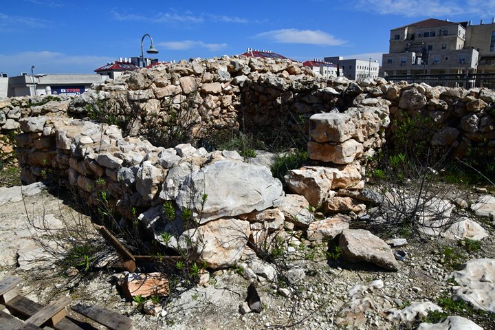
The following is a view of the south east corner.
On the left side of this photo is the external southern wall, and along it are two equal size casemate chambers. They are separated by a short wall with an opening. On the external wall is a sealed gate.
On the right side of this photo is the external eastern wall. Along the wall are two long casemate chambers.
Etymology:
- Arabic name of the ruin: Khirbet Dir Baal
- Khirbet – ruin
- Dir – monastery
- Baal – a Canaanite God, means master, chief. The Quran tells about prophet Elijah: (37:125) “Do you call upon Baal”
- Hebrew name of Beitar Illit:
- Beitar, Betar – name of a Roman fortress town, the center of Israelite command during the Bar Kokhbah revolt. Located nearby at the ruin of Khirbet al-Yahud.
- Illit – Upper
Links:
* External:
- Khirbet Dir Baʿal, a Persian Period Fortress on the Western Slopes of the Judean Hills – Qadmoniot: A Journal for the Antiquities of Eretz-Israel and Bible Lands – Vol. No. 163 (תשפ״ב / 2022), pp. 29-33 (5 pages)
- A People Transformed Palestine in the Persian Period – John W. Betlyon – Great article answering: Why was the mighty Persian empire regraded until the 1970s as a dark period in their presence in the Holy Land?
Internal:
- Wind Mountain – Persian period fortress west of Jerusalem (YouTube); also: Horvat Eres
BibleWalks.com – walk with us through the sites of the Holy Land
Biar Tunnel<<<—previous Judea site–<<< All Sites >>>—next Judea site—>>> Rachel’s tomb
This page was last updated on April 11, 2024 (new)
