The ruins of the village are located on a hill, above the delta of the upper Jordan river, a fertile area with many ancient villages. It was a Biblical city in the land of Geshur, and a Roman city, the site of Jesus’ two miracles.
Home > Sites > Golan > Bethsaida (Et-Tell)
Contents:
Background
Location
Biblical Map
Where Is?
History
Structure
Photos
* General
* Street
* Winemaker’s
* Fisherman’s
* Center
* South
* Gate
* East
* Cobblestone
* Escape tunnel
Biblical
References
Etymology
Links
News
Background:
Bethsaida, an ancient city on the north side of the Sea of Galilee, is a “tale of two cities” – an Iron age city of the land of Geshur, and a Roman city known as Julias.
The area of Bethsaida was referred in the New Testament in conjunction with two of Jesus miracles: healing the blind man and the first feeding of the Multitude. It is also known as the birthplace of some of the Apostles (Andrew, Peter, Philip).
Mark 8:22: “And he cometh to Bethsaida; and they bring a blind man unto him…”
Location:
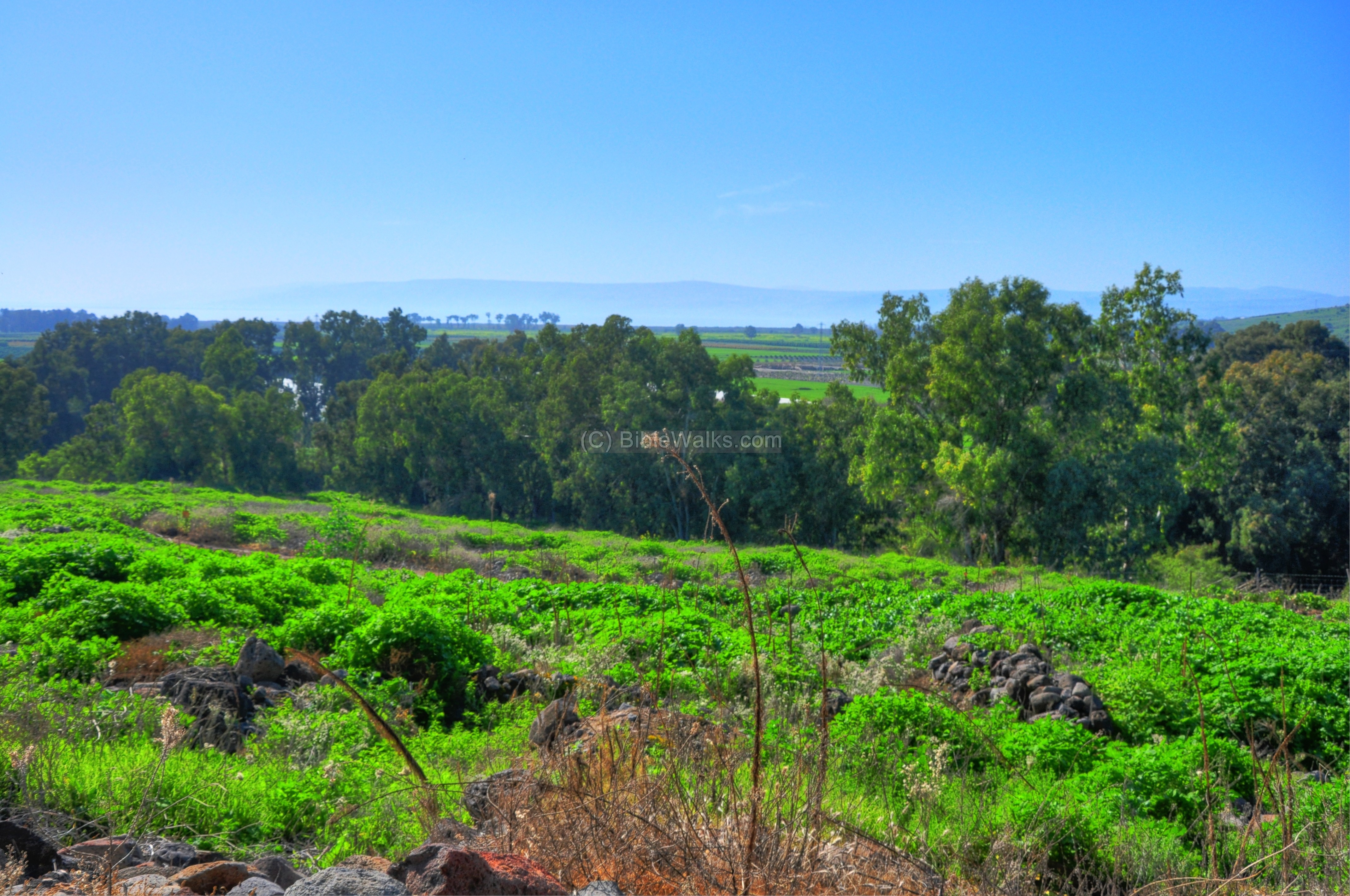
The area of BethSaida is located at the fertile delta of the upper Jordan river, when it enters to the sea of Galilee. The site is located on a hill, several hundred meters to the east of the Jordan river, and 30M higher than the valley. It is 1.5KM north of the northern shores of the sea of Galilee, and 4KM northeast to Capernaum. The ruins cover about 20 acres on the hill.
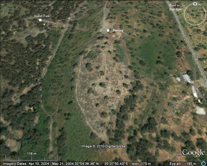
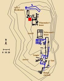
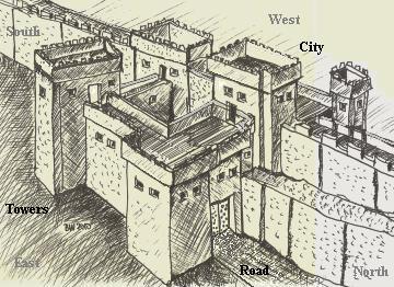
An aerial view is shown in the following picture. The major points of interest are indicated. BethSaida (Khirbet et-Tell) is located in the center, east of the Jordan Park. The access to the site is from the gate to the Jordan park. Right after passing the gate, turn left and reach the parking lot on the north side of the ruins of BethSaida.
Biblical map:
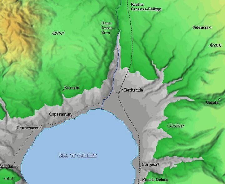
A Biblical map of Bethsaida and the area around it is illustrated below. The site is located on the crossroads of major trade routes: north to Caesarea-Philippi (Panias/Banias); south to Gadara and the Gilad; east to Aram; west thru Capernaum, Genneserat (Kinnereth), Magdala (Migdal) to the Via Maris route which crossed the land to the south.
During the Iron (Israelite) Age, it was a part of the land of Geshur, which bordered on the east side of the tribe of Asher. Later, during the Roman period, it became the fortified city of Julias.
(based on Bible Mapper 3.0)
Where exactly is BethSaida?:
The quest for the exact location of BethSaida has been one of the great mysteries of the past hundreds of years. This area of the northern part of the Sea of Galilee has many ancient sites due to its strategic place: a crossing of the ancient trade routes, a year round flow of water, the fish and game that can be found around the site, and the fertile soil in the area. There are many scattered ruined villages at the area, and for many years it was not clear which one of them is the village that Jesus has visited and performed miracles.
Finally, we may now have the answer to this mystery. According to recent excavations, Khirbet et-Tel (“the Tell”) is the right candidate for Bethsaida (“the house of the hunt”).
Recent excavations in el-Araj (Beit Ha-Bek), on the shores of the Sea of Galilee, 2km to the south, suggest an alternative place of BethSaida. That site is on the shores of the Sea of Galilee, and better fits the description of a thriving fishing village described in the Gospels.
History:
-
Biblical Period – capital city of Geshur
During the excavations at the site, there was an unexpected discovery of remains from a sizable Biblical city, which predated the events of the New Testament by a thousand years.
The archaeologists reconstructed, on the east side of the hill, remains of a massive gate complex belonging to the Iron Age. The gate led to a paved square in front of a huge palace. This was part of the fortified city, which was founded in the 10th century BC. Its size (20 acres) and location suggest this was the capital city of Geshur, and was identified as the city of Zer (or Zed). The mound included an upper city and palace on the north eastern side, and a lower city which covered the other parts of the hill.
The land of Geshur was the border of Joshua’s territory, and some of its cities were incorporated in the Israelite area (Joshua 13:11-13): “… and the border of the Geshurites and Maachathites… Nevertheless the children of Israel expelled not the Geshurites, nor the Maachathites: but the Geshurites and the Maachathites dwell among the Israelites until this day”.
Geshur was located during the time (10th century BC) on the eastern side of the Jordan river, around the area of this site. It was also the country of King David’s third wife, Maacha, mother of Absalom (2 Samuel 3:3): “…and the third, Absalom the son of Maacah the daughter of Talmai king of Geshur”. Absalom found refuge in the Geshurite city after murdering his elder brother Amnon (2 Samuel 13:37-38): “But Absalom fled, and went to Talmai, the son of Ammihud, king of Geshur. And David mourned for his son every day. So Absalom fled, and went to Geshur, and was there three years”.
Zer was a well fortified walled city. The city was protected by water on its south side, since at those times the Sea of Galilee reached the hill.
The smashed stele: One of the interesting findings in the excavations is a stele depicting a bull (illustrated on the right image). The basalt stone was found smashed to five pieces on a gate altar located at the inner side of the gate. It is believed to represent Geshurite Beth-Saida’s chief deities, smashed by the Assyrians who conquered the site. The city was destroyed by the Assyrians during their intrusions to Northern Israel.
This Assyrian destruction was by the forces of Tiglath-Pileser III in 734-732 BC during the times of King Pekah (2 Kings 15:29: “In the days of Pekah king of Israel came Tiglathpileser king of Assyria, and took Ijon, and Abelbethmaachah, and Janoah, and Kedesh, and Hazor, and Gilead, and Galilee, all the land of Naphtali, and carried them captive to Assyria.”).
As per the Eikha scroll (Lamentations 4:1): “… the stones of the sanctuary are poured out in the top of every street”.
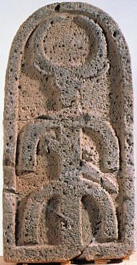
Basalt Stele 1.15M x 59cm x 31cm thick
-
Hellenistic and early Roman period
During the Hellenistic period, starting at the 3rd century BC, the ruined city was rebuilt. Josephus Flavius, the Roman historian and ex-Jewish commander, writes about BethSaida during the early Roman period. According to the Josephus, Bethsaida was given (in 30 AD) to Herod Phillip, one of the sons of Herod the great. He fortified the city and renamed it to Julias, in honor of Caesar’s daughter and Augustus’s powerful third wife, so that implies that the city was important. Herod Phillip was also buried there (34 AD). * Thanks for M. Levitz for the correction
Josephus fought against the Romans during the great revolt, and during the preparations for the war (66 AD) he was wounded near Bethsaida after falling from his horse (Autobiography, 72): “… Julias, near to the river Jordan… for the horse on which I rode, and upon whose back I fought, fell into a quagmire, and threw me on the ground, and I was bruised on my wrist, and carried into a village named Cepharnome, or Capernaum”.
The excavations found residences from the Hellenistic and early Roman period. Two of the reconstructed structures are seen on the walking tour of Bethsaida, and named the “Winemaker’s house” and the “Fisherman’s house“.
The archaeologists also found a 1st century AD building (20M x 6m) with thick walls which was built over the Biblical period gate complex, believed to be a temple dedicated to the Roman imperial cult of Livia-Julia. Ritual vessels were found in the debris of the structure.
In addition to the structures, the excavations unearthed rich findings, such as coins. One of the late Roman period coins is shown on the right.
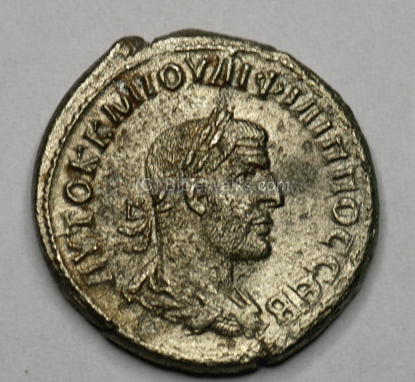
Silver Coin of Marcus Julius Philippus (“Philippus the Arab”), dated to 245AD.
He was a Roman emperor 244-248. Phillipus was born in Syria, 50KM to the east of Bethsaida.
For more coins – see a separate web page.
-
Jesus and Bethsaida
According to the New Testament, BethSaida was known as the birthplace of the Apostles Andrew, Peter, and Philip (John 1:44): “Now Philip was of Bethsaida, the city of Andrew and Peter”. The area of Bethsaida was referred in the new testament in conjunction with two of Jesus miracles: healing the blind man (Mark 8:22:”And he cometh to Bethsaida; and they bring a blind man unto him…..”), and the first feeding of the Multitude
(Luke 9:16: “”And the apostles, when they were returned, told him all that they had done. And he took them, and went aside privately into a desert place belonging to the city called Bethsaida…”).
Later, Jesus cursed Bethsaida since its Jewish residents did not follow his teachings (Matthew 11:21: “Woe unto thee, Chorazin! woe unto thee, Bethsaida! for if the mighty works, which were done in you, had been done in Tyre and Sidon, they would have repented long ago in sackcloth and ashes”). Indeed, the cursed city was destroyed during the 4th century AD.
-
Modern period
This hill of et-Tel was used as a Syrian bunker before 1967, and the area was mined. Only after the 6-day war there was access to the area east of the Jordan river, and the archaeological quest began.
The scholars debated for many years on the location of Bethsaida. The location at et-Tel was suggested in 1838 by Robinson. Excavations started here in 1987 after the Archaeologist Rami Arav recognized the significance of et-Tel while exploring the sites in the area. The excavations at Bethsaida are directed by Rami Arav on behalf of the Bethsaida Excavations Consortium which is headed by the University of Nebraska. The excavations at the site confirmed the identification.
The ruins of Bethsaida are open to the public and is a highly recommended historic and archaeological site with a great importance for Christian pilgrims.
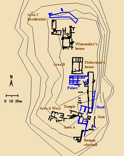
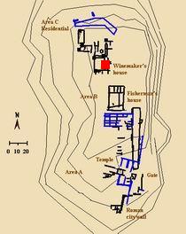
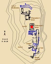
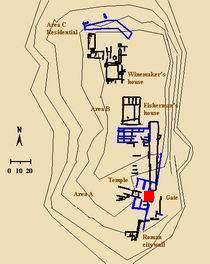
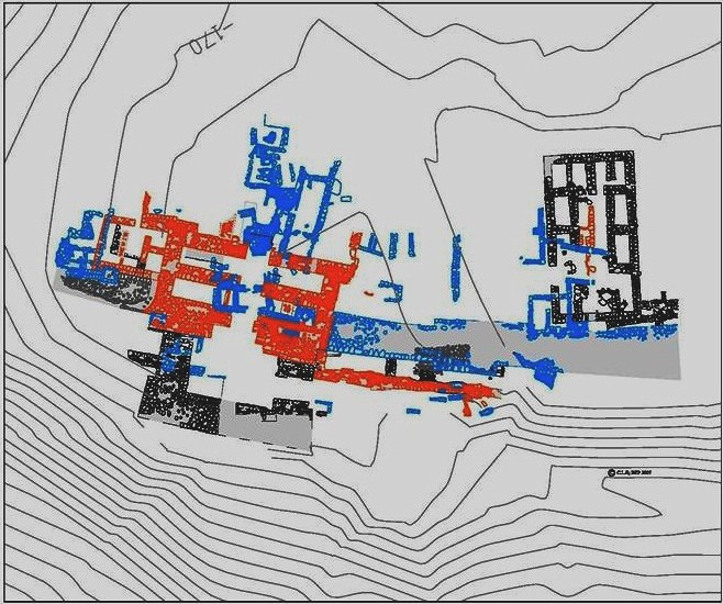
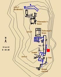
Plan of the city:
A plan of the city, as excavated until 2008, is illustrated in the diagram, based on the excavation field reports (2007). There are three main excavations areas (A, B, C).
The black structures are from the Roman period level (“Stratum 2”), while the blue structures belong to the older, lower level – the Iron age (“Stratum 5”).
The main highlights of Bethsaida are indicated on the diagram.
Photos :
General views:
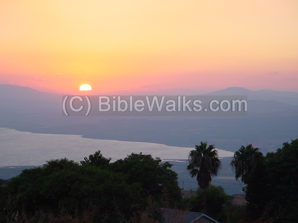
The fertile valley of Beth-Saida (Arabic – Betikha) is located on the north edge of the sea of Galilee. A view from the east towards the plains of Bethsaida, at dusk. The valley is actually the delta of the upper Jordan river which flows from the north in the rightmost corner of the sea of Galilee. The site of Bethsaida is located inland about 1.5KM.
Click on the photos to view in higher resolution…
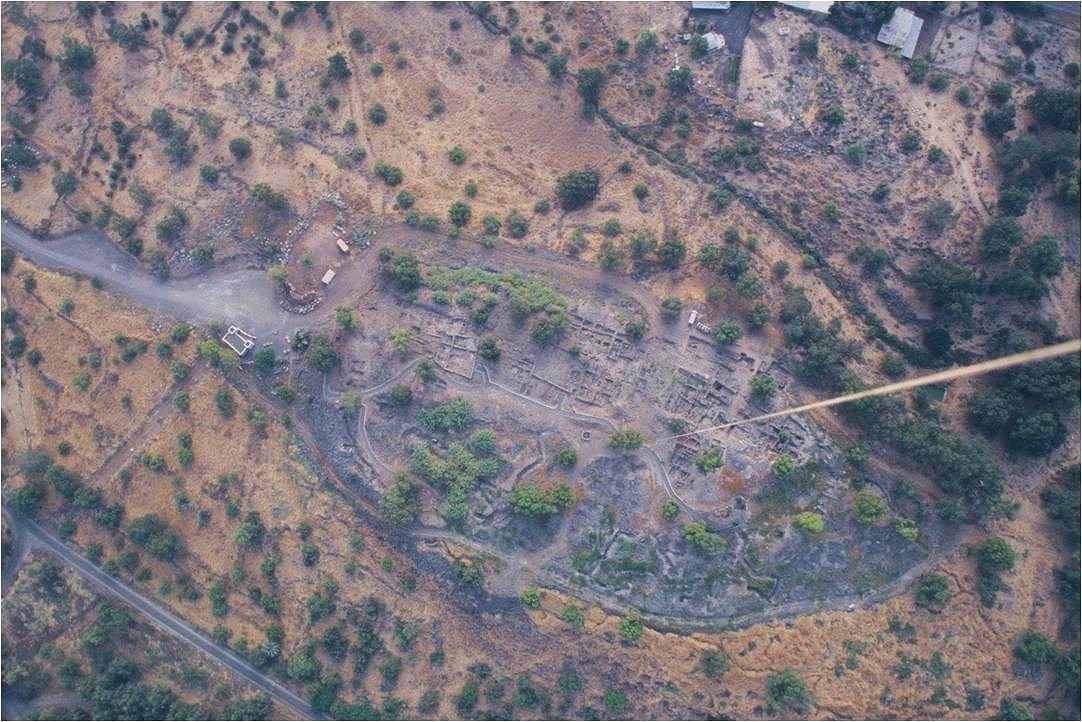
A 2009 aerial photo of the excavations is attached (courtesy of Dr R. Arav). The photo was captured with a helium-filled balloon launched from the ground, hence the white line on the right.
The following photos focus on the archaeological findings in BethSaida, arranged from north to south.
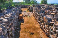
Roman Street:
A Roman period stone paved street was excavated in the residential area (“Area C”) on the northern section of the city. It is indicated on the diagram as a red square.
The north-south street passes between two residential houses – the “Winemaker’s house” on the left and other structure on the right. The view of the street is shown in the following picture, from the north side.
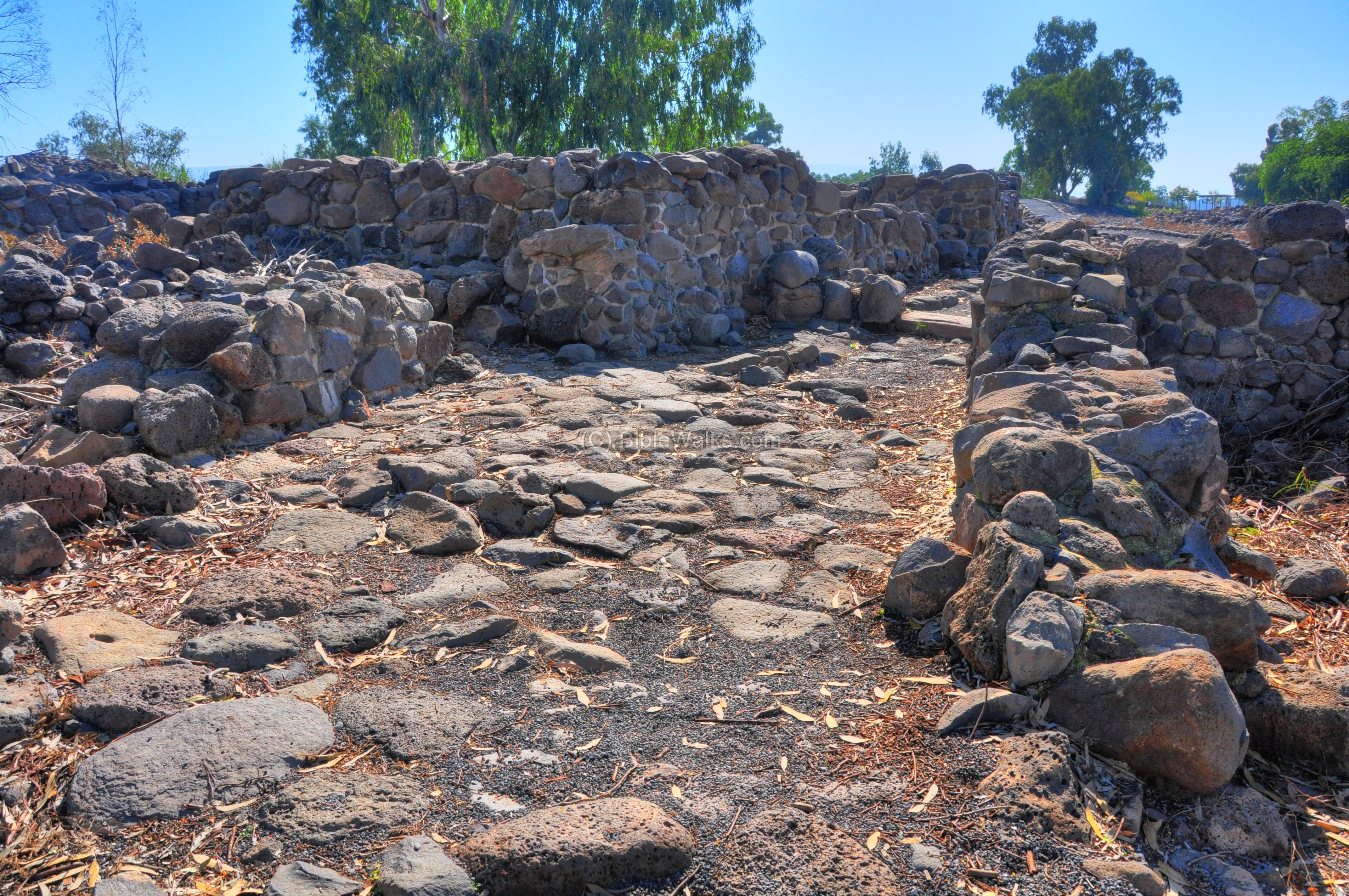
The following photo shows the street from the opposite angle.
The street passed along the walls of the “Winemaker’s house”.
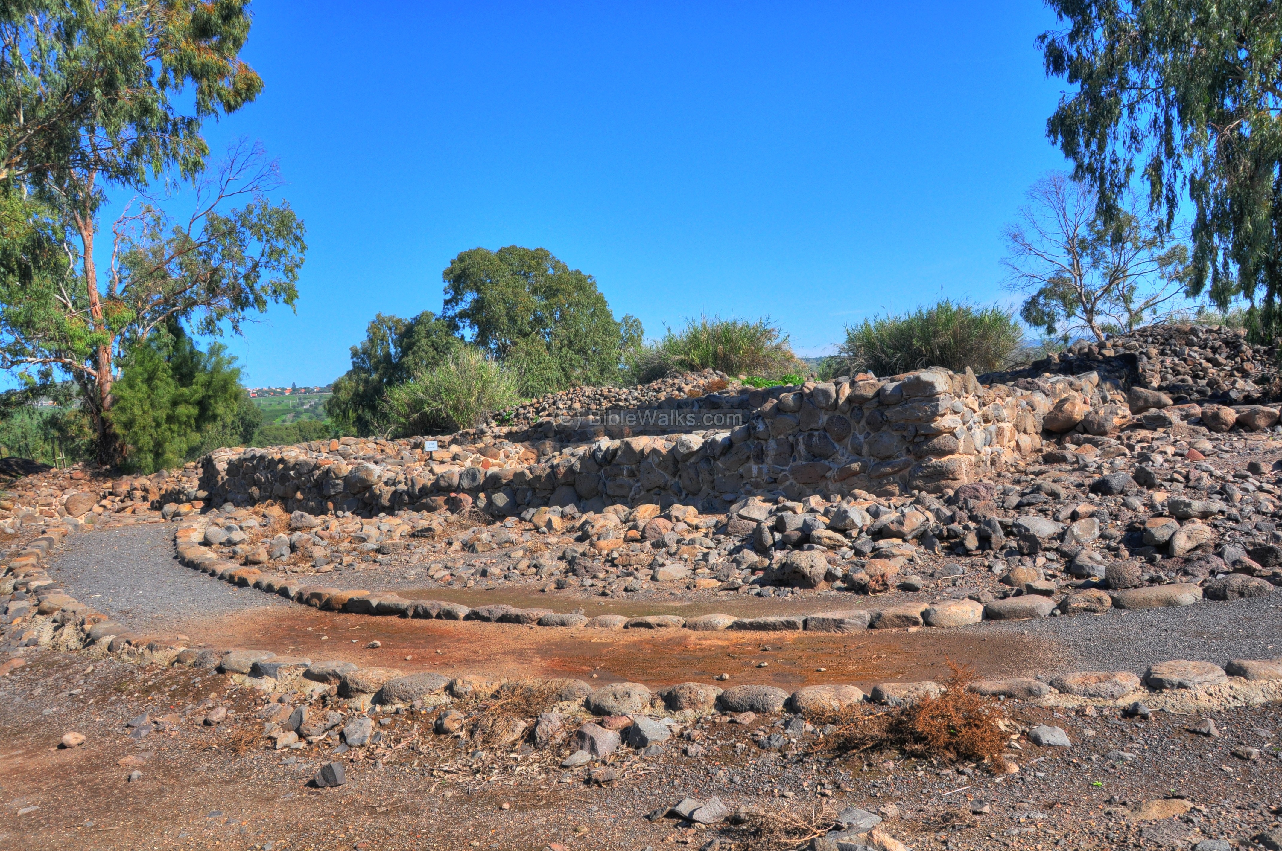
The Wine Maker’s house:
One of the reconstructed residential houses in Area C, on the north side of the city, was named “The Wine Maker’s” house since a wine cellar was found in the complex. It is marked as a red square on the diagram.
A view of the “Wine Maker’s” house, from the west side, is shown below. The entrance to the house was from the right (south) side.
A reconstruction of the winemaker’s house is illustrated on the right.
This house was a 2 story structure, with a large courtyard on the street side, residence rooms on the north side, and a wine cellar on the east side. The house is dated from the Hellenistic period (2nd century BC) to the early Roman period (1st century AD). 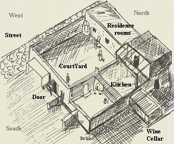
The central courtyard, as viewed from the south-east side, is below.
The residence rooms were located on the north side of the courtyard. A large shard incised with a cross was found in the entrance from the courtyard to the rooms.
The wine cellar, which is shown in the photo underneath, was located on the external east side of the house. It was made of several long slabs of basalt stone stretched over a pair of walls.
The following photo shows the wine cellar from the eastern side. Four large wine jars were found under the roof of the cellar. In another wine cellar in area C, in a nearby house, a total of 17 jars and jugs were found.
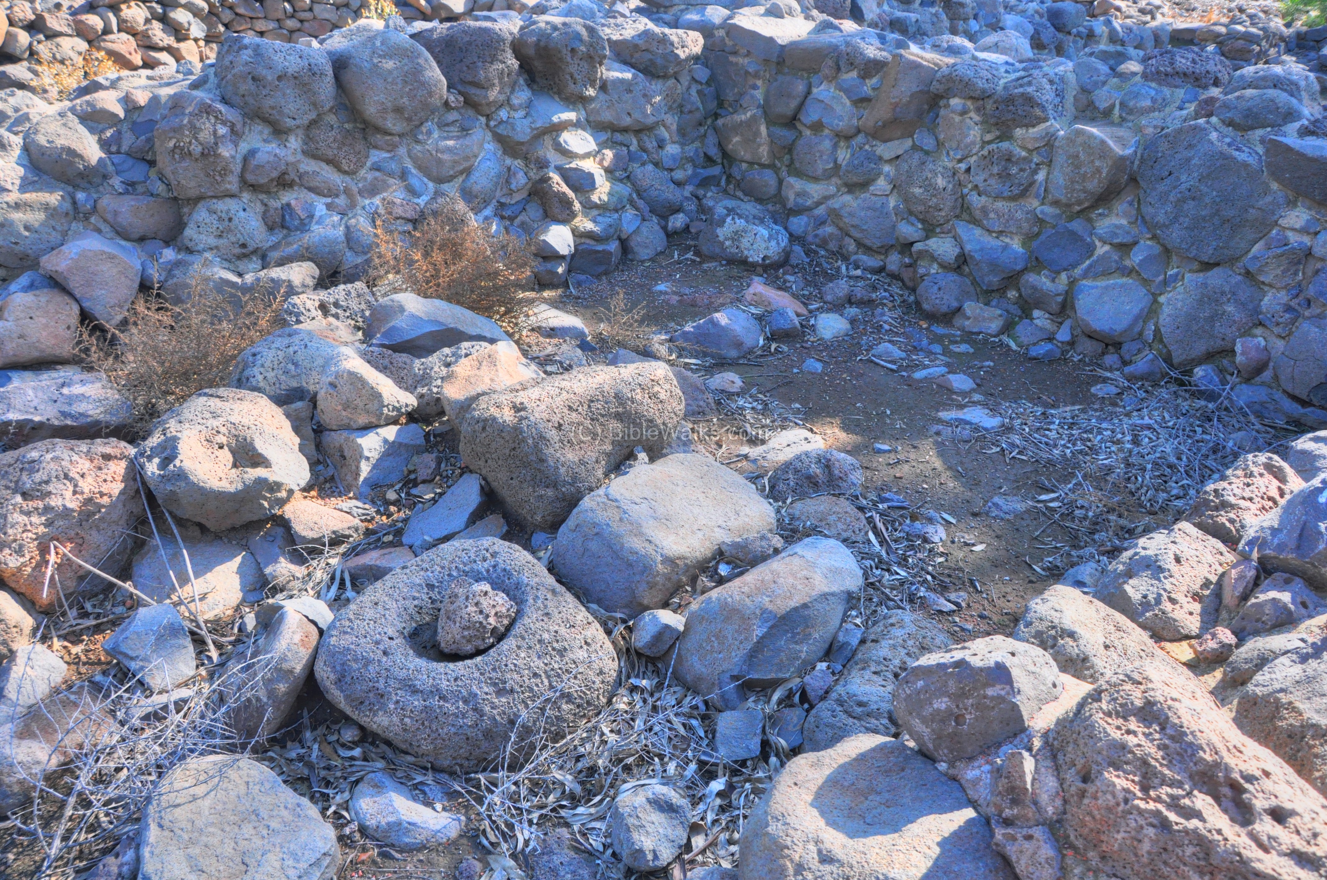
The kitchen area was located on the eastern side:
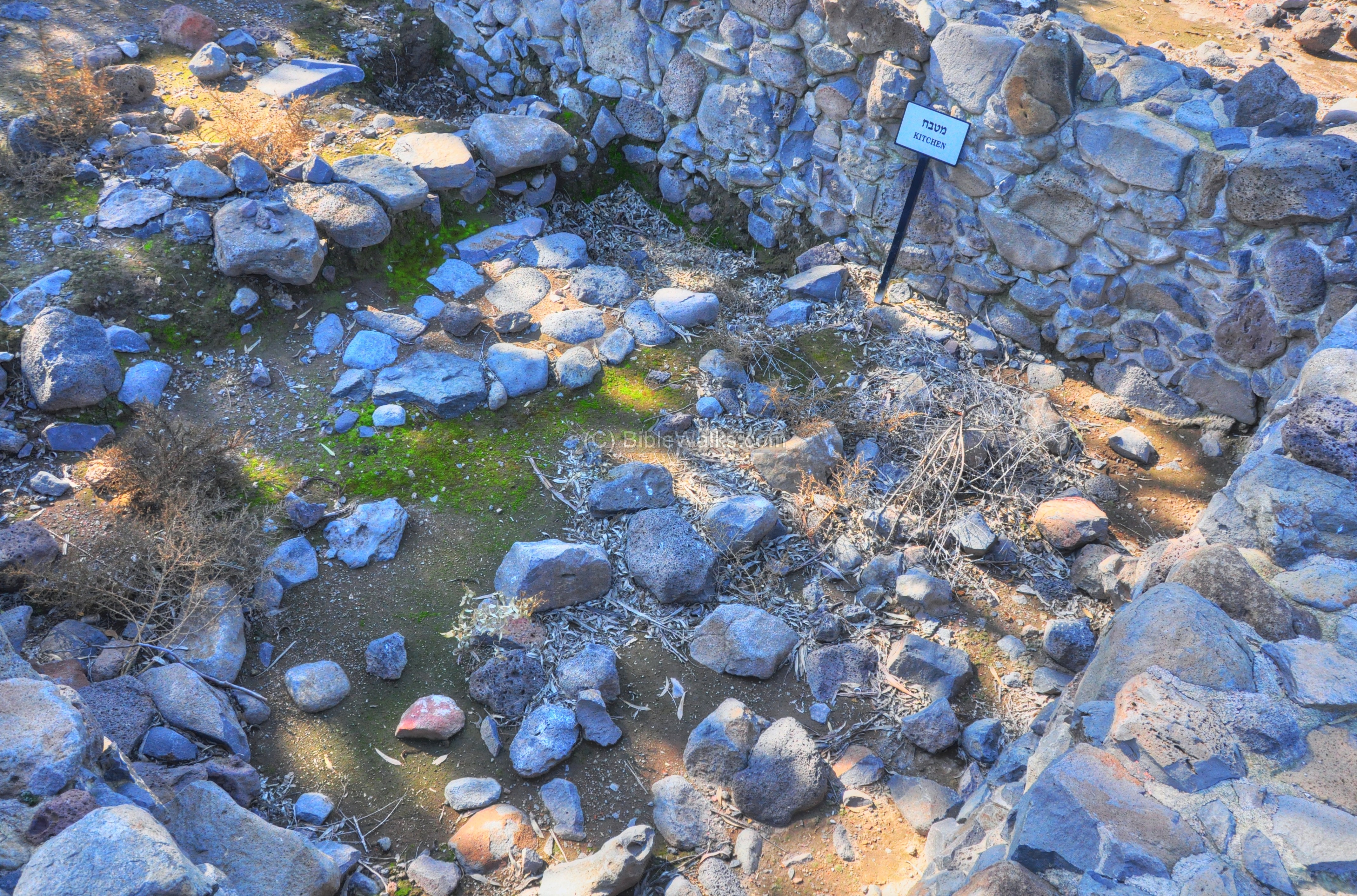
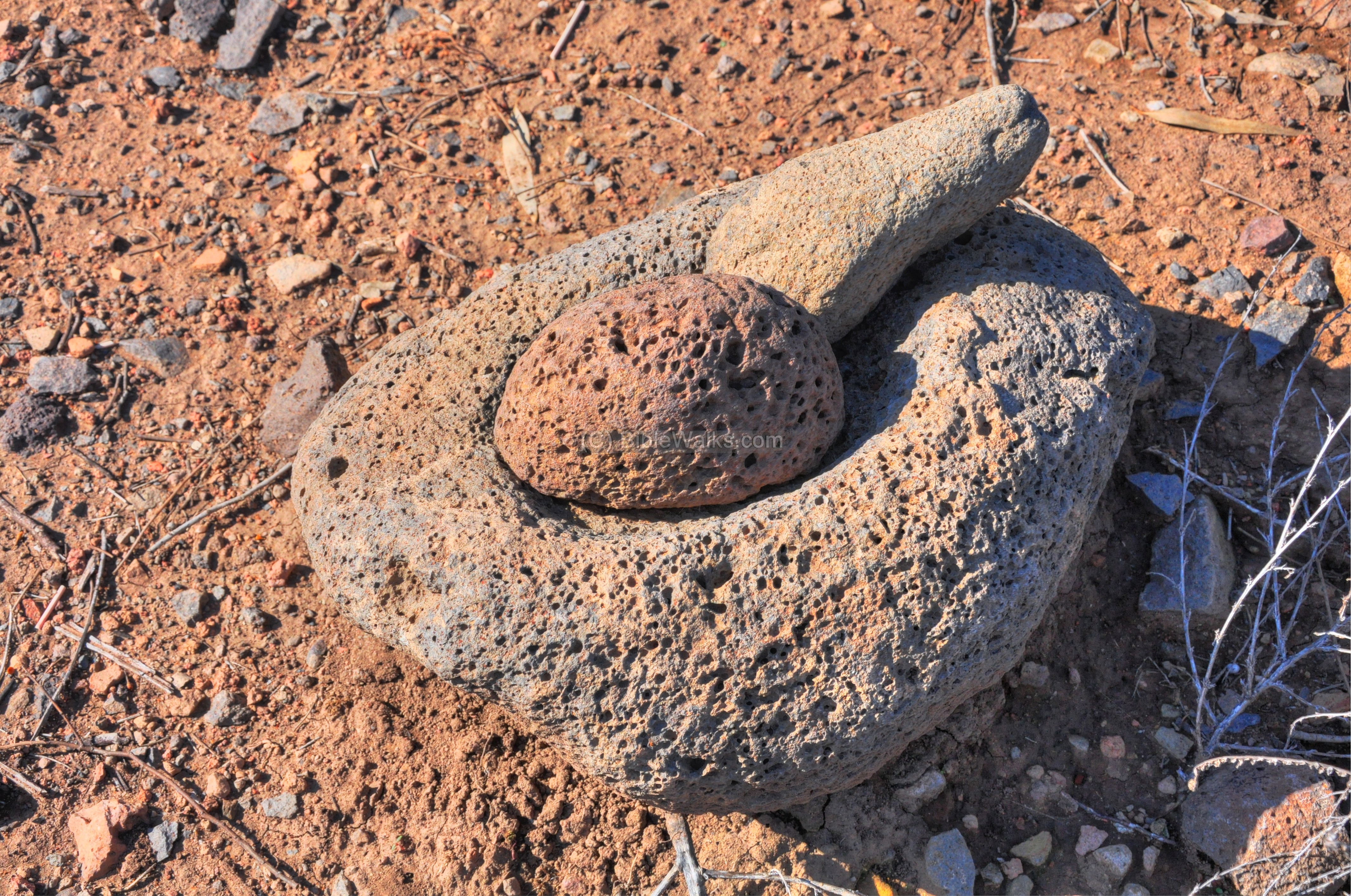
A view of one of the rooms is in the following photo. A grinding stone is located near the wall.
Another grinding stone is shown below.
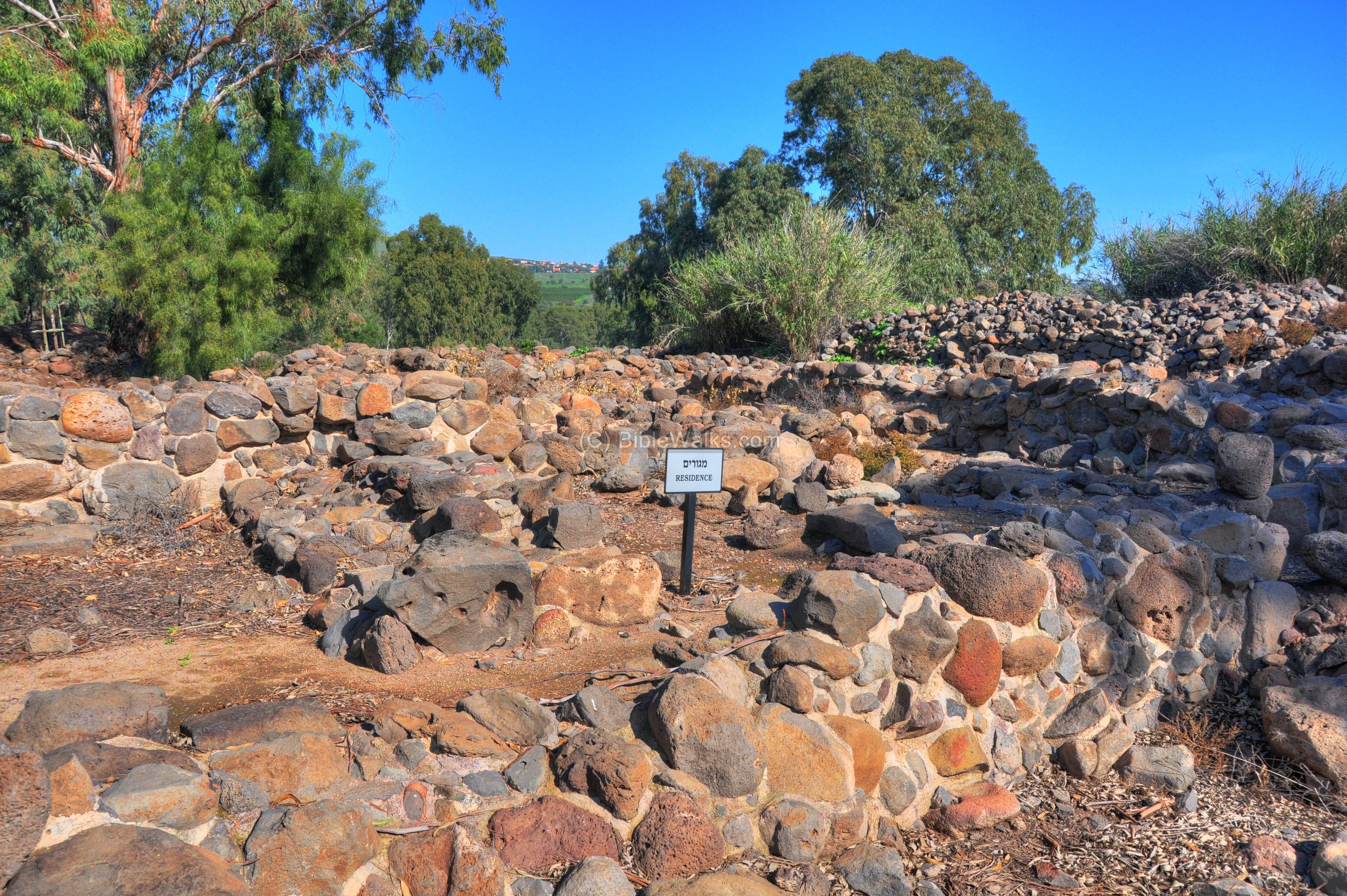
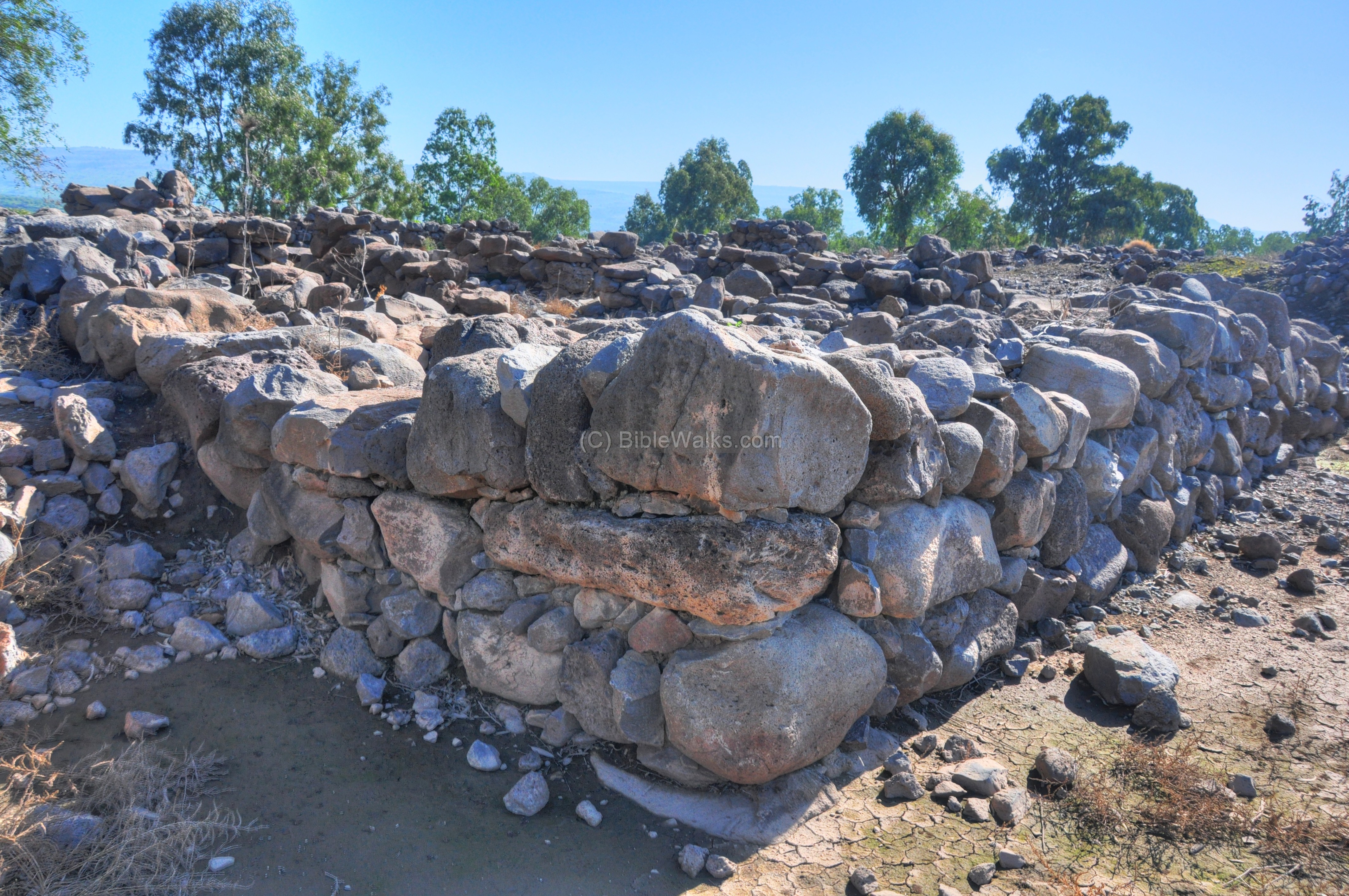
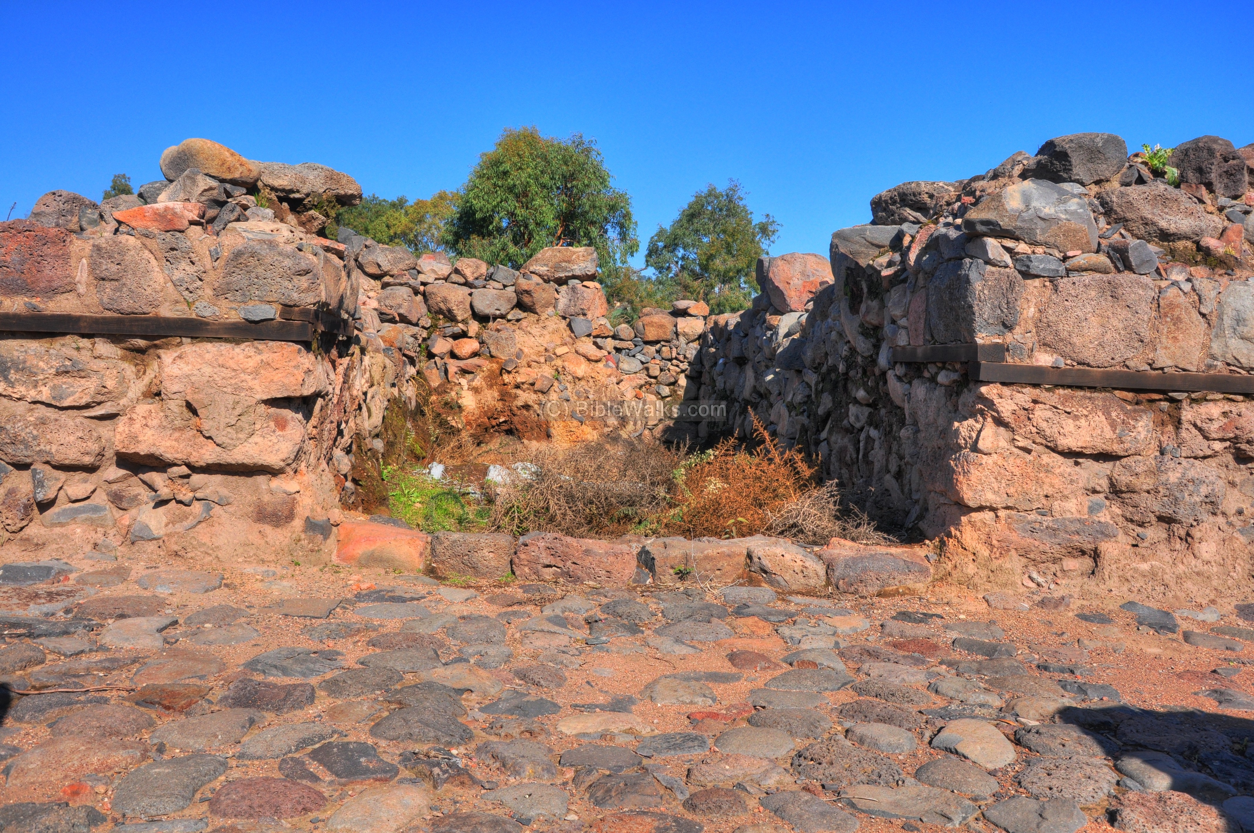
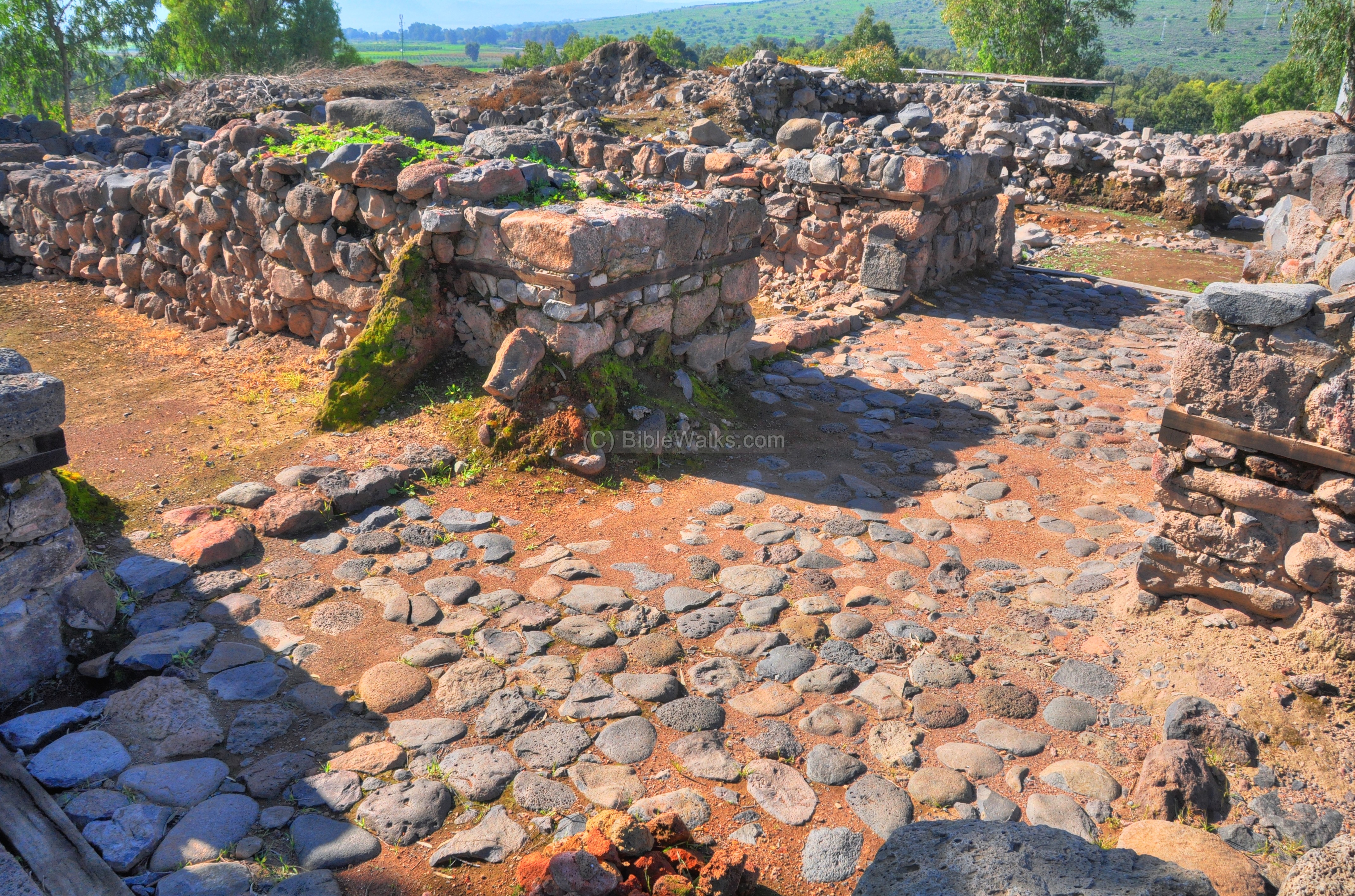
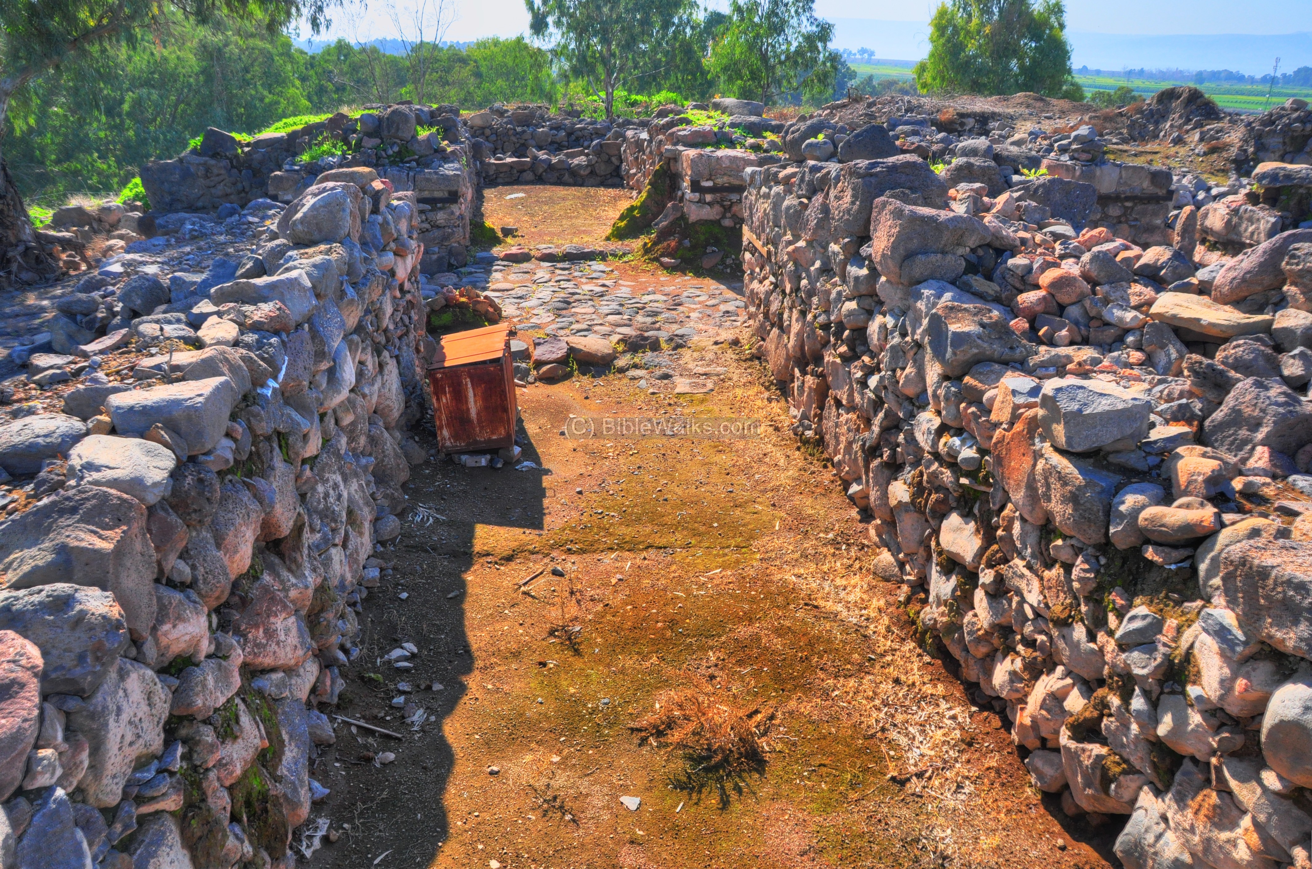
The Fisherman’s house:
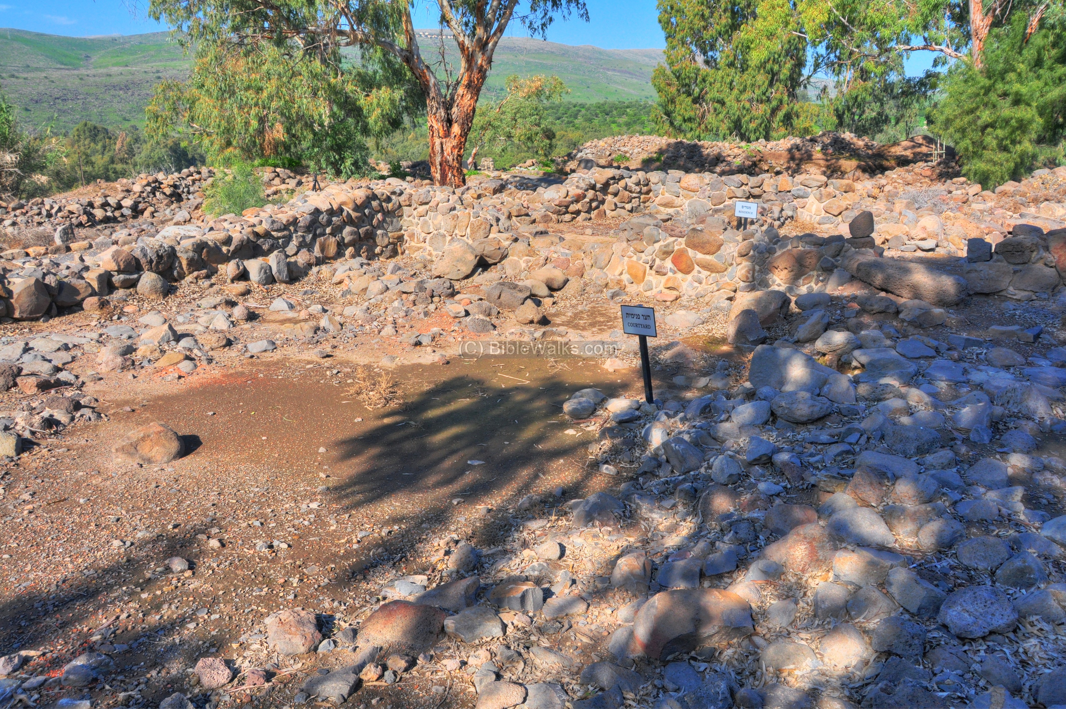
Another residential house in the Area “B”, located in the center of the hill, was named “The fisherman’s house”. It is indicated as a red square on the diagram, south of the winemaker’s house.
The entrance to the house, shown in the photo below, is from the street’s side. Past this entrance is the open courtyard. The residential rooms are located on the north and east sides.
A reconstruction of the fisherman’s house is illustrated here.
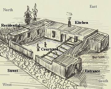
This house was a single story structure, with a large courtyard on the street side, residence rooms on the north side, and a kitchen on the east side.
The house is dated from the Hellenistic period (2nd century BC) to the early Roman period (1st century AD).
The ruins of the residential rooms on the northern side of the compound are shown in the photo below.
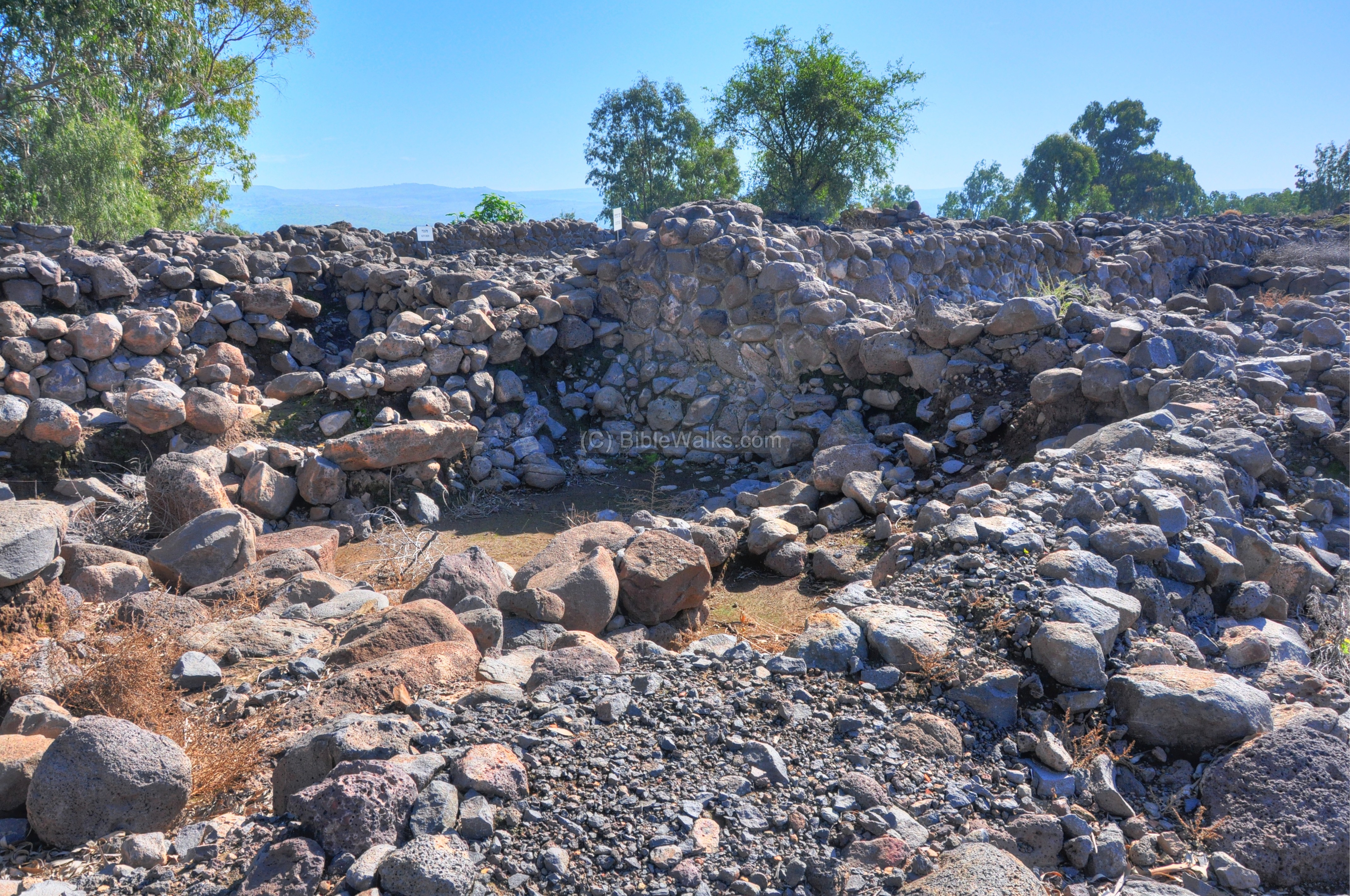
A closer view of the entrance to the courtyard is in the following photo. In the house the excavators found many fishing tools (lead weights for the nets, iron anchors, fishing hooks).
The following picture shows the ruins of the house – the central courtyard is on the north side – marked by the left white sign – while the kitchen is on the east side, marked by the right sign.
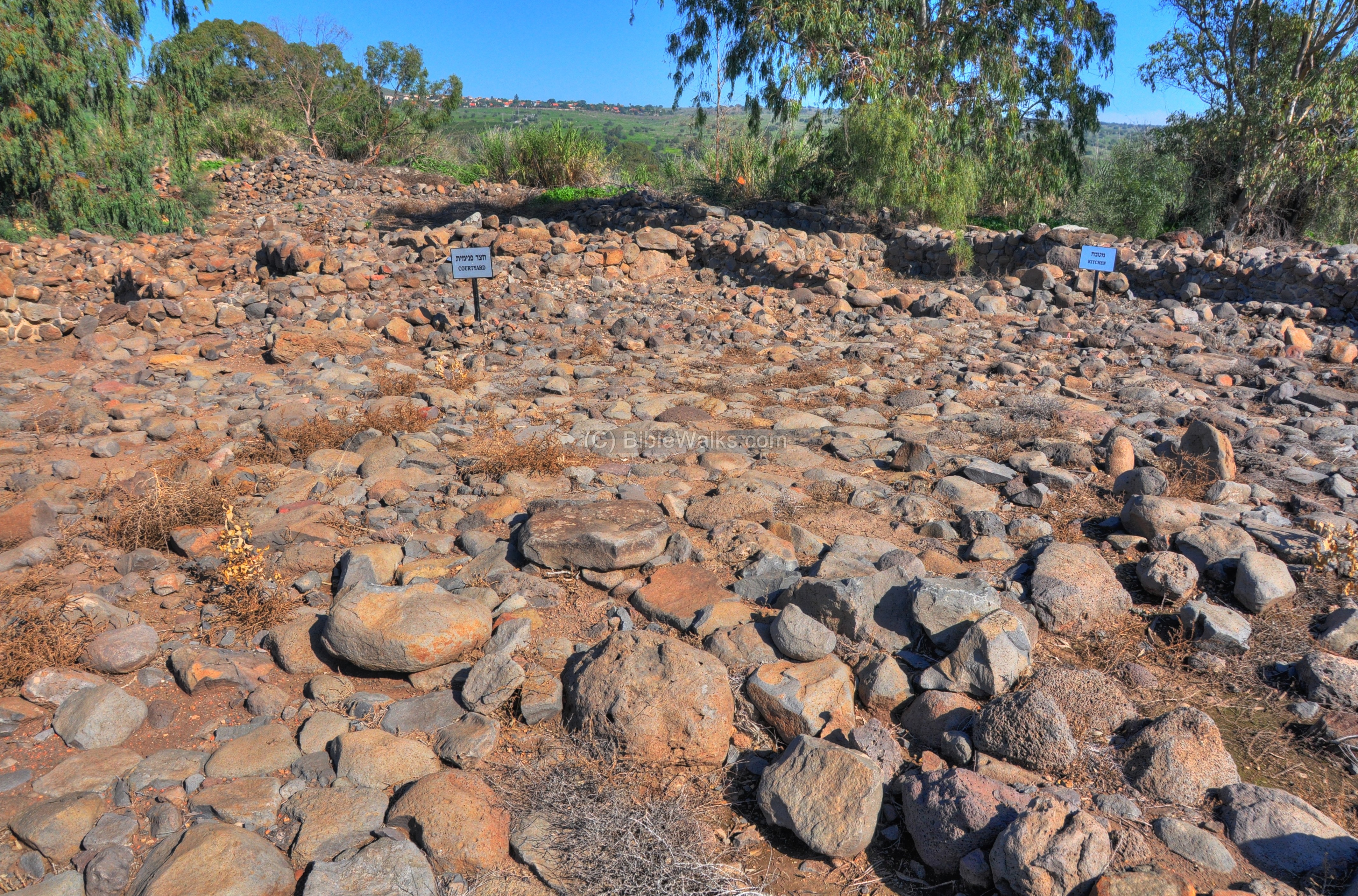
The courtyard is viewed below from the south-east side. The street passes behind the wall of the courtyard on the left side. The kitchen is on the right side near the white sign.
On the far background is Moshav Almagor (=”without fear”), a former Nahal settlement which was established in 1965.
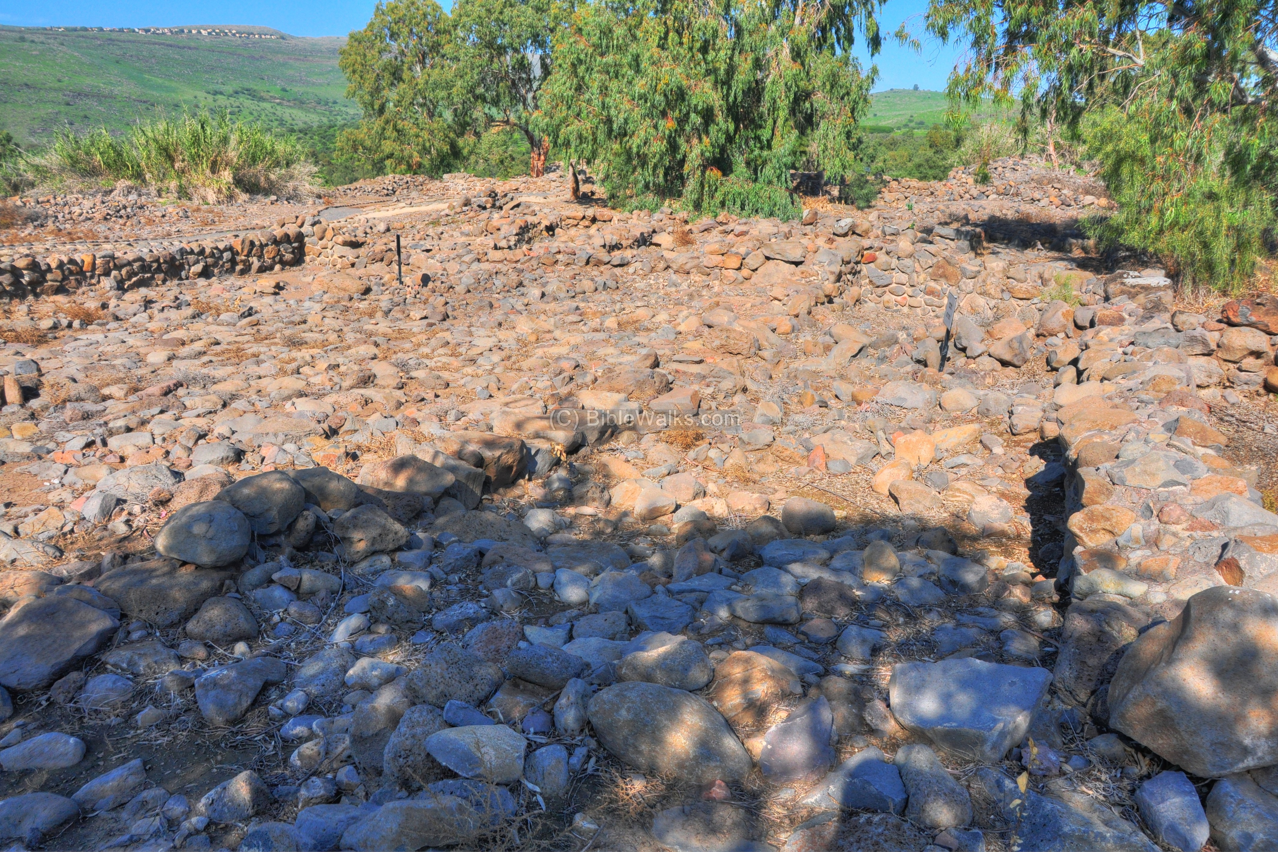
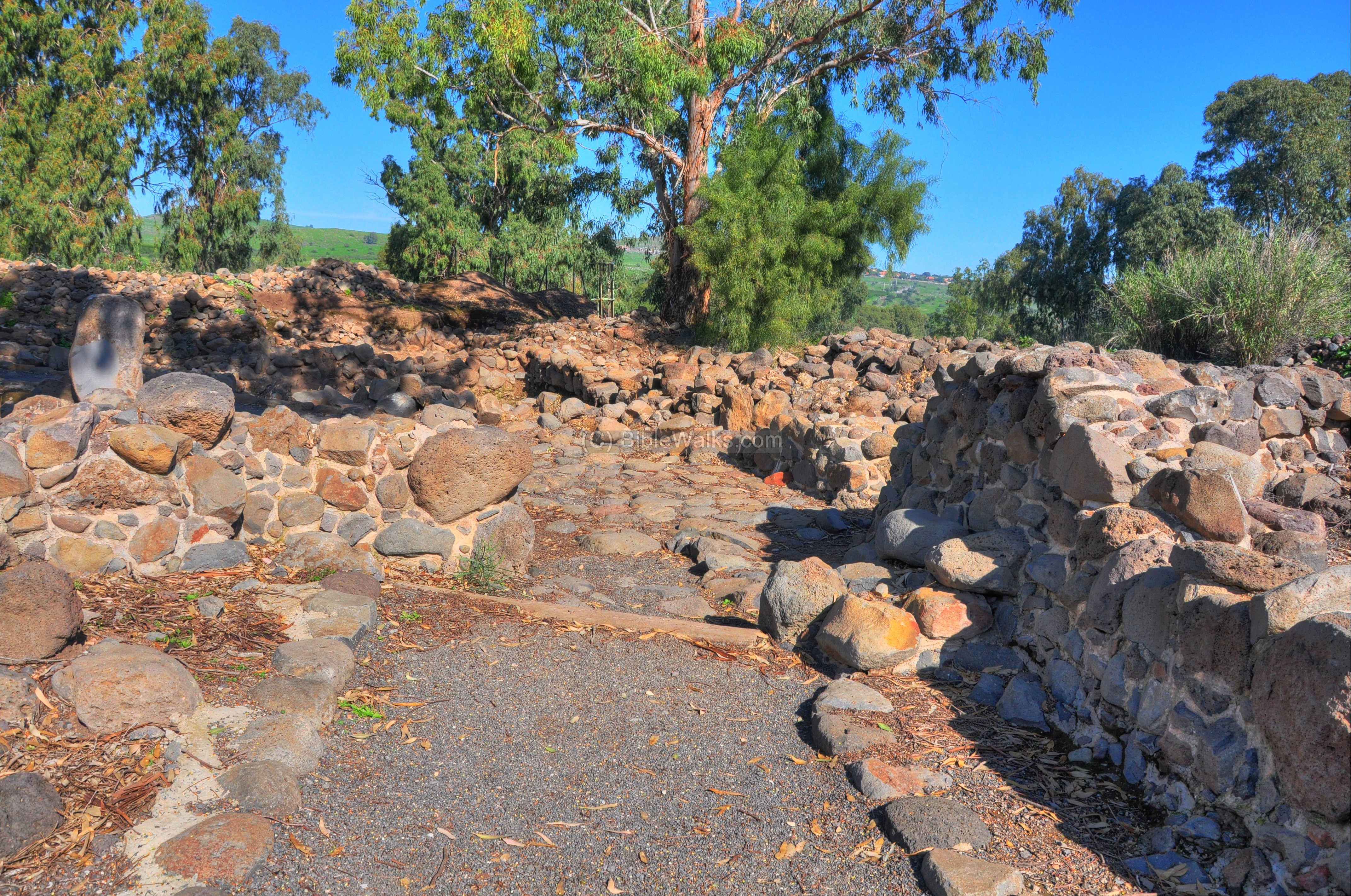
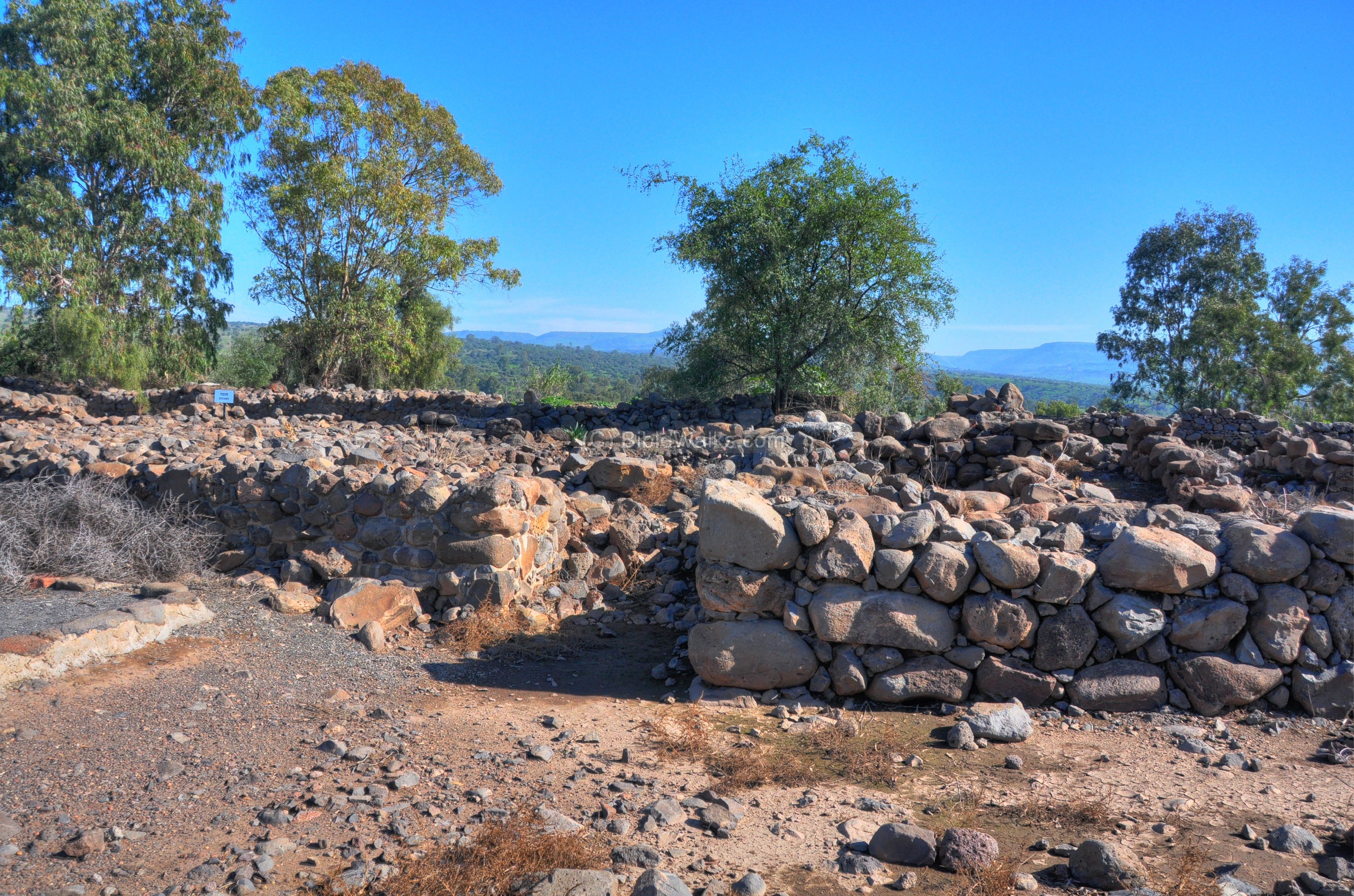
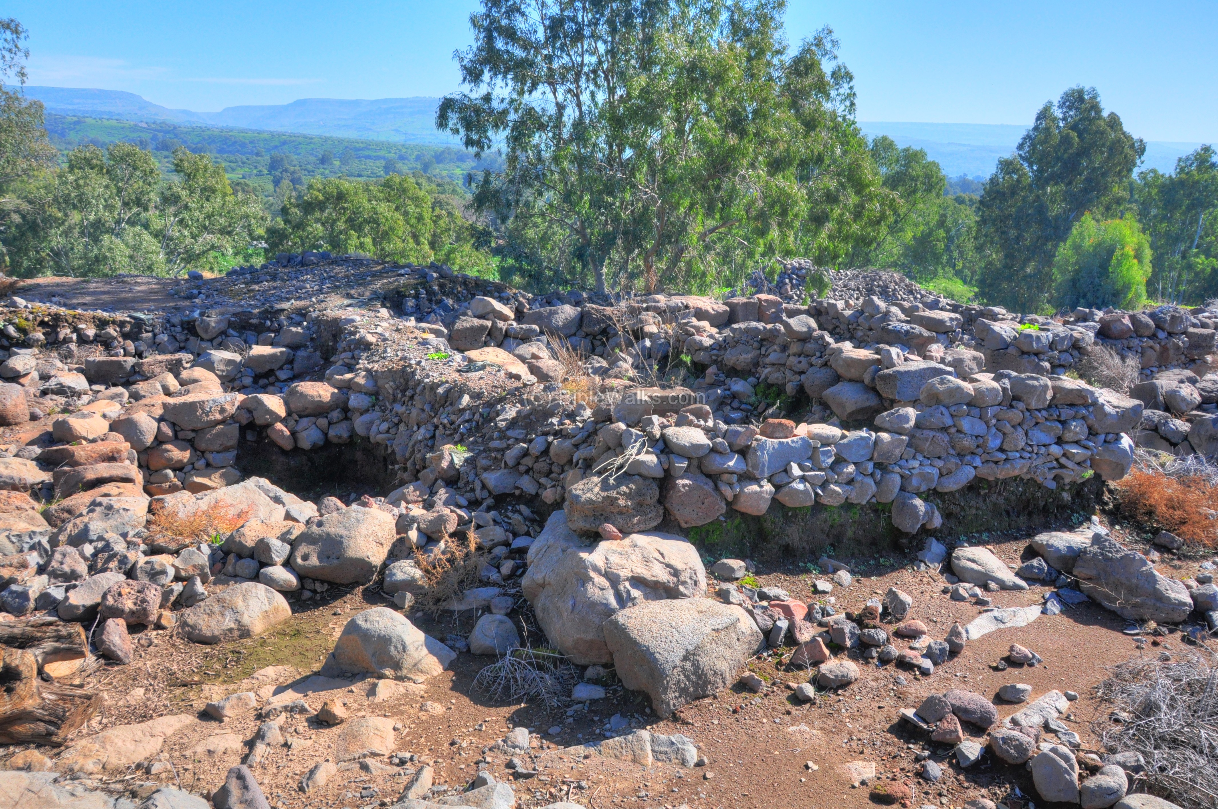
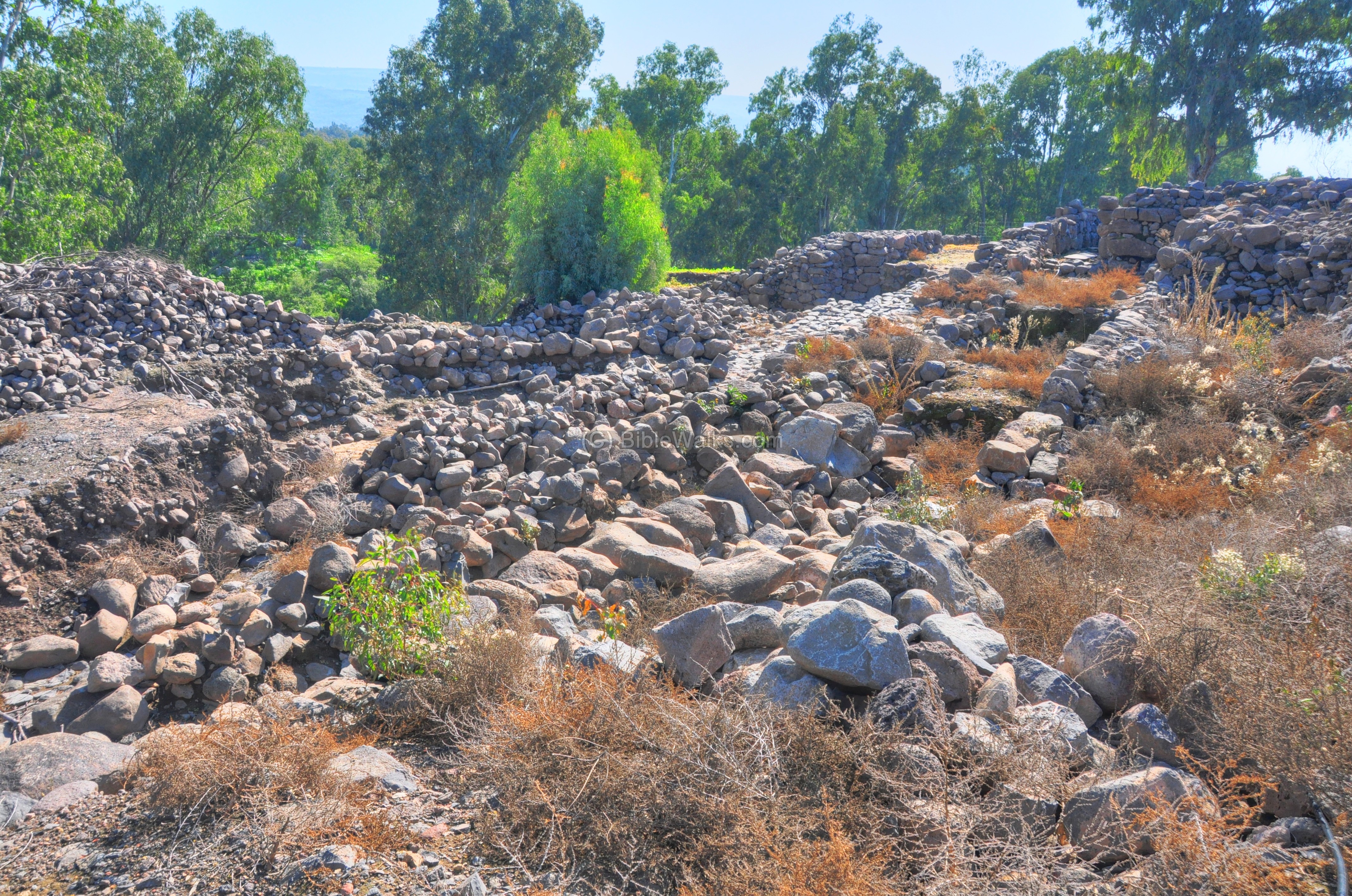
Center:
In the center of the hill (“Area B”) are additional Roman residential houses on the upper level (Roman period – “Stratum 2”), and on a lower level is the King’s palace from the Iron-age city (belonging to the Iron Age – “Stratum 5”) .
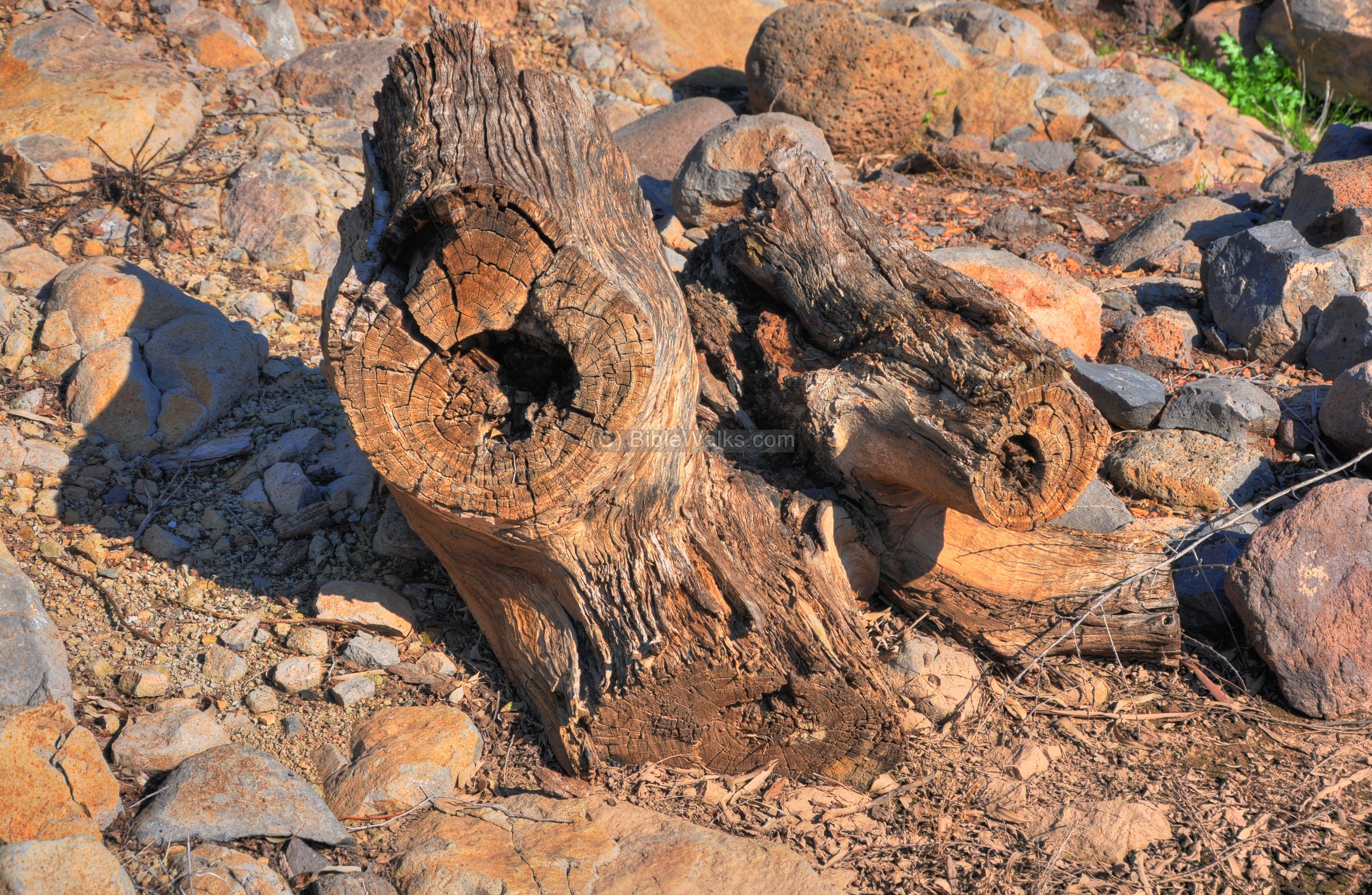
The original eucalyptus forest that covered the area, planted by the KKL in the 60s or 70s, was cleared out on most of the area. Some of the tree barks remain, adding some nice shots.
Another view of the excavations of the center is shown below.
In the far background is the settlement of Had-Ness, which was established in 1989 by settlers who were evacuated from the Sinai desert after the peace treaty with Egypt.
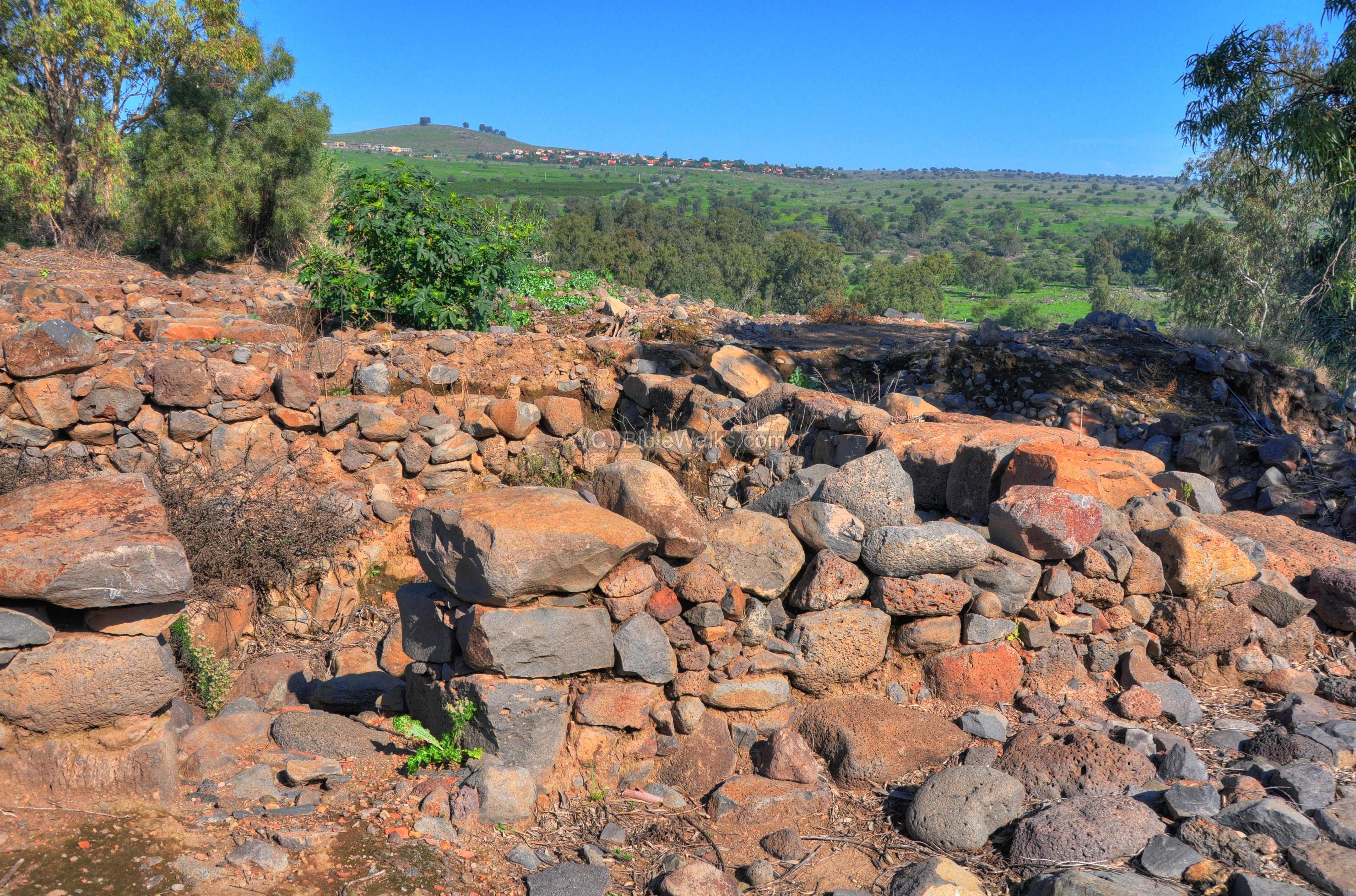
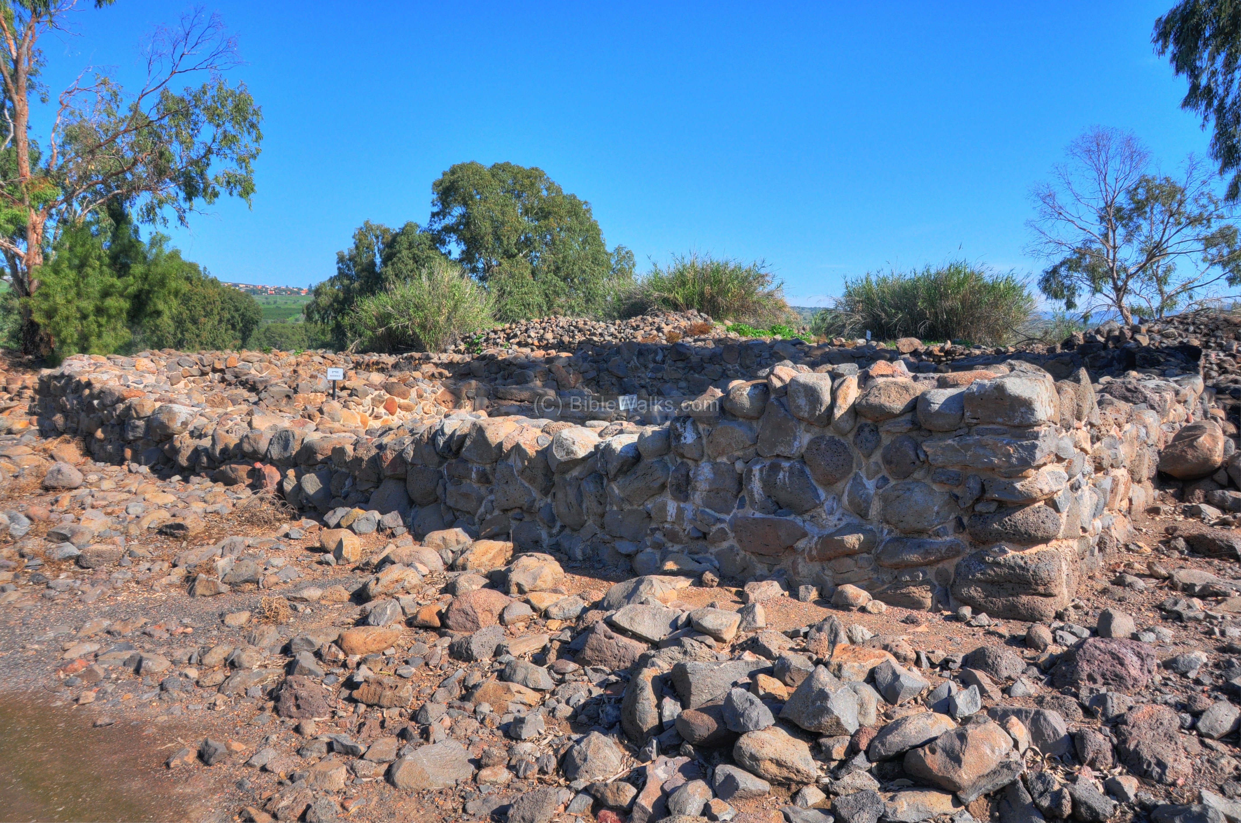
South West
New excavations (2009) are in progress in the southern side of the site (“Area A west”), which is close to the city gate.
From the southern side of the hill is a view of the fertile valley of Bethsaida. During the Iron age the Sea of Galilee reached these foothills, but now the shore is located 1.5KM away. The “upper” Jordan river, which flows into the Sea of Galilee, is on the right side.
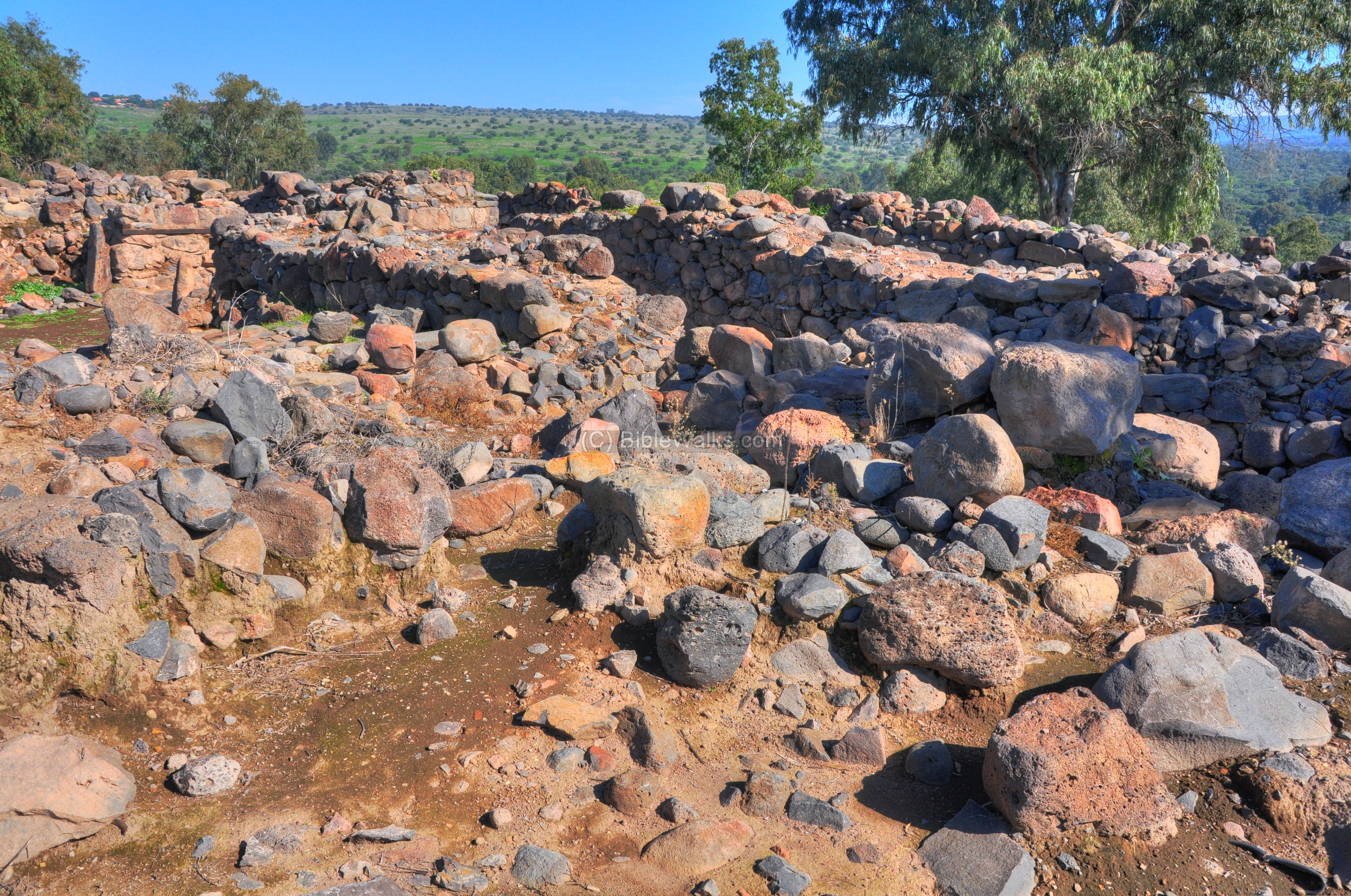
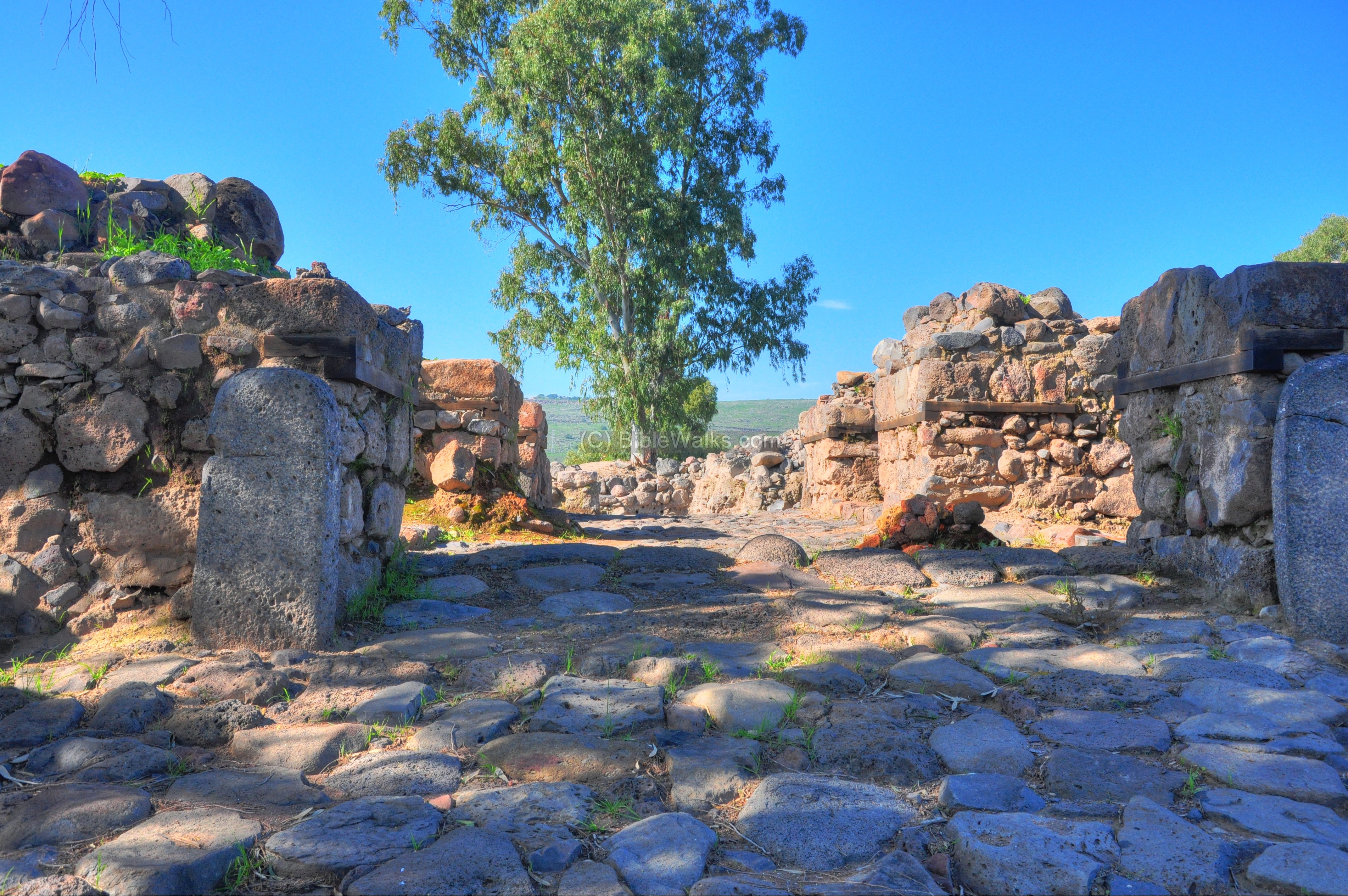
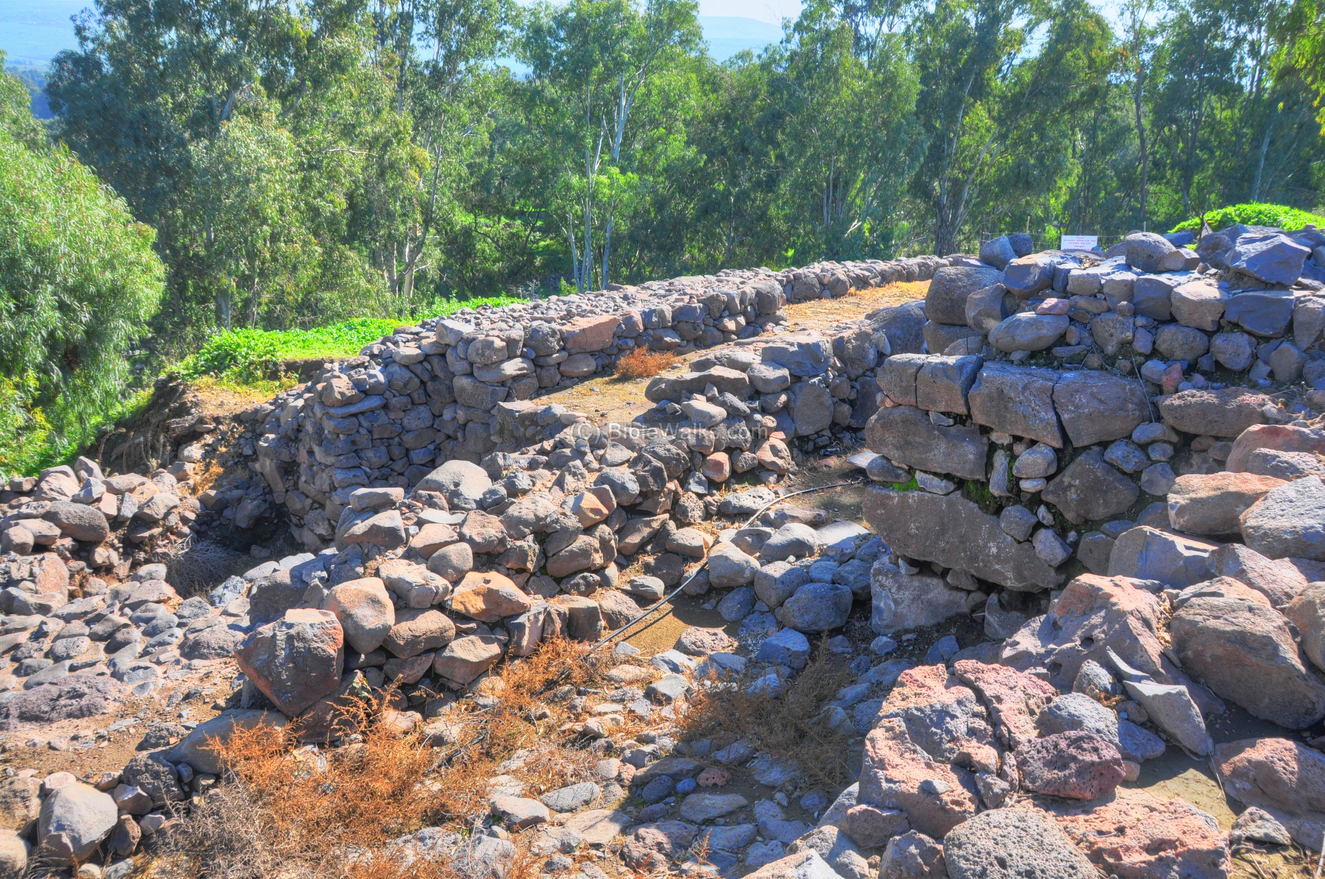
Gate Area
An Iron age city was excavated under the Roman layer, which was founded in the 10th century BC and destroyed on the 8th century BC. On the eastern side of the city the excavators reconstructed a massive gate complex. It is indicated as a red square on the diagram.
The photo below shows the gate area as viewed from the inner side of the city. The design of the inner gate was based on a four-chamber layout.
An illustration of the Iron-age city gate and walls – viewed from the external (eastern) side – is illustrated here. The width of the city walls was a massive 6M, with additional 2M for the supporting walls (buttresses).
The gate complex was composed of four towers, measuring between 6M x 6M to 8M x 10M. The The two eastern towers were thoroughly destroyed in the Assyrian (8th century BC) assault, and were not in use in the later Roman period walls.
A paved road followed the outer side of the eastern walls, and entered through an outer gateway between the two northern towers, entering a courtyard between the four towers. It then turned west into an inner gateway, passing between a four-room inner gatehouse measuring 35 x 17.5M.
-
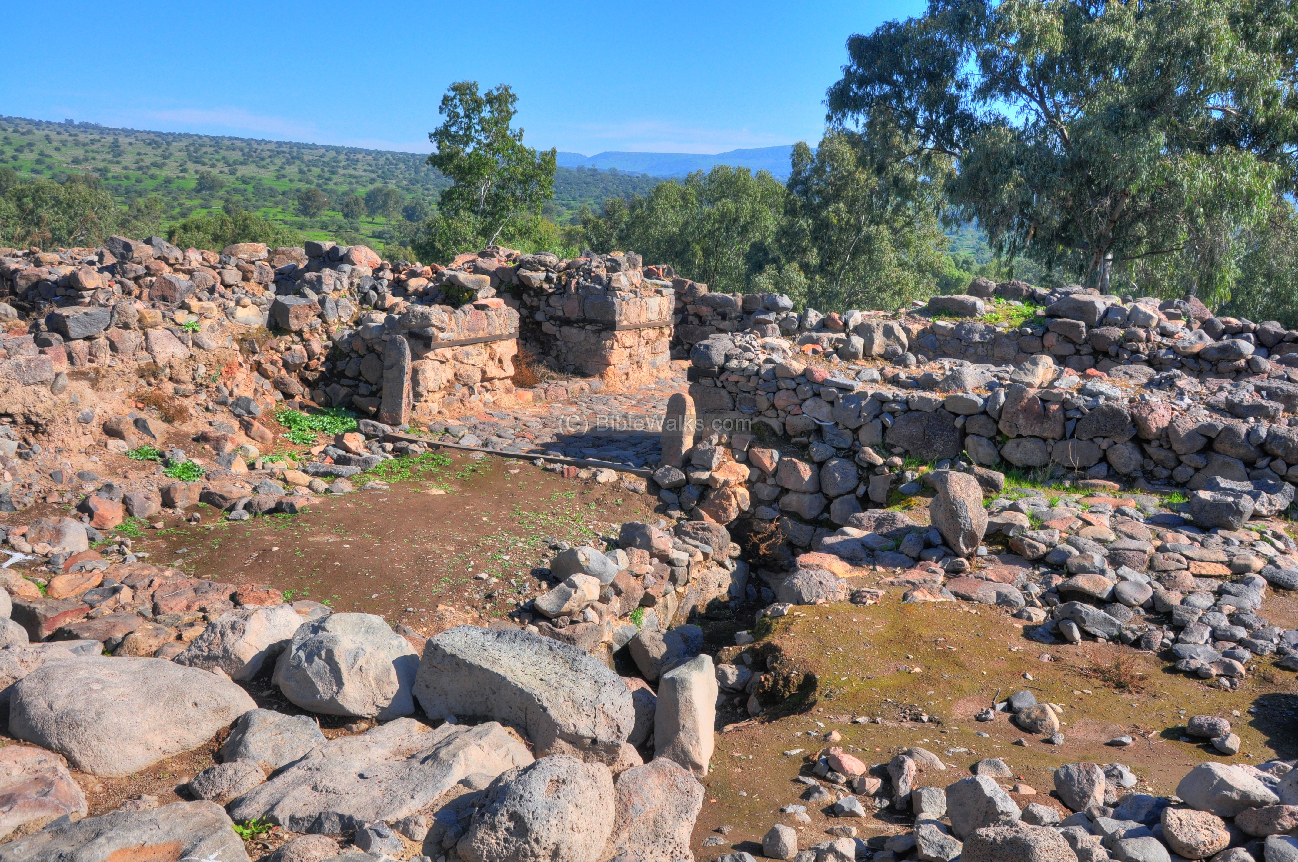
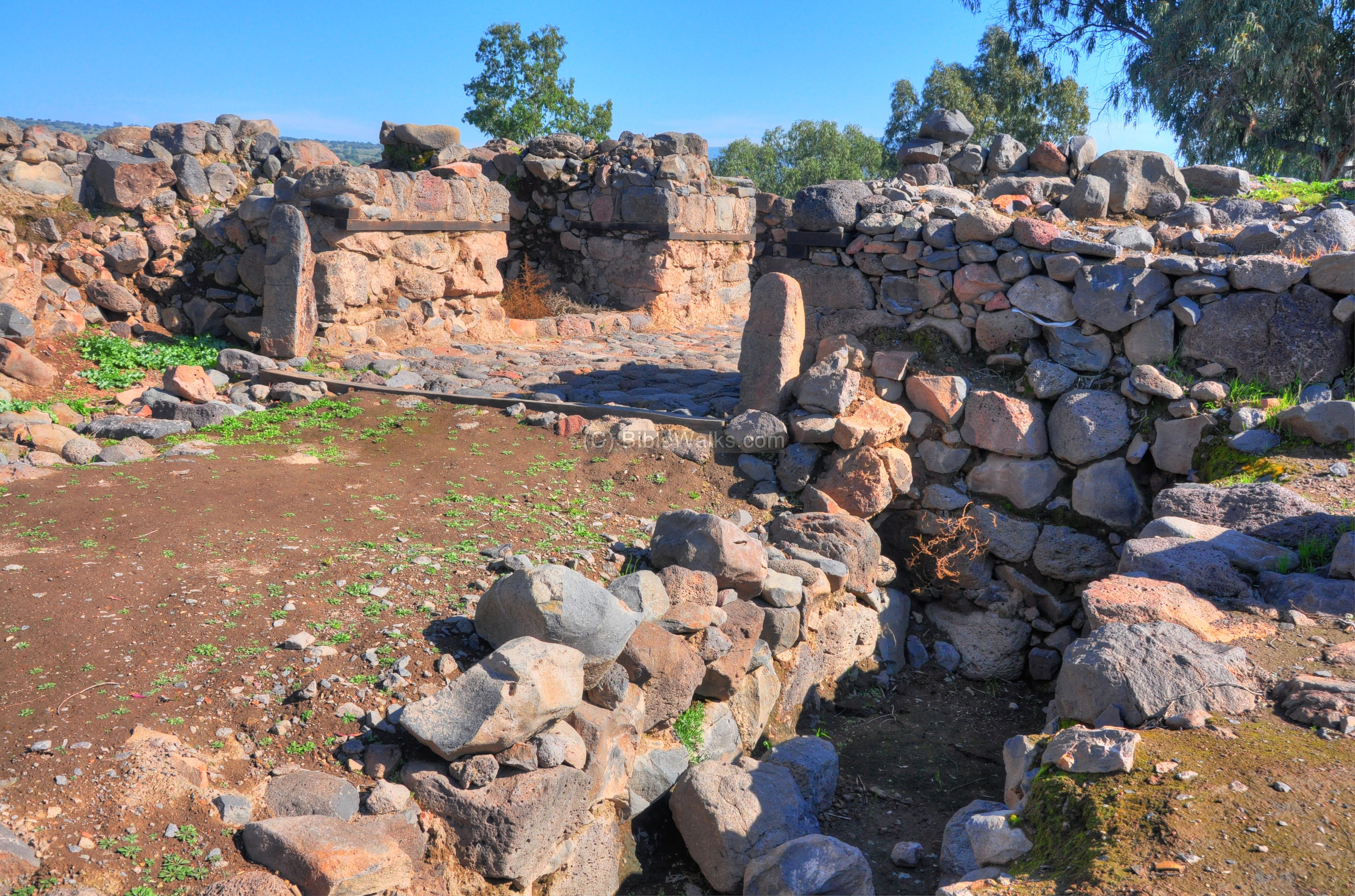
Inner Gate section
The photo below shows a south-western view of the inner side of the gate. The room on the right was a large storage room, adjacent to the two southern chambers.
-
Sacrificial high place
A closer view of the four-chamber inner gatehouse is in the following photo. Two steles stand upright on both sides of the gate. A sacrificial high place is located on the southern side of the inner gate. The pit was found to contain bones of kosher animals.
The structure is based on large basalt stones. It was reconstructed with wood beams to a height of 3M, and is the largest Biblical gate excavated in the Holy Land. The area of the four-chamber gate covers 520 square meters, compared to other cities which are smaller (Dan is 500M2, Megiddo 420M2, Dor 420M2, Beer Sheba 250 & 220M2, Ashdod 200M2 and Tell En-Nasbeh/Mizpah 180M2).
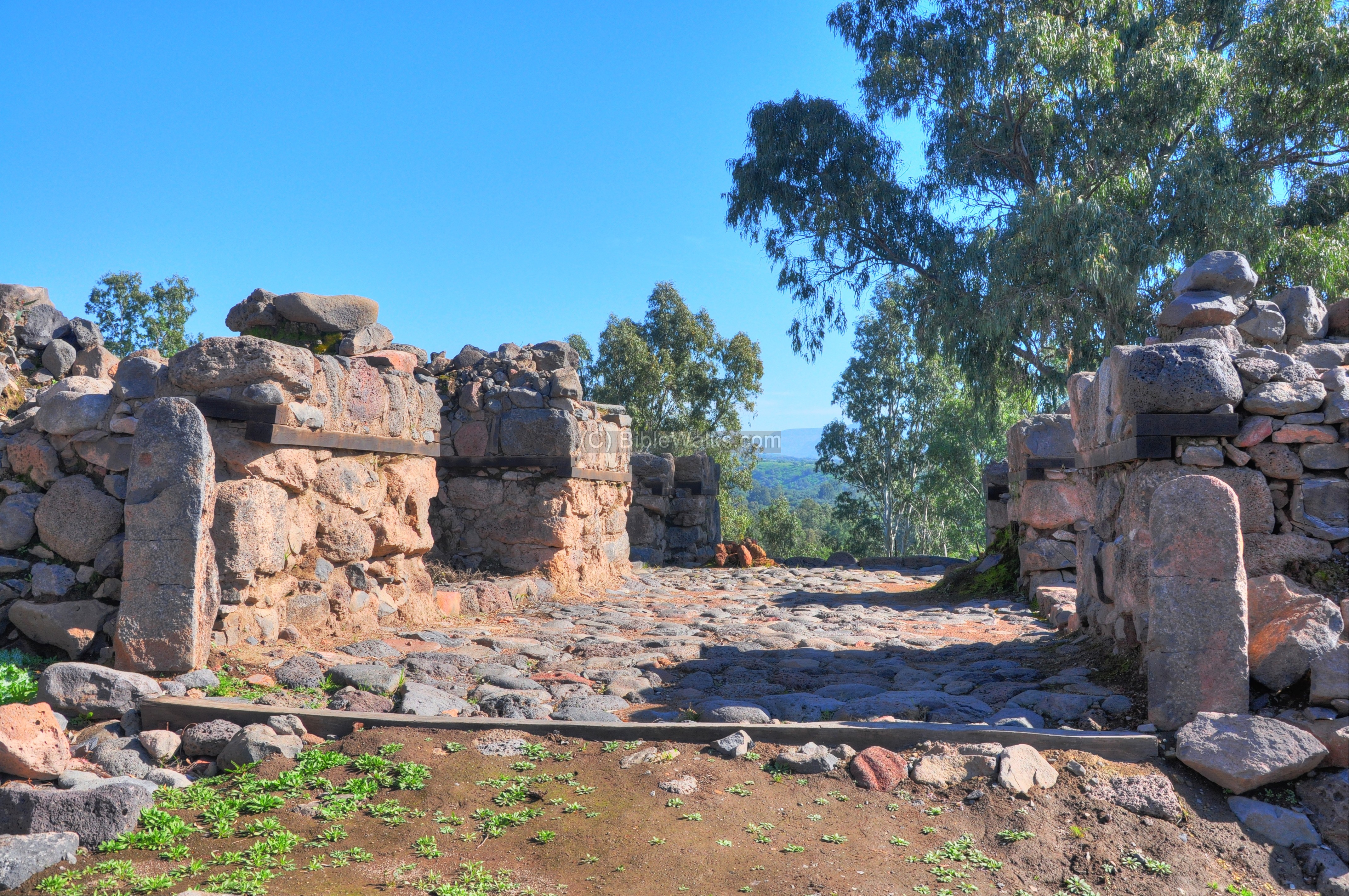
One of the four inner chambers (#3 – north-west) in the inner gatehouse is shown below.
The picture below shows another view of the four-chamber design of the inner gatehouse. These rooms served as a granary – storehouse for threshed grain or animal feed.
The north-eastern chamber (#4) in the inner gatehouse is seen in the next photo. The excavators found evidence of the 8th century BC battle that destroyed the city, with signs of fire on the bricks and carbonized wood, and arrow heads. After hundreds of years, when the city was rebuilt in the Hellenistic and Roman period, a new city wall was built over these ruins.
An aerial view of Area A, focusing on the gate area, is provided below (courtesy of the excavations director R. Arav). In the center of the picture is the four-chamber inner gate area, where two persons are working on the excavation. The outer gate courtyard is on the lower-left side, and the southern section is on the top-left side.

A ground plan of areas “A” (as above) and “B” (the center of the hill) is also attached, showing the different layers. The structures are drawn in different colors – orange and black for the Iron age (“Stratum 5”); blue for the Roman period (Stratum 2). A detailed plan from the 2008 season may be downloaded here (in pdf), courtesy of Dr. R. Arav.
-
Outer Gate section
The external side of the gate is shown in the following photo, with the inner gatehouse behind. This is the outer gate court yard, which measured roughly 15M x 15M and was surrounded by the four towers. Two steles stand on both sides of the gate, just like on the inner side.
-
Stepped High place
A gate altar (Hebrew: “Bamah”) was found in front of the inner gate house, on its right (north) side. The 1.6M x 2.1M altar is built by plastered basalt stones with two steps that lead up to the top. The pagan altars are described in many Biblical verses, such as (Ezekiel 20:29): “Then I said unto them, What is the high place whereunto ye go? And the name whereof is called Bamah unto this day”. Note the the KJV version added the Hebrew word Bamah. The “high place” is in this case just two steps up, but in most cases it was located on a high-place – on top of hills or large trees. Ezekial describes the practice (20:28): “…then they saw every high hill, and all the thick trees, and they offered there their sacrifices, and there they presented the provocation of their offering: there also they made their sweet savour, and poured out there their drink offerings”.
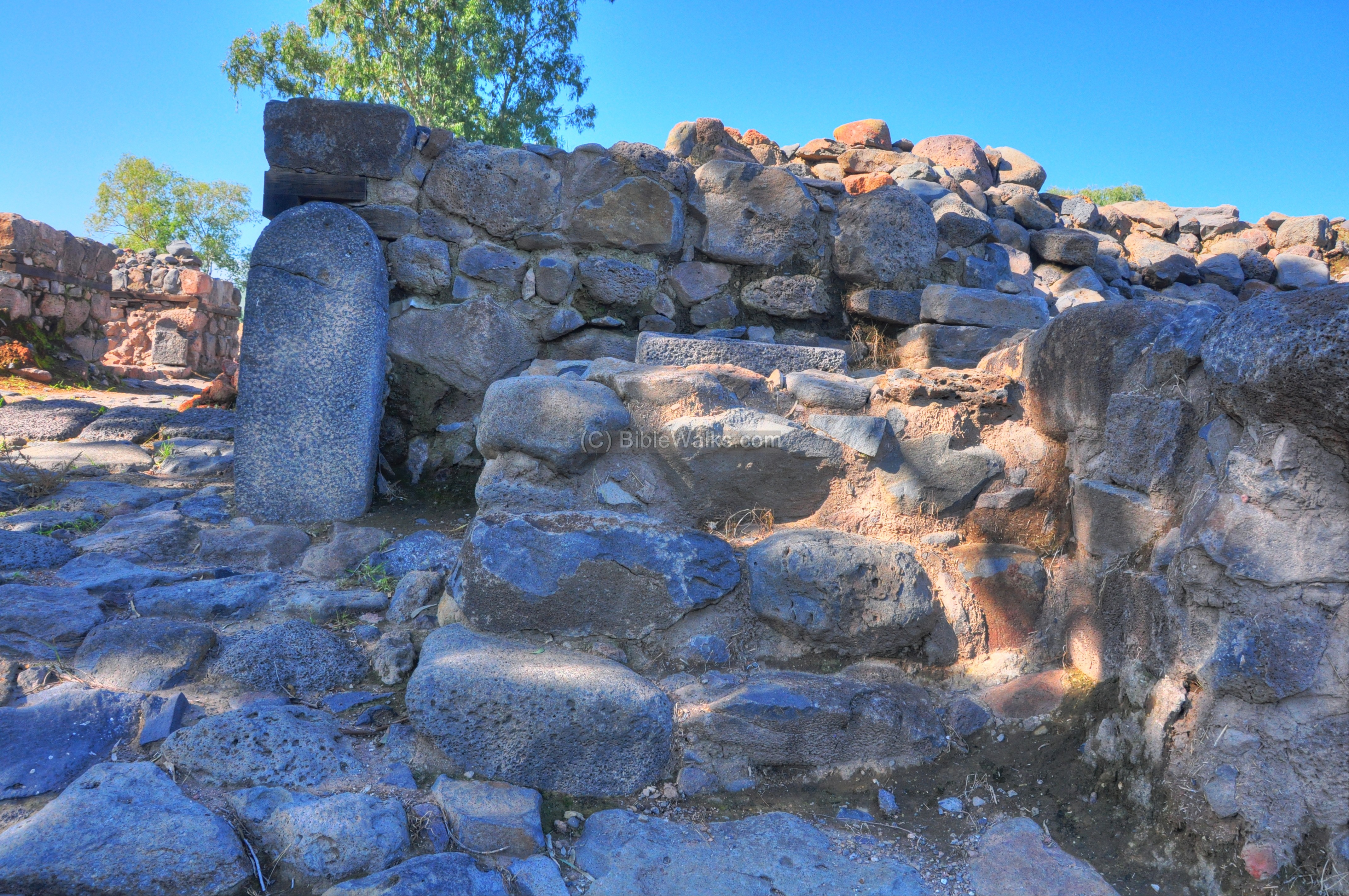
A 50 x 60cm stone basin was found on top of the altar. Near the altar was a stele bearing the figure of a horned bull. It was broken to five pieces, another evidence of the Assyrian destruction.
The following photo shows the altar and the outer gate court yard.
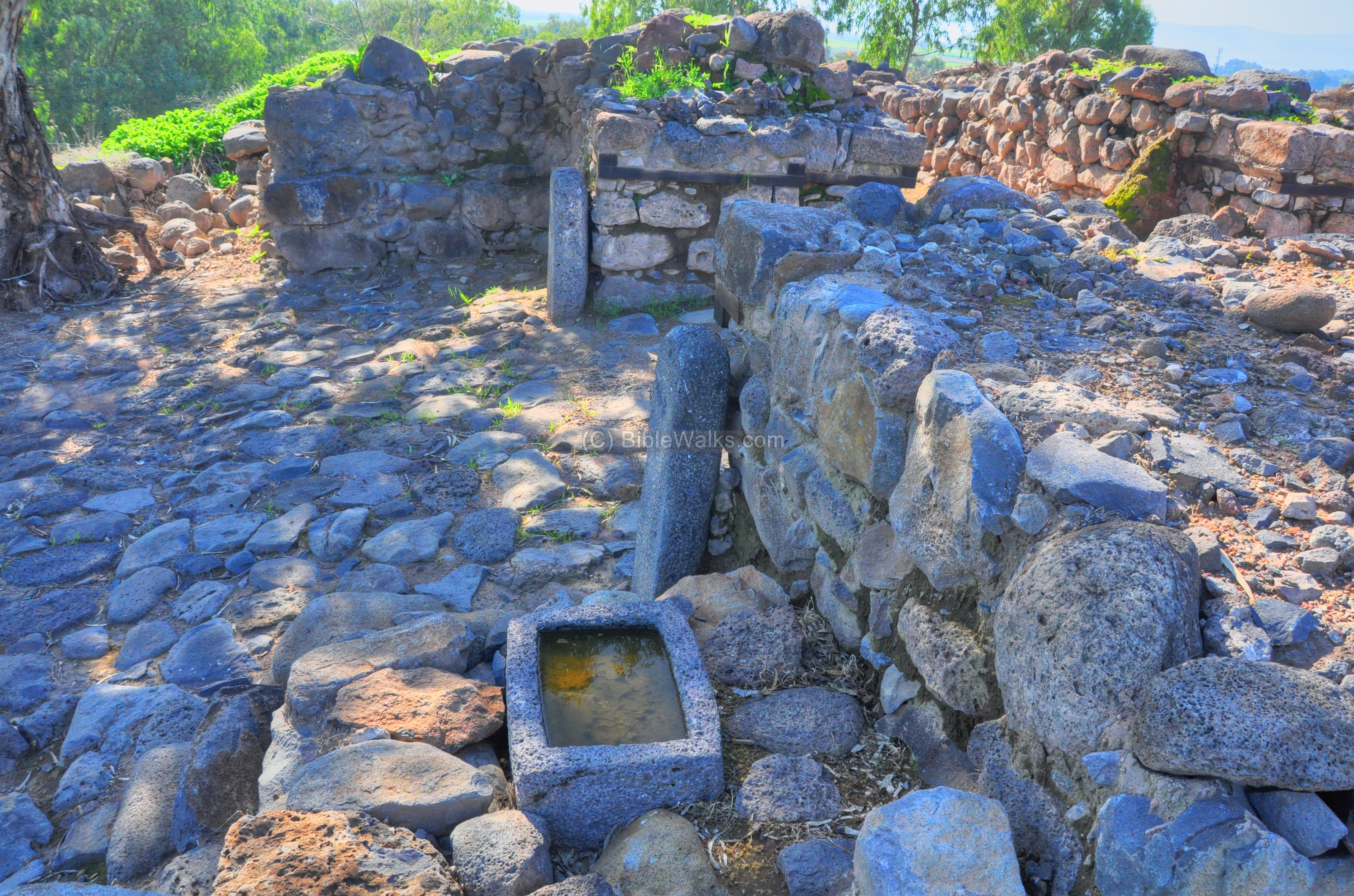
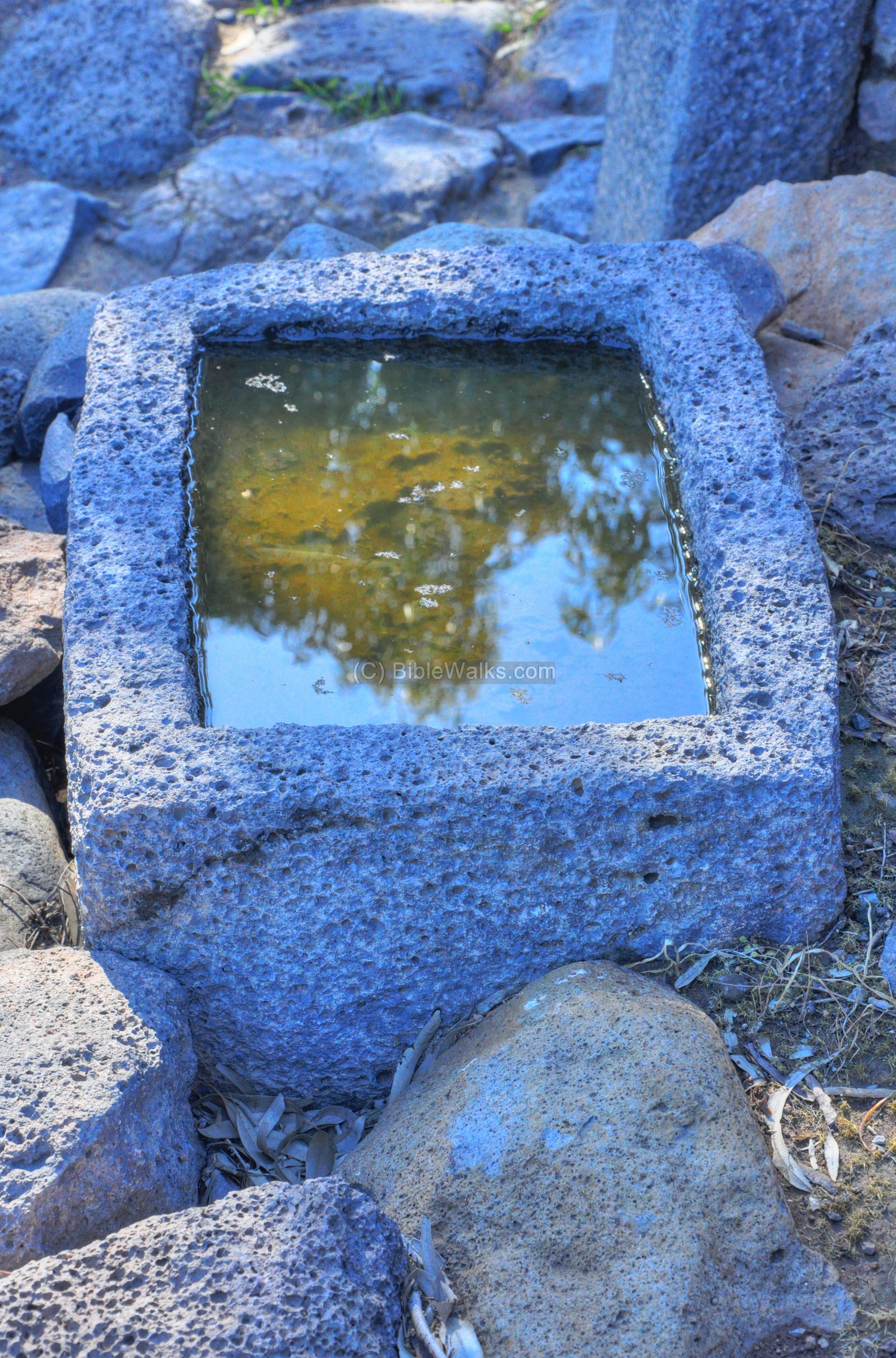
The stone basin has a square recess 35cm deep.
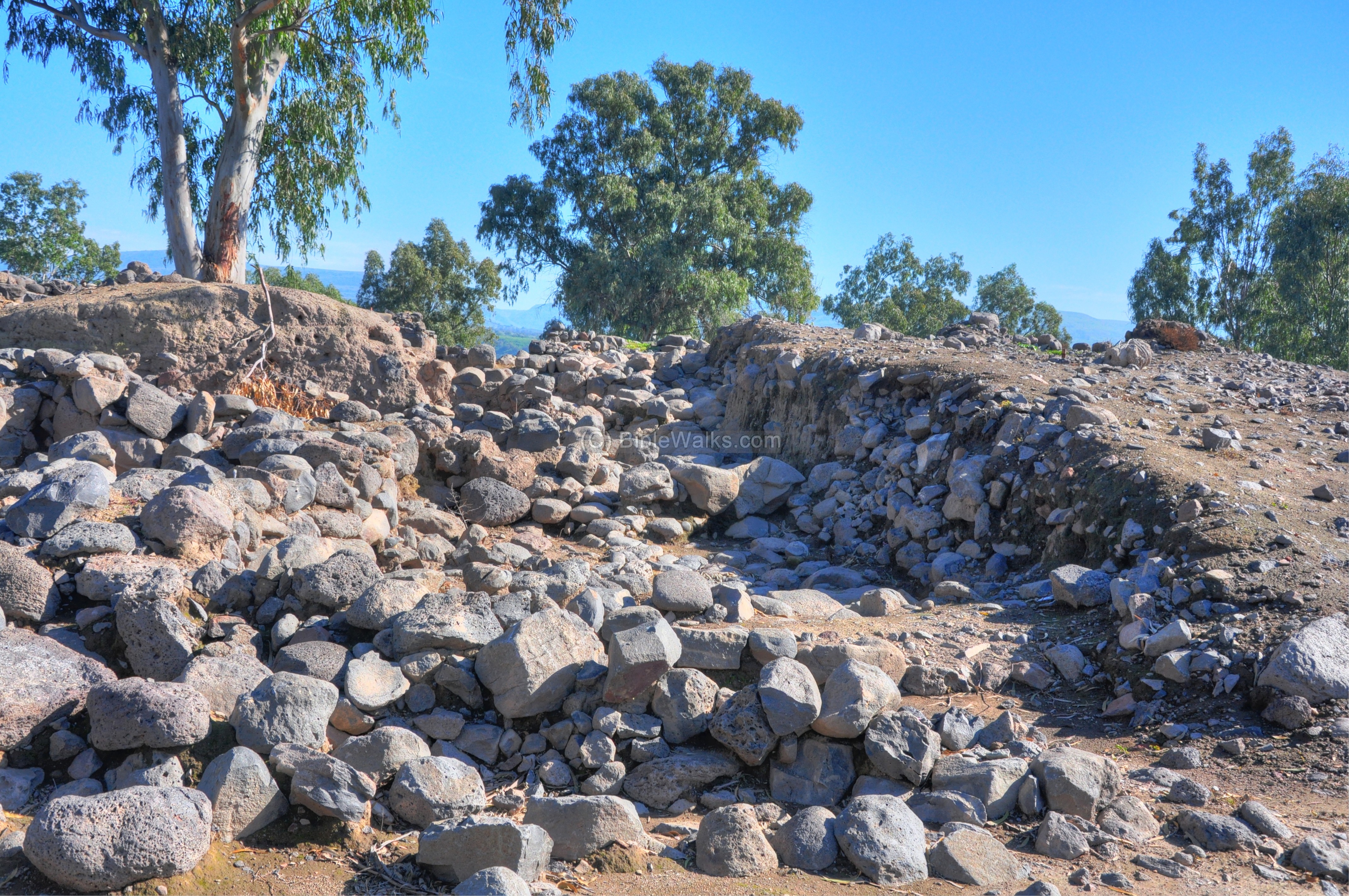
East side
The east side of the city is shown in the following photo. The eastern gate is on the right side, while the outer city walls of the city stretch from the gate to the left.
A closer view of the eastern city walls is in the next photo. The edge of a cobble stone road appears in the bottom left side.
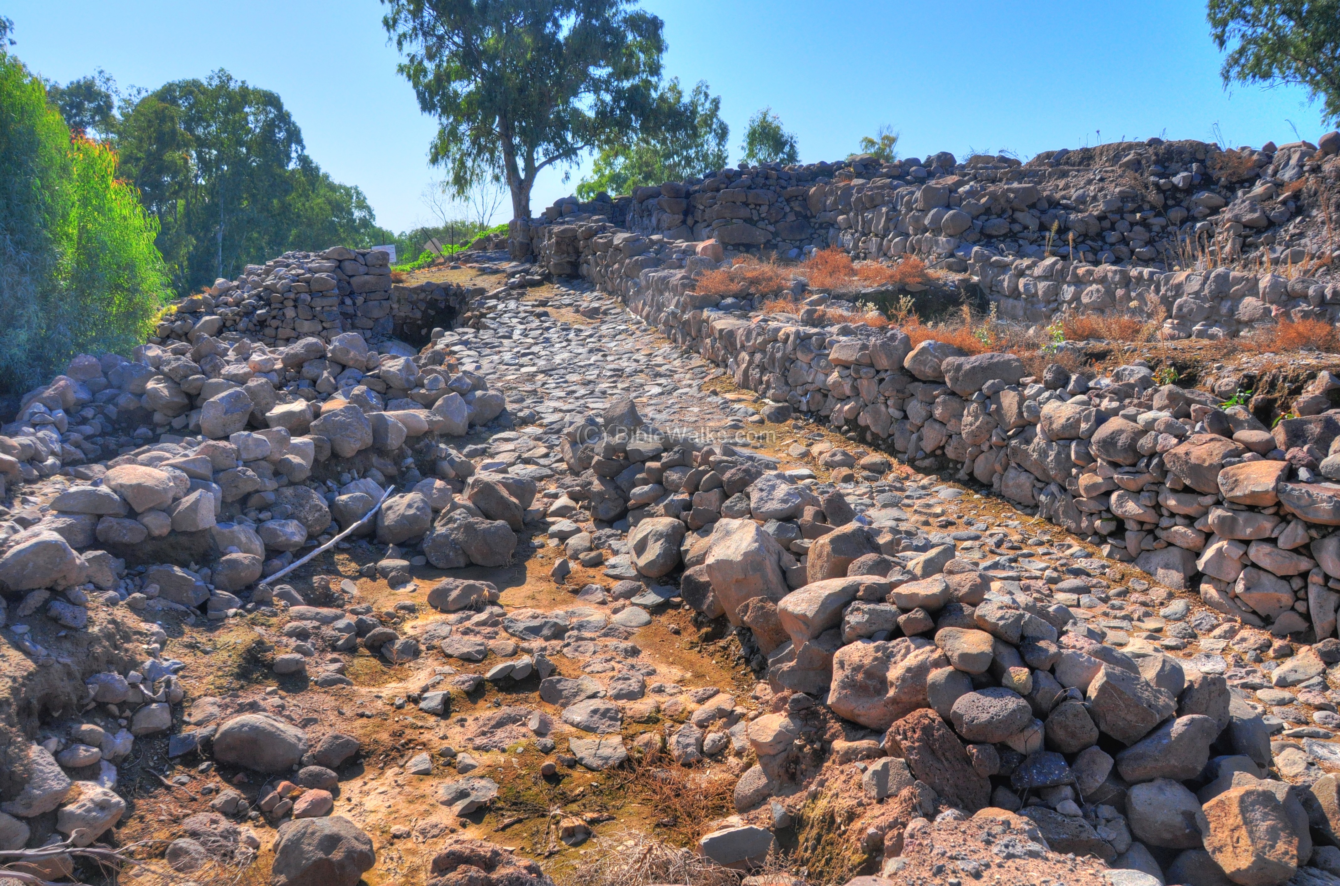
Cobble stone Road
The cobble stone road approached the city, following the eastern outer city wall to a distance of about 25 m from the outer city gate. It then departs from the wall and turns east. The cobble stone road then continues down the hill (eastward) for the next 25 m, but this section is not yet excavated.
The location of the road is indicated as a red square on the diagram.
The following picture shows the road from the south side. The walls of the city are located on the left side.
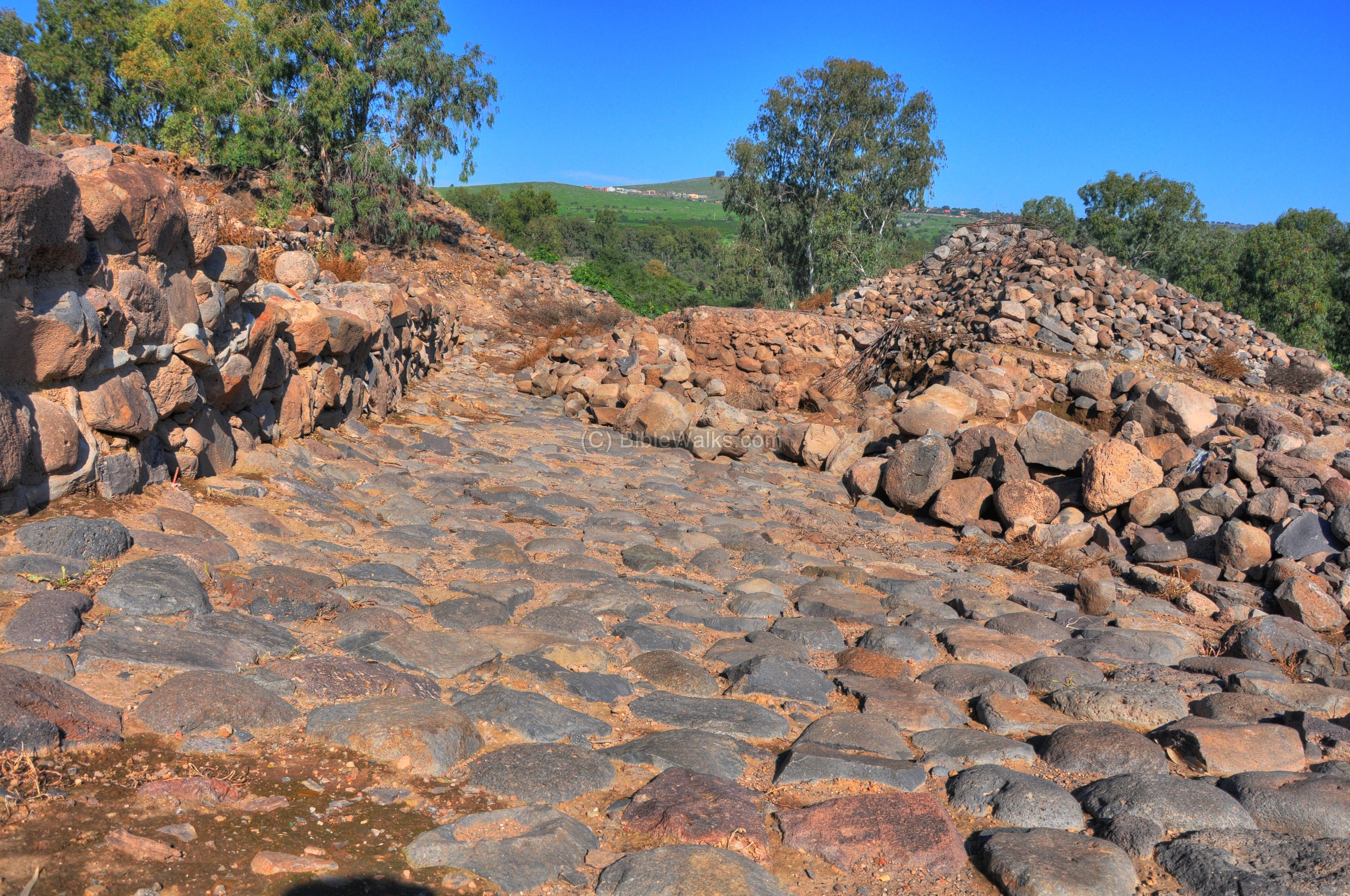
The next picture is a view from the bottom of the road facing towards the outer side of the gate. The paved area served as a large plaza outside the city gate. It is most probably an area termed ex-mural market place (the Biblical term was in Hebrew named ‘Huzot’ which means both streets and markets).
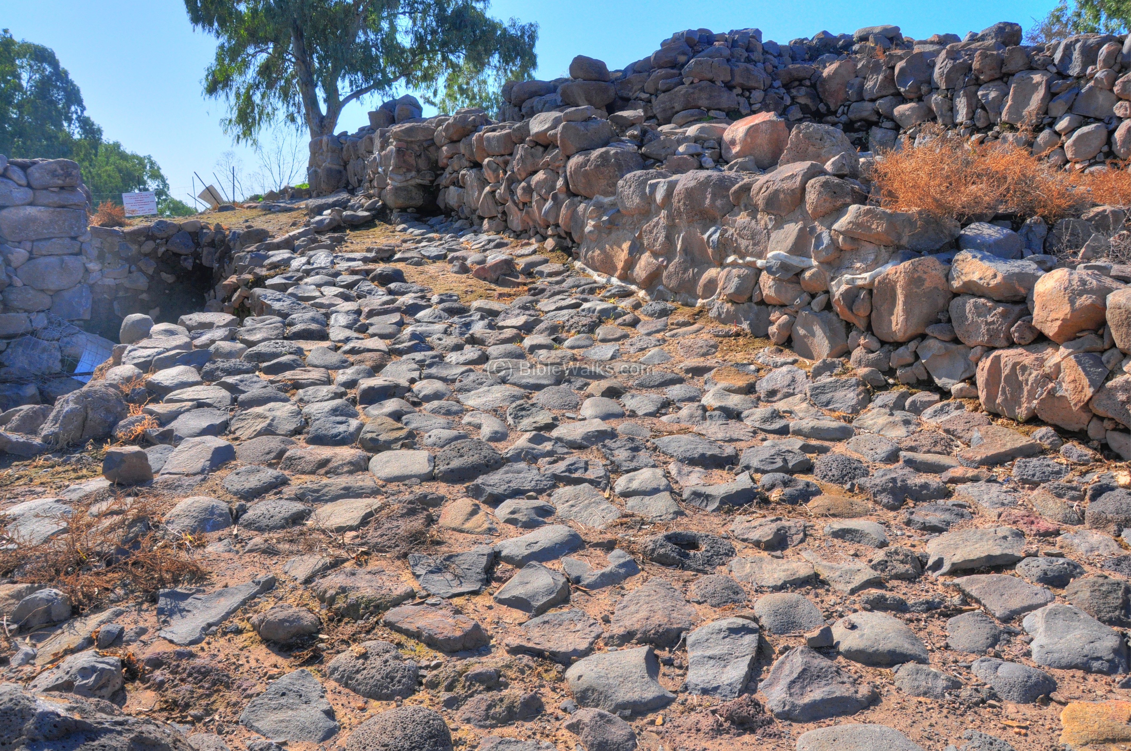
The cobblestone road was paved in the 9th century BC, and had been in use until the 4th century AD. Pottery finds on the road (located in the excavation hole) include shards from all periods, from the Bronze period up to the Roman period.
In future, the road will be the entry point of the visitors to the reconstructed city.
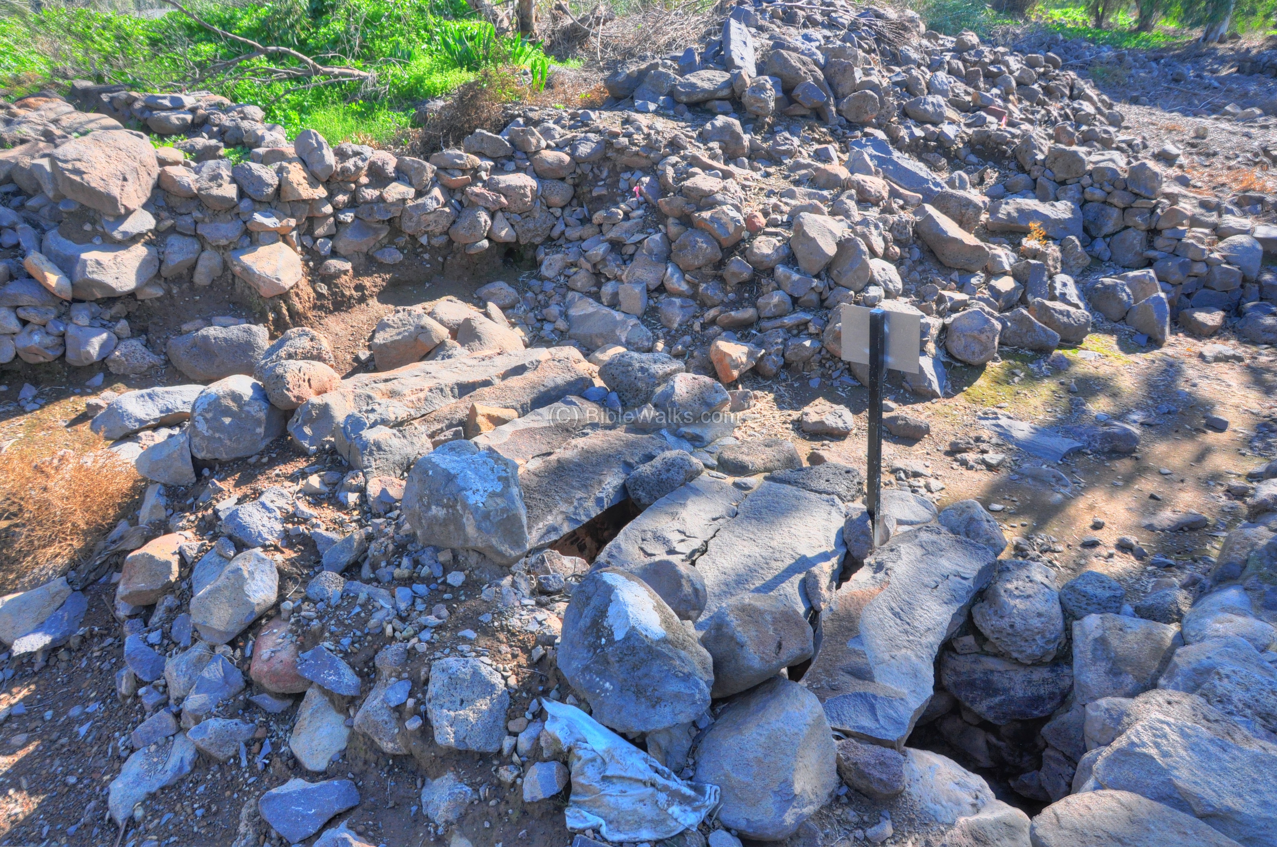
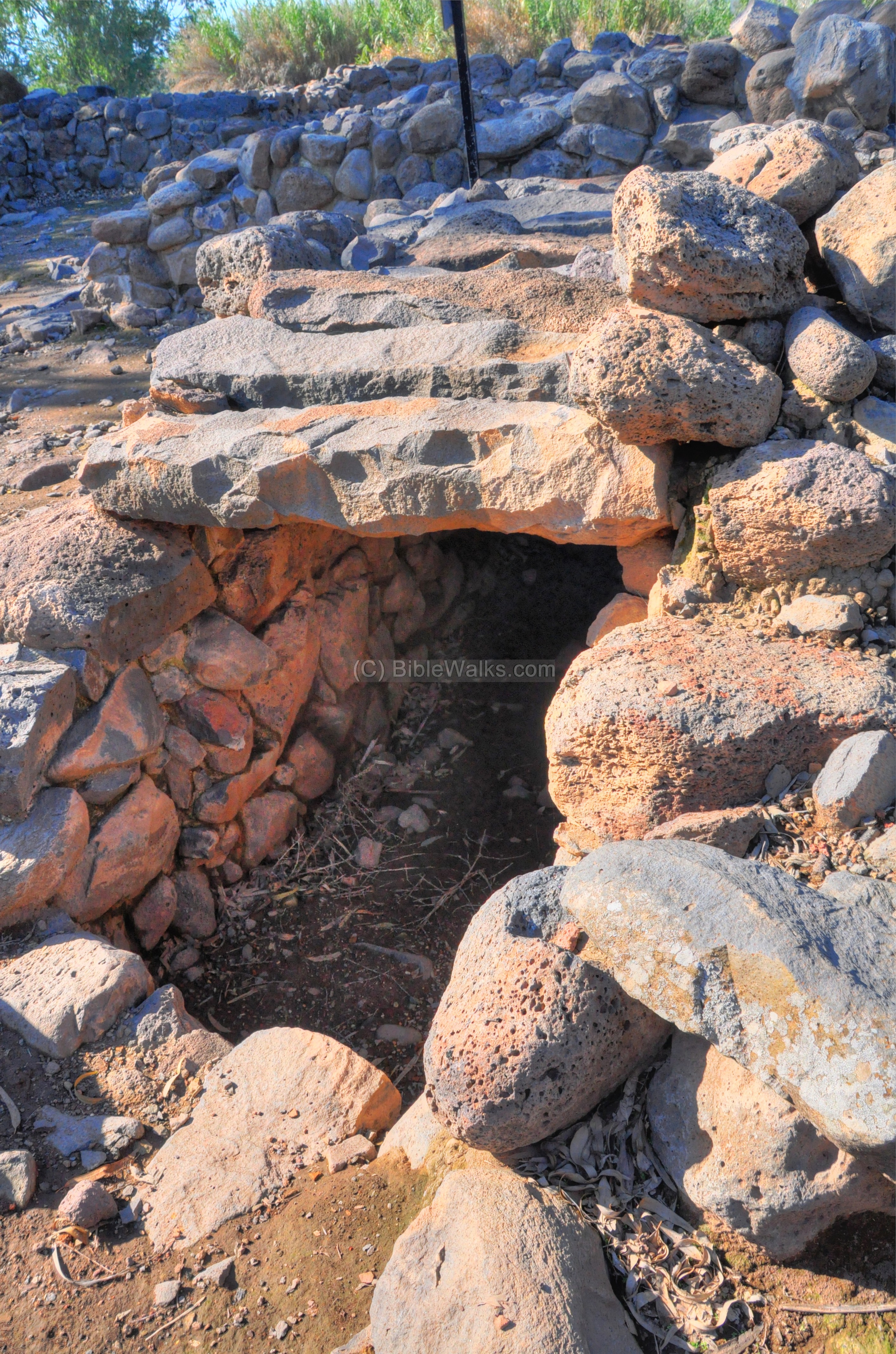
Royal Escape Tunnel?
An escape tunnel under the Iron Age city of Geshur may have been recently (2014) uncovered. The tunnel, leading from the Royal palace, towards a gap between the eastern inner and outer city walls, may have served the royals to safely flee from a besieged city. A similar escape tunnel is referred in the accords of Zedekiah during the Babylonian siege (2 Kings 25:1-4): “…Nebuchadnezzar king of Babylon came, he, and all his host, against Jerusalem, and pitched against it… And the city was besieged unto the eleventh year of king Zedekiah. And on the ninth day of the fourth month the famine prevailed in the city, and there was no bread for the people of the land. And the city was broken up, and all the men of war fled by night by the way of the gate between two walls, which is by the king’s garden…and the king went the way toward the plain”.
Check this Youtube video for a presentation.
Visit Summary
This site is really unique: both the Old and New Testaments come alive in front of your eyes and under your feet. The lost land of Geshur, the massive gate complex, the fishermen of BethSaida – all in one small place. What other new surprises will the archaeologist find in the coming excavation seasons ?
New Testament References:
(a) Mark 8:22-26
This text describes the miracle of the healing of the blind man in BethSaida:
“And he cometh to Bethsaida; and they bring a blind man unto him, and besought him to touch him. And he took the blind man by the hand, and led him out of the town; and when he had spit on his eyes, and put his hands upon him, he asked him if he saw ought. And he looked up, and said, I see men as trees, walking. After that he put his hands again upon his eyes, and made him look up: and he was restored, and saw every man clearly. And he sent him away to his house, saying, Neither go into the town, nor tell it to any in the town”.
(b) Mark 6:44-45
This text talks about the miracle of feeding the multitude, afterwards Jesus left for the area of BethSaida.
“…And they that did eat of the loaves were about five thousand men. And straightway he constrained his disciples to get into the ship, and to go to the other side before unto Bethsaida, while he sent away the people”.
(c) Luke 9:16
This text also relates to BethSaida and the miracle of feeding the multitude:
“And the apostles, when they were returned, told him all that they had done. And he took them, and went aside privately into a desert place belonging to the city called Bethsaida. And the people, when they knew it, followed him: and he received them, and spake unto them of the kingdom of God, and healed them that had need of healing. And when the day began to wear away, then came the twelve, and said unto him, Send the multitude away, that they may go into the towns and country round about, and lodge, and get victuals: for we are here in a desert place. But he said unto them, Give ye them to eat. And they said, We have no more but five loaves and two fishes; except we should go and buy meat for all this people. For they were about five thousand men. And he said to his disciples, Make them sit down by fifties in a company. And they did so, and made them all sit down. Then he took the five loaves and the two fishes, and looking up to heaven, he blessed them, and brake, and gave to the disciples to set before the multitude”.
Josephus Flavius:
Josephus Flavius, the Roman historian and ex-Jewish commander, writes about BethSaida. According to the following text, Bethsaida was given to Herod Phillip, one of the sons of Herod the great. He renamed the city to Julias, in honor of Caesar’s daughter, so that implies that the city was important. He was also buried there.
(a) Antiquities of the Jews, Book 18, 2: 1
“He also advanced the village Bethsaids, situate at the lake of Gennesareth, unto the dignity of a city, both by the number of inhabitants it contained, and its other grandeur, and called it by the name of Julias, the same name with Caesar’s daughter”.
(b) Antiquities of the Jews, Book 18, 4: 6
“He died at Julias; and when he was carried to that monument which he had already erected for himself beforehand, he was buried with great pomp”.
(c) Autobiography, 72
Josephus was wounded near Bethsaida (Julias) after falling from his horse:
“As soon as I had gotten intelligence of this, I sent two thousand armed men, and a captain over them, whose name was Jeremiah, who raised a bank a furlong off Julias, near to the river Jordan, and did no more than skirmish with the enemy; till I took three thousand soldiers myself, and came to them. But on the next day, when I had laid an ambush in a certain valley, not far from the banks, I provoked those that belonged to the king to come to a battle, and gave orders to my own soldiers to turn their backs upon them, until they should have drawn the enemy away from their camp, and brought them out into the field, which was done accordingly; for Sylla, supposing that our party did really run away, was ready to pursue them, when our soldiers that lay in ambush took them on their backs, and put them all into great disorder. I also immediately made a sudden turn with my own forces, and met those of the king’s party, and put them to flight. And I had performed great things that day, if a certain fate had not been my hinderance; for the horse on which I rode, and upon whose back I fought, fell into a quagmire, and threw me on the ground, and I was bruised on my wrist, and carried into a village named Cepharnome, or Capernaum. When my soldiers heard of this, they were afraid I had been worse hurt than I was; and so they did not go on with their pursuit any further, but returned in very great concern for me. I therefore sent for the physicians, and while I was under their hands, I continued feverish that day; and as the physicians directed, I was that night removed to Taricheee”.
Etymology (behind the name):
-
Beth, Beith – in Hebrew – House.
-
Tsaida – in Hebrew: Hunt.
-
BethSaida – the combined name means “House of the Hunt”.
-
Julias – the Roman name of the city, named after Caesar’s daughter and Augustus’s powerful third wife
Links:
* External:
- e-Tel excavations
- Jordan Park
- Bethsaida – ancient fishing village
* Internal:
- Promoted archaeological sites – including more photos from BethSaida
- Bethsaida coins – Greek & Roman coins found in the excavations
- Roman streets – a collection of streets in ancient cities of the Holy Land
- St. Peter info page
- El Araj – an alternative site for Bethsaida
- Beit Ha-Bek (el Araj) – drone view of el Araj
From the trenches:
A Pithos – large storage jar – excavated in Bethsaida:
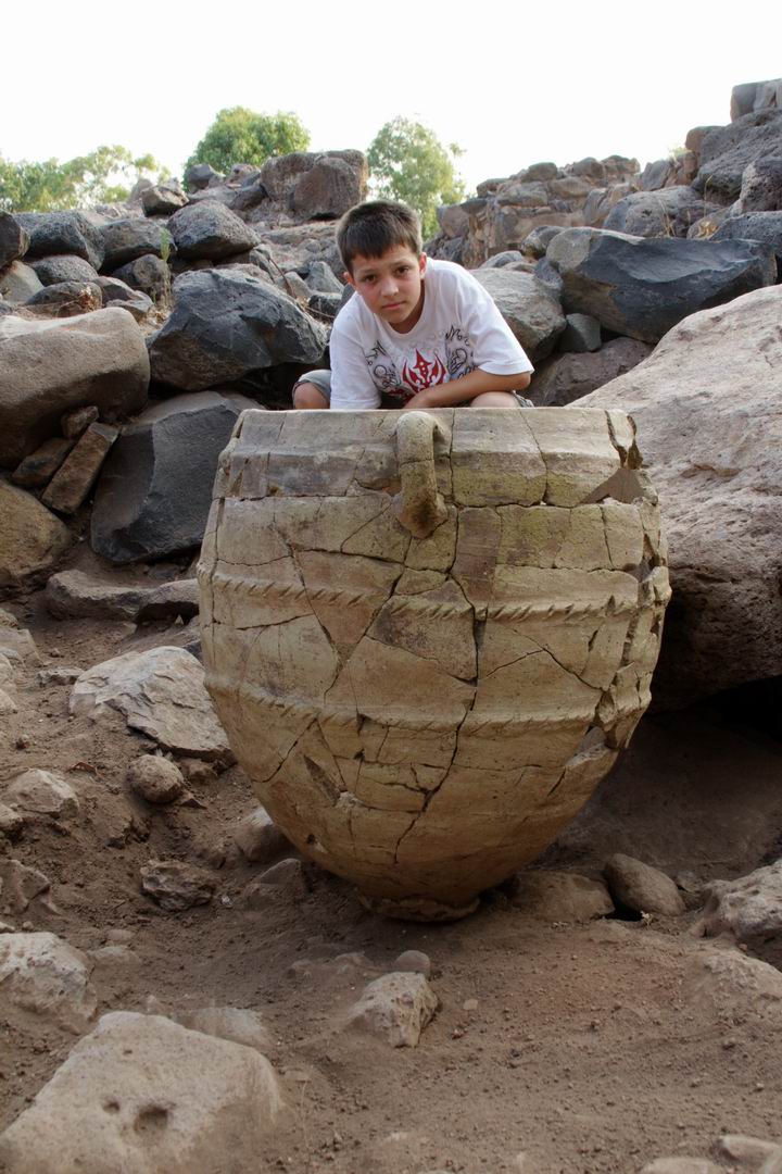 (photo courtesy of R. Arav)
Check the dig’s web site for more details.
A picture of excavations in Area A, west of the winemaker’s house, is shown in the following photo. The student is examining a fragment of a Roman bronze bowl:
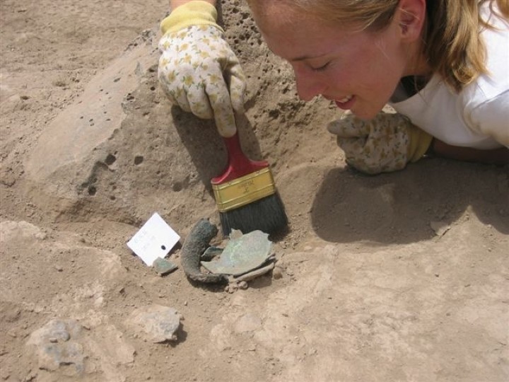
(photo courtesy of R. Arav)
Another photo from the same area (A west, Wall 668) is shown below. The group is excavating a structure dated to the Hellenistic/Roman period.
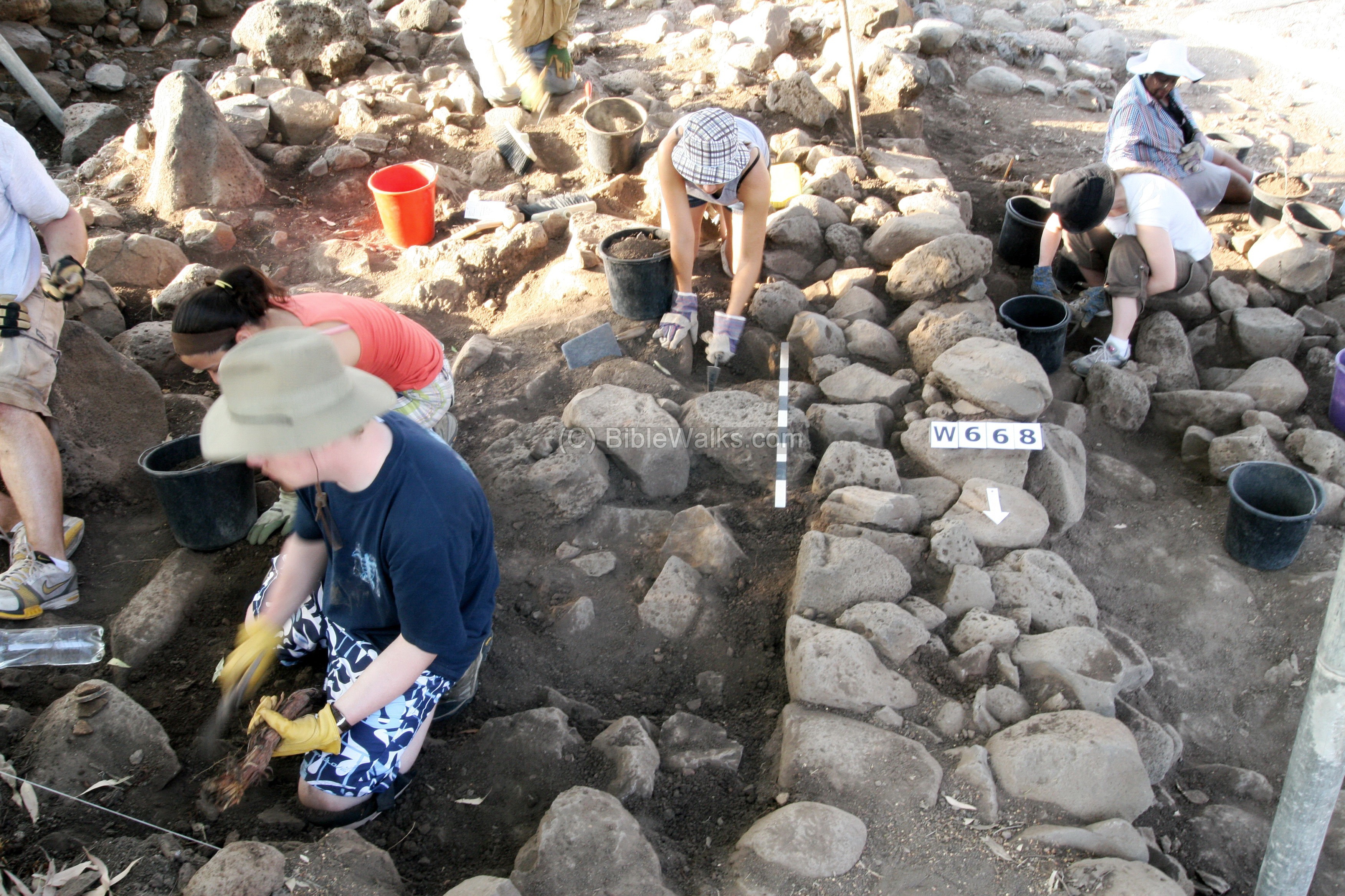
(photo courtesy of R. Arav)
A fish-eye photo of the excavations is shown below.
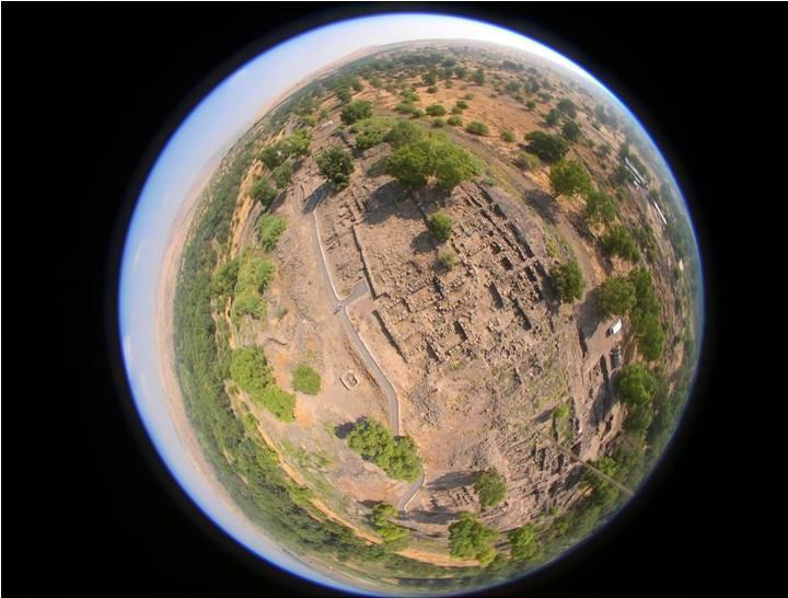
(photo courtesy of R. Arav)
BibleWalks.com – witnessing the Biblical places
Golan Roman Roads <<<–previous site—<<<All Sites>>>—next Golan site—>>> Bethsaida coins
This page was last updated on Feb 7, 2025 (add El Araj site)
Sponsored links: