A Druze village in the center upper Galilee, the highest village in Israel, founded in the 13th century. It may have been the Biblical village of “Beth-Dagon” of the Galilee.
Joshua 19, 24-27: “And the fifth lot came out for the tribe of the children of Asher according to their families. And their border was… And turneth toward the sunrising to Bethdagon…”
Home > Sites > Upper Galilee > Center > Beit Jan (Beth Jan)
Contents:
Background
Location
History
Photos
* The Village
* Horvat Shfanim
* Mt Ha’Ari
* Nature photos
Biblical
Etymology
Links
Background:
Beit Jann is a Druze village in the center upper Galilee. It is the highest village in Israel, spread over several hills at about 1000M above sea level. It was founded in the 13th century AD.
The site can be identified as the Biblical “Beth-Dagon” of the Galilee, which was listed in the region of the Tribe of Asher.
Location and Aerial map:
The village of Beit Jann is located south to the peak of Meron (Meiron), the tallest mountain. The village is surrounded by several high hills (Ha’Ari-1048M, Safrir-1060M).
An aerial photo is shown below, indicating the major points of interest.

History:
- Biblical periods
The high mountainous area around Meron was inhabited starting in the Iron age, at the time of the Israelite settlement. The difficult terrain and weather limited the growth of the area. During the Iron/Israelite age there were several sites around Beit Jan (Khirbet Hamama, Hurvat Shefanim, Kh. Esel). A fortress from the Israelite Kings period (10th-7th century) was discovered north to Beit Jan, on Mount Meron. Another site was excavated near the village of Peki’in, west of Beit Jan (Tell Harashim, which had 5 levels starting from the Mid-Bronze age, ending in the Persian/Hellenistic period, and fortified during the Israelite period).
The site be identified as the Biblical “Beth-Dagon” of the Galilee, which was listed in the region of the Tribe of Asher. This was the border with the tribe of Naftali, which some of its villages are located in the plains below, such as Rama (the Biblical Ramah).
This identification relies, among other considerations, on the similarity of the Biblical name to the modern name. The Biblical site may have been located inside the village of Beit Jan or in one of the Iron age sites near it.
Horvat Shfanim: Ruins of a large fortified Bronze and Iron age village is located on a hill, 0.5KM east of Beit Jan. This may have been the village of Biblical Beit-Dagon. In old maps it appears as Kh. Shufnin or Kh. Shefnin. The modern Hebrew name is Horvat Shefannim. The settlement is located on the top of the hill near a pond, and has formidable walls all around the summit. Surveys dated the pottery to Early Bronze II-III, Middle Bronze II, Iron Age I, Iron Age II, Persian and Hellenistic.
Roads:
David Dorsey (“The roads and Highways of Ancient Israel”, 2018, pp. 156-162) described a Bronze/Iron age road that passed in the area around Beit Jan: G7. H. Sirim to Har Hazon – A NW to SE road, passed thru Horvat Esel (site #466), descended to Ramah in the Karmiel valley.
This Biblical road is now the modern road #864 (from Peki’in to Ramah). The entrance road to Beit Jan starts from the foothills of Horvat Esel, then goes east along Nahal Peki’in valley.
- Hellenistic/Roman/Byzantine
The site was probably destroyed in the intrusion of Tiglath-Pileser III, dates 734-732 BC, as per Kings II 15: 29. This intrusion wiped out most of the Galilean sites, as written in the Bible.
After the destruction, the area was inhabited again during the Hellenistic/Roman period. Several villages were founded in the area, but destroyed in the 7th century AD.
- Foundation of the Druze faith – 11th century
The Druze faith, an offshoot of the Ismaili sect of Islam, can be traced back to the times of Al-Hakim bi-Amr Allah, the 6th Fatimid Caliph in Egypt (996-1021 AD).
Al-Hakim, an eccentric ruler of the Fatimid empire, was proclaimed as a prophet (1017) by his follower, Muhammad bin Ismail Nashtakin ad-Darazi. Darazi was later (1018) executed by the orders of Al-Hakim.
Caliph Al-Hakim himself disappeared (assassinated?) in 1021. However, the new faith continued through other followers, such as Hamza ibn ‘Ali ibn Ahmad, the first leader of the new faith.
Hamza and other members of the new faith were forced to hide in exile in the remote mountains of Lebanon, where the faith grew over the years, then spreading to Syria and Israel.
- Crusaders and Mamlukes
The Druze, named after Darazi, became fierce warriors who fought against the Crusaders.
During the 13th century Druze villagers from the Shuf mountains of Lebanon founded three villages in the area: Beit Jann, Zavud and Jermak. The last two were deserted during the 18th century.
- Ottoman period
The area was examined in the PEF survey (1866-1877) by Wilson, Conder and Kitchener. A section of their map is shown here, focusing on the area around Beit Jann.
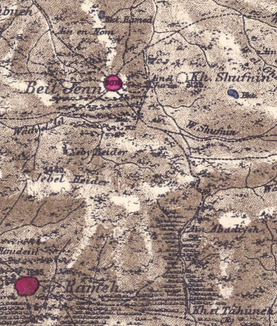
Part of Map sheet 4 of Survey of Western Palestine,
by Conder and Kitchener, 1872-1877.
(Published 1880, reprinted by LifeintheHolyLand.com)
The surveyors wrote about Beit Jann (Vol 1, p. 196):
“Beit Jenn —A good village, built of stone, containing about 300 Moslems and 100 Druzes, situated on hill-top, with gardens and
extensive vineyards. There are two good perennial springs near the village, and birket for cattle, besides cisterns, in the village.‘Beit Jenn contains 200 inhabitants, all Druzes. A few years ago it was much larger, as is indicated by the abandoned houses which are beginning to fall into ruins. I am told that their occupants have fled to the Hauran to escape conscription.
‘The flanks of the hill on which the village stands are covered with vines which creep along the ground ; their grapes, of a prodigious size, make one think of the cluster brought to Moses by the spies. ‘The place was known in the middle ages as Beitegene, or Bette-Gen. Its Hebrew name would be Beth-Jannim, the ” House of Gardens.” —Guerin.The surveyors also wrote about the ancient ruin of Horvat Shefannim (Vol 1, p. 247): “Kh. Shufnin —Heaps of stones, mostly unhewn; a small ruin”.
- British Mandate
A 1940s British map shows the area around Beit Jann. The Iron Age ruin appears as Kh. Shufinin, located on the top of a hill, with a pond on its eastern side.
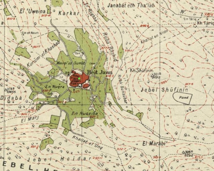
British survey map 1942-1948 – https://palopenmaps.org topo maps
License: public domain under the UK Copyright, Designs and Patent Act 1998
- Modern times
Beit Jann is a large Druze village which is constantly expanding to the mountains around the congested center of the town. The maze like town is difficult to navigate (you would get lost inside even if you leave bread-crumbs behind… ).
The town offers good Druze food and some rooms to let (Zimmer). The climate is cold year round, with snow in the winter. The high mountainous area, with panoramic views of the whole north of Israel, make it a recommended place to visit.
Photos
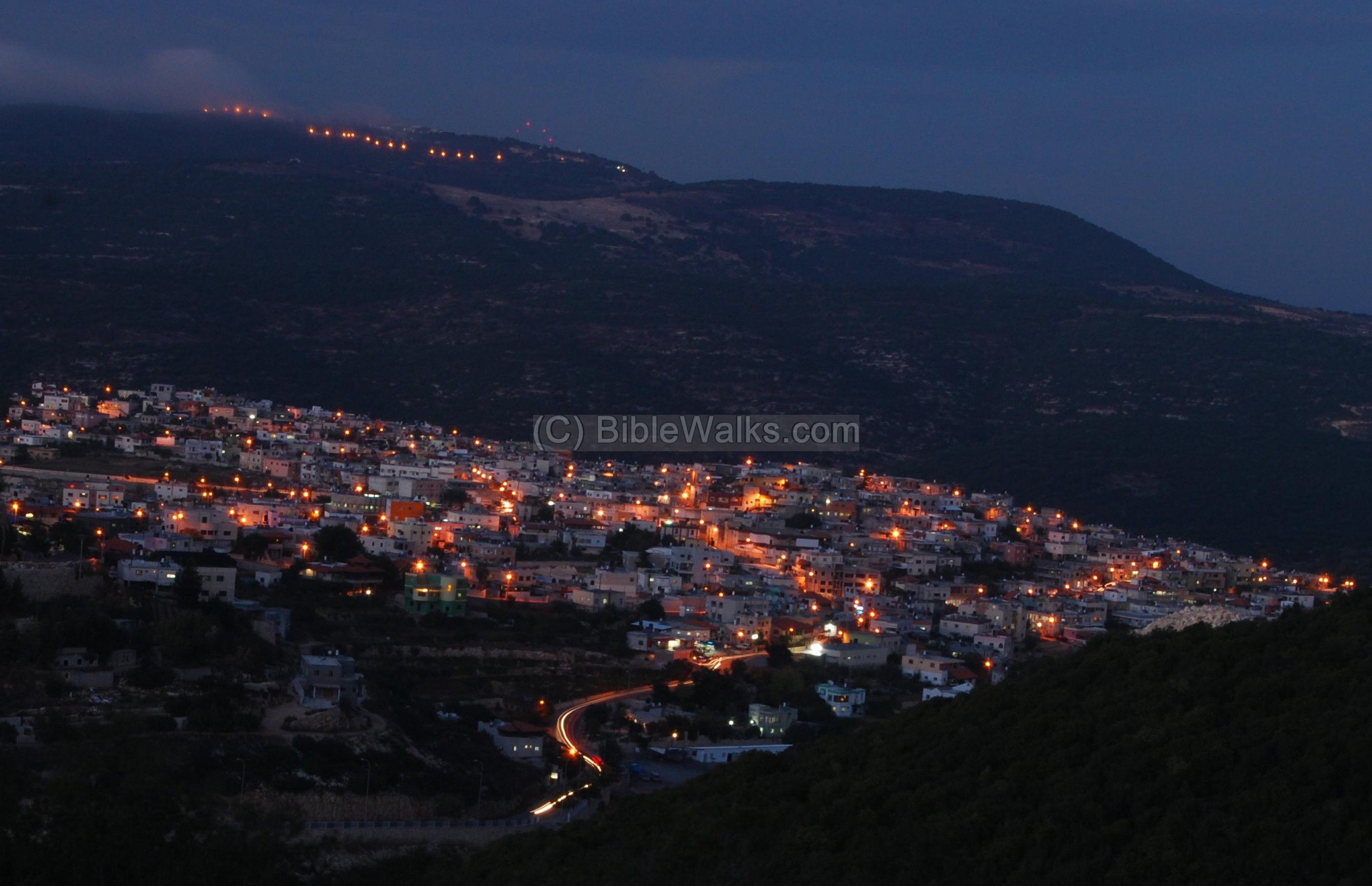
(a) The village
A night view of the center of the village of Beit Jann is seen below. The village is spread over several hills around the center. In the background of the village is the highest mountain in Israel (excluding the Golan heights) – Mount Meron (Meiron, 1208M above sea level).
Click on the photos to view in higher resolution…
(b) Horvat Shfanim (Kh. Shufnin)
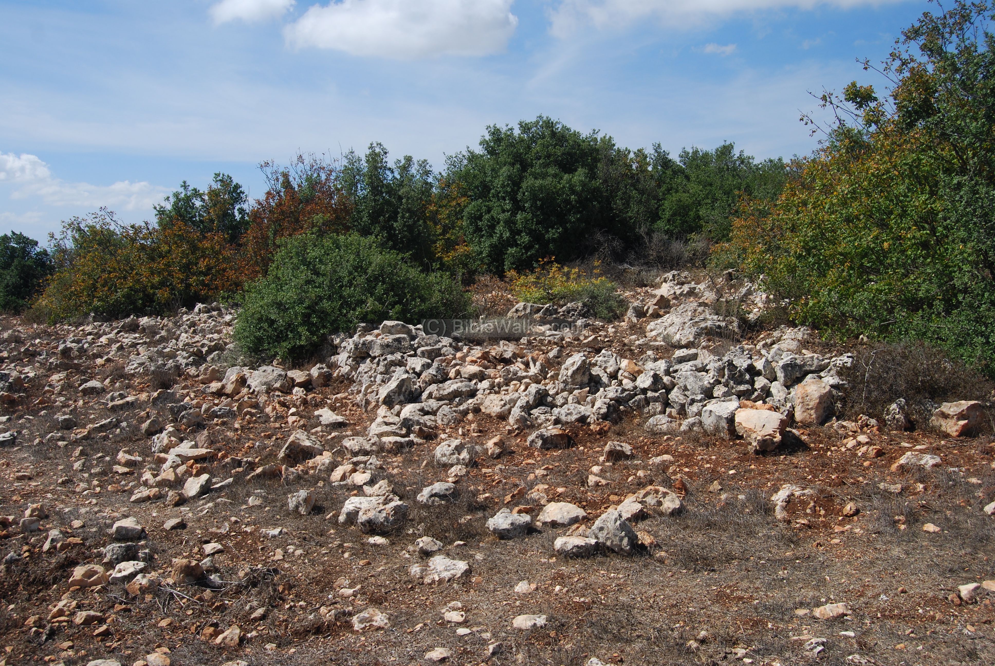
Ruins of the large fortified Bronze and Iron age village are located on a hill, 0.5KM east of Beit Jann. The modern Hebrew name is Horvat Shfanim (“Ruin of the Rabbits”). In Arabic it was named as Kh. Shufnin (“Ruin of the dove”).
This is a view of the hill, as seen from the eastern edge of Beit Jann.
This ancient settlement is located on the top of the hill, at an altitude of 949m above sea level. The ruins cover an area of 20 dunams.
A pond (Shefannim pond) is located 450m south-east of the site, and fills up during the winter.
Another source of water supply is the wells of Ein Gerna, 650m to the west, in the bottom of the Nahal Kziv valley. It used to be the main water supply for Beit Jann.
Around the summit is a wide ancient peripheral wall, made of unhewn fieldstones. Some of its sections are still intact and rising several meters above the steep slope.
Below – another section of the peripheral wall, as seen from the outside. Judging from the long hewn slabs that were pushed aside, this breach in the wall may have been the ancient gate into the fortified settlement.
On the summit, behind the peripheral wall, are remains of walls and structures.
Another section of the summit is seen below.
Notice the arrangement of the rocks – steps?
Most of the summit is covered with soil. However, this section has a long area of barren flat rock.
On its side is a trench, probably the effect of illicit digging. We noticed signs of illegal excavation in another section of the site, and reported to the authorities.
On the surface of this rock is a cupmark, seen here behind Uncle Ronnie, used in the antiquity as a base for grinding.
Another section of the wall is seen below, with a hewn stone, part of an installation.
In the far background are the residential houses of Beit Jann.
- Survey:
A polygon survey was conducted on the site, headed by Ido Vachtel. According to the pottery distribution within the 25 areas, the following periods were identified: Early Bronze II-III, Middle Bronze II (37%), Iron Age I (52%), Iron Age IIa (4%), Iron Age I/II (7%).
Another survey, headed by N. Getsov and R. Frankel, also added the Persian and Hellenistic periods.
The following are few samples of interesting findings found during our short survey across the site, which was lead by archaeologist Ayelet Goldberg-Keidar. She also identified the pottery findings in this web page. All items were left on the site.
- Iron Age 2 vessel
2. Iron Age I or II handle
(c) Ha’ari Mountain
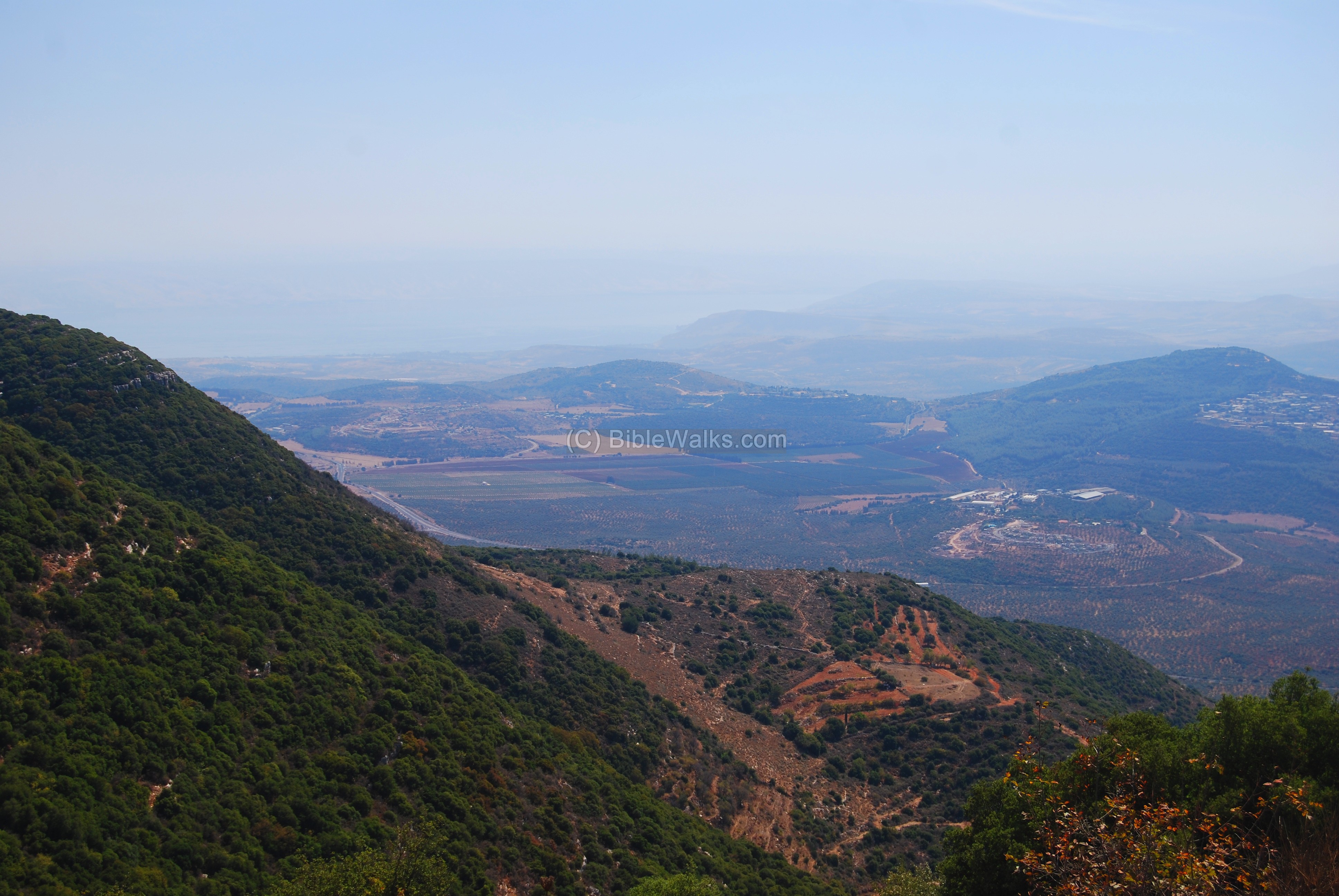
The high mountain Ha’Ari (1048M) is located on the south side of the village. The mountain means “The Lion” in Hebrew, and is also named after the Holy Ha’Ari -the 16th century author of the Kabalah. From its peaks is a great panorama of the western Galilee and the Sea of Galilee.
The photo below shows the highest peak in the ridge is seen below, with a view of the valley of the Kerem (with the city of Carmiel). In the background are Mt Carmel (left) and the bay of Haifa and Acre (right).
A view towards the east is seen below, with the Sea of Galilee in the far left background.
The top of the mountain is bare, except for a round low wall around its peak, seen below.
We speculate that the round enclosed area behind the wall, which measures to about 200 square meter, may have been used as watching tower and a fire-signal post. The next post was probably Har-Gamal at the edge of the valley, and from there to Acre. In Jeremiah 6:1 there is an excellent text that refers to Jerusalem, but may be applicable to this site as well, which also overlooks the Beth Haccerem valley:
“… and set up a sign of fire in Beth Haccerem: for evil appeareth out of the north, and great destruction”. Another text is in Judges 20:38-40: “Now there was an appointed sign between the men of Israel and the liers in wait, that they should make a great flame with smoke rise up out of the city….”.
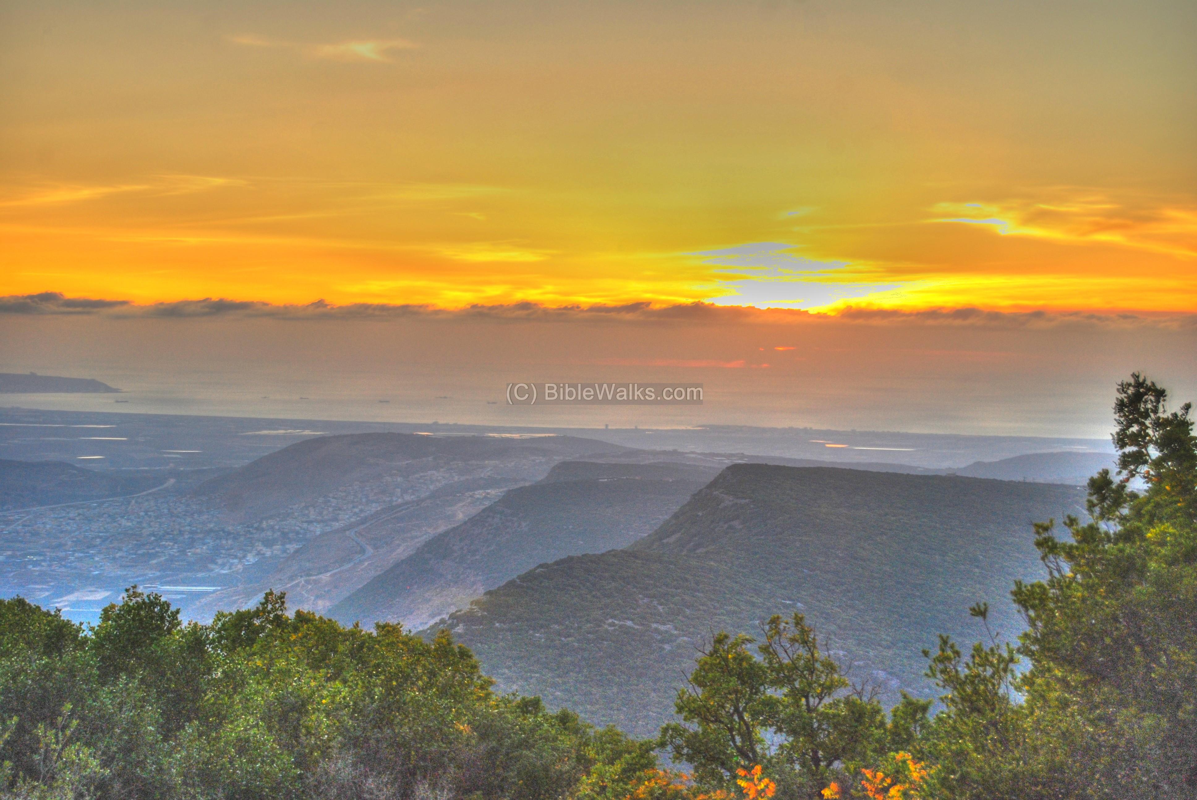
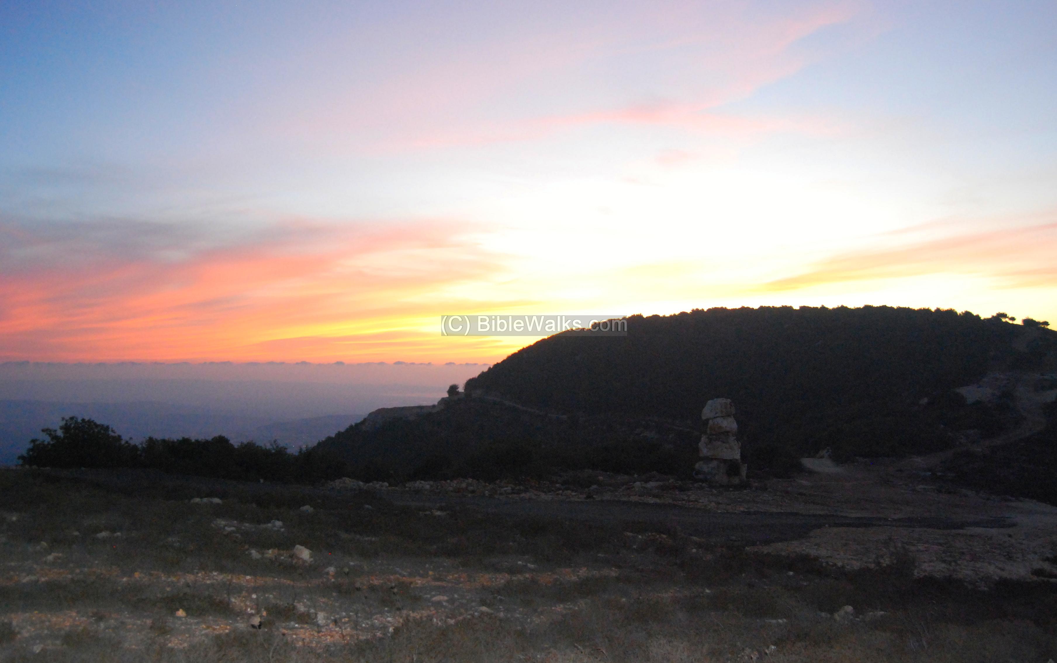
There are spectacular sunsets to be seen, as in the photo below. The valley on the left is called “Beth Haccerem” (as in the Jeremiah text), while the background is the Carmel and Haifa (left) and Acre (center).
Another sunset view is seen below.
(d) Nature photos
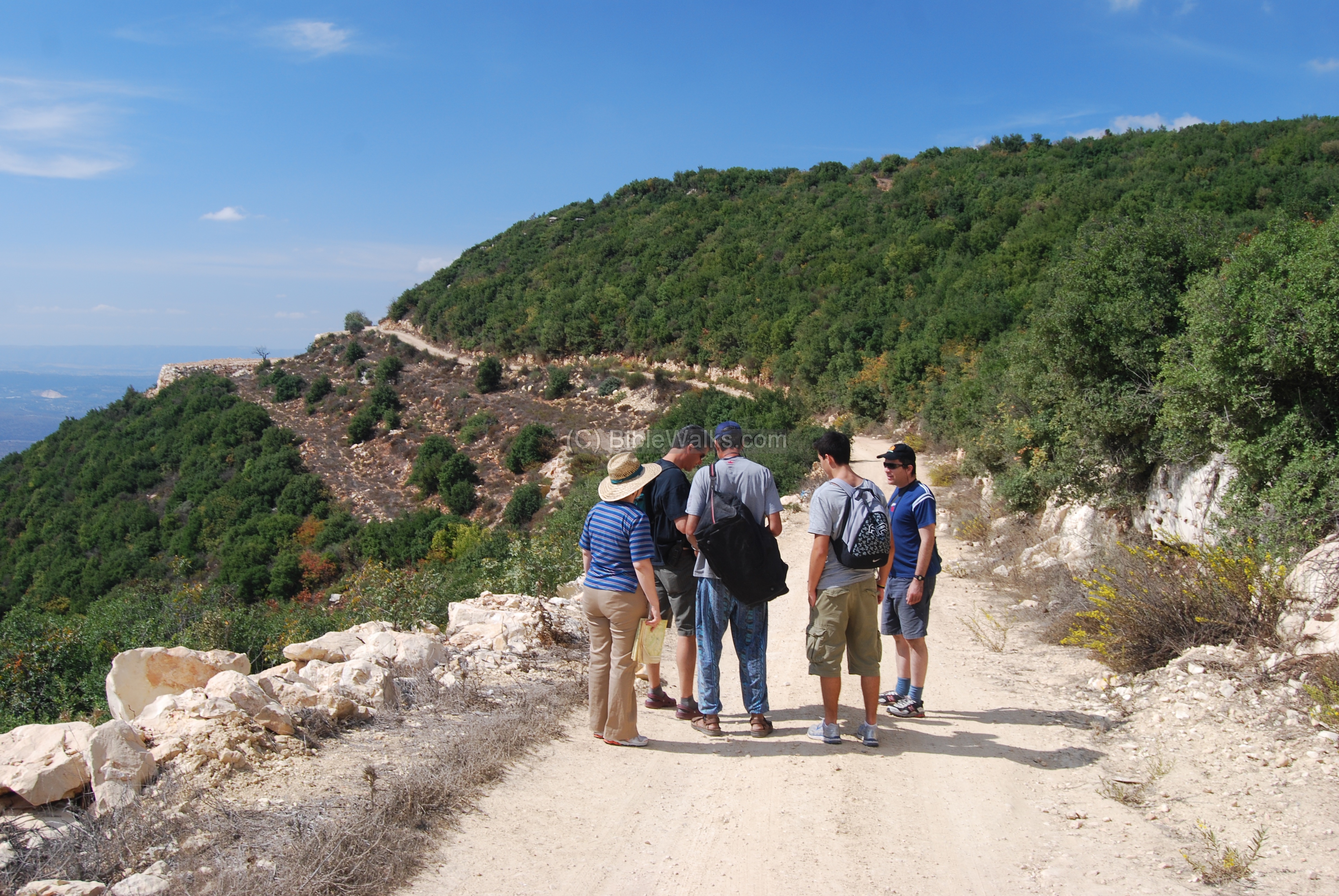
The area around Beit Jan has excellent hiking and nature paths. In the photo below the group (family of webmaster Rotem) plans the hike around Mt Ha’Ari and down to Khirbet Essel.
There are other outdoor sports, such as horse riding and hang gliding off the nearby cliff.
The following flowers and trees were among the wild plants seen along the trail on the first week of October.
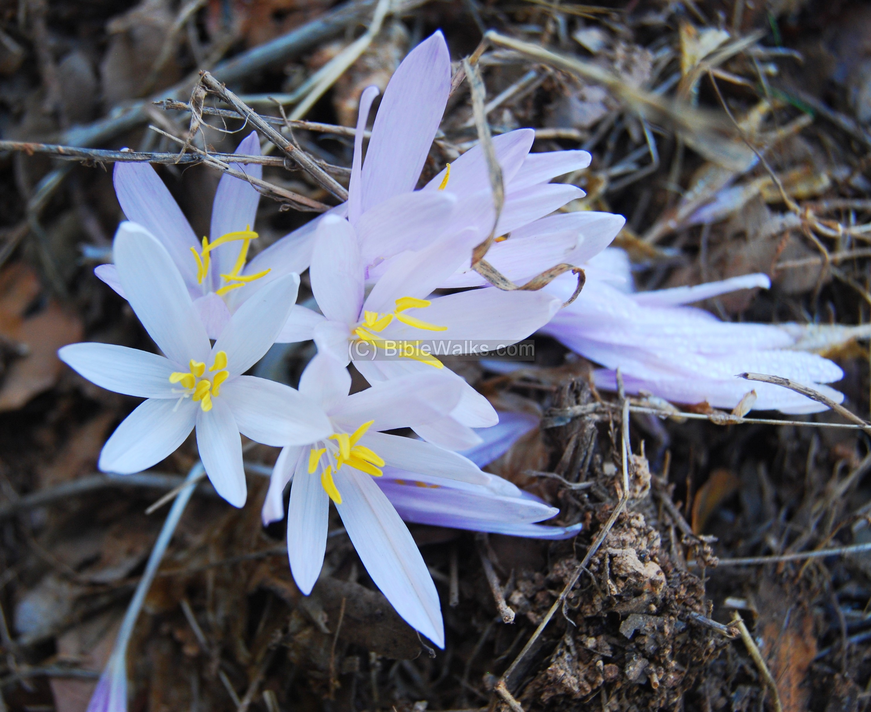
- Sitvanit Hermon
The photo below shows one of the flowers that can be seen on the first days of the autumn, and is named as the informer of the Autumn. The flower type is called “Colchicum tauri”; In Hebrew: “Sitvanit Hermon”, where the former name means “flower of the Autumn” and the latter name is called after Mt Hermon. Sitvanit is referred in the Mishna, the 2nd C AD books of Jewish practices, where it is said to be used to produce vinegar.
(Rotem: thanks for uncle Ronnie for the identification of the flowers and trees)
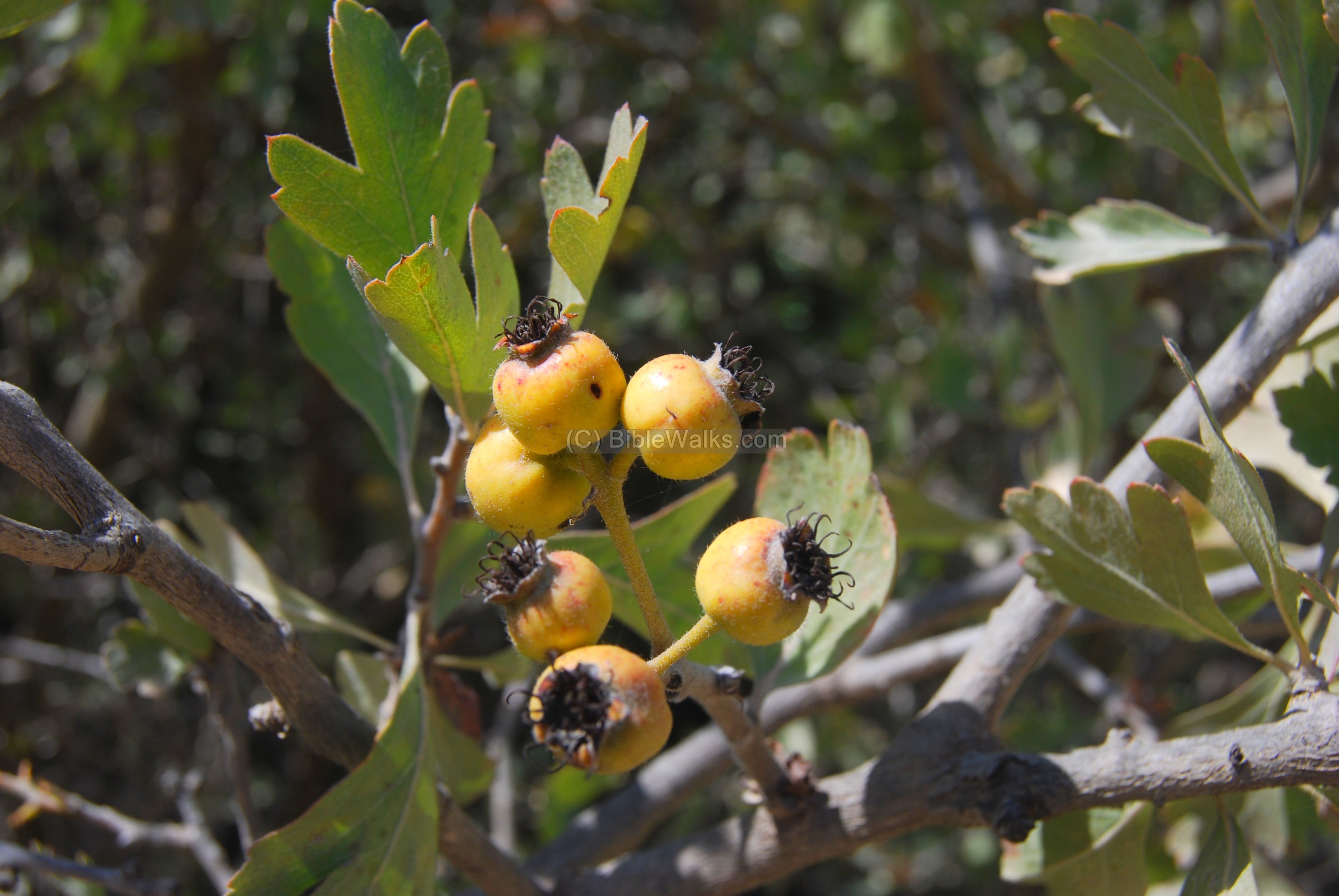
- Uzrar Kotzani – Spiny Hawthorn – Christ Thorn
Another common bush is seen below, called Spiny Hawthorn (Hebrew: “Uzrar Kotzani”). This thorny bush was associated by the Greeks and Romans with marriage and fertility, and is used in religious ceremonies.
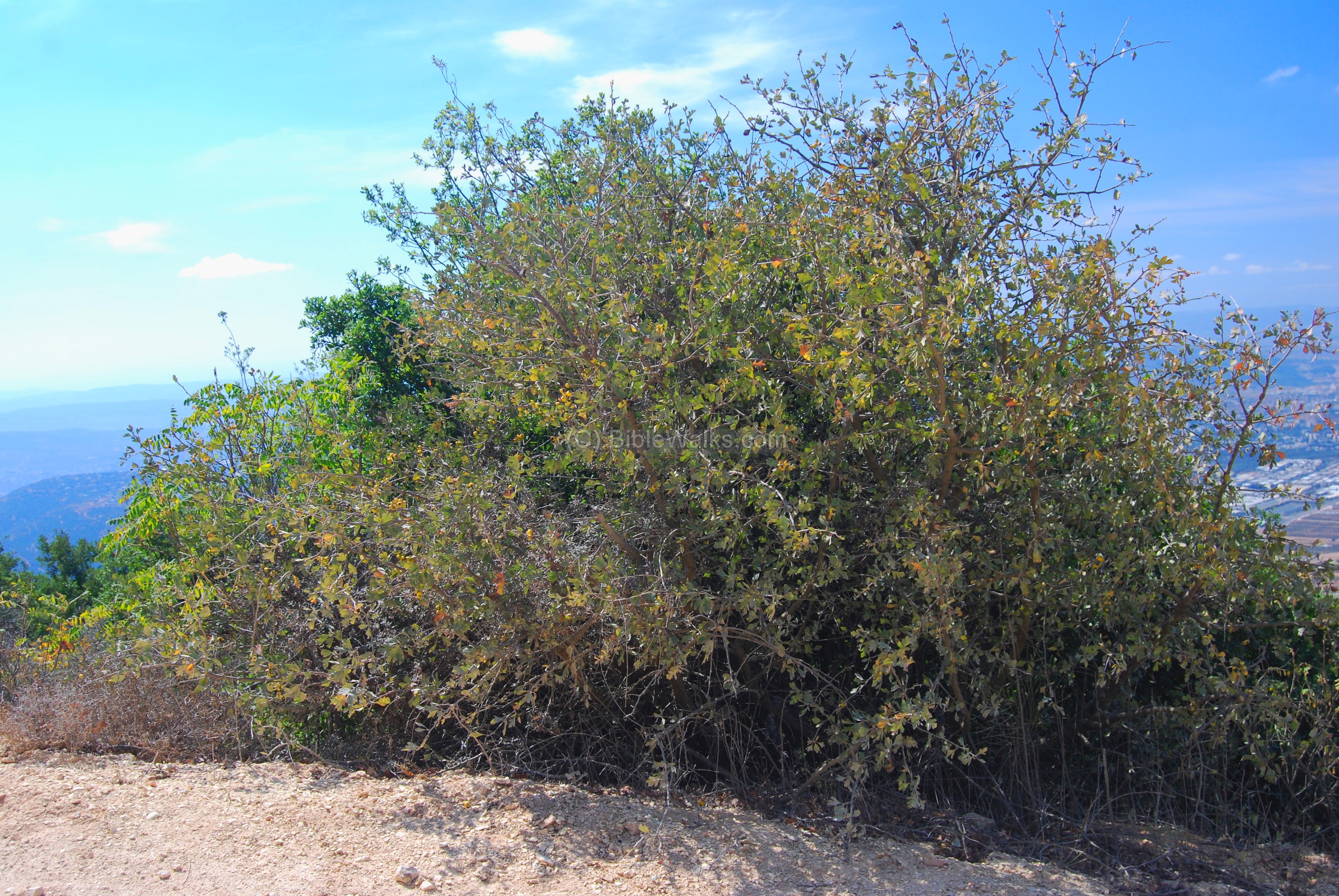
One of the Christian traditions is that the Jesus crown of thorns was twisted from twigs of the bush, and thus the bush is also called “Christ Thorn”. (Matthew 27: 29: “And when they had platted a crown of thorns, they put it upon his head…”). Note that there are other thorns that claim to have made up the crown of thorns, such as the Arabian jujube (Ziziphus spina-christi, sheisaf ).
A detail of the Hawthorn bush shows the fruits, which taste like an apple. The Arabs collect these small fruits and prepare jelly and juice.
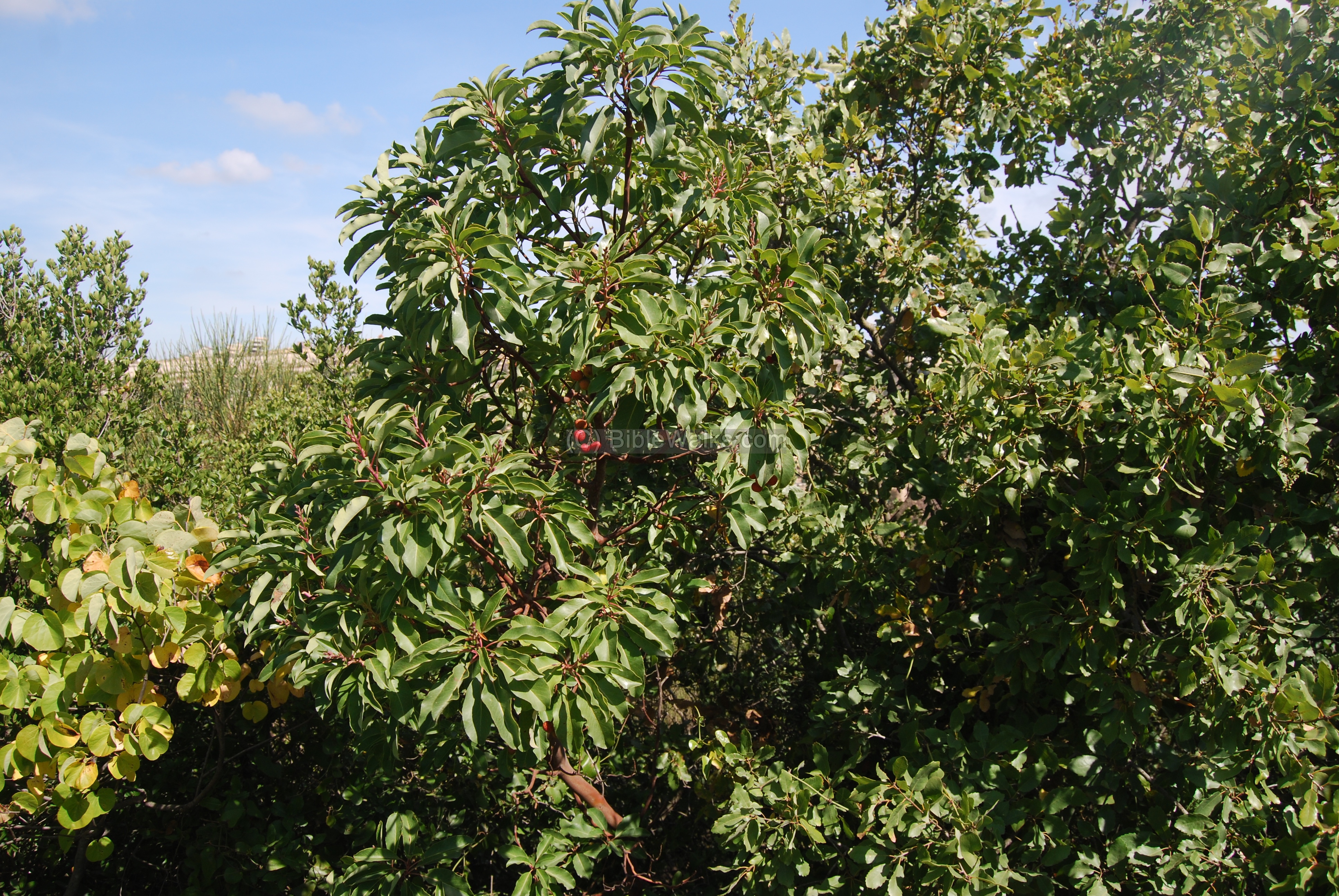
- Katlav – Eastern strawberry Tree
Another bush, seen below, is called “Eastern Strawberry Tree” (Hebrew: “Katlav Matzui”). Its branches and fruits have a vivid red color, which earned its “strawberry” name.
There are several tales that explain the “bloody” look of the branches and fruits. One of the Biblical tales is about prince Absalom – the son of King David who mutinied against his father. He was caught hanging on the oak tree (in the Hebrew version: Ella/Pistacia tree) with his long hair, then he was stabbed to death by David’s soldiers. According to the legend, on the place where Absalom’s blood dripped, a new tree specie was born – the strawberry tree.
2 Samuel 18:9-17: “And Absalom rode upon a mule, and the mule went under the thick boughs of a great oak, and his head caught hold of the oak, and he was taken up between the heaven and the earth; and the mule that was under him went away…. And ten young men that bare Joab’s armor compassed about and smote Absalom, and slew him…. And they took Absalom, and cast him into a great pit in the wood, and laid a very great heap of stones upon him:”.
This tree is normally found near an oak tree , just like where prince Absalom died.
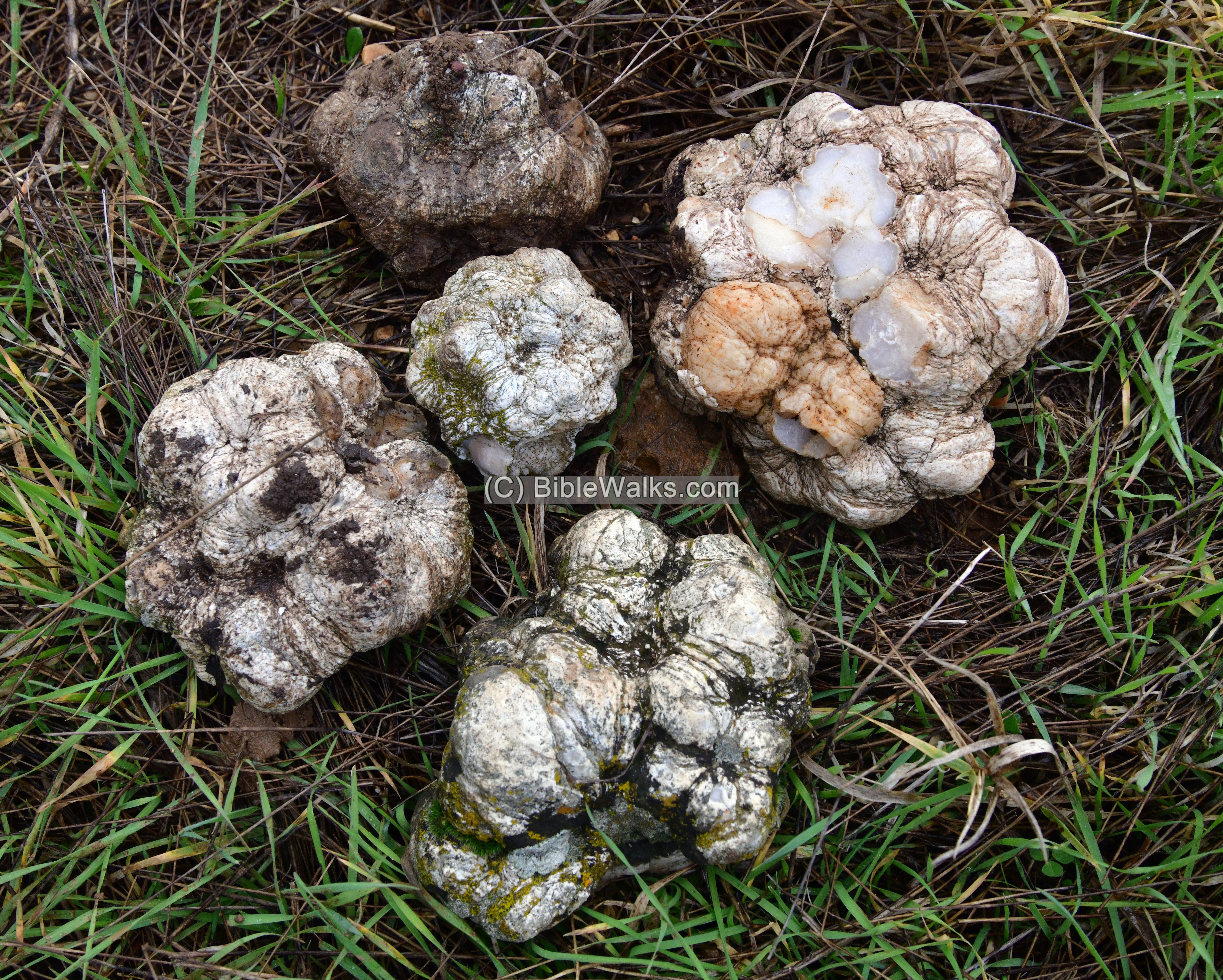
- Quartz stones:
In the area around Beit Jann are many stones nicknamed “Elijah’s watermelon”, also “Brain Stones”. These stones are quartz balls, the size of various sizes such as a golf ball or melon. If the stone is broken it has a colored inner texture. This collection was found on Horvat Shefannim.
Biblical:
(a) Asher : Joshua 19:24-27
The east side of the region of the Israelite tribe of Asher passed at a site/city of Beth Dagon, which may be identified as the place of Beit-Jan (which preserved the name).
“And the fifth lot came out for the tribe of the children of Asher according to their families. And their border was…
… And turneth toward the sunrising to Bethdagon…”
(b) Naftali: Joshua 19: 32-39
This text describes the area belonging to the bordering tribe of Naphtali (Naftali), including the city of Ramah which is located in the plains south of the hills of Beit Jan.
The sixth lot came out for the children of Naphtali, even for the children of Naphtali according to their families….
… And the border … reached to Asher on the west… And the fortified cities were … Ramah…”.
Etymology (behind the name):
- Beit Jann – Beit is “House” in Arabic and Hebrew; “Janna” is garden in Arabic (“Gan” in Hebrew). Therefore, the name may mean “house of the garden”.
- Beit Jenn. This is spelled in the PEF map. It is explained in the PEF dictionary as: “The house of the genie : but probably Beth
Gann, the garden house”.
It may also be identified with Biblical site of “Beth-Dagon” of the Galilee, and may have preserved the ancient name.
- Beth-Dagon – a city or place within the region of Asher. Means in Hebrew: Beth (“house”) + Dagon (a Canaanite and Philistine God of agriculture and grain – “Dagan”).
- Ha-Ari: Hebrew: “The Lion”. Also named after the Holy Ha’Ari -the 16th C author of the Kabalah.
- Beth Haccerem – Hebrew: House of the vineyard.
- Khirbet Shufnin – Arabic: The ruin of the dove.
- Shefannim – Hebrew: rabbits. Proverbs 30:26: “The shephanim are not mighty people, Yet they make their houses in the rocks”.
Links:
Flowers and Bushes:
-
Tiuli wild flowers:
Other Links:
BibleWalks.com – walk with us through the sites of the Holy Land
Beit Uriya<<<–previous site—<<<All Sites>>>—next Upper Galilee site—> Seraf
This page was last updated on Mar 2, 2024 (renamed Horvat Shfanim)
Sponsored links: