A Byzantine fortified village located on a high hill on the east side of Karmi’el, with two churches. This was the most important site in the area.
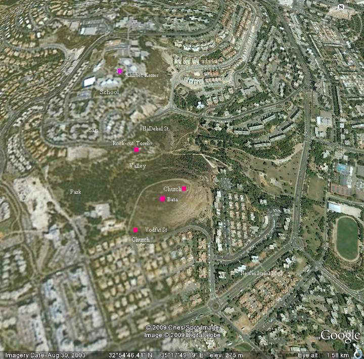
Home > Sites > Beit-Kerem > Karmi’el > Khirbet Bata
Contents:
Background
Location
History
Photos
* General view
* South
* East
* North
* Top Chapel
* Lower Chapel
* Top of hill
Links
Etymology
Background:
A Byzantine fortified village located on a high hill on the east side of Karmi’el, with two churches inside the walled area. This was the most important site in the area.
Location:
The site is located on a high hill (altitude 305M) on the east side of Karmi’el. The site is accessed from a dirt road that starts from Yodfat street, on south side of Kh. Bata.
History:
Byzantine:
During the Byzantine period (5th-7th century) the area of western Galilee was mostly populated by Christians. The area within the municipal area of the city of Karmiel was the densest in this region – a total of nine (!) Byzantine monasteries were excavated here or identified as such.
Khirbet Bata was one the most important site in this area – a Byzantine fortified village with 2 small churches. The village was protected by a wall around the higher foothills and the lower church, which is unique in Byzantine villages.
Excavations by Yeivin (published in 1991), assisted by local high school students, unearthed a fortified monastery, chapel, mosaics and a large cistern.
Another large church (25 x 50M), part of another Byzantine monastery, was excavated in Khirbet Kenes, located on the north side of Bata. It is covered today in the school yard of Megadim high school.
Arab/Mamlukes period:
Most of the Byzantine sites were destroyed in the 7th century during the Persian or Arabic conquests. The site was resettled during the Arab, Crusader, Mamlukes and Ottoman periods. Today the site is in ruins and only small sections were excavated.
Ottoman period:
In the PEF survey (1881-1883) the site is named as Kh. es-Siyeh. The full Arabic name was “Bat es-Siyeh”, which was the base of the modern Hebrew name of “Bata”, a Biblical name for scrubland. The explorers reported on this site a short description (SWP Sheet V p. 321): “Heaps of small stones, foundations, and cisterns”.
Modern times:
Karmiel was established in 1964, and has grew since then to a large and beautiful city with over 50,000 residents (2008).
The site, located on a high hill in the east side of the city, was left untouched, and the residential neighborhoods were built around it.
It is very easy to access the site (via Yodfat st.), and is recommended both for the archaeological remains and the great panorama of the Beit-Kerem valley.
Photos:
(a) General view
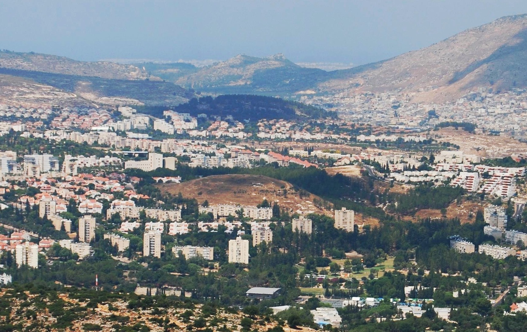
A view from the east shows the round hill of Kh. Bata in the center of the modern city. Behind it, in the far background, is Har Gamal (“Hill of the camel”) and behind it is the Mediterranean sea.
Click on the photos to view in higher resolution…
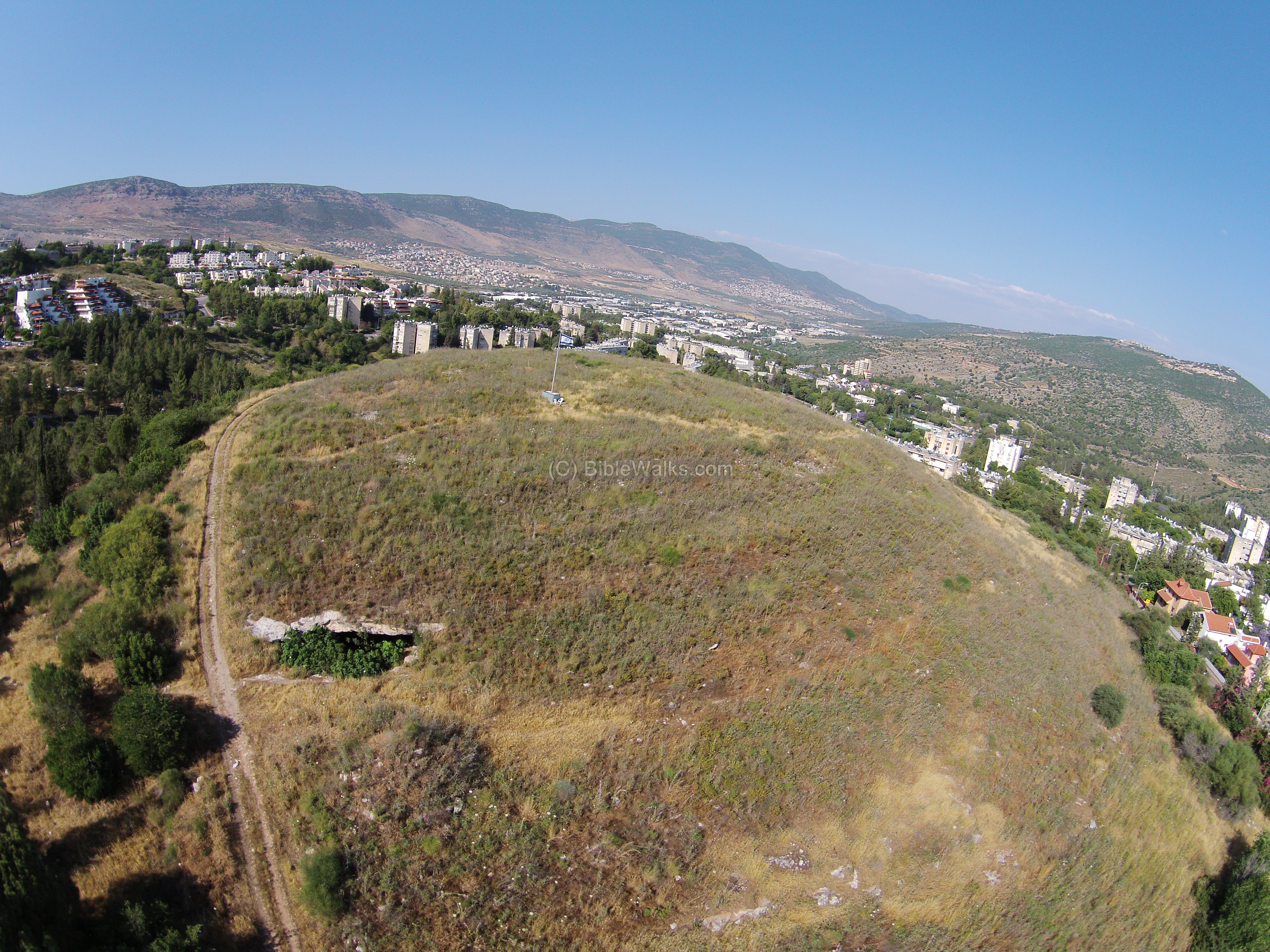
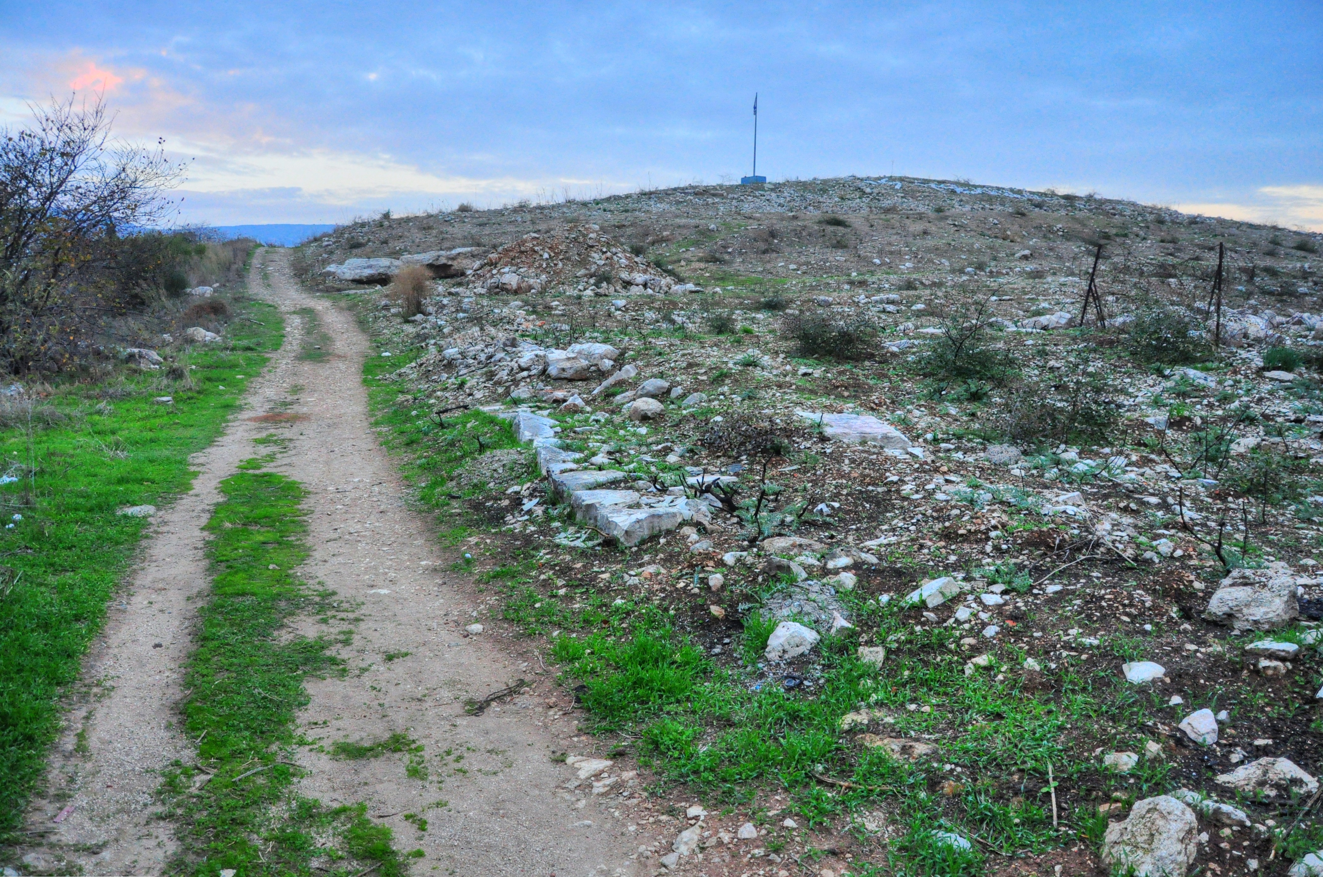
An aerial view, as captured by a quadcopter in May 2014 from the south side, is seen in the following photo. A road traverses the hill from its west side, passing near a large cave. An Israeli flag is located on the top, as in all ancient sites of Karmiel.
(b) South side
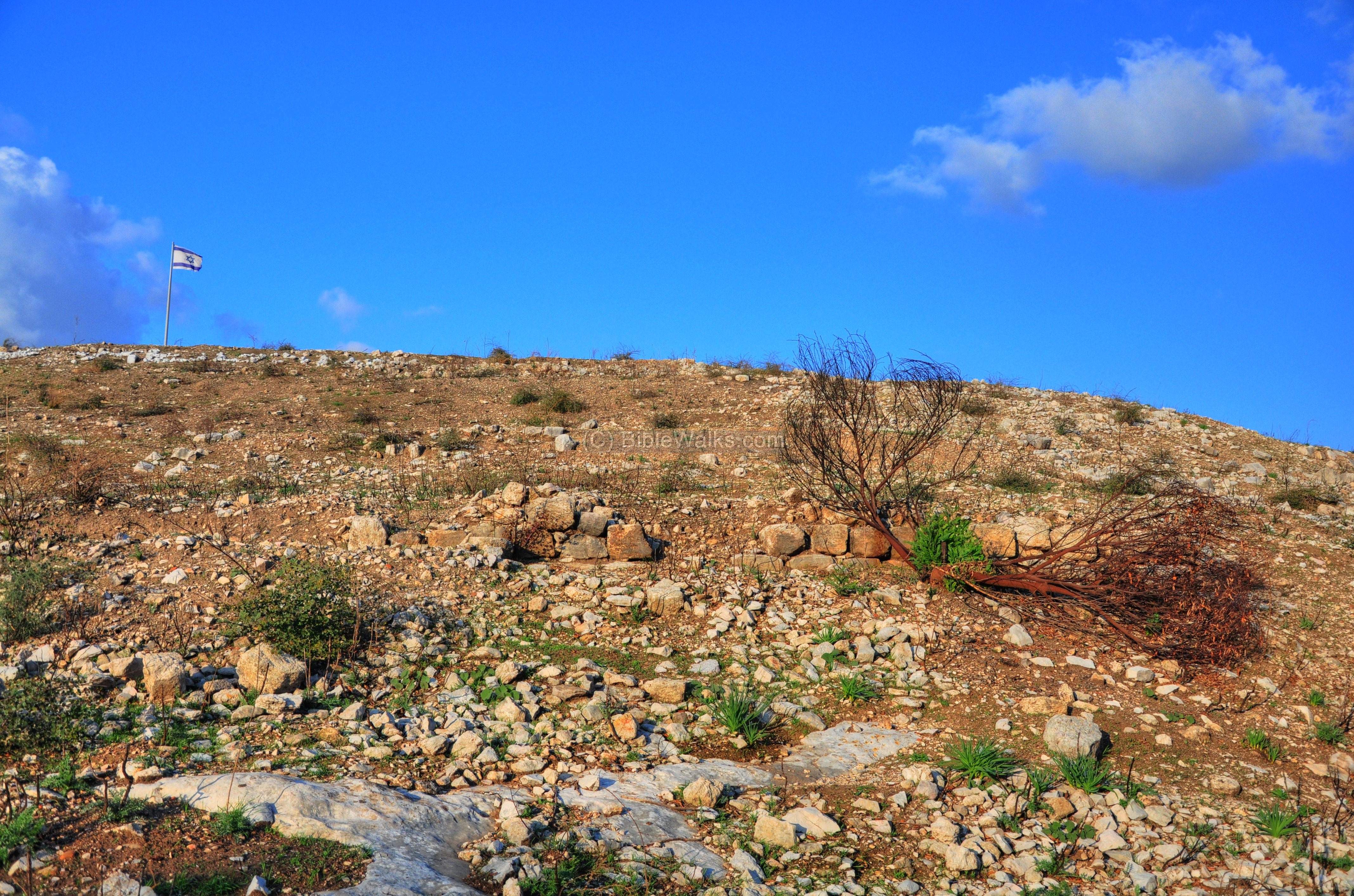
An easy access to the site is via Yodfat street. A dirt road circles around the hill and you can walk along it to enjoy the panorama and understand the topography of the site. On top of the hill is the Israeli flag, which was posted by the mayor in all the ancient sites of Karmi’el.
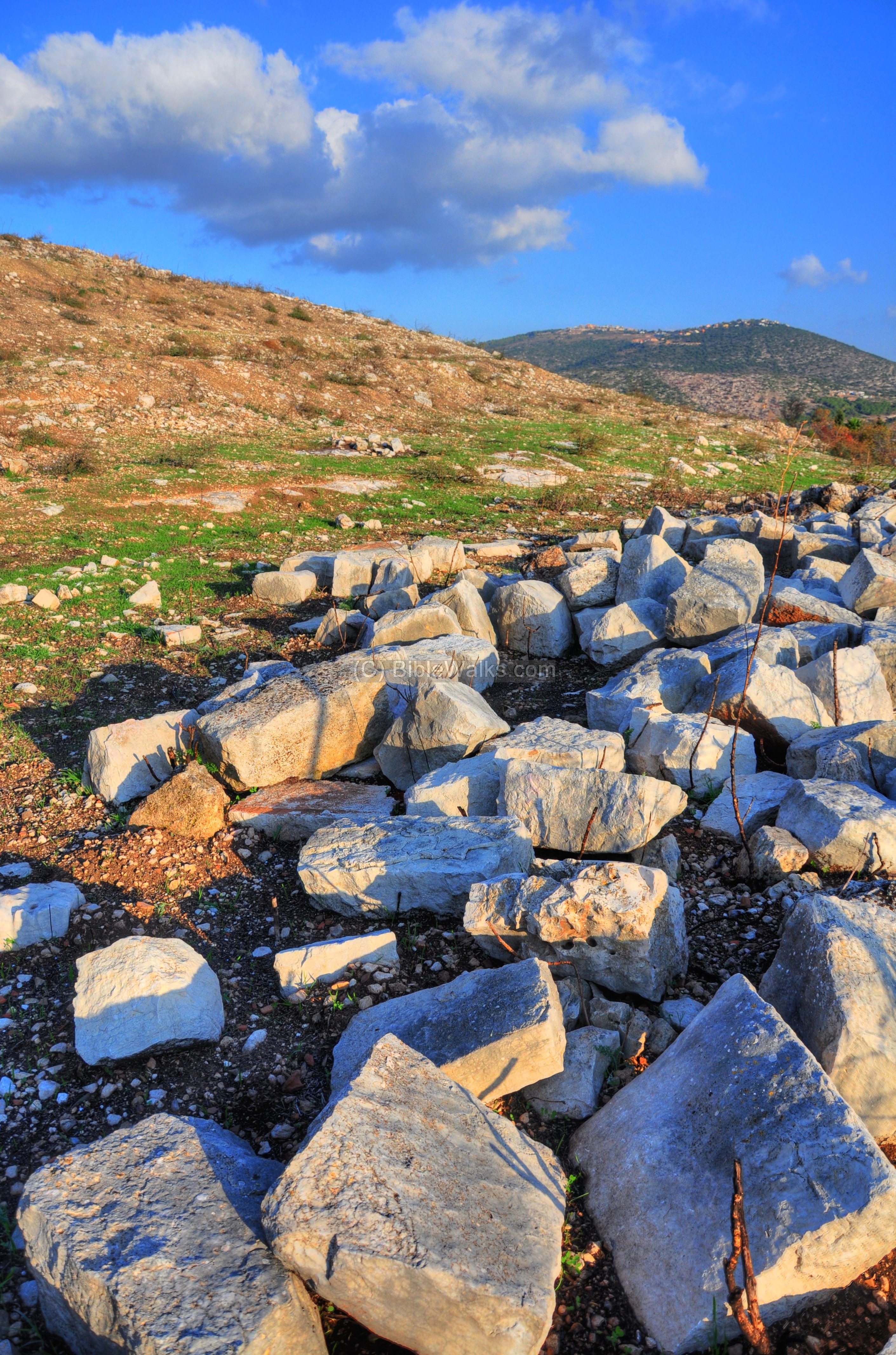
The hillside is littered by thousands of clay fragments, traces of walls and buildings, cisterns and installations:
Another base of a house is seen in the following picture:
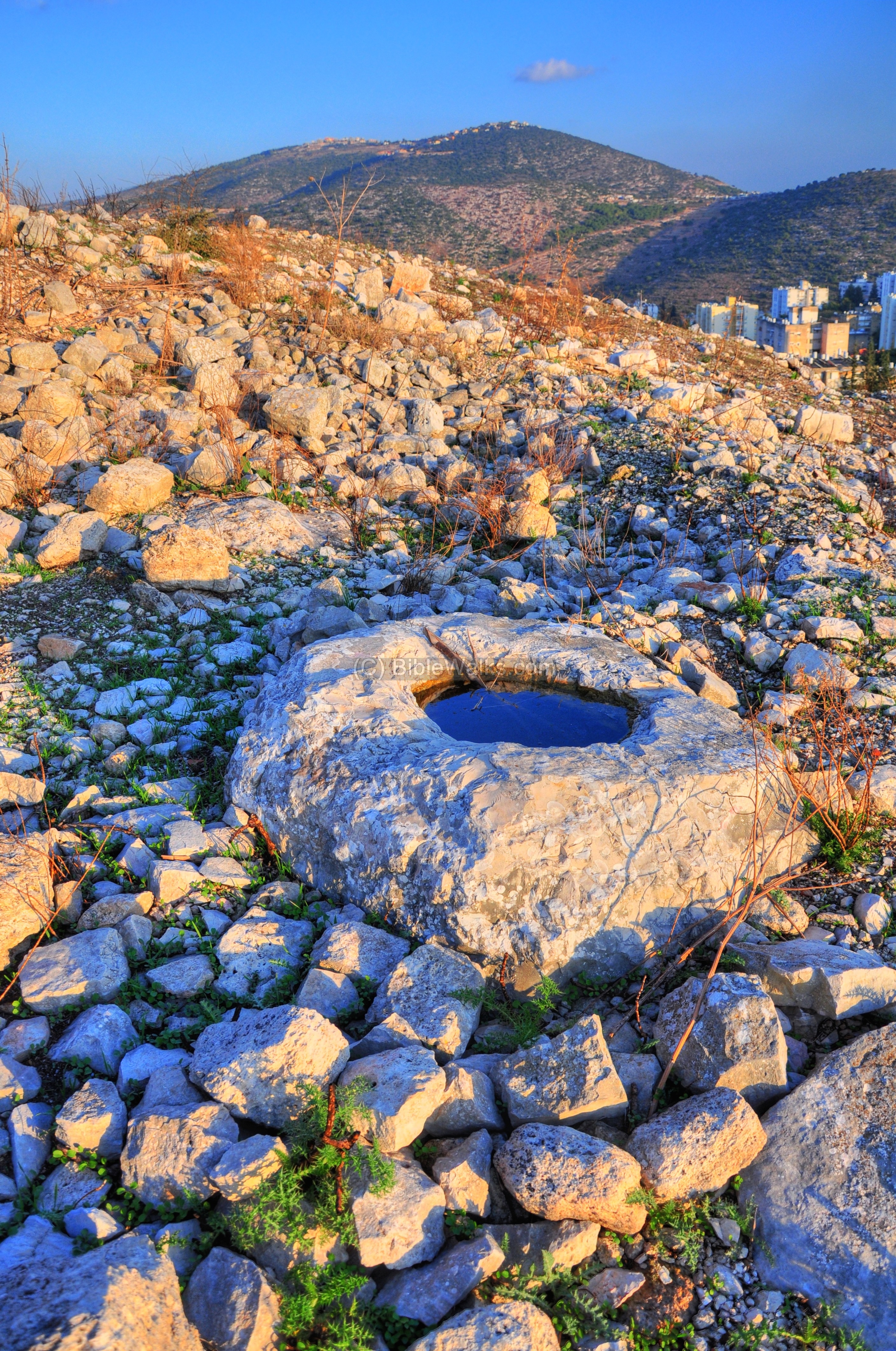
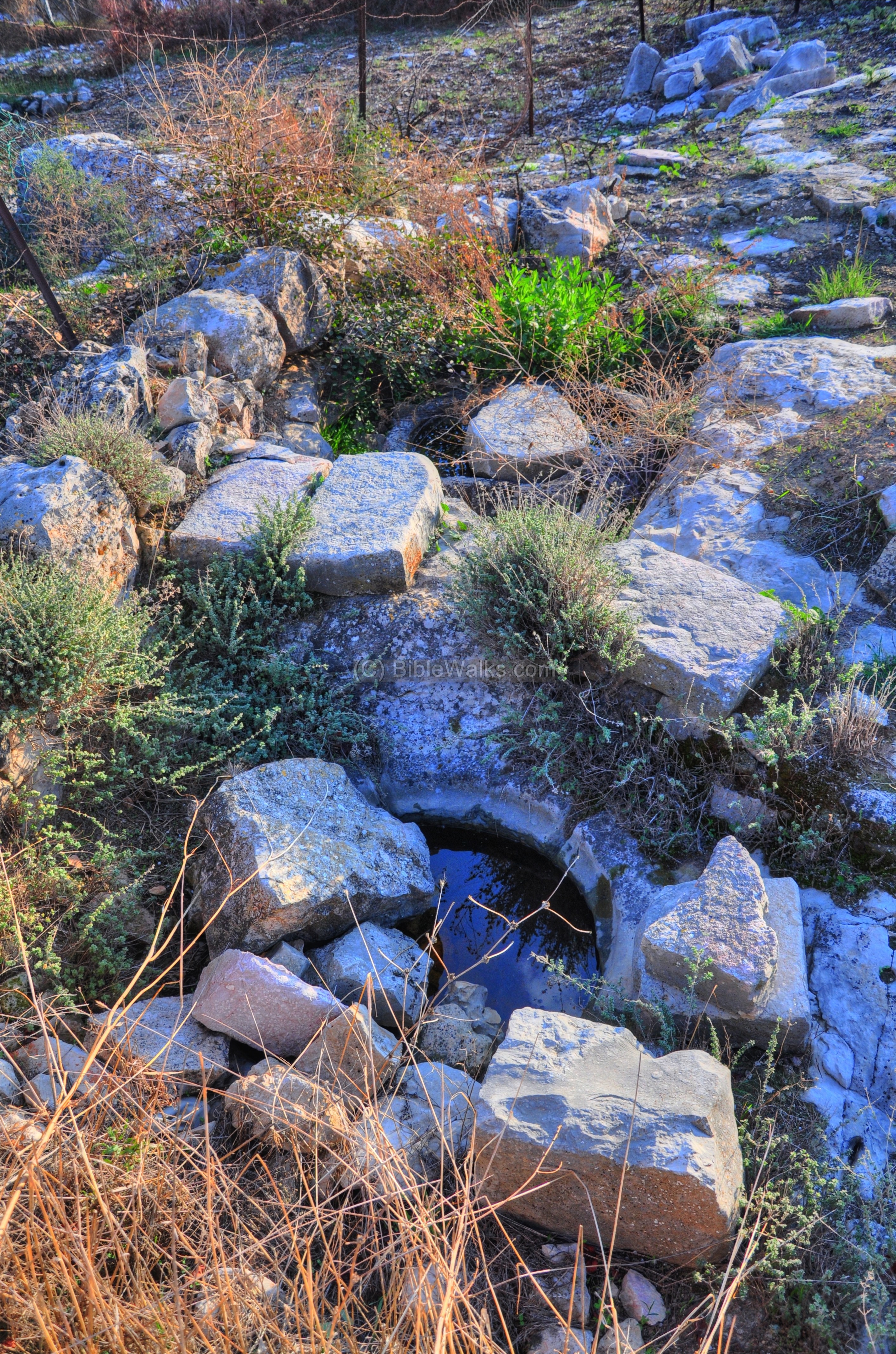
On the lower side of the hill is a large cistern, which was probably used as one of the sources for water. Its roof caved in, leaving a large opening on the top of cistern.
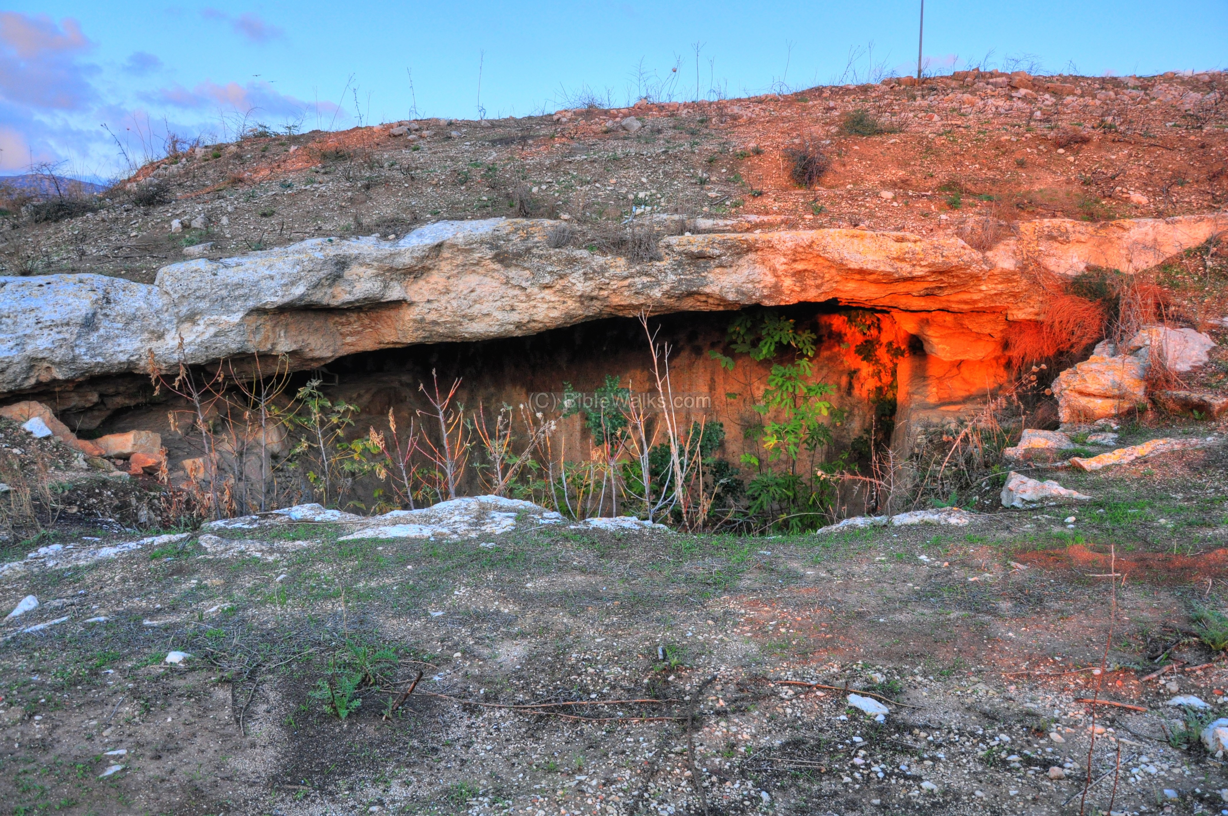
The interior of this cistern is seen below.
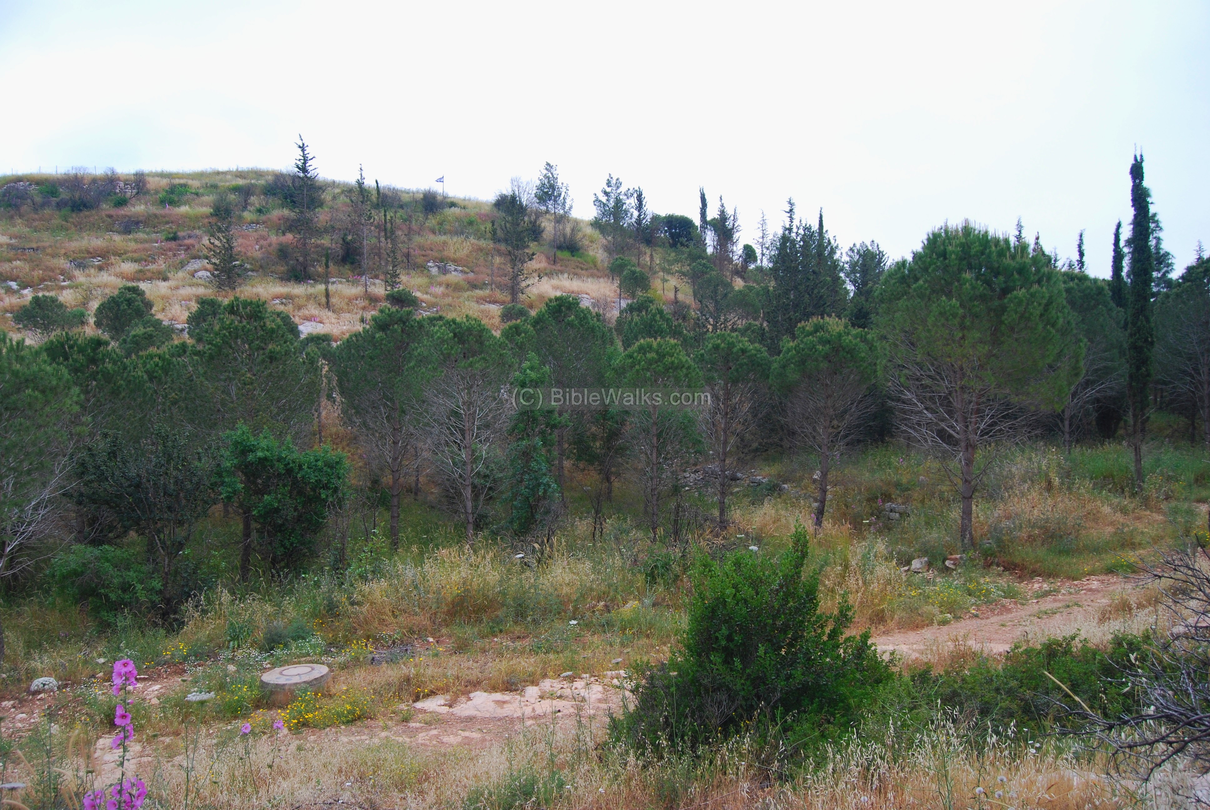
On the southern hillside are other cisterns and installations, and more traces of ruins:
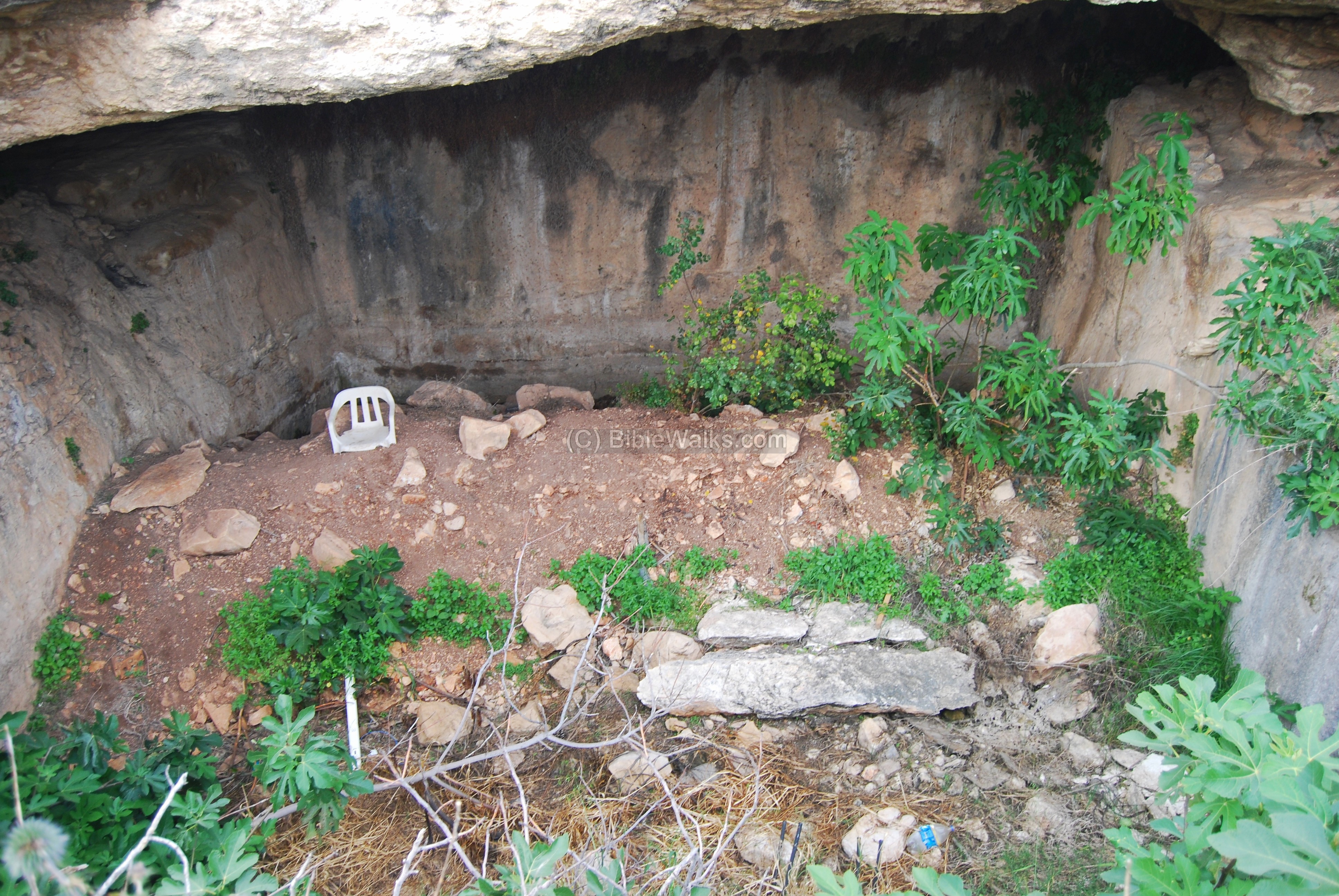
(c) Eastern side
The eastern hillside has no special visible remains, except for some traces of walls. Most of the stones were either buried or hauled away long ago.
The only visible exception is a large rock-hewn cavity whose function is not known to us. This may initially have served as a stone quarry, and later used as a pen.
A panoramic view towards the east is displayed below. Click on the photo to see it in detail, just like all other photos.
(d) North side
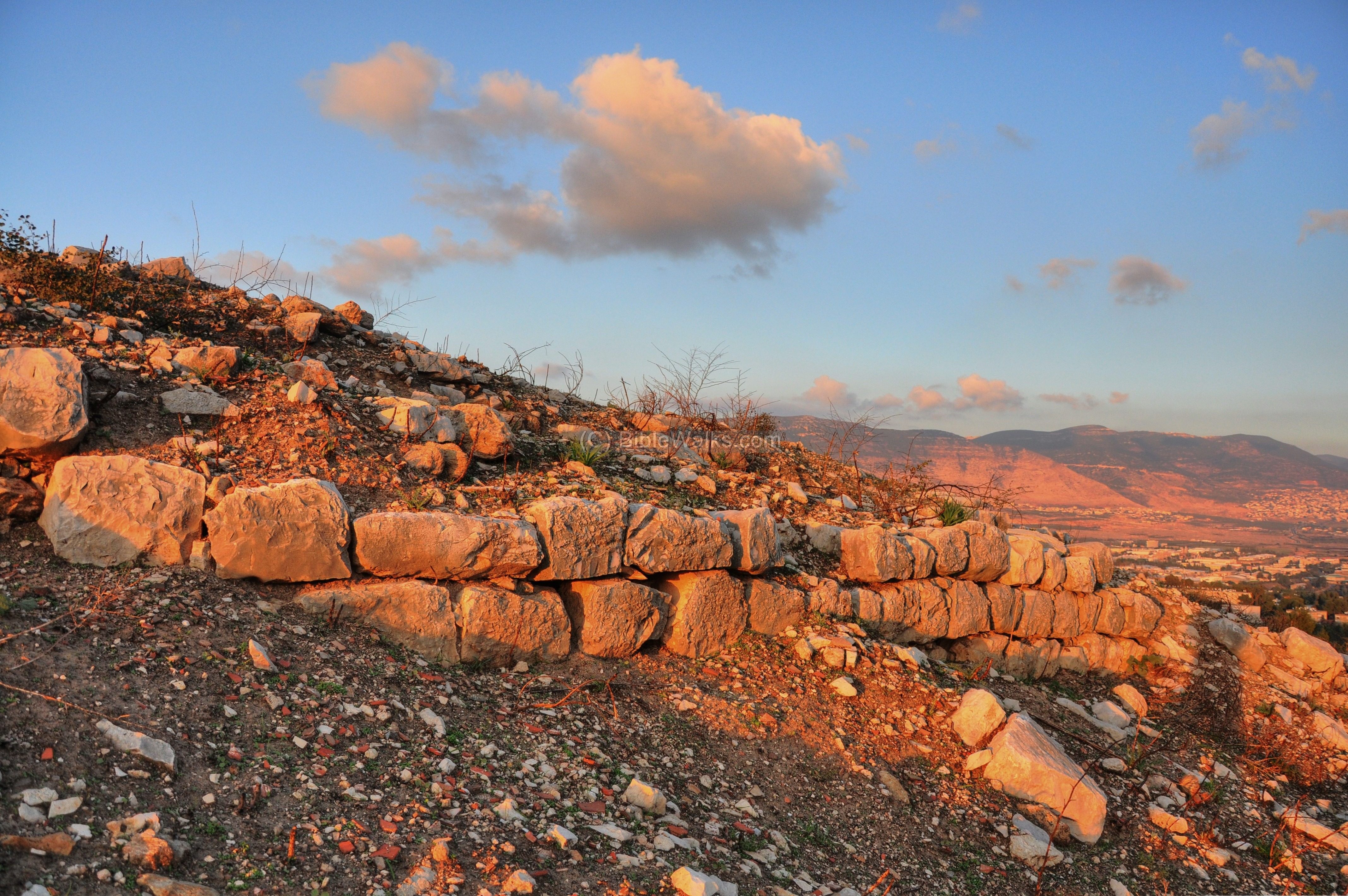
A great view of the Beit-Kerem valley is seen from the north side of Khirbet Bata.
The slope on the north side is very sharp. A road, which starts on the south side and circles around the west and north sides of the hill, follows the edge of the hill.
The municipality of Karmi’el, who are always keen on gardening, planted nice young trees around the hillside. Unfortunately, these were burnt by fires during fall 2010.
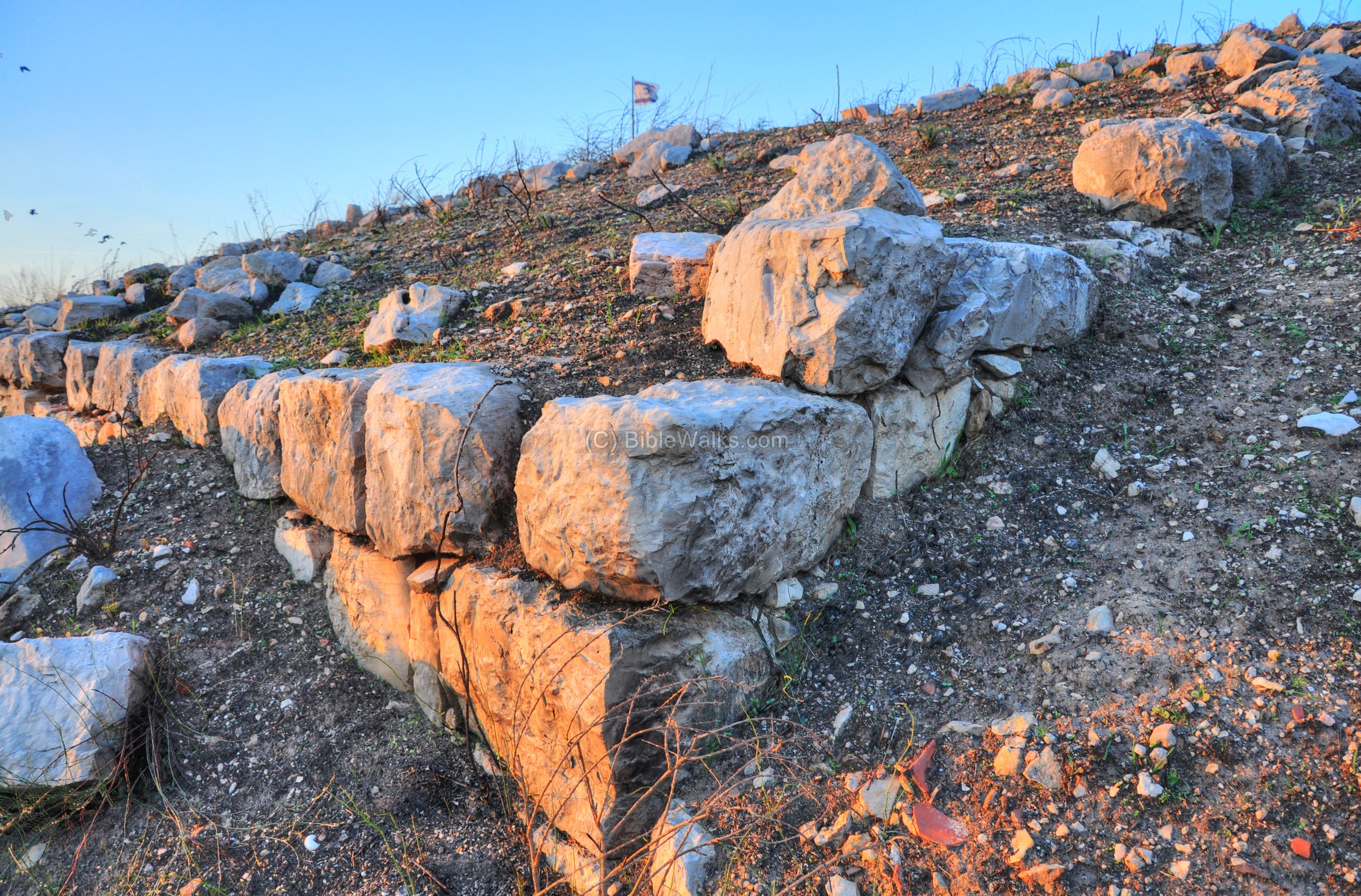
An ancient wall is built along the upper layer, just below the level of the circumference road. It surrounds the north and west side of the hill.
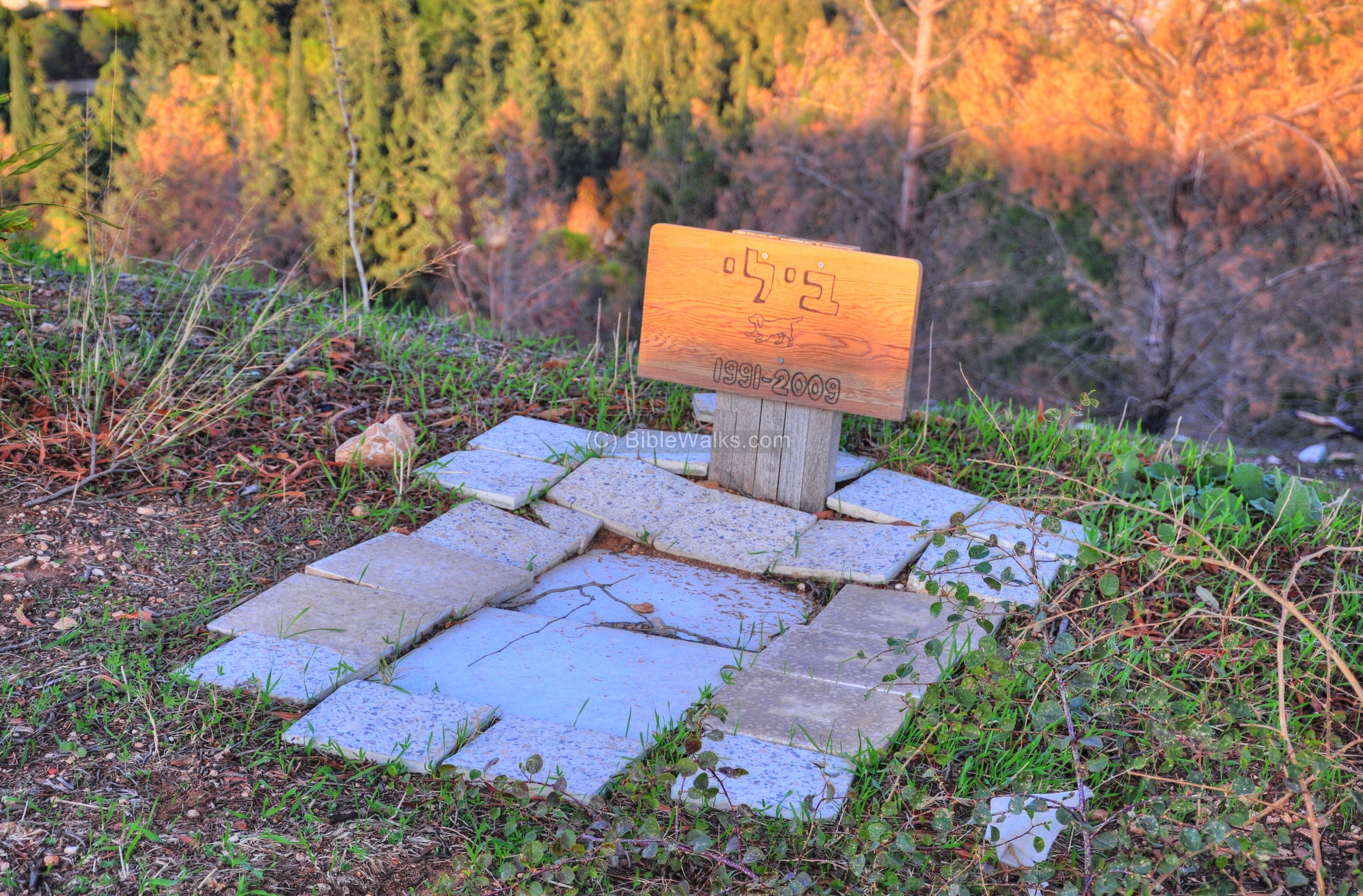
The kids of the neighborhood bury their cats and dogs on the north-east edge. One of these animal graves is dedicated to the beloved dog named Billy.
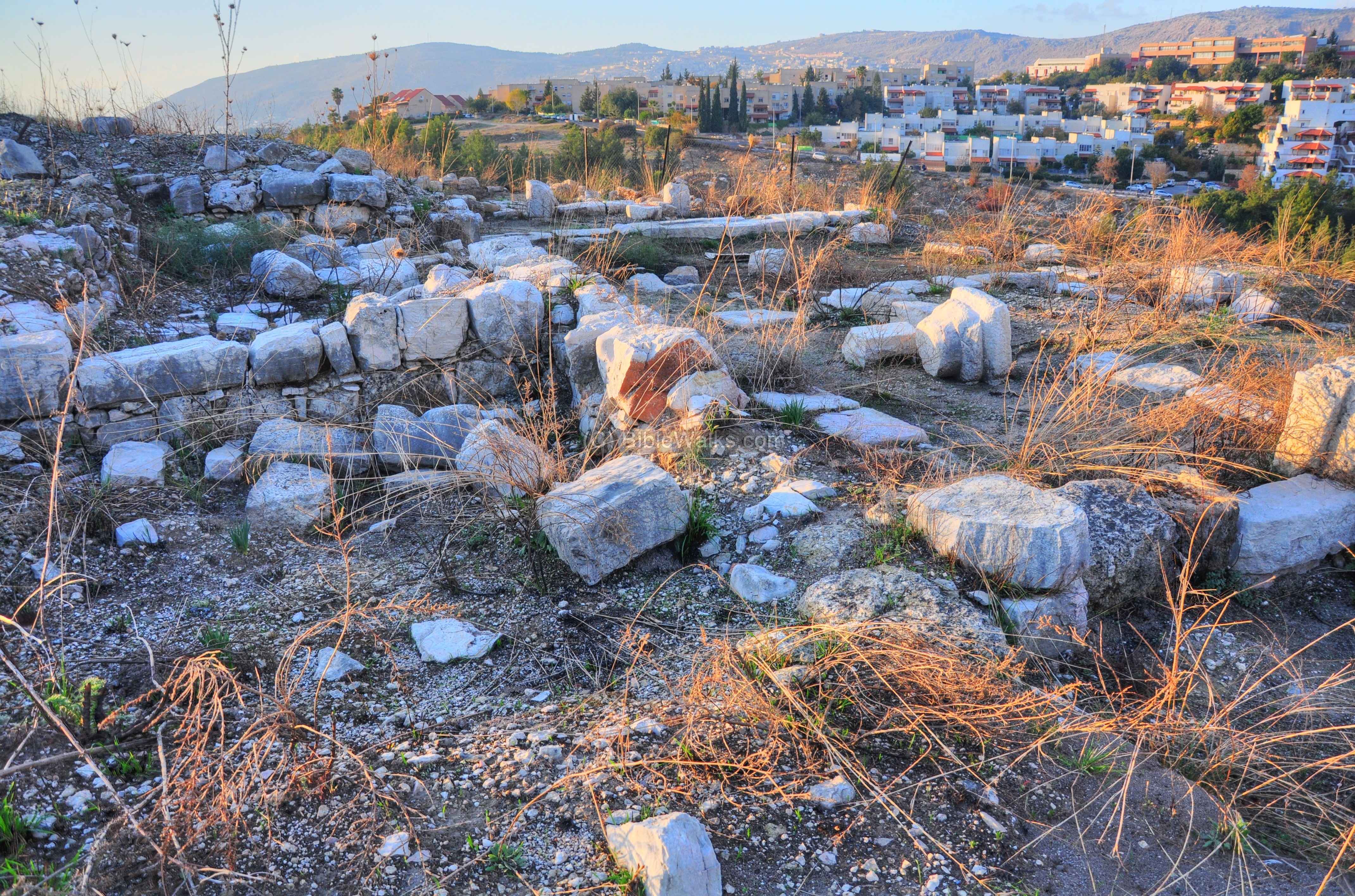
(e) Chapel on top of hill
On the north-eastern side, on the top of the hill, are the ruins of a small Byzantine church. The paved atrium to this church is seen in the foreground, while the prayer hall and apse are at the edge of the church.
The central apse of the chapel, seen below, is also oriented towards the east – as in most of the Christian churches.
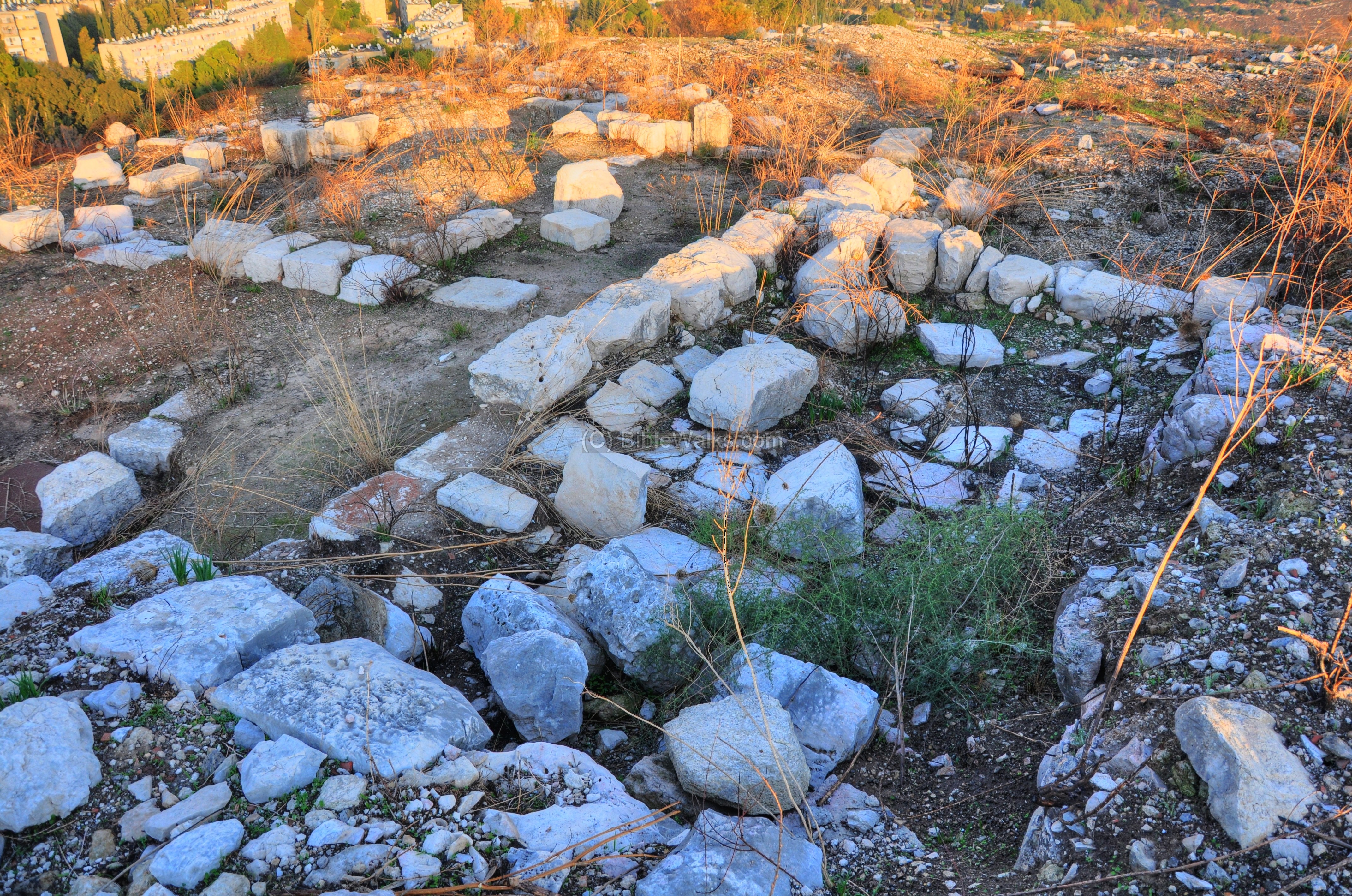
Another apse is located on the north side of the central apse:
The western section of the church and the rooms on its south side are seen in the picture below:
The eastern side, in the direction of the apse, is shown below. On the left side is the sealed entrance to the underground crypt.
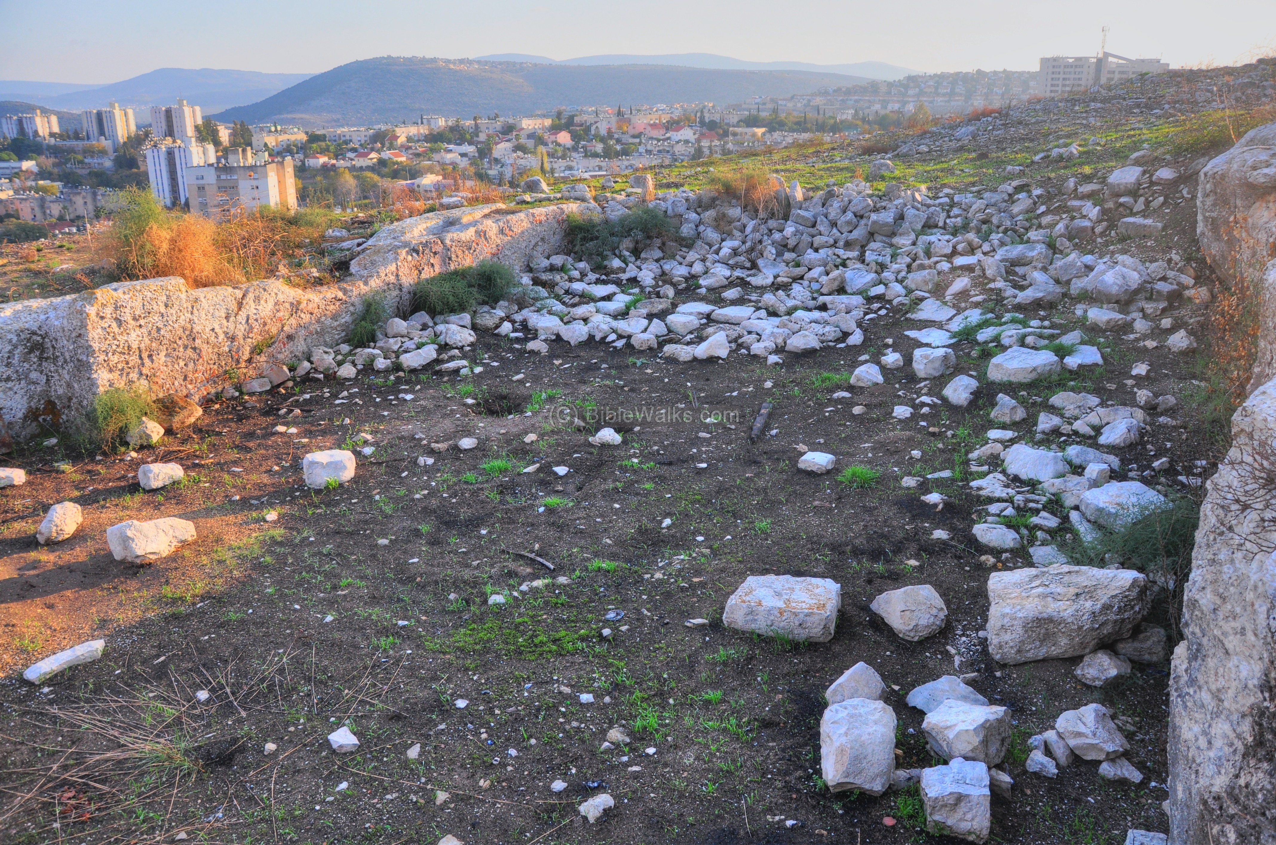
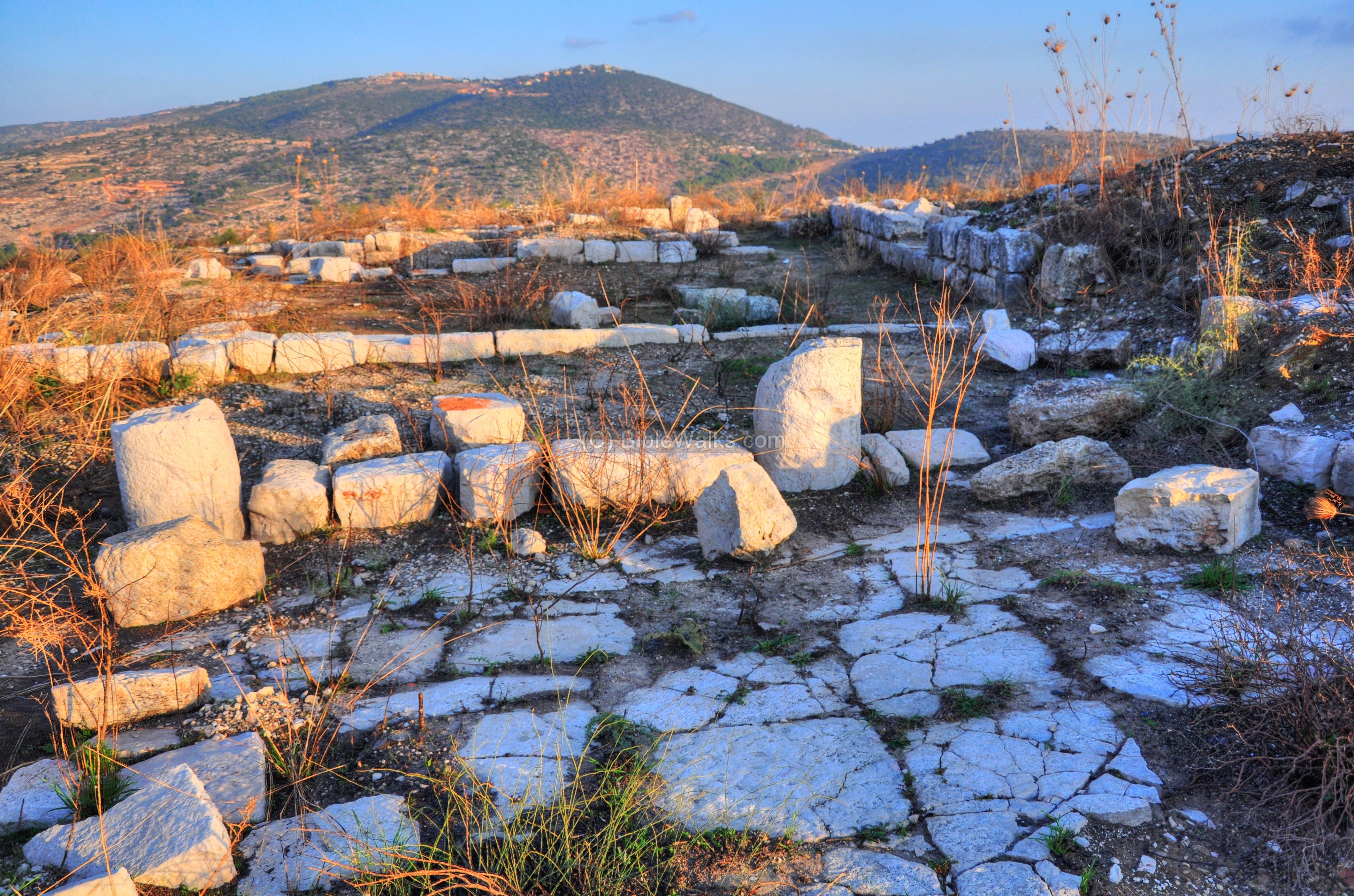
(f) South (Lower) Monastery and Chapel
On the lower south side of Khirbet Bata are remains of another Byzantine chapel, which was unearthed and researched by the archaeological team. Other remains include installations and other structures of a monastery.
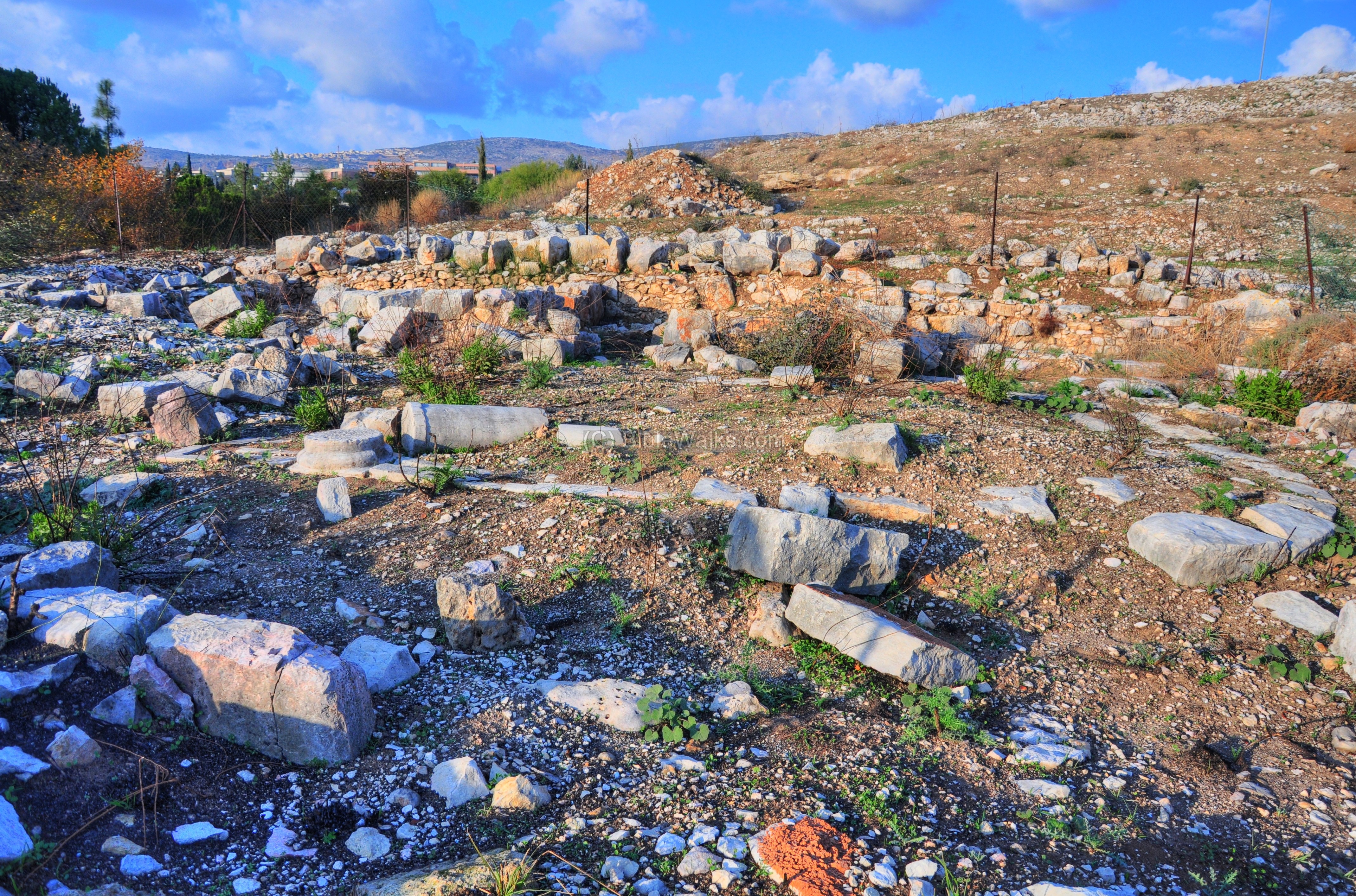
The apse of the church is seen below, with an orientation towards the east.
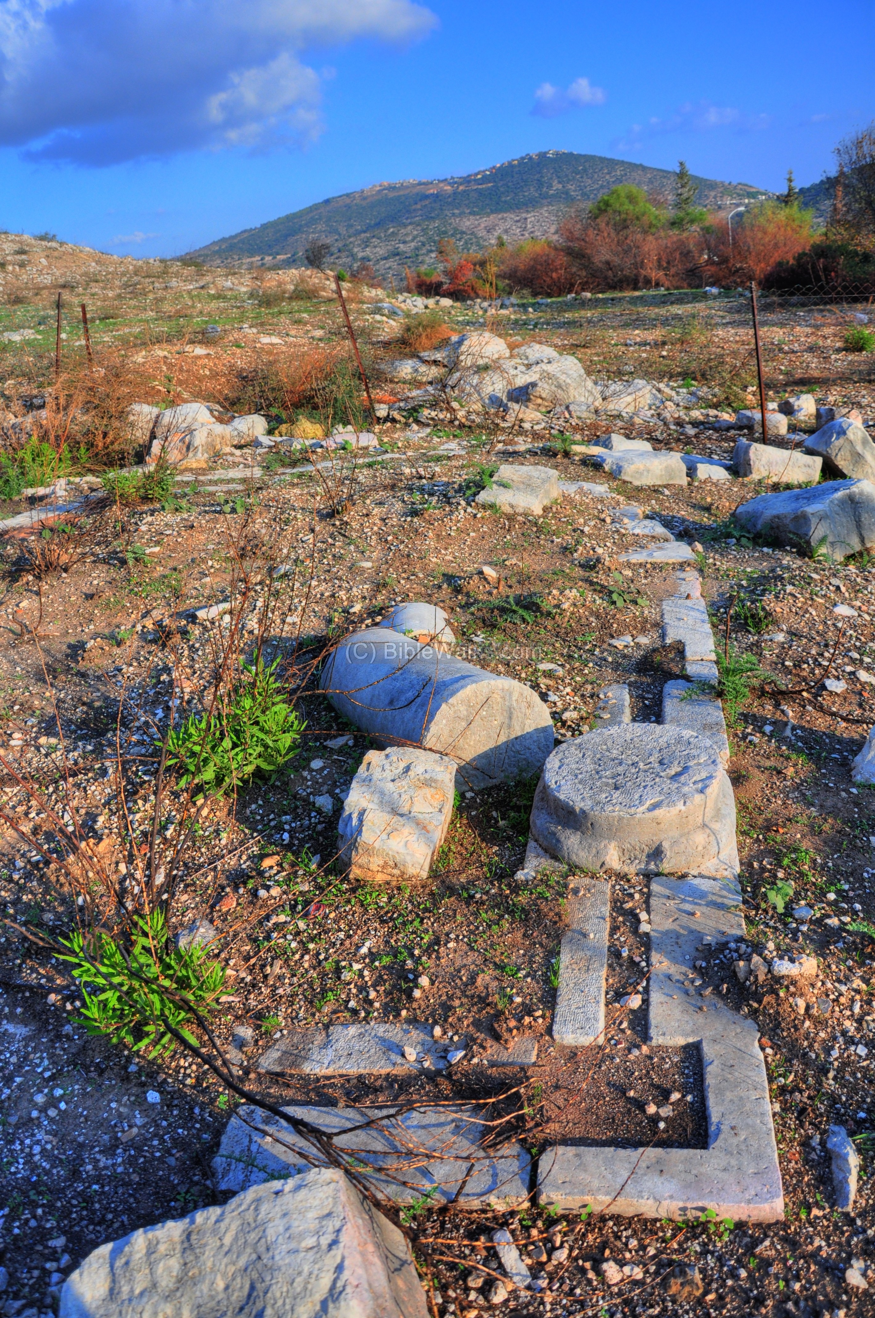
On the eastern side of the church are remains of an oil press.
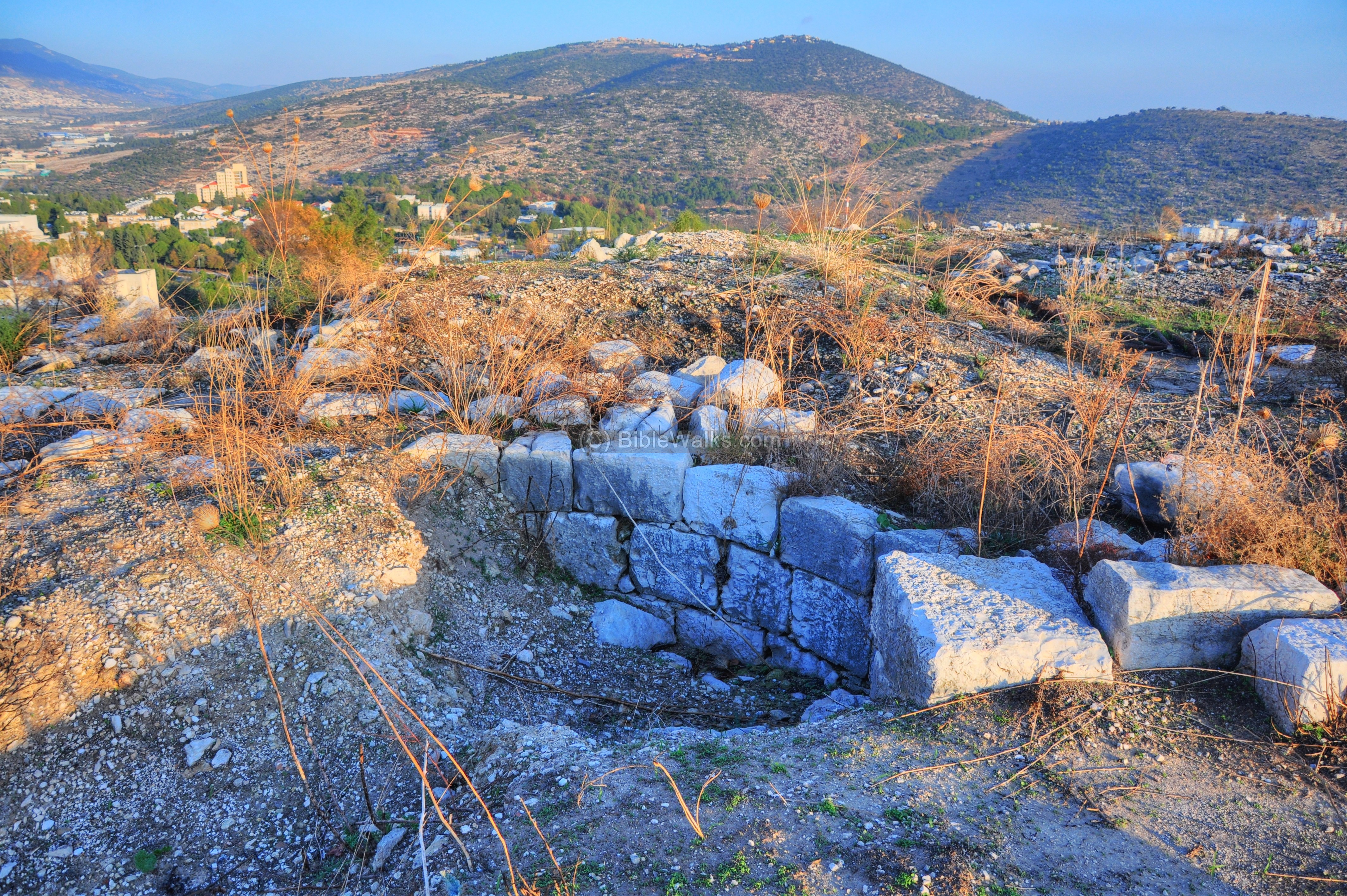
The wall around the hill actually descended to the lower level of this monastery, and included it into the walled section of the city. The picture below shows a small section of this wall, which was excavated in order to track the course of the wall.

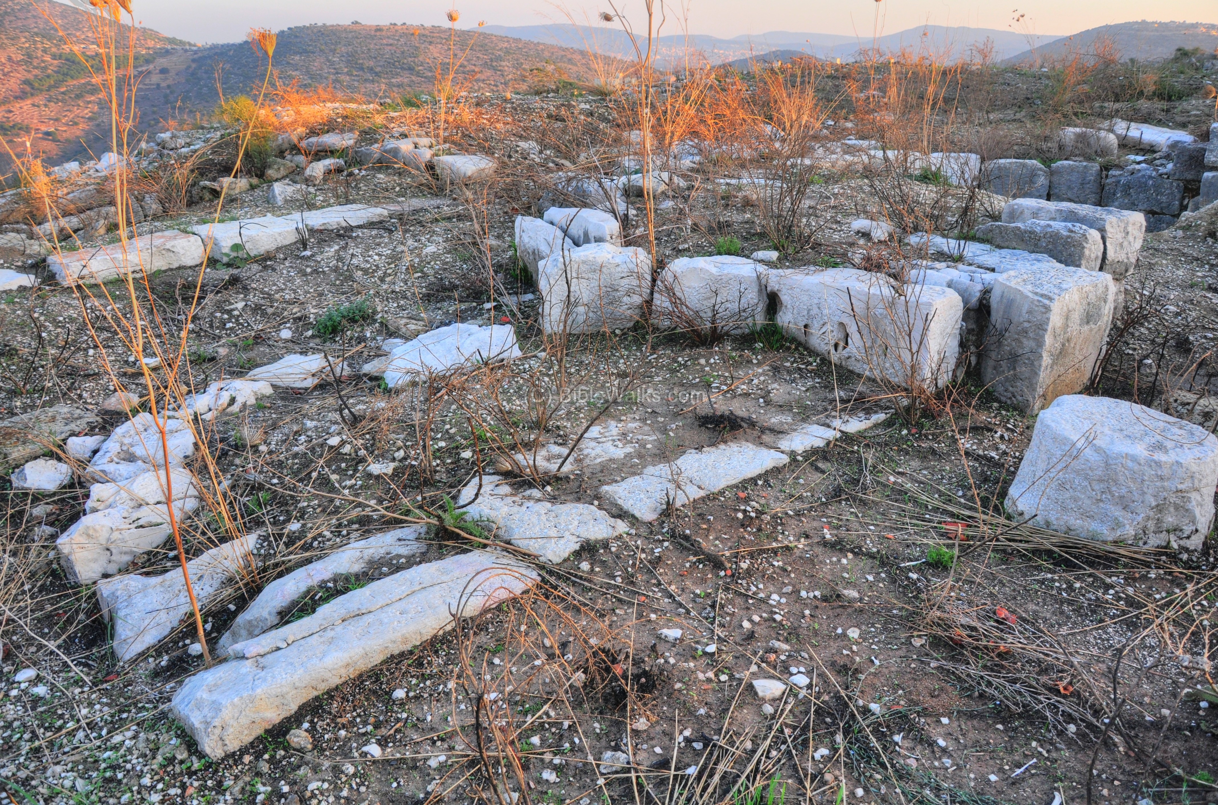
The next picture shows the north side of the monastery, with remains of its building blocks. The ruins of the village, along the hillside, are seen on the left.
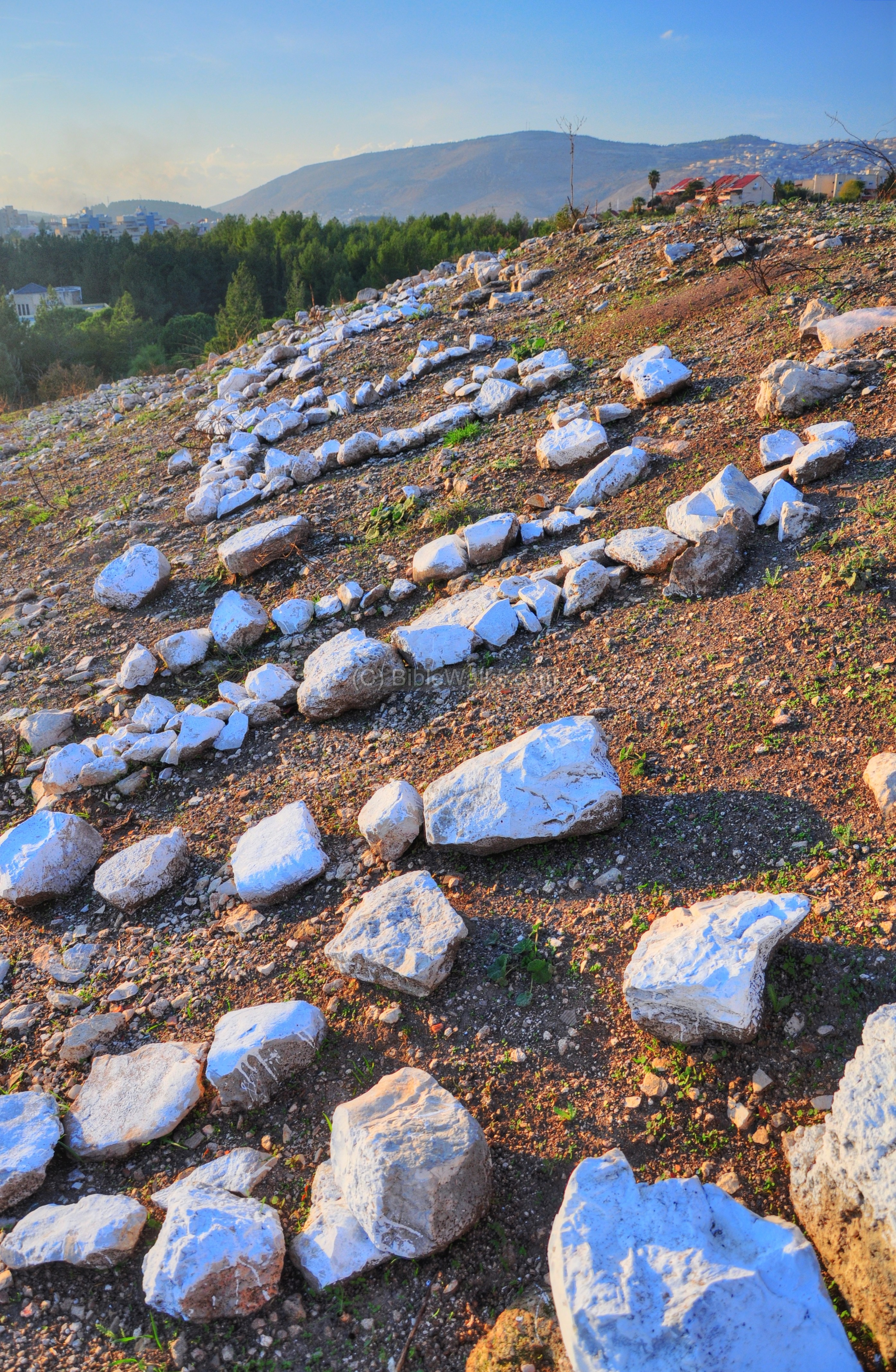
(g) Top of Hill
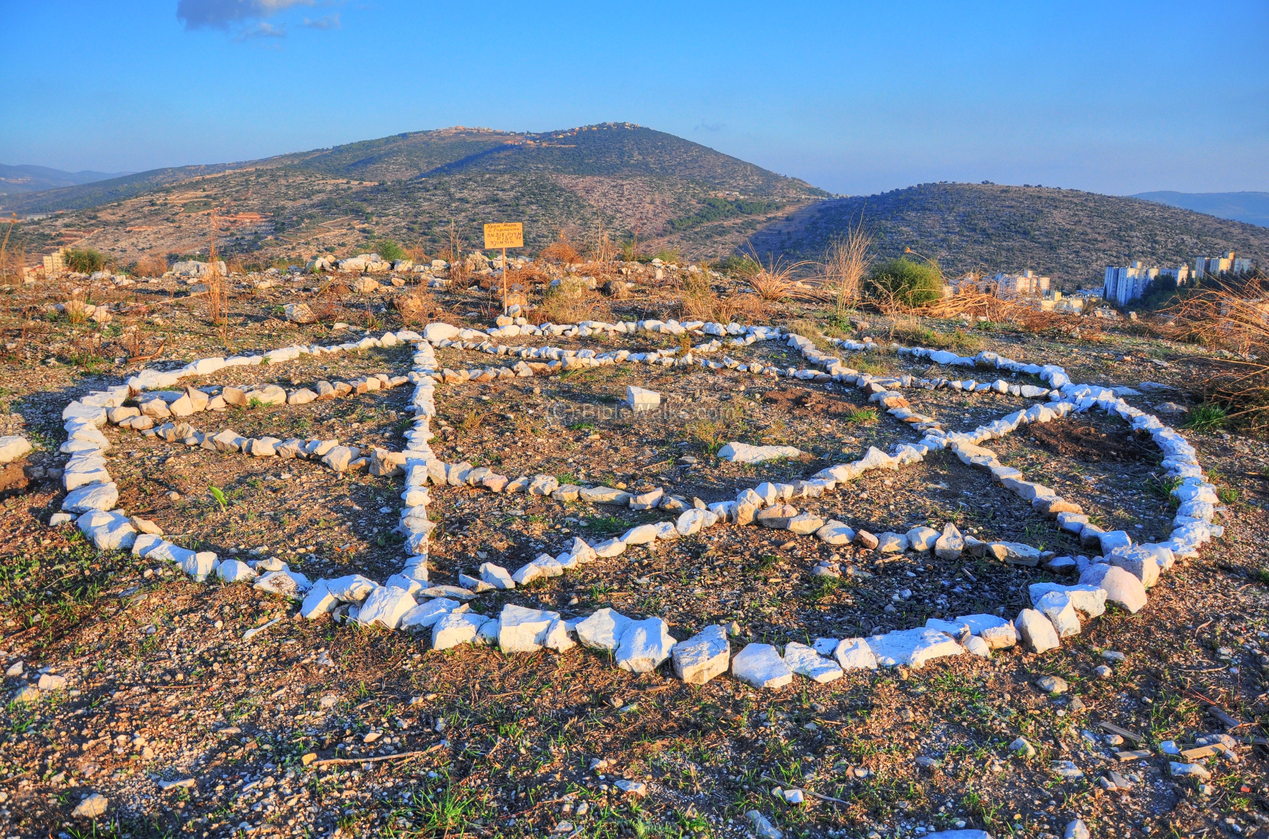
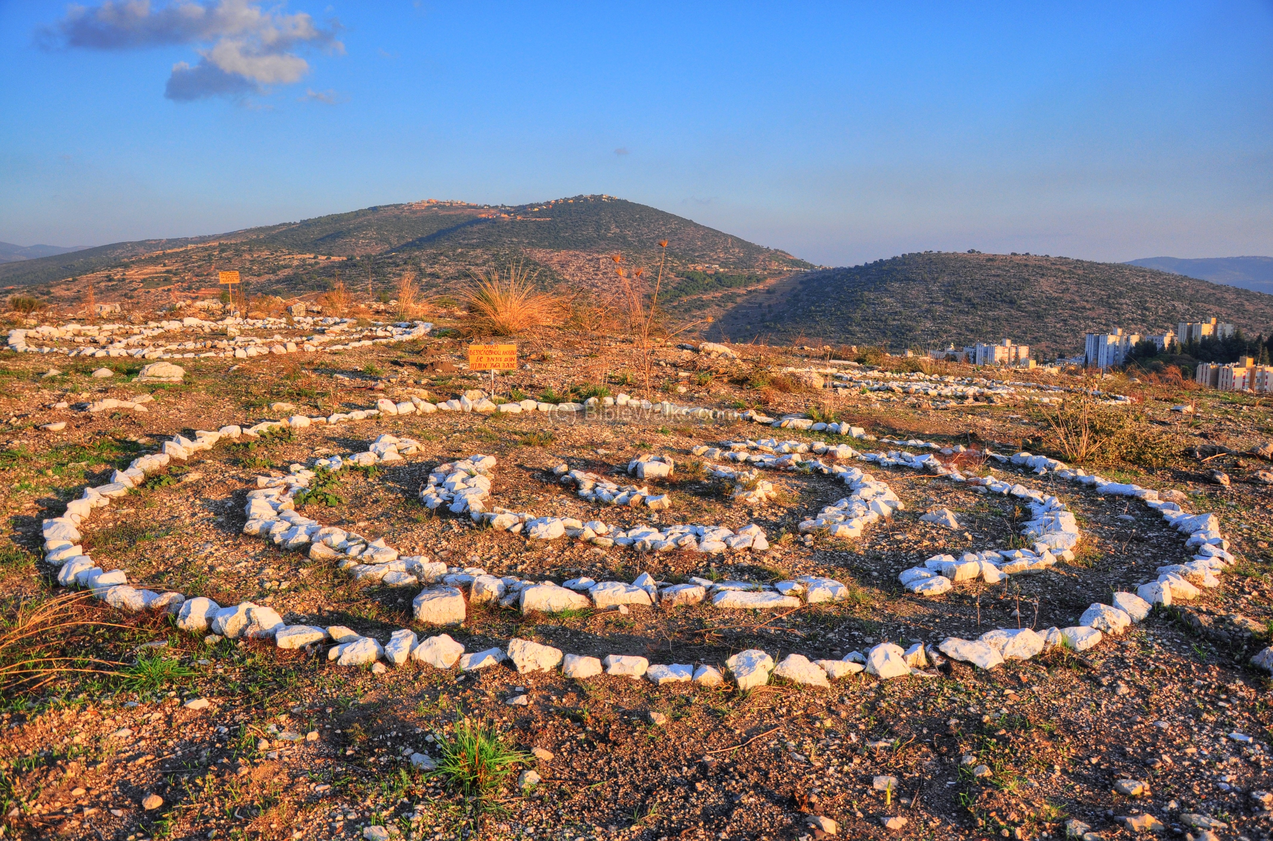
On top of the hill, except for the Israeli flag flying high above the site, we found remains of some kind of a spiritual ceremony. There were 3 groups of white-washed rock arrangements, each with a different sign (in Hebrew and Russian) describing its meaning. These neat displays have been arranged recently – soon after the fire of fall 2010 – but what do they mean?
The first group title is “Power center of Harmonic Peace”:
The next group title is “Power center of unconditional Love”:
The third title is “Power place of true abundance”.
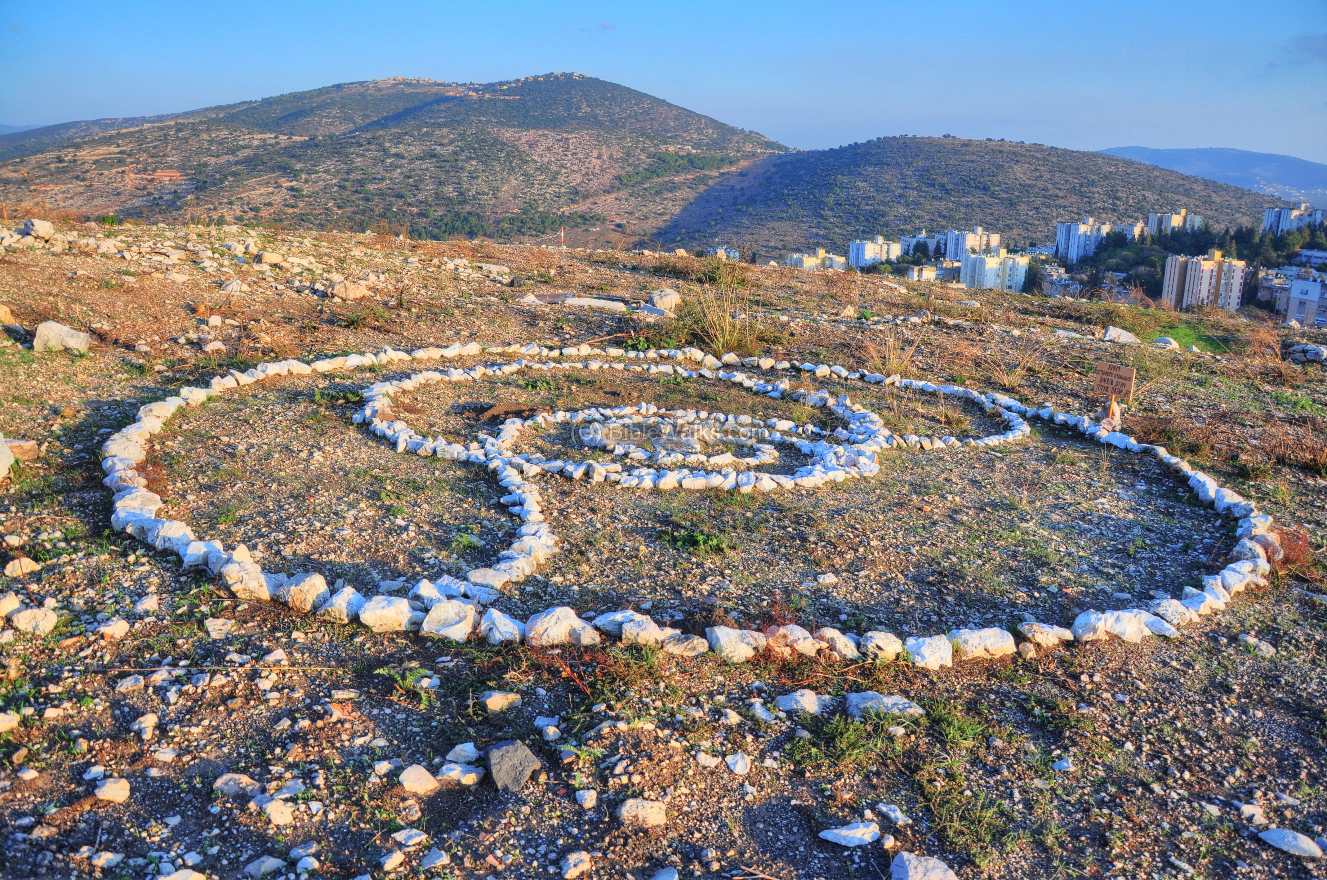
There is another arrangement of white-washed stones nearby, spelling some phrase in Hebrew, but we couldn’t read it. If some one of the organizers can tell us what all this means – please drop us a letter. As in archaeology, mysteries cannot remain unresolved…
Links and references:
* Archaeological links:
- Conservation in Urban areas – Karmiel as a test case (English)
- Conservation in Urban areas – Karmiel as a test case (Hebrew)
- Aviam M. 2004: Jews, Pagans and Christians in the Galilee (Land of Galilee 1). Rochester. Pp. 181-204.
- Yeivin Z. 1991. Excavations at Carmiel (Khirbet Bata) `Atiqot 21:109128.
- Hurvat Bata – The village and its Monasteries (Hebrew pdf; Cathedra 147, M. Aviam and J. Ashkenazi; 2013)
* Internal links:
- Quadcopter photos – collection of aerial views
- Maps of Karmi’el area sites
Etymology (behind the name):
- Hurvah, Harvat – Hebrew: ruins (Arabic: Khirbet). Based on the root word “Harev” – ruined.
- Bata – Hebrew for scrubland or wasteland, used for pasture rather than growing trees. The word Bata appears in the Bible as “waste” in Isaiah 5, 6: “And I will lay it waste: it shall not be pruned, nor digged; but there shall come up briers and thorns: I will also command the clouds that they rain no rain upon it”. Also in Isaiah 7, 19 the word appears as “desolate”: “And they shall come, and shall rest all of them in the desolate valleys, and in the holes of the rocks, and upon all thorns, and upon all bushes”.
The name Horvat Bata in Hebrew (חורבת בתה) was derived, based on phonetic similarity, from Arabic: Khirbet Bat es-Sih (as in the British Mandate maps).
- Kh. es Siyeh – as appears in the PEF survey map (1878).
- Beit Kerem (Beth Cerem) – Hebrew: House of the vineyard (or olive grove). In Jeremiah 6:1 there is reference to another site near Jerusalem with the same name”… and set up a sign of fire in Beth Haccerem: for evil appeareth out of the north, and great destruction”.
- Karmi’el (Carmiel) – Hebrew: Olive grove (Kerem) of God (-EL). Kerem means also vineyard, so the name also can mean “Vineyards of God”. The city’s name was based on the name of the valley – Beit-Kerem.
BibleWalks.com – Experience the Bible by foot
Kh. Zagag<<<–previous site—<<<All Sites>>>—-next Beit-Kerem site—>>> Kh. Kenes
This page was last updated on Apr 15, 2025 (add Hebrew name)
Sponsored links: