Geology sites inside the Ramon crater, an erosion cirque in the high Negev mountain area.
Home > Sites > Negev > Ramon > “Saw Mill” & Colored sand
Contents:
Background
Makhtesh
Location
Photos
* “Saw Mill”
* Colored sand
Etymology
Links
Background:
The large Ramon crater is located in the center of the Negev desert. It is 40KM long by 9KM wide. The Ramon crater is actually a geological erosion cirque, created through a natural process over a period of 200 million years. It is 400M deep: its rim is ~900M above sea level, while the floor of the crater is at an altitude of ~500M.
This vast area has many geology attractions. Two sites are located near the main road and are recommended stops on the way south to Eilat – the “saw mill” and the colored sand park.
Makhtesh:
A makhtesh is a unique geological formation found only in the Negev region of Israel and the Sinai Peninsula. It is a type of erosion cirque, but with distinctive features that set it apart from other cirques.
Makhteshim (plural of makhtesh) are large, circular depressions in the ground that are surrounded by steep cliffs. They are typically several kilometers wide and can be up to 500 meters deep. Makhteshim are formed by a combination of erosion and tectonic activity. The erosion is caused by water and wind, which gradually wear away at the surrounding rock. The tectonic activity is caused by the shifting of tectonic plates, which creates fractures and faults in the rock.
One of the most well-known makhteshim in the Negev region is Makhtesh Ramon, which is also the largest erosion cirque in Israel. It is a massive crater-like depression in the Negev Desert that was formed over millions of years. The rock layers within the makhtesh are exposed, revealing a geological record that spans hundreds of millions of years.
Location:
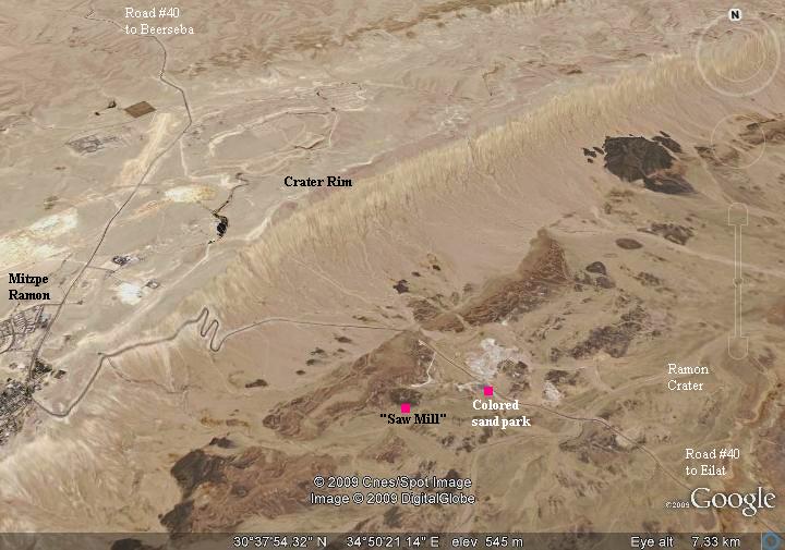
The “saw mill” is located inside the Ramon crater, on the south side of Highway #40 (from Mitzpe-Ramon to Eilat), close to the north edge of the crater. The colored sand park is several hundred meters south along the road. There is an easy access road from highway #40 to the “saw mill” site, while the Colored sand park is located on the south side of the highway.
Photos:
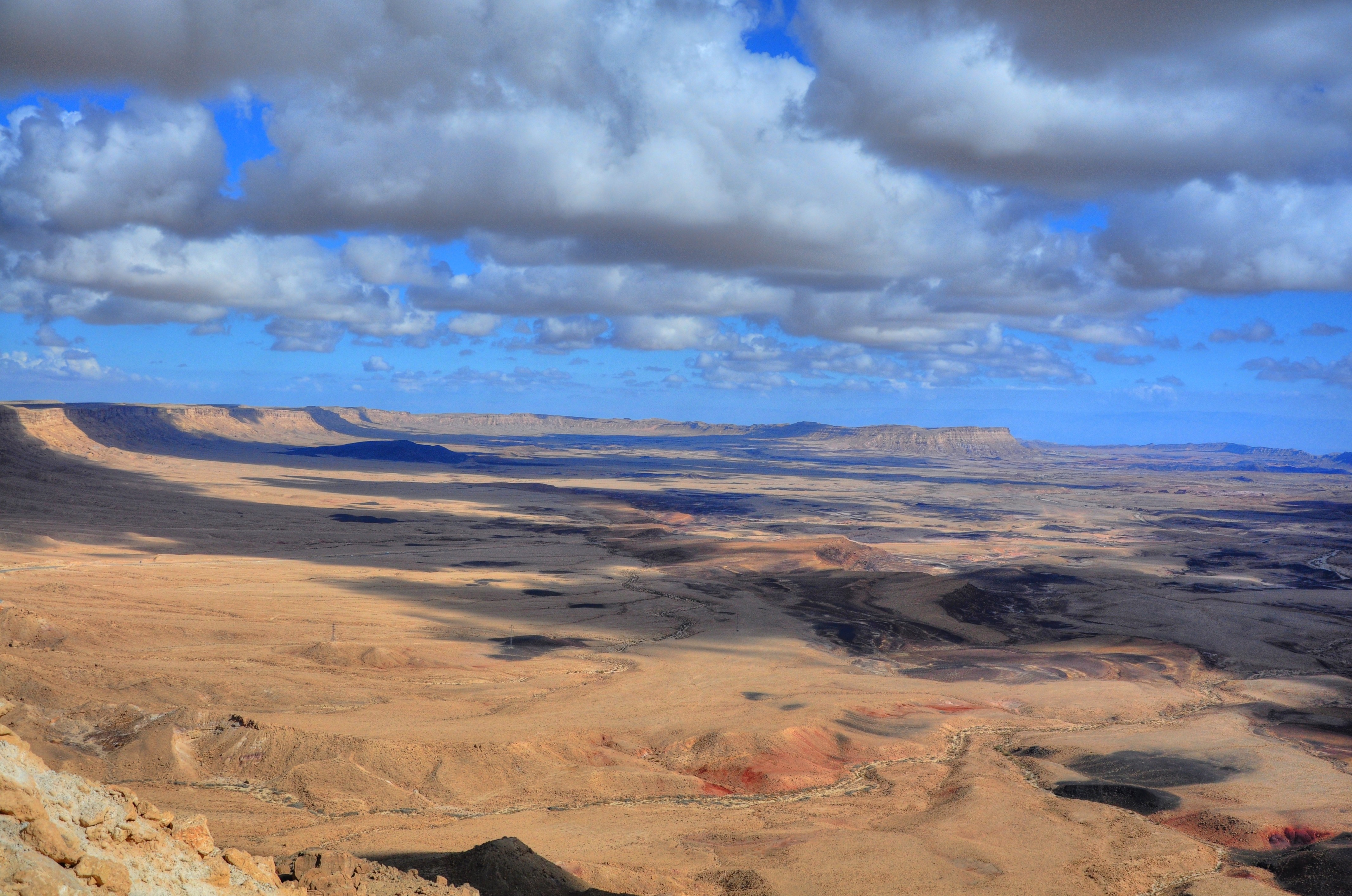
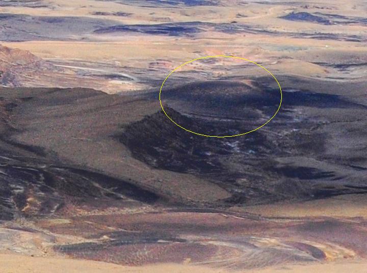
(a) General View of the Crator
The “Saw Mill” site is located on the bottom of the crater, close to the city of Mitzpe Ramon. A view from the city towards the crater is seen in the picture, and the site is marked as a yellow ellipse.
A closer view of the “saw mill” site is shown below.
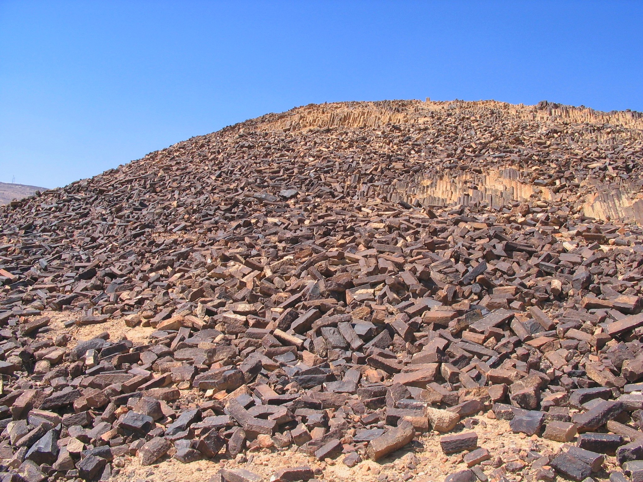
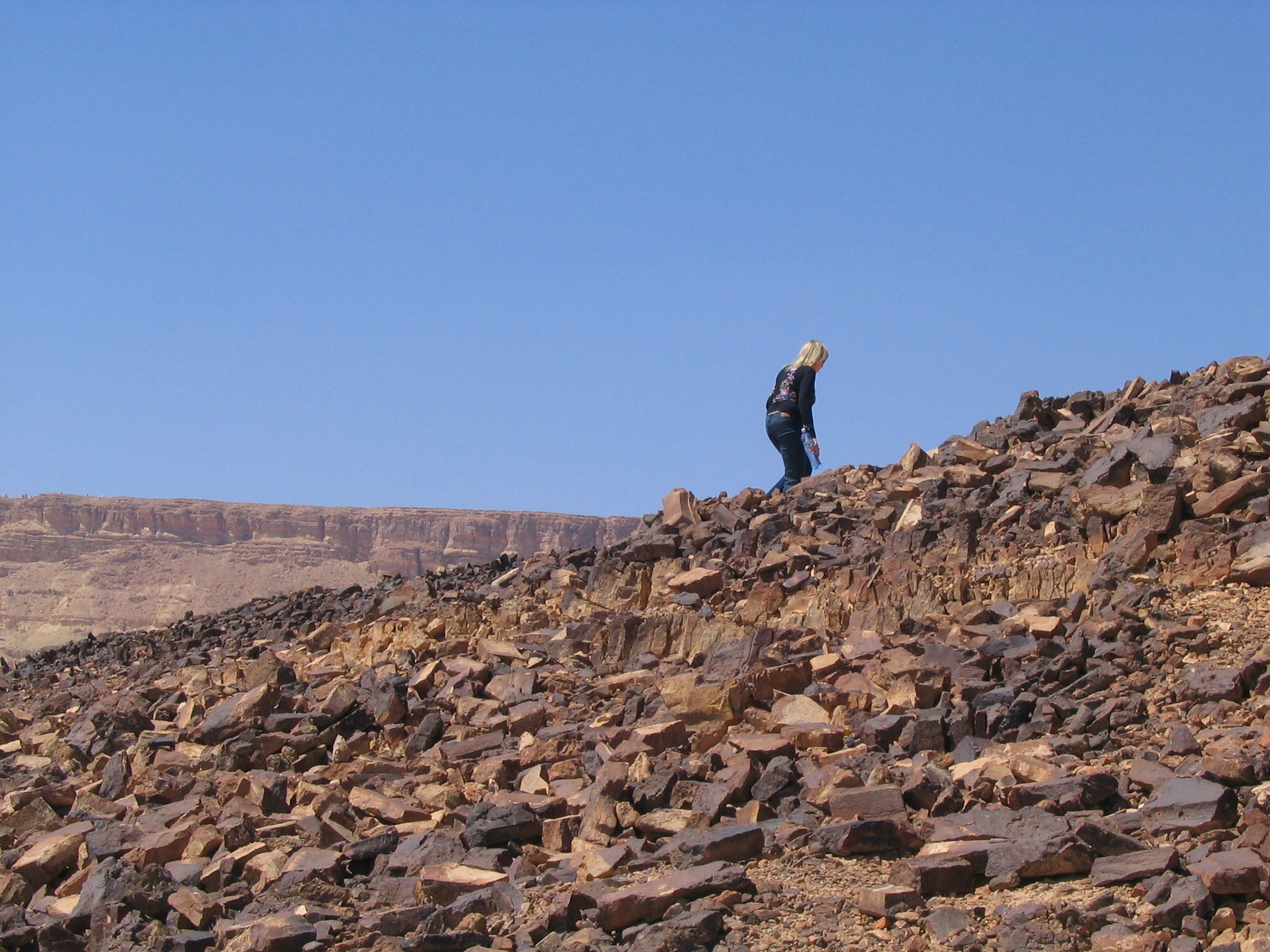
(b) Saw Mill
The “saw mill” is a sand stone hill where thousands of prism-like rocks are scattered around it.
These stones were created during a volcanic eruption, when the magma penetrated into a sandstone hill and melted the sandstone. The liquid stone then crystallized into long quartzite forms (quartzite is a hard metamorphic rock which originated from sandstone and concerted by heat and pressure).
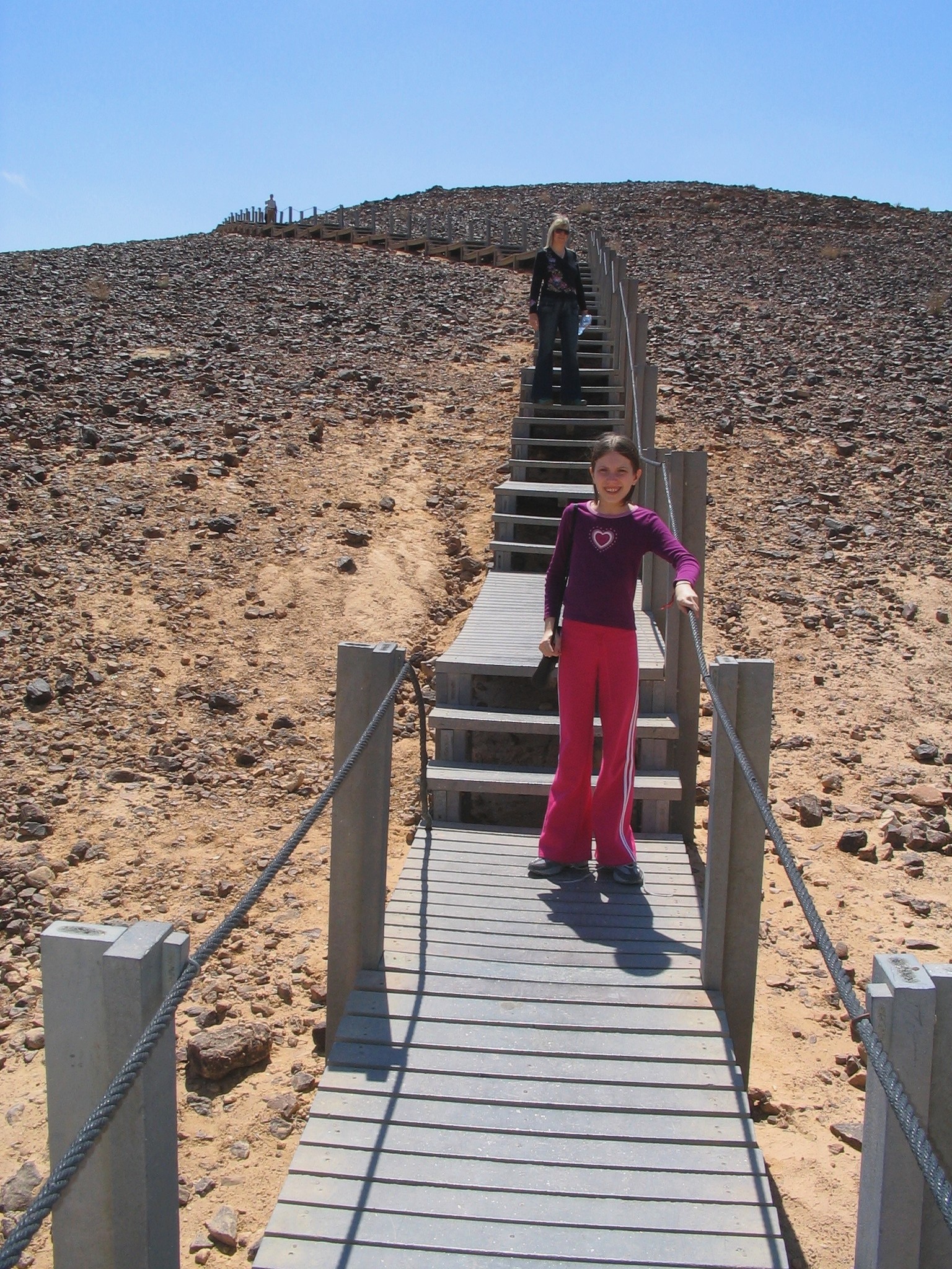
A boardwalk was constructed to support an easy access to the top of the hill.
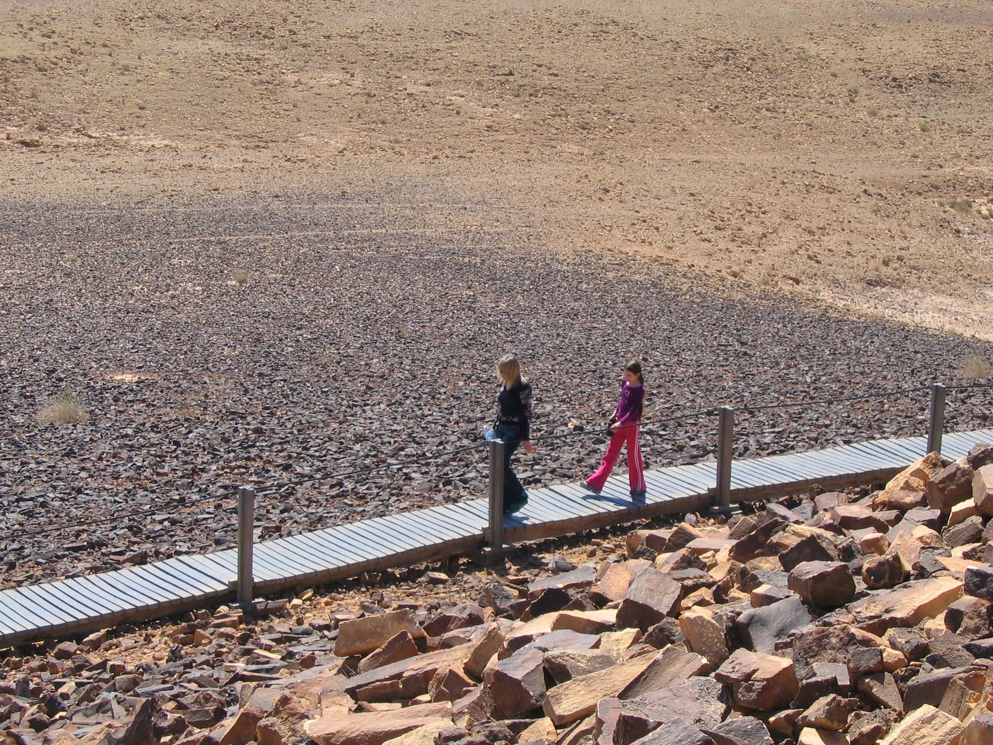
The boardwalk is accessible from the parking lot.
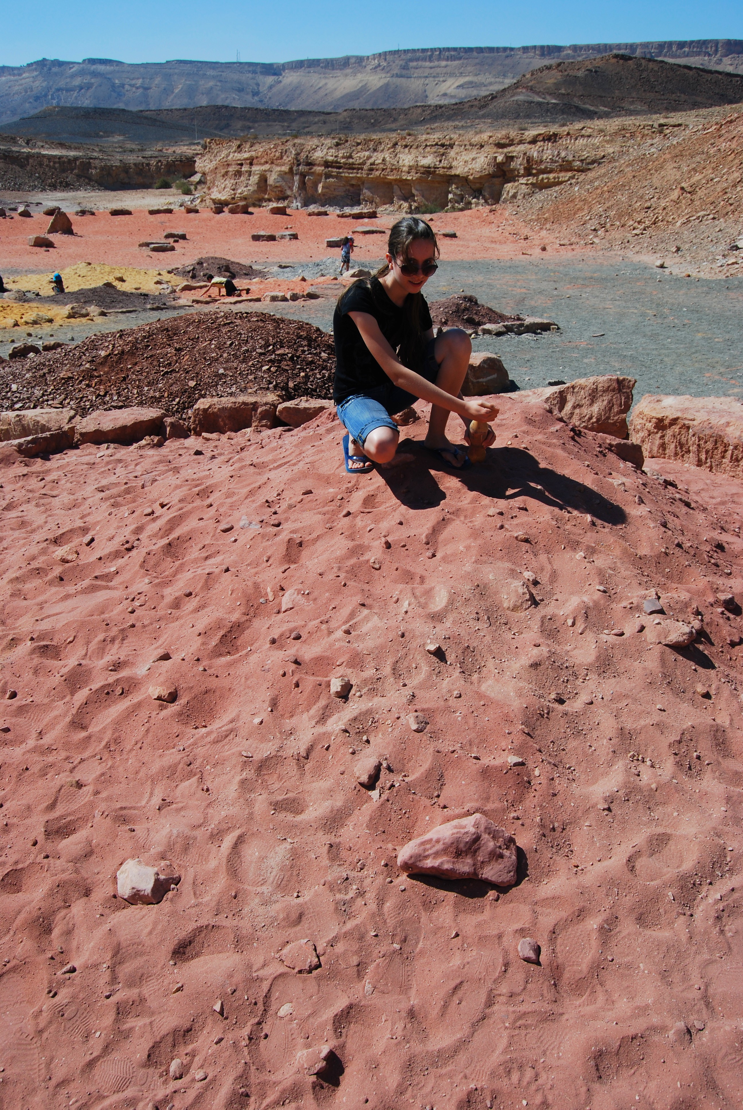
(c) Bottles of Colored Sand
South of the “saw mill”, along the main road that crosses the crater, is the colored sand recreation park. The natural colorful sand piles (yellow, red, brown, black and white) were collected from different sites in the crater.
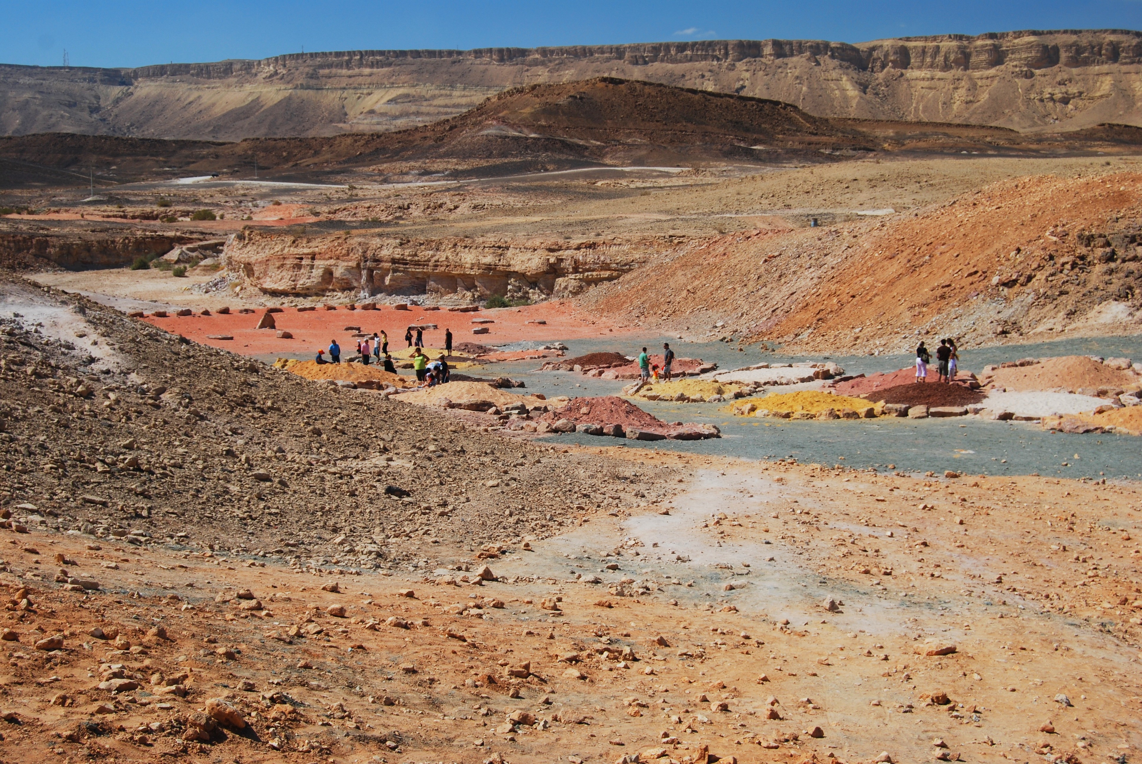
This is a unique nature playground – combining art and nature. The kids and their parents collect the different colored sand into bottles, and create their own colorful creations. The resulting art work is a great souvenir to take back home.
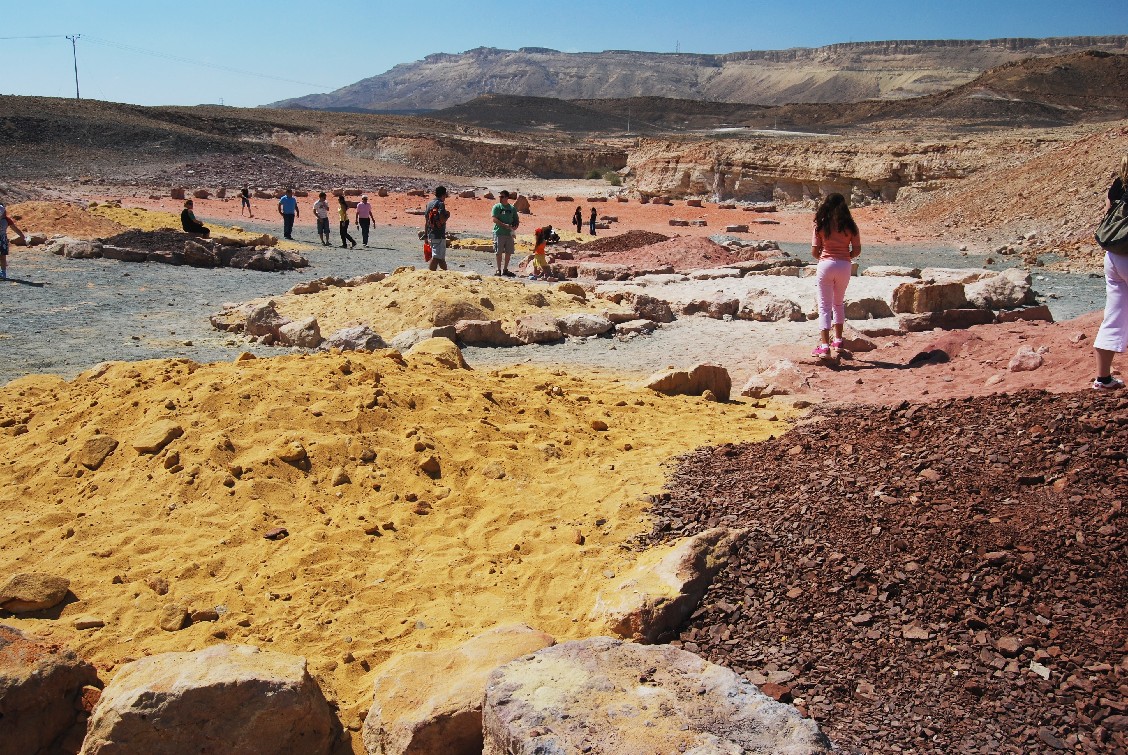
The park is open free to the public, but you should bring your own plastic or glass bottles.
Etymology (behind the name):
- Ramon – the name of the crater. The Hebrew name is based on the Arabic name (Wadi Raman).
- Ramon crater is also called Ramon erosion cirque
- Mitzpeh (Mitzpe) Ramon – the city near the north edge of the rim around the crater. Mitzpeh is “observatory” in Hebrew. The city was established in 1954.
- Machtesh, Makhtesh – Hebrew: crater. A biblical term for a hollow place, referred in Samson’s life as a valley enclosed by hills (Joshua 15, 19): “But God clave an hollow place that was in the jaw, and there came water thereout; and when he had drunk, his spirit came again, and he revived: wherefore he called the name thereof Enhakkore, which is in Lehi unto this day”.
- Makhtesh, Maktesh – one of the many names of Jerusalem (Zephania 1, 11): “Howl, ye inhabitants of Maktesh, for all the merchant people are cut down; all they that bear silver are cut off”.
Links:
* External links:
- Formation of “Makhteshim” – unique erosion cirques in the Negev, southern Israel (Israel Journal of Earth Sciences V49, Ezra Zilberman, 2000)
- Geological dating of Makhtesh Ramon Amit Segev, Tuvia Weissbrod, Barbu Lang (2005; pdf, 24 pages)
* Other related BibleWalks sites:
* Makhtesh Ramon – overview
* Makhtesh Katan – small crater
* Gamal hill – lookout point on the northern rim; Early Bronze age settlement
BibleWalks.com – walk with us through the sites of the Holy Land
Eilat<—previous site—<<<All Sites>>>—next Negev site—> Avdat
This page was last updated on Mar 23, 2023 (add info on Makhtesh)
Sponsored links: