Tel Yifar, a nature reserve near Moshav Balfouria, was a Biblical site located near ancient crossroads. The springs around the site are one of the sources of the Kishon creek. Water buffalos and donkeys graze in the swap.
Home > Sites > Yizreel Valley > Tel Yifar (Tell el-Far) – Balfouria nature reserve
Contents:
Background
Location
History
Photos
* View of Tell
* Waters
* Monument
* Ceramics
* Buffalos
* Roman
* Nature
Biblical
Links
Etymology
Background:
Tel Yifar, an open nature reserve, was a Biblical site located near ancient crossroads and close to the ancient site of Afula. The ‘Adashim springs surrounding the area mark a primary source of the Kishon creek, forming wetlands that have largely been reclaimed. Encircling the lake, there exists a demarcated space where water buffalos and donkeys peacefully graze.
In close proximity lies the farming settlement of Moshav Balfouria. The modern highway to Afula traces the path of the ancient road to Megiddo.
Judges 5 13: “Then he made him that remaineth have dominion over the nobles among the people” (inscription on the monument on the top of the hill)
Location:
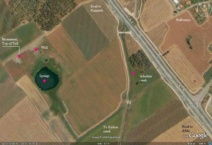
The site is located 500M west of the Afula-Nazareth highway (#60), about 1km west of Moshav Balfouria, and 2.5 KM south of Moshav Tell-Adashim. The remains of the swamps are seen in the center.
History:
-
Bronze/Iron age
The site was first inhabited starting from the Chalcolithic period (4500 – 3150 BC), and the mound was established in the Late Bronze period (1,550 -1,200BC). It continued to be settled throughout the Iron age. It was located near springs, and therefore protected by the wetlands around it. The ancient city was located in the path of major crossroads – north-south from Tabor to Megiddo, and west-east from Acre to Beit-Shean.
The cities and roads during the Canaanite and Israelite periods are indicated on the Biblical Map below, with Tell Yifar in the center.
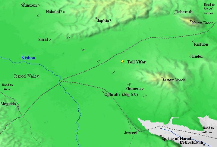
Map of the area around Tell Yifar – during the Canaanite and Israelite periods – 15 century BC through 6 century BC (based on Bible Mapper 3.0)
According to David Dorsey (“The roads and Highways of Ancient Israel”, 2018, pp94-98), major roads passed near Tel Yifar:
- ‘B3’ – connecting Megiddo, thru Yifar, Kh. al-Mazraa and Tel Adashim, bypassing Mount Tabor from the west side
- ‘B2’ – connecting Megiddo, thru Yifar, Horvat Adashim and Hovat Tevet to ‘B1’, bypassing Mount Tabor on its east side (shown as dashed line in the map above)
- ‘T6’ – connecting Yifar via Tel Sadud (Sarid) to Haifa and Jokneam
- ‘T6’ – connecting Yifar to Afula
Dorsey’s explanation to the role of Yifar was that Yifar was located on a “central rise” – a volcanic causeway 40-50m higher than the valleys around it (as published by Karmon in 1971). This was important during the winter time, as it was the only way from Megiddo to the North.
-
Hellenistic/Roman/Byzantine
As most of the sites in the Galilee, the site was probably destroyed by the Assyrian intrusion of 732 BC.
The well was in use during the Roman period, but the major village moved to a larger place nearby. Its new location is marked on the old map below as “Kh. el Mezrah”, closer to the route of the Ottoman period road. According to the PEF survey (1866-1877), they found traces of ancient ruins with “broken sarcophagi and good springs of water”.
Tel Yifar was abandoned during the Early Arab period (7th century AD).
-
Ottoman period
The site was examined in the PEF survey (1866-1877) by Wilson, Conder and Kitchener. It appears in the center of the section of this map of 1878. They named the site of the springs as el-Mujahiyeh, meaning in Arabic: “the place of bursting forth of water”. It was identified as one of the sources of the Kishon river.
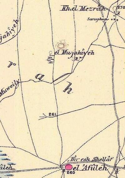 Part of Map Sheet 8 of Survey of Western Palestine, by Conder and Kitchener, 1872-1877.
(Published 1880, reprinted by LifeintheHolyLand.com)
The mound is situated near the ancient Road (appears as a double dashed line to the right of the site), connecting the north (from Mt Tabor) to the south (el-Afuleh which was established in 1925 as the city of Afula), and then to Megiddo.
During WW1 the German troops pumped water for the supply of water to the Turkish locomotives in Afula. Since then, the well in the site is called the “German well”.
-
Modern Times
Balfouria was founded in 1922, about 1km east of the mound. The Moshav was named after James Balfour, the British foreign minister who’s declaration in 1917 gave Jews a homeland in Israel, which was one of the milestones of the Zionist movement.
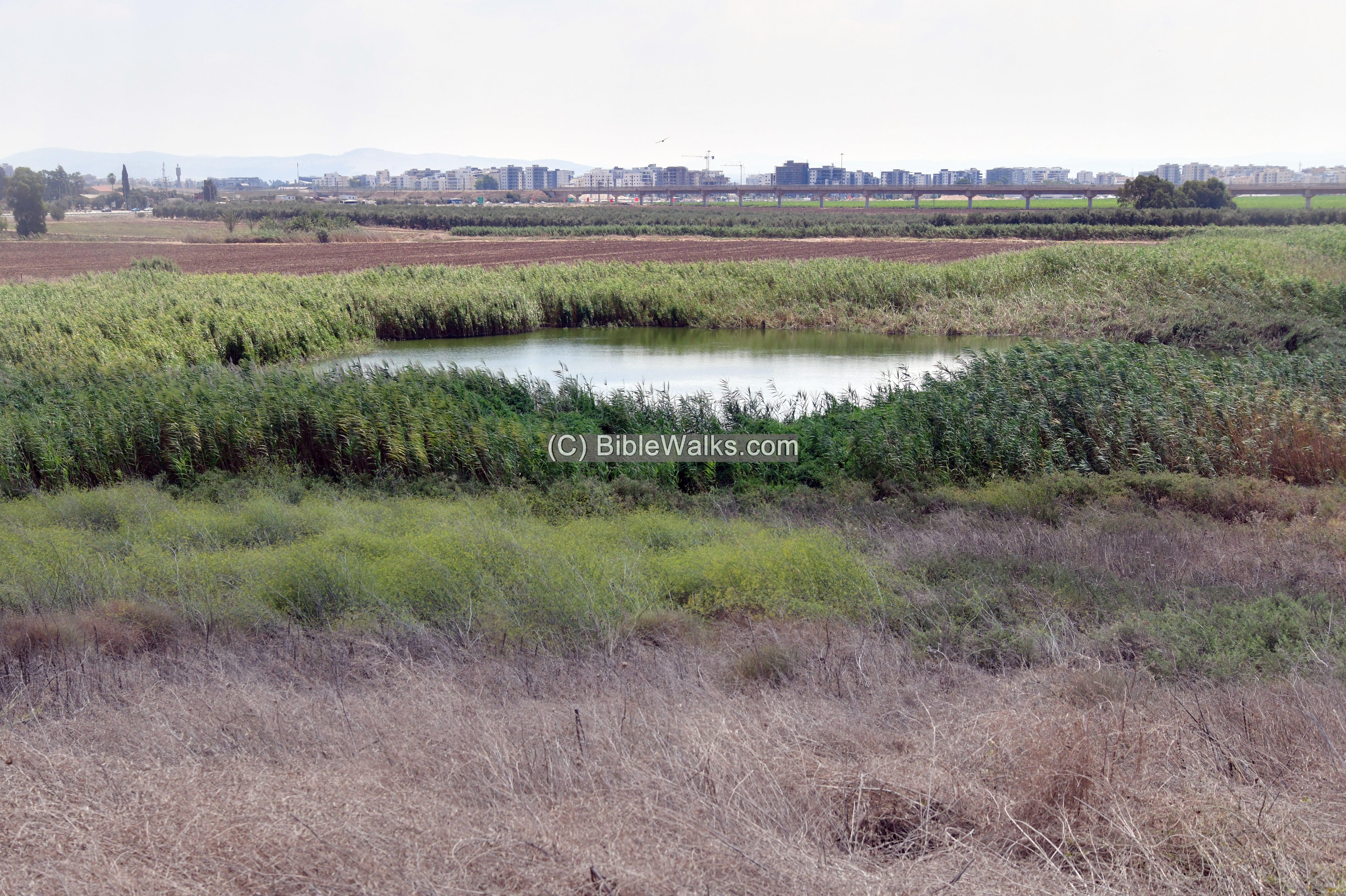
The swamps posed a danger to the settlers, and they eradicated the malaria by drying the swamps. The swamps covered hundreds of Dunams around the area. The majority of these swaps were dried up using pipes and pumps, but some of the swamp remained around the ancient site.
In 1979 a nature reserve was declared in the area around Tel Yifar, and the area of 45 Dunam (4.5 hectares) was fenced off. In order to keep the swamps clean of canes, a number of donkeys and Water Buffalos (Jamus) were brought here.
Photos:
The site was visited in 2011, 2018 and 2023.
(a) General views
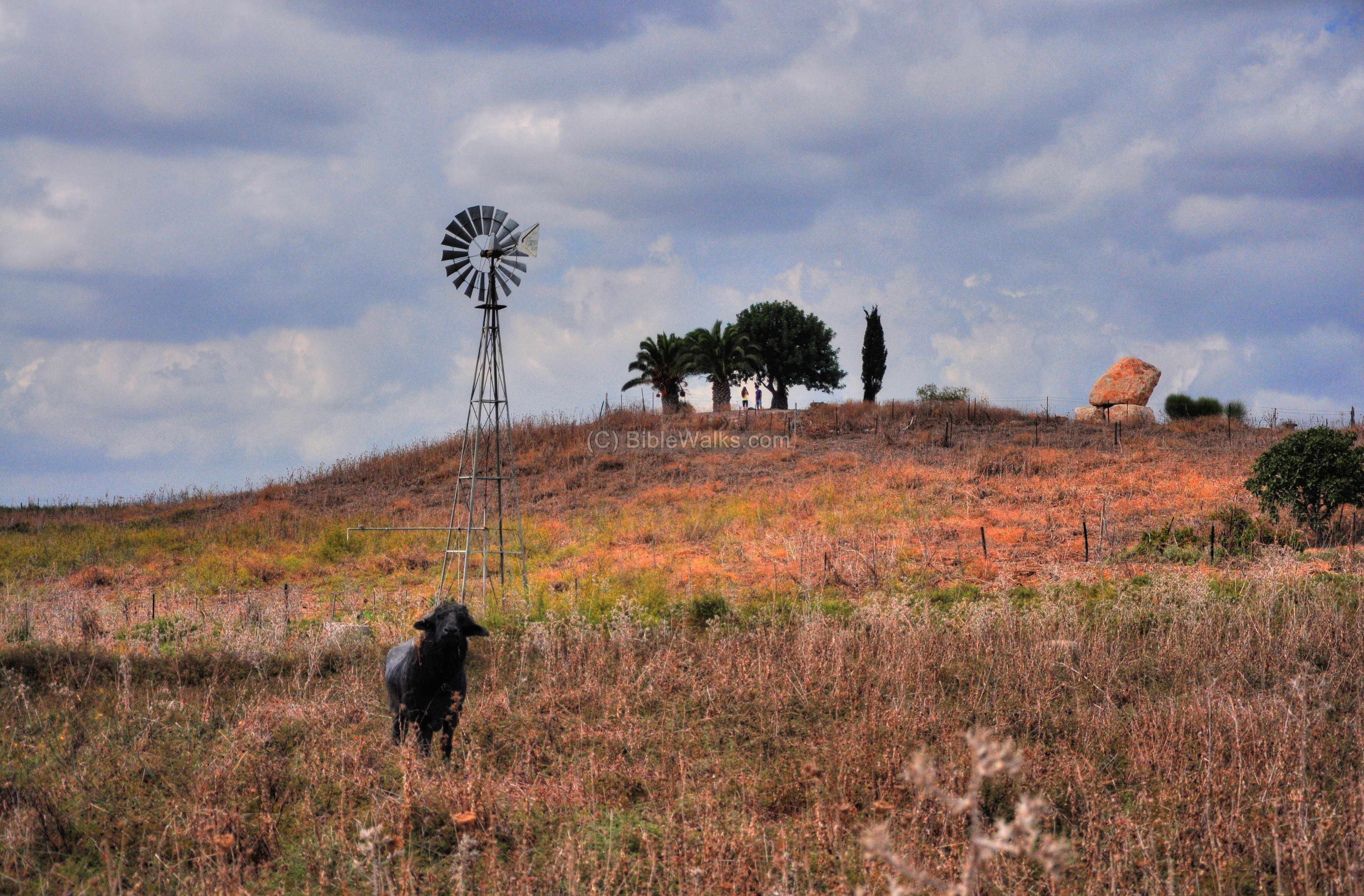
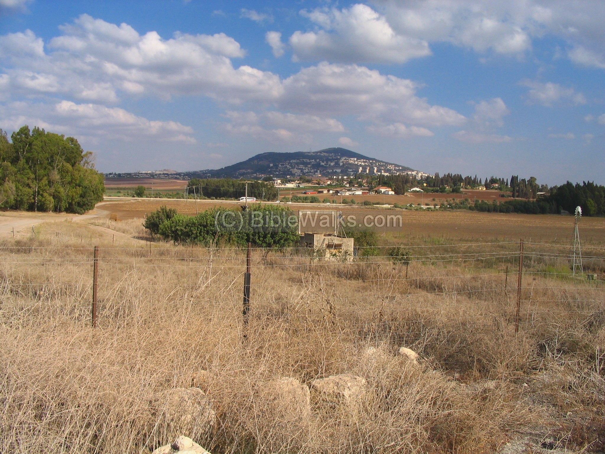
This is the view of the ancient Tel, which is located on a small hill in the center of the swamp. On top of the hill is a monument (the vertical rock on the right). Below the hill is the area of the lake, mostly dried up in the summer time, the well and the windmill that pumped the water out. A water buffalo, a resident of the nature park, is interested why we are visiting the site.
Click on the photos to view in higher resolution…
The small lake on the south-east side of Tell Yifar is seen in the next photograph.
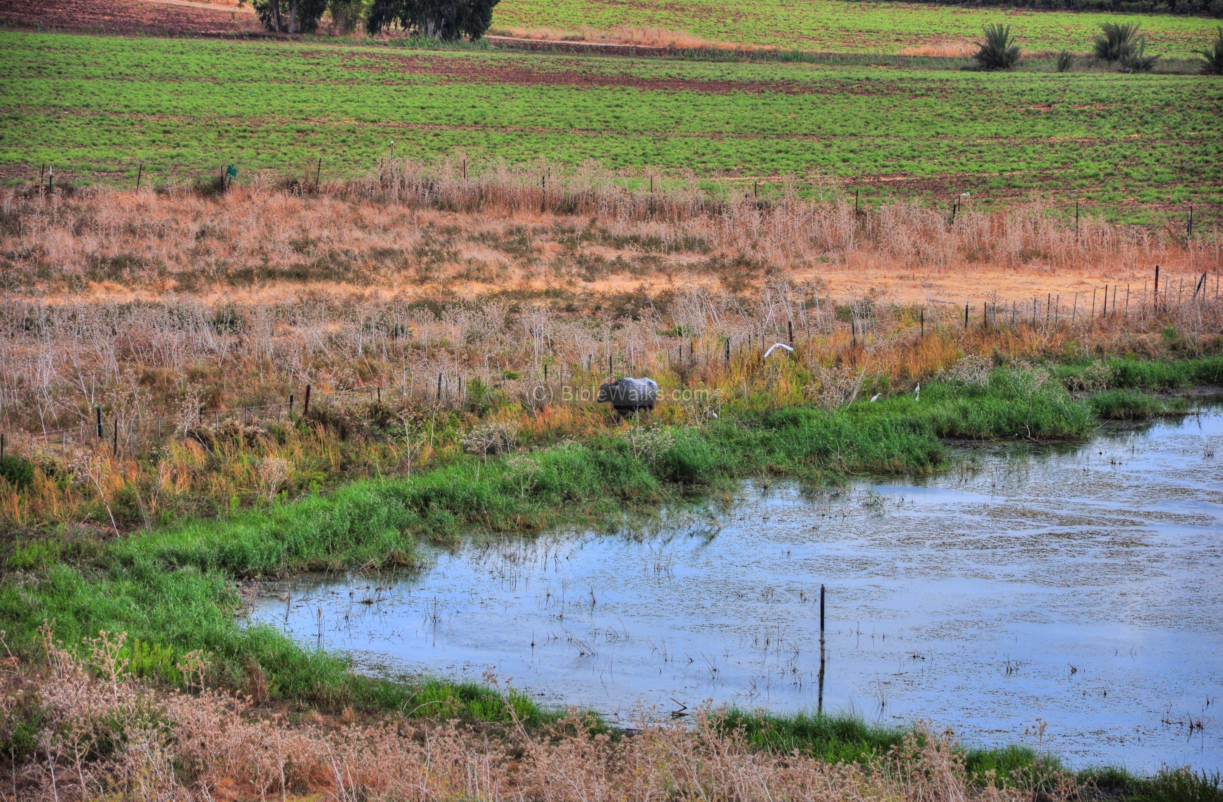
In August 2023, 12 years later than the first visit, the lake is still alive.
In the far southern background are the outskirts of Afula, and a new railroad bridge that supports the Haifa to Beit Shean line.
(b) ‘Adashim Springs
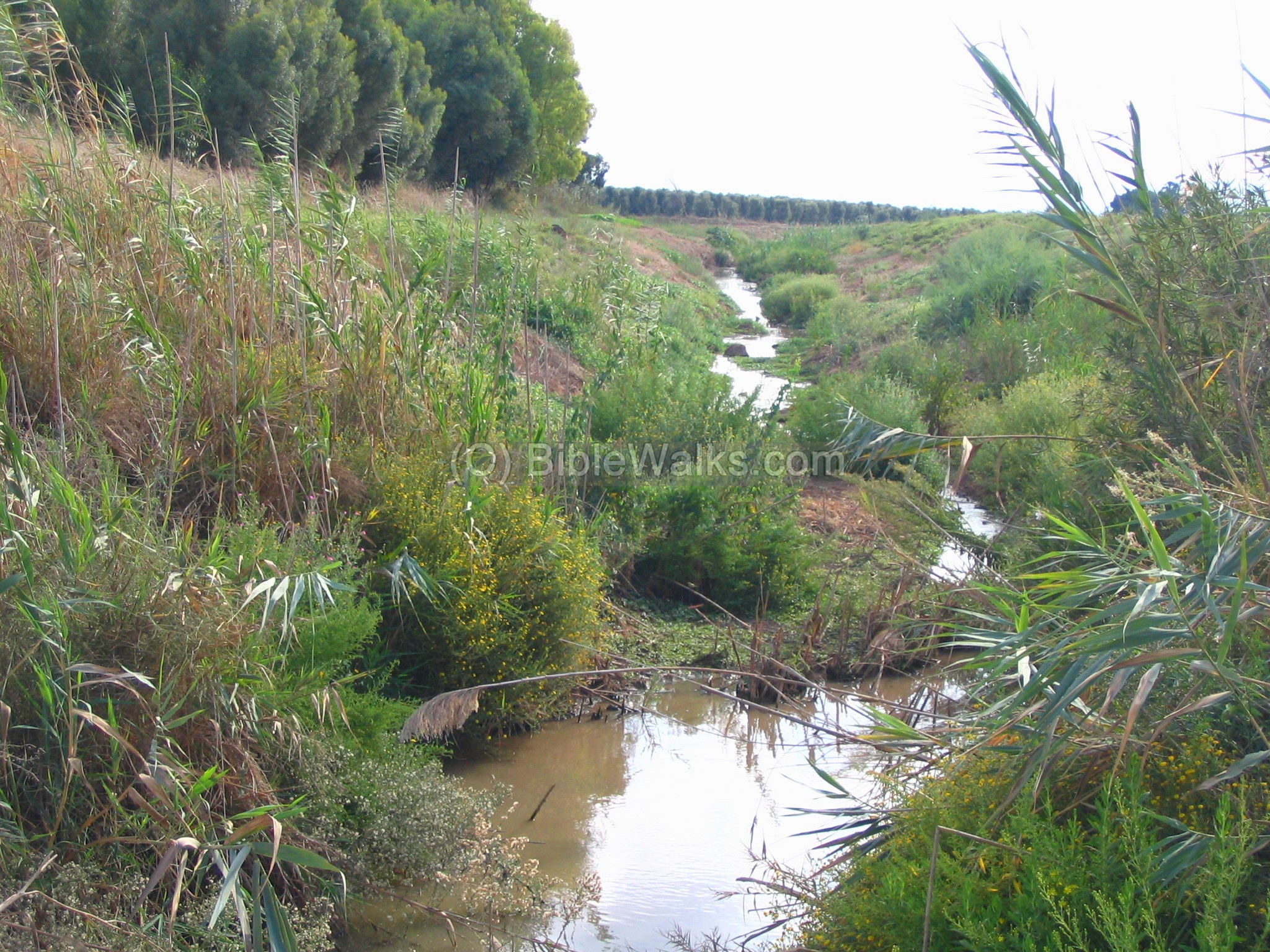
There are a number of springs around the site, named the “‘Adashim” springs, and the brook bearing the same name that starts from the hills of Nazareth. These are one of the sources of the Kishon creek, which flows through the heart of the Yizreel (Jezreel) valley to the Mediterranean sea – north of Haifa. The Kishon creek becomes a wide river only in its last 6KM segment. The Kishon river is referenced in several Biblical events (the books of Joshua, Judges and Kings).
In antiquity the waters created swamps covering hundreds of dunams around the site. In the course of the Biblical battle between Barak and Sisera the wetlands prevented the Canaanite chariots to cross the Kishon, forcing them to go west and subsequently be perished by the Israelites.
The well is seen in the next photograph, and is dated to the Roman period, with a modern structure built over it. A broken wind mill is located above the well, which used to pump the water. During WW1 the German troops pumped water for the supply of water to the Turkish locomotives in Afula. Since then, the well in the site is called the “German well”.
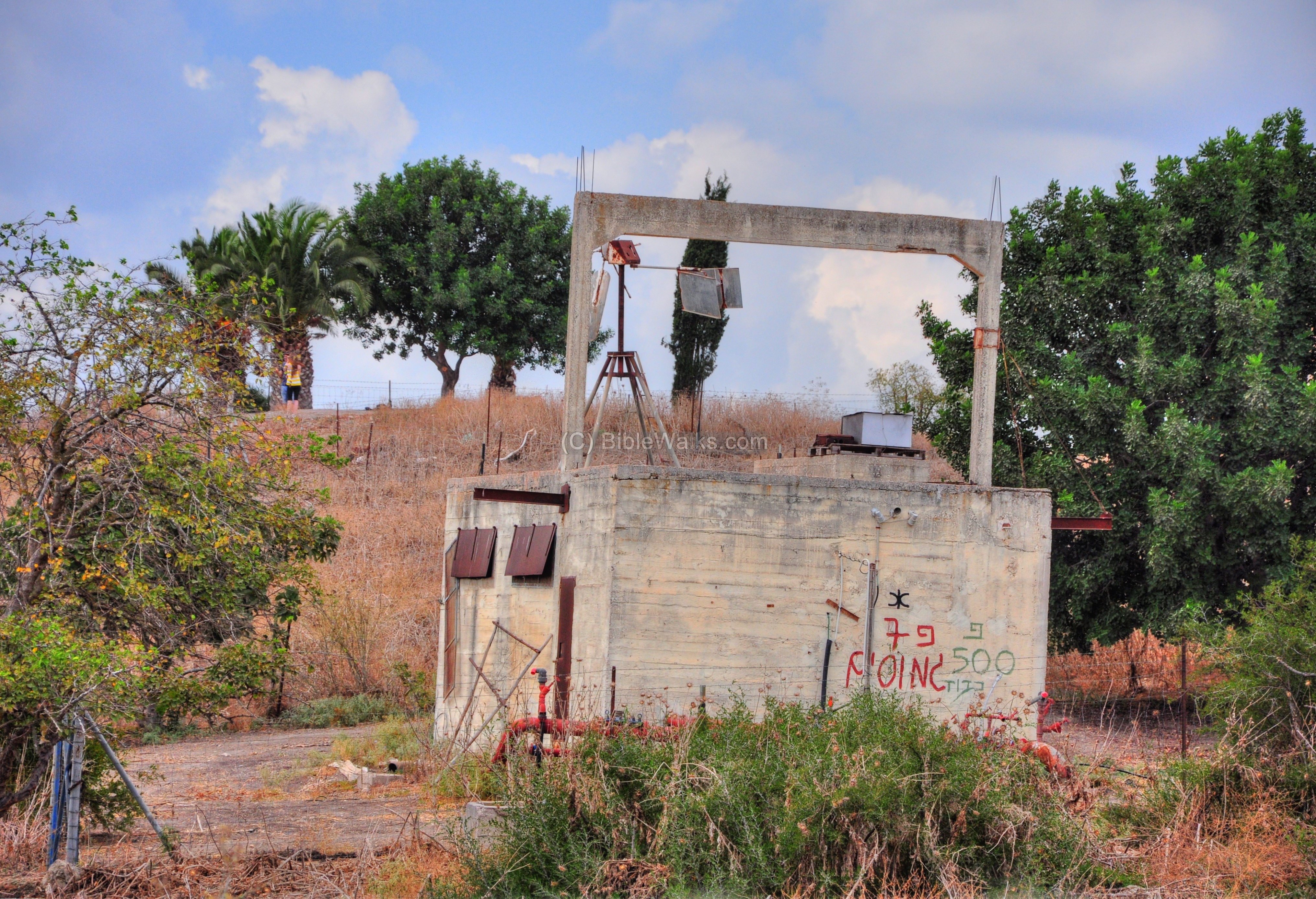
A view from the site towards the east is seen below. Behind the well, 0.5KM away, is the main road from Nazareth to Afula. Behind it, at about 1KM away, is Moshav Balfouriya. In the far background is the hill called Givat-Hamoreh (hill of Moreh), which is mentioned in a Biblical description of a battle (Judges 7,1: “Then Jerubbaal, who is Gideon, and all the people that were with him, rose up early, and pitched beside the well of Harod: so that the host of the Midianites were on the north side of them, by the hill of Moreh, in the valley”).
On the foothills of Moreh are other ancient sites: Shunem (Sulem) on the southern foothills, and Naim (Nein, site of Jesus’ miracle) on the northern foothills.
(c) Ceramics
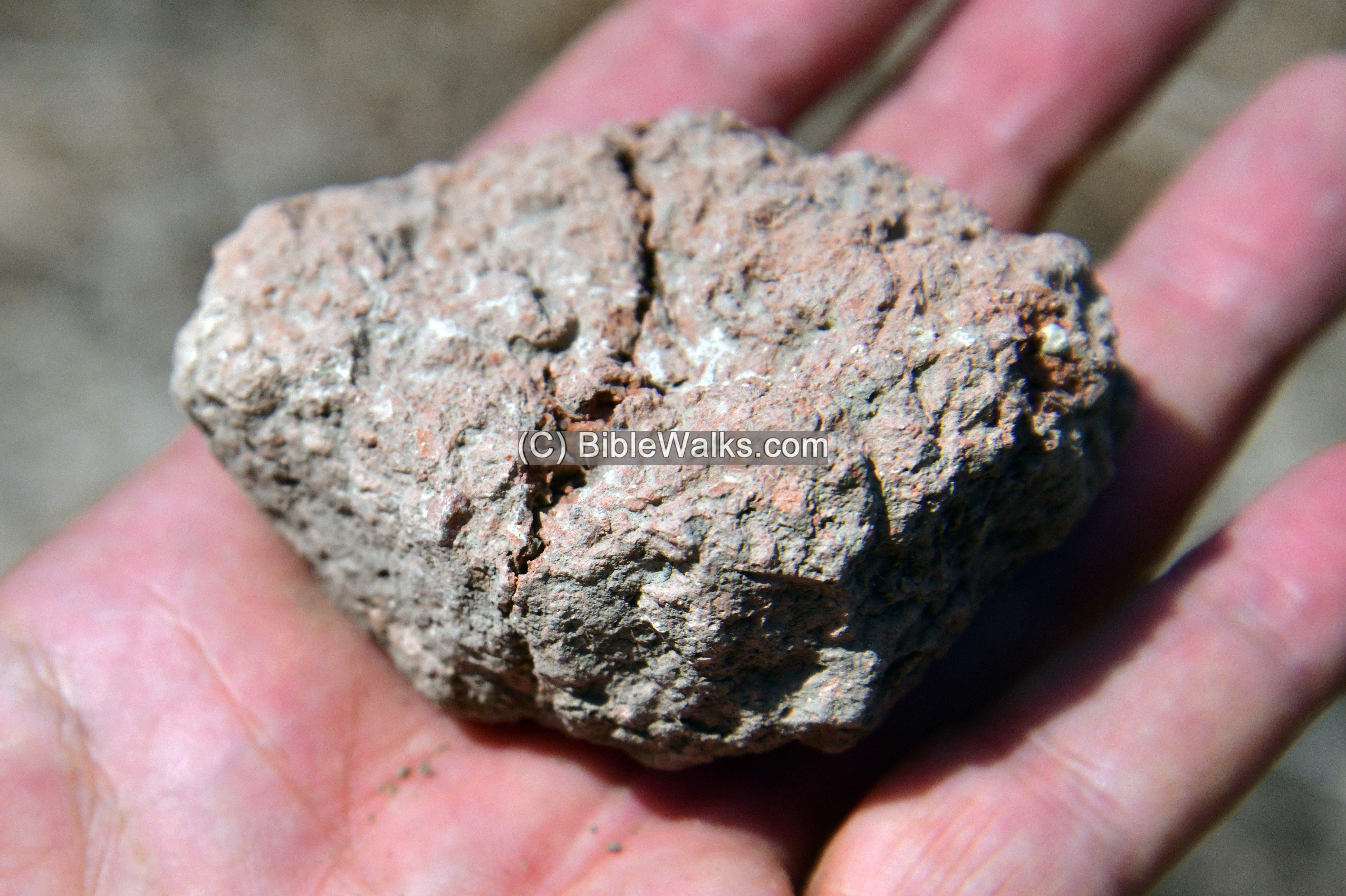
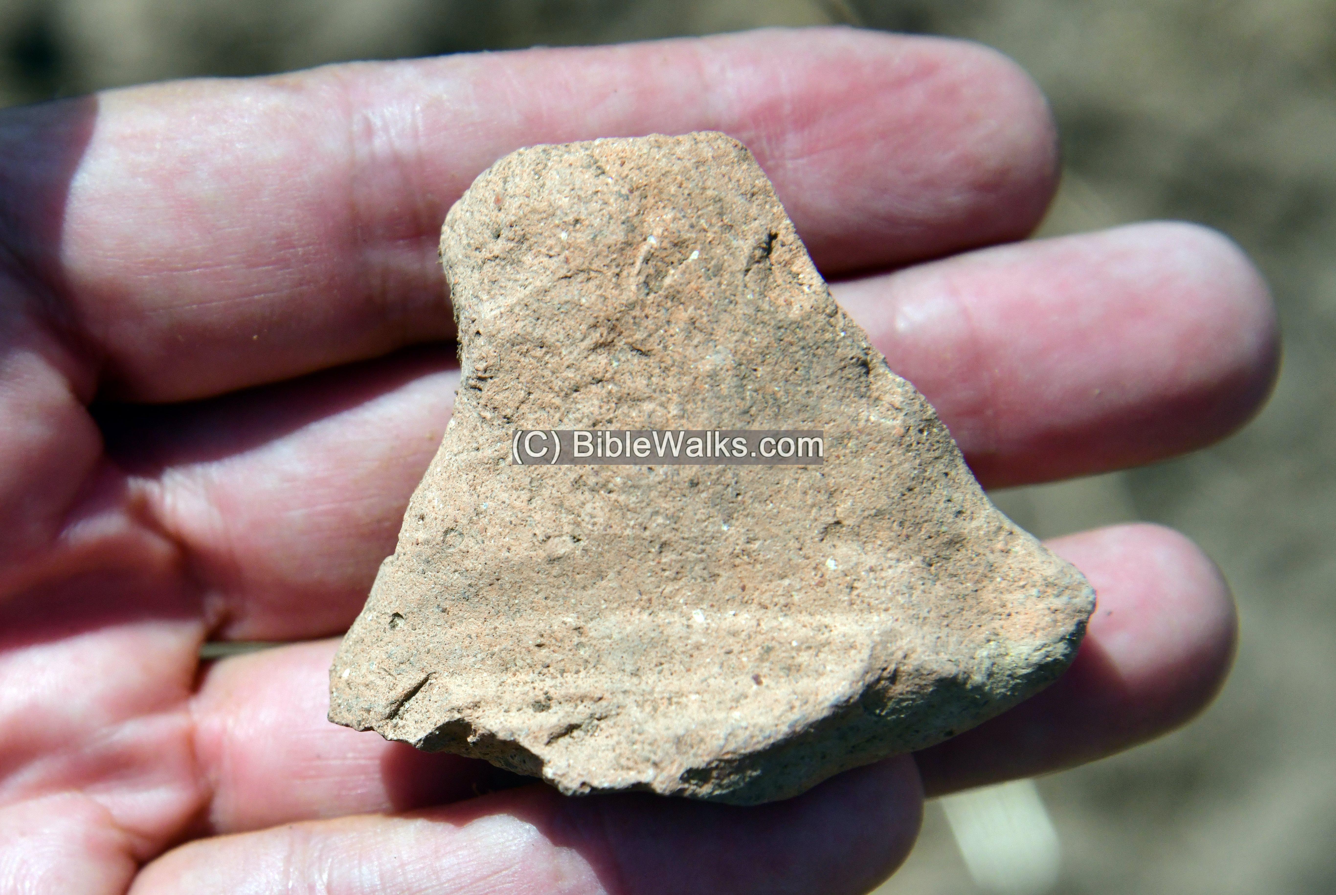
We conducted a short survey of the mound and the fields around it in order to date the occupation of the site. All items were left on the site.
First, a piece of a sun dried mud brick found on the top of the mound. Mud bricks were used for building the walls during the Bronze and Iron Age, and were also in use by the peasants during the middle ages.
A handle of a vessel, date to the Bronze/Iron age, found on the field west of the mound:
A collection of pottery fragments, with Bronze/Iron age on the left and Arab/Middle ages on the right:
(d) Monument
A monument was erected by the residents of Moshav Balfouria to honor the memory of its soldiers.
The inscription on the pillar is a verse from prophetess Deborah’s song of triumph over the Canaanites, when Barak the son of Abinoam defeated the Canaanite army led by Sisera. It reads ( Judges 5 13): “Then he made him that remaineth have dominion over the nobles among the people”. In the background of the inscription is a map of the creeks around the site (Kishon and Precipice) where the battle occurred and the Israelites were victorious.
On the south side of the pillar is a rock-hewn sculpture of the pioneers farming the fields. In the background behind the left side of the rock is Mount Precipice near Nazareth, the traditional site of Jesus’ leap.
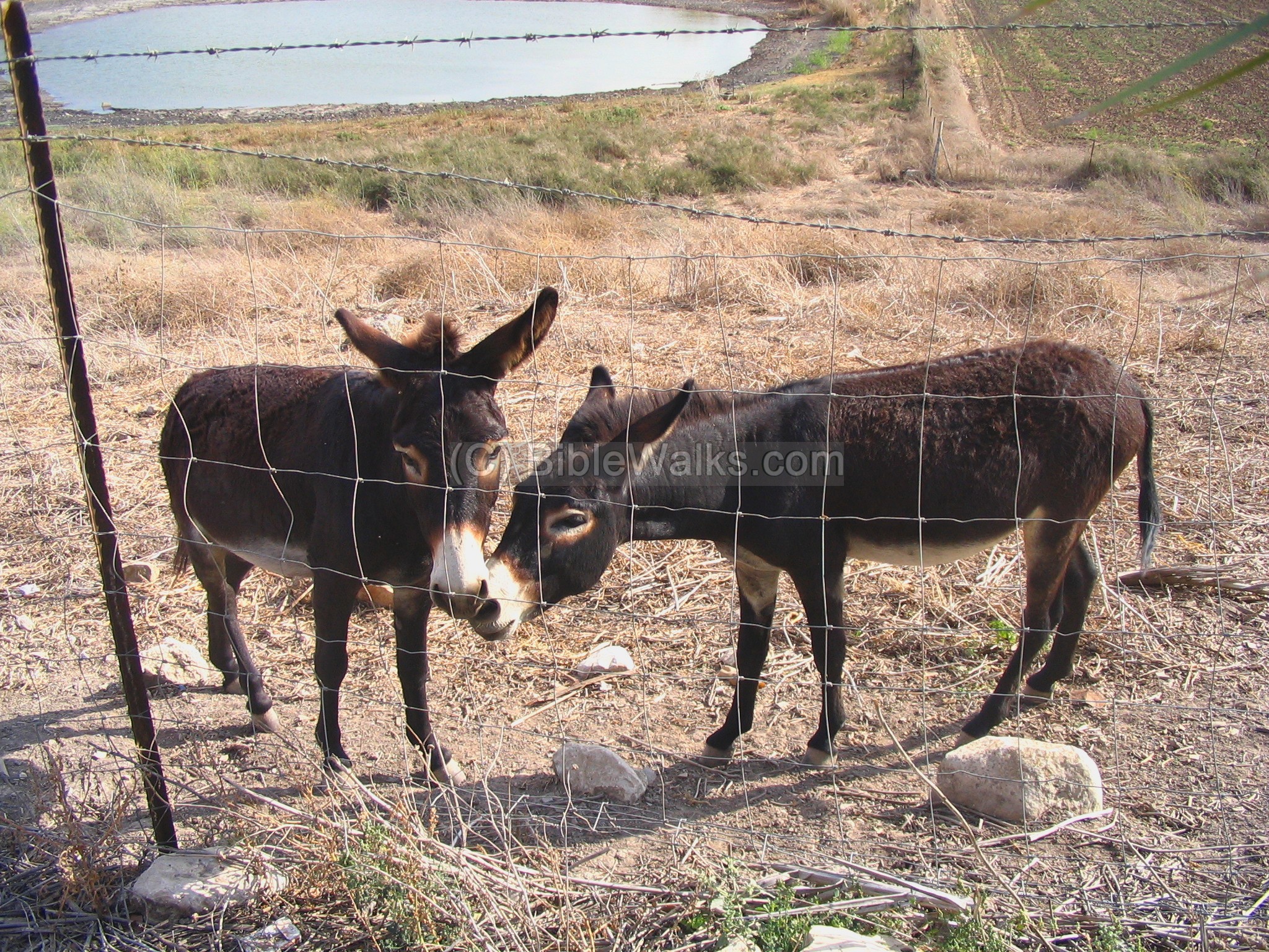
(e) The Buffalos and Donkeys
In the nature reserve is a small number of Buffalos and donkeys, who were brought here to eat up the canes and weeds, keeping the swamp clean.
The photo below shows a view to the west, with a water buffalo grazing in the swamps.
The use of the water buffalos to clean up the swamps is used in other sites, such as in Hula lake and in Afek nature reserve.
A closer view of the buffalo is shown next. It doesn’t look so happy… tough day in the swamps.
A pair of donkeys are other residents of the nature reserve, and they welcome you behind the fence on top of the hill. In the background is a small pond, which is what remained from the swamp after a dry summer.
(f) The Hellenistic/Roman site
The Biblical village moved to a larger place nearby, called “Kh. el Mezrah” (Arabic for : “ruin of the farm”), which was closer to the route of the ancient road. According to the PEF survey (1866-1877), they found traces of ancient ruins with “broken sarcophagi and good springs of water”.
The site is located on a small hill north of Balfouriya, which is seen in the center of the photograph. Behind it in the far background is Giv’at Hamoreh. On the far right background, is the village of Naim (Nain) and Tell Agol.
(g) Nature
Common in this area, as well as other areas in Israel, is a typical shrub that is a menace to farming, as it is difficult to get rid off. Prosopis farcta, commonly known as “Yanbut Ha-Sadeh” in Hebrew, is a species of flowering plant in the Fabaceae family. It is also known by various other common names such as “Syrian mesquite,” “Farsi mesquite,” and “wild mesquite.” This plant is native to regions in the Middle East and North Africa, including parts of Israel.
Here are some key features and information about Prosopis farcta:
- Appearance: Prosopis farcta is a thorny shrub or small tree that can grow up to 6 meters (20 feet) in height. It has feathery, pinnate leaves with small leaflets. The plant also produces small, fragrant yellow flowers that are arranged in cylindrical spikes.
- Habitat: This plant is well-adapted to arid and semi-arid environments. It is often found in dry regions, such as desert edges, sandy areas, and rocky slopes. It is known for its ability to withstand harsh conditions and poor soils.
- Uses: Various parts of the Prosopis farcta plant have been used for different purposes. In some cultures, the pods and seeds of the plant are consumed as food, either raw or after processing. The pods can be ground into a flour for making traditional dishes. The plant has also been used in traditional medicine for its potential therapeutic properties.
- Ecological Impact: Prosopis farcta is considered an invasive species in some regions, including parts of Israel. Its ability to thrive in challenging environments and produce large amounts of seeds has allowed it to spread and outcompete native vegetation in certain areas, potentially disrupting local ecosystems.
- Cultural Significance: The plant’s Hebrew name, “Yanbut Ha-Sadeh,” reflects its cultural significance in the region. It has been mentioned in various historical and cultural contexts.
Biblical References:
(a) Deuteronomy 14:4-6:
The Bible lists the “Kosher” meat, which includes the wild ox (“Teo” in Hebrew) which is a water Buffalo.
“These are the beasts which ye shall eat: the ox, the sheep, and the goat, The hart, and the roebuck, and the fallow deer, and the wild goat, and the pygarg, and the wild ox, and the chamois. And every beast that parteth the hoof, and cleaveth the cleft into two claws, and cheweth the cud among the beasts, that ye shall eat”.
(b) Isaiah 51 20:
In this verse the word “Teo” was translated to “wild bull“.
“Thy sons have fainted, they lie at the head of all the streets, as a wild bull in a net: they are full of the fury of the LORD, the rebuke of thy God”.
Links and References:
* External:
-
Tell Yifar Nature reserve (Hebrew)
-
Sefi Ben Yosef’s hike (Hebrew)
* Internal:
-
Kishon River – sites along the river
-
Tarbenet – a nearby ruins of a Roman/Byzantine village
-
Deborah and Barak – info page
- Trees and Bushes of the Holy Land
Etymology (behind the name):
- Tell (Tel) – mound (See more on the story of a Tell).
- Jamus – Arabic for Water-Buffalo (Bubalus arnee or Bubalus bubalis)
- Teo – Hebrew: Buffalo (also: wild ox or will bull)
- ‘Adashim – Hebrew: Lentils. ‘Adashim is the name of the springs in this site, the source of ‘Adashim creek which flows to the Kishon. It is also the name of the agriculture village of Tel ‘Adashim, located 5 KM north.
Biblical references:
Genesis 25 34 : “Then Jacob gave Esau bread and pottage of lentils; and he did eat and drink, and rose up, and went his way: thus Esau despised his birthright”.
Ezekiel 4:9 :”Take thou also unto thee wheat, and barley, and beans, and lentiles, and millet, and fitches, and put them in one vessel, and make thee bread thereof, according to the number of the days that thou shalt lie upon thy side, three hundred and ninety days shalt thou eat thereof”.
- Yifar – Hebrew: יפאר – based on the Arab name of the site: “el-Phar”
BibleWalks.com – walk with us through the sites of the Holy Land
Tel Iztabba <<<—previous site—<<< All Sites>>>—next Yizreel Vallley site—>>>
This page was last updated on Aug 25, 2023 (new photos, new texts)
Sponsored links: