In the bay of the city of Atlit is a large Crusader fortress, 20KM south of Haifa. It was built in the 13th Century to add a port and protect the pilgrimage road from Acre to Jerusalem. It was the last Crusader outpost in the Holy Land, evacuated in 1291.
Home > Sites > Carmel> Atlit/Athlit (Peregrinorum, Château Pèlerin)
Contents:
Overview
Location
History
Photos
* General view
* Cemetery
* Fortress
* Road
* Sandstone ridge
* Sunset
Visiting
Archaeological
Etymology
Overview:
Atlit (also Athlit) is a small coastal town located in the Haifa District of Israel, approximately 20 km south of Haifa. While it holds historical significance as the site of a former British detention camp during the Mandatory Palestine era, it also boasts a notable Crusader fortress that played a crucial role in the medieval period.
The Crusader fortress in Atlit was constructed in the late 12th century under the orders of the Knights Hospitaller, a medieval Catholic military order. The fortress served as a strategic coastal defense, allowing the Crusaders to safeguard their territories and maintain control over important maritime routes.
During the Crusades, Atlit Fortress witnessed a series of battles and exchanges of power between the Crusaders and Muslim forces. Its location along the coastline made it a prime target for both sides seeking to secure control over the region. The fortress withstood numerous sieges and attacks as the tides of the Crusades ebbed and flowed.
Atlit was the last Crusader outpost in the Holy Land. Following the fall of the Crusader Kingdom of Jerusalem in 1291, Atlit Fortress lost its significance and gradually fell into disrepair. With no longer a need for a stronghold in the area, the fortress was abandoned, and its structures began to crumble over time.
During the Ottoman period, the remnants of Atlit Fortress were repurposed as a convenient quarry for building materials. This further contributed to the deterioration of the site as stones from the fortress were systematically removed for other construction projects.
Presently, the ruins of Atlit Fortress are inaccessible to the general public due to its location within a military camp. The area surrounding the fortress is restricted for security purposes. While visitors cannot explore the fortress itself, its historical and archaeological significance remains intact.
The Crusader fortress in Atlit stands as a testament to the medieval struggles for control in the region and the architectural prowess of the Crusaders. Its strategic position overlooking the Mediterranean Sea offers a glimpse into the military tactics and challenges faced by both Crusader and Muslim forces during the tumultuous Crusader period.
While the fortress may not be open for public exploration, Atlit itself is a charming coastal town worth visiting. Its picturesque beaches, proximity to the Carmel Mountains, and the nearby Atlit Yam archaeological site, mentioned earlier, offer visitors a diverse range of attractions and historical experiences.
Location:
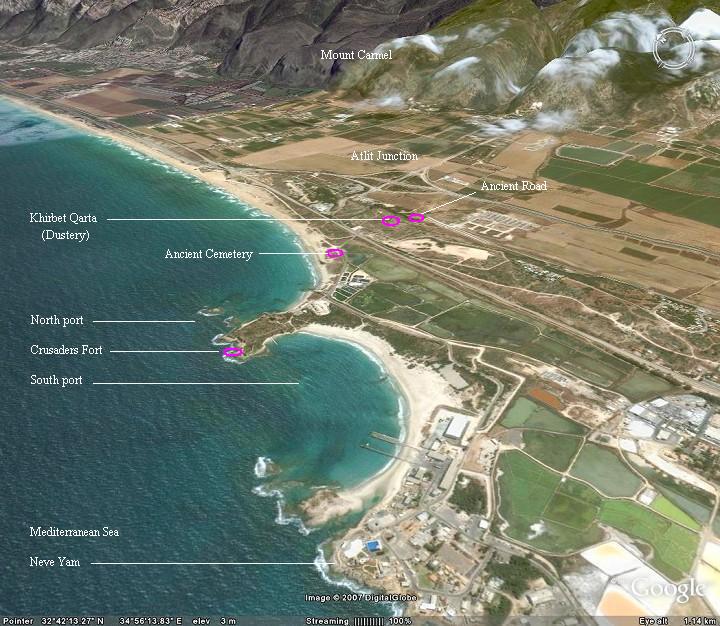
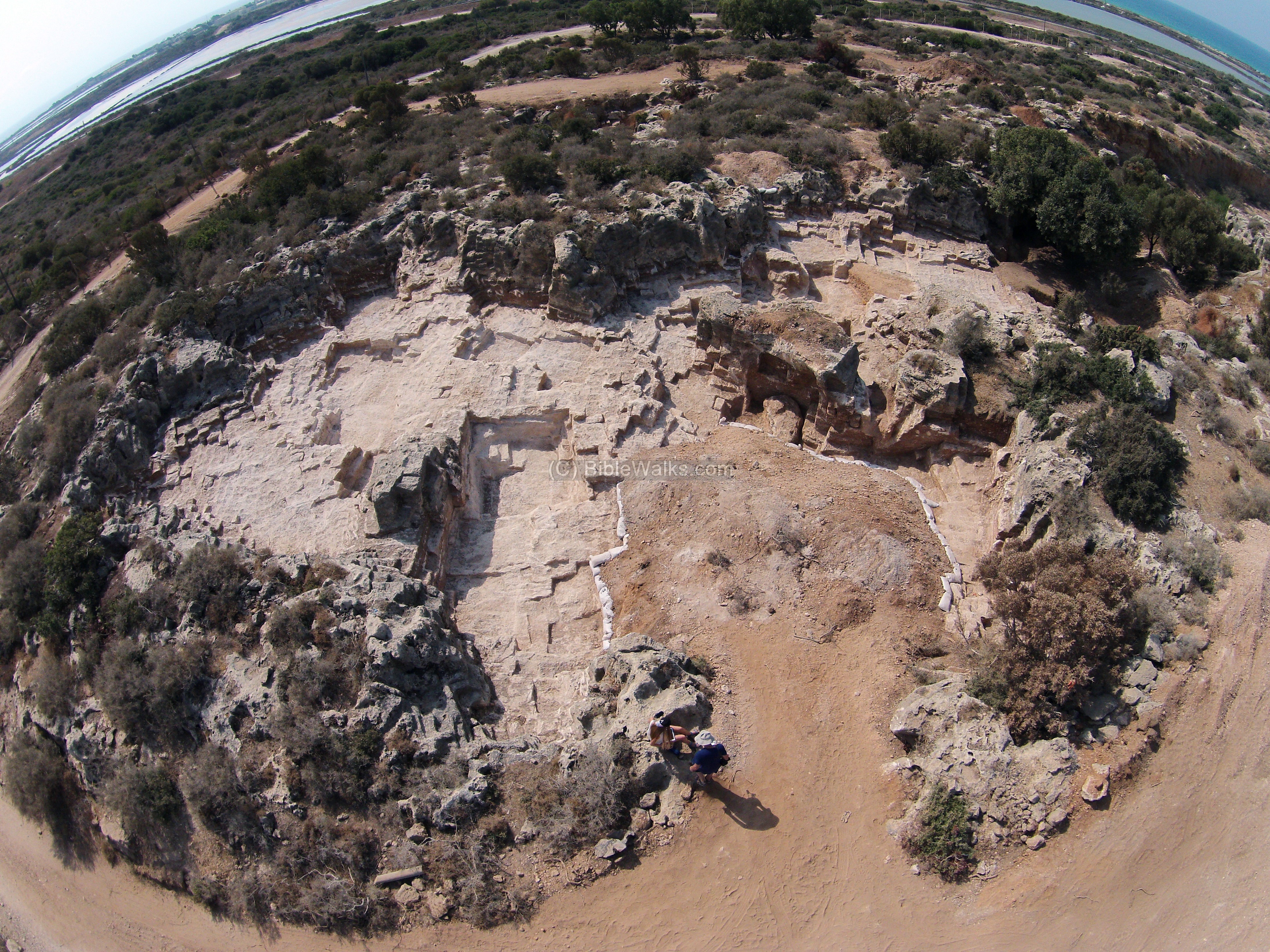
The site is located 20KM south of Haifa, on the sea shore, 3 KM west of Mount Carmel. It is a large site (400Mby 500M) that dominates the scenery of the southern shore of Haifa.
An aerial photo is shown below, indicating the major points of interest. The old small post, Dustery, is shown in the center, along the North /South road.
History of the place:
(a) Prehistoric periods
The submerged prehistoric village in the Bay of Atlit is an archaeological site located on the Mediterranean coast of Israel, near the modern town of Atlit. This site is known as the Atlit Yam site and represents a Neolithic village that existed around 9,000 years ago during the pre-pottery Neolithic period.
The Atlit Yam site was discovered in 1984 during a marine archaeological survey. It is unique because it is one of the best-preserved submerged prehistoric settlements ever found, submerged under about 15 meters of water due to rising sea levels over thousands of years. It is 200-400m offshore, in the bay north of the fortress, with an area of ~40 dunams (4 hectares). The remains of the village were preserved remarkably well, providing valuable insights into the daily lives and activities of the Neolithic people who lived there.
The village was situated (at that time) on a sandy beach, and its structures were made of timber, stone, and mud. The people of Atlit Yam were engaged in a variety of activities such as fishing, hunting, agriculture, and trade. The site contains numerous artifacts, tools, installations, walls and bones of fish. Also discovered was a ritual installation of megaliths, a stone built well (15.5m under current sea level and 5.5m below the sea bottom).
The discoveries made at the Atlit Yam site have provided valuable insights into the transition from a hunter-gatherer lifestyle to a settled agricultural society during the Neolithic period. It has also shed light on the ancient maritime activities and the interaction between coastal communities during that time.
(b) Canaanite thru Roman/Byzantine periods
Due to its ideal location on the shore of the Mediterranean Sea, and its natural large bay (the second largest after the bay of Haifa), the site has a history of thousands of years: it was inhabited during the Early Canaanite, Late Canaanite and Israelite periods. Its Canaanite name was Qarta or Certha. Later it was a Phoenician port. This port, at the 8th and 9th century BC, probably served the commerce with the Israelite Kingdom, as documented in the Bible (for example, Hiram King of Tyre traded with King David and Solomon).
Later, it was inhabited in the Persian and Hellenistic periods, Roman and Byzantine periods.
(c) Crusaders build first post (Dustrey):
Initially, the Crusaders built a very small post (21M x 18M x 3m height) called Dustrey (also named Qarta). Its location is about 1KM east to the larger (and later built) castle, adjacent to the ancient north-south road. Its was actually quarried out into the sandstone ridge. This post was used to deter the robbers and road pirates that attacked the pilgrims, and was built after the Crusader’s King Baldwin I was nearly killed at this place by robbers in 1102.
(d) Crusaders build the large castle and port:
The first construction phase of the great fortress started in 1218-1220 AD. built by the Templars order. The fortress was originally constructed as a rectangular structure with four towers and a courtyard, and was later expanded with additional fortifications.
The purpose of this castle, called “Castellum Peregrinorum” (castle of the pilgrims), was to protect the pilgrims road along the coast from Acre to Jerusalem, and to add another port for the Crusaders in addition to their main center in Acre. It was built in conjunction with the castle in Caesarea, for the same purpose of protecting the road and adding an outlet to the sea.
The plan of the fortress was illustrated by the PEF survey team in 1873 (SWP Volume I p.292.5), and the site was detailed in pages 293-300. As seen in the plan, a “modern village” was established during that period inside the ruins. There are 2 harbors indicated on the north and south bays.
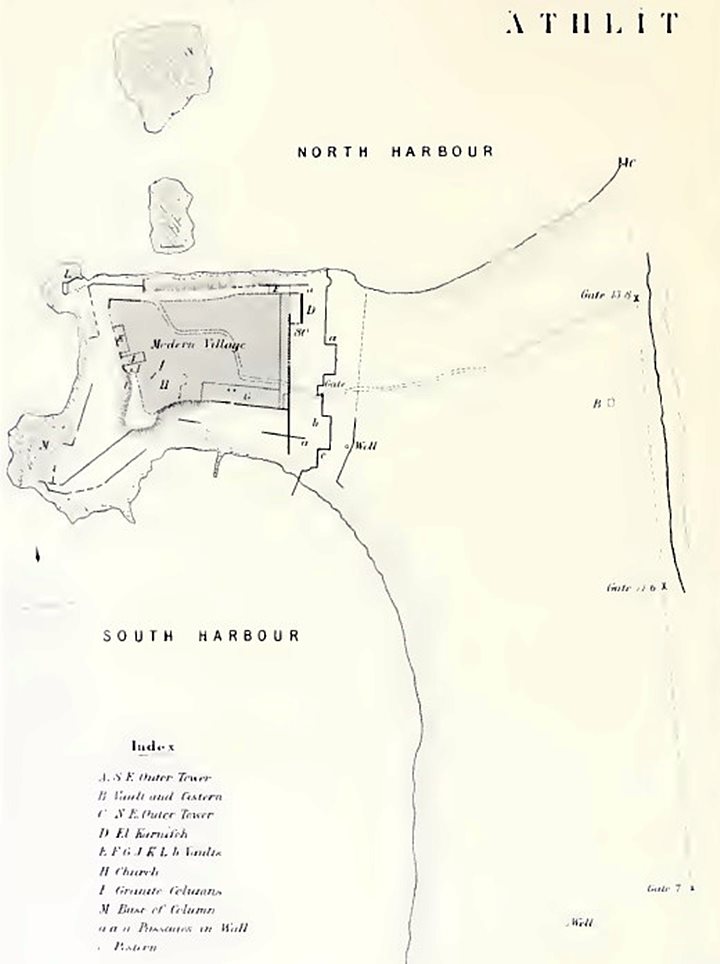
SWP Volume 1 p. 292.5 plan of Athlit fortress
The surveyors provided an extensive description of the castle (pp. 293-295):
” ‘Athlit —The ruins of the fine fortress of Castellum Peregrinorum here exist. The place was built by the Templars in 1218 a.d. (Jaques de Vitry, quoted by Rey, p. 94). A small fort, called le Detroit, had existed previously, and ancient foundations were discovered by the Templars, and a spring between two walls on the south-east (marked ‘well’ on plan). The Templars built two towers, each 100 feet by 74 feet, with a wall between, an outer wall enclosing the well, and a chapel. These buildings are all traceable.
The fortress stands on a promontory with a shallow bay on the south, and a second protected by a reef of rocks on the north. An outer line of fortification is formed by a long wall, running north and south, and by a second running west to the sea from the tower at the south-cast corner. The ground outside this is marshy. The buildings to be described are— 1st. The outer wall and towers. 2nd. The main walls. 3rd. The church 4th. The vaults.
Outer Walls.—The corner tower on the south-east is much ruined : it contained a cistern. On the outside is a ditch, rock-cut, with vertical scarps. The ditch is 38 feet wide on the east, and 32 feet on the south. It is called el Khanduk, ‘the fosse.’ In the counter-scarp are three chambers… These contained recent skeletons ; beyond them is a channel, two feet six inches deep, thirteen paces long, in the face of the scarp. On the glacis outside the fosse there are shallow rock-cut basins, resembling salt-pans. There are other chambers in the counterscarp ; some had structural roofs ; one measured four feet nineteen inches by three feet three inches, and was three feet eight inches in height.
The south wall is 300 yards long, and appears to have had a gate ; the ditch is probably filled up with blown sand. The east wall is 800 yards long, and had three gates ; the southern seven feet wide ; the central eleven feet six inches ; the northern thirteen feet eight inches, being the main entrance on the road from Dustrey to the gate of the main enceinte. The space enclosed between the outer enceinte and the town is about 50 acres. Along the eastern wall outside are remains of the fosse once filled from the sea. The digging of this is related to have taken seven weeks (Jaques de Vitry) ; it still contains water in places. The foundations only of the eastern wall are visible, half covered with blown sand. Behind the wall, half-way between the two northern gates, is a chamber (B), thirty-one feet six inches square outside, with a groined roof. On the west and south a passage, five feet four inches broad, runs within the wall of this building. Its height is eight feet—equal to that of the chamber. The north end is stopped by a wall of good-sized stones.
The vaulting is a cradle vault, with pointed arch. The ground roof of the chamber is also slightly pointed.
The eastern wall terminated on the north at a tower (C) projecting into the sea ; the floor only and foundations of the walls remain. The floor is six feet above the water. The walls are of good stones, four or five feet long, not drafted inside, laid lengthwise, and the joints broken by short stones, two feet by two feet. The total length of the tower appears to have been twenty-five feet, the breadth fourteen feet, inside, the walls being six feet thick : there are two ruined windows on the east, and steps on the south, where a narrow tongue of rock connected the tower with the mainland. The length of the stones in the ashlar is very irregular.Main Walls.—Two hundred and seventy yards west of the outer enceinte the counterscarp of the ditch before the second wall extends from the water right across the neck of the promontory, and the second wall runs within it. The ditch here is loo feet wide, measuring to the curtain of the wall, which has a gate in the middle and a rectangular tower ninety feet broad, and projecting thirty feet either side of the gate. The total length of the wall, north and south, is 200 yards. Each tower had a postern or sallyport in its side : near the sea there is a small semi-circular tower of small masonry, apparently built later. The masonry of the wall is very fine ; the stones two feet high, and two feet six inches to five feet long, with a draft one and a half inches broad, and never less than three inches deep ; in the cases where the boss is rustic, it projects as much as a foot. The backing is of rubble of small stones in hard mortar, with sea-shells (Bivalves) and bits of pottery. It is important to notice that one of the posterns has a pointed arch of drafted stones, with even number of voussoirs. The mortar used is of two kinds throughout the walls—grey, mixed with ashes, for interior work ; white, with cockle shells, as before noticed. Some of the stones have been cut by the natives, and the lead clamps with which they were bound together removed. The gate is broken down, but appears to have been built with a square recess, in the south wall of which was the door ; the entrance was thus flanked by the line of the wall and by the towers. There is no reason to suppose older masonry to have been used up in these walls, for the stones in the pointed arch are like those in the lower courses. The material is a sandy
limestone from the quarries near, (Maktiyet Athlit). It is related that two oxen could scarcely drag one of the stones used by the Templars on a cart. The wall of the towers has a slight halter. The two great towers within the second wall have almost entirely disappeared. The southern cannot be traced, but the vault that was beneath it remains. It seems to be the building called Kusr Bint el Melek, ‘The King’s Daughter’s Palace,’ by the peasantry. The east wall of the northern tower is still standing. It is nearly eighty feet high, sixteen feet thick, and thirty-five paces long (thirteen feet short of the total length given by Jaques de Vitry). On the inside or west are three ribbed pointed arches, supported on corbels, representing on the left a bearded head ; on the right a head shaven, with curling hair ; in the centre a cantaliever, with three lilies in low relief. The wall itself on the outside has eighteen courses of fine ashlar, and rubble-work above for the rest of its height. Both sides were originally faced with ashlar. The stones are two feet in height and about four feet long on the average, with drafts, as before described ; the bosses are dressed. Square lewis holes occur in many of the stones, by which they were raised. This tower is called el Karnifeh by the inhabitants.
The modern village covers the whole site of the town, which stood upon vaults, running round four sides of a rectangle measuring 500 feet north and south and 300 feet east and west. There was also a wall outside the vaults, leaving a broad street or esplanade round the town, from which the vaults were entered. This wall joins the one on the east outside the great towers, and on the south-west had a pointed bastion, with a second line of fortifications within it. The bastion flanked the jetty leading down to the water in the south harbour”.“The Church is described by Pococke as a large decagon, with three pentagonal apses, on the three eastern faces, forming the choir, but is now almost entirely destroyed. A vault, the entrance of which is choked, is said to exist beneath it. The roof was still whole before the great earthquake of 1837, but was then thrown down, and much of the ashlar was removed to ‘Akka for reparations after the time of Ibrahim Pacha, in 1S38. The cornice noticed by Dr. Porter (‘Murray’s Guide’) has also disappeared, though remembered by the villagers. One apse only
is now left, pointing east (92′), being a decagon of twelve feet side. In the court of a hovel west of this two slender pillar-shafts are standing, eleven feet ten inches apart, probably not in situ. The remainsof two of the windows—huge masses of masonry, lying upside down—have fallen outside. The arches appear to be round. A capital of Gothic design, and belonging apparently to a very thick column, lies much broken near. The window-mouldings were sketched (see Plan), as well as the capital”.
(e) Post Crusader Periods
Atlit was the last Crusader outpost in the Holy Land. After their retreat (August 1291 AD) and its partial destroy, the fortress was repaired and held by the Mamlukes.
In spring of 1799 the port served as one of the French navy ports during Napoleon’s failed expedition to conquer Acre.
On Jan 1, 1837, the fort was heavily damaged by a powerful earth quake that also destroyed Zefat and Tiberias, and many of its stones were looted and reused by the Turks in other cities.
An illustration of the ruins of the Crusaders fortress, dated 1882, was published a book by CH. W. Wilson ,one of the PEF explorers. The title: “Ruins on the west side of Athlit”, with subtitle: “The fortress was built by the Templars in the year 1218, and was the last place held by the Crusaders in Palestine. It was taken by the Sultan Melek el Ashraf el Khalil after his conquest of Acre in 1291.”.
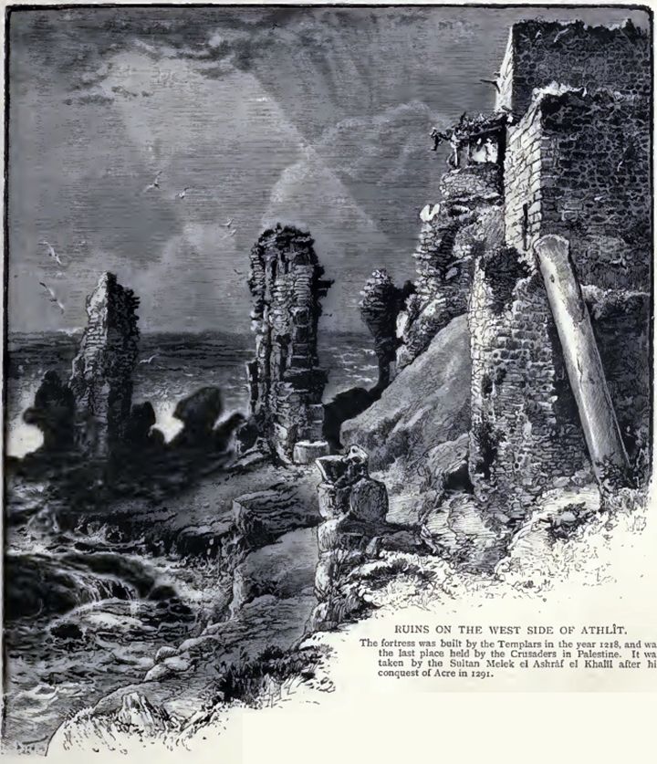
Ch. W. Wilson, Picturesque Palestine, 1882, Vol III P. 101
Another view of the ruins from the south:
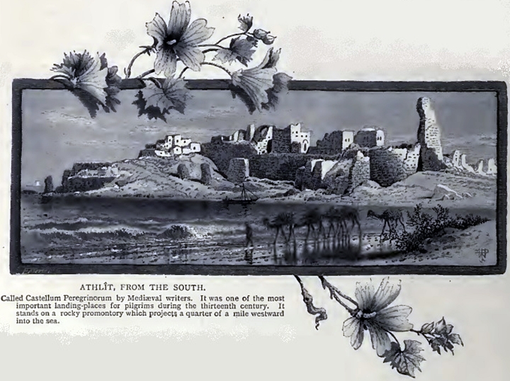
Ch. W. Wilson, Picturesque Palestine, 1882, Vol III P. 100
(d) Modern Times
Today, the site is in ruins. The castle site is not reachable since it is a military area. On the west side of the site there are industrial salt ponds. The British forces built army camps and ammunition dumps in the vicinity, including the Jail where they imprisoned Jewish immigrants during the British Mandate (you can visit the camp, where a museum for “Illegal Immigration”).
A Modern city (Atlit) was built nearby, established in 1903 on land purchased by Rothschild. It is now expanding to the sandstone hills south east of the castle, and the whole area has seen a massive real estate push. The city is trying to get the army base moved away from the Crusaders site in order to open it to the public.
Photos:
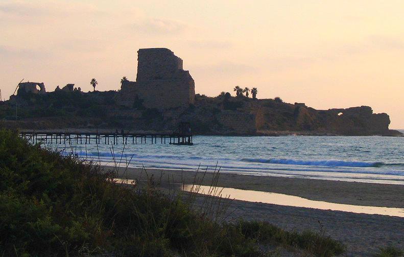
(a) General View of the fort:
The Atlit Crusader fortress is located on the beach near the modern city by the same name. Only a few walls are seen standing in this ancient city. The castle is built on an eastern side which is separated from the mainland by a moat.
The fort had two ports:
- The Northern port’s wall can be seen at the right side – stretching into the Mediterranean Sea.
- The southern port is hidden behind the castle, and used the natural bay as the base of the port.
Click on the photos to view in higher resolution…
Another view from the east is next. The castle is built on a sandstone extension of a natural bay, one of the few along the Holy Land coastline.
In the foreground are modern salt ponds. This area has a long history of salt production.
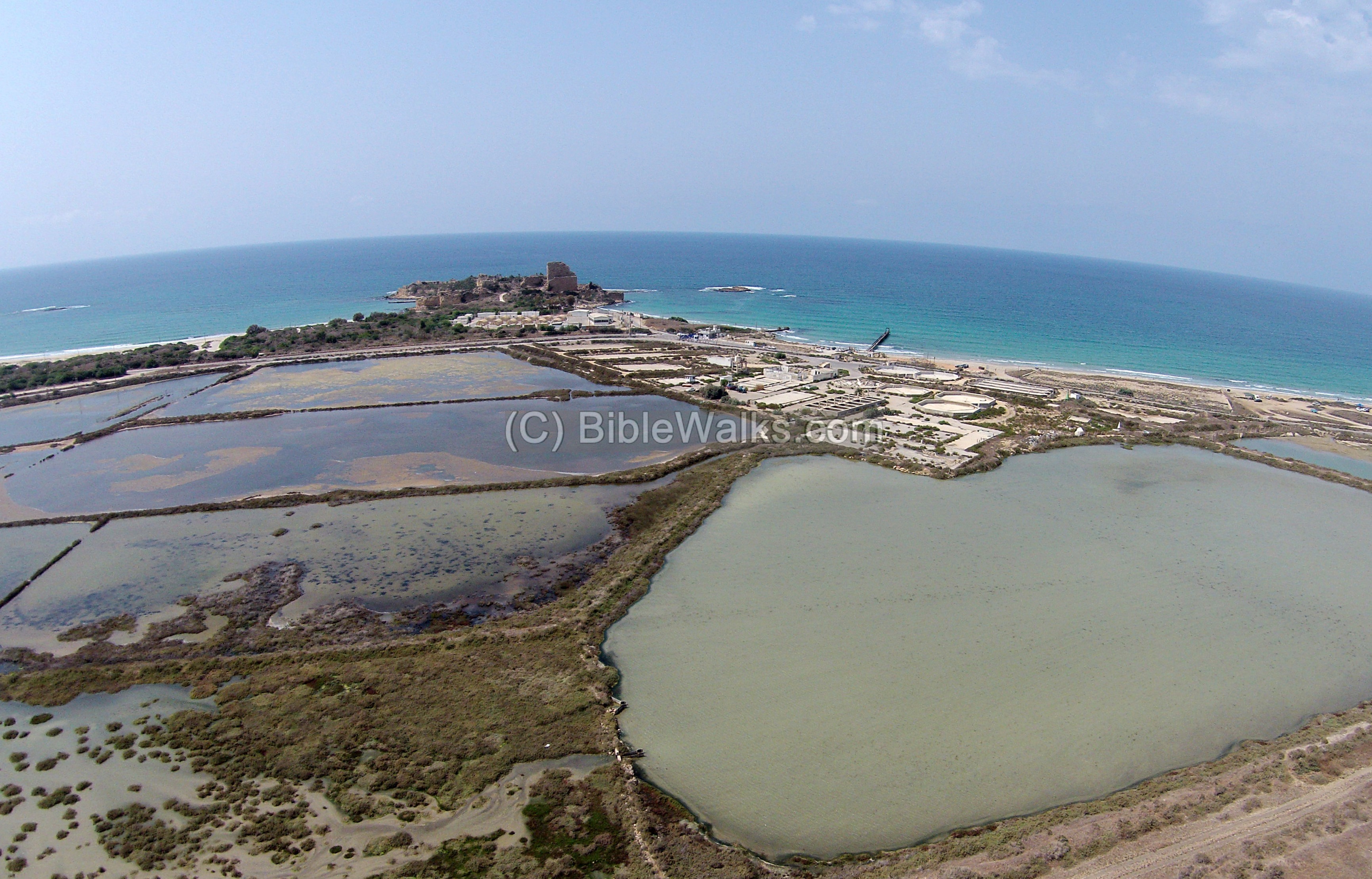
A closer east view on the fortress is in the next photo.
Notice one standing high wall. As per the PEF survey report (SWP. Vol 1, p. 295): “The east wall of the northern tower is still standing. It is nearly eighty feet high, sixteen feet thick, and thirty-five paces long… “. Wilson, one of their surveyors, writes about this wall (Ch. W. Wilson, Picturesque Palestine, 1882, Vol III P. 111):
“Projecting from the north-east corner there are the ruins of a spacious hall, called by the natives El Karnifeh. The eastern wall of the northern tower of Athlit is still standing ; it is eighty feet in height, and from a distance it appears to be a complete structure”.
(b) The Fortress:
Modern photos are not available, as the fortress is within a military area. However, old photos are shown here to see some of the views and the extent of the damages.
An arched vault inside the fortress:
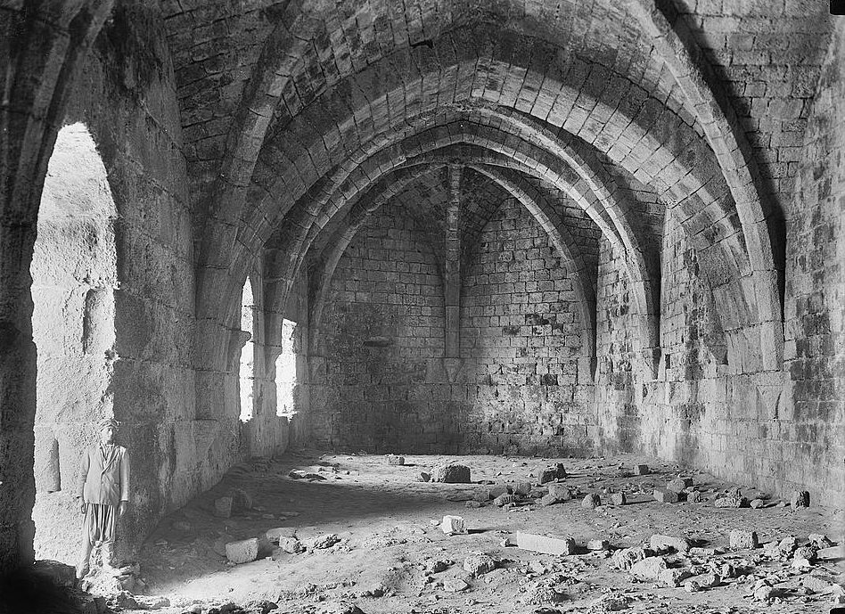
Library of Congress – American colony collection (1934-1939)
The north west side of the fortress, with a view towards the bay on the north side:
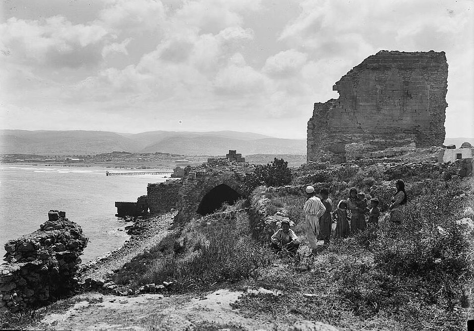
Library of Congress – American colony collection (1934-1939)
The south west side of the fortress and the south bay:
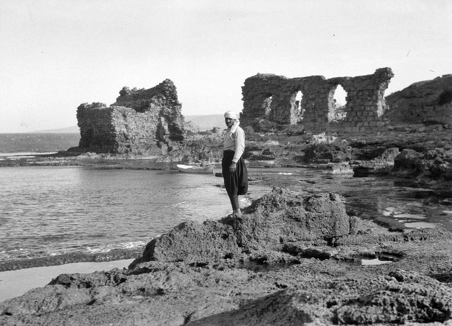
Library of Congress – American colony collection (1934-1939)
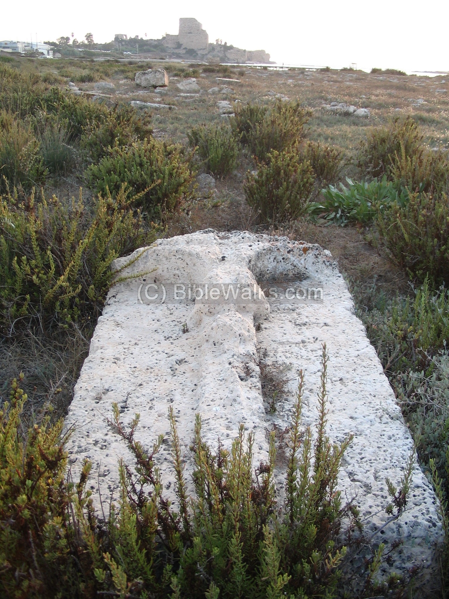
(c) Ancient Cemetery:
In the north of the fortress there is an ancient cemetery with hundreds of tombs from the Crusader period, covering an area of 80 x 100M.
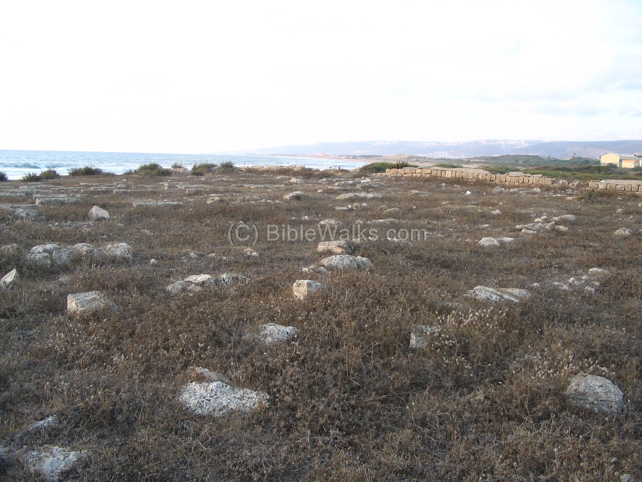
There are 4 illustrated tomb stones in this ancient cemetery. One of these Crusader tomb stones has a cross in the shape of an anchor, as seen on the right photo.
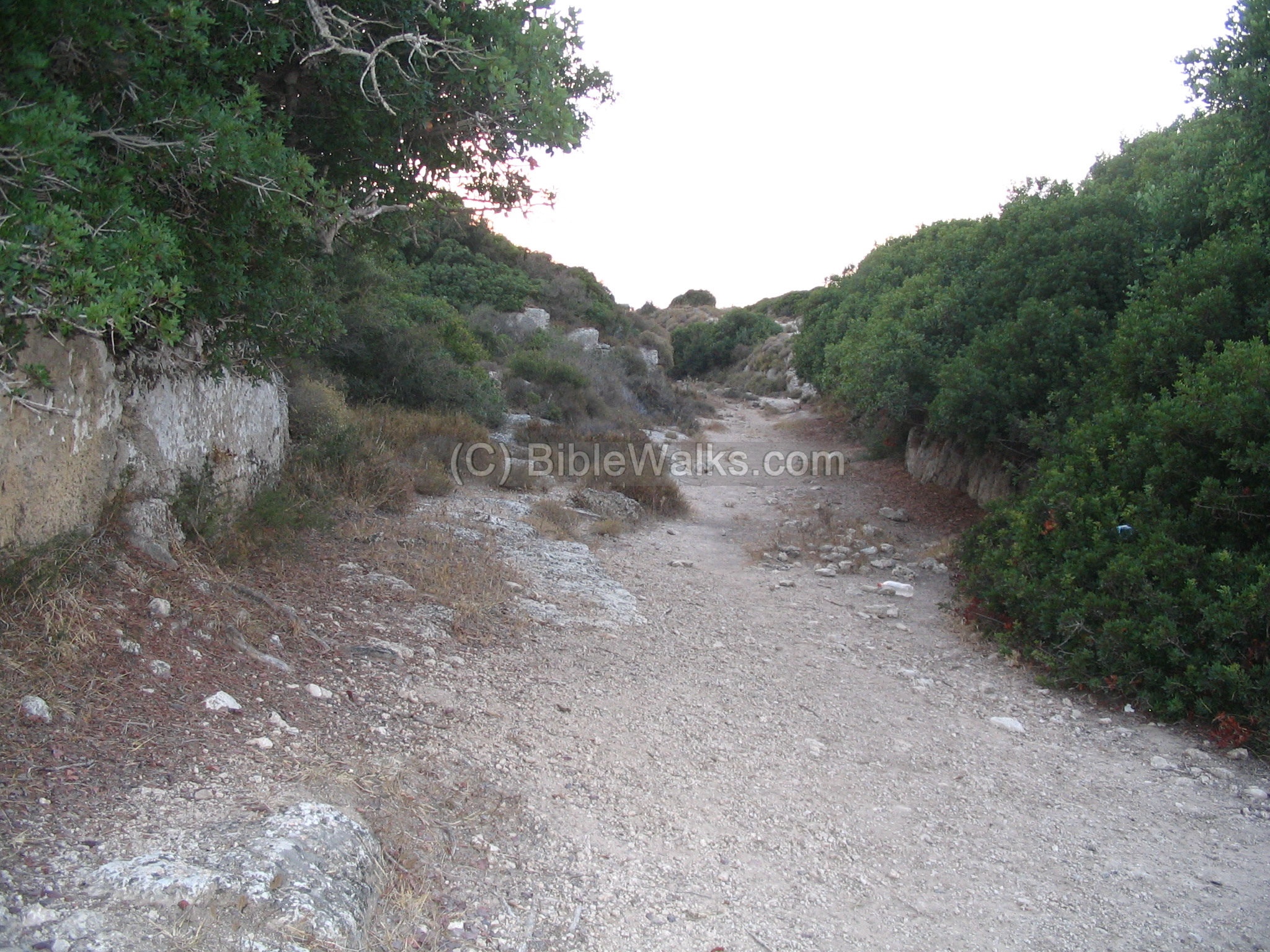
(d) Ancient Road:
The Ancient road (250M long) is carved into the eastern cliffs of the sand-stone hills (east of the castle). The signs of wheel ruts from the thousands of wagons that passed this road are visible along this pathway. The eastern side of the road has crumbled over the years. On the south side of the road is a stone quarry.
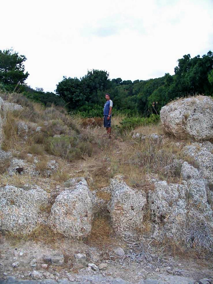
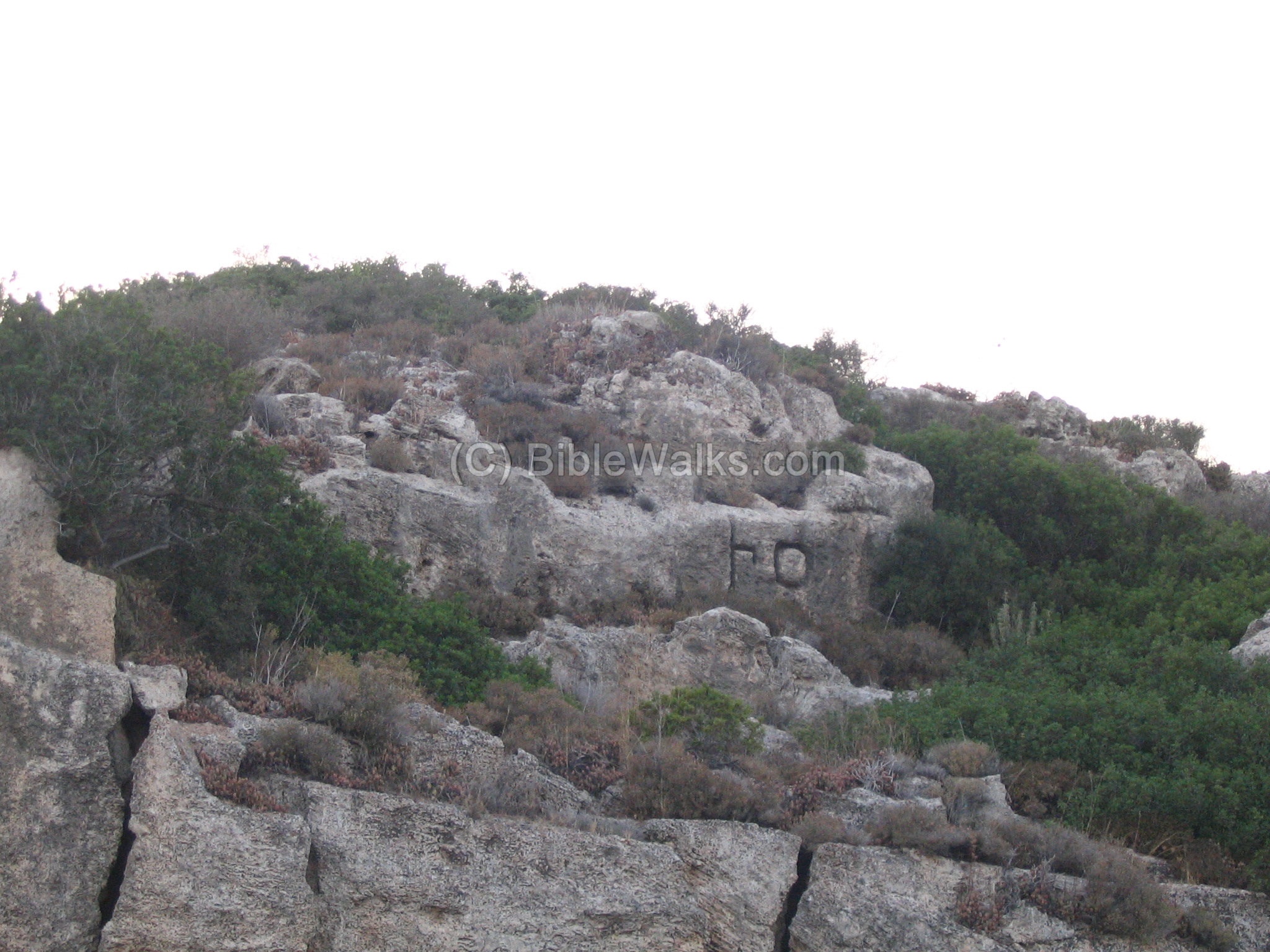
On this ancient road, two very large Phoenician letters (“Ayin” ,” Taff”) are carved out in the rock on the eastern cliff. This word is “AT”, and it maybe the prefix of Atlit. This shows that the road has been in use, at least, from the Phoenician period (7/8th century BC) to the Crusaders (12/13th century AD).
The road passes this hillside since the land in the east of this place was marshes, since the water coming from Mount Carmel could not pass these hills naturally. Only in the Roman times some narrow passes were dug out through the rock in order to dry out these wetlands, such as a passage nearby (Wadi Dustery).
The following photo shows the entrance to the Castle from the main ancient road, which goes east to west. It is cut deep into the sandstone hill. There are places to tie the horses, and water basins for the horses. The Dustrey (Qarta) fort is on the right side, behind the trees.
(e) Sandstone ridge:
A long sandstone ridge stretches in parallel to the coast line. The Crusaders used it as their first line of defense, building posts such as Qarta (Dustrey), horse stables, gates and roads. This aerial view shows one of the horse stables along this ridge, used by the defending knights as a front line post. It is located near the old synagogue in the nearby modern city Atlit.
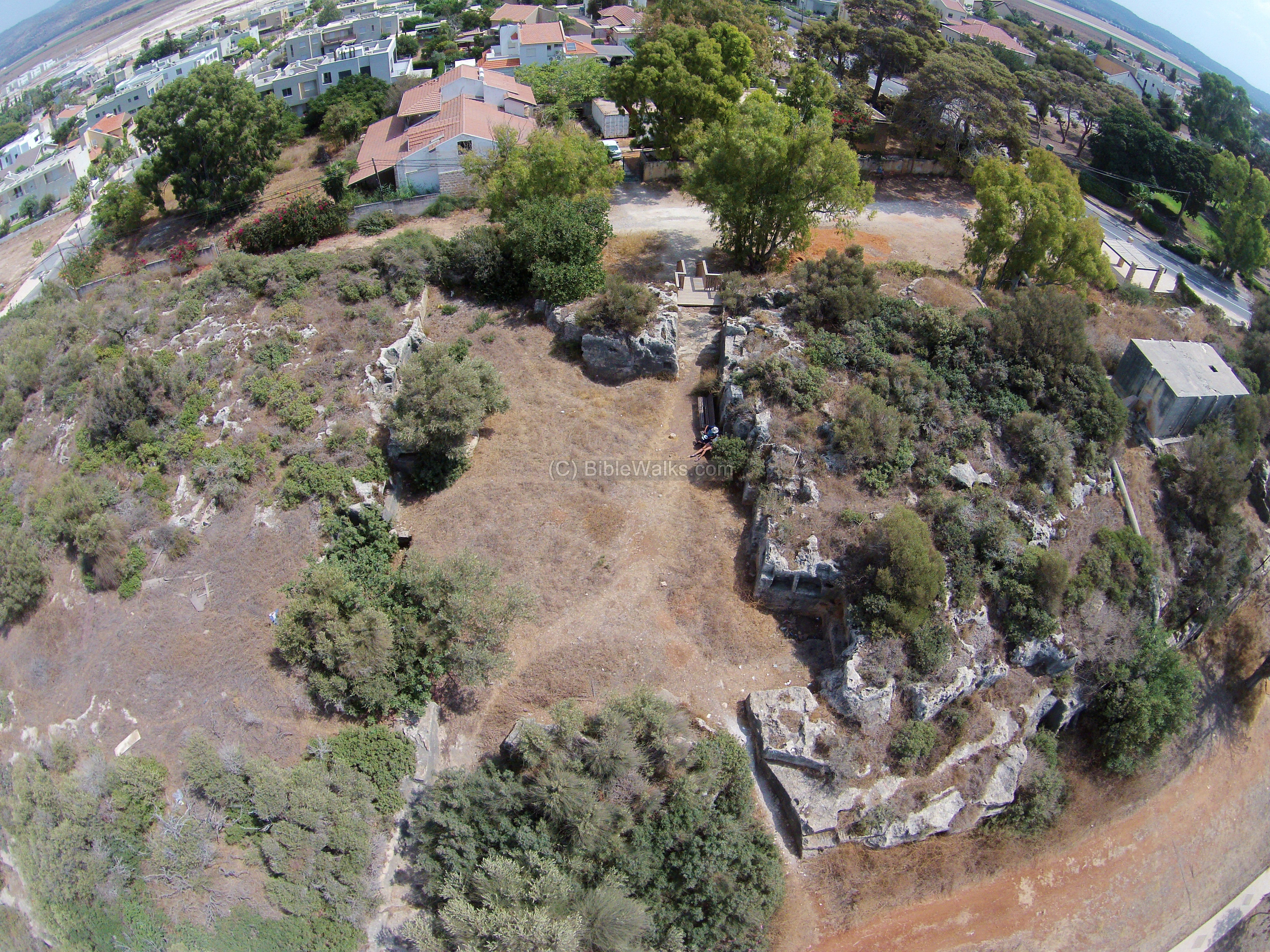
Sadly, a new neighborhood was recently approved to be built along this unique sandstone ridge. In spite of numerous protests, the building plans will affect the historic ridge. Emergency excavations are now (2015) conducted in several locations.
The next aerial photo shows one of the Crusaders period stone quarries, as the builders of the fortress required a large number of building blocks.
![]() Fly over the quarry with this YouTube video:
Fly over the quarry with this YouTube video:
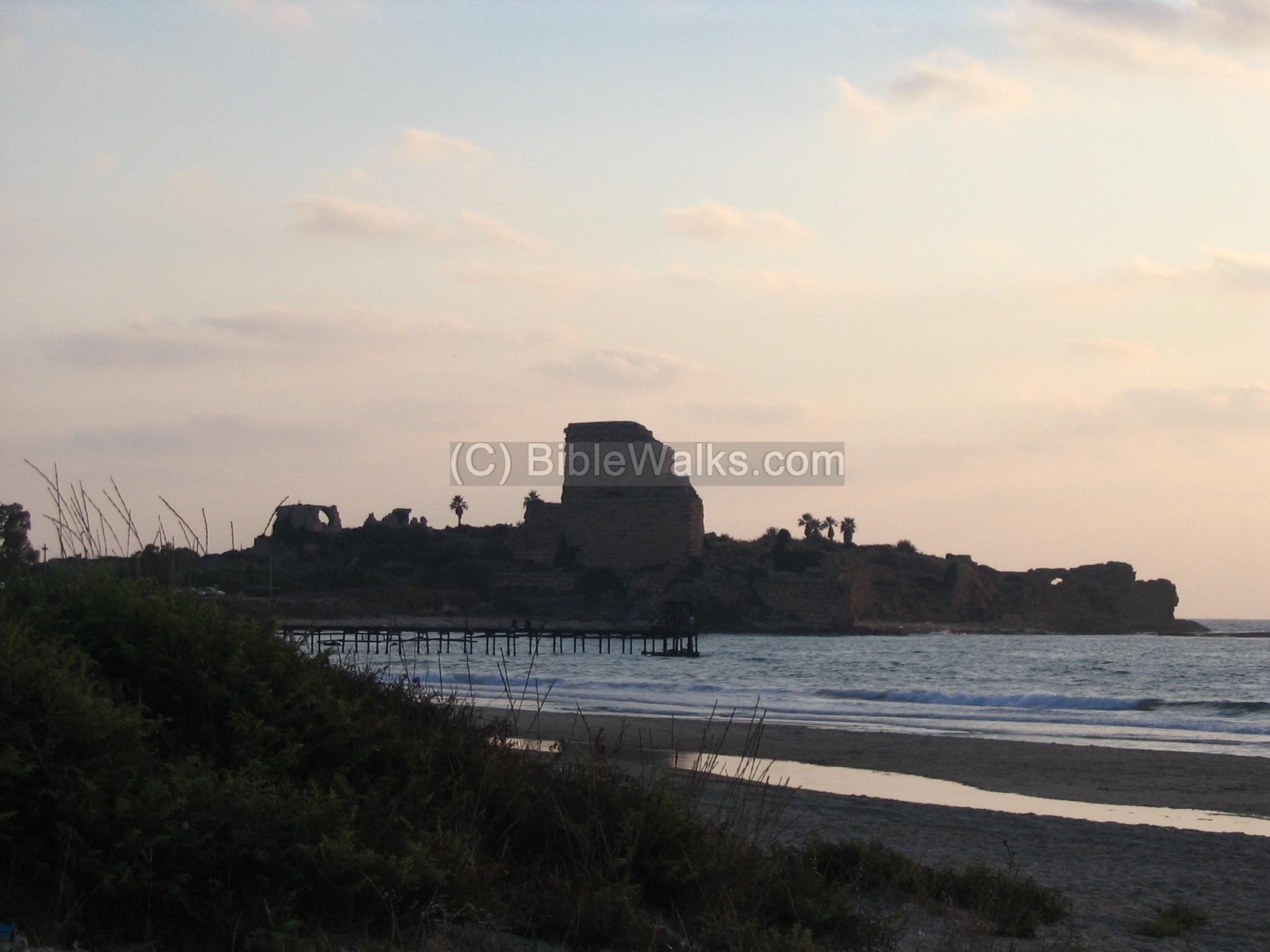
(f) Sunset:
A beautiful sunset photo is seen below. Atlit was the last Crusader outpost in the Holy Land, and can be called the “sunset” castle.
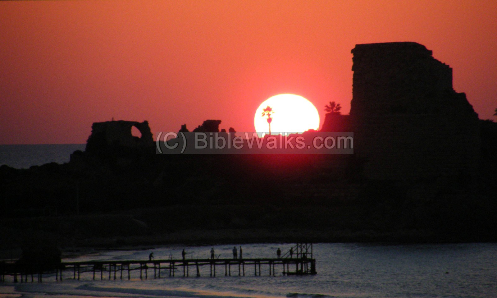
Photo by Ohad Shatz
Visit at the site:
The fortress is not reachable since it is a military area. You can, however, get close to the site by driving from Haifa down the main highway Tel-Aviv-Haifa about 20KM, turn right in the Atlit junction, and continue straight on for 2 Kilometers.
To get to the Qarta/Dustrey fort and Phoenician letters, stop at the park which is southwest of the junction.
Archaeological References:
- The site was excavated during 1932-1938 by the British Archaeologue Johns.
- Underwater Exploration along Israel’s Mediterranean Coast
- Arch. Survey of Israel – Atlit Map (24) – A. Ronen, Y. Olami [1978] , site: #82 (Atlit), #81 (Cemetery), 80 (north port)
- SWP (Survey Western Palastine, 1881): I p. 281, 293-301, 357
-
Other References/Links:
- Ariel Encyclopedia [1979]- Qarta, Certha; Athlit.
- Migdal Malcha – In BibleWalks
- Drone Aerial views – collection of Biblical sites from the air
- Pre-Pottery site of Atlit Yam – IAA
- Sea Levels in the past 200,000 years – PSU article
Etymology – behind the name:
- Atlit/Athlit – The name of the city in Arabic. One explanation for the source of the name is – according to J.S. Bukingham, a 19th C Holy Land traveler – is from Greek: “Atlethes”, meaning strength, since the place was a stronghold.
- Castrum Peregrino – the Crusaders name of Atlit, “castle of the pilgrims” since it protected the pilgrimage road from Acre to Jerusalem.
- Qarta or Certha – the Canaanite name of Atlit. The source of the name may have come from City (Carta/Qarta/Qeret in Hebrew).
- Majdal Malcha – the Arabic name – Majdal (tower) of salt (Malcha), due to the salt industry in the area which exists here for thousands of years until modern times.
BibleWalks.com – walk with us through the sites of the Holy Land
Carmel Caves <<<—previous site —-<<<All Sites>>>—next Carmel site—> >>Qarta
This page was last updated on June 15, 2023 (PEF report)
Sponsored Links: