Overview of the sites around Yeruham, located on the high Negev desert area.
Home > Sites > Negev> Yeruham> Overview
Contents:
Background
Location
History
Sites of Yeruham
Etymology
Links
Overview:
This web page is an overview of the sites around Yeruham, located on the high Negev desert area.
Location and Map:
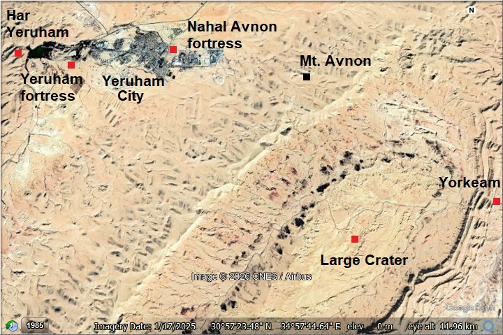
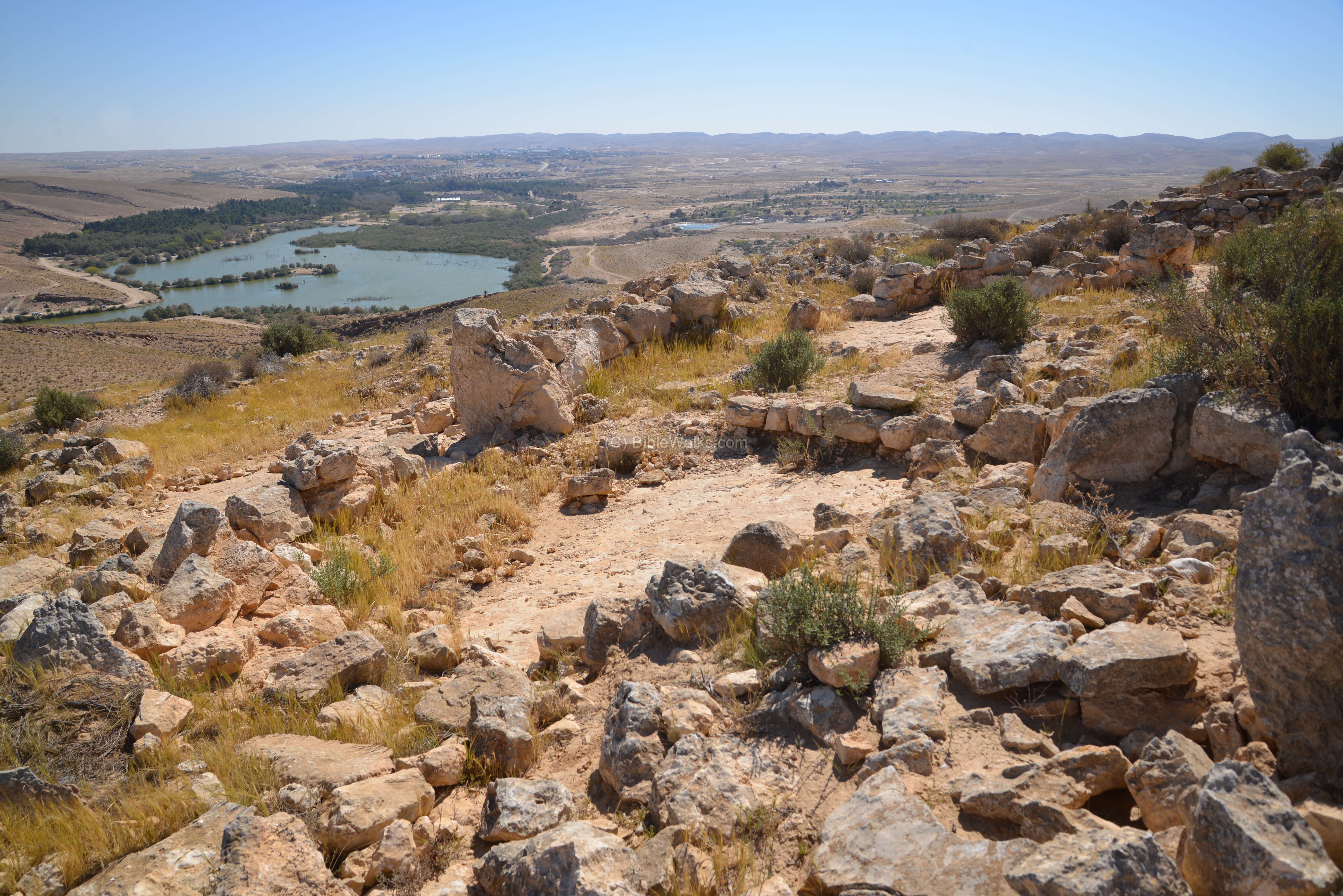
The modern city of Yeruham is located north west of the Large crater (Makhtest Gadol), at a height of ~500m above sea level.
The sites covered in this page are marked on the following aerial map.
History:
The area of Yeruham is located on the side of ancient routes cross or bypass the Great Crater. Therefore, many ancient sites can be found in this area, starting from the stone age and spanning all periods until the modern times.
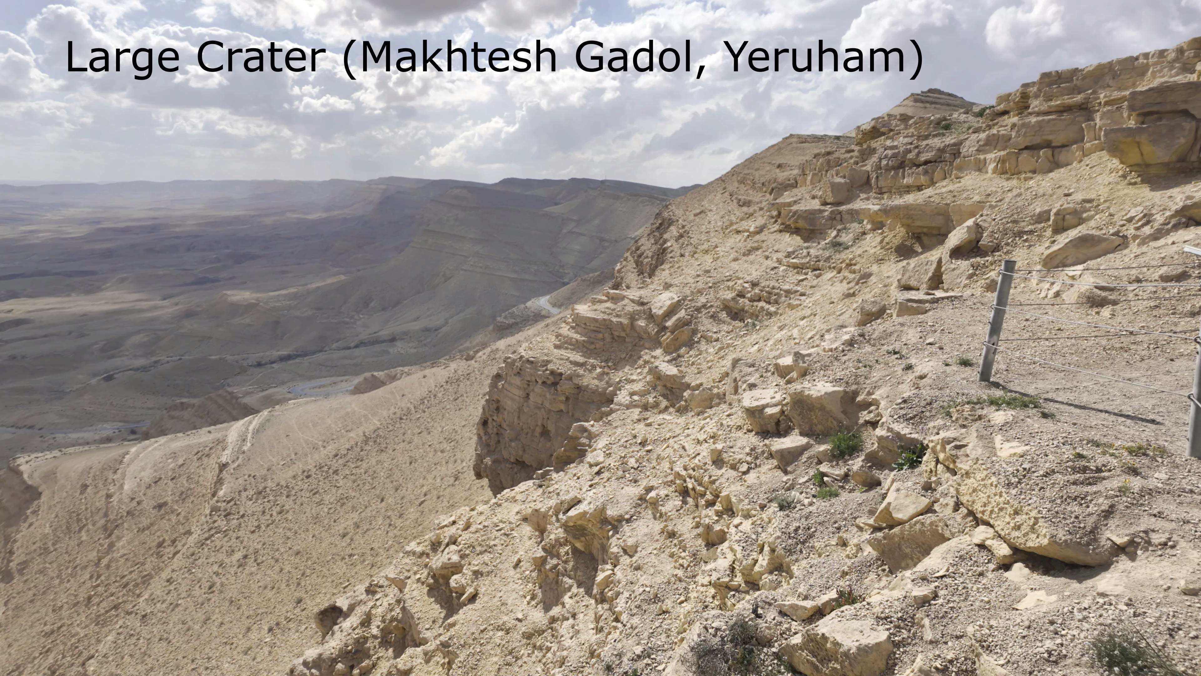
- Creation of the Large Crater (5 million years ago)
Just southeast of Yeruham lies a geological wonder: Makhtesh Gadol, or the Large Crater. It is one of three major ‘Makhteshim’ in the Negev—massive erosion cirques that are so unique to this region and the Sinai that the Hebrew word ‘Makhtesh’ was adopted by scientists worldwide to describe them.
Unlike craters formed by meteorites or volcanoes, this was carved by the sheer power of time and water. The story began 25 million years ago with the birth of the Great Rift Valley. As the African and Arabian plates pulled apart, the Arava Valley dropped to 350 meters below sea level—the lowest point on Earth. This massive drop created a ‘vacuum effect’ for water drainage. About 5 million years ago, seasonal floods began ‘sucking out’ the soft rock from deep beneath the surface, hollowing out the earth from the inside. While the solid limestone rim held firm, the center collapsed and sank, eventually forming a massive basin 5 kilometers wide and 10 kilometers long.
Over millions of years, the gap between the crater floor and its towering cliffs grew to a staggering 400 meters. The process finally settled about 8,000 years ago, and thanks to the bone-dry desert climate, this prehistoric masterpiece has been perfectly preserved for us to see today. Because the towering walls of the Makhtesh Gadol acted as a nearly impassable barrier, most ancient travelers were forced to navigate around its edges, such as the route from Avdat to Yeruham. However, some desert routes crossed the crater.
![]() See a video blog on the Large Crater.
See a video blog on the Large Crater.
-
Intermediate Bronze, Middle Bronze I (2400-2000 B.C.)
During the MB1 period, a permanent settlement was established on a hilltop southwest of the Lake. In the settlement are 30 connected dwelling structures, creating a compact form around a large central courtyard. The site was one of the largest permanent settlements among the several hundreds of MB1 sites in the Negev.
![]() This period is detailed on a separate web page – Har Yeruham – located on the mountain above the lake.
This period is detailed on a separate web page – Har Yeruham – located on the mountain above the lake.
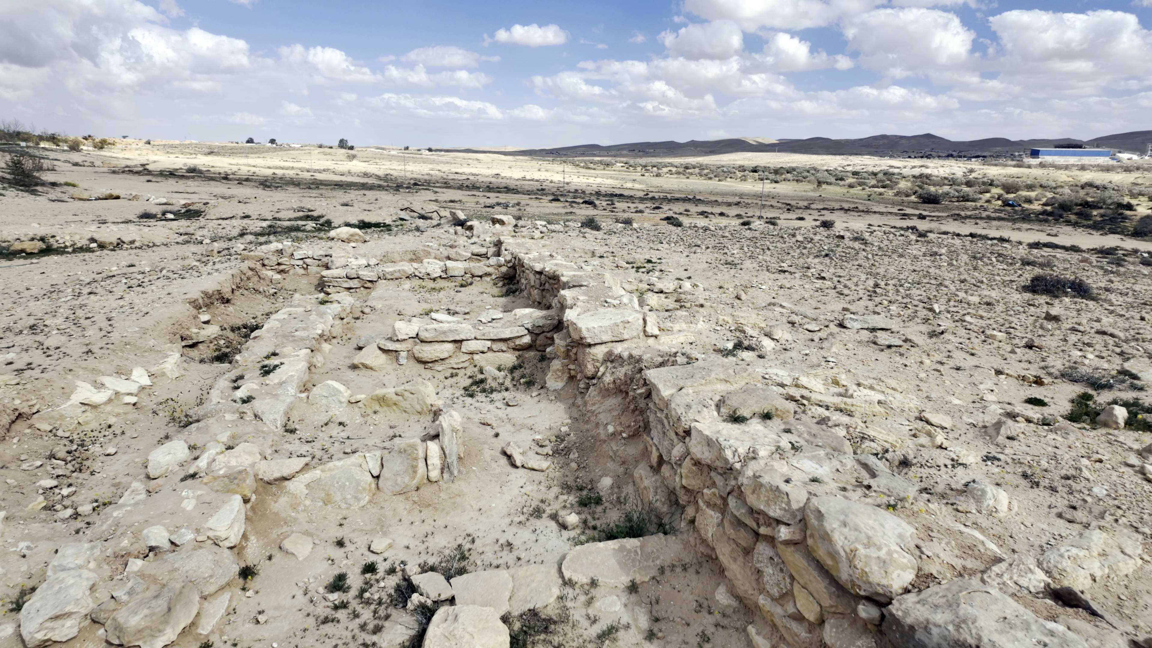
- Iron Age (1200 – 586 BC)
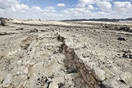
A fortified city was established during the Israelite times on the north bank of Nahal Avnon, north of the industrial area of Yeruham. A section of a casemate wall was unearthed in the preliminay study of this newly discovered site. Scholars believe this fort, as well as others along the route, guarded the ‘Way of the Atharim’—the same major north-south artery mentioned in the Bible. This legendary route ascended from the Arava Valley through the Ramon Crater, cutting through these highlands near Sde Boker and Yeruham on its way to Tel Arad.
![]() This site is featured in another page – Nahal Avnon fortress.
This site is featured in another page – Nahal Avnon fortress.
The Iron Age city in Tel Yeruham appears in the list of sites conquered in 924 BC by Shishak, king of Egypt. The conquest of Tel Yeruham appears on a wall in his palace in Upper Egypt, and the name appears as Y-r-h-m. This event was also described by the Bible (2 Chronicle 12:4): “And it came to pass, that in the fifth year of king Rehoboam, Shishak king of Egypt came up against Jerusalem, because they had transgressed against the LORD, With twelve hundred chariots, and threescore thousand horsemen: and the people were without number that came with him out of Egypt; the Lubims, the Sukkiims, and the Ethiopians. And he took the fenced cities which pertained to Judah, and came to Jerusalem”.

Karnak: Commemoration of Shishak’s victory over Rehoboam
Photo of the Library of congress (American Colony, taken 1900-1920)
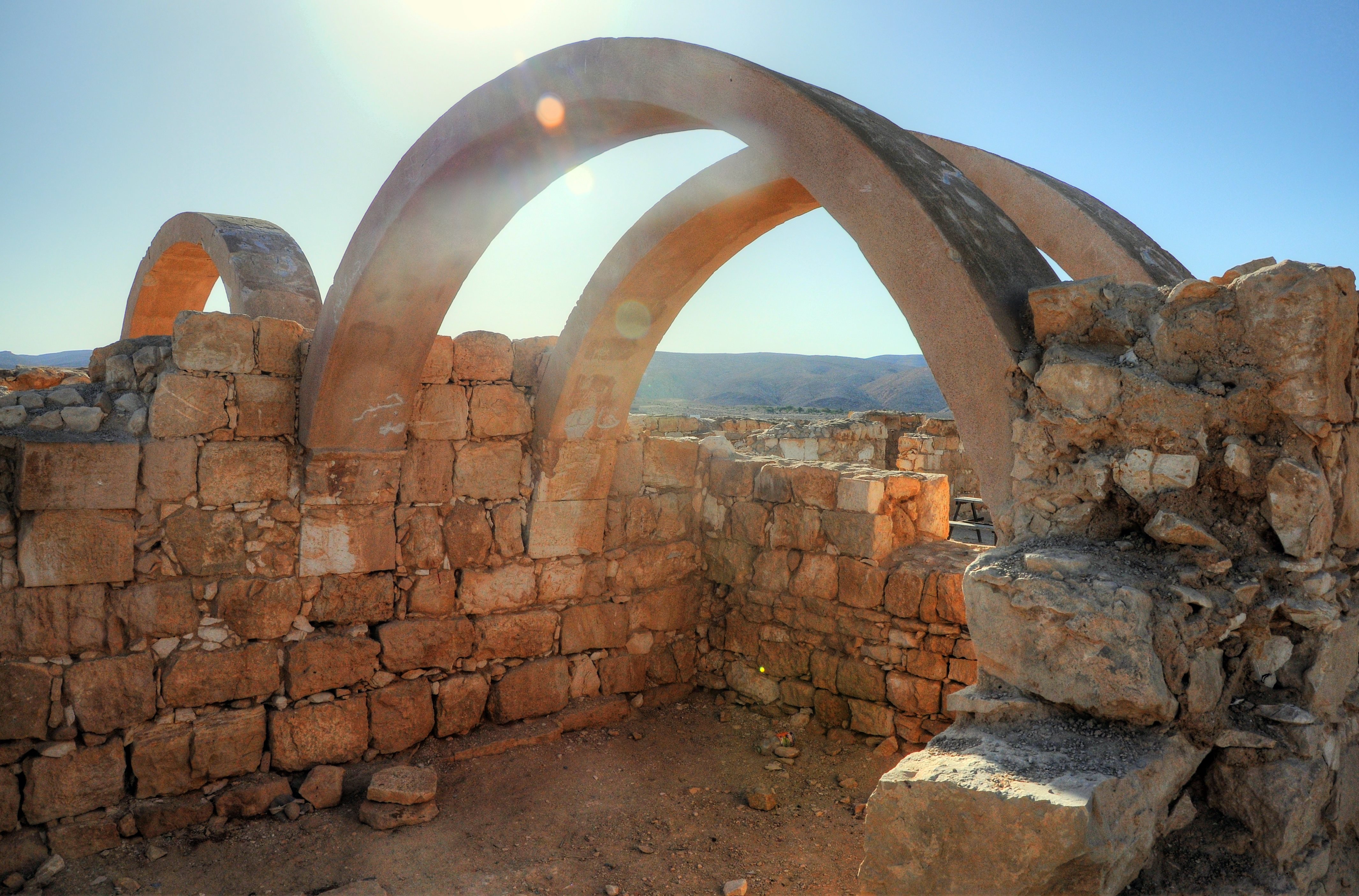
- Early Roman period (1st century – 106 AD)
On the southeast side of Lake Yeruham was one of the stations along the Nabatean trade route – known as the Incense & Spice route. This route connected the east (Yemen and Oman), through Arabia, via the Nabatean capital city Petra, to the port cities on the shore of the Mediterranean Sea – Gaza, Raphia, Rhinocorura (al Arish). The road was used by the Nabateans to export the incense and spices from southern Arabia and the Far east to the Classic world of Greece and Rome. In order to support & protect the Incense route, the Nabateans established stations and fortresses along the road.
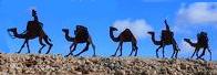
Caravans of camels carrying the merchandise along the Incense route
During the Early Roman period this was a Nabatean station along the Incense & Spice route. The site sits roughly two-thirds of the way between the major Nabatean cities Avdat (Oboda) and Mamshit (Mampsis). The fortress was originally established as a fortified tower and included stables. It functioned as a praesidium (military post) to defend the ancient trade route between Avdat and Mamshit, which was part of the Incense and Spice route used by Nabataeans and later the Romans. Findings from this era showed the site’s origins as a fortified tower accompanied by stables.
![]() This period is detailed on a separate web page – Yeruham fortress.
This period is detailed on a separate web page – Yeruham fortress.
- Late Roman period (4th century AD), Byzantine period (5th-7th century AD)
The site of the Yeruham fortress expanded significantly during this time. Residential houses and additional buildings were added, transforming the military post into a small town or a complex caravanserai for travelers. Excavators uncovered an extensive town-like expansion, including residential houses, paved streets, and a surrounding wall.
- Ottoman Period
Wooley and Lawrence of the PEF survey surveyed the Negev area, and published this map in the PEF book “The Negeb or Desert south of Beersheba”. Woolley camped overnight in Bir Rakhama (ruins of Yeroham fortress) on February 15, 1924. According to his diary, Woolley traveled from Avdat (Abda) to Bir Rakhama along the ancient road (via Wady ‘Araeigin and Wady el-Jurf – the Biblical ‘Way of Atharim’?), then the next day continued to Kurnub (Mamshit).
Here is a section of their map:
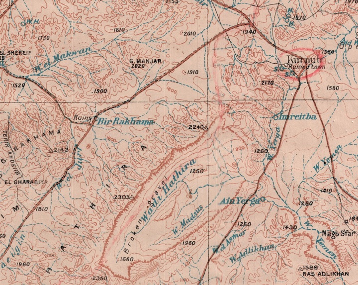
P/O Wooley and Lawrence Negev map, printed 1921 (public domain, link)
- Modern period
In 1951 a town was established near the Great Crater, initially housing the workers in the crater and immigrants. It was named after Tel Yeruham, which is adjacent to the town. It has since grown into a remarkable desert city. As of early 2026, the population of Yeruham is approximately 12,300 residents. The town has seen steady growth over the last decade, increasing from around 9,000 in 2015 to its current size.
The name is derived from the Hebrew root R-H-M (ר-ח-ם), means “mercy,” “compassion,” or “to cherish.” Before the modern town was founded, the area was known by the Arabic name Bir Rakhma, meaning “Well of Mercy.” It is located north east of the Lake’s park area. Local tradition identifies this ancient well as the one revealed by God to Hagar when she was wandering in the desert with her son Ishmael (Genesis 21).
Sites:
These are the sites that are covered in BibleWalks.com:
(a) Har Yeruham
Prehistoric sites on hills above lake Yeruham, dated to the Middle Bronze I period; including a settlement, burial heaps and Amorite temple.
(b) Yeruham Fortress
Nabatean/Roman and Byzantine period desert fortress east of lake Yeruham.
(c) Nahal Avnon Iron Age fortress
Newly discovered Iron Age IIa period desert fortress east of Yeruham.
(d) Large Crater
Just southeast of Yeruham lies a geological wonder: Makhtesh Gadol, or the Large Crater. It is one of three major ‘Makhteshim’ in the Negev—massive erosion cirques that are so unique to this region and the Sinai that the Hebrew word ‘Makhtesh’ was adopted by scientists worldwide to describe them.
(e) Ein Yorkeam
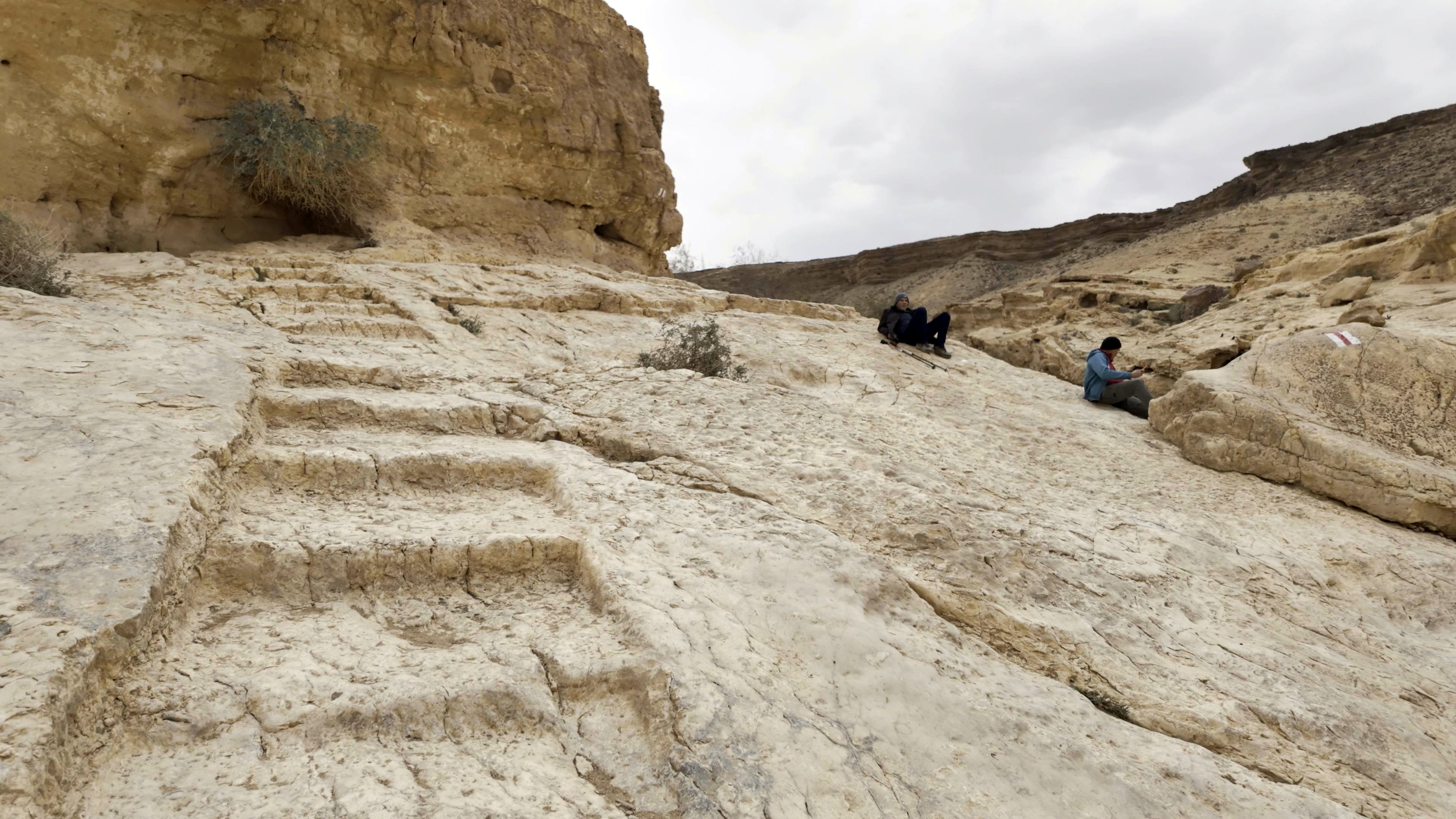
Ein Yorkeam is a breathtaking desert oasis located where the Hatira Stream carves a deep limestone canyon through the rugged Negev landscape.
Remains of the Roman camp at Ein Yorkeam are seen upstream near the highway, on the side of Hatira brook.
Etymology (behind the name):
* Names of the area:
- Yeruham – the town was established in 1951. The name is derived from the Hebrew root R-H-M (ר-ח-ם), means “mercy,” “compassion,” or “to cherish.” Before the modern town was founded, the area was known by the Arabic name Bir Rakhma, meaning “Well of Mercy.” It is located north east of the Lake’s park area. Local tradition identifies this ancient well as the one revealed by God to Hagar when she was wandering in the desert with her son Ishmael (Genesis 21).
- Tel Yeruham – – an Iron Age site on the west side of the town.
- Khirbet A-Rakhma – Arab name of Tel Yeruham, an ancient mound north of Yeruham. In Arabic: the ruins of mercy.
- Qasr Rekhmeh – the Arabic name of the site (means: fortress of mercy)
Links and References:
* External links:
* Internal links:
- Har Yeruham – prehistoric sites on the hill south of the lake
- Nahal Avnon Iron Age fortress newly discovered site
- Yeruham fortress – Large Roman/Byzantine period fortified station
![]()
BibleWalks.com – On the path of the Incense and Spice route
Nahal Avnon fortress <—previous Negev site—<<<All Sites>>>—next Negev site —> Horvat Hazaza
This page was last updated on Mar 16, 2026 (add shishak wall)
Sponsored links: