The Romans built roads thru the Golan heights, establishing efficient link from Israel to Syria.
Home > Sites > Golan >Roman Roads
Contents:
Background
Maps
Peutinger
Photos
* North
* South
Links
Background:
Roman roads were an important part of the infrastructure built during the Roman period in Israel, which lasted from 63 BC to 324 AD. These roads were built by the Roman Empire to facilitate trade, communication, and the movement of troops throughout the region. They set up roads that enabled an efficient route through the tough terrain.
Some sections of these Roman roads are still visible today and can be explored by visitors to Israel. They are also found in the Galilee region, where they have been incorporated into modern roads and highways. The Romans linked their center of administration, located in Damascus, to the Galilee.
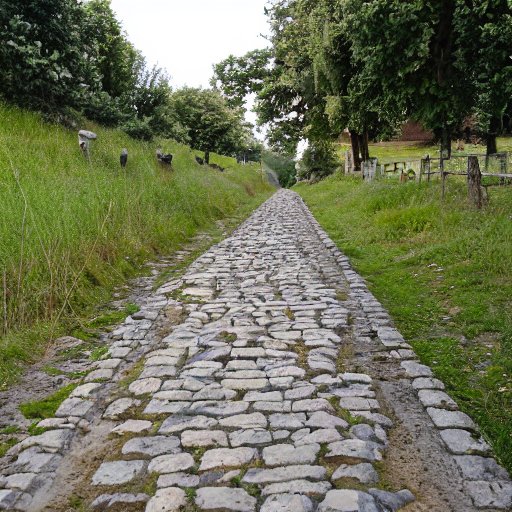
A Figurative Roman road – AI generated by Stable Diffusion
Location and Maps:
There are several sections of the Roman roads in the Golan: South and North Golan.
A map of the ancient roads of the Golan is illustrated here. There are two major roads from the Galilee to Damascus, a northern one (through Dan and Caesarea Philippi-Banias) and a southern one (from several sites on the west side of the Sea of Galilee).
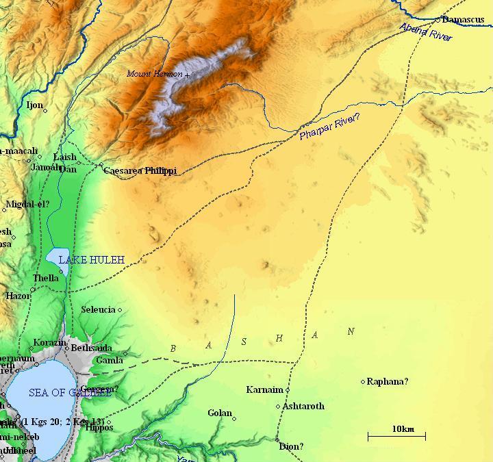
Map of the Golan during Biblical times – based on Bible Mapper 3.0
Peutinger map of Roman roads:
A detail of the Peutinger map (Peutingeriana tabula), based on a 4th century map of Imperial Roman roads, shows the major military roads around Tiberias (shown as “Tyberias”) . It is oriented with the top side as the west.
The Golan area is located on the bottom and the right of the Sea of Galilee (under Tiberias). The main Roman road passed to the east of it, directed to Damascus (on the right, marked as “Damaspo”) . It is marked as “XXXVII” and “XXIIII” (which means 37 and 24 Roman miles between the stations on the road to Damascus).
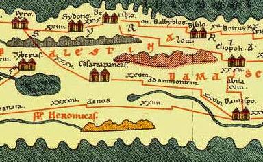
The northern road through the Golan is shown on the map – passing through Banias (“Caferapaneas” – Kafar-Panias – Caesarea Philippi), connecting to Tyre (“Tyro”).
The southern road through the Golan is not marked on the map. It connects Tiberias, via the north of the Sea of Galilee (“Lac Tyberias”) to “Aenos” (perhaps Masmiyeh in Syria).
Roads:
(a) North Golan – Via Banias
A Roman road connected Tyre to the North Golan, passing near Tell Dan, and then through Banias (Caesarea Philippi), up to the Golan. This road is illustrated in the Peutinger map. The road passed through Banias (Panias – Caesarea Philippi) and joined the road to Damascus. The road joined the Roman roads going south to Scythopolis through Bethsaida and Tiberias, west to Tyre on the west coast, and north to Emesa and Antioch.
An aerial map is shown, with the Roman road routes in this area. Some of the locations of the roads are estimated.
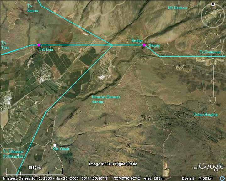
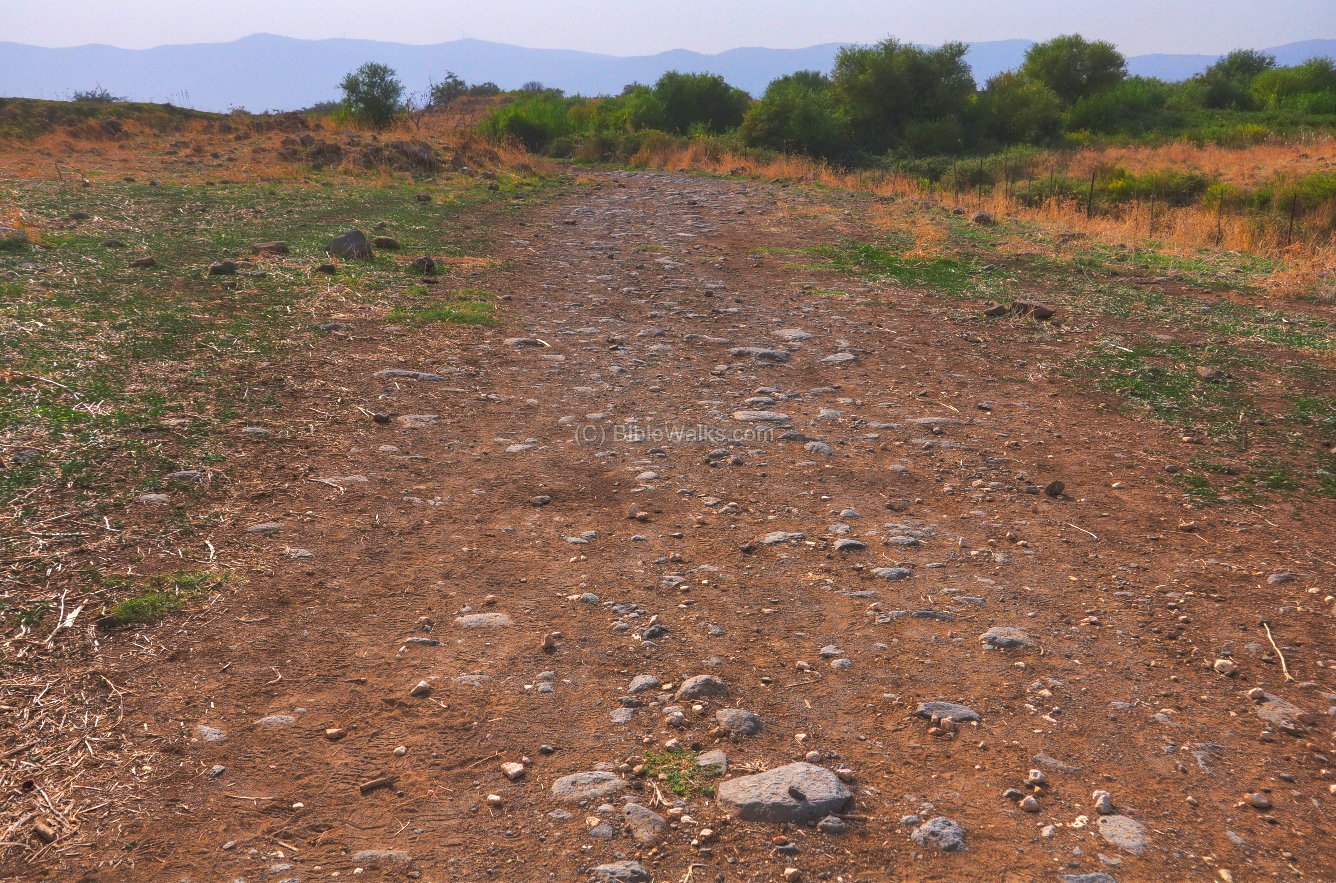
A section of the Tyre-Damascus road, located north-west to the ancient city of Dan , is seen below. It is made of small basalt stones. A Roman bridge is located west to this location.
The 1924 border line, drawn up by the British and French, marked the borders of Lebanon, Israel and Syria – roughly along this road. Today this section is located on the Israeli side.
Click on the photos to view in higher resolution…
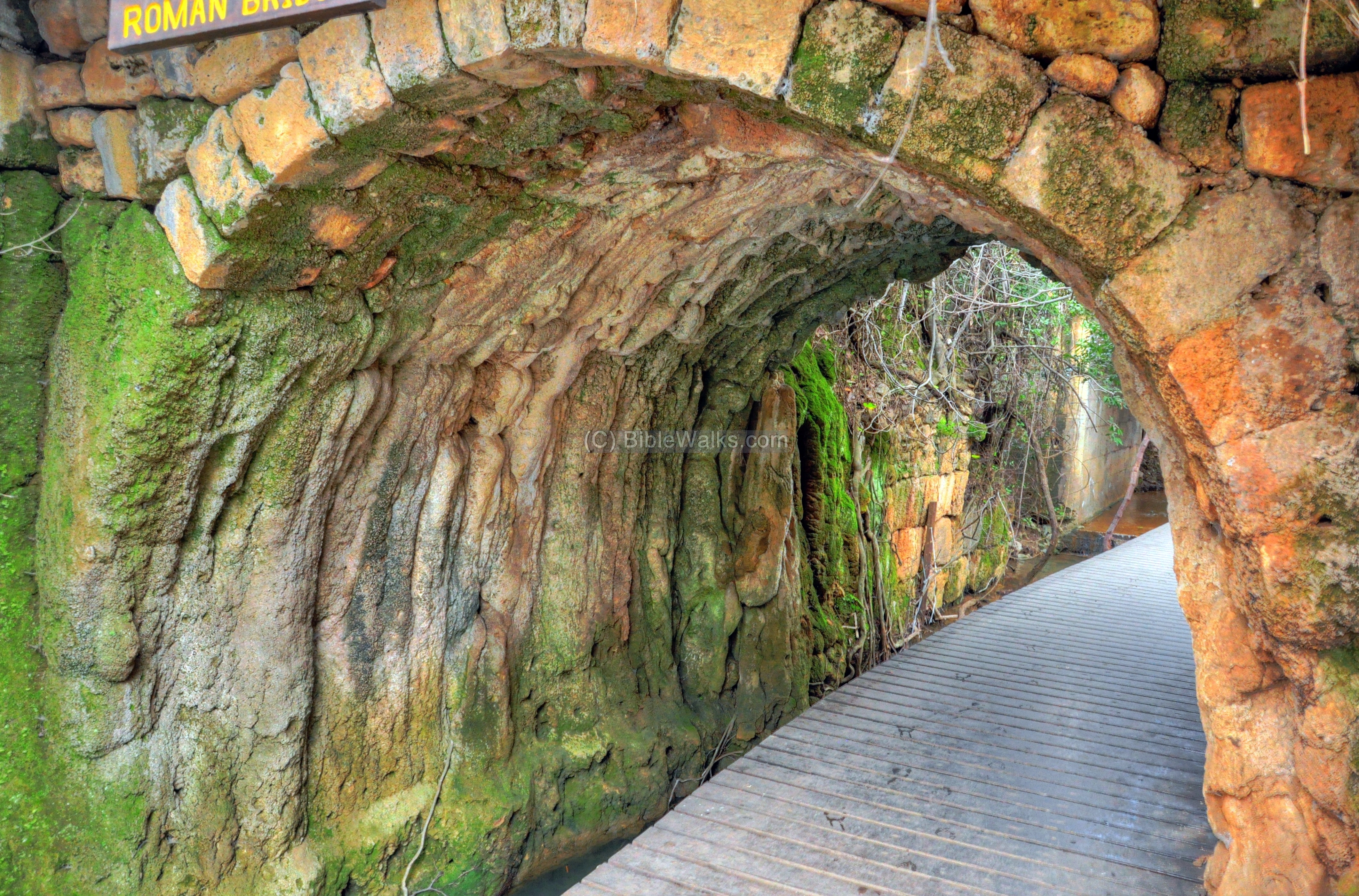
Further to the east, the Tyre-Damascus road climbs up to the Golan heights. Under the modern road near the western side of Banias, is the base of a Roman bridge. The bridge enabled the traffic to pass above the strong Banias stream and the Guveta stream which flows under the bridge. The city of Banias, or Caesarea-Philippi during the Roman period, appears on the Peutinger map as “Caferapaneas” (Kafar-Panias ).
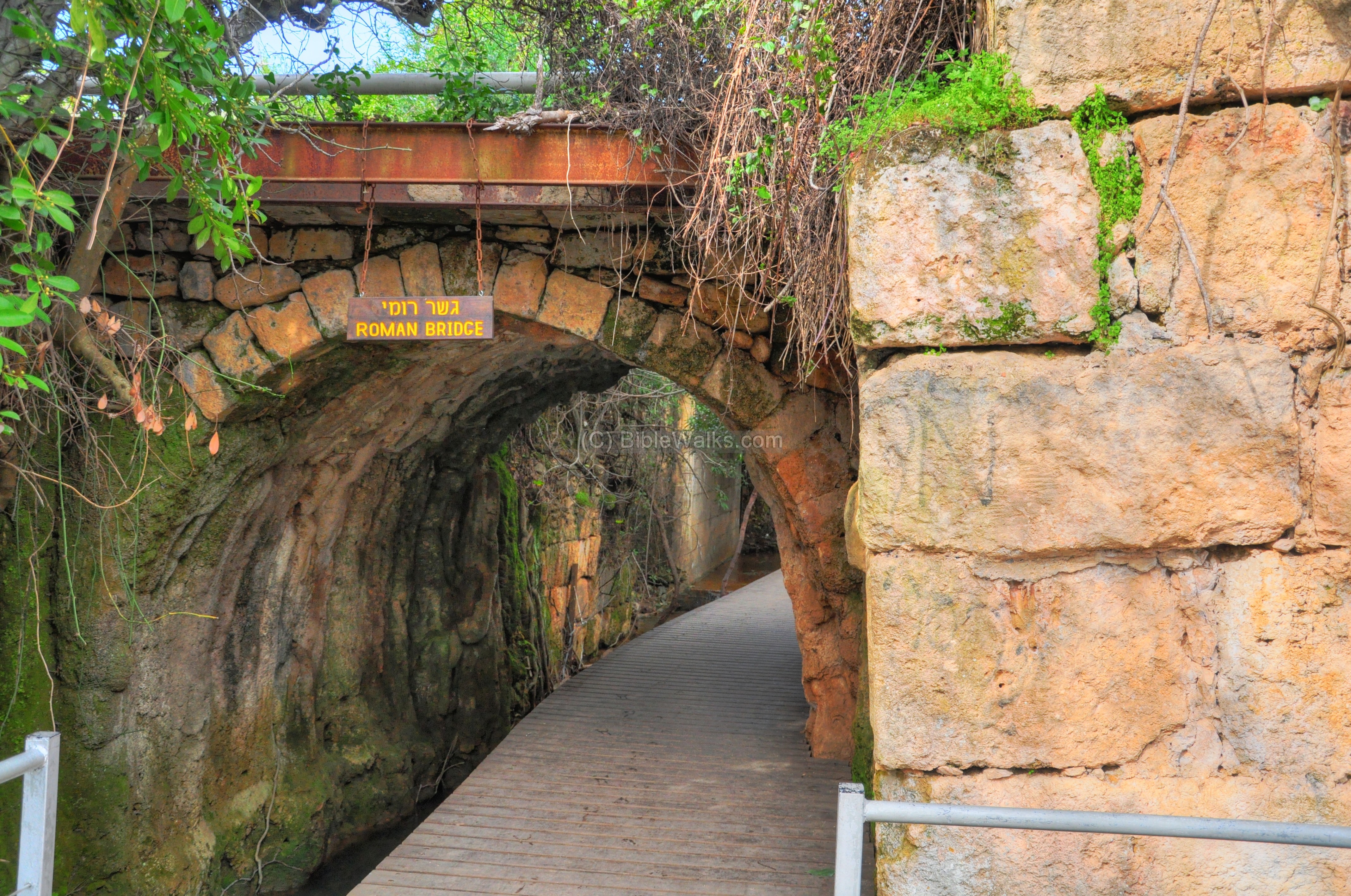
The bridge dates to the 1st century AD, during the early Roman period. It was likely built under the rule of Herod Philip (4 BC – 34 AD) or slightly later under Roman administration.
This Roman road is also mentioned in Jesus’ travels (Mark 8 27): “Now Jesus and His disciples went out to the towns of Caesarea Philippi; and on the road He asked His disciples, saying to them, “Who do men say that I am?”, and Peter confessed Jesus as the Messiah. They have probably walked over this bridge.

Illustration of Jesus meets the tax collector on the bridge near Banias
(Image created by AI using DALL·E through OpenAI’s ChatGPT)
(b) South Golan – via Ramot:
This west-east route was also used in prehistoric times as well and along its path are prehistoric sites. The Romans improved the road, as it may have been the major road that connected the Sea of Galilee (and ancient Israel) to the Roman administration center in Syria.
This is its route (west to east): the Roman road starts near Moshav Ramot on the sea of Galilee, where it connects through BethSaida and Capernaum to the west.
According to the New Testament, Jesus meets a tax collector named Levi (later named Mathew) near Capernaum. The Biblical Account (Mark 2:13-14, Matthew 9:9, Luke 5:27-28) state that Jesus saw Levi sitting at the tax booth and called him to follow. Mark 2:13-14 specifically says, “Jesus went out again beside the sea, and all the crowd was coming to him, and he was teaching them. And as he passed by, he saw Levi the son of Alphaeus sitting at the tax booth, and he said to him, ‘Follow me.’ And he rose and followed him.”This suggests Levi was collecting tolls or taxes near a trade route by the Sea of Galilee.
The road must have passed over the Jordan river near Bethsaida/el Araj and the tax collector may have served on this bridge. This bridge has not been found yet.

Illustration of Jesus meets the tax collector on the bridge near Bethsaida/el Araj
(Image created by AI using DALL·E through OpenAI’s ChatGPT)
The map below shows the path of the road going to the east. The road passes south of the Roman village of Kanaf, climbs up the Kanaf valley, passes 1KM south of Daliyoth junction (roads #869 and #808) and continues eastwards to the village El-Jurniyeh. There it splits to two east borne roads (that pass the Syrian border towards Damascus). This section is seen below.
Note that the road passed near Gamla (Gamala), a strong fortified village to the north, which may have been one of the reasons why the Romans destroyed the rebellious city during the great revolt in 68AD.
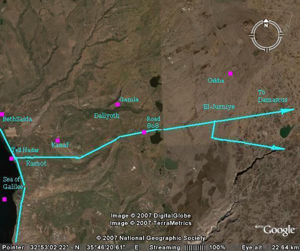
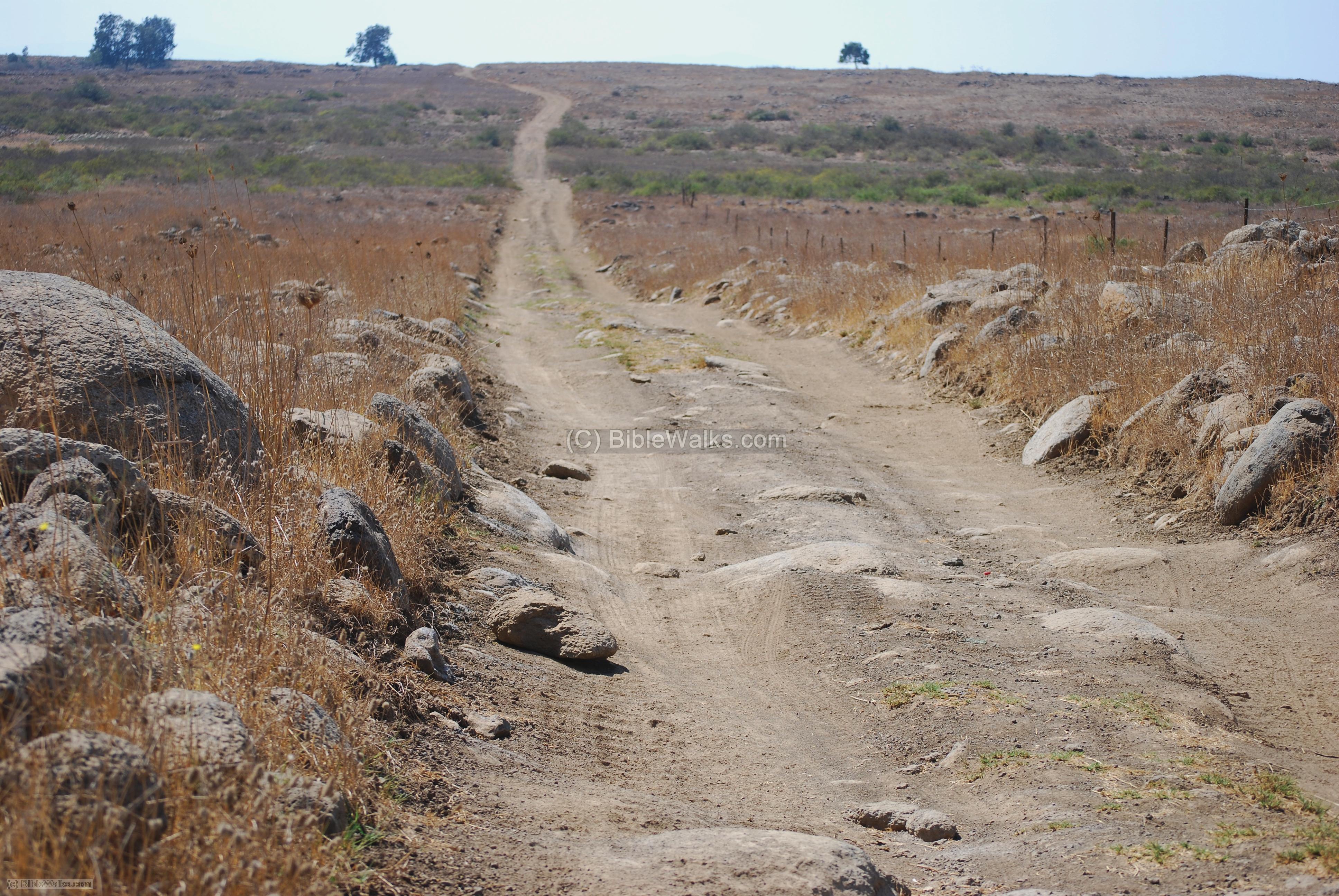
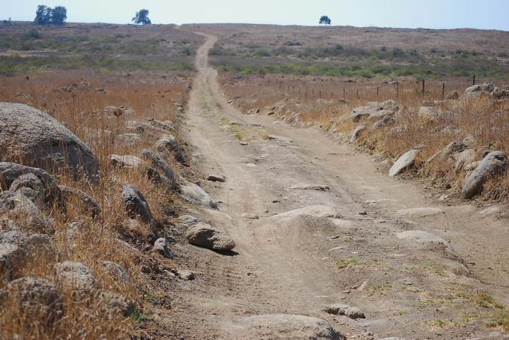
The photo below shows a section of the road south of the Daliyoth junction, west to the main modern highway (#808), and south of Gamla. The road used to be, in ancient times, paved with large stones. These are hardly visible now.
Along the road there were milestones, most of them with inscribed ranges. Some of the milestones were found near Moshav Ramot.
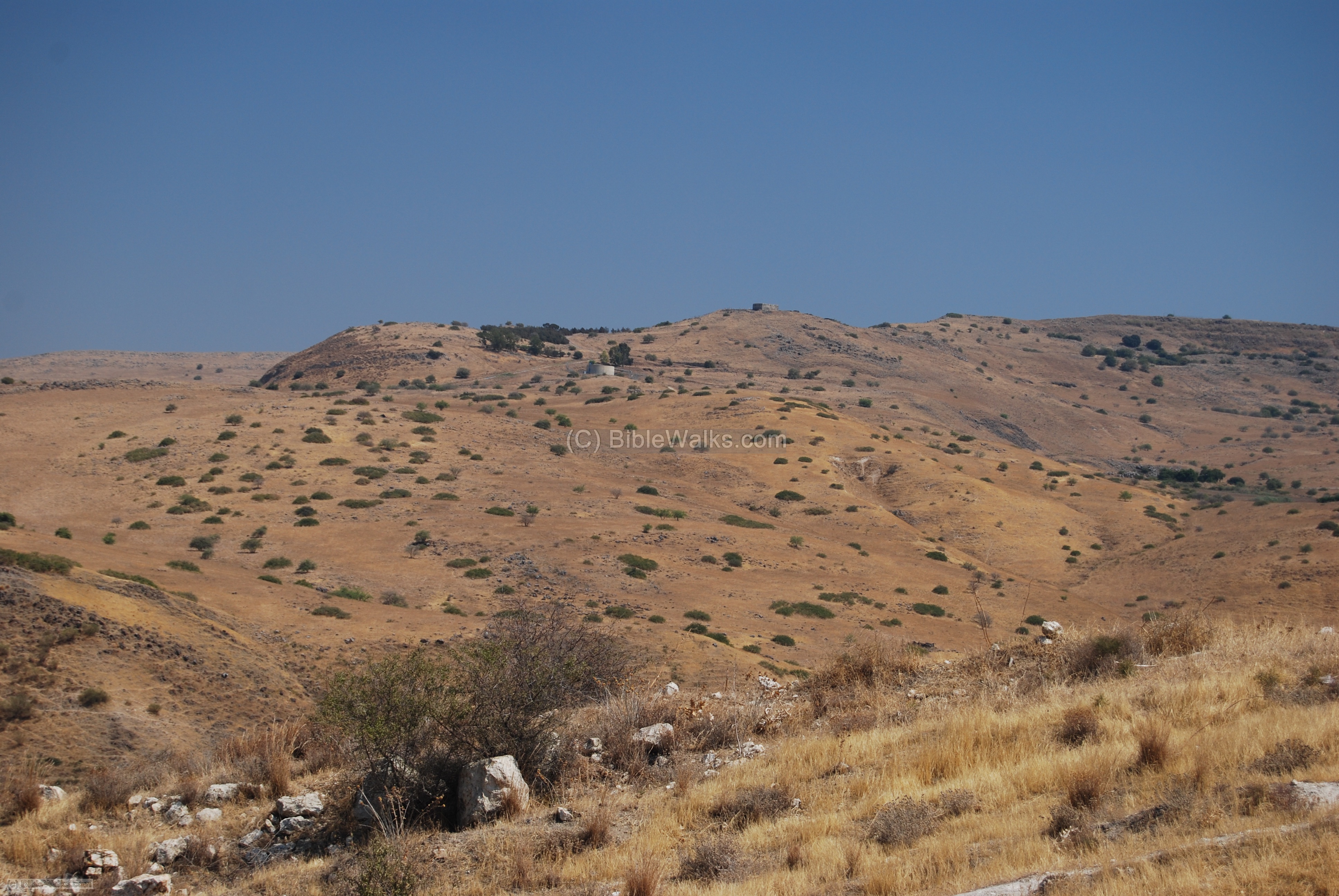
The photo below shows the Kanaf valley, near Moshav Ramot and Tell Hadar, where the road started. It passed through the valley and climbed up the Golan heights towards the east (on the right side). On top of the hill in the center background is Khirbet Kanaf, a Roman period village.
One of the villages near the route are located on the Orkha (Juhadar) hill, seen in the background of the photo below. In Medieval times a Khan (inn, caravansary) was built here as a service station that supplied water, food and accommodations.
Links:
* Internal:
- Roman roads in BibleWalks
- Banias – Caesaria-Philippi
- Orkha hill and Khan
* External:
- Kh. Omrit – road from Banias to Scythopolis
BibleWalks.com – walk with us through the sites of the Holy Land
Dolmens<—previous Golan site—<<<All Sites>>>—next Golan site—>BethSaida
This page was last updated on Feb 8, 2025 (add illustrations, swap north and south)
Sponsored links: