The site is located on a sandstone ridge along the ancient trade route on the Carmel coast. Excavations unearthed Byzantine winepresses, installations, and a trefoil-shaped church and its crypt. An Early Muslim and Crusader fortress is located on the northern side.

Home > Sites > Carmel> Coast > HaBonim (Cafarlet, KefarLam)
Contents:
Location
History
Aerial Map
Photos
* Winepresses
* Church
* Quarries
* Fortress
Archaeological References
Historical References
Etymology
Background:
The site is located on a sandstone ridge, along the ancient trade route on the Carmel coast. Recent excavations unearthed Byzantine winepresses, installations, quarries, and a trefoil-shaped church and its crypt.
A fortress, dated to the 8th century Early Muslim and 13th century Crusader periods, is located on the northern side and used to protect the pilgrims, the coast line and trade road. It is detailed in another page.
History of the place:
-
Earlier periods
Traces of early man settlements were found around the site (Neolithic/Calcolithic periods on the south west and middle-Paleolithic on the south). After then, there were no settlements in this area until the Roman period.
-
Roman/Byzantine
An early Roman period tombstone was discovered in the fields, with a Greek inscription of a Roman soldier that served under Agrippa II.
The village was established in the late Roman period and grew at the Byzantine period. These periods witnessed a surge of the sites in the Carmel coast area (a total of 50 villages from Caesarea to Haifa, more than one village per KM). The village was located in two locations on the sandstone ridge: in the center (where the church was excavated) and on the north-eastern side (where the fortress is located).
Stone cutting may have been its main occupation, as attested by the large number of quarries that cover most of the ridge. The village occupation was also based on agriculture, such as wine production, and it also provided services to the trade route that passed on its eastern foothills.
Recent excavations (2007) unearthed a cluster of winepresses, installations and traces of buildings, and a church.
-
Arab period
The village was destroyed and abandoned after the Arab conquest in the 7th century, as what happened to most of the Carmel sites.
A fortress was built during the reign of the Umayyad caliph Hisham ibn Abd al-Malik (691-743, ruled from 724). It was named “Kafarlab” or “KaferLab” (=village of Lab), and was built on the north-eastern side. The purpose of the fortifications, here and in other coastal sites, was to protect the Arabs against a Byzantine invasion.
-
Crusaders fortress
The Crusaders built the fortress (“Cafarlet” or “Capharlet”) on the north-eastern side of the sandstone ridge. The fortress was a 58M x 50M rectangular structure with round towers on all corners, and a gate located on its southern wall. It was reconstructed from the earlier Arab fortress which gave it a unique structure (of round corner towers, which is not a Crusaders standard design). The fortress was part of the Crusaders coastal fortifications, built along the pilgrimage route from the north (Acre, Haifa, Atlit), to the south (Caesarea and further to Jerusalem).
The fortress belonged to the Crusaders seigneuria of Caesarea. In 1213 the fortress was given to the order of “Hospitallers” – the order of the Knights of the Hospital of Saint John – as a loan collateral. It was later sold to the order of the Templars in 1232. The Muslims captured and destroyed it in 1265, but the fortress was reconstructed later by the Templars.
It is covered by another page.
-
Post Crusader Periods
The fort was finally abandoned in 1291 when the Crusaders left the Holy Land. The site stayed in ruins since the Mamlukes period until the 19th century.
- Ottoman period
The area was examined in the PEF survey (1866-1877) by Wilson, Conder and Kitchener. A section of their map is seen here. At that time HaBonim was not yet founded (only in 1949). The fortress is located south of Kefr Lam. The quarries and installations are located along the Kurkar limestone ridge. The Ottoman period coastal road passed along the western foothills of the ridge.
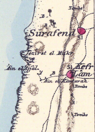
Part of Map sheet 7 of Survey of Western Palestine,
by Conder and Kitchener, 1872-1877.
(Published 1880, reprinted by LifeintheHolyLand.com)
The surveyors wrote about the fortress and the quarry and the stone cut tombs (SWP, Vol 2, Sheet VII, pp 29-30):
“Kefr Lam —The Crusading fort at this village appears to have been about 70 feet square, with round towers at the angles. Those on the east wall are best preserved ; along the wall between the towers were six buttresses about 2 feet thick. The towers are about 1 5 feet diameter. The stones are small, about 1 foot long by 6 inches high ; the joints of the masonry fine and regular. The mortar is thinly laid, and very dark in colour, and hard in consistency. The walls stand some 12 to 15 feet in height, and the fort is on rising ground, commanding the road. The general effect is similar to that of the castle at Minet el Kulah (Sheet XVI.), which is also attributable to Crusading times. The twelfth century castles in Syria have similar masonry, and round towers. The fort at Kefr Lam is called el Kusr, ‘ the tower.’
South of the village there are quarries and a group of rock-cut tombs, seventeen in all. The first has three iociili, the second is simply a locuhis under an arcosolium cut in the cliff. The third has three shelf loctili, raised 1 foot from the floor. The fourth has three shelf locili, raised 2 feet 6 inches from the floor, and 5 feet long. The fifth and sixth have each three loculi under arcosolia ; the seventh is blocked. The next seven are like the fifth. The fifteenth and sixteenth have five kokini each, 6 feet 3 inches long, 2 feet 5 inches broad, two kokim at the back, two on one side, one on the other. The last tomb has three loculi, with walls in front, which have been broken by quarrying, and with arcosolia.
Visited 8th March, 1873”.
-
Modern Times
Kefar-Lam was a small Arabic village, and its houses were built inside and around the fort. Its name preserved the earlier names. The village was demolished in 1948 during the Israeli Independence war.
Moshav Ha-Bonim (“the builders“) was established in 1949 on its ruins by Jewish immigrants from South Africa and England, members of the Habonim youth Zionist organization.
In 1985 there was a terrible train crash was to the site, and 19 kids and 3 adults on a tour bus were killed in this tragedy. Ever since the name HaBonim is associated with this tragic event. A monument was erected at the train crossing.
In 2007 the Moshav planned to expand to the south side of the ridge. This initiated the current excavations which unearthed the agriculture installations and Byzantine church.
Location:
The site is located on a sandstone (Kurkar) hill, 25M above sea level. An ancient road used to pass at the eastern side of the site, and the new Haifa-Tel-Aviv highway was constructed at the same location. When you drive by the site on the highway, you can easily see the eastern side of the Crusaders fortress – which is the best preserved wall. The Byzantine village is located several hundred meters to the south of the fortress.
Moshav HaBonim is located 27KM south of Haifa, 1KM east to the sea shore, 3 KM west of Mount Carmel. It can be accessed from the old highway (route #4) adjacent to Moshav Zerufa. If you arrive to the site, be sure to visit the remarkable nature reserve park, which is located on the shore west to the Moshav.
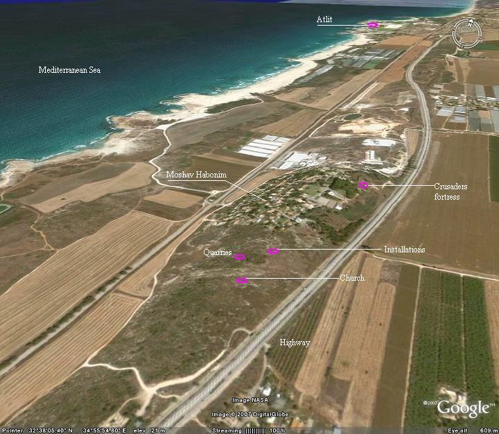
Map / Aerial View:
An aerial photo is shown below, indicating the major points of interest. The site is located along the Haifa-Tel-Aviv main highway.
Photos:
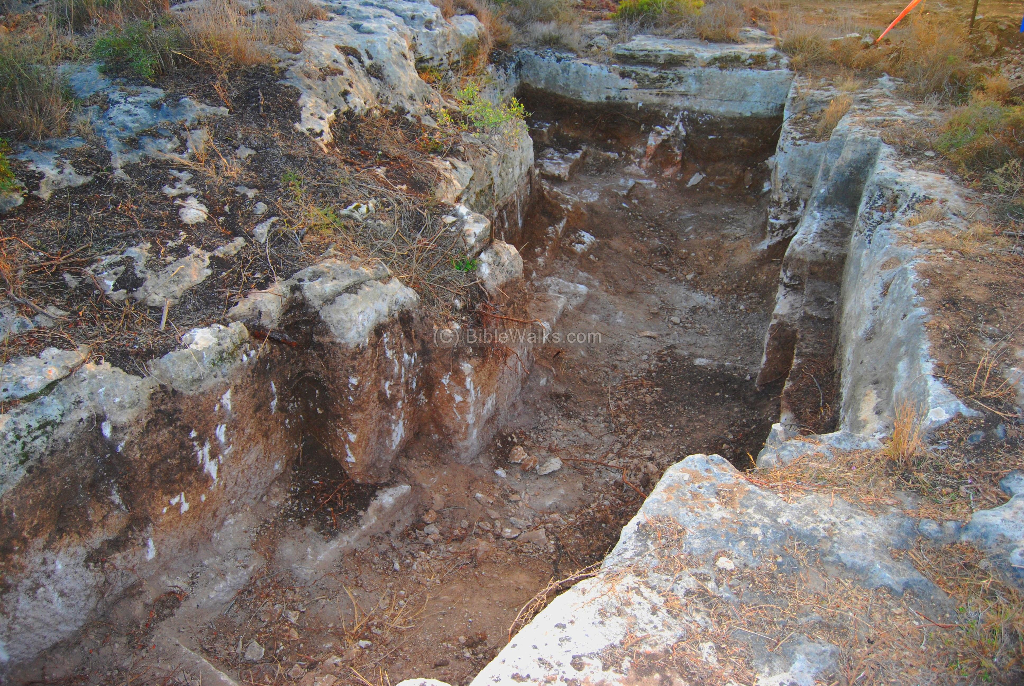
(a) Agriculture Installations:
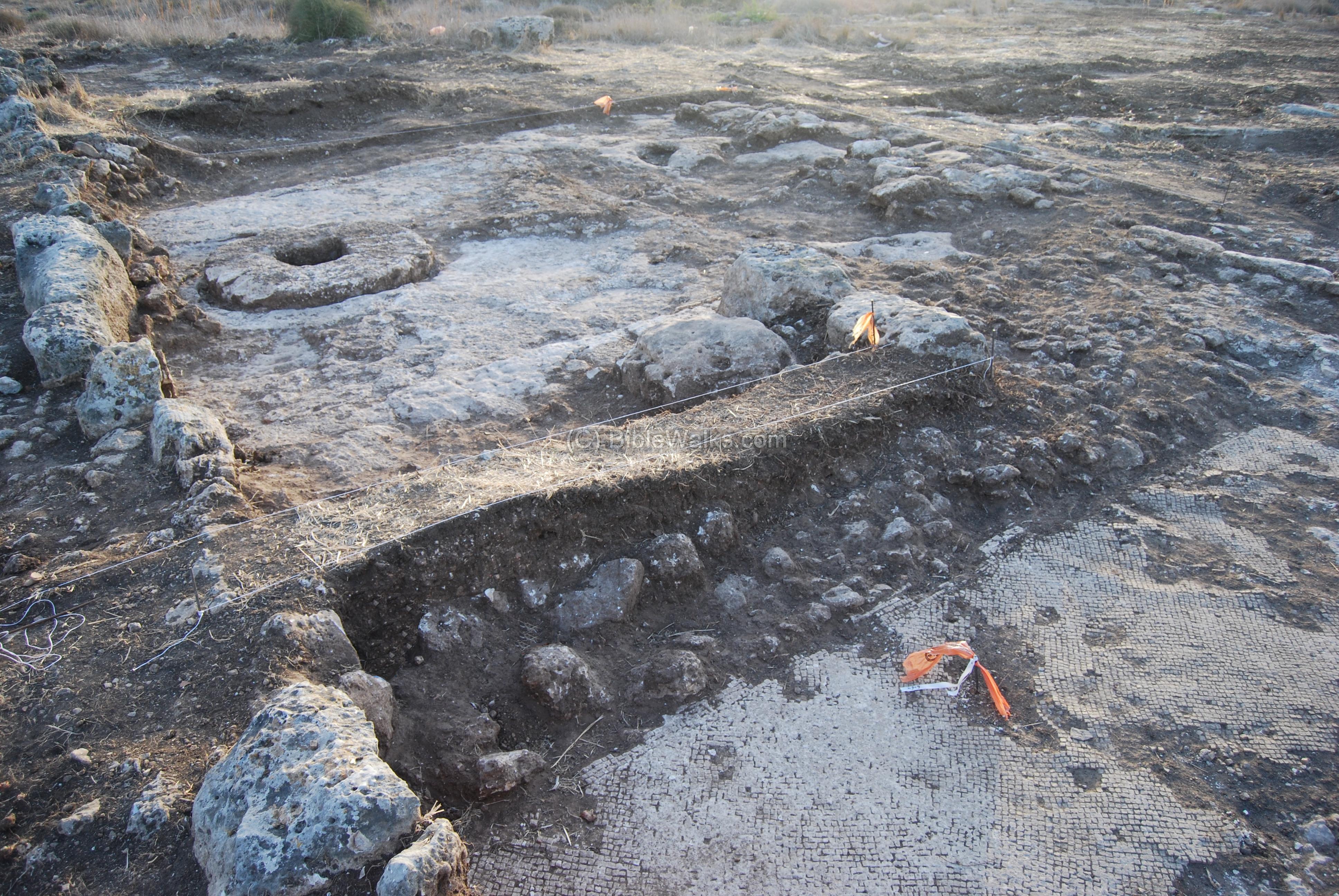
A cluster of Byzantine winepresses and building remains from the early Arab period were unearthed in the excavations of 2007.
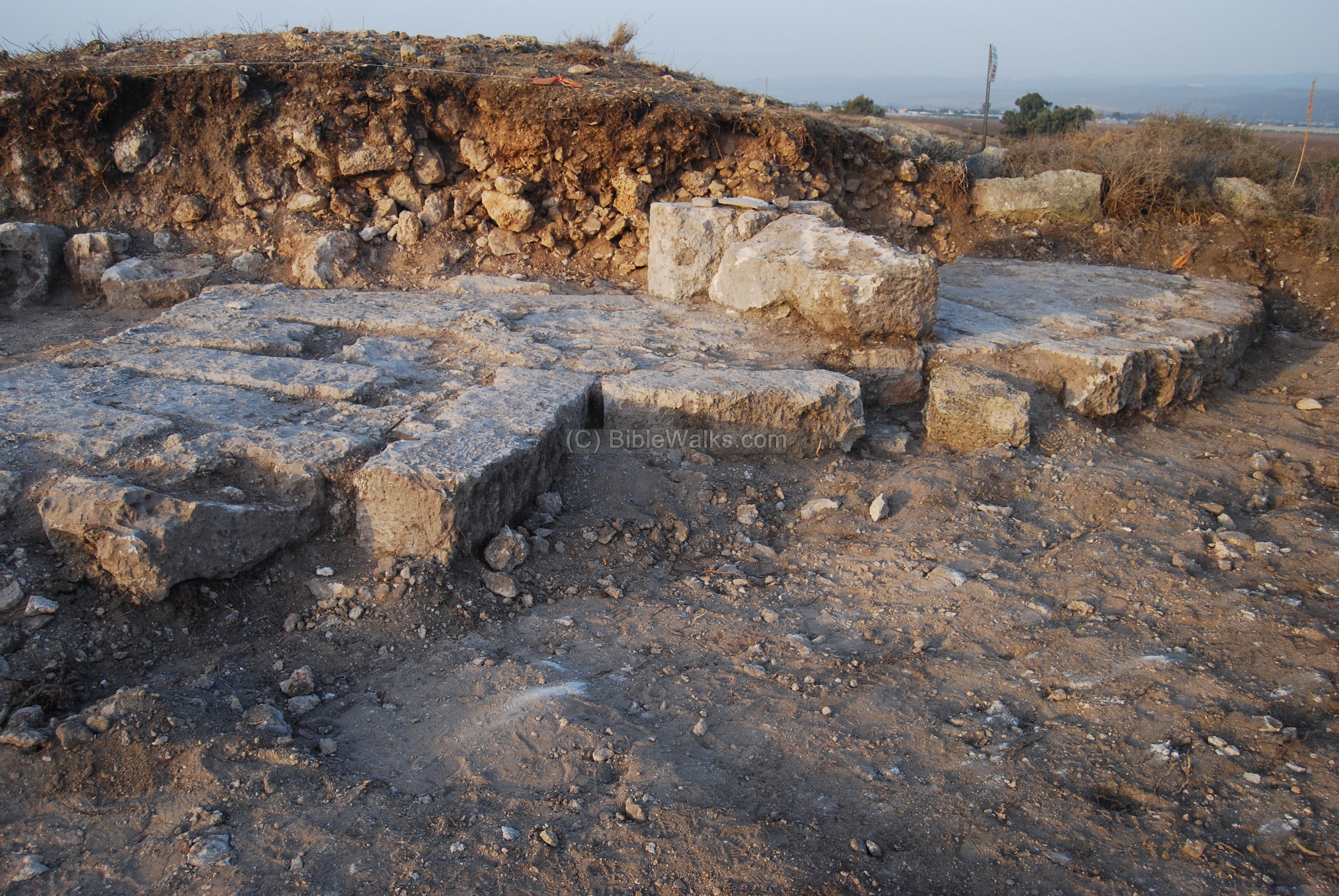
The following photo shows the cluster of 3 winepresses. In the left background is the modern highway, while in the far center background is the Byzantine church.
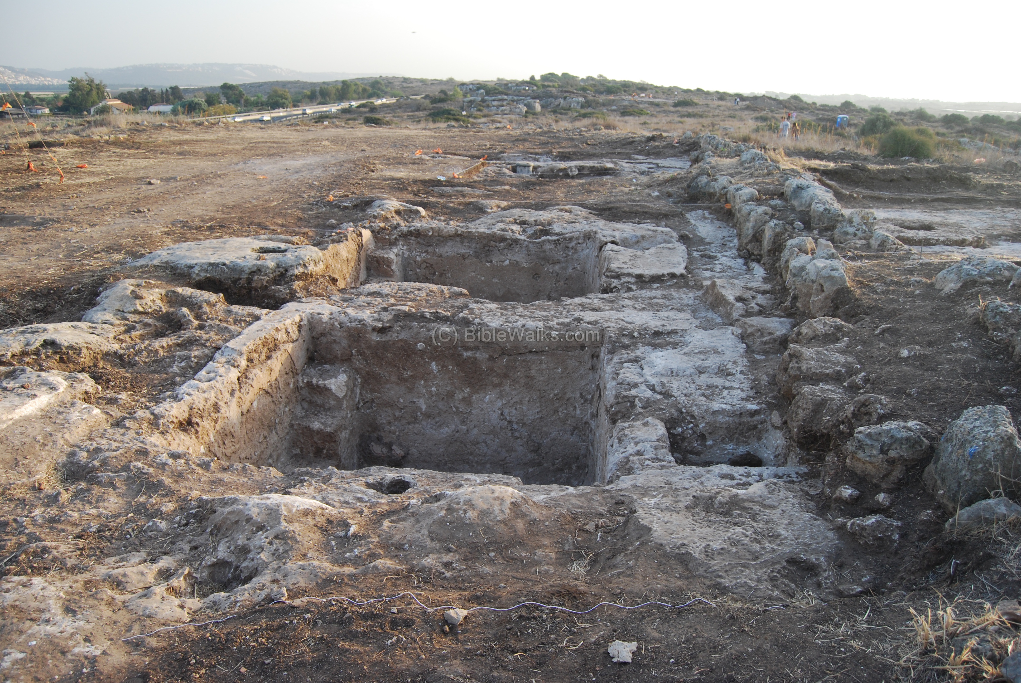
A detail of a winepress is seen below. The wine production process was as follows: the grapes would be placed on the front (hidden) side, and the workers would crush them with their bare feet. The extracted grape juice would then sit in the floor for a fermentation process.
Then, the wine would pour thru a groove into the collecting vat (seen on the bottom center). There it passed through a filter (a collection of thorns or brushes) into the large pit. Steps lead into the bottom of the pit in order to allow the workers to step down and collect the juice into jars, then store them for subsequent fermentation.
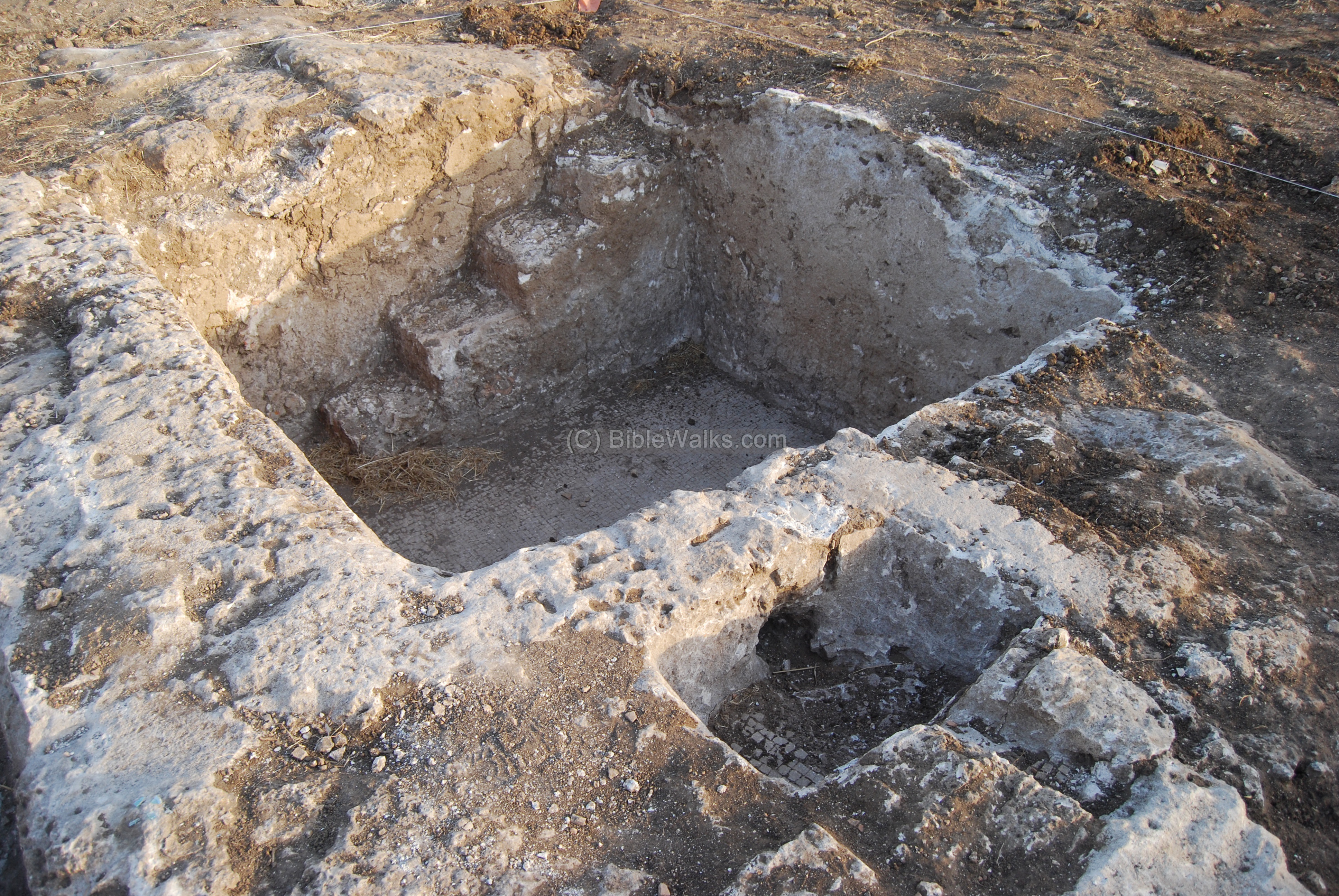
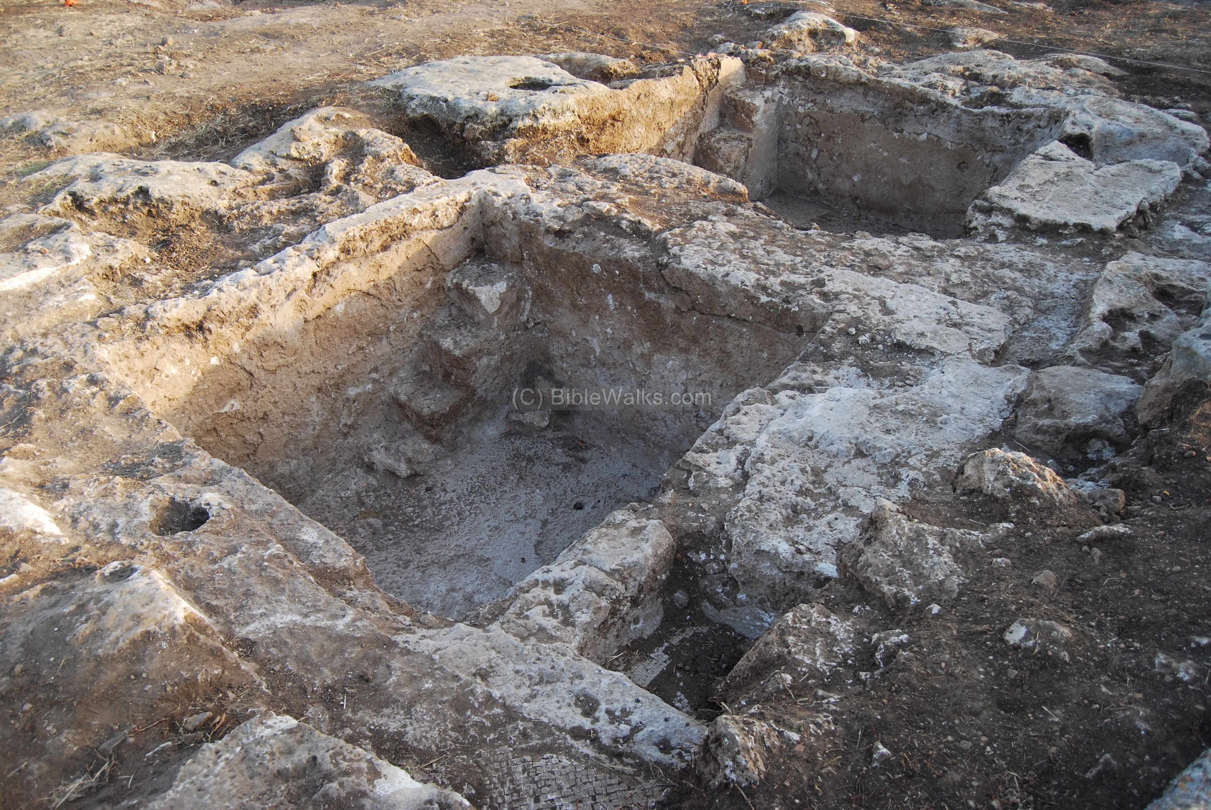
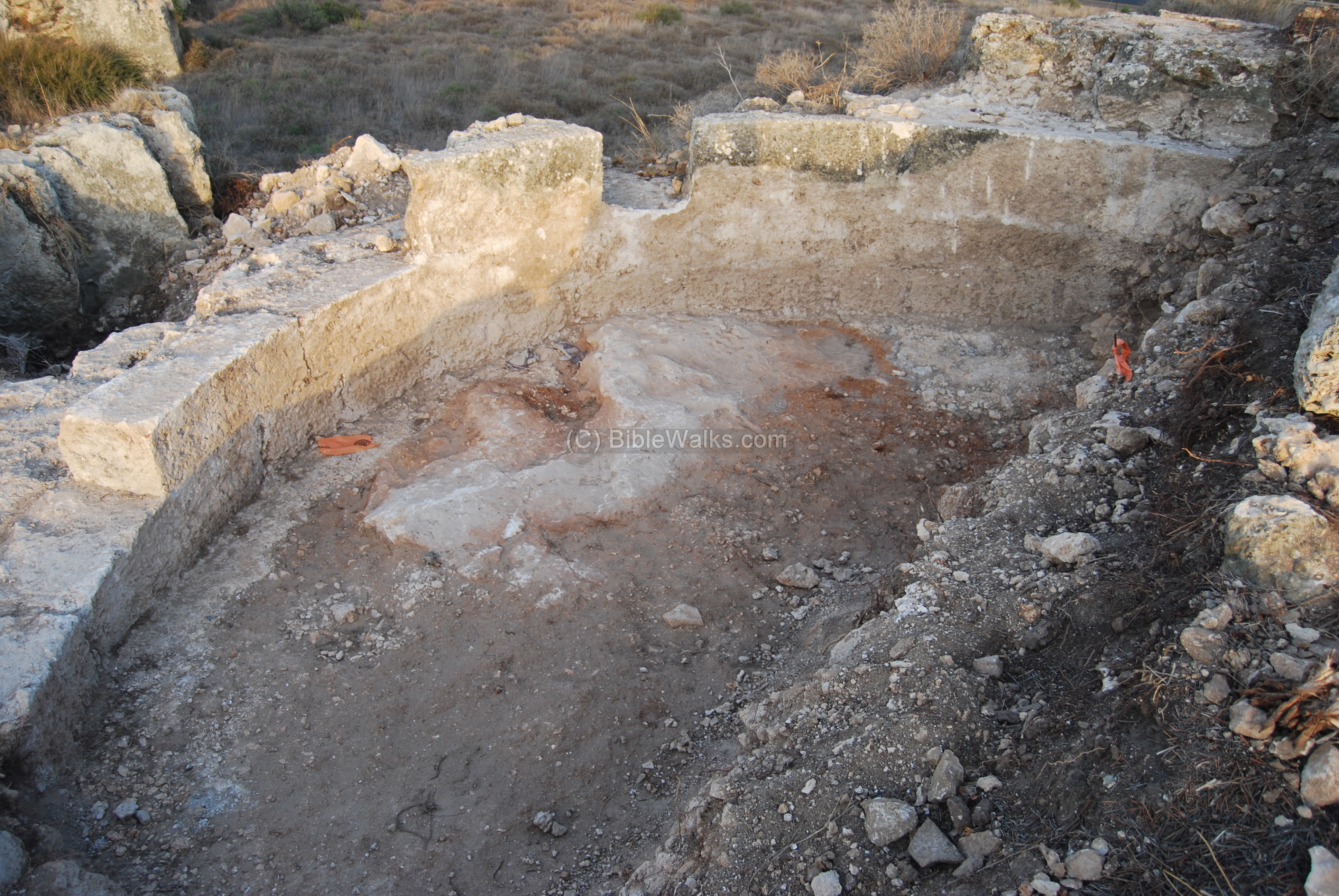
Another part of the winepress, where the grapes are crushed, is seen below. The large crushing floor is covered by a mosaic.
The hole in the center was used for secondary extraction of the juice, using a single fixed-screw press. The press squeezed out the must left in the grape skins and stalks after treading. (Thanks for Rafi Frankel for his correction).
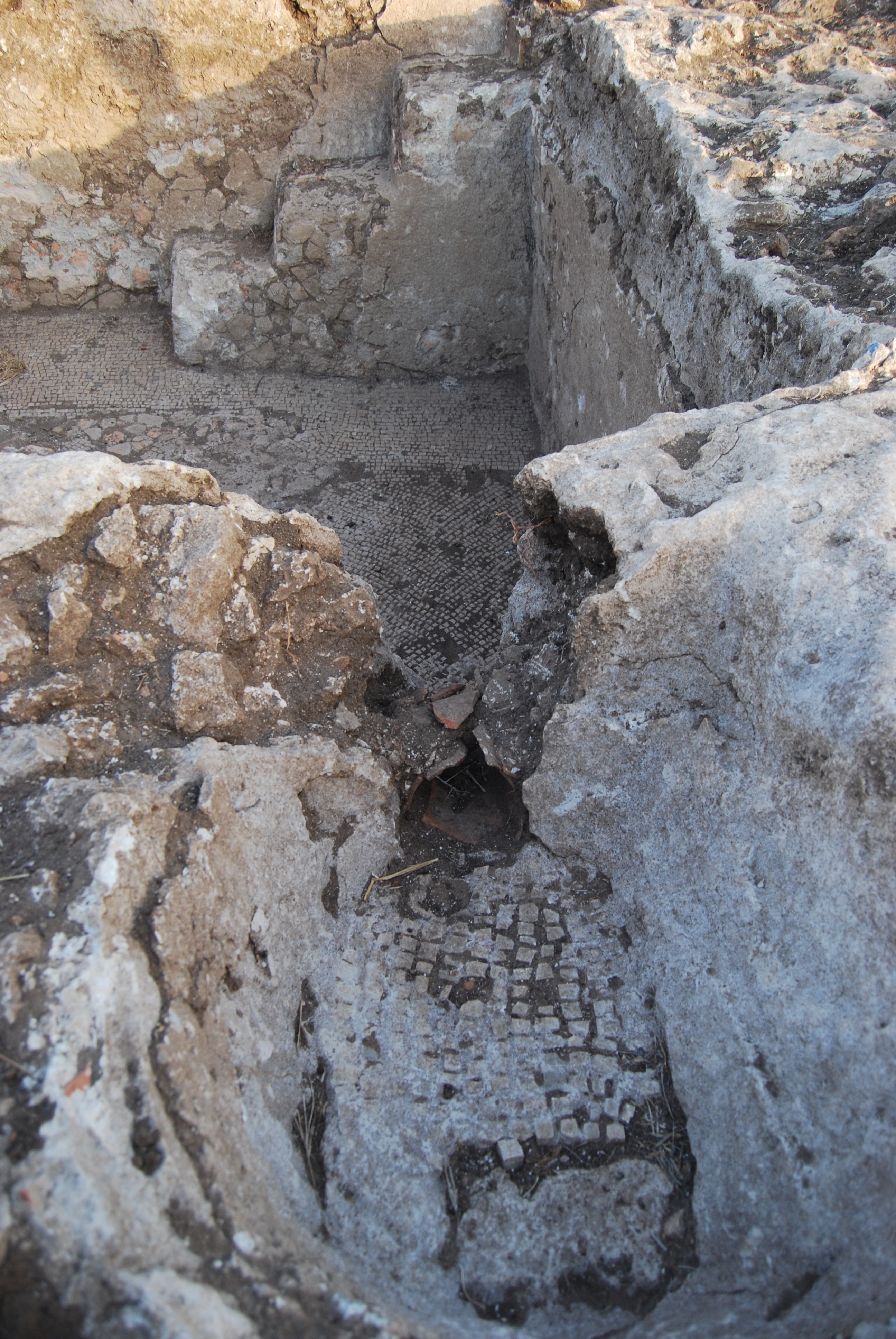
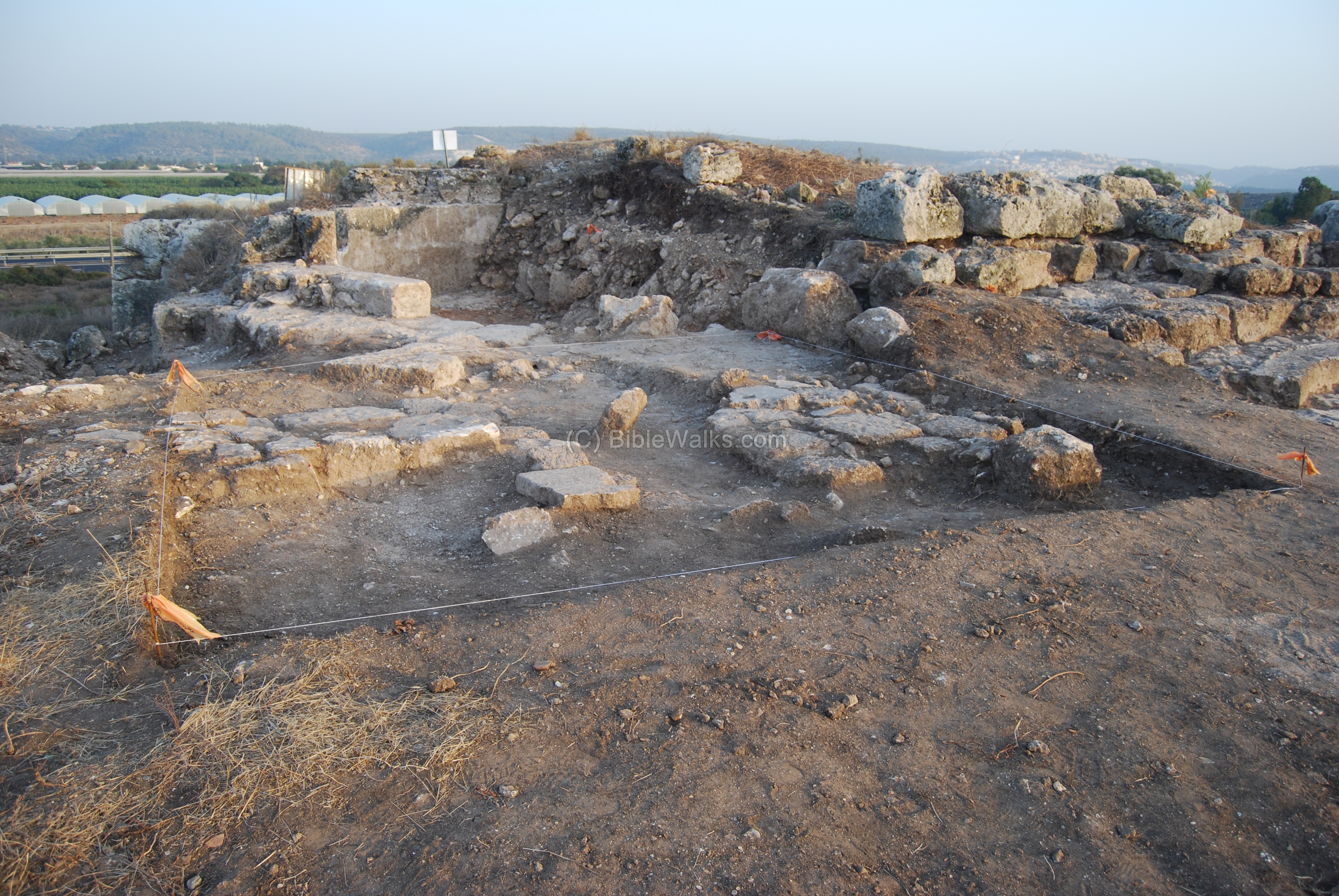
Another view of the winepresses.
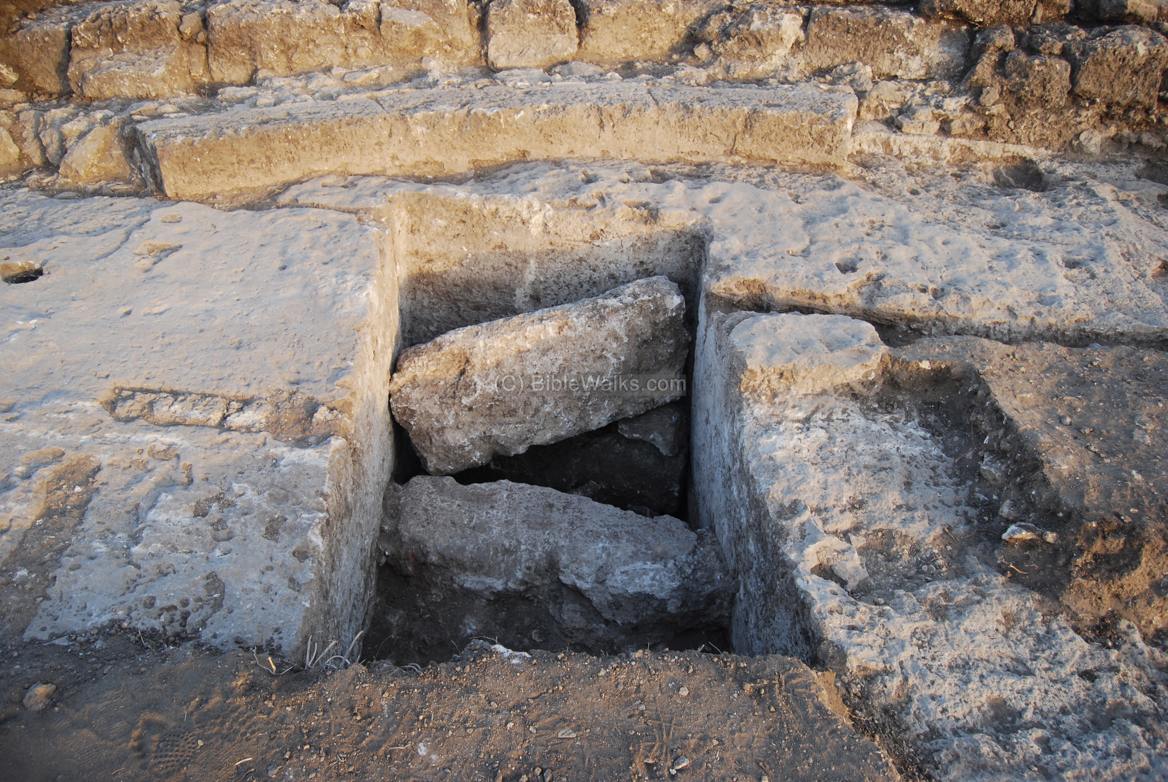
The photo below shows a closer view of the filter and pipe between the treading floor, where the grapes were crushed, and the collecting pit.
A detailed archaeological report is available in the links section.
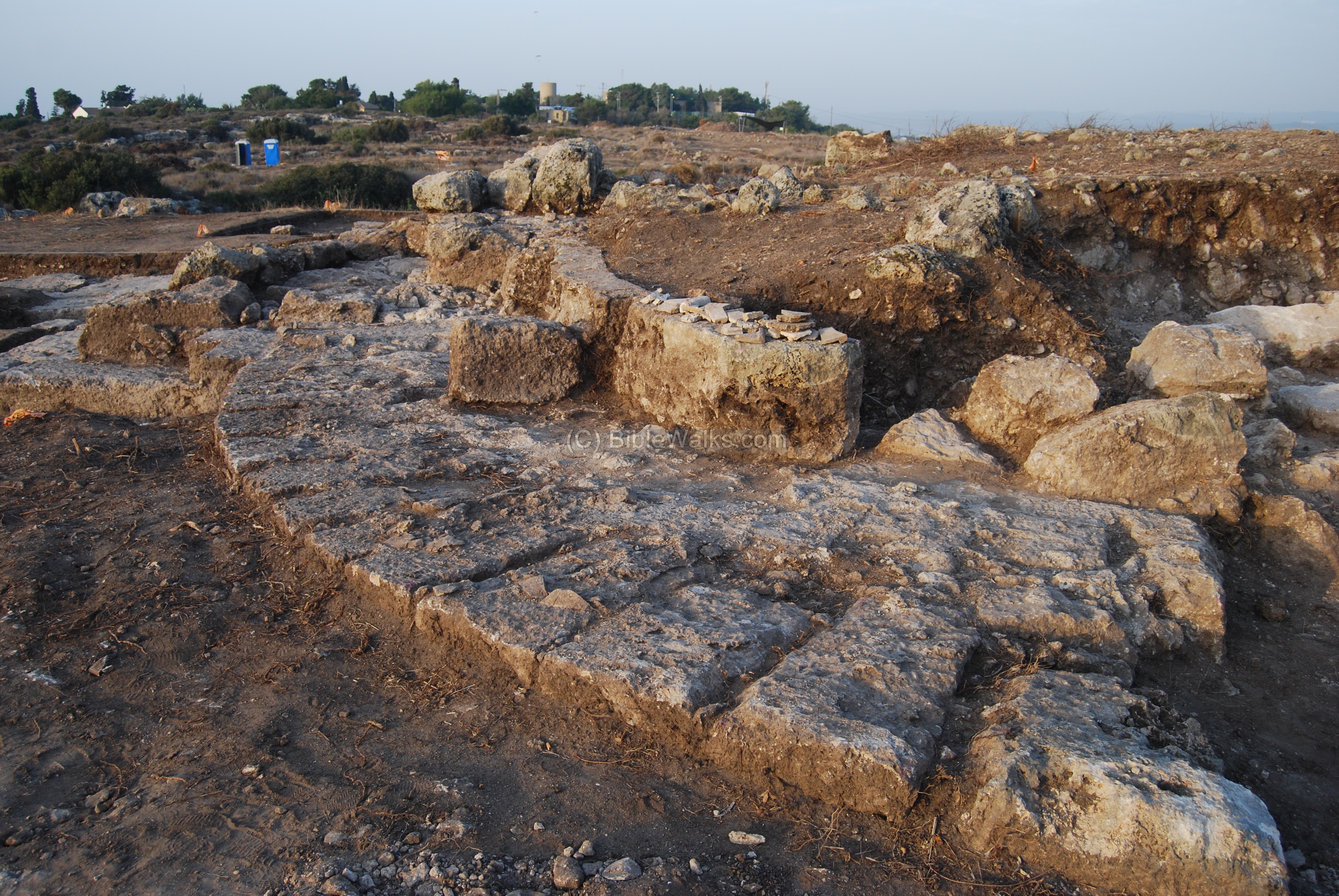
There are more winepress installations on other areas of the ridge, such as under the courtyard of the Cafarlet fortress and on its eastern slopes.
(b) Byzantine Church:
In 2007 the excavators unearthed a church on the southern side, shaped in a trefoil design (three-lobed arches, like a leaf). This Byzantine church is seen below with a view towards east, the orientation of the church, where its 3 apses are located.
Mount Carmel is seen in the background. The church overlooked the beautiful plains and the western side of the Carmel, a perfect location for the church.
The southern apse is seen below. Moshav HaBonim is seen in the background.
The center apse is seen in the following photo. Note that most of the stones are gone, probably reused in the Arab village houses.
The following photo is the northern apse.
In a cavity under the floor in the center of the church are stone slabs that cover the crypt (=a vault that is found under the floor of most churches). It is not known what was found in this crypt, which is usually skeletons or relics of important church officials.
The church was covered after the excavation ended in order to preserve it until further excavations continue to restore the ancient church.
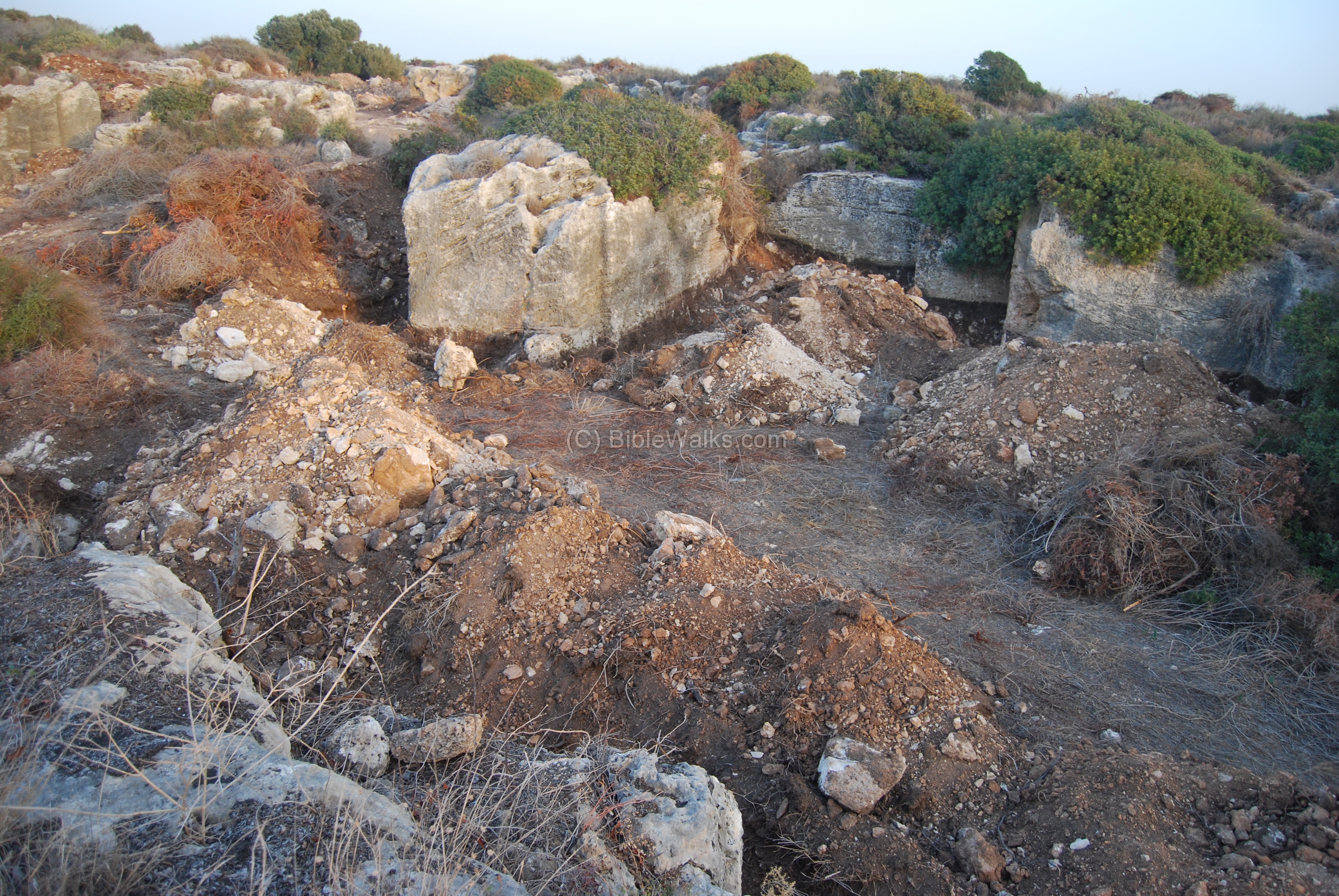
(c) Ancient sandstone quarries:
The whole area was a very large ancient sandstone quarry. Few parts of the quarries were excavated, as seen in the photo below.
Another section of the quarries, located on the western side.
Moshav Habonim is planning to expand their houses into the proximity of this area, which we hope will not be allowed and limited to a safe distance from the antiquities.
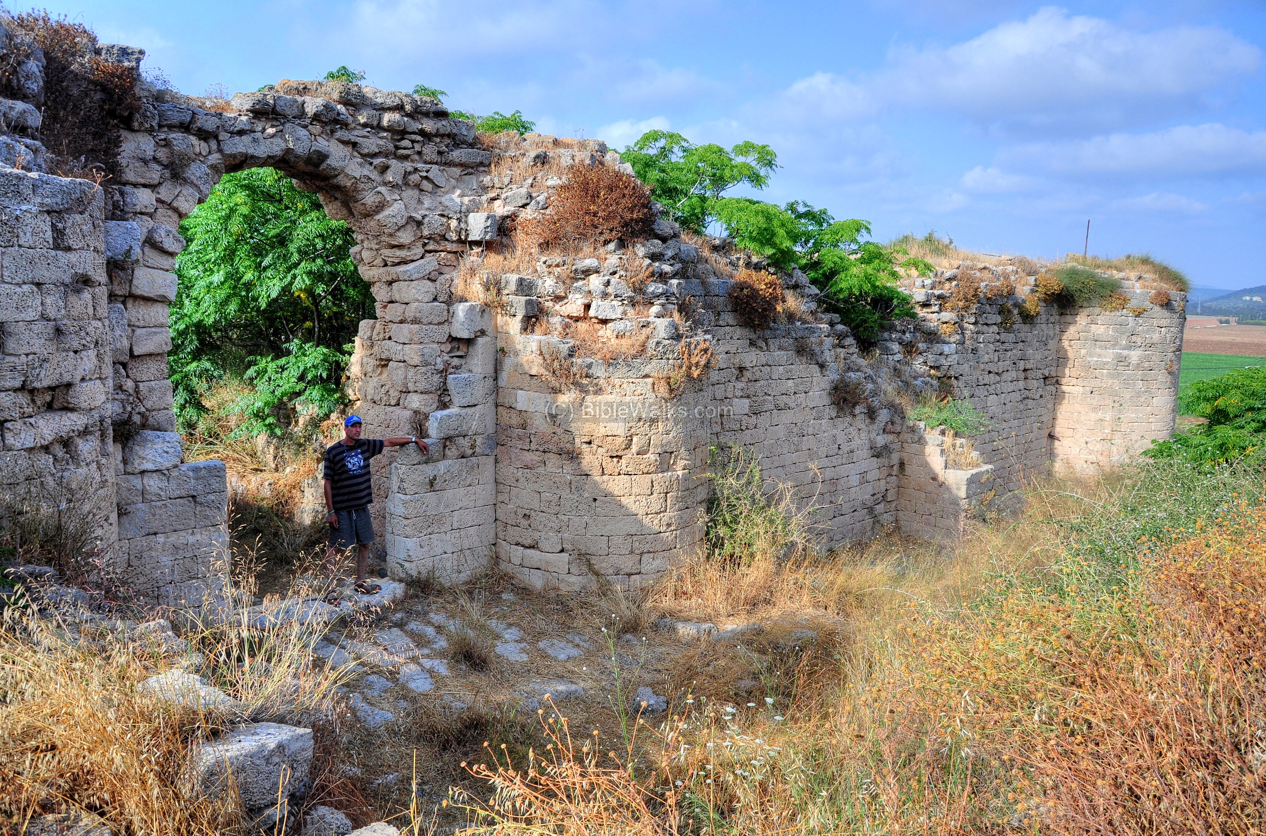
(d) Crusaders fortress
The Crusaders built a fortress (“Cafarlet” or “Capharlet”) on the north-eastern side of the sandstone ridge. The fortress was a 58M x 50M rectangular structure with round towers on all corners, and a gate located on its southern wall. The photo below shows the gate on its southern side.
A separate web page focuses on the fortress.
Archaeological References:
- IAA excavation permit
- Excavation 2006 (Hebrew)
- Lever and Drum – final report (pdf; Israel Exploration Journal, V62 #1, 2012, pp101-112) – recommended report on the installations.
- Pottery of the Crusader, Ayyubid and Mamluke periods in Israel – Miriam Avissar, Edna J. Stern (2005)
-
HaBonim Final report Volume 120 Year 2008 Kareem Sa‘id
Historical References:
Laurence Oliphant “Haifa, or Life in Modern Palestine” [1884]
|
His article was published on Dec 13 1884 in the New York “Sun”, with the title “Identifying ancient sites”, where he tells his readers about his trip to the ruins of Kefar Lam and his exploration of the fortress. He calls the village “Kefar Nahum (Capernaum) of the Crusaders”. This tradition was adapted by the Crusaders, who substituted the real site on the shore of the Sea of Galilee with this place for practical reasons (of access and security). He also tells about a 35 ft deep well that the villagers discovered near the fortress, 17 rock hewn tombs, and ancient items that the villagers gave him as presents . As a reporter, his articles ignited the imagination and curiosity of the World… Indeed, a pioneer of Bible Walks! “Haifa” by Laurence Oliphant is a recommended book for the period of rediscovering the Holy Land. |
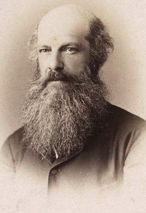
Laurence_Oliphant (1829-1888) Public domain photo |
Other References/Links:
- Cafarlet fortress – detailed review of HaBonim castle
- Wine & Oil Production in Antiquity in Israel & other Med. Countries [ISBN 1850755191 1998] Frankel, Rafael.
- Winepresses – BibleWalks info page
- Moshav Habonim Home page (Hebrew)
Etymology – behind the name:
-
HaBonim – Hebrew: the Builders. This was a Zionist youth organization that was established in 1933, helped the Jewish immigration, and built 25 settlements (all of them Kibbutz, and a single Moshav – named after the organization). It merged with “HaNoar Ha-Oved” in 1959.
- Moshav HaBonim – founded in 1949 on the ridge west of the modern highway.
BibleWalks.com – walk with us through the sites of the Holy Land
Qarta <<<—previous Carmel site —-<<<All Sites>>>—next Carmel site—> >>Cafarlet fortress
This page was last updated on Nov 26, 2025 (add new page on Cafarlet, link)
Sponsored Links: