Remains of a multi period settlement situated on the top of a high hill, on the north bank of Nahal Qana (Kanah), south of Nirit.
Home > Sites > Sharon > Horvat Zakkur (Zakhur), Nirit
Contents:
Overview
Location
History
Photos
* Aerial views
* Tour of the site
* Arch. findings
* Dhahar Zakkur
* Nature
Etymology
Links
Overview:
Remains of a multi period settlement situated on the top of a high hill, on the north bank of Nahal Qana (Kanah). The ruins are part of the Hezi Sapir memorial park, part of the community of Nirit, in the south east Sharon region.
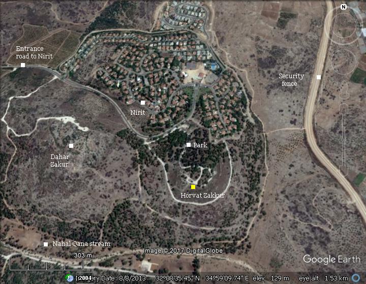
Location:
The ruins of Horvat Zakkur are located on a hill (altitude 135m) overlooking the Nahal Qana stream on the south. The structural remains, belonging to the ruined village, cover 20 dunams on the upper side of the hill. On the western hill are remains of an Iron Age I settlement – Dahar Zakur.
History
-
Iron age I
The Iron Age village is located on the western edge of the ridge. The village was built on a hill in a strategic location. It guarded the main road along the valley of the Nahal Qana stream, connecting the plains and Jaffa on the west, Via Aphek and Azzun, to Samaria and Shechem on the east. According to D. Dorsey (“The Roads and Highways of Ancient Israel”, p. 167) this route was designated as “5a” – a branch of the Joppa-Shechem road – that passed thru Aphek and continued along the Wadi Qana thru Azzun to the east.
Nahal Kanah (Qana) was not only a major route from west to east but also a border between two tribes (Joshua 17: 9-10):
And the coast descended unto the river Kanah, southward of the river: these cities of Ephraim are among the cities of Manasseh: the coast of Manasseh also was on the north side of the river, and the outgoings of it were at the sea: Southward it was Ephraim’s, and northward it was Manasseh’s”
The village was within the territory of the western half of the Menasha tribe (Joshua 17:7):
“And the coast of Manasseh was from Asher to Michmethah, that lieth before Shechem; and the border went along on the right hand unto the inhabitants of Entappuah”.
- Later periods
Later periods include Iron Age II, Persian, Hellenistic, Roman, Byzantine, and Early Islamic periods. The village expanded to the eastern edge of the ridge. Scattered over 20 dunams on the eastern hill are ancient installations (winepress, oil press, water cisterns) and remains of structures (houses, burial caves, quarry). On other western edge of the ridge are additional burial caves and installations.
-
Ottoman Period – (1516-1918 A.D.)
Most of the structures seen today on the hill are of the ruined Ottoman Arab village of “ez Zakur” (meaning the “hawk”).
The area of was examined in the Palestine Exploration Foundation (PEF) survey (1866-1877) by Wilson, Conder and Kitchener. A section of their map is here:
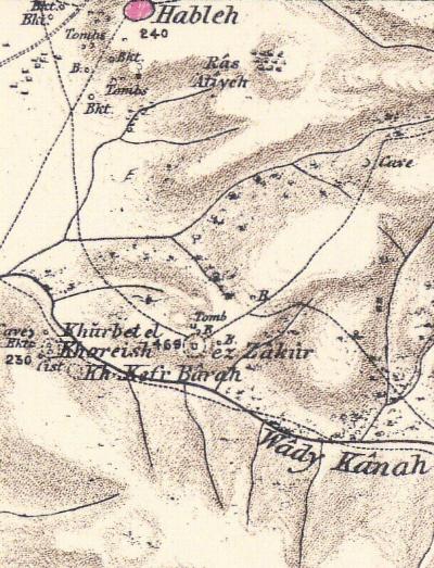
Part of map sheet 14 of Survey of Western Palestine,
by Conder and Kitchener, 1872-1877.
(Published 1880, reprinted by LifeintheHolyLand.com)
The survey did not provide details on the site. A nearby site does appear (volume 2, p. 337):
“Kh. el Khoreish – A rock-cut tank or birkeh exists here. A vault, apparently modern. Caves and cisterns.”
The adjacent community, Kibbutz Horshim, was named after this ruin.
-
Modern Period
An archaeological survey was conducted in 1968. It appears as site #111 in the Kfar Sava segment of the archaeological survey of Israel. The dating of the findings include the Iron Age II, Persian, Hellenistic, Roman/ Byzantine, Early Islamic, and Ottoman periods.
In 1997 a salvage excavation was conducted, examining the quarries and cavities on the northern slope of a hill, on the northern side of Nirit (site #107). Among the two tombs examined in this excavation, their findings were dated to the Iron Age II and Byzantine periods.
Another salvage excavation was conducted in 1998 on 2 burial caves in Nirit, 500m NW of the site. The archaeologists dated the burial findings to the EB IB, Herodian and Byzantine periods. An earlier survey of the caves dated the findings in the caves from the Iron Age thru the Ottoman periods.
The area around the site became a memorial park managed by KKL (Keren Kayemeth LeIsrael – Jewish National Fund). The park commemorates captain Hezi Sapir, who was killed in 1994 by a suicide bomber in Gaza.
Photos:
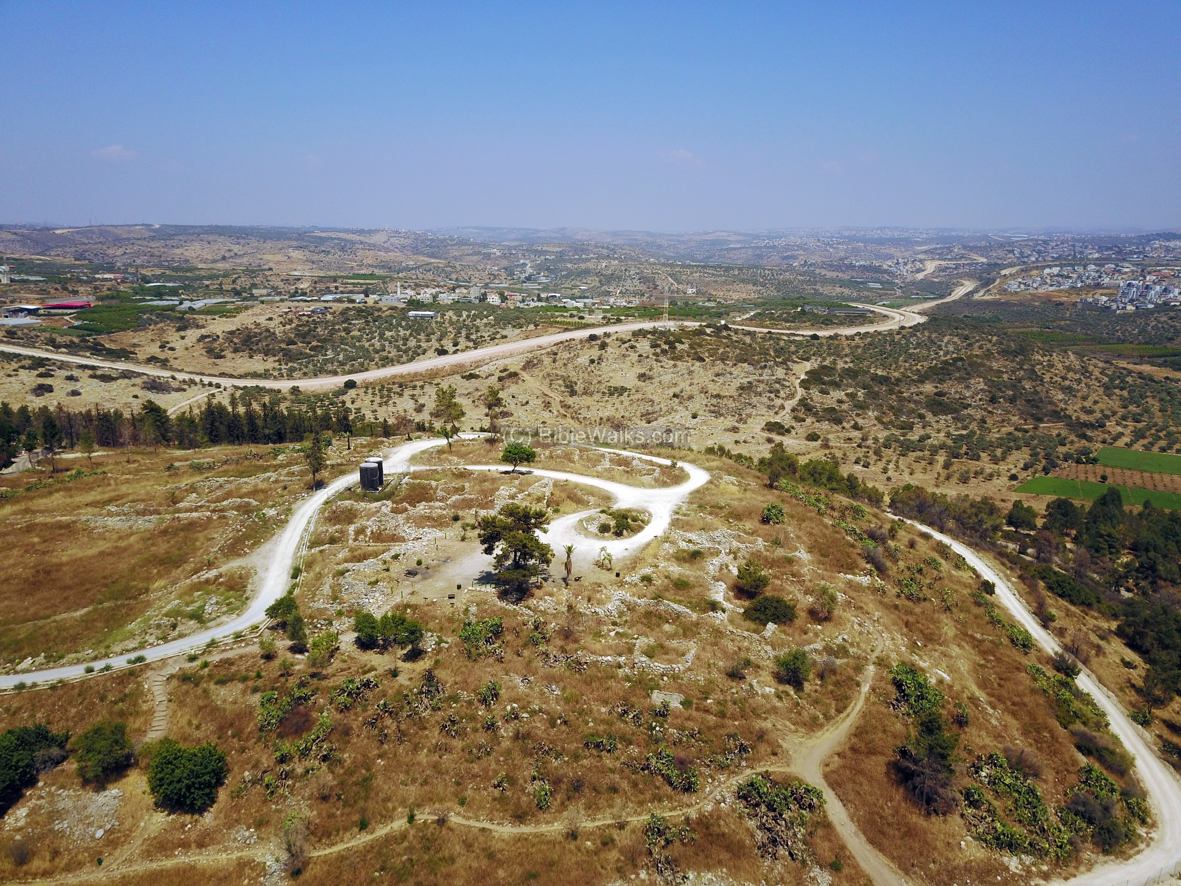
(a) Aerial views
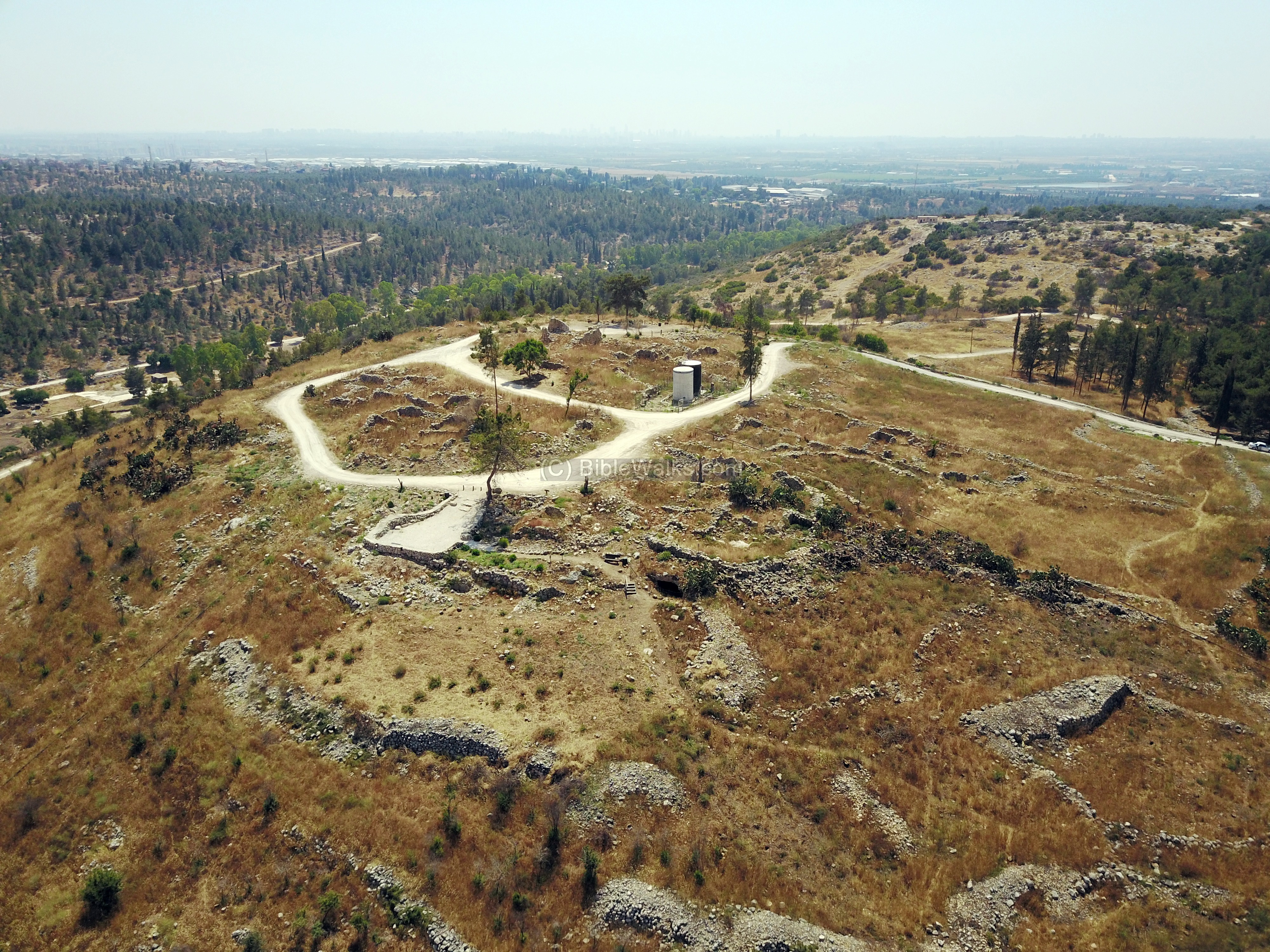
A drone captured this view from the north east side of the summit. The ruins of the village are noticeable on the summit and the northern slopes. The valley of Nahal Qana is behind the hill on its southern slope. In the far background is the coastal area of central Israel.
Click on the photos to view in higher resolution…
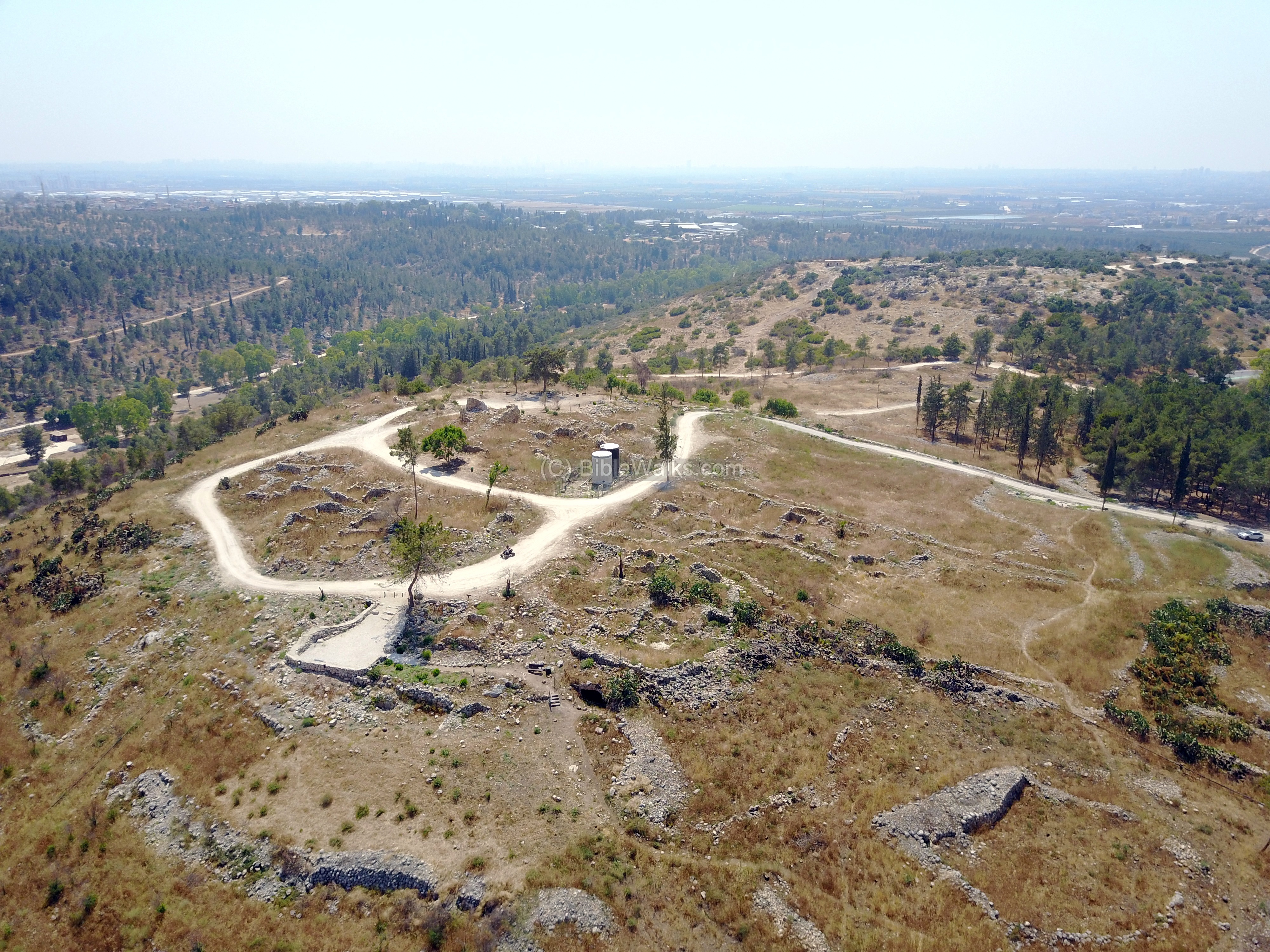
Another view from the west side is seen in the next aerial view. An observation point, part of the memorial park, is located on the summit under the large tree. In the far background is the security fence between Israel and Samaria. To the right side is the community of Oranit.
![]() The following YouTube video shows a flight over the site:
The following YouTube video shows a flight over the site:
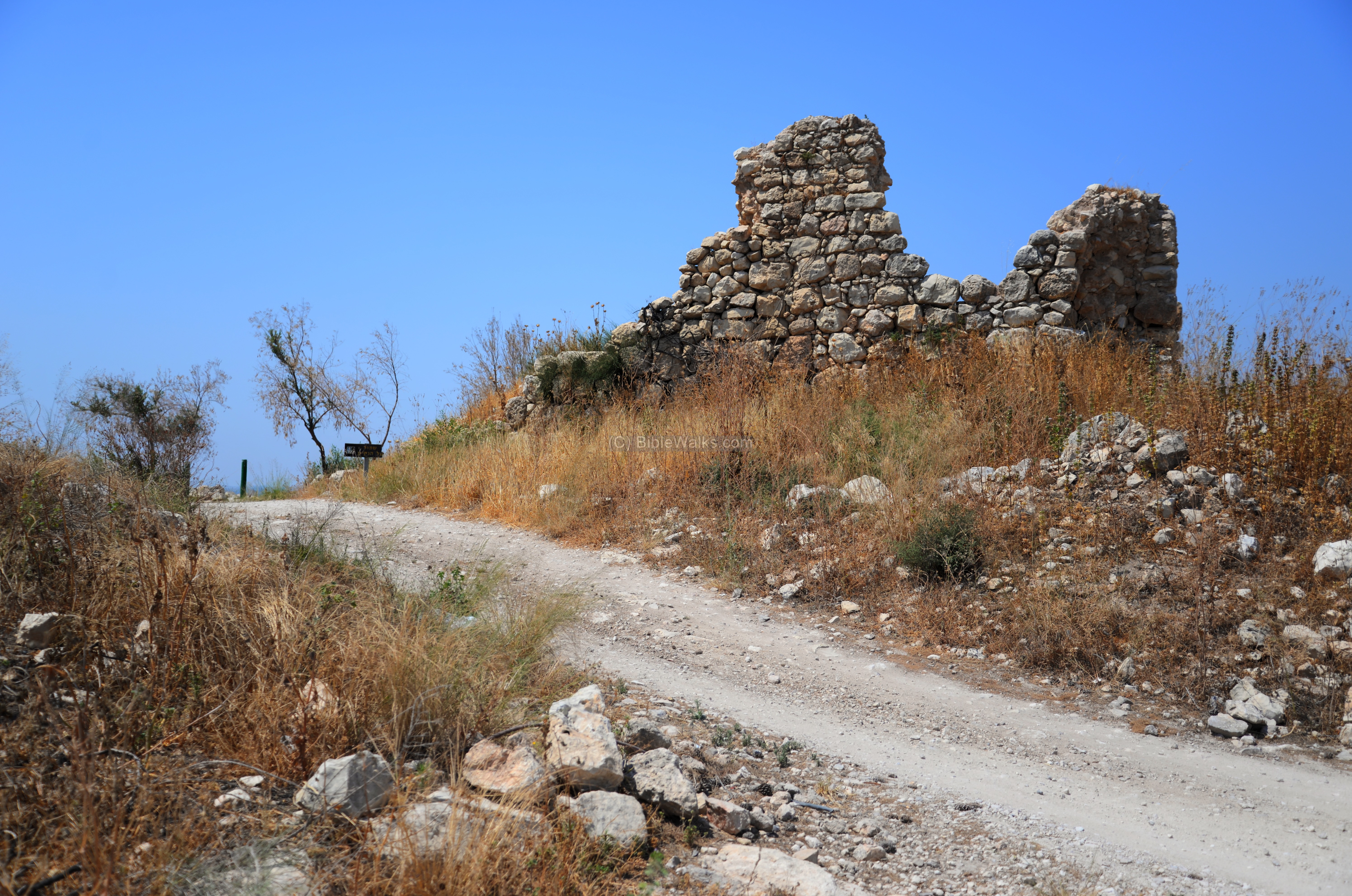
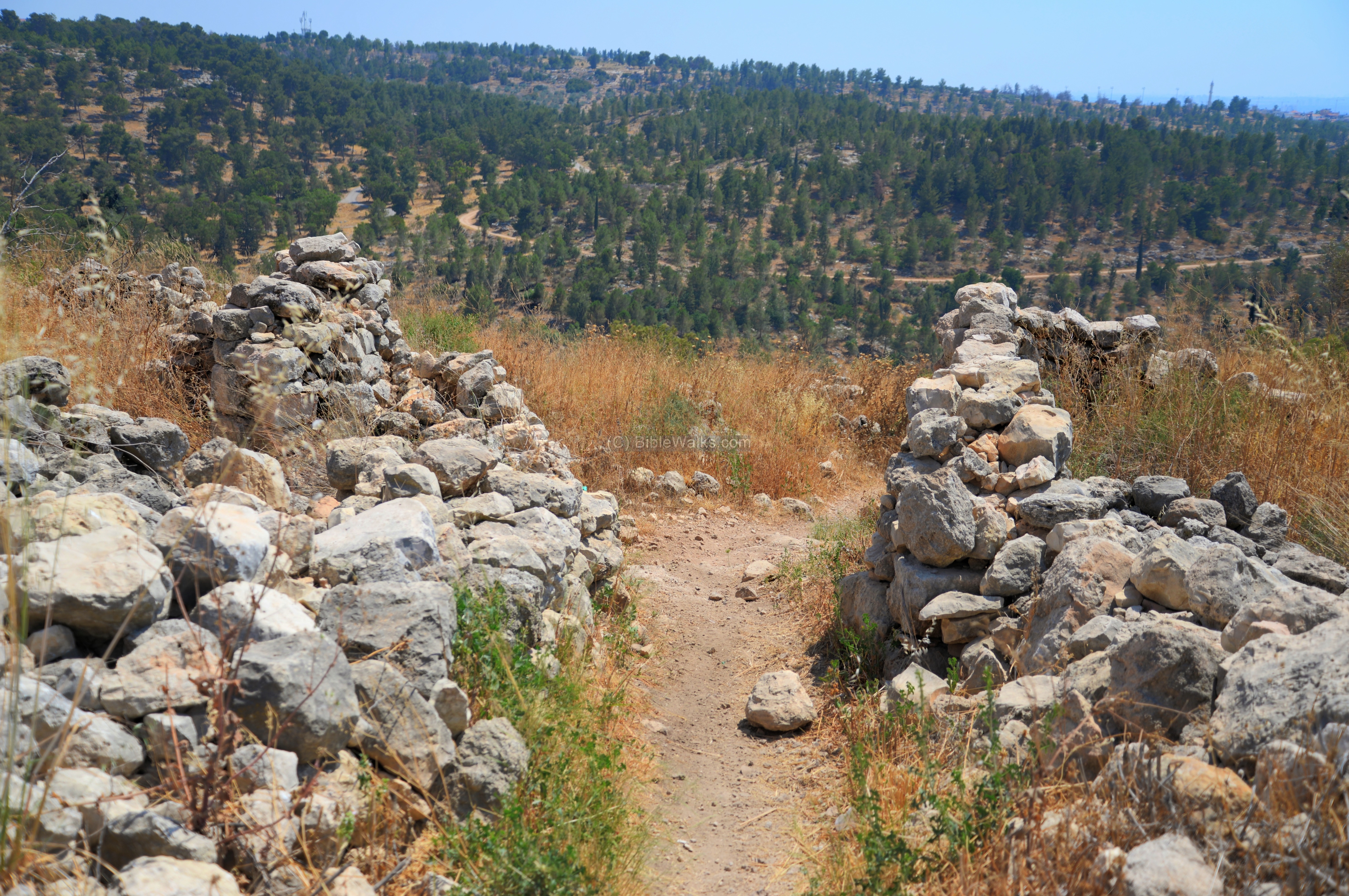
(b) Tour of the site
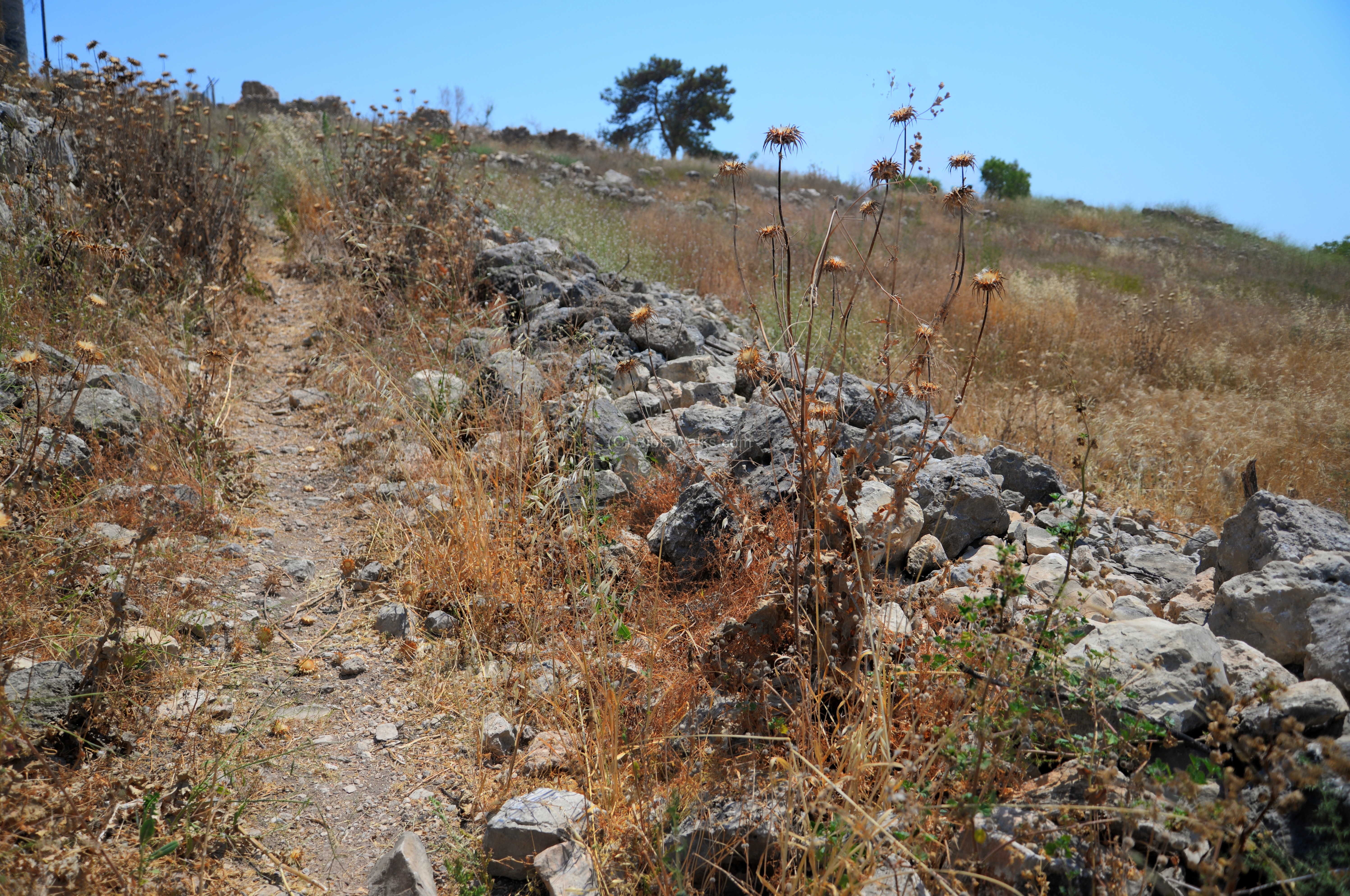
A path leads from the parking area up to the hill, and is surrounded by the ruins of the Arab village. Ancient building stones and architectural elements were incorporated in the walls of the Arab village.
The following is a north view from the edge of the path towards the houses of Nirit.
On the summit are remains of a large structure.
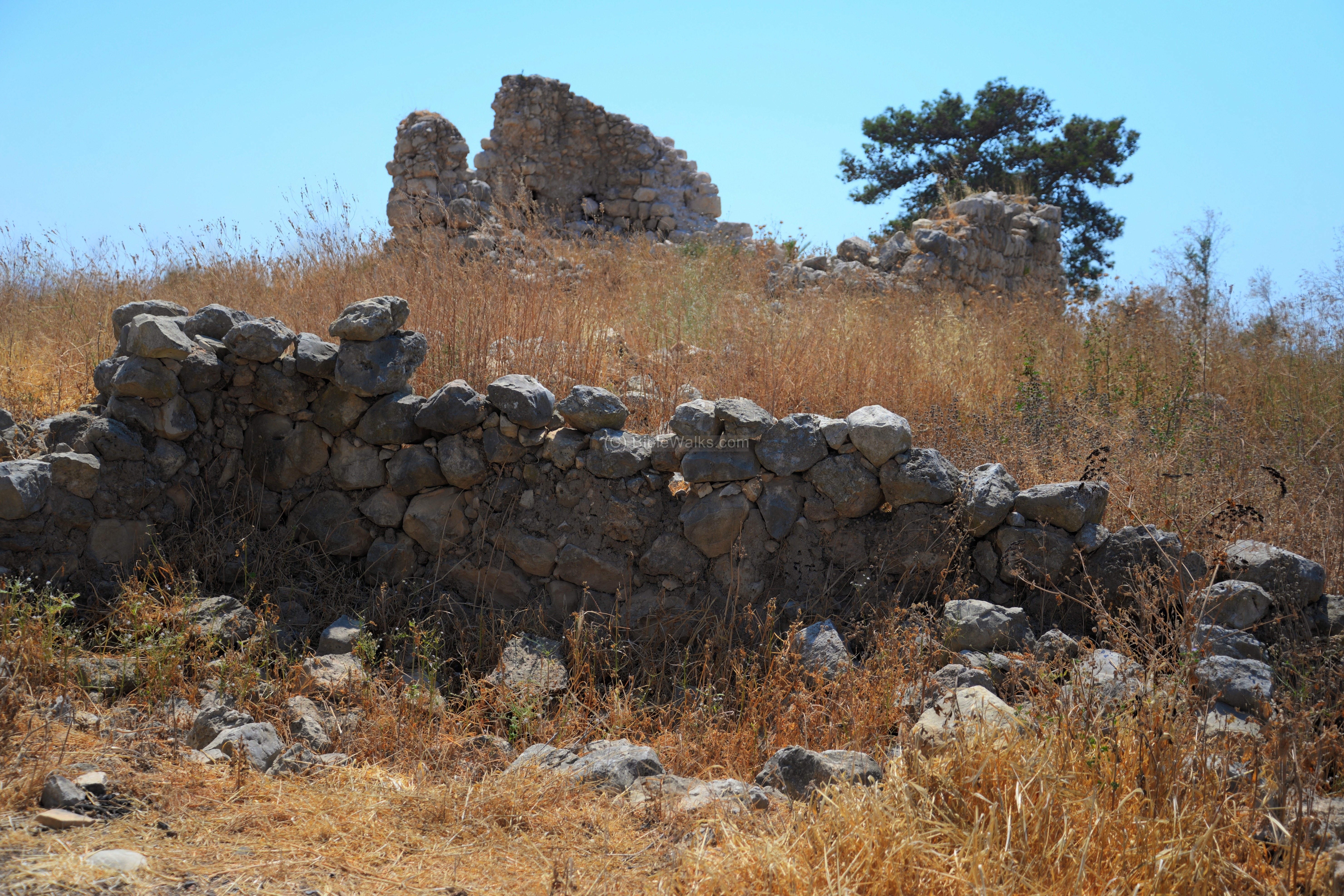
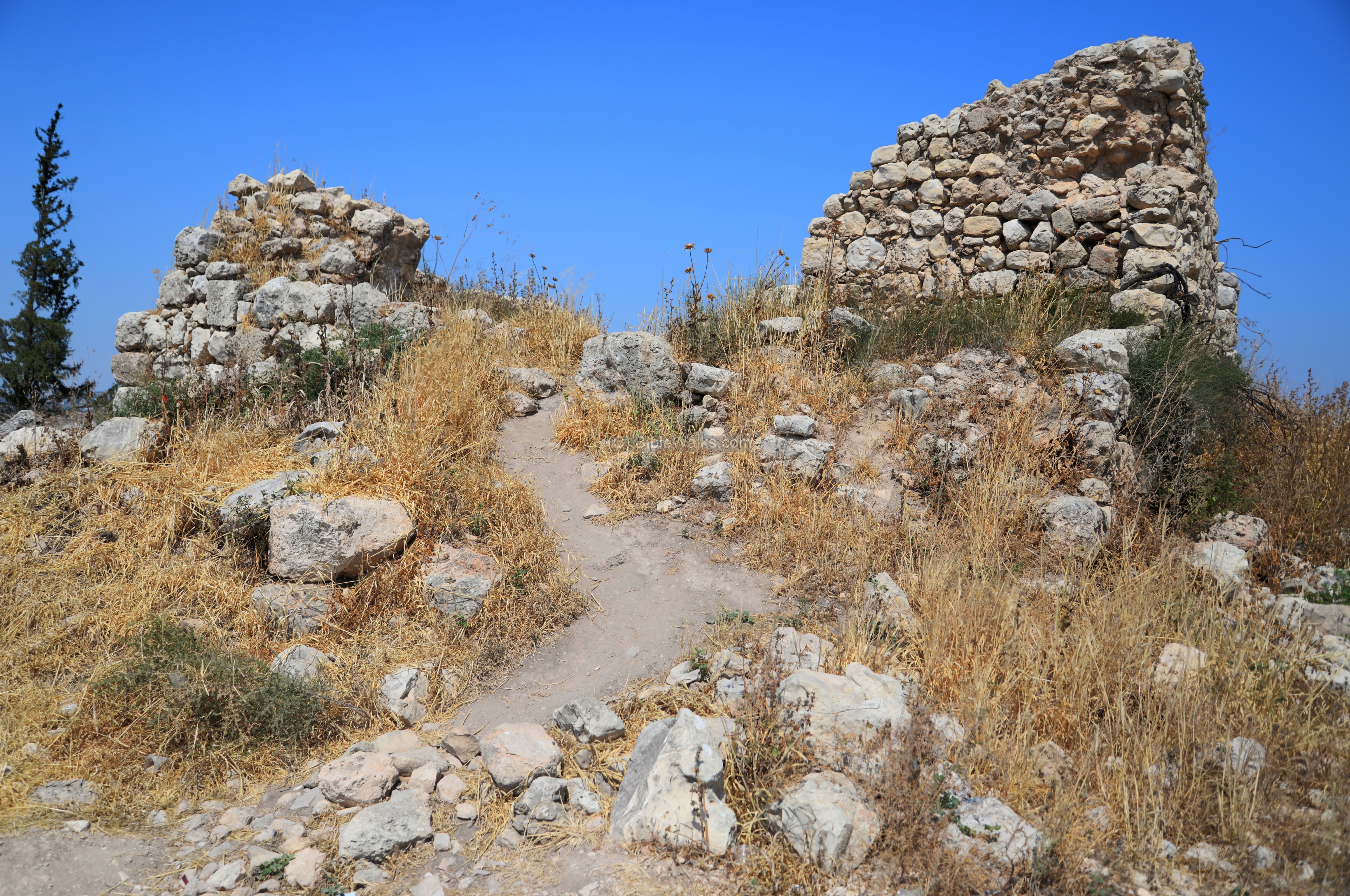
Another view of the largest structure:
A trail leads up into the remains of the structure.
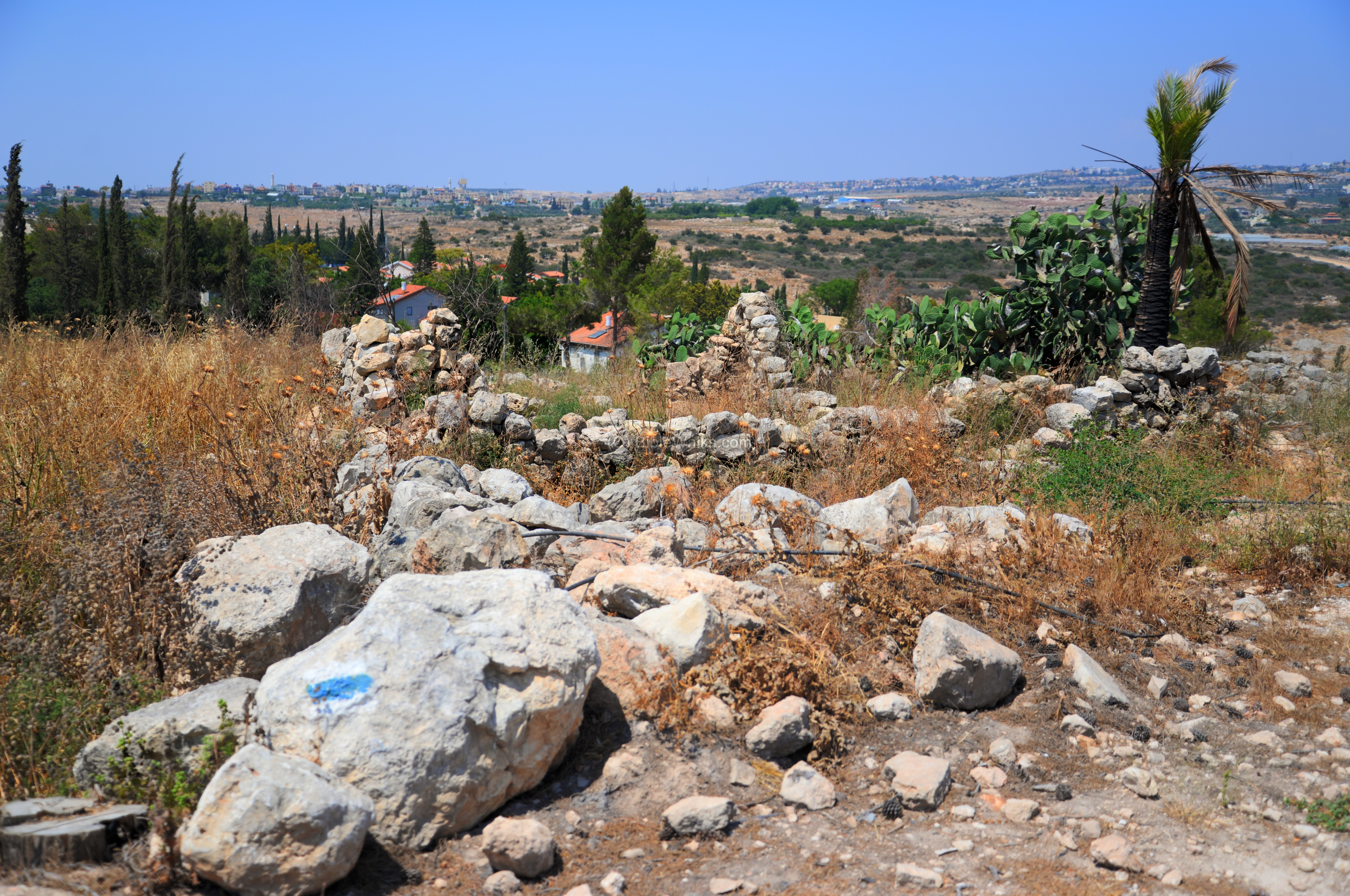
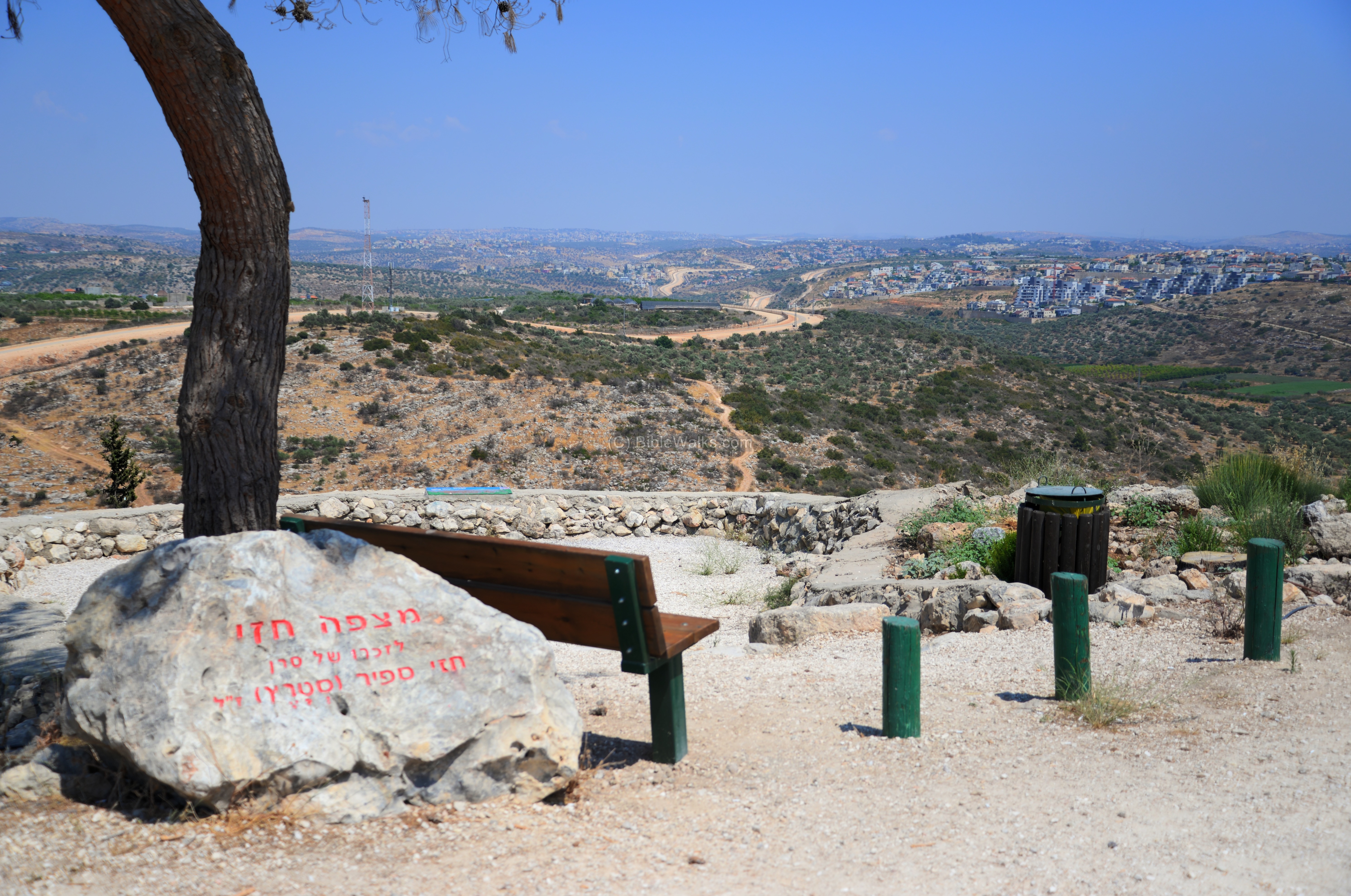
An observatory area, commemorating Hezi Sapir, overlooks the west bank. The security fence is where the bright line crosses the hills from left to right. On the right background is the community of Oranit.
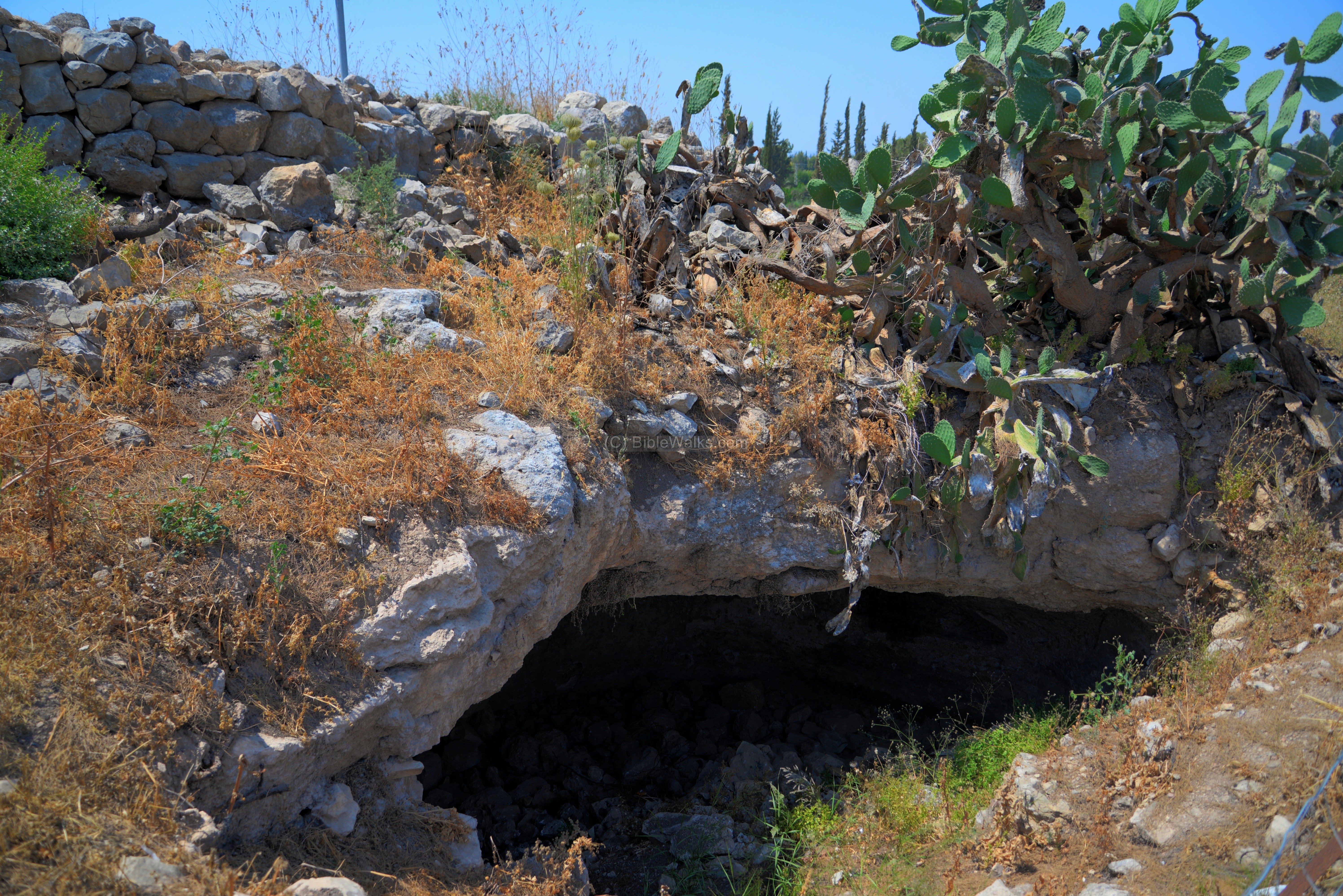
A cave is located near the observatory area.
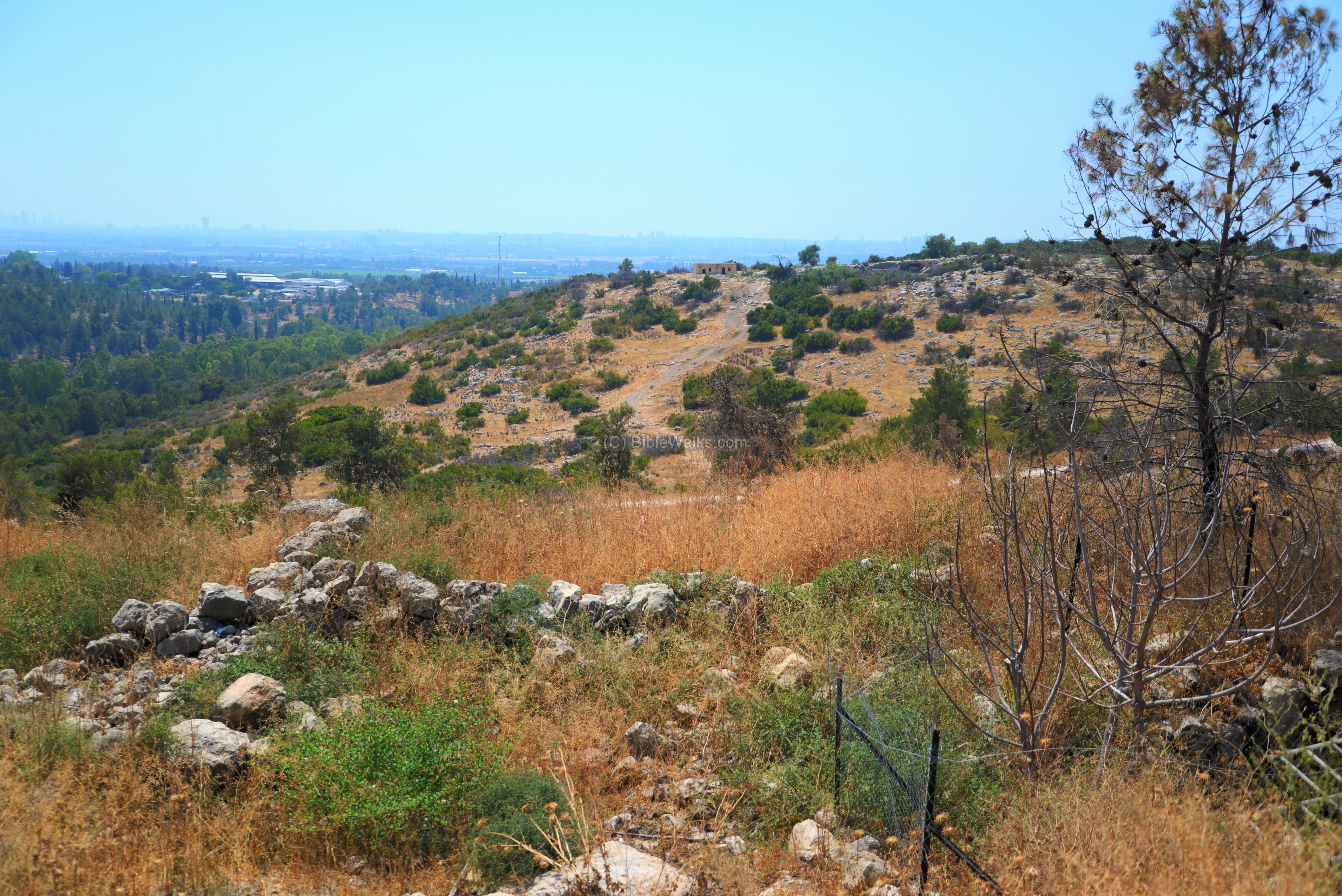
On the south side are remains of a street that faced outwards towards the Nahal Qana stream.
A view towards the south west is in the next photo. On the hill across the valley is yet another ruins, with a structure and a cave.
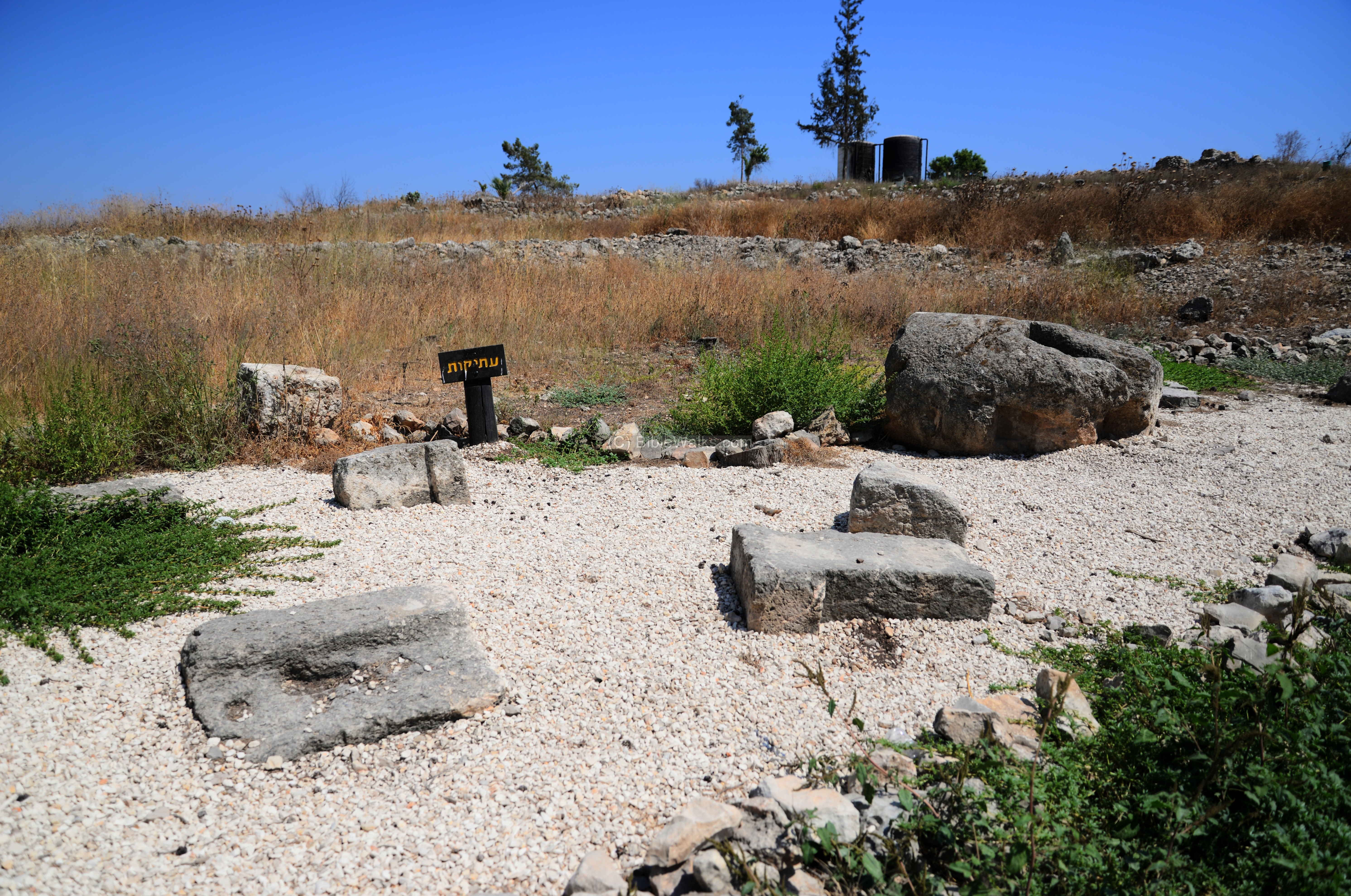
(c) Archaeological findings
The ancient village depended on farming for income. Near the parking area is a display of elements of farming installations that were found scattered in the ruins of the village. These elements are dated to the Roman/Byzantine period.
-
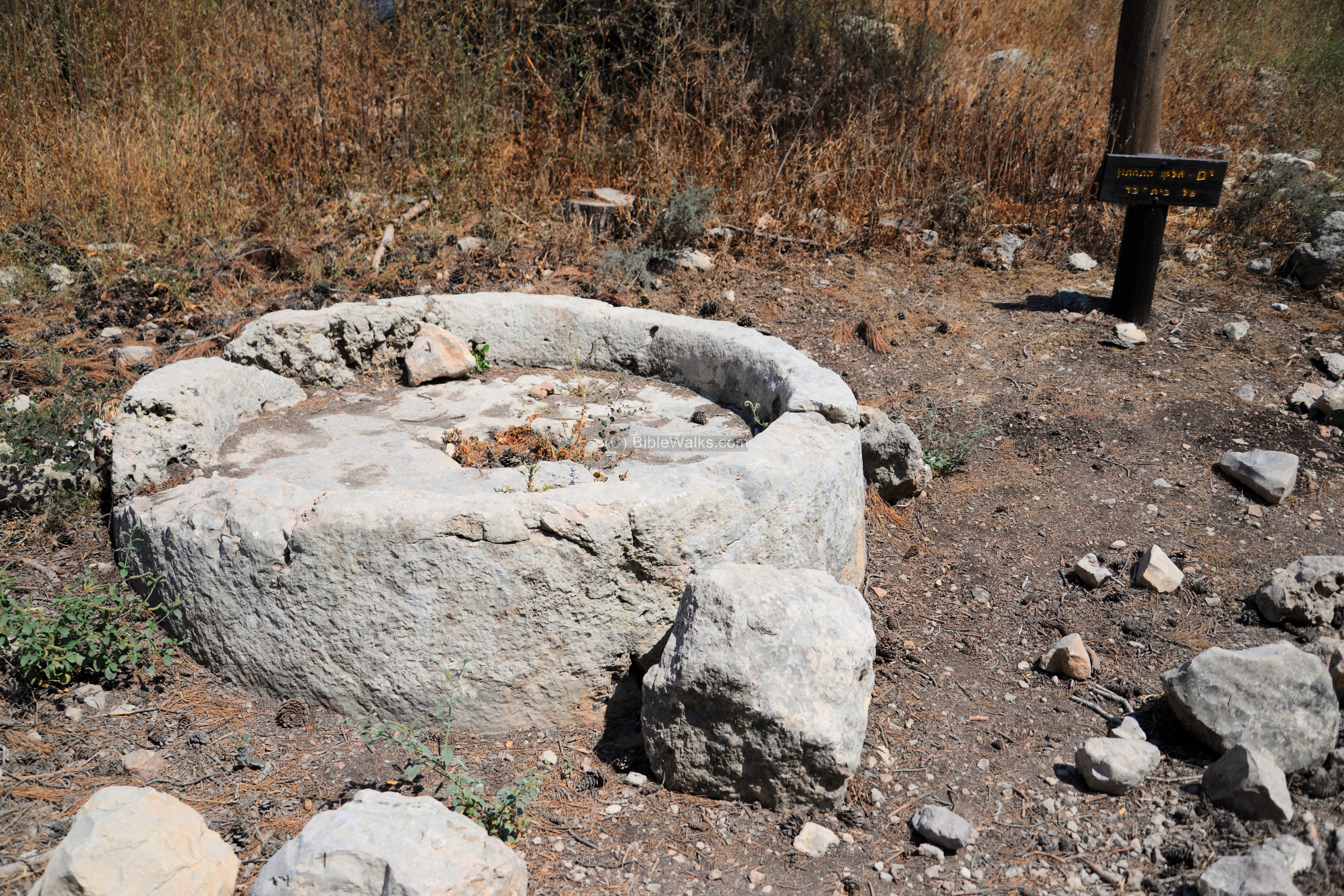
Olive oil press:
One of these elements, seen below, is a crushing basin, part of an olive oil press.
This oil press used a large rolling stone to crush the olives on top of the crushing basin. The stone was held upright by an axis, which was connected to a long handle. The handle was pushed by humans or animals. The mashing stone rolled along a cavity on the circumference of the base, crushing the olives. The crushed olives would then be collected into a basket and then further processed by the oil press.
The second phase of the olive oil production was to press on the crushed olives, which were placed inside baskets. The cylindrical stone weight of an oil press is in the next photo. It was part of a lever-screw-cylindrical weight (“type 6”) oil press. This press used the force of the weight to push down a wooden lever unto the baskets, squeezing out the precious olive oil.
- Winepress installation:
Nearby are remains of a winepress, including the treading floor (where the grapes were laid and fermented), collecting pool (where the juice is accumulated) and underground storage area (a cool pit where the wine was kept inside jars).
(d) Dhahar Zakkur
West of Zakkur, on the edge of a flat topped hill, are remains of an Iron Age I settlement, covering an area of 20 dunams. It is named Dhahar Zakkur (meaning the aged Zakkur). In the area of the site, which was damaged by cultivation, are remains of walls and heaps, rock-hewn cisterns and olive press. Many Iron Age pottery fragments are scattered on the surface.
A small round tower, built on the western edge of the settlement, overlooks the coastal plain.
A modern observation tower stands at its side.
A rock hewn burial cave is seen along a trail descending from the site.
(e) Nature
Wild flowers cover the foothills during the spring time.
This flower – Arum Palaestinum Boiss (English: Black Calla Lily, Hebrew: Erez-Israeli Luf) – flowers during March-April timeframe.
The blue flower is Centaurea Cyanoides (English: Syrian cornflower, Hebrew: Dardar Kakhol).
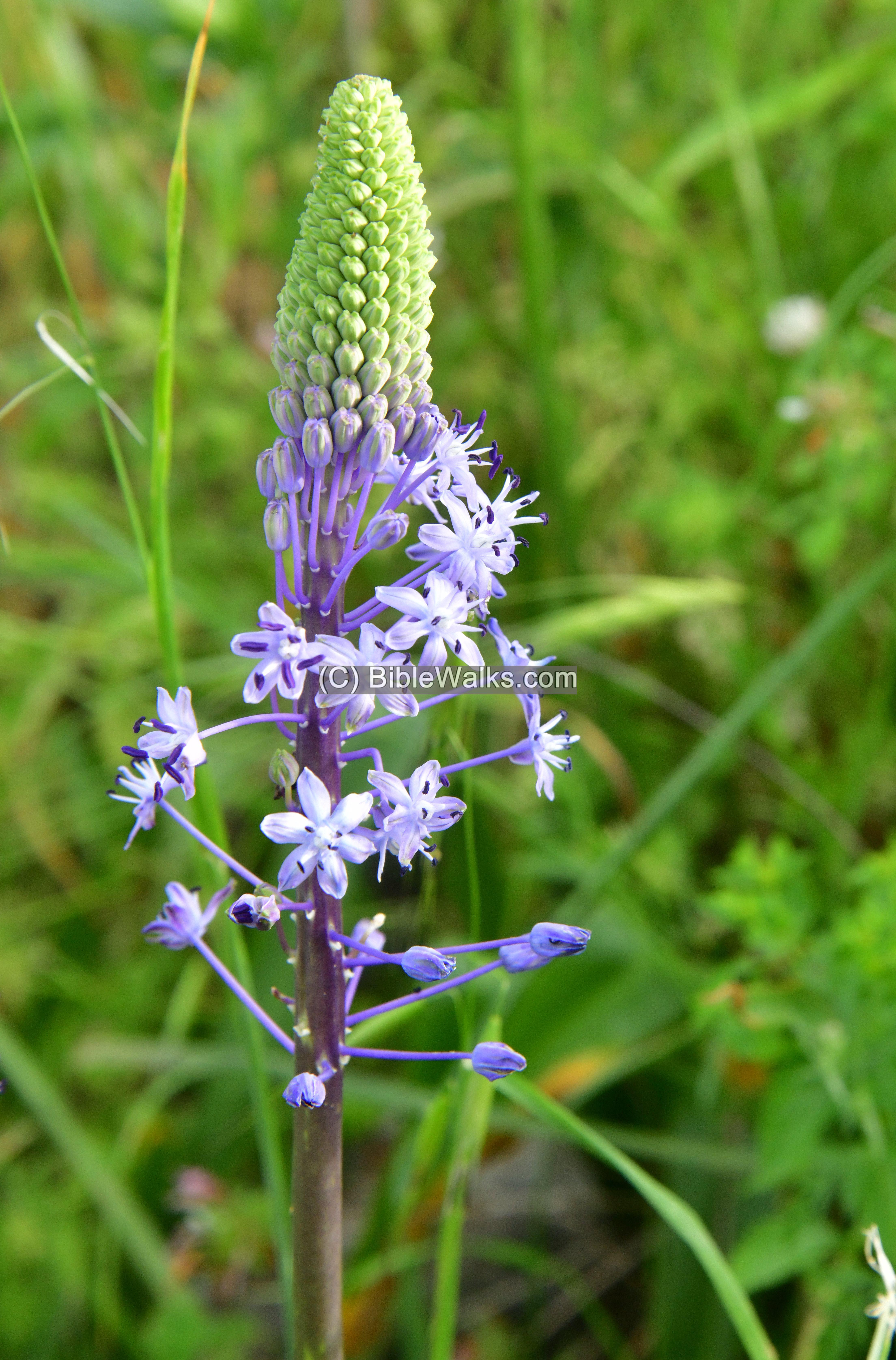
The next flower is Scilla hyacinthoides. It flowers in March/April with purple flowers on 1–1.5 m high flowering stalks.
Etymology (behind the name):
- Nirit – a community, established in 1982. Named after an annual weed that grows in the area – Nirit Hakama (Latin: Ridolfia segetum), which is used as a herb and medicine.
- ez Zakur – Arabic name of the village; a private name, from: “hawk” (as per PEF dictionary)
- Kh. Zadur – another name of the site (as per Dorsey p. 167 site $499)
- Kanah brook – mentioned in Joshua 16:8: “The border went out from Tappuah westward unto the river Kanah; and the goings out thereof were at the sea. This is the inheritance of the tribe of the children of Ephraim by their families”. Also in Joshua 17:9: “And the coast descended unto the river Kanah, southward of the river: these cities of Ephraim are among the cities of Manasseh: the coast of Manasseh also was on the north side of the river, and the outgoings of it were at the sea:
- Dhahar Zakkur – meaning the aged Zakkur; based on Arabic dhar – “time”.
Links and References:
* Archaeology:
- “The Roads and Highways of Ancient Israel” – D. Dorsey
– Site #499 Kh. Zadur – 10 dunam ruin with Iron II pottery
(Kokhavi Moshe: “Judea, Samaria and the Golan: arch survey 1967-1968” 1972:228)
- Archaeological survey of Israel – Map 77 (Kefar Sava):
– Site 111 “Horbat Zakkur”
-
-
- Horbat Zakkur – Hadashot Arkheologiyot: Excavations and Surveys in Israel, #115 (2003) Hagit Torge, HAESI 115 2003 pp. 38-40
- Horbat Zakkur – 1998 salvage excavation of 2 burial caves 500m NW
- Nirit – community website (Hebrew)
- Hezi Sapir memorial park (Hebrew, including map and info)
-
-Sןite 110 “Dhahar Zakur”
* Nature:
* Internal:
- Drone Aerial views – collection of Biblical sites from the air
- Gilgal (Sharon) – nearby Jaljulia
- Oil presses of the Holy Land
- Wild flowers in the Holy Land
BibleWalks.com – tour the Land with a Bible in the hand
Tel Tanninim <<–previous site—<<< All Sites>>>— next Sharon site—>>> Apollonia
This page was last updated on Mar 22, 2024 (add Dhahar Zakkur)
Sponsored links: