Ruins of an Iron Age village, Hasmonean and Roman fortresses on a mound in Ein-Gedi.
Home > Sites > Dead Sea > Ein-Gedi > Tel Goren
Contents:
Background
Location
Photos
* General views
* Aerial views
* Foothill
* Western edge
* Eastern edge
* Northern foothills
* Monument
* Aerial video
Biblical
References
Etymology
Links
Overview:
Ein-Gedi (‘Kid spring’) is located on the western shore of the Dead Sea, and is the largest desert oasis in Israel (1,000 dunams – 250 acres). It is watered by four springs. Its fresh waters made the settlement possible since ancient times, and was referred several times in the Bible as a fertile place.
Ancient Ein-Gedi was located on Tel Goren, a low hill (size of 2 dunam – 1/4 acre) on the north bank of Nahal Arugot. It was established as a small village in the 7th century BC, during the Judean Kingdom. The Jewish village thrived during the next 14 centuries, expanding into a small town which was located around and near the ancient site.
Location:
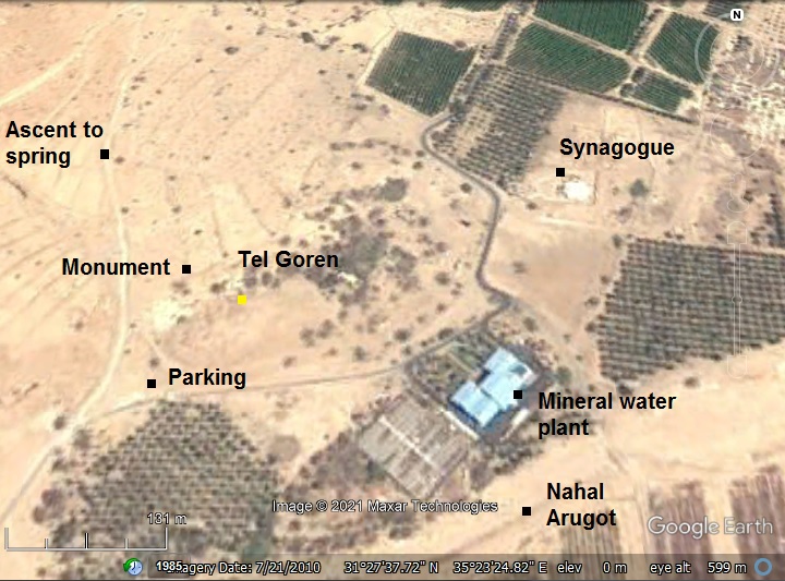
An aerial map of the area around Tel Goren is shown below, indicating the major points on interest. The settlement started on Tel Goren, then expanded in the area between the two streams. At later stage it expanded to the area below Tel Goren, where the synagogue is located.
Ein Gedi spring is located 700m north to Tel Goren, at an altitude 130m higher. A pipe conveys its waters down to the mineral water plant, on the south east side of Tel Goren, where the spring waters are bottled.
History:
-
Biblical periods (Iron age)
The site was known in the Biblical times as fertile, blessed by the spring it is named after. This area is where David hid from the pursuing King Saul (1 Samuel 23 29: “And David went up from thence, and dwelt in strong holds at Engedi“).
Ancient Ein Gedi is located on Tel Goren, a low hill (size of 2 dunam – 1/4 acre) on the north bank of Nahal Arugot. It was established as a small village in the 7th century BC, during the Judean Kingdom. A seal was found bearing the name “Uriyahu son of Azaryahu”, perhaps belonging to an official Judean clerk around the 6th-7th century BC.
The village thrived during the next 14 centuries, expanding into a small city which was located around and near the ancient site. A small harbor was located in Ein Gedi, and wood and stones anchors were found here on the eastern side of the synagogue. At some times the water level reached and flooded the houses of Ein Gedi.
-
Persian/Hellenistic/Hasmonean period
The Babylonians destroyed the village (located on Tel Goren) in the 6th century BC. It was repopulated after the exiles returned during the Persian period. The village continued until the 4th century, then was deserted.
The Hasmonean Kings, starting from Hyrcanus I (134-104 BC) and especially Alexander Jannaeus (103-76), rebuilt the oasis, marking the rise of the new Ein Gedi. They added aqueducts and pools, initiated the balsam (persimmon) industry, planted trees on the hillsides, and relocated the new village to the north of Tel Goren.
- Ottoman period (1516-1917 AD):
Conder and Kitchener surveyed this area during the PEF Survey of Western Palestine (SWP) in 1873. A section of the survey’s map, part of Sheet 22, is shown here.
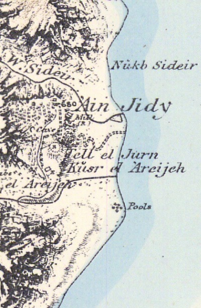
Part of Map Sheet 22 of Survey of Western Palestine,
by Conder and Kitchener, 1872-1877.
(Published 1880, reprinted by LifeintheHolyLand.com)
The surveyors wrote about the mound (here: Tell el Jurn), and the spring and the Chalcolithic temple above the mound (Volume III, sheet 22, p. 387):
“Ain Jidy (O w).—Below the spring is a large mound (Tell el Jurn), and at the spring a modern ruined mill. The most remarkable ruin, however, is a platform on the terrace, just north of the spring. It is a square building, 12 or 15 feet side, and 3 feet high, built of large undressed blocks. Traces of old garden terraces are observable on the slopes of the bank below the spring. Visited February, 1875“.
-
Archaeological excavations
Tel Goren was excavated during 1961-1965 (B. Mazar). The archaeologists identified 5 historical levels of settlement:
- V – Late Israelite period (630-582 BC). The houses were built on the top of the hill and along the foothills. The plan of a typical house was a courtyard with two side adjoining rooms. Access to the houses was by a staircase from a street at a lower level of the steep foothill. Among the residential structures were installations were the balsam plant (persimmon) was extracted to produce the precious perfume. Clusters of large clay barrels, probably used for this purpose, were found with their bases stuck in the ground. This early city on Tel Goren was destroyed and burnt by the Babylonians.
- IV – Persian period (5th-4th century BC) – the Zion returnees from the Babylonian exile built larger and more solid houses, and the settlement expanded to the north and the east. An extremely large residential house (500 square meters, 23 rooms!) was unearthed on the north side of the hill.
- III – Hellenistic period; mainly Hasmonean (103-37 BC) – a large Hasmonean fortress was built on the top of the hill and along its foothills, covering an area of 3500 square meters. The width of the walls was 1.2-1.4m on the west wing, and 1.7-2.0m on the east wing. Two rectangular towers were built on the western and south-eastern sides. The period of the fortress was from Alexander Jannaeus until the time of Herod. It was destroyed during the Parthian conquest (40-37 BC) or during the battles with Herod.
- II – Early Roman period (mainly 4 BC – 68 AD) – The settlement moved to the area on the east and north of the hill. On top of Tel Goren was a large fortress, with 2m wide walls. A rectangular tower (14m x 7m) was unearthed on the western edge. The fortress was destroyed during the Great Revolt against the Romans.
- I – Late Roman, Byzantine period (2nd-6th century AD) – the settlement on the hill dwindled.
- Modern period
Tel Goren is in an open public place, part of the national park. We recommend to park the car at its south foothill, visit the site, then consider hiking to the Ein Gedi spring and the Chalcolithic temple.
Photos:
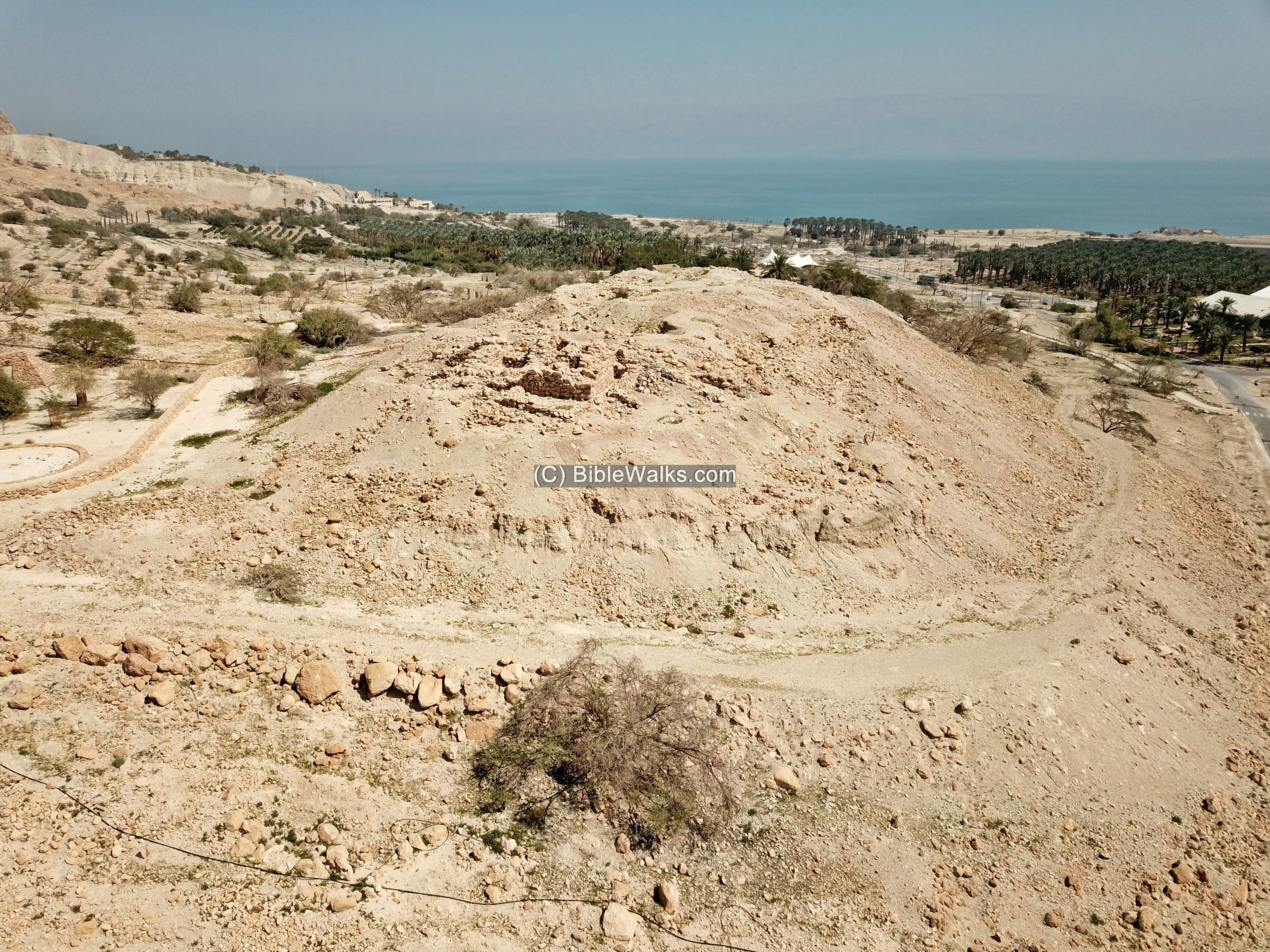
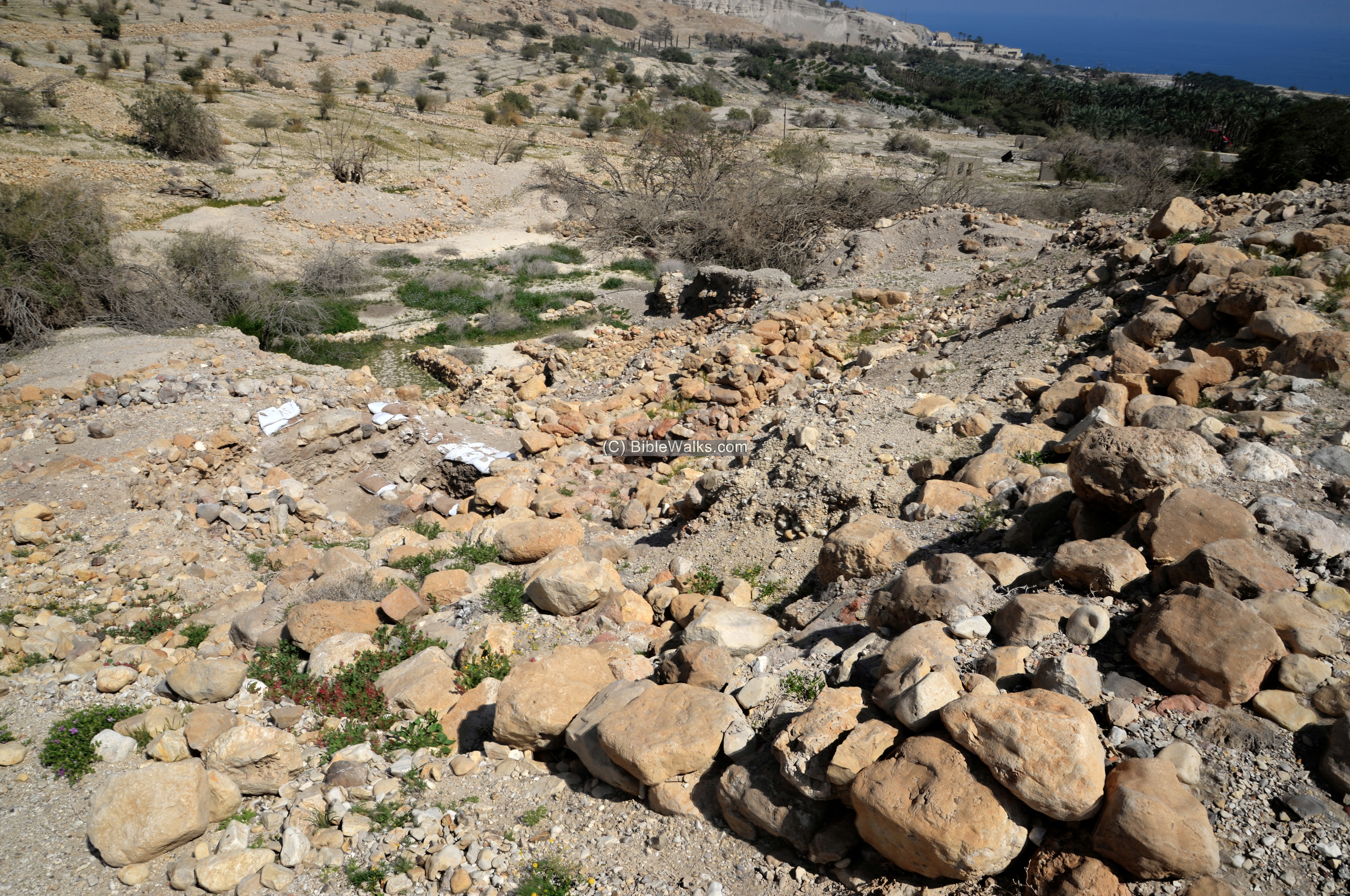
(a) General views:
Tel Goren is the major ancient site in the Ein Gedi Oasis. The mound is seen here in the center of the view from the North West, located on the north bank of Nahal Arugot. The stream cuts deep under the hill, where the modern Kibbutz Ein Gedi was built, and flows to the Dead Sea.
Click on the photos to view in higher resolution…
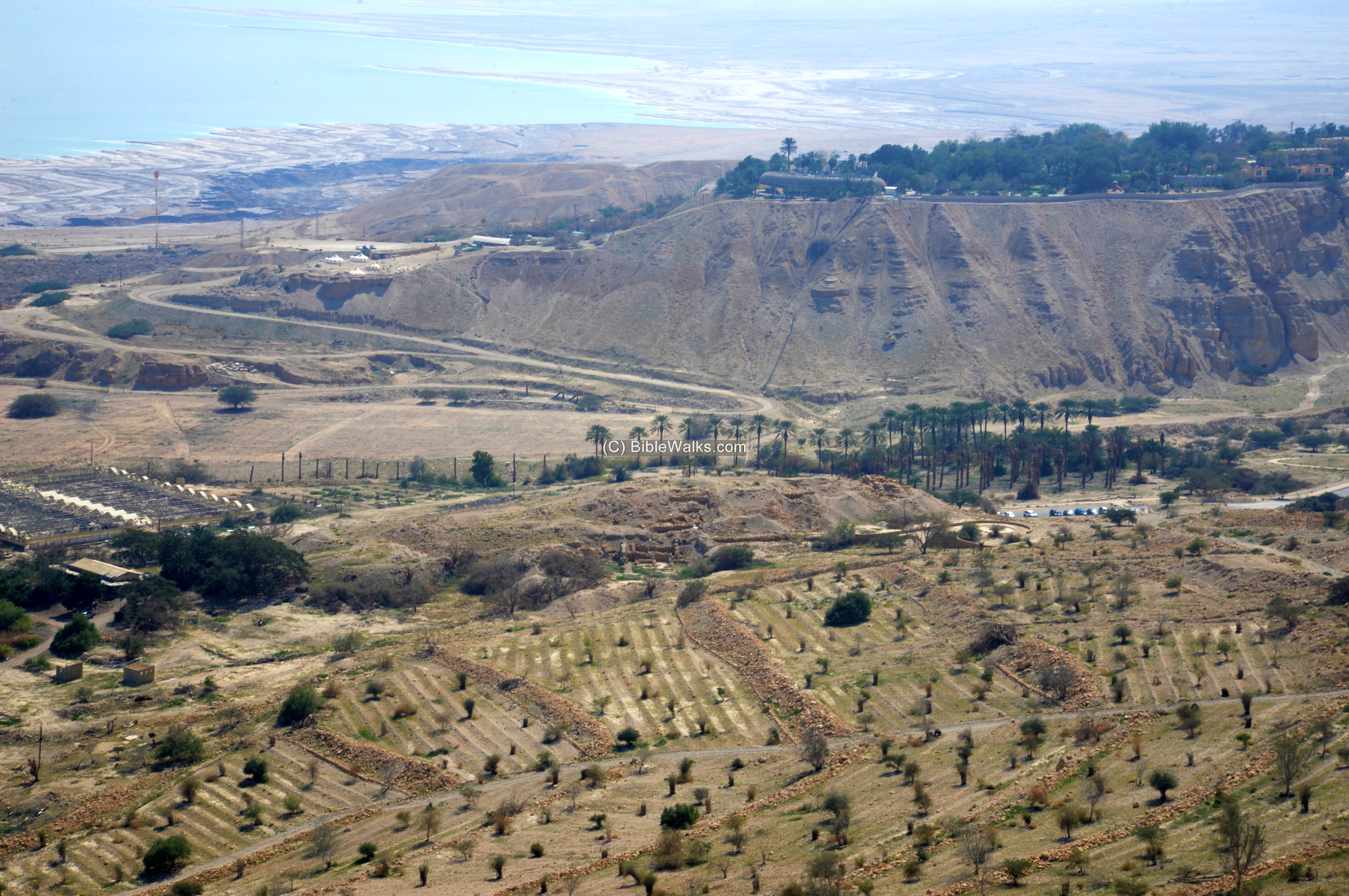
A closer view of the mound is next. The settlement occupied the hill and expanded to the area between the two streams – Nahal Arugot on the south and Nahal David in the north.
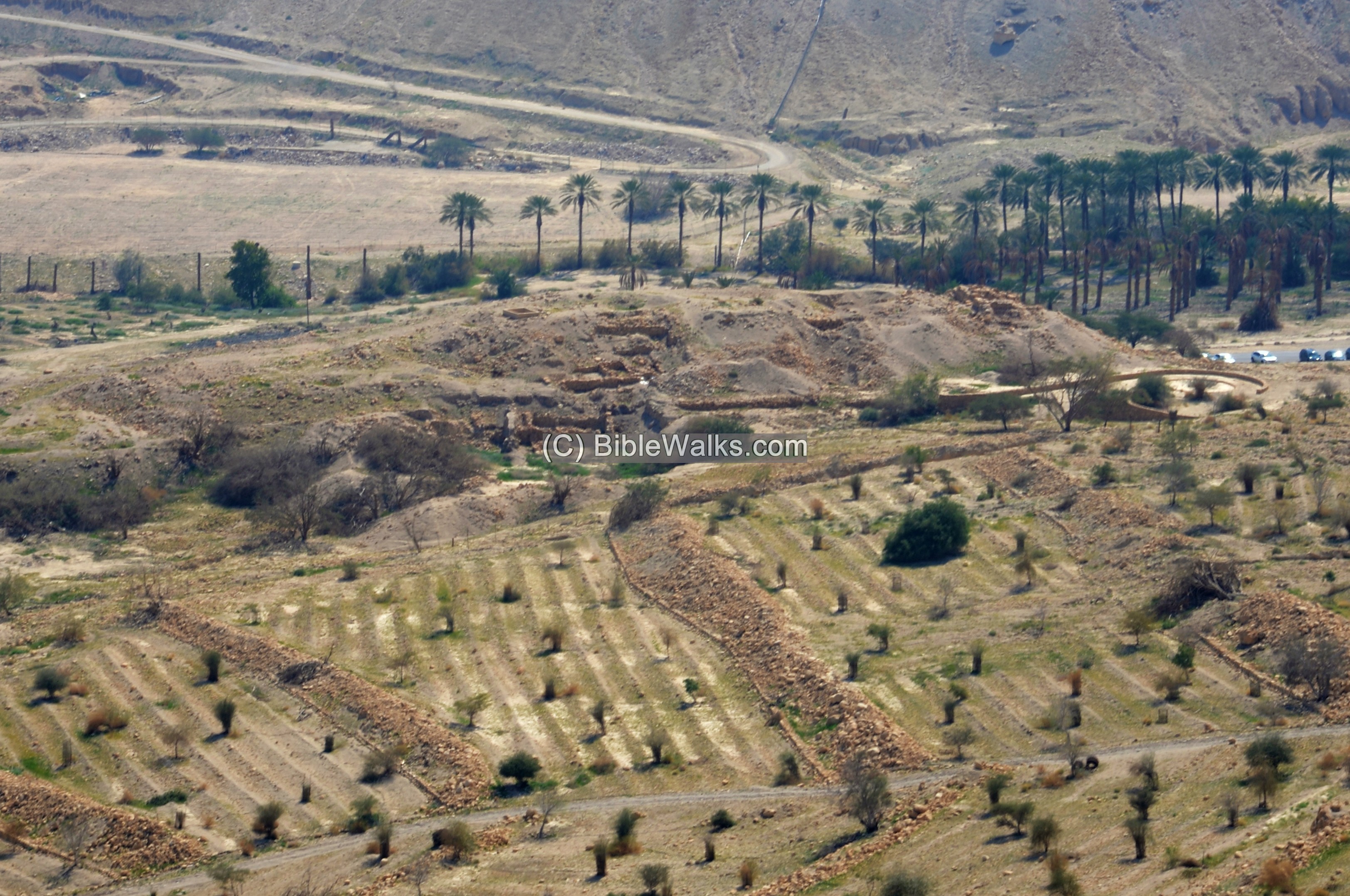
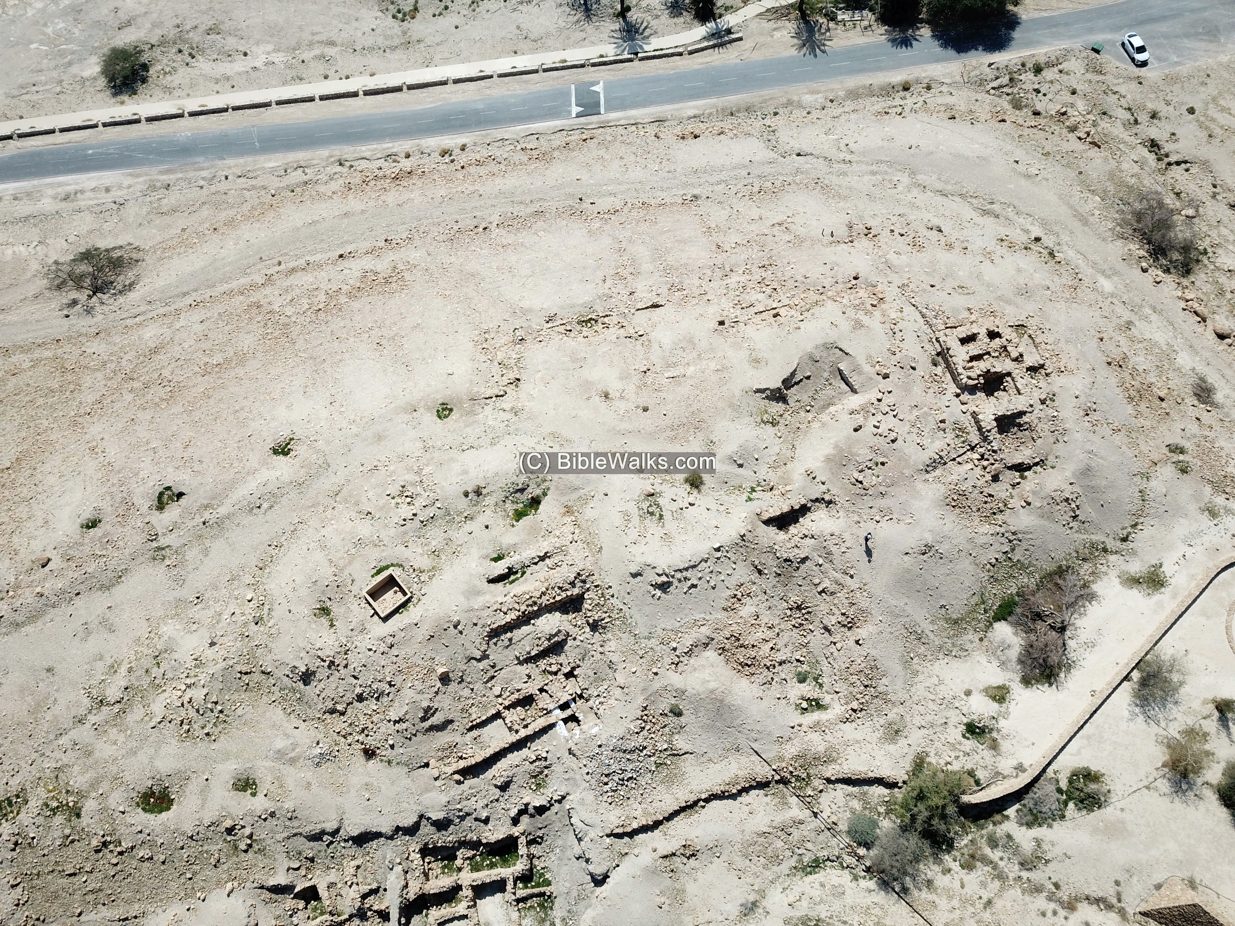
(b) Aerial views:
An aerial view of Tel Goren is next, captured by a drone from the west side. Its size is 2 dunam – 1/4 acre.
The next aerial view of Tel Goren is from above it, with an orientation to the south. You can notice the frame of a city wall around the peripheral of the summit, a western tower on the right side, and excavated buildings on the bottom left side.

A parking lot is adjacent to the Tel, offering a convenient access to the site.
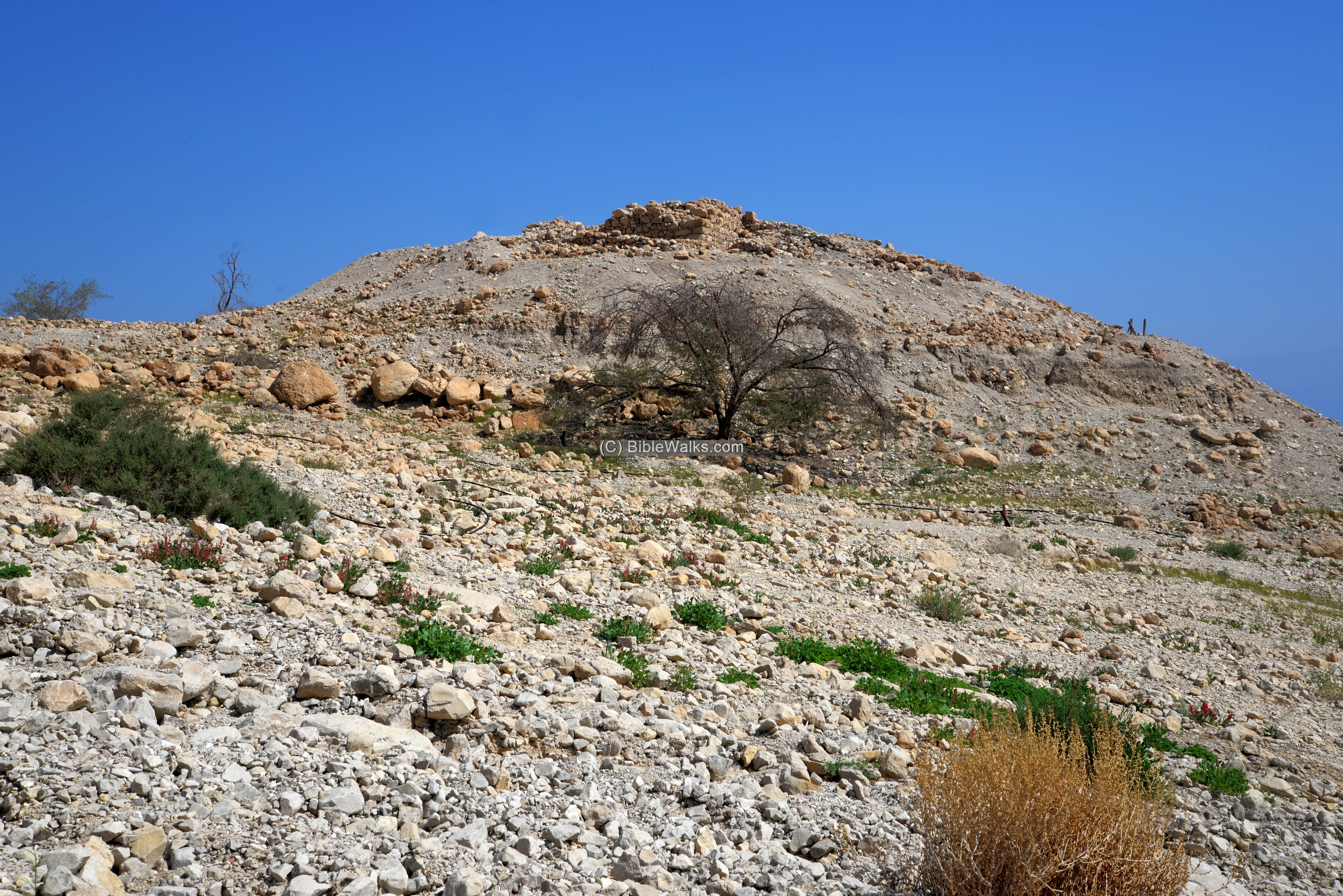
(c) Foothill:
From the parking lot, on the south side of Tel Goren, is a steep ascent to the top of the hill. The trail turns around the western side of the hill, passes thru the monument on its north west side, where the climb to the top of the hill is easier.
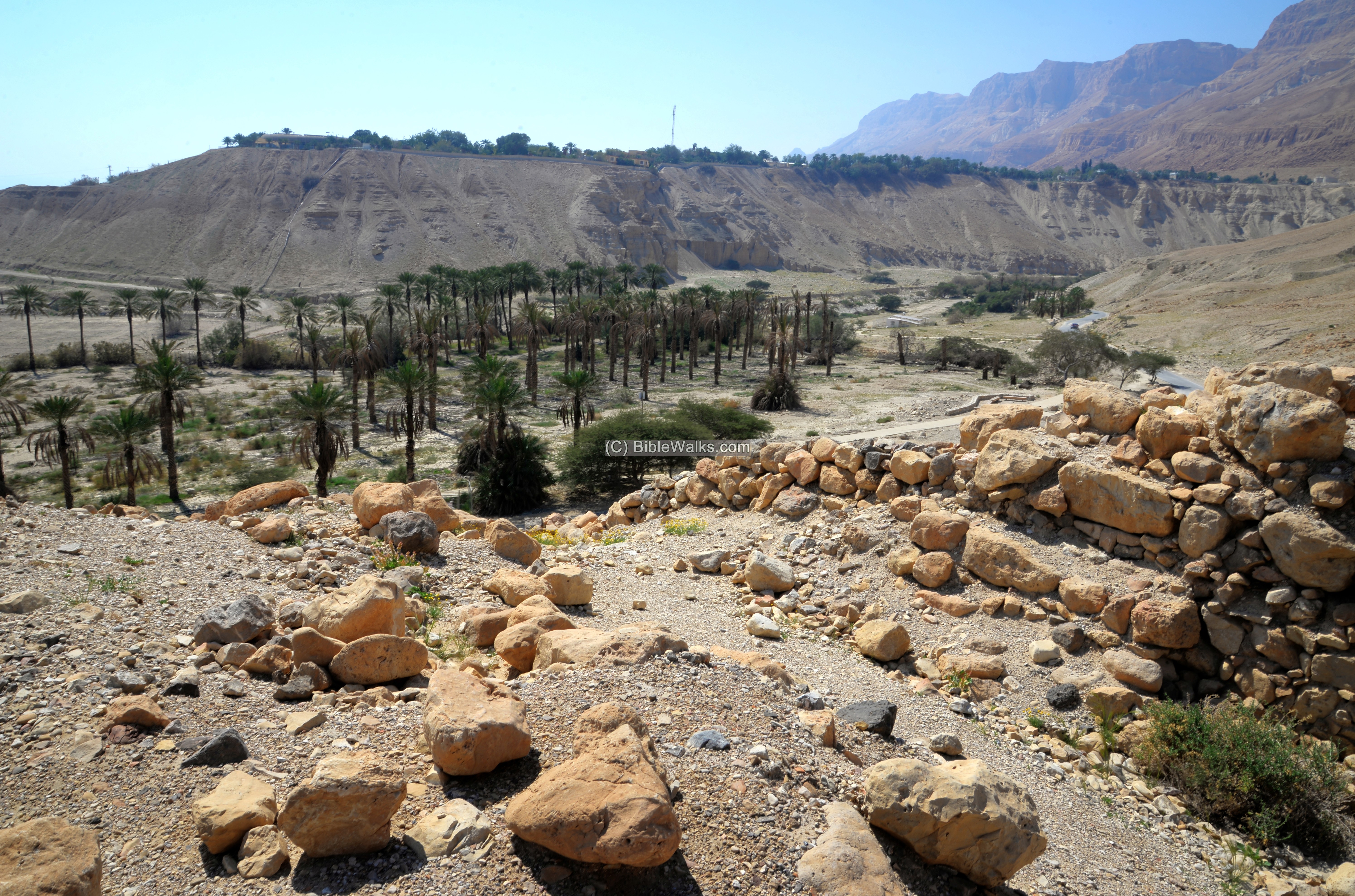
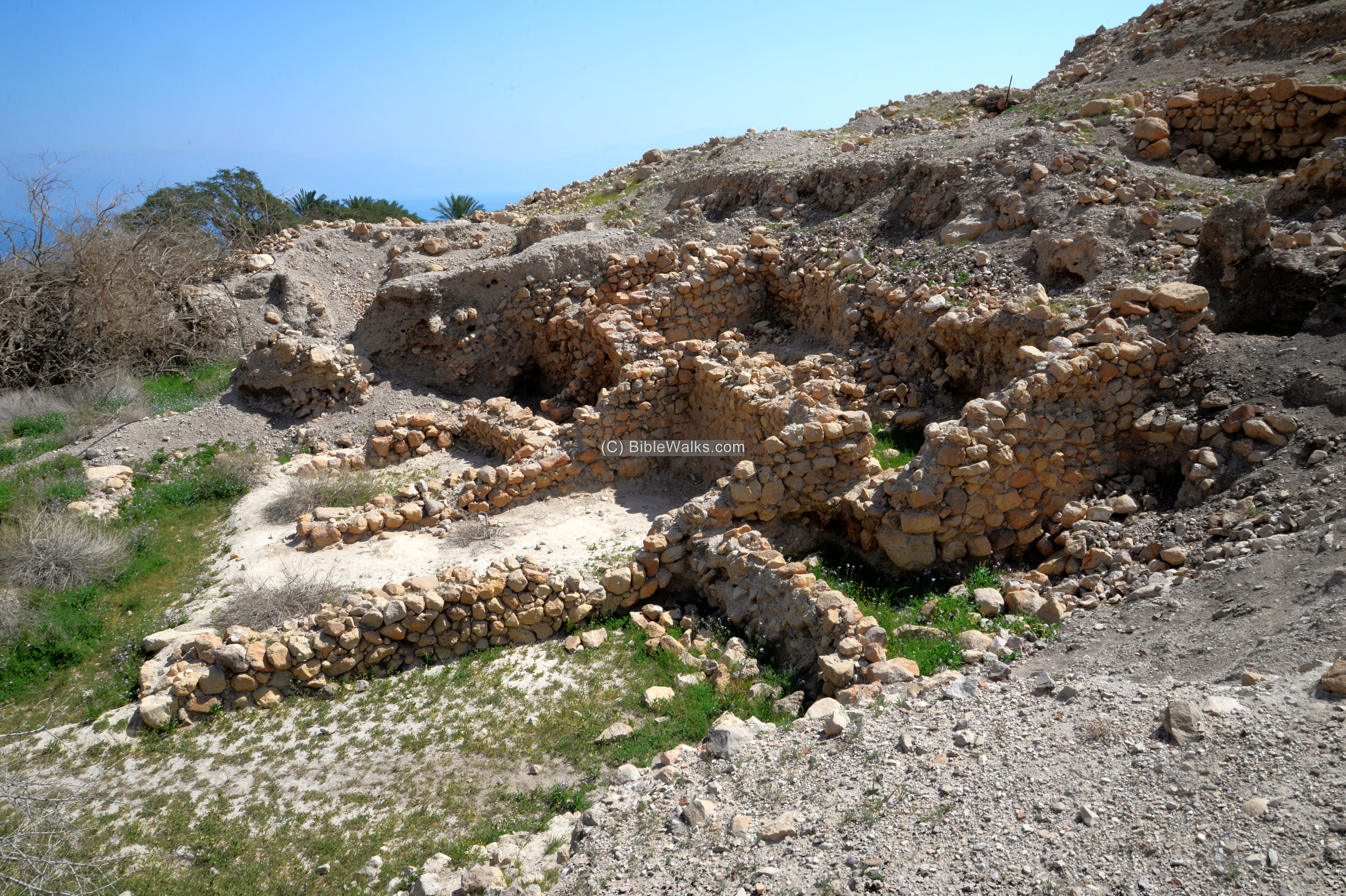
(d) Western Tower:
On the top of the hill are few visible structures, since most of the excavation areas were covered.
A section of a wall stands on the western edge of the hill, overlooking Nahal Arugot.
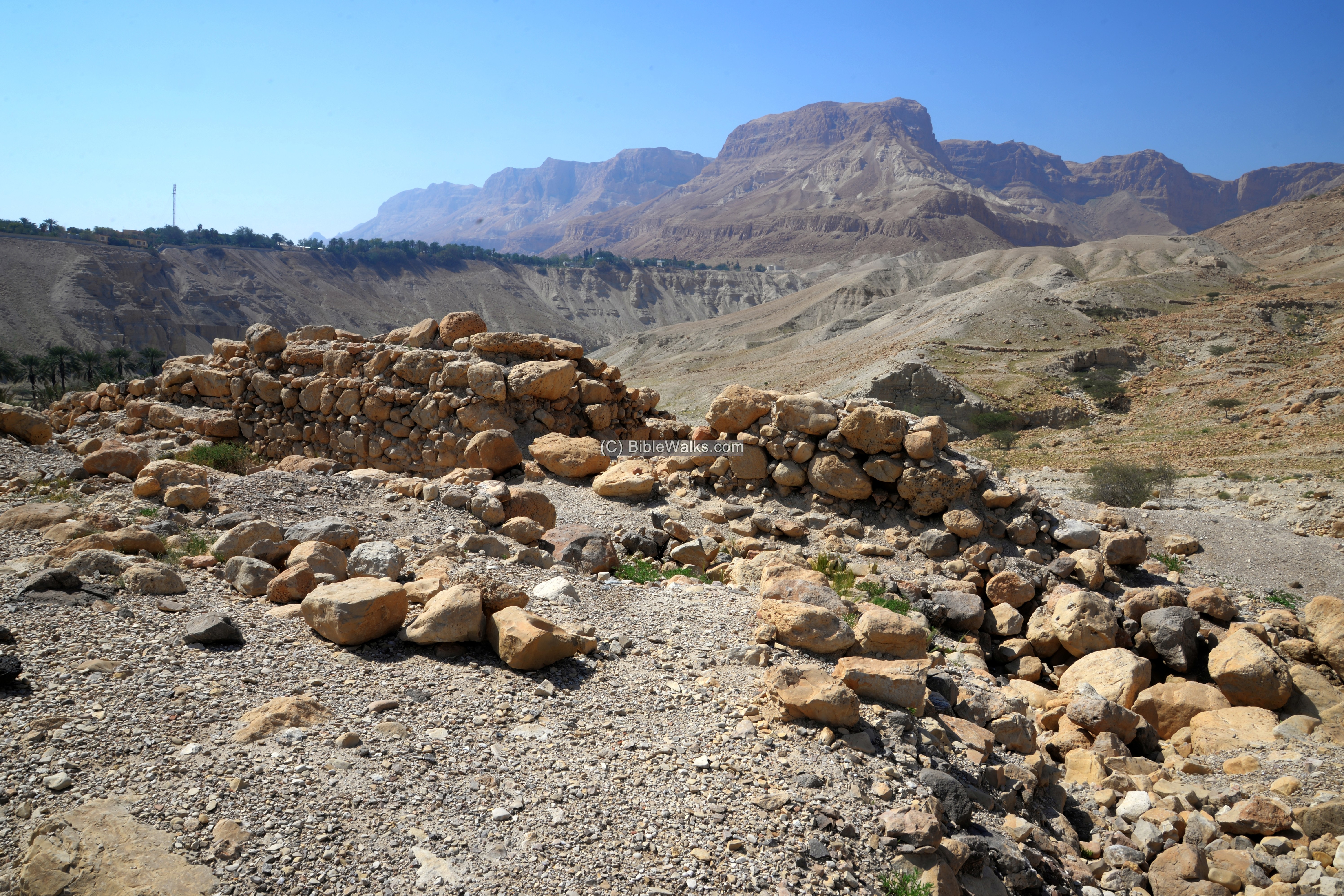
The wall was a section of the western tower, part of a large Hasmonean fortress which was built on the top of the hill.
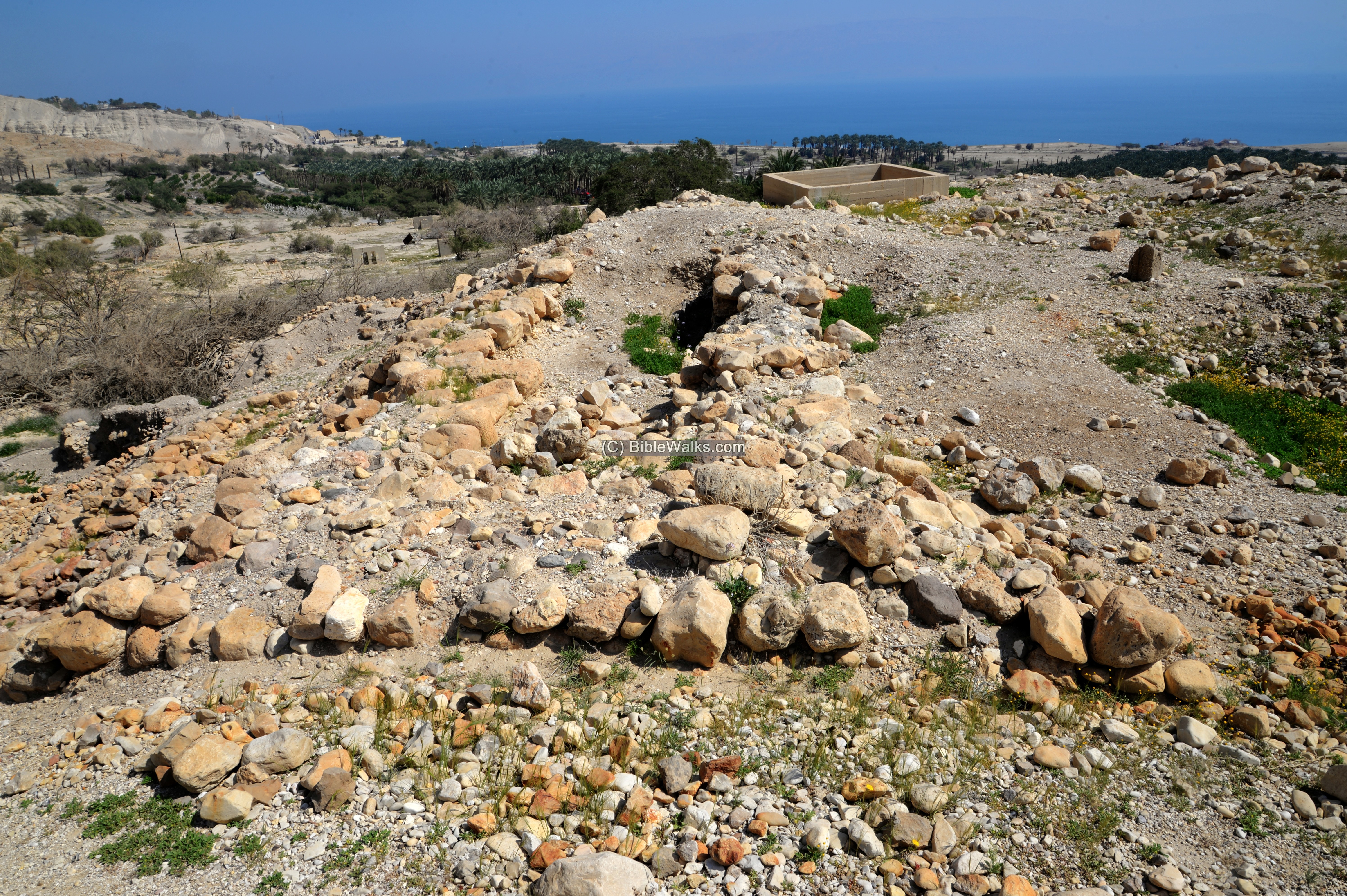
The western tower, 7 x 14m in size, included two rooms and two long and narrow chambers. It is seen below from a section of the aerial view:
There is a gap for an alley between the tower and the city wall. This is also seen in the ground view:
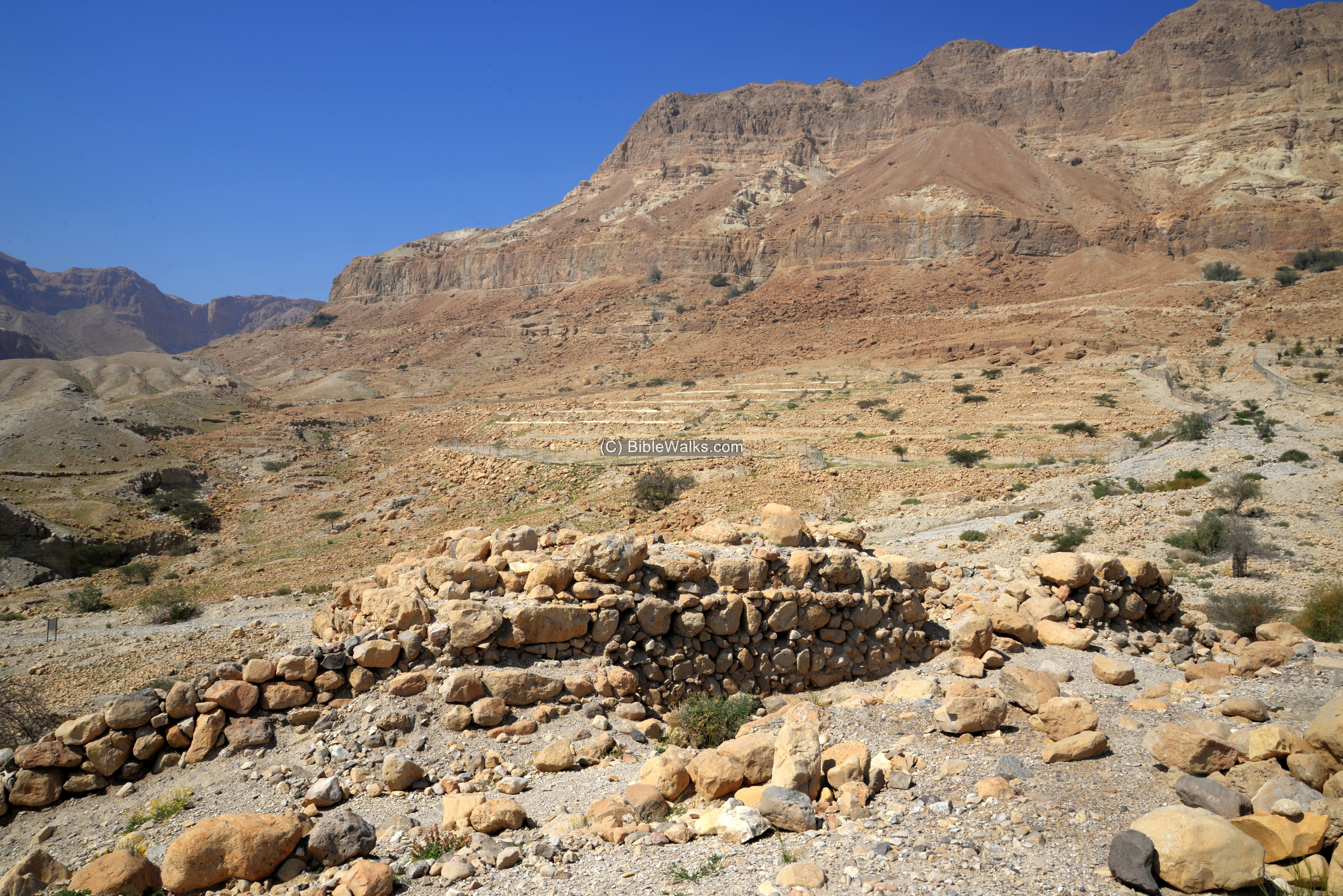
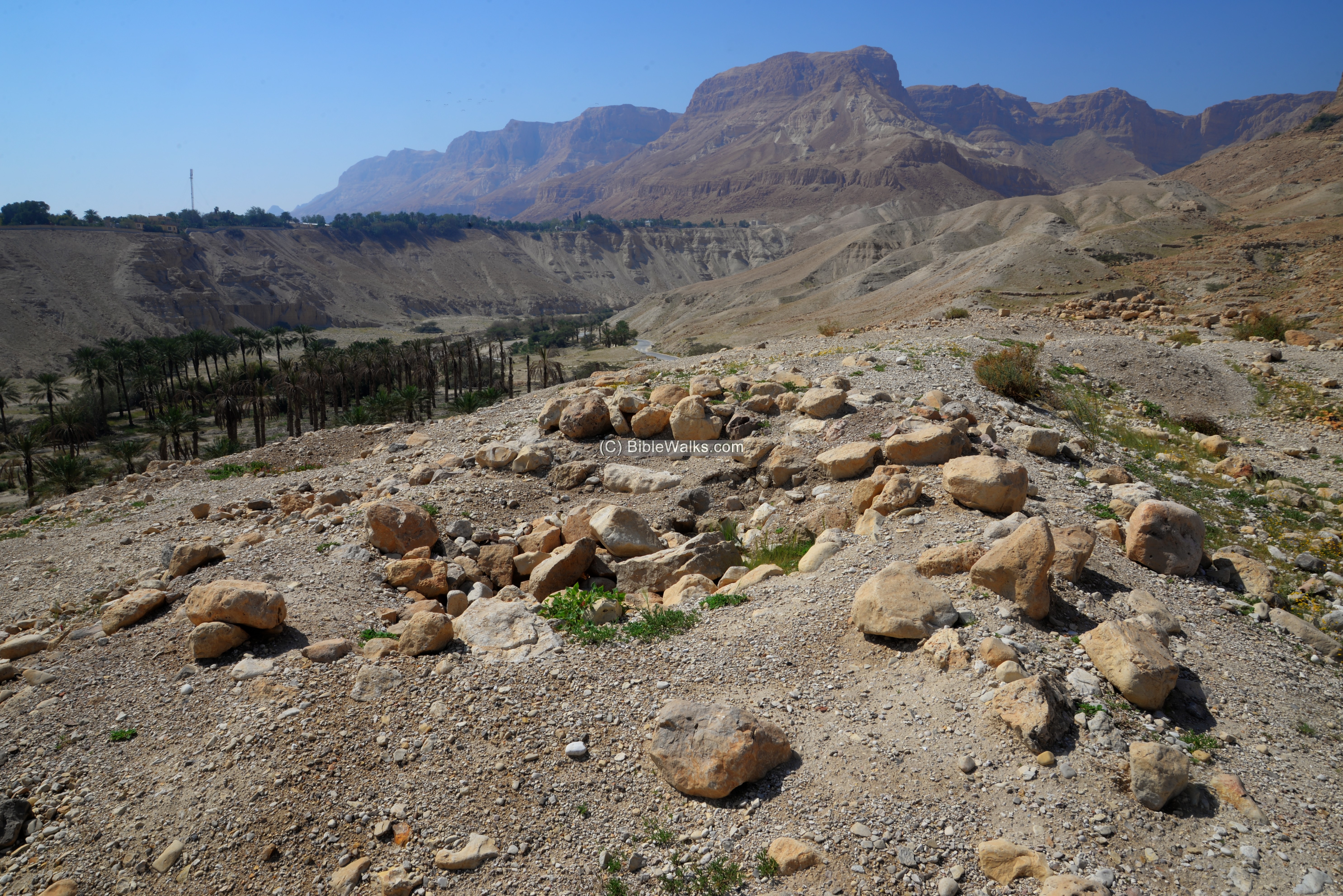
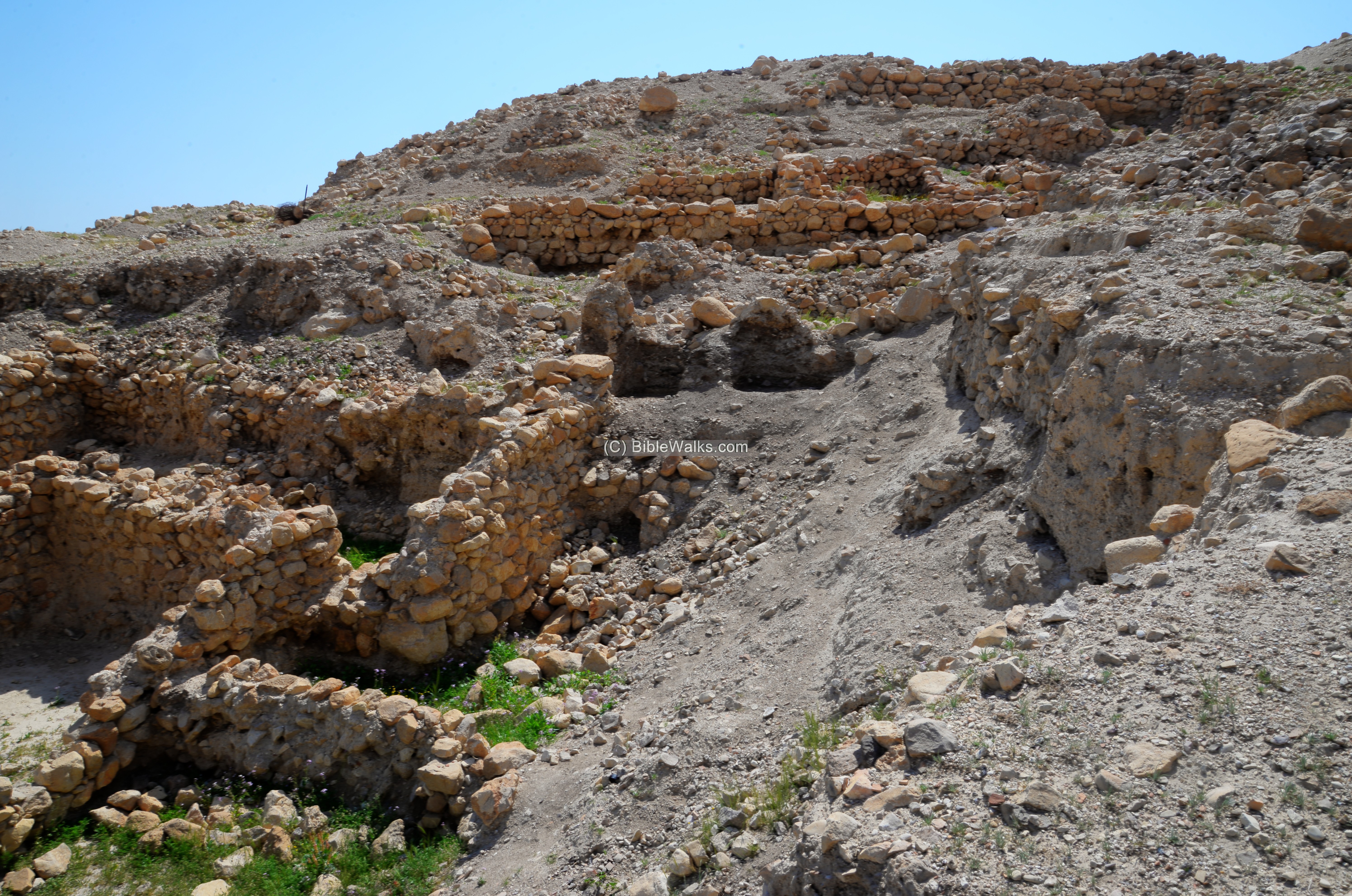
(e) Eastern side of the top:
The eastern edge of the top of the hill is seen in the next view. A section of the city wall is seen on the left side.
There was also a tower built on the south east side.
A view from the eastern edge to the western side shows the top of the hill, with few visible structures.
(f) Northern foothills
The most visible structures are on the Northern foothills.
The lower structure seen here was dated to the Herodian period. On the foothill above it is a structure and dated to the the Persian period.
Another view of the northern foothills:
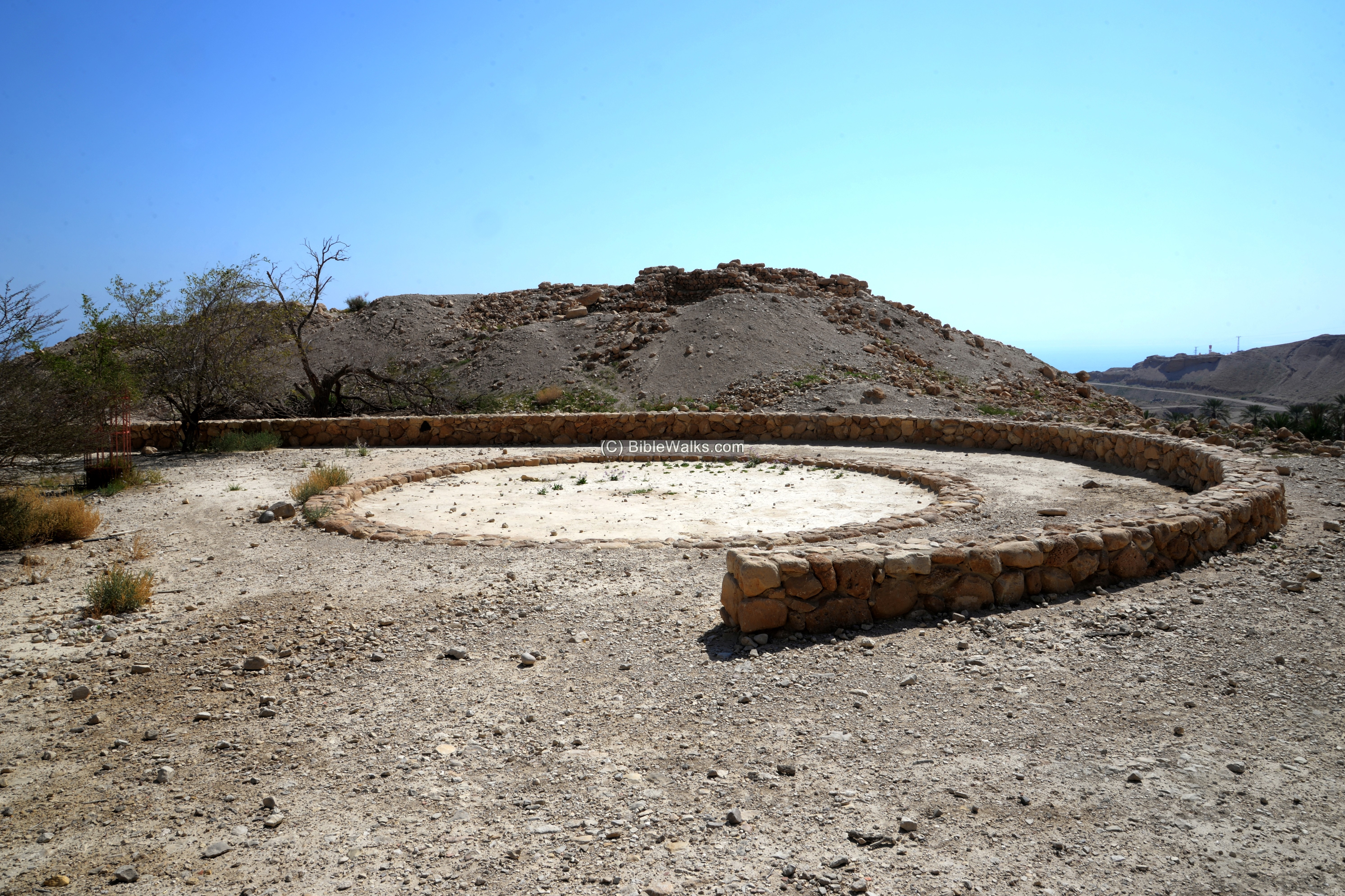
(g) Monument
A modern monument was erected on the north side of the site. It commemorates the 7 youths and their guide that died on April 9, 1942, when a hand grenade exploded in a bonfire. The group, belonging to the Palmach paramilitary force, prepared to climb Masada on the next day. The circle of rocks symbolize the bonfire where the tragic event occurred.
(h) Aerial Video
![]() The following Youtube video was captured by the drone in 2021.
The following Youtube video was captured by the drone in 2021.
Etymology (behind the name):
- Ein Gedi – Hebrew: Ein-spring, Gedi – Kid (a young goat). Prof Mazar suggested that Gedi is based on “Gedud” which means “many”, and translates Ein Gedi to “many springs” – based on the four springs of the site which give it life in this dry area.
- Ain Jidy (A’in Jidi) – the Arabic name of Ein Gedi (as in PEF maps); preserved the ancient name
- Kibbutz Ein Gedi – founded 1956; located above the south bank of Nahal Arugot
- Tell el Jurn – Arabic name of the mound. Meaning: “The mound of the trough” ( per PEF dictionary)
- Tel Goren – Modern Hebrew name of the site, based on the Arabic name.
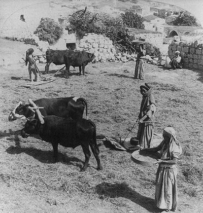
- Goren – Hebrew for threshing-floor – Jurn in Arabic. (Below: Threshing floor in the Galilee ;Library of Congress – JF Jarvis, ~1900)
Links and references:
* External links –
- The new encyclopedia of archaeological excavations in the Holy Land – Volume 3 – Ein Gedi; pp 1189-1200
- Ein Gedi mineral water company
* Internal – Sites around Ein Gedi:
* Aerial views (Youtube channel by BibleWalks.com)
BibleWalks.com = Touring the Bible Land
Ein Gedi<<<—previous site—<<< All Sites >>>—next Dead Sea site—>>> Qumran
This page was last updated on March 11, 2021 (New page)
Sponsored links: