Remains of an ancient multi-period port city, south of the ford of Nahal Hadera river.
Home > Sites > Sharon > Tel Gador (Tell el-Akhdar)
Contents:
Overview
Location
History
Photos
* Aerial views
* Access
* Summit
* Views
* Beach
* Flowers
Etymology
Links
Overview:
Tel Gador (also: Tel Gedor, Tell el-Akhdar) is a multi-period ruin south of Hadera. It is situated on a high (33m) sandstone cliff overlooking a bay.
Sections of the cliff fell down to the sea, chopping away the western side of the site.
The site offers outstanding views of the sea, and a public beach is located on its south side. Remains of a Byzantine period ship were excavated in the bay.
The site is part of the Tel Gador Nature reserve area, covering a stretch of 700 dunams (175 acres) along the coast south of Giv’at Olga, Hadera.
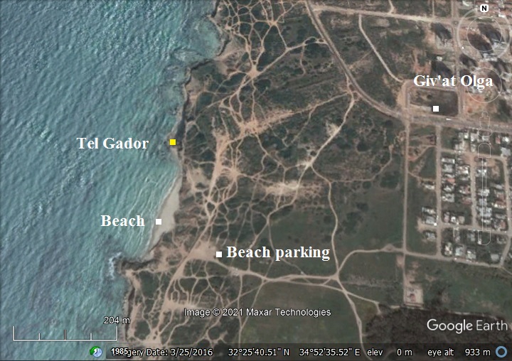
Location:
The aerial map shows the location of the site, indicating the highlights of the area.
It can be accessed from a beach parking place, accessed from the southern edge of Giv’at Olga.
History
Ceramic survey dated the settlement to the Early Bronze 1, Hellenistic, Roman/Byzantine, Mameluke and Crusader periods.
The ancient highway “Via Maris” (Dor to Joppa), later the Roman period coastal road (Caesarea to Apollonia), passed along the sea shore at its foothills. Additional roads connected the site to the east.
Remains of a Byzantine period ship were excavated in the bay.
- Early Muslim, Crusaders (7th – 13th century AD)
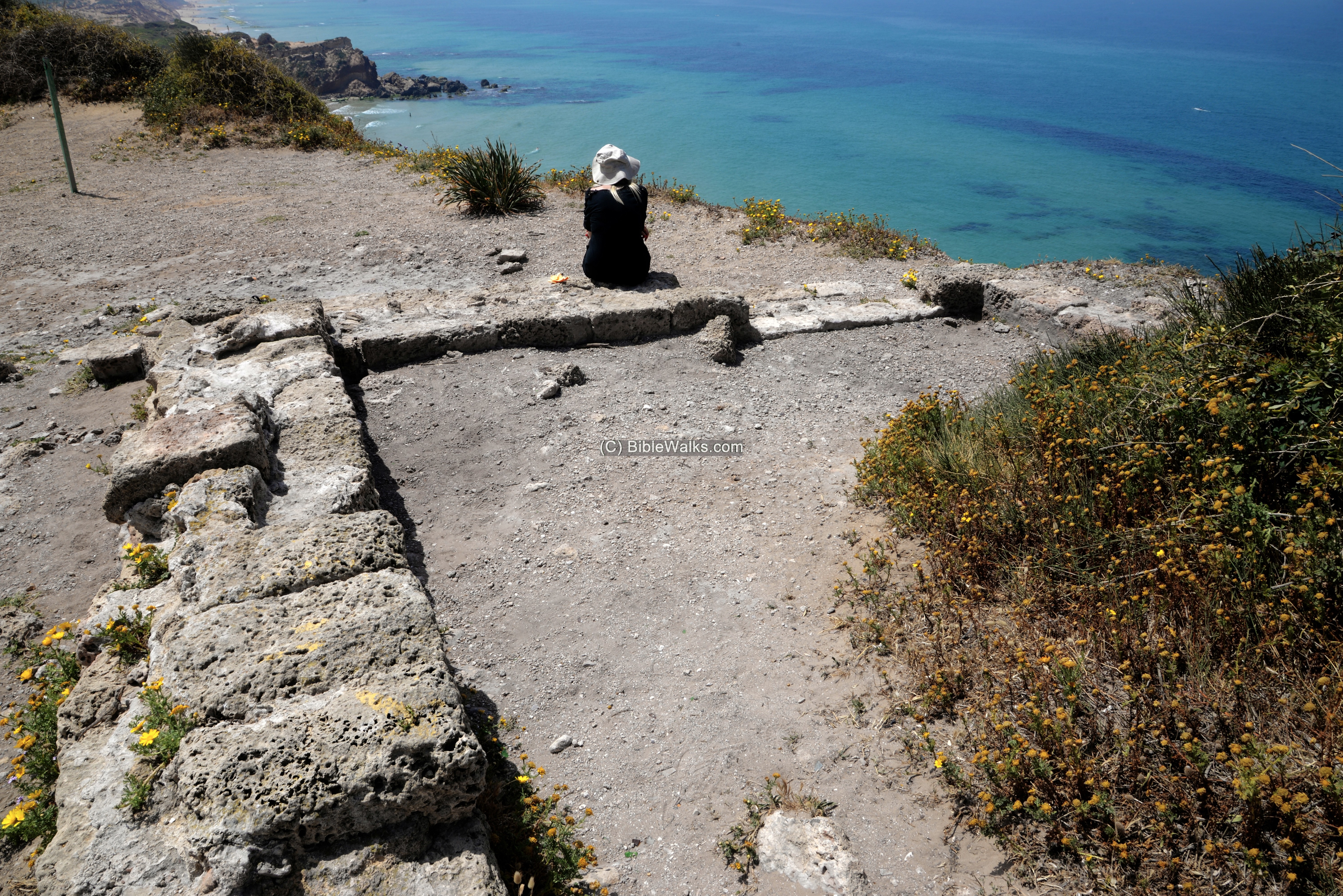
Close to the edge of the top of the cliff is a base of a small rectangular tower, with 0.8m wide walls, made of Kurkar sandstone hewn stones. Dated to the 6th-8th century AD, later re-plastered at the 9th-10th century, it may have been one of the coastal fortresses and observation towers that were constructed by the Omayyad rulers.
-
Ottoman period (1516-1917 AD):
Conder and Kitchener surveyed this area during the PEF Survey of Western Palestine (SWP) in 1873. A section of the survey’s map, part of Sheet 7, is shown here. The site is named “Tell el Akhdar” – the Arabic name, meaning “the green mound”. The river north of the site is named “Nahr el Mefjir” – the Arabic name of Nahal Hadera river.
Notice the double dashed line passing along the shore – the route of Via Maris. It is the ancient highway “way of the sea”.
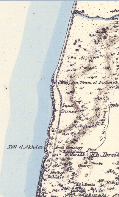
Part of Map Sheet 7 of Survey of Western Palestine,
by Conder and Kitchener, 1872-1877.
(Published 1880, reprinted by LifeintheHolyLand.com)
There are several places indicated around the site-
- Birket (pool) Belakis – A pool south of the mound
- Bir (well) Suleiman el Marzuk. A well east of the mound
- Kh. Ibreiktas – a ruin with pottery remains of Middle Bronze II, Iron I, Hellenistic, Roman and Byzantine. (Location 32.42691:34.88848 – east of highway #2)
- Arab cemetery
-
British Mandate
A 1940s British map shows the site. It is named here: Tell esh Sheikh Zraq. On the 1934 description of the site the survey include: “Ancient remains, marble columns, rough mosaic fragments, surface pottery.
Another name of the site was Tell el Khadra.
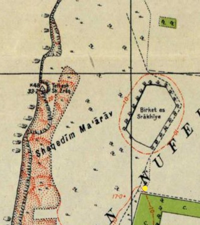
British survey map 1942-1948 – https://palopenmaps.org topo maps
License: public domain under the UK Copyright, Designs and Patent Act 1998
-
Modern period:
Tel Gador is located in an open public place, part of the Tel Gador Nature reserve area. A popular beach is located in the bay south of the mound. From the parking place is a trail that leads to the site.
Photos:
(a) Aerial views
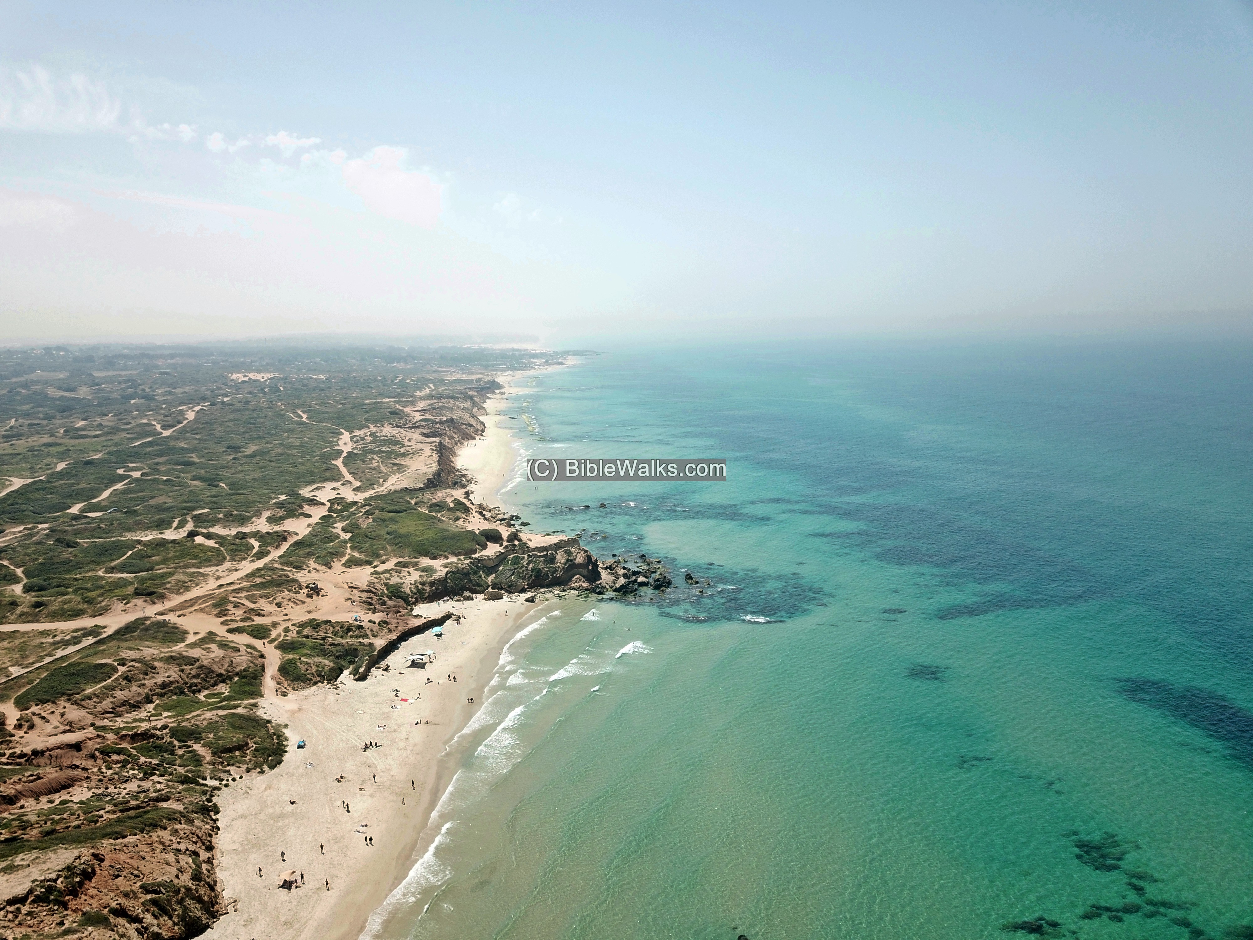
Tel Gador is located on a high cliff overlooking the sea.
This view was captured by a drone above the south side of the hill.
Click on the photos to view in higher resolution…
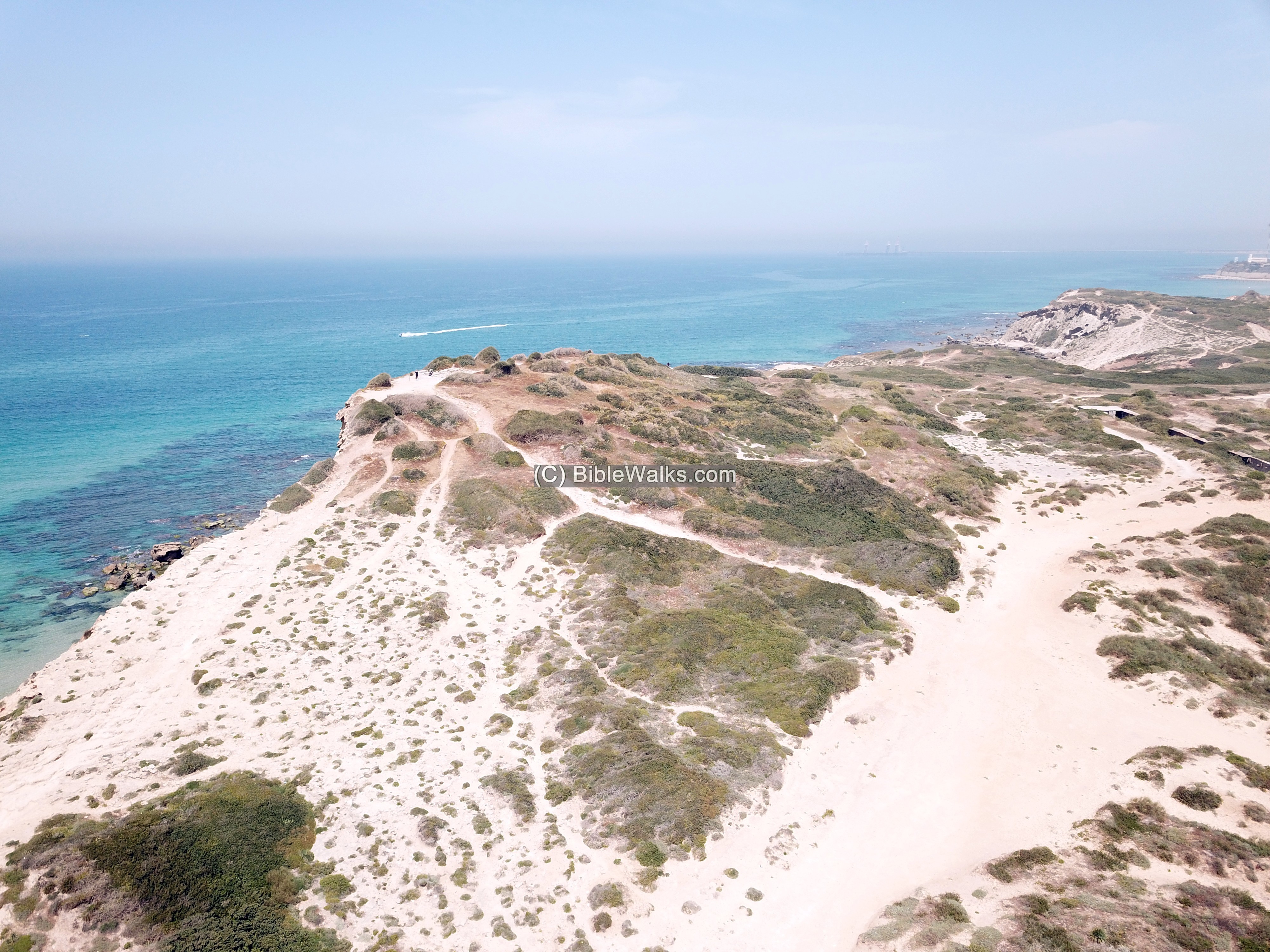
Sections of the cliff have fallen into the sea, cutting off the western part of the ancient site.
In the far background are the residential houses of Giv’at Olga, a western suburb of the city of Hadera.
A top view of the site:
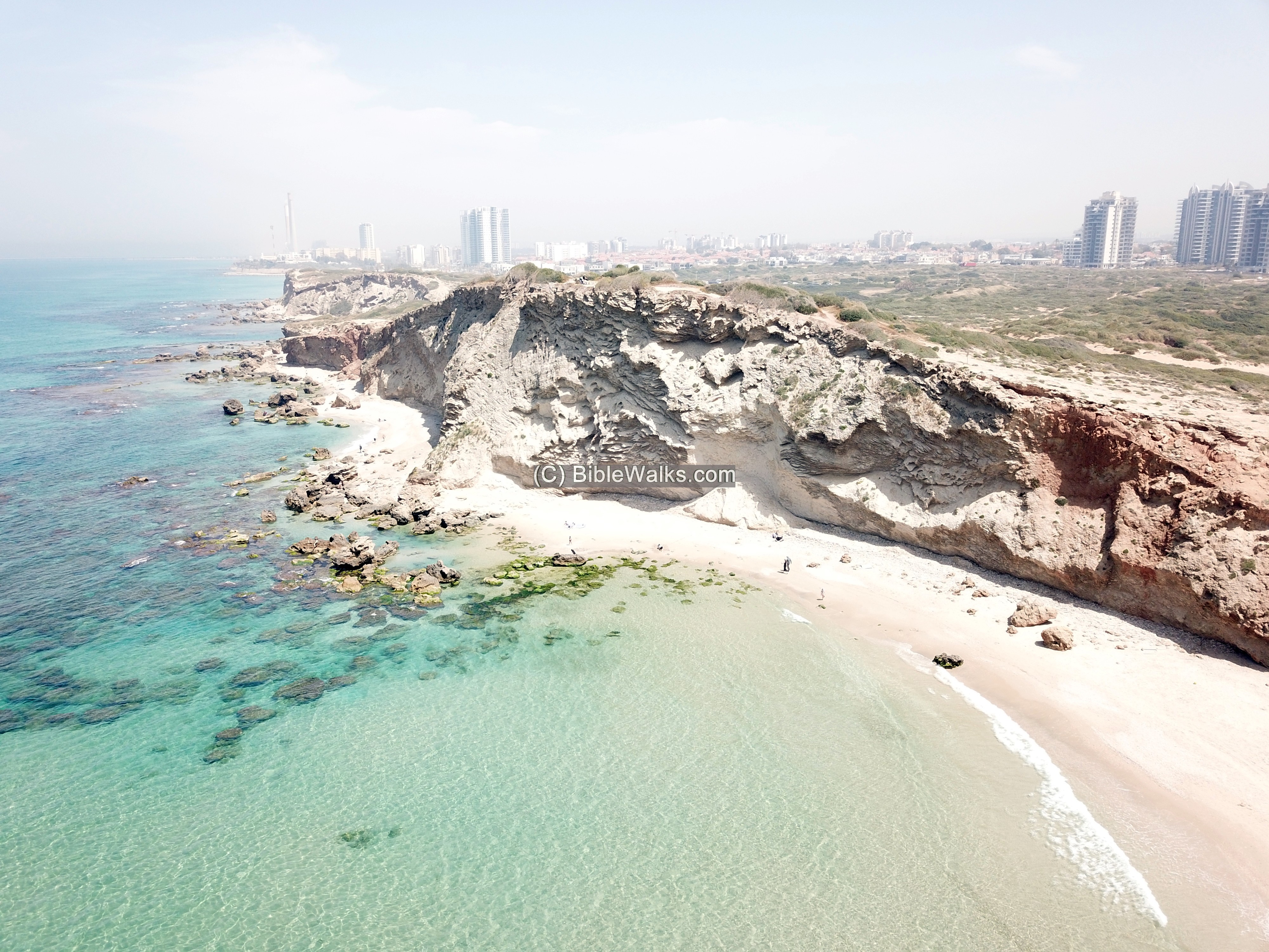
Another view from the north east:
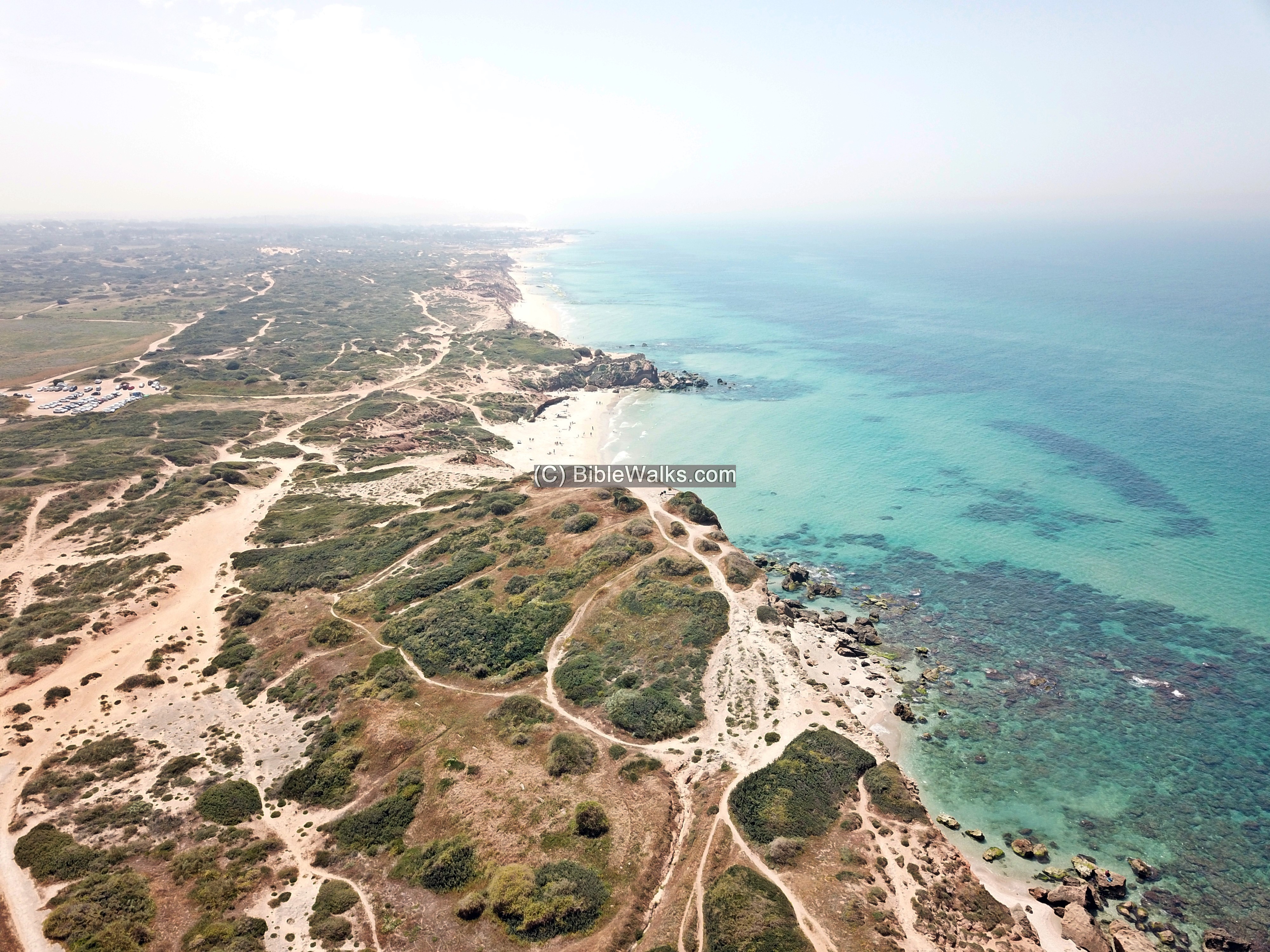
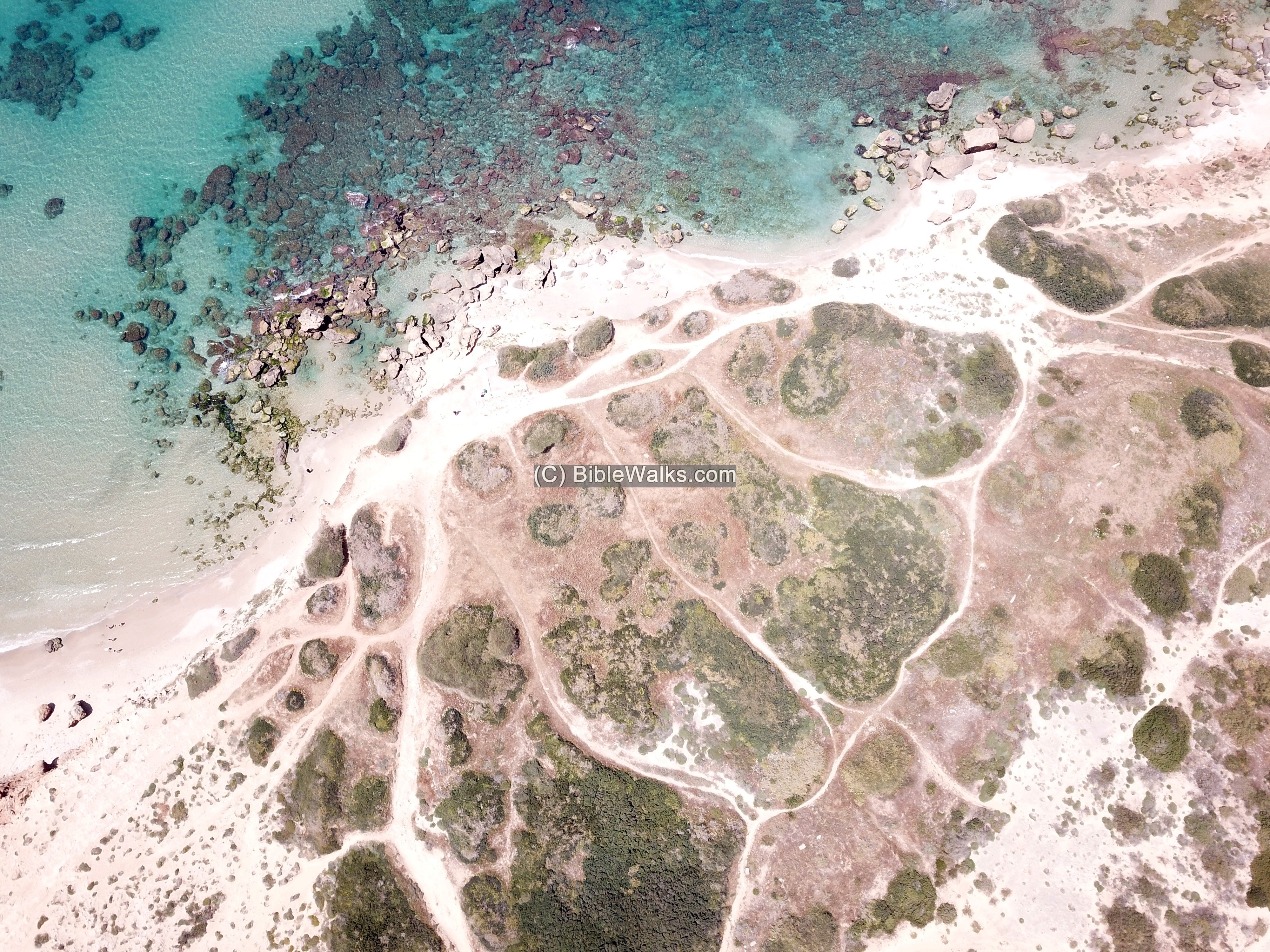
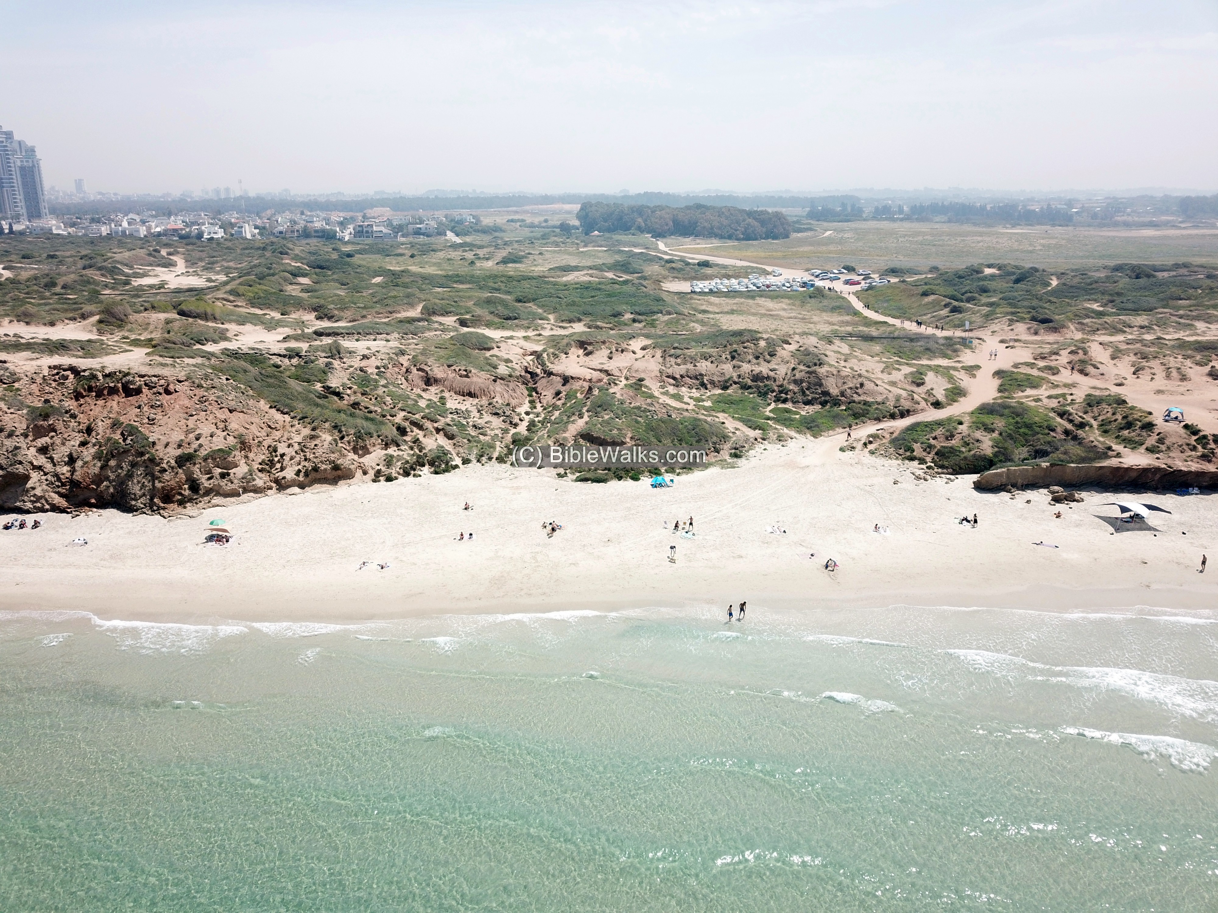
South of the hill is a public beach.
A closer view of the beach is next. The cars park in an area east of the beach.
![]() The following video shows a view of the site and its surroundings.
The following video shows a view of the site and its surroundings.
Another take of the drone flight over the site: https://youtu.be/y3Zn6XrGYUw
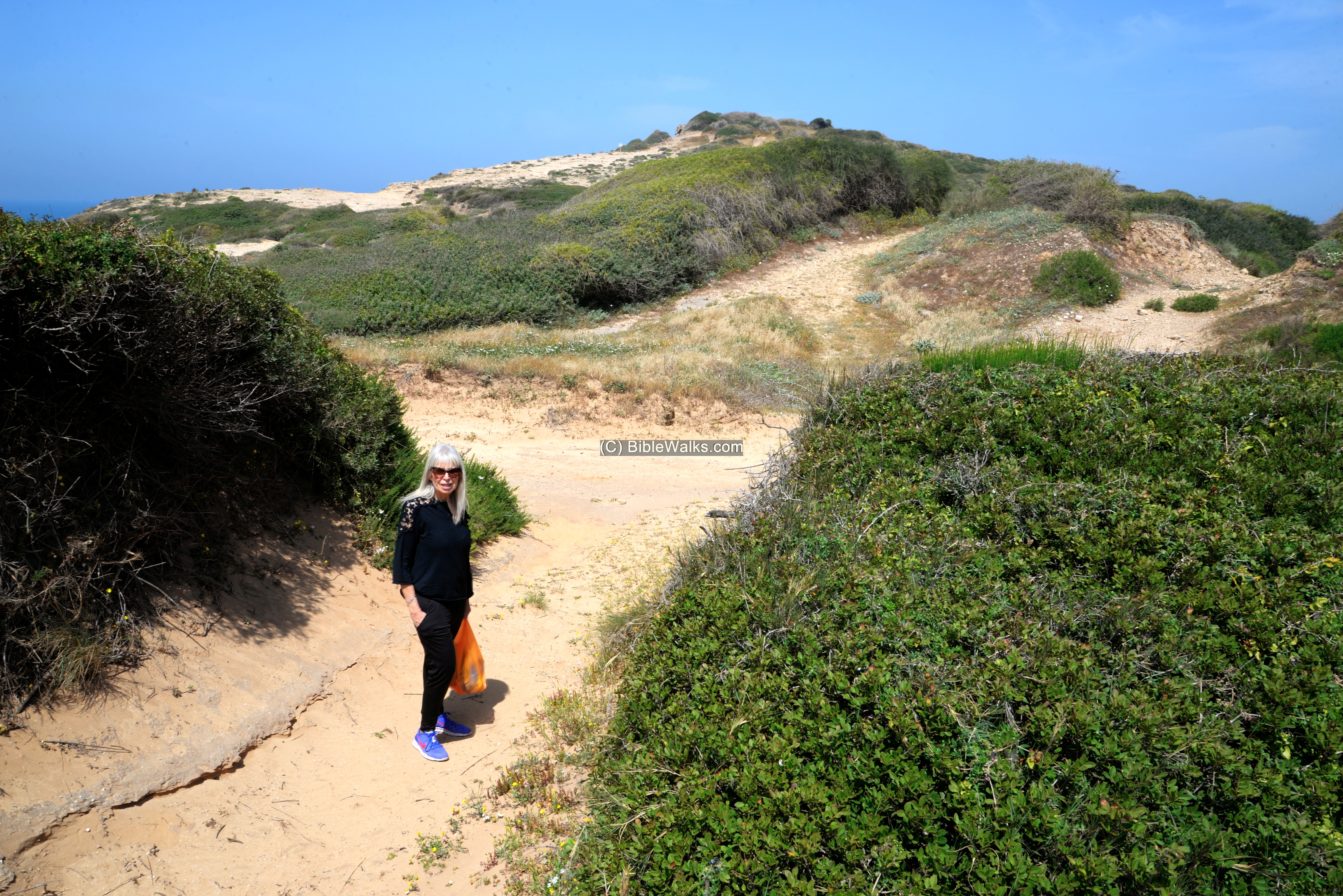
(b) Access to the site
From the parking lot is a trail that leads to the hill.
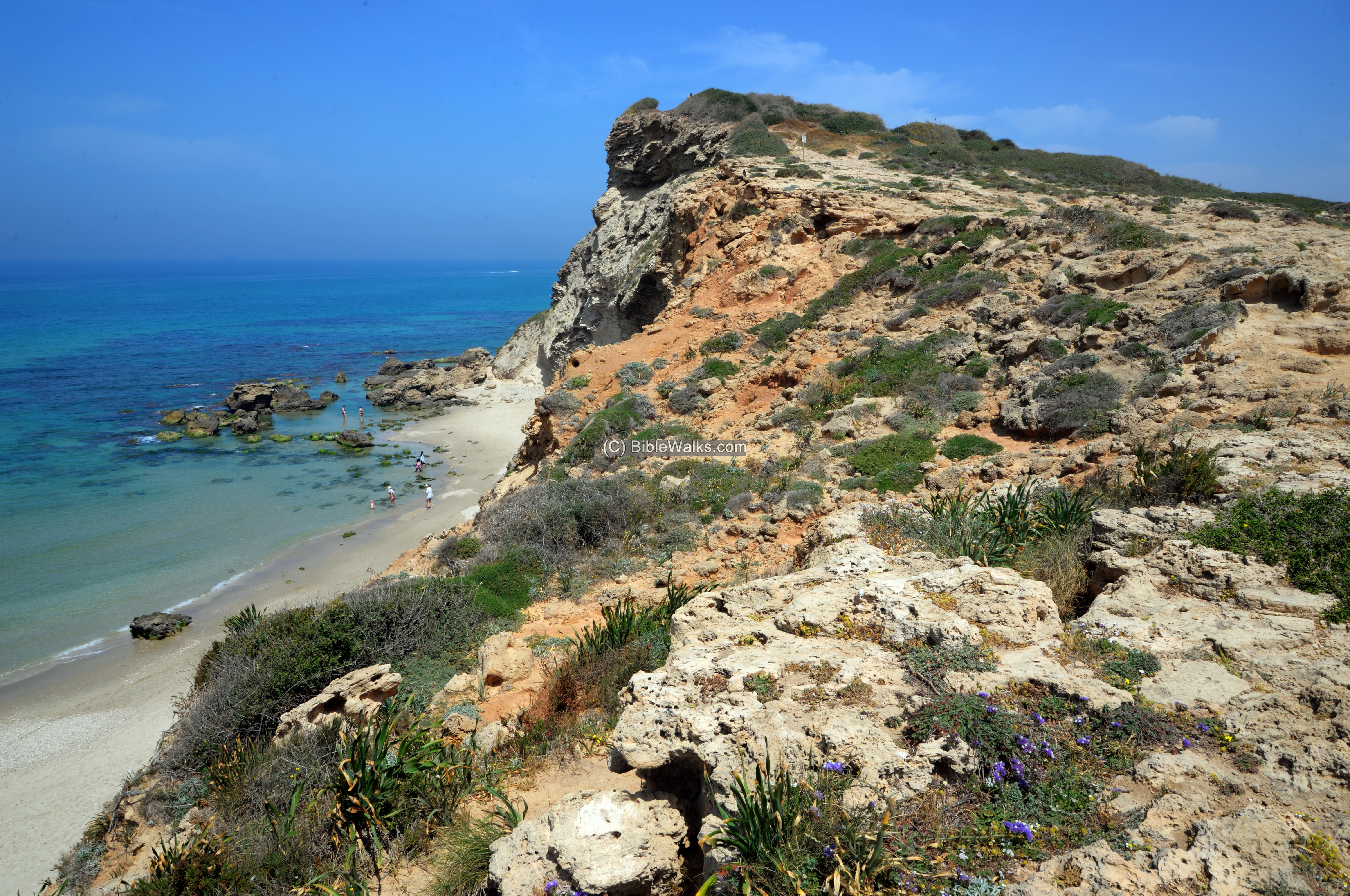
The site is situated on a high (33m) sandstone cliff overlooking a bay.
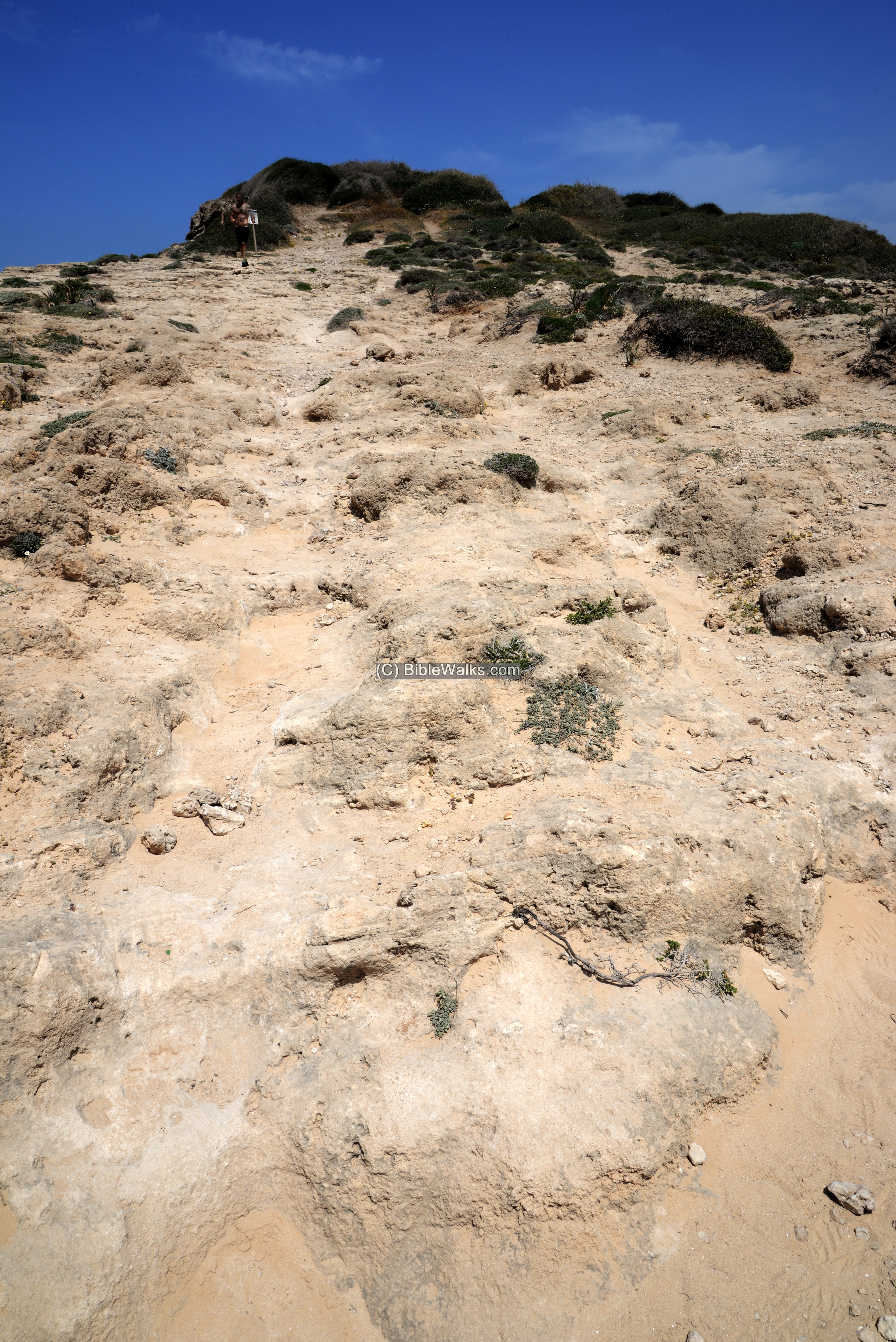
A trail leads up to the summit. Sections of the trail go along the surface of the sandstone rock.
(c) Summit
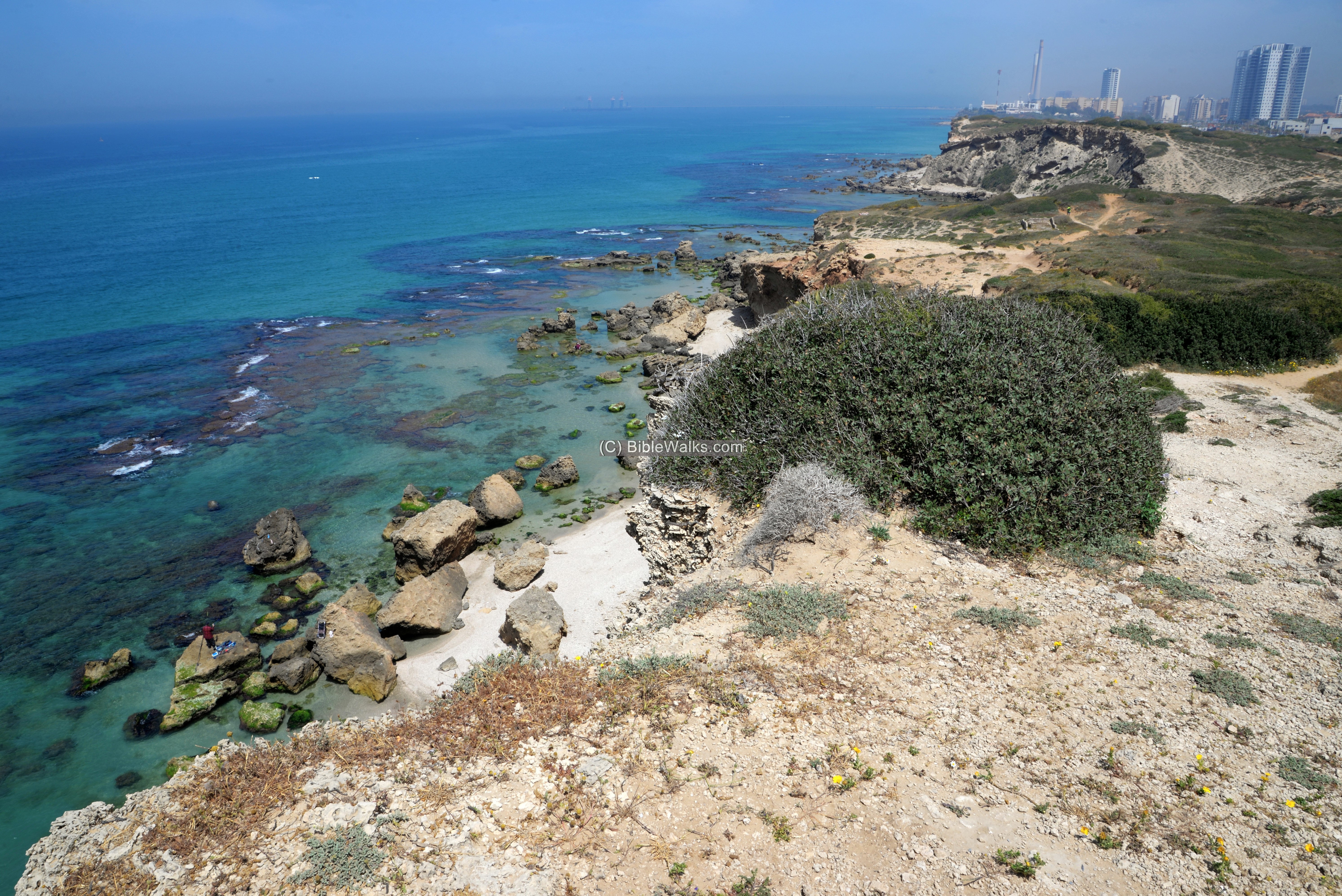
From the summit are great views around the area. The beach is seen here on this southern view.
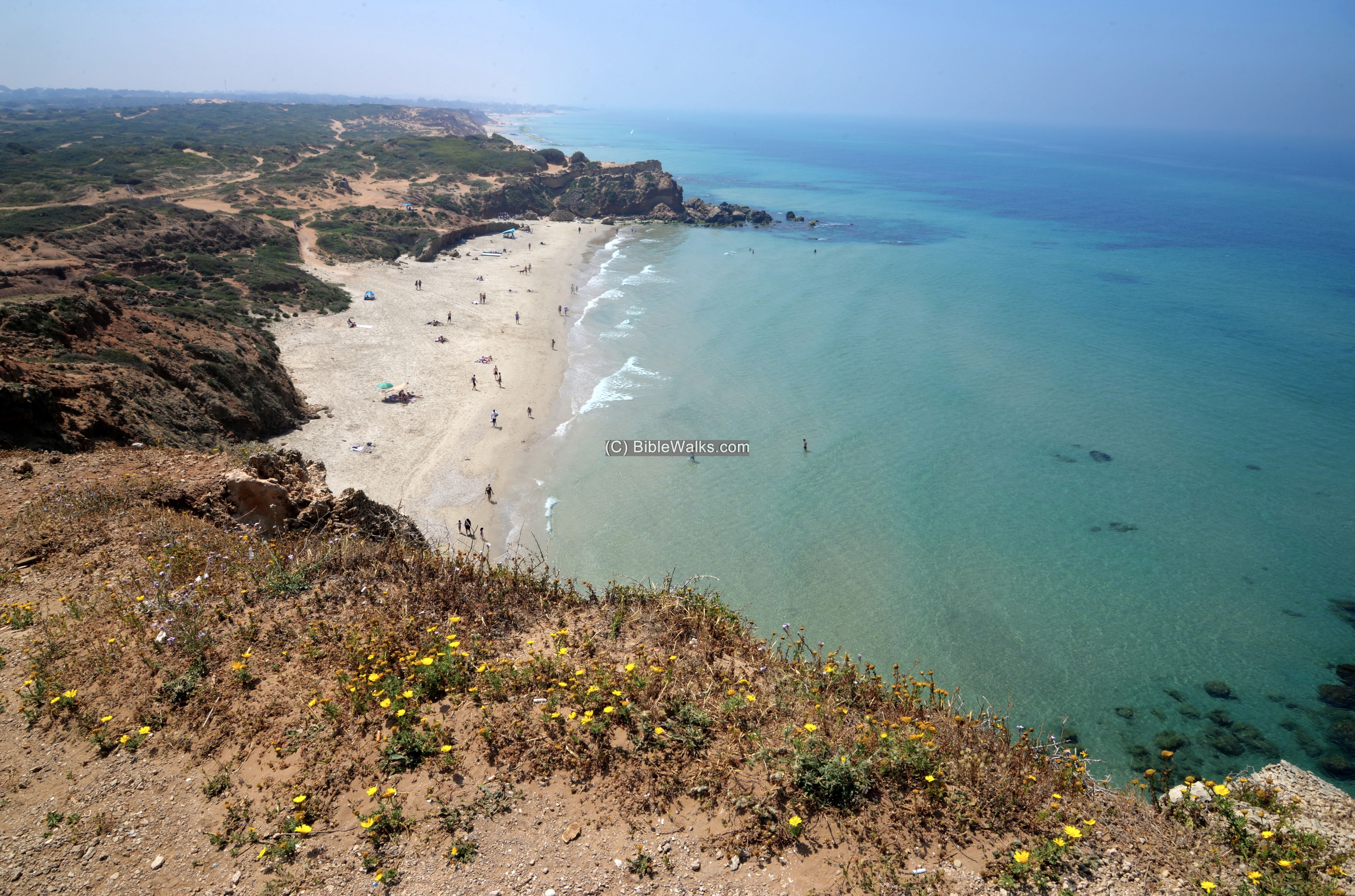
Sections of the cliff fell down to the sea, chopping away the western side of the site.
Take care not to approach to the edge of the cliff.
Close to the edge of the top of the cliff is a base of a small rectangular tower, with 0.8m wide walls, made of Kurkar sandstone hewn stones.
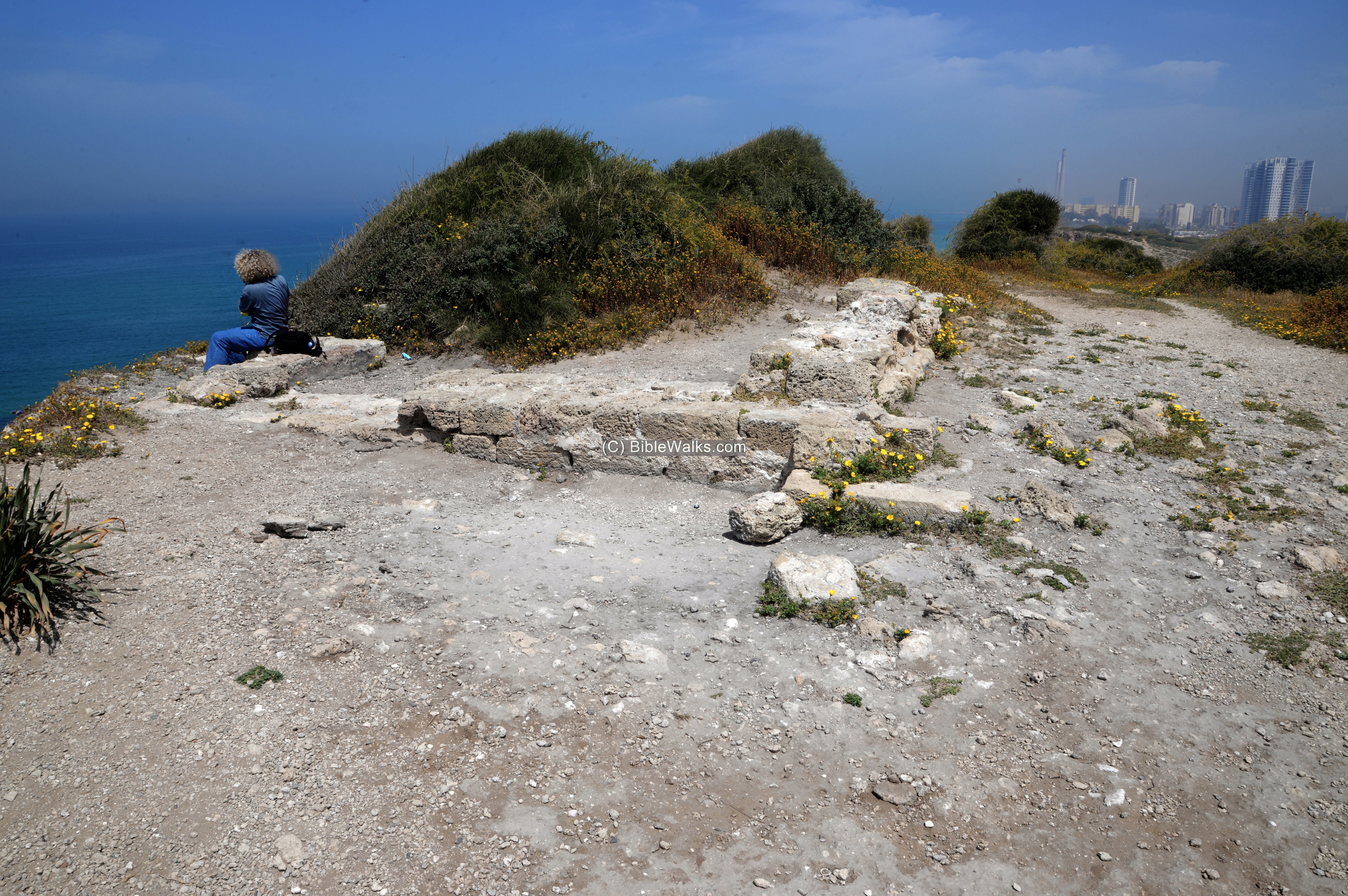
Dated to the 6th-8th century AD, later re-plastered at the 9th-10th century, it may have been one of the coastal fortresses and observation towers that were constructed by the Omayyad rulers.
(d) Views
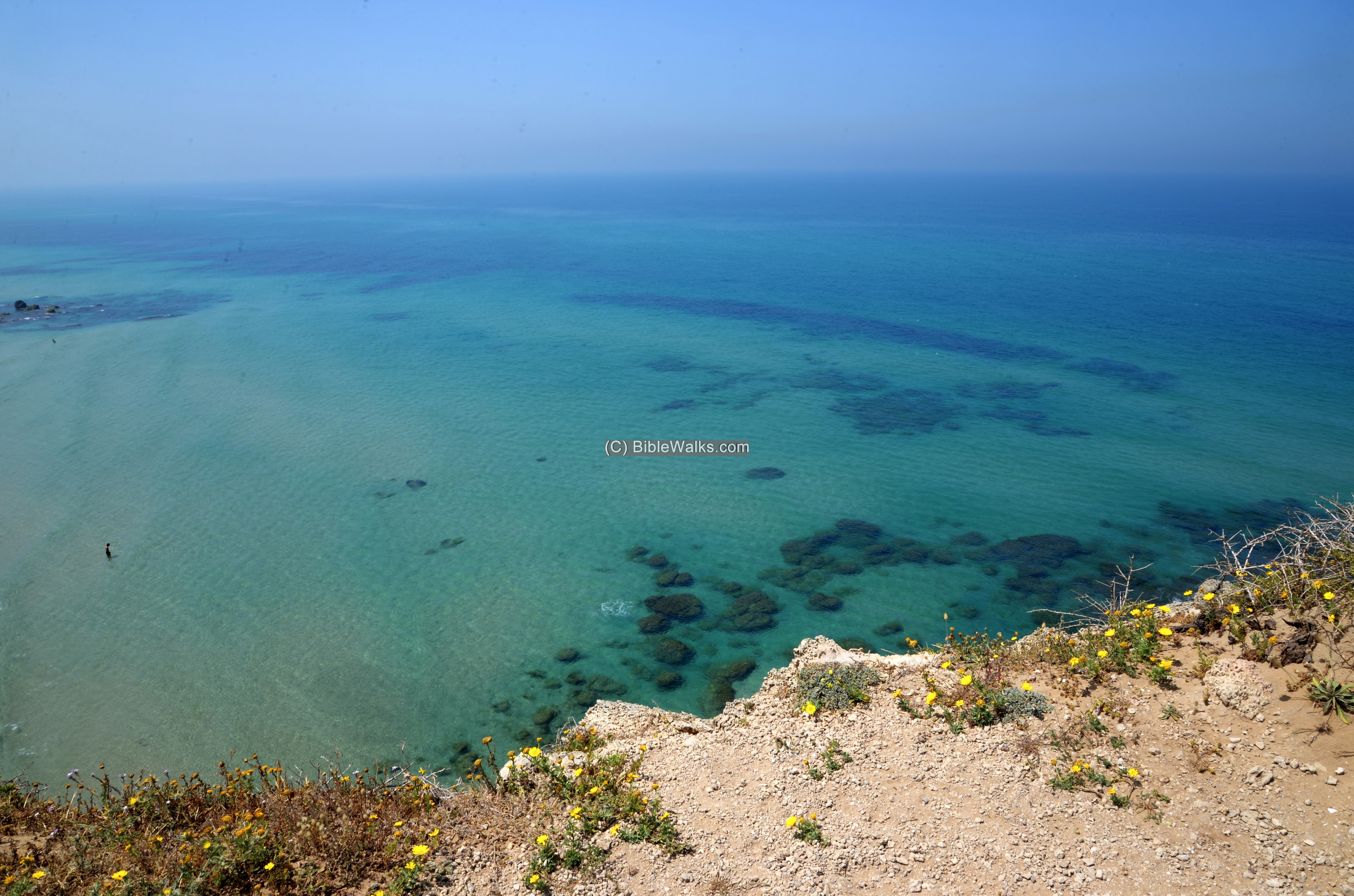
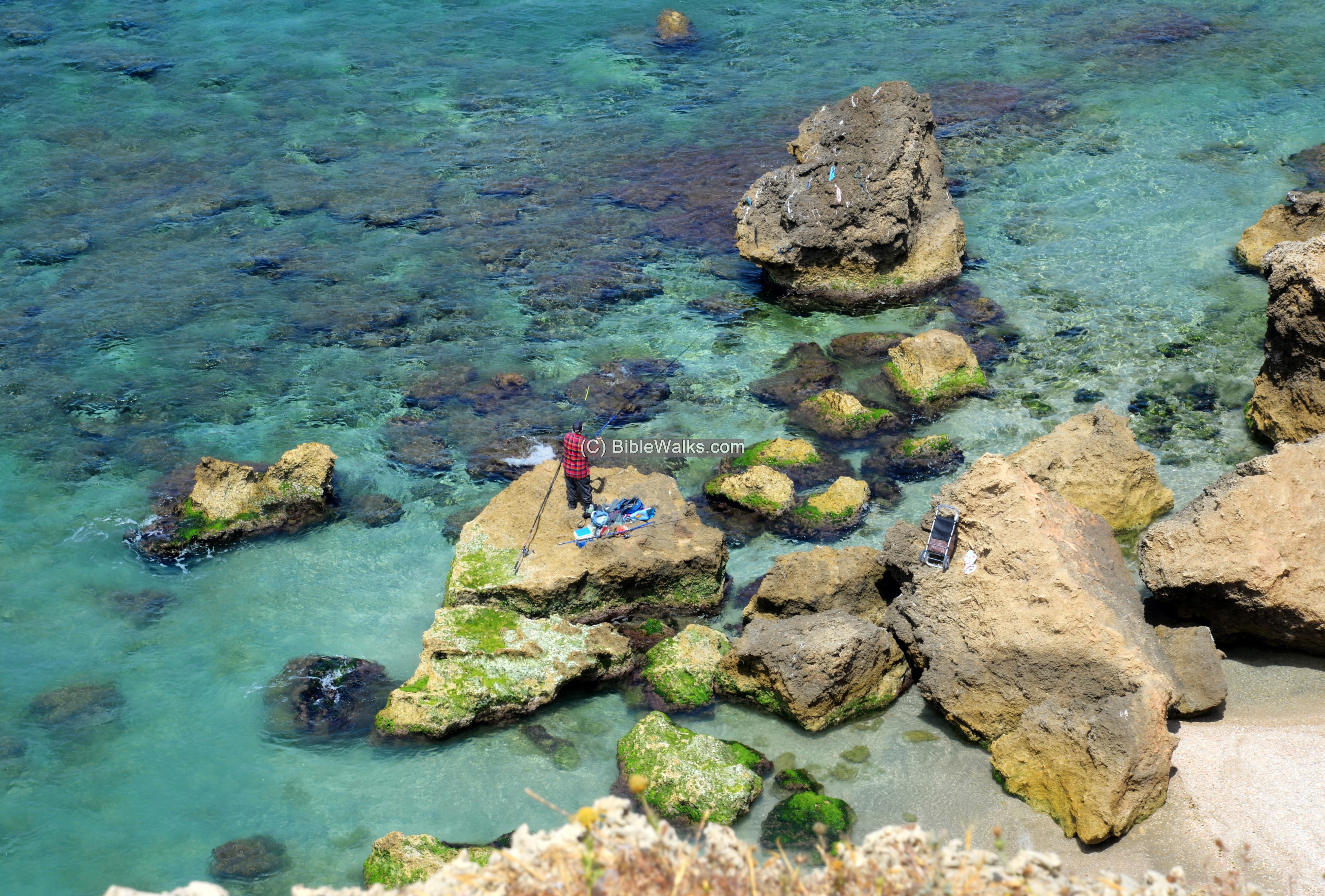
View to the sea: A fisherman stands over one of the rocks at the bottom of the cliff.
The next view is farther towards the north:
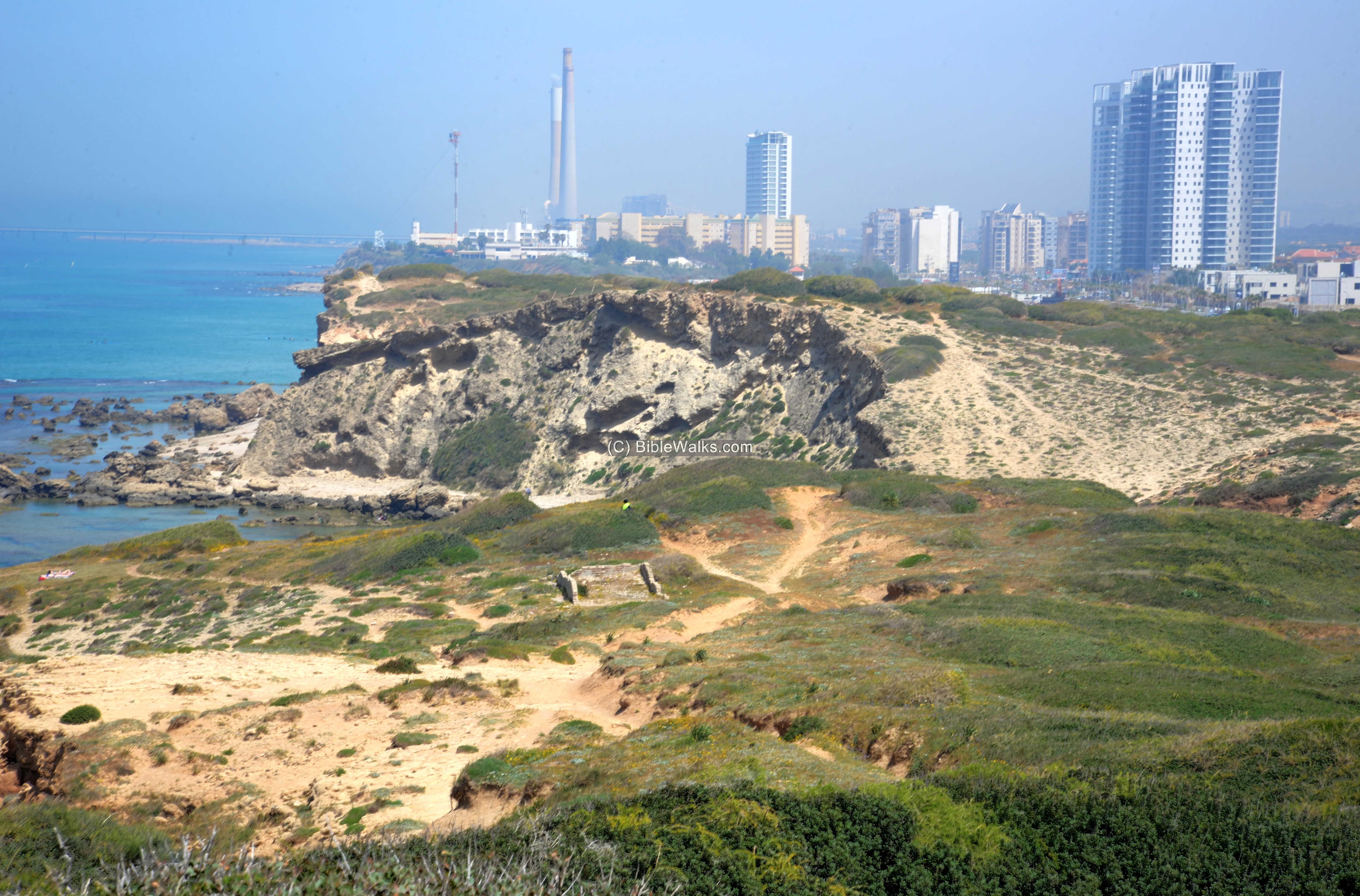
Yet another view of the north is in the next photo. The residential neighborhood of Giv’at Olga is located nearby.
In the far background is the Hadera power station (“Orot Rabin”), with its tall chimneys. The power station, Israel’s largest, was built on the northern bank of Nahal Hadera river, south of Caesarea. It started as a coal based power station. A long pier stretches from the plant into the sea where the coal is loaded from boats. It then was converted to gas, as a rich natural gas field was found in the sea near by.
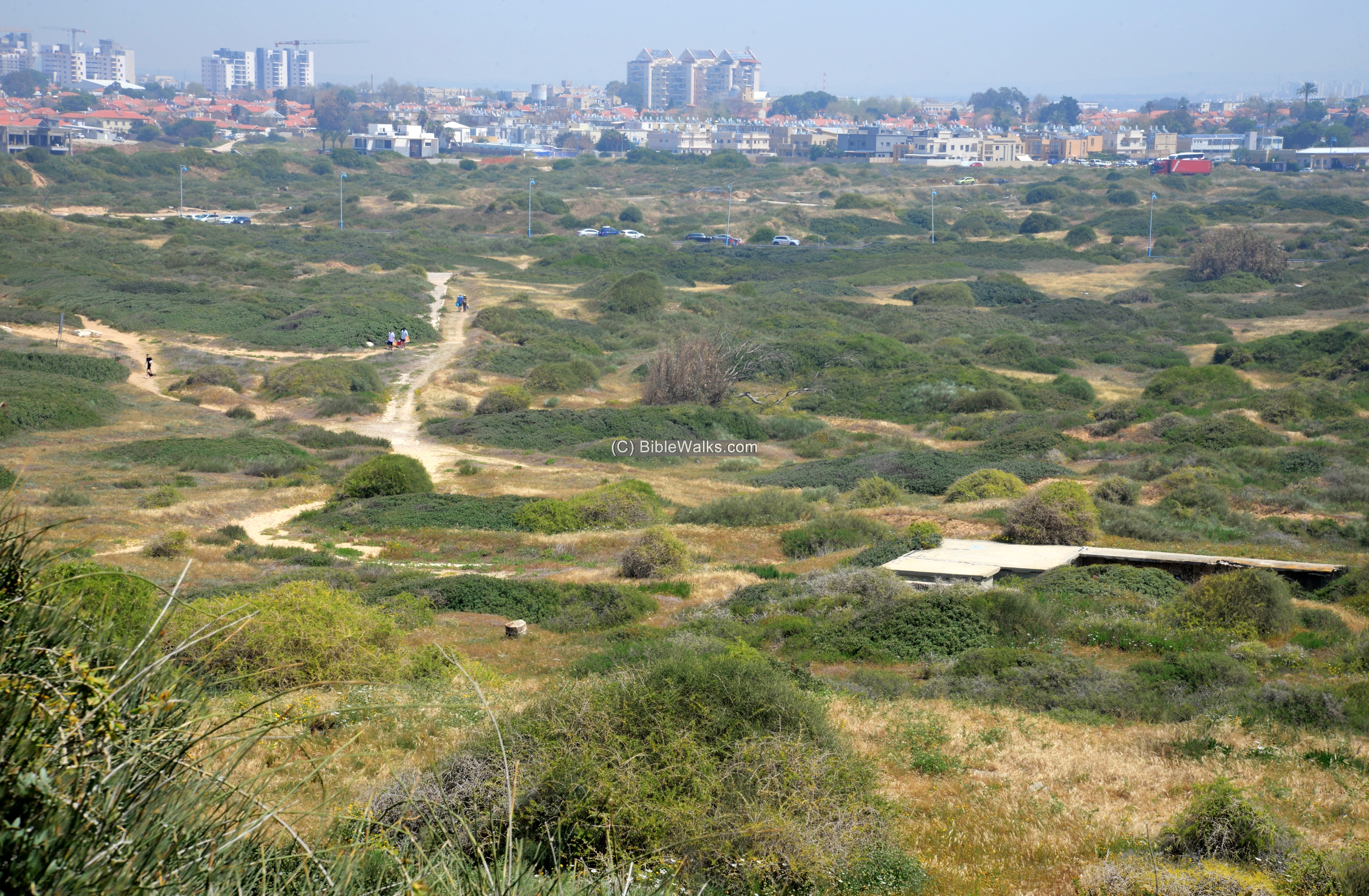
A view towards the east is below. As seen, some come here by foot from the street at the southern edge of the town.
The building at the foot of the hill, as well as protecting sand walls around it, were built during WWII by the British serving as a shooting range. It was later in use by the IDF army, but has been abandoned long ago.
(e) Beach
A public beach is located on the south side of the cliff.
The common name of the bay is the “Chinese bay”, named after Jewish immigrants that fled post war Europe in the 1940s to a temporary shelter in Shanghai, China. They eventually settled in Giv’at Olga, and used to assemble and swim in the bay.
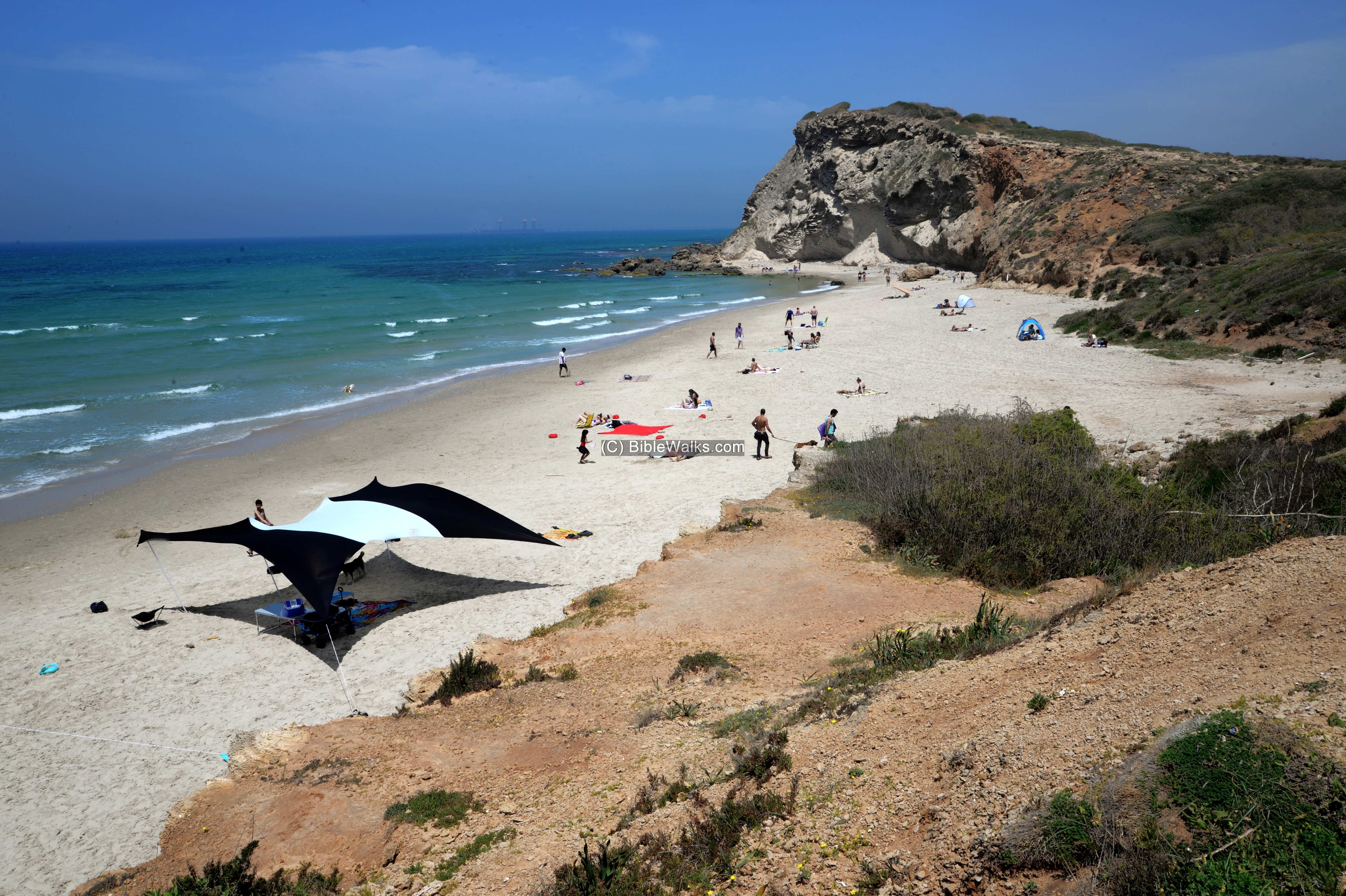
The white sand, the shallow bay, and the imposing cliff, make it ideal for fun and relaxation.
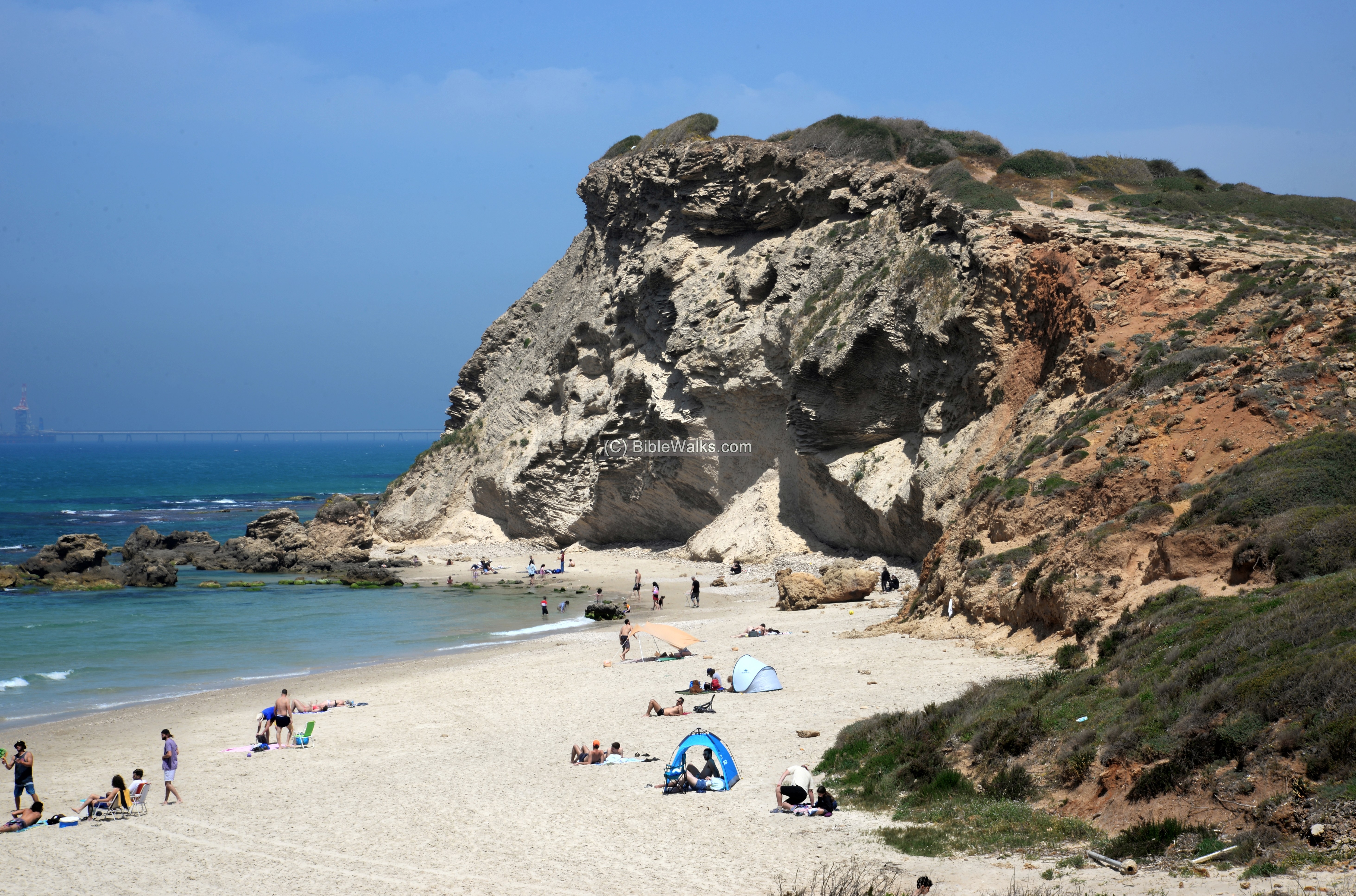
The bay is bounded by a smaller sandstone cliff on the south side.
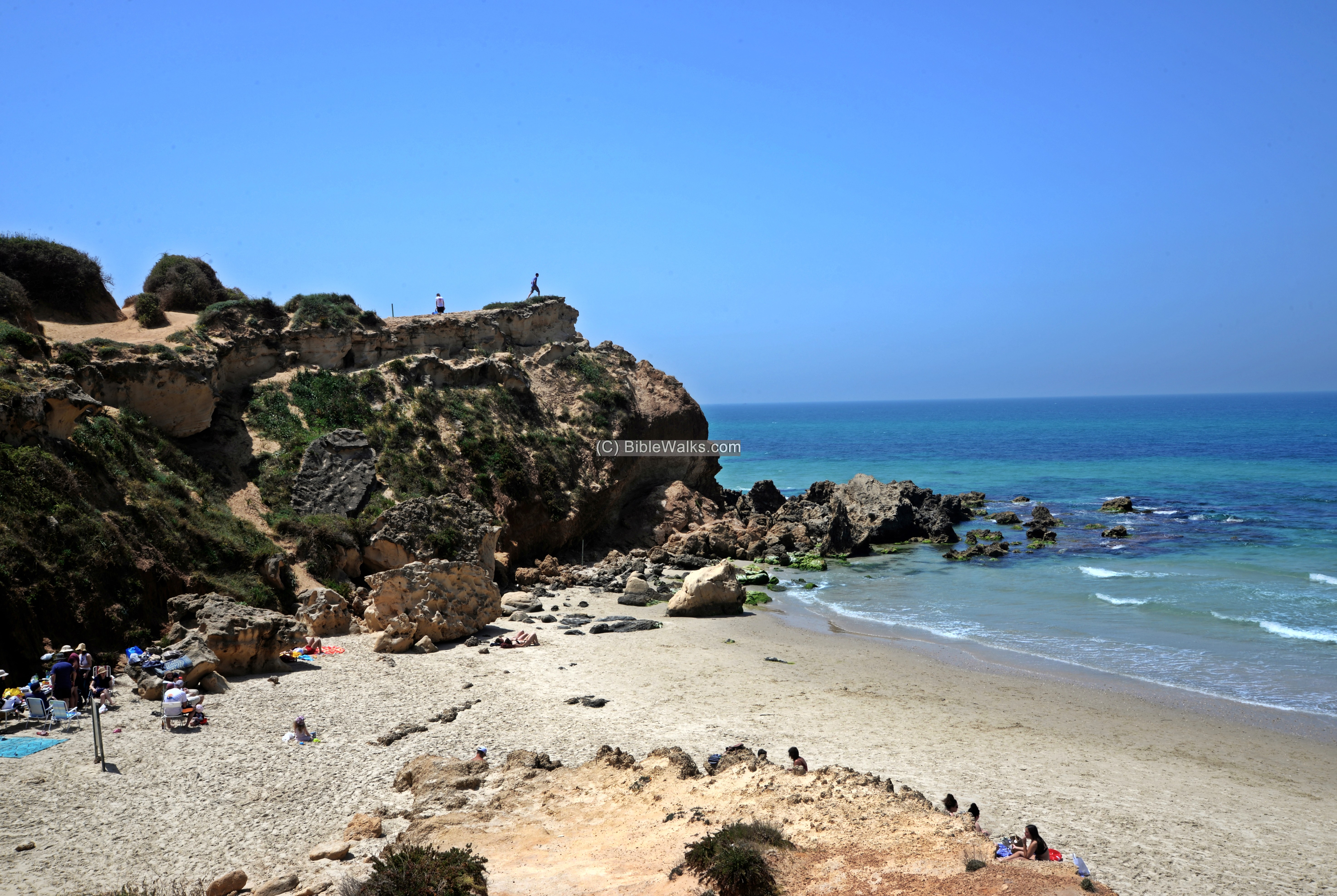
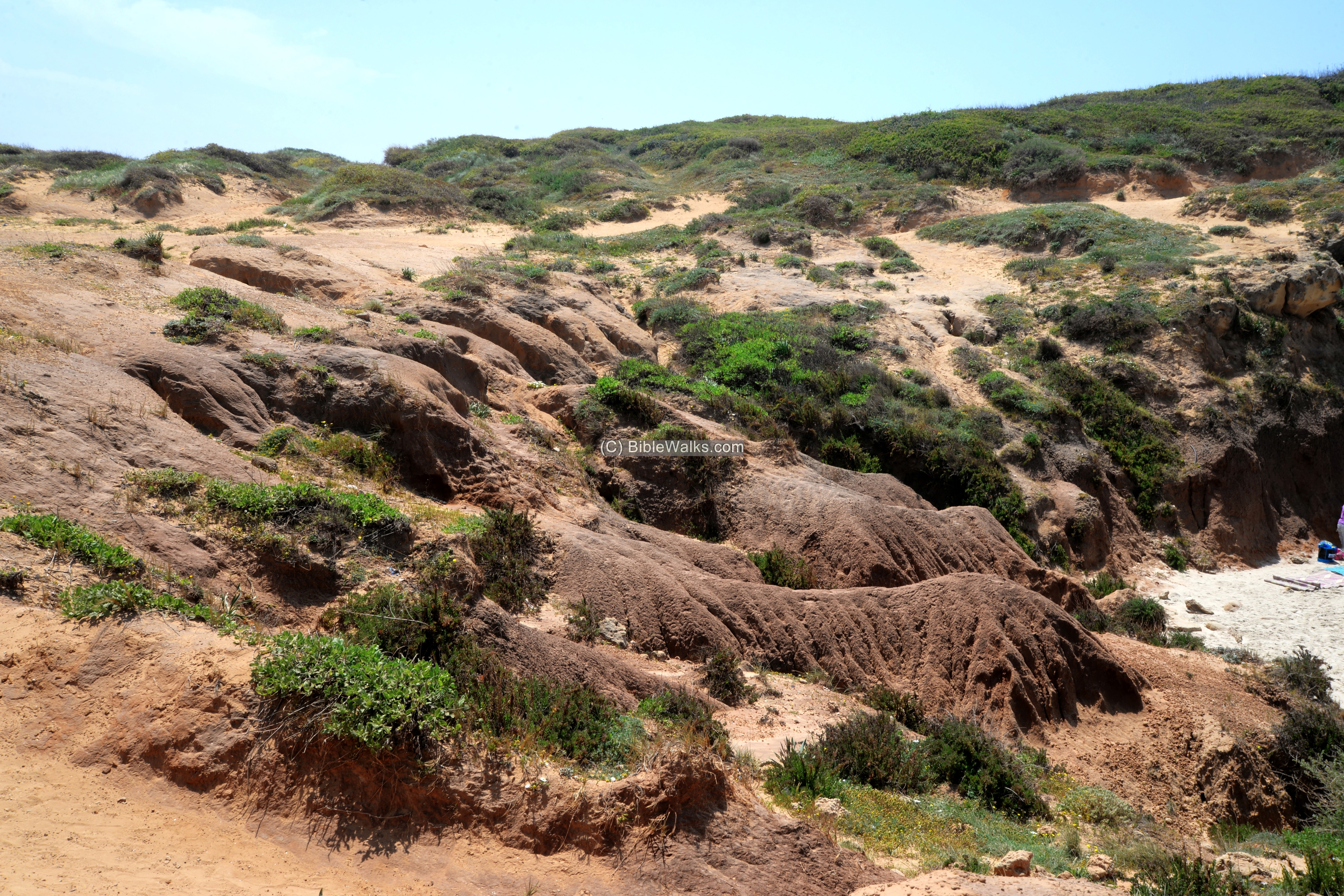
Below – A picturesque view of the ground area near the southern cliff.
This hillside is made of sand and Hamra (loam), and was carved by the waters and wind.
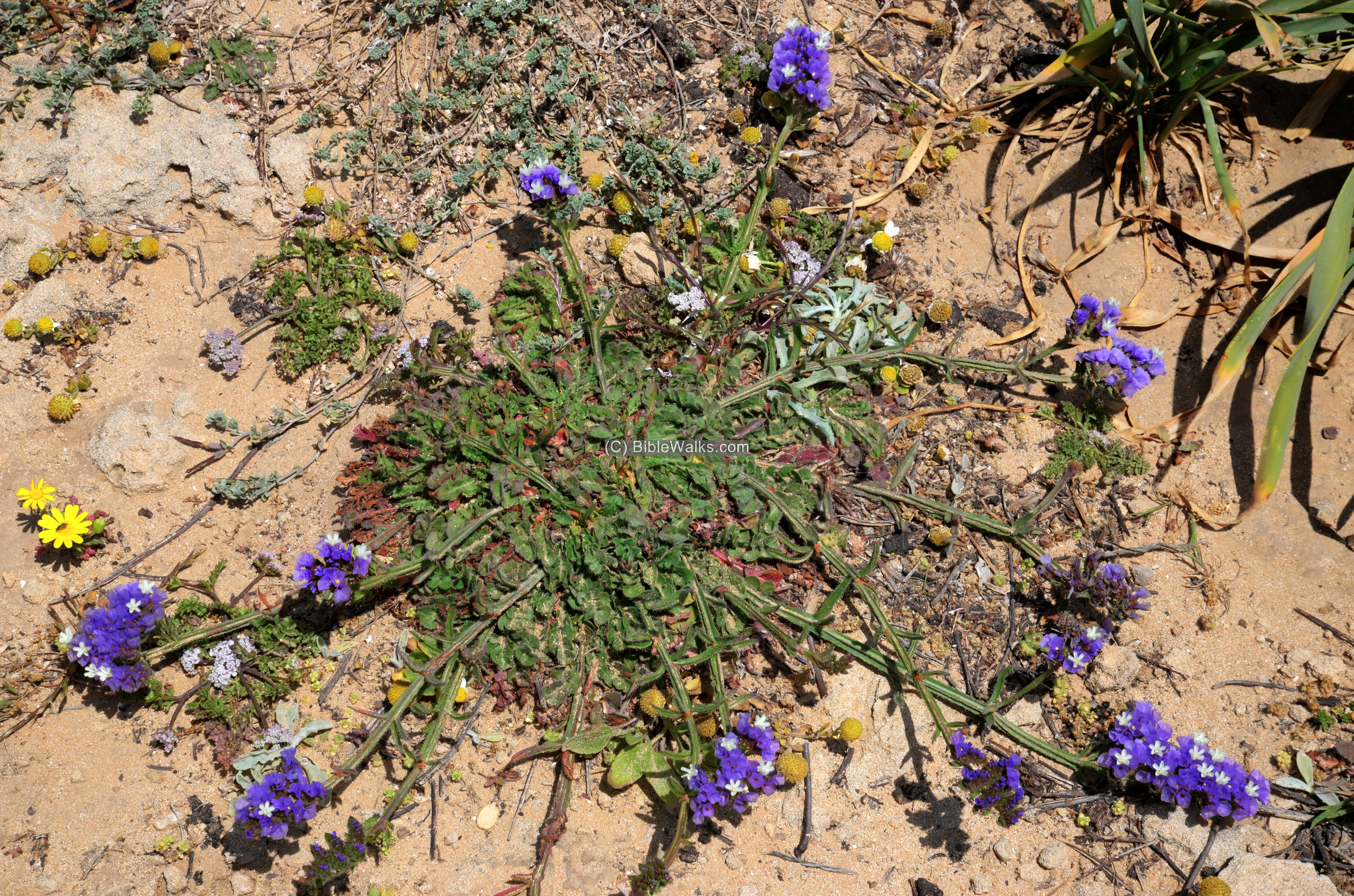
(f) Nature
The Cut Leaf Sea lavender (Latin: Limonium sinuatum, Hebrew: Adad Kakhol) are common wild flowers along the beaches. They flower during the late winter to the early summer with colors ranging from purple to deep blue.
The name Ad-Ad means ‘ever lasting’, due to the papery nature of their flowers.
Etymology (behind the name):
* Names of the site and vicinity:
- Gador, Gedor – Based on the name of a Roman period Jewish village – “Ugdor”. This village is mentioned in the Gmara (Talmud Yerushalmi, Avoda Zara 5:4). Its wine was prohibited for ritual wine as it was located near Kefar-Pigsha – a Samaritan village. Hebrew: “יינה של אוגדור למה הוא אסור מפני כפר פגש”
- Tell el Akhdar – Arabic name of the hill – “the green mound”
- Tell esh Sheikh Zraq – name appearing on the British map.
- Nahr Mefjir – Arabic name of Nahal Hadera river, meaning (PEF): “The river of the gushing stream or outlet”.
Links and References:
* Archaeology:
- Arch. survey of Israel – Tel Gador – map 52 site 10
- Arch. survey of Israel – Shipwreck in the bay, Byzantine period – map 52 site 41
- Tel Gador – HESI Volume 130 2018 – survey of the tower
* Internal:
- Drone Aerial views – collection of Biblical sites from the air
- BibleWalks Youtube channel – Join!
- Wild flowers in the Holy Land
BibleWalks.com – along the shores of the Holy Land
Tel Michmoret<<–previous Sharon site—<<< All Sites>>>—next Sharon site—>>> Tel Esur
This page was last updated on May 8, 2021 (misc updates)
Sponsored links: