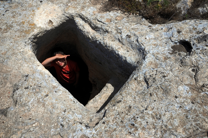
Traces of a Roman period settlement, with agriculture installations, cisterns and hiding complexes.
* Site of the Month Jan 2019 *
Home > Sites > Yizreel Valley > Horvat Qisi (Qattat/Qattonit?)
Contents:
Background
Location
History
Identification
Photos
* Aerial Views
* Above the surface
* Underground
Links
Etymology
Background:
In the ruins, which were not previously marked on the maps, are traces of a settlement, agriculture installations, cisterns, and hiding complexes. According to the survey and the existence of hiding complexes, the settlement was dated to the Roman period, one of the Galilean Jewish villages.
Horvat Qisi is located 1.5km north of Timrat. Perhaps, this site is related to the Timrat Sabbath stone.
Location:
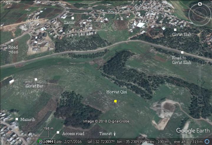
An aerial map of the site is shown here. Nearby neighborhoods (Zarzir, Mazarib, Giv’at Elah) are marked around it. The ruins of Horvat Qisi are scattered around the yellow point in the center of the map.
History:
-
Biblical times
The archaeologists, Z. Erlich and Y. Shivtiel, suggested the village Biblical name was Qattat (Joshua 15:10,19): “And the third lot came up for the children of Zebulun according to their families:… And Kattath, and Nahallal, and Shimron, and Idalah, and Bethlehem: twelve cities with their villages”. During the Roman period the village was renamed Qattonit, based on the Jerusalem Talmud (Megila page 2 , 2 1:1, Hebrew): “…and Qattat is Qattonit”.
-
Roman Period (1st century BC – 4th century AD)
According to the survey, this ruin was a Roman Jewish village. The hiding complexes, which are typical in the Galilee and Judea, imply it was a Jewish village. The villagers dug underground hiding complexes under their houses in order to prepare to the Roman onslaughts during the Bar Kokhba revolt of the second century and other rough times after then.
The archaeologists dated a probable destruction time of the settlement to the Galus Revolt (351 AD), which resulted in the destruction of major cities (Sepphoris, Tiberias, Lod) and numerous villages in the Galilee and the Shefela.
-
Modern Times
The site is in ruins, and most of the large stones have been robbed years ago. However, one of the hiding complexes offers an exiting experience to explore the Roman underground world.
The Sabbath marker and Horvat Qisi:
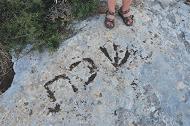
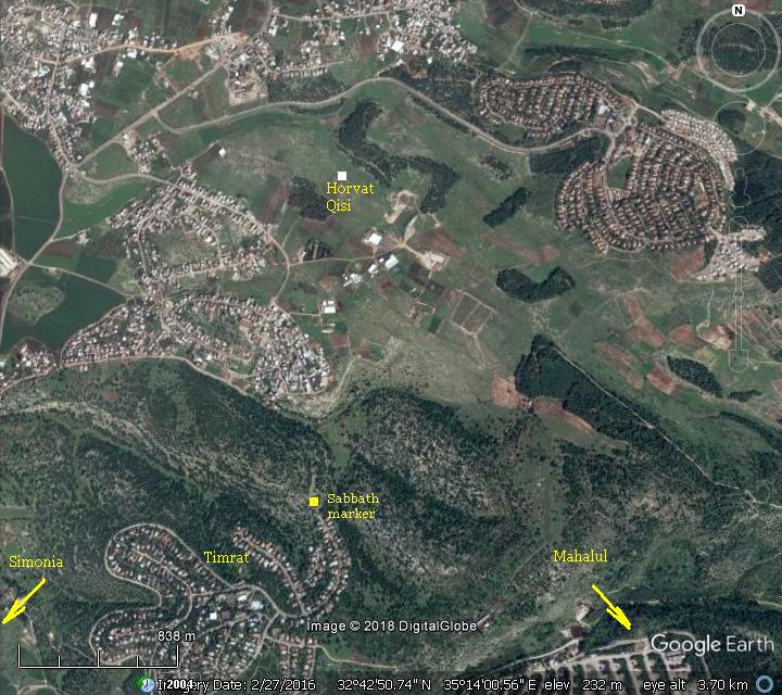
A Sabbath boundary marker found in the community of Timrat, 1km south of the site. The marking has 3 Hebrew letters (שבת – Hebrew for ‘Sabbath’), and was dated to the Roman period. A common knowledge of this marking was the Jewish custom of excluding work during Sabbath or Holidays, including traveling outside of the place of residence. This marking, at 2000 cubits (1km) from the site, may have been the reasons for this marking. The orientation of the marking was such that it was visible to a walker from Horvat Qisi towards the neighboring villages (Mahalul and/or Simonia).
Sabbath marker in Timrat (see review)
The following map shows the area north of the Sabbath marker stone. Horvat Qisi may have been the reason why the Sabbath marker was inscribed there.
Another theory of the Sabbath marking was a special exempt from the Sabbath city limit of 2000 cubits allows an extension of another 2000 cubits beyond the city limit. It is named Eruv Techumim – Hebrew for “mixed borders”. This exemption applies in cases two villages are within 4000 cubits, allowing walking between them after the Sabbath starts in Friday evening. The exemption is allowed by two options – (a) physically standing at the Sabbath boundary just before sundown when the Sabbath starts, then walking the extra distance, or (b) by placing food before sundown on a spot at the Sabbath boundary.
The “Eruv Techumim” exemption allows walking another 2000 cubits from that point to the neighboring village. Is this the case of the Sabbath marking in Timrat? According to this theory, the marker was in the middle between two villages to the north of the marker. Perhaps in this case – between Mahalul and/or Simonia on the south, and Horvat Qisi on the north.
Photos:
(a) Aerial views
A drone view of the site, oriented towards the west, is seen here. On the hill are scattered ruins, cisterns, stone cuttings and piles of stones.
Click on the photos to view in higher resolution…
Another view towards the south is below. The community of Timrat is seen in the background. This is where the Sabbath stone was found, probably on the path from Horvat Qisi to the southern Roman villages.
The next drone view is towards east. The community of Giv’at Elah is seen in the far background.
(b) Above the surface
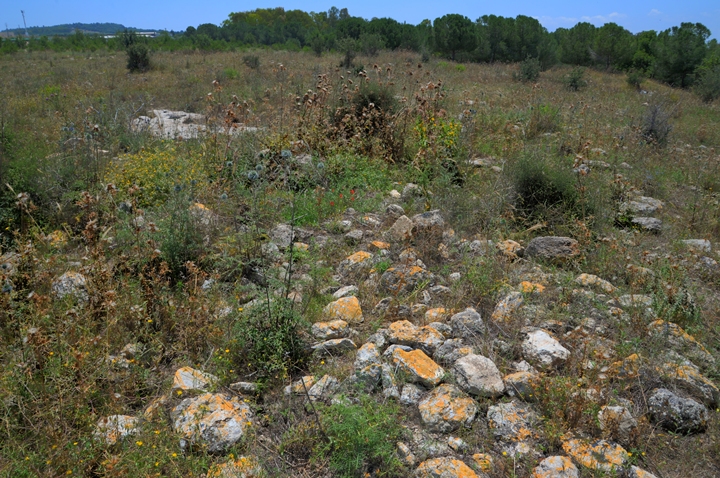
On the surface, there are no special architectural elements seen around. Only piles of stones and some traces of structures. Compared to other Roman period villages this site does not catch much attention. On most of the old survey maps it wasn’t even marked or named on the maps and old surveys.
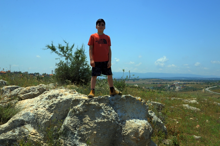
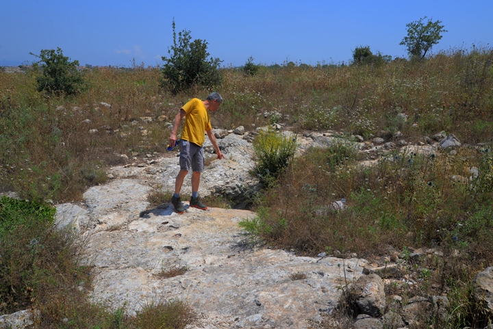
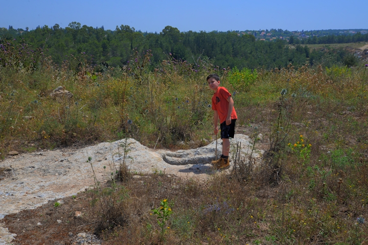
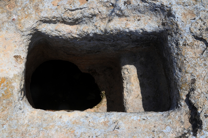
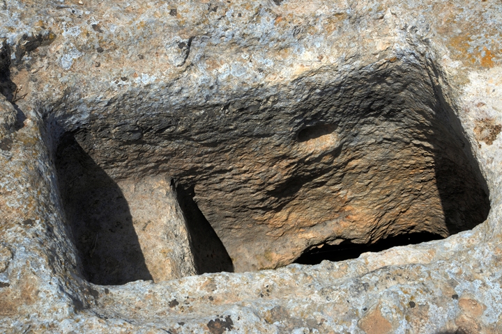
There are some rock hewn caves, rock cuttings, that could be seen on the hill and its footsteps. Here, Cousin Eyal – who joined us in the exploration of the site – stands above one of the rock cuttings on the north west side of the hill.
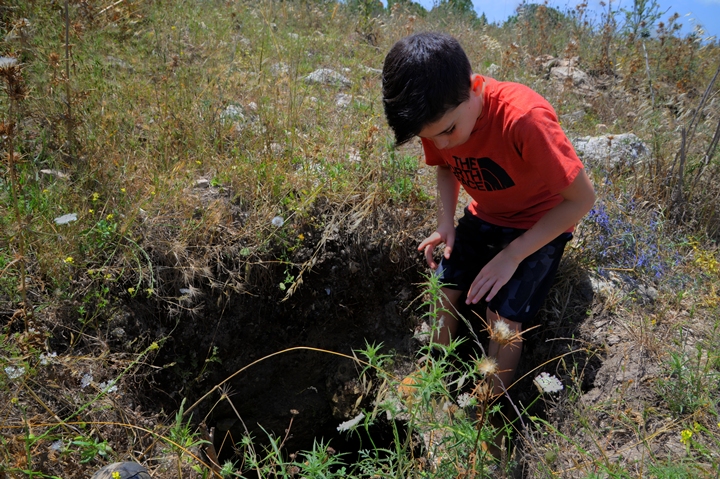
His father, Uncle Ofer, is from the nearby community of Timrat. Its their second time here on the hill. He points to the first underground complex that we crossed when walking from the nearby Arab village of Mazarib (a suburb of Zarzir).
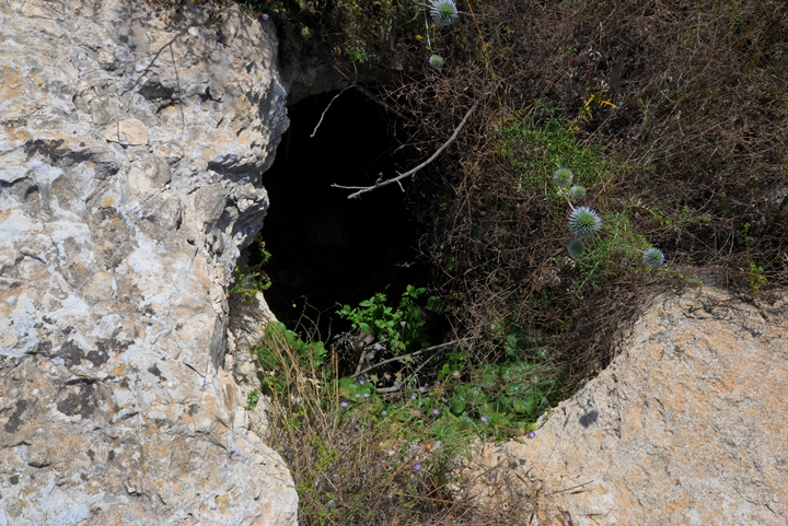
An entrance to this underground complex is nearby. Be careful not to fall into one of the many cisterns and openings on the hill.
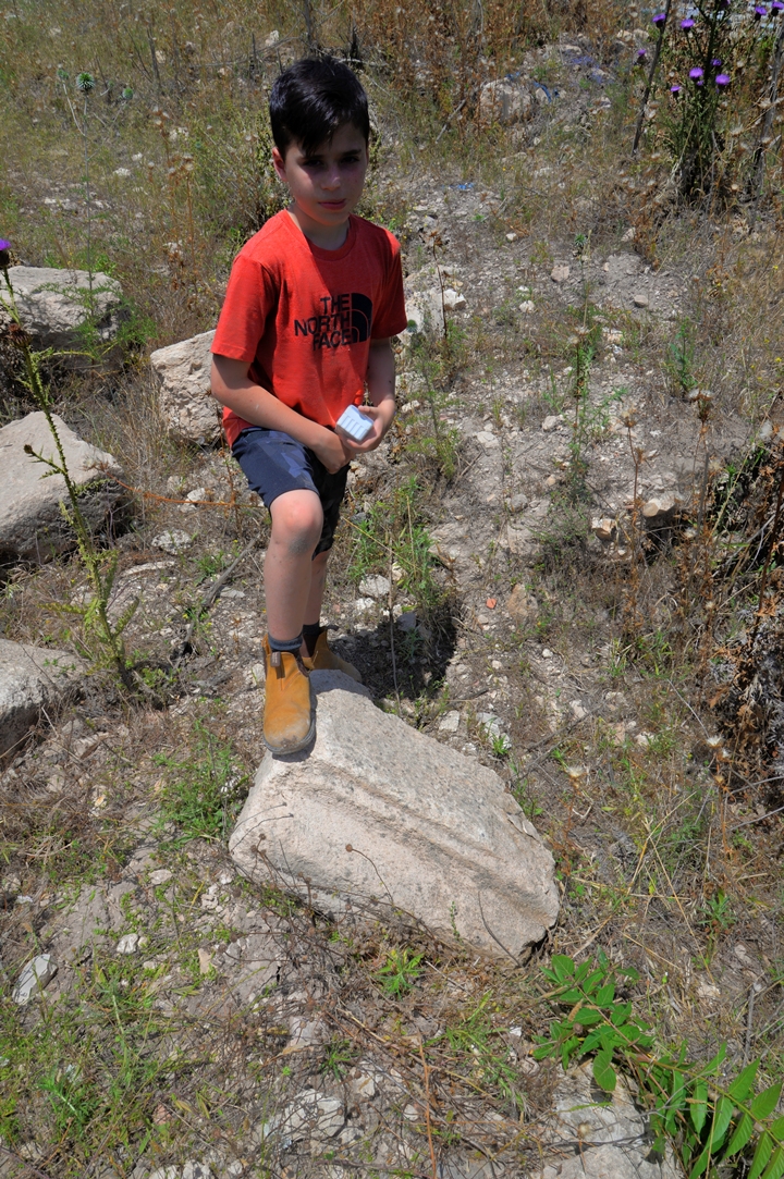
Eyal stands above one of the few carved stones that were found near the main underground complex.
All over the site are cisterns, installations, stone quarries, and caves.
(c) Underground world
The highlight of this site is the underground cavities, which were cut as a preparation for tough periods. The Land of Israel witnessed several major revolts, conquests, purges and harsh treatment from the authorities. To protect themselves, the residents resorted to preparing hiding places under their houses so “when push comes to shove” they could save their souls.
One of the underground complexes were thoroughly surveyed and documented by Z. Erlich and Y. Shivtiel.
This aerial view shows a top view above the entrance. Webmaster’s father, Yoram, sits on the edge of the visible flat rock surface, near one of the openings.
The following illustration shows a rough map of the underground complex, based on the survey. There are 7 large cavities (marked ‘A’ thru ‘G’), connected by corridors. Three entrances (marked ‘1’ thru ‘3’) allow entering into the complex and exploring some of it.
The following photos detail each of the underground rooms that we visited. You can press on each of the rooms in the illustration above to skip to the relevant section.
-
Room A
Room A is located on the western side of the underground complex. Its position is highlighted with yellow lines.
Entrance #1, which was probably the main entrance to room ‘A’, is one the north side. The opening is hidden behind a fig tree.
Viewed from the inside, the neatly hewn entrance has a double doorposts, with cavities on both sides for securing the door bolts.
The opening led into a square room (numbered ‘A’). Its size is 3.5m x 5.0m. It was once divided into 3 chambers, but at later period the walls between the chambers were removed.
Most of the room is covered by dirt and rocks, and so the full height of it is currently not visible.
On the western wall of room ‘A’ is a short corridor that turns and leads up to the surface, but it is blocked.
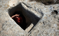
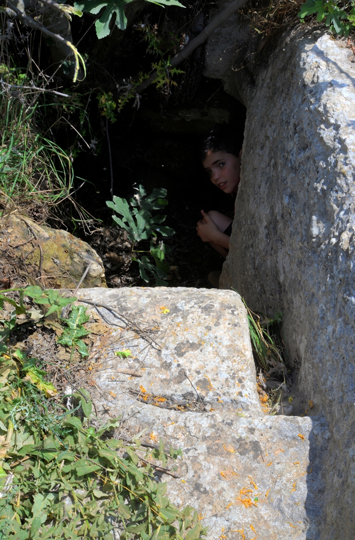
Entrance #2, located above the surface on the south side, allows an easier access to room ‘A’. It was probably a secondary entrance to the complex.
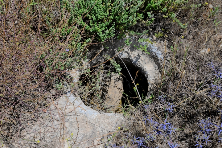
This rectangular opening has steps that leads down into a circular vertical shaft. The round shaft may have been originally an opening to a storage cistern, which was later reused to serve as a secondary opening. These bell shaped cisterns are of the the “Gibeon” type wine cellars, which are common in Judea and Samaria.
The opening is 0.55 x 0.95m, each step is 0.5m long and 0.35m wide, and the height between the steps is 0.5m.
On the east side of the opening is a round cavity that secured the door bolt.
Cousin Eyal stands above the surface of room ‘A’, telling us that this opening is an easier way in.
Indeed, climbing down the two step entrance is not difficult, even for father Yoram.
-
Room B
Room ‘B’ is located on the south west side of the underground complex. The area of the rectangular room is 1.95m x 3.65m, and its height is 1.32m.
Room ‘A’ leads to room ‘B’ through an opening on the southern wall. This opening is 1.3m high, 0.6m wide.
In the photo below – Uncle Ofer and his son Eyal are inside the room behind the opening.
Room ‘B’ was added to room ‘A’ at a later stage. It is quite dark – needs to open the flashlight to see what is going on.
Viewing the entrance from room ‘A’, you can see a hole for an oil lamp on the left side, and a cavity for the door bolt on the right side.
A small opening is on the western wall, leading to a narrow corridor.
The corridor was cut towards the west, at an average height of 0.4m.
The corridor’s length is only 2.67m, and is blocked at its end. Apparently, its construction was stopped in the middle of the work.
-
Room ‘C’
From room ‘A’ there is an opening on its south eastern wall corridor. It leads east into room ‘C’, with an area of 3.0m by 3.0m and an height of 1.5m.
In the photo below, Uncle Ofer tries to crawl into the room from the eastern wall of ‘A’. However, the entrance was too small for us to enter into it. We abandoned trying to crawl into it, and moved on to the next room.
-
Room D
We skipped Room D, which is connected to room C via a short tunnel from the eastern wall of room C. Its size is larger – 5.0m x 5.0m.
-
Room E
This small circular room, which we also skipped, is 2.0m in diameter. It is accessed via two parallel tunnels that lead south from the eastern wall of room D. A hole in its ceiling is blocked by stone slabs.
-
Room G
Room ‘G’ is located on the north side of the underground complex. It has a rectangular shape, 5.0m by 4.0m. Two openings were added on its eastern side but are sealed, and another opening on the southern wall connects to an adjacent water cistern (‘F’).
This room served for storage, and was part of the hiding complex which was built at a later stage than the adjacent water cistern, and connected rooms D-F-G together to form a larger space for the family in hiding.
The access to room ‘G’ either from room ‘F’, or thru an opening (‘3’) on its north side. Below, Eyal looks down into the opening, judging how to climb down into it.
The opening from down under is seen in the following photo.
A view of the two blocked corridors on its eastern wall are seen below.
-
Room F
Room ‘F’, which was an ancient bell shaped cistern, is covered by plaster that was used to preserved the waters. Its opening on the surface is blocked by a stone.
The diameter of the cistern is 4.5m, it is 2.5m high, with an additional 1m height of the cistern’s neck towards the opening on the surface.
Both Ofer and Eyal managed to enter into the cistern from room ‘G’.
According to the survey, the ceramics found inside the room are typical Roman – end of 3rd century to beginning of the 4th century.
Finally, Eyal returns back from the adjacent room. It was indeed an exciting adventure down there! Needless to say, take precautions from loose rocks and crawling snakes.
Links and references:
* References:
-
Horvat Qisi – “Al Attar”, Vol. 19, 2016, pp 5-23 [Z. Erlich and Y. Shivtiel (Hebrew, pdf ]
* Internal:
-
Drone Aerial views – collection of Biblical sites from the air
- Hiding complexes – info page
Etymology (behind the name):
- Qisi – unknown Arabic name. (Identification?)
- Horvat – Hebrew for ruin (Khirbet in Arabic)
- Qattat, Kattath – A Biblical village, perhaps at the place of Horvat Qisi (Joshua 15:10,19): “And the third lot came up for the children of Zebulun according to their families:… And Kattath, and Nahallal, and Shimron, and Idalah, and Bethlehem: twelve cities with their villages”.
- Qattonit – the Biblical name changed to this name, as per the Jerusalem Talmud (Megila page 2 , 2 1:1, Hebrew): “…and Qattat is Qattonit”.
BibleWalks.com – exploring the ancient sites of Israel
Taibe in Galilee <<<—previous site—<<< All Sites>>>— next site—>>> Tel Rechesh
This page was last updated on May 20, 2023 (history correction)
Sponsored links:
