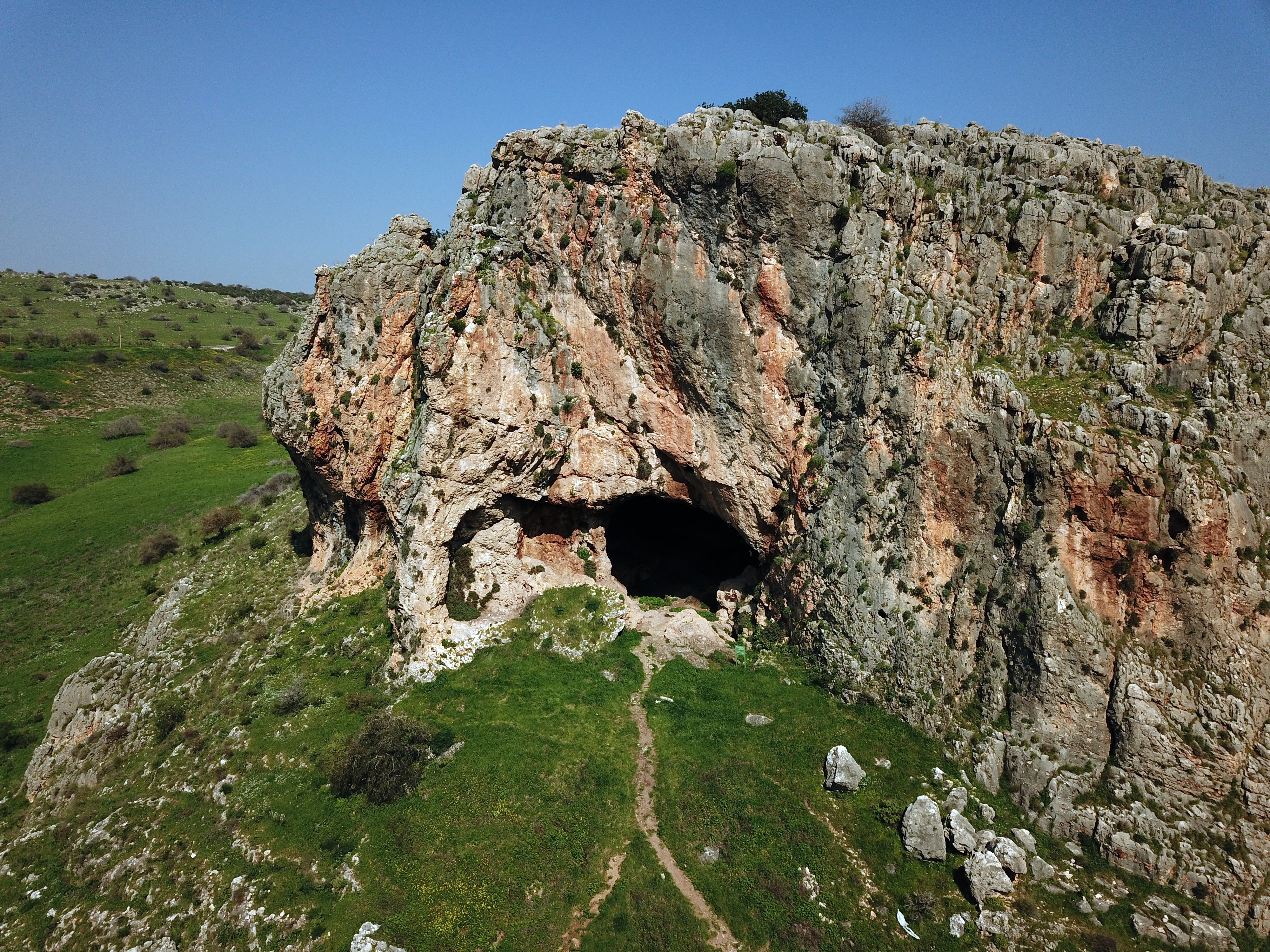
Skull (Zuttiyeh) cave where Early man remains were found.
 * Site of the Month July 2020 *
Home > Sites > Sea of Galilee> Skull Cave
Contents:
Overview
Aerial Map
History
Photos
Biblical References
Links
Etymology
Overview:
On top of a limestone cliff, above the lower Amud stream canyon, is the “Skull” cave. The cave is also known as Mugharet el-Zuttiyeh (Arabic: “Cave of the Robbers”).
In 1925 the archaeologists, headed by Francis Turville-Petre, unearthed a fossilized skull of a prehistoric Galilean man , dated to 200,000-300,000 years ago, at the end of the Lower Paleolithic period. The skull was the first fossilized archaic human found in Western Asia. The species is known as Homo Heidelbergensis, which had brains as large as modern humans, and is regarded as pre-Neonderthal.
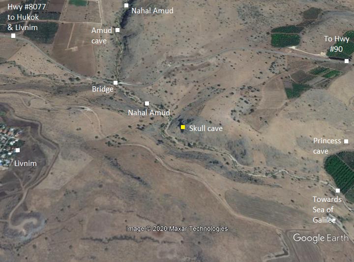
Map / Aerial View:
The cave is located on the top of the northern limestone cliff, along the lower Amud stream canyon. The Amud stream flows into the north west shore of the Sea of Galilee, north of Kibbutz Ginosar. The cave is located 800m from its outlet, marked here in yellow.
Two other prehistoric caves are located nearby – the Amud cave (1km upstream) and the Princess cave (near the outlet of Nahal amud).
History:
- Prehistoric periods – Early Man
The gorge of the lower Wadi Amud section was inhabited by the Early Man (Homo Heidelbergensis and Neanderthal species) who dwelt in the four caves in this area.
In 1925 the archaeologists, headed by Francis Turville-Petre, unearthed a fossilized skull of a prehistoric Galilean man , dated to 200,000-300,000 years ago, at the end of the Lower Paleolithic period. The skull was the first fossilized archaic human found in Western Asia. The species is known as Homo Heidelbergensis, which had brains as large as modern humans, and is regarded as pre-Neonderthal. The skull is kept in the Rockefeller museum in Jerusalem, and a cast is displayed in the Israel Museum.
Another nearby cave with prehistoric remains is the ‘princess’ cave (Mugharet el Emireh), near the outlet of the Nahal Amud stream. It was also excavated by Francis Turville-Petre who was the regional officer in Tiberias at that time.
A photo of Francis Turville-Petre excavation in the Skull cave is here.
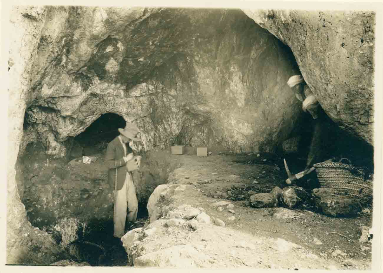
Francis Turville-Petre excavating in the Zuttiyeh cave (PEF – public Domain)
New excavations were conducted in 1973 at the entrance to the cave. The archaeologists analyzed the flint stones, dating them to two periods of flint stone manufacturing:
- Mousterian period flint-stone tools – the latter part of the Middle Paleolithic period – roughly 160,000 to 40,000 years ago. Uranium-Thorium dating of a specimen indicated 93,000 years old.
-
Acheulo-Yabrudian complex – the end of the Lower Paleolithic period – roughly 400,000 to 200,000 years ago, preceding the Mousterian period. Uranium-Thorium dating of a specimen confirmed it to be 140,000-150,000 years old.
This dating confirmed that the skull can indeed be dated to the end of the Lower Paleolithic period.
- Modern period
The valley of the Amud stream is open to the public, and is highly recommended for a short hike through the beauty of the nature.The best time is the the spring, as it gets too hot during the summer.
Entry to the cave is prohibited during the winter to avoid interference to the fruit bats that nest inside.
Photos:
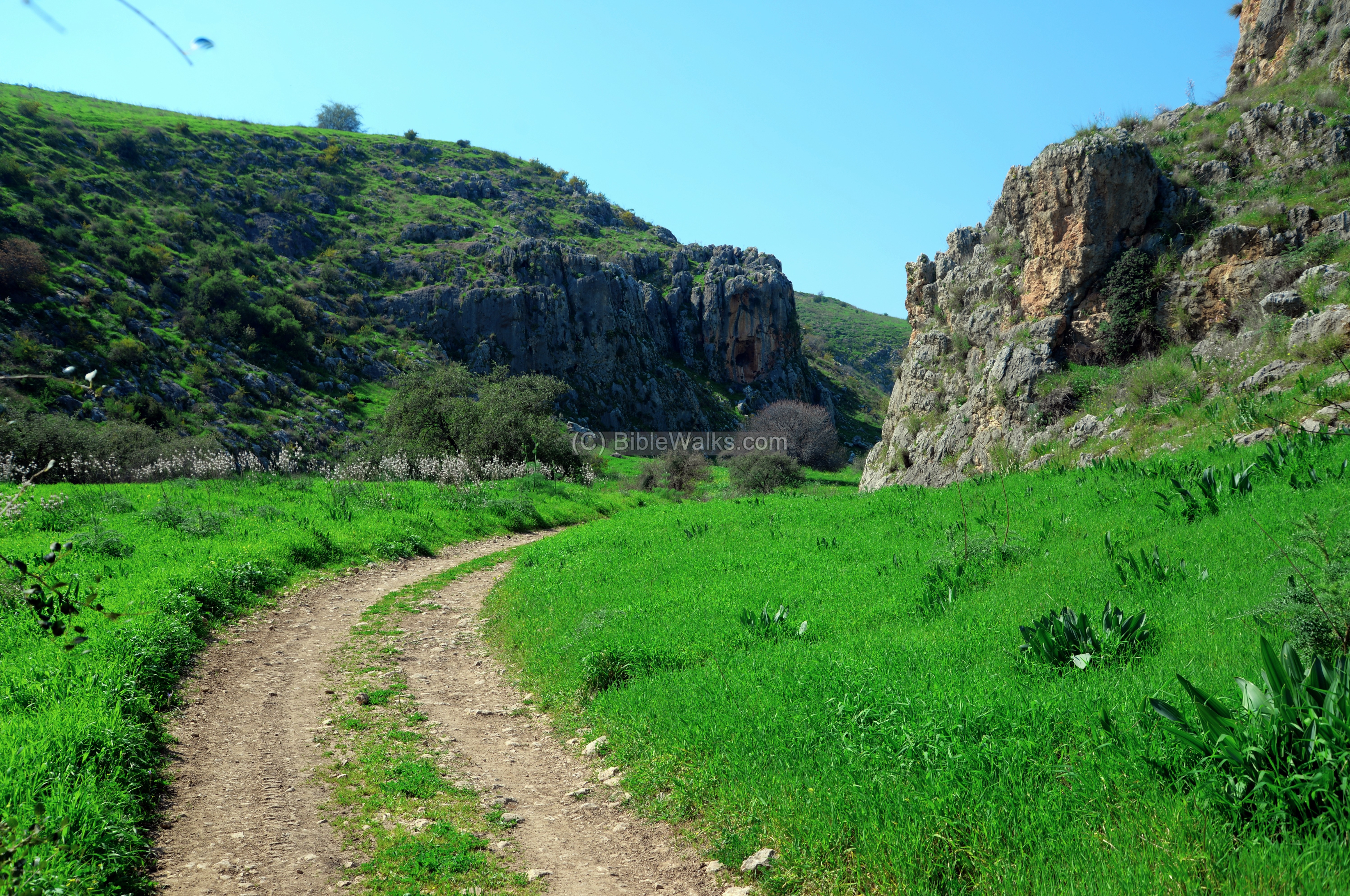
(a) Amud Gorge
The lower Amud stream flows through a wide gorge into the Ginosar valley, on the north west shores of the Sea of Galilee. Access to the site is from the outlet of the stream on the plain of Ginosar.
The trail to the site passes along the ancient road from Hukuk to the Sea of Galilee.
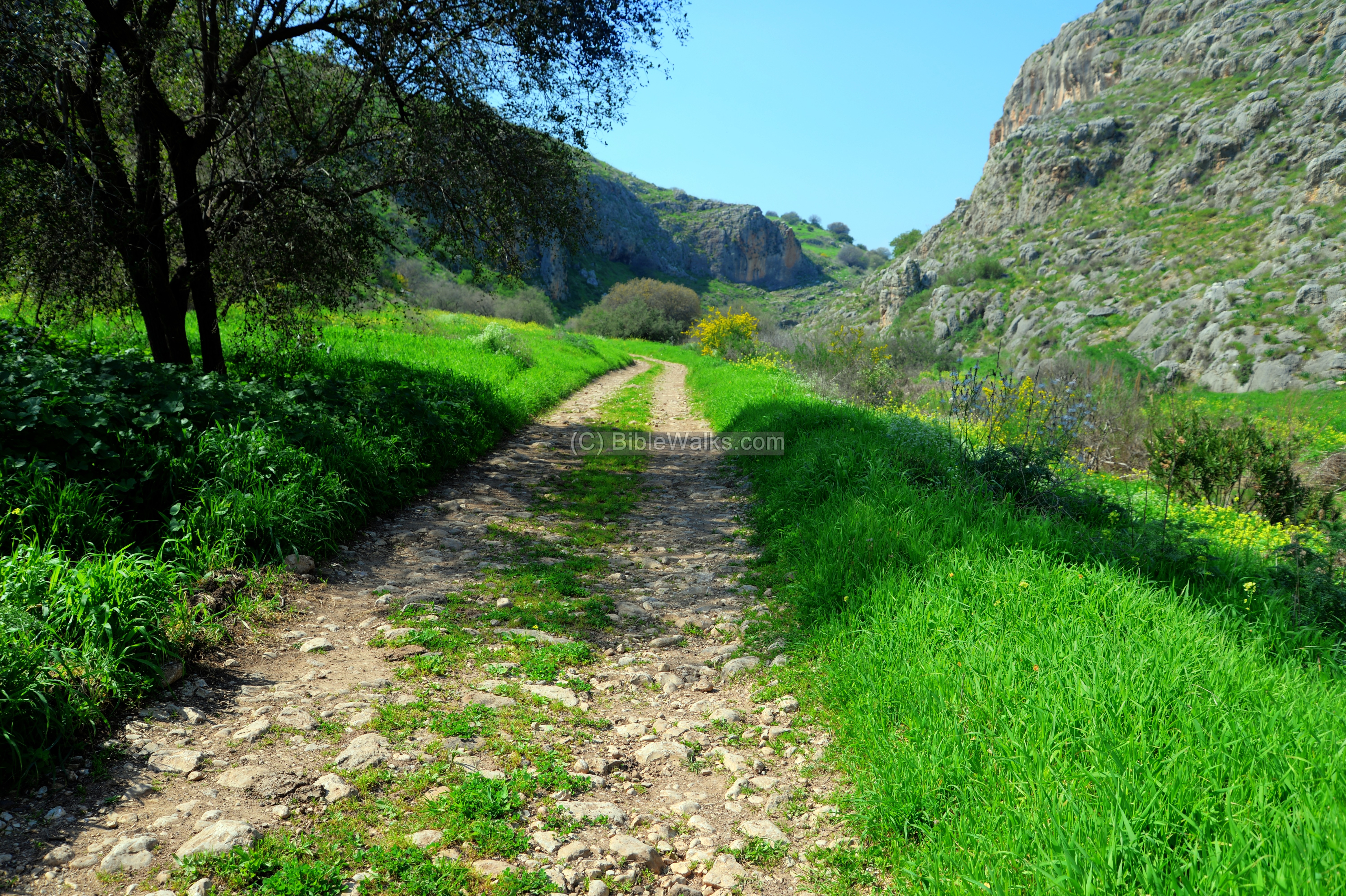
The cave is located on the right side of the valley.
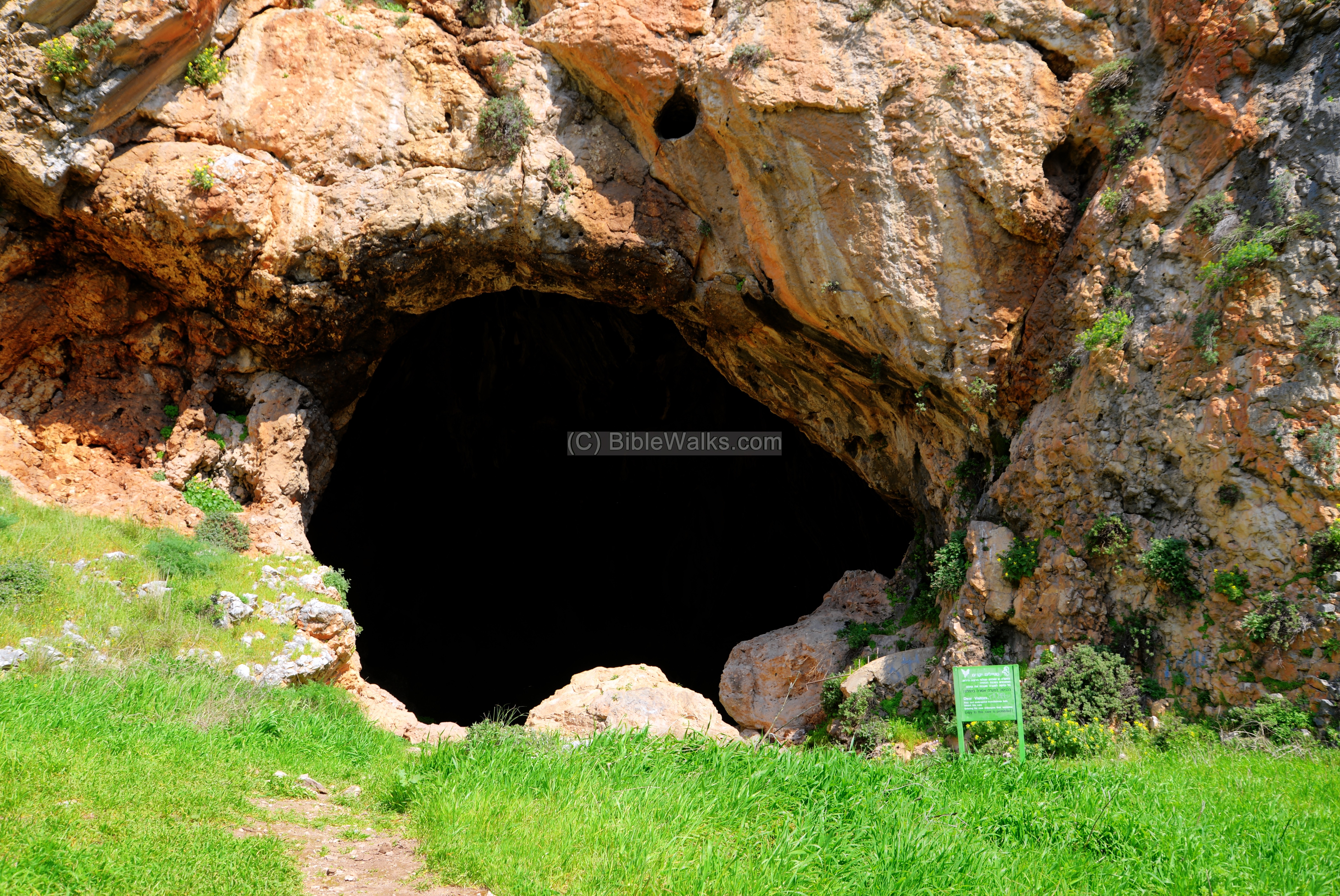
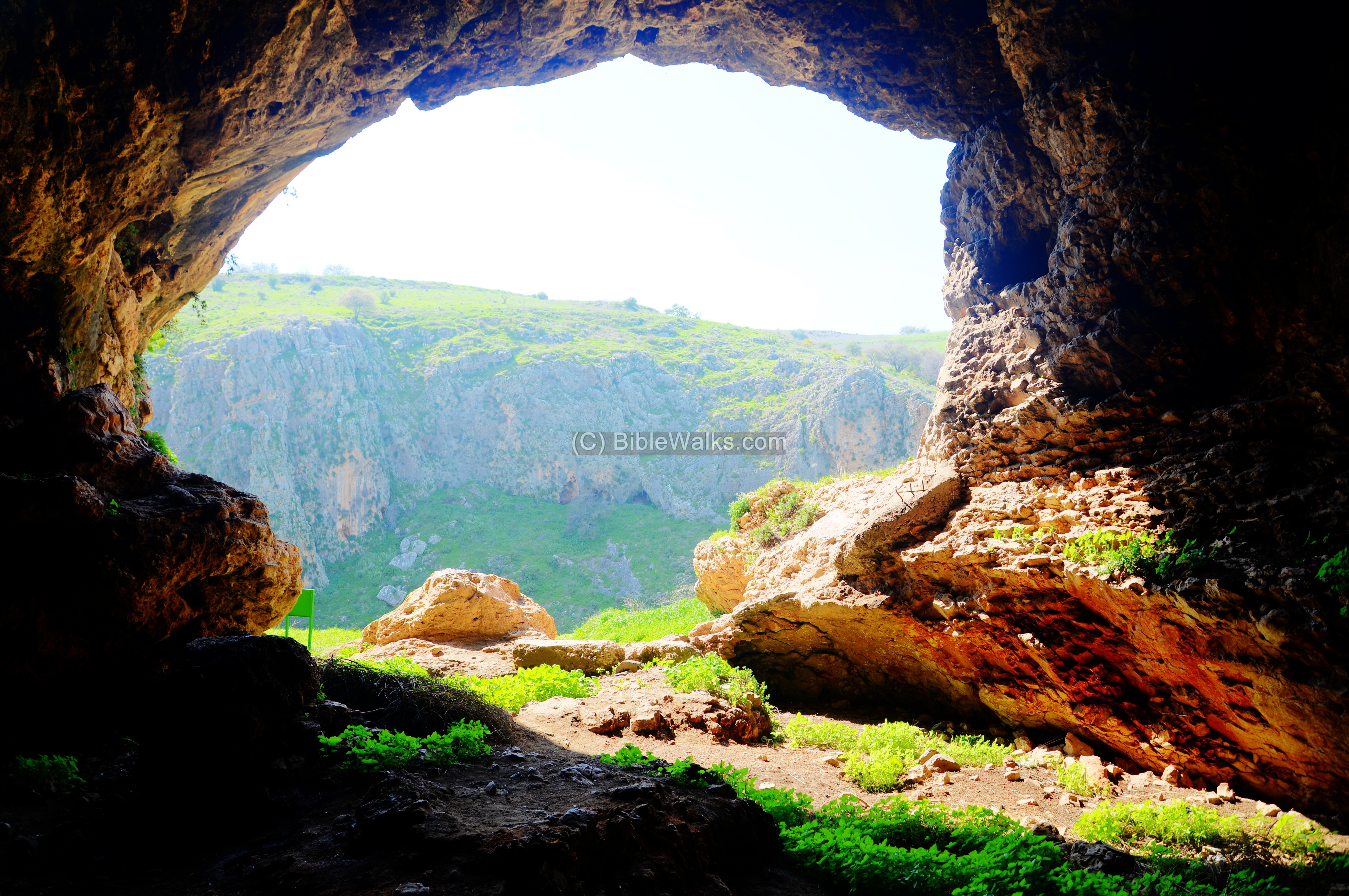
(b) Skull cave
The Skull cave is located on the eastern cliff, at the height of 30m above the canyon’s bed, and 800m before the edge of the gorge.
A closer view of the entrance to the cave is seen next. The opening is 10m tall and 13m wide, facing towards the western cliffs.
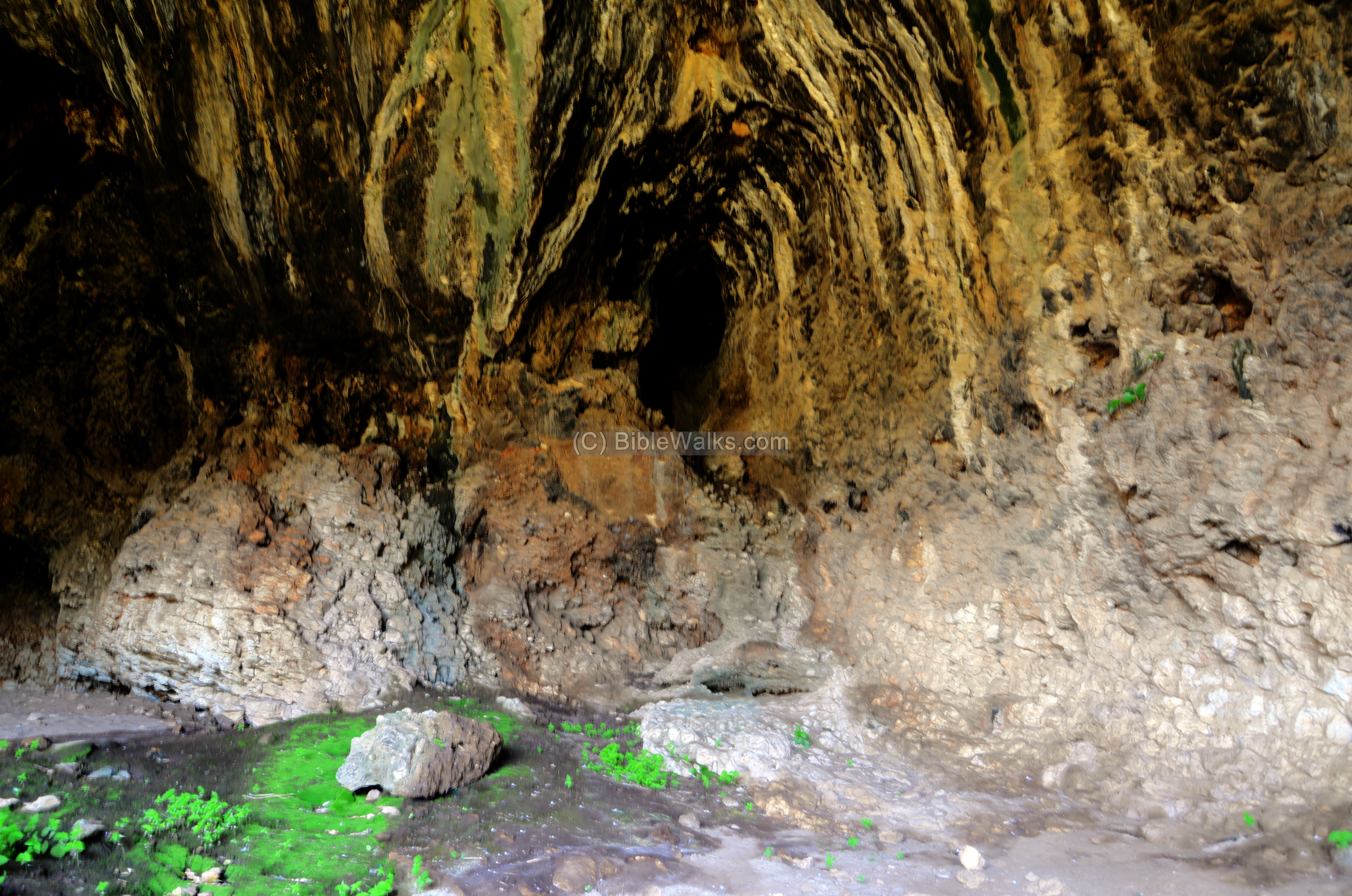
Inside the cave are remains of the excavations. Francis Turville-Petre removed 550 cubic meter of sediment inside the cave. The 3 layers of this fill were dated as following:
- 1.2m deep layer of white and grey ash – Early Bronze ceramics
- 0.9m deep layer of fallen limestone rocks and soil – Rich amount of Paleolithic flint-stones. The section of the skull was found under this layer.
- 3m deep layer of sand and pebbles and fallen rocks – few flint-stones.
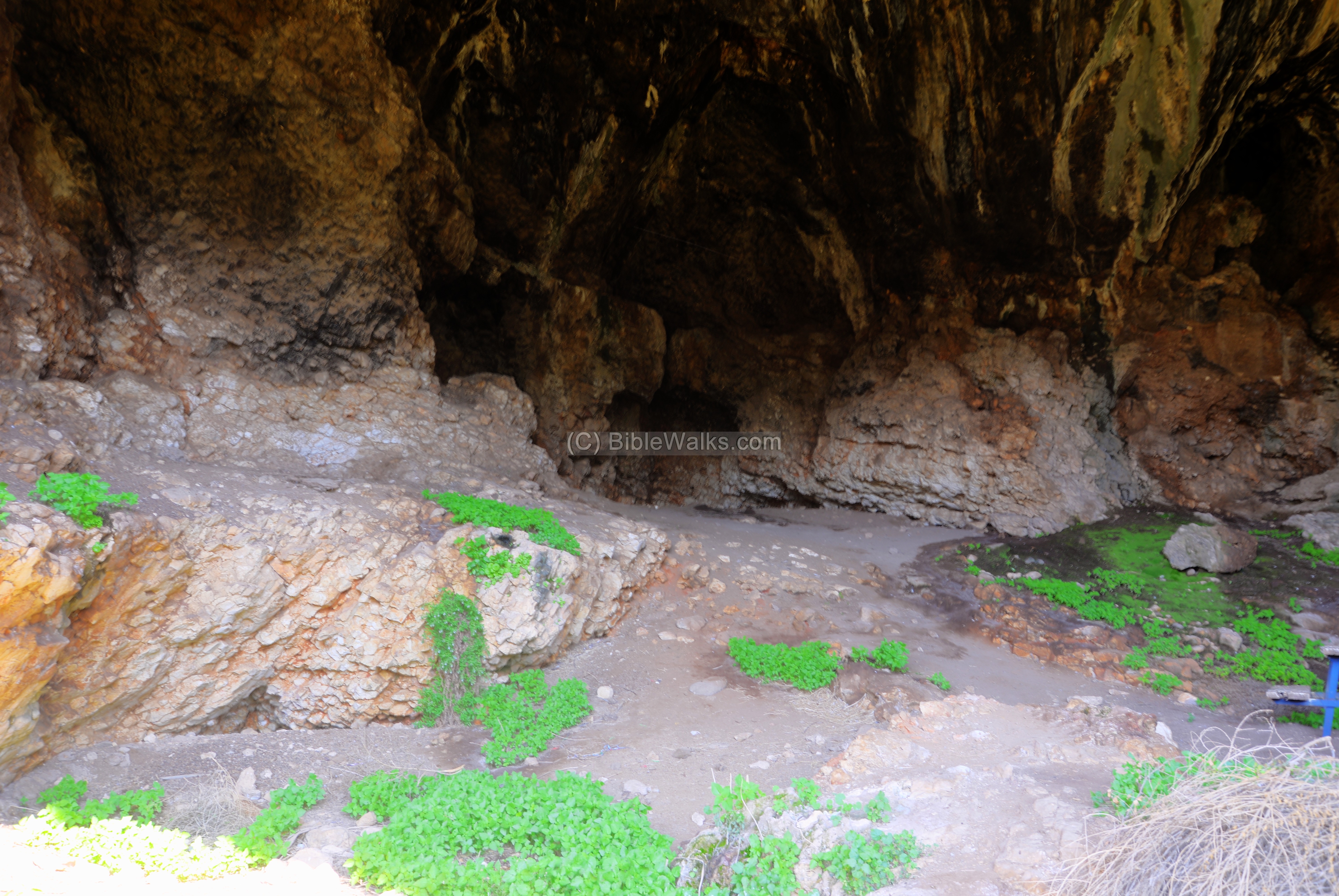
The rear wall of the cave is next. The cave is 20m long and 12-18m wide.
The view from the opening towards the other side of the gorge:
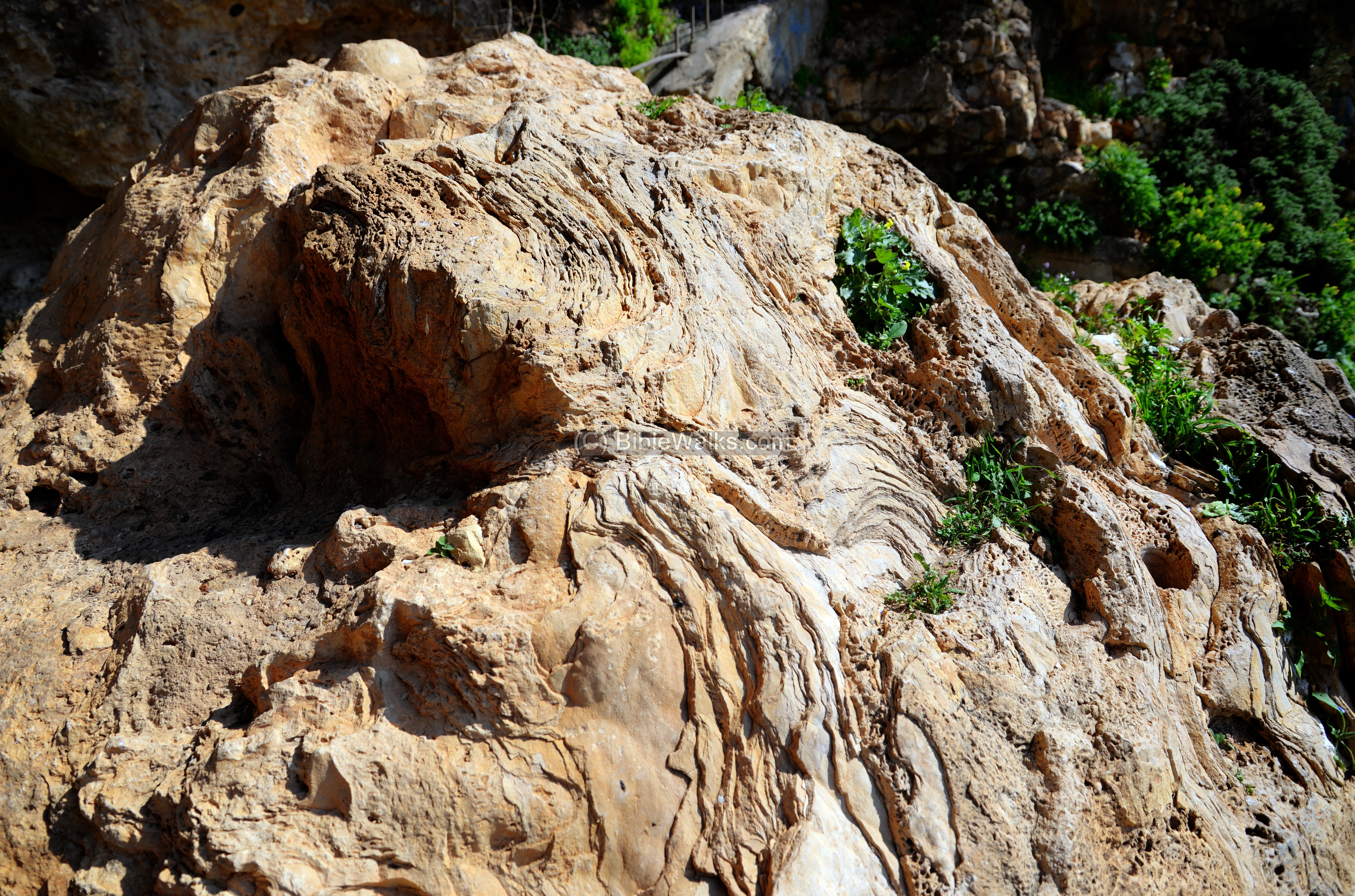
A section of the rock, a fossilized rock made of the accumulation soil, is seen in front of the cave. The excavations of 1973 concentrated on the entrance, taking sections out of the rock for analysis.
(c) Aerial Views
![]() A drone view of the cave and its surroundings is seen in this Youtube video.
A drone view of the cave and its surroundings is seen in this Youtube video.
Links:
* External links:
- New excavation in Zuttiyeh Cave, Wadi Amud, Israel – Gisis I.,Bar-Yosef O.
* Internal Links:
- Another prehistoric Amud cave (YouTube)
- Drone Aerial views – collection of Biblical sites from the air
- Prehistoric sites – Biblewalks info page
- Prehistoric Tools – info page on early man tools
Etymology – behind the name:
* Names of the site:
- Mugharet el-Zuttiyeh (Arabic: “Cave of the Robbers”)
- Skull cave – named after the skull found in the cave. It also looks like a skull…
- Amud – Hebrew: Pillar – named after the pillar standing 800m to the north
BibleWalks.com – walks along the Bible land
Berniki Hill<<<—previous Sea of Galilee site—<<<All Sites>>>— next site—>>> Lower Tsalmon
This page was last updated on Dec 28, 2020 (update)
Sponsored Links: