On the hill are ruins of a village and agriculture installations dated to the first temple and Roman/Byzantine periods.
* Site of the Month Feb 2019 *
Home > Sites > Samaria > South West > Wineries Hill, Talmon
Contents:
Background
Location
History
Photos
* Aerial views
* Entrance
* Sheikh ‘Aisa
* Hill side
* Oil press
* Observation tower
* Cisterns
* Ein Talmon
* Bad BeVad
Etymology
Links
Overview:
This ancient ruin is located above the community of Talmon, in West Binyamin region of Samaria. On the hill are ruins of a village and agriculture installations dated to the first temple and Roman/Byzantine periods. On the east side of the hill, among the oak trees near the picnic tables, is a ruined structure of Sheikh Aisa’s tomb.
The agriculture installations include 4 oil presses, including a 3,000 year old installation , cisterns, columbarium, wine presses, and an underground system of wineries. The ancient wine cellars (26 “Gibeon” type pits) kept the grape and olive oil at a cool 18 degrees Celsius. This temperature is required for the fermentation process in order to turn the grape juice into wine. Their top openings were covered by stone lids. These were later reused to construct a labyrinth of secret underground hiding places during the Bar-Kokhba revolt.
Location and Map:
The ancient site is located north east of Talmon, near the road that ascends from hwy #450 to Har Hareshah. The Talmon spring is located on the south west foothill.
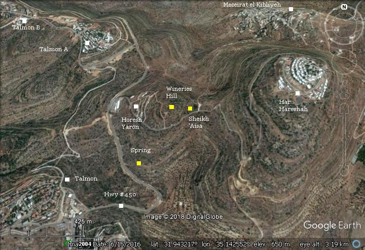
History:
- First temple period
During the first temple period this was an agriculture village, producing olive oil and wine. The many ancient wine cellars that are on the hill are typical of the first temple period, known as “Gibeon” type pits. The name of these cellars – Gibeon – are based on the first site were they were identified in Judea.
The Bible differentiates between the growers of the grapes (husbandmen) and those responsible for producing the wine (vinedressers). (2 Kings 25:12): “But the captain of the guard left of the door of the poor of the land to be vinedressers and husbandmen”. The grapes were grown on the hillsides, watered by the nearby springs, pressed and fermented in the winepresses near the fields, then stored in the wine cellars.
- Roman/Byzantine periods
Between the wine cellars are interconnecting tunnels. They were added hundred of years later. Evidence of hiding complexes imply that the village was one of the Jewish villages that were besieged and destroyed during the Bar Kokhba revolt (132-135 AD). Cassius Dio, the historian of Rome, wrote about the devastation of Judea (Roman History, LXIX 13):
“Fifty of their most important outposts and nine hundred and eighty-five of their most famous villages were razed to the ground. Five hundred and eighty thousand men were slain in the various raids and battles, and the number of those that perished by famine, disease and fire was past finding out. Thus nearly the whole of Judaea was made desolate, a result of which the people had had forewarning before the war”.
In general, the destroyed Judean and Samarian villages were resettled during the Late Roman and Byzantine periods by Christians and Samaritans. Jews were forbidden to return to all settlements in the vicinity of Jerusalem. Eusebius of Caesarea wrote about this ban in the 4th century (Church History, Book IV, Ch. 6, 3):
“…the whole nation was prohibited from this time on by a decree, and by the commands of Hadrian, from ever going up to the country about Jerusalem. For the emperor gave orders that they should not even see from a distance the land of their fathers.”.
- Ottoman period
Conder and Kitchener surveyed this area during the Survey of Western Palestine (SWP) in 1873. A section of their map (Sheet 14) is shown here. They merely reported the Sheikh’s tomb, but skipped the antiquities on the hill (Volume 2, Sheet XIV, p.215):
“Sheikh ‘Aisa: A ruined kubbeh [BW: Dome]”.
Part of map Sheet 14 of Survey of Western Palestine,
by Conder and Kitchener, 1872-1877.
(Published 1880, reprinted by LifeintheHolyLand.com)
To the east of the Sheikh’s tomb are the ruins of Batn Harasheh, which are also described in a short text (p. 305):
“Batn Harasheh – The ruins here are merely foundations near Sheikh ‘Aisa. There is also a cave with a central column of rock”.
A spring is located to the south east of Sheikh ‘Aisa – ‘Ain Umm Seraj. The Arabic translation (as per PEF dictionary) is the “spring with the lamps”. In modern maps it is named ‘Ain el Misraj – the spring of the ridge.
Farther south is a stream, illustrated with a blue color. The valley (Arabic: Wady ed-Dilb, Hebrew: Dolev valley), had mills along its course. A Roman road passed along the valley from West to East.
- Modern Period
Visitors can crawl thru the tunnels, and also tour the site with great walking trails and listen to guidance recordings. From the western side of the hill is a lookout tower with views of the area all the way to the coast.
Photos:
(a) Aerial views
A drone captured this view from the east side. The site is located on a hill, at an altitude of 676m. In the left background is the community of Talmon.
Click on the photos to view in higher resolution…
A closer view of the hill is next. Notice the traces of walls and structures on the top of the hill. In the lower left side, under the oak trees, are the ruins of Sheikh ‘Aisa.
![]() This YouTube video shows a flight over the site, starting from the east side, crossing the top of the hill towards the observation tower, then lowering down to the ancient oil press installation:
This YouTube video shows a flight over the site, starting from the east side, crossing the top of the hill towards the observation tower, then lowering down to the ancient oil press installation:
(b) Entrance
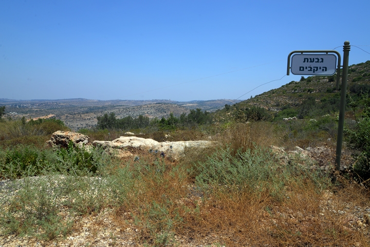
The parking place is on the east side of the site. The sign “Wineries hill” shows that you arrived to the right place.
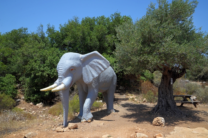
A sculpture of an elephant stands near the olive tree, perhaps he got lost . Behind are picnic tables
(c) Sheikh Aisa
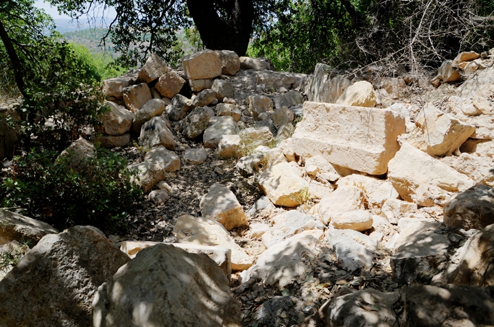
Near the entrance, on the eastern side of the hill, are ruins of a Muslim prayer house (Makam), named Sheikh ‘Aisa. Due to the religious use of the structure, the oak trees around the prayer house were preserved over the years and were not cut down as other trees around it.
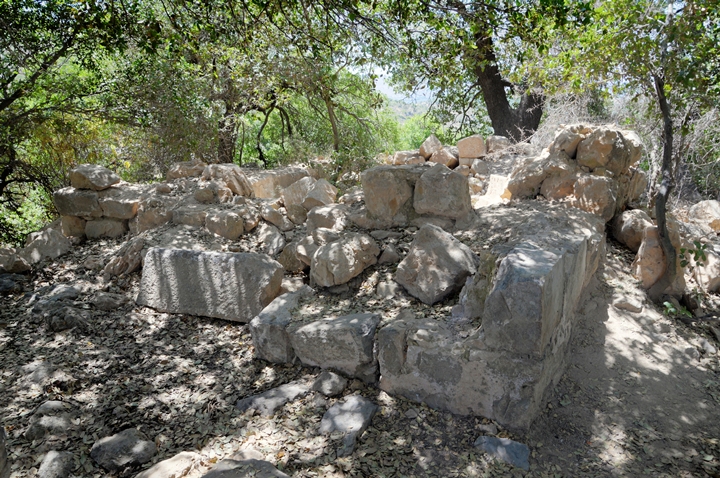
During recent years most of the walls crumbled, leaving only the base of the walls and a few of the stones.
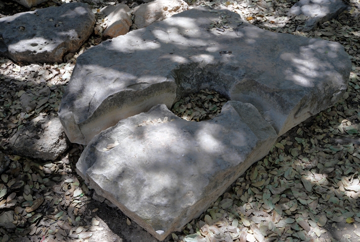
Fragments of a stone lid, with a hole in the center, are located near the ruins.
(d) Hillside
The hillside is covered by olive trees, remains of structures, and piles of stones. Tuvia, who joined this hike, walks up towards the hill top.
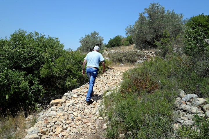
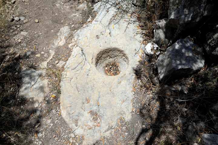
Good walking trails were prepared by the school pupils of Talmon. Along the trails are remains of the Roman period houses, agriculture installations (such as the grinding hole below).
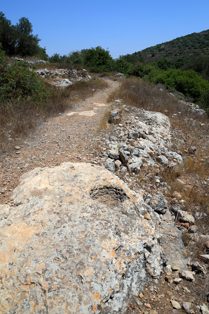
Another grinding hole:
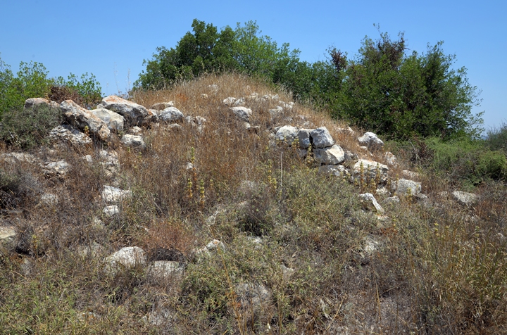
Closer to the top of the hill are remains of Roman period structures, with some high walls.
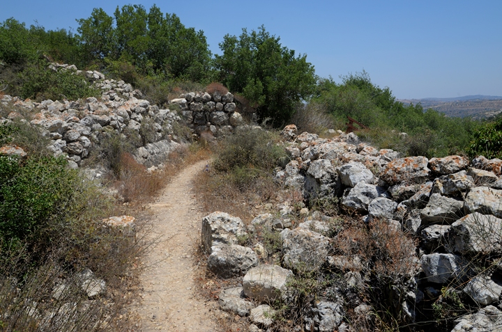
Other structures along the trail:
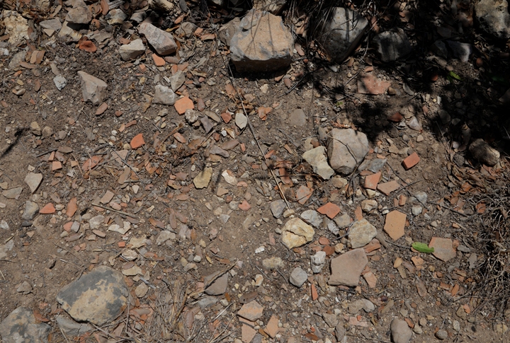
The hillside is scattered with thousands of ceramic fragments.
(e) Olive oil production
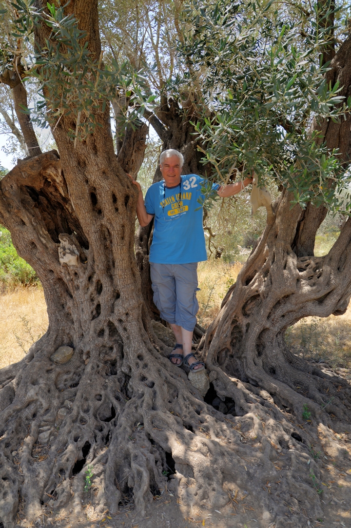
Olive trees are growing on the hill, some of them very old. Here, father Yoram finds rest on one of these old olive trees.
On the hill are 4 oil press installations, which were used to crush and squeeze the olives and then collect the precious olive oil and store it in underground storage places cut into the surface. One of the most ancient installations is this one, located near the observation tower on the west side of the hill.
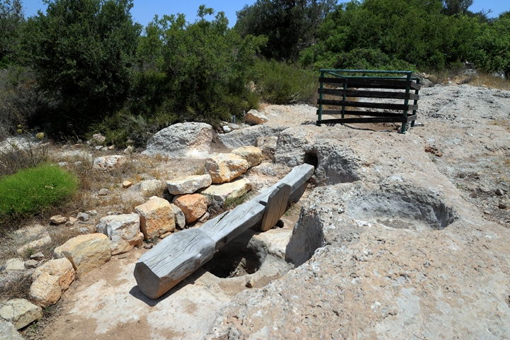
The oil press is 3,000 years old. Its design is a based on a lever and weight (known as “type 4” oil press): In this oil press, a stone weight was tied to the edge of the wooden lever, pushing the lever down. The use of a lever exerts a large force over a small distance. The force of the lever pushed a flat stone down on a basket, which contained the olives. The stone squeezed the basket, extracting the precious olive oil unto the round grooves of a basin stone. The juice flowed down along these grooves, out through an outlet in the basin, and down into a collecting vat. The olive juice contained water and oil. After a few days, the lighter oil in the juice floats above the water, and it is then collected and stored in jars.
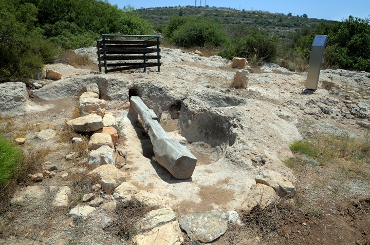
An aerial view of the oil press, and the cistern near it, is next:
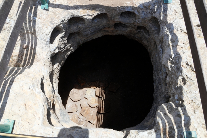
Inside the adjacent cistern are holes that are cut into the rock, which served as a columbarium. The word ‘columbarium’ is based on the Latin word columba (‘pigeon’), as it was used for a place to house doves and pigeons. This agriculture use of the birds was for their meat, while the bird droppings were used as a fertilizer for growing food. It was a secondary use of the cistern which was cut in an early stage for storage of oil jars or water.
(f) Observation tower
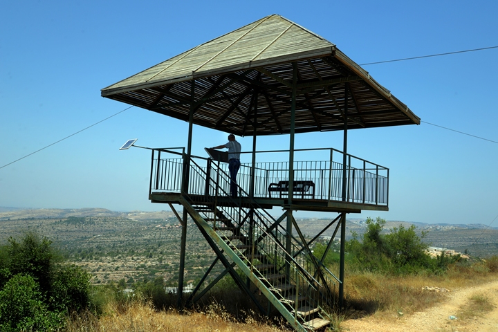
An observation tower is located on the western side of the hill. Great views of the area and the plains of Israel are seen from the look out tower.
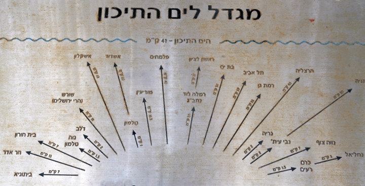
A plate shows directions in Hebrew to the major points of interest. The Mediterranean Sea is 41 KM to the west, while the nearest community is Talmon (1km). The city of Modi’in is 13.5km away, Tel Aviv is 37km, and Ben-Gurion airport is 25 km away.
(g) Cisterns
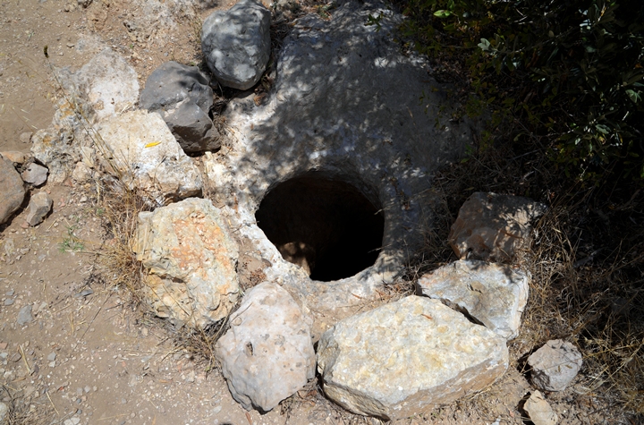
On the eastern hillside are rock hewn cisterns, dated to the first temple period. These bell shaped cisterns are of the the “Gibeon” type wine cellars, which are common in Judea and Samaria.
The wine jars were kept inside the bell shaped cellars. These underground cellars kept the jars, either wine or olive oil, within a year round constant temperature of 18 degrees Celsius.
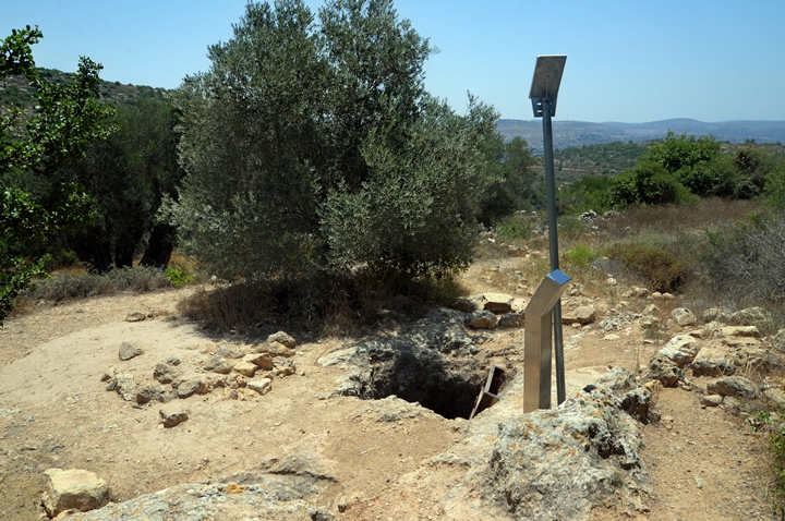
The rim around the opening is cut lower in order to fit a lid over the top.
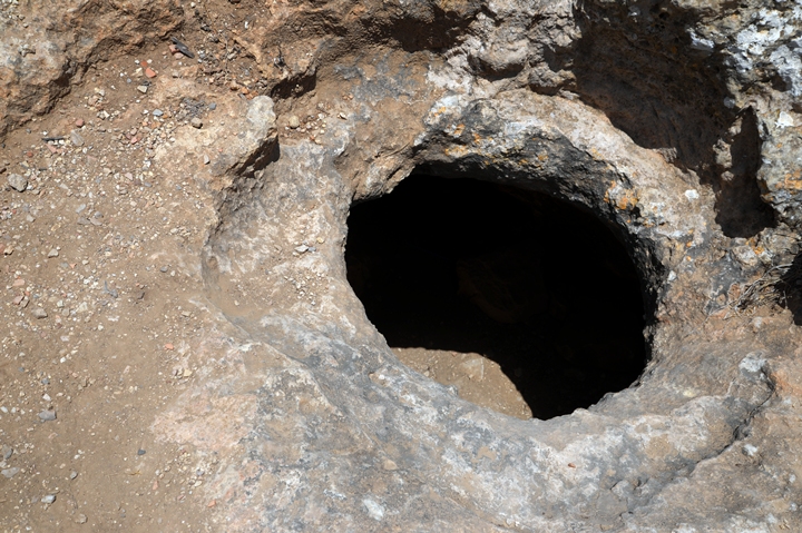
Another one of the storage pits:
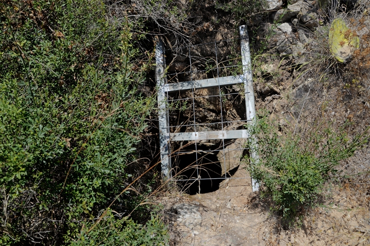
Inside one of the cisterns is a ladder that allows an easy descent into the underground complex in order to explore it. This is one of the highlights of the visit to the site.
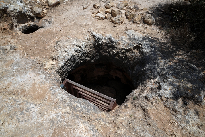
Between the cisterns are tunnels that interconnect them together. This was used, many years after the cisterns were cut for agriculture purposes, as an underground hiding place during the Bar-Kokhba revolt.
Inside some of the cisterns are holes cut into the walls, for the use of a columbarium.
(h) Ein el Misraj
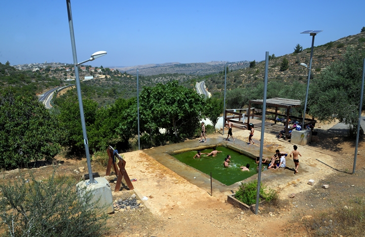
The spring is named in the British maps as ‘Ein el Misraj (“spring of the saddle”), while the name in the PEF map is ‘Ein Umm Seraj (“spring with the lamps”). The Hebrew name is Ma’ain Ha-Ukaf (spring of the saddle), or simply Talmon spring. Another spring, closer to the site, is ‘Ain el Mallah (appears on the British map).
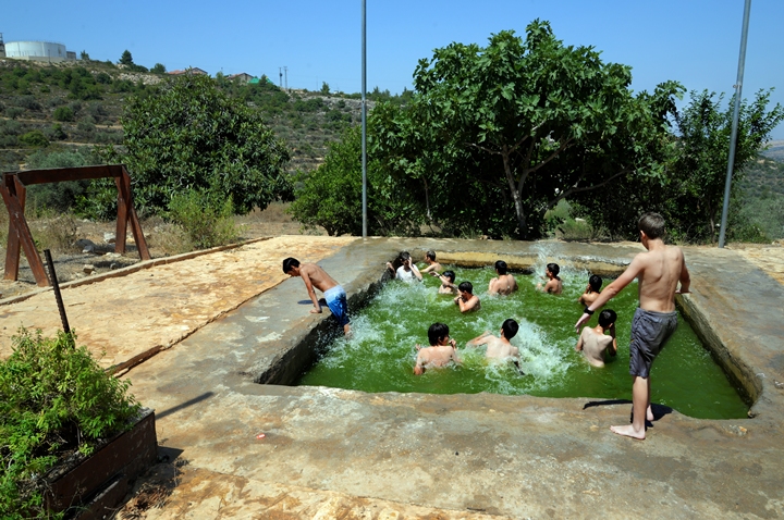
The pool is 4x4m and 1.3m deep – large enough for a dozen kids happily splashing around.
(i) Bad Bevad
On the western hillside of the Wineries hill is a neighborhood named Horesh Yaron (Yaron’s forest”).
A modern oil press is located inside one of the modern structures, with a catchy Hebrew name “Bad Bevad”. It means in Hebrew “at the same time and same weight”, but also refers to a “Beit Bad” – an oil press in Hebrew. The name also appears in the Bible in relation to food (Exodus 30:34): “And the LORD said unto Moses, Take unto thee sweet spices, stacte, and onycha, and galbanum; these sweet spices with pure frankincense: of each shall there be a like weight“.
The machine, imported from Italy, is a 2 phase oil press. It first shakes off the leaves and twigs from the olives in the section seen above. The olives are sucked up to the section seen below, which crashes and squeezes the olives with great force. The oil is then separated from the water using paper filters.
The olive oil, produced here in the adjacent room, is also sold to the visitors.
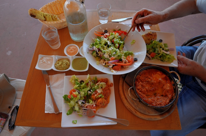
The restaurant also offers a tasty Shaksukah – a dish of eggs poached in a sauce of tomatoes, chili peppers, and onions. The green salad, combined with and the words of the waiter who described the olive oil process, made this meal and enjoyable and authentic treat.
Etymology (behind the name):
* Names of the site and vicinity:
- Sheikh ‘Aisa (also Esh Sheikh ‘Isa) – a Muslim Makam (prayer house), named after ‘Aisa (or ‘Isa).
- Yekev – Hebrew: winery. Yekevim – plural for wineries. The Hebrew root is Y-K-V is based on the root Nekev – hole, as the ancient wineries were cut underground.
- Talmon – the community was founded in 1989. Its name is based on the Bible – Talmon were a family of gatekeepers of the temple (Nehemiah 12, 25): “Mattaniah, and Bakbukiah, Obadiah, Meshullam, Talmon, Akkub, were porters keeping the ward at the thresholds of the gates”.
- Neria (Talmon B, Talmon North)- the original community planned for the place of Talmon. Named after Rabbi Moshe-Zvi Neria.
Links and References:
* External:
- Bad Bevad – an oil press, cafe, and restaurant restaurant
* Internal:
- Drone Aerial views – collection of Biblical sites from the air
- Oil press installations
- Hiding Complexes info page
Nearby site:
- Ein Bubin (Ein Danny), Dolev
BibleWalks.com – back to where it all began
Natuf <<<—previous site—<<<All Sites>>>—next Samaria site—>>> Ein Bubin
This page was last updated on June 15, 2018
Sponsored links: