A famous ancient city, located near the crossing of the ancient trade route over the Sorek stream.
Home > Sites > Shefela > Tel Yavne (Yavneel, Jamnia)
Contents:
Background
Location
Biblical Map
History
Photos
* General view
* The Tel
* Mamluke Tower
* Byzantine winery
* Mamluke Bridge
* British PillBox
* House of Arches
* Rabban Gamaliel
* Sanhedrin Garden
* Panoramic view
Biblical
Links
Background:
Ancient Yavne (Yavneh, Yavneel) was one of the important cities in the plains of Sharon. The Bible and other historic sources contain numerous references to the site, which is located along the way of the sea (Via Maris) at the crossing over the Sorek stream.
(Joshua 15:11): “And the border went out … unto Jabneel; and the goings out of the border were at the sea”.
The Greeks named it Yamnia (Jamnia). After the Roman destruction of Jerusalem, Yavne became a religious and administrative center for the Jewish population. The Crusaders named it Ibelin, and built a fortress and Church on the summit. It was converted to a mosque by the Mamlukes.
The center of the old city was located on a hill (Tel Yavne), but today it is in ruins and waiting to be excavated. A modern city of Yavne, with a population of 35,000, was built since the Independence of Israel on its western side.
Aerial Map:
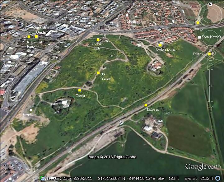
The modern town of Yavne, built around the ancient site, is located 21 KM south of Tel-Aviv, east of the coastal highway ( #4), about 7KM southeast of the sea.
The mound of Tel Yavne is a large open green area, covering a size of about 450m long and 350 wide. There are few ancient structures seen above the surface, except for the Mamluke tower. Some other places of interest related to Tel Yavne are spread around in different sections of the modern city.
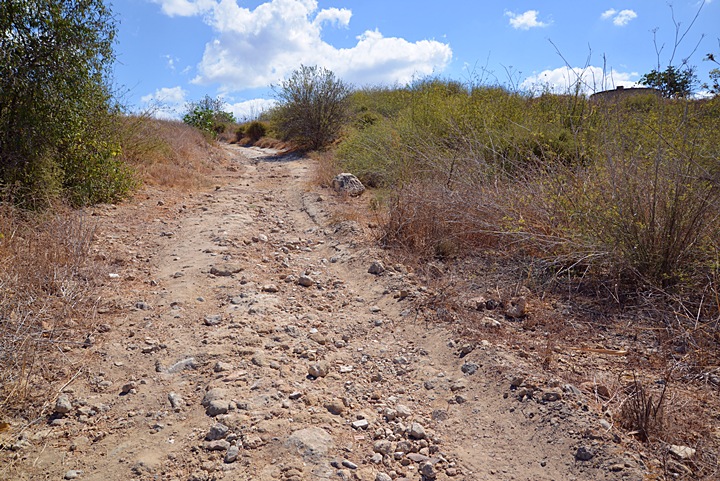
You can park on the junction near the northwest corner of Tel Yavne, and walk up the access path. From the top of the hill (49m above sea level) are great views of Yavne and the area around it.
The following aerial view shows the points of interest on and around the site.
Biblical Map:
This map, illustrating the greater area of the site, indicates the roads and sites during the Biblical period (Iron age period until the Roman period).
Yabne (marked here as “Jabneh” and “Jamnia” near a red marker) is situated along the coastal road (“Via Maris”), near the crossing of the Sorek brook. The ancient highway connected Egypt on the south, through Gaza and Ashkelon (Ascalon), to Yavne. Two roads continued north from Yavne: a northwestern road to the port city of Yafo (Joppa), and a northeastern road via Aphek (Antipatris) to Syria and Mesopotamia. The port of Jamnia (Yavne Yam) is located south of the Sorek outlet, and is marked by a yellow circle.
Map of the area around Yavne (based on Bible Mapper 3.0)
History:
-
Early Israelite period – Judges (Iron Age)
Yavne was one of the cities in the region of Judah, after the Israelite conquest of the Land of Israel in the 13th Century B.C. The Bible names it as Yavneel (“God will build”), or Javneel in the KJV version (Joshua 15:11): “And the border went out unto the side of Ekron northward: and the border was drawn to Shicron, and passed along to mount Baalah, and went out unto Jabneel; and the goings out of the border were at the sea”.
A port was constructed in the outlet of the Sorek stream, 7 KM north west. The harbor was in use starting from the second Millennium B.C. The proximity of Yavne to the sea, and its control of the ancient highway (“Way of the Sea”, or “Via Maris”) made it a strategic asset.
-
Philistine control (11th C – 8th century B.C.)
The Philistines – “Sea Peoples” from the Aegean sea – landed in Canaan and Egypt in the 12th century BC. The Egyptians fought the invaders (Ramses III battle of 1175BC) and repulsed them into a small enclave in the southern coastal cities of Canaan (from Gaza to Ashkelon), as per (Joshua 13, 3): “…five lords of the Philistines; the Gazathites, and the Ashdothites, the Eshkalonites, the Gittites, and the Ekronites”. Yavne also became a Philistine city in the 11th century BC. At a later stage the Philistines moved northwards along the shore until the Yarkon river north of Jaffa.
The Philistines became the arch enemies of the Israelites. Only in the 8th century, Uzziah king of Judah captured the city back from the Philistines (2 Chron 26:3,6): “Sixteen years old was Uzziah when he began to reign, and he reigned fifty and two years in Jerusalem … And he went forth and warred against the Philistines, and brake down the wall of Gath, and the wall of Jabneh, and the wall of Ashdod, and built cities about Ashdod, and among the Philistines”.
-
Assyrian intrusions (8th Century B.C.):
The Assyrian empire, a rising force in the region, conquered Syria and the North of Israel during the reign of the Assyrian king Shalmaneser III. The Assyrian king, probably named in the Bible as “Shalman”, invaded to Syria and the northern part of Israel in the first Assyrian intrusion (841 B.C. ). This conquest continued in a second intrusion (738) by the great Assyrian king Tiglath-Pileser III.
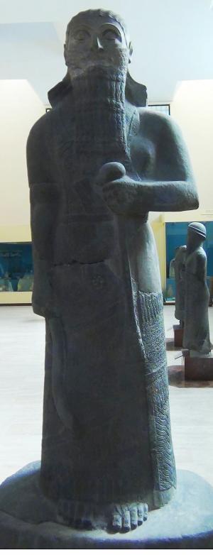
Basalt stele of Shalmaneser III (858-824BC), city of Assur
[Istanbul Archaeological Museum]
Pekah son of Remaliah, the king of the Northern Israelite kingdom, tried to block the Assyrians. He attempted to create a coalition with the Rezin king of Aram-Syria and with the Judean Kingdom. However, King Ahaz (the grandson of Uzziah) refused to join them. Pekah then tried to replace Ahaz with the son of Tabeal (Isaiah 7 6):
“And it came to pass in the days of Ahaz the son of Jotham, the son of Uzziah, king of Judah, that Rezin the king of Syria, and Pekah the son of Remaliah, king of Israel, went up toward Jerusalem to war against it, but could not prevail against it”.
This attack encouraged the Adomites and the Philistines to attack Judah (2 Chronicles 28 18):
“The Philistines also had invaded the cities of the low country, and of the south of Judah, and had taken Bethshemesh, and Ajalon, and Gederoth, and Shocho with the villages thereof, and Timnah with the villages thereof, Gimzo also and the villages thereof: and they dwelt there”. Yavne, although not listed here, was probably one of the cities the Philistines recaptured from Judah.
Ahaz was under pressure from all fronts, and called the Assyrians for help, although prophet Isaiah warned against the move (Isaiah 7 4): “Take heed, and be quiet; fear not, neither be fainthearted for the two tails of these smoking firebrands, for the fierce anger of Rezin with Syria, and of the son of Remaliah”.
The Assyrians quickly came to the help of Judah: In 734BC was an intrusion to the North of Israel by the Assyrian King Tiglath-Pileser III. The Assyrians first captured the coastal cities until Gaza, subduing the Philistines. At a second intrusion (732) they captured some of the cities of the Northern Israelite Kingdom (as per 2 Kings 15: 29): “In the days of Pekah king of Israel came Tiglathpileser king of Assyria, and took … Galilee…and carried them captive to Assyria”.
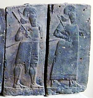
Orthostat relief – depicting soldiers from different orders of the Assyrian Army, in procession;
basalt; Hadatu Tiglath-Pileser III period (744-727BC)
[Istanbul Archaeological museum]
The Egyptians encouraged the people in the occupied territories of the Assyrians to revolt following the death of Tiglath-Pileser III. Hoshea, king of Northern Israel, joined this mutiny, but made a fatal mistake.
This time the Assyrians crushed the remaining territories of the Northern Kingdom. The intrusions of kings Shalmaneser V and Sargon II in 724-712 ended the Northern Kingdom (2 Kings 17: 5-6):
“Then the king of Assyria came up throughout all the land, and went up to Samaria, and besieged it three years. In the ninth year of Hoshea the king of Assyria took Samaria, and carried Israel away into Assyria, and placed them in Halah and in Habor by the river of Gozan, and in the cities of the Medes”.
In 720 king Sargon II attacked Gaza and Rafah, the Philistine coastal cities who also joined the mutiny. Sargon captured these cities, defeated the Egyptian relief force, thus expanding their territory south of Rafah. Yavne became part of the Assyrian province, ruled by a Pasha, and paying taxes to the king.
The South Kingdom of Judah managed to survive this onslaught by teaming up with the Assyrians, but not for long. After the death of the Assyrian king Sargon II (705 B.C.), king Hezekiah mutinied against the Assyrians, joining other cities in the area who attempted to free themselves from the Assyrian conquest. Anticipating the coming Assyrian intrusion, he fortified Jerusalem and the major cities.
The Assyrian army came in 701, led by Sennacherib, son of Sargon II (2 Chronicles 32 1):
“After these things, and the establishment thereof, Sennacherib king of Assyria came, and entered into Judah, and encamped against the fenced cities, and thought to win them for himself”.
Sennacherib captured the coastal cities, including Yavne. The Assyrians did not attempt to enter to the heart of Upper Egypt, a task which was completed only in 669 by Esarhaddon, son of Sennacherib.
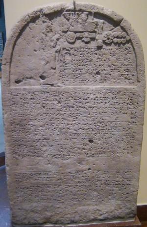
Sennacherib’s stele with relief and inscription; Ninveh;
limestone [Istanbul Archaeological Museum]
-
Babylonian conquest (604-538 B.C.)
The Assyrian empire fell in 610 B.C., and was replaced by the Babylonians. During the empire switchover, the Judean King Josiah (628 to 609BC) seized the moment and expanded the Kingdom until Ashdod (2 Kings 23 8): “And he brought all the priests out of the cities of Judah, and defiled the high places where the priests had burned incense, from Geba to Beersheba”. The area Josiah seized probably included Yavne, based on a Ostracon found in Mezad Hashavyahu, near Yavne Yam.
This was the greatest times for the Judean Kingdom, which lasted for a short time, since Josiah was killed in a battle at Megiddo. The Babylonians, headed by Nebuchadnezzar, conquered the coastal cities in 604 BC (2 Kings 24 7), and later destroyed Judea in 587 and exiled some of the Judean population.
-
Persian conquest (538 – 332 B.C.)
The Persians defeated the Babylonians (539BC), and King Cyrus “the Great” allowed the Judean exiles to return back to Israel (Zion) and rebuild their temple in Jerusalem. Pleshet (“land of the Philistines”), the coastal area around Ashdod which included Yavne, remained excluded from the Jewish territory. This territory was controlled by the Phoenicians of Tyre and Sidon, who provided maritime services to the Persians.
-
Hellenistic period (332 – 163 B.C.)
Alexander the Great replaced the Persians as the ruler of the ancient world. Following their victory in Issus (333), the Greeks conquered Tyre after seven months of siege (332). Alexander and the Greek army continued along the coast, passing through Yavne, and Ashdod surrendered rather than fighting the great army. Gaza then was conquered after 2 months of siege, followed by the conquest of Egypt. This conquest started the Hellenistic period.
Illustration of Alexander in battle with Darius III of Persia
– Either battle of Issus or battle of Gaugamela
– On a mosaic floor in House of Faun Pompeii
After Alexander’s death (322), the area passed hands during the Wars of the Diadochi, between his successors – Antigonus (Asia Minor), Seleucus (ruler of Syria), Ptolemy (ruler of Egypt). The area finally settled in 311 under Ptolemy of Egypt. After more than 100 years, the area returned to the Seleucid kings of Antioch following the victories of Antiochus III in Gaza (201-198).
Yavne was renamed to a Greek name Yamnia (or, Jamnia).
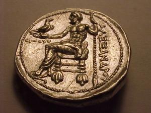
Greek coin – Alexander the Great – Bethsaida
-
Maccabee revolt (163 B.C.)
The Maccabees headed the anti-Hellenization rebellion against the Greek Seleucids who controlled the land of Israel during the second half of Hellenistic period (4th – 1st Century BC). After a series of successful military campaigns they took control of Judea, liberated the land and created an independent Jewish country, known as the Hasmonean Kingdom (164 BC to 63 BC as independent state, and 63-37BC as rulers under Rome).
Dall-E 2 illustration of Greek fighting
Yamnia (or Jamnia), the Greek Yavne, is associated with many events during the revolt and Hasmonean wars:
Battle of Emmaus: Judas Maccabaeus, the leader of the revolt against the Seleucid empire (167-160BC), launched a successful attack against the Syrian forces in Emmaus in 165 B.C.. The Maccabees pursued their army until Yamnia (1 Maccabees/Hasmonean 4 15): “…and they pursued them as far as Gezeron, and even to the plains of Idumea, and of Azotus, and of Jamnia: and there fell of them to the number of three thousand men”.
Failed attempt: During the military campaign of 163 B.C., two Maccabee generals attempted to attack Jamnia where the Seleucid general Gorgias was stationed, but they failed (1 Maccabees/Hasmonean 5 56-60) : “Joseph the son of Zacharias, and Azarias captain of the soldiers… and they went towards Jamnia. And Gorgias and his men went out of the city, to give them battle. And Joseph and Azarias were put to flight, and were pursued unto the borders of Judea: and there fell, on that day, of the people of Israel about two thousand men, and there was a great overthrow of the people”.
Attack on Harbor – Judas Maccabaeus – the leader of the revolt against the Seleucid empire (167-161BC) – set the ships in the harbor of Jamnia on fire in order to protect the Jewish residents of the city: (2 Maccabees 12 9): “But learning that the men in Jamnia meant in the same way to wipe out the Jews who were living among them, he attacked the people of Jamnia by night and set fire to the harbor and the fleet, so that the glow of the light was seen in Jerusalem, thirty miles distant”.
Ambush (147 B.C.) The Seleucid general set an ambush to Jonathan and Simon south of Jamnia, brothers of Judas, but they prevailed (1 Maccabees/Hasmonean 10 69-89): “…Apollonius his general … gathered together a great army, and came to Jamnia: and he sent to Jonathan the high priest… And Jonathan knew that there was an ambush behind him”.
Raids (137 B.C.)– The Seleucid commander Cenedbeus started to raid Judea from Jamnia (1 Maccabees/Hasmonean 15 40-): “And Cendebeus came to Jamnia, and began to provoke the people and to ravage Judea, and to take the people prisoners, and to kill”. The Hasmonean fought the Seleucids and killed 2,000 men, bringing the raids to an end.
Conquest – Later, Jamnia was captured by Simon Maccabee (Judas’s brother, leader 142-135) or his son John Hyrcanus (leader 134-104 B.C.).
Jewish city – Later, Alexander Janneus, son of John Hyrcanus, became king (a new title, reigned 103-76). At his time, Jamnia city was Jewish, part of the expanded Hasmonean Kingdom. In 100 B.C. Alexander expanded the area further, past Rafah, after capturing the port city of Gaza (with its rich income of the Nabatean trade, an important asset for the Hasmoneans).
Yamnia (Jamnia) remained a Jewish town city for about 50 years, until the Roman conquest.
-
Roman – (1st Century B.C. to 3rd CenturyA.D.)
Rome defeated the Greeks (during the years 88-64), and became the new empire. Their general Pompey entered the land in 63 B.C., conquered Jerusalem and brought an end to the independent Hasmonean Kingdom. Within a few years he introduced major changes, that downsized the Hasmonean kingdom: during the years 57-55 B.C. most of the previously Greek or Hellenized towns, which were captured during and after John Hyrcanus period, were extracted from the Hasmonean Kingdom. Thus, Jamnia as well as all coastal cities, became autonomous units. (Josephus Plavius, Antiquities, XIV 4 4): “took away those cities … he rebuilt … Ashdod, and Jamnia…. All these Pompey left in a state of freedom, and joined them to the province of Syria.”.
After the murder of Julius Caesar (44), Augustus defeated his opponents and became the new emperor. Herod the Great (Hasmonean king 37-4 B.C.) managed to build good relations with Augustus, and received the coastal cities, Jamnia included, back to the Hasmonean territory (30 B.C.). Jamnia became the capital of a toparchy – A small state, consisting of a few cities or towns.
Following Herod’s death, the area of Jamnia and Ashdod were given to his sister – Salome (Shlomit). (Antiquities XVII, 11 5): “But Salome, besides what her brother left her by his testament, which were Jamnia, and Ashdod, and Phasaelis…”.
After her death (10 A.D.), this area was given back to Tiberias of Rome (Antiquities XVIII 2 2): “Salome, the sister of king Herod, died, and left to Julia, [Caesar’s wife,] Jamnia, all its toparchy”. Thus, Jamnia became an imperial estate, although it remained a Jewish city. This lost area was later returned to Agrippa I, grandson of Herod (in 37-44 A.D.).
During the great revolt against the Romans, Jamnia was captured by the Roman General Vespasian (67). (War IV 2 2):
“Vespasian from Cesarea to Jamnia and Azotus, and took them both”.
During the siege of Jerusalem (70), Vespasian allowed Johanan Ben Zakkai, leader of the Pharisees, to escape the siege and move to Yavne. There, he opened a new center of Judaism.
Titus Arch, Rome
– the victory procession of Titus, son of Vespasian (right, on chariot)
After the temple was destroyed, the new school functioned as the new seat for the Great Sanhedrin – the supreme judicial body during and after the Second Temple period. The city became a center of Jewish administration, places of Torah study, schools and establishments. A term “wise men of Yavne” refers to religious scholars who once settled here, and made an important contribution to the Jewish customs. The leadership then passed to Rabban Gamaliel II (80-90). According to a new tradition, his tomb is in an impressive mausoleum (large tomb structure) on the west side of Tel Yavne.
During the Bar Kochba revolt (131-135), the city remained under Roman control and was not harmed. After the war, Rabbi Tarfon of Yavne was one of the Ten Martyrs killed by the Romans (135). The Sanhedrin then moved to Usha in the Galilee, bringing a decline in Jewish Yavne.
In parallel to this decline, the number of Samaritan residents in the Sharon cities, including Jamnia, has increased considerably. Evidence of the large Samaritan residence was found on a Samaritan synagogue inscription in the ruins of one of the Arab houses.
-
Byzantine period (4th – 7th CenturyA.D.)
During the Byzantine period, Yavne was a Christian city. It appears in the Madaba map with the title: “Yavneel which is also Jamnia”. The city expanded to the south side of the hill.
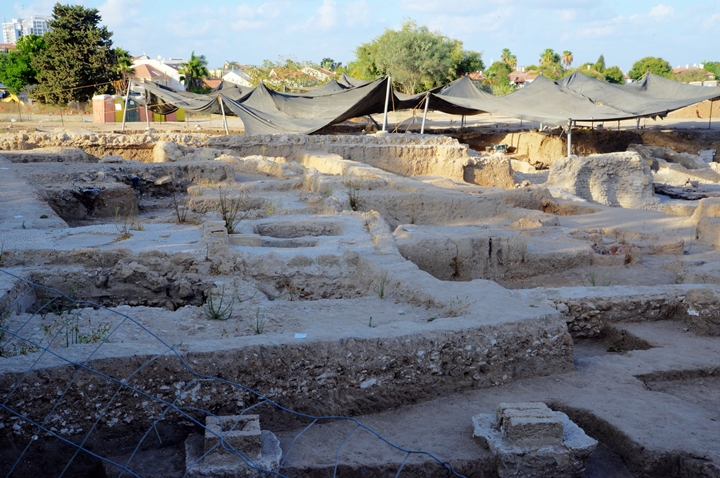
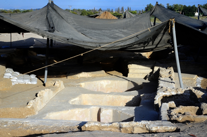
In recent excavations (2020-2021), a huge Byzantine winery was exposed on the south eastern side of the Tel.
Jamnia also appears on the the Peutinger Map (Tabula Peutingeriana), an indication it is an important station.
This map is a medieval map which was based on a 4th CenturyRoman military road map. The map shows the major roads, with indication of the cities, and geographic highlights (lakes, rivers, mountains, seas). Along the links are stations and distance in Roman miles (about 1.5KM per mile). The roads are shown as brown lines between the cities and stations. In the section shown below is the area of Jerusalem, drawn in a rotated direction (Egypt on the left, the Mediterranean sea on the top). Jerusalem is illustrated in the center as a double house icon, which represents a major city. It is listed as “formerly called Jerusalem, now called Aelia Capitolina” (antea dicta Hierusalem n(unc) Helya Capitolina).
The section where the Roman road passes through Yavne (“Jamnia” on the map) is indicated as a red square, where it spilts to the north (right side). The city is shown between Ashdod (“Azoton”, X miles) and Ashkelon (“Ascalone”) on the left, and Jaffa (“Joppe”, XII miles) on the right.
Part of Peutinger map, based on 4th CenturyRoman road map.
-
Early Arab and Crusaders (7th – 13th CenturyA.D.)
The city was conquered in 634 by the Arabs, who controlled the town until the first Crusade (1099).
The Crusaders arrived from Europe to the Holy Land in order to liberate the Holy Land and free Jerusalem. They accomplished the mission in 1099, and established the Crusader Kingdom. Yavne was also included in the new Kingdom.
The Arab Fatimids attempted to recapture the city from the Crusaders (1105, 1123) but failed.
In 1141 the Crusader King Fulk the Younger constructed a massive castle on the summit of Tel Yavne, and named it Ibelin. It included a regional church, and the town was the home of the Crusader Franks. Ibelin was an important frontier fortress, as at this time Ashkelon was under the Muslim control. The Crusaders were surrounded by the hostile Arab world, and therefore the importance of holding and fortifying the city which was located in the border of their Kingdom.
Only in 1154 the Crusaders managed to capture Ashkelon, thus advancing their control south of Ibelin.
In the second half of the 12th century, the great opponents of the Crusaders were the Ayyubid Muslims. This dynasty was founded by Saladin (Salah ad-Dīn Yusuf ibn Ayyub). The Ayyubid Muslims ruled Syria and Egypt in the years 1171-1341. Saladin, a Muslim of Kurdish origin, was the first Ayyubid Sultan in 1174 and reigned until 1193. His mission was to drive the Crusaders out of the Holy Land and the Levant, a mission that was mostly accomplished.
Saladin captured the city in 1187, but the control of the city switched sides in 1191 and 1240.
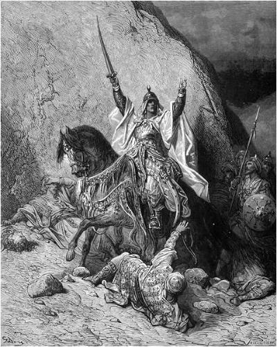
Saladin – by Gustave Dore (French artist, 1832-1883)
-
Mamlukes (1250-1516 A.D.)
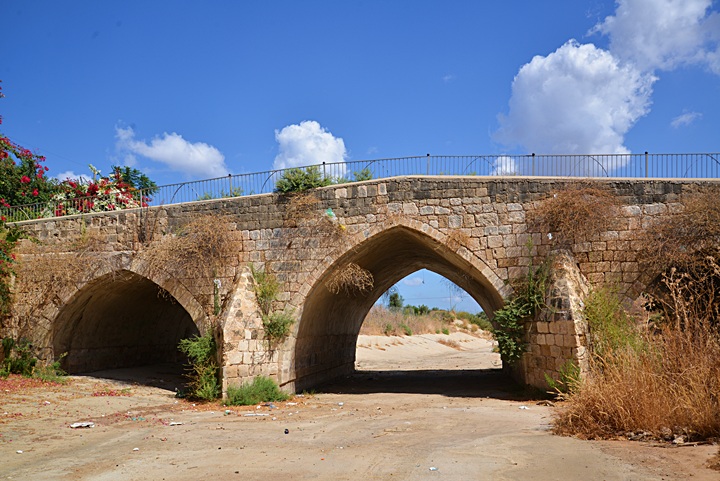
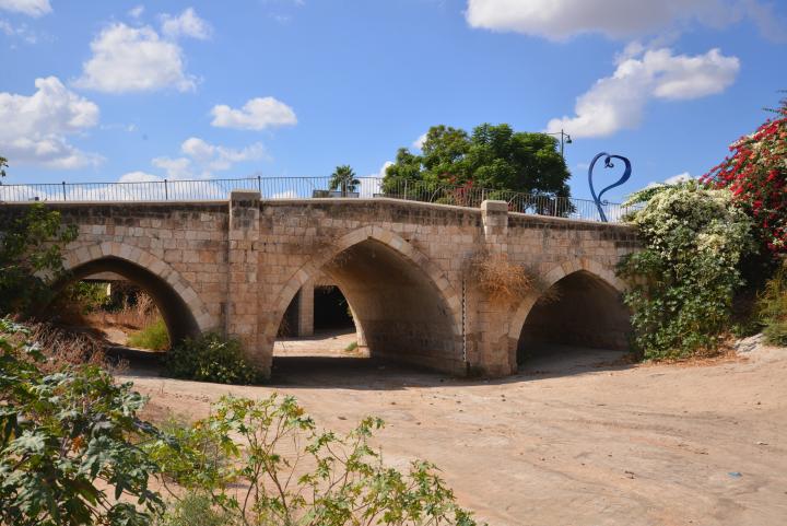
The Mamlukes were Turkish prisoners of the Mongols who were sold to the Sultan of Egypt, trained by him and served as his palace guards. In 1250 they seized the control of Egypt, and defeated the Mongols (1260). They captured Yavne in 1244, and converted the Church to a mosque. One of its towers remains today on the south side of the summit. They constructed a bridge over the Sorek stream (end of the 13th century), and built a monumental mausoleum (now dedicated to Rabban Gamliel II).
The Mamlukes controlled the Holy Land until the Ottoman period.
-
Ottoman Period – (1516-1918 A.D.)
During the Ottoman period, Yavne was inhabited by farmers, and named Yebnah (Yibnah), preserving the ancient name.
The area of Yavne was examined in the Palestine Exploration Foundation (PEF) survey (1866-1877) by Wilson, Conder and Kitchener. The surveyor’s report of 1875 (in Survey of Western Palestine, sheet XVI pp. 414, 441-443) on Yebnah, the Arab village built over the ruins of ancient Yavne, includes the following points of interest:
“Yebnah – Topography: A large village standing in a very conspicuous position on a hill. It has olives to the north and fields of corn and Kursinnch (vetches). Some of the houses arc of stone. The place is identified with the ancient Jabneel (Joshua xv. 11), and the later Jamnia (i Mace. iv. 15). It was known to Eusebius, and to the mediaeval writers. The fortress of Ibelin was here constructed in 1142 A.D. The Crusaders supposed the site to be the ancient Gath (William of Tyre). There are several wells in the gardens surrounding the hill”.
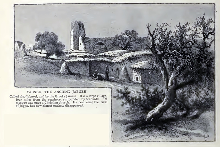
An illustration of the village dated 1882 is shown here. This is from a book by CH. W. Wilson , one of the PEF explorers. The title reads: “Yabneh – the ancient Jabneh”.
Ch. W. Wilson, Picturesque Palestine, 1882, Vol III P. 162
The PEF report continues:
“Archaeology: This town was of importance, not only in Jewish times, but also in the Crusading period, when it was thought to stand on the site of Gath ; and the fortress of Ibelin was here erected in 1144, having four square towers like Blanche Garde. The modern village occupies a strong site on a rounded hill, the houses being mostly of mud. The only remains of interest noted were the church, in the middle of the village, and the mosque of Abu Hurcireh, west of it.
The church is now converted into a mosque, but it is still called el Keniseh by the natives. In the south-west corner is a short minaret, on which is an inscription in Arabic, which may be thus rendered: ‘In the name of God, the Merciful, the Compassionate. Ordered the construction of this blessed minaret, the one who needs the grace of God Most High, the Mawlawi, the Great Emir Suleiman en Nasiri, in the month Rabi al Akhir, a.h. 738 [November, A.D. 1337]’. The mosque itself has an internal measure of 49 feet along a line bearing 109°, with an internal breadth of 32 feet 6 inches. It is divided into two aisles, the southern 16 feet 3 inches in the clear, the northern 12 feet 9 inches in the clear. These were the nave and north aisle of the church. There were three bays, supported on two intermediate piers, the clear span of the arches being 16 feet, and the piers 4 feet 6 inches square. The pillars on the south side of the nave are now built into the mosque wall, in which is a mihrab 3 feet diameter. The east and west walls are also apparently modern, and the apses have been destroyed.
A staircase leads up to the minaret from the north-west corner of the interior, having 35 steps in three flights. A rude narrow cornice runs round the walls above the piers, probably late. The whole of the interior is whitewashed, and thus no masons’ marks were discovered. The north wall has a door in it opening into a courtyard. It appears to be the original wall of the church, and has in it two windows with pointed arches, 9 inches broad outside, and constructed like loopholes, 2 feet 10 inches broad inside ; one in each of the end bays. The door is 6 feet 8 inches broad, with a pointed arch, probably of later construction, as are also the roof and vaulting of the mosque. The west door is built up, but was sketched by M. le Comte, who describes it as ‘of the purest Western (Gothic) style.’
The mosque of Abu Hureireh is a handsome building under a dome, and contains two inscriptions, the first in the outer court, the second in the wall of the interior.
The first may be thus translated : ‘In the name of God the merciful, the pitiful. Founded this blessed cloister our Lord the Sultan el Melek edh Dhaher, pillar of the temporal and spiritual affairs, Abu el Fath Bibars, mighty Emir of the believers, may God make him victorious. And the completion of it was in the month Rabid el Owal (the third month), in the year 673 a.h. And had charge of the building Khalil ibn Sawir, Wall of Ramleh. May God forgive him and his parents, and all Moslems.’
The second inscription in the interior reads :
‘In the name of God the merciful and compassionate. Constructed this blessed shrine to Abu Hureireh (with whom may God be pleased), the friend of the Apostle of God (on whom be God’s blessing and salutation), our Lord the Sultan, the wise, the just, the Defender and Outpost of the Faith, the victorious El Melik el Ashraf Salah ed (dunya wed) Din (Sultan of Islam and Moslems and of kings and sultans), Abu’l Feda Khalil, in completion of the order of his late father, whose victories may God exalt, El Melik el Mansur Kalaun, of the family of Saladin, may God … and his dynasty … paradise and comprehensive pardon and cause him to dwell in gardens of eternity, as was promised to him on the “testified day,” and may He place him in an extended shade, with water poured out, and fruit in plenty, neither cut nor grudged ; and may He recompense him with reward and with good works, and prepare for him an excellent return, and grant him all he desires. Amen.
‘The building was completed in the course of the year 692 (= 1292 A.D.). The superintendent of the building (architect) was Edemir ez Zeiti (?), may God pardon him and his parents and all Moslems.’
Part of map sheet 16 of Survey of Western Palestine,
by Conder and Kitchener, 1872-1877.
(Published 1880, reprinted by LifeintheHolyLand.com)
Their report continued:
“In addition to these two sanctuaries there is the Mukam of Sheikh Waheb, immediately north-west of the village, and that of Sheikhah Sadeh his sister, a cave now closed. The small bridge over the stream has pointed arches, and is probably Saracenic work. The port of Yebnah is at Minet Rubin.”.
-
British Mandate (1918-1948) and Israel Independence war
The British railway passed on the south and east side of Tel Yavne. During the Arab revolt of 1936 a “pillbox” guard post was built in order to protect the railway.
During the Independence war, the Arab forces commanded by Fawzi al-Qawuqji were stationed on the hill. The Egyptian forces almost reached to unite with Qawuqji in order to attack TelAviv , but the Israeli forces captured the town and demolished it before this could happen.
-
Modern times
Tel Yavne is an open area on the east side of the modern city of Yavne. Few remains could be seen on the hill, except for the Mamluke tower on its south side.
Emergency excavations are held since 2020 on the foothills and surroundings of Tel Yavne. These large scale excavations are conducted as part of plans to build new neighborhoods. A huge winery factory, dated to the Byzantine period, was unearthed here. This is the largest ancient winery found to date in the world, producing an estimated 2 million liters per year. The findings will hopefully change the plans of the neighborhood, and the exciting complex will be preserved and open to the public.
Photos:
(a) General Views:
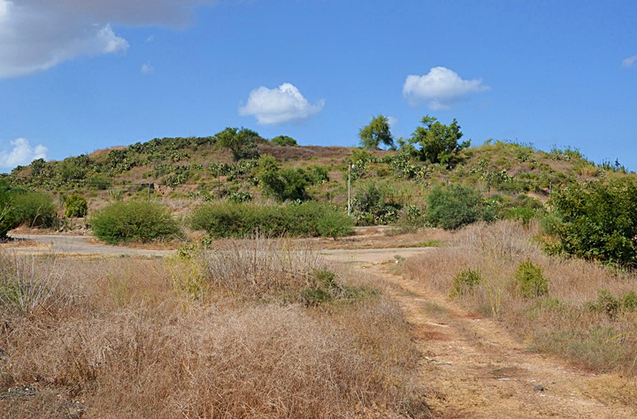
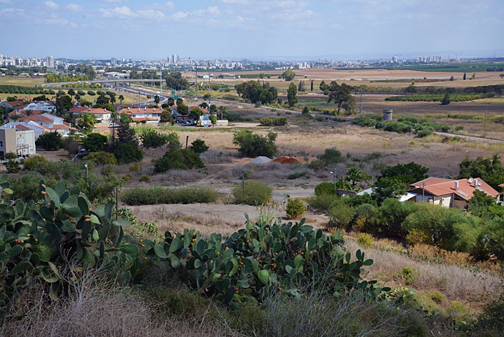
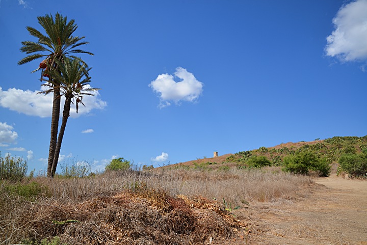
Tel Yavne is located on a low hill, at an altitude of 49m – 15m above the area around it. On top of it are few remains of the Arab village of Yibna and earlier periods. This view is from the southeast side.
Click on the photos to view in higher resolution…
The summit offers great vies of the Sharon plains. Near the hill, on the left and right sides, is a residential area.
(b) Ancient Tel Yavne:
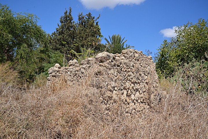
A relative easy access to the top of the hill is from the northwest side of the hill. Along this path are ruins of the Arab town of Yibna, which was destroyed during the Independence war of 1948.
On the right side of the photo you can notice the cement structure of a water reservoir, which is located on the summit.
Around the summit are some remains of the Ottoman period houses, cisterns and sheds. Under the surface are layers of thousands of years of history, waiting for the first thorough excavation.
(c) Tower:
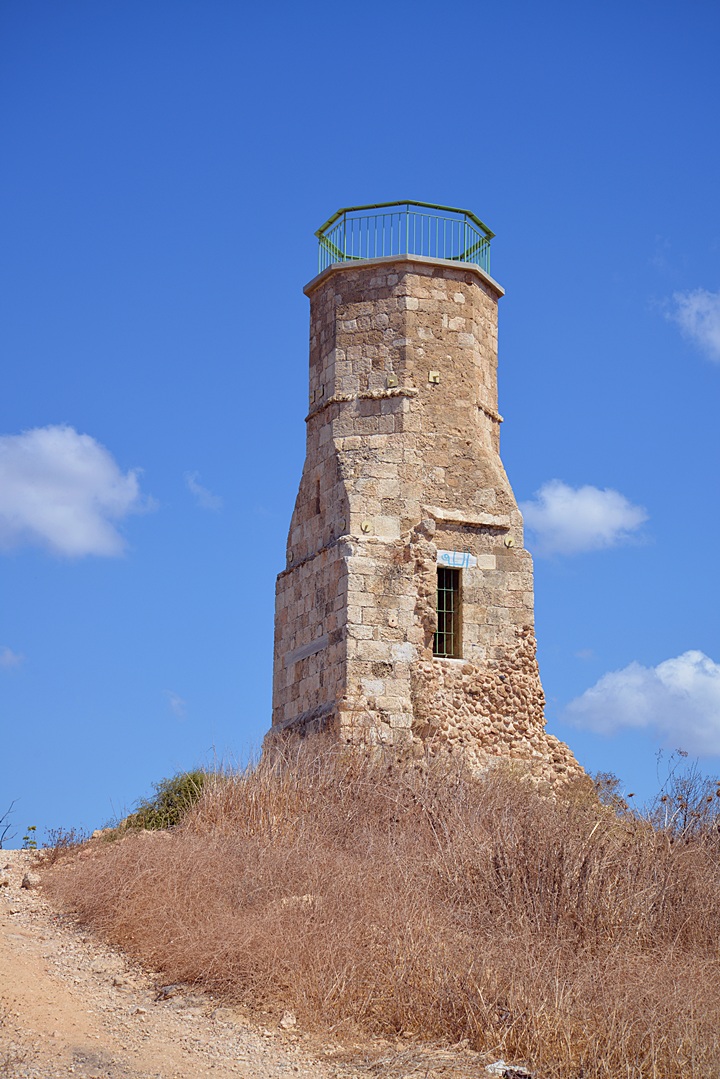
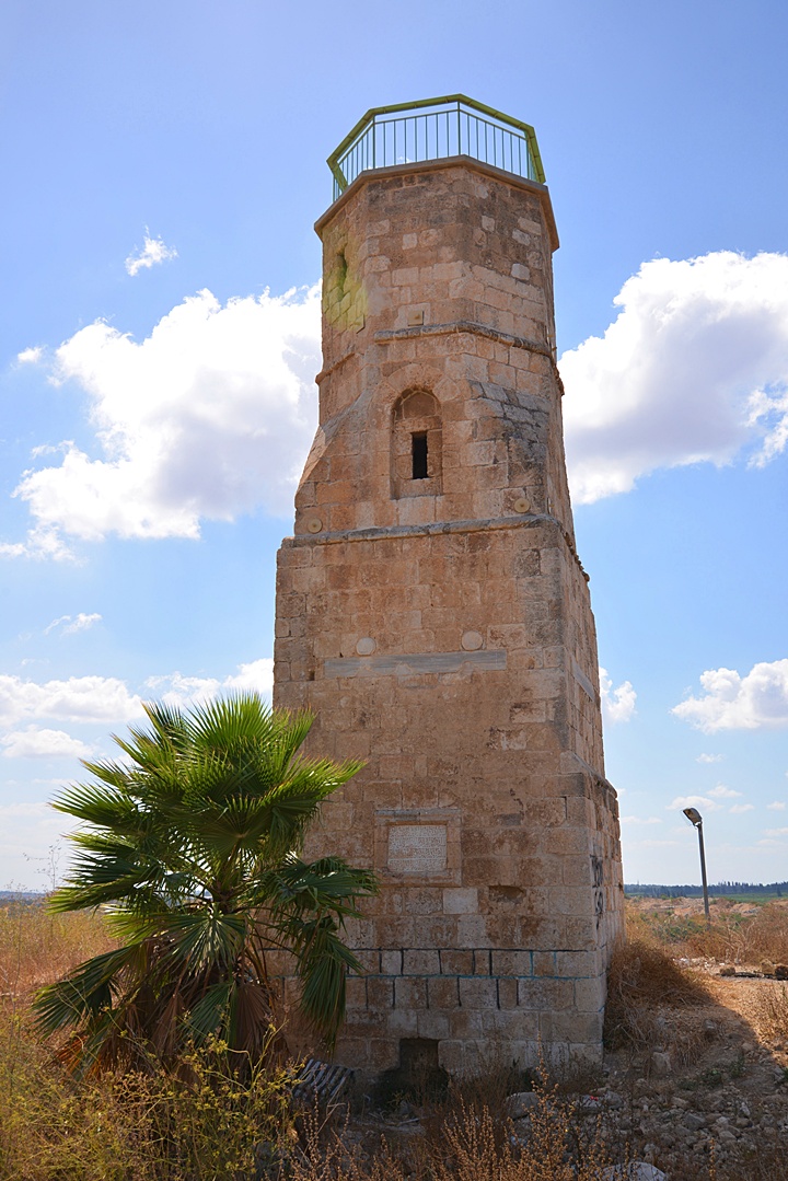
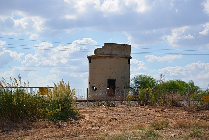
There are few remains on top of Tel Yavne, except for a Mamluke tower located on its south side.
A closer view from the west side of the tower is shown below. The tower was renovated and cleaned by the Israel Antiquities Authority.
The tower was a minaret (call-to-prayers tower), part of the Jama’a el-Kabir mosque built in 1337. This mosque was built on the ruins of the Crusaders Church, built in the 12th Century.
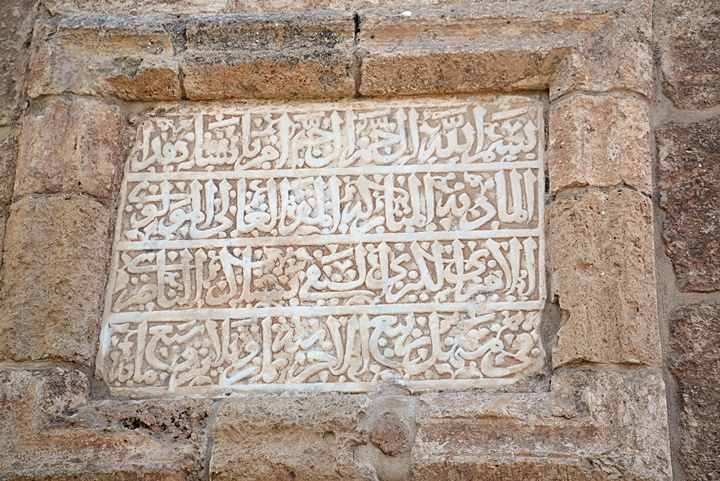
On the east side of the tower is an inscription:
The Arabic inscription on the wall of the tower reads:
‘In the name of God, the Merciful, the Compassionate. Ordered the construction of this blessed minaret, the one who needs the grace of God Most High, the Mawlawi, the Great Emir Suleiman en Nasiri, in the month Rabi al Akhir, a.h. 738 [November, A.D. 1337]’.
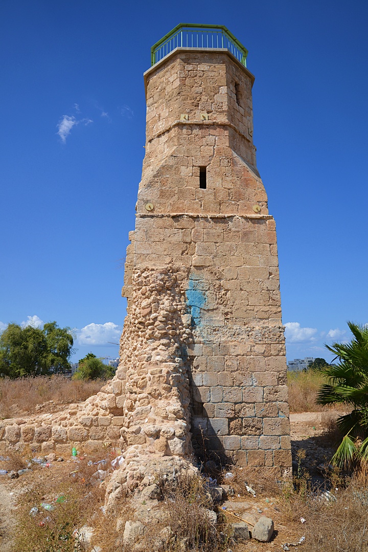
A view from the east side is shown in the next picture. Remains of the demolsihed walls of the mosque can be seen attached to the tower.
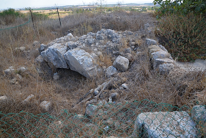
Remains of the Crusader fortress and church are barely seen in the ruins around the tower. Perhaps in the future, archaeological excavations will bring back the glory of the Crusaders structures and earlier periods.
(d) Byzantine winery:
Emergency excavations are held since 2020 on the foothills and surroundings of Tel Yavne. These large scale excavations are conducted as part of plans to build new neighborhoods.
A huge winery factory, dated to the Byzantine period, was unearthed here. This is the largest ancient winery found to date in the world, producing an estimated 2 million liters per year.
It was arranged as a complex of 5 huge wine producing areas, each covering an area of 225 square meter. Each area consisted of a large treading floor, covered by mosaics, where the grapes are laid and crushed by the feet of the workers, extracting the juice. Around it were octagon-shaped collecting pools, and storage chambers where the grape juice fermented inside jars.
The winery produced prestigious white wine that was sold to the entire region via the ports of Ashkelon and Gaza. The archaeologists also unearthed thousands of jars that were manufactured locally, used for storage, aging and export.
(e) Mamluke Bridge:
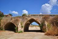
Two major roads crossed the Sorek stream (Arabic: “Nahr Rubin”) near Yavne: a northwestern road to the port city of Yafo (Joppa), and a northeastern road via Aphek (Antipatris) to Syria and Mesopotamia. The latter road was the main coastal road, and in order to support the traffic through this important road, a bridge was constructed over the stream during the beginning of the Mamluke period (end of the 13th century).
The ancient trade route started during the Early Bronze Age. It is mentioned in the Bible (Isaiah 9 1): “Nevertheless the dimness shall not be such as was in her vexation, when at the first he lightly afflicted the land of Zebulun and the land of Naphtali, and afterward did more grievously afflict her by the way of the sea, beyond Jordan, in Galilee of the nations”. Its route is described as connecting between Egypt and Assyria (Jeremiah 2 18): “And now what hast thou to do in the way of Egypt, to drink the waters of Sihor? or what hast thou to do in the way of Assyria, to drink the waters of the river?”. The name of the trade road was later called by the same name: “Via Maris” (the way of the sea), based on the Latin translation of the Bible (the “Vulgate”) of Matthew 4:15, a verse from the Book of Isaiah: “The land of Zabulon, and the land of Nephthalim, by the way of the sea, beyond Jordan, Galilee of the Gentiles;”.
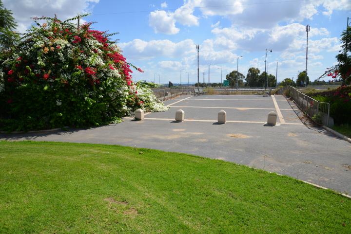
The bridge served the modern traffic, and was known to cause the cars to shake (hence, it was called the “jumping bridge”). A new replacement bridge was built, and the 700 years old bridge became part of a park. The following photo is a view of the east side of the park and the old bridge behind the grass.
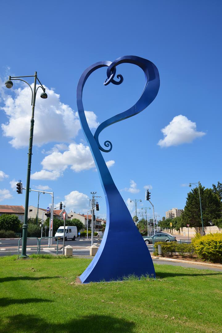
On the south side of the small bridge park is an impressive metal statue painted in blue. It is the work of Israel Primo, a metal sculptor from Kefar Aaron, who erected other statues in Yavne. On the other side is an inscription in Hebrew: “Yavne – An excellent community in the Shephela”.
Behind the statues it is the road that crosses over the modern bridge, which is built at the side of the old bridge.
(f) British “Pill Box” and railway
During World War 1 the British forces advanced from Egypt northward into the Ottoman held territories. The campaign started on January 1915, and after two years the British forces completed their conquest of the Sinai Peninsula. In order to support their forces, the British laid a railway from the Suez Canal to the Sinai town of Rafah, reaching it in 1916. On November 1917 the British captured the town of Arab Yibna (Yavne), and extended this railway from Rafah northwards. A rail station was constructed in Yibna (Yavne).
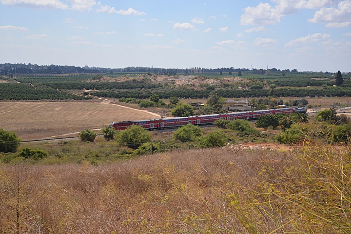
A hundred years later, the modern railway uses the same line, passing on the east and south of Tel Yavne. This photo shows a view from the mound towards the south, with the passenger train passing from right (south) to left.
During the Arab revolt (1936-1939), the railway was a prime target of sabotages, and so the British built blockhouses to guard the bridges along the railways. These concrete guard posts were nicknamed “pill boxes” as they resembled an oblong box for holding pills. One such “pillbox” is located on the east side of Tel Yavne, near the railway crossing of the Sorek brook.
(g) House of arches:
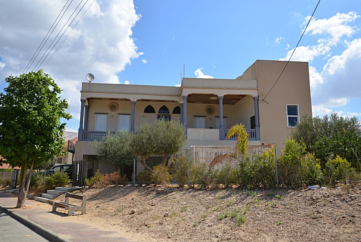
An Arab villa was built by the Sheikh of Yibne in 1936, on the east side of Tel Yavne. The “House of Arches”, named after its windows design, was converted in 1948 to a hotel, and later sold to a family who recently renovated it.
(h) Tomb of Rabban Gamliel:
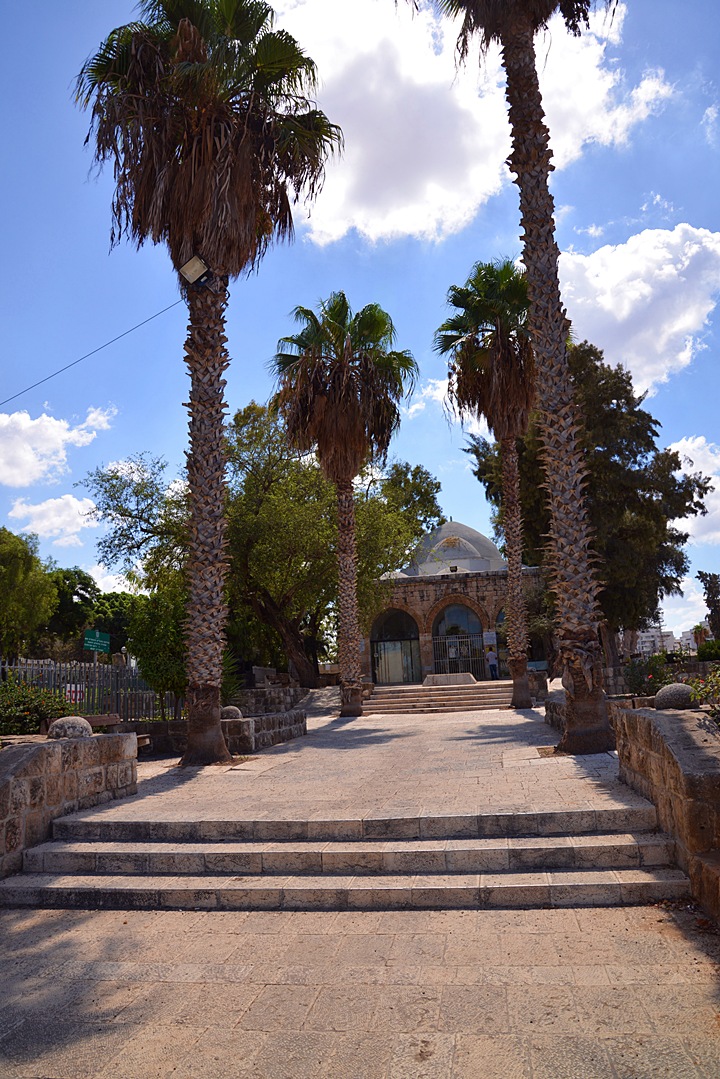
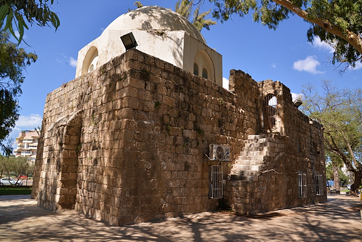
An impressive mausoleum (large tomb structure) stands on the west side of Tel Yavne. It is dated to the Mamluke period (end of the 13th Century). This photo shows the entrance to the tomb from the north side. A park, called “Sanhedrin Garden”, is located on the left (east) side.
According to the Jewish Sephardic tradition (since 1948), this is the tomb of Rabban Gamaliel II. This Jewish leader was the first head of the Great Sanhedrin in the years 80-90.
The Great Sanhedrin was the supreme judicial body during and after the Second Temple period. Today, the tomb serves as a Jewish Holy place of worship.
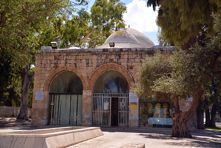
This picture shows the north eastern side of the structure:
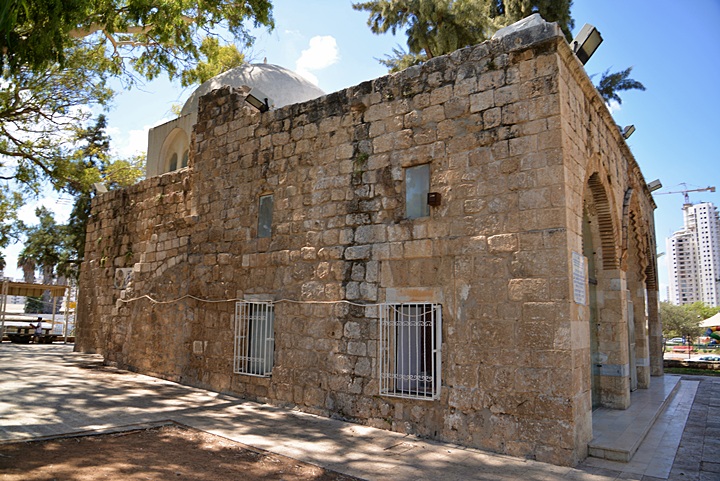
A south eastern view of the structure is shown below. Steps lead on the side to the roof, where a large white cape is located just above the hall of the tomb.
According to the Muslim tradition, this structure was actually the tomb of Abu Hureireh (Hurayrah)- a famous companion of the Islamic prophet Muhammad (born in 603 A.D.). While he is known to be buried in the cemetery of Medina (681 A.D.), the tradition holds that this is Abu Hureirah’s tomb.
- Interior
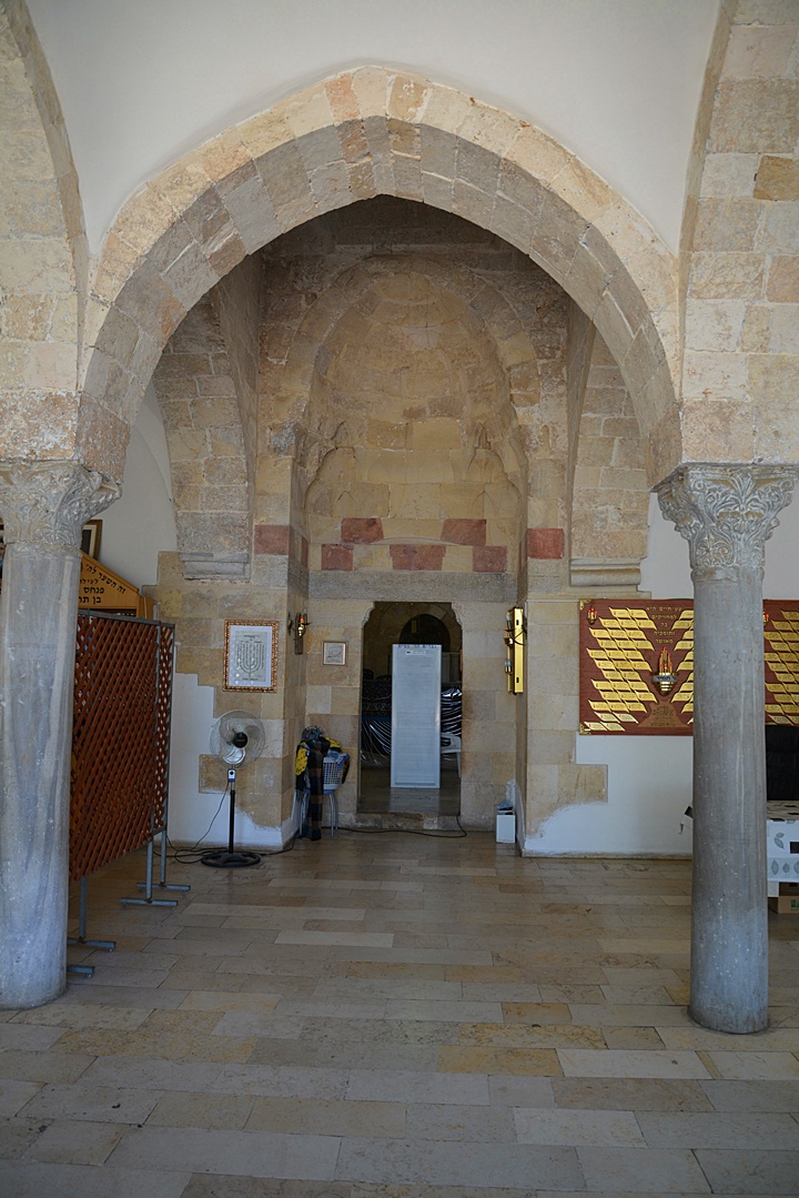
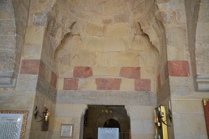
The next picture shows the entrance to the internal side of the entrance hall, where two columns with Corinthian capitals stand.
An Arabic inscription dates the completion of the building in 1292. It includes the following dedication (see also the History section): “‘In the name of God the merciful and compassionate. Constructed this blessed shrine to Abu Hureireh (with whom may God be pleased), the friend of the Apostle of God (on whom be God’s blessing and salutation)…”.
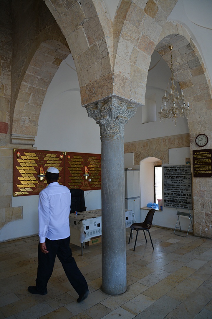
Another view of the entrance, with Ethan who supervises this holy place:
- Main hall
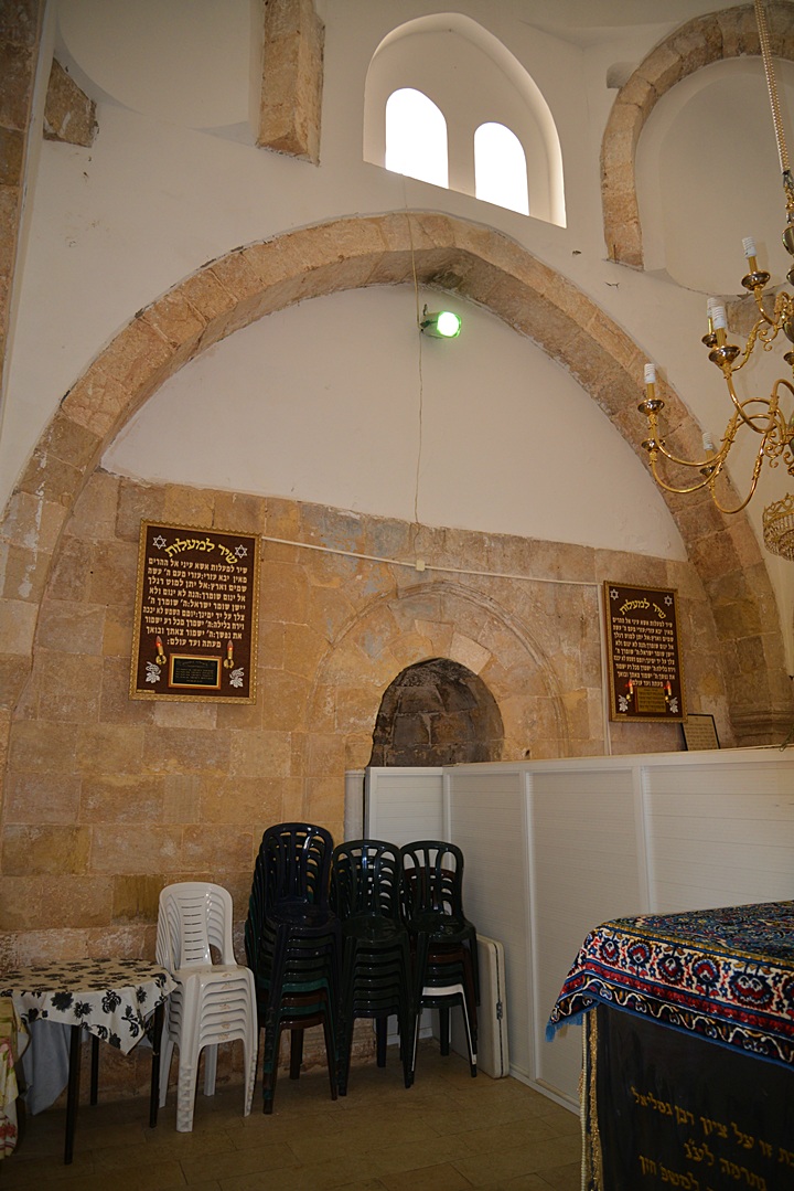
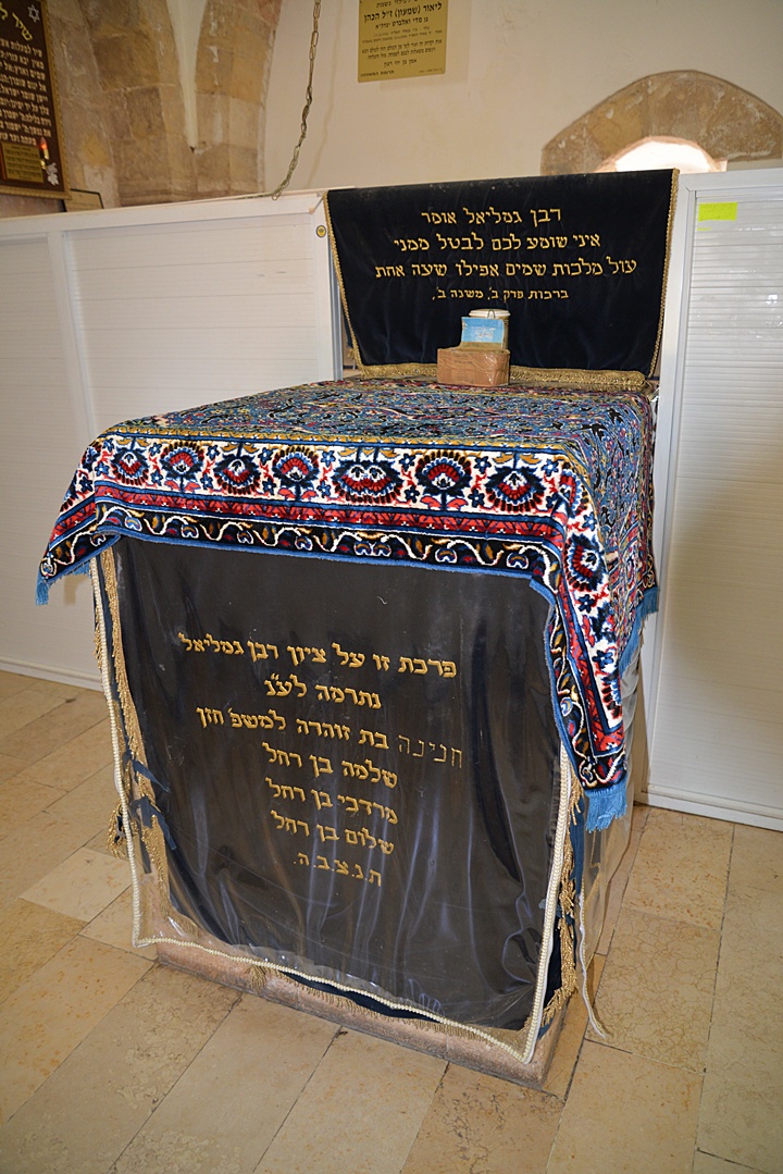
Inside the main hall, located under the large dome, is the place of prayer separated by a fence to a section for men and a section for women. In its center is a square marble tomb, covered by an inscribed cloth (“parochet” – ornamental curtain or cloth covering the front of a tomb or a the holy ark in the synagogue).
A Muslim prayer niche – Mihrab – is embedded on the south wall, hidden by the fence that separates the women and men sections of the hall. The Mihrab is directed, as all mosques and Muslim tombs, towards the Islam Holy cities of Mecca and Medina.
As for the Jewish tradition, Gamaliel II was the son of Shimon Ben-Gamaliel, one of the Jewish leaders during the mutiny against the Romans (67-70 A.D.). He was also the grandson of the great Jewish teacher Gamaliel the Elder, who lead the Sanhedrin before the Jewish revolt, and was the teacher of Paul the Apostle (Saul of Tarsus, 5BC-67AD) – one of the most influential early Christian missionaries. (Acts 22 3): “I am verily a man which am a Jew, born in Tarsus, a city in Cilicia, yet brought up in this city at the feet of Gamaliel…”. A monastery of Beit Jamal (the Arabic name of Gamaliel) is located near Beit Shemesh, an is dedicated to Gamaliel the Elder.
During the siege of Jerusalem, a new center of Judaism was opened in Yavne, with the permission of the Roman General Vespasian. The center was lead by Johanan Ben Zakkai, a prime contributor to the Mishna (2nd Century AD books of Jewish practices). After the temple was destroyed, the new school functioned as the new seat for the Sanhedrin. After Johanan’s death (90 A.D.), his successor was Gamaliel II.
(i) Sanhedrin Garden:
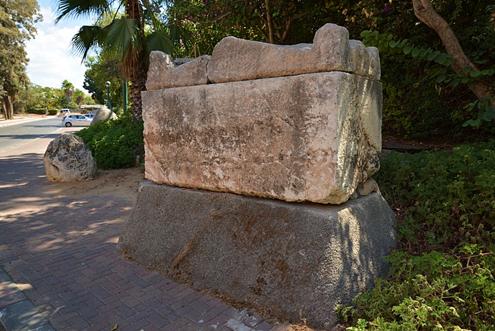
To the east of the tomb of Rabban Gamaliel is the “Sanhedrin garden” municipal park. This was the location of the cemetery of ancient Yavne, which was in use since the Bronze age. A sarcophagus (burial coffin) is located on the adjacent road.
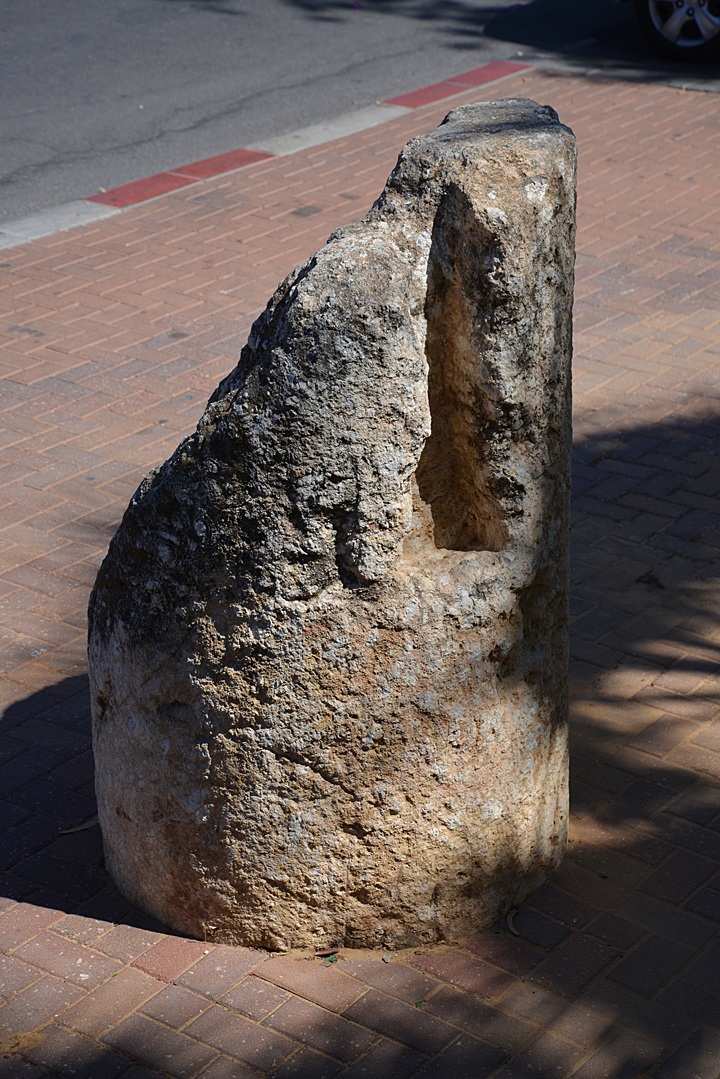
Ancient pillar stones are also on display on the side of the garden.
(j) Panoramic view:
A 360 degrees panoramic view, as seen from the south side of the summit, is shown in the following picture. If you press on it, a hi-res image will pop up.
Etymology (behind the name):
- Tel (Tell) – a layered mound (read about the story of the Tels)
- Yavne’el (Jabneel) – Hebrew: “God will build”. Biblical reference: (Joshua 15:11): “And the border went out … unto Jabneel”.
- Yavne – short for of Yavne’el (“will build”)
- Yebnah, Yibna – Name of the Arab town (ruined in 1948), which preserved the ancient name
- Gamaliel – Hebrew: “”reward of God” or “rewarded by God”, where Gamal=reward, El=God.
-
Sorek – Hebrew name of the stream that passes on the east side of Yavneh. Biblical references: A single Biblical verse refers to Sorek, describing the area where Samson operated (Judges 16 4): “And it came to pass afterward, that he loved a woman in the valley of Sorek, whose name was Delilah”. Sorek is a Biblical form of a reddish color and also a type of grape used to make red wine. In the following verse the Hebrew word for vine is Sorek (Isaiah 5 2): “And he fenced it, and gathered out the stones thereof, and planted it with the choicest vine, and built a tower in the midst of it, and also made a winepress therein: and he looked that it should bring forth grapes, and it brought forth wild grapes”. The word Sorek is used for the red color (Zechariah 1 8): “I saw by night, and behold a man riding upon a red horse, and he stood among the myrtle trees that were in the bottom; and behind him were there red horses, speckled, and white.
Links:
* Archaeology:
- Tel Yavne prototype excavation (Foundation stone project)
- R. Kletter, I. Ziffer, W. Zwickel, Yavneh II: The “Temple Hill” Repository Pit (Book published 2015)
- Largest wine factory in the world from Byzantine period unearthed in Yavne – Jpost Oct 11
Salvage excavation reports:
- Salvage excavations Raz Kletter (Hadashot Arkheologiyot V116 2004)
- Tel Yavne Noy Velednizki (Hadashot Arkheologiyot V116 2004)
- Tel Yavne Ofer Sion (Hadashot Arkheologiyot V117 2005)
- Tel Yavne Aviva Buchennino (Hadashot Arkheologiyot V118 2006)
- Tel Yavne Felix Volynsky (Hadashot Arkheologiyot V121 2009)
* Other:
- Municipality web site
- Pillbox study group
- Wine presses in the Holy Land
- Yavne Yam BibleWalks site
BibleWalks.com – tour the Land with a Bible in the hand
<<< All Sites>>>—next Shefela site–>>> Yavne Yam
This page was last updated on May 9, 2023 (change panoramic view)
Sponsored links:
