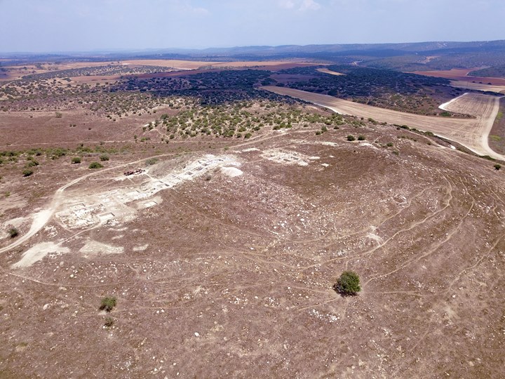
Ruins of a multi-period Biblical city on a flat topped mound. A possible identification is Libnah.
* Site of the Month Feb 2018 *
Home > Sites > Shephela > Tel Burna (Tell Bornat, Libnah?)
Contents:
Background
Location
History
Photos
* Aerial views
* Ground views
Etymology
Links
Background:
Tel Burna, also known as Tell Bornat (“mound of the hat”) is an archaeological site located in the Shephelah region of Israel, about 35 kilometers southwest of Jerusalem. The site is situated on a hill that rises about 50m above the valley of Nahal Beit Guvrin which flows on its south and west sides.
The site has a long and complex history that dates back to the Bronze Age, and it has been the subject of extensive archaeological research over the past two decades. The earliest evidence of human habitation at Tel Burna dates back to the Middle Bronze Age (2000-1500 BC), when a small village was established on the site. During the Late Bronze Age (1500-1200 BC), the site grew into a significant city that was likely part of the Canaanite civilization.
After a period of decline and abandonment, the site was reoccupied in the Iron Age (1200-586 BC), and it became a major city in the kingdom of Judah. The city was surrounded by a massive wall and contained a palace, temples, and other public buildings. It was likely an important center of regional power and influence, and it played a key role in the politics and economics of the southern Levant.
After the Babylonian conquest of Judah in 586 BC the site was abandoned for several centuries. It was briefly reoccupied during the Hellenistic period (332-63 BC), and a small settlement was established on the ruins of the ancient city.
The identification of Tel Burna with the biblical city of Libnah is somewhat uncertain. The name “Libnah” appears in several biblical passages, such as (Joshua 10:29): “Then Joshua … fought against Libnah:”. But it is not clear whether these refer to the city at Tel Burna or to another location, and some scholars have proposed other identifications.
In recent years, archaeological excavations at Tel Burna have uncovered a wealth of artifacts and structures that shed light on the site’s complex history. These include a massive gate complex, a large palace, a cultic area, and numerous other structures that provide insights into the social, economic, and political dynamics of ancient societies in the southern Levant.
Location:
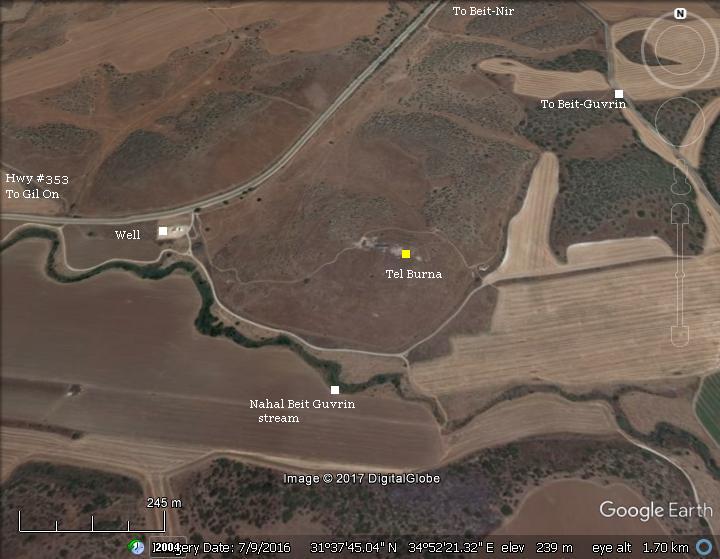
The site is located on the side of a highway #353 between the Kibbutz settlements of Gal On and Beit-Nir. Access to the site is from the modern well on the side of the highway.
History:
-
Early Bronze II-III (3,050-2,400 B.C.)
Settlement on the tell started in the 3rd millennium BC, based on the ceramic survey. After then, the city was deserted for several hundred years. This follows a general pattern, as most of the EB III cities were depopulated in the Levant. It may have been a result of onset of drier climatic conditions, which resulted in insufficient resources to support the large cities. Most cities in the Levant disappeared and settlements were abandoned.
-
Middle Bronze Age, Late Bronze period (2,200-1,550 BC, 1,550 – 1,200 BC)
The Canaanite city once again was settled. It reached a peak during this period, spreading over a large area of 60 dunams (6 hectares).
The excavators identified findings related to domestic activities on the western terrace below the summit, which were dated to the 13th century BC (Late Bronze Age IIB).
Excavations revealed that the Canaanite city was destroyed and burnt at the end of the Late Bronze period.
-
Iron Age I – Israelite conquest & Judges (1,200 – 1,000 BC)
During this period, the settlement was not occupied, according to the excavation areas opened until now. This lack of settlement, or at a limited scale, may have been the consequence of the Israelite conquest by Joshua.
-
Identification of Tel Burna: Libnah?
The excavators identify the site as Biblical Libnah. There are other candidates in the area for Libnah. However, recent excavations of Tel Burna are making the case of this identification more solid.
What do we know of Libnah? It was a Canaanite city that Joshua conquered (Joshua 10:29):
“Then Joshua passed from Makkedah, and all Israel with him, unto Libnah, and fought against Libnah:”.
The King of Libnah is listed among the 31 Canaanite Kings who was defeated by Joshua (Joshua 12: 7,15):
“And these are the kings of the country which Joshua and the children of Israel smote on this side Jordan on the west… The king of Libnah, one; the king of Adullam, one;”.
Libnah was part of the region held by the tribe of Judah (Joshua 15: 20, 42):
“This is the inheritance of the tribe of the children of Judah according to their families… Libnah, and Ether, and Ashan”.
It was one of the refuge cities, probably since it was on a border between tribes (Joshua 21:13 and 1 Chronicles 6:42):
“Thus they gave to the children of Aaron the priest Hebron with her suburbs, to be a city of refuge for the slayer; and Libnah with her suburbs”.
A map of the cities and roads of the Iron Age period is here, with Burna (“Libnah?”) marked as a red point in the center. The map shows 2 major roads passing near the site. According to David Dorsey (“The Roads and Highways of Ancient Israel”, pp. 192/3) the following roads passed thru Tel Burna/Libnah:
- J12a – a major North/South road passed on its east side, connecting Gath and the Shephelah cities in the north to Maresha/Guvrin, Lachish and BeerSheba in the south.
- J10 – An westward road connected the city, via Tel Zayit, to Ascalon (Ashkelon).
Cities and roads around Tel Burna (Libnah?) – Canaanite, Israelite periods up to Hellenistic period – Bible Mapper 3.0
-
Israelite Kingdom – Iron Age IIA (1000 – 925 BC), Iron Age II B ( 925-700 BC)
During the Israelite Kingdom period, the city covered both the upper and lower areas, and was spread on a larger area of 80 dunams (8 hectares). In addition to the expansion to the west of the summit, the excavators exposed remains of the Iron Age IIA period east of the summit.
During the reign of Joram, king of Judah, the city of Libnah joined the Edomite mutiny (2 Kings 8:20-22):
“In his days Edom revolted from under the hand of Judah, and made a king over themselves … Then Libnah revolted at the same time”.
-
The Philistine threat
In the 12th century the Philistines arrived to the cities along the shore. Tel Burna was on the border between the Philistines and the Judean Kingdom, and the excavators attempted to explore the relationships between the two rival states. The Philistine control of the plains was initially not a threat to the Israelites who dwelt in the hills of Samaria and Judea. However, towards the beginning of the 11th century BC the Israelites pushed westwards towards the plains, resulting with periodic clashes. This ongoing conflict ended only after 400 years, following the Babylonian conquests at the end of the 7th century (604 BC).
The Philistines – “Sea Peoples” from the Aegean sea – landed in Canaan and Egypt in the 12th century BC. The Egyptians fought the invaders (Ramses III battle of 1175 BC) and repulsed them into a small enclave in the southern coastal cities of Canaan (from Gaza to Ashkelon), as per (Joshua 13, 3): “…five lords of the Philistines; the Gazathites, and the Ashdothites, the Eshkalonites, the Gittites, and the Ekronites”. Gath was conquered by the Philistines, with minor damages to the city, and became their most important city.
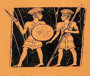
Philistine warriors – on sign of the Zafit national park
The main cities of the Philistines were located in the south coast area named by the Bible as “Pleshet”. The area was initially between Gaza and Ashdod. It included Gath, Ashkelon, and Ekron (Tell Mikne). As described in the Bible (1 Samuel 6:17):
“And these are the golden emerods which the Philistines returned for a trespass offering unto the LORD; for Ashdod one, for Gaza one, for Askelon one, for Gath one, for Ekron one”.
At a later stage the Philistines moved northwards until the Yarkon river north of Jaffa. They replaced the Egyptians, ruling the southern coastal area of Israel.
-
Assyrians (732-632 BC) and Babylonians (632 -586 BC)
The Assyrian empire conquered the North Kingdom of Israel in 732 BC, destroying most of the cities and villages in the land. The Assyrian King Tiglath-Pileser III annexed the area (as per 2 Kings 15: 29):
“In the days of Pekah king of Israel came Tiglathpileser king of Assyria, and took … and carried them captive to Assyria”).
The Assyrians reached the south coast and made the Philistine cities – from Jaffa to Raphia – a kingdom subdued and raising taxes to the Assyrians.
Due to the heavy taxes, the cities of the Levant attempted to free themselves from the Assyrians. They were assisted by the Egyptians, the empire from the south. Ashdod’s king, Azuri, stopped to deliver tributes to Assyria. The Assyrians replaced him with his brother, but a commoner named Yamani took the power and refused to pay.
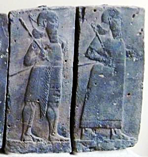
Orthostat relief – depicting soldiers from different orders of the Assyrian Army,
in procession; basalt; Hadatu Tiglath-Pileser III period (744-727BC)
[Istanbul Archaeological museum]
Sargon II ‘s intrusion: The Assyrian King Sargon II (722 – 705BC) came to settle the Philistine mutiny. The first step was to handle the allies of the Philistines: in 720 BC Sargon fought the Egyptian army in Raphia, south of Gaza, and managed to repel them back to the south. The next step was to handle the rebel Philistines: in 712 Sargon’s army crushed their cities (Gibton, Ekron and Gath), then took Ashdod and its port city Ashdod-Yam (Ashdudimmu).
Prophet Isaiah writes about this campaign, when Tartan – chief officer of Sargon – conquered Ashdod and its seaport (Isaiah 20 1):
“In the year that Tartan came unto Ashdod, (when Sargon the king of Assyria sent him,) and fought against Ashdod, and took it”.
Isaiah’s prophecy was backed by Sargon’s own accounts of the events, as inscribed in his palace of Khorsabad (discovered by P. E. Botta in 1845). One fragment described the mutiny and specifically mentioned Ashdudimmu (Ashdod-Maritime): “Ashdod, Gath, Ashdudimmu, I besieged, I conquered”.
After the Sargon II destruction, the Assyrians deported some of the Philistine population, replacing them with newcomers.
Sennacherib’s intrusion (701 BC): Following the death of the Assyrian King Sargon II, the Judean King Hezekiah mutinied against the Assyrians, joining other cities in the area in another attempt to free themselves from the Assyrian conquest. Two Philistine cities joined Hezekiah’s mutiny: Ashkelon and Ekron. Hezekiah crushed the other Philistine cities that refused to join the mutiny (2 Kings 18:8): “He smote the Philistines, even unto Gaza, and the borders thereof, from the tower of the watchmen to the fenced city”.
During the late 8th Century there is evidence of a Judahite presence in Burna/Libnah. A LMLK seal (“L’melekh” – “belonging to the king”) were found in the excavations, which are dated to Hezekiah’s times. Therefore, it can be assumed that Hezekiah fortified Burna/Libnah as preparations to the Assyrian intrusion.
The Assyrian army came in 701, led by Sennacherib son of Sargon II (2 Chronicles 32 1): “After these things, and the establishment thereof, Sennacherib king of Assyria came, and entered into Judah, and encamped against the fenced cities, and thought to win them for himself”. The Assyrians first handled the rebelling Philistine cities and then confronted the Egyptian army that supported the mutiny.
Isaiah reported that Libnah was conquered by Sennacherib (Isaiah 37: 8):
“So Rabshakeh returned, and found the king of Assyria warring against Libnah: for he had heard that he was departed from Lachish”.
According to an Assyrian stele found in the ruins of the royal palace of Nineveh, Sennacherib conquered 46 cities in Judea:
“And as to Hezekiah, the Judaean, who had not submitted to my yoke, 46 of his strongholds, fortified cities, and smaller cities of their environs without number, with the onset of battering rams and the attack of engines, mines, breaches, and axes (?), I besieged, I captured. 200,150 people, small and great, male and female, horses, mules, asses, camels, oxen, and sheep without number I brought out of their midst and counted as booty. He himself I shut up like a caged bird in Jerusalem, his capital city; I erected beleaguering works against him, and turned back by command every one who came out of his city gate”.
According to the excavations (of the casemate wall in Area B2), the level of Iron IIb (925-700 BC) was destroyed in Tel Burnat, probably due to the Sennacherib conquest.
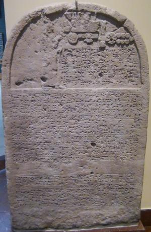
Sennacherib’s stele with relief and inscription; Nineveh;
limestone [Istanbul Archaeological Museum]
Jerusalem was spared from destruction and the Assyrians retreated (2 Chronicles 31 22): “Thus the LORD saved Hezekiah and the inhabitants of Jerusalem from the hand of Sennacherib the king of Assyria, and from the hand of all other, and guided them on every side”. Jerusalem fell only 114 years later. Judea continued to pay heavy taxes to the Assyrian conquerors.
Following the Assyrian destruction, the city of Burna/Libnah continued to be settled, as 100 years later King Josiah – father of Zedekiah – marries Hamutal of Libnah (2 Kings 24:18):
“Zedekiah was twenty and one years old when he began to reign, and he reigned eleven years in Jerusalem. And his mother’s name was Hamutal, the daughter of Jeremiah of Libnah”.
The archaeologists unearthed sections of the Iron Age casemate wall that surrounded the summit. In addition, they exposed a silo on the summit, dating it to the end of the Iron Age at the times of King Josiah.
-
Persian, Hellenistic, Roman, Byzantine (6th Century BC – 6th Century AD)
During the Persian time there was some presence in the city, although limited in comparison to the Iron Age II.
Throughout the following Hellenistic, Roman/Byzantine periods there was limited activity on the site.
Eusebius Pamphili (better known as Eusebius of Caesarea), a 4th century Greek historian of the Church, wrote in his book “Onomasticon” that a village existed in Libnah (here: Lebna, Lobano):
“Lebna: Josue also besieged this and captured (killed) its king. Given to the tribe of Juda. Priestly city. There now is a village called Lobana in the area of Eleutheropolis. Isaia noted it also”.
-
Ottoman period (1516-1918)
Conder and Kitchener surveyed this area during the Survey of Western Palestine (SWP) of the PEF in 1873. A section of the survey’s map, part of Sheet 20, is shown here, with Tel Burna (Tell Bornat) in the center. Notice the Roman road that passed near the site, connecting Beit Jibrin (the red circle on the bottom right corner) to Tel es-Safi (Gath) in the north.
Part of map Sheet 20 of Survey of Western Palestine,
by Conder and Kitchener, 1872-1877.
(Published 1880, reprinted by LifeintheHolyLand.com)
Their report (p. 290 on Volume 3, sheet XX) was as follows:
“Tell Bornat – mound, partly natural, partly artificial, with a square enclosure, about 50 yards side at the top, and terraces artificially cut on the slopes”.
They did not identify the site, but proposed that this mound was one of the three outposts that surrounded Eleutheropolis (Beit Guvrin). (p. 270 on Volume 3, sheet XX):
“The three Tells which surround the site of Eleutheropolis may perhaps have been originally used as out-works. They are called Tell Bornat, Tell el Judeiyideh and Tell Sandahannah, and described under those heads ; the first two are each about 2 miles from the village ; the third less than a mile”.
-
Excavations
Tel Burna, first thoroughly surveyed in 2009, is excavated by a team headed by Dr. Itzhak Shai of Ariel University, and a professional staff of various institutes. The first two seasons have unearthed impressive findings of the Late Bronze IIB period (13th century BC), Iron Age II (9th-7th century), and the Persian period. An Iron Age casemate wall surrounds the summit, and a square tower was built on it. A lower city is located to the west of the upper city. On the north east side is the Necropolis.
Until the season of 2022, the following areas were designated and excavated:
- Area A2 – summit buildings (Late Iron IIA to Persian Period)
- Area B1 – western platform (Late Bronze cultic enclosure)
- Area B2 – east-west slope (Late Bronze and Early Iron IIA), and western casemate (Late Iron IIA-Persian Period)
- Area B3 – western platform, southern part(Late Bronze buildings)
- Area C – north east of the mound, agricultural installations (Chalcolithic-Byzantine periods)
- Area D – lower platform, northern side (Late Bronze buildings)
- Area G – southern side, casemate fortifications and gate (Late Iron IIA-Persian Period)
A map of the excavation areas is seen here, from the west side, on the 2017 aerial view:
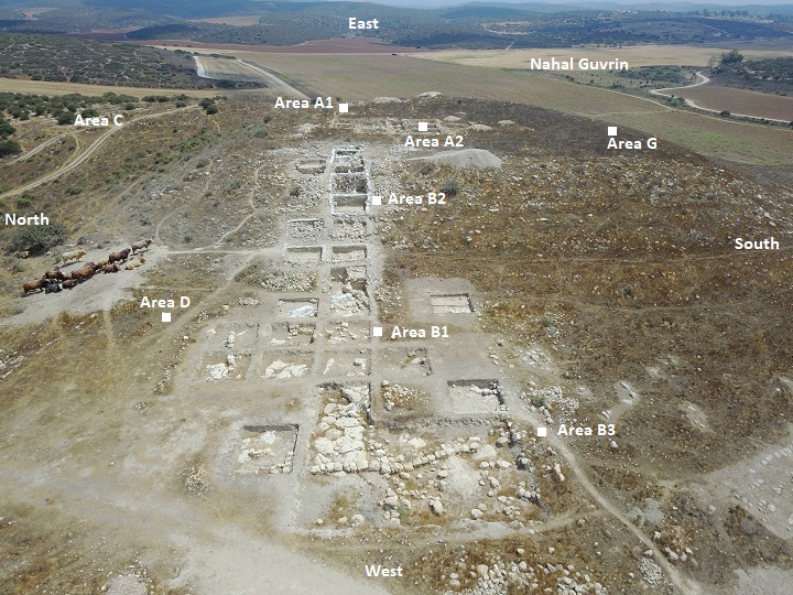
Since the visit to the site in September 2017, there were more excavation seasons. We intend to revisit this exciting site soon.
Photos:
The aerial and ground photos were captured in 2017.
(a) Aerial views
A drone captured this view from the south west side. The ruins cover the summit and the area around it. Several excavation areas were opened.
Click on the photos to view in higher resolution…
Another view below is from the east side.
These drone shots were captured in 2017, and since then there were more excavation seasons.
![]() The following YouTube video shows a flight of a drone over the mound, starting from the valley side, then over the mound from east to west:
The following YouTube video shows a flight of a drone over the mound, starting from the valley side, then over the mound from east to west:
Another drone video starts from the east side, crosses the mound, then turns around the area:
(b) Ground views
The ground views are arranged in the order from east to west.
(1) Eastern foothills:
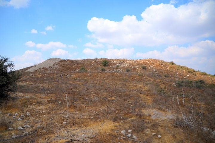
This is the view of the east side of the mound. The ruins are situated on a hill that rises about 50m above the valley.
After climbing up from the east side, a number of agriculture installations were observed on the foothill.
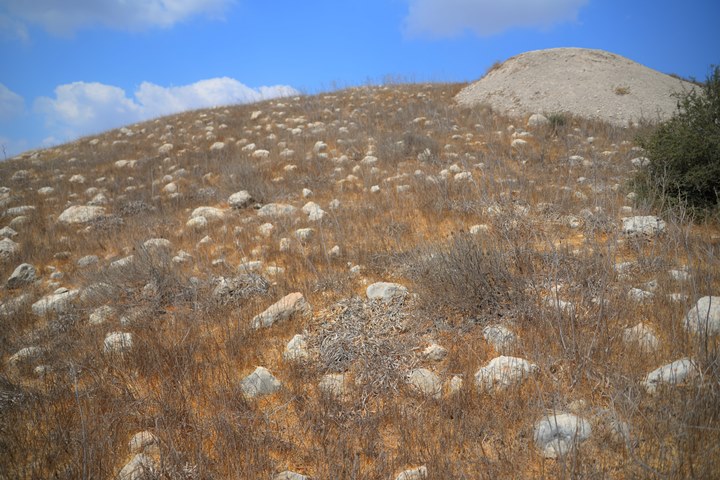
A view of the eastern foothills is in the next photo. Excavations held in 2017 piled up the soil unto the pile seen in this photo.
Notice that the whole eastern slope is covered by field stones. Is it the debris of the Iron Age II glacis? There was also occupation outside the eastern wall during the Late Bronze period of the Canaanite city, but this was only recently excavated and not yet published.
(2) City wall on Eastern side (area A1):
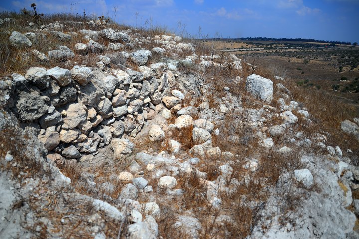
The archaeologists exposed the eastern fortifications on the summit, designating them as “Area A1”. The fortifications were dated to the Iron II period. A section of the Iron Age II city wall was exposed. A casemate wall – double parallel walls with chambers built between them – surrounded the Iron II city. This view shows the external side of the double wall.
A casemate wall (Hebrew: “Sogarim”) is a type of defensive wall construction used during the Iron Age, which is typically characterized by the use of stone or mud bricks. Casemate walls are made up of parallel walls or partitions, which create a series of compartments or rooms within the wall structure. The compartments can be accessed through internal doors or openings and can be used for storage or as living spaces during peace time, and filled up with soil during wars in order to create a strong wide defense. (The excavations of the wall in area B2 demonstrated that the chambers were filled during the war by soil and stones from an earlier level of Late Bronze, perhaps from area B1).
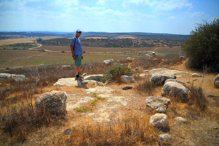
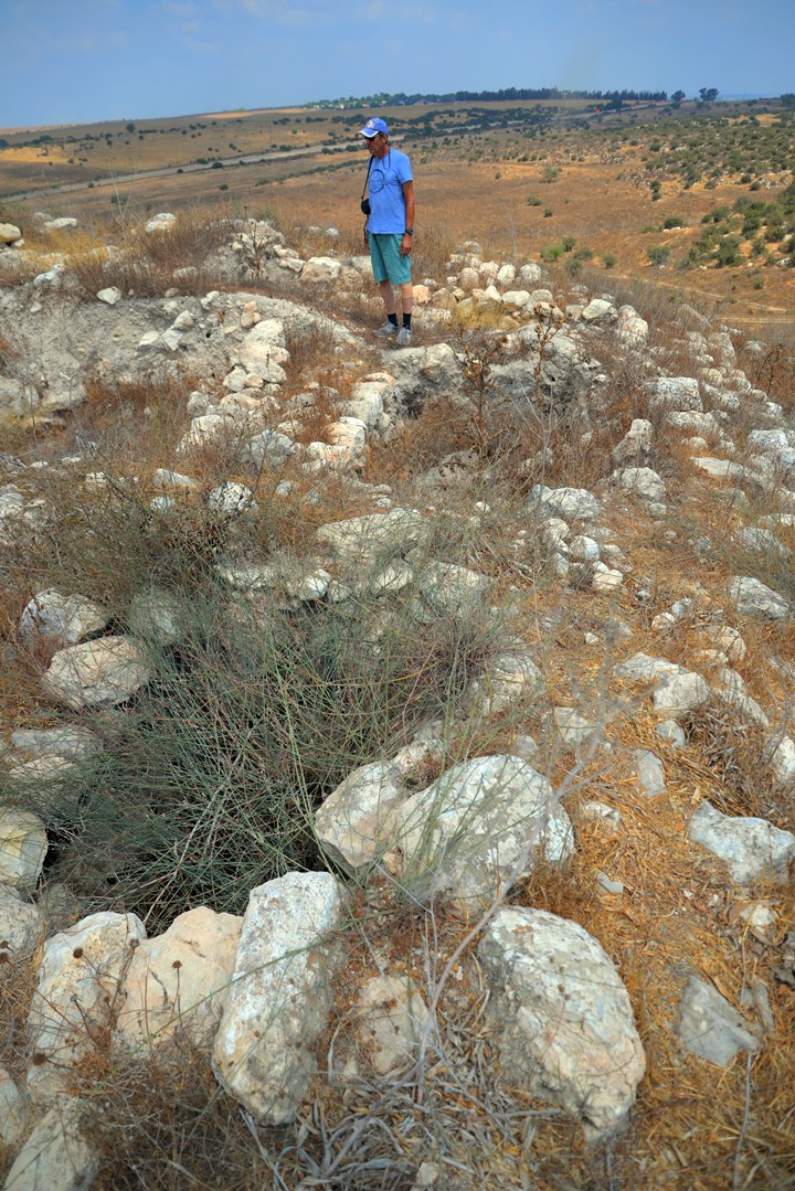
A section of the casemate wall is also seen in the next photo, taken from the summit. Uncle Amnon is standing near the inner wall of the casemate wall, while the outer external wall is to the right of him. Between the two walls is a chamber.
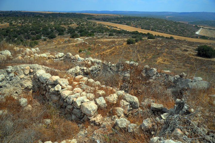
Another view of the casemate wall is next. The valley of the Guvrin stream is seen in the background, and the mountains of Hebron in the far background.
The casemate wall was built along the edges and around the summit, although only sections of the wall was unearthed so far (sections on the east, west and south). This created a 70m x 70m enclosed fortified area on the summit, as also observed on the aerial view and observed by the PEF survey (“a square enclosure, about 50 yards side at the top”).
(3) Upper City (area A2):
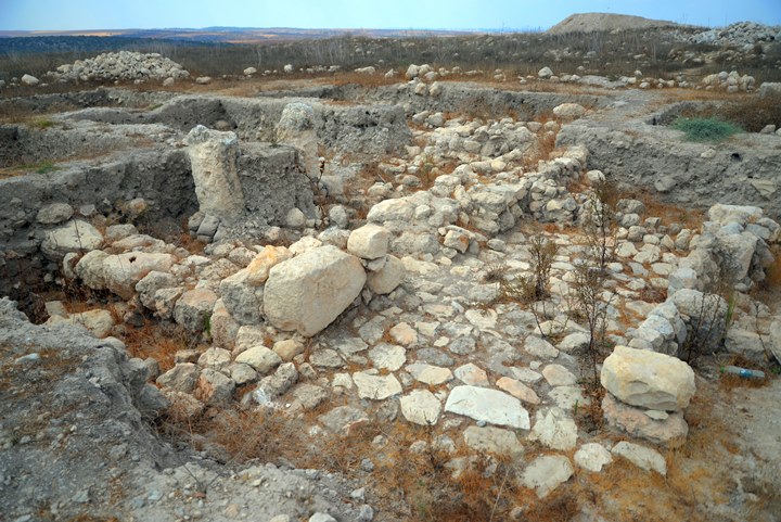
On the central summit are remains of buildings. They were constructed in the Iron IIa period and were in use until the Persian period. The entire area was protected by the casemate wall from all sides.
The archaeologists opened squares on the summit, designated as “Area A2”. The structures were dated by the archaeologists to the Iron Age II (IIa, IIb, IIc) and also found some Persian period activity.
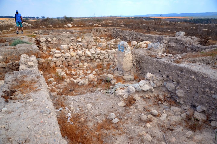
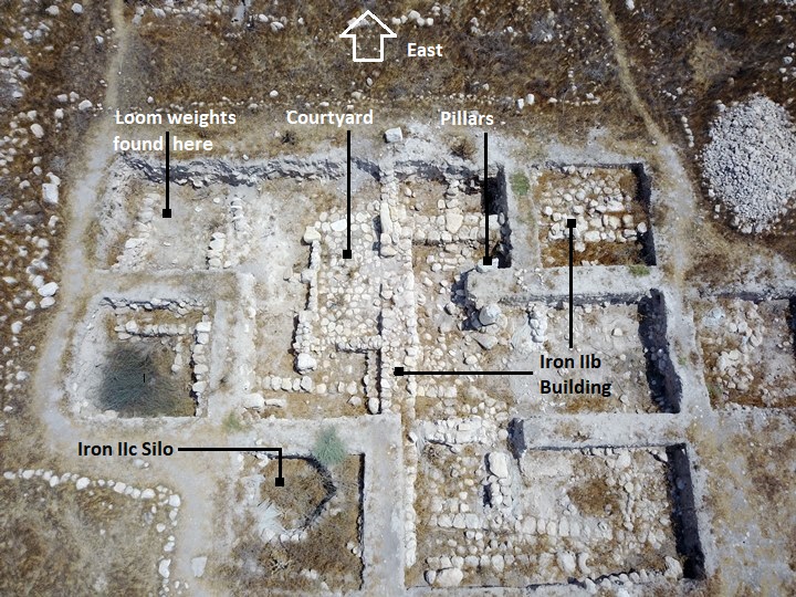
This area is also seen from the following aerial view. The excavation unearthed a large building dated to the Iron Age IIB (8th century). Under this building is an earlier 9th century building of the same plan.
(4) Western slope (area B2):
The lower city is built along the western slope and on a lower platform.
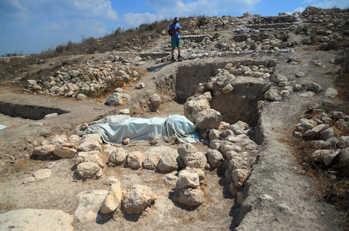
The photo is a view of the western slope, as seen from the lower side, looking east towards the summit. The exposed area below the summit is designated as “Area B2”. It was first populated during the Late Bronze age, and continued during the Late Iron IA/Early Iron IIA, Iron IIb and IIc, and Persian period.
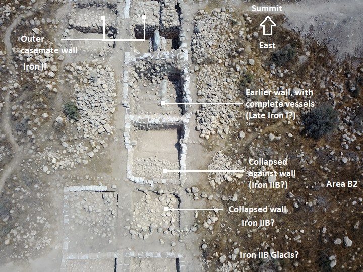
The excavations unearthed on the western fortifications of this area, the casemate wall, and an Iron IIc building (7th century BC) that was reused during the Persian period.
An aerial view of a section of the area is shown here.
(5) Lower platform (areas B1, B3, D):
The lower platform on the west side of Tel Burna was also exposed. The area was designated as “area B1” (northern side) and “area B3” (southern side). Both were populated in the Late Bronze period (13th century BC).
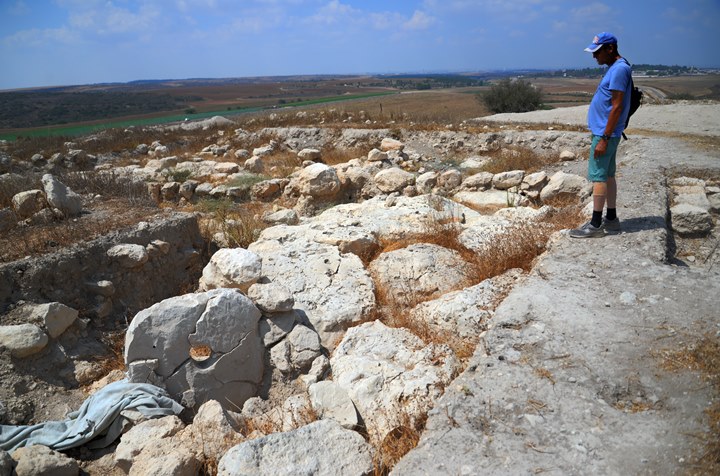
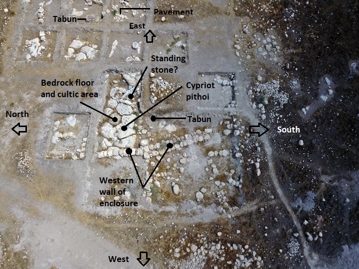
In area B1 a large Late Bronze period cultic enclosure was unearthed, including a remarkable rounded stele (diam. c. 1.5 m) with a hole in its center (see photo below). This was a large and well constructed building, with ritual related assemblage (goblets, chalices, ceramic masks, local and imported vessels).
Unique vessel pieces, animal bones and botanical material were found around it. It was probably not a temple, but an open cultic enclosure.
The cultic area in B1 is shown in the center of the aerial view:
In area B3, on the south side, the archaeologists unearthed buildings of the Late Bronze Period. The teams discovered remains of the destruction of the Canaanite city, including burnt mudbricks and smashed storage jars.
In new excavation seasons another area “D” was opened on the northern part of the western platform, also with Late Bronze period buildings.
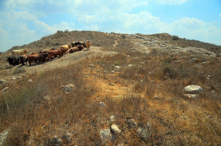
In the photo below – A view from the northern part of the lower platform towards the summit. This was before area D was opened. The cows standing there were curious about the dig, and so they also came to visit the excavated site…
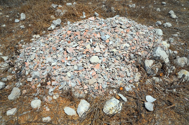
The excavations yielded a great amount of pottery sherds. Some of them, normally the rims or the handles, were used to date the level that was exposed and saved for future cataloging. The redundant pieces were thrown into a pile.
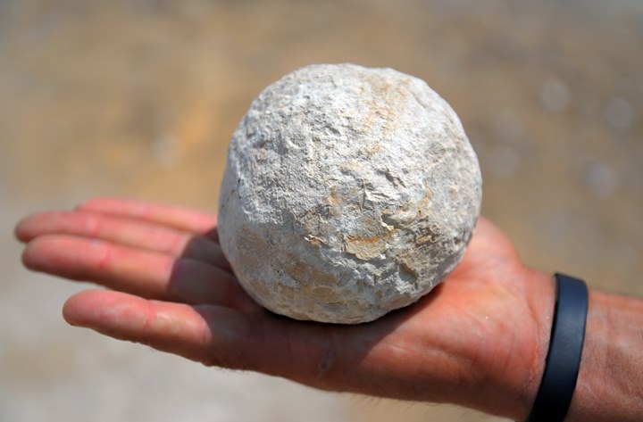
A round stone was seen in the area of the excavations. We are not sure what was the purpose of this stone.
(6) Installations (area C):
Agriculture installations, dated to the Chalcolithic thru the Byzantine period, are located around the site.
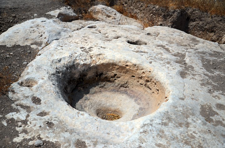
The following winepress is on the north east side, in an area designated as “C”.
(7) Gate (area G)
In later seasons, the archaeologists unearthed the city gate and fortifications on the southern side. This was designated as area “G” and was dated to the Late Iron IIA period thru the Persian period.
Etymology (behind the name):
* Names of the site:
- Tel Burna – Hebrew; Tel-mound, Burna – name based on the Arabic name
- Tell Bornat – Arabic: “Mound of the hat”; Tell- mound, Bornat – hat
- Libnah , Livnah – Biblical city (Joshua 10 and other references). Hebrew: white. Some scholars identify this city in Tel Burna.
Links and References:
* Archaeology and History:
- Tel Burna expedition – home page of the Tel Burna expedition
- Tel Burna Preliminary Report 2010-2019 – Itzhaq Shai – HA-ESI Volume 133 Year 2021
- End of Season 2017 – Burna expedition blog
- Expedition facebook
- Burna – Eretz Teva 129 (2010; pdf, Hebrew)
- The Shephelah according to the Amarna Letters – Nadav Na’aman
* Biblewalks sites:
Drone Aerial views – collection of Biblical sites from the air
BibleWalks.com – tour the Bible country
Gath<<–previous Shefela site—<<< All Sites>>>—next Shefela site—>>> Tel Haror
This page was last updated on Apr 9, 2023 (new ground views and text)
Sponsored links:
