A major Canaanite city in the western Negev area, situated on the way from Egypt northwards and from the coast eastwards.
 * Site of the month Oct 2020 *
Home > Sites > Negev > Sharuhen (Tell el-Farah)
Contents:
Overview
Aerial Map
History
Excavations
City Plan
Photos
* On the way
* Moat and Glacis
* South Gate
* Palace
* Northern views
* Eastern views
* Assyrian
Biblical References
Etymology
Links
Overview:
Sharuhen was a major Canaanite city in the western Negev area, situated on the way from Egypt northwards and from the coast eastwards. In the 16th century BC the Hyksos fortified the city after they were expelled from Egypt. The Egyptians placed a siege for 3 years, seized and demolished the city. It was rebuilt several times, continuing with some gaps until the Roman period.
There are several suggestions for the identification of the city. A leading candidate is the mound of Tell el-Farah (South) on the banks of Nahal Besor stream.
Joshua 19:1,6: “And the second lot came forth to Simeon… and their inheritance was within the inheritance of the children of Judah….And Bethlebaoth, and Sharuhen; thirteen cities and their villages”.
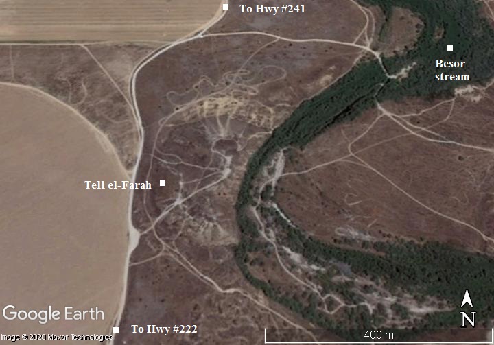
Map / Aerial View:
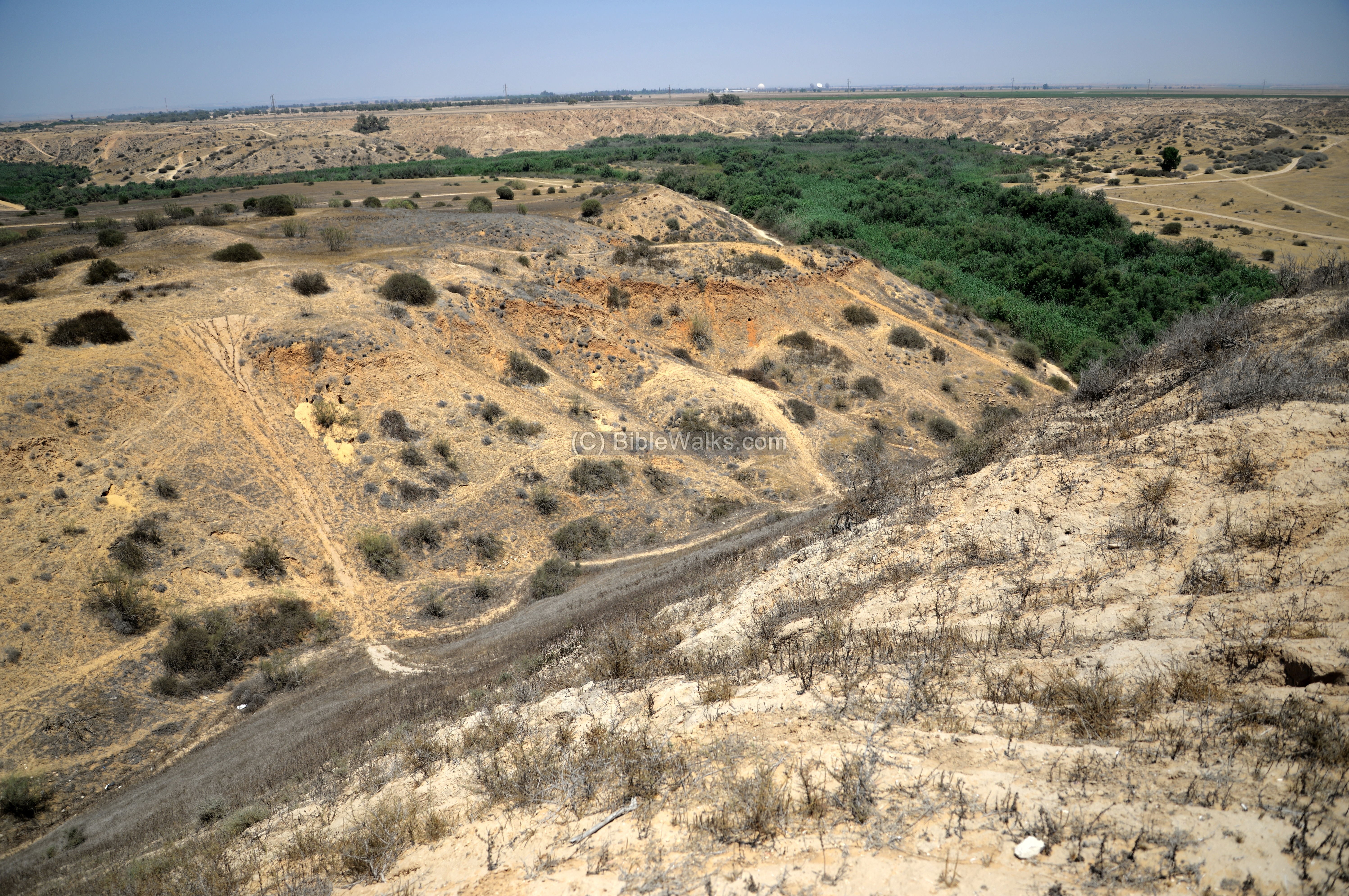
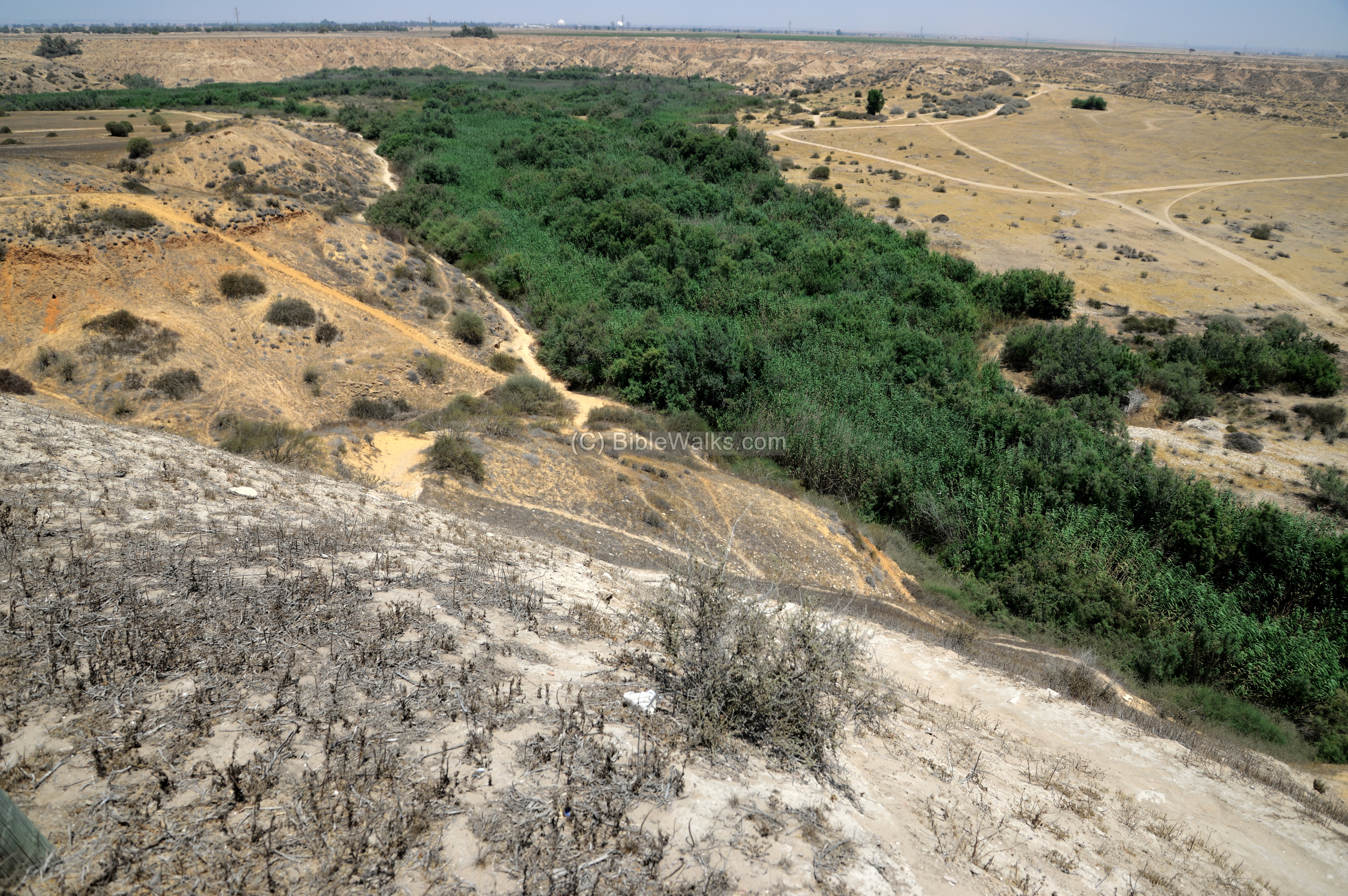
An aerial map is shown here, indicating the major points of interest around the site. The mound is situated on the western bank of Nahal Besor stream (wady Ghuzzeh), which cuts its eastern foothills. It covers a large area of 66 dunam, with a height of 14m (!) of accumulated layers of ancient cities, in addition to 30m height of the natural hill above the stream.
History:
-
Biblical periods (Bronze and Iron age)
Sharuhen became one of the cities in the area inherited by Simeon and Judah:
Joshua 19:1,6: “And the second lot came forth to Simeon… and their inheritance was within the inheritance of the children of Judah….And Bethlebaoth, and Sharuhen; thirteen cities and their villages”
Another possible name of the city, Shilhim, was named by Shishak. It appears in Judah’s tribal inheritence (Joshua 15-20,32):
“This is the inheritance of the tribe of the children of Judah according to their families…And Lebaoth, and Shilhim, and Ain, and Rimmon: all the cities are twenty and nine, with their villages:
Cities and roads during the ancient periods, up to the Roman period, are indicated on the Biblical Map below. Sharuhen is marked by a red circle, on the banks of the Besor brook, 24km south of Gaza and 30km west of Beersheba.
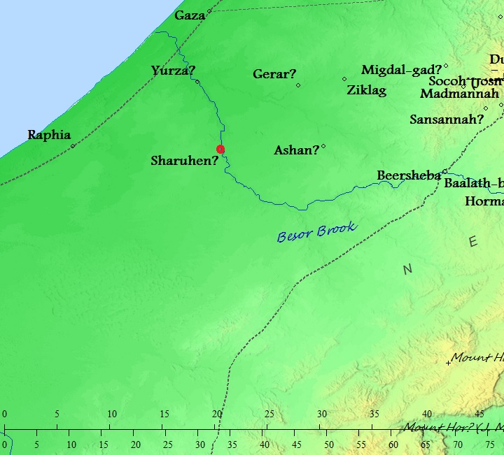
Map of the area around Sharuhen – from the Canaanite/ Israelite periods to the Assyrian period (based on Bible Mapper 3.0)
- Egyptian sources
Sharuhen is mentioned in Egyptian sources 3 times:
- The expulsion and 3 years siege of the Hyksos (16th century BC)
- The first incursion of Thutmose III (15th century BC). Sharuhen was a Egyptian fortress at the time the Canaanite cities revolted.
- The incursion of Shishak (Sheshonq I, 9th century BC). Sharuhen appears on line IX of the Karnak portal as ‘Srhn’.
- Hyksos
The fortifications were constructed in the Middle Bronze period (16th century BC) by the Hyksos, as determined by the archaeologists.
The Hyksos (Egyptian for “rulers of foreign lands”) were Semites invaders from western Asia who settled in the eastern Nile delta in ~1650 BC. They took over the rule of Egypt, establishing the 15th (XV) and 16th (XVI) Dynasty in Egypt, and their capital city was Avaris. This city was already populated by other foreign people who migrated 150 years earlier from the Levant to Egypt.
The Egyptians of the 17th Dynasty managed to conquer Avaris and reestablish an Egyptian rule. It was later incorporated into the city of Pi-Ramesse by Ramesses II in the 13th century. The Hyksos were expelled to Canaan at ~1550 BC by the Egyptian pharaoh Ahmose I, the first king of the 18th Dynasty. The Egyptians continued to push them out of the Canaanite cities, with Ahmose conducting at least two campaigns in Canaan. This included a 3 year besiegement of the fortress in Sharuhen (Tell el-Farah?), a city near Gaza that the Hyksos fortified after their expulsion.
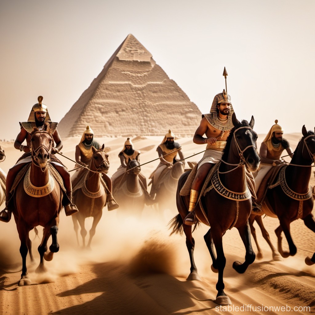
Hyksos in Egypt – AI generated by Stable Diffusion
There are scholars who relate the Hyksos story to the Biblical accords, due to the similarities: a nation comes from Canaan to Egypt, establish a strong presence there, build cities in the eastern Delta, then return back to Canaan. Perhaps, according to their theory, this event was a nucleus of a folklore that rooted into the Bible of the rise to power by Joseph and the Exodus led by Moses. Other similarities include: the name of the second Hyksos ruler was Yakubher (a variant of Jacob), and Pi-Ramesse (Avaris) was one of the cities (Raamsses) built by the Hebrews.
The Egyptians eventually broke the military and political powers of the Middle Bronze cities, marking the end of the MB period. Evidence of this mid-16th century destruction can be found in many of the excavated cities. One of their cities is Tel Adami near the Sea of Galilee.
There are uncertainties how long did the process of the destruction of the Hyksos cities in Canaan take. Some scholars estimated that it was a short period, while others suggested it took a century until the conquests of the Egyptian Pharaoh Thutmose III of the 18th Dynasty (~1468 BC). Sharuhen is mentioned by Thutmose III in his first excursion of Canaan.

Thutmose III smiting his enemies (7th pylon in Karnak). Photo by Markh; public domain.
- Israelite period
The city was burnt in the 11th century, then rebuilt by Philistines, lasting until the 10th century.
After Solomon’s death, Egypt’s Shishak invaded Israel in 924 BC (1 Kings 14: 25: “in the fifth year of King Rehoboam, Shishak king of Egypt attacked Jerusalem”). The Biblical Shishak is identified as Shoshenq I – the founder of the 22nd dynasty of Egypt (reigned 943-922). According to the Pharaoh’s hieroglyphic inscriptions in Karnak, Sharuhen was captured and destroyed. The city appears on line IX of the Karnak portal as ‘Srhn’.

Karnak: Bubastite Portal – Shishak’s victories.
Photo of the Library of congress (taken 1900-1910)
Based on analysis of burial sites around the city, there was a settlement gap between Mid 9th century (Shishak’s incursion?) until the 7th century BC.
- Assyrians
The Assyrian empire conquered the North Kingdom of Israel in 732BC, destroying most of the cities and villages in the land. King Tiglath-Pileser III annexed the area (as per 2 Kings 15: 29): “In the days of Pekah king of Israel came Tiglathpileser king of Assyria, and took … and carried them captive to Assyria”). The Assyrians developed the Gaza coastal plain, making the Philistine cities – from Jaffa to Raphia – a kingdom subdued and raising taxes to the Assyrians. An Assyrian administration center was establish in nearby Tel Gamma (Yurza), and the cities in this area became important trading posts on the caravan routes between the sea and Arabia.
- Persian period
The Assyrians ruled Gaza for 100 years, and were followed by the Babylonian empire (630BC-538BC) and the Persians (538-332BC). The Babylonians exiled the Philistines ending their presence in the area.
A small settlement, centered on the south side, continued during the Persian period.
- Roman period
During this period, it served as a border post for the Romans. A small fortress (15m x 20m) was built on the north side of the mound. Its base was made of stone, and its plan was a courtyard surrounded by rooms on 3 sides. A hoard of coins dated it to the 1st century AD.
- WW1
The mound was fortified by the Turkish army during World War 1. They dug in holes on the mound to protect the hill against the cavalry attacks.
On the foothills of Tell el Fara are signs commemorating the mounted infantry maneuver of the Australian and New Zealand Army Corps (Anzac) forces on Oct 31, 1917, during the World War 1. Their bold mission was to surprise the Turkish forces in Beersheba in order to break the 8 months long deadlock of the British Army’s siege on Gaza.
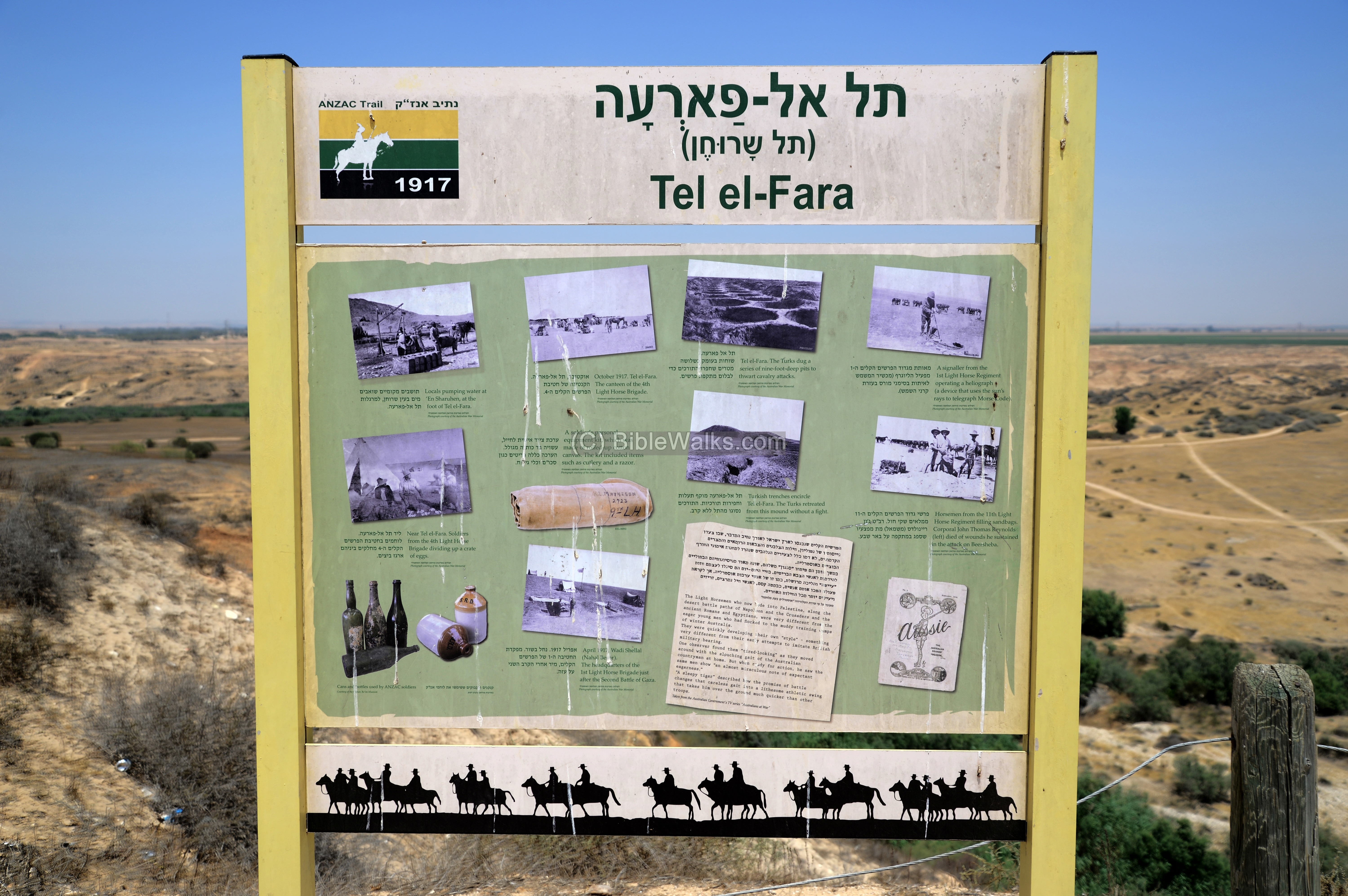
ANZAC trail sign on Tel el-Fara
General Allenby, who was appointed just before this operation after the two failed attacks on Gaza, ordered a surprise charge as the first phase of his 5-steps plan to break the stalemate, capture Beersheba, and finally reach and conquer Damascus. Before launching the cavalry, the British started with a heavy bombardment of Gaza, as a diversion. Then, over a long night and covering 45 Kilometers, the Anzac infantry crossed the territory taking the Besor stream route, reached their target, charged the enemy front during the day, and by nightfall entered into Beersheba. A memorial trail passes along the historic route of the Anzac forces. Its sixth station is located on the mound, seen here on the memorial post.
The Turkish forces retreated from Tell el-Farah without any battle.
Excavations
Tell el-Farah was first excavated by Sir W.M.F Petrie in 1928-1929 (2 seasons), an English Egyptologist and pioneer in the Archaeology of the Holy Land and excavation methods and dating.
Renewed excavations were conducted in 1992-2002 by the University of Ben Gurion.

Dignitary visit at Tel Farah during excavations – Photos LOC Matson collection -1929
The excavators dated the layers of settlement in the city as early as the Middle Bronze IIb (1750-1650 BC) until the Roman period. However, Petrie identified the city as another place – Beth-Pelet – also mentioned in the Bible.
W.F. Albright suggested that the mound was Sharuhen. However, other scholars disagree: Nadav Ne’eman suggested it was Biblical Shur. A. Kempinski identified Sharuhen as Tel al-‘Ajjul, a Biblical Tel on the outlet of the Besor to the sea, another site excavated by Petrie in the 1930s.

Tel Farah 1929 – North East side from Wady. Photos LOC Matson collection
Tel Farah Plan:
W.M.F Petrie reported his excavations of 1928-1929 in a report in 1930. A map of Tel Farah was published in his report, and is shown here.
Besor stream (‘Wady Ghuzzeh’) is illustrated here on the bottom; north being on the right side as shown by the arrow, scale is 1:2000. The numeral dates are Egyptian dynasties: XV (Hyksos, 1650-1550 BC), XVIII (1550-1292 BC), XX (1189-1077), XXII (943-720).
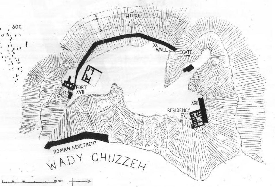
Petrie – Beth-Pelet Vol I Tell Fara (1930) Plate LI
The eastern side of Tell Farah was well protected by the stream. The south and north sides of the city were protected by a moat, high walls and glacis, and deep ravines flowing to the stream and partially covered by the stream.
A less protected side was on its west side, where a huge trench cut on its west side during the MBII Canaanite period. It was 24m wide! Its external side is 8m in height at an angle of 40 degrees; the internal side the moat is 18m high at an angle of 33 degrees. A ditch 1.2m wide and 2.5 deep is cut inside the trench. These huge earthworks are typical of Hyksos fortifications, intended to slow down military attacks. No wonder the city held on for 3 years! After the fall of the city, the ditch was sanded and some burial tombs were cut into the slope.
A cluster of dots on the left side of the map is marked “600”. It is one of the 6 large cemeteries studied by the archaeologists, using the invaluable findings (jewelry, scarabs, ceramics, weapons and skeletons) to study the history of the city. One of the treasures that were found in a 1050BC tomb is below.
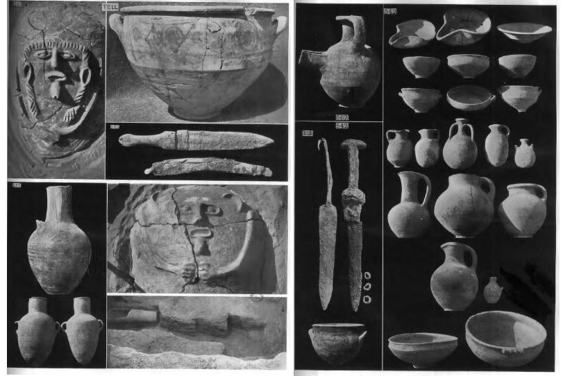
Petrie – Beth-Pelet Vol I Tell Fara (1930) plates XXIV-XXV (1050-1320 BC)
Most impressive were the scarabs that were found in quantities in the cemeteries. This plate includes Hyksos scarabs of the XV Dynasty (1650-1550 BC).
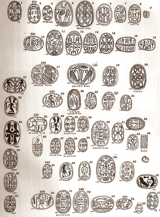
Petrie – Beth-Pelet Vol I Tell Fara (1930) plates VII (Hyksos scarabs, XV Dynasty)
Photos:
(a) On the way to the site
The site is part of the Besor national park, a vast area covering a large section of the stream.
The modern Hebrew name of the Tell el-Farah is Tel Sharuhen, based on it being the leading candidate for the Hyksos city. It is reached by a dirt road in the HaBesor National park. The shortest distance is from the north via highway #241 where the Turkish railway once passed, connecting the Gaza Strip to Beersheba.
Click on the photos to view in higher resolution…
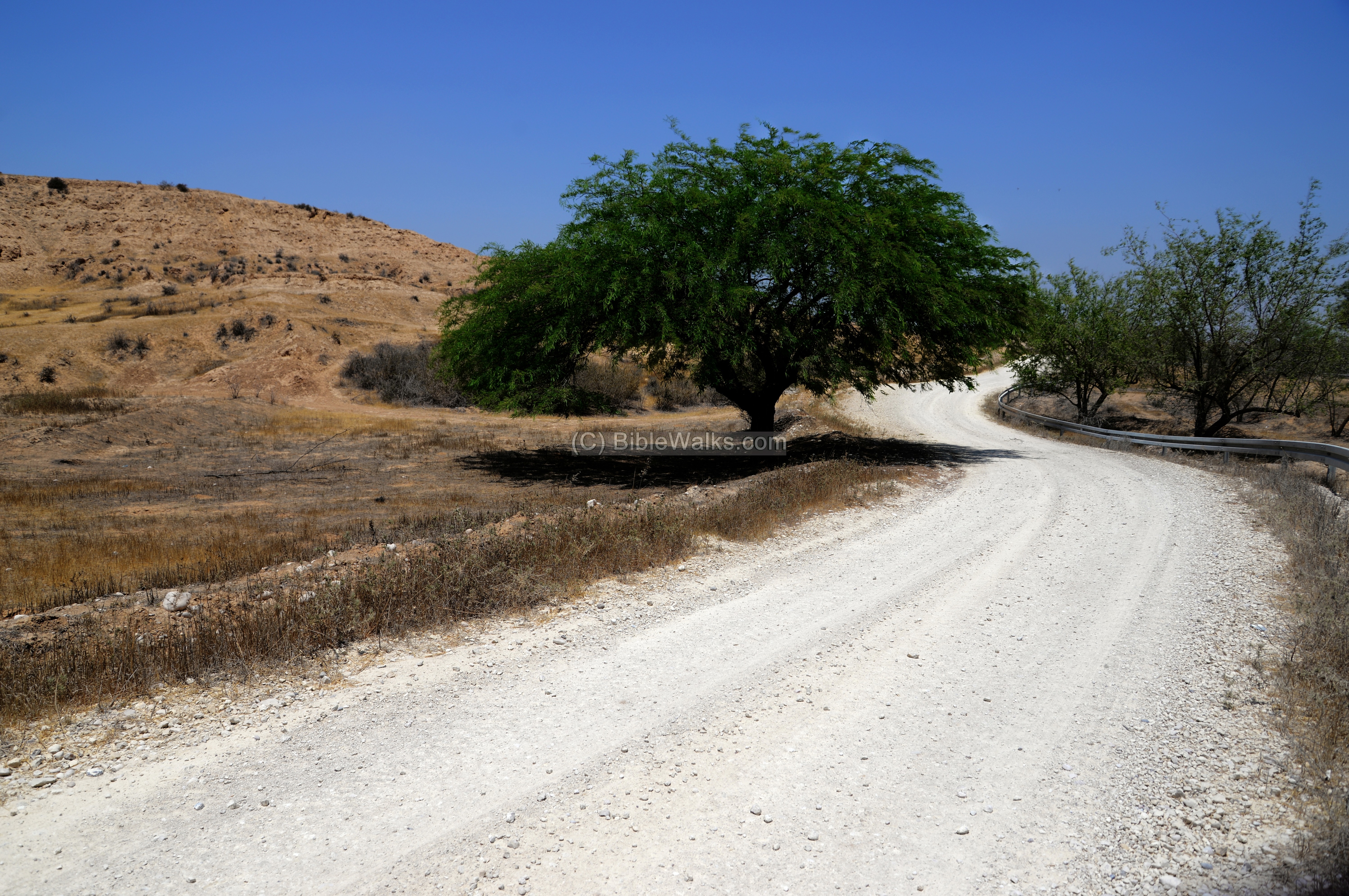
An unpaved road passes along the western bank of the Besor stream, reaching the site 3km south of the northern park entrance.
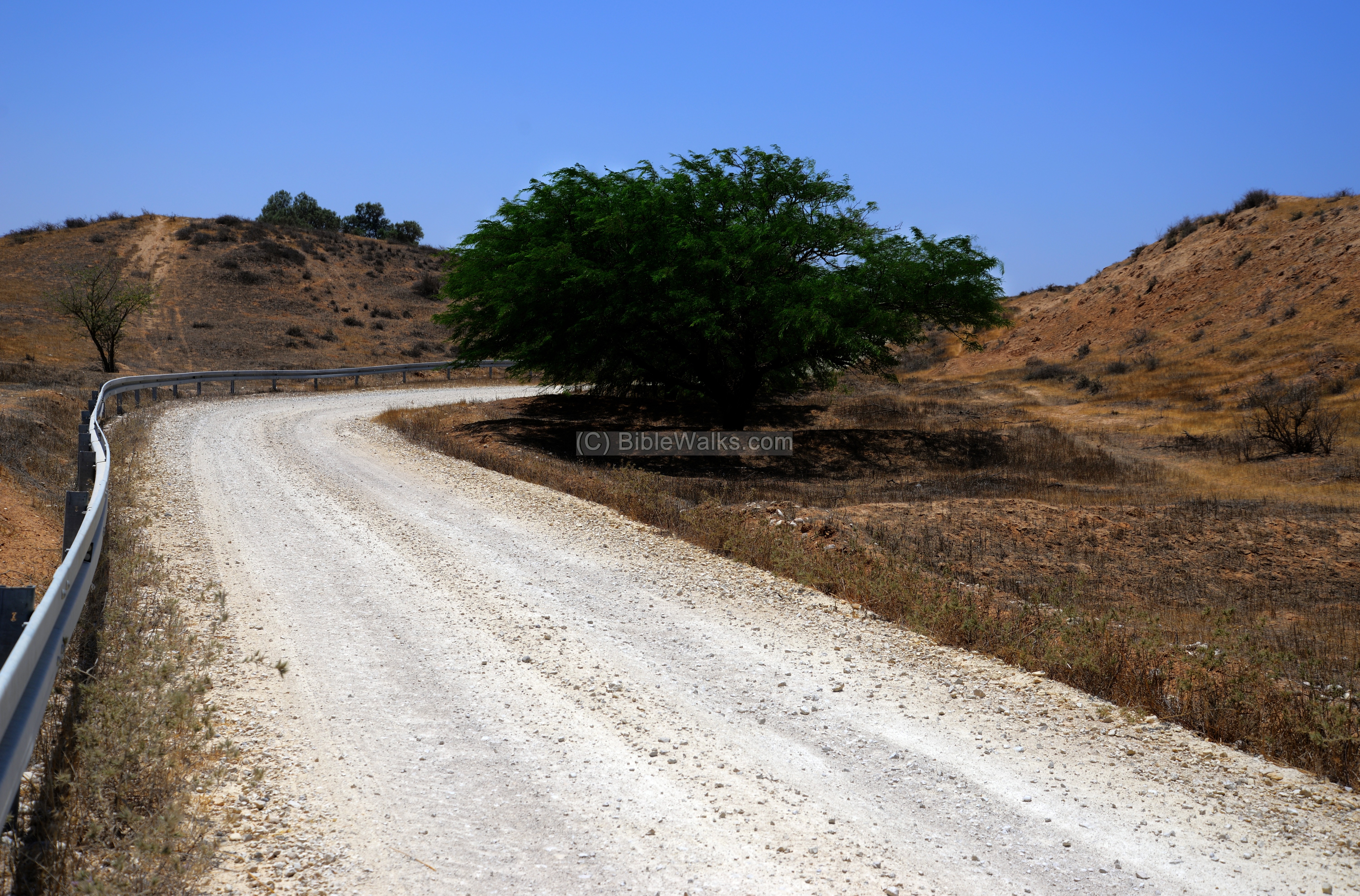
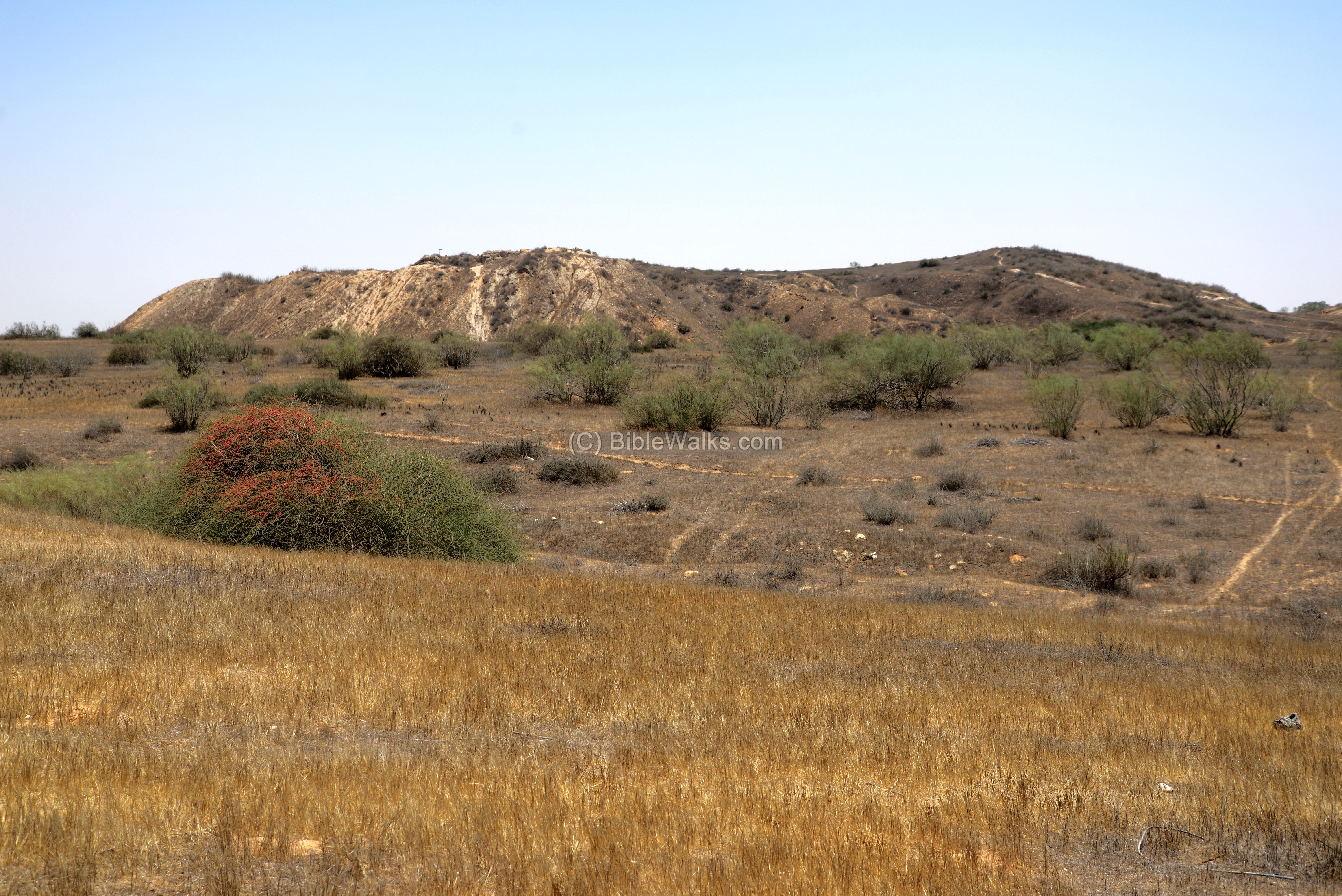
Finally reaching the site… A view from the west side is seen below.
The vast size of Tell el-Farah is quite impressive, covering an area of 66 dunams.
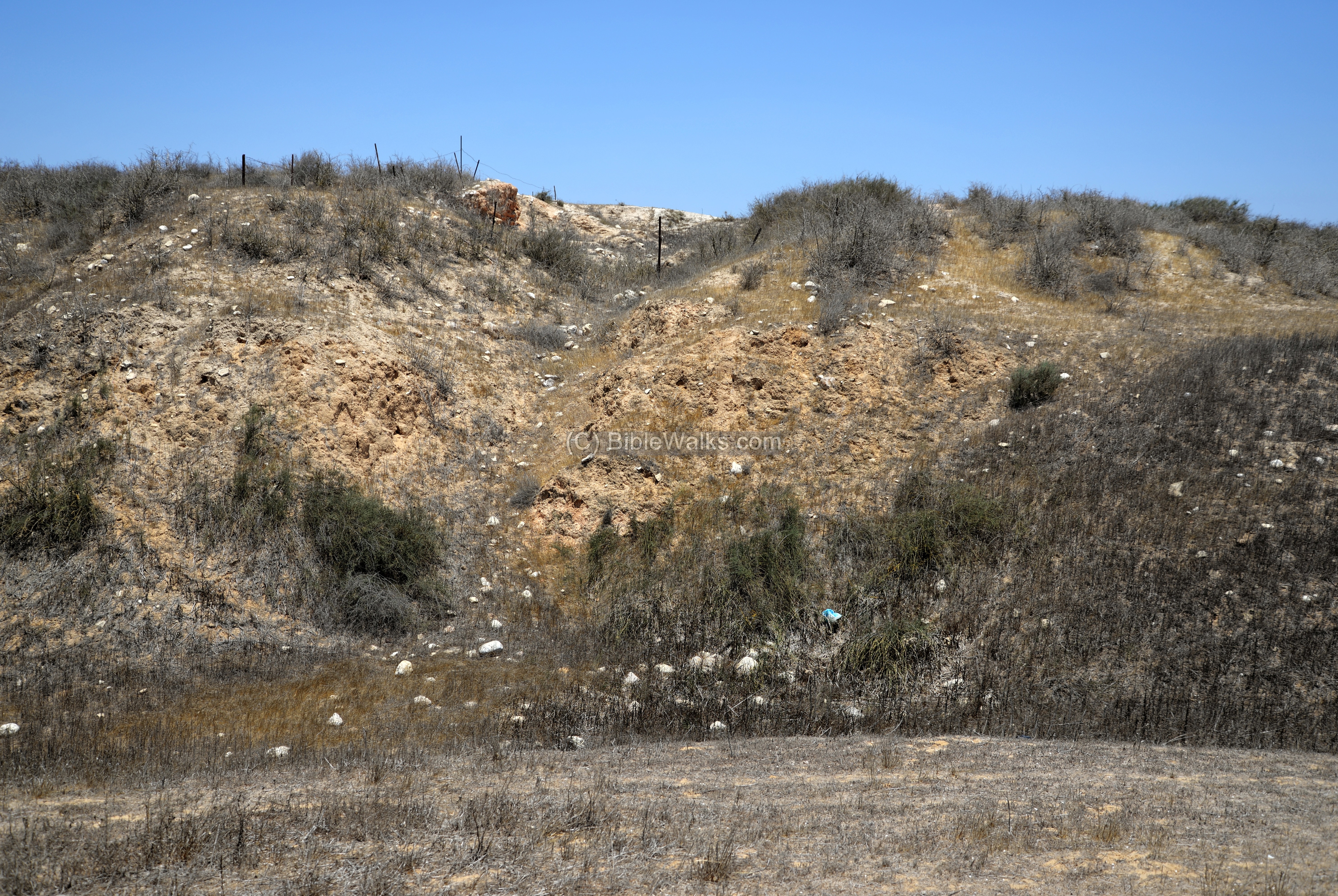
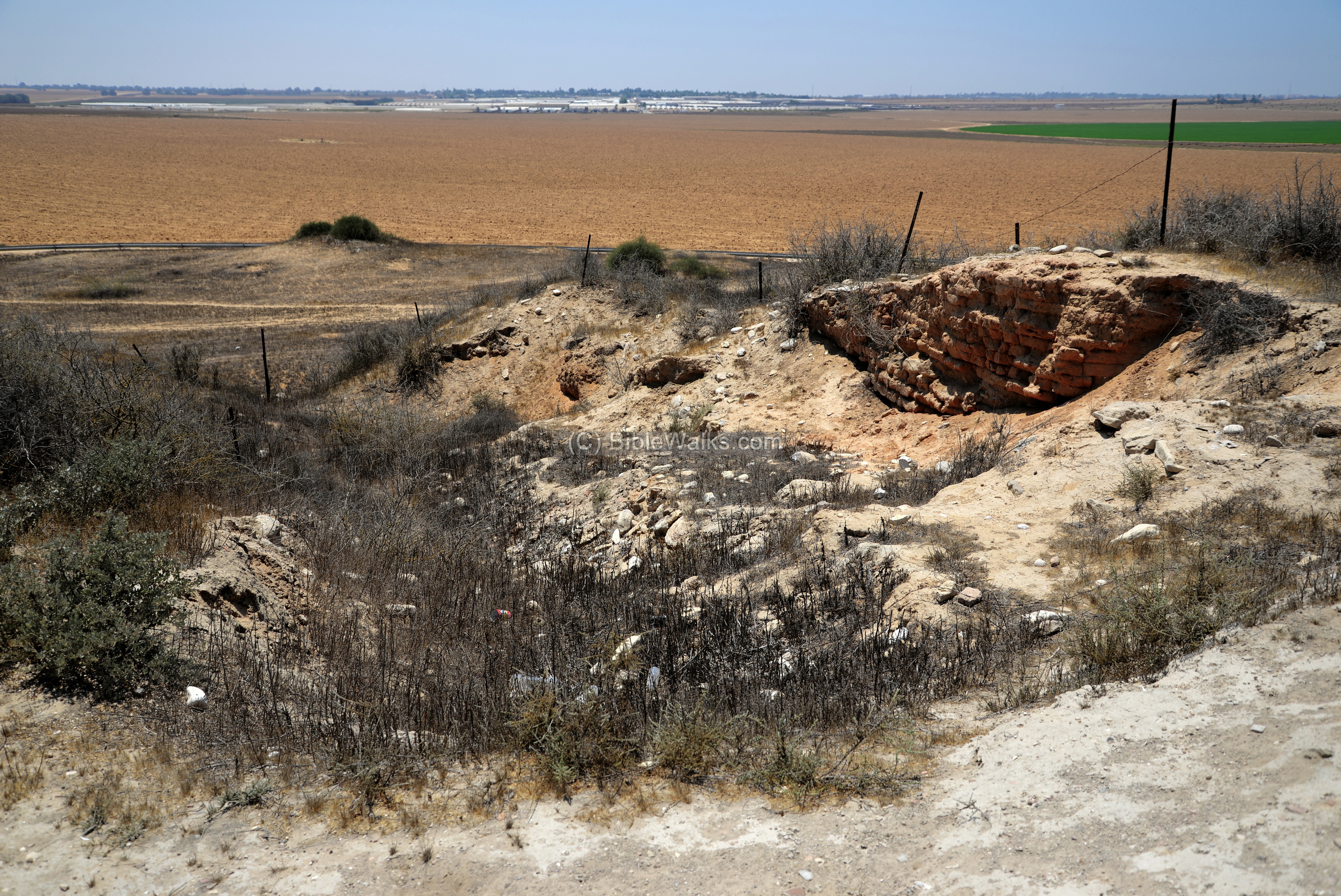
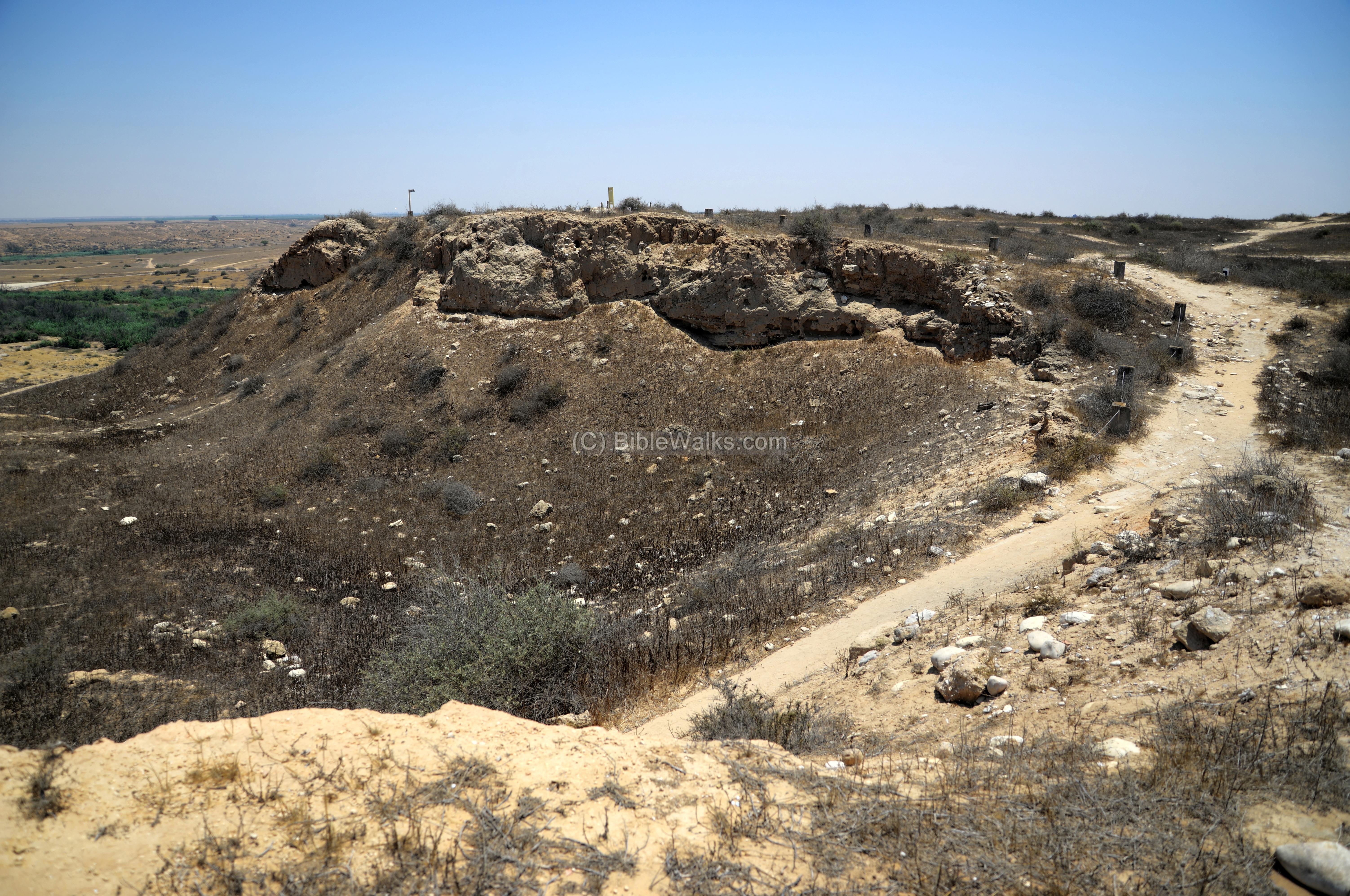
(b) Moat and glacis
The city was protected by a moat on three sides – north, west and south (here in the photo). On the east the Besor stream added its natural protection. Behind the moat were high walls with a glacis.
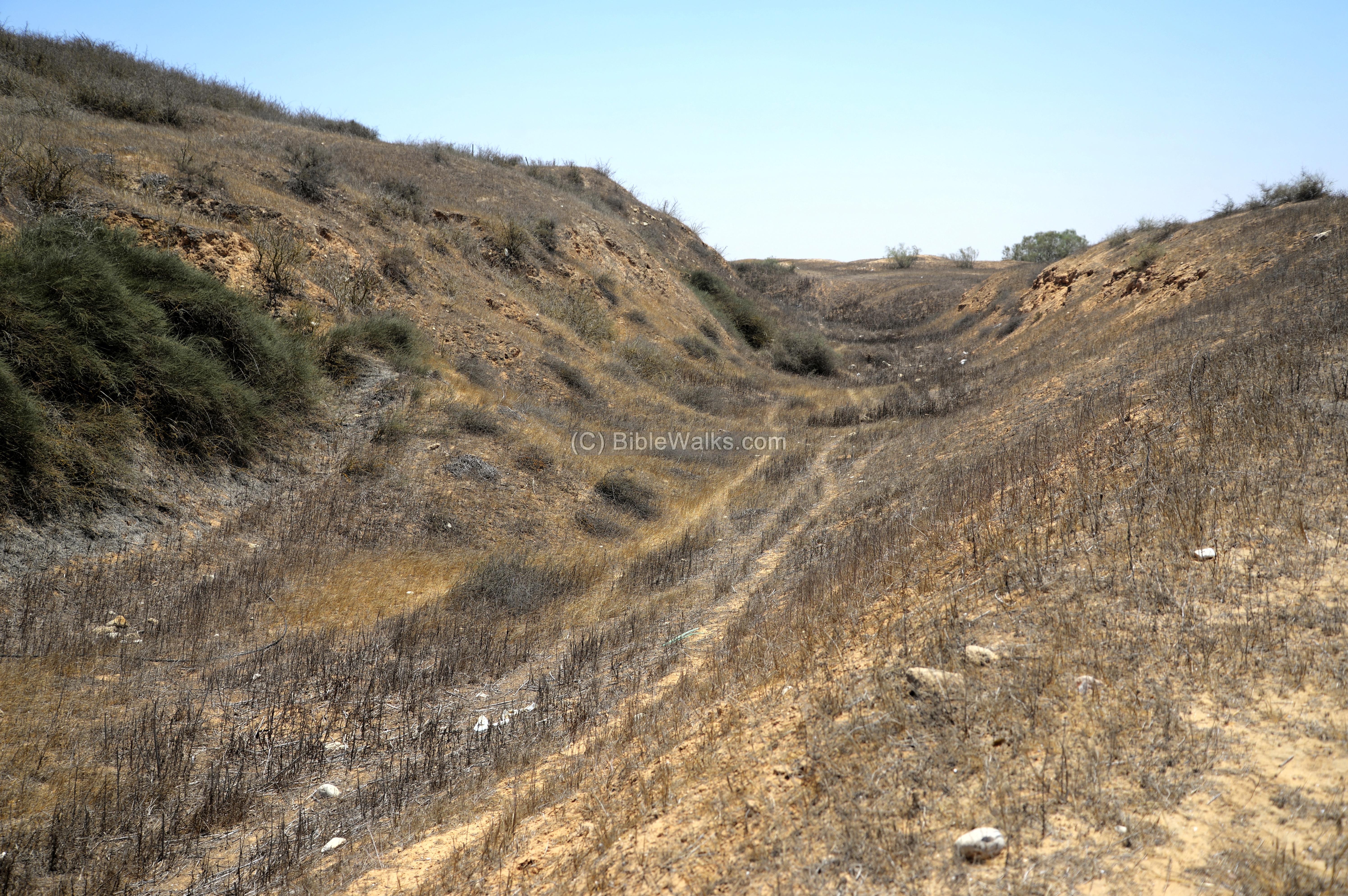
Ramparts on top of the mound are also impressive: the Canaanite MBII wall on the top of the mound was 6m high and 5m wide. The wall was constructed with mud bricks, 0.6m on the external side, 1.5m on the internal side. Between these walls was 2.9m width of pressed soil.
These features of moat /steep glacis /walls are typical Hyksos construction during the MB2 period.
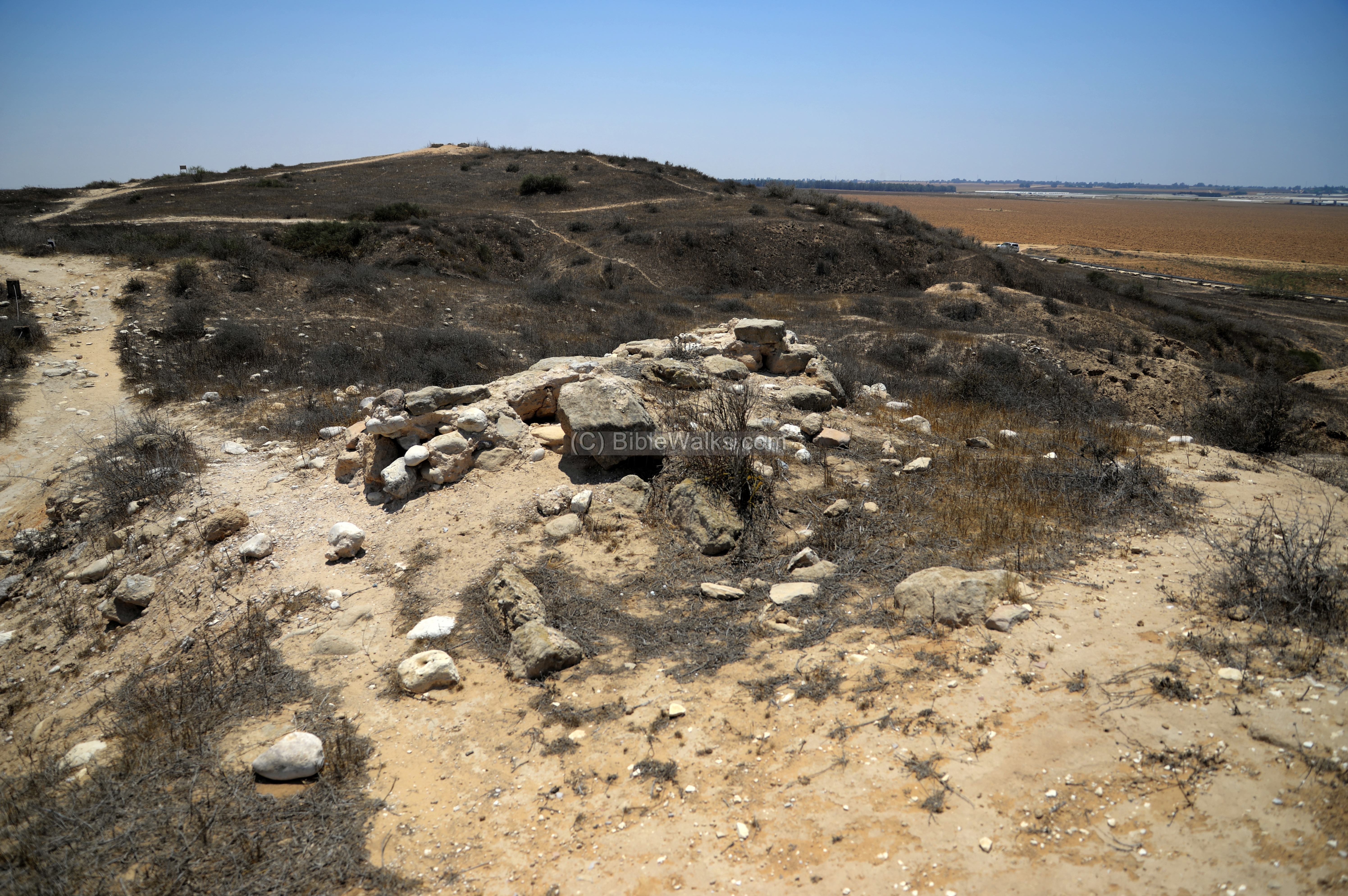
(c) South city gate
On the south side of the mound is the city’s main gate. Another gate was suggested on the north west side based on large blocks he unearthed in the ravine. This is marked on Petrie’s map, but it was probably just a structure.
This massive city gate was 3.5m wide, 18m long, protected by towers on both sides, and 4 inner rooms along each side. The towers extended 6m outside the wall.
First constructed by the Hyksos in the MBII period (1650-1550BC), it was in use until the late Bronze period (1550-1292 BC) after it was raised and repaired.
A view from the top of the mound, down thru the gate:
The gate was made of a brick that was laid on a layer of sand. This section was part of the north western tower which is the only tower that survived of the pair.
On top of the mound, 25m behind the gate, was a structure dated to the Persian period.
(d) Egyptian palace
On the north side are remains of the Egyptian governor’s palace, dated to the Late Bronze period (Dynasty XVIII, 1550-1293BC), after the expulsion of the Hyksos. It was paved with pebbles from the Wadi.
The palace is 22 wide and 25m long, built on the northern end of the mound. Its structure is made of bricks, and was built adjacent and over the MB2 Hyksos wall.
The plan of the main structure of the palace was a central courtyard surrounded by rooms on all 4 sides. Inside the storehouse the excavators unearthed 45 sealed jugs. On the west side of the palace was a smaller house, 12m long by 9m wide, perhaps used as service rooms.
The palace was in use until the 11th century, when it was destroyed by fire. The next occupation phase included 2 phases of reconstruction inside the palace (layer X, Iron Age IIa – the late Philistine phase).
According to the burial sites around the city, there was a settlement gap between Mid 9th century until the 7th century BC. This may have been the last phase of construction.
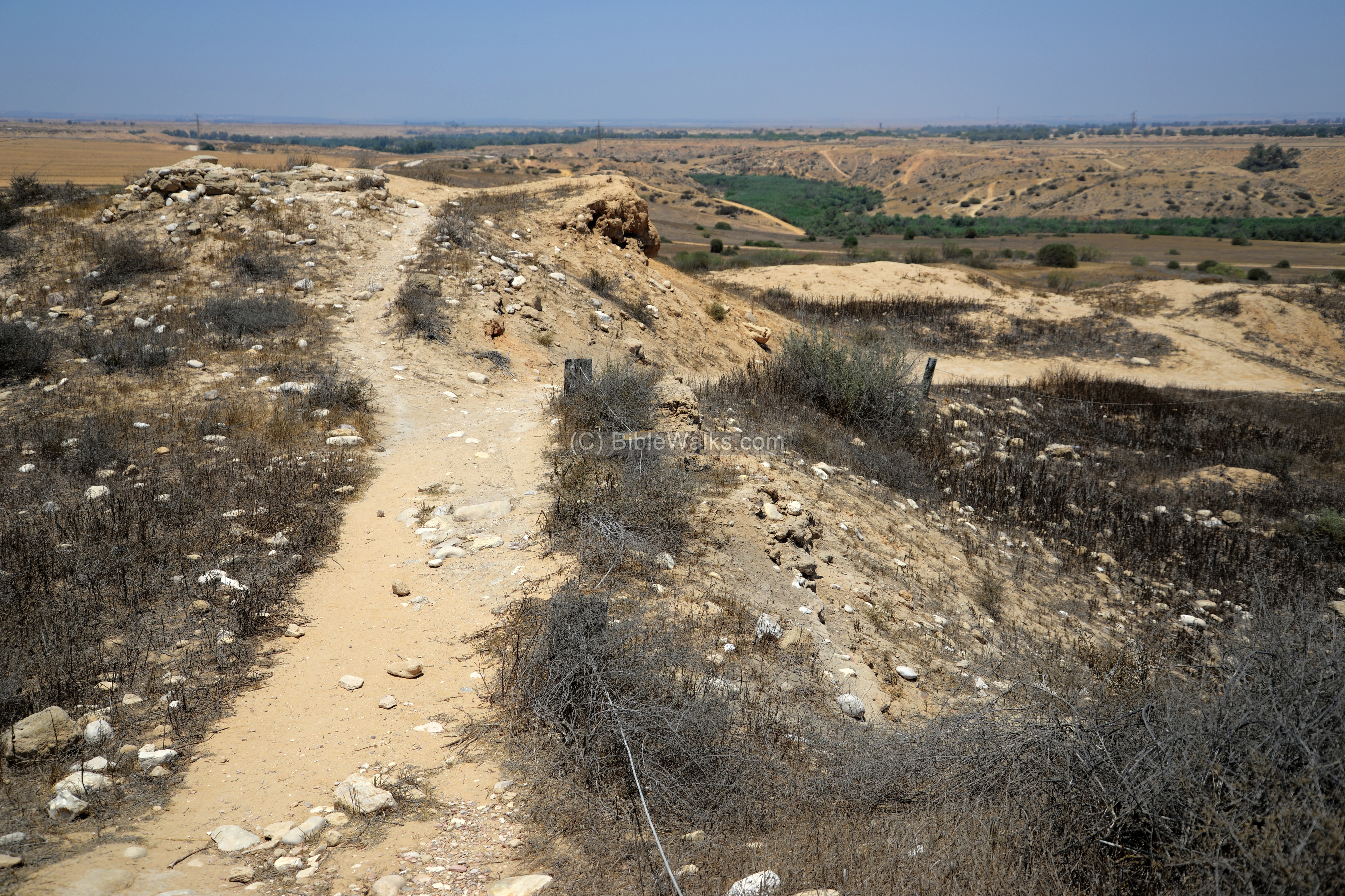
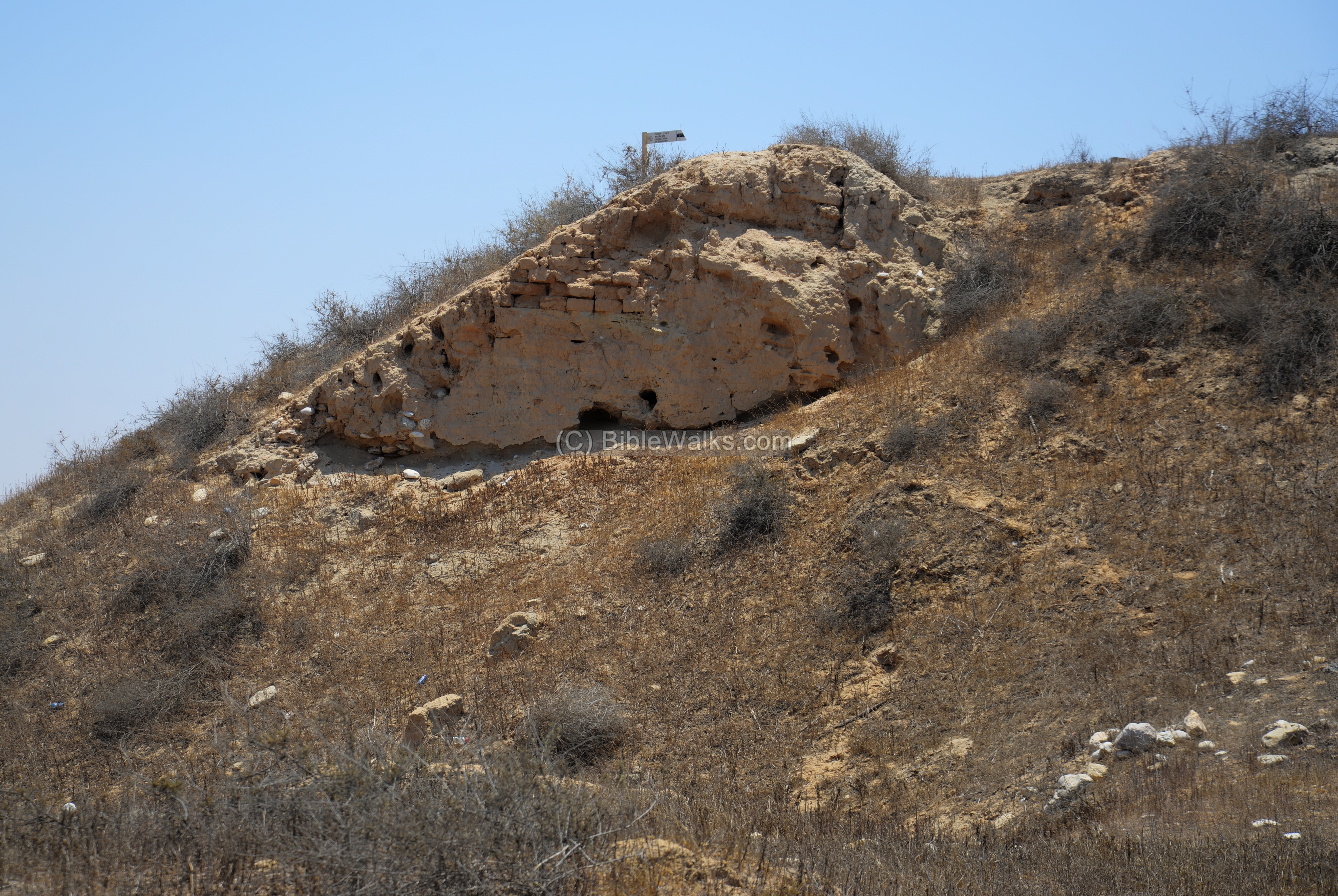
(e) Northern views
On the north side of Tel Fara is another steep glacis, wide wall on the top and a moat that runs down into the stream.
(f) Eastern views
The Eastern side of the tel was well protected by the Besor stream. It is also very steep, built of a glacis that is very smooth to make the attackers more difficult to reach the walls. Watch your step!
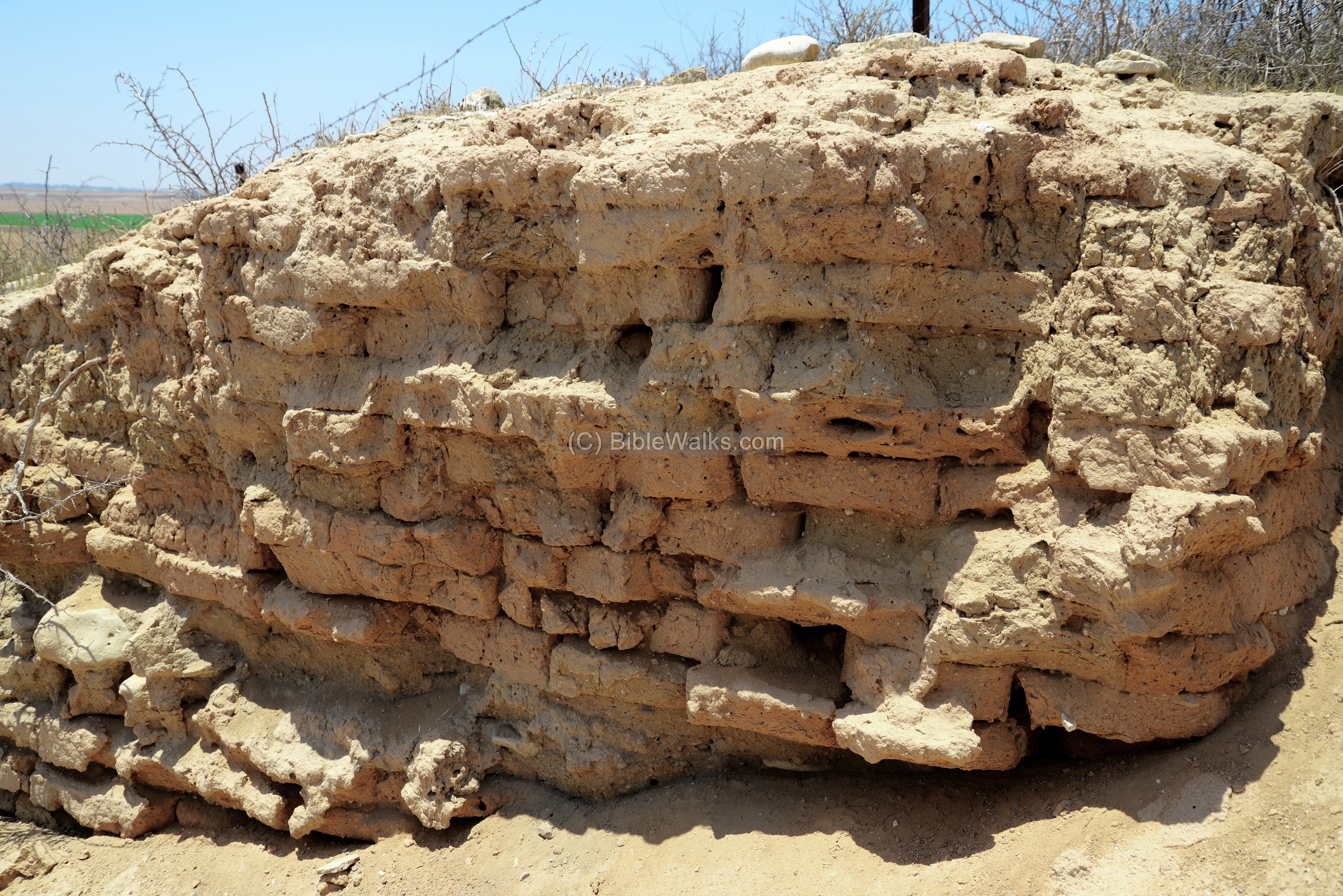
(f) Assyrian remains
After the Assyrian conquest, most of the Negev cities were rebuilt by them, encouraging trade and payment of taxes.
Part of a Assyrian brick wall is seen here.
Biblical References:
1 Samuel 30 9-10:
David chases the Amalekites after they raided Ziklag and took the women in captive. He and his men reached the Besor brook.
“So David went, he and the six hundred men that were with him, and came to the brook Besor, where those that were left behind stayed. But David pursued, he and four hundred men: for two hundred abode behind, which were so faint that they could not go over the brook Besor”.
Etymology – behind the name:
* Names of the site:
- Tell el-Farah (Fara, Faria’h) – Arabic: high mound of ruins
- Sharuhen (Sharuchen) – Biblical and Egyptian name of the city. Joshua 19:6: “”And Bethlebaoth, and Sharuhen; thirteen cities and their villages”.
- Shilhim – probably a second name of the city. Joshua 15:32: And Lebaoth, and Shilhim, and Ain, and Rimmon.
- Besor – Arabic: Wadi Ghuzzeh, Wadi esh-Shellaleh (Arabs name each section with a different name)
Links:
* External links:
- Farah south – excavation web page
- Petrie – Beth-Pelet I Tell Fara (1930) – Internet archive
- ANZAC memorial trail
* Internal Links:
- Tel Adami – another Hyksos city in the north
BibleWalks.com – walks along the Bible land
Aravah copper smelting <<<—previous Negev site—<<<All Sites>>>— next site—>>>
This page was last updated on May 11, 2024 (add AI illustration)
Sponsored Links: