A multi-period site with a Crusader fortress on Mt. Carmel.
Home > Sites > Carmel > Rosh Maya (Kh. Rushmiya)
Contents:
Background
Location
History
Photos
* Commanding view
* Crusader fortress
* Fortress tour
* Other remains
Video Tour
Etymology
References
Background:
Rosh Maya, or Khirbet Rushmiya, is a ruin that occupies the summit of a hill overlooking the northern area of Mt. Carmel. It commanded the main entry to the Carmel that was along the valley of Rushmiya in front of us. A Crusader fortress was built here, built over earlier period structures starting from the Hellenistic period. It was later re-used by Dhaher el Omar during the 18th century.
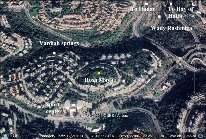
Location & Aerial map:
The site is located on a forested hill in the Romema neighborhood in Haifa, at 248m above sea level. Two valleys pass below the hill, Vardiya and Giborim, and there is a north view along Rushmiya (Remez) valley all the w ay to the bay of Haifa. Around the site are modern residential houses of the Romema neighborhood, and a hotel on its east side. The ruins cover an area of 20 dunam.
History:
Excavations of several sections of the site revealed 8 layers, that are detailed below:
1) Hellenistic period:
First settlement on the site was during the Hellenistic period (3rd-2nd century BC). A fortress was built on the top of the hill.
2) Hasmonean period:
The Hasmoneans added new wider walls and added retaining walls, reinforcing the fortifications. At that time, the site lay along their northern frontier and served as a key stronghold for repelling attacks originating from Acre, then under Seleucid control over the Galilee.
Yenon Shavtiel is an Israeli archaeologist and researcher specializing in ancient fortifications, hiding complexes, and refuge systems from the Second Temple and Bar Kokhba periods in the Galilee and Judea regions. He investigated a subterranean complex beneath the summit of Rosh Maya which appears to have been used as a hiding or refuge system. It was originally excavated in the 1970s but re-evaluated more recently.
The complex is rock-hewn below ground, containing multiple cut chambers connected by very low tunnels that force crawling. There are candle/niche features (recesses for lamps) and well-disguised openings — characteristic elements used to support the hiding-complex interpretation. Some cavities show deliberate shaping and finishing; others are cruder, indicating varied work phases or different intended uses before conversion to hiding use.
This complex is attributed to the period of the Hasmonean Period. The surface fortress (and the subterranean parts’ relation to it) is dated archaeologically to the late 2nd century BC — Hasmonean period; ceramic/architectural contexts support this association. It is argued to pre-date many of the well-known Roman/Byzantine revolt-era “hiding complexes” elsewhere in the region. It thus provides evidence for defensive or refuge architecture earlier than the major Judean revolts, and suggests that such underground systems may have roots in the Hellenistic/Hasmonean era rather than only in the later Roman crisis periods.
The hiding complex seems to incorporate or adapt earlier installations (possibly cisterns, tunnels or storage areas) and turn them into a refuge system. That is similar in concept to later Roman/Bar Kokhba hiding systems, but with a distinct early date and perhaps different layout. The site’s summit location (steep terrain, commanding views) aligns with fortified use and with the need for concealment or escape. The integration of a fortress and underground refuge shows how settlement, defense and covert architecture interacted. The finding is significant because it pushes back the timeline for subterranean refuge systems in Galilee/Carmel, bridging the gap between Hellenistic/Hasmonean fortifications and the better-known Roman revolt hideouts. It also raises questions about the nature of Jewish/Hasmonean defensive preparation and settlement in the region.
3) Early Roman (1st century BC-1st century AD)
4-5) Late Roman and Byzantine period (3rd to 6th century AD)
The Hasmonean fortress continued to be in use during these periods.
During the Roman and Byzantine (Mishna and Talmud) periods, a Jewish village called Rosh Maya was established on the hill. It was centered around the Hasmonean fortress which continued to be in use during the Byzantine period. A Byzantine period oil lamp found here and bearing an illustration of the seven-branch candelabra, provides evidence for the continued presence of the Jewish residents.
Rosh Maya (ראש מאיא) is mentioned in the Jerusalem Talmud (Yerushalmi), tractate Demai 2:1 (22d). In that passage, it appears in a geographical context, referring to a location in the Galilee, likely a settlement or landmark near water sources, since the name Rosh Maya literally means “head of the water” or “water source.”
Scholars generally identify it with a site in Upper Galilee, near Safed or the Hula Valley. Some link it with Rosh HaNikra or Ein Rosh Maya, though the most accepted view (including that of archaeologist Yenon Shavtiel) places it at the site of Rosh Maya fortress on Mt Carmel.
The Arabic name (Rushmiya) preserves the ancient name of Rosh Maya and this is one of the important factors in considering this site as the place of Rosh Maya.
The Byzantine period village was probably destroyed during the early Muslim period.
6) Crusader period (12th century)
During the Crusader period, the fortress on Rushmiya (Rosh Maya) — located on the western slopes of Mount Carmel above Haifa — was part of the Frankish defensive system that protected the approaches to Haifa and the coastal road. The Franks held it from 1099 to 1187, and 1192 until 1291. In 1283 Rushmiya was mentioned as one of the 12 villages on Mt Carmel as part of the domain of the Crusaders” in the hudna (truce) between the Crusaders at Acre and the Mamluk Sultan Qalawun.
The fortress may have been named Francheville. This place appears in Crusader documentation of 12th–13th-century and is connected to Rushmiya via identification by scholars. The name Francheville is of Old French origin and literally means “Free Town” (franche = free, ville = town or settlement). In the Crusader context, it carried both a descriptive and symbolic meaning: It referred to a Frankish (Latin) settlement—a community founded or inhabited by Crusaders and settlers from Western Europe (the “Franks”). The term franche also implied freedom from certain taxes or feudal obligations, which was sometimes granted to encourage settlers to move into frontier regions. So when the Crusaders called a place Francheville, they meant something like: “The Frankish free town” or “the town of the Franks.”
The identification is not absolutely proven, but is accepted by some Crusader-era scholars (e.g., Pringle) because of the location, archaeological remains (fortification, Crusader period usage) and historical mentions of a Frankish settlement in this vicinity.
After Saladin’s conquest in 1187, the fortress was probably abandoned or destroyed, as were many of the smaller Frankish positions in the region. Archaeological remains show reconstruction phases, possibly by local or Ayyubid forces afterward, but the site did not regain major strategic use.
7) Mameluke period
During this period the fortress served as a khan (inn).
8) Ottoman period:
The Ottomans used the fortress during the early 17th century. It was later re-used by Dhaher el Omar during the 18th century.
Conder and Kitchener surveyed this area during the Survey of Western Palestine in 1882. A section of their map is seen here, with Rushmia on a hill south of the walled city of Haifa.
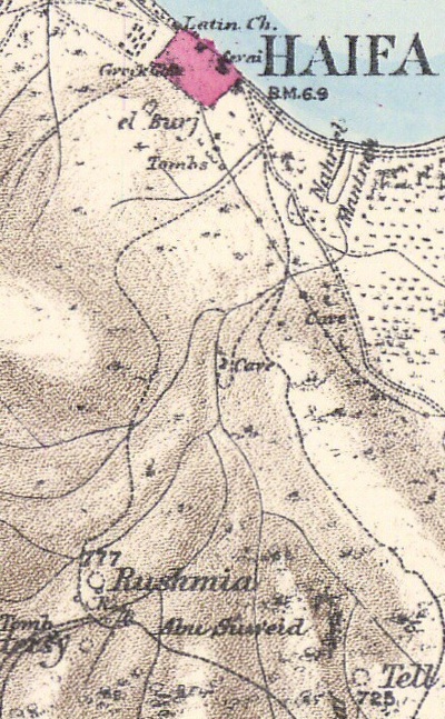
Part of map Sheet 5 of Survey of Western Palestine,
by Conder and Kitchener, 1872-1877.
(Published 1880, reprinted by LifeintheHolyLand.com)
The surveyors wrote about the site (Vol 1, pp. 329-330):
“Rushmia (J h).—The ruin of a rectangular building, with a tower in its north-east corner. The walls are standing some 15 feet high in places. The building measures 35 feet north and south, and 45 east and west outside. The tower is about 15 feet square, and intended to flank the northern entrance. The east wall has been destroyed. The walls are 7 feet thick, built of courses of ashlar, the stones averaging 2 feet 3 inches by 1 foot 2 inches by 1 foot 2 inches. The material used is very soft, and the stones much worn ; the mortar joints arc very thick, and large pieces of pottery are used. No drafted stones were seen.
The tower is entered by a door 5 feet high, 2 feet broad, on the west. The roof is of rough stones, with a pointed arch. It is barrel-vaulted, and covered with hard cement. On the south is a loophole-window, and a side-door, the latter with a flat lintel. On the west wall is a window with retaining arch, and a small window above. All these arches are pointed.
There is a large window in the south wall of the main building. It appears to have had a semicircular arch. The site is a very commanding one. A path leads down to Haifa. There are ruins all round for a distance of some hundred yards. About 150 yards west are four vaults, apparently the basement of some building. This is evidently the ruin of a fortress, on the hill-side, and the character of the masonry would lead to the supposition that it was one of those constructed by Dhaher el ‘Amr.Visited 8th January. 1873”
- Oliphant visit
Laurence Oliphant (1829–1888) was a British author, diplomat, traveler, and mystic. Laurence Oliphant frequently wrote travel letters and reports to newspapers, especially during his journeys. On pages 18–19 of “Haifa: or, Life in Modern Palestine (1887)”, a collection of his letters associated with the Holy Land, Laurence Oliphant recounts his visit to the ruins of Rushmiya, a small site on the lower slopes of Mount Carmel near Haifa. He describes the remains of ancient stone structures and rock-cut tombs, noting how they are scattered among olive groves and limestone terraces.
Oliphant remarks on the site’s quiet isolation and its commanding view of the Bay of Haifa and the plain of Acre. He speculates that Rushmiya may have once been a small Phoenician or Jewish village, later abandoned. His tone combines archaeological curiosity with romantic reflection—he admires the harmony between the ruins and the surrounding landscape, and contrasts their desolation with the vitality of modern Haifa below.
A 1940s British survey map of the area is shown here. The site is marked as Kh. Rushmiya.
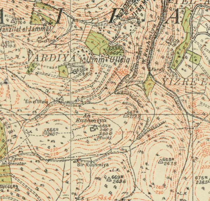
British survey map 1942-1948 – https://palopenmaps.org topo maps
License: public domain under the UK Copyright, Designs and Patent Act 1998
- Modern period:
The site is open to the public. On its west is a memorial park commemorating the fallen soldiers of Romema neighborhood..
Excavations were conducted in years 1973-4, headed by M.W. Prausnitz of the Haifa University.
Photos:
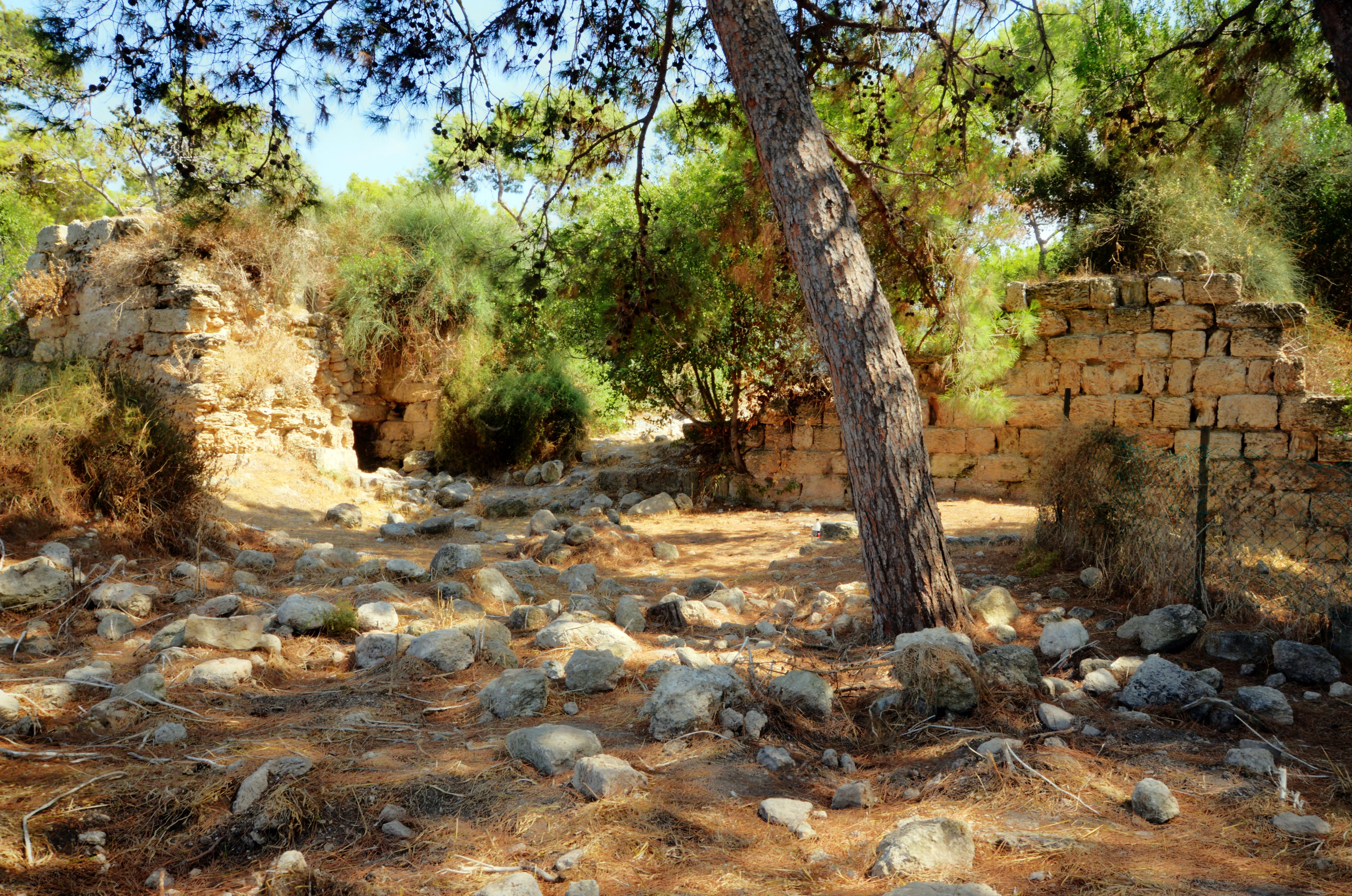
(a) Commanding view
Rosh Maya, or Khirbet Rushmiya, is a ruin that occupies the summit of a hill overlooking the northern area of Mt. Carmel. It commanded the main entry to the Carmel that was along the valley of Rusmiya, seen here in this north view.
The site rises above the area surrounding it. The steep terrain above the valleys highlights the strategic choice of this commanding location.
From the edge of the summit, the view is expansive. The coastal road and the bay of Haifa can be seen from the site.
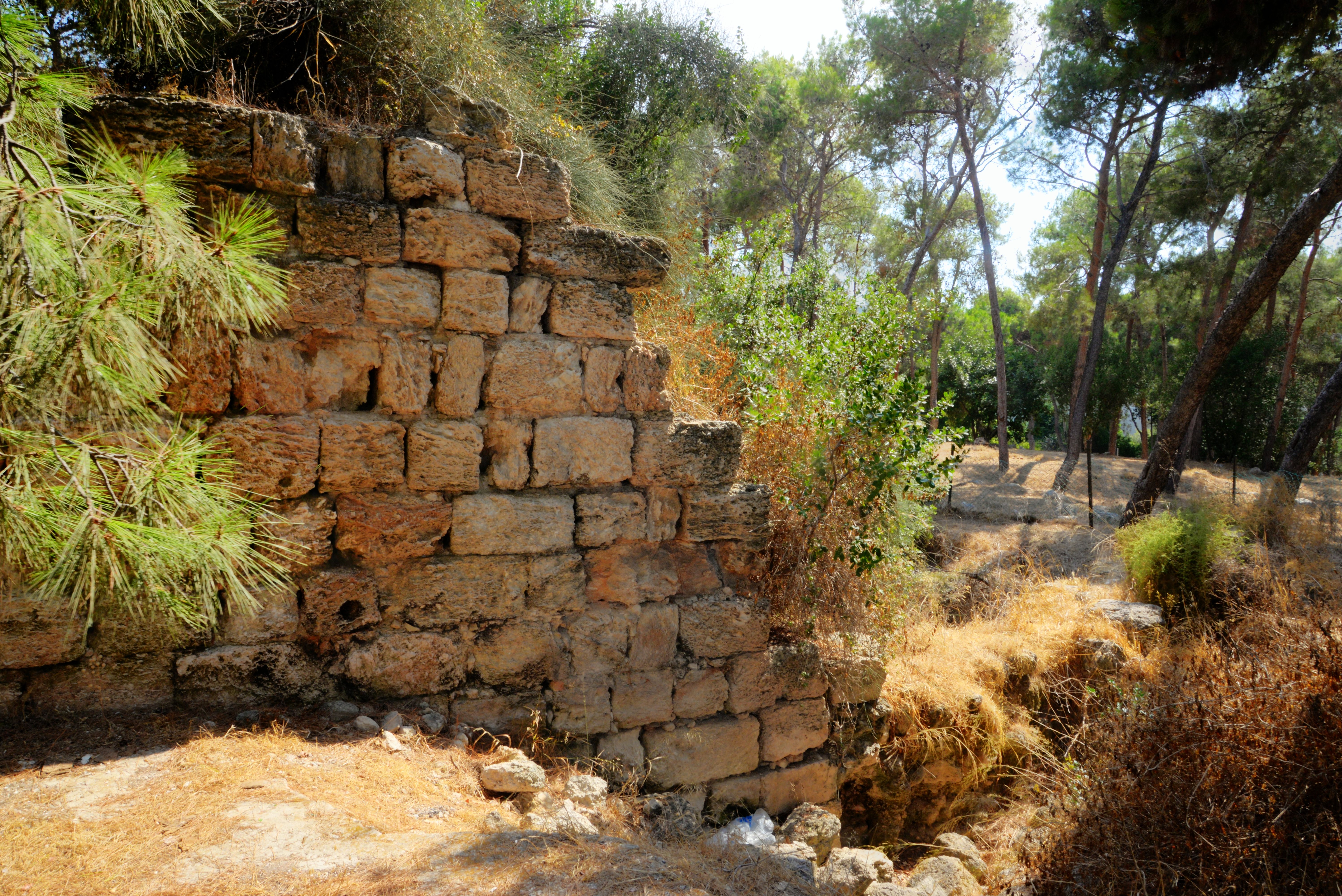
(b) Crusader fortress
The fortress includes a rectangular tower in the center, measuring 20.8 by 13.2m, with 2.5m wide walls. On the north east corner is a fore building extension, measuring 11.2 by 8.7m, that protected the entrance to the tower. Most of the fortress was leveled, so we can see only the lower side of the fortress.
The fore building extension is seen here from the north west side. A door is located along the wall, once used to enter the fortress through the extension.
To the right is the main building courtyard, as seen from the west side. The northern wall of the main building is missing at this section.
Exiting through this doorway leads to an open area on the north side of the fortress. Notice that the wall is missing between the extension structure and the remaining wall.
The ground here is covered with numerous stones—some originating from the fortress ruins, others from the earlier Roman and Byzantine settlement.
A section of the northern wall can be seen on the west side.
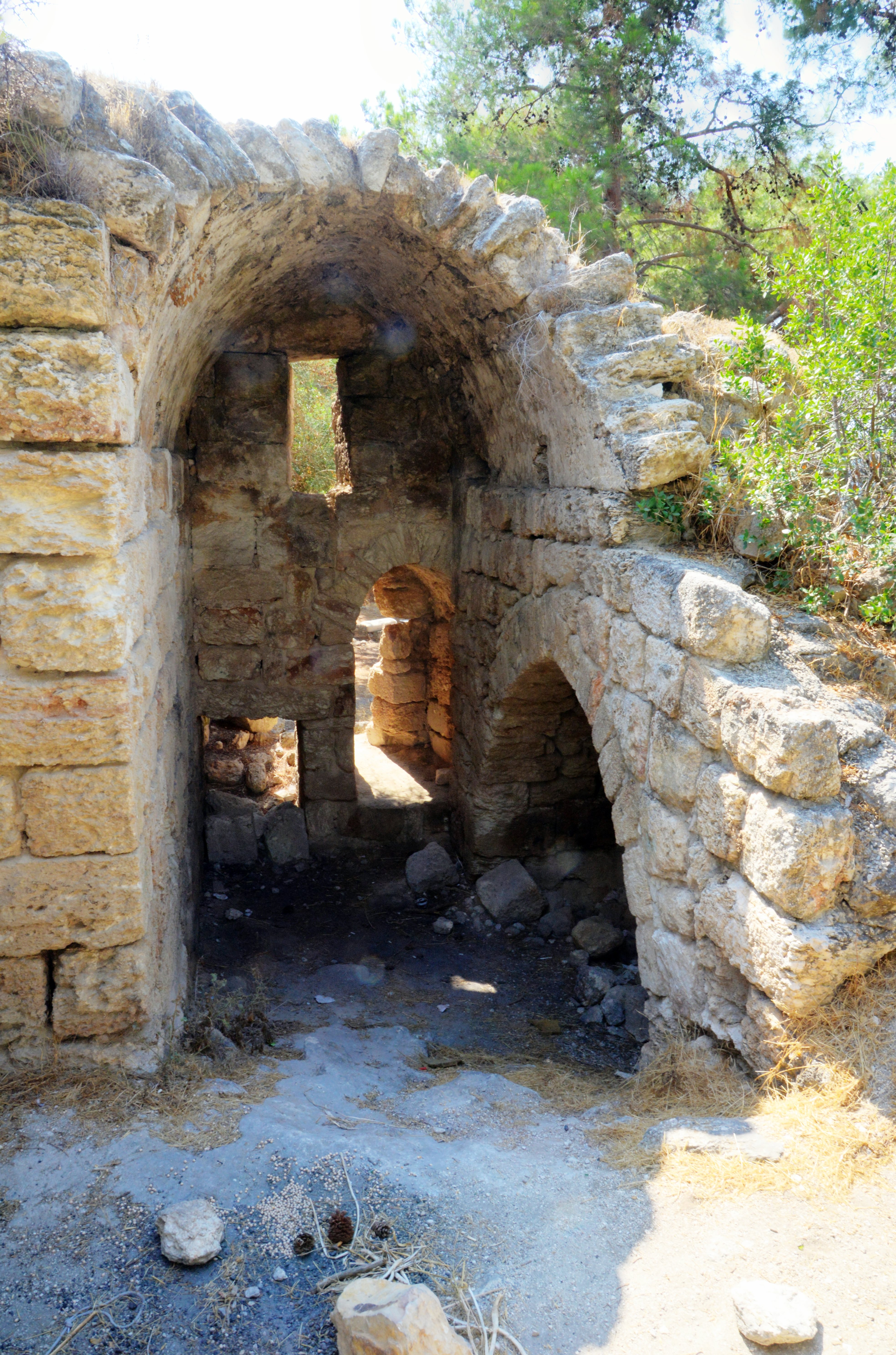
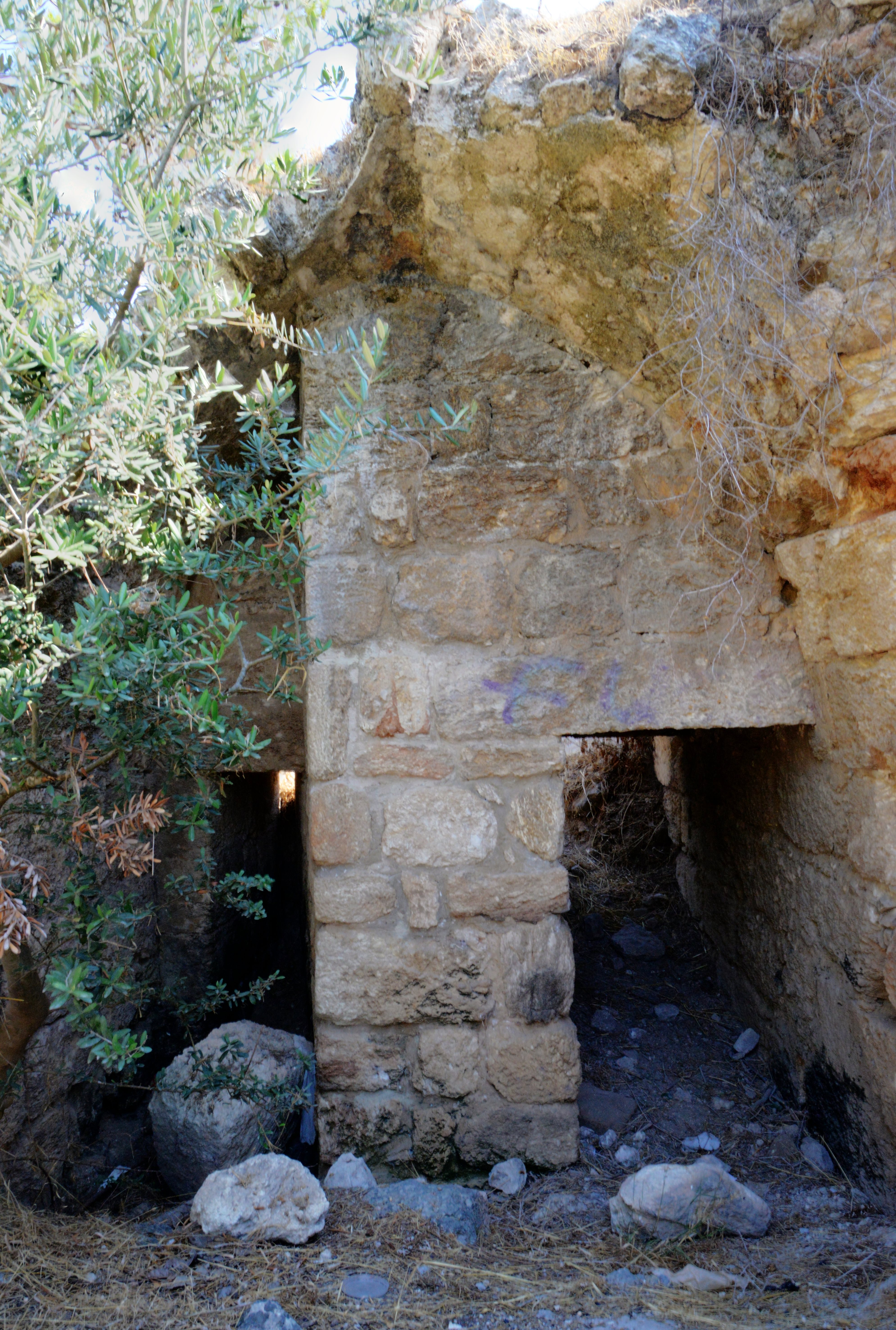
(c) Tour of the fortress
We entered through the basement of the forebuilding, which once projected beyond the main tower to protect its entrance. In its original state, the structure had two doorways—on the south and west sides—providing access inside. Following its destruction, the eastern wall of the extension collapsed, allowing passage over the fallen stones.
The interior displays the typical vaulted construction style characteristic of Crusader architecture.
On the west wall is a door that was used to enter into the fore building, then use a staircase to enter the main building. Above the door is a retaining arch and a small window.
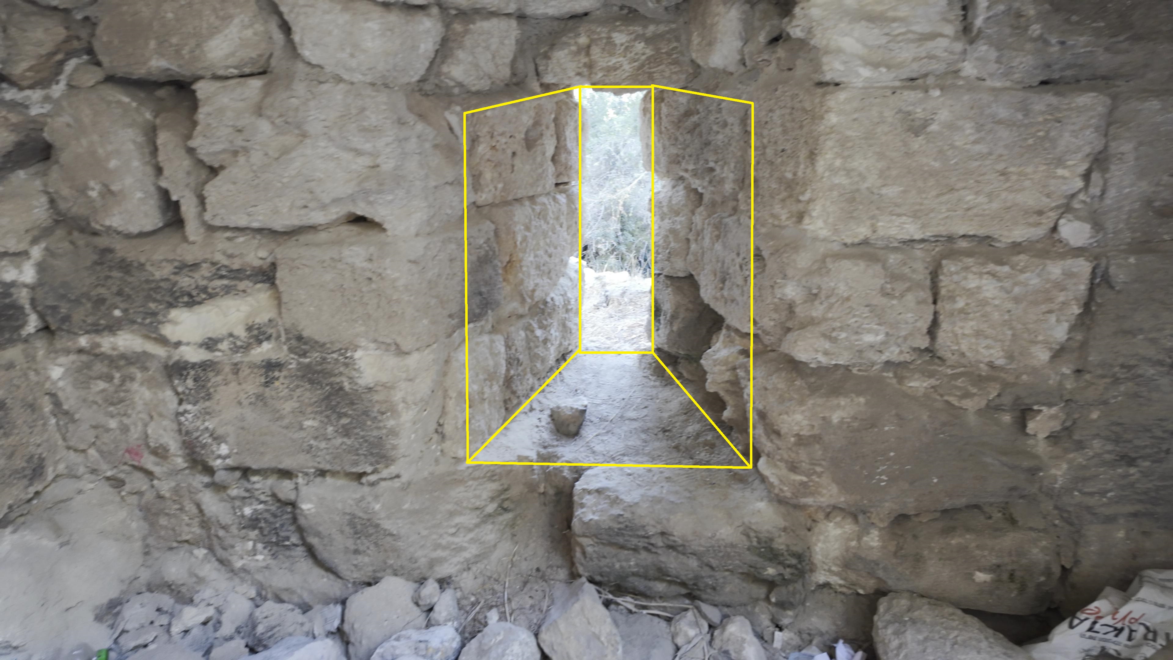
On the north wall is an arrow slit – a narrow vertical opening that allowed archers to shoot at attackers while remaining protected behind the wall. It has a narrow exterior to minimize the target for enemies and wide interior to give defenders a wide field of view and firing angle.
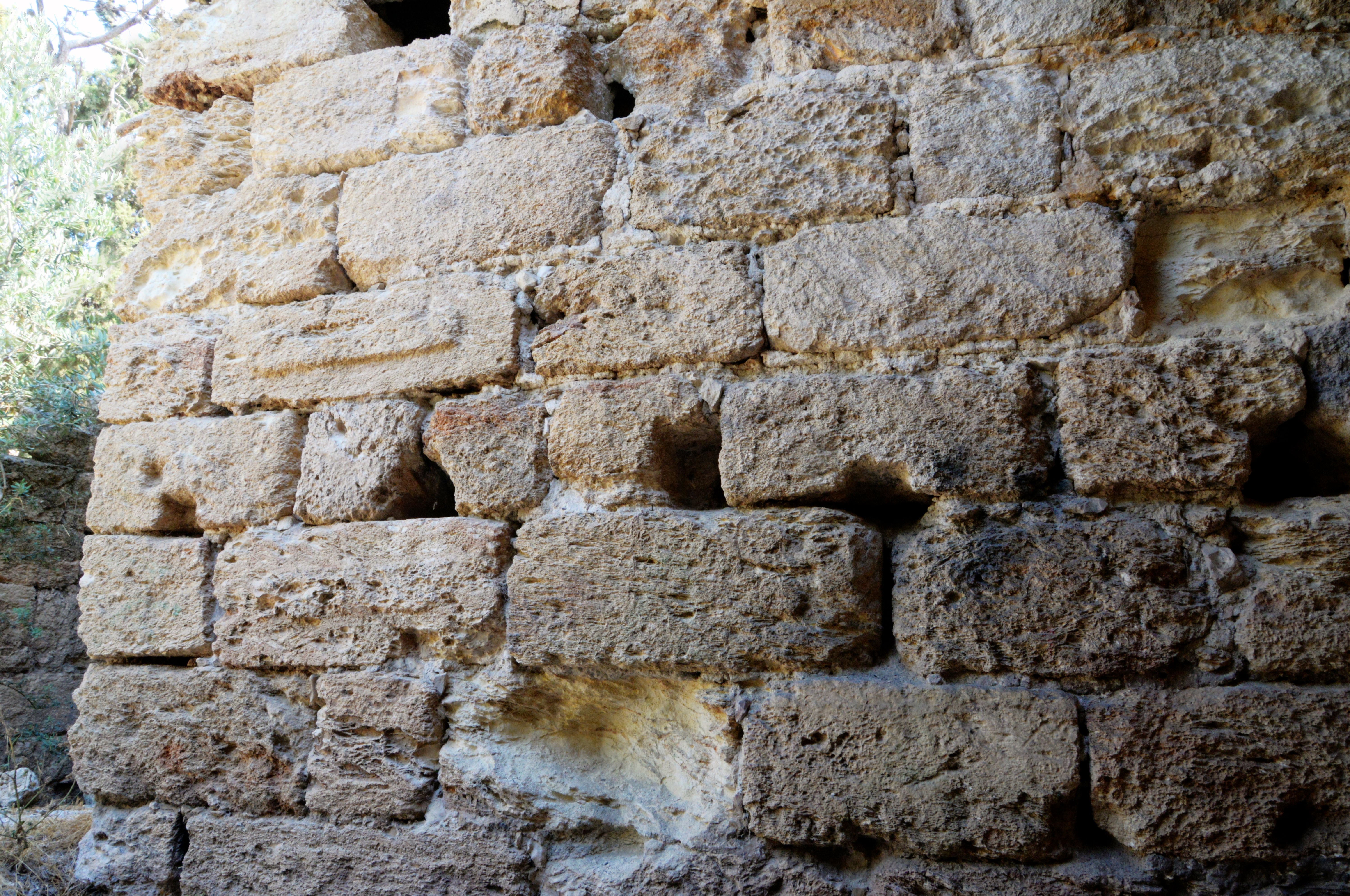
On the south side is a wide wall, part of the north-east corner wall of the main building. One of the kurkar bricks has drafted margins.
Carved stone slabs with chiseled or drafted margins (also called marginally drafted stones) are indeed characteristic of both the Hasmonean and Crusader periods, though their style and technique differ somewhat:
-
Hasmonean period (2nd–1st centuries BC):
Builders often used ashlar stones with finely chiseled margins and a slightly raised, smooth boss in the center. This drafted-margin technique is typical of Hasmonean and early Herodian masonry, seen for example in Jerusalem’s fortifications and in sites like Hyrcania and Alexandrion/Sartaba. It gave the walls a refined yet sturdy appearance. -
Crusader period (12th–13th centuries AD):
Crusader builders revived this technique, but their stones are generally larger, rougher, and less precisely dressed, with broader margins and deeper tool marks. The purpose was similar—strong, visually ordered masonry—but the finish is less meticulous than in earlier classical examples.
So, while both periods used carved margins on stone slabs, the Hasmonean style is finer and more precise, and the Crusader style more massive and utilitarian.
Between the extension and the main wall is another entrance doorway, leading to the south. It is also protected by an adjacent arrow slit. Both door and arrow slit are partially covered by debris and soil that accumulated over the years.
Courtyard of the main tower:
The basement of the main hall is the surviving part of the original tower. Facing east, it features an unusual architectural layout combining a groin vault – a double barrel vault. On the west side – the hall was built with a single barrel vault.
An opening on the south side of the hall provides access outside. The southern wall, 2.5 m thick and 13.2 m long, is largely preserved.
The following view shows the southern wall and the southeast corner of the fortress.
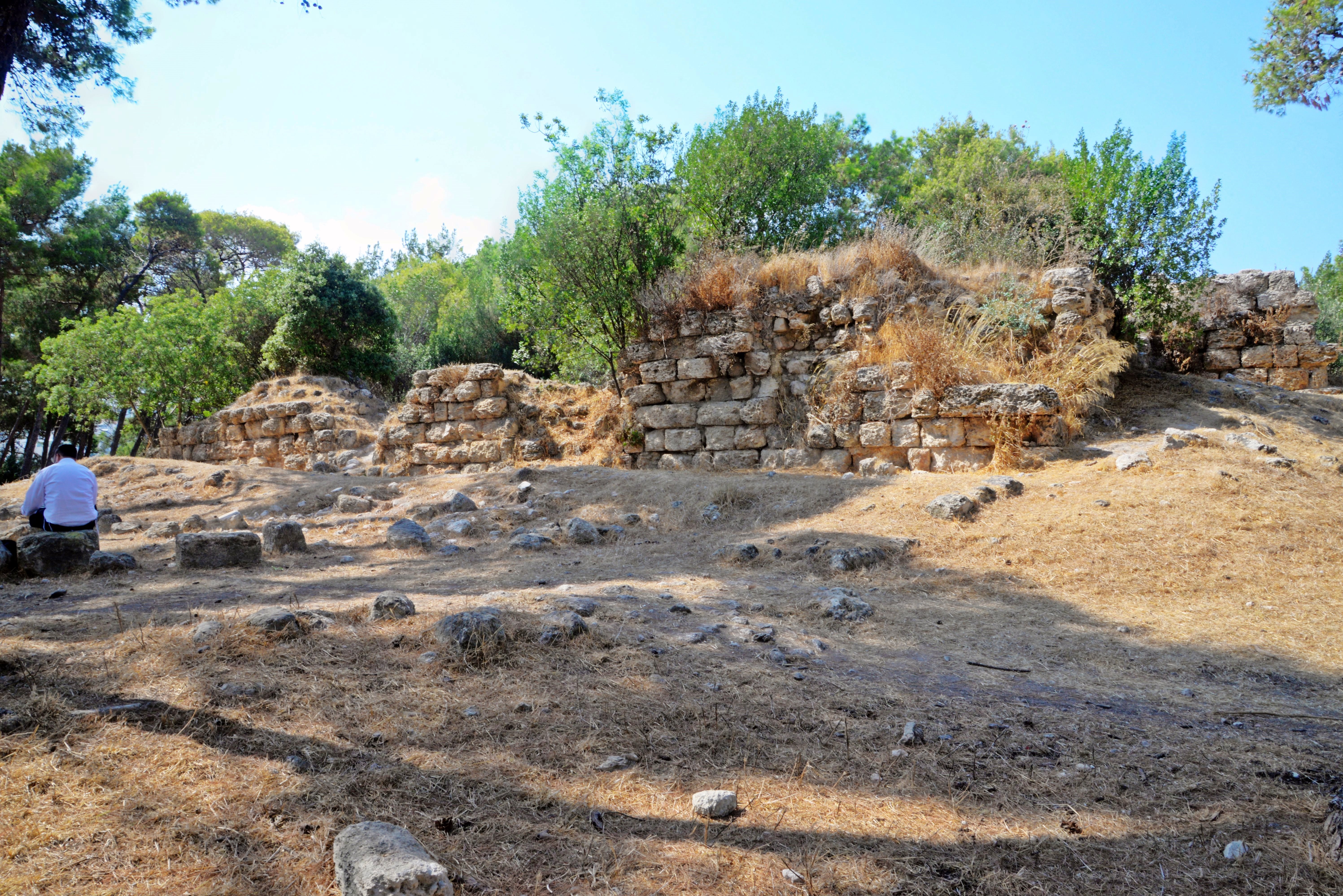
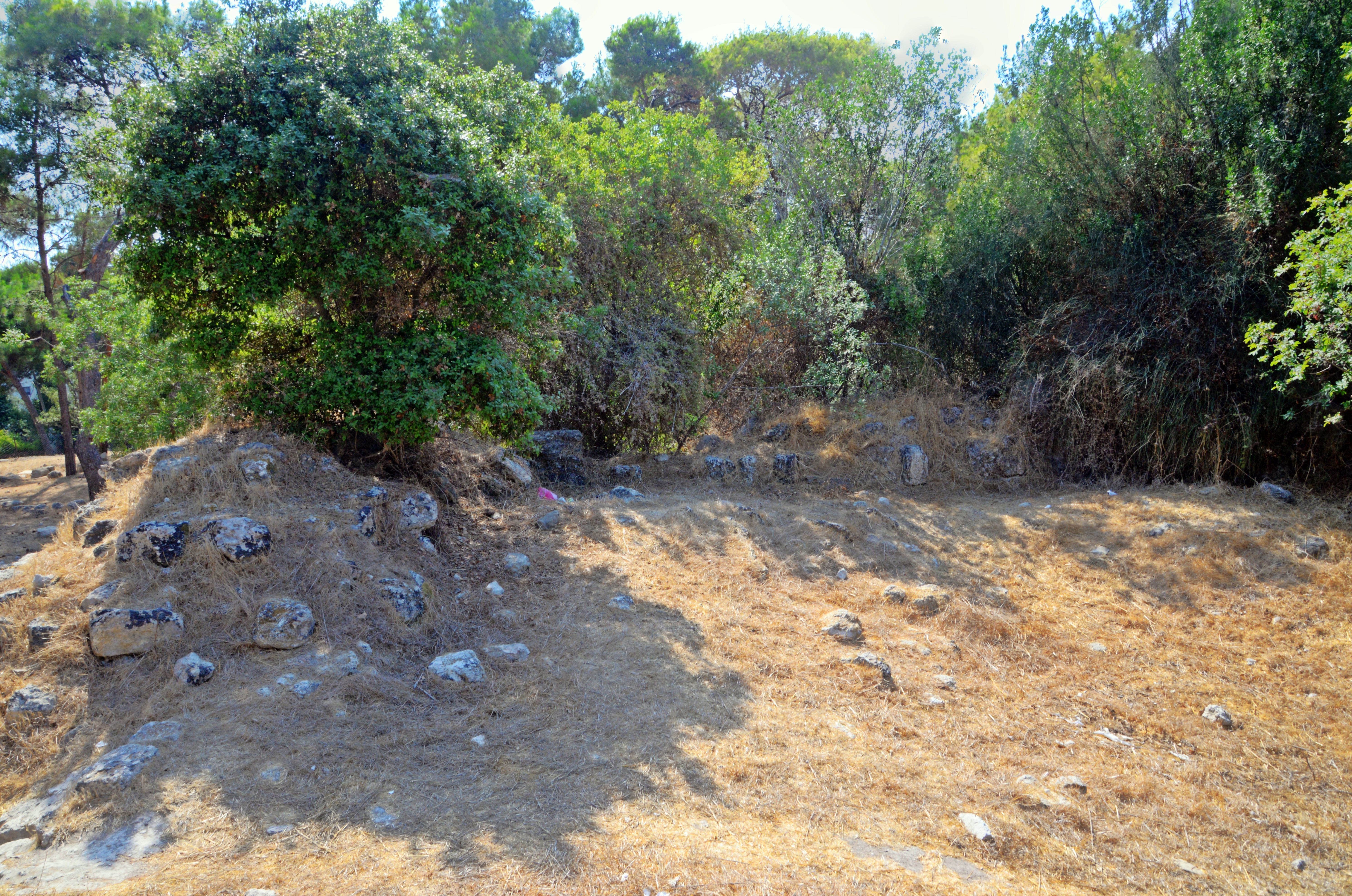
(d) Other remains
The fortress stands on a flat, pine-covered plateau, with unexcavated remains from earlier periods beneath the surface. The ancient site covers an area of 20 dunam.
During the Roman and Byzantine periods, a Jewish village called Rosh Maya was established on the hill, where remains of ancient oil presses are still visible among the ruins.
The site’s earliest settlement dates to the Hellenistic period (3rd–2nd centuries BC). Toward the end of the 2nd century BC, the Hasmoneans constructed a fortress on the summit. Recent excavations uncovered a network of underground tunnels likely connected to this fortress—constituting the earliest known hiding complex on Mount Carmel, predating the Roman-era refuge systems used during the Jewish revolts.
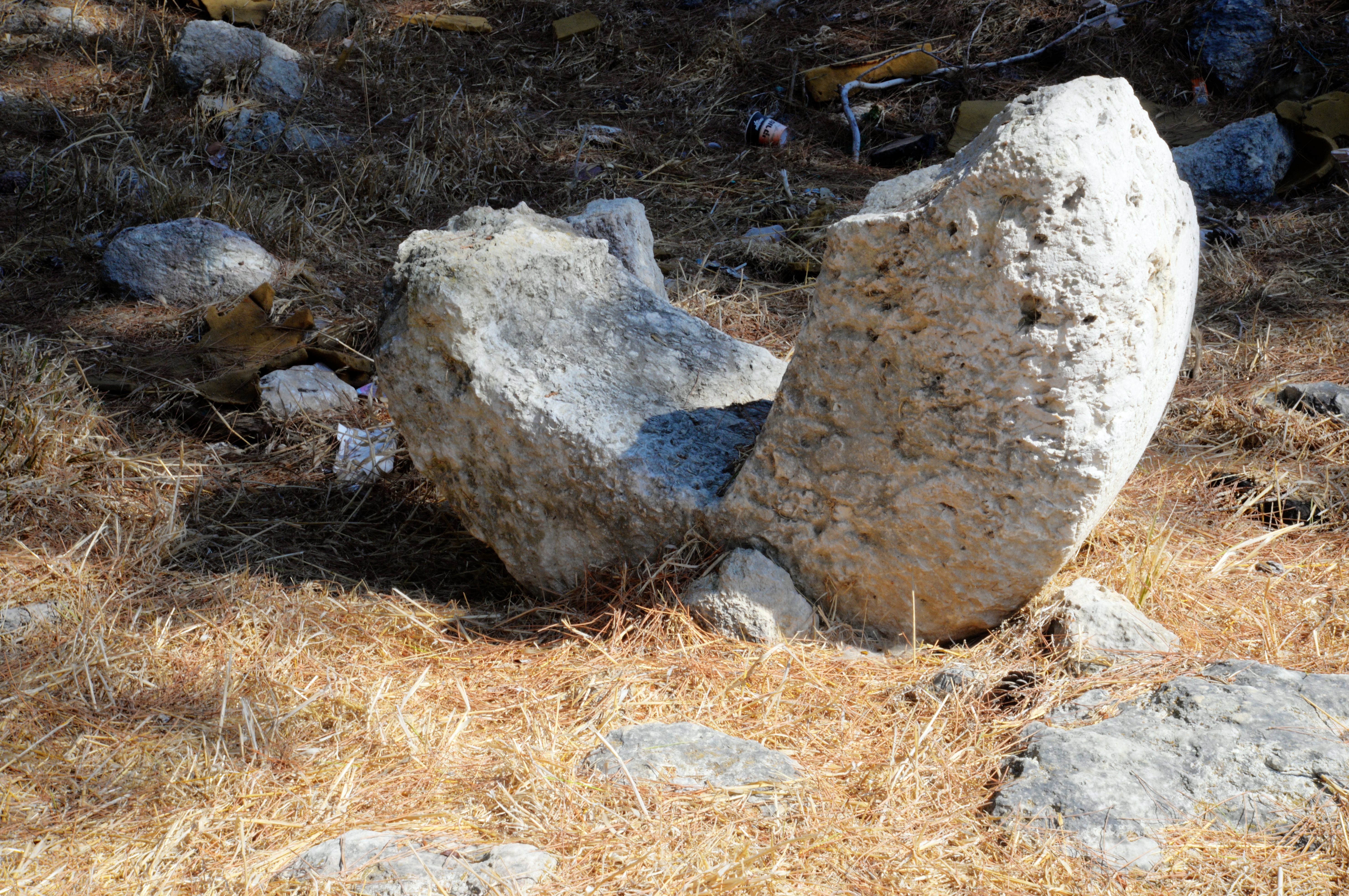
This entrance, one of the 2 entrances to the hiding complex, is 6m north of the north-east corner of the Crusader fortress.
(e) Video Tour
![]() This 5+ minutes video summarizes a tour of the site by BibleWalks staff, conducted on September 2025:
This 5+ minutes video summarizes a tour of the site by BibleWalks staff, conducted on September 2025:
Etymology (behind the name):
- Rosh Maya – meaning: Rosh Mayim (translation: Head of Water)
- Romema – neighborhood, Hebrew for: uplifted.
References and Links:
* External Links:
- Hiding complex on Rosh Maya– Yenon Shavtiel, Tel-Hai Galilee Studies, Vol. III, pp 98-118
- Secular building in the Crusader Kingdom of Jerusalem – D. Pringle; page 90 Site 190
* Internal links:
BibleWalks.com – Gateway to the sites of the Bible
Kebara Cave<<<—previous Carmel site —-<<<All Sites>>>
This page was last updated on Oct 29, 2025 (new page)
Sponsored links: