Ruins of a royal palace and administration center, on the south outskirts of Jerusalem, overlooking the road to Bethlehem and Hebron.
Home > Sites > Jerusalem > Ramat Rachel
Contents:
Background
Location
History
Photos
* Aerial view
* Iron Age
* Roman period
* Byzantine
* Modern
Etymology
Links
References
Overview:
Ramat Rachel Archaeological Park is an archaeological site located on a hill overlooking the modern-day Ramat Rachel Kibbutz, just south of Jerusalem, Israel. The site has a rich history dating back to the Iron Age, with significant finds from the Babylonian and Roman periods.
Excavations at Ramat Rachel began in the 1950s, and a number of important discoveries have been made since then. One of the most significant finds was a large fortified palace from the 8th-7th centuries BC, which was likely the residence of the kings of Judah. The palace included a large courtyard, a throne room, and several smaller rooms.
Other notable finds include a complex of ritual baths (mikvaot) from the Second Temple period, as well as a Roman villa from the 2nd-4th centuries AD. The villa included a number of elaborate mosaic floors, as well as a large wine press and other agricultural installations. Remains of a Byzantine period monastery and village were also unearthed.
In addition to the archaeological excavations, the Ramat Rachel Archaeological Park also features a visitor center with exhibits about the site’s history and archaeological finds. Visitors can also take guided tours of the site and see the excavated remains of the palace, mikvaot, and other structures.
Overall, the Ramat Rachel Archaeological Park is a fascinating destination for anyone interested in the history and archaeology of the Jerusalem area. The site’s rich history and well-preserved remains provide important insights into the lives of the people who lived there thousands of years ago.
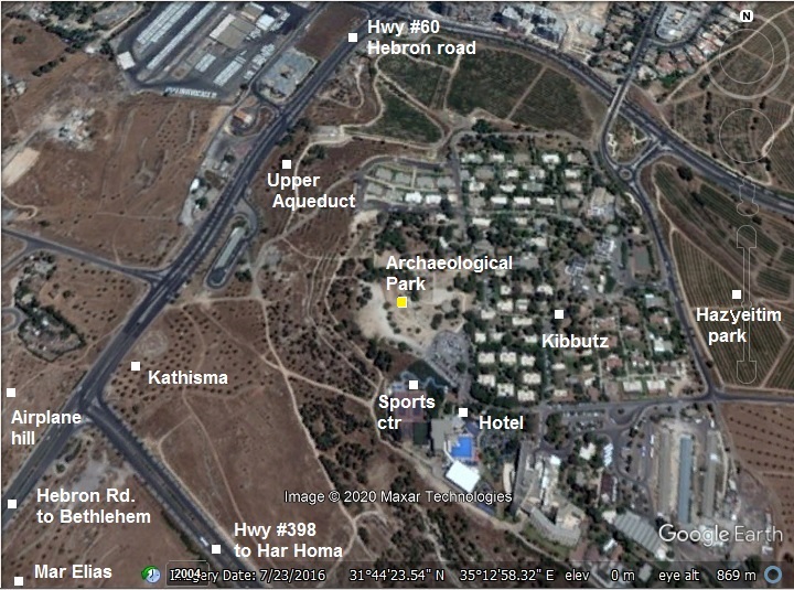
Location and Aerial map:
The archaeological park is located on the western side of the Kibbutz, overlooking Hebron road that connects Jerusalem to Bethlehem.
History:
- Settlement levels:
These were the settlement levels dated by the archaeologists (from earliest to latest):
- VB – Iron Age IIc (8th-7th century BC) – Royal administrative center
- VA – Iron Age end (608-597 century BC) – Royal administrative center, enclosed by a garden
- Destruction
- IVB – Persian/Hellenistic (5th-3rd century BC) – Imperial administrative center
- IVA – Herodian (1st century BC – 1st century AD) – Village
- Destruction (great revolt)
- III – Late Roman, Early Byzantine (3rd-4th century AD) – Village
- IIB – Middle Byzantine (5th-6th century AD) – Village
- IIA – Late Byzantine (6th-7th century AD) – Village, Church
- I – Early Arabic (7th-8th century AD) – Farm
- – Fatimid-Ottoman (12th-19th century) – Farm
- – Israel (1947-1954) – military fortifications, trenches
These periods are detailed in the following paragraphs.
- Iron Age – level VB
During the 8th-7th century a Royal fortified administrative center was built on a hill south of Jerusalem. It was built here due to its strategic location, on a hill overlooking a major road from Jerusalem to Bethlehem and Hebron. A tower was built on the summit, and administration buildings were built on its east side. Few remains of it were found on this level, designated as VB.
The hill may have been part of the Royal vineyards. Some scholars identify the place as Beit Hakerem (house of the vineyards), as written in the Bible (Jeremiah 6,1): “O ye children of Benjamin, gather yourselves to flee out of the midst of Jerusalem, and blow the trumpet in Tekoa, and set up a sign of fire in Bethhaccerem”.
Only few remains of this early fortified center was found, as the second phase of construction mostly destroyed it.
- Iron age – level VA
During the 6th century BC, close to the end of the Judean Kingdom, the place underwent total reconstruction. A monumental palace was built on the ruins of the previous fortress.This may have been the work of Jehoiakim (608-597 BC), as in the Bible (Jeremiah 22,13-18):
“Woe unto him that buildeth his house by unrighteousness, and his chambers by wrong; that useth his neighbour’s service without wages, and giveth him not for his work; That saith, I will build me a wide house and large chambers, and cutteth him out windows; and it is cieled with cedar, and painted with vermilion. Shalt thou reign, because thou closest thyself in cedar? did not thy father eat and drink, and do judgment and justice, and then it was well with him? He judged the cause of the poor and needy; then it was well with him: was not this to know me? saith the LORD. But thine eyes and thine heart are not but for thy covetousness, and for to shed innocent blood, and for oppression, and for violence, to do it. Therefore thus saith the LORD concerning Jehoiakim the son of Josiah king of Judah”
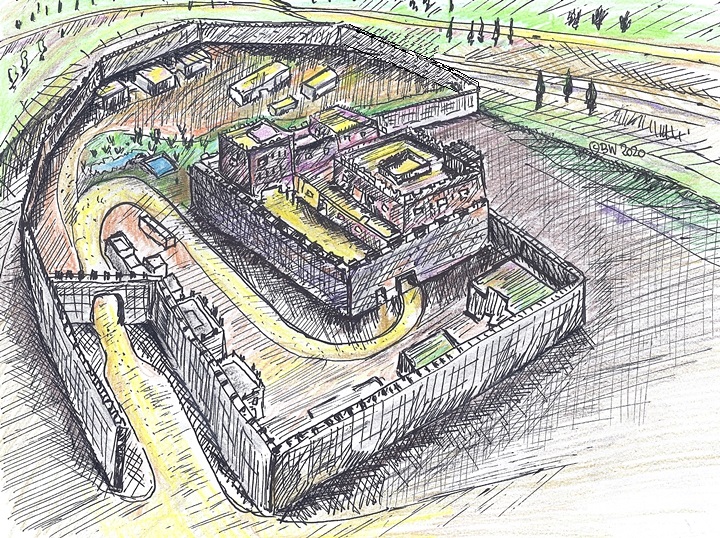
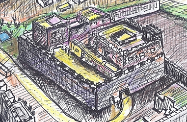
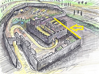
The ruins of the palace were found on level VA. Its plan consists of a large outer perimeter wall covering an area of 20 dunam, and a smaller inner fortress at the size of 50 x 75m. In this new palace was a ceremonial courtyard on the east side of the inner fortress, three palatial wings, and a royal garden with water installations.
A creative illustration of the palace is presented here, with a view from the south east. An inner fortress is oriented west-east with its long axis is surrounded by an exterior wall. The gate of the inner fortress, in the middle of this view, was located on its south east corner. The fortress was surrounded by an exterior wall that surrounded a larger area around the fortress, with its north and west sides following the edge of the hill. Only few sections of the wall was found. Its gate was also not yet found, but could be on the south side, as shown here.
- Persian period – level IVB
After the Babylonian destruction of Jerusalem, and the fall of the Babylonian empire, the Persians replaced them and controlled Judea. The site became an Imperial administrative center. During this period a new fortress wing was built on the north west side. The inner fortress of level VA was not in use.
Main findings of this period were 270 stamped jar handles, including handles with letters Y-H-D or Y-H (Judah), Yerushalem (Jerusalem), and others.
- Byzantine period
A monastery was built in 456 AD by a rich widow – Iqilia. It was enlarged at the end of the 6th century. It was dedicated to Mary Theotokos (the bearer of God), and named “The Seat of Mary”, recalling Mary’s resting on her way to Bethlehem before the birth of her son. Luke 2 4-5: “And Joseph also went up from Galilee… unto … Bethlehem… with Mary his espoused wife, being great with child”. Its church was built near the north eastern corner of the Iron Age inner citadel, and the monastery rooms were to the east of it.
In recent years an octagon shaped church was found close to Hebron road, below the hill upon the monastery was located. This was the lost Kathisma church.
-
Modern period
In 1927 a Kibbutz, Ramat Rachel, was established near the site. The name means in Hebrew “Rachel’s heights”, since it is named after prophet Rachel (wife of patriarch Jacob), whose traditional tomb is located nearby on the north west side of Bethlehem.
In 1931 a set of second temple burial caves, south of Ramat Rachel, were excavated by B. Mazar and M. Stekelis. The first excavations on the site were conducted in 1954, headed by Y. Aharoni. They were followed by additional seasons in 1959-1962, 1984, and 2004-2010.
The archaeological park is open free to the public; visitors can walk thru a well arranged paths, sculptures, and signs explaining the structures. From the site are great views of the southern area of Jerusalem. Nearby is the Ramat Rachel sports center and hotel.
Photos:
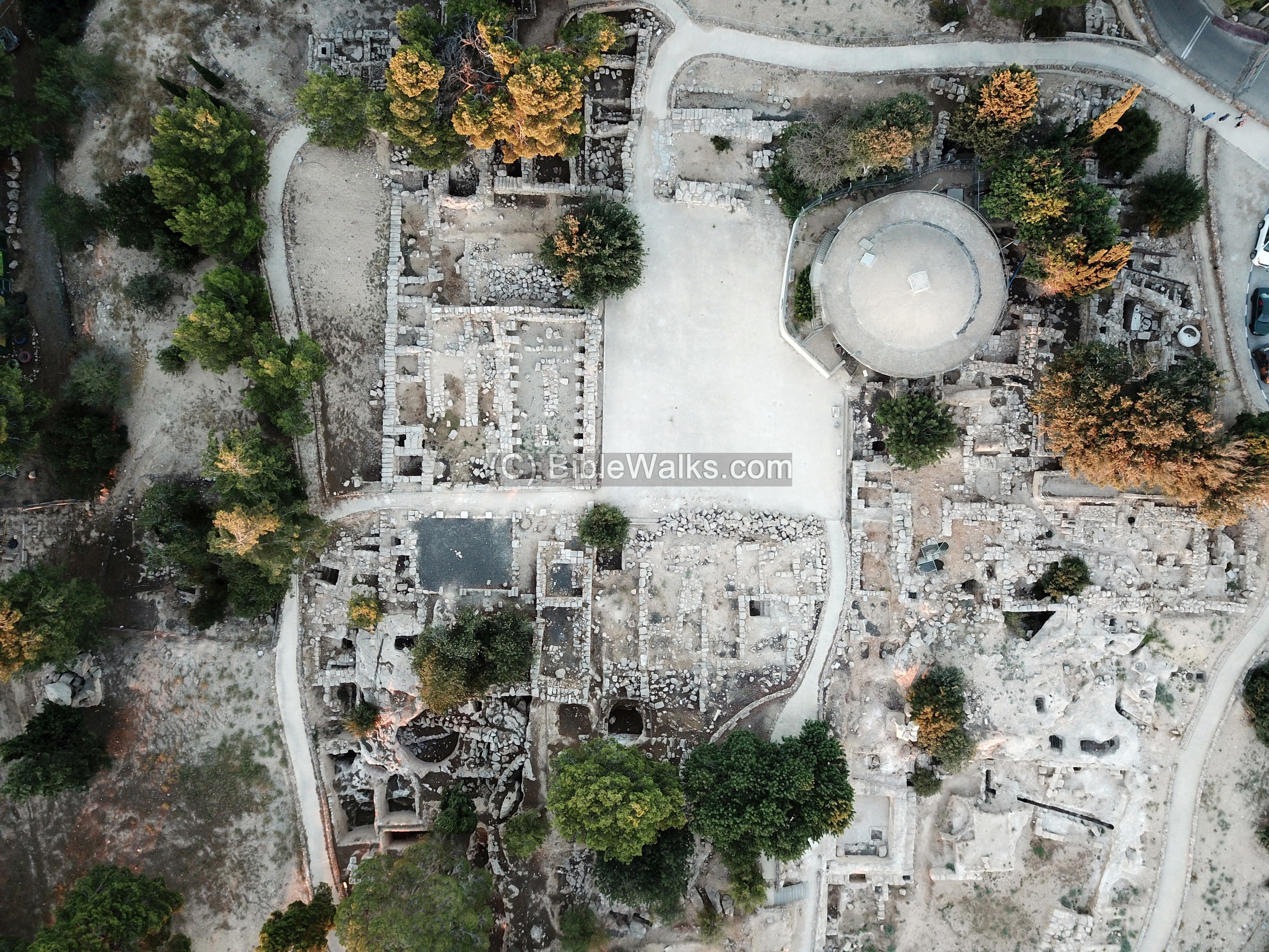
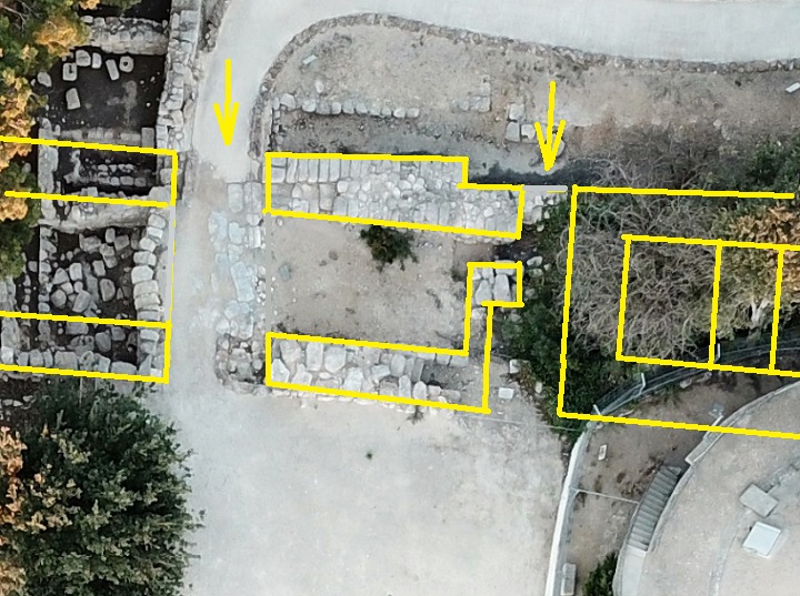
(a) Aerial view
Our drone captured this view towards the east. The Kibbutz residential houses border with the park on the north side, while the sports center and hotel are located on its eastern side. A convenient parking place is on the west (bottom) side.
Click on the photos to view in higher resolution…
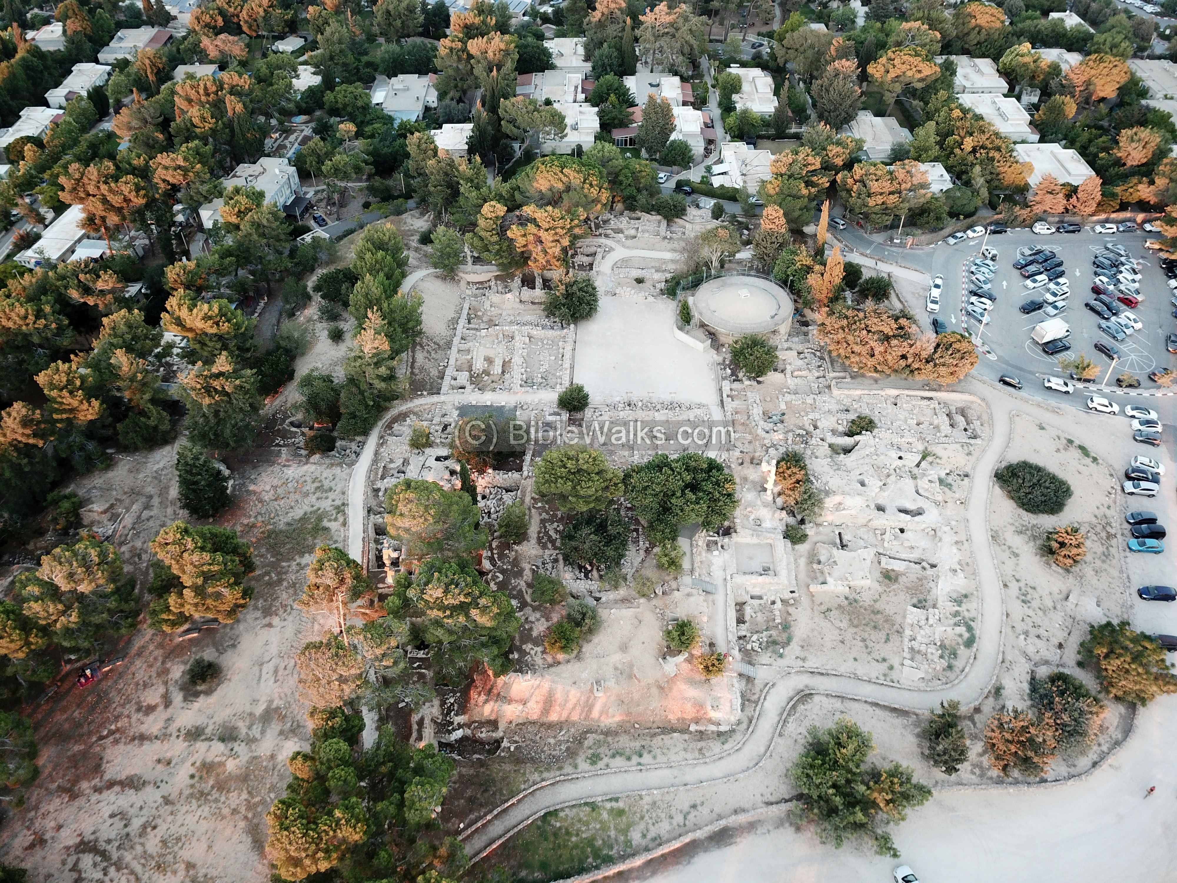
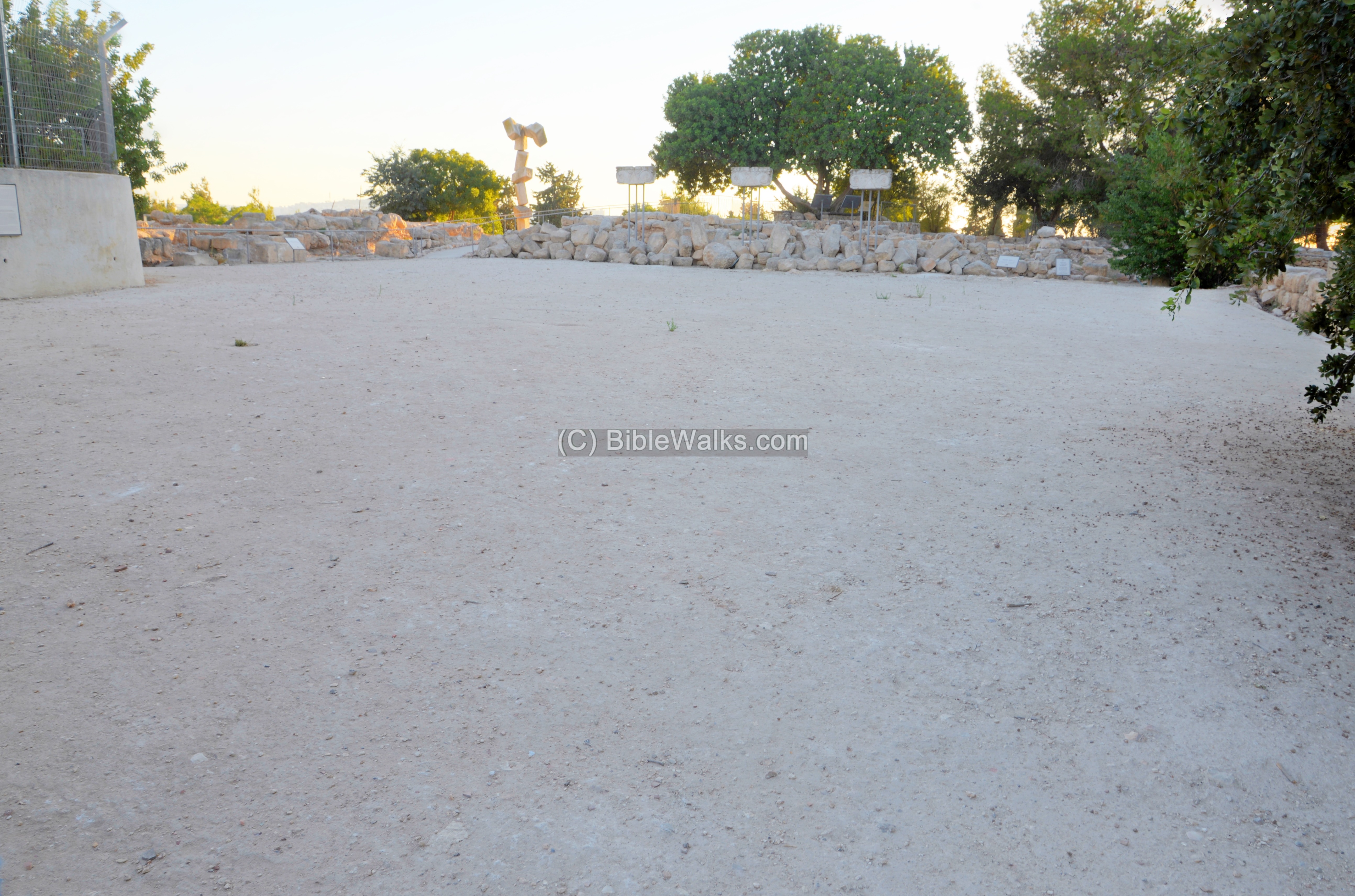
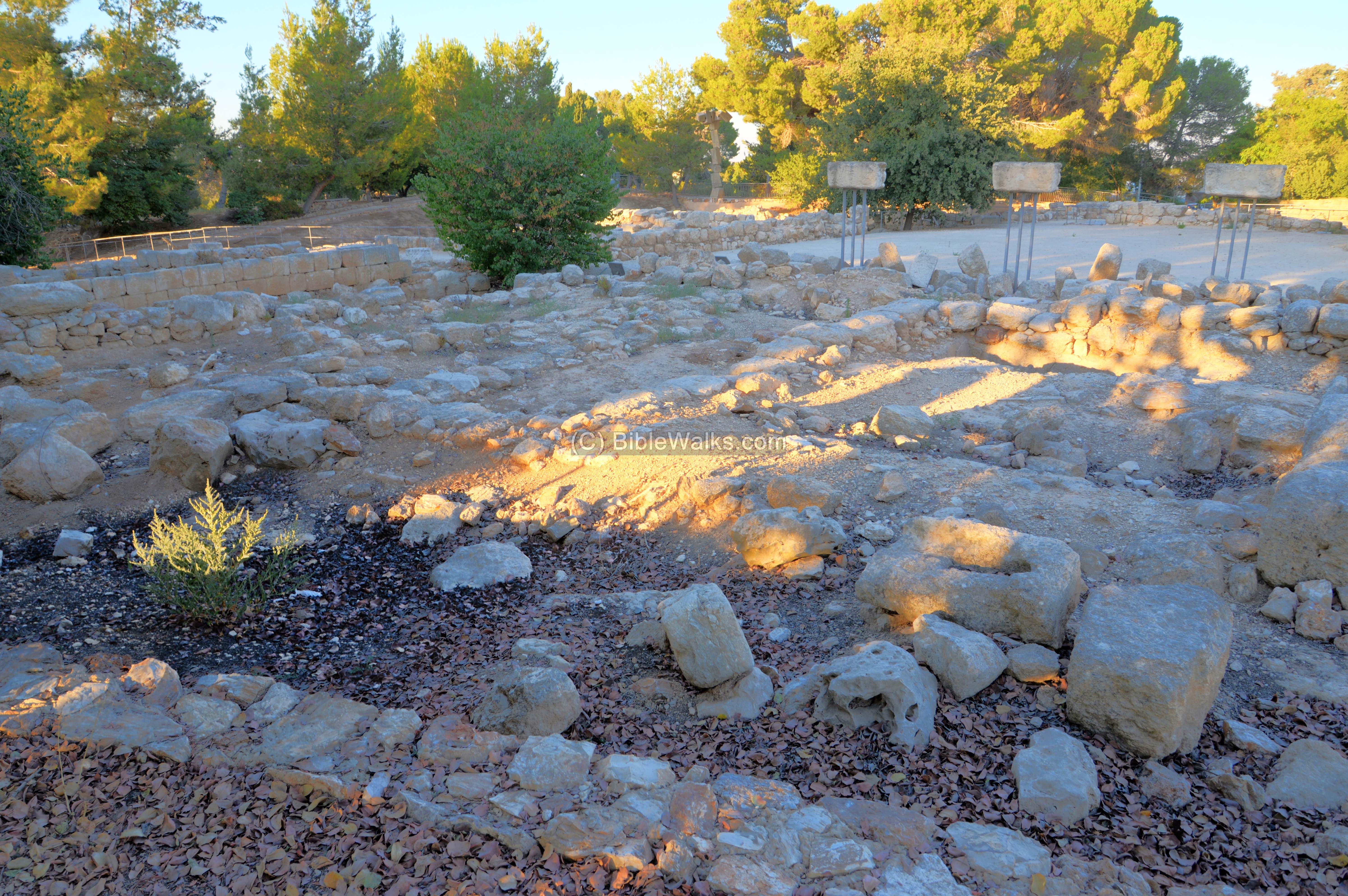
The following sections are arranged by the periods, starting from the early levels. Since the archaeologists pealed off the later levels to dig down into the old layers, many sections in the center of the park have only the Iron Age remains.
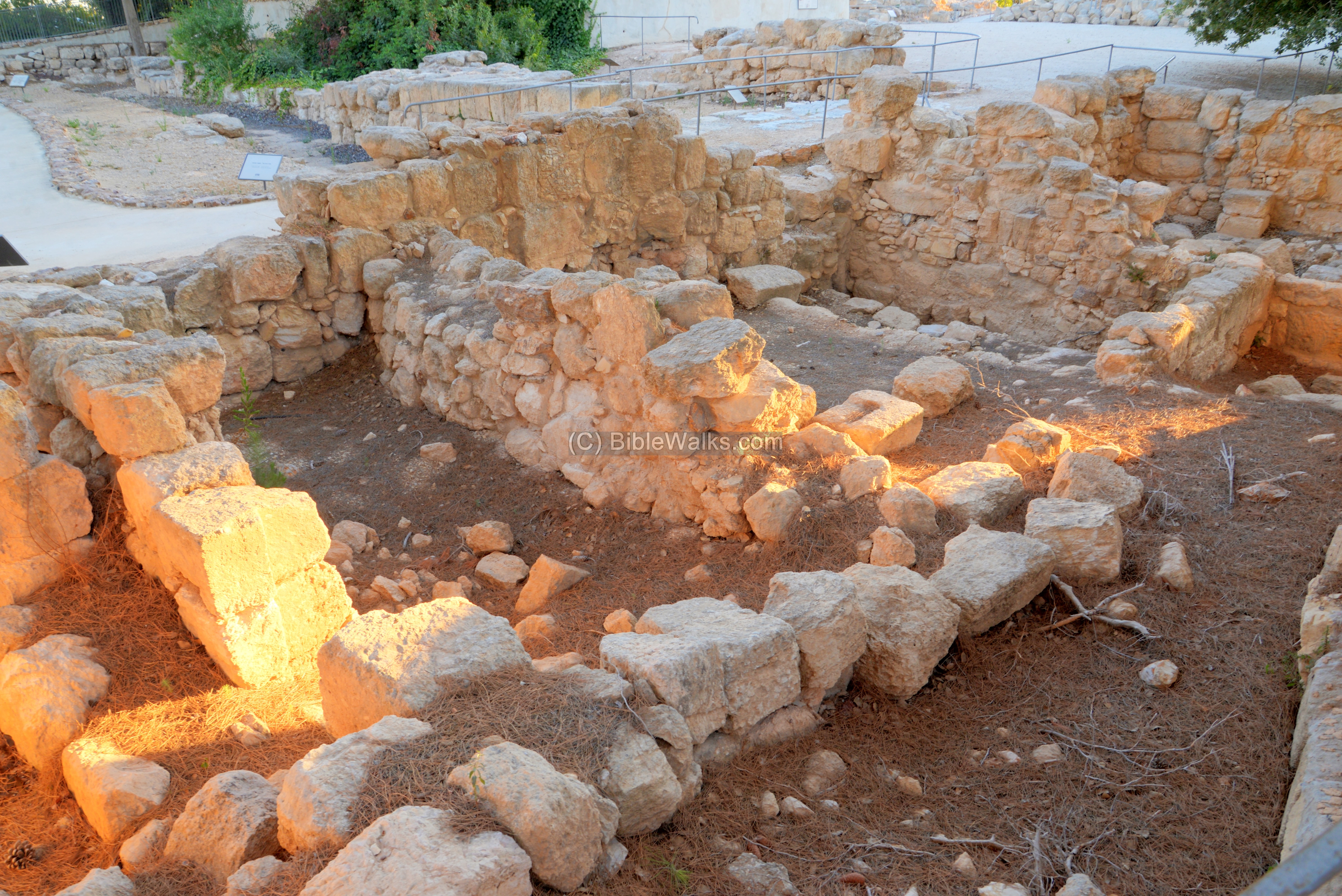
(b) Iron Age – Level V
Ruins of the inner fortress of the Iron Age are located in the center of the park. The large water tower was constructed on its south east corner, cutting into the south east section of the wall. Its construction in 1954 initiated the excavations by Y. Aharoni.
The boundaries of the inner fortress are marked on this photo with yellow lines. Its size is 75m by 50m, with the gate facing eastwards.
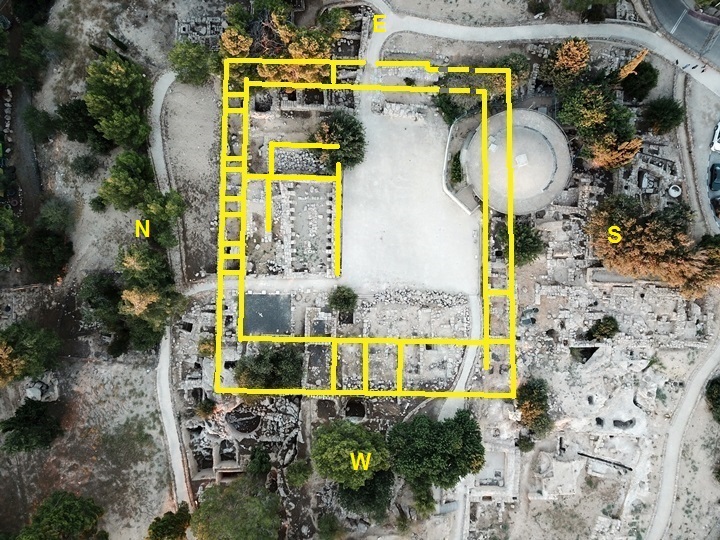
- Eastern Gate
The gate to the inner fortress was in the middle of the eastern casemate wall. An illustration of the inner fortress and its gate is seen from the south east.
The entrance was a straight cut through the internal and external wall of the 7m wide casemate wall. Another narrow pedestrian entrance was on its south side.
A top view illustration of the main gate and the pedestrian gate is shown here.
A cross section of the casemate wall is seen when passing the gate.
Notice remains of a pavement along the main gate.
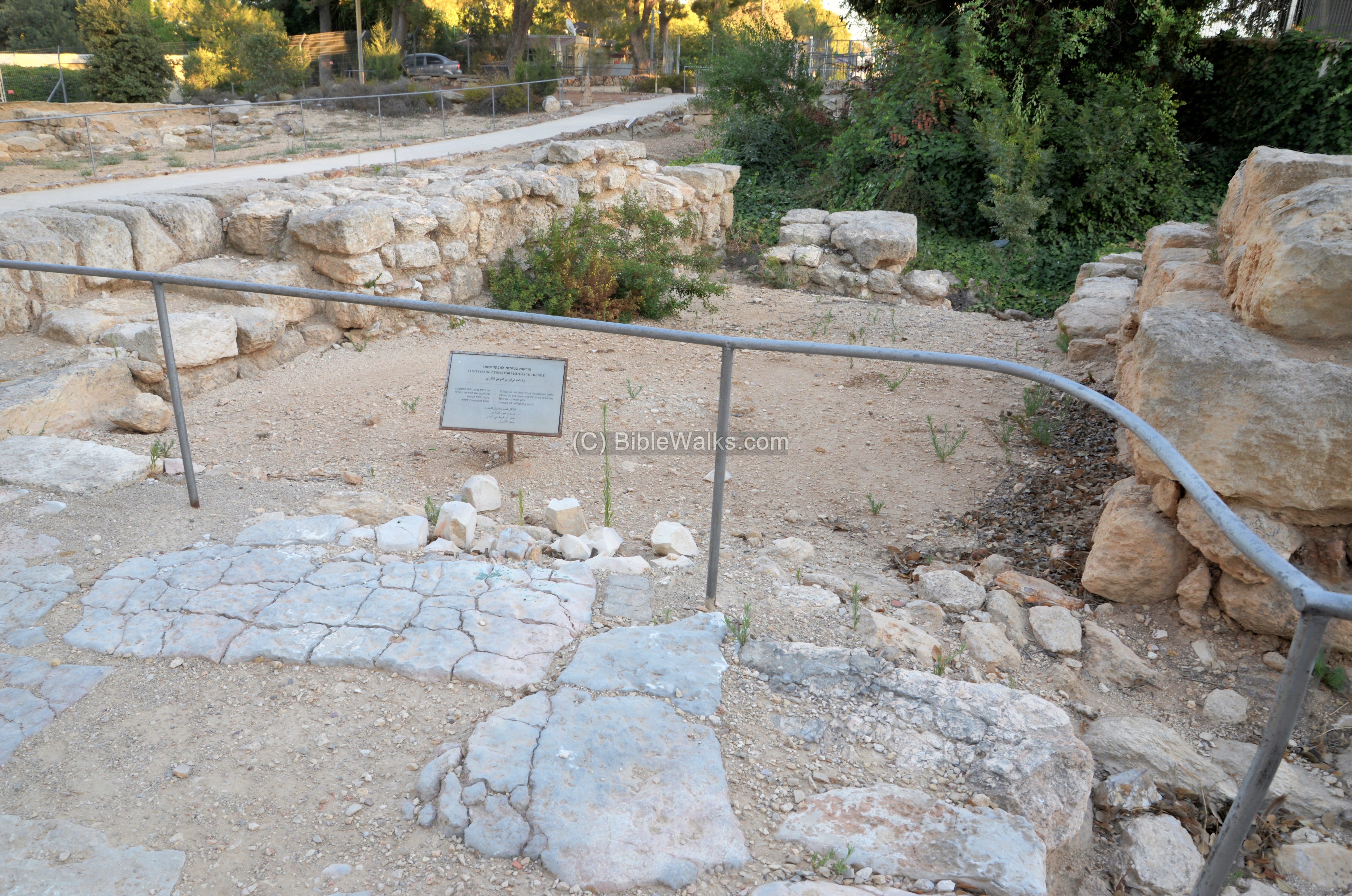
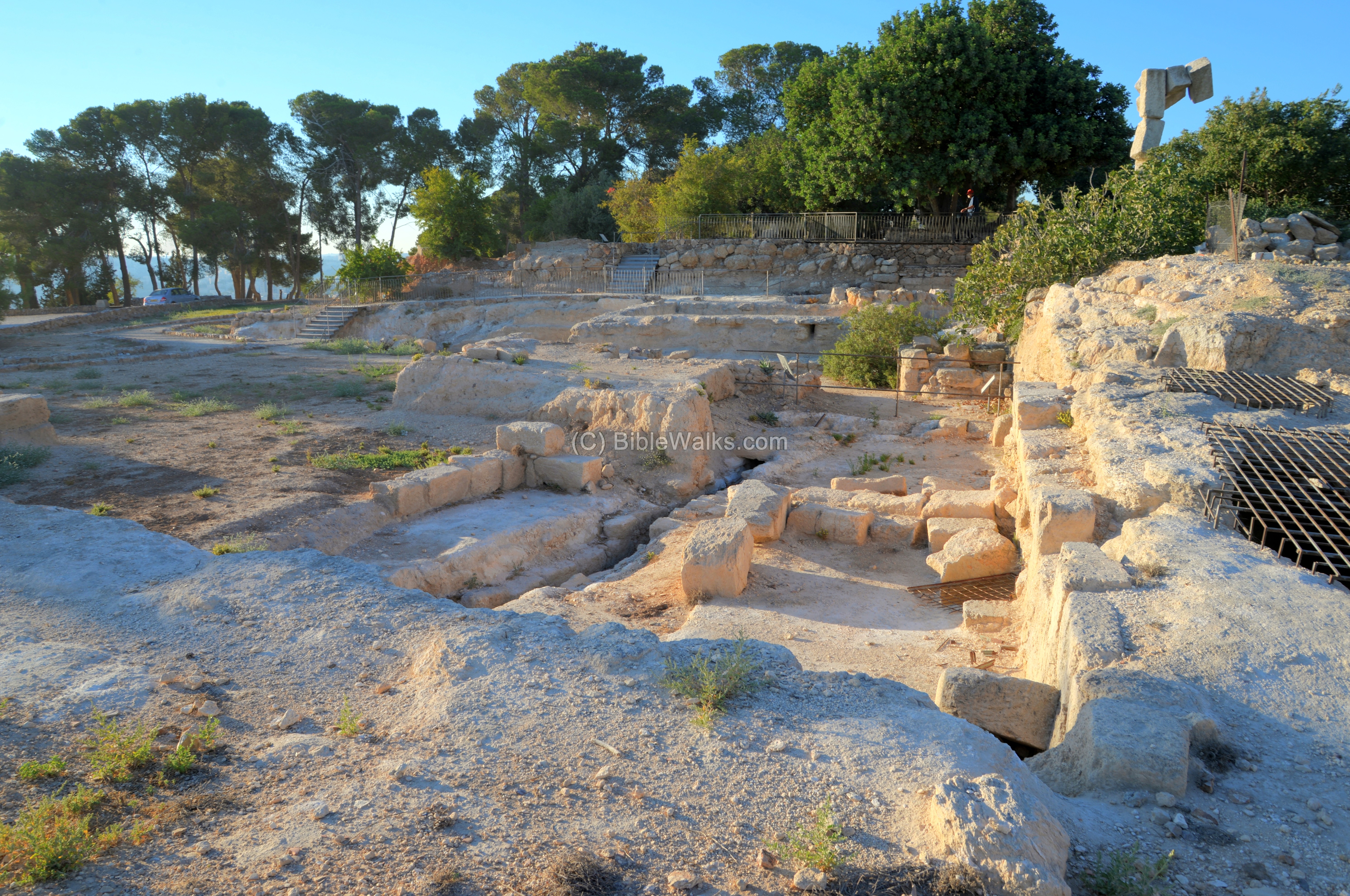
- Courtyard
A ceremonial courtyard was located on the south side of the inner fortress, just past the gate. It is now also serving as an open space.
- West wing
The west wing of the inner fortress is seen here from the west side.
This sculpture marks the point of the south western corner of the Israelite citadel’s casemate wall.
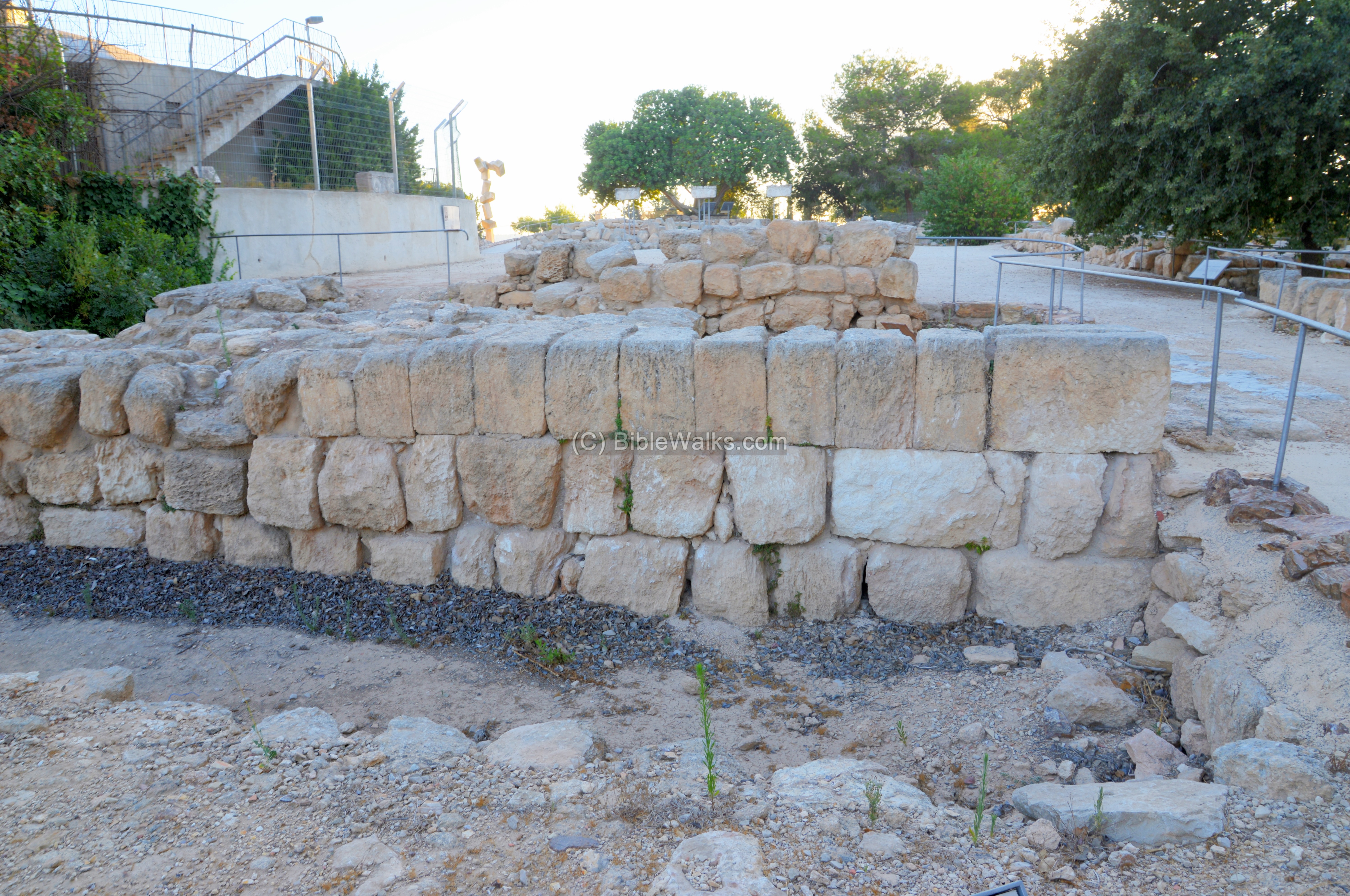
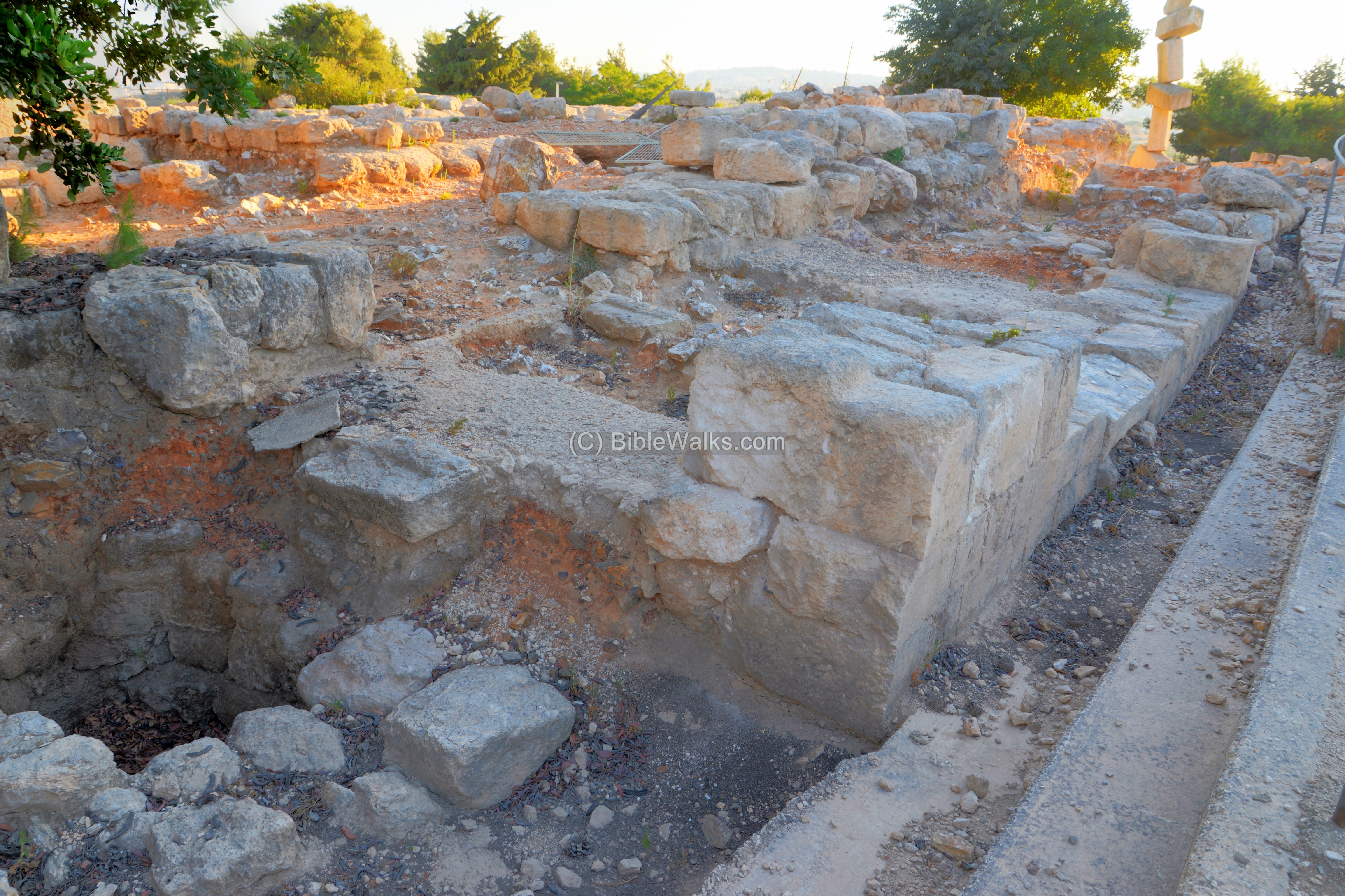
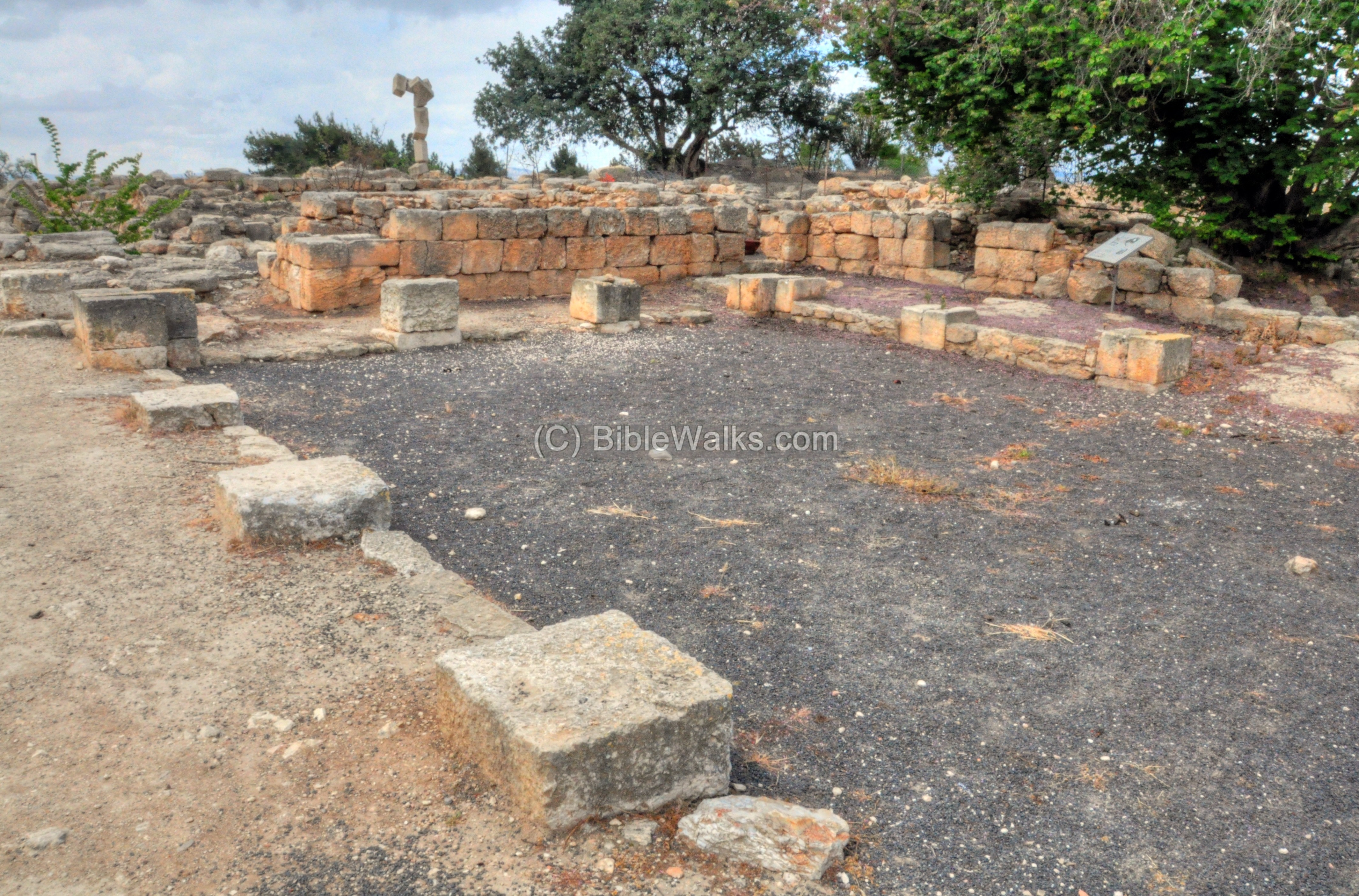
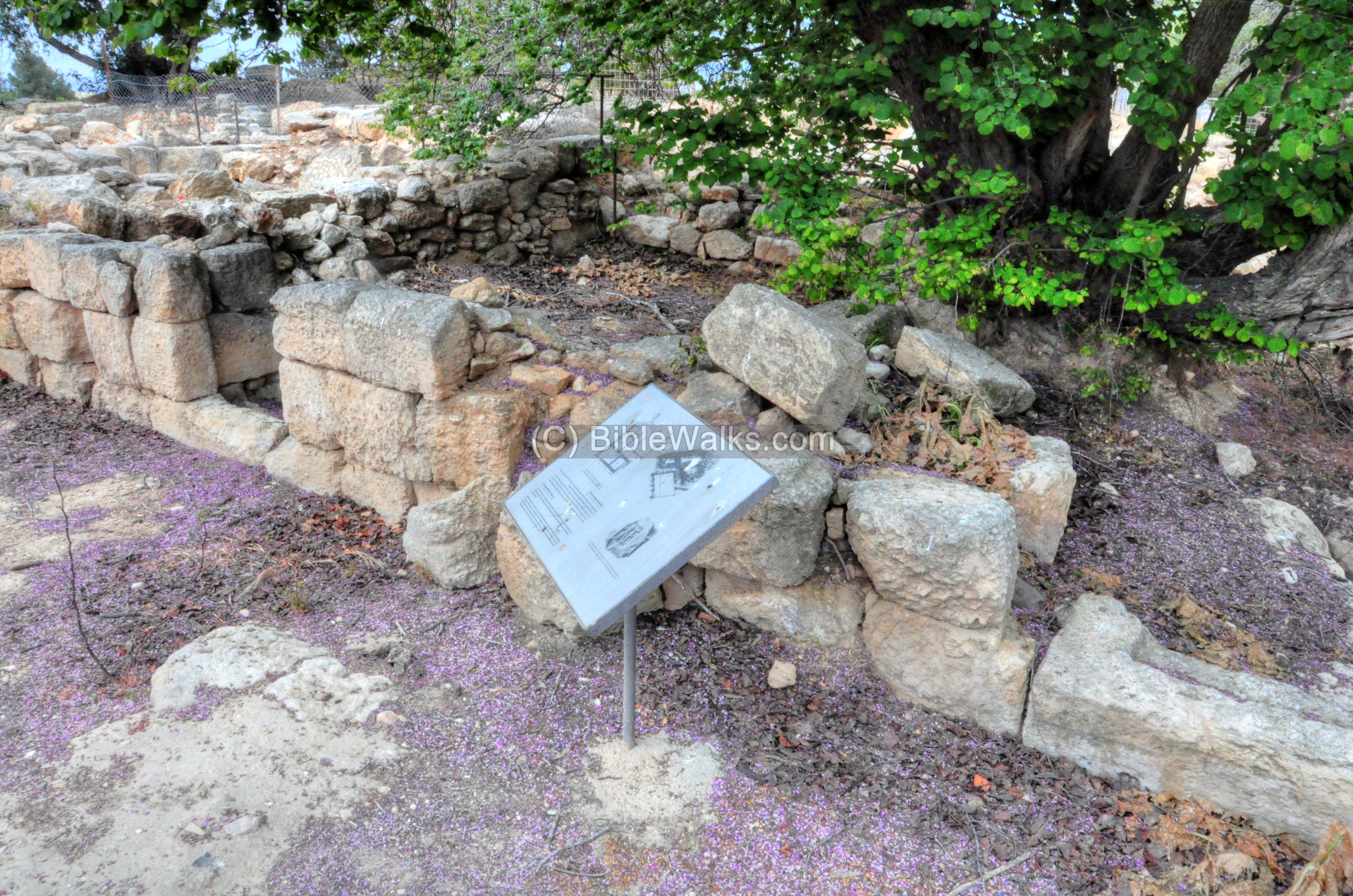
- Casemate wall
A section of the casemate wall, on the south side of the inner fortress, is seen below. In this section, in the middle of the southern wall, is an entrance from the courtyard into one of the chambers of the casemate wall. Notice the fine ashlar masonry facing the courtyard.
The casemate wall consisted of two parallel walls: an external wall 1.6m wide, an internal wall 1.1m wide, and a 2.5m space between them. Few of the casemate chambers were filled with soil, and were used as stores or sleeping quarters. During battles the defenders could fill them up, thus creating a wide and strong wall.
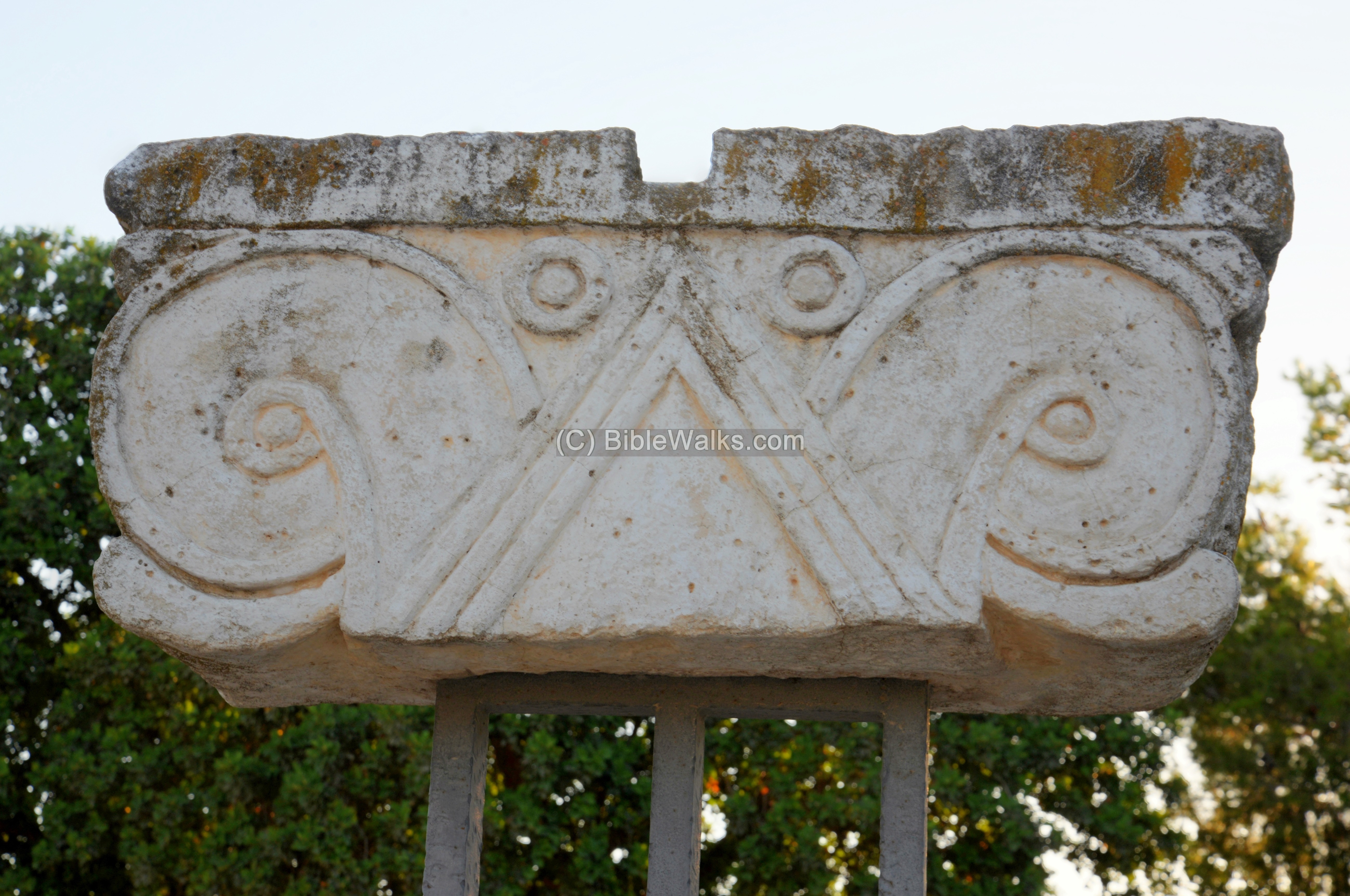
One of the famous structural elements found in Ramat Rachel are Proto-Aeolic capitals, hanging here on poles. Their original location was here on the western side of the courtyard, on the facade of the central wing of the palace.
Total of 13 capitals were found: Three of these capitals were found unbroken in the ruins, other fragments were scattered around, and another column was found inside the columbarium cave.
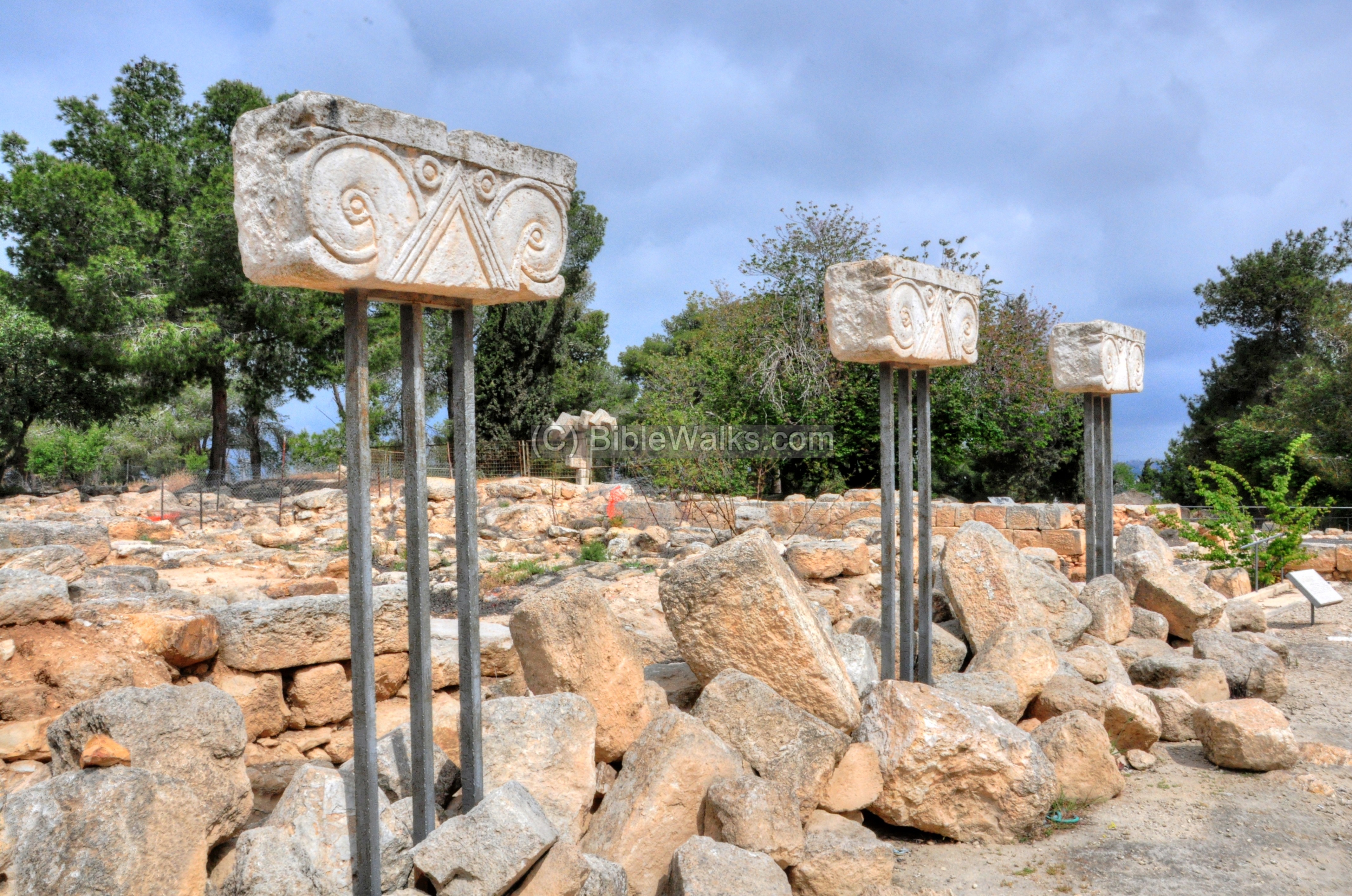
Proto-Aeolic means the fore-runner of Ionic capital. It was an invention of the Phoenician architecture. These types were found in dozens of Israelite and Judahite sites, and are associated with royal buildings. An icon of a capital appears on the Israeli shekel.
These capitals may have been the remains of the windows that Jeremiah described (Jeremiah 22:14): “That saith, I will build me a wide house and large chambers, and cutteth him out windows; and it is cieled with cedar, and painted with vermilion”.
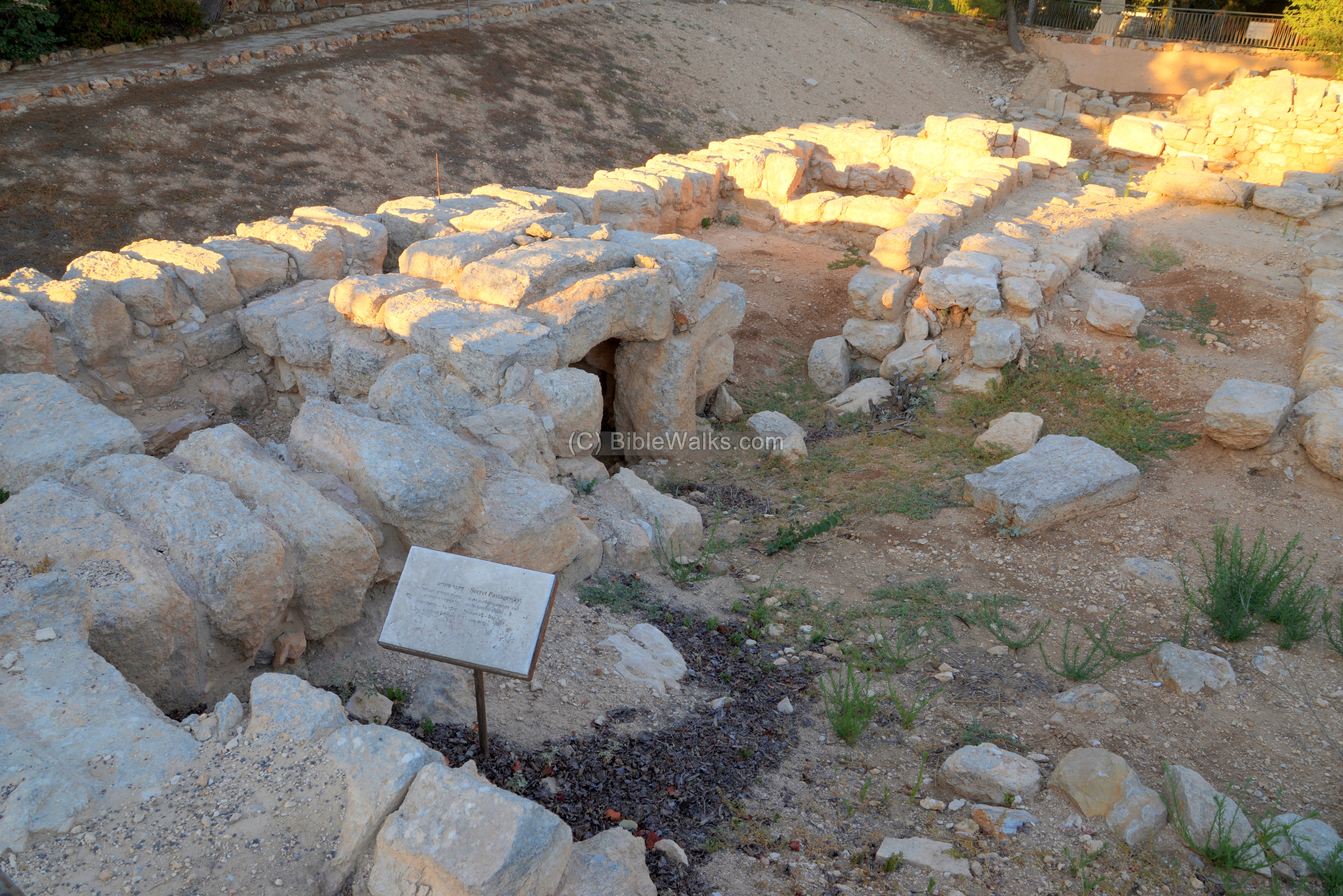
- Northern wall
On the northern side of the Iron Age fortress are remains of the casemate wall that surrounded the Iron Age period (Level VA) structure.

At this section, the inner and external walls coincided, as indicated here with a yellow line:
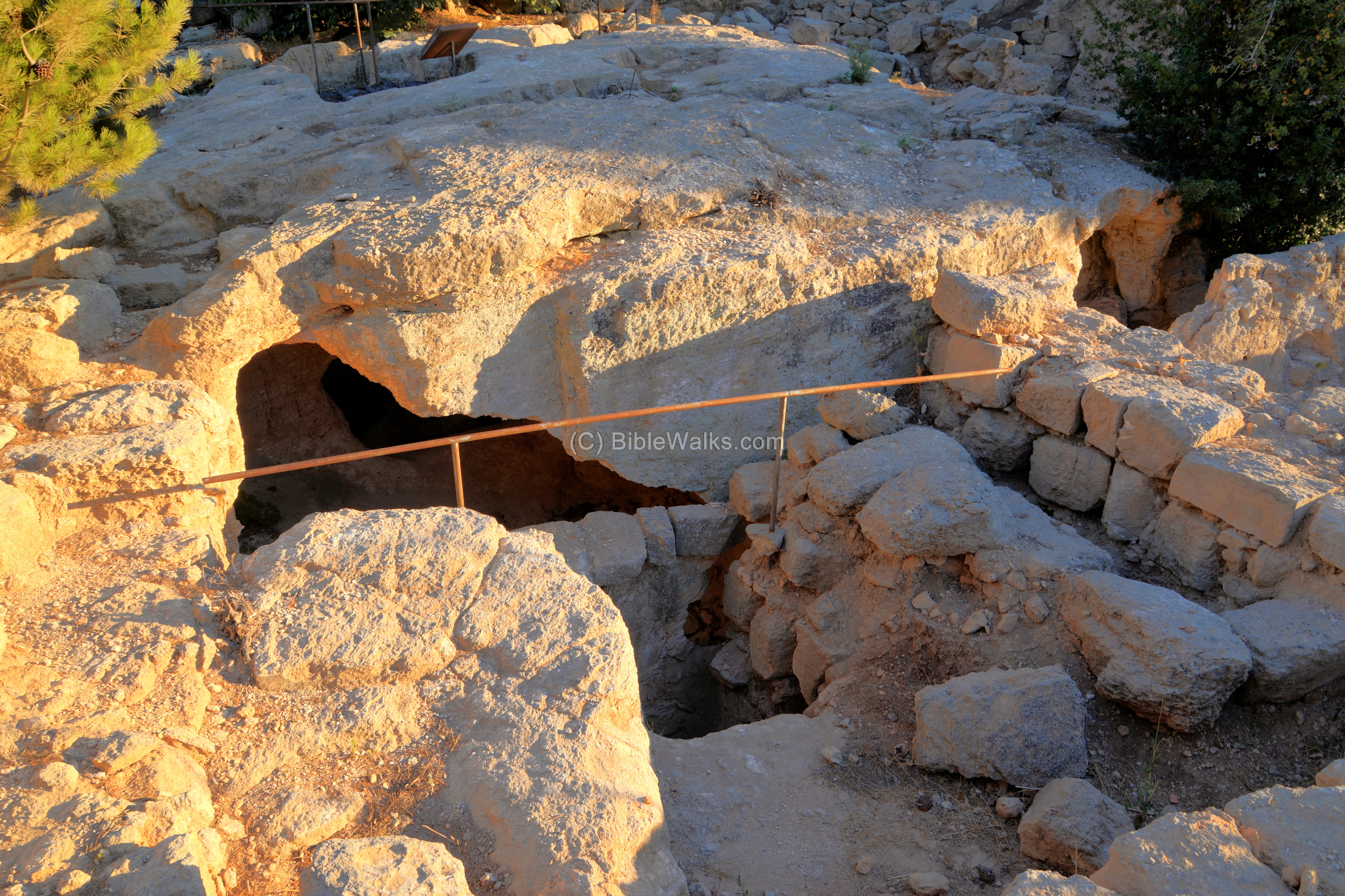
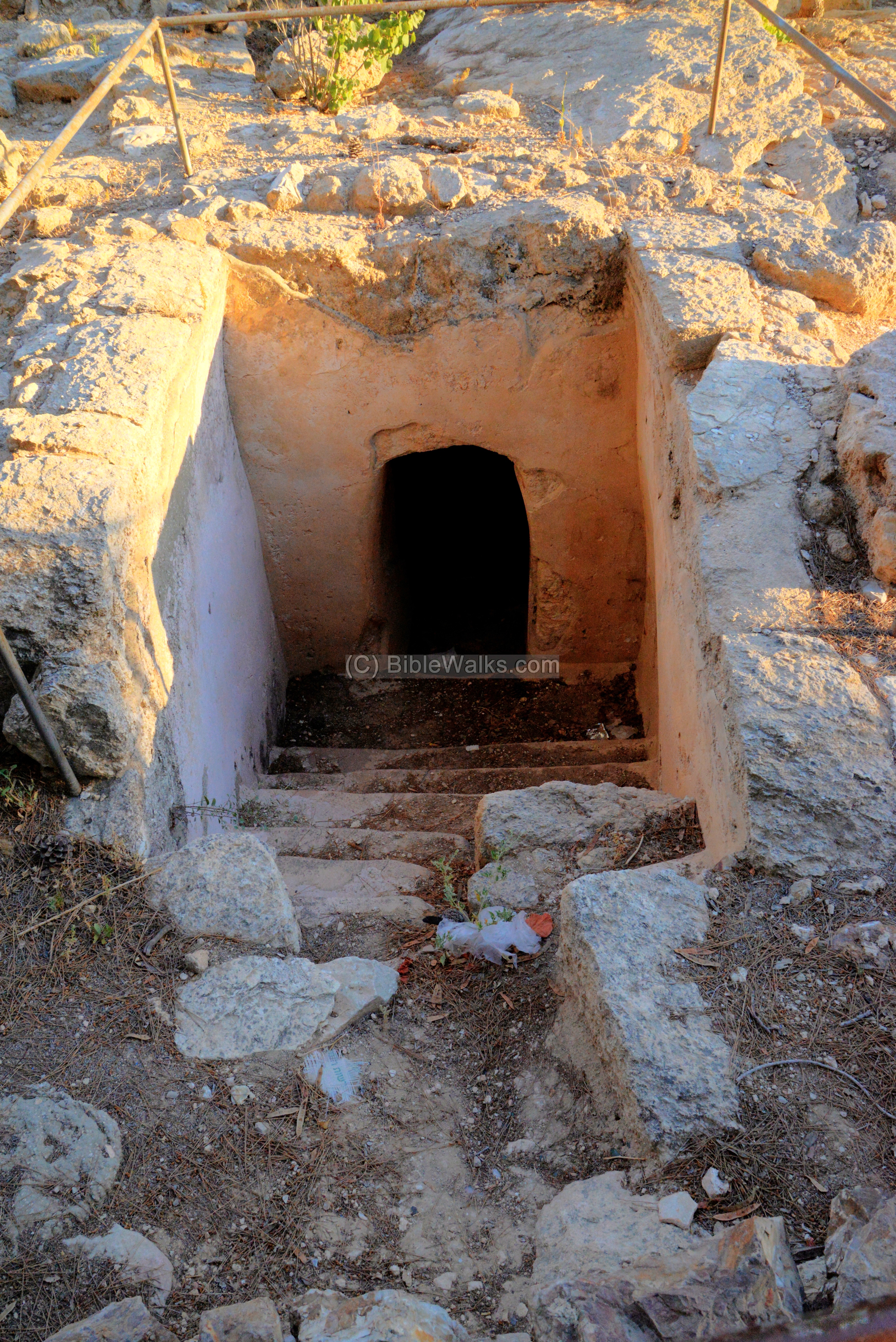
A secret passage was found on the northern casemate wall (6th century BC, level VA).
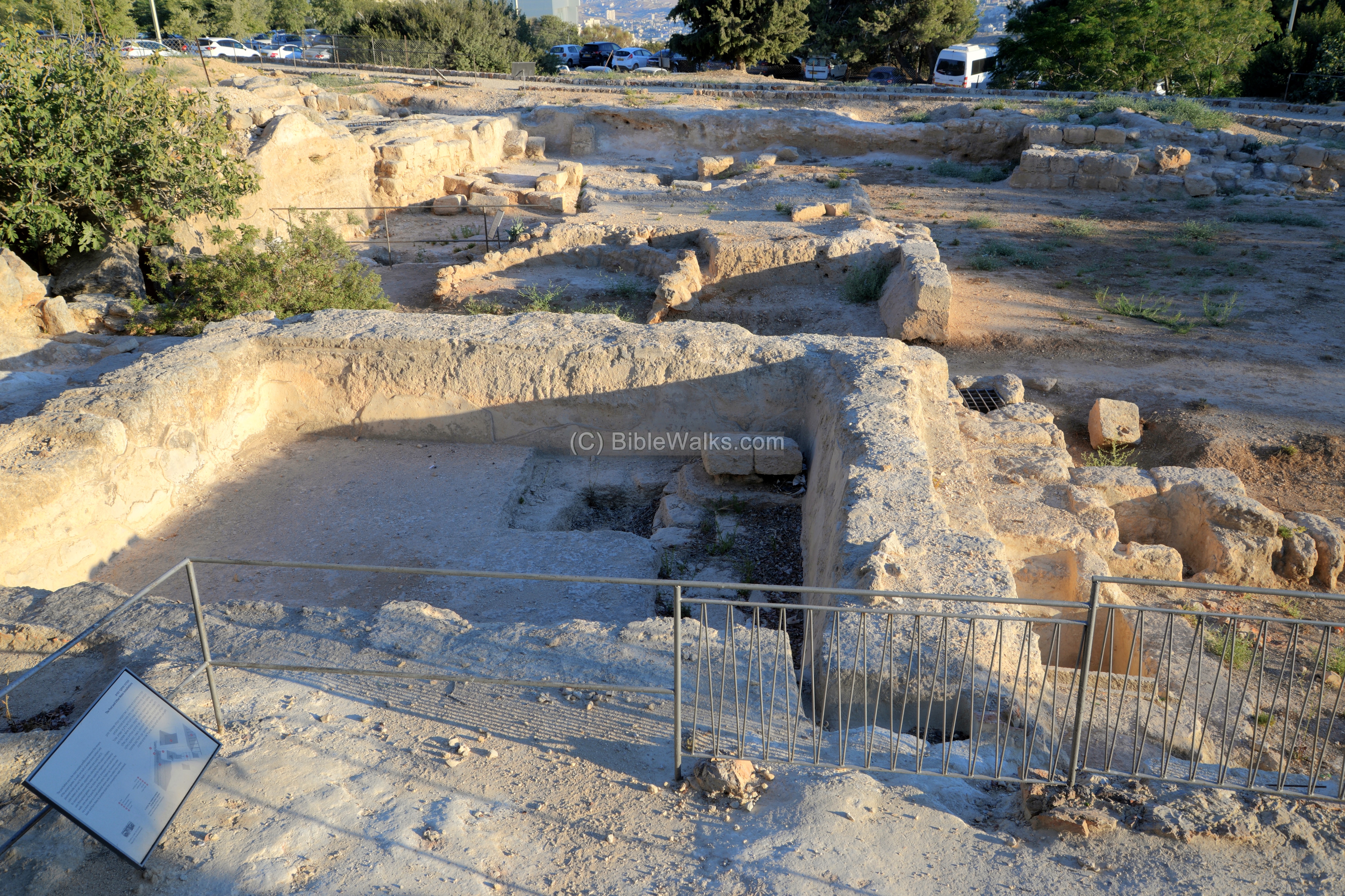
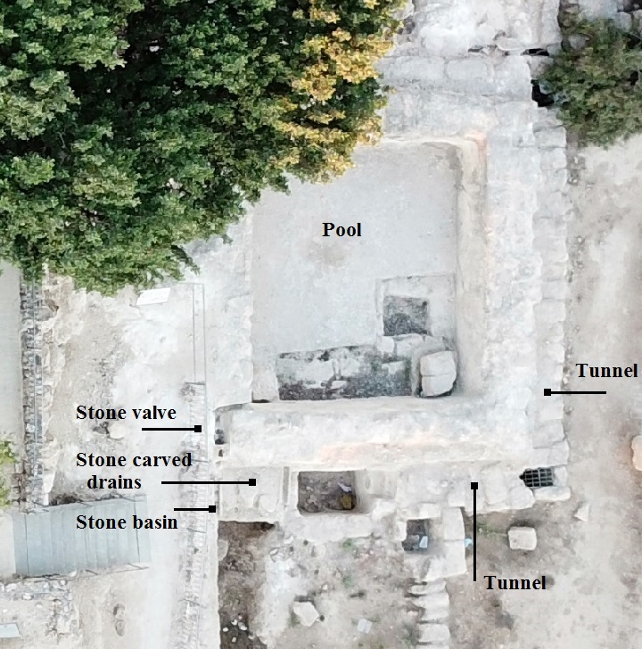
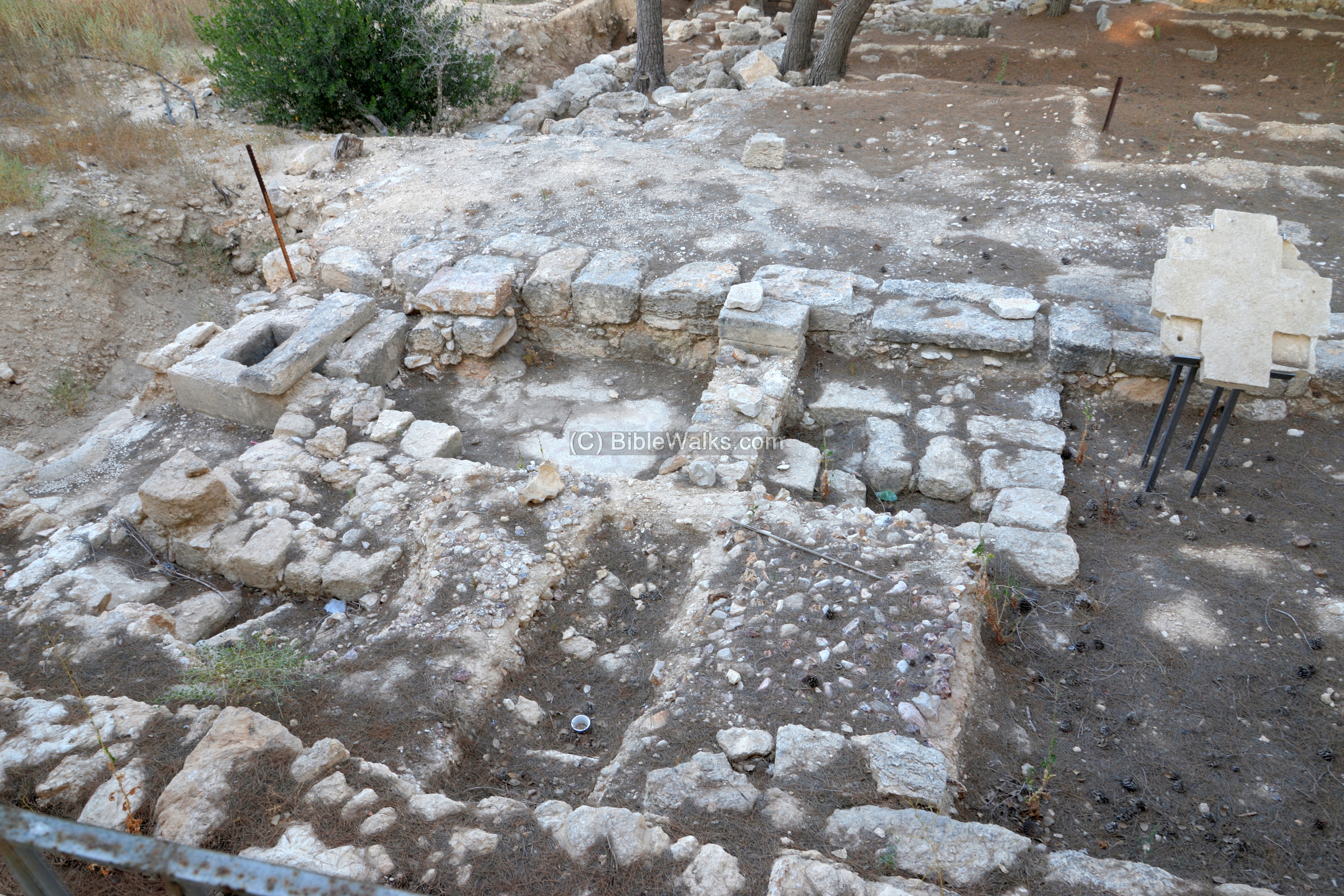
- Pool and water installations
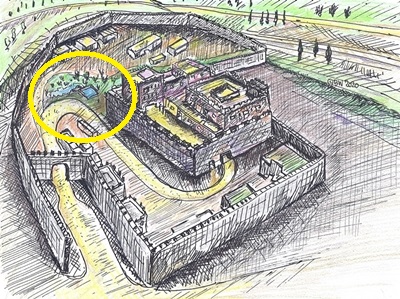
A royal garden with water installations was located in the ceremonial courtyard, on the south side of the inner fortress. A raised water reservoir fed the water to the garden.
The area of the pool is marked as a yellow circle in the illustration.
The water reservoir, built of ashlars (worked stones) and plastered, is 1.1m deep and holds a volume of 35 cubic meters. The pool was fed from runoff rain water from the roof of the palace.
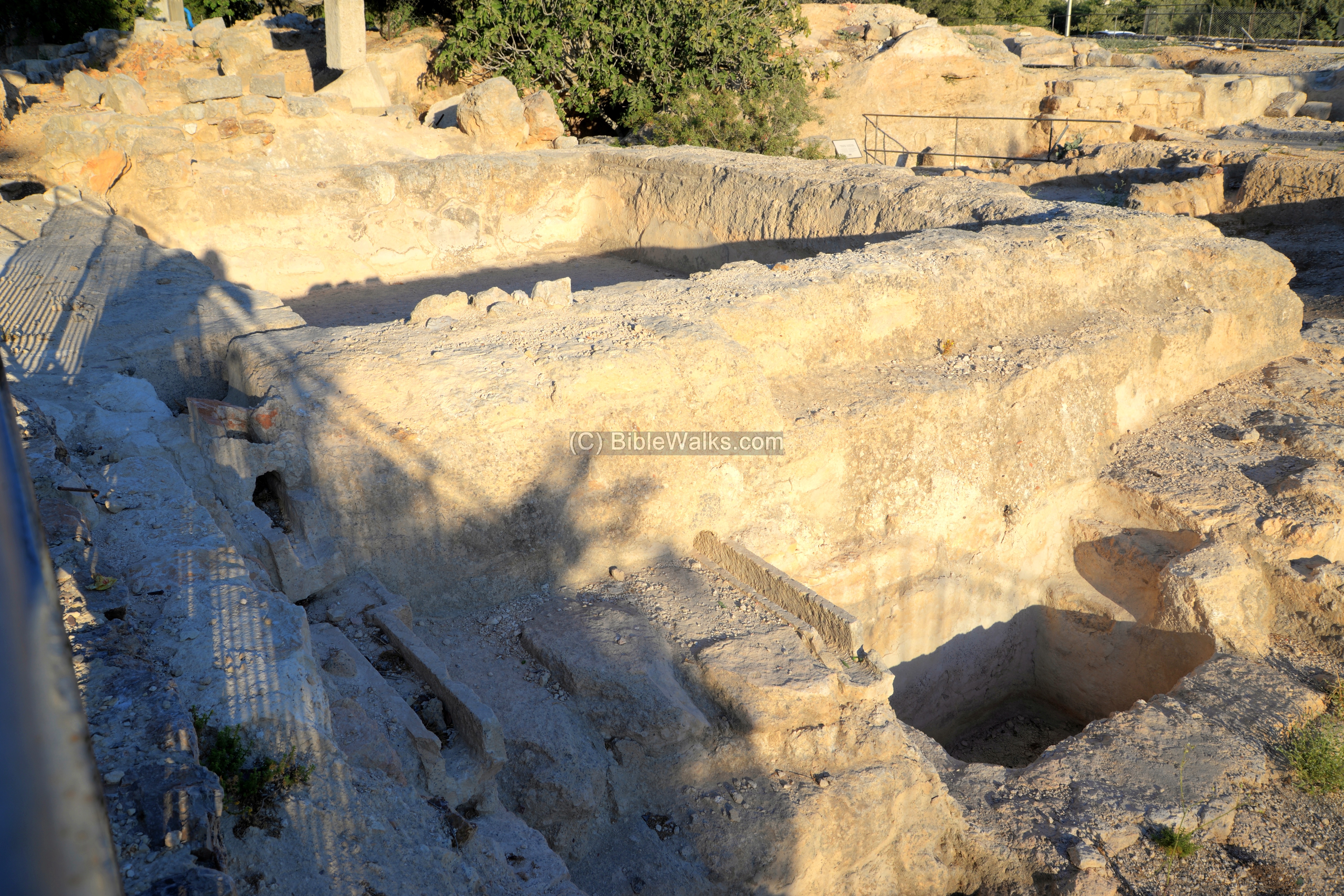
A view from the drone shows the plan of the pool, with indication of its parts. Two drain pipes, carved into the stone, were built in the walls. One near the floor of the pool, and the other higher up. They funneled water via a stone valve to a waterfall, into a stone basin, then to a drain that conveyed the water away.
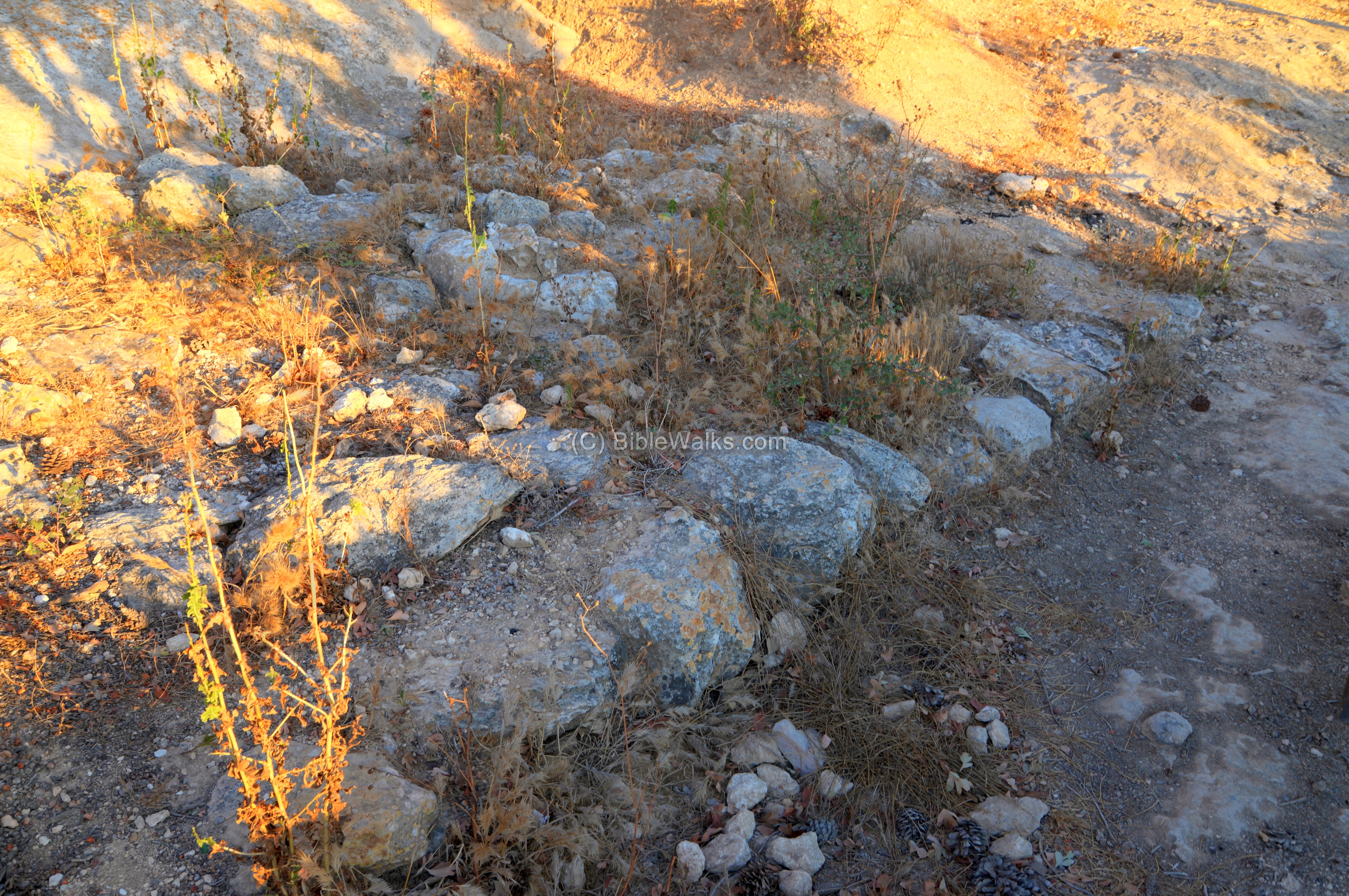
- Outer walls
Few sections of the outer walls of the fortress were found. However, under the Yair observation place is a short section of the outer wall of level VA (8th-6th century BC). It can be reached by descending its steps to the area outside the park.
A quarry that supplied the building blocks of the fortress is also located here.
(d) Roman period
- Southern Columbarium:
A Columbarium (pigeon growing structure) was cut inside a cave during the second temple period. The installation was used to grow pigeons for food and ritual sacrifice. The cave, seen here on the right under the iron screen, was accessed by a wooden ladder. It consists of a central hall with 4 smaller chambers. On the walls were niches where the pigeons nested.
A small treasure of 15 Tyrian shekels, dated to the 1st century BC, were found inside a cooking pot concealed inside in one of the niches. These coins were typical taxes given at the temple.
- Northern Columbarium
Another pigeon growing structure is found on the north west corner of the inner fortress. It is also dated to level IVa – Early Roman period. This elliptical cave had niches along its walls for nesting pigeons.
One of the Proto-Aeolic capitals was found inside the cave.
- Burial cave and ritual baths
Adjacent to the columbarium, a burial cave and ritual baths (miqvehs) were cut into the rock. They are dated to the second temple period. The burial cave was reused in the late Roman period.
- Legion X buildings
The tenth Legion Fretensis was stationed in Jerusalem since the great revolt (70 AD) until Diocletian’s reforms (around 300). They may have camped on the hill, based on a section of a tile with the imprint of the Fretensis legion which was found in the Roman bath house.
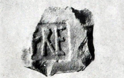 Legion X Frentensis – tile found in the excavations
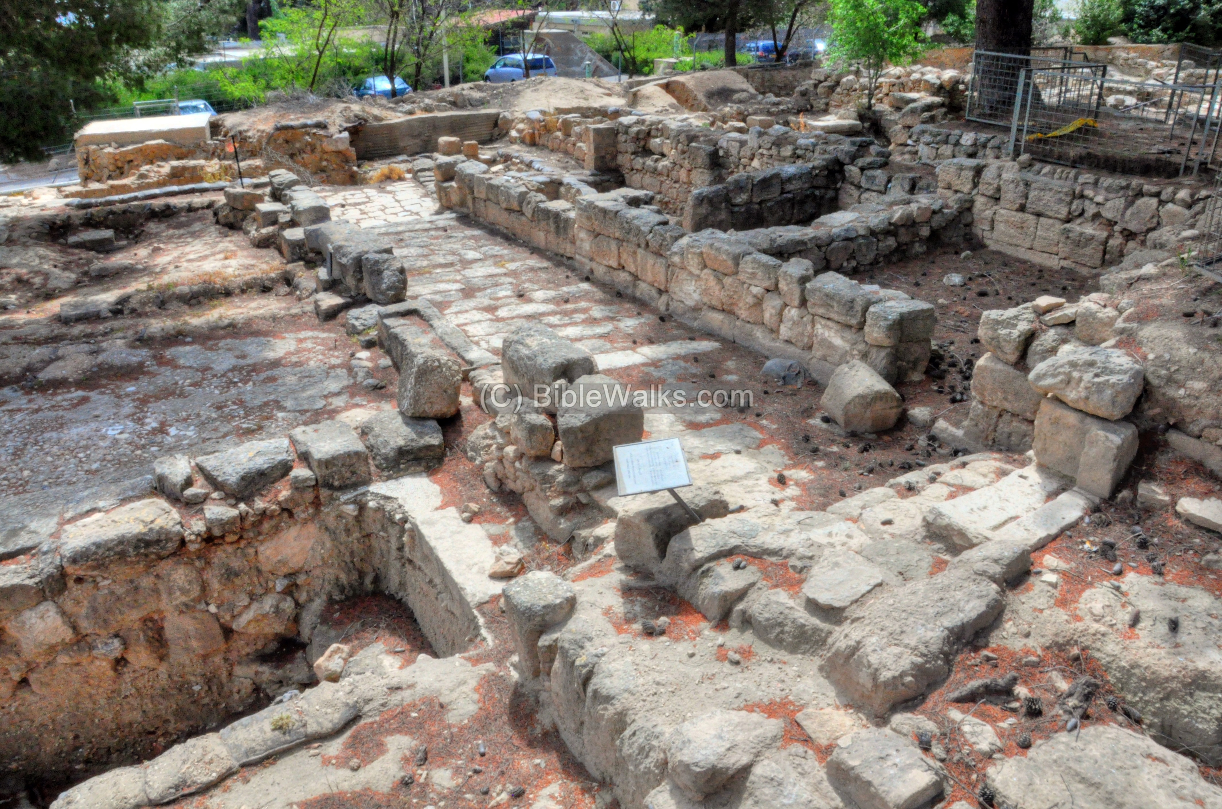
On the north west side of the Iron Age fortress was a Roman villa, built for one of the Roman officials or veterans. Its typical Roman villa plan had a courtyard surrounded by peristyle (continuous porch formed by a row of columns surrounding the courtyard) and a line of rooms. This photo shows the courtyard, while the next one is an entrance to one of the rooms.
A Roman bath house was constructed above the inner gate of the Iron Age fortress. It had three rooms with mosaic floors, cisterns and pipes. The bathhouse was dismantled to dig lower into the foundations.
The Roman buildings, including the bathhouse, were later in use during the Byzantine period.
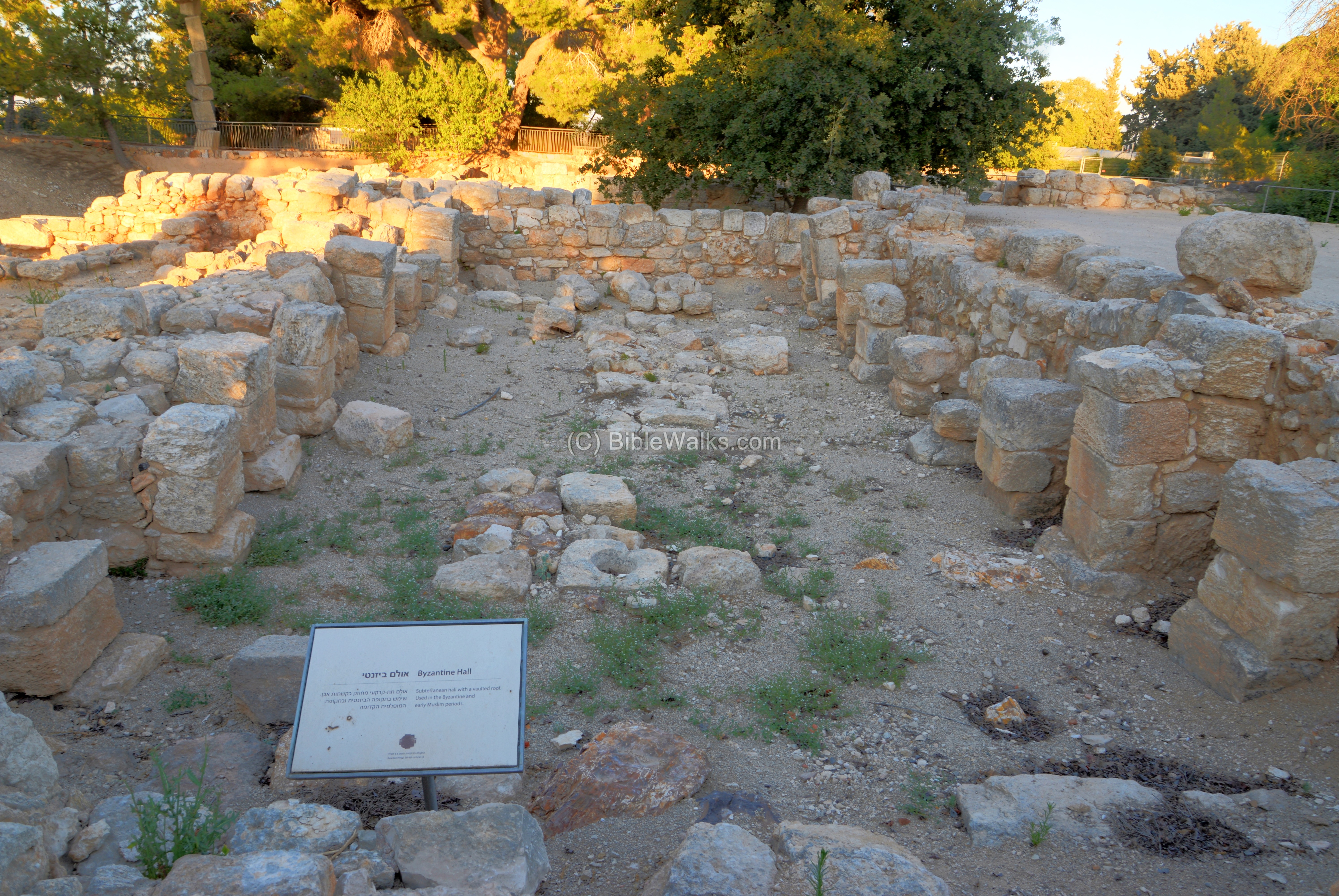
(e) Byzantine period
The Byzantine church was built on the north eastern side of the Iron Age fortress.
Its plan was a basilica with an extra line of columns on the west side.
East of the church were the rooms of the monastery.The monastery consisted of rooms along a long corridor.
West of the church was large pool. Farther west was a subterranean hall, built on the base of the northern side of the Iron Age fortress. The subterranean hall was supported by stone arches; their bases are seen along the walls.
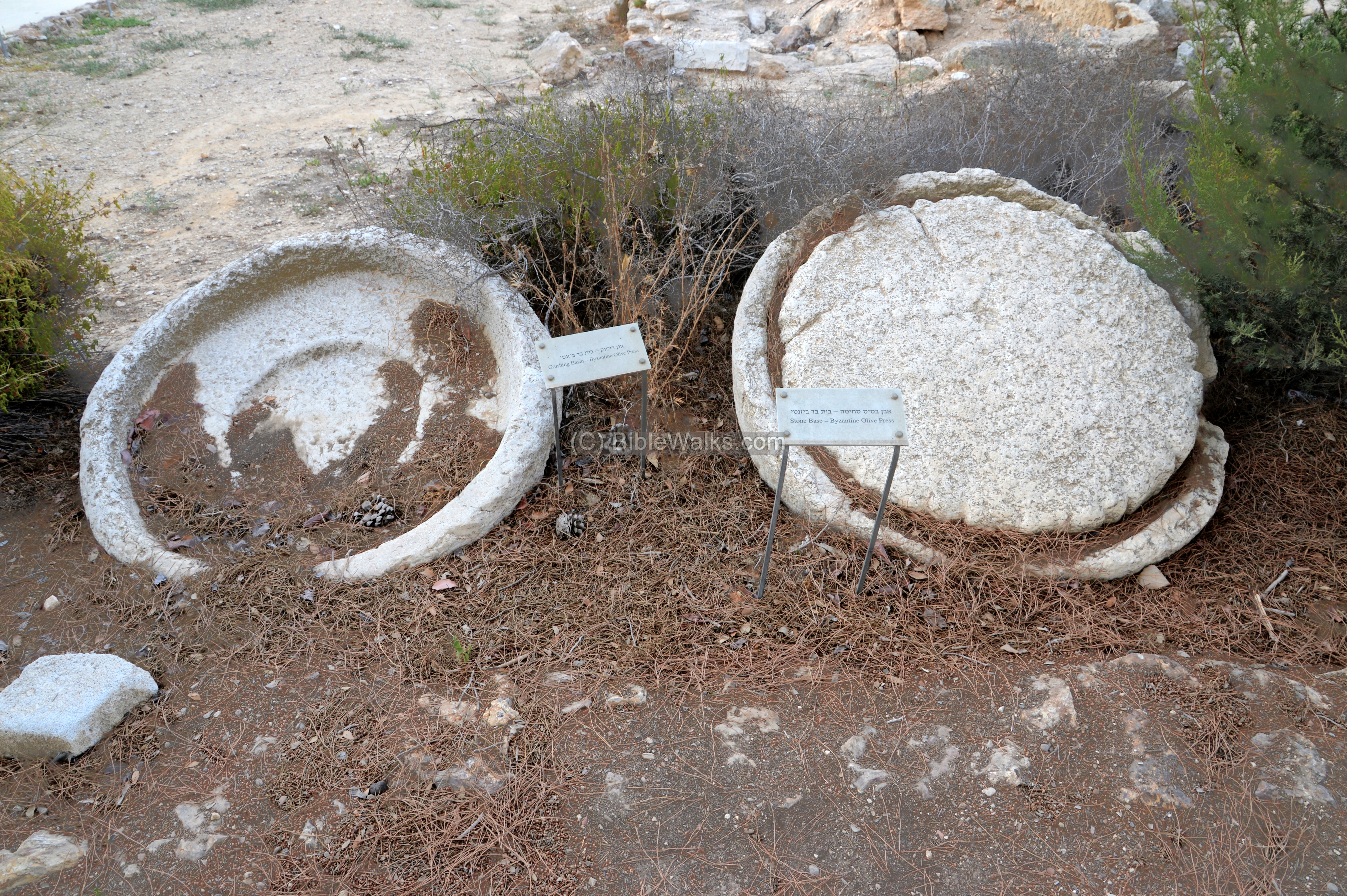
Common to monasteries were oil presses. In the park is an exhibition of elements of an oil press – a crushing basin (left) and a press base (right).
(f) Modern period
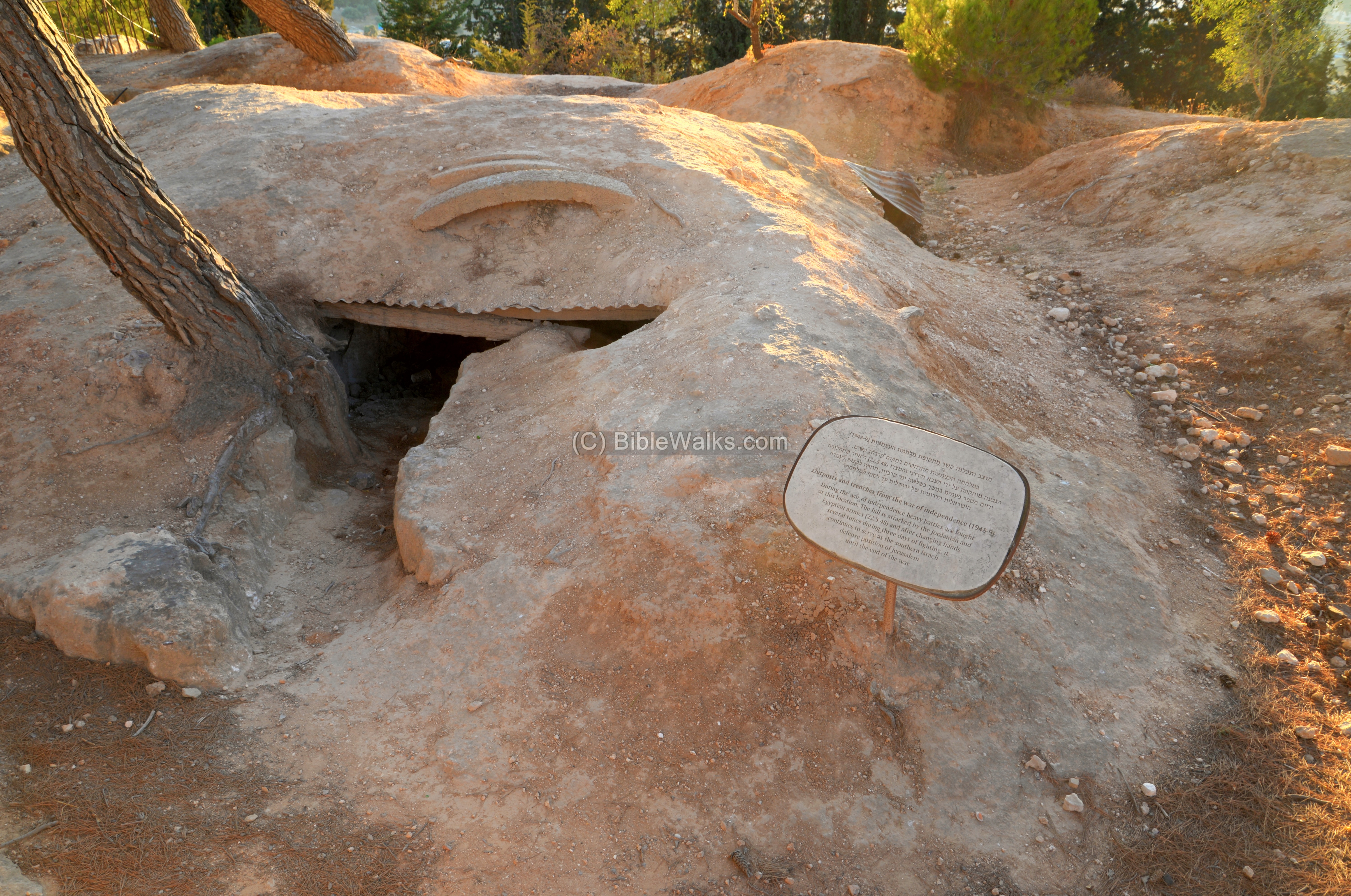
During the independence war and after it the Kibbutz was on the fringe of the newly born state. The Israeli army dug trenches and outposts along the edges of the hill. Heavy battles occurred here. On May 22, 1948 the hill was attacked by the Jordanian and Egyptian armies. After changing hands several times, the hill remained as part of the state of Israel.
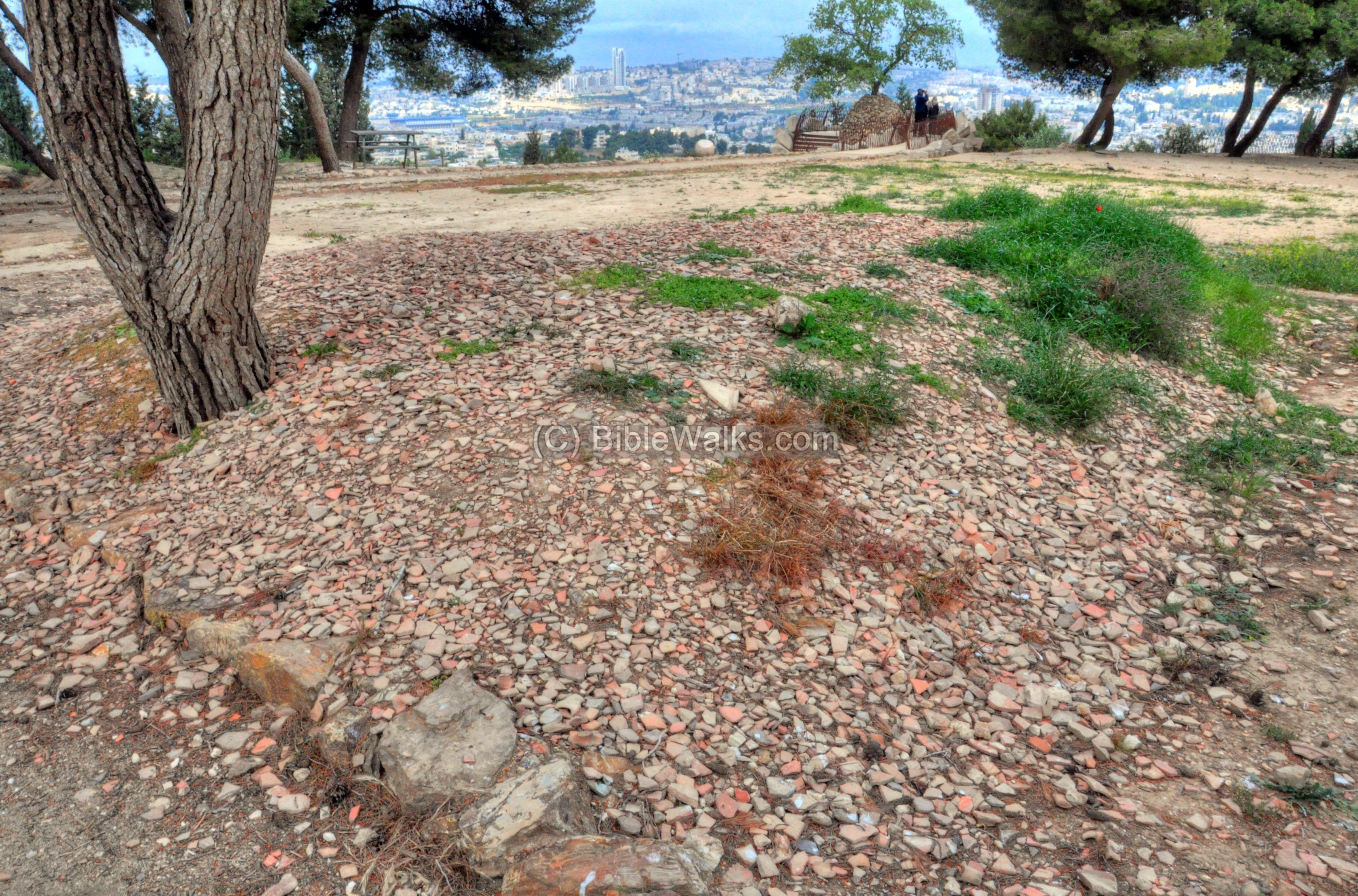
Fragments of ceramics pile up on the west side of the park, the result of archaeologic excavations.
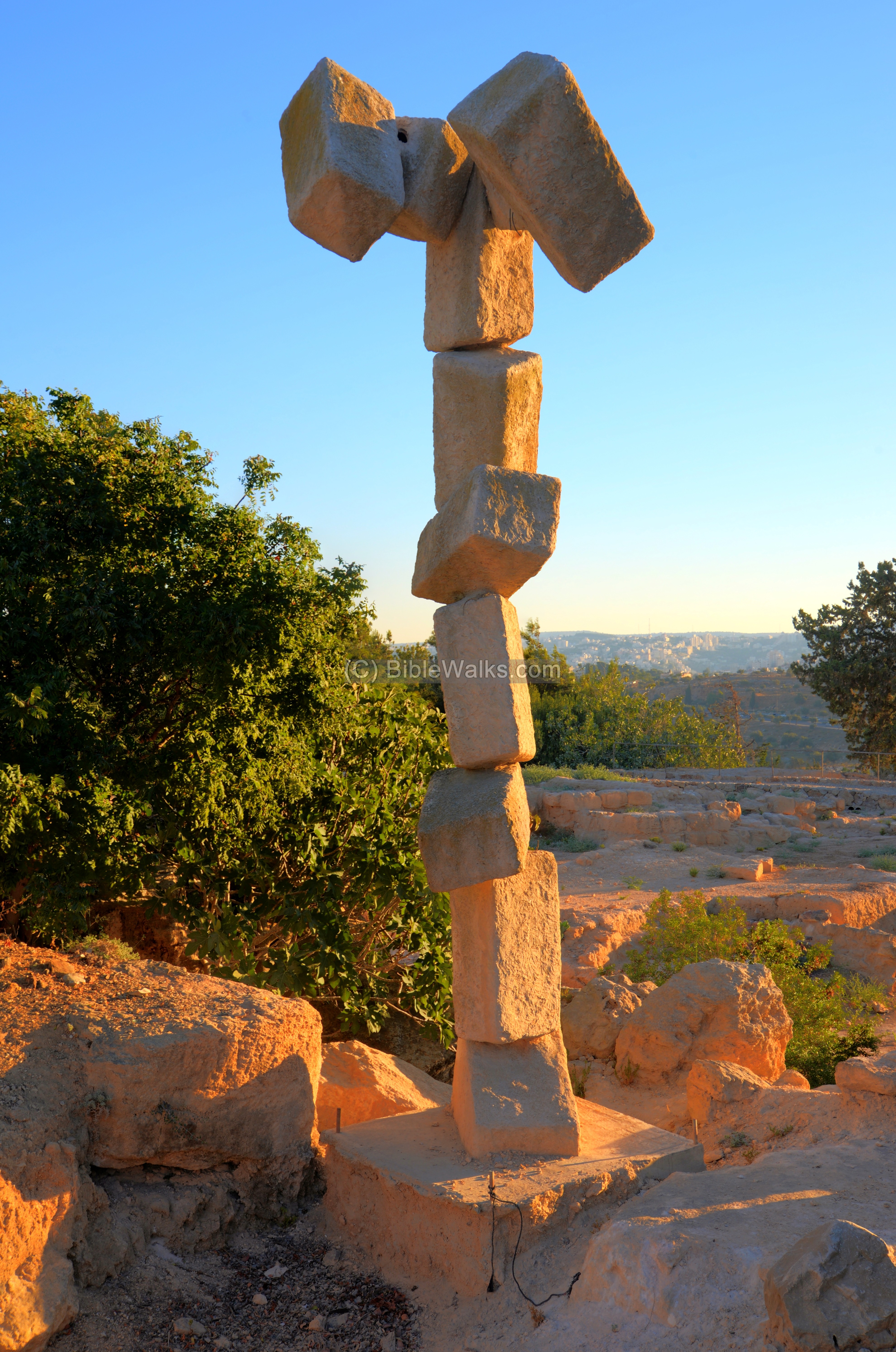
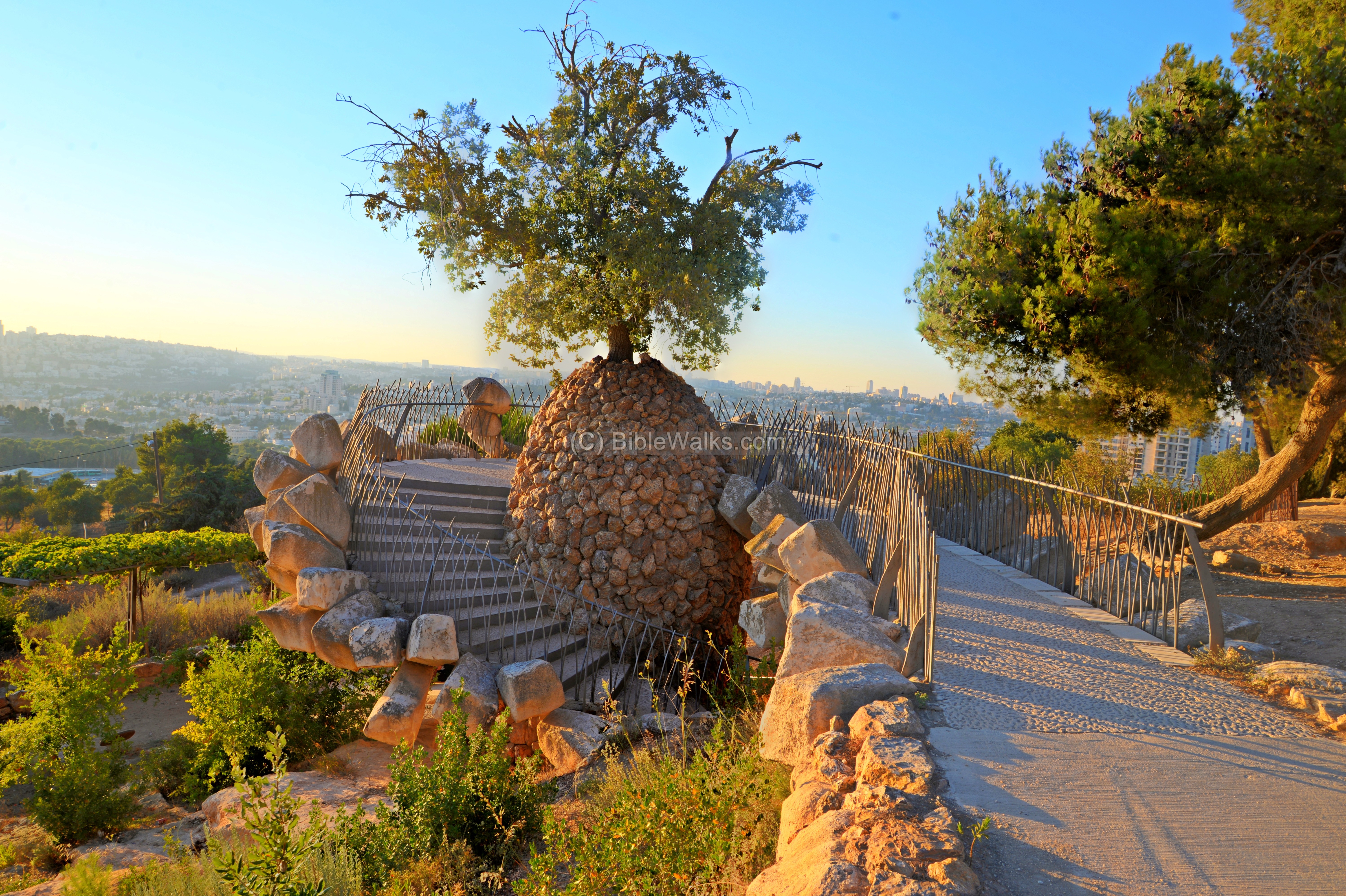
On the western side of the park is a unique observation terrace in the shape of a pine cone. This memorial terrace, designed by the sculpture Ran Morin, is dedicated to Yair Engel, a flotilla soldier who died in 1996 during a diving exercise. From here are great views of the neighborhoods of southern Jerusalem.
(e) Flight Over the site
Etymology:
-
Ramat-Rachel – The Kibbutz on the north side; Hebrew for the “Rachel’s heights”, named after the Rachel (wife of Jacob) who according to the Bible is buried in Bethlehem, several KM to the south (Gen 48:7: “And as for me, when I came from Padan, Rachel died by me in the land of Canaan in the way, when yet there was but a little way to come unto Ephrath: and I buried her there in the way of Ephrath; the same is Bethlehem”.).
-
Har-Homa – Hebrew: Mountain wall. A large new Jewish neighborhood (construction started in 1997). This major real-estate project is located on the south-east side of Jerusalem, near Mar Elias monastery. It is named after a wall built over a Byzantine church, which was seen from Ramat Rachel outpost.
Links and references:
- Kibbutz Ramat Rachel hotel
- Yair memorial
- Ramat Rachel Hadashot Arkheologiyot 120 2008
- Ramat Rachel project in TAU
- Biblewalks videos channel
* References:
- Ramat Rachel – The new encyclopedia of archaeological excavations in the Holy Land, 1992, Vol 4, pp. 1479-1484
* Nearby sites:
BibleWalks.com – navigate with the Bible
Tancred fortress<<<—previous Jerusalem site–<<< All Sites >>>—>>> Sanhedria
This page was last updated on Feb 25, 2023 (new overview)
Sponsored links: