Ruins of a small Roman/Byzantine and Ottoman period village, located on the south eastern side of Mount Gilboa.
Home > Sites > Jordan Valley > Horvat Ner (Kh. Umm Sirhan)
Contents:
Background
Location
History
Photos
* Eastern foothills
* The Old village
* Modern ruins
* Samll cave
* Findings
* Surroundings
* Mukhtar’s house
* Watch Tower
* Field Surveys
Etymology
Links
Background:
Horvat Ner (Khirbet Umm Sirhan) is an archaeological and historical site located on the southeastern slopes of Mount Gilboa in northern Israel. The site was originally a Byzantine-era settlement, repopulated during the mid 19th century, and abandoned after the 1948 war.
Location:
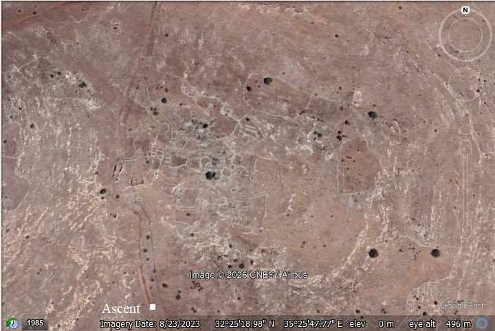
This map shows the area around the site. The ruins, located on the hillside of Mt. Avner, cover ~15 dunams.
The site is on an altitude of 300m.
History:
- Early Man
N. Zori surveyed the site (1977) and collected Paleolithic flint stones in the area of the site.
Several Paleolithic and Chacolithic/Neolithic flint workshop sites were discovered on the hills above the site in the recent (2026) archaeological survey of Mt. Gilboa.
- Roman/Byzantine
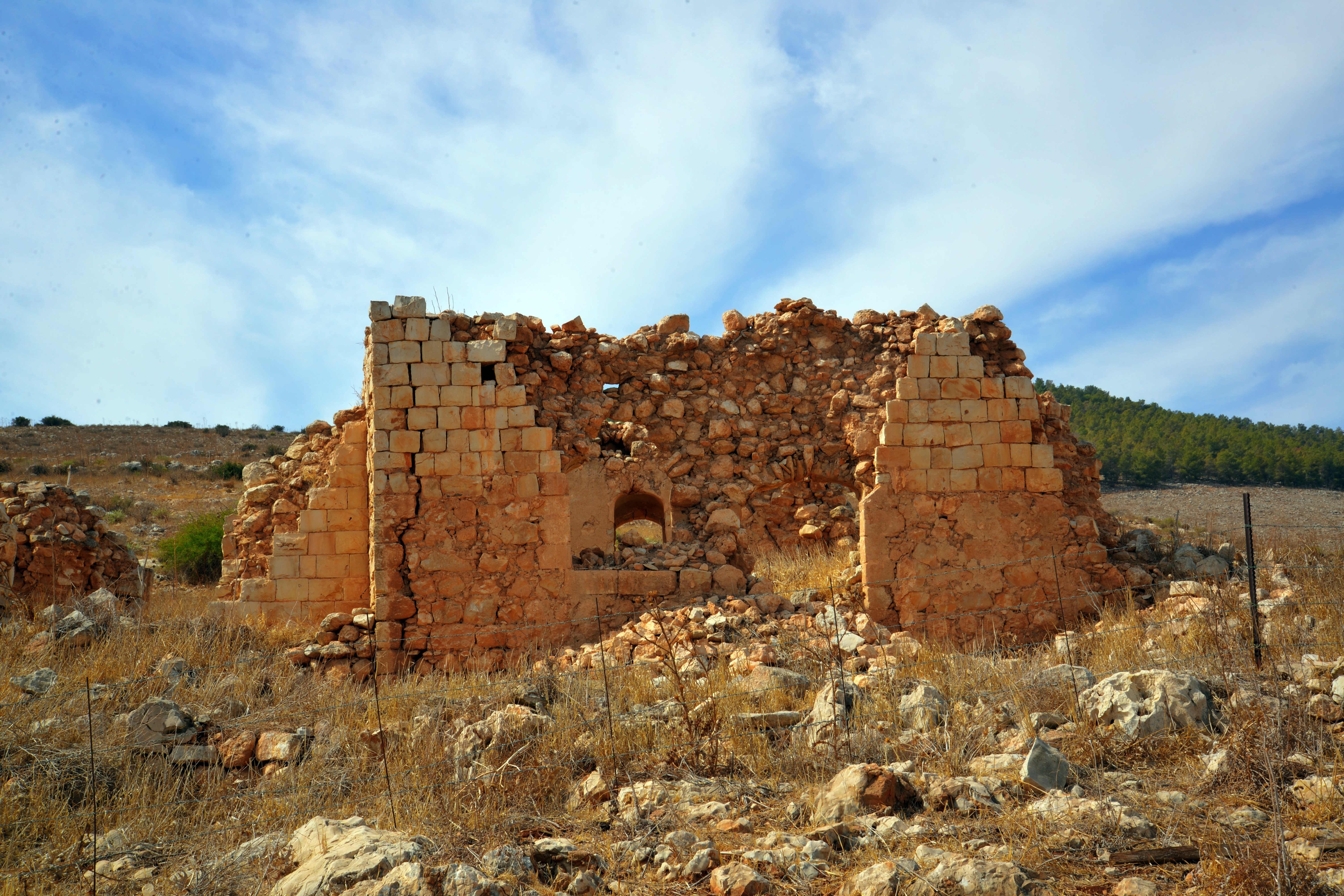
The site was originally a Byzantine-era settlement. Archaeological surveys have uncovered ruins from this period, including building foundations and numerous rock-cut cisterns.
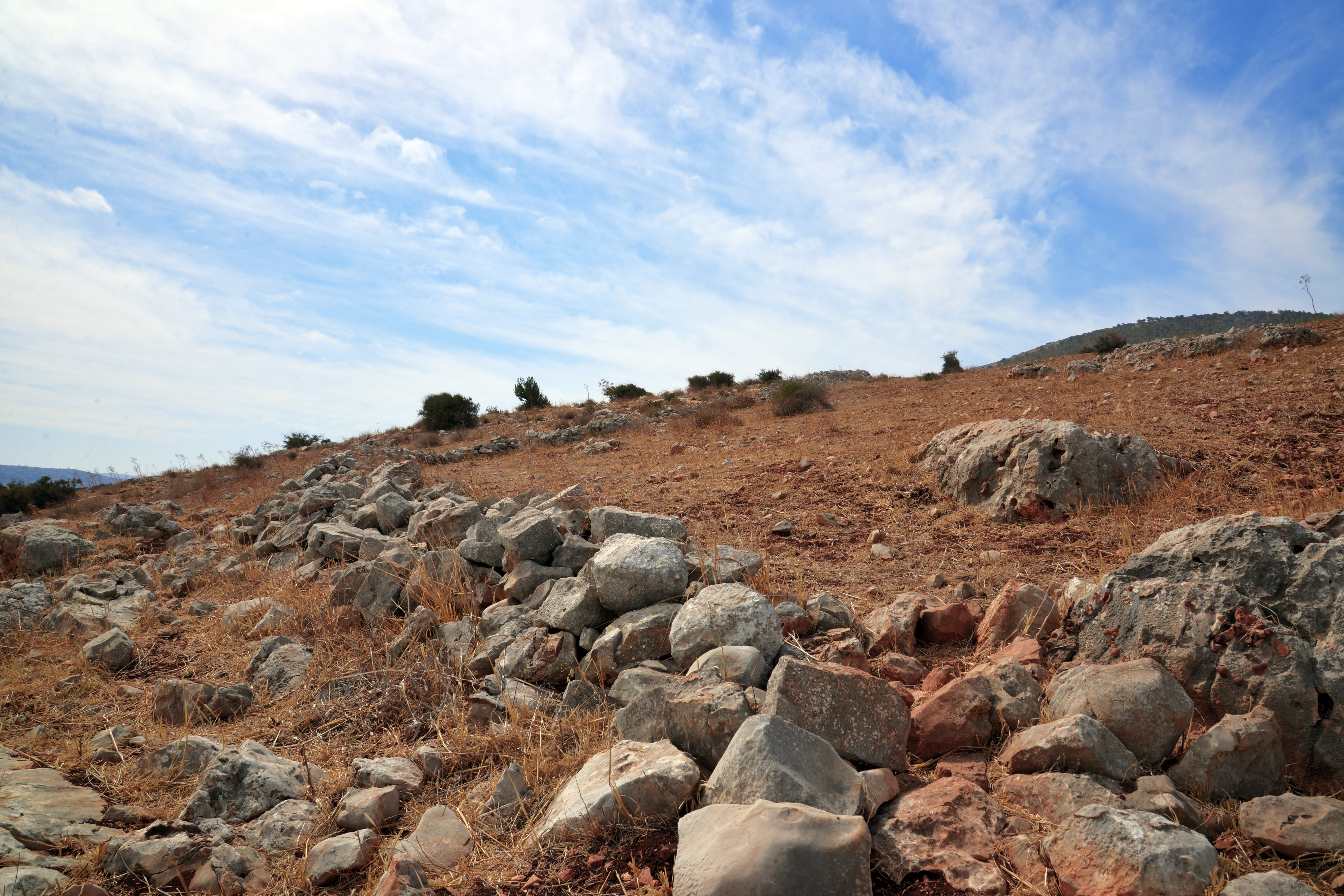
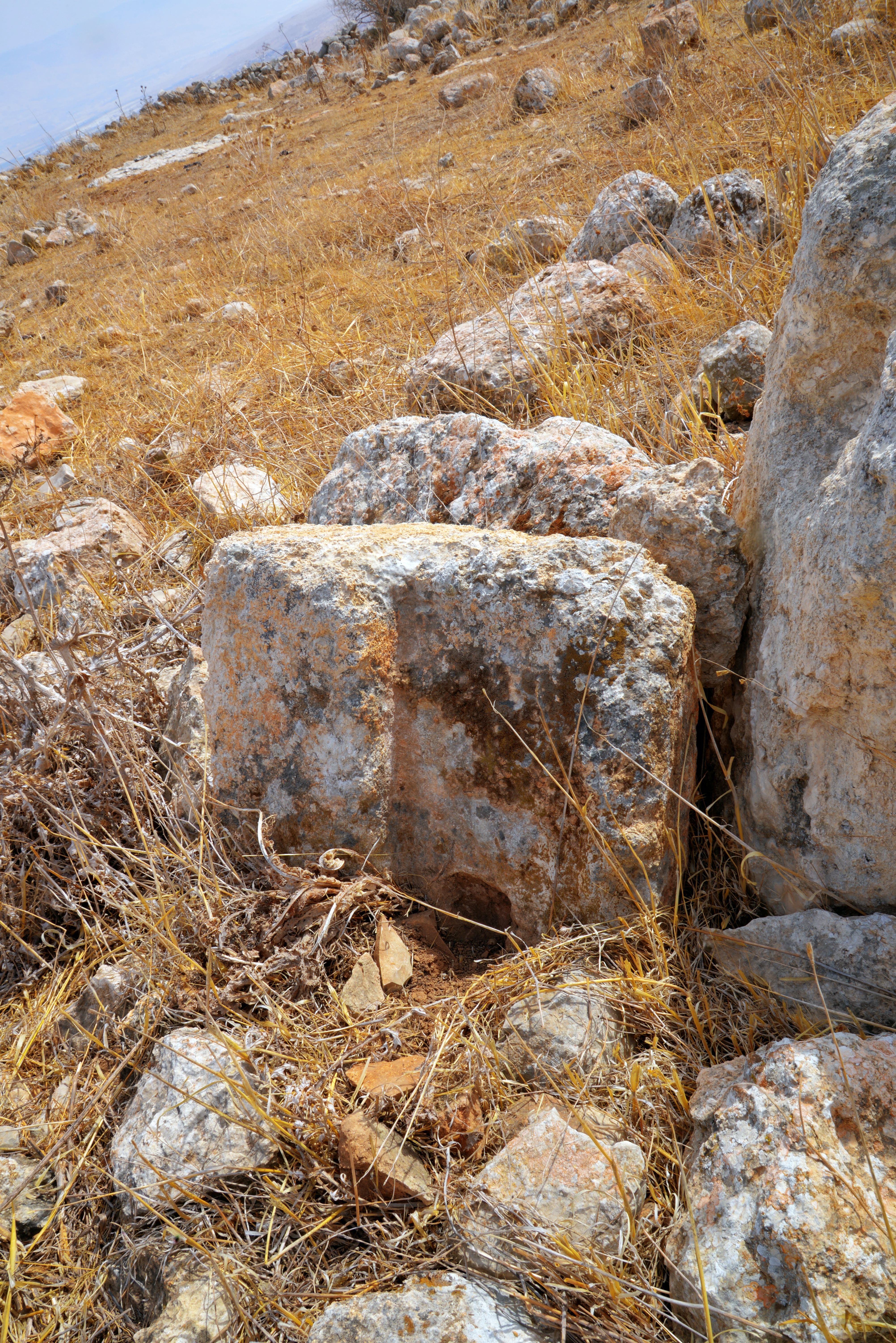
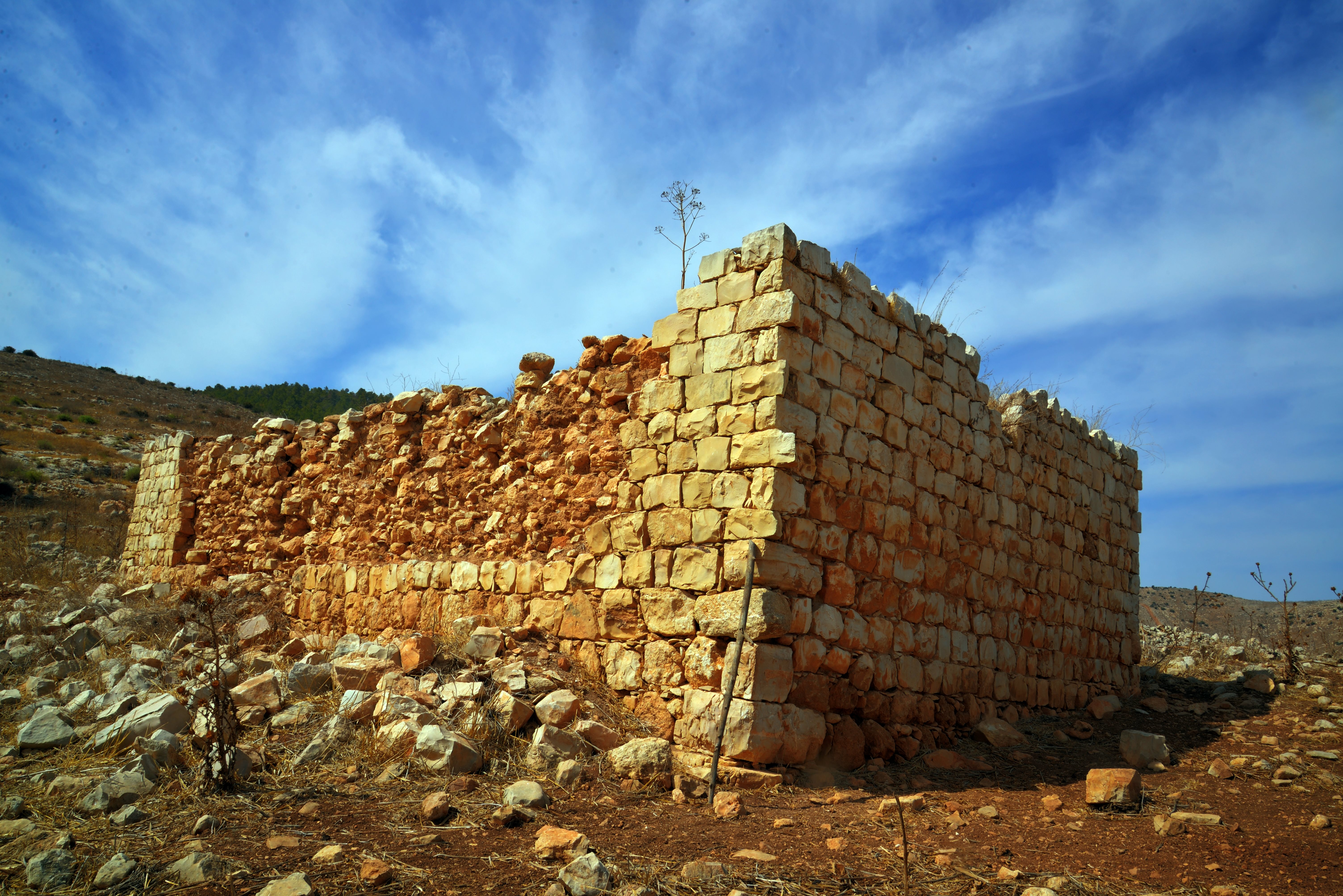
On the surface, massive walls are visible, constructed from dressed stones 1.2 meters wide, some featuring marginal drafting. Nine cisterns were counted at the site: eight bell-shaped cisterns and one open reservoir. Additionally, evidence of quarrying, stone troughs, and cupmarks are visible. Further up the ridge to the west, the entrances to two burial caves can be seen; a cupmark is hewn above the arched entrance of the western cave. Higher up the slope is a small, rock-cut wine press consisting of a treading floor and a collection vat. Throughout the ridge and the surrounding valleys, field walls, agricultural terraces, and stone clearance heaps are scattered.
The site’s infrastructure highlights a sophisticated water Management, based on a network of channels that once carried rainwater from the hillside of mount avner into ten massive communal cisterns. The discovery of wine presses suggests a thriving local agricultural economy, while ancient troughs and rock-cut tombs with rolling stones indicate a well-established, permanent settlement.
- Site Identification:
N. Zori suggested in his book that the Roman village may have been the remains of a Roman fortress which eventually evolved into a settlement, similar to the nearby Avinadav fortress (5km north). That fortress guarded an ascent to Mount Gilboa, and is dated the late Roman period (3rd-4th centuries AD). The site at Horvat Ner may have also guarded a Roman route that ascended to Mount Gilboa and crossed it towards the valley of Jenin, and also the main Roman route along the valley of Bezeq (Wadi Shubash) to Samaria.
Ahia Cohen-Tavor suggested that a forward observation tower may have been constructed on a hill 600m south of the site, in order to monitor the Bezeq valley that is hidden from the main fortress at Horvat Ner.
As per an article by historion R. Gafni, the Byzantine village was likely a remote Jewish community that was displaced from the main mountain ridges by expanding neighboring populations, leading them to settle this remote eastern edge near Beit She’an. This theory is based on the known Jewish presence in nearby Beit She’an during that era, and that this population was pushed to the eastern periphery of the central mountain range due to pressure from non-Jewish populations.
-
Ottoman period
The Byzantine settlement was probably destroyed during or a short period after the Muslim conquest of the land. It was resettled 1250 years later.
Roughly a century ago, members of the Al-Zur clan from the nearby village of Raba settled in the ruins. They reused the ancient Byzantine stones to build their homes and utilized the existing cisterns for water. The settlement functioned primarily as a site for herders and farmers.
The area around the site was examined in the PEF survey (1866-1877) by Wilson, Conder and Kitchener. They did not mention the site.
A section of the survey map is shown here. The site is marked as a yellow square.
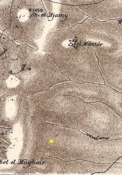
Part of Map sheet 9 of Survey of Western Palestine,
by Conder and Kitchener, 1872-1877.
(Published 1880, reprinted by LifeintheHolyLand.com)
- British Mandate
A 1940s British map shows the area around the site with more details. It is marked as “Kh. Umm Sirhan”. During the beginning of the 20th century the villagers built new houses on a higher level of the village.
Notice the roads that ascended to Umm Sirhan from the Jordan avvley, and continued westwards via Kh. Al Mutilla (Kh. el Mughair in the PEF map), crossing the Gilboa between two peaks – Mt. Avner (alt. 496m) and the southern peak (alt. 521).
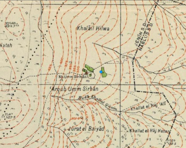
British survey map 1942-1948 – https://palopenmaps.org topo maps
License: public domain under the UK Copyright, Designs and Patent Act 1998
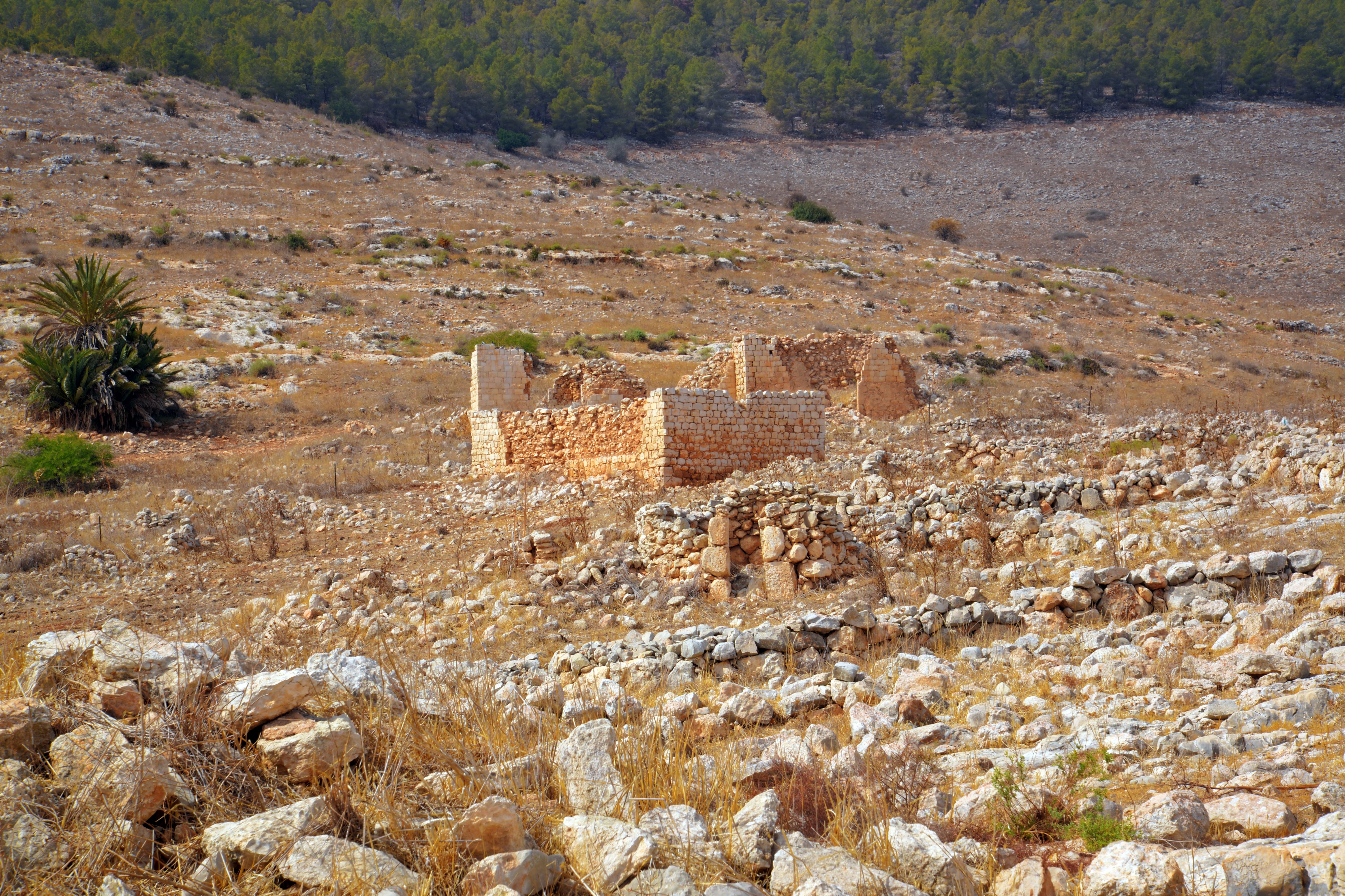
Near the site stands a distinctive stone building with domed windows known as the House of Arches or the House of the Mukhtar (head of the village). It is a popular landmark for hikers in the southern Gilboa.
The village was abandoned following the 1948 disengagement treaty.
-
Modern Times
The site is in a public place.
Hikers are advised to stay strictly on the marked paths because the area contains many uncovered ancient cisterns that can be dangerous.
Photos:
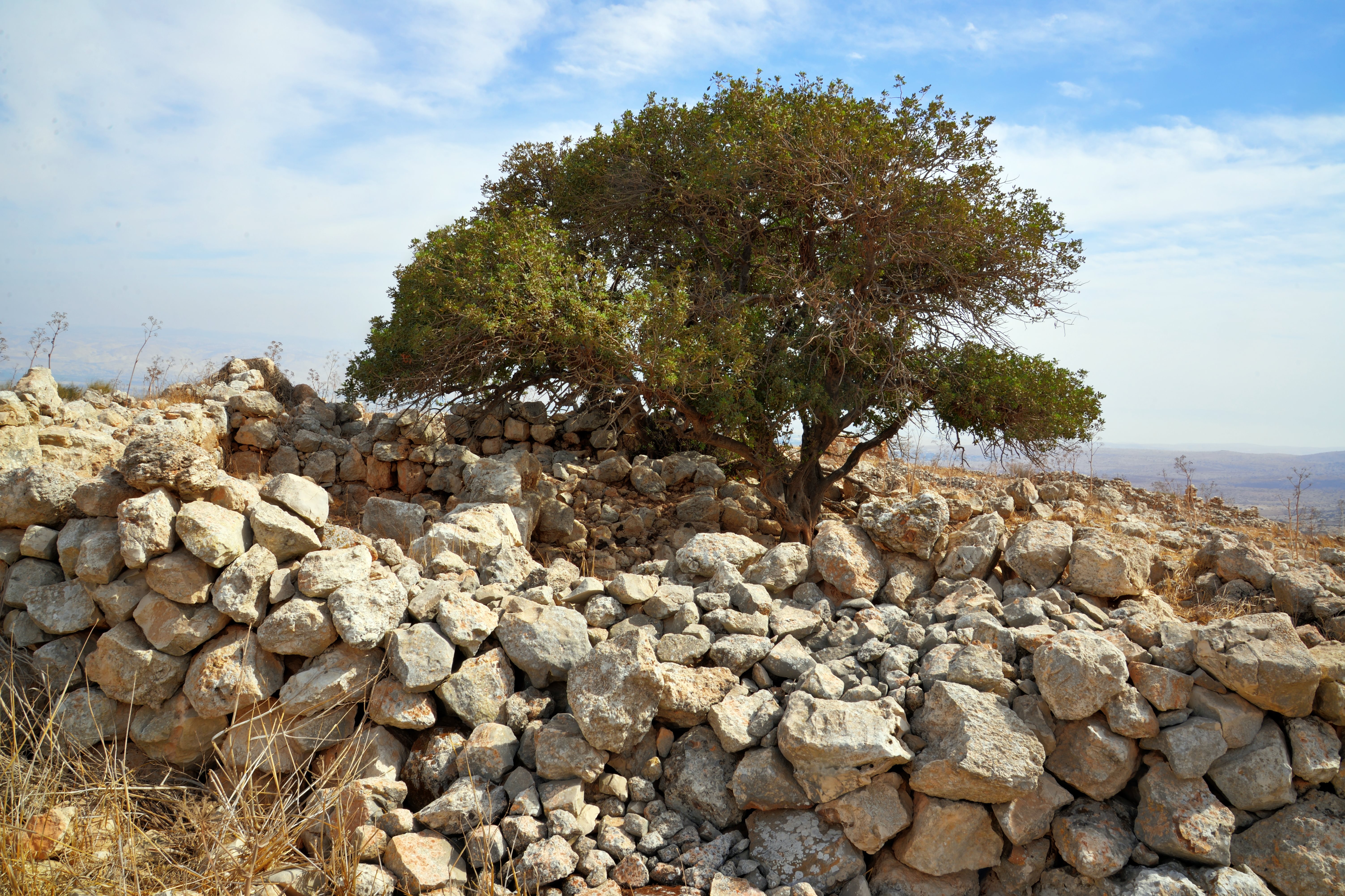
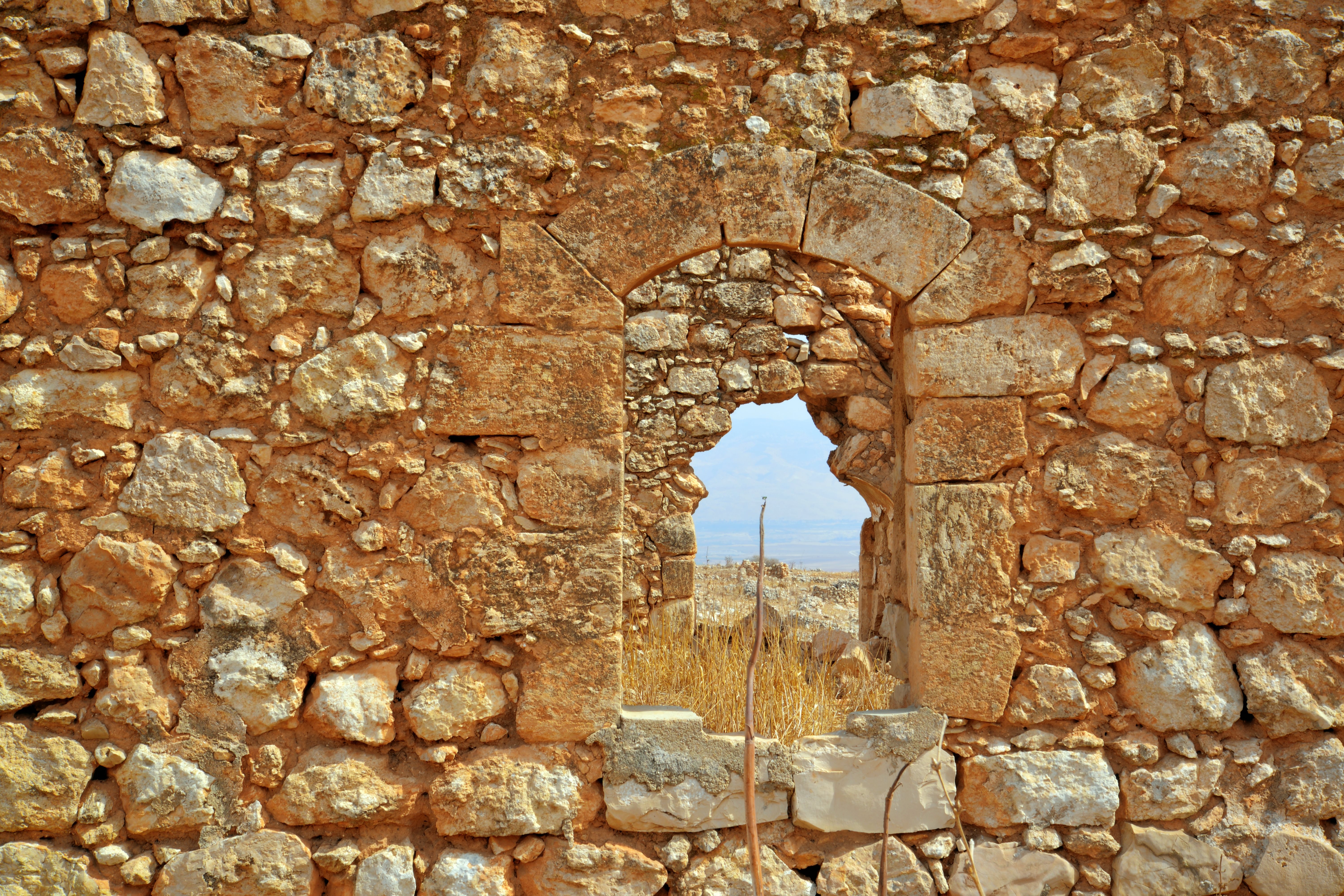
(a) Eastern foothills
We surveyed the site in October 2016, and started the ascent from the eastern foothills. Starting from this point there is a 300m height difefrence to the site, along a distance of 1km.
Here is a eastern view towards the Jordan valley. The Jordan river is 10km to the east.
Click on the photos to view in higher resolution…
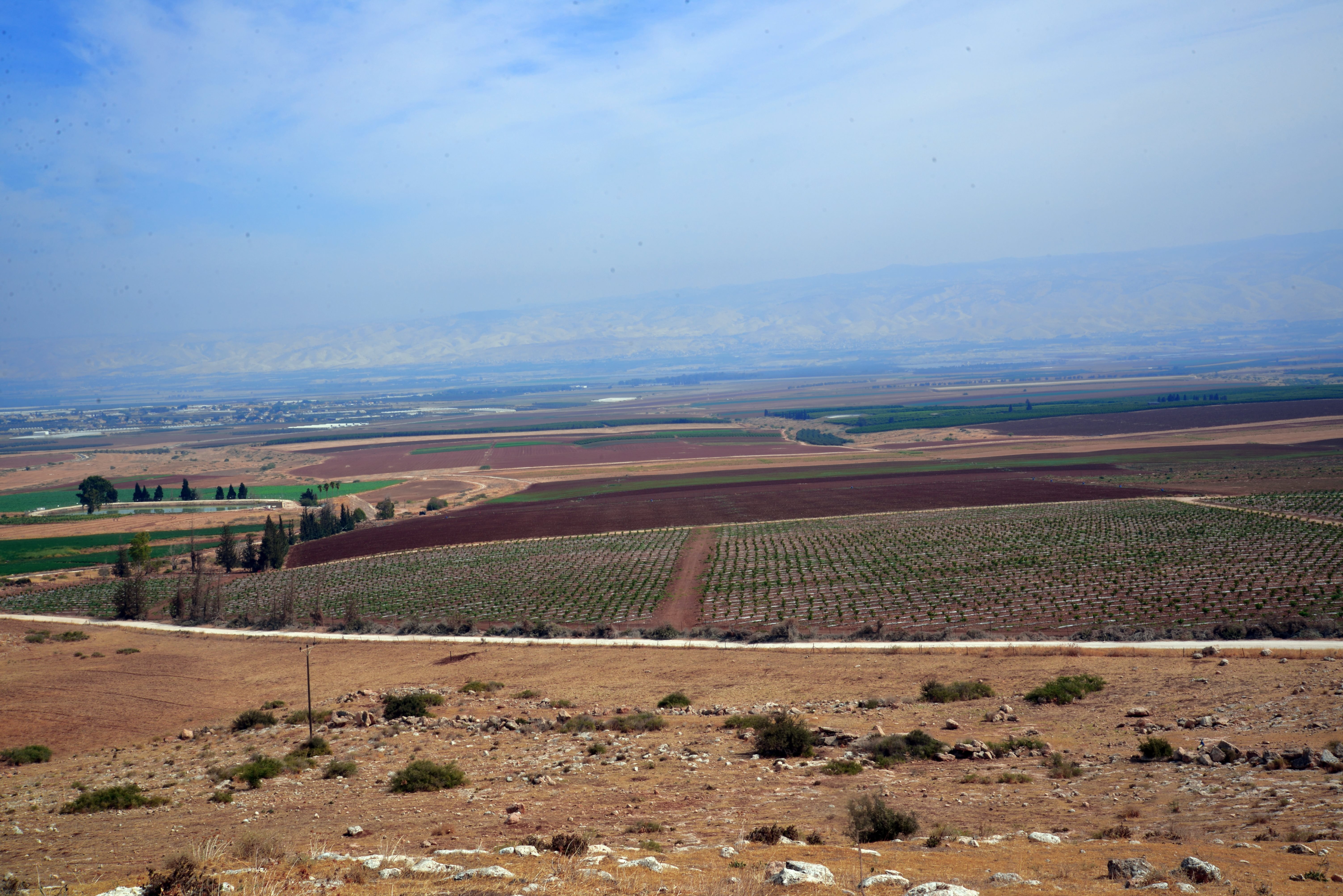
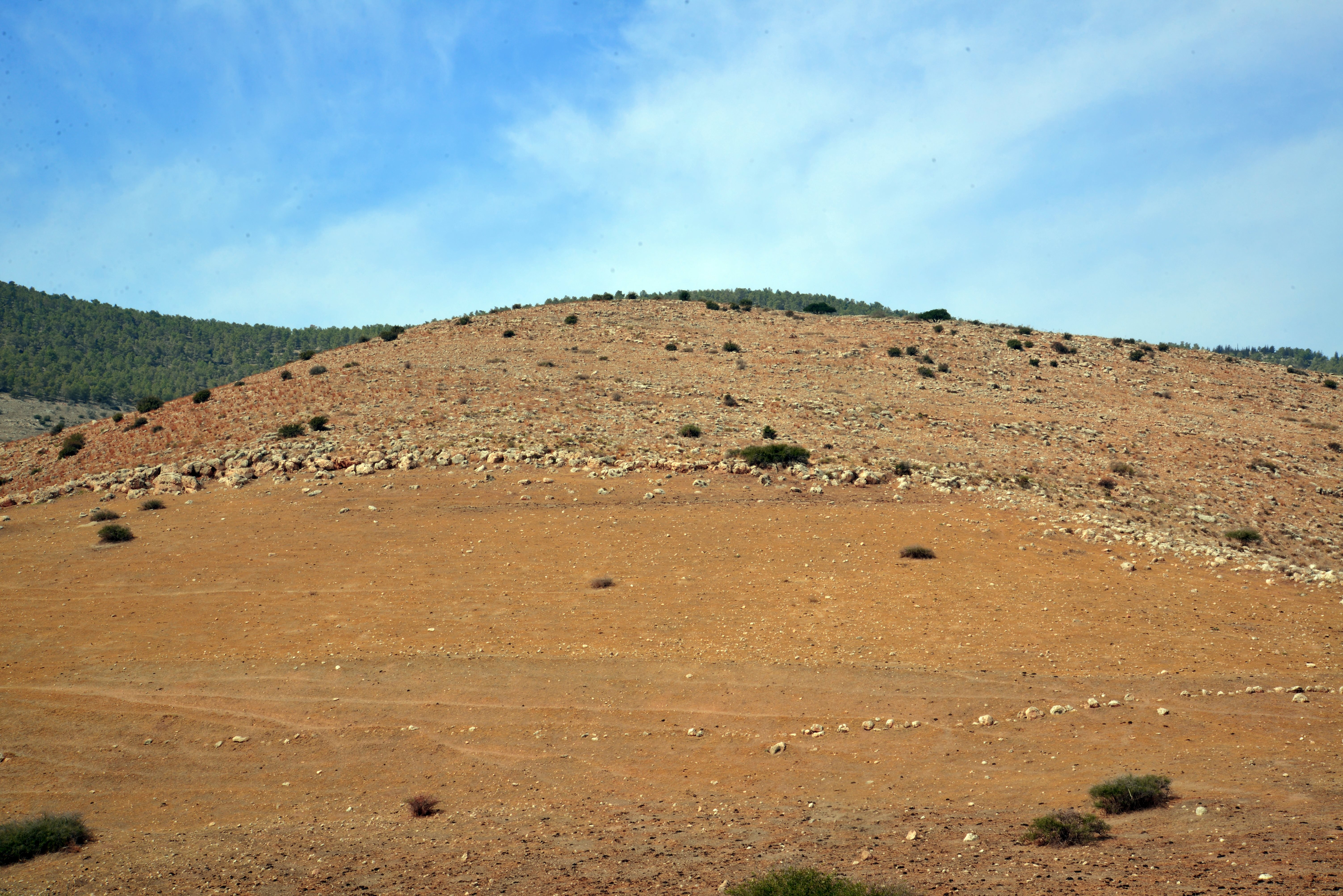
A western view towards the edge of the site. Mt. Gilboa is seen in the background, covered with bush and pine trees.
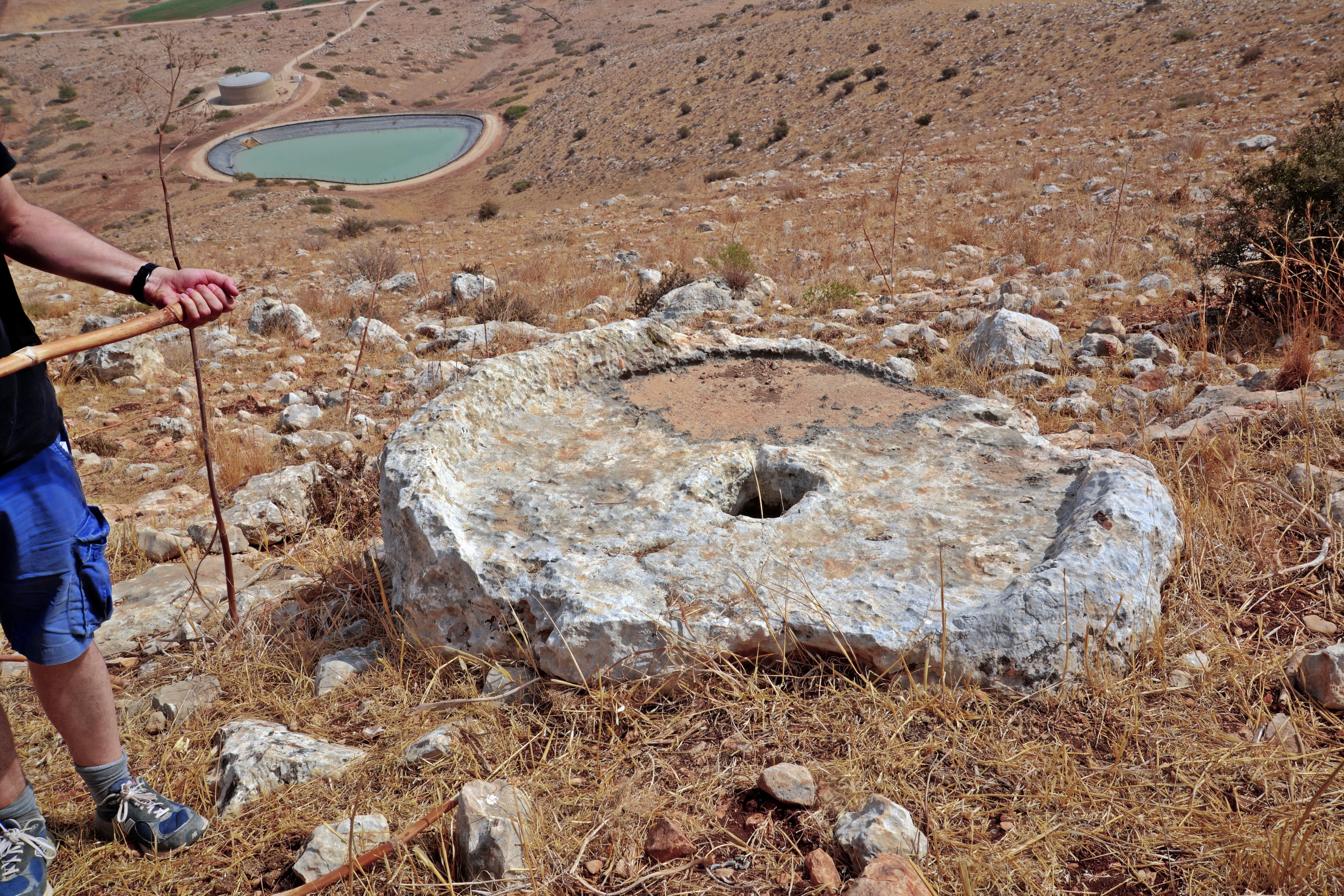
Along the ascent we saw a crushing base (“Yam”) of an oil press. This large, stationary circular stone vat was where the olives were placed. A heavy, vertical millstone (“Memel”) was used to crush the olives by rolling inside the basin. The cavity (or socket) in the center of the basin held a vertical wooden beam. A horizontal wooden axle passed through the center of the rolling memel stone. One end of this axle was attached to the central vertical beam held by that cavity.
During ancient period olive trees were planted in the area. Olive oil was used as a cooking oil, food, lighting fuel, soap making, religious ceremonies and medicinal use. Its production was one of the major sources of income in the Holy Land over thousands of years, including modern times when the olive oil is an essential ingredient in the Middle East cuisine.
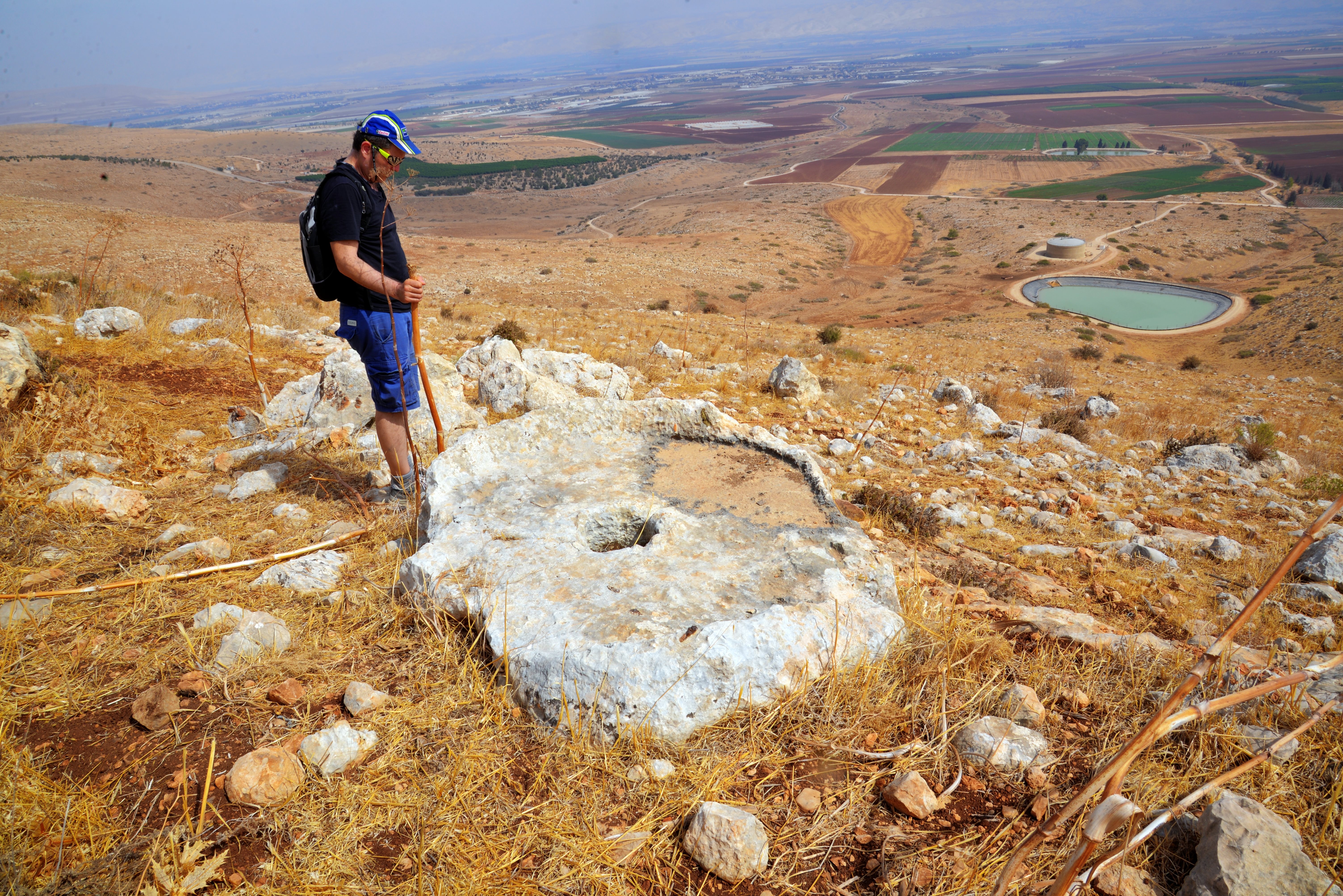
During the Roman and Byzantine periods the number of oil presses was in the thousands; many farmers had their own private installations, and larger public industrial complexes generated huge amount of olive oil.
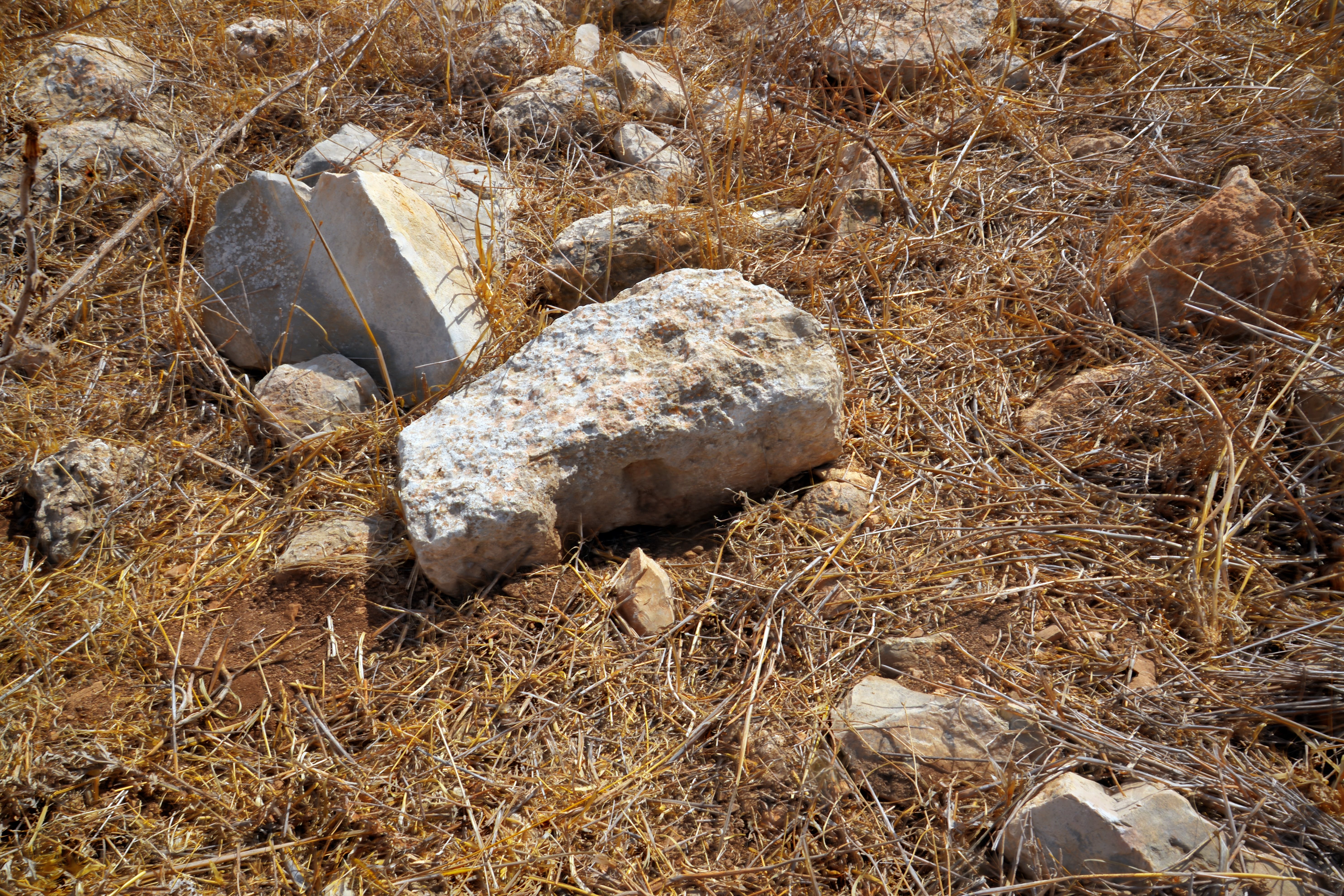
Evidence of intensive land cultivation is visible throughout the site. Local farmers managed the rugged terrain by clearing fieldstones and arranging them into terraced systems, a common practice for maximizing arable land on the Gilboa slopes.
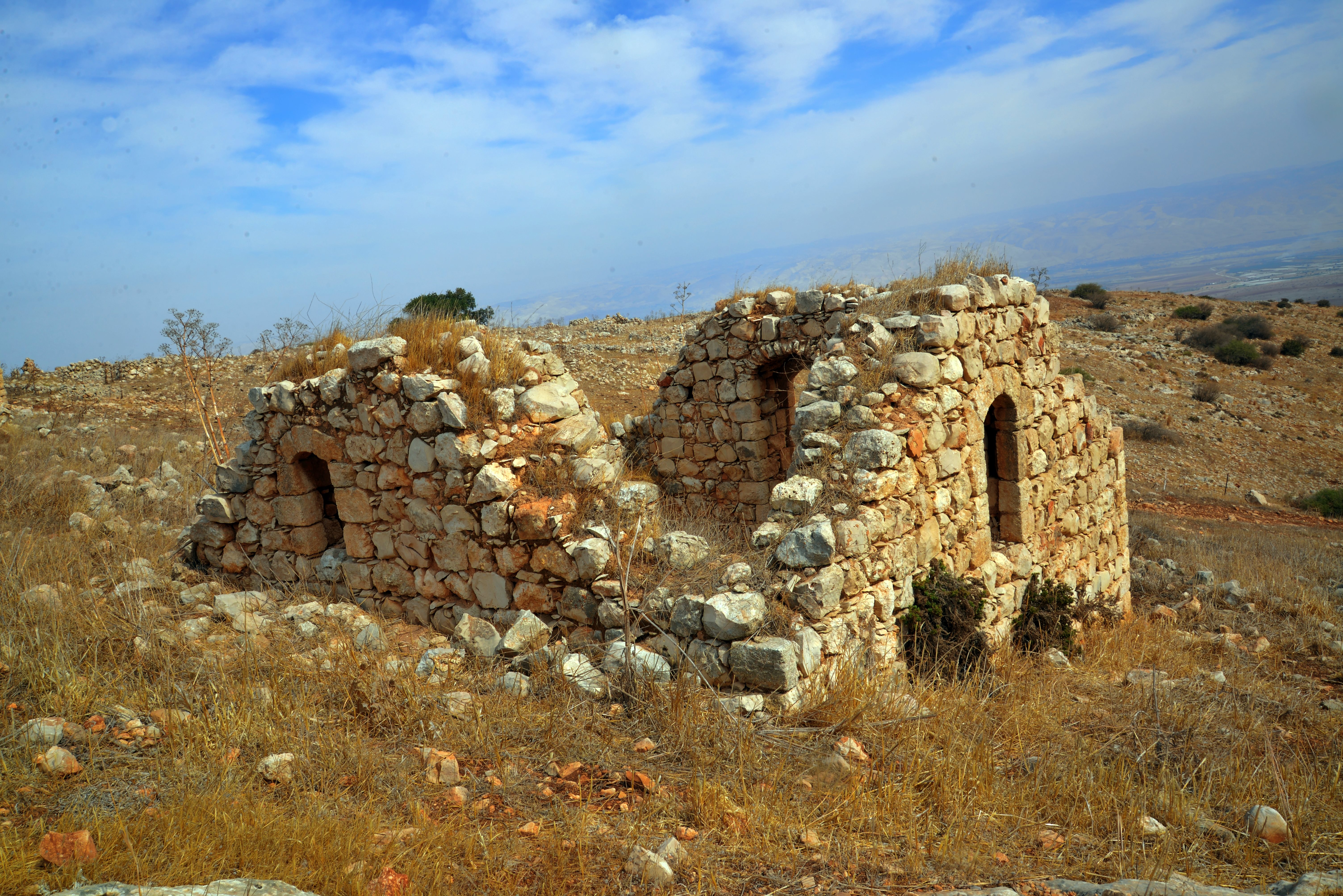
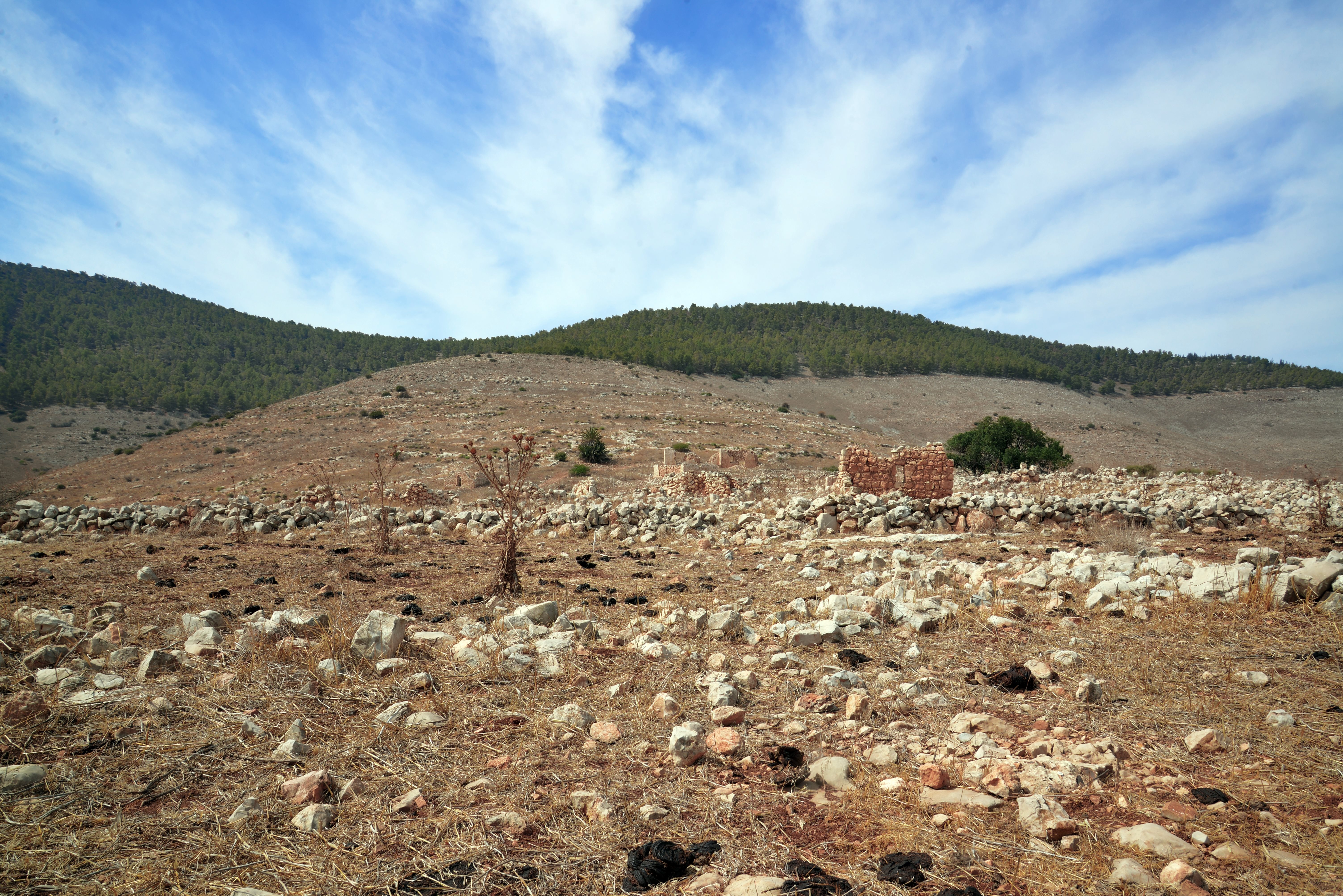
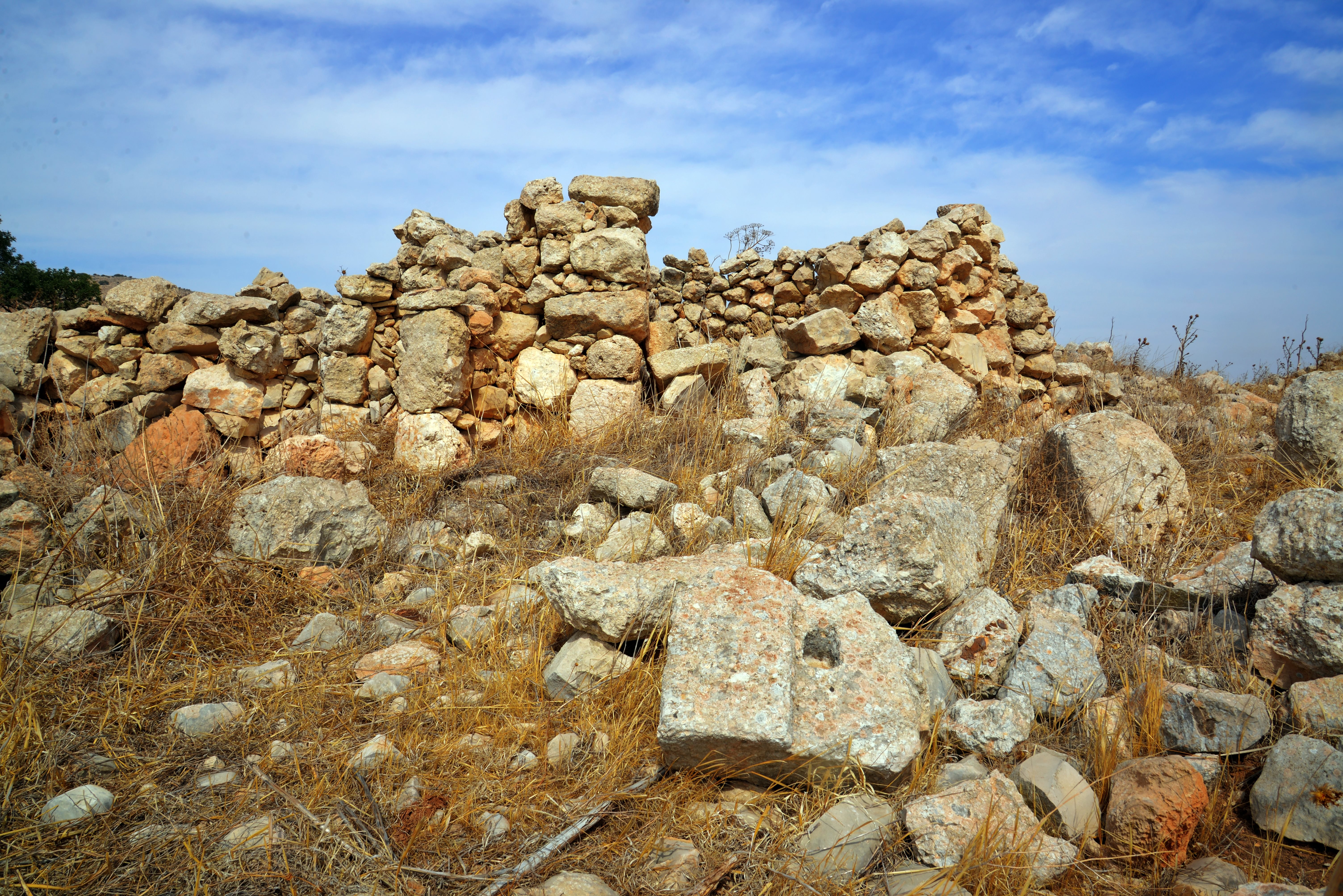
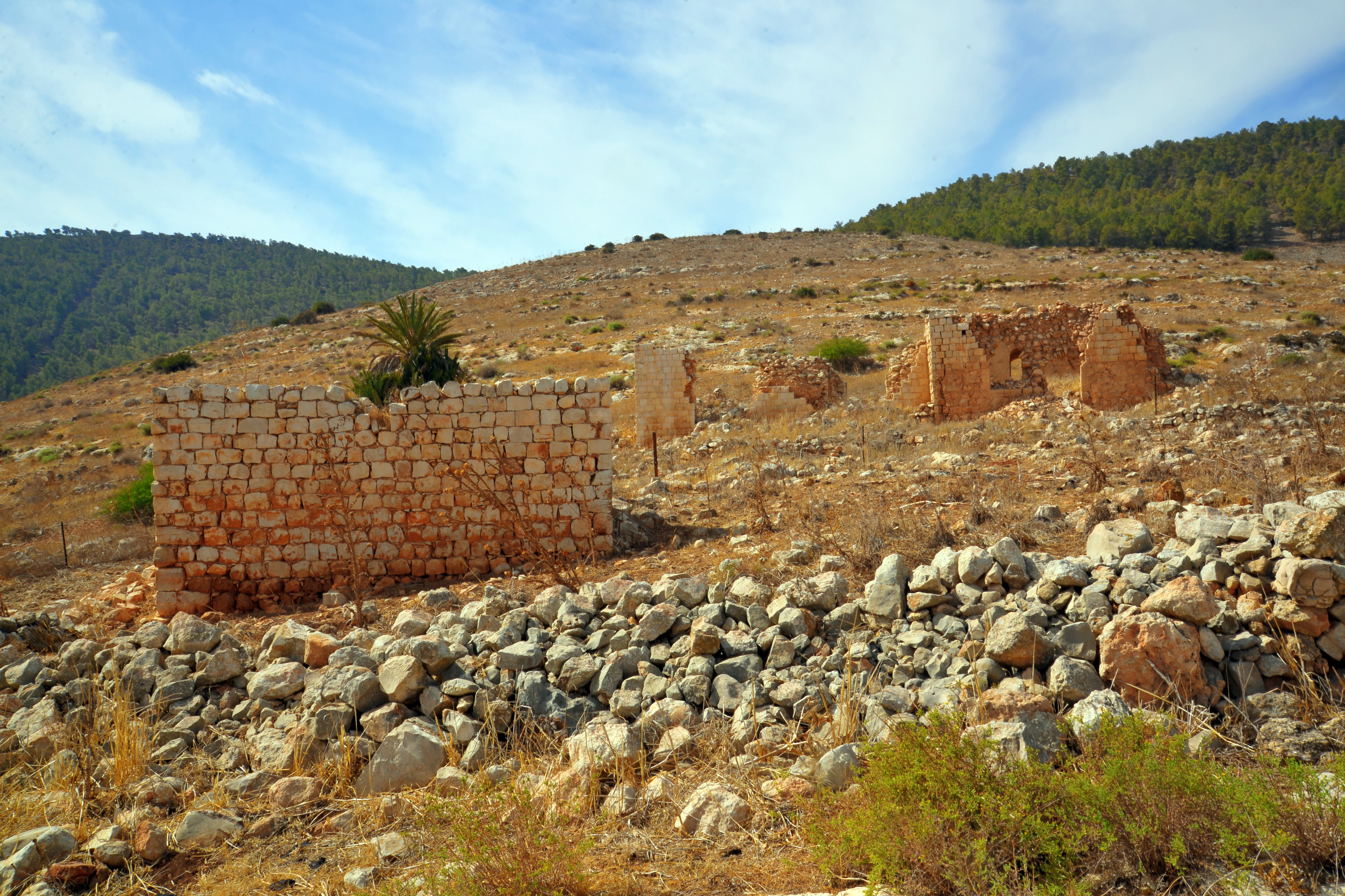
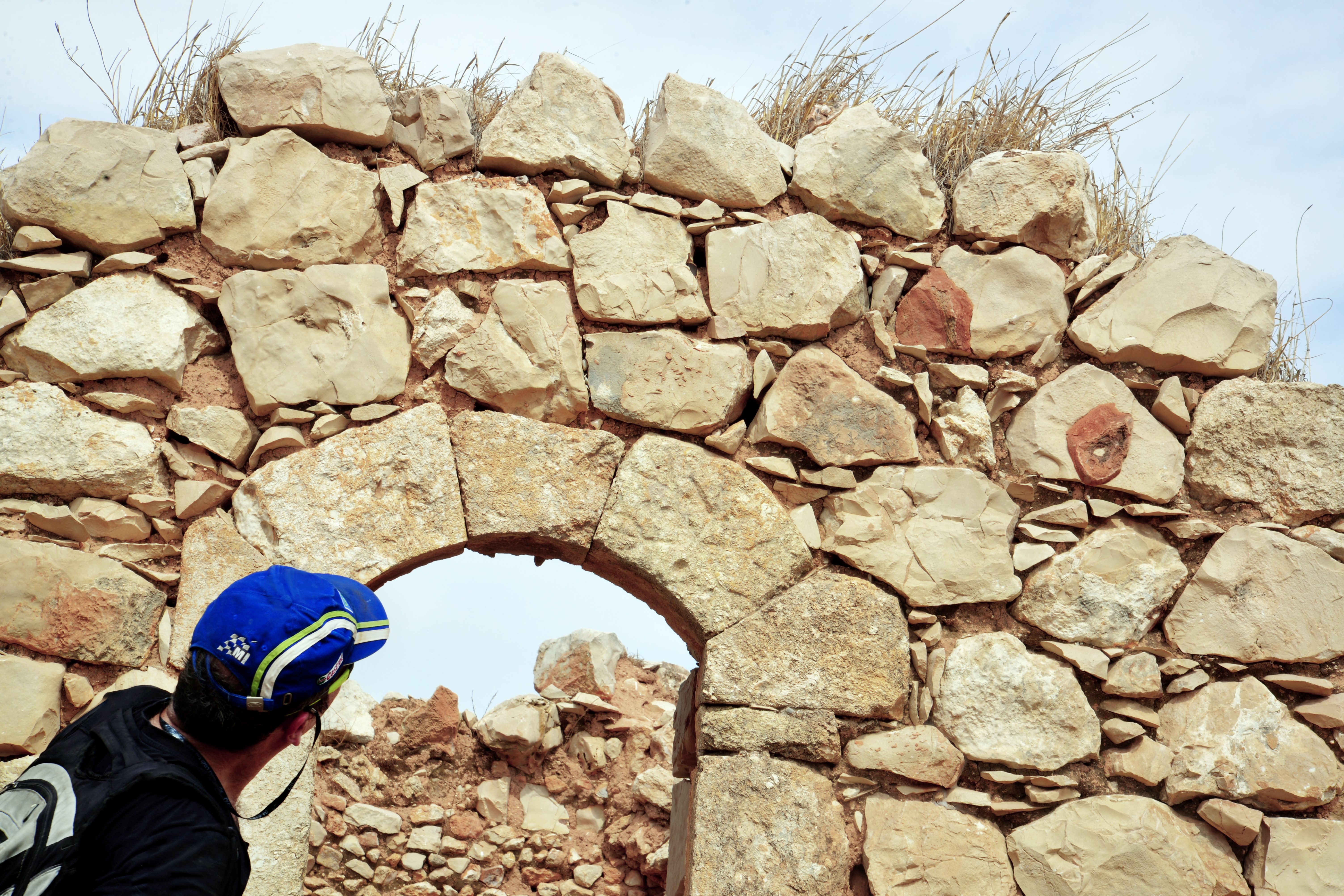
(b) The old village
This photo shows a western view of the outskirts of the village.
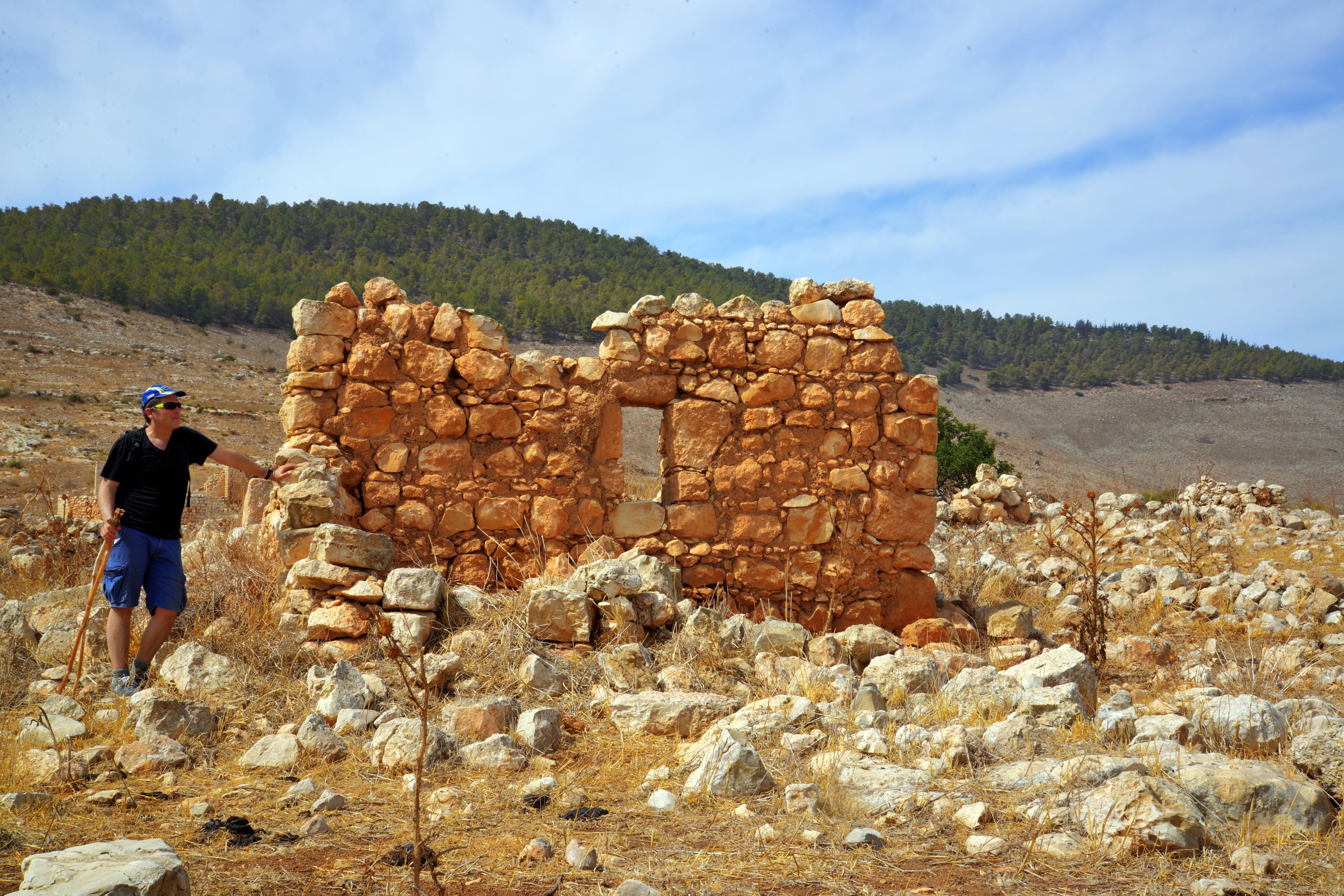
Remains of an Ottoman period house is the first standing structure. Uncle Roni is seen here on the side of the ruin.
At the end of the 19th century the villagers who moved to the site reused the ancient Byzantine stones to build their homes and utilized the existing cisterns for water. Later they built new modern houses on a higher level of the village.
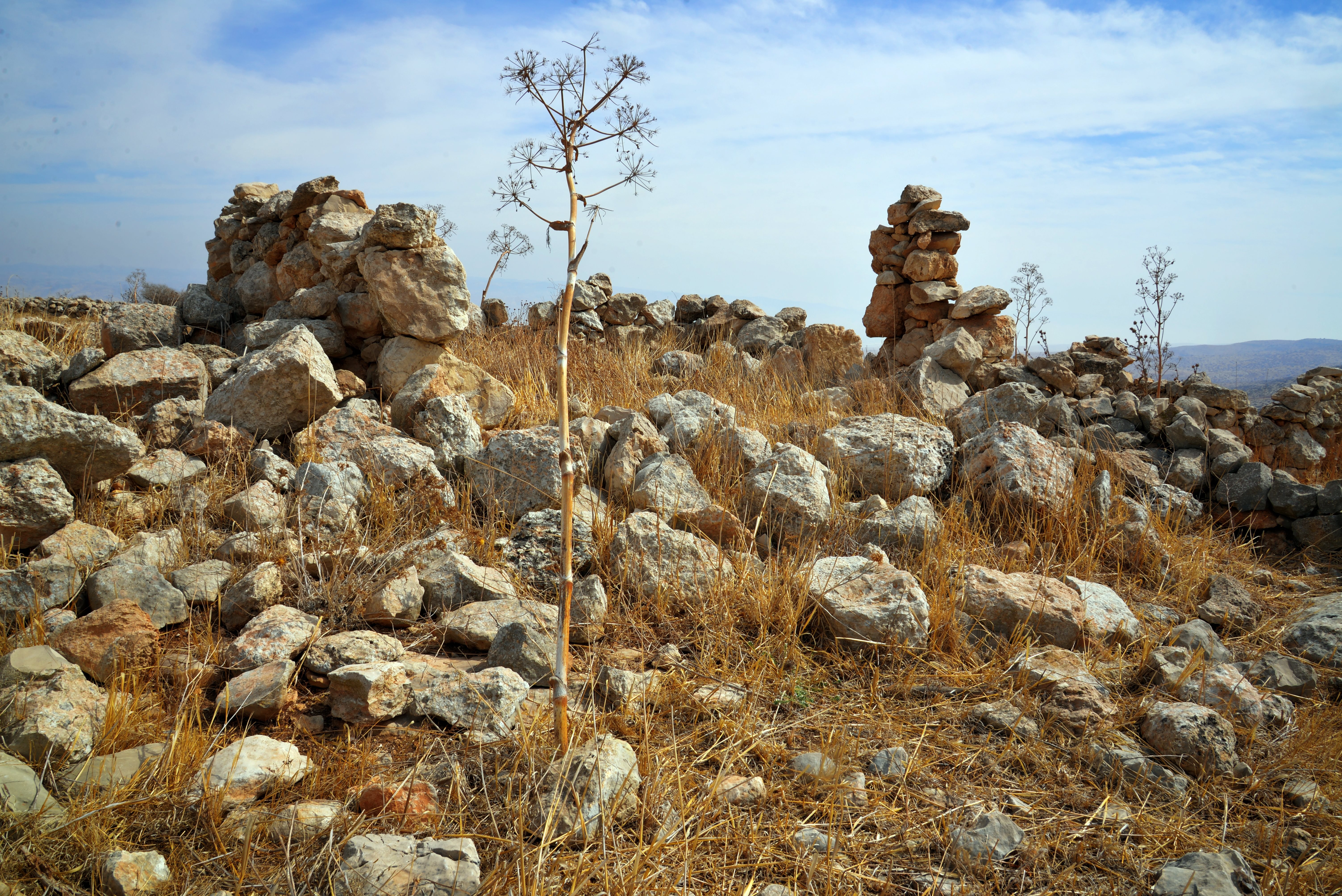
On the surface, massive walls are visible, constructed from dressed stones 1.2 meters wide, some featuring marginal drafting.
Here are some samples:
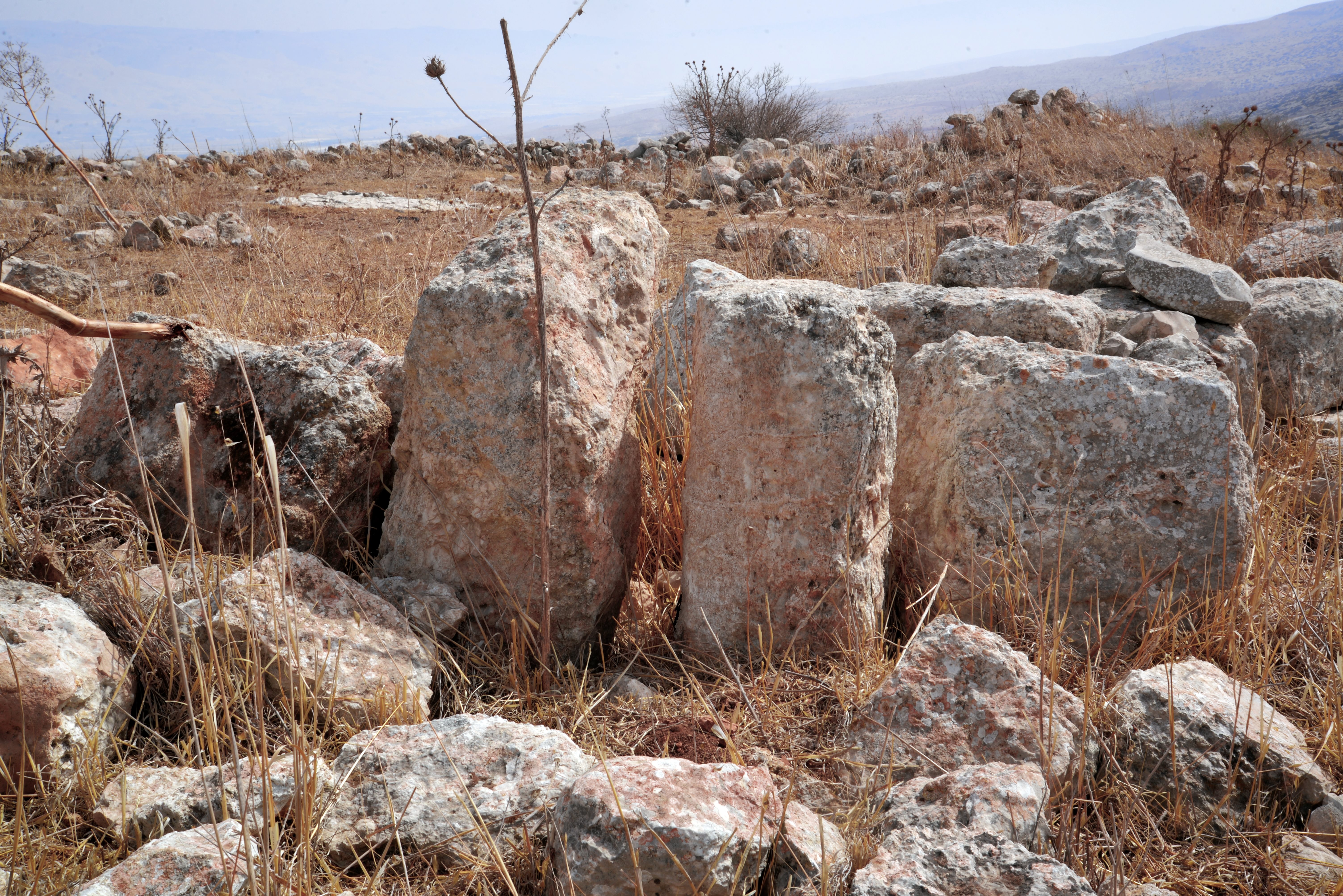
Nine cisterns were counted at the site: eight bell-shaped cisterns and one open reservoir. Additionally, evidence of quarrying, stone troughs, and cupmarks are visible.
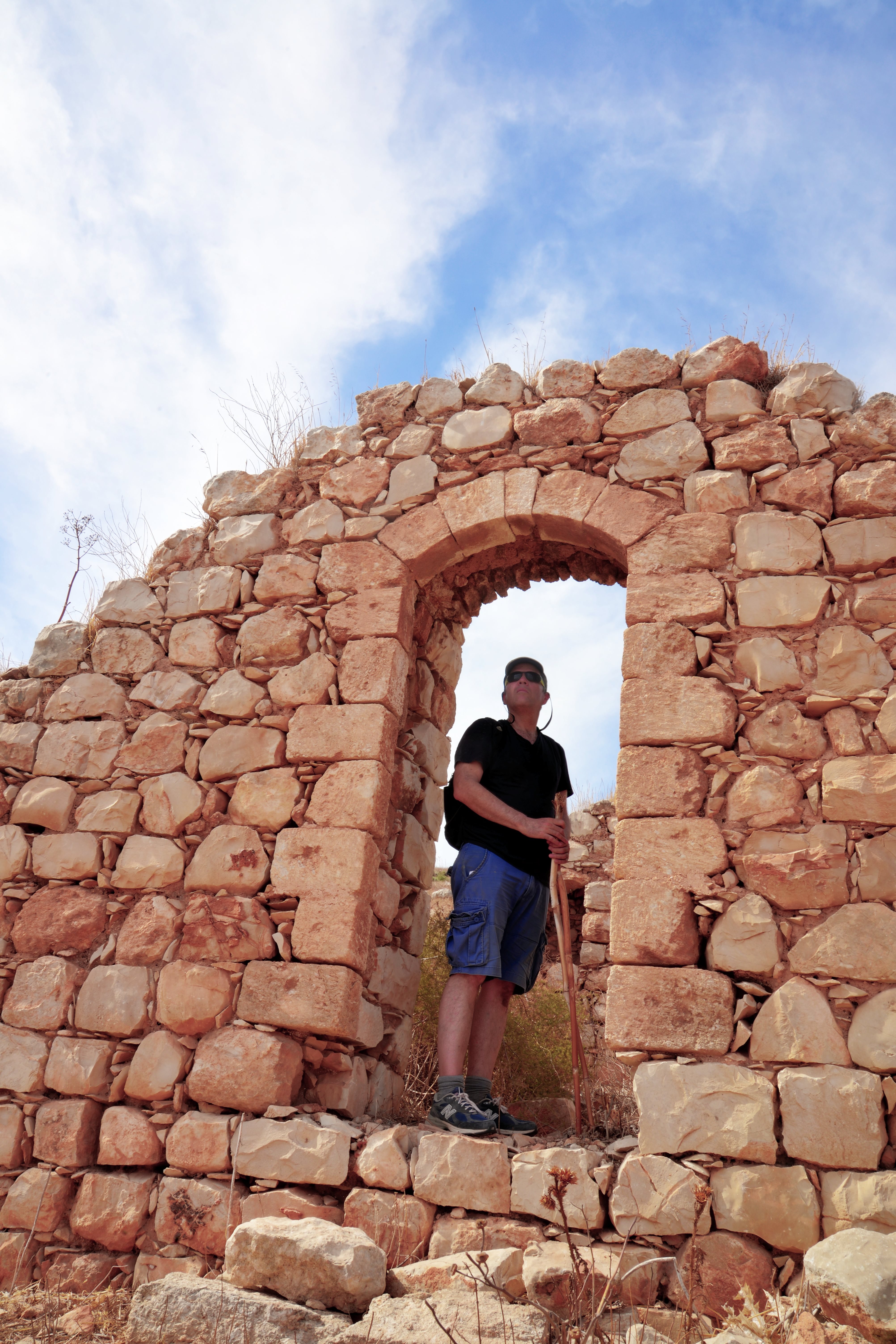
(c) Modern Buildings
Ruins of the modern houses of the village are located at a higher altitude. They were built during the British Mandate, at the first part of the 20th century, by farmers who relocated to the ruins at the end of the 19th century from the Arab village of Raba.
As per Uri Eliav, and quoted by A. Cohen-Tavor (Site 1), its farmers produced cheese as well as other farming activities.
The residents were also engaged in smuggling goods. Khirbet Umm Sirhan is perfectly situated for illicit movement: It sits on the southeastern edge of the Gilboa, overlooking the Jordan Valley. Historically, this was a transition zone between the central highlands (Samaria/Northern Israel) and the Transjordan (modern-day Jordan). Furthermore, the site offers a “crow’s nest” view. Residents could see anyone approaching from the valley below long before they arrived, while the rugged, cave-pocked limestone terrain provided endless places to hide contraband.
In the late Ottoman and British Mandate periods, the “smuggling” mentioned in local lore usually involved: Livestock: Moving sheep and goats across the Jordan River to avoid taxes or “animal head” counts by authorities. Tobacco and Salt: These were heavily taxed state monopolies under the Ottomans. Small, remote villages in the Gilboa were notorious for moving these goods through the mountain passes to avoid checkpoints in the valleys. Firearms: During periods of unrest (like the 1930s), the remote paths near Umm Sirhan were used to move weapons from the eastern deserts into the Galilee and Samaria.
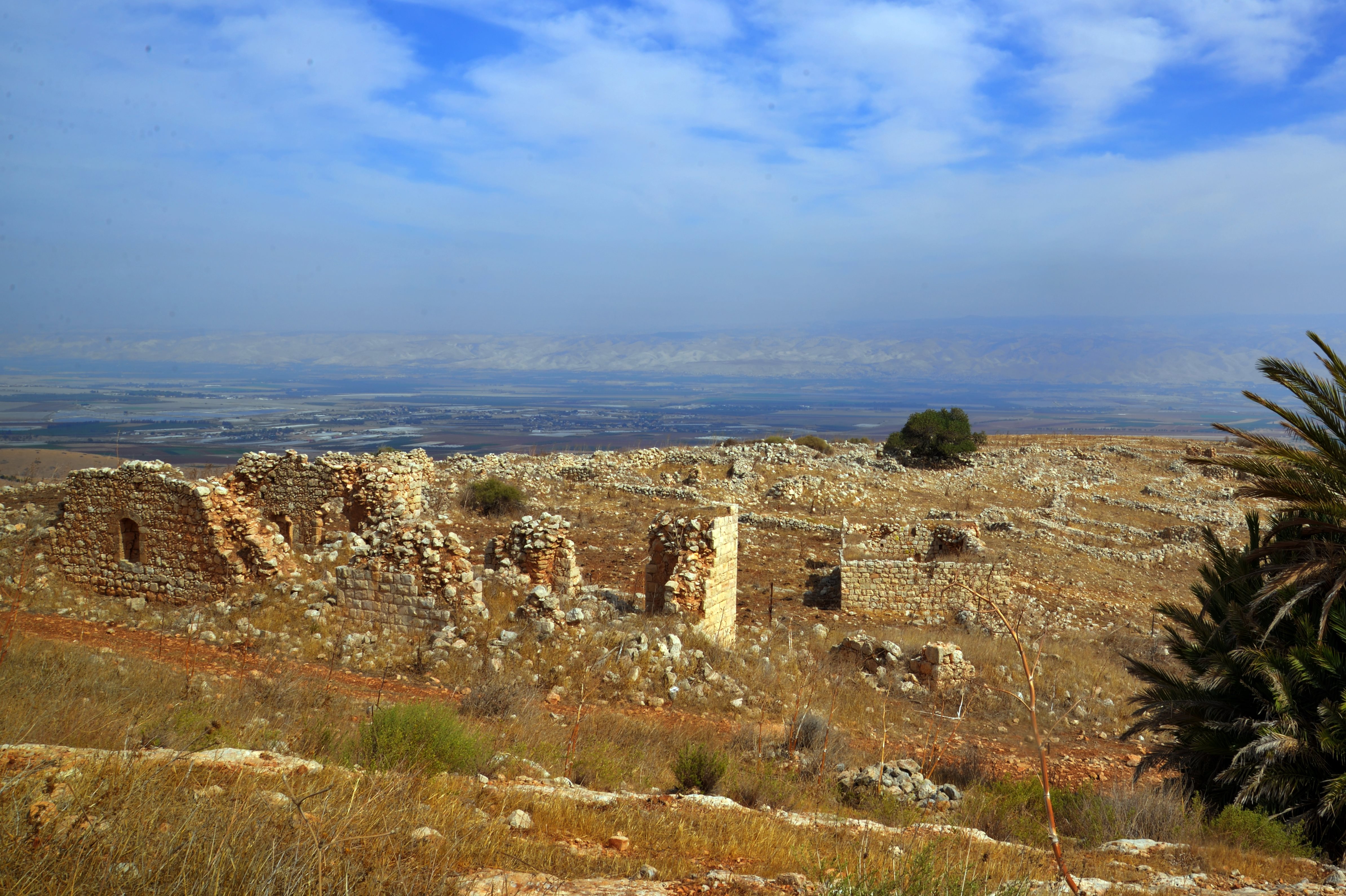
The village was abandoned in April 1949, following the disengagement agreements of the 1948 independence war. The border with Jordan was established 1.5km south of the village, and the residents were transferred to the Arab village el Mugheir beyond the border fence.
Untril 1967, when the West Bank was recaptured by Israel, the ruins of the village continued to be a secret meeting place for the Israeli intelligence with Arab residents behind the border.
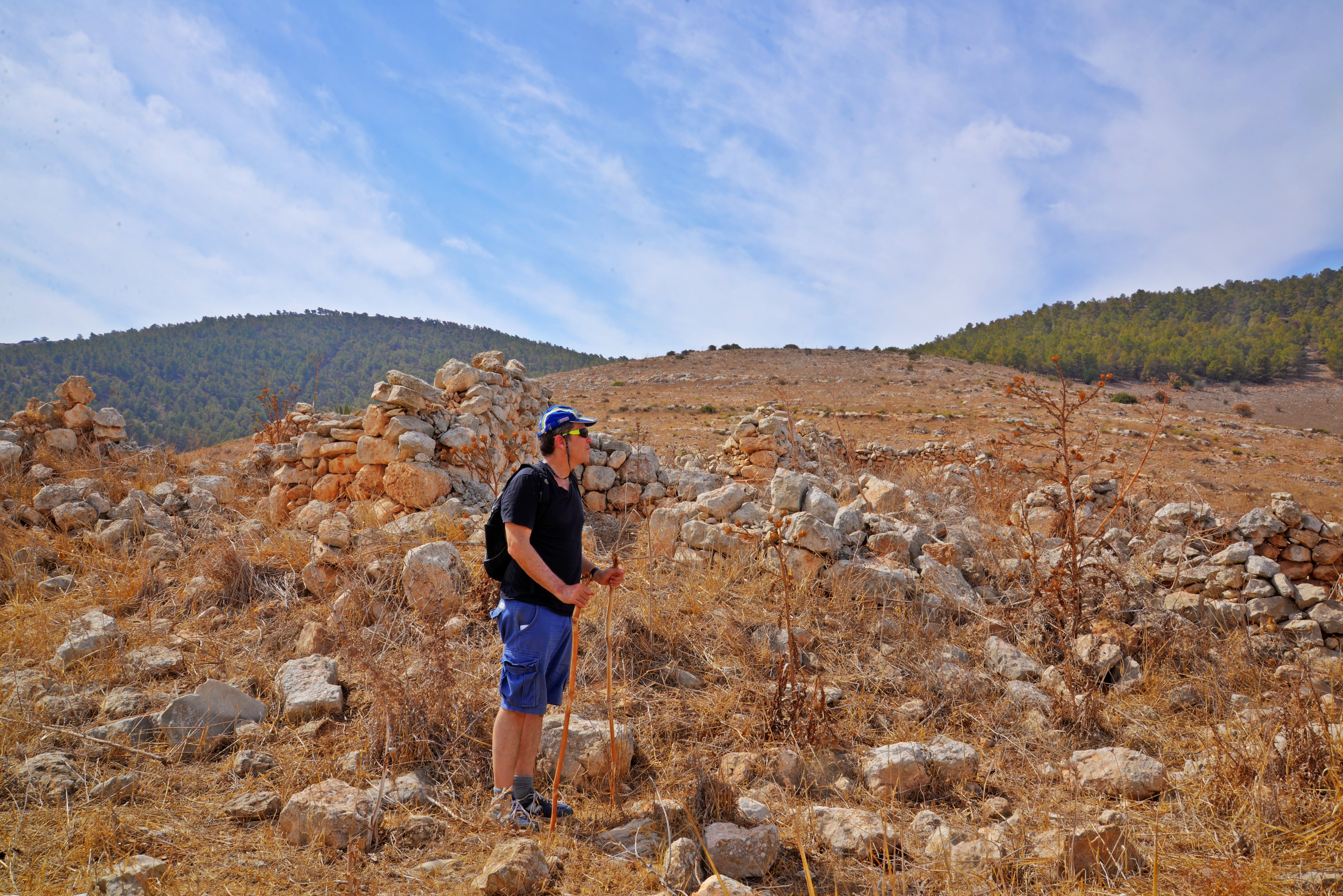
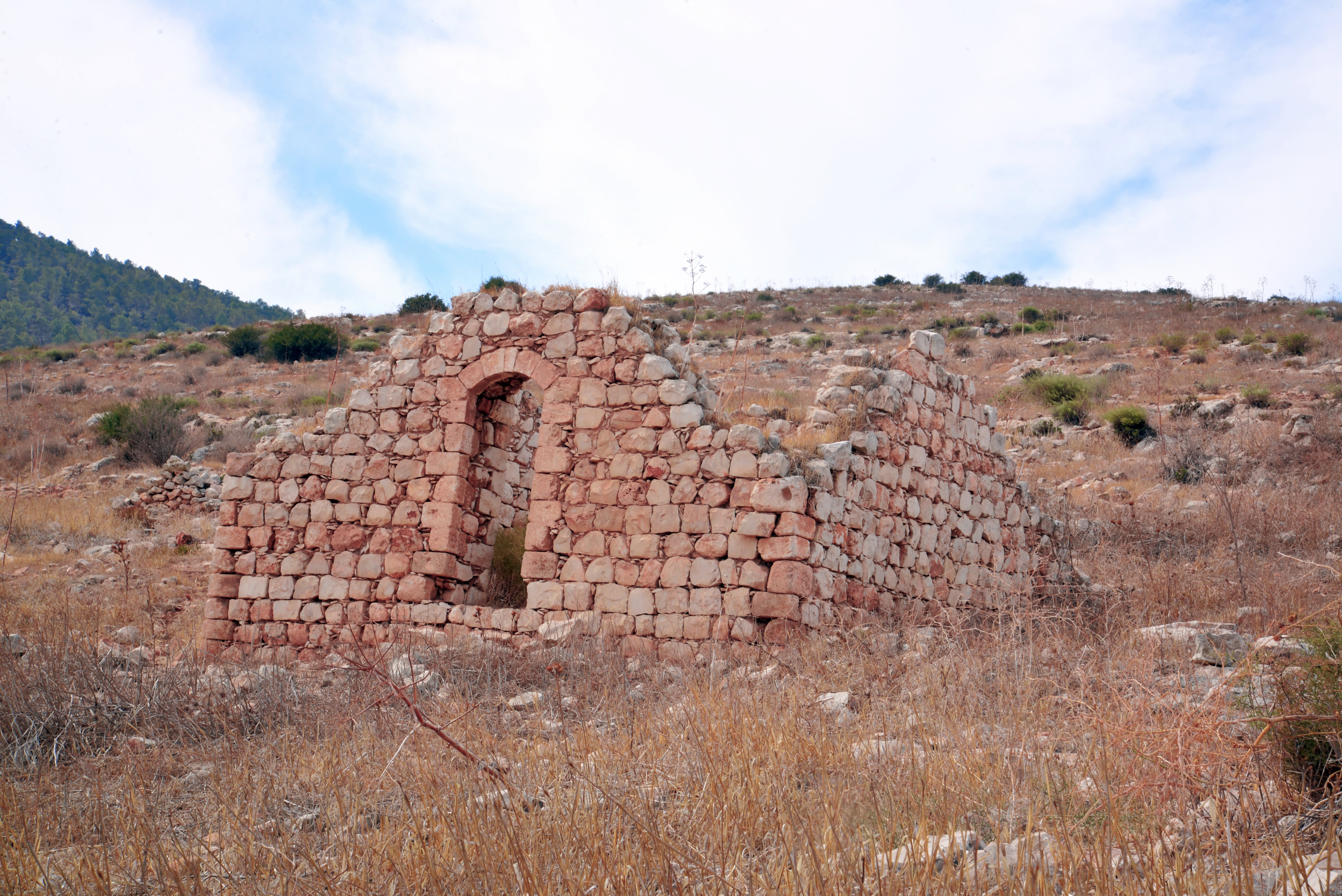
A collection of photos show the ruins from different views.
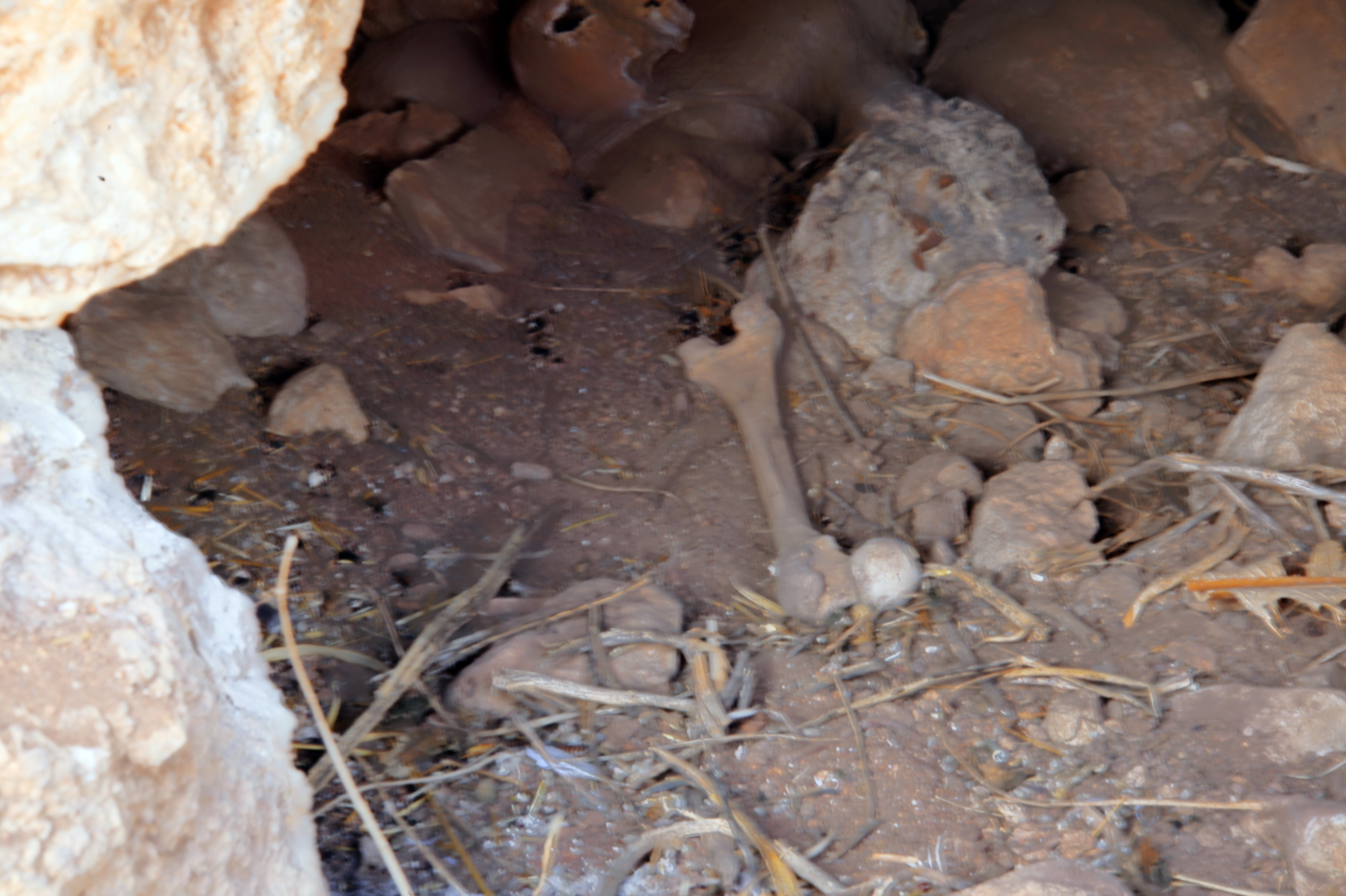
(d) Cave
During our survey we stumbled upon a small cave.
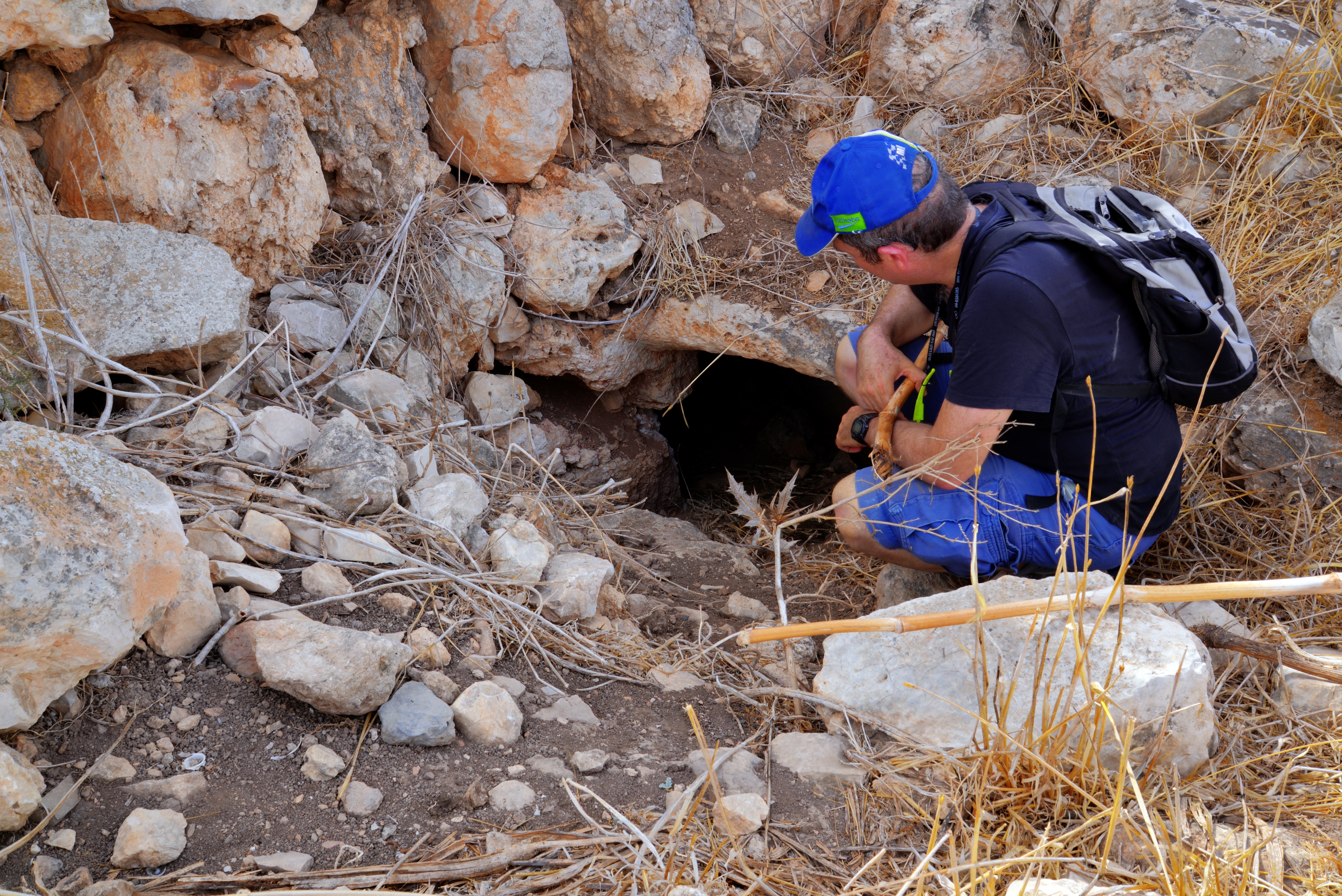
Inside the cave were animal bones.
This might have been an animal den, perhaps jackal or wolf. Jackals are extremely common in the Gilboa and the surrounding North Jordan Valley. They often use ancient burial caves or cisterns as shelters. The original name, Umm Sirhan, literally means “Mother of the Wolf/Jackal.” This suggests that for centuries, locals recognized these ruins specifically as a habitat for canids.
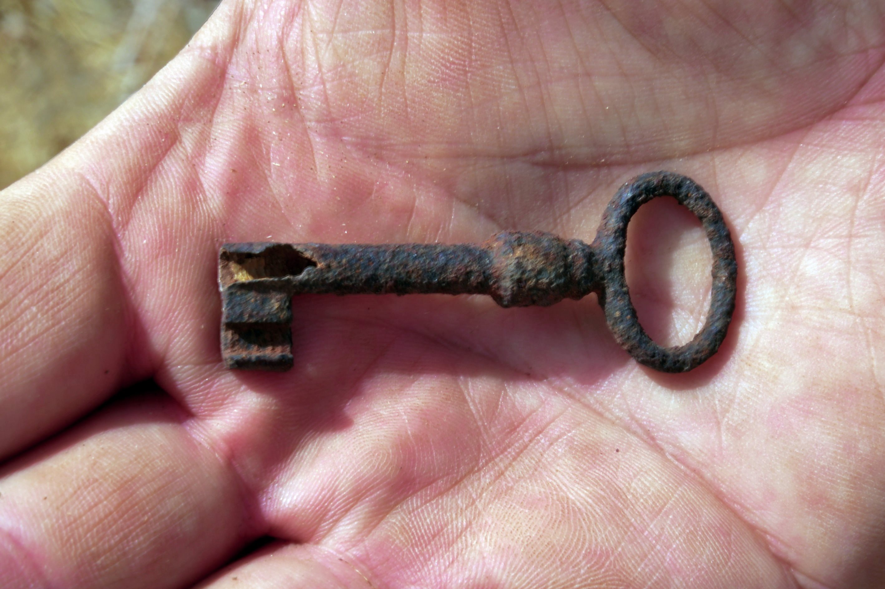
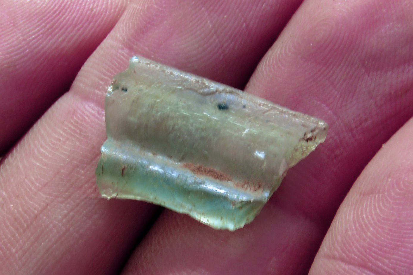
(e) Findings
A small key was found during our survey.
An iron butcher’s axe (meat cleaver) was also found. Its blade is 18cm long and the handle adds 10cm.

Also, a piece of Roman period glass.
(e) Surroundings
We descended from the site along the valley of Nahal Ner. This dry stream joins Nahal Bezeq (Wadi Shubash) 2km downstream.
In the photo below – a view from the hill above the site.
(f) Mukhtar’s House
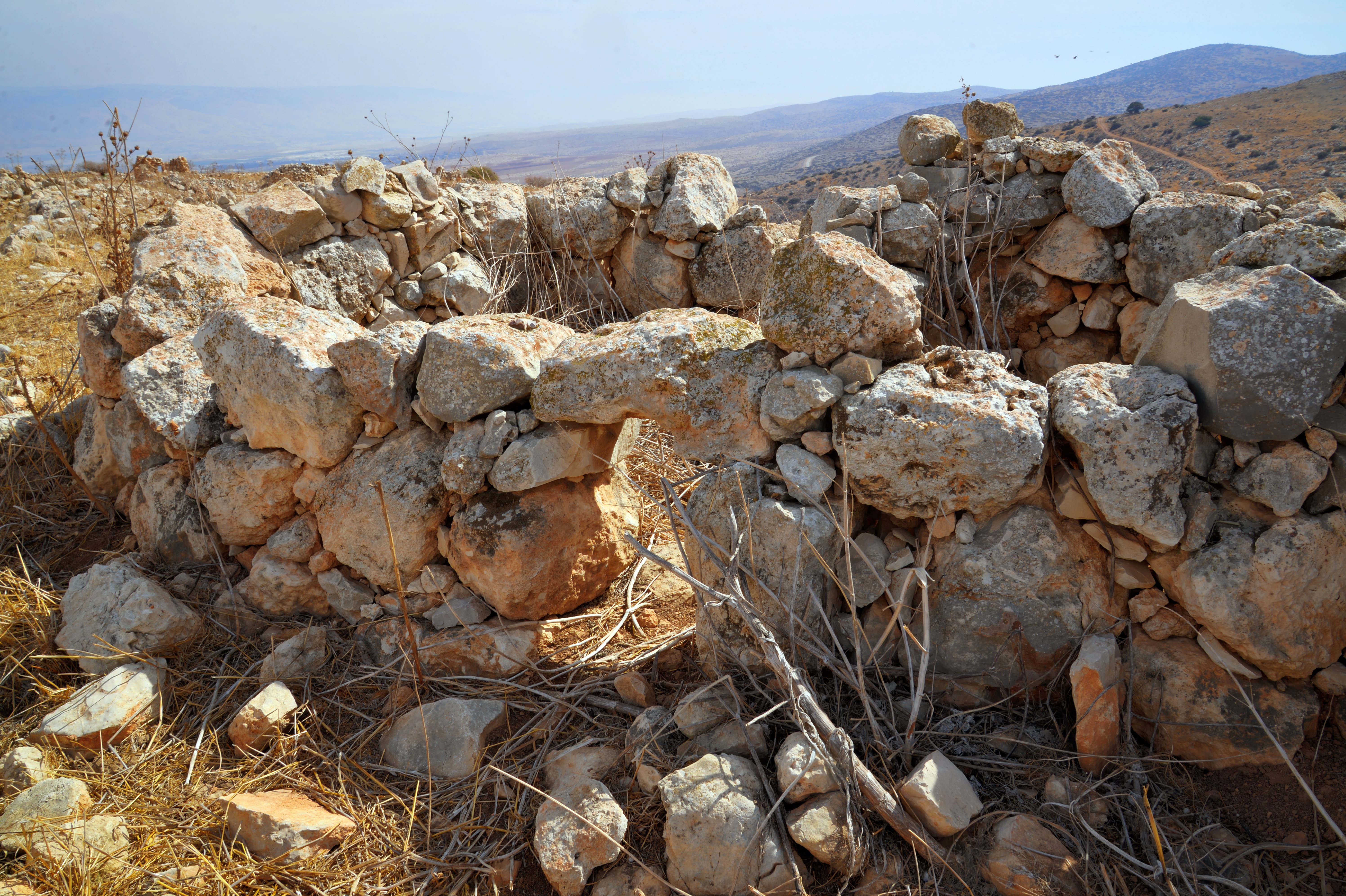
Ruins of a residential house is located on a ridge, 600m south of Horvat Ner.
This structure is known as the “Mukhtar’s” house (meaning, the head of the village). It is also known as the “house of Arches”.
According to Zuri’s survey (1977, site 31) the house was built in years 1945-1947 by a resident of the nearby village Raba.
It may have also been used as a school house.
As per Uri Eliav, and quoted by A. Cohen Tavor (Site 1), the owner supplied merchandise to the Bedouines in the area.
There are other ancient structures scattered on its eastern side.
Additional walls and terraces…
(g) Watch Tower
On the hill east of the “Mukhtar’s house” are remains of a rectangular watch tower, built with large rocks. According to A. Cohen (2010, site 2) its size is 4m by 2m.
Ahia Cohen-Tavor suggested that this was a forward observation tower of the Roman fortress in Horvat Ner.
Zori reported on few Roman/Byzantine sherds around the site.
According to the theory, the watch tower was used in order to monitor the Bezeq valley that is hidden from the main fortress at Horvat Ner.
A major Roman route crossed the mountains to Samaria along the Bezeq valley (Wadi Shubash). The valley is seen here, passing under the road.
(h) Field surveys
Field surveys were carried out on and around Horvat Ner, as part of the archaeological survey of Mt. Gilboa within the framework of the Manasseh Hill Country Survey. The project is directed by Dr. Shay Bar and Ayelet Keidar, with the assistance of BibleWalks staff and other volunteers.
The area around the site was surveyed in several Fridays, so far covering 7 polygons, as illustrated in this map.
![]() Here are the survey videos:
Here are the survey videos:
- Survey 1:
This 9+ minutes video summarizes a field survey of the site, as part of the Gilboa archaeological survey. In this session the team surveyed the following plygons:
a) Polygon #1 (area SW of the ruined Mukhtar house) – Found ruins of a Ottoman period farmhouse with a unique stone-built hen house, an adjoining structure, a large cistern and cupmark.
b) Polygon #2 (the forest north west of the Mukhtar house) – Findings of a lime kiln and a field watch tower.
Survey 2:
Video was not filmed. The team covered polygons #3-#4, and found an early man site, caves and installations.
Surveys 3-4:
In these sessions the team surveyed the following plygons:
a) Polygon #5 and #6 (area of Mt. Avner, north west of Ner) – Found a Roman/Byzantine winepress and a Neolithic/Chalcolithic flint stone workshop settlement; Shay dated the findings
b) Polygon #7 (the south of Mt. Avner, west of Ner) – Findings of an oval structure, small installations and terraces
Survey 5:
This session focused on Polygon #8—an enclave at the mountain’s southwestern base, framed by the border fence. Key findings within a local olive grove include a Roman/Byzantine winepress, two bell-shaped cisterns, and three caves, with pottery samples primarily spanning the Iron Age (minority) through the Byzantine period (majority).
Survey 6:
The team covered an area of Polygon #9 – North west of Ner, along the border fence, SW of Malkishua.
Etymology (behind the name):
-
Khirbet Umm Sirhan – The original Arabic name for the ruins. It translates roughly to “The Ruin of the Mother of the Wolf” (or “Place of the Wolf”). This likely refers to the wildlife once common in the rugged terrain of the Gilboa slopes. The “Umm” (Mother of) prefix is a common feature in Arabic toponymy to denote a place possessing a certain characteristic.
-
Horvat Ner – the official Hebrew name assigned to the site by the Israeli Names Committee. Meaning: It translates to “Candle Ruin” or “Lamp Ruin”. Context: The name was chosen because it preserves the phonetic sound of the original name (Sirhan sounding vaguely like Ner in a symbolic sense of “light” or “shining”). Additionally, it follows the naming of many sites on Mt. Gilboa related to King Saul. Avner ben Ner was King Saul’s cousin and the commander-in-chief of his army. Given that the Gilboa is the site of Saul’s final, tragic battle against the Philistines, the Israeli Names Committee utilized the landscape to create a “geographic memorial” to his circle.
- Ner – King Saul’s uncle, a high-ranking figure within the tribe of Benjamin and a foundational member of Israel’s first royal family.
Links:
* External, archaeological links:
- Survey of Western Palestine, Vol 2 Sheet IX
- Survey of Tel Rehov area in the Beit-Shean Valley, Ahia Cohen-Tabor 2010; sites 1-2 p. 56
- The Land of Issachar, N. Zori 1977, sites 30, 31, 32 (p.18)
- Mystery of the ruin of the wolves – R. Gafni – nice article (Hebrew)
- Mount Avner an Horvat Ner – Hike [KKL-JNF]
* Internal links:
- Mt. Gilboa archaeological survey
- Meizad Avinadav – Roman fortress 5km north
BibleWalks.com – unearthing the Bible lands
Migda<<<—previous Jordan Valley site—<<< All Sites>>> — Next site—>>>Archaeological survey
This page was last updated on Feb 24, 2026 (add survey video)