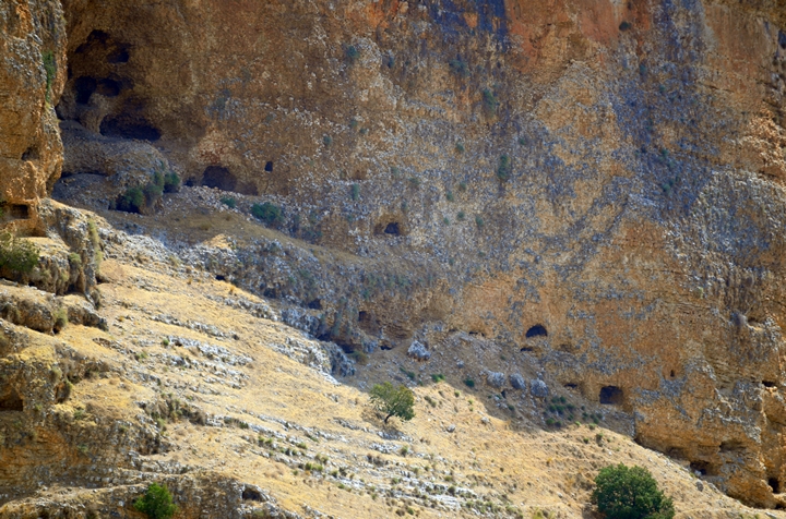
Akhbara was a Roman period village, fortified by Josephus Flavius. An impressive 100m high cliff (“the Rock of Akhbara”) soars above the valley, dotted with caves.
* Site of the Month Aug 2019 *
Home > Sites > Upper Galilee > East > Akhbara
Contents:
Overview
Location
History
Photos
* Aerial
* Rock of Akhbara
* Eastern area
Etymology
Links
Overview:
Akhbara was a Roman period village in the Upper Galilee area, 3km south of Zefat. An impressive 100m high cliff (“the Rock of Akhbara”) soars above the valley, dotted with caves. It was one of the villages that were fortified by Josephus Flavius in the wake of the great revolt against the Romans.
Location and map:
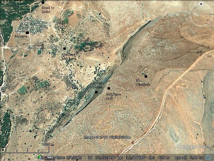
This aerial map indicates the major points of interest around the site. The site is located to the south of the city of Zefat. Access to the ancient site and to the panoramic view of the cliff is from the south east side of the village.
History:
- Earlier periods
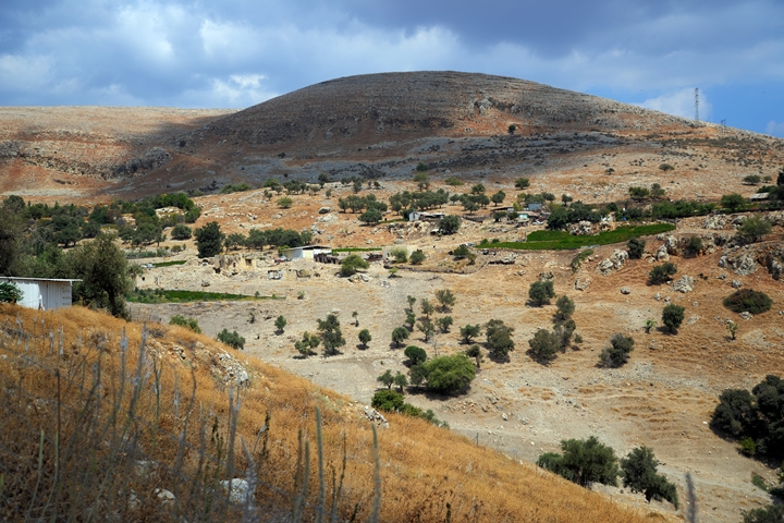
According to the pottery surveyed in the site, the settlement was established on the steep hill west of the valley during the Iron Age. The farming village centered around the spring of Ein Akhbrara.
- Roman period
Akhbara was fortified during the great revolt against the Romans by Josephus Flavius (66 AD). Josephus, the commander turned historian, wrote about his fortification (Wars 2, 20:6): “Josephus … he built walls about the caves near the lake of Gennesar, which places lay in the Lower Galilee; the same he did to the places of Upper Galilee, as well as to the rock called the Rock of the Achabari”.
After the war, a Jewish village existed here near the spring of Ein Akhbara, and was famous of the rabbis who taught here and buried in the caves. Akhbara is mentioned in rabbinic literature on the writings and activities of sages during the late Roman period, most notably R. Yannai who founded and headed a Beit Midrash (house of learning) here. The Jewish village continued until the Middle Ages.
-
Byzantine period
The Madaba map, a 6th century mosaic floor in a Jordanian church, illustrates major sites in the Holy Land during that period. A small section of the map depicts Akhbara as an icon and bearing a section of the Greek name (‘ΑΓΒΑΡ…’ – Akhbar(a)).
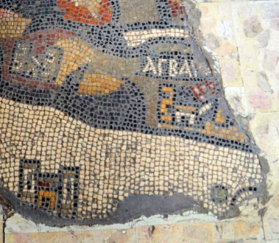
The location of the site is indicated on the Biblical map by a red square.
Roads and cities during the Israelite period thru the Roman periods (based on Bible Mapper 3.0)
- Ottoman period (16th-20th century)
The area was examined in the Palestine Exploration Foundation (PEF) survey (1866-1877) by Wilson, Conder and Kitchener.
A section of their map is shown here. The site is near the Arab village named here “‘Akbara”, which preserved the ancient name.
Part of map sheet 4 of Survey of Western Palestine, by Conder and Kitchener, 1872-1877.
(Published 1880, reprinted by LifeintheHolyLand.com)
The surveyors wrote about the state of the village at that time (Volume 1, p. 196):
“Akbara – A small village, built of mud and stone, containing about ninety Moslems. Products, olives and figs. Perennial stream in wady close by”.
Their report adds (p. 205):
“Akbara = Achbara: This is the place called by Josephus ‘rock of Achabara,’ which was fortified by him daring the insurrection of the Jews. He also calls it Achabare. It is mentioned (Carmoly ‘Itineraires,’ 185) as the burial place of Rabbi Nehurai, Rabbi Jannai, and Rabbi Dostai”
The archaeological remains are described in p. 235:
“Kh.’Akbara – Large ruin; traces of foundations of walls ;medium-sized stones scattered. ‘The remains of an ancient town. At every step one comes upon vestiges of numerous small houses formerly built of cut stones of medium size not cemented.
There are also the remains of a more considerable edifice, which seems to have been ornamented by columns, for one shaft, now mutilated, lies beside the place where it once rose. About twenty cisterns cut in the rock are scattered about. A circular pool is now half filled up.
Josephus mentions a fortified town named Achabara (‘Wars of the Jews,’ II. xx 6), but this is not the Khurbet Akbara, but the place also retaining its ancient name in the modern form Akbara, about two miles south of Safed in this sheet.”.
- Identification
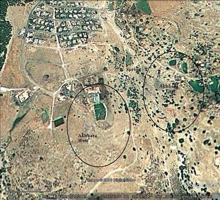
It is difficult to find the exact location of the Roman and Byzantine village. According to the detailed article by Uzi Liebner, the ancient sites of Roman and Byzantine village are located in 2 areas (see map below):
-
‘Akhbara-West’ on the hill south of the mosque (area of 10 Dunams/1 hectare). This hill is steep and may have been fortified by Josephus.
-
‘Akhbara-East’ across the valley and south east of the spring (30 Dunams/3 hectares in area). The ruins of the Roman period synagogue were identified in the center of the East area, next to the spring.
According to surveys, the pottery on both areas can be dated to the Iron age, Persian/Hellenistic, Roman-Byzantine and Crusader/Mameluke/Ottoman periods. The settlement started on the western hill and then expanded to the eastern area. The majority of ceramics are dated to the Late Roman period in both areas. During the Byzantine period the settlement remained only on the western hill. It then thinned during the 1st half of the 6th century AD.
As for the fortifications of Josephus, scholars debate whether the site was on the cliff itself above the caves (‘the Rock of Akhbara’), or on the hill in Akhbara-West.
- Modern Period
The old Arab village of ‘Akbara was blown up and destroyed during the 1948 independence war. Today, a modern Arab village bearing the same name – ‘Akbara – is located here in a newly built area. It was built in the 1980s about 0.5 km north-west of the ruins of the old Arab village.
Photos
Aerial view:
A drone view of the rock of Akhbara was captured by the drone. The 100m high cliff soars above the valley of Nahal Akhbara, which joins the valley of Nahal Amud, ending in the Sea of Galilee seen here in the top left corner.
Click on the photos to view in higher resolution…
A closer view of the cliff, which was fortified by Josephus. Dozens of caves dot the southern edge of the cliff, where tombs of rabbis were laid to rest.
The small modern Arab village of ‘Akbara is situated north west of the cliff. On its south side is the golden dome of the mosque. Behind, in the far background, is the large bridge that crosses the valley. Above it are the southern neighborhoods of Zefat.
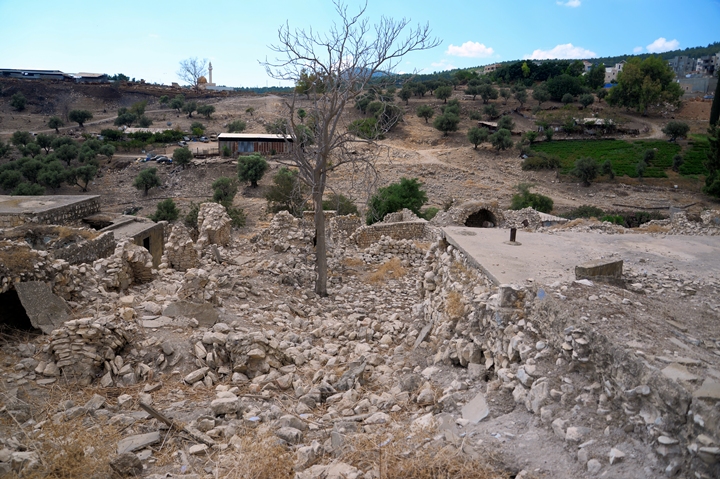
To the south east of the Arab village are remains of the old Arab village and the scattered ruins of the ancient Roman village.
![]() The following YouTube video shows a flight of a drone around the site. The drone first flies over the edge of the village and the spring of Ein Akhbara. It then turns south towards the “Rock of Akhbara”. The Sea of Galilee is seen in the far background.
The following YouTube video shows a flight of a drone around the site. The drone first flies over the edge of the village and the spring of Ein Akhbara. It then turns south towards the “Rock of Akhbara”. The Sea of Galilee is seen in the far background.
The next sections show views from the ground level.
Rock of Akhbara:
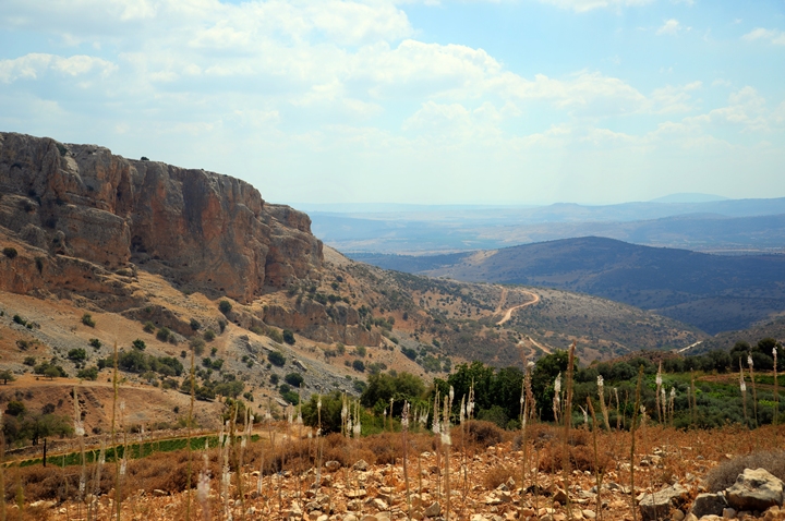
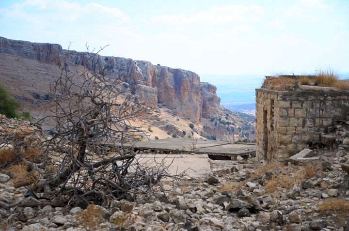
From the foothills of the west hill is a great panoramic view of the area. The cliffs of the Rock of Akhbara rise above the valley.
Along the foothills are hundreds of Squill flowers (Hebrew: Hazav). The squill flowers at the end of the summer, signaling the beginning of the Autumn season. Their bulbs hold the ground firmly and are useful as markers. The squills are found in many ancient sites, as the bulbs were used to mark the boundaries between houses and lots. A legend has that Joshua used the squill bulbs to mark the borders between the tribes.
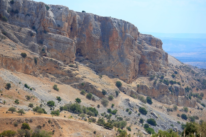
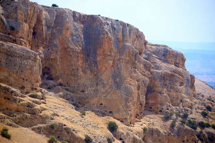
A closer view of the cliff is next. It is dotted with dozens of holes and caves. Birds nest in the cavities and there is a constant buzz of birds flying in and out of their nests.
A closer view of the impressive cliff:
Inside one of the largest cave are tombs of several famous sages.
Eastern area Ruins:
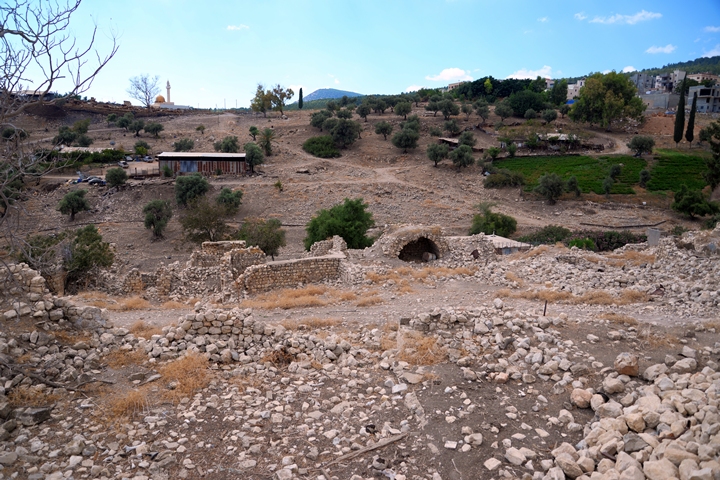
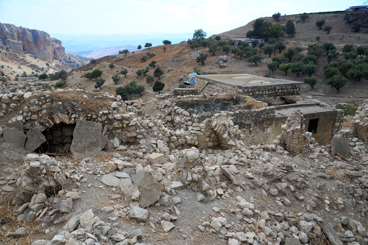
The ruins of the Roman period village are spread on both sides of the spring of Ein Akhbara. This photo is a view from the west hill towards the eastern area, with the spring inside the valley.
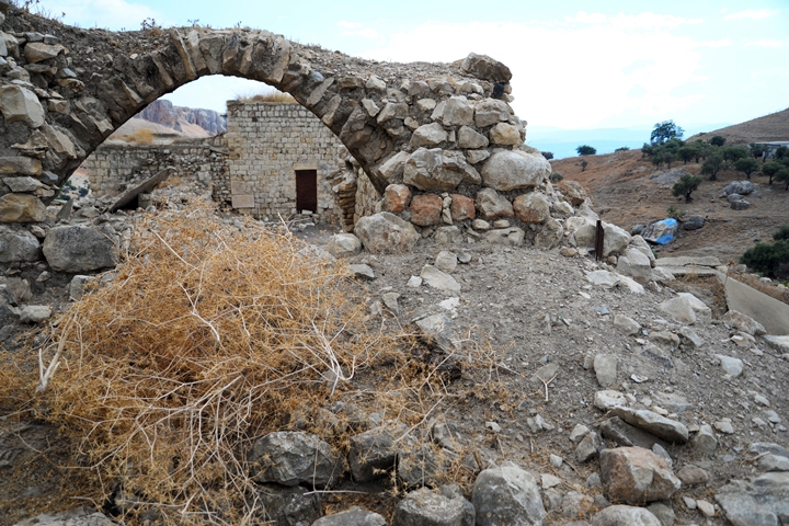
On the east side of the valley are scattered ruins of structures. These were the old buildings of the Arab village that were blown up during the Independence war. The ruins were built over the structures of the Roman village, reusing some of the stones.
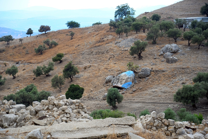
Inside the valley of Nahal Akhbara is a painted rock. The turquoise color signals a holy Jewish place – a marker for the tombs of 3 sages of ancient Israel – R. Yannai of Akhbara (3rd century sage), R. Nehorai (2nd century AD) and R. Dostai Bar Yannai. A sign is located on the large rock, naming the 3 sages.
The marker replaces an actual tomb, as their actual resting place is not known. Religious Jews come to the place to pray and honor the great sages and read from their writings.
The following photos captured views of the ruins.
Etymology (behind the name):
* Names of the place
-
Akhbara, Akhbarin – Hebrew name, perhaps based on the Hebrew word Akhbar – mouse.
-
Rock of the Achabari – listed as one of the fortified villages by Josephus Flavius
-
‘Akbara – name of the modern Arab village, which preserved the ancient name
Links:
* External sites:
-
Settlement and History in Hellenistic, Roman, and Byzantine Galilee: Uzi Liebner, pp.106-116
-
R. Nahorai marker in Akhbara (Hebrew)
* Nearby sites:
* BibleWalks links:
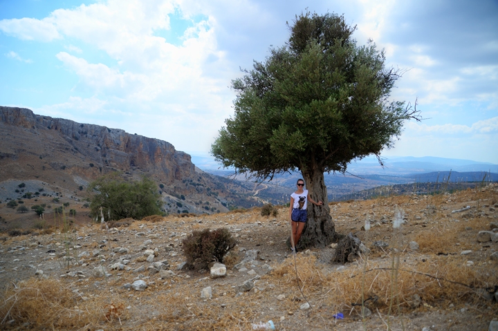
Amit posing under the olive tree. This place offers one of the most impressive views in the Upper Galilee.
BibleWalks.com – Views of the Holy Land
Tel Nes<<<–previous site—<<<All Sites>>>—next Upper Galilee site—>>> Horvat Zunam
This page was last updated on March 30, 2019
Sponsored links:
