Maritime Yavne was the ancient port city of Yavne (Jamnia), situated south of the stream mouth of Nahal sorek.
Home > Sites > Shefela > Yavne Yam (Maritime Yavne)
Contents:
Background
Location
Biblical Map
History
Photos
* Public beach
* West walls
* South headland
* K. Dubbeh
* Port
* South Beach
* Panorama
Biblical
Links
Background:
Yavne-Yam, Hebrew for “Yavne on the Sea”, was the ancient port of Yavne (Jamnia).
This port city is situated on a natural bay south of the stream mouth of Nahal Sorek, near Kibbutz Palmachim. The port existed from the second millennium B.C. (Middle and Late Bronze ages), and continued until the 12th C A.D.
The site is covered under the sand, and some of its ruins were excavated. It is part of a national park with a popular public beach.
(2 Maccabees 12 9):” (Judas) … attacked the people of Jamnia by night and set fire to the harbor and the fleet”.
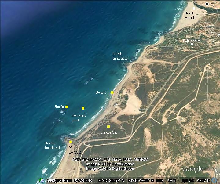
Aerial Map:
An aerial view of the site is seen here, with an indication of the major points of interest.
Biblical Map:
This map, illustrating the greater area of the site, indicates the roads and sites during the Biblical period (Iron age period until the Roman period). The port of Jamnia is located south of the Sorek outlet, and is marked by a small yellow circle near the shore. The inland city of Yabne (marked here as “Jabneh” and “Jamnia” near a small red marker) is 7KM southeast of the port. The city is situated along the coastal road (“Via Maris”), near the crossing of the Sorek stream (Nahr Rubin).
Map of the area around Yavne (based on Bible Mapper 3.0)
History:
-
Bronze age
The site was first settled during the Middle Bronze age (2nd millennium B.C.) . Its natural anchorage place, protected by reefs on the west side, and two headlands on the north and south side of the bay, made it a perfect place for a harbor. The underwater surveys found evidence that the naval activities were conducted here from the Late Bronze age until the middle ages. It was the only anchorage along the coast between Sinai and Jaffa that provided shelter for the ships. Along the 188km long coast of Israel are few places that could provide natural shelter, and therefore this was a safe haven for the ancient seafarers, and the basis for the establishment of the city of Yavne-Yam.
-
Biblical period – Iron age
Yavne was one of the cities in the region of Judah, after the Israelite conquest of the Land of Israel in the 13th Century B.C. The Bible names it as Yavneel (“God will build”), or Javneel in the KJV version (Joshua 15:11): “And the border went out unto the side of Ekron northward: and the border was drawn to Shicron, and passed along to mount Baalah, and went out unto Jabneel; and the goings out of the border were at the sea“. This verse implies that the port city was included in the region of the Israelites, as it gave an access to the Mediterranean sea.
A monumental building, dated to the 7th C B.C., was excavated in the city. South of the city are remains a fortress called Mezad Hashavyahu, where a Israelite period fortress was excavated. In its ruins an interesting 7th C B.C. Ostracon has been found by the excavators. The Ostracon, piece of pottery with Hebrew letters inscribed with ink, naming Hashavyahu who apparently was a clerk of the fortress’s commander. The time of its writing may have been during the reign of the Judean King Josiah (628 to 609BC). Josiah seized the moment of the fall of the Assyrian empire, and expanded the Kingdom until Ashdod (2 Kings 23 8): “And he brought all the priests out of the cities of Judah, and defiled the high places where the priests had burned incense, from Geba to Beersheba”. The area Josiah seized probably included Yavne and its port.
-
Persian period (538 – 332 B.C.)
The main archaeological evidence, revealed by the excavations held in Yavne-Yam, dated to the Persian period (6th century B.C.) until the middle ages (11th century A.D.). The port city was controlled by the Phoenicians of Tyre and Sidon, who provided maritime services to the Persians.
-
Hellenistic period (4th C – 2nd C B.C.)
The archaeological findings showed a continued use of the harbor during the Hellenistic period. The city was renamed Yamnia (Jamnia). The peak period was in the 2nd century B.C. The archaeological excavations revealed evidence of the Hellenization of the city.
-
Maccabee revolt (163 B.C.)
The Maccabees headed the anti-Hellenization rebellion against the Greek Seleucids who controlled the land of Israel during the second half of Hellenistic period (4th- 1st century BC). After a series of successful military campaigns they took control of Judea, liberated the land and created an independent Jewish country, known as the Hasmonean Kingdom (164 BC to 63 BC as independent state, and 63-37 BC as rulers under Rome).
Both ports of Yavne-Yam and Jaffa were important goals in Judas campaign to seize the coast region from the Seleucids.
The port city of Yamnia (or Jamnia), the Greek Yavne, is mentioned in context with the attack on the harbor city by Judas Maccabaeus – the leader of the revolt against the Seleucid empire (167-161BC) – who protected the Jewish residents of Jamnia:
(2 Maccabees 12 9): “But learning that the men in Jamnia meant in the same way to wipe out the Jews who were living among them, he attacked the people of Jamnia by night and set fire to the harbor and the fleet, so that the glow of the light was seen in Jerusalem, thirty miles distant”.
The archaeological excavations revealed a destruction level at the end of the 2nd, perhaps at a later date – during the days of Maccabee leader John Hyrcanus (134-104) or King Alexander Jannaeus (103-76), who conquered Jamnia.
-
Roman – (1st century B.C. to 3rd century A.D.)
Few Roman remains were found in the excavations.
-
Byzantine period (4th – 7th century A.D.)
During the Byzantine period, the inland Yavne was a Christian city, but also populated by Jews and Samaritans. The port city witnessed a prosperous period. Monumental buildings were excavated north east of the southern headland (Areas “B” and “A”), including fine mosaic pavements, water installations and drainage channels. In other areas the archaeologists found industrial installations, buildings and funerary cave.
Yavne/Jamnia appears in the Madaba map with the title: “Yavneel which is also Jamnia”. Jamnia also appears on the the Peutinger Map (Tabula Peutingeriana), an indication it is an important station. See the Tel Yavne site for more information.
The site was also named in Aramaic “Mehoz Yavneh”, which means harbor.
-
Early Islamic and Crusaders (7th – 13th century A.D.)
The city was conquered in 634 by the Arabs, who controlled the town until the first Crusade (1099). Its port was named Mahuz Yibna, meaning in Arabic: harbor of Yavne. The city was intensively occupied, and centered on the southern headland (Area “C”). Its existence was documented by several Islamic sources.
The city eventually decayed at the end of the Crusaders period, and was covered by sand in the 12th century. Its existence is known since then, appearing in maps and reports of travelers.
-
Ottoman Period – (1516-1918 A.D.)
The area of Yavne Yam was examined in the Palestine Exploration Foundation (PEF) survey (1866-1877) by Wilson, Conder and Kitchener. They correctly identified the harbor of Yavne Yam at the place called “Minet Rubin” (in Survey of Western Palestine, sheet XVI, p. 443): “The port of Yebnah is at Minet Rubin”.
Part of map sheets 13 & 16 of Survey of Western Palestine,
by Conder and Kitchener, 1872-1877.
(Published 1880, reprinted by LifeintheHolyLand.com)
The surveyor’s report of 1875 (in Survey of Western Palestine, sheet XIII pp. 264, 265,268-269) includes the following points of interest:
Minet Rubin: “The ancient harbour of Jamnia, situated immediately south of Nahr Rubin. The port seems to have been double, and entered by narrow passages, as at Tyre and Jaffa. The northern bay is some 400 paces across (north and south), flanked with a rocky promontory on either side. The southern bay is larger, and on the promontory south of it are the ruins of ed Dubbeh. A large reef is visible outside, beneath the water. An isolated rock stands opposite the central promontory. The beach slopes gently, and low sandhills flank it, except at the point, where are the caves called Ed Dekakin, where is a sandy cliff some 10 feet to 20 feet ; other cliffs appear to the north. There are signs of former cultivation, for vines and a few mulberry trees are growing wild in the sand, which cannot probably be very deep. Visited May 6th, 1875”.
Khurbet ed Dubbeh: “South of the Minet Rubin. This is apparently a mediaeval tower on a sandy promontory. It is levelled to the foundations. The masonry is small, set in cement. There are several cisterns, with domed roofs of rubble set in a reddish cement. Shells are used in the mortar”.
Ed Dekakin – “Ancient tombs in the rock,close to the shore. The northern is a rude cave ; the southern a kokim tomb with two entrances. The chamber is 15 feet square, the kokim 2 feet 2 inches broad, 6 feet long, three at the back, three on the right, two on the left. The third koka, near the door on the left, is made into a sort of narrow passage. South of this is a third tomb, choked with sand, the kokim not visible. A cistern exists east of the tombs. The whole cut in soft sandy limestone”.
Neby Rubin – “A chapel in a courtyard, full of very fine mulberry trees. It is mentioned by Mejr ed Din in 1495 as a place of pilgrimage”.
-
Modern times
In 1949 a Kibbutz was established on the north side of Yavne-Yam, called Palmachim (named after the elite force Palmach). An archaeological museum is located in the Kibbutz, with a display of the findings from the site.
Archaeological excavations (conducted 1967-1969, 1992+) and underwater archaeology surveys (since 1980) were conducted in Yavne Yam.
The site is part of a national park and public beach, which cover an area of 221 Dunam (22 Hectares). We recommend to visit the site, enjoy the sandy beach, and also walk along the bank of the Sorek stream, and visit the tomb of Reuben.
Photos:
(a) Public Beach:
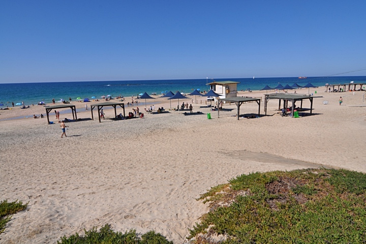
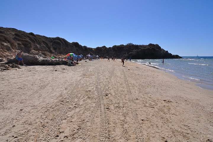
The public beach of Yavne Yam, south of Kibbutz Palmachim, attracts residents of Rishon Lezion and the area. The sandy beach, as well as the nearby ruins of the ancient port city, are all part of the Palmachim National park.
Click on the photos to view in higher resolution…
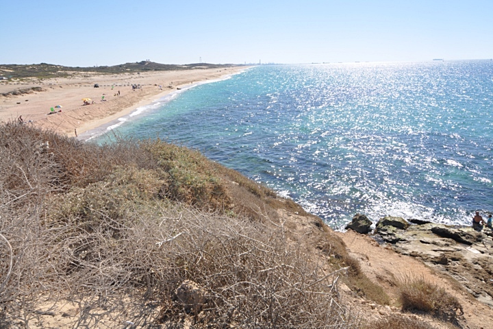
The beach stretches between the south and north headland.
Close to the water is the edge of the ruined city, seen below on the right side of this view (looking north). Some parts of the city were excavated, but it is all covered by sand.
(b) West walls:
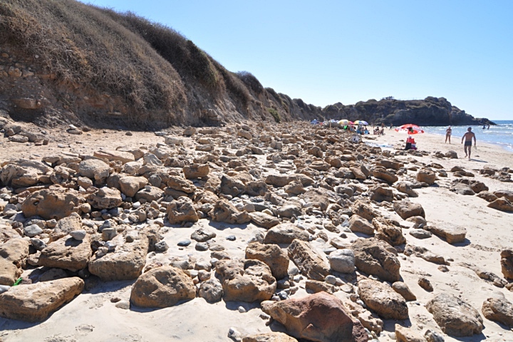
The south side of the beach ends at the south headland. In order to cross it to another beach behind it, you will need to walk along the trail on top of the ridge on the left side. The trail leads from the parking lot, traverses the ruins of the city, and reaches the headland.
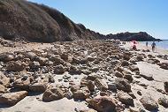
The western edge of the ancient city borders with the beach. Sections of the walls, made of sandstone bricks, have fallen unto the sand, as in the following picture. You can notice, on the bottom of the hill on the left side, traces of the ruined city wall.
(c) South Headland:
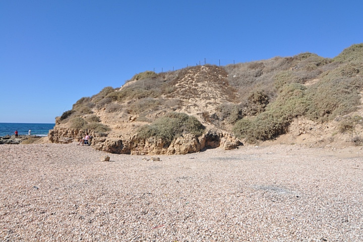
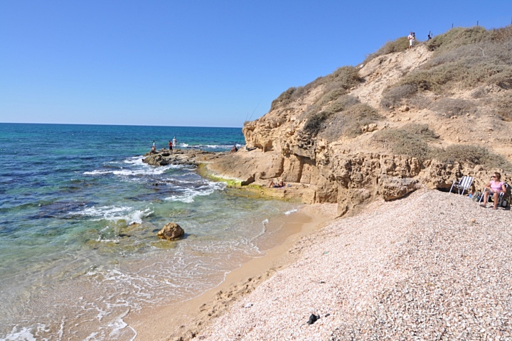
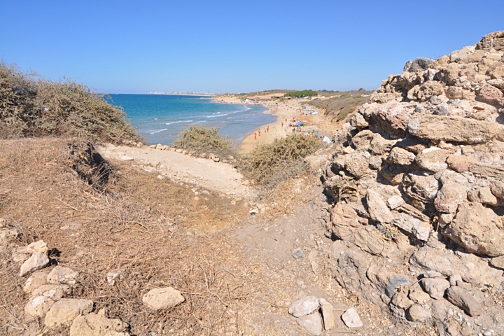
The definition of a headland is “high point of land that extends into the water”. The bay of Yavne lies between two headlands. The south one is seen here from the south side.
The Kurkar (sandstone) hill is 9m high above the sea. On top of it are ruins of an early Muslim period fortress.
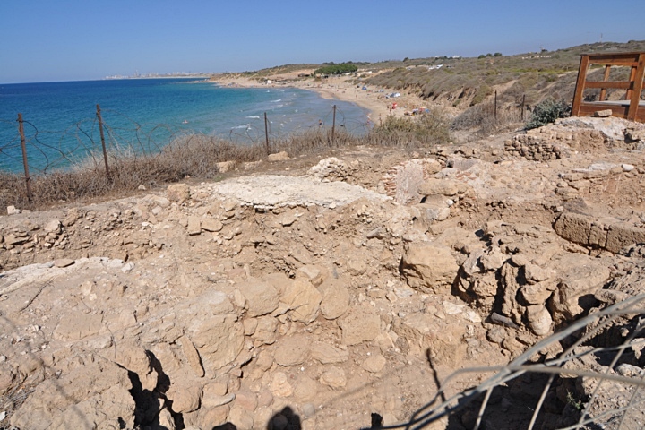
From the headland is a view of the bay and the beach.
(d) Kh. Dubbeh:
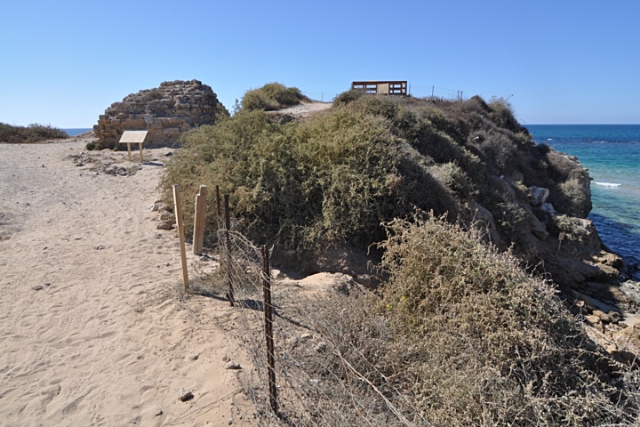
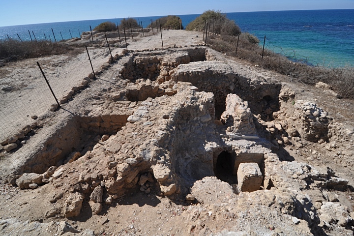
On top of the south headland are some of the ruins of the city of Yavne Yam. This section is called by the Arabs as “Khurbet Dubbeh”.
The visible ruins are of the early Muslim period. The fortress, now leveled to its foundations, existed until the arrival of the Crusaders in the 12th Century.
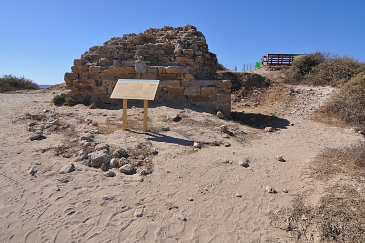
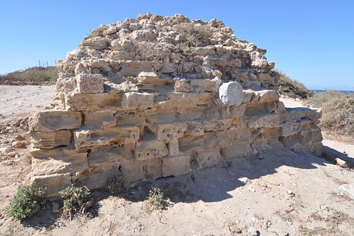
Remains of a tower are seen on the entrance. Behind it are remains of the wall that once surrounded the hill.
The tower is built with dressed stones on the outside, filled with construction waste and plaster. The spaces between the dressed stones were filled with plaster and seashells mixed with sand.
Remains of a bathhouse, dated to the Early Islamic period, are located past the tower. Its design is in the form of a Roman bathhouse: A hot room with an oven, lower and upper floors, clay pipes through which the hot air flowed along the walls, small feeder pools and drainage channels.
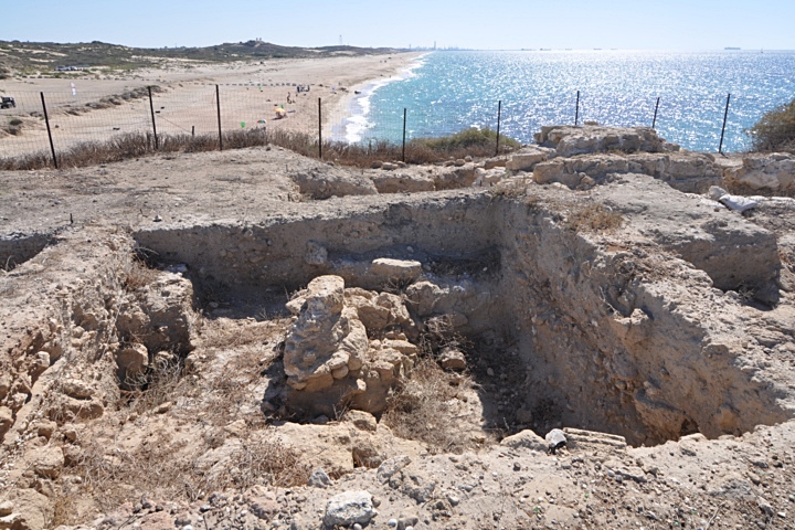
A view from the ruins of the bathhouse towards the north is seen in the following photo. The port was located in the bay, seen here in the background.
Another section of the excavations of the ruined fortress is seen below. Behind, a section of the wall that surrounded the headland.
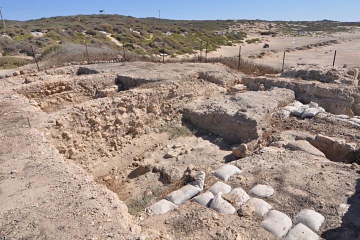
The next picture shows another section on the southeast side. In the background is a low Kurkar sandstone hill, which today is out of limits to the public.
On a low hill, at the right edge of the photo, are remains of a fortress called Mezad Hashavyahu, where a Israelite period fortress was excavated.
(e) Port:
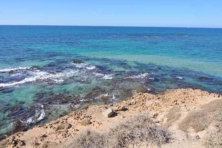
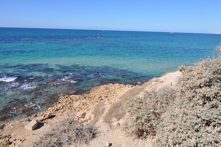
The ancient port of Yavne-Yam was located between the headlands, located inside a natural formed bay. This picture is from the south end towards the north. An offshore kurkar sandstone reef, partially submerged, runs parallel to the shoreline. It provided shelter for the anchorage of the small ships during antiquity. Some of its sections are man-made improvements.
A description of the plan of the port is found in the SWP report of 1875: “”The ancient harbour of Jamnia, situated immediately south of Nahr Rubin. The port seems to have been double, and entered by narrow passages, as at Tyre and Jaffa. The northern bay is some 400 paces across (north and south), flanked with a rocky promontory on either side. The southern bay is larger, and on the promontory south of it are the ruins of ed Dubbeh. A large reef is visible outside, beneath the water. An isolated rock stands opposite the central promontory”.
(f) South – “Shell beach”:
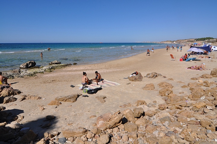
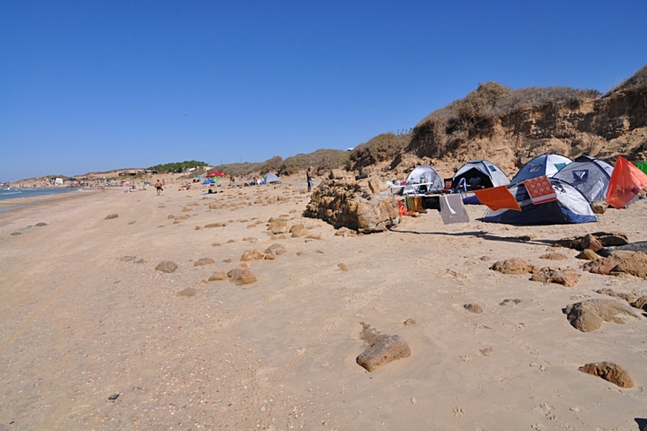
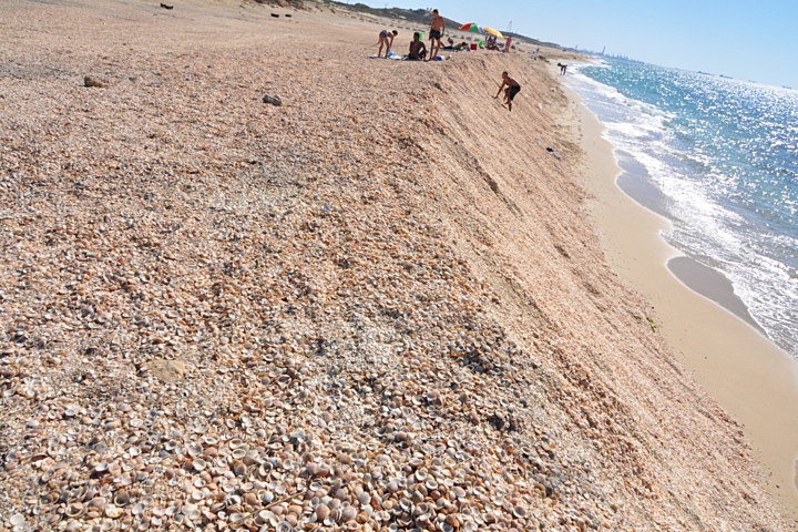
On the south side of Yavne-Yam is another, unofficial, beach. In the far background are the towers and cranes of the port of Ashdod – a modern version of the ancient port.
The section near the south headland is a high pile of shells. Tons of them. We haven’t seen such a wall of shells along the coast of Israel, but then – Yavne Yam is a special place…
(g) Panoramic view:
A panoramic view, as seen from the south headland, is shown in the following picture. If you press on it, a panoramic viewer will pop up. Hot spots indicate the major points of interest. Using this flash-based panoramic viewer, you can move around and zoom in and out. You can also view in full screen mode, by pressing the right button on the viewer. Then just relax, listen to the music and surf the waves.
To open the viewer, simply click on the photo below. It opens a new window, and will run after a minute or so.
Etymology (behind the name):
* Yavne Yam:
- Yavne’el (Jabneel) – Hebrew: “God will build”. Biblical reference: (Joshua 15:11): “And the border went out … unto Jabneel”.
- Yebnah, Yibna – Name of the Arab town (ruined in 1948), which preserved the ancient name
- Mahuz Yibna – Arabic: harbor of Yavne. Name used during the Arab period.
- Mehoz Yavneh – Aramaic name of the port city, during the Byzantine period.
- Palmachim – nearby Kibbutz. Hebrew: Palmach (initials of the elite fighting force 1941-1948), Yam – Sea.
- Minet Rubin -harbor of Rubin. Rubin is Reuben – son of Jacob, whose traditional tomb is located on the south side of Sorek stream, near Yavne Yam.
- Khurbet ed Dubbeh – Arabic: the castle of the sand dune. Located on the south side of the harbor.
- Ed Dekakin – Arabic: the “stores”, since the tombs look like stores. Located on the north side of the harbor.
* Sorek:
- Sorek – Hebrew name of the stream that passes on the east side of Yavneh. Biblical references: A single Biblical verse refers to Sorek, describing the area where Samson operated (Judges 16 4): “And it came to pass afterward, that he loved a woman in the valley of Sorek, whose name was Delilah”. Sorek is a Biblical form of a reddish color and also a type of grape used to make red wine. In the following verse the Hebrew word for vine is Sorek (Isaiah 5 2): “And he fenced it, and gathered out the stones thereof, and planted it with the choicest vine, and built a tower in the midst of it, and also made a winepress therein: and he looked that it should bring forth grapes, and it brought forth wild grapes”. The word Sorek is used for the red color (Zechariah 1 8): “I saw by night, and behold a man riding upon a red horse, and he stood among the myrtle trees that were in the bottom; and behind him were there red horses, speckled, and white.
- Nahr Rubin – Arabic name of Sorek stream. Nahr – river; Rubin – Reuben , son of Jacob, whose traditional tomb (Neby Rubin) is located , near Yavne Yam.
- Neby Rubin – Arabic: prophet Reuben. The name of his traditional tomb.
Links:
* Archaeology:
- Yavneh Yam project (Tel Aviv University)
- Underwater Archaeology – Yavne-Yam anchorage (IAA)
* Other:
- Yavne – BibleWalks review of the ancient inland city\
BibleWalks.com – tour the Land with a Bible in the hand
Tel Yavne <<–previous site—<<< All Sites>>>–next Shefela site—>>> Gaza
This page was last updated on Aug 3, 2014
Sponsored links:
