Remains of an ancient multi-period port city, north of the ford of Nahal Alexander river.
Home > Sites > Sharon > Tel Michmoret
Contents:
Overview
Location
History
Photos
* Aerial views
* River mouth
* Trail
* Structures
* Sea front
* Bay
* North of Bay
* Tel Girrit
* Nahal Alexander
Etymology
Links
Overview:
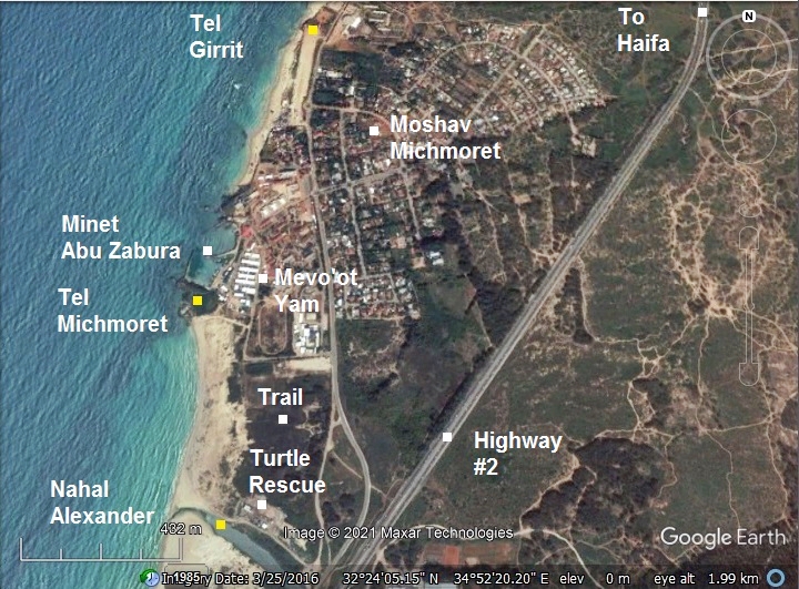
Tel Michmoret (also: Mikhmoret) is a small archaeological mound, south of Moshav Michmoret in the Sharon. It was settled starting from the Late Bronze period, during the Iron Age and until the Mameluke period. The site served as a port, with its natural anchorage place located on the north side of the mound. Another section of the settlement was on Tel Girrit, a hill 800m north of the bay.
The site is located 600m north of the ford of Alexander river (Nahr Iskanderuneh). In the 19th century the river was used to float watermelons on rafts that were grown in the Sharon region, then export them to Lebanon and Egypt thru the port in the bay (“Minet Abu Zabura”, named after Iskender (Alexander) Abu Zabura – the merchant and land owner). The bay is used today by the marine youth school Mevo’ot Yam.
Location:
The aerial map shows the location of the site, indicating the highlights of the area. Tel Michmoret is a small hill along the shore, west of Mevo’ot Yam. On its north side is the port’s bay (named Minet Abu Zabura in Ottoman period). Another ancient city is located north – Tel Girrit.
The ford of Nahal Alexander river is on the south side. A sea turtle rescue center was constructed near the riverside.
A nature trail crosses the marsh area on the north bank, and can be used to get to Tel Michmoret.
History
- Late Bronze period
During the Middle Bronze IIA period (2000-1750 BC) the main city in the area was in nearby Hefer. It had an inland sea port along the wide Alexander river. Later, during the Late Bronze period, an alternative seaport was established in Michmoret near the ford of the river, along the coast line. This diminished the importance of Hefer as an inland sea port.
Underwater survey of the area between Tel Michmoret and the ford of the river revealed a 5m wide channel that was cut into the rock. The purpose of the channel was probably to allow an easy access from the river to the bay.
The Sharon coastal road, a major North-South longitude route, passed through the site. The advantage of this route is that the river crossing did not require a bridge, as the water flow at the mouth of Nahal Alexander was reduced by sandbars. It appears as site #86 on route I19 of Dorsey’s book “The roads and highways of ancient Israel”. This route continued throughout the ages, including up to modern period (Highway #2).
- Iron Age
During the Iron Age, after the establishment of Samaria city in the 9th century, the new port in Tel Michmoret serviced the Kingdom of Northern Israel.
- Persian-Hellenistic period (5th-1st century BC)
During the Persian and Hellenistic period (5th-1st century BC) the site continued serving as the central port of the area, operated by the Phoenicians.
The archaeologists unearthed a large public structure dated to the Persian period. The structure covered an area of several hundred square meters, and was probably the administration building of the port.
After Herod’s construction of Caesarea, this marine city lost its importance.
- Early Muslim, Crusaders (7th – 13th century AD)
The port was in use during these periods, based on anchors found in front of the bay and pottery identified on the mound.
A shipwreck was found in the sea at a depth of 14m, carrying large basalt slabs. It was dated to the Late Byzantine or Early Muslim period.
-
Mamelukes period (1250-1516 AD)
The Mameluke were Turkish prisoners who were sold to the Sultan of Egypt, trained by him and served as his palace guards. In 1250 they seized the control of Egypt, and defeated the Mongols (1260). The Mamelukes took the Sharon area in 1265.
On Tel Michmoret they built a watch tower, as part of their coastal defense line in preparation to possible Crusade invasions.
-
Ottoman period (1516-1917 AD):
Conder and Kitchener surveyed this area during the PEF Survey of Western Palestine (SWP) in 1873. A section of the survey’s map, part of Sheet 10, is shown here. The port of Michmoret is marked as Minet Abu Zabura. The coastal road passed near the site, and crossed the river at the Ford south of the port.
The surveyors described the river:
“Nahr Iskanderuneh, and is a sluggish stream some 15 yards across, with marshes on either side, in which are numerous springs, which feed the stream. The river is fordable near its mouth. This stream is called ‘the Salt River’ by Geoffrey de Vinsauf in 1191 (Itin. Ric, ch. xv.)”.
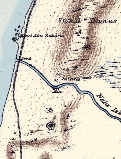
Part of Map Sheet 10 of Survey of Western Palestine,
by Conder and Kitchener, 1872-1877.
(Published 1880, reprinted by LifeintheHolyLand.com)
-
British Mandate
A 1940s British map shows the site of the port – Minet Abu Zabura – meaning the port of Abu Zabura. It is named after Iskender (Alexander) Abu Zabura – a 19th century merchant and land owner who used the river for floating watermelon on rafts to the seasonal port of Minet Abu Zabura.
South of the site is the ford of the river. Its Arabic name – Nahr Iskanderuneh – is also named after Abu Zabura.
North of the site is Tell el Jariya (Hebrew: Tel Girrit) – another location of the ancient city.
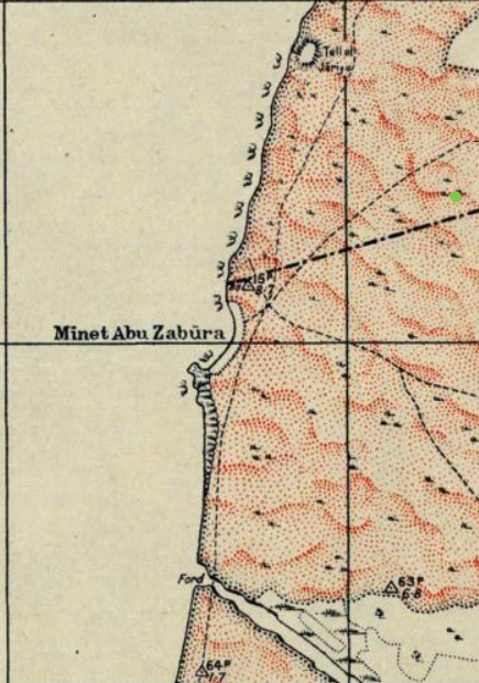
British survey map 1942-1948 – https://palopenmaps.org topo maps
License: public domain under the UK Copyright, Designs and Patent Act 1998
-
Modern period:
Moshav Michmoret was established in 1945 by Jewish veterans of the British Army. They named it Michmoret (Mikhmoret) – a large fishing net. This word appears in the Bible (Isaiah 19:8):
“The fishers also shall mourn, and all they that cast angle into the brooks shall lament, and they that spread nets upon the waters shall languish”.
Excavations were conducted by Porath et a, starting in 1978, as part of the Hefer regional project. 3 areas were opened – ‘S’ on the mound, ‘E’ in the south side of the bay, and ‘N’ on the north side of the bay.
A nature trail leads from the parking place north of Nahal Alexander. It passes thru the swamp area, and reaches to the shore south of the site. There is no access to the port as it is fenced off by the marine youth school Mevo’ot Yam.
Photos:
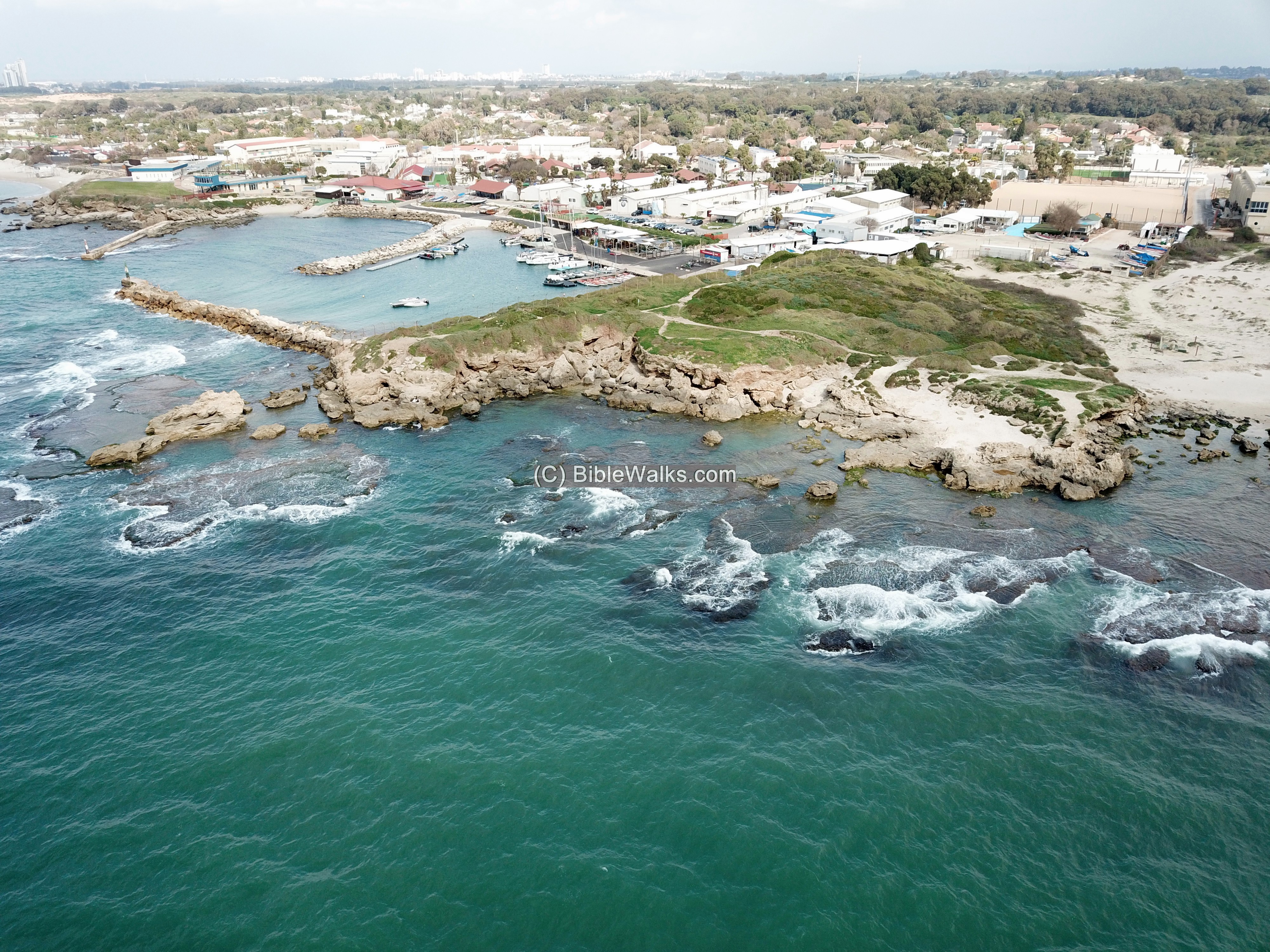
(a) Aerial views
Tel Michmoret is located on the shore, about 500m north of the ford of Nahal Alexander. To the north of the site is Moshav Michmoret.
Click on the photos to view in higher resolution…
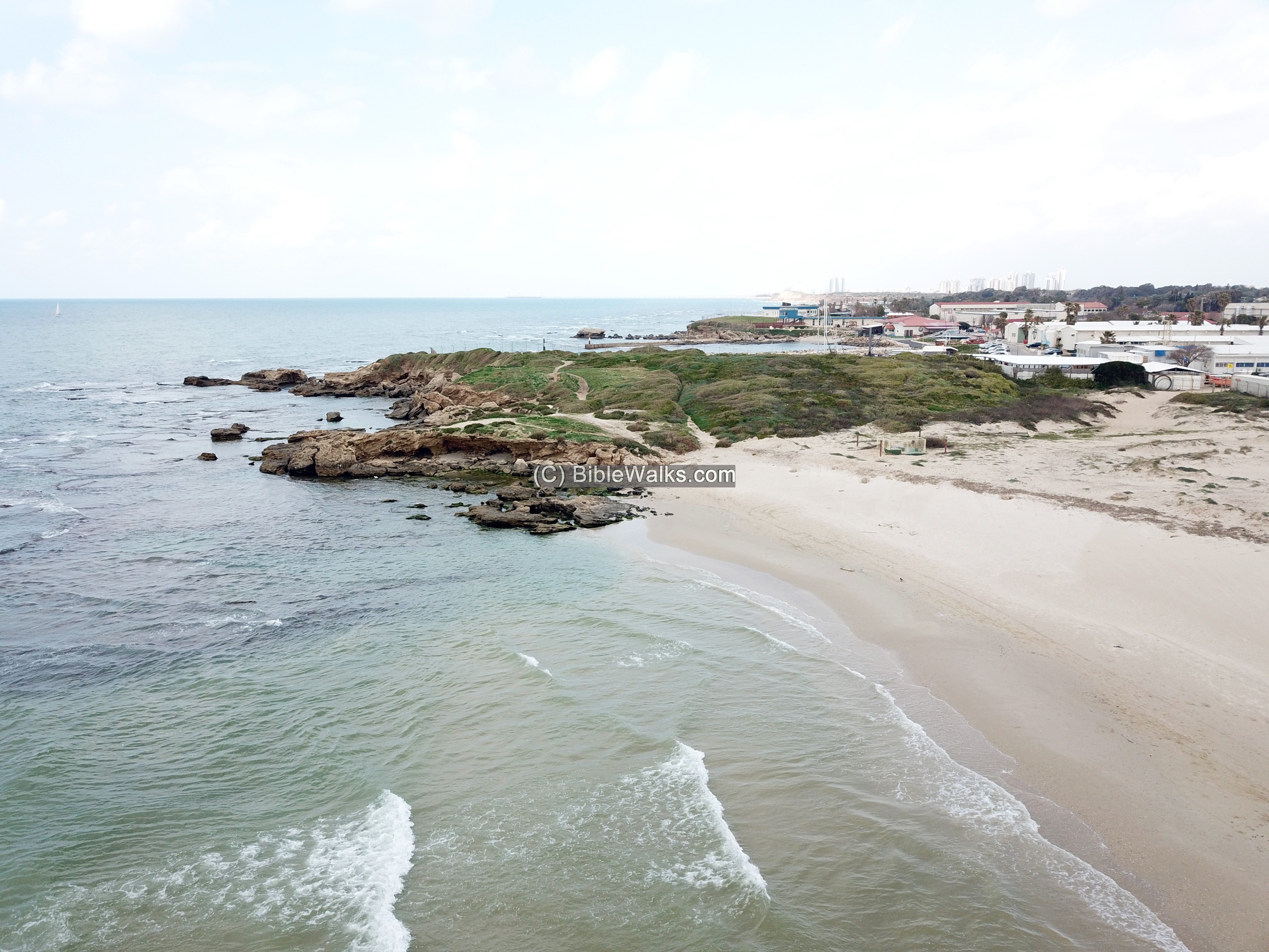
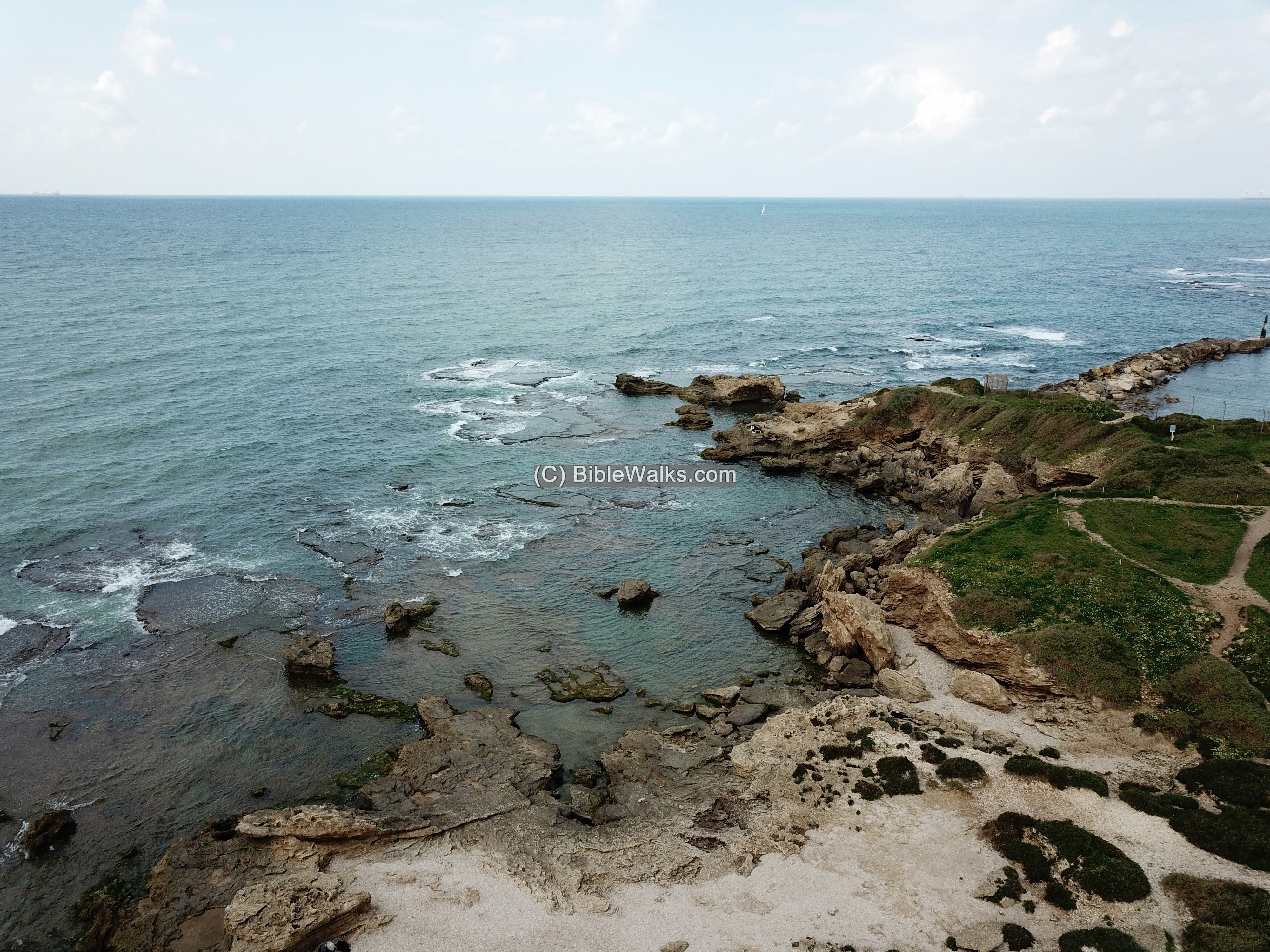
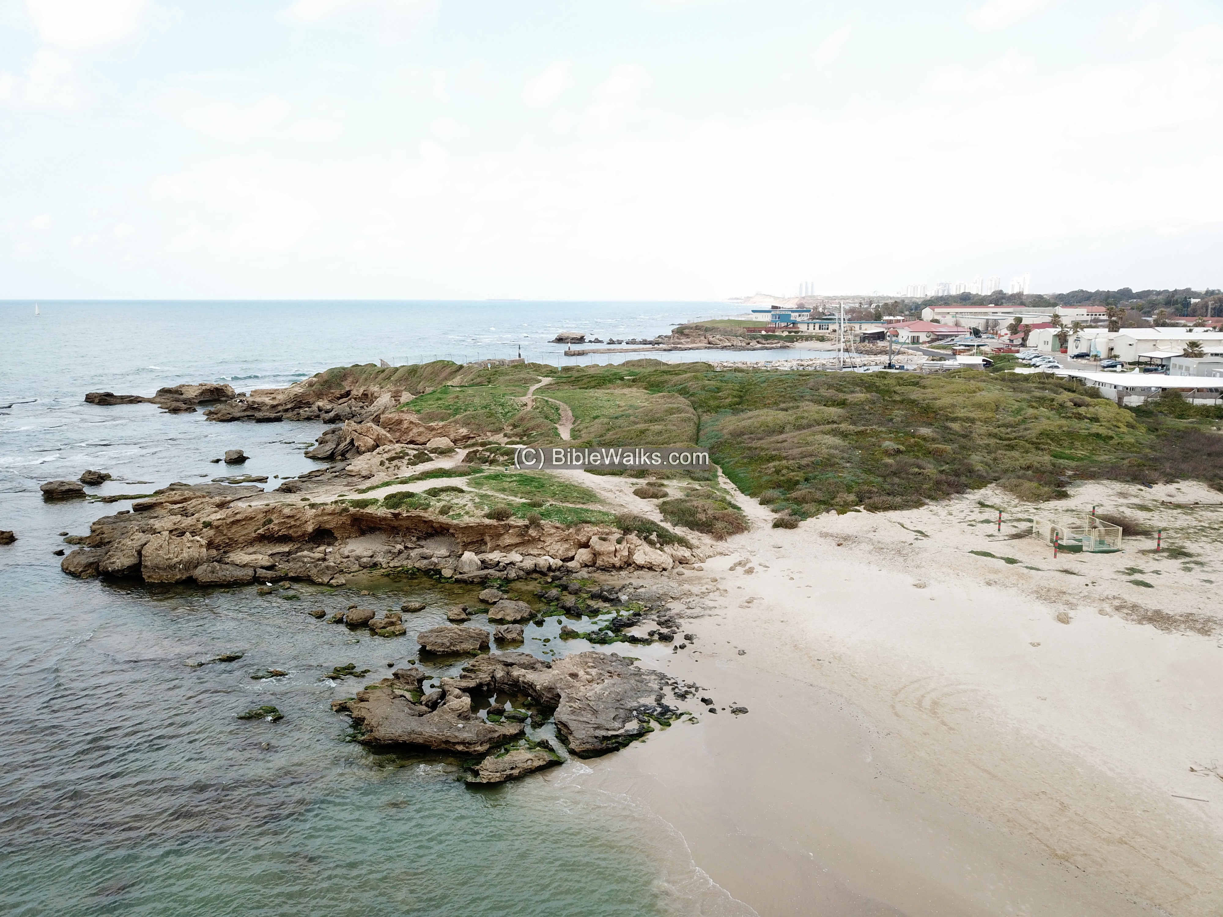
An aerial view of the mound is seen from the south west side. The mound, covered by bush, overlooks the bay on its north side. The bay was used as a port in ancient times, during the Ottoman period (Minet Abu Zabura), and in modern period (Mevo’ot Yam).
Along the sea front are sandstone rocks.On the north most side are two ancient fish ponds, now submerged. The largest pond covers an area of 13m x 13m. Both fish ponds are connected by a channel, and have an outlet to the sea.
A vertical view above the site is next.
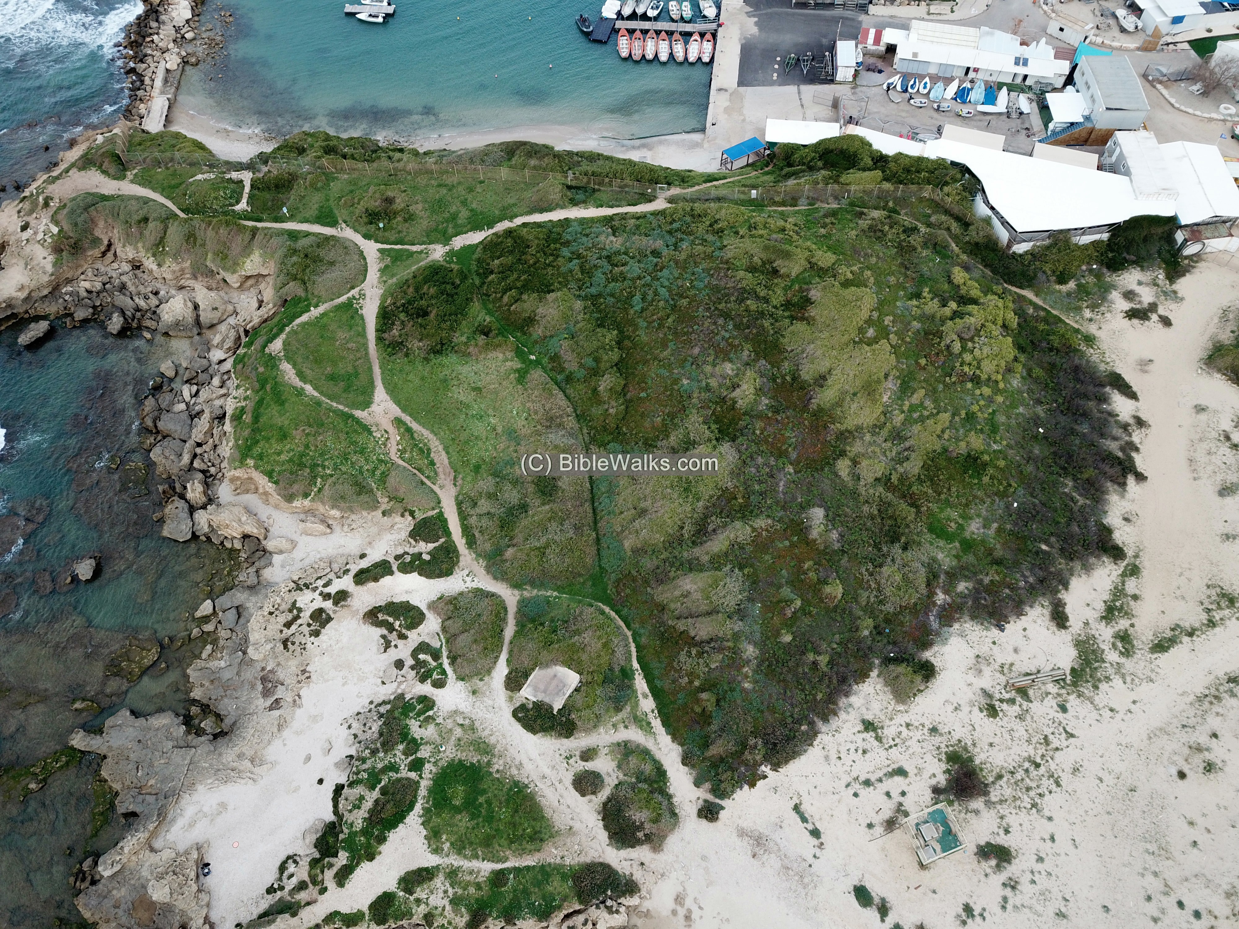
![]() The photos above, and the following Youtube video, were captured by the drone in 2021.
The photos above, and the following Youtube video, were captured by the drone in 2021.
(b) Trail
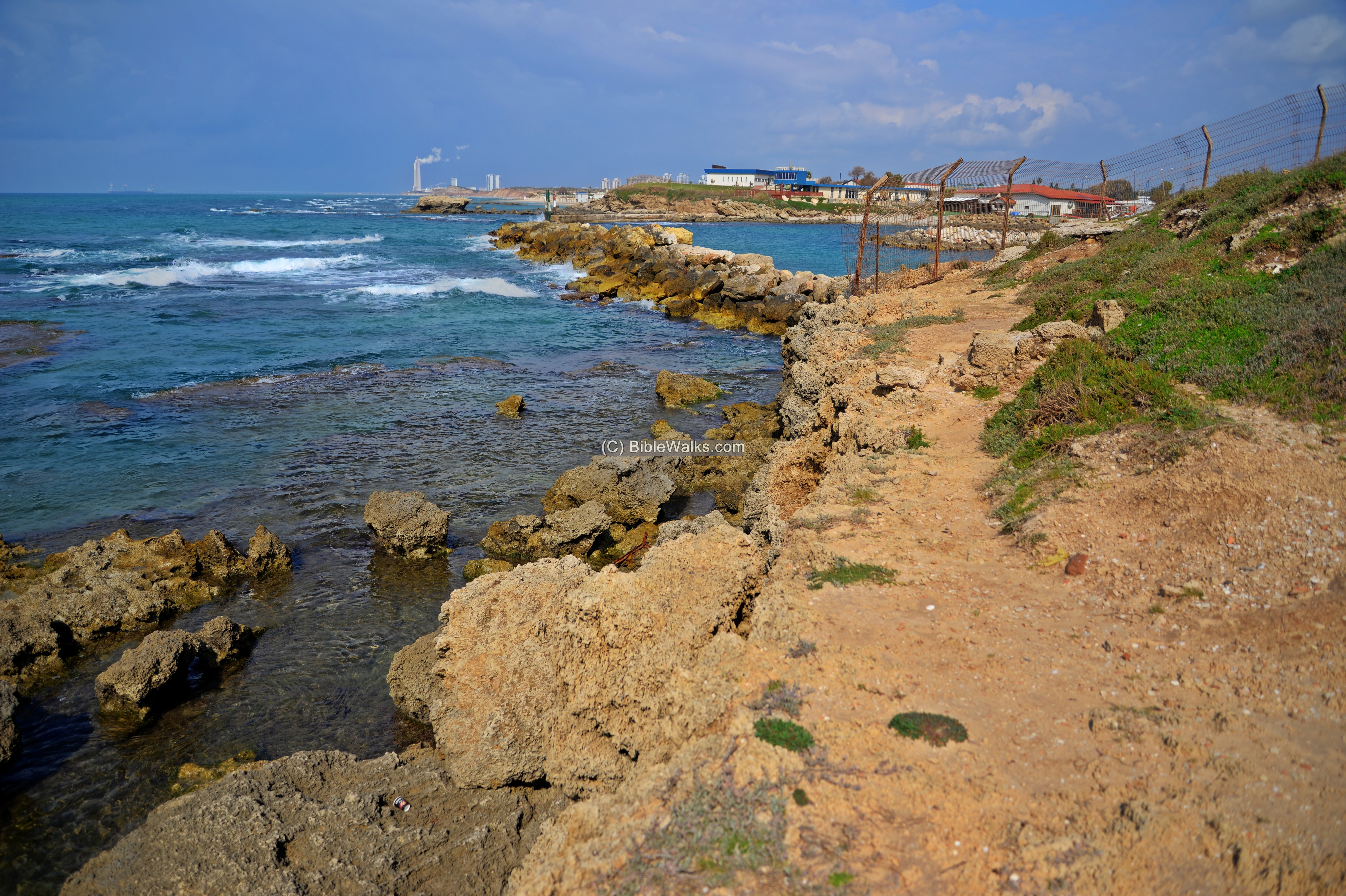
Access to the site is by a nature trail that crosses the marsh land north of Nahal Alexander.
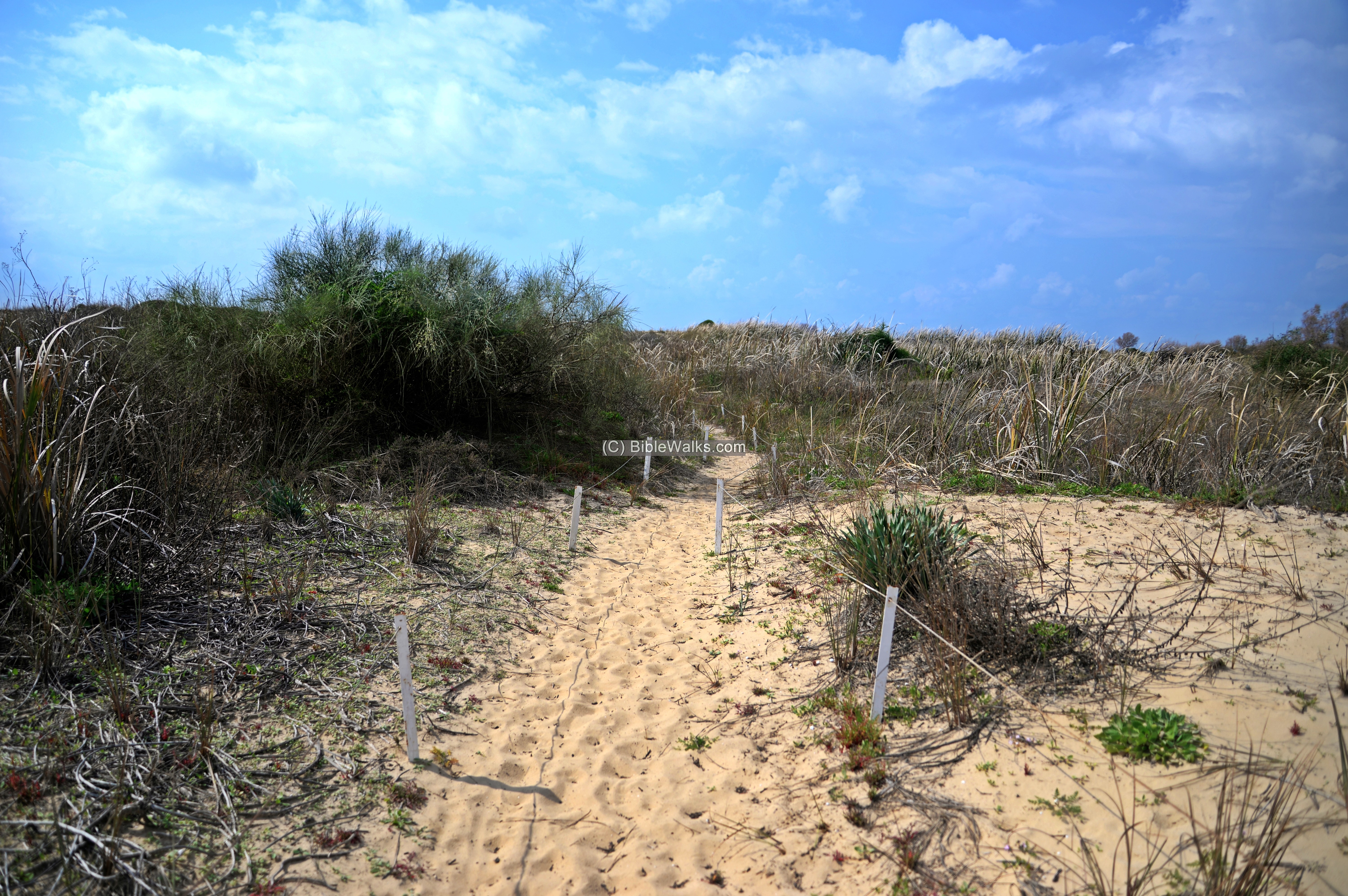
The trail leads to the shore, south of Tel Michmoret.
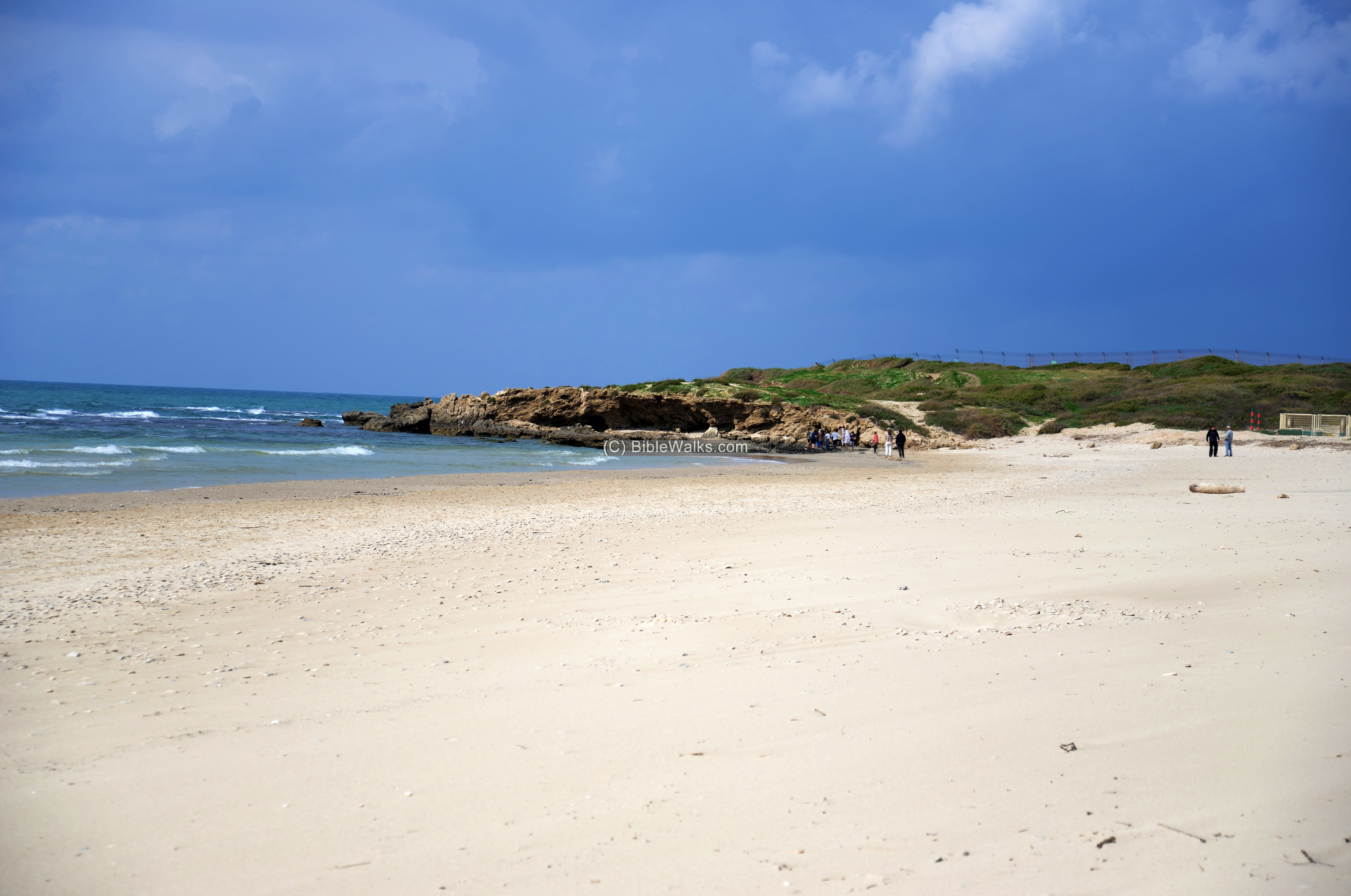
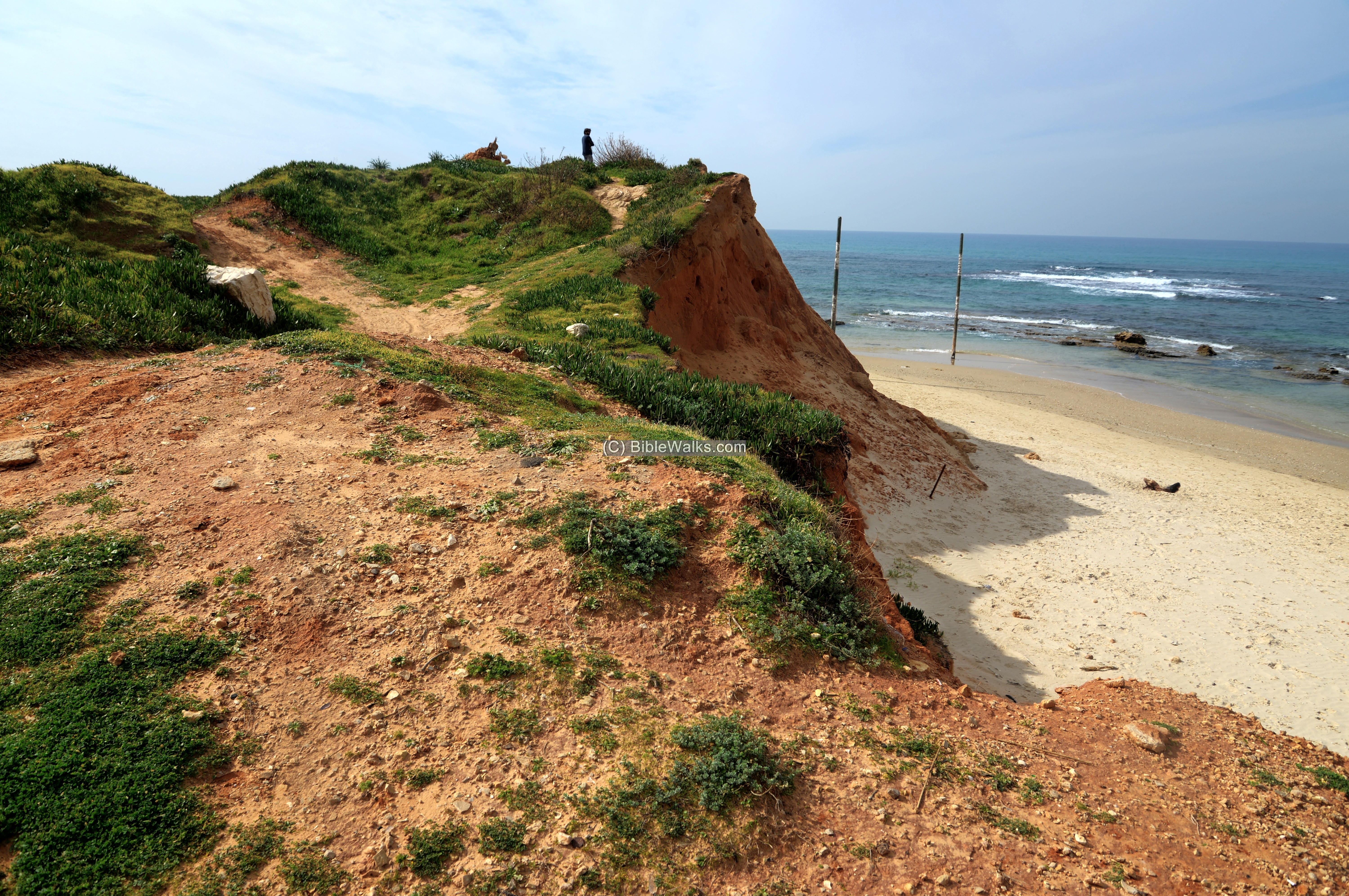
(c) Tel Michmoret
The mound is located on the shore, south of the bay. On its surfece are mostly hidden remains of the antiquity. Fragments of ceramics are scattered all around the mound.
A walk along the edge of the Tel reaches a fence, overlooking the bay.
Next – A view from the mound towards the sea.
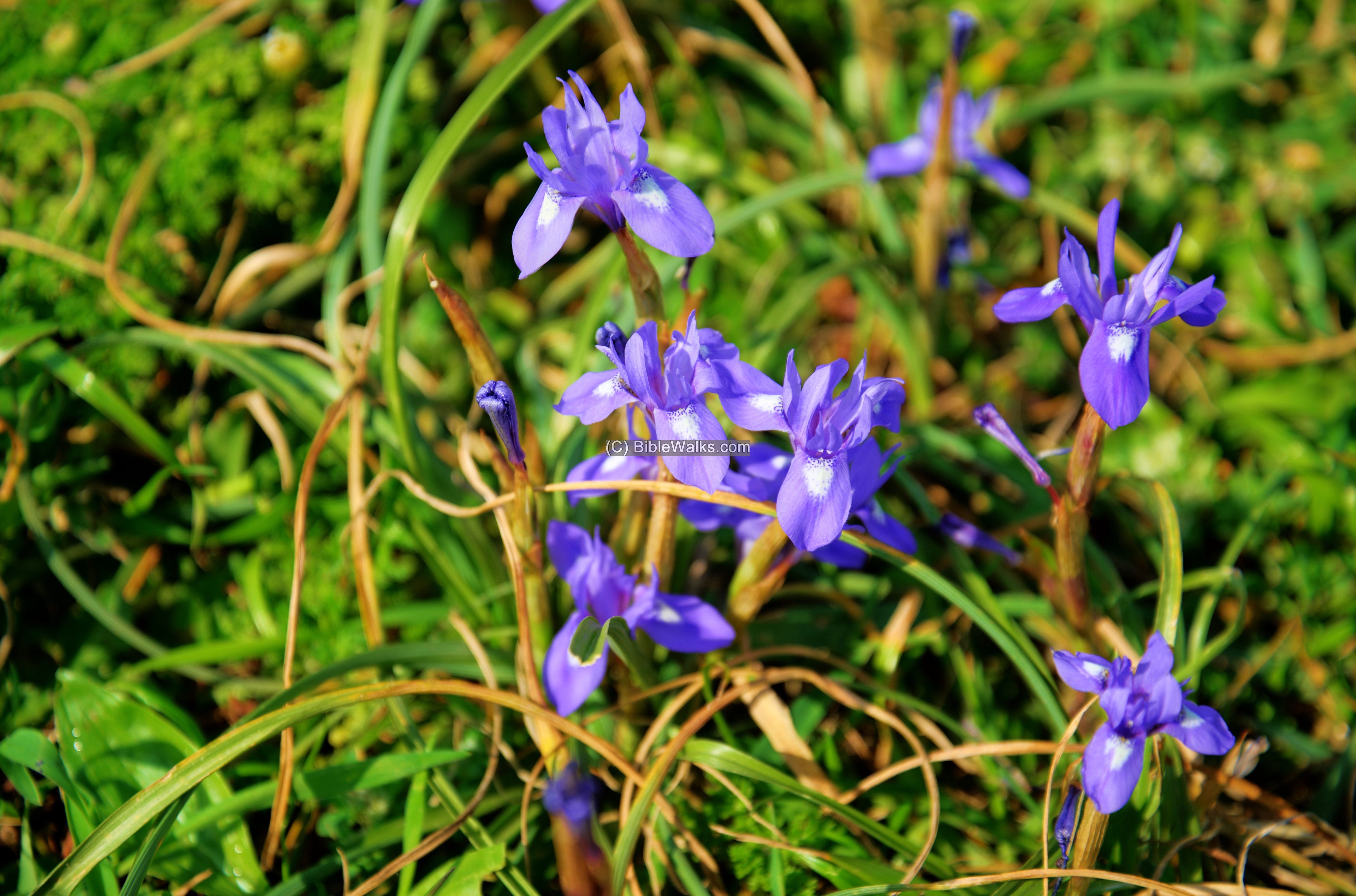
In the foreground are wild flowers that bloom during the late spring and early spring period.
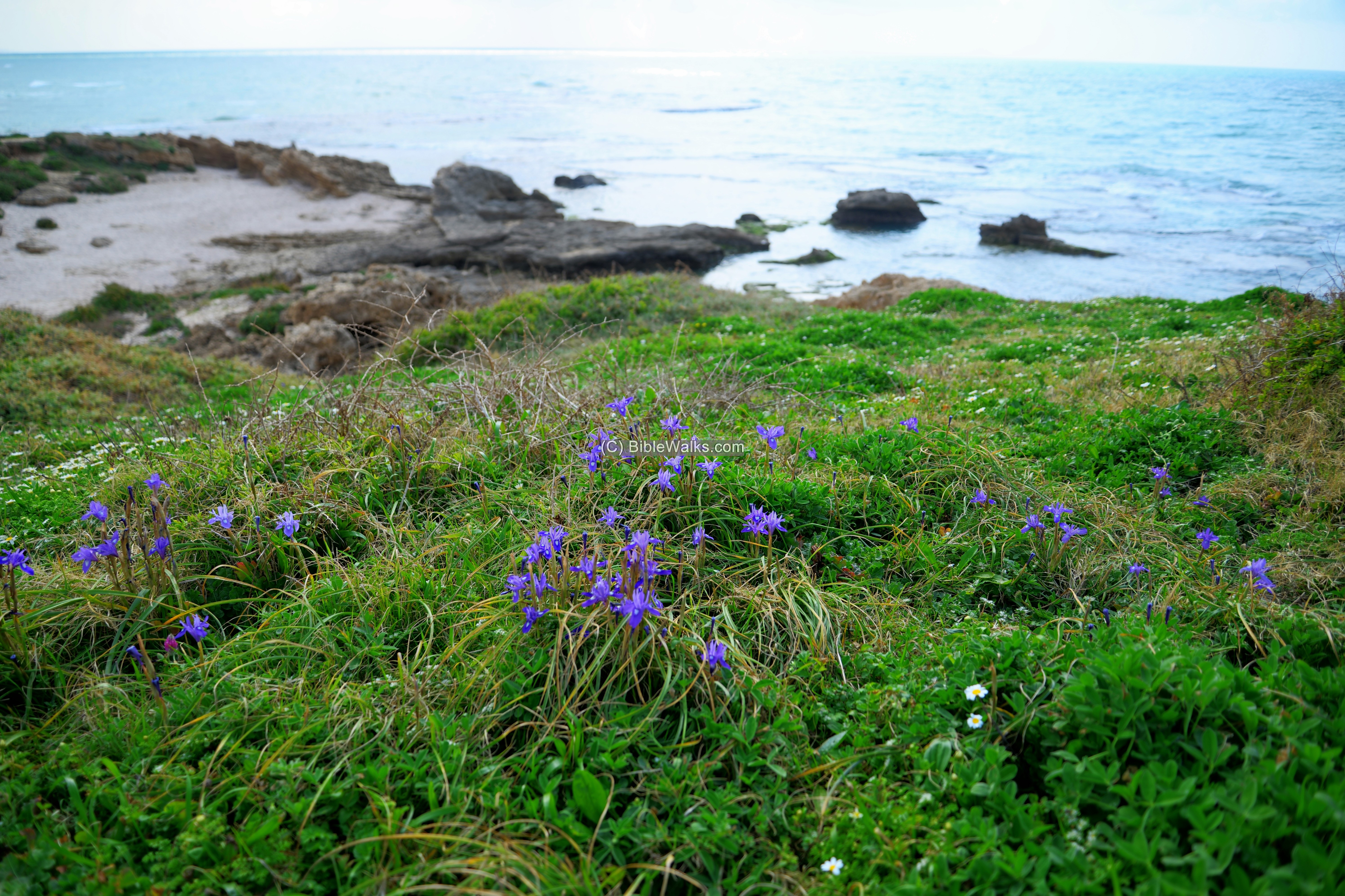
These Iris flowers are of type Barbary Nut (Iris sisyrinchium), or Hebrew Tsaharon.
(d) Structures
Few visible structures are seen on the hill. One structure is located on the north side of the mound. This is a base of a tower, a square 8m by 8m, with 1m thick walls. The small sandstone bricks were cemented and also plastered on the outside. According to a gold Fatimid coin, its was dated to the 10th-11th century.
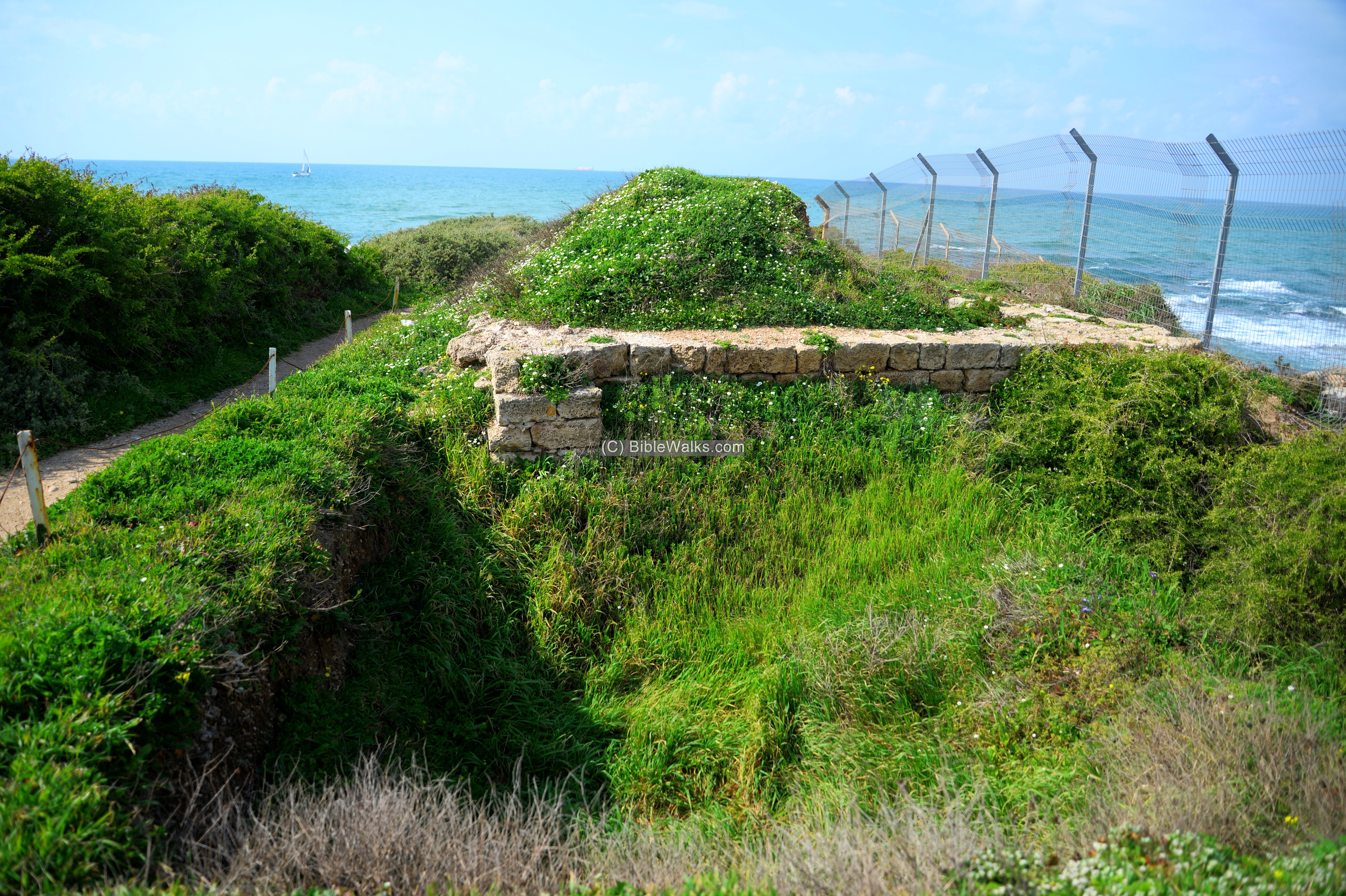
The tower is one of several Fatimid watch towers that were constructed along the Levant coast.
- Persian administration building
The archaeologists also unearthed a large public structure dated to the Persian period. The structure covered an area of several hundred square meters, and was probably the administration building of the port. The Persian structure was found under the Byzantine and Arab levels, and was built over a earlier 4th-5th structure.
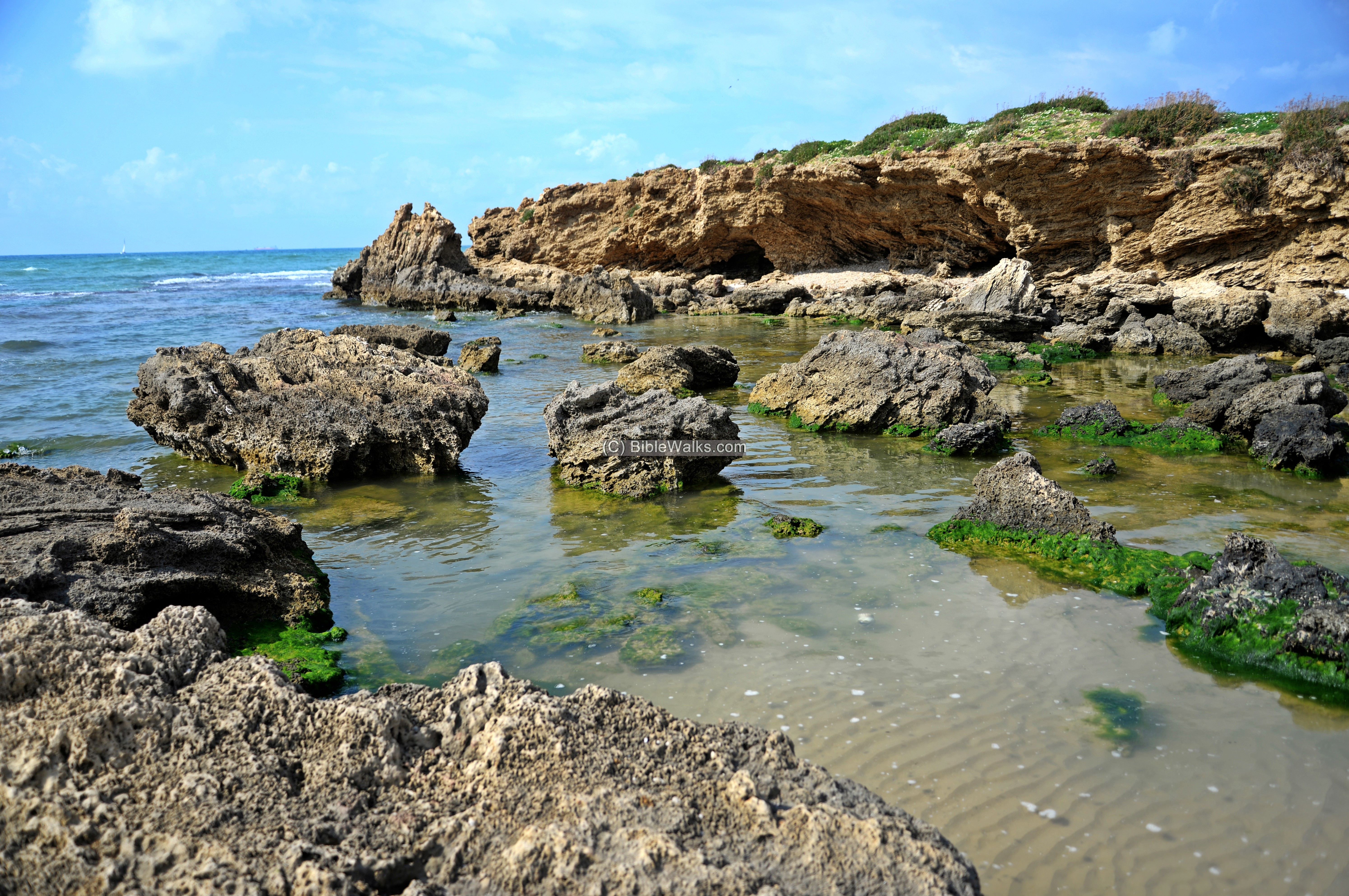
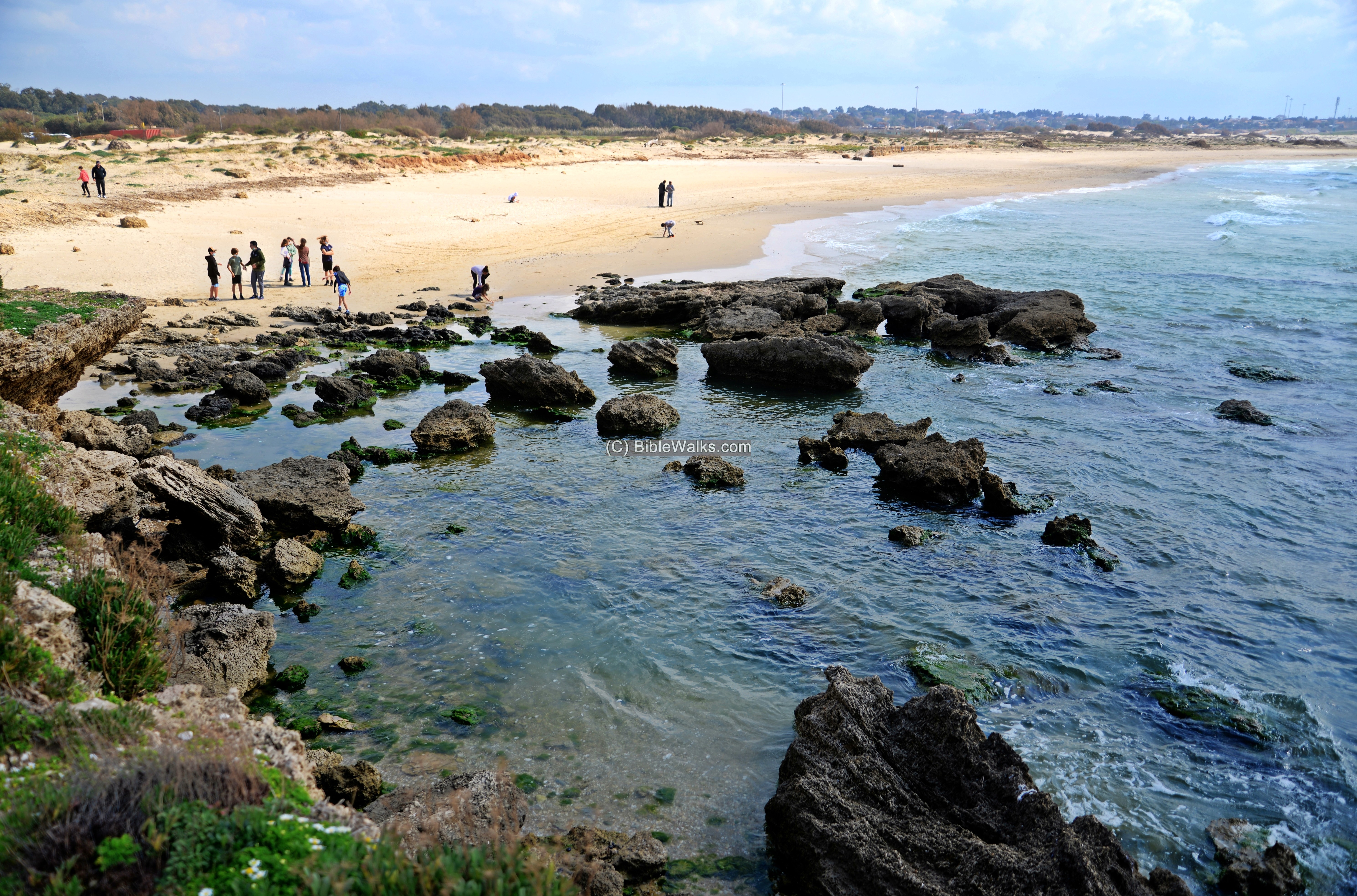
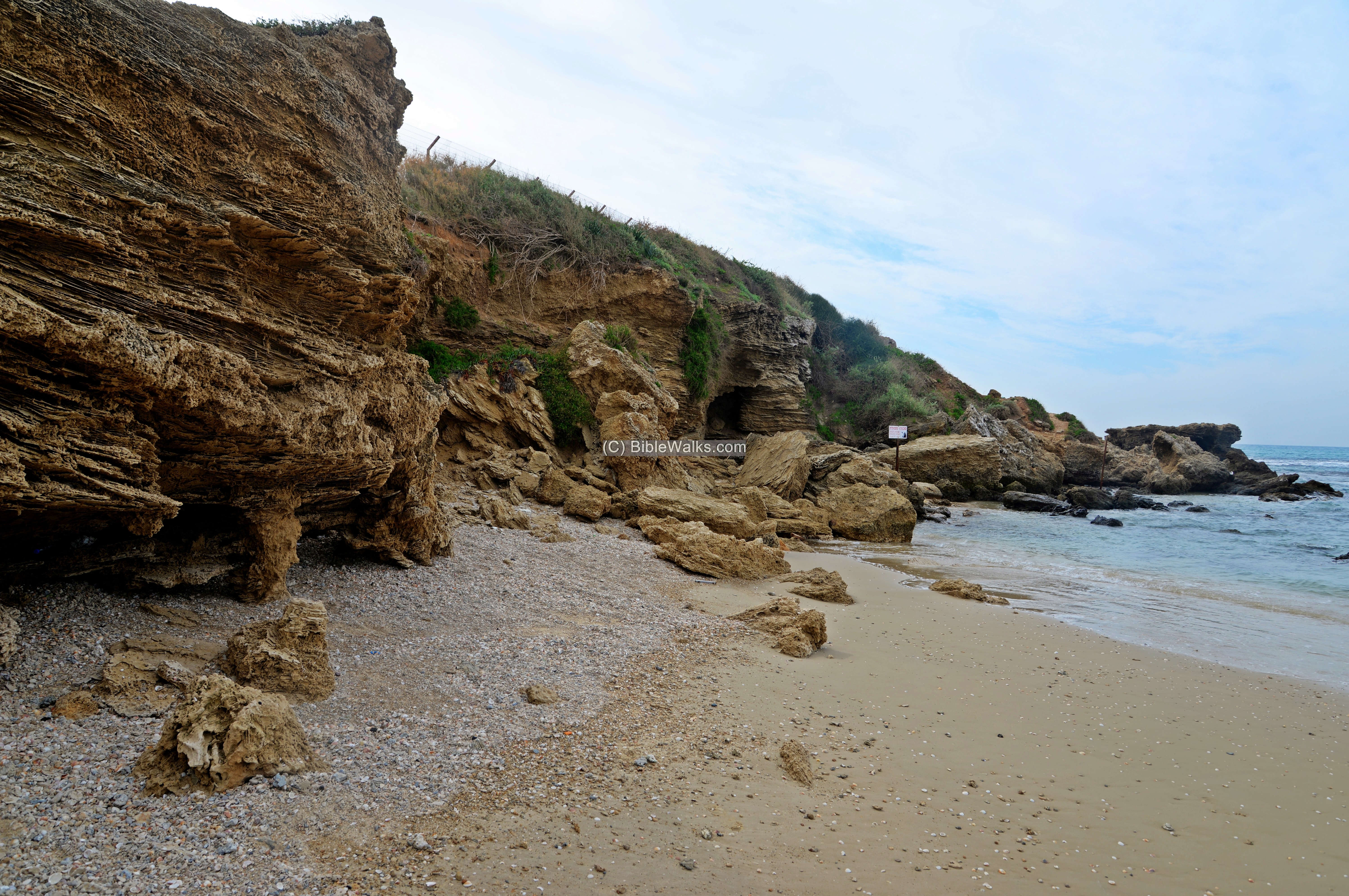
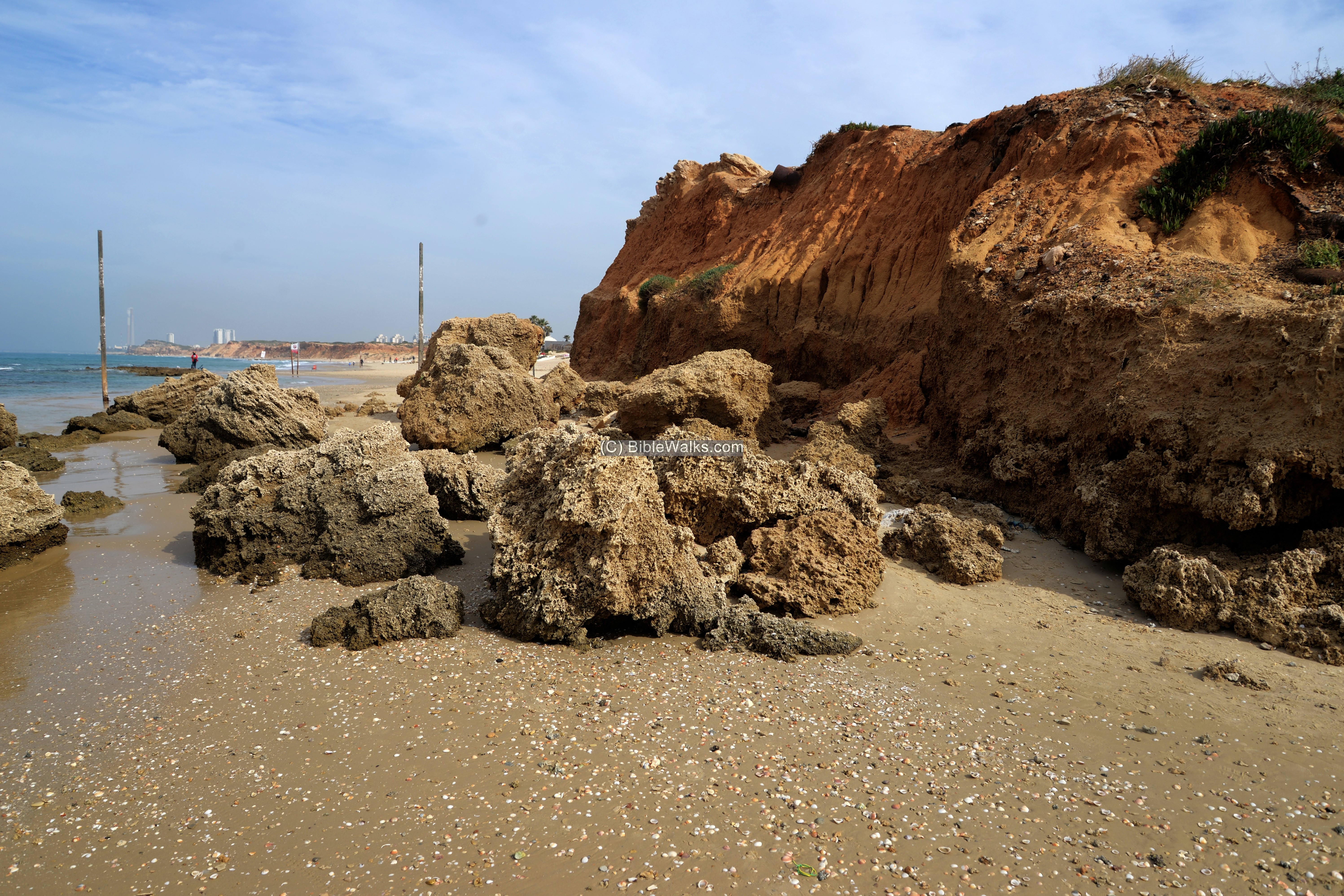
(e) Sea front
The site was hit by storms over the years, cutting away a section of the hill.
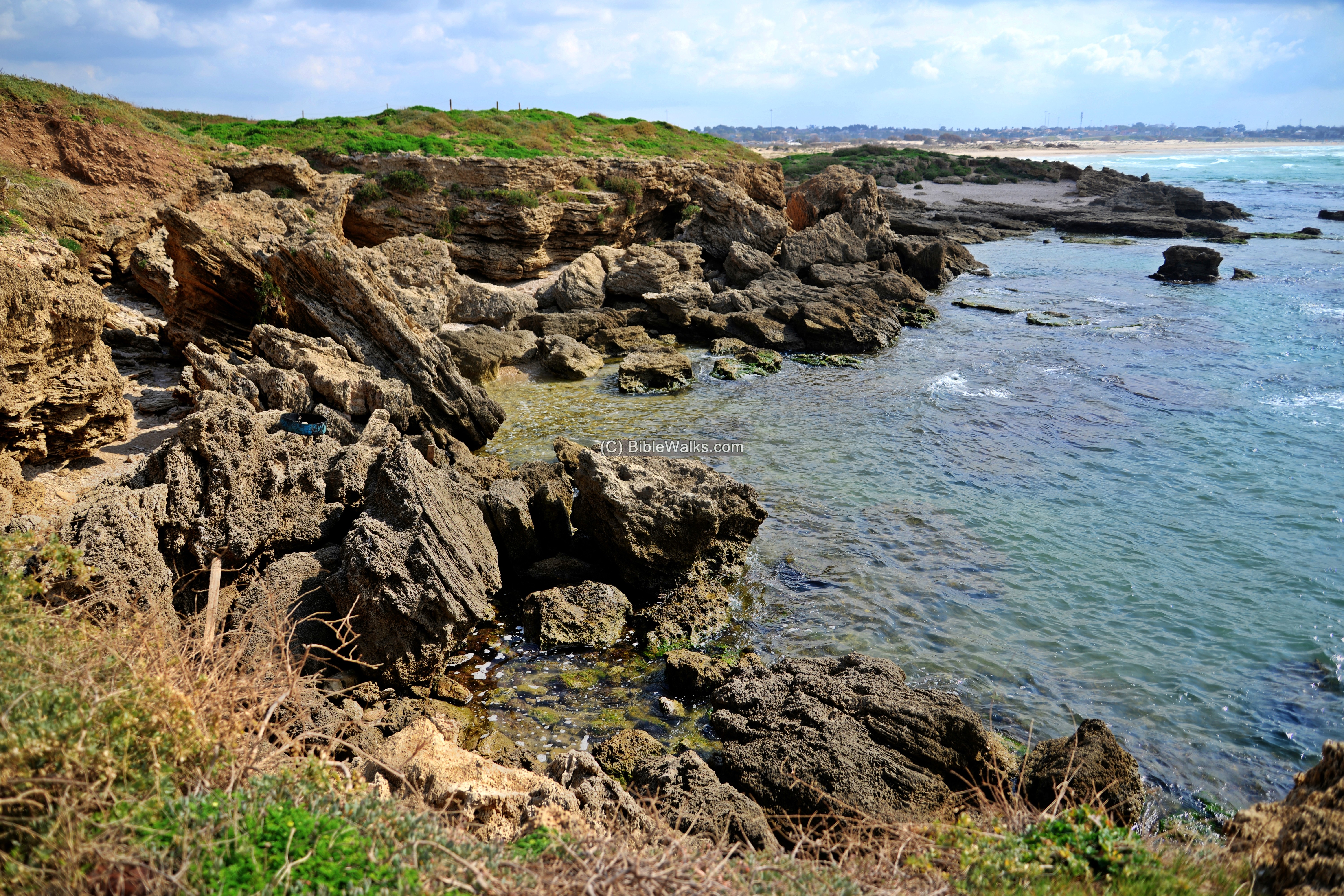
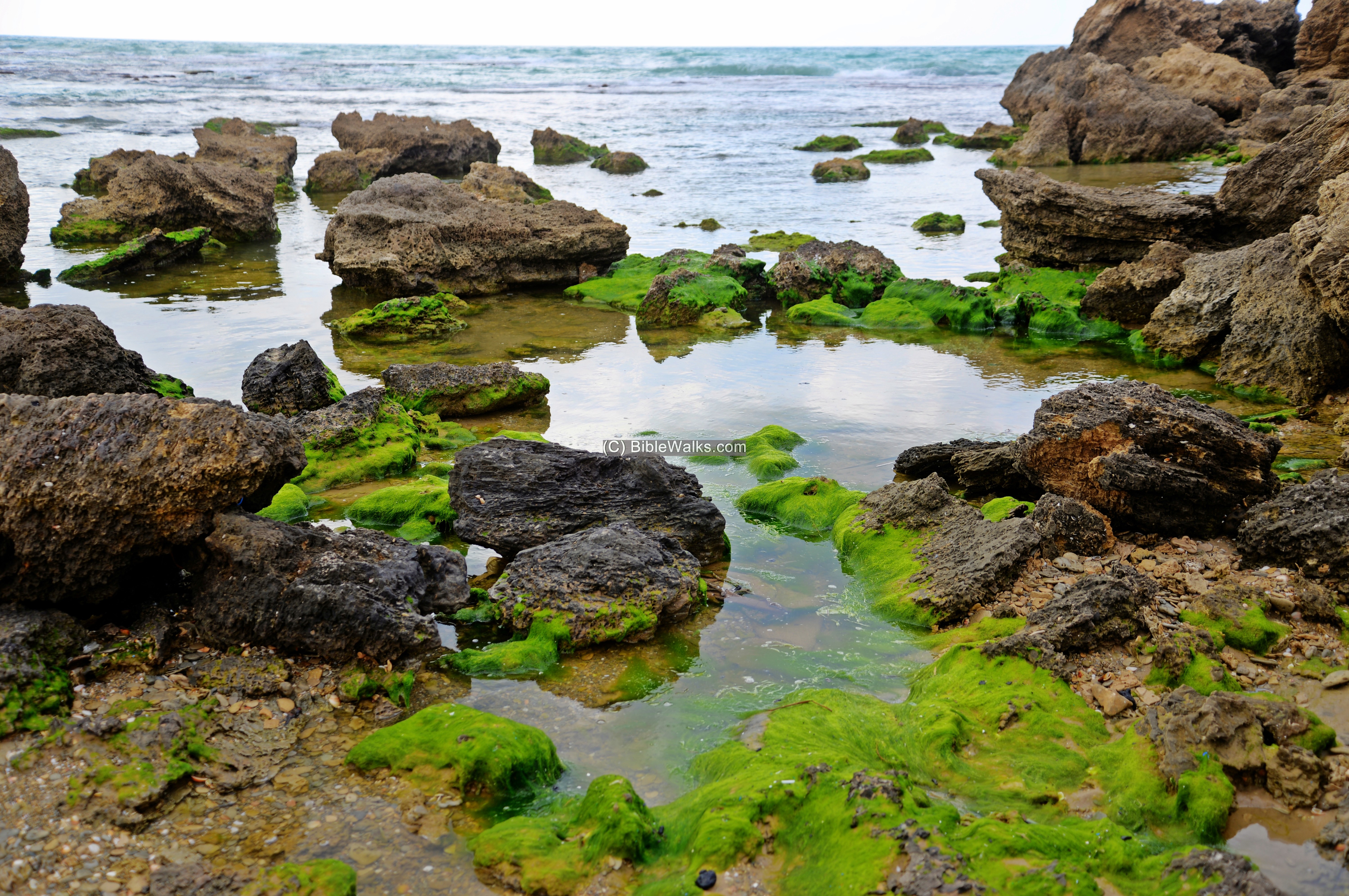
The sea front is a rugged collection of sandstone rocks, dotted by cavities.
In the following photo, with a view towards the south, is a group of youngsters who came to clean the beach. In February 2021 an oil tanker deposited tons of crude oil into the Med sea, causing a wide contamination of the coast with tar.
Green moss adds to the beauty of the struggle between the sea and the rocks.
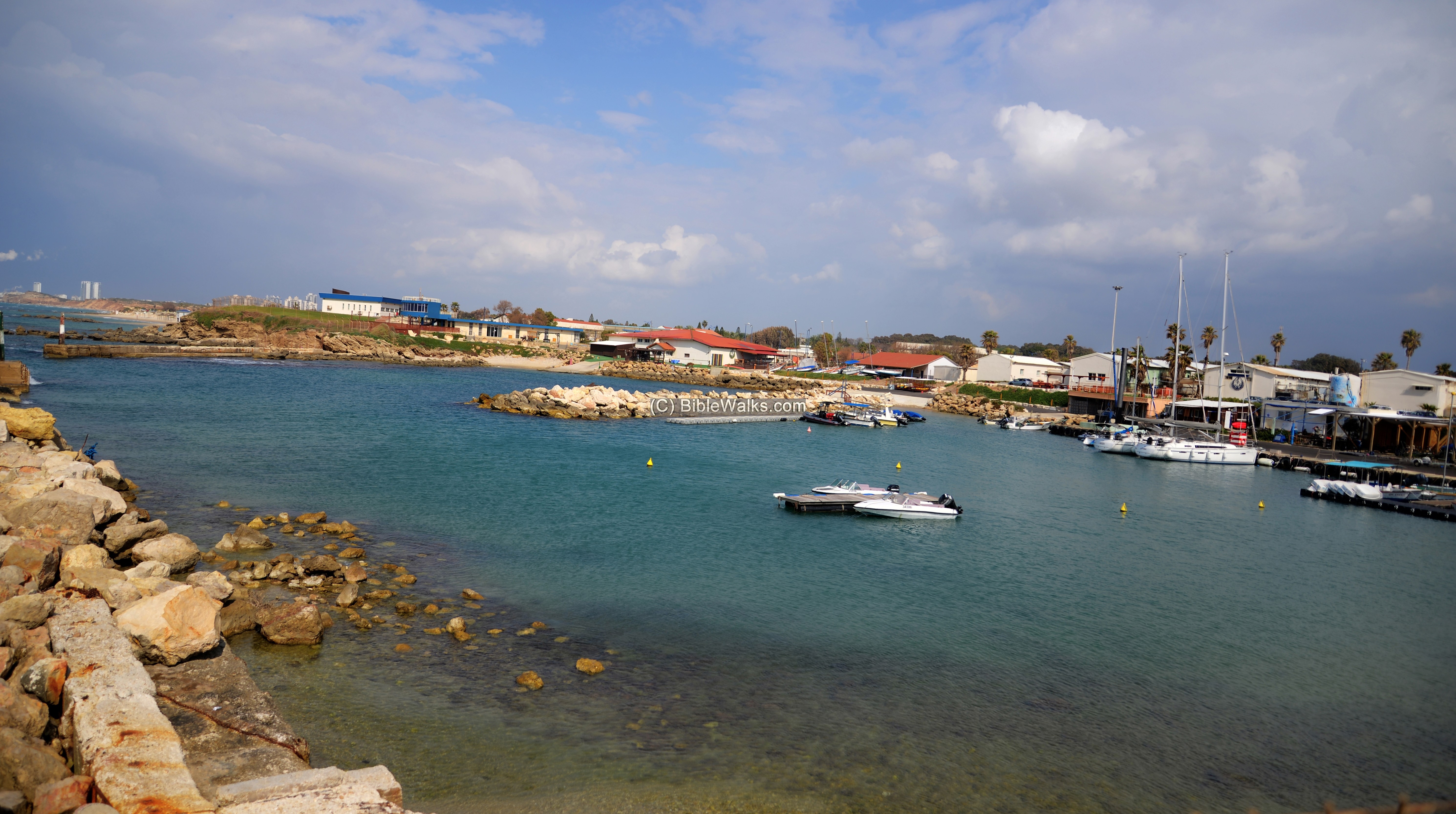
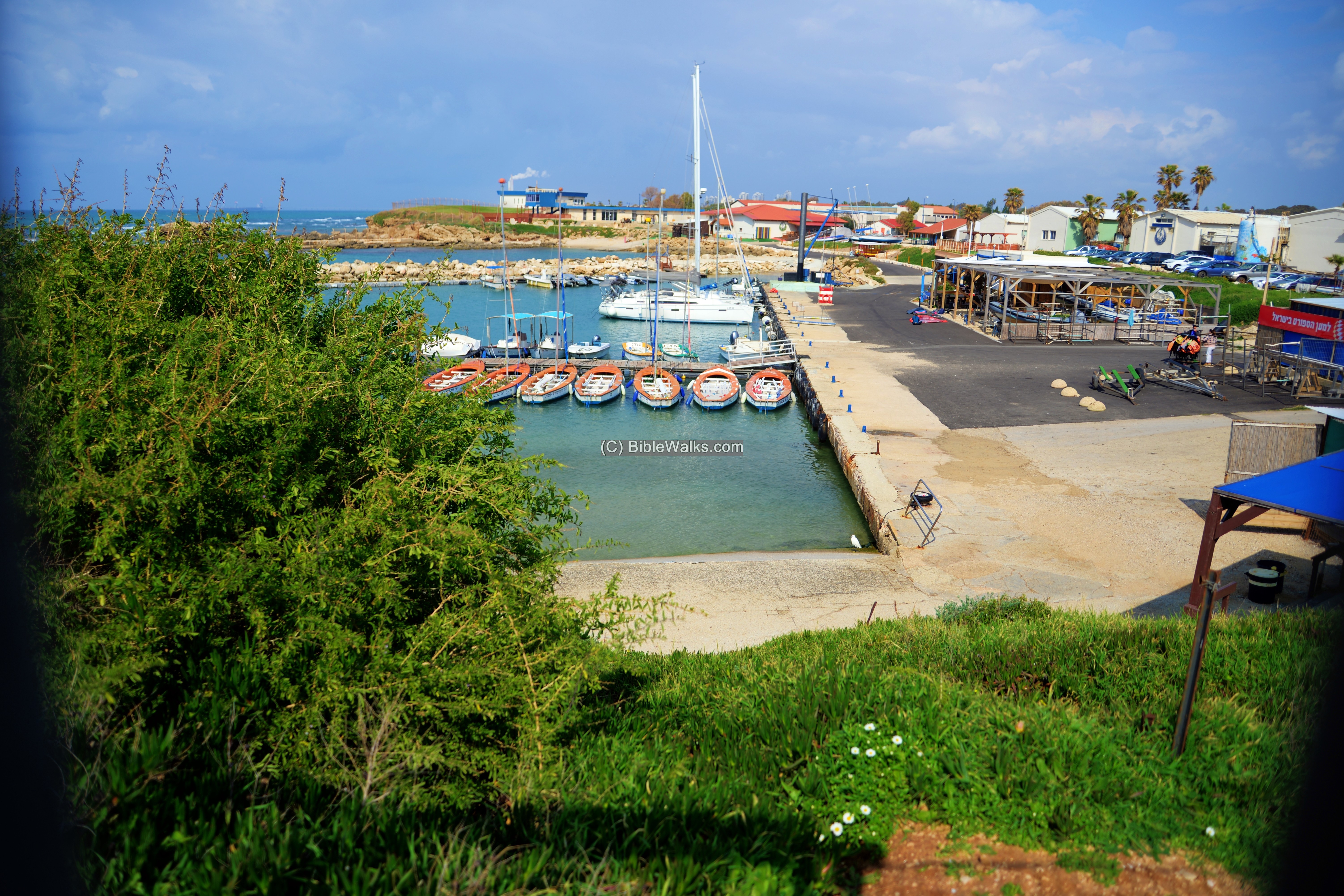
(f) The bay
The bay of Michmoret is the only natural bay south of Haifa. Its size is 19 dunam. During the antiquity it was a central port, while in the Ottoman period it was used as a port to export watermelons and other agriculture exports.
An underwater archaeological survey located half a dozen of ancient anchors dated to the Late Hellenistic, Roman, Early Islamic, Crusader, Mameluke and Ottoman periods (Arch Survey; Map 52 Michmoret I, sites 46-53).
In modern days it is used by the marine school.
(g) North side of the bay
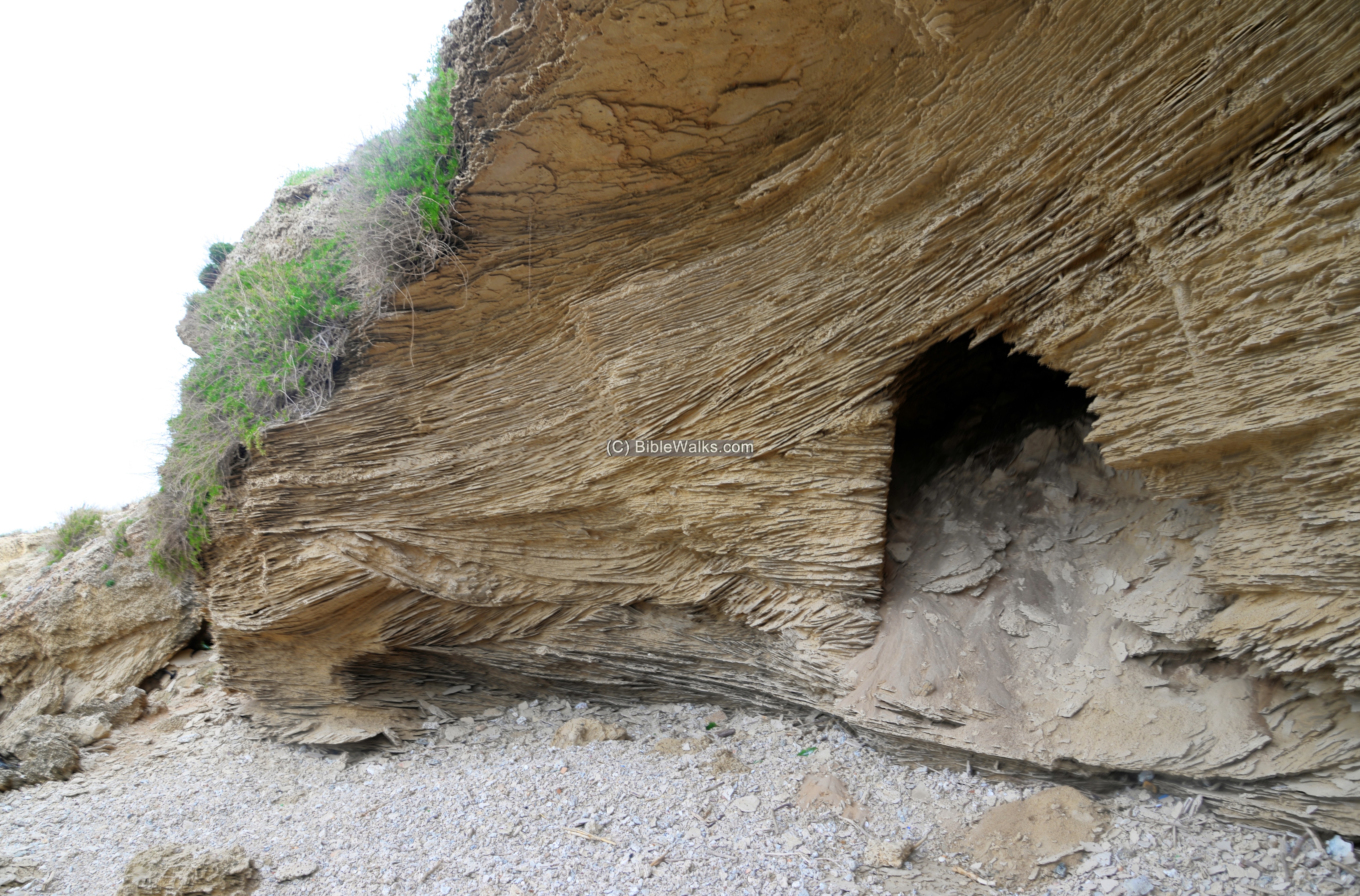
On the north side of the bay is a cliff dotted with caves. It can be accessed from the beach on the north side.
An excavation square was opened on the cliff above – area ‘N’. The archaeologists unearthed a burial complex dated to the Persian/Hellenistic period. Furthermore, a water reservoir was found to the south of the burial chamber, also dated to the same period.
A closer view of one of the caves is in the following photo.
(h) Tel Girrit
Farther north of the site, about 800m, is a another section of the Late Bronze settlement.
The site is located on a Hamra (loam) cliff. It was badly damaged by the sea waves that cut the western section of the site.
The ruin is named ‘Tell el Jariya’ on the British map. In Hebrew it was renamed Tel Girrit, a modern name given in order to be phonetically close to the Arabic name. Girrit is a mammal – a ‘badger’ – a specie named Meles Faxus.
On the mound are few traces of walls and a structure.
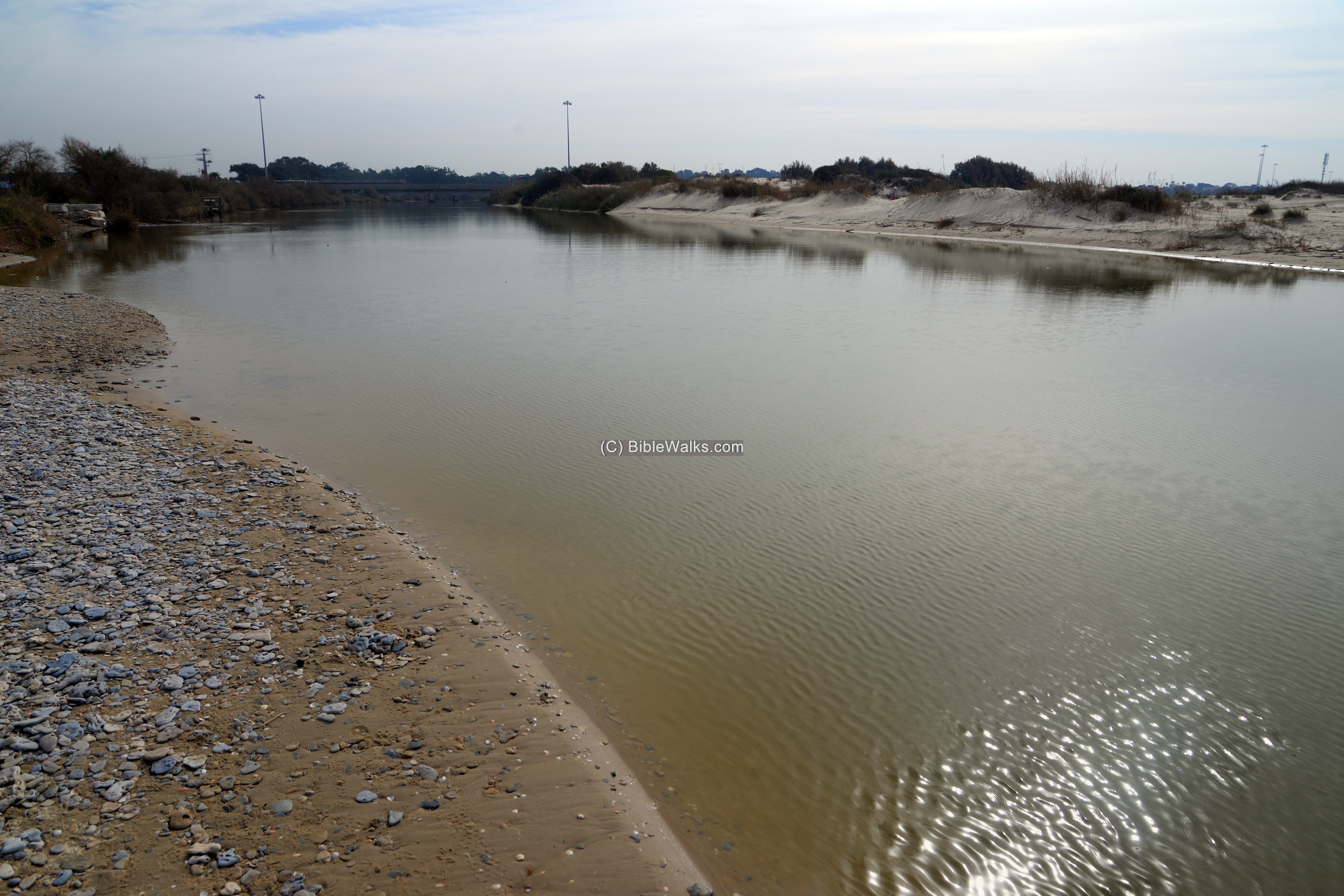
South of Tel Michmoret is the ford of Nahal Alexander river. It is much wider in the section, close to the shore, than it width inland.
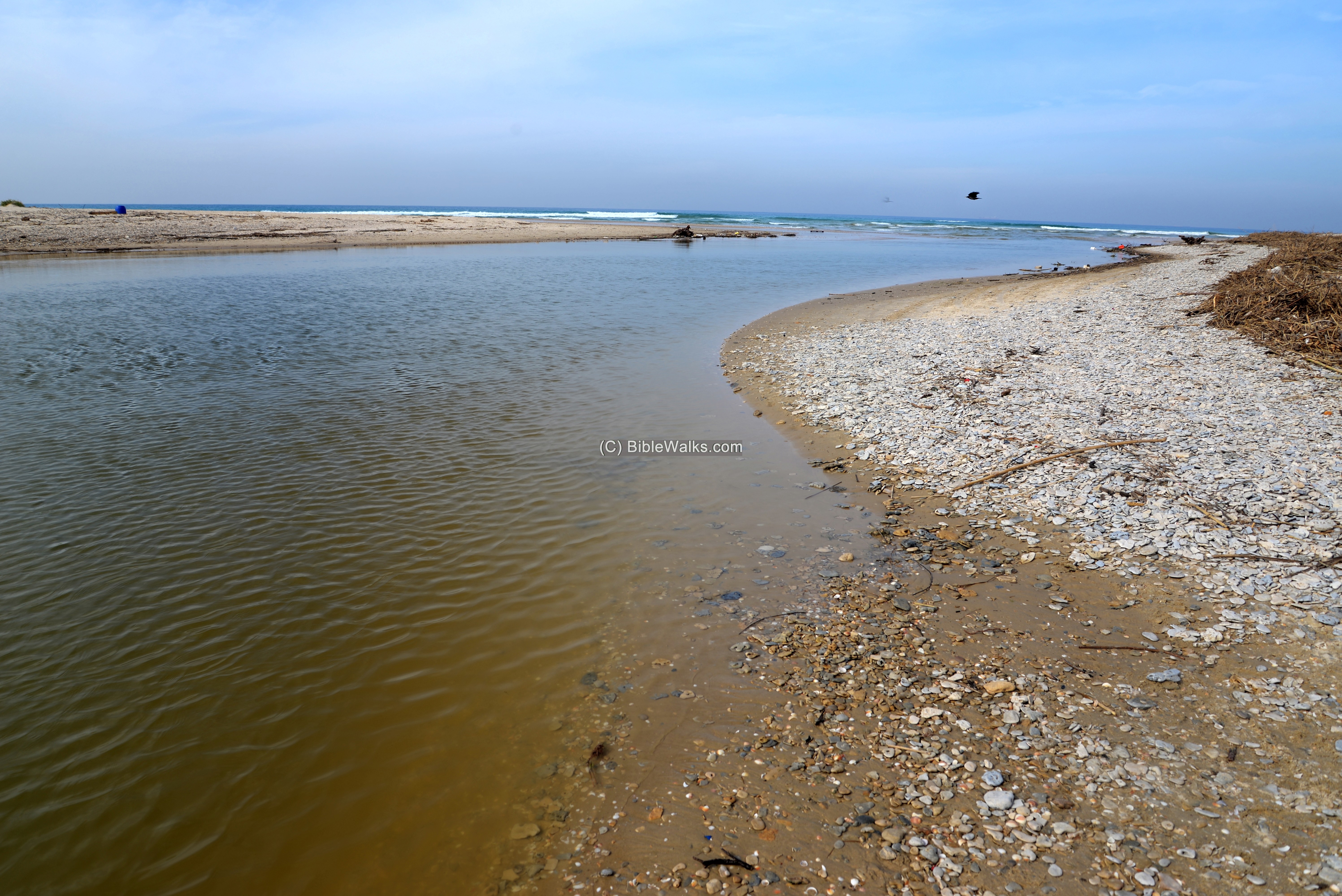
It is part of a national park, that is open to the public.
Highway #2 crosses the river on a bridge which is seen in the background of the photo.
Etymology (behind the name):
* Names of the site and vicinity:
- Moshav Michmoret – the Moshav (type of Israeli settlement) was established in 1945 by Jewish veterans of the British Army.
- Michmoret (also: Mikhmoret) – Hebrew: large fishing net.(מכמורת) The word appears in the Bible as ‘nets’ (Isaiah 19:8): “The fishers also shall mourn, and all they that cast angle into the brooks shall lament, and they that spread nets upon the waters shall languish”.
- Nahr Iskanderuneh: Arabic name of the river. Named either after Alexander the Great, or after Iskender (Alexander) Abu Zabura – a 19th century merchant and land owner who used the river for floating watermelon on rafts to the seasonal port of Minet Abu Zabura (Michmoret/Mikhmoret).
- Nahal Alexander – Hebrew name, based on the Arabic name. The river is 32 KM in length, starting from the central Samaria hills around Shechem, then flowing to the Mediterranean Sea.
- Abu Zabura – Arabic; father of Zabura. According to the PEF dictionary, it means “cased with stones”.
Links and References:
* Archaeology:
- “Watermelon” – articles of the 19th century, including Abu Zabura (Baruch Ben Ezer, 1887-1960, pdf , copied by Ehud Ben Ezer; Hebrew)
- Arch. survey of Israel – Tel Girrit – map 52 site 21
- Arch. survey of Israel – Tel Mikhmoret – map 52 sites 26
- Arch. survey of Israel – Underwater channel – map 52 site 54 (Hebrew)
- Arch. survey of Israel – Shipwreck – map 52 site 44 (Hebrew)
* Internal:
- Horvat Samara – nearby structure, a customs station to control the watermelon export business
- Drone Aerial views – collection of Biblical sites from the air
- BibleWalks Youtube channel – Join!
- Wild flowers in the Holy Land
BibleWalks.com – after the lost Biblical cities
Tel Hefer<<–previous Sharon site—<<< All Sites>>>—next Sharon site–>>> Tel Gador
This page was last updated on Sep 19, 2021 (add Samara)
Sponsored links: