Ruins of a Biblical city on a high hill in western Judea foothills.
* Site of the month Sep 2015 *
Home > Sites> Judea> West > Kesalon (Chesalon)
Contents:
Background
Location
History
Photos
* Aerial Views
* Kesalon valley
* Ascent
Etymology
Links
Overview:
Ruins of a Biblical city on a high rising hill on the western Judea foothills region. This may be the place of the Biblical city of Kesalon (Chesalon), which fits the description of the Judea cities in the book of Joshua.
Joshua 15:10: “And the border … passed along unto the side of mount Jearim, which is Chesalon…“.
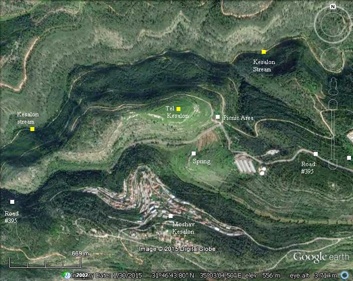
Location and Aerial map:
The site is located 15km west of Jerusalem.
To reach the site, drive on road #395 and turn to the north on the sharp curve of the road. A small picnic area is located here, part of the Forest of Martyrs (Ya’ar Ha’kdoshim) KKL park.
History of the place:
-
Bronze (Canaanite)
The Canaanite city was established on a steep hill in the Bronze age.
-
Conquest by Joshua (13th Century B.C.)
The tribe of Judah receives the Canaanite city (Joshua 15:10): “And the border compassed from Baalah westward unto mount Seir, and passed along unto the side of mount Jearim, which is Chesalon, on the north side, and went down to Bethshemesh, and passed on to Timnah”.
The cities and roads during the Canaanite and Israelite periods are indicated on the Biblical Map below. Kesalon is indicated in the center of the map as a red point. It is located north of the Valley of Sorek, which leads up to Jerusalem.
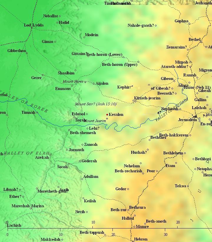
Map of area around Kesalon – during Bronze, Iron age and Roman periods (based on Bible Mapper 3.0)
According to D. Dorsey (“Roads and Highways of ancient Israel”, p. 187), road J5 from Jerusalem thru Beth Shemesh to the port city Yavne-Yam passed thru Nahal Kesalon (Chesalon). This site was therefore the main fortified city along this path. It was also the path of the return of the ark from Beth-Shemesh to Kiryat Yearim on the way to Jerusalem.
-
Byzantine period (4th-7th Century AD)
Eusebius Pamphili (better known as Eusebius of Caesarea), a 4th Century Greek historian of the Church, wrote in his book “Onomasticon” about the site: “Chesalon – Tribe of Benjamin on the border of Jerusalem. A (very) large village”.
-
Ottoman Period (19th C)
Conder and Kitchener surveyed the area during the Survey of Western Palestine (SWP) in 1874. Section of their map of the area is here, with Kesla in the center, south of Wady el Hamar (“valley of the ass”). Around the site are many ancient ruins, as indicated by the prefix “kh.” (for Khirbet). A Roman road is shown 4KM north of the site, which was one of the roads from the Shephelah (low lands) to Jerusalem.
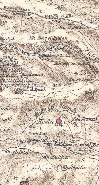
Part of map Sheet 17 of Survey of Western Palestine,
by Conder and Kitchener, 1872-1877.
(Published 1880, reprinted by LifeintheHolyLand.com)
There are several springs around the site, as indicated on the map:
- Ain el Kusab – means the “spring of the reeds”
- Ain el Arab – means the spring of the Arabs
- Ain el Jurun – spring of the hole.
The PEF report of the site includes the following short summary (Volume III p.25):
“Kesla – A small stone village in a conspicuous position on the top of a rugged ridge, with a deep valley to the north. There is a spring to the east, and two more in a valley to the south. This is the site of Chesalon, on the boundary of Judah (Joshua xv. lo). The thickets which cover the ridge fully correspond with the old title of Jearim”.
Modern Period
A number of Moshav settlements were established by immigrants to the newly founded state of Israel. The closest one to the site, Moshav Kesalon 0.5km to the south, was named after the ancient site.
A forest was planted around the site, named Ya’ar Hakdoshim (Martyr’s forest). It commemorates the victims of the Holocaust, and 6 Million trees are planned to be planted, as the number of Jews who perished.
Photos:
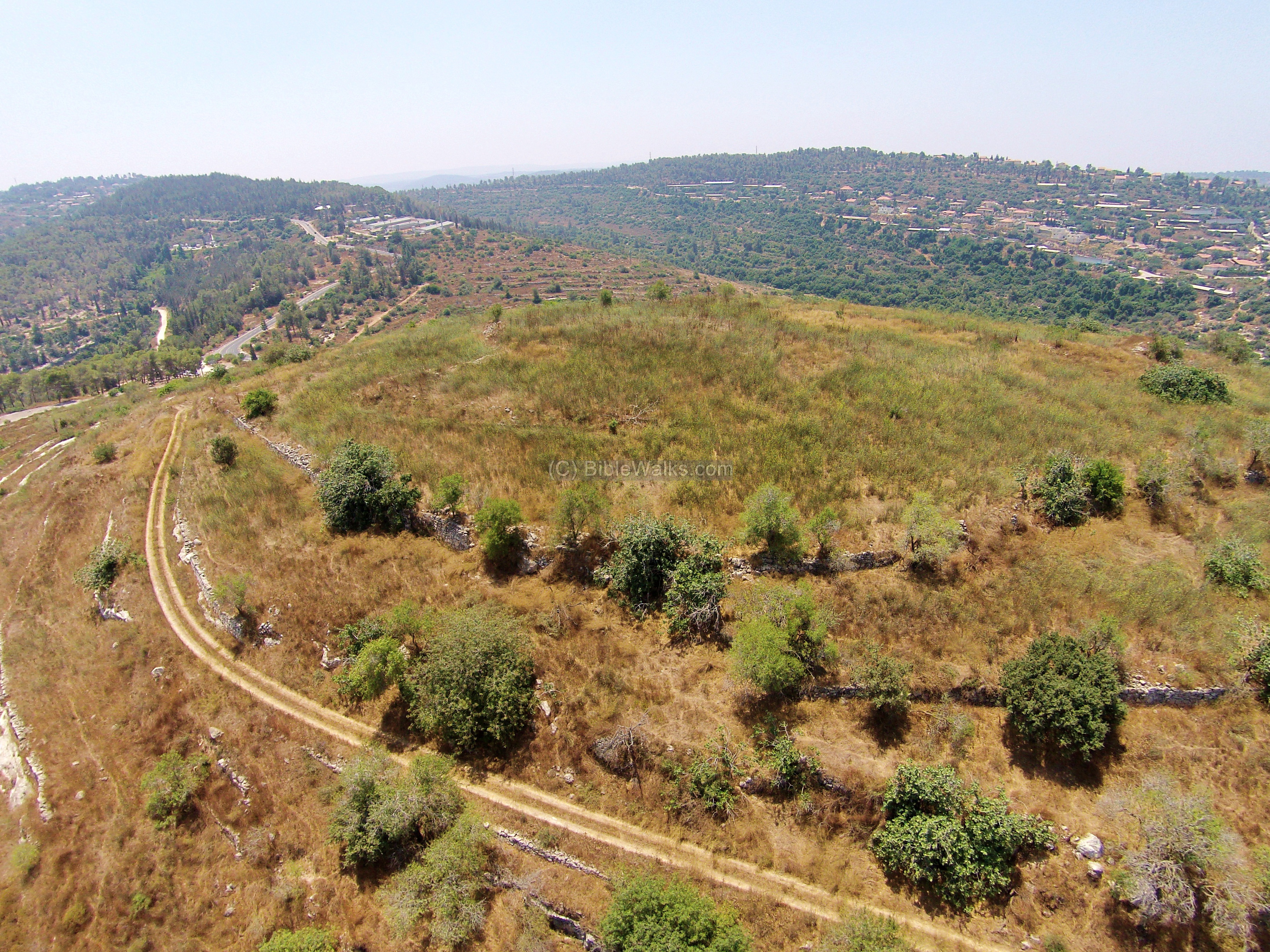
(a) Aerial Views:
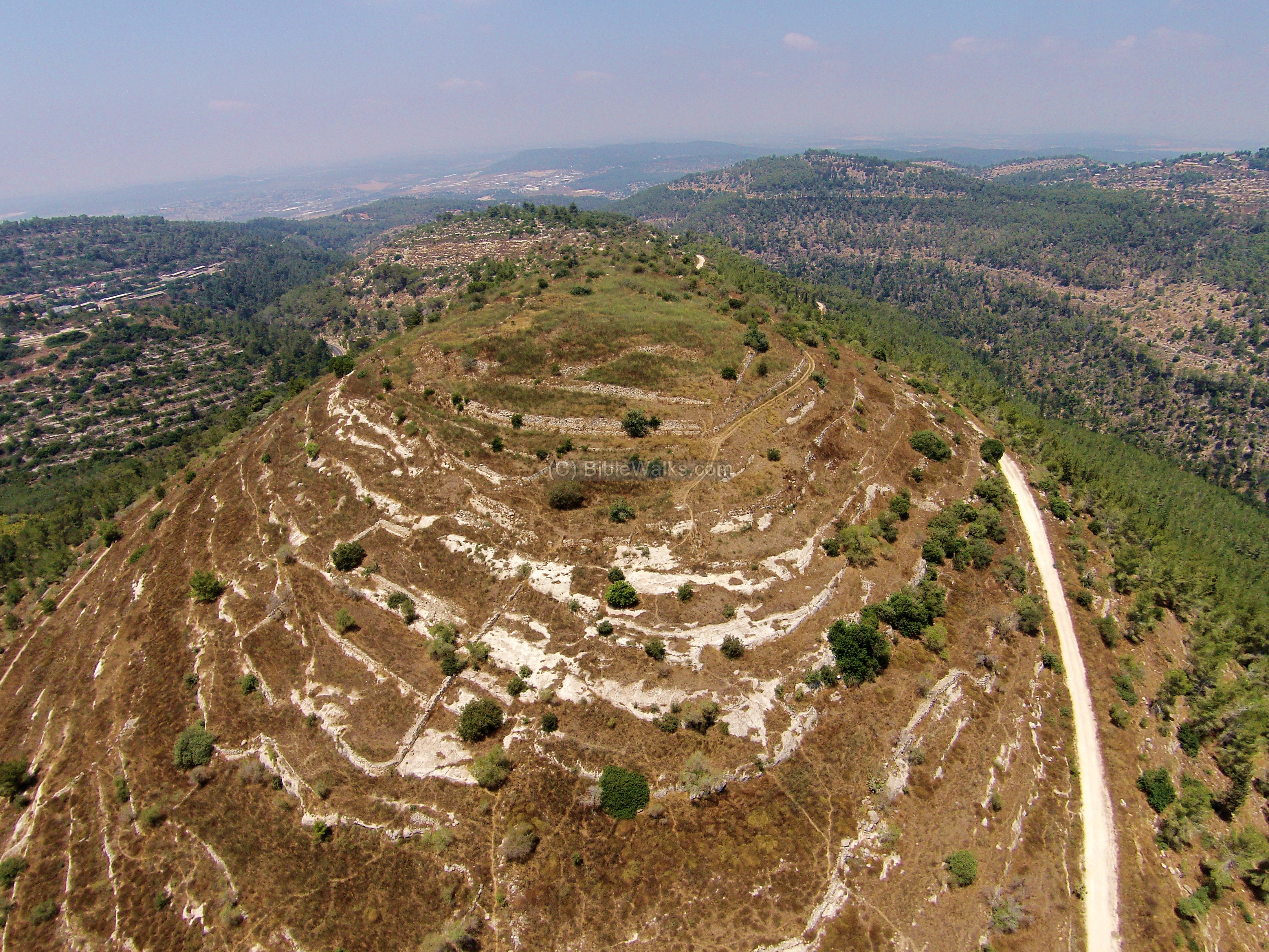
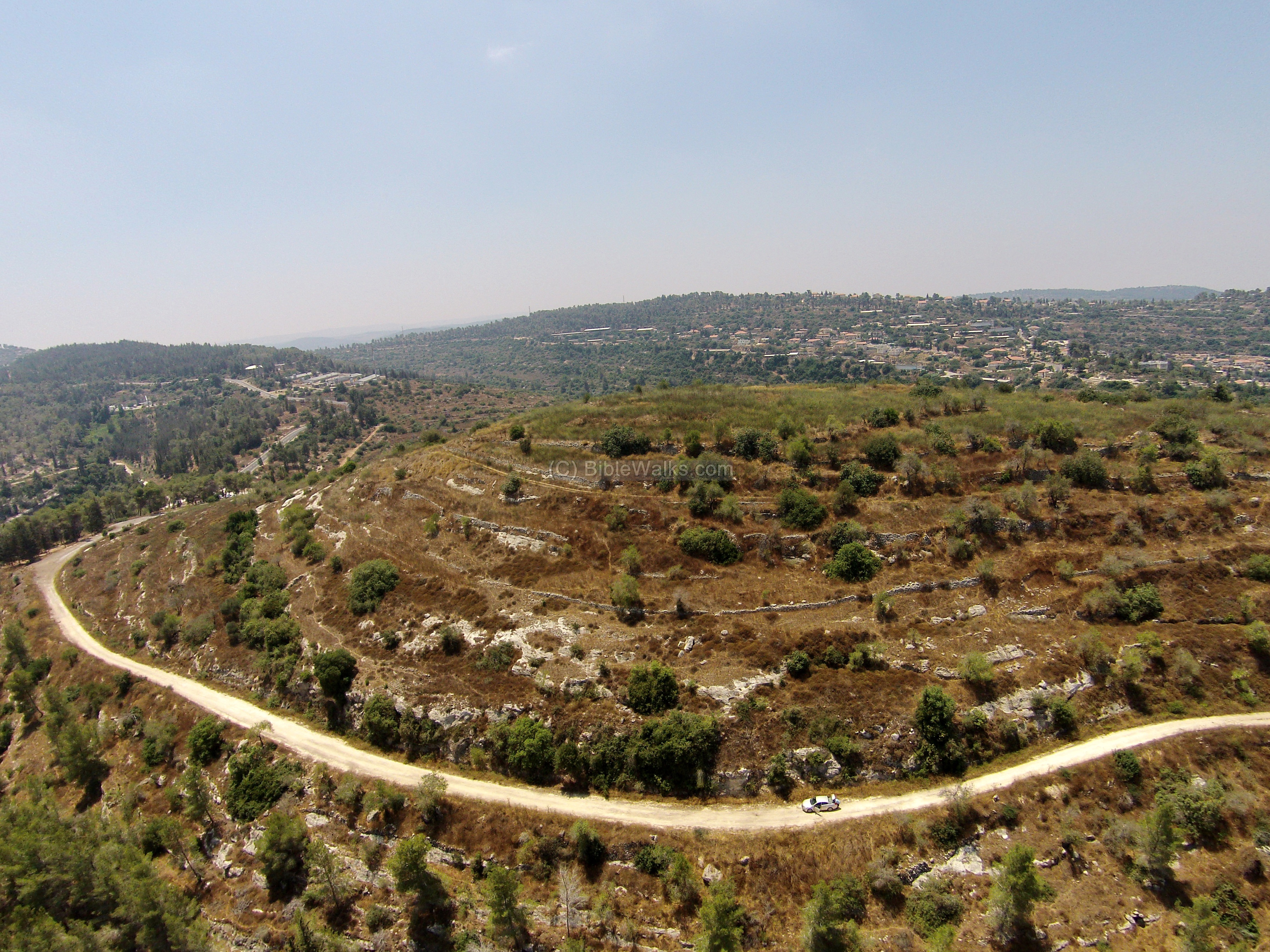
This photo, captured by a drone, shows the summit and foothills of Tel Kesalon from the east side. An access road climbs up from along the northern side of the hill, but continues to the west side. To get to the summit we walked up this side of the hill, leaving the car near the picnic area on the curve of road #395.
Click on the photos to view in higher resolution…
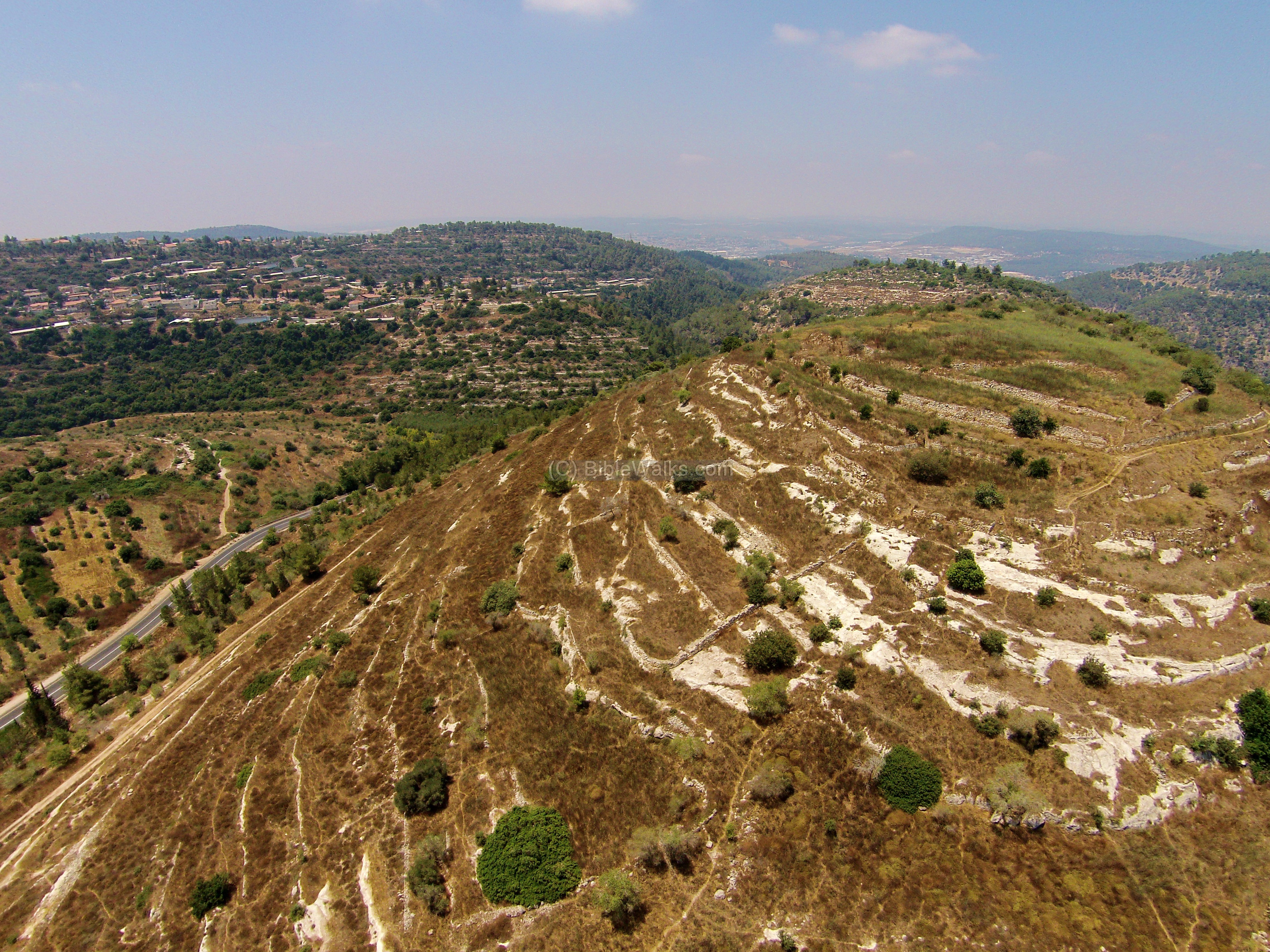
A view from the north shows the summit.
In the right background, just behind the hill, are houses of Moshav Kesalon, established in 1952 by immigrants from Yemen and Romania, then re-established in 1955 by immigrants from Morocco and Tunisia. in the left background are houses of Ramat Raziel, a Moshav which was established in 1948.
The next view is from the eastern side of Tel Kesalon. On the side of road #395 is a path to the spring of Kesalon.
![]() Fly over the site with this YouTube video:
Fly over the site with this YouTube video:
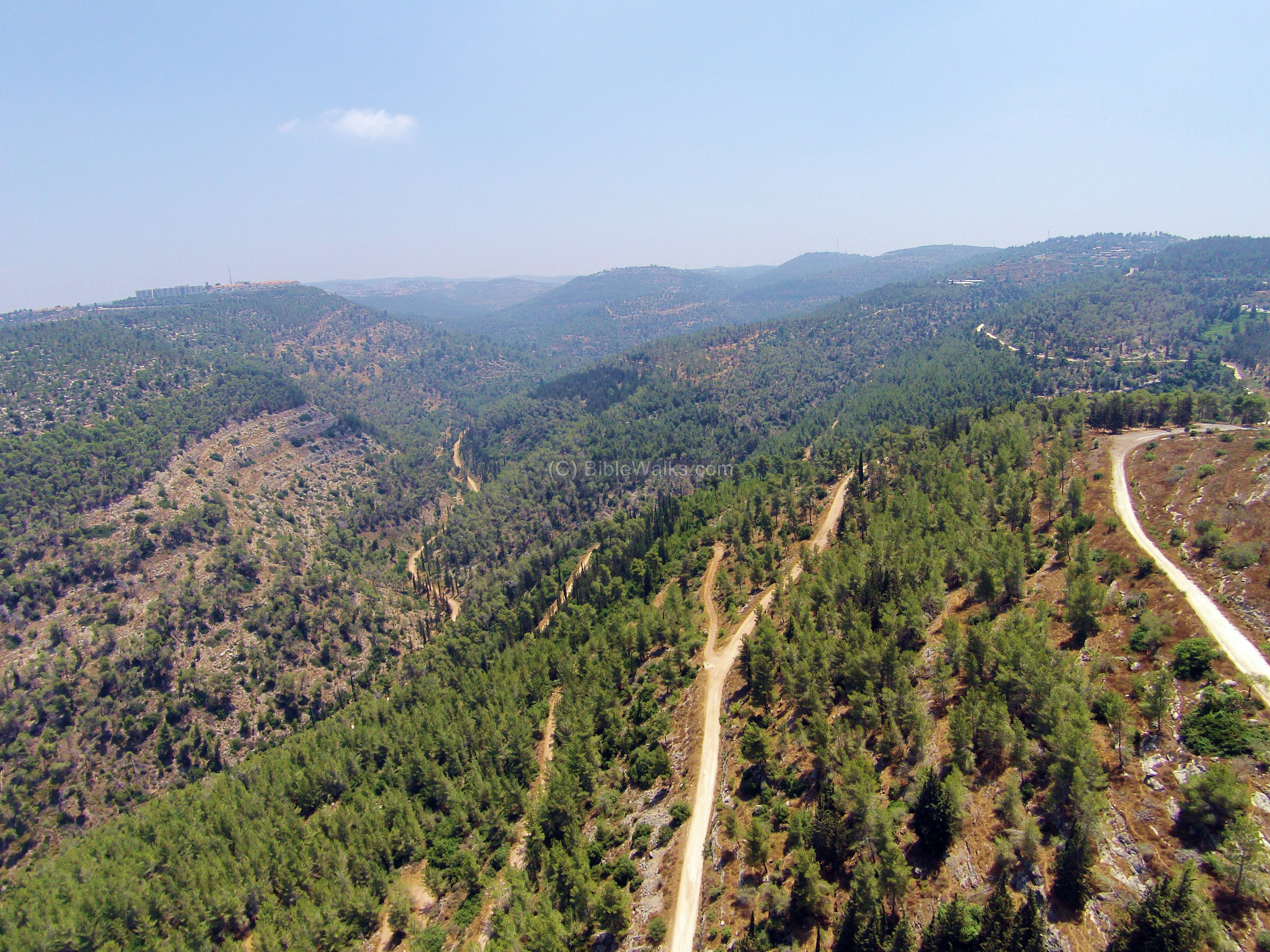
(b) Kesalon steam valley :
A deep valley of the Kesalon stream passes on the north side of the hill, more than 200m below the summit.
This view is towards the east side. The settlement of Moshav Givat Yearim, established 1950 by immigrants from Yemen, is located on the hill on the left background.
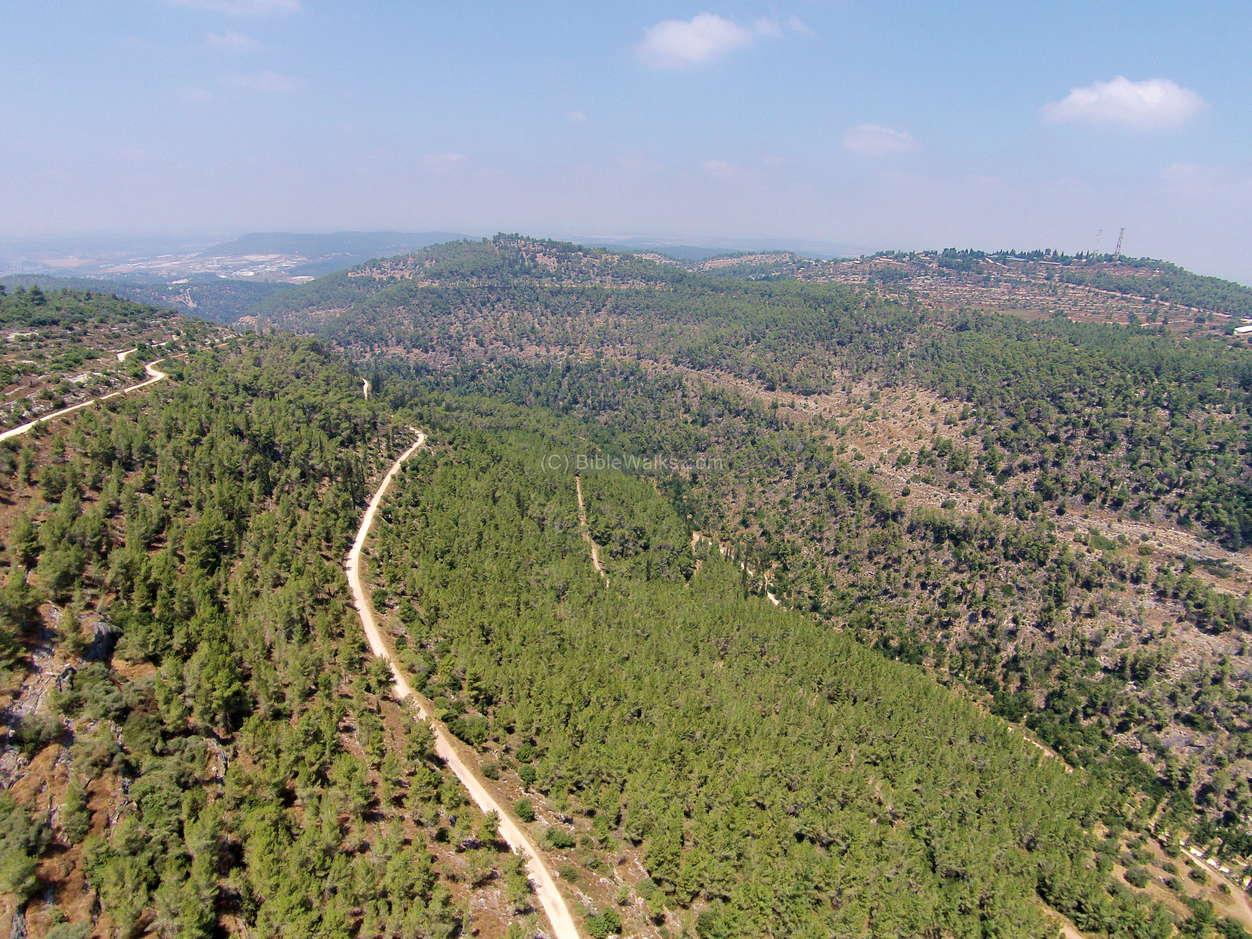
The next photo is of the west side of Kesalon. The religious farming Moshav of Beit Meir, also established in 1950, is located on a hill on the right background.
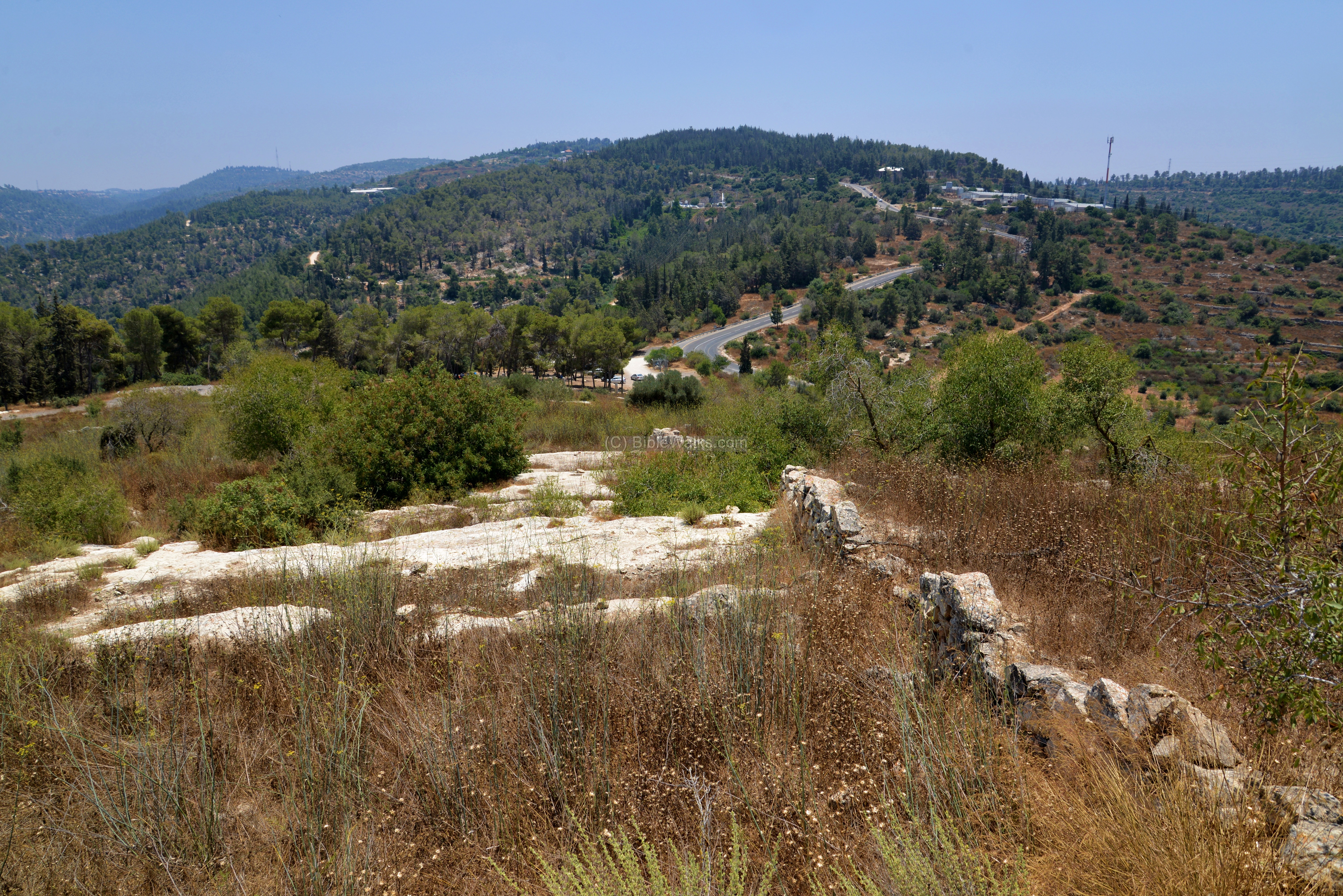
(c) Ascent:
We ascended to the summit on the north east side. This photo is a view looking down towards the east. The picnic area, where we started our climb, is seen near the curve of the road.
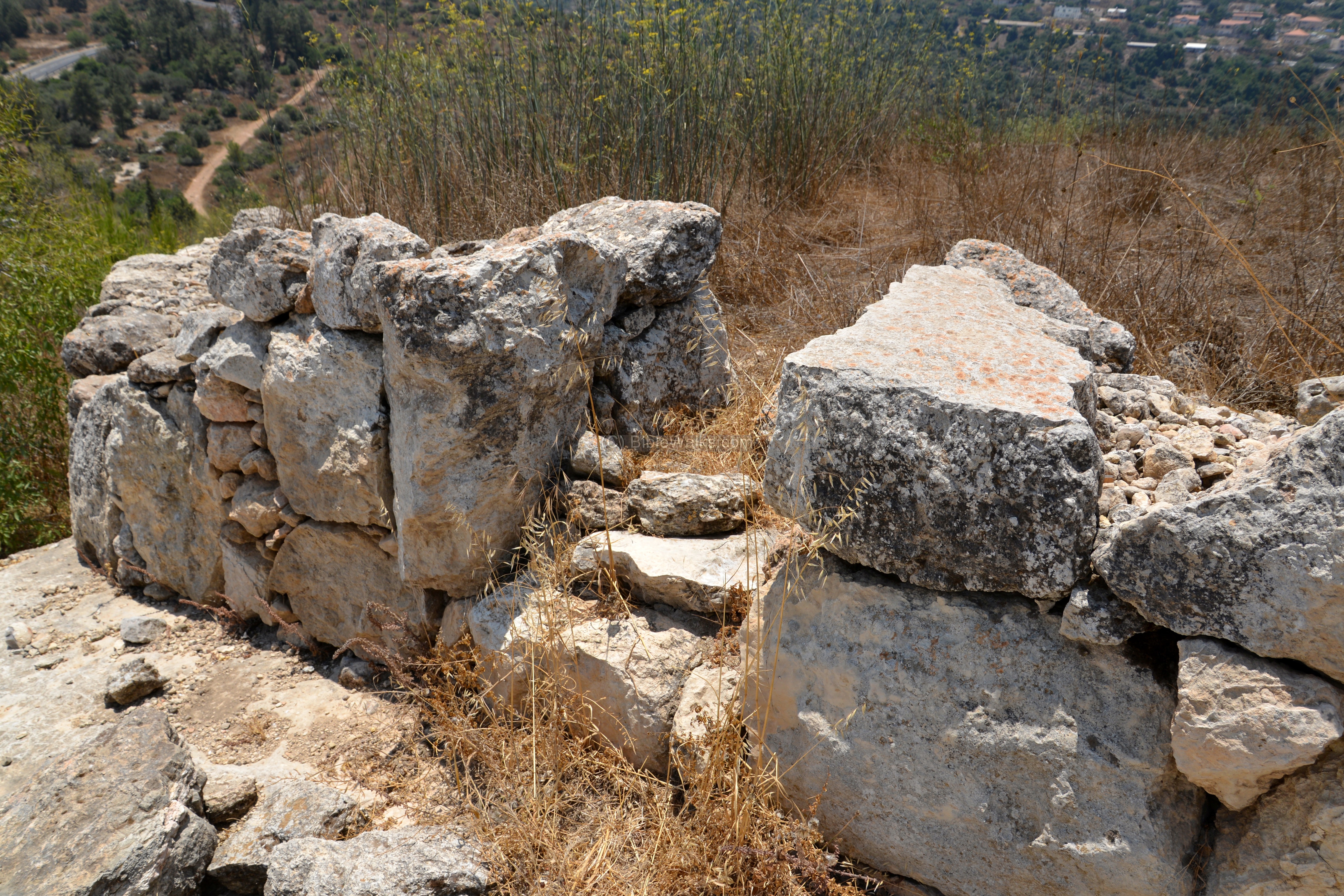
Along this side is a wall made of roughly hewn rocks.
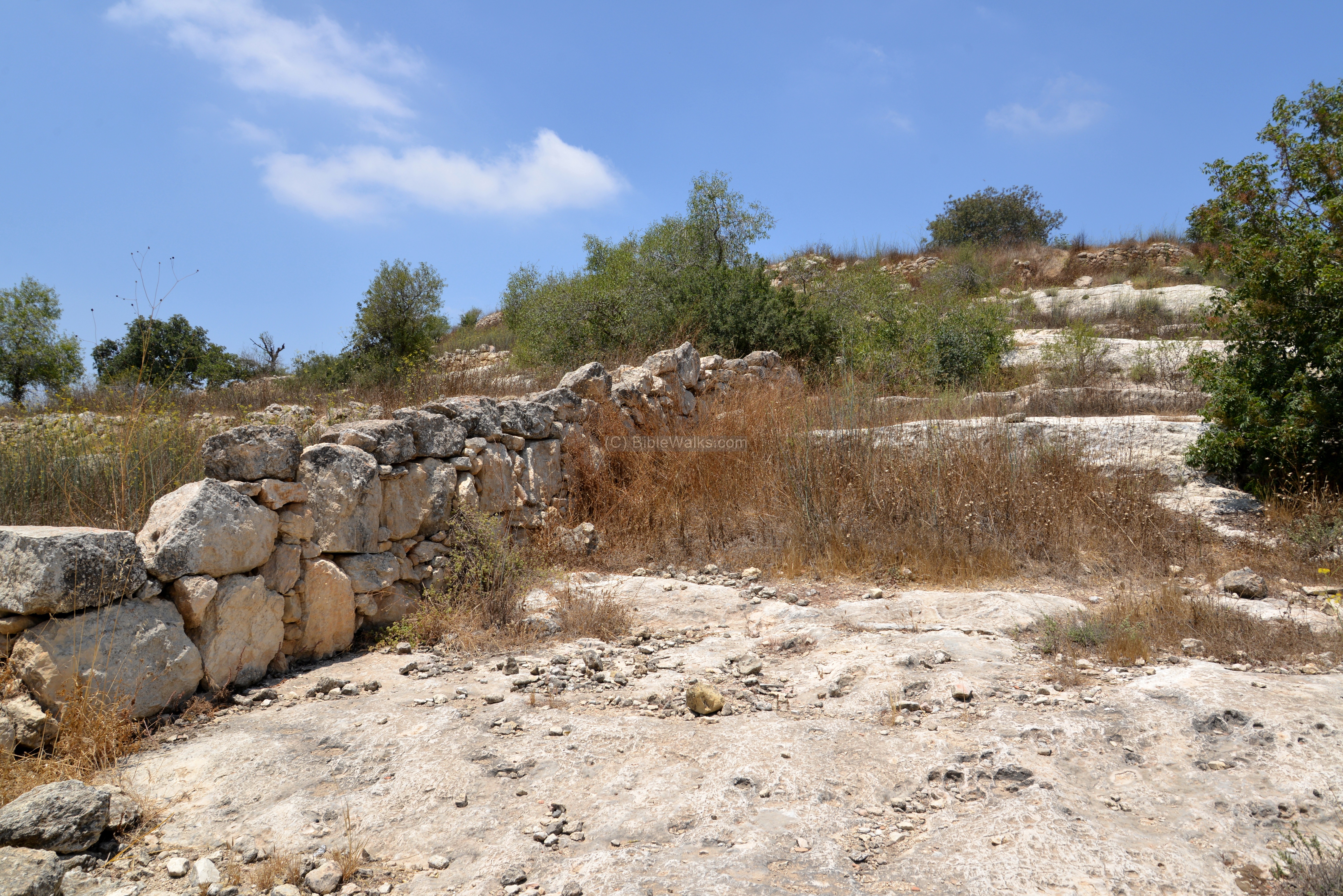
The next photo shows an opening in the wall.
There are many sections of large areas of a barren rock surface, due to a heavy soil erosion.
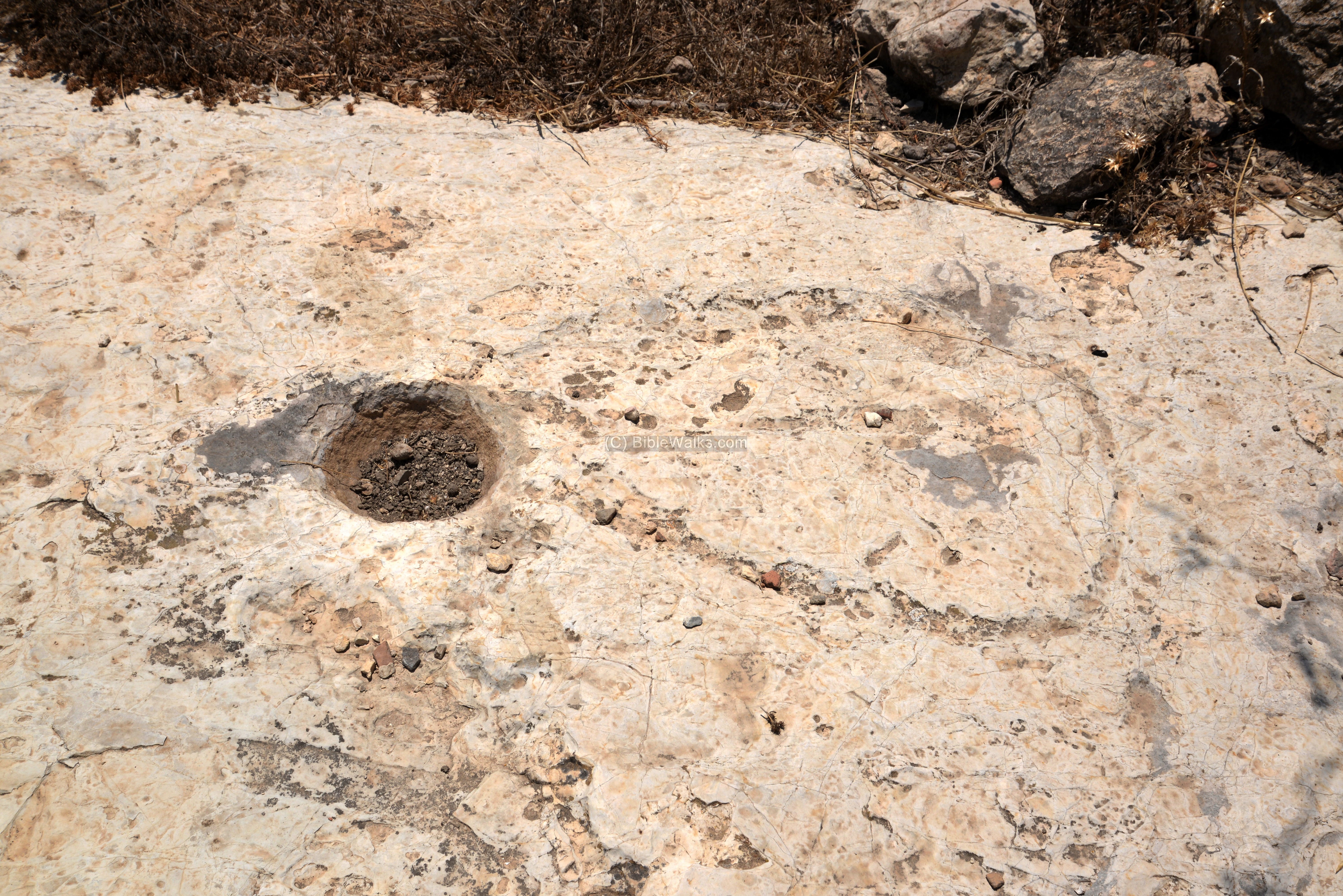
In many places there are cup marks hewn into the bedrock. Of course, this was not a golf course… These cup marks were probably used for crushing olives, as part of a small scale olive oil production.
Other possible use of the cup marks were for rituals performed near tombs.
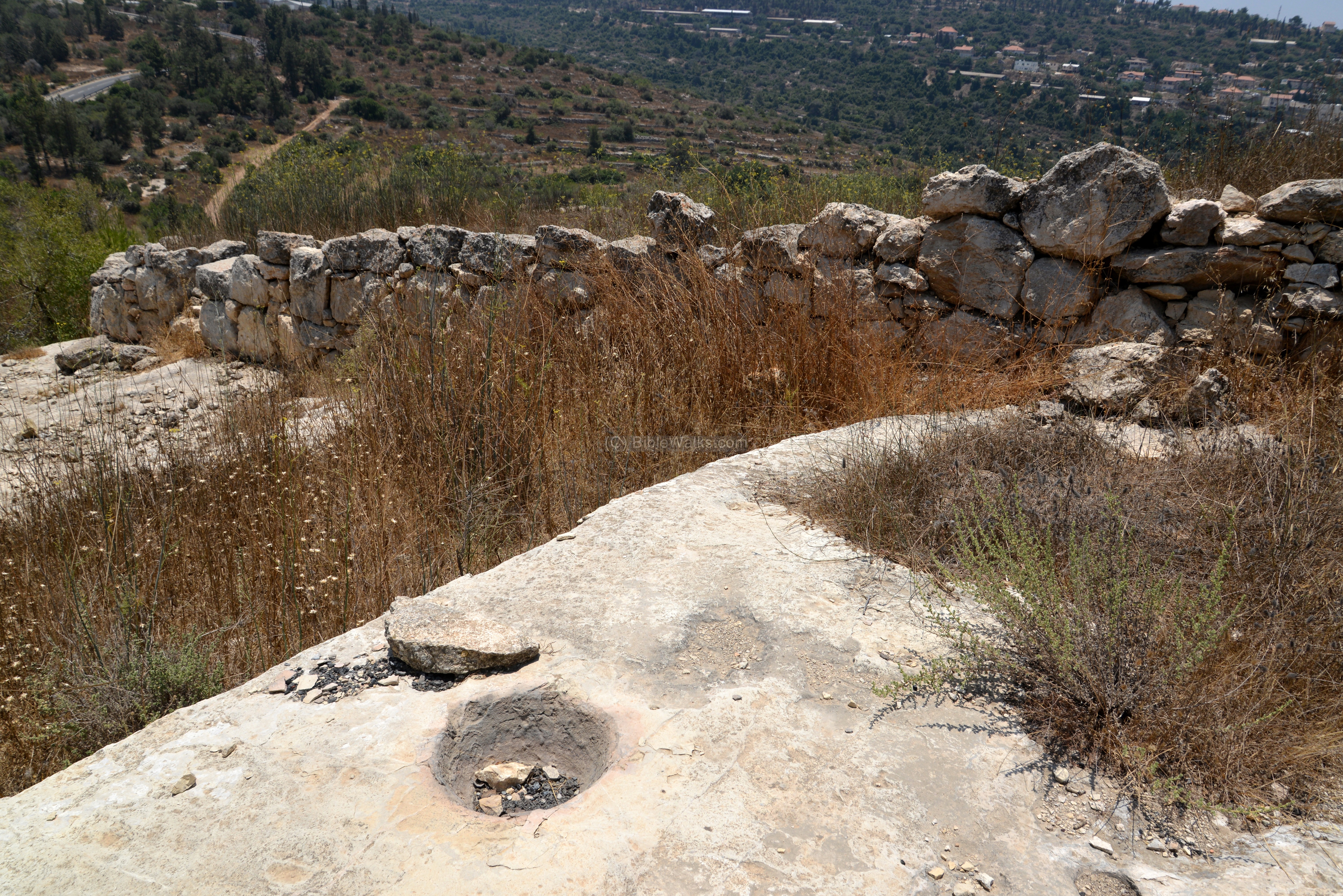
Another cup mark, with grooves that let the olive juice flow thru a channel into the cup mark hole.
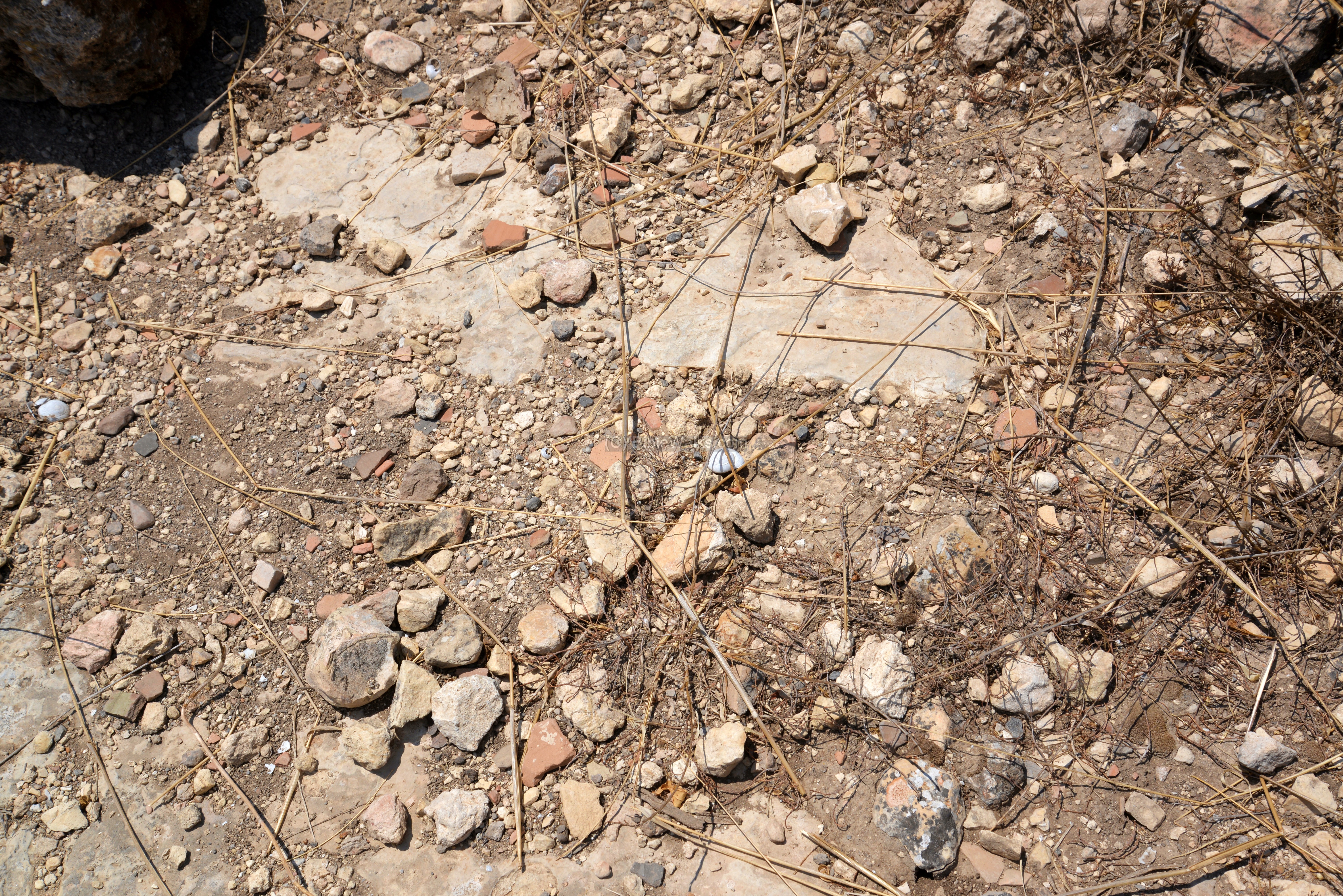
The foothills are covered by fragments of Iron Age ceramics. The closer you get to the summit, the higher the concentration of the antiquities. There are also burial caves and installations along the foothills.
Walls around the rim of the summit can be seen in the following photo. We did not eventually reach the summit, as the thick cover of weeds was too dangerous to cross due to snakes.
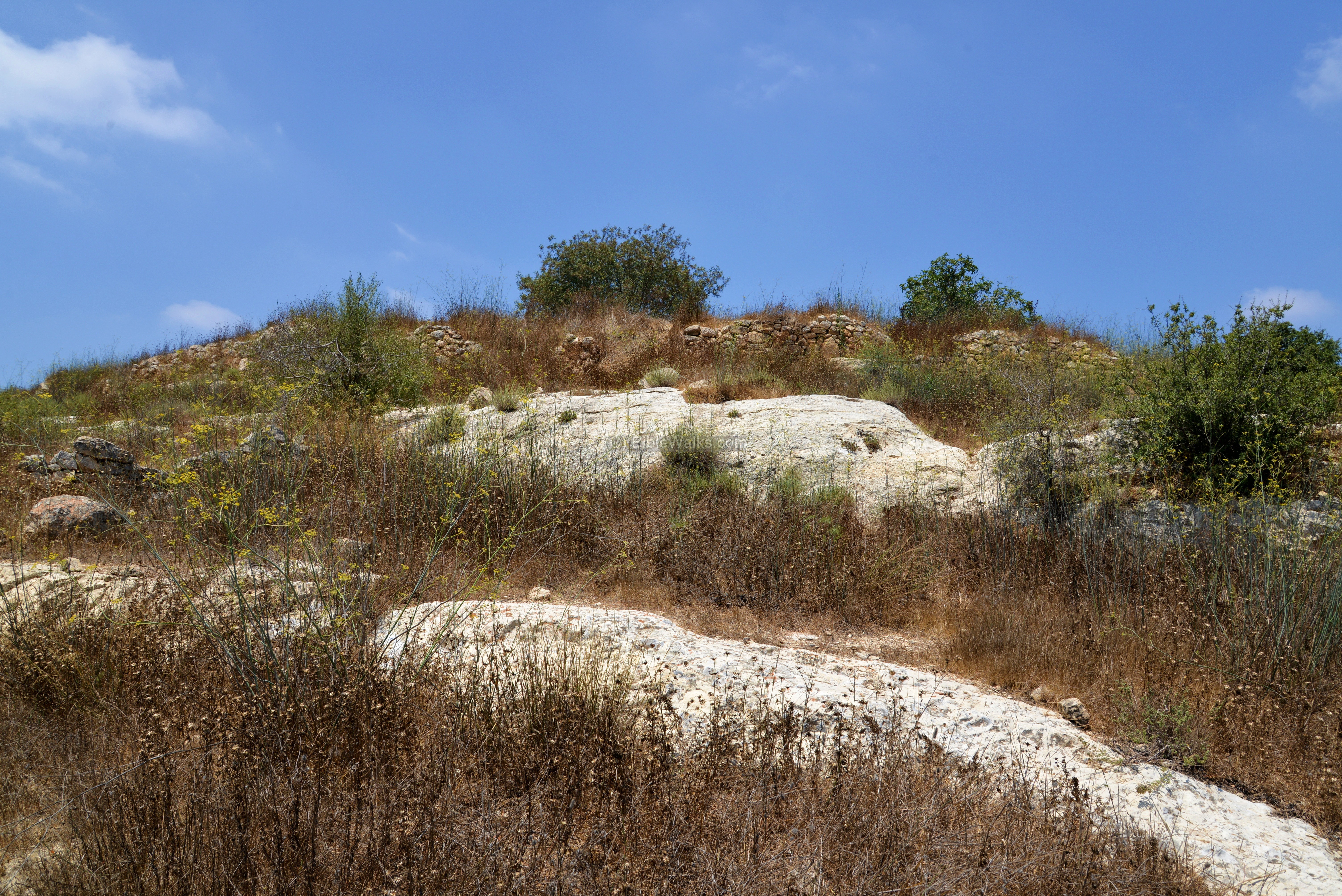
Therefore, we sent out the drone to take a photos of the summit where traces of ruins can be seen.
The site was surveyed by a team headed by Prof. Boaz Zissu of the Bar Ilan university, as part of the Archaeological survey of Israel. In future this site will be excavated and documented, but there is a long list of sites that are waiting for the archaeologists.
Etymology (behind the name):
* Names of the site:
-
Kesalon – the Biblical name as in Joshua (15:10): “And the border … and passed along unto the side of mount Jearim, which is Chesalon…”. The name is perhaps based on the root K-S-L which means confidence (Proverbs 3:26): “For the LORD shall be thy confidence”. The Hebrew word was also translated as hope (Psalms 78:7): “That they might set their hope in God”.
-
Chesalon – the Greek/Latin name (as in KJV bible).
-
Mount Jearim – may have been another name of the city, or the area, based on the woods (Hebrew: Ye’arim) around it, as described in the Judean tribe borders (Joshua 15:10) “.. mount Jearim, which is Chesalon”.
-
Kesla – name of the Arab village, based on the Biblical name.
-
Chasalon – name in the Onomasticon: “Tribe of Benjamin on the border of Jerusalem. A (very) large village”.
Links:
* External links:
- Onomasticon -translation
- Kesalon – blog by Yehuda Ziv (Hebrew)
- Ein Kesalon – description of the spring (Hebrew)
* Settlements around the site:
-
Givat Yearim (Hebrew)
* Internal sites:
-
Drone Aerial views – collection of Biblical sites from the air
BibleWalks.com- Discover the Bible Land
Hebron<<<—<<<—previous Judea site—<<< All Sites >>>—next site—>>> St. George Koziba
This page was last updated on Apr 10, 2021 (add road J5)
Sponsored links: